New Zealand South Island Road trip 2025 – Aoraki

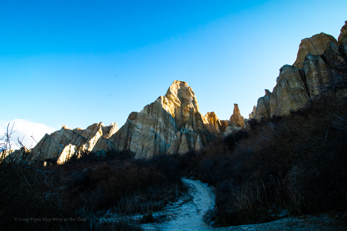
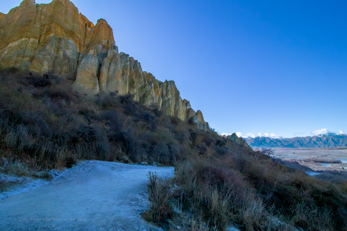
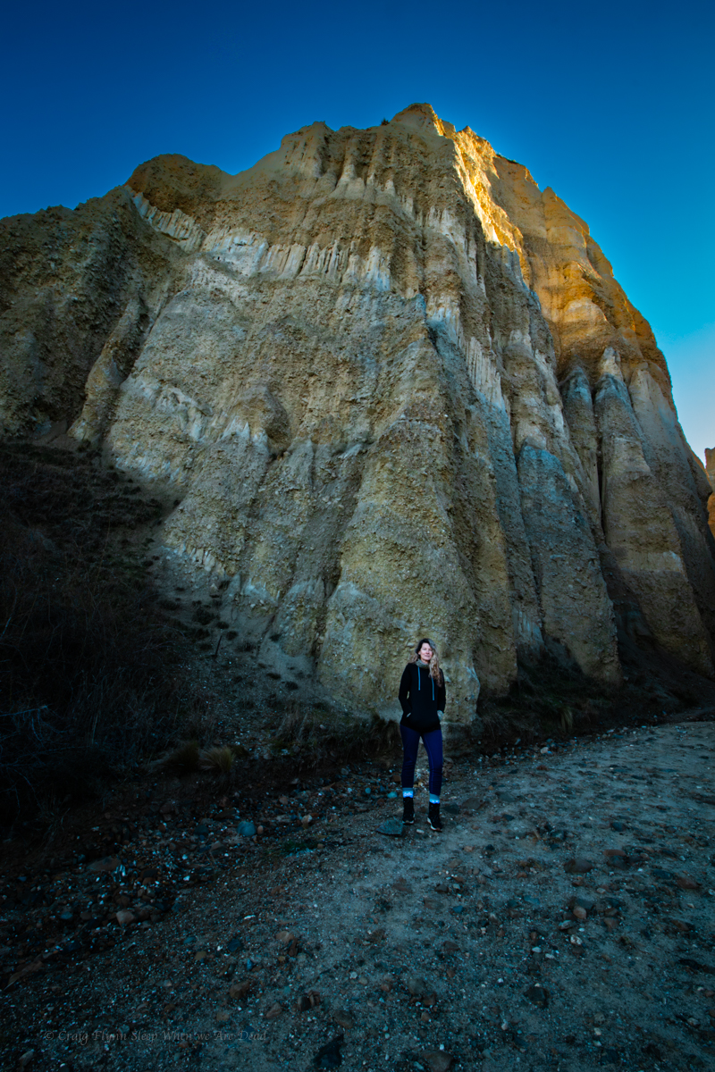
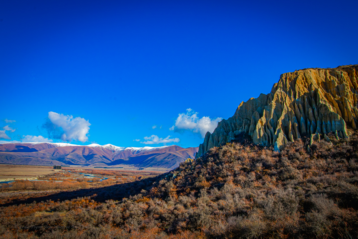
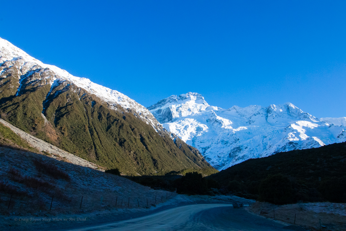
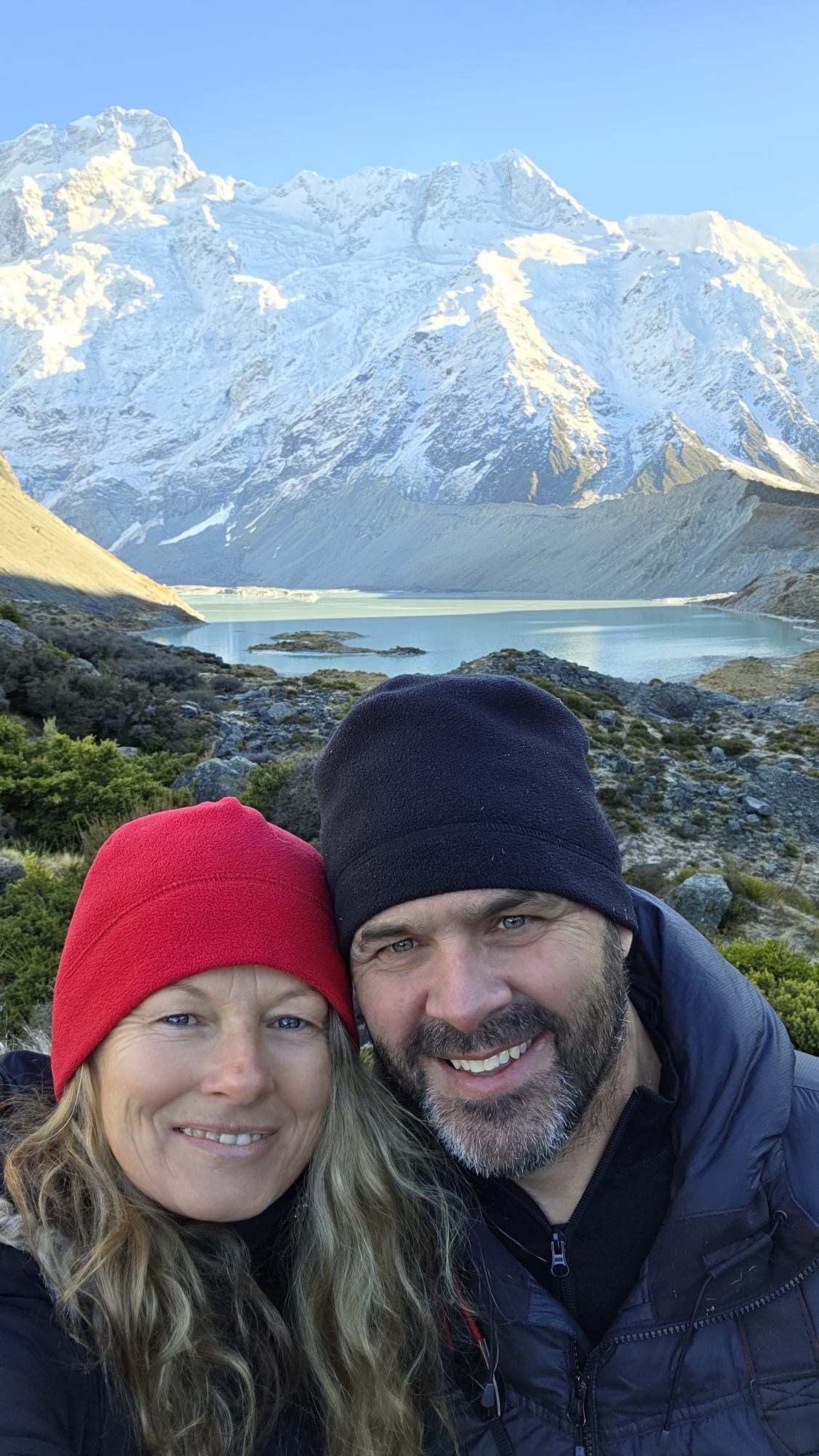
From the Clay Cliffs we make our way up to White Horse Hill campground which is nestled below the towering peak of Aorali/Mount Cook.

White Horse Hill is a paid ground. During the winter the main toilet/shower blocks are closed off as the frequent negative temperatures lead to burst pipes and what not. What you are left with is two of the smelliest drop toilets I’ve ever encountered, And I’ve done long weekends at Newnes Camp ground in it’s heyday.

Take the biggest breath you can here and hold it as long as you can, a young whipper snapper was heard giving advice to her younger brother…..

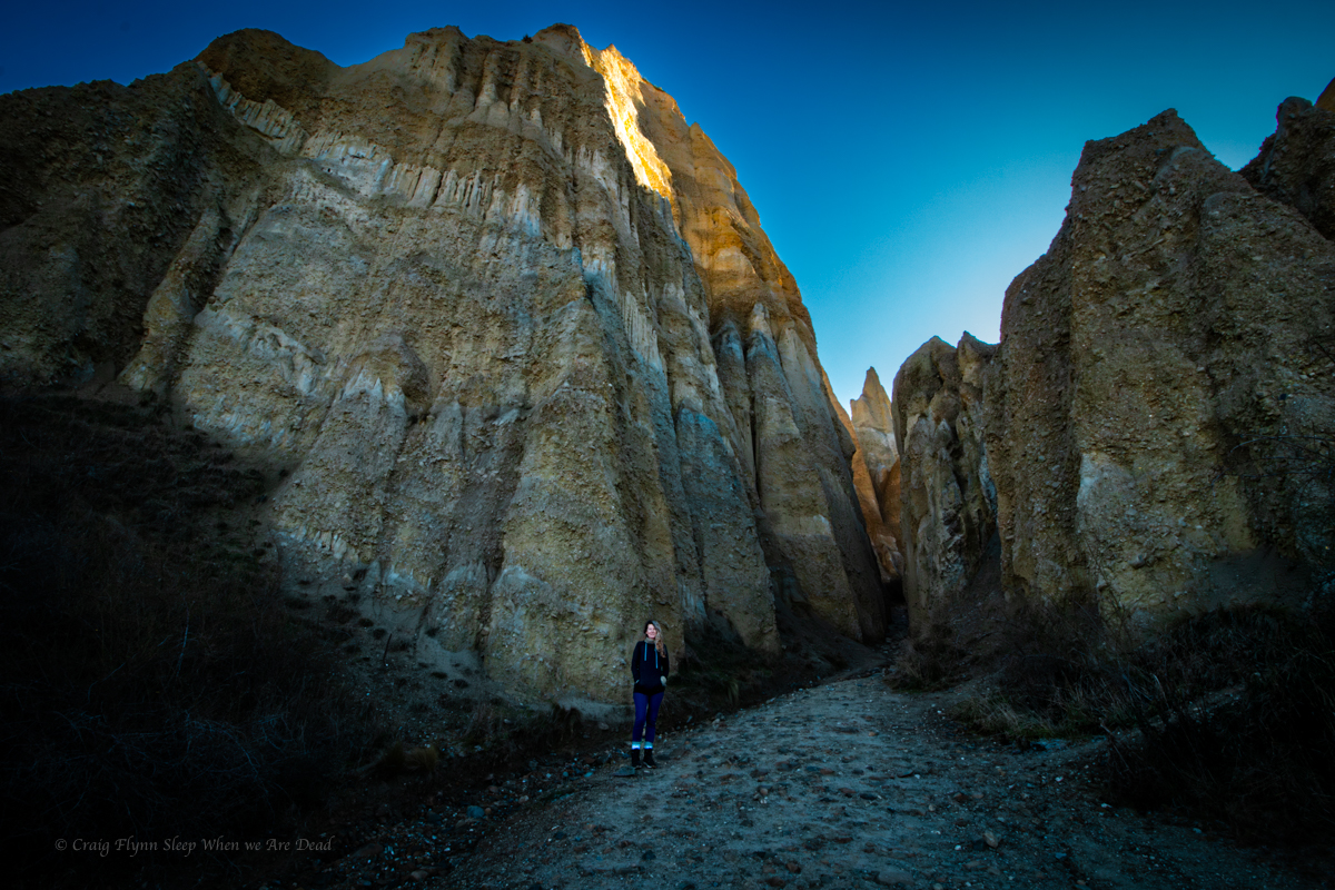
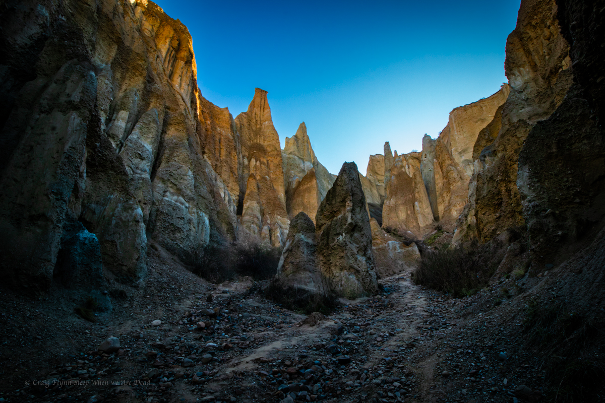
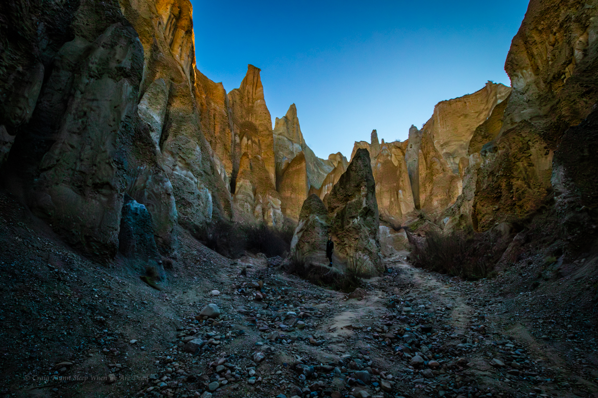
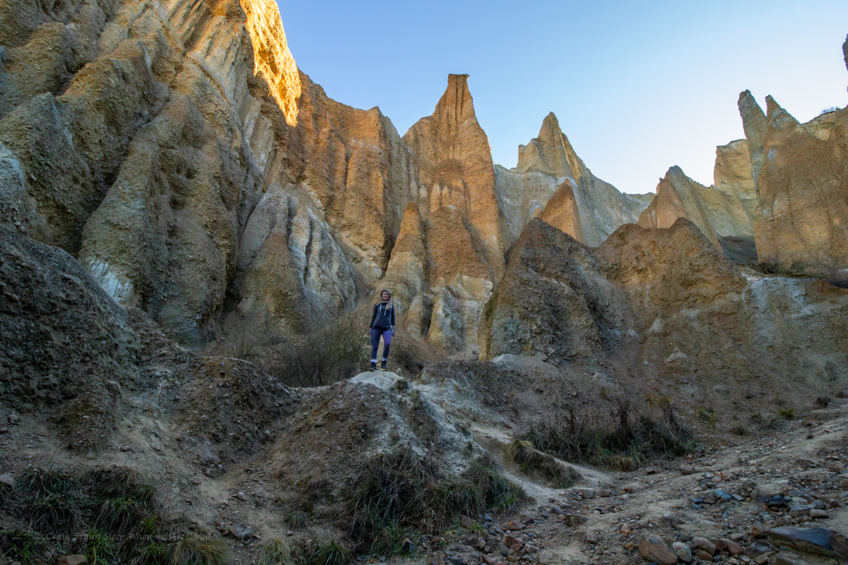
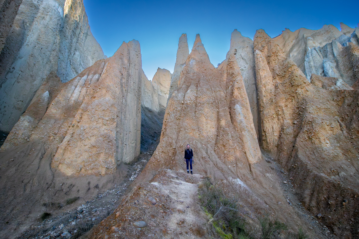
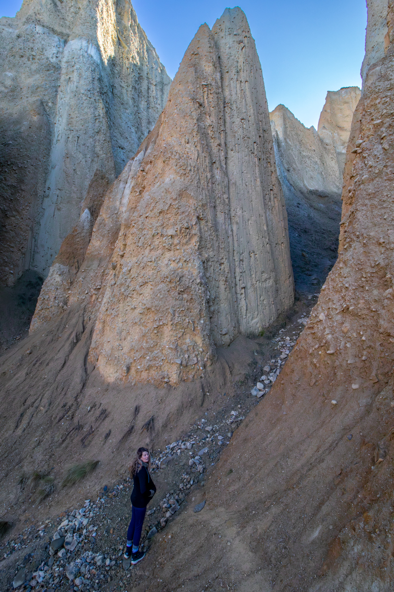
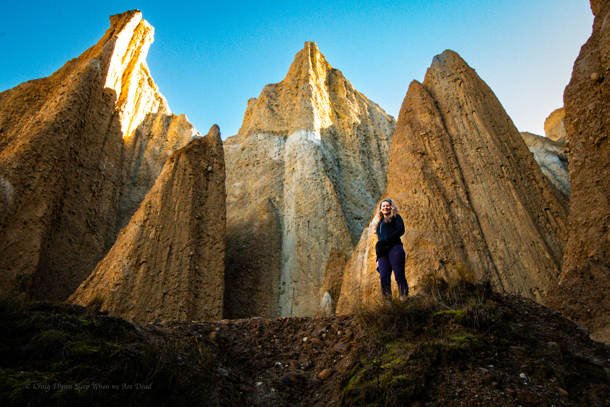
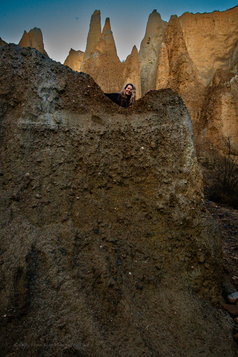
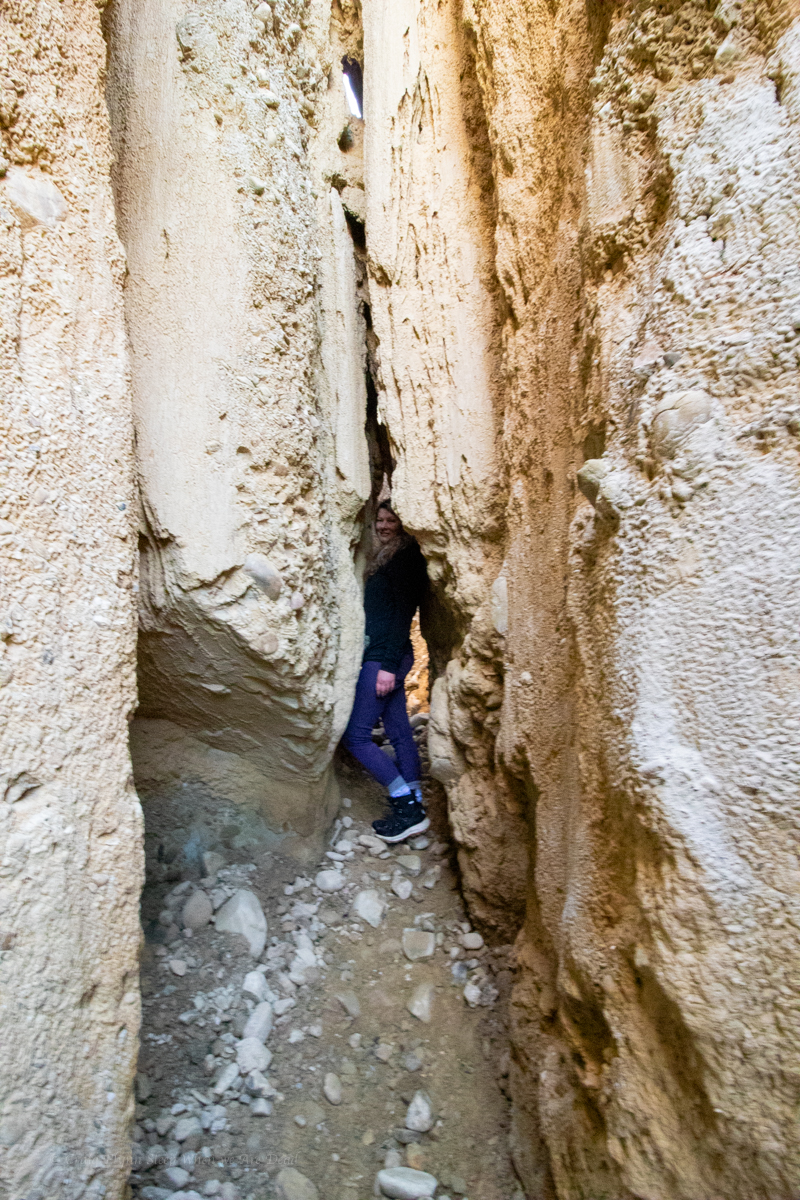
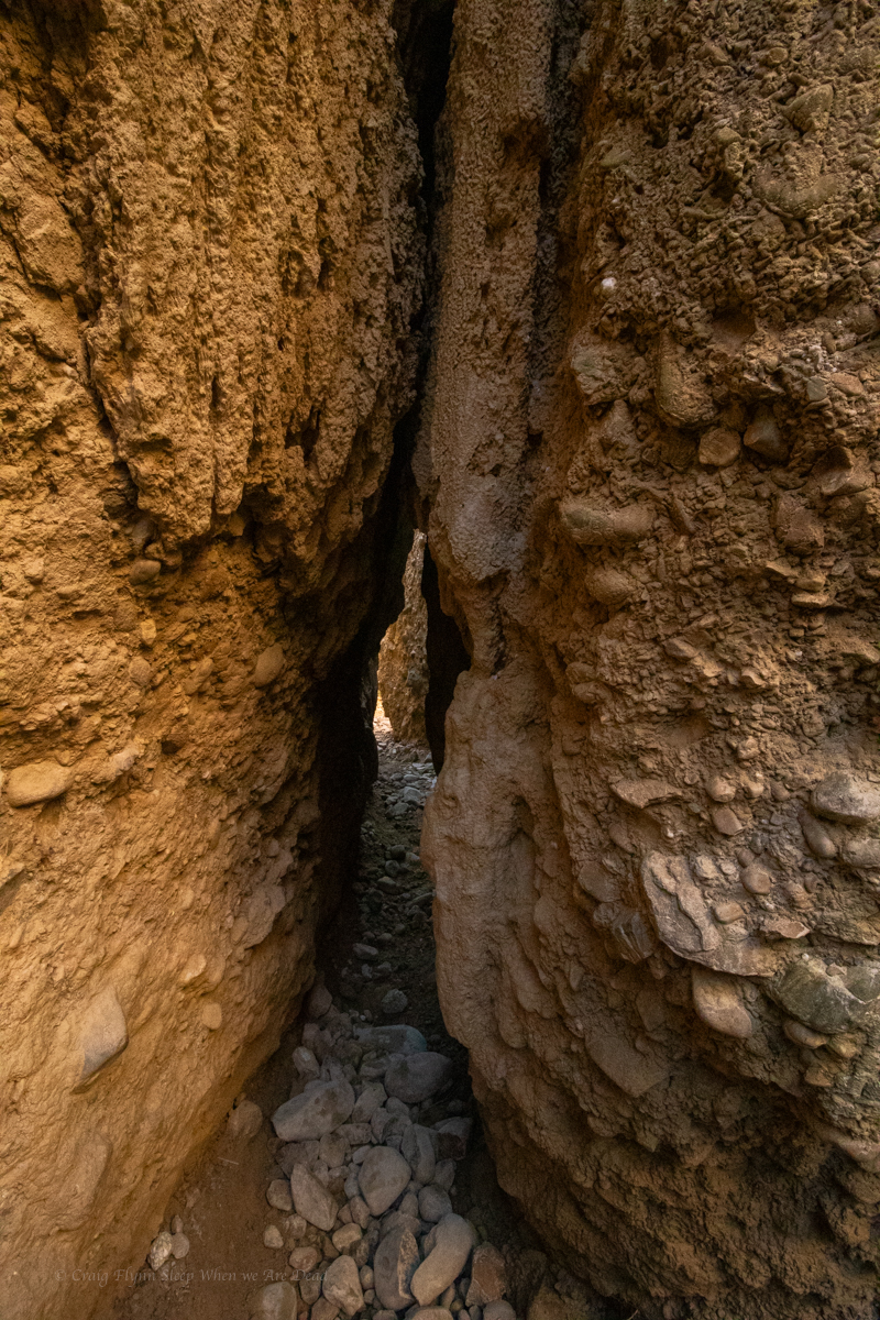
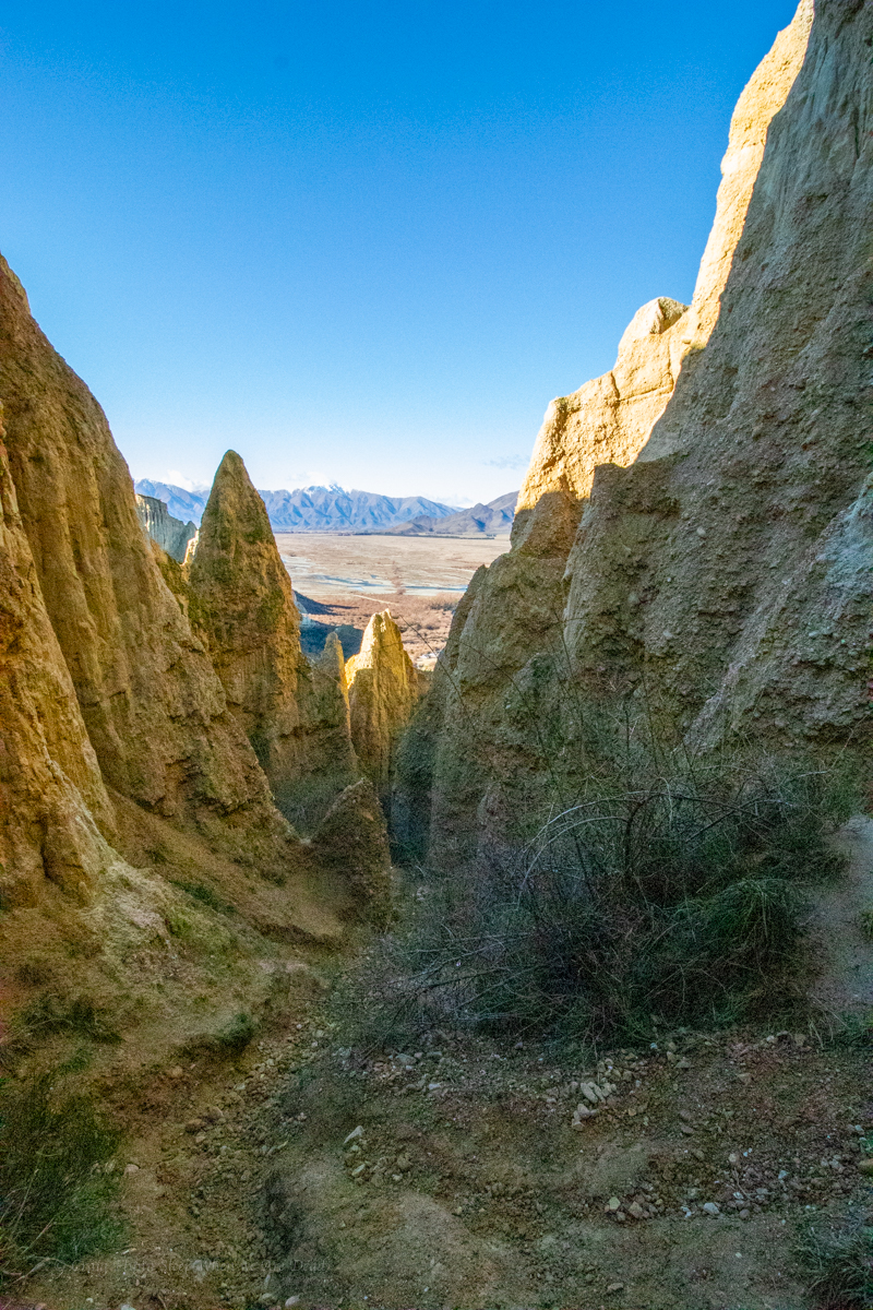
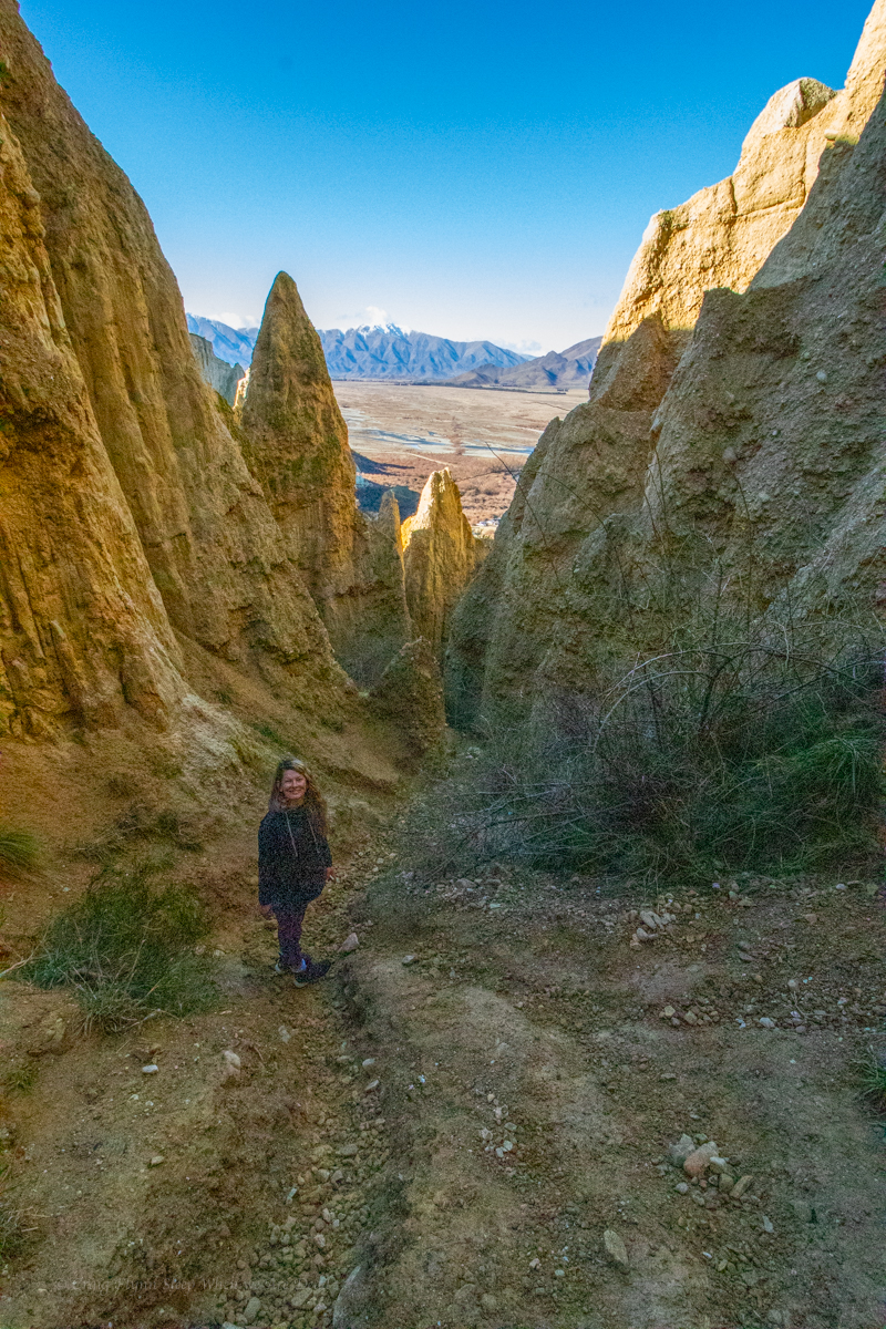
Don’t let that put you off though, the scenery is well worth a skinny loo or two.

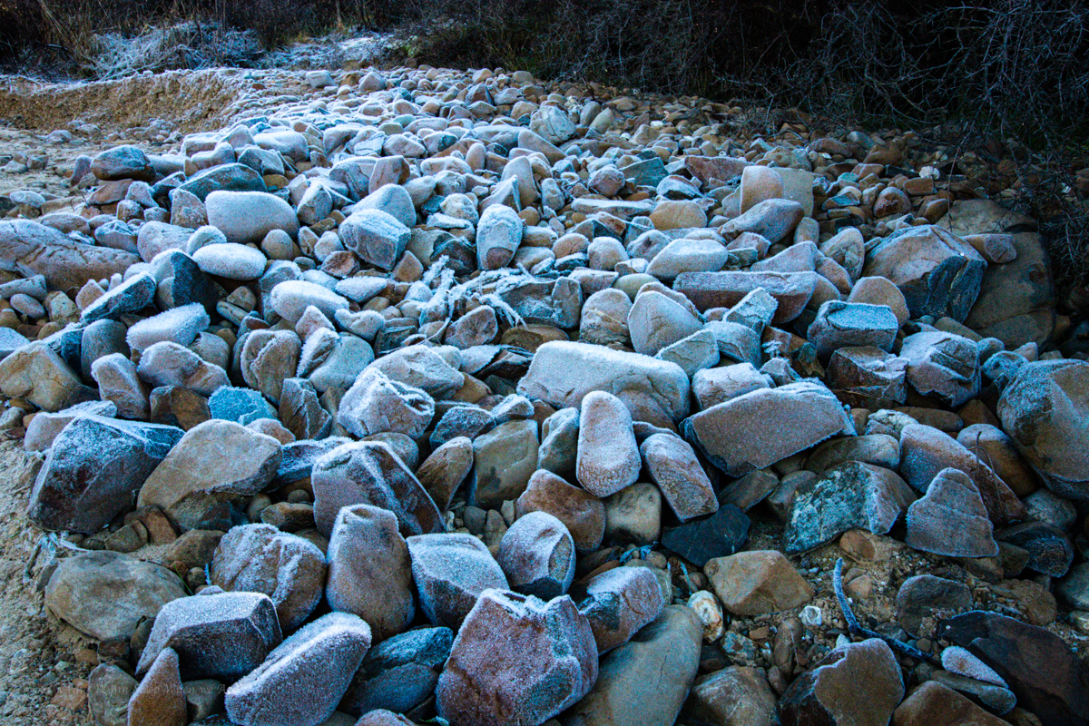
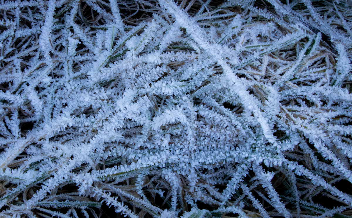
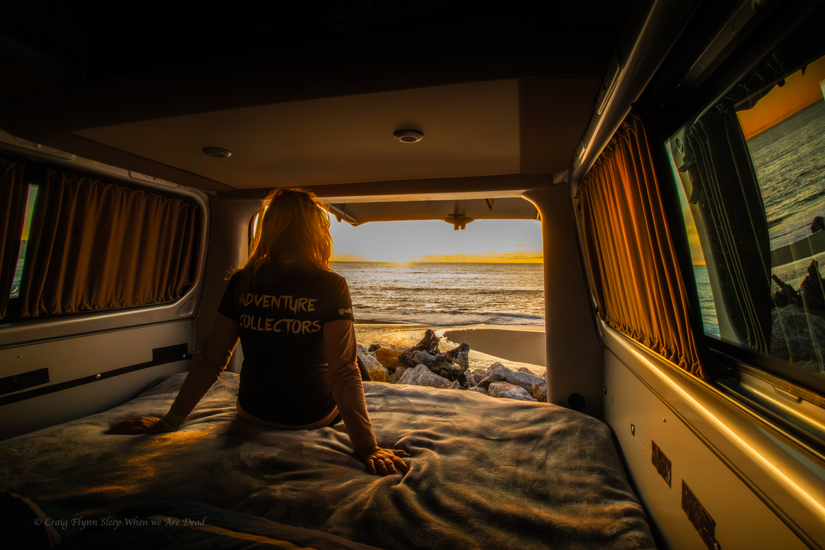
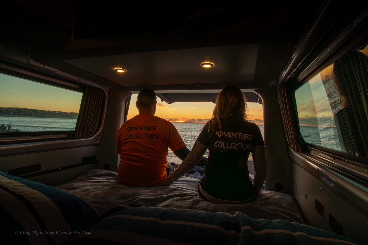
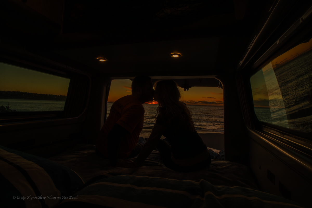
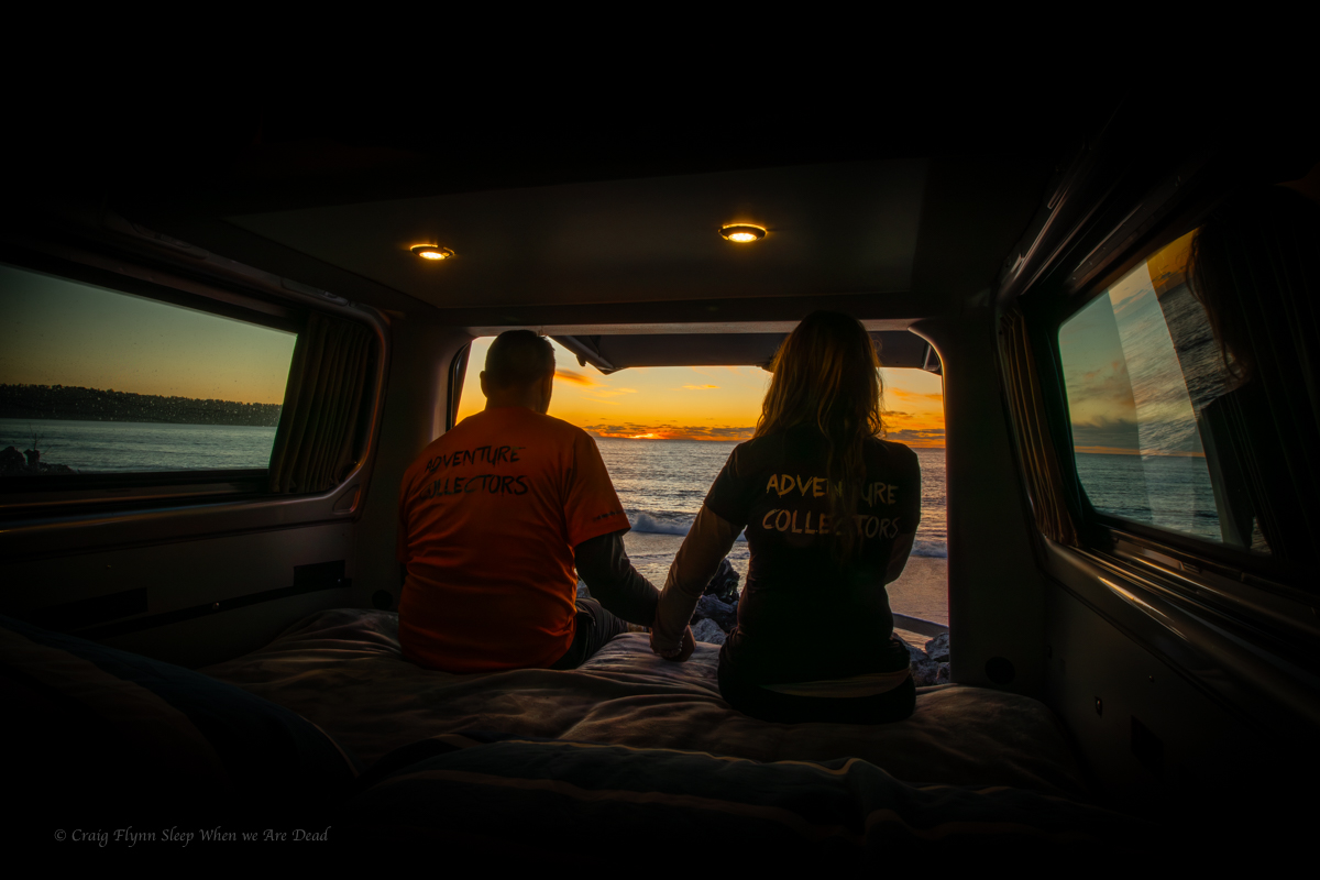
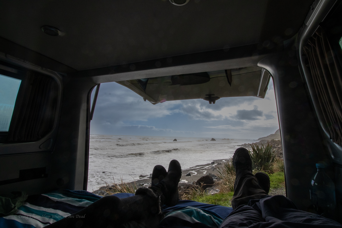
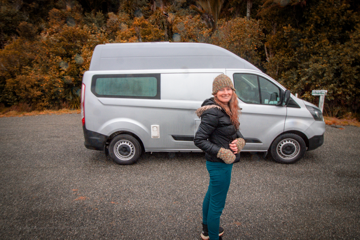
We roll in late afternoon and set the camp up. The temperature is already -2ºC and falling. The little diesel heater fitted in the van is amazing.

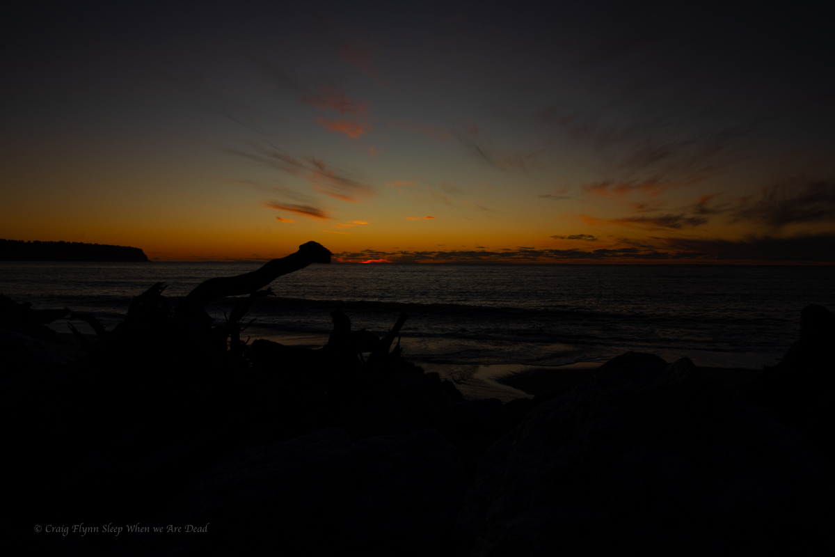
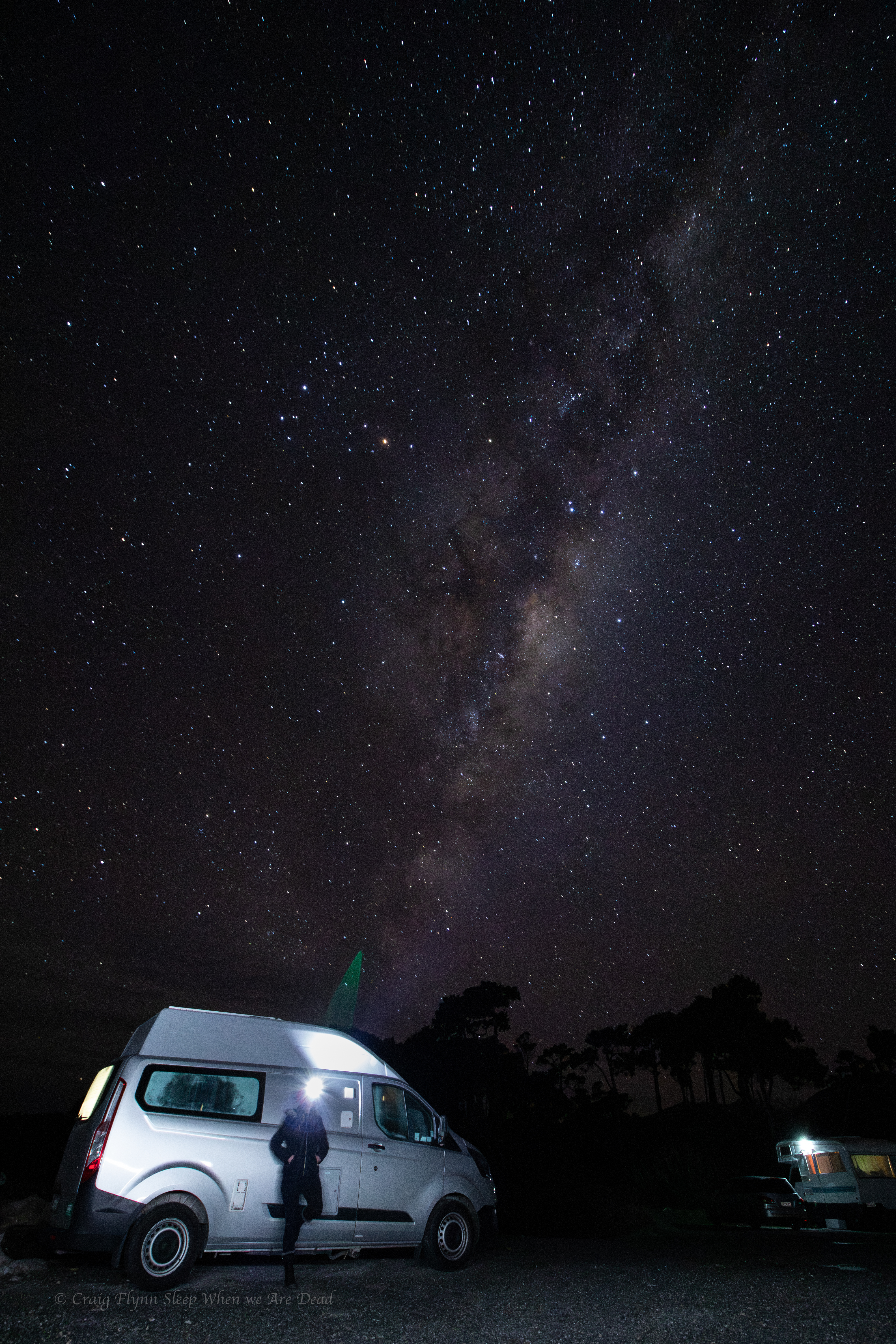
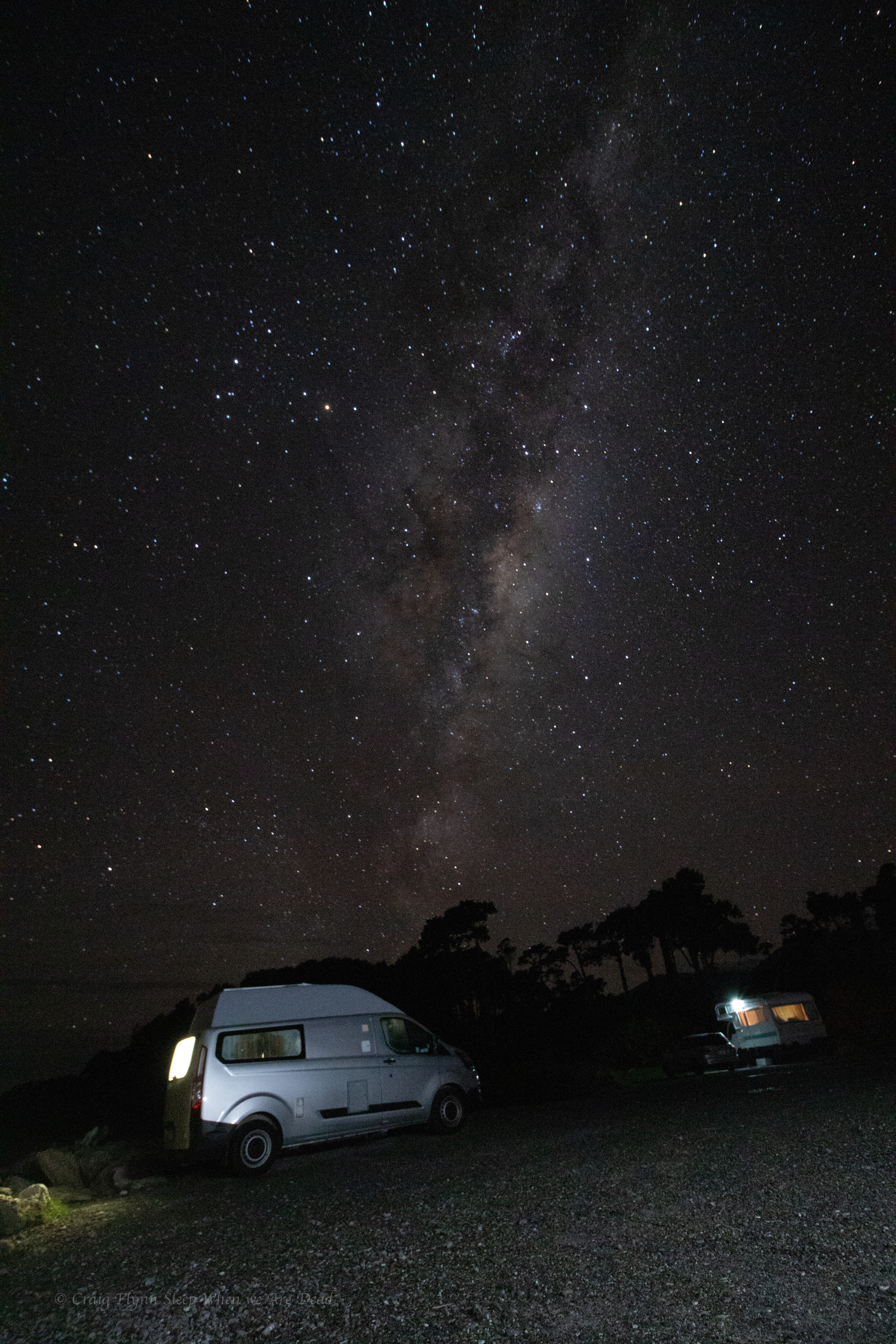
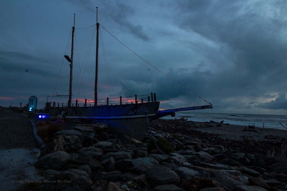
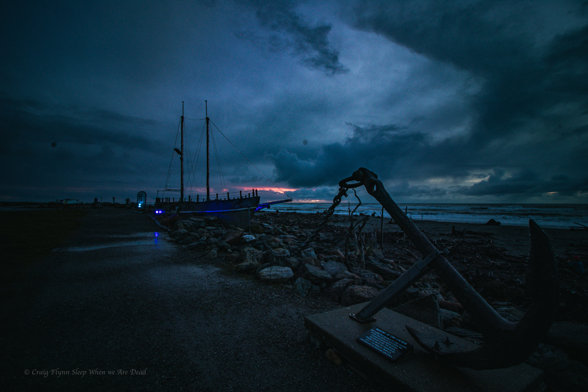
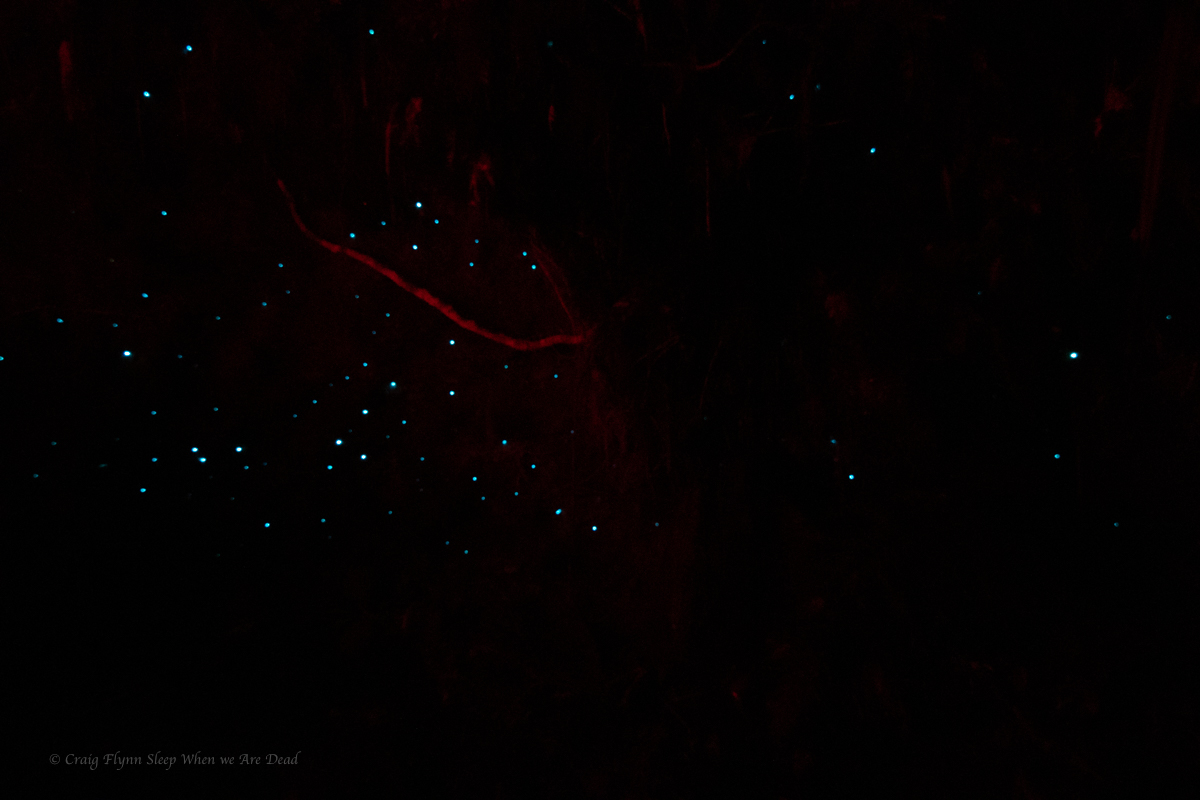
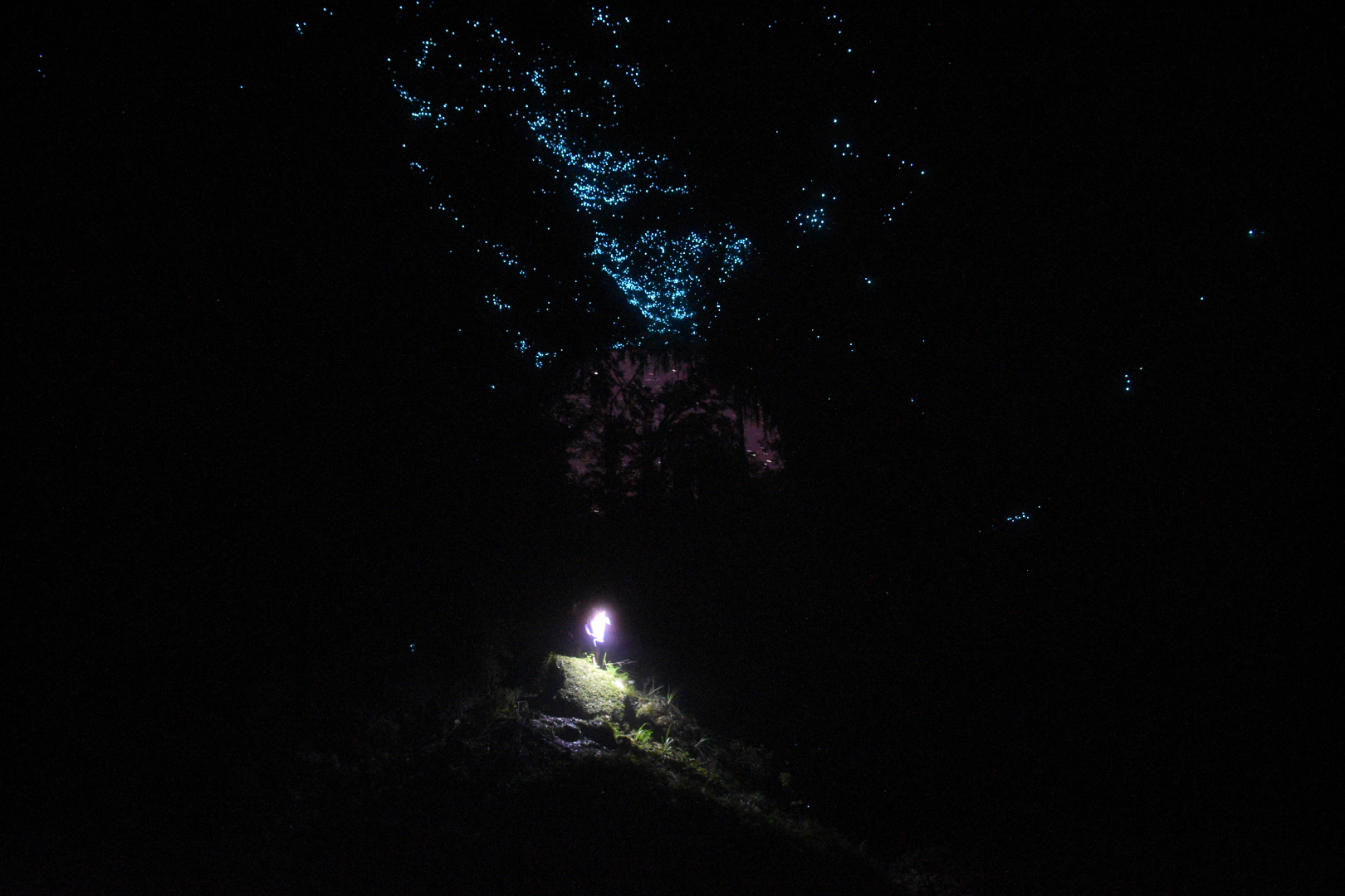
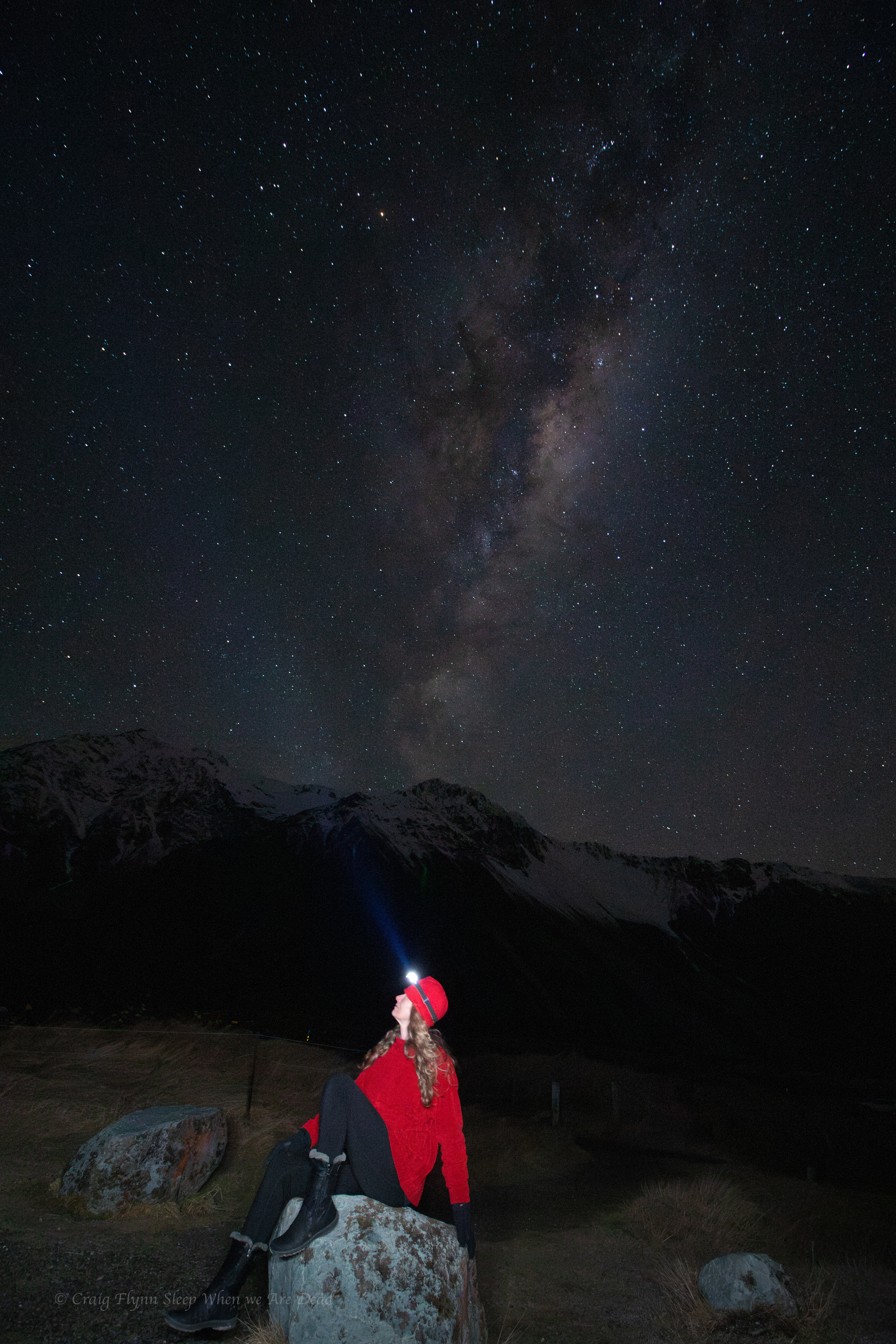
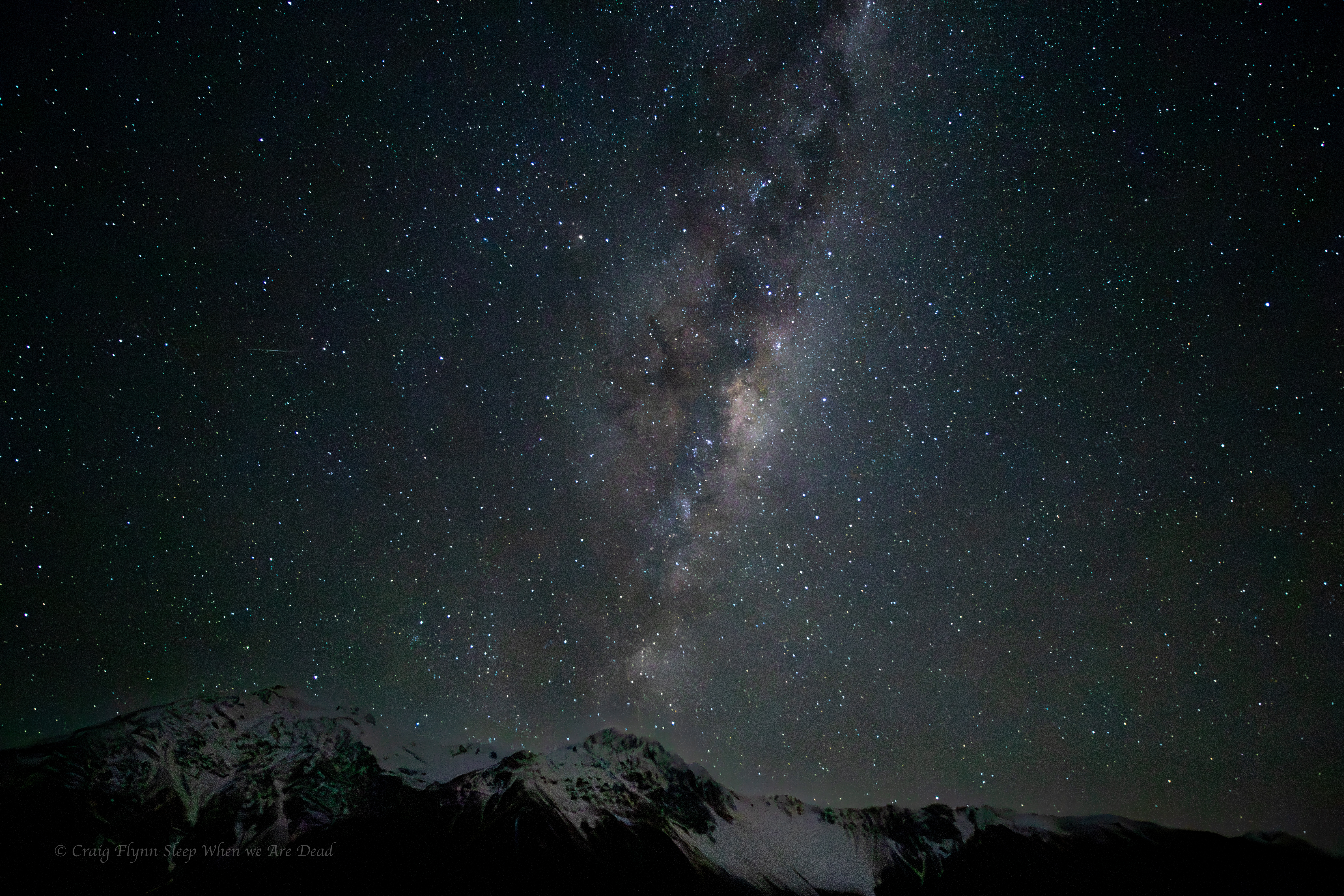
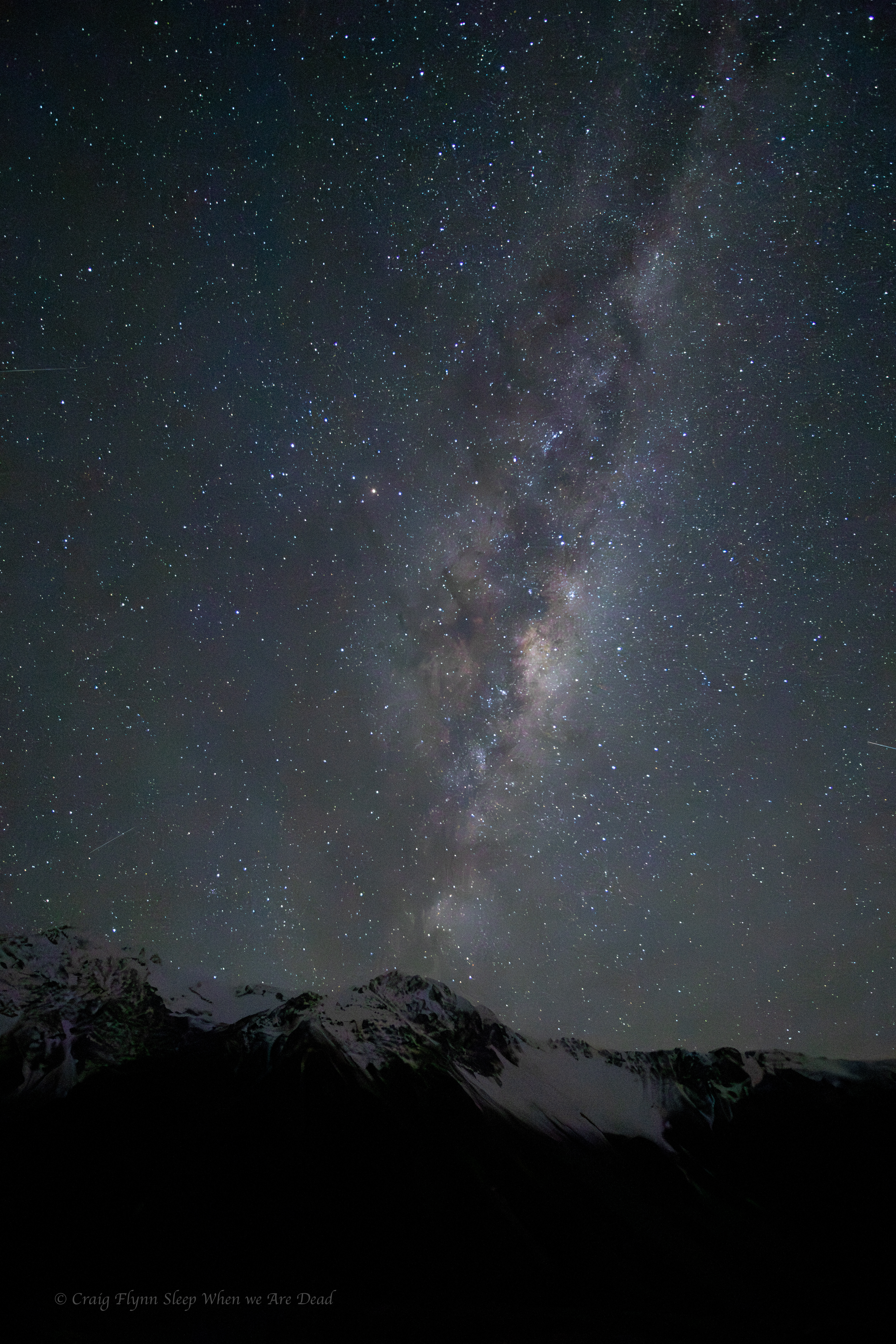
As night settles in and the temp plummets to -8º we decide to brave it for the sake of the most amazingly clear night sky.

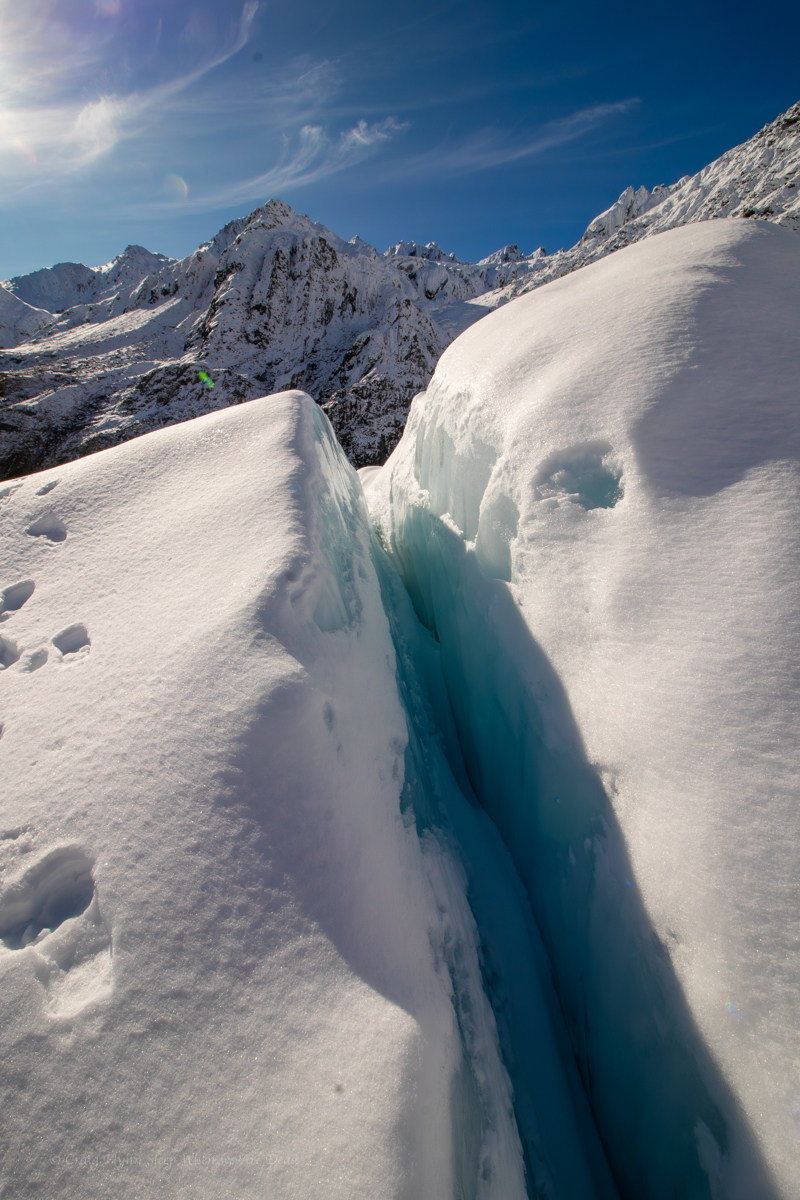
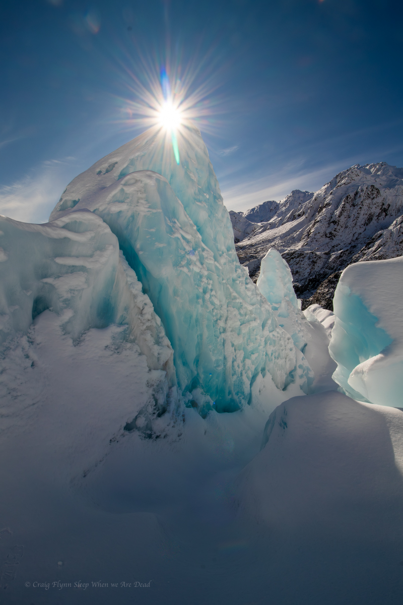
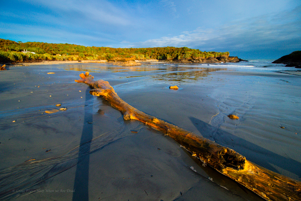
Clicky Clicky to see full photo

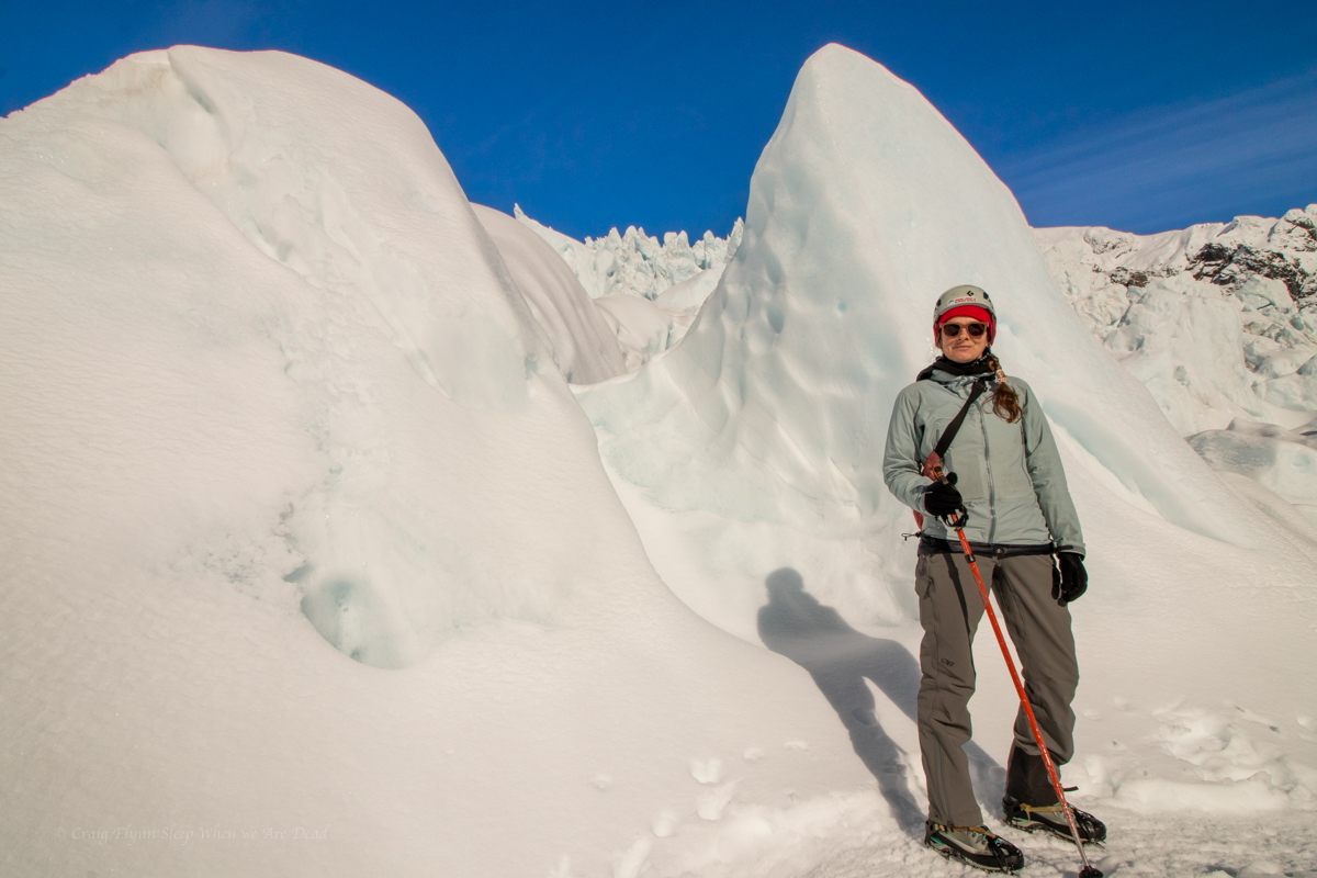
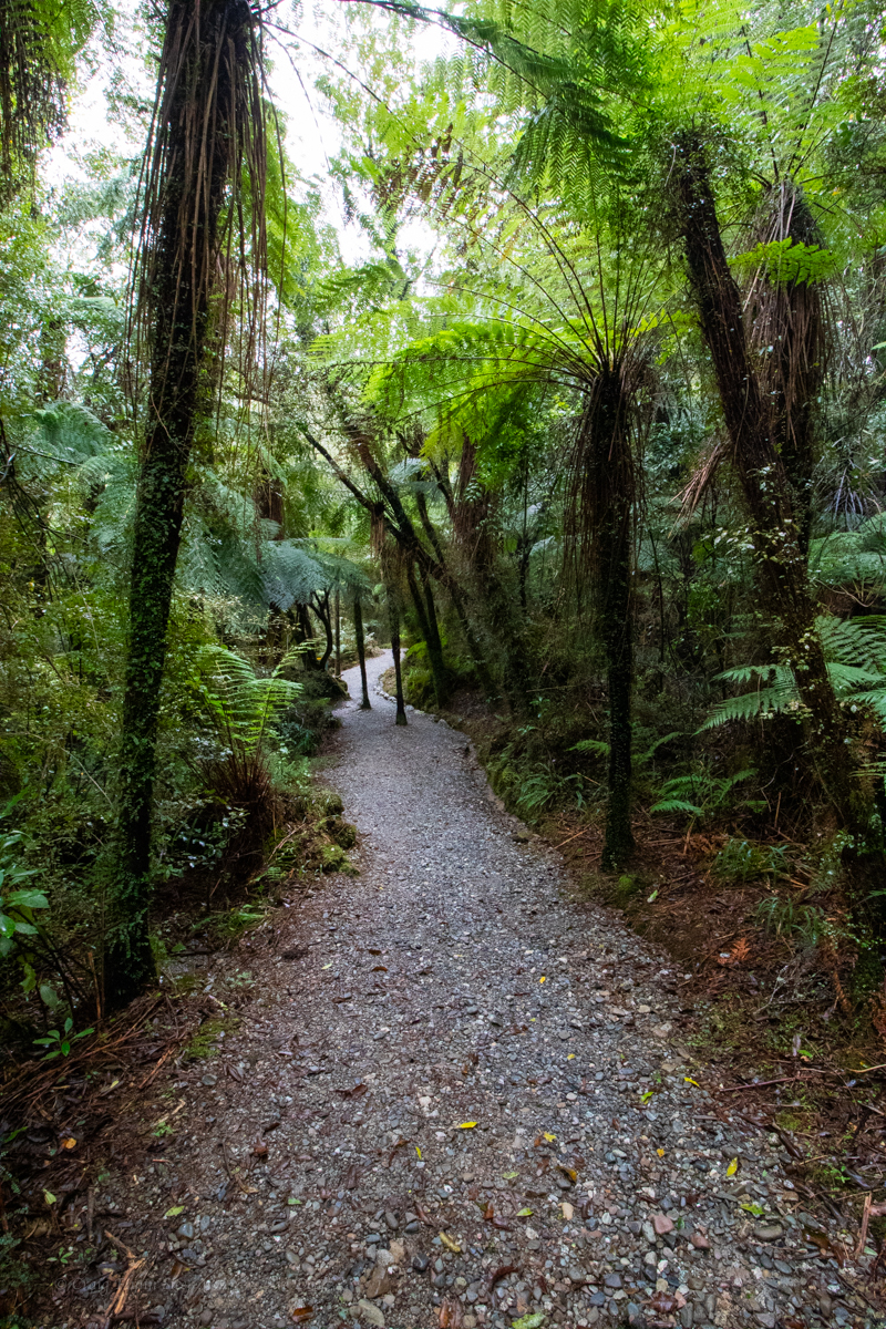
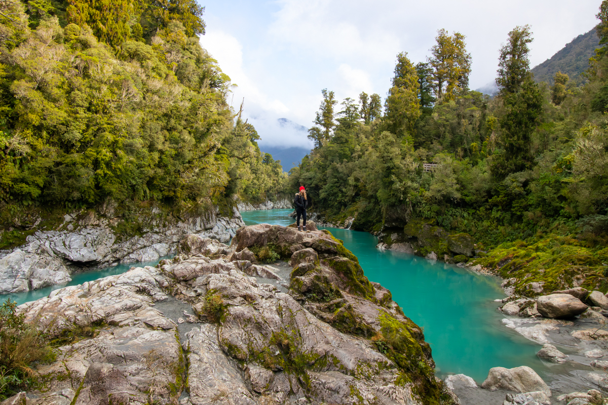
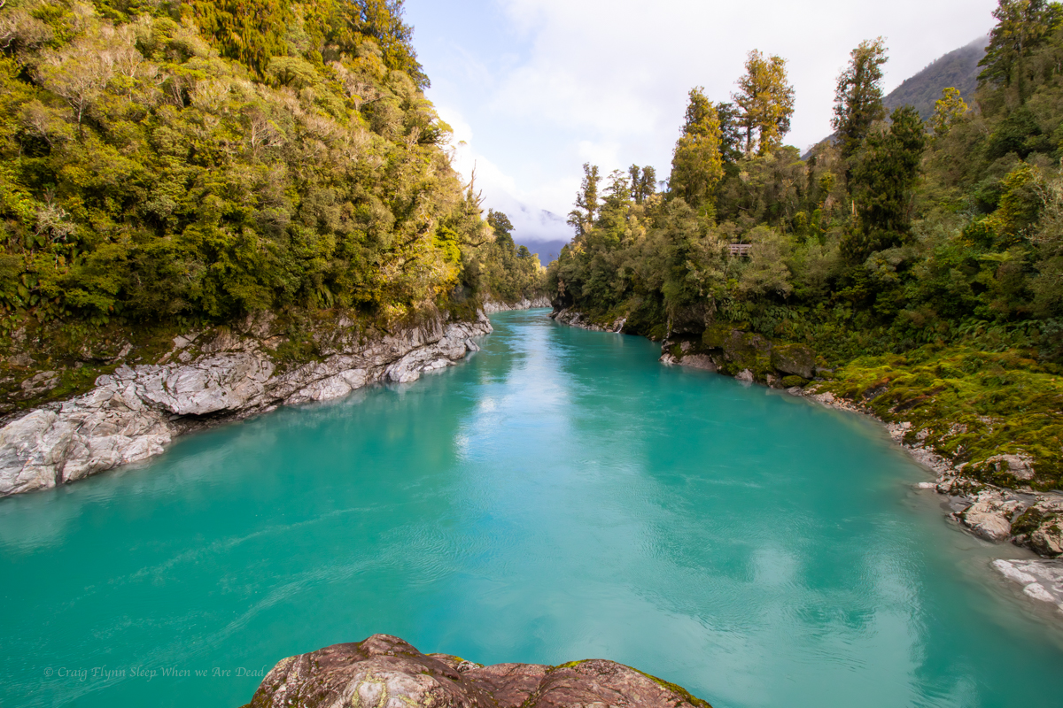
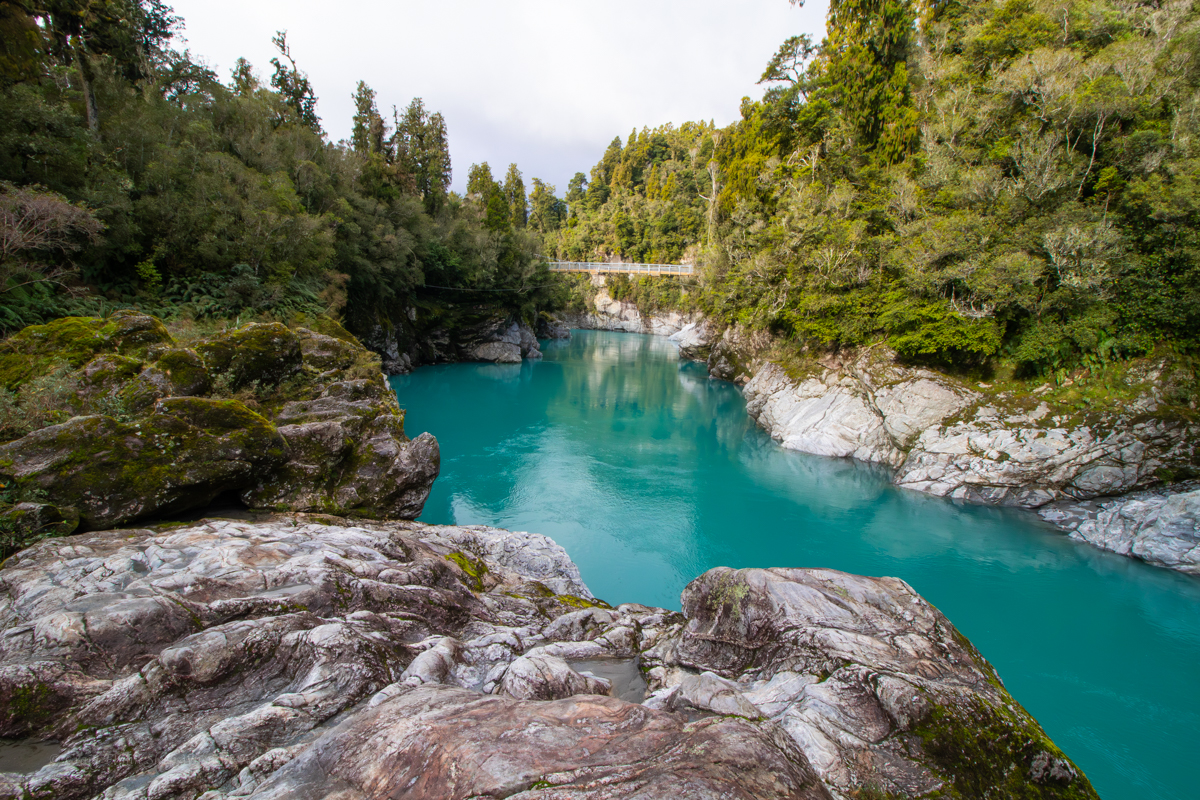
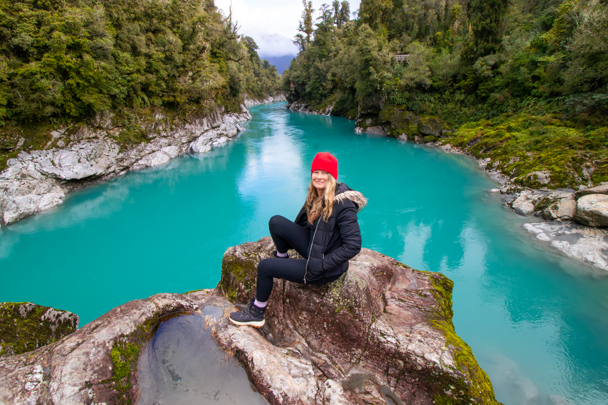
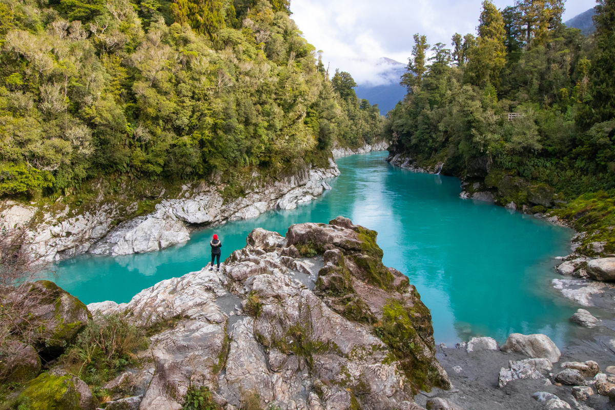
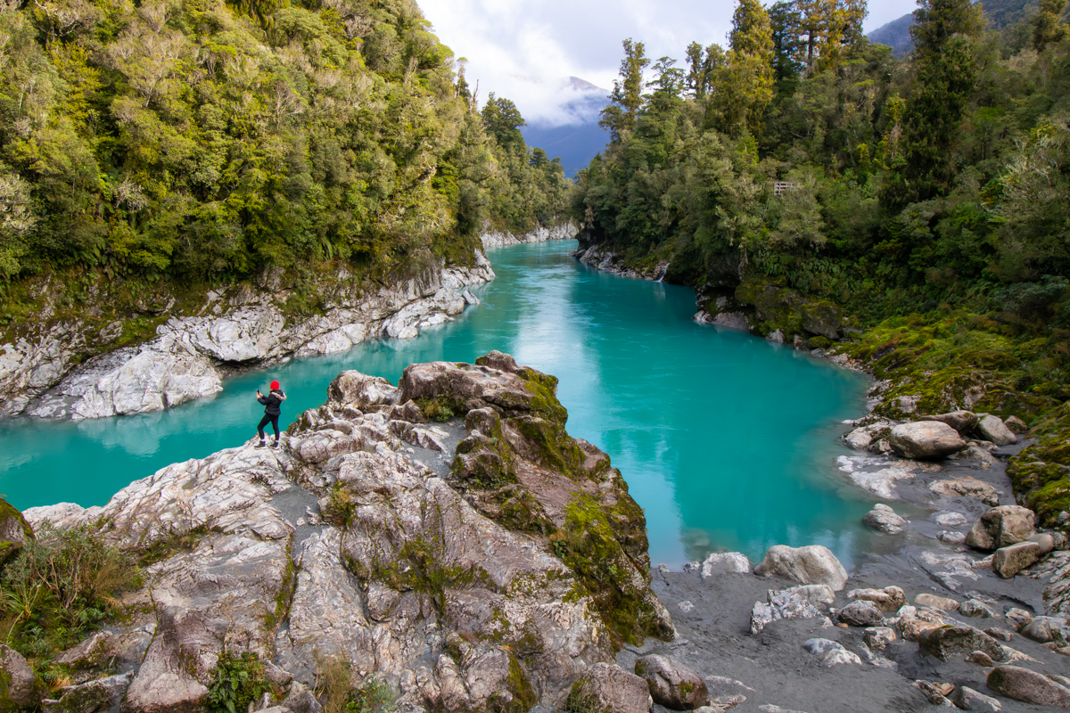
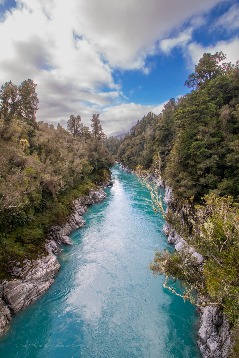
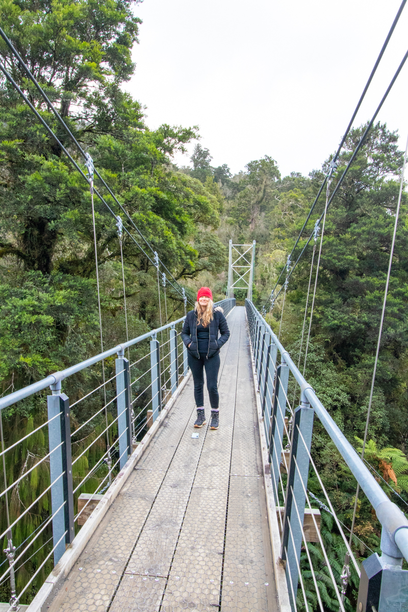
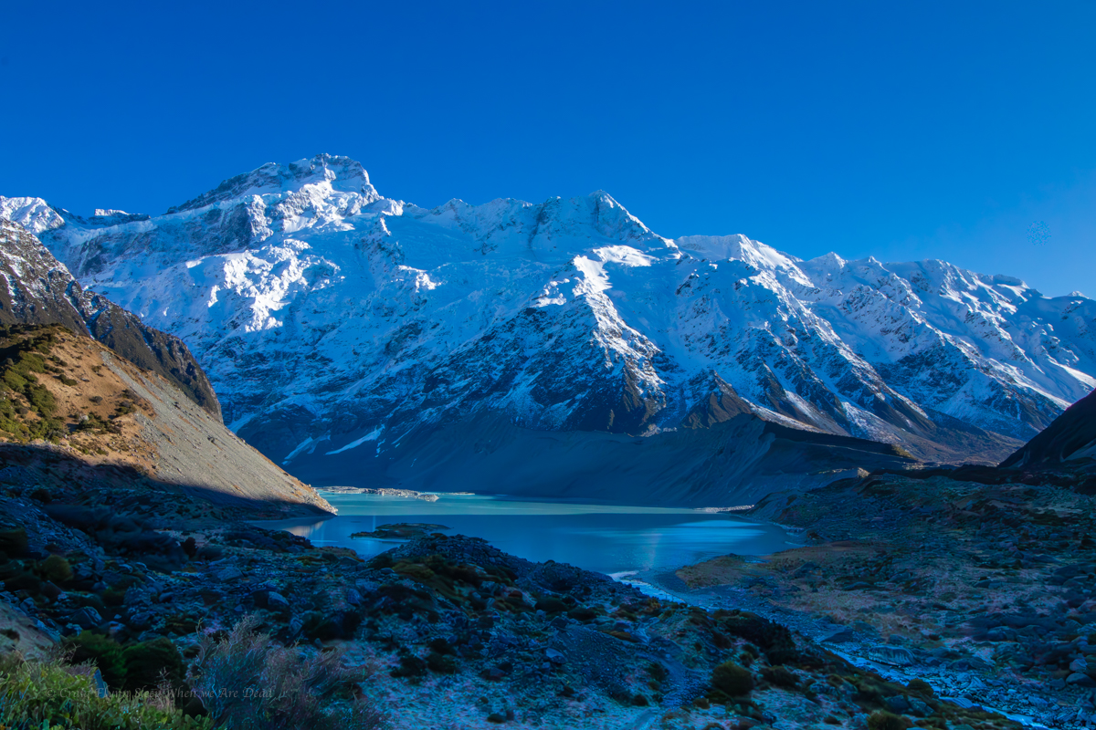
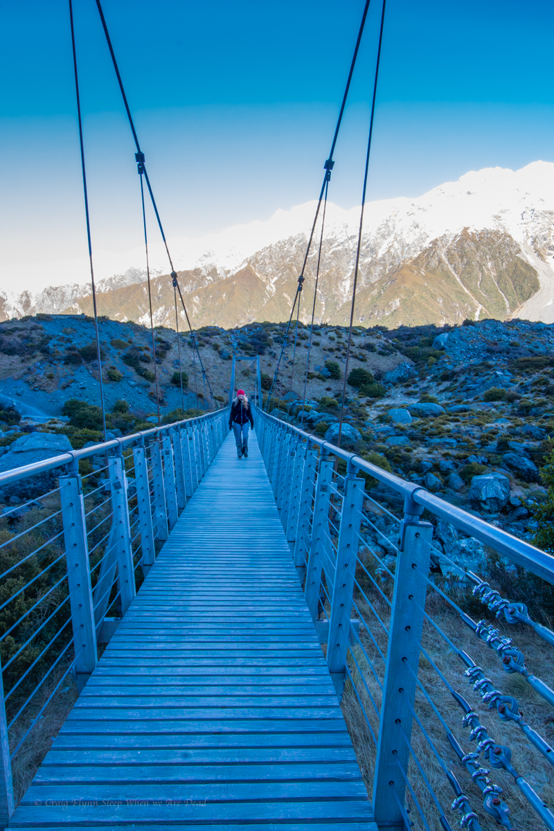
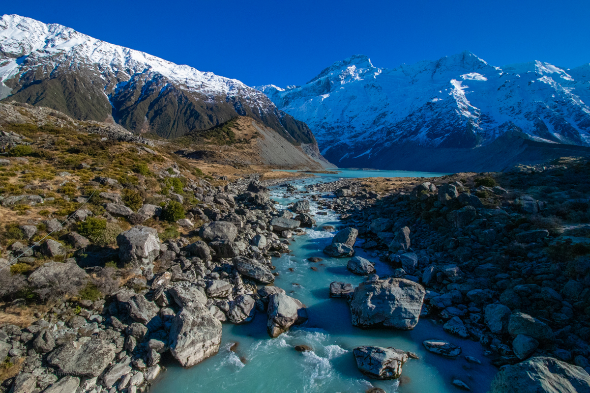
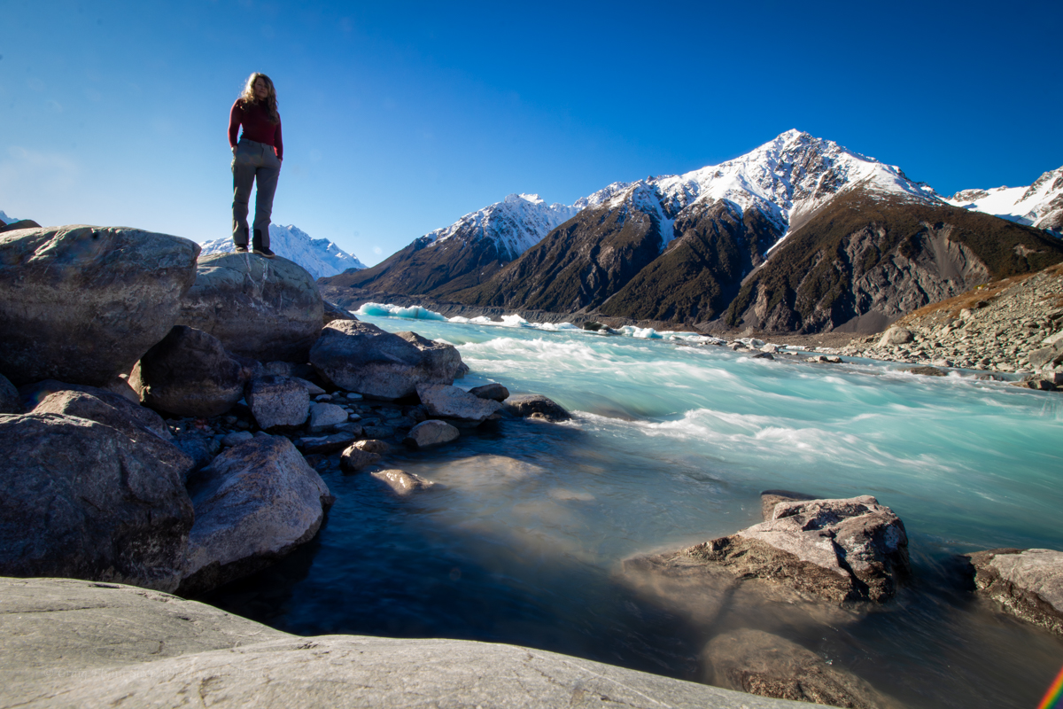
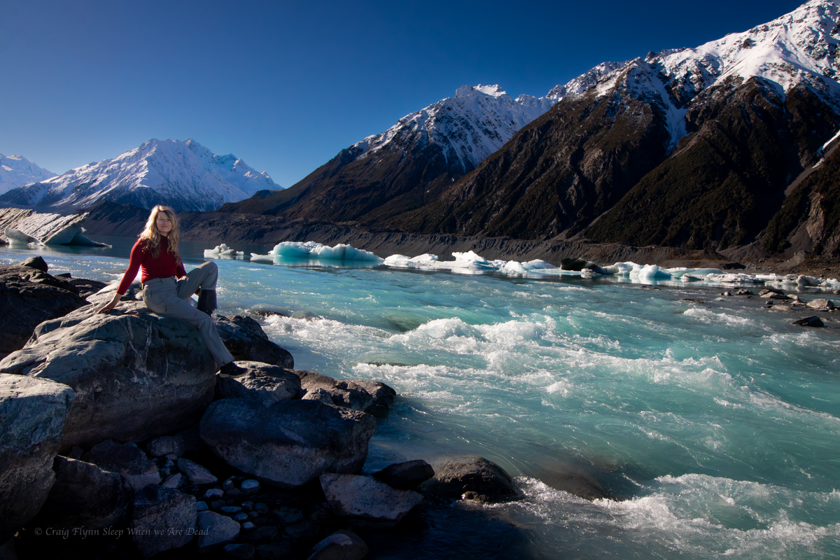
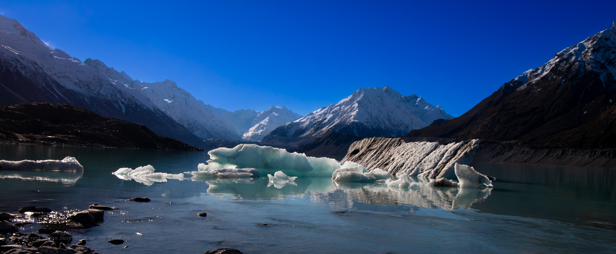
The next day we head out on the Hooker Valley Trail.

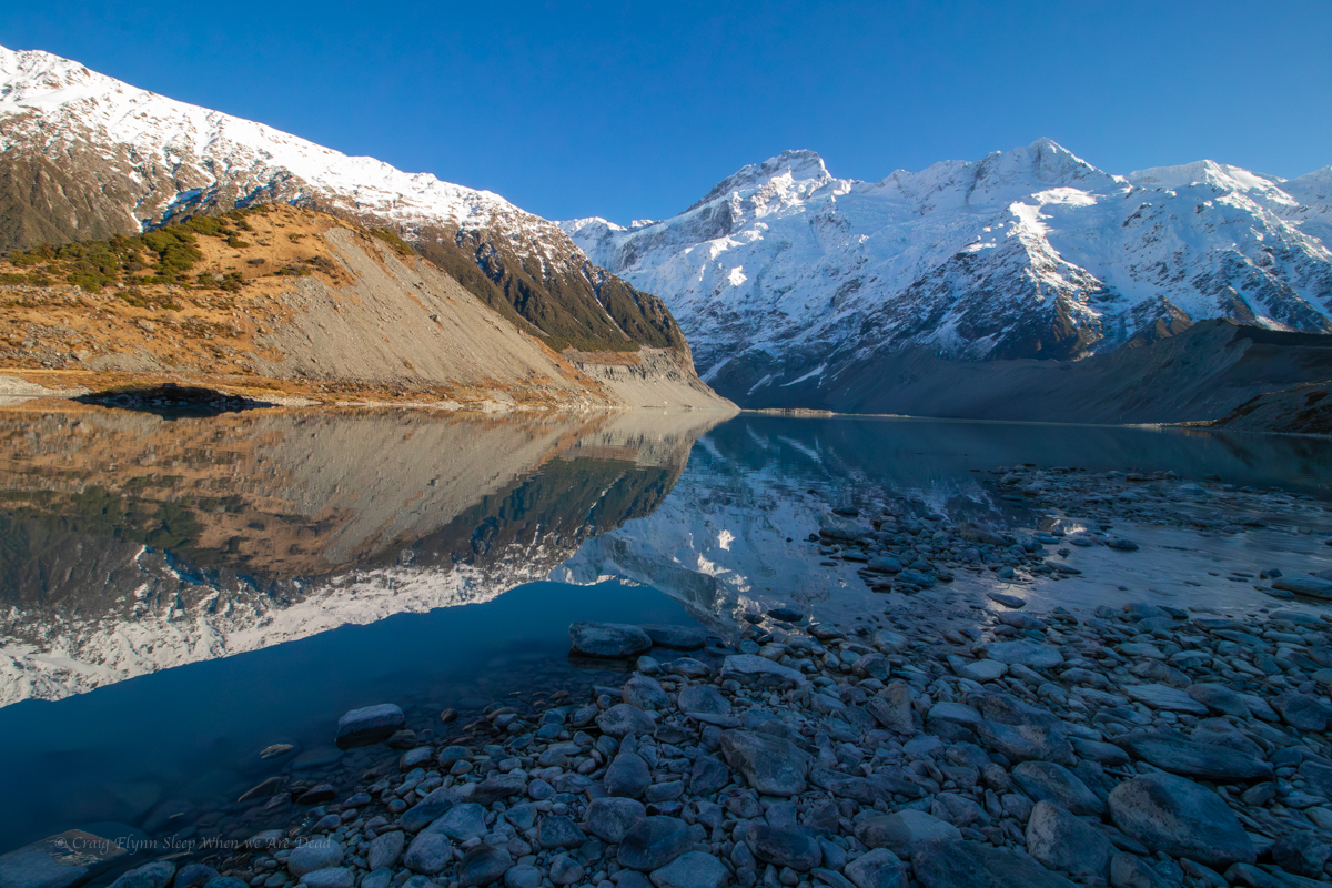
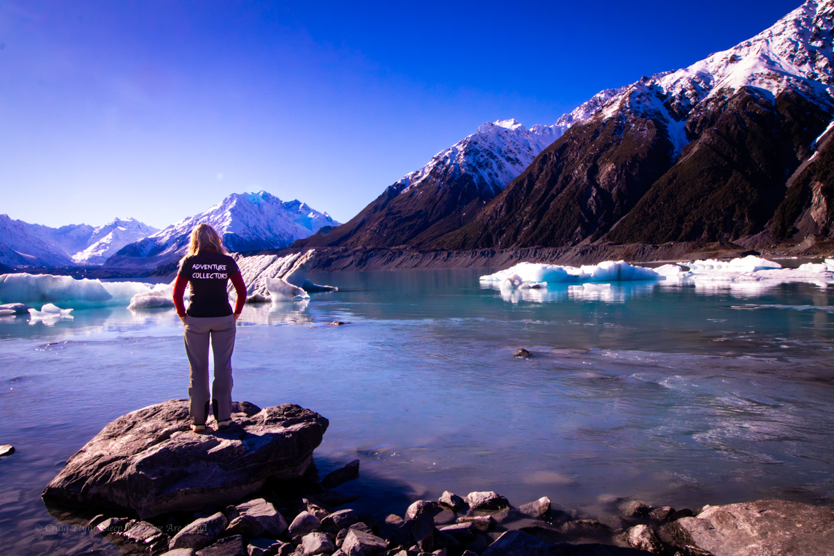
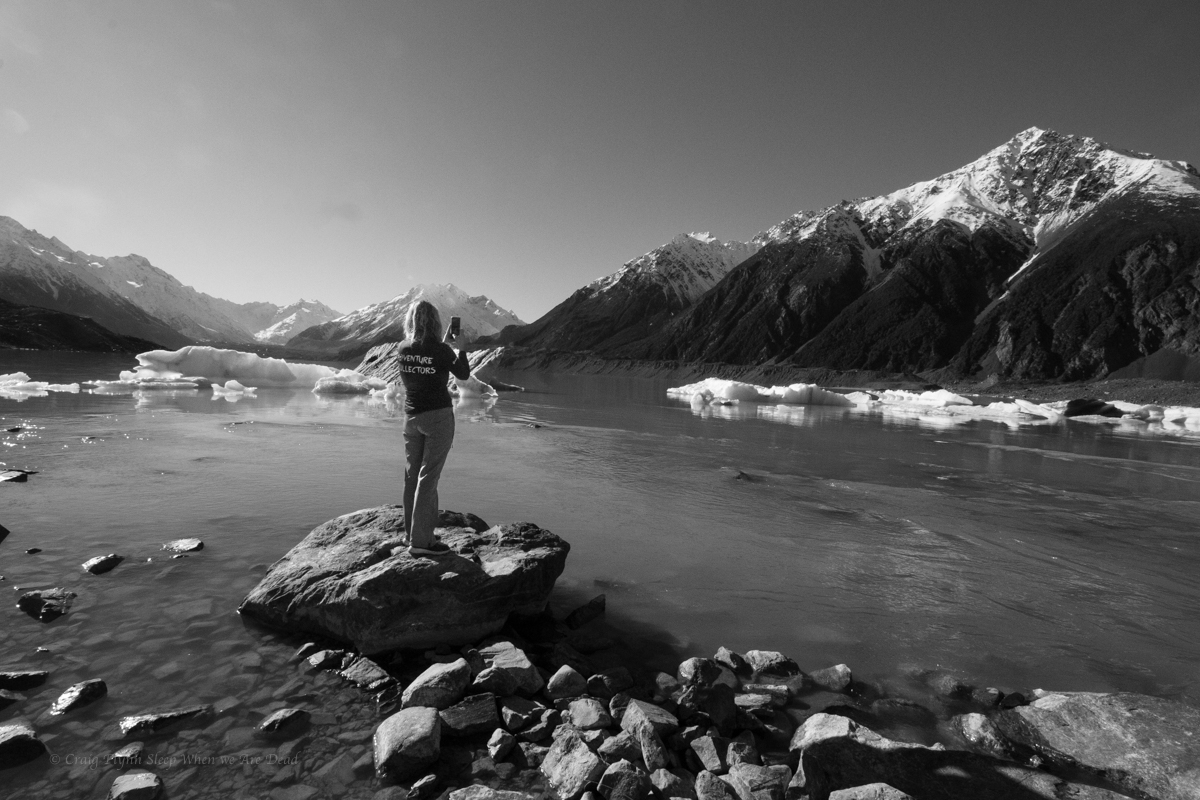
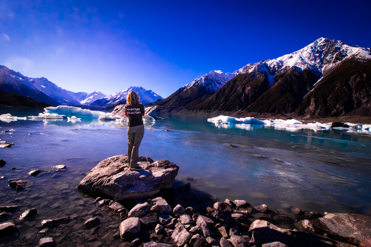
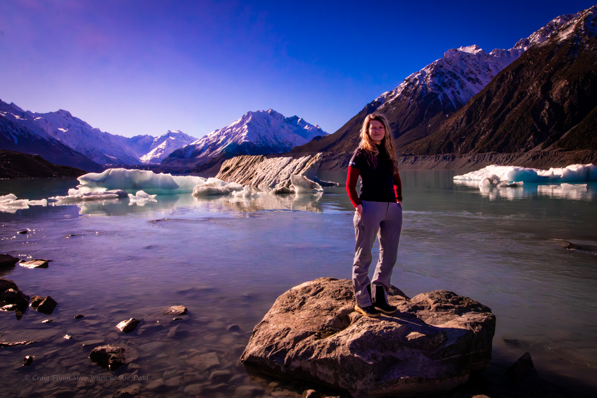
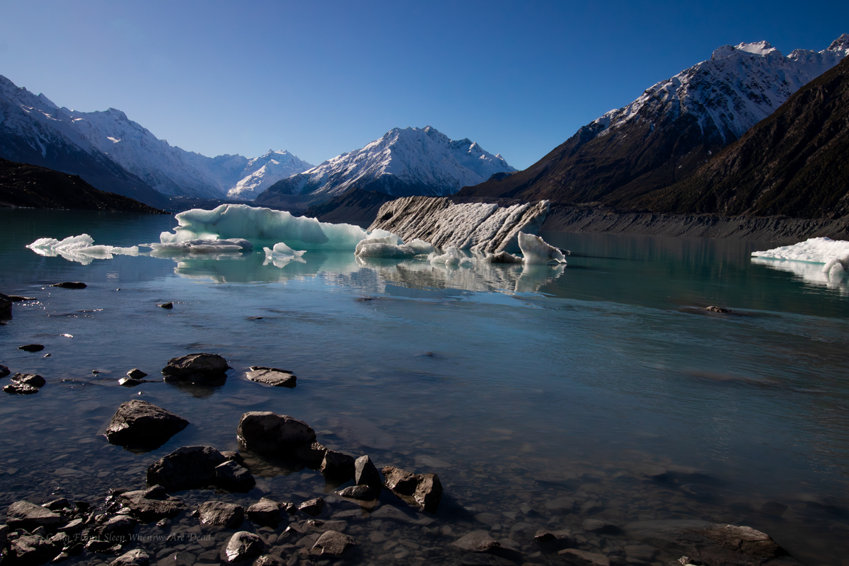
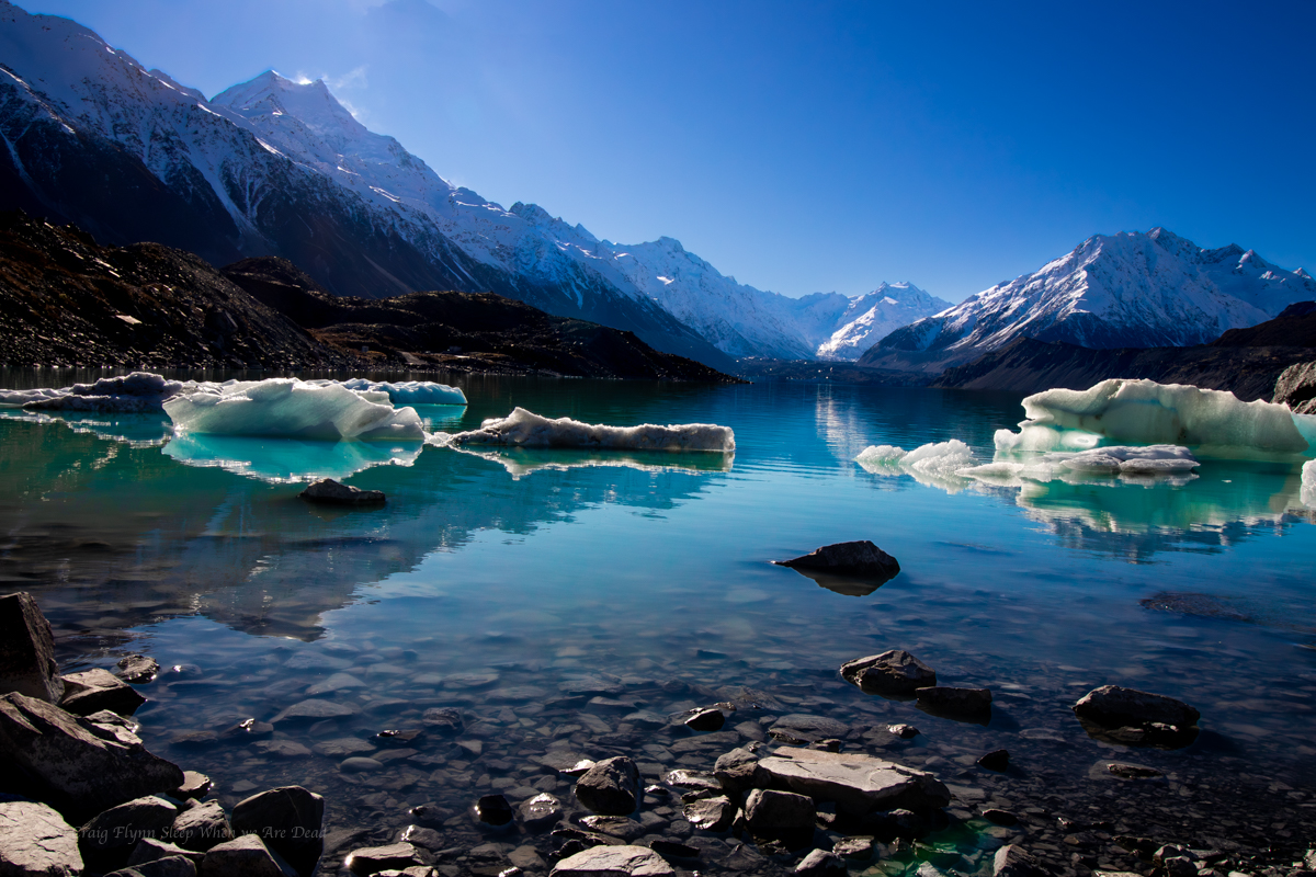
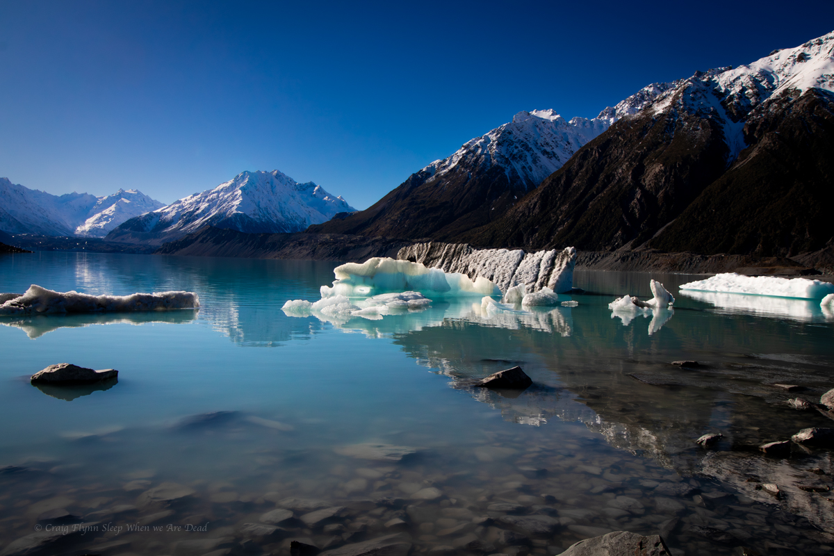
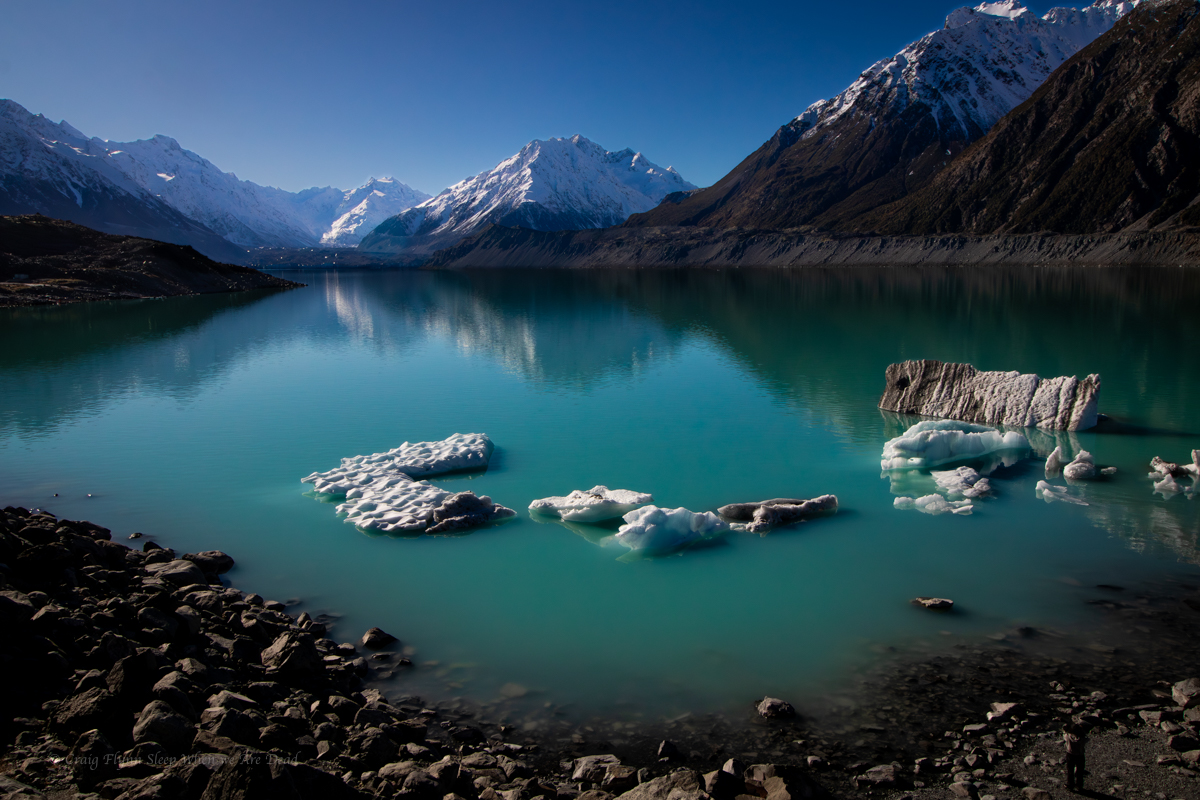
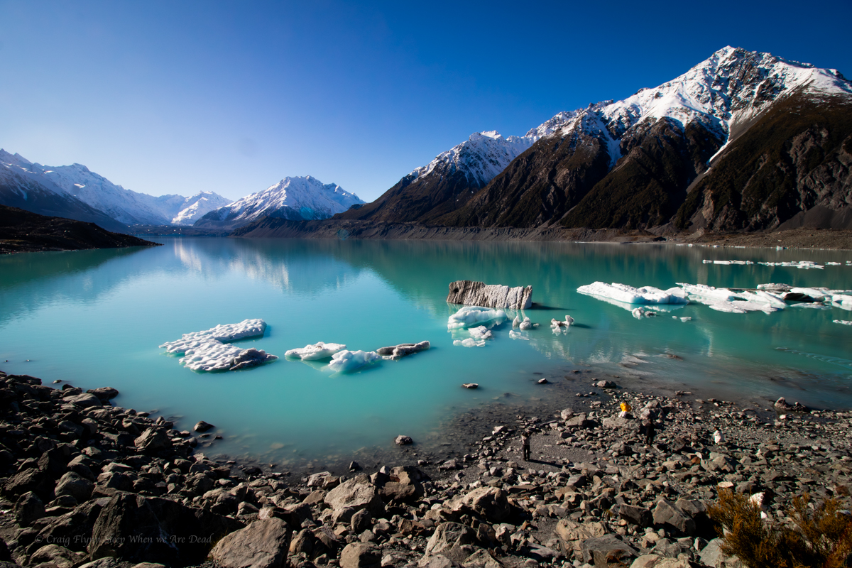
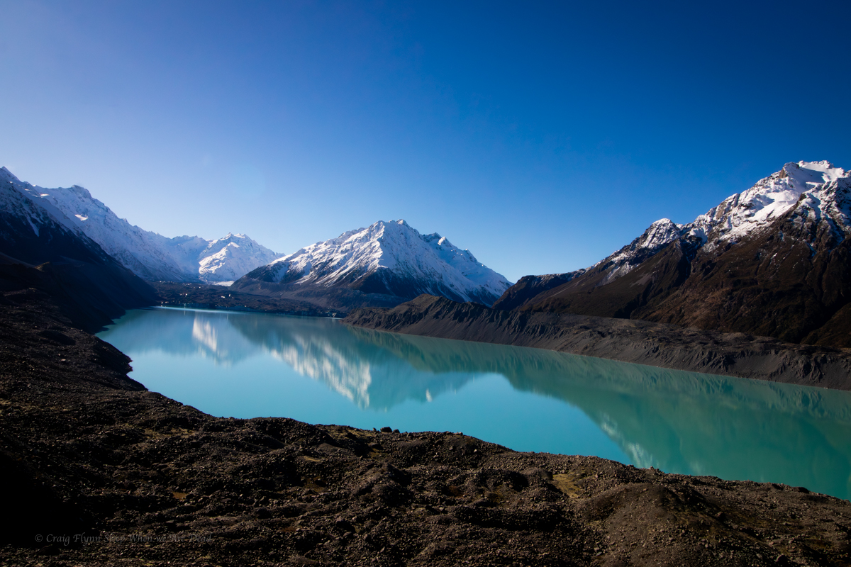
Normally this gives the closest access to the base Aoraki the general public will get and also views over the proglacial Hooker Lake, complete with icebergs, however only a short section of the trail was open at the time of our visit due to track work and a bridge being washed out.

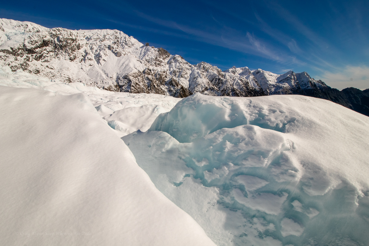
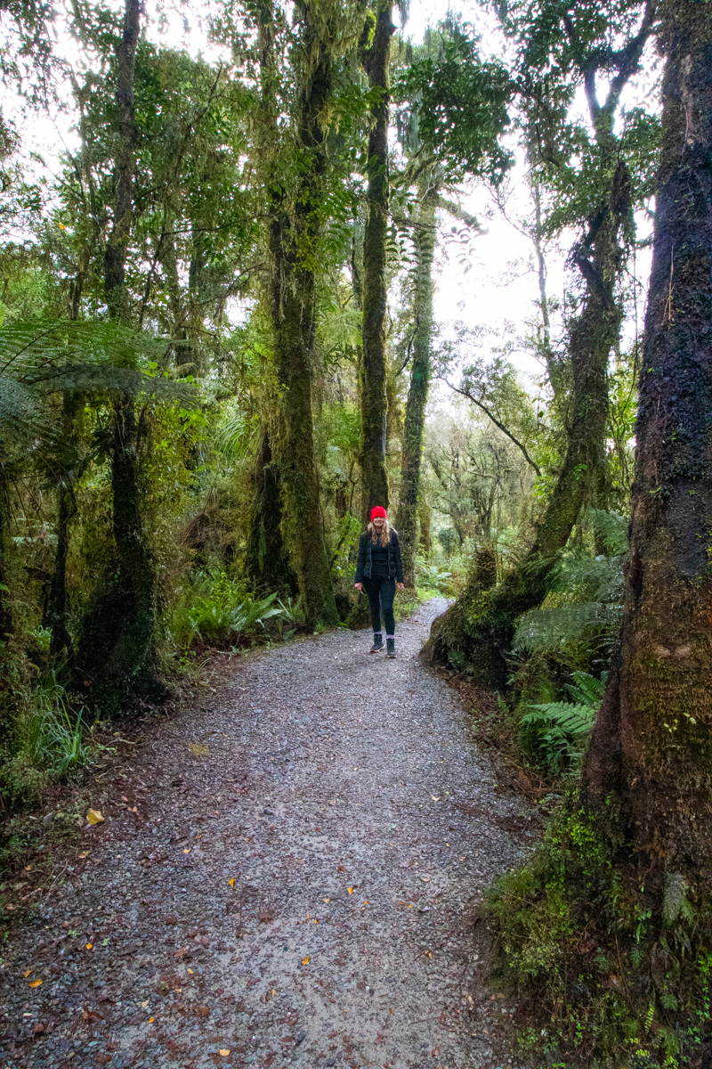
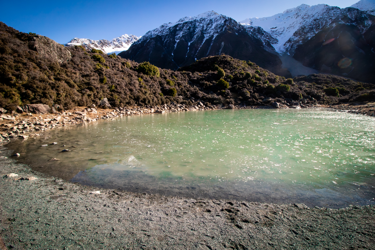
the short open section did, however provide great views over the Mueller Glacier and it’s lake.

Next we return to the van and duck over to the village for a coffee. While there we dropped in to the Department of Conservation information centre.

Wow!!!

What an amazing free resource. If you were in the area and the weather was bad you could easily spend a whole day in here. There are displays and videos and more lots more.

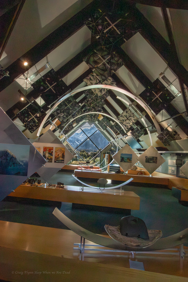
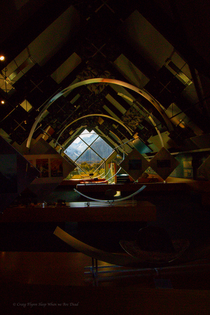
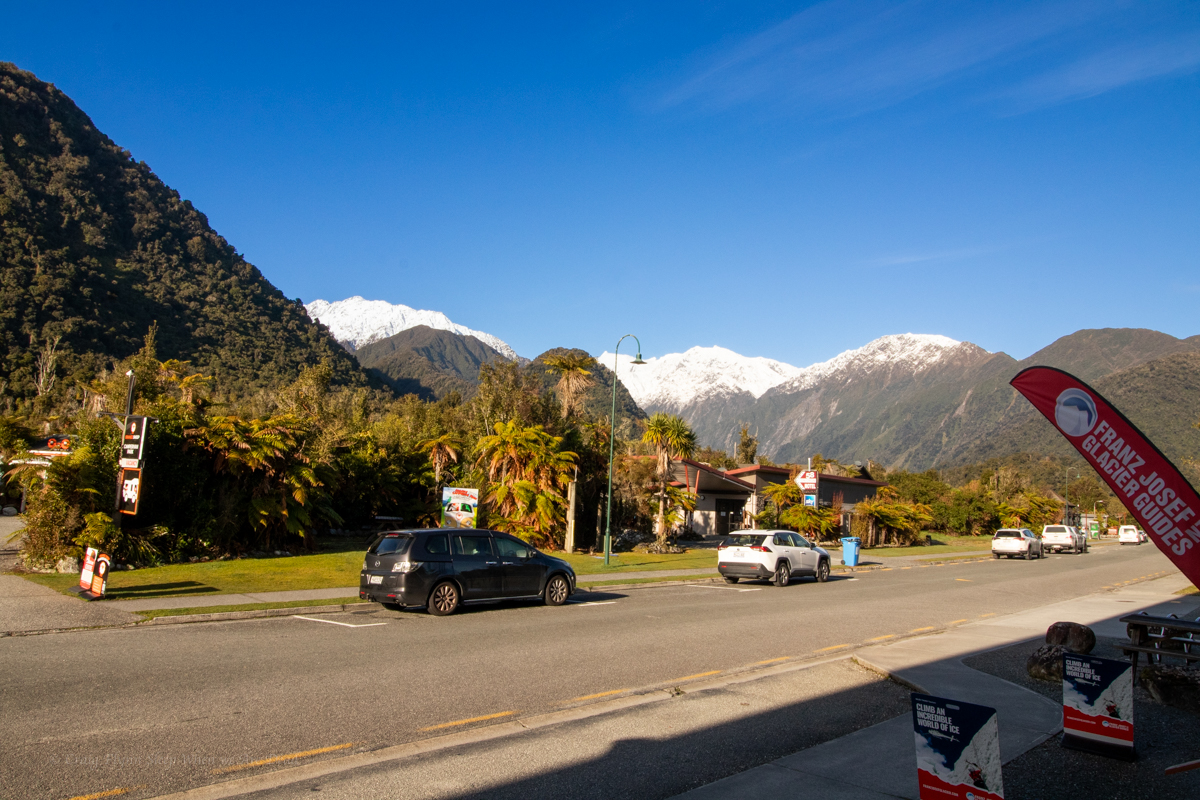
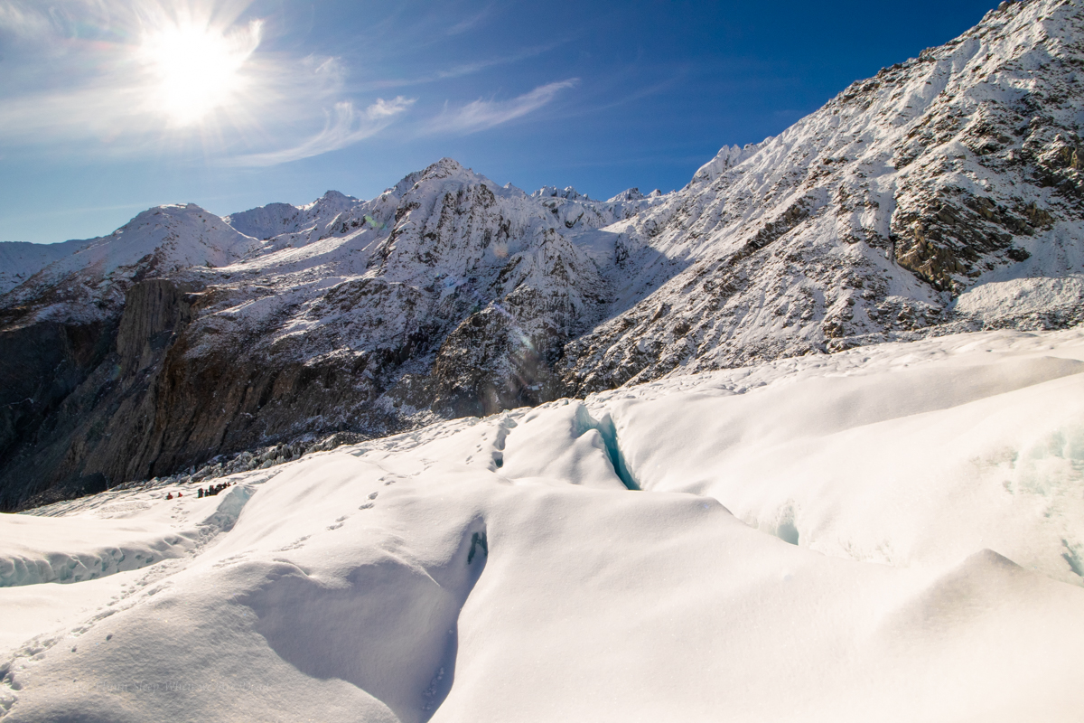
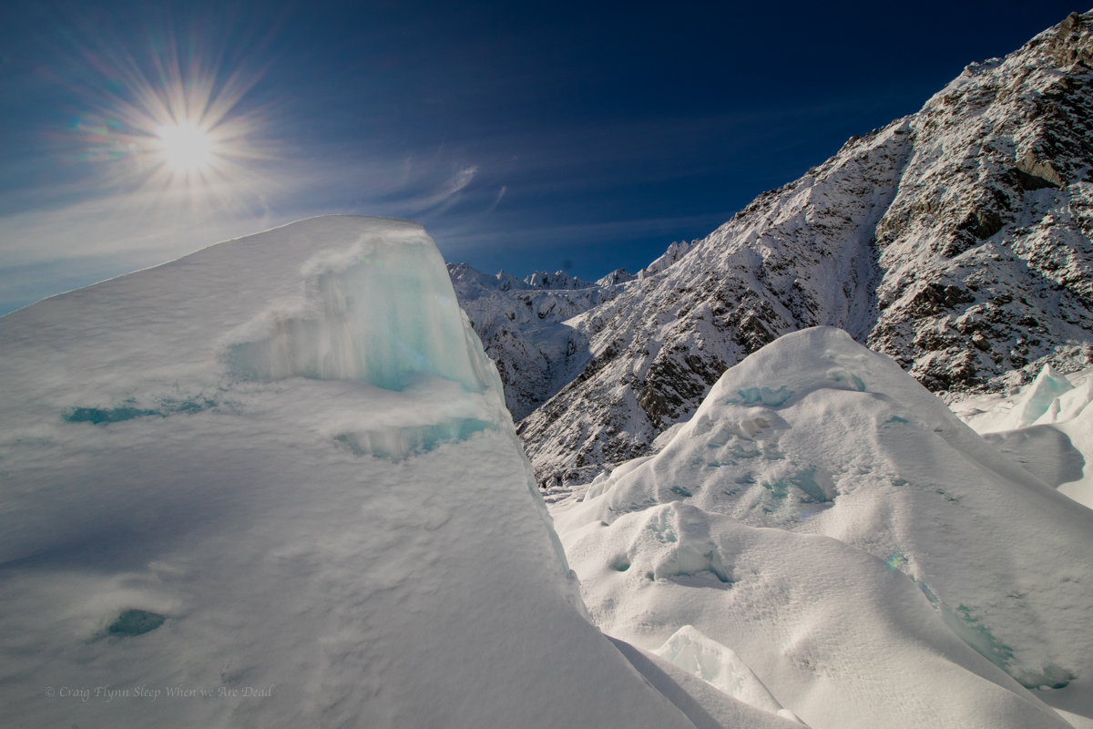
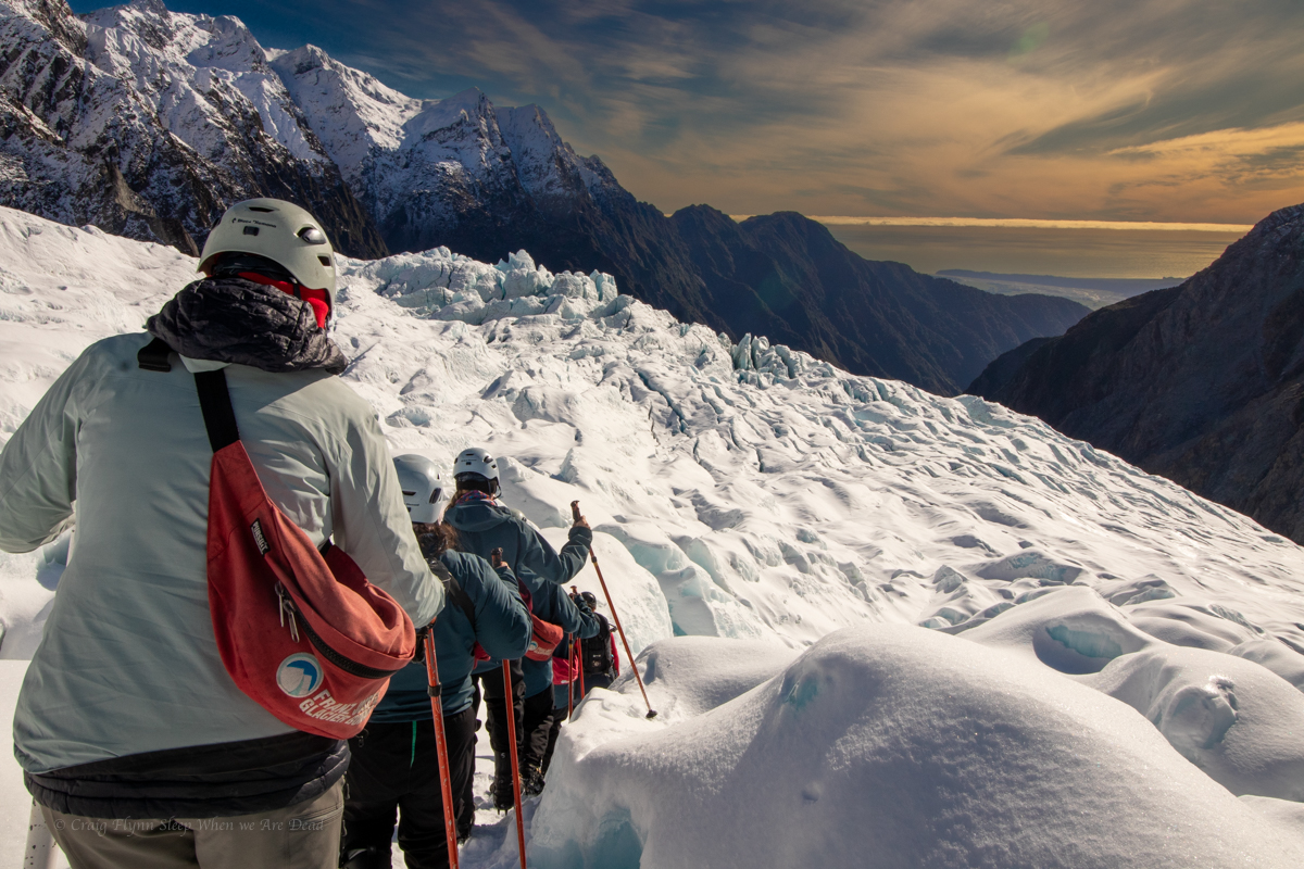
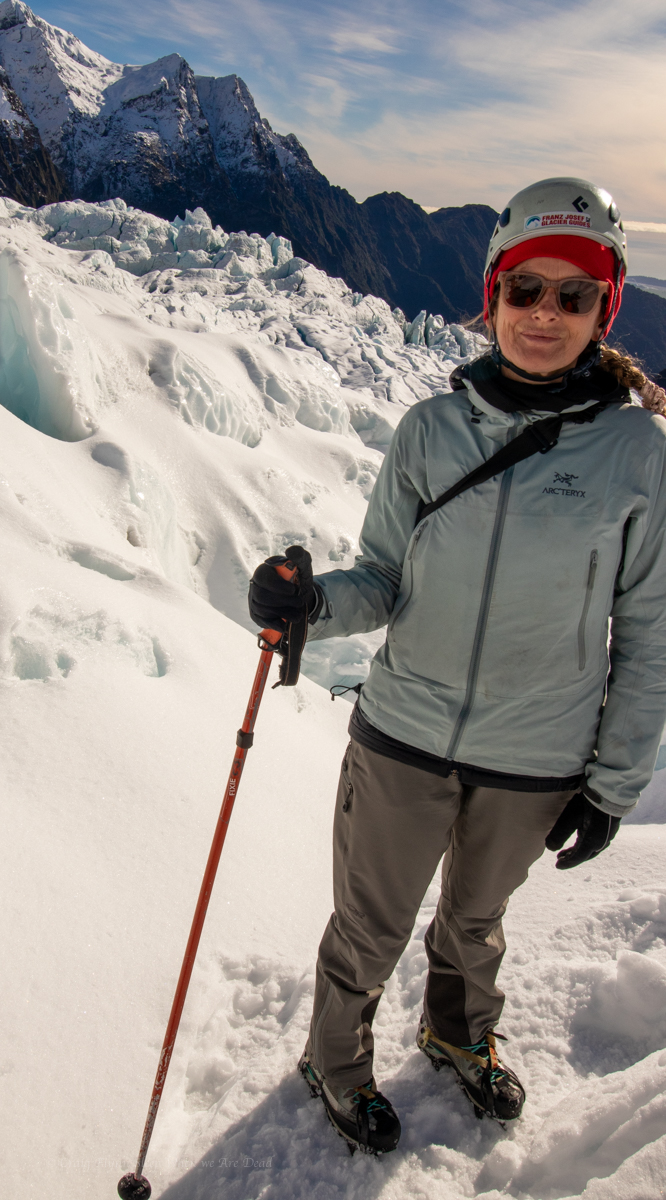
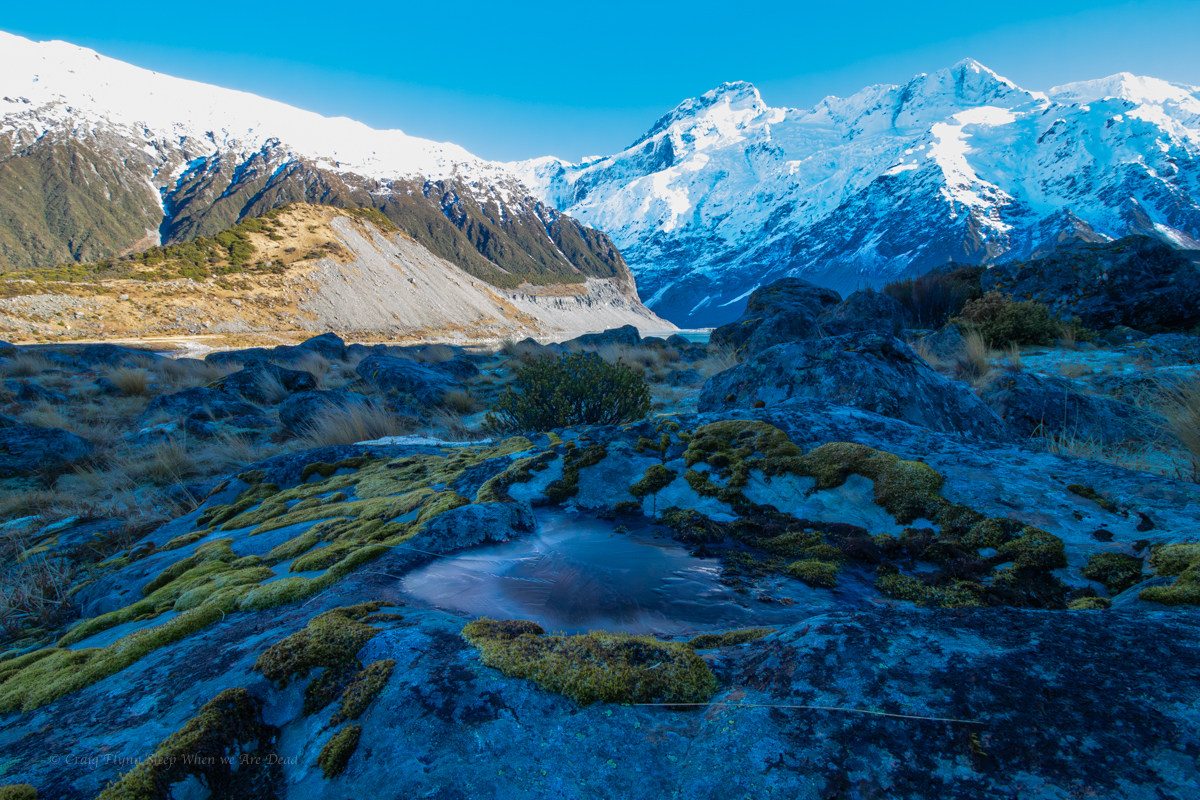
But today was a blue bird day so we have a quick look and then head over towards the Tasman Glacier.

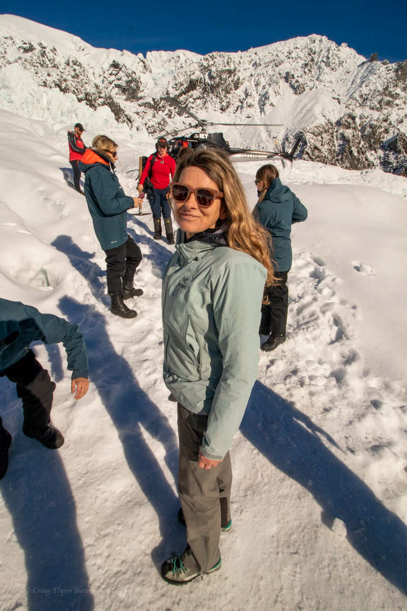
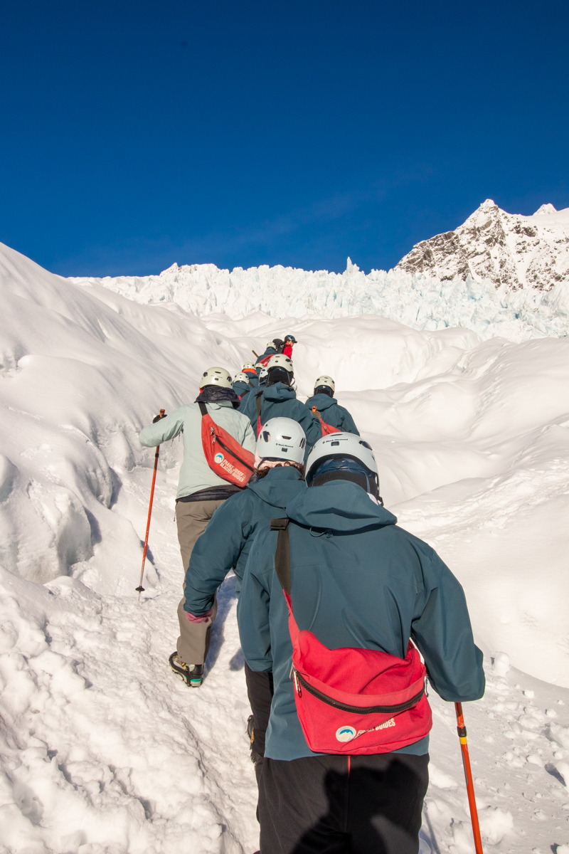
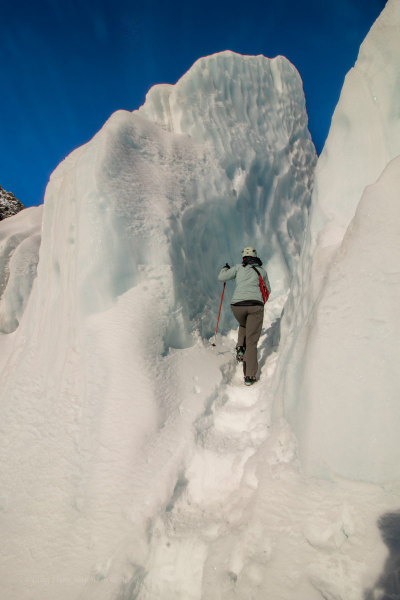
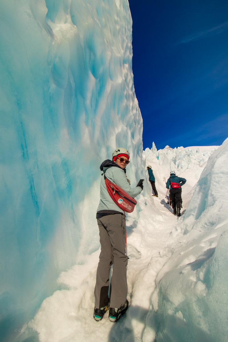
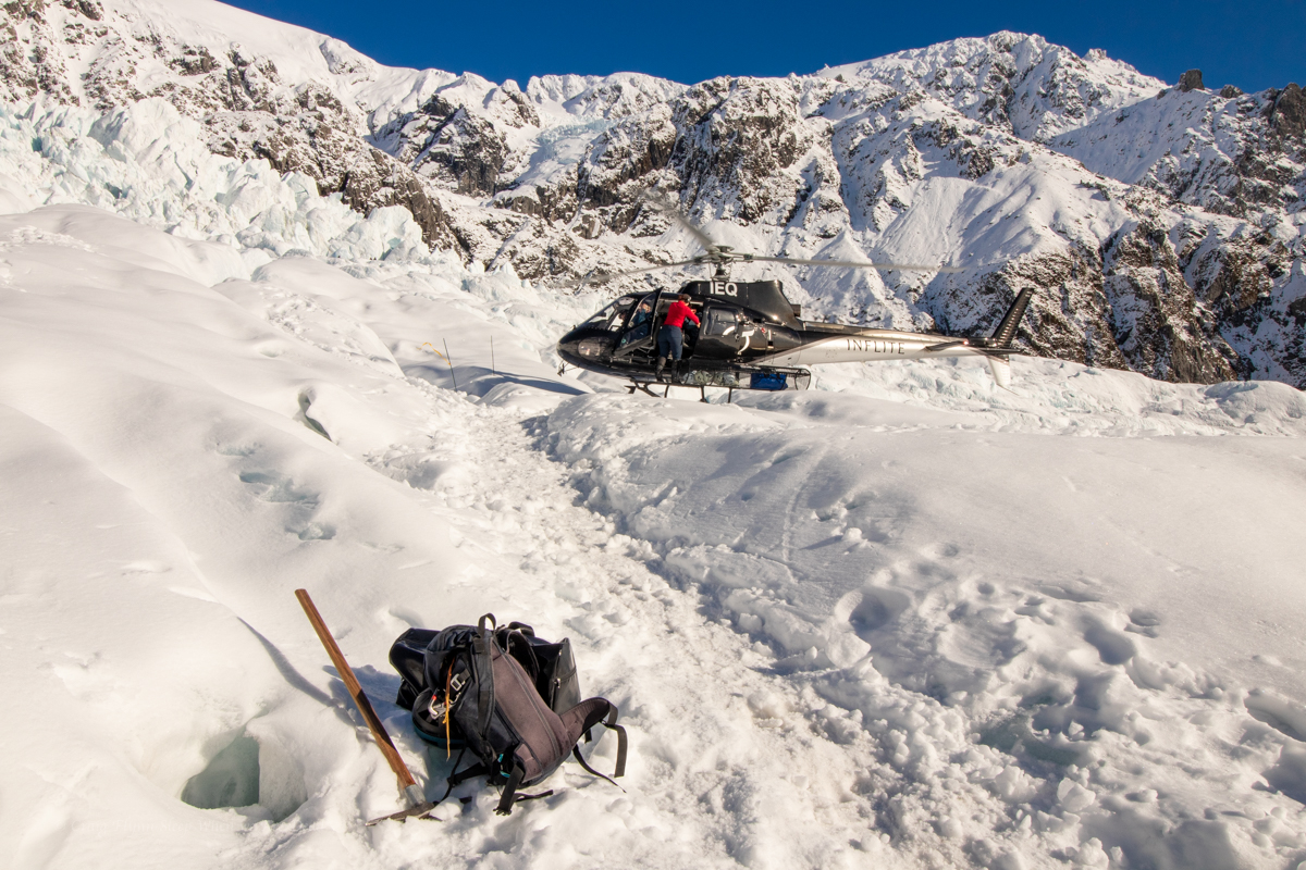
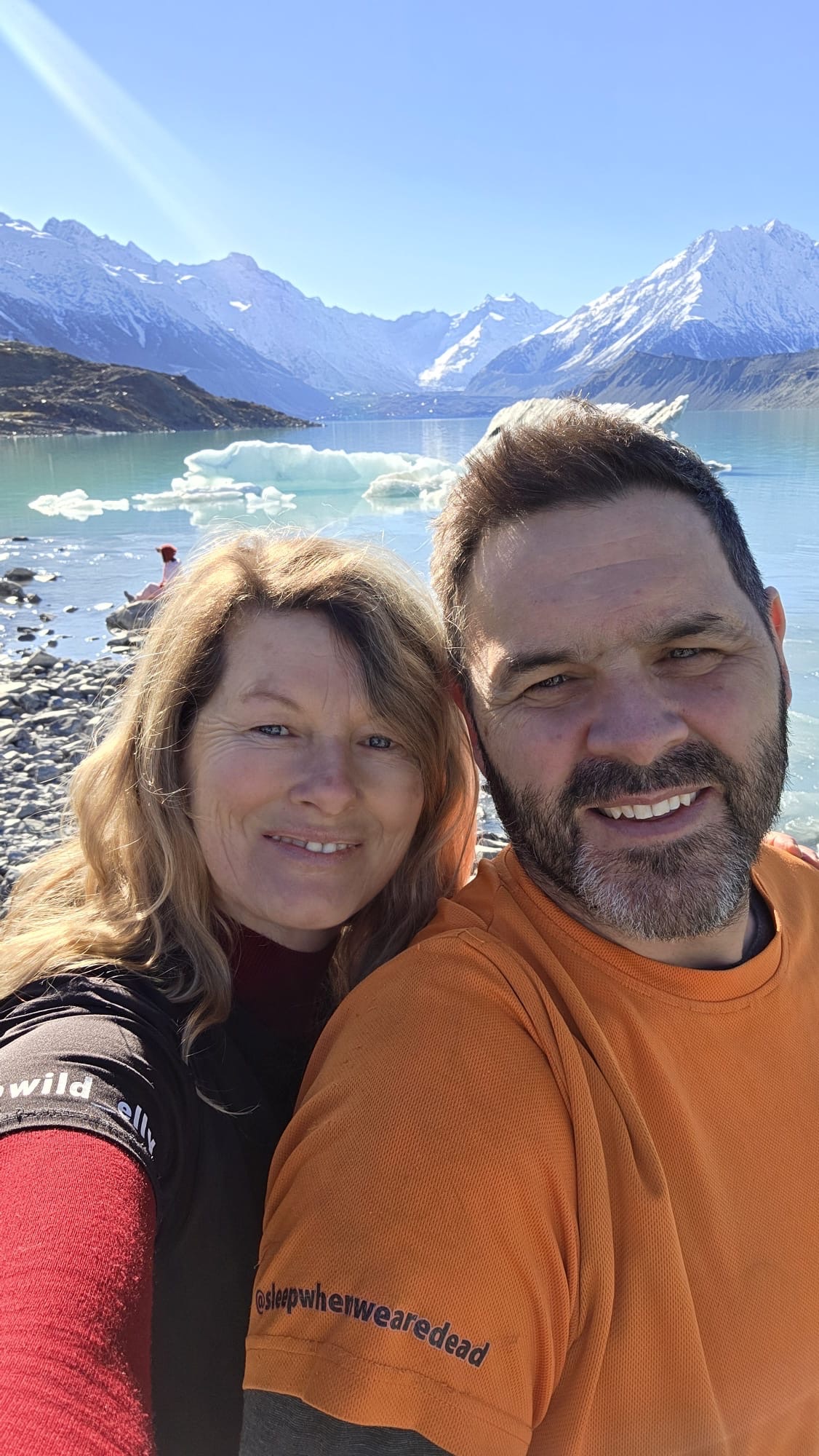
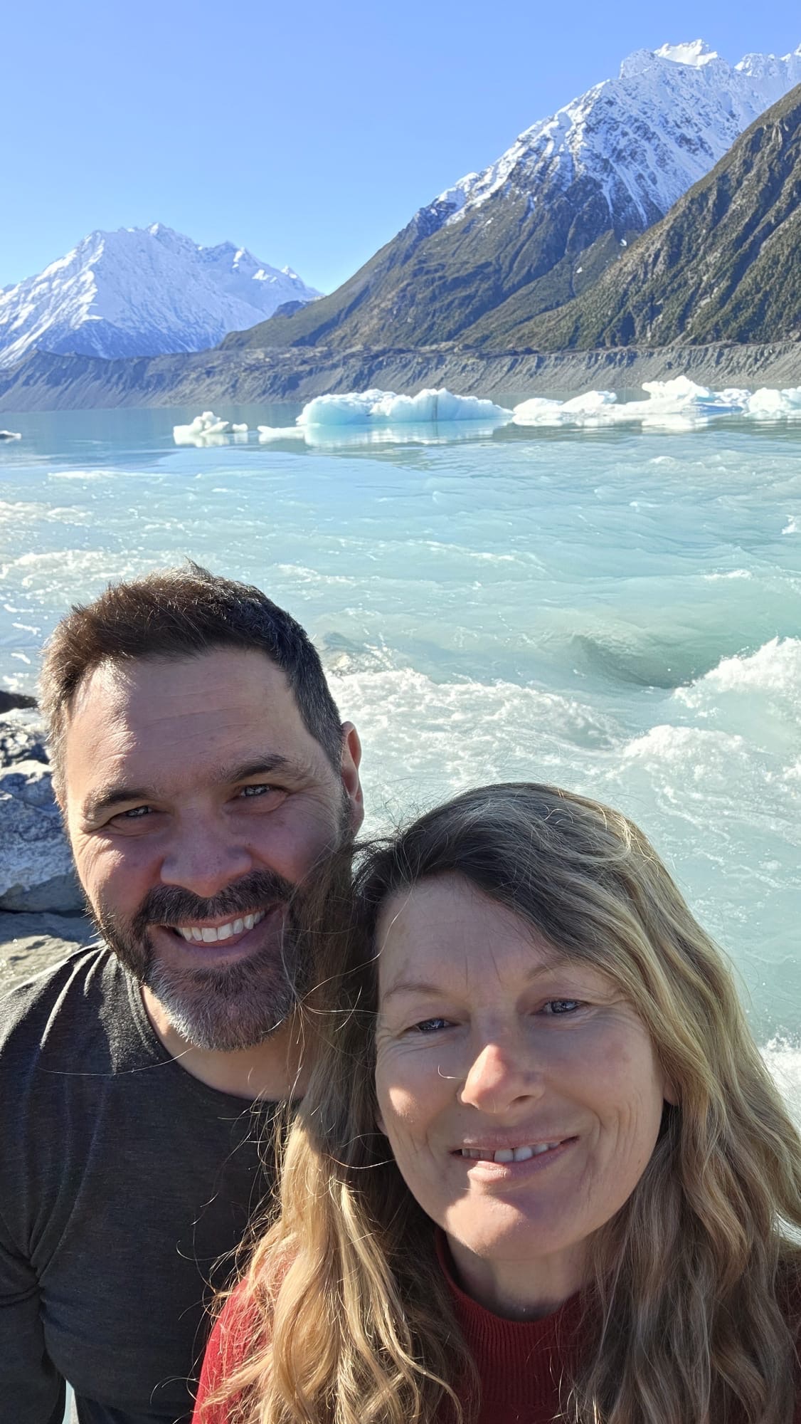
Here you can take helicopter tour or a boat tour on the lake. We opt to just do the tourist walks.

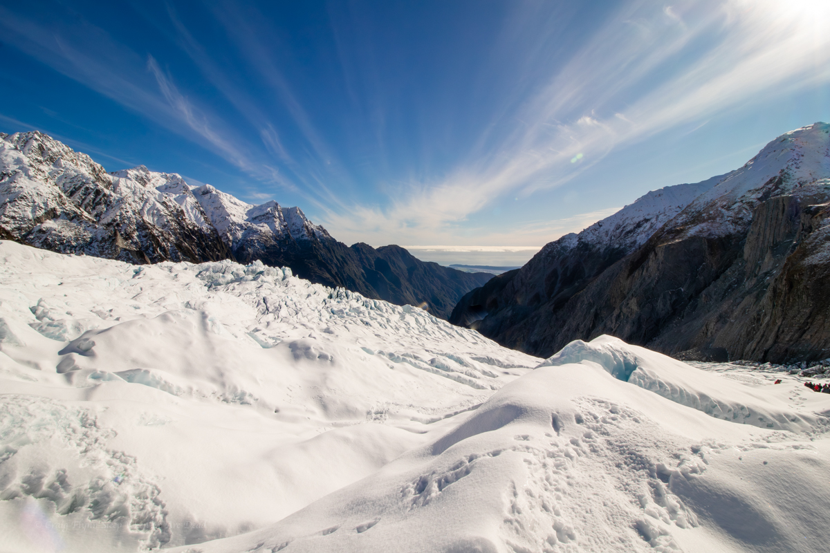
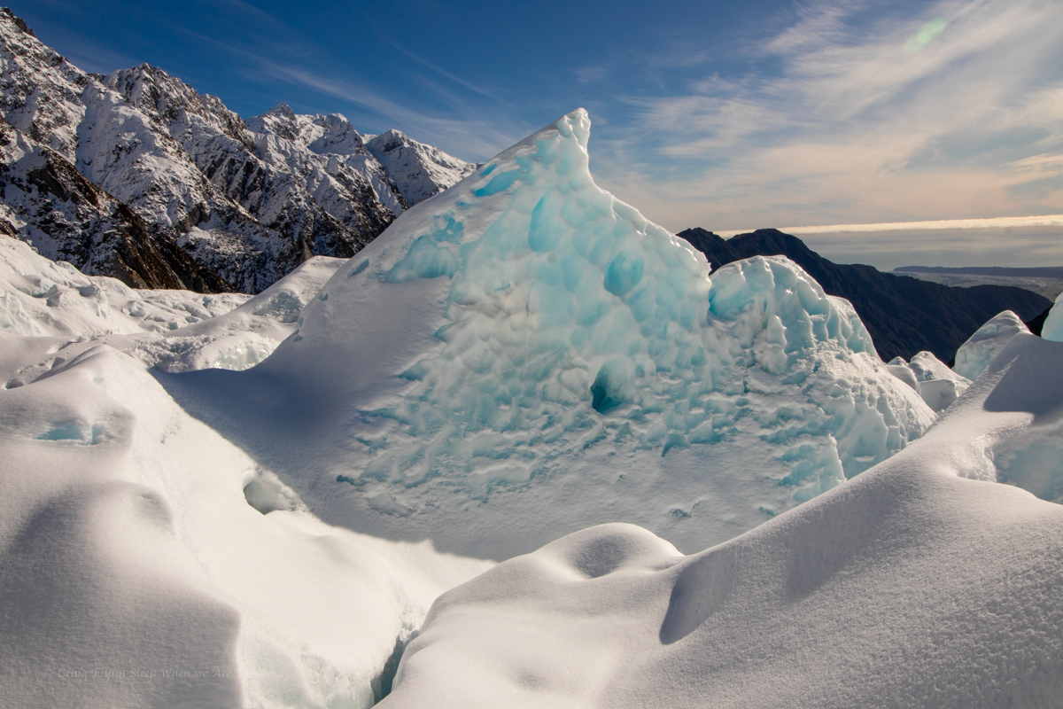
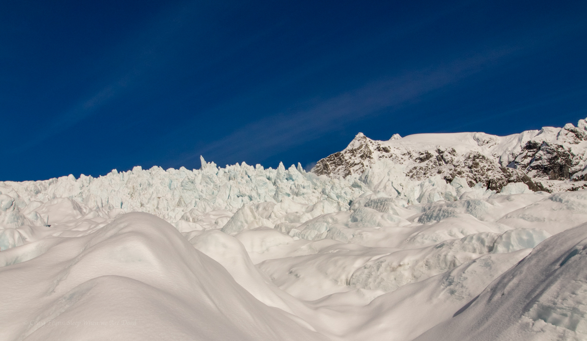
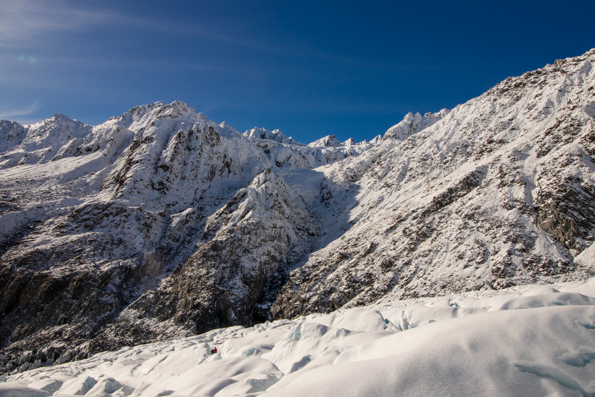
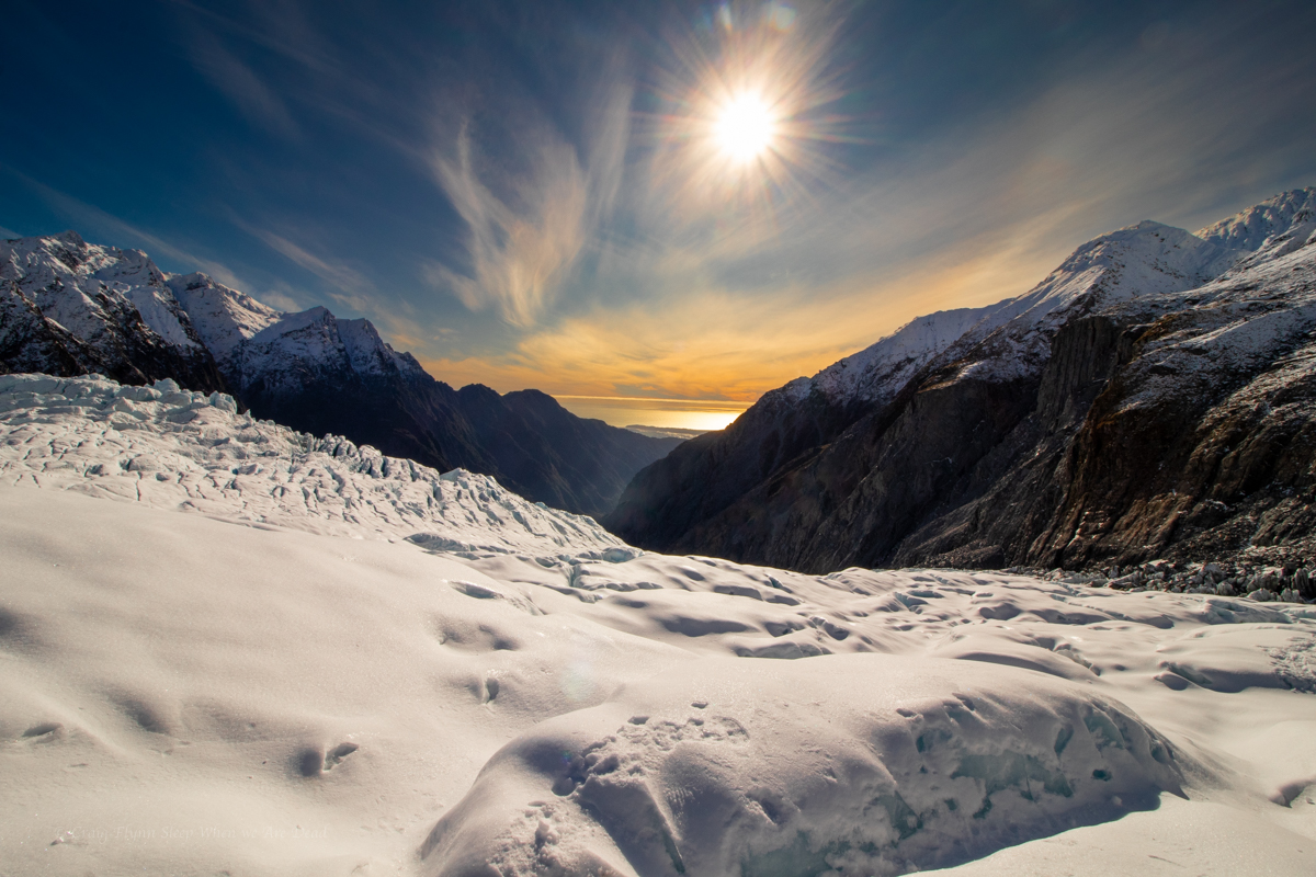
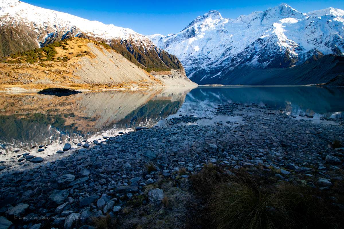
Sitting between NZ’s two tallest peaks the Tasman is New Zealand’s largest glacier, being up to 4km wide and 600m thick in places. It had remained a fairy constant 28km long through out its recorded history up until it starting to retreat in the 1990s. It’s currently 23km long and retreating on average 180m/year.

Looking up the lake from the tourist lookout the glacier is’t much to look at. Compared to the white snow and crystal blue ice on the Franz Josef, the Tasman crunches up and contains a lot more rock and minerals (Glacier flour), giving it a dark, almost dirty appearance. Without the information sign at the I doubt most people, me included, would pick it out in the distance.

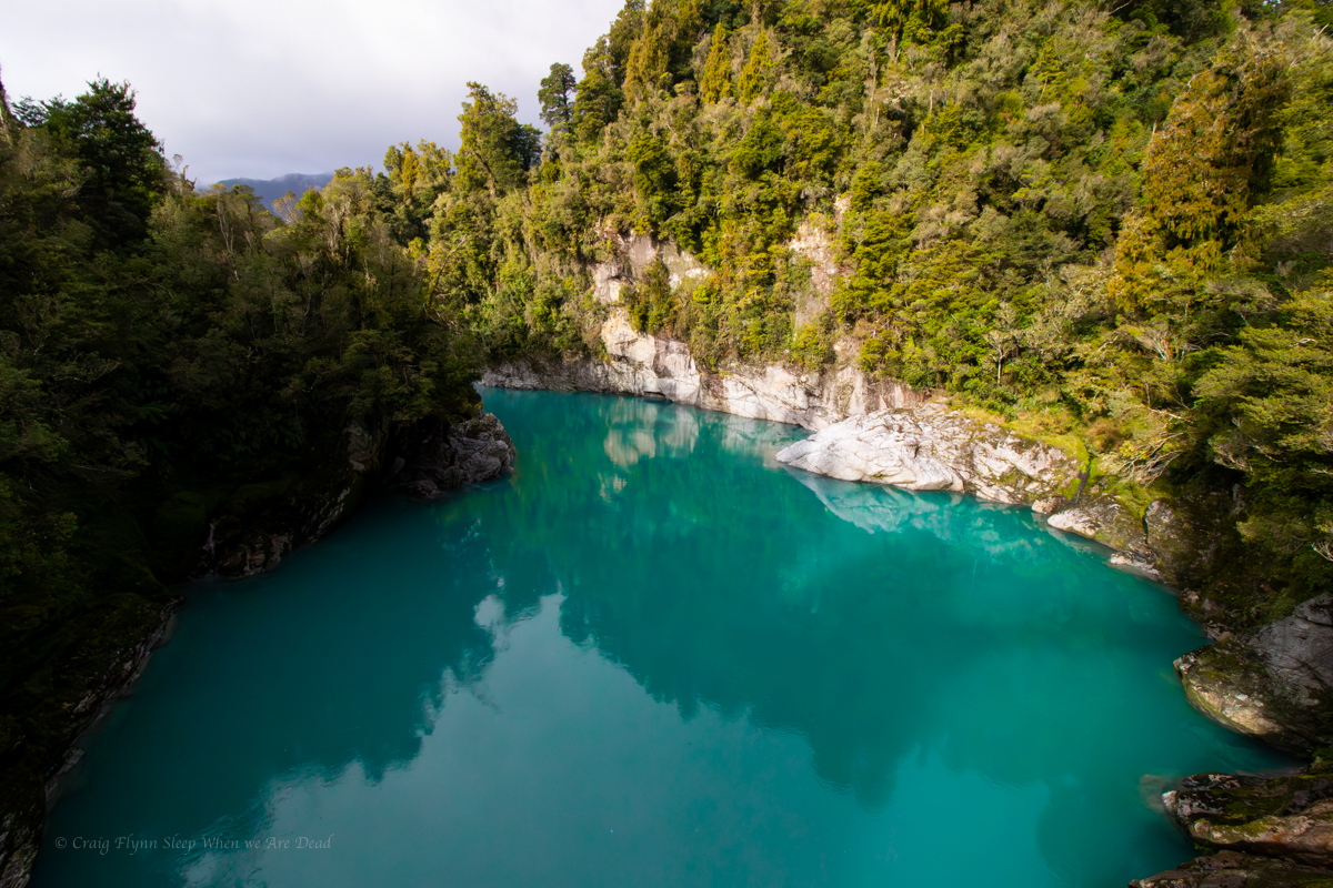
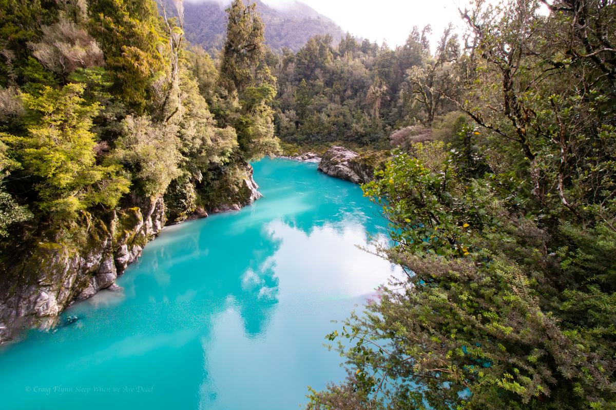
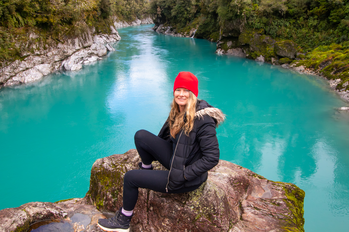
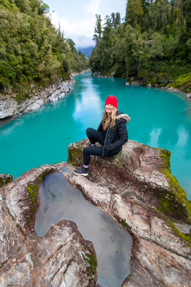
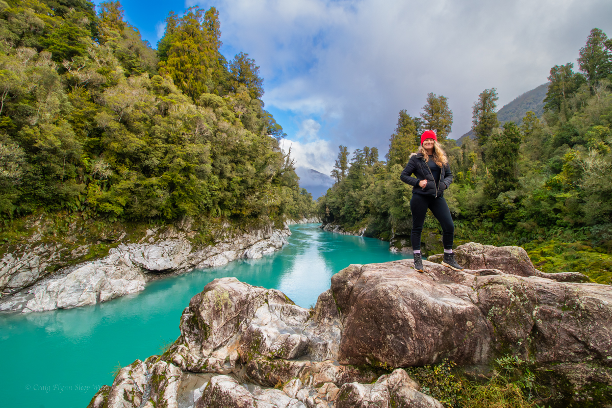
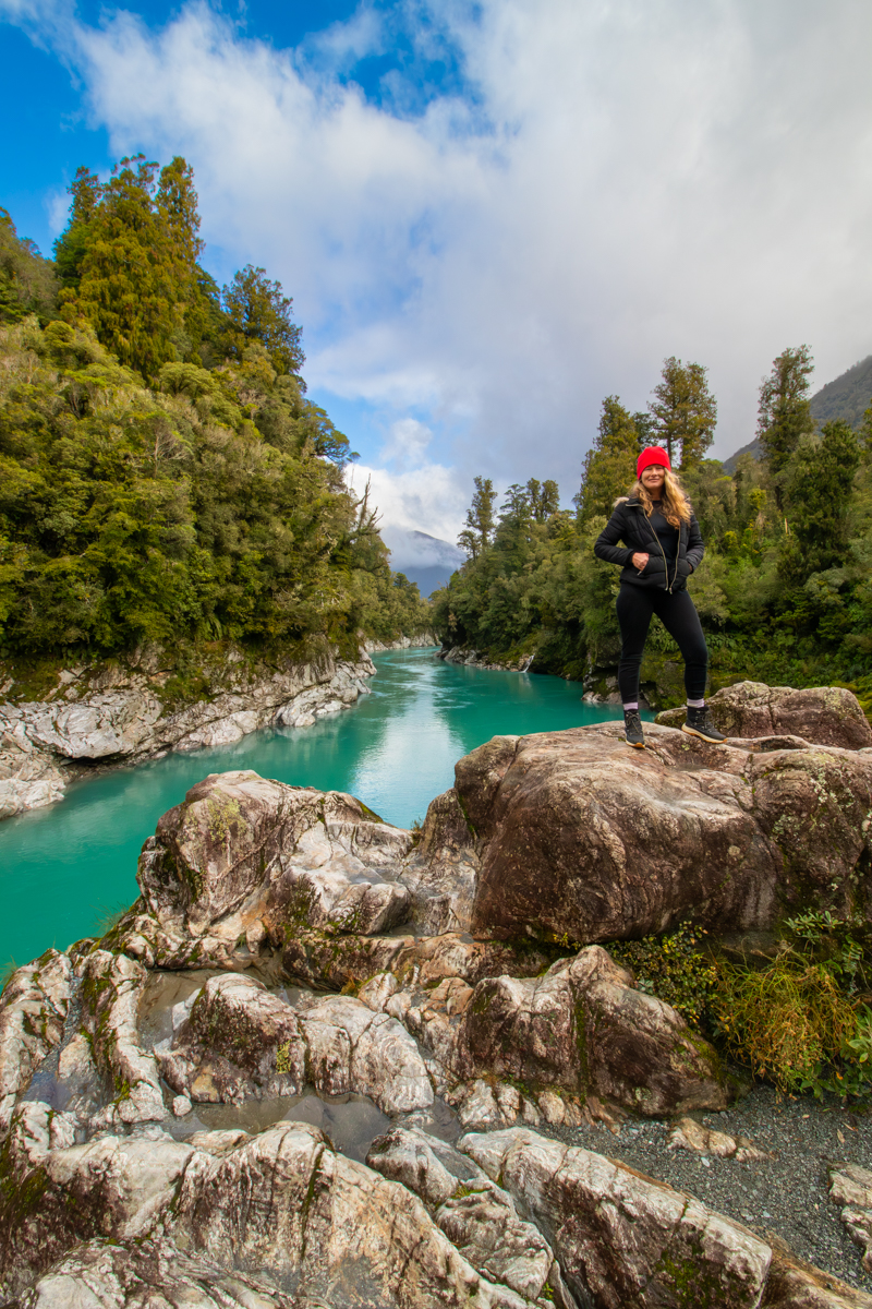
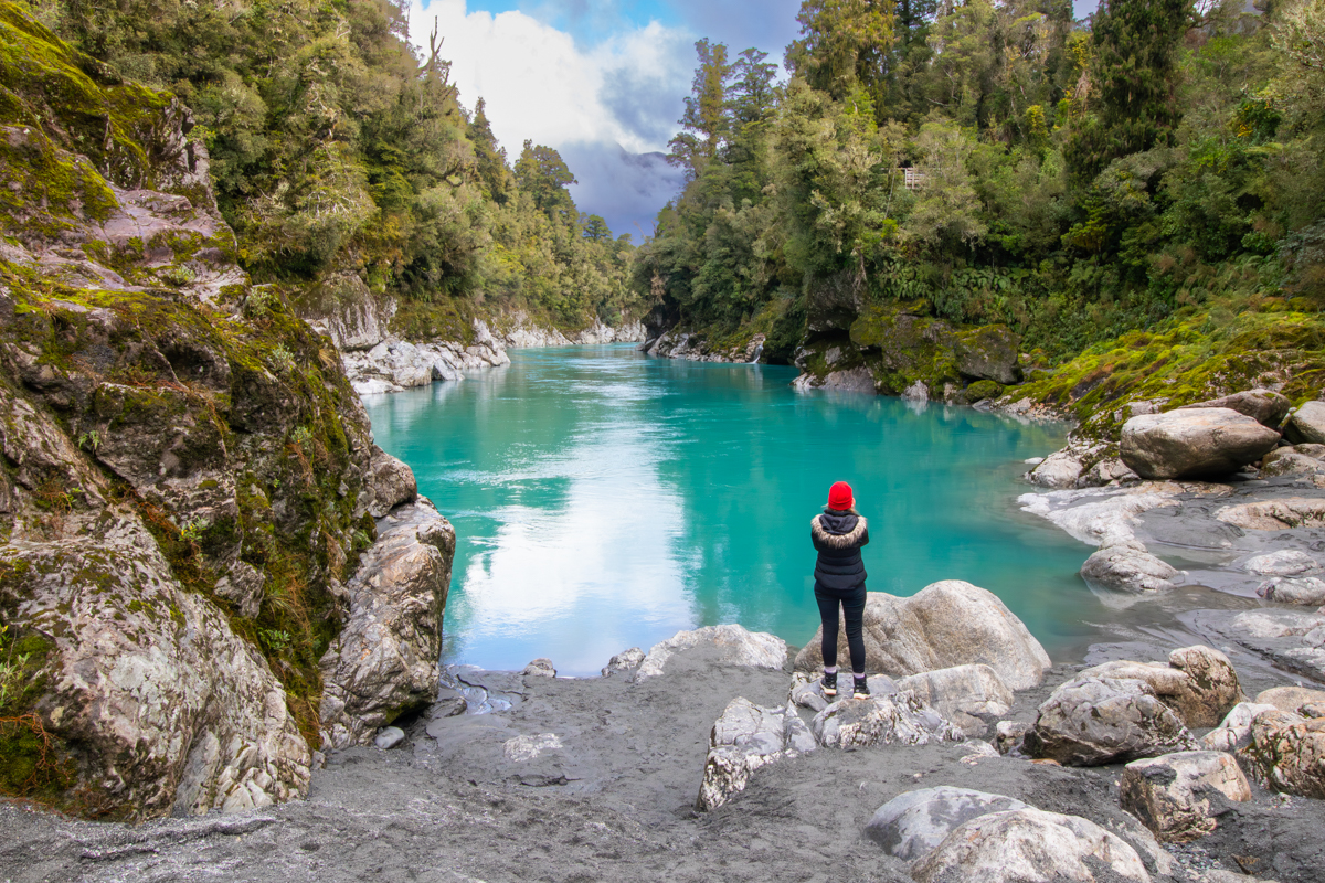
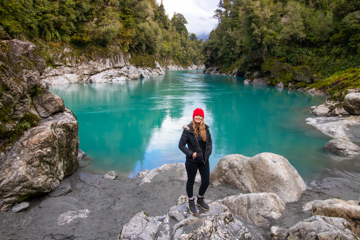
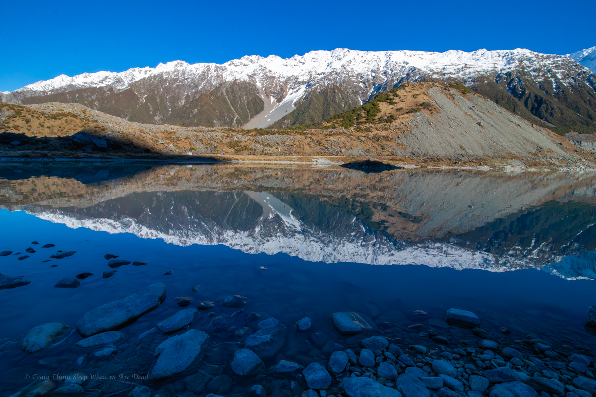
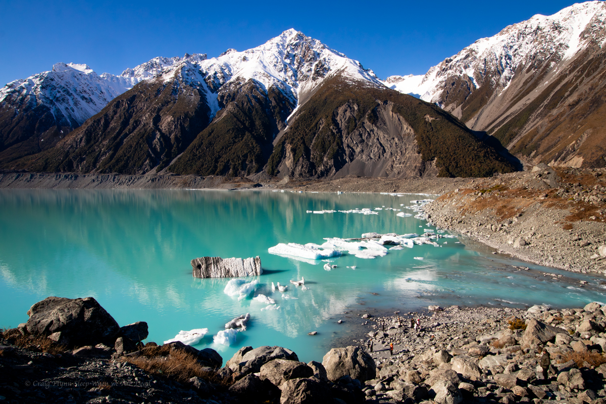
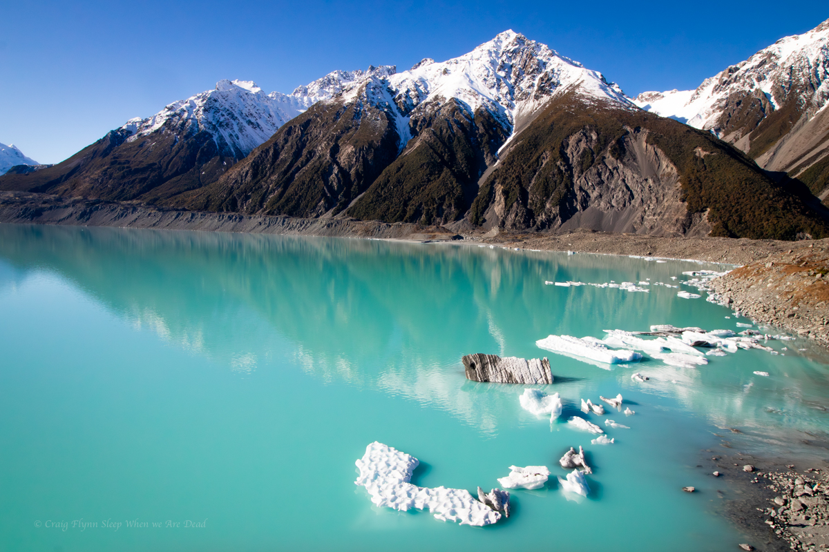
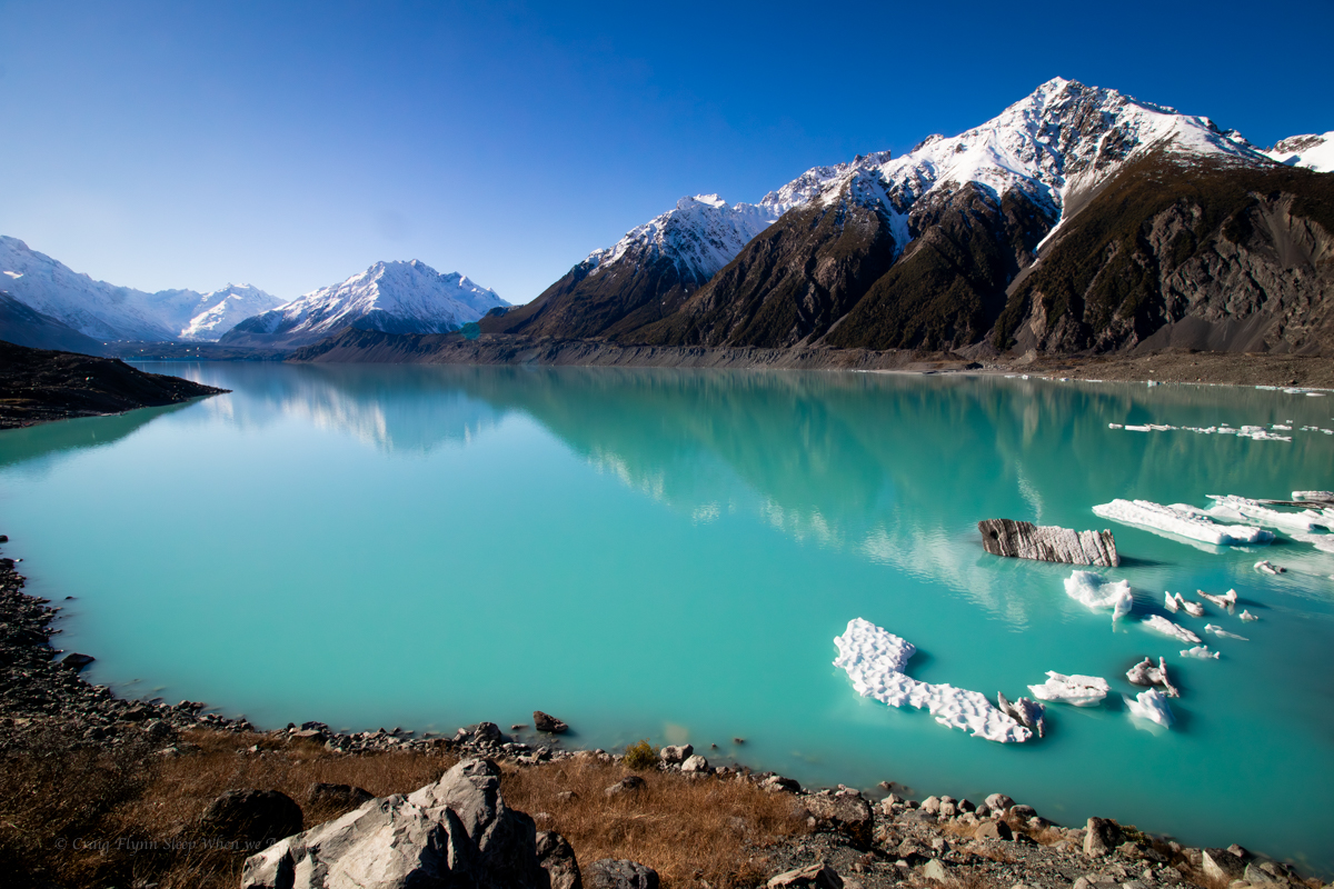
The lake, however is stunning.

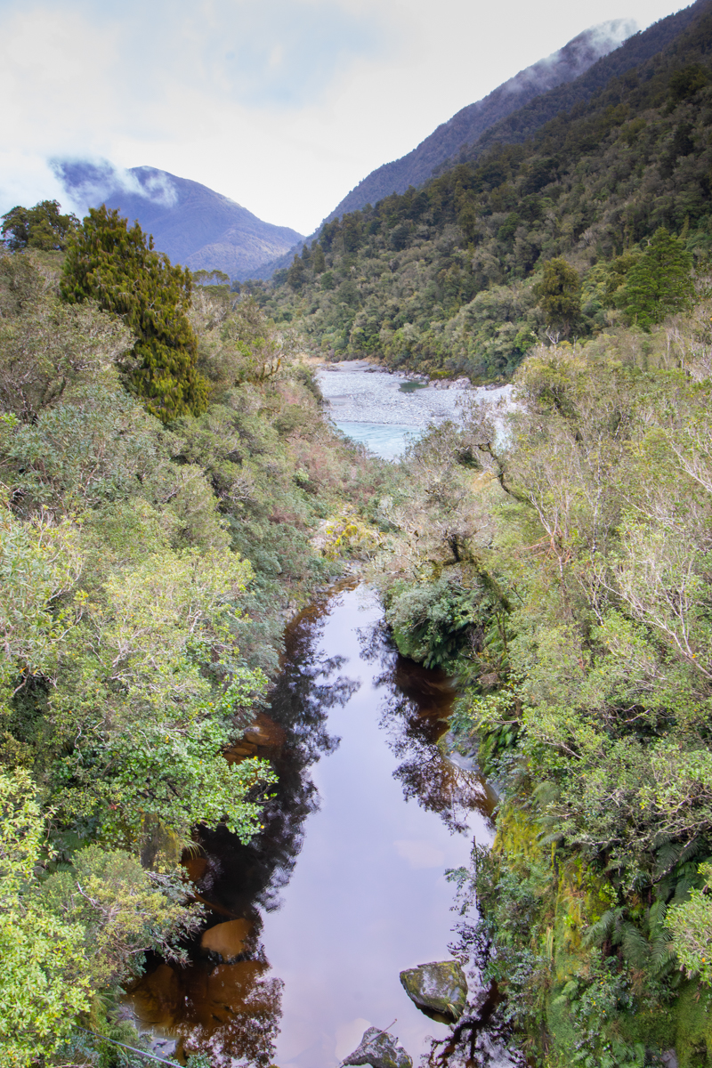
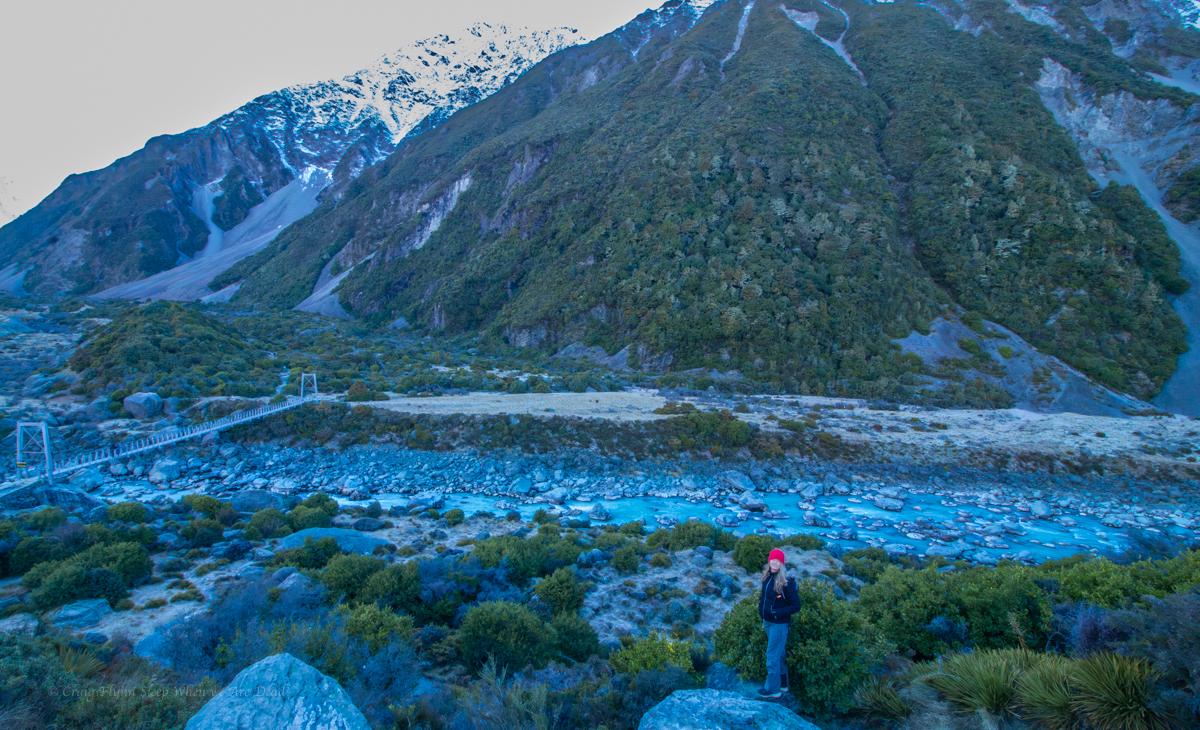
Back at the van we start heading back down the valley.

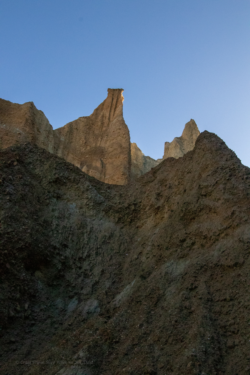
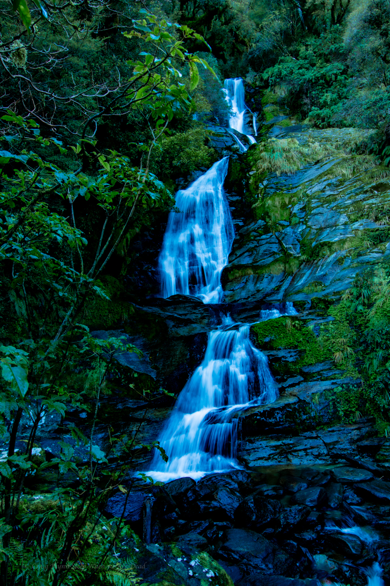
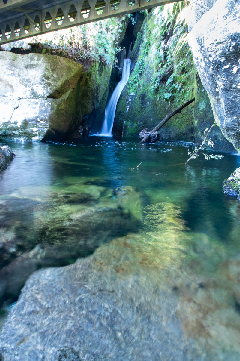
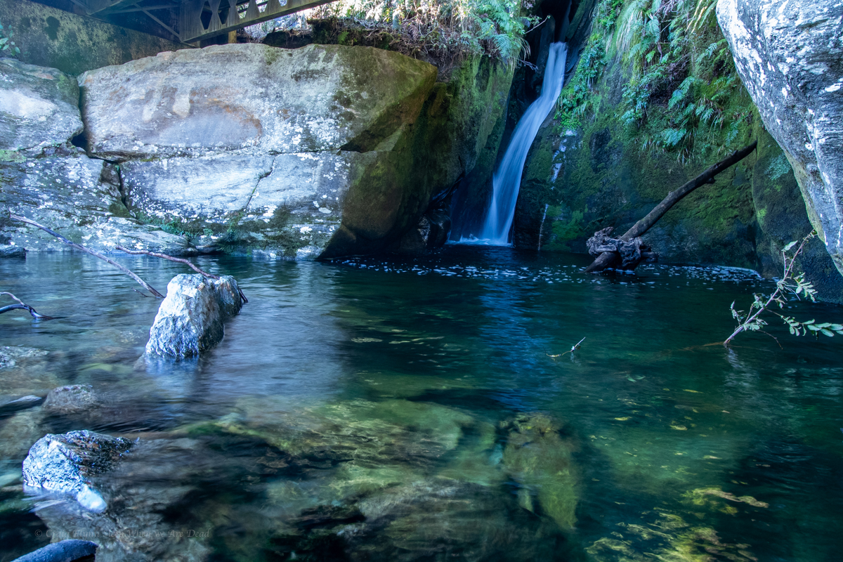
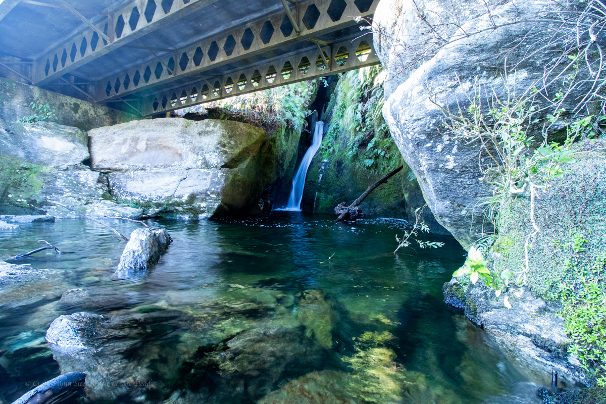
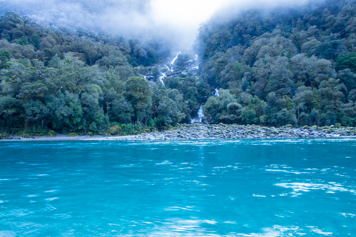
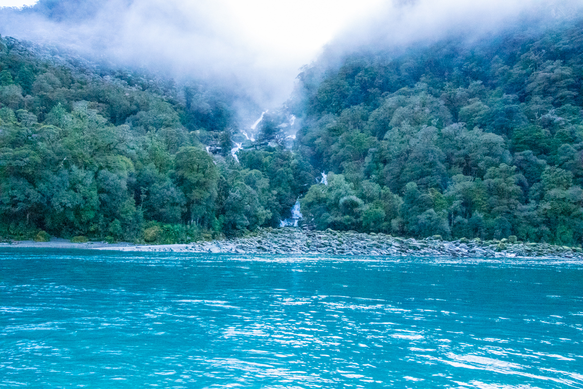
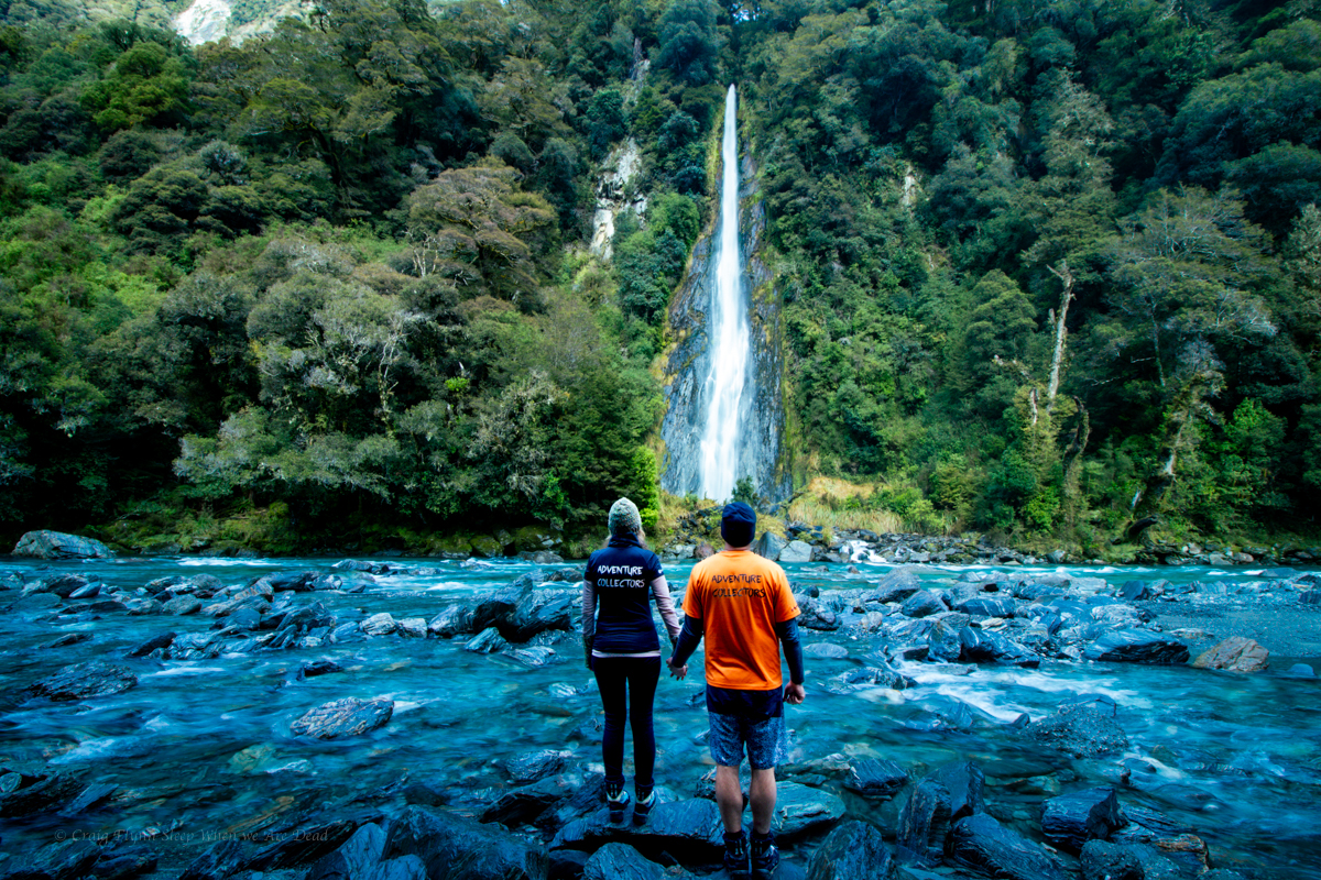
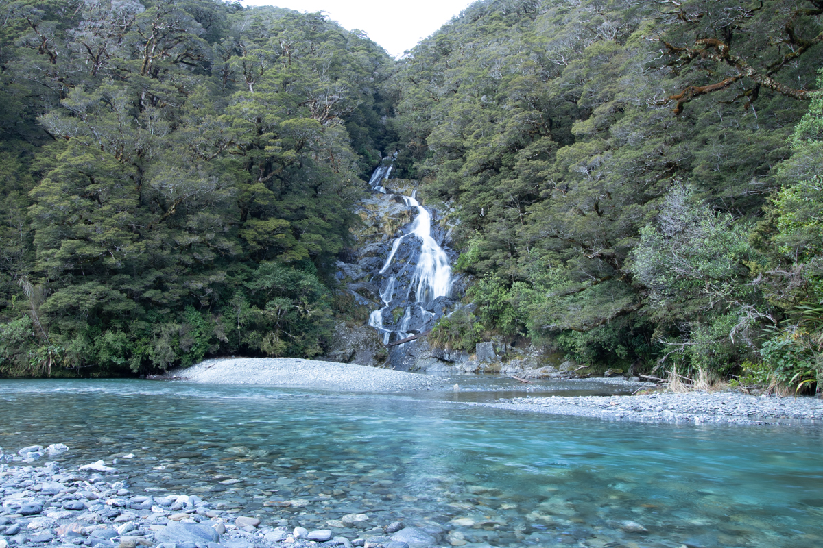
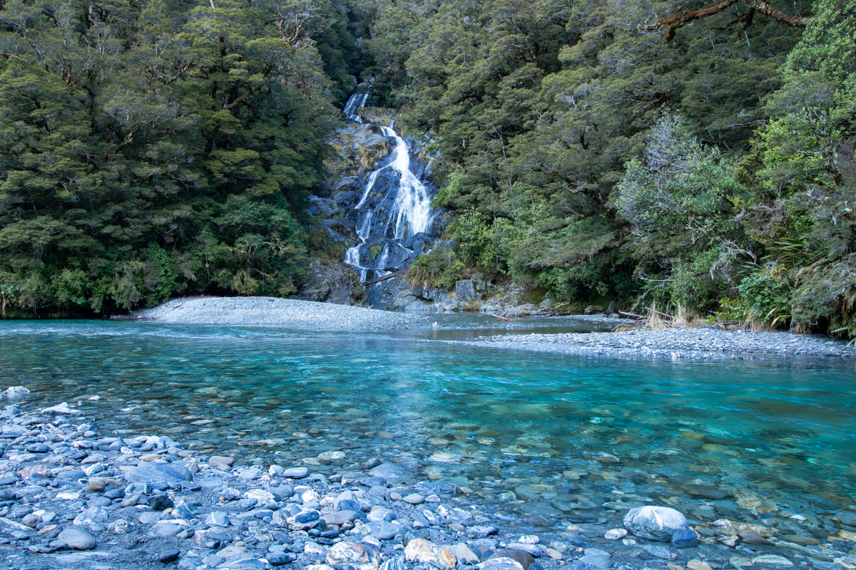
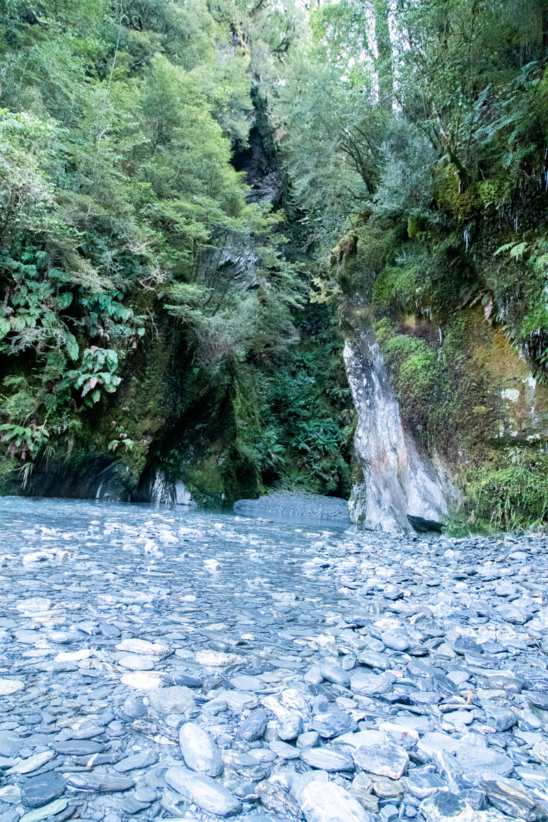
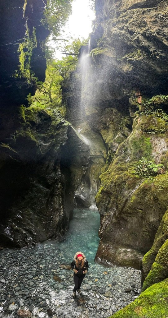
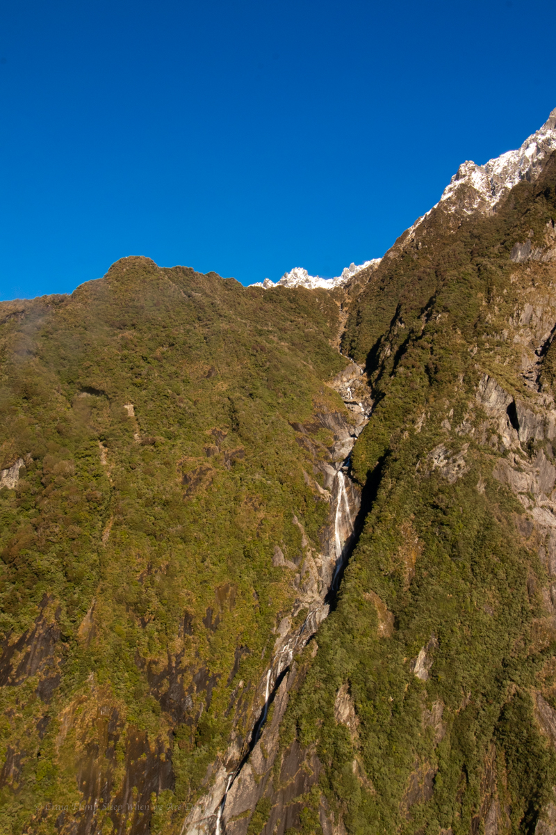
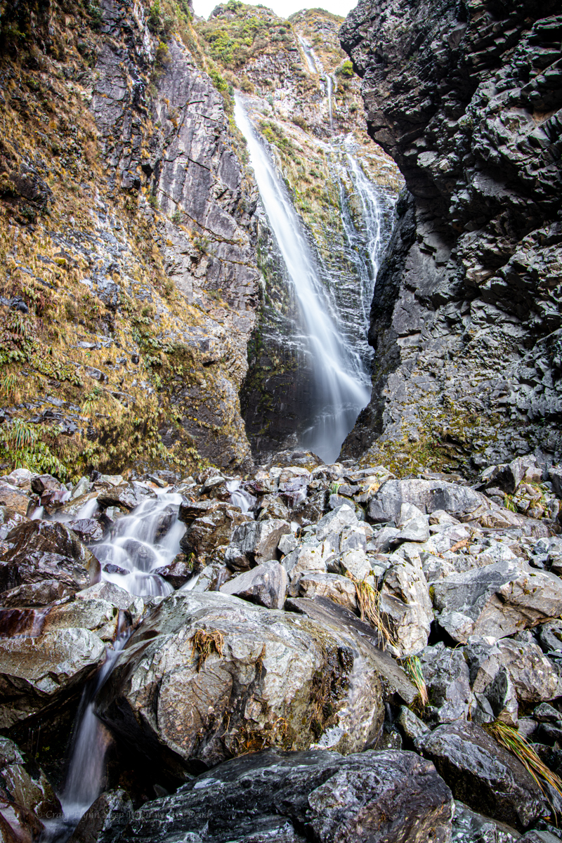
On the way in I’d caught a glimpse of Wakefield Falls. It caught my eye on the way back out.

Is that waterfall frozen?

Looks like it.

It’s difficult to come to terms with scale here. That waterfall tumbles 230 vertical meters.

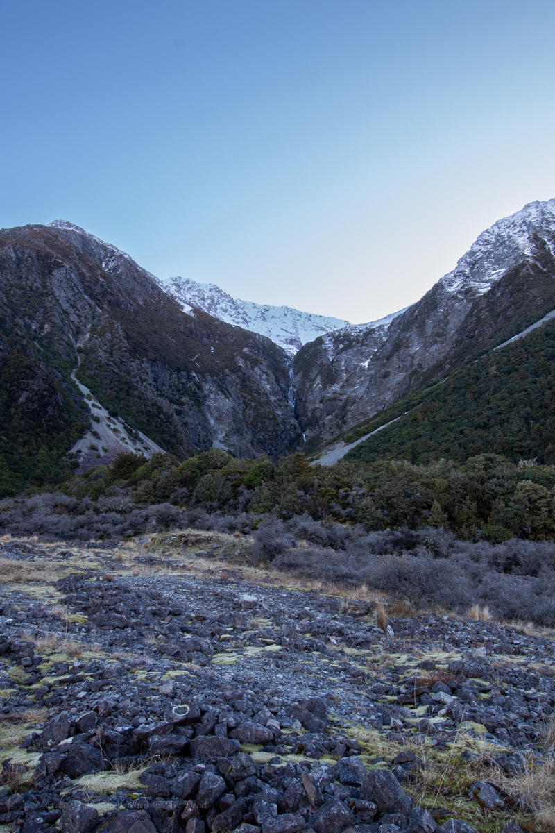
We pull over for a better look.

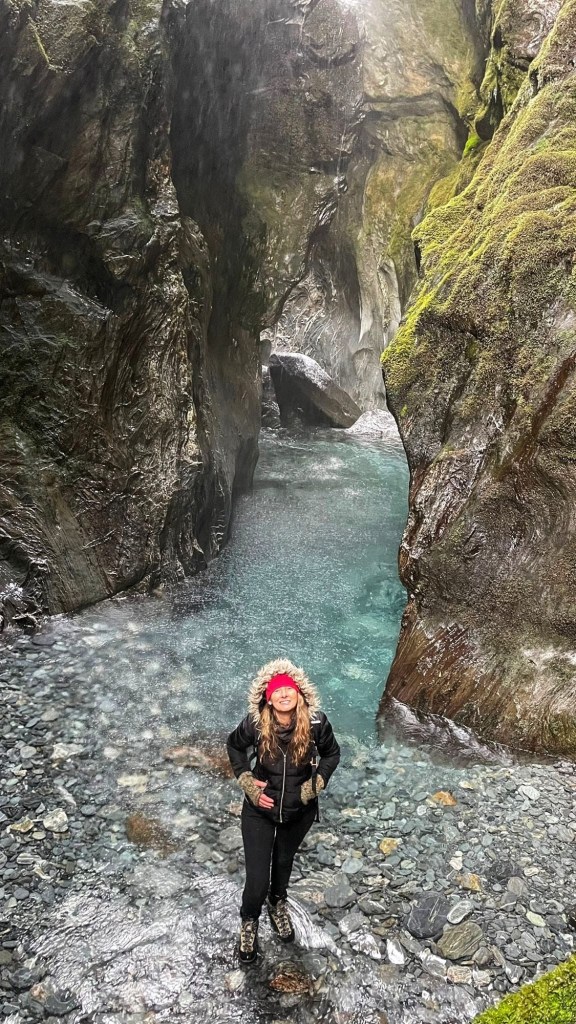
Na, it’s flowing. Looks like a cracker of a slot it’s tumbling into.

Should we go for a look.

hell yeah.

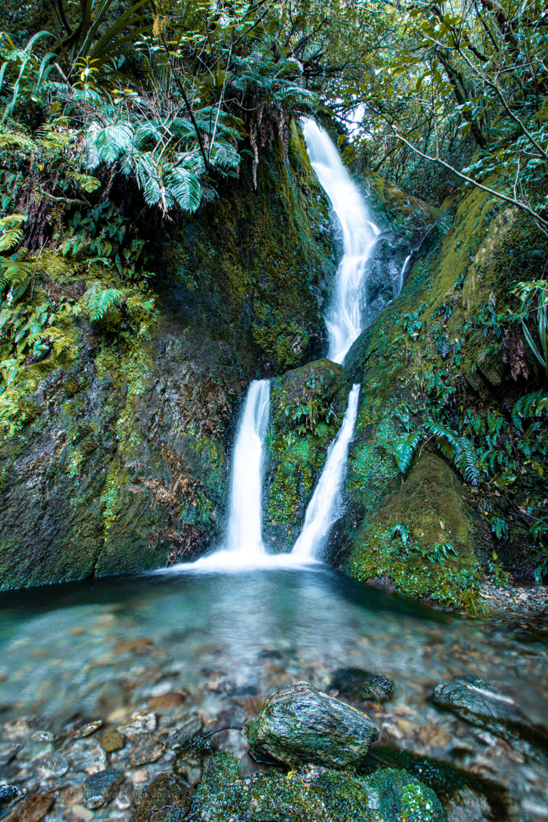
I grab the camera and off we go.

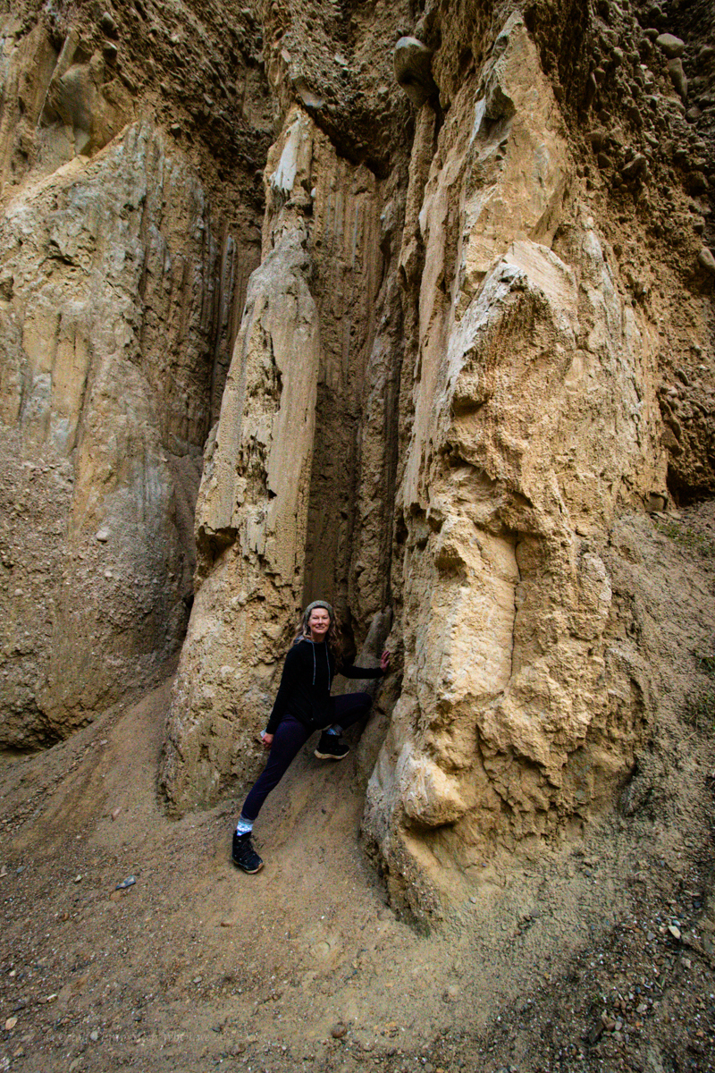
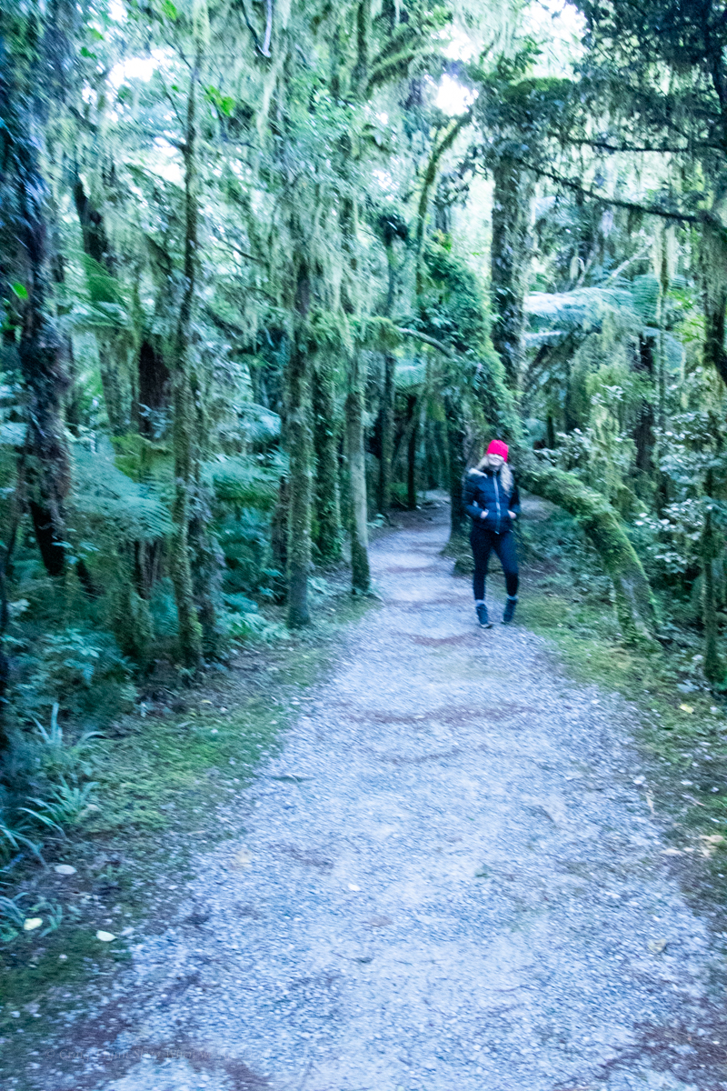
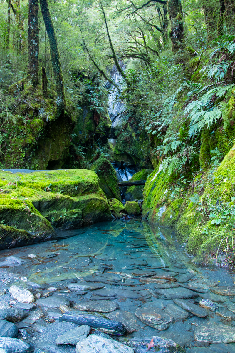
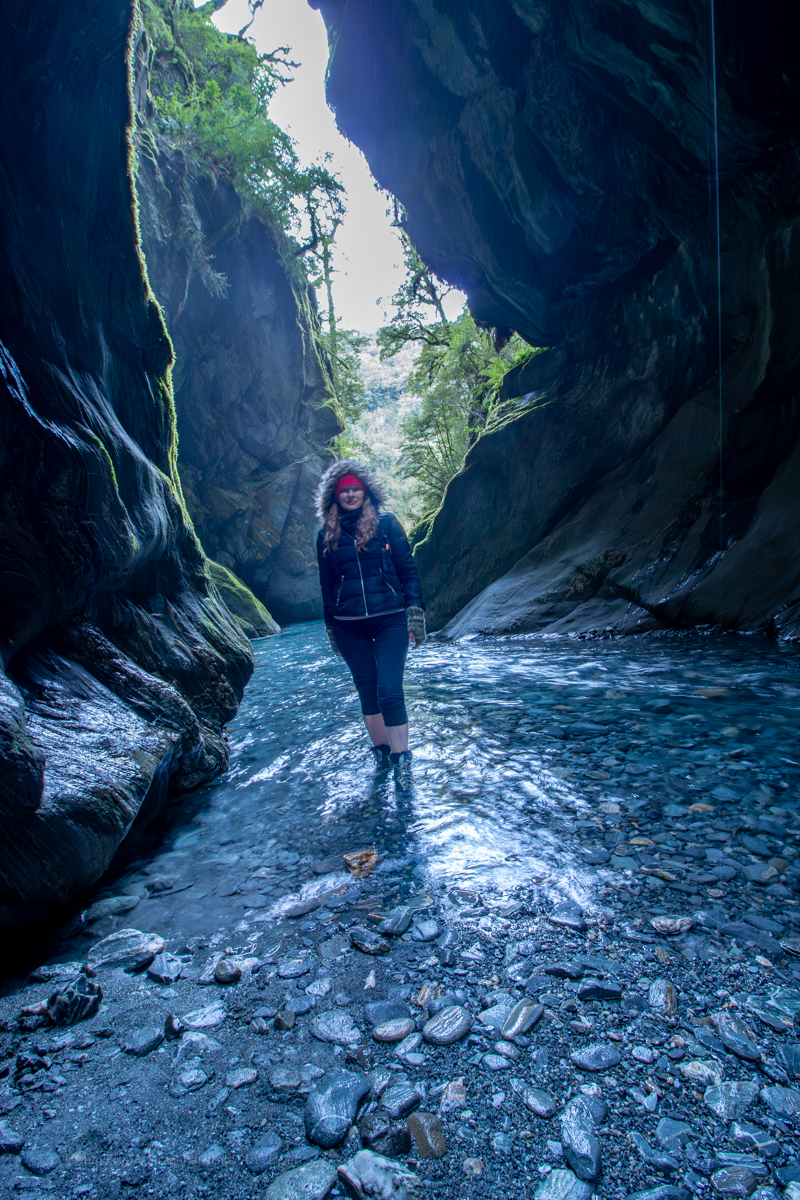
There is what appears to be a former tourist trail that comes and goes through the scrub and scree.

Did I mention it is hard to come to terms with scale here? It becomes apparent it’s further than it first looked.

Belatedly I realise in my excitement to get going I failed to grab my puffer jacket and beanie. This is how silly tourist get themselves on the news kids. Luckily not today though

Halfway up we meet to Russian(?) guys coming back down.

Did you get to the waterfall? ask we

Yes yes. Beautiful. Very careful. Very careful.

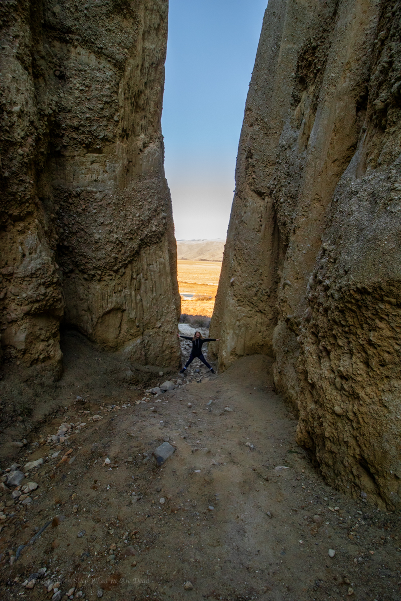
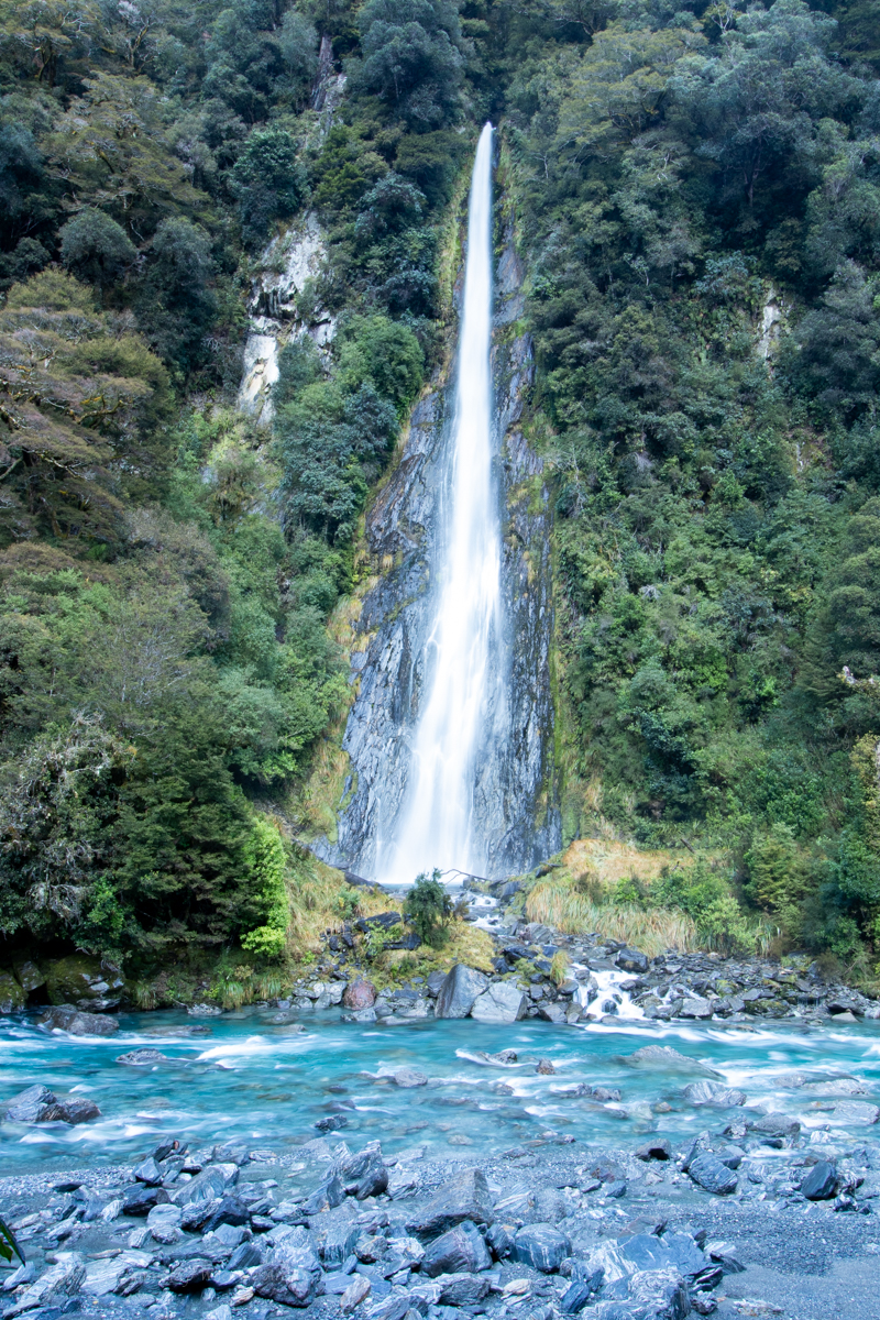
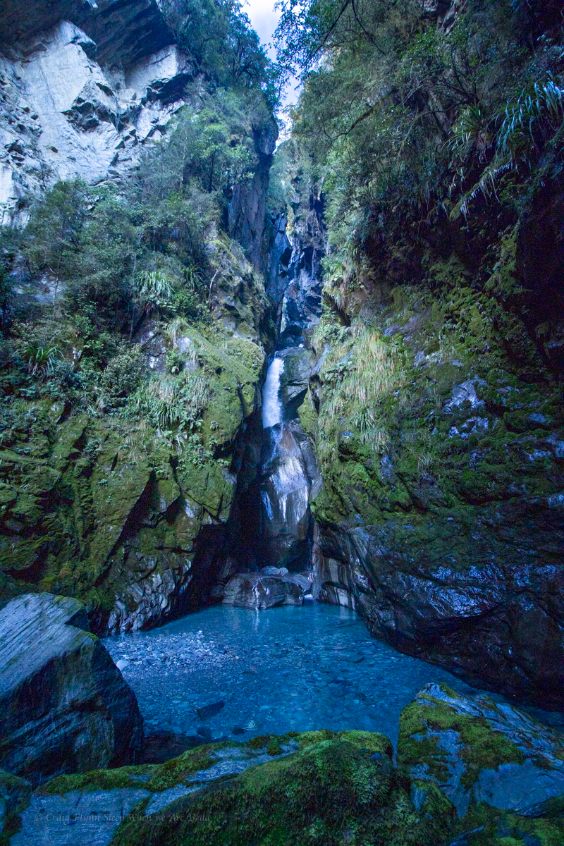
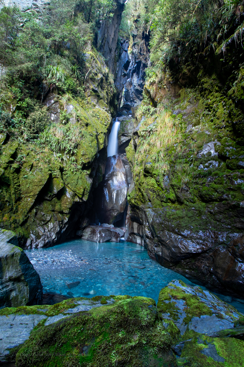
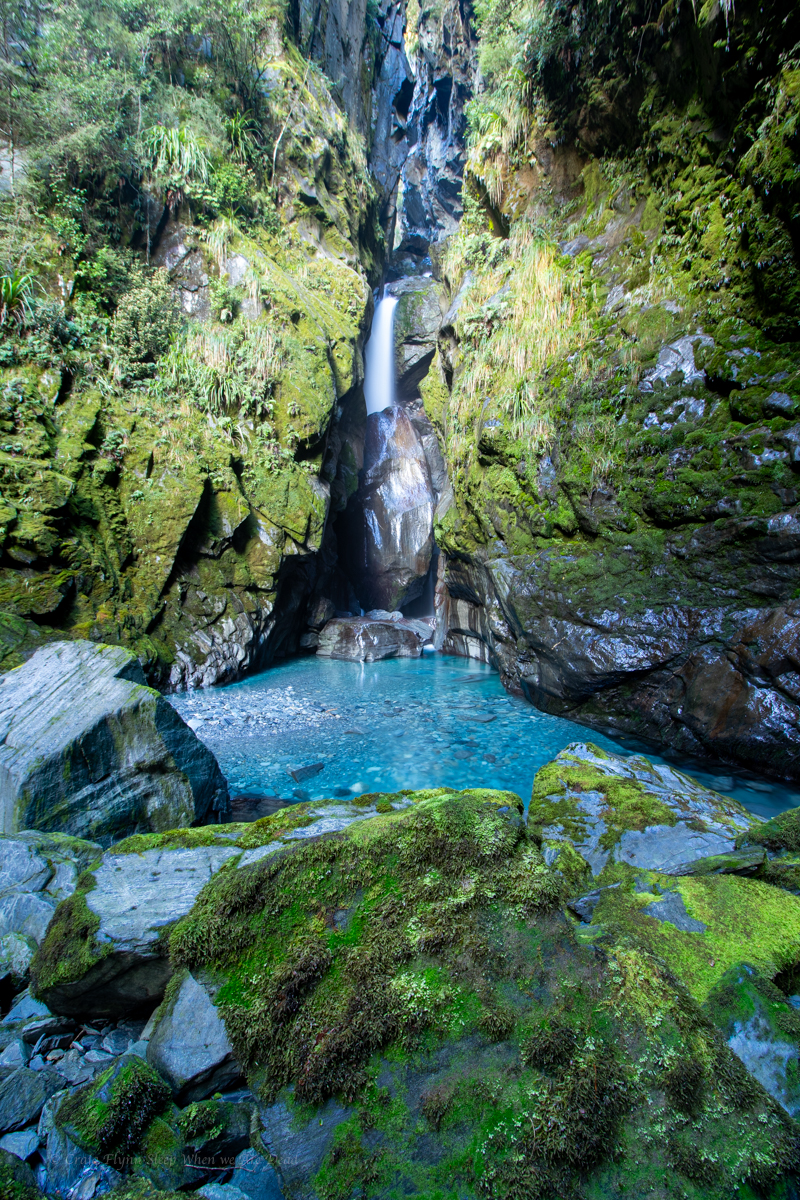
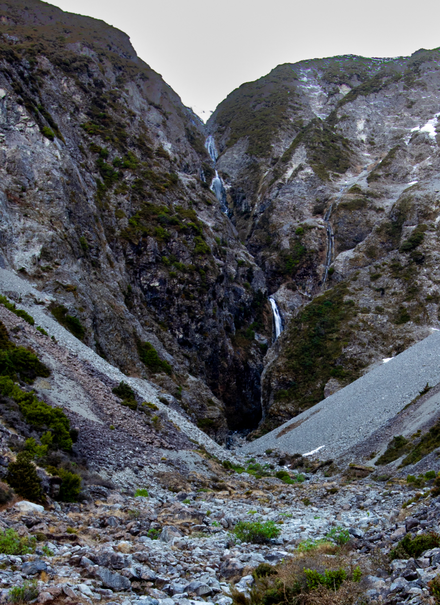
We push on. We reach the end of the flatter basin and the terrain gets steeper and looser. We had been yeeting up but slow here. A rolled ankle, rock fall or dislodging the scree here would be bad indeed.

There is still a fair way to go. Says Kylie. We should set a hard stop point.

Good idea.

It had been about 2:15pm when we left the van. We decide at 3:15 we need to turn around to get back prior to loosing the light.

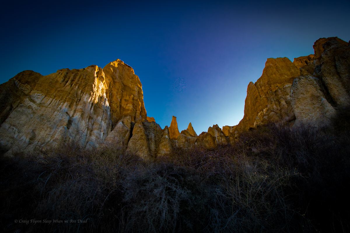
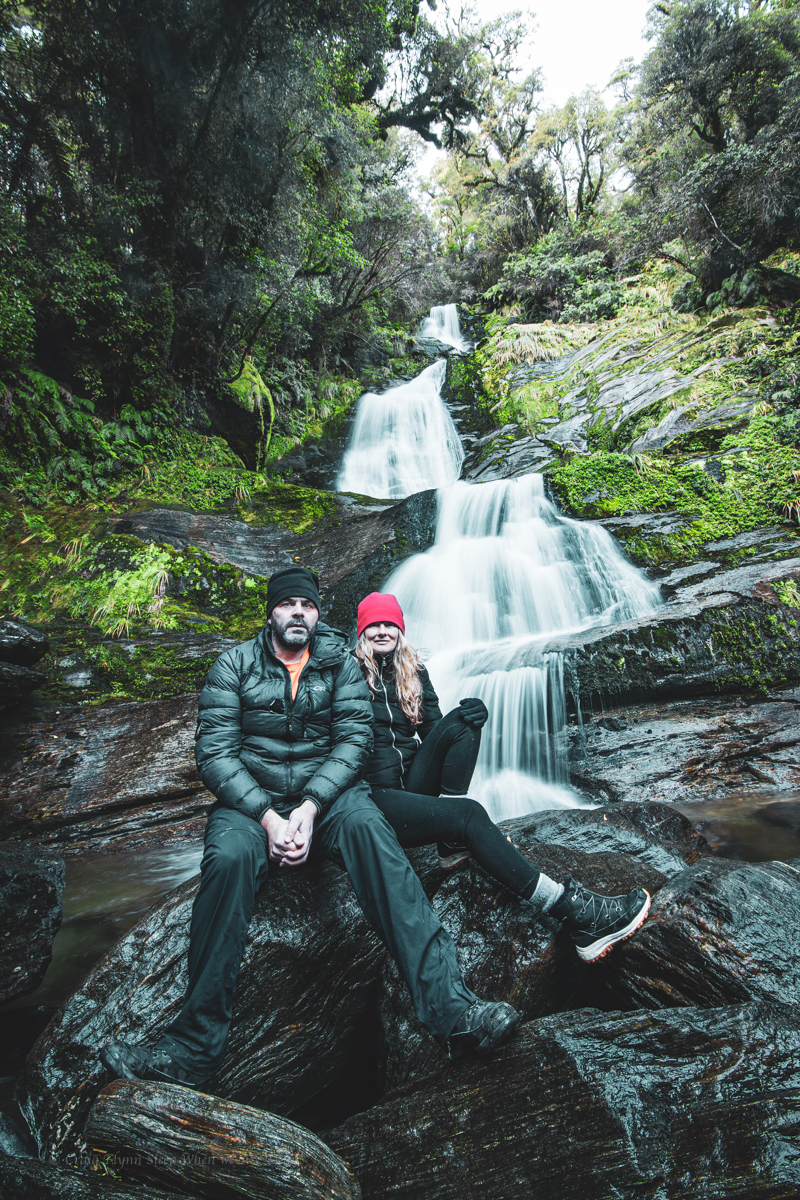
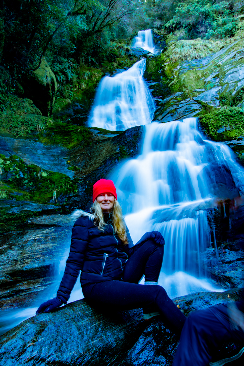
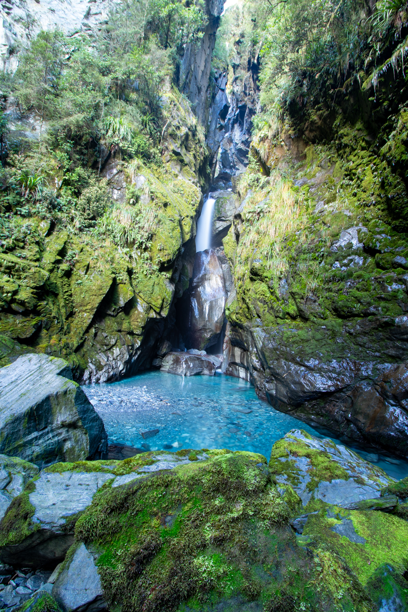
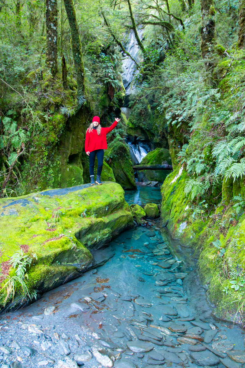
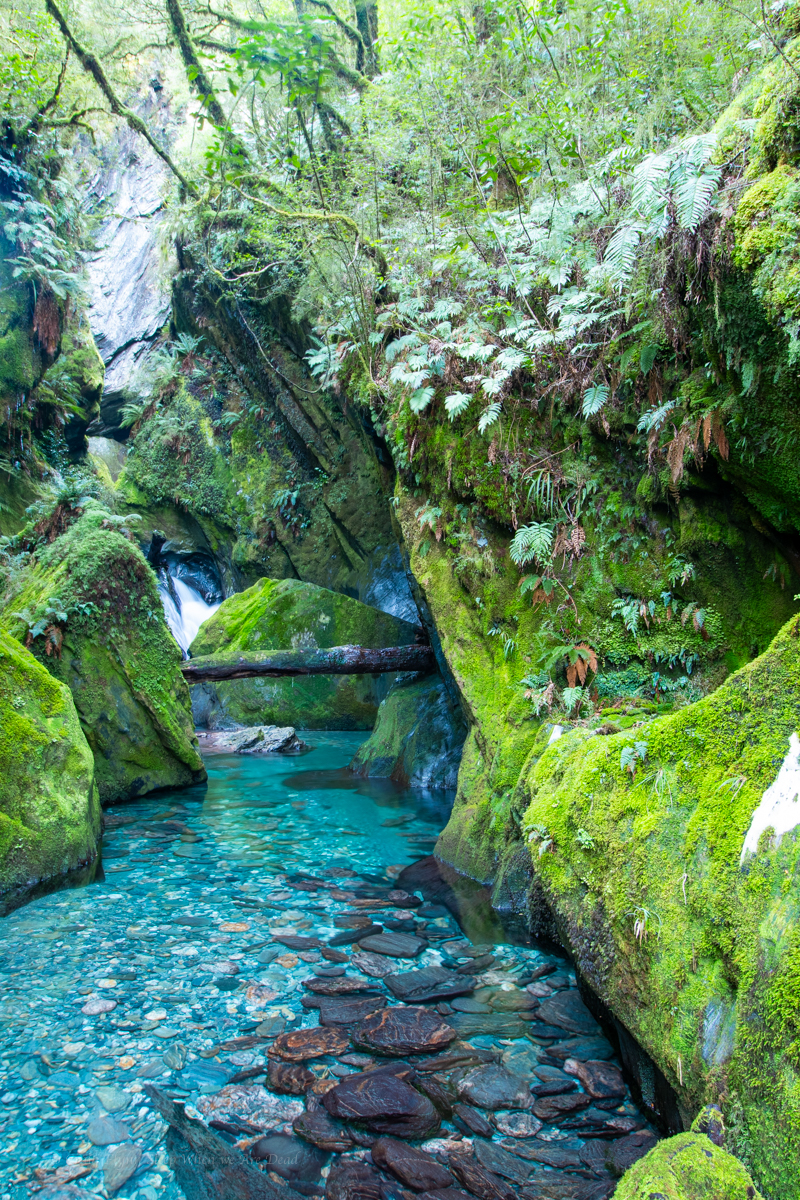
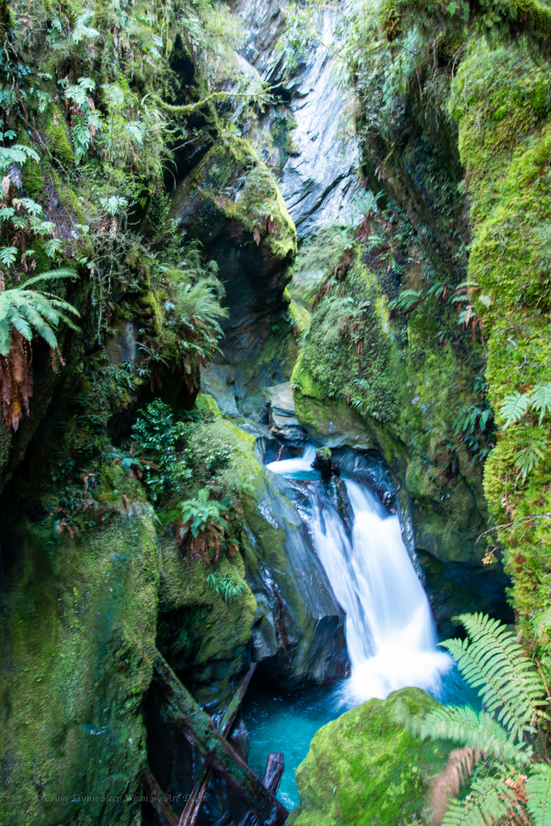
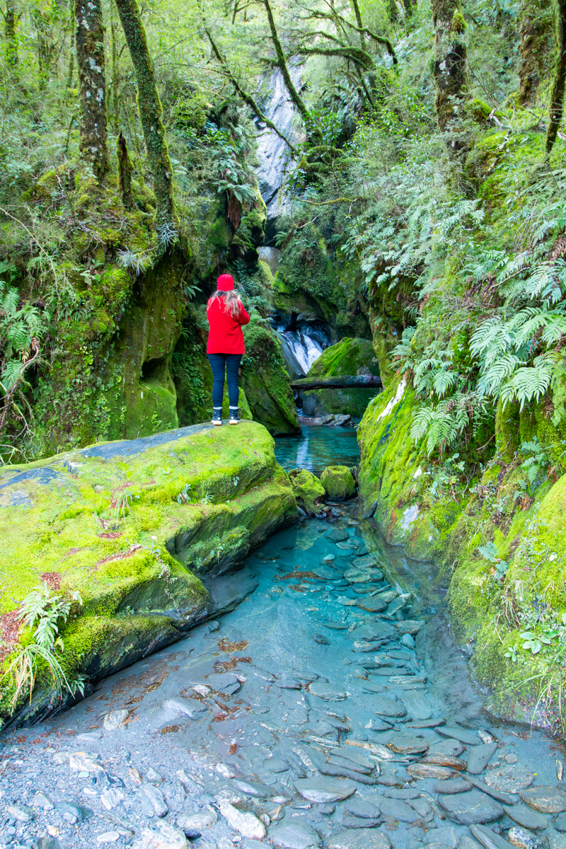
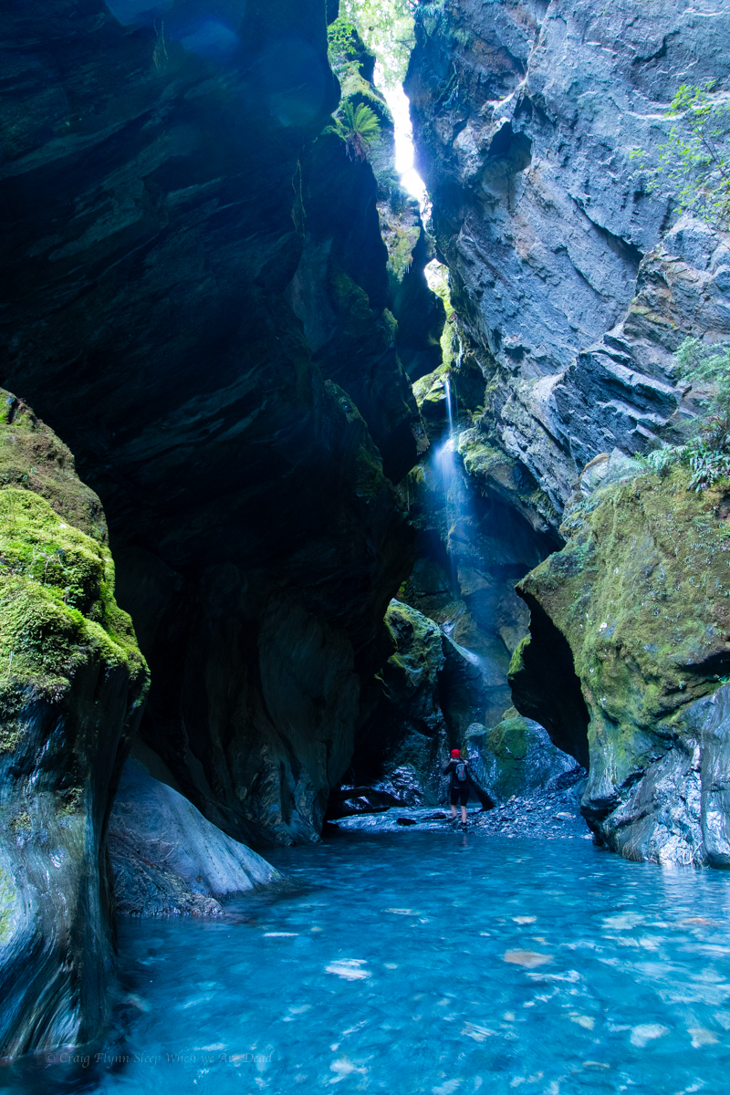
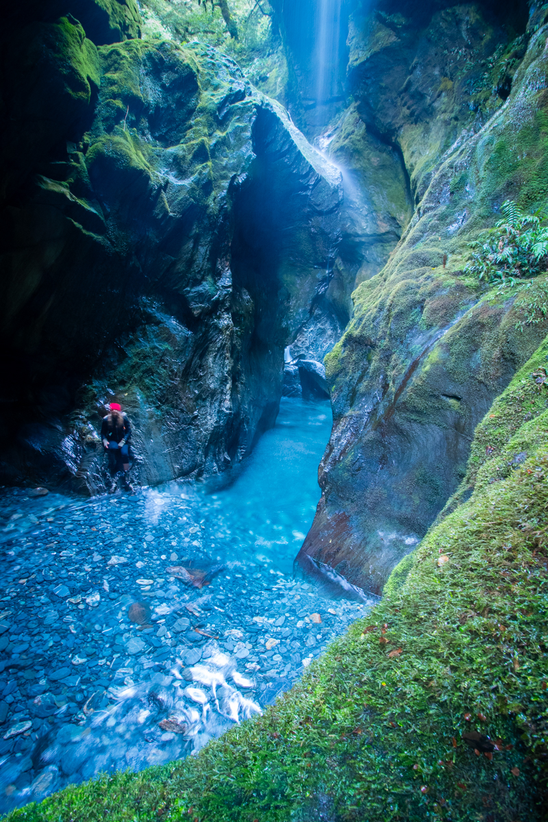
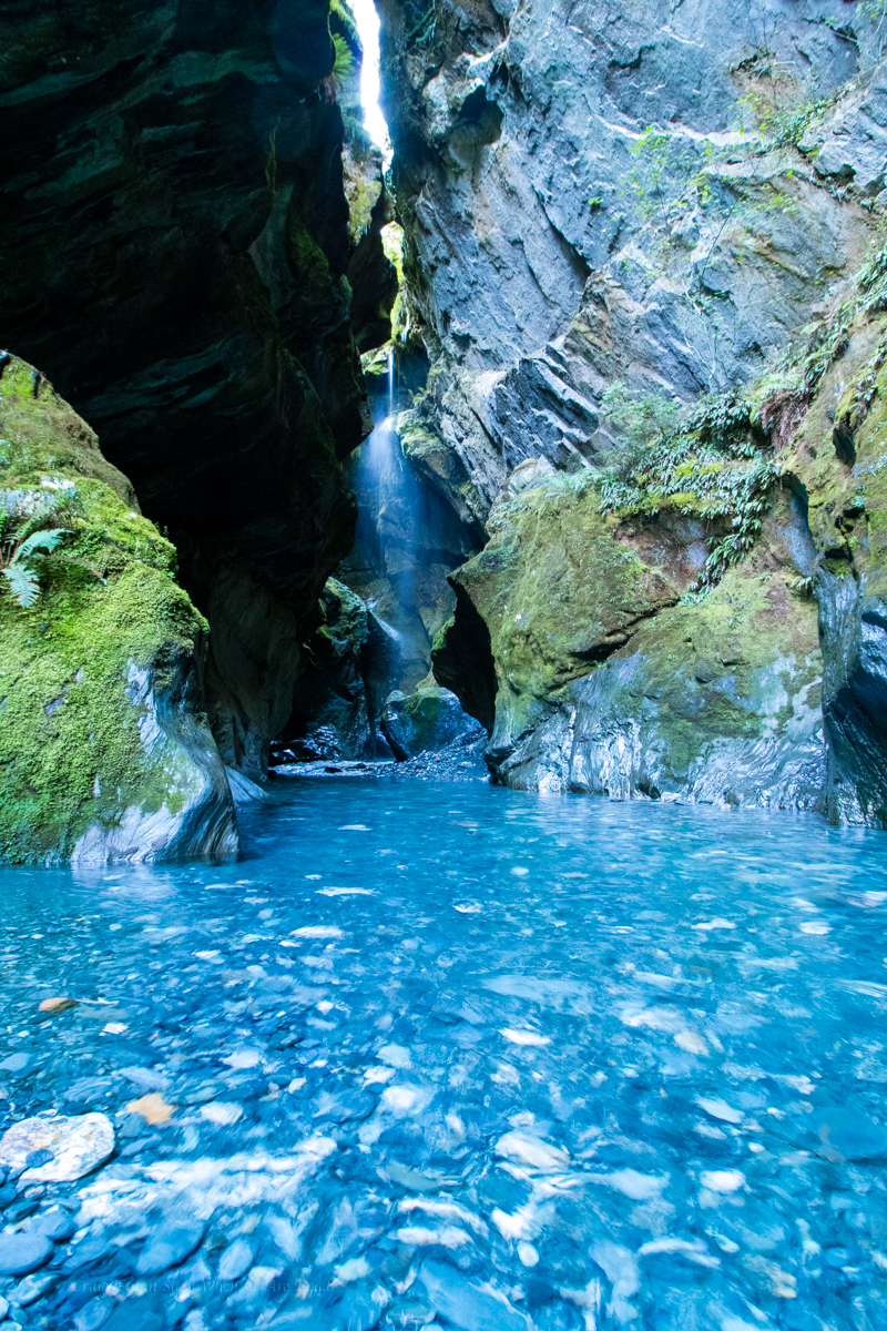
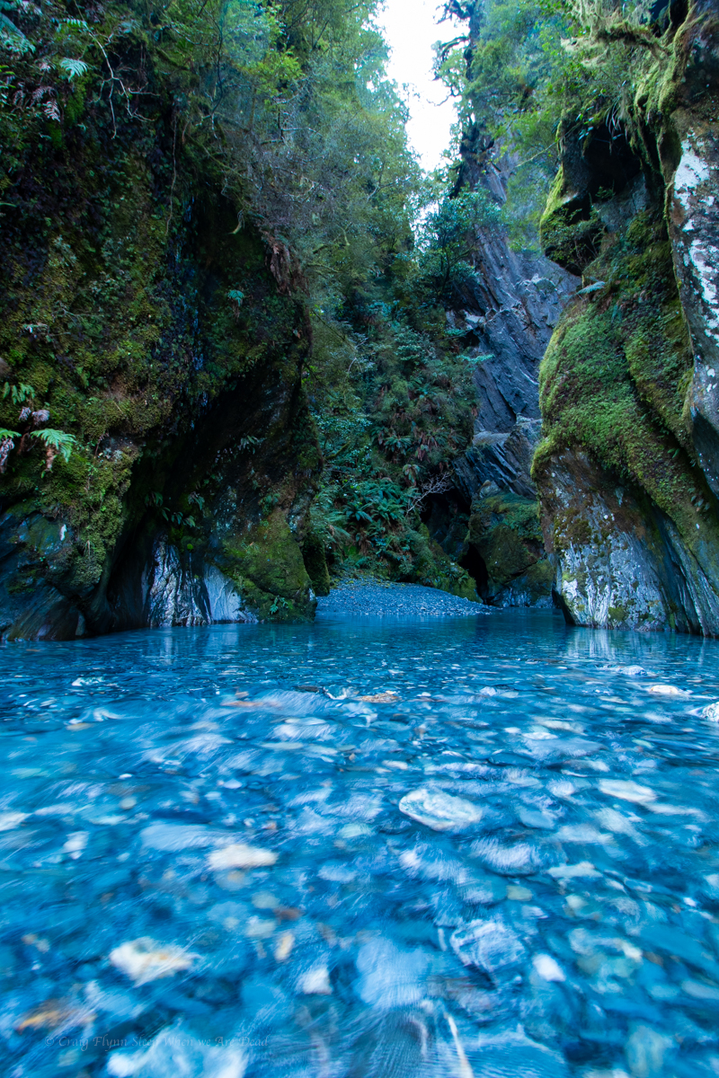
I think we gained about 200m of elevation from the road. A bit after 3pm we get to a point where we had a a reasonable view into the slot where 3 streams of the falls converge.

We are so close. Another 10-15min and we’d be at the base of the falls. but hard stops are hard stops and but I know by the time I get the camera set up and get some shot we’d be close to time so thats what we do.

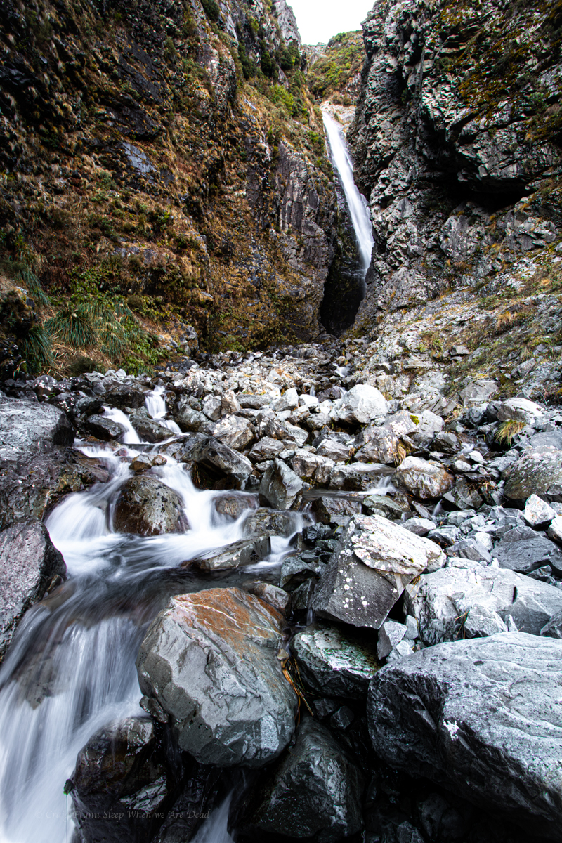
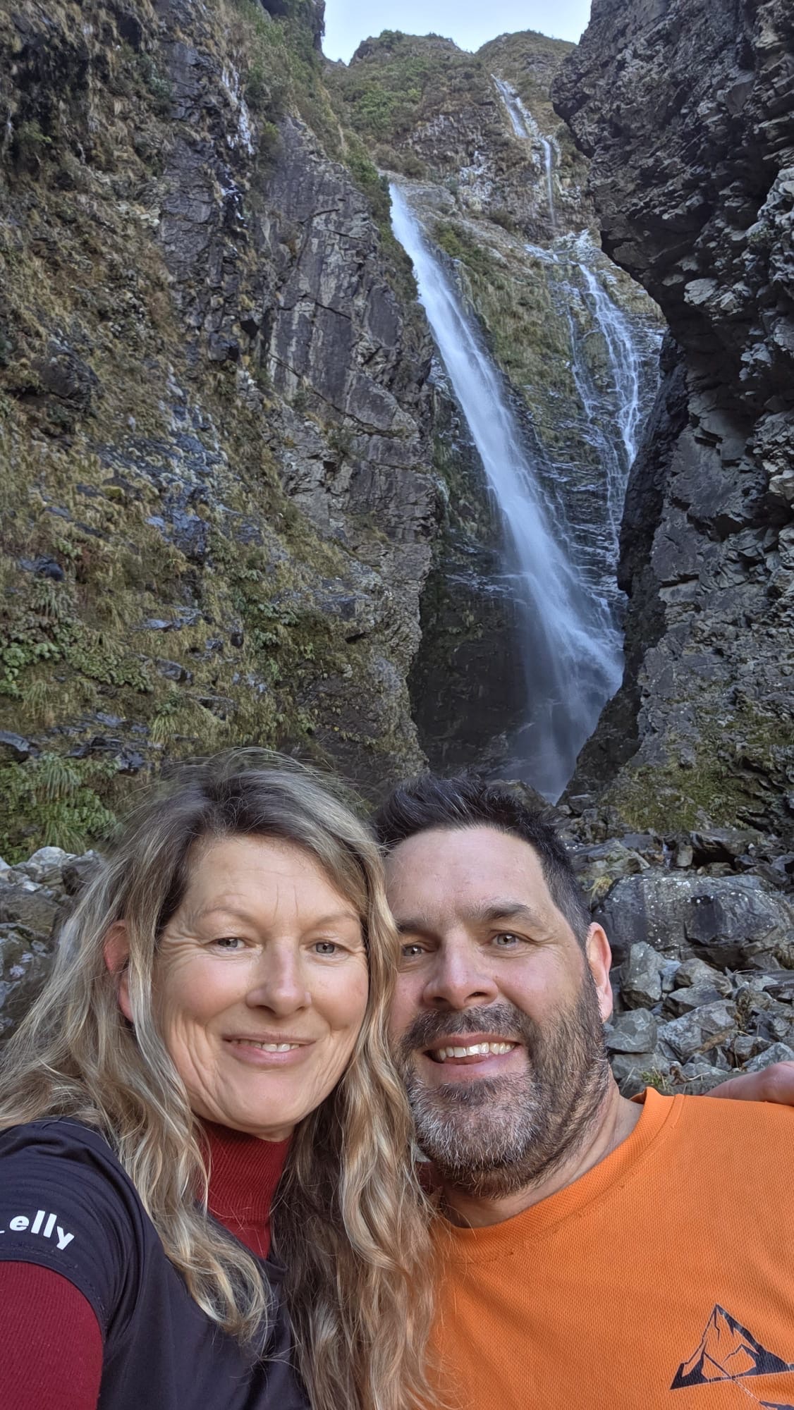
We get the shots and video in and scoot back down.

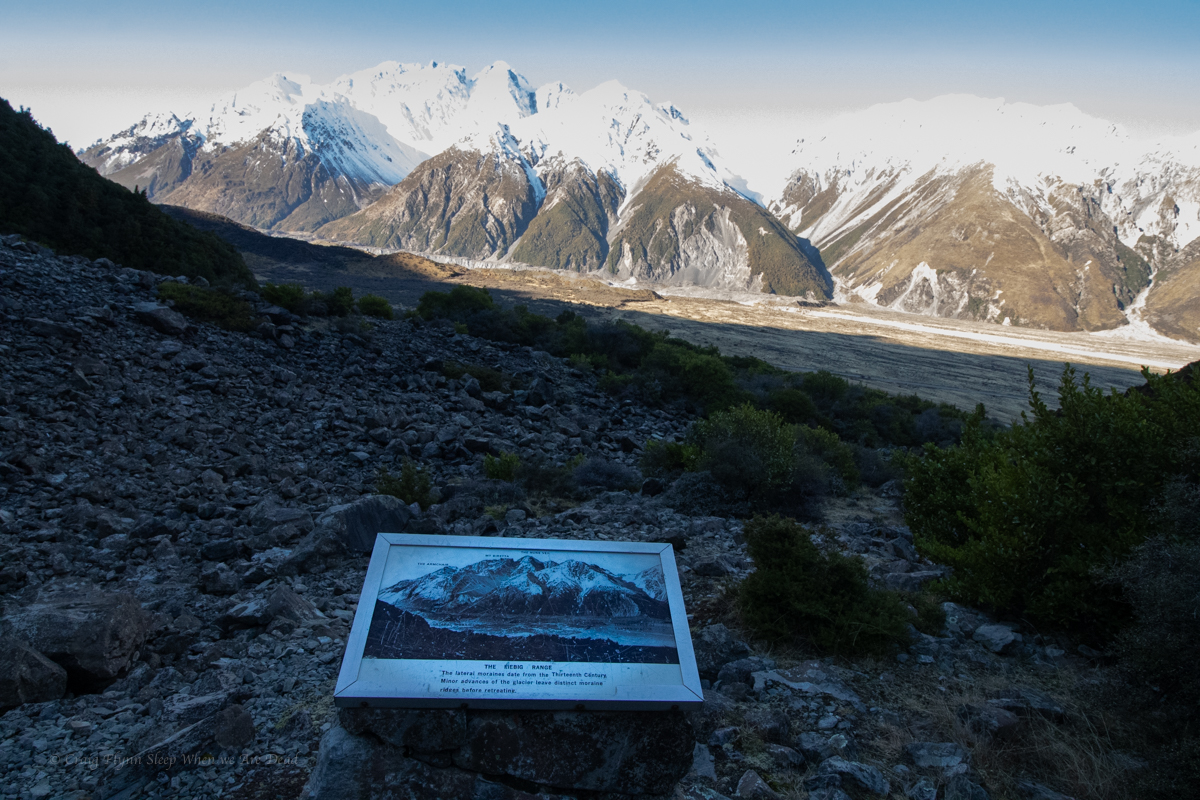
Part way down we come across this old information sign. Weird spot but I guess the old tourist track came up to this vantage point.

Explaining how the moraines pushed up by the glaciers formed dams in the rivers as the glacier retreated. or sumfink

Back at the van we chug down the road making for a freedom camp at lake Pukaki

New Zealand South Island Road Trip 2025 – Clay Cliffs

From Wanaka at the end of the Haast Pass we head up to Omarama for another geological wonder, the Clay Cliffs.

We miss timed it a bit and got there pretty much at noon which meant the contrasting light made photography difficult but hopefully the epicness of the landscape still came through.

The Omarama Clay Cliffs are on private land and there’s a honesty system donation to enter.

Formed from millions of years of sediment deposit at the bottom of a lake then uplifted and tilted, the Clay Cliffs are a classic example of what is termed “Badlands erosion”

They really are spectacular.

Kylie has a much better and more scientific explanation of these formations.

Here’s what she said

“I still remember the first time our lecturer brought us here and told us to “run wild and free” as he explained to us this magnificent example of tectonics in action. The Clay Cliffs are sedimentary deposits that were once the base of river bed. Due to the position of the Ostler Fault line under the South Island of New Zealand the river bed has been uplifted overtime and then eroded to form these strikingly alien planet like features.

New Zealand is an amazing country to see Earth in motion, similar to Iceland where tectonic forces are still very much at play building the landscape as we speak. Unlike Australia that is so ancient it only erodes now.

Anyway the Clay Cliffs are totally cool, I’m still finding new parts of it to explore every time I come back.”

Click to make the photo go biggish

After spending most of the afternoon here we jump in the van and make tracks up to Aoraki aka Mount Cook.

new Zealand South Island Road Trip 2025 – Waterfalls of Haast Pass

We’ve seen some amazing thing so far and the next adventure was one I was looking forward to.

We opted for a super early wake up at Bruce Bay and made our way down to Haast for breakfast and coffee. Today we would be driving the Haast Pass, in an of itself a great scenic drive but we were leaving ourselves plenty of time for exploring.

Haast Pass is home to some of the most popular canyons in New Zealand. It would be too cold to descend them this time but with the constrictions often ending in stunning waterfalls just off the road we planned to take most of the day exploring them.

Some of the waterfalls are sign posted tourist attractions, others you just need to keep an eye on the bridge names and find a place to park. We had several picked out that we wanted to check out but there were plenty more.

Note: The Haast river is known to have Didymo, an invasive fresh water algae also known as Rock Snot, so if you enter the river bed or water it’s important to Check Clean Dry shoes and gear before entering another waterway or traveling.

Anyhoo our first stop.

Depot Creek

A camping area on the right just after the bridge made a good spot to park and a trail headed off leading upstream. Less then 5min later we came to the 10m tiered Depot Creek Falls.

Click to see the full photos

Imp Grotto

When I say the canyons open with a waterfall near the road, Imp Grotto finishes right under the bridge. We had to park a little up the road and walk back but it’s a cool spot

Roaring Billy

Not far up the road Roaring Billy falls is a signposted tourist stop. A dedicated parking area gives access to a trail that takes you down to the Haast river for views across to Roaring Billy falls, it’s around a 30min round trip with a bit of time taking photos. Thou the mountain mist made getting a decent shot hard today

Douglas Falls

Another small waterfall right by the road

Thunder Falls

Thunder falls is signposted with a constructed tourist walk down to the stunning 30m waterfall

Pyke Creek

This one was a little harder to get to. Being directly fed from the Brewster Glacier the water is even colder. Kylie decided to sit this one out. I carefully made my way up stream on a rough track that at times traversed narrow ledges. Im handy in the outdoors and a good scrambler with a head for heights but this was at the limit of what I was willing to brave on my own in unfamiliar terrain so take care.

In summer you might be able to work your way up the creek itself but I’d imagine with ice melt the water flow would be treacherous as the canyon descent has rarely been repeated.

Fantail Falls

Another signposted waterfall with dedicated car park and walking track to views across the river towards the falls.

Robinson Creek

One of the more popular canyons in the area for which the bottom chamber is easy to get to

Wilsons Creek

The show case canyon in the area, Wilsons creek is spectacular and if you are willing to brave cold water and wet feet you can visit the last little bit just in off the road.

Other waterfalls within 5min walk of the road or visible from the road that we didn’t visit this time around include

  • Orman Falls (10m high)
  • Joes Creek Falls (150m High)
  • Gunboat Falls (150m High)
  • Diana Falls (15m High)

We decide if possible we’d spend a night at a van park to get a descent shower and stuff. A quick google search revealed Mt Aspiring Holiday Park to be cheap as chips and referenced something about a hot hub.

Calling ahead the lovely Erin assured me they had plenty of spots and if we could get there by 6:30 we could book the last allocation for the hottub.

How mush is it said /i

$10 each for 25 minutes. Says she

Book us in said I.

We got there around 5 and Erin informs me she’d given us their best non-powered site. She wasn’t wrong, close the kitchen and amenities while not too close but better it gave an amazing view out the back of the van to the snow capped mountains reflected off the lake.

No only that but she also said no one had booked the 6pm spa spot and she was keen to leave early so if we wanted to pick up the key to the spa at 6 it was ours for the night, just put the key in the safe when we finished. Winning.

But wait, there’s more!

Um, I saw a sign for a drying room how much is it to use that?

What gear do you have?

Just some old boots, we were in the Haast and have done the check and clean and gave them a good scrub but it would be good to get them dry.

Oh yeah of course, no charge. Leave them outside the door and when I get a chance I’ll pop over turn the heating on and put them in for you.

I like Erin.

So that’s an unpowered van site, pretty much unlimited use of the hot tub (TBH we were tired and hungry so only took the 30mins anyway but still.) and they turned the ski gear drying room on all night just for us for a grand total of $68NZ.

We do a nice diner in the kitchen, get a good night sleep and then head to the Clay Cliffs of Omarama

New Zealand South Island road trip 2025 – Bruce bay

On a massive high from Franz Josef Glacier we take a tip from Maya and head for Bruce Bay to find a camp for the night.

Maya explained not only was it a great freedom camp but in local Maori legend, Bruce Bay was where the semi mythical Māui first landed in New Zealand.

To gain land Māui had to kill the two Taniwah that guarded the bay. The name of the headland at the western end of the bay, Heretaniwha means “to tie up the monster”).

Archaeological evidence points to human occupation back to the 14th century and mind boggling in modern times Maya’s family farm has been there from the start….

Anyhoo it was a great spot to finally catch a west coast sunset.

And with the sunset the clouds dispersed and I took the opportunity of dark sky and milky ways.

But we didn’t stay up too late as we wanted an early start the next day to explore the waterfalls of Haast Pass.

New Zealand Road Trip 2025 – Franz Josef Glacier

From Hokitika it was an early start to drive down for our next adventure.

When planning our itinerary Kylie had mentioned a walk up towards the base of a glacier she had previously done and loved and while we had been trying to keep it a low cost holiday we had also been tossing up splurging on helicopter tour.

I remembered my old mate and mentor, Rusty (RIP) having done a heli/hike tour onto a glacier and raving about it.

If we do the helicopter I’d love a snow or glacier landing, Say I.

That’s a great idea Kylie replies.

We begin looking into options trying to decide what would fit our wants and itinerary. Franz Josef Glacier Guides started looming large as the front runner.

This is the one part of our holiday where we decided to dam the expense and splash a bit of cash on. IMO it was worth every cent.

Just driving into town is mind-blowing as we get our first close encounter with the snowcapped peaks while walking down streets lined with giant fern trees.

While FJGG supply all the outer layers to keep their clients warm they were more than happy for us to use our own gear (after confirming that it was suitable).

Our guide, Maya, was informative, funny and chill as she took us through the safety talk. That’s worst case, says she. It won’t happen today… I hope. Na, it won’t happen.

Suitably prepared we leave town via a lovely walk through the rain forest to the helipad. The group would be split into 2. And our group were first up with Maya joining us and our chopper pilot Matt giving great commentary along the way.

We had been assigned seating and Kylie had jagged a front seat, allowing her to capture some amazing videos.

Even with Matt’s commentary it was hard to come to grips with the scale of this place. It wasn’t until we were down and looking back to the following helicopter that was just a tiny speck against the mountainous back drop that it started sinking in.

Once both groups were on the ice Maya guided us on a 2.5hr loop around the glacier with lots of facts, anecdotes, and Maori legends thrown in.

Kylie was in her element, engaging in her specialities of climate science, glacial processes, and paleo-river systems. Her smile was beaming and her eyes sparkling.

It was a great experience and I’d highly recommend it.

We had jagged a perfect bluebird day. Summer is their peak season but a clear winter’s day is the perfect time to visit.

Anyhoo, we took about a thousand photos between us. Here are some of my favourite ones of mine.

Click to expand

Would 100% do it again

And on an absolute high from this we cruise down to Bruce Bay for camp

Exploring Glaciers at Lunch followed by sunsets on the beach for diner.

It was a bit surreal

New Zealand South Island Road trip 2025- Hokitika Sunset point and glowworms

From Hokitika Gorge we slip back into town and head to Sunset point for diner in the van.

I’d never seen the sunset over the ocean before, Unfortunately the cloud cover closed in an all but blocked it out.

Not to be discouraged I thought I’d try my hand at some more arty farty photos at the memorial and art works.

Driving into town I’d spotted a sign post for glowworms.

I know we had just done the most amazing cave tour but I’ve said it before and I’ll say it again, I will never not be awestruck by glowworms.

Lucky Kylie shares my fascination with the little shiny slugs with their little glowy bums.

If a cave tour sounds a bit too strenuous or clautrophobic for you I have some good news.

The Hokitika Glowworm dell is literally (Literally babes) 50m off the main highway in a shady, fern filled gully. A concrete path leads you in.

Tip: either use a red light (even a bit of coloured cellophane or contact over your torch) or hold onto the hand rails turn your torch off and let your eyes adjust.

From here it was on to a highlight in a long list of highlights from this trip Franz Josef Glacier

New Zealand South Island road trip 2025. Part 2. Pancake rocks

Continuing on from Charleston we chug on down the coast calling in to the unsign-posted and little heralded Hatter Bay,

Then another beach

and the push on to Punakaiki to check out the famous Pancake rocks.

We arrived late afternoon in drizzling rain but made a dash around the short circuit walk, before camping nearby and coming back the next morning in what we thought would be “better light”. TBH the rainy afternoon photos picked up the contrasts and colours much better.

We then drive through to Hokitika gorge

New Zealand South Island road trip 2025. The launch

New Zealand is a mountain bike and canyoning Mecca so it might come as a surprise that

  1. I hadn’t been before
  2. On my first trip there I had no intention of doing either
  3. We also wouldn’t be heading to either Queenstown or Milford Sound

Kylie and I had been talking about a New Zealand winter road trip for a while and when the stars aligned where we both had time and opportunity we leapt at it.

We had 10 days to smash out a road trip where we’d nerd out on geology and climate, this meant some of the more well known spots got dropped off.

We also wanted to do it on the cheap so if you want to know where we went and what we saw stay tuned, I’ve got about 2000 photos yet to edit and cull so I’ll post them as I go in a little series over the coming days or weeks or whatever.

Anyhoo we flew into Christchurch at some ungodly hour and got a ride to North South Holiday Park where we had arranged a late check in. It was about 1am when we pick up the keys from the key safe and make our way over to the cabin.

Um didn’t we get a double? asked I as I open the door.

Yes says Kylie.

I’d walked into the wrong cabin…. Opsie

Finding the right cabin we settle in. We’d picked a basic cabin, it was basically just big enough for the bed, a bar fridge and a counter top. But considering we just needed somewhere to sleep for a few hours it was perfect. and surprisingly comfy.

And for $54NZD, which included a courtesy bus into town the next day, we couldn’t go wrong.

Next morning we get dropped off at Tui Campers. One of the reasons for flying into Christchurch was the amazing deals Tui do on their camper vans.

And all set up in a Ford Transit van we hit the road for the West Coast via the Lewis Pass. Destination Cape Foulwind, where we’d camp the night in a cosy little Freedom Camp.

Freedom camping in NZ has gone through a little change recently and now to do it legally in most places you need a certified self contained camper. Thus the Transit camper.

Now on the west coast it was time to take in the sights and sounds.

Our first stop was Charlestown for a river rafting tour with Underworld Adventures. Kylie had done this one before and raved about it as a must do.

Look, my home town of Lithgow famously boasts the Glowworm tunnels and the canyons and caves of the Blue Mountains host them by the thousands but this tour was something else.

After suiting up the trip started with trip on a funky little petrol engined train.

Toot toot!!!

©Jess the wonder guide
Codi, the big Canadian was over the moon that we rang the previous day to book as there’s a minimum of 2 for the trip to go ahead and until we rang he was told it wouldn’t be offered. ©Kylie

All Photos from the cave are ©Kylie unless stated otherwise as the second half activities meant I didn’t take my camera.

At the end of the train line we pick up our tractor tubes and walk up through the rain forest to the start of the Metro Cave.

we start in the upper level of the cave and are treated to some great limestone formations
Interestingly the little fella trapped in the stalactite is a fungus gnat. ‘Fungus gnat’ doesn’t sound real sexy but this is the adult that gives birth to the glowworms. As an adult they don’t have a digestive system. they just fly around mating wildly for a couple of days and die.
Our guide, Jess giving us the run down of this cool formation
the cave also contained some nice concretions. This one looks to have formed around a crab claw

The cave is quite extensive and we explore passageways and crawl-throughs before making our way down to the next level

The second level is a little wetter and I shine my light through a piece of broken limestone under a waterfall.

The second level is where we find the first of the glowworm displays. The following photos are promos from Underworld Adventures. Click to Enbiggen.

The Glowworms here are Arachnocampa Luminosa close cousins to the ones in the Blue Mountains, Arachnoocampa Richardsae. Arachno means spider like, due to the silky stands they use to catch pray. Campa refers to them setting up a little hammock and wait for food to come to them. Luminosa refers to the fact they are Harry Potter Fans.

Next we descend to the 3 level which is where we find the river and mount our tubes.

It had rained for a week prior to our visit, the river was up but Jess was hyped.

Due to needing to paddle and hold on and stuff we couldn’t really get any photos of this section, let me just say it is mind blowing. You alternate from easy floating under a cavern of glowworms to quicker sections where it’s important to avoid being pushed into the undercuts.

It was hella fun

And then we reach the end of the cave.

©Jess the wonder guide

But the fun isn’t over. We head out to where the Ananui creek meets the mighty Nile River, Waitakere. From here it’s hold on tight for a fun ride down some mild rapids back to the train.

Would recommend this to anyone, it’s a great trip. The cave system is quite extensive so there are drier options but even midwinter the thick wetsuits hold off the worst of the cold.

Continued on (and I’ll try to be less wordy and more photoey)