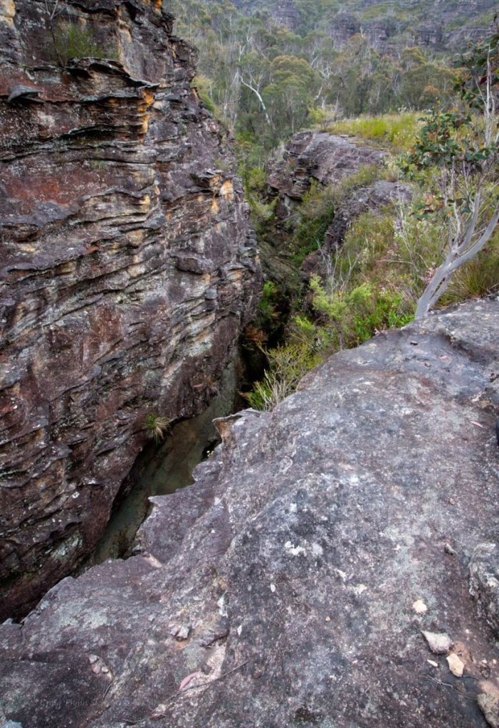
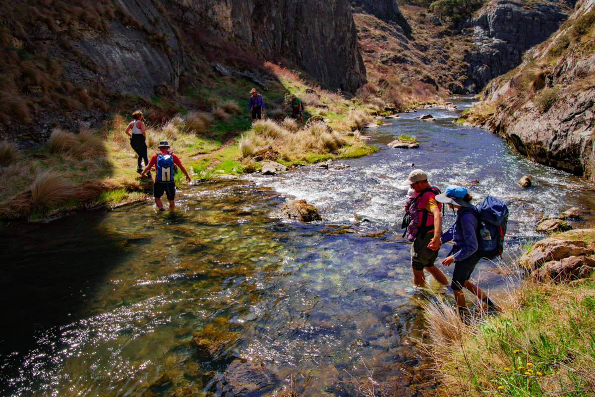
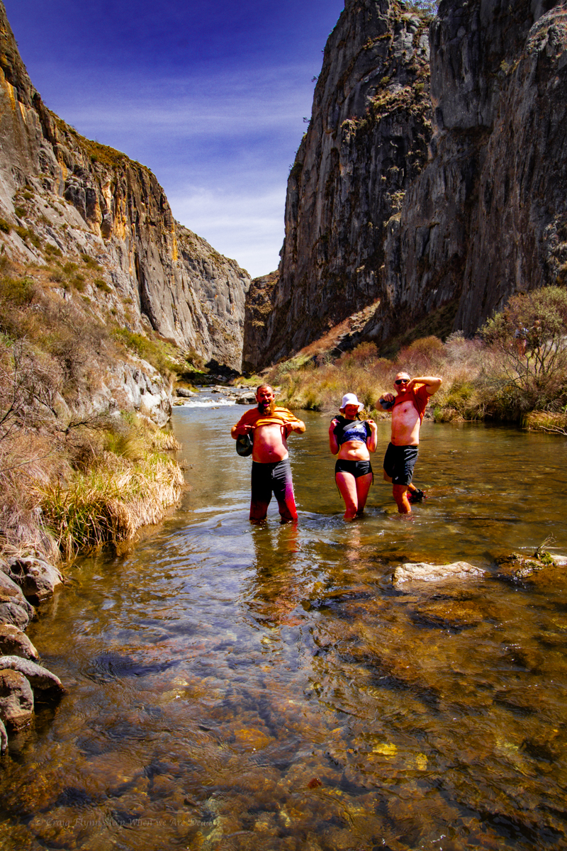
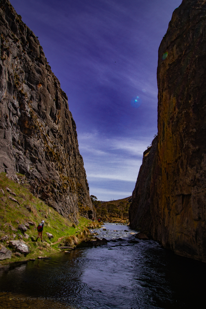
Popeye creek pops in and out of canyon sections along much of its course and it’s one I’d not done before.
A big Saturday trip had been foiled by thunderstorms and we just needed to shake out the cobwebs but couldn’t be arsed repacking ropes and stuff so thought why not have a look at some non abseil sections in Popeye.
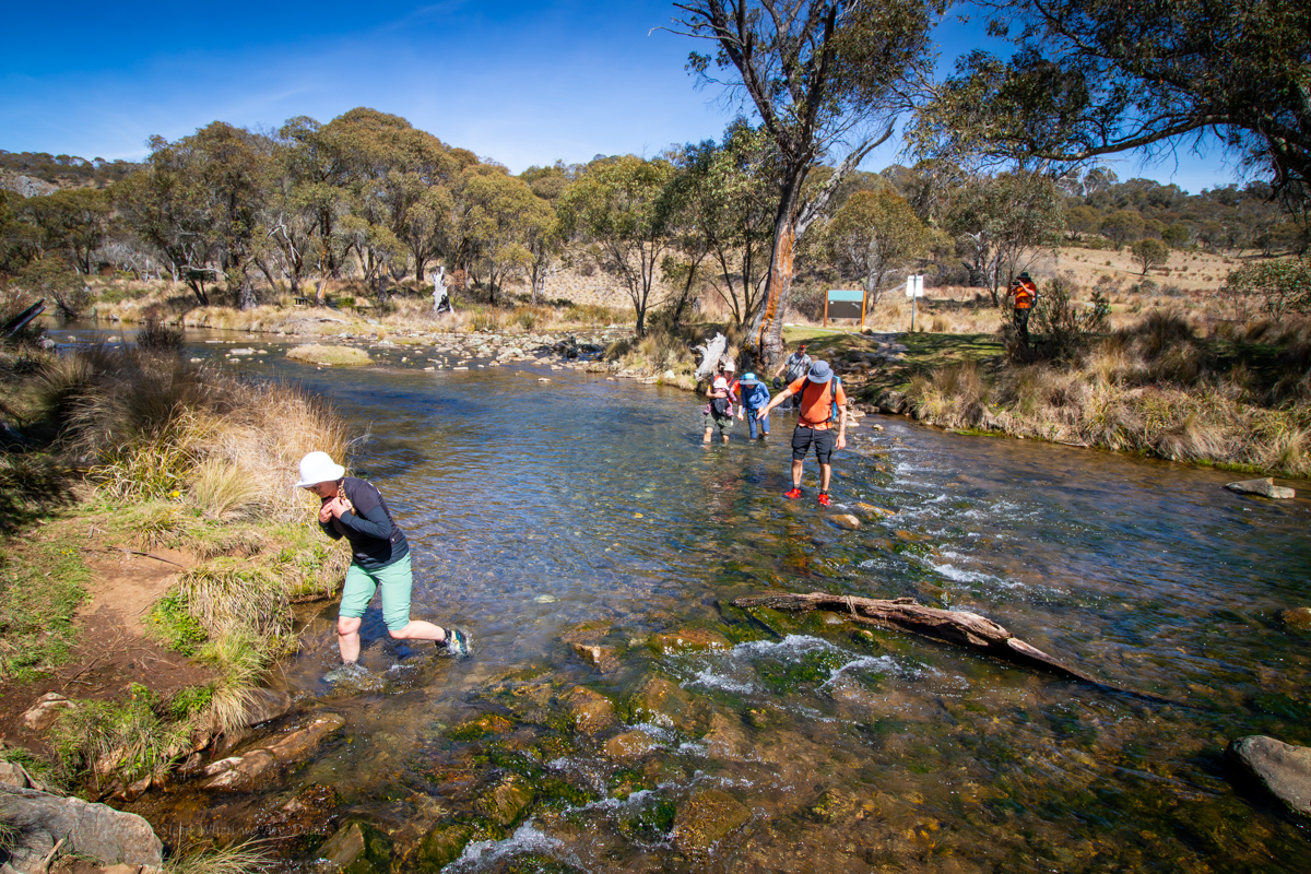
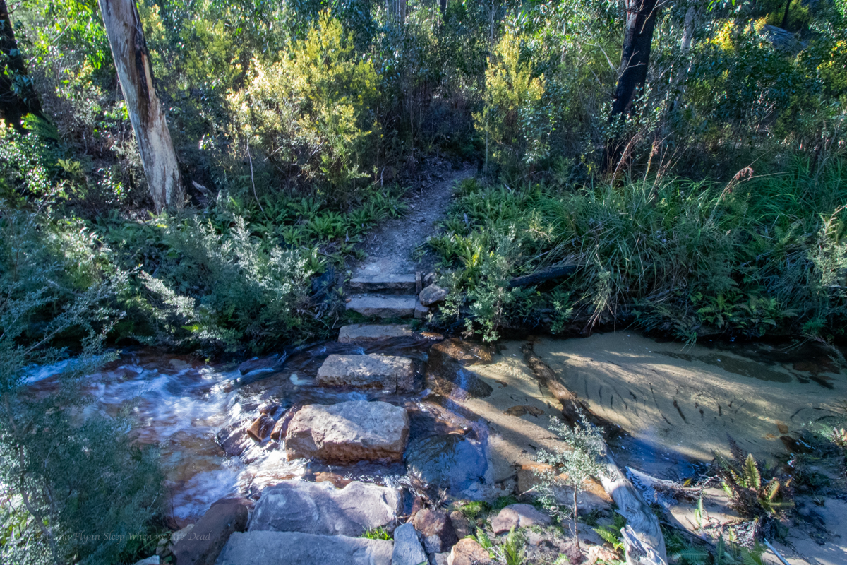
Meeting at the crack of 10am, or there abouts we make our way in in no time.
We’d be entering the canyon a long way upstream of where the jamieson guide recommends but not too far from the increasingly popular Popeye falls.
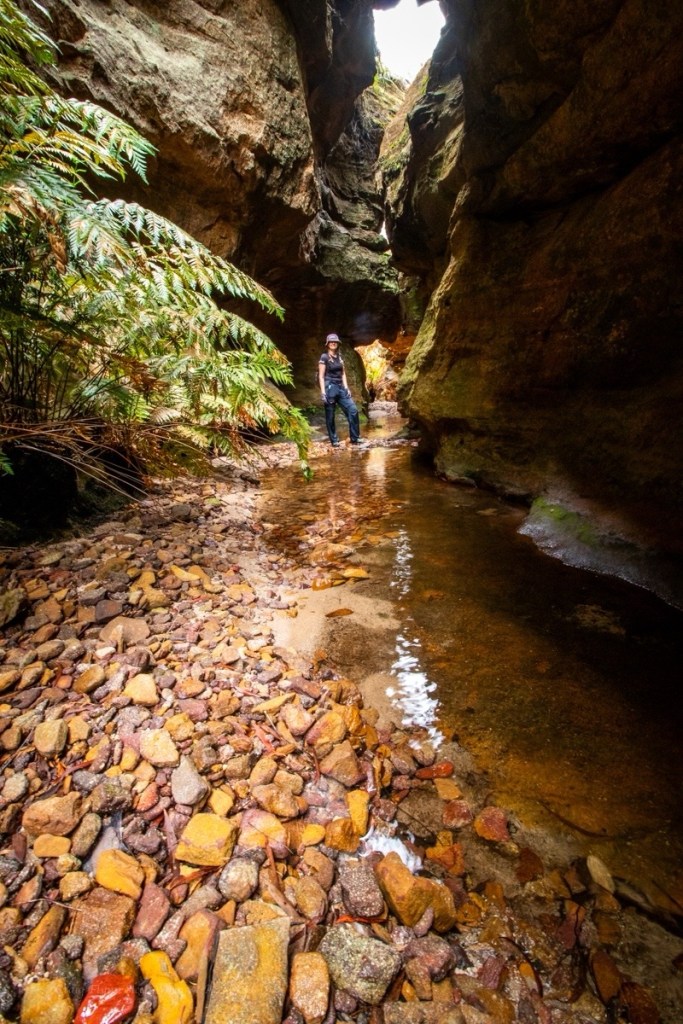
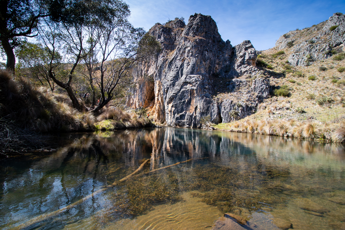
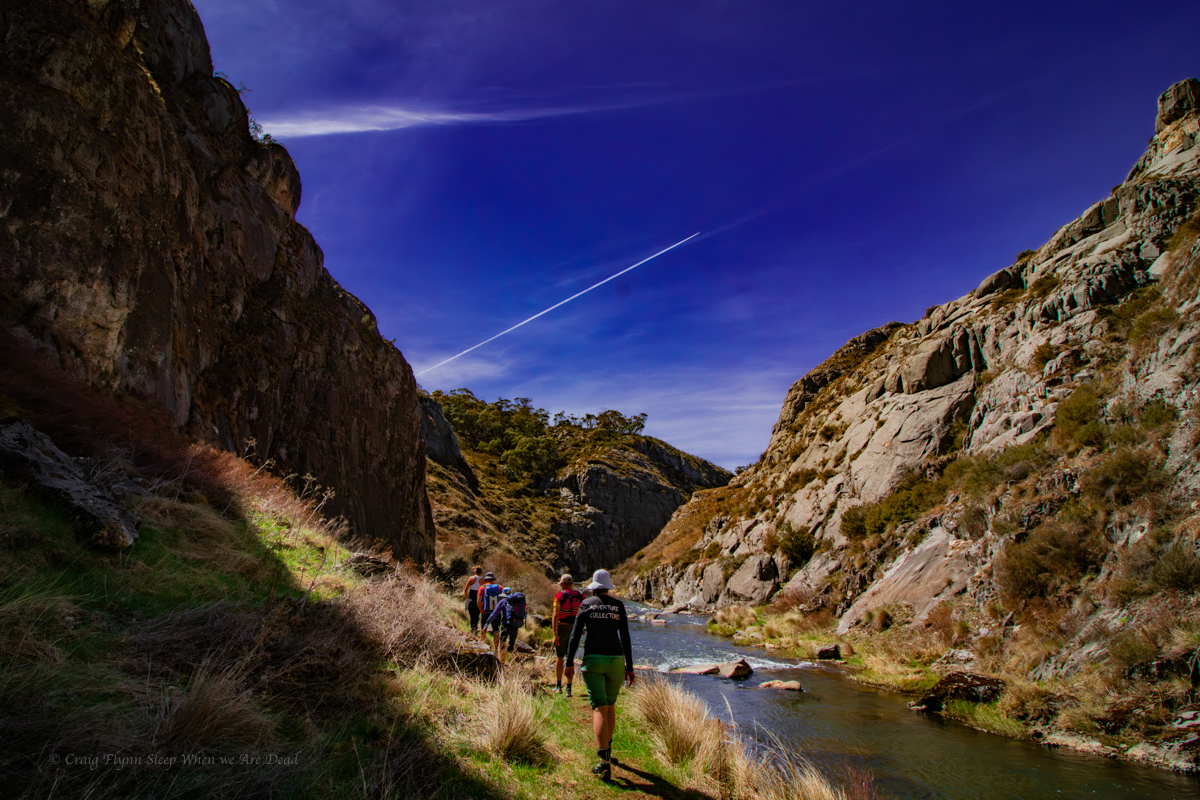
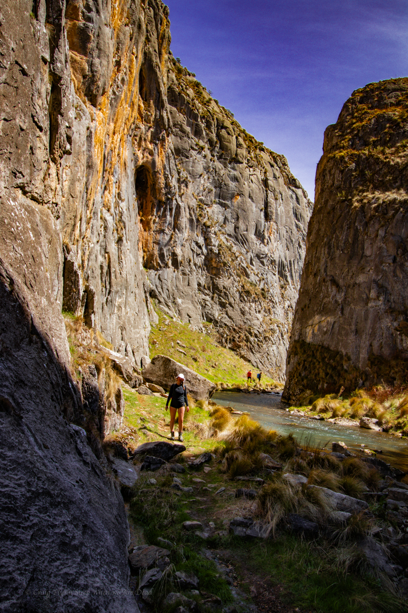
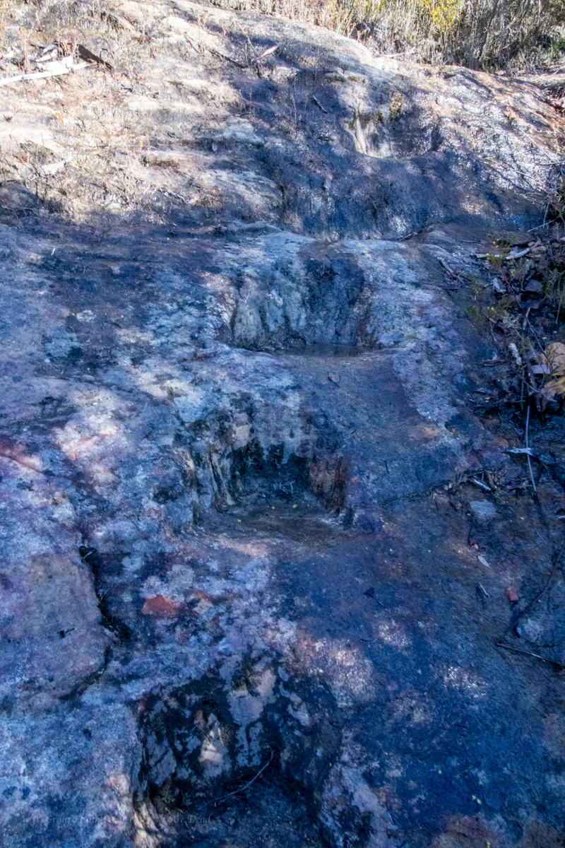
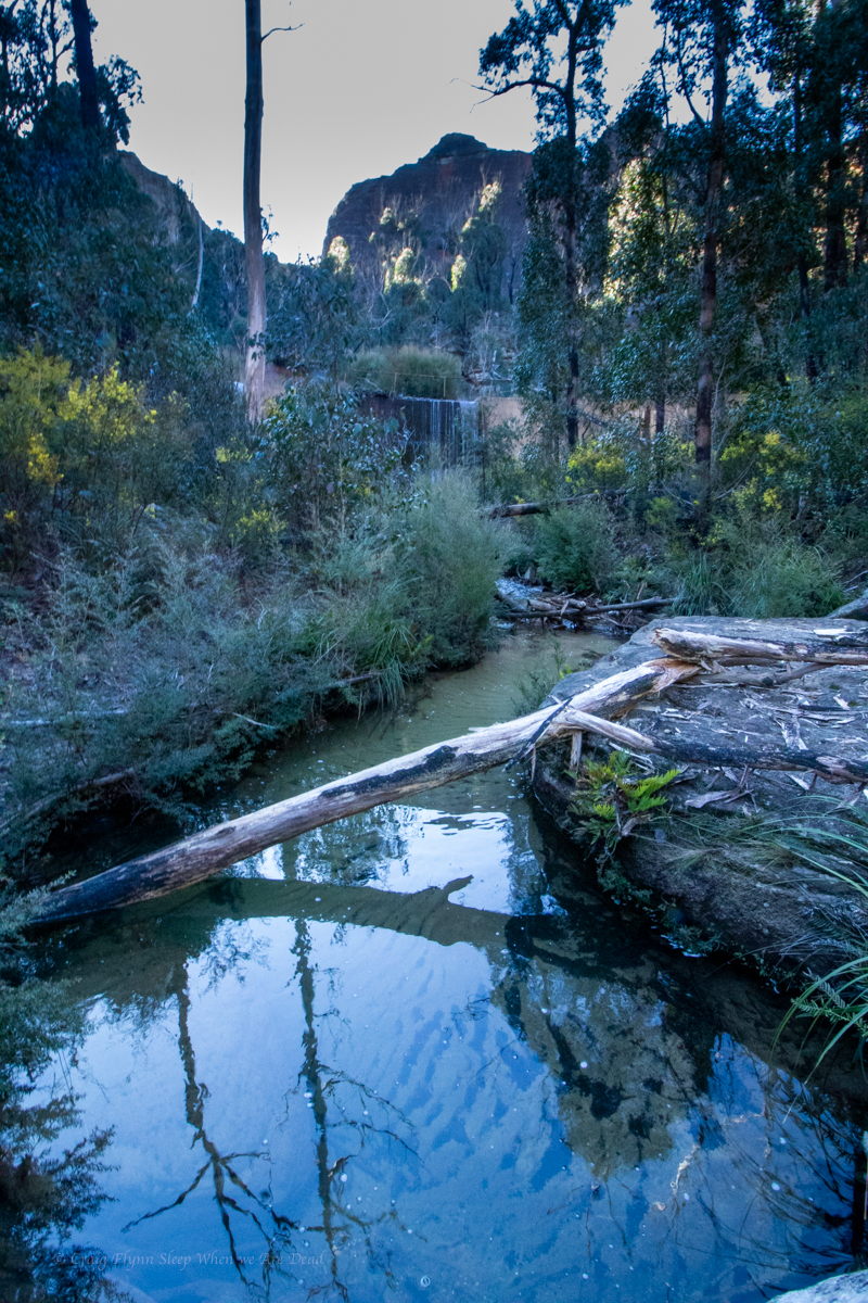
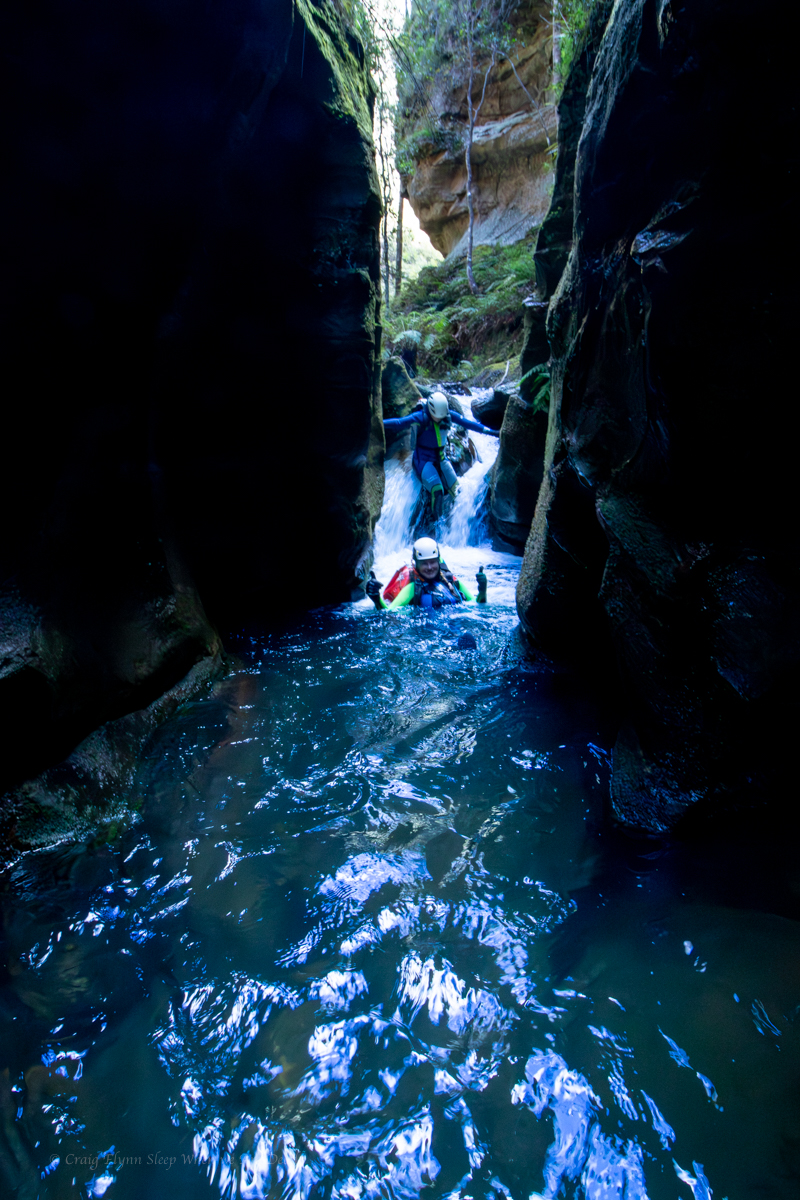
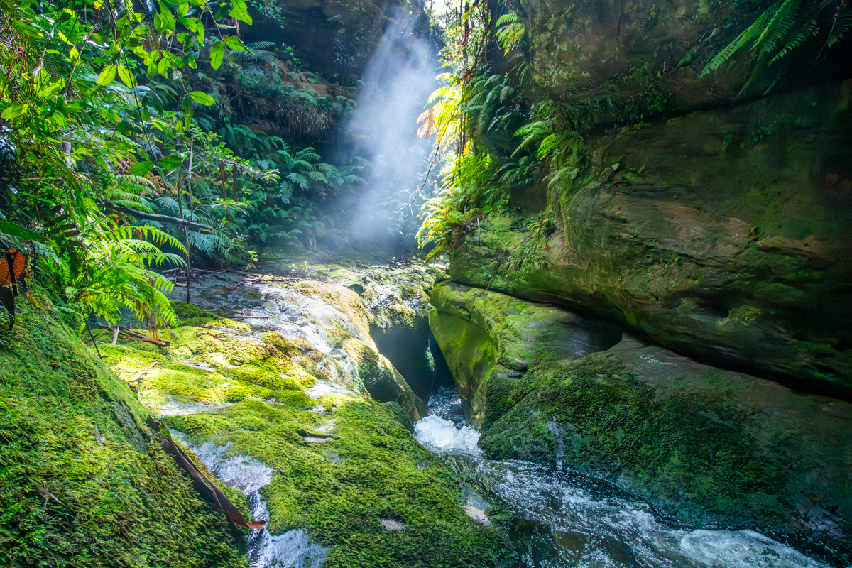
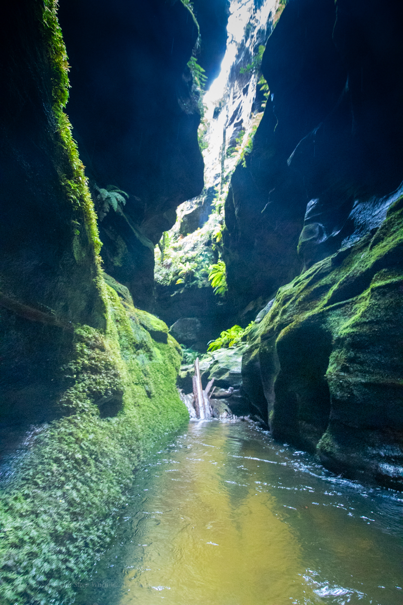
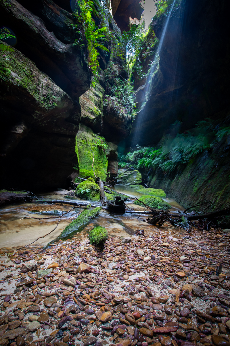
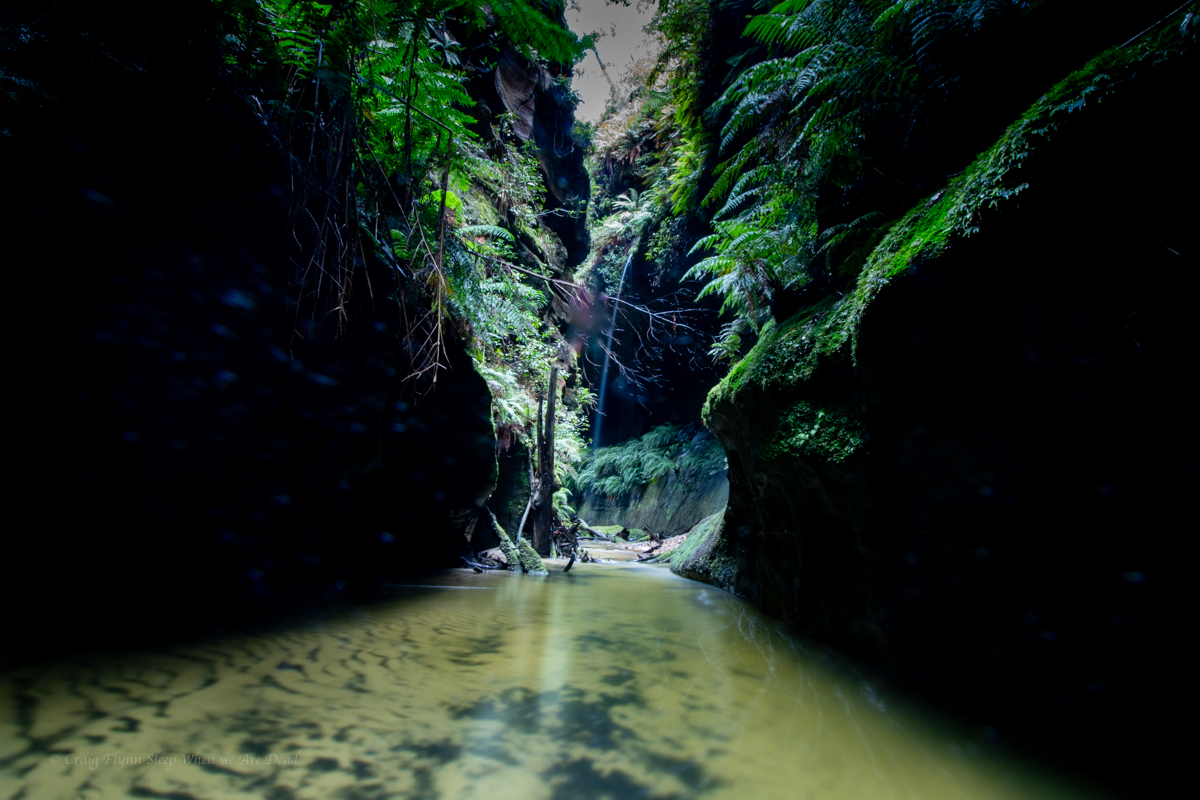
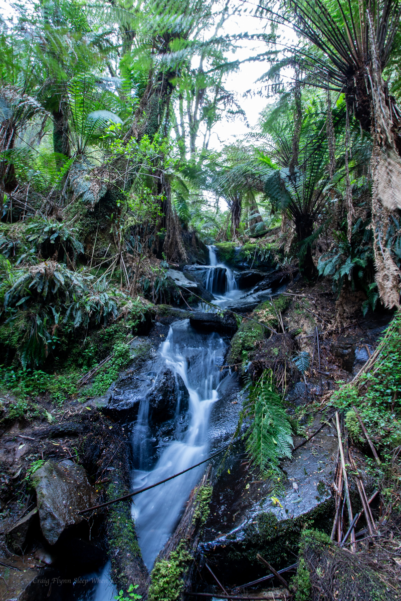
The creek cuts a deep, promising looking cleft in the sandstone.
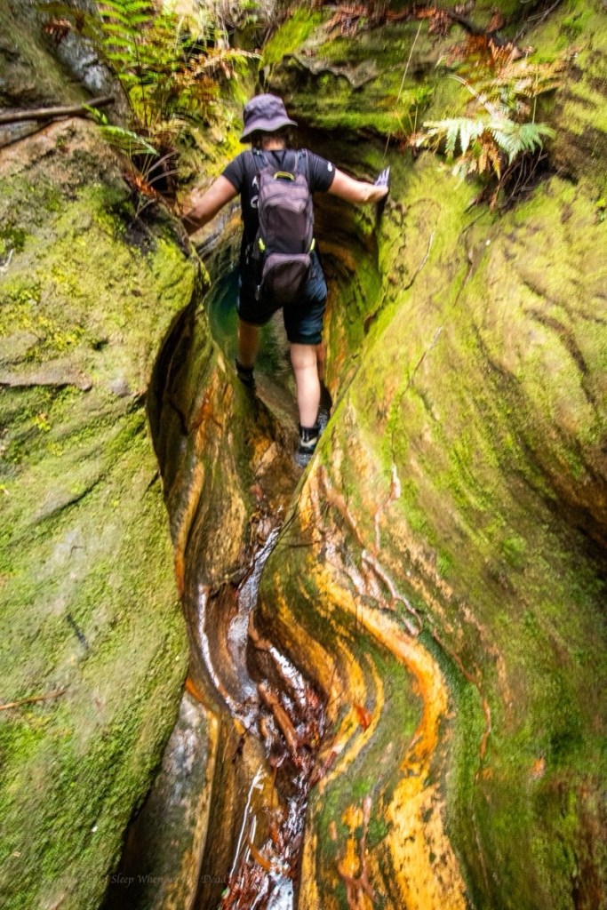
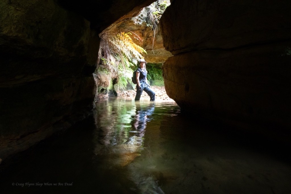
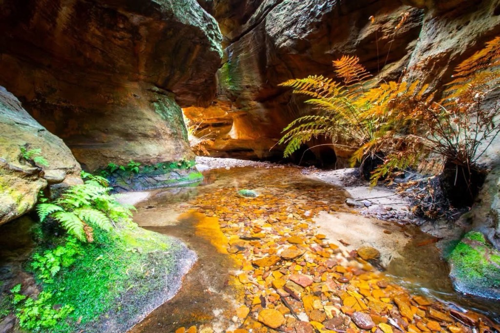
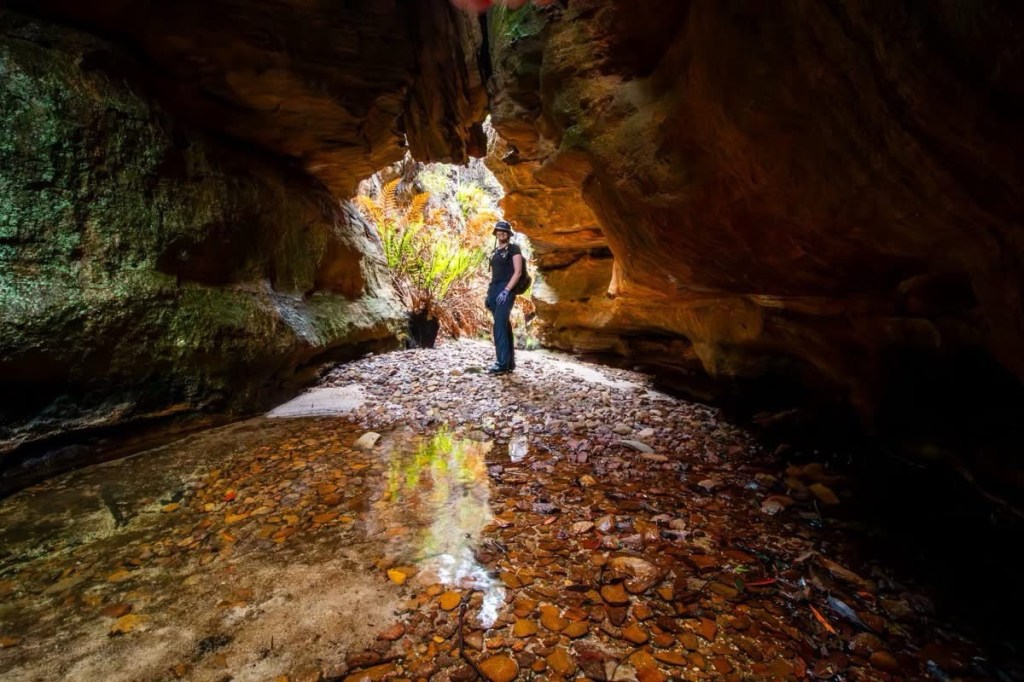
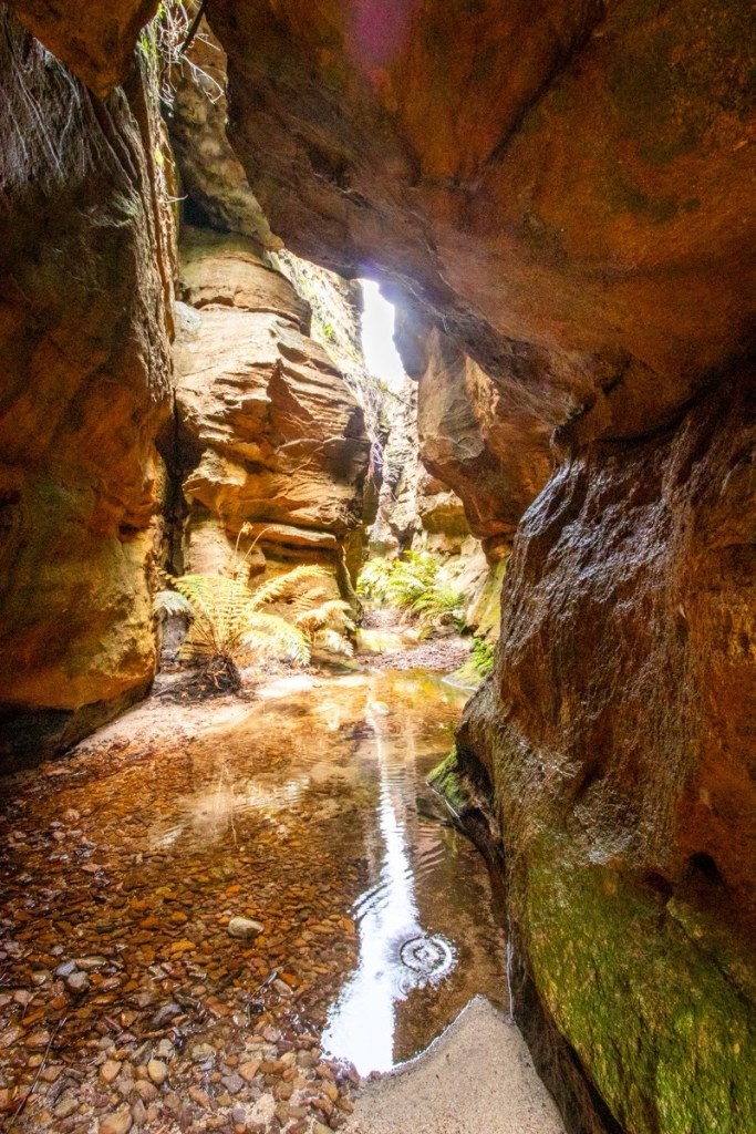
A short section of narrow u bends hide a pleasant little canyon.
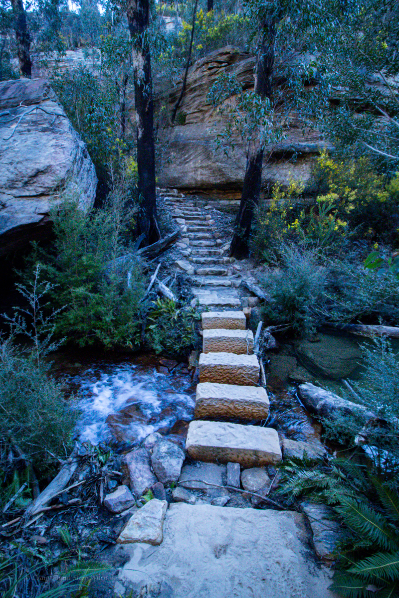
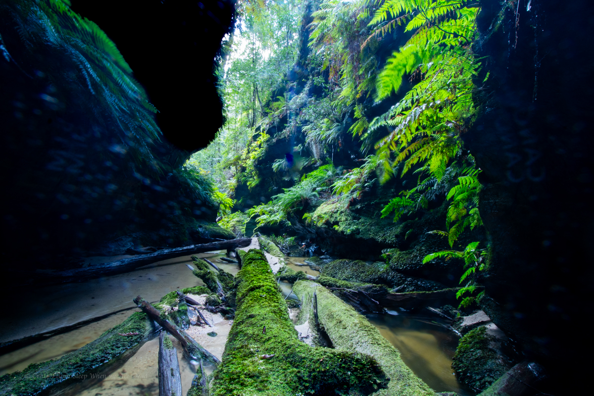
There’s a bit of bridging to stay dry above the knees. But the water is a pleasant temp anyway
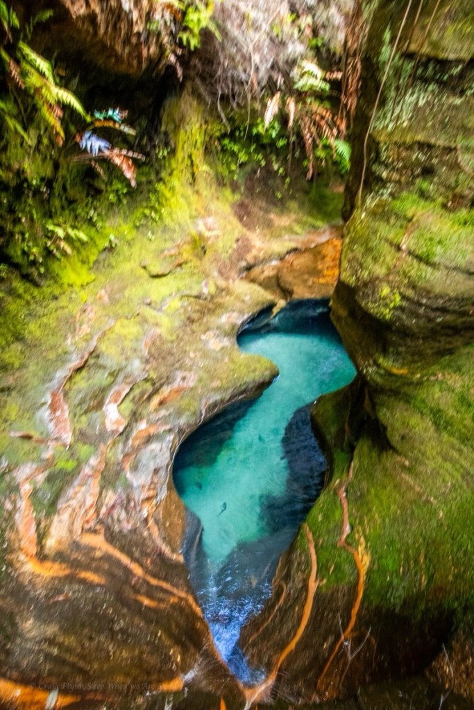
Not the figure 8 pool
It is very pretty.
Parts very similar to the Dumbano tunnels.
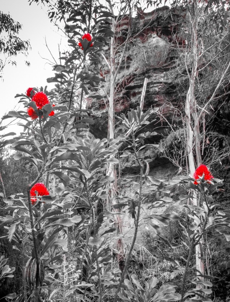
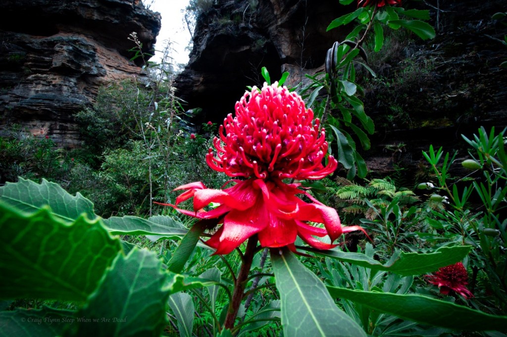
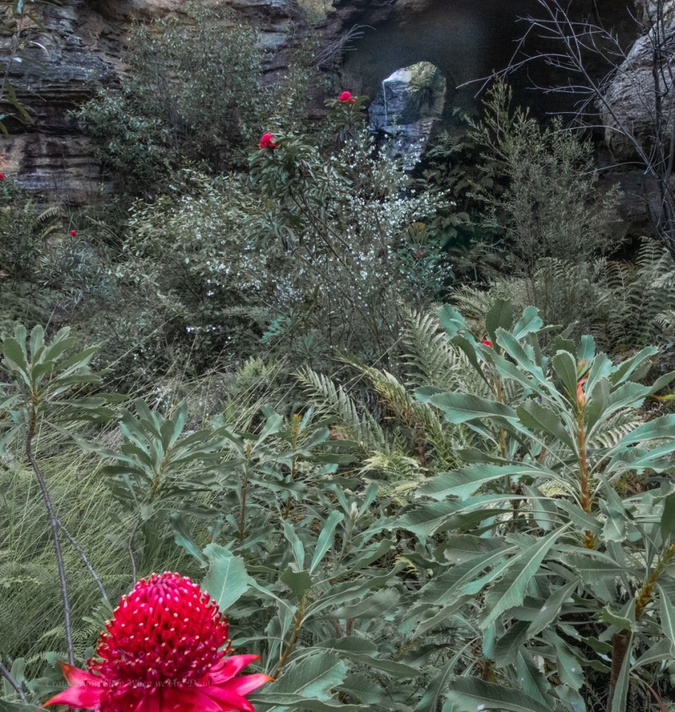
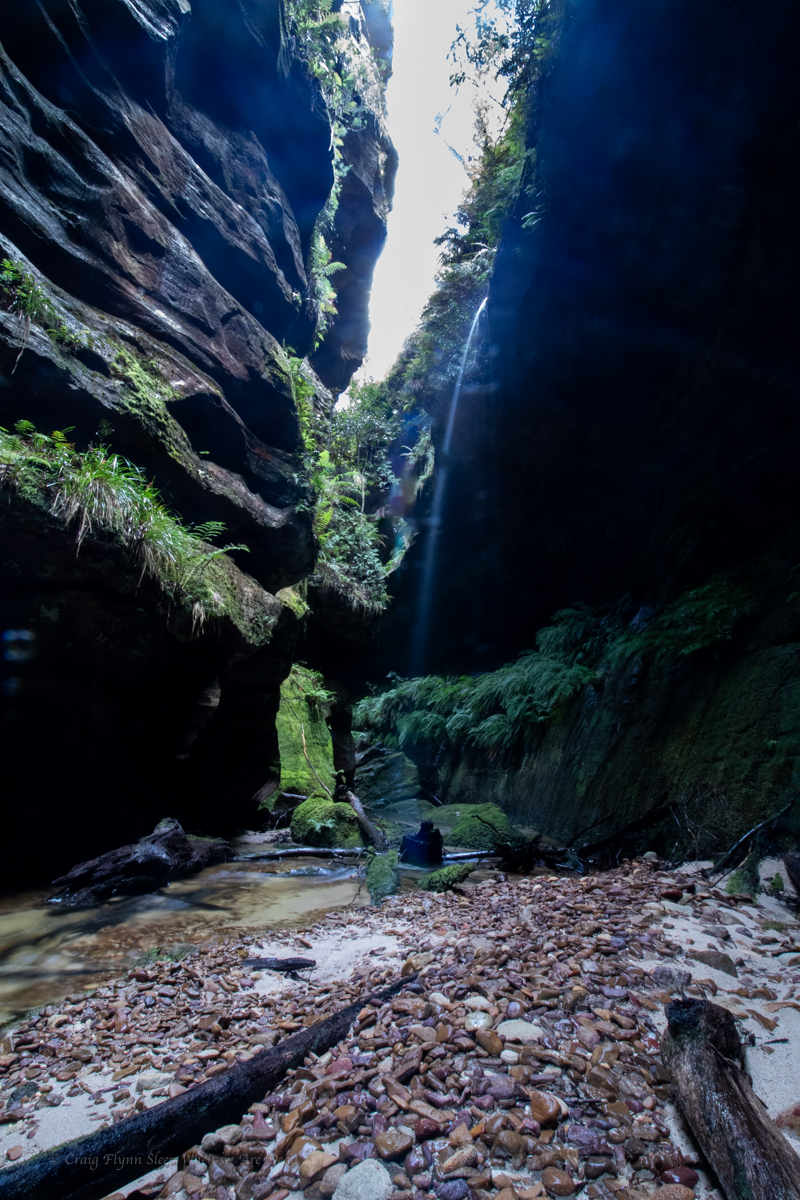
We are already impressed. the canyon opens up a bit and Waratahs line the banks.
Waratahs along a spur off Waratah ridge? Who would have thunk it
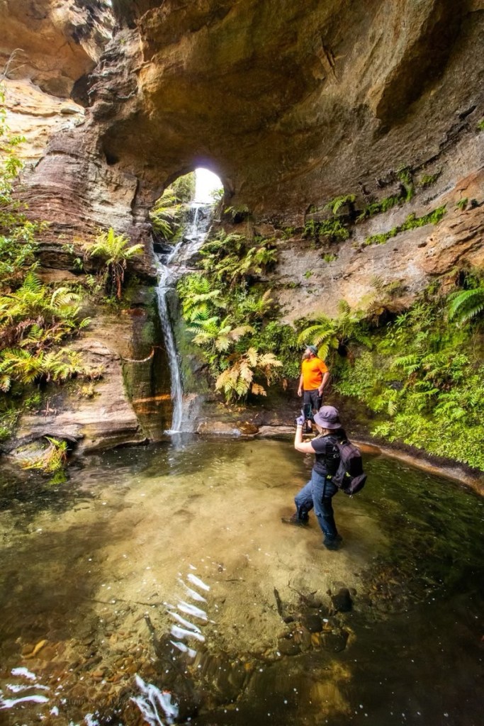
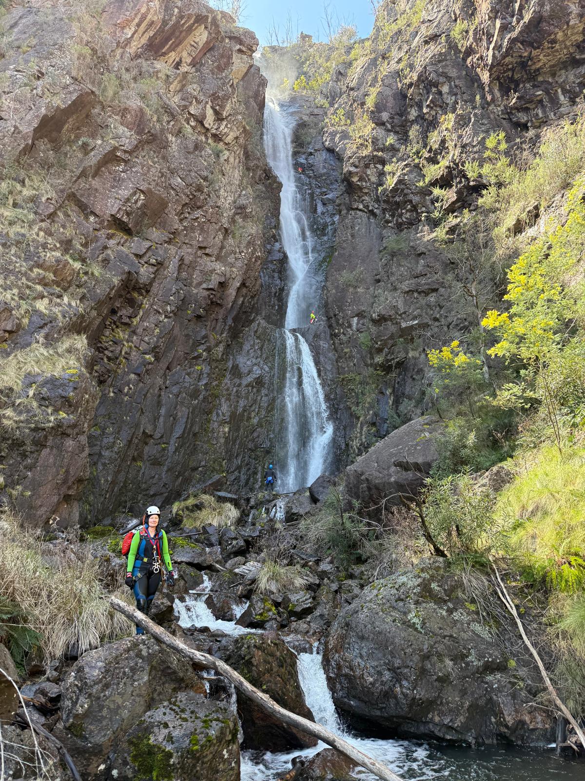
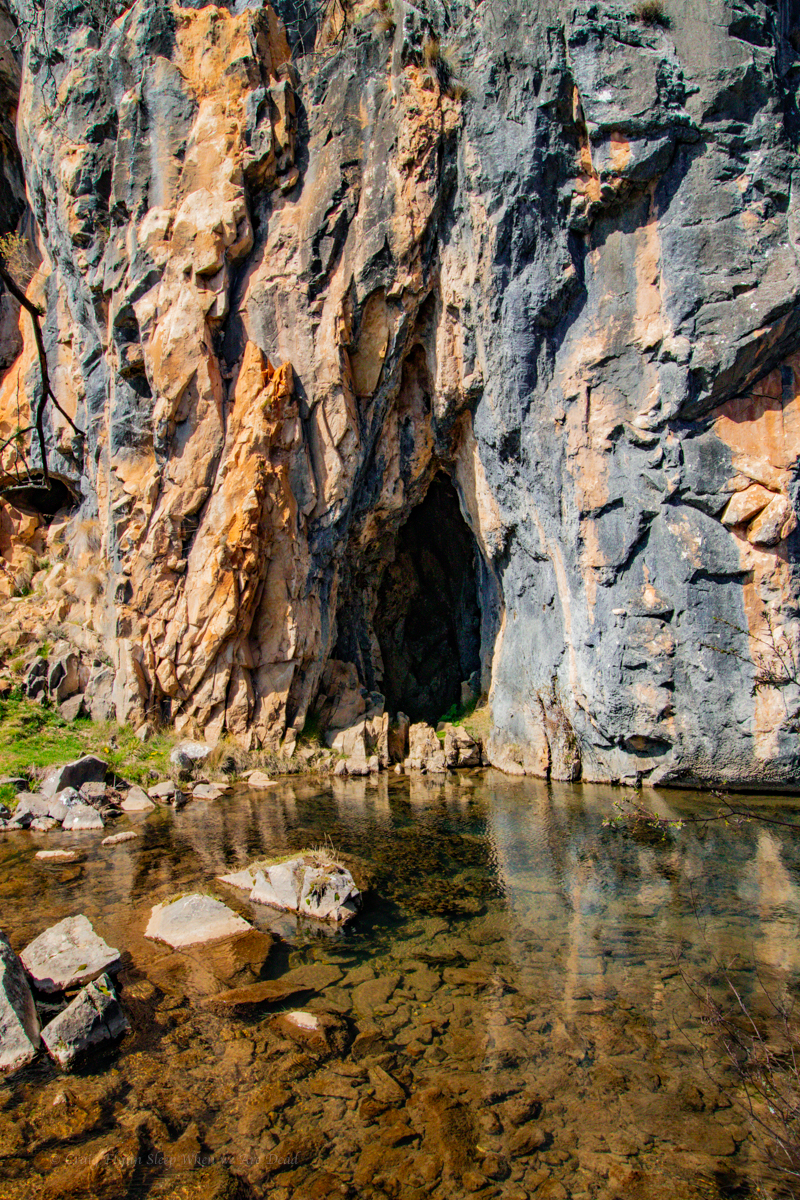
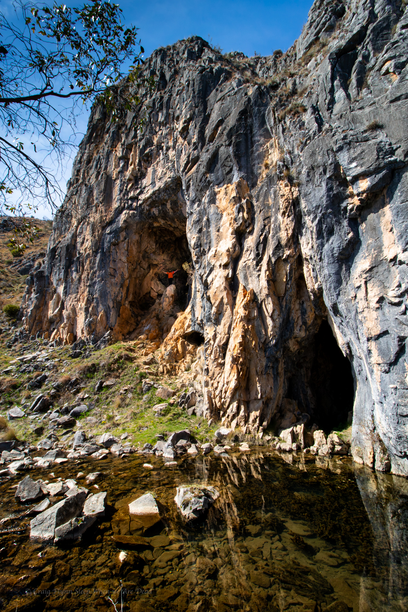
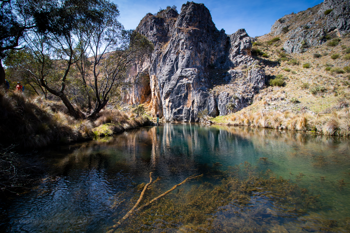
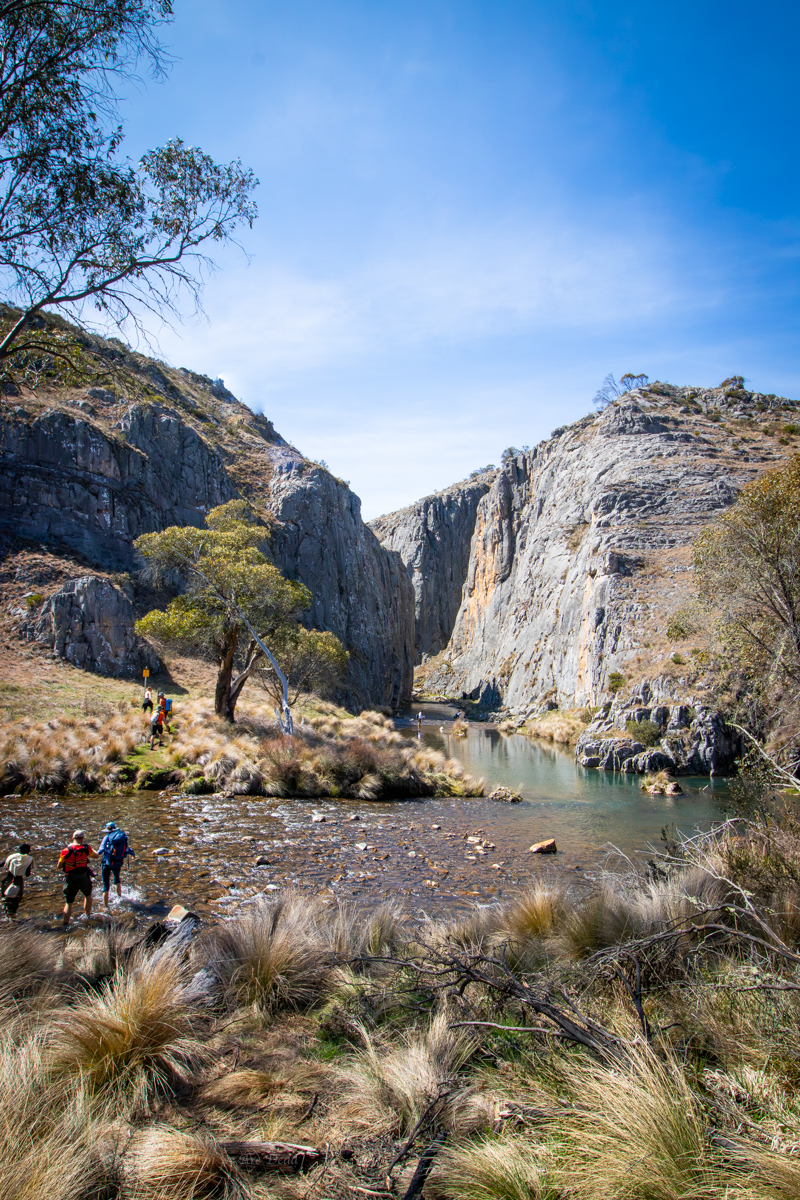
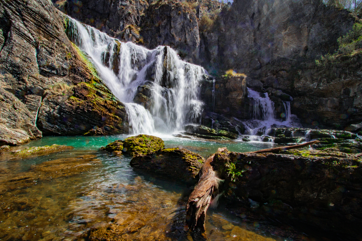
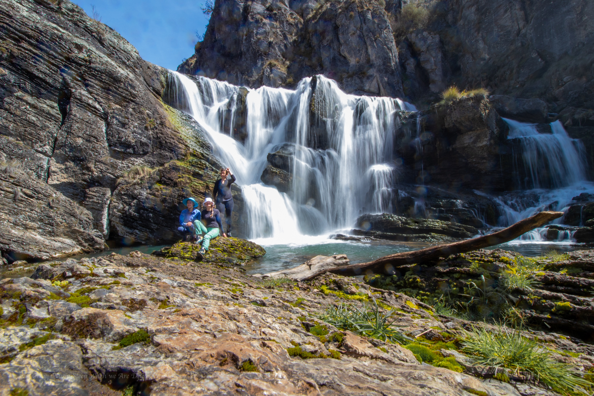
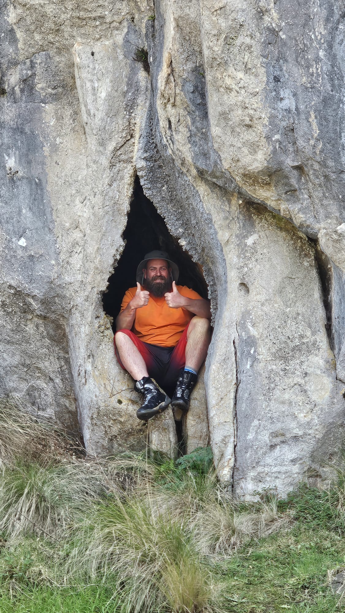
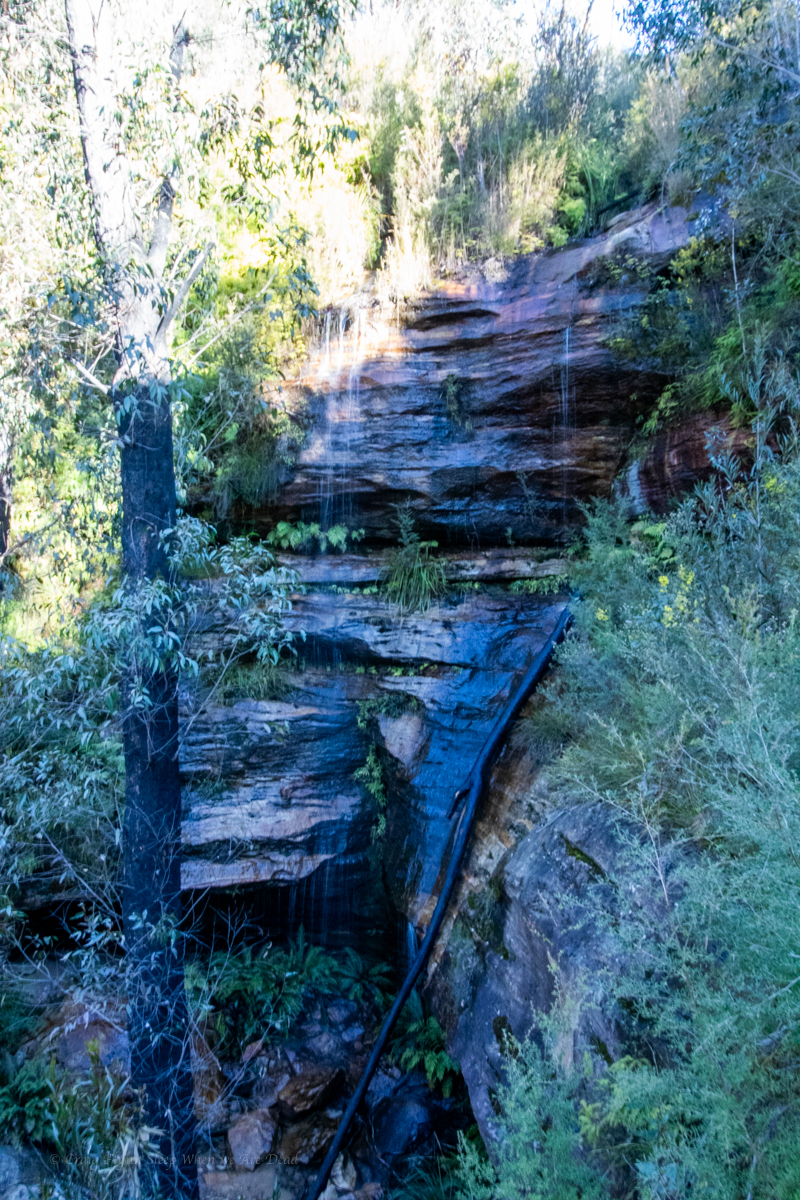
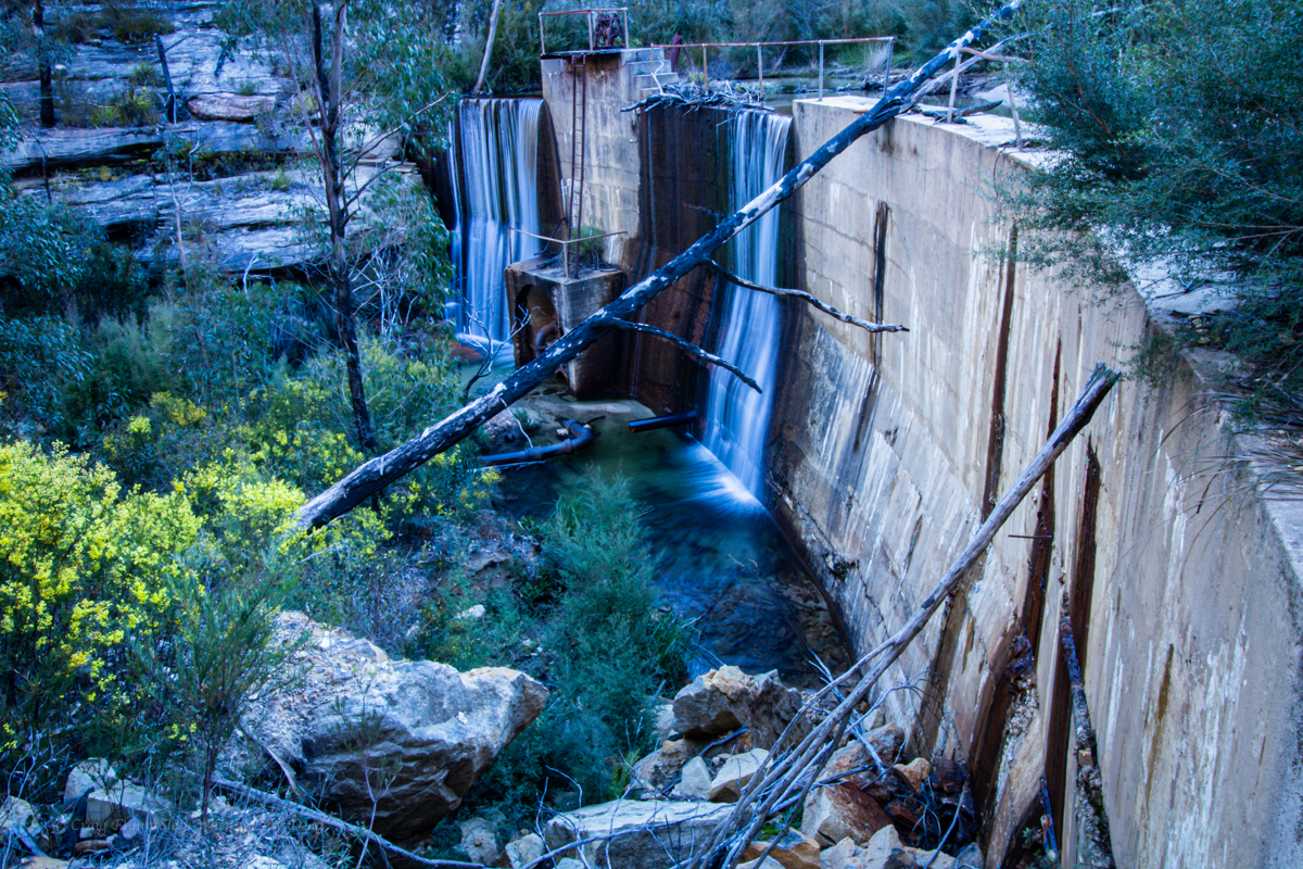
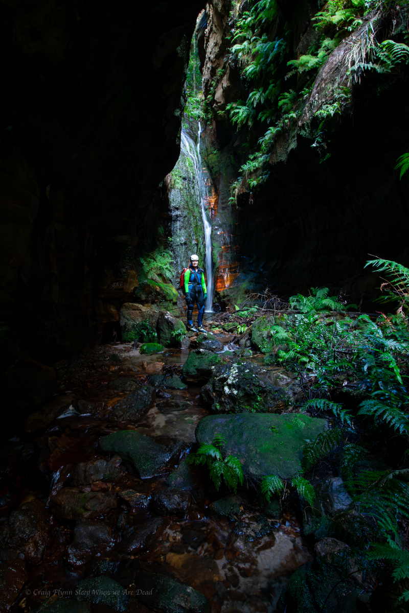
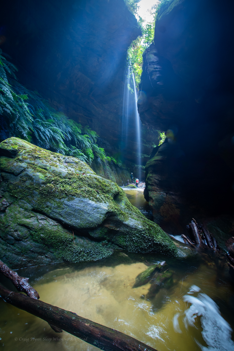
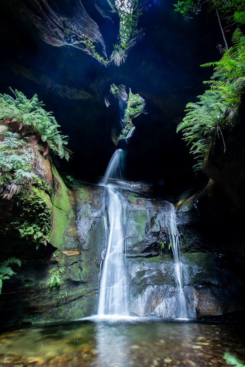
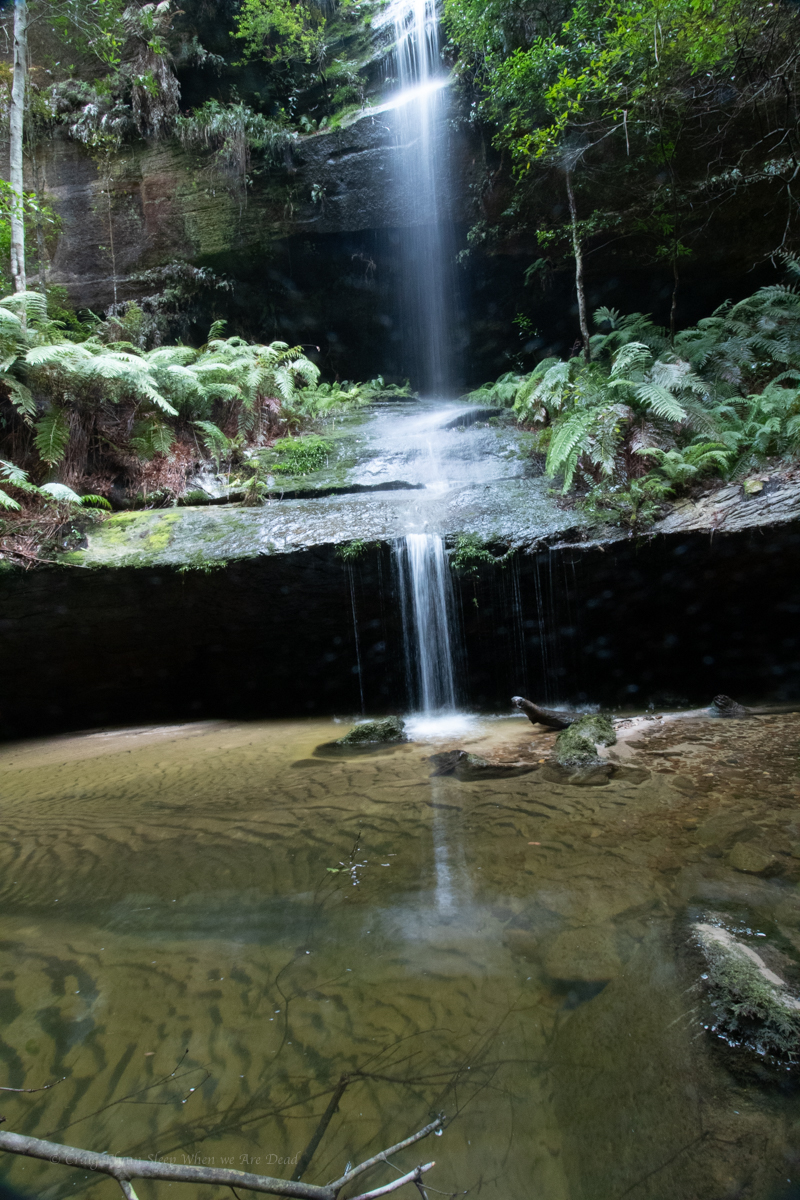
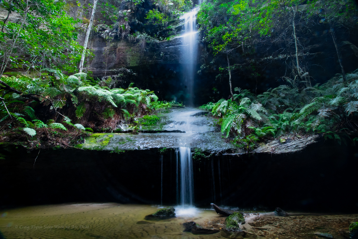
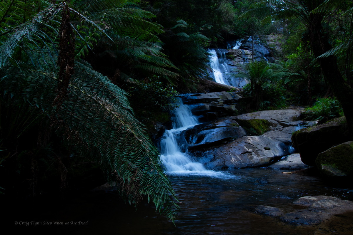
And soon we come to the falls.
Most visitors to here avoid the canyon bit and keep their feet dry by scrambling down the nose.
It’s a funky little waterfall through an arch in a side creek
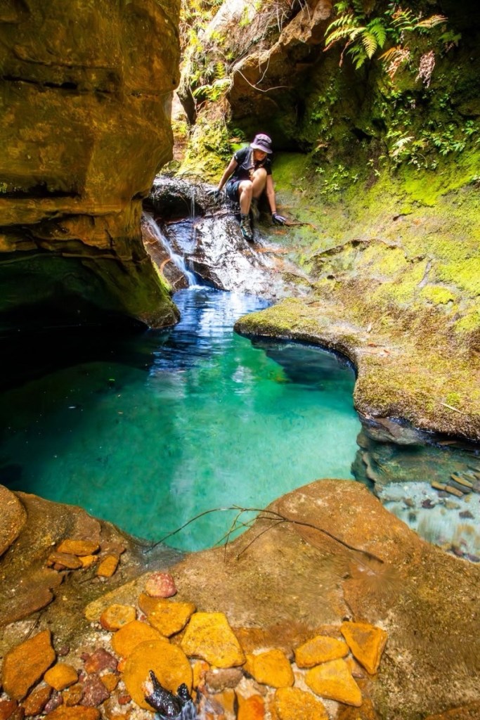
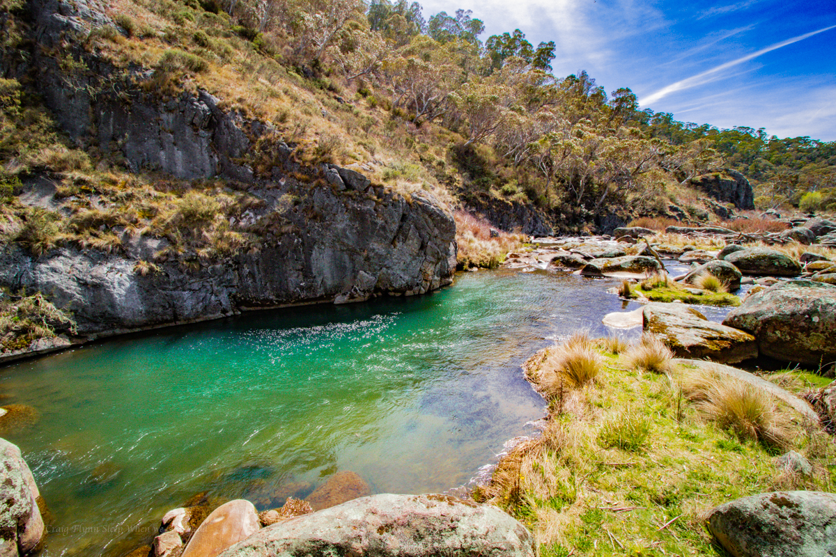
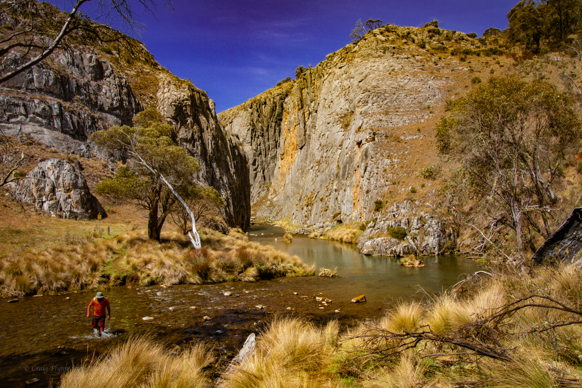
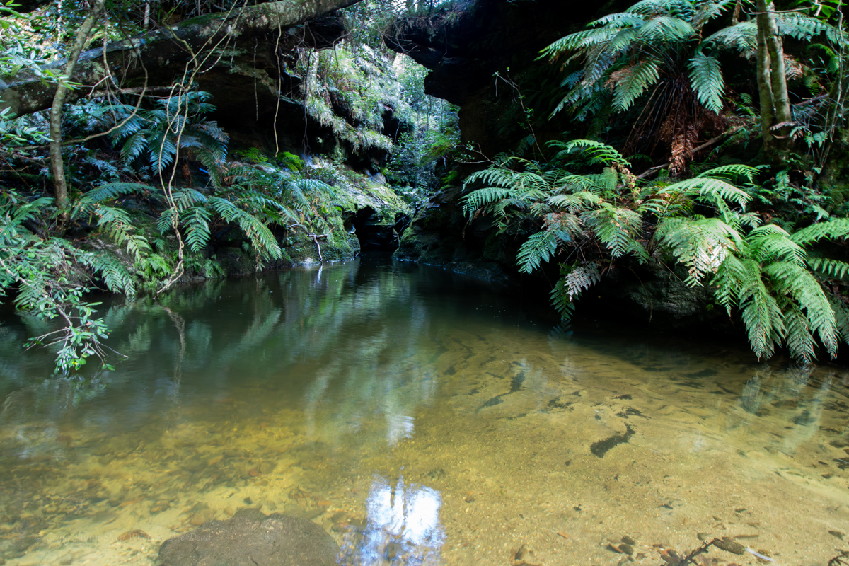
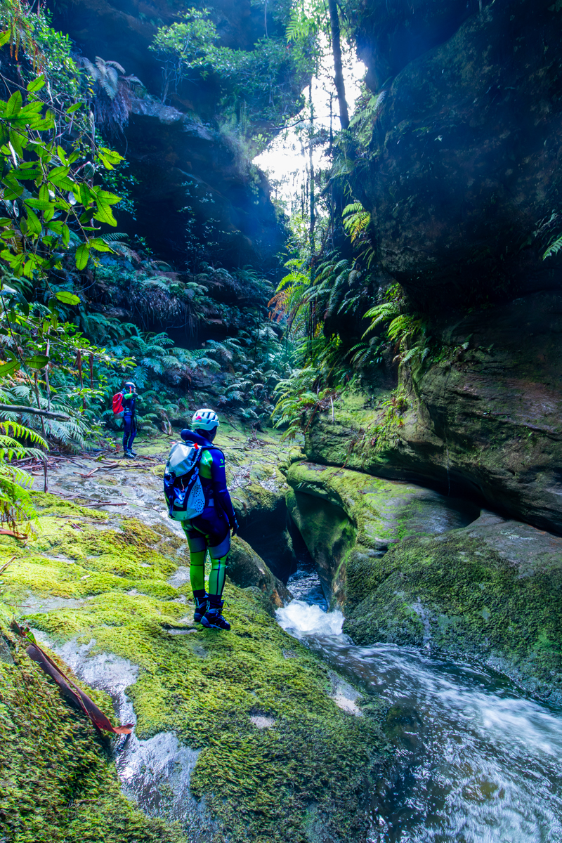
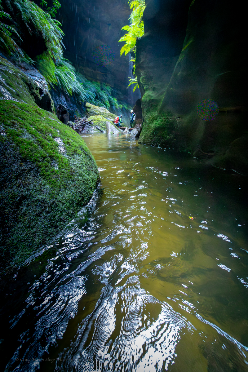
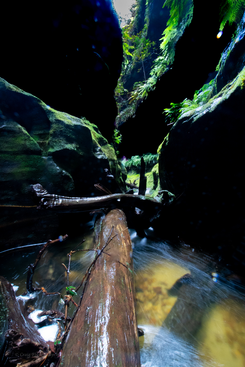
We phaff about with photos for a bit, we have to pool all to ourselves., but then push on downstream to the next canyon section.
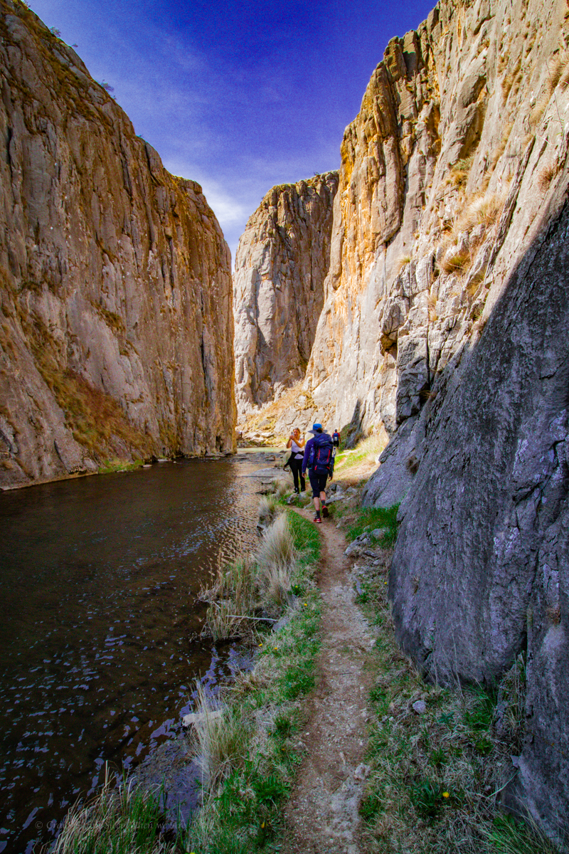
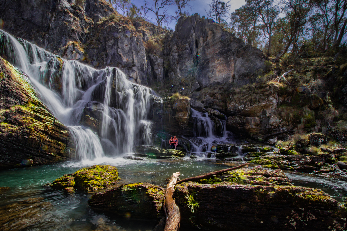
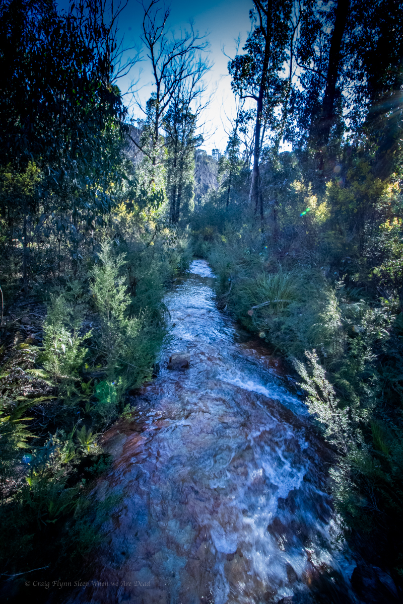
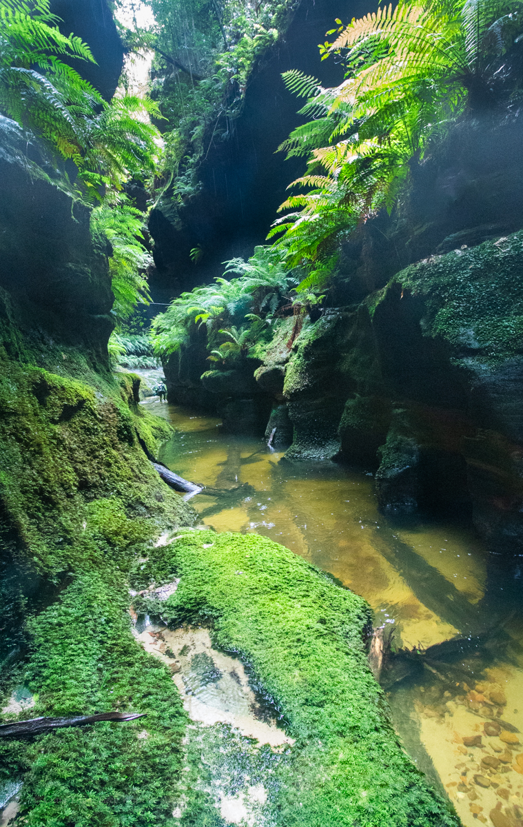
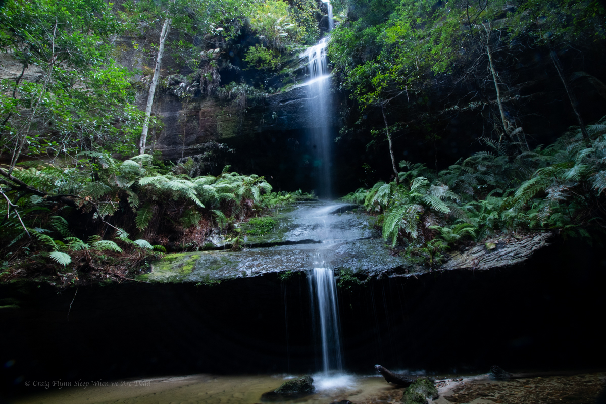
A bit wider and deeper it’s a nice walk through section
It’s nice
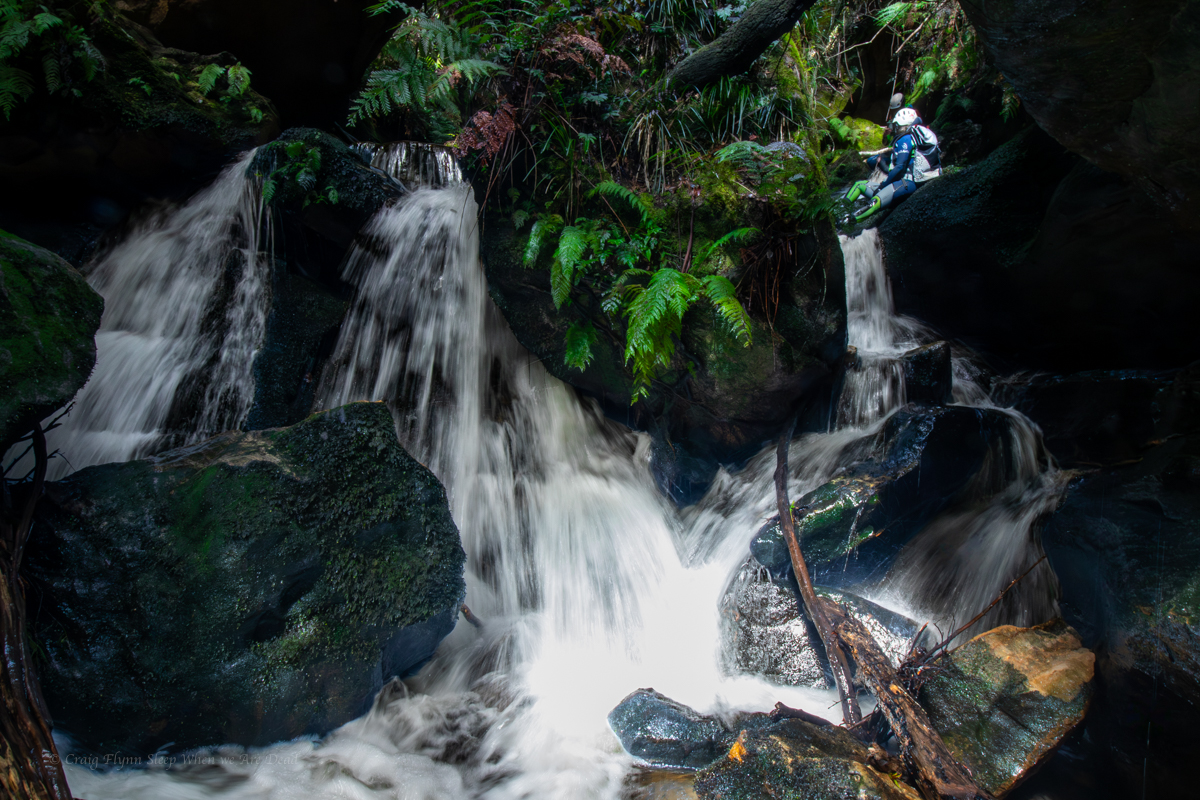
Again the canyon opens out. We believe it’s a 1km scrub bash down to the next bit so, happy with our easy day, we retrace our steps back up to the waterfall. A crowd of people are here now.
There’s an easier way in, says old mate sucking in a vape.
We came that way, replies Ellie very politely. We just had a look at some other stuff while out here.
We leave the guards and scramble out into the cliff top for lunch.
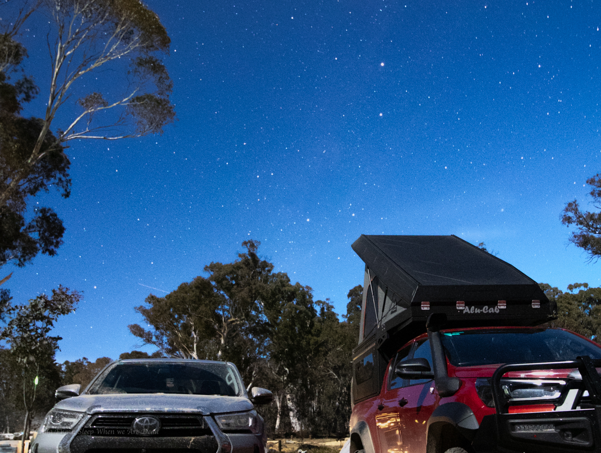
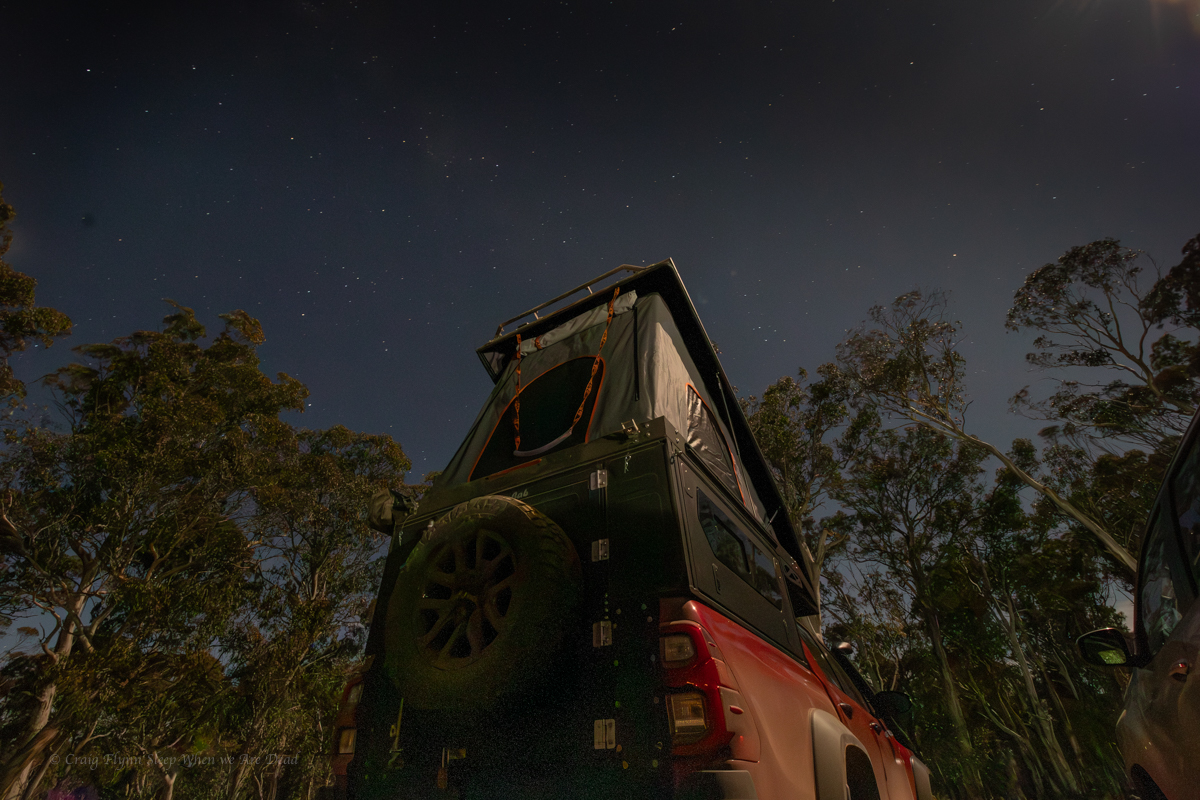
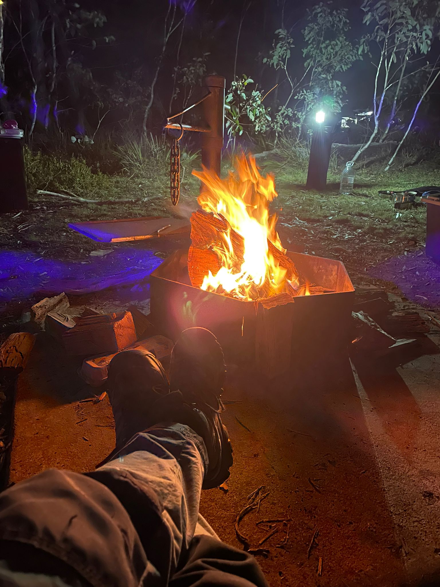
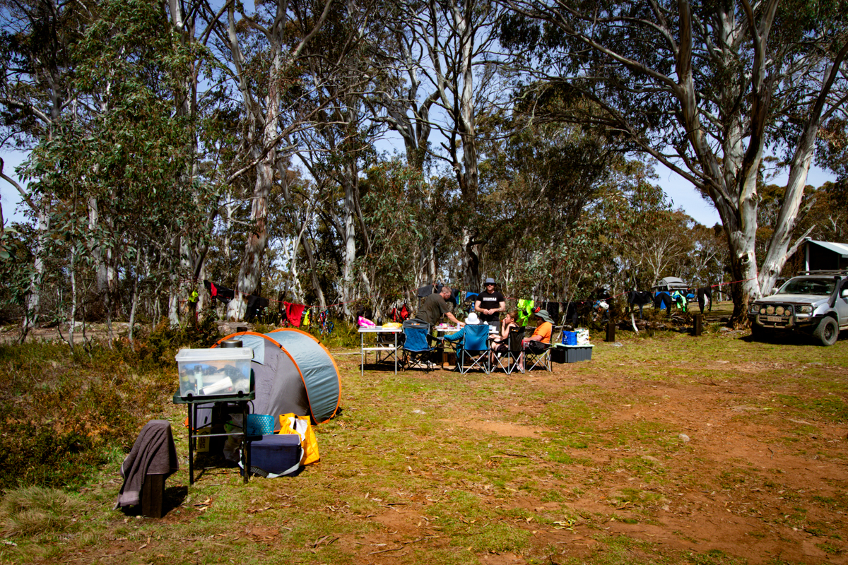
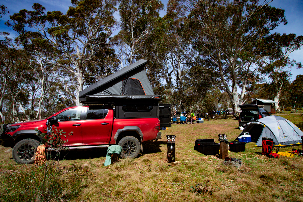
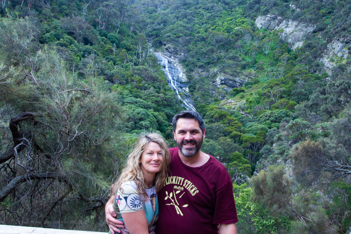
We were keen as mustard to give the new Alucab camper a proper test out and as luck would have it Kylie had organised a long weekend of adventures in and around Long Plain, Kosciuszko NP.
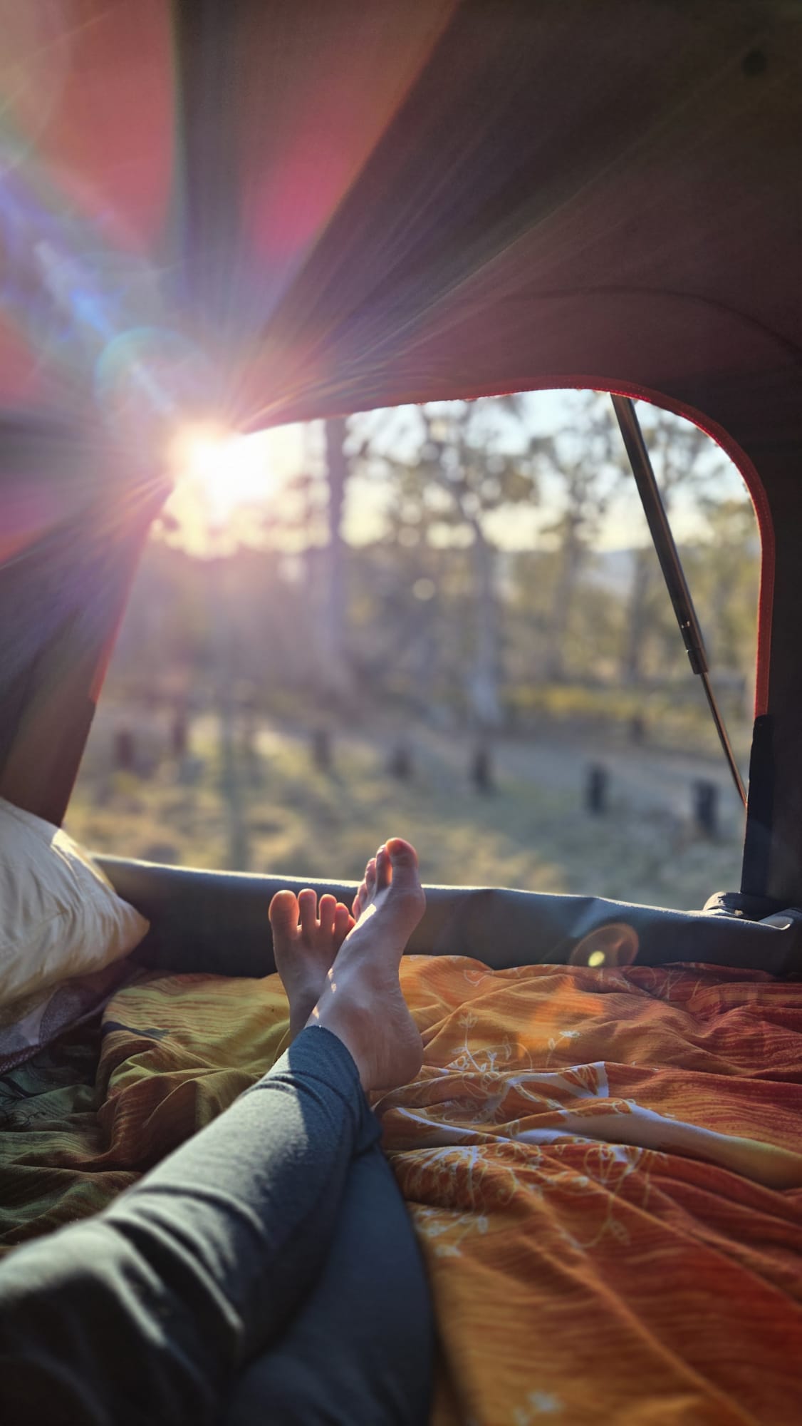
Rocking into Cooleman camp late Friday night it was so good to just pop the top and be able to crawl into bed
A near full moon blazed out potential milky way or comet shots.
We get a good night sleep but are up early for what would become and epic adventure in Landers Falls.
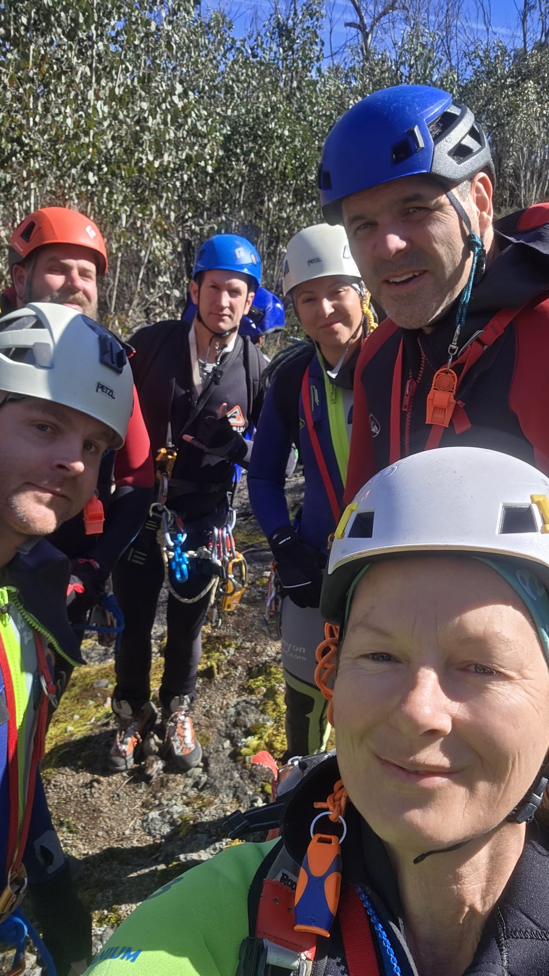
Kylie, Kristo, Jason, Hywaida, Dave and meeeeeeeeeeee
This one had been on the agenda for a while.
Kylie had scoped out topos and satellite images years ago. Then it caught the attention of Laurie, the Victorians and others and the race was on.
I’m not sure who lead the first trip but they did a stella job. It then appeared in the Canyoning Around Victoria guidebook, Published by Rob and Sam. But being a little out of the way meant there hasn’t seemed to be a ton of repeats.
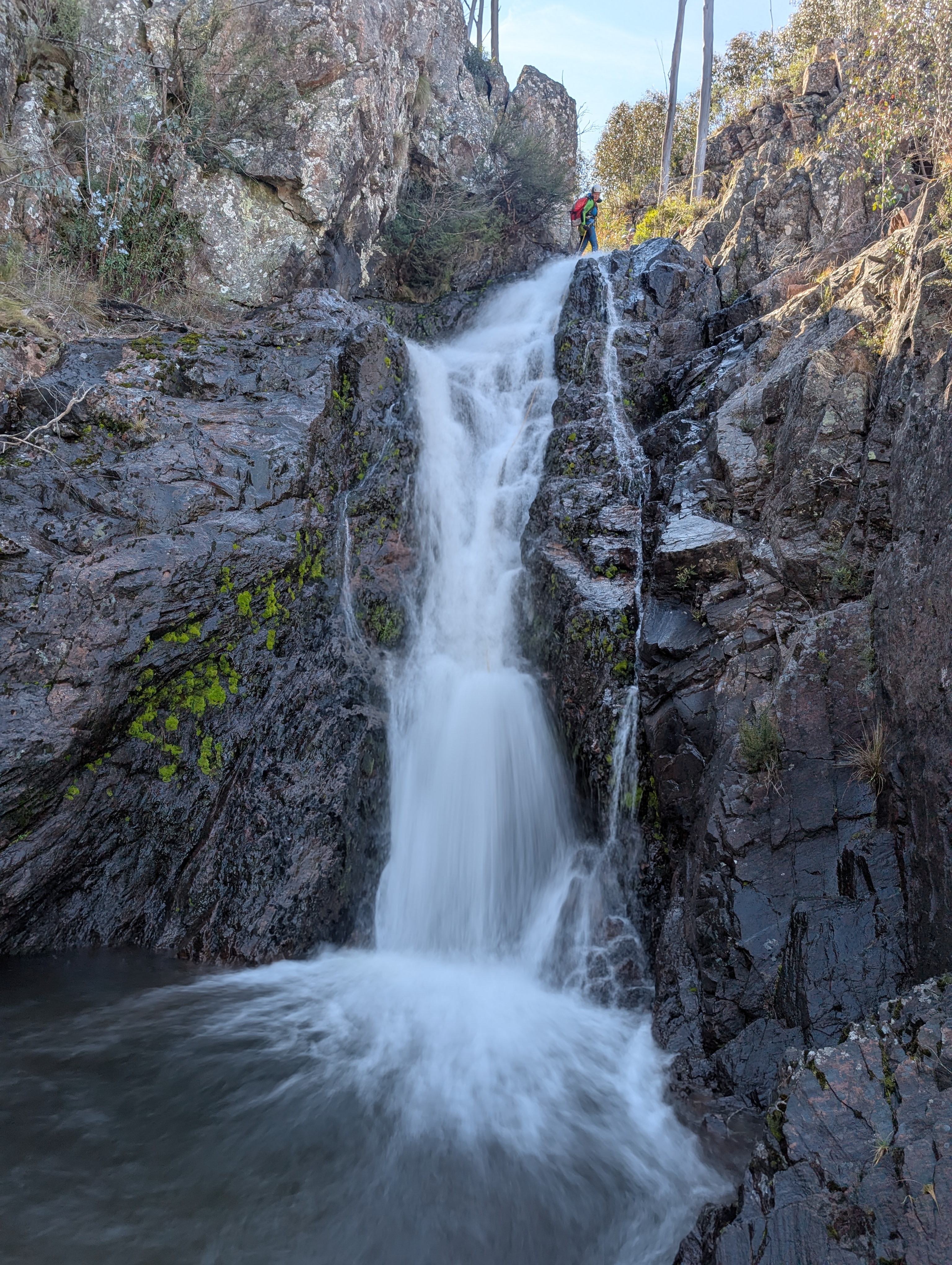
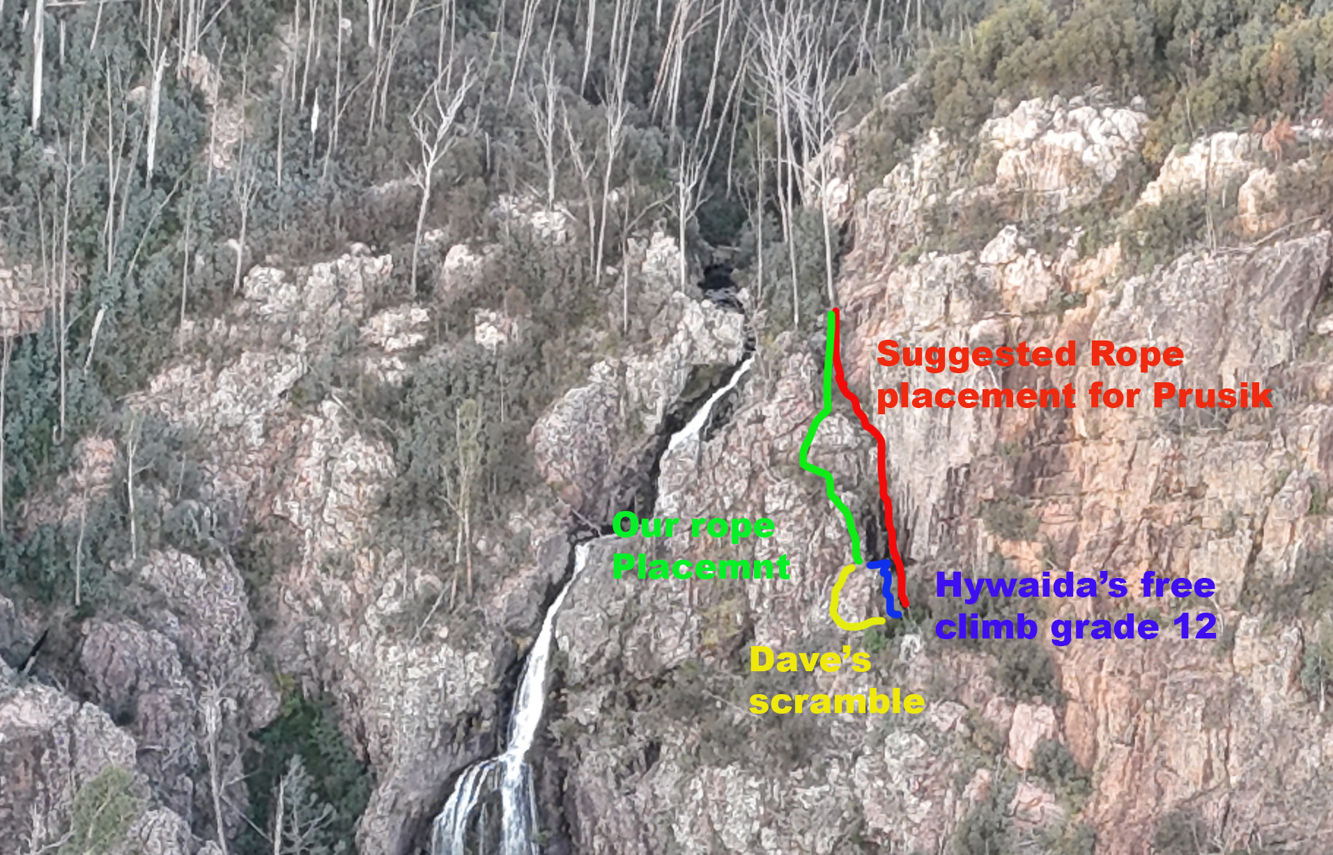
Our intel said to drop a rope to aid with the last little bit of the exit. Rope wiki said someone should descend it to make sure it’s in the right spot. But there was nothing to say what the right spot was. Asking previous parties gave mixed messages. Everyone said it was really obvious where to put the rope. Almost everyone said they put the rope in the wrong spot and had to free climb a bit…
The guide said the last 10m of exit was the tricky bit, ropewiki said setting a 20 or 30m rope in place to assisted existing would be handy.
Looking down the last 10m didn’t look that sketchy. We attach a rope to a tree and Me and Jason descend to have a look. There is another drop. Straight over is a 15-20m vertical face. Around to the right looks to be a grade 10 chimney. We put the rope to the right.
Again we descend. Straight ahead from here drops onto a narrow ledge that doesn’t look to go anywhere. Left is a scrambling climb from a large ledge. We drop the rope to the left so its now in a big zig zag.
One party we spoke to put a longer rope straight down from the top tree and prusiked up the vertical face. In hindsight this is probably the best choice.
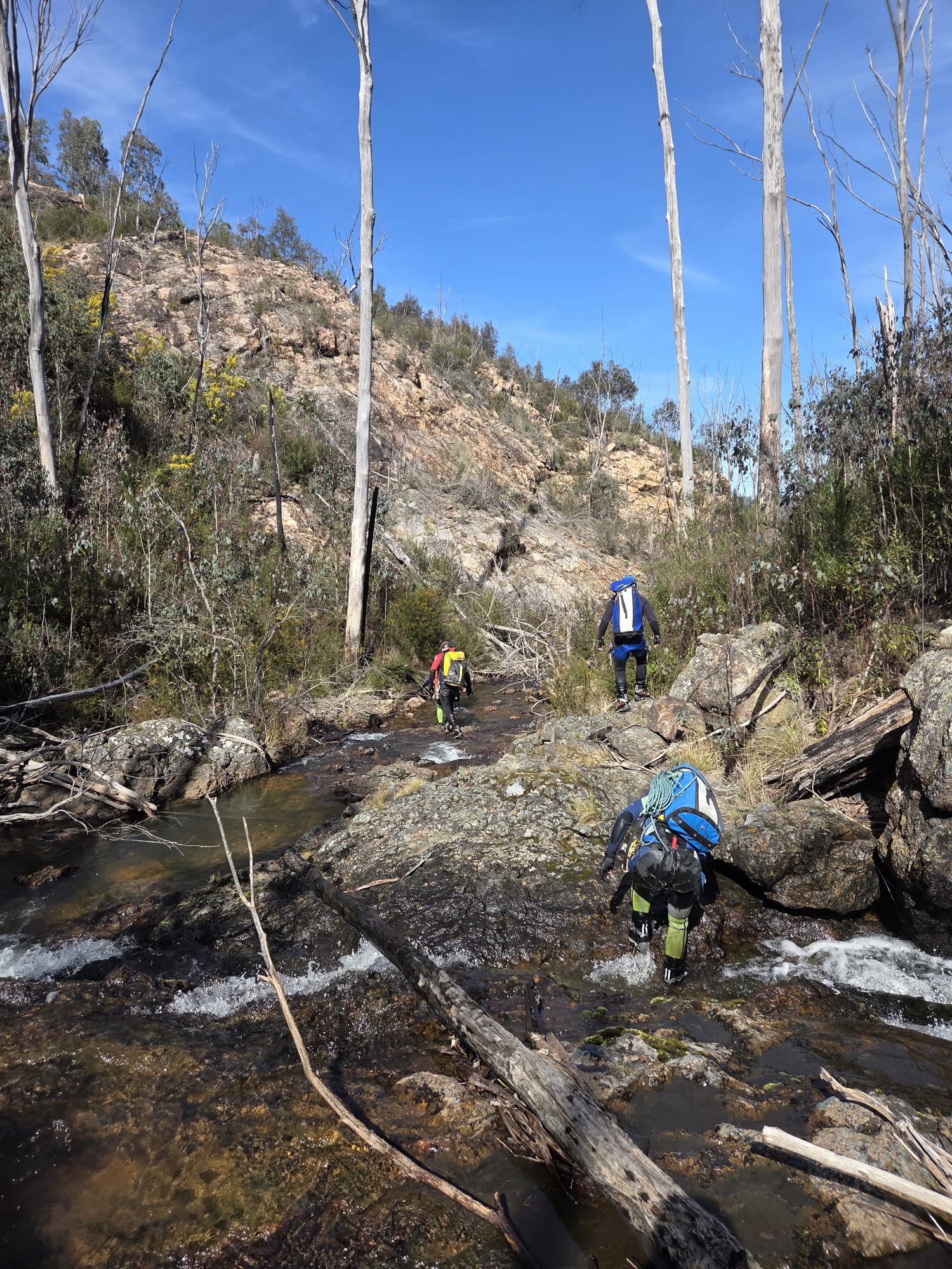
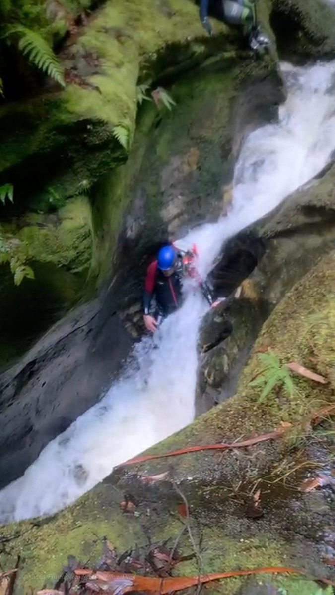
The descent itself is action packed, 6 abseils one after the other, at most there is a small swim between them. At these water levels you are either in the flow or crossing the flow on all of them.
The first 3 pitches are the easiest and we regroup at the base of P3.
Top anchors were all good but with few repeat trips and snow melt we brought gear to replace things if needed. P4 drops to a narrow, semi handing belay above the 45m P5 money pitch. The plan is for Jason to go first with anchor gear, just in case, and a short rope for P6, and get himself safe. Then for me to follow with the long rope for P5. We had discussed leap frogging anchor duties to avoid 1 person exposed to the chill but the water, while cold, wasn’t as bad as expected.
P4 anchors are just over the lip for less rope wear and better pull down. Kristo secures himself on a semi hanging belay and off we go.
Jason signals that the anchors are good. I descend and replace him on anchor. The rest follow.
The bottom 3 pitches are fantastic, well they all are but the bottom 3 especially.
Despite what I said earlier about water temps, I ain’t going to lie. Even with a spray jacket I was bloody cold by the time I got to the bottom of P6.
All pull downs were simple and hassle free for us, potentially with long ropes you could combine pitch 4 and 5 though the guides say there are lots of nubs and cracks that ropes could get jammed in so that may not be the best idea. These cracks are also a foot entrapment risk so take care.
Climb out as soon as the steep cliffs allow, is a bit vague. 50m down stream of the waterfall. Was more helpful.
We were about 50m down stream. A slabby corner crack looked scramblable. Scoping from the other side on creek, braving the scree slope of death Kylie spies and easy spur another 10m down though.
Guide mentions gaining a spur. We took the spur into a gully (if you could call it that) so far matching descriptions. to another spur to gain a ramp leading back towards the top of the waterfall. Well there looked to be a ramp there, it would be a scramble to get up on it but we head up.
Scrub was hectic. Every step forward was a punish. The ramp went up but it would come to an option of narrow, loose traverse that didn’t look like it went or a dodgy scramble bordering climb. Time and again we’d force our way up or along only to get cliffed out and need to retreat a bit and try again.
It was steep and loose and slightly terrifying.
It was energy sapping and soul destroying.
We were a long way up and had been forcing away towards the top of the falls, but it still seemed so far away.
Eventually after getting cliffed out again we retreated back slightly. There looks to be a ledge just below us. Said someone. Kylie and Kris find a way down to it. It might go.
Kristo pushes on.
Some time later, It goes calls Kris.
They had finally stumbled across the right ledge. We still had scrub to fight through and we still didn’t know for sure it was the right ledge.
I see the rope. called someone.
Releaf.
We emerge from the scrub only to find a gully between us and the rope. we drop in and discover we are at the base of a climb and the rope is at the top. Hywaida goats up. When it comes to exits it gets to a point where she transforms to superwomen.
Kris goes next, taking a rope to join to the one in place.
Dave disappears to the left and as Kris drop the rope Dave appears next to him. It’s an easy scramble around the corner. says he.
From there its 3 easy scrambley pitches which we punch up using our crolls on the rope as a safety, but tbh despite some grade 10-12 moves its the least exposed stuff of the entire exit.
3hrs later the battle to escape Landers was done.
I’m not 100% sure we won.
The Beast
There was a point to this story, but it has temporarily escaped the chronicler’s mind: Douglas Adams
A bit of an idea for those wanting to set a fix rope for the final bit of the exit
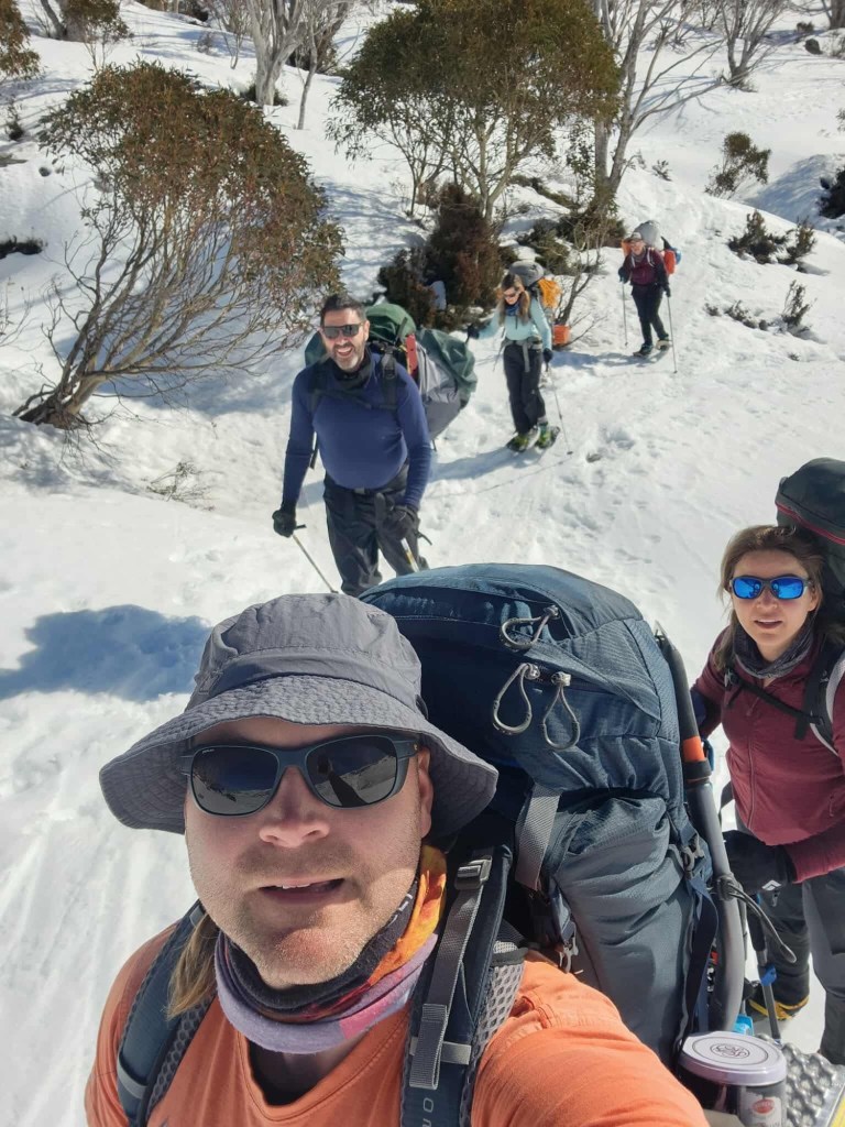
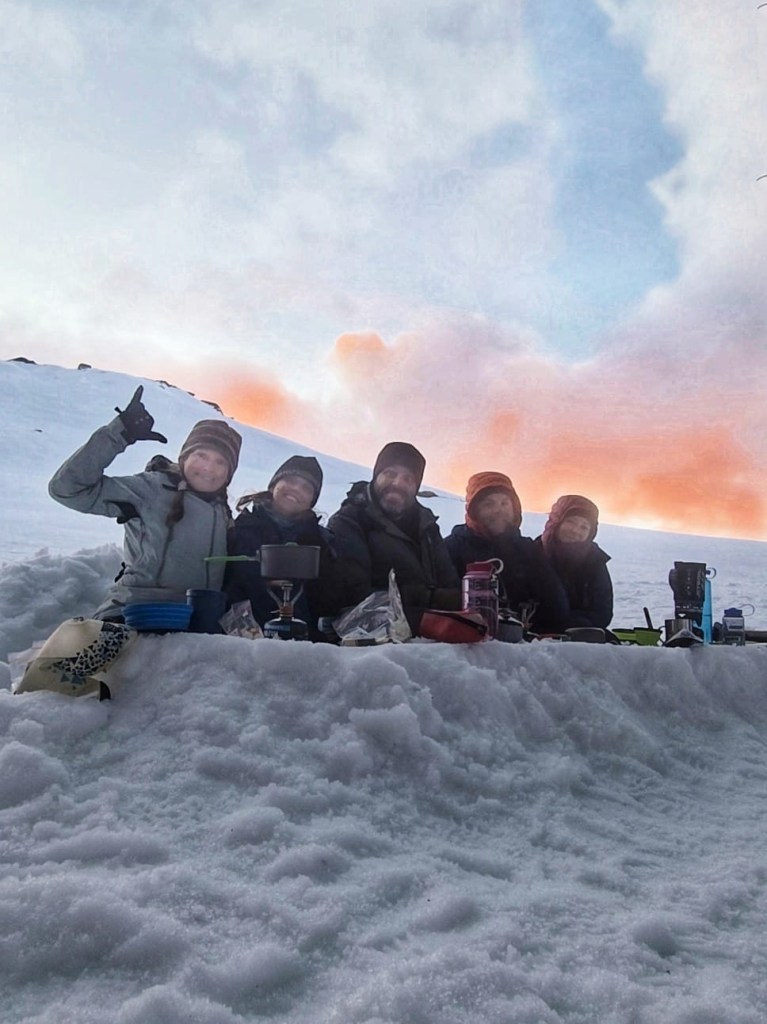
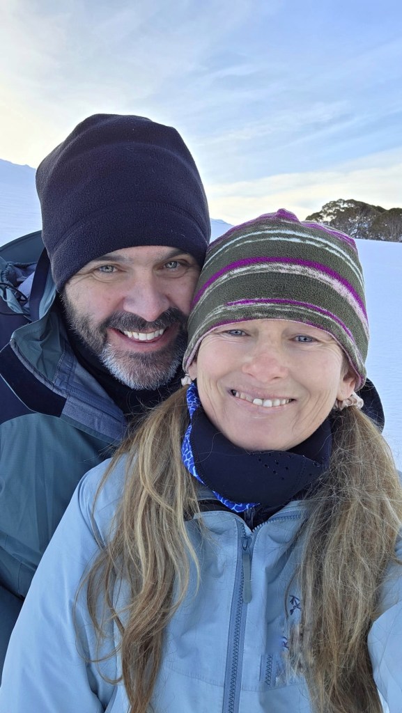
The gang have been doing an annual pilgrimage to Blue Lake for a while now. This is the second time I’ve got to join them.
We did a day at Charlotte Pass where I gave skiing a go for the second time and had fun rumbling down green runs.
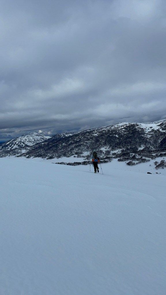
The following day we headed up to Guthaga, where it was like an random uni reunion for Kylie and her former class mates as well as a Blue mountains adventure crew hang out. Lots of coincidental trips with like minded people over the weekend.
We said our g’days and yakked then went our separate way and shoed out to little twynam.
Well, Sonya, Kylie and I shoed Kris and Hywaida decided it was icy enough to. Just use crampons. This proved a wise choice and one we’d all adopt for the rest of the weekend.
Blue bird days
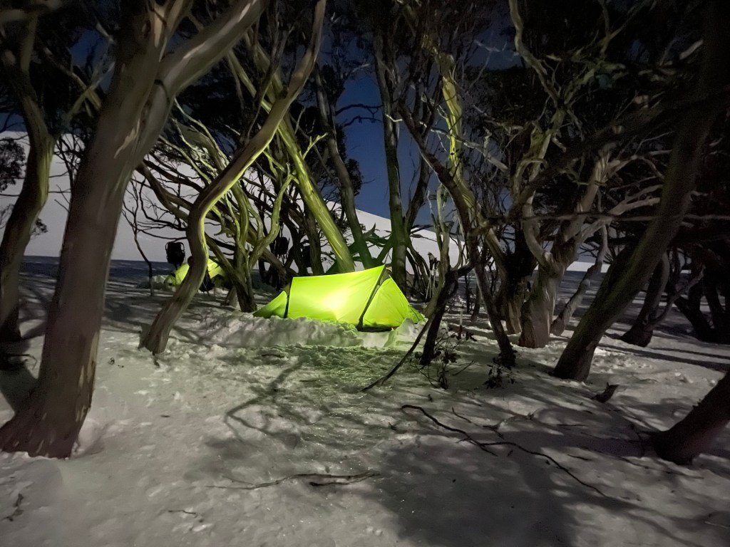
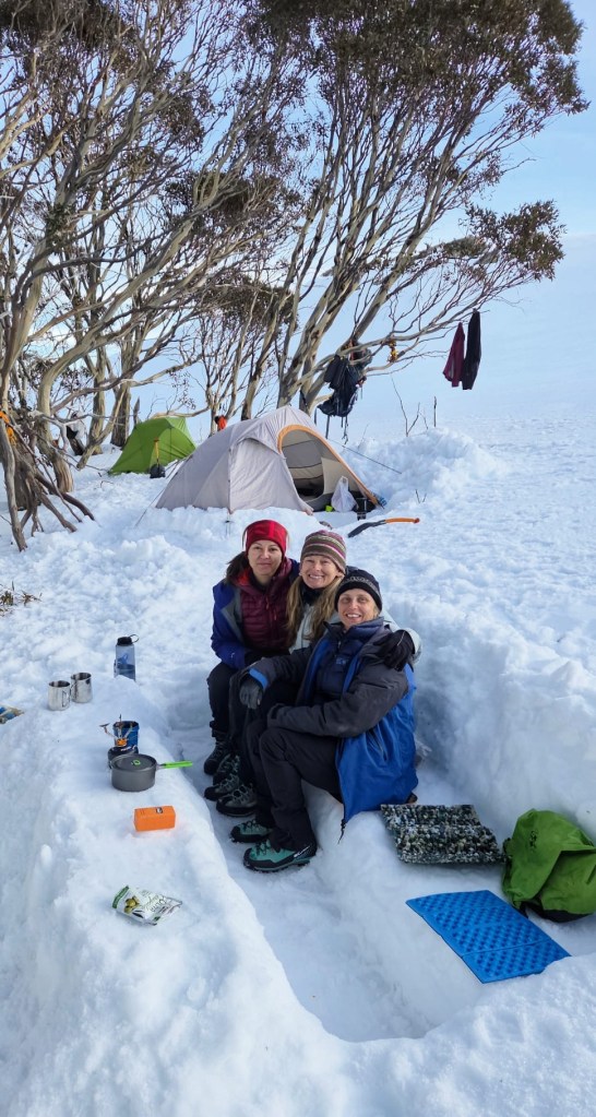
We dig the tents in and settle in for the night.
I say “we” but Kylie pretty much set up ours on her own. I was in a mind daze and struggling physically. Belatedly I realised I hadn’t had any thing to drink all day. Rooky mistake
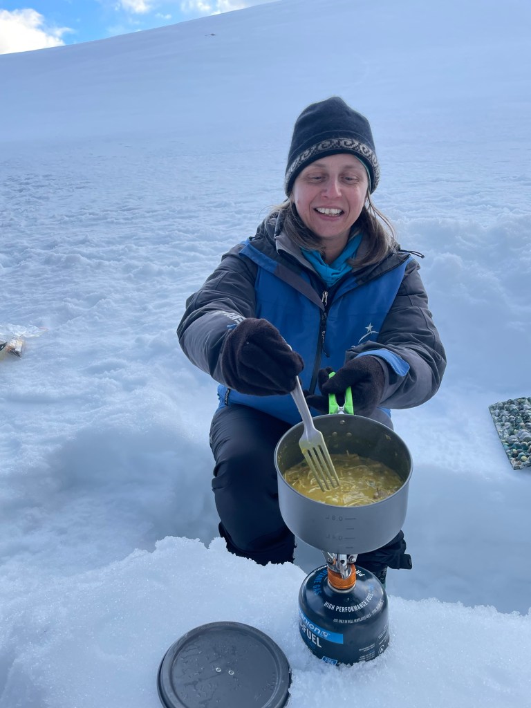
A shot of Thorzt in my water bottle and I came good and set about building a rough kitchen
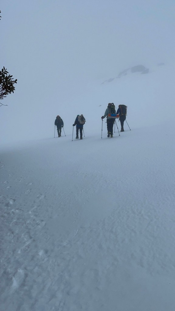
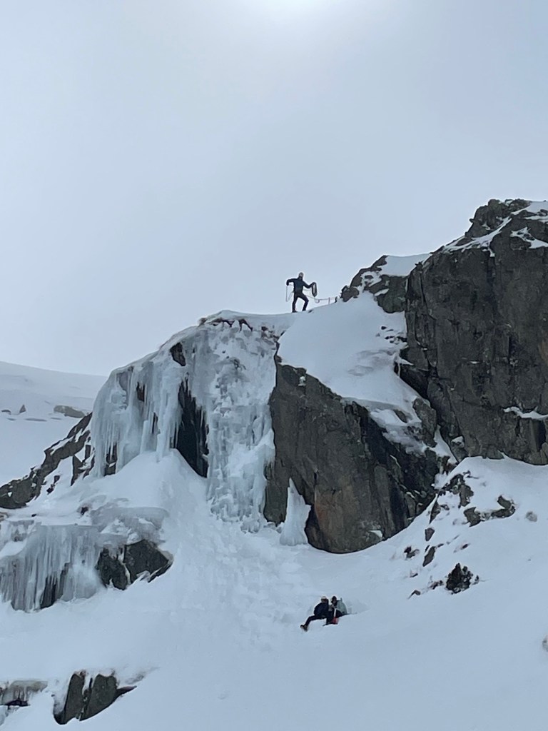
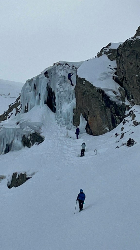
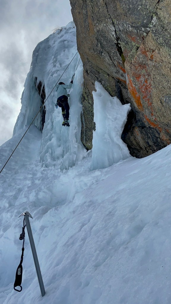
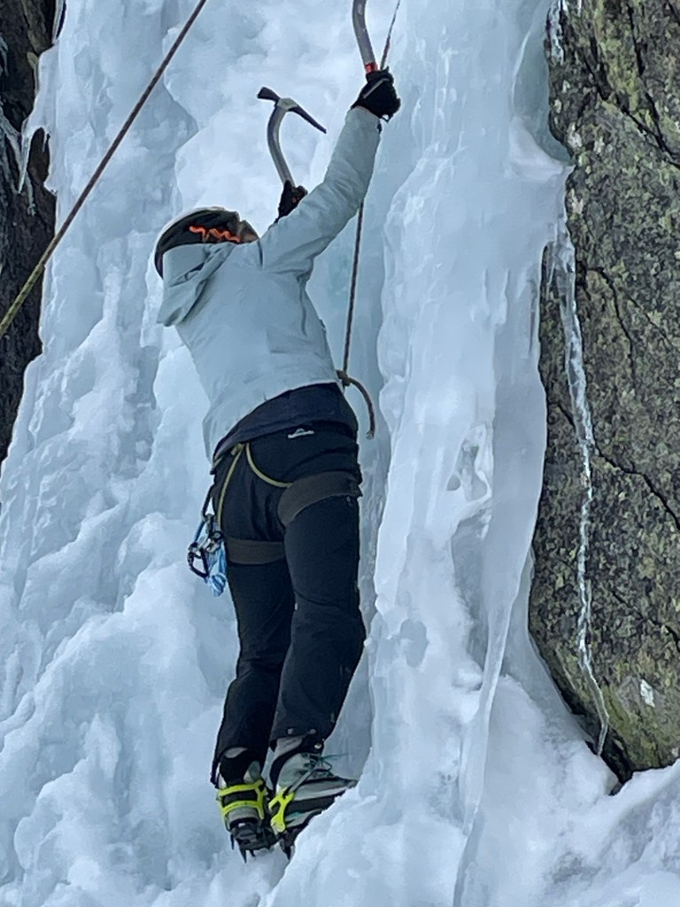
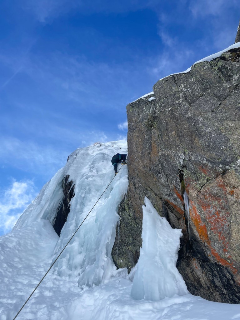
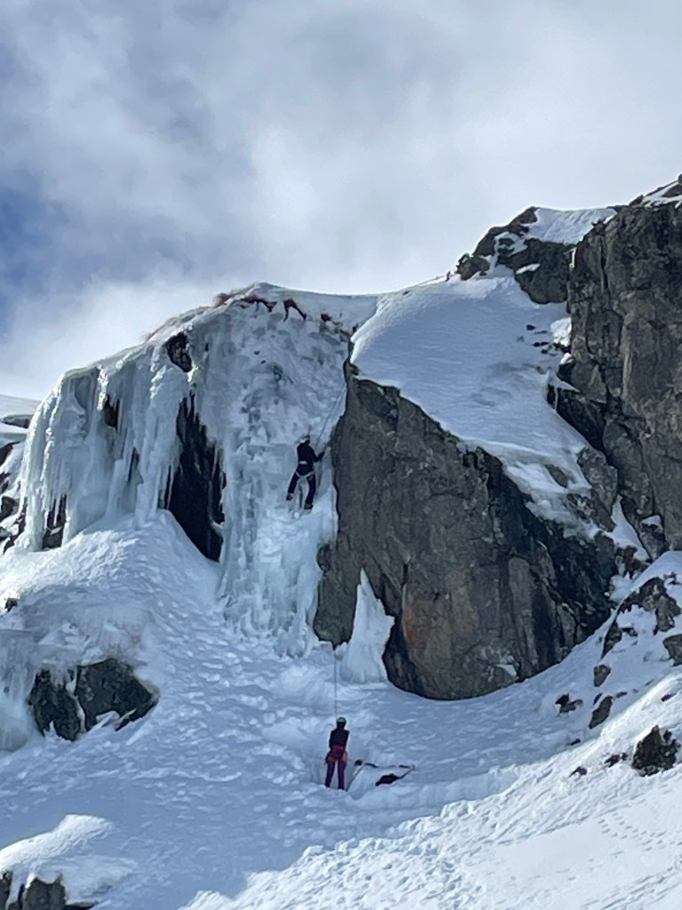
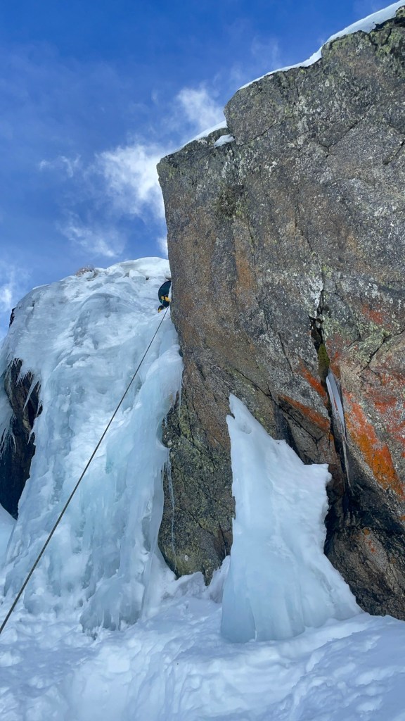
Next day we were up early to make the most of the good weather to play around on the ice walls.
Atmospheric Kris setting up a T anchor for us.
Back at camp
When your mate is the author of the best wilderness cook book on the market, Xtreme Gourmet. Sonya showing us how easy great food can be.
It’s not much but it surprising at how much more comfortable a simple bench and table make the experience.
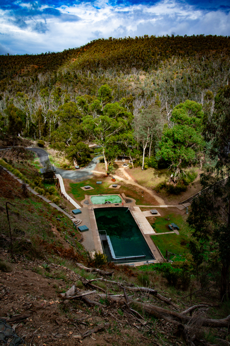
Access: Easy access to the start of the trail. Dirt roads but well maintained at time of writing
Navigation: Navigation is fairly straight forward. Signposted tourist trails
Map: Lithgow
Time: There’s various options but give yourself a couple of hours
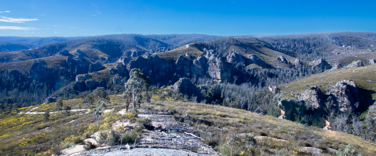
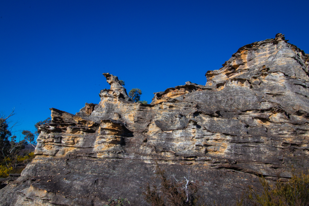
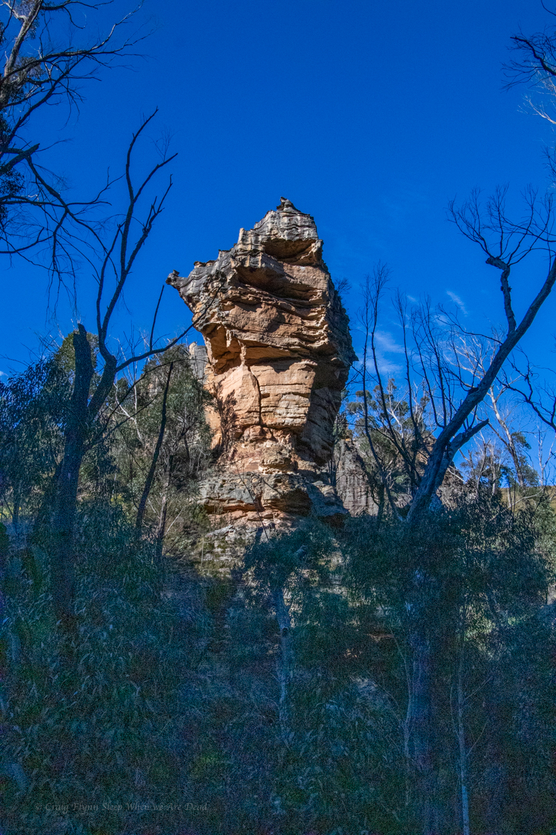
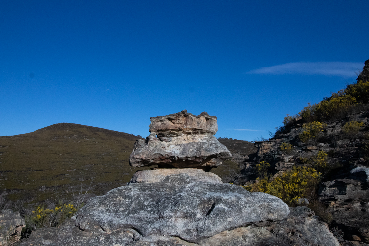
The name is inspired by the resemblance of the spectacular towering pagodas to some fabled lost city, The lost city has been a well known favourite to 4WDers, rock climbers and avid bushwalkers for years but recent works by NPWS has improve accessibility and the area now has a family friendly loop.
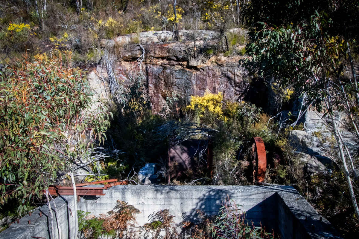
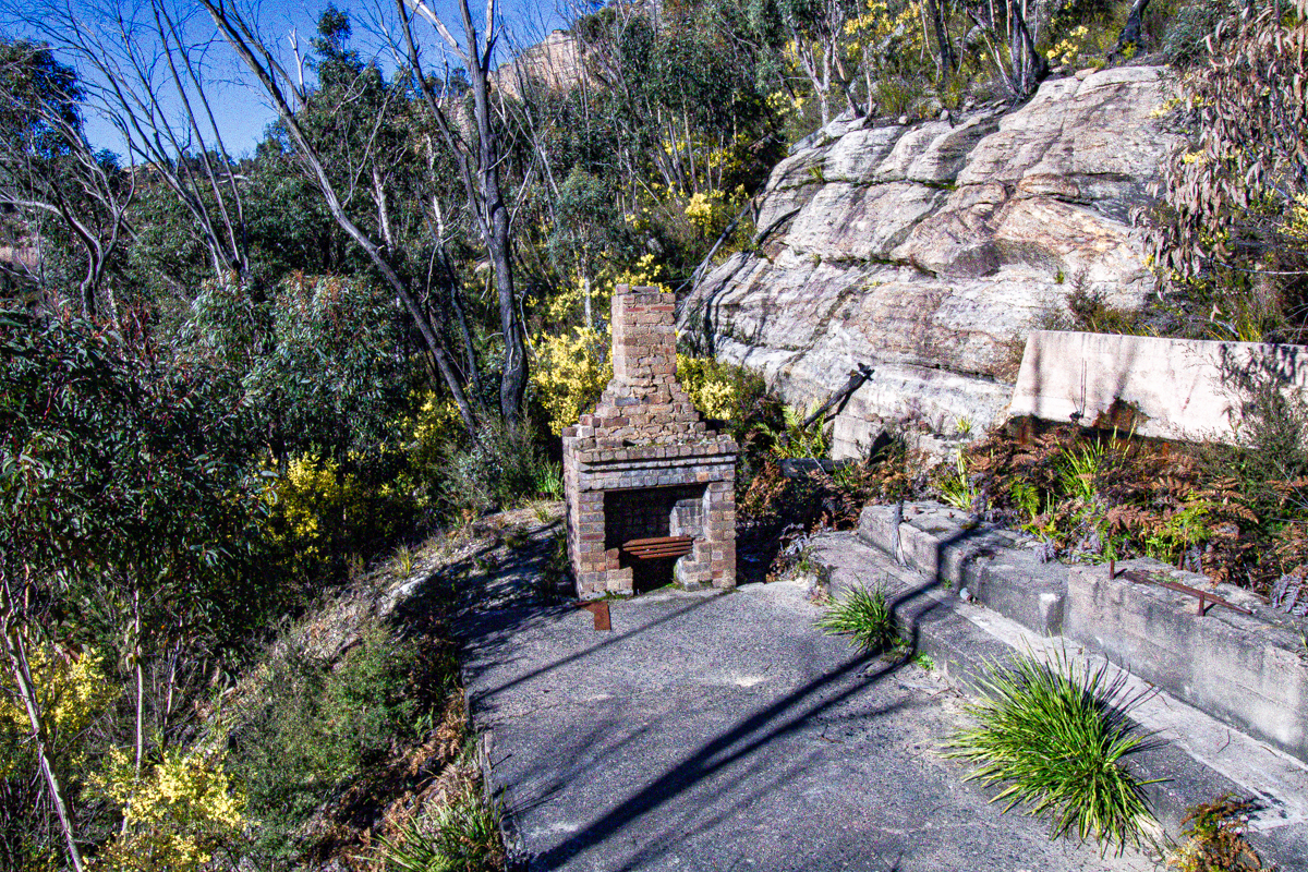
While not as shady or rainforesty as the Grand Canyon loop at Blackheath it more than make up for it with towering cliffscapes and industrial heritage
Getting there:
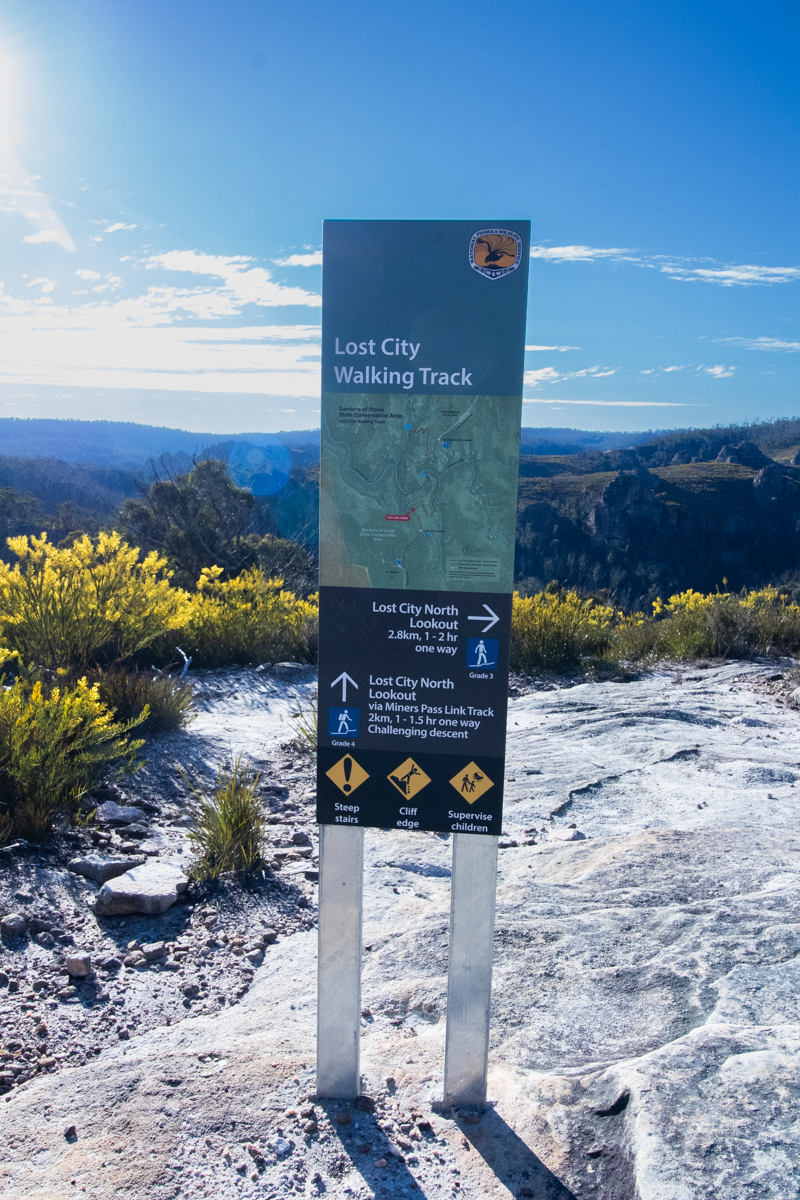
There are a couple of options of where to start, The Northern Lookout (Traditionally more well known) and the Southern Lookout (up until recently more of a local secret.)
Drive out of Lithgow via Atkinson Street and continue up State Mine Gully Road.
(Halfway up the steep hill (Dobbs Drift) there is a parking area on the left and it’s worth a stopping for a quick side trip to have a look here.)
Drive to the top of the hill. The first turn on the left as it flattens out will take you to the southern car park.
Alternatively continue along and onto Glowworm tunnel road. Take the left fork at the Bungleboori Picnic ground, then left again. this will take you to the Northern car park.
Suggested Walks.
Easy 1: Start at the Southern Lookout and enjoy the expansive views over toward the lost city. Follow the main trail down to Marrangaroo creek then return the way you came.
Easy 2: Start at the Northern Lookout and enjoy wandering through the amazing pagodas. Follow the trail down Marrangaroo Creek then return the same way.
Through Walk: Do a car shuffle and walk between the 2 lookouts. I’d suggest starting at the Northern Lookout and walk to the southern lookout via the main trail.
Southern Loop: If you don’t want to do a car shuffle but want a loop rather than an out and back I’d suggest starting at the Southern Lookout. Descend via the miners track then come up the main trail. This provides views over some old mining heritage and takes in a nice waterfall (best after a bit of rain) then a more gentle climb out along the gorgeous Marrangaroo Creek.
The Full Box and dice: If you want to take it all in I’d suggest parking at the Northern Lookout. Walk down and up to the Southern lookout via the main trail then descend the miners track back to Marrangaroo creek and hence back to the Northern Lookout not the main trail.
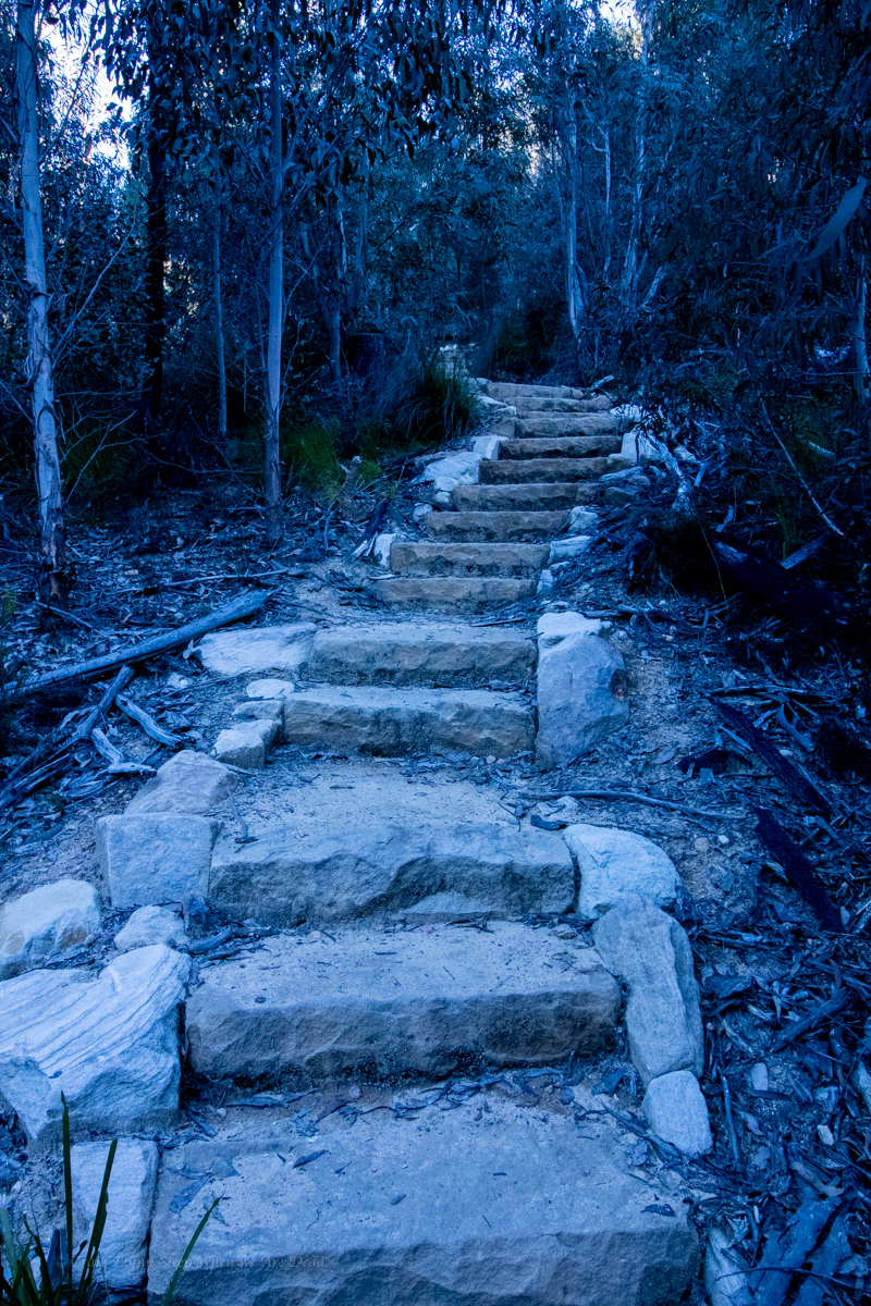
Of course if you don’t wish to tackle the stairs it’s worth just visiting the lookouts.
Despite just getting back from Blue Lake hot on the heals of New Zealand we were feeling like we hadn’t been too active this winter. I hadn’t really been riding and Kylie was missing regular trips to the climbing gym and we were both missing canyoning.
We briefly considered a simple Empress run then I thought to myself, I haven’t done Hat Hill in like forever.
Hey Kylie, says I, I haven’t done Hat Hill in like forever.
Me neither, says Kylie.
So we put a last minute call out and H joins us.
Driving into Blackheath, Um, Does anyone know where we are going? say I
A quick check on Ozultimates to confirm the car park and we are off.
We had considered abseiling in via one of the side canyons but there had been a crap load of ran through the week and since we hadn’t done it in like forever we decided to stick with the standard trip as a reccie for later adventures.
We are expecting the water levels to be up and were prepared to abort the trip if it was too high.
The walk in is short and easy we get to the start of the first section now dramas
The water was a bit pushy, making the down climb a bit tricky
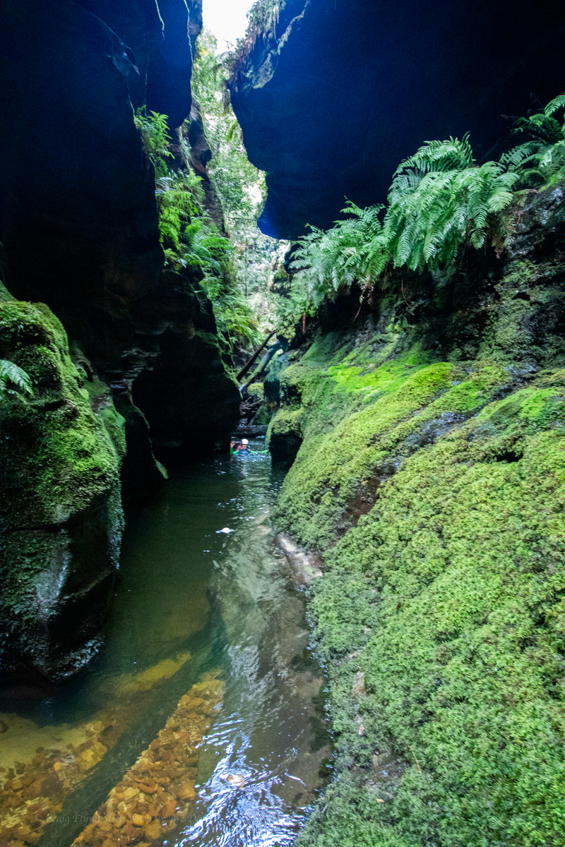
The first section is a nice little teaser, the walls close in then pretty much open out.
But it’s pretty creek walking in between the canyon sections
We take the time to explore up the side canyon on the right making plans for future trips before heading down stream
The high water made some features a bit harder to negotiate than usual.
We scope out the entry to the middle section and carefully consider it before committing.
A still from Kylie’s Video. Might not look like much but personally I would be reluctant to try it any higher. If you needed to reverse out for any reason it would be problematic
There is a lot of tree fall which would also create dangerous hazards in high water. the calmer bits between, though were noice.
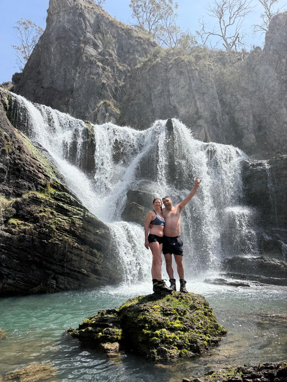
The lower section was as pretty as ever with multiple side waterfalls
the infamous double arch waterfall in a side canyon
Making our way back up to the exit through the lower section was surprisingly hard work. The extra water flow and deep sand working like resistance training on every step.
And back at the exit there was nothing left but to have lunch then haul out.
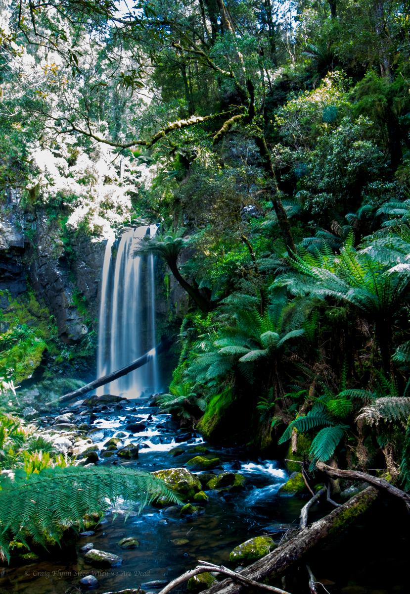
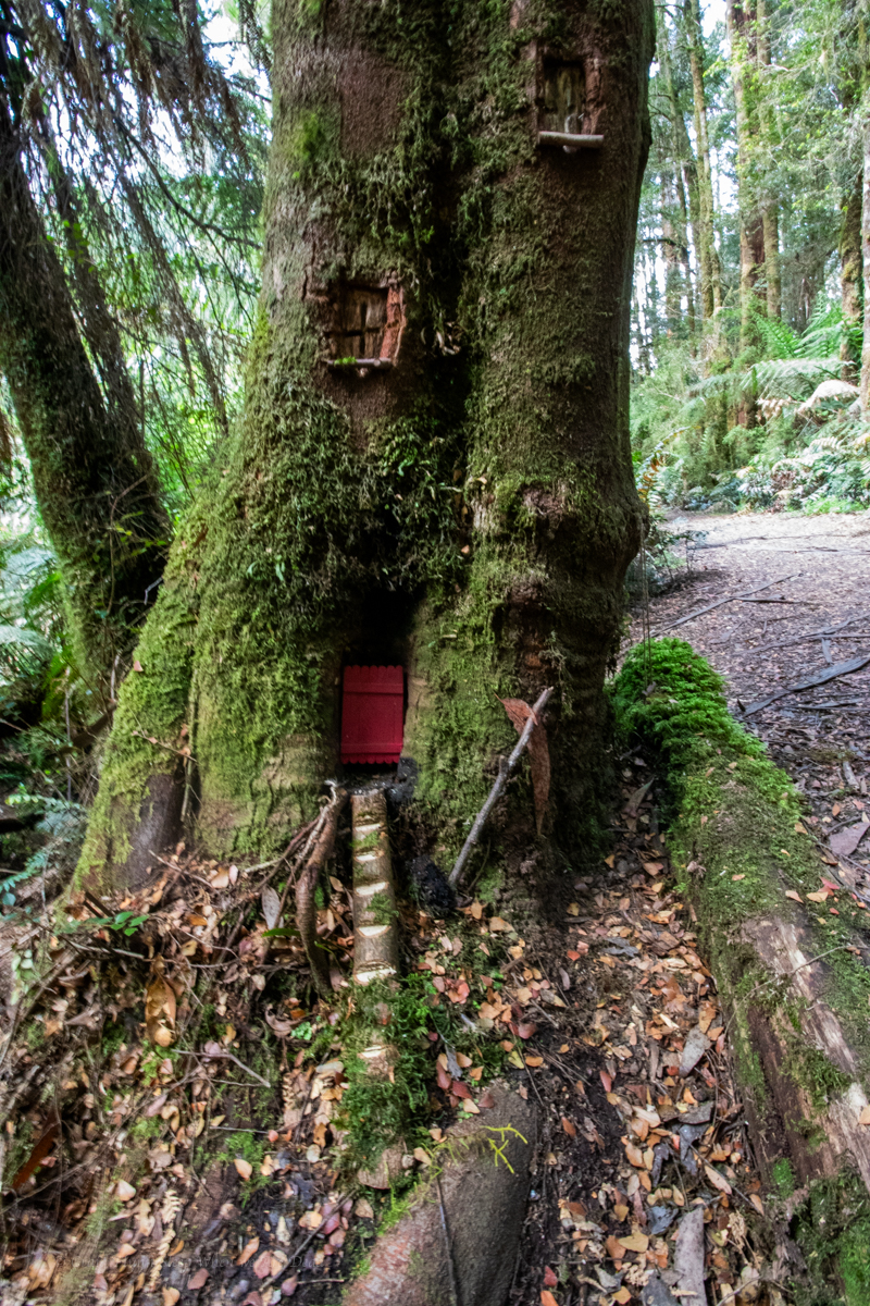
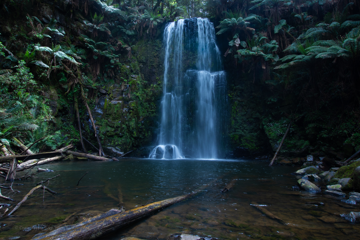
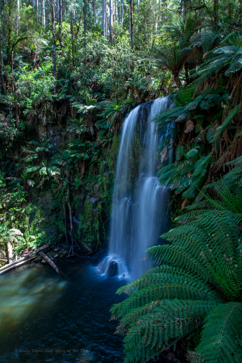
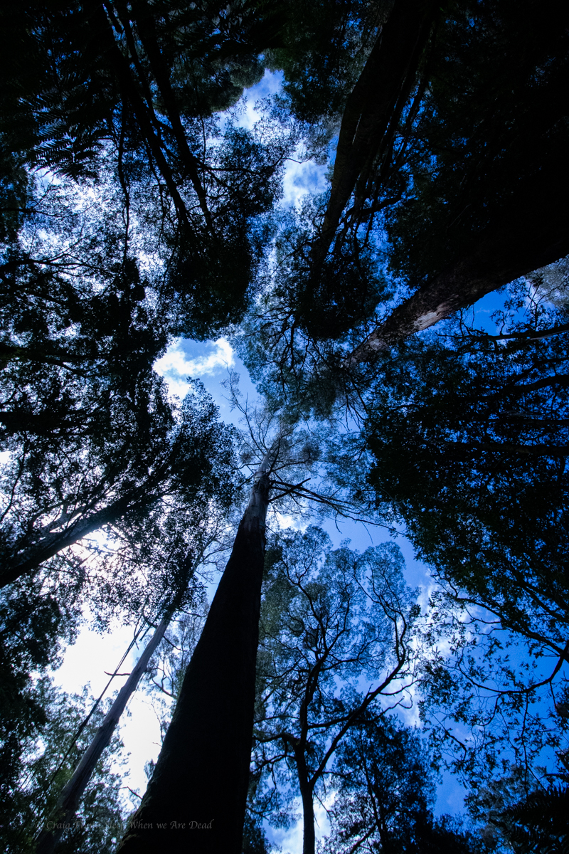
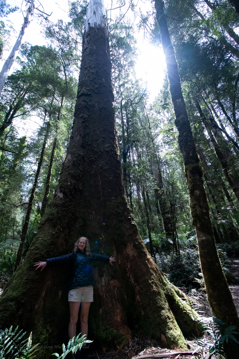
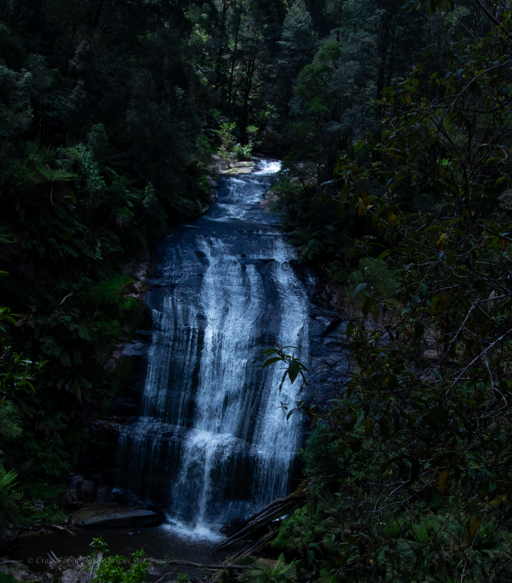
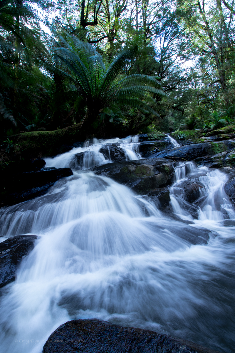
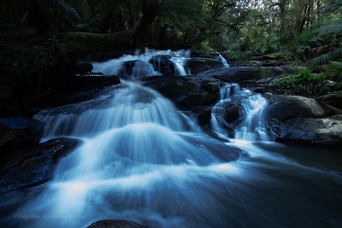
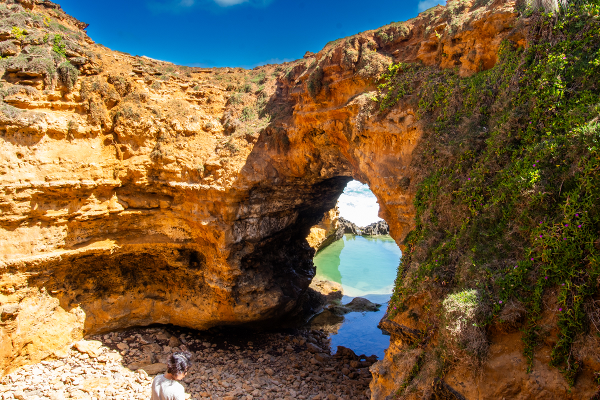
Doesn’t really need words but we road tripped out of Melbourne and made our first stop in The Great Otways NP for waterfalls and old growth Gondwana forests.
Glowworms. Always chasing glowworms
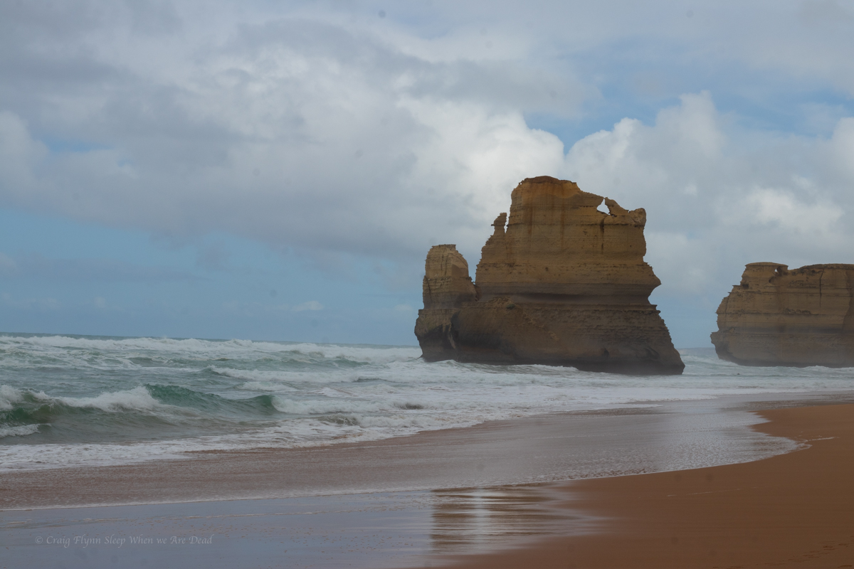
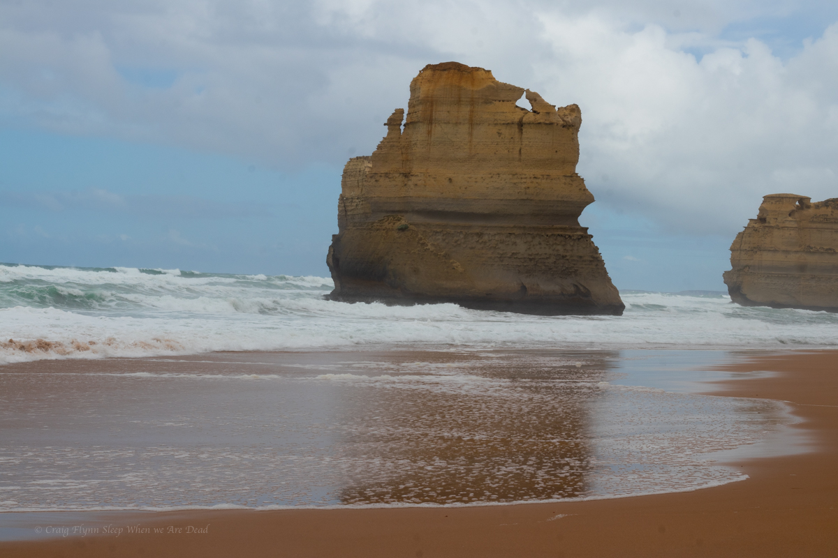
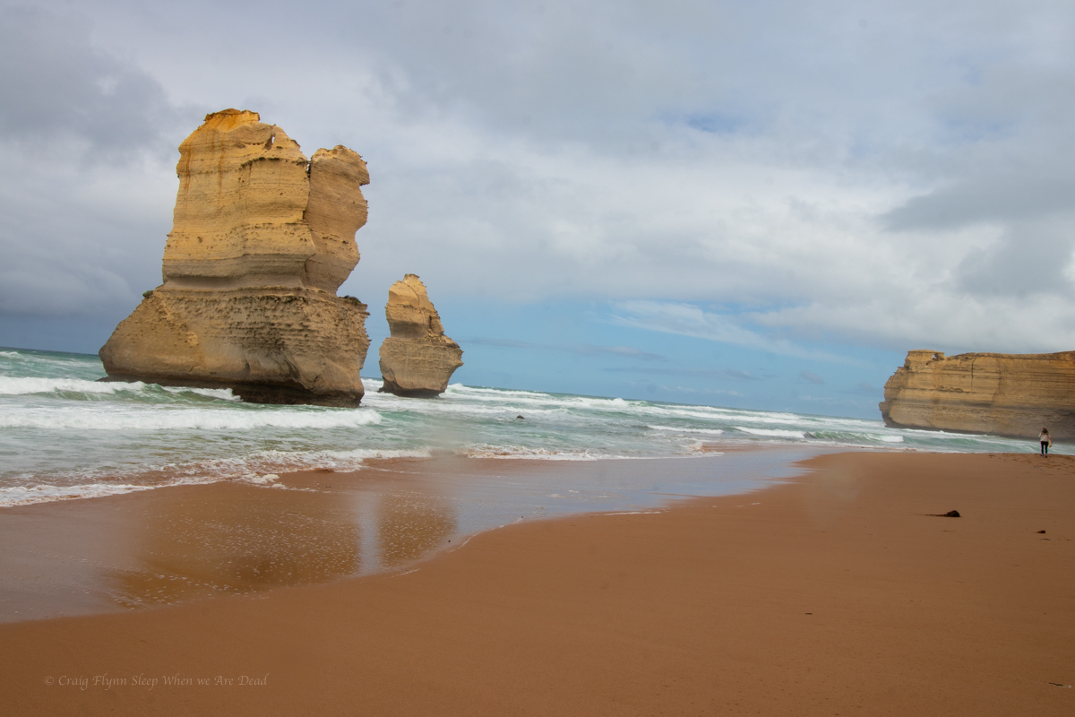
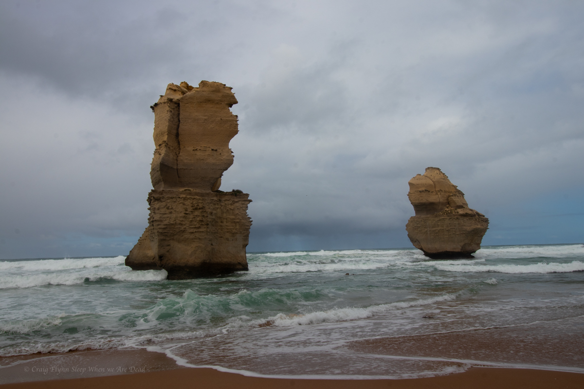
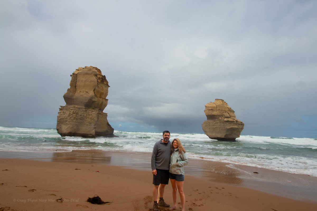
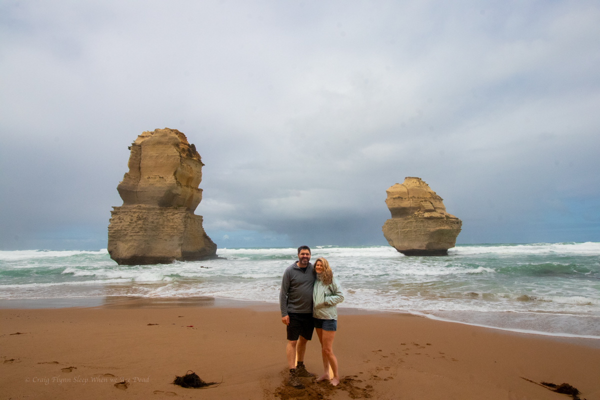
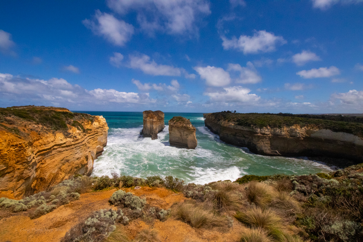
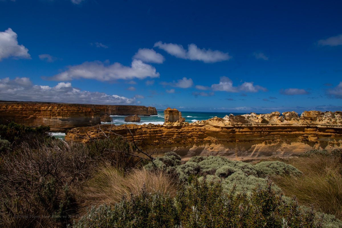
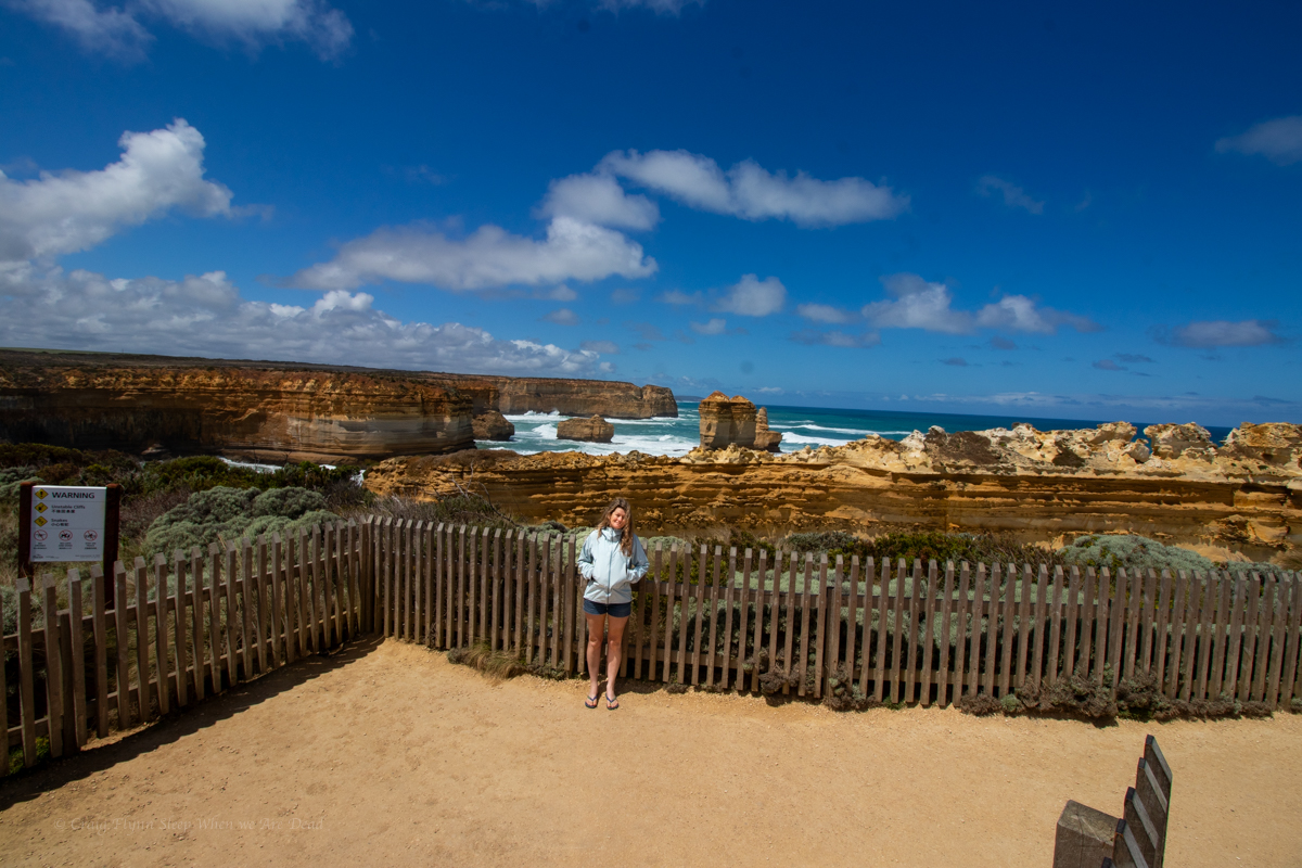
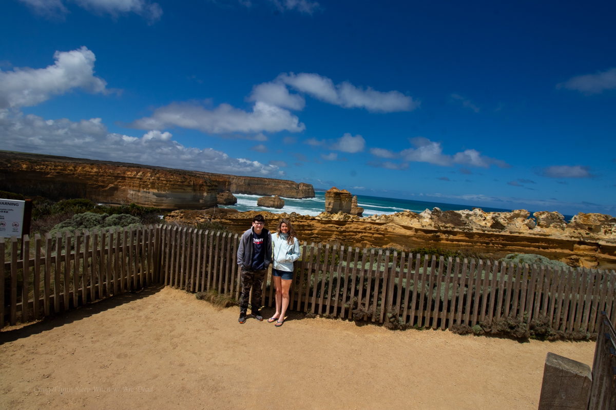
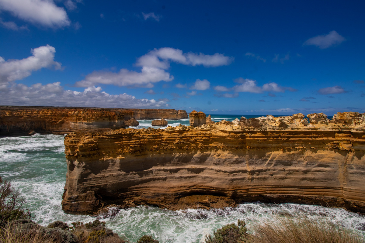
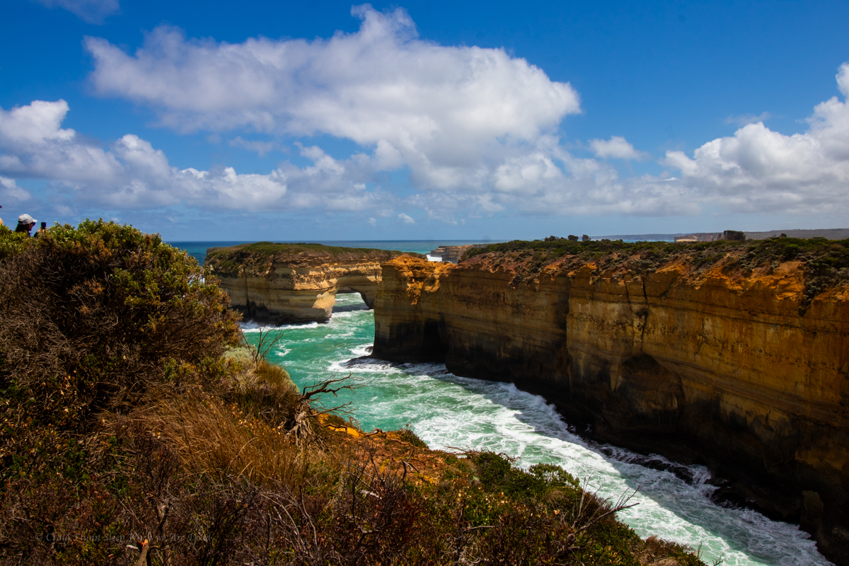
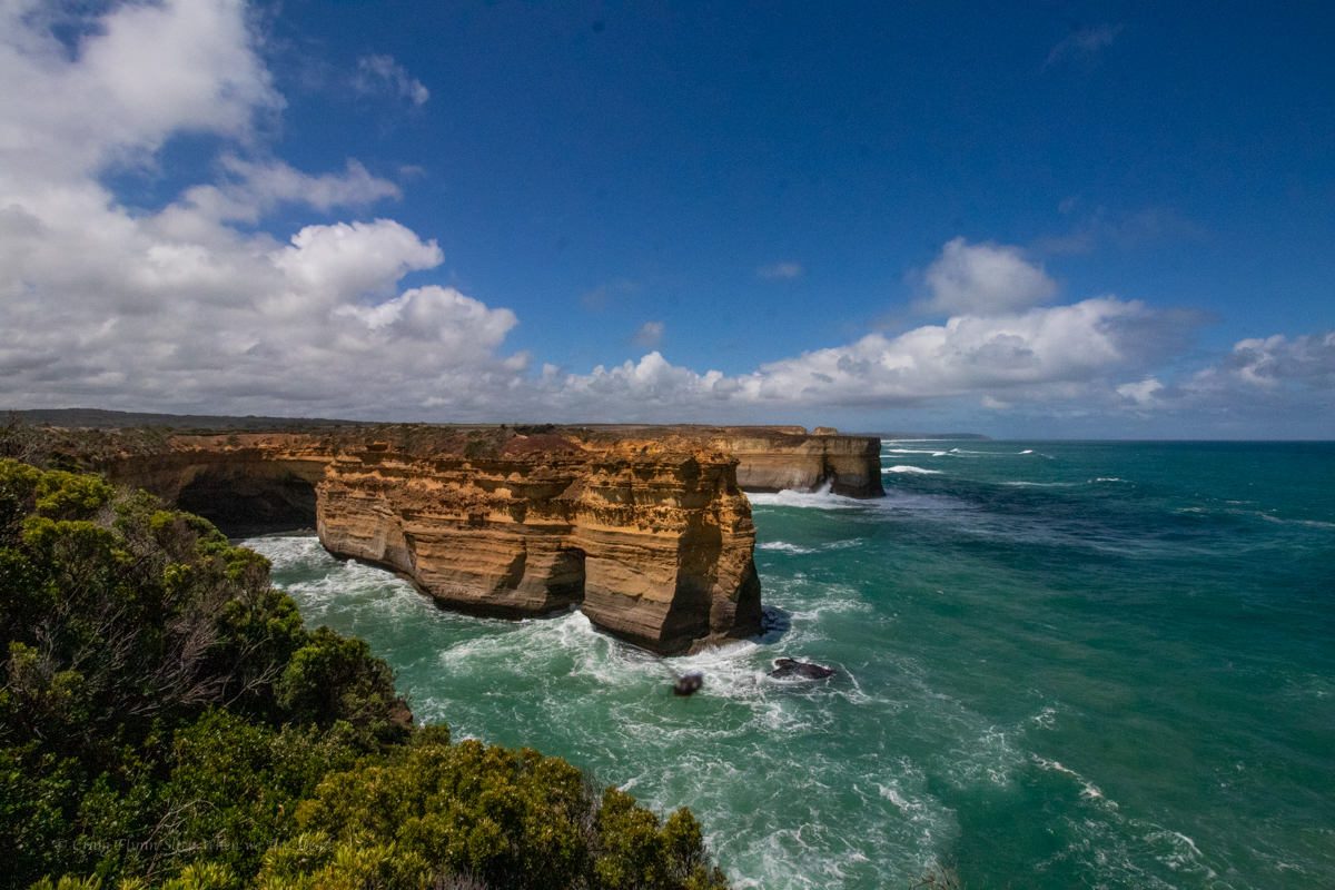
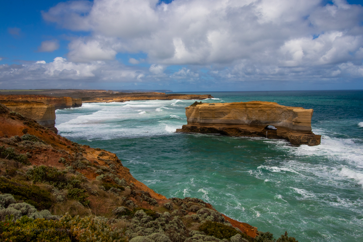
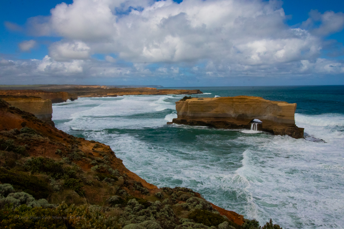
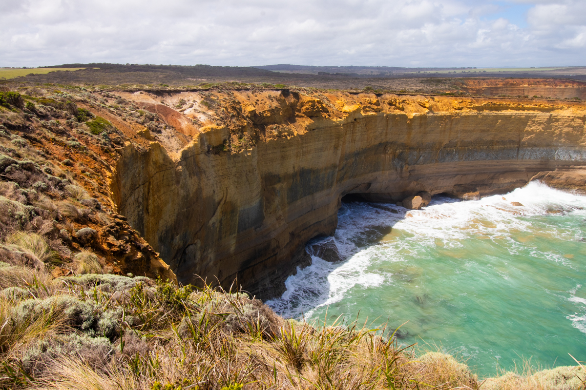
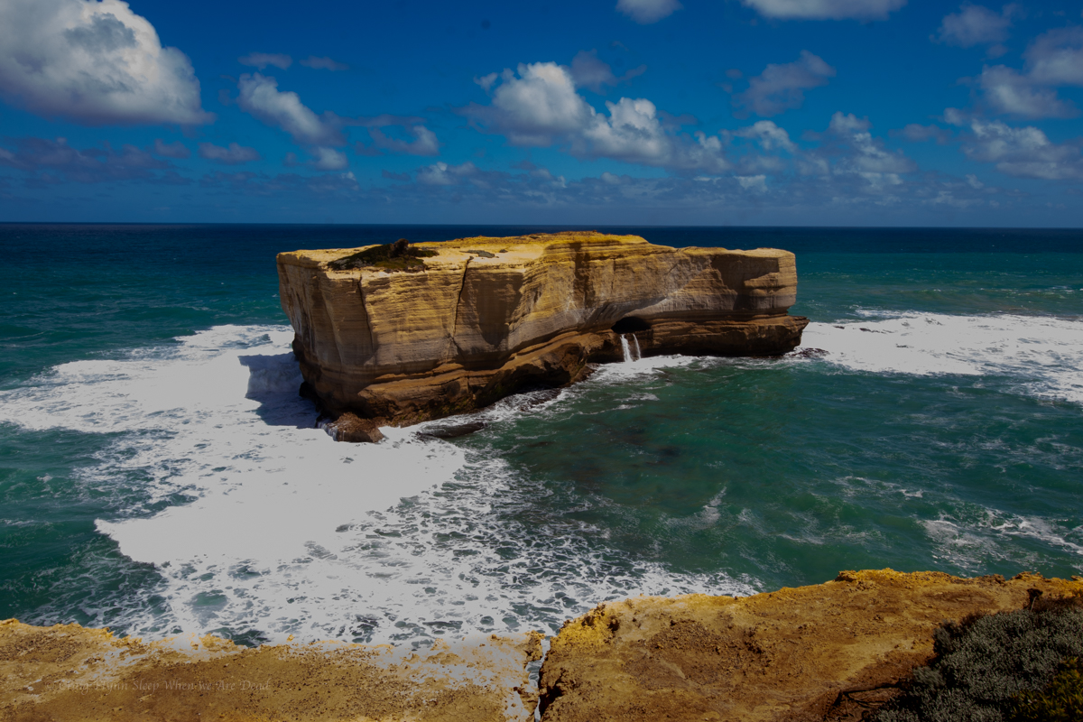
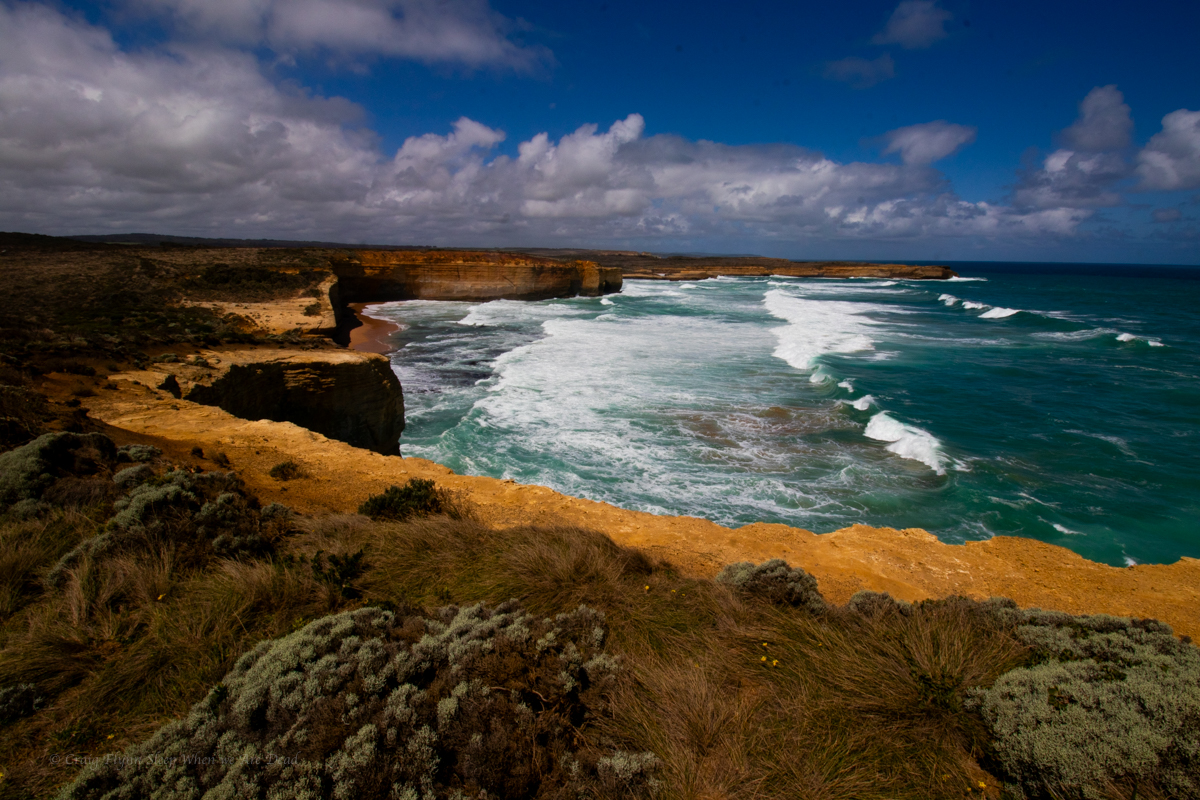
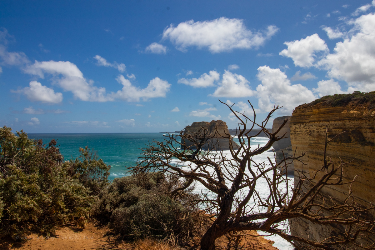
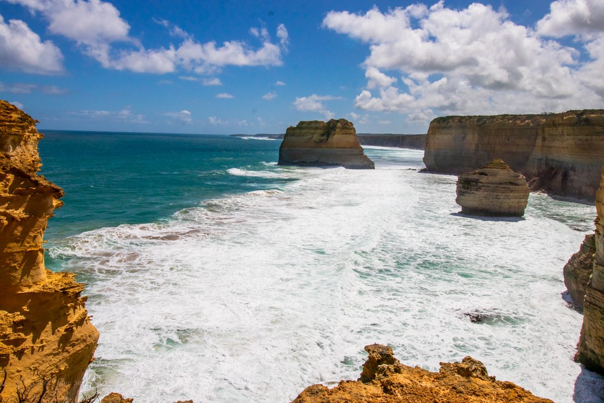
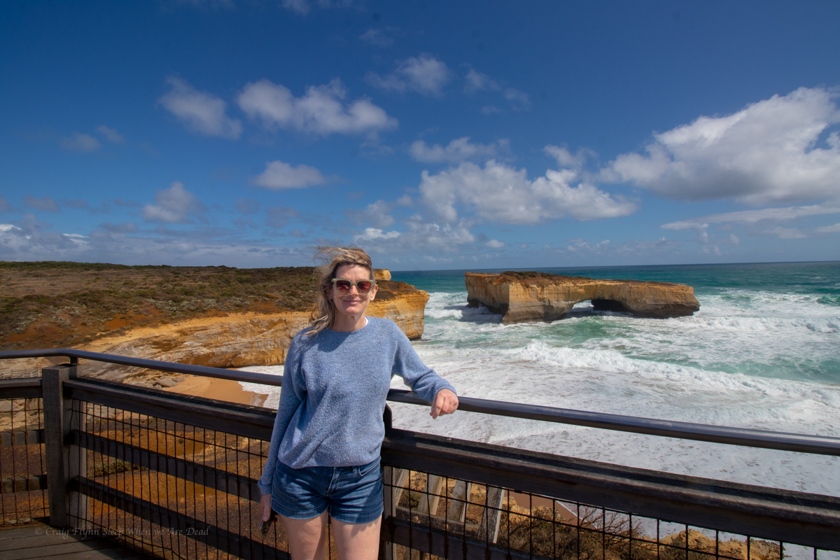
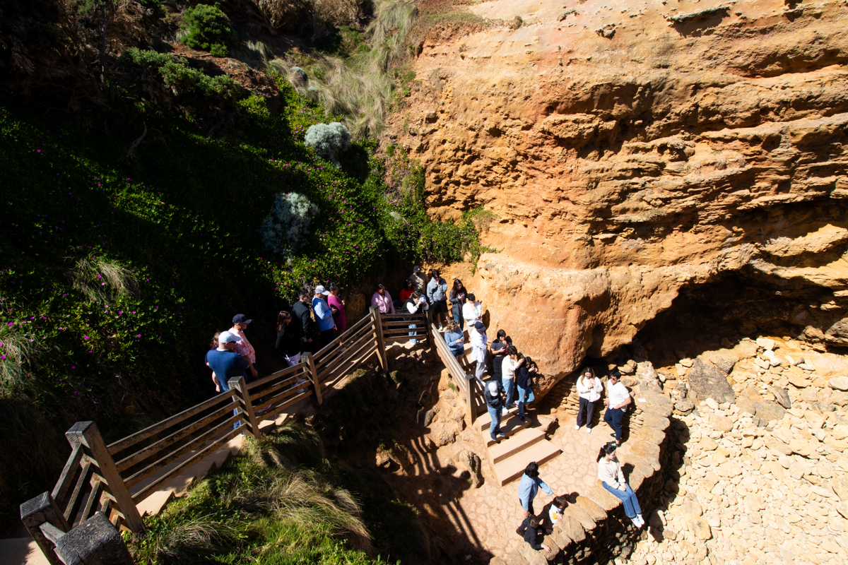
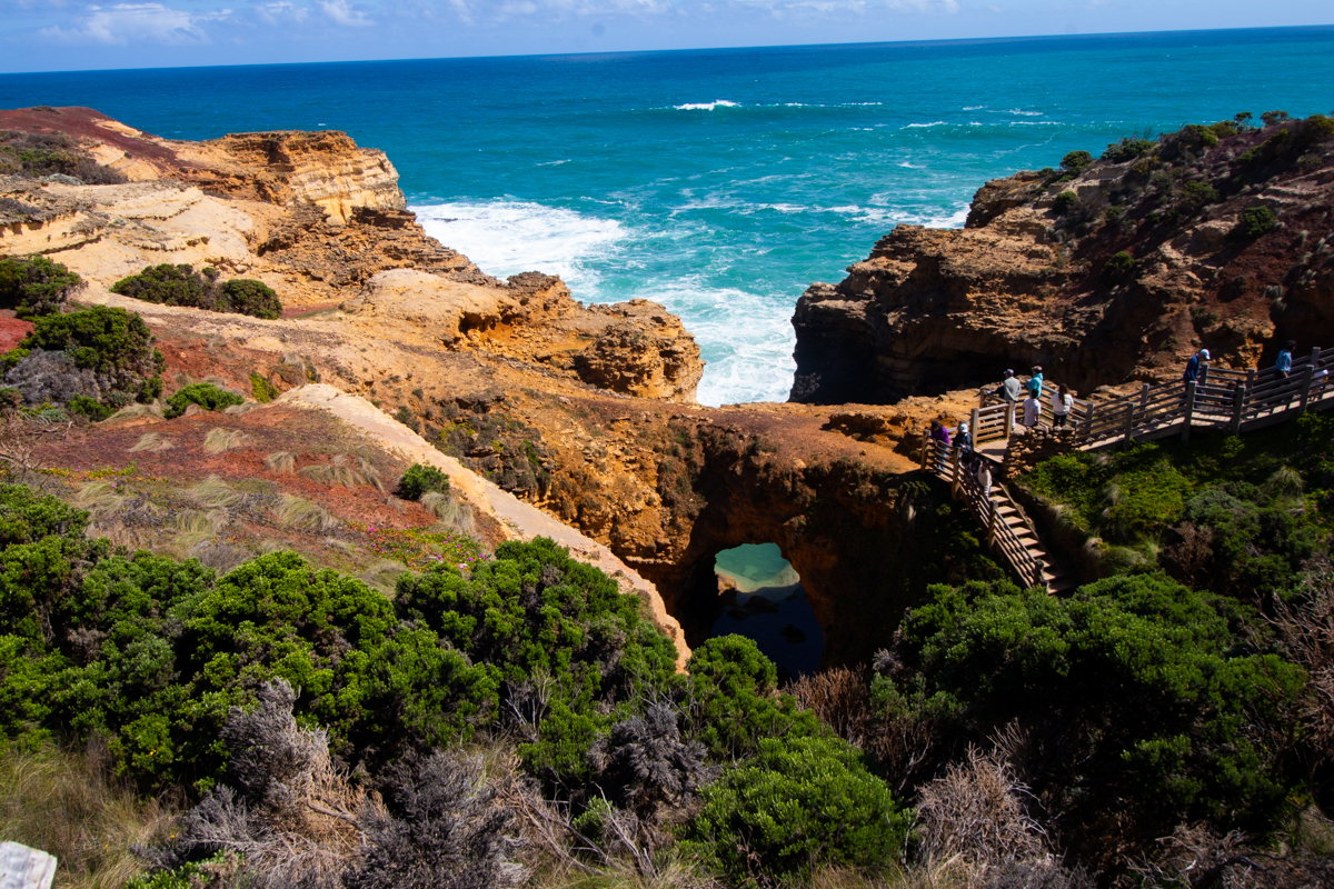
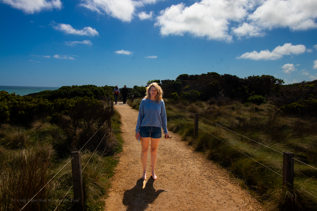
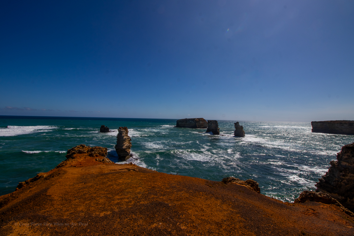
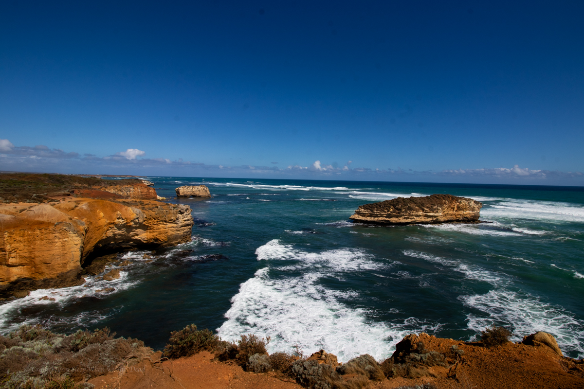
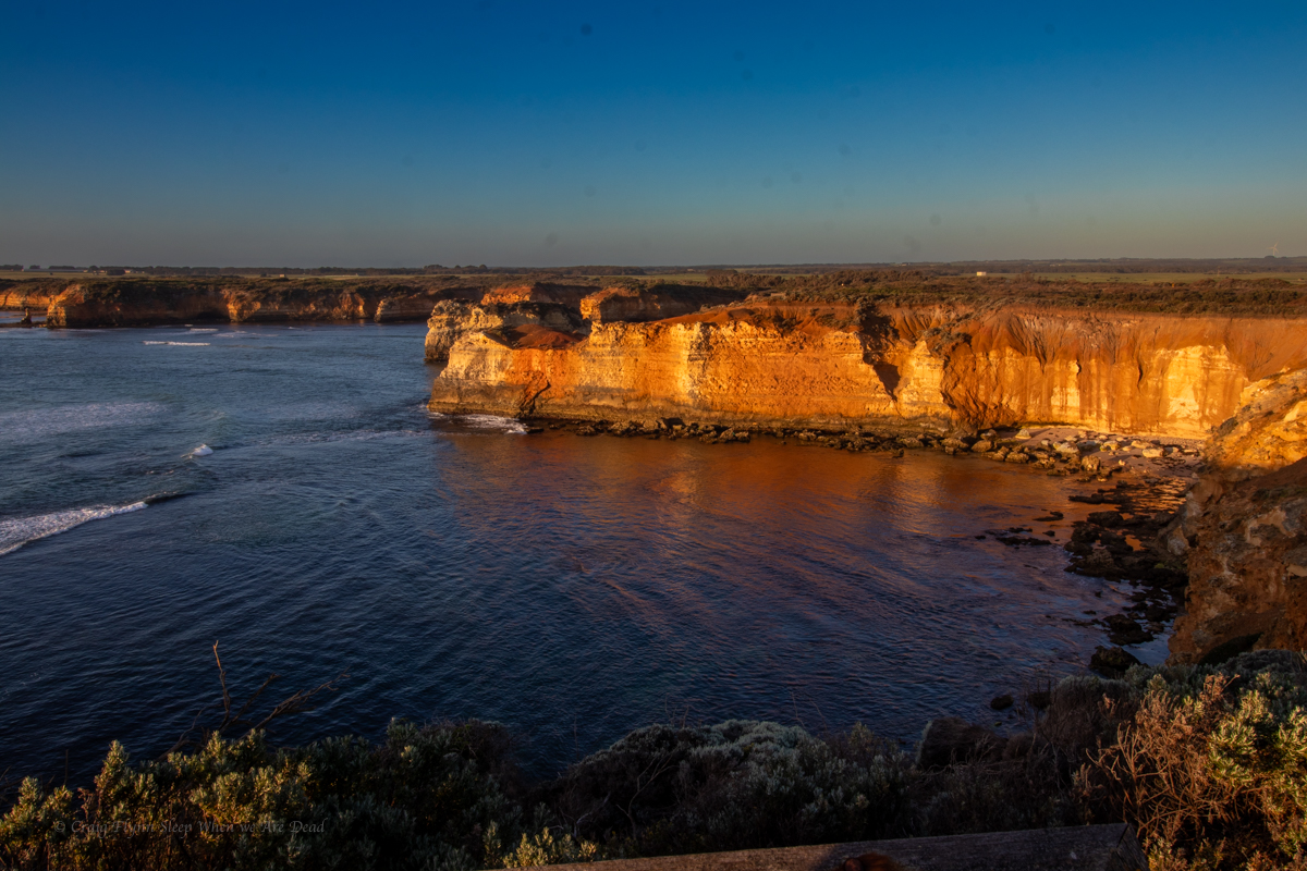
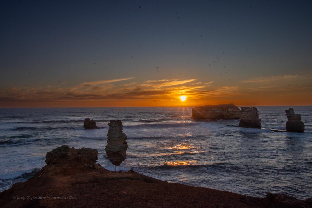
And then we cruise on down the road turning left at every opportunity to look at big rocks sticking out of the southern ocean.
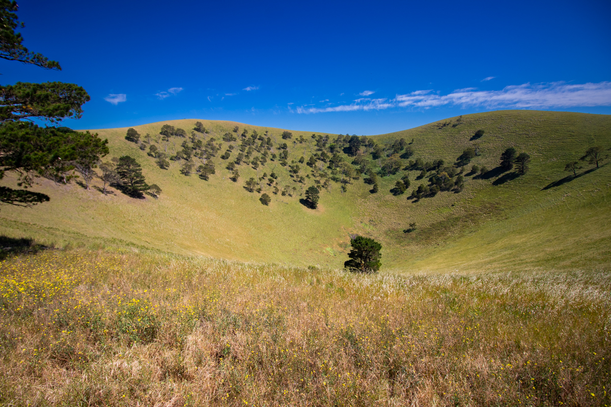
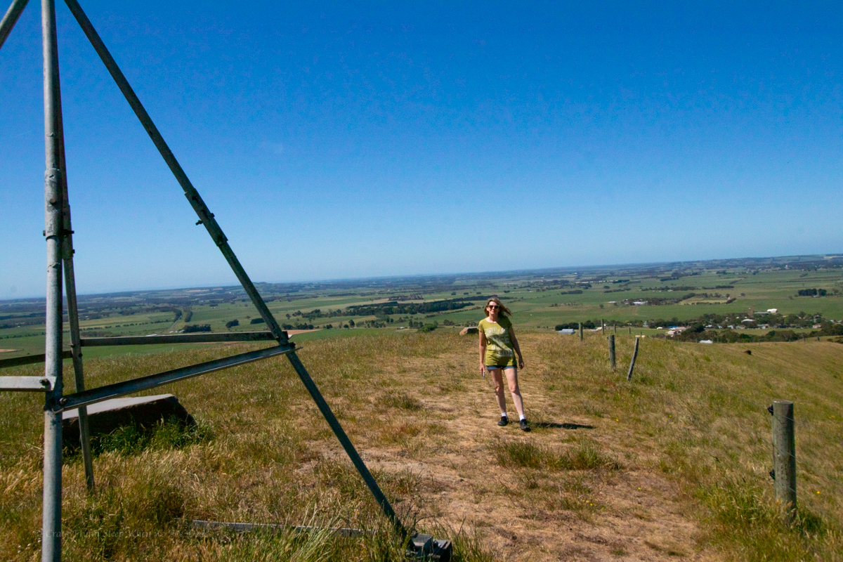
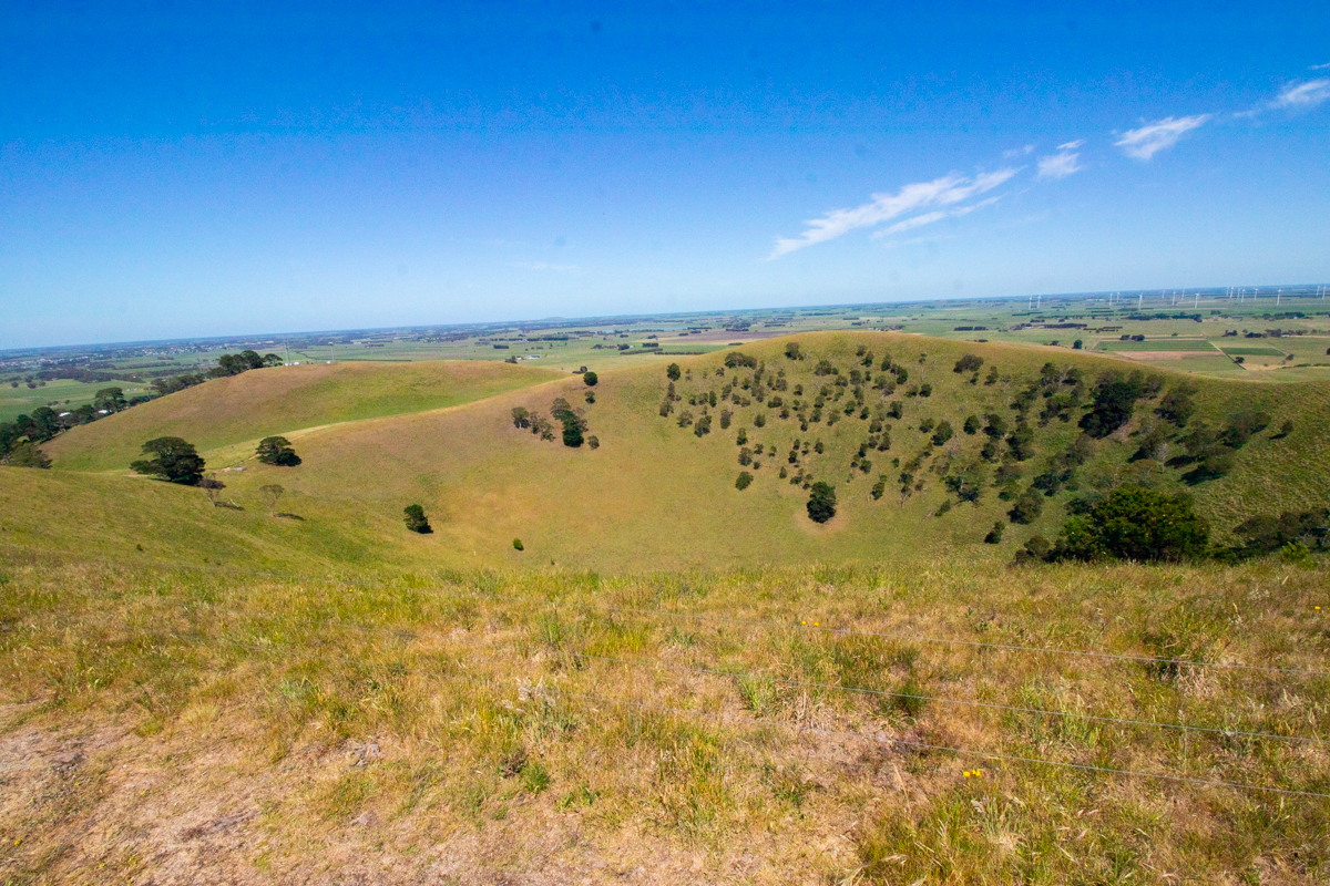
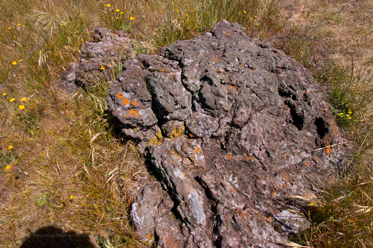
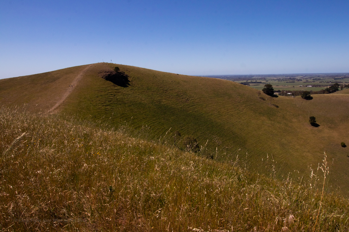
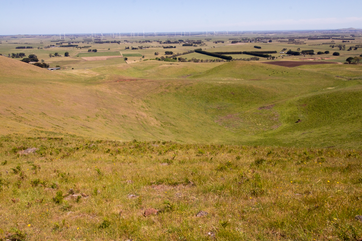
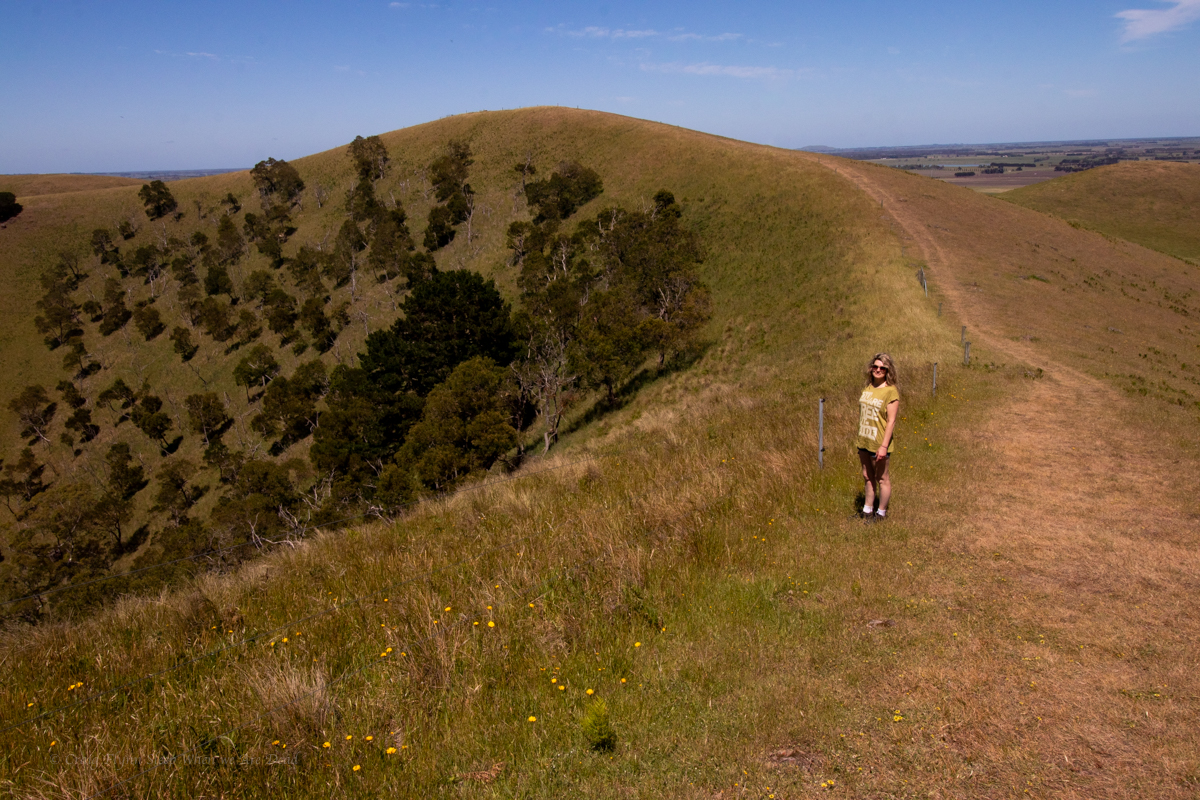
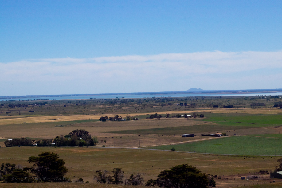
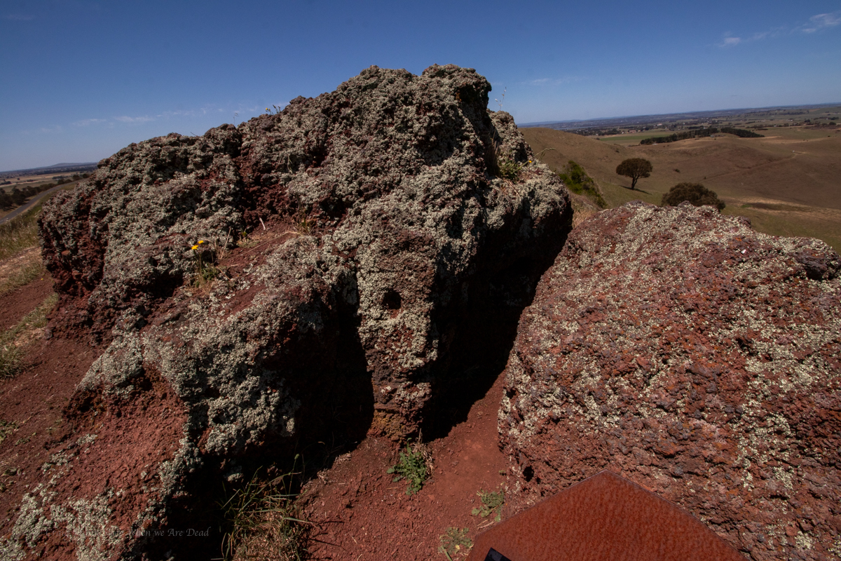
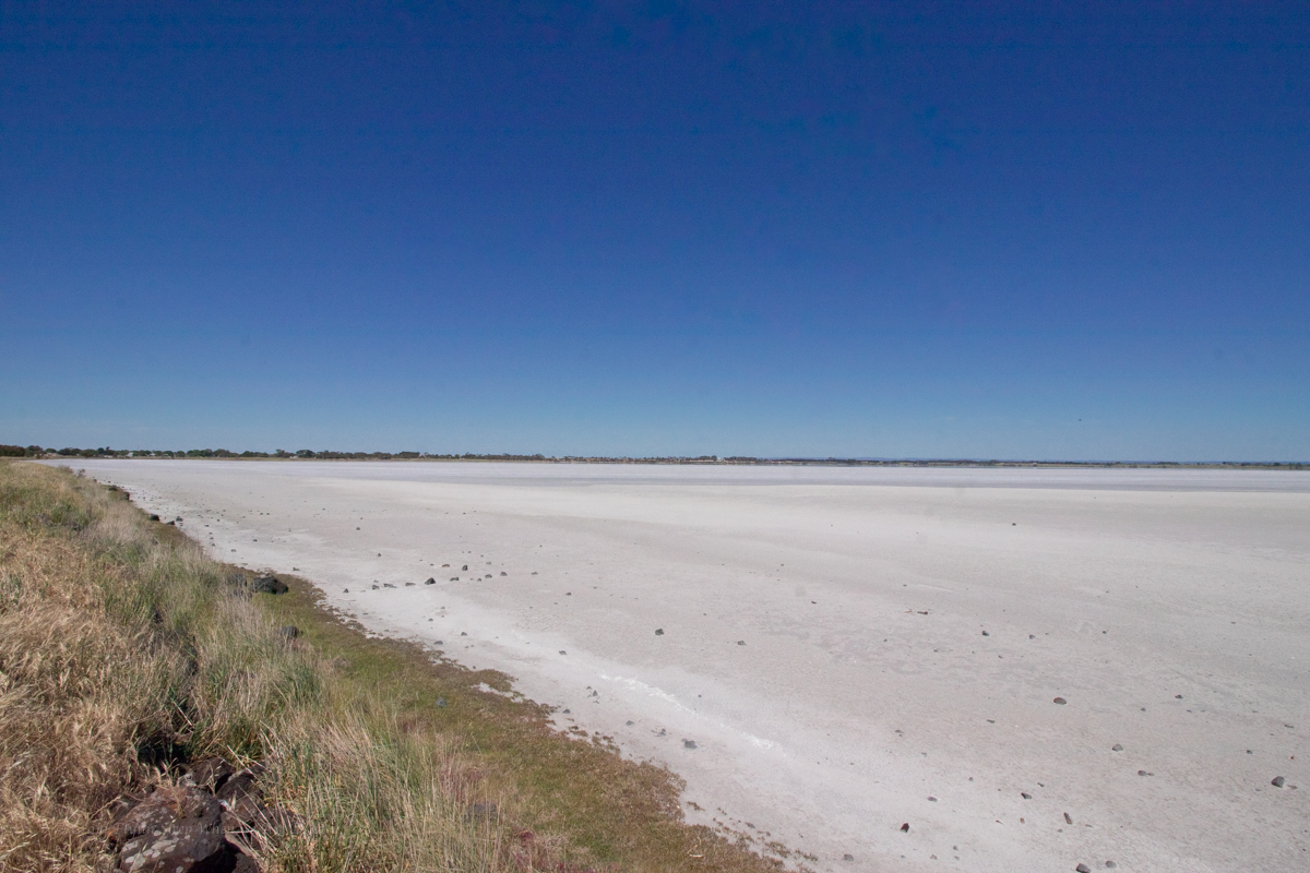
We spend the night at Warrnambool and then make our way back on the slightly less travel inland route to check out the amzing geology of Victorias extinct volcanos and salt lakes
There’s one more geological marvel we want to see.
But before we get there we stop at a PDS to empty the grey water out of van and top up fresh water.
While there and another van pulls up and out jumps Debby Downer wanting a chat.
Moeraki Boulders? Says him after asking where we are heading. That’s a big lot of disappointment. nothing there, just rocks on a beach…
And he proceeds to launch into a general whinge about the world, life, and modern times intermingled with a racist rant or two. I curse at how slow the grey water tank drains and opt to just pretend it’s finished so I can move on quicker…
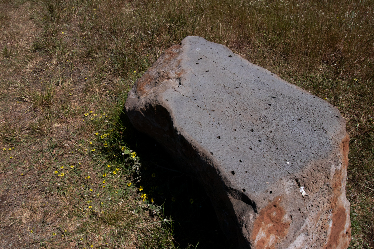
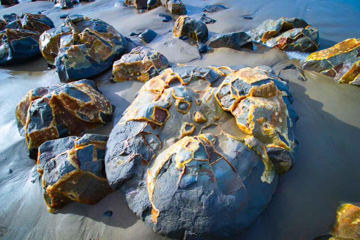
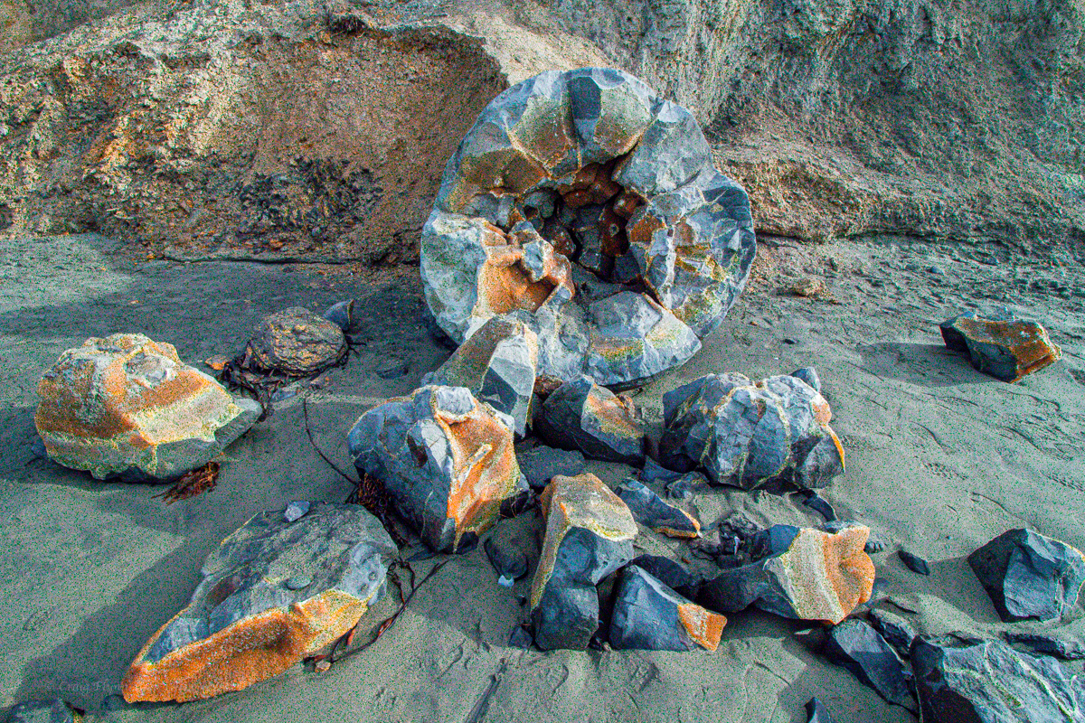
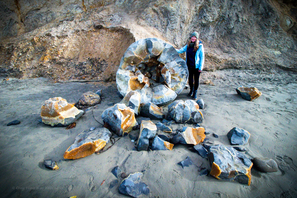
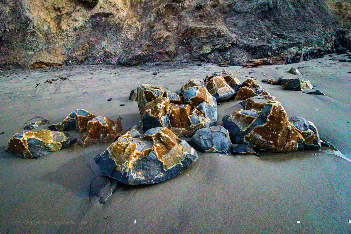
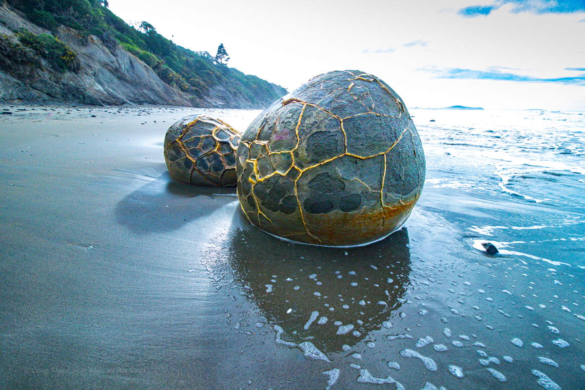
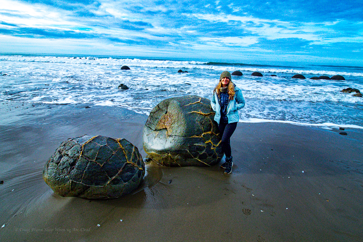
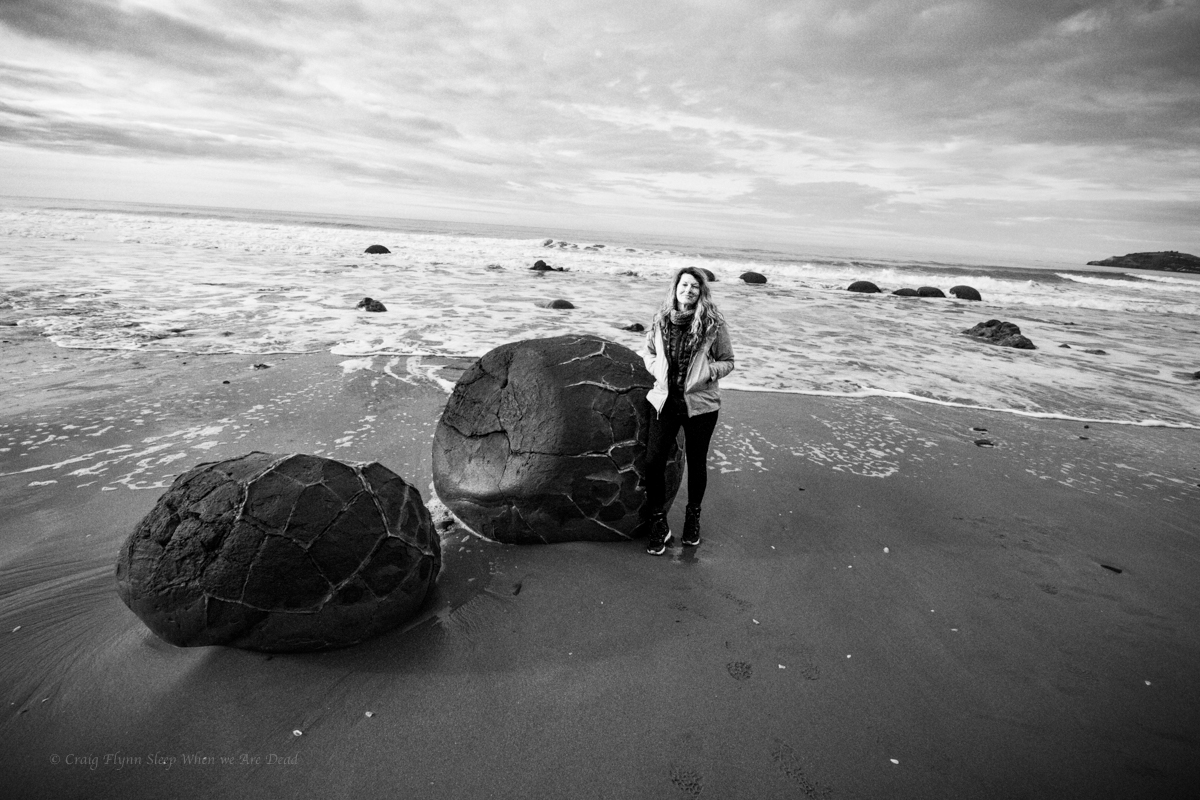
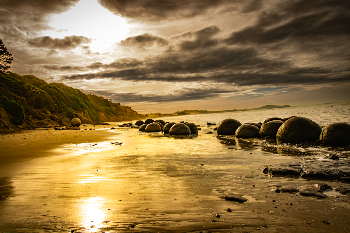
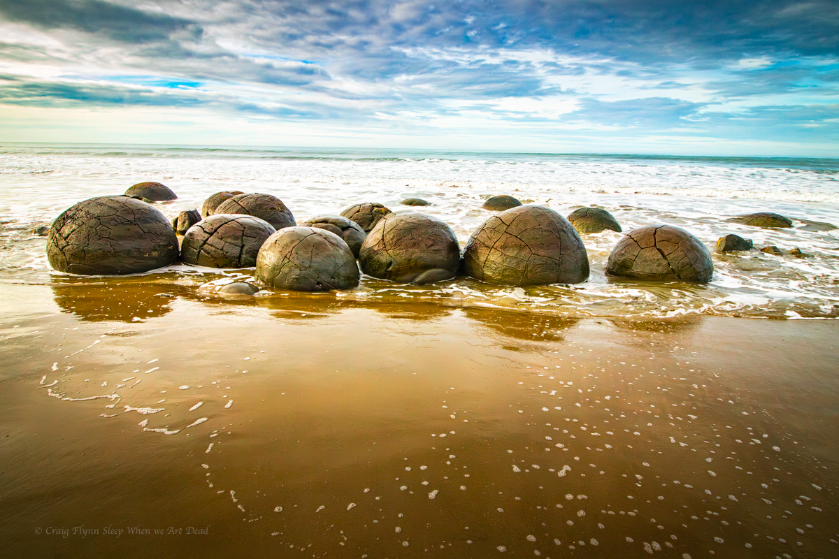
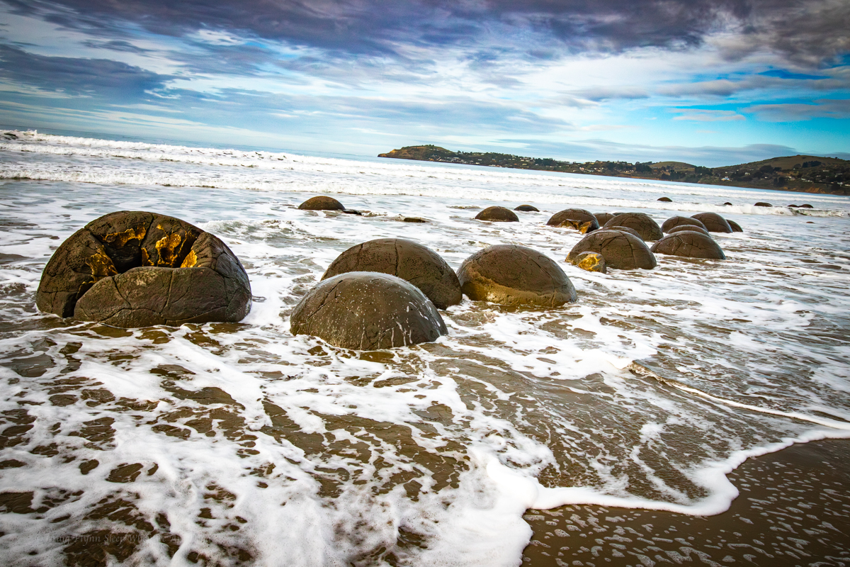
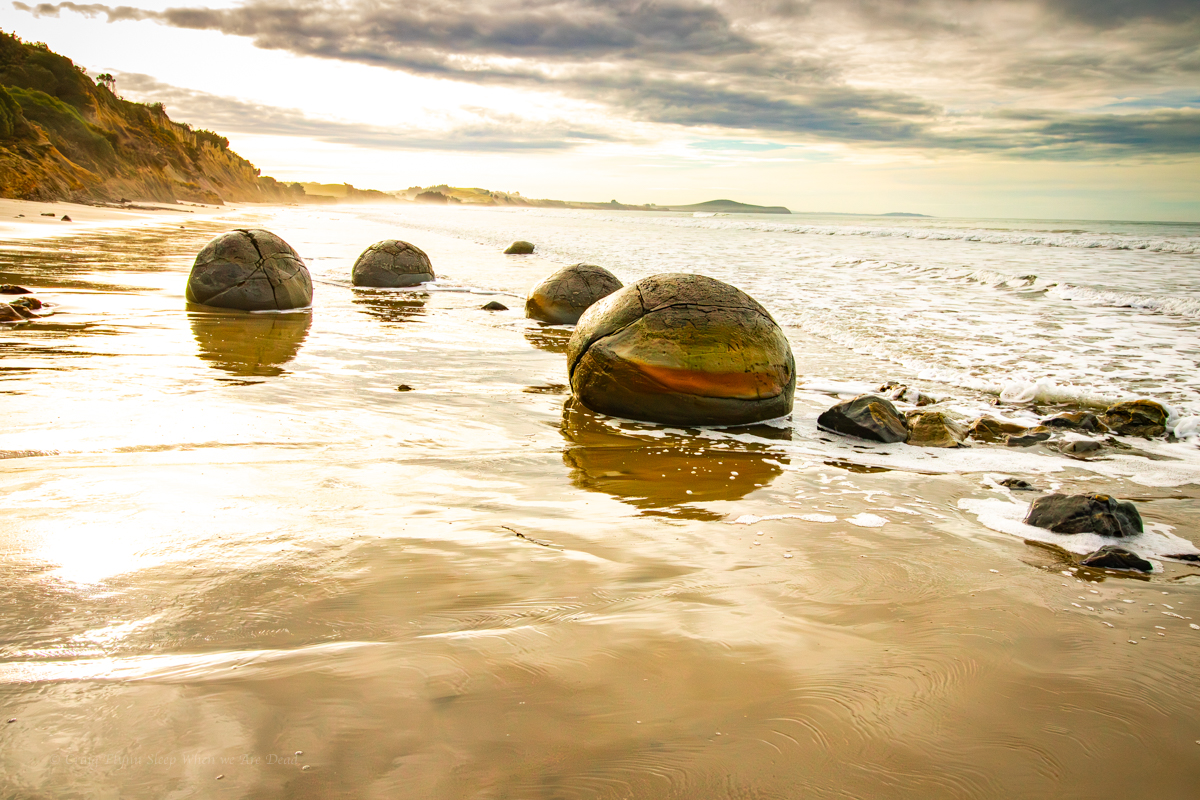
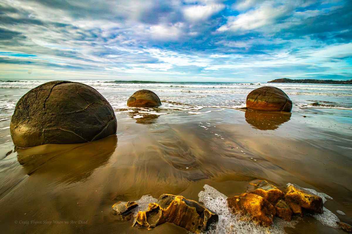
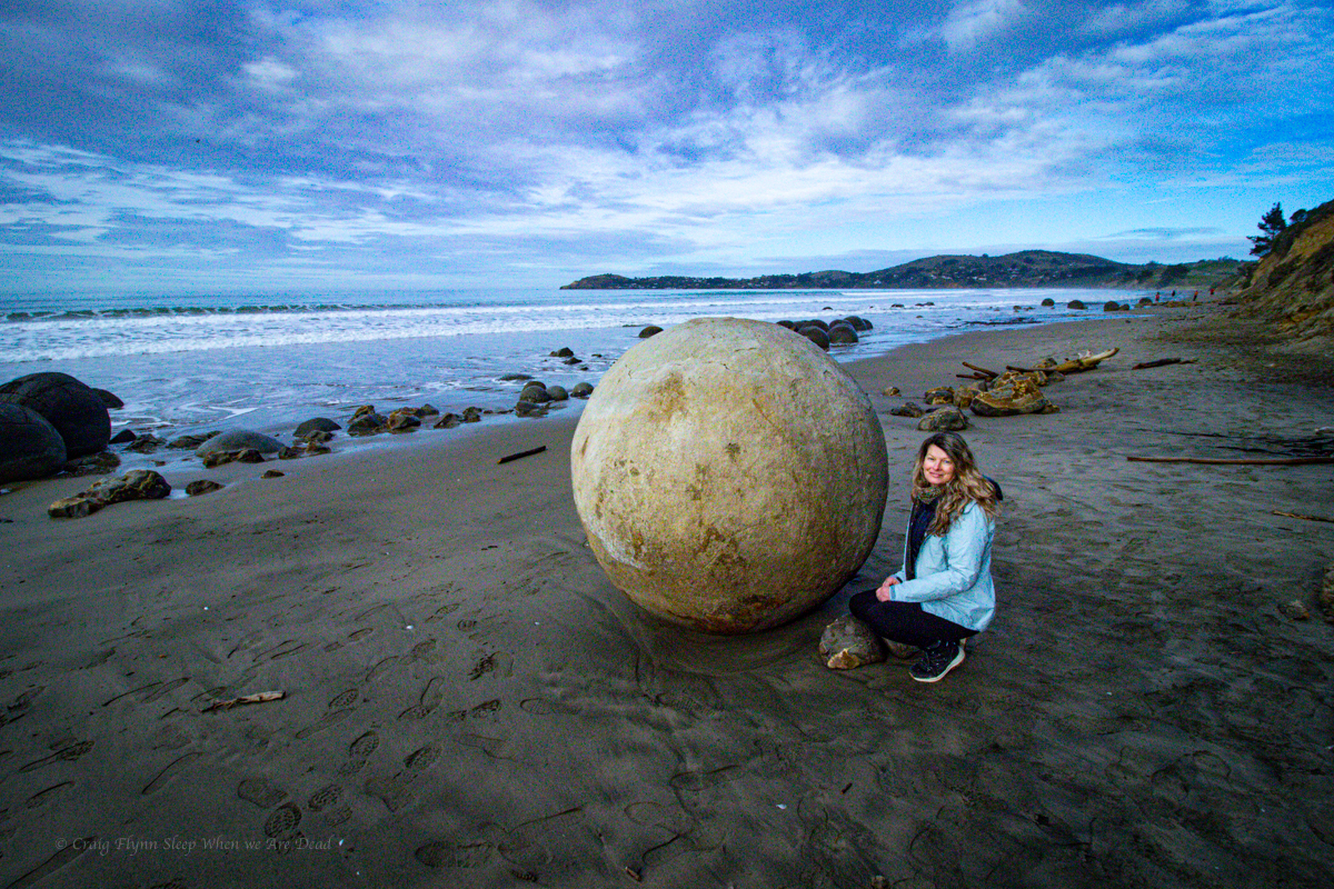
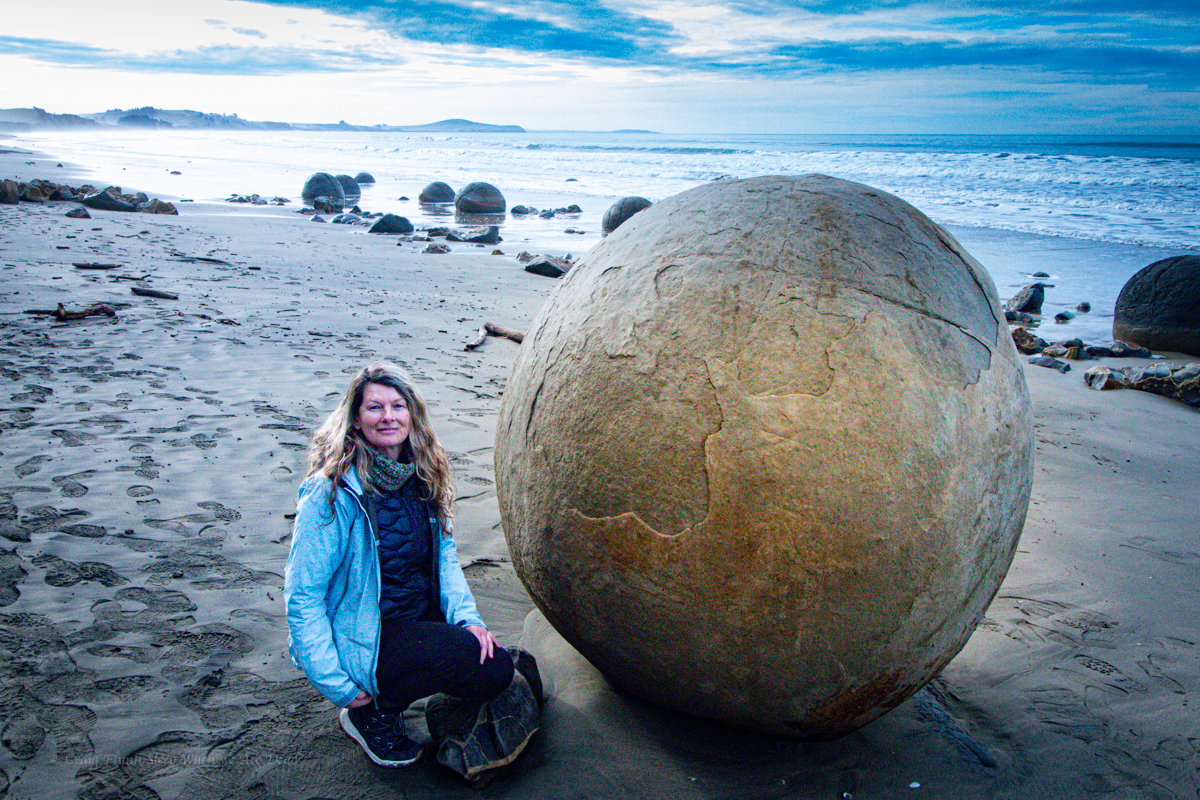
So what are the Moeraki Boulders?
Well old racist Karen was sort of right, they are rocks on a beach.
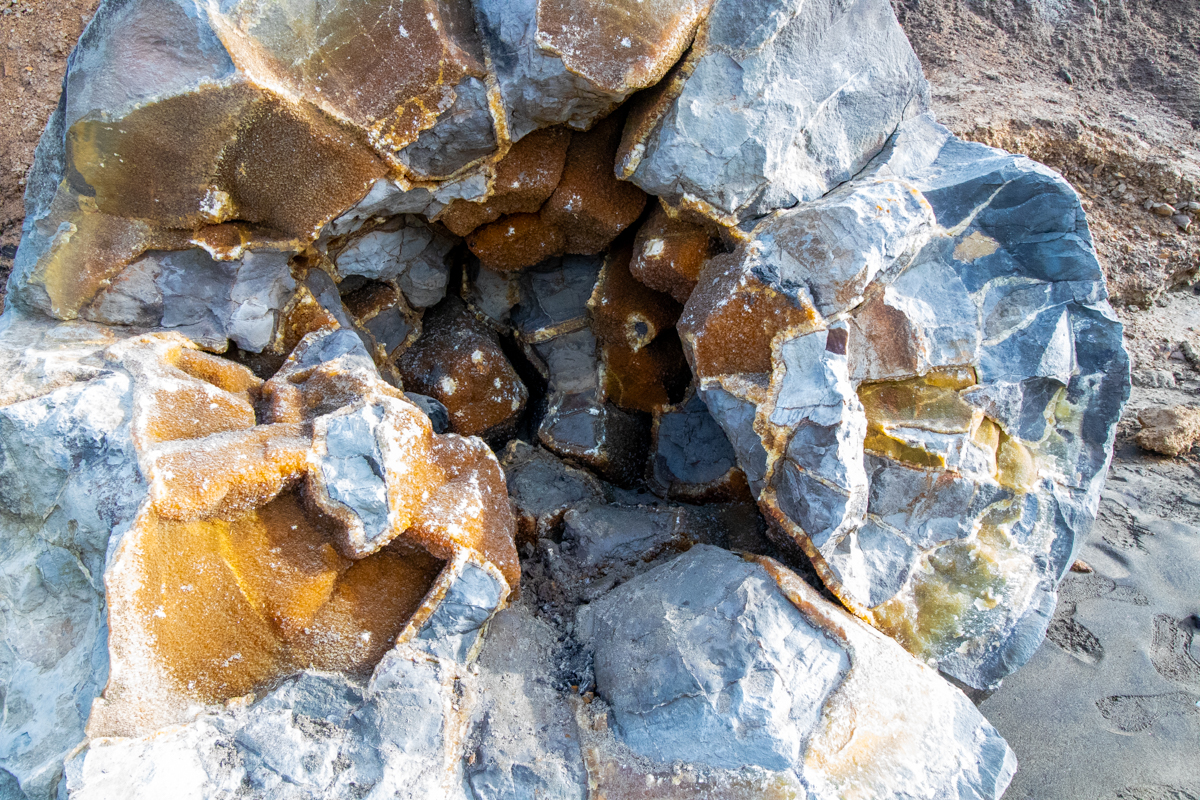
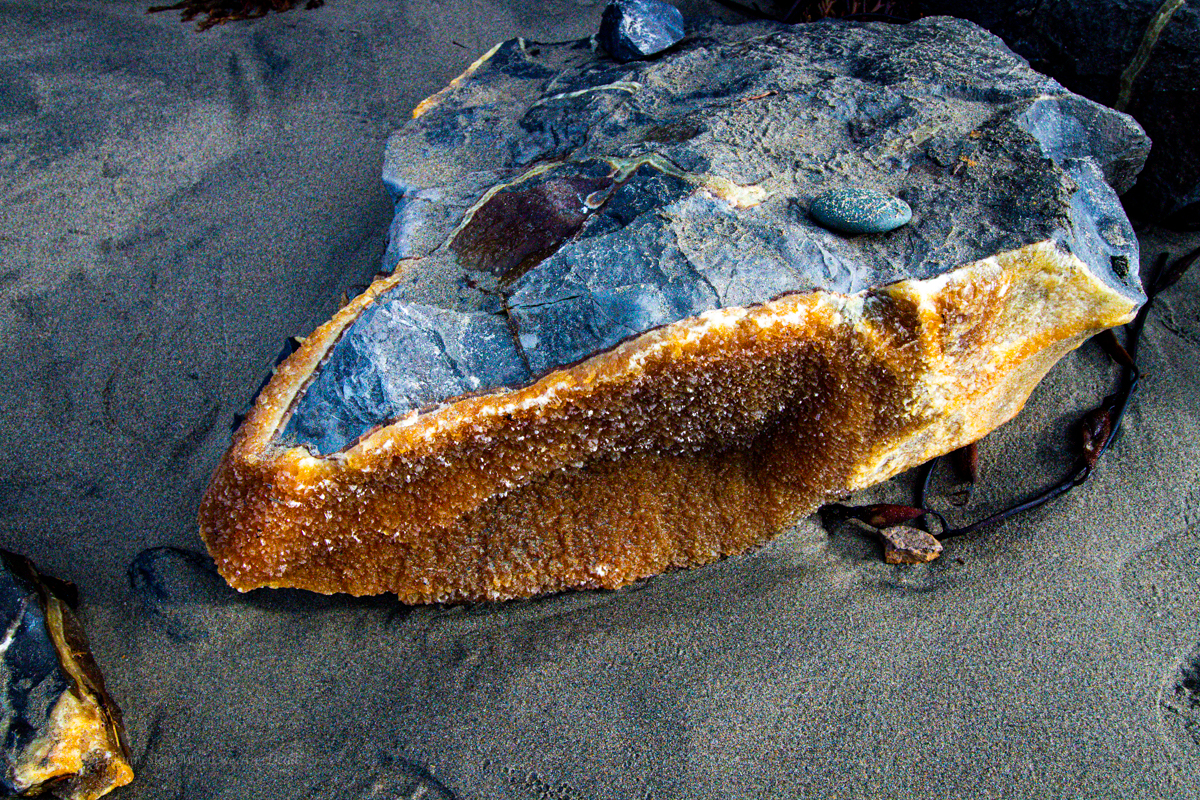
But not just any rocks, they are concretions, Septarian Concretions to be exact. Similar to the ones we saw in the cave tour only bigger. Much bigger.
What the hell are Septarian Concretions?
I’m glad you ask.
They are nodules of rock, typically spherical, usually formed in cabanate rich mudstone. They often “grow” around something, a crab claw or dinosaur bone for example, so often contain fossils in their centre.
So basically as dumbed down as I needed it explained to me, a bit of organic matter is engulfed in mud and a rock “crystal” grows around it before the mud/sand is rockyfied itself.
Time move son and the softer mudstone or sandstone is eroded from around the harder nodule leaving behind big marbles.
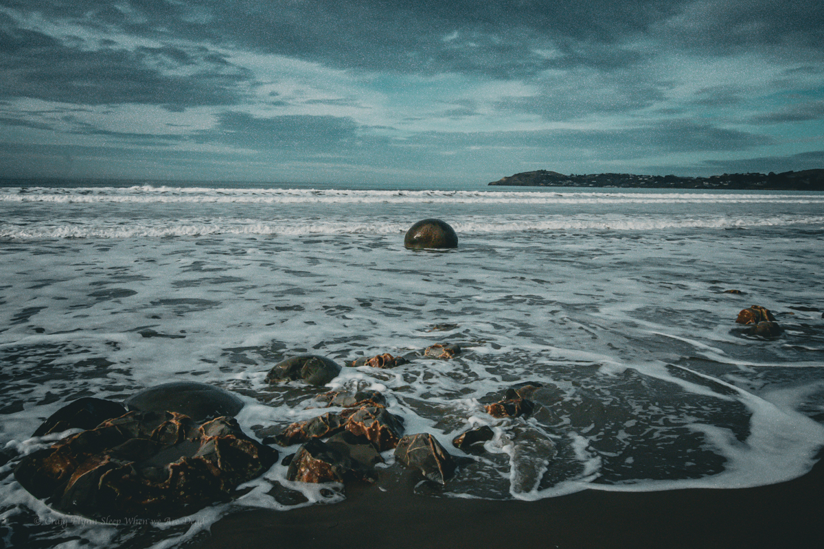
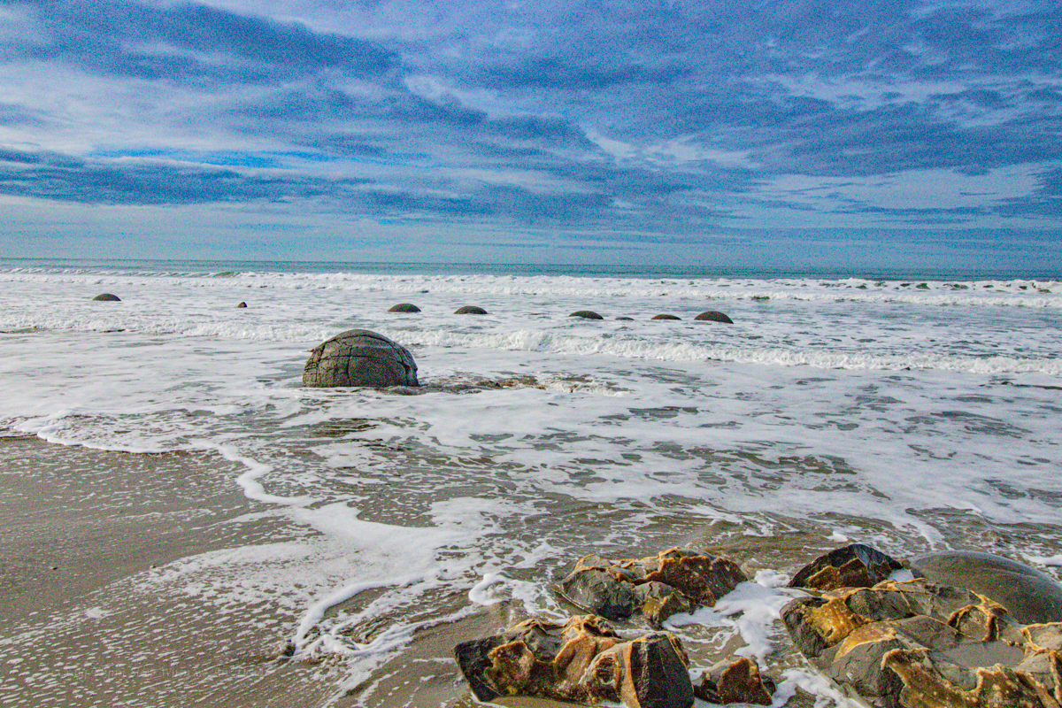
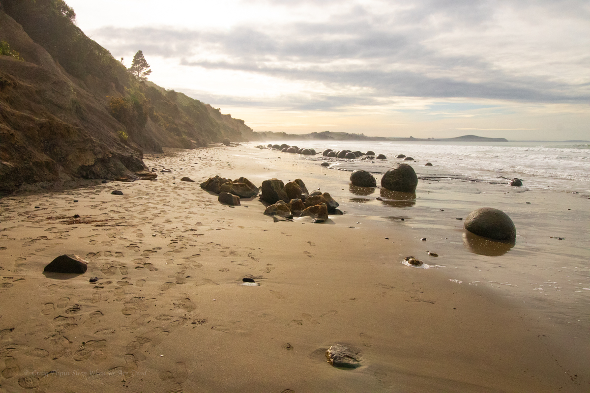
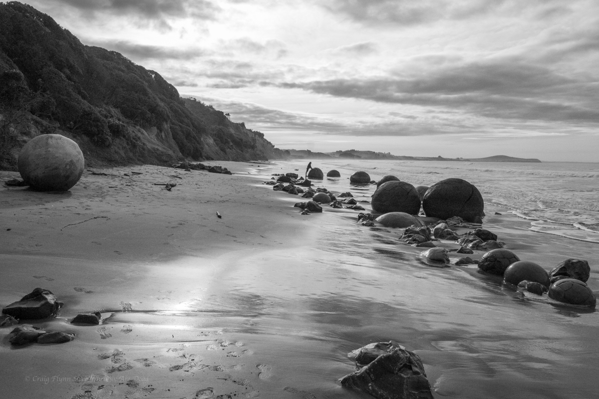
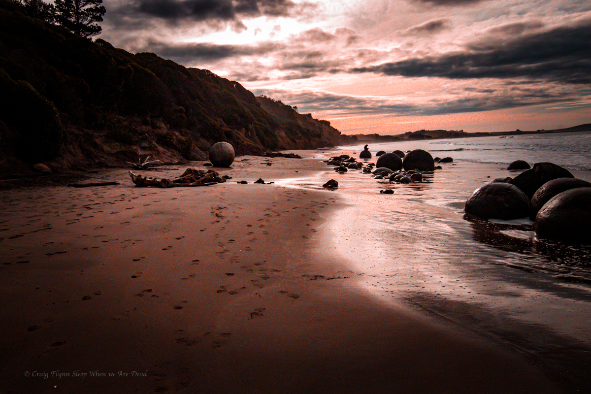
And if that’s not impressive enough to make you want to check them out. Well they are on a spectacular stretch of beach.
And, well
Just look at them!
There are other, similar concretions 20km south at Shag Point (Teheheh, Shag!) that contain plesiosaur fossils but we are heading north…
And that end’s our New Zealand adventure, for this time. The following day is spent making our way back up to Christchurch, we’ve a plane to catch.
All in all we had a great trip. To recap here’s a list of links to all the awesome stuff we got to see and do.