From Hokitika it was an early start to drive down for our next adventure.
When planning our itinerary Kylie had mentioned a walk up towards the base of a glacier she had previously done and loved and while we had been trying to keep it a low cost holiday we had also been tossing up splurging on helicopter tour.
I remembered my old mate and mentor, Rusty (RIP) having done a heli/hike tour onto a glacier and raving about it.
If we do the helicopter I’d love a snow or glacier landing, Say I.
That’s a great idea Kylie replies.
We begin looking into options trying to decide what would fit our wants and itinerary. Franz Josef Glacier Guides started looming large as the front runner.
This is the one part of our holiday where we decided to dam the expense and splash a bit of cash on. IMO it was worth every cent.
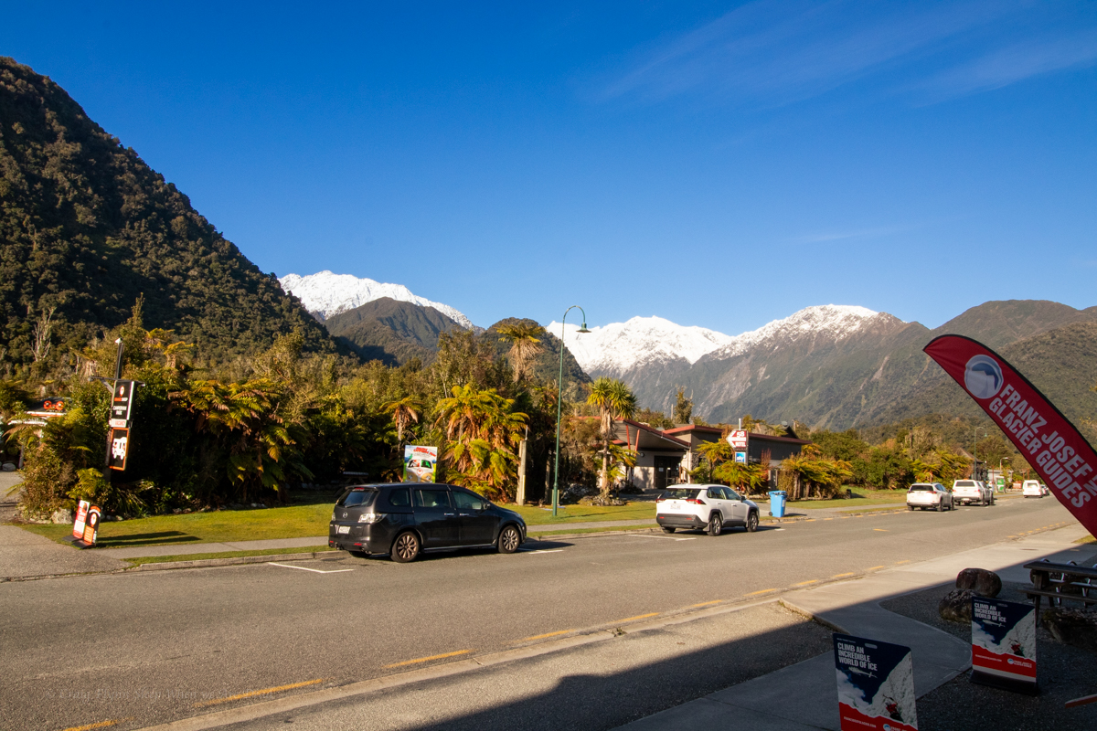
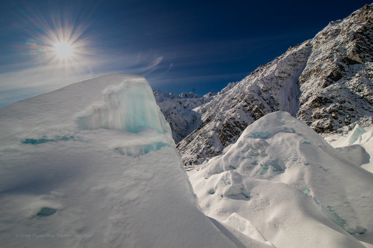
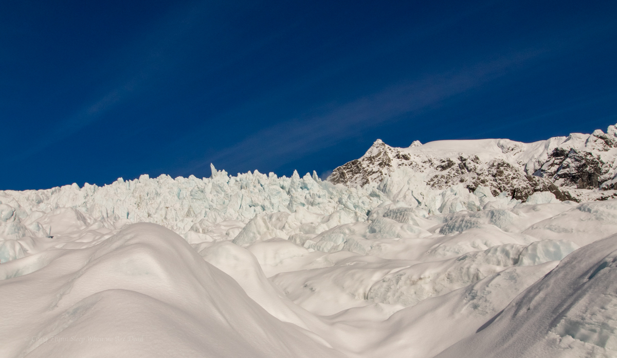
Just driving into town is mind-blowing as we get our first close encounter with the snowcapped peaks while walking down streets lined with giant fern trees.
While FJGG supply all the outer layers to keep their clients warm they were more than happy for us to use our own gear (after confirming that it was suitable).
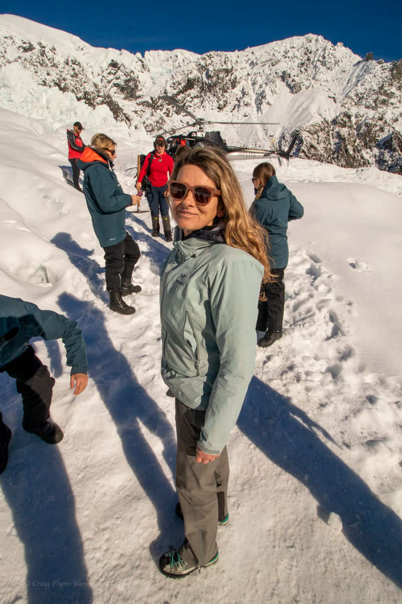
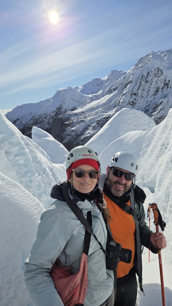
Our guide, Maya, was informative, funny and chill as she took us through the safety talk. That’s worst case, says she. It won’t happen today… I hope. Na, it won’t happen.
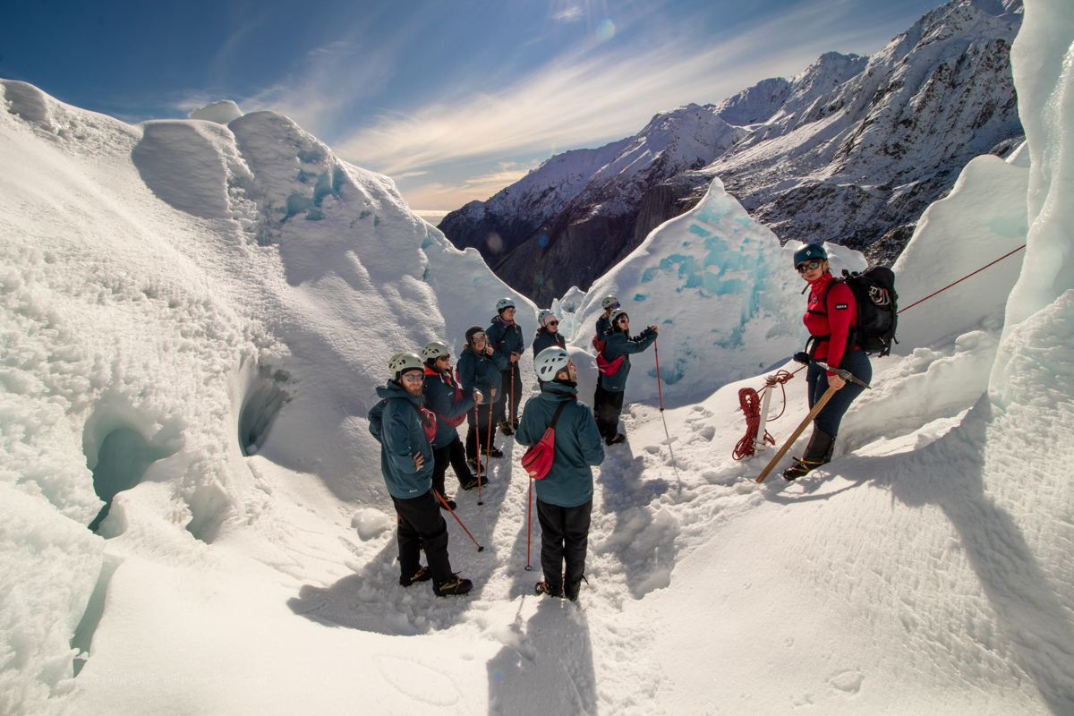
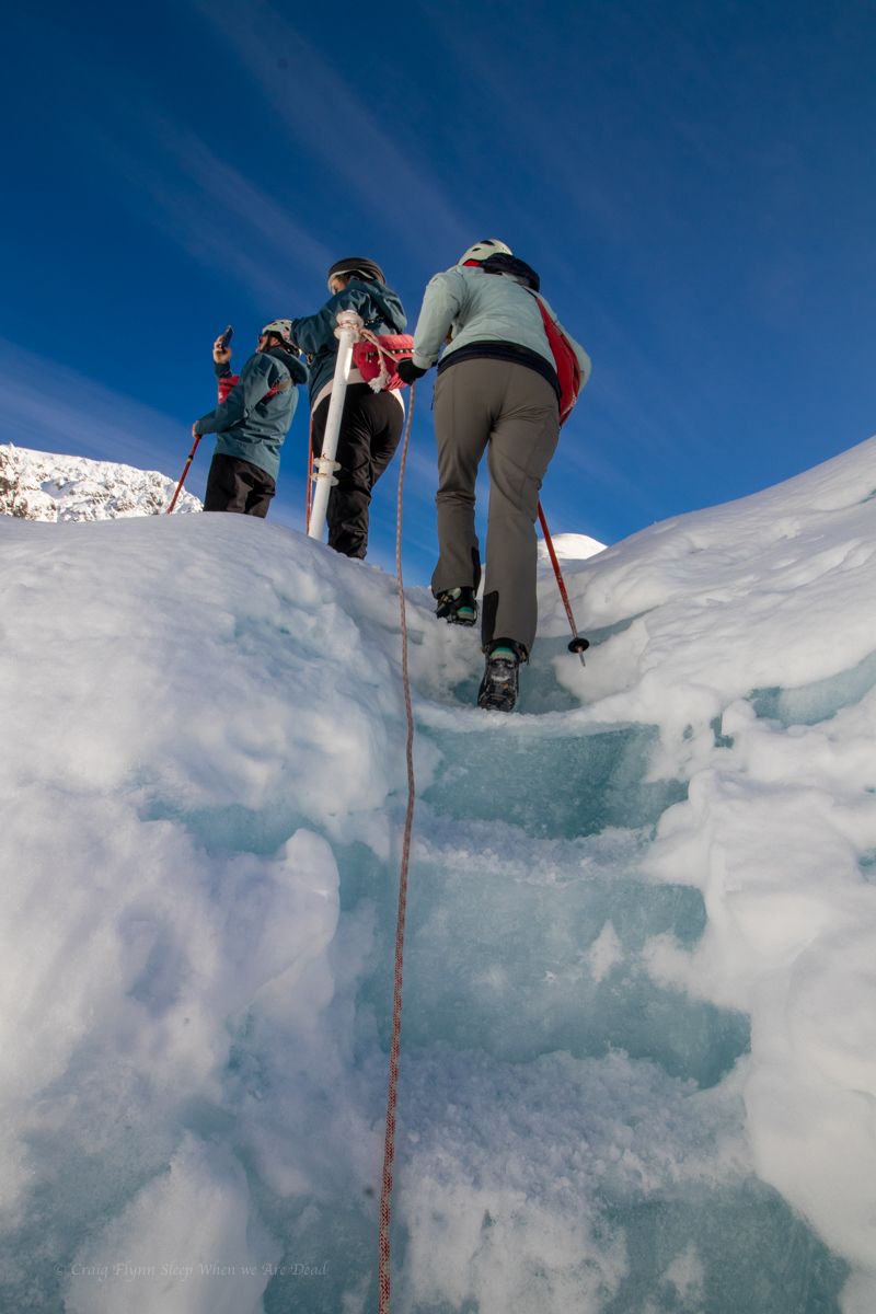
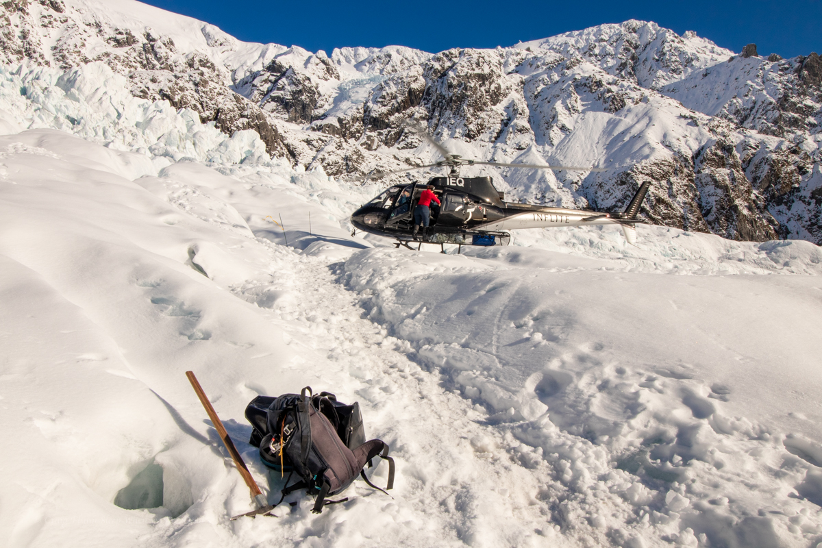
Suitably prepared we leave town via a lovely walk through the rain forest to the helipad. The group would be split into 2. And our group were first up with Maya joining us and our chopper pilot Matt giving great commentary along the way.
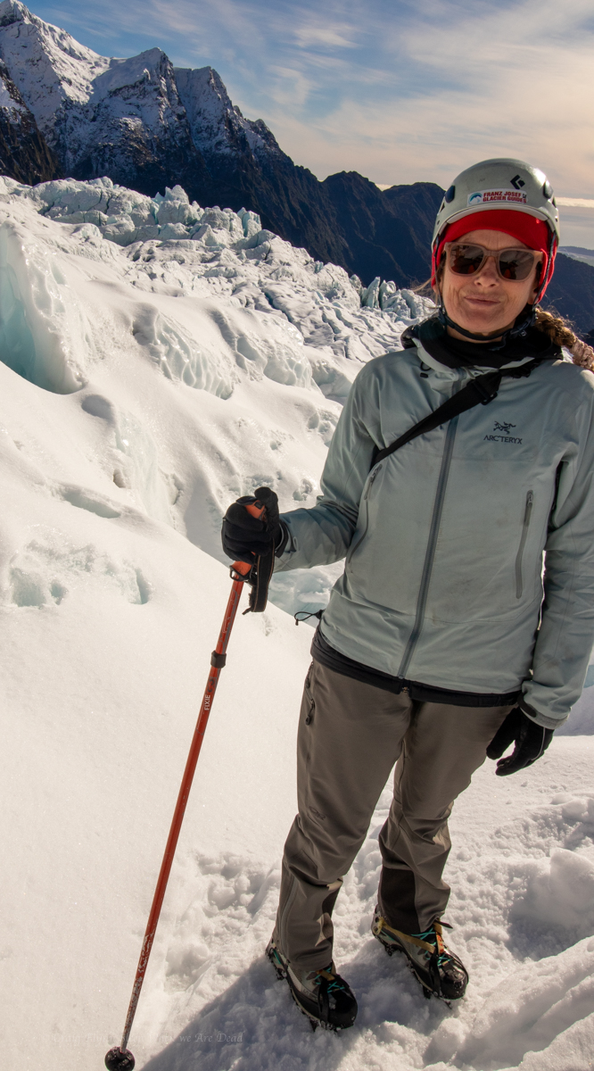
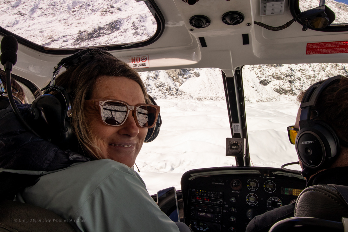
We had been assigned seating and Kylie had jagged a front seat, allowing her to capture some amazing videos.
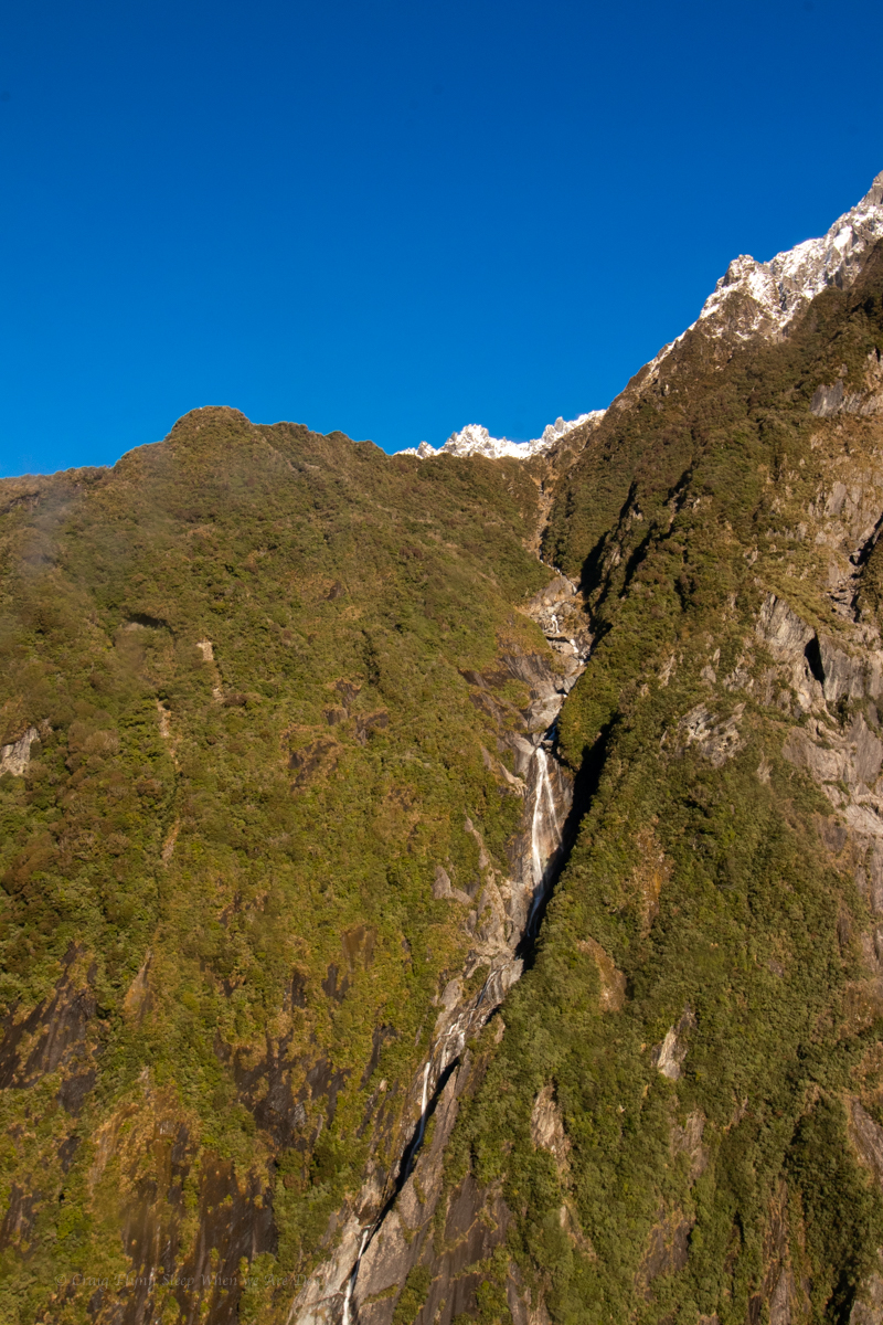
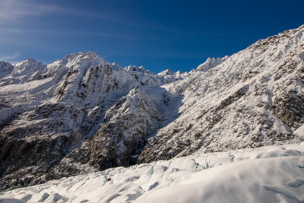
Even with Matt’s commentary it was hard to come to grips with the scale of this place. It wasn’t until we were down and looking back to the following helicopter that was just a tiny speck against the mountainous back drop that it started sinking in.
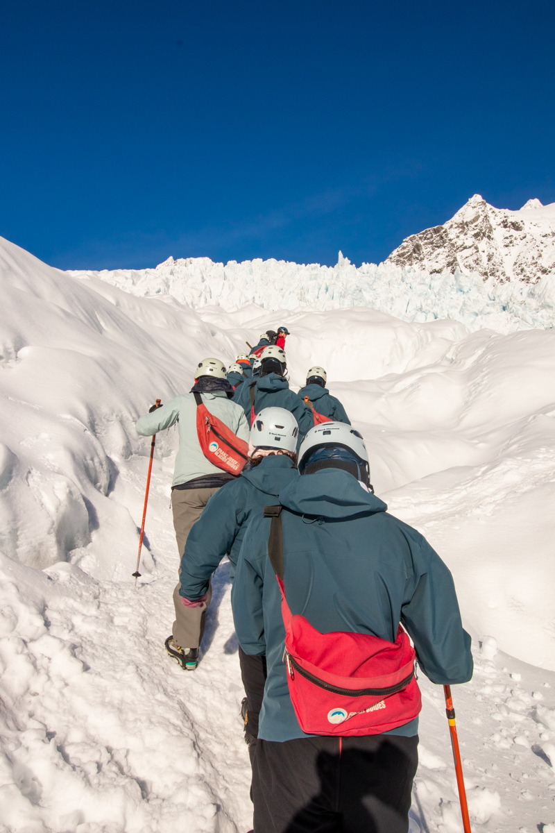
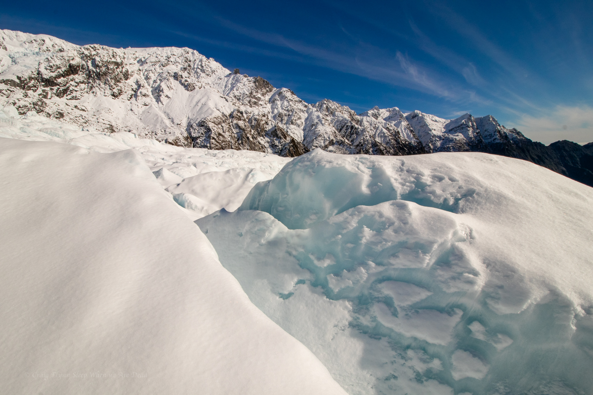
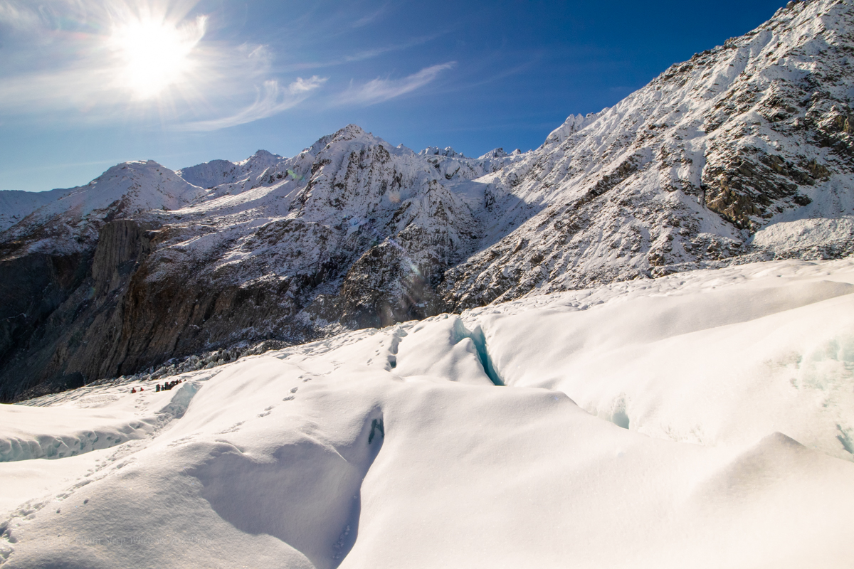
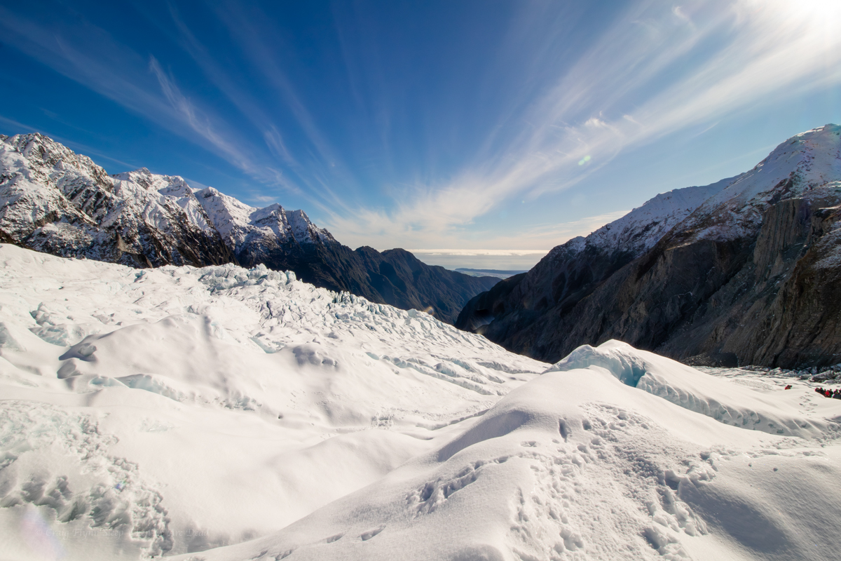
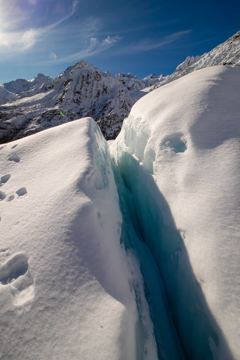
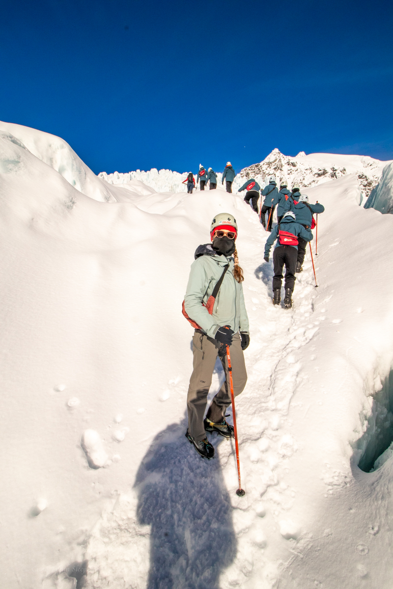
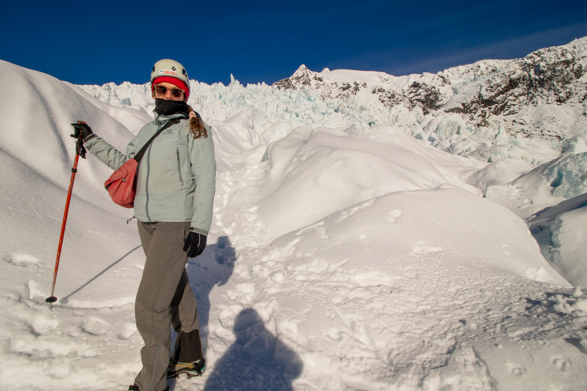
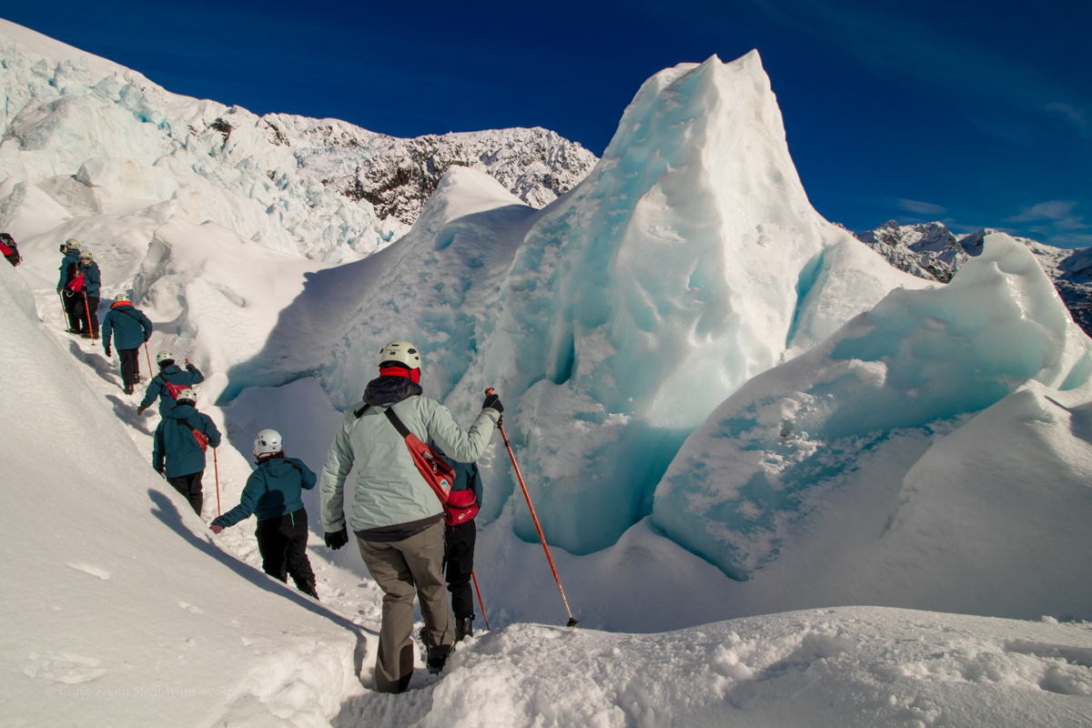
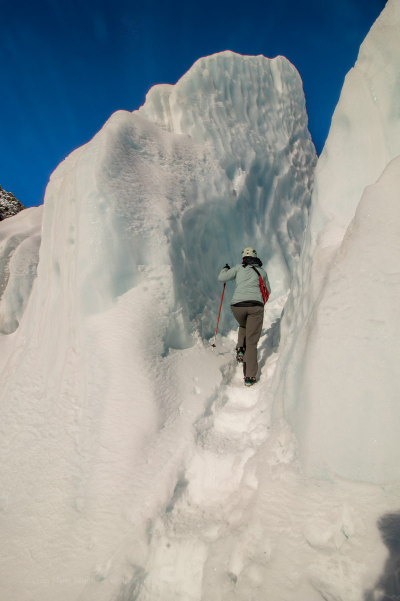
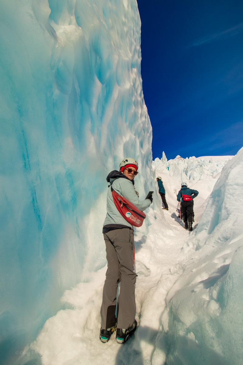
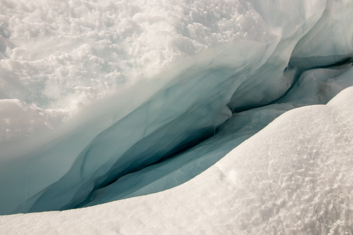
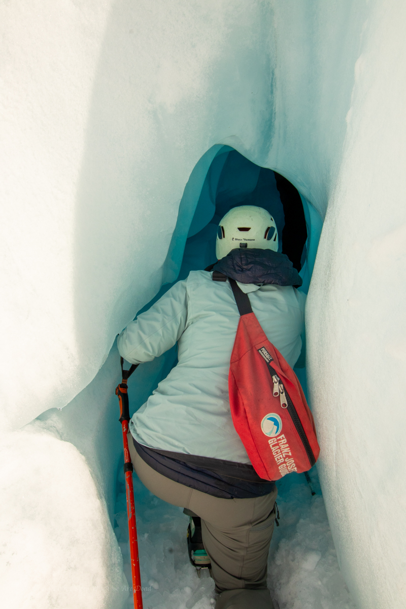
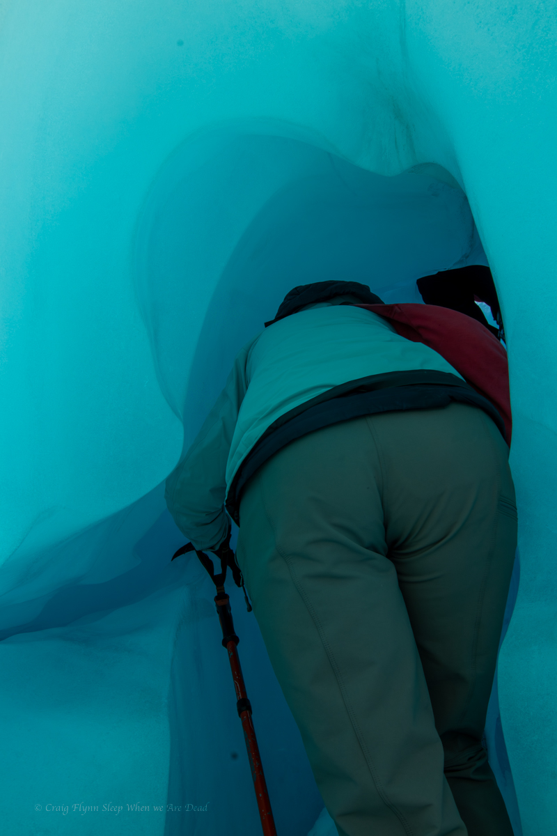
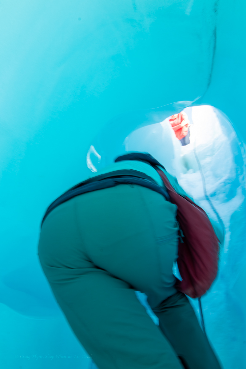
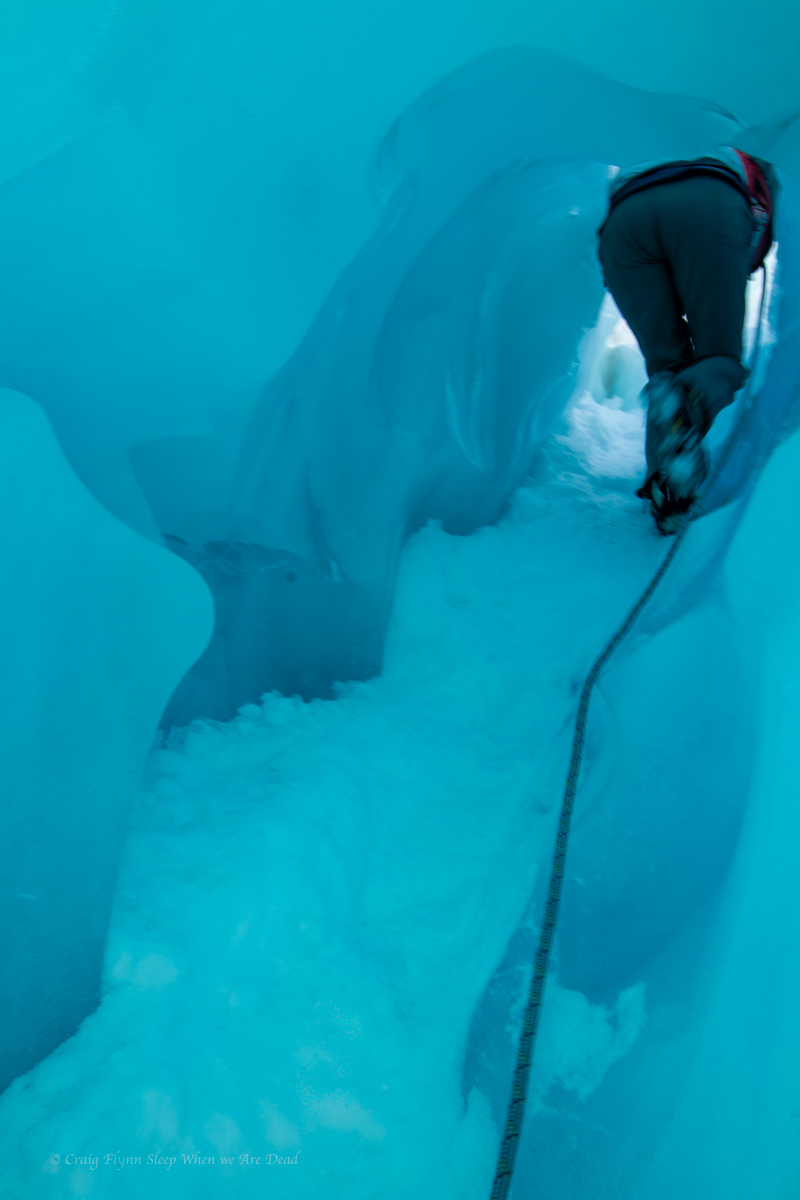
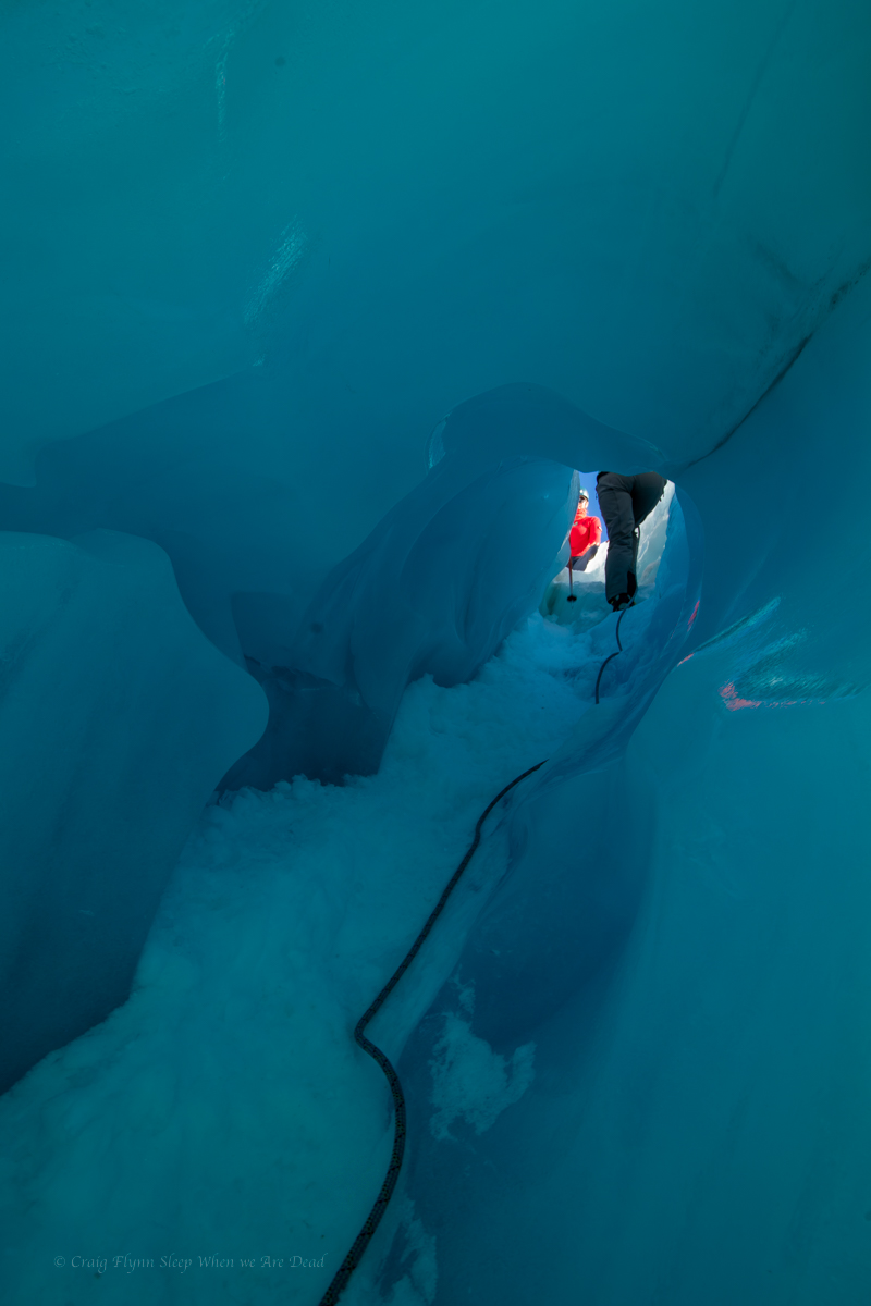
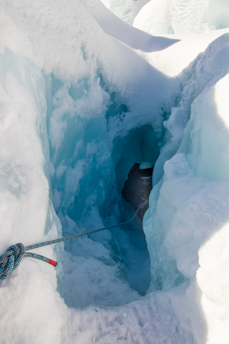
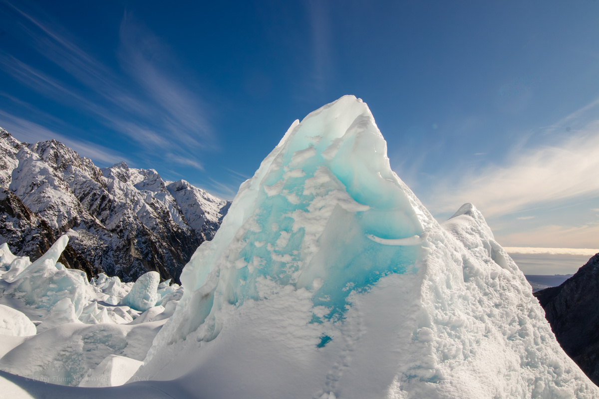
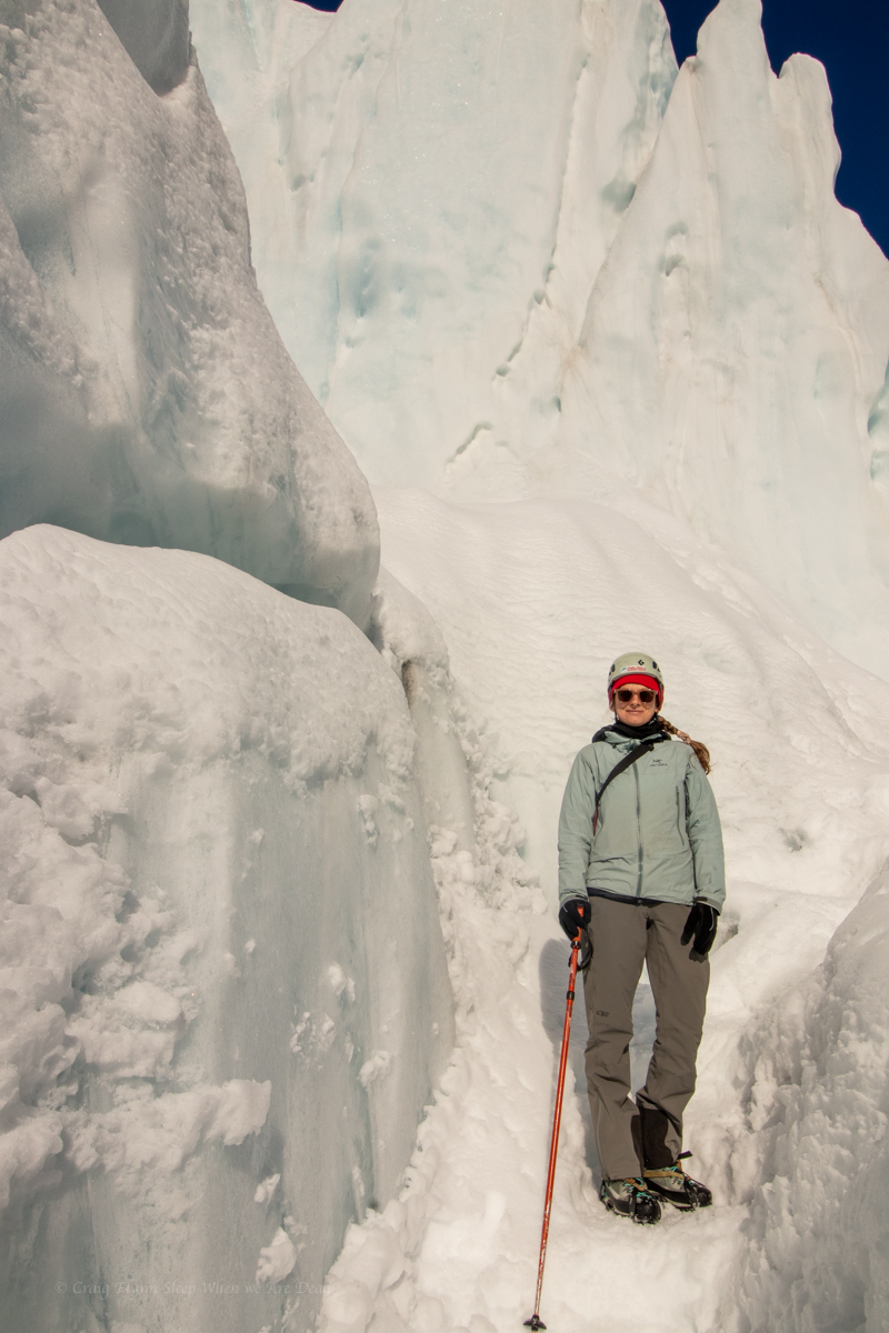
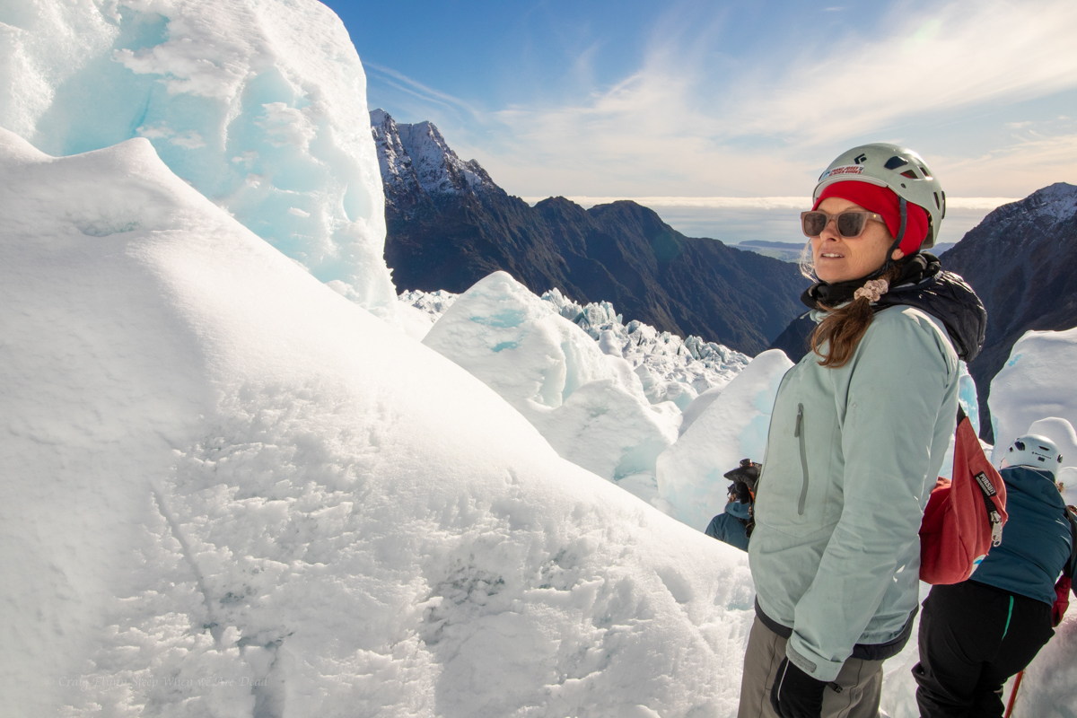
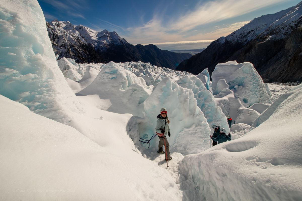
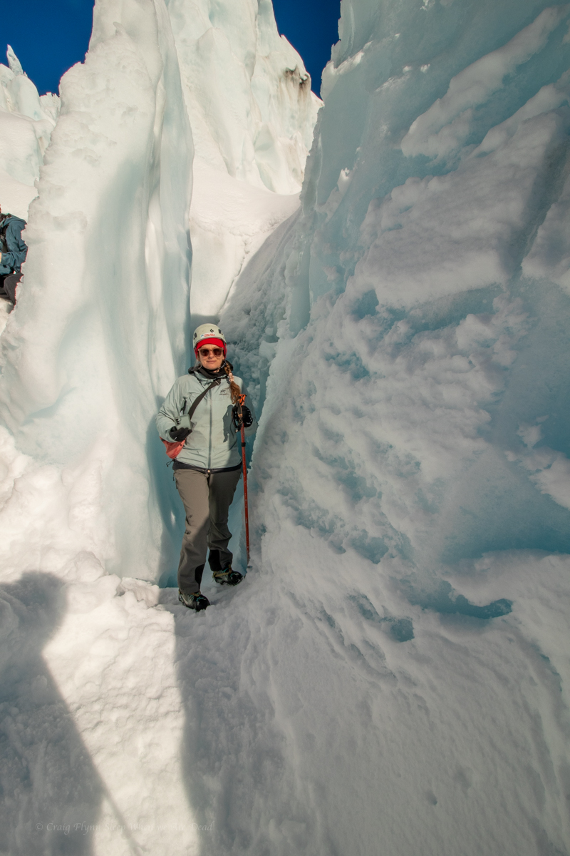
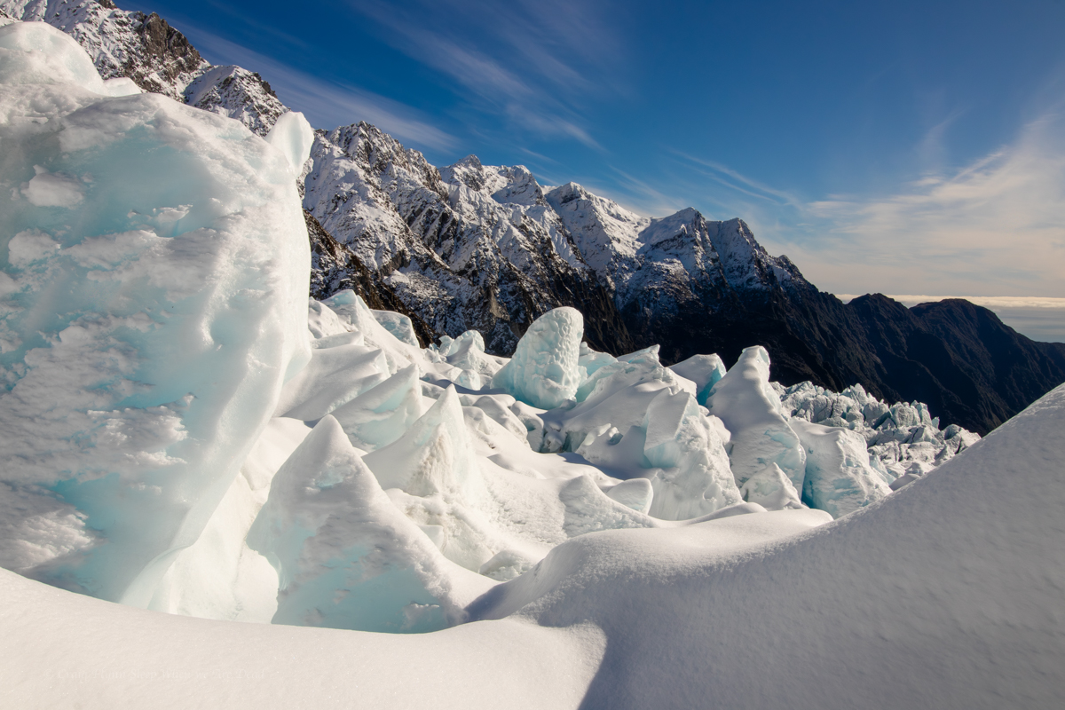
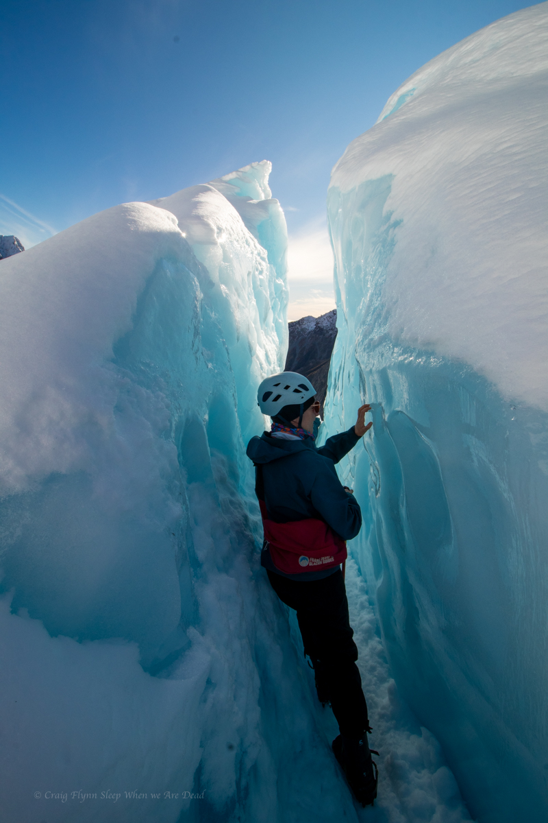
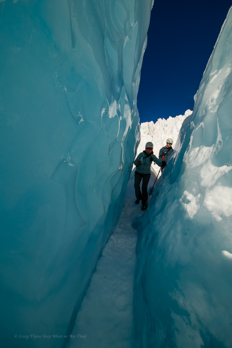
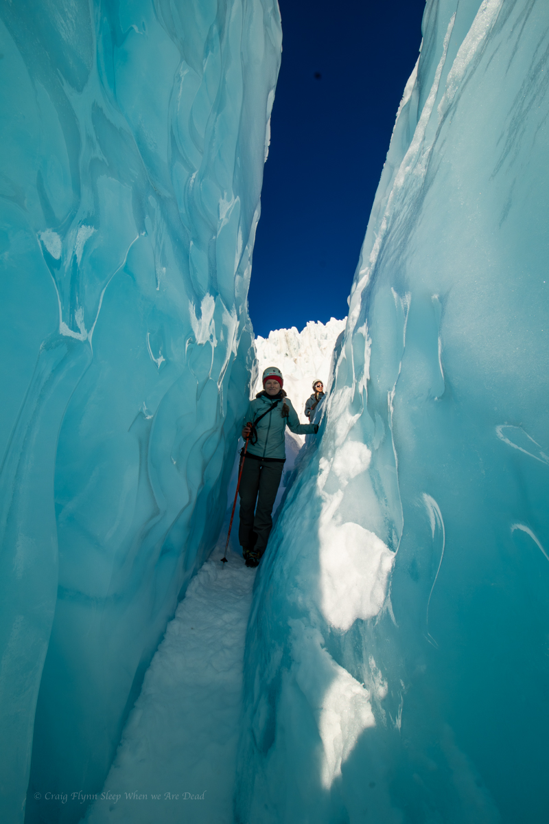
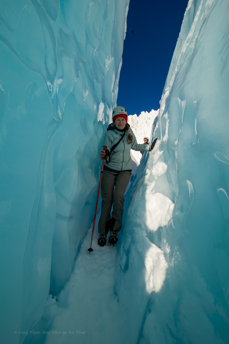
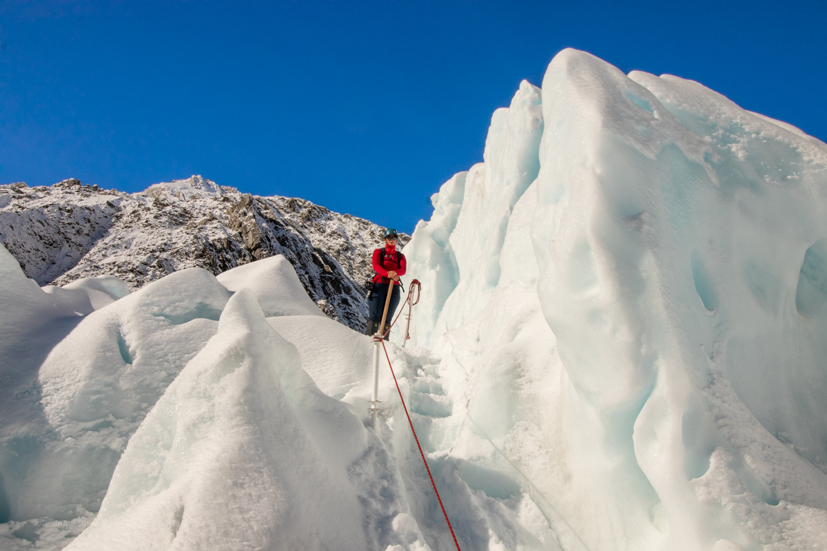
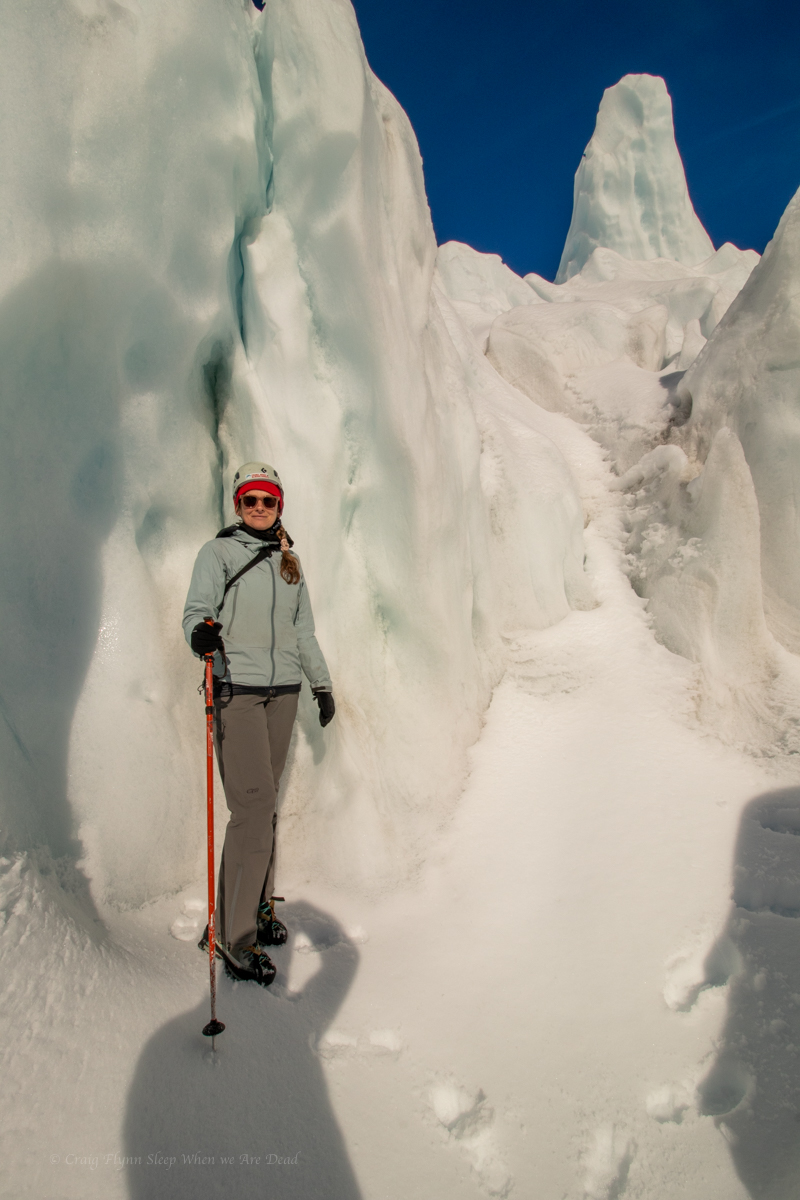
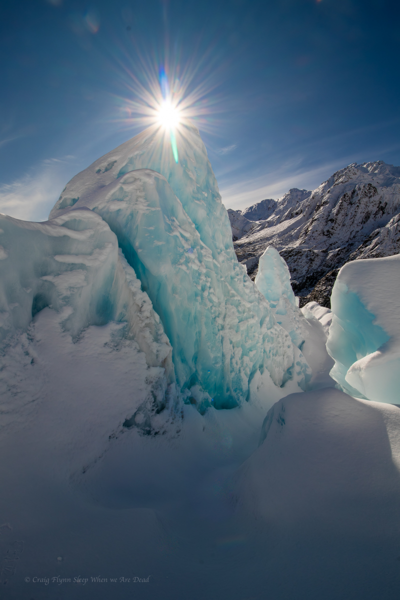
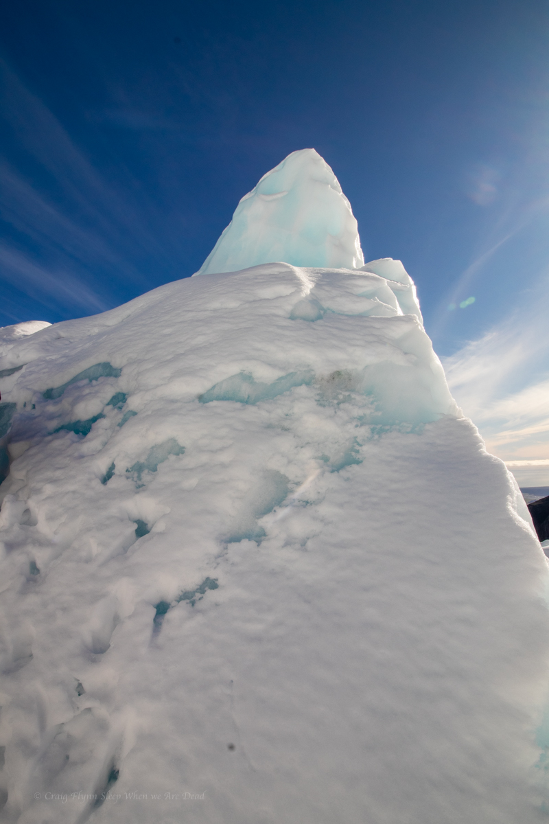
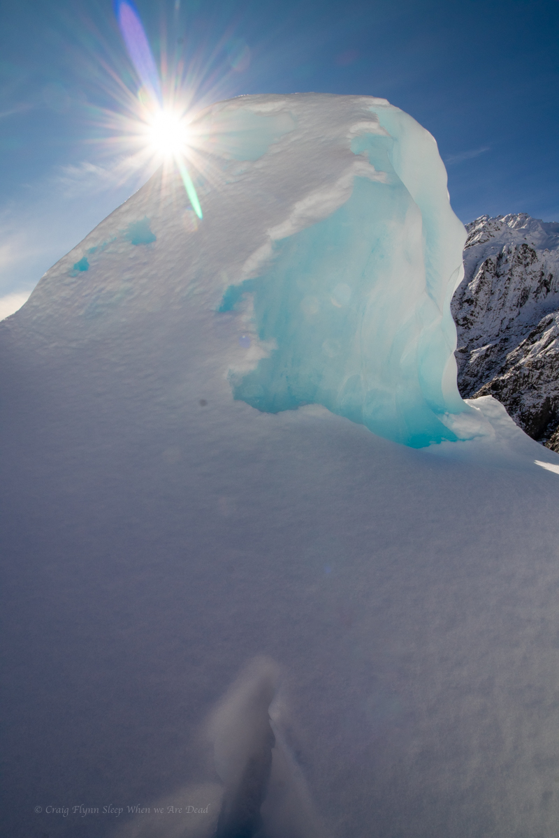
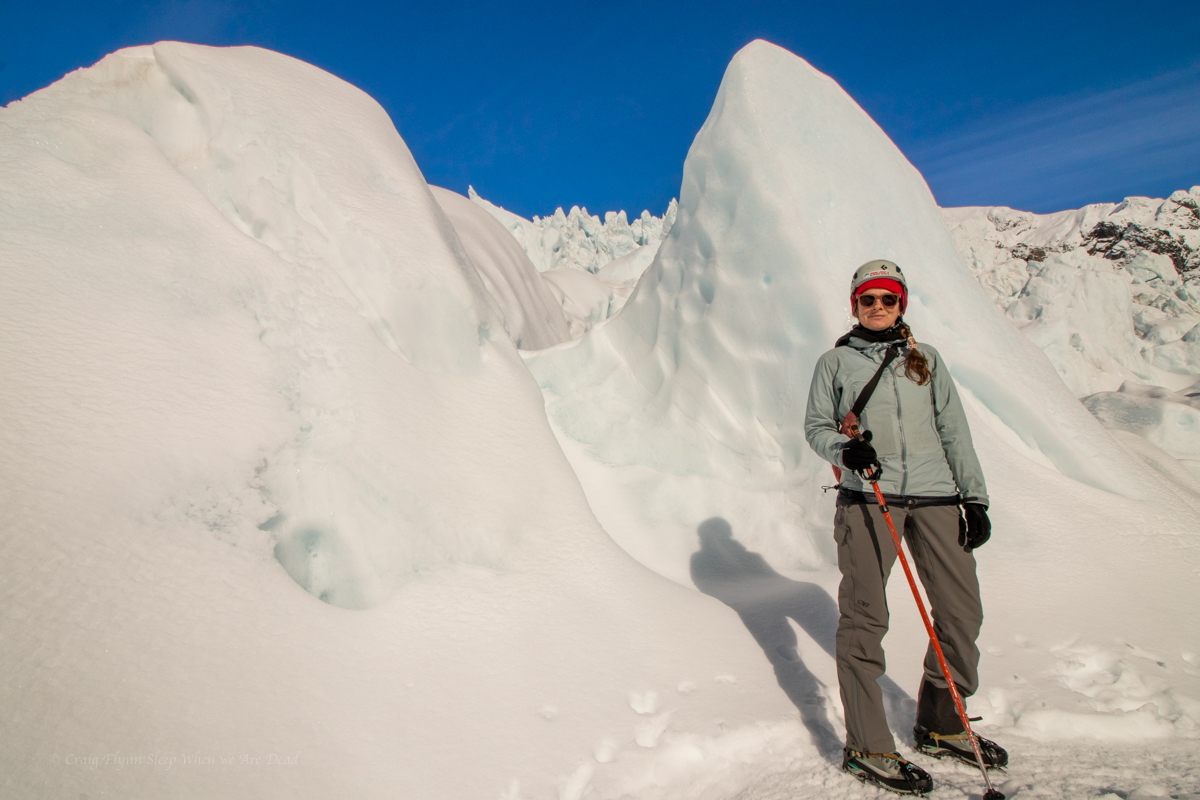
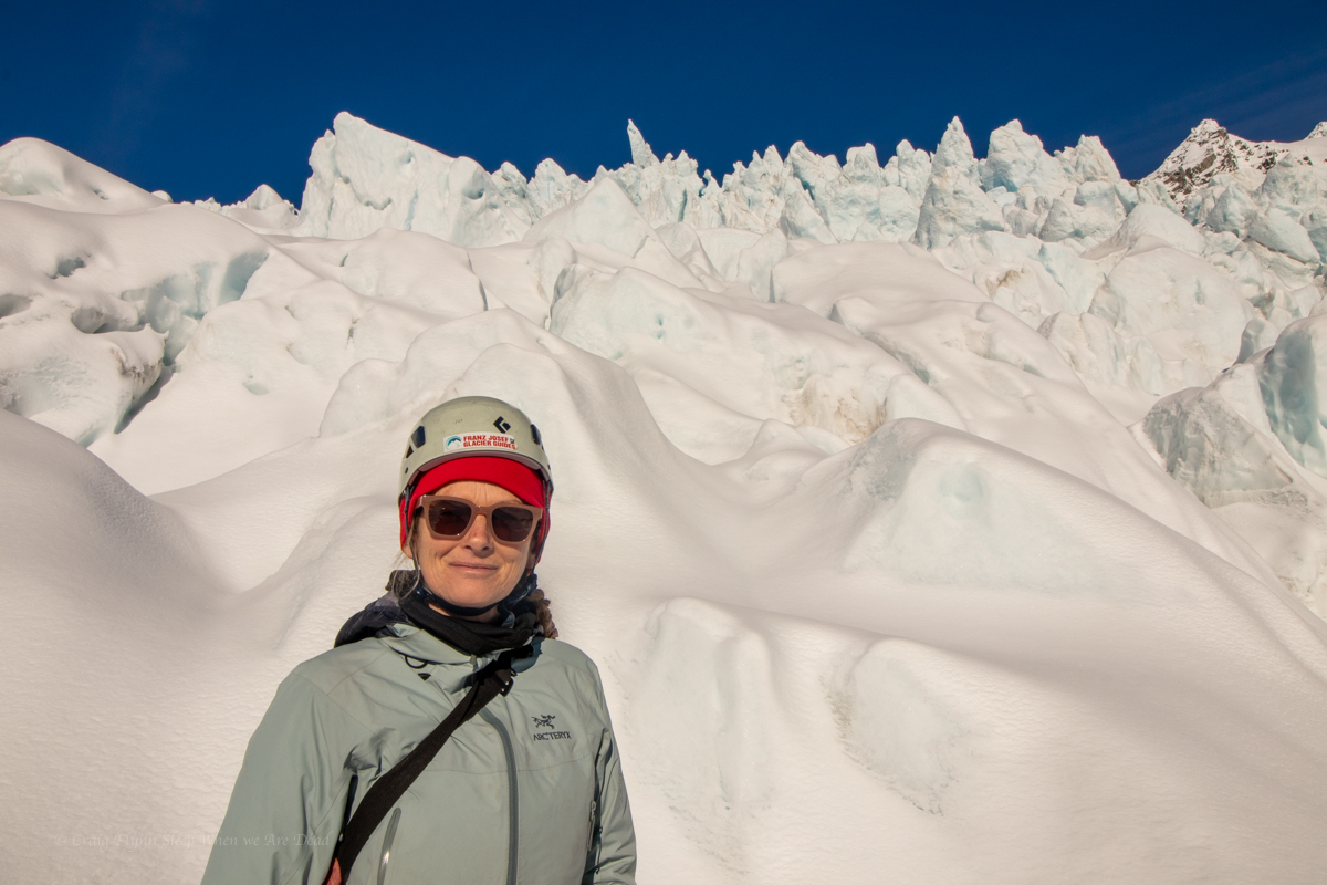
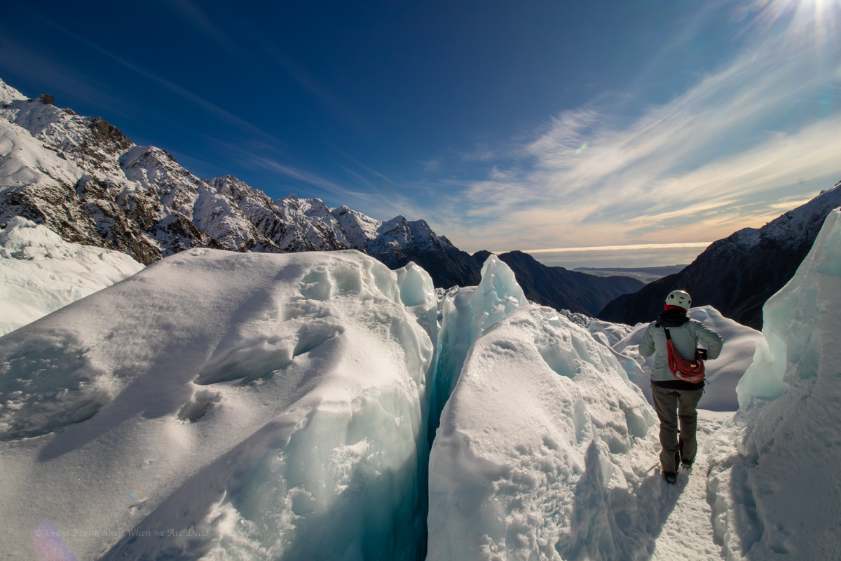
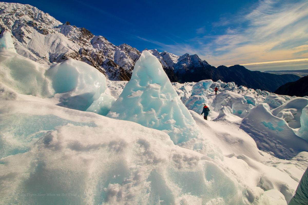
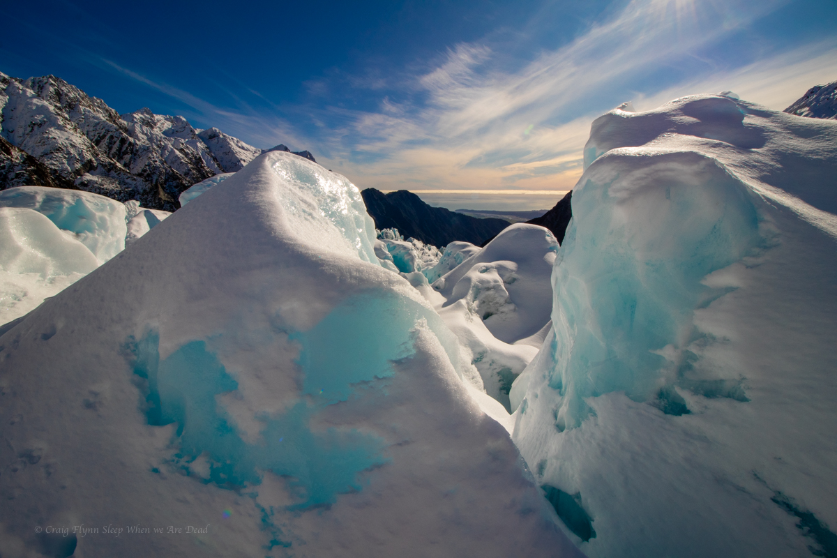
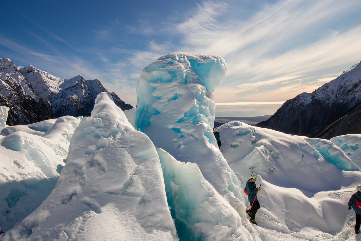
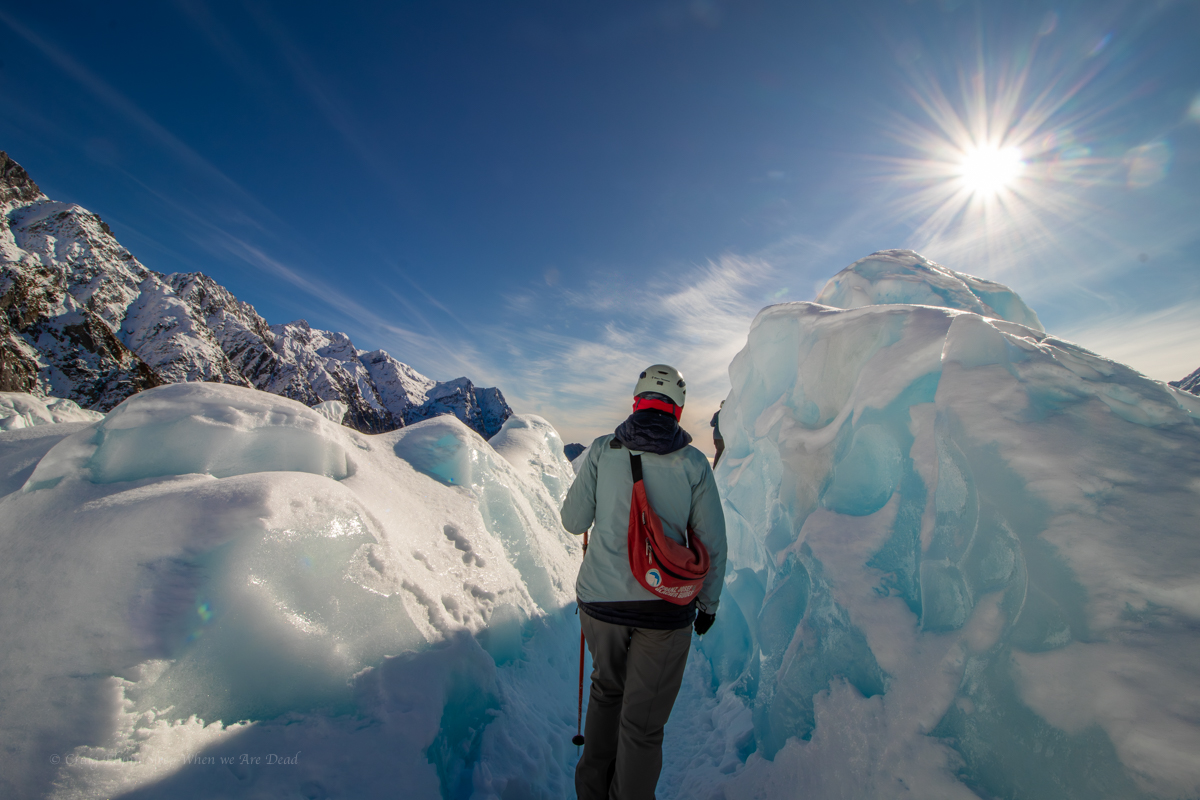
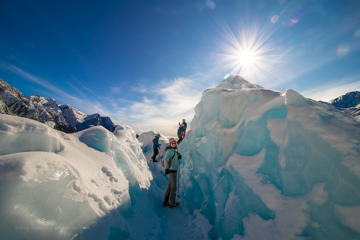
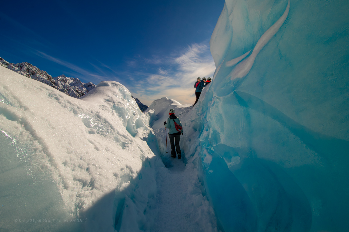
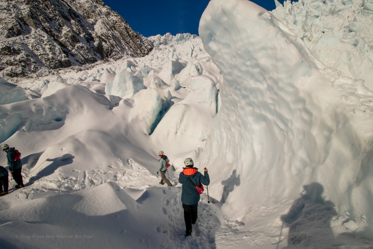
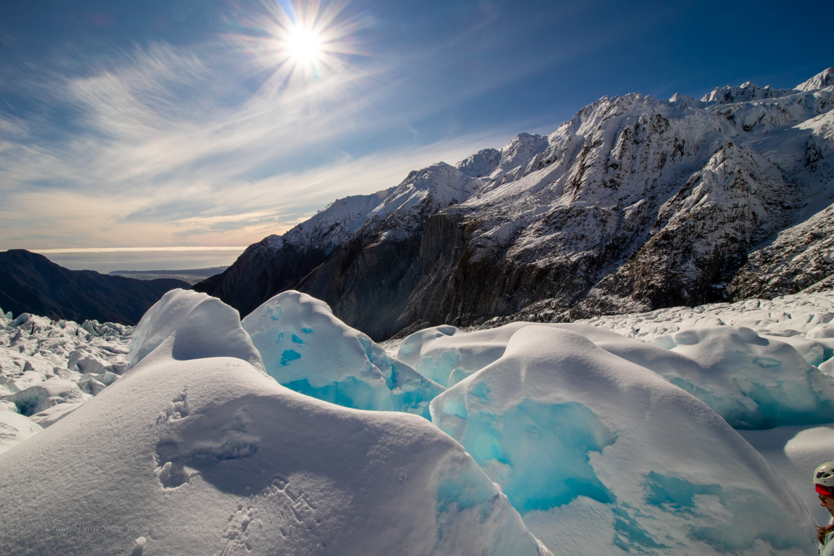
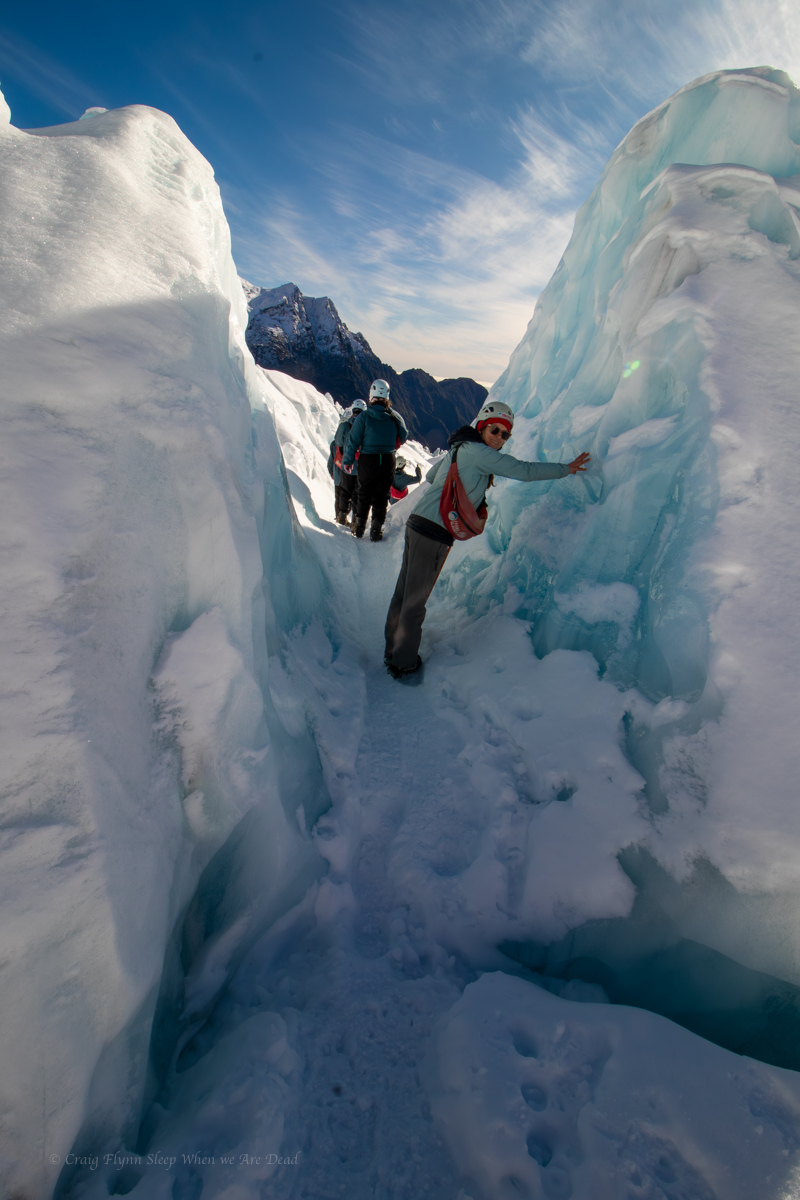
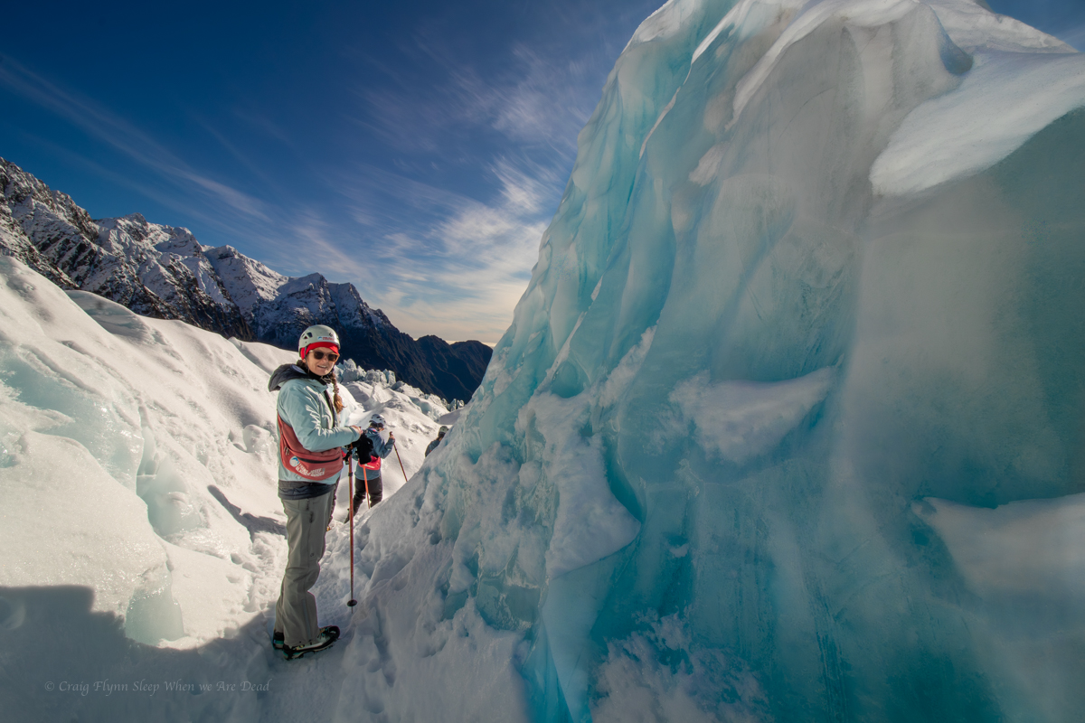
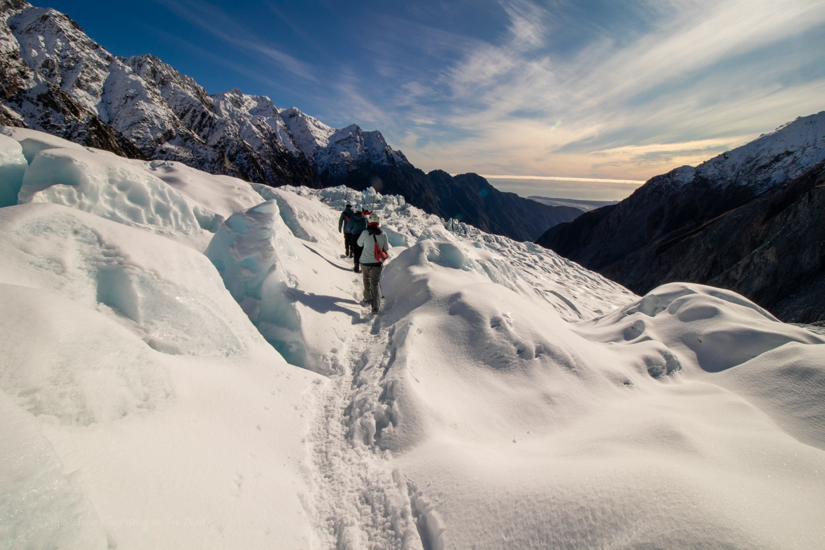
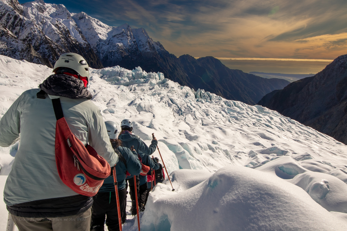
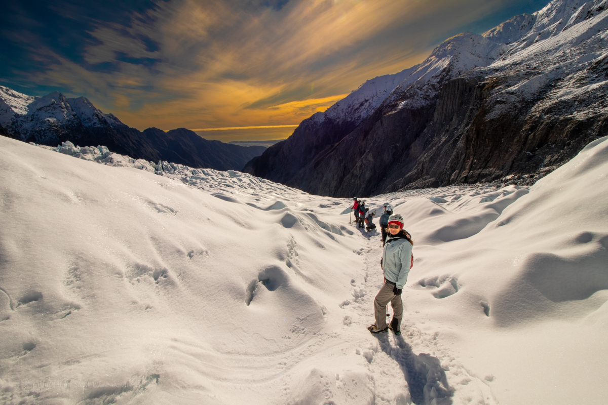
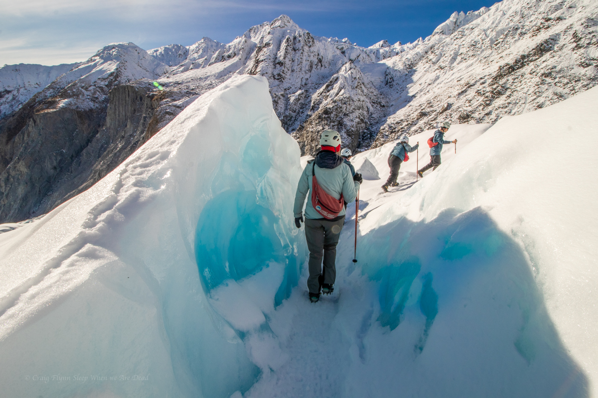
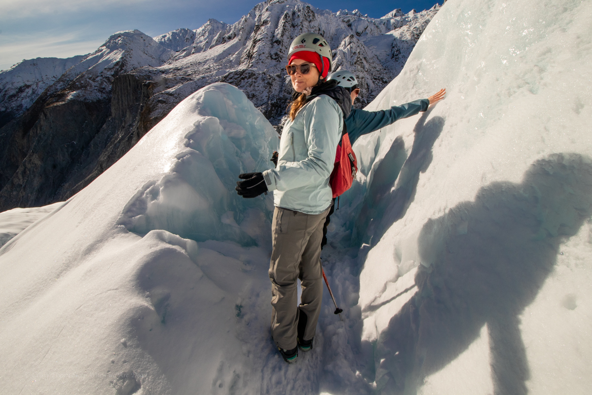
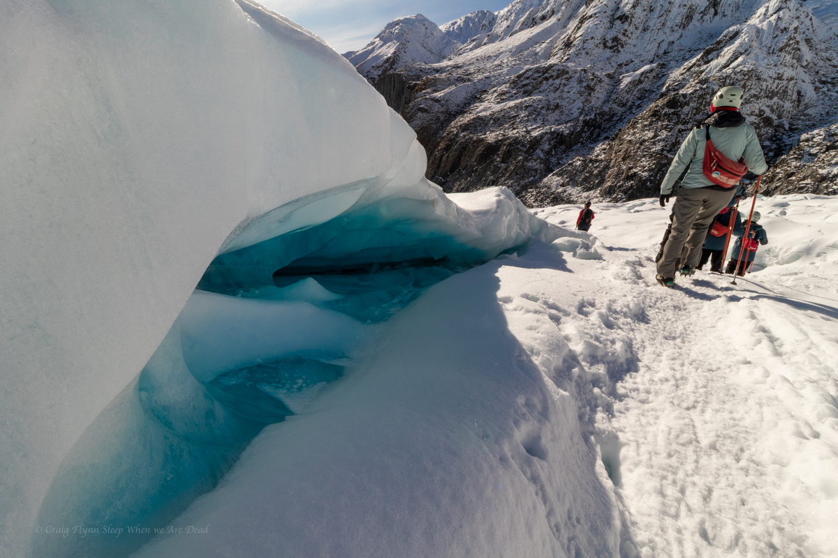
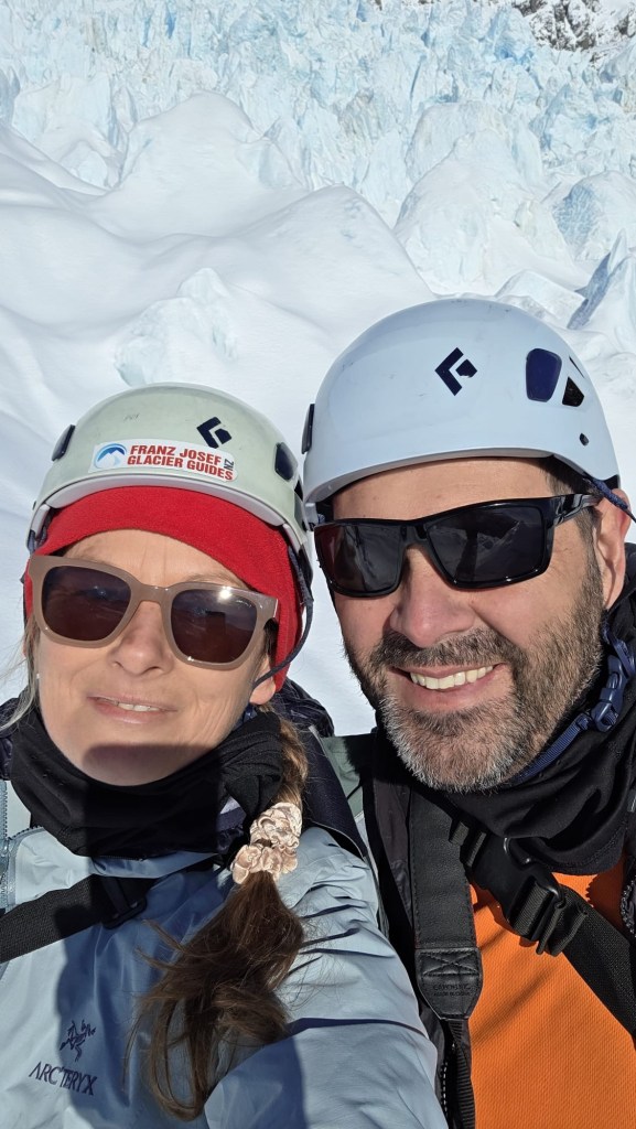
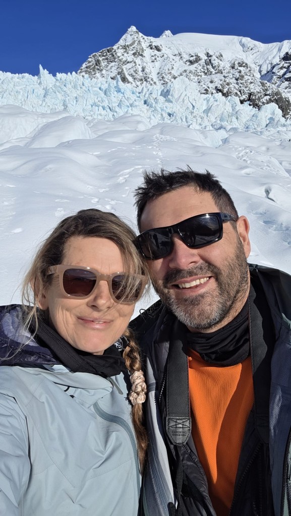
Once both groups were on the ice Maya guided us on a 2.5hr loop around the glacier with lots of facts, anecdotes, and Maori legends thrown in.
Kylie was in her element, engaging in her specialities of climate science, glacial processes, and paleo-river systems. Her smile was beaming and her eyes sparkling.
It was a great experience and I’d highly recommend it.
We had jagged a perfect bluebird day. Summer is their peak season but a clear winter’s day is the perfect time to visit.
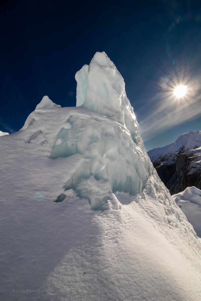
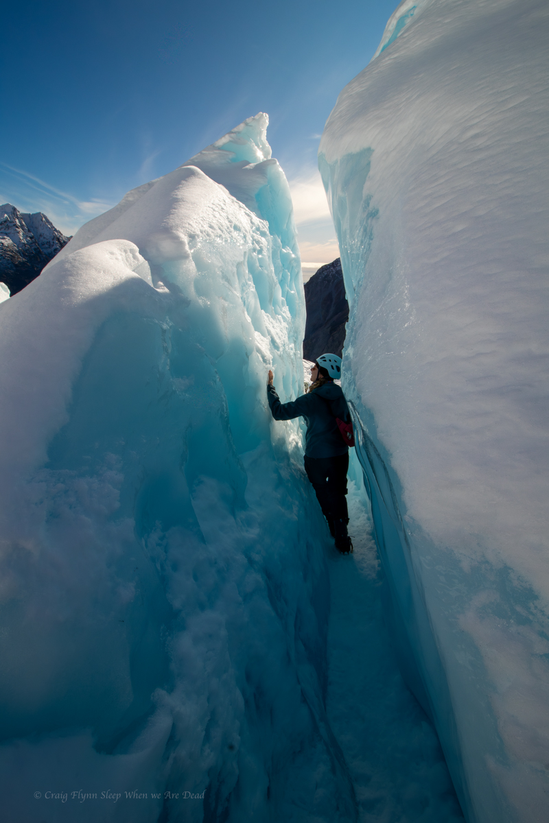
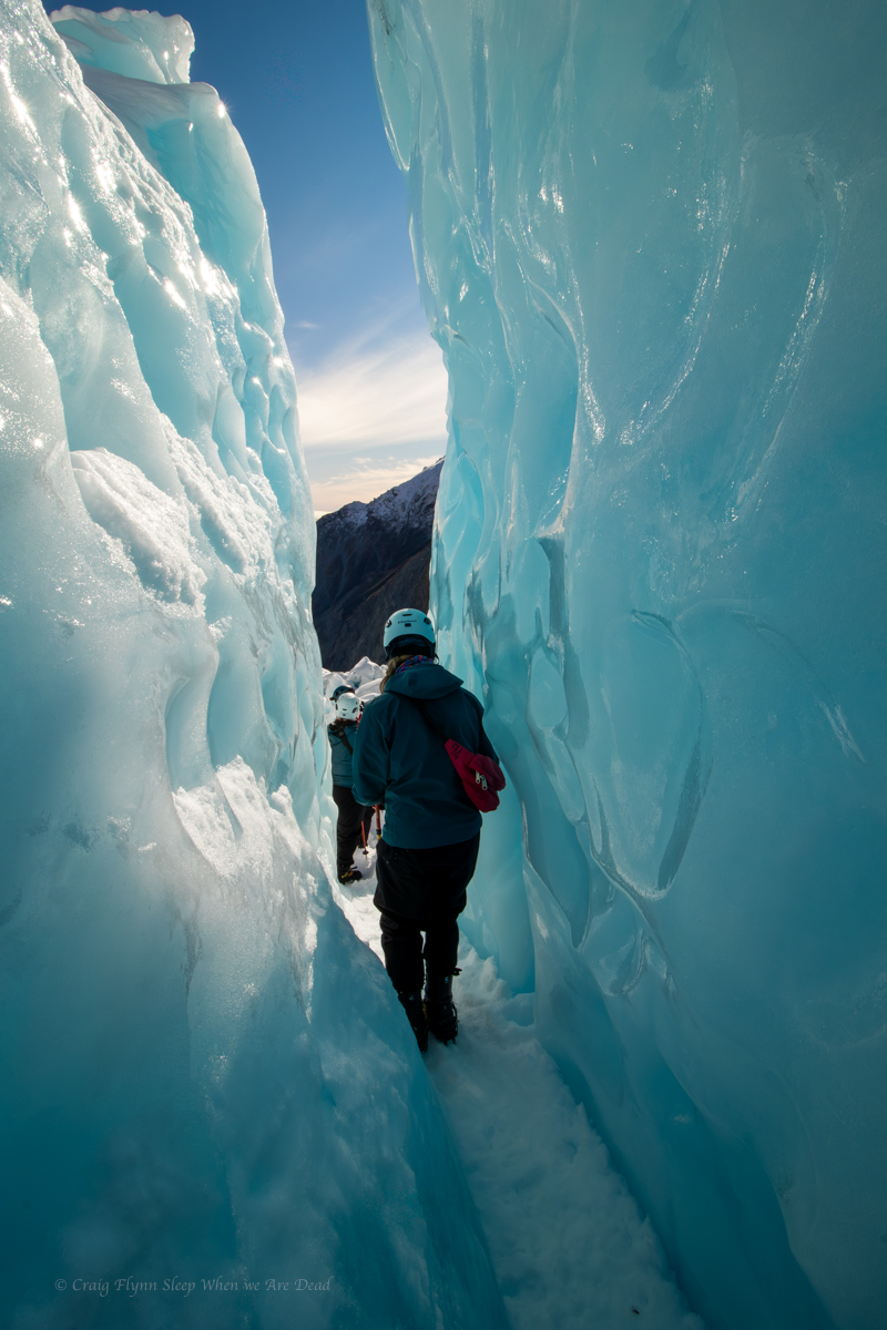
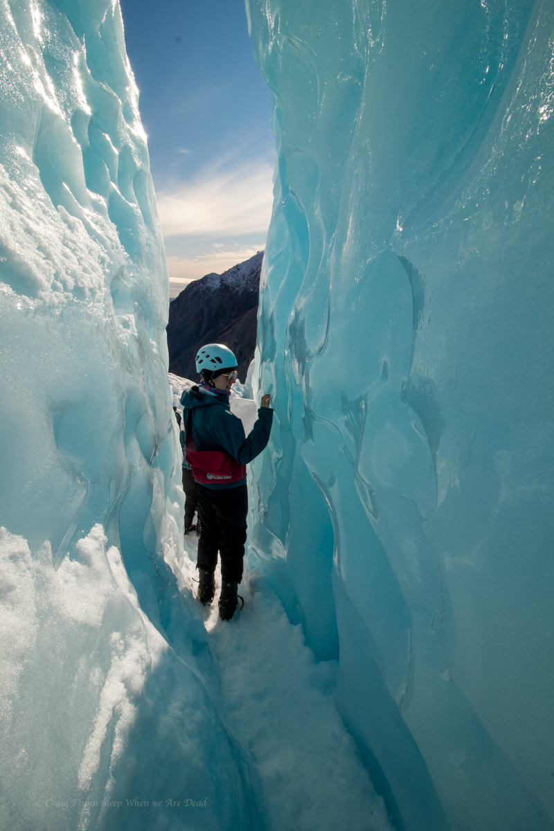
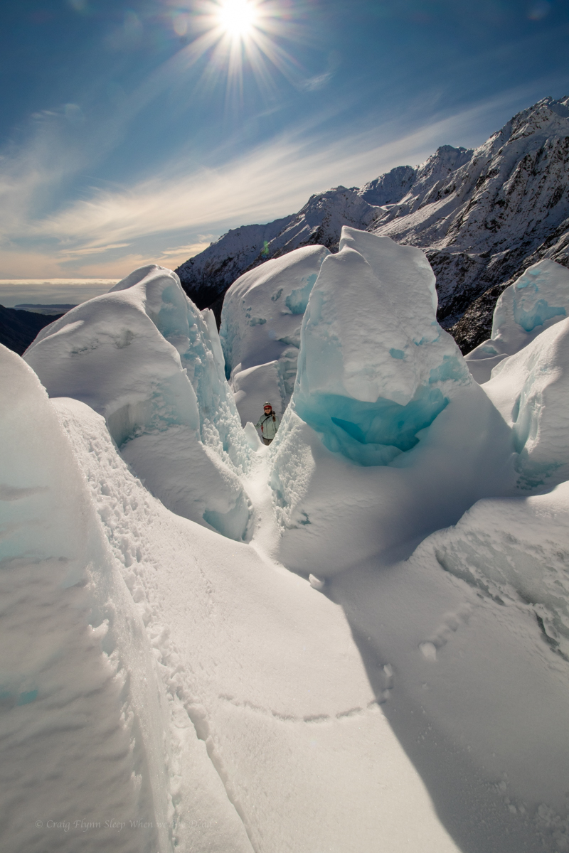
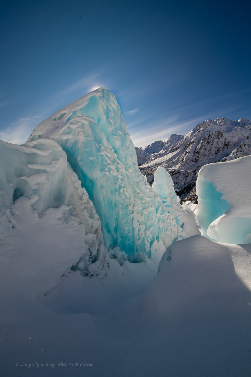
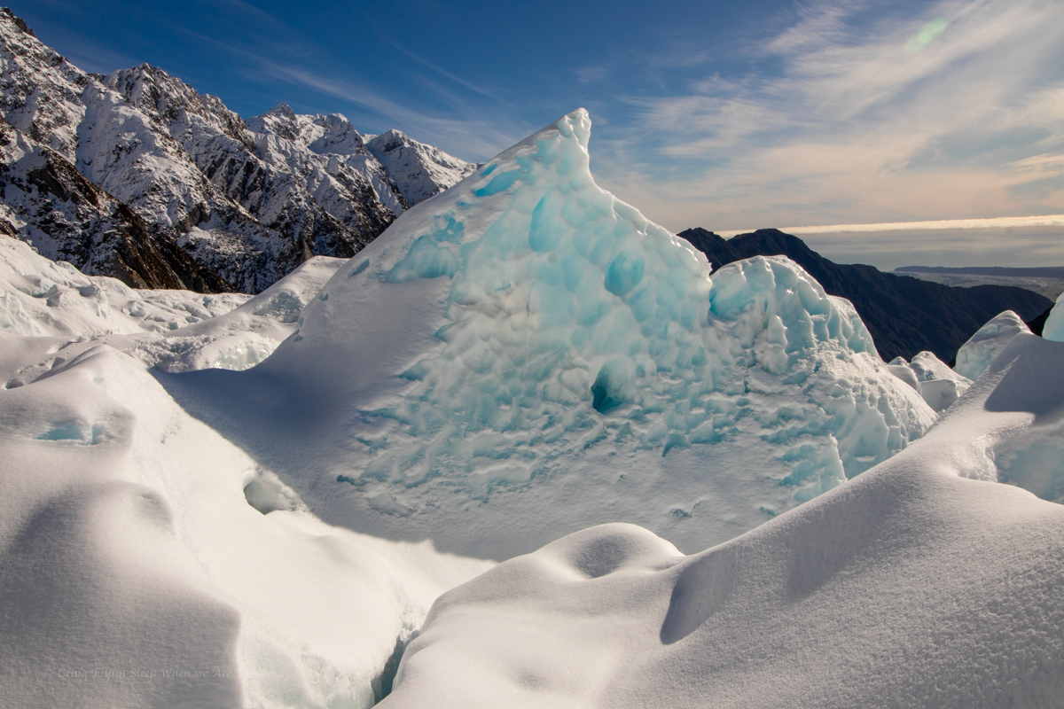
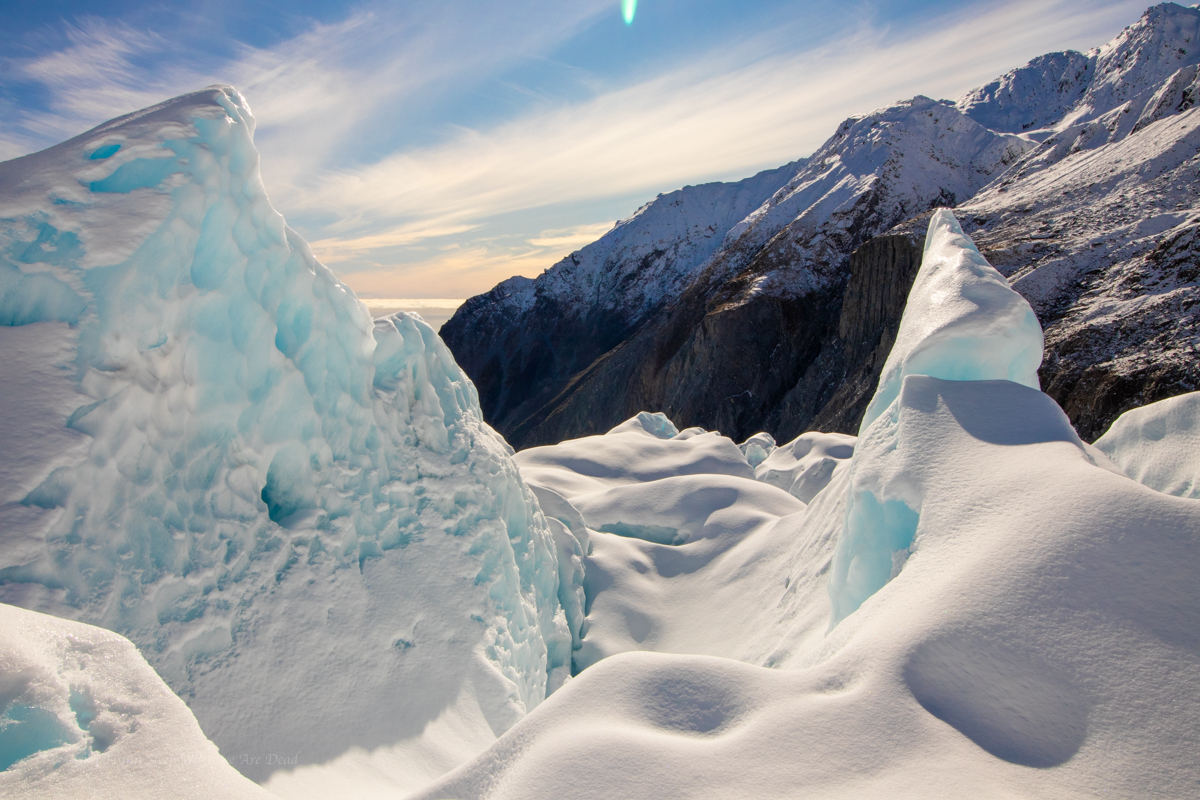
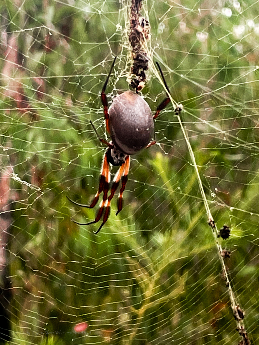
Anyhoo, we took about a thousand photos between us. Here are some of my favourite ones of mine.
Click to expand
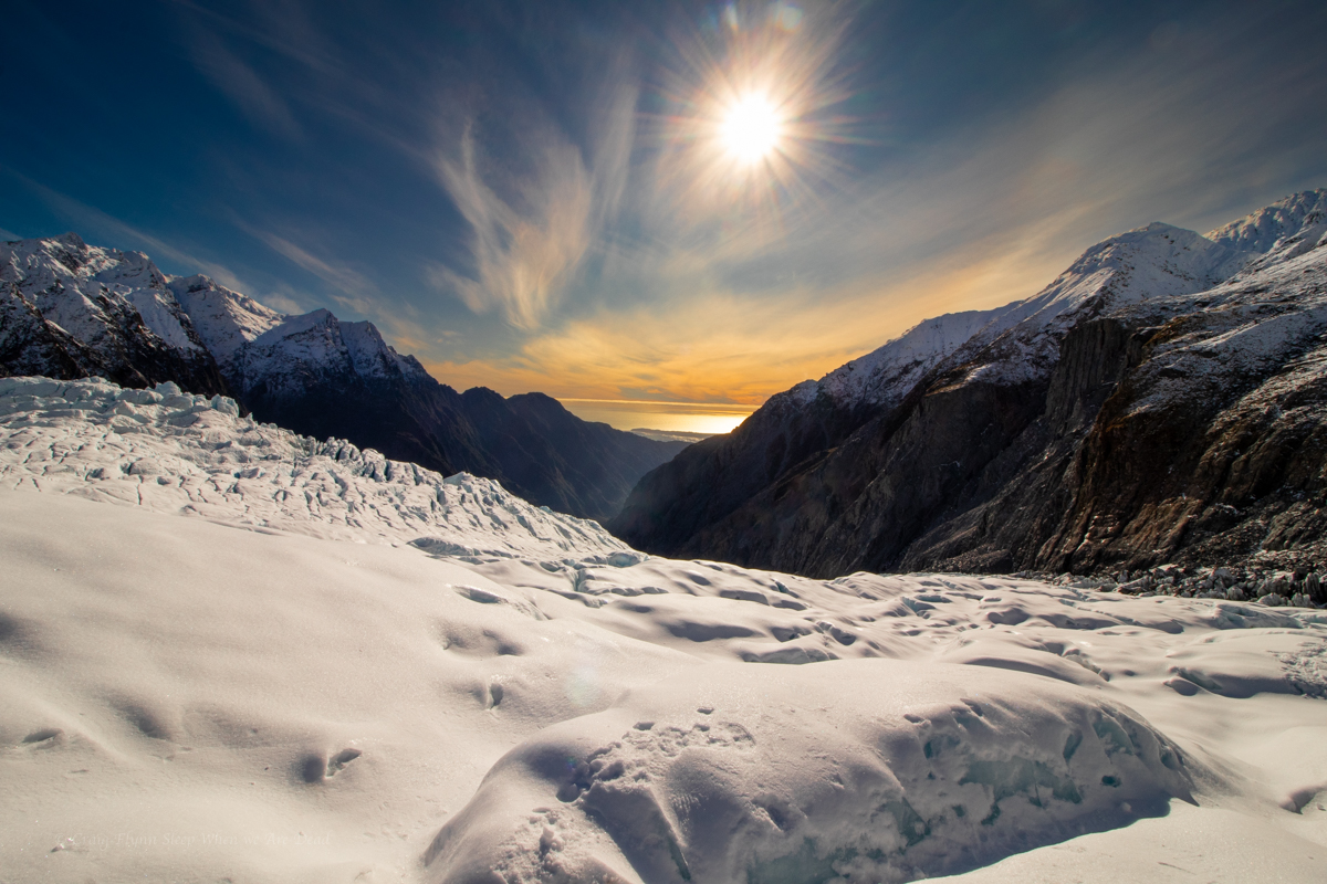
Canyon anyone?We are standing on a glacier looking at a beach!!!
Standing on a Glacier looking at a sunset over a beach!!!
Would 100% do it again
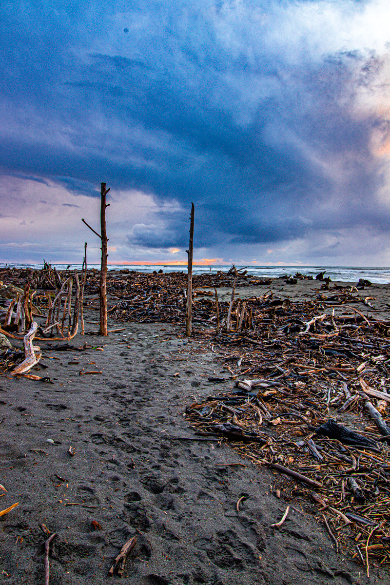
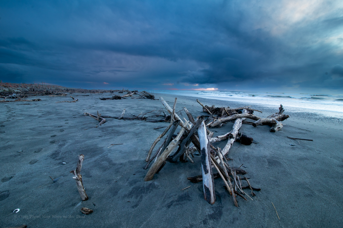
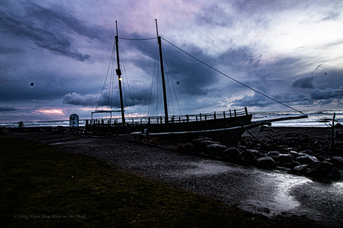
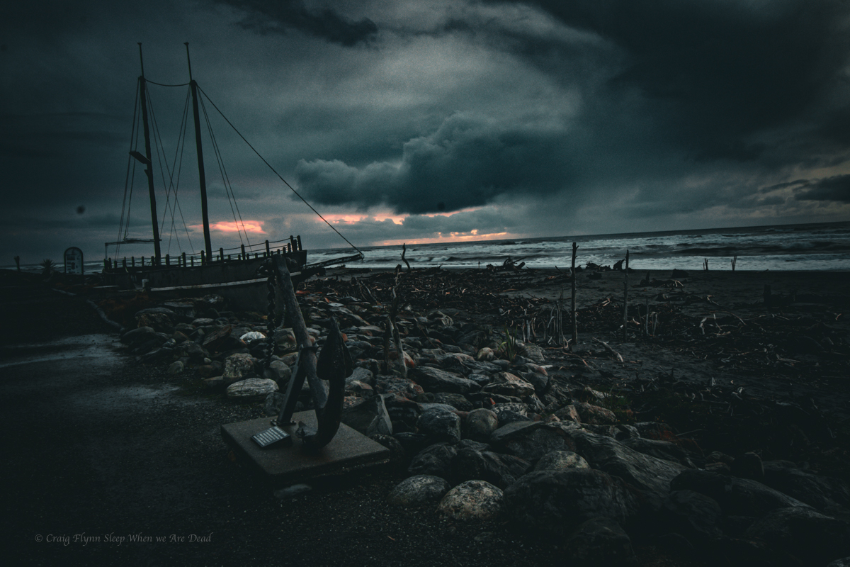
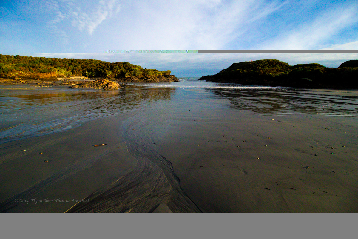
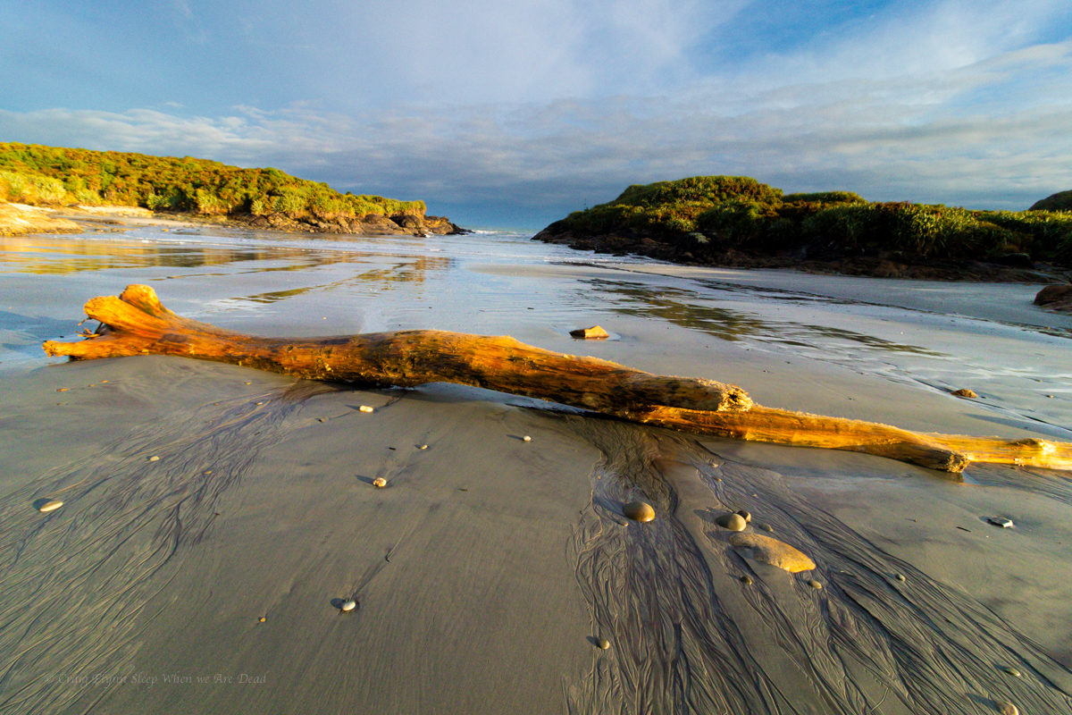
And on an absolute high from this we cruise down to Bruce Bay for camp
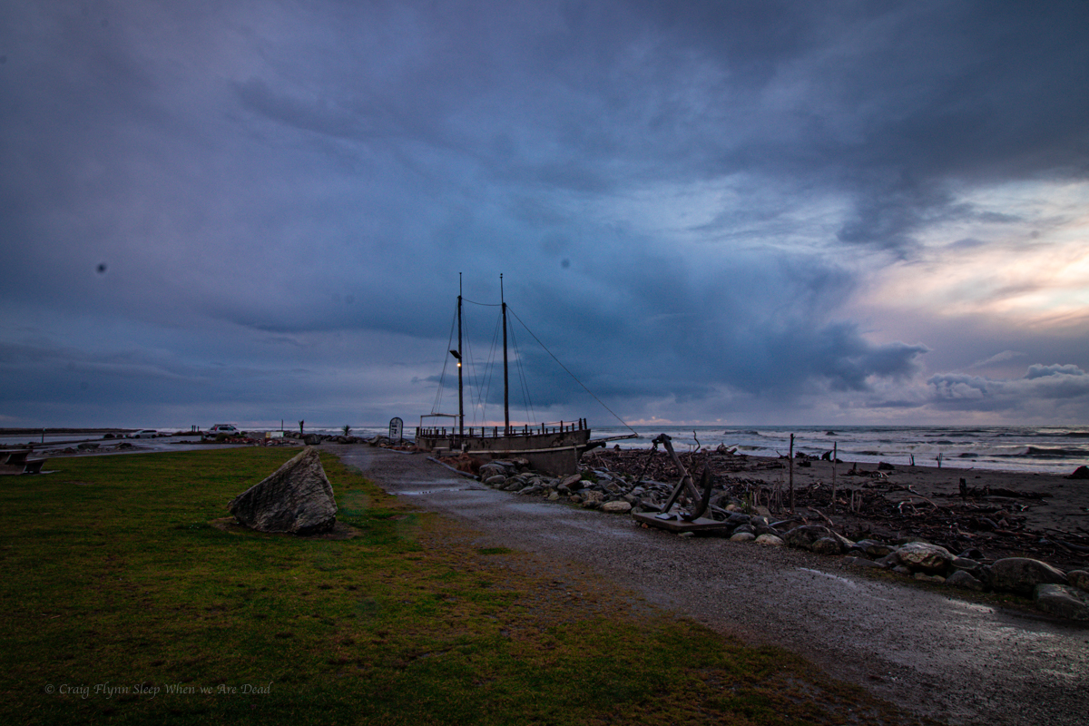
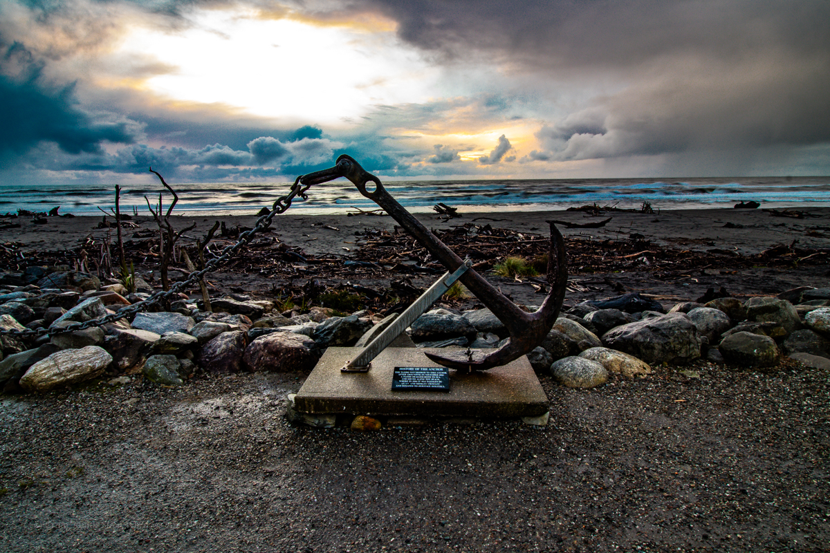
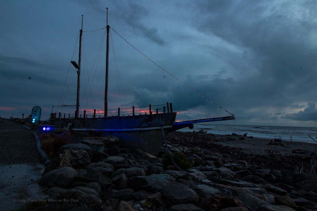
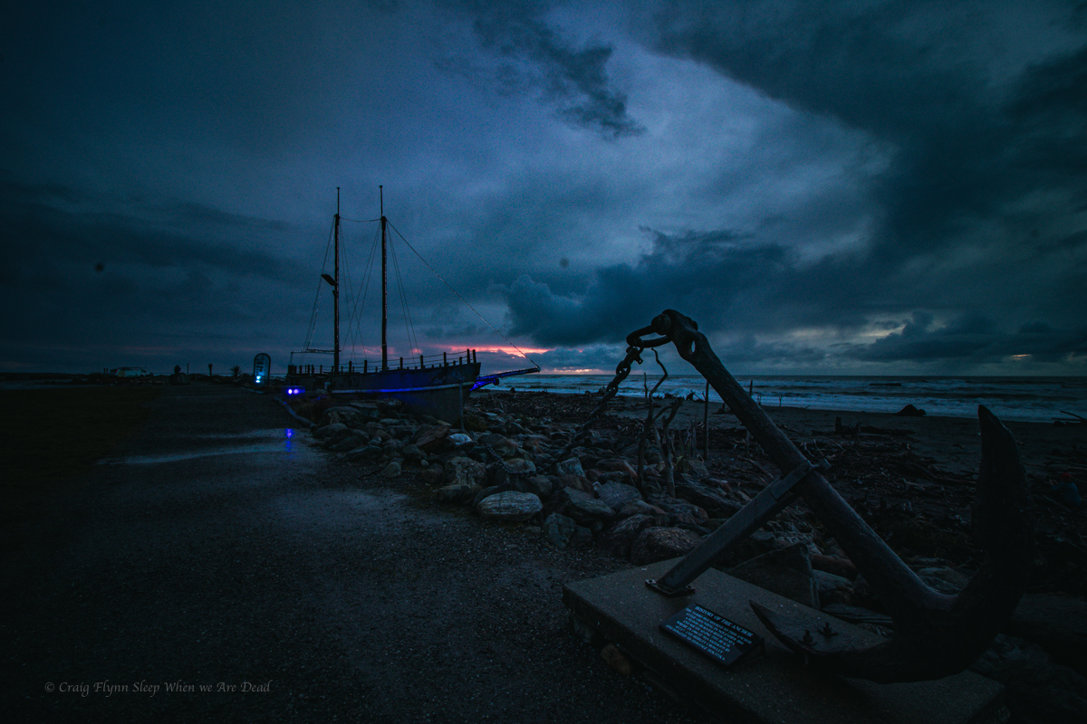
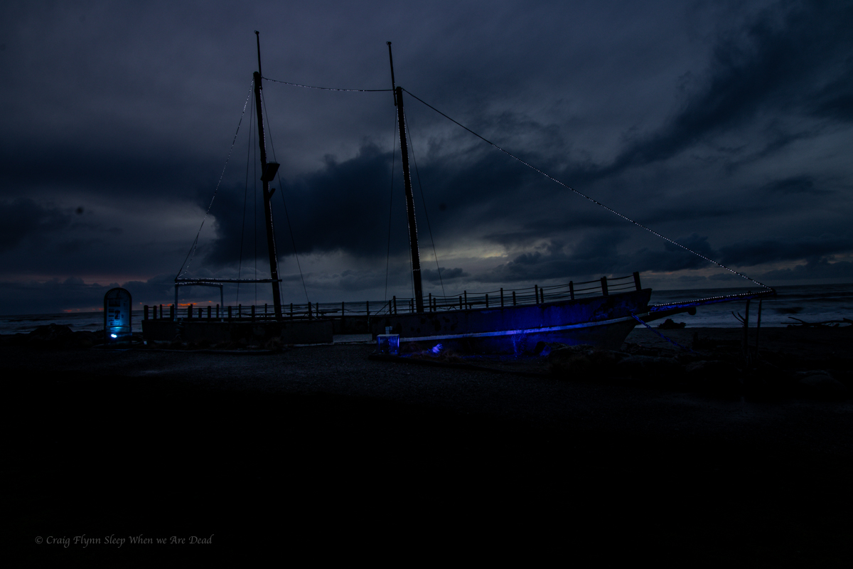
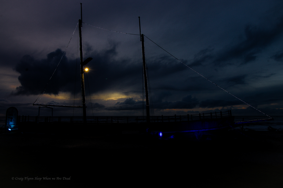
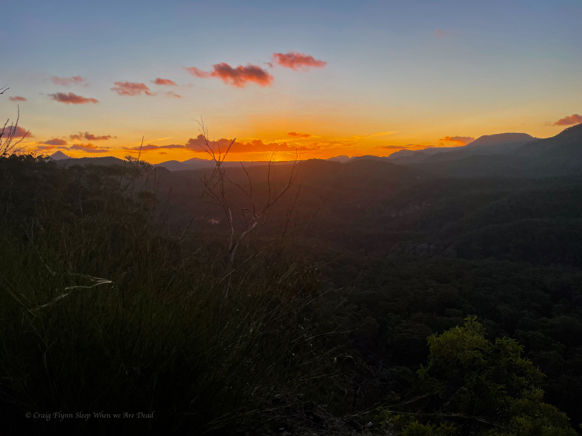
From Hokitika Gorge we slip back into town and head to Sunset point for diner in the van.
I’d never seen the sunset over the ocean before, Unfortunately the cloud cover closed in an all but blocked it out.
Not to be discouraged I thought I’d try my hand at some more arty farty photos at the memorial and art works.
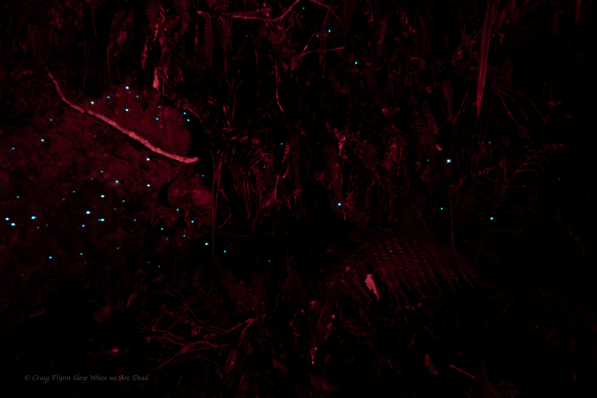
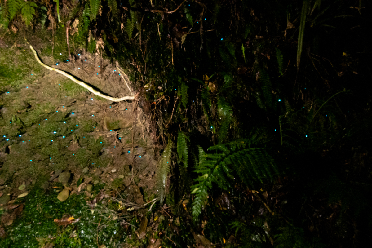
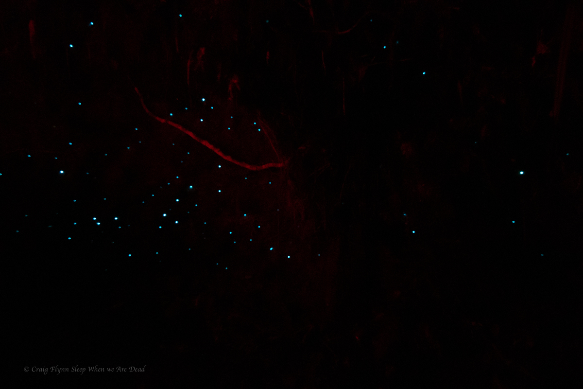
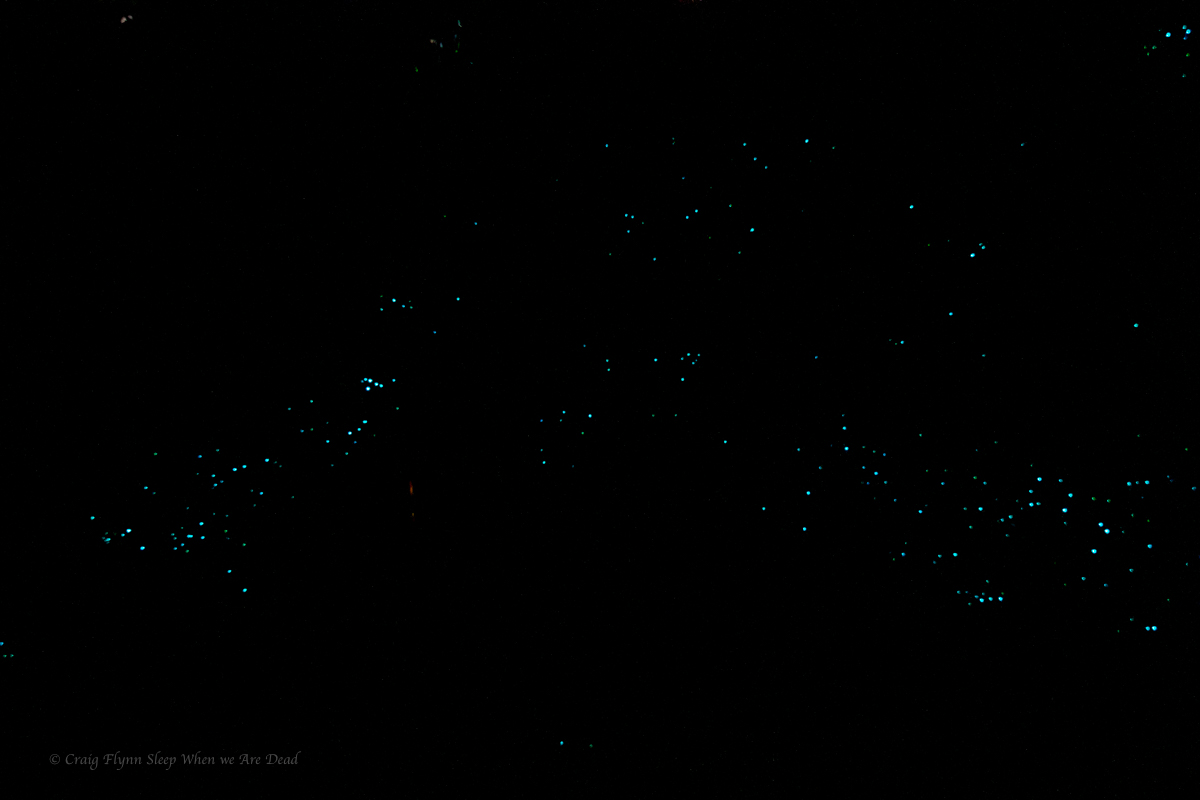
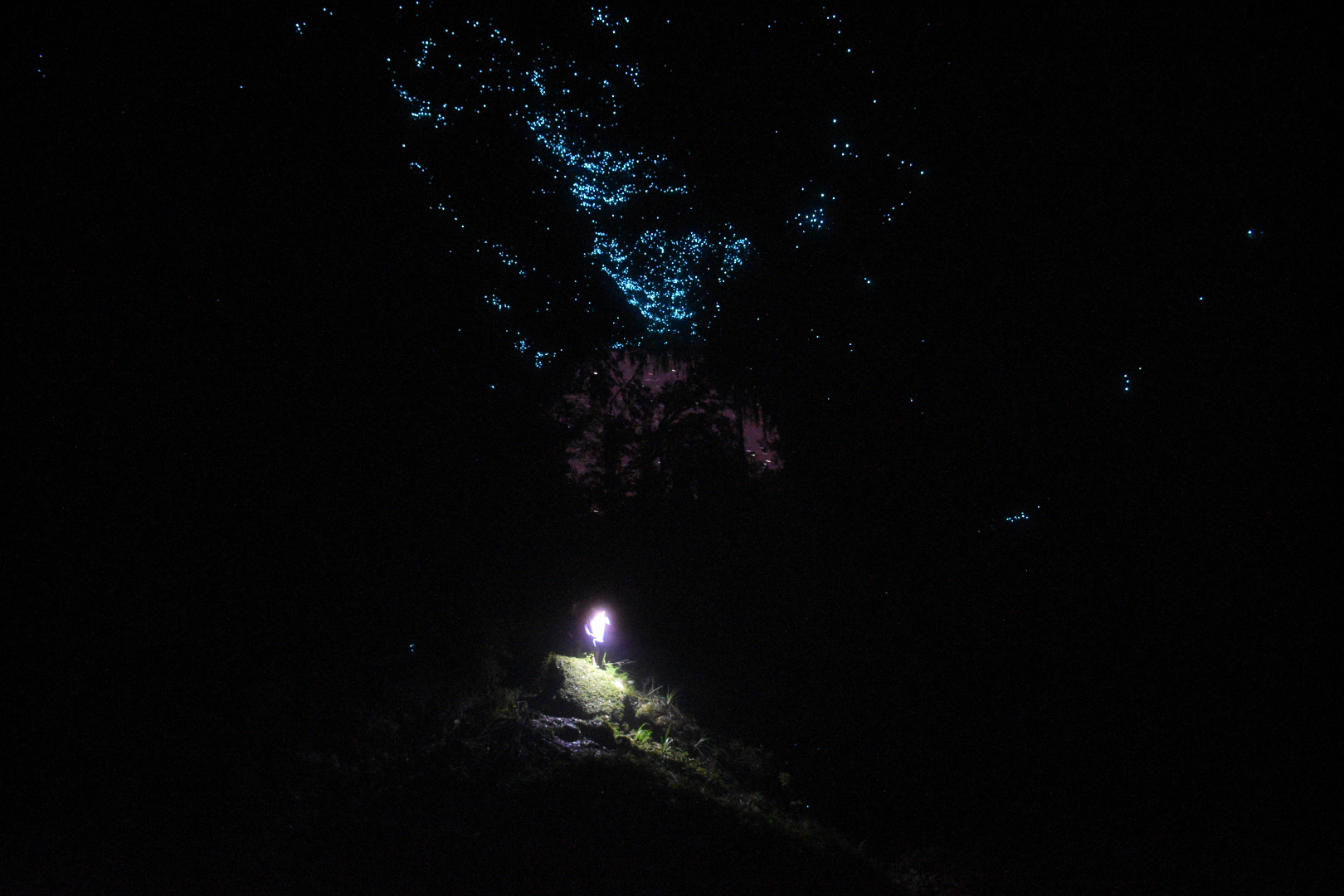
Driving into town I’d spotted a sign post for glowworms.
I know we had just done the most amazing cave tour but I’ve said it before and I’ll say it again, I will never not be awestruck by glowworms.
Lucky Kylie shares my fascination with the little shiny slugs with their little glowy bums.
If a cave tour sounds a bit too strenuous or clautrophobic for you I have some good news.
The Hokitika Glowworm dell is literally (Literally babes) 50m off the main highway in a shady, fern filled gully. A concrete path leads you in.
Tip: either use a red light (even a bit of coloured cellophane or contact over your torch) or hold onto the hand rails turn your torch off and let your eyes adjust.
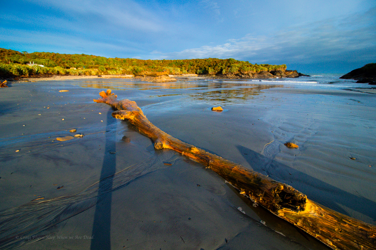
From here it was on to a highlight in a long list of highlights from this trip Franz Josef Glacier
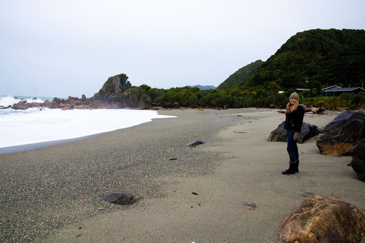
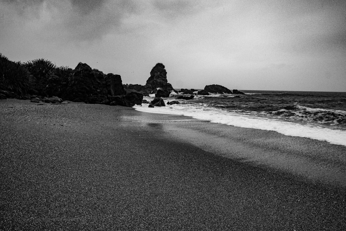
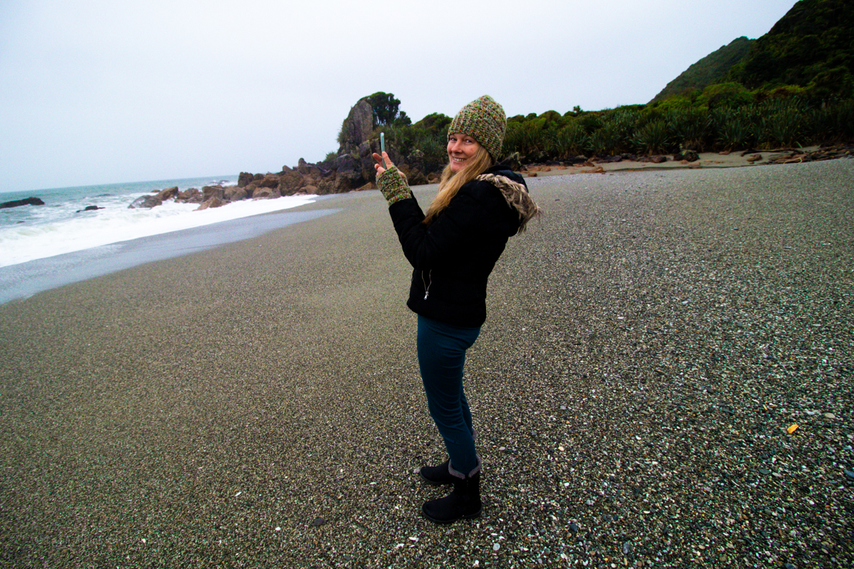
Continuing on from Charleston we chug on down the coast calling in to the unsign-posted and little heralded Hatter Bay,
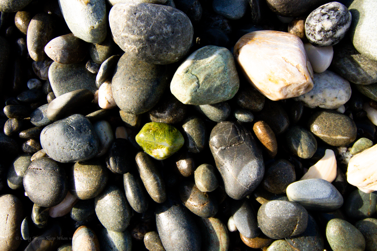
Then another beach
even the sea was frothing
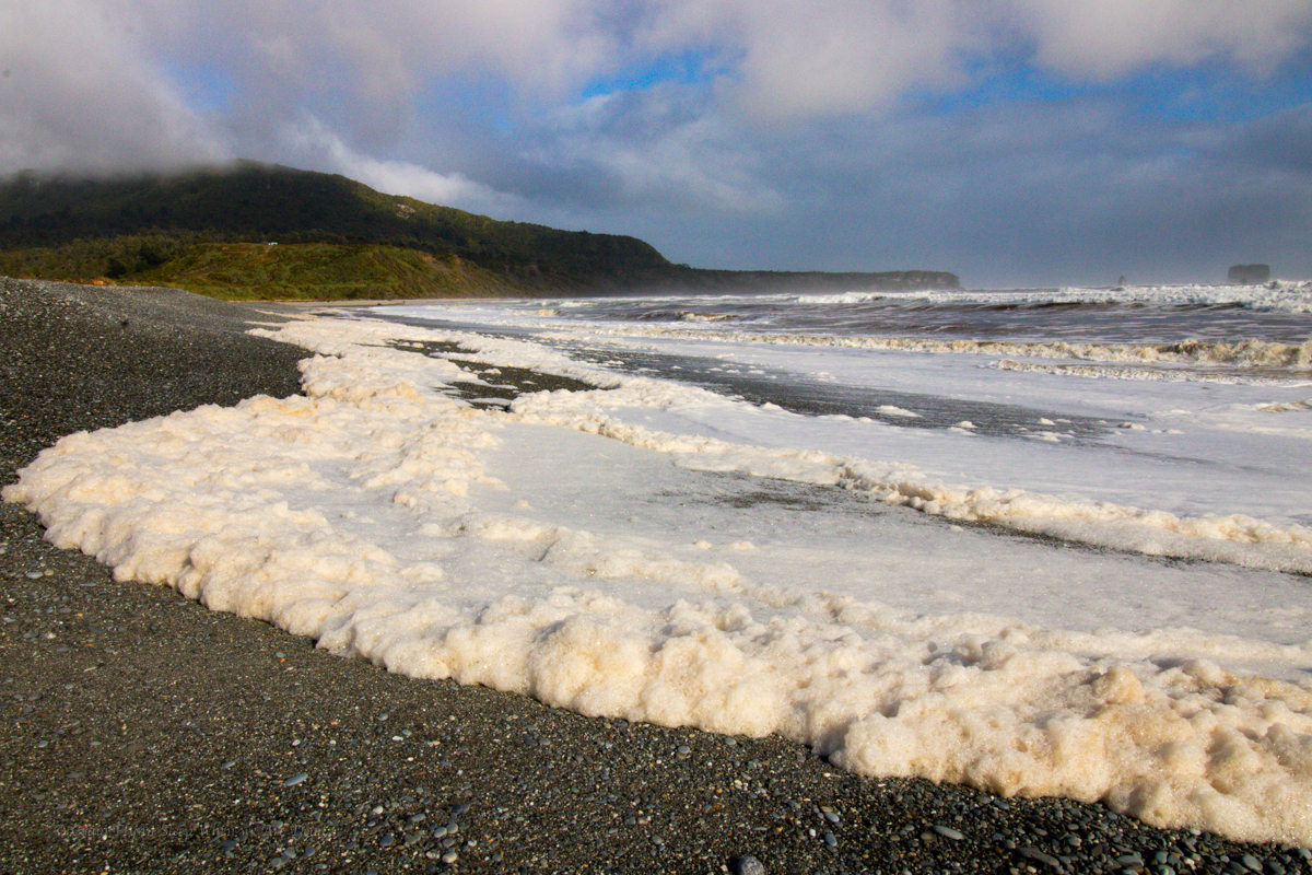
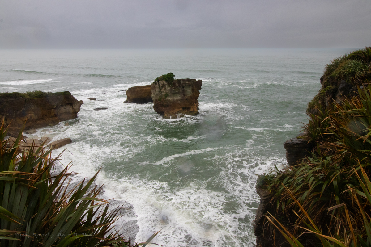
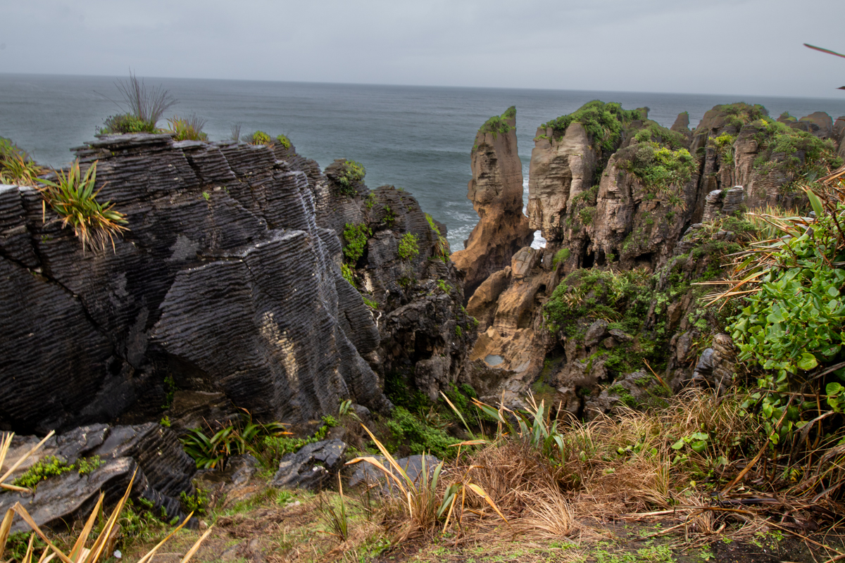
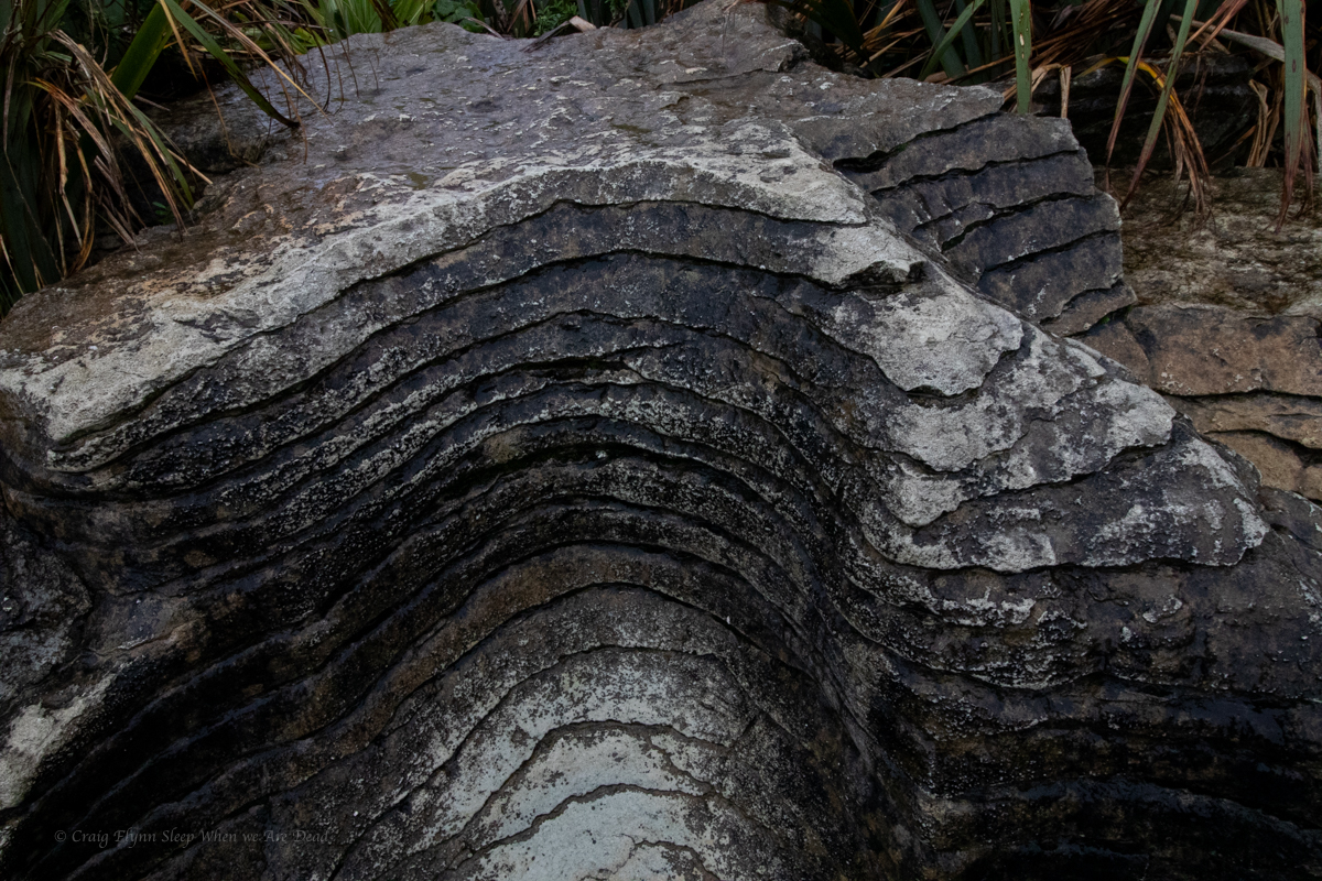
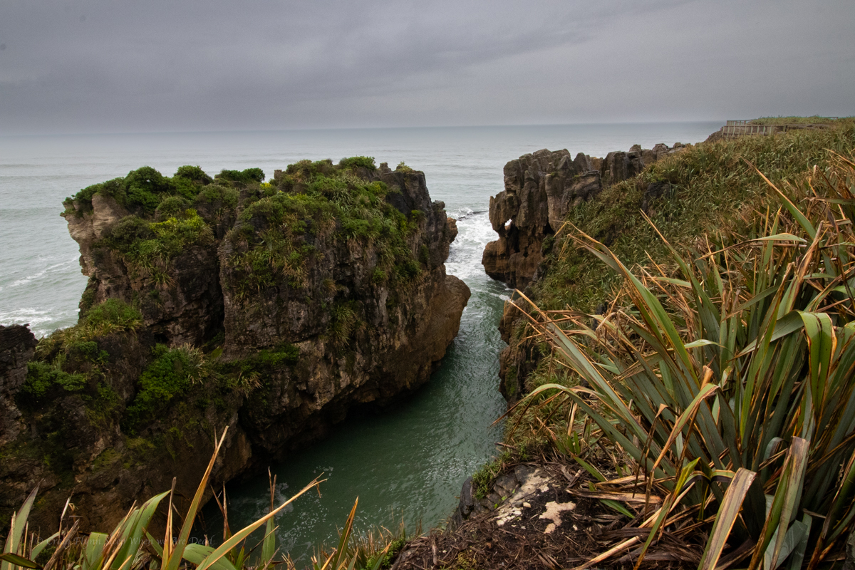
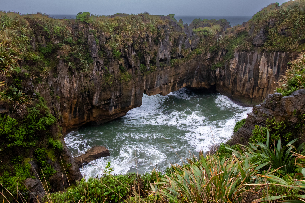
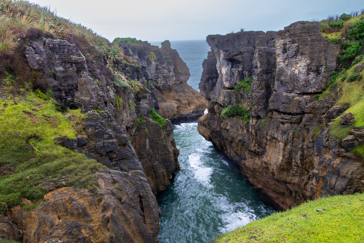
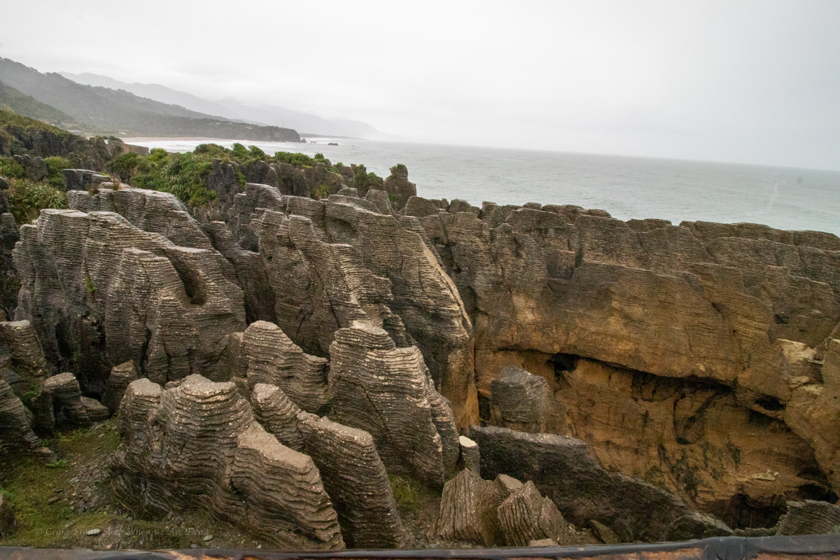
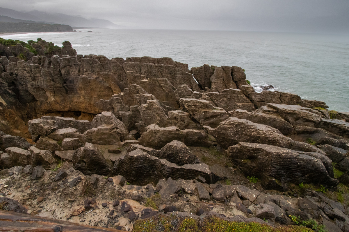
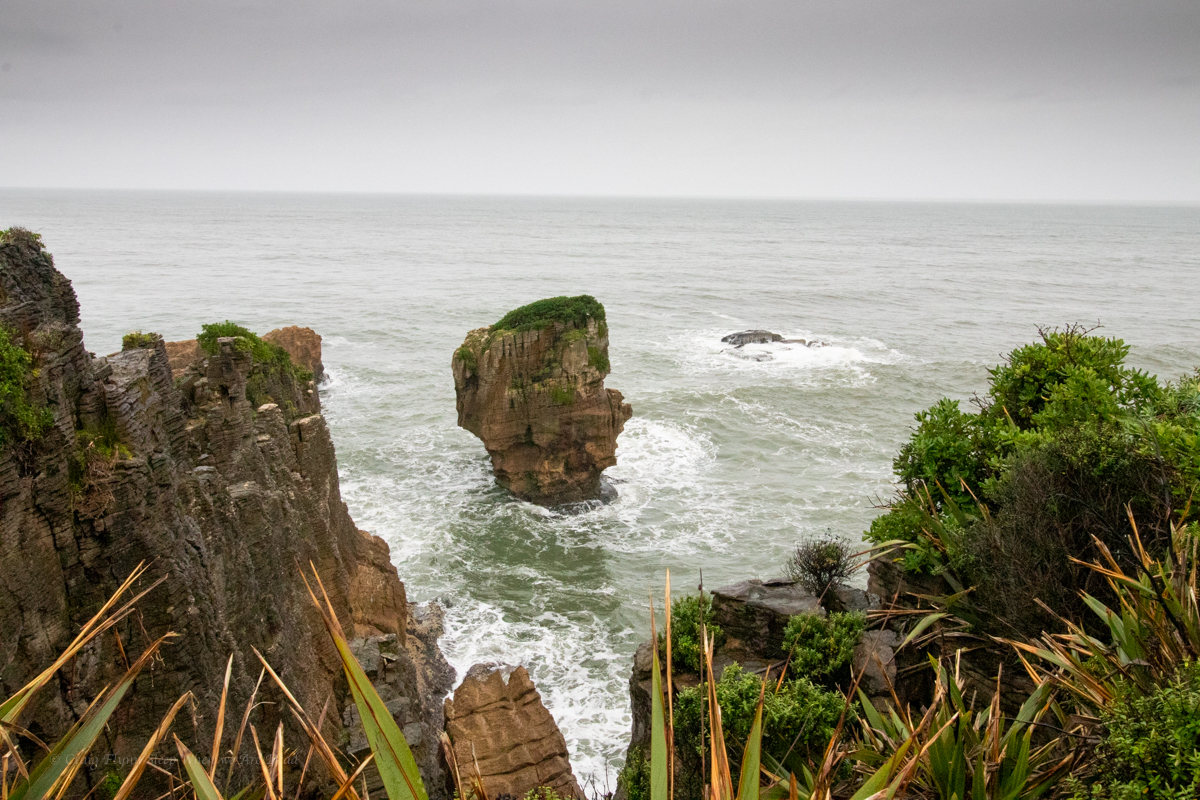
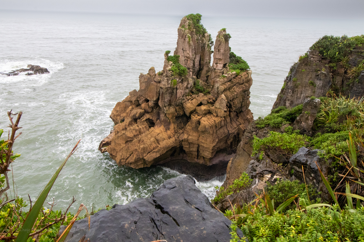
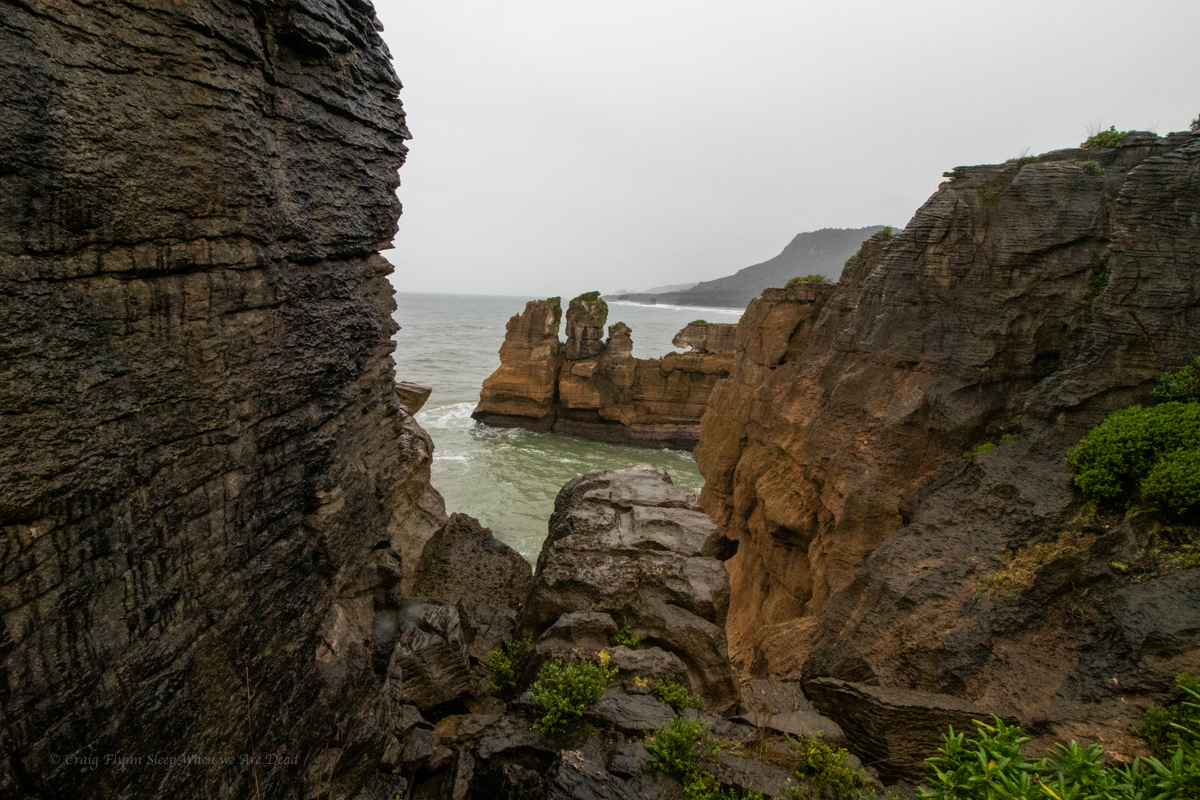
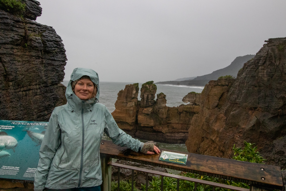
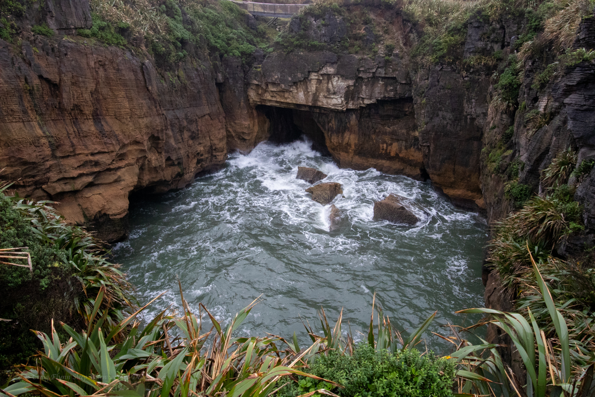
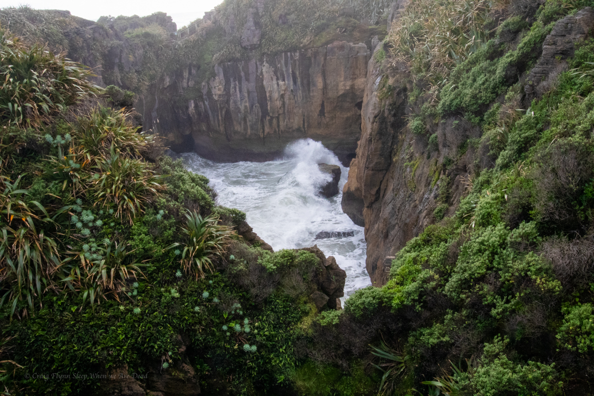
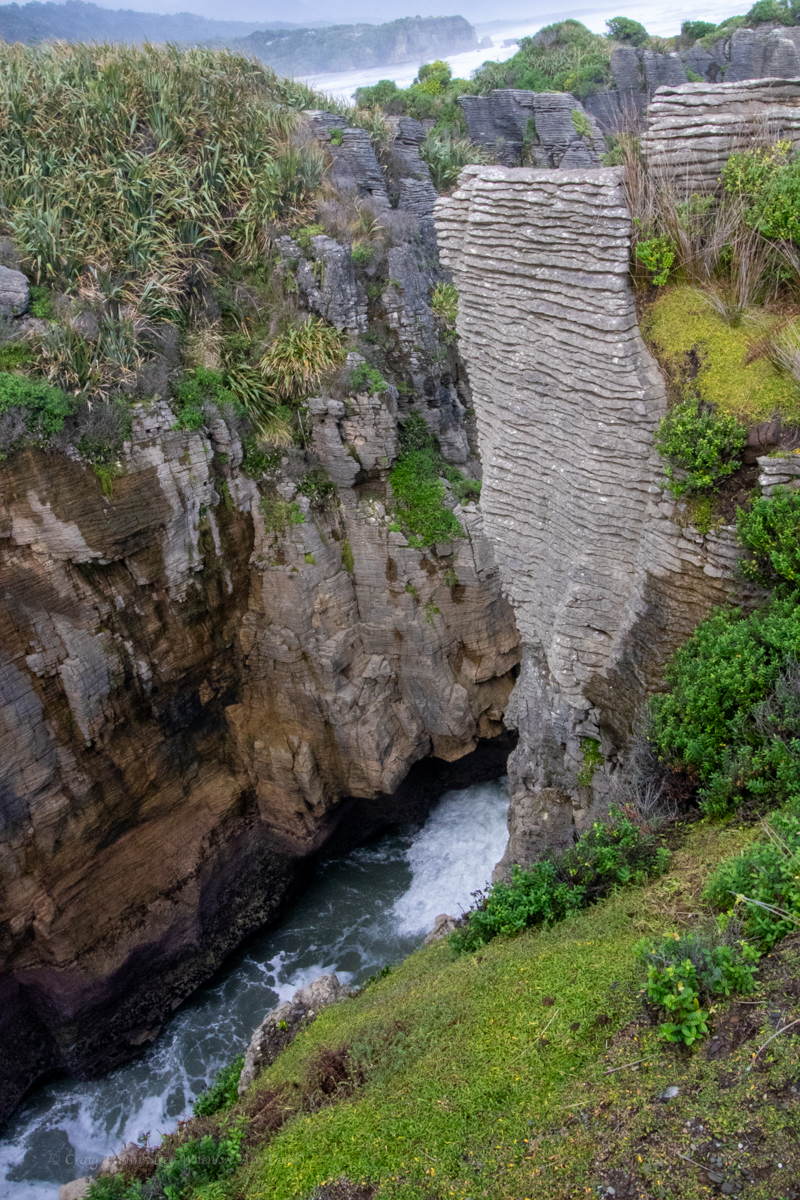
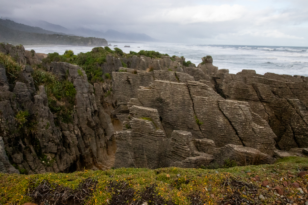
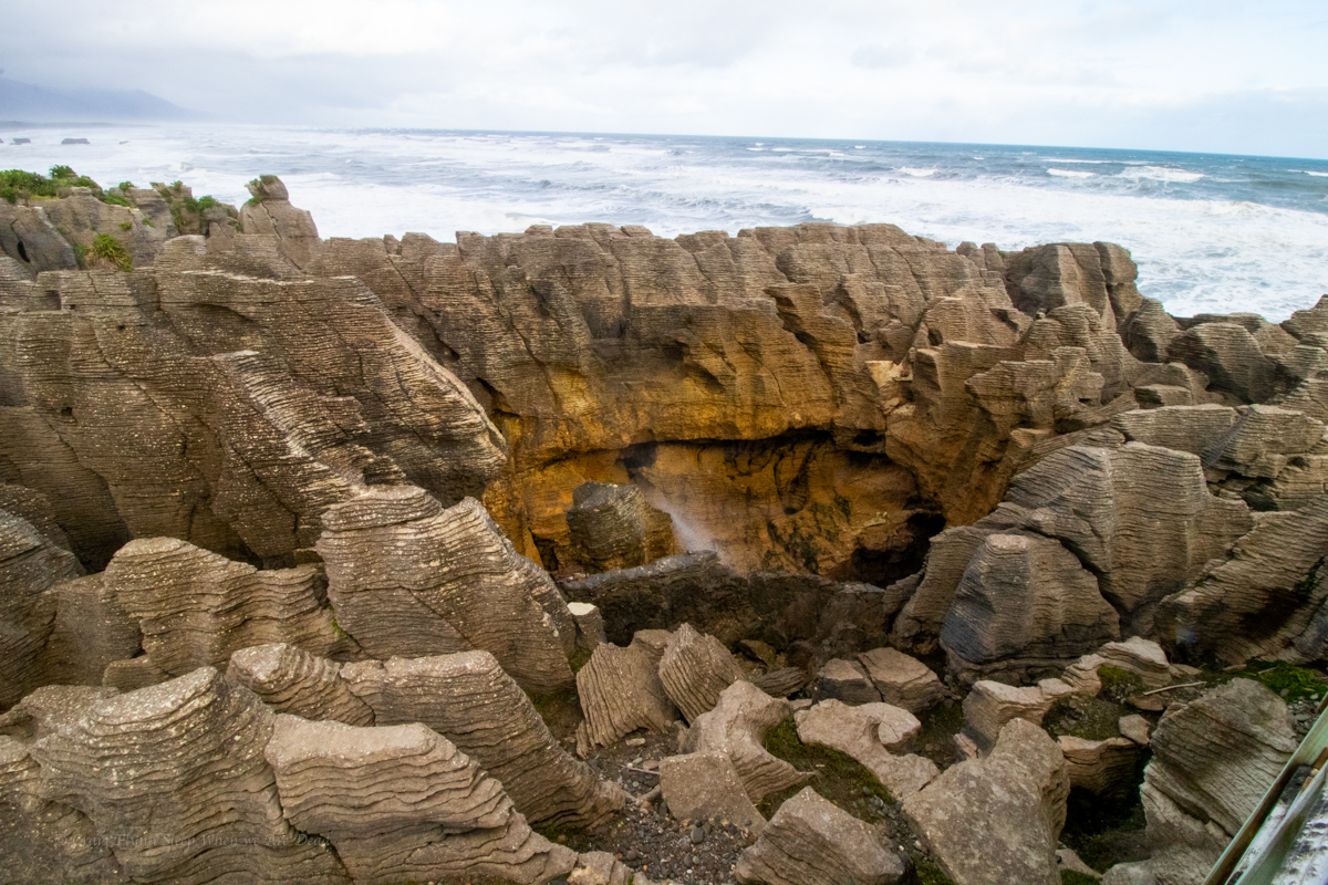
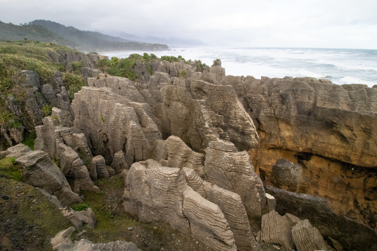
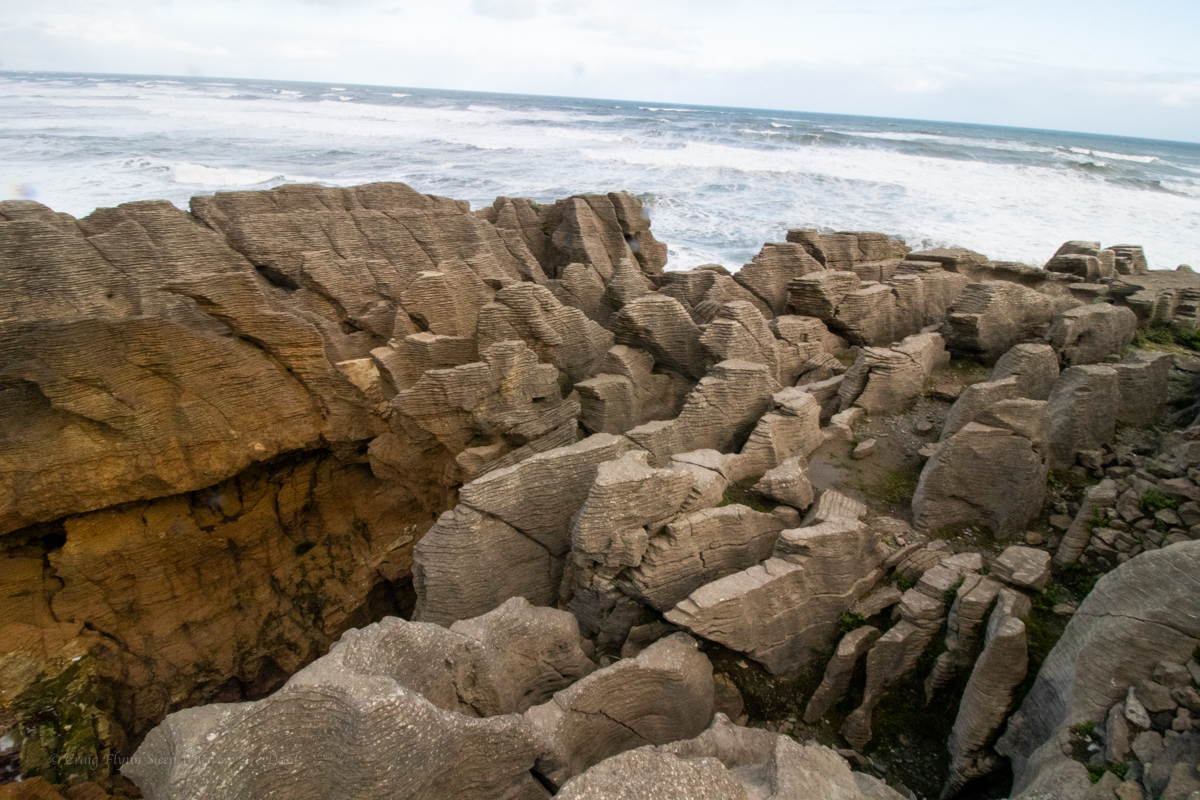
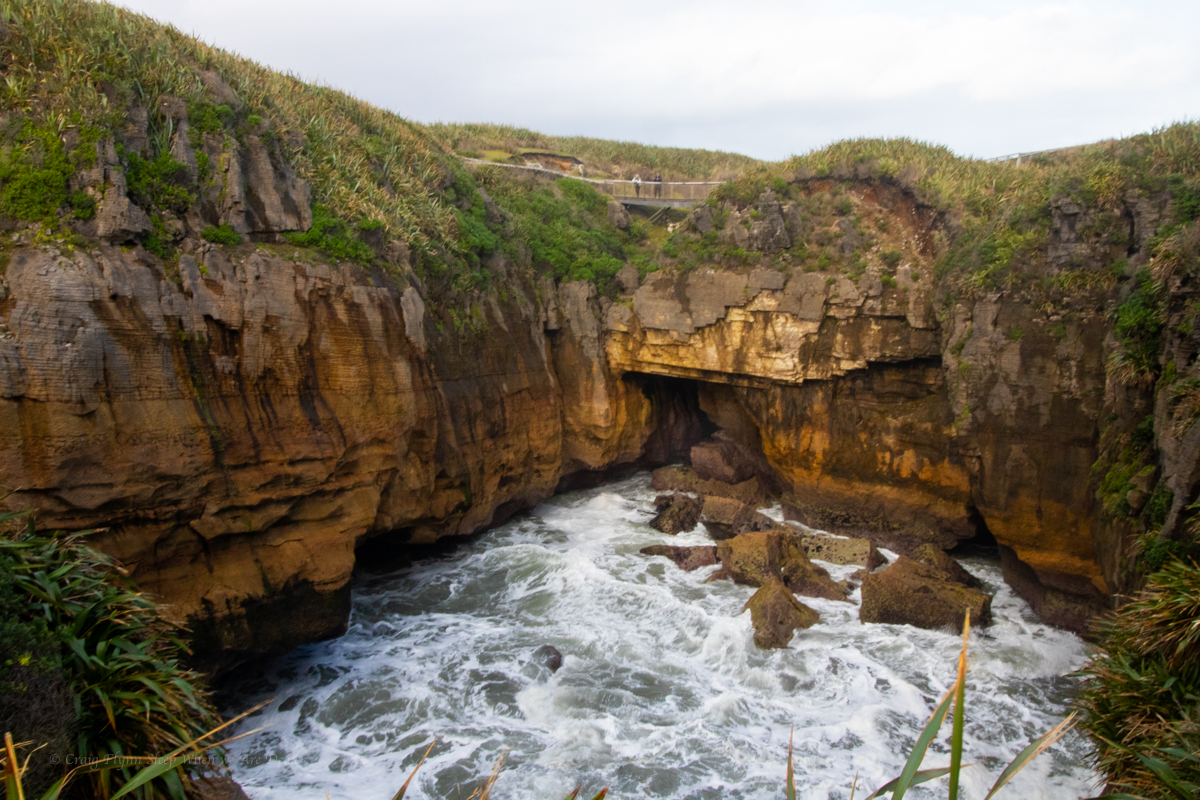
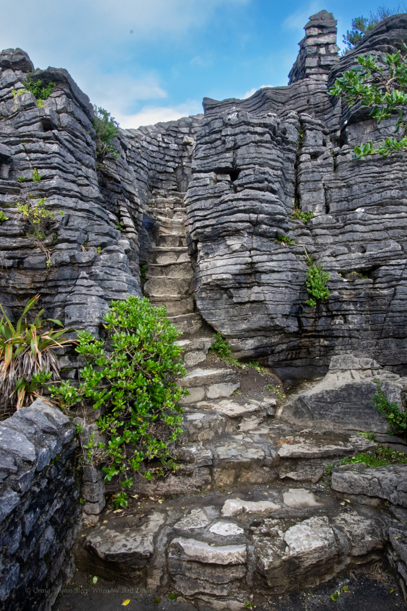
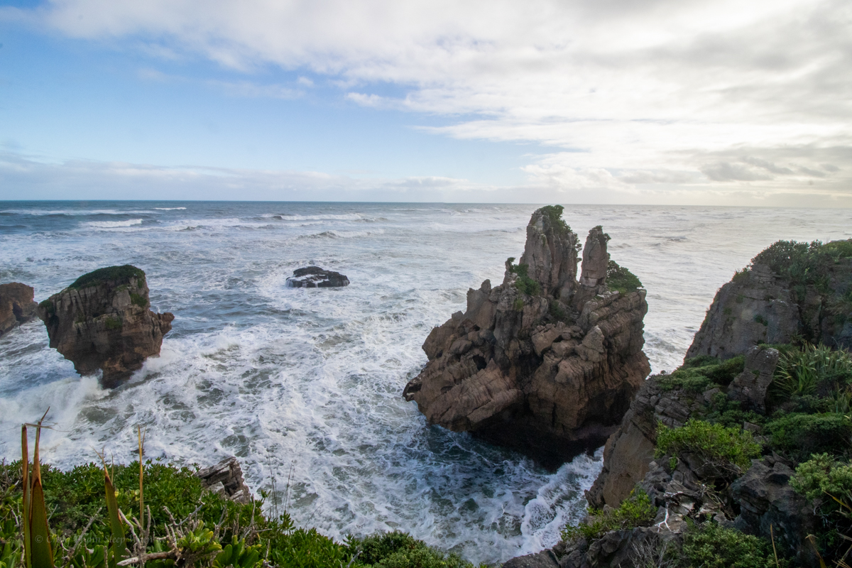
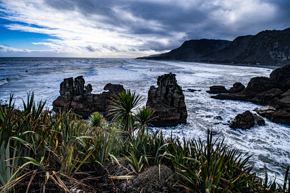
and the push on to Punakaiki to check out the famous Pancake rocks.
We arrived late afternoon in drizzling rain but made a dash around the short circuit walk, before camping nearby and coming back the next morning in what we thought would be “better light”. TBH the rainy afternoon photos picked up the contrasts and colours much better.
New Zealand is a mountain bike and canyoning Mecca so it might come as a surprise that
I hadn’t been before
On my first trip there I had no intention of doing either
We also wouldn’t be heading to either Queenstown or Milford Sound
Kylie and I had been talking about a New Zealand winter road trip for a while and when the stars aligned where we both had time and opportunity we leapt at it.
We had 10 days to smash out a road trip where we’d nerd out on geology and climate, this meant some of the more well known spots got dropped off.
We also wanted to do it on the cheap so if you want to know where we went and what we saw stay tuned, I’ve got about 2000 photos yet to edit and cull so I’ll post them as I go in a little series over the coming days or weeks or whatever.
Anyhoo we flew into Christchurch at some ungodly hour and got a ride to North South Holiday Park where we had arranged a late check in. It was about 1am when we pick up the keys from the key safe and make our way over to the cabin.
Um didn’t we get a double? asked I as I open the door.
Yes says Kylie.
I’d walked into the wrong cabin…. Opsie
Finding the right cabin we settle in. We’d picked a basic cabin, it was basically just big enough for the bed, a bar fridge and a counter top. But considering we just needed somewhere to sleep for a few hours it was perfect. and surprisingly comfy.
And for $54NZD, which included a courtesy bus into town the next day, we couldn’t go wrong.
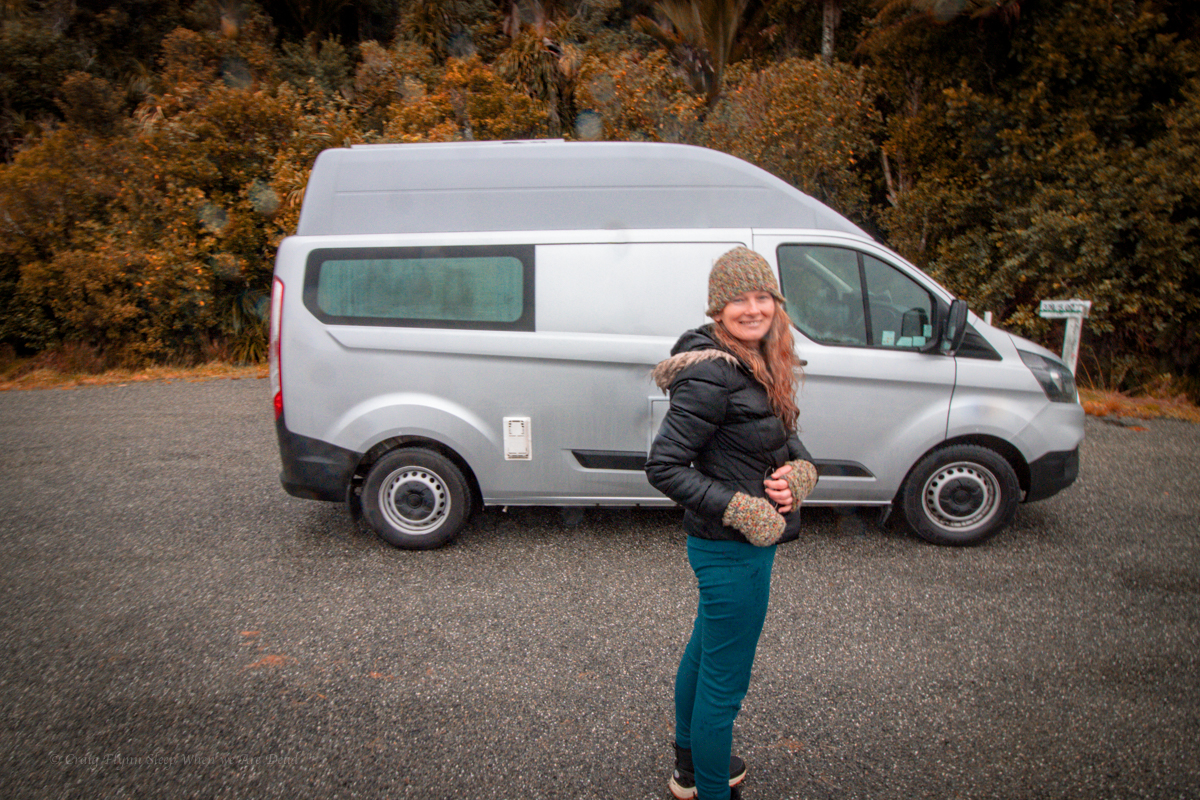
Next morning we get dropped off at Tui Campers. One of the reasons for flying into Christchurch was the amazing deals Tui do on their camper vans.
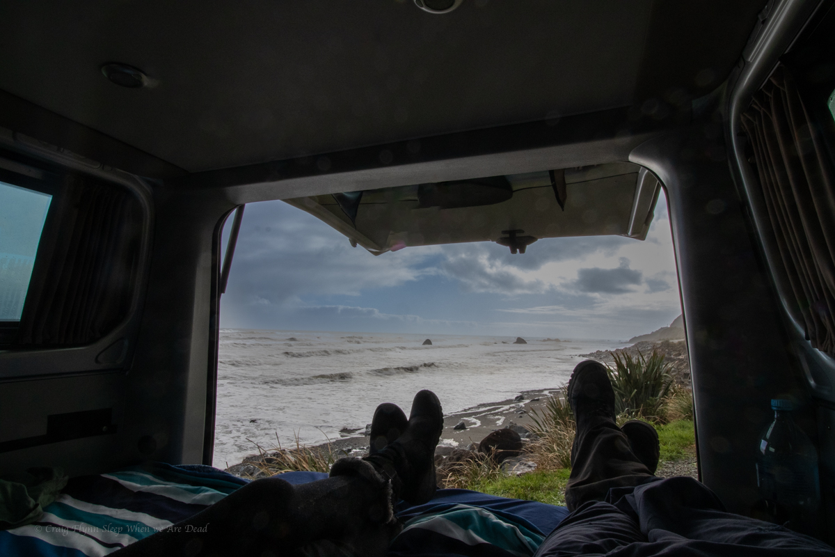
And all set up in a Ford Transit van we hit the road for the West Coast via the Lewis Pass. Destination Cape Foulwind, where we’d camp the night in a cosy little Freedom Camp.
Freedom camping in NZ has gone through a little change recently and now to do it legally in most places you need a certified self contained camper. Thus the Transit camper.
Now on the west coast it was time to take in the sights and sounds.
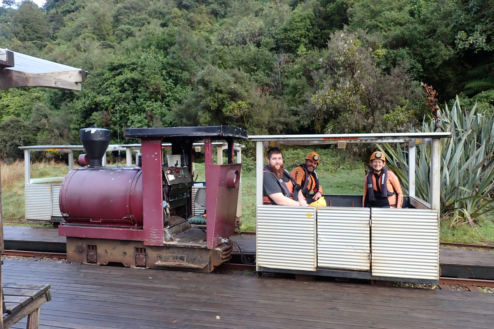
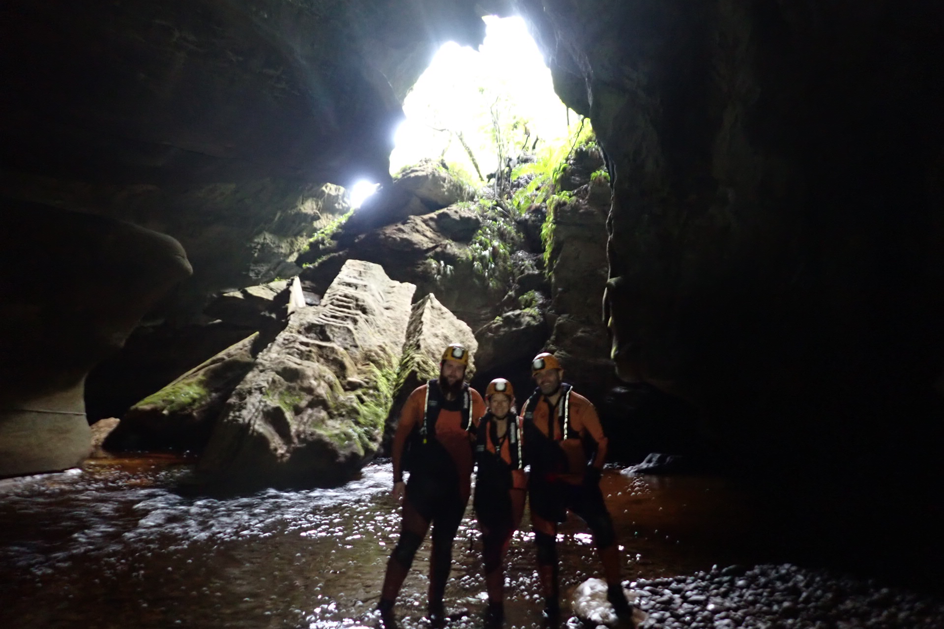
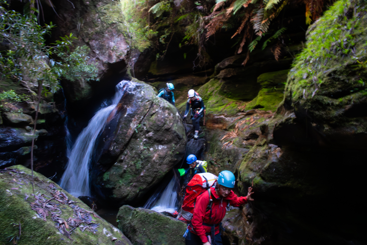
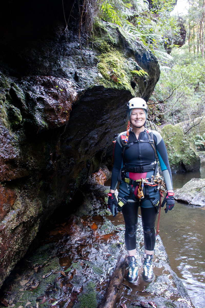
Our first stop was Charlestown for a river rafting tour with Underworld Adventures. Kylie had done this one before and raved about it as a must do.
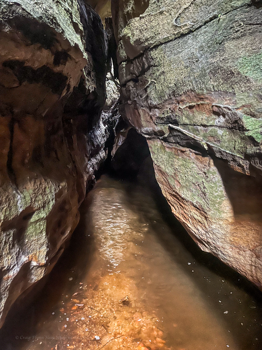
Look, my home town of Lithgow famously boasts the Glowworm tunnels and the canyons and caves of the Blue Mountains host them by the thousands but this tour was something else.
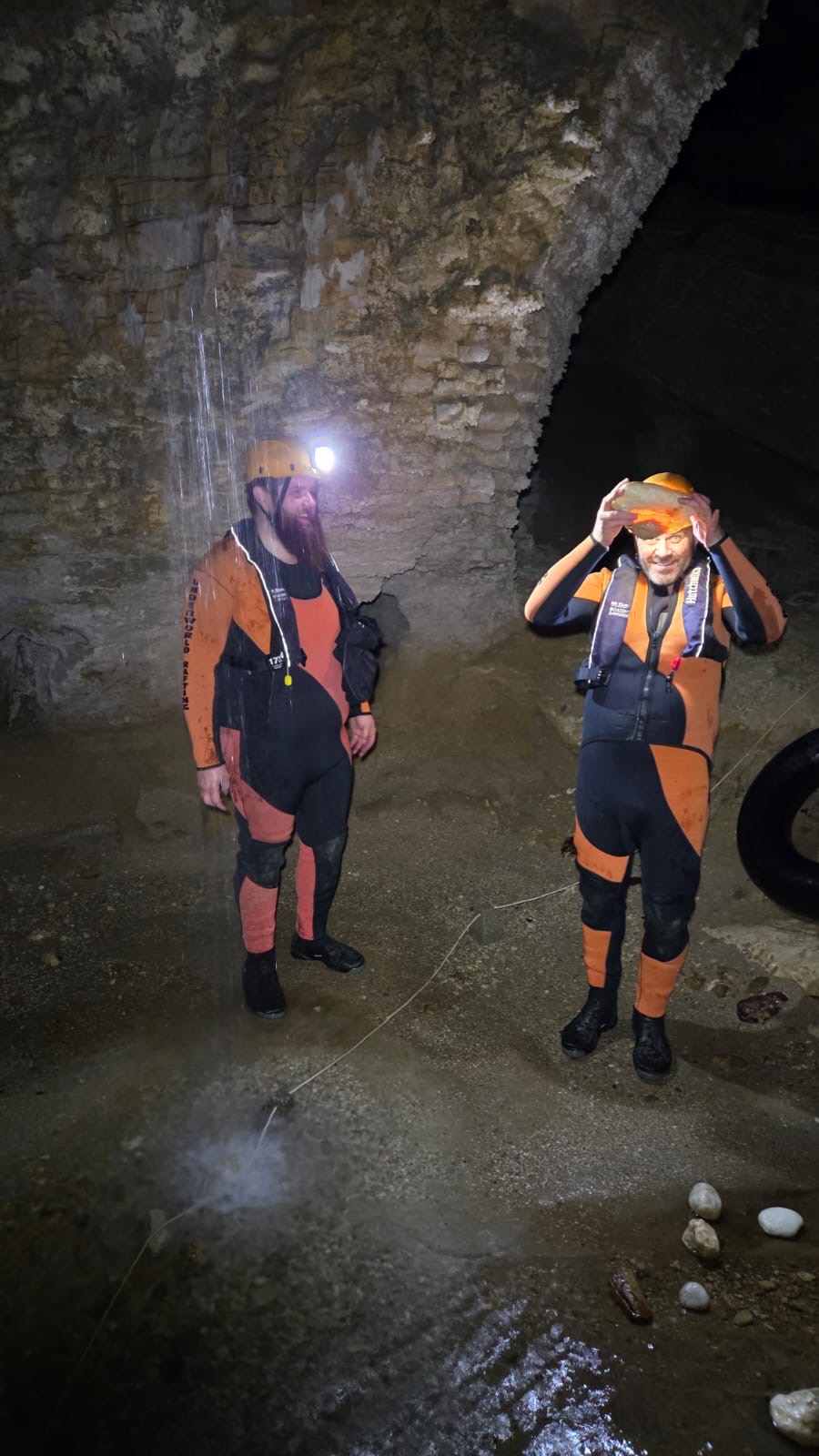
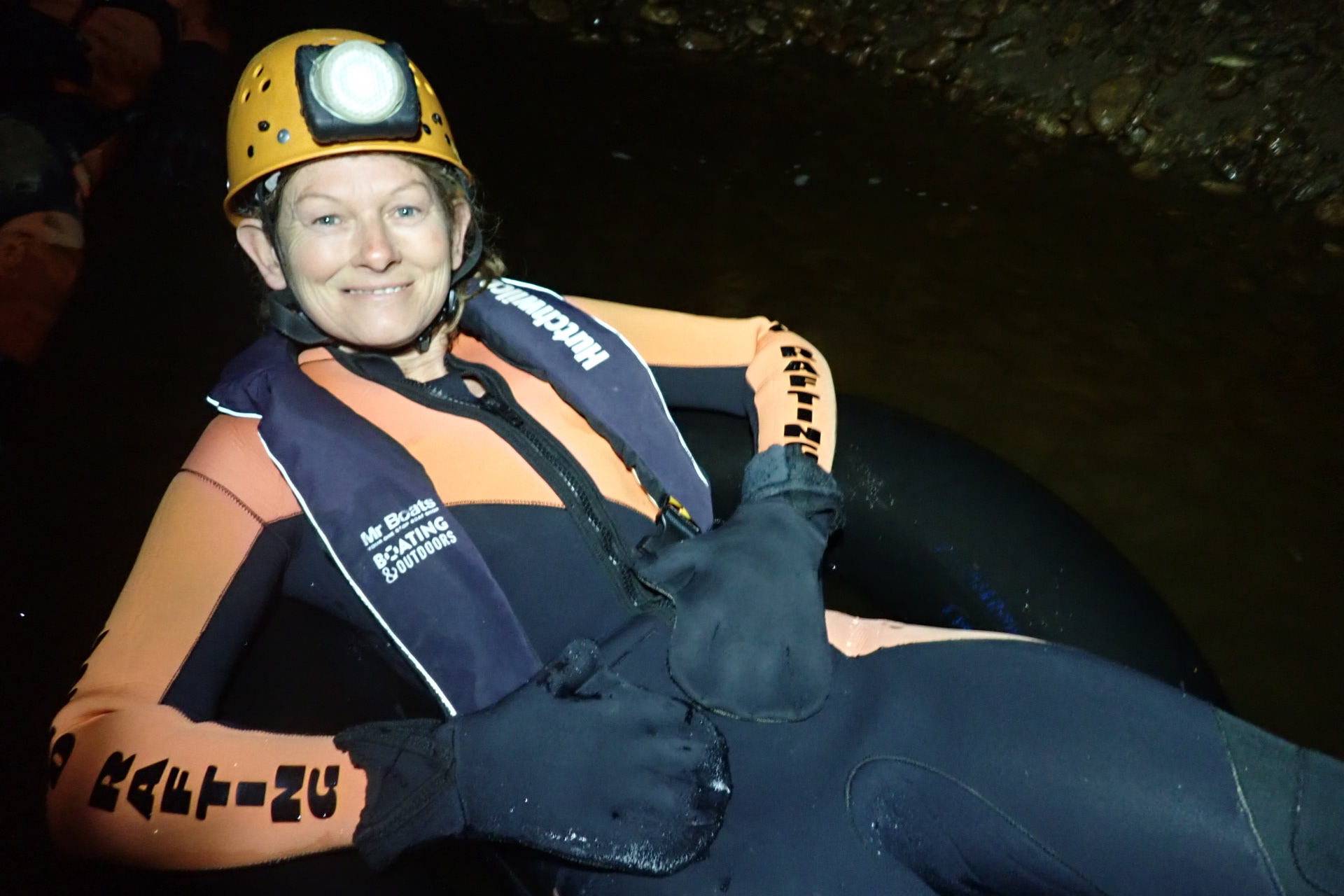
After suiting up the trip started with trip on a funky little petrol engined train.
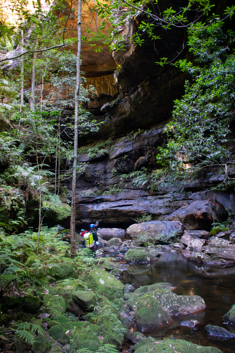
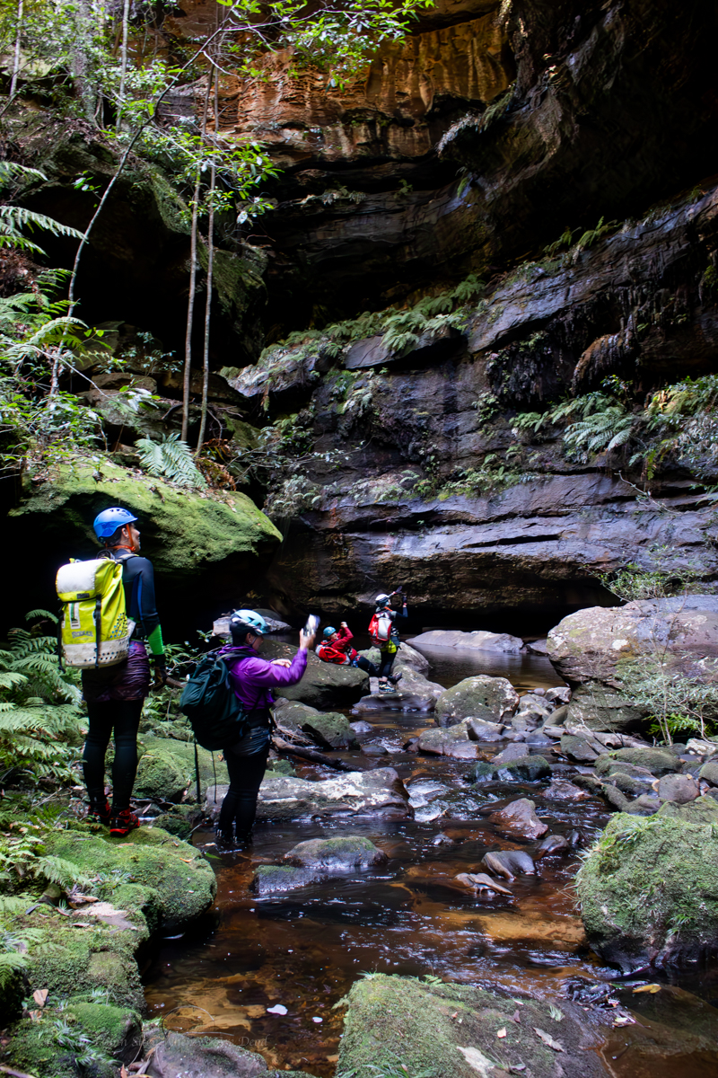
At the end of the train line we pick up our tractor tubes and walk up through the rain forest to the start of the Metro Cave.
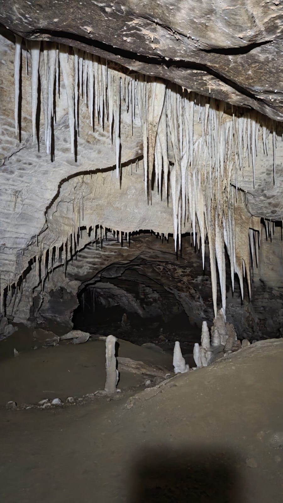
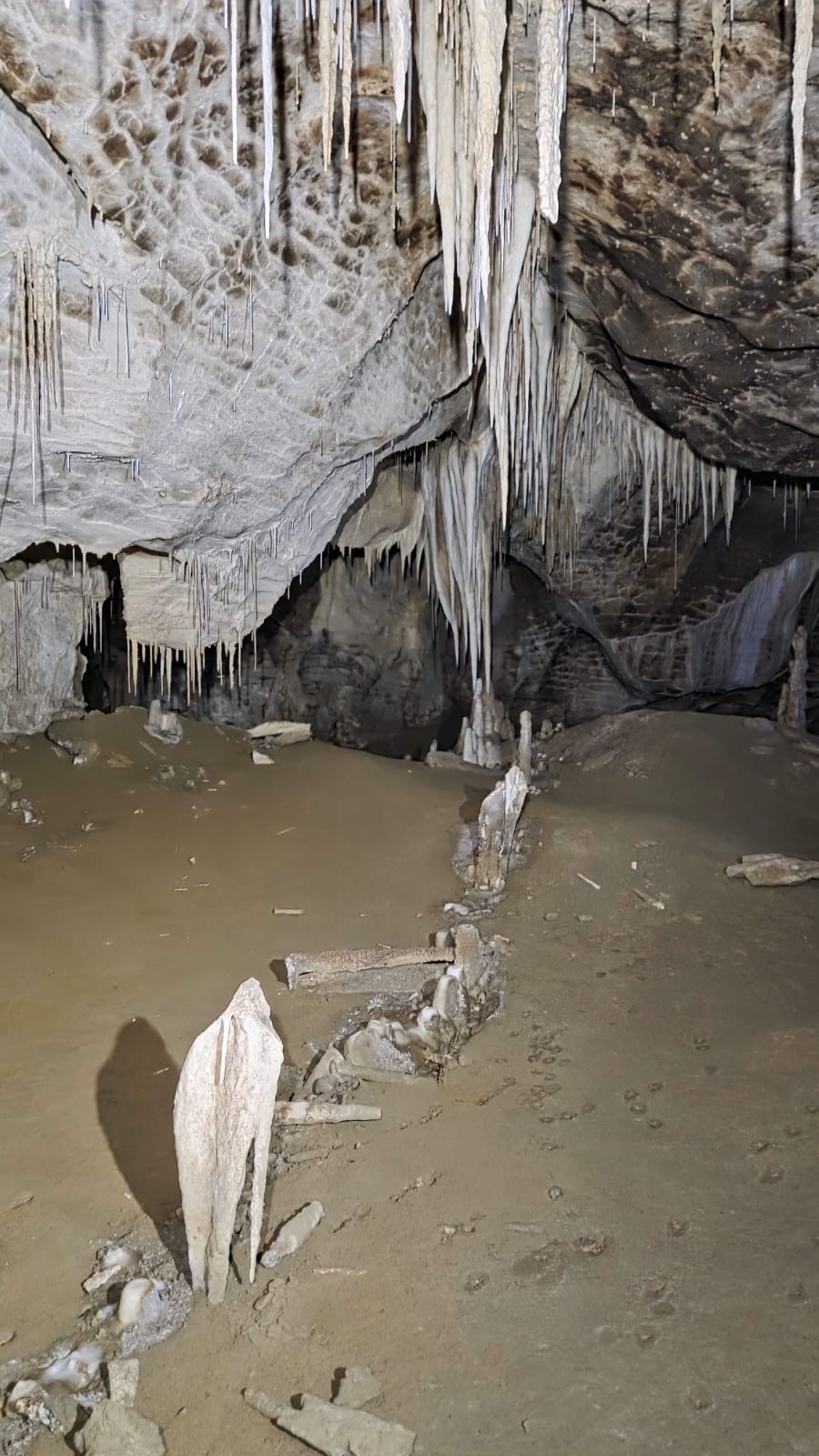
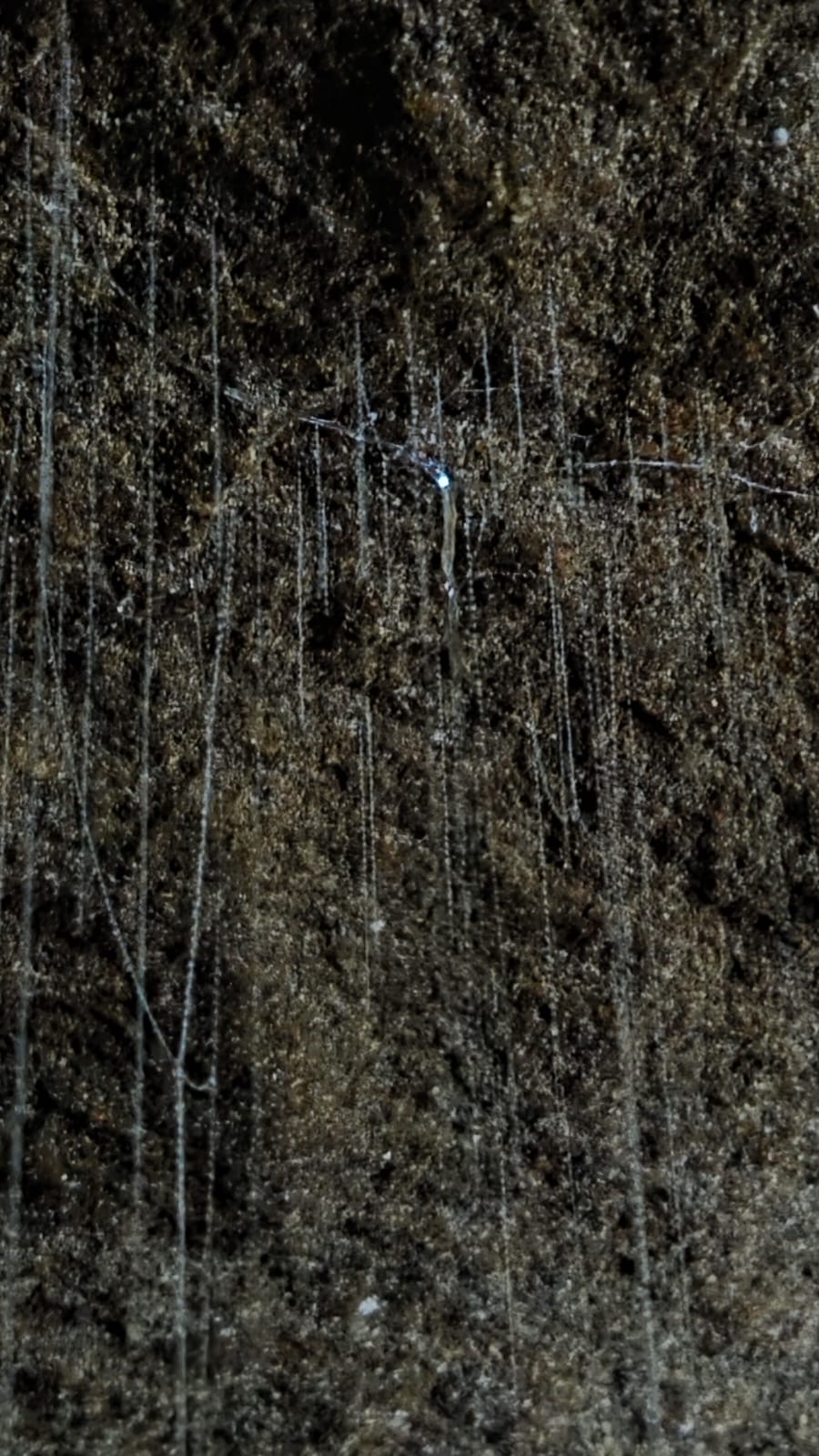
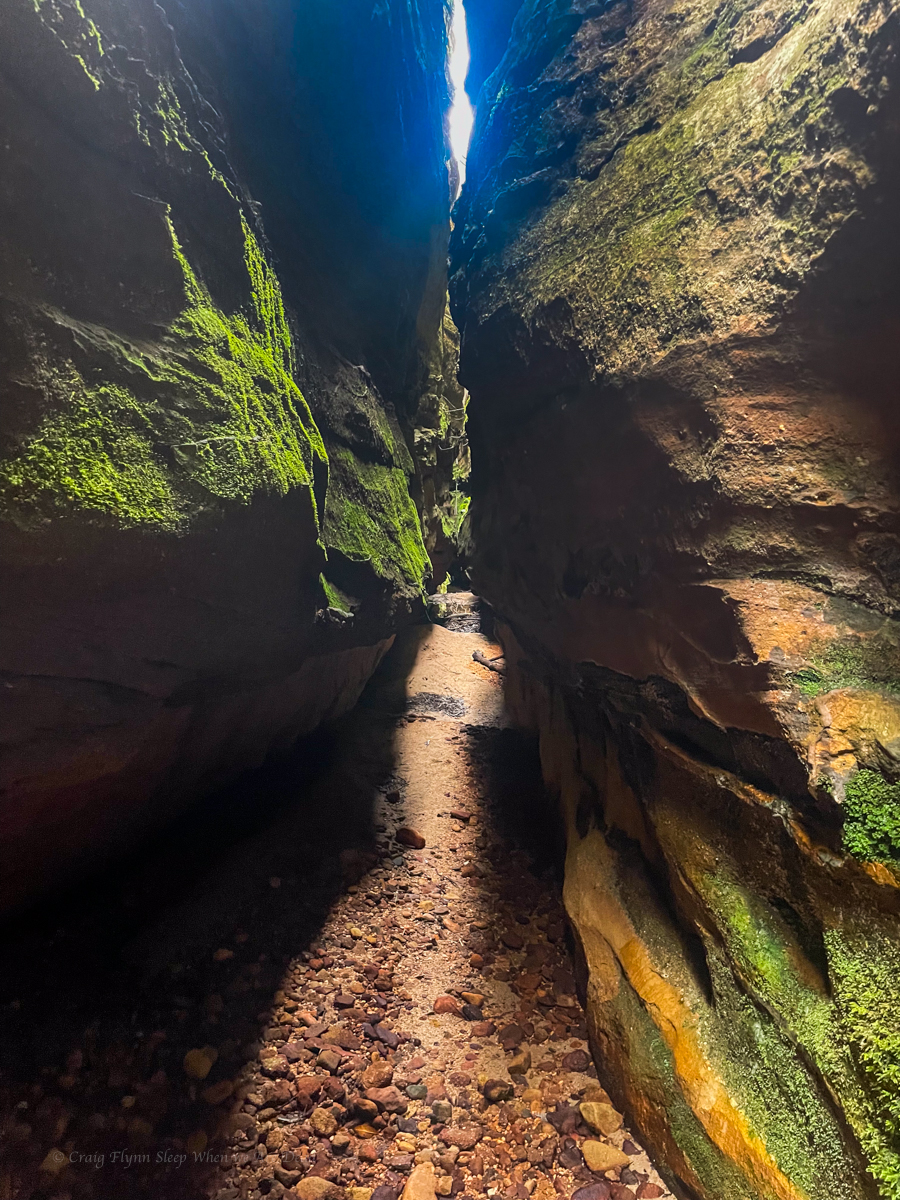
we start in the upper level of the cave and are treated to some great limestone formations
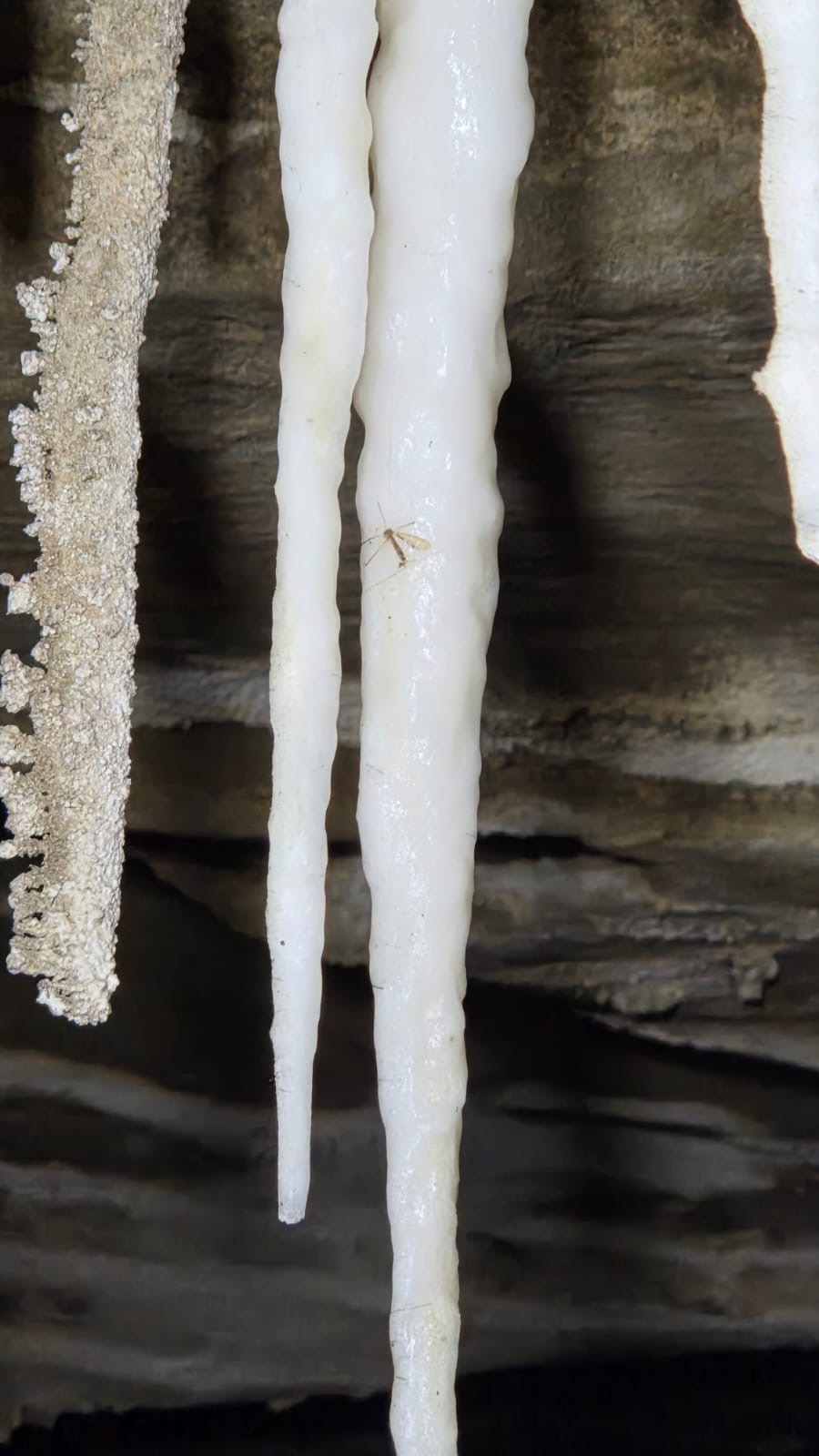
Interestingly the little fella trapped in the stalactite is a fungus gnat. ‘Fungus gnat’ doesn’t sound real sexy but this is the adult that gives birth to the glowworms. As an adult they don’t have a digestive system. they just fly around mating wildly for a couple of days and die.
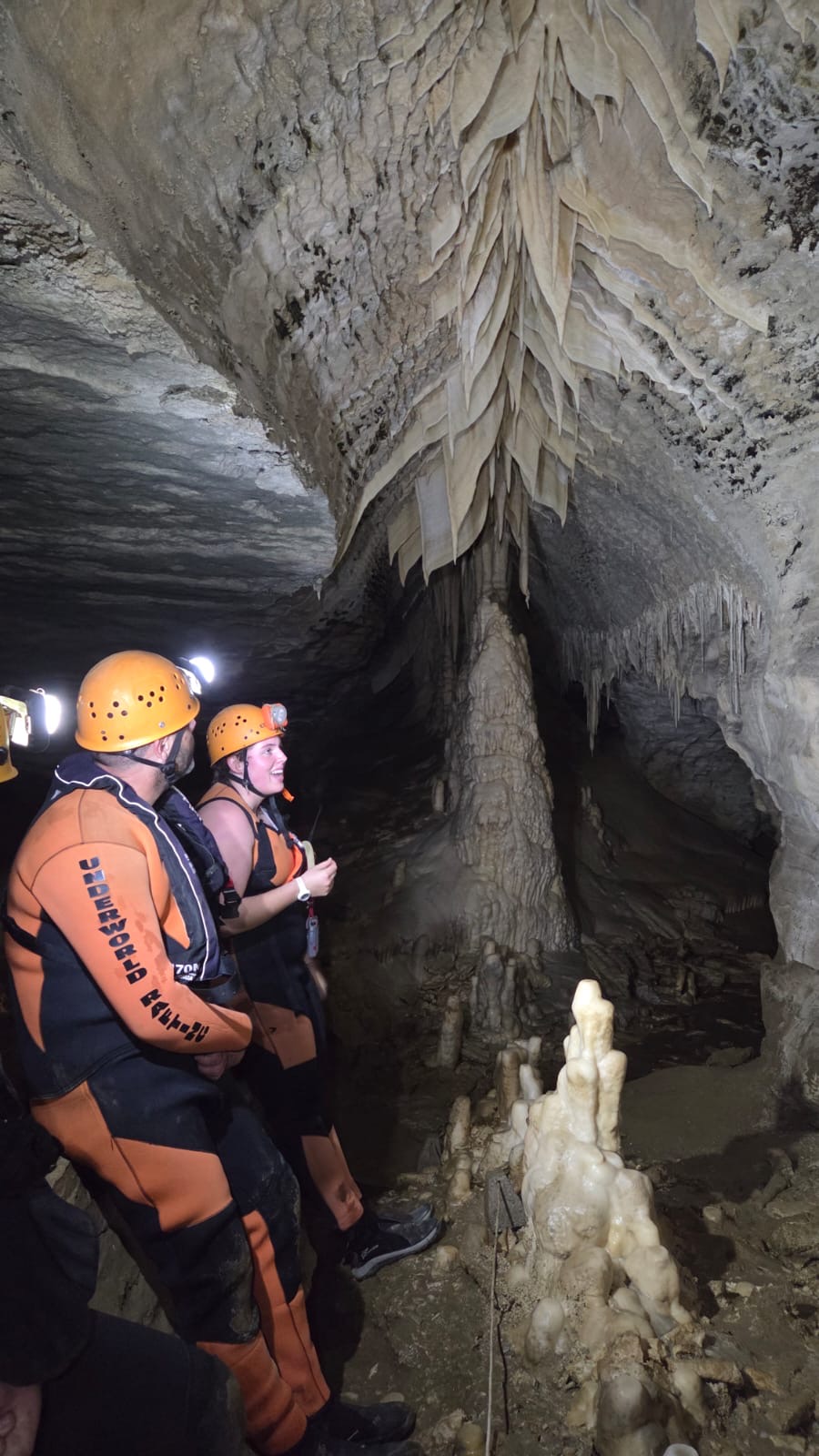
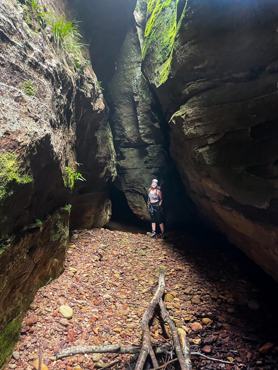
Our guide, Jess giving us the run down of this cool formation
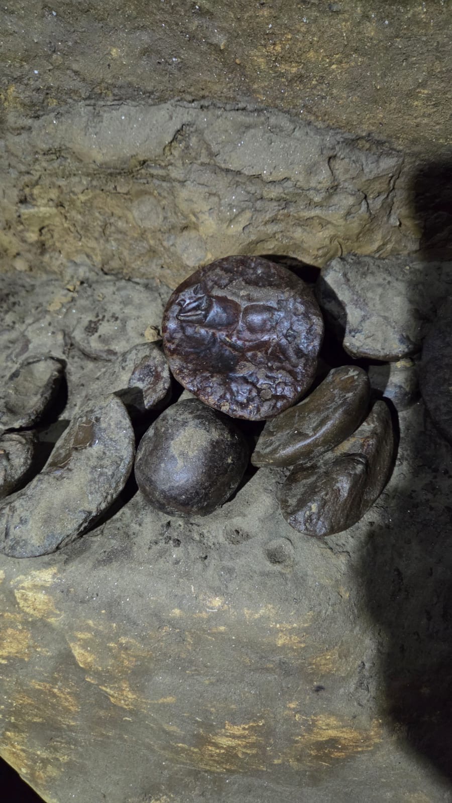
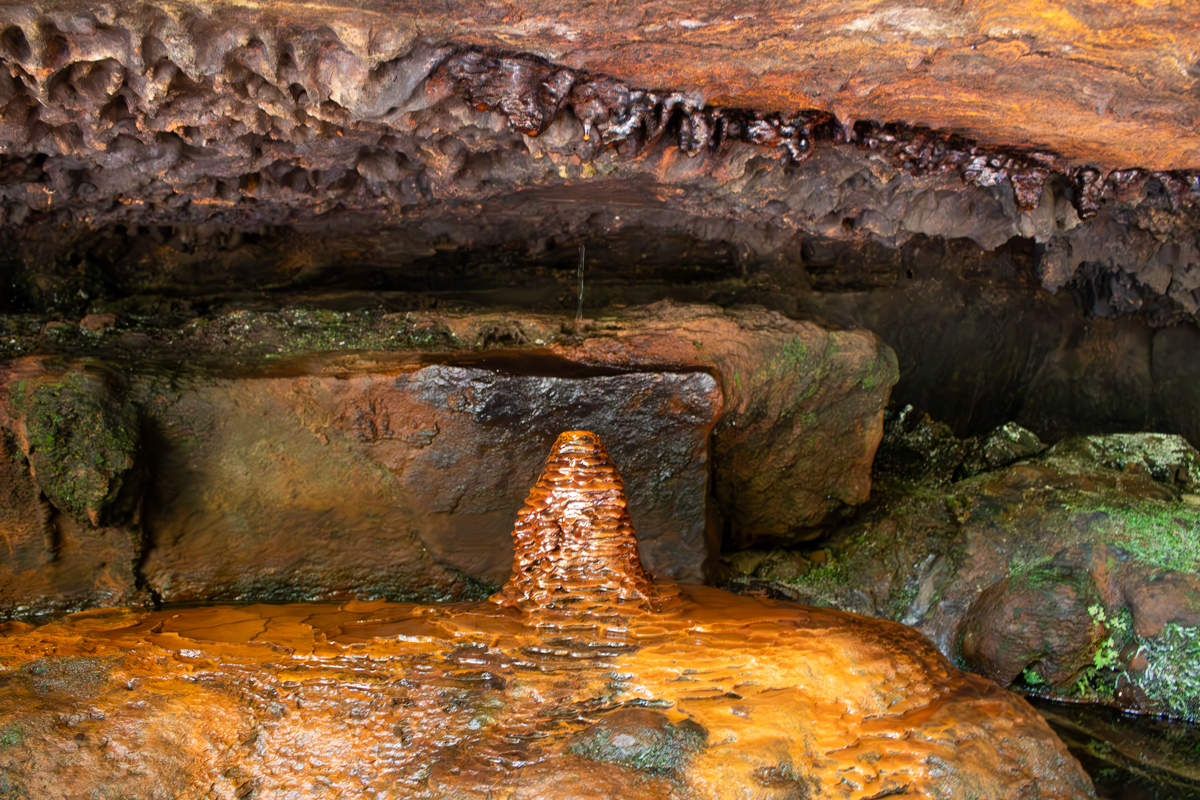
the cave also contained some nice concretions. This one looks to have formed around a crab claw
The cave is quite extensive and we explore passageways and crawl-throughs before making our way down to the next level
The second level is a little wetter and I shine my light through a piece of broken limestone under a waterfall.
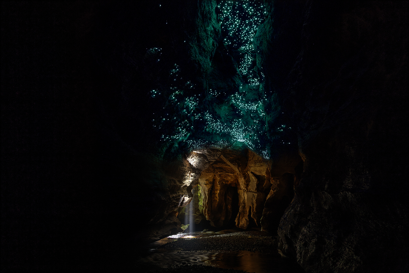
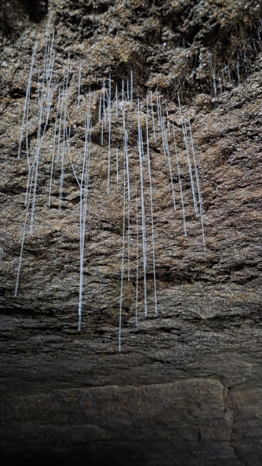
The second level is where we find the first of the glowworm displays. The following photos are promos from Underworld Adventures. Click to Enbiggen.
The Glowworms here are Arachnocampa Luminosa close cousins to the ones in the Blue Mountains, Arachnoocampa Richardsae. Arachno means spider like, due to the silky stands they use to catch pray. Campa refers to them setting up a little hammock and wait for food to come to them. Luminosa refers to the fact they are Harry Potter Fans.
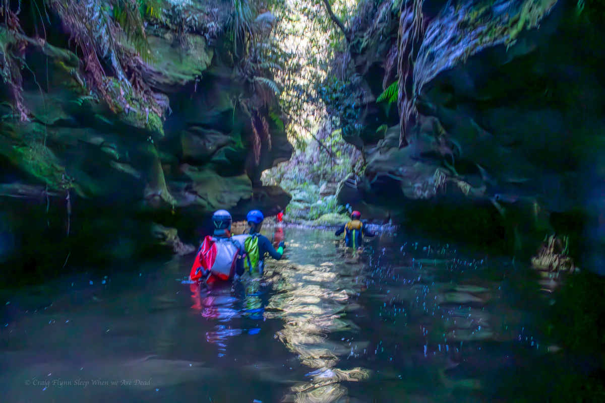
Next we descend to the 3 level which is where we find the river and mount our tubes.
It had rained for a week prior to our visit, the river was up but Jess was hyped.
Due to needing to paddle and hold on and stuff we couldn’t really get any photos of this section, let me just say it is mind blowing. You alternate from easy floating under a cavern of glowworms to quicker sections where it’s important to avoid being pushed into the undercuts.
But the fun isn’t over. We head out to where the Ananui creek meets the mighty Nile River, Waitakere. From here it’s hold on tight for a fun ride down some mild rapids back to the train.
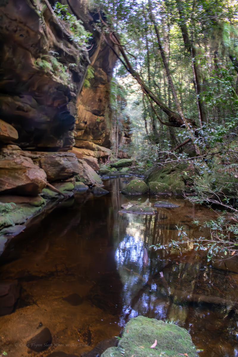
Would recommend this to anyone, it’s a great trip. The cave system is quite extensive so there are drier options but even midwinter the thick wetsuits hold off the worst of the cold.
Continued on (and I’ll try to be less wordy and more photoey)
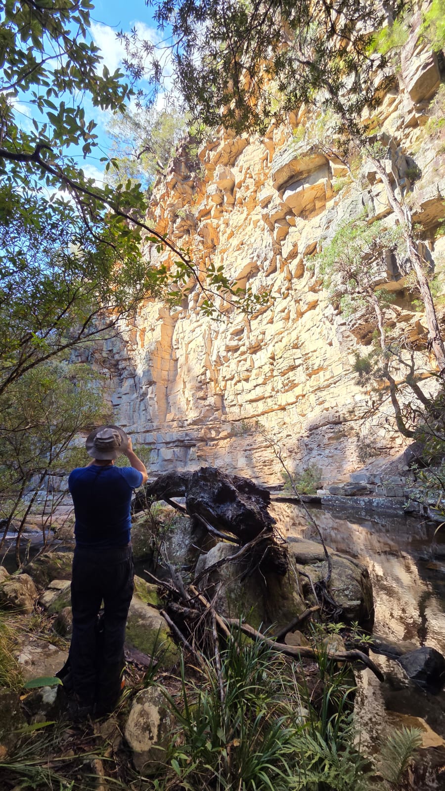
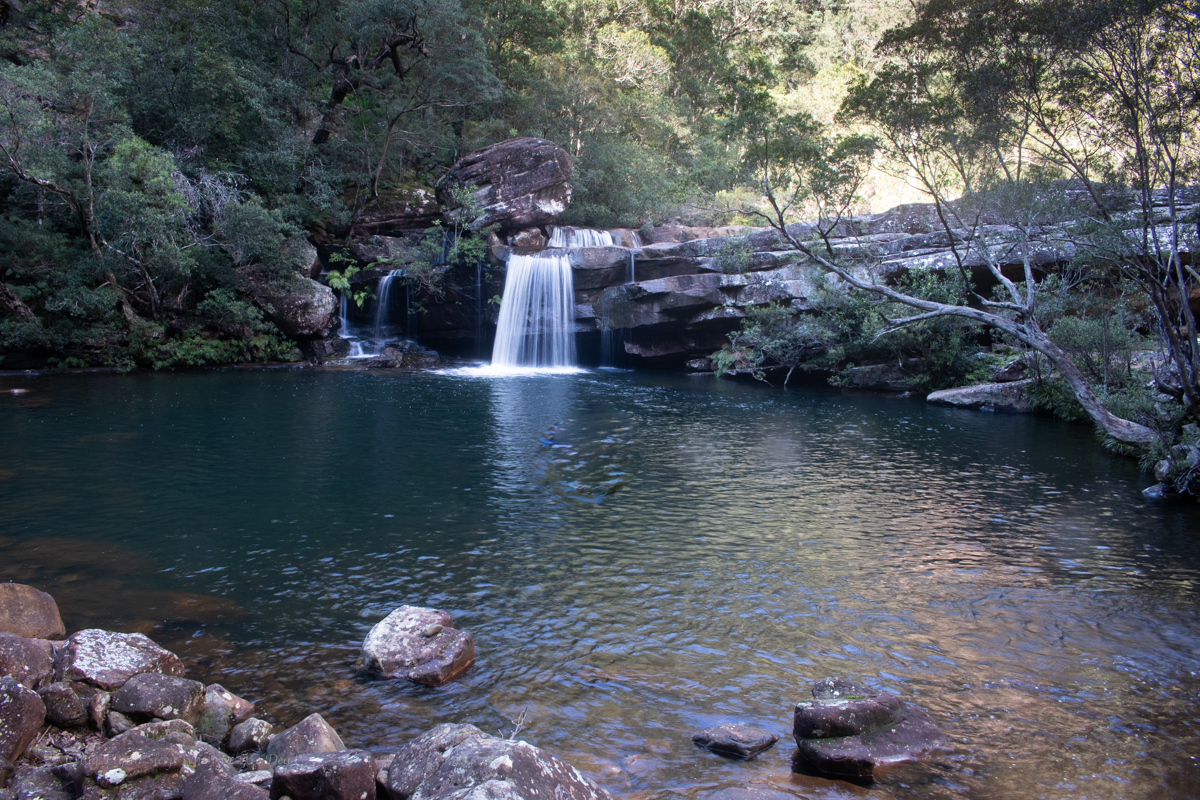
Our weekend plans had fallen through so we thought we’d go in search of some waterfalls neither of us had been to before.
Kylie suggested a spot and during research got a tip off that the fire trail out to them had recently been gated.
So we put the mountain bikes in to help eat up the kilometres.
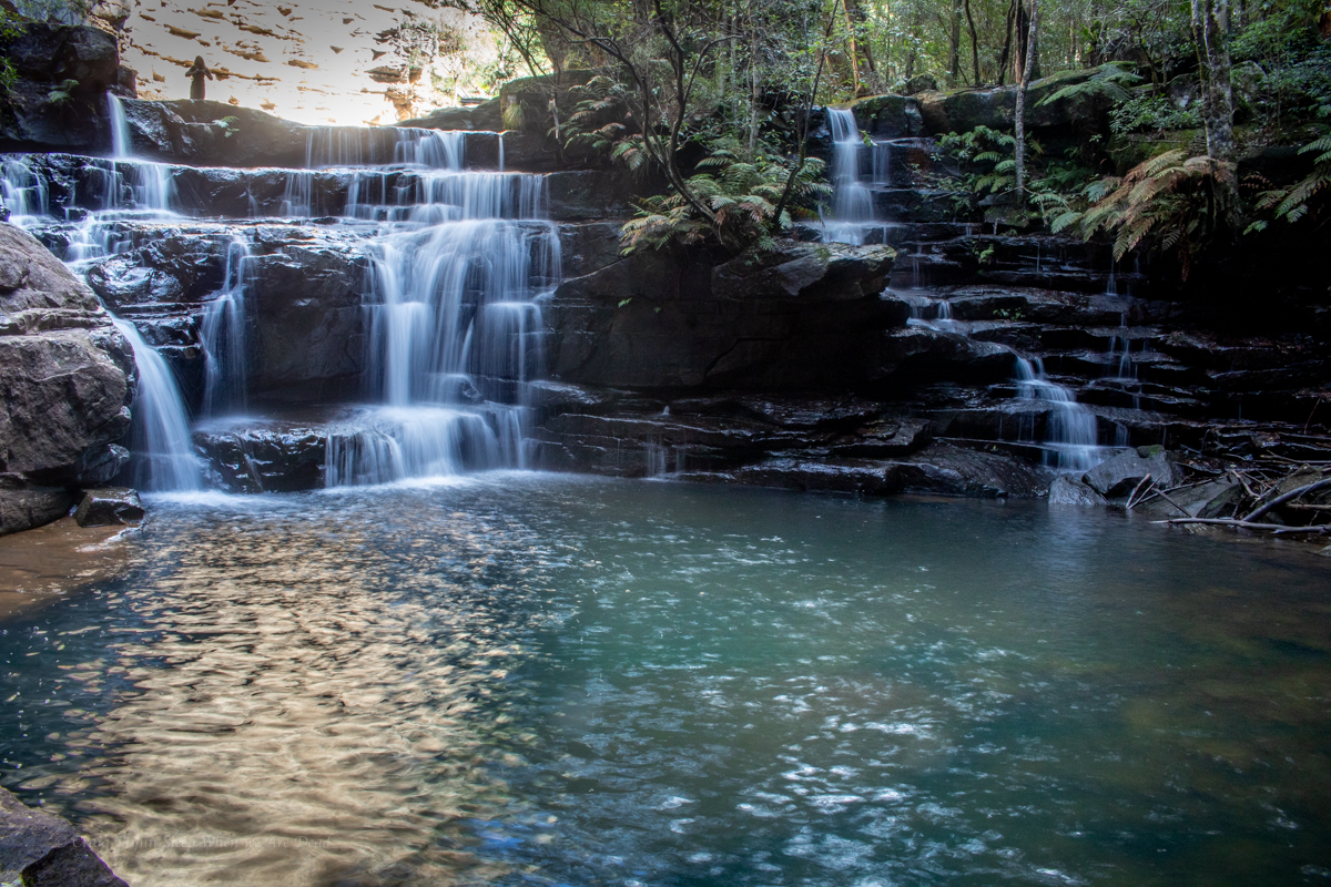
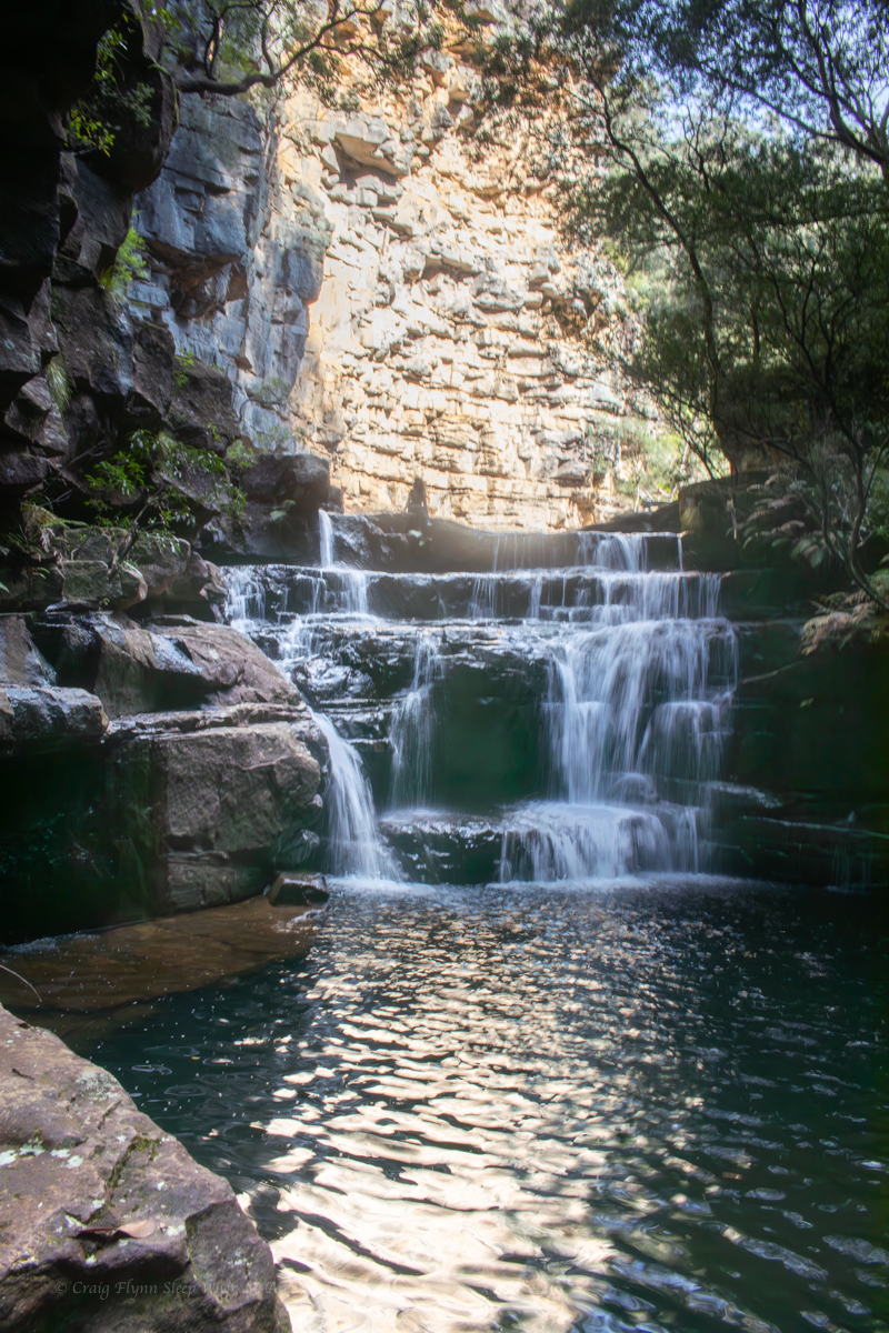
Not only are the swimming holes spectacular this could now be my favourite fire trail ride (Did I just say that? what have I become?) I have a feeling the guy who did the road work is a mountain biker. Each waterbar seemed to be a perfectly shaped step down. Even though recovering from a shoulder injury meant I couldn’t take to the air it was still a blast.
Anyhoo, that’s not what we are here for.
20min later we are stashing the bikes in the bush and heading down a steep trail cutting through subtropical rainforest quiet different from anything you usually see in the upper mountains..
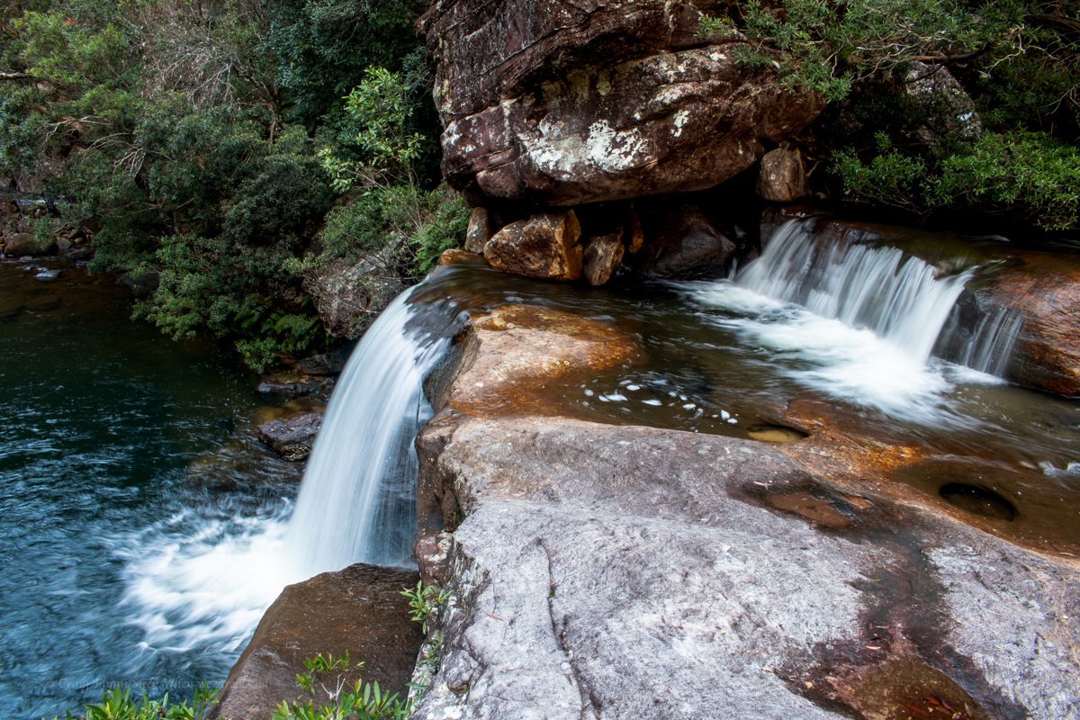
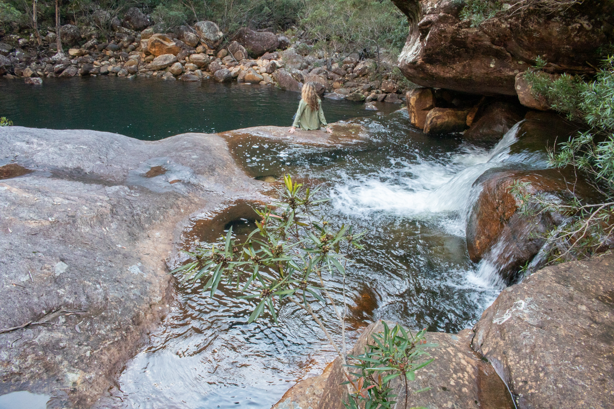
This brings us to a pleasant creek and we head downstream.
We have some lunch and a splash then make our way out.
The Haul up the hill is steep but interesting enough that I wasn’t in a world of suffering. And while I thought the ride back to the car might be tough it was just as much fun as it was coming in, with some pinches to keep you honest.
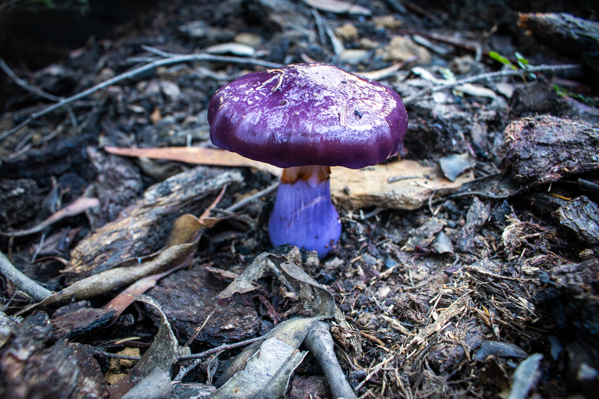
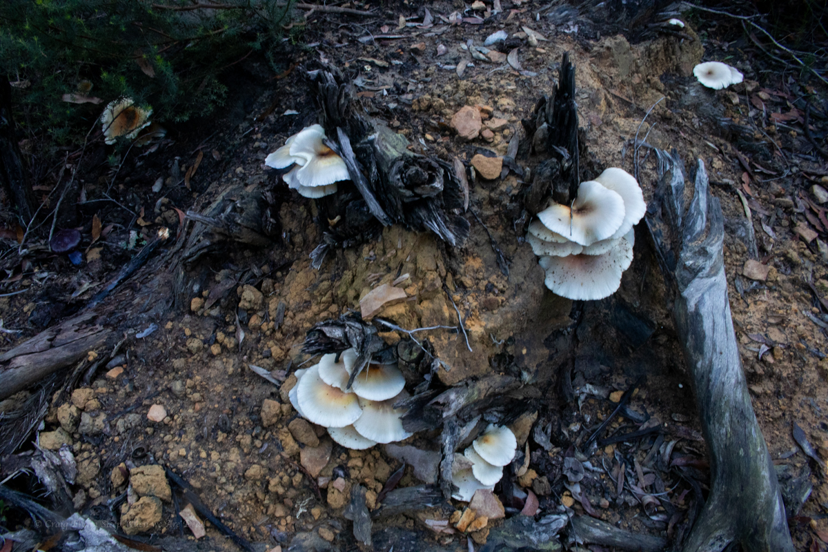
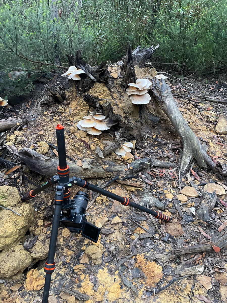
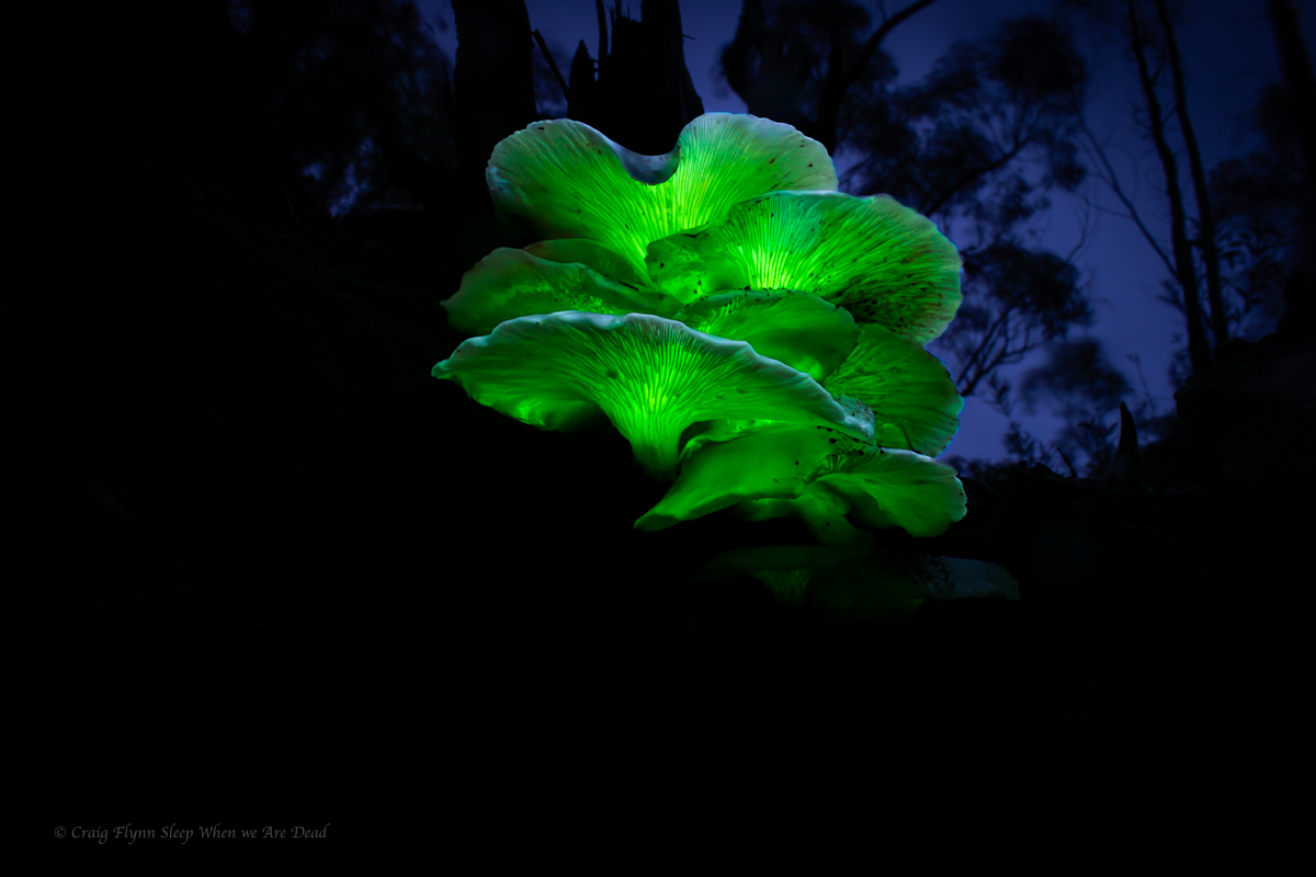
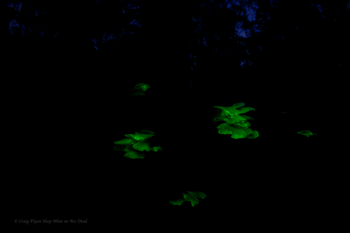
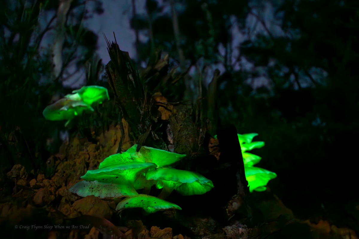
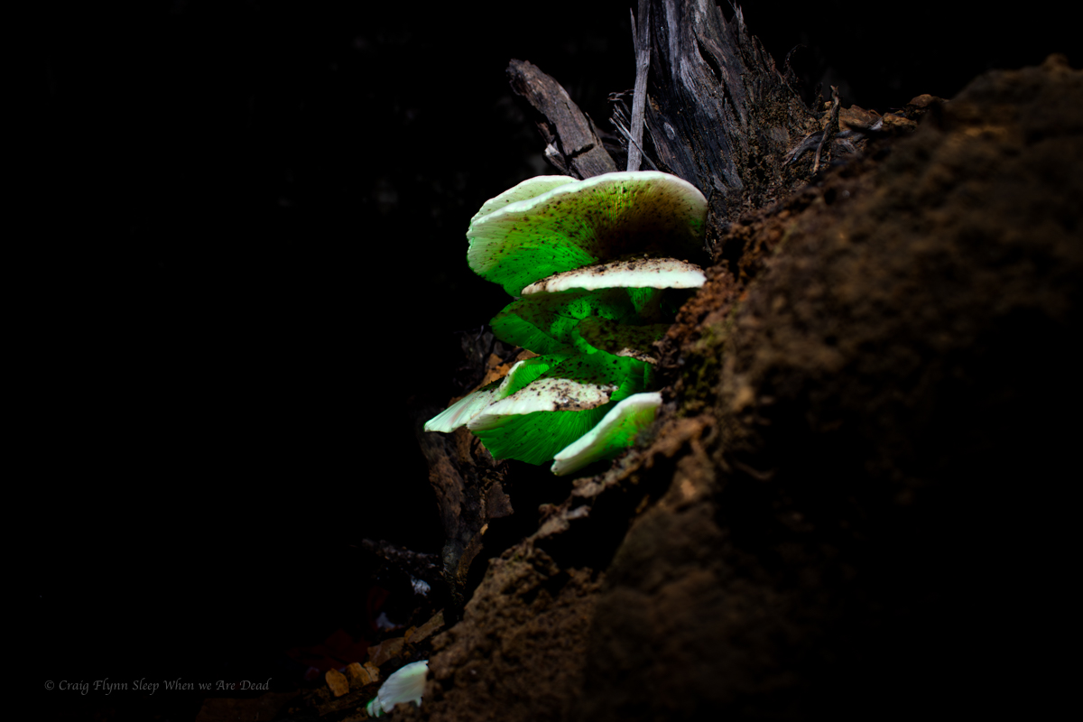
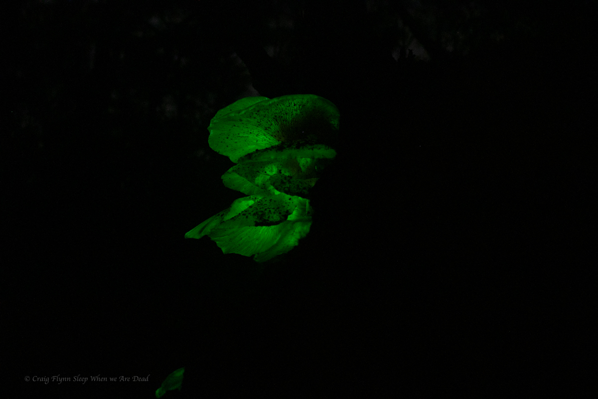
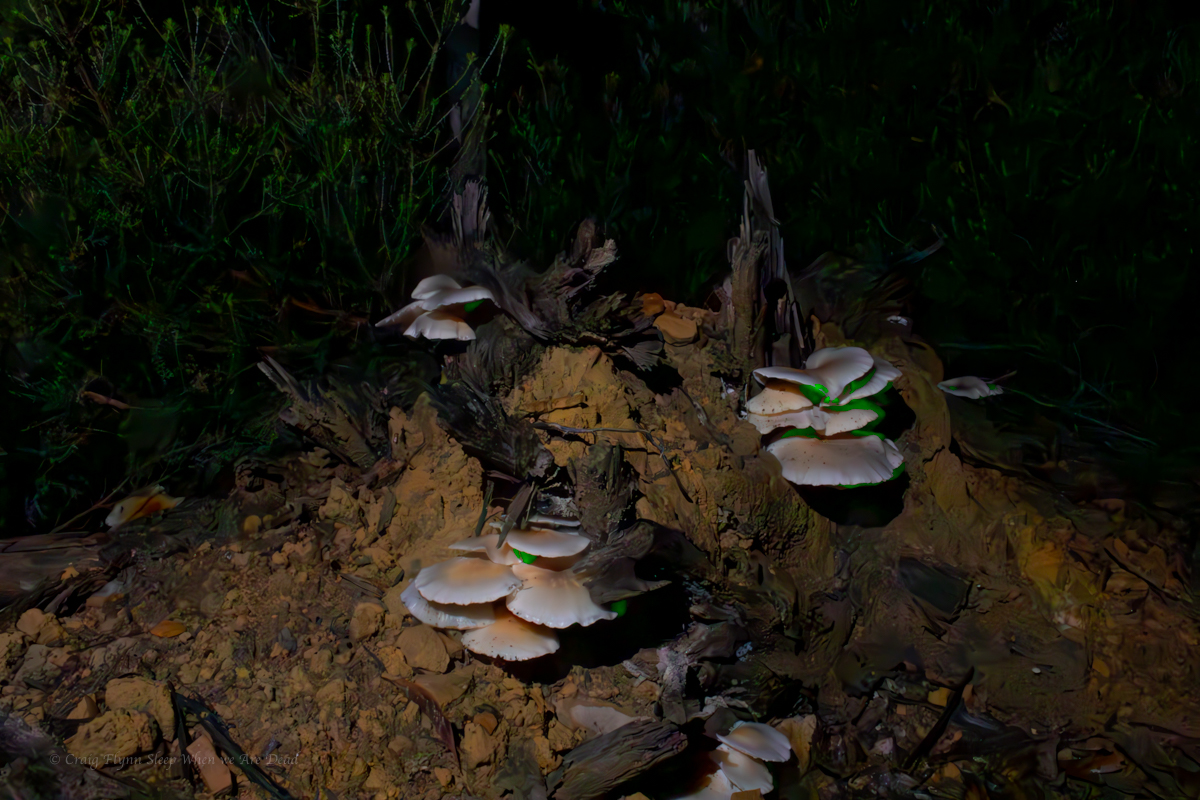
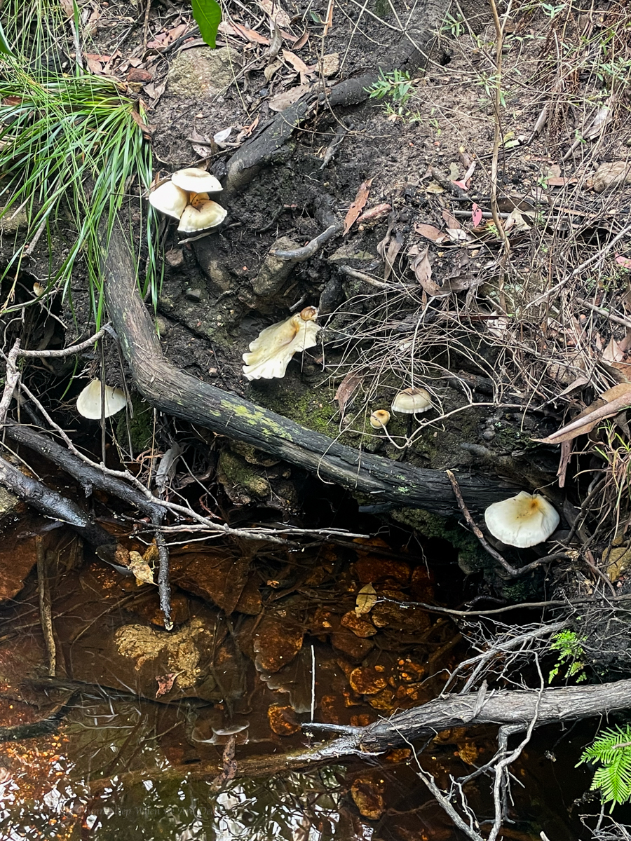
On the way back we spy some interesting mushrooms.
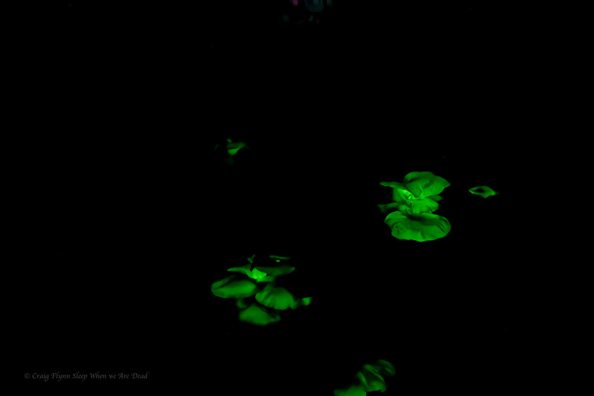
So of course we had to head back in the dark to see if they still had a shine.
It was faint, barely able to be made out with naked eye but some long exposures brought up their beauty.
Click to enbiggen
Ghost Mushrooms produce bioluminescence for around 22hrs a day. And for 14 of those hours you would think they are just another mushroom. People are like ghost mushrooms, if you can’t see their glow you are looking at them in the wrong light: C Flynn
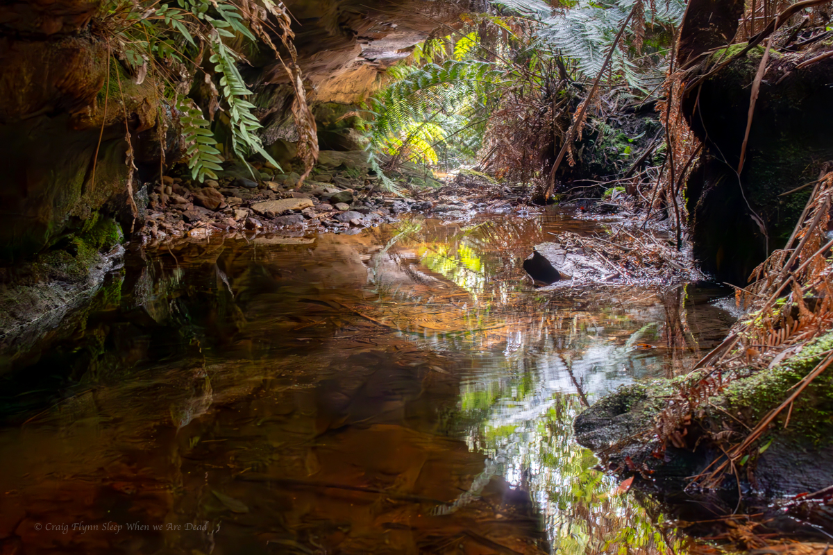
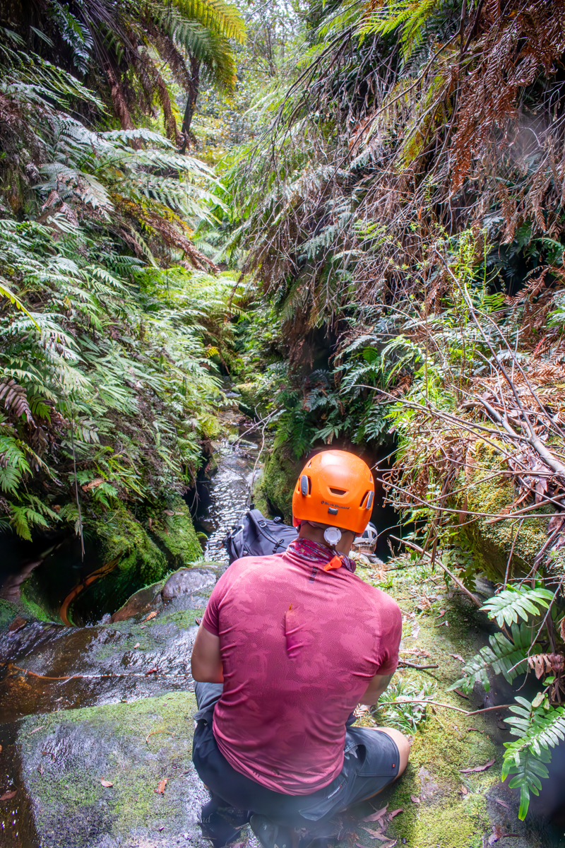
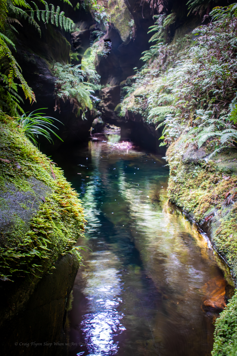
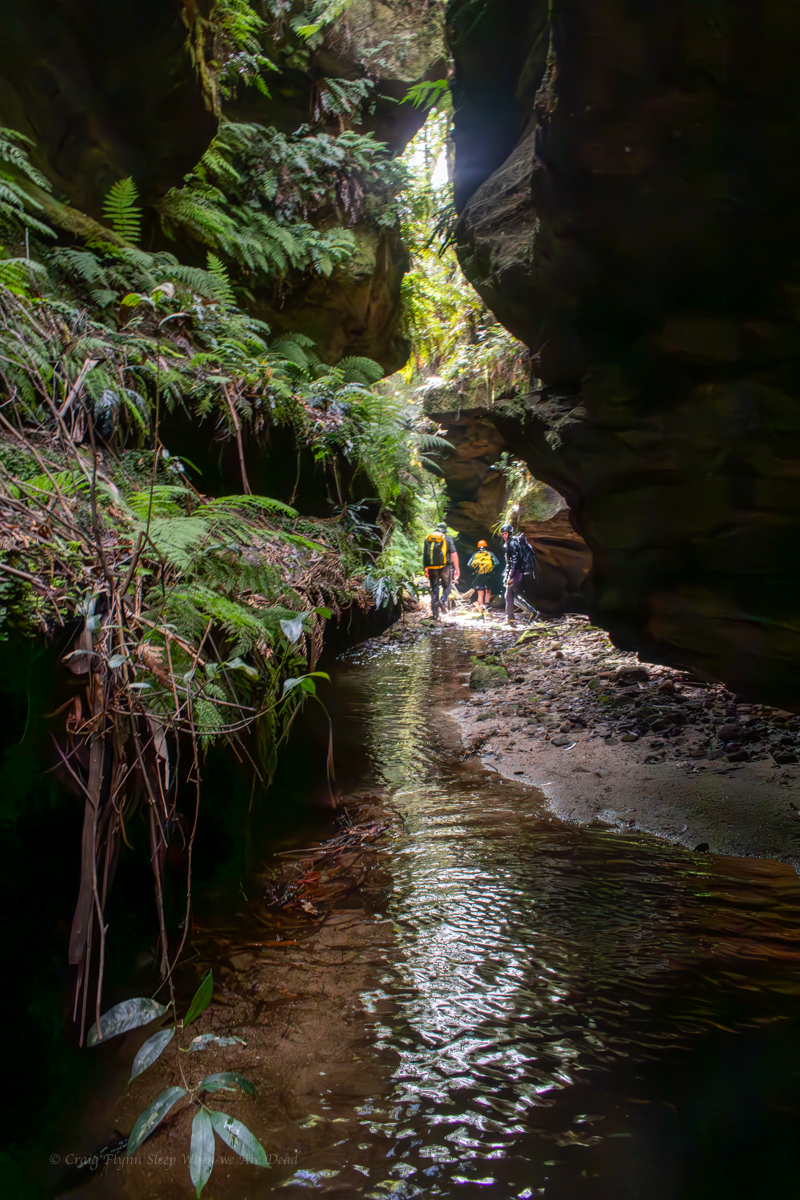
I always enjoy discovering there’s hidden canyons in areas I thought I knew fairly well.
Suddenly finding ourselves with a spare day we organised a last minute semi exploratory trip to a little canyon none of us had been to before.
Vince had prepared the lidar maps which suggested the constriction would start a bit further downstream than the spot I had selected to enter.
The one source I had said the lidar hadn’t picked up a small cliffline near the creek. says I. I’d hate to miss something.
So we bush bashed in to the spot I had picked. Somehow picking a path to the only 2 cliff lines in that area, luckily there was a path down in-between the two outcrops that look surprisingly like a butt on the lidar. We went down the crack.
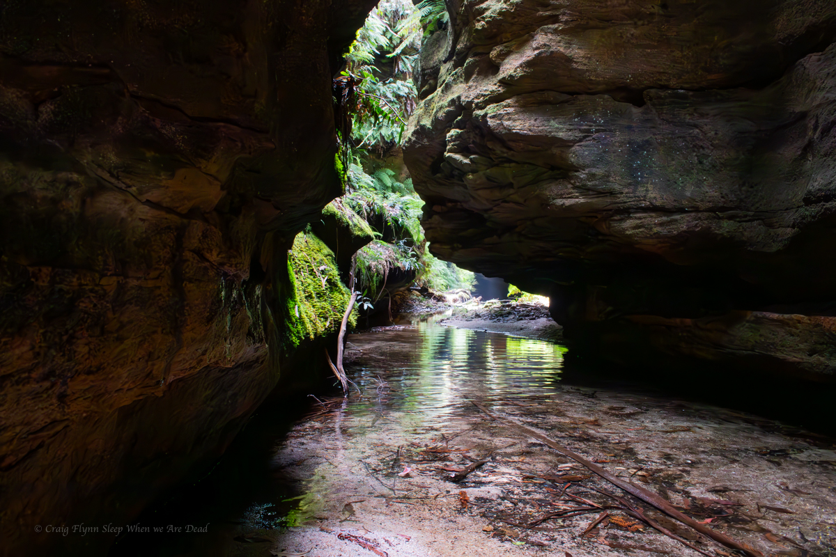
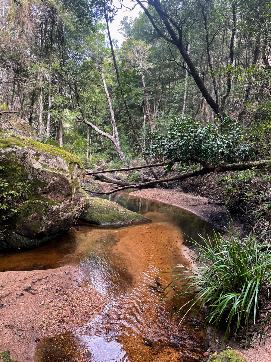
The first part of the creek was a bit of a scrubby dub dub with 1000 fallen trees to clamber over but then it opened up a bit
I’ve visited worse creeks
A nice spot for a dip on a warm day. Today was not warm.
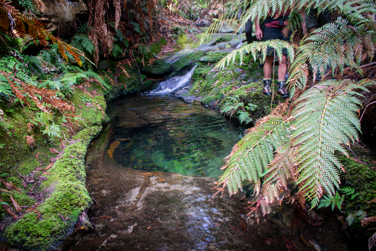
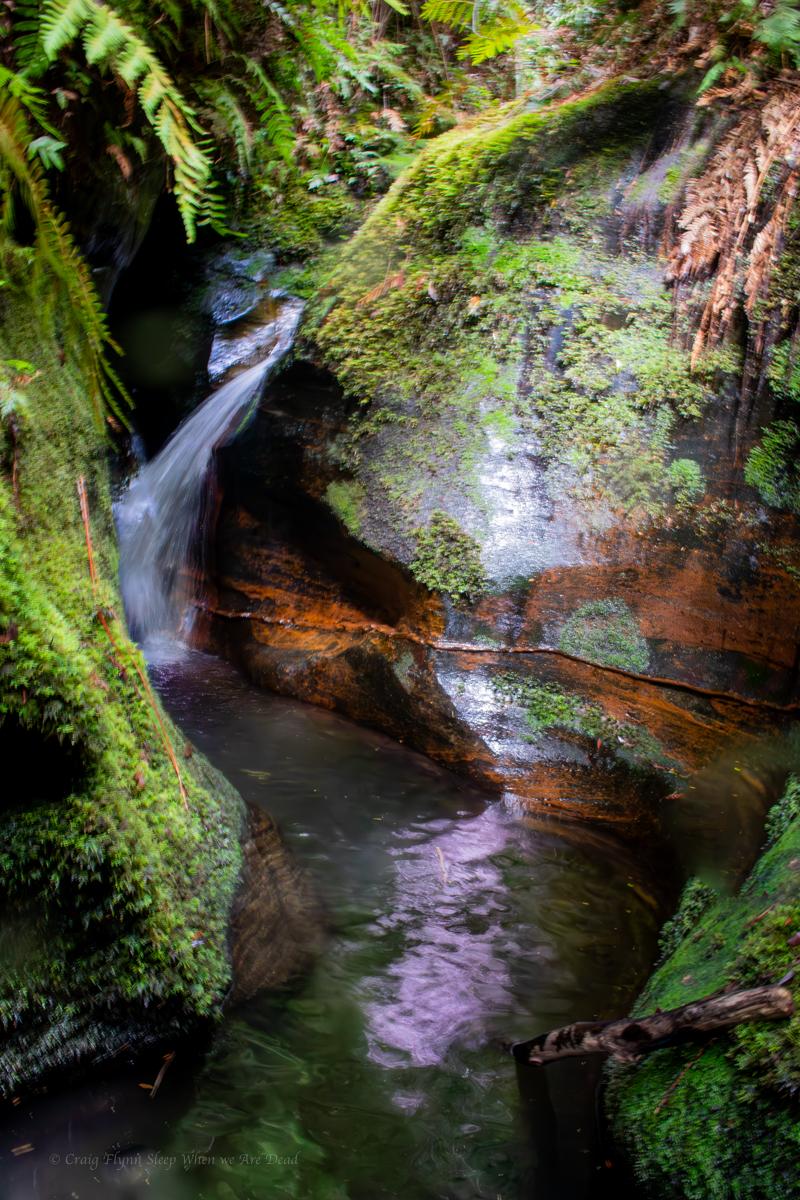
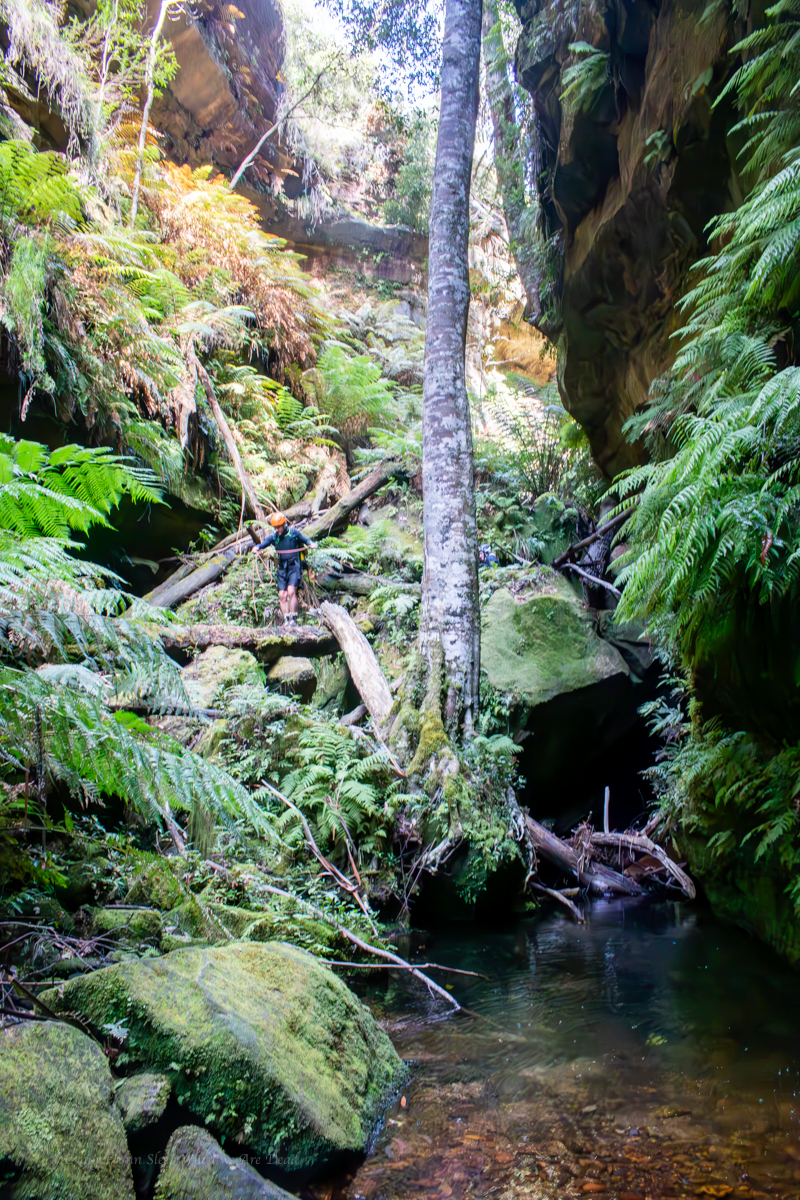
and soon it dropped into something that looked very canyon like
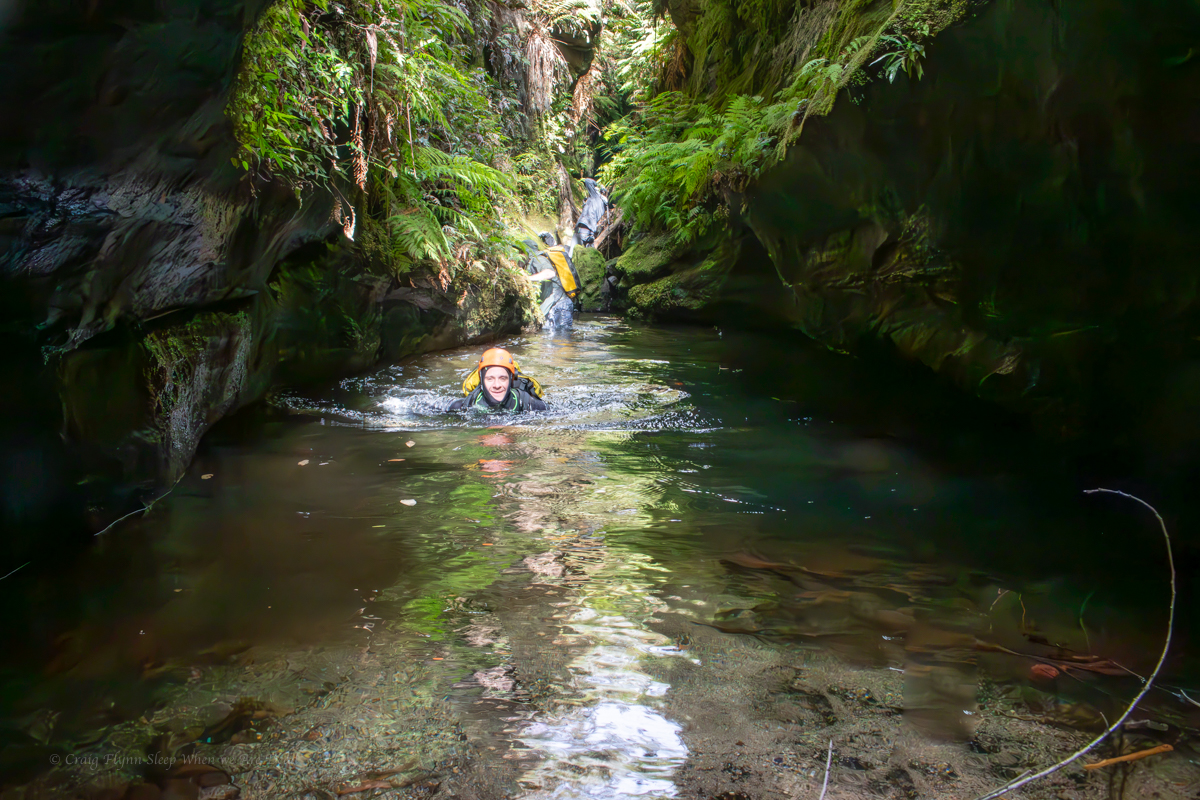
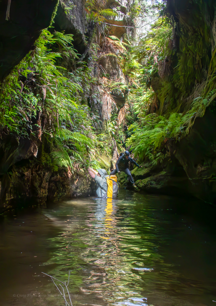
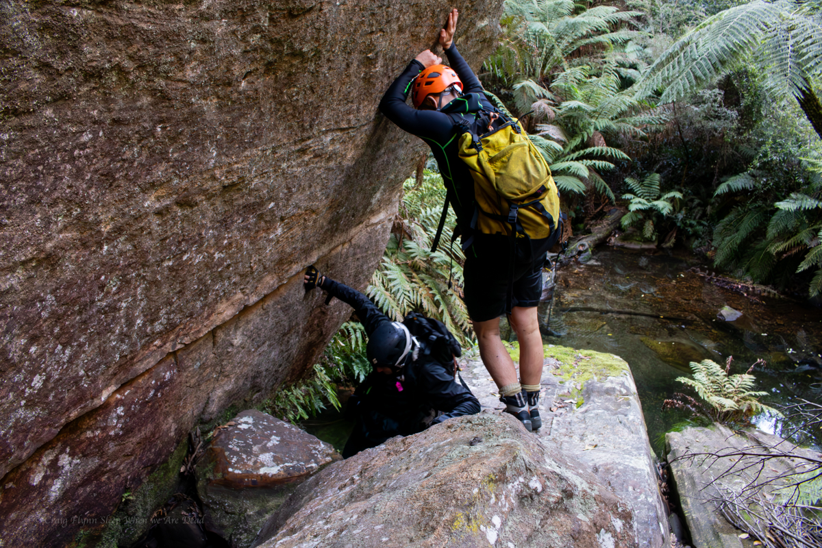
A slippery scramble down brought us to a deep, crystal clear pool. Vince spidermaned across. Russ and Jas follow.
This is going to be a test for my shoulder.
I manage to bridge out but as I try the next move I feel the shoulder giving way….. In I go.
It was refreshing.
It should have been a simple bridging exercise.
Couldn’t support my own weight
Not overly deep or consistent but a canyon non-the-less
With some very noice sections.
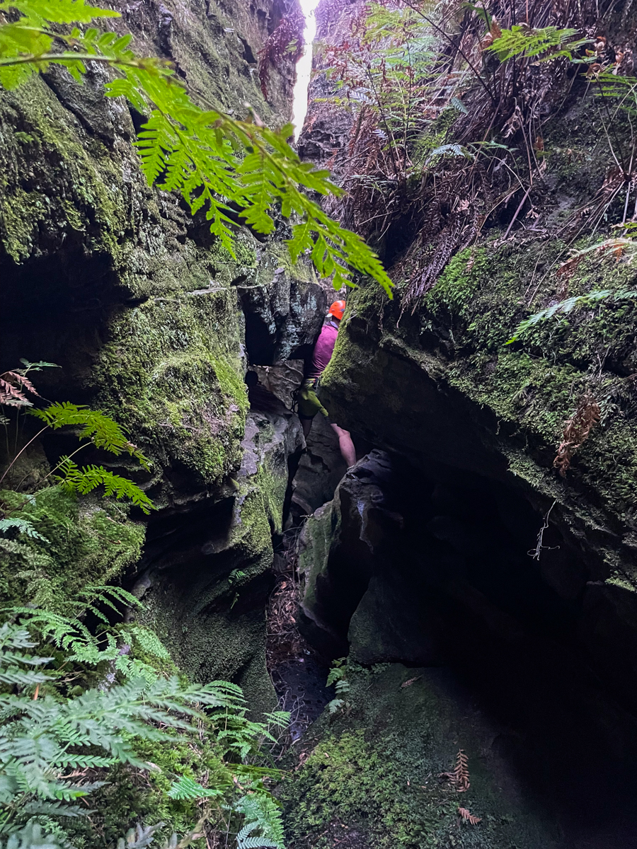
the next pool looked less avoidable
Even Russ suited up and swam through
Jason decided to give traversing along the side a go. And very nearly made it.
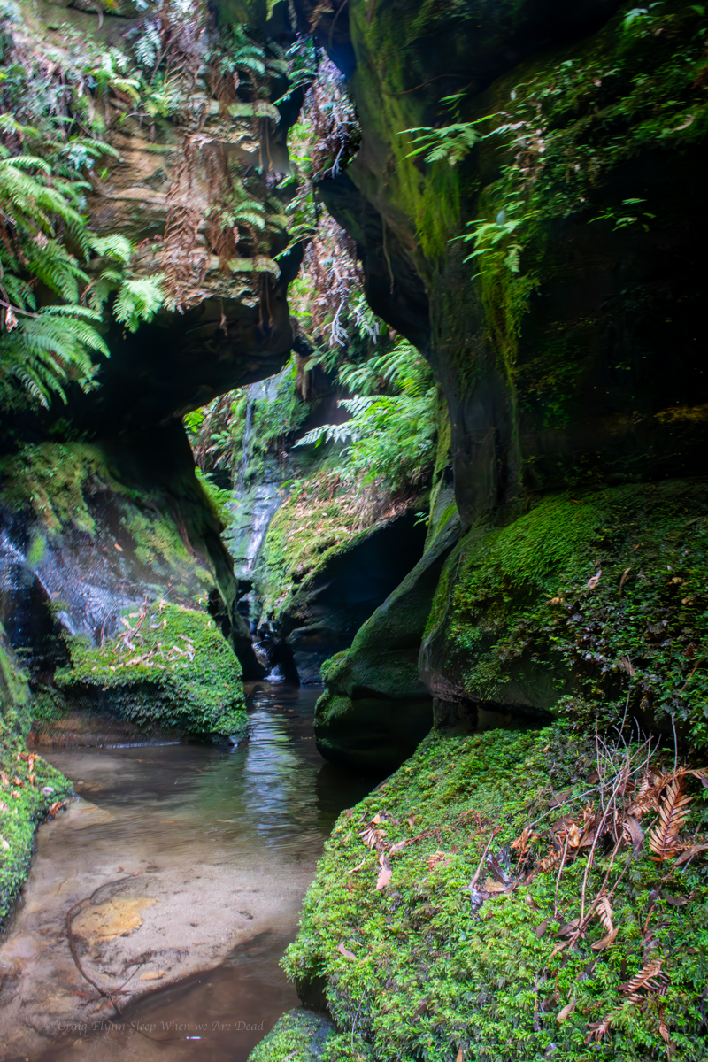
And more pleasant canyon follows
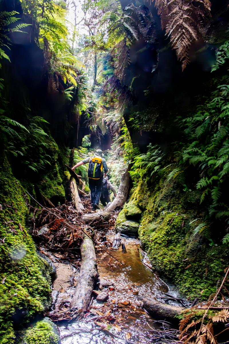
Getting down this tangle of rotting logs and loose boulders was one of the biggest challenges of this little canyon.
And soon we came to the tributary we had planned as our exit.
A little bit of scrambling and a tad of scrub bashing and we were back at the road and quickly headed back to the car to pick up the ropes and harnesses then head off to visit another little canyon not too far away.
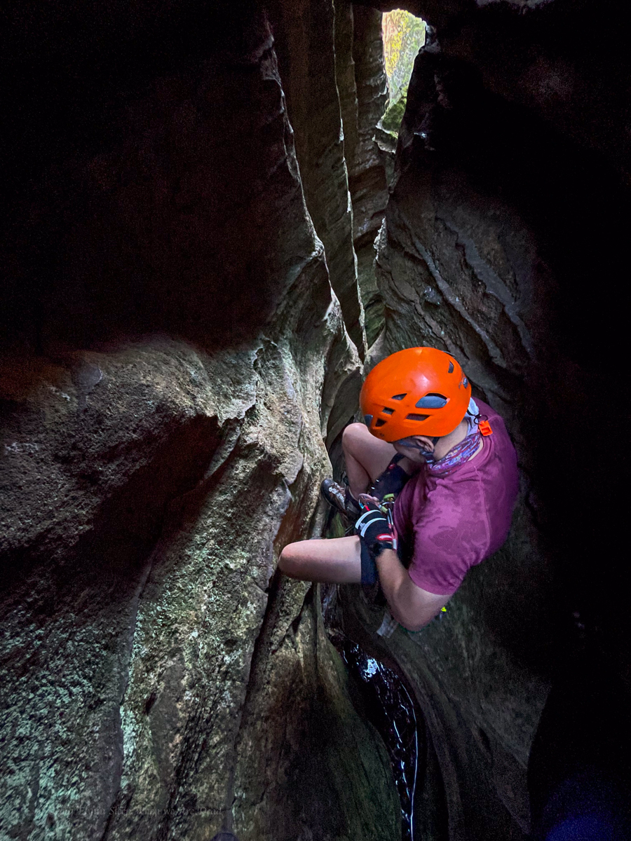
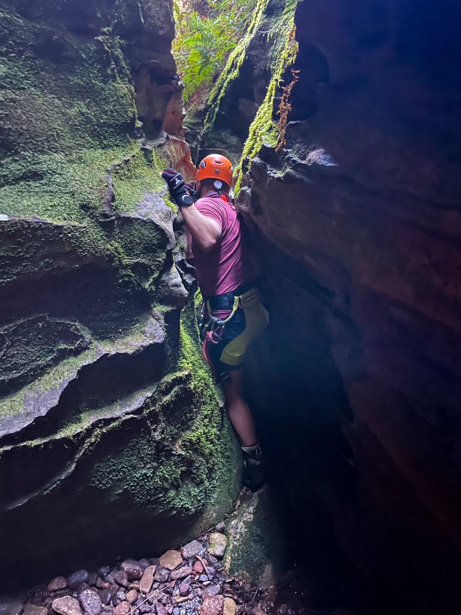
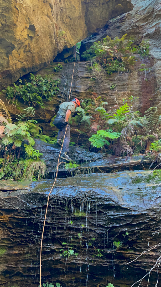
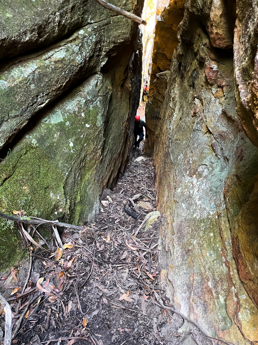
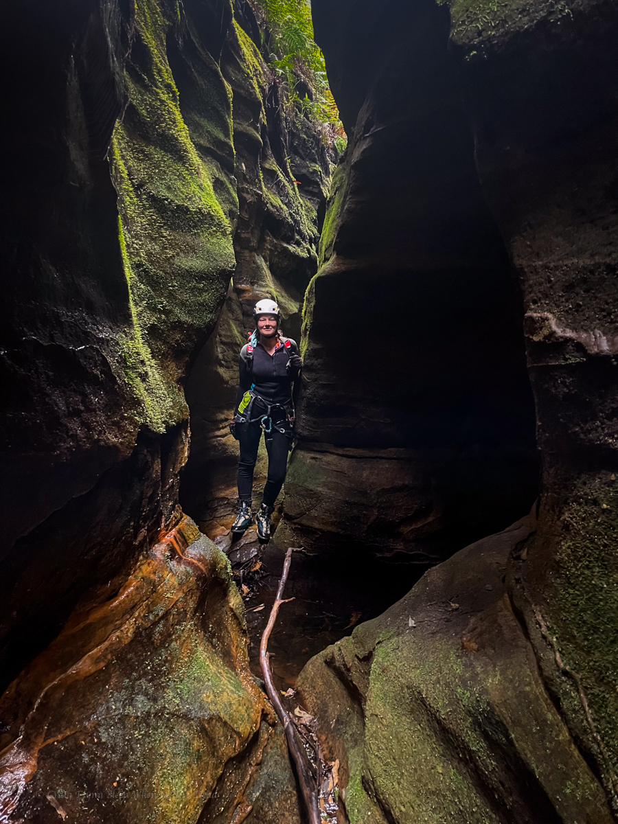
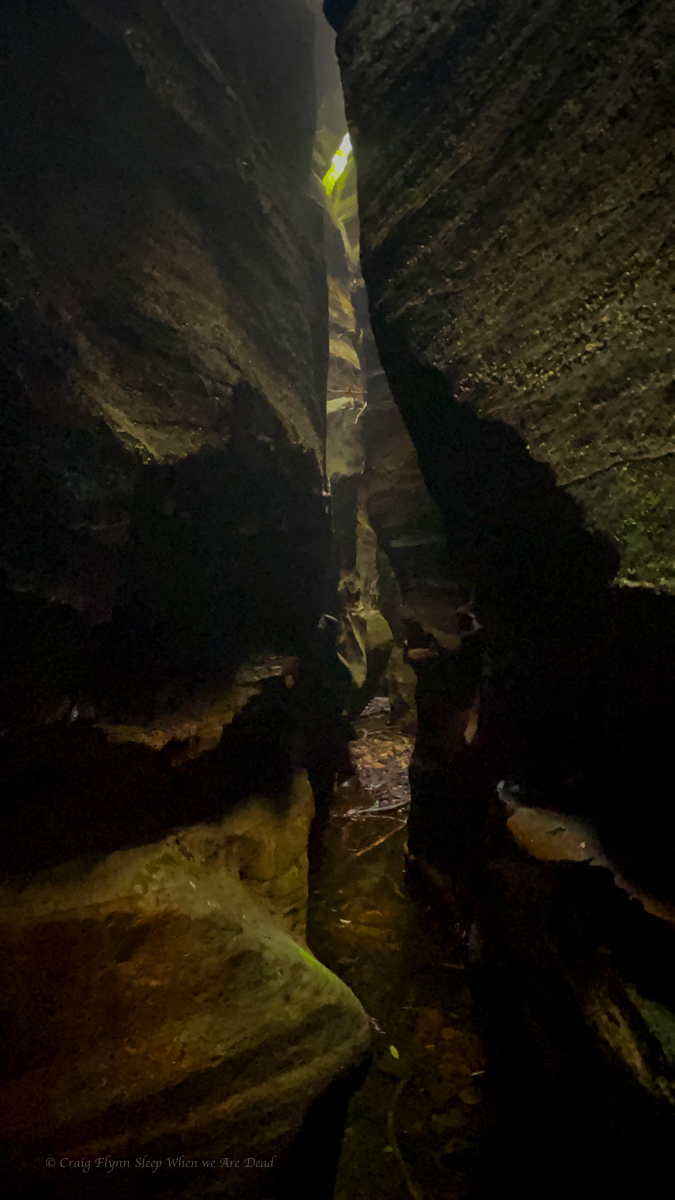
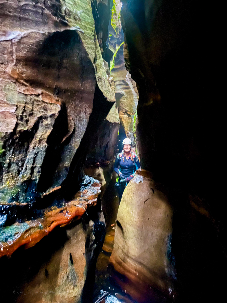
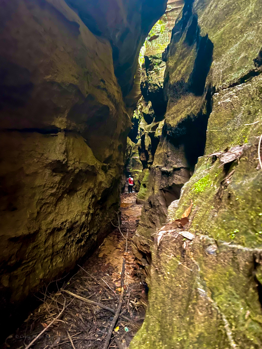
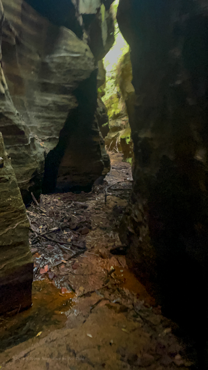
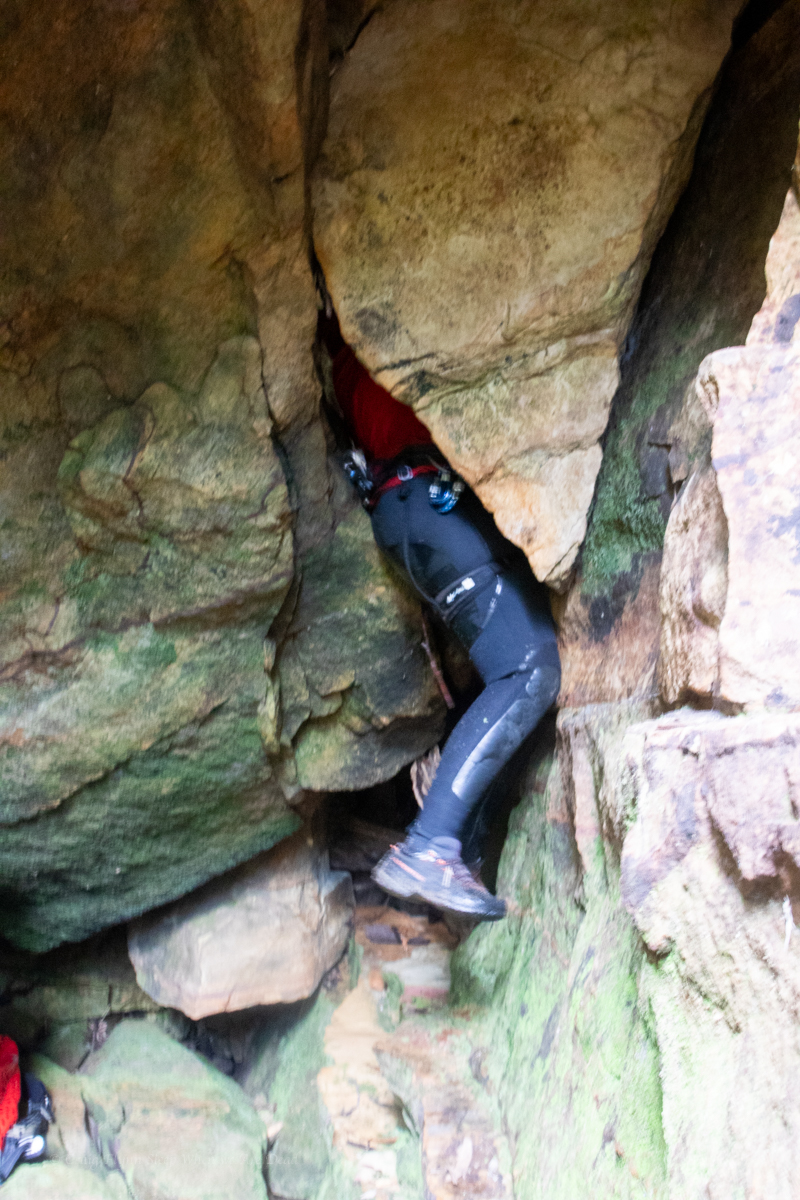
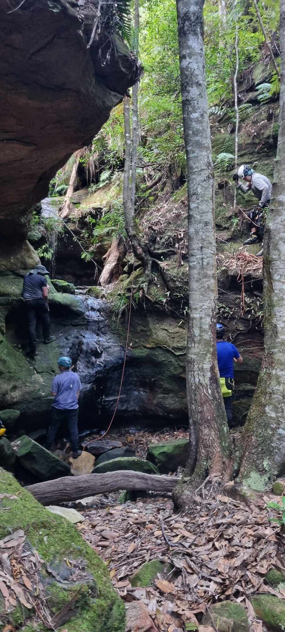
Everyone’s favourite squeezy canyon
Russ sitting on everyone’s favourite dodgy anchor
Jason on everyone’s favourite cheese grater abseil
Everyone’s favourite Go/No Go gauge. Don’t go down go over!
Everyone’s favourite helpful team mate
Everyone’s favourite return to the big wide world.
a noice ramp back up through the cliffline.
Then all the was left to do was to bash some more scrub to the main trail and a 3km walk back to the car.
Searching is half the fun. Life is much more manageable when thought of as a scavenger hunt: J Buffett
Saturday dawned clear but heavy rain was predicted to set in late in the day.
All the comforts of home or sumfink
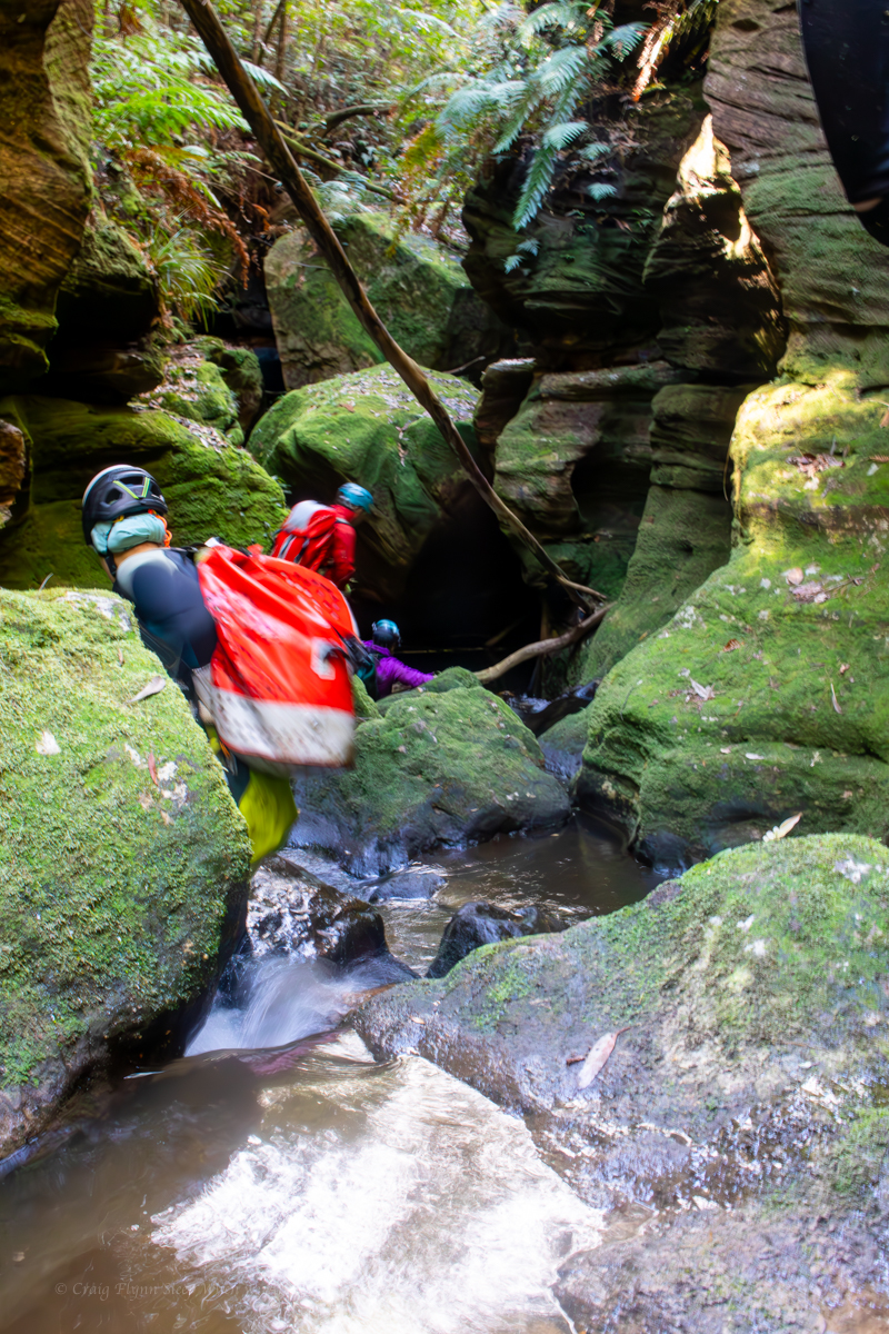
Today we would leave the camp gear behind and head to the canyon we came out here for. We navigated our way along the, well you can’t call it a ridge but lets say “convoluted yet connected spur” and down to our target creek, which soon canyoned up.
Doesn’t look like much yet but just down there…
It was as specularly beautiful as I’d imagined
Many times throughout the day we would, once again reflect on similarities to Carnarvon Gorge and some of the remote slots we had explored well upstream of the usual tourist hikes. Just all rolled into 1. And greener.
it was grand
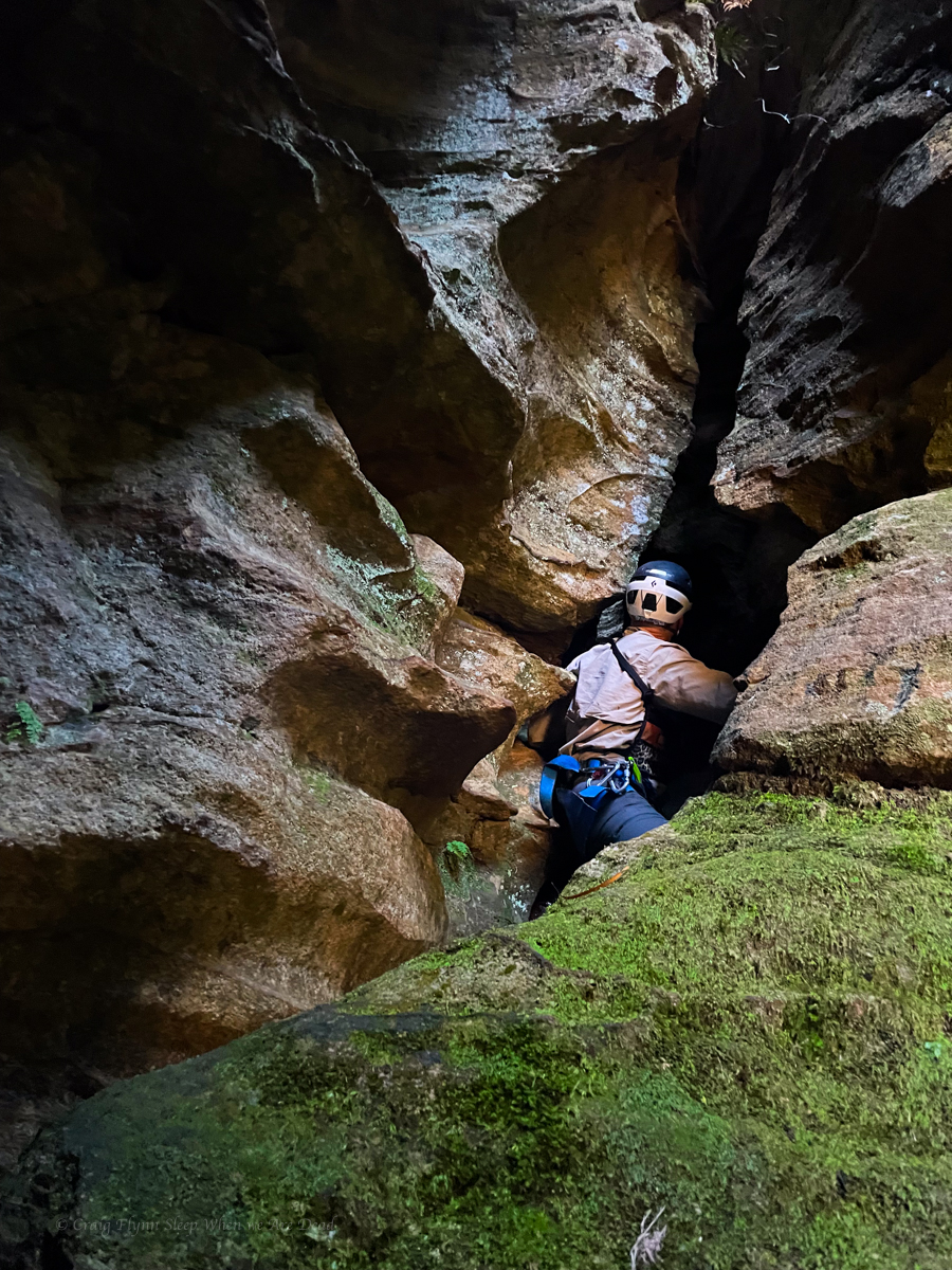
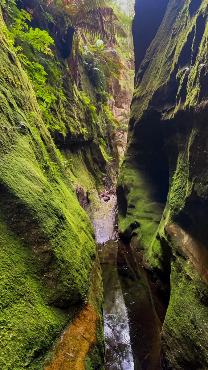
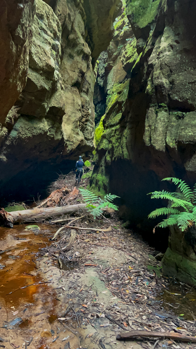
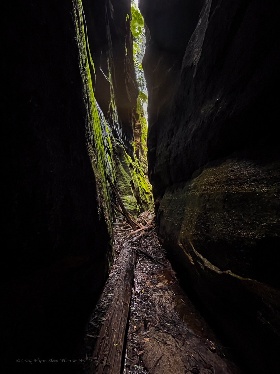
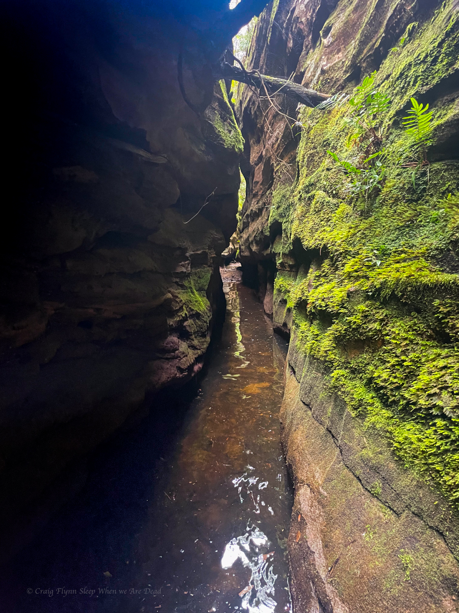
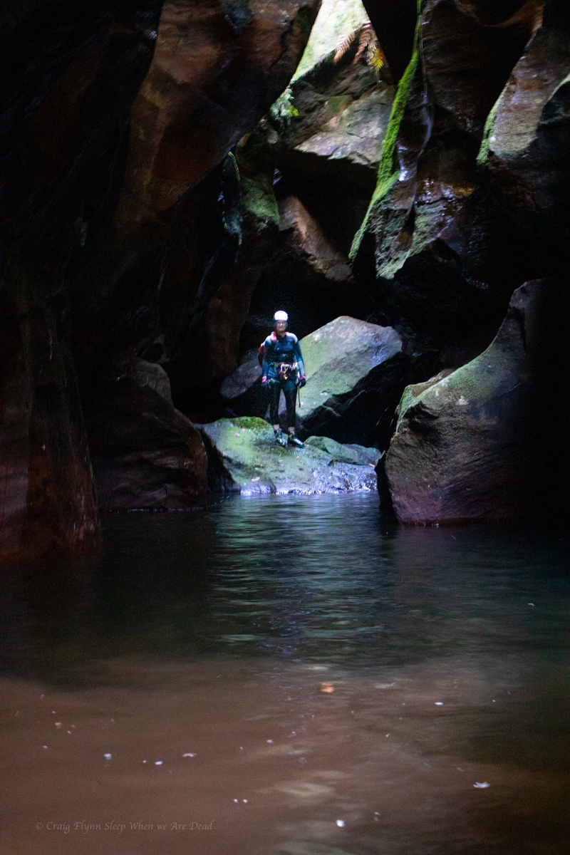
Deep, narrow, and twisty
and it went and went
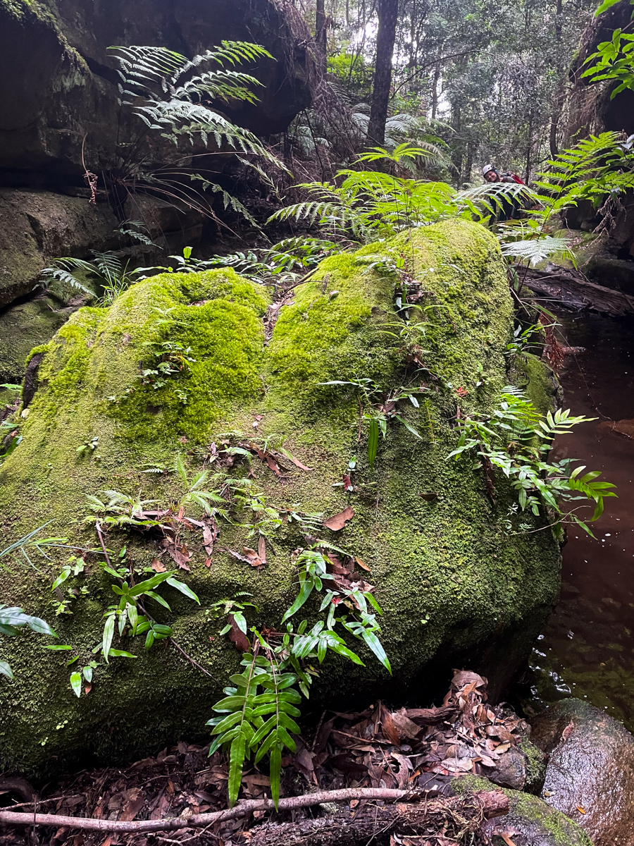
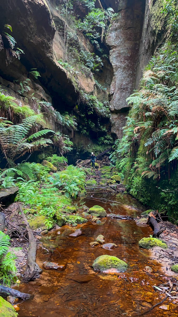
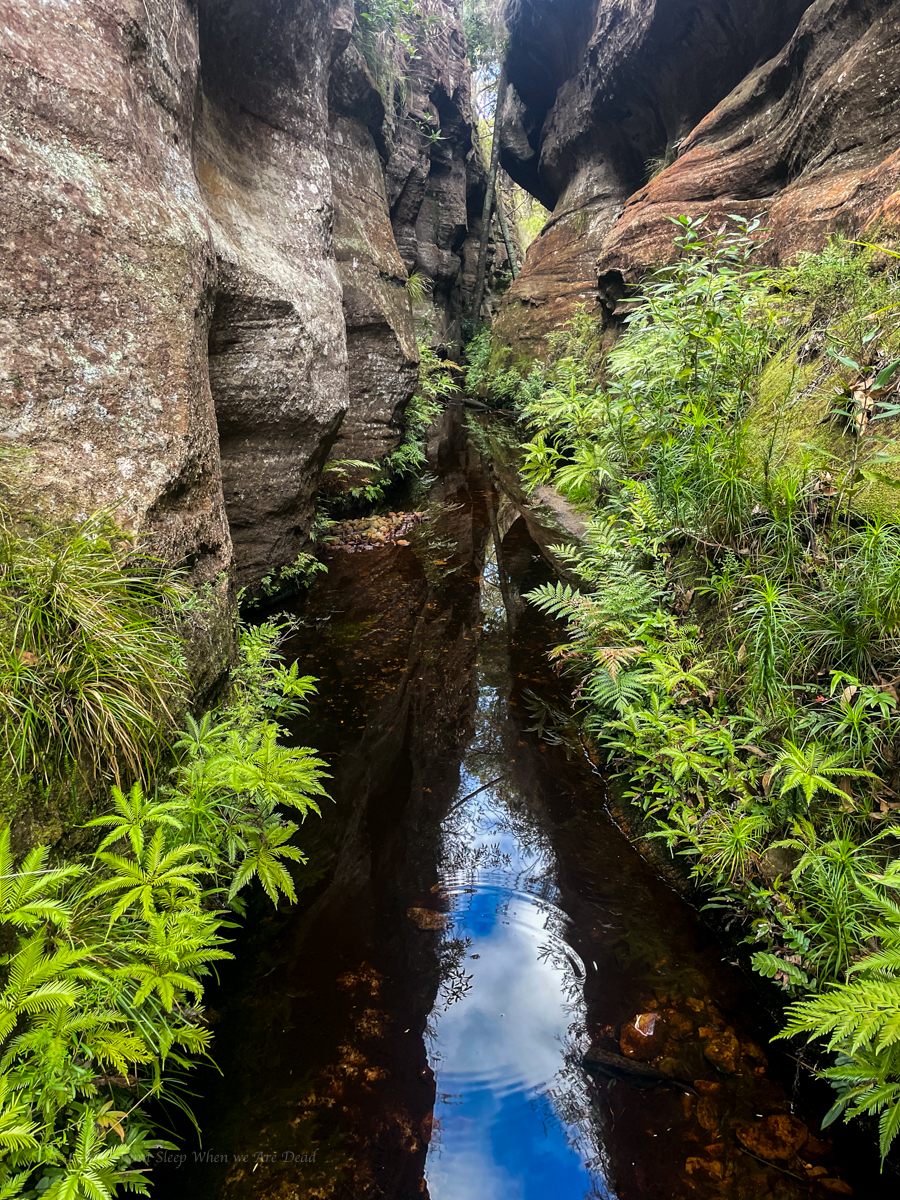
Before opening into a cliff lined oasis.
We wondered down through remnant Gondwana rainforest, in that moment we were content and complete.
There is not enough superlatives to do it justice.
Mini Hunks fist
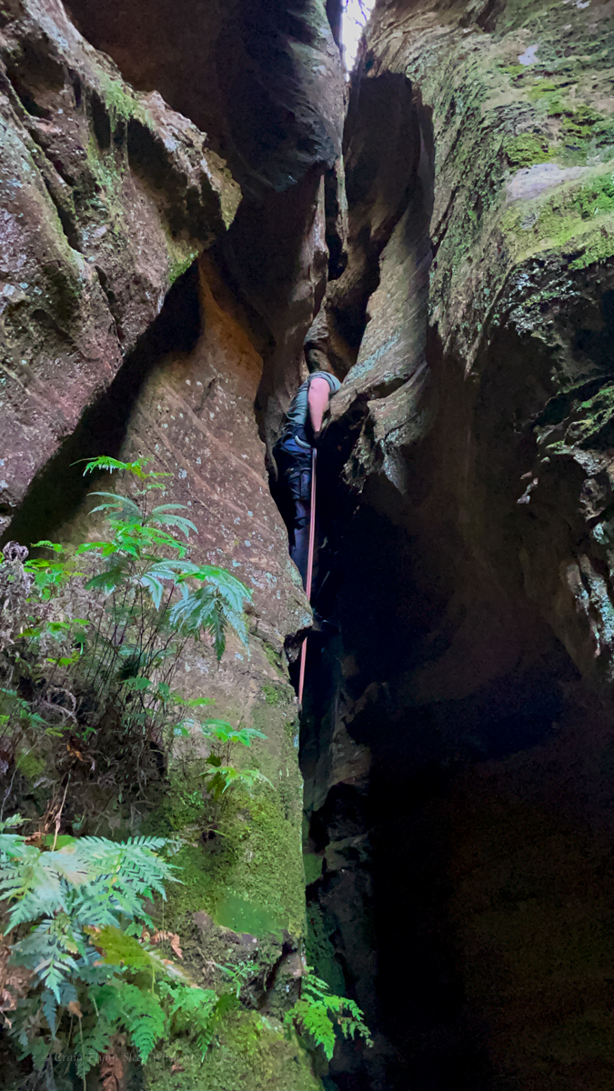
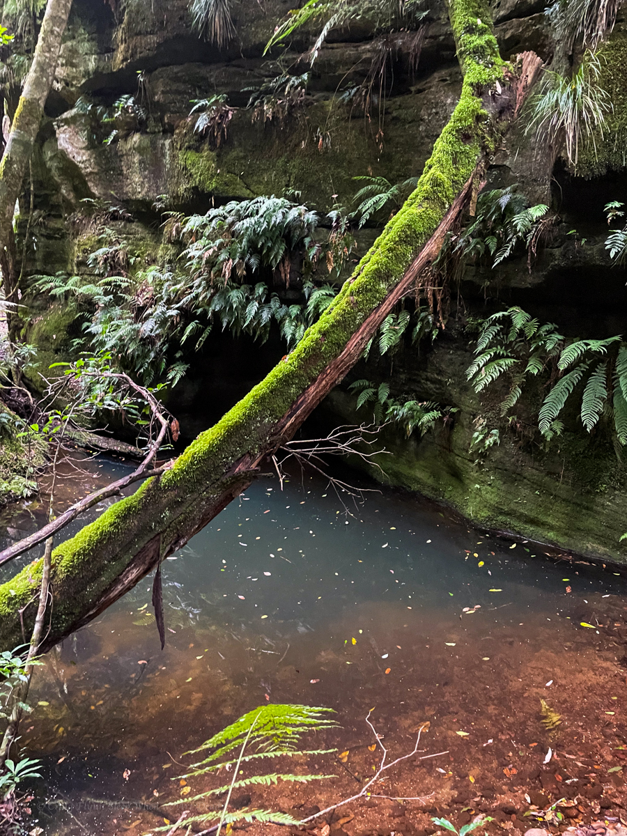
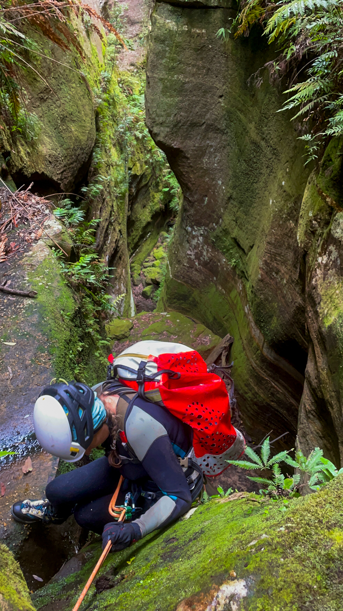
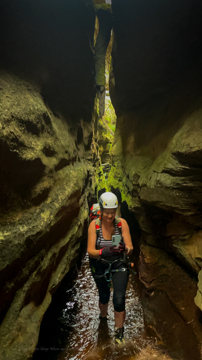
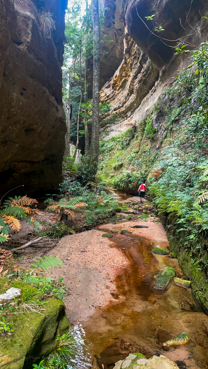
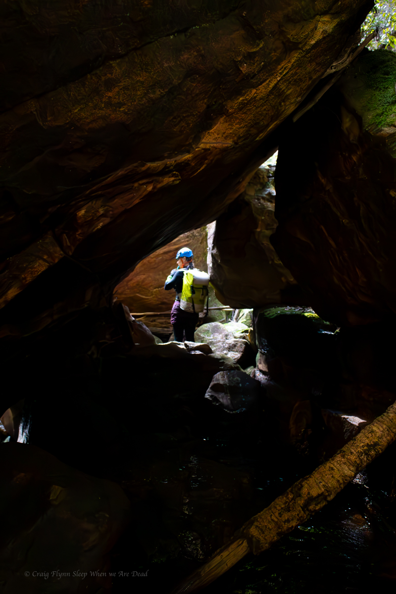
But the day wasn’t done with us yet. We wound our way through lush coachwoods and ferns to the jaws of another deep and impressive slot.
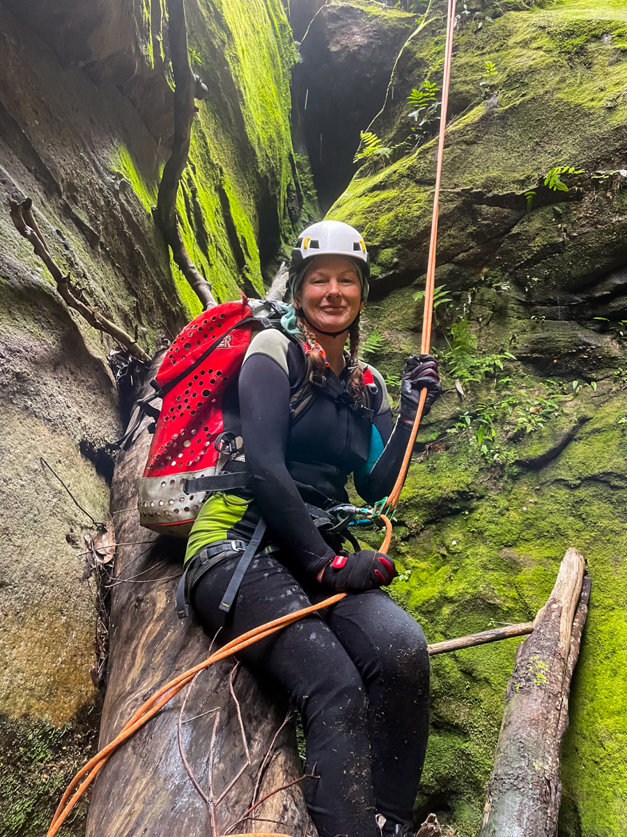
We wasted no time roping up to drop in
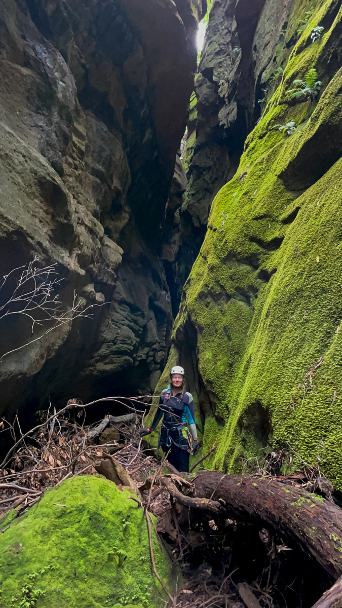
Once again we are dwarfed by moss covered walls
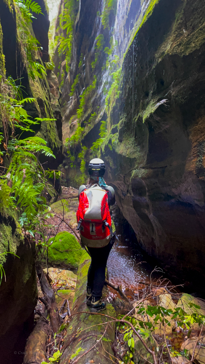
and still it drops
and once we reach the bottom a beam of sun lights up the spray of a side waterfall. The photo does not do it justice but Magic happens.
It’s hard to feel anything but humble out here.
We explore side canyons, again struck by similarities to side slots in Carnarvon Gorge.
We go slow, carefully pick our footsteps not wanting to damage the thick, spongy moss carpet and just soaking in the experience.
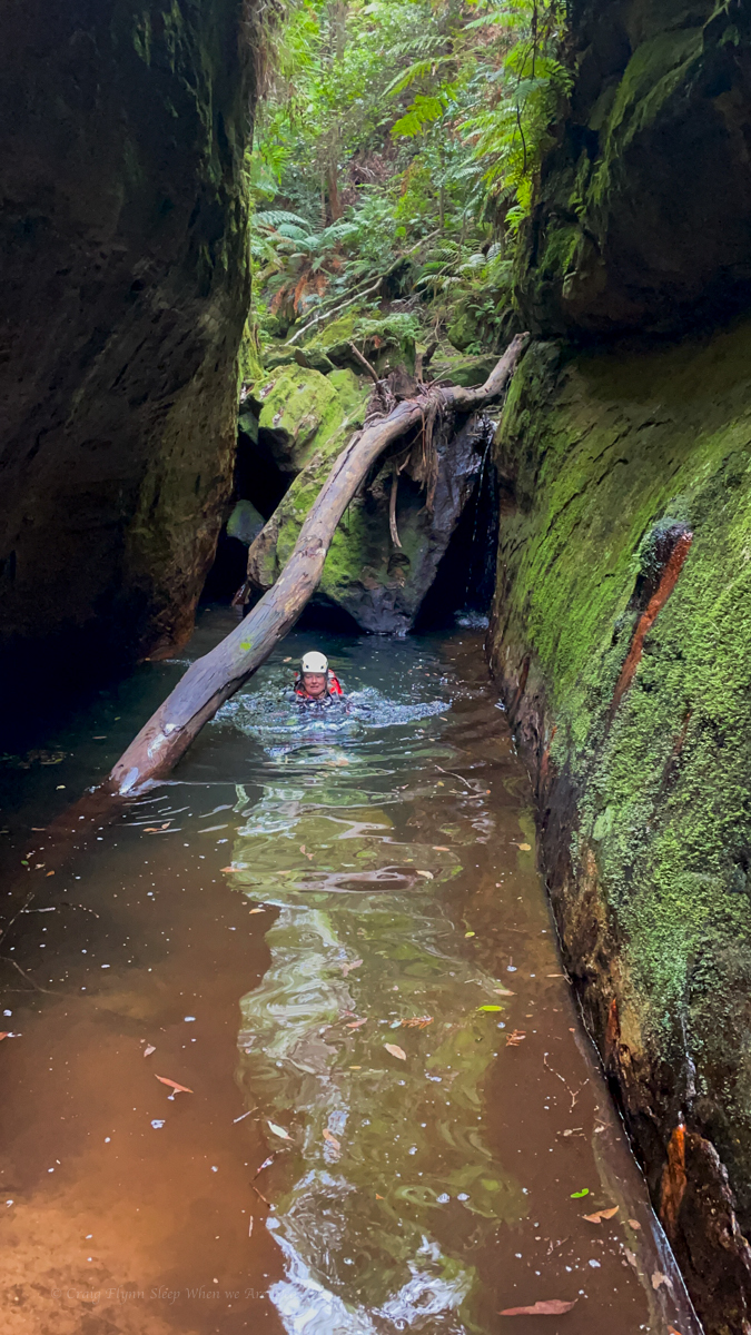
And of course before the canyon was done with us it would give us one short swim.
A ways downstream we refill our water bottles and quit this creek via an easy pass onto another convoluted but connected spur.
The sky is ominous so we punch up the spur back to camp.
just over six and a half hours after we left we make it back to camp and attempt to dry things off a bit while cooking diner before retiring under the tarp just as the storm hits.
Sunday
We had some canyons planned but it had rained hard all night and was not letting up. The dump was predicted to get heavier through the day cumulating in a thunder storm after lunch. So we opted to retreat down our first spur back to the pretty creek. The flow had definitely increased since yesterday and by the time we waded upstream to the bottom of a canyon that would lead us back up to the fire trail we had walked in on the rain was getting heavier.
Knowing this canyon was deep, narrow and long and still expecting a storm we reluctantly decided to slip up a pass beside it instead. The ridge I was hoping to use to avoid dropping back into the head waters of the canyon proved to be far more complex than the topo map suggested but it eventually got us to the road via another spectacular knife edge.
With empty heads and full souls all that was left to do was to follow the trail back to the car and the long drive home.
At the end of the day, your feet should be dirty, your hair messy, and your eyes sparkling: Shanti
This trip nearly didn’t happen. I’d been coughing up a lung and had full body aches after Ashcroft Ravine. I was ummming and arrrring about calling it off, especially when the weather looked to be turning wet and cool and the rest of the crew pulled out due to illness and work commitments.
How about we do a shorter over night trip? says Gadget.
Um I’m not sure says I
Come on this has been on your list for ages, says she, Let’s pack the bags and decide later in the week.
I started improving and once the bags were packed it seemed silly to repack for a shorter trip.
Anyhoo
In 1904 or there abouts the bush poet, vagabond and phrenologist, Cecil Poole wrote a description of the creeks in the area we were headed “The term gorge is not applicable to the creeks of this district. They are true canyons.”
Early cattlemen, ruffians, vagabonds and rogues knew the wild, twisted beauty of this section of the Wollemi. Not as intricately as the natives who had travelled its passes and decorated its walls for time immemorial, but well enough to know it was a maze of ravines, canyons and complex spurs.
Still, being further from Sydney and with lots still to discover closer to train lines and highways the area was largely overlooked by modern canyon explorers.
Until, that is, legendary bushwalker, ecologist, and all round nice bloke, Roger Lembit, was leading a midwinter bush walk in the mid 80s and ventured down what he thought would be an easy pass and instead stumbled on a deep slot canyon.
With no ropes or waterproof gear they opted not to venture down. Instead, they retreated and found a spur that took them to the bottom where they camped the night. The next day Ian Wilson and Michael Donovan opted to brave a cold pool at the end of the slot and ventured up, finding an astoundingly beautiful slot canyon. (It has a total of 0 abseils but I still put it toward the top of my list of favourite canyons based on shear beauty.)
This sparked an explosion of canyon exploration in the area and it was soon found to be densely packed with canyons. Some more scrubby creeks but many containing high quality slots.
But all that is neither here nor there nor anywhere in between.
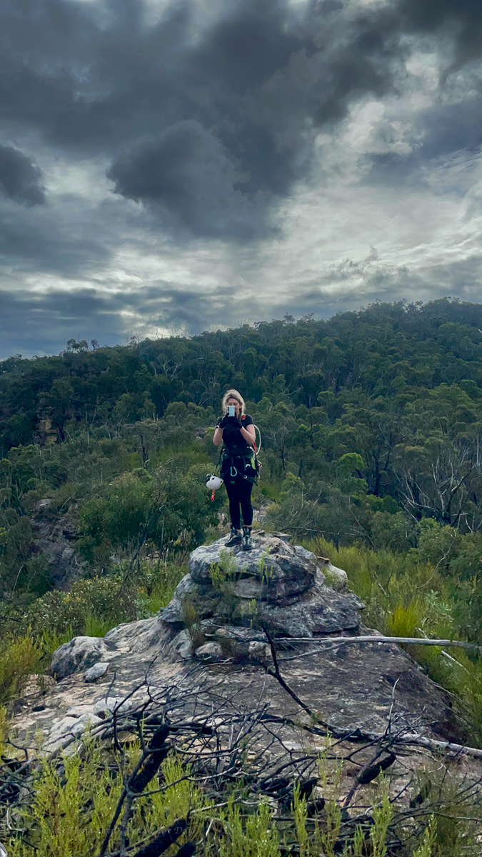
The fact is I’d barely dipped my toe into this region but had day dreamt of one particular canyon situated off an isolated spur, well off the beaten track. I was well overdue to go for a look.
As luck would have it both Kylie and myself had an extra long weekend to do just that.
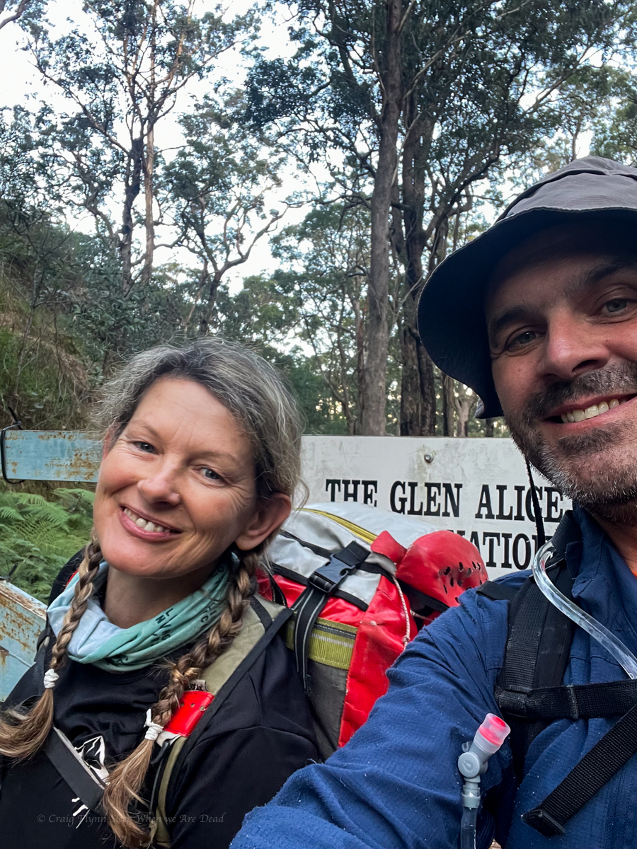
We made a late start Thursday afternoon.
happy at the start
The walk into our first camp is along an easy fire trail. However, I soon had a bit of a niggle on my left heal. It’s been so long since I’ve had blisters and it was such an easy walk I didn’t even register that might be what was happening. Needless to say by the time I stopped to check it was too late.
Idiot.
But really, blisters! After a couple of kilometres!! I can’t remember the last time I had bloody blisters!!!
Anyhoo we press on.
We reach the usual camp site to find a family already setup. They had been there for the full week and the kids, 7 and 5, excitedly regaled us with tales of the canyoning adventures they had experienced. Legends have done more wilderness canyons than most adult canyoners.
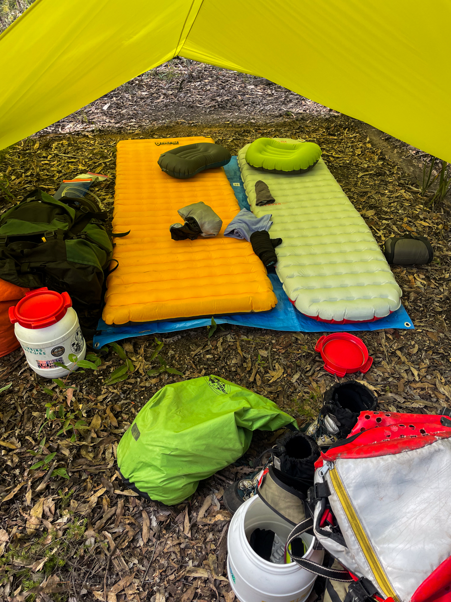
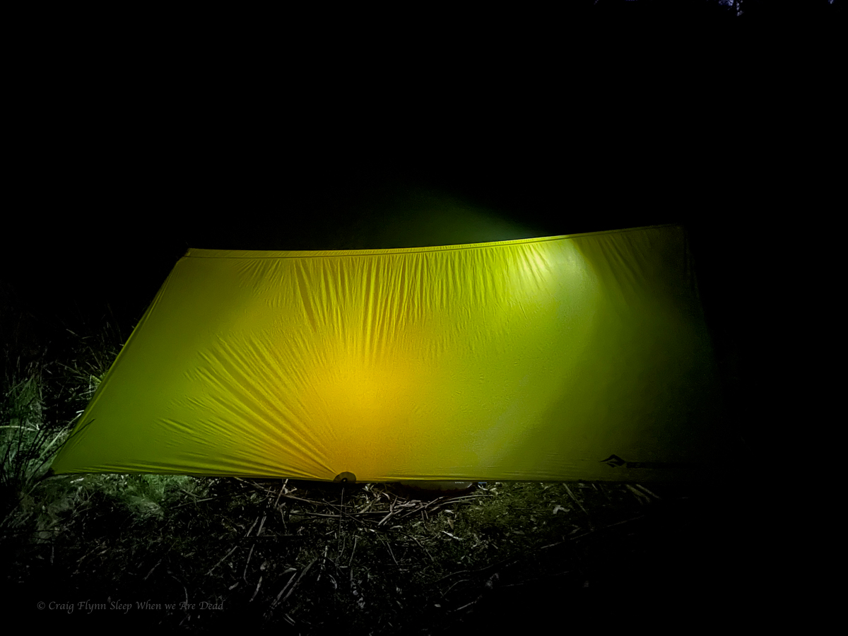
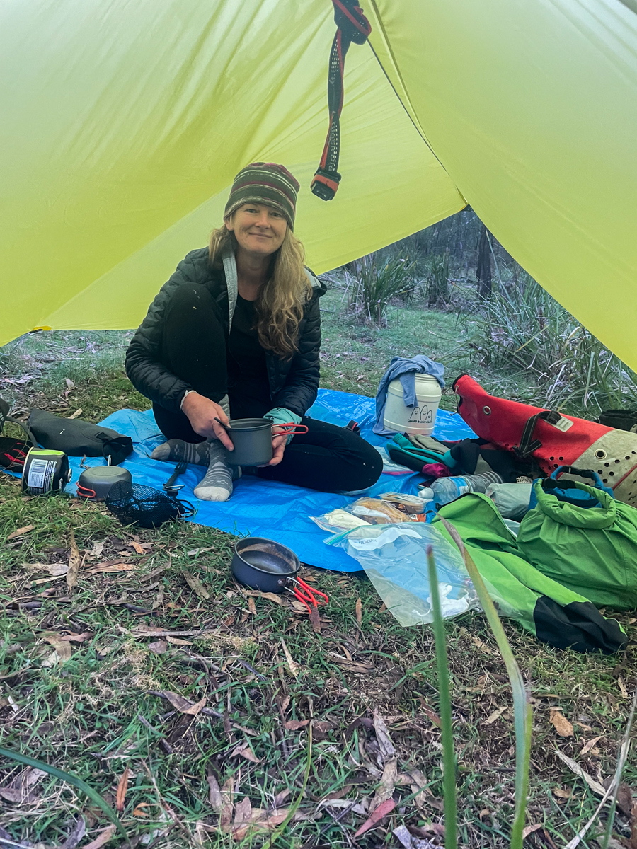
We set up and snuggle in for the night. Gadget did an amazing job researching our light weight over night gear before settling on the Sea the Summit Escapist Tarp and Spark sleeping bags. I’ve always been a fan of the Nemo sleeping mats. It makes a great combo
Friday
Morning dawns and we have a lovely breakfast, repack then head off for our first canyon
Having done canyons either side of our target for today I had high hopes of it.
I pick a spot to leave the road and Kylie navigates down ridge.
Shelob was guarding the pass but we weren’t scared. Honest.
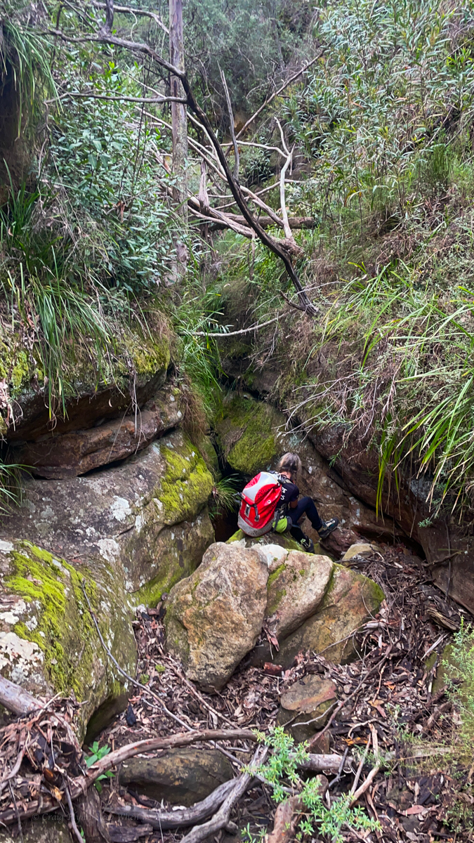
We gain the creek surprisingly easily and follow it down.
It soon drops into a narrow canyon.
With a bung shoulder I opt to abseil things I would usually scramble but we get down soon enough.
The expected chest deep pool had silted up to be ankle deep so we forewent the usual circus tricks of trying to bridge across and skipped on through.
Well, not skipped. The boys warned us last night of a brown snake lurking near the first pool so we went a bit cautiously.
No sneaky snek was spotted but the canyon snaked on.
then opened up a little
and closed back in
cameras at 10 paces
the walls soon open out to a wider canyon.
The slot had been nice and all but not mind blowing and a lot shorter than I was expecting. Compared to others in the area it was a bit of a fizzer. And we were still a fair way off the junction of the main creek below.
the gullies were brimming with ghost mushrooms. These glow in the dark but we’d be camping hours away so won’t be back to check.
We follow the the widening gully down, boulder hopping and creek bashing to the major creek below
A pretty spot for a picnic or sumfink
Long sidetrack: The names of the creeks around here have such evocative names, but that could have been very different had we had a different Surveyor General intent on mapping the state.
Major Mitchel, of the pink cockatoo fame, was by all accounts a bit of a cock. Invariably described as pigheaded, arrogant and boorish he was the protagonist in Australia’s last recorded pistol dual with soon to be NSW Governor Darling. None of this old west quickdraw Hollywood bullshit. The combatants stood back to back, marched out 10 paces, turned, and like the civilised gentlemen they were, took turns having a shot. Flinch or get shot (obviously) you loose.
Mitchell having thrown down the challenge by slapping Darling with his glove had to go second. Darling took a shot and missed. Michell then took his shot and knocked Darling’s hat off so was declared the winner.
Anyhoo none of that is important to this side story other than I found it fascinating. What is important is Mitchell also had a redeeming factor in that he insisted that, where possible, aboriginal place names were to be used on his map.
When an early sketch was sent in by one of his under surveyors making a nearby creek with the local land owners piss take of a name “The Upper Nile” he basically fired back words to the effect ‘stop being a dickhead and find the bloody native name for the creeks, and if you can’t do that don’t name them at all.’ (probably so he could name them after Macquarie or some shit…)
And thus we have the Coricudgy, Umbiella, Numietta, Coorangooba, and Capatee. (pronounced Kay-pa-tee by the locals and originally spelt Capata on the sketch map )
Of course we still have the Bogee Nile and the Capertee Nile…. but that’s not important either.
Too get back to the story, we’d be using another high camp tonight so we’d need to cart water up. Enough to get us up, cook diner, breakfast, and at least part way through the canyon the next day.
We fill up and start up a creek that should allow us to scramble out at the top. However, a couple of tangled tree falls at the bottom and Screw this shit, says I. I’m going up there.
And we forge a pass up the nose onto the spur.
A break in the cliff line lets us gain the spur with just a short, easy rock climb.
And Kylie leads us up the spur avoiding some minor cliff lines by simply skirting around them.
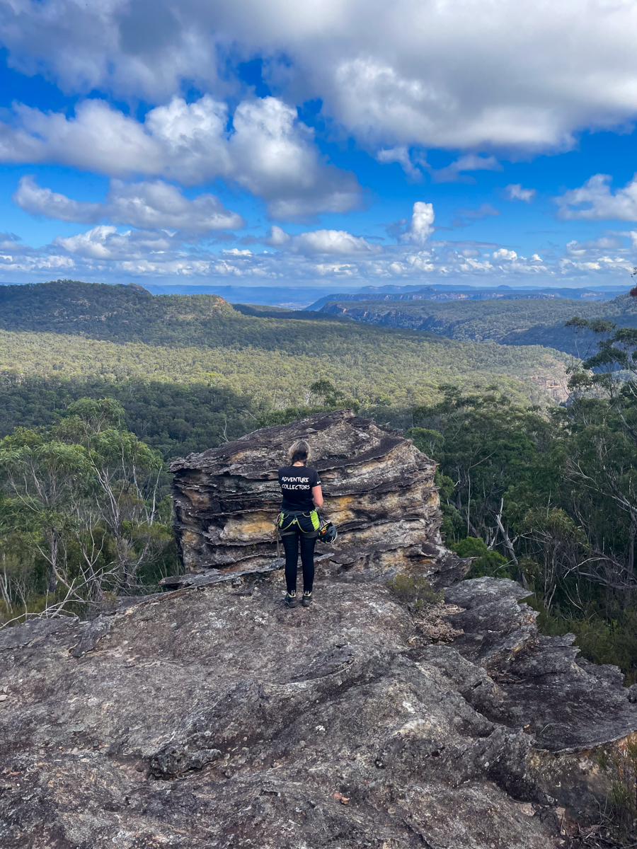
Up top we have astounding views including this one over the Numietta looking towards Pantones Crown at the other end of the Capertee Valley. This spot put us in mind of battleship spur in Carnarvon Gorge.
And sunsets over the stunning peaks. With Tayan Pic, Grassy Mountain, Mount Coorangooba and many others appearing in a 270° panorama on the other side of the peak.
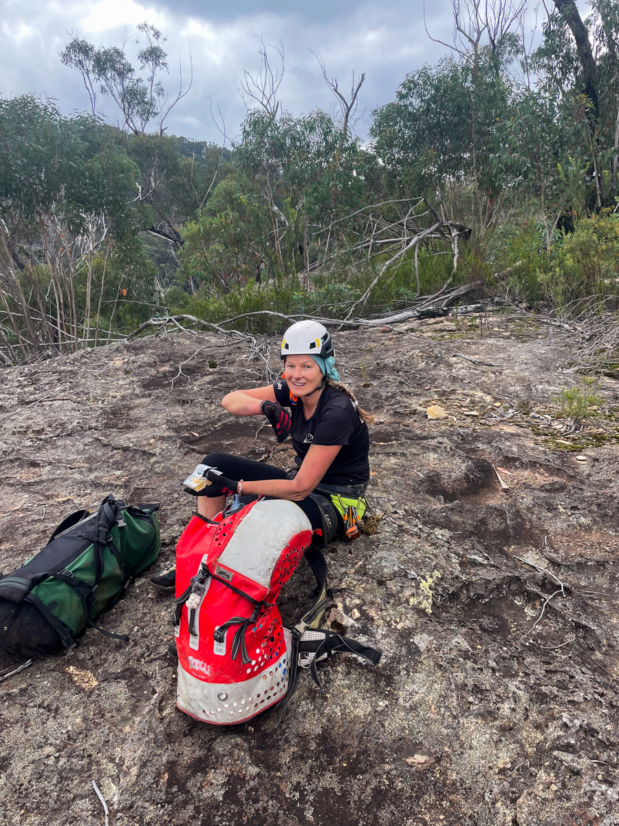
Anyone want to come on a trip that might be a big day of scrub bash to a poor quality canyon? Say I
Hell yeah! says the above awesome folk.
It’s been a hot minute since I’d organised a semi exploratory trip to a canyon I’d not visited before so it was about bloody time I got out of my funk and Kylie might have gave me a bit of a nudge.
The entry in the Jamieson guide labels it “Ashcroft Ravine” with the description it includes the best bit of Wentworth Creek. There was a reference elsewhere of “Cut-throat canyon.” None of it was clear on what was what and where was where but anyhoo.
The little information we could find suggested the first part of the creek (Variously marked on maps as “Franks” or “Franki”) was a viscous scrub bash so we substituted that for a slightly less scrubby bash down a ridge to drop in right at the start of a canyony bit via 2 short abseils.
Straight away it was more impressive than I was expecting and every bit as slippery.
No scrub in sight and a pleasant bit of canyon greeted us
It was dark and cool but pretty
The canyon section only went a short way before opening into a beautiful, more open gorge
And that would be the theme of Franks(i) short, South Bowenesk canyon sections and more open ravine.
With some tunnel sections and squeezy bits along the way
And it kept going
Very South Bownen like in spots
With tunnels
And happy smiley faces
We made it to the junction with Wentworth creek and had Elevensies.
Wentworth creek put me in mind of the end of Bell creek or sumfink big and grand.
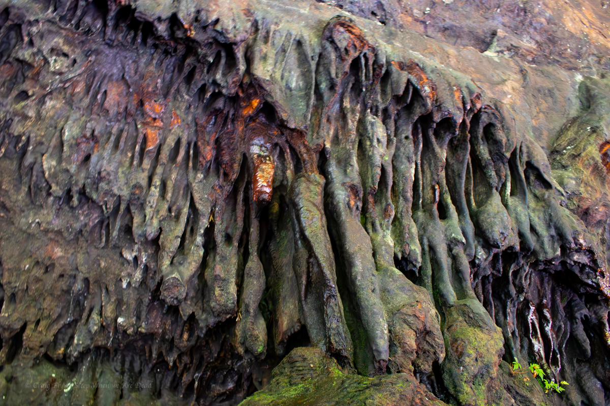
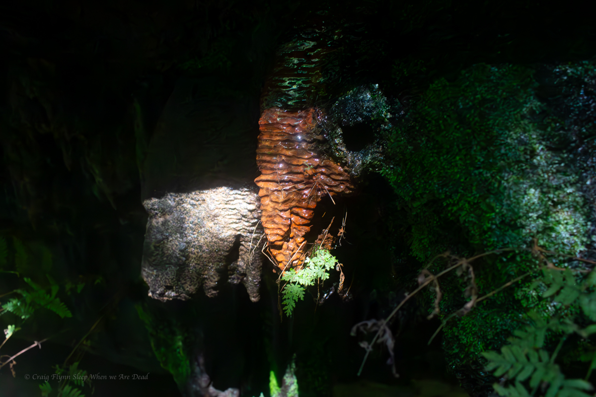
And soon we came across one of the features that when I heard about them really piqued my interest
Tucked away in alcoves along the walls are a series of Stalagmites and Stalactites. In sandstone! I’m assuming there is a drip line passing through an ironstone layer high in manganese or some such, but if any geologist out there have a better explanation please leave a comment.
Older flowstone covered in moss and algae
They were awesome and more numerous than I had expected
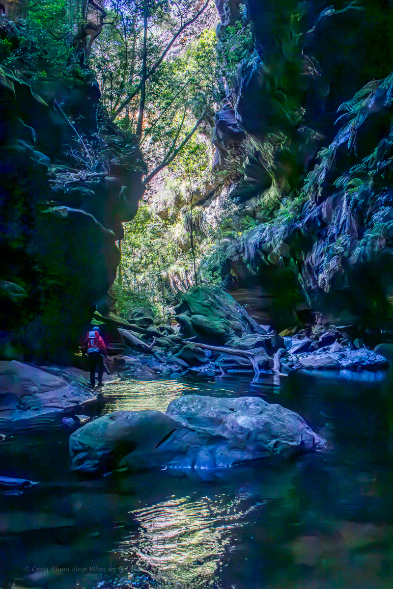
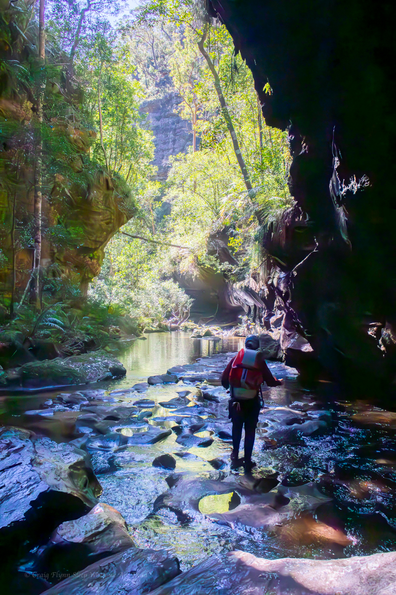
On we went and the gorge continued to be impressive
The banks opened out a little and we alternated between traversing high on banks and wading down the creek depending.
Just before the tributary we had marked as our exit Jen and Kirstie spotted a ramp leading up in roughly the right direction that looked like it might bypass one of the 3 climbs Jamieson described.
Kylie and Kirstie scouted up while the rest of us got changed.
It’s bit dodge but it looks like it goes, Called they.
Be careful, called us.
Before long the agreed whistle blasts came to inform us it did indeed go.
We were now in the exit creek but soon came to the small waterfalls that would be the main challenge of getting out.
Reports I had been able to find described a climb on the right.
Kylie gets up to a series of fractured ledges that looked doable but sketchy and dropped a rope down. Jason and I ascended up to her.
The next section looked shit and we weren’t sure what was above. Kylie stood on a log to step up to the next ledge but the log snapped with a thud.
In the meantime the rest of the group were looking for other options.
Back to the left might be doable. Called they
The lidar looks better on the left. Says Jen
I’ll drop back down and check the left option. Said I
Kristie leads me back around bulge and across a very narrow ledge. A short slab climb (maybe grade 7 or 8 but very exposed) presented itself. Up I went. A narrow ledge ramped up below the cliff line.
It goes. says I.
We got a rope up and the rest followed.
It had taken us about an hour and a half to work this puzzle out but once solved it was simple enough.
From there is was a trudge back up to the top of the ridge and back to the cars.
William Charles Wentworth, Billie C-Dubb to his mates, was a statesman, pastoralist, newspaper editor, politician, author, reformist, and advocate.
That’s the type of stuff people could achieve before TV or social media.
That and having 10 kids (Seven daughters and three sons.)
Who Frank, Franki or Ashcroft were I have no idea.
But the creeks named after them are both worth an explore.