After the heat of Waa Gorge and Mount Kaputar we decide our best plan would be to get up super early and get the bulk of the Grand High top walk down before the heat of the day.
But first we have to get there. There was another feature just out of Coonabarabran we wanted to check out.
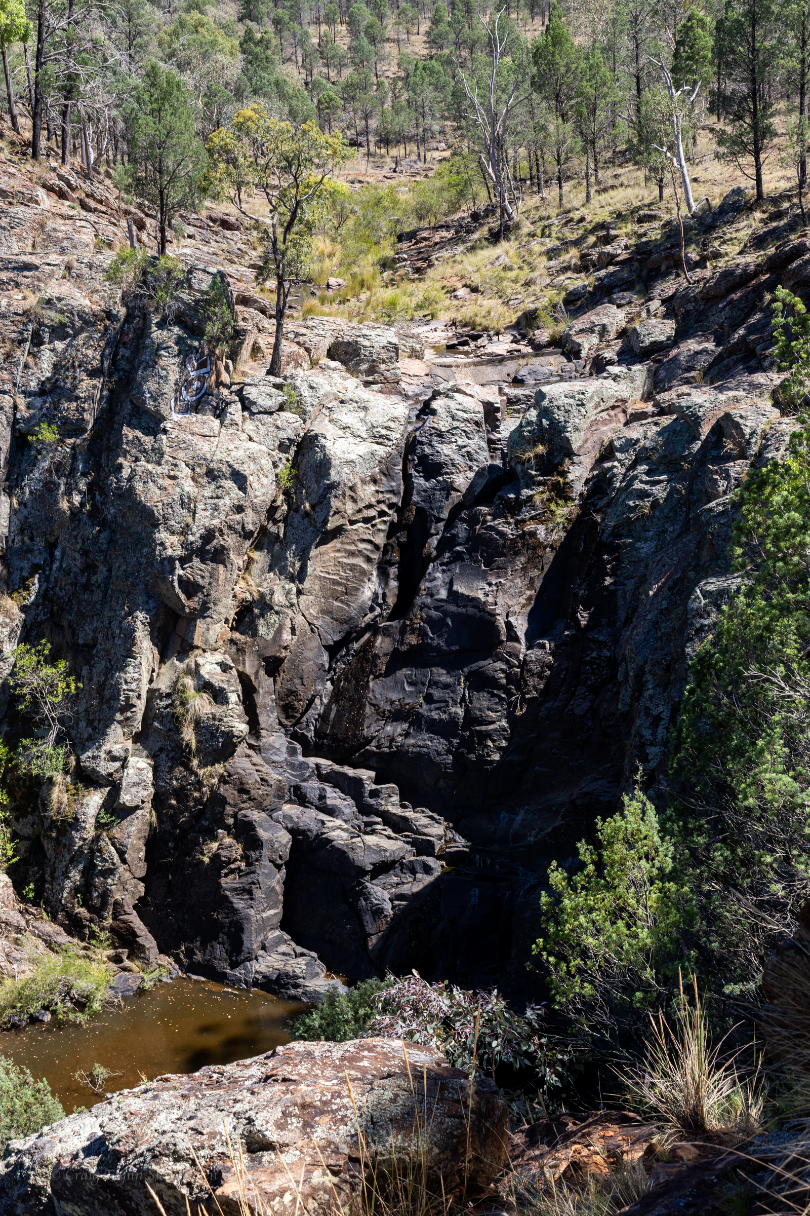
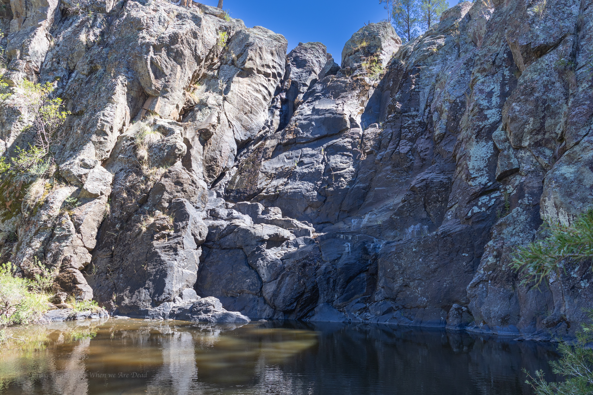
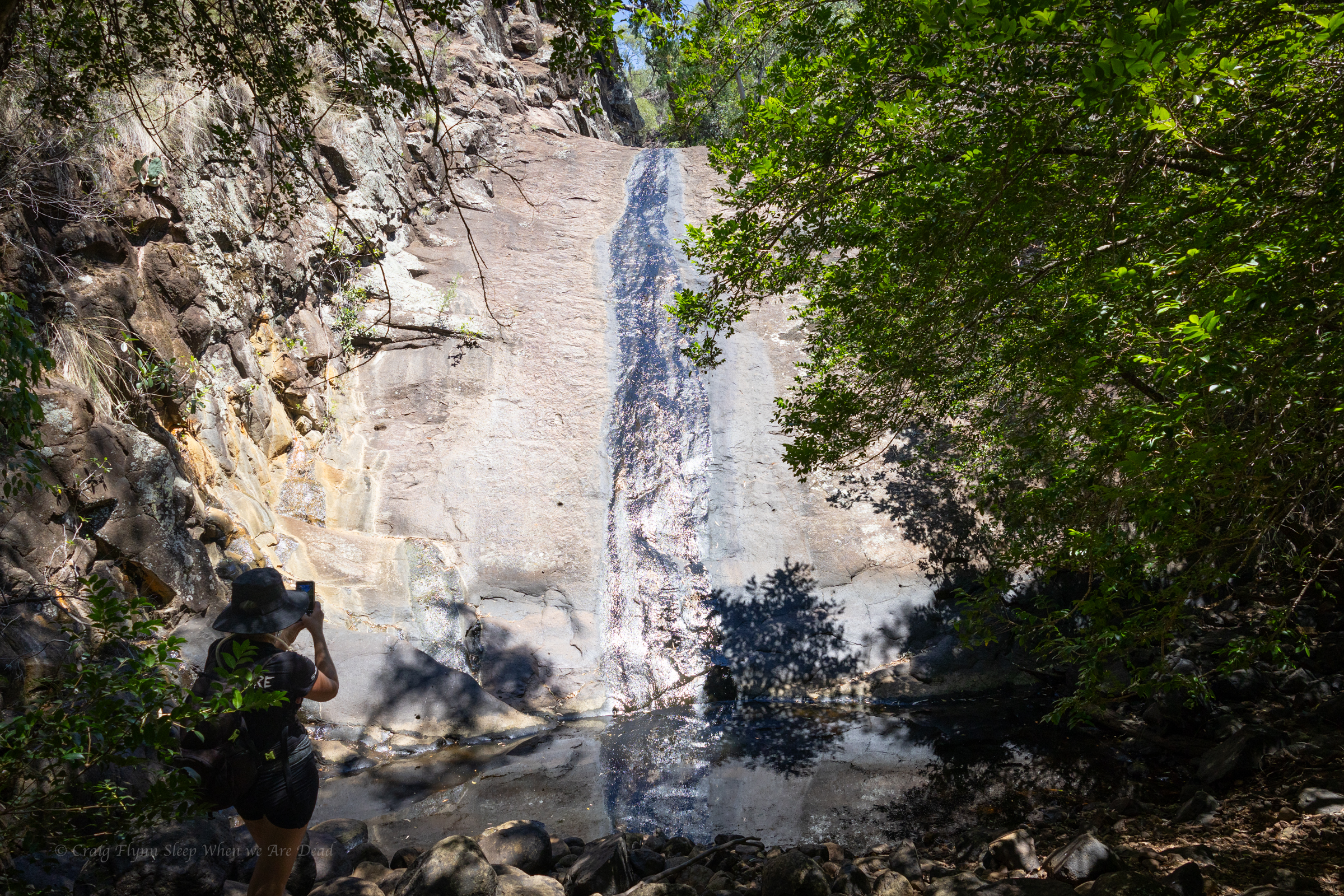
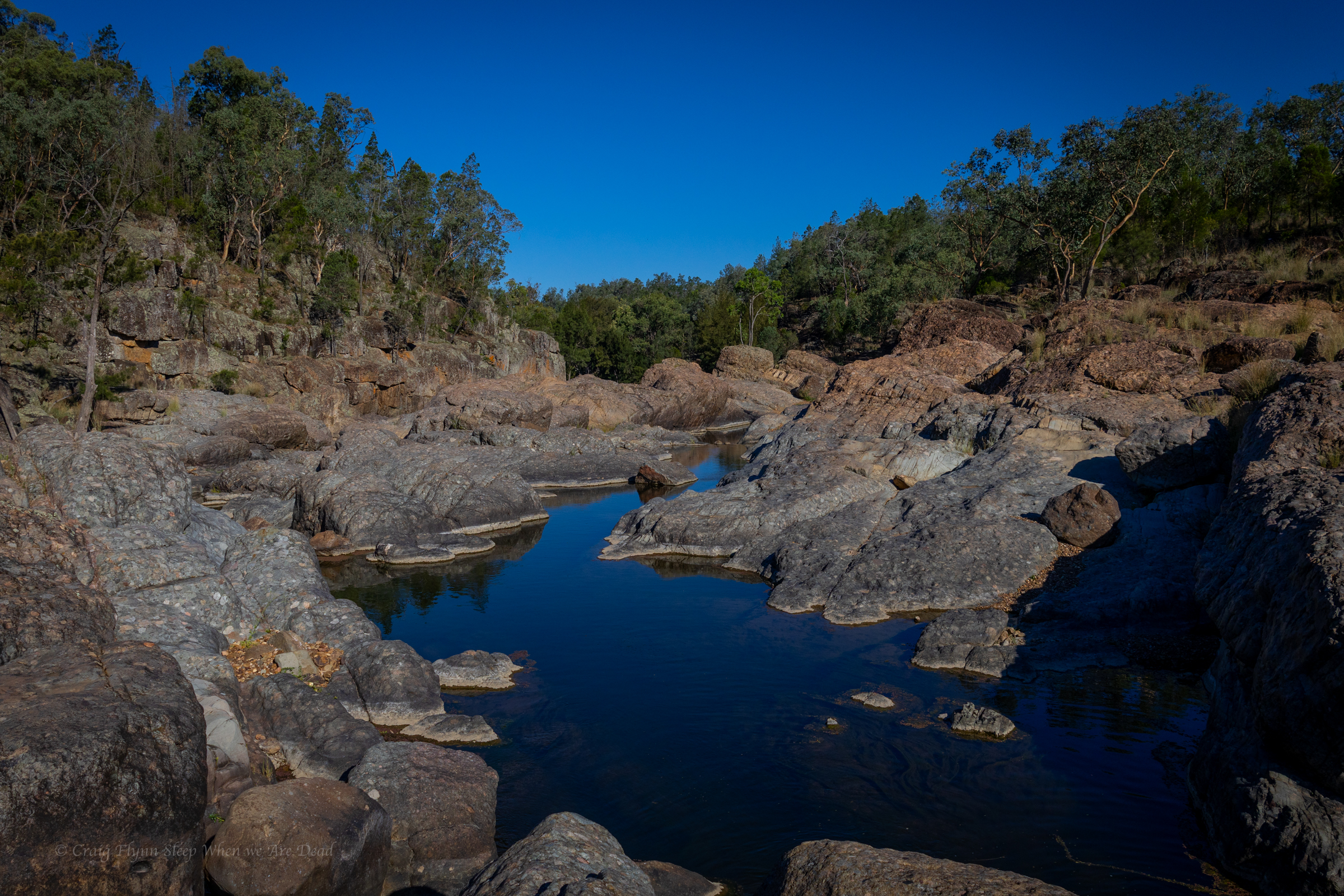
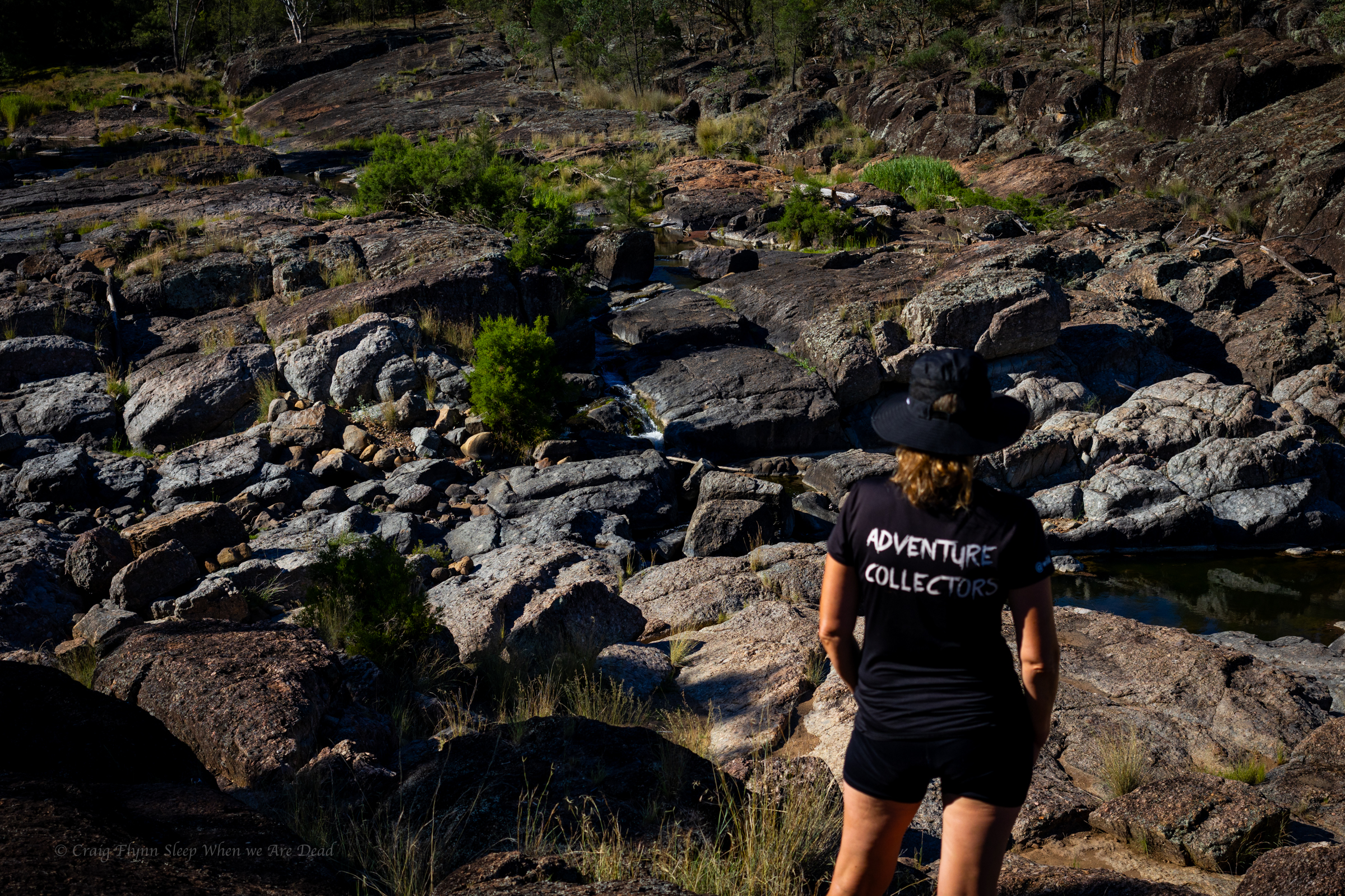
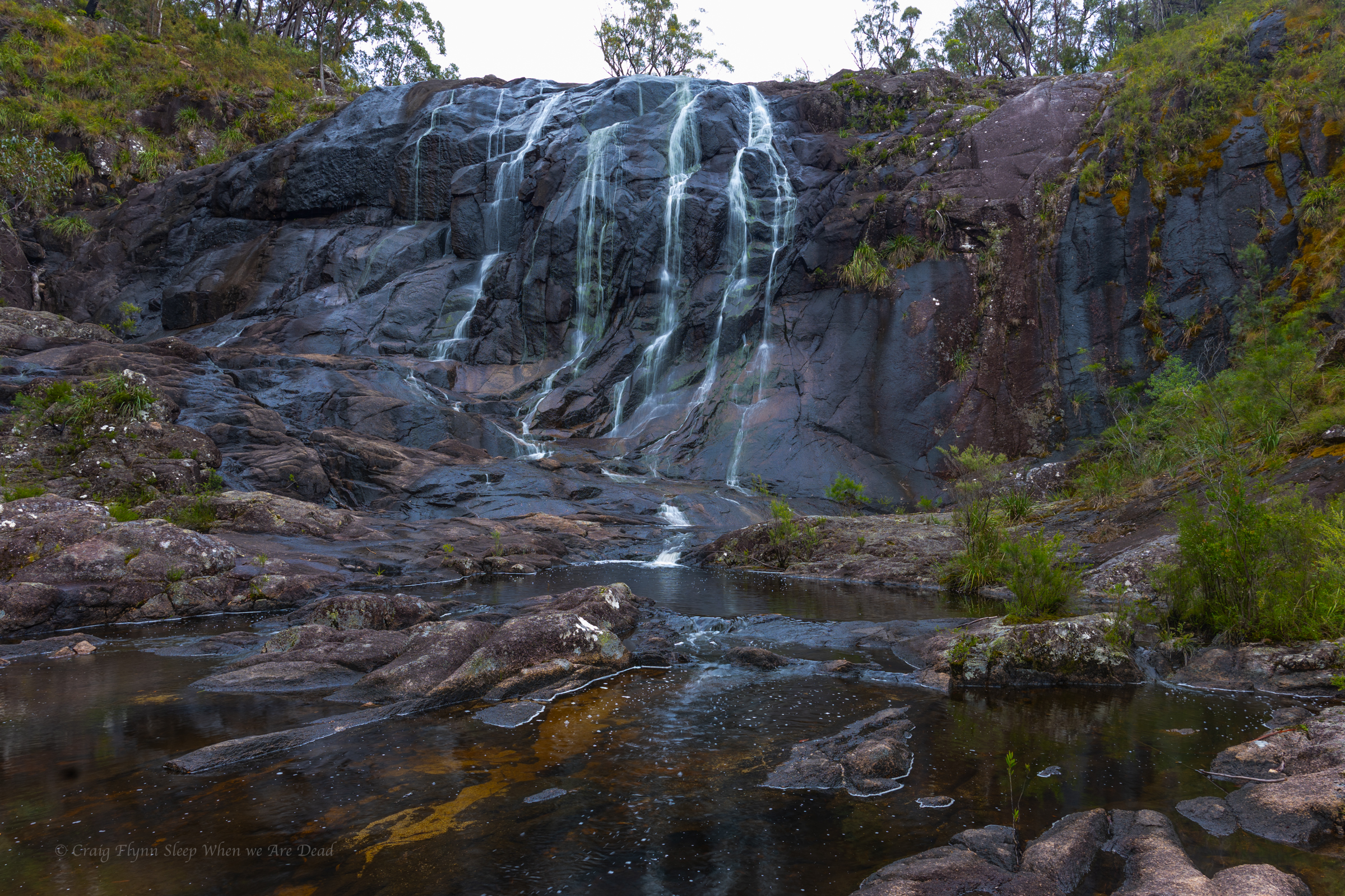
We pull into Hickey Falls, never seen them this dry before. Says a local lady we bump into.
as dry as Uncle Geoff’s sense of humour
The side trip to Hickey Falls meant we’d enter the Warrumbungles from the eastern side and the drive in is spectacular.
View after view.
We pull into the visitor centre to book into our camp we are thinking they are going to say we are nuts but when we mentioned we we planning the Grand Hightop Walk in the morning they just smiled and said, Oh lovely. You’d be best to start early in this heat.
Oh yeah we are going to start about 5 and try and get up to the breadknife for sunrise.
Oh that would be awesome…
Ok so we aren’t nuts. Or not as nut as when thought.
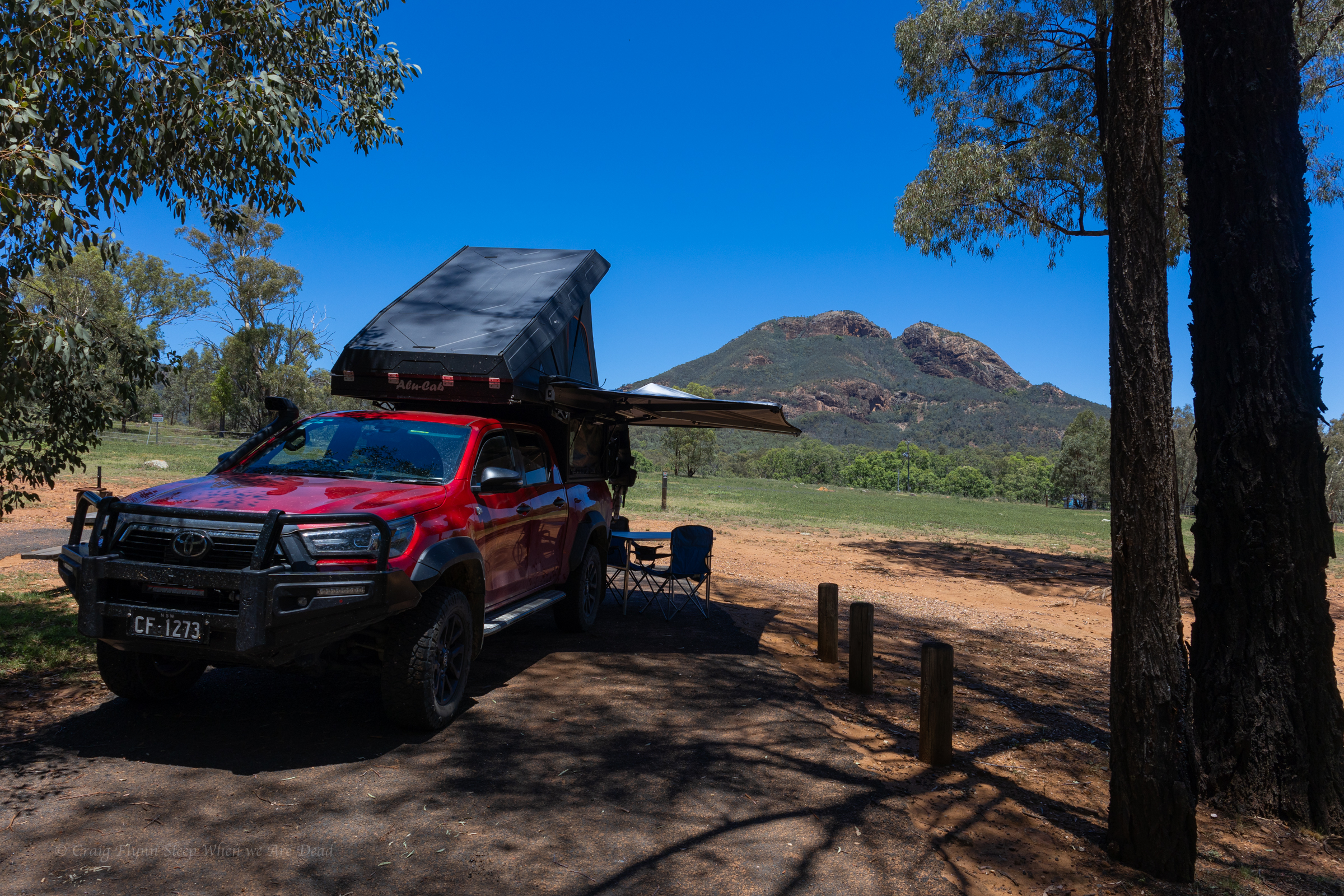
We pull into camp. We had picked our site based around the morning view
All set for the view
It took about an hour, though for the shade to disappear and we begged a change of site to find afternoon shade.
The afternoon is spent having a short section of song echo over and over and over and over.
It was a bot weird, at first I thought the grounds keep really likes his teeny bop but I go for a walk and there’s a K-pop or TikTok or whatever the kiddies call themselves these day <Old man shakes fist at Cloud> perfecting their dance moves to the song.
We are pretty much the only ones in the entire camp ground so good on them say I.
Stil,l I do my best to get into their background and ape their moves. It’s how I roll.
Anyhoo
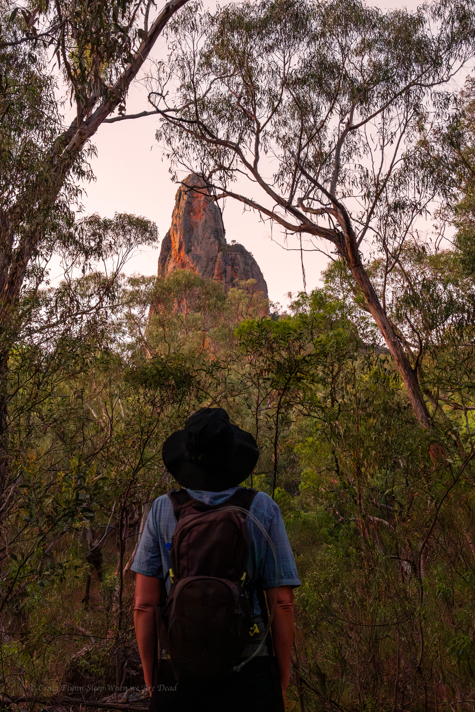
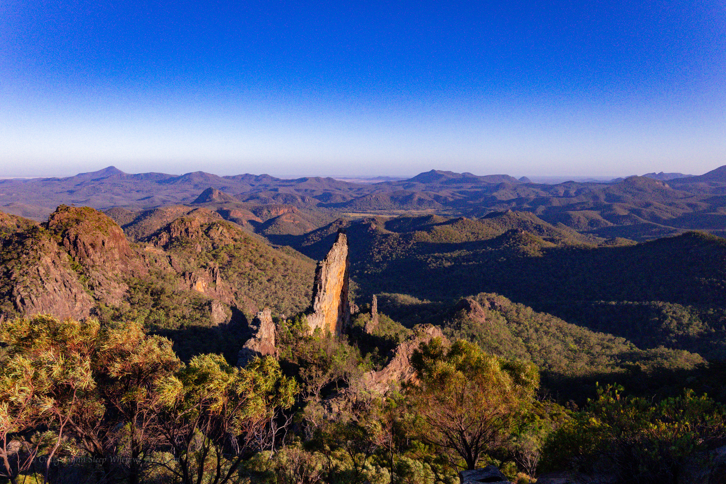
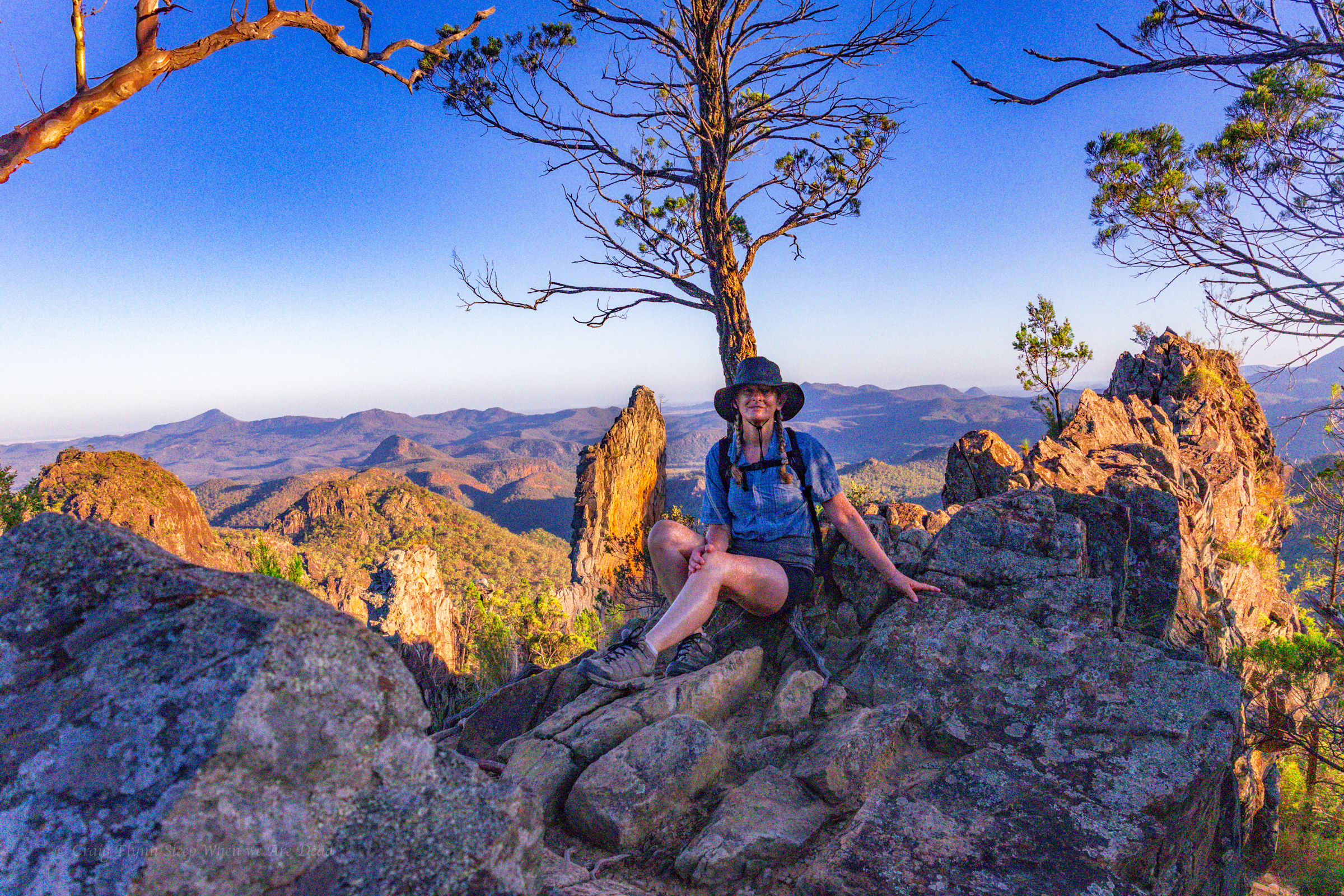
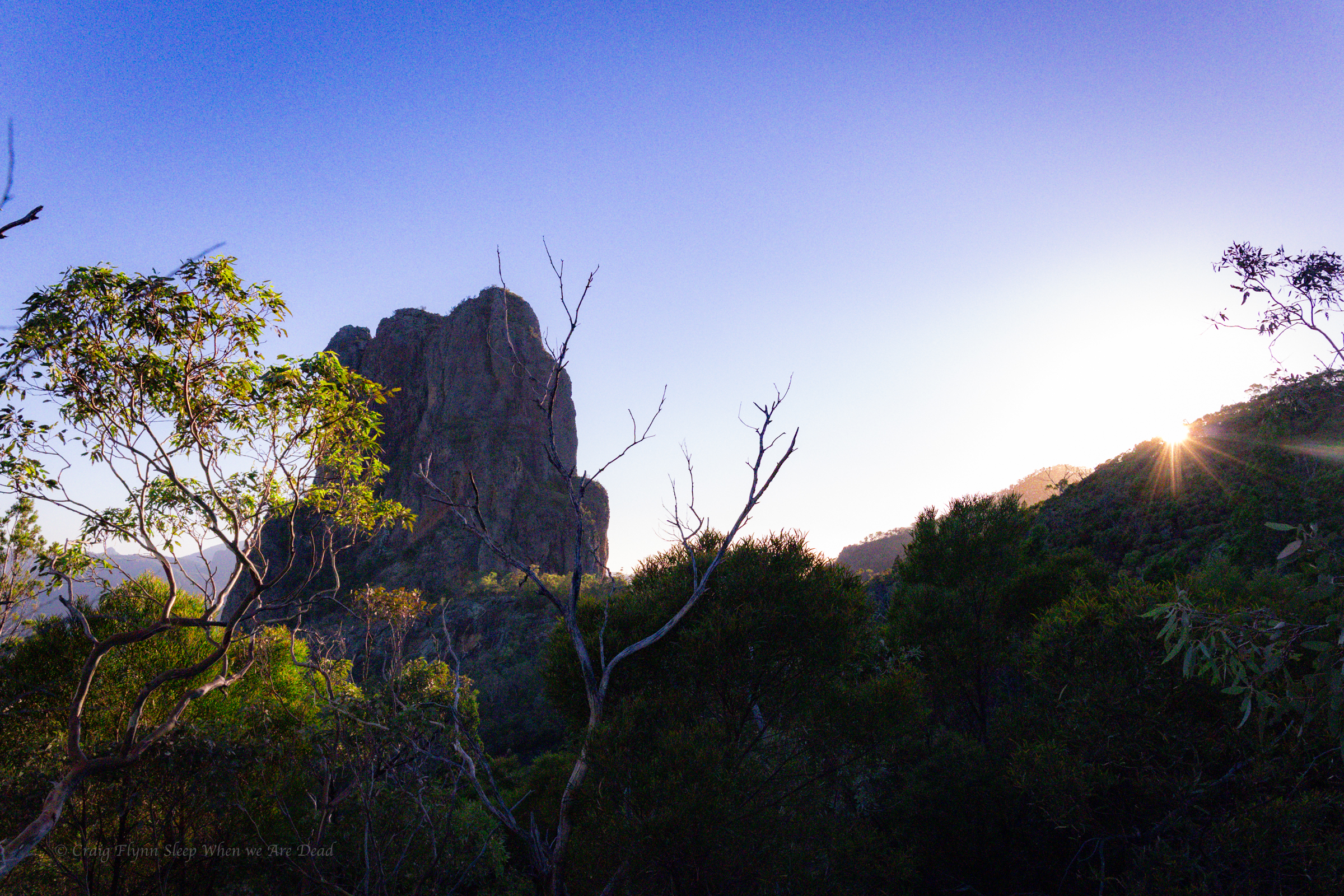
We up at sparrows fart and hit the trail at about 4.45am
It’s a lovely morning for a walk.
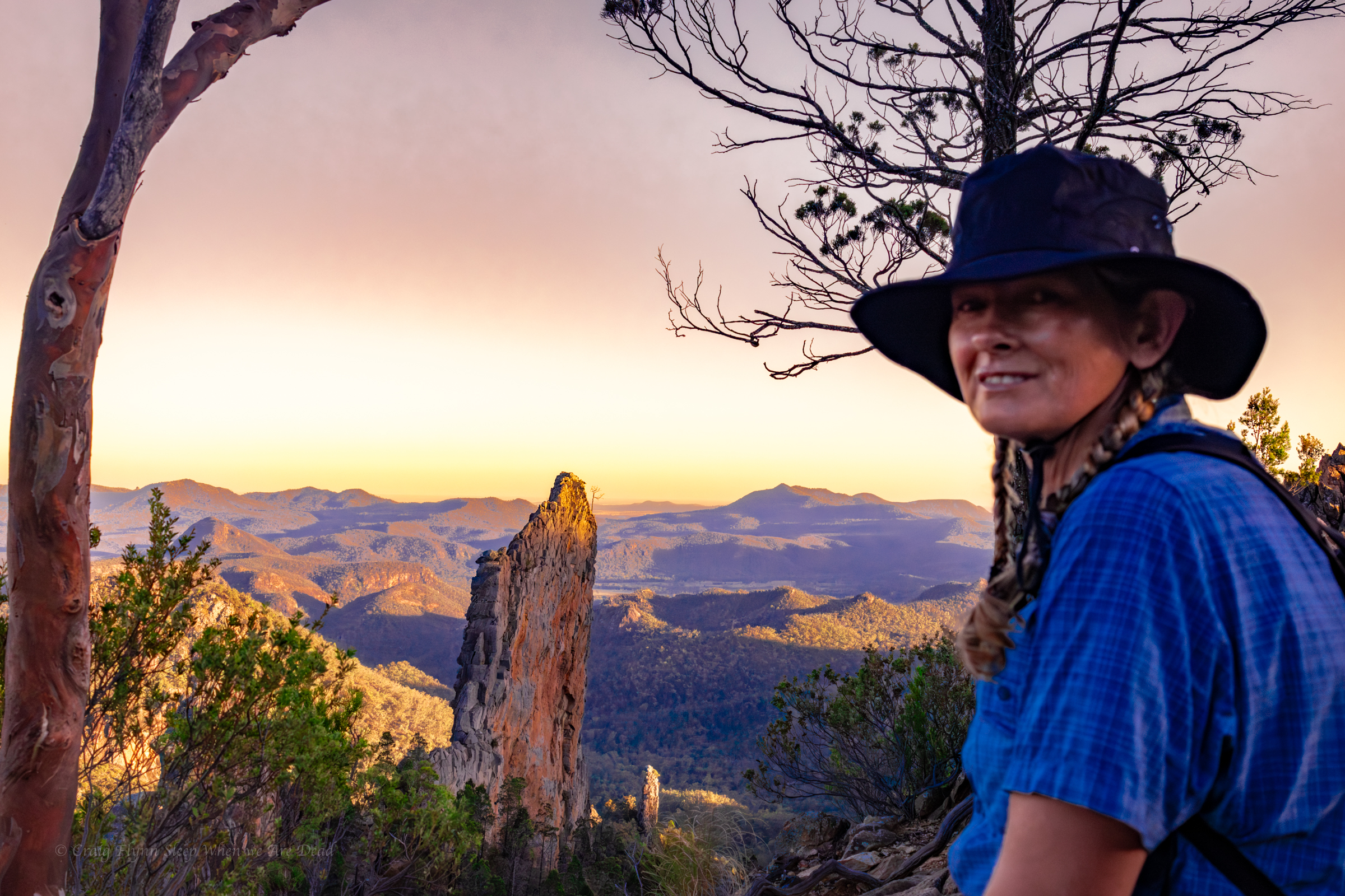
and the first of the pillars pops into view just as the sun lightens the sky and Kylie some how turns into Dicky Knee
Are you thinking what I am thinking?
yes, I just made a Hey Hey its Saturday reference…
I apologise.
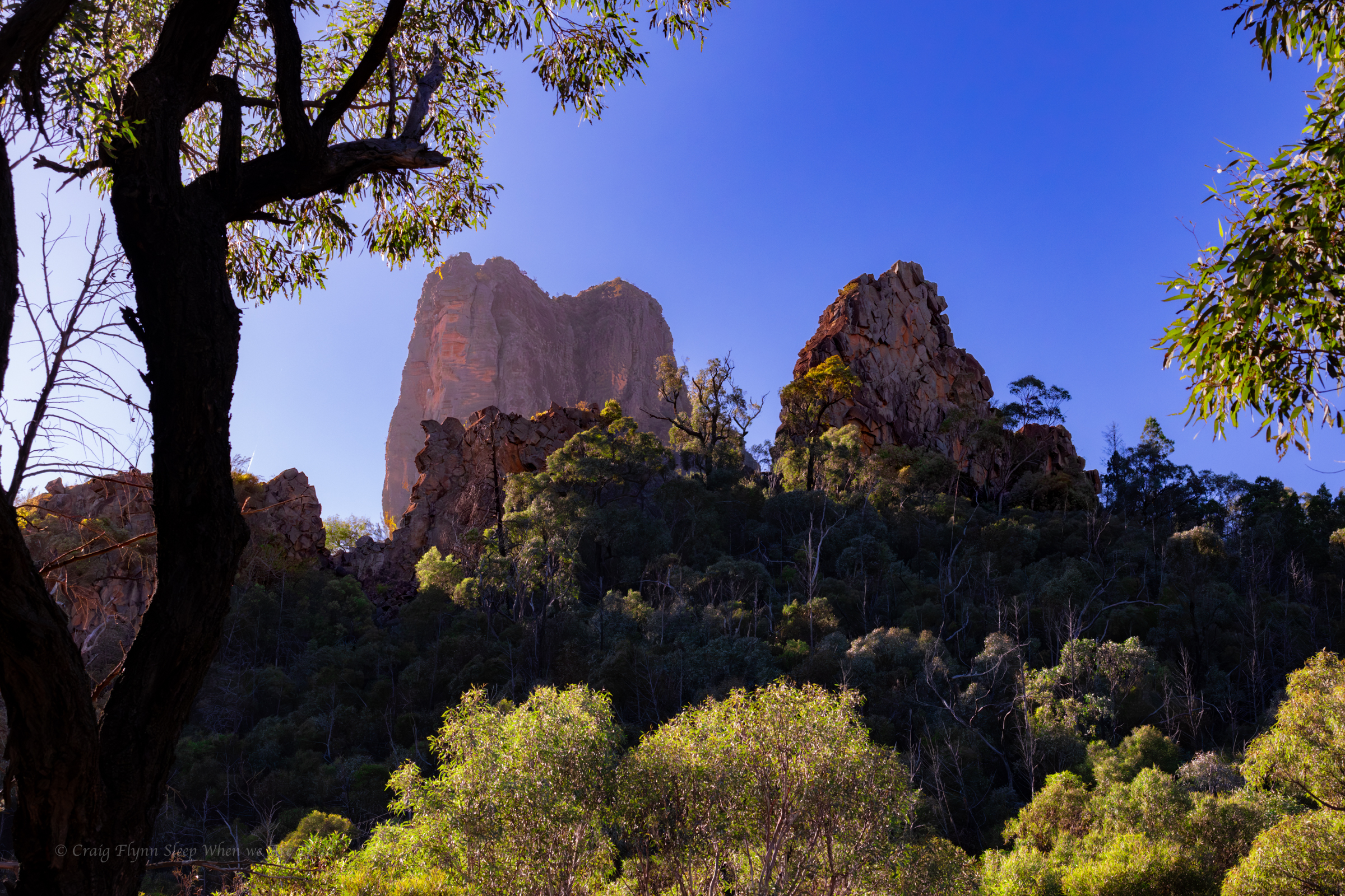
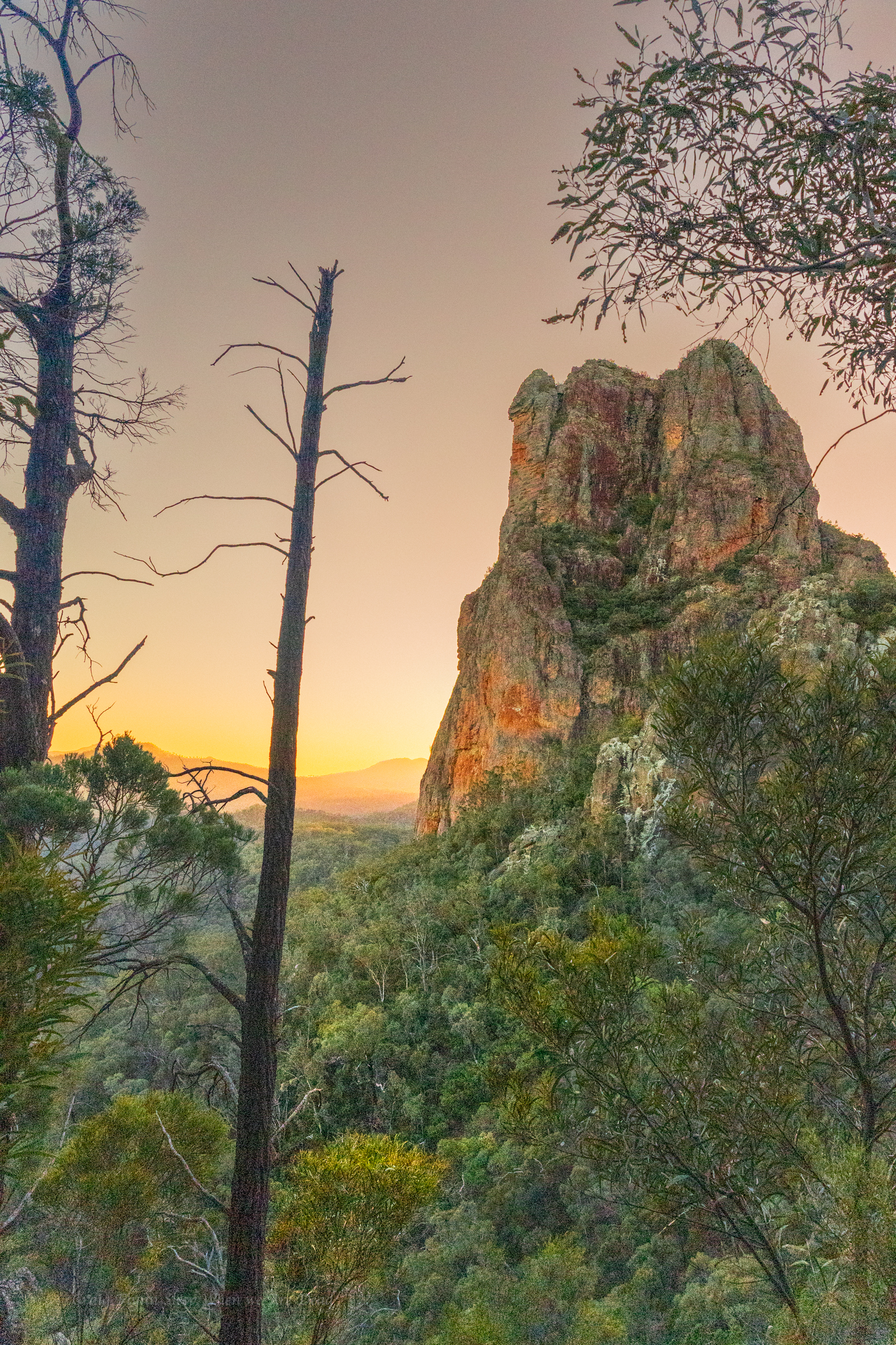
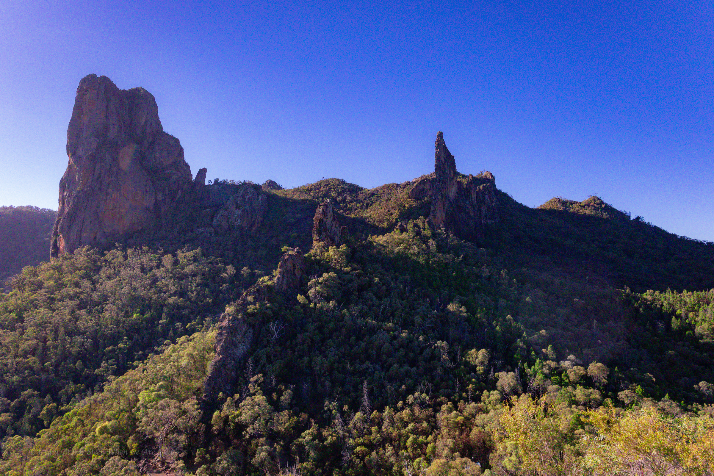
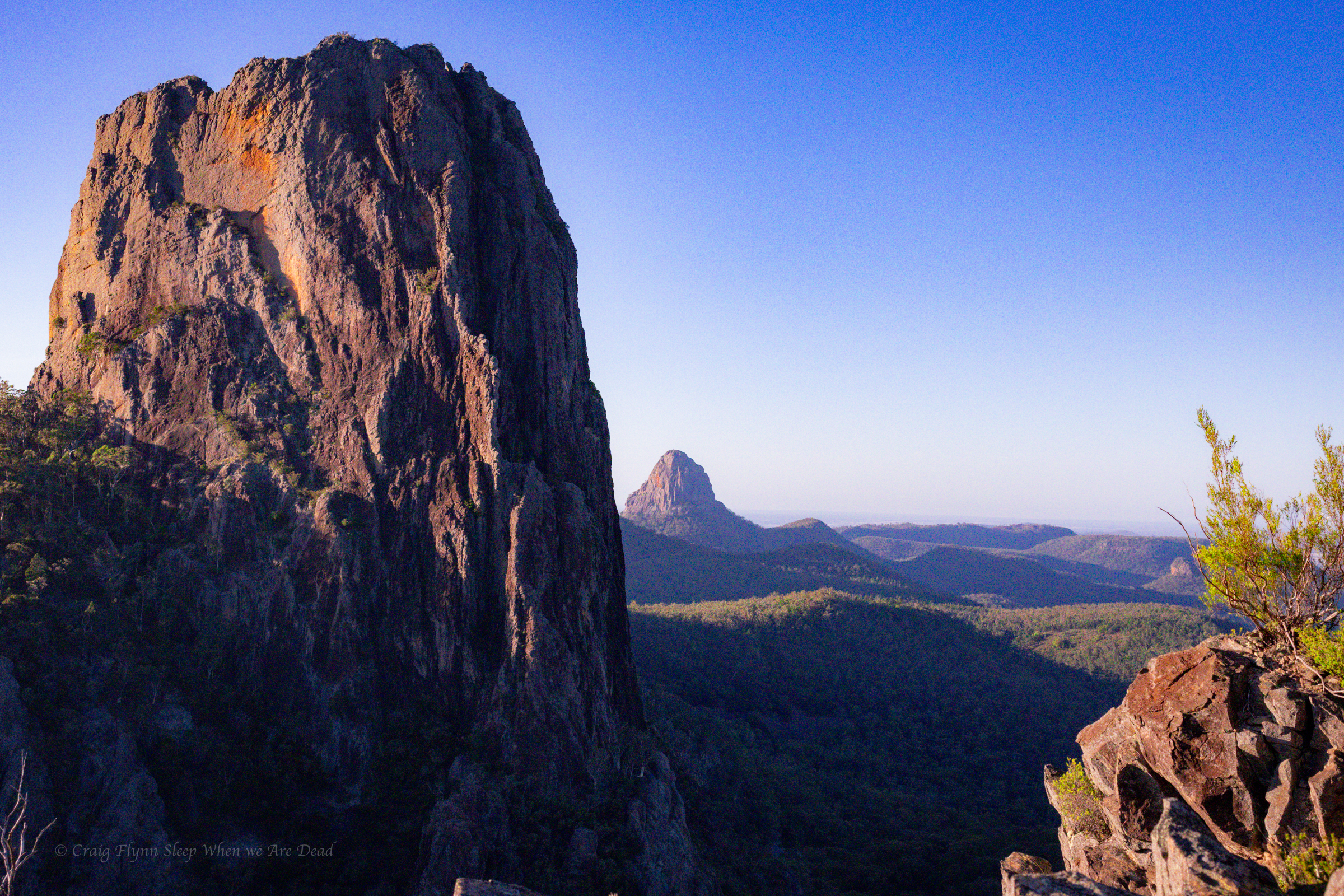
and the views keep coming
It’s actually really shit at cutting bread
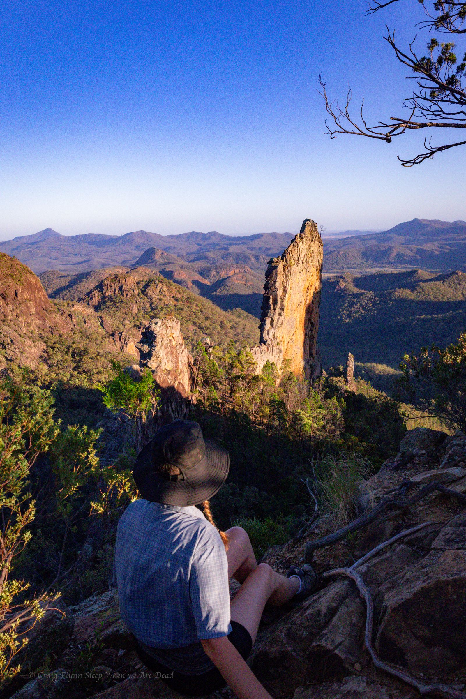
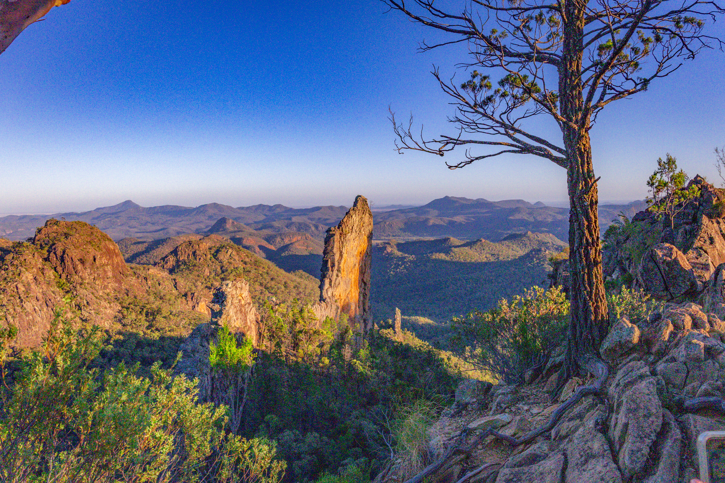
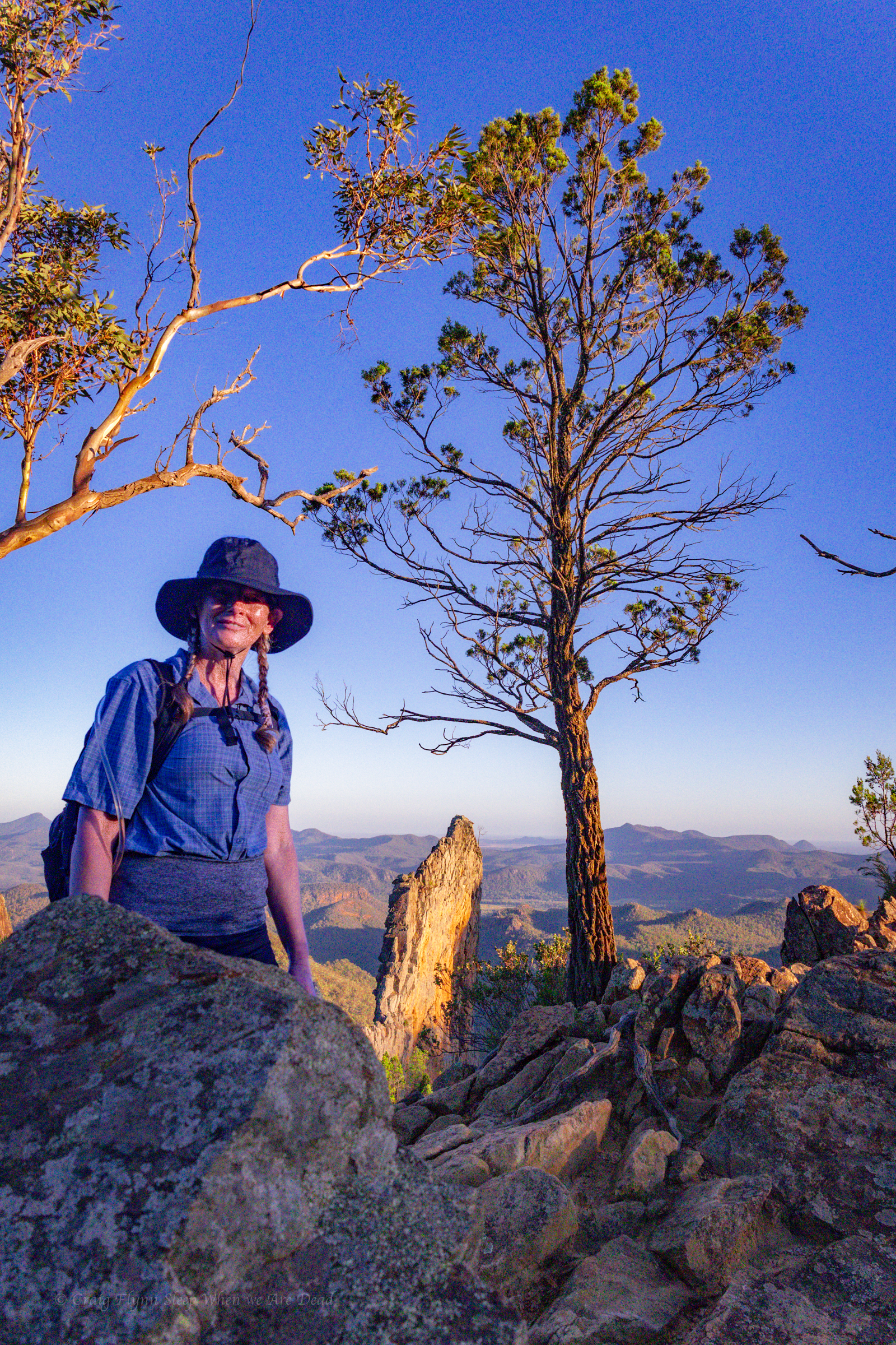
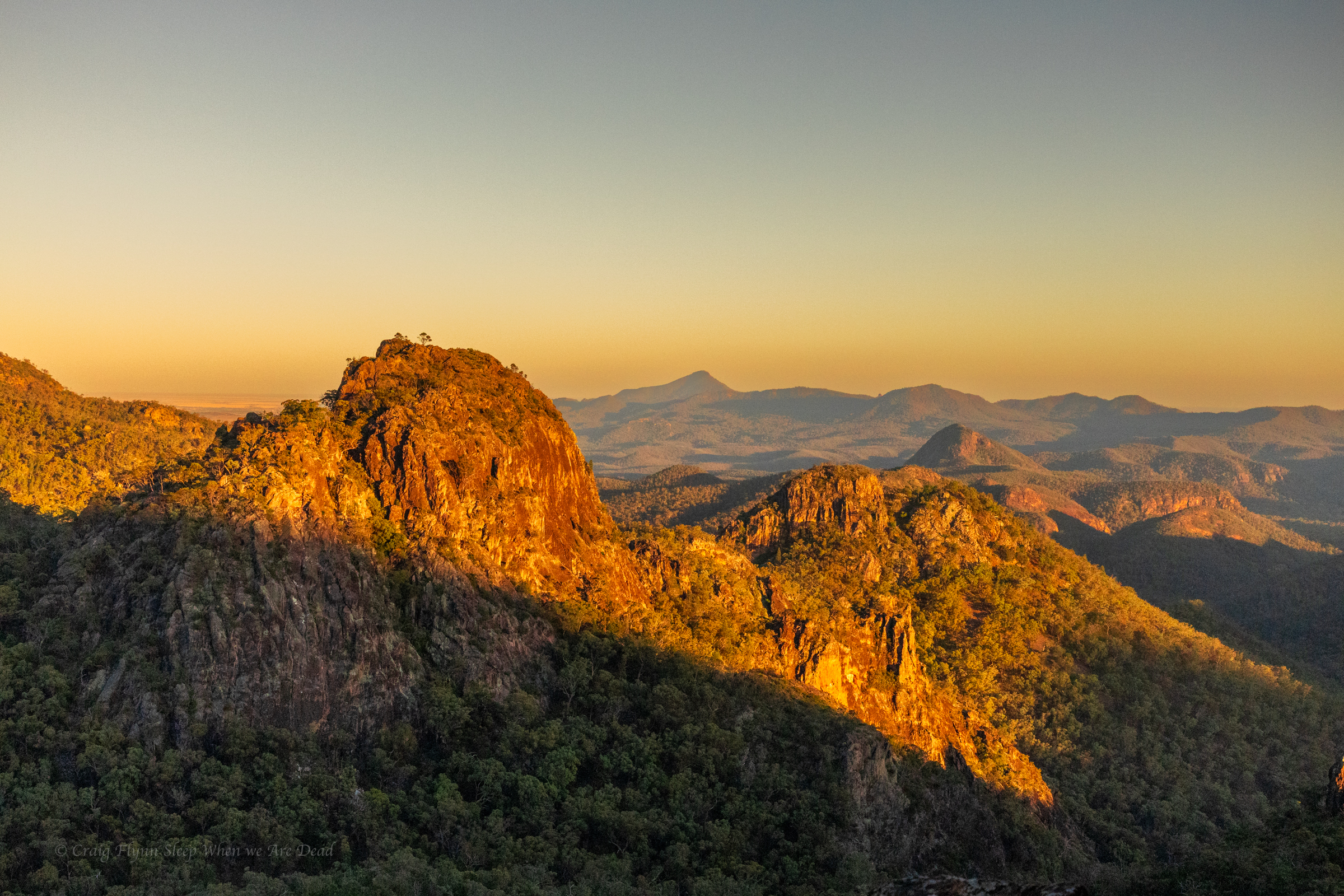
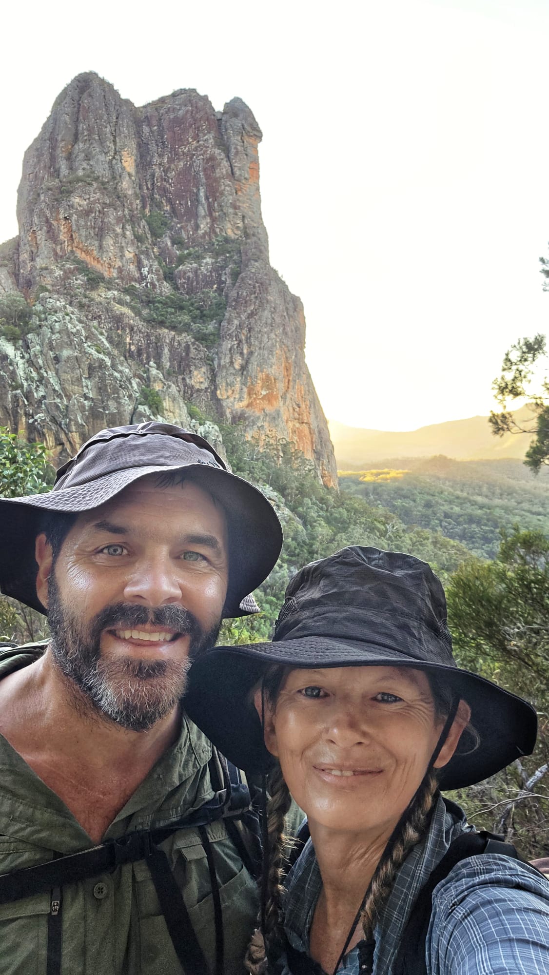
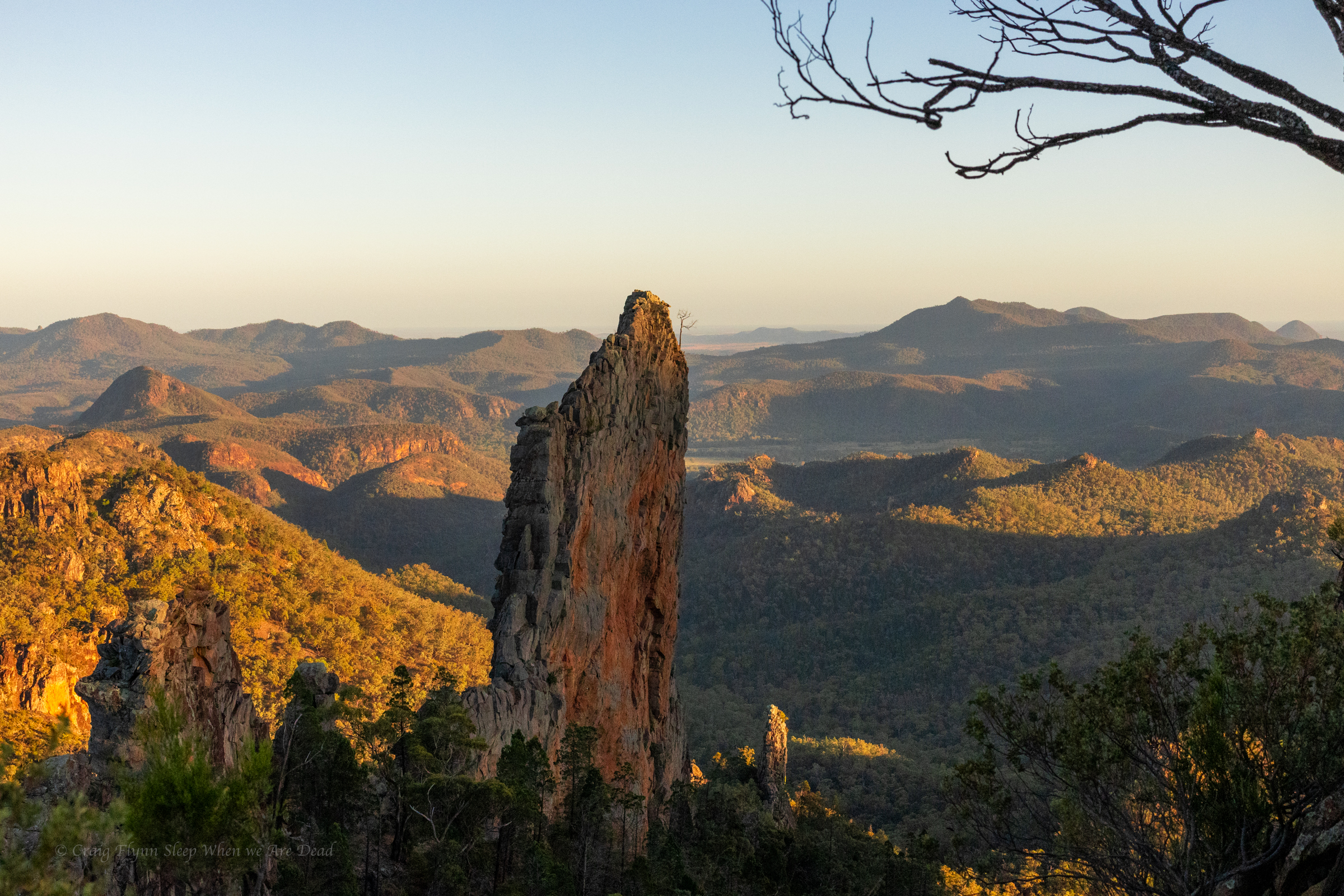
Sunrise and the Breadknife
We spend a bit of time here and a bit further up just watching the changing light and taking a gazillion photos
the light kept getting better
We are not sure how or why Kyle dressed as a school girl
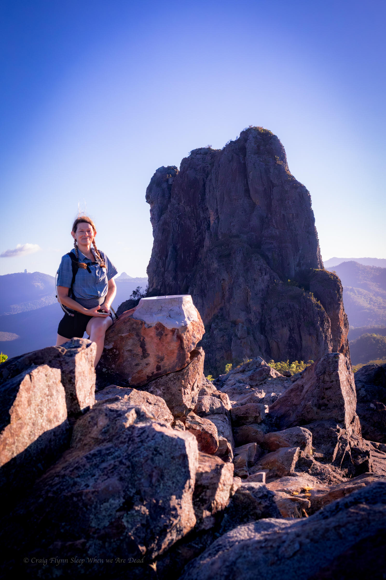
We scramble up to the tops, the last 100m or so of trail is under construction so it’s still a bit of a scramble.
Topping out the wind is intense.
We take the short cut back down past Balors hut and get back to camp just after 9.
Another hot day poking around town and that brings a close to our epic first road trip in the Alucab
Over the years I’ve had a quiet giggle at the poor tourists hopelessly out of their way asking “is this the way to the campground at, um, New Ness.” their GPS’s having them very confused.
Today I gained a deeper understanding for those poor souls.
It’s pronounced “War” Gorge, said the amused cowcockie we waved down to ask where the hell are we. Turn left here and you’ll see the signs. he says but where did you come from?
I get ahead of myself. That came later.
We were doing a less than direct route from Cranky Rock to Waa Gorge as we wanted to use a free camp ground at Glacial Rocks to give us access to both Waa Gorge and Sawn Rocks without too much back tracking.
The road in to the Gorge from this end was touted as 4wd and fair weather only so we wanted to swing by the camp to see if it was suitable and make sure the road between was doable.
The camp looked great and we continued on. GSP signal was lost.
We get a couple of bars of signal just down the road and it screams to turn right.
Veering onto Terrergee road the signs matched what we were expect, other than not mentioning the Gorge, “Road Suitable in dry weather only.”
But the road was a lot better than expected.
Must have been recently graded, said we, if this is the rough road people whine about on trip advisor…. We should have shut up.
The road takes us across the top of some beautiful county and then down steeply into the valleys. It did get a bit slippy on the descents and you could see why it would be problematic in the wet.
So far so good.
Take the second left onto “Berrigal road” Says the nice lady in the GPS.
But the second road is signposted “Haven Home road” or sumfink and it’s the only road sign we’ve seen all day and the road looks like a goat track.
We pass it.
Go back says the GPS lady.
We go back have another look. Doesn’t look right. We try the other option.
Go back says the GPS lady.
I get out my phone and check the GPS topo app. I could see where the roads go but Waa Gorge isn’t marked and I’m not 100% sure where it is.
We take the goat track. It gets rougher and rougher.
There’s some dry creek crossing we need to engage 4wd for.
This is why we bought the ute. Says I
but it gets wilder.
Eventually GPS lady says, Turn left 100m ahead.
The left was even more over grown. I check the app again.
It opens out just through there but I’m 100% sure it’s private property.
Straight will skirt around the property boundary but add 18min to the drive.
Oh well we skirt around.
We are now in 4wd more than not.
It was a fun drive.
the road links us back onto Terrergee road, about a 5min drive further on from where the GPs insisted we turn off it earlier and still no signs for Waa Gorge.
We flag down a landcruiser coming the other way, the first car we’d see all day.
Um is this the way to “Wah” Gorge, say I sheepishly.
With a wry grin the afore mentioned conversation takes place.
The GPS took us down that road back there.
That bloody goat track!, it would have tried to take you across old mates property too.
I sense this isn’t his first of such encounters.
Anyhoo we are on the right track now. If the final little bit of bumpy road into the car park is what Tripadvisor folk are complaining about they don’t know what they are missing.
It’s 38°c as we pull into the car park.
By the way, it’s pronounced “War” gorge. 🙂
Sunscrees, hats, water, electrolytes, deep breath
Ok let’s head up. drink lots and if it gets too much say early and we’ll head back.
having suffered heat stroke and dehydration before I’m extra cautious in hot weather so we have a lot of water between us.
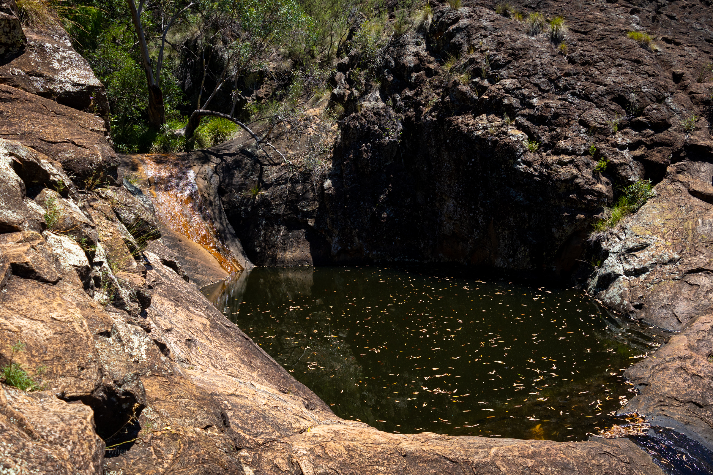
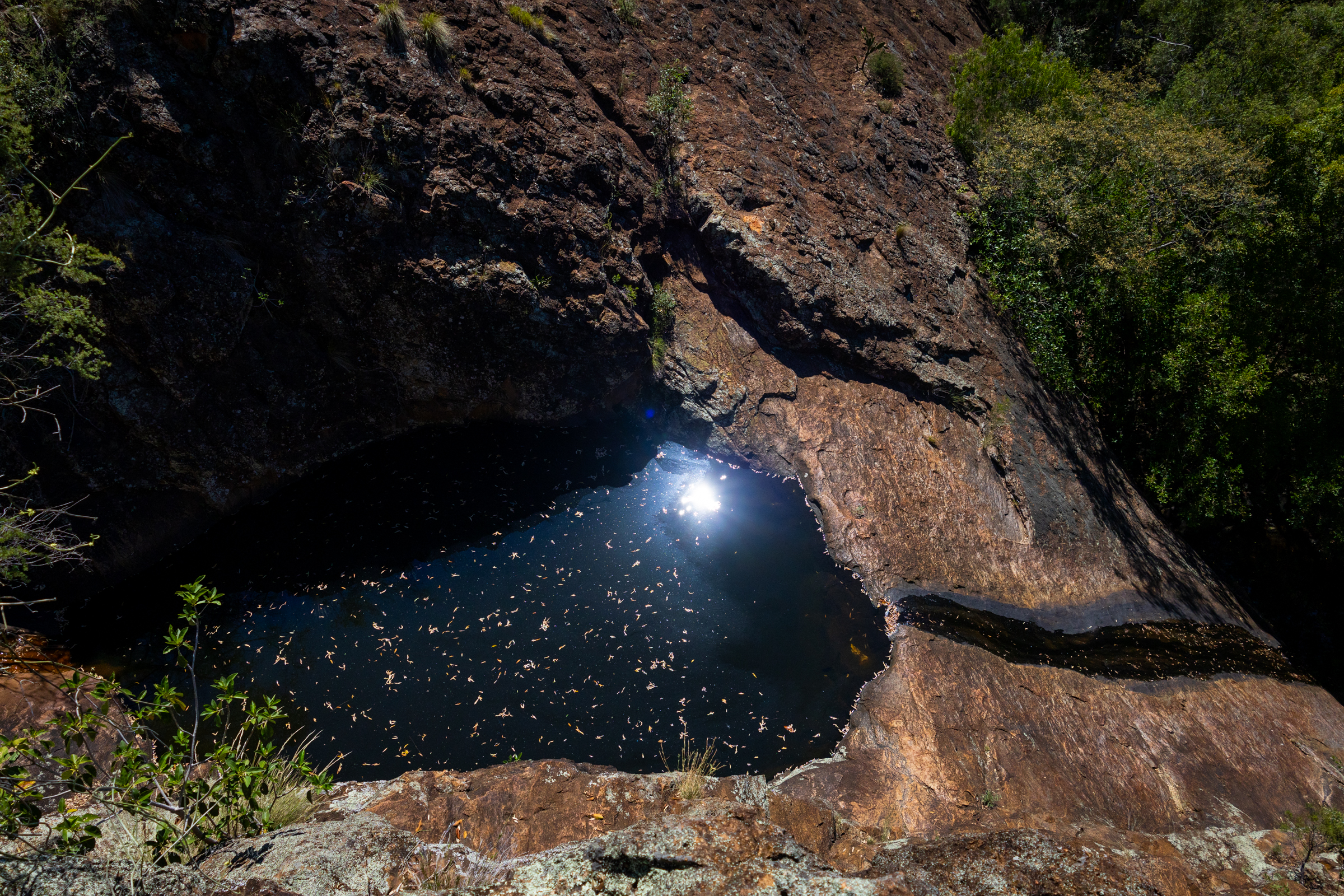
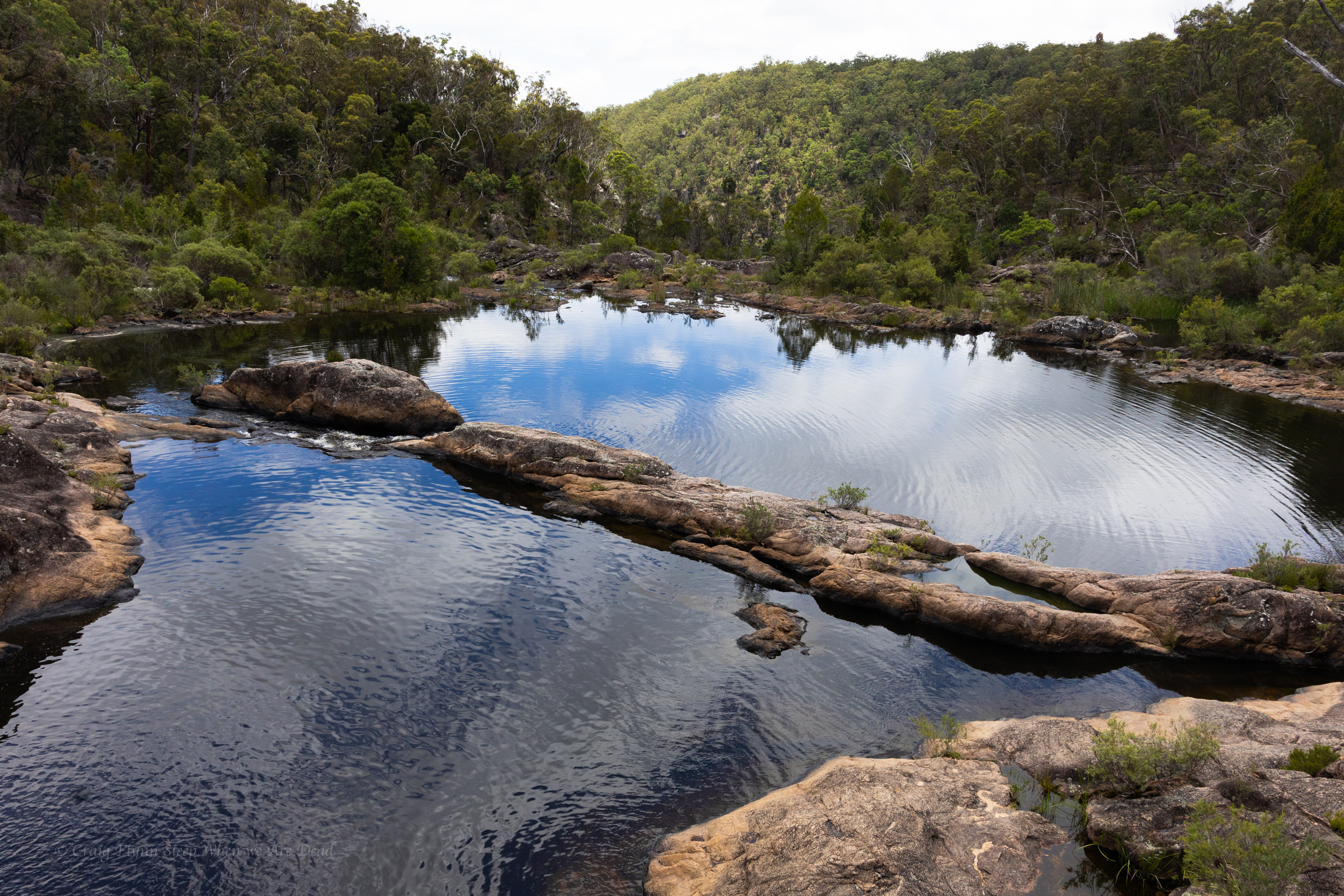
It’s a short walk up to the Mill-bullah water holes.
There is water in them but it has been in there a long time with no flush through to clean it out.
The top waterhole looks a little nicer but still stagnant.
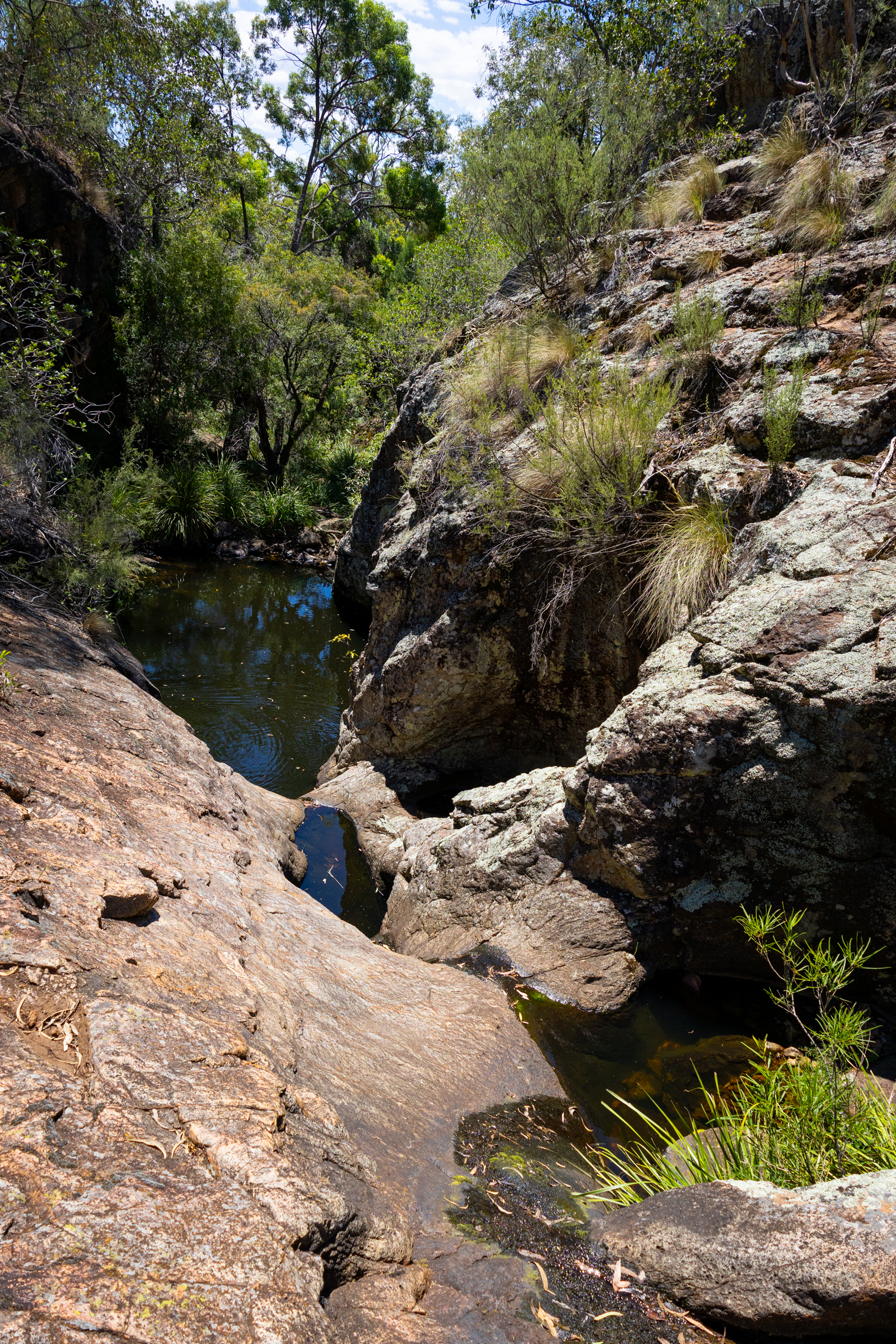
The constructed tourist trail ends here but a well used ad hoc trail leads up through the cliff line.
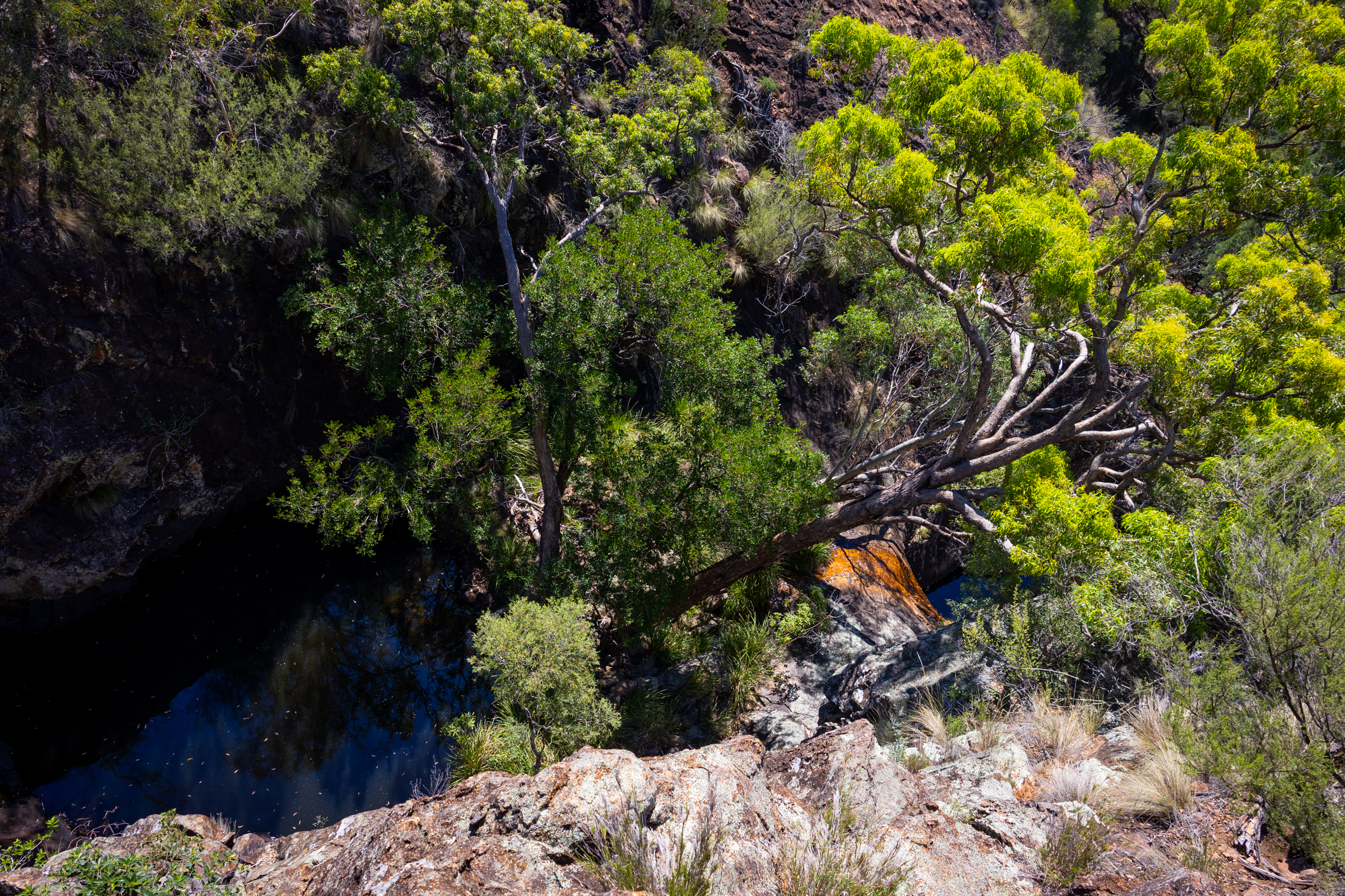
The track skirts above what looks like would be a fun little canyonette full of jumps and slides, in the right water flow
Unfortunately we are here in the middle of one of the driest summers we’ve had since 2019.
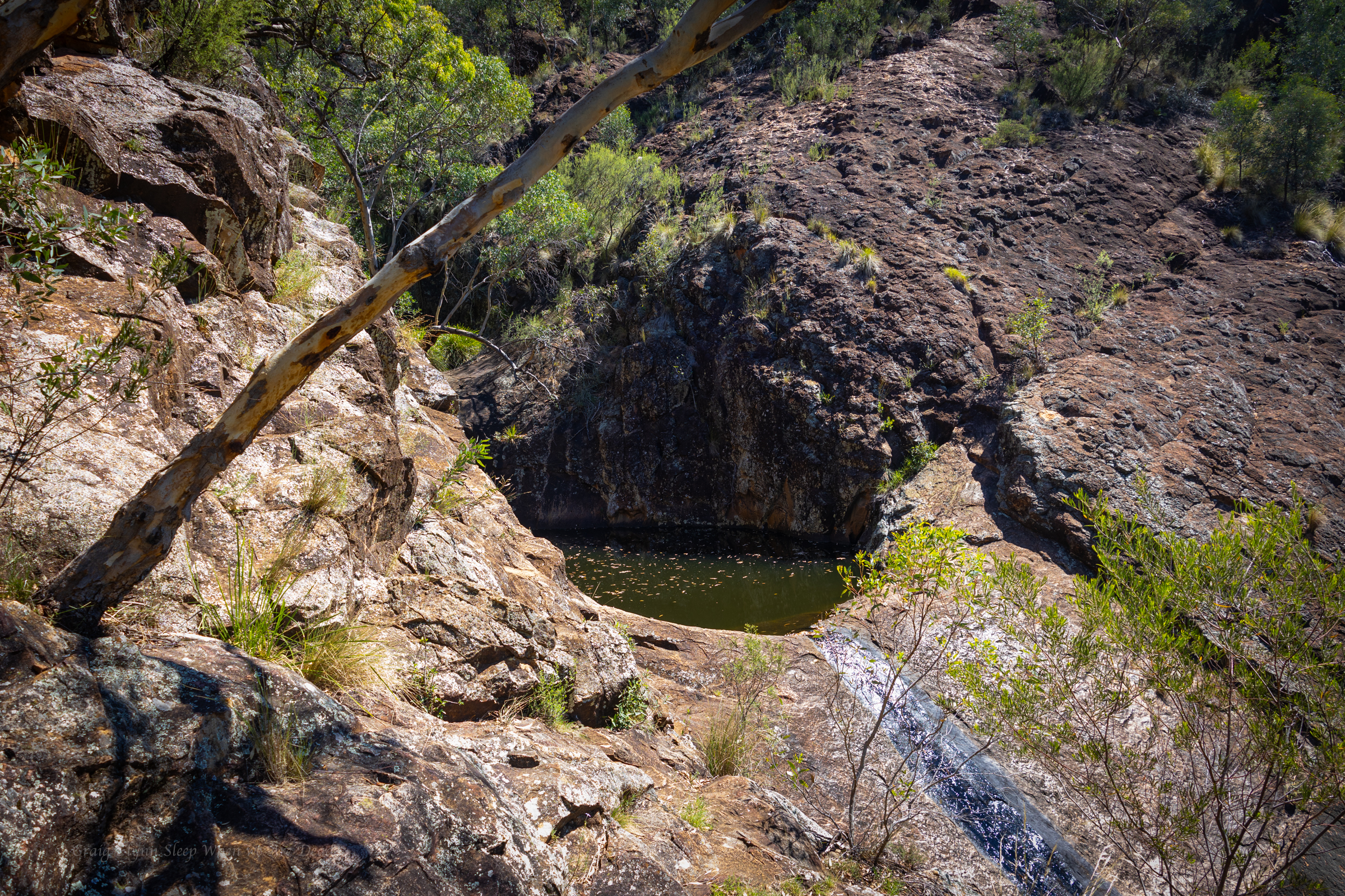
Above the canyonette the gorge is shaded but the heat still oppressive
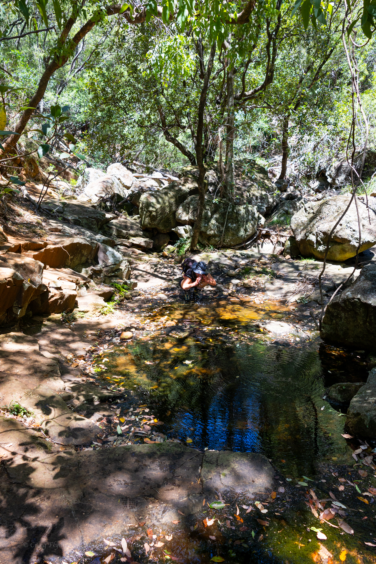
we find a clear pool to splash some water over us in an effort to cool off
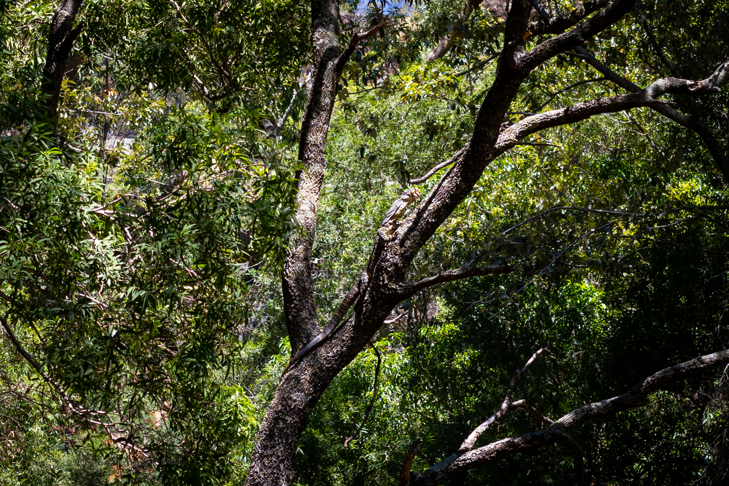
We continue up, disturbing this lace monitor with his mouth full of a water dragon sandwich
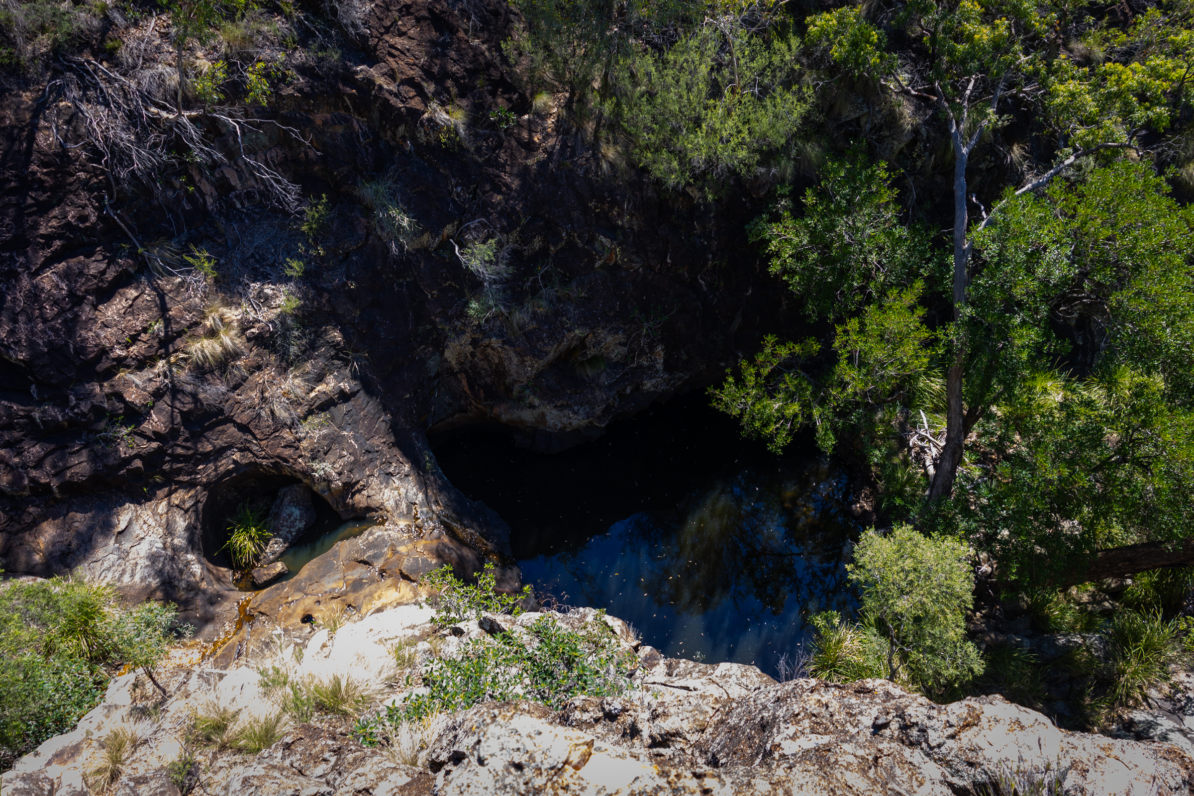
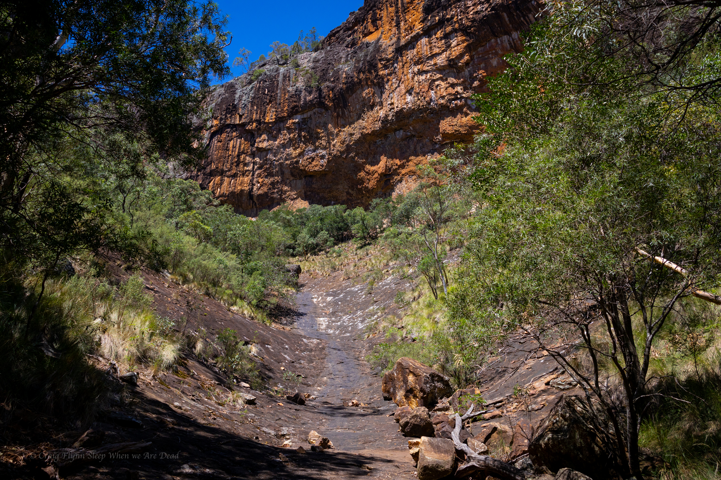
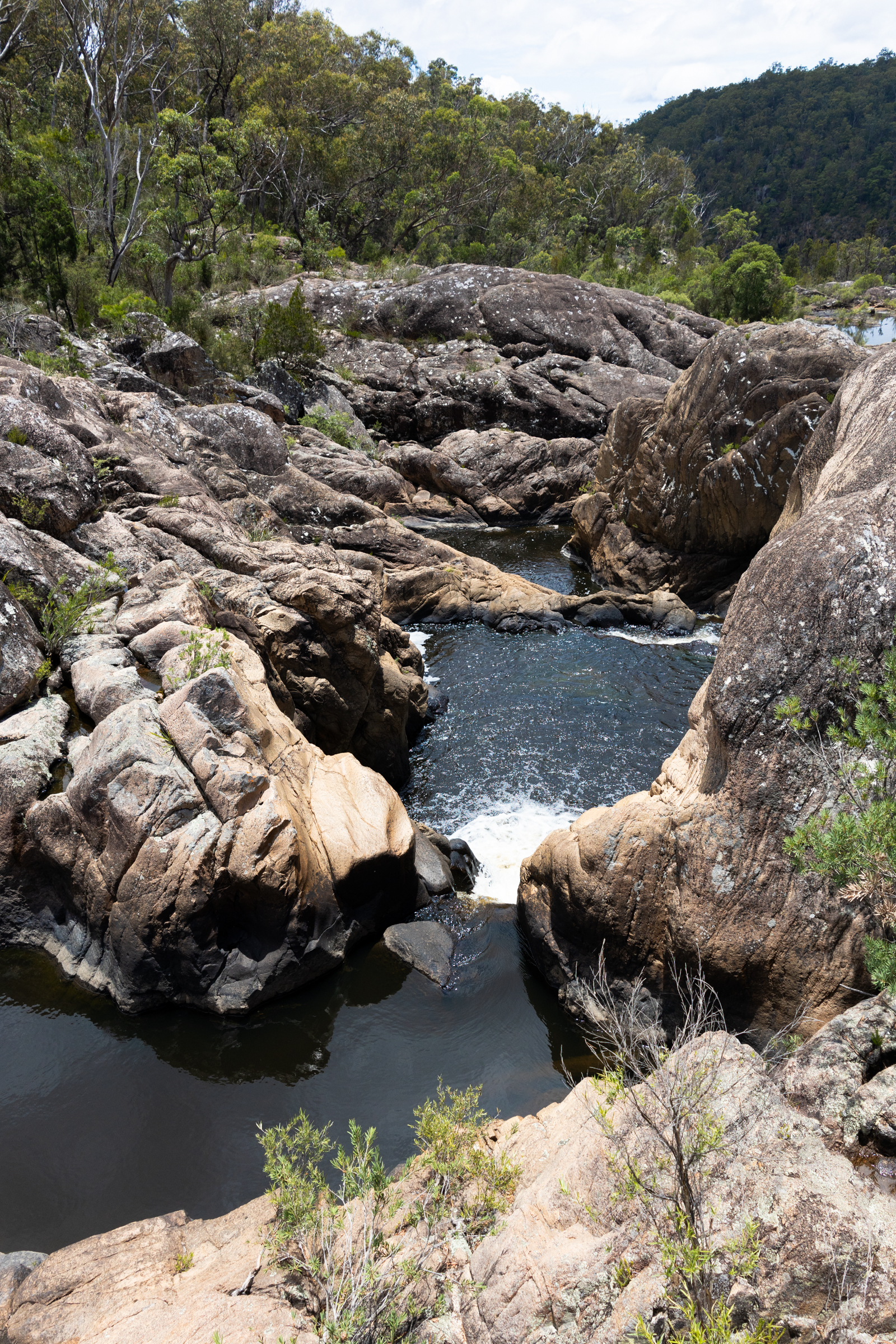
Finally we get to the junction. Left takes us to the big wall .
A dry cascade greets us.
I head up, Kylie waits in the shade. The heat blasting off the stone is next level
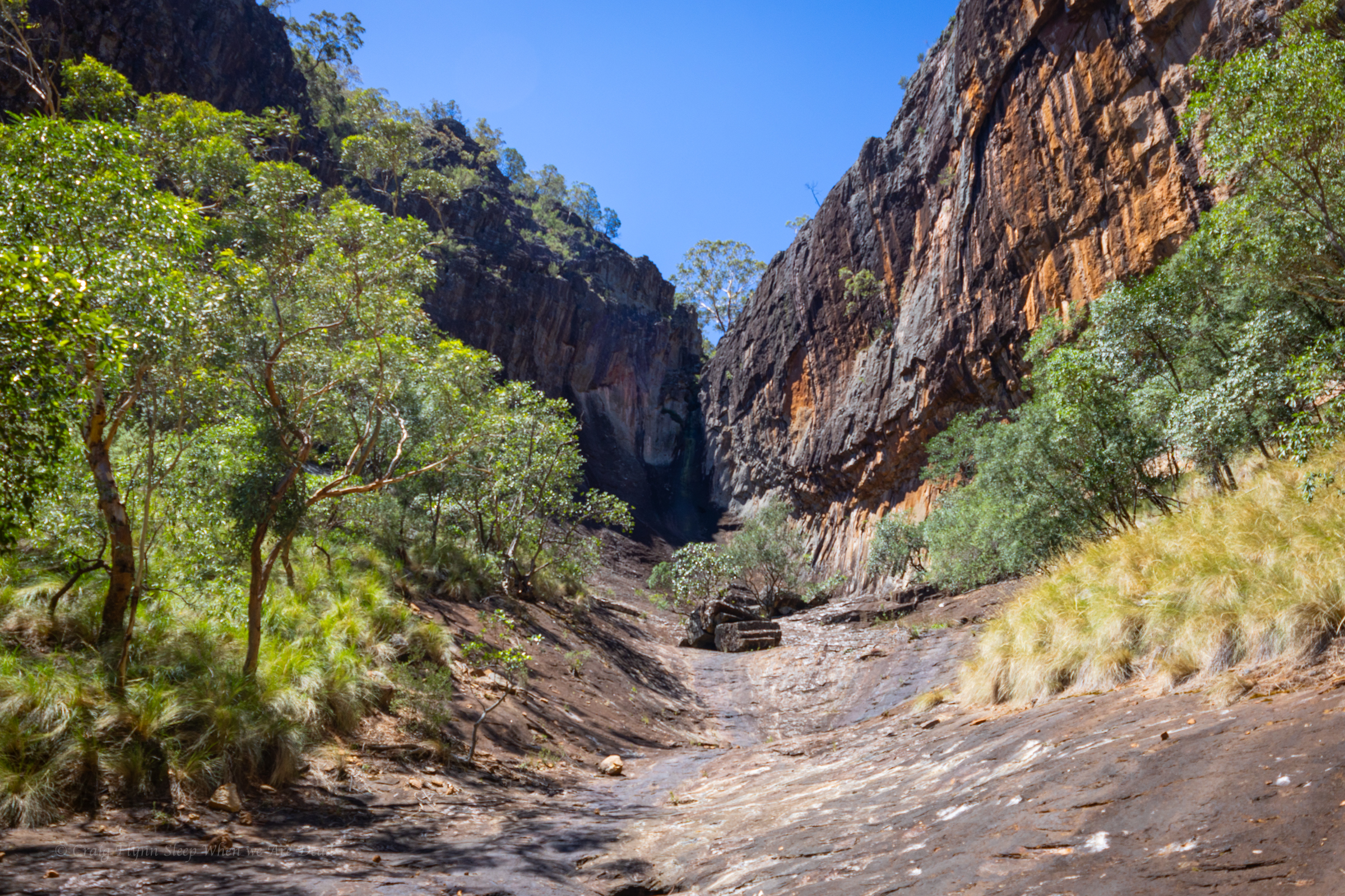
The top of the gorge is impressive
We had a permit to fly the drone for 30min here so I get it out and try my hand at flying again
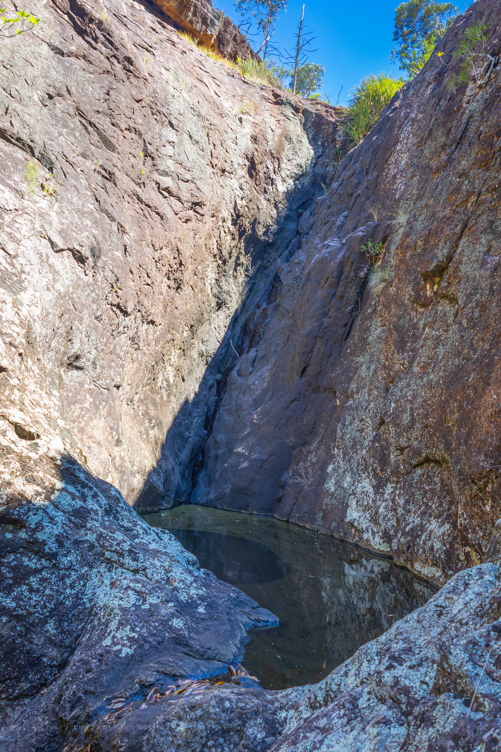
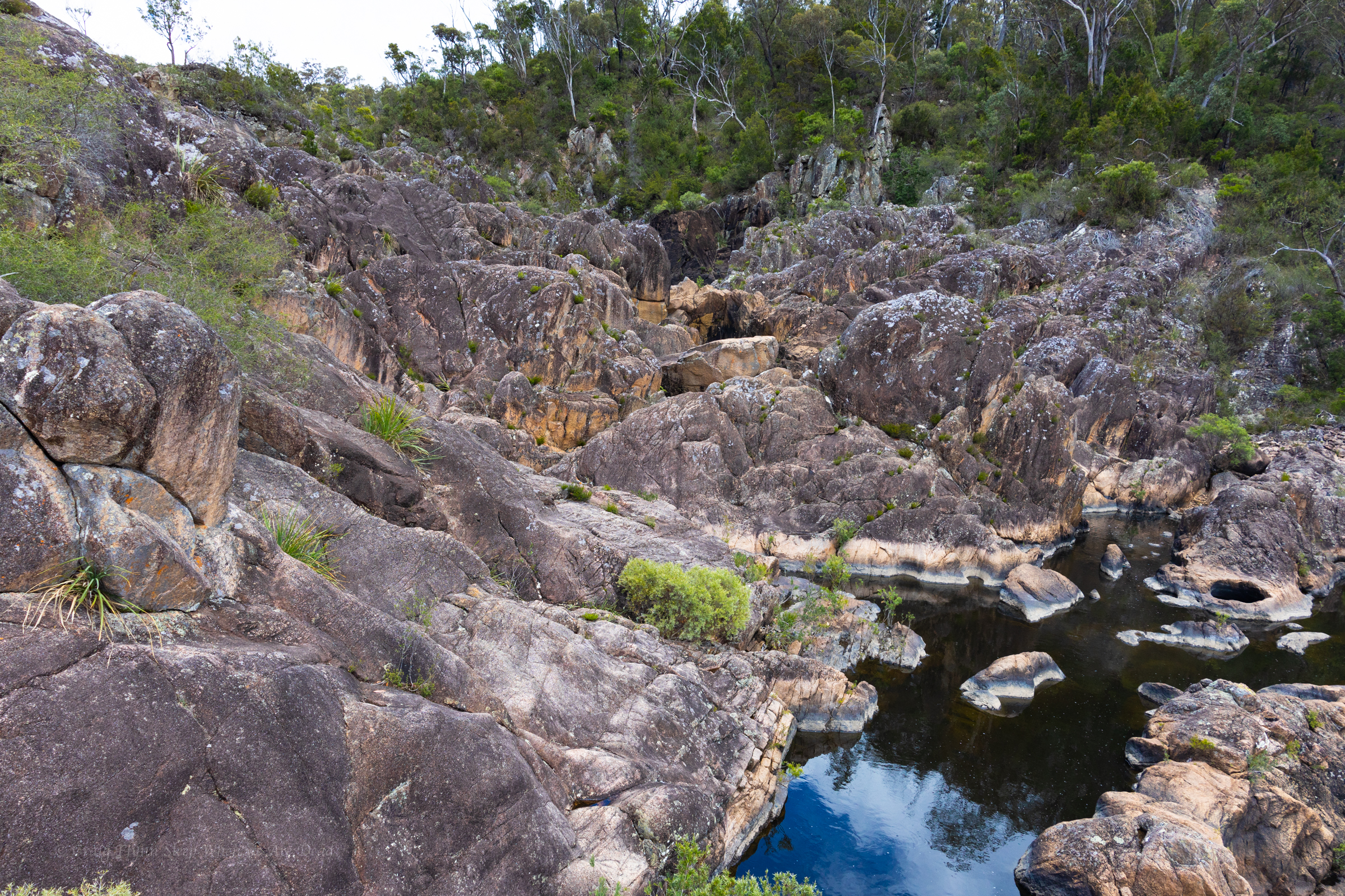
We slip back down to the junction, have a bite to eat and a big drink in the shade then explore up the other branch
another dry waterfall into a stagnant plunge pool greets us. It looks like there are some interesting levels above too. Definitely worth some exploration when things are cooler and wetter
We make our way back down to the car. And head back to the camp
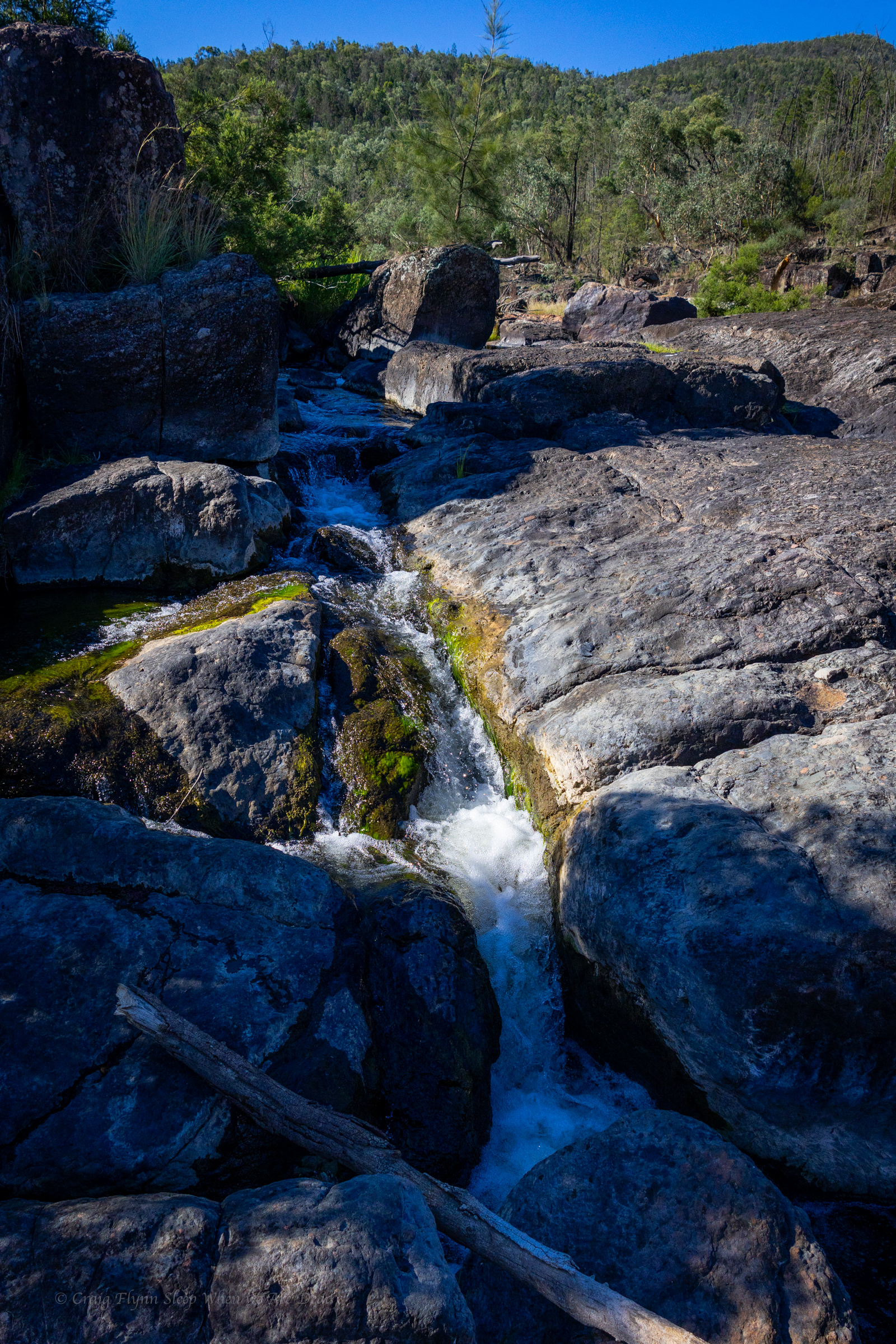
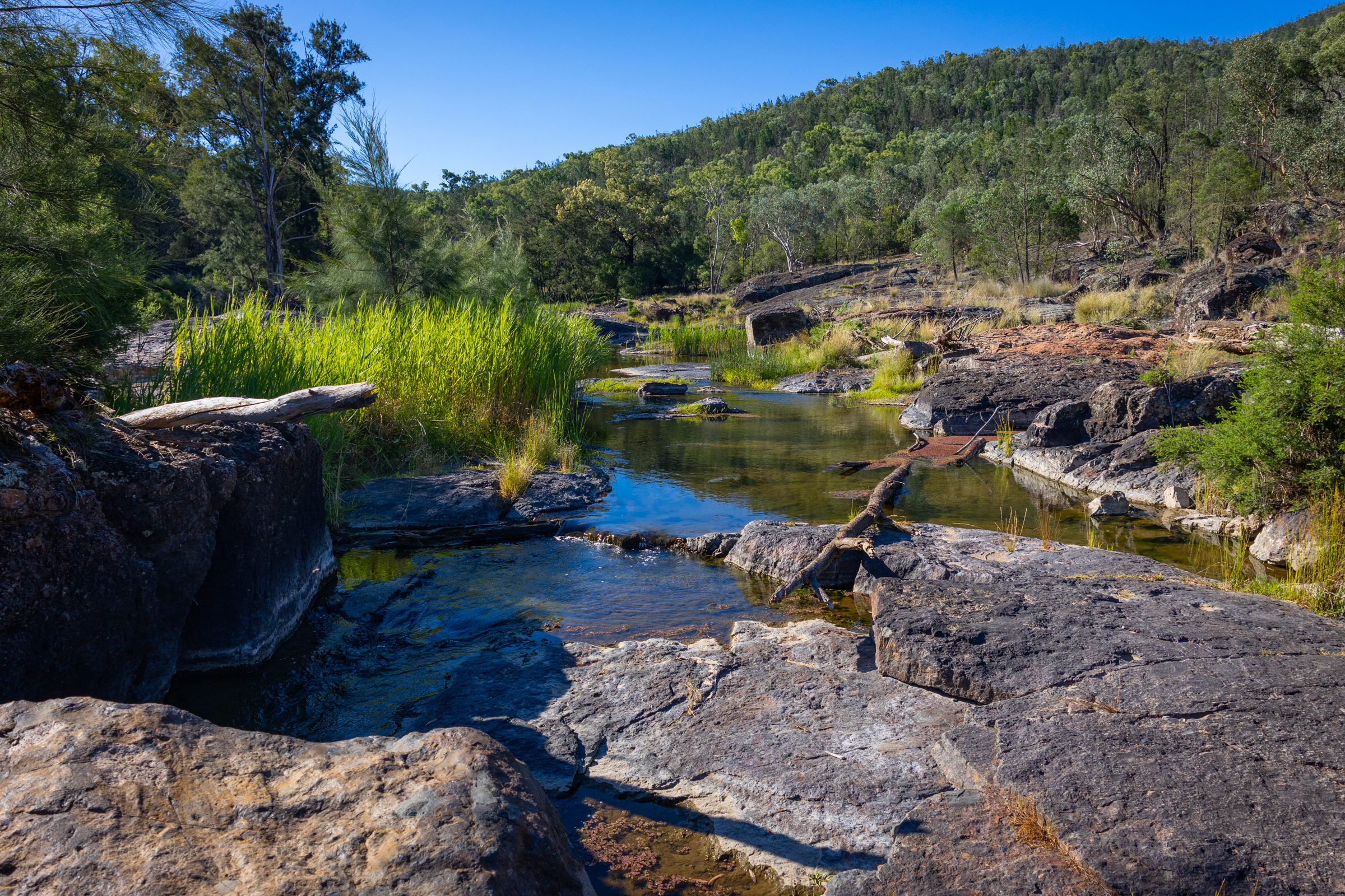
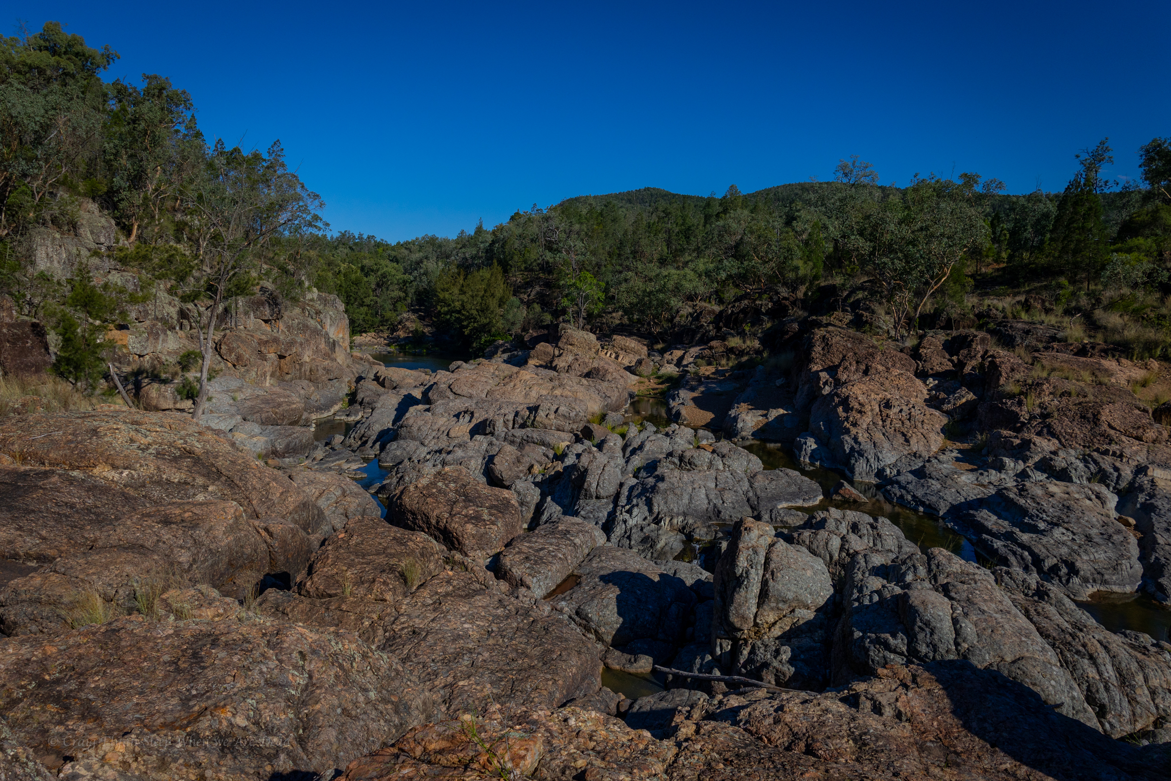
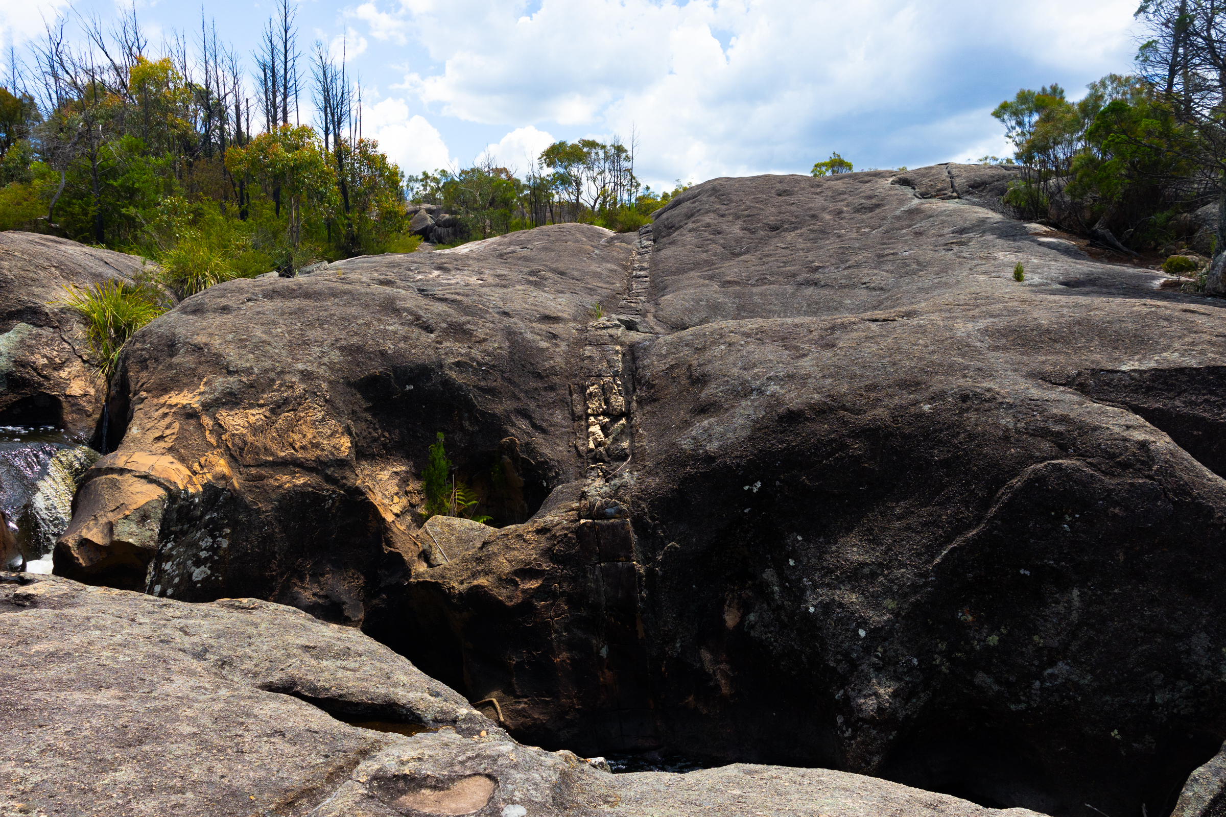
the Ancient Glacial Rocks site on Rocky creek is interesting. Superficially it looks like another granite lined gorge. A closer look and the rocks are different. You can see how they have been churned up, smashed together and dumped out.
Once again the river is running through agricultural land and wild goat are everywhere but once again it’s too hot to be picky so we cool off in the rapids and then settle in for the night.
The camp site is basic but has bins and toilets. It’s worth checking out the toilet signs for a giggle.
There a 2 other campers set up. Flat spots are at a premium but we manage to jag a flat spot in shade
Winning
We eat diner with the goats. Tomorrow we head to Sawn Rocks.
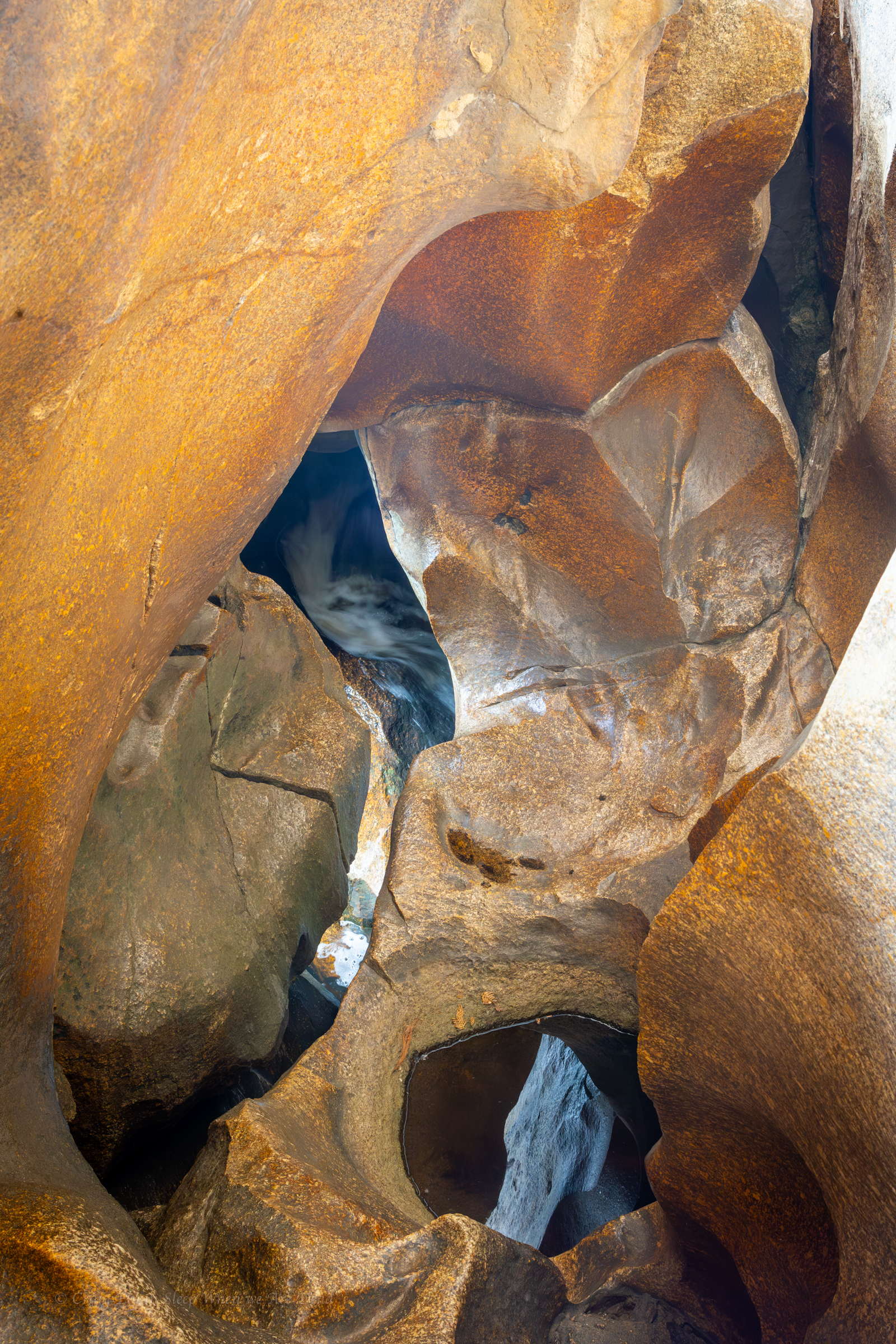
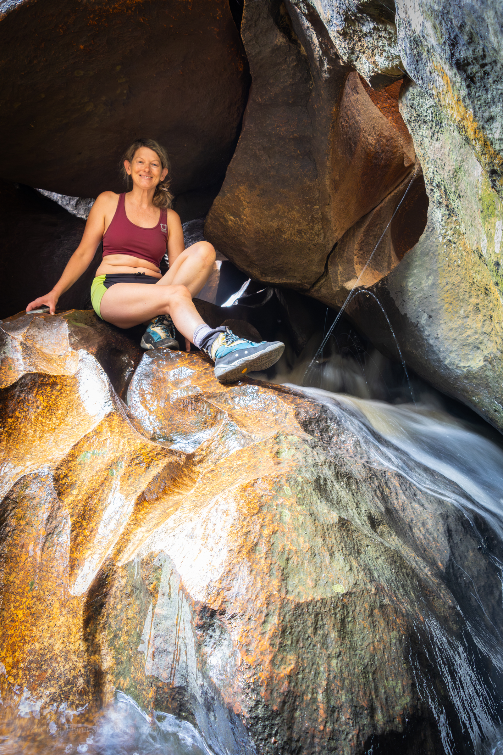
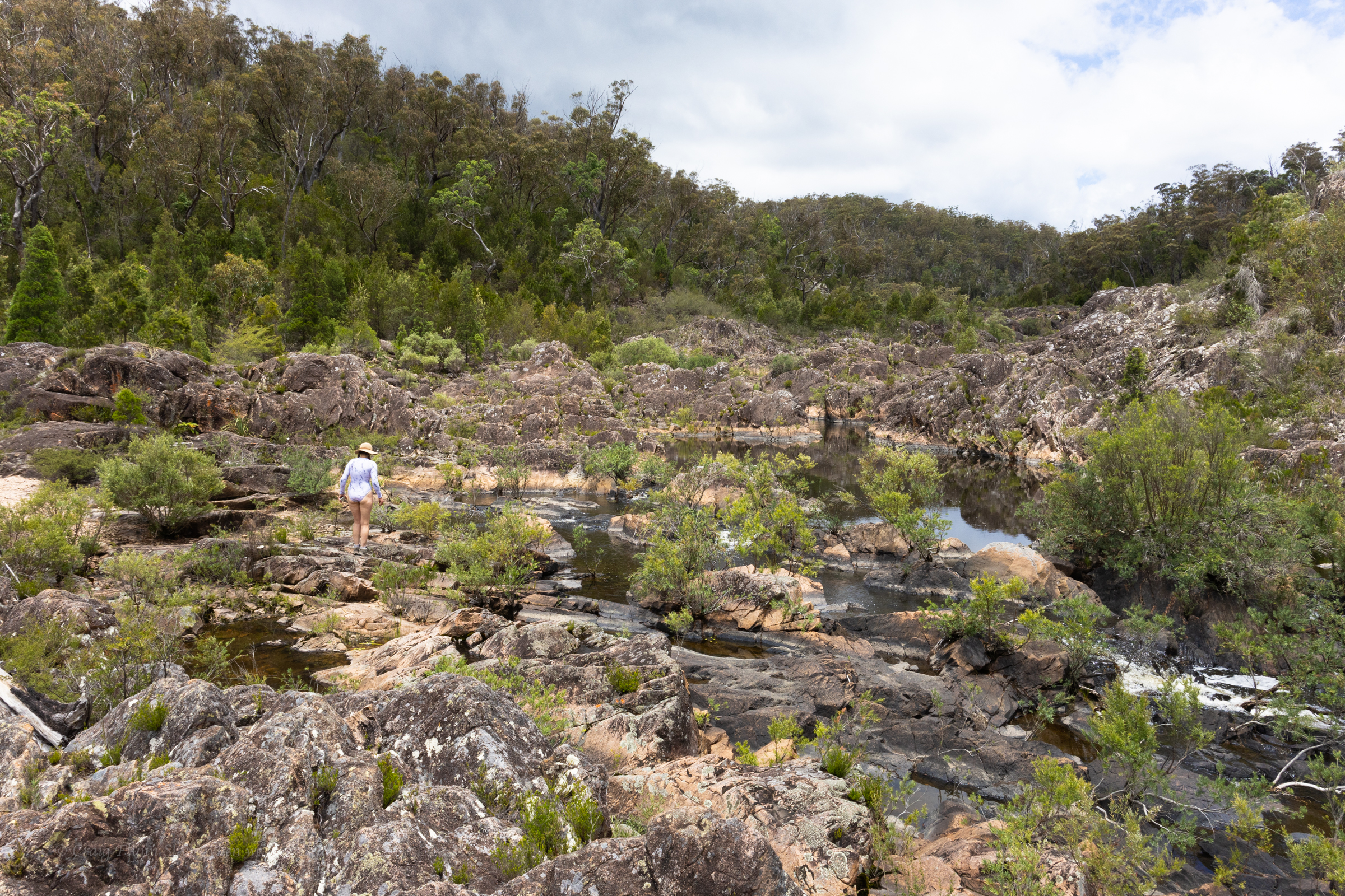
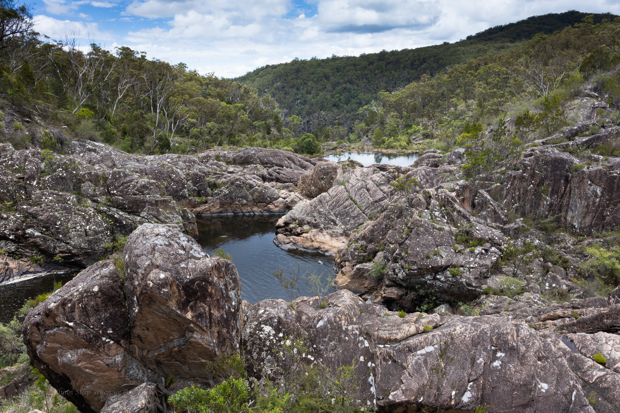
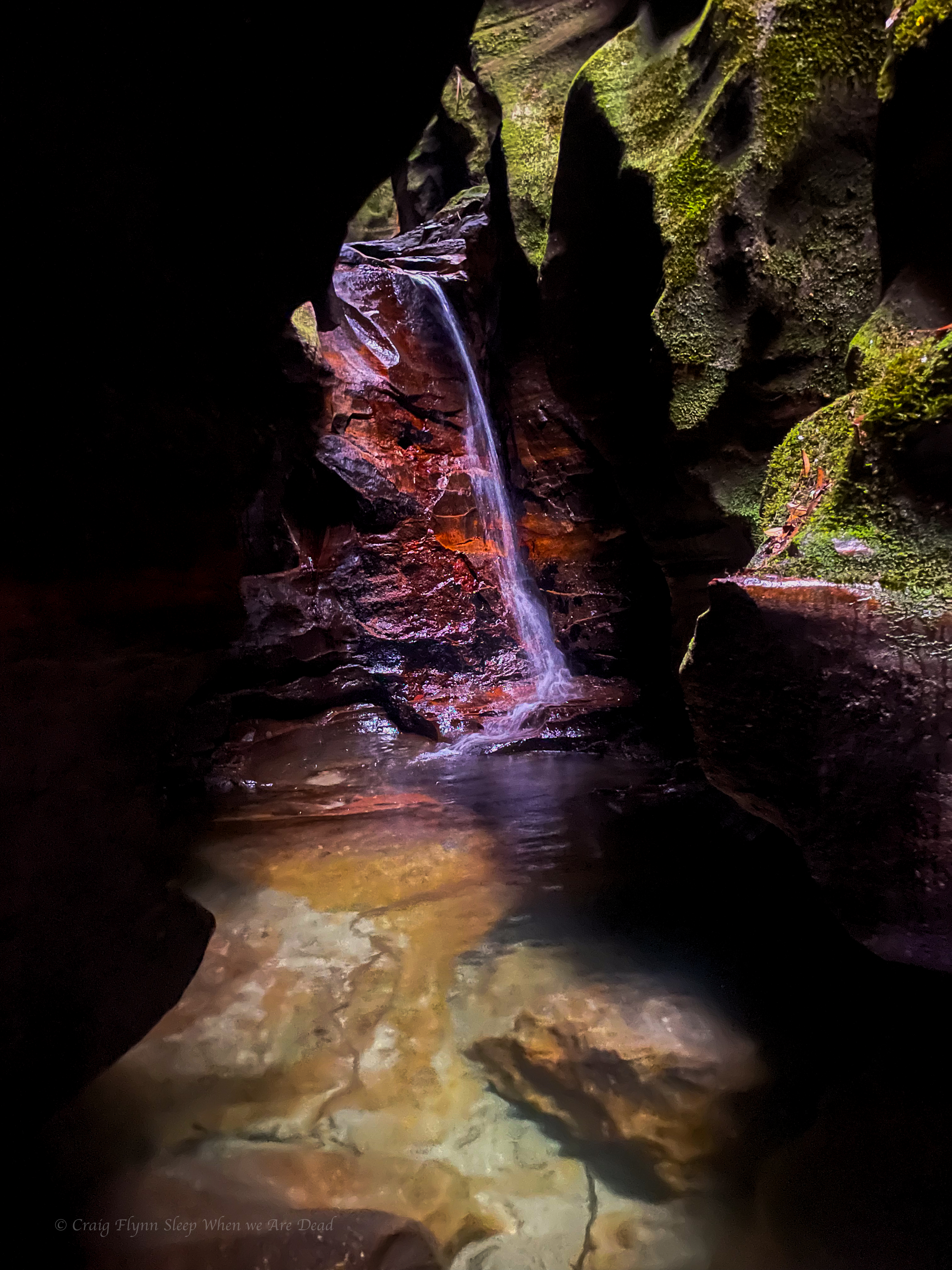
Returning from The Sphinx as the heat began to ramp up a visit to the underground creek sounded ideal.
If nothing else the name was cool.
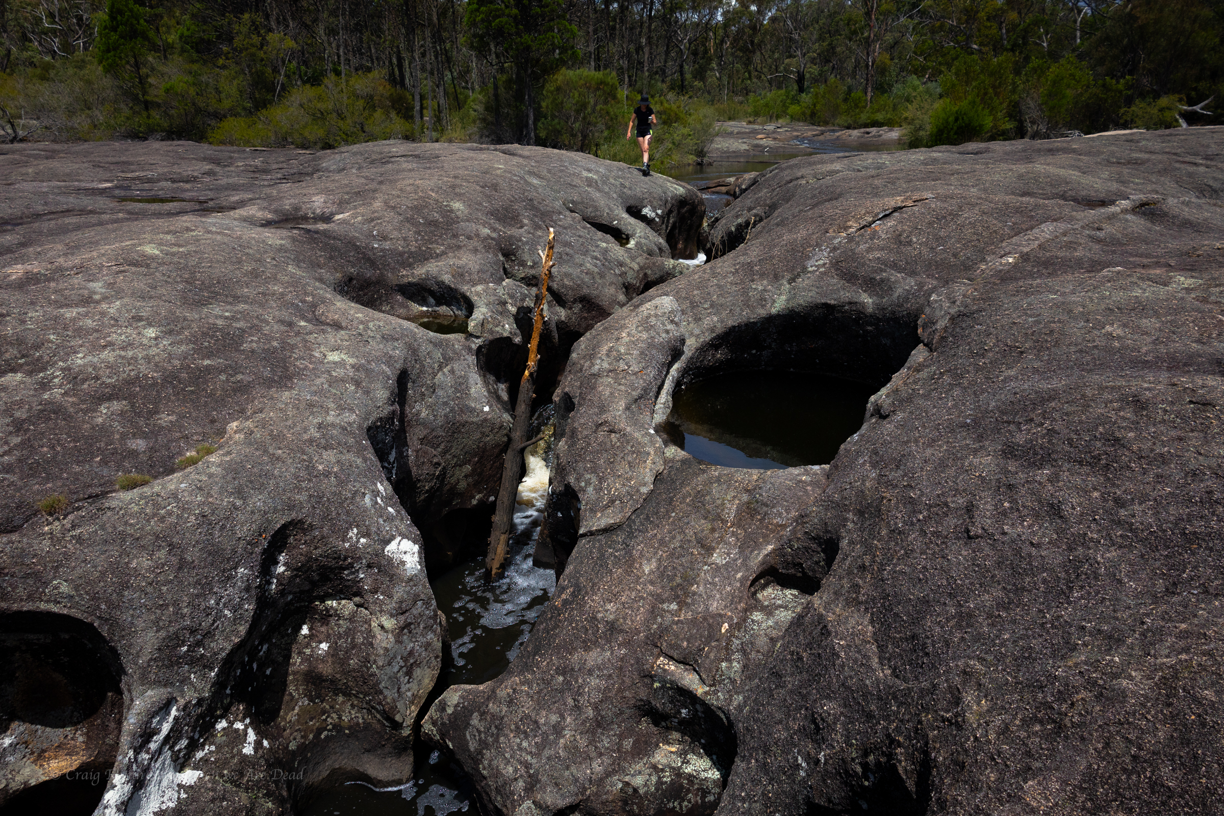
A short drive from our camp took us up into the surrounding hills. The car park is well signposted and gives access to both the Underground creek trail and Dr Roberts Waterhole.
The walk out to the underground section the creek is just over a 1km and fairly flat.
So what the hell is it?
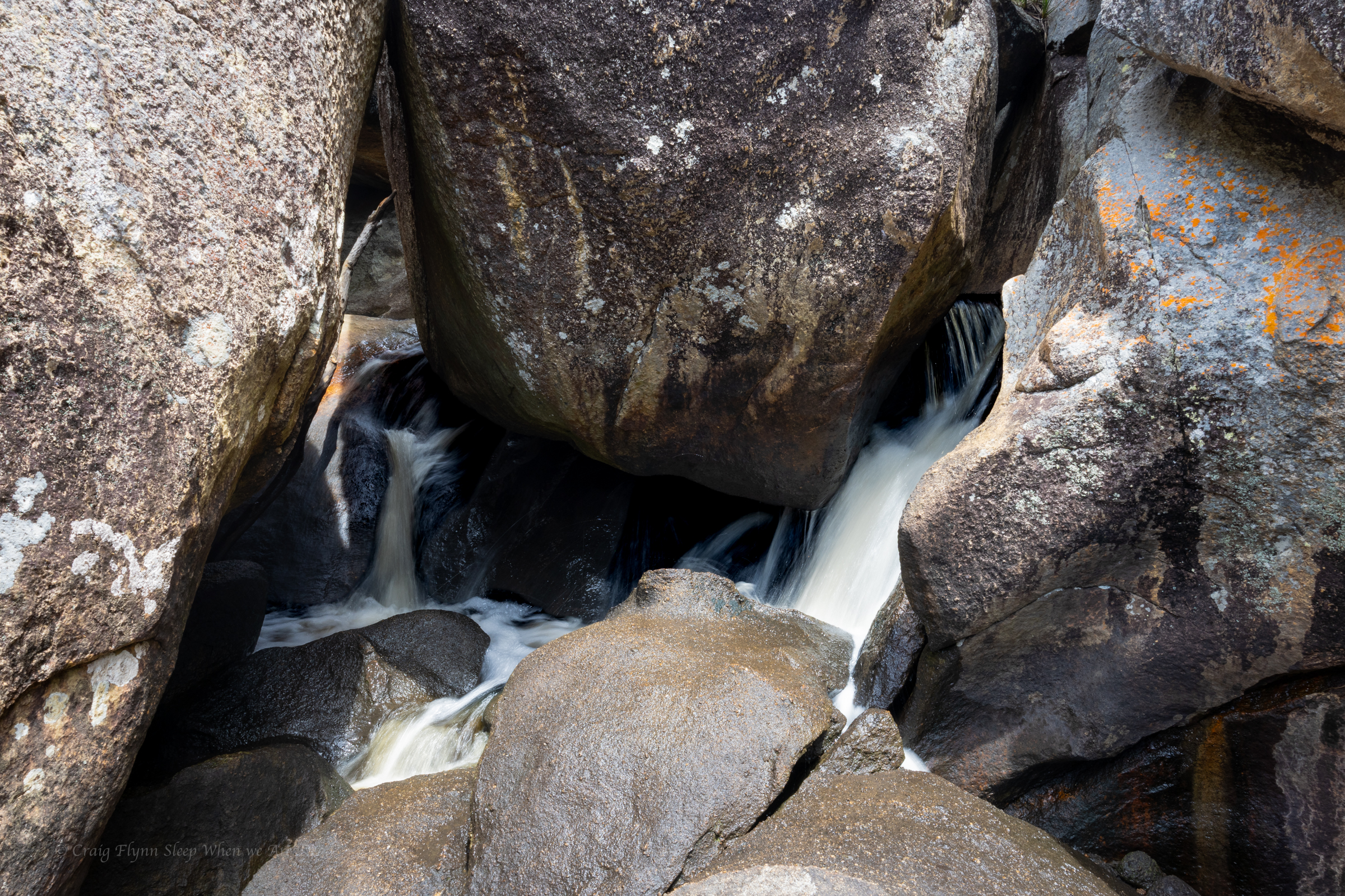
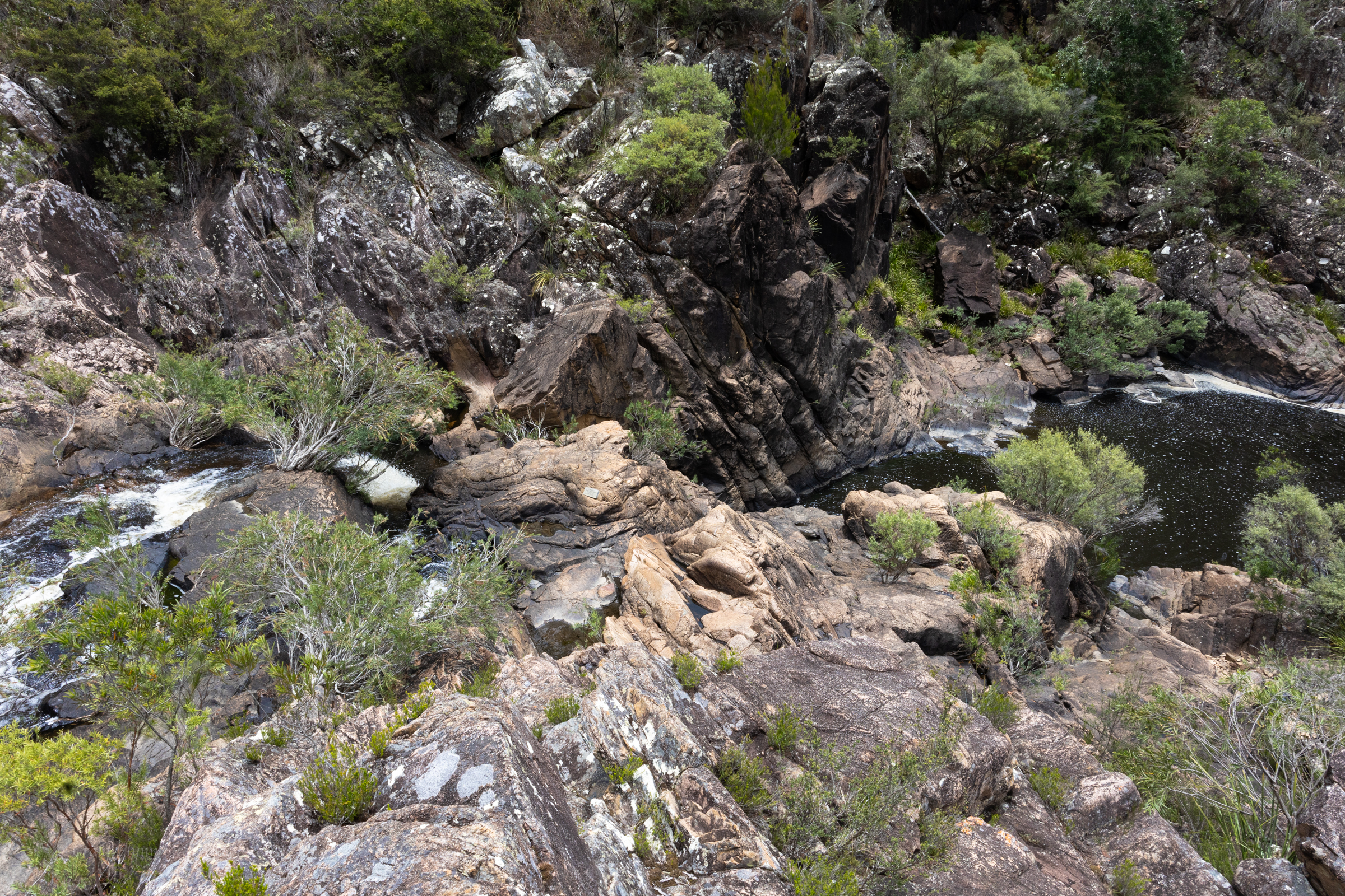
This section of creek drops down through boulders into a a short section of old lava tube
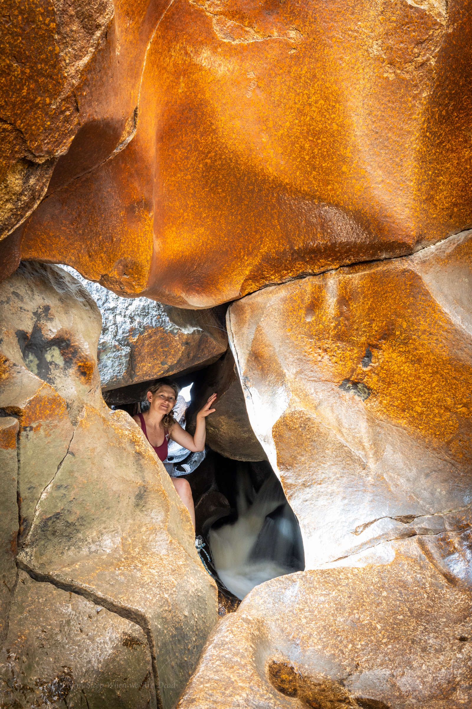
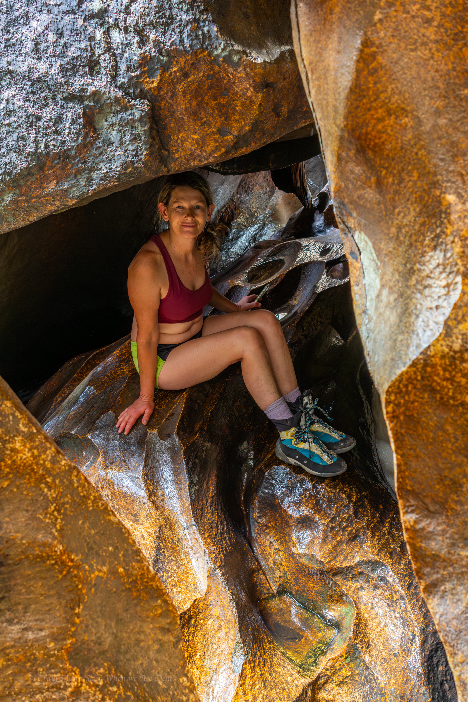
If you find the top secret… I mean really obvious entry it’s such a cool feature
of course we spend no time scrambling down
It’s a short section but well worth exploring a bit.
Just upstream we scrambled up past this feature. Belatedly we found an easy trail that bypasses around the little cliff line up to a sunny platform that’s worth a look
iddy biddy baby canyon
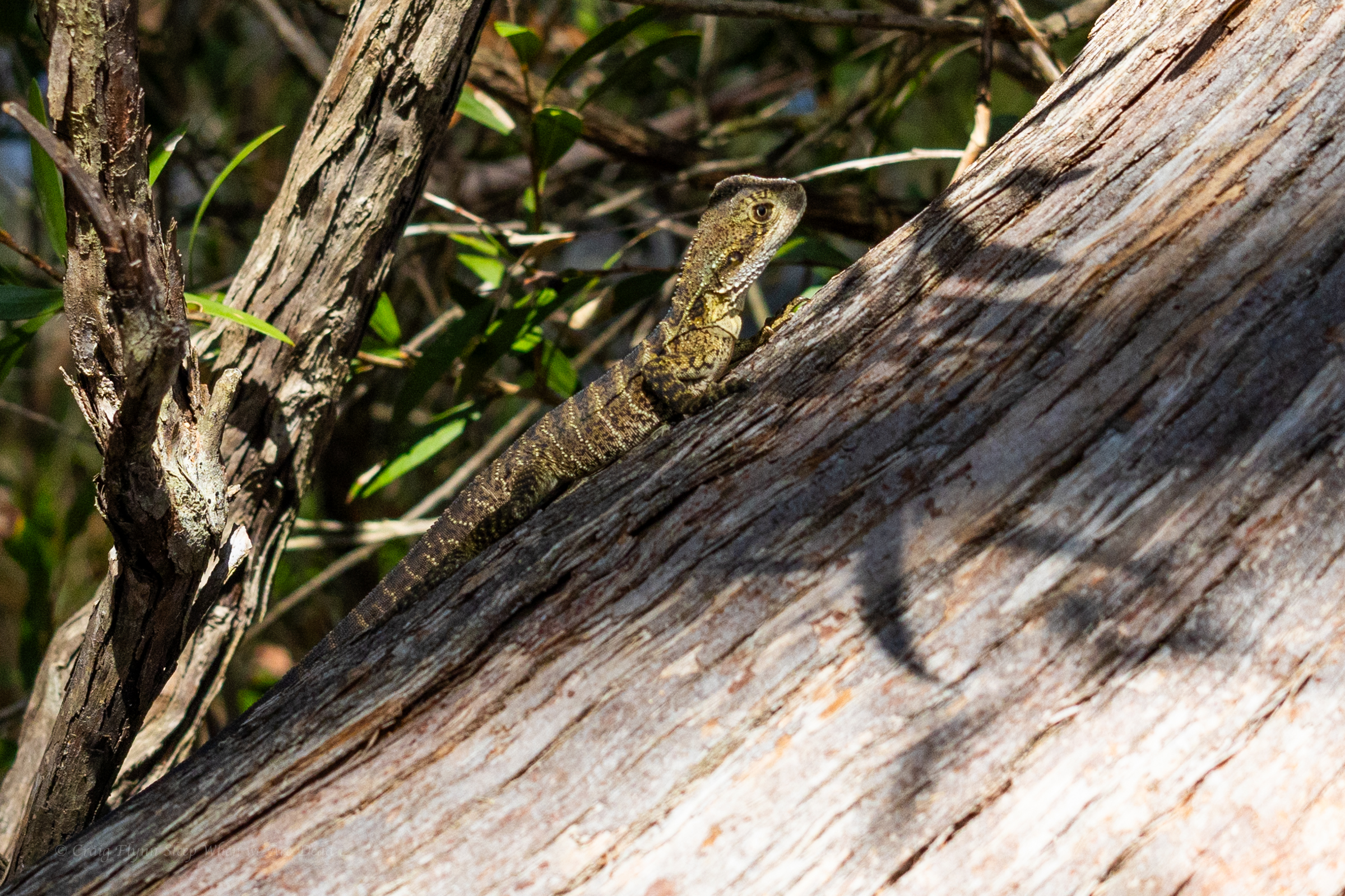
iddy biddy baby water dragon
big dyke
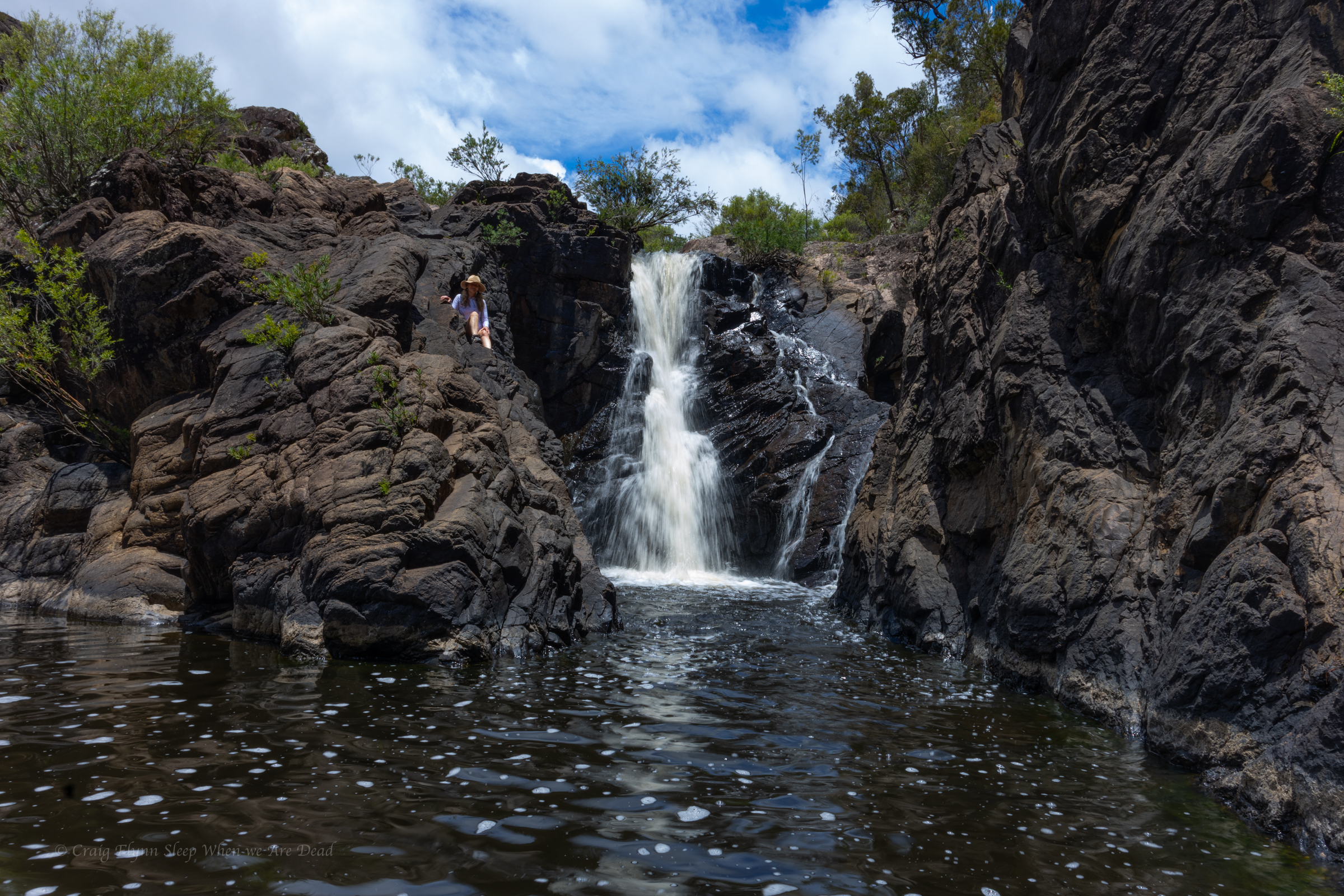
On the way back we made the detour to Dr Roberts waterhole. It’s a nice spot for a dip.
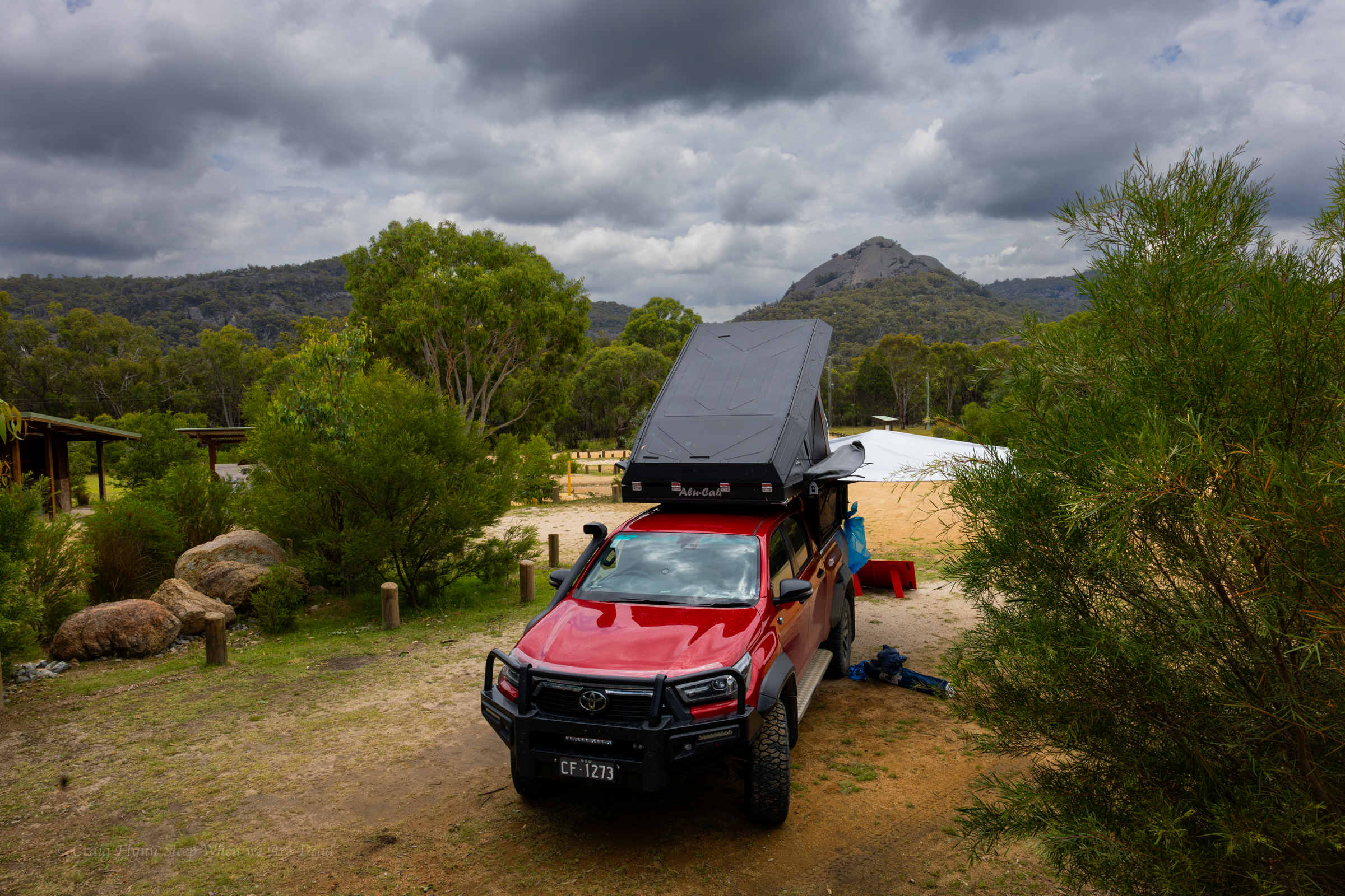
We’d spend another night in Girraween before hitting the road and head towards Cranky Rock
From Booboo Booboo we do a bit of a down and around, crossing the boarder into Qld and into Girraween.
Bald Rock and Girraween are not that far apart as the crow flys, but we aren’t crows and the road needs to circle around the mountainous country in between.
We roll into an almost empty camp ground, the Christmas/New years crowd have dispersed. Just about everyone else we see here we saw at Boonboo Boonoo. Haha
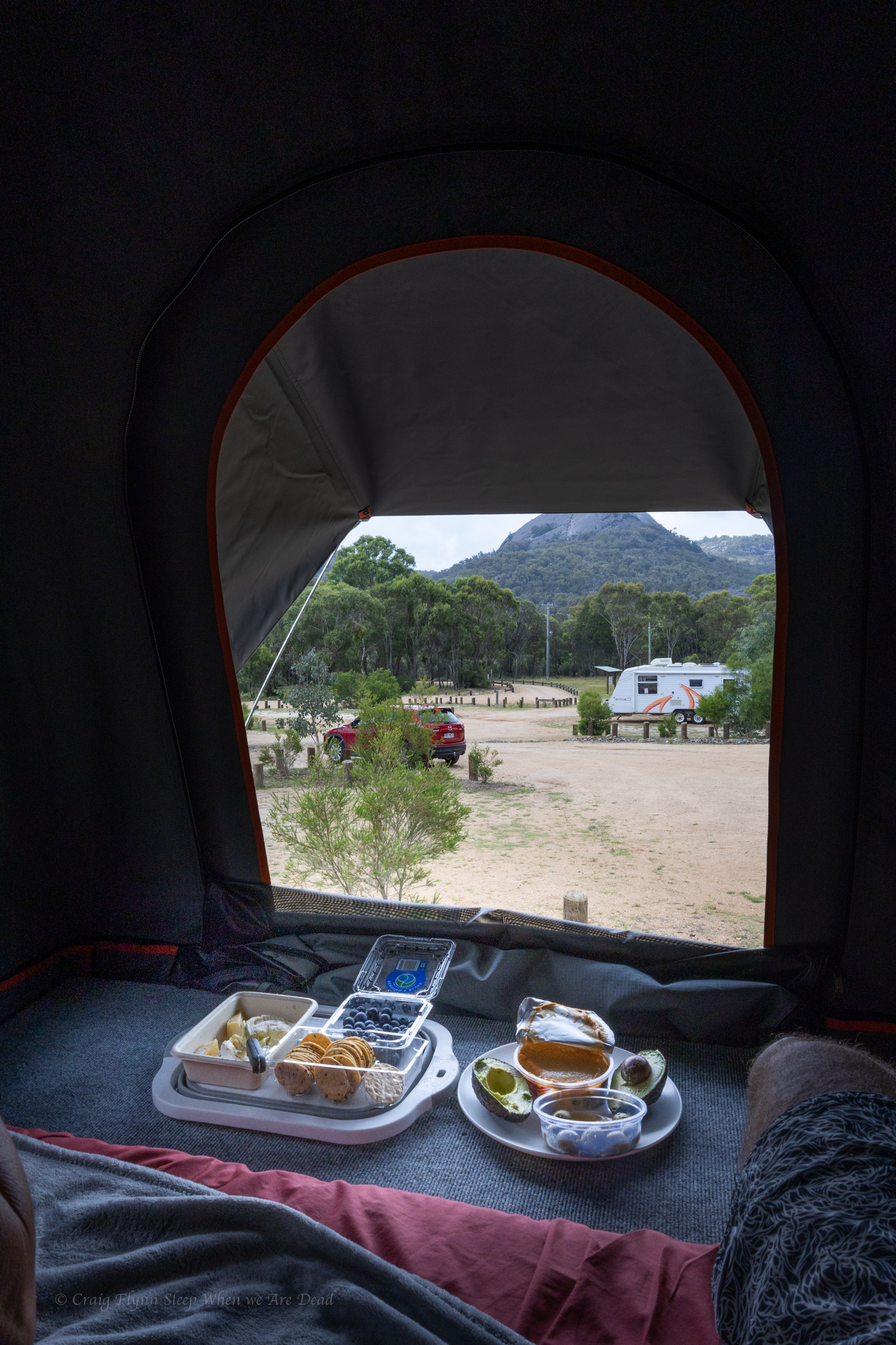
We have a couple of nights here and planned to smash out as much as possible. but the heat was oppressive so we cut our list of things to do from “Everything all at once” to our “must sees” and worked out a bit of a plan for best time of day to see the things. In between we do something rare for us. We chill out and enjoy the camp ground.
and with views like these out the back of the camper why wouldn’t you
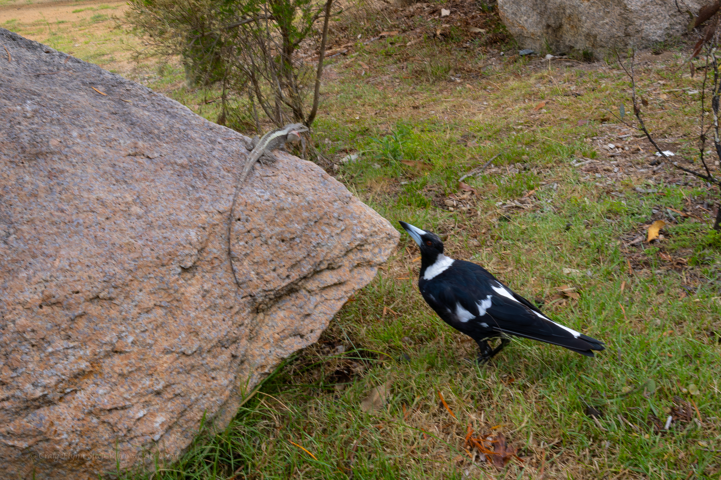
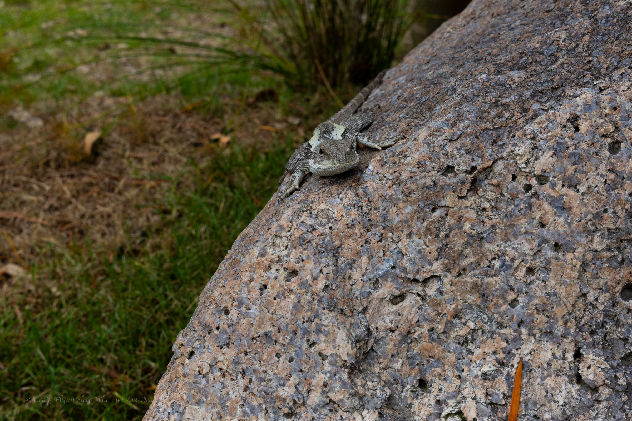
The neighbours were amusing. Knobbie the dragon was preaching the virtues of sun baking. Maggie Pie seemed very engrossed in the topic.
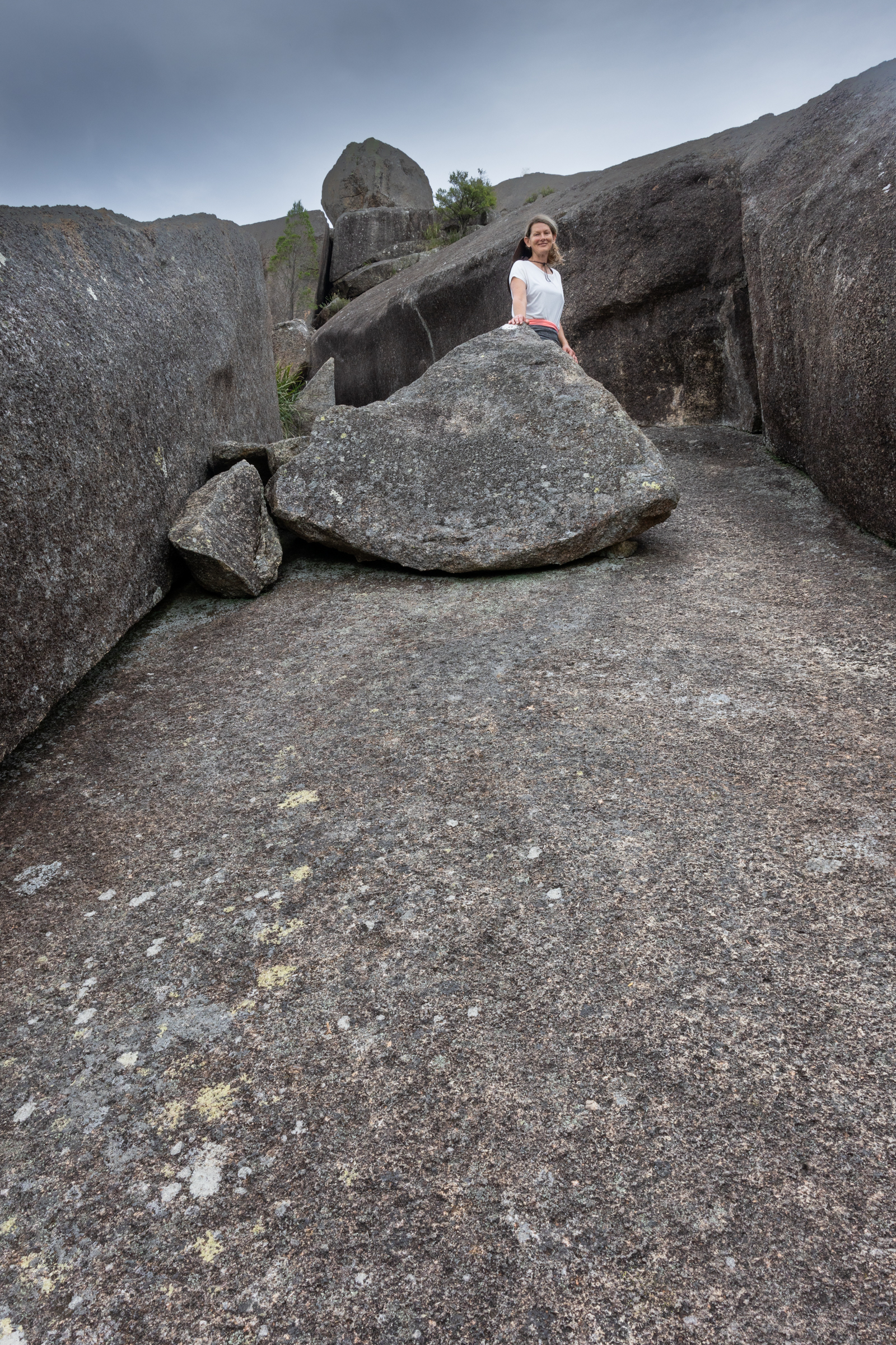
We thought we’d start our stay with a quick walk up to the Granite arch.
An nice easy walk lead us past serval granite outcrops up to this beauty.
On our way to Bald Rock we had stopped at “Thunderbolt’s hideout.” and joked at the time that if we didn’t stop on the way in we wouldn’t stop on the way back as we’d be sick of looking at Granite tors and boulders .
Narrator: Neither Craig nor Kylie got sick of looking at granite tors or boulders.
Just adjusting the placement for a better composition
A big storm role din with lots of thunder and lightning so we dashed back to camp.
Knobby Dragon. I think. Could be a Jacky Dragon. I aint know. I’m not a dragon tamer.
The storm passed over without rain and the sky cleared so we thought a late afternoon walk up the Pyramid would be just the ticket.
It’s about 2km from the campground to the summit, so not a big walk.
But it’s steep.
While not the steepest signposted tourist track we’ve been up (I’d probably give that to the Red Track at Bungonia) added to the steepness is the exposure.
Grippy shoes and dry weather is a must for this one. Once the rock is wet you’d have more grip on an ice skating rink.
The first part is along a clear easy path. This leads to some stairs. They lead to a big granite slab. White dots lead the easiest path up. All good so far
Then you scramble up this rocky chute, referred to as the pyramid passage.
Then comes the traverse.
You make your way out, angling up. To the right the granite slab towers above. To your left a steep slope dropping off to nothing but air.
It’s terrifying but worth it. Say a couple coming back down.
(Belatedly, on the way down, we find there is a less terrifying option of veering right and around the back side of the boulders above)
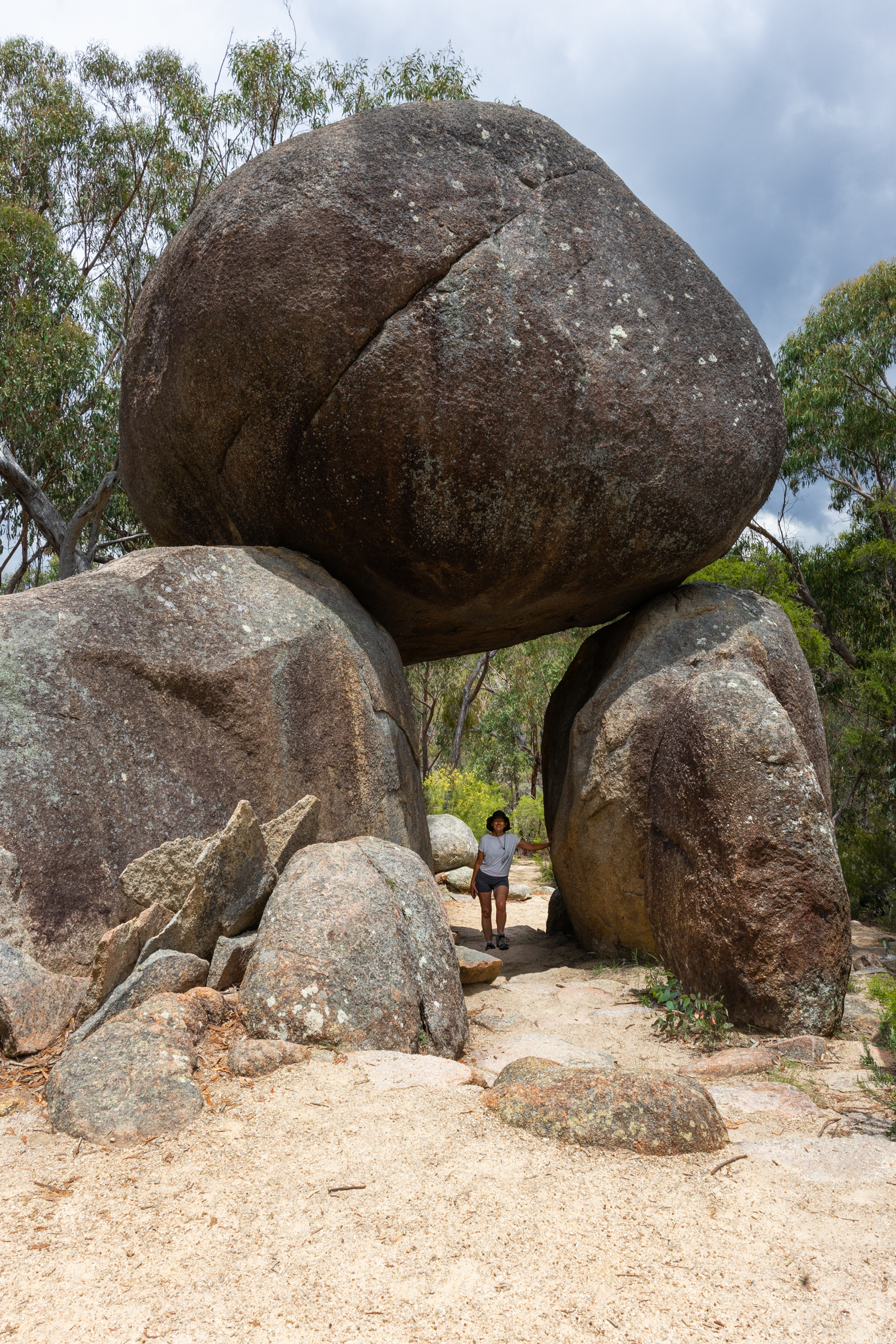
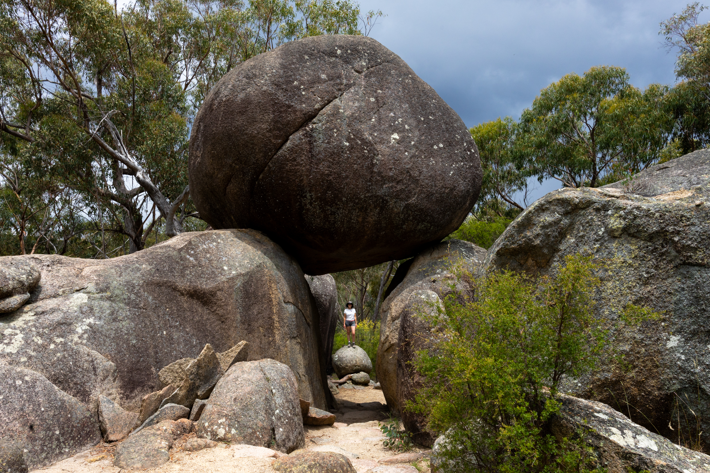
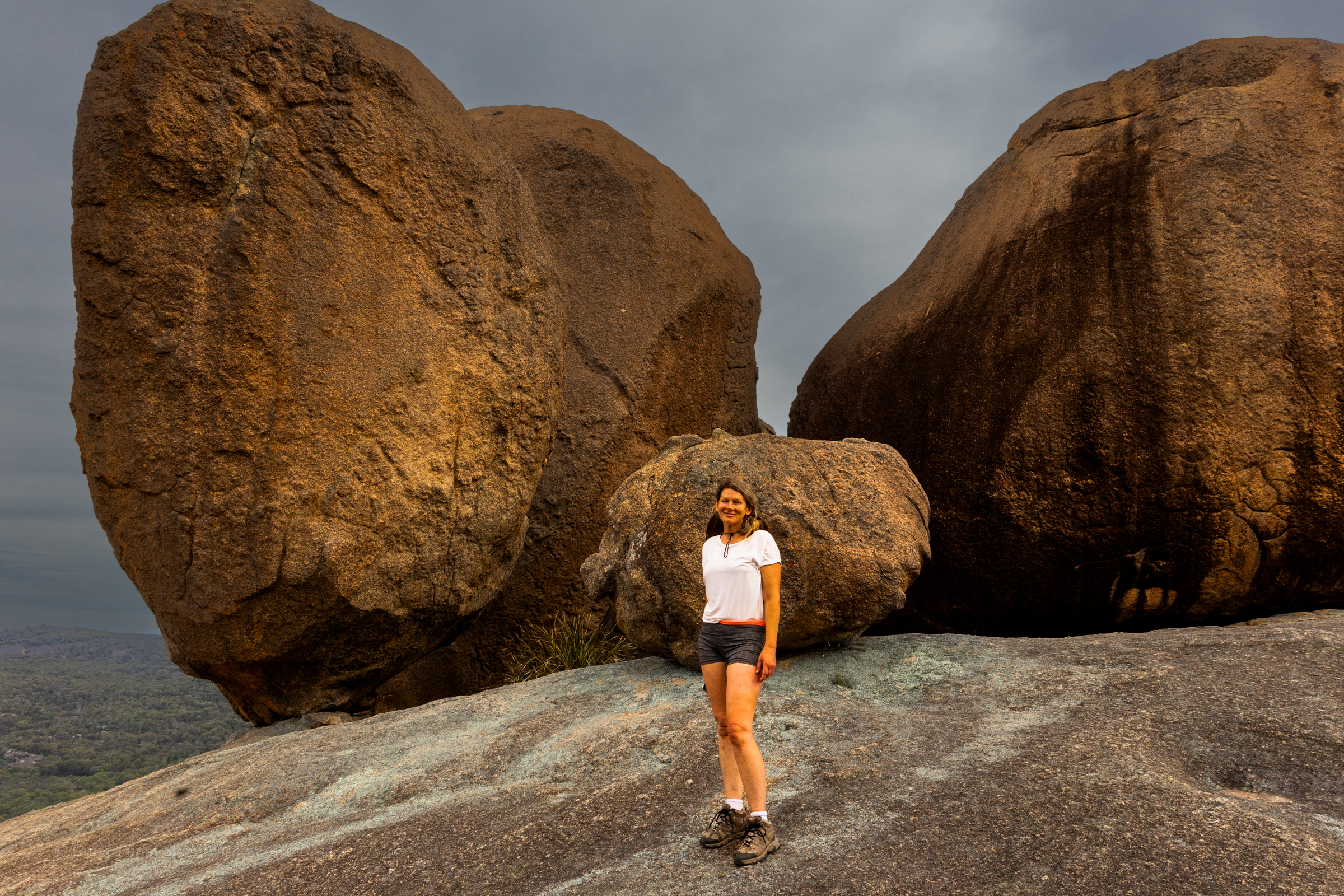
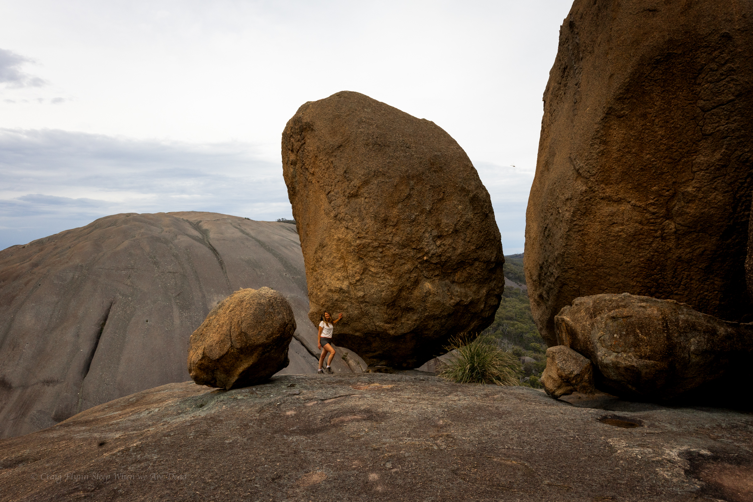
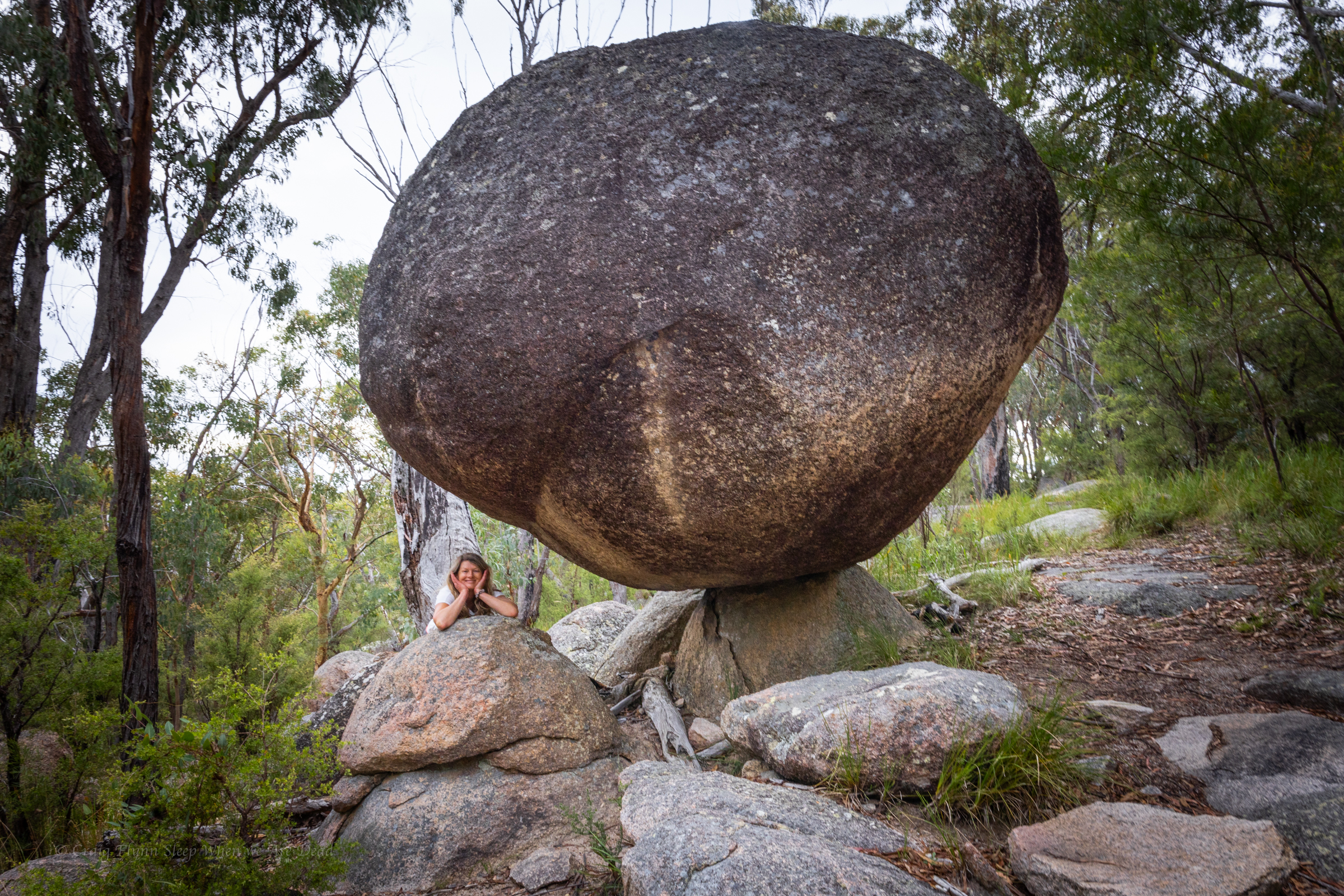
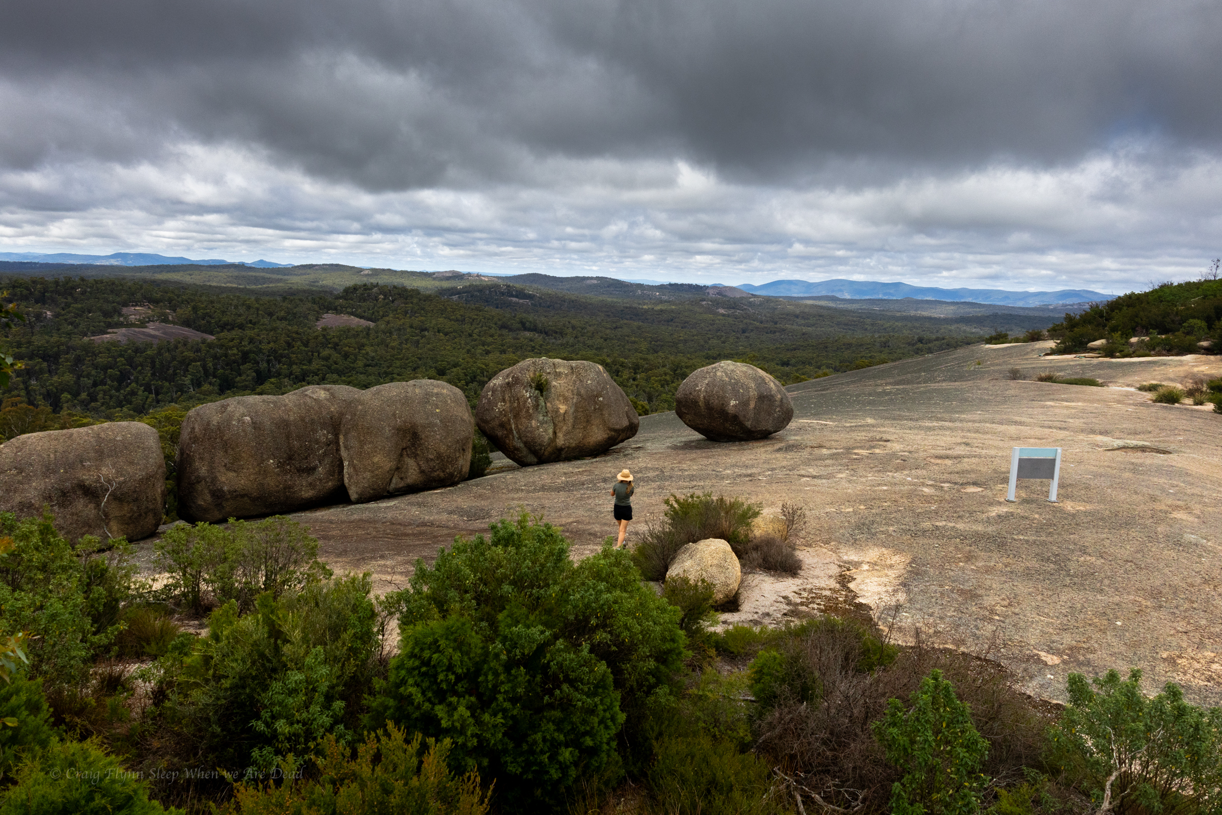
Past traverse its another little scramble before you round a corner to views of the infamous balancing rocks, defying gravity (for the meantime) right on the edge of the dome.
Breath taking in the soft afternoon light of sunset
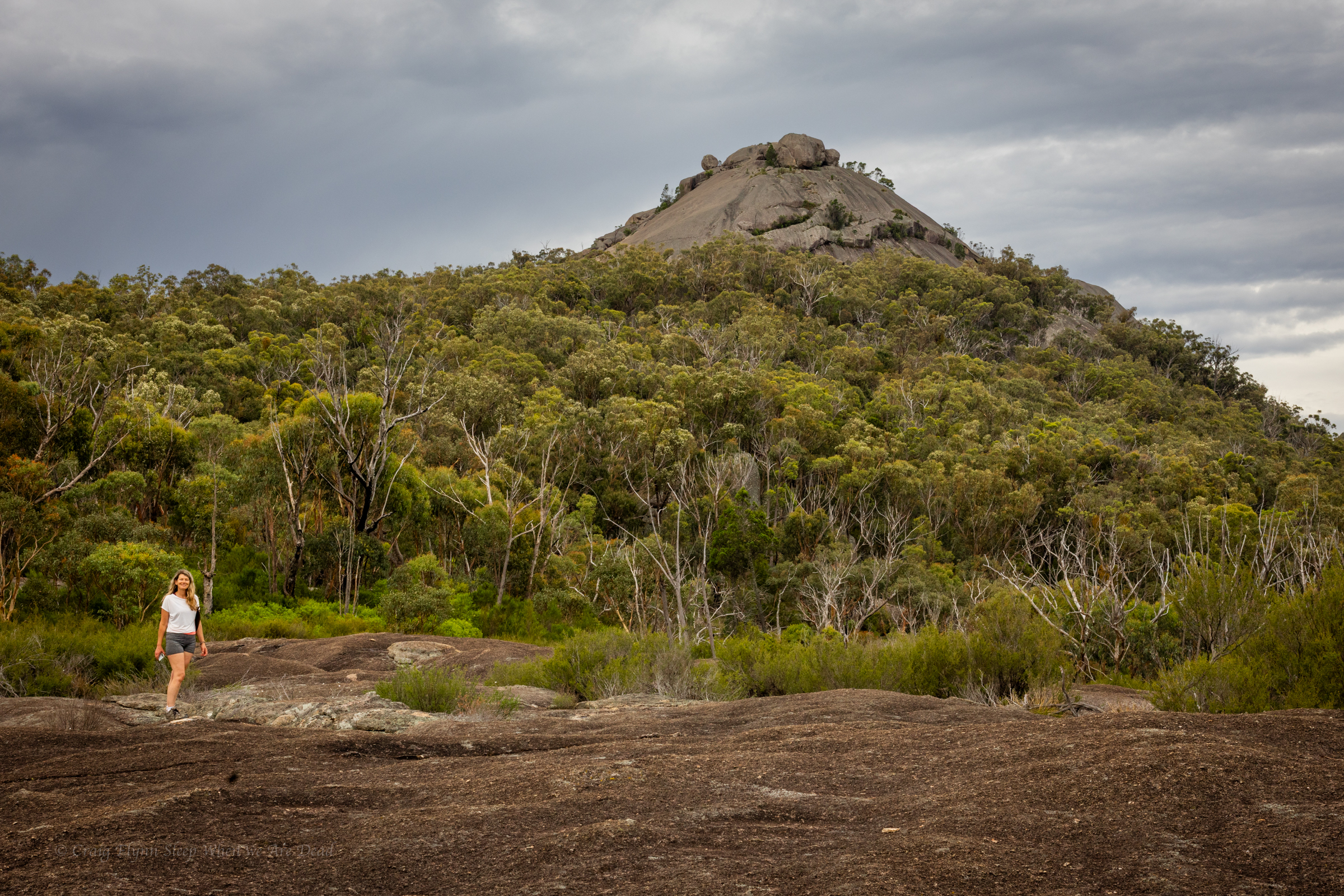
The view across to the second “Pyramid” and equally impressive granite dome.
If you close both eyes and try really hard to imagine a pyramid it looks just like a pyramid.
The aboriginal name for these peaks seems to have been Terrawambella. Early pastoralists mapped them as “the domes” at some point they became known as the Pyramids.
With the sun sitting low in the west the light was magical and we had the views all to ourselves.
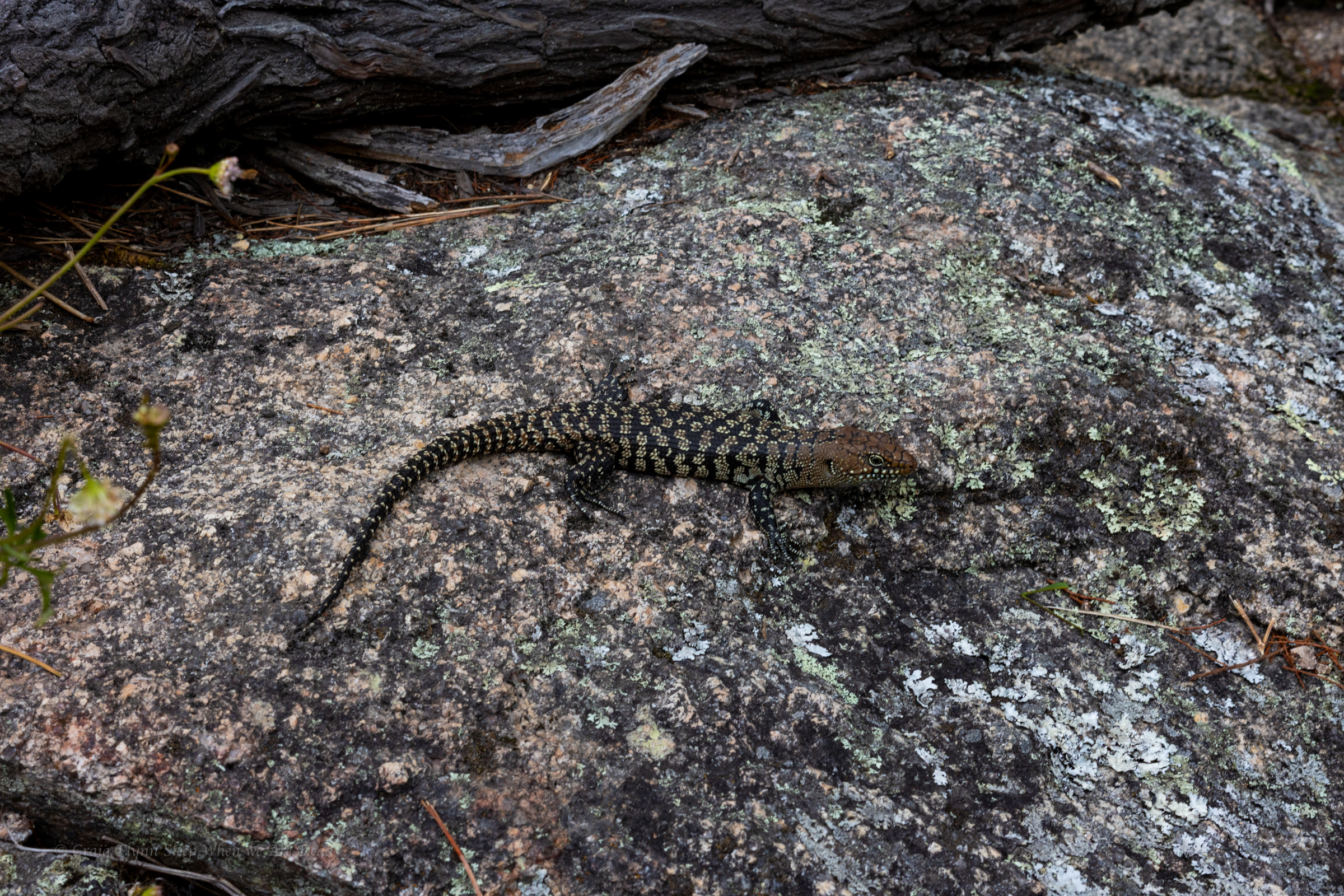
Well, us and Mr Cunningham.
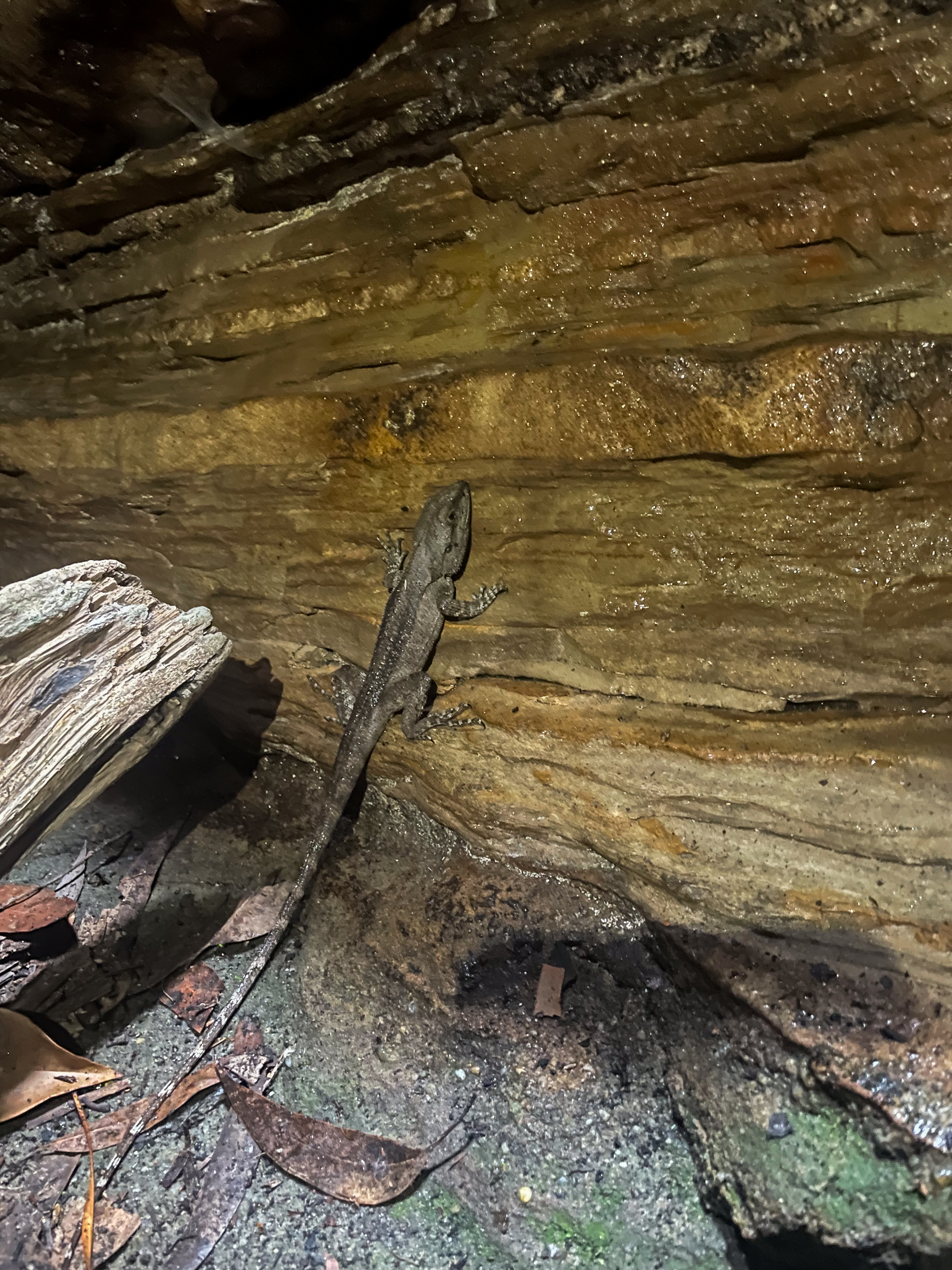
I only recently learnt that Cunningham skinks have the ability to change their colour a bit, sort of like a chameleon, to help blend into the background.
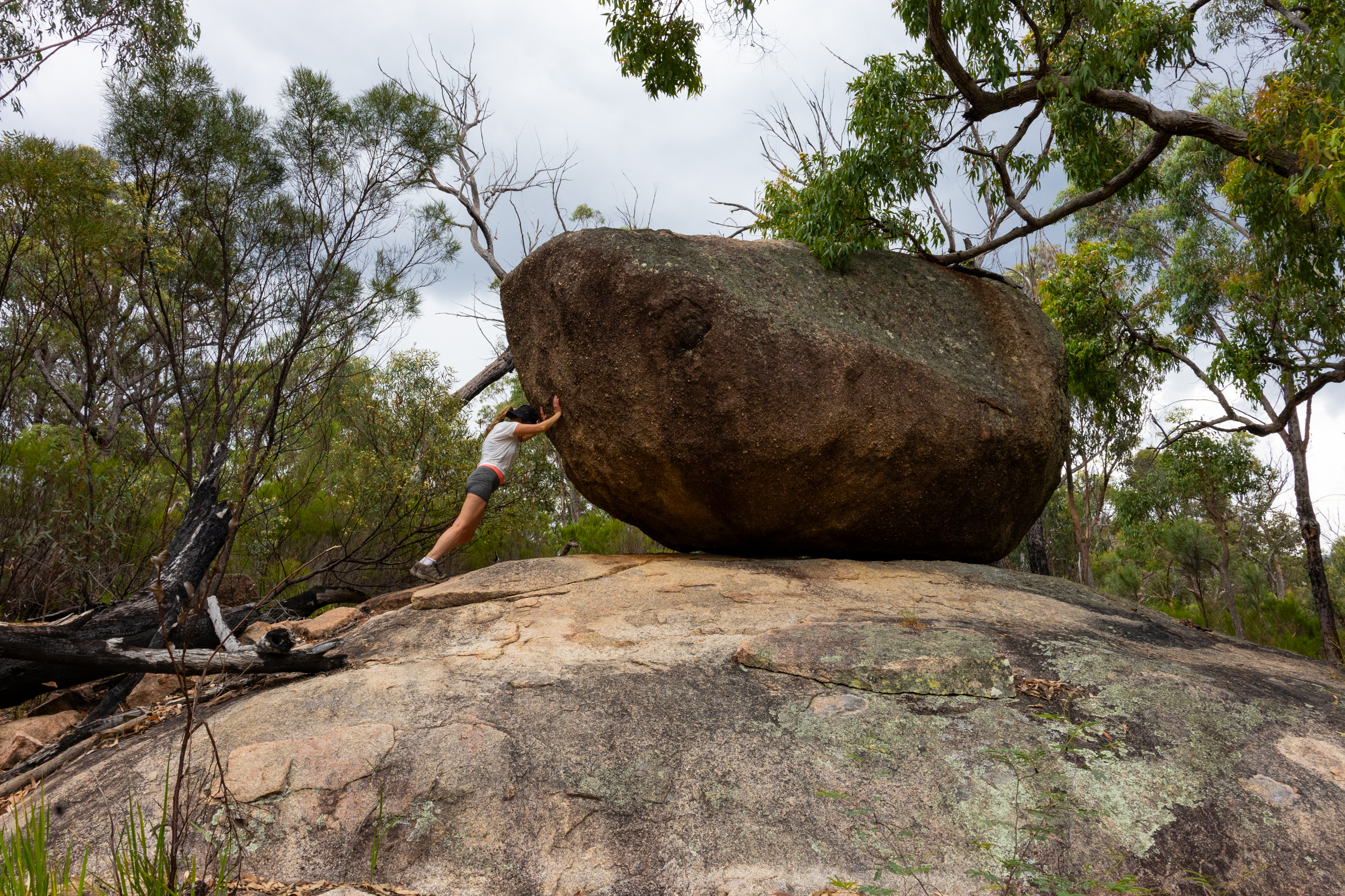
Once back down off the dome we veer off track to check out other balancing rocks and views
Gadget and The Great Pyramid of Girraween
It’s been a good day. We have punched out a couple of short but steep walks. Basketswamp Falls, the Granite Arch and the Pyramid.
We get back to camp as another storm rolls through. The temperature was due to ramp up again tomorrow so we plan an early morning trek out to the Sphinx
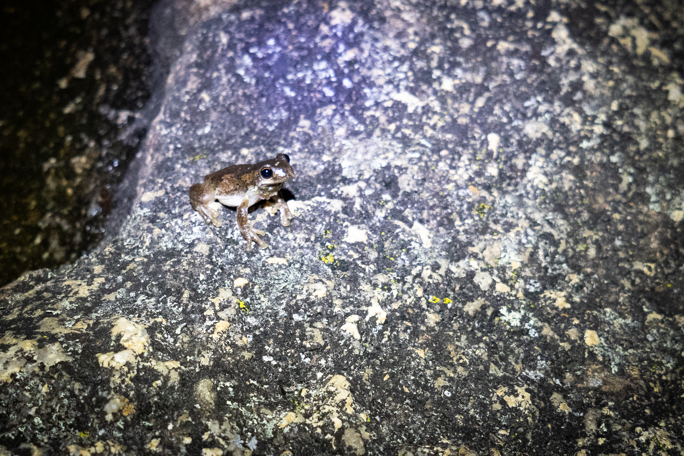
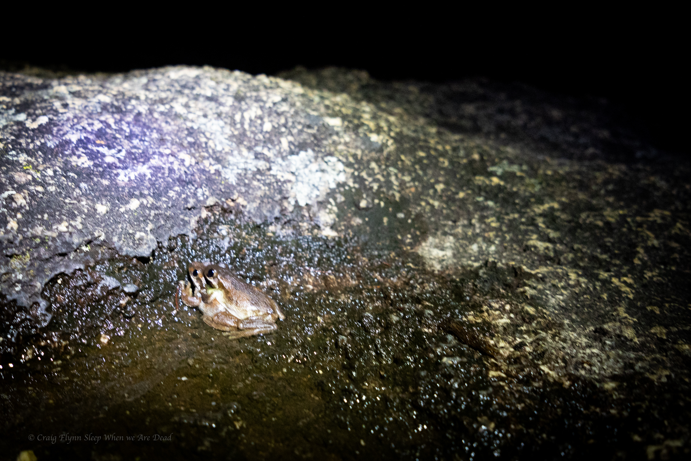
But not before a bit of late night herping
it was a frogathon but I forgot to charge my head torch so had to call it before the snakes came looking for diner.
It’s pronounced “Bunoo Boonoo” Thou tbh I had to ask Kylie how Bunoo was pronounced differenty to Boonoo.
One is “bun” and one is “boon”. She explains patiently to her favourite idiot.
Anyhoo
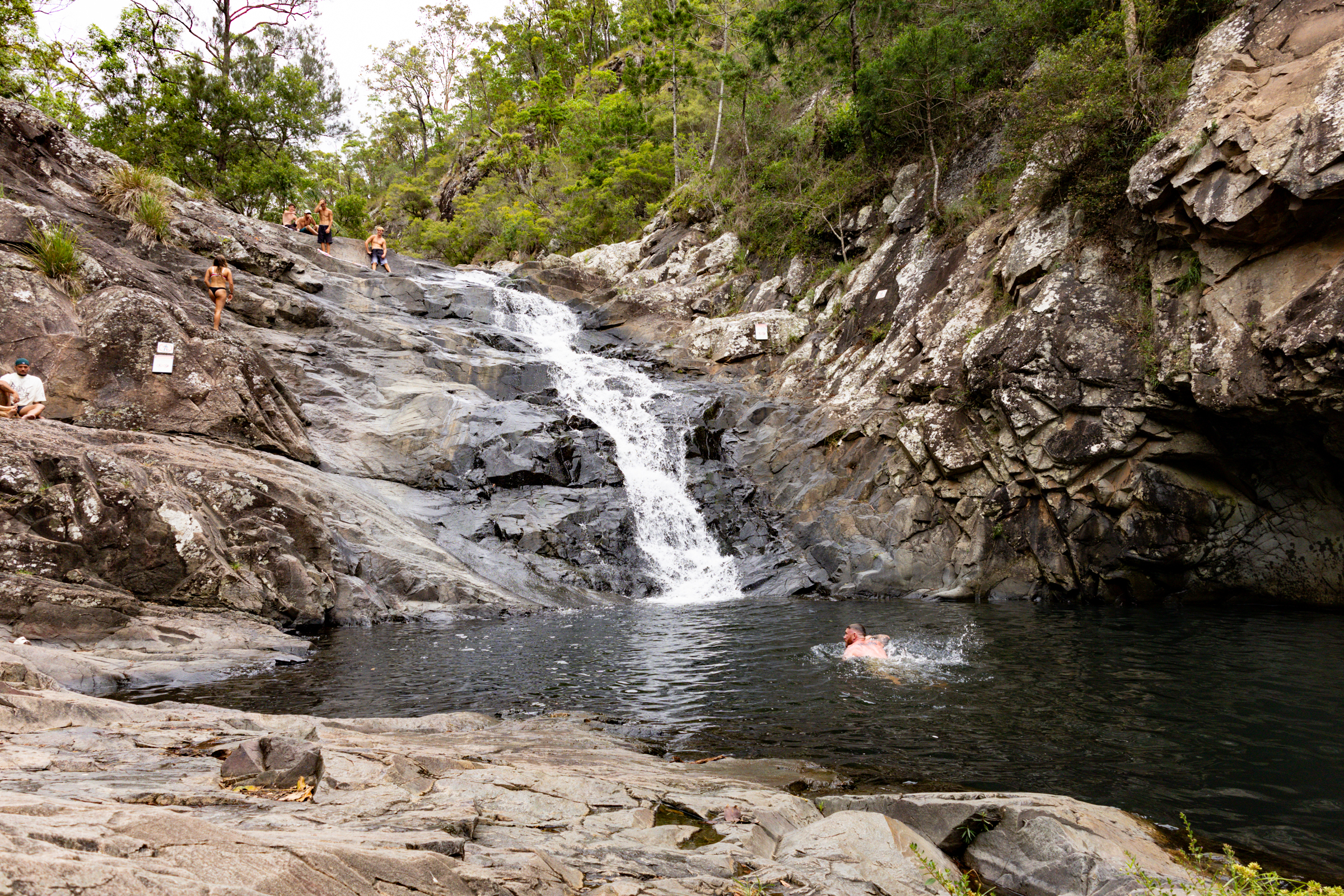
After a pleasant morning at Bald Rock the day has heated up and so we drive past the campsite and head to the main falls.
The road runs along the creek as it tumbles through a little granite gorge. It looks like it would have plenty of nooks and crannies to explore.
From the car park tourist trails lead to rock pools above the falls or down to a viewing platform over the main drop.
We head down to the lookout. It’s an easy 5min walk.
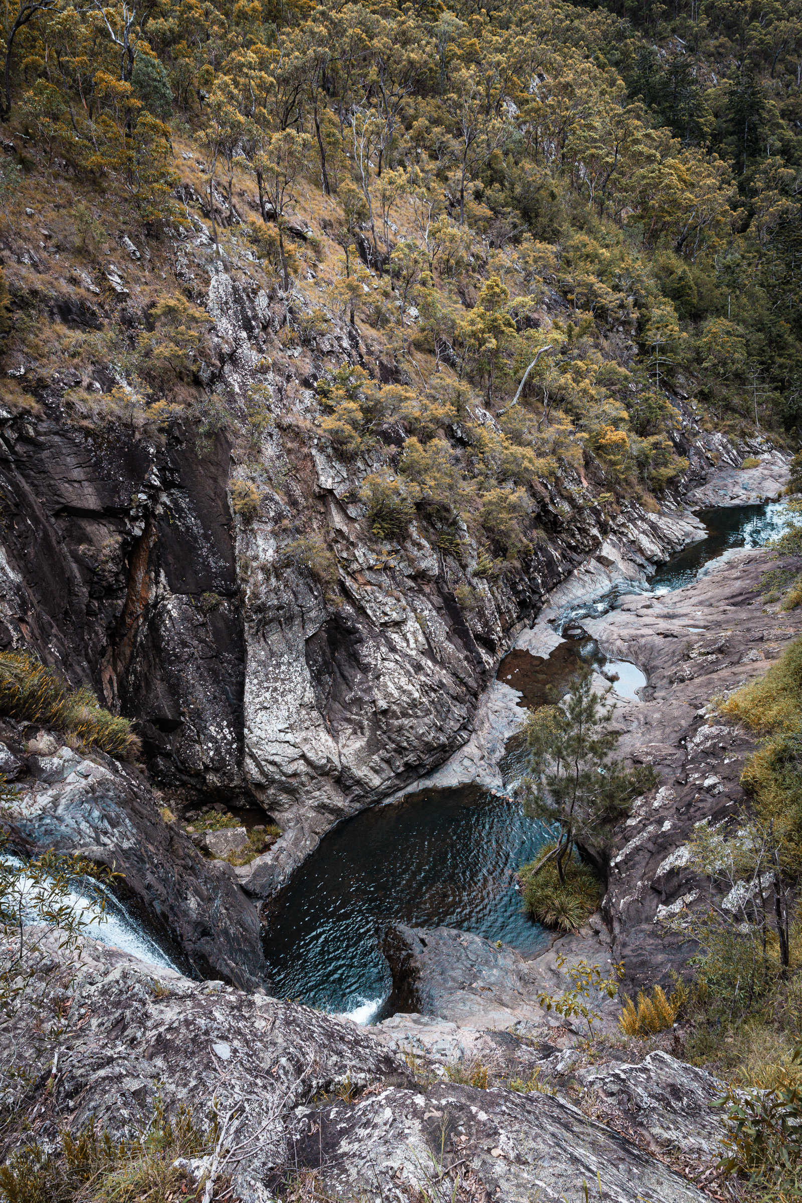
A 260m cascading waterfall tumbling into the steep sided gorge below.
Beyond the fenced path glimpses of old trails hint at adventure. If it wasn’t so hot or dry we may have been tempted.
Instead we make our way up to the rock pools intent on a dip.
The main pools at the end of the trail are beautiful, but why stop at there when there’s so much to explore.
We make our way upstream
A bit of rock hoping leads us past a series of cascades and semi hidden water holes
You can see just how low the water is by the waterline on the rocks. But still enough for a cool dip on a hot day.
And we choose a plunge pool below a little waterfall tucked into an alcove and play in the current of the falls wondering just how nasty the hydraulic would get in higher flows
From here its a short drive back to the camp ground where we set up for the night then explore the camp ground
The camp is upstream of the gorge and gives access to the river
We spend the twilight chilling out on the bench by the platypus pool. Unfortunately we didn’t catch a glimpse of any this time around.
An evening storm is our first real test in the Alucab in heavy rain. Lessons learnt: the make shift rain gutter works well but even with it on leaving the door open wasn’t a great idea…
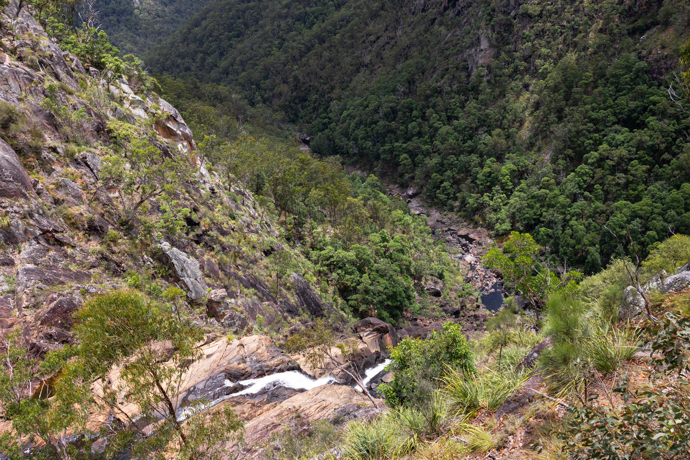
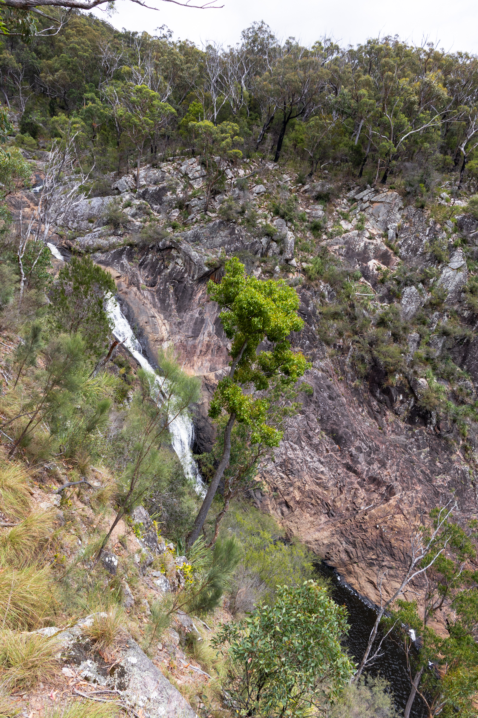
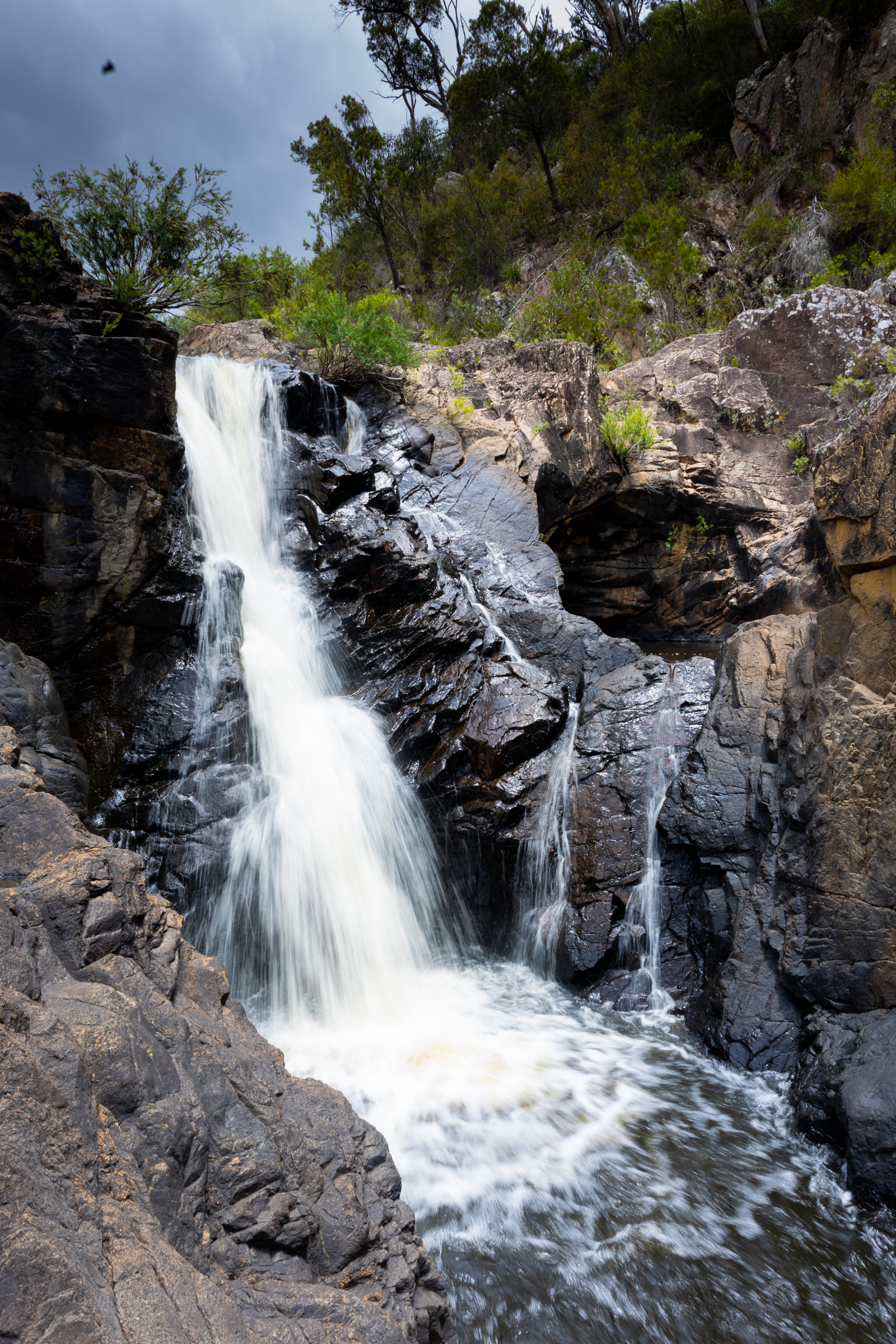
Next morning we get up early and head to BasketSwamp Falls for sunrise.
Kylie below the lower falls
Even after last night storm the water level is low but at least there is some flow over the falls.
Kylie had gifted me a Potensic Atom 2 drone for Christmas and had been forward thinking enough to also apply for permits to fly it in various national parks we’d be visiting .
We were denied permission as the first couple because it was peak tourist time over the New Years long weekend but even then they encouraged us to apply again.
Most of our requests were granted though. There were a few conditions on the permits but they were easy enough to comply with
So if you are taking a drone it’s worth planning ahead and doing the right thing. There were also a few times where we had permission but opted not to put it up due to not wanting to disturb other visitors.
Can’t deny the awesome perspective you get with them though.
This was one of my first flights.
From here we’d be heading west into Queensland… sounds weird but the border does a little curve here. Bald Rock in NSW is North East of Girraween in Qld.
Finishing up our coastal sojourn we head west. Our plan was to come back down the western line.
As usual we had planned to pack a fair bit in to a short time.
The Western line probably isn’t in the forefront of most peoples minds as a summer trip. We are not most people
Are we crazy? asks one of us
Yeah. says the other as if it was the most obvious answer in the history of obvious answers.
The fact was summer was when we both had time off so…
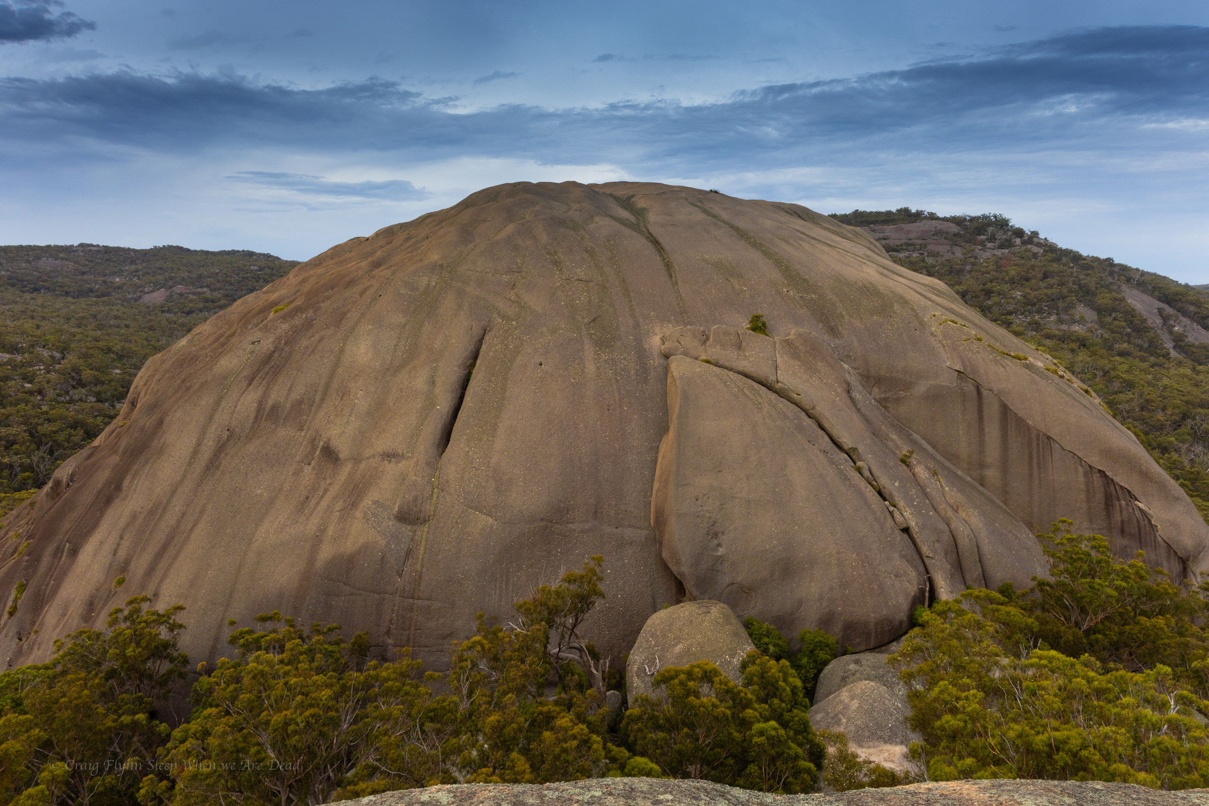
Our first destination was Bald Rock.
I’d never heard of it but Kylie said it was something she really wanted to see.
It’s right on the Qld border and part of the New England Granite belt, which was formed about 250million years ago. It’s called the New England granite belt because, you know, nothing resembles Old England more than goannas running across massive granite domes…
Anyhoo
We pull into the car park and cook up a breakfast then make our way up to the trailhead.
There are several walk options, from super short to all day. We opt for the summit walk.
A reasonably short walk leads us to the base of the massive granite dome. This point is wheel chair accessible and if its as far as you get it still bloody impressive.
A mountain of granite towers above.
White reflectors stuck on the rock were the only indicators of a path up.
Of course we follow them. Mostly
It was steep.
Jokes
It’s a little steep but not *that* steep
It’s a short, punchy walk up to the summit and it was spectacular.
Rising 260m above the surrounding terrain, Bald Rock is the largest granite monolith in Australia and the colours are amazing, even on an overcast morning.
as it levels out we pass a few boulders and suddenly this view bursts into view
There is something humbling about big terrain. Human trivialities seem… Trivial
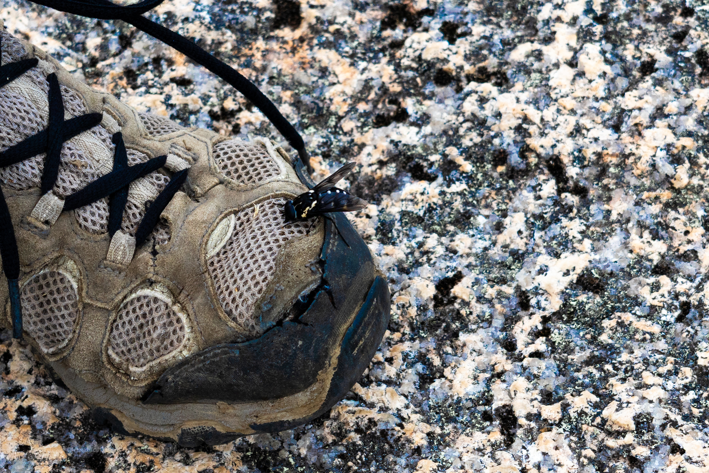
These guys were everywhere and they were curious but they were friendly enough. The bee not the warn out merrells.
We share the summit with several other groups. Families, grey nomads and, us. (There is a song in there somewhere)
We return to the car and back track a little to our camp site in Boonoo Boonoo.
Ash wanted to head to Surface Paradise so we thought it might be nice to drop him off for a day out and drive up to check out a couple of the touristy waterfalls on Tamborine Mountain.
We knew Jason was up visiting family in Brisbane so we threw him a shout out to meet us there.
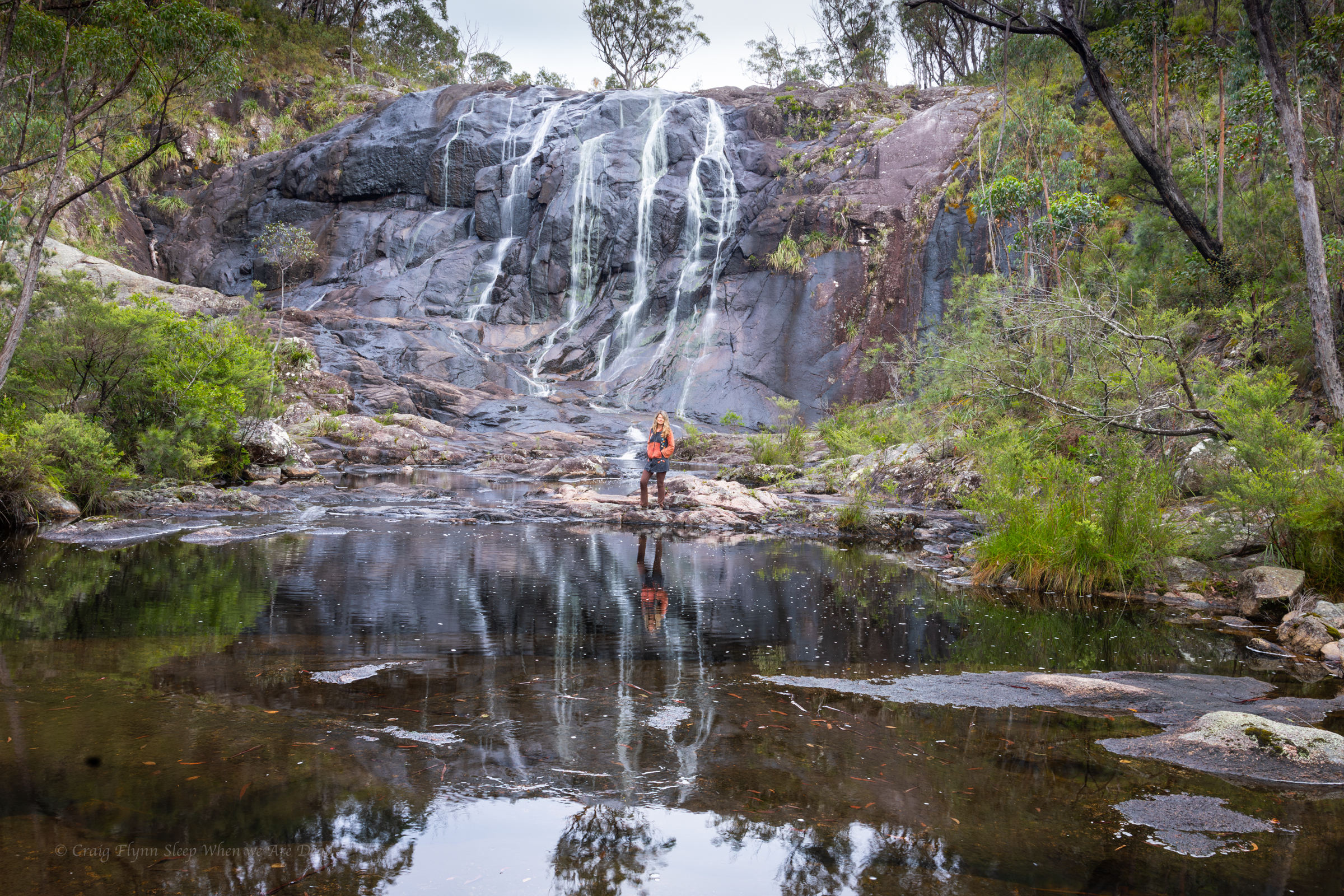
Our first stop was Cedar Creek falls.
This is another popular swimming spot and it has limited parking. We needed to park way back at the turn off (Junction of Tambourine Mountain Road and Cedar Creek Falls Road.) which gave us an extra 800m walk each way.
Locals at the end of the road had set up a paid (donation) parking lot in their paddock and the kids had an esky set up sell cold drinks. Kylie half jokingly wondered if said locals rushed out of a morning on public holidays and filled the car park up with their own cars before the crowds appeared. Clever them if so as their paddock was just about full.
And to be fair, imagine having this place pretty much as your private back yard extension before the crowds discovered it and the tourists (like us) rolled in.
From the car park a boardwalk style trail leads you down past a nice picnic area beside the creek then down to a lookout above the main falls.
The trail then continues down to the base of a lower cascade and a nice swimming hole.
There are two main pools accessible from the trail.
A series of other cascades and pools are off limits due to safety concerns and rangers were on and to remind people of the need to comply.
We have a dip and laze about then head back up the mountain to check out Curtis Falls.
There’s a much bigger car park here but it’s equally full, luckily people are leaving and we get a park close to the trail head. Winning.
There is no swimming allowed in this one but is a lovely walk along a shaded creek and a very pretty waterfall.
It teemed down overnight at camp. But our trusty tarp kept us cozy and by morning the sun was peaking through the clouds.
We had said goodbye to Levis and Monica and talked ourselves into another short canyon while we were out here.
Kylie, Jason and I had visited the top couple of sections of Popeye Canyon as a day walk a few weeks earlier which had some pretty bits in it, and so we were keen to have a look at the lower section.
I cooked up a plan to head straight down from camp to the grid reference that the Jamison guide lists as the start of Popeye (a kilometre or so below the upper section).
We start down a ridge in between two faint gullies. These soon join to become a stoney bottom creek that tumbles over a substantial cliff line. We only brought a short rope with us today so make our way a bit further long the left hand bank and find a way down into what we came to christen MCPCC. Mega Clear Path Creek Canyon.
heading out to enter via the upper section may have been easier.
Anyhoo we find ourselves in Popeye creek. It’s not looking like much but H and K don light wet suits.
Looks like there’ll be some more creek walking, I’ll suit up later, the rest of us say.
10 steps later, literally, like literally 10 steps babes, we round a bend and the creek drops into a tunnel like canyoney section.
This would be the theme for this section of Popeye. boulder hoping interspaced with tunnels and cavey bits. A few abseils and short swims
and awesome company
but not much quality canyon.
Plenty of weirdness thou
we head all the way down to the…… it hurts to say it…. Dingo *fugging* Creek for the final 10m of “canyon”
The plan is to head down said creek to an exit Kylie had mapped out opposite gateway canyon. I’m hopeful this section is similar to the bit below HITW and we can just float with the current.
There was a bit of floating.
A bit of boulder scrambling.
Some scrub bashing.
And lots of sinking knee, sometimes hip, deep into fine sand to have it defy the sand traps and fill the bestards.
I still have sand in places sand has no place being.
Still, it’s a wild and beautiful part of the Bungleboori system worth visiting. Once.
The bottom of Gateway canyon was a welcome site
The walls lining the creek had gone from broken slopes to towering cliffs and I’m wondering just how tricky this exit is going to be.
Surprisingly it’s straight forward, cutting back along a gentle ramp to a not too steep nose that avoided the cliffs altogether.
Nice one Gadget
All in all a fantastic weekend out in the wilderness with my kind of people.
Kylie, Hywaida, Kris, Jason, Monhaka, Levis and meeeeee,
We were itching to just get out and soak up the bush.
We may have got soaked in the bush.
It was a drizzly start to the weekend but undeterred we found ourselves making our way along the entry route with overnight packs and a sense of excitement.
Kylie and I had been held up behind a traffic accident so Monica and Jason already had tents set up and camp established by the time we roll in.
We pitch our tarp, cook a warm meal and settle in out of the drizzle.
Levis arrives a bit later, the drizzle is a bit heavier so there wasn’t a lot in the way of introducing him to the gang.
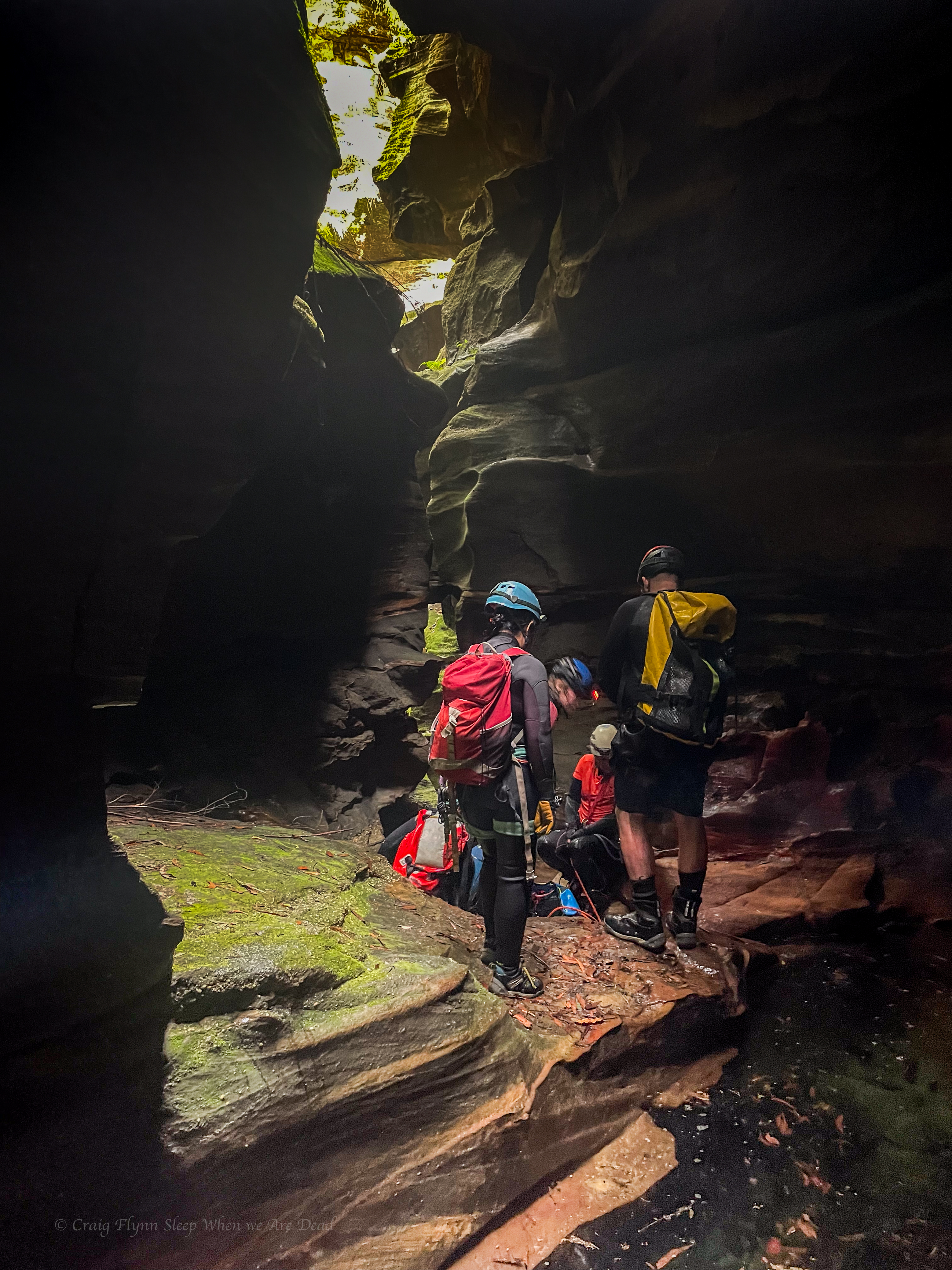
Kris and Hywaida join us at the crack of dawn and we head off to visit Hole in the Wall canyon.
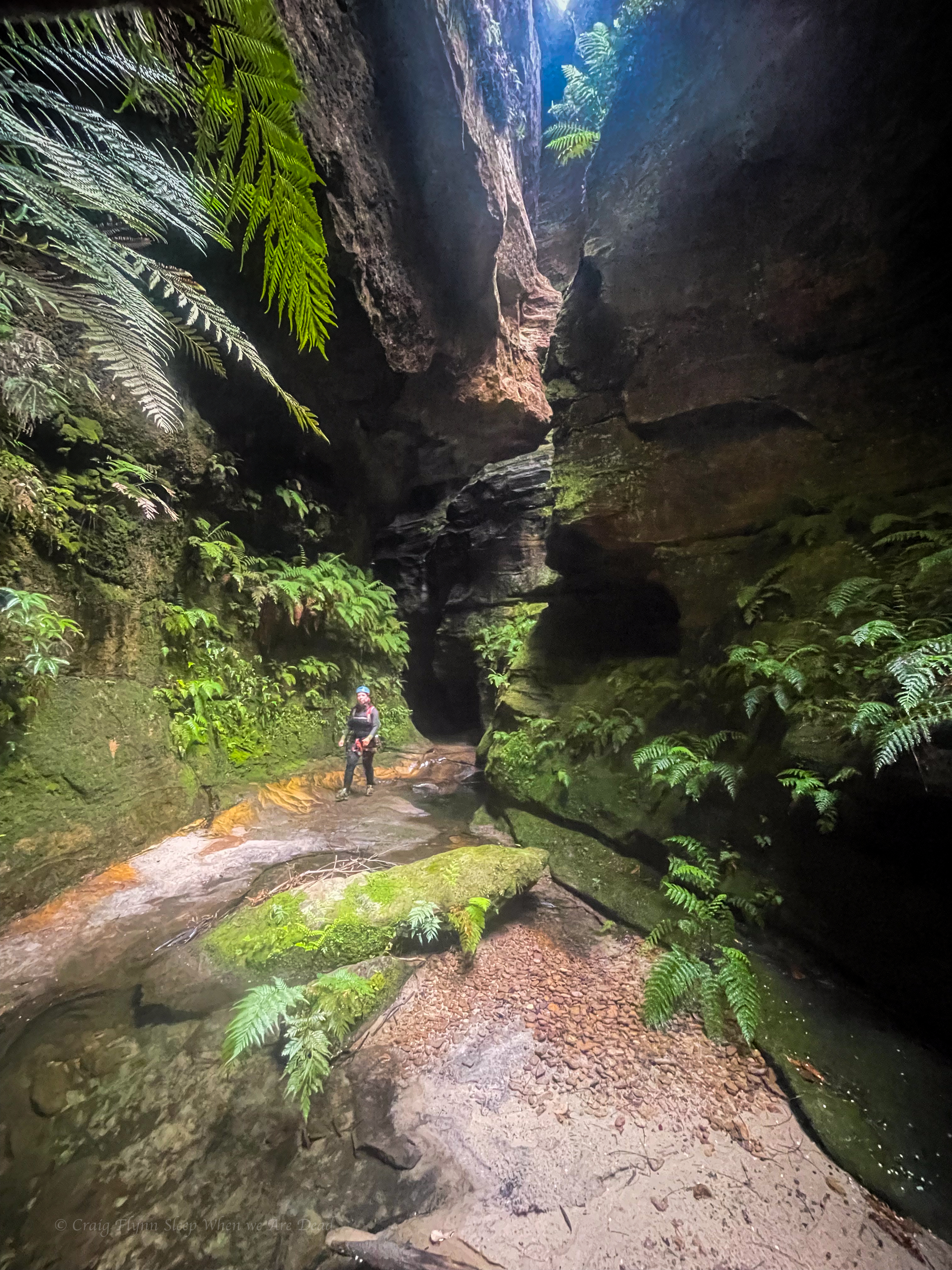
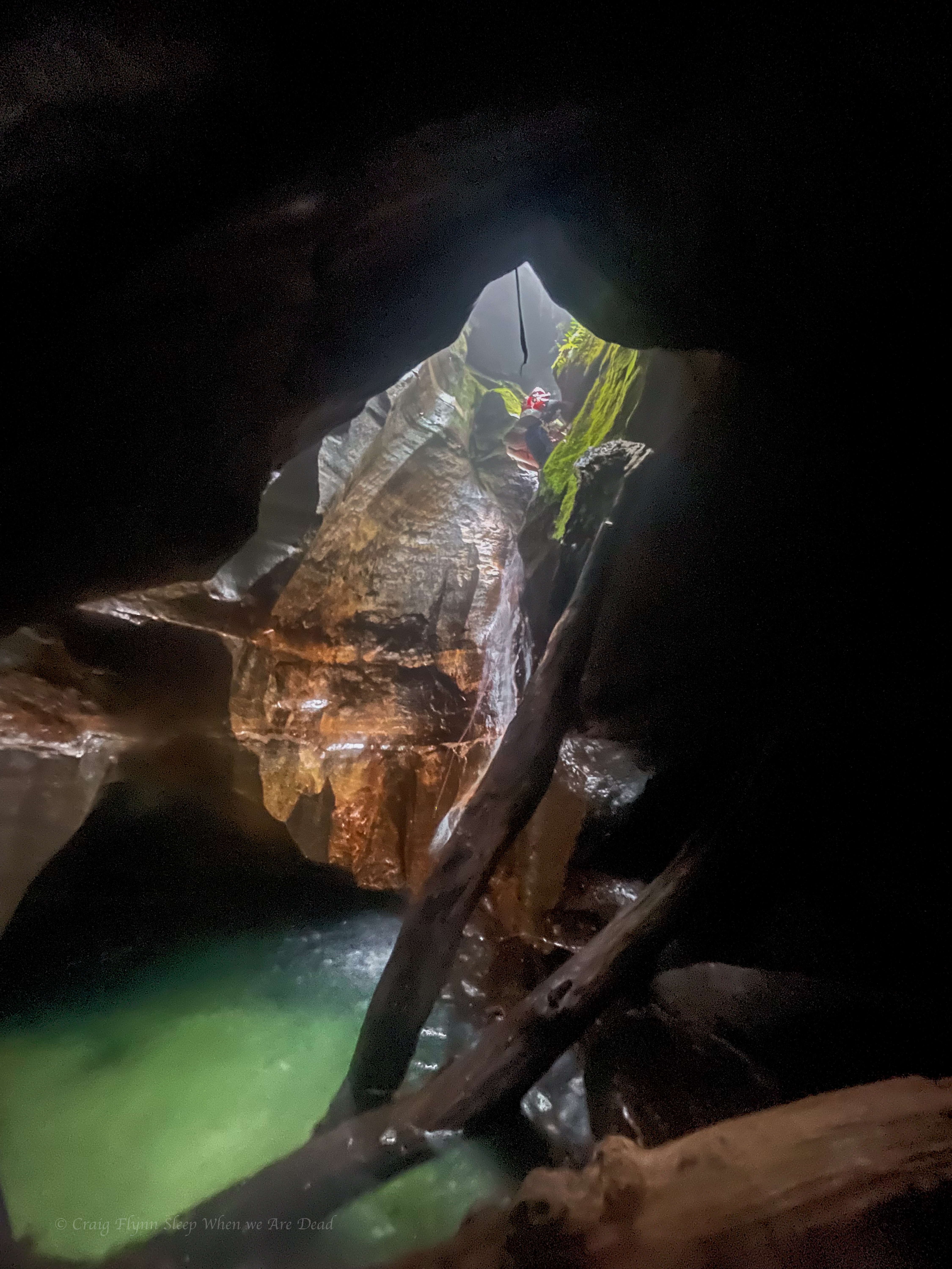
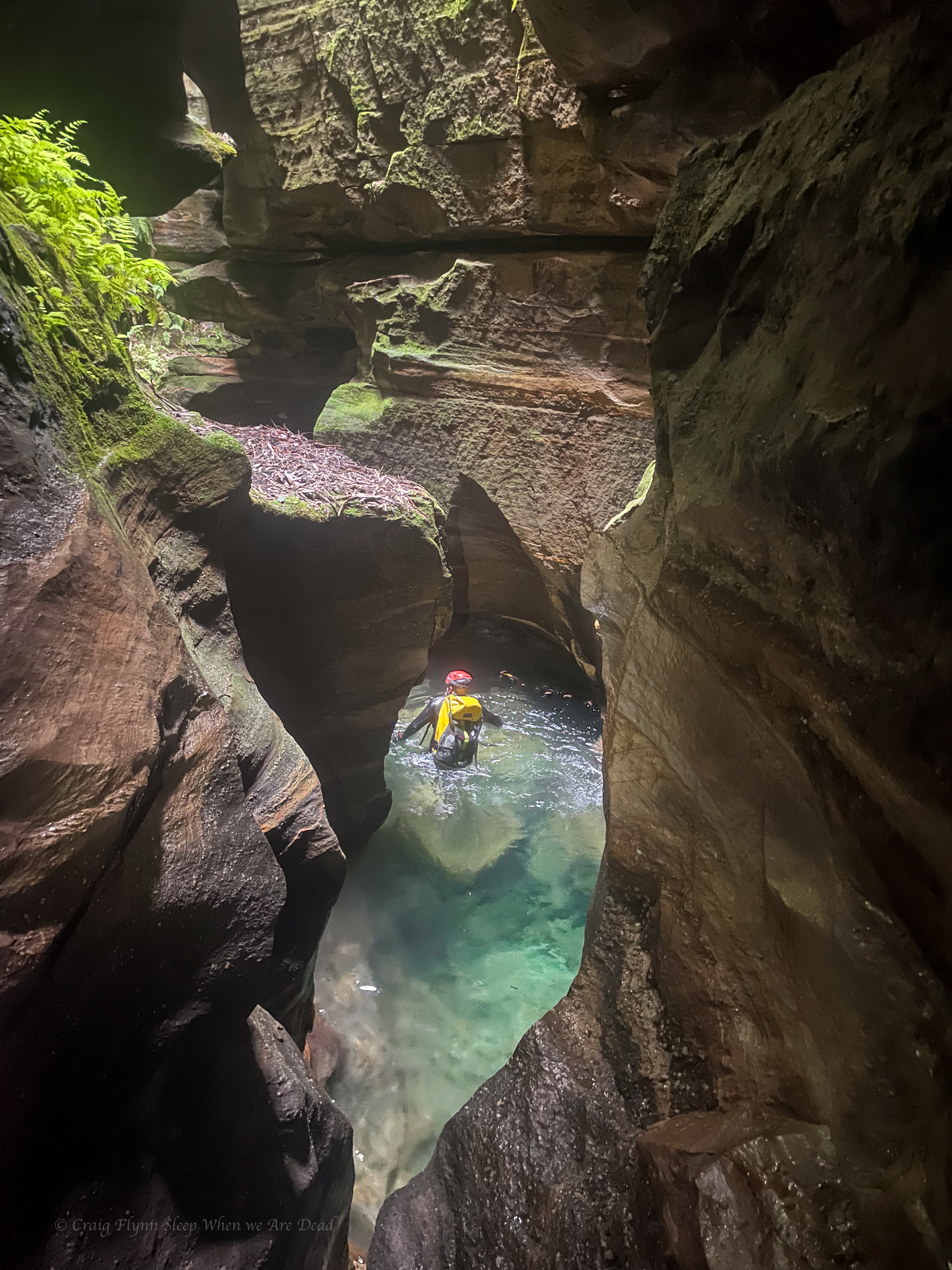
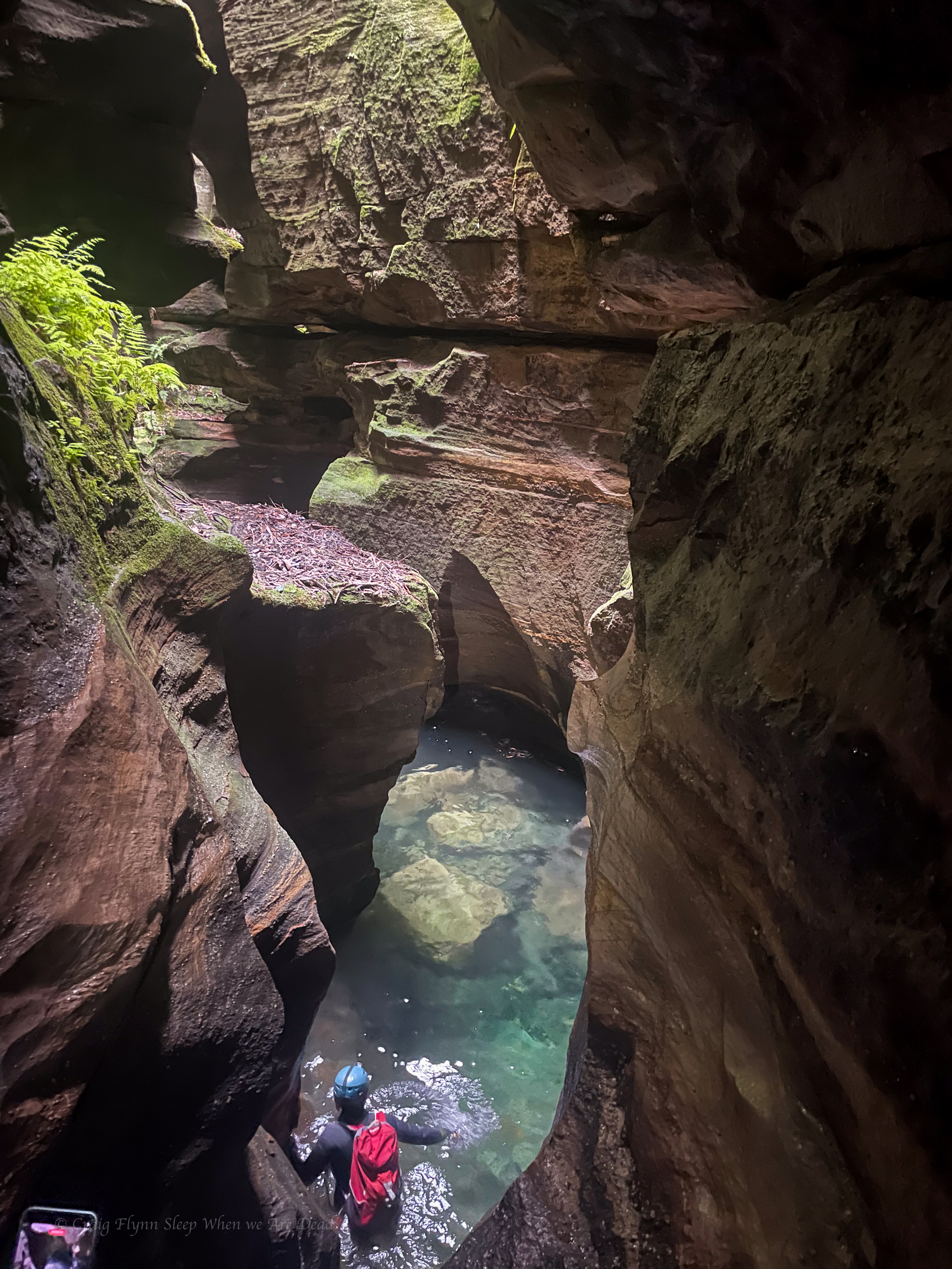
Hole in the Wall is a classic Blue Mountains canyon consisting of 2 deep, beautiful slots separated by a short creek walk.
Mon entering the upper constriction
The top sections contains some scrambles and wades between deep twisting walls, but no abseils
The bottom sections starts with an abseil into a very pretty pool
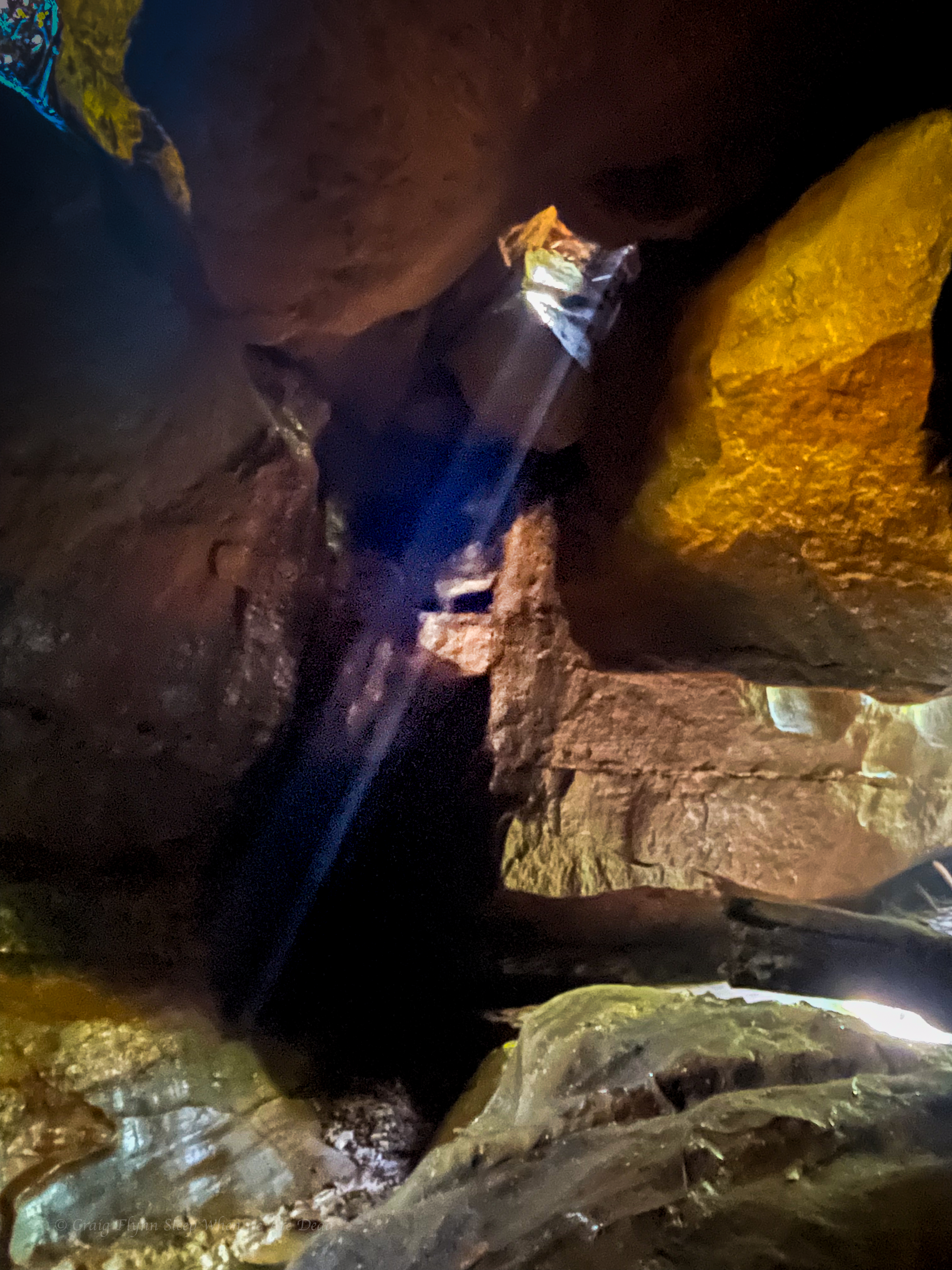
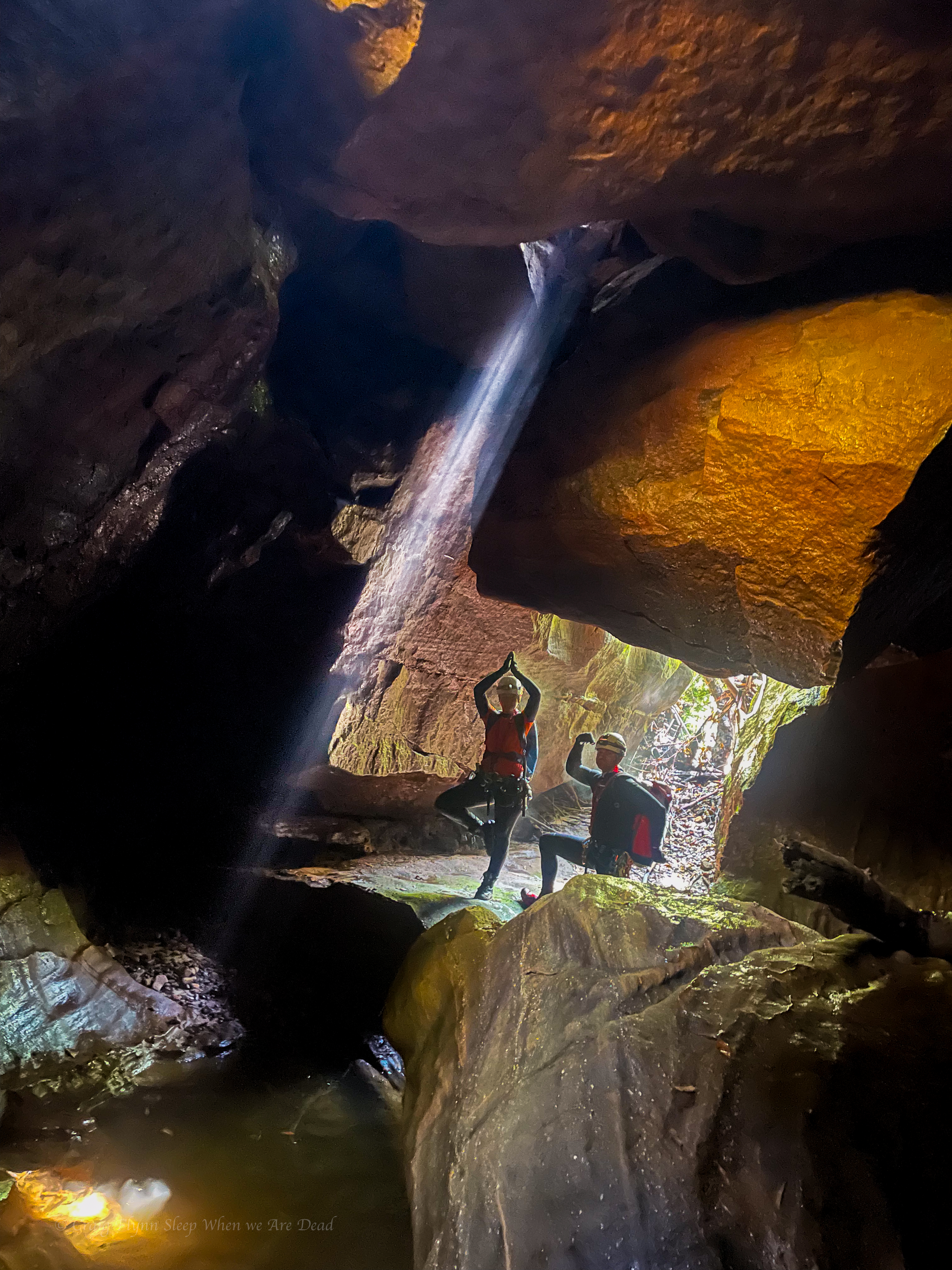
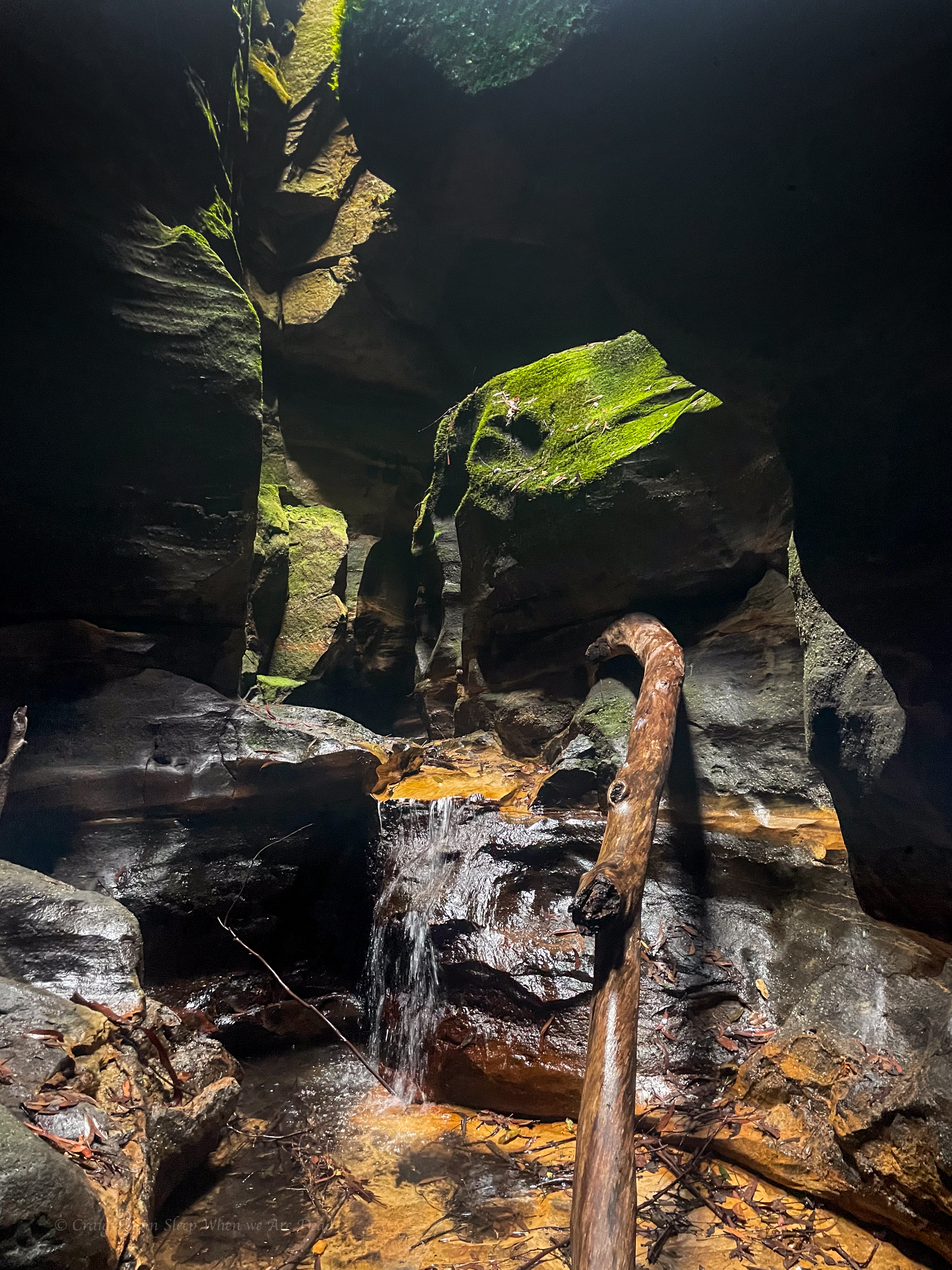
and then straight into the glowworm cave.
The glowworm cave is different every time I visit.
This time was probably the least spectacular display of worms. To be fair it was cold and wet outside, so potentially less insects to attract into their web, and it is early ion the season.
The hydrology of the cave also changes. The exit squeeze down to the left has long since collapsed. But what has been a deep swim requiring a difficult exit in recent years has silted up again resulting in a shallow wade.
Still it’s not as bad as it was in the early 2000s when you had to belly crawl in.
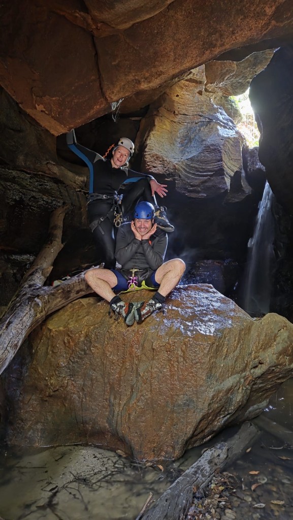
Then there’s the exit. Every year I think is this the year I’m too fat to make it. I’m not built for caving.
Jason in the green pool
Mon
Kylie in the lower section of the lower section
Levis’ mate Jackie
The final abseil
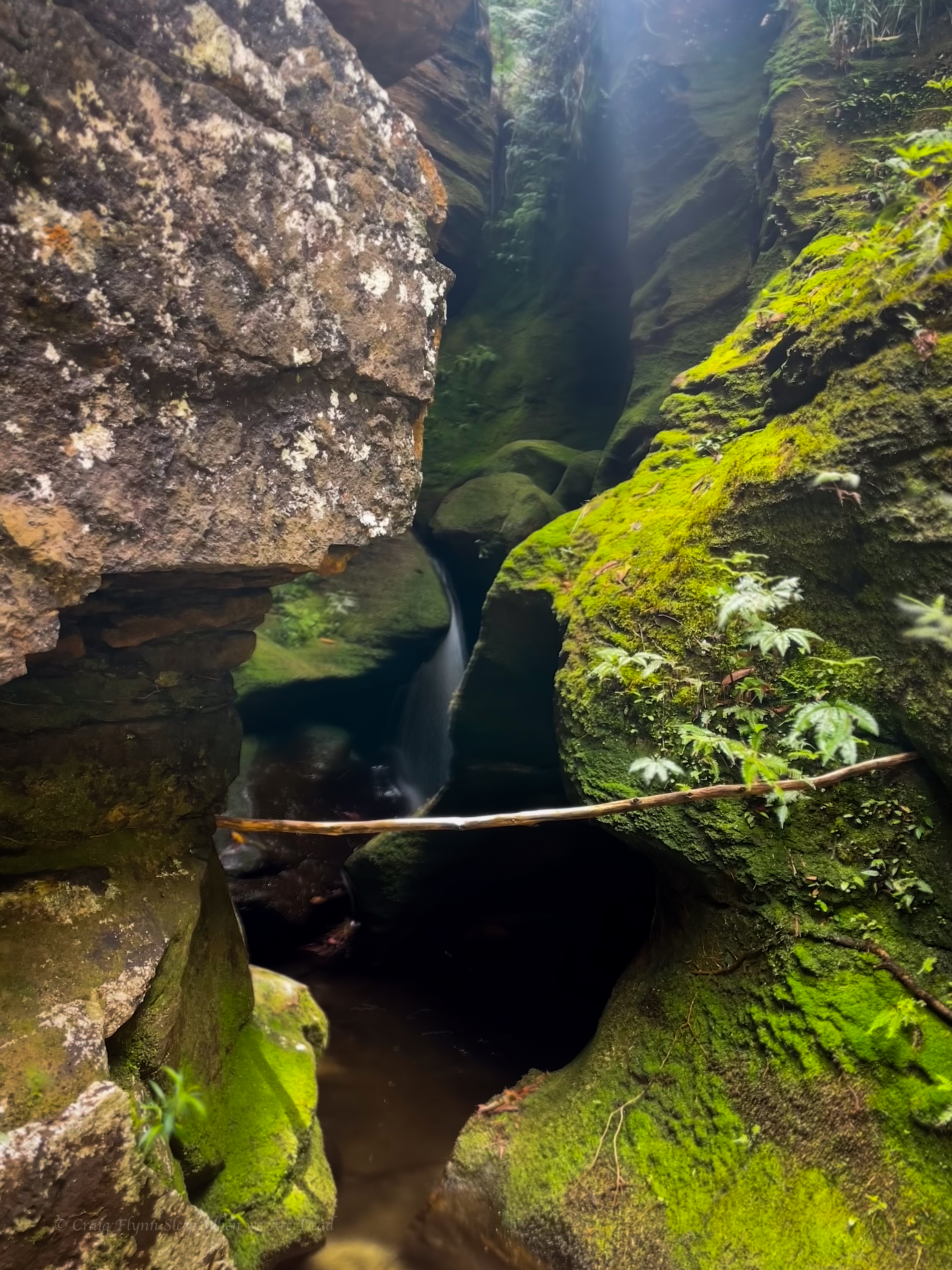
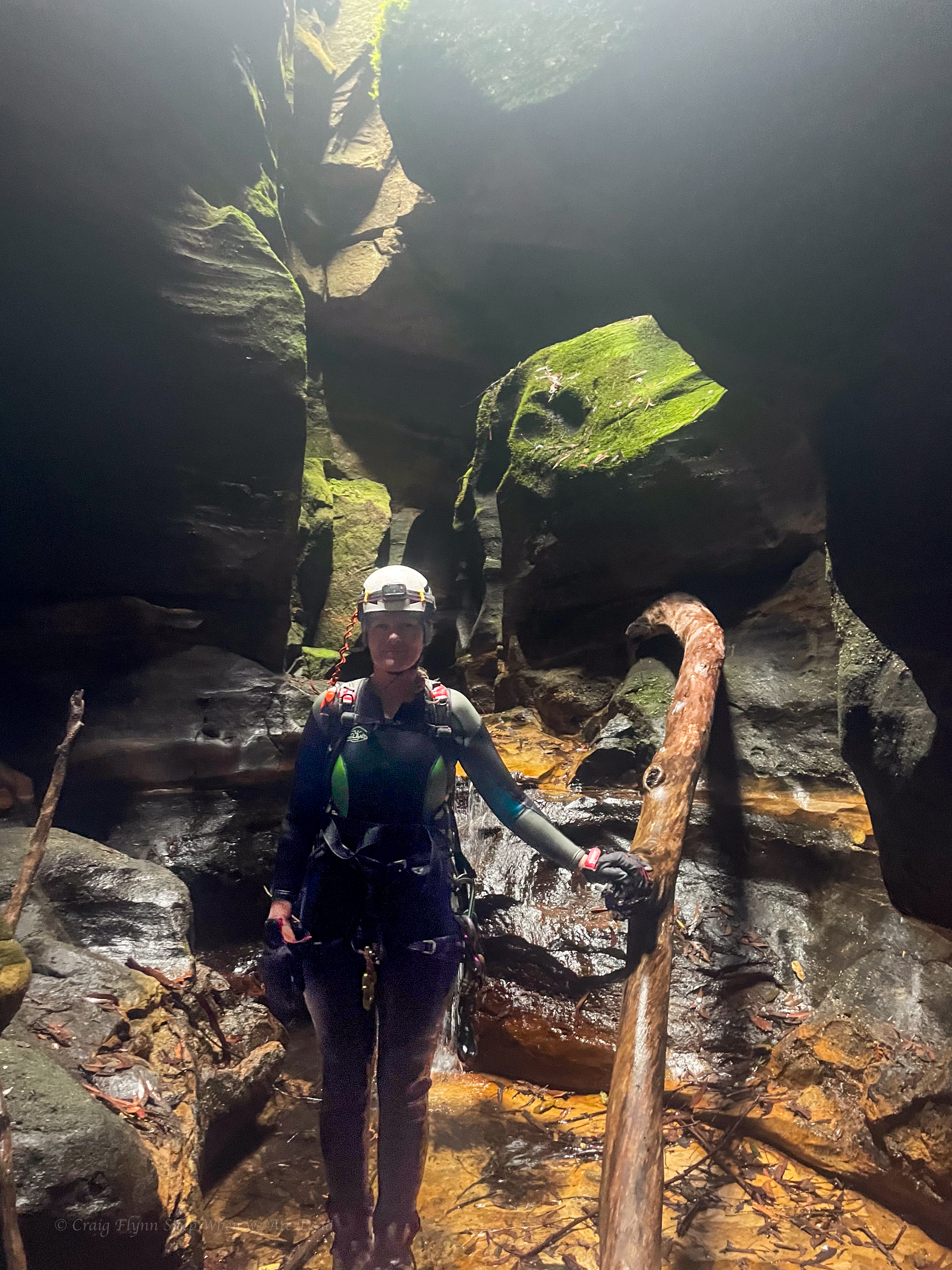
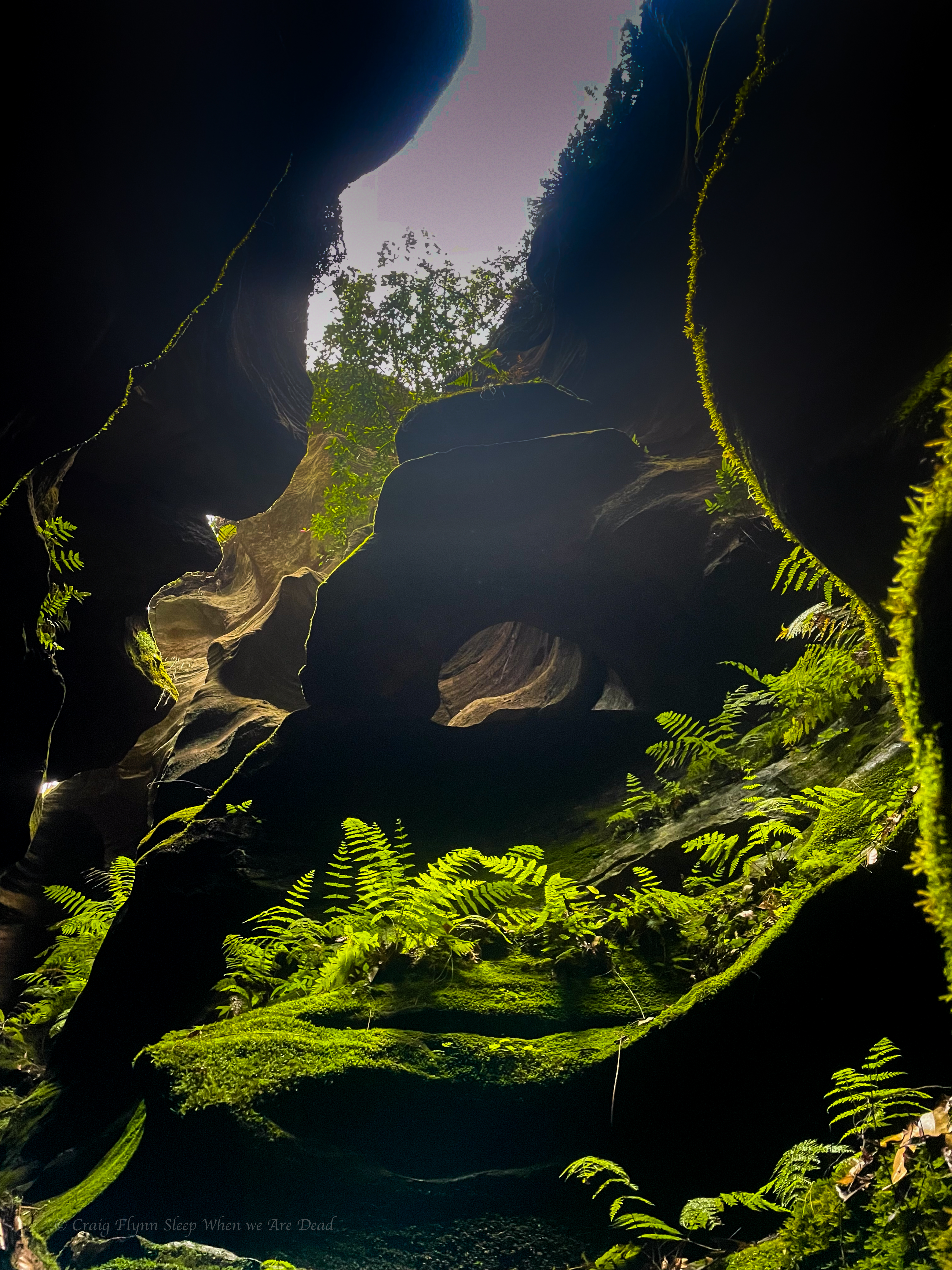
Lush green walls
And the final little waterfall before the Hole in the Wall of the Bungleboori
From here we head upstream.
Yeah yeah I know this creek has been officially renamed “Dingo creek” and has been since 2006 but that really is an unimaginative name for such a beautiful creek. On the old 1 inch to the mile Wallerawang map Dingo creek was marked as a small side creek (with an impressive rock arch). The major creek was Bungleboori Creek. The Southern branch that creek lower down was called Bungleboori creek, Nine Mile branch in reference to the Newnes Railway.
I’m assuming Bungleboori was the native name.
Anyhoo, we head upstream to the lunch rock at the usual HITW exit, we have made good time and enjoy a quick bite to eat in the drizzle before crossing the creek and heading up the other side for your next adventure.