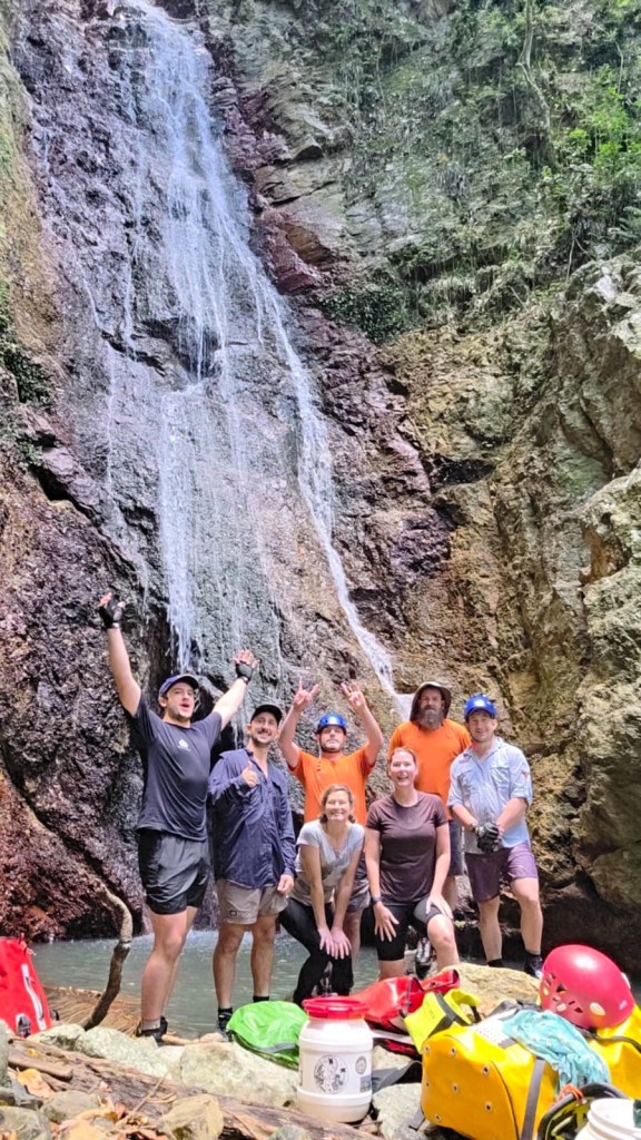
Kylie, Jason, Beck, Robin, Alex, Dane and meeeeeee
We were in northern NSW and it was too good an opportunity not to have a New Years Day play date with Jason and his QLD crew.
Every one else had done this one before but it had been on Kylie and my wish list for a while.
Pictures of it pumping in previous years had us frothing.
However, recent photos look like a trickle.
A storm the night before got our hopes up.
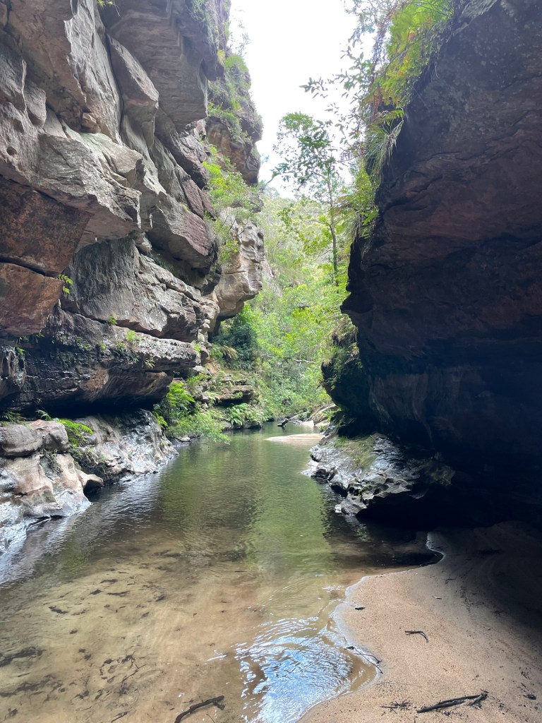
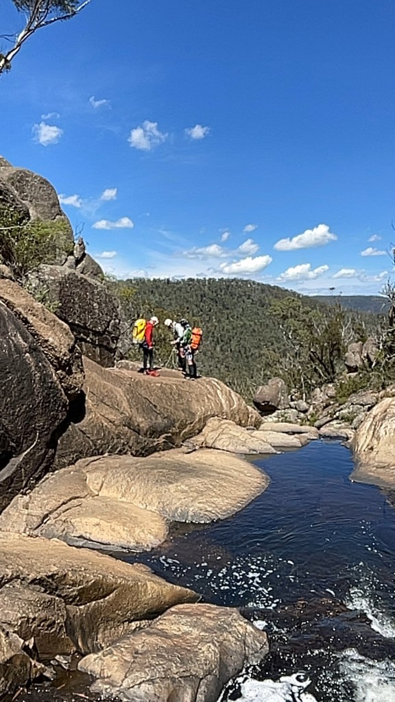
We meet at the top secret location (note: location may not be top secret) and skirt private property boundaries to access our canyon.
The storm had done nothing. Nothing !
The creek was dry as a nuns nipple.
Well not quite. There was water flowing, just
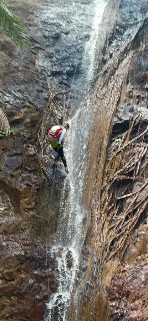
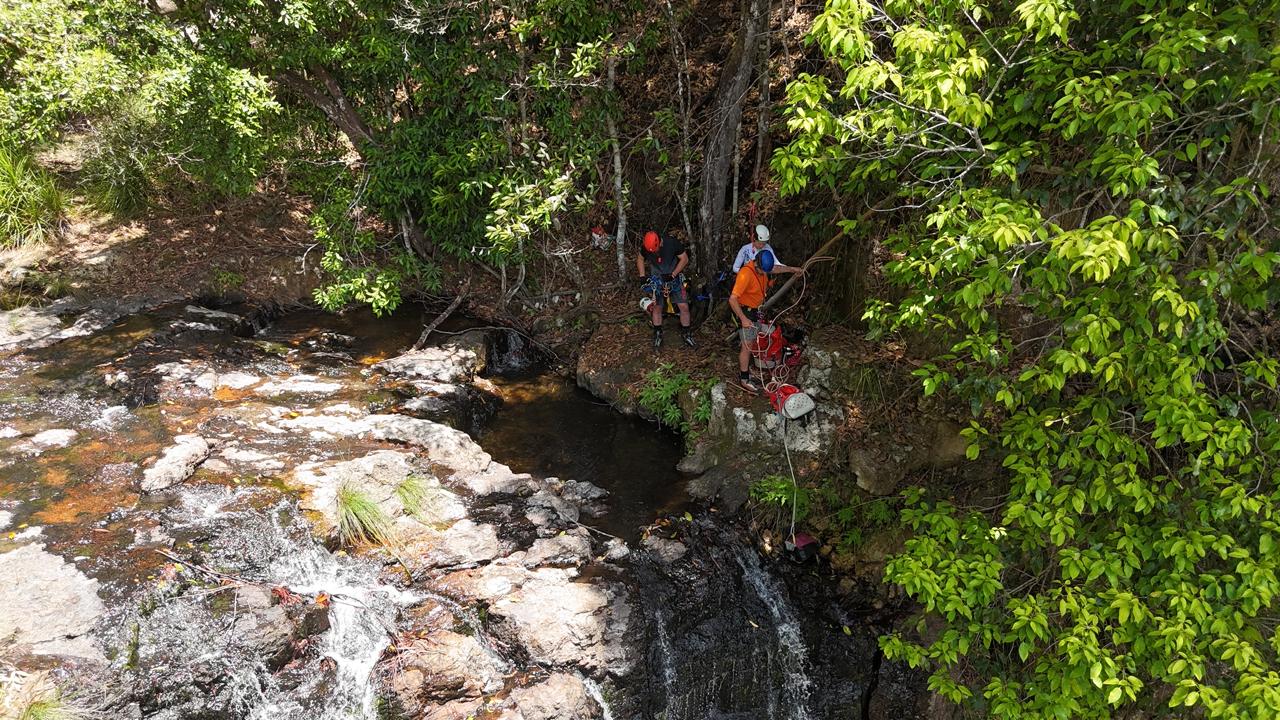
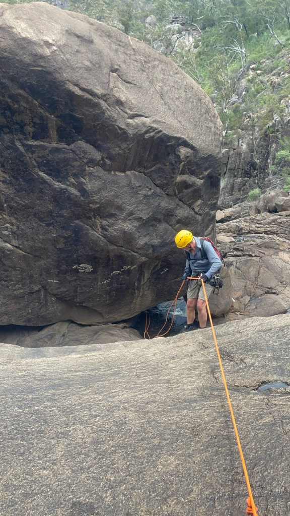
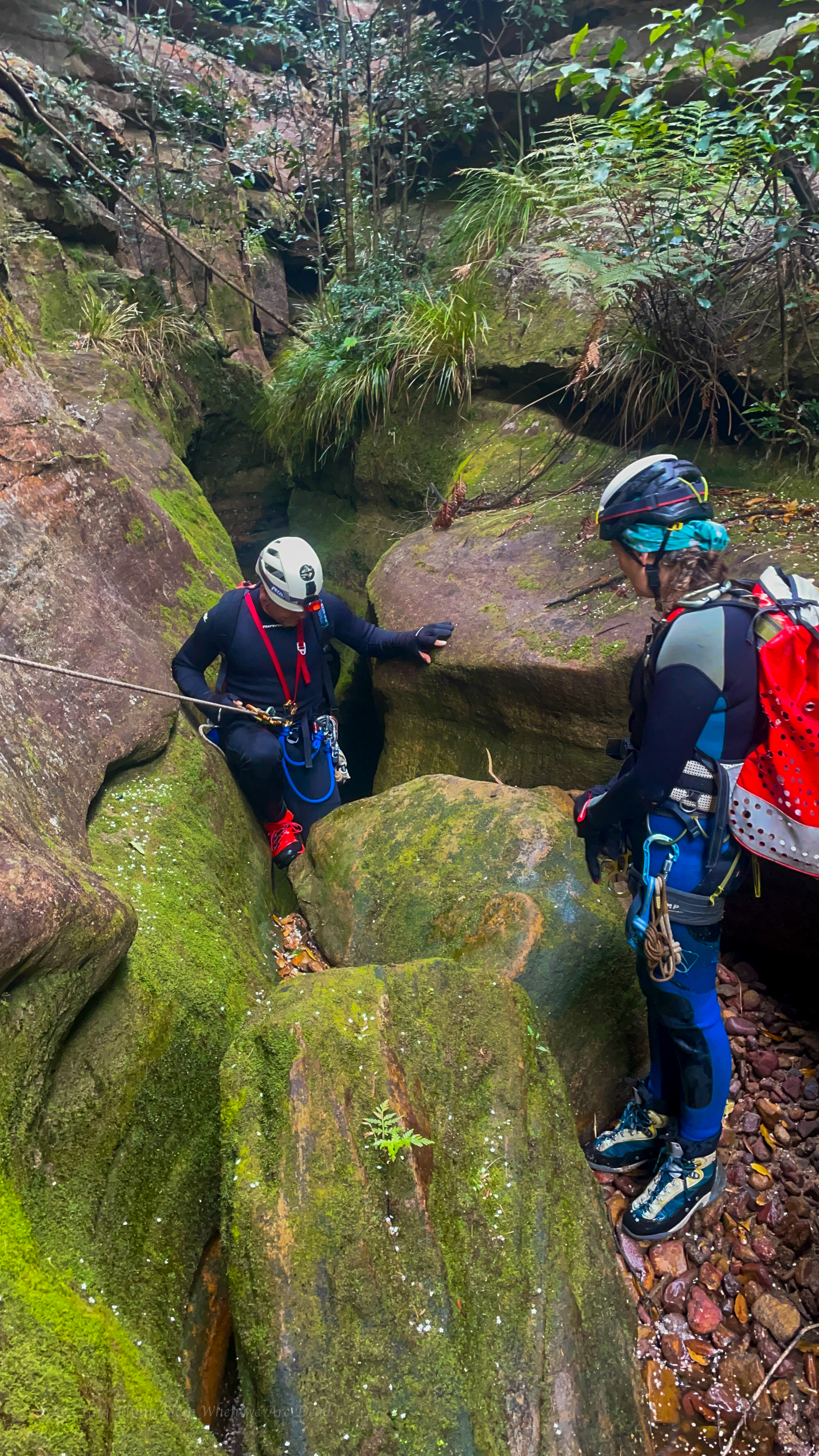
Jason wondering where the water went.
Alex on rope while Dane waits
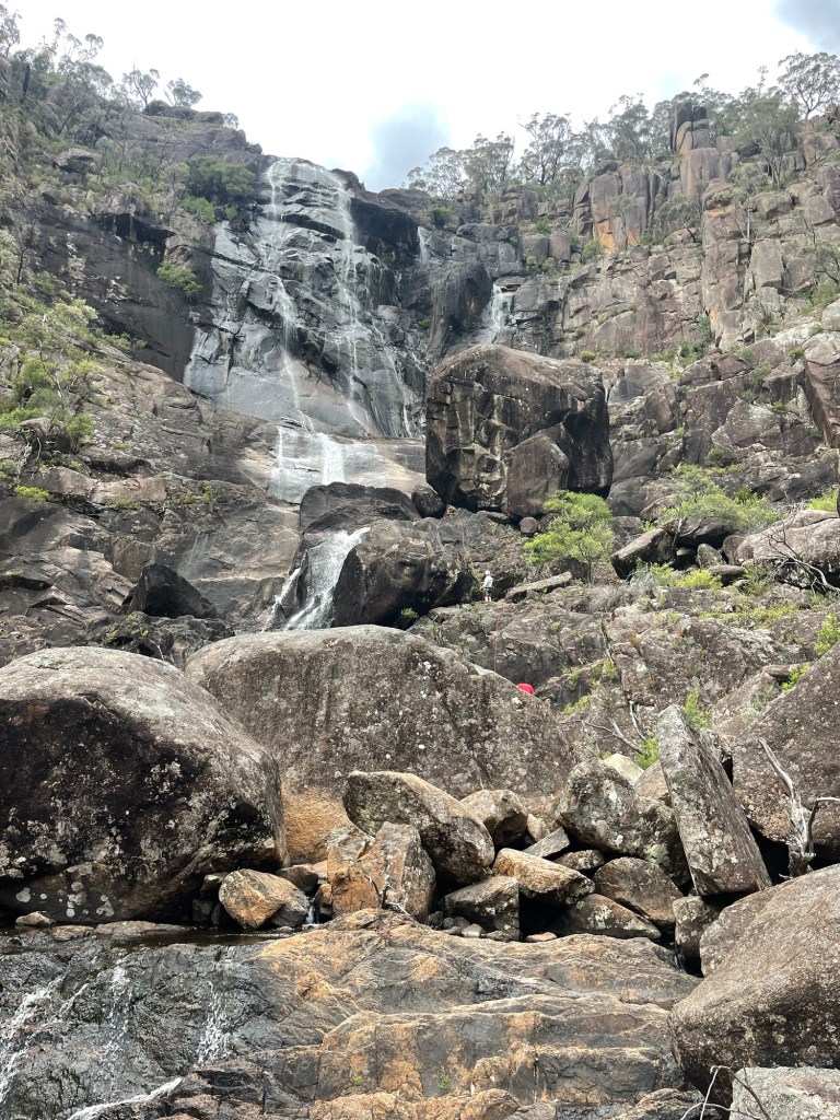
Kylie thinking, well at least it’s a little wet
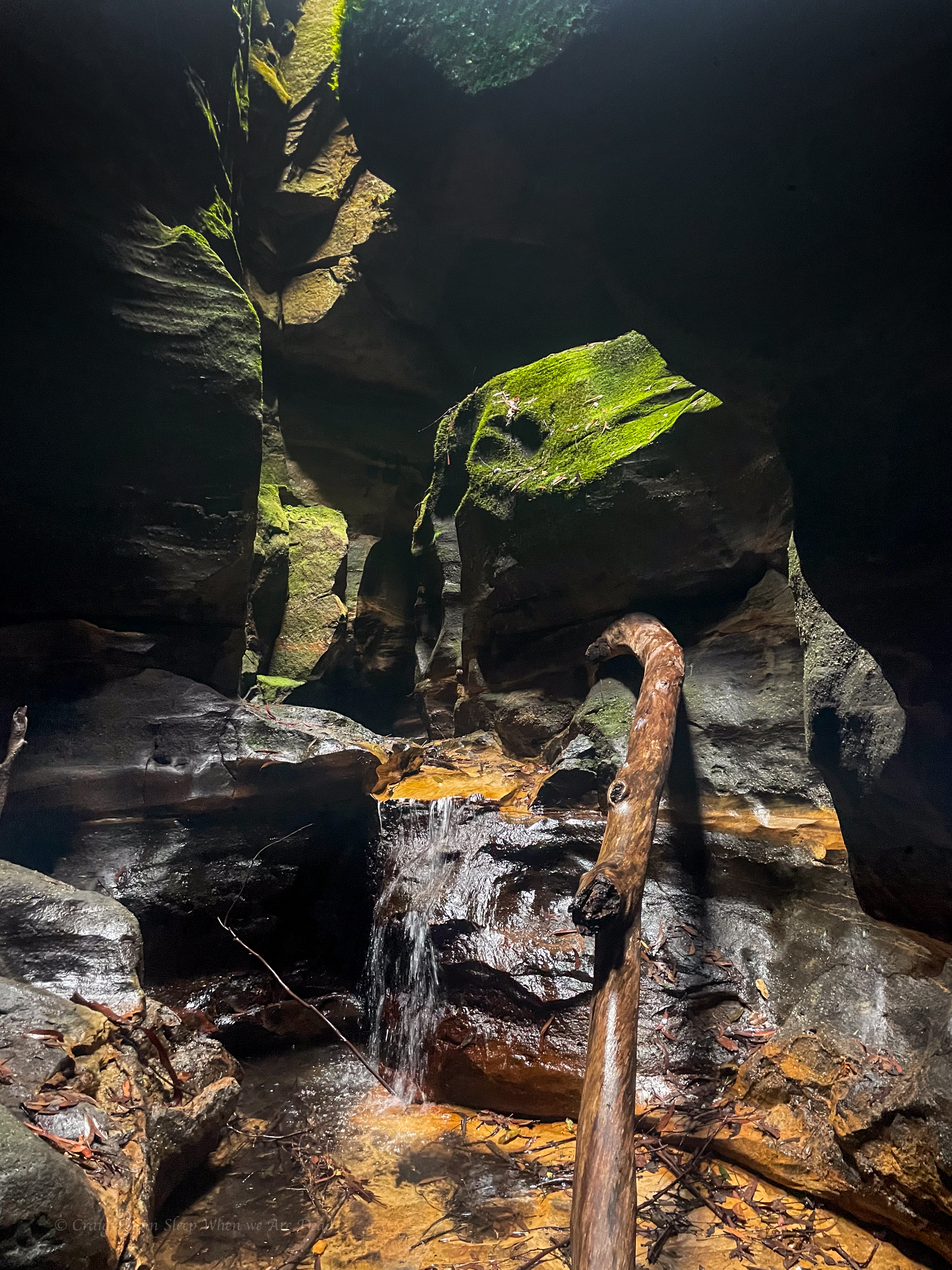
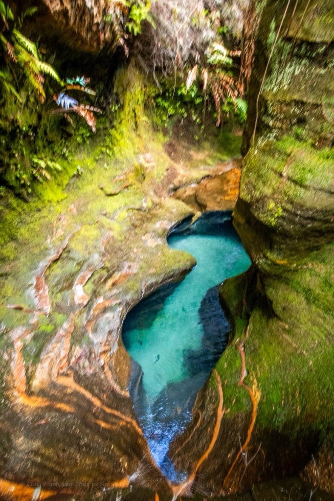
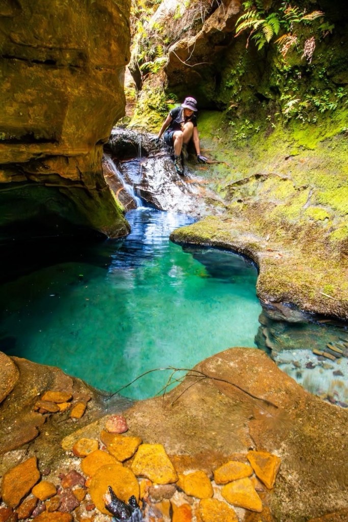
It might be a trickle but still pretty
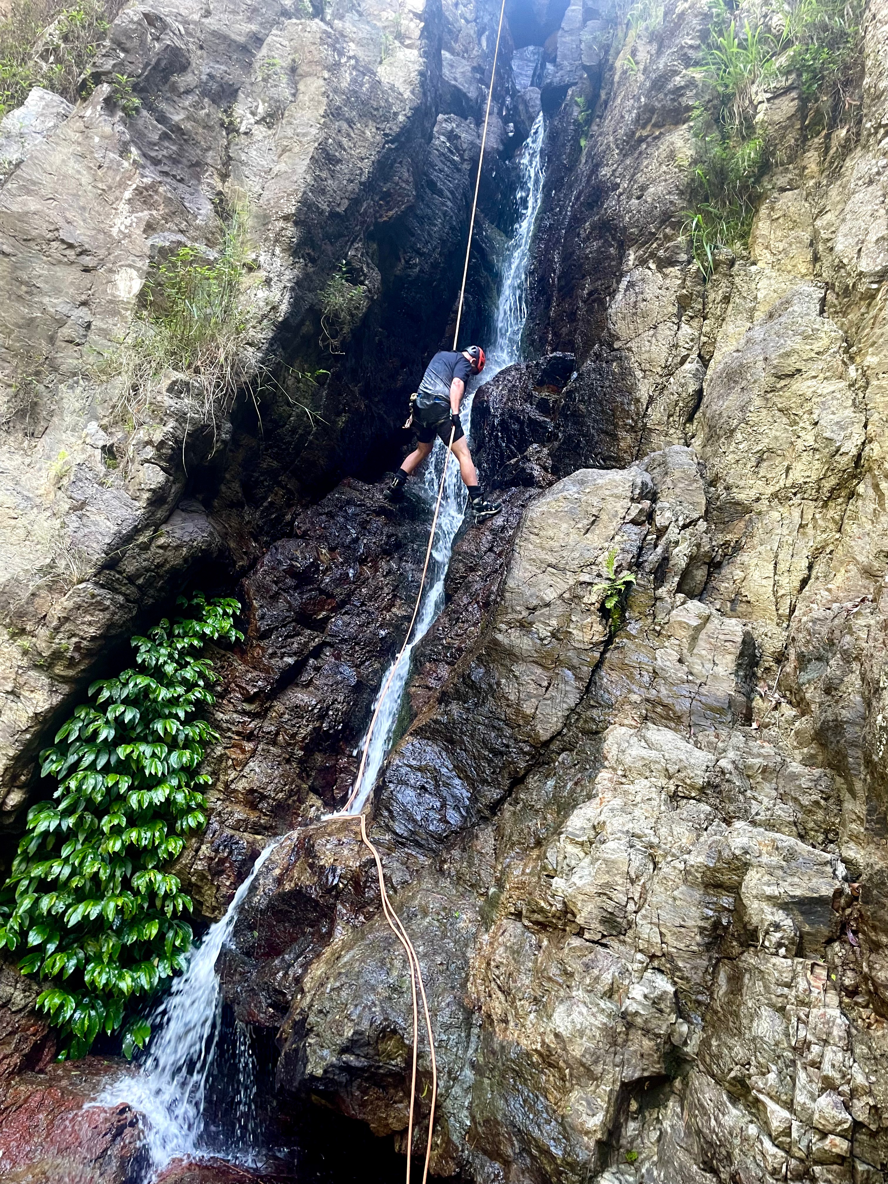
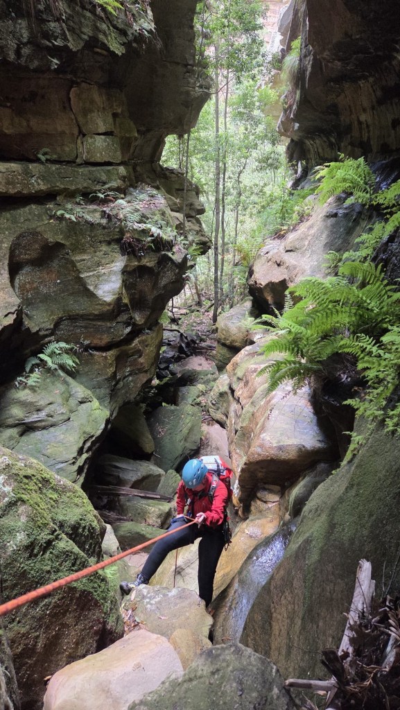
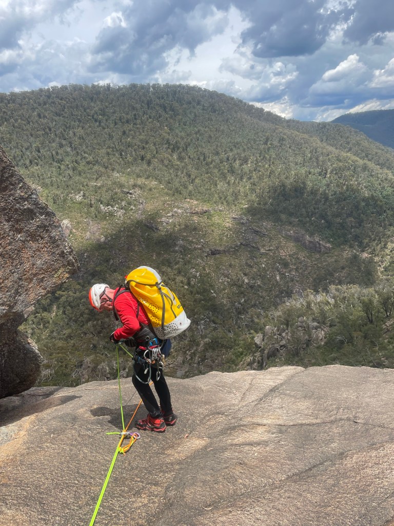
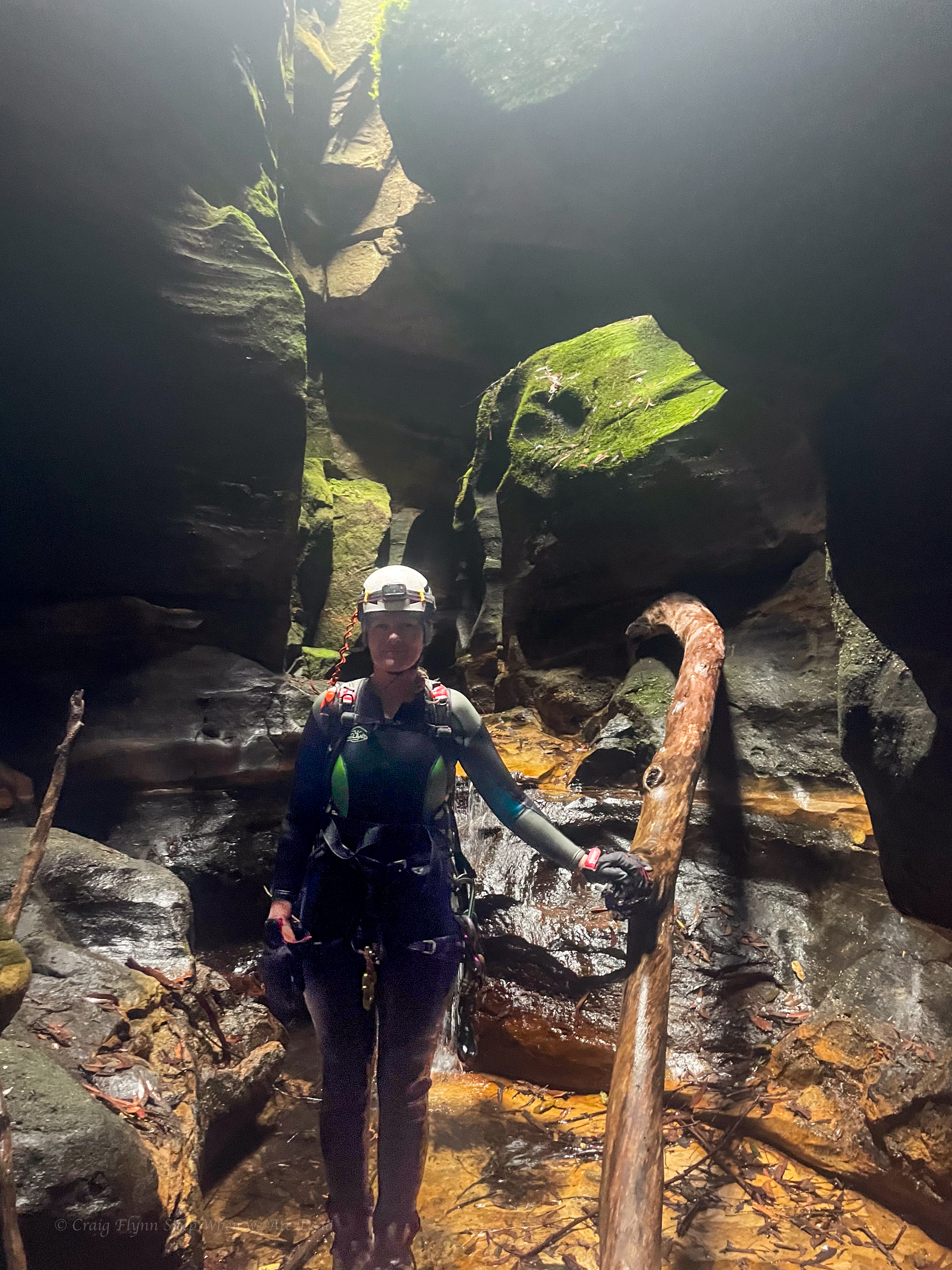
Taking on Vecna
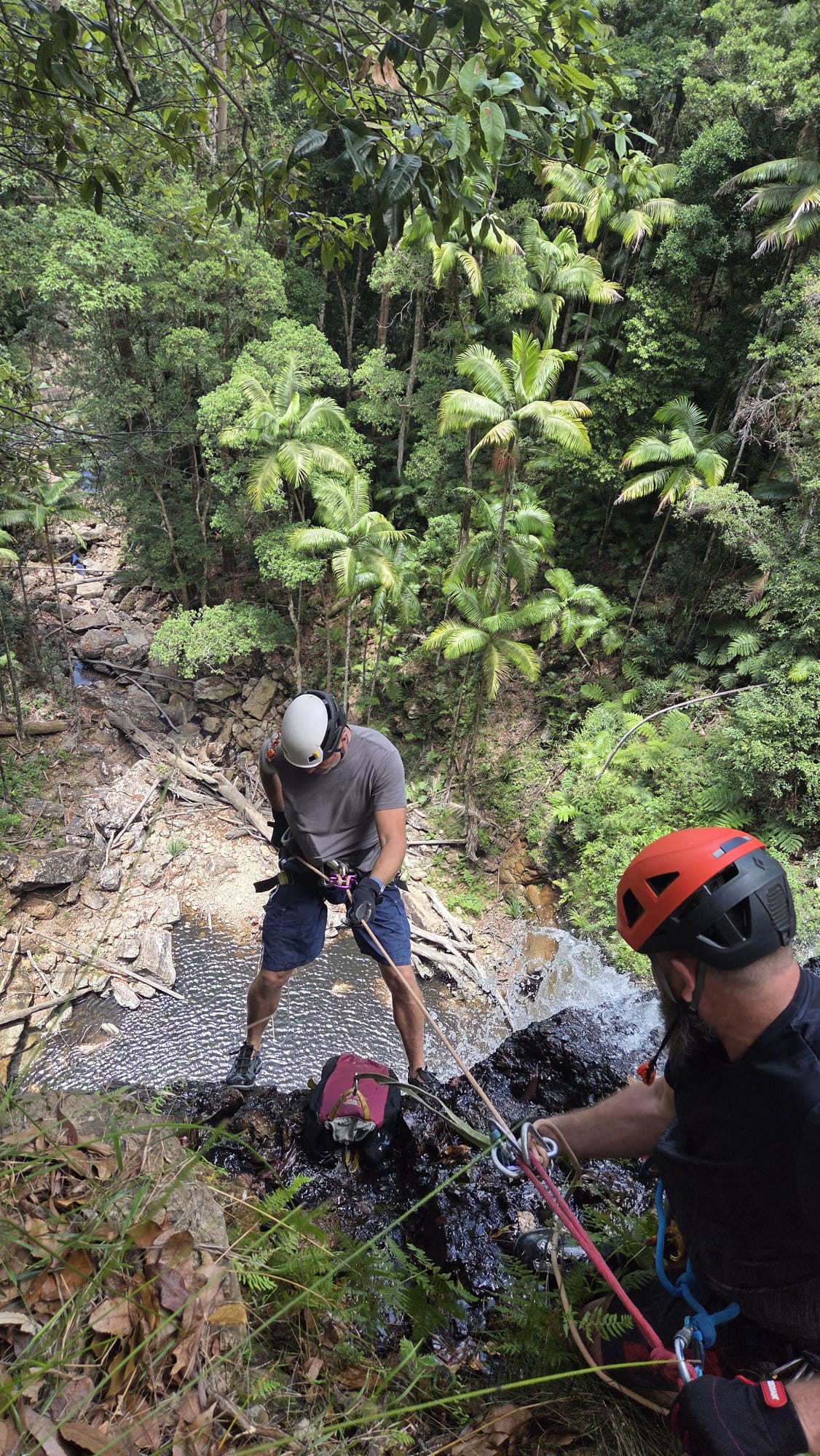
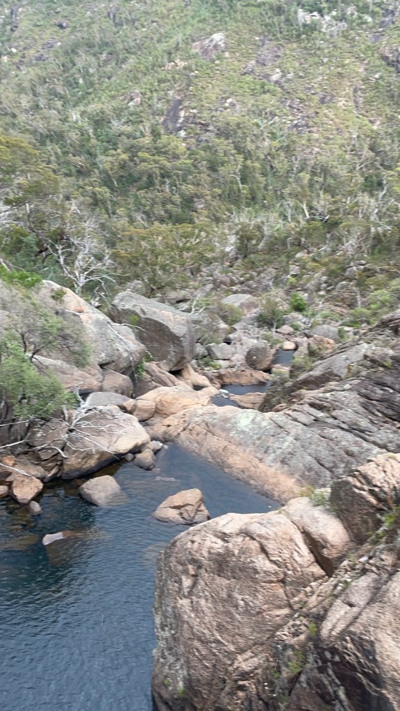
Robin wondering if he should avoid the pool or plunge in
There is a teeny tiny lathe you can unclip and jump from
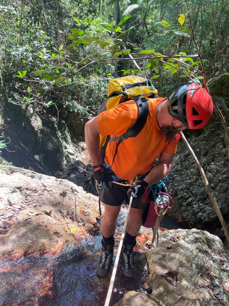
Coming last I made an error. I didn’t unclip it just did the usual Empress release the brake hand and jump.
I knew my centre mark was just beyond the anchor.
I figure I jump out and when I reach the end it will pull the pull strand with me.
I’ve done that before, but I unclipeped first.
This time I’m sailing through the air, there’s “a bit” of a jolt snap the plastic lug it was tied to and the end of the rope recoils up And is now on a teeny tiny ledge 4metres above the pool.
Up I jug to retrieve it.
Lessen learned, double check your centre mark, especially when doing abseils exactly as long as half your rope. And keep an eye on your end of rope markers
I have marks at the 10 and 5m points to let me know I’m getting to the end. I didn’t even look for them. Dumb arse.
Anyhoo all good, no harm, rope retrieved. Let’s never speak of it again.
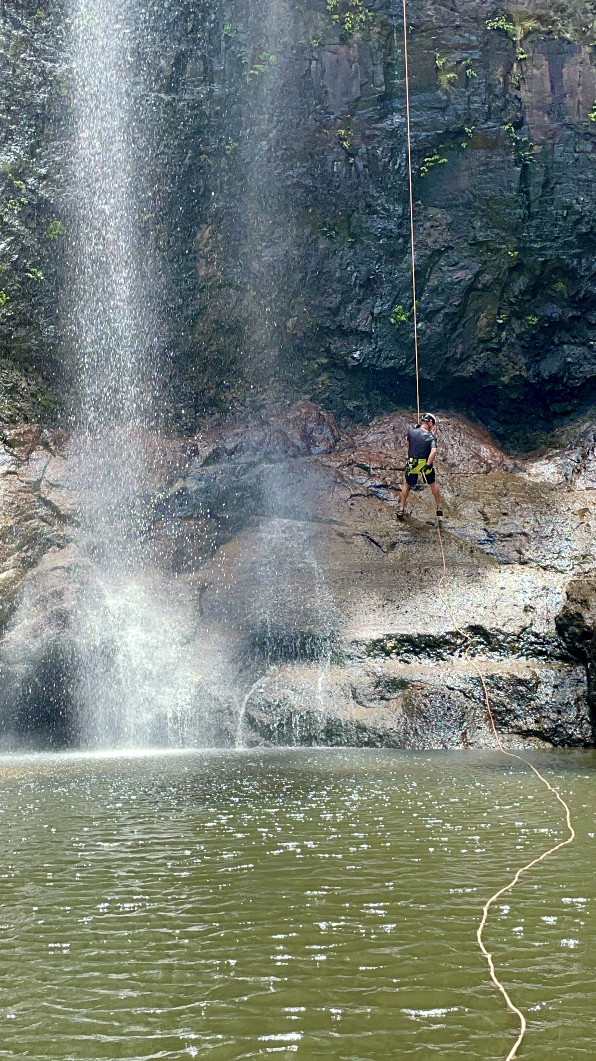
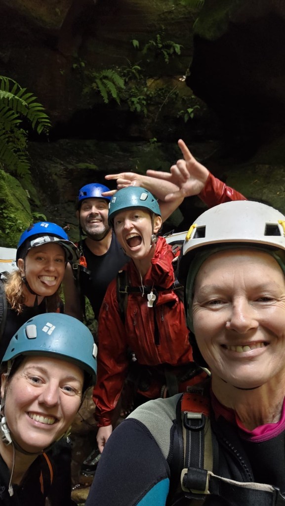
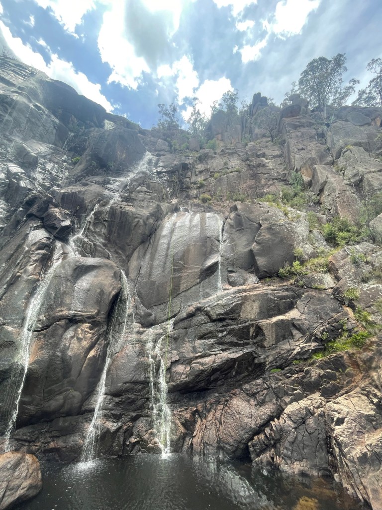
One more abseil and she’s all over.
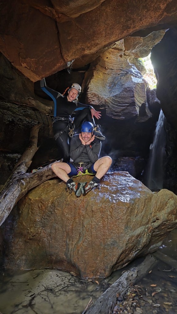
Beck doing it in style Only slightly rinsed but Happy canyoners
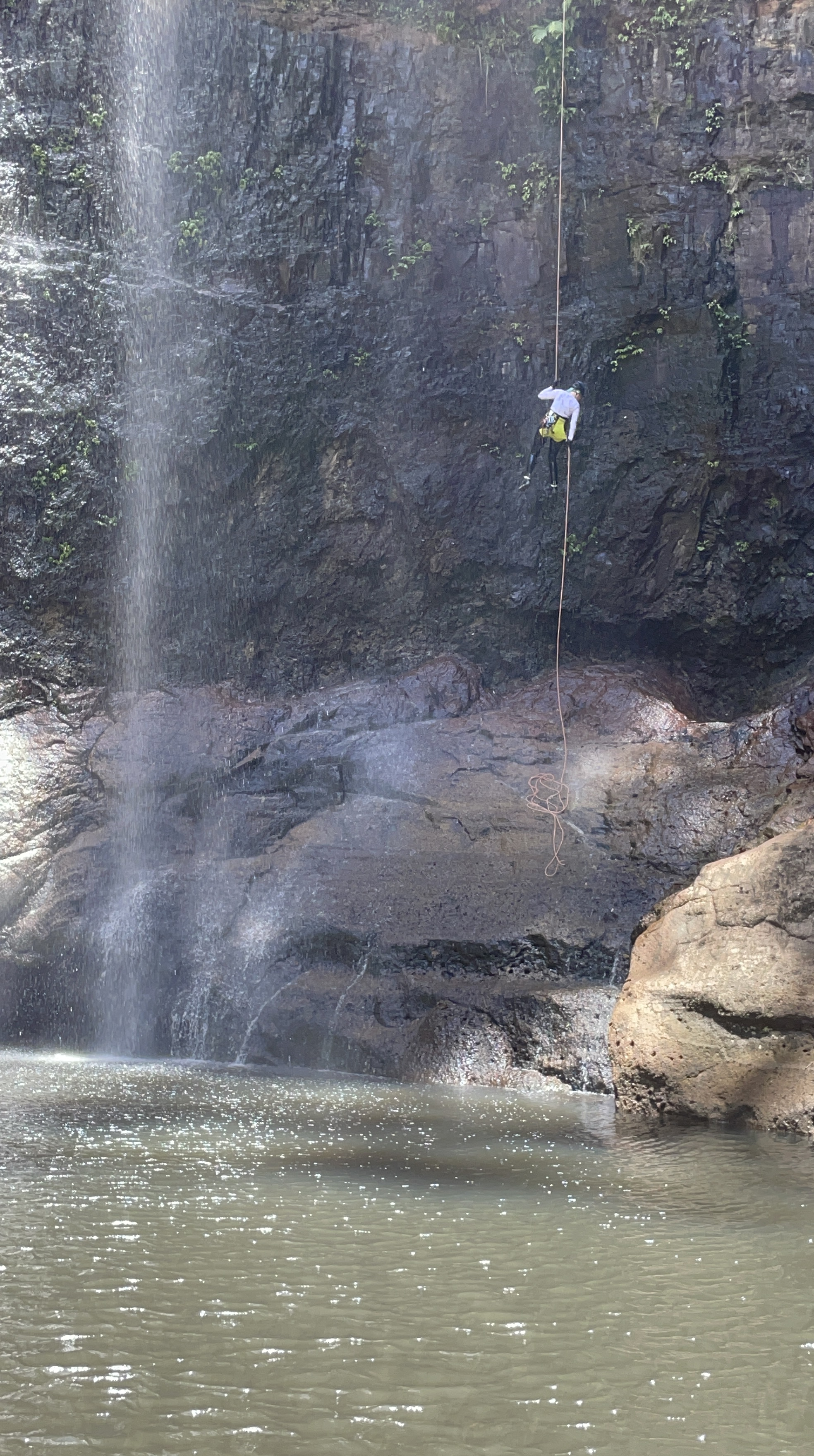
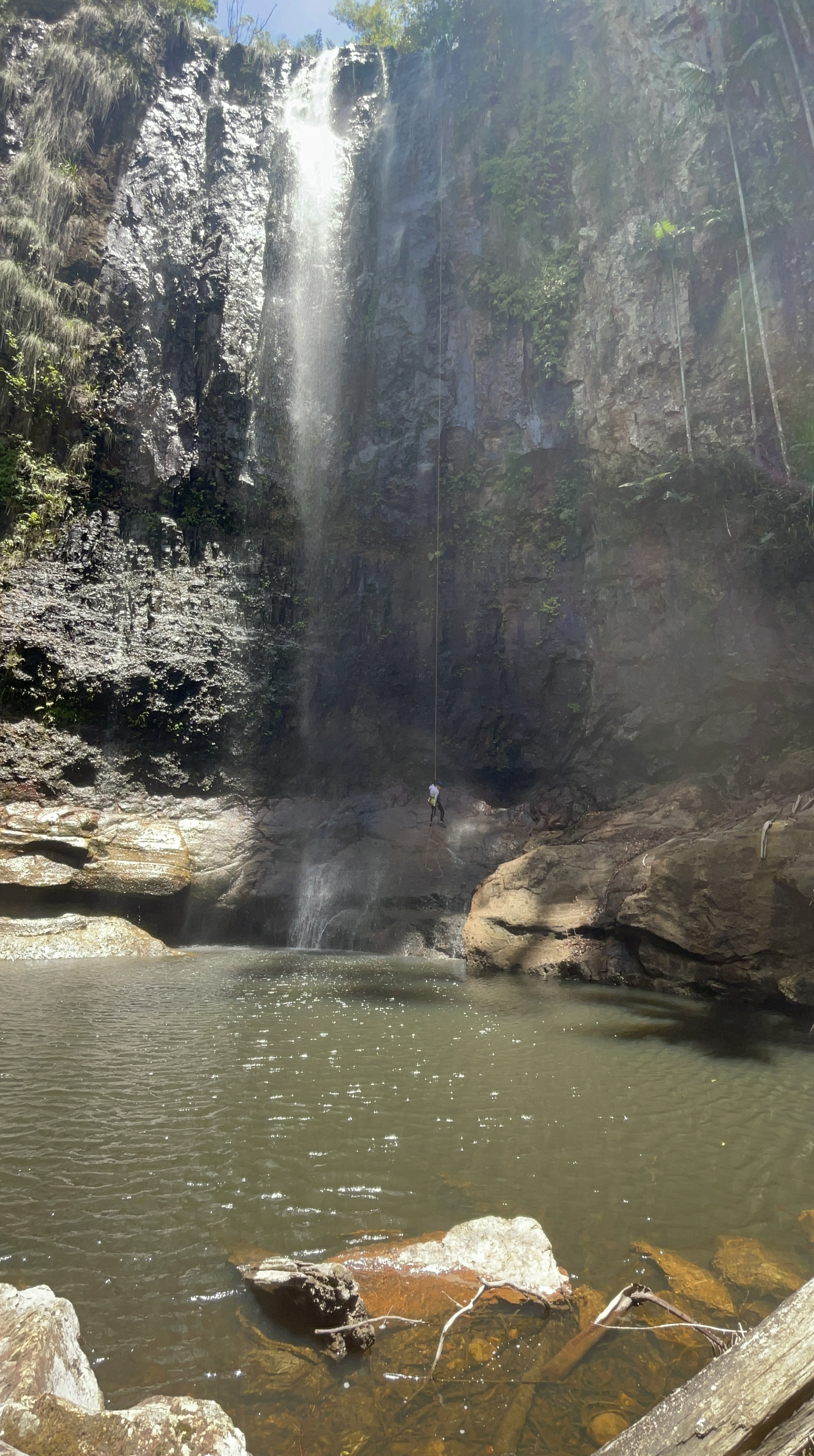
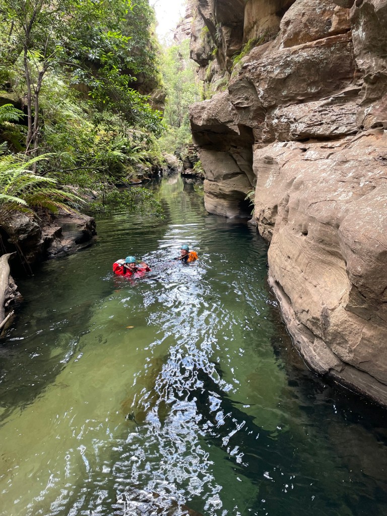
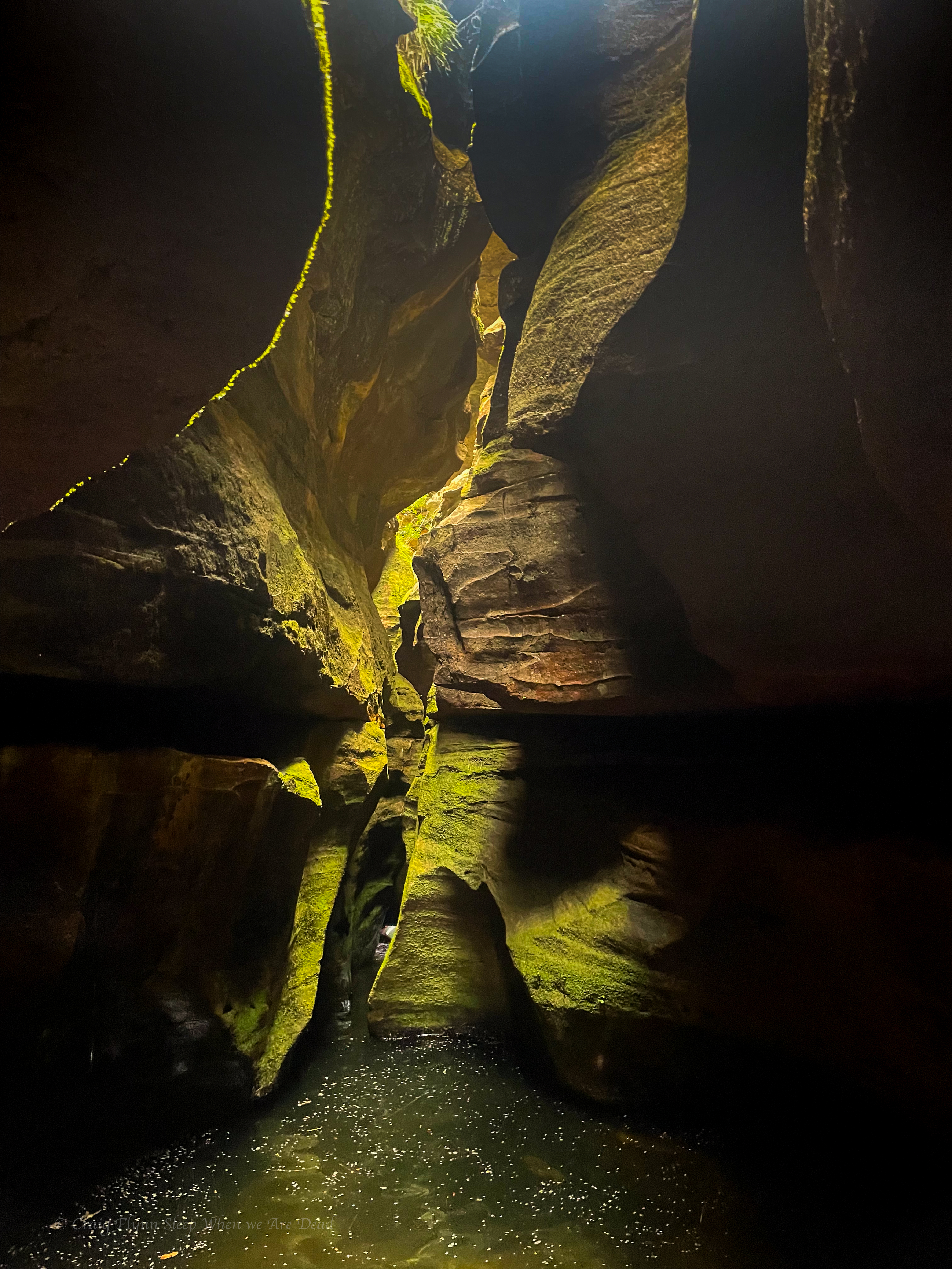
We spend a bit of time making sure we get it right as the rock can be damn sharp in these parts. Canyon and rope bags are put to use as rope protecter, then I head on down.
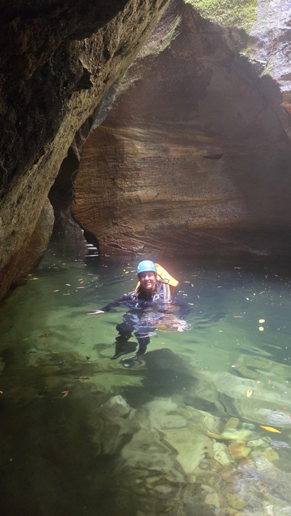
It’s a great pitch, slippery start to free hanging in the spray, finishing on a slab into the pool
the sun was in the wrong spot so these photos don’t show the amazing colours of this place.
and the water was warm!
As my old mate, Super Goose, likes to say “It’s like getting hit up the bum by a rainbow.”
Whatever the hell that means. He made it sound like it was good or lucky or sumfink.
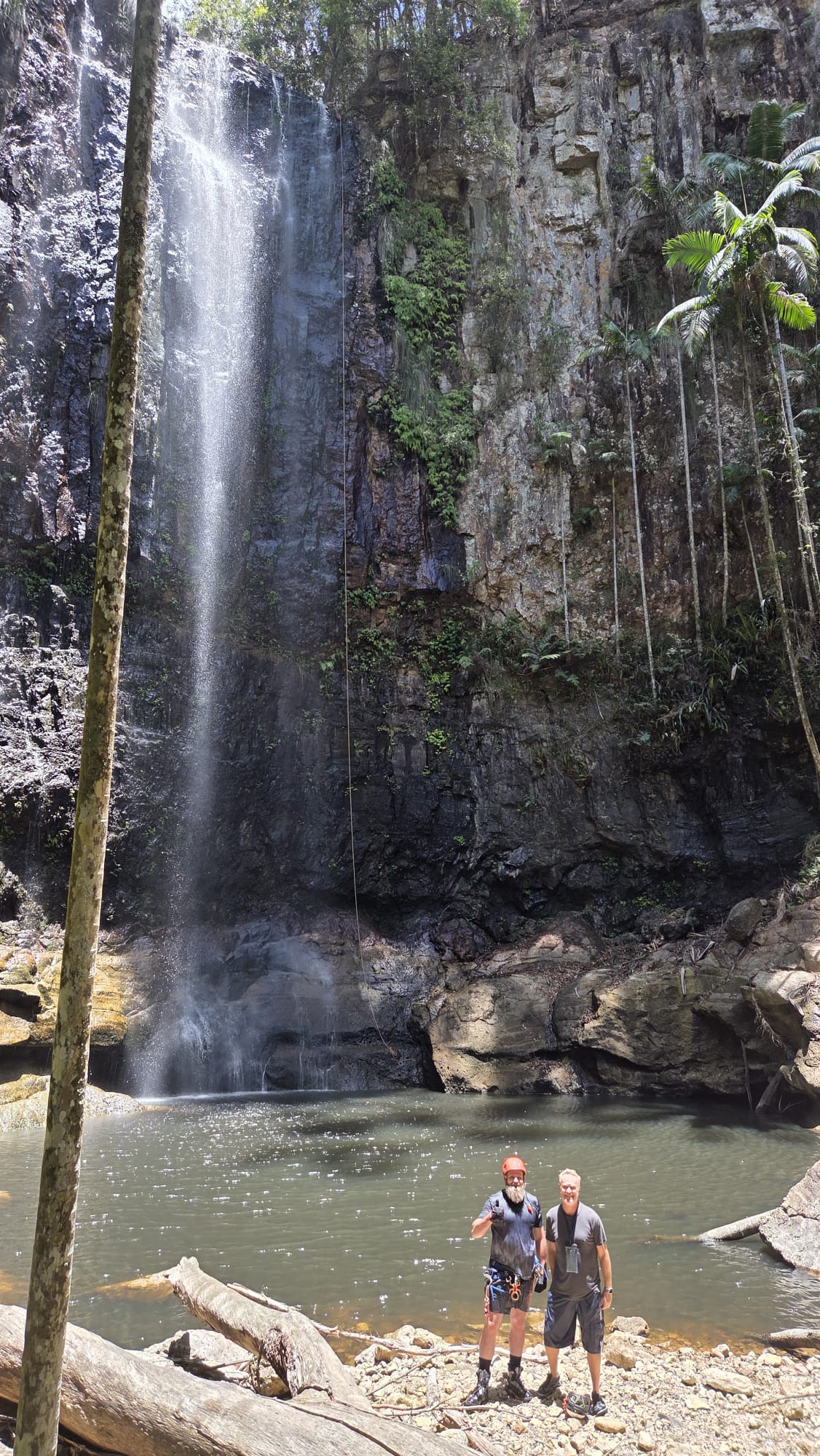
Jason and Jonathan
What makes it even better is a quick and easy exit back up to the top. So Jason and I opted for a second run. TBH I could have done this one over and over
But we make our way back to the car and head across to the Hell Hole!!!
Apparently we missed Henrik and his mate by a day here which is a shame as it would have been great catching up with him.
Hell Holes is a little more canyon like, but still just 2 (or 3) pitches down a waterfall.
Again the water is super low so Kylie and Jonathan decide it’s not worth descending.
Probably a good choice.
But Jason and I think we may as well.
More of a questionable choice.
There wasn’t much in the way in natural anchors at this one.
Good Luck. It’s bolted.
Bad Luck. P1 is carrots.
Good Luck. We have bolt plates.
Bad Luck. We didn’t bring them with us this trip.
Good Luck. The carrots stick out a bit and I’m able to hero loop a sling.
Bad Luck. They want me to be crash test dummy….
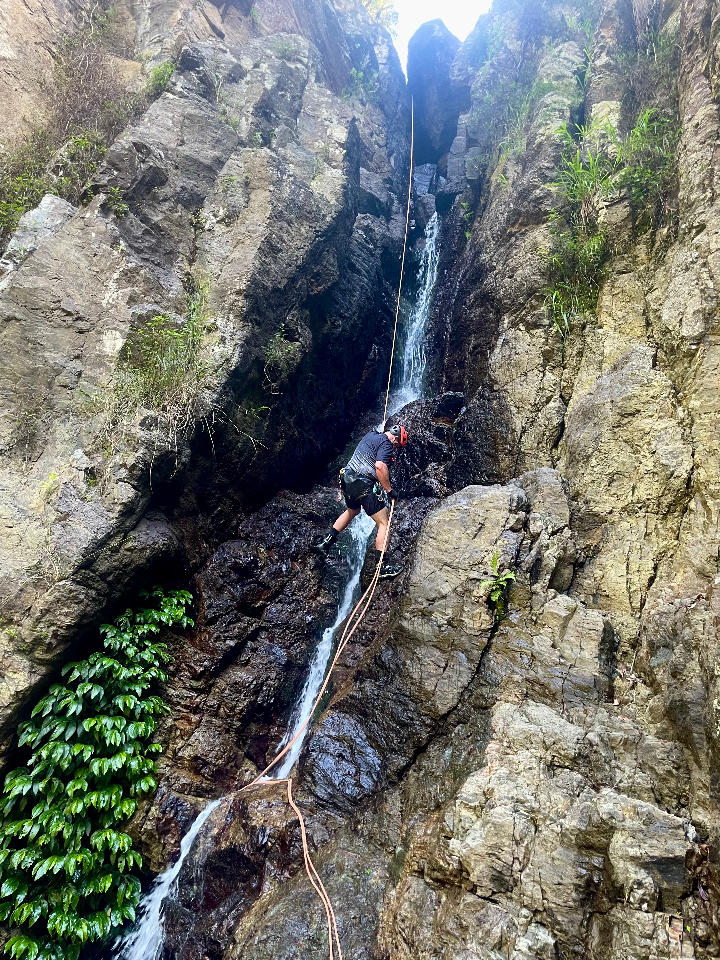
And again the rock is super sharp so we opt to do the first pitch on isolated double ropes.
the anchor for P2 is solid though the top nut is starting to show signs of corrosion
the start of P2 is, um awkward. It’s a tight wedge with the rope trying to pull you into the wedge. I could imagine in high-water this would be very tricky indeed.
The water is barely a trickle.
You can do P2 all the way to the bottom as a ~52m drop. But the notes say it has a habit of trapping ropes so we had planned to split it into 2 and rebelay off the large ledge 2/3 of the way down.
Turns out my 62m rope was enough to double rope to the ledge which removed the risk of getting a knot stuck the wedge.
Looking over the ledge at a slabby P3 we opted to forego going all the way to the not so impressive pool and walked off the ledge river left onto the exit track, saving ourselves an extra 20meters of vertical to climb back up.
The exit back to the top of the falls was steep with lots of loose rock to be wary of, but it’s reasonably quick.
Back at the top we cool off in the pools and head on out.
All in all a pleasant day. Hell Holes isn’t somewhere I’d rush back to, but it was worth a look.
to top it off Jonathan made this awesome video of our day
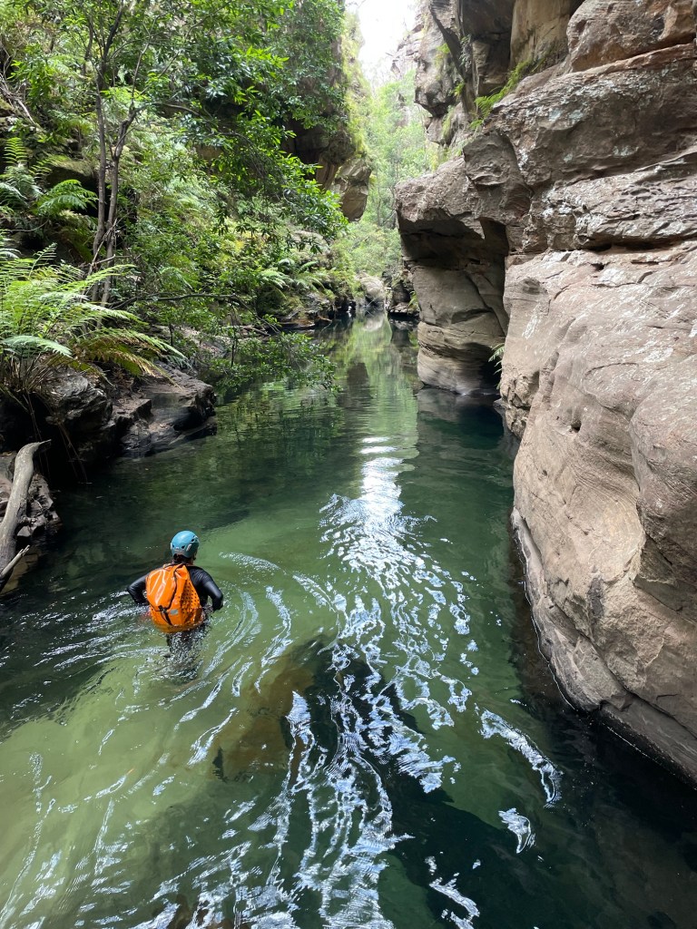
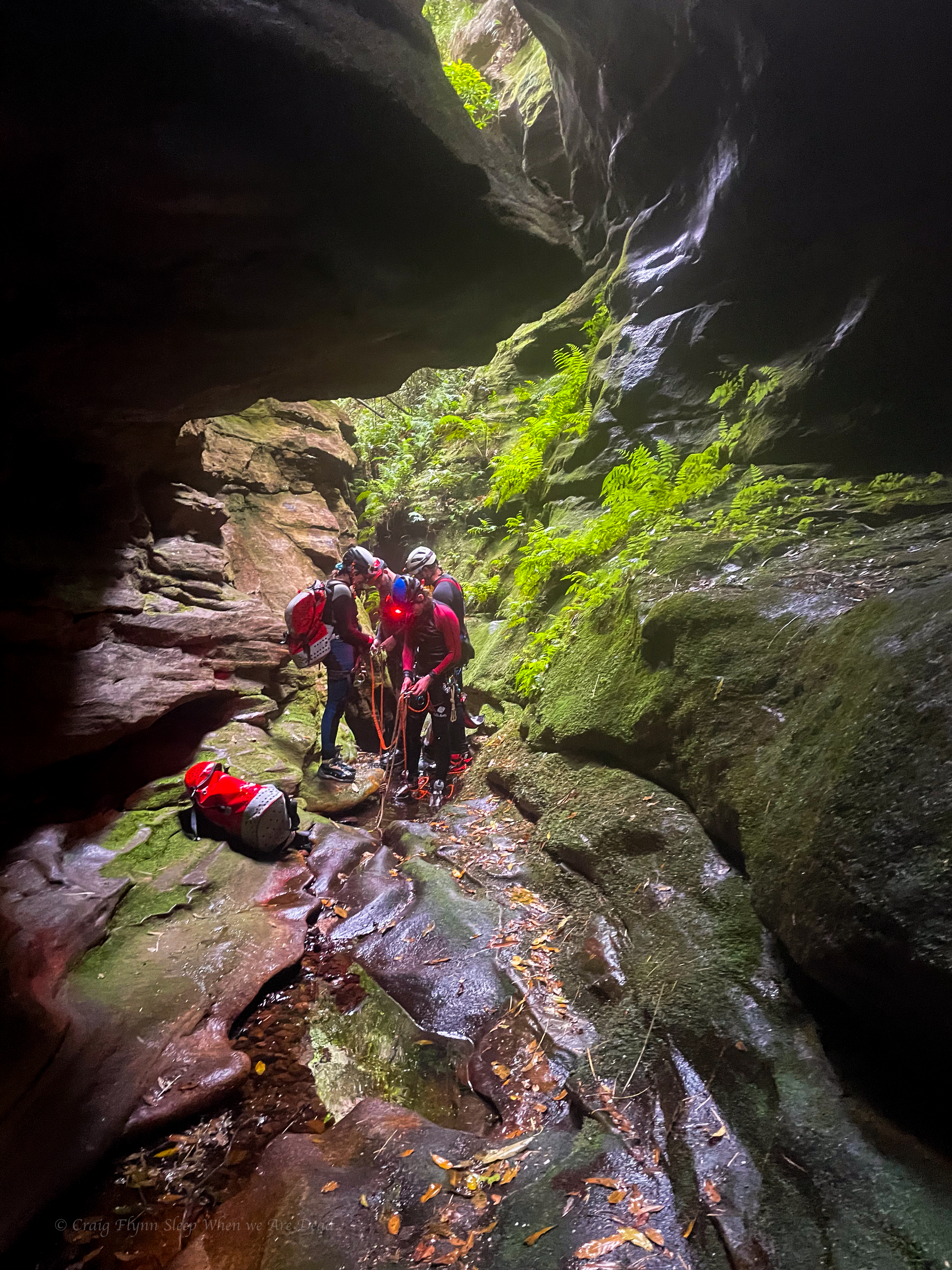
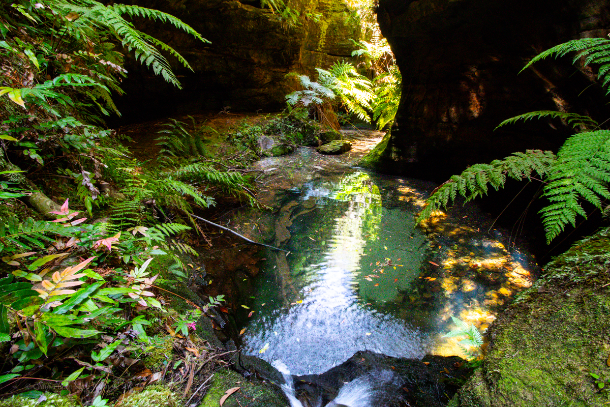
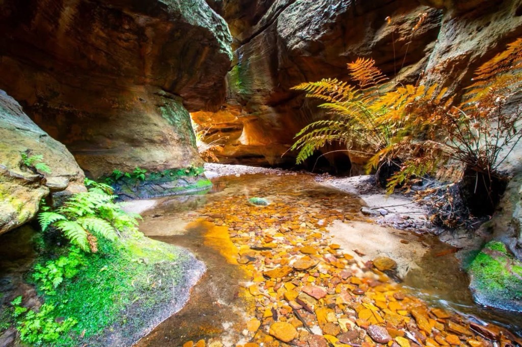
There’s some great side canyons along the Wollangambe with the most popular ones clustered around Mt Wilson.
Of those accessed from the Fire Shed there are a couple of outliers that get less traffic due to being a little harder to get too.
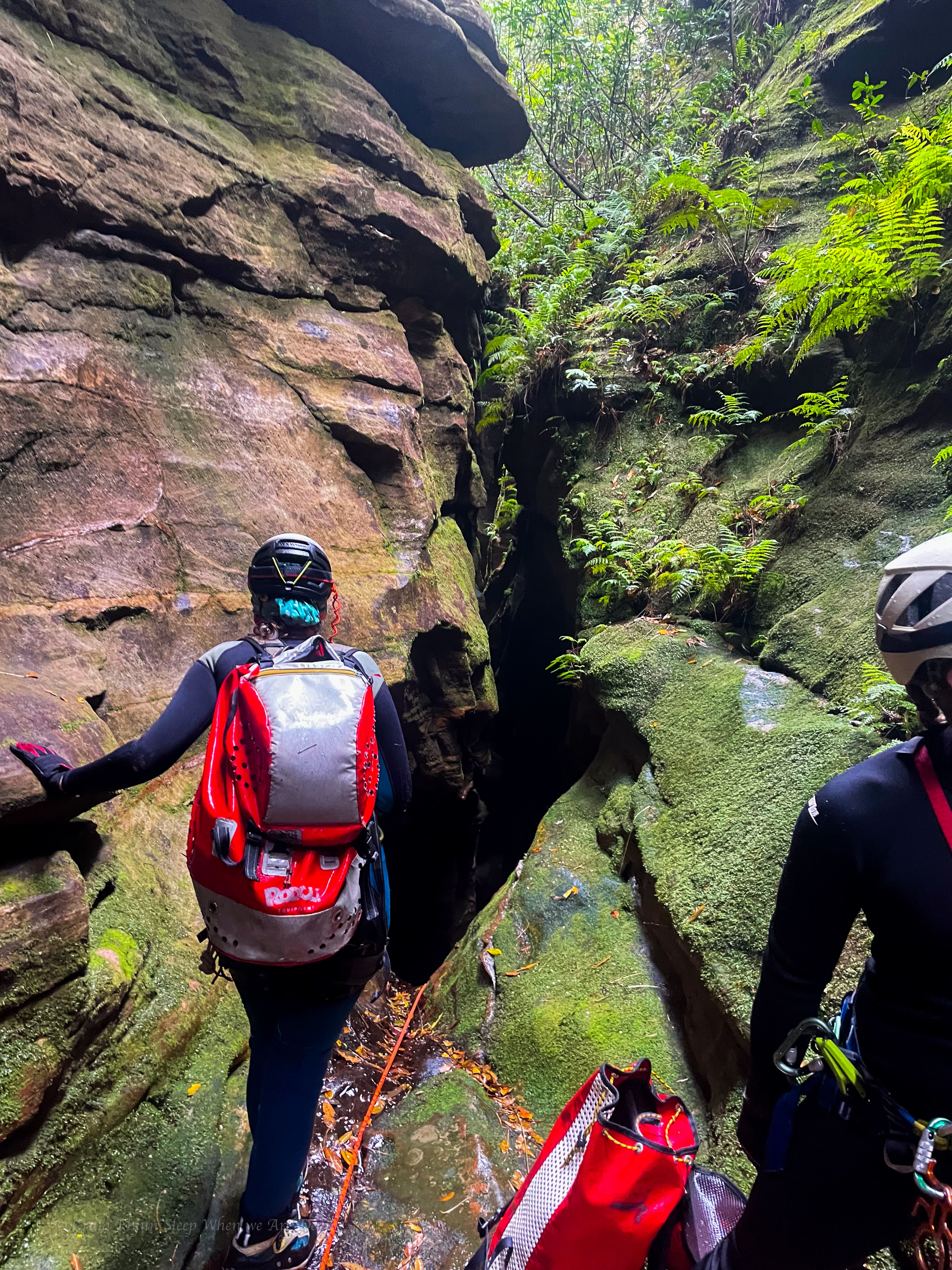
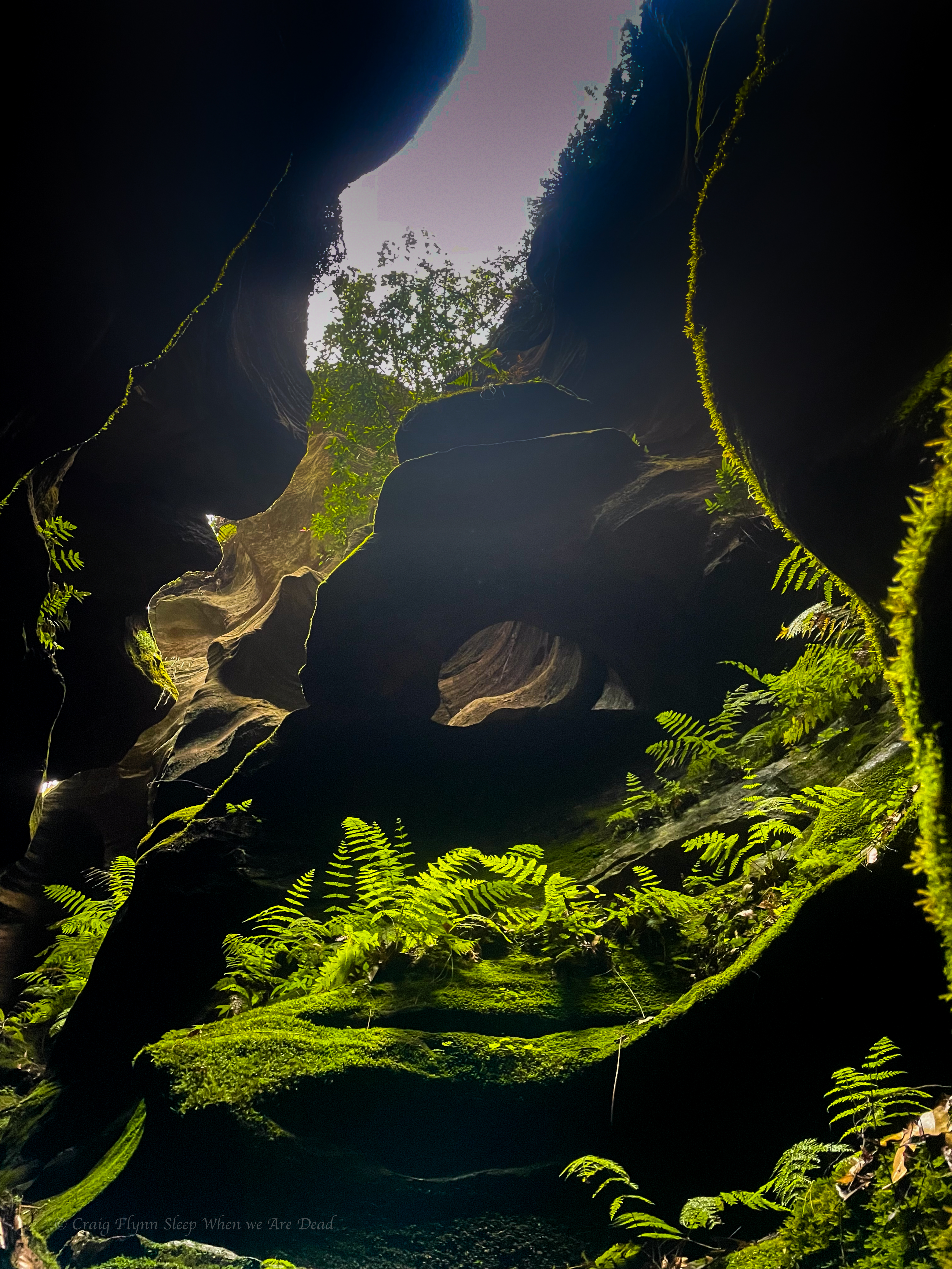
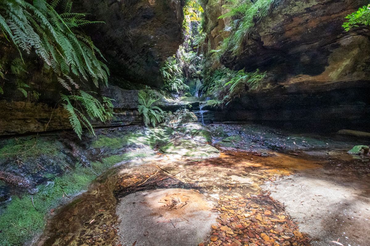
Whirlpool canyon is one of these.
Expecting a stinking hot day and a long scrubby walk in we meet early and head off.
The others had obtained a GPS trace of the entry, I had my usual plotted way point for the canyon start and sometimes/usaul/mostly wackily off gut feel…
Banter made the walk in pass in a flash, well not really but it was surprisingly simple, even if I did get completely turned around at one point, thankfully Clare and Kylie kept us on track. Though when H suggested we try a short cut I was all in.
It was also relatively scrub free(ish)
Slipping down H’s side gully hoping to cut off a fair bit of the GPS trace.
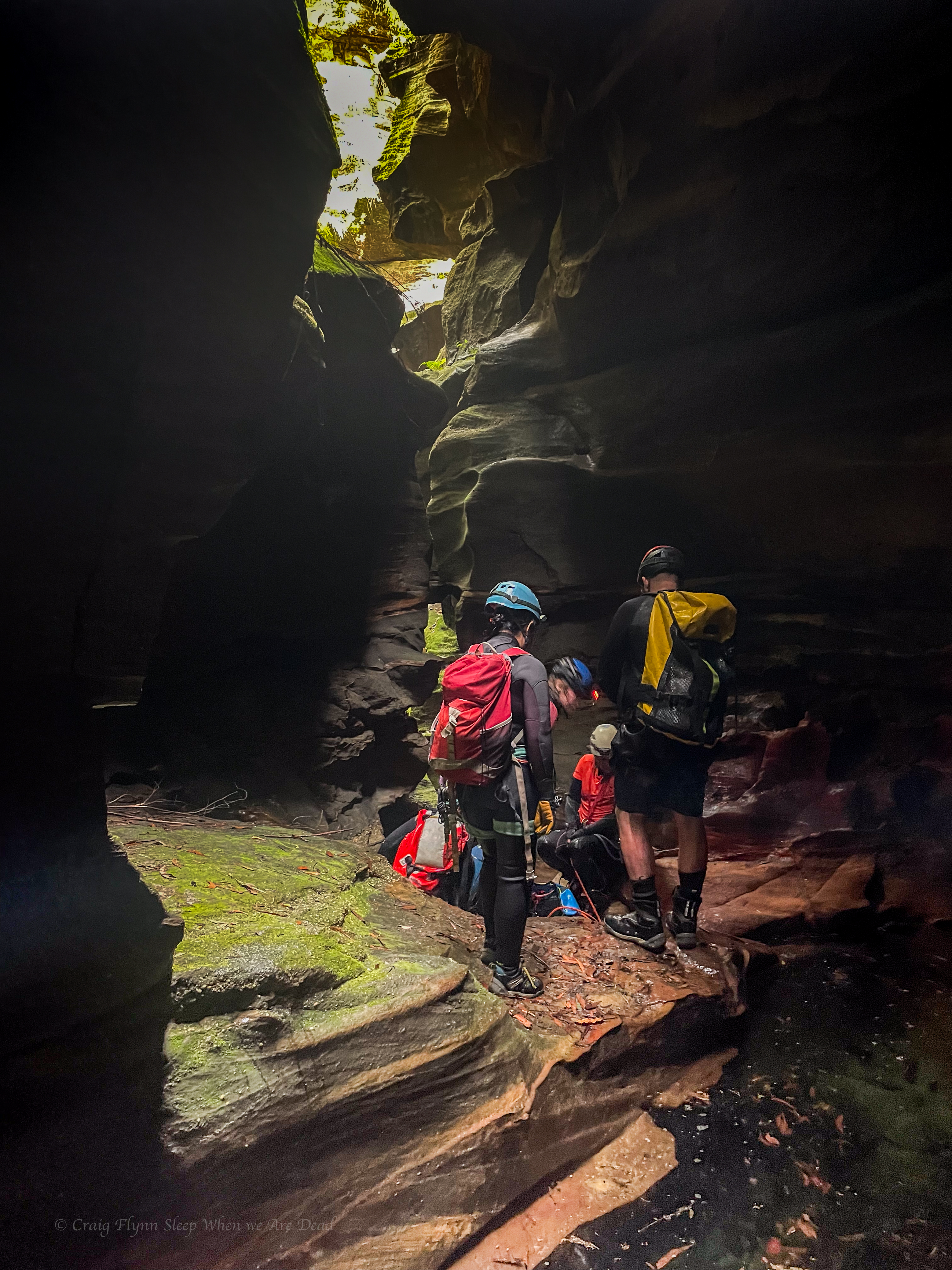
And soon we find ourself at the start of the canyon.
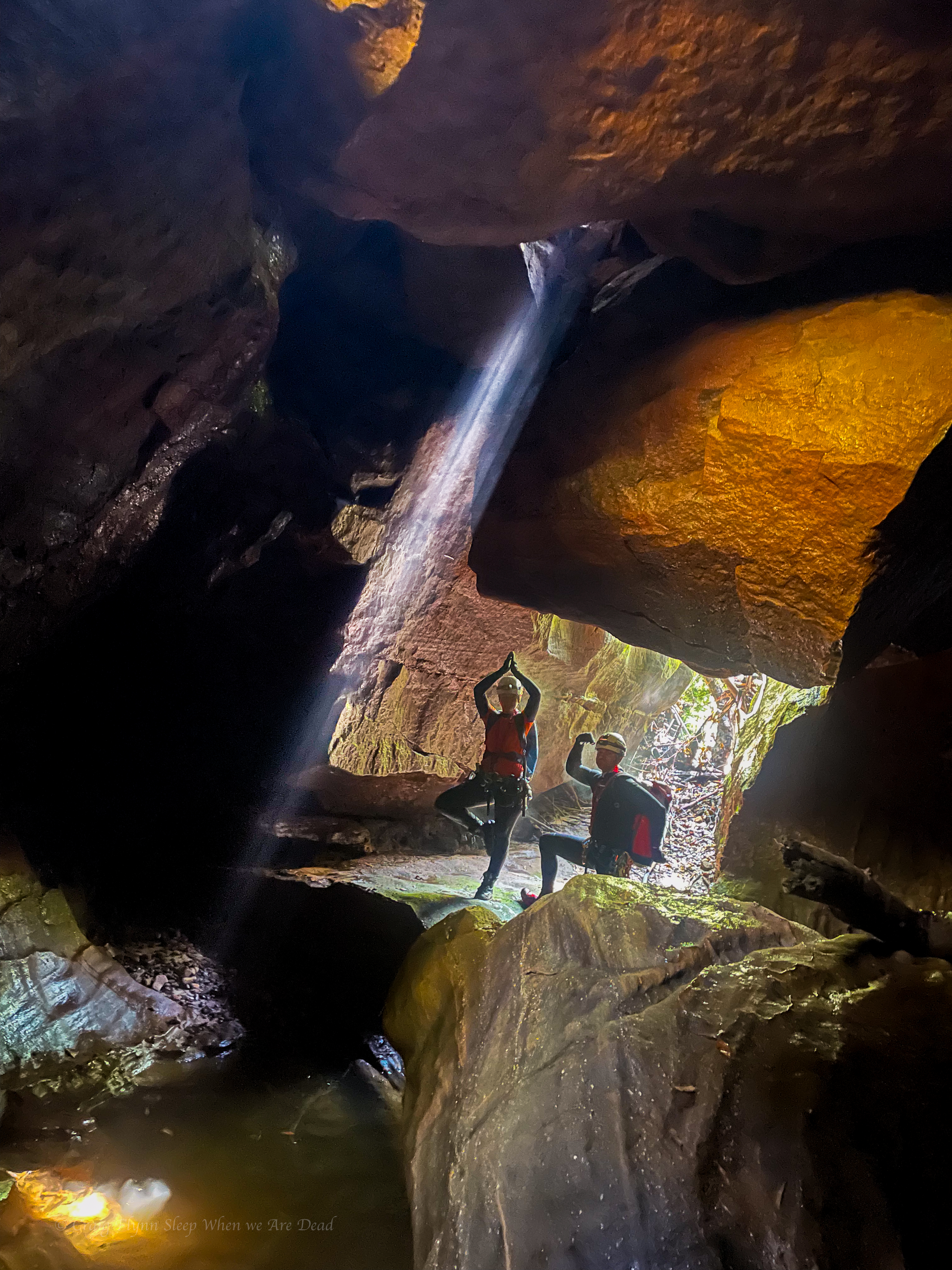
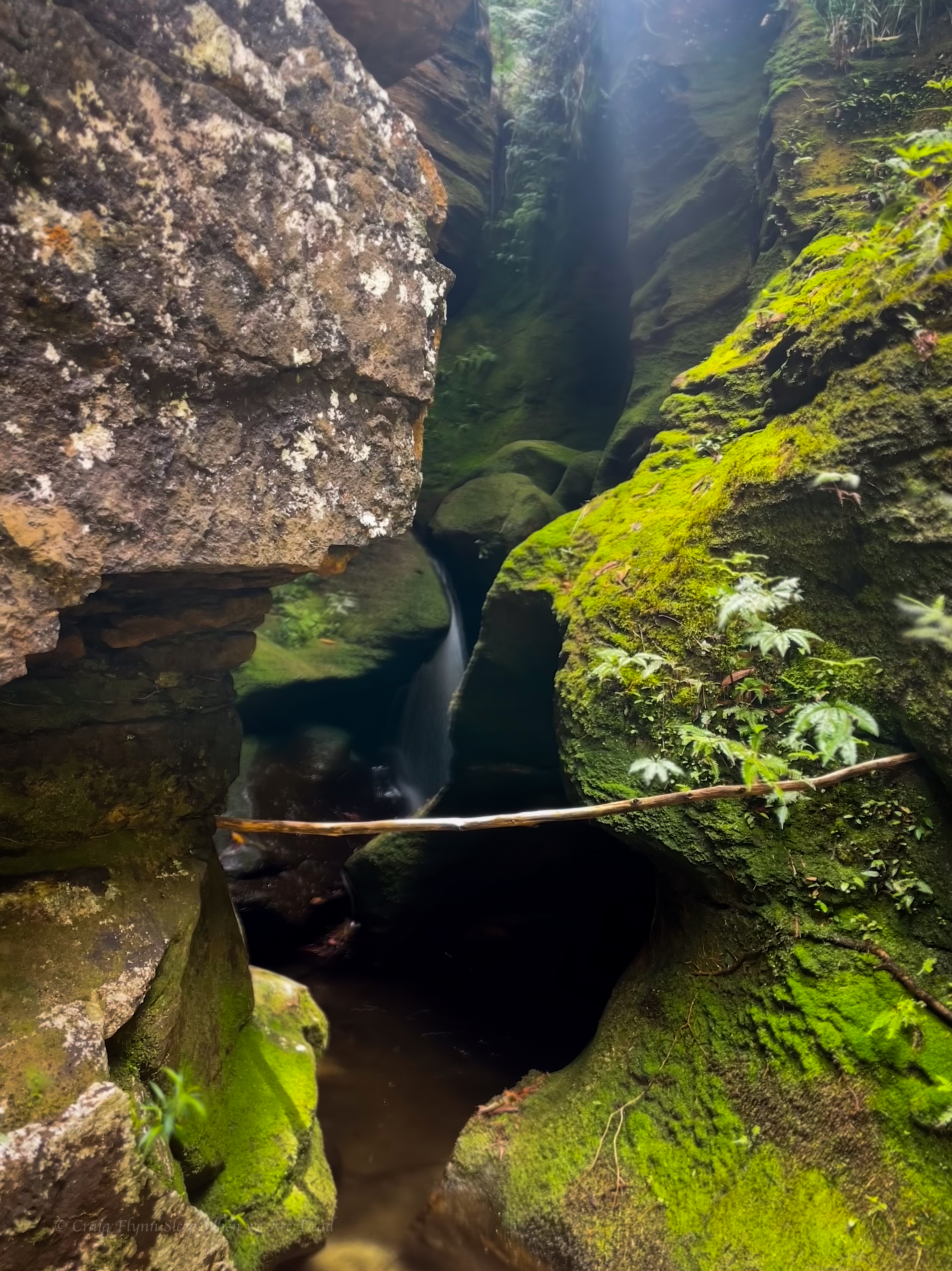
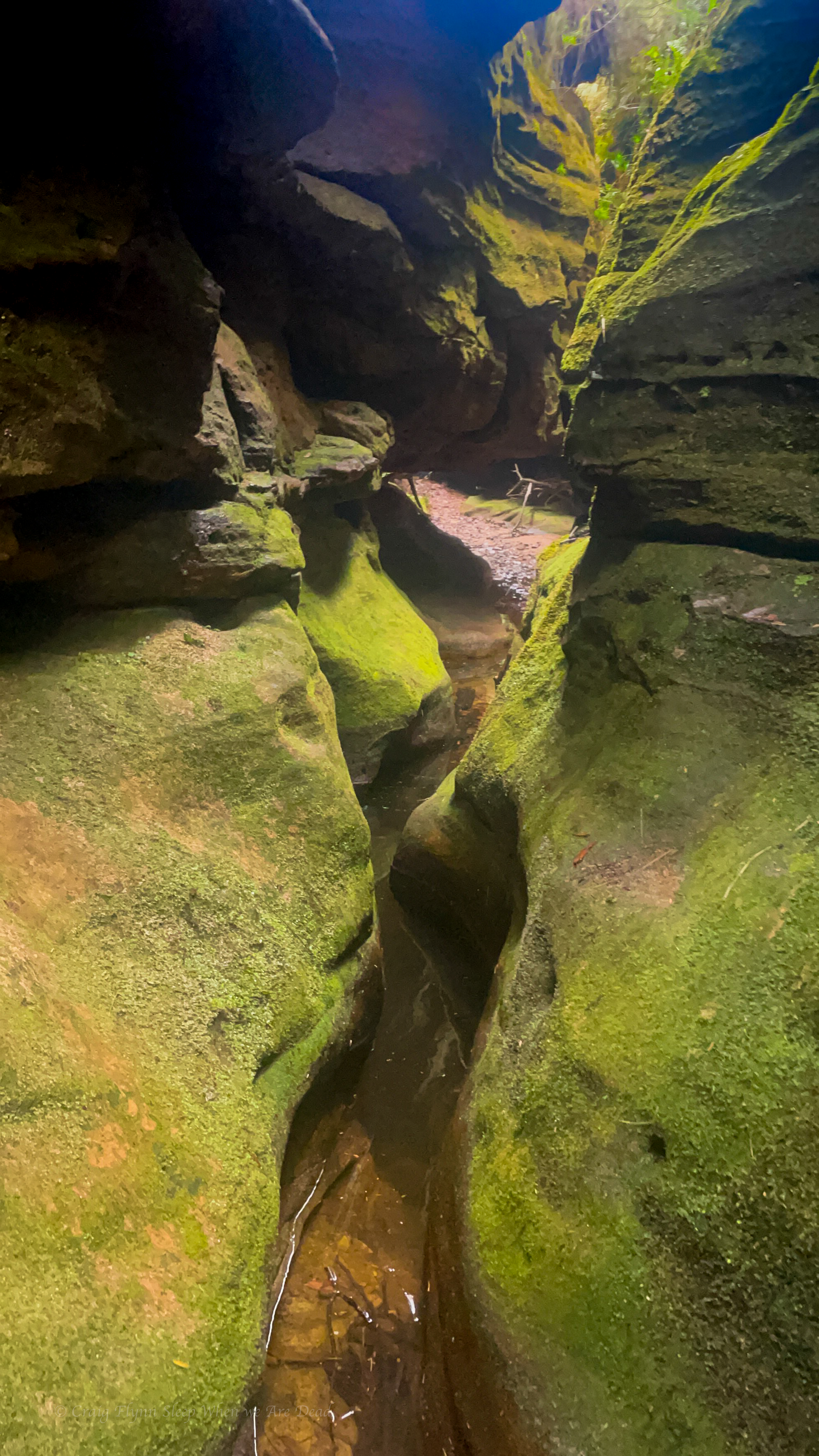
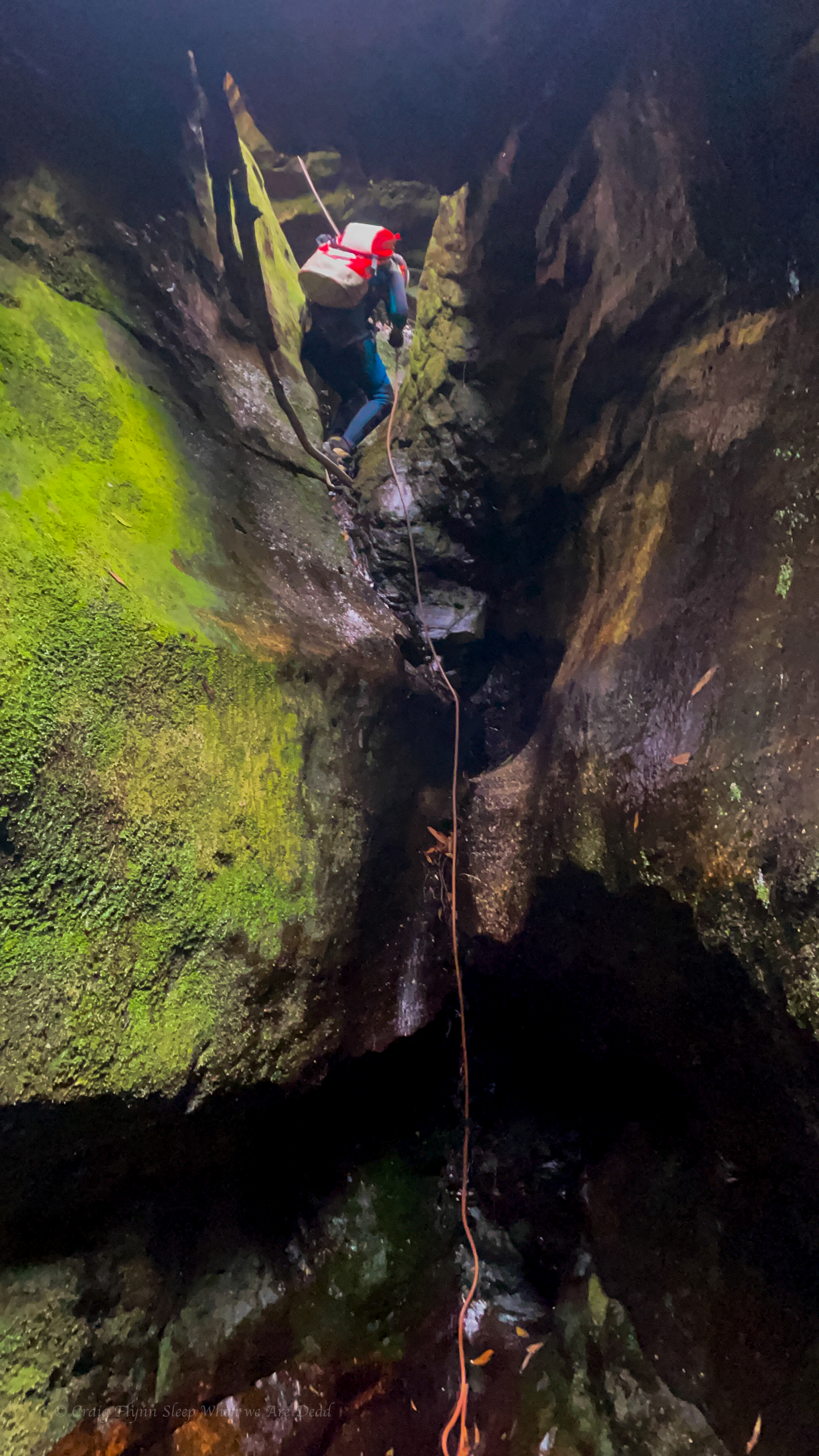
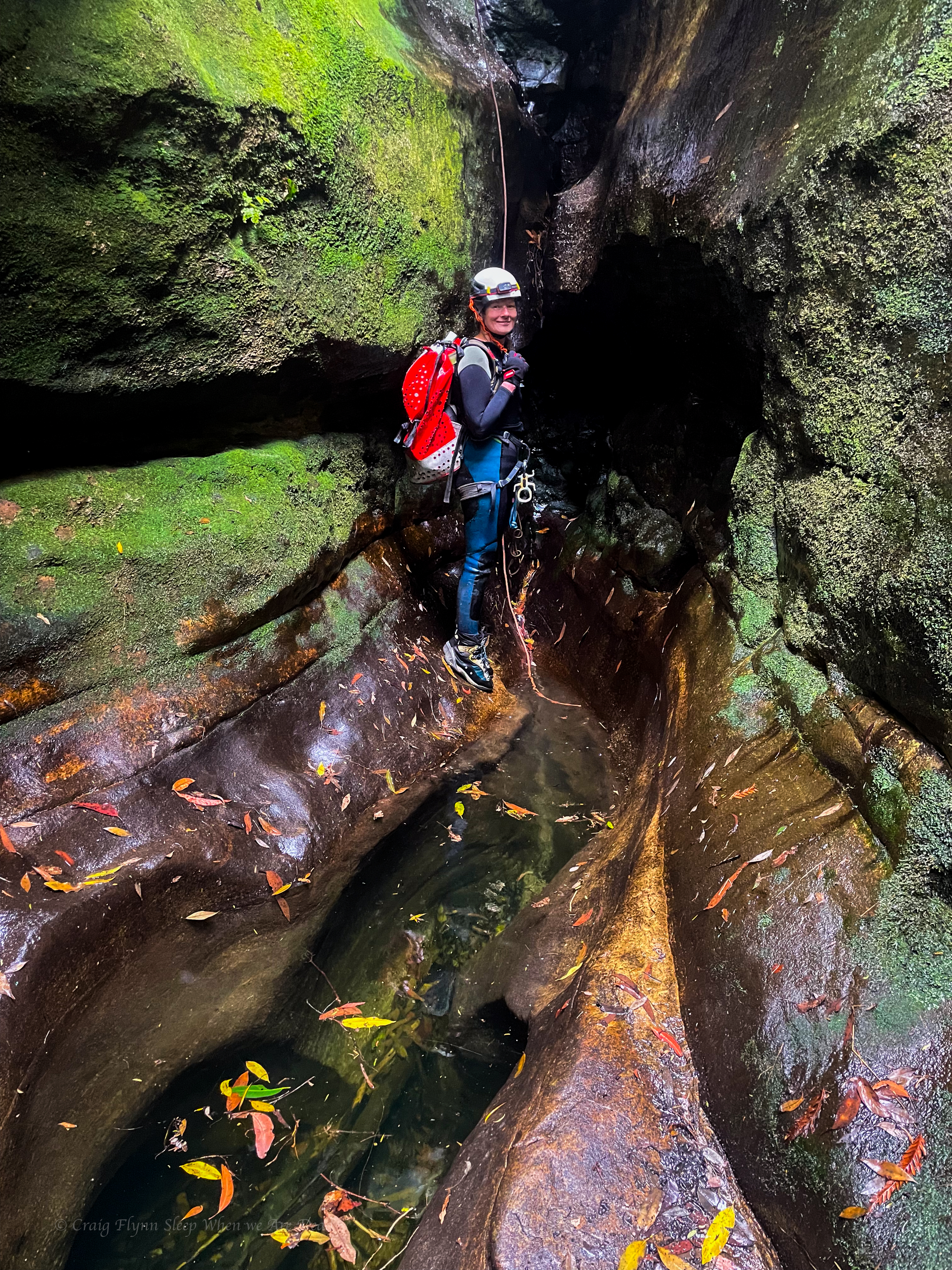
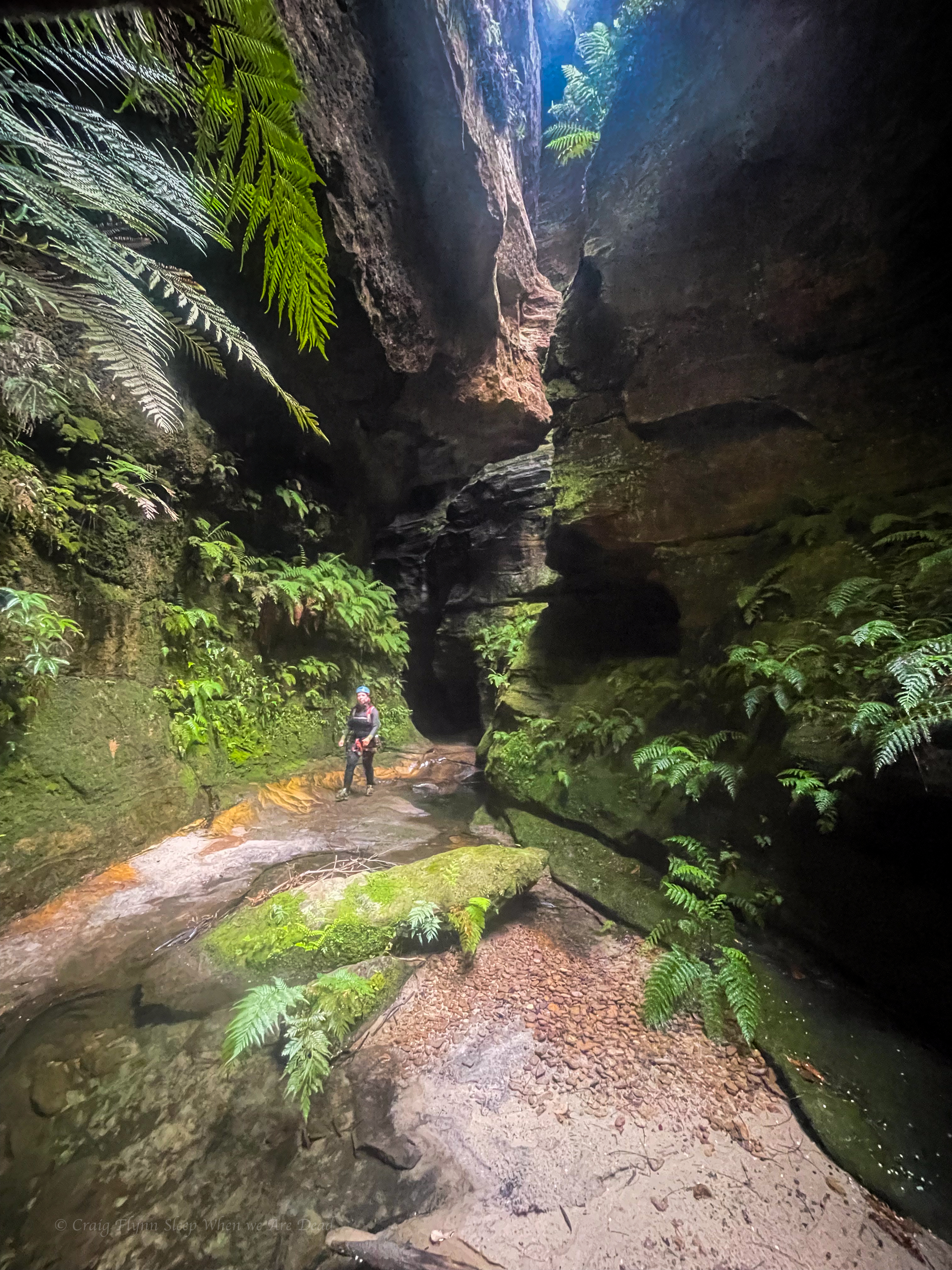
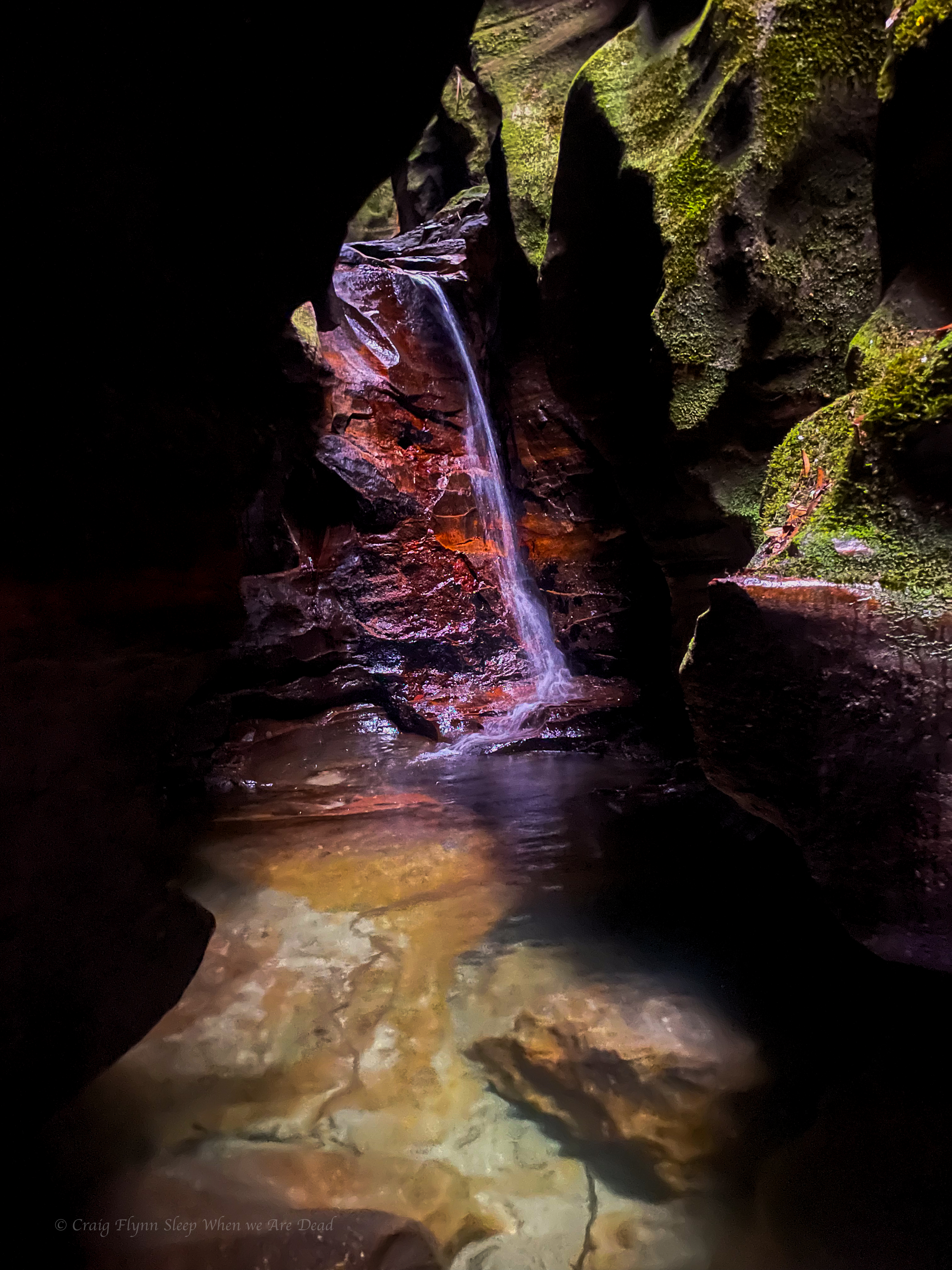
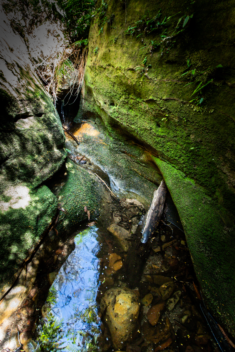
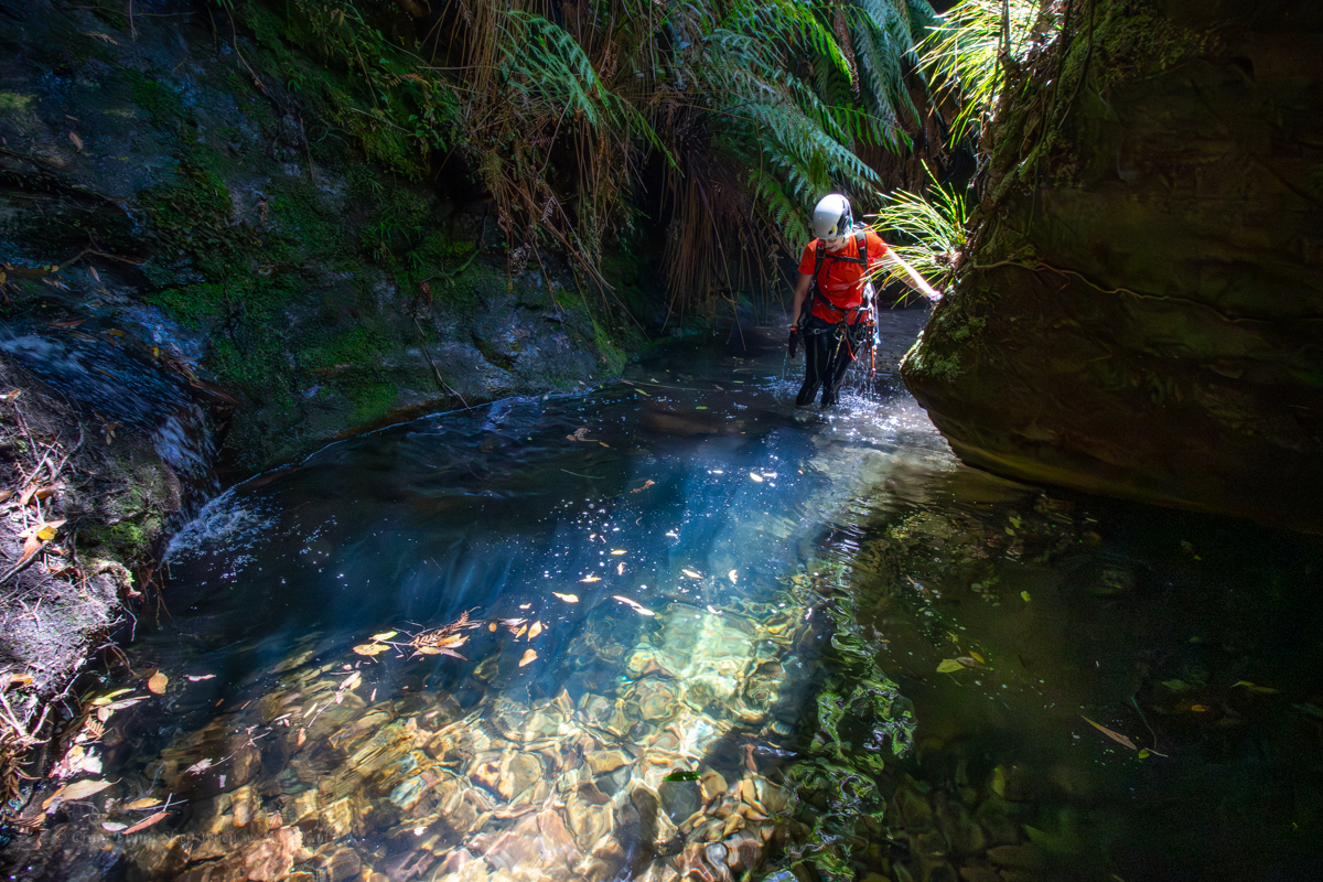
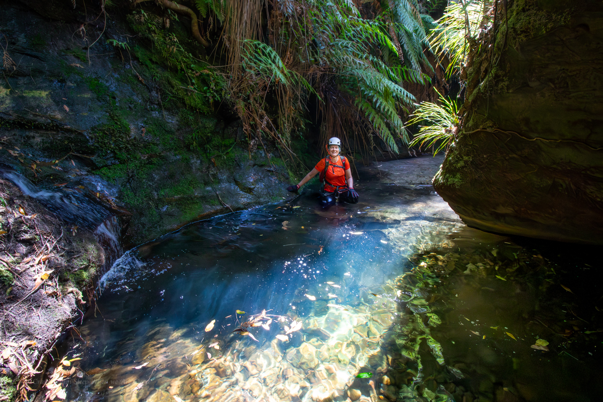
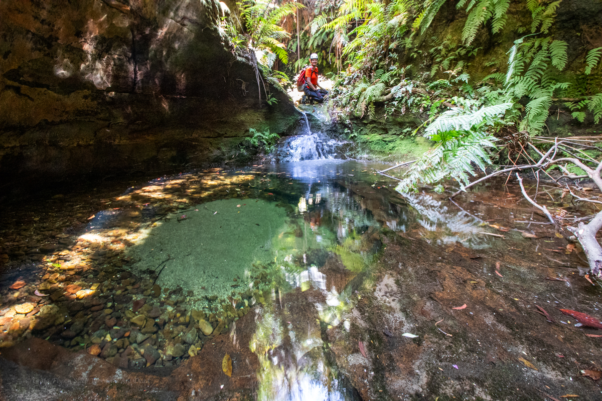
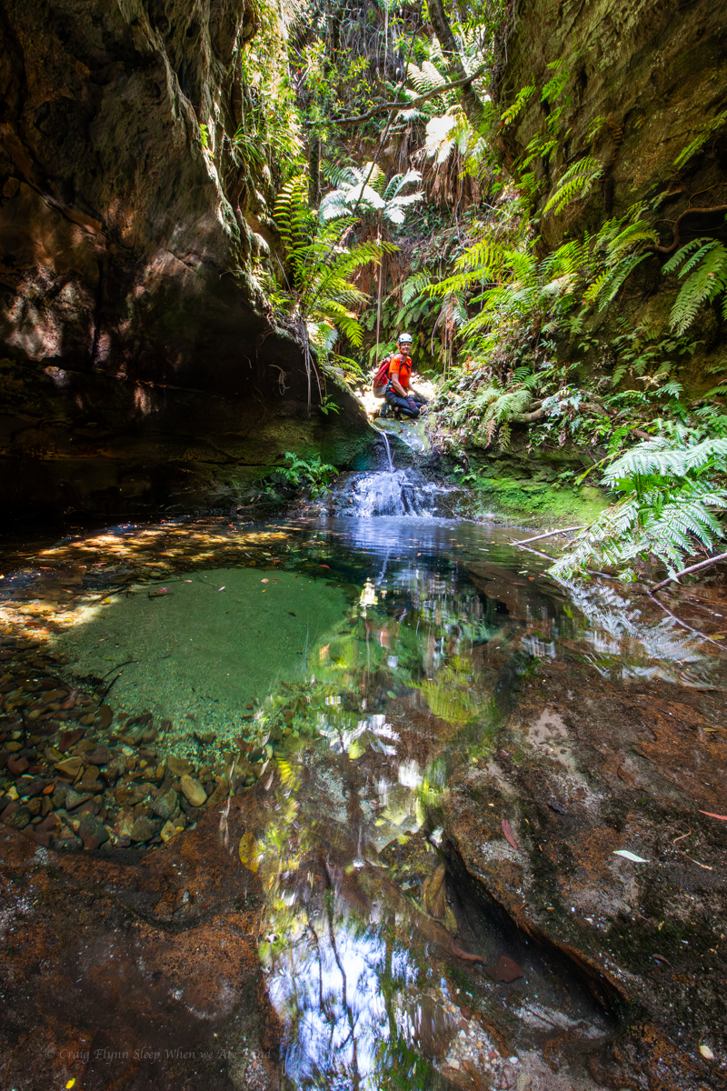
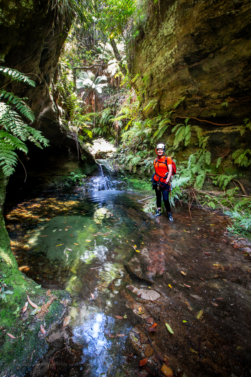
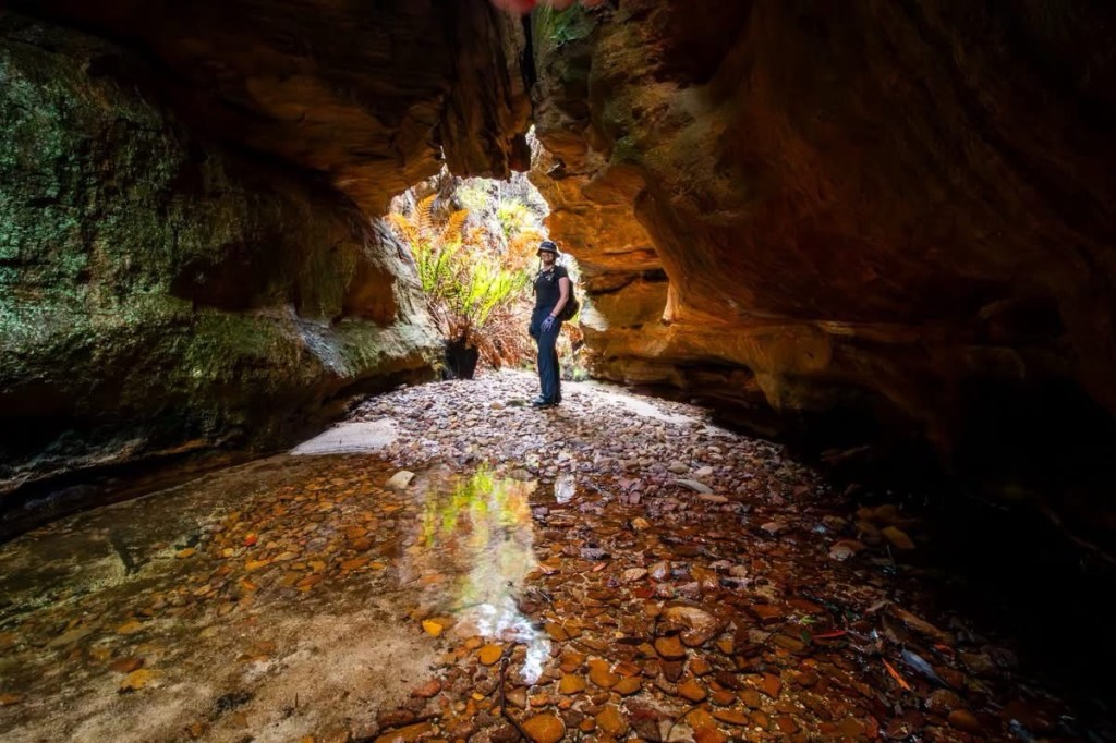
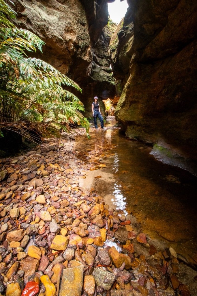
We weren’t expecting much out of this one but a short abseil gets us into a surprisingly nice slot.
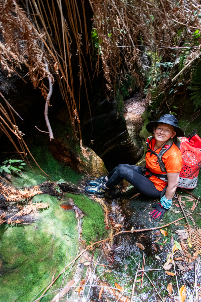
Kylie sussing out the first abseil
There was some interesting anchor set ups and a couple of the abseils have very tricky starts. This problem solving aspect is part of what I really enjoy about canyoning.
Don’t get my wrong, on popular trips where hordes of foot steps compact tree roots and pulling rope after rope wears grooves in the rock well placed bolts are a Good Thing (TM) but they do take something away from the overall experience of problem solving. That’s probably not a major draw for most, but for me it’s a big part of it.
Anyhoo that’s off topic.
Back in the land of dodgy anchors, we check each one carefully (as you should every time). Replace what needs to be replaced and carefully consider the remnant dodginess
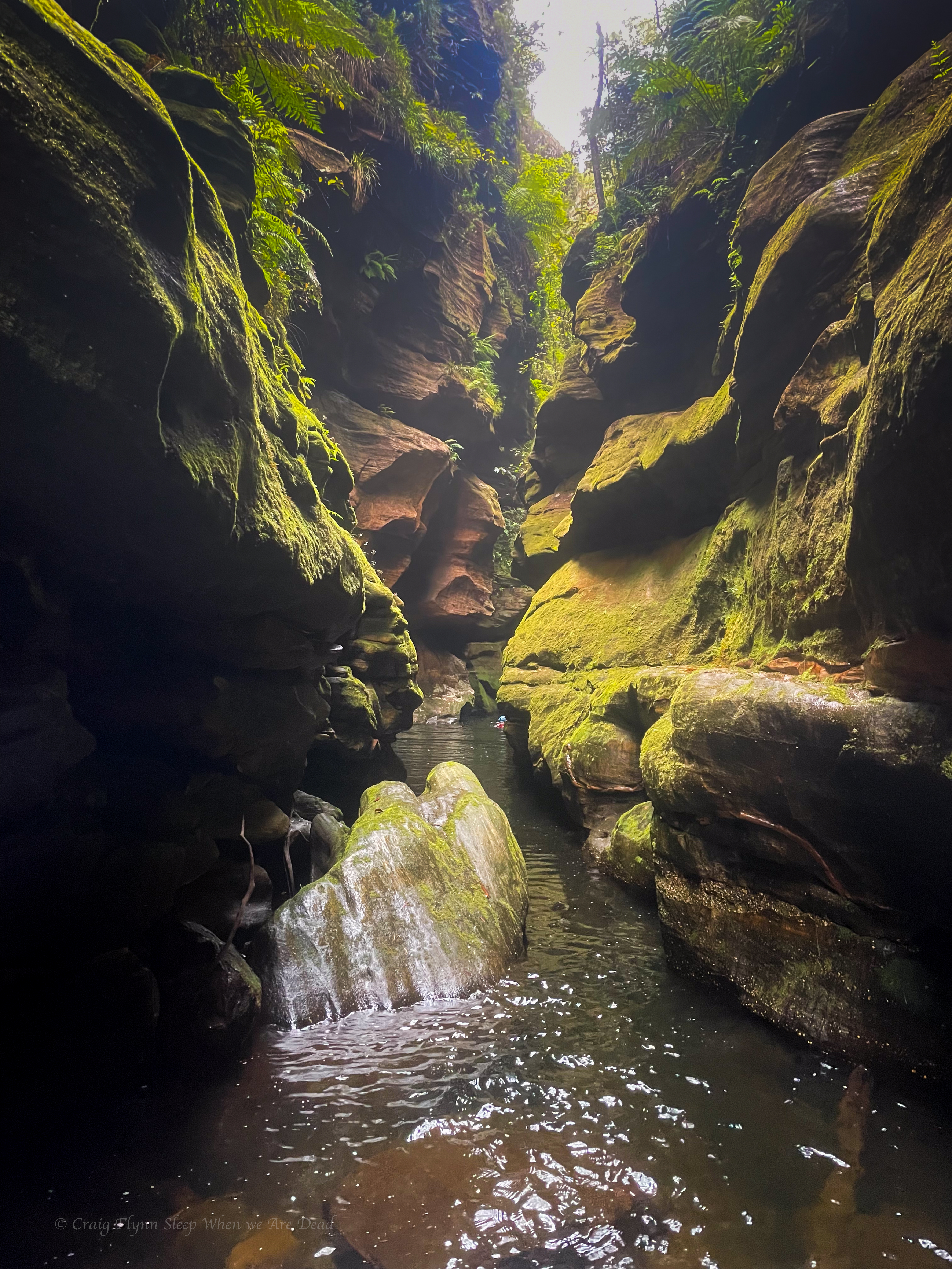
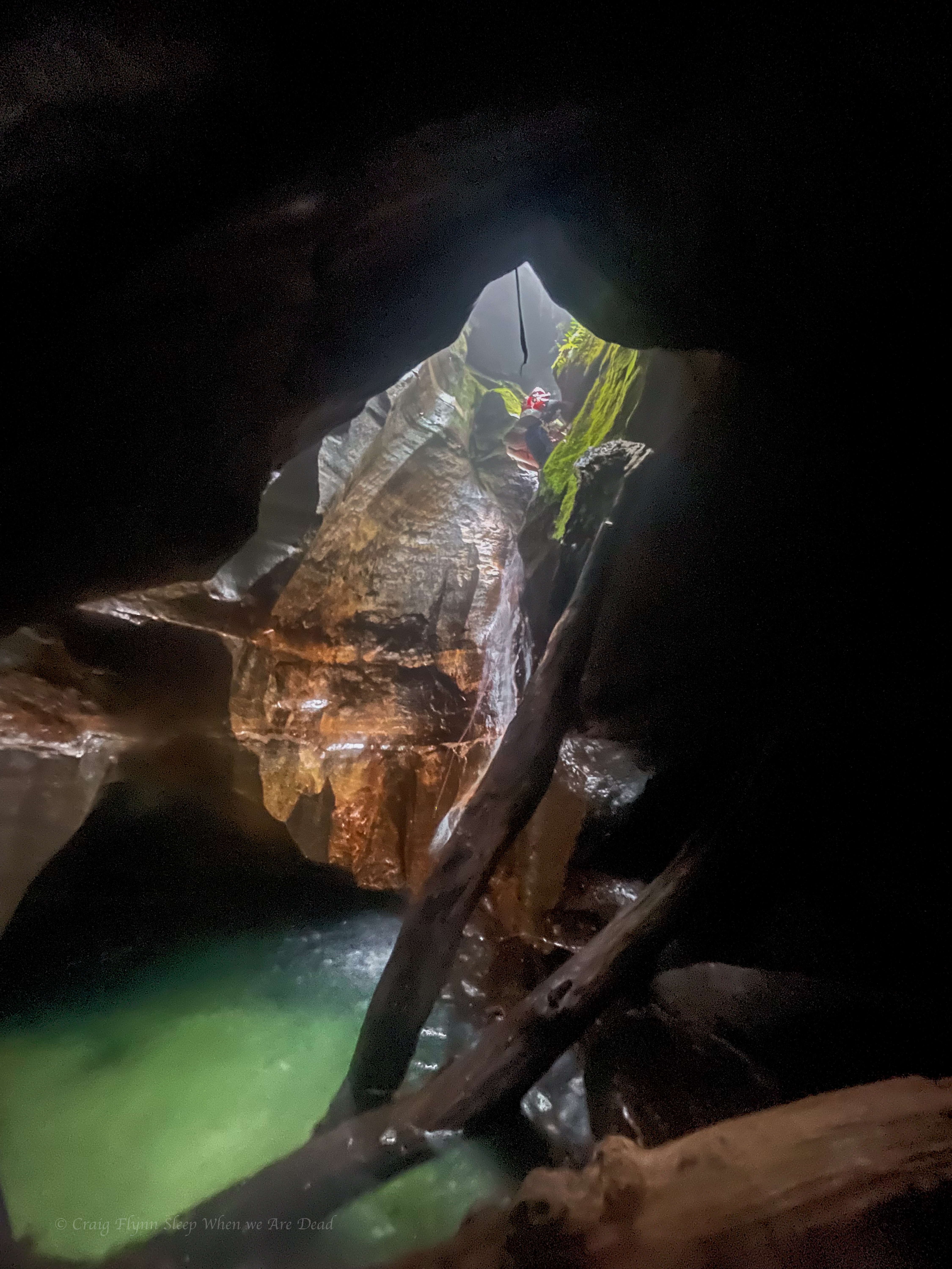
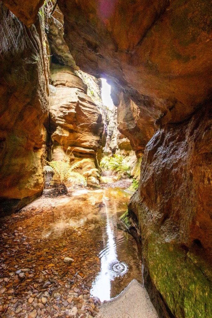
Before lone you could feel the warmth chimneying up from the ‘Gambe
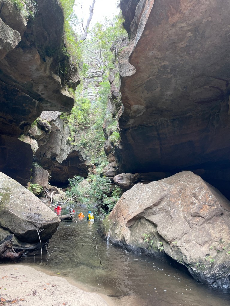
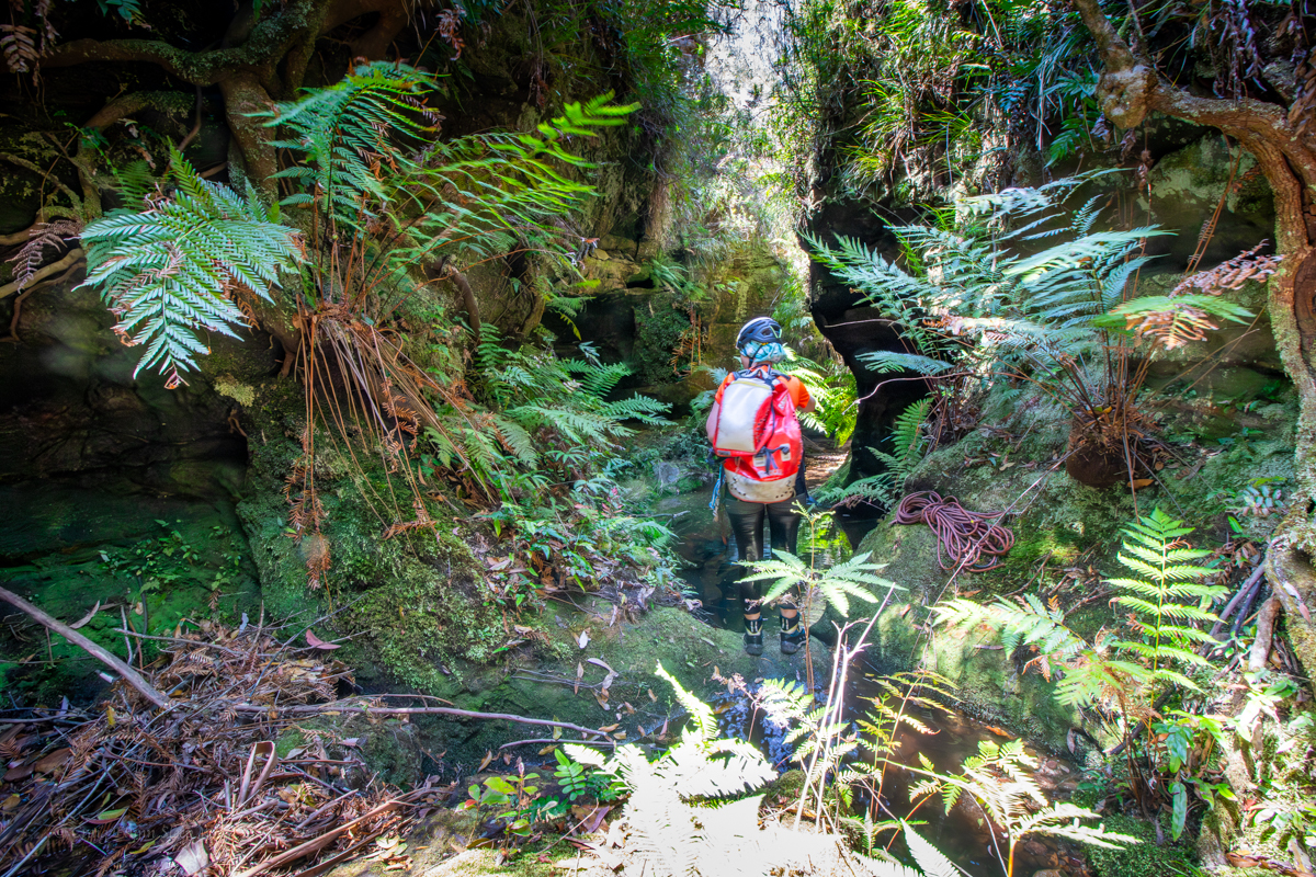
H leads the way down the last abseil and soon we reach the Junction with the Wollangambe
But the day is not over. Our exit is about a kilometre and half downstream.
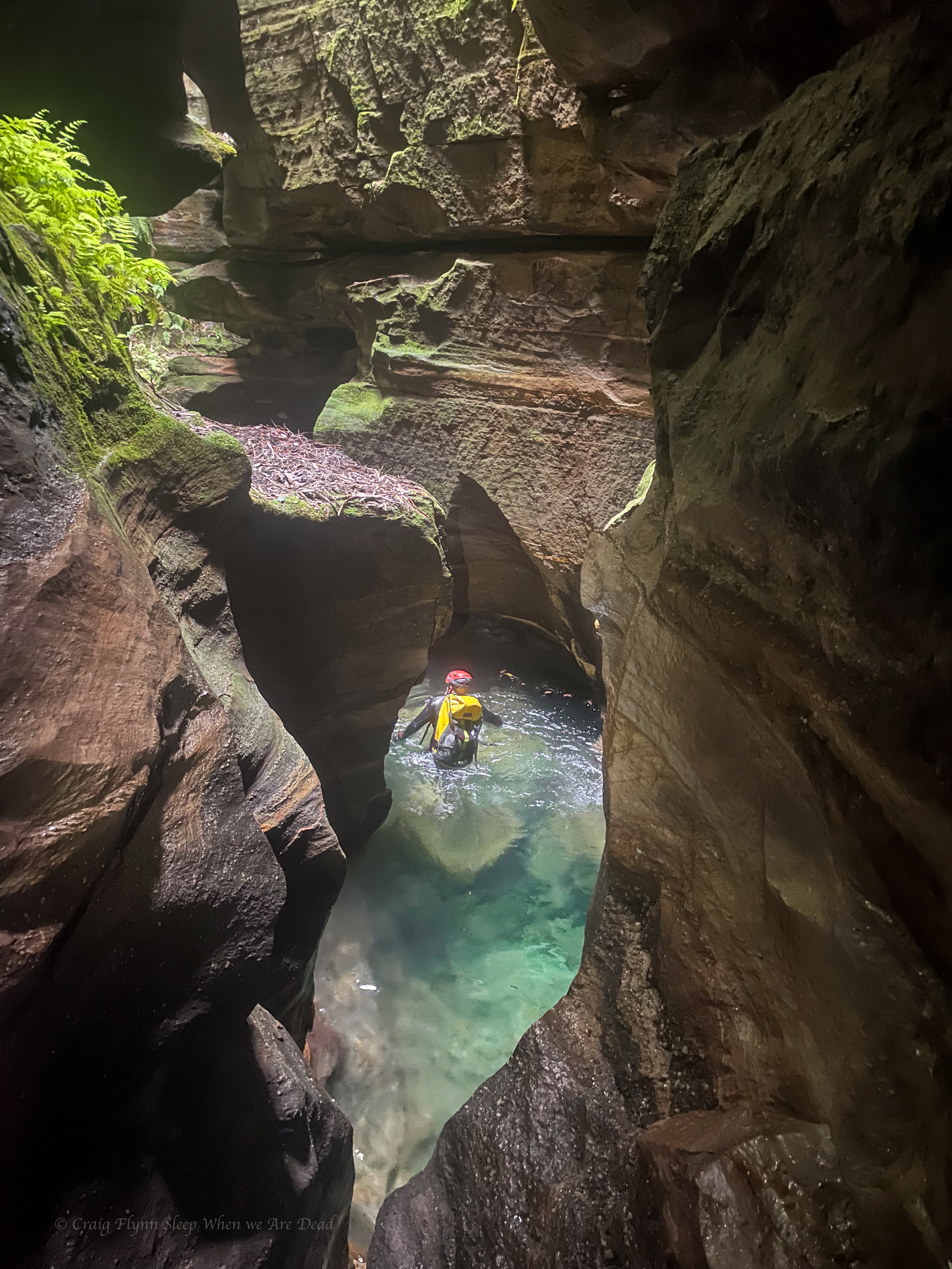
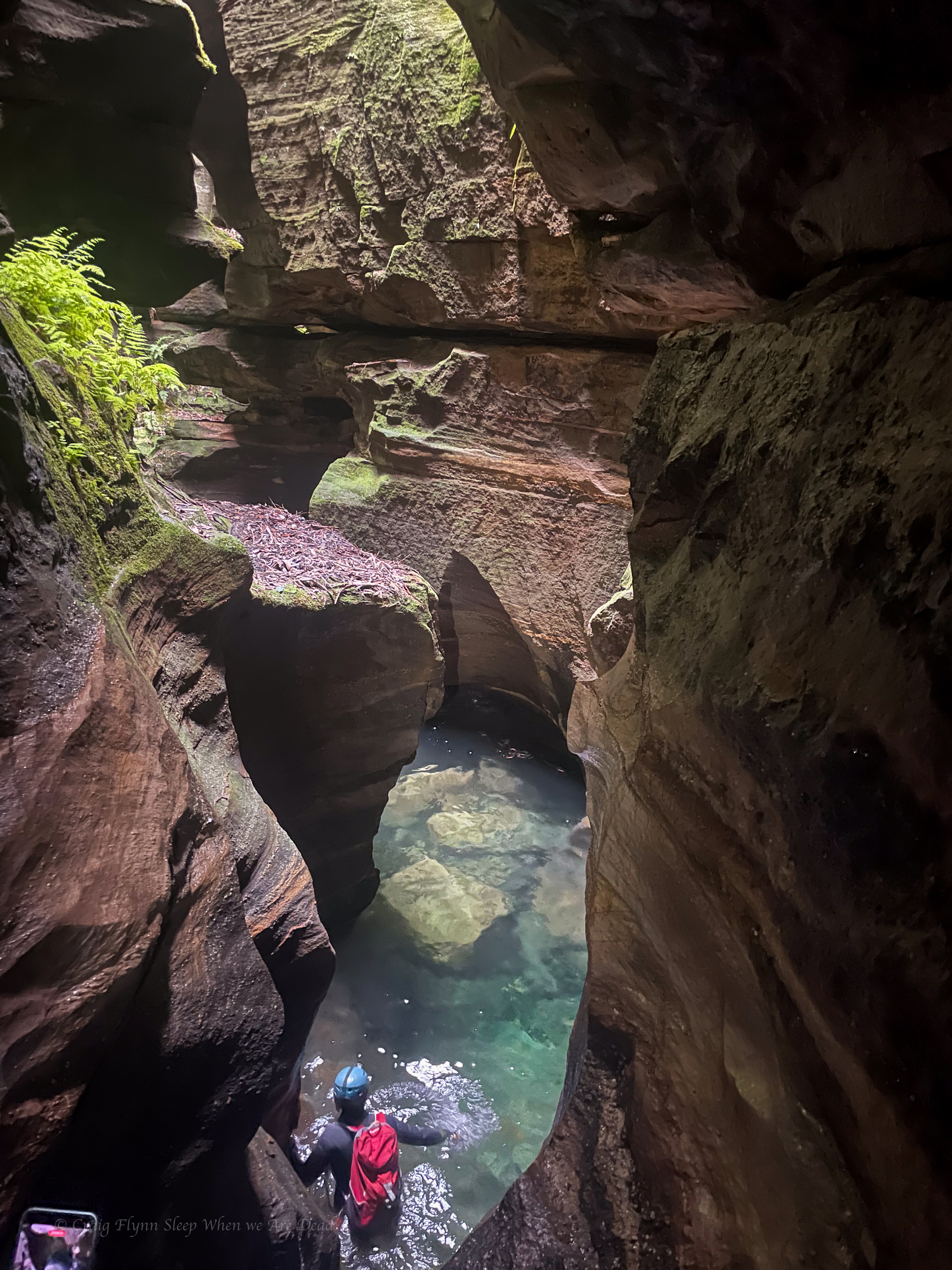
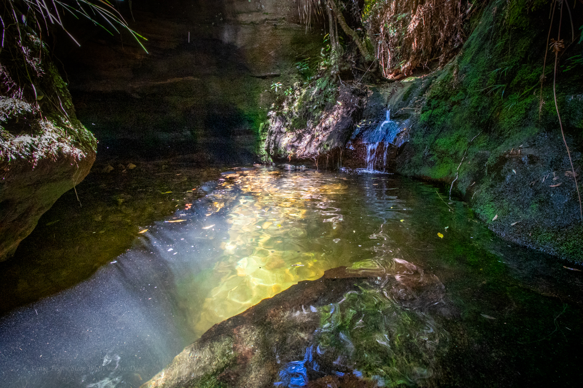
Having pretty much traced this enigmatic river from its source at Clarence to below Mt Irvine on various trips over the years I reckon this bit is the most stunning section of the ‘Game
Deep walls and beautiful pools.
That’s said it’s not easy going with deep sand and boulder hoping between long swims zapping your energy after an already longish day .
Having less foot traffic it’s also a lot slipperier in spots.
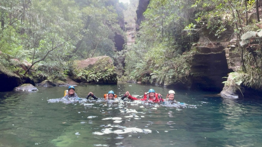
Just before our exit we catch a group from the central coast who had completed Geronimo.
We chat at the exit, cooling off at the sandy beach before making our way back up to the shed.
All in all a thoroughly enjoyable day but it was also a long day for a shortish canyon so I wouldn’t rush back to repeat the trip.
Whirlpool itself was nice and as stated it’s a beautiful section of the Wollangambe so worth doing at least once.
But Having a much larger catchment it can be a disappointing trickle or a wall of white water death.
We got it almost perfect.
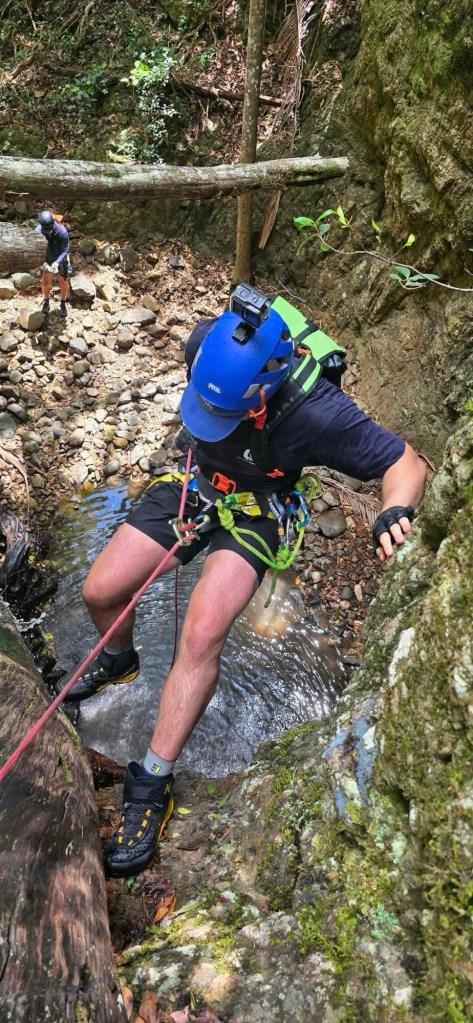
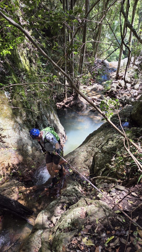
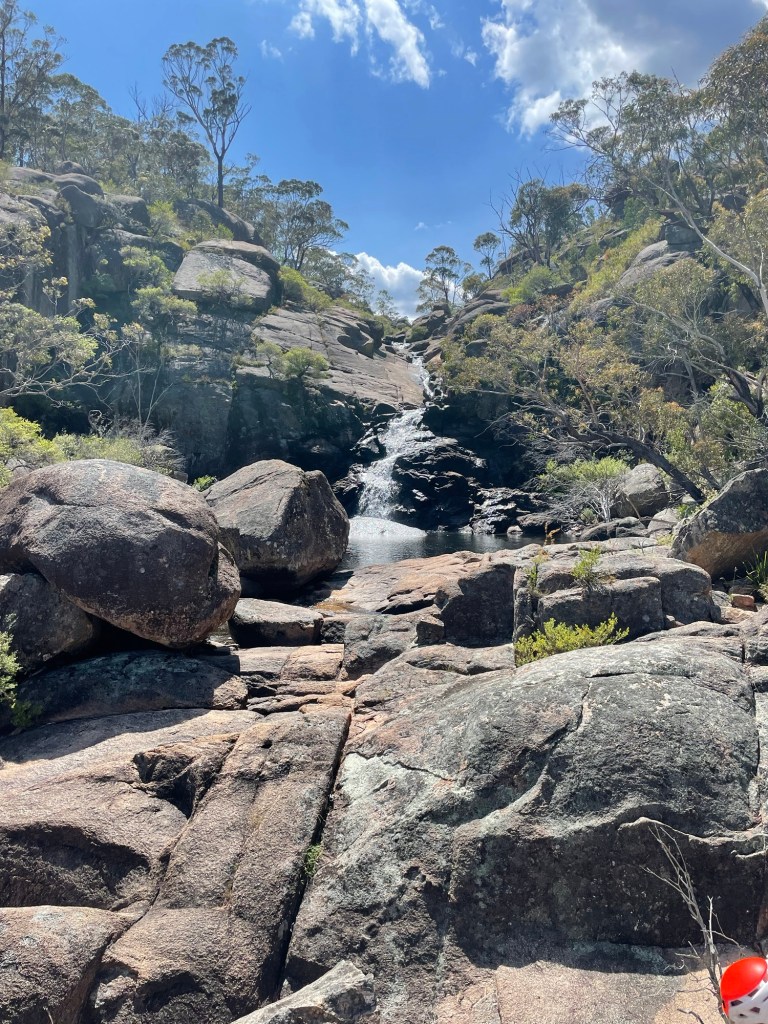
We meet up and waste no time walking to the end of the fire trail and making our way down to the upper falls.
We bypass the first cascade and its inviting plunge pool.
Kent leads us pass an anchor set mid river left to find another just to the left of the main flow.
All abseils except the big one have easy escape routes back to the exit trail so you can pretty much choose your own adventure with doing a part or the whole.
Our first 3 slabby abseils are between 8 and 15m high. They are a bit of fun and nothing technical.
It’s a beautiful series of falls interspaced with plunge pools
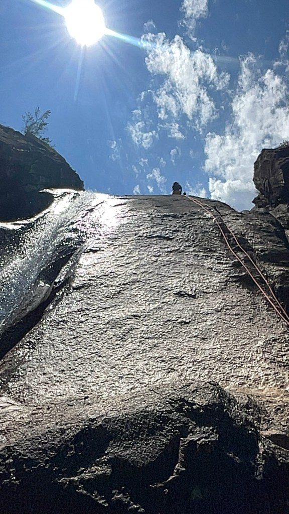
Joel and I have the long ropes and get sent ahead to set the big drop.
From Kent’s description I’m nervously looking for a narrow ledge I need to traverse across which may or may not be slippery.
I’m standing on the edge of a wide slopping platform with heaps of grip looking for something below.
Bolts are behind you. Says Joel
I look at the wall behind me.
On the ground.says Joel.
Oh
I know this particular drop was pioneered by members of one of the caving clubs a few years ago.
2 odd looking bolts are set on the ground 7 or 8m back from the edge. 1 is a 8mm cap screw. The other a type I’ve not seen before….
A nice shiney new glue in has been added and all 3 equalised using D shackles.
We set up and Joel leads the way down. We have about 76m of rope out and by the time he gets to the next big ledge and traverses across to the rebelay there is maybe 3m of tail left.
As Kent heads down the rope snags behind a nub of rock which gets dislodged as he traverses at the bottom. He calls up a warning over the two way.
Dave about to descend
The rest of us get down no drama but Kent is reluctant to pull rope from directly below.
Joel devises a plan which will allow us to descend the next 12m abseil on a biner block, tie the pull cord for the previous ropes to the biner and pull rope from both pitches together from a safe spot on the far side of the plunge pool
We all head down. Most swim across the pool. Joel does a nice traverse climb to avoid the swim.
Pete follows Joel but does not avoid the swim…
I stay dry, just
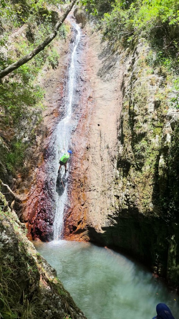
The main falls. Around 90m
We start to pull and the system works perfectly
1 rope down.
2 two ropes down
3rd rope clears the anchor the end tumbles down and lands in a ledge. I start to pull.
It comes.
It comes .
It does not come.
Joel and I spend a bit of time trying different angles and stuff and it’s stuck good and proper on the only ledge not accessible from the exit track.
Next time we think we’d set this drop, leave the rope there and collect it on the way out. Not only would it avoid a stuck rope but it would avoid the need for 2 x 76m+ ropes and carrying it out the bottom half of the exit.
Joel looking further down as storm clouds begin to roll in.
Kent on the next one which passes under big boulder halfway down
Looking back up the main series of drop. Can you spot Dave, Cotter and Joel?
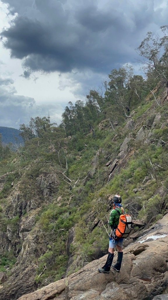
Finally we get to the wetter part of the trip. We are not quite 3/4 of the way down, still 150m or so above the Kowmung.
Below a series of falls and plunge pools
Above thou, the sky is cranky.
Dark clouds, thunder and a spattering of rain.
Big storms were predicted for later in the day. It looks like they arrived early. Standing on exposed granite in a lightning storm probably isn’t the best idea so we opt to abort the trip and scramble out to the exit track.
The storm doesn’t really hit in full, thou I later learn it hit the mountain with a good smash of hail. While disappointed not to complete the trip to the bottom we are comfortable with the call.
Besides, it gives us a good excuse to comeback and finish the journey.
“A river cuts through a rock, not because of its power but because of its persistence.” – Jim Watkins
It teemed down overnight at camp. But our trusty tarp kept us cozy and by morning the sun was peaking through the clouds.
We had said goodbye to Levis and Monica and talked ourselves into another short canyon while we were out here.
Kylie, Jason and I had visited the top couple of sections of Popeye Canyon as a day walk a few weeks earlier which had some pretty bits in it, and so we were keen to have a look at the lower section.
I cooked up a plan to head straight down from camp to the grid reference that the Jamison guide lists as the start of Popeye (a kilometre or so below the upper section).
We start down a ridge in between two faint gullies. These soon join to become a stoney bottom creek that tumbles over a substantial cliff line. We only brought a short rope with us today so make our way a bit further long the left hand bank and find a way down into what we came to christen MCPCC. Mega Clear Path Creek Canyon.
heading out to enter via the upper section may have been easier.
Anyhoo we find ourselves in Popeye creek. It’s not looking like much but H and K don light wet suits.
Looks like there’ll be some more creek walking, I’ll suit up later, the rest of us say.
10 steps later, literally, like literally 10 steps babes, we round a bend and the creek drops into a tunnel like canyoney section.
This would be the theme for this section of Popeye. boulder hoping interspaced with tunnels and cavey bits. A few abseils and short swims
and awesome company
but not much quality canyon.
Plenty of weirdness thou
we head all the way down to the…… it hurts to say it…. Dingo *fugging* Creek for the final 10m of “canyon”
The plan is to head down said creek to an exit Kylie had mapped out opposite gateway canyon. I’m hopeful this section is similar to the bit below HITW and we can just float with the current.
There was a bit of floating.
A bit of boulder scrambling.
Some scrub bashing.
And lots of sinking knee, sometimes hip, deep into fine sand to have it defy the sand traps and fill the bestards.
I still have sand in places sand has no place being.
Still, it’s a wild and beautiful part of the Bungleboori system worth visiting. Once.
The bottom of Gateway canyon was a welcome site
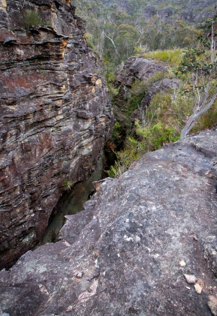
The walls lining the creek had gone from broken slopes to towering cliffs and I’m wondering just how tricky this exit is going to be.
Surprisingly it’s straight forward, cutting back along a gentle ramp to a not too steep nose that avoided the cliffs altogether.
Nice one Gadget
All in all a fantastic weekend out in the wilderness with my kind of people.
I hadn’t done Banks Canyon since the last time I had done Banks canyon.
At that time we had followed Jamison’s guide and went up North East Canyon. We repeated that route when we visited Nose Dive Canyon.
This time we went directly across and found a rough trail up the major north south gully. It was a bit scrubby to start but once we gained the base of the eastern cliff line it was relatively easy going and lead us up to the even fainter trail in from Rail Motor Ridge.
While slightly longer I think this option was a bit quicker as it avoided problem solving some sketchy scrambles in North East and was relatively easy going.
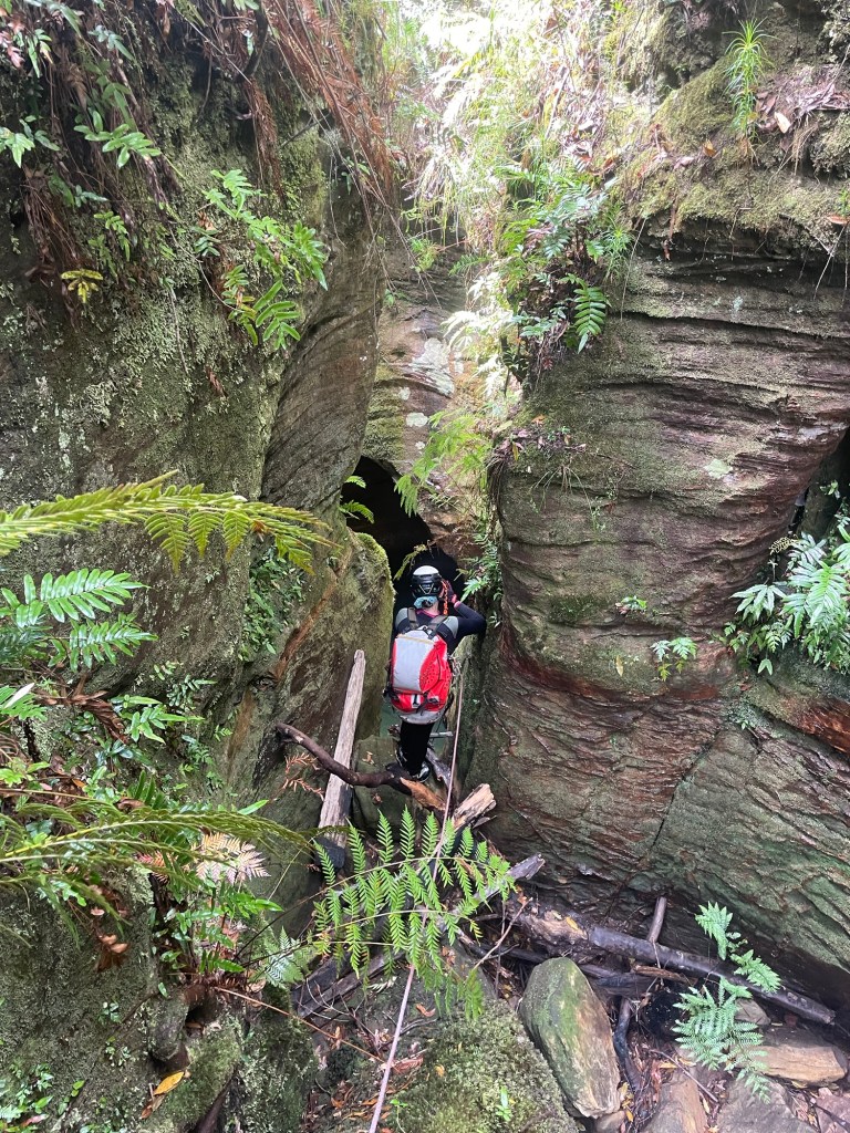
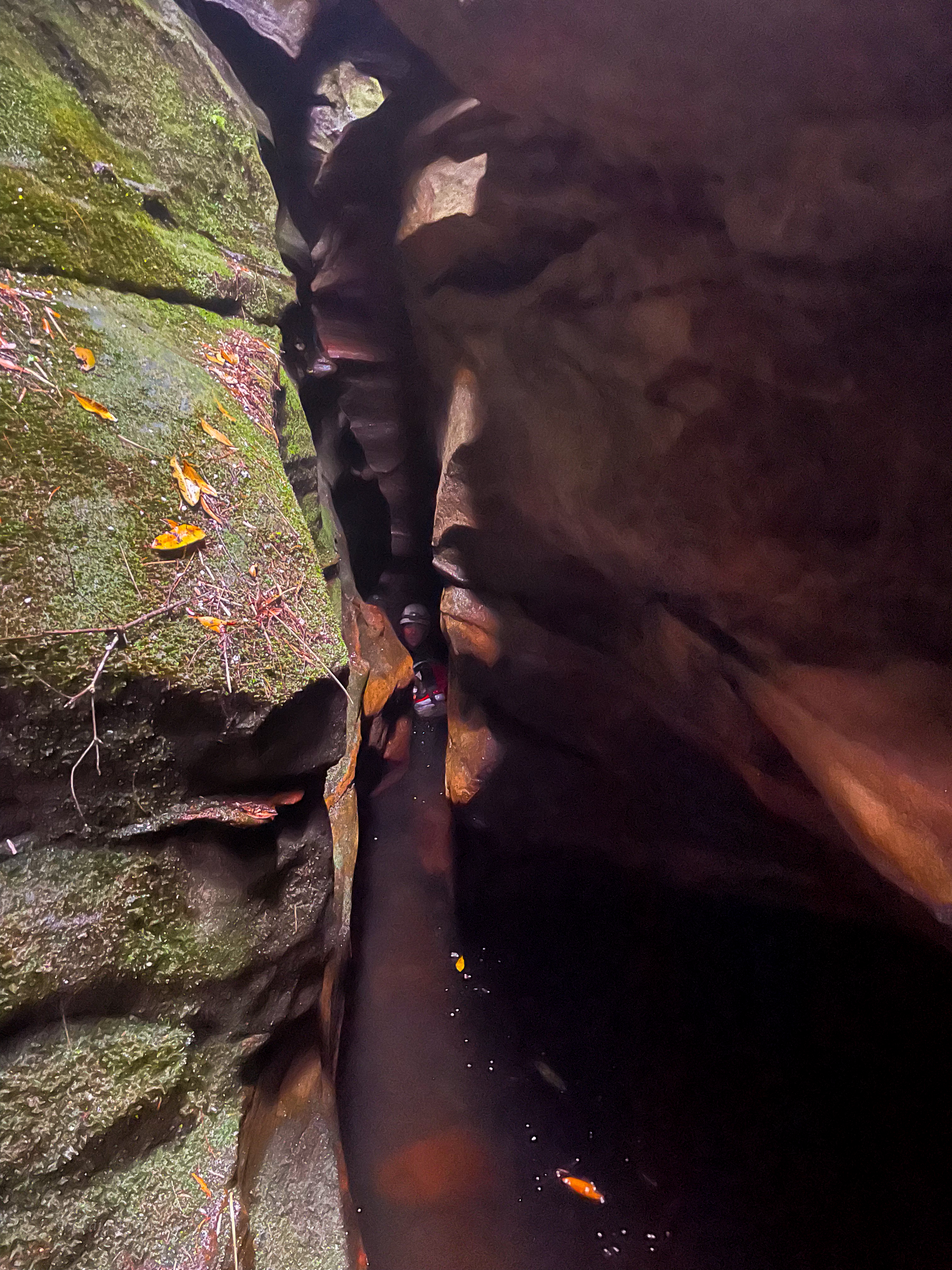
Banks is darker and more constricted than Hole in the Wall and the upper section is more sustained, it just seems to keep going.
And being a bit less visited it has a wilder, more adventurous feel. There’s a bit of problem solving in terms of anchors and down climbs and duck under and squeezes. Which I love.
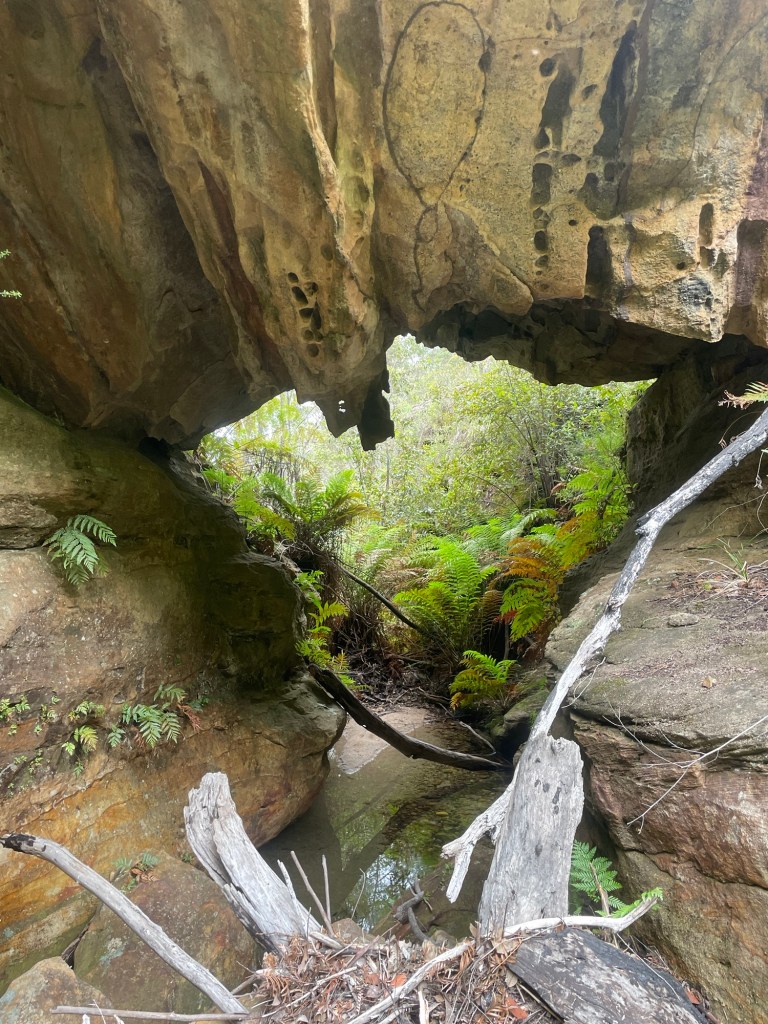
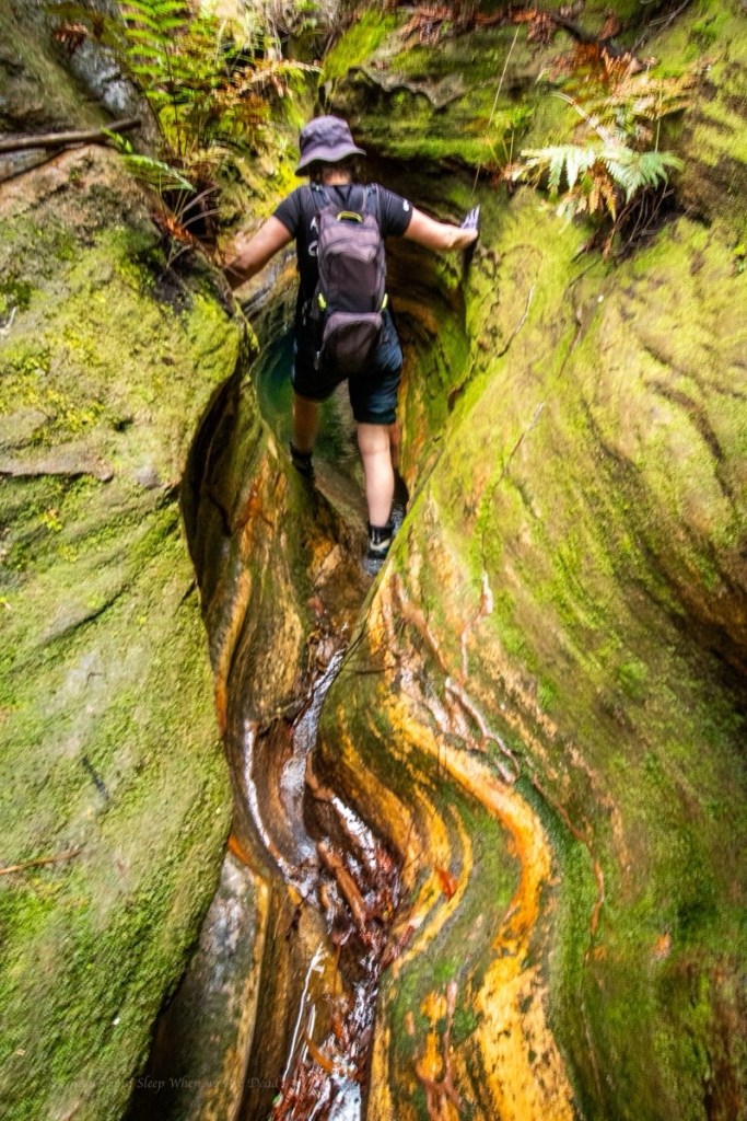
It starts Green and Lush
and soon drops into a deep dark hole
deep pools lead to tight squeezes
Blue Mountains canyons often have short upper sections that cut through the Banks Sandstone layer. These are usually low quality. Occasionally, though, upper sections, like the ones in Hole in the Wall, South Bowen or Bell are surprisingly high quality. But the upper section in Banks is exceptionally good. Thus the name.
did I mention tight squeezey bits?
There are 3 or 4 short abseils in the upper section, some with tricky starts, some ending in tricky to get out of (unless you are skinnier than me) pools. Some end in dark holes. Some all three.
We had slowed down quite a bit in Banks. Partly because of the problem solving, partly just to soak it in.
But eventually we emerge back into the light.
We are just about at the junction, says someone. We’ll start heading down.
I’m sure there’s another abseil. Say I. I remember a longer one.
We begin boulder hoping and get out on what appears to be a track on the banks.
I dont’remember this, says I
and soon the creek plummets below us and we are forced to back track as bit to get back in.
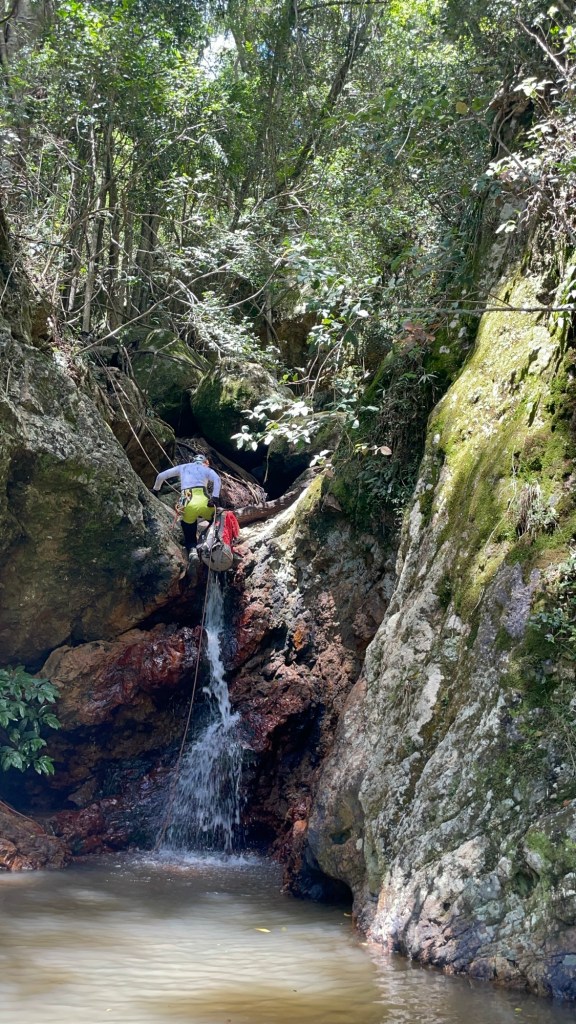
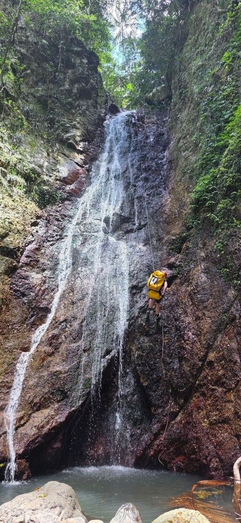
A tricky down climb later we come to the biggest drop of our trip. An 18m abseil into the wider, shorter lower section
Kylie makes her way down
The water is so clear
1 more abseil gets us to the junction with the Bungleboori/ Dingo Creek
What’s with canyon rocks looking like hulk smash fists?
There is reportedly a tricky exit downstream but this section of the Bungleboori/Dingo creek from Banks upstream past Hole in the Wall to the exit is remarkably beautiful, especially in the soft light of a slightly over cast day. we go upstream.
From here we make our way back to camp to recover for Popeye
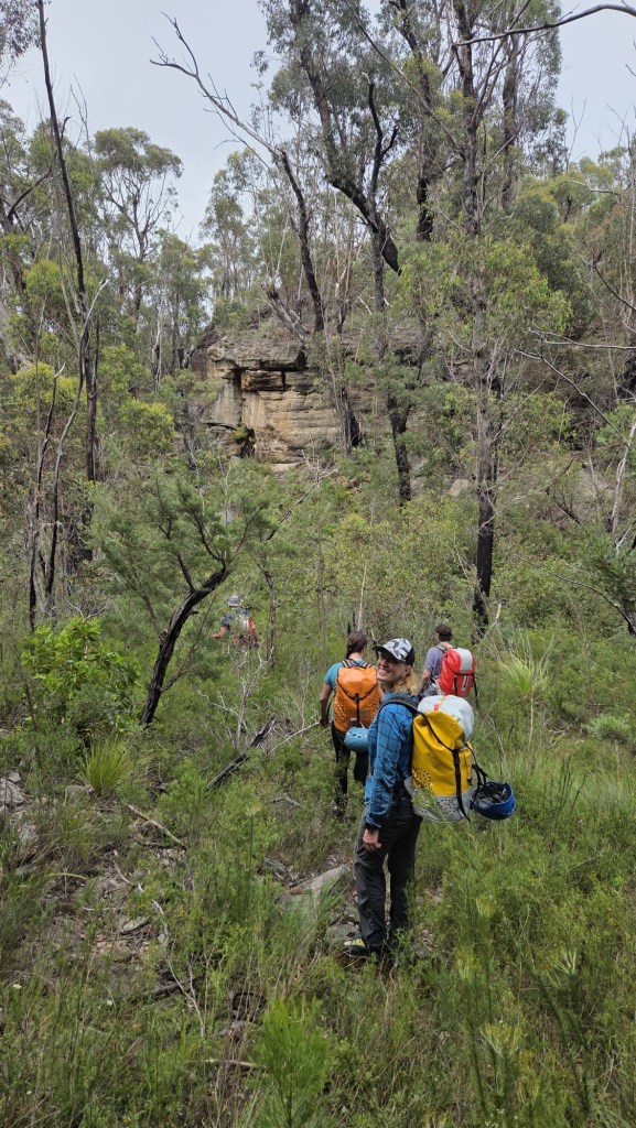
Kylie, Hywaida, Kris, Jason, Monhaka, Levis and meeeeee,
We were itching to just get out and soak up the bush.
We may have got soaked in the bush.
It was a drizzly start to the weekend but undeterred we found ourselves making our way along the entry route with overnight packs and a sense of excitement.
Kylie and I had been held up behind a traffic accident so Monica and Jason already had tents set up and camp established by the time we roll in.
We pitch our tarp, cook a warm meal and settle in out of the drizzle.
Levis arrives a bit later, the drizzle is a bit heavier so there wasn’t a lot in the way of introducing him to the gang.
Kris and Hywaida join us at the crack of dawn and we head off to visit Hole in the Wall canyon.
Hole in the Wall is a classic Blue Mountains canyon consisting of 2 deep, beautiful slots separated by a short creek walk.
Mon entering the upper constriction
The top sections contains some scrambles and wades between deep twisting walls, but no abseils
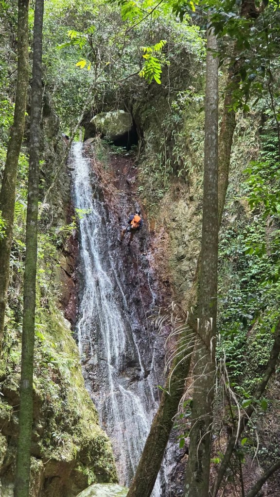
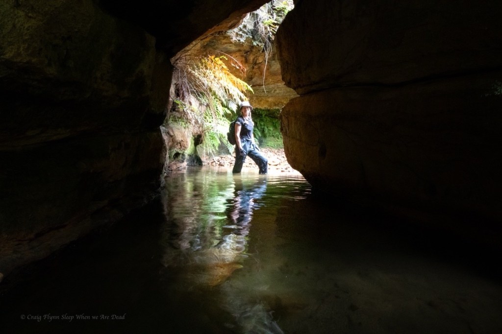
The bottom sections starts with an abseil into a very pretty pool
and then straight into the glowworm cave.
The glowworm cave is different every time I visit.
This time was probably the least spectacular display of worms. To be fair it was cold and wet outside, so potentially less insects to attract into their web, and it is early ion the season.
The hydrology of the cave also changes. The exit squeeze down to the left has long since collapsed. But what has been a deep swim requiring a difficult exit in recent years has silted up again resulting in a shallow wade.
Still it’s not as bad as it was in the early 2000s when you had to belly crawl in.
Then there’s the exit. Every year I think is this the year I’m too fat to make it. I’m not built for caving.
Jason in the green pool
Mon
Kylie in the lower section of the lower section
Levis’ mate Jackie
The final abseil
Lush green walls
And the final little waterfall before the Hole in the Wall of the Bungleboori
From here we head upstream.
Yeah yeah I know this creek has been officially renamed “Dingo creek” and has been since 2006 but that really is an unimaginative name for such a beautiful creek. On the old 1 inch to the mile Wallerawang map Dingo creek was marked as a small side creek (with an impressive rock arch). The major creek was Bungleboori Creek. The Southern branch that creek lower down was called Bungleboori creek, Nine Mile branch in reference to the Newnes Railway.
I’m assuming Bungleboori was the native name.
Anyhoo, we head upstream to the lunch rock at the usual HITW exit, we have made good time and enjoy a quick bite to eat in the drizzle before crossing the creek and heading up the other side for your next adventure.
It had been a hectic week, we needed to get out and wanted to do something neither of us had done before but had limited time.
What about Hand Over Hand? It’s suppose to be a short half day.
Kylie did a quick bit of research and noted the trace on ropewiki did not match the description on ropewiki. While the notes mention several exit options the main description was for the shorter exit. The trace was for the longer exit if you went down South Bowen.
TBF the South Bowen option would make a good short day trip but if you had just glanced over the description expecting a couple of hours then blindly followed the trace you’d be in for a shock.
With mapping apps like alltrails becoming more popular this is becoming a bit of an issue. There have been reports of people looking for the infinity pool at the end of Fortress or the bush walker route to Dalpura but unknowingly loading the GPX trace for the canyon trips instead and getting themselves into trouble.
Don’t get me wrong, Alltrails and other mapping apps are a handy resource, but like any tool you need to know how to use them.
A good tip is to start with the premise that you have no idea who uploaded it, what their skill and experience is (an easy rock scramble for a gun climber might induce a BLM (Bowel Liquifying Moment) to the average canyoner). You don’t know what information or directions they themselves were following or if they just stumbled along and got lucky. You don’t know if it’s their trace or one they got off someone who got it off someone who got it off someone. Hell, you don’t even know if they have actually done the route, it might be just a speculatively drawn line on a map.
So, load it onto your mapping app and have a good look. Does it look to follow the best contours? Are there other options? Why does it do that big zigzag at the cliff? And does it match your expectations from the description?
Cross referencing the track notes with other sources and trip reports will also give you a broader understanding of the trip.
Anyhoo, enough pontification. that side track was longer than the trip and maybe well over the top for experienced canyoners on a simple trip like HoH but it’s how we role.
Now onto the canyon.
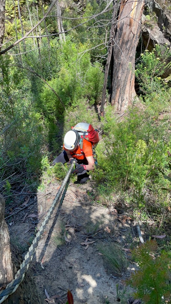
We leave home at the crack of 10:30am and make our way across to park up at the start of the Mount Wilson East Power Line fire trail. A short distance down here and we swing down under the powerlines.
The description hinted at horrendous scrub in the creek so I had hoped to drop in a little lower. I choose a nose I hoped goes between two side creeks and we make easy time down to the cliff line.
Right creek looks like it cliffs out. Calls I
Left looks like it goes, answers Gadget.
I make my way across and scramble into the side of the side creek. In doing so I disturb the biggest copperhead snake I’ve ever seen. Chunky boi makes a bee line toward Kylie.
Snake coming directly at you! warns I
WTF! yells Kylie. But in long form. This is no time for three letter acronyms.
Snekie snek dodges her ankles and disappears into scrub.
Well that was fun.
We gain the creek. Scrub and dead fall awaits. We hadn’t saved ourselves as much creek bashing as I hoped but we make our way down to the upper section of canyon.
It starts with a bit of promise, with a crystal clear pool below a small down climb as the cliffs close in.
But to call it an upper section is a stretch.
The “canyon” opens back out and a short way down the creek the cliff open as well. There is what looks to be a gentle ridge entering on the left. In hindsight this could be a much better spot to enter. It’s not to far a divert if you want to head up stream to bask in the glory of the upper section and it would miss a 1km of creek bashing.
We all know I have a rep for horrendous scrub bashes to canyons of questionable quality but up until now even I was wondering if this one was going to be worth it.
Just downstream the bottom bit makes up for it.
Gadget above the first drop
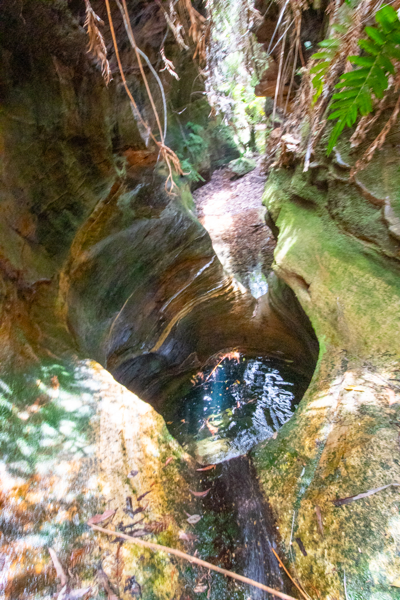
One of the few keeper potholes in the Bluies.
There is a couple of ways to get out of the pothole. 1. Scramble out over the lip or, 2. duck under and swim through an arch
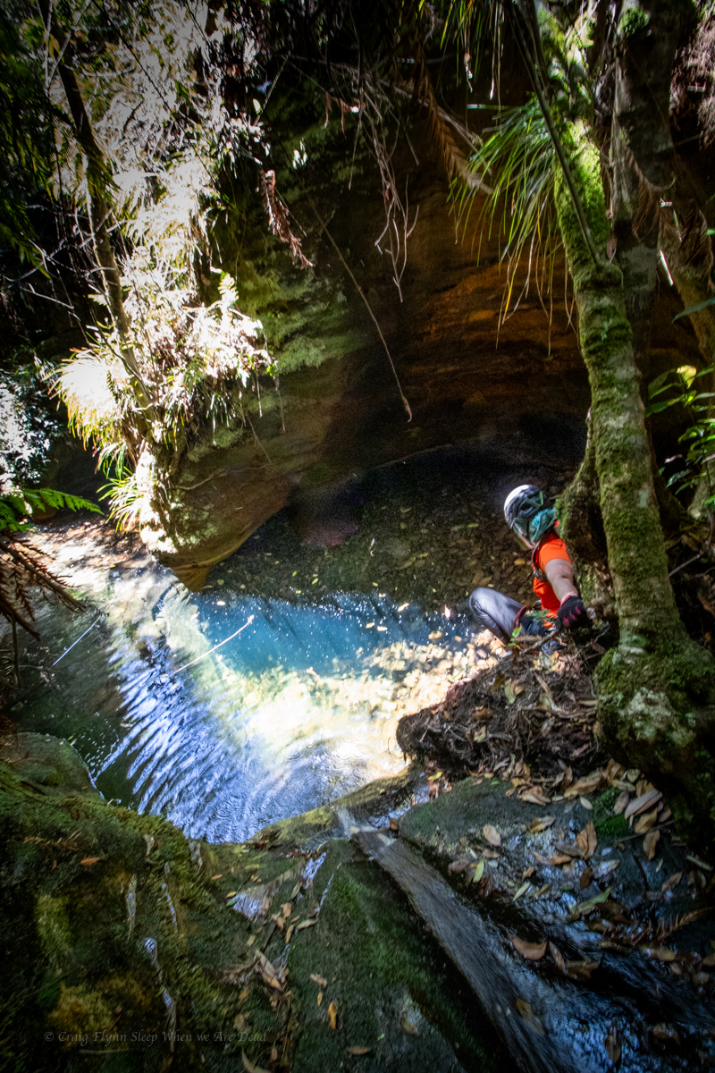
Water levels looks low so scrambling over the slippery walls may prove difficult and we couldn’t see if the tight duck under was clear so we opted to by pass over the top and abseil in the side.
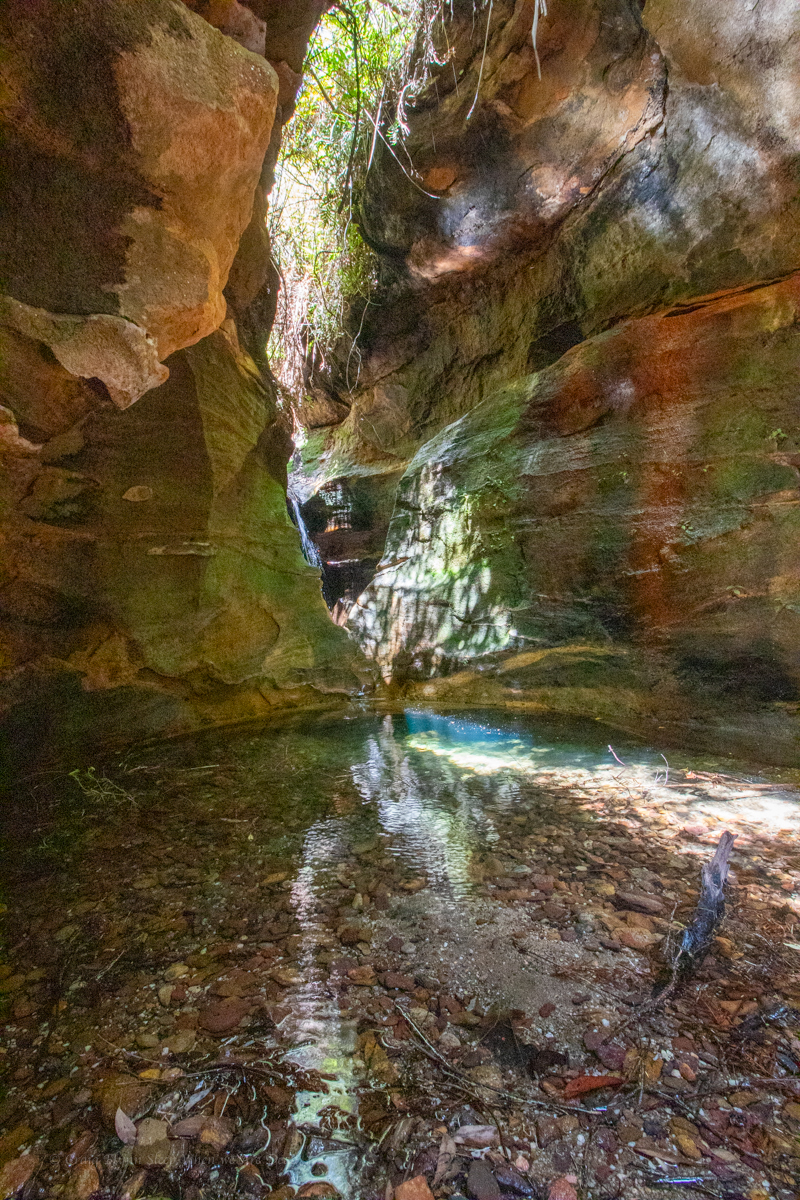
Once down I thought I’d try the duck under. It’s a bit deep to be called a “Duck Under” it’s a full on swim under and it’s silted up making a tight squeeze.
yes I chickened out. Got my head under the arch and thought screw that for fun
pretty but
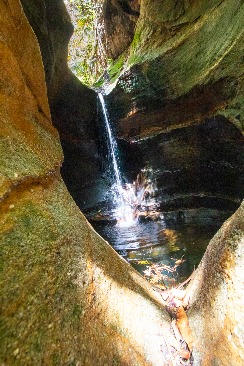
A lot of these little side canyons have 1 really nice chamber and that’s it. I was kinda expecting that to be the case here but what we got was a very beautiful series of enclosed dells. it reminded me a bit of an untouched deep pass.
the water clarity was amazing
and the canyon opens up. We are a bit above the junction with South Bowen but follow a break in the cliff lines up to the left where a rough bush walkers trail leads up back up to the powerlines near where we first dropped in.
Seeing places few others see and doing things few others do is what it’s about
About 3hrs car to car with a lot of photo phaffing
Popeye creek pops in and out of canyon sections along much of its course and it’s one I’d not done before.
A big Saturday trip had been foiled by thunderstorms and we just needed to shake out the cobwebs but couldn’t be arsed repacking ropes and stuff so thought why not have a look at some non abseil sections in Popeye.
Meeting at the crack of 10am, or there abouts we make our way in in no time.
We’d be entering the canyon a long way upstream of where the jamieson guide recommends but not too far from the increasingly popular Popeye falls.
The creek cuts a deep, promising looking cleft in the sandstone.
A short section of narrow u bends hide a pleasant little canyon.
There’s a bit of bridging to stay dry above the knees. But the water is a pleasant temp anyway
Not the figure 8 pool
It is very pretty.
Parts very similar to the Dumbano tunnels.
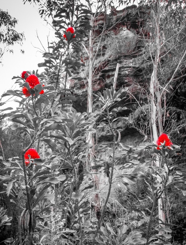
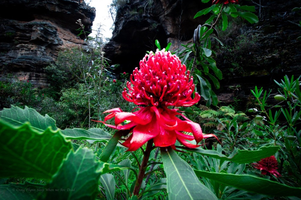
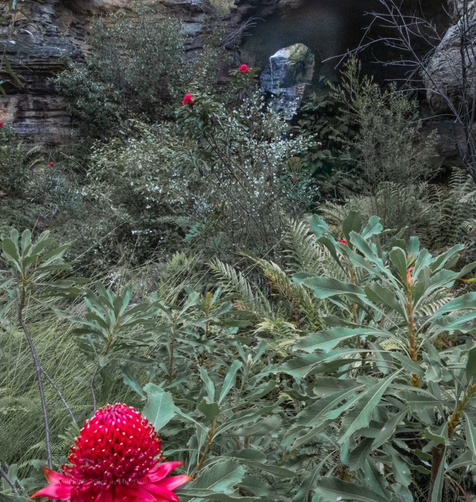
We are already impressed. the canyon opens up a bit and Waratahs line the banks.
Waratahs along a spur off Waratah ridge? Who would have thunk it
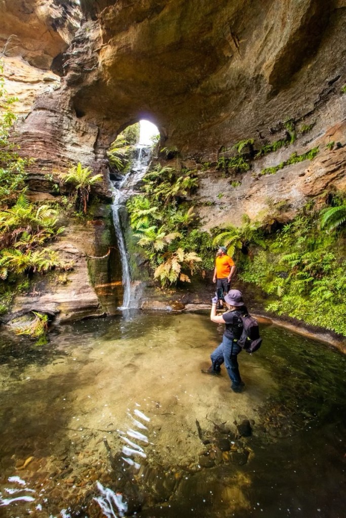
And soon we come to the falls.
Most visitors to here avoid the canyon bit and keep their feet dry by scrambling down the nose.
It’s a funky little waterfall through an arch in a side creek
We phaff about with photos for a bit, we have to pool all to ourselves., but then push on downstream to the next canyon section.
A bit wider and deeper it’s a nice walk through section
It’s nice
Again the canyon opens out. We believe it’s a 1km scrub bash down to the next bit so, happy with our easy day, we retrace our steps back up to the waterfall. A crowd of people are here now.
There’s an easier way in, says old mate sucking in a vape.
We came that way, replies Ellie very politely. We just had a look at some other stuff while out here.
We leave the guards and scramble out into the cliff top for lunch.