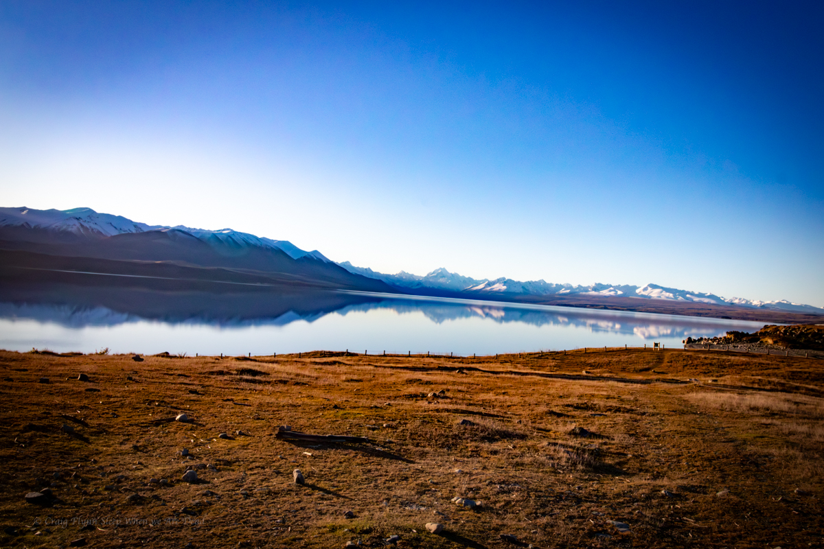
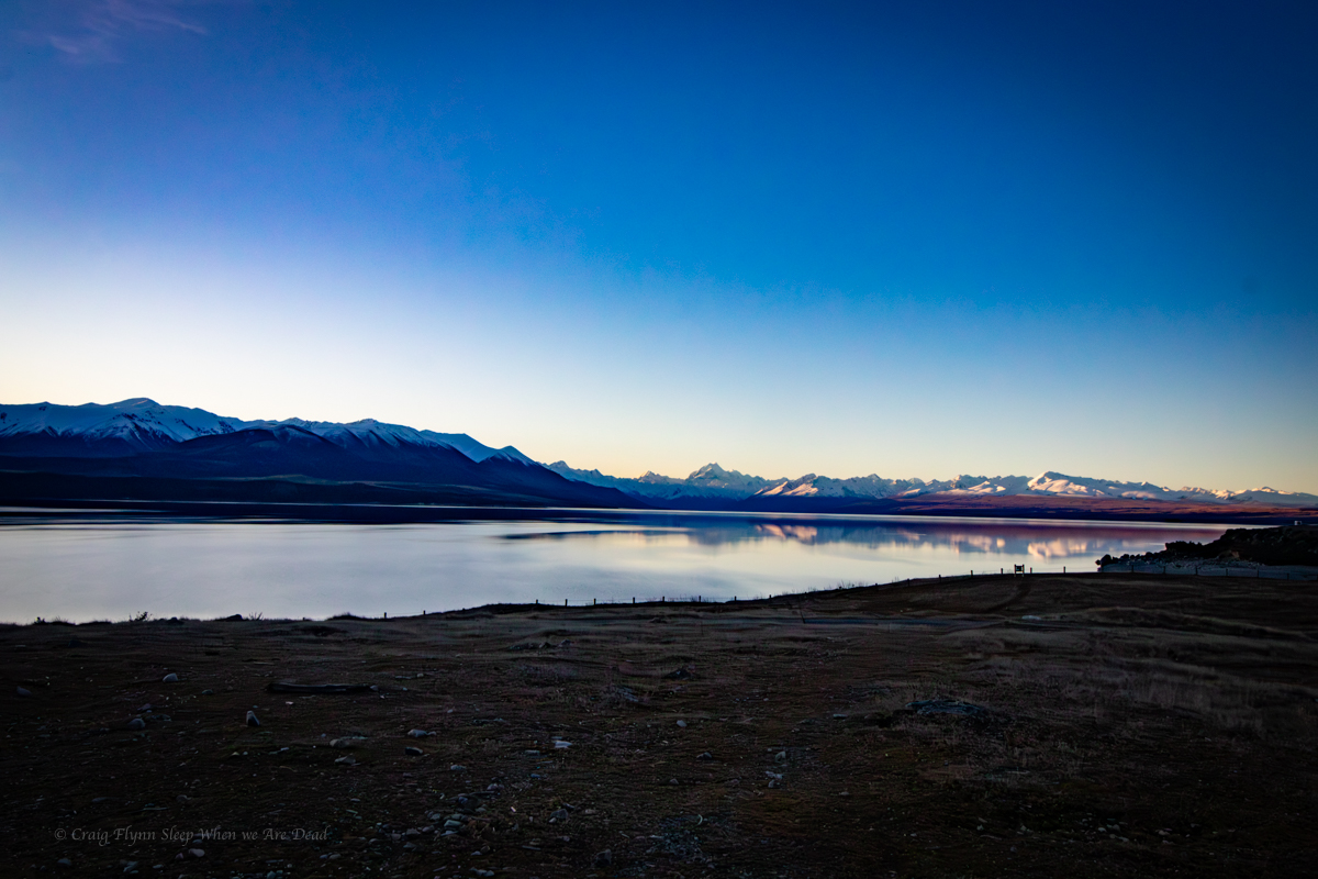
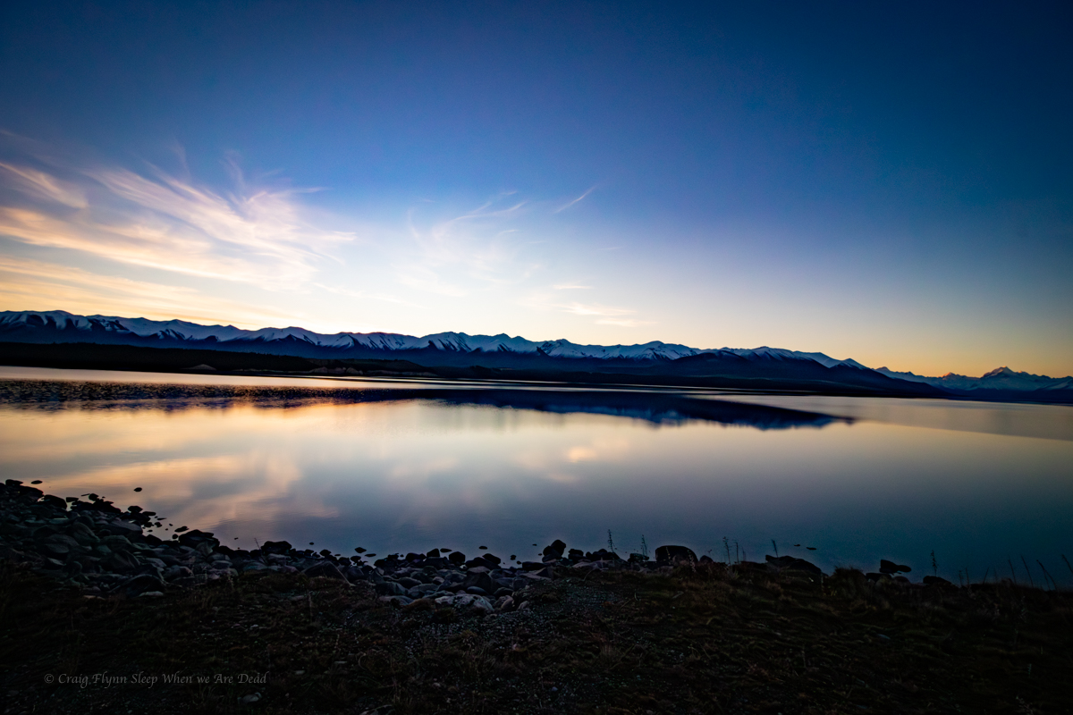
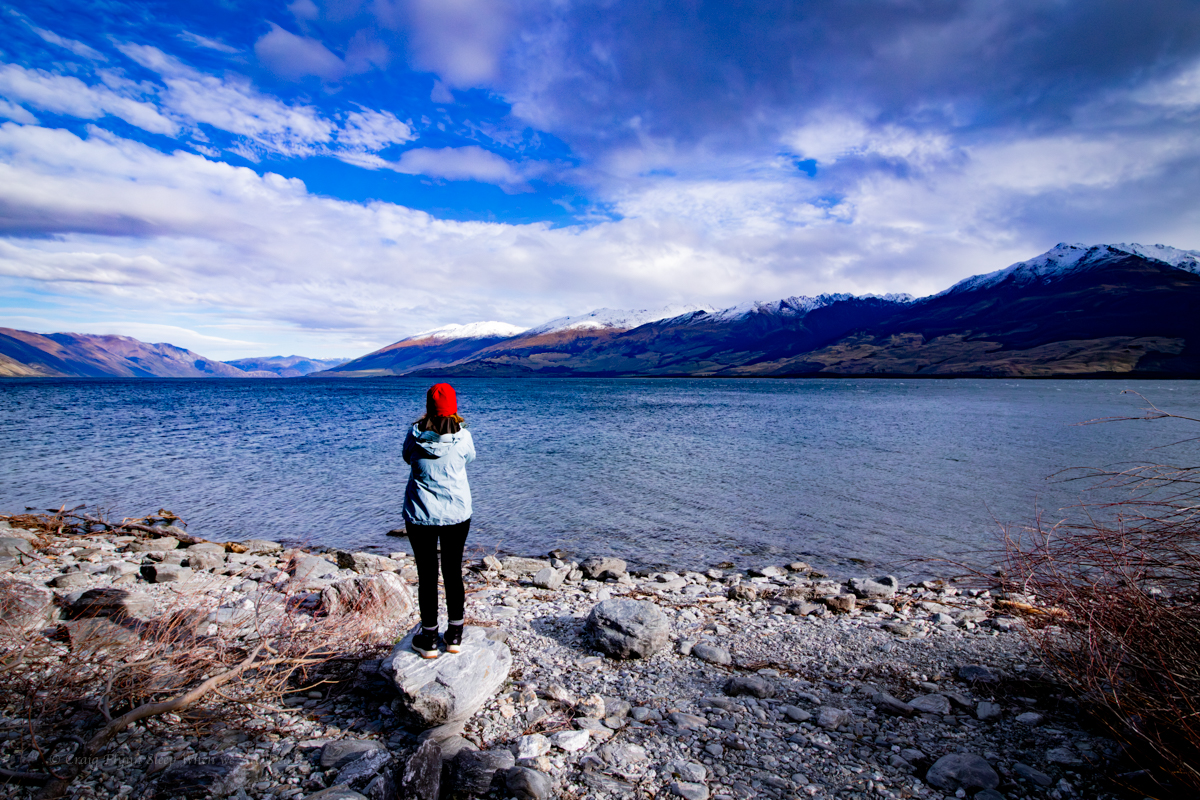
From Aoraki we head down the valley to Lake Pukaki.
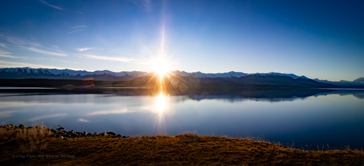
One of the larger freedom camps we’ve come across to date, we set the van up with tremendous views across the expansive lake.
The reflections off the snow capped mountains made great photos with a grand view of the sun set.
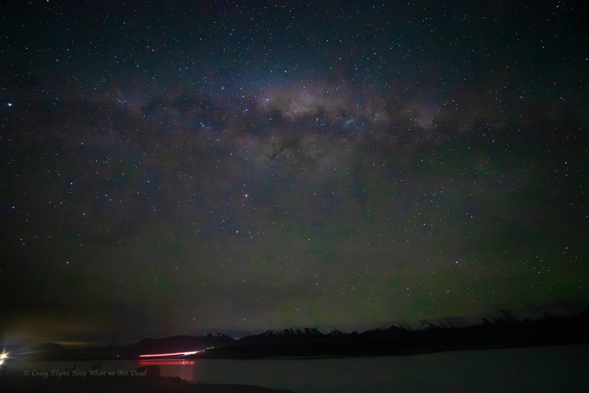
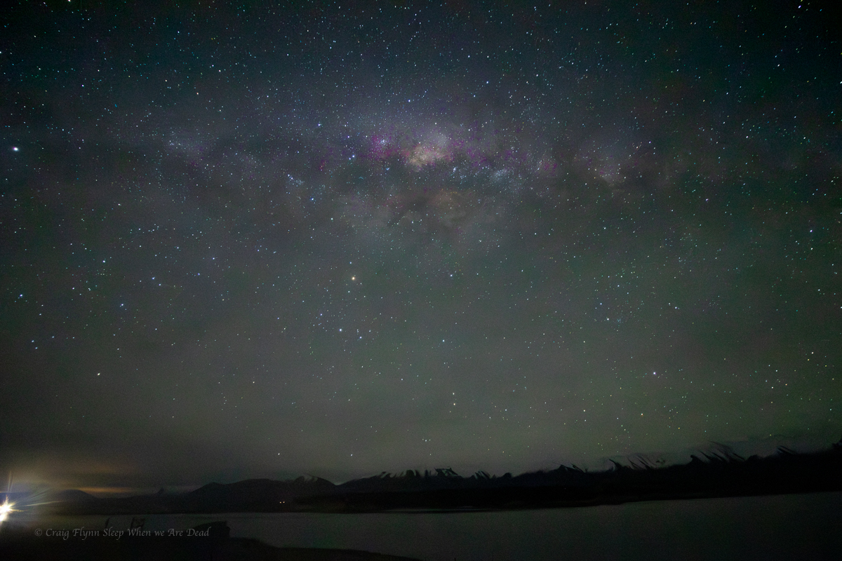
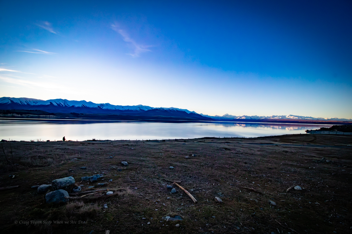
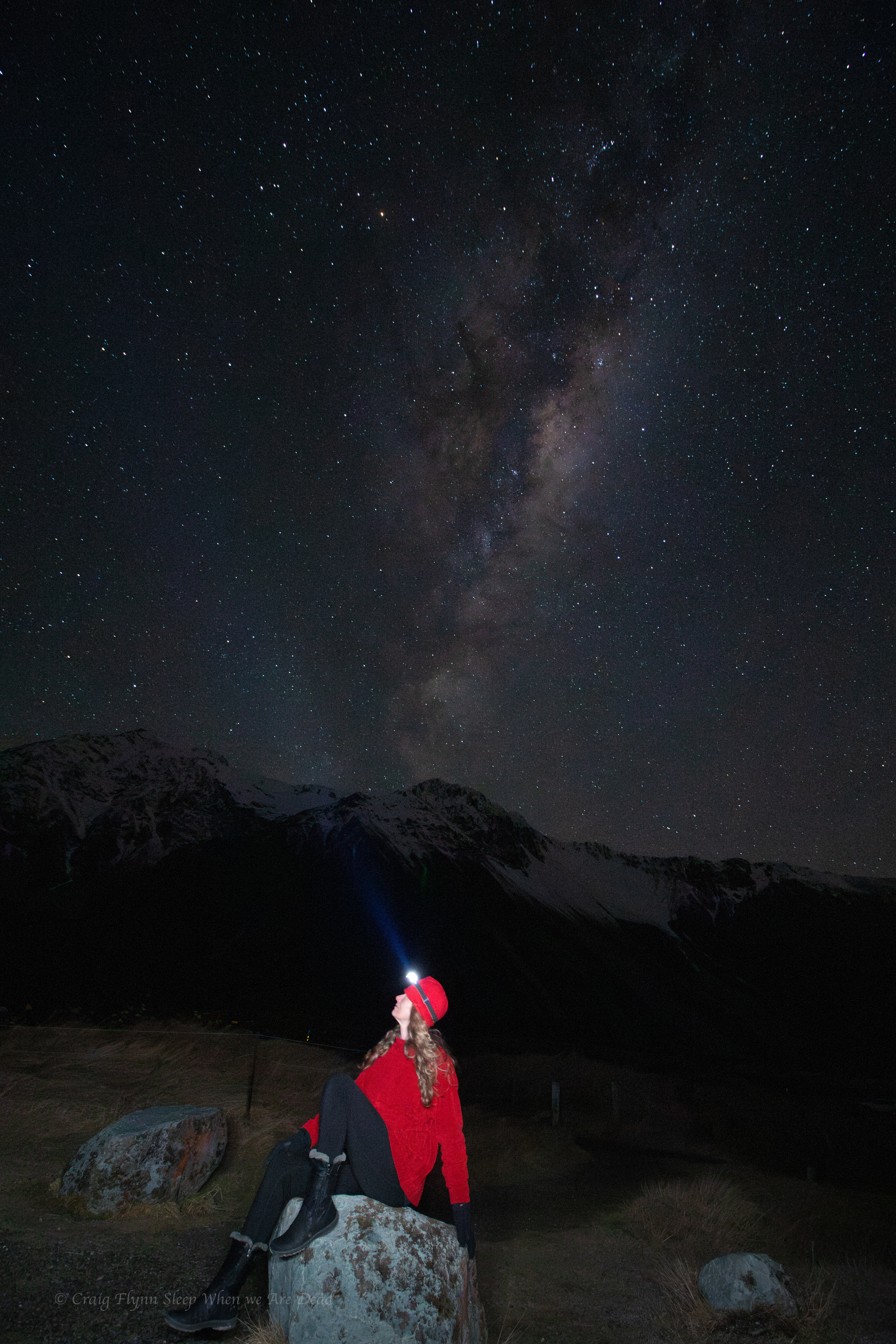
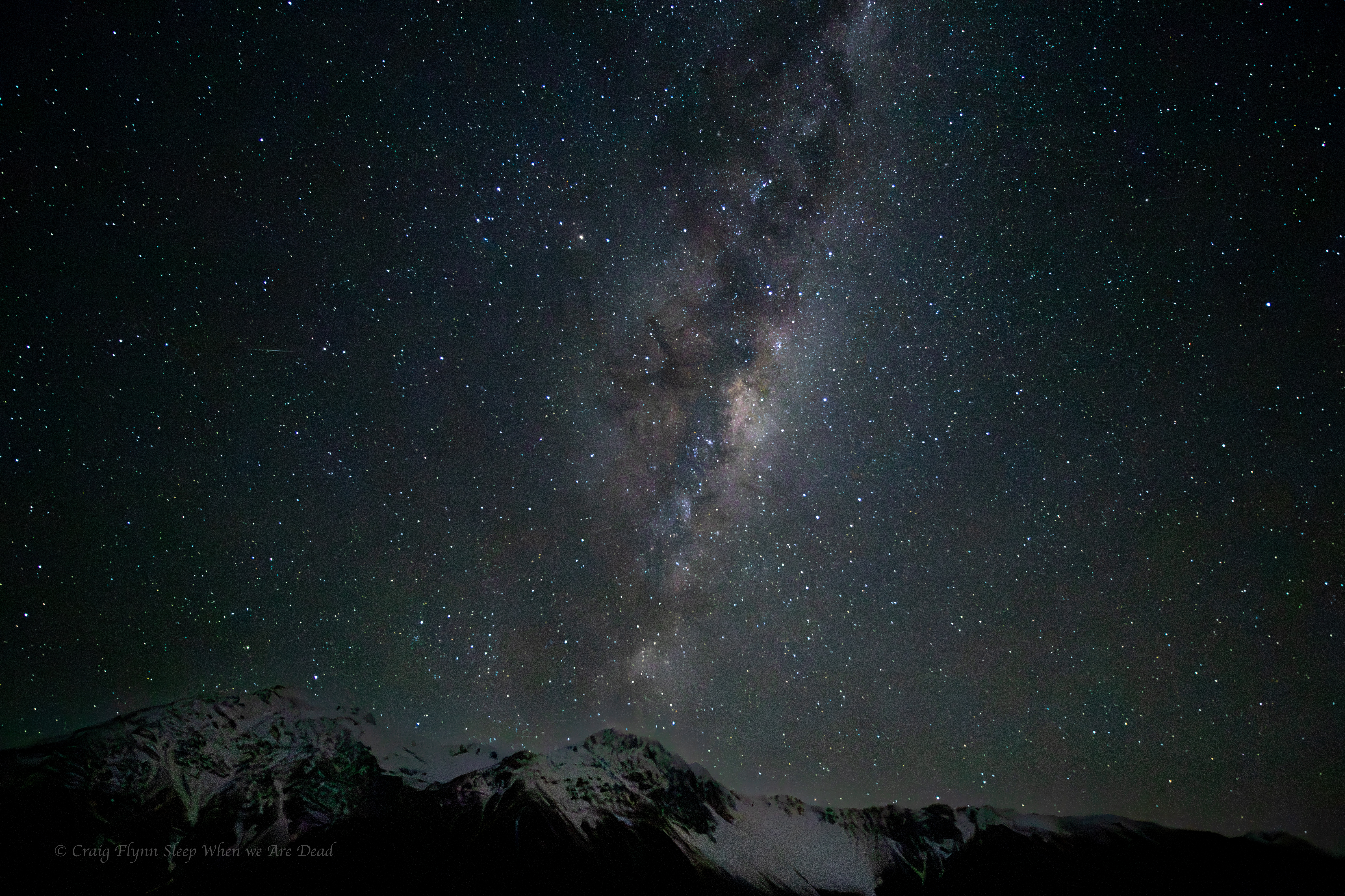
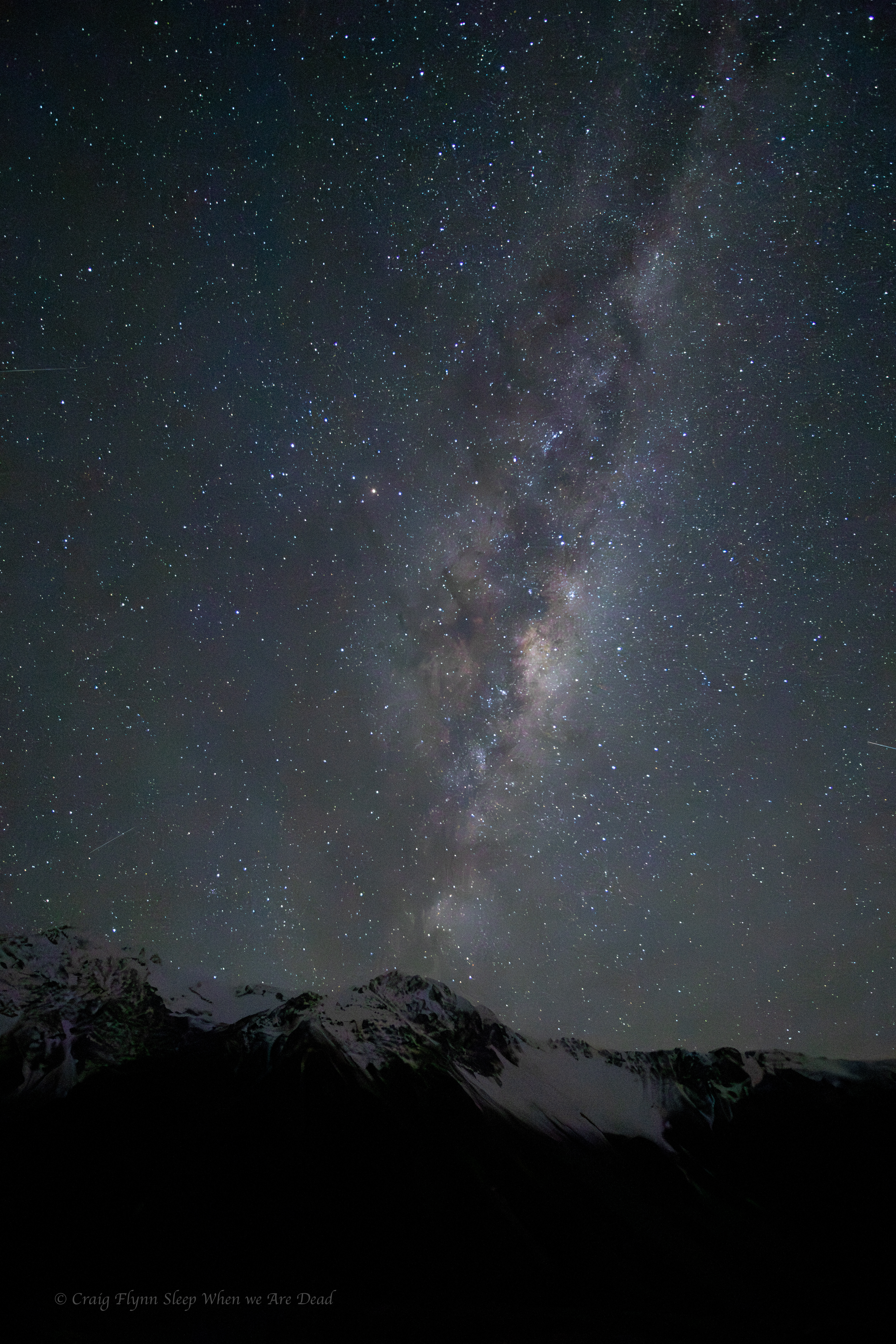
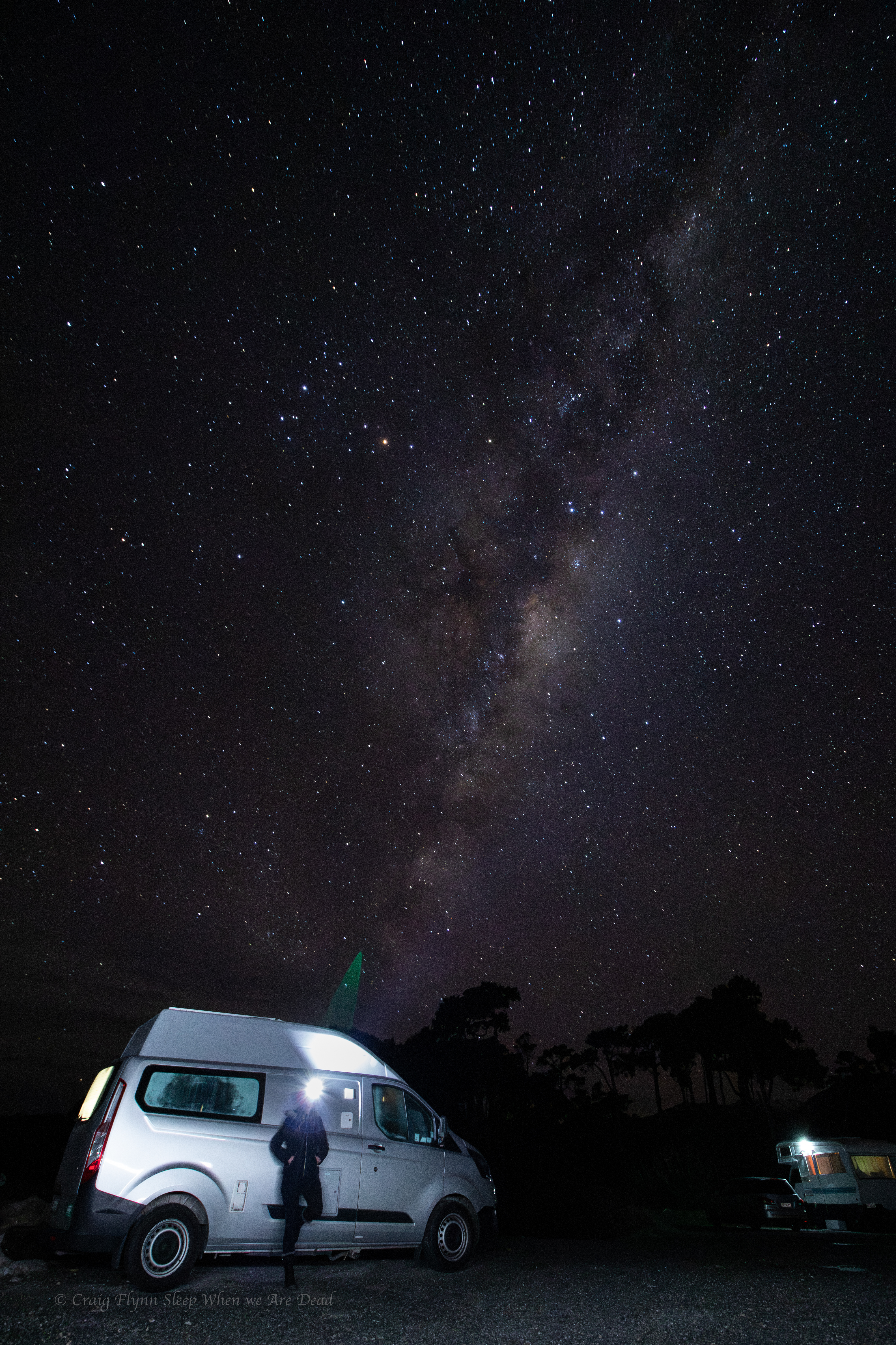
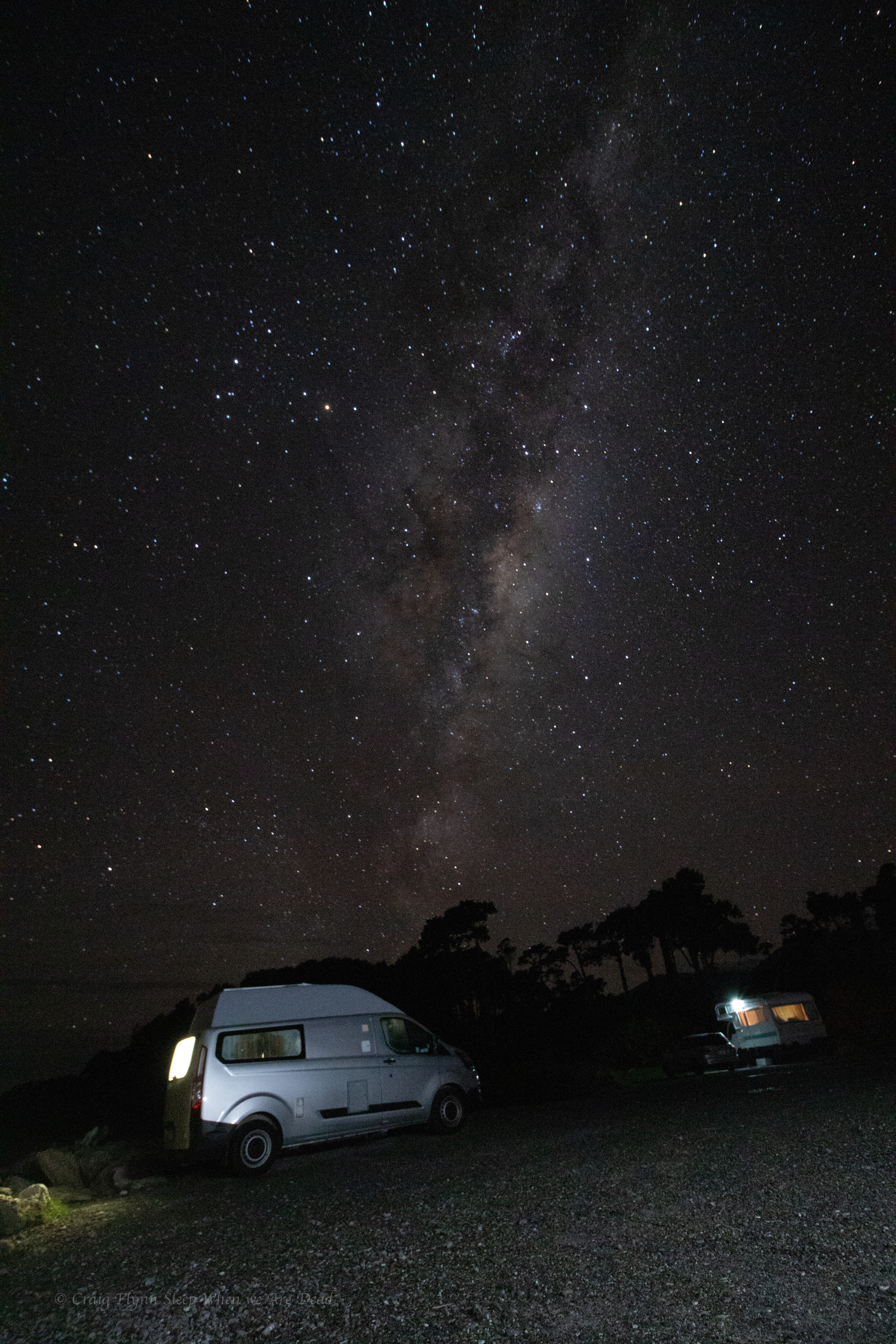
This also gives me an idea. I do a few calculations and check a few things and work out that in the wee hours of the morning the Milkyway should be splayed out horizontally above the mountains.
Now I just need to decide if I really want to interrupt my sleep to crawl out of a nice warm bed and stand in the cold….
Milky over the lake with a truck passing over the spillway.
Another hour and it might have presented as more of an arch over the mountains but it was 2:30am and -6ºC. I wasn’t hanging around.
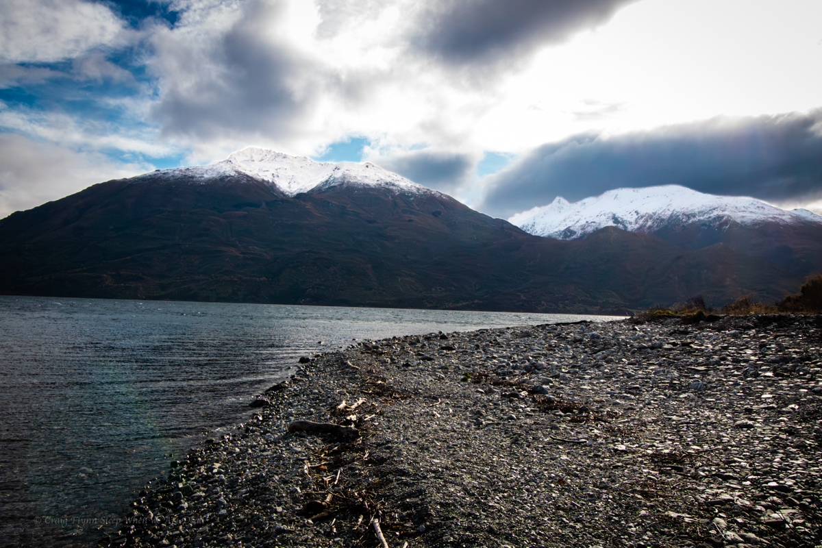
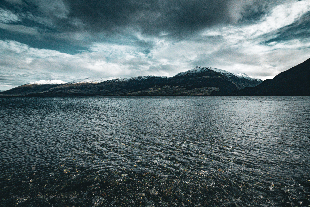
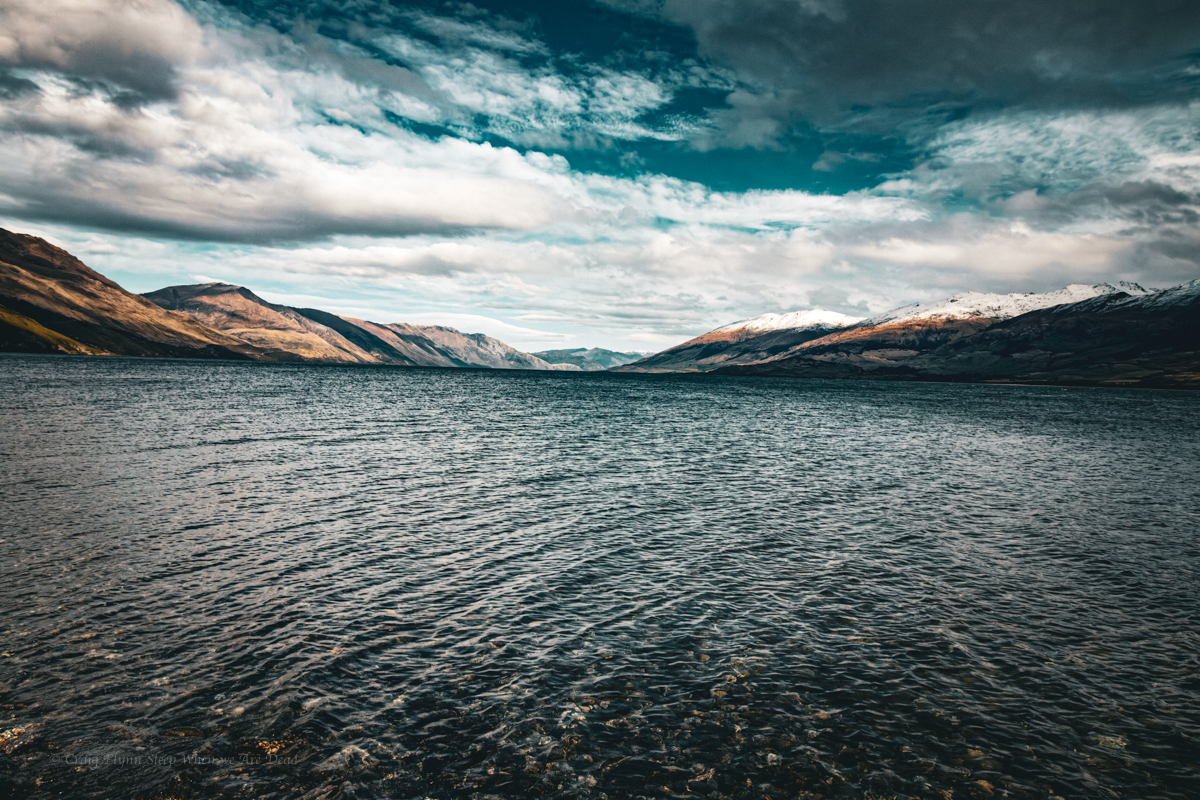
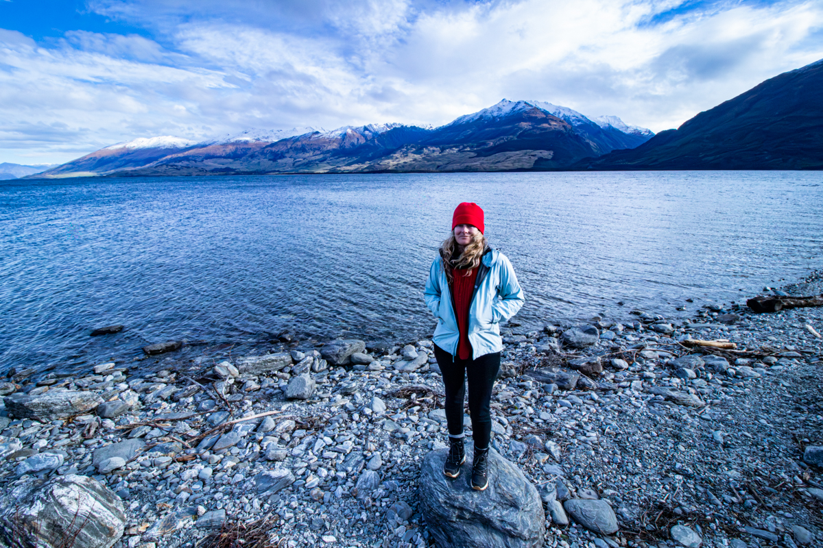
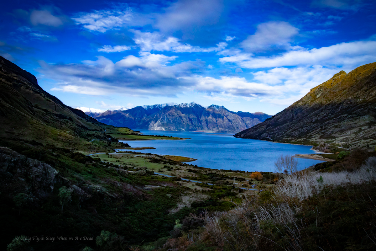
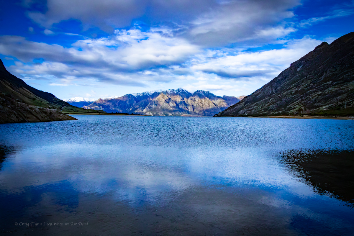
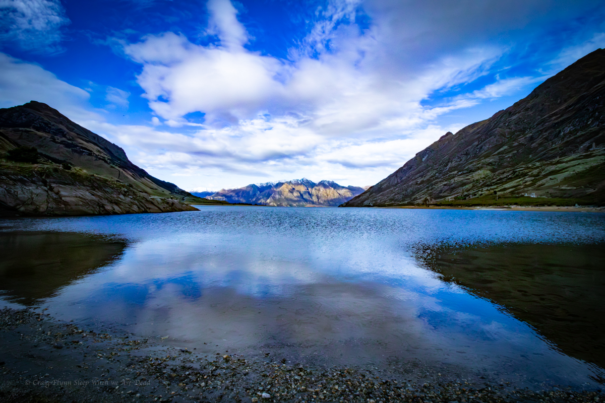
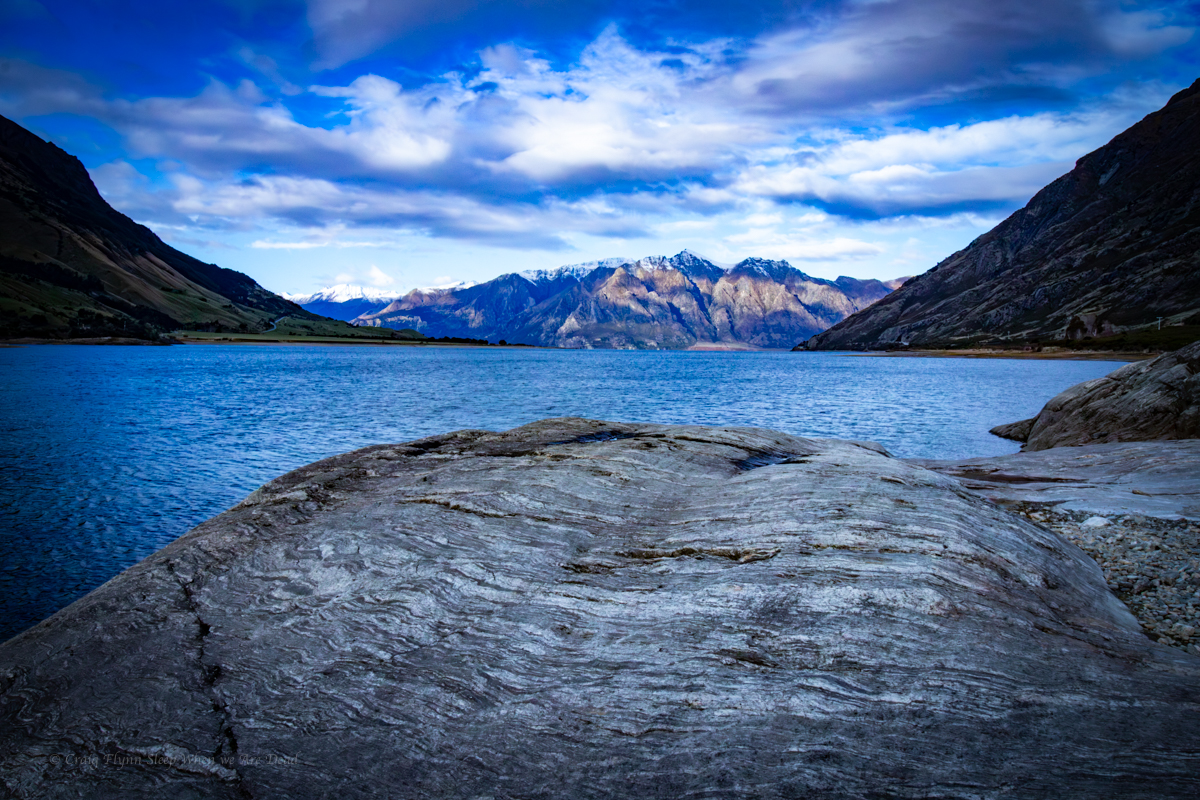
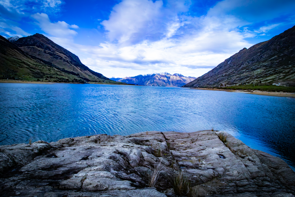
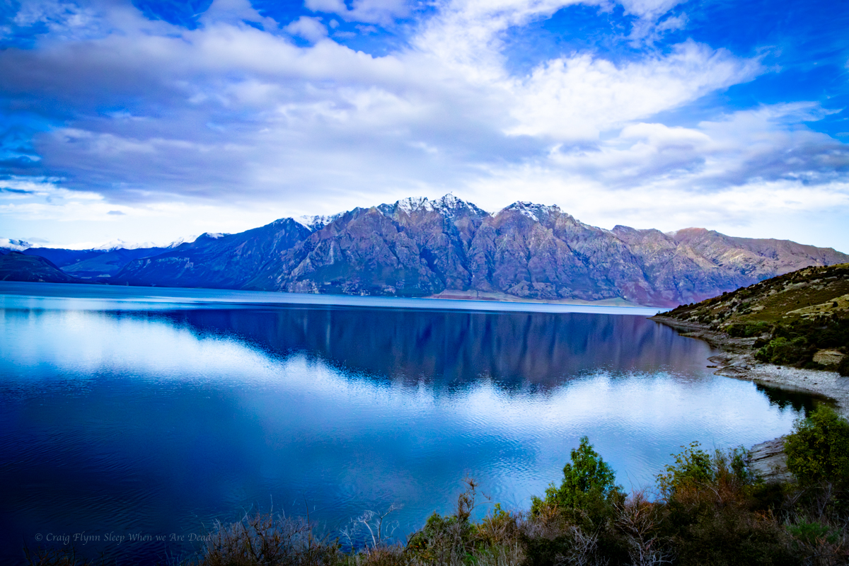
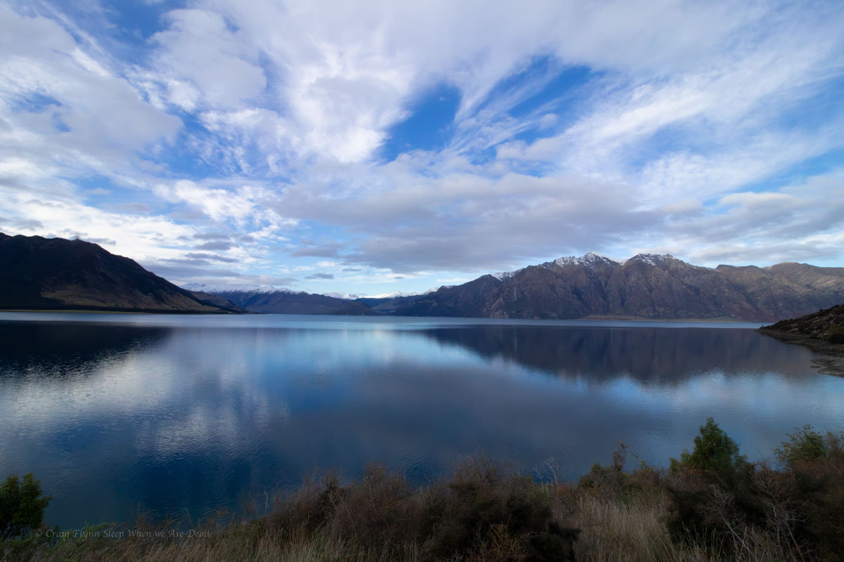
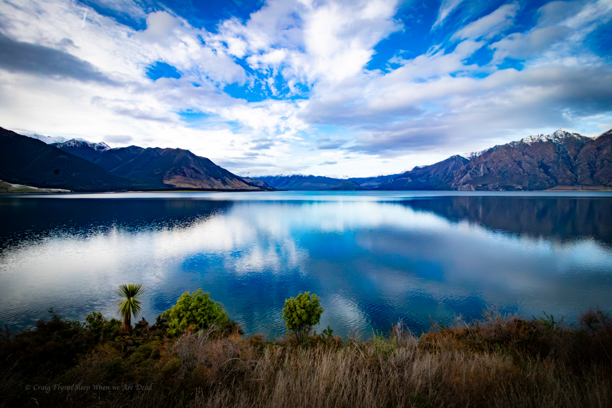
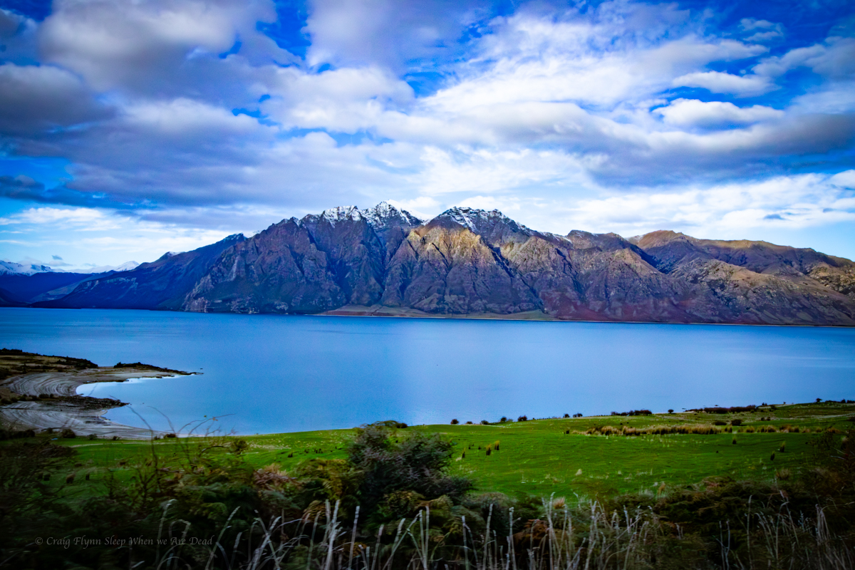
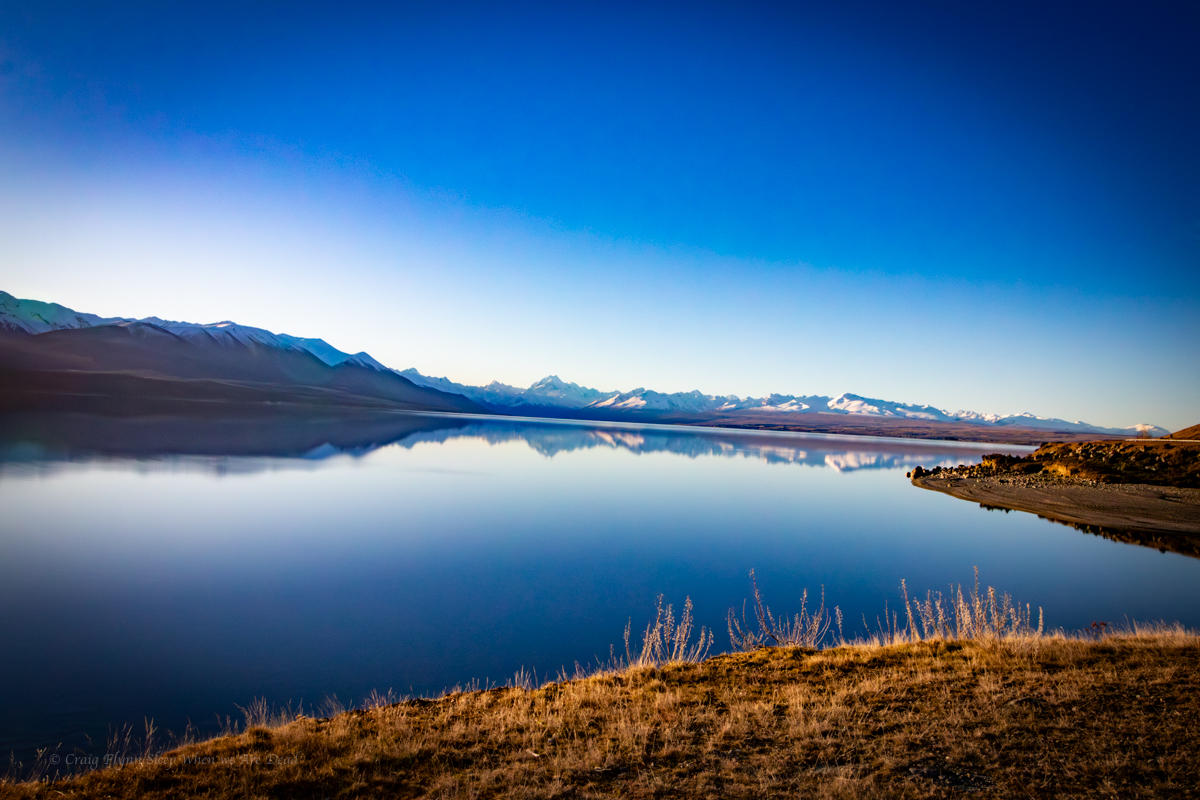
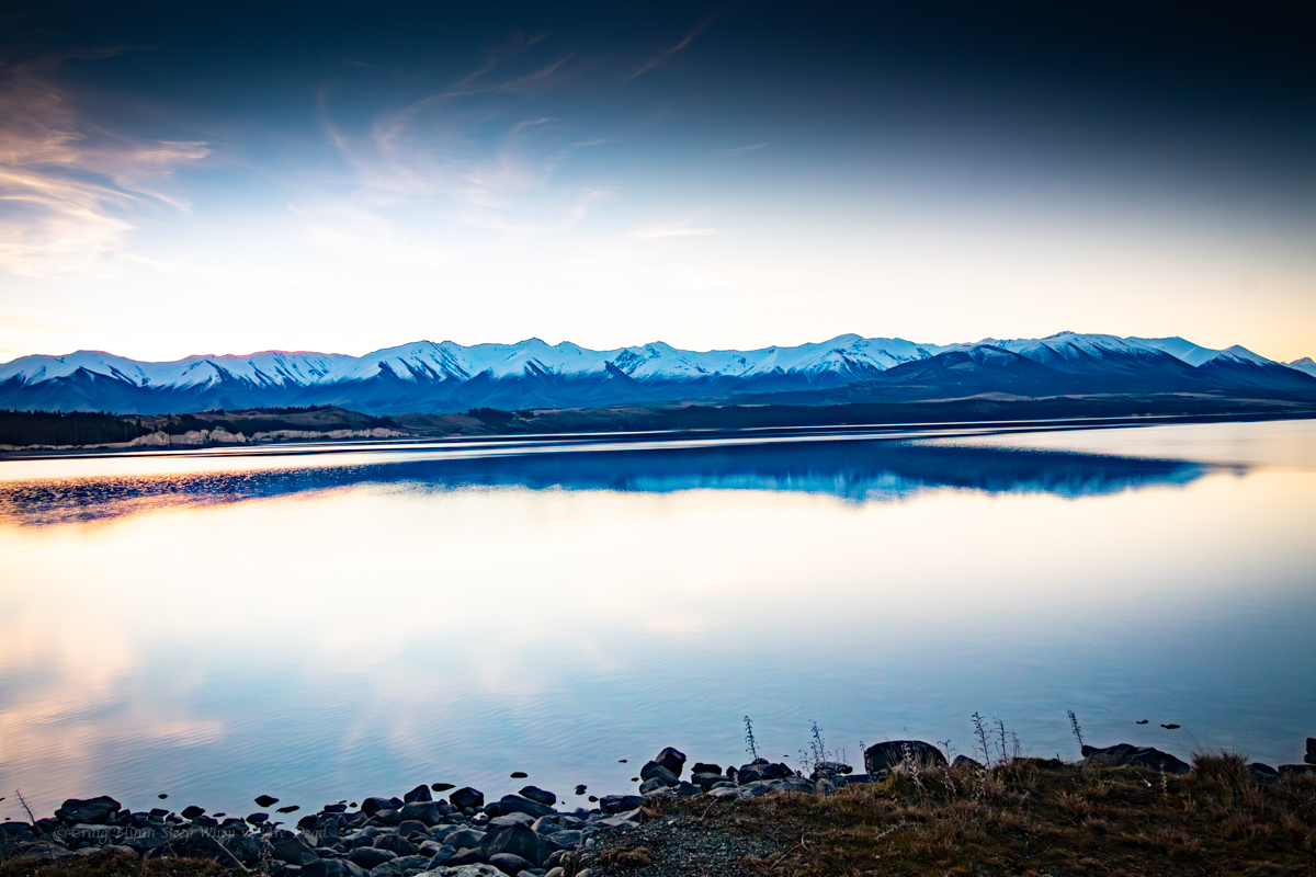
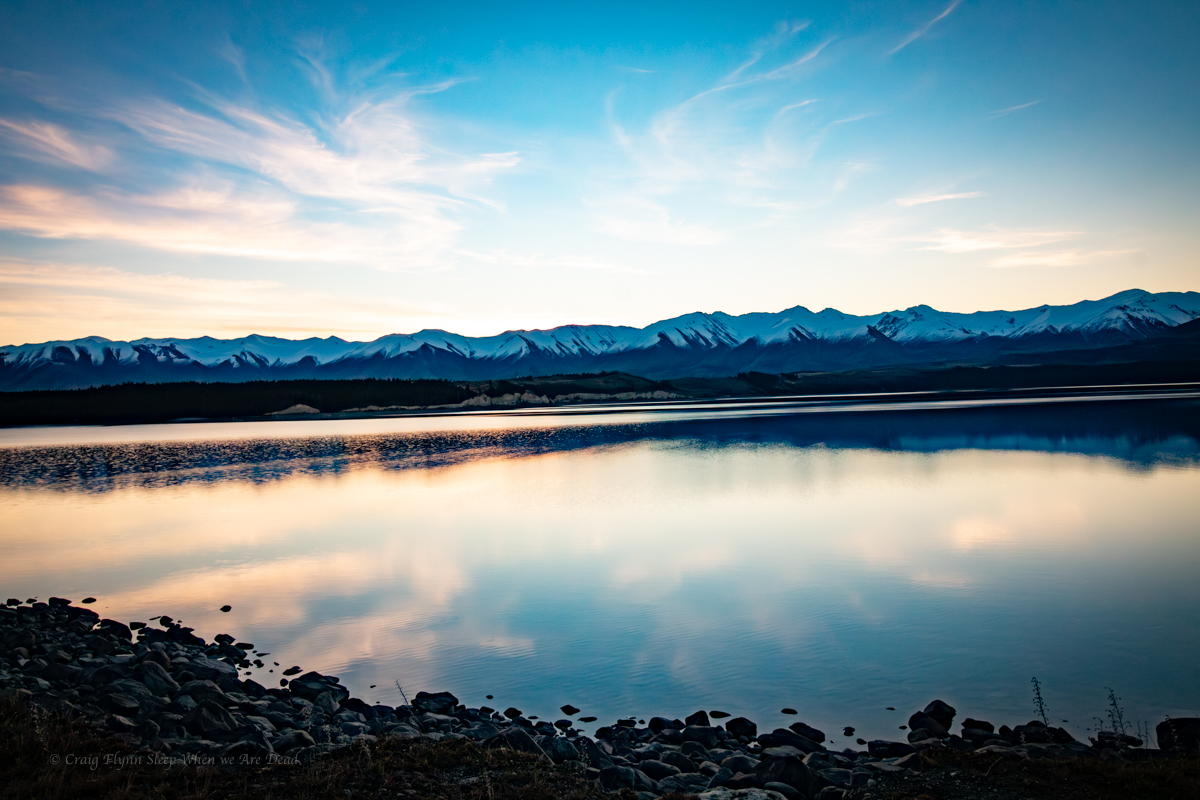
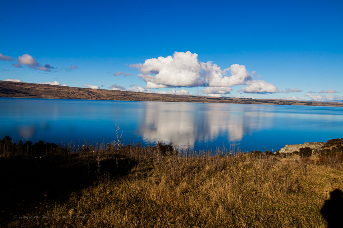
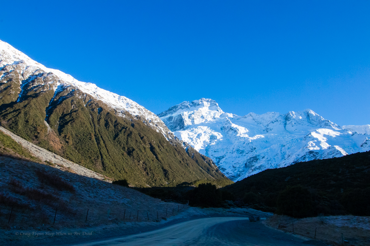
Lake Pukaki was just one of the amazing lakes we drove past / stopped at / were amazed by.
This might sound naive but the size and amount of lakes caught me by surprise. I mean, I knew the rivers and creek systems were a lot higher flow but kinda just assumed they tumbled off the mountains and flowed into the ocean. Coming from the driest habitable continent on earth the shear amount of lakes contained by our little cousin across the ditch, and their size, blew me away.
Below is a random collection of photos of just some of the ones we stopped at for photos.
Anyhoo after the epic nightscape shoot we sleep in a little then head to Elephant Rocks.
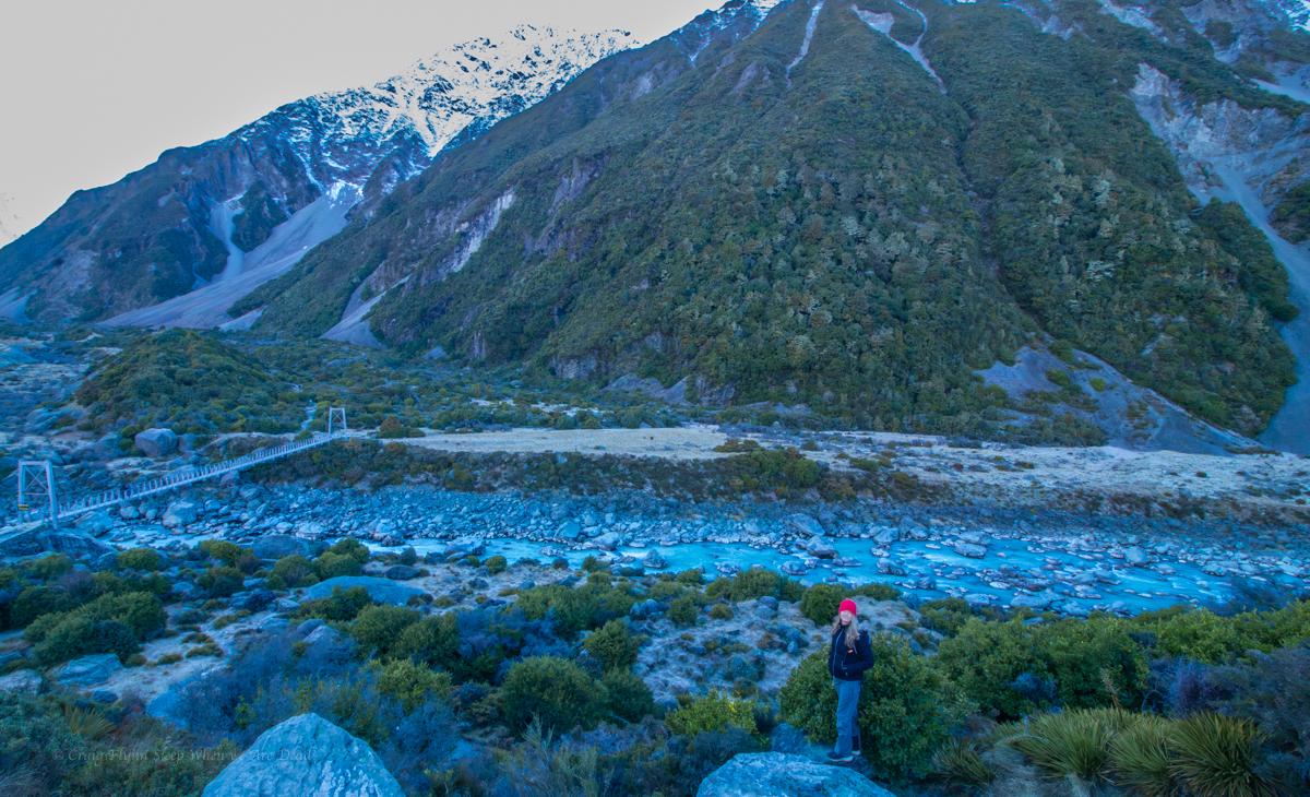
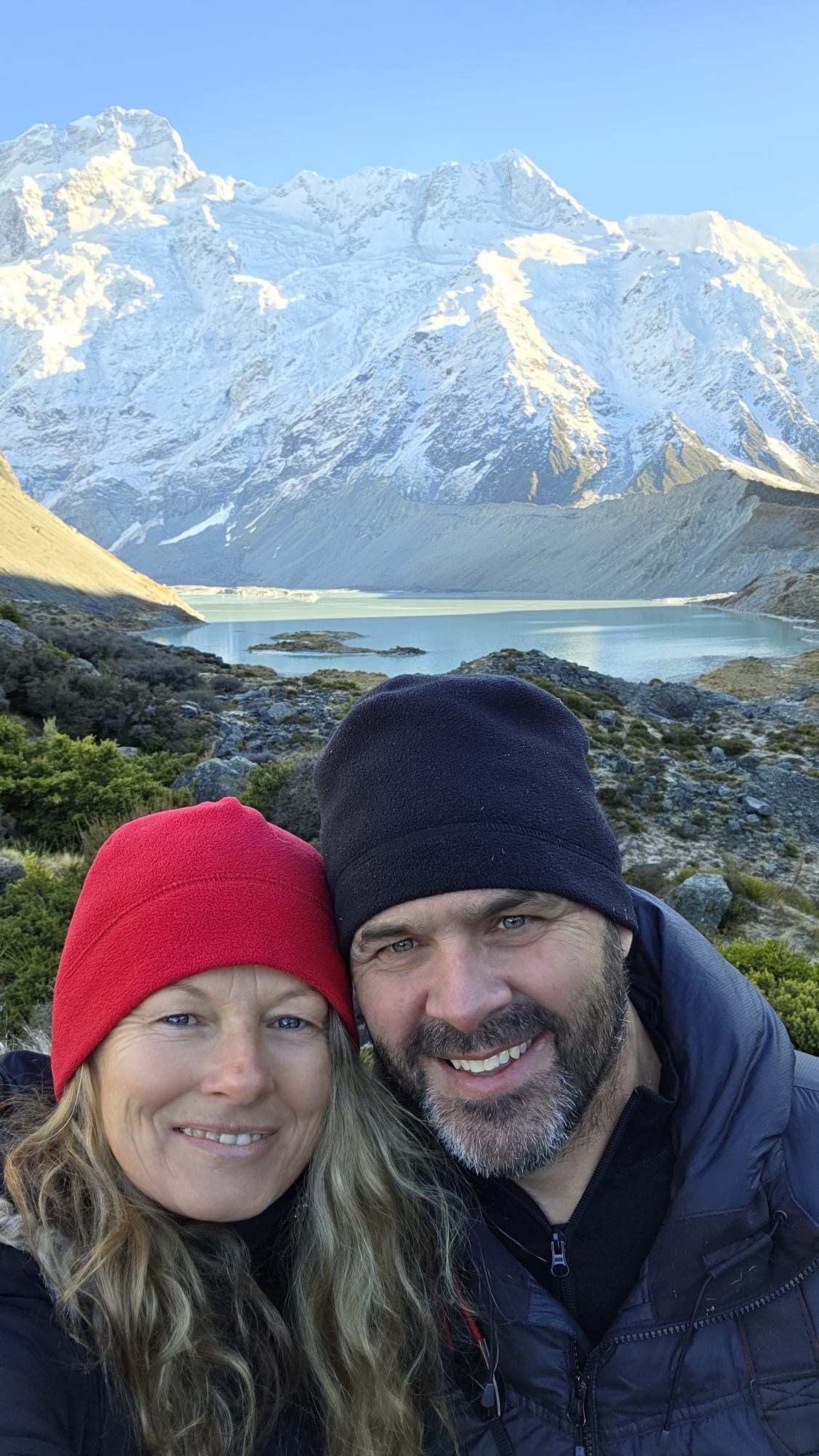
From the Clay Cliffs we make our way up to White Horse Hill campground which is nestled below the towering peak of Aorali/Mount Cook.
White Horse Hill is a paid ground. During the winter the main toilet/shower blocks are closed off as the frequent negative temperatures lead to burst pipes and what not. What you are left with is two of the smelliest drop toilets I’ve ever encountered, And I’ve done long weekends at Newnes Camp ground in it’s heyday.
Take the biggest breath you can here and hold it as long as you can, a young whipper snapper was heard giving advice to her younger brother…..
Don’t let that put you off though, the scenery is well worth a skinny loo or two.
We roll in late afternoon and set the camp up. The temperature is already -2ºC and falling. The little diesel heater fitted in the van is amazing.
As night settles in and the temp plummets to -8º we decide to brave it for the sake of the most amazingly clear night sky.
Clicky Clicky to see full photo
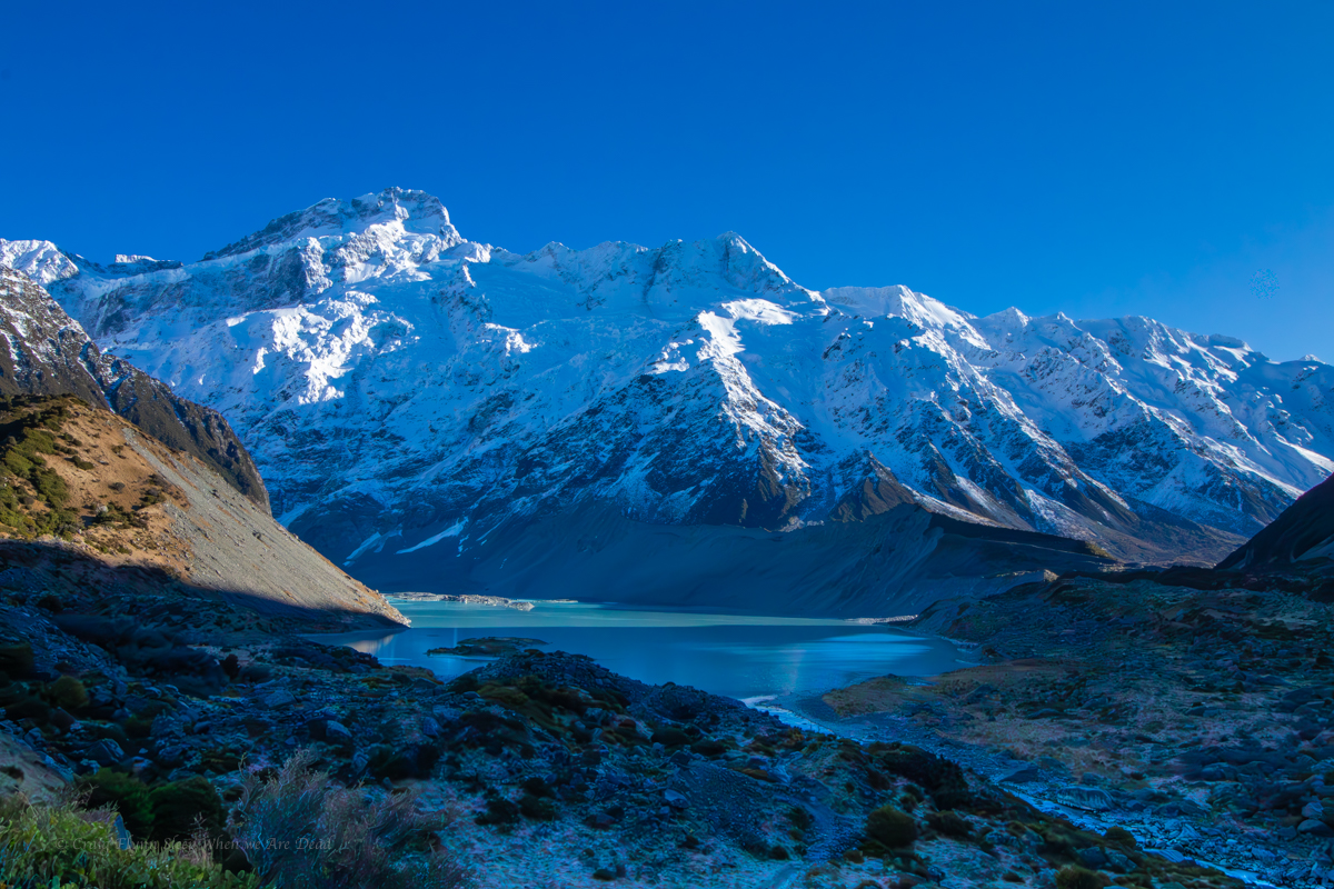
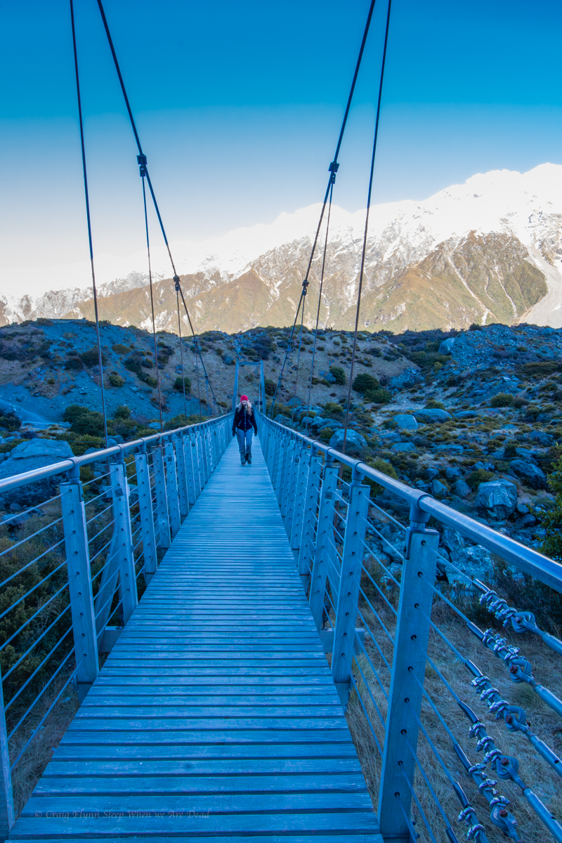
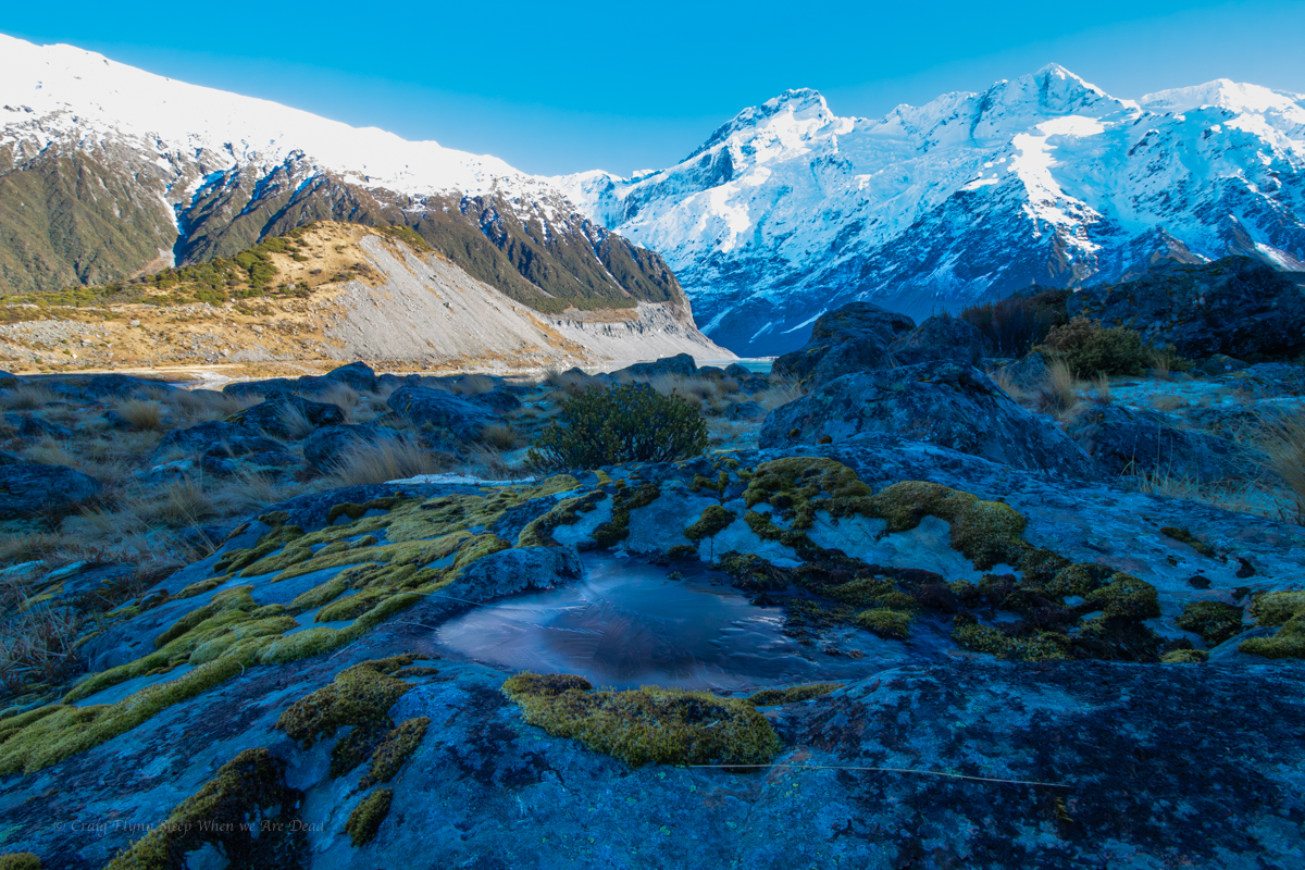
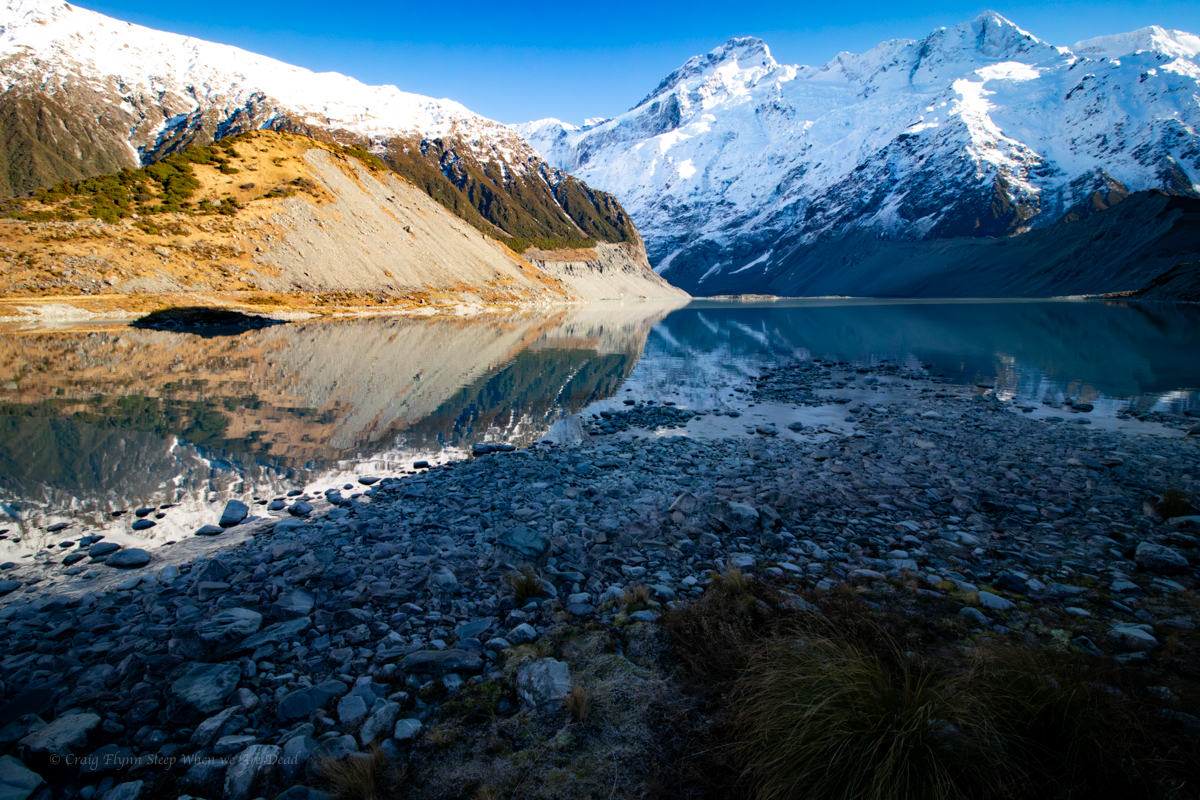
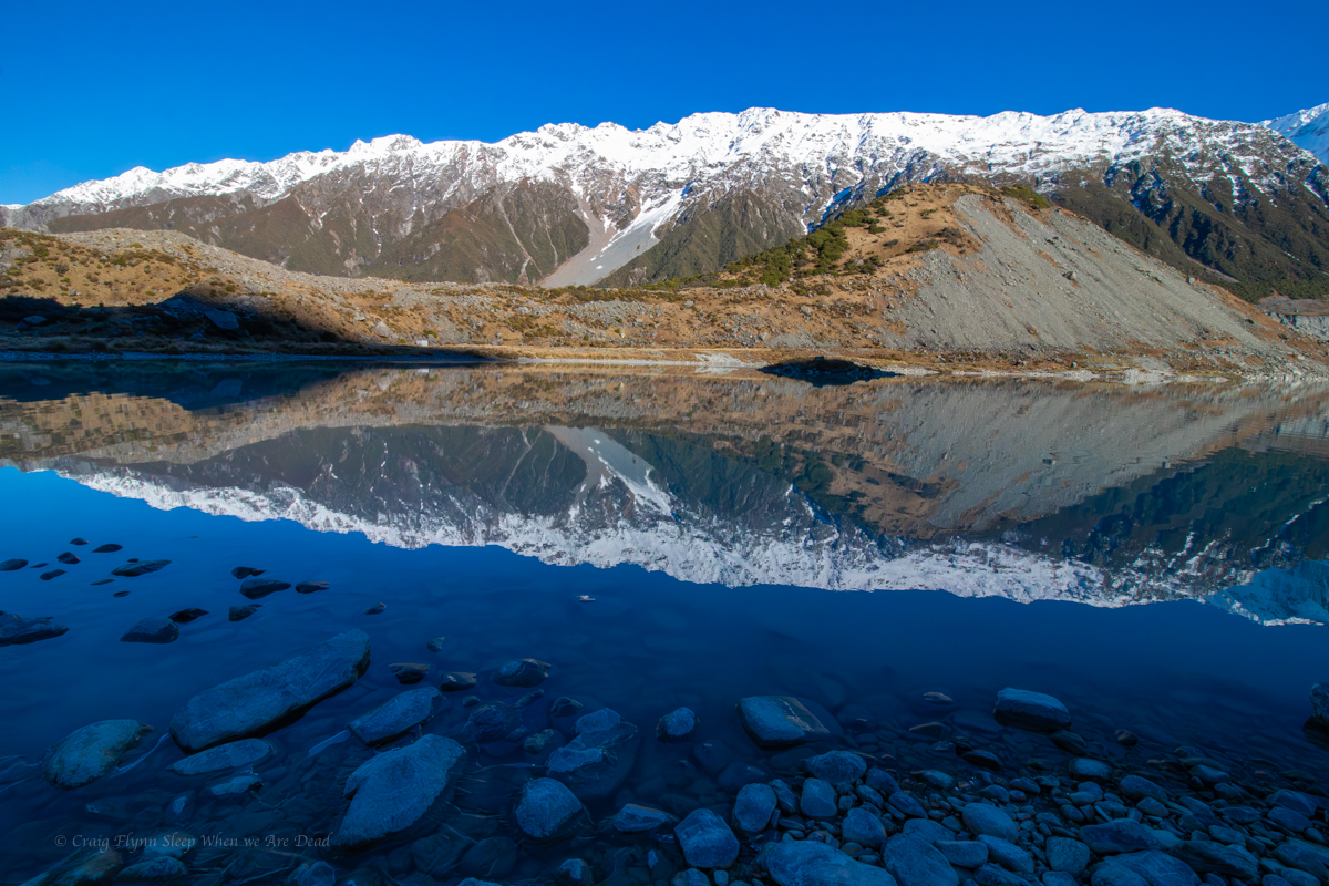
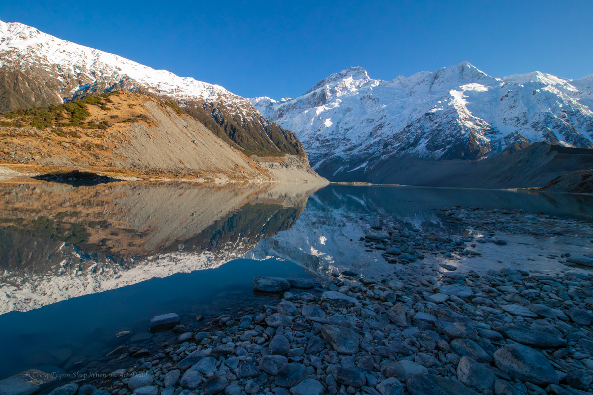
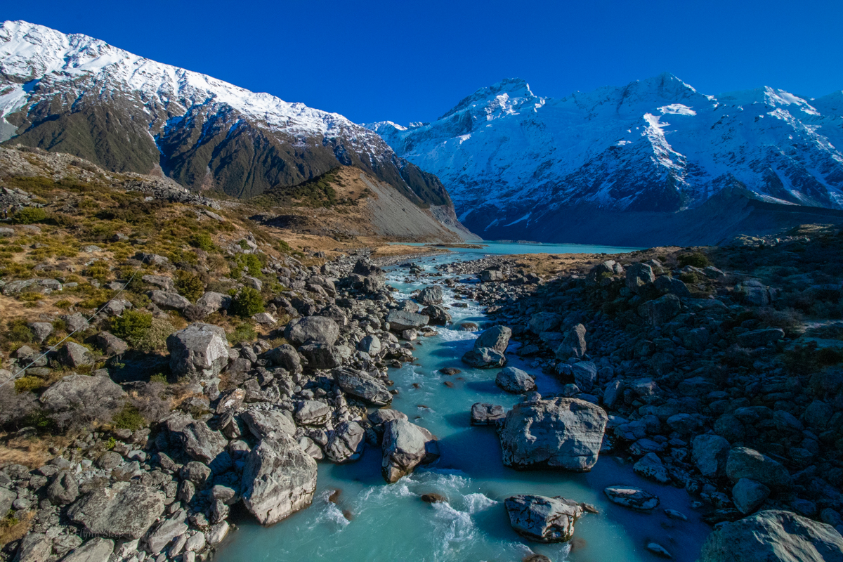
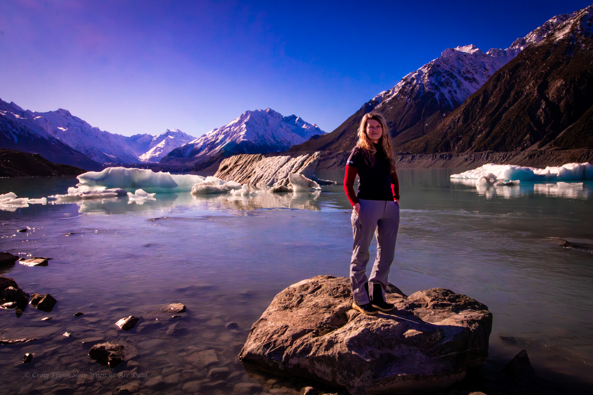
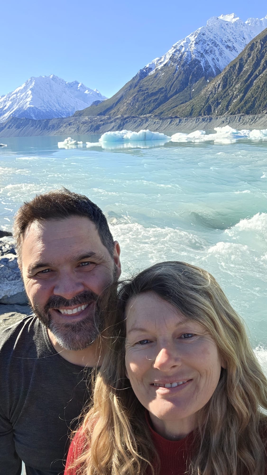
The next day we head out on the Hooker Valley Trail.
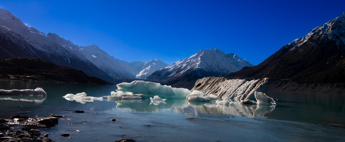
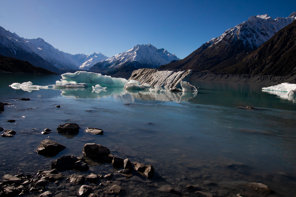
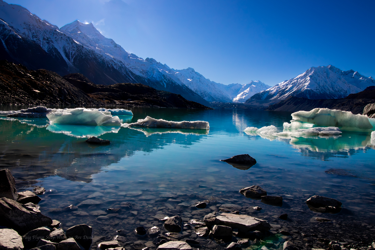
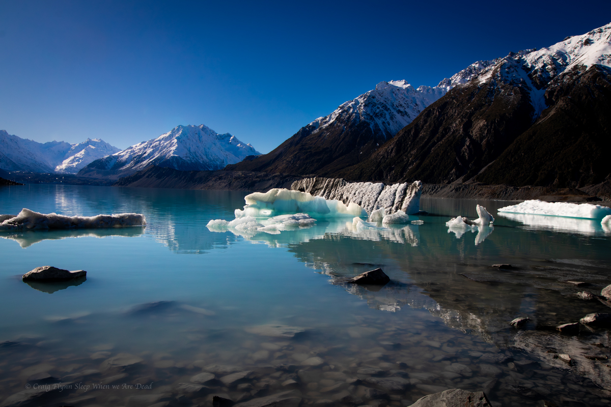
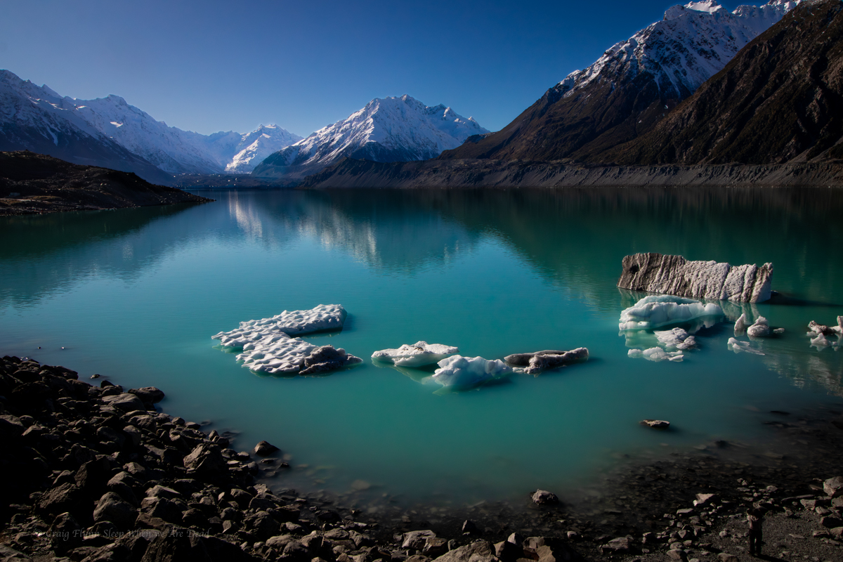
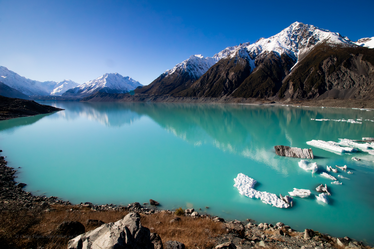
Normally this gives the closest access to the base Aoraki the general public will get and also views over the proglacial Hooker Lake, complete with icebergs, however only a short section of the trail was open at the time of our visit due to track work and a bridge being washed out.
the short open section did, however provide great views over the Mueller Glacier and it’s lake.
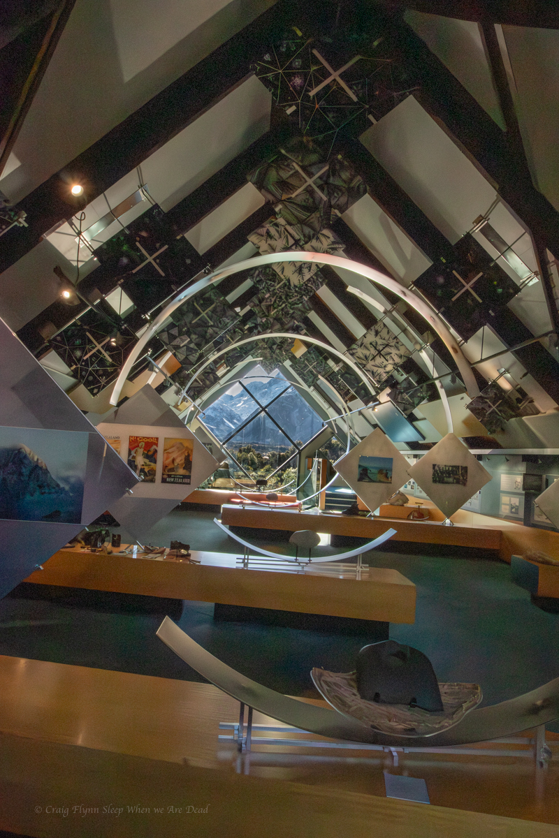
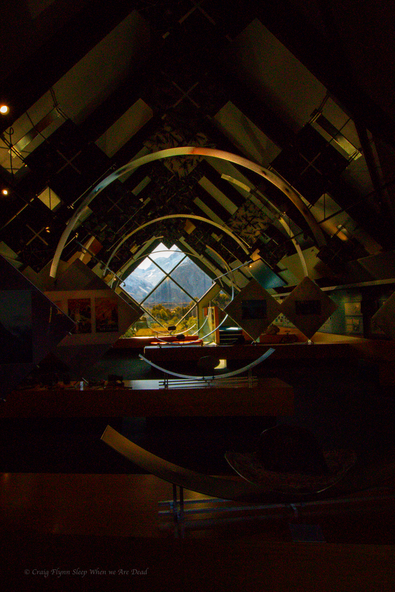
Next we return to the van and duck over to the village for a coffee. While there we dropped in to the Department of Conservation information centre.
Wow!!!
What an amazing free resource. If you were in the area and the weather was bad you could easily spend a whole day in here. There are displays and videos and more lots more.
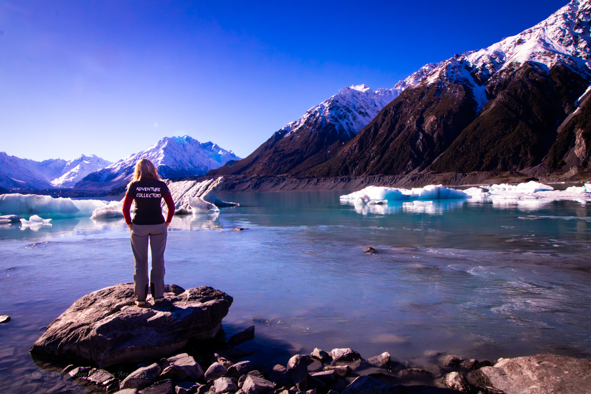
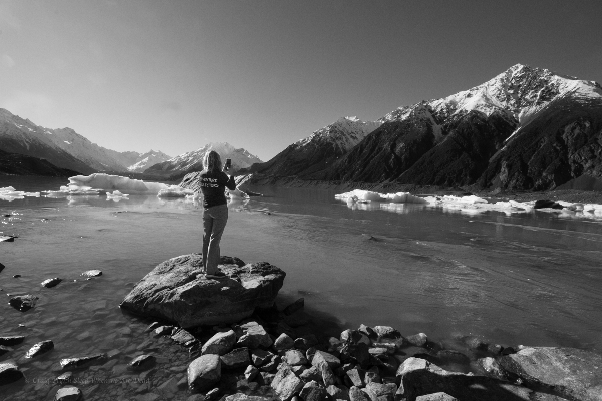
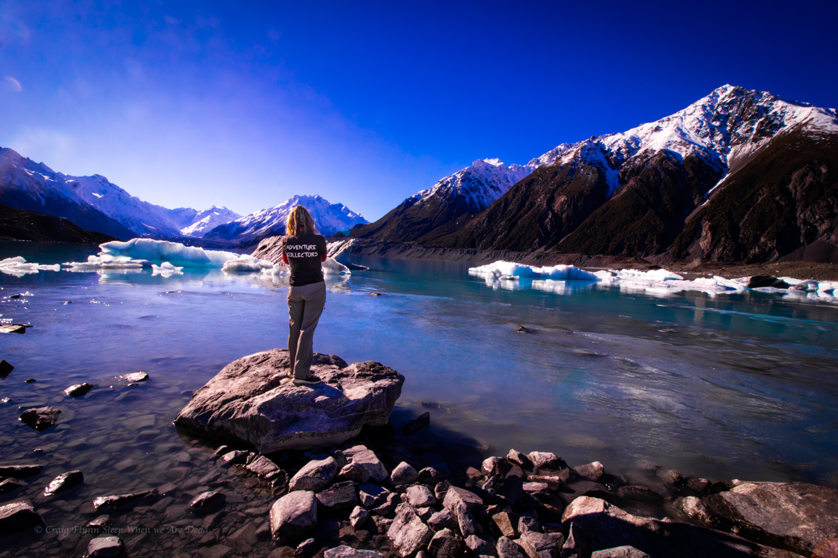
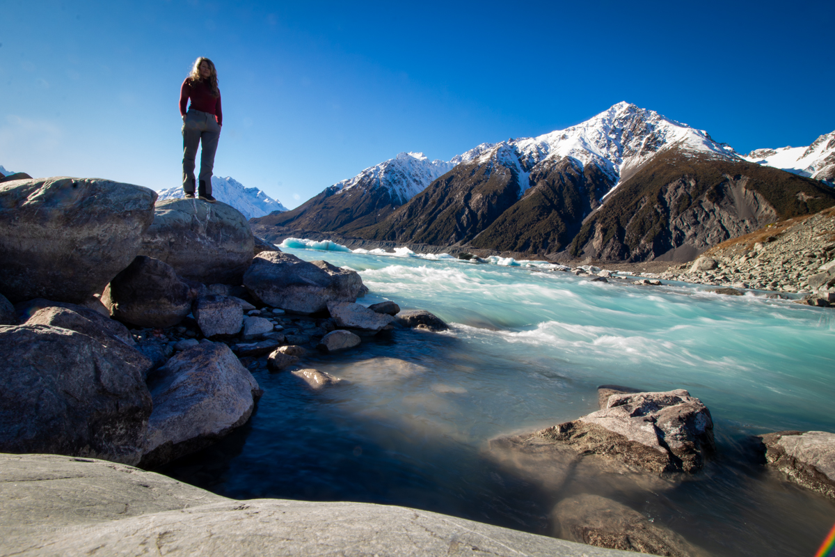
But today was a blue bird day so we have a quick look and then head over towards the Tasman Glacier.
Here you can take helicopter tour or a boat tour on the lake. We opt to just do the tourist walks.
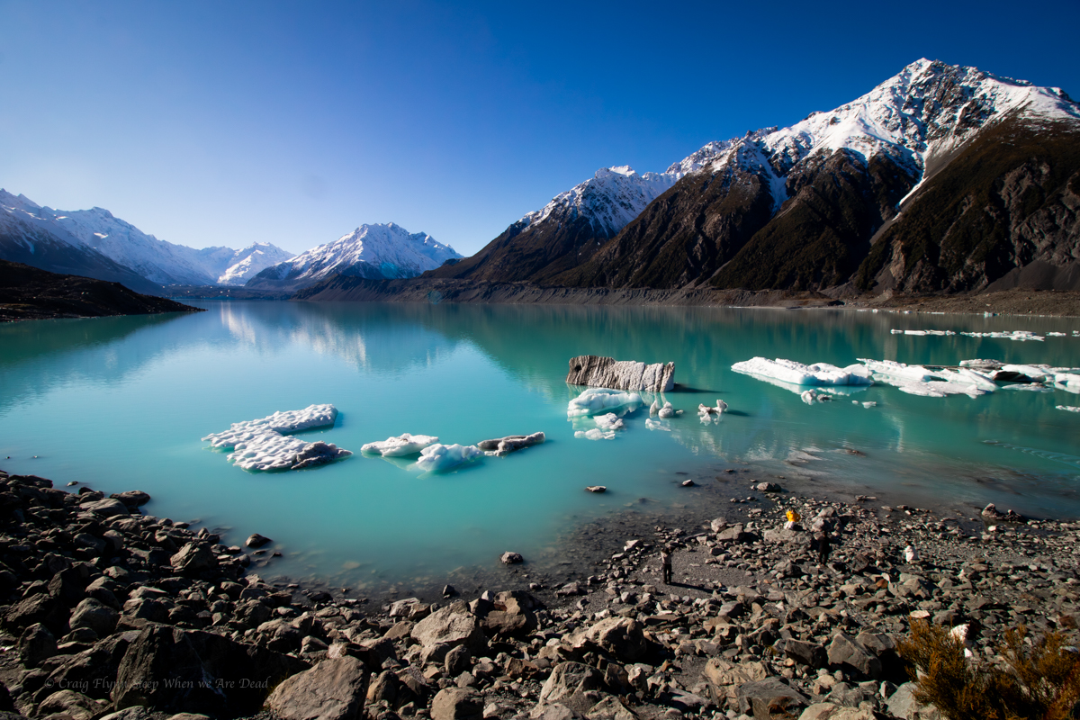
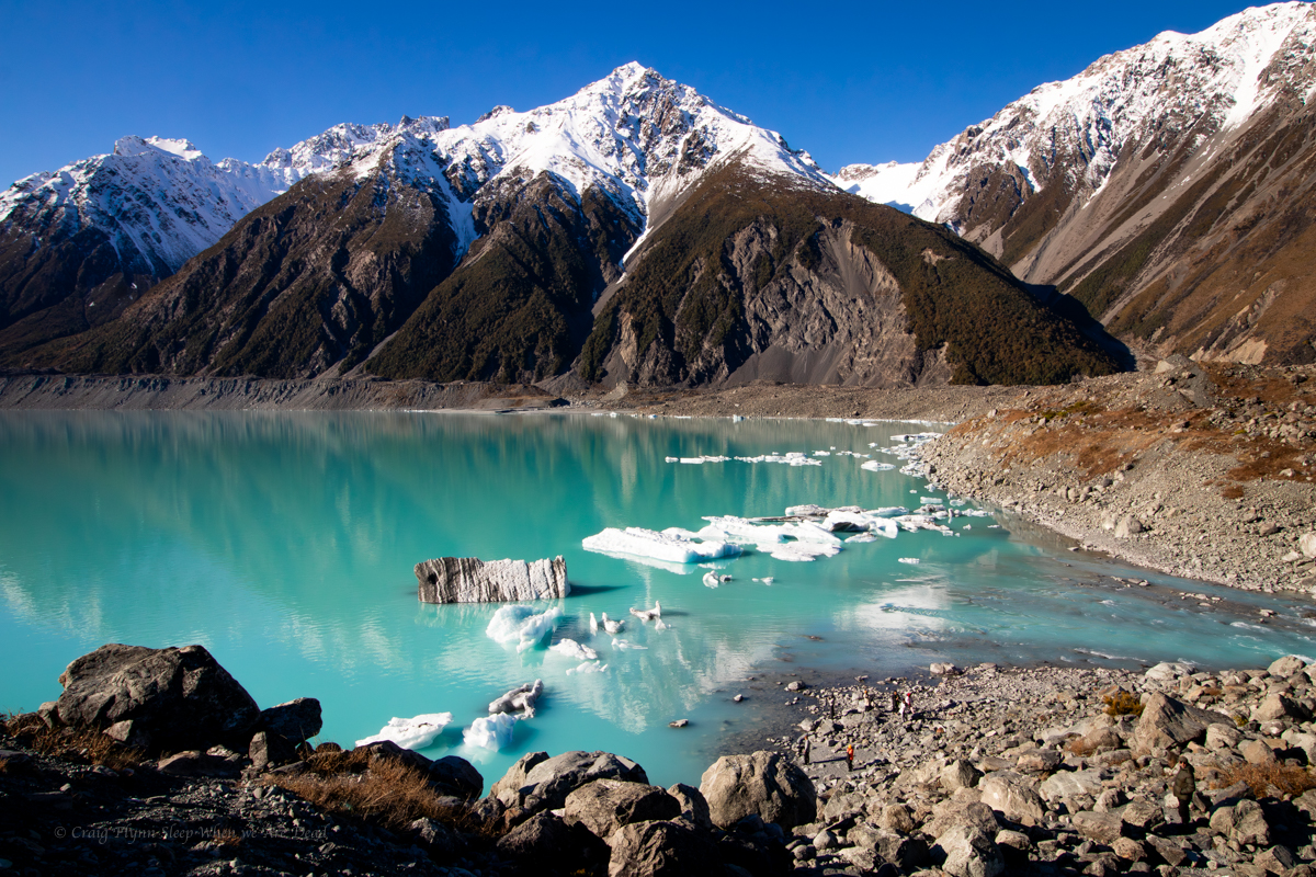
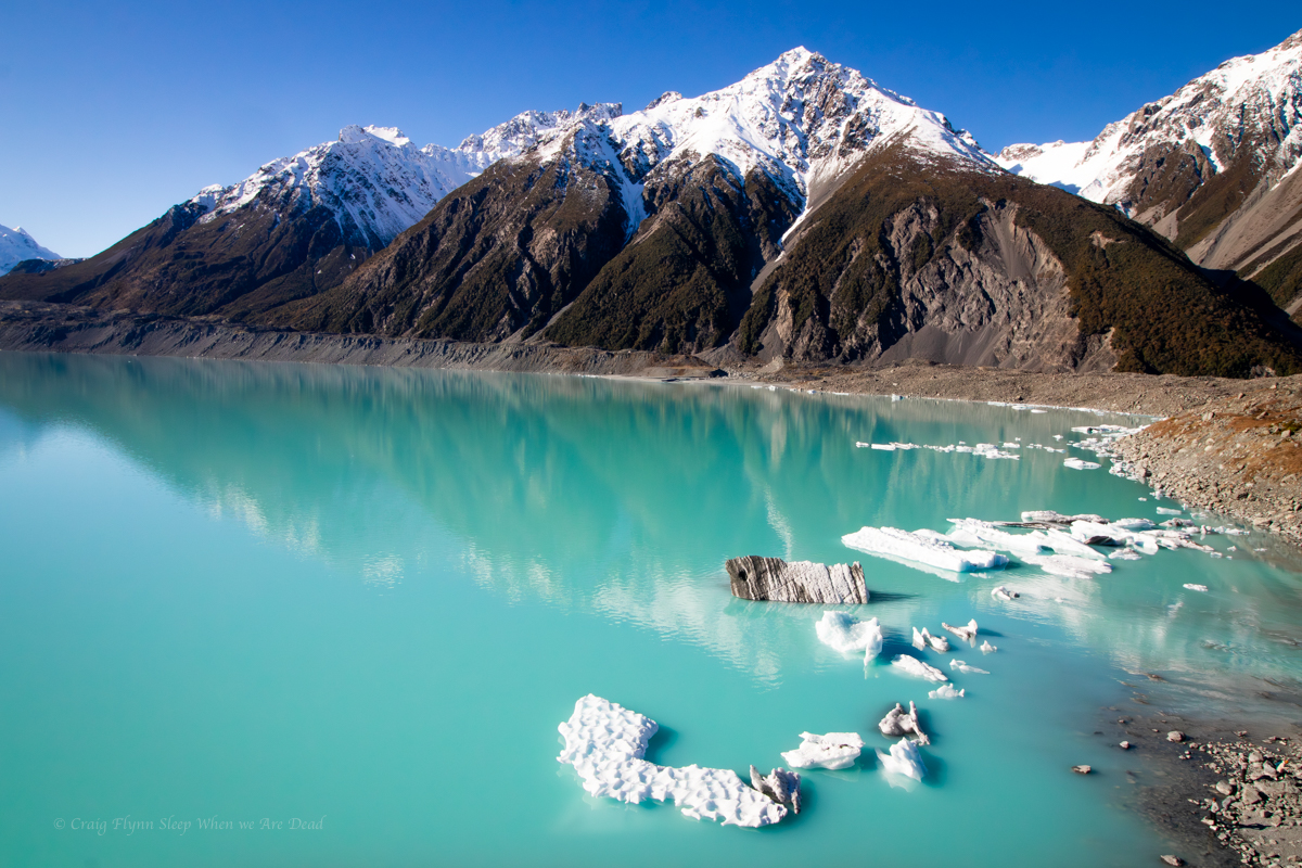
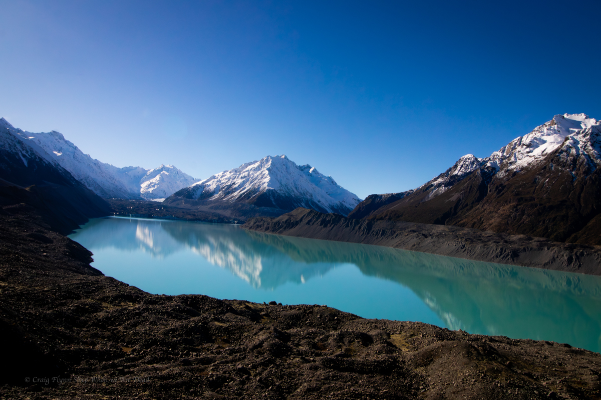
Sitting between NZ’s two tallest peaks the Tasman is New Zealand’s largest glacier, being up to 4km wide and 600m thick in places. It had remained a fairy constant 28km long through out its recorded history up until it starting to retreat in the 1990s. It’s currently 23km long and retreating on average 180m/year.
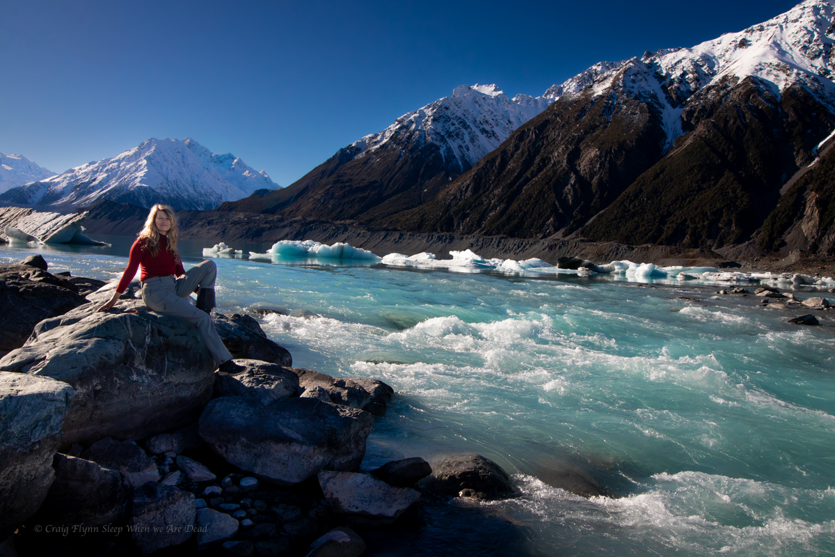
Looking up the lake from the tourist lookout the glacier is’t much to look at. Compared to the white snow and crystal blue ice on the Franz Josef, the Tasman crunches up and contains a lot more rock and minerals (Glacier flour), giving it a dark, almost dirty appearance. Without the information sign at the I doubt most people, me included, would pick it out in the distance.
The lake, however is stunning.
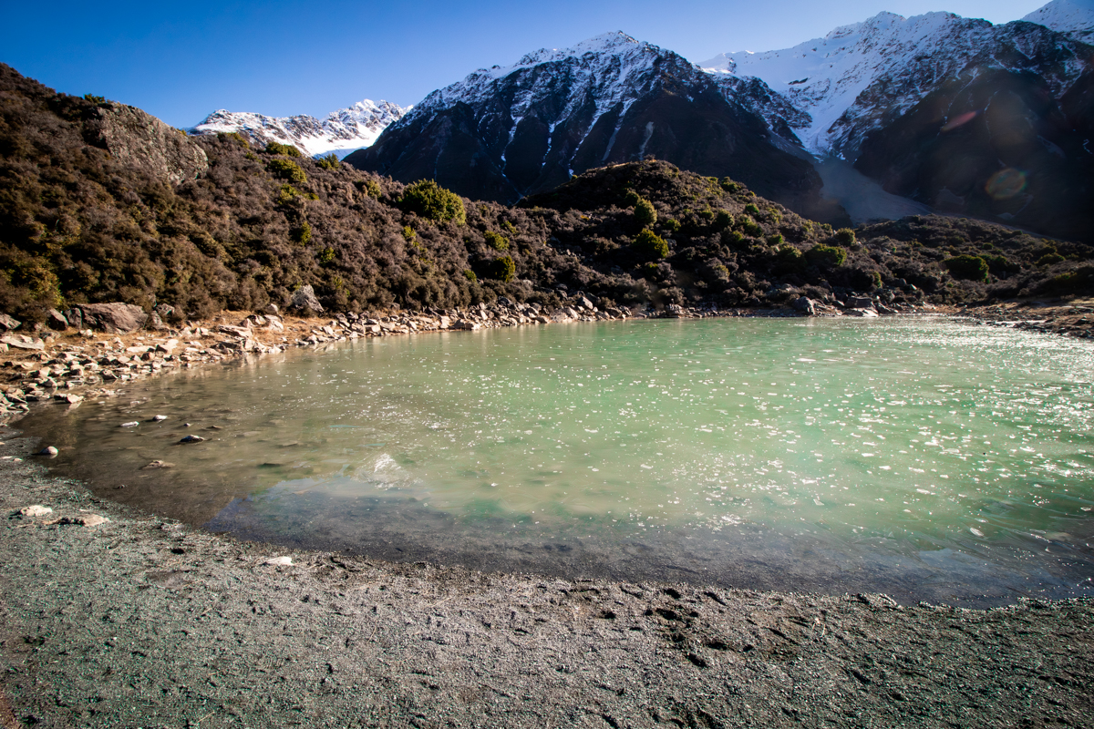
The Blue Pools. When named they were connected to the glacier and very blue. Now they are cut off they are more a stagnant green.
Back at the van we start heading back down the valley.
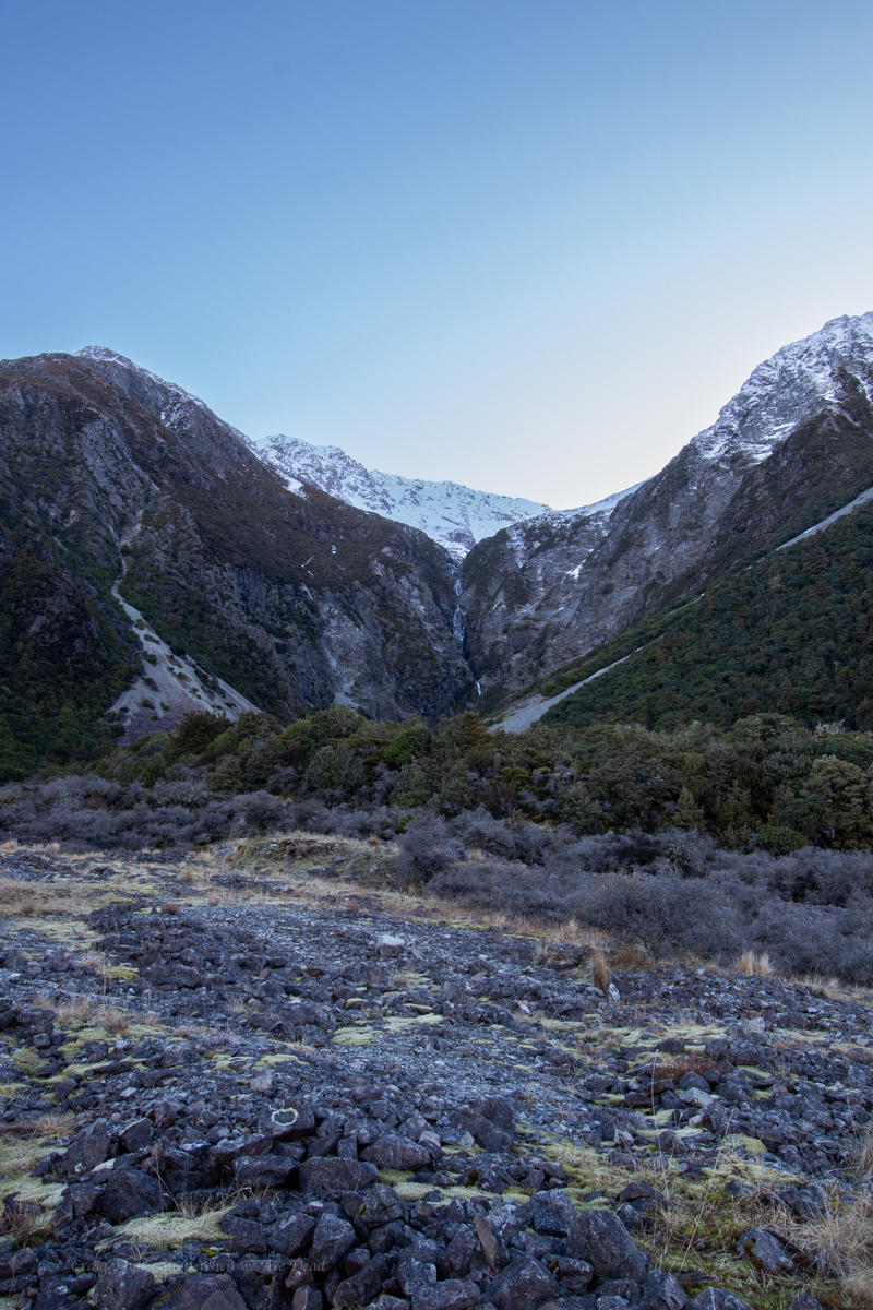
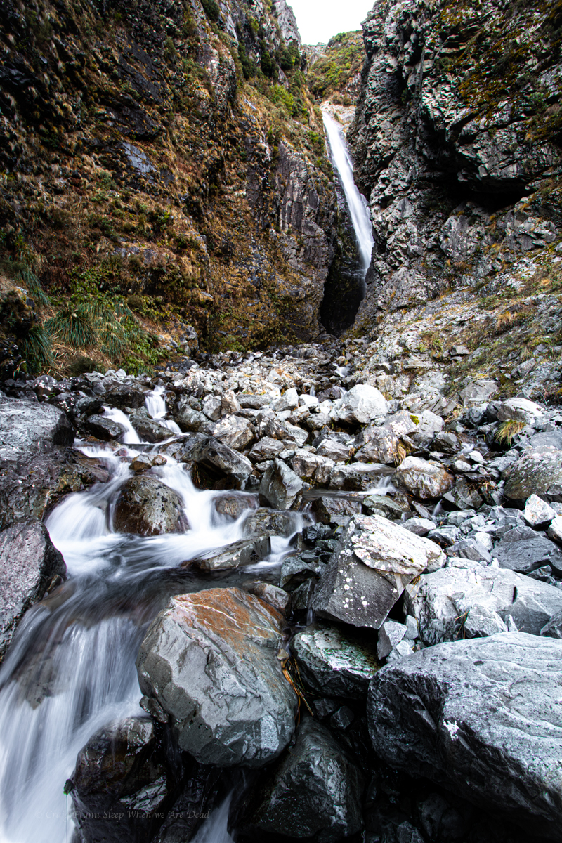
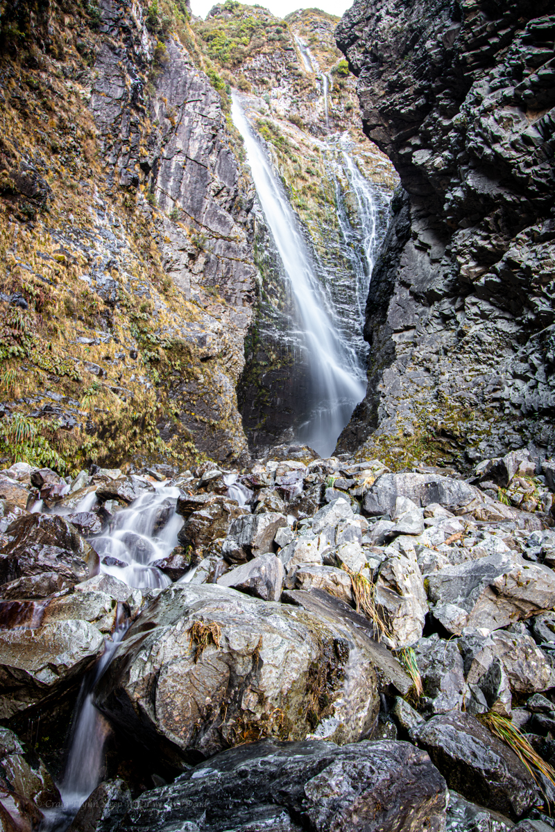
On the way in I’d caught a glimpse of Wakefield Falls. It caught my eye on the way back out.
Is that waterfall frozen?
Looks like it.
It’s difficult to come to terms with scale here. That waterfall tumbles 230 vertical meters.
We pull over for a better look.
Na, it’s flowing. Looks like a cracker of a slot it’s tumbling into.
Should we go for a look.
hell yeah.
I grab the camera and off we go.
There is what appears to be a former tourist trail that comes and goes through the scrub and scree.
Did I mention it is hard to come to terms with scale here? It becomes apparent it’s further than it first looked.
Belatedly I realise in my excitement to get going I failed to grab my puffer jacket and beanie. This is how silly tourist get themselves on the news kids. Luckily not today though
Halfway up we meet to Russian(?) guys coming back down.
Did you get to the waterfall? ask we
Yes yes. Beautiful. Very careful. Very careful.
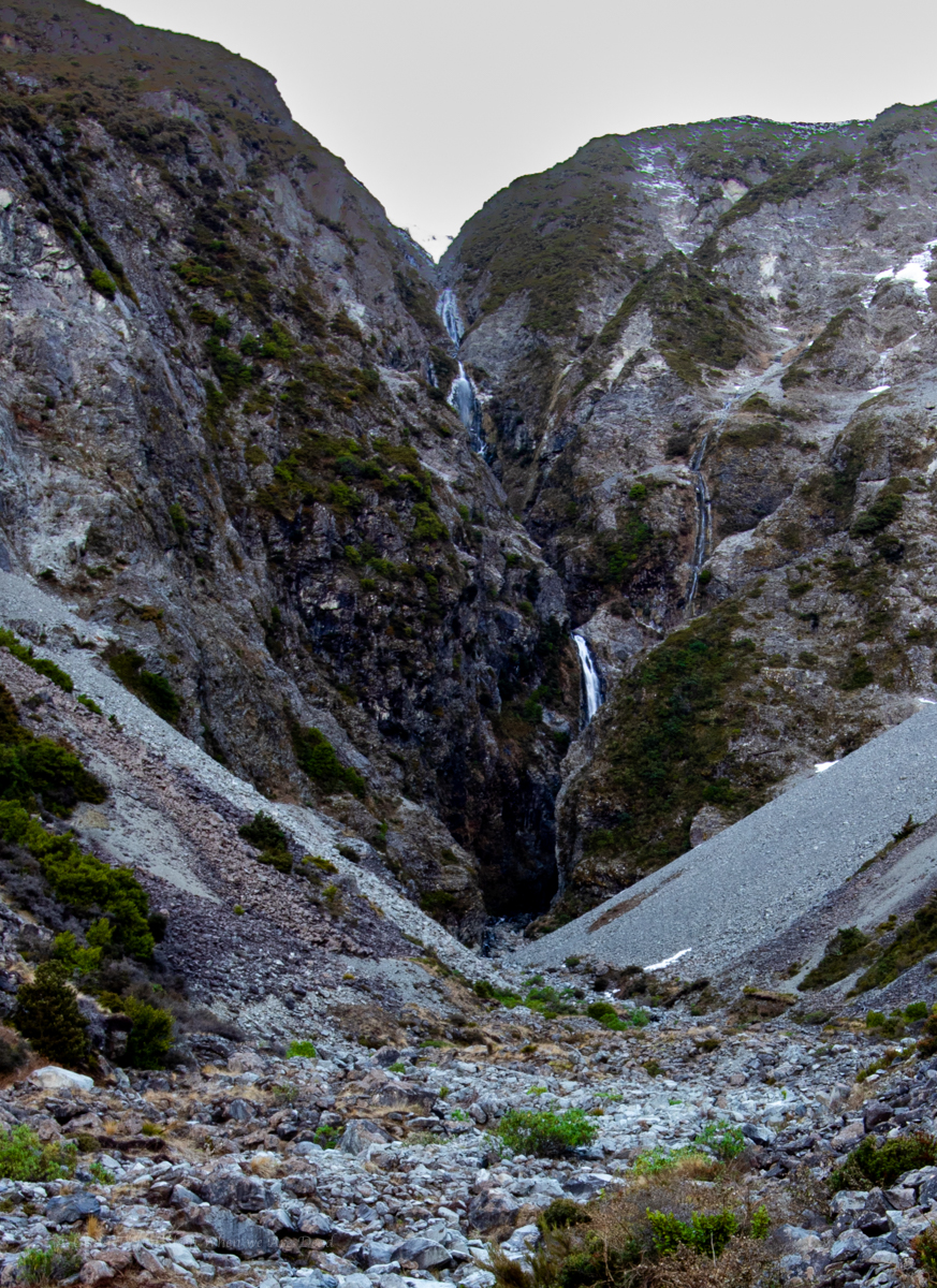
We push on. We reach the end of the flatter basin and the terrain gets steeper and looser. We had been yeeting up but slow here. A rolled ankle, rock fall or dislodging the scree here would be bad indeed.
There is still a fair way to go. Says Kylie. We should set a hard stop point.
Good idea.
It had been about 2:15pm when we left the van. We decide at 3:15 we need to turn around to get back prior to loosing the light.
I think we gained about 200m of elevation from the road. A bit after 3pm we get to a point where we had a a reasonable view into the slot where 3 streams of the falls converge.
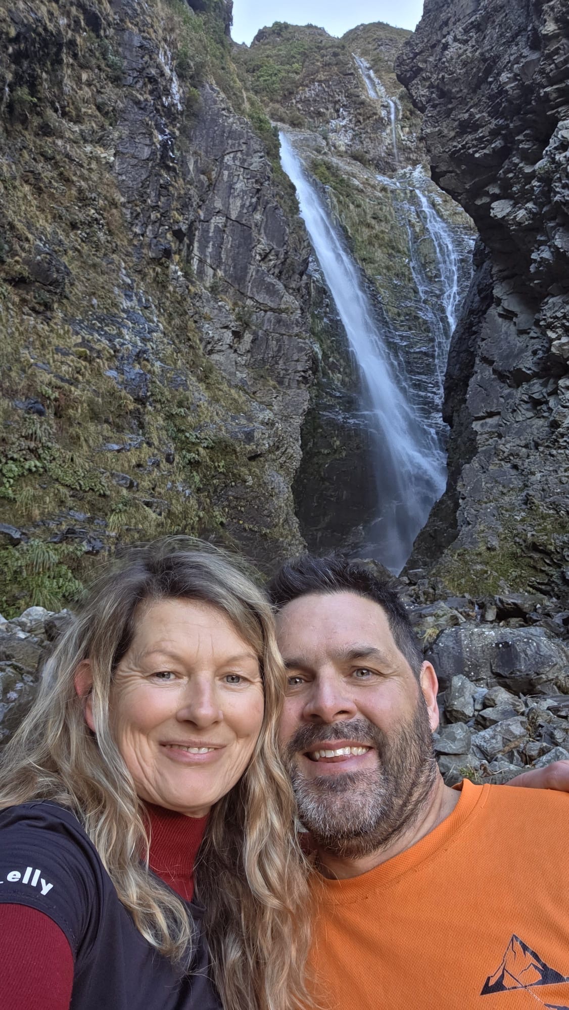
We are so close. Another 10-15min and we’d be at the base of the falls. but hard stops are hard stops and but I know by the time I get the camera set up and get some shot we’d be close to time so thats what we do.
I’d guesstimate the bottom tier you can see here is about 50m tall
We get the shots and video in and scoot back down.
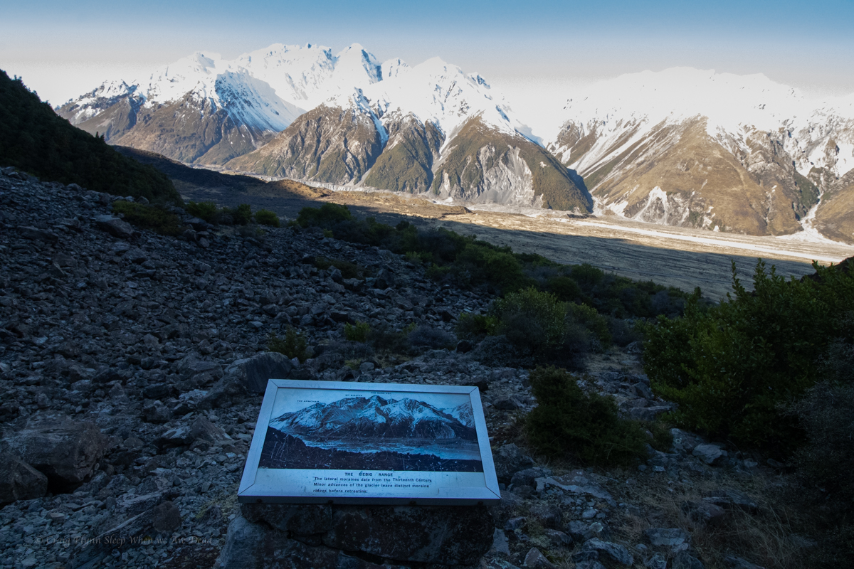
Part way down we come across this old information sign. Weird spot but I guess the old tourist track came up to this vantage point.
Explaining how the moraines pushed up by the glaciers formed dams in the rivers as the glacier retreated. or sumfink
Back at the van we chug down the road making for a freedom camp at lake Pukaki
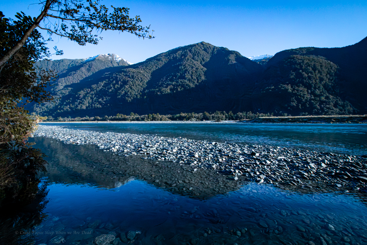
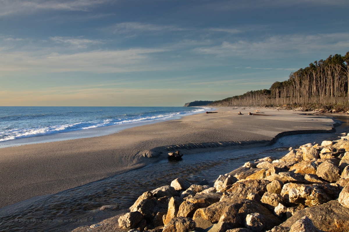
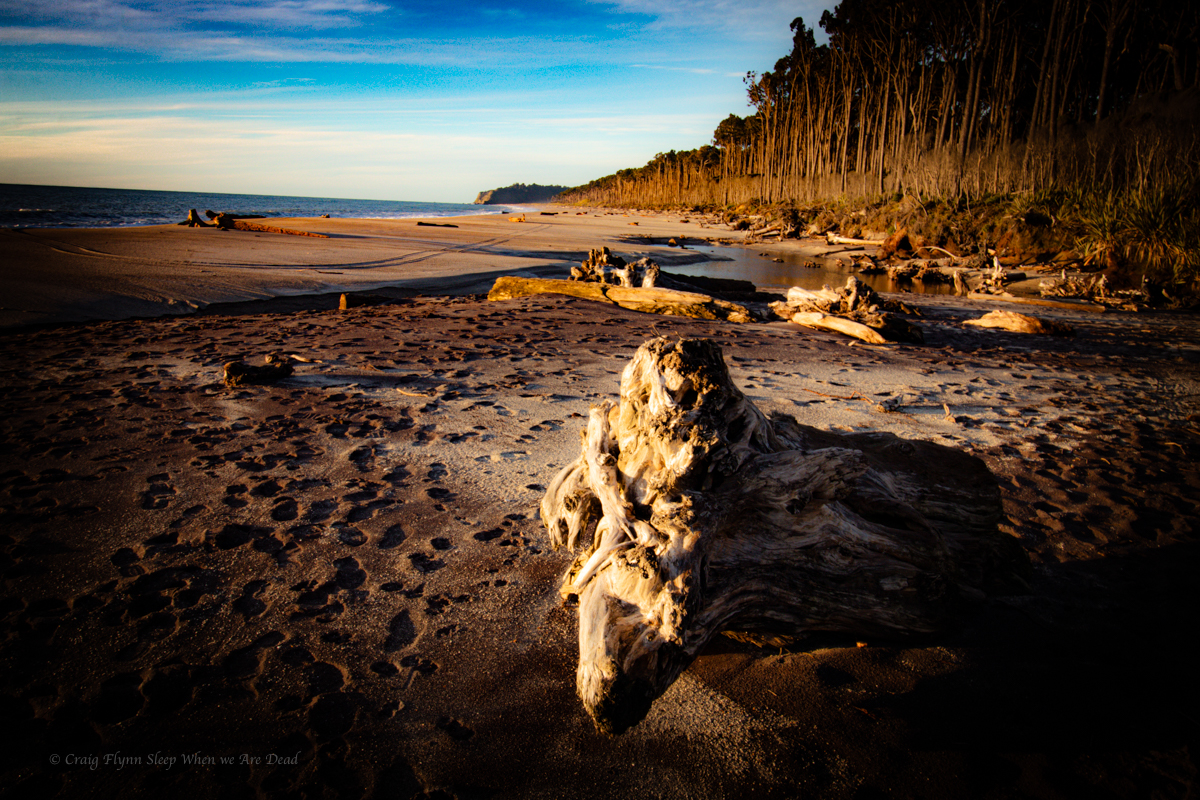
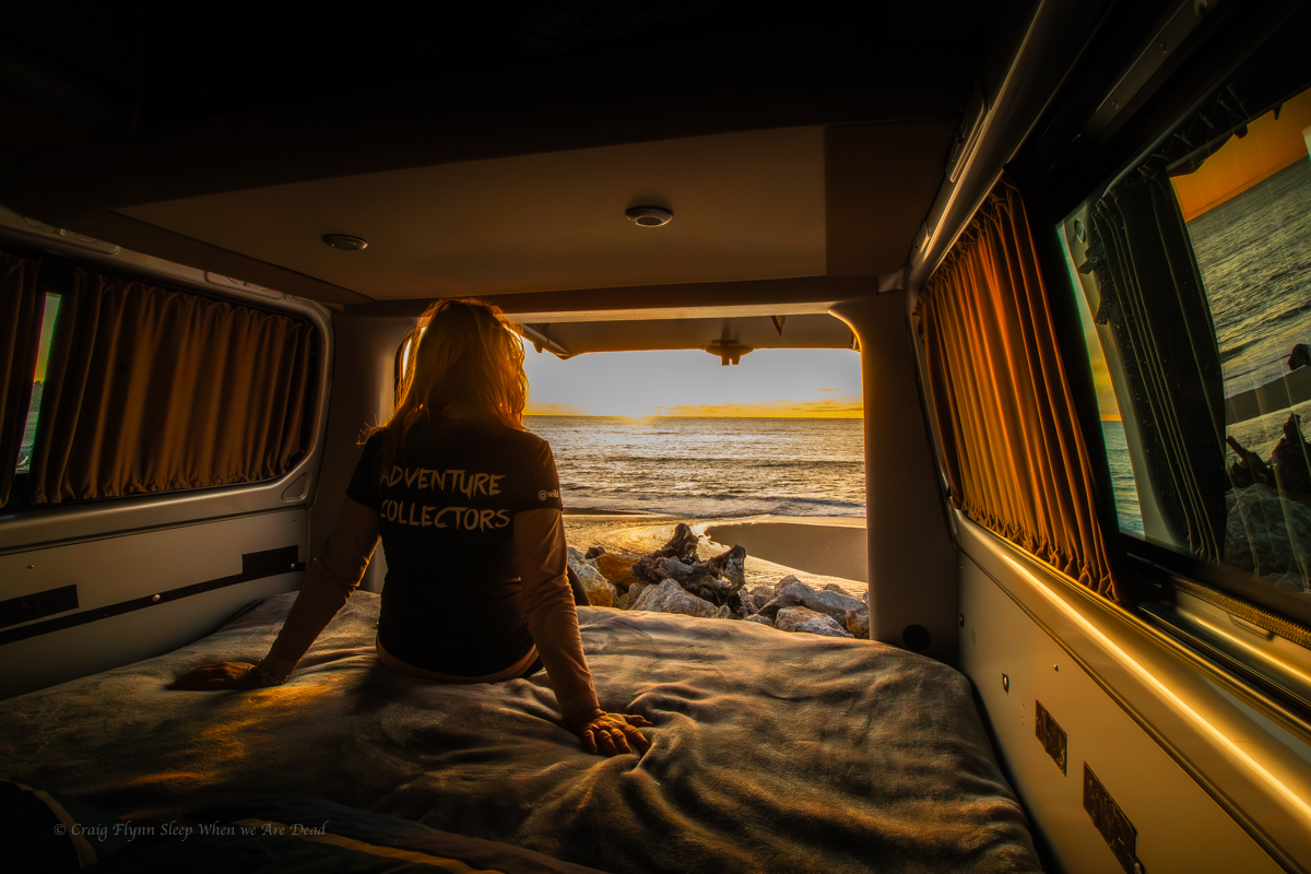
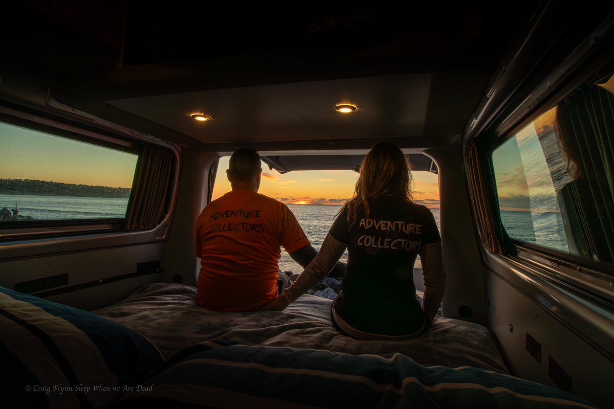
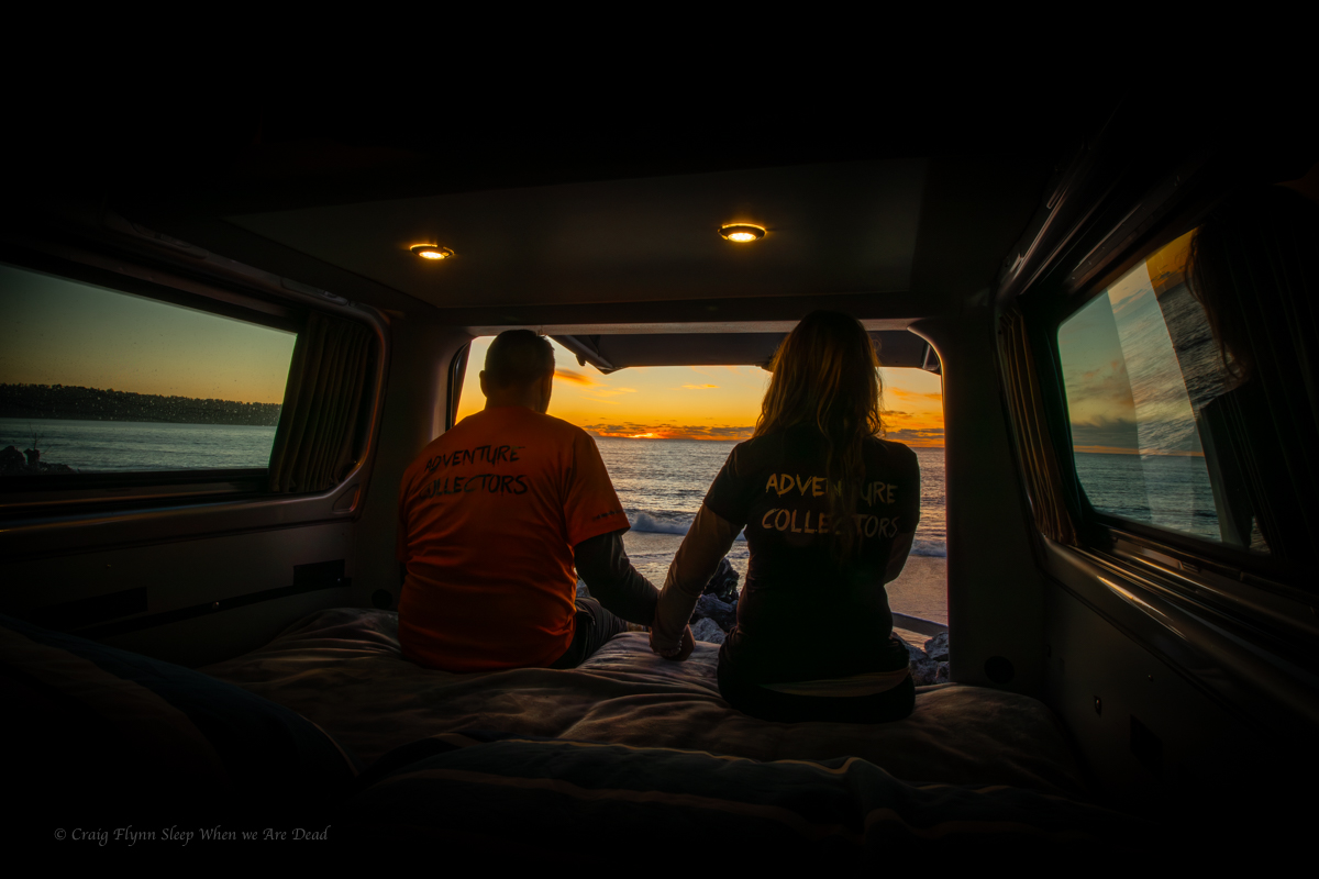
On a massive high from Franz Josef Glacier we take a tip from Maya and head for Bruce Bay to find a camp for the night.
Maya explained not only was it a great freedom camp but in local Maori legend, Bruce Bay was where the semi mythical Māui first landed in New Zealand.
To gain land Māui had to kill the two Taniwah that guarded the bay. The name of the headland at the western end of the bay, Heretaniwha means “to tie up the monster”).
Archaeological evidence points to human occupation back to the 14th century and mind boggling in modern times Maya’s family farm has been there from the start….
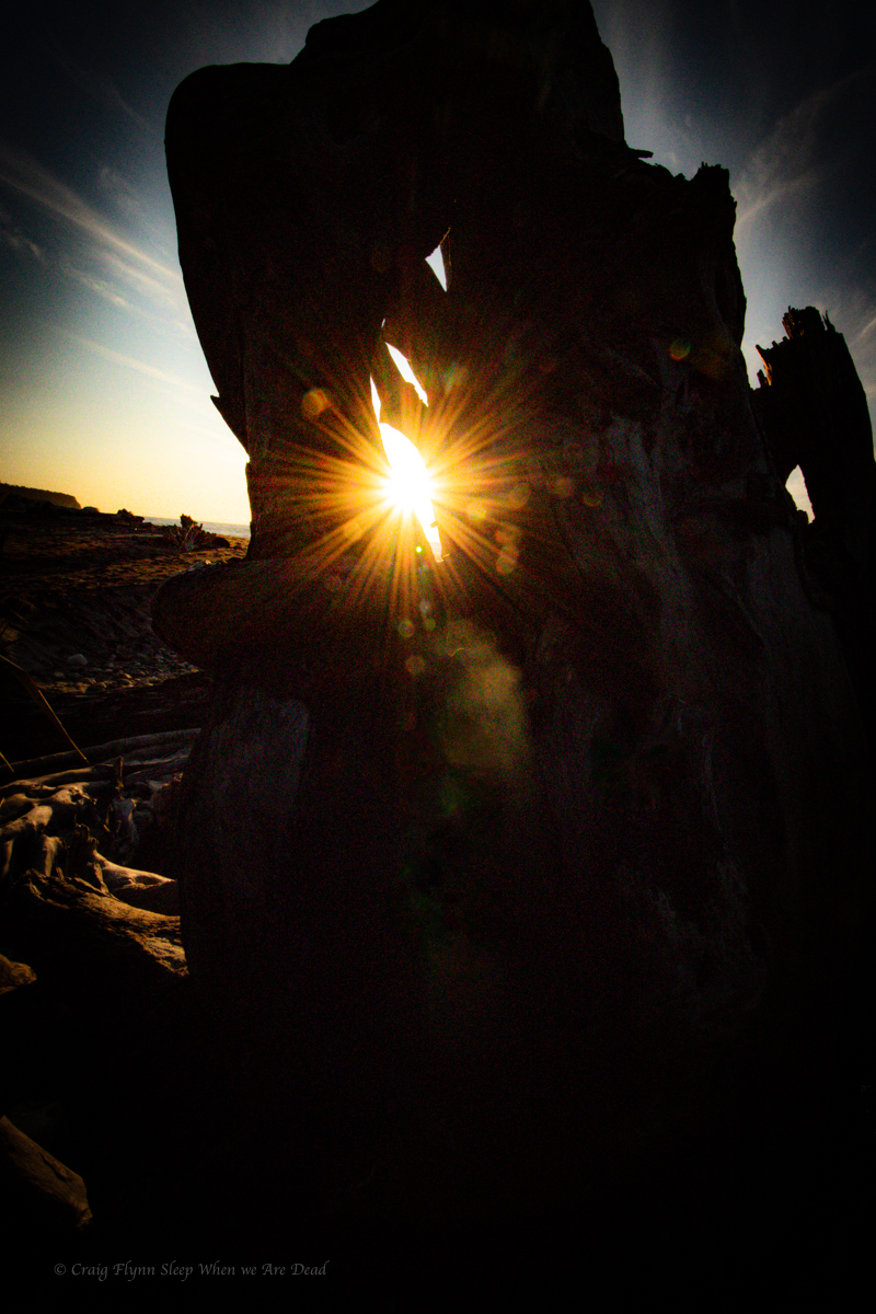
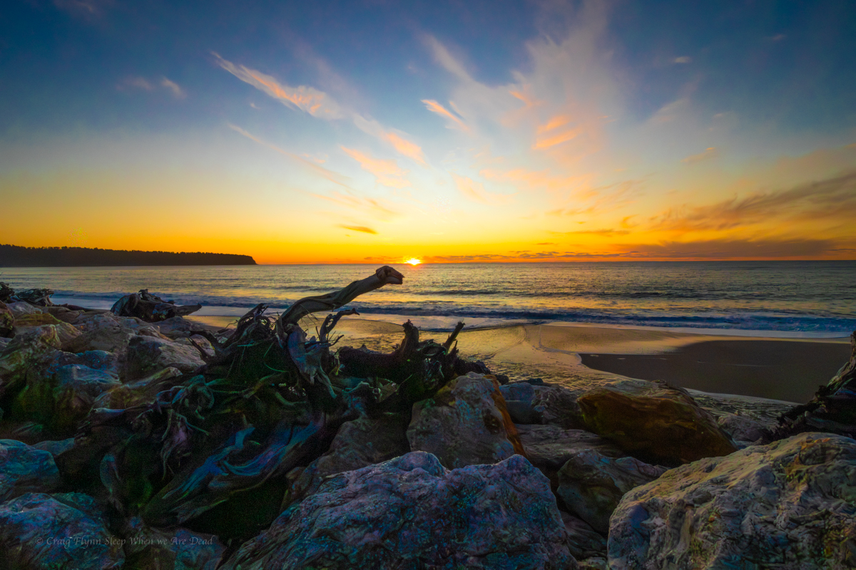
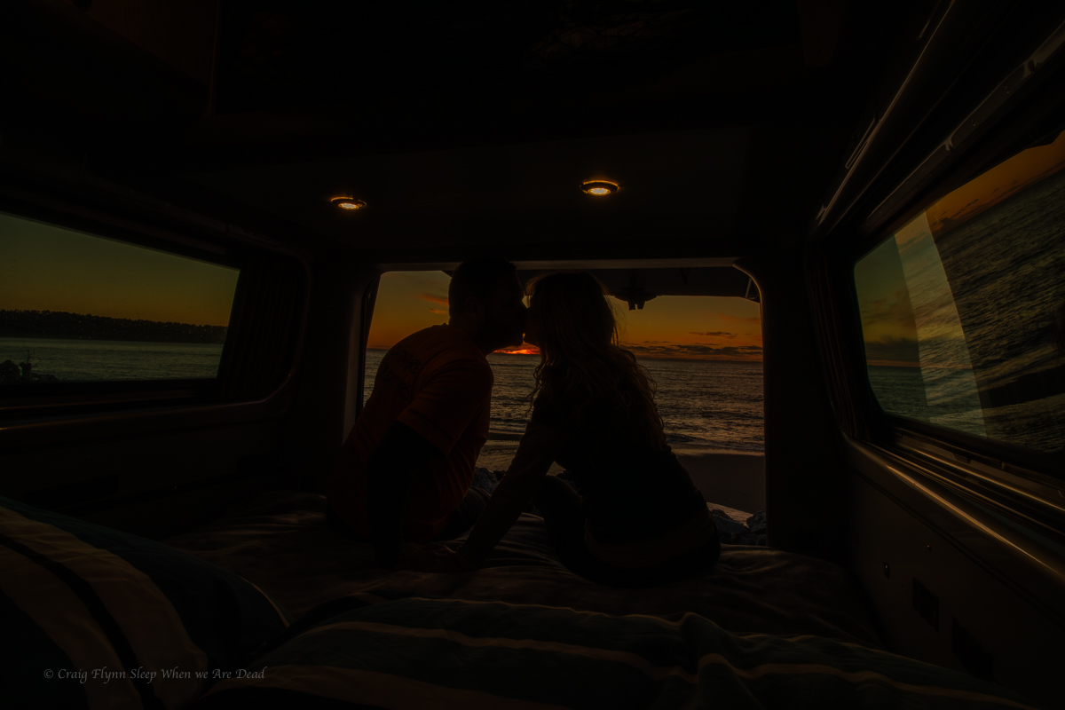
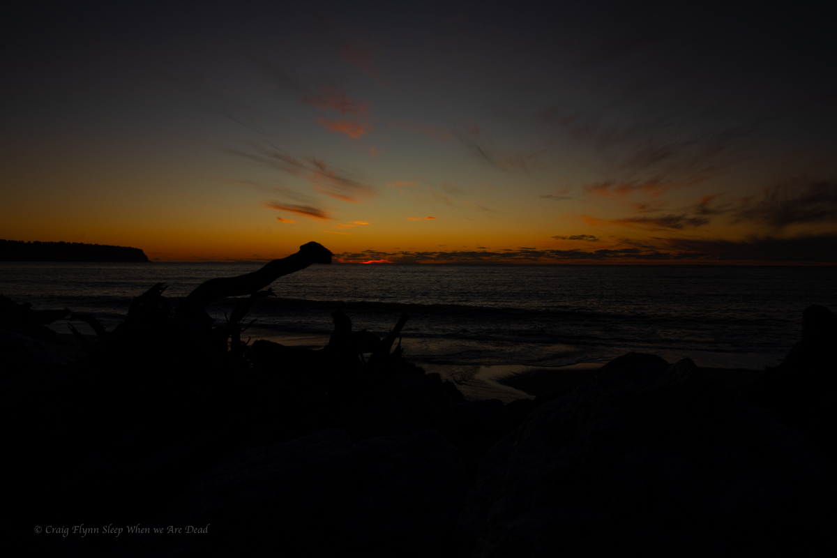
Anyhoo it was a great spot to finally catch a west coast sunset.
And with the sunset the clouds dispersed and I took the opportunity of dark sky and milky ways.
But we didn’t stay up too late as we wanted an early start the next day to explore the waterfalls of Haast Pass.