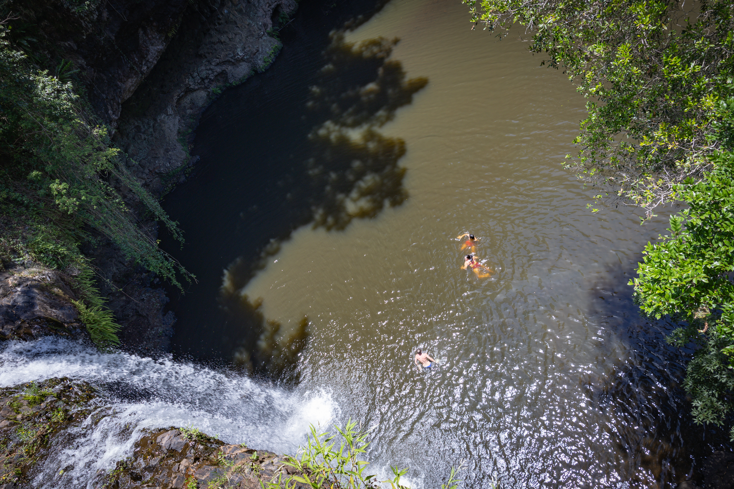
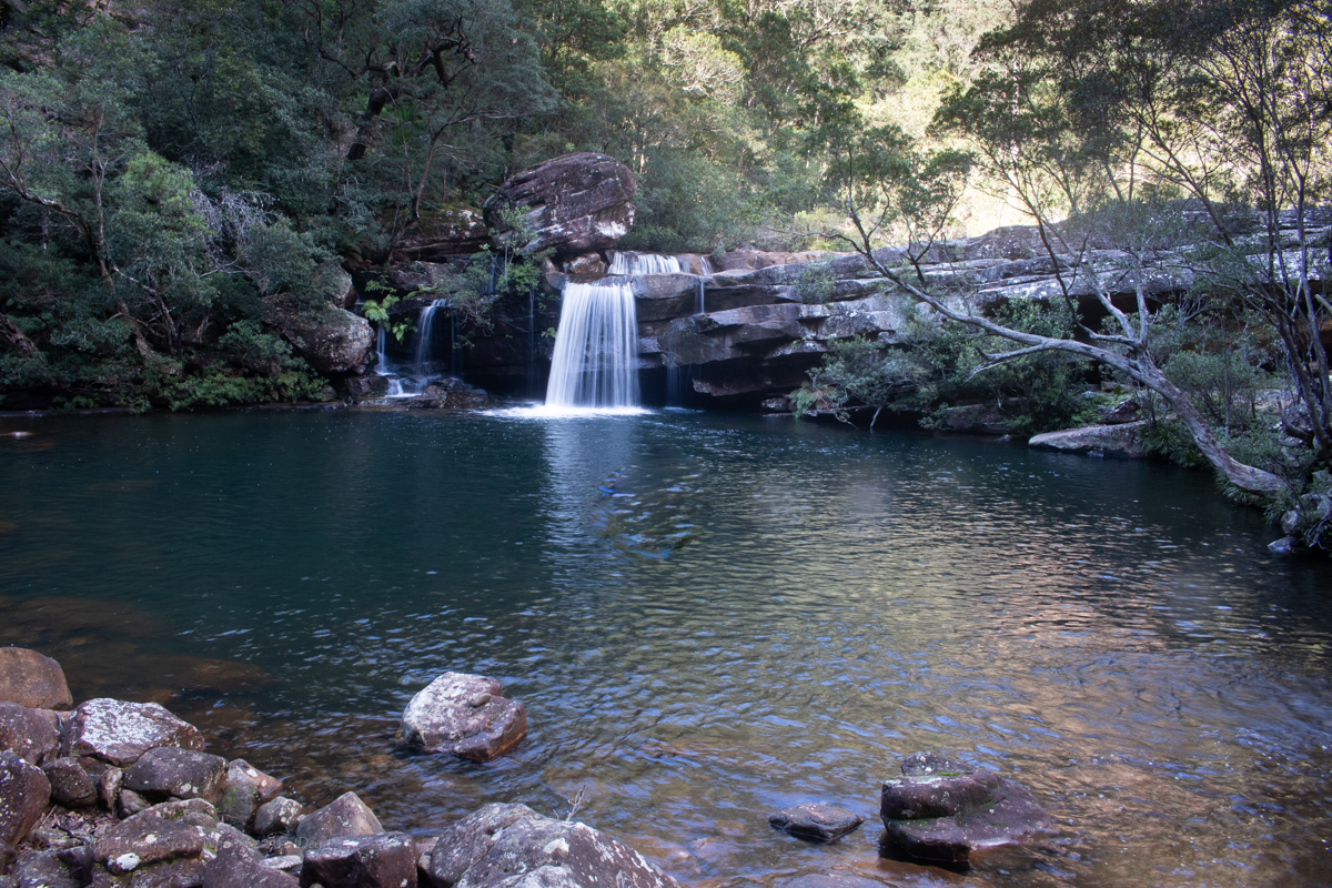
Veering slightly south we thought we’d check out Killen falls as a spot of cool off
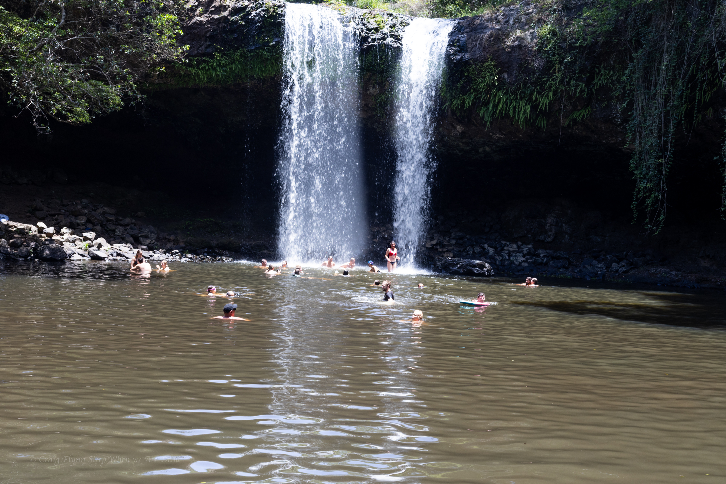
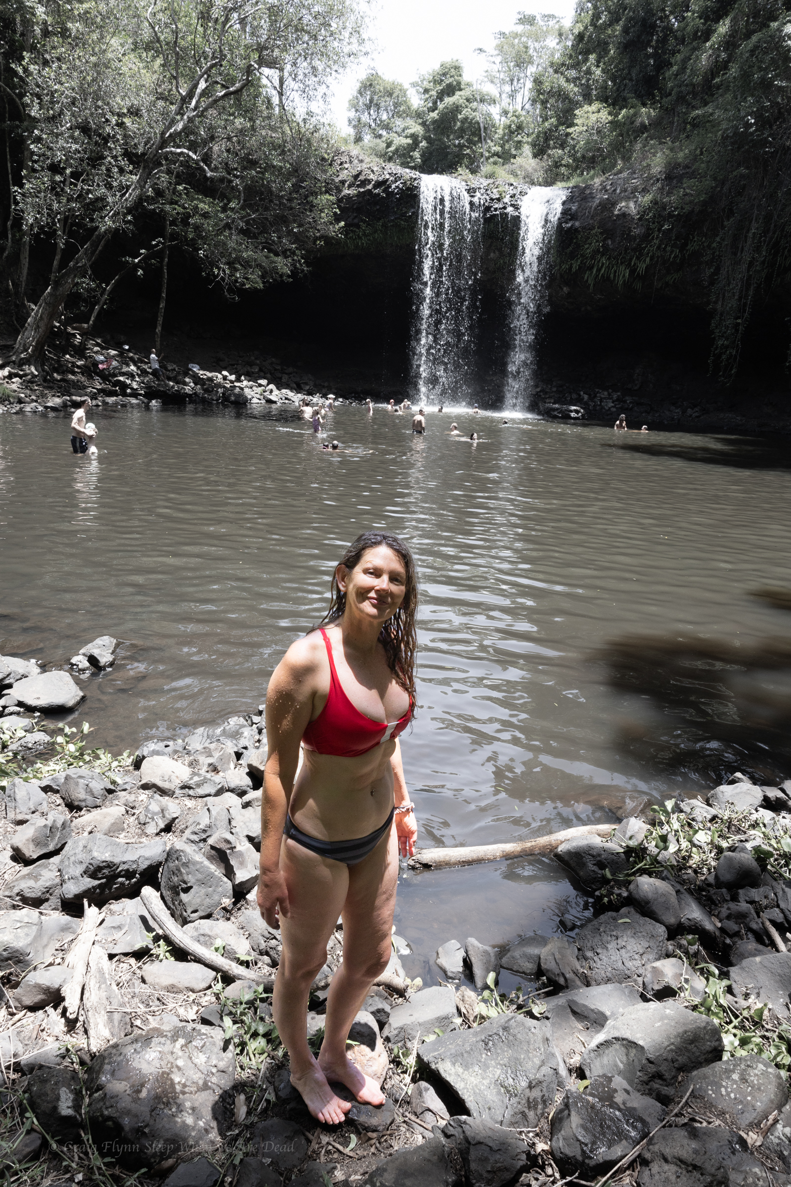
Killen Falls if a nice little waterfall in Tintenbar, near Ballina. It’s very touristy but worth a look.
It’s accessed from Friday Flat road and there is plenty of signage to get you to the car park.
From there it’s about a 400m walk to the base of the falls along a nice tourist trail.
There’s a large plunge pool at the base that is a popular swimming hole.
Being use to the crystal clear waters of Blue Mountains canyons it’s little brown and agricultural run offy but it’s a nice enough spot to cool off on a hot day if you are over the beach
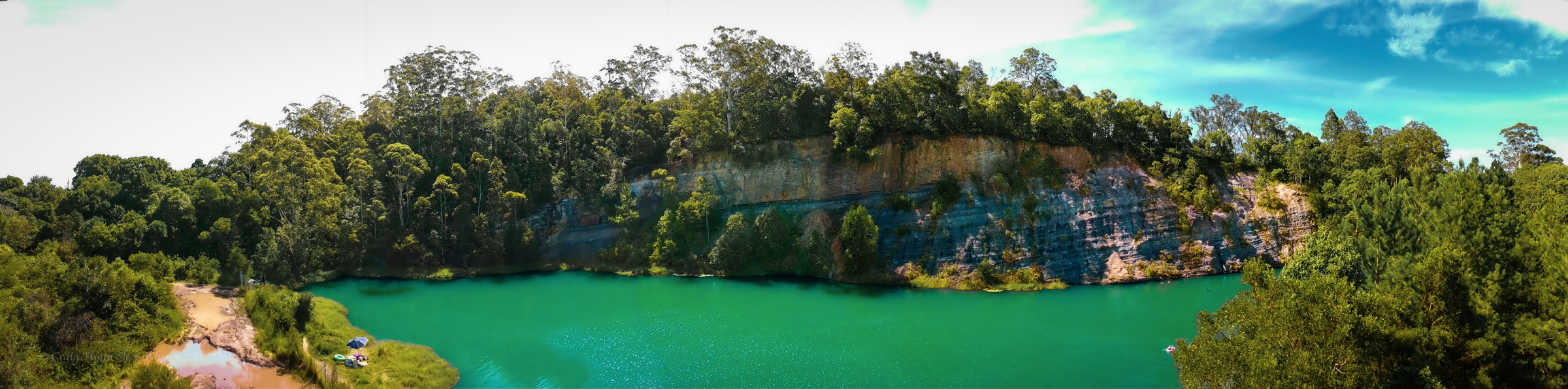
On the drive back Kylie asks, Have I shown you the quarry
No, says I
Yeah I have, says she
No you haven’t, said I
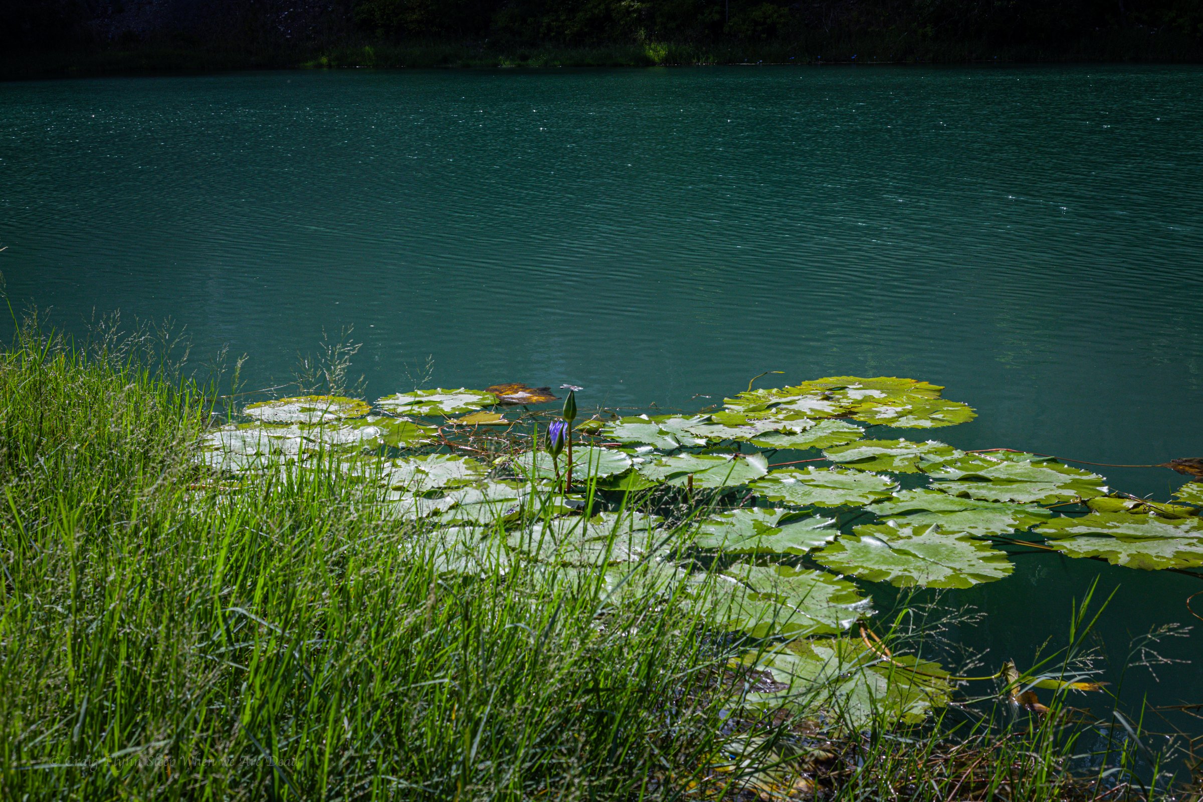
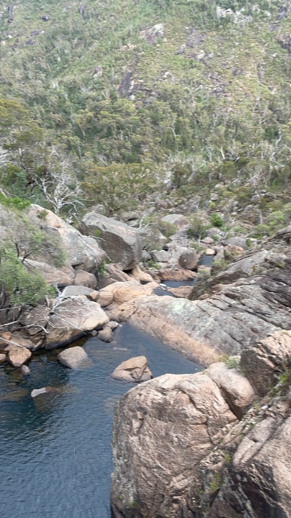
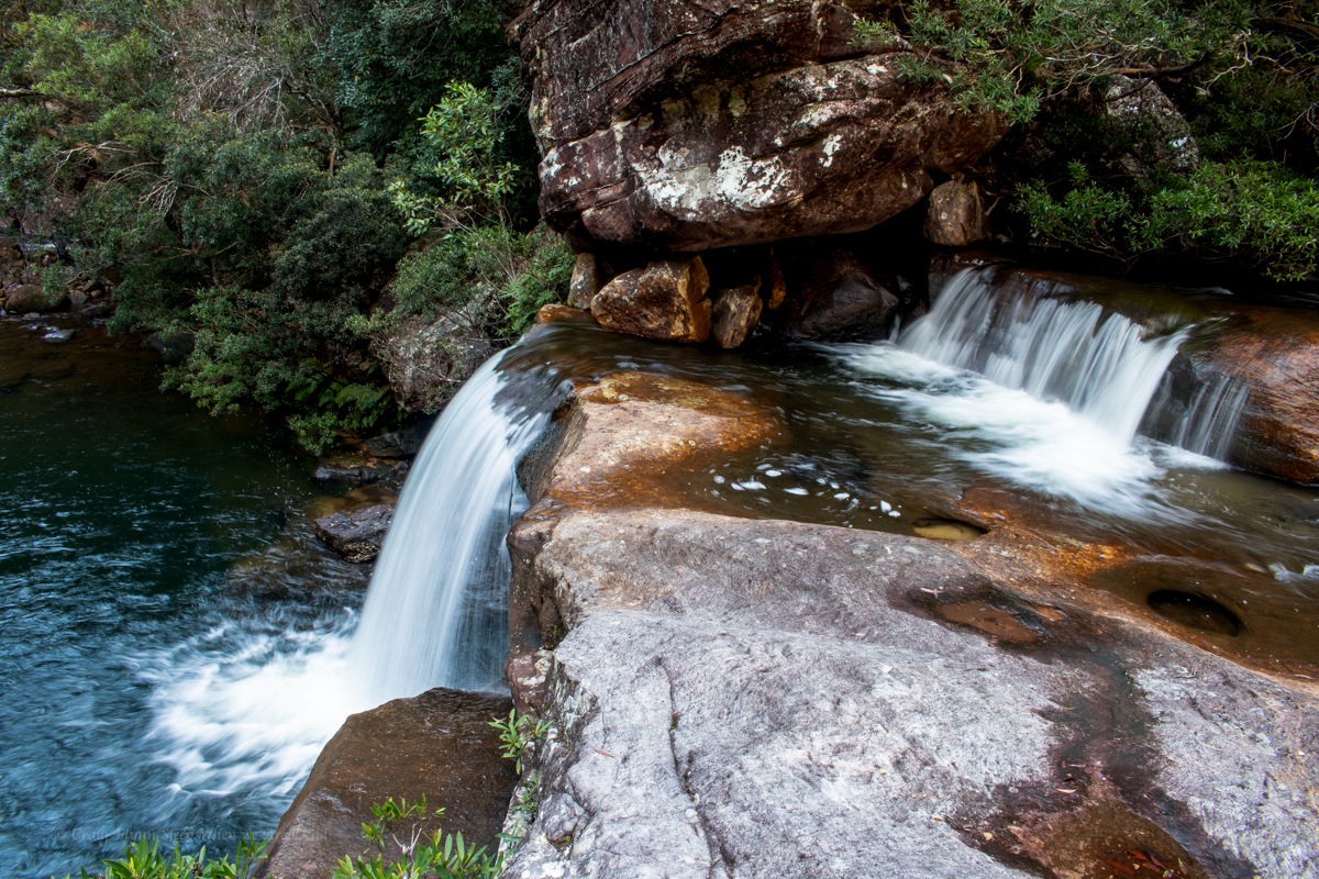
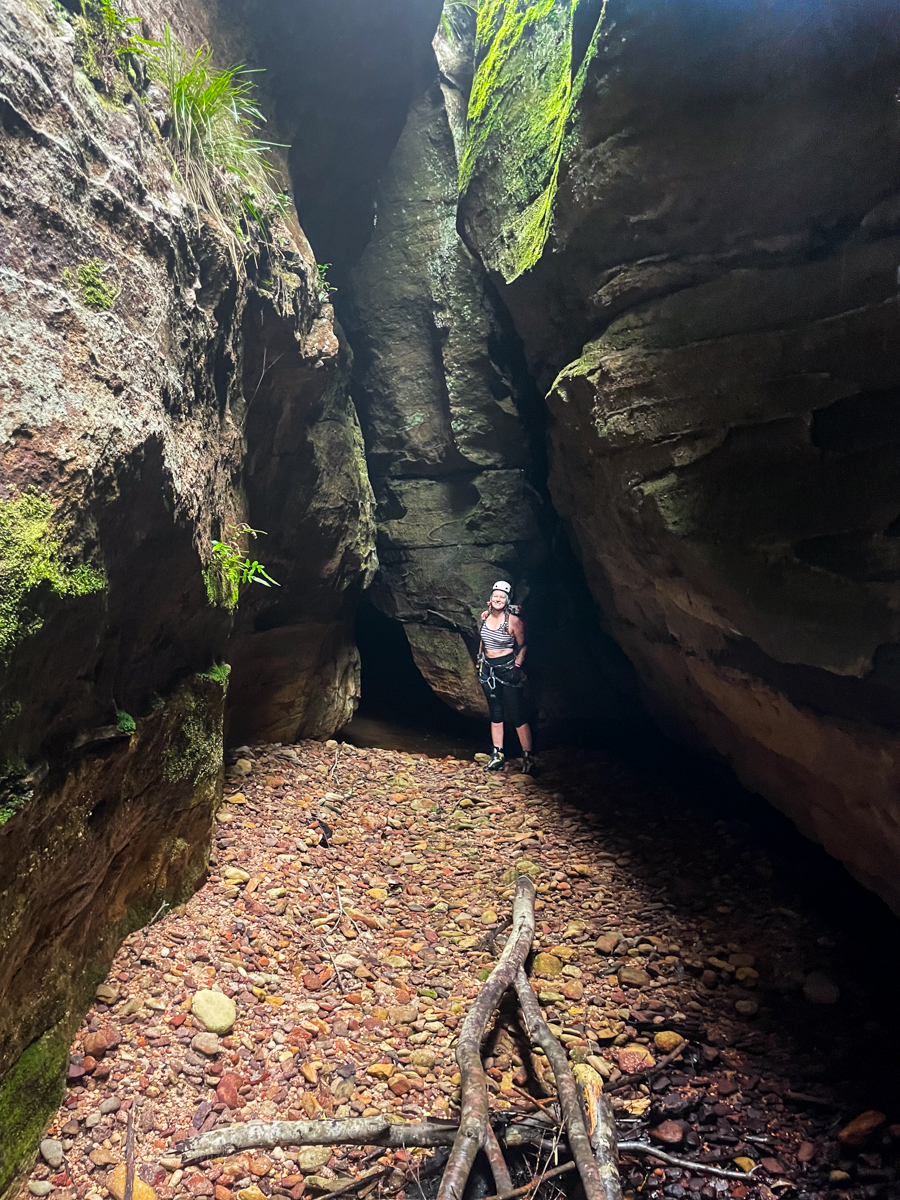
Bexhill quarry is an old brick quarry that operated from the 1890s through to the 1940s. When operations ceased it filled up with water and became a popular swimming spot.
With no through flow the water became quite acidic and was found to have high levels of dissolved metals, such as Aluminium and magnesium, so in 2016 it was shut off due to “safety concerns”.
No sooner had the fence gone up than locals cut holes in it…
But nature seems to have found it equilibrium, subsequent testing found acidity levels returning to normal(ish) levels and plans were submitted 2021 to turn the area into a public reserve.
That hasn’t happened yet so in the mean time you’ll still need to climb through the holes in the fence. To be fair though, it’s more hole than fence.
The Quarry is accessed of Coleman Street (Bangalow Road) Bexhill. About 10km from Lismore
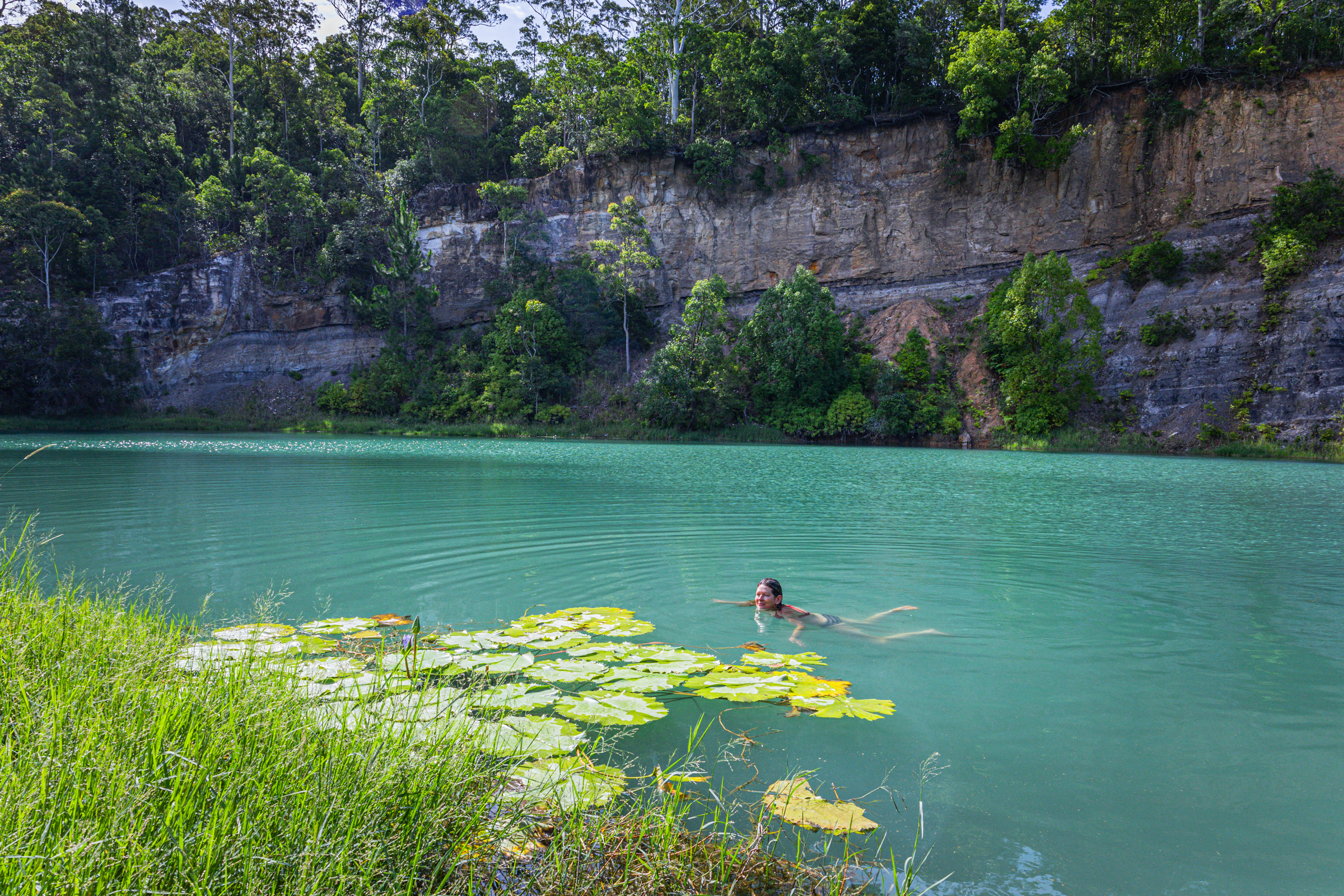
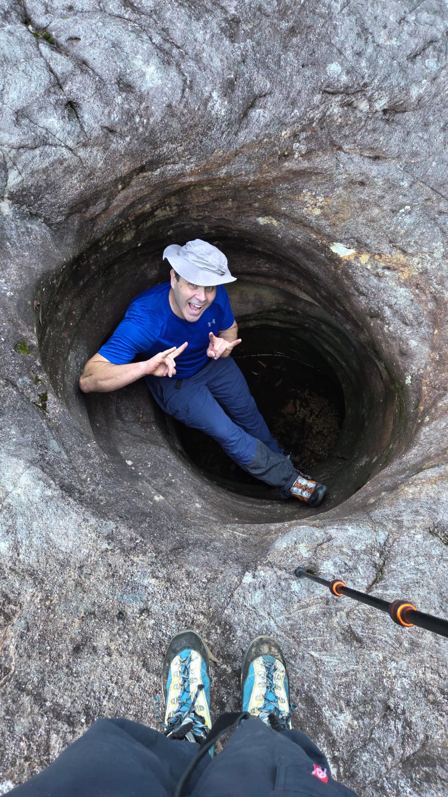
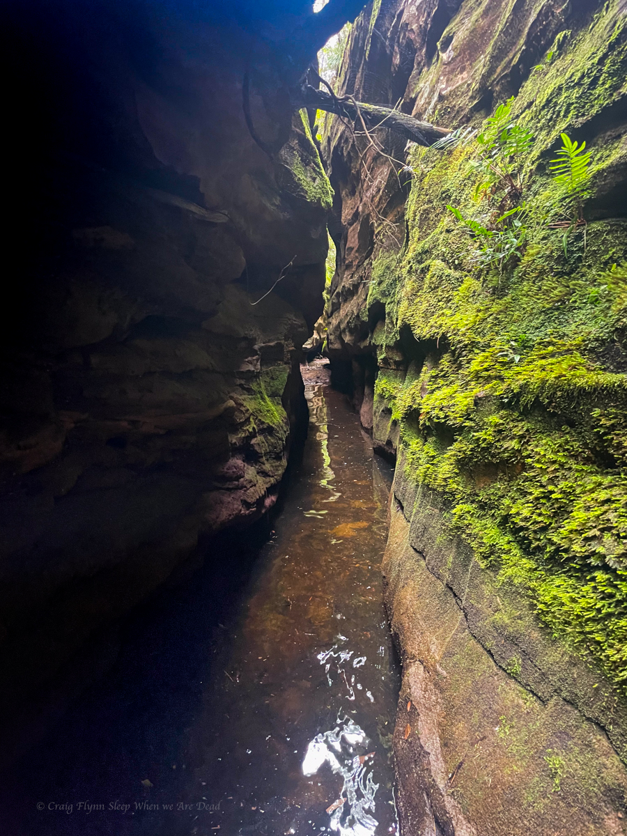
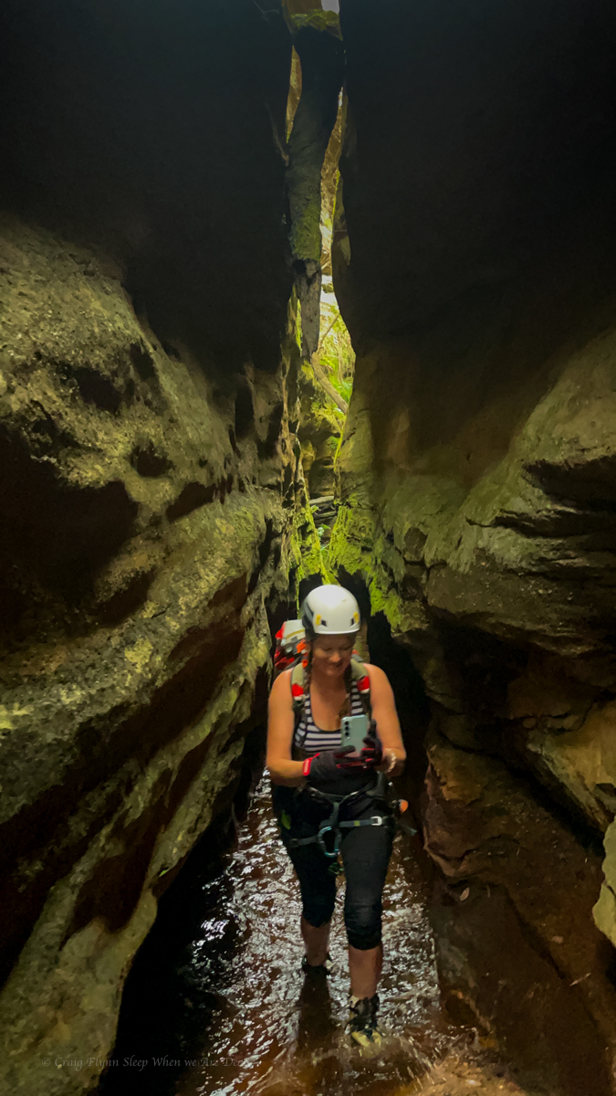
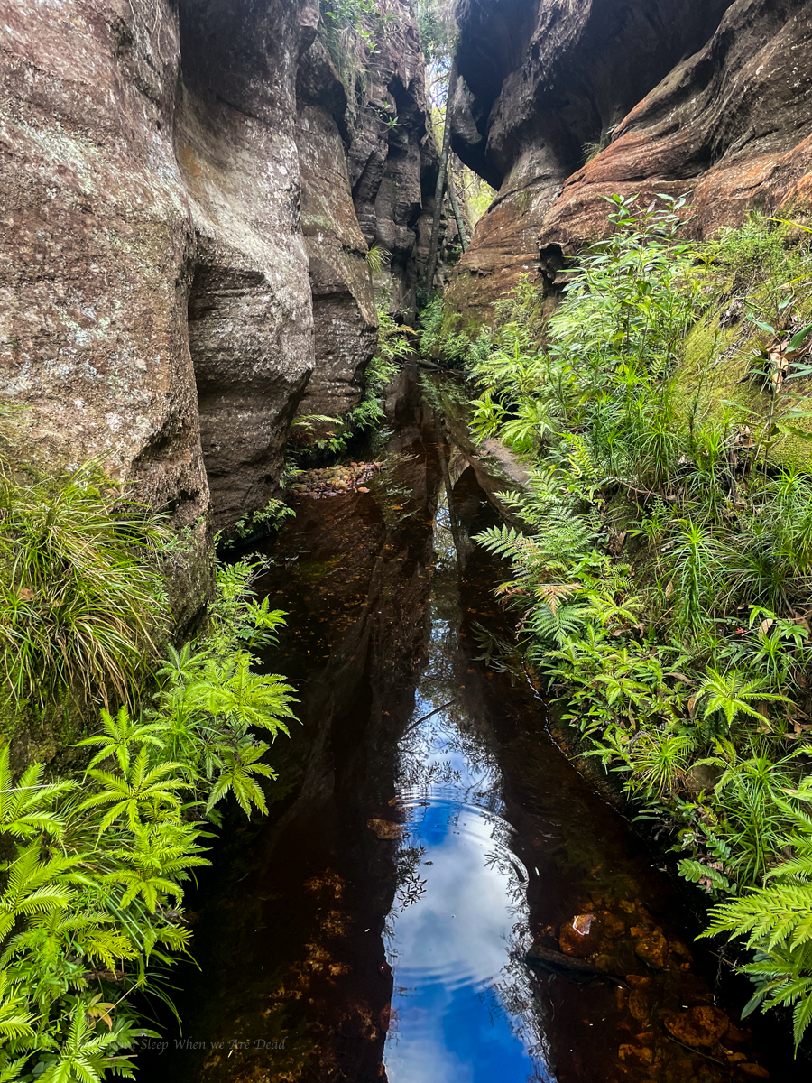
Not sure if the starling green water will give us superpowers or just melt the flesh from our bones..But the Lilly Pads and Dragonflys seem to enjoy it
And Kylie isn’t scarred
Water was quite pleasant indeed.
It’s a great spot for photography and a nice dip though, I recommend proficient swimmers only because I have no idea how deep it is.
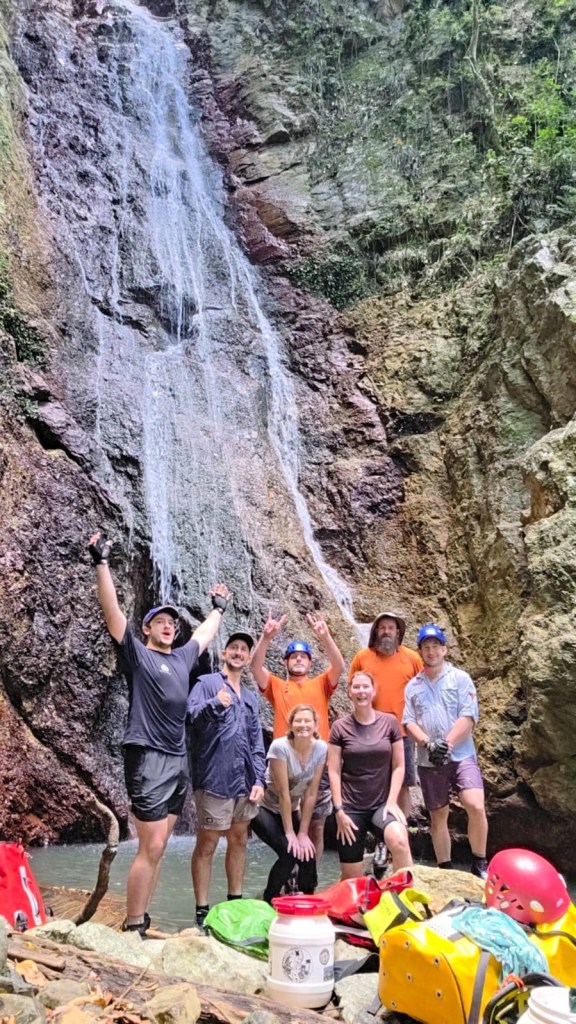
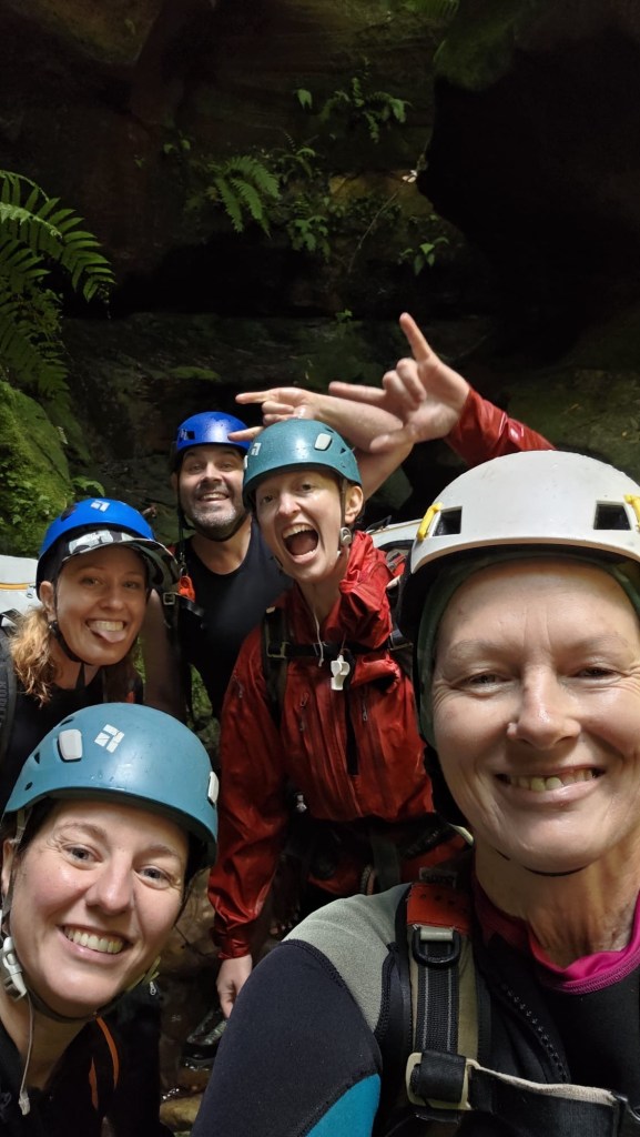
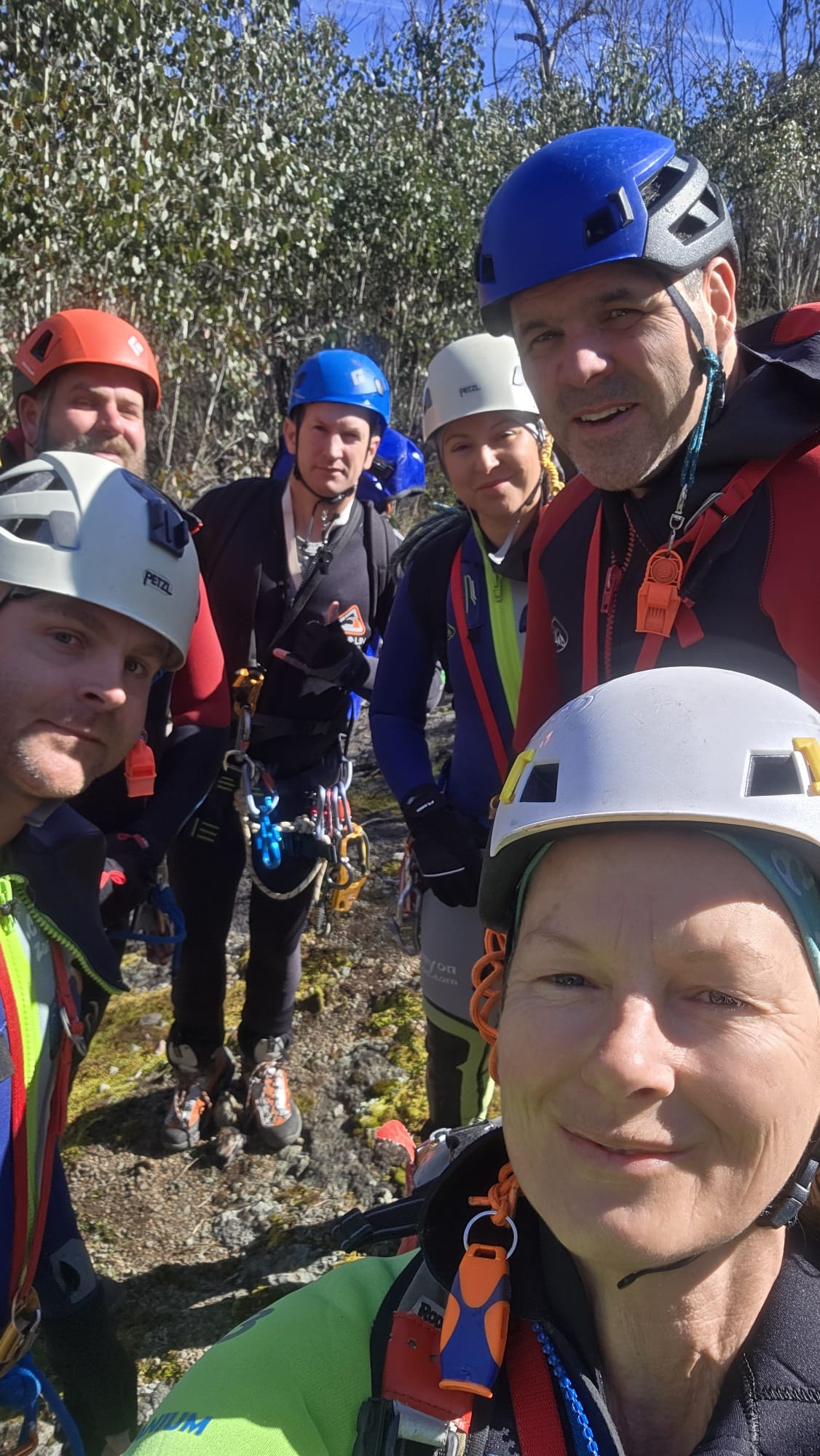
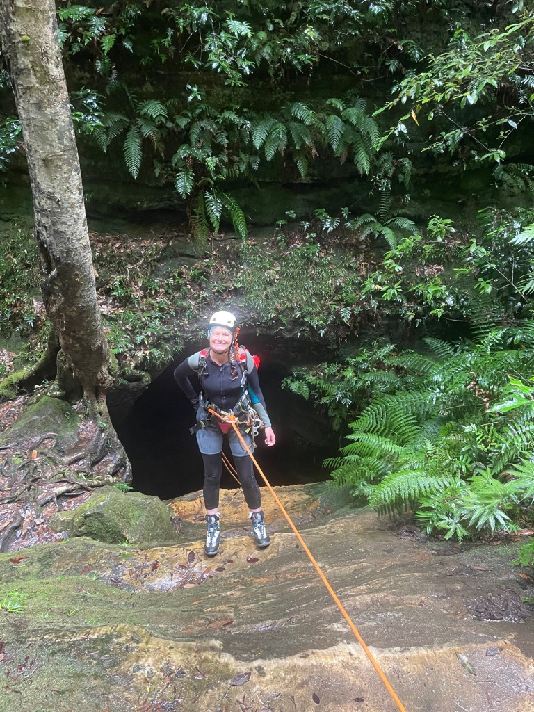
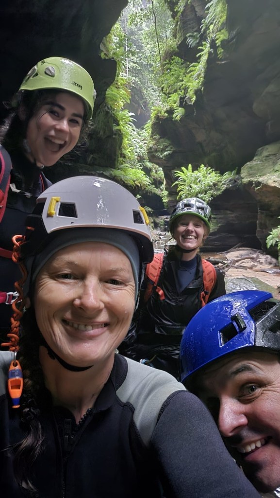
Kylie, Jason, Beck, Robin, Alex, Dane and meeeeeee
We were in northern NSW and it was too good an opportunity not to have a New Years Day play date with Jason and his QLD crew.
Every one else had done this one before but it had been on Kylie and my wish list for a while.
Pictures of it pumping in previous years had us frothing.
However, recent photos look like a trickle.
A storm the night before got our hopes up.
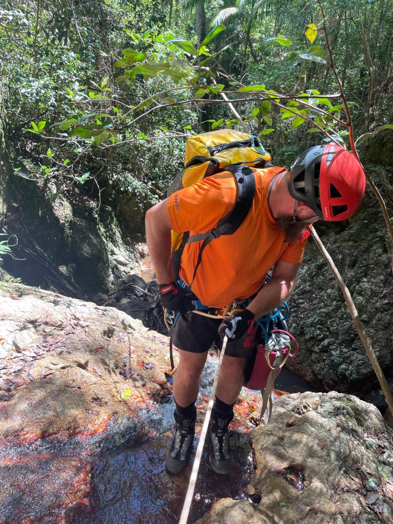
We meet at the top secret location (note: location may not be top secret) and skirt private property boundaries to access our canyon.
The storm had done nothing. Nothing !
The creek was dry as a nuns nipple.
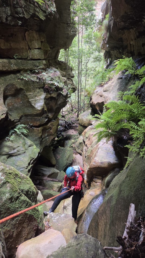
Well not quite. There was water flowing, just
Jason wondering where the water went.
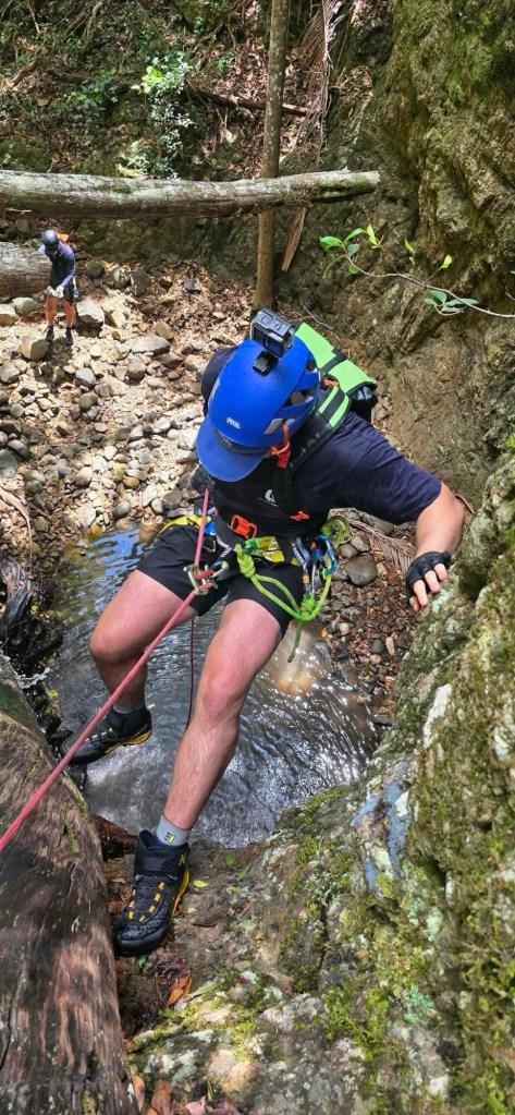
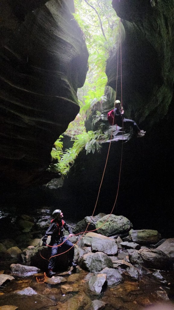
Alex on rope while Dane waits
Kylie thinking, well at least it’s a little wet
It might be a trickle but still pretty
Taking on Vecna
Robin wondering if he should avoid the pool or plunge in
There is a teeny tiny lathe you can unclip and jump from
Coming last I made an error. I didn’t unclip it just did the usual Empress release the brake hand and jump.
I knew my centre mark was just beyond the anchor.
I figure I jump out and when I reach the end it will pull the pull strand with me.
I’ve done that before, but I unclipeped first.
This time I’m sailing through the air, there’s “a bit” of a jolt snap the plastic lug it was tied to and the end of the rope recoils up And is now on a teeny tiny ledge 4metres above the pool.
Up I jug to retrieve it.
Lessen learned, double check your centre mark, especially when doing abseils exactly as long as half your rope. And keep an eye on your end of rope markers
I have marks at the 10 and 5m points to let me know I’m getting to the end. I didn’t even look for them. Dumb arse.
Anyhoo all good, no harm, rope retrieved. Let’s never speak of it again.
One more abseil and she’s all over.
Beck doing it in style Only slightly rinsed but Happy canyoners
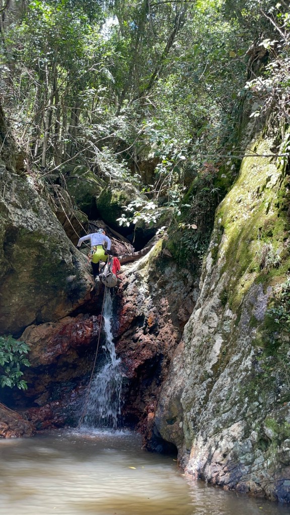
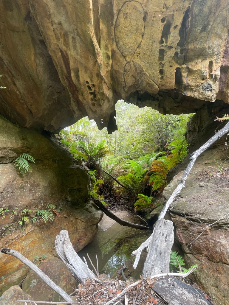
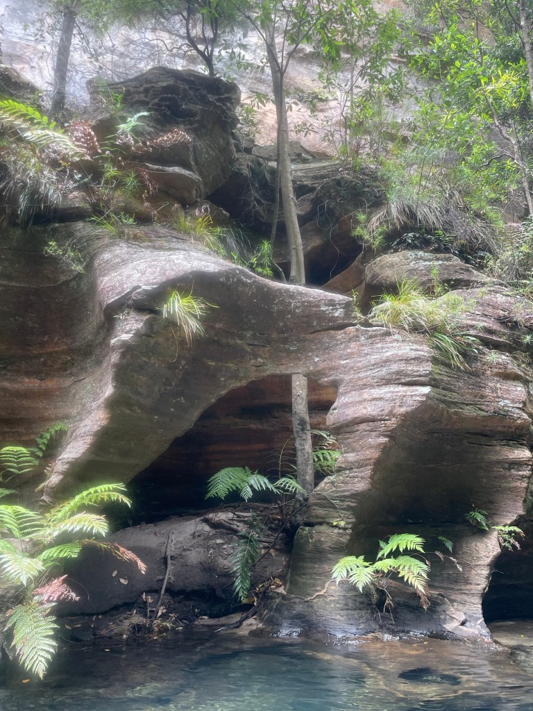
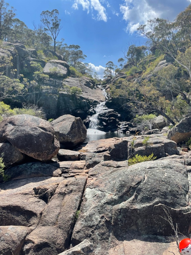
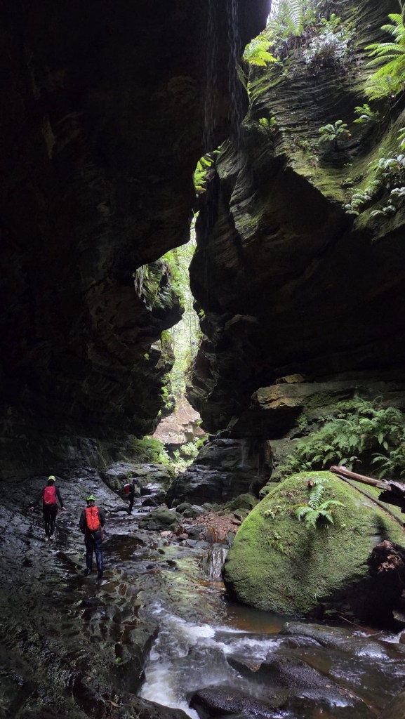
There’s some great side canyons along the Wollangambe with the most popular ones clustered around Mt Wilson.
Of those accessed from the Fire Shed there are a couple of outliers that get less traffic due to being a little harder to get too.
Whirlpool canyon is one of these.
Expecting a stinking hot day and a long scrubby walk in we meet early and head off.
The others had obtained a GPS trace of the entry, I had my usual plotted way point for the canyon start and sometimes/usaul/mostly wackily off gut feel…
Banter made the walk in pass in a flash, well not really but it was surprisingly simple, even if I did get completely turned around at one point, thankfully Clare and Kylie kept us on track. Though when H suggested we try a short cut I was all in.
It was also relatively scrub free(ish)
Slipping down H’s side gully hoping to cut off a fair bit of the GPS trace.
And soon we find ourself at the start of the canyon.
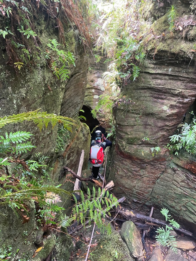
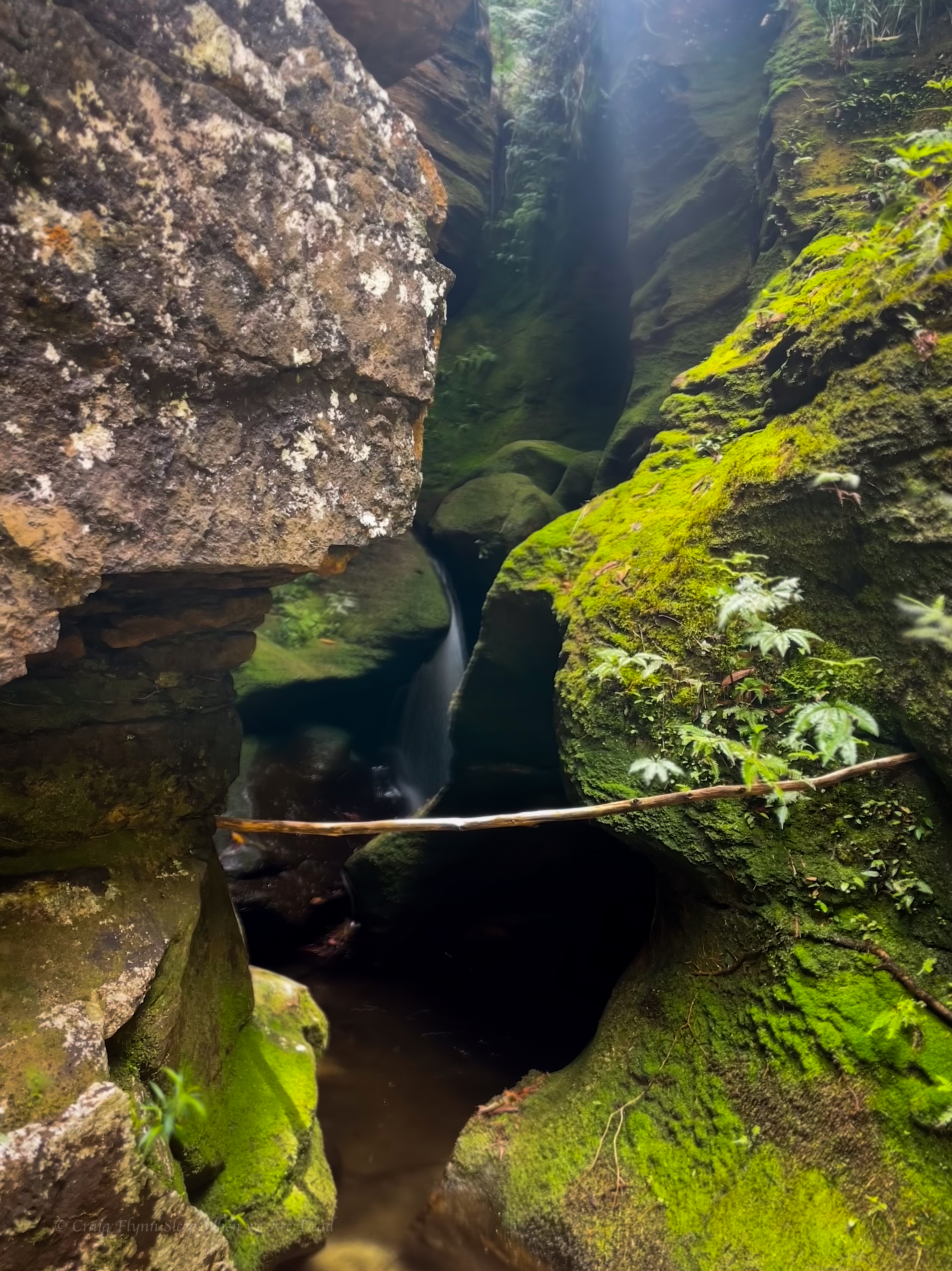
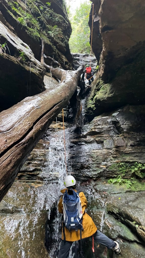
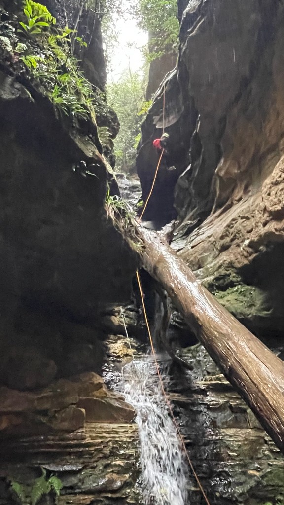
We weren’t expecting much out of this one but a short abseil gets us into a surprisingly nice slot.
Kylie sussing out the first abseil
There was some interesting anchor set ups and a couple of the abseils have very tricky starts. This problem solving aspect is part of what I really enjoy about canyoning.
Don’t get my wrong, on popular trips where hordes of foot steps compact tree roots and pulling rope after rope wears grooves in the rock well placed bolts are a Good Thing (TM) but they do take something away from the overall experience of problem solving. That’s probably not a major draw for most, but for me it’s a big part of it.
Anyhoo that’s off topic.
Back in the land of dodgy anchors, we check each one carefully (as you should every time). Replace what needs to be replaced and carefully consider the remnant dodginess
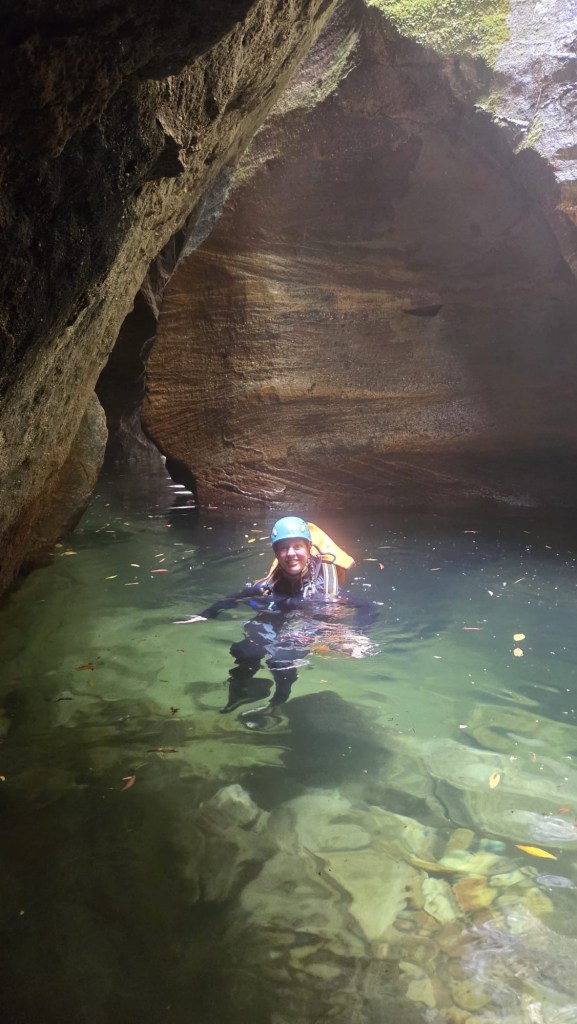
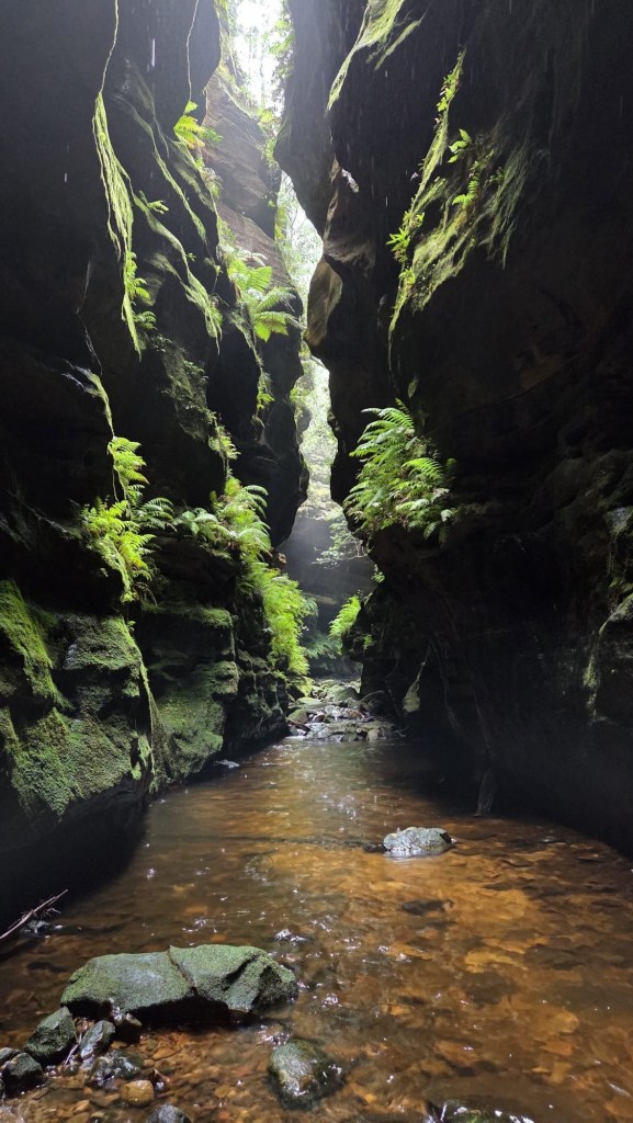
Before lone you could feel the warmth chimneying up from the ‘Gambe
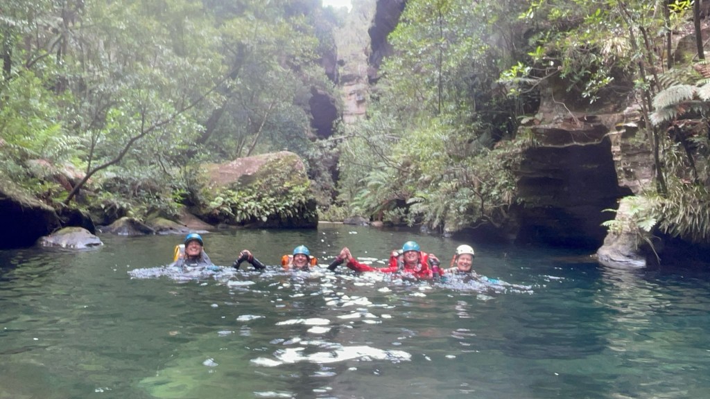
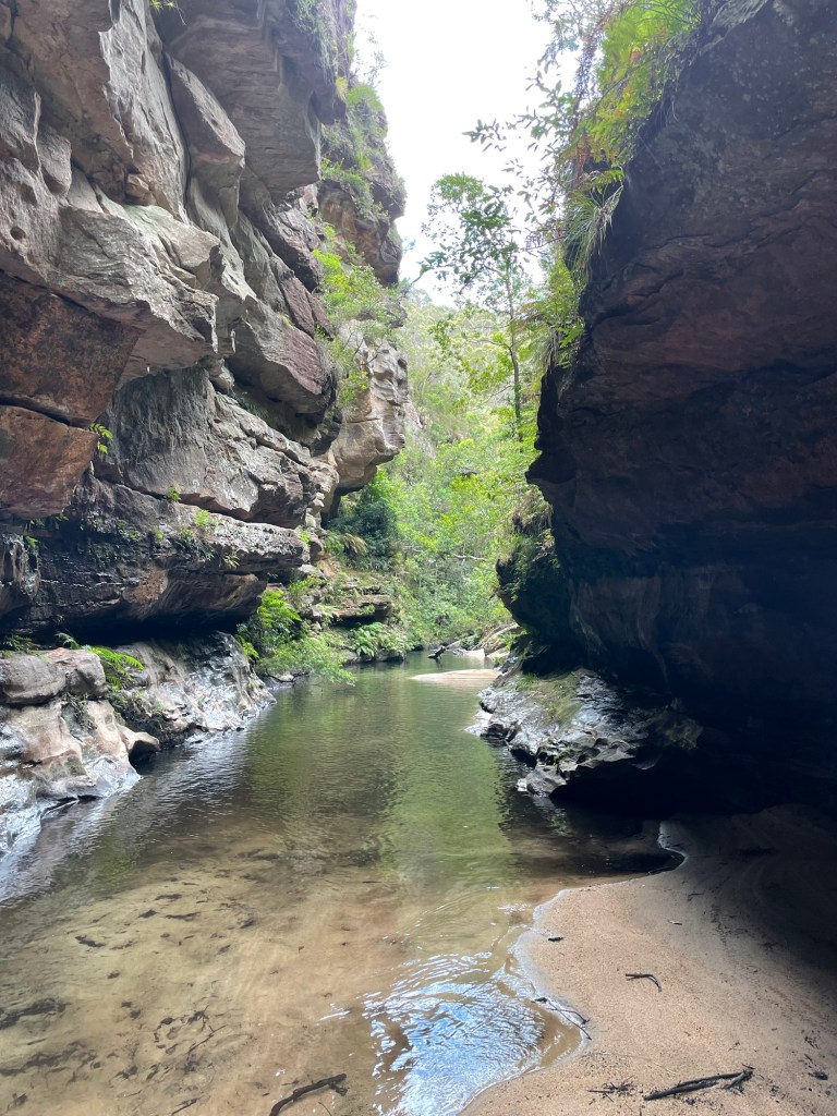
H leads the way down the last abseil and soon we reach the Junction with the Wollangambe
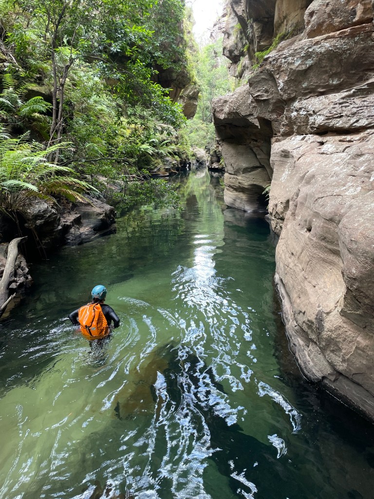
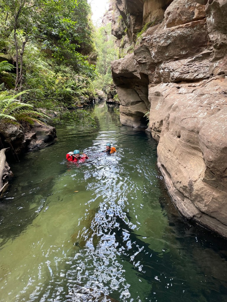
But the day is not over. Our exit is about a kilometre and half downstream.
Having pretty much traced this enigmatic river from its source at Clarence to below Mt Irvine on various trips over the years I reckon this bit is the most stunning section of the ‘Game
Deep walls and beautiful pools.
That’s said it’s not easy going with deep sand and boulder hoping between long swims zapping your energy after an already longish day .
Having less foot traffic it’s also a lot slipperier in spots.
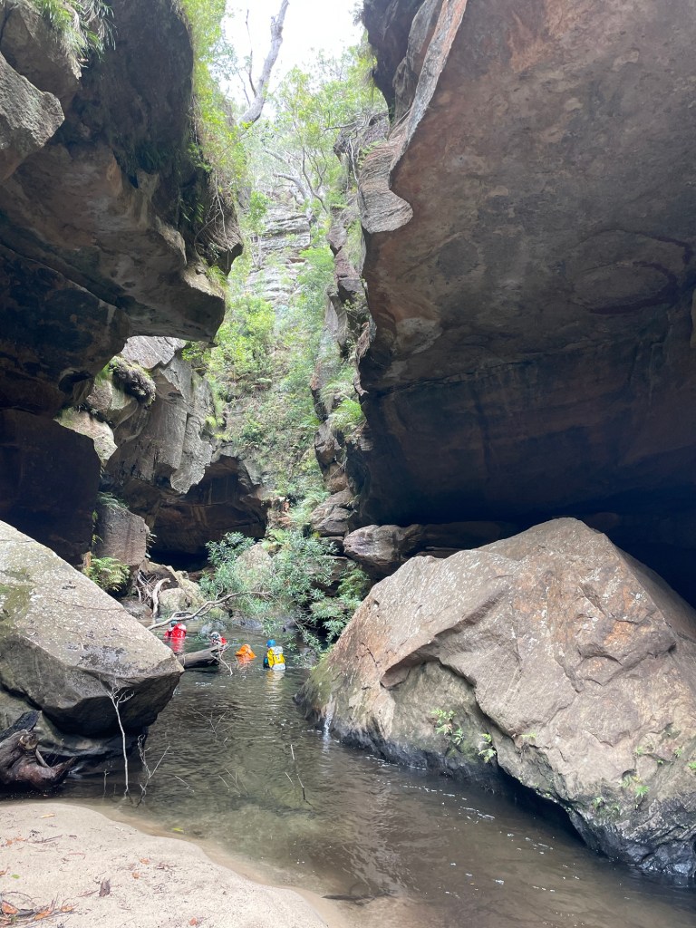
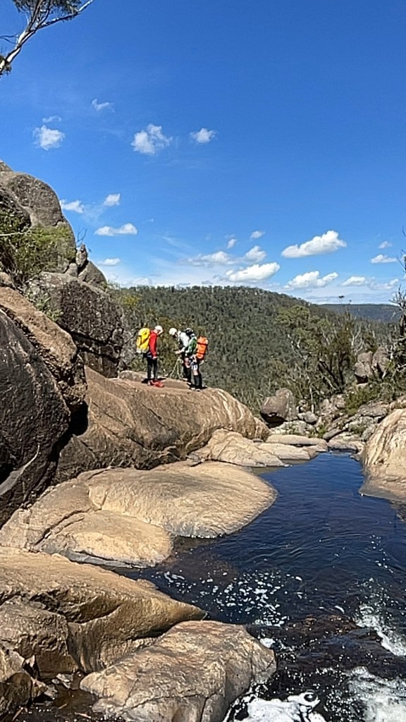
Just before our exit we catch a group from the central coast who had completed Geronimo.
We chat at the exit, cooling off at the sandy beach before making our way back up to the shed.
All in all a thoroughly enjoyable day but it was also a long day for a shortish canyon so I wouldn’t rush back to repeat the trip.
Whirlpool itself was nice and as stated it’s a beautiful section of the Wollangambe so worth doing at least once.
But Having a much larger catchment it can be a disappointing trickle or a wall of white water death.
We got it almost perfect.
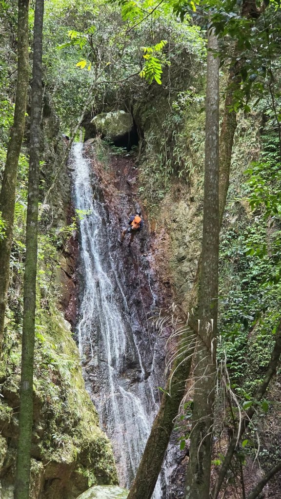
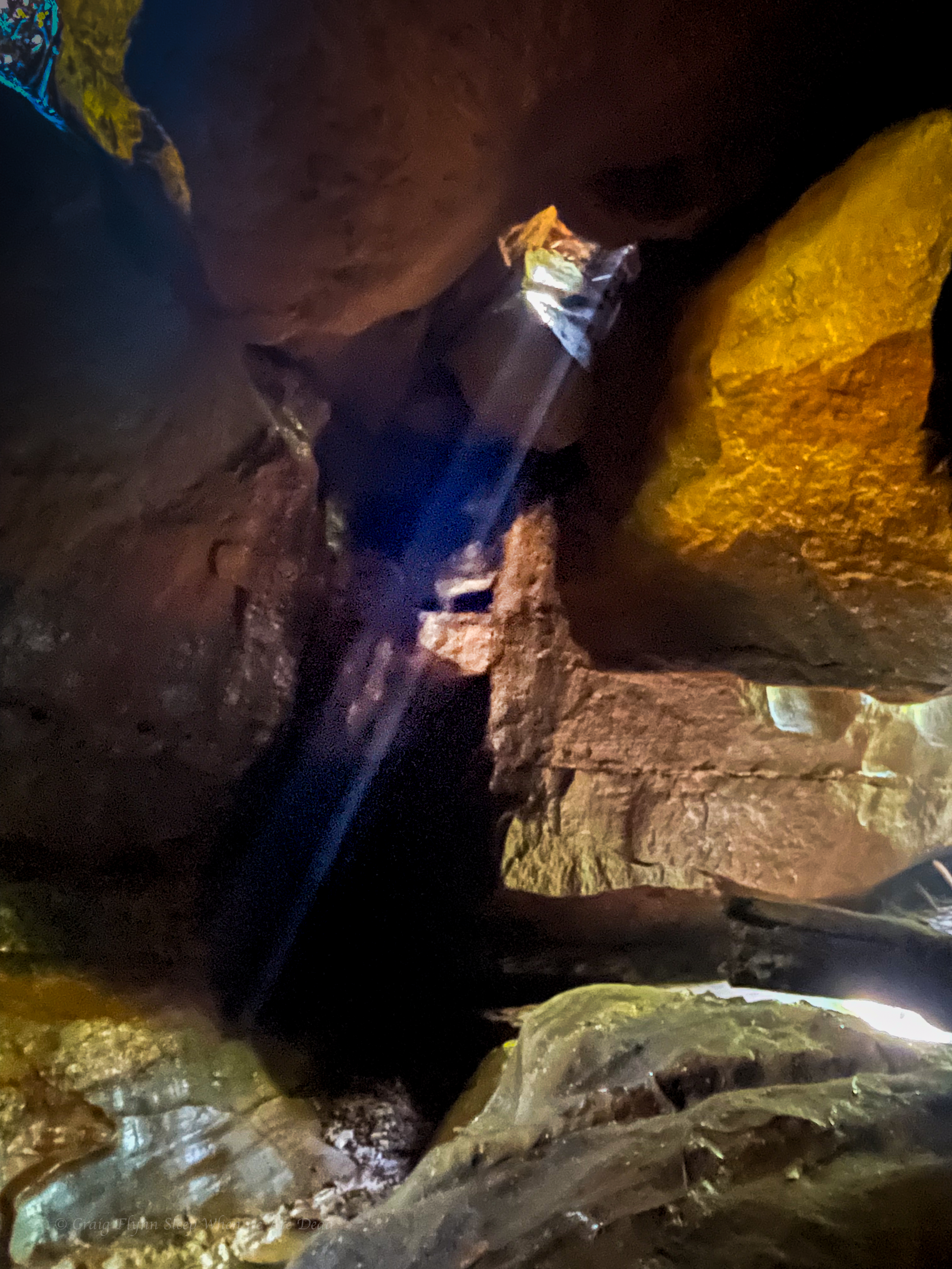
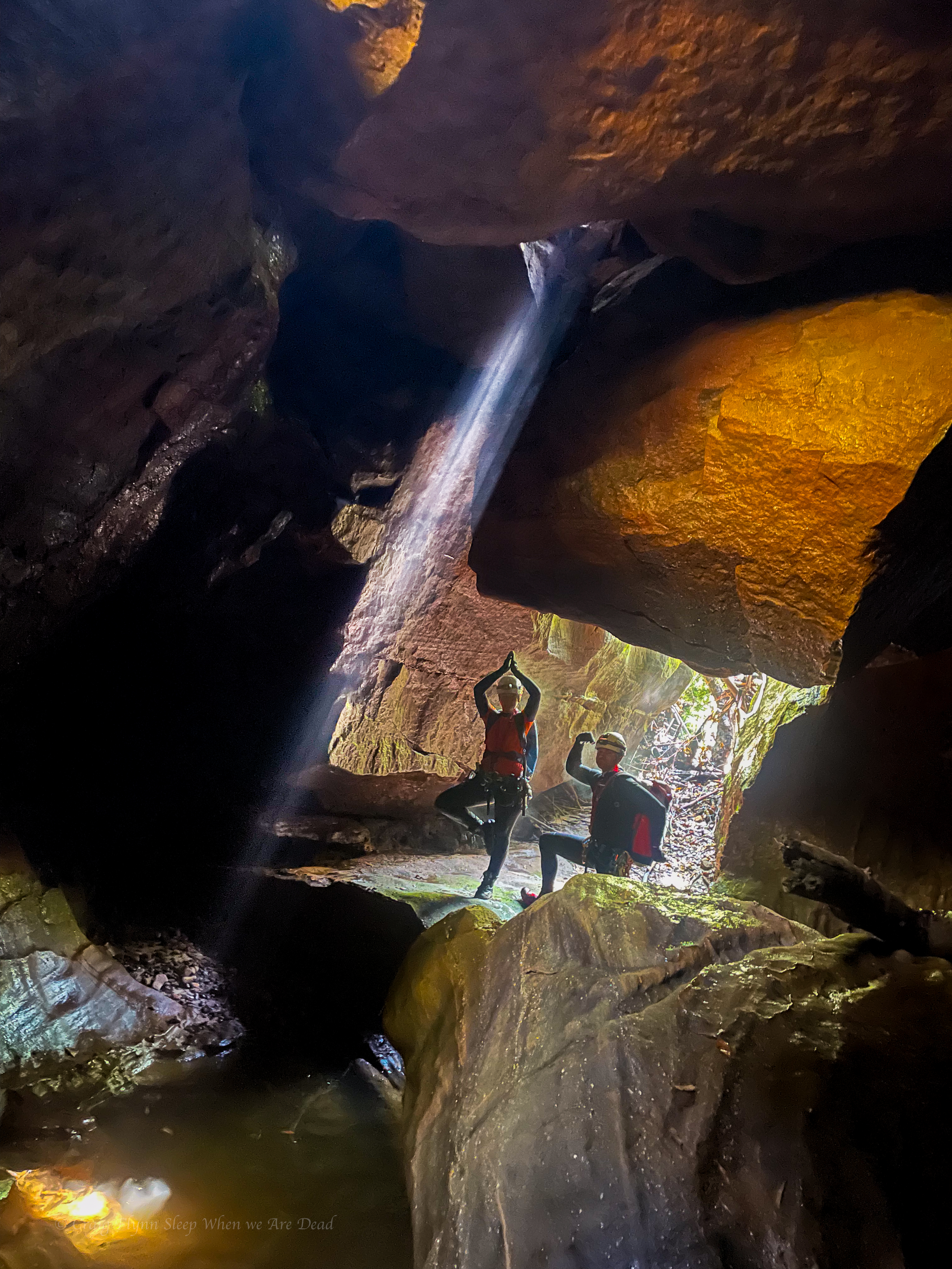
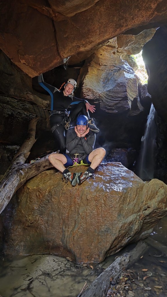
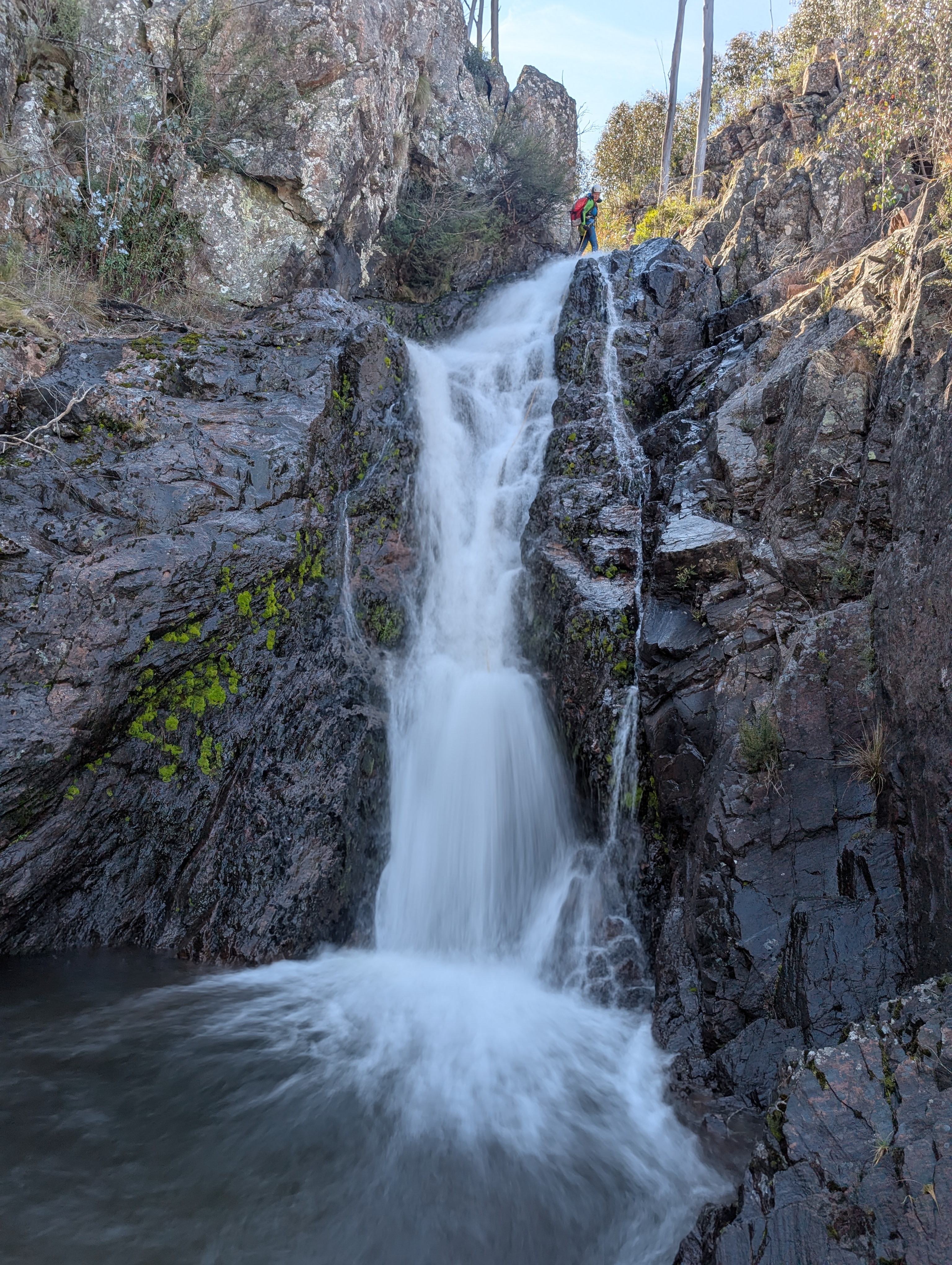
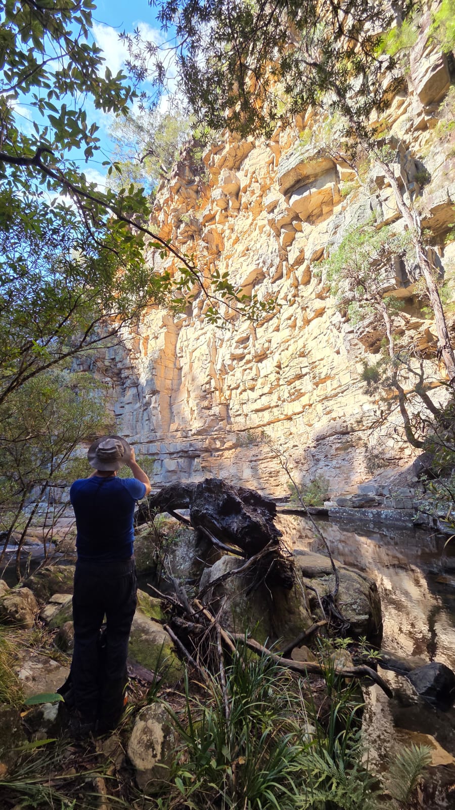
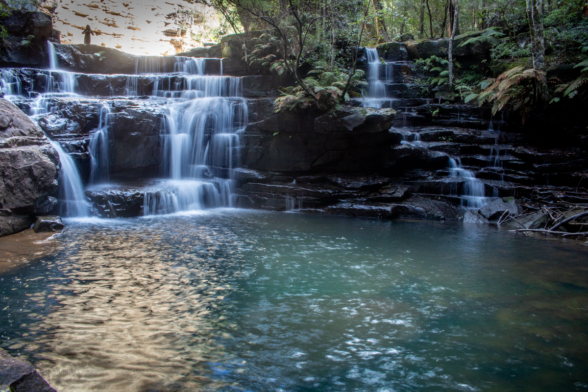
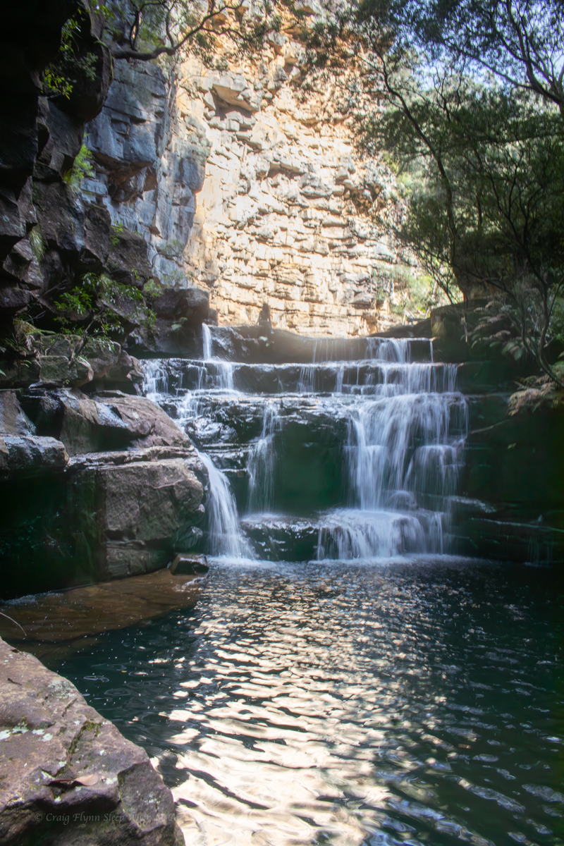
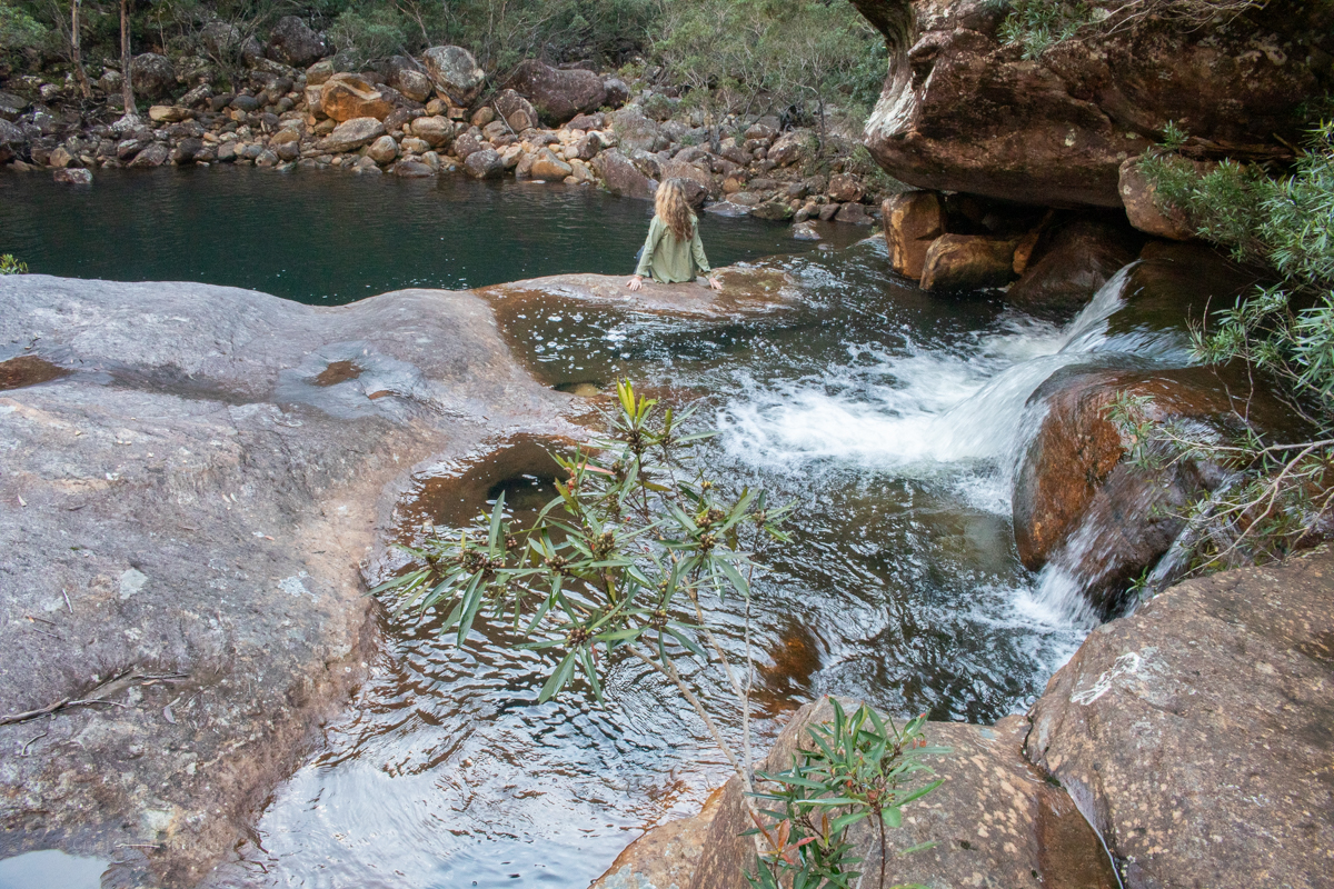
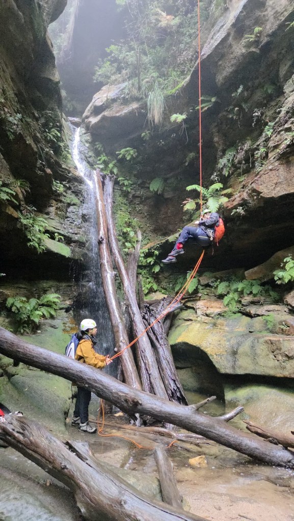
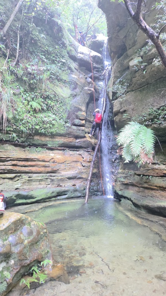
We meet up and waste no time walking to the end of the fire trail and making our way down to the upper falls.
We bypass the first cascade and its inviting plunge pool.
Kent leads us pass an anchor set mid river left to find another just to the left of the main flow.
All abseils except the big one have easy escape routes back to the exit trail so you can pretty much choose your own adventure with doing a part or the whole.
Our first 3 slabby abseils are between 8 and 15m high. They are a bit of fun and nothing technical.
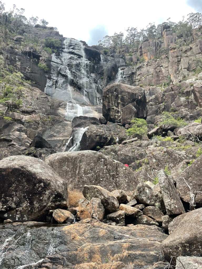
It’s a beautiful series of falls interspaced with plunge pools
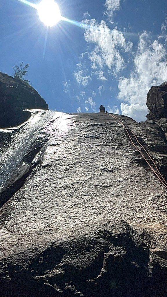
Joel and I have the long ropes and get sent ahead to set the big drop.
From Kent’s description I’m nervously looking for a narrow ledge I need to traverse across which may or may not be slippery.
I’m standing on the edge of a wide slopping platform with heaps of grip looking for something below.
Bolts are behind you. Says Joel
I look at the wall behind me.
On the ground.says Joel.
Oh
I know this particular drop was pioneered by members of one of the caving clubs a few years ago.
2 odd looking bolts are set on the ground 7 or 8m back from the edge. 1 is a 8mm cap screw. The other a type I’ve not seen before….
A nice shiney new glue in has been added and all 3 equalised using D shackles.
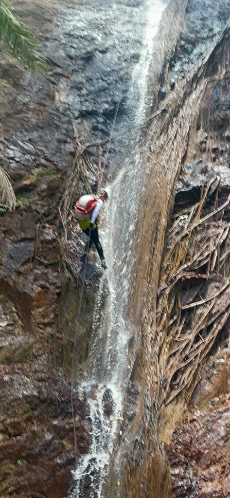
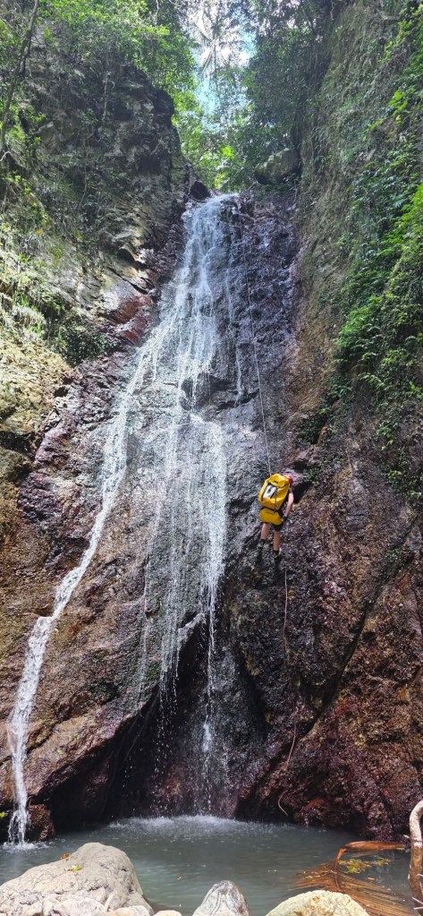
We set up and Joel leads the way down. We have about 76m of rope out and by the time he gets to the next big ledge and traverses across to the rebelay there is maybe 3m of tail left.
As Kent heads down the rope snags behind a nub of rock which gets dislodged as he traverses at the bottom. He calls up a warning over the two way.
Dave about to descend
The rest of us get down no drama but Kent is reluctant to pull rope from directly below.
Joel devises a plan which will allow us to descend the next 12m abseil on a biner block, tie the pull cord for the previous ropes to the biner and pull rope from both pitches together from a safe spot on the far side of the plunge pool
We all head down. Most swim across the pool. Joel does a nice traverse climb to avoid the swim.
Pete follows Joel but does not avoid the swim…
I stay dry, just
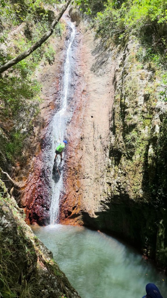
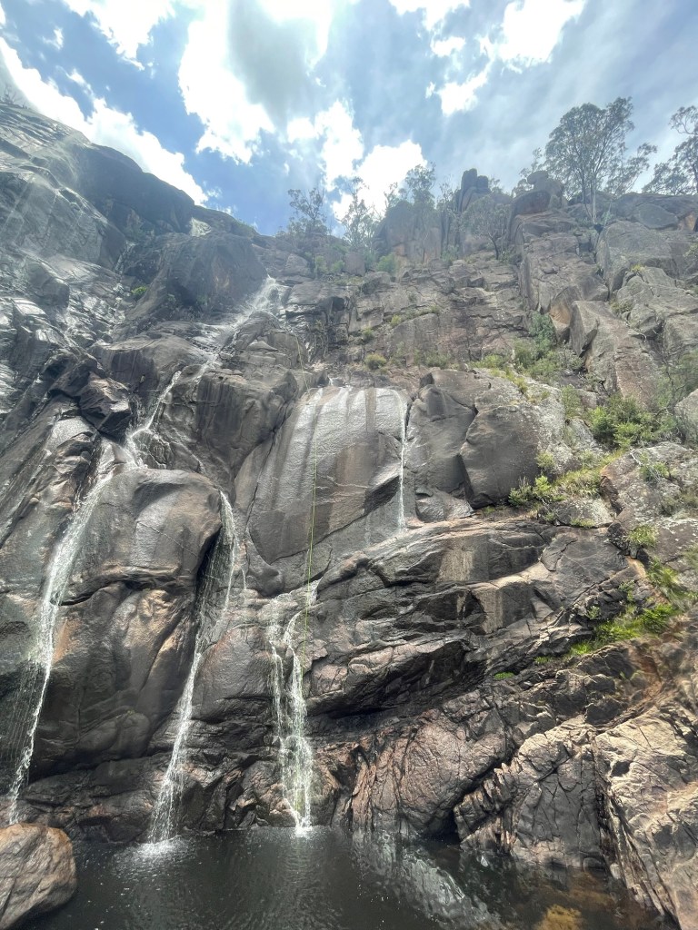
The main falls. Around 90m
We start to pull and the system works perfectly
1 rope down.
2 two ropes down
3rd rope clears the anchor the end tumbles down and lands in a ledge. I start to pull.
It comes.
It comes .
It does not come.
Joel and I spend a bit of time trying different angles and stuff and it’s stuck good and proper on the only ledge not accessible from the exit track.
Next time we think we’d set this drop, leave the rope there and collect it on the way out. Not only would it avoid a stuck rope but it would avoid the need for 2 x 76m+ ropes and carrying it out the bottom half of the exit.
Joel looking further down as storm clouds begin to roll in.
Kent on the next one which passes under big boulder halfway down
Looking back up the main series of drop. Can you spot Dave, Cotter and Joel?
Finally we get to the wetter part of the trip. We are not quite 3/4 of the way down, still 150m or so above the Kowmung.
Below a series of falls and plunge pools
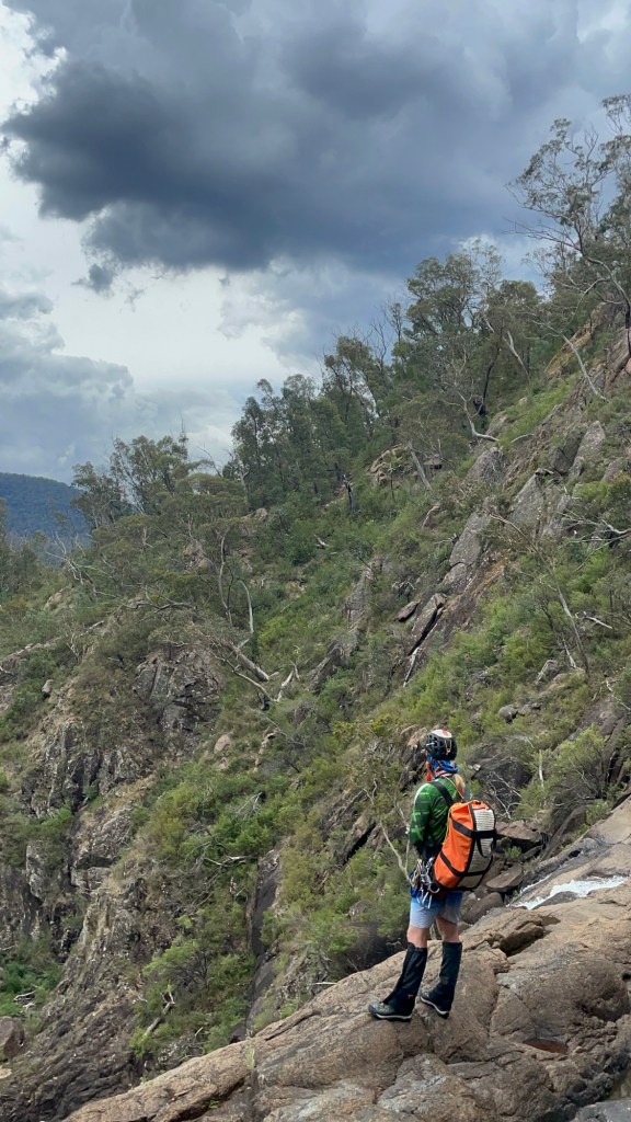
Above thou, the sky is cranky.
Dark clouds, thunder and a spattering of rain.
Big storms were predicted for later in the day. It looks like they arrived early. Standing on exposed granite in a lightning storm probably isn’t the best idea so we opt to abort the trip and scramble out to the exit track.
The storm doesn’t really hit in full, thou I later learn it hit the mountain with a good smash of hail. While disappointed not to complete the trip to the bottom we are comfortable with the call.
Besides, it gives us a good excuse to comeback and finish the journey.
“A river cuts through a rock, not because of its power but because of its persistence.” – Jim Watkins
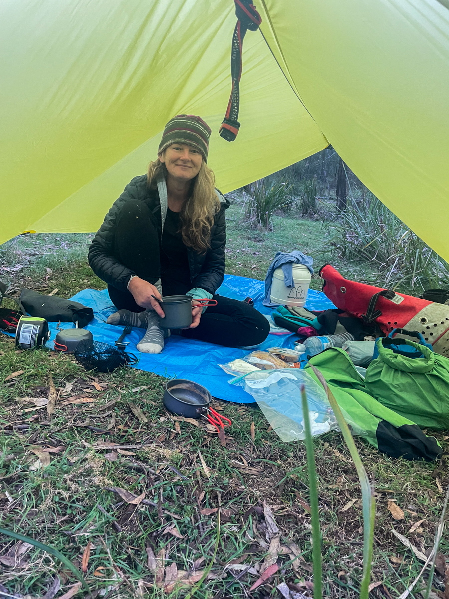
It teemed down overnight at camp. But our trusty tarp kept us cozy and by morning the sun was peaking through the clouds.
We had said goodbye to Levis and Monica and talked ourselves into another short canyon while we were out here.
Kylie, Jason and I had visited the top couple of sections of Popeye Canyon as a day walk a few weeks earlier which had some pretty bits in it, and so we were keen to have a look at the lower section.
I cooked up a plan to head straight down from camp to the grid reference that the Jamison guide lists as the start of Popeye (a kilometre or so below the upper section).
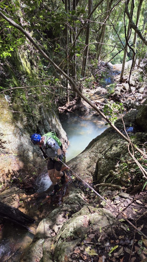
We start down a ridge in between two faint gullies. These soon join to become a stoney bottom creek that tumbles over a substantial cliff line. We only brought a short rope with us today so make our way a bit further long the left hand bank and find a way down into what we came to christen MCPCC. Mega Clear Path Creek Canyon.
heading out to enter via the upper section may have been easier.
Anyhoo we find ourselves in Popeye creek. It’s not looking like much but H and K don light wet suits.
Looks like there’ll be some more creek walking, I’ll suit up later, the rest of us say.
10 steps later, literally, like literally 10 steps babes, we round a bend and the creek drops into a tunnel like canyoney section.
This would be the theme for this section of Popeye. boulder hoping interspaced with tunnels and cavey bits. A few abseils and short swims
and awesome company
but not much quality canyon.
Plenty of weirdness thou
we head all the way down to the…… it hurts to say it…. Dingo *fugging* Creek for the final 10m of “canyon”
The plan is to head down said creek to an exit Kylie had mapped out opposite gateway canyon. I’m hopeful this section is similar to the bit below HITW and we can just float with the current.
There was a bit of floating.
A bit of boulder scrambling.
Some scrub bashing.
And lots of sinking knee, sometimes hip, deep into fine sand to have it defy the sand traps and fill the bestards.
I still have sand in places sand has no place being.
Still, it’s a wild and beautiful part of the Bungleboori system worth visiting. Once.
The bottom of Gateway canyon was a welcome site
The walls lining the creek had gone from broken slopes to towering cliffs and I’m wondering just how tricky this exit is going to be.
Surprisingly it’s straight forward, cutting back along a gentle ramp to a not too steep nose that avoided the cliffs altogether.
Nice one Gadget
All in all a fantastic weekend out in the wilderness with my kind of people.
Kylie, Kristo, Jason, Hywaida, Dave and meeeeeeeeeeee
This one had been on the agenda for a while.
Kylie had scoped out topos and satellite images years ago. Then it caught the attention of Laurie, the Victorians and others and the race was on.
I’m not sure who lead the first trip but they did a stella job. It then appeared in the Canyoning Around Victoria guidebook, Published by Rob and Sam. But being a little out of the way meant there hasn’t seemed to be a ton of repeats.
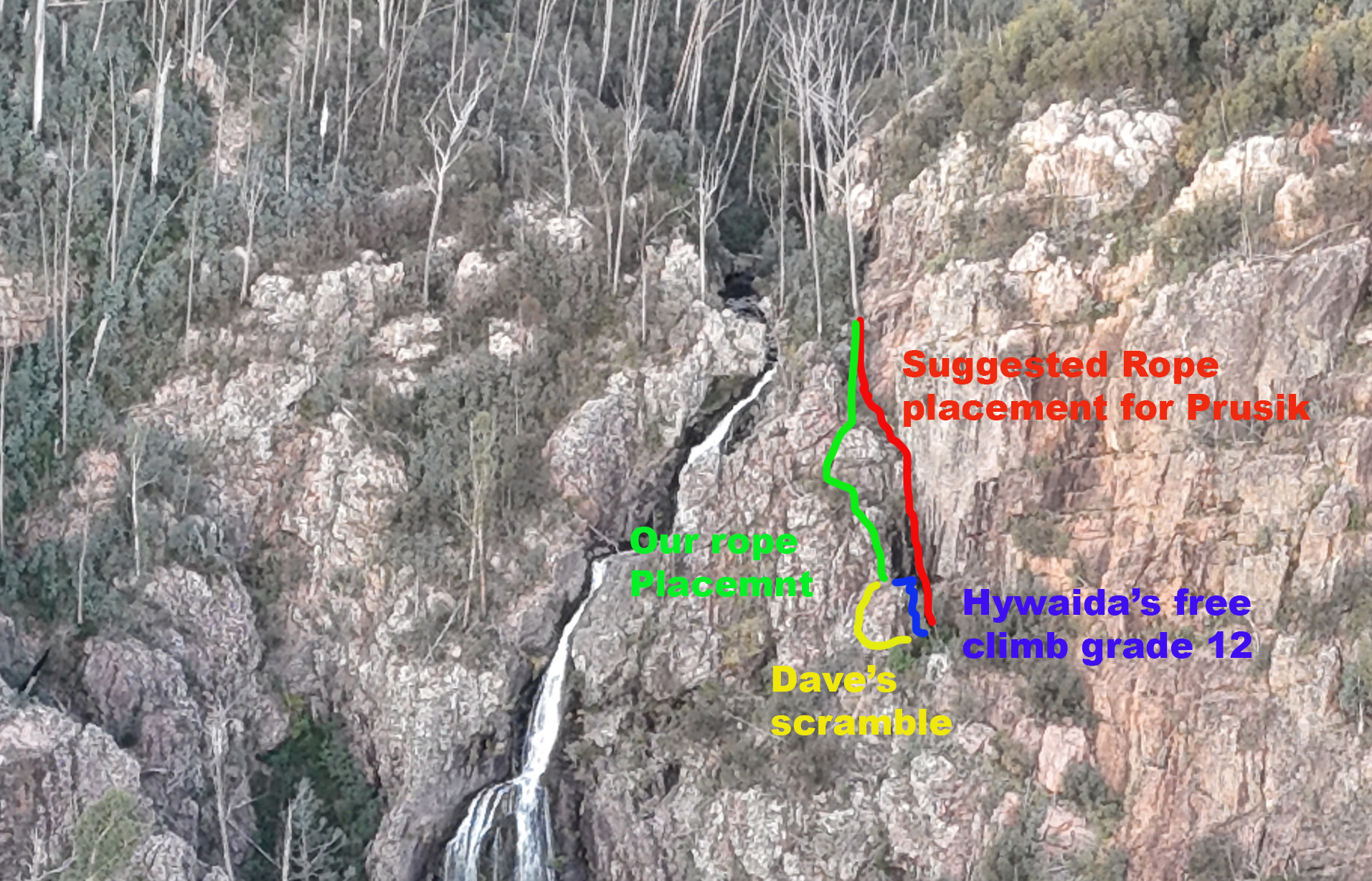
Our intel said to drop a rope to aid with the last little bit of the exit. Rope wiki said someone should descend it to make sure it’s in the right spot. But there was nothing to say what the right spot was. Asking previous parties gave mixed messages. Everyone said it was really obvious where to put the rope. Almost everyone said they put the rope in the wrong spot and had to free climb a bit…
The guide said the last 10m of exit was the tricky bit, ropewiki said setting a 20 or 30m rope in place to assisted existing would be handy.
Looking down the last 10m didn’t look that sketchy. We attach a rope to a tree and Me and Jason descend to have a look. There is another drop. Straight over is a 15-20m vertical face. Around to the right looks to be a grade 10 chimney. We put the rope to the right.
Again we descend. Straight ahead from here drops onto a narrow ledge that doesn’t look to go anywhere. Left is a scrambling climb from a large ledge. We drop the rope to the left so its now in a big zig zag.
One party we spoke to put a longer rope straight down from the top tree and prusiked up the vertical face. In hindsight this is probably the best choice.
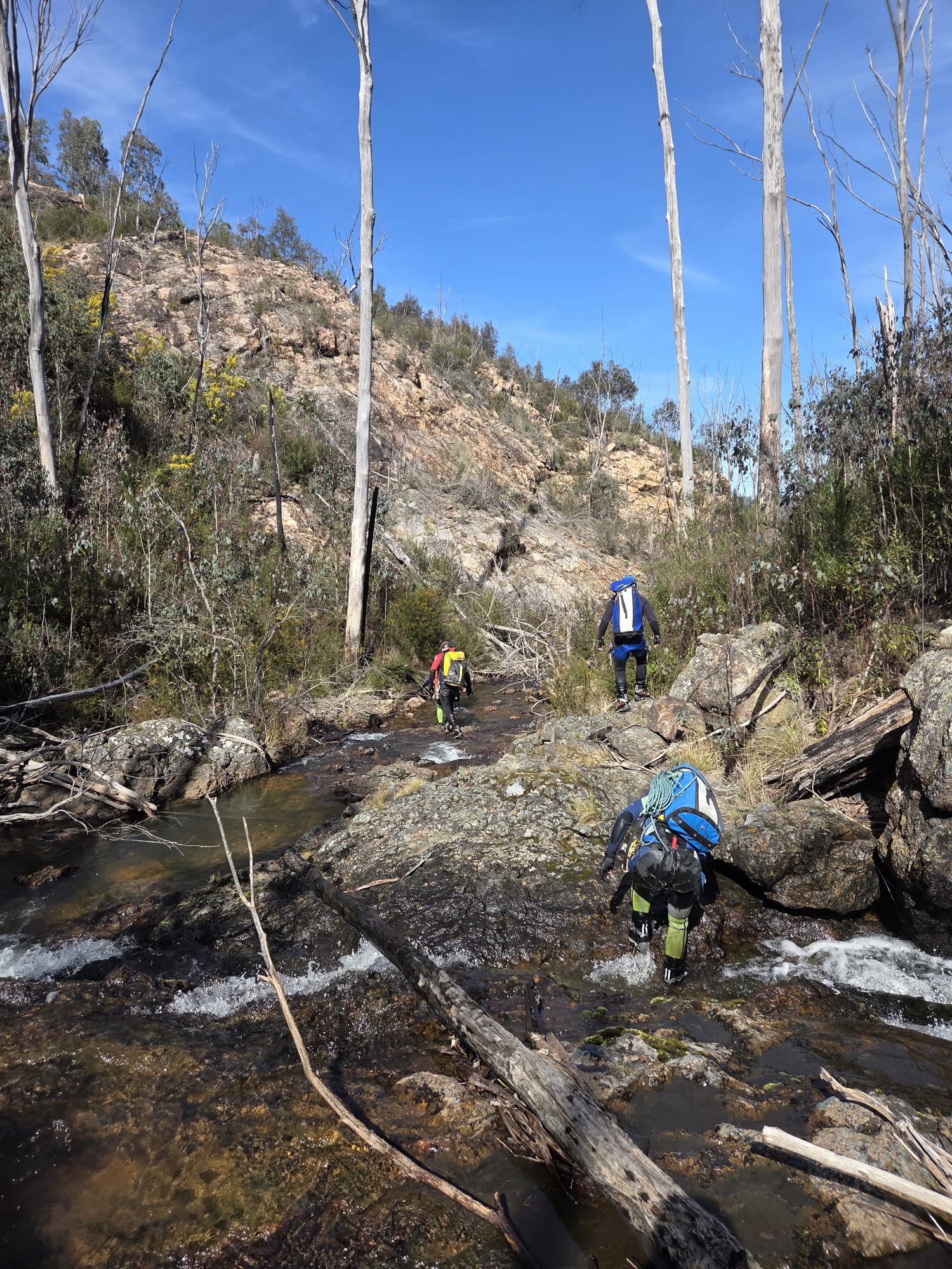
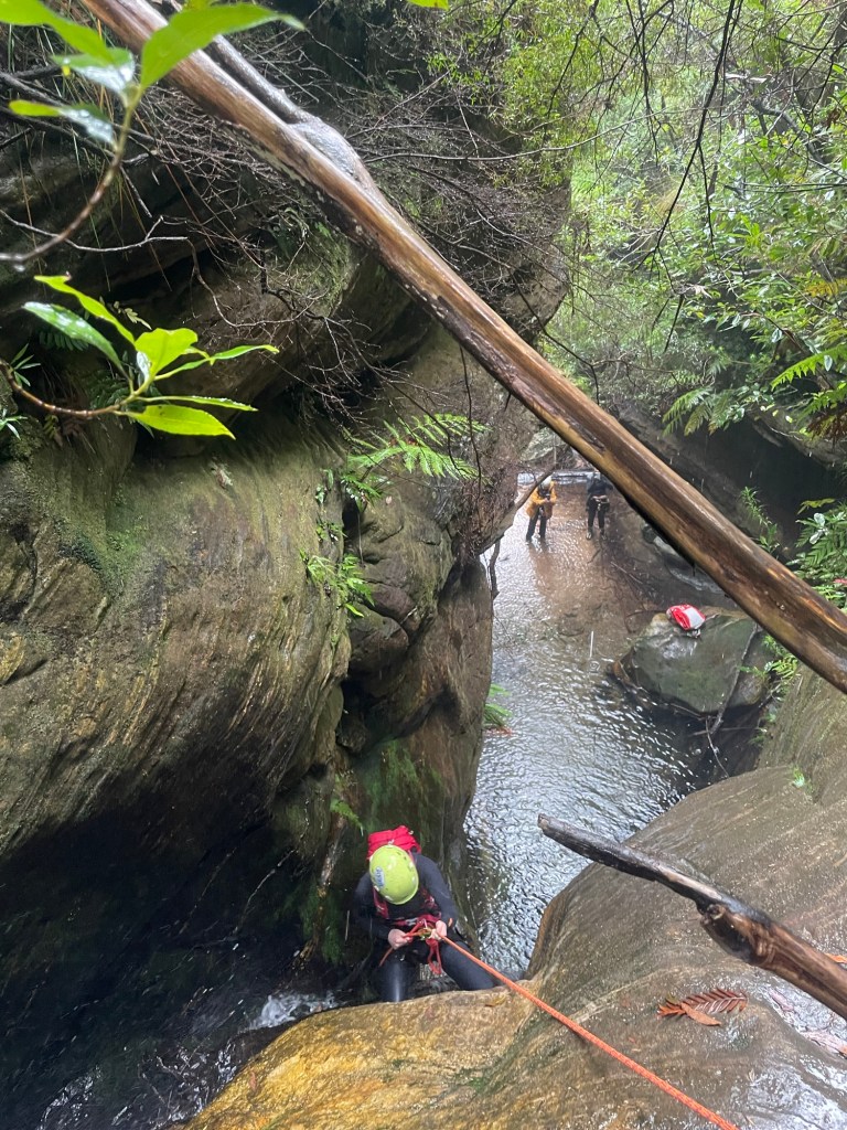
The descent itself is action packed, 6 abseils one after the other, at most there is a small swim between them. At these water levels you are either in the flow or crossing the flow on all of them.
The first 3 pitches are the easiest and we regroup at the base of P3.
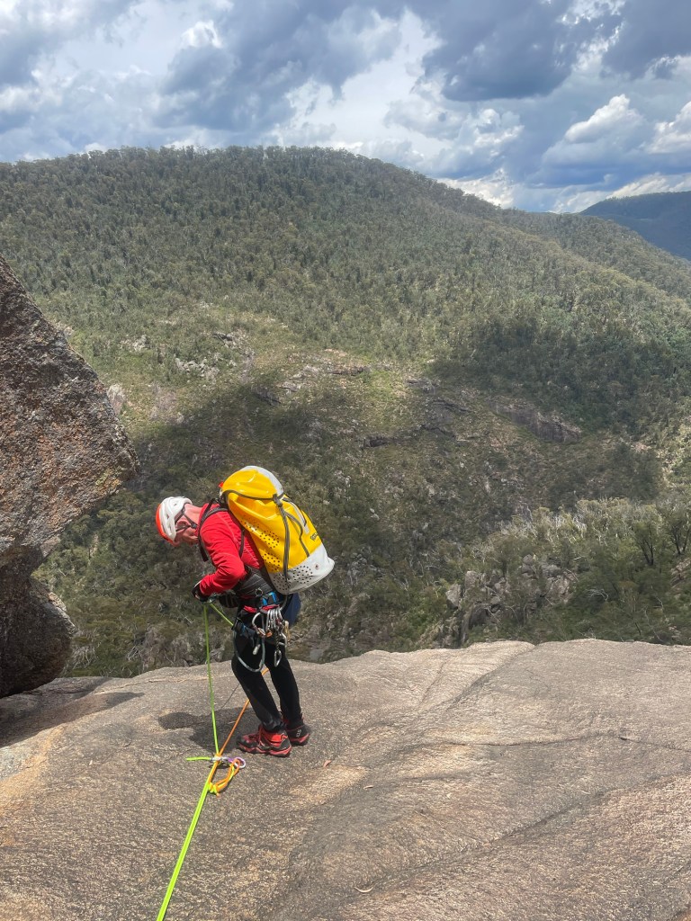
Top anchors were all good but with few repeat trips and snow melt we brought gear to replace things if needed. P4 drops to a narrow, semi handing belay above the 45m P5 money pitch. The plan is for Jason to go first with anchor gear, just in case, and a short rope for P6, and get himself safe. Then for me to follow with the long rope for P5. We had discussed leap frogging anchor duties to avoid 1 person exposed to the chill but the water, while cold, wasn’t as bad as expected.
P4 anchors are just over the lip for less rope wear and better pull down. Kristo secures himself on a semi hanging belay and off we go.
Jason signals that the anchors are good. I descend and replace him on anchor. The rest follow.
The bottom 3 pitches are fantastic, well they all are but the bottom 3 especially.
Despite what I said earlier about water temps, I ain’t going to lie. Even with a spray jacket I was bloody cold by the time I got to the bottom of P6.
All pull downs were simple and hassle free for us, potentially with long ropes you could combine pitch 4 and 5 though the guides say there are lots of nubs and cracks that ropes could get jammed in so that may not be the best idea. These cracks are also a foot entrapment risk so take care.
Climb out as soon as the steep cliffs allow, is a bit vague. 50m down stream of the waterfall. Was more helpful.
We were about 50m down stream. A slabby corner crack looked scramblable. Scoping from the other side on creek, braving the scree slope of death Kylie spies and easy spur another 10m down though.
Guide mentions gaining a spur. We took the spur into a gully (if you could call it that) so far matching descriptions. to another spur to gain a ramp leading back towards the top of the waterfall. Well there looked to be a ramp there, it would be a scramble to get up on it but we head up.
Scrub was hectic. Every step forward was a punish. The ramp went up but it would come to an option of narrow, loose traverse that didn’t look like it went or a dodgy scramble bordering climb. Time and again we’d force our way up or along only to get cliffed out and need to retreat a bit and try again.
It was steep and loose and slightly terrifying.
It was energy sapping and soul destroying.
We were a long way up and had been forcing away towards the top of the falls, but it still seemed so far away.
Eventually after getting cliffed out again we retreated back slightly. There looks to be a ledge just below us. Said someone. Kylie and Kris find a way down to it. It might go.
Kristo pushes on.
Some time later, It goes calls Kris.
They had finally stumbled across the right ledge. We still had scrub to fight through and we still didn’t know for sure it was the right ledge.
I see the rope. called someone.
Releaf.
We emerge from the scrub only to find a gully between us and the rope. we drop in and discover we are at the base of a climb and the rope is at the top. Hywaida goats up. When it comes to exits it gets to a point where she transforms to superwomen.
Kris goes next, taking a rope to join to the one in place.
Dave disappears to the left and as Kris drop the rope Dave appears next to him. It’s an easy scramble around the corner. says he.
From there its 3 easy scrambley pitches which we punch up using our crolls on the rope as a safety, but tbh despite some grade 10-12 moves its the least exposed stuff of the entire exit.
3hrs later the battle to escape Landers was done.
I’m not 100% sure we won.
The Beast
There was a point to this story, but it has temporarily escaped the chronicler’s mind: Douglas Adams
A bit of an idea for those wanting to set a fix rope for the final bit of the exit
Our weekend plans had fallen through so we thought we’d go in search of some waterfalls neither of us had been to before.
Kylie suggested a spot and during research got a tip off that the fire trail out to them had recently been gated.
So we put the mountain bikes in to help eat up the kilometres.
Not only are the swimming holes spectacular this could now be my favourite fire trail ride (Did I just say that? what have I become?) I have a feeling the guy who did the road work is a mountain biker. Each waterbar seemed to be a perfectly shaped step down. Even though recovering from a shoulder injury meant I couldn’t take to the air it was still a blast.
Anyhoo, that’s not what we are here for.
20min later we are stashing the bikes in the bush and heading down a steep trail cutting through subtropical rainforest quiet different from anything you usually see in the upper mountains..
This brings us to a pleasant creek and we head downstream.
We have some lunch and a splash then make our way out.
The Haul up the hill is steep but interesting enough that I wasn’t in a world of suffering. And while I thought the ride back to the car might be tough it was just as much fun as it was coming in, with some pinches to keep you honest.
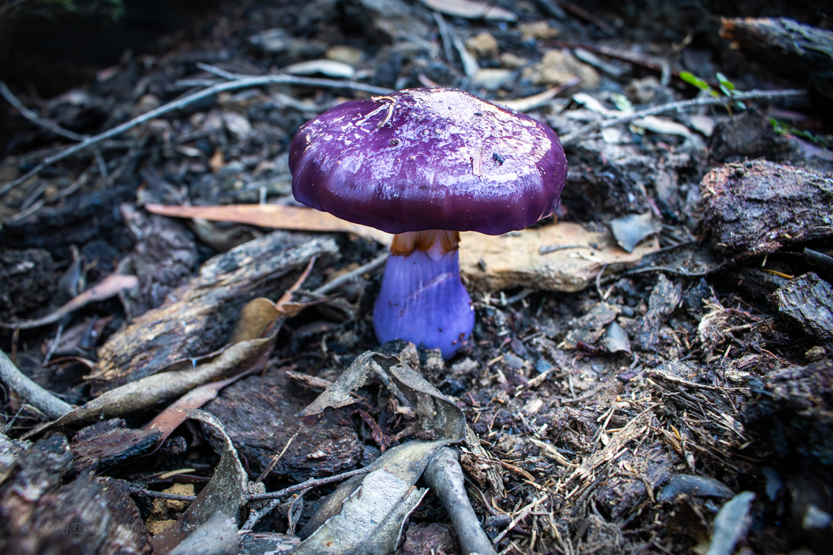
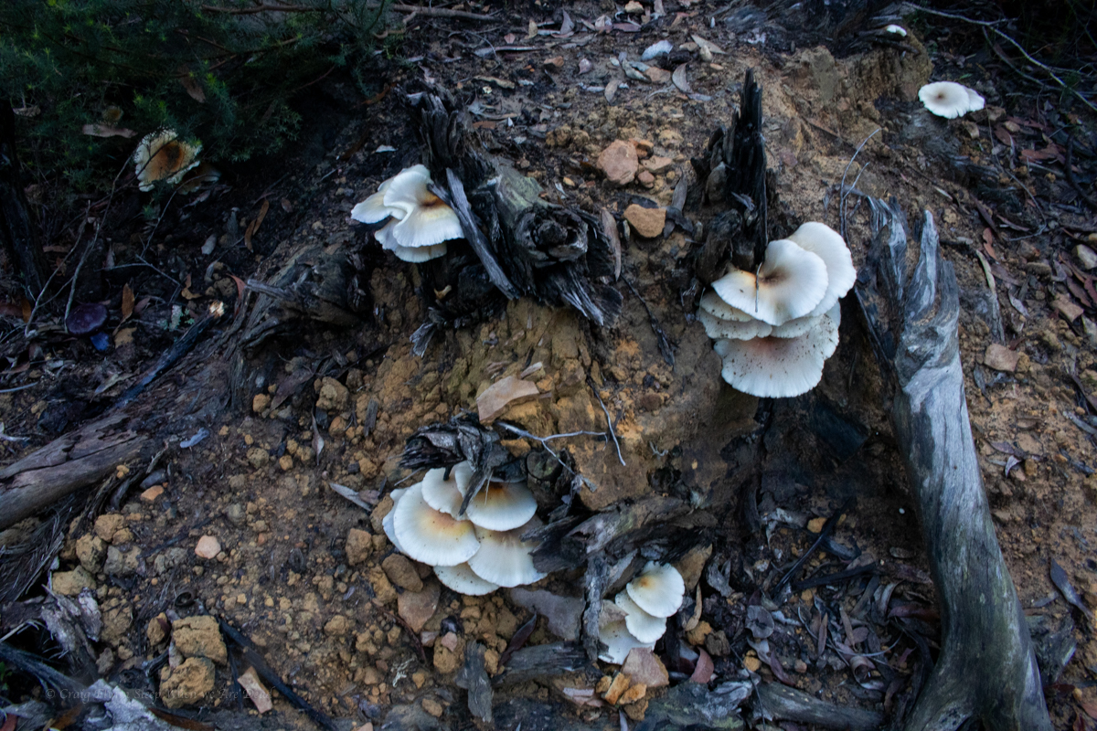
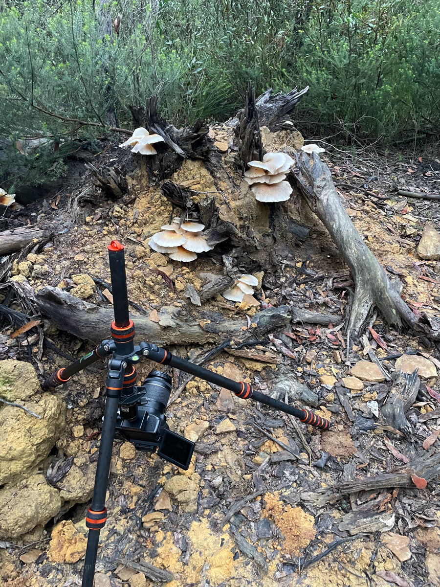
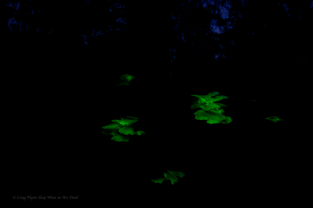
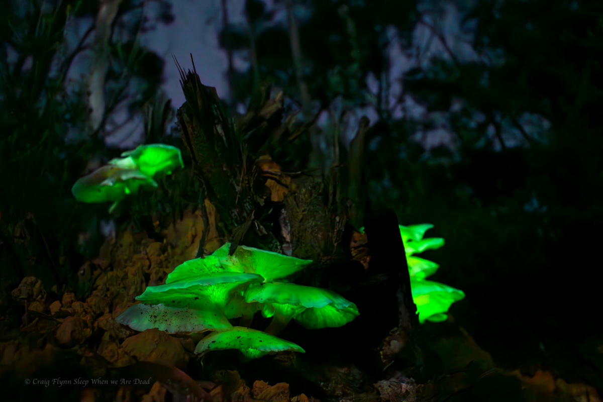
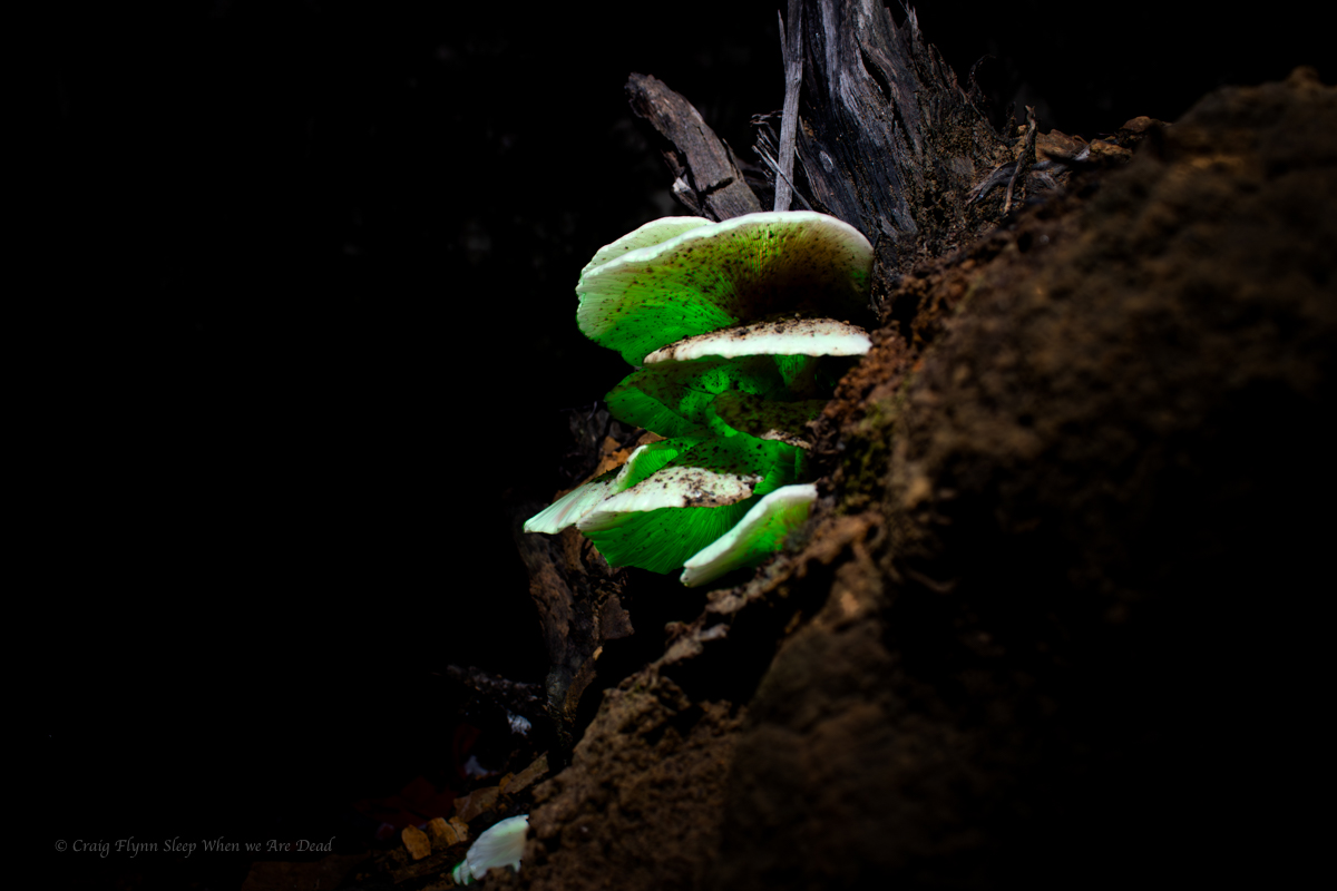
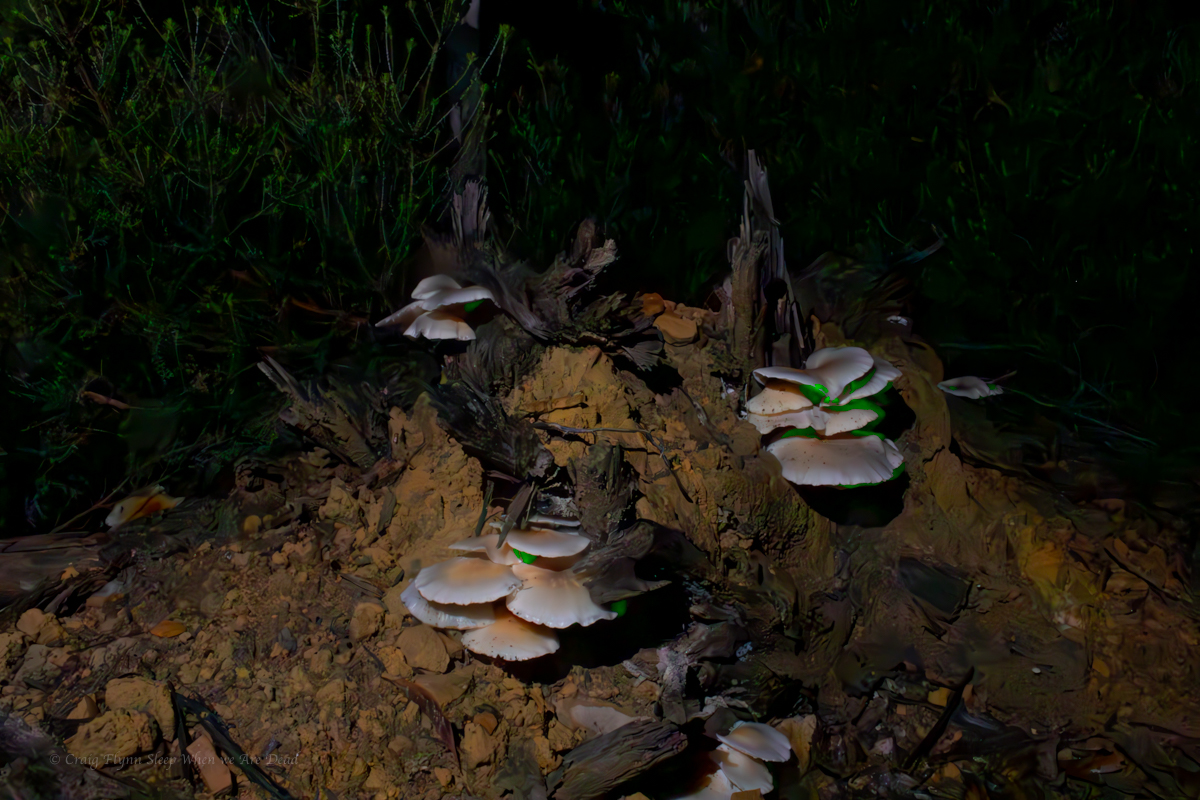
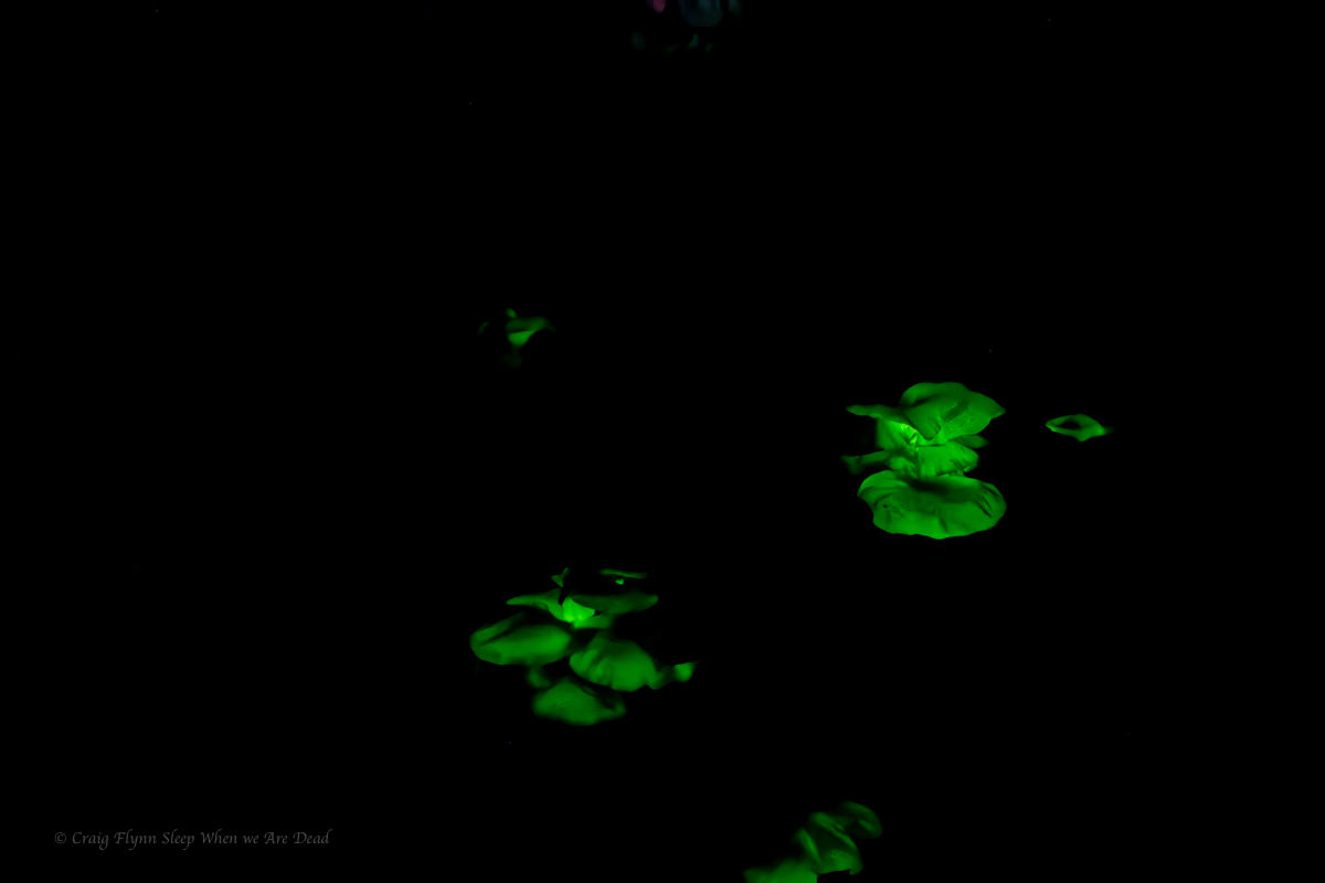
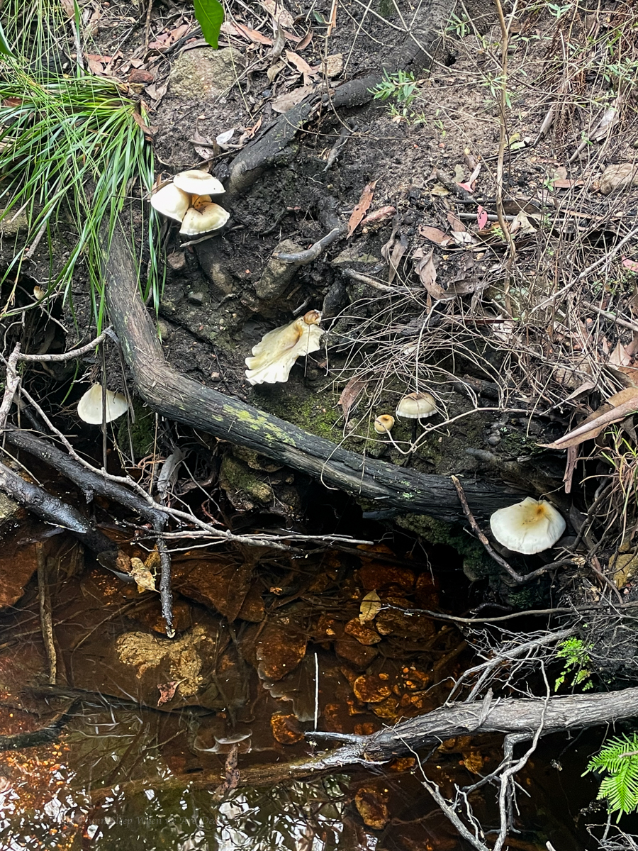
On the way back we spy some interesting mushrooms.
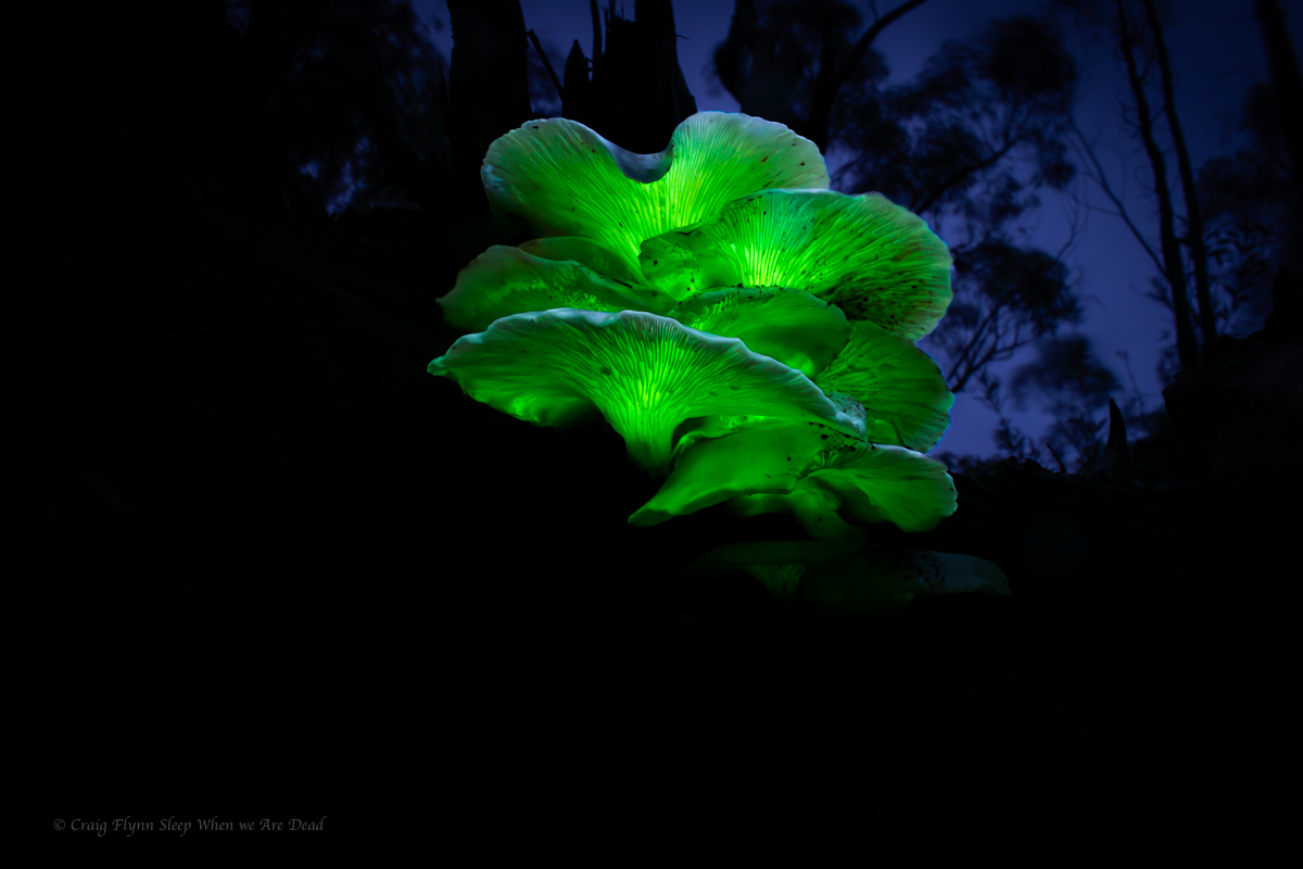
So of course we had to head back in the dark to see if they still had a shine.
It was faint, barely able to be made out with naked eye but some long exposures brought up their beauty.
Click to enbiggen
Ghost Mushrooms produce bioluminescence for around 22hrs a day. And for 14 of those hours you would think they are just another mushroom. People are like ghost mushrooms, if you can’t see their glow you are looking at them in the wrong light: C Flynn
This trip nearly didn’t happen. I’d been coughing up a lung and had full body aches after Ashcroft Ravine. I was ummming and arrrring about calling it off, especially when the weather looked to be turning wet and cool and the rest of the crew pulled out due to illness and work commitments.
How about we do a shorter over night trip? says Gadget.
Um I’m not sure says I
Come on this has been on your list for ages, says she, Let’s pack the bags and decide later in the week.
I started improving and once the bags were packed it seemed silly to repack for a shorter trip.
Anyhoo
In 1904 or there abouts the bush poet, vagabond and phrenologist, Cecil Poole wrote a description of the creeks in the area we were headed “The term gorge is not applicable to the creeks of this district. They are true canyons.”
Early cattlemen, ruffians, vagabonds and rogues knew the wild, twisted beauty of this section of the Wollemi. Not as intricately as the natives who had travelled its passes and decorated its walls for time immemorial, but well enough to know it was a maze of ravines, canyons and complex spurs.
Still, being further from Sydney and with lots still to discover closer to train lines and highways the area was largely overlooked by modern canyon explorers.
Until, that is, legendary bushwalker, ecologist, and all round nice bloke, Roger Lembit, was leading a midwinter bush walk in the mid 80s and ventured down what he thought would be an easy pass and instead stumbled on a deep slot canyon.
With no ropes or waterproof gear they opted not to venture down. Instead, they retreated and found a spur that took them to the bottom where they camped the night. The next day Ian Wilson and Michael Donovan opted to brave a cold pool at the end of the slot and ventured up, finding an astoundingly beautiful slot canyon. (It has a total of 0 abseils but I still put it toward the top of my list of favourite canyons based on shear beauty.)
This sparked an explosion of canyon exploration in the area and it was soon found to be densely packed with canyons. Some more scrubby creeks but many containing high quality slots.
But all that is neither here nor there nor anywhere in between.
The fact is I’d barely dipped my toe into this region but had day dreamt of one particular canyon situated off an isolated spur, well off the beaten track. I was well overdue to go for a look.
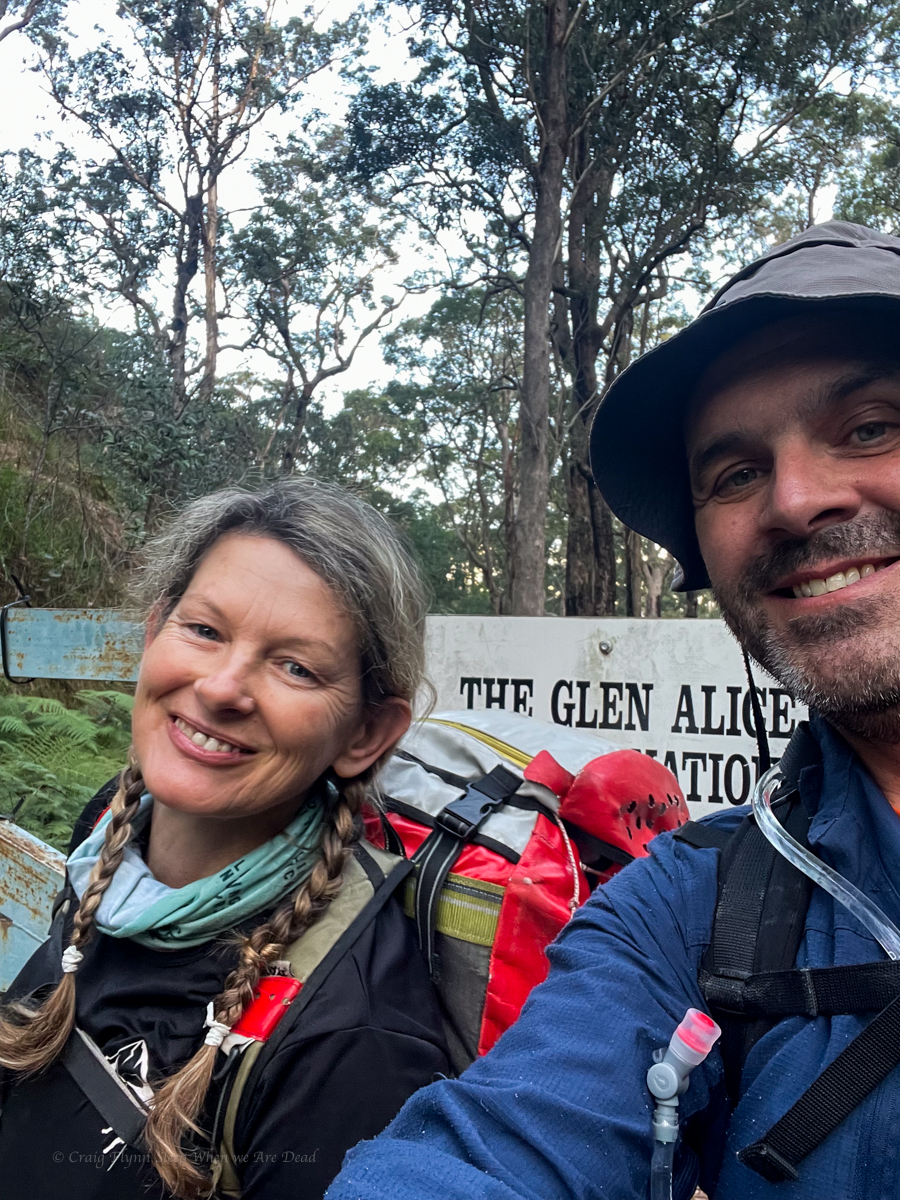
As luck would have it both Kylie and myself had an extra long weekend to do just that.
We made a late start Thursday afternoon.
happy at the start
The walk into our first camp is along an easy fire trail. However, I soon had a bit of a niggle on my left heal. It’s been so long since I’ve had blisters and it was such an easy walk I didn’t even register that might be what was happening. Needless to say by the time I stopped to check it was too late.
Idiot.
But really, blisters! After a couple of kilometres!! I can’t remember the last time I had bloody blisters!!!
Anyhoo we press on.
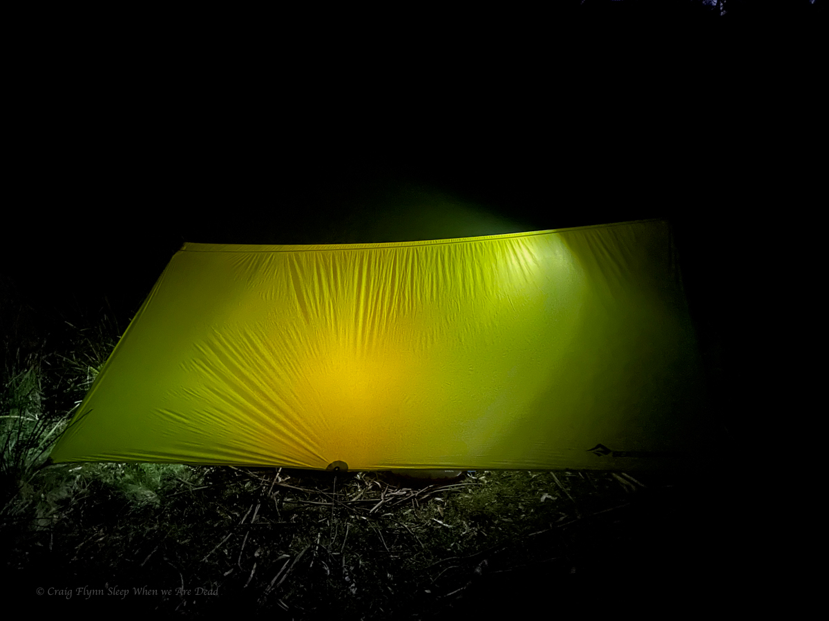
We reach the usual camp site to find a family already setup. They had been there for the full week and the kids, 7 and 5, excitedly regaled us with tales of the canyoning adventures they had experienced. Legends have done more wilderness canyons than most adult canyoners.
We set up and snuggle in for the night. Gadget did an amazing job researching our light weight over night gear before settling on the Sea the Summit Escapist Tarp and Spark sleeping bags. I’ve always been a fan of the Nemo sleeping mats. It makes a great combo
Friday
Morning dawns and we have a lovely breakfast, repack then head off for our first canyon
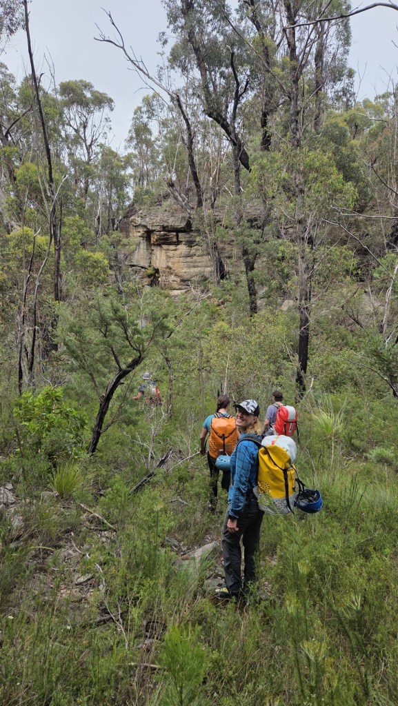
Having done canyons either side of our target for today I had high hopes of it.
I pick a spot to leave the road and Kylie navigates down ridge.
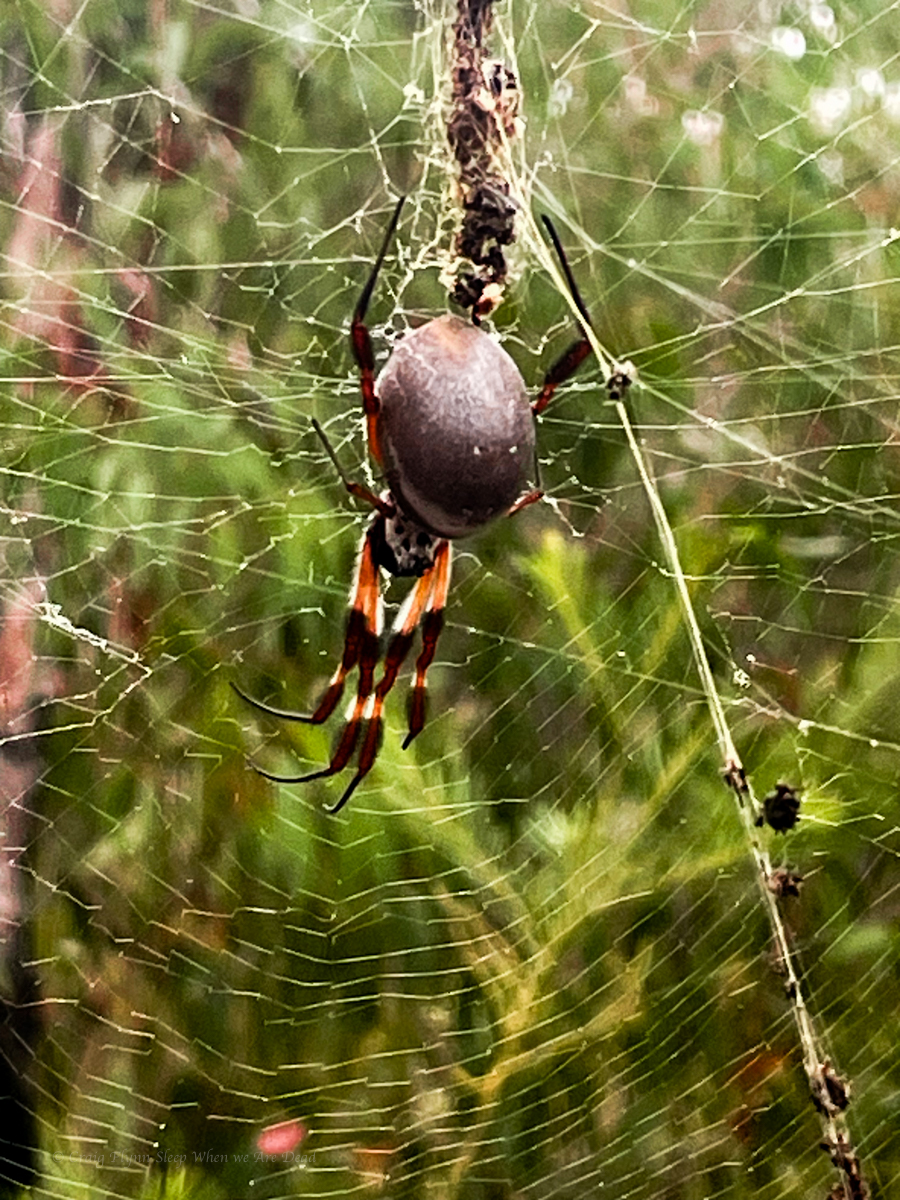
Shelob was guarding the pass but we weren’t scared. Honest.
We gain the creek surprisingly easily and follow it down.
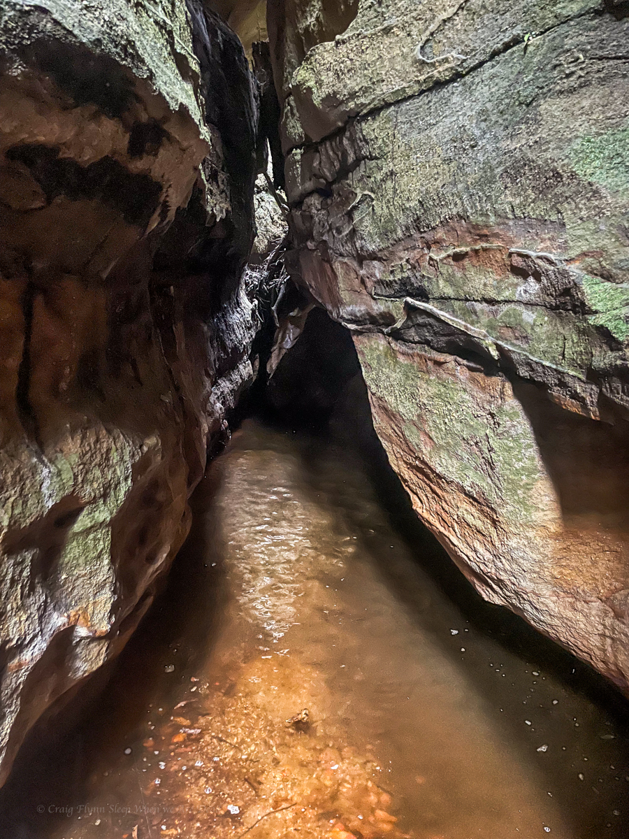
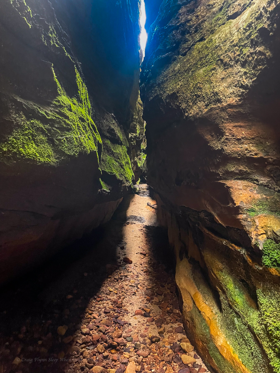
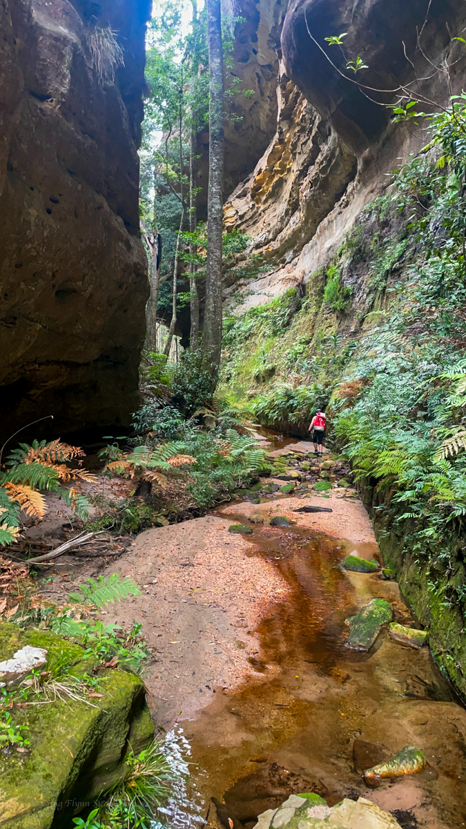
It soon drops into a narrow canyon.
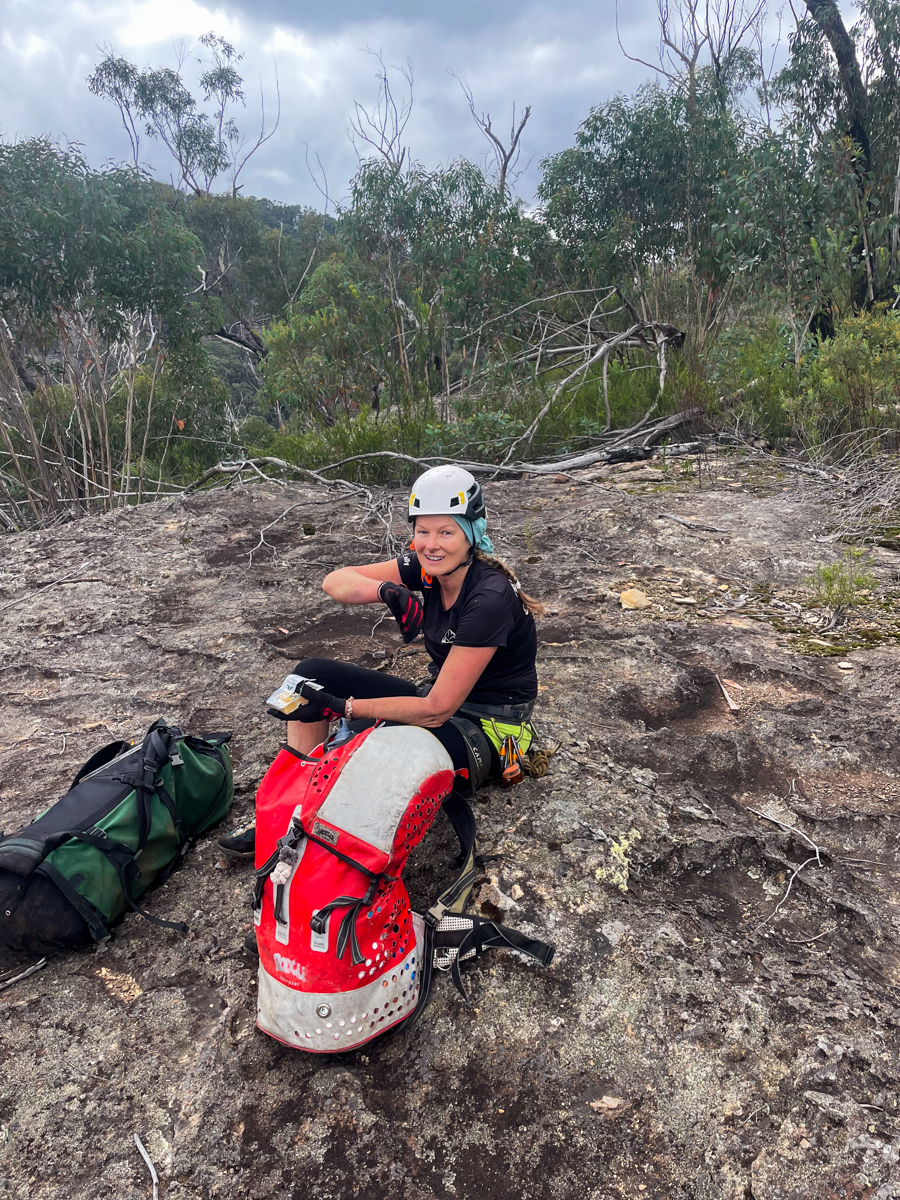
With a bung shoulder I opt to abseil things I would usually scramble but we get down soon enough.
The expected chest deep pool had silted up to be ankle deep so we forewent the usual circus tricks of trying to bridge across and skipped on through.
Well, not skipped. The boys warned us last night of a brown snake lurking near the first pool so we went a bit cautiously.
No sneaky snek was spotted but the canyon snaked on.
then opened up a little
and closed back in
cameras at 10 paces
the walls soon open out to a wider canyon.
The slot had been nice and all but not mind blowing and a lot shorter than I was expecting. Compared to others in the area it was a bit of a fizzer. And we were still a fair way off the junction of the main creek below.
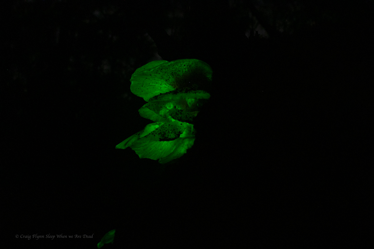
the gullies were brimming with ghost mushrooms. These glow in the dark but we’d be camping hours away so won’t be back to check.
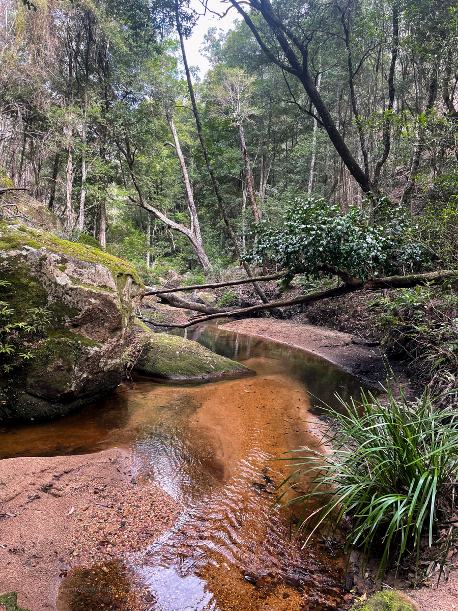
We follow the the widening gully down, boulder hopping and creek bashing to the major creek below
A pretty spot for a picnic or sumfink
Long sidetrack: The names of the creeks around here have such evocative names, but that could have been very different had we had a different Surveyor General intent on mapping the state.
Major Mitchel, of the pink cockatoo fame, was by all accounts a bit of a cock. Invariably described as pigheaded, arrogant and boorish he was the protagonist in Australia’s last recorded pistol dual with soon to be NSW Governor Darling. None of this old west quickdraw Hollywood bullshit. The combatants stood back to back, marched out 10 paces, turned, and like the civilised gentlemen they were, took turns having a shot. Flinch or get shot (obviously) you loose.
Mitchell having thrown down the challenge by slapping Darling with his glove had to go second. Darling took a shot and missed. Michell then took his shot and knocked Darling’s hat off so was declared the winner.
Anyhoo none of that is important to this side story other than I found it fascinating. What is important is Mitchell also had a redeeming factor in that he insisted that, where possible, aboriginal place names were to be used on his map.
When an early sketch was sent in by one of his under surveyors making a nearby creek with the local land owners piss take of a name “The Upper Nile” he basically fired back words to the effect ‘stop being a dickhead and find the bloody native name for the creeks, and if you can’t do that don’t name them at all.’ (probably so he could name them after Macquarie or some shit…)
And thus we have the Coricudgy, Umbiella, Numietta, Coorangooba, and Capatee. (pronounced Kay-pa-tee by the locals and originally spelt Capata on the sketch map )
Of course we still have the Bogee Nile and the Capertee Nile…. but that’s not important either.
Too get back to the story, we’d be using another high camp tonight so we’d need to cart water up. Enough to get us up, cook diner, breakfast, and at least part way through the canyon the next day.
We fill up and start up a creek that should allow us to scramble out at the top. However, a couple of tangled tree falls at the bottom and Screw this shit, says I. I’m going up there.
And we forge a pass up the nose onto the spur.
A break in the cliff line lets us gain the spur with just a short, easy rock climb.
And Kylie leads us up the spur avoiding some minor cliff lines by simply skirting around them.
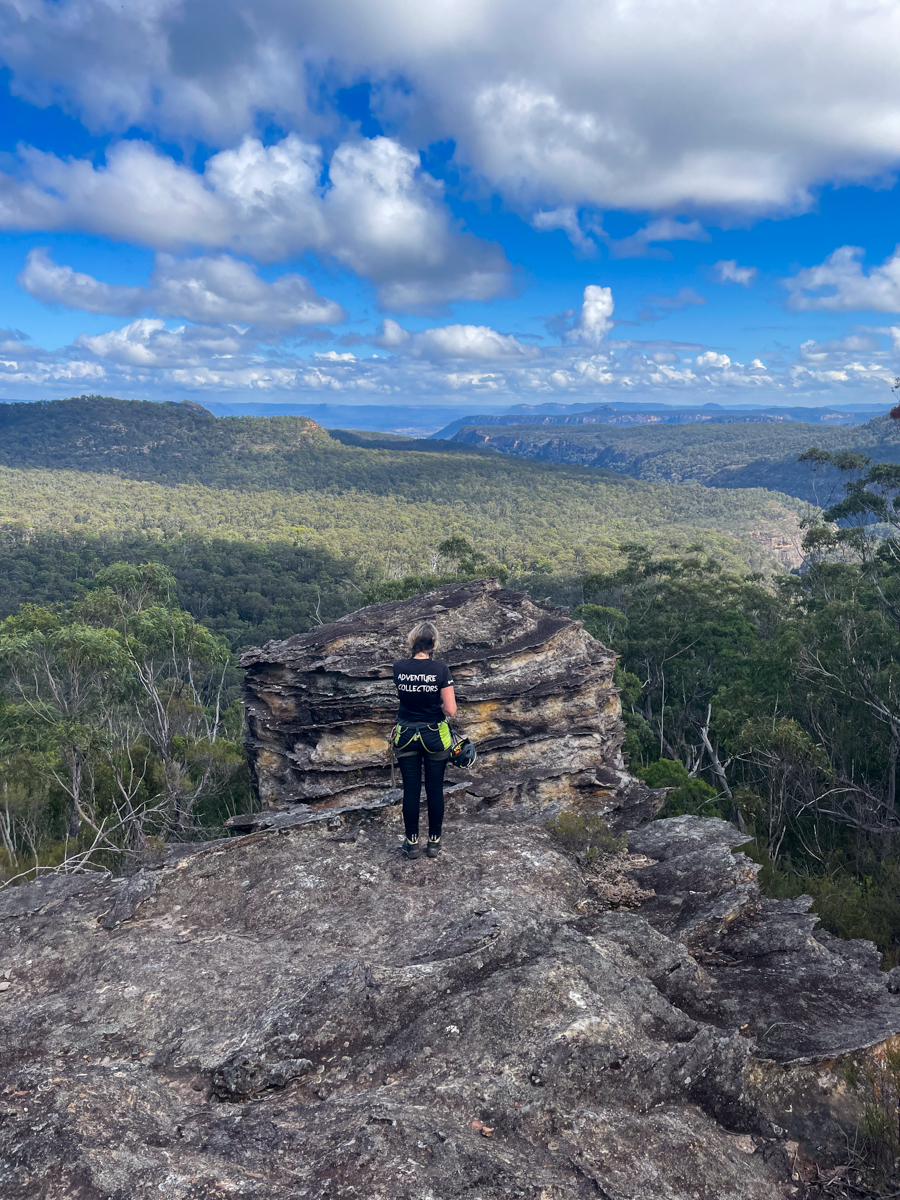
Up top we have astounding views including this one over the Numietta looking towards Pantones Crown at the other end of the Capertee Valley. This spot put us in mind of battleship spur in Carnarvon Gorge.
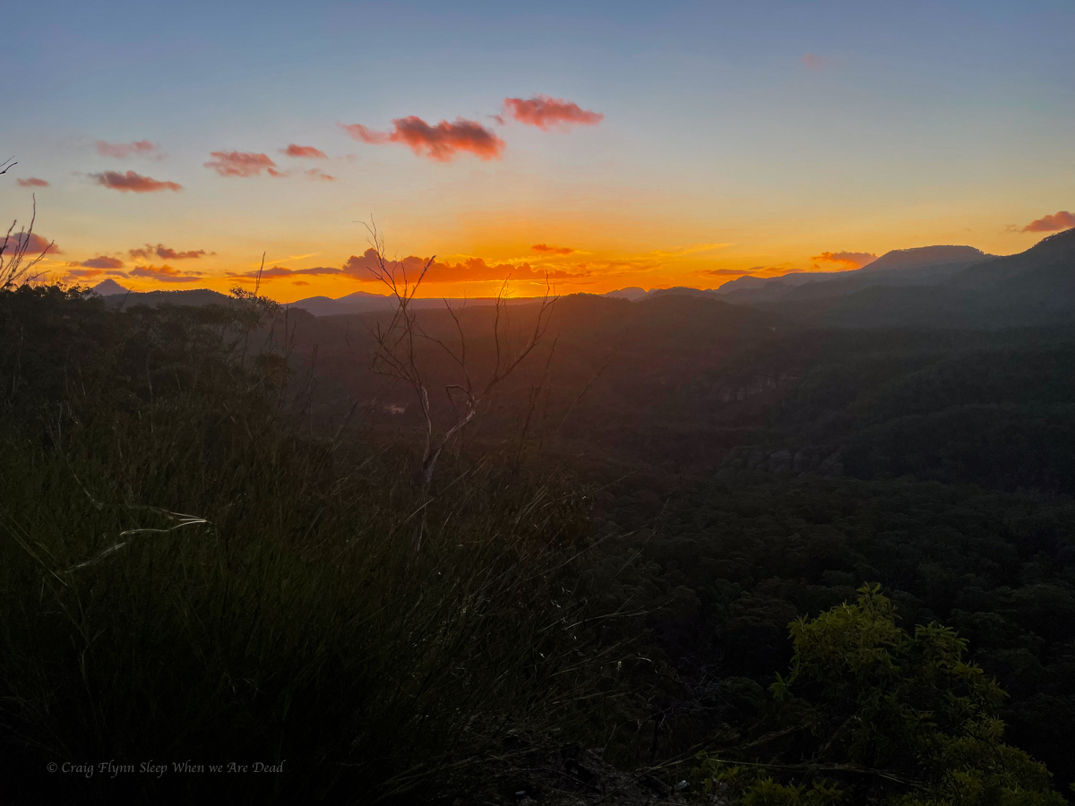
And sunsets over the stunning peaks. With Tayan Pic, Grassy Mountain, Mount Coorangooba and many others appearing in a 270° panorama on the other side of the peak.