Claustral

11/12/2016

Edwin, Lewis and myself

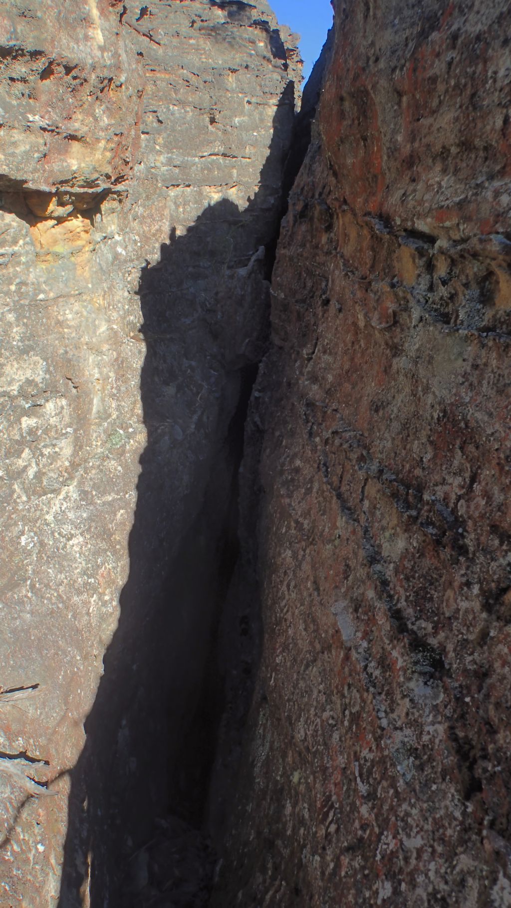
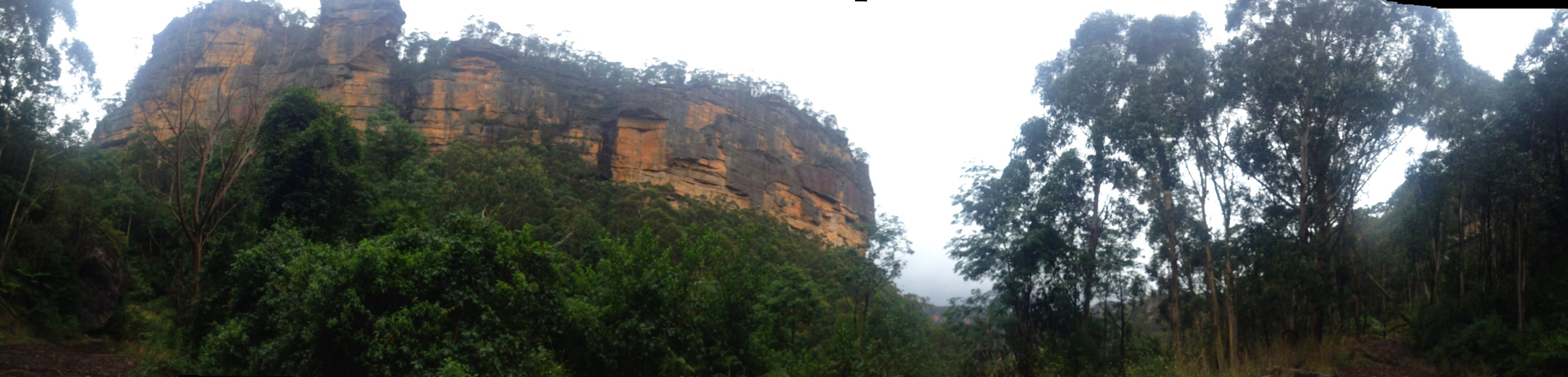
Claustral is the quintessential Blue Mountains canyon. A deep, dark, sustained slot accessed by a series of abseils down a dark hole known as the Black Hole of Calcutta. Once in you are committed, the slot can be as fearsome as it is beautiful. Flash floods do happen and the exit is hours away. It has claimed the lives of some very experienced canyoners and been the scene of various rescue operations over the years.

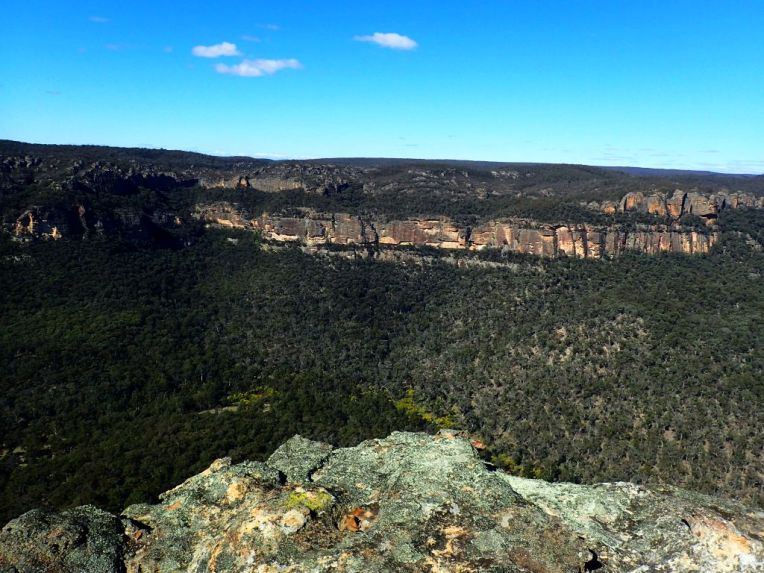
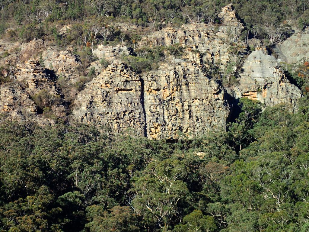
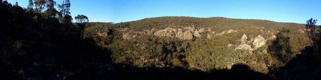
It’s part of the big three. Thunder, Ranon and, Claustral canyons and their tributaries, carve the saddle in between Mt Tomah and Mountain Banks into a deep maze that has come to be known as the Carmathan labyrinth.

In 1804 the botanist and  explorer, George Caley, gazed up at the Blue Mountains and confidently declared “There is not a single peak which would take more than half a day to scale!”

He was right, but it wasn’t the peaks that would thwart him in his attempt to cross the mountains. His party reached the top of Mt Tomah with little difficulty then set about crossing the short distance to the next peak,  Mt Banks. He didn’t know about the labyrinth that awaited him below.

We were taught at school that the early explorers failed to find a way across the mountains because they tried to penetrate the river valleys when they needed to follow the ridges. But Caley’s plan was always to follow the ridges between the high peaks. Unfortunately the ridge he tried to follow didn’t exist

Scrambling down through lawyer vines and disjointed cliff lines they eventually came to a deep dark chasm they called Gaping Gill (while a chasm still bares this name it is probable they were looking into the lower reaches of Thunder gorge).

With no way to cross the chasm they beat a retreat back up to the ridge and tried another approach. This time into a gully Caley would name Dismal Dingle. Night descended and they made camp in a small overhang. Awestruck by the glow worms lighting up the wall over head, tormented by possums who ran like little demons through their camp stealing their food, eaten alive by mosquitoes and, terrorised by a wild fire that ripped up through the Grose Valley his men threatened revolt if he tried to push on they way they were going.

Come morning they beat another retreat up to the ridge line and opted to follow this in a wide arc around the labyrinth below. They were now on the very ridge that would one day carry the Bells Line of road. A native track way, had they stayed on this ridge they would have achieved their goal of crossing the Mountains in little over another days walk. But, of course, they didn’t know this.

Their plan was to follow the ridge line they mistakenly believed connected the major peaks they could see from the Richmond plains . And so they veered off to explore the peak of Mt Banks with Hat Hill, their next objective. Upon reaching the top of Mt Banks they looked down in dismay at the 300m cliff line that plummeted into the Grose Valley with Hat Hill unreachable on the other side. Dejected they turned tail and headed for home.

Later, or so I have read somewhere (but for the life of me I now can’t find the source) an early female bush explorer (Mary Biles?) ventured into the rim of the Labyrinth and upon peering down into a dark slot dropping into bowels of the earth wrote words to the effect of “One day the depths may be explored. Whether brave or fool hardy those who do surely will not suffer from claustrophobia.” Thus the slot was later christened Claustral canyon.

OK, maybe I spiced a bit or even all of that intro up. I’m not a historian, don’t take it as gospel. After all, I got my history of the world from Mel Brooks and all I know for certain is “It’s good to be the king.”….

Anyhoo. I’ve a confession to make. I’d never done Claustral Canyon. I’d been into  the system through Ranon and I’d wandered up the bottom section of Thunder canyon but back in the day Claustral was the most popular abseil canyon and I was put off by the thought of lining up to access the abseils. I was a bit of a canyon snob really and I come to realise I had cheated myself of a great experience.

Soooooo when Ed and his mate, Lewis, invited me along on a photophaffary trip I jumped at the chance. Now as you probably have worked out by now I have a little point a shoot camera (Olympus Tough TG4) and am not overly concerned at capturing amazing images of art, more documentaries of my travels so I had a sneaky suspicion that they needed a mule to carry the ropes so that they might lugg in more photomagraphary equipment needed to get their awesome shots but I was cool with that.

As it was everybody bought rope.

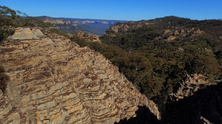
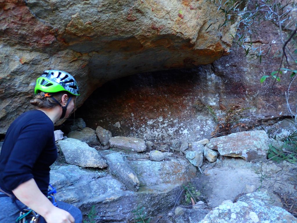
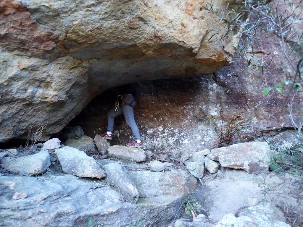
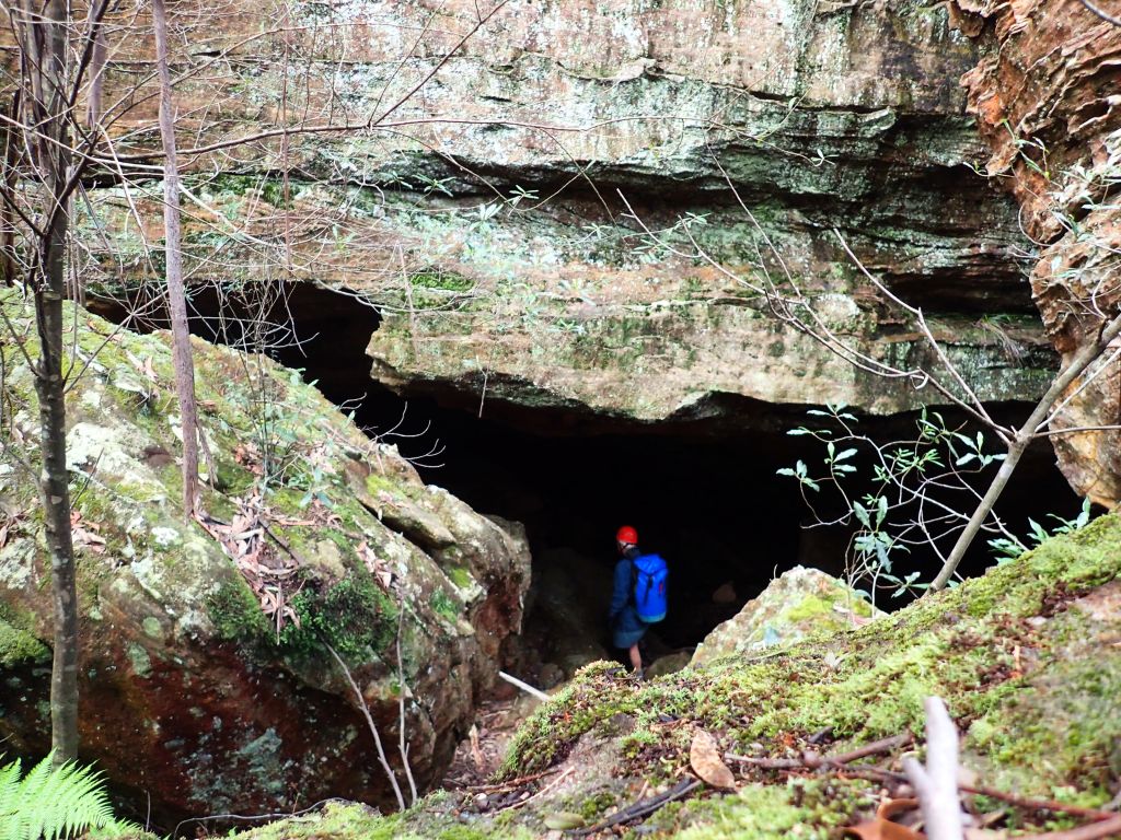
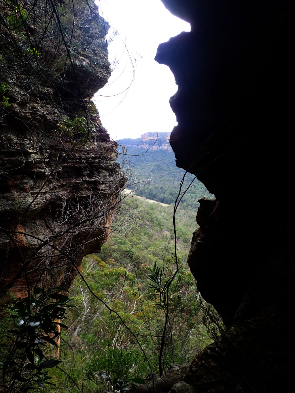
Anyhoo, I was running a bit early so stopped by the Emu Cave to get a few photos and explore the rock shelf a little more. then it was onto the car park

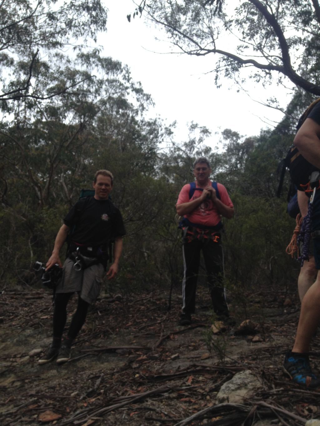
After a quick meet and greet, with the wrong party ( Are you Lewis, Says I. Nope, says he. Are you doing Claustral? We’re doing Ranon. Cool we’ll probably see you in there)

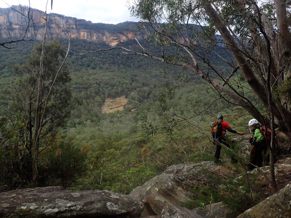
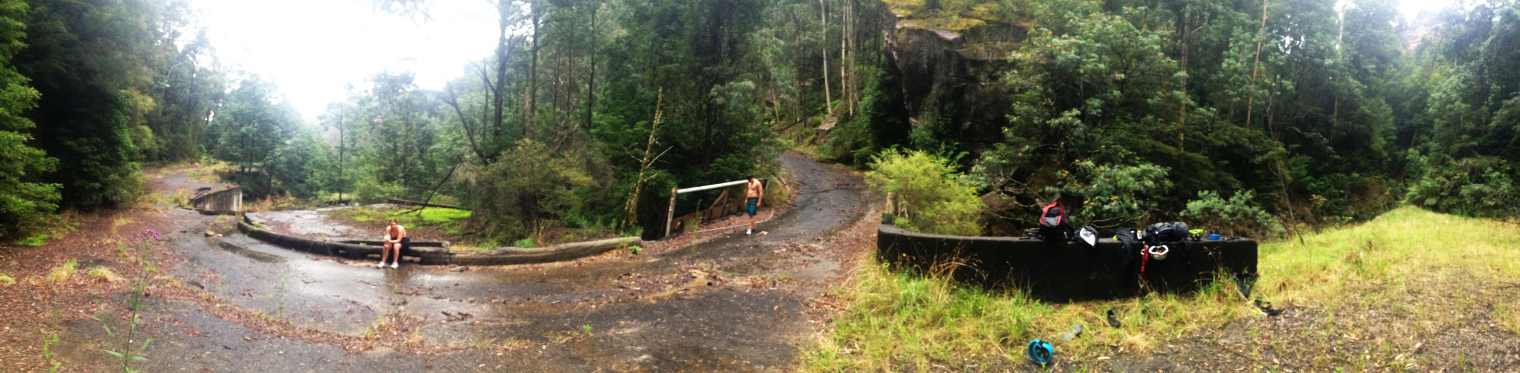
Lewis arrives and we introduce ourselves just as Ed turns up. We reconcile gear, stuff packs and we’re off. The traditional entry and exit point to Claustral was from the top of Mt Tomah, however in 2011 the land the access track crosses changed hands and the new owners built a house right where the track was. And who can blame them, they have some of the best views in the mountains.

A new route was found from the other side Mt Bell. This made the exit a lot longer and more convoluted which I think may have reduced visitor numbers a bit.

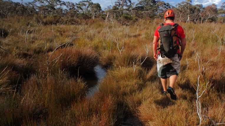
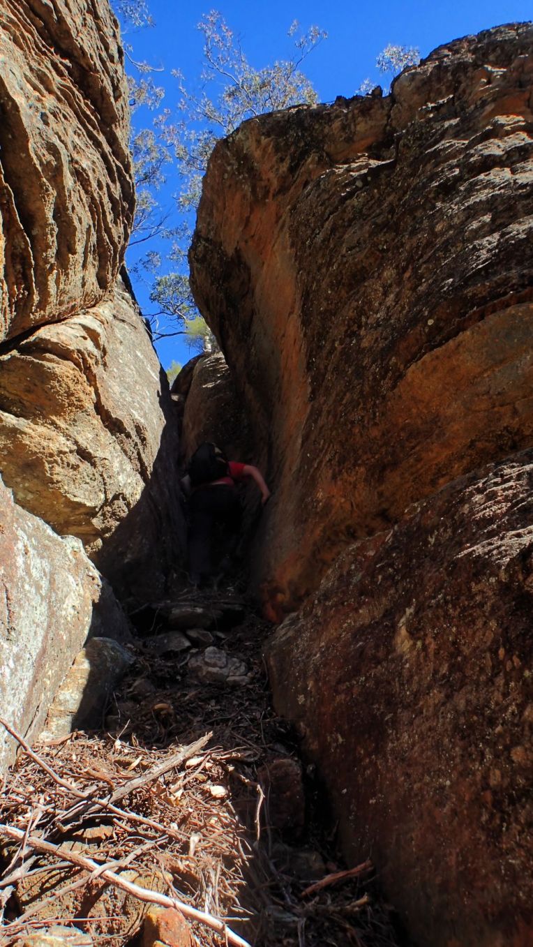
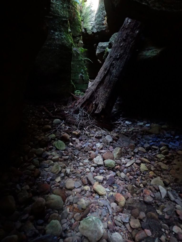
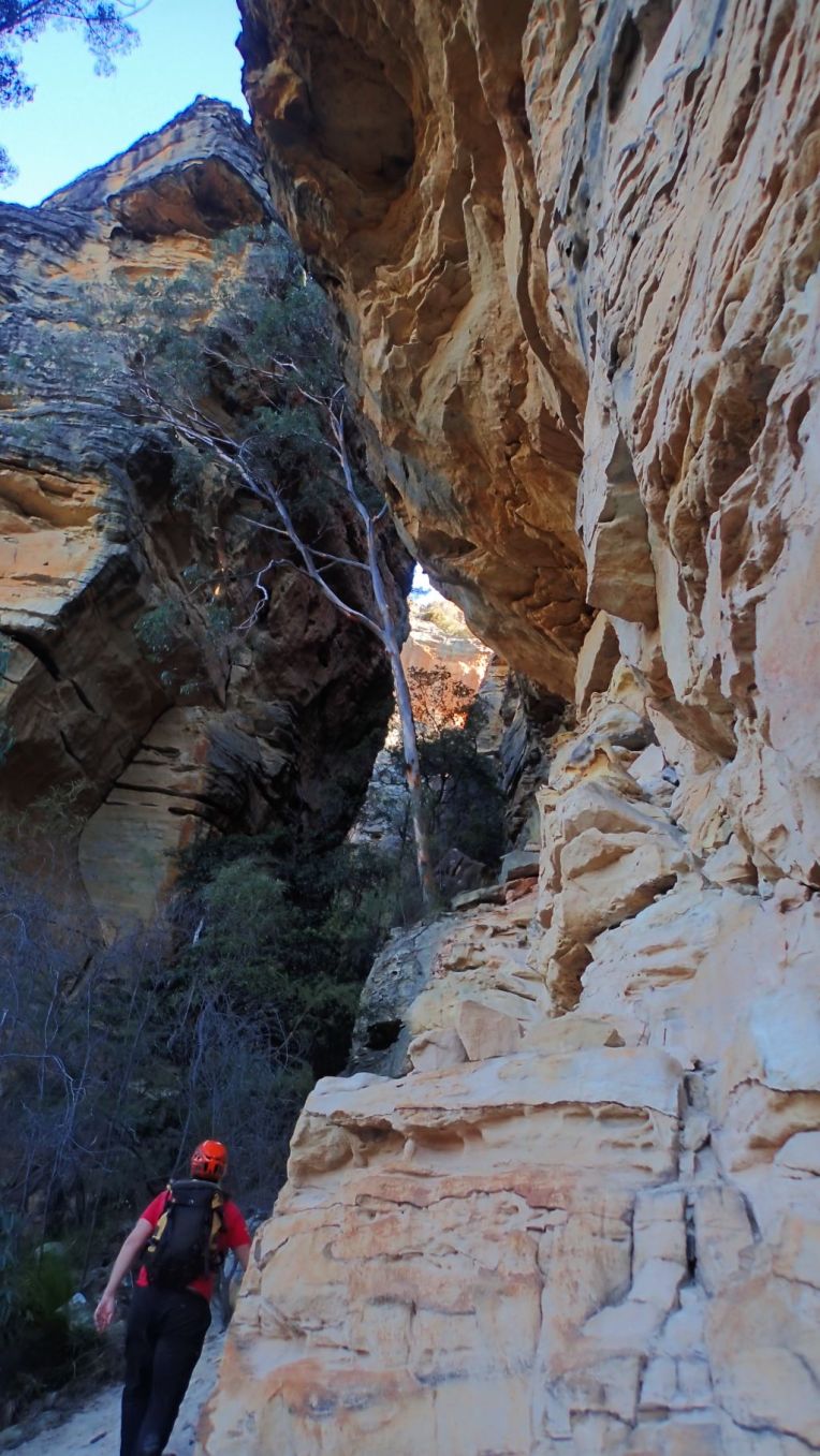
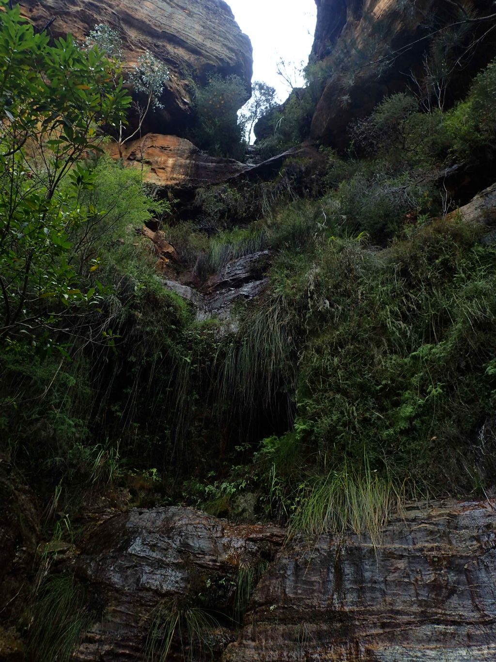
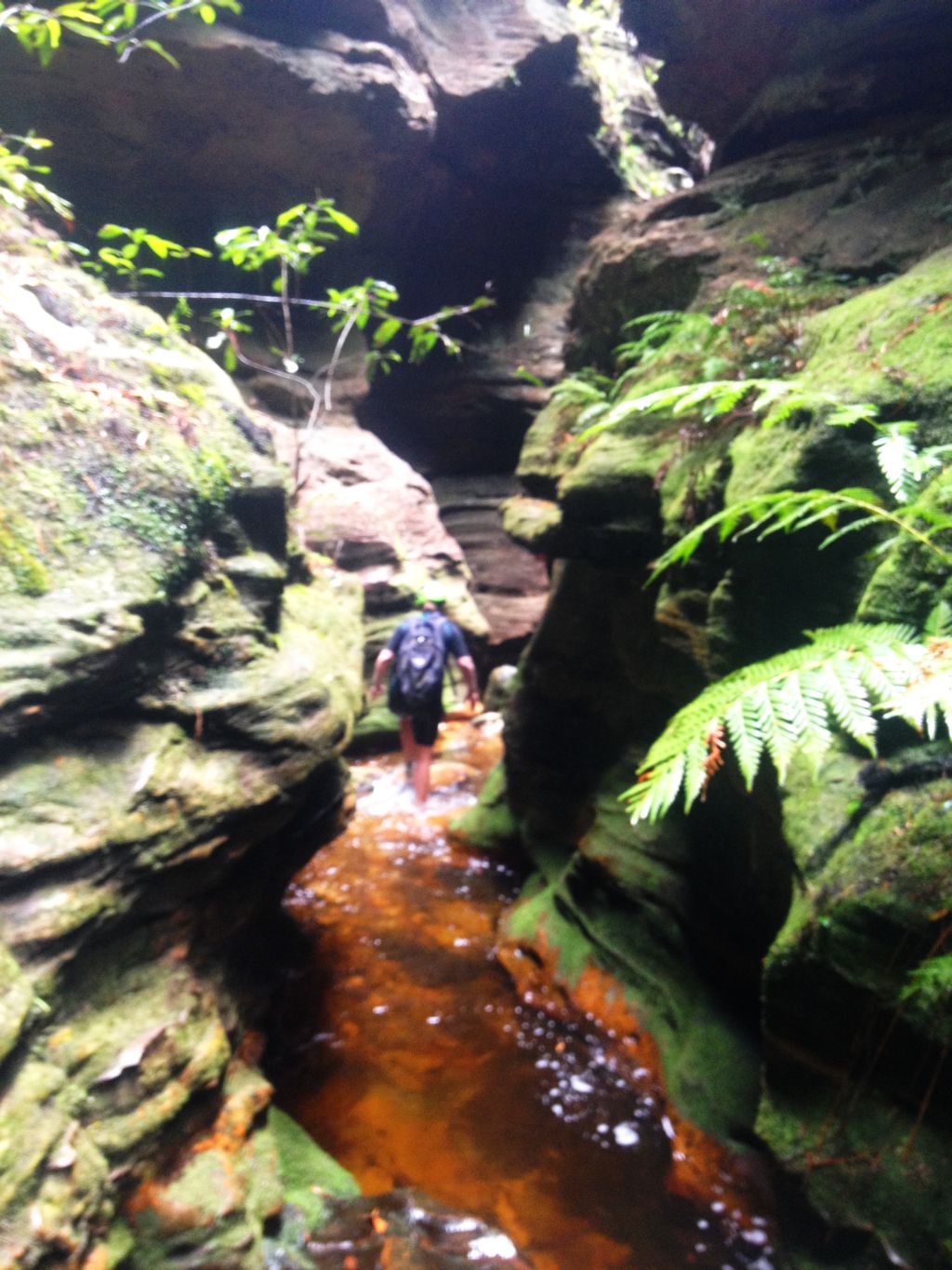
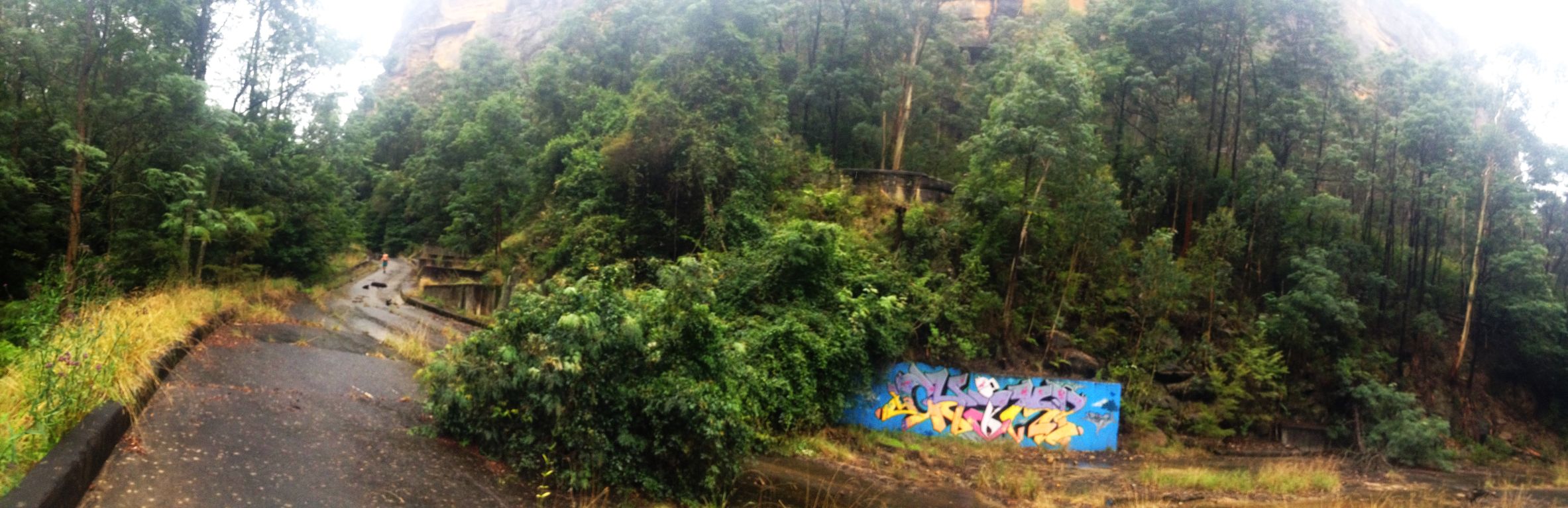
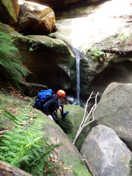
Anyhoo. We quickly make our way down through a pleasant gully and soon reach the junction with Claustral Brook

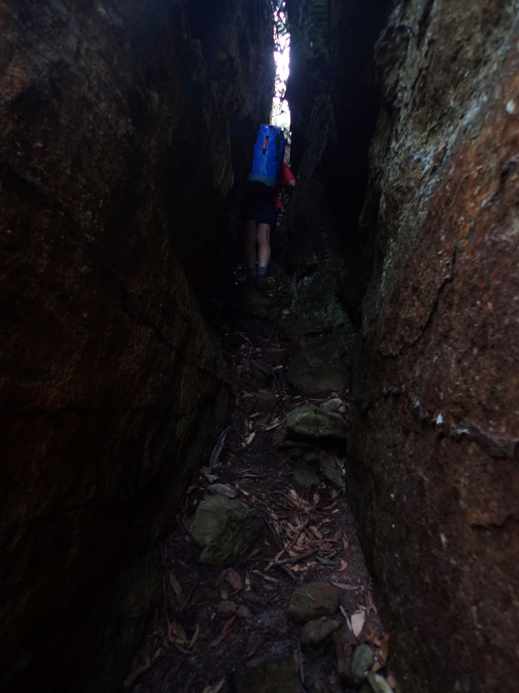
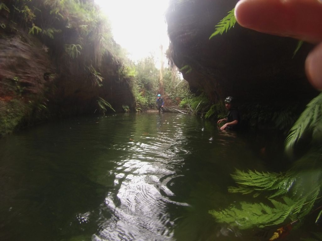
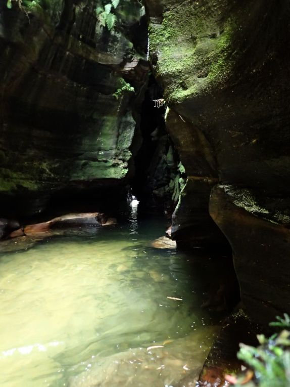
A bit of creek walking and boulder scrambling brings us to the first swim and we suit up and plunge in as the canyon begins to get deeper

10
Ed scrambling down
11
The canyon is looking good already

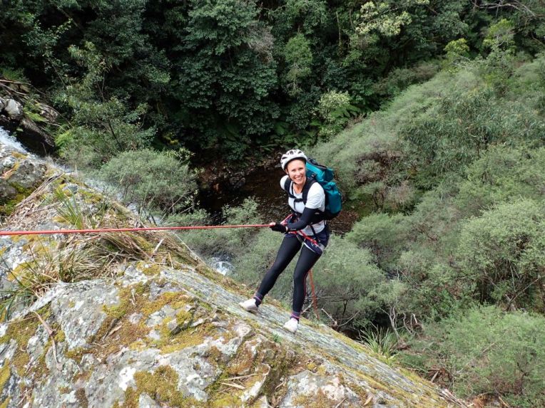
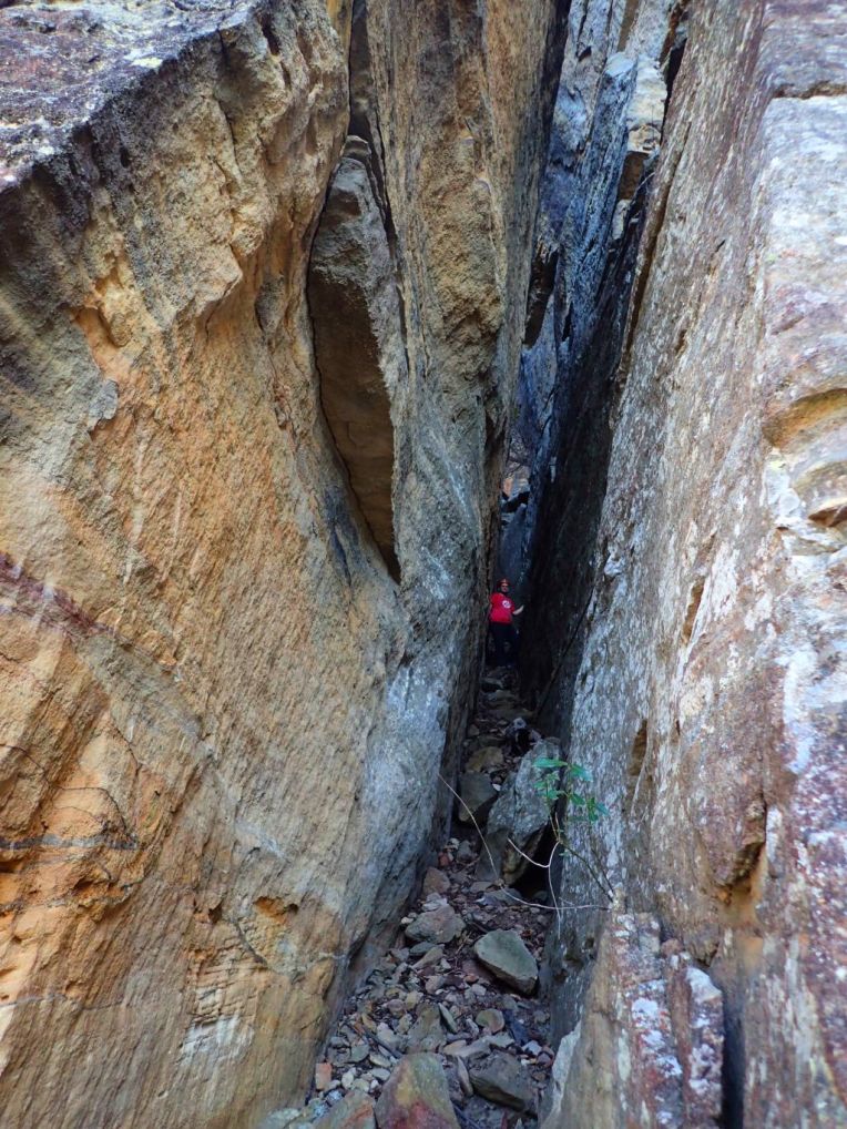
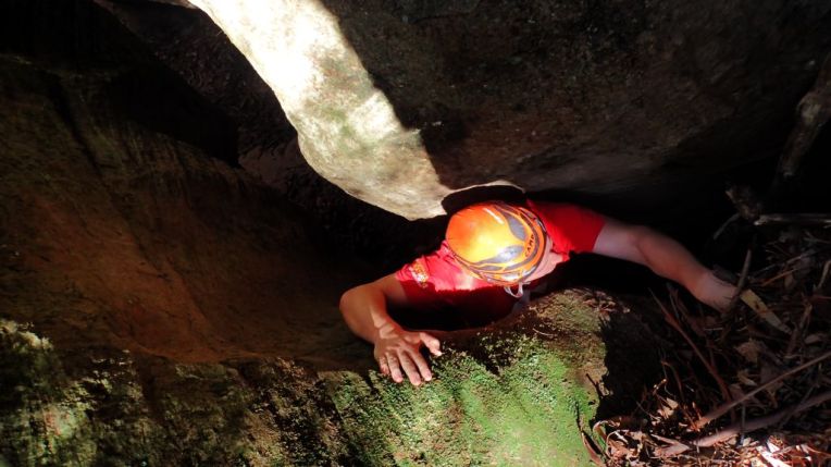
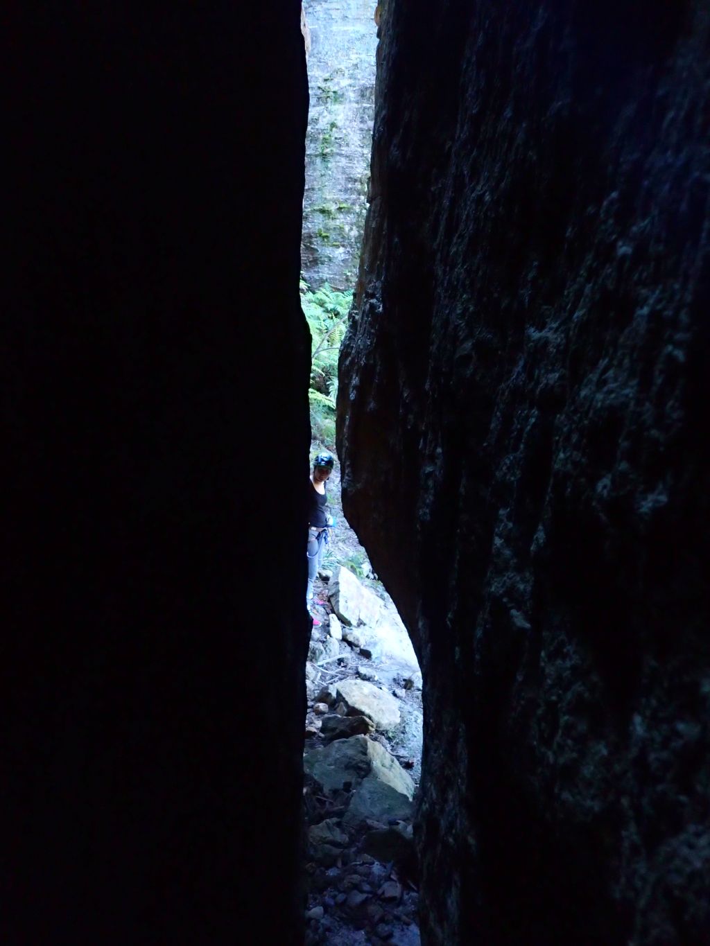
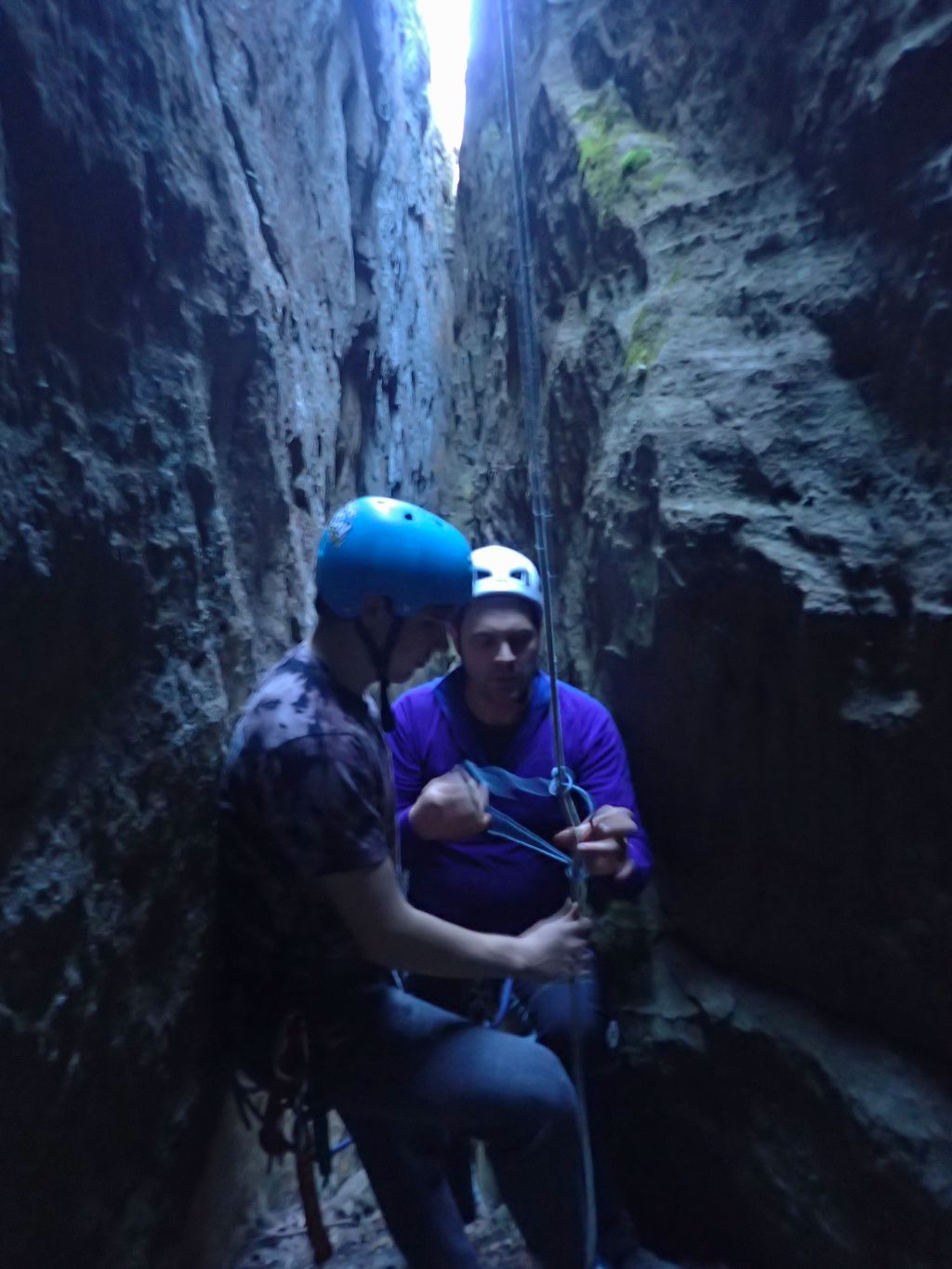
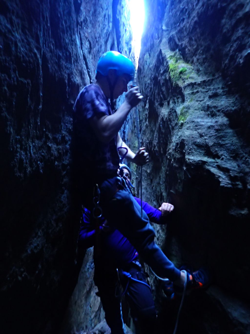
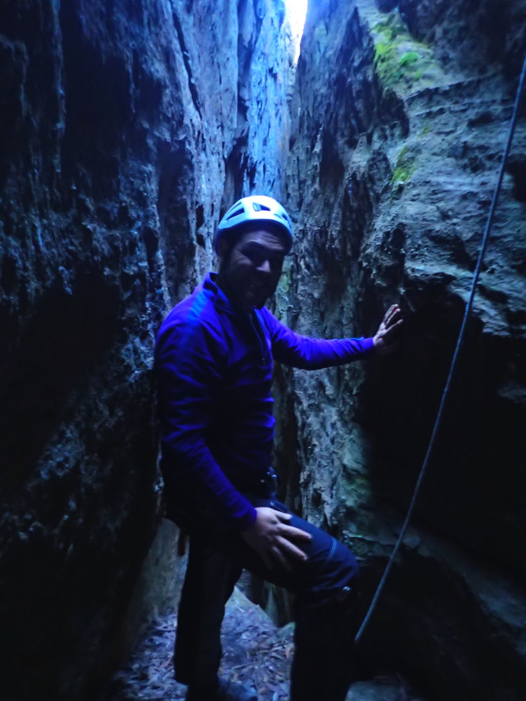
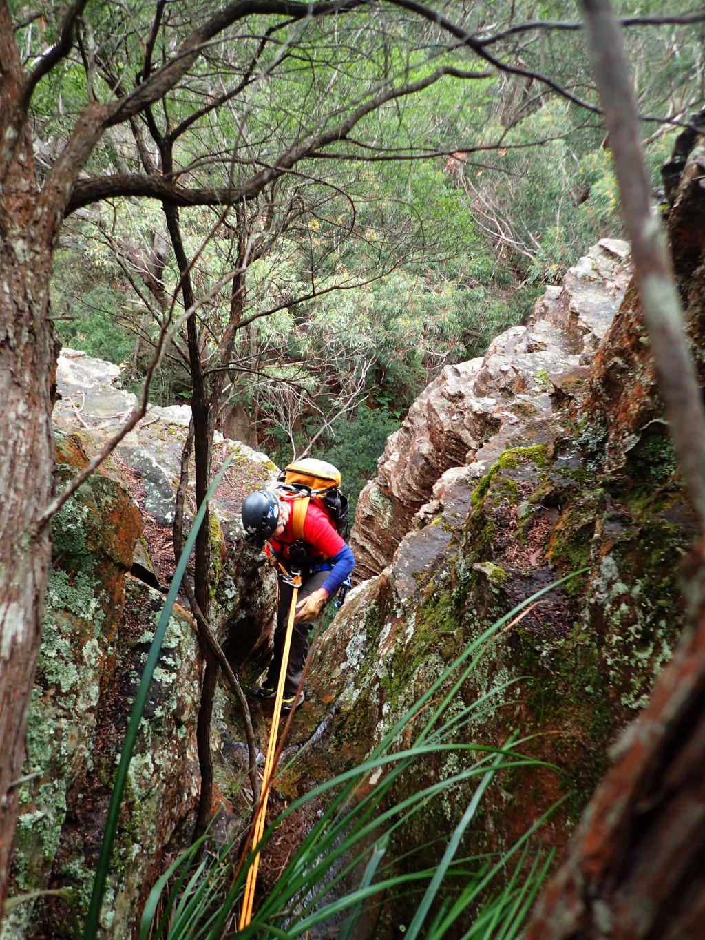
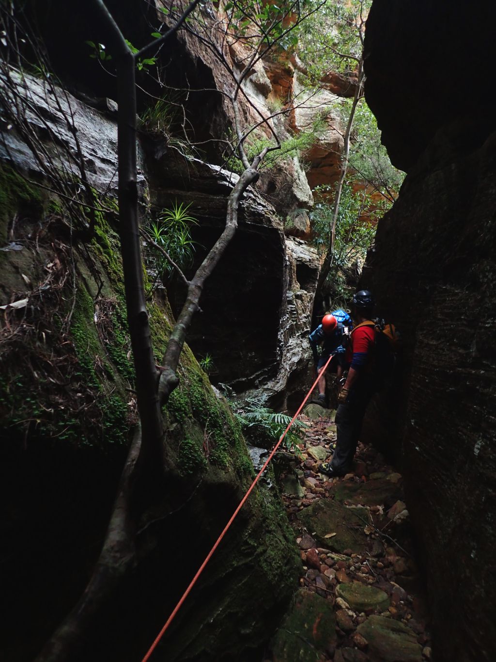
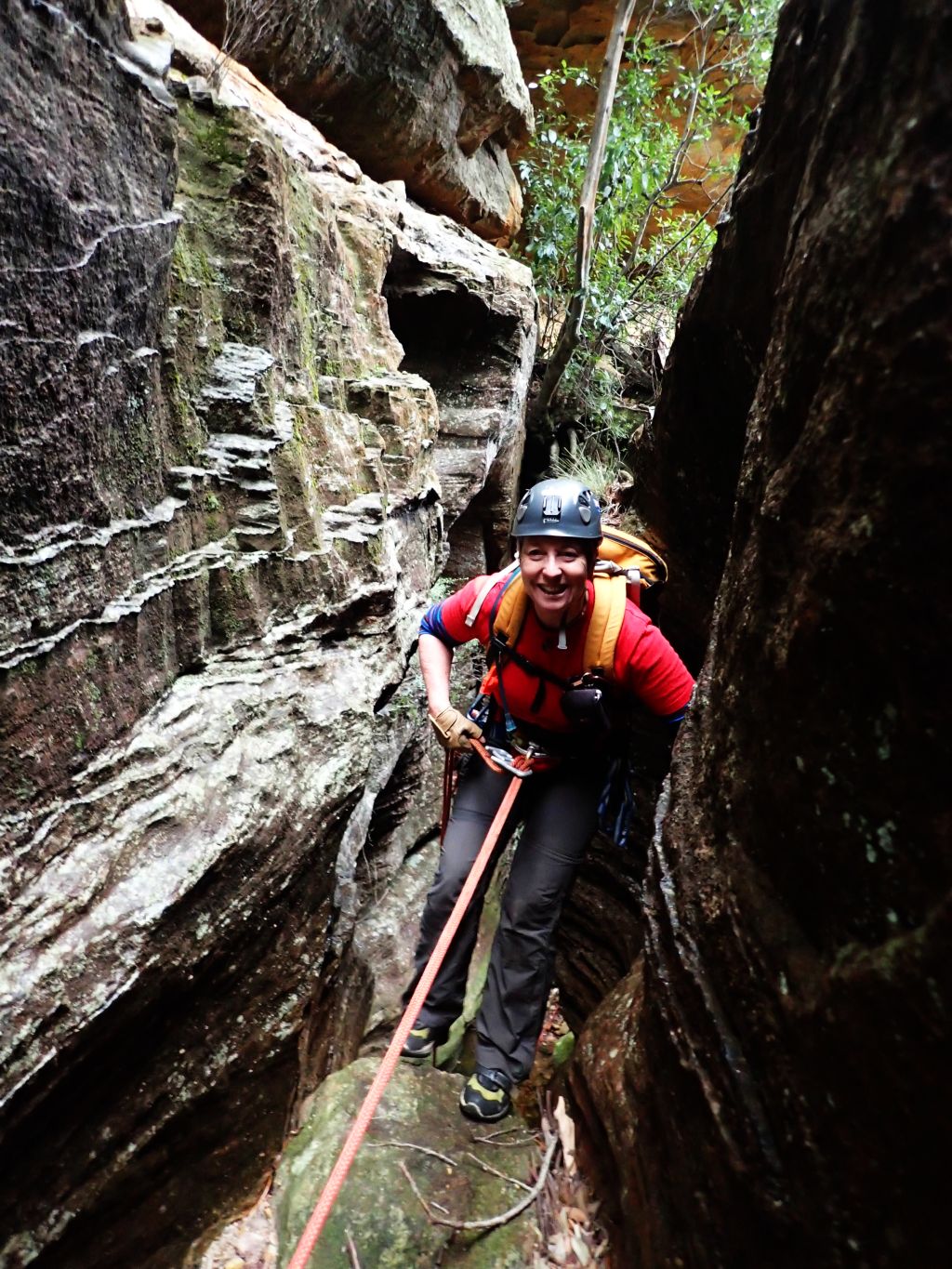
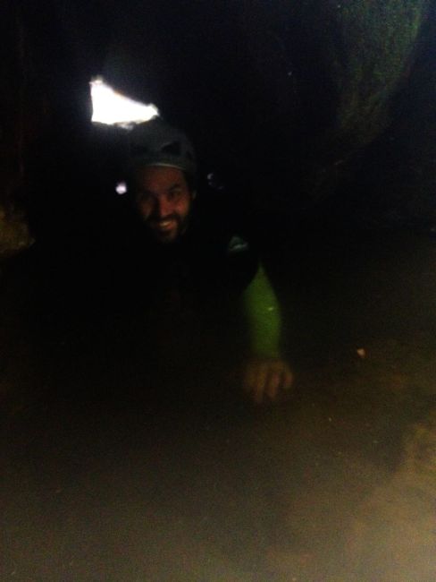
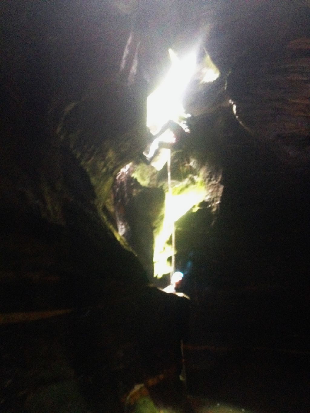
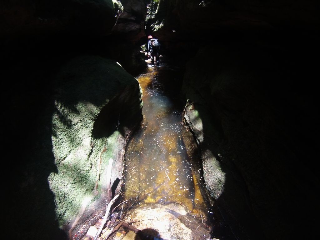
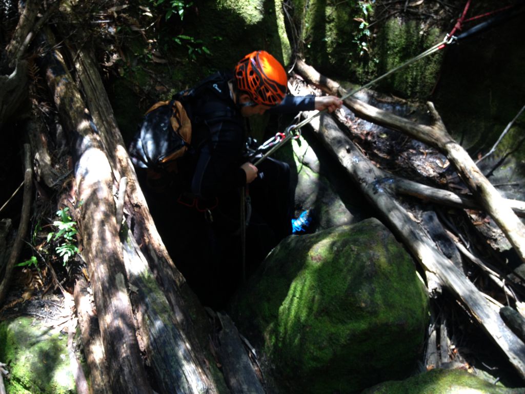
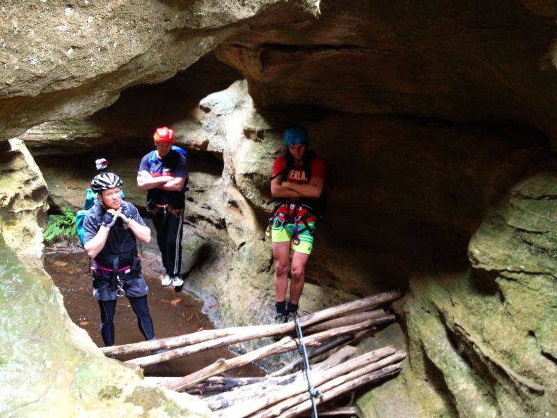
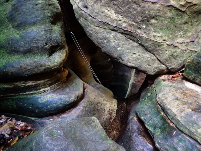
A little more scrambling and we come to the abseils. 3 successive drops down into a dark abyss. Ed and Lewis scramble to get cameras out. Looks like I’m going first for want of a better model

12.jpg
The start of the abseils
13
Lewis on the first abseil

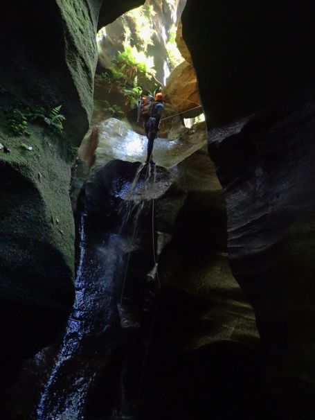
The drops are pretty cool. Abseil 10-15 meters, swim across a pool to a small stance and repeat

3
Lining up to take photos on the small stance between drops

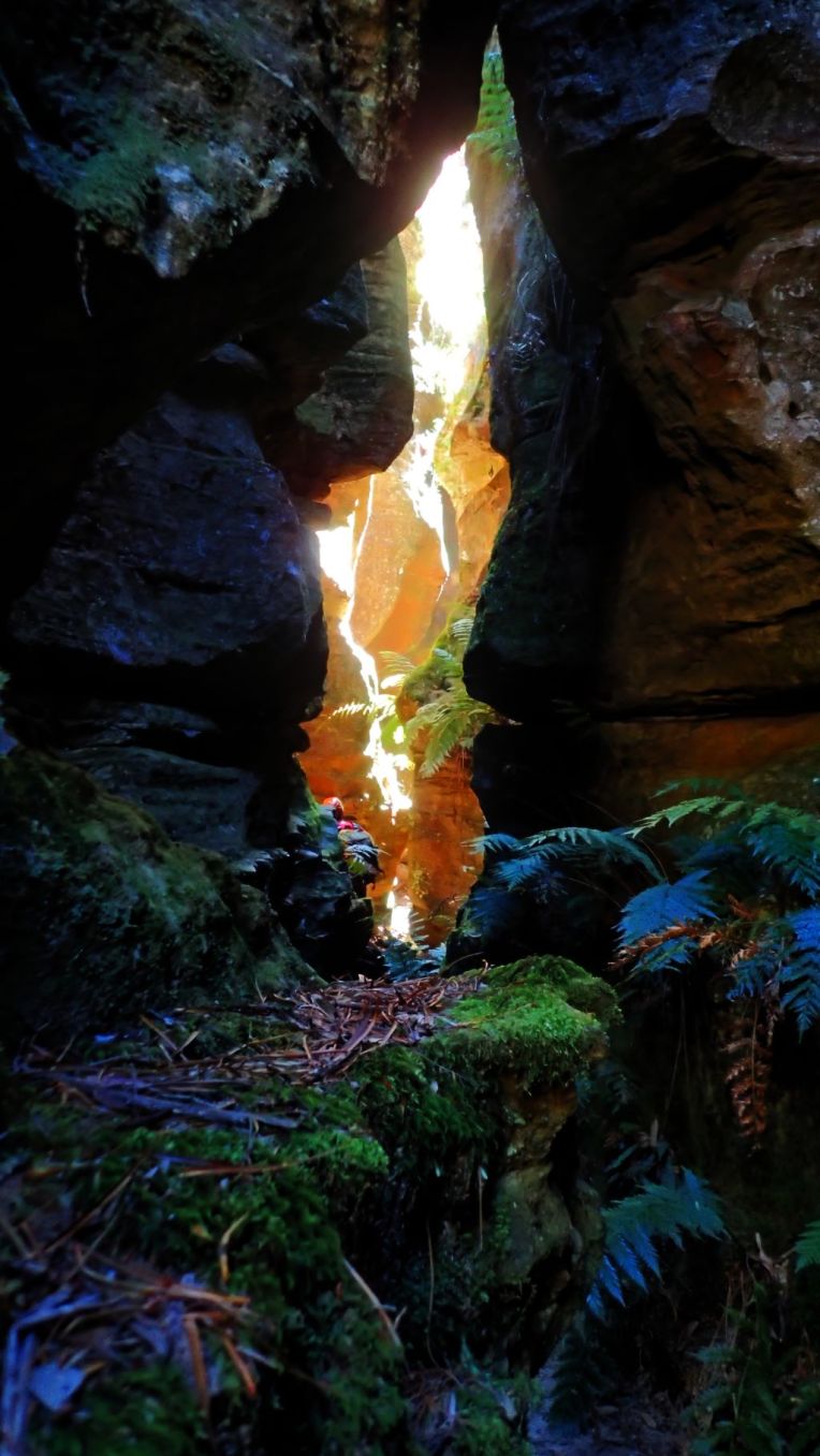
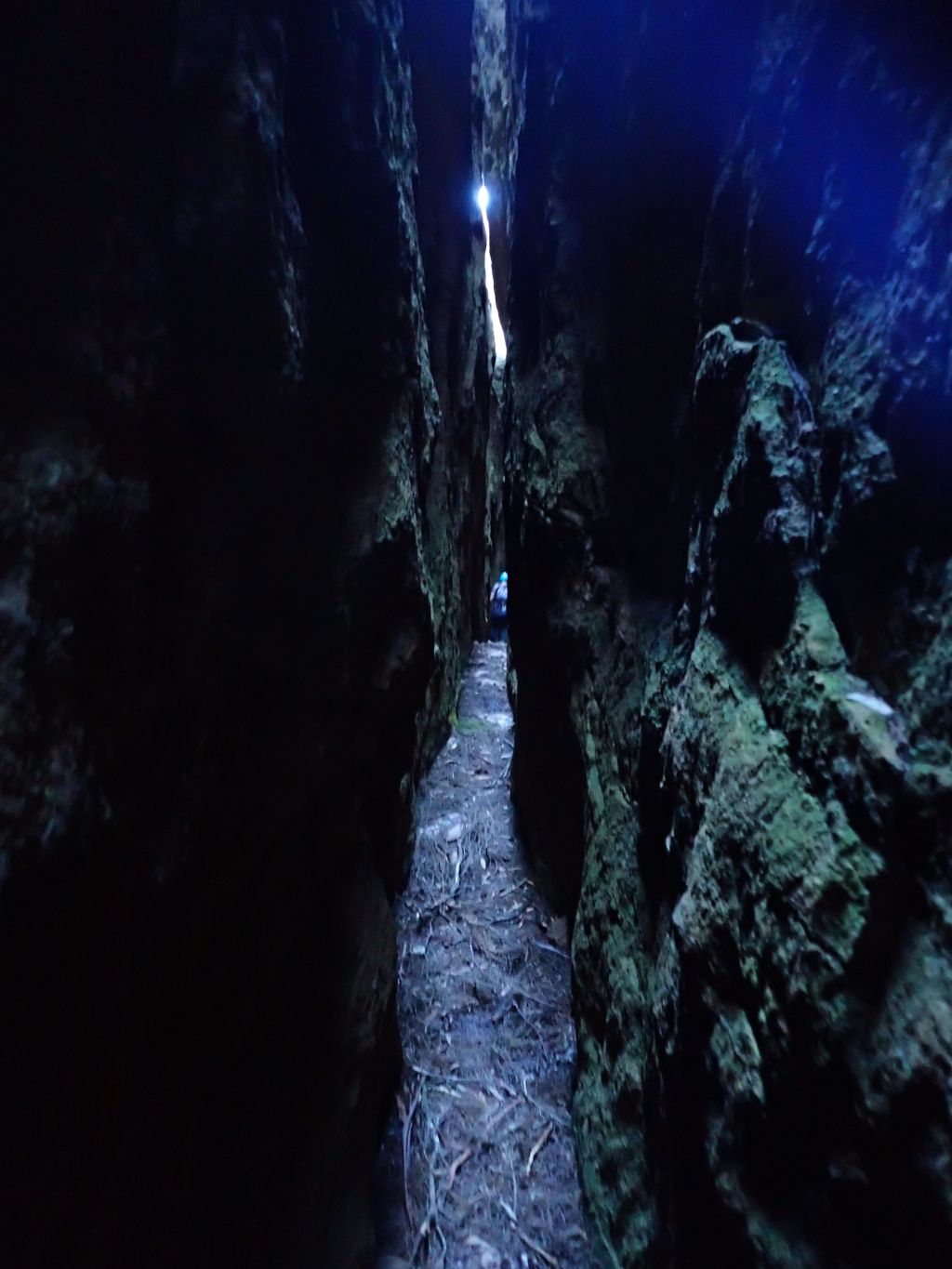
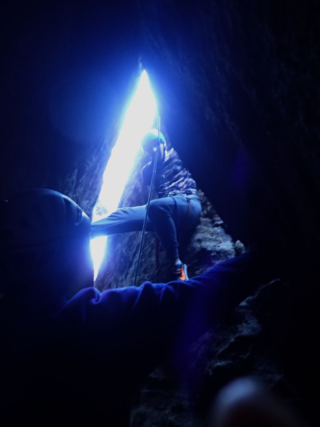
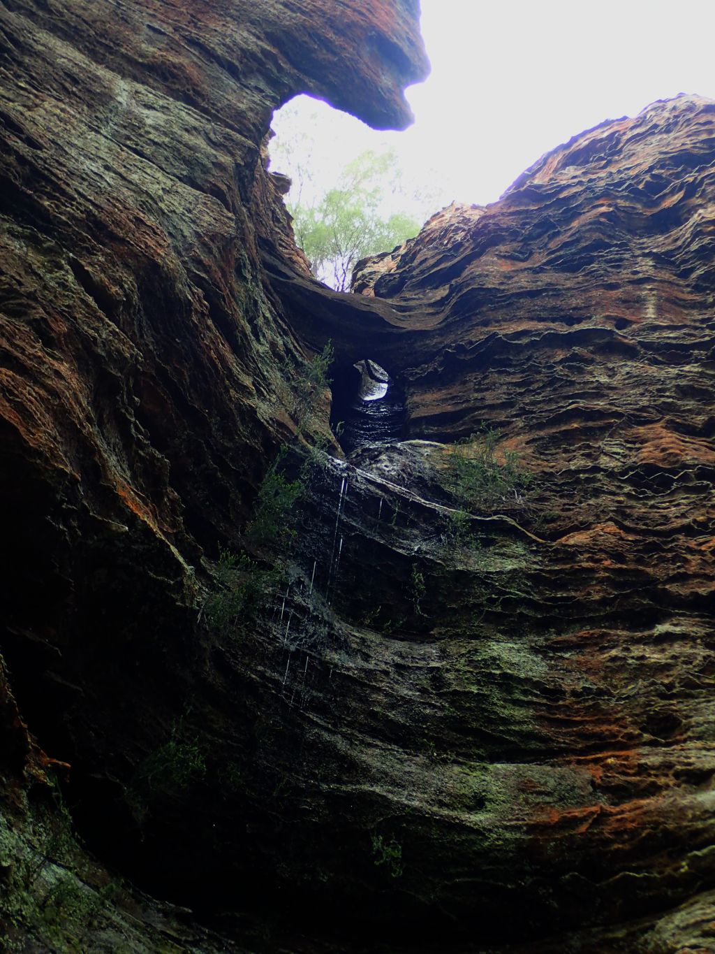
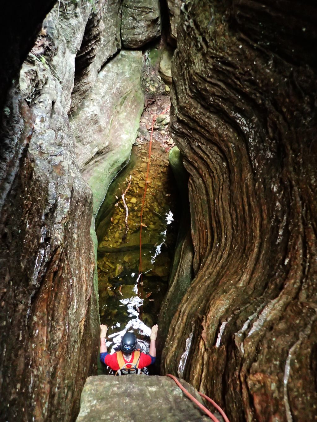
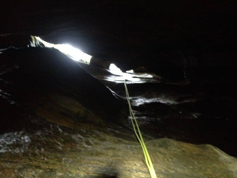
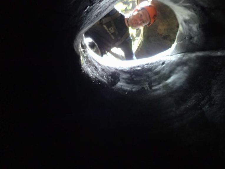
The final abseil starts through a small hole and drops into darkness. Much awesomeness

5
Edwin dropping into the Black hole of Calcutta, nicely back lit by Lewis’ torch

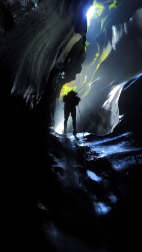
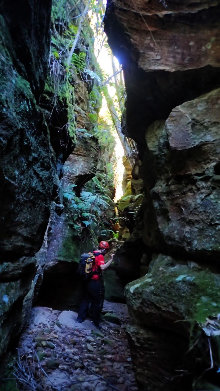
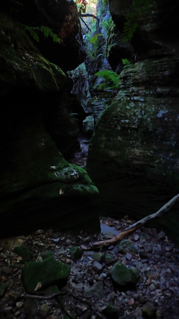
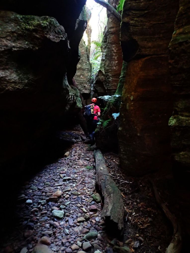
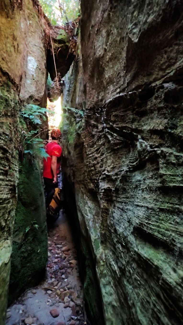
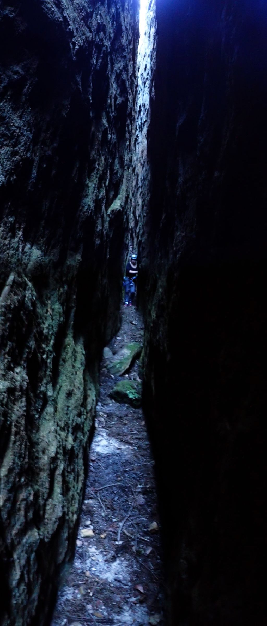
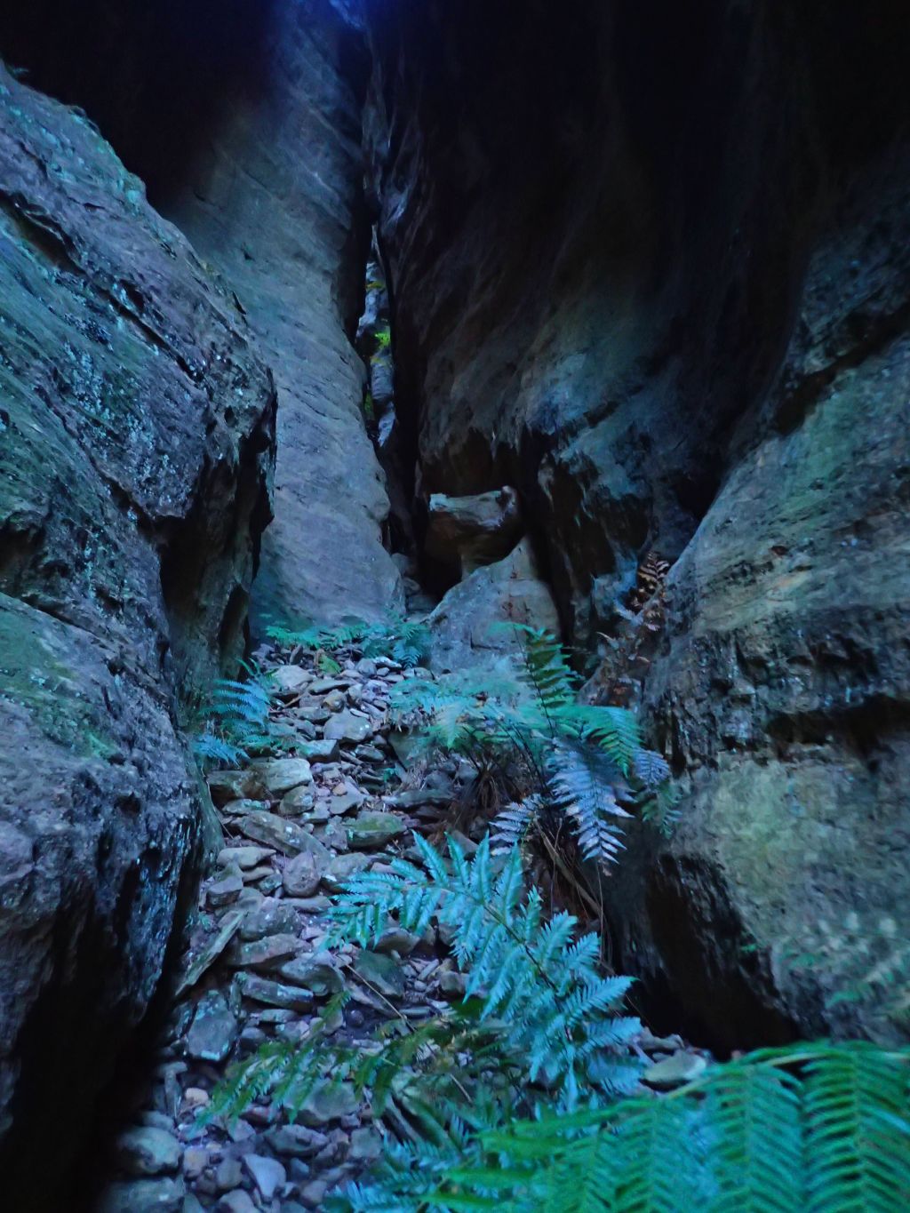
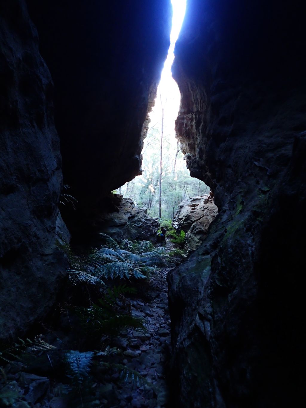
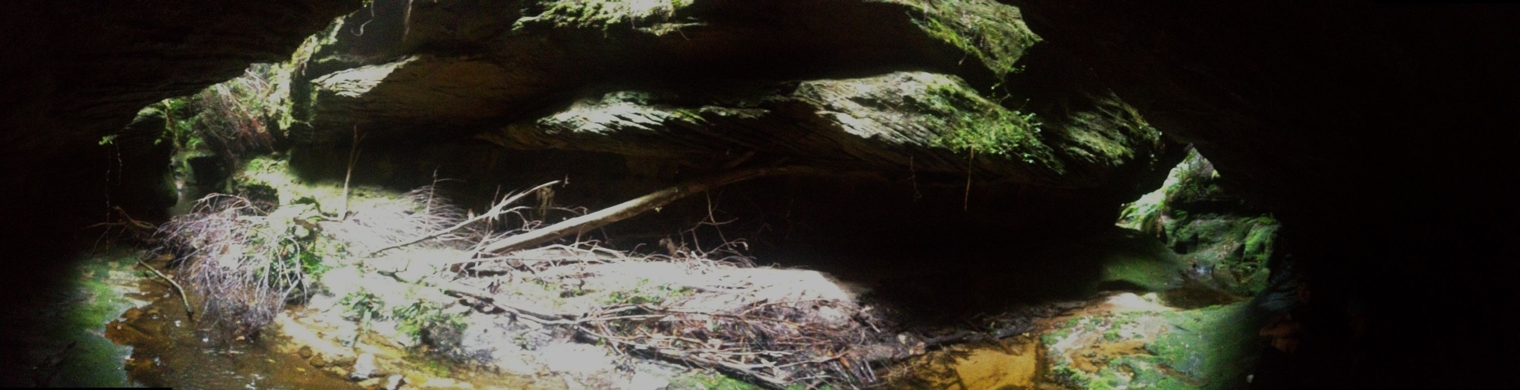
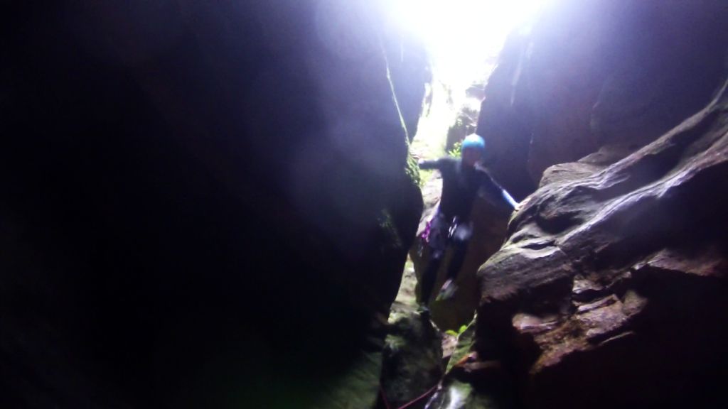
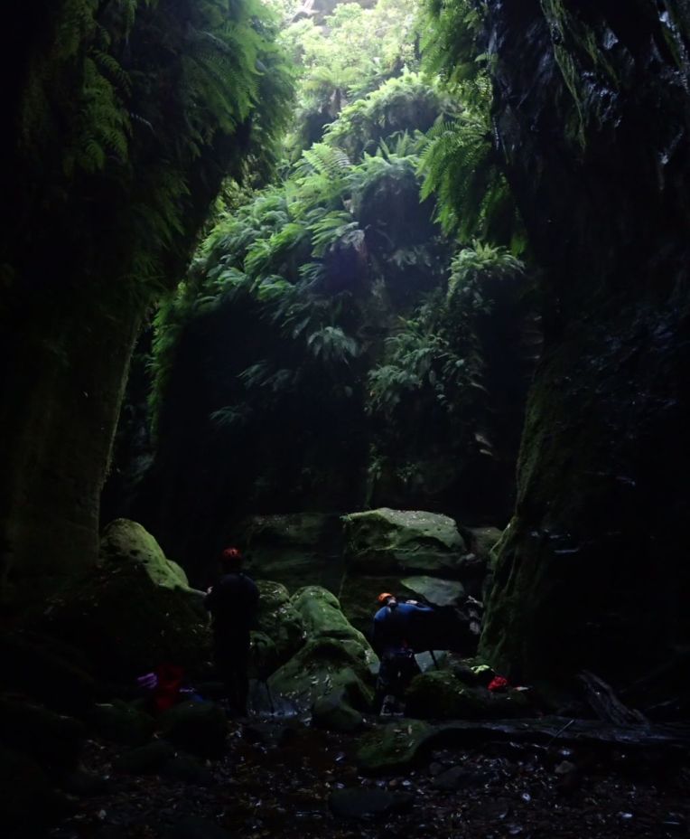
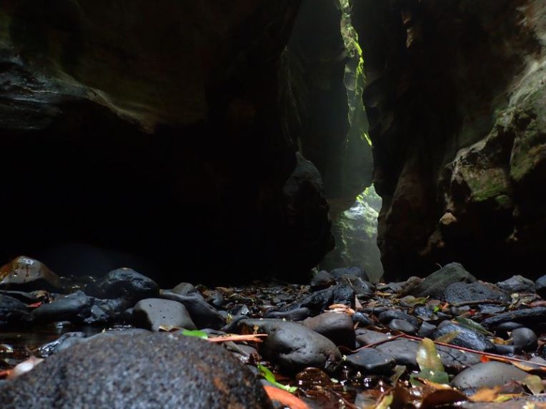
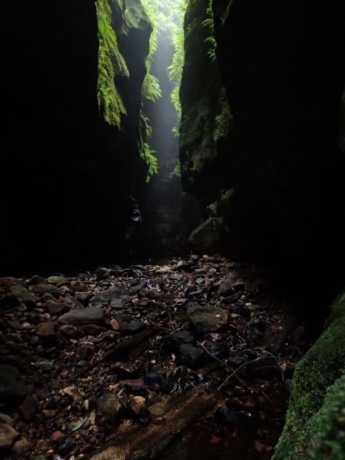
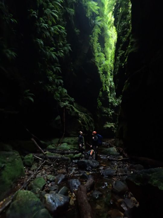
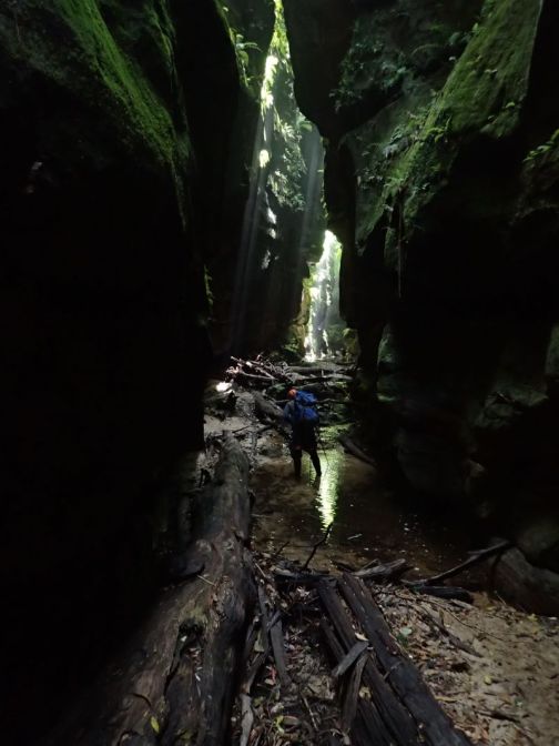
From here its 50m through the darkest part of the slot until it widens slightly at the Junction with Ranon.

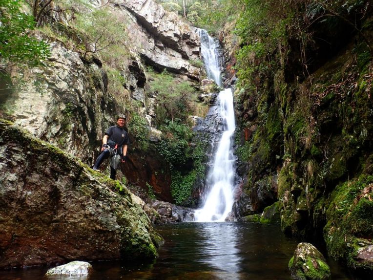
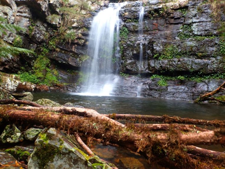
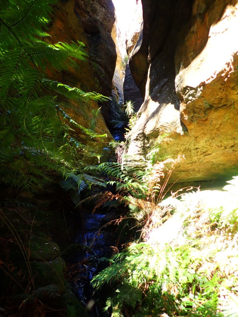
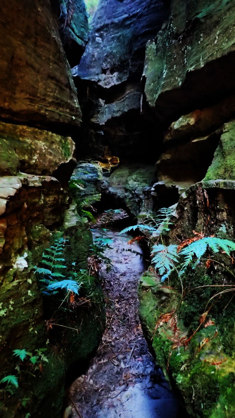
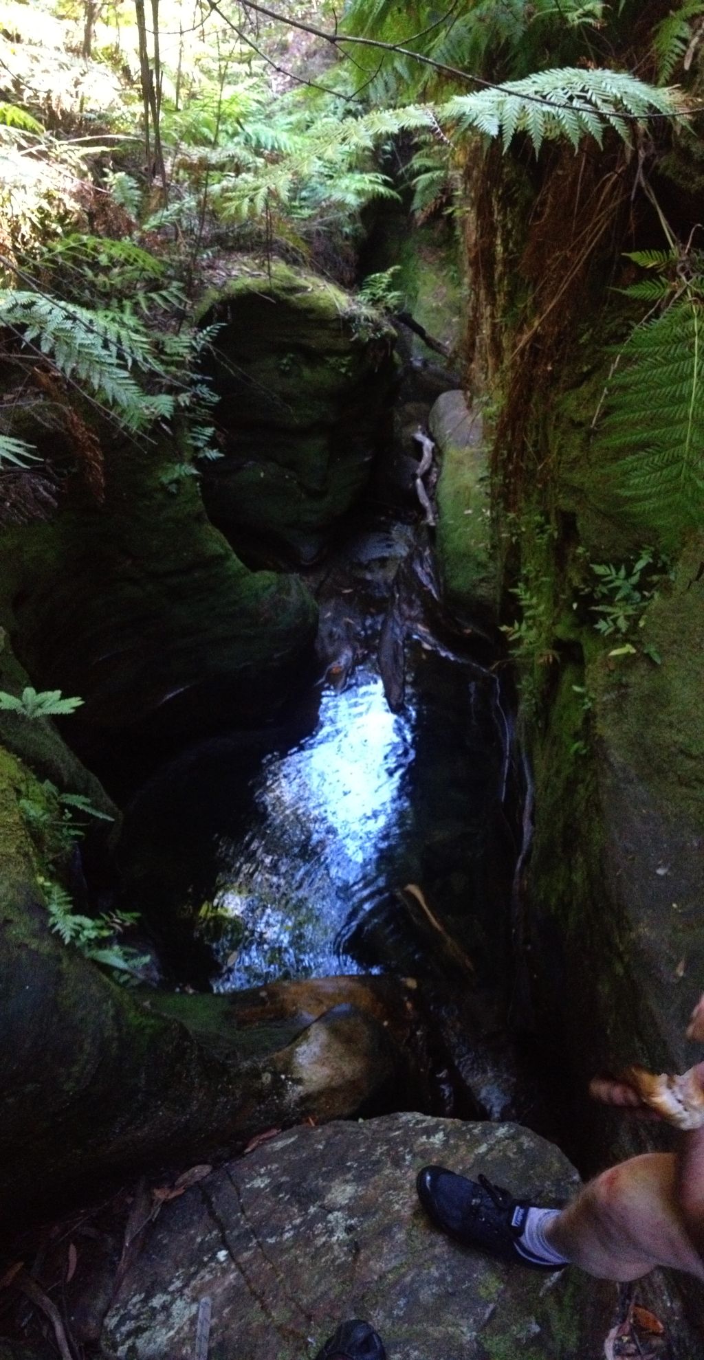
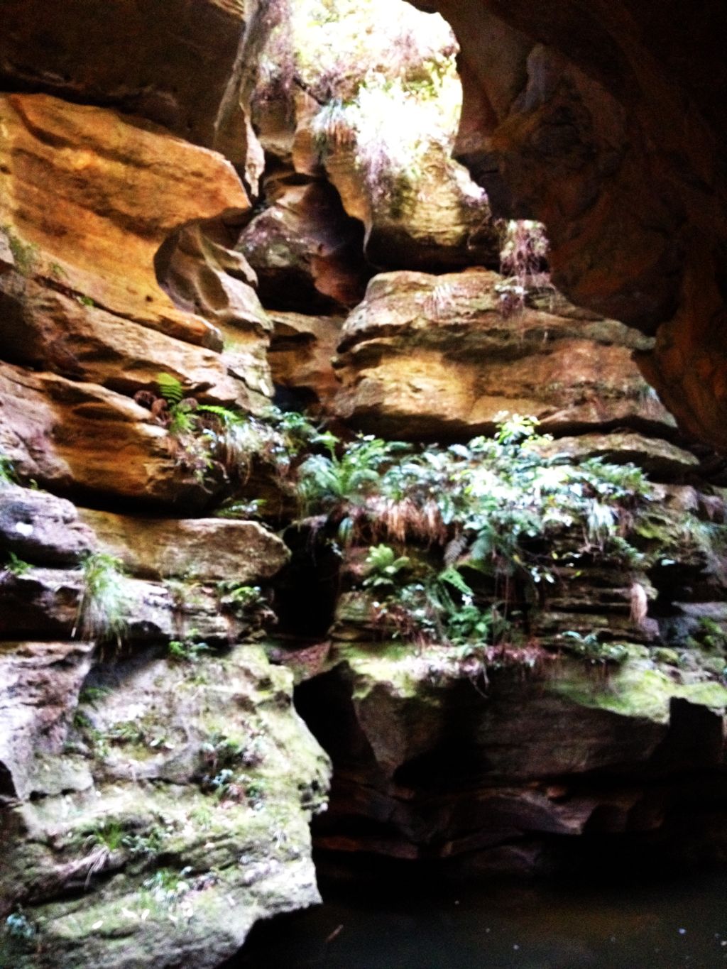
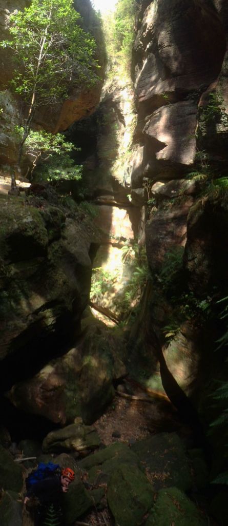
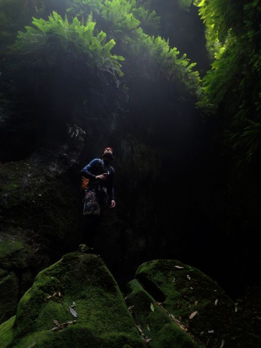
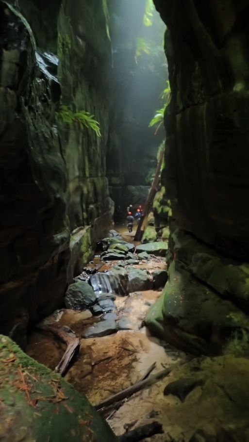
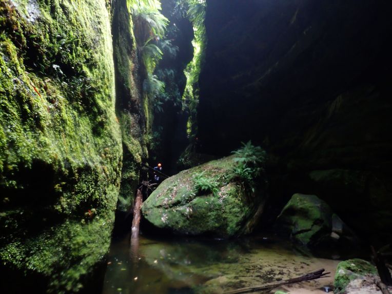
The moss covered boulders and fern strewn walls at the junction may well be the most photographed bit of canyon in the country but it is truly stunning.

17
We played around here for a while snapping photos from all angles
21.jpg
Lewis contemplating the light
22
It’s much greener than I remember. One of the most fern filled and moss covered canyons I’ve been in
23
Cameras at 10 paces… I’ve heard of people paying to do the guided trip just for a photo here

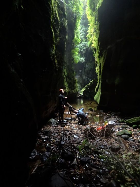
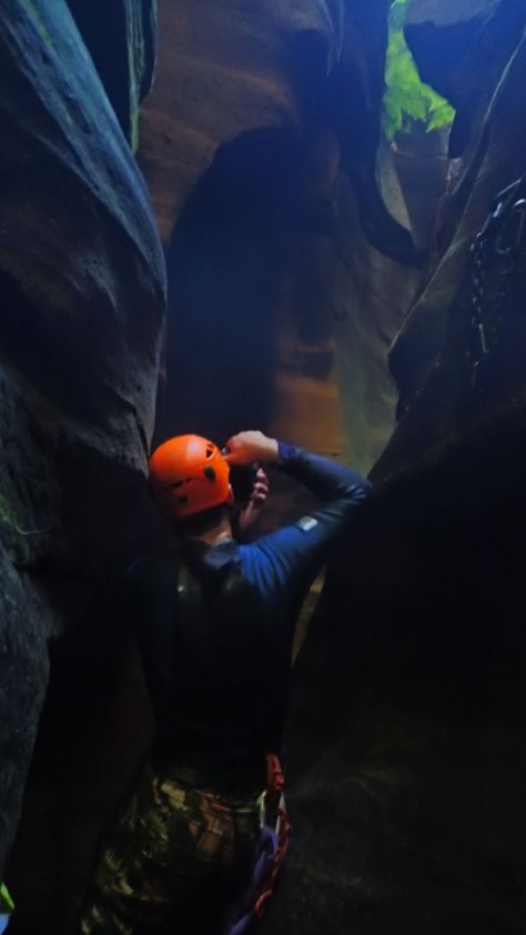
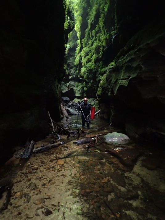
After lots of photo phaffing we head down. The boys need to be very careful with keeping their gear dry so it’s in and out of dry bags a lot. The advantage of my TG4 is I can keep it at the ready. The photos may not be the same quality but as it’s so handy I have about 600 to trawl through.

25
Canyon formation
29
Canyon Formation

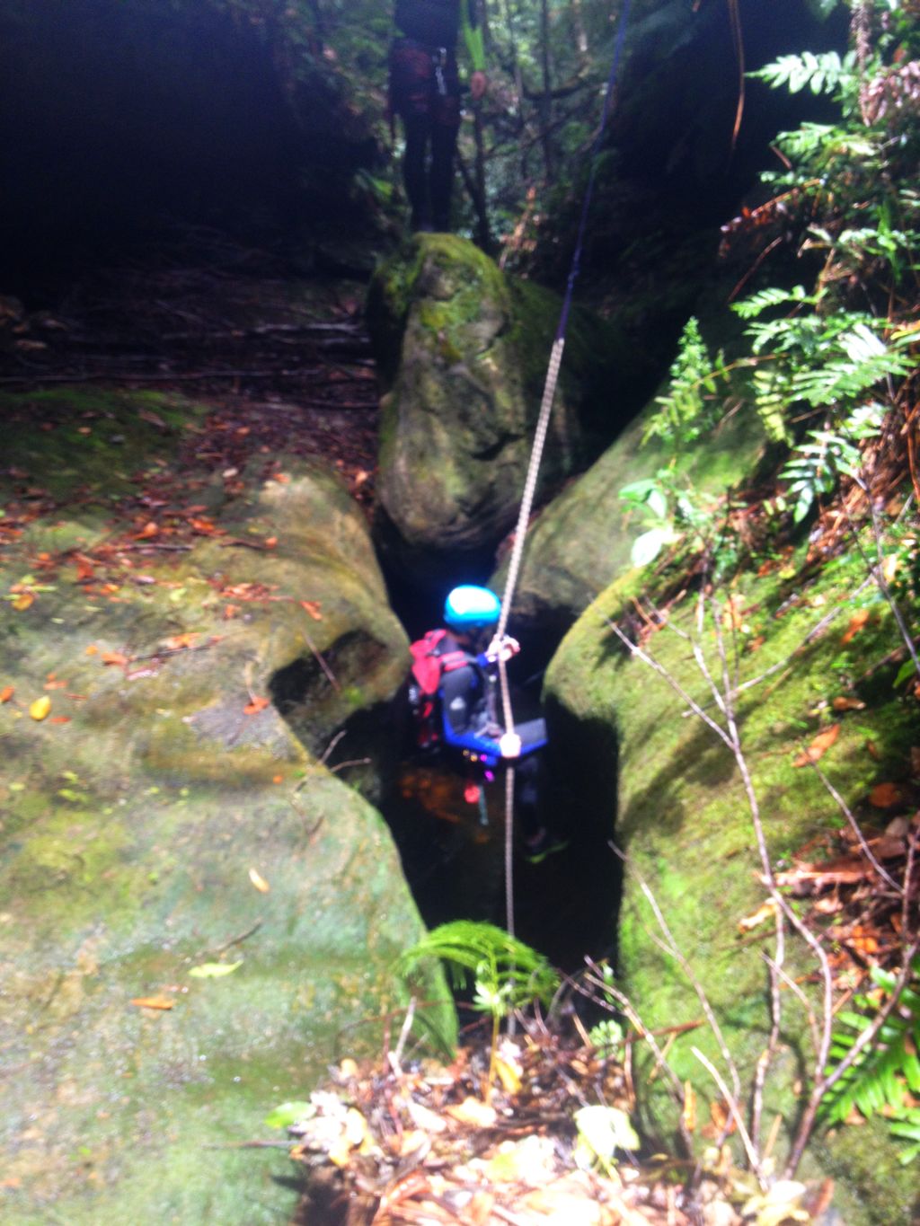
Just as the big cameras get triple dry bagged to continue on Ed looks up to see one of the group coming in from Ranon has slid out along a fallen log that spans the canyon 40 or 50 meters up. There was a scramble to get cameras back out in the hope they were going to abseil down the middle of the canyon walls from this log but by the time cameras were out he had thought better of it and retreated to do the normal route through the waterfalls

35
The group coming in from Ranon catch us
37.jpg
Like the slot the greenery just keeps going

With all the standing about i had begun to get cold so I peeled down the wet suit and put a light thermal underneath which improved things greatly.

39
Looking for sun rays but the day was a little overcast so the few we got were very faint

46

44
Ed carefully wading with the camera out
45
Canyon formation

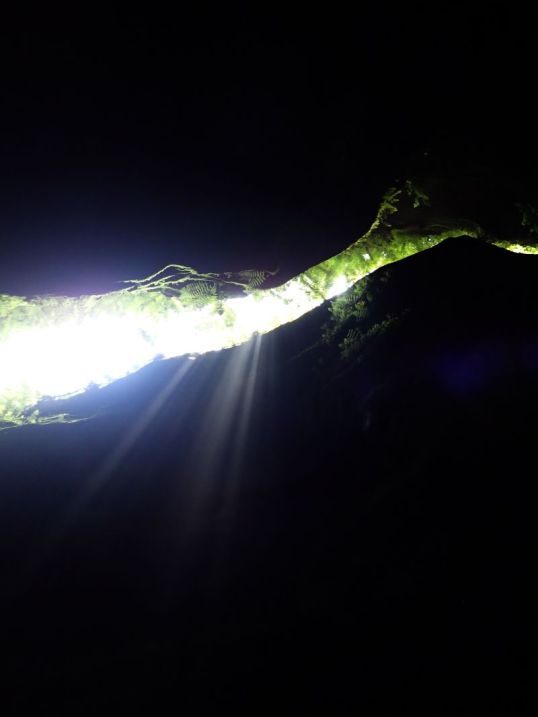
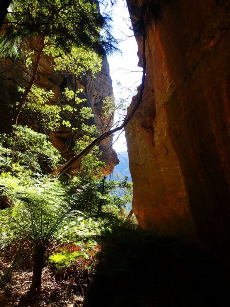
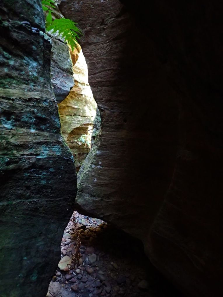
Light rays, canyons and photographers

51
Ed chasing Rays

We caught back up to the other group at the junction with Thunder Canyon, which is a great spot for lunch. They soon finished and continued on, we have a quick look up Thunder and then followed suit.

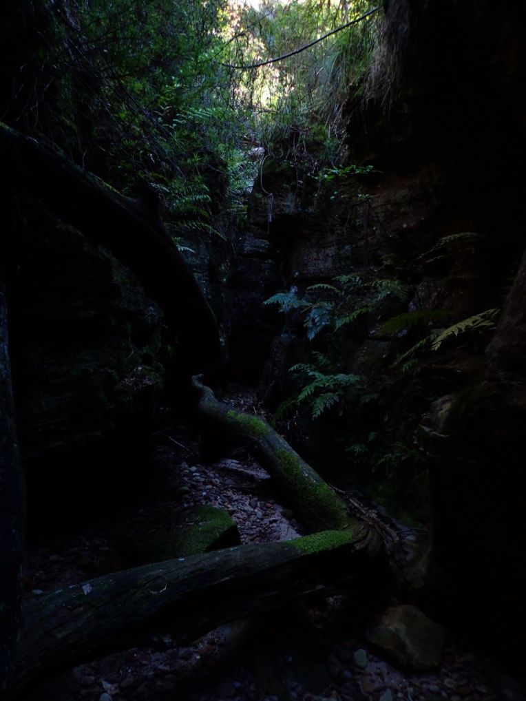
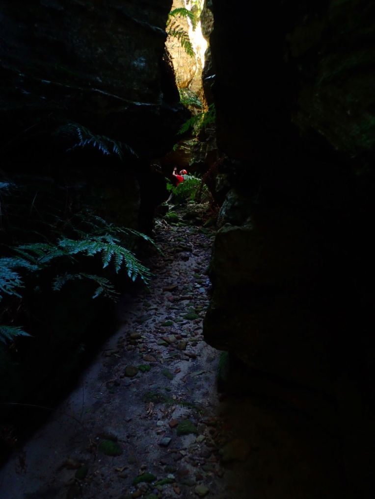
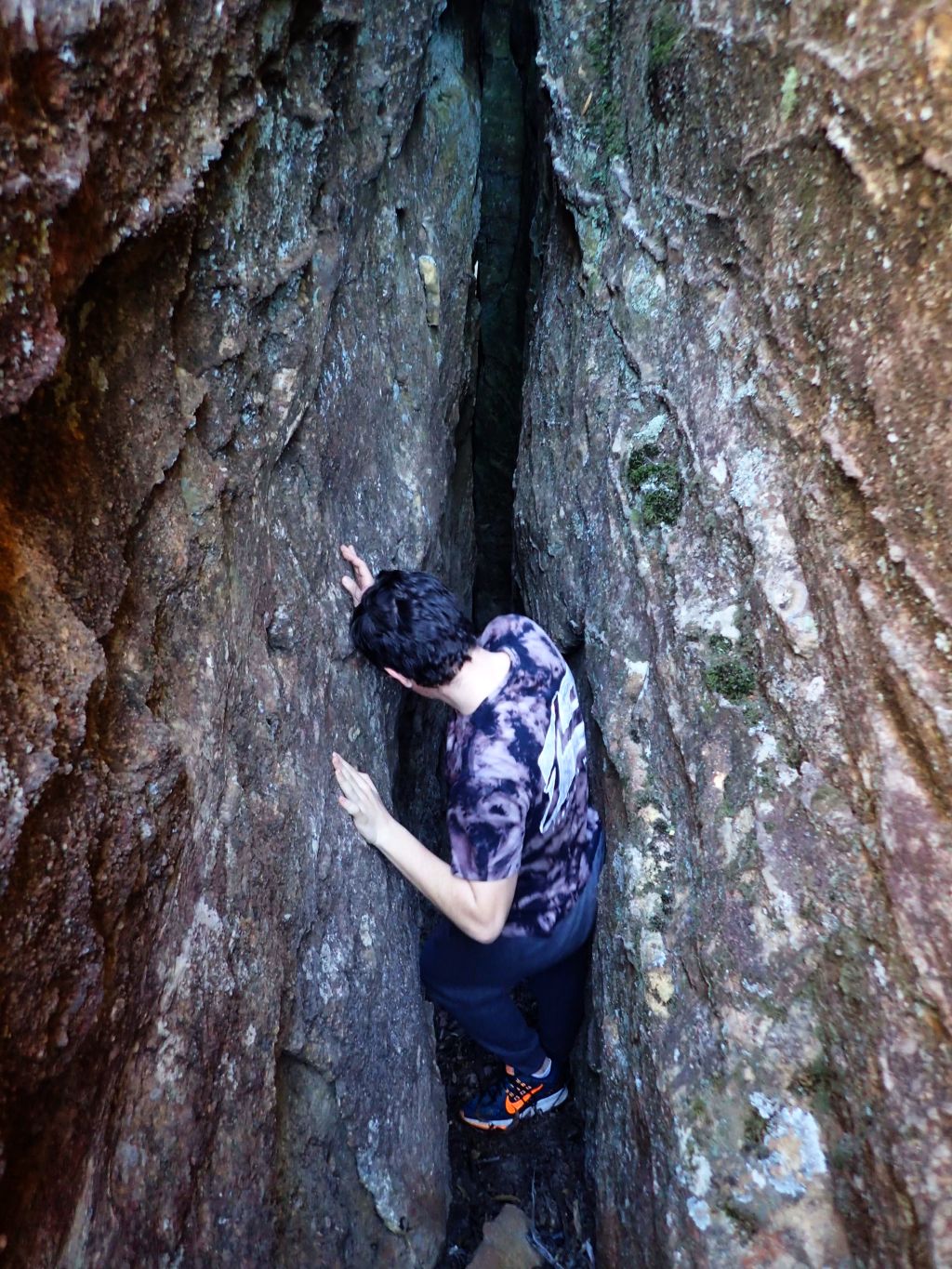
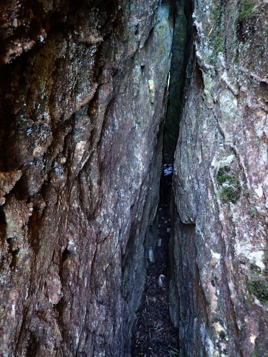
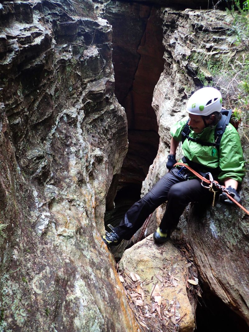
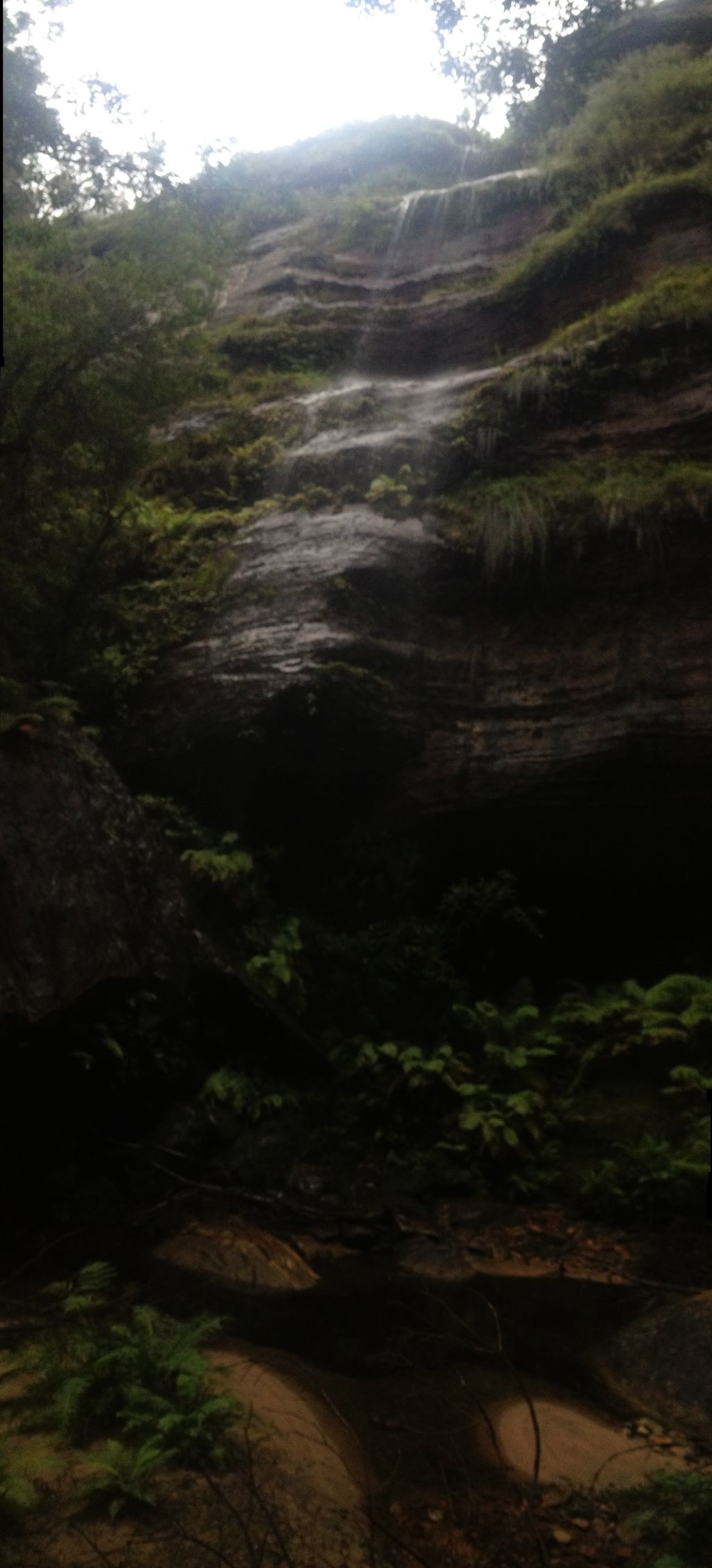
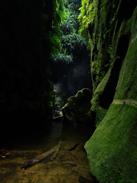
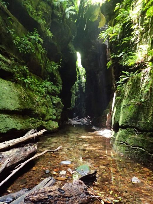
After this junction the canyon opens up a little and there is some tricky scrambling down some drops before it closes back in.

52
Lewis looking down a pot hole

Once it closes back in you encounter the infamous tunnel swim. Way back when I did Ranon the last time the water level was down and you could walk through here. Now it’s  a spectular 50m swim

53

A little more scrambling, a couple of pools and you reach the exit

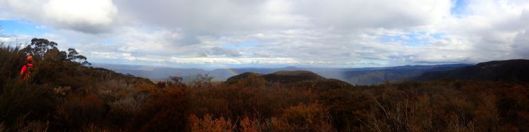
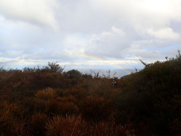
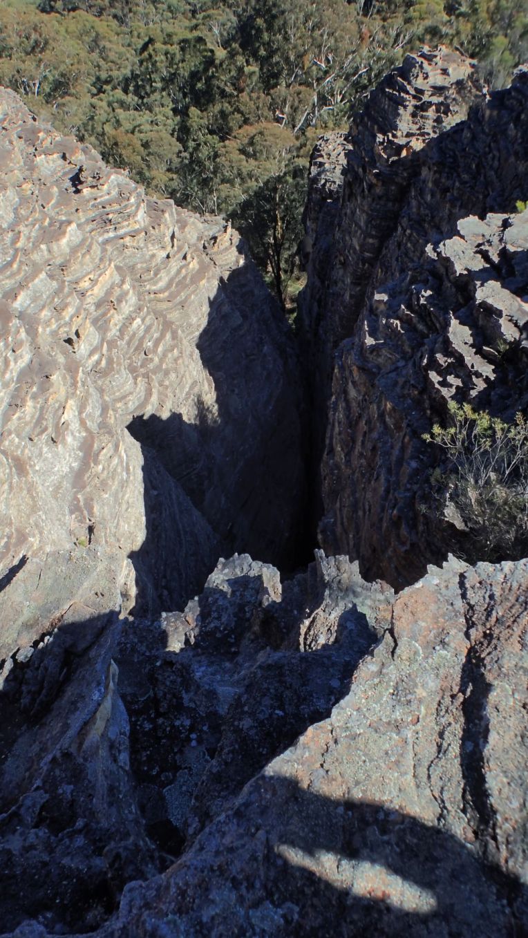
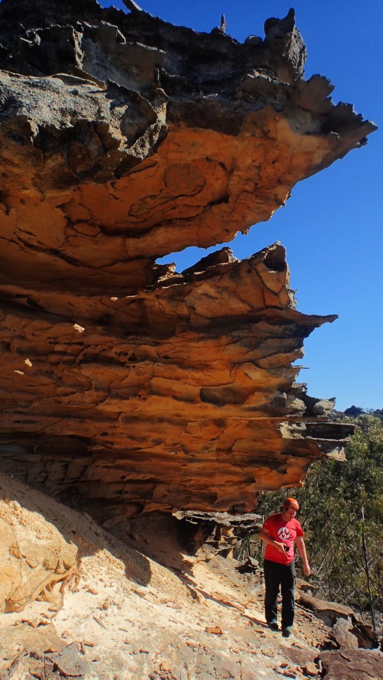
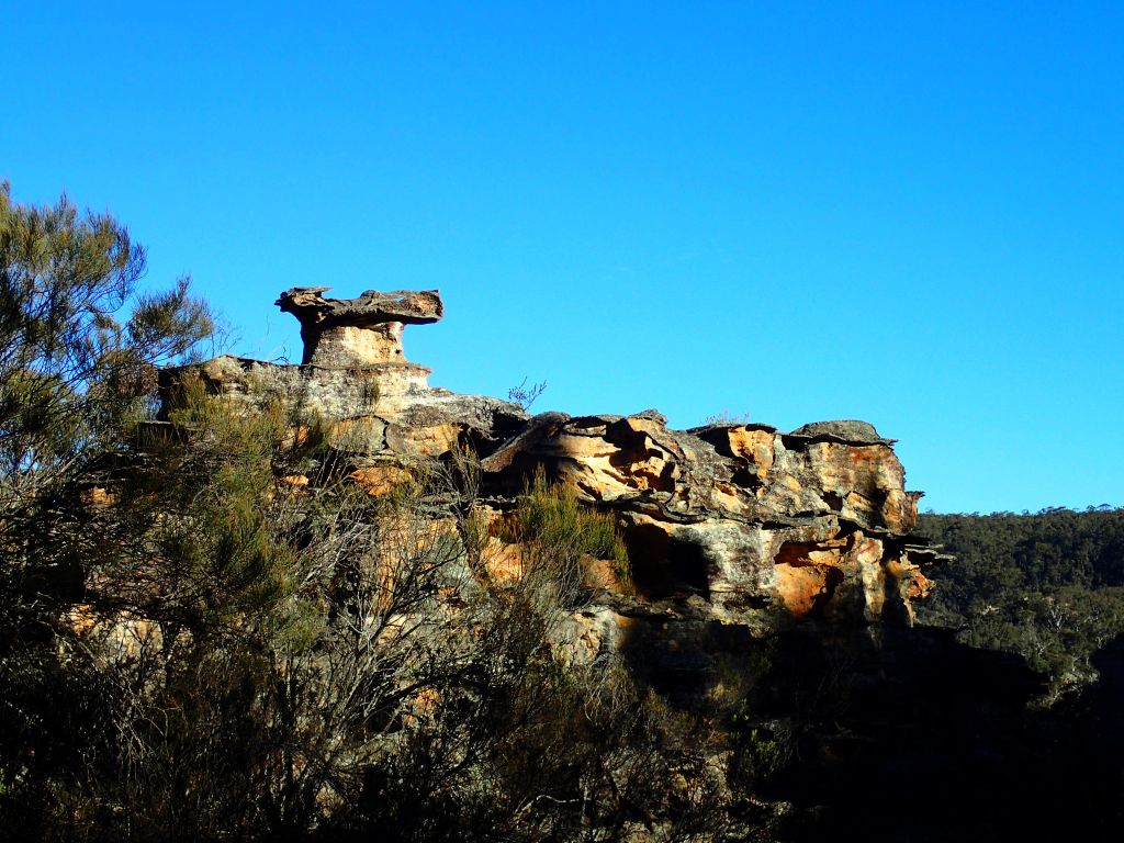
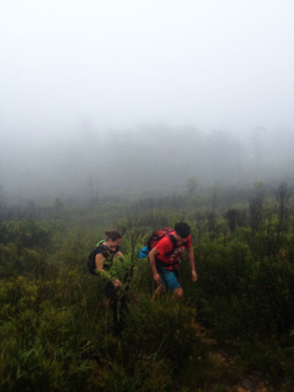
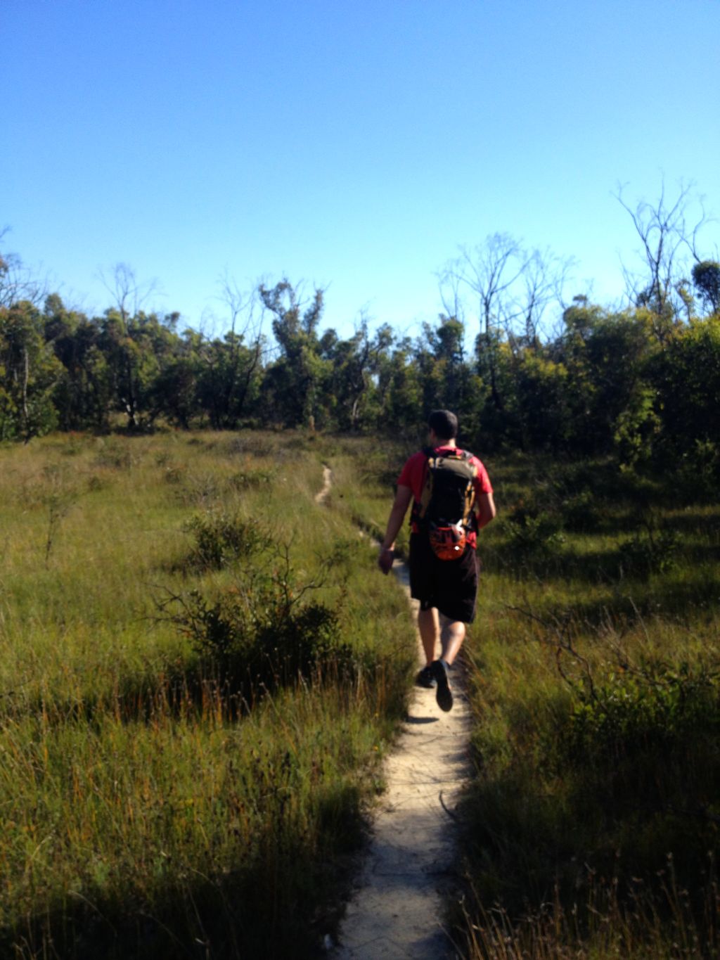
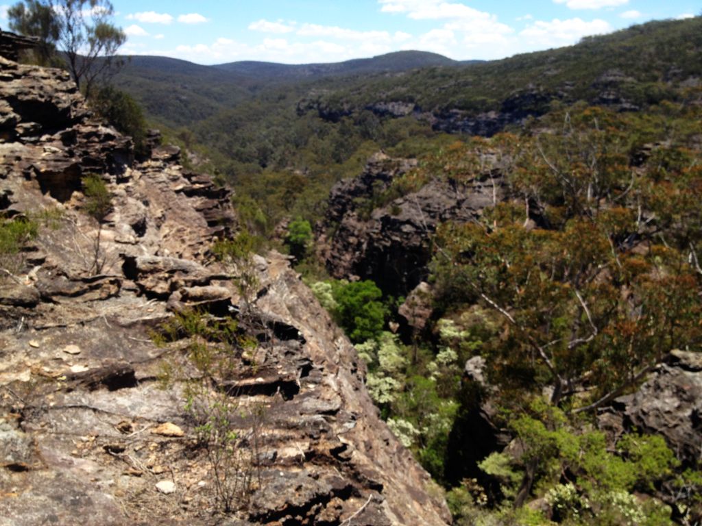
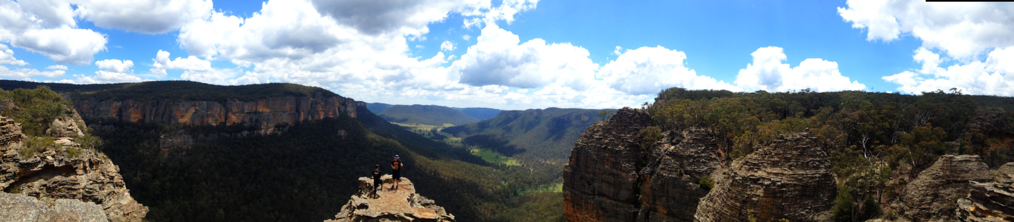
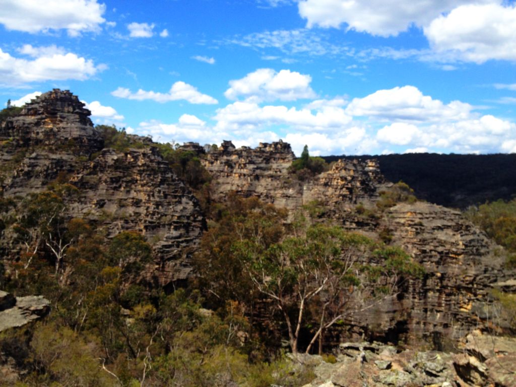
There is a steep haul up Rainbow Ravine, which has some pretty canyon sections itself, then a long walk up the ridge to the top of the Camels Hump. I remember last time getting to this point and thinking we had come up the wrong hill.  From the top the hump it looks to be surrounded on all sides by chasms and the old exit point to top of Mt Tomah can be seen across a particularly deep chasm. You can see why, with no maps and no knowledge of the land Caley and his crew had so much trouble. I’m remember almost having my own muntiny on my hands as hungover and exstausted Della and Lurch were in no mood to drop down and climb out again.

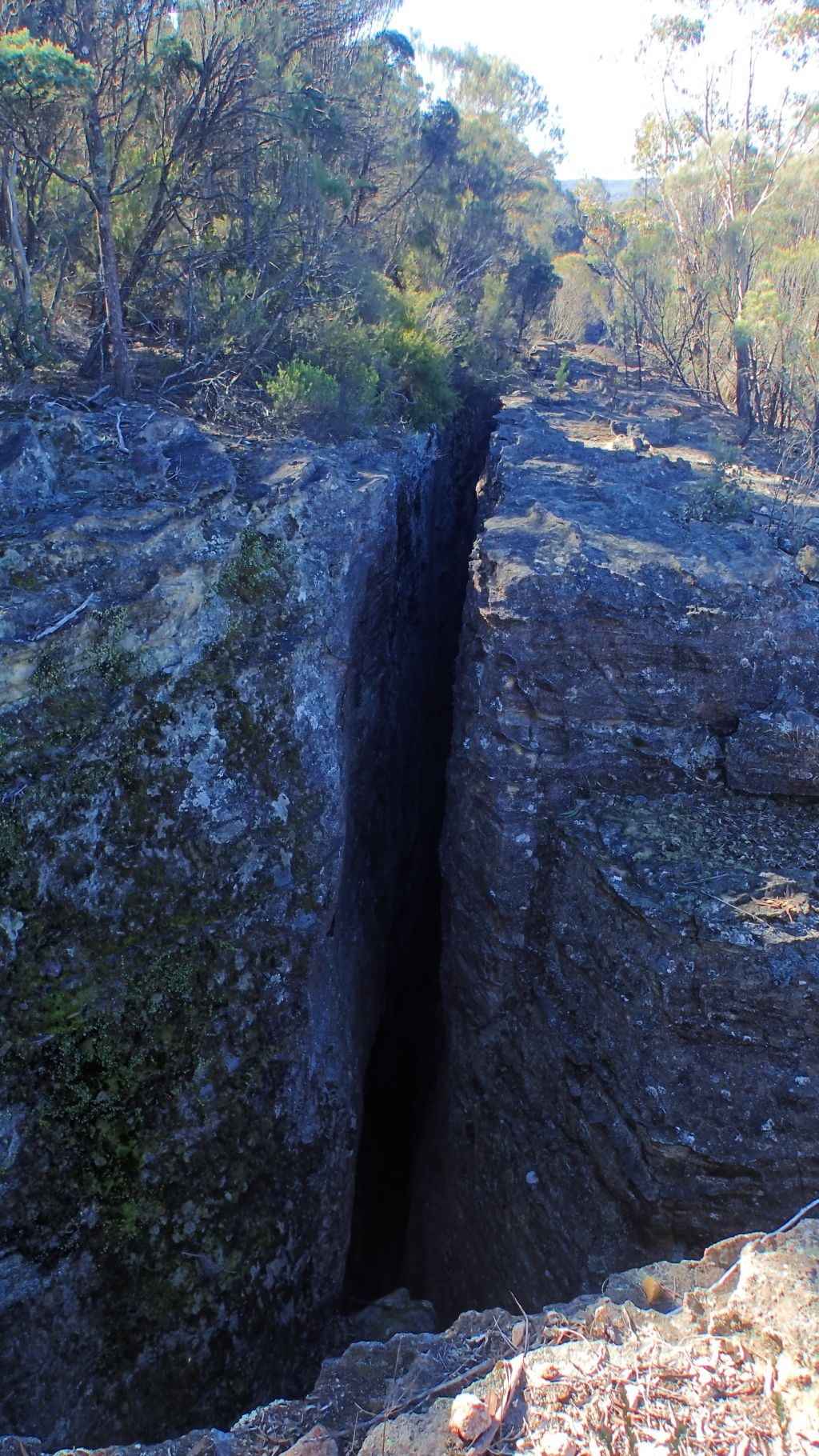
Just when we thought we would have to descend all the way down and start again the trail crossed a narrow, bridge like rock saddle. It barely looks real. Something straight out of Tolkin. The old exit is now just up the hill. 10-15min up to the car park… The old exit.

The new exit is not so quick and does involved dropping all the way back down into Claustral Brook. We head steeply back down. There are some nice canyon sections and a swim or two before we reach the gully we came in on.

Yeah it’s a long walk out. Yeah I’m feeling it today but it’s not too bad, we’ve done worse.

Party Size: 3 All experienced

Time: 10hrs car to car. Lots of time spent striking poses and  snapping photos

Back

Dione Dell

25-09-2016

Jodie, Garry Edwin and me

26

Dione Dell is a good introduction to the Kanangra-Boyd style canyons. Unlike the dark, sandstone constrictions of Blue Mt canyons the ones out this way are more steep ravines that drop through a series of water falls as the streams cut down through the quartzite landscape.

Now at first glance quartzite looks a bit like sandstone, and once upon a time it was just that but then it got subjected to heat and pressure which melts down the granny structure and metamorphises it into and different beast.

Gone is the grittiness that offers some semblance of grip, and it’s harder too so tends to break off in lots of block sized chunks. Loose and slippery. It can make for hard going as you try to traverse it.

Anyhoo it had been ages since I’d been down Dione Dell (Almost 18 years) and I was keen to take Tal, he  and his mates had other ideas and went camping instead but I was still excited to show the others through it.

As I said earlier, it’s a good intro into Kanangra Walls canyons. One of the smaller trips out this way it consists of 4 major waterfalls, which are, for the most part, descended in single pitches, and a relatively easy walk out.

All that said it shouldn’t be taken lightly. The quartzite is slippy and loose and some of the abseils have quiet a bit of vegetation and in high water it would be a bit of a challenge.

In summer it is possible to take the direct route down through the falls. Today we opted to stay mostly dry (‘Cept for me who fell in. Pay back for the time I took Della down in the snow and he fell in multiple times)

But enough of my blabbering. here are some photos to wet your appetite.

1
Edwin testing out my new Canyonfire rope

4

5
Jodie and Gaz
7
Gaz on the second abseil
8
Jodie

12

13

17
The crew at the base of Wallara falls
18
Garry
28
Me just after my unintended swim

2022

23

25


27

29

Party Size: 4 (3 experienced I beginner)

Time: About5 hr car to car with some photo phaffing


Miners, Birds, Bells and, Labyrnths

14-08-16

Edwin and me

17
The harsh mid day sun made it difficult to get nice shots. This one is almost there

I’ve been meaning to get to this one for a while and it was a bigger day than I expected. Nice to have visited it but I don’t think I’d rush back real soon.

Anyhoo Ed met at my place not too early and after Mandy decided to pyke it was just the 2 of us heading down into the Wolgan.

Packing the ropes we had a couple of options.

Option 1 was either my 11mm 58m or Ed’s 9mm 60m

We choose option 2. Meggsie’s 9mm 40m because it was lighter. This would come into play later.

Arriving in the valley we have 2 options. Option 1 head a bit further down stream and park at the actual car park. We choose option 2 and park in this convenient car spot that sort of matches the description and starting marching up the hill, after a bit of steep stuff we found and old road and traversed around a bit on it. So far all good. Then the road took a turn back down towards the main road. We left it behind and traversed our way across and up to the base of the cliff. Our car park ended up being 1km further up stream than necessary

Drink breaks. Just above us looks to be an interesting slot around a detached block of cliff. It was more interesting than that as behind it was another slot around a second detached block. Very Noice!

2

We stuff around here a fair while investigating little nooks and slots and disturb an owl (Possibly a Powerful Owl) before continuing around the corner to the dry creek we are looking for.

6
Ed investigating a slot

Following this up we cross from one side to the other finding some cool sandy caves and side canyons on our way up to the main canyon.

11
Side canyon

The Bellbirds are in full voice as we make our way up towards The gully.

It doesn’t give much indication it is going to close in any time soon and we start to think maybe we were suppose to head up one of the side canyons. But then, with little warning the canyon appears.

13
The gully eventually closes in
16
It’s not deep or dark but it is relatively sustained

It’s a nice, dry canyon but I think after the beauty of last weekends canyon and with the midday sun belting directly in to create harsh contrasts I was a little underwhelmed.

Never very deep or dark, the canyon threatened to open out on a couple of occasions but kept going further than we through it would. When it finally did open up we had 2 options.

Option 1 is to  Reverse down

We go option 2. With Great views over the Wolgan promised we choose to climb out.

25
Up we go

After several pagodas offered false high points we reach the ridge top and again have 2 options. We’ve come across a slot  that is not running in the direction of out track notes.

Option 1 is to explore a way down through the slot. I have vague memories of trip reports that suggest that it will lead down with a couple of abseils but I’m unsure how big the drops are and we have the short rope.

28
This option was very tempting

We choose Option 2. Head down a ridge spur and have a look off the end.

We reach the cliff edge and the grand views typical of the Wolgan greet us. Good spot for lunch.

29
Across the Wolgan, Penrose gully is to the far right and if you know where to look you can make out the slots of Kenobi, Windows and Hole in the Rock canyons

Now we need to find away down. We wander out to the end of the ridge. Lots of Options all bigger than we are expecting. It’s now I choose to read the track notes a little closer.

“Follow the ridge until the slot…” We didn’t see a slot so make our way back up the ridge a bit.

A steep crack might be our slot but it was hard to say. A bit further around a weakness in the cliff appears to give us access to the lower cliffline where a convenient tree provides great anchor. We toss the ropes.

Sounded like it hit the ground, Says I. Sounded like not much if any hit the ground, Retorts Ed.

I had used my safety rope to tie into while I set the ropes. I pack this up and now I am on rope I have 2 options.

Option 1. Take my pack back off and put it back where I normally keep it.

I choose option 2. I give it to Ed to Store in his pack while I abseil down.

I still can’t see the ground but over I go. There is a second ledge about 15m below me. I can’t see ropes on the ground. I rap to the lower ledge and peer over.

Now either of my 50m+ ropes would have reached. Ed’s 60m would have reached. But the lighter 40m rope ends aren’t on the ground. It doesn’t help we have chosen to rap directly into a small Vee gully. If the tree up top had been 20m either side and the ropes would be on the deck.

Now I have 2 options.

Option 1. Prusik back up and look for another spot to get down.

I choose option 2.  I make myself safe by hero looping  a “chicken head” (a little nub of rock I can hitch a sling around and clip into). It was a reasonable ledge. Then get Ed to re set the rope to full length single strand. This gets me to the bottom fine but the halfway mark is about 7-8m above me.

Now to get Ed down.

Easy I’ll tie my 10m safety line… Um Ed has my 10m safety line. He tosses it down and some how manages to miss the ledge, the trees and the snags and I catch it just fine.

So the solution. Tie my line to the end I have on the ground. Anchor that to a tree just a bit back with a long sling. Ed can now haul the slack back up, lower the other end and rap down on that strand. It’s still head height off the ground but as he weights it the  give in the system has him reaching the ground all safe.

Now it was just a stroll back down the hill to the car.

Party Size: 2 both experienced

Elevation gain: 640m

Time: Bit under 7hrs car to car with lots of stuffing about with photos and exploring and rigging up impromptu abseil solutions.

14
Ed in the canyon

1518

19

2021

22
Ed in a squeeze

24

26
The Hollow pagoda.
27
Pagoda country
30
Yep magic

Back

Return to The Cracks of Doom

31-07-16

Mandy Tal and I

1
Tal descending the first Crack

Those following along at home may recall my recent misadventures, firstly not finding the Cracks of Doom and then not fitting through the Cracks of Doom well after a ” it should only take 1 hour” rail trail meeting went all morning we thought we’d at least get out for an afternoon walk and head back for another folly.

This time we took the abseiling gear and the plan was for a quick look at the Crack of Doom 1 then traverse the cliffline and abseil into the exit crack, Crack of Doom 2.

Plowing straight across the scrub was much better then traversing though it and we found the first crack no dramas.

Have a look down Tal, says I. You might fit. I use to…

Are you sure you that goes? Calls Tal from the depths where the slot becomes nothing but a crack. Um, yep use to.

These types of crack are fairly common in this area, forming along fault lines (for want of better, more correcter terminology) known as joints. These tend to run parallel and perpendicular to each other.

The way they were explained to me, and this may well be completely wrong, was they were formed as the landscape pushed up and the former sea bed raised up to create the Blue Mt range. As it did so the bulge basically caused the sandstone to fracture in the parallel lines which can be seen clearly in aerial photos and satellite imaging, google earth etc..

Anyhoo we make out way back up and follow the cliffline around, making our way a little bit back up hill away from the edge. Ignoring the more obvious start to Cathedral canyon for now we head to Crack of Doom 2. This was our exit slot all those years ago and coming up the end needed a tricky bit of climbing to get up over an over hanging chockstone. Thus the ropes and harnesses for a descent this time around.

We rap in and leave the rope in place as an aid to get out later. I comment to Mandy that the rocks looks like they have seen a bit of traffic. I’m no tracker but it tends to be obvious when others have passed this way. A bit of rock with the moss worn off at on obvious foot hold, that sort of thing.

This crack has a bit more width about it, a tad wider than shoulder width for most of it’s length, and it descends steadily down through the cliff line in a nice ramp. The bottom exit is well hidden, the crack basically runs parallel with the main cliff line and looking up the little alcove it starts in you would not see it if you didn’t know where to look.

The original plan was traverse back along the bottom of the cliff line for a look up the bottom of Crack of Doom 1 but not far around the scrub encroaches right up to the cliff edge. With limited time we opted to forego bashing through this and instead head the other way to the base of Cathedral canyon.

I was surprised to see a number of foot prints in the fine sand along the base of the cliffs. Others must have visited here fairly recently, I’m thinking yesterday as they were quite clear and the fine powdery sand wouldn’t hold a print that clear for too long.

Anyhoo Cathedral canyon is as awesome as I remember. The Bush Explorers refer to it as the Diamond Cavern and describe it with much reverence in their Gardens of Stone books and I can see why but back in the day my guide introduced me to it as Cathedral  canyon and that’s the name I prefer as it does have a Cathedral feel to it.

The micro canyon is very short and gets thinner as it climbs up through the cliff line before your passage is blocked by a small overhang  chock stone 2 or 3 meters up in the narrow walls. Belatedly I figure it would probably be a much easier climb out here. Alas I’d left my pack at the bottom of the abseil.

Anyhoo we have a bit of a look around before head back the way we came.

Party size: 3. All experienced

Time: I really didn’t take much notice but it wouldn’t have been much more than a couple of hours car to car with a few snack breaks and a lot of phaffing about with photos

2
Tal gets to the narrow bit of Crack of Doom1 and thinks yer aint fairdinkum
4
Crack of Doom 1. Yep once upon a time I did fit through
5
Crack of Doom 2. A more sensible width
7
Tal heads down the crack
9a
Mandy Descending
10
Mandy at the 90° exit
12
Heading up Cathedral Canyon
15
Tal in Cathedral Canyon
18
Back at the hidden base of Crack of Doom 2
19
Where’d she go?
20
Knots 101 refresher course. My climbing skills are a little rusty so we used a prusik back up, just in case.
21
22
Tal bridges up and out easy peasy
23
Ignore me, I’m an idiot
25
Another crack across the way
26
Pagoda country
27
Enter a caption
28
Top of Cathedral Canyon

And of course I went back, stopped sooking and squeezed through

Reconnaissance

19-07-16

Julie, Lyn, Jim and I


With Julie being an active member of the forums back in the day and the administrator and driving force behind the Ozcanyons facebook group I was familiar with her name and adventures but had never met her in person.

When she put out a call to see if anyone was interested in a mid week canyon trip to a place I hadn’t been in 15 years and wanted to take Tal to at some stage I thought why not. It was school holidays and I could rustle a leave day so I sent her a message that we’d be keen.

Of course school holidays finished that week so Tal wouldn’t make it. Bummer. No worries plans had changed and it just so happened Julie was heading out to do the canyon I had failed to find on our scrub bash to no where.

That left me with a bit of a dilemma. I’d got the day off and was super keen but was reluctant to do it without the others. For some strange reason after I had lead them up the garden path, flipped out and aborted the trip they were all still keen to give it another go. We had unfinished business. In fact we had it scheduled the weekend before but illness, injury and other commitments got in the way.

On the other hand a recon mission with those who knew where they were going might not be a bad idea.  It was Ed who had put this canyon on our agenda so I let him know the deal and he said go for it.

As the day approached the weather forecast got worse and I started to think this canyon was becoming my nemesis. Then the day before things brightened up and Julie said it was game on.

I pulled into the meeting place and instantly recognised Julie from her trip reports and photos. Also there were Lyn and Jim Cook and after a quick meet and greet we piled into Jim’s car and headed off for a typical south Wolgan canyoning adventure.

The weather was pretty much spot on for this type of trip. Warm enough to peel off the jumpers. Cool enough you didn’t bake on the haul up .

It’s always good heading out with more experienced people. You get to compare techniques and either confirm you are doing things ok or learn better, or just different ways, to do it. Julie and the Cooks put me at easy right away chatting about past adventures as we headed up the hill.

I would have to say I felt a lot better about my failed navigation as we had a bit of trouble finding the entry point, and my three guides had been here before. We started down the wrong gully before resorting to pulling out the GPS to get a grid reference and consulting the map.  No big deal we just zigged when we should have zagged.

All these pagodas look the same. And indeed the next gully over did look rather similar.

Now in the right spot I realized just how close I was on my first attempt. My navigation hadn’t been the issue, just my interpretation. I was looking for an anchor point on the cliff line directly above, and I mean directly above, the actual anchor in the hidden gully….. Live and learn.

From here down the trip is really nice. It’s a fairly average canyon as far as constrictions but it makes up for it with some nice long abseils with some cool features and awesome exposure to make them memorable.

I’m even keener to get the others through here now.

Big thanks Julie for organising and letting me tag along

3
Jim leading us up the hidden slot

7
Julie

10
Natural Oculus

13
Entering the netherworld

16
Looks wet down there. We’ll send Jim first

17
A nervous smile? before descending into the water

18
Can it be bridged?

20
Lyn

25
Split in the Wolgan cliffline

27
This one was a bit damp with the spray but not cold at all

28
Views

A Lazy Koombanda Day

Koombanda canyon: A long write up of a short canyon

Mandy, Tal and I

My original plans for the weekend had fallen through. A back up plan never got off the ground so come Friday morning when the boss asked what I was doing on the weekend I smiled and said “I have bugger all on. I might have one of those rare weekends where I don’t do anything at all.”

It sounded pretty good….

Who am I kidding not half an hour later I’m texting Mandy “You up for Yileen this weekend?” I’ll admit at this stage I’m 3/4 joking but Mandy texts back “Not sure I’m up for the big abseil. Sunday looks like its the pick of the days what other options have we got for a small trip” “What about Koombanda? and what about doing it Saturday, leaving Sunday for an even lazier swim somewhere.” The idea was planted.

We’d never done Koombanda Canyon before. I’d heard it was short but OK plus it’s an easy walk out up old abandoned colliery haul road.

Saturday dawns wet and drizzly. We had a nice 7:30 sleep in. We still hadn’t committed to the idea but, What do you reckon? says I over breakfast. Want to get the gear packed?

Why not, says she.

We let Tal sleep while we get stuff ready. Finally waking him up around 9:45. We tell Beth our plans and ask if she wants to come. I didn’t think she would as she does like abseiling that much. Declines does she

So it was about 10:30 before we even drive out of town. Talk about a lazy canyon trip. To be even lazier we take 2 cars to do a bit of a car shuffle and reduce the walking even further.

The weather was miserable. I’m thinking of pulling the pin, say Mandy as she climbs in the ute after dropping her car at the locked gate at the top of the Colliery. They predicted 1-5mil and I’m pretty sure that’s running down my forehead just from dashing between cars, says she

’tis a mere heavying of the mist, says I.

To keep an explorational type feel I’d only read the basics about the trip. Where to park, how much rope we needed. But I gave Tal a copy of Tom’s track notes. It says to contour around the hill. Says he. But it doesn’t say which side of the hill, left or right. We check the map, take a bearing and split the difference. Straight over the top

k1.jpg
Sure it looks like the Scottish moors but, honestly, it’s the Aussie bush in high summer

Despite the vigorous regrowth after the State Mine fire that had ripped through a couple of years ago it was fairly easy going, if damp. We dropped into a tributary and it only got scrubby towards the junction with the main creek. Even then it was more ferns then anything else

We soon reach Koombanda crk. It sounds like it has a bit of water flowing through it so we decide to put the wetsuits on. We had done a bit of  humming and haing as to whether to bother taking wetties, especially after not using them in Pipeline last weekend but with the weather having a piss weak attempt at summer I’m glad we took them. The swims were short but the water was chilly.

We come to a spot where the water disappears down a drop and under a rock. Is there a tunnel through Tal, asks I. Not Sure, says he. From here I can’t see light coming through from the other side. Best have a better look, says I.

There was an easy path around but under looked like a bit of fun, we were in no hurry, the big arse cave crickets didn’t look that scary and, we might as well make use of the wetsuits

k7.jpg

It was a tight squeeze in the middle  but the water is crystal clear. It was a bit of fun

There followed a bit of crk walking. Did we come down the same tributary the note mention? Does it mater? The canyon eventually closed in and we scramble down a little chute to a beautiful, if somewhat cold, pool for our first deep swim.

DCIM166GOPRO
Hmmm pretty but chilly

A little more crk walking and we come to our first abseil. It looks like it would be easy enough to down climb to save getting the ropes out but instead I ask Tal if he’d like to try going first? Alright, says he.

Not sure if it was because he really wanted to or just he wanted to freak his mother out a little. He ropes up and down he goes. Fully pro.


I can’t remember the last time Mandy abseiled, it must be 17 years since she had done one in a canyon as I’m sure it was before Beth was born but she handled it like she hadn’t had a break at all. Only problem she had was scrambling out of the deep pool at the bottom onto a ledge in a tight squeeze.

A really gorgeous bit of canyon follows. Not overly deep or narrow but As the great R Smith once sang it was so wonderfully, wonderfully, wonderfully, wonderfully pretty.    (He may sang that more than once, who knows. Not I)

k13

And just around the corner is our next drop. Once again it’s down a cool little hole dropping into the narrows below. The notes says 15m but I don’t think it’s that high. A 20m rope would be very close to reaching so long as the anchor is on a long sling.

Tal offers to go first again

k15
Tallis on rope

k16
Mandy in the depths

k19
Me on rope with Tal on Belay

k17.jpg
The chamber of Awesomeness

The water here has a reddish brown tinge suggesting high levels of manganese and iron and stuff usually associated with mine disturbance but we are a fair was up stream of the coal seem so maybe its just tannins leaching to the water, there was a lot of vegetation in a couple of the pools up stream. One I may have compared to Yodas swamp on Dagobah. Down stream it  seemed much clearer again.


Anyhoo, a couple of twists in the narrow section and we come to a final drop.

k23

The notes say it’s an abseil, says Tal. But it looks like a down climb. They say that it might be able to be jumped. He looked hopeful. I think he wanted to jump

The drop is about 2.5-3m it looks like an easy scramble so I offer to slip down and check the depth. Swinging in under a chock stone I notice there is a hand line set up. Definitely wouldn’t bother setting up an abseil, even without the hand line its a relatively easy scramble. Water is deep and clear of hazards I point out where the rock ledge ends and Tal takes the leap.

uvs160206-001


From here the creek opens out a bit. A stunning waterfall comes in on the right then things degenerate to a choice of boulder hopping in the creek or picking our way over, through, around and under dead fall on the banks or sometime both together. One of the legacies of the intense fire that ripped across the ridge above, followed by some big gully rakers up rooting trees and washing branches and stuff down to jam up in the gullies. It’s not too bad but it does sap a bit of energy

k25.jpg

It seems to take a fair bit of time to get from the waterfall down to our next point of interest. One of the more unique finishes to a canyon trip in the Bluies. You round a corner and suddenly the creek bed is concreted… After carefully working your way down the slipper concrete cascade and around another corner  the walls of the canyon look more like a man made breakwall… and there is a bridge spanning them.

We have arrived at the old Grose Valley/Canyon colliery. Dad worked here as a truck and loader driver on the surface in the 70s and 80s and I still look back fondly on the pit Christmas parties that took place over at Glenroy, on the Junction of the River Lett and Coxes River, a bunch of kids high on sugar running through the bush and finding spots to swim, jump and rope swing into the rivers.

k26.jpg

It’s an interesting industrial relic in a very beautiful setting, I remember dad bringing me down here when I was young but don’t remember much except getting to ride around in the loader for a bit. We took our time having a bite to eat and a look around.

The cliff lines are stunning and some artists have added a splash of colour to the drab concrete wall.

k28.jpg

And then for the walk out…  Up the old haulage road. It’s a gentle grade, the only difficult bit is a spot where the road disappears into a land slide but with a bit of care it is soon crossed.

There was a slight threat of summer heat at the bottom but not far up the rain set back in which made for a pleasant stroll back to the car.

k31.jpg


Party Size: 3

Time: 4hrs 50min, car to car (with the second car saving us maybe 2km walking) Taking it easy with lots of faffing about with photos and stuff plus a relaxed lunch and look around the colliery site.

Hole in the Wall and Banks Canyons

Hole In the Wall, Dingo Crk/Bungleboori (part there of), North West and Banks Canyons. Trip report

Party: Edwin, Tal, Meggs, Ben and me

The last time I had done Hole In the Wall canyon Alicia Silverstone was Clueless, Tas Pappas was king of vert skateboarding, Michael Jackson was weird but not yet totally creepy, hypacolour Tee shirts and hammer pants were cool, clear cola was a not so distant disappointing memory and the internet 2.0 was so fresh people still didn’t really know how to do interactive (any git with a website was considered an expert in their field, cough cough mummble)

Oh, and you could drive all the way to the faint foot pad that lead the way in.

I had done the canyon a few times. First time was with Mandy, Scott and Gav(?). I remember needing to shimmey into the tunnel section and then it being a tight squeeze up and over the rock jam to get out. Next time was a few years later with Mandy and Della. This time we we able to walk into the tunnel section and there was a narrow but relatively easy squeeze down to the left through the water under the rock jam. 3rd time was seconding a commercial party. We didn’t make it to the tunnel section. A massive storm hit us in between the 2 canyon sections and we beat a hasty retreat in rapidly rising water. I had a couple of bad experiences guiding that year and that topped it off, no more commercial guiding for me.

Anyhoo, time to revisit the Canyon. Gaz and Bryson couldn’t make it but the rest of the crew were keen. Since the last time I had been through the Wollemi Wilderness area had been declared which meant it was going to be an extra 30min walking either way. With HITW being a relatively short canyon I hatched a plan to link it up with Banks Canyon to make the walk more worth while.

Neither I nor any of the others had done Banks Canyon before but I had memories of people discussing doing them as a double back in the day.

As the weekend neared we started gathering some more info. of course I consulted both Dave’s and Tom’s pages and both indicated  that, while a big day it was comfortably doable. Of course they aren’t your average joe canyoner

Other info trickled in

AD couldn’t come but said he remembered doing Banks on it’s own years before and remembered it being a massive day. I was stuffed afterwards, says he

Edwins mate did the trip a week or two before. 8hrs car to car with a party of 2.

Someone else said they did Banks on it’s own, no faffing about 10hrs car to car…

I started to think we might be biting off more than we could chew. As usual we decided to bite anyway and chew like hell.

Well not exactly, we decided to get an earlish start and set a cut off time. If we weren’t at the exit point on Dingo crk, AKA Bungleboori North, by 12 we’d give up on Banks and set it aside for another day.

A guy from work, Dave asked if he could come along, he use to be in Ramblers and wanted to get back into canyoning. I gave him the run down. We’d be leaving my place at 7 at the latest and needed to be efficient on the raps.

6:40 I get a text Dave was just leaving home he’d be 20min late. Now I’m normally accommodating but we didn’t know how long Banks was going to take. I had stressed we didn’t want delays… Sorry Dave, we left without him.

I know the plateau reasonably well but I hadn’t been out to the end of Waratah ridge for a long time and with the pine forest heading out now logged it all looks a bit different so I printed out Toms turn by turn, km by km, guide and promptly left it on the breakfast bar. I took the right at the fork knowing that they both go to the same place but thinking for some reason R was quicker if you had a vehicle with  a bit of ground clearance… Needless to say a little bit of consultation over the map was needed before we reached the car park at around 8am. Meggs did point out that was twice I’ve gone wrong on fire trail recently.

Anyway. It’s along walk in but the track is now very well defined and it’s not hard walking out along the ridge line.

bb4

Edwin saves energy by levitating down the entry trail


About 1 hr later we reach the junction with the exit track, swing right and make our way down to the start of Hole in the Wall. We decide not to suit up yet and enter the dark confines of the upper constriction.

The first section is narrow and twisty but doesn’t drop all that much. We get wet up to our wastes and manage the few little drops without difficulty

DCIM166GOPRO
DCIM166GOPRO

We make good time and it’s only 10am as the gorge opens back out and we make our way down to the lower constriction

The walls close back in and we get to the first abseil. Ed declares it can be jumped. We suit up and have a quick bite too eat. The plan is for a few little stops for food rather than 1 long lunch

I’m looking at the pool at the bottom of the drop. The clarity of the water makes it look shallower than it is. I can see a bit of a rock ledge poking out at the right and a big log on the left but the glare of the sun makes it hard to see how far they stick out. The bottom looks rock. I normally don’t balk at jumps but…

It’s deeper than it looks just aim for the center, says Ed. I’m still dubious and decide to down climb. It’s an easy scramble and I check the depths, it’s over 6foot. From the top it looked like 3… Ed and Tal jump. Ben and Meggs decide to rope up and hand over hand.

bb7

It’s jumpable, says Ed

The bottom section of HITW is spectacular. An abseil or two later Meggsie calls back up. Does anyone have a torch? This next bit is really dark. Didn’t you bring torches? No. I said you’d need water proof torches. No you didn’t. It was in the text message. I didn’t read that… you’ve done this before. I can’t remember what I did yesterday.

Oh well 2 head torches between 5 people was going to make the cave section interesting. And didn’t it what.

I have never seen so many glowworms in a such a small space. It was, like, totes amazeballs. I’m hoping the go pro is sensitive enough to pick them up as with torches off it really was stunning.

The duck under down to the left is silted up again so it’s up and through a tight squeeze. Either it’s getting smaller or…. It takes us a bit of time to get every one through

bb10

1 last abseil and we’re out of HITW and into the wider Dingo crk (Ok, so it’s been marked as Dingo crk since atleast the 74 edition maps but its still hard not to refer to it as the “Boori”).

As the guys wade up the gorge I decide it would make a great foto so I take the go pro off the chest strap, switch over to photo mode and click away, then as I go to put it back on the chesty I promptly fumble it and drop it in the dark waters…

Now when I needed a new case I thought the “stealth” case looked cool. I’m now regretting the decision to go the black case that hides the flashing red light. Duck diving in I can’t see jack. Char from the fires two years back still pools in black clumps in the depths. It was dark in the gorge with dappled sun light reflecting off the water. I fish the head torch out, still no good. Damn. I wonder if another party will find it some time in the future.

Giving up I continue up stream, and kick the bloody thing in a wide section 10m up stream of where I dropped it. The Go Pro gods are smiling on me.

I worry we haven’t made as good a time in the lower constriction as I was hoping but as we reach the exit point up stream I check the time and it’s 11:55. we make cut off with 5min to spare. Sorry again, Dave but at this stage I’m glad we didn’t wait for you.

A quick lunch and we consult the track notes for accessing Banks. Cross the river head up on ledges and around right to a gully 50m down stream. We’d spied the gully on the way up and wondered if it would be easier just to wade down stream and access it. The notes hinted at a need to traverse around a bit higher up so we cross over and there are signs others have done the same. Then the faint trail goes no where and turns back down toward the water, 10m down stream of where we’d just crossed.

We wade down and climb up to the right of the gully. There doesn’t seem to be any easy, safe paths up to the base of the upper cliff line but we skirt up the side of the gully regaining it just above the “impassable waterfall” The pass up to the start of North West canyon is a razor grass shrewn scrub bash. Once in NW is easier going. it’s a reasonable little canyon but nothing to write home about. It does how ever give us access up through the cliff lines. The heat up top was oppressive after the cool of the Canyons

I’m getting tired, says Tal, can I wait here instead of doing Banks?

You could mate but you’ve done the hard work and you’re on the wrong side of the Valley. We have to go back down into ‘Boori and up the other side to get home.

Ooooh. OK, we don’t have to bash back up that gully again? Cool I’ll do Banks

bb11

We scramble down into the next gully and suit up again. Squeezing into his wetty Tals zipper lets loose… He’s going to have a cold back…

Banks is interesting. Cutting through the upper layer of Banks sandstone, the walls aren’t that deep but it is consistently narrow. There is a lot of sucking in stomachs, squeezing, dragging packs behind as there not enough room for both you and a pack. Even the go pro chest mount had to come off. The abseils in the constrictions are short but interesting. The one into the dark is technical and cool. Duck unders where you have to pass short under water tunnels to get through and one or two tricky down climbs that look like some parties rope up for… The water isn’t flowing as much here and after the crystal clear water of HITW it’s a little stagnant and pongy in places.

Then the creek opens out and it boulder hopping and route finding. 2 final abseils. Nice simple and longer than the others.

and again we’re at Dingo crk, AKA the ‘Boori. Wide and majestic, one report said. A disappointing boulder hopping scrub bash said another.

I’ll go with the former. Wide and majestic. The long swims are very reminiscent of floating down the Wollemgambie, ‘cept you’re going against the current, you’re not on a lilo and you’re pretty shagged from an already big day. Our passage was disturbed by a baby brown snake casually swimming down stream. I would have thought the coldness of the water would have it seeking the nearest rock, log or human to scramble out into the sun but it swam on looking for adventure down stream.

Meggs and Ben saw another sunning itself on a rock not far on… the rest of us missed it.

There wasn’t much boulder hopping in this section but it was becoming more strenuous. In about 40min we were back at the point where Hole in the Wall enters.

bb23

The crack in the towering canyon walls where Hole in the Wall flows into Dingo crk, AKA the Bungleboori North branch.

Another 10min up stream to the exit. It’s amazing how much harder this section was the second time around. Obviously after the big hike the legs were starting to get weary but the long swims also took their toll on arms and shoulders. Scrambles that had been simple the first time around seemed to be overly complicated and taxing this time.

I don’t think there is a single submerged rock or stick in this section of creek I didn’t bash my knees, shins, nuts or all 3 on.


We make the exit, hang suits, ropes and harnesses out to dry a bit and then stuff ourselves with chocolate and energy bars. After a bit of a rest make our way out. Its a steep haul to start then a gentle winding trail out along the ridge. Views over the cliff lines are stunning.  It’s not a hard walk just a constant one foot in front of the other that seems far longer than the walk in.


So there you are. We managed to do it. I was impressed with Banks but don’t think I’d do it as a trip on it’s own. Going in through Hole in the Wall wouldn’t add much more than maybe 2 or 3hrs to the trip.


So the details are.

Groups size 5, all experienced and capable abseilers, thou we do still help Tal and Ben rope up. Ages 50something 40 something 20 something (or is that 30 somehting) and 2 teen somethings

None of us had done Banks before

Left car park around 8am. Got back around 6. We  had a few more delays in HITW than planned and took a fair bit of time finding our path up through NorthWest canyon to the top of Banks Canyon. I then stuffed around a bit trying to fix Tals Zipper before heading in.

We weren’t rushing but didn’t faff with photos and looking about about either. We kept a reasonable steady pace. The trip was around about 20kms and contained around 1000m of elevation gain. It’s a big day but doable if you don’t have any major dramas along the way

We had a 20m rope and a 50m rope. The 20 was enough for all but 3 of the drops, the reason we took 2 was a) I like a back up spare and b) we had planned to stack the abseils in Banks sending the first person down with spare rope to set up the next drop to save time. We didn’t end up doing this as we weren’t that pushed for time.

10hrs car to car. Plenty of day light left.


Zorro Canyon: Small adventures for the Geographically misaligned

OK 2 things

  1. I’ve always thought I was a reasonable bush navigator. With no formal training I’ve always managed to  get us where we wanted to go and back to the car with out too many mishaps.
  2. I’ve always thought I had a pretty good memory for places I’ve visited. 4WD routes I did with dad as a kid I found easily as an adult many years later and so on and so forth.

Today would challenge both those perceptions a bit.

A bit over a decade ago (well closer to 15 years ago) I was on a trip that visited a few interesting slot canyons, including the Cracks of Doom. Not really a canyon, more just a thin crack that slotted down through the cliffline. Interesting though very short and not something you would do a trip up to visit on it’s own, but easily tied in as a side trip when visiting other interesting stuff out that way.

zorro1.jpg

Back then there wasn’t much info around on it. I think we may have been the second or third party to visit the cracks. Anyway on this trip our guide mentioned another dry canyon in the area called Zorro, saying it well worth a look.

I immediately consulted maps and set a goal of checking it out. Then life happened and  I never got around to it. Now getting back into the swing of things I decided I should take the chance to tick it off the list.

Now my memory was sure he said it was right out the end of the same fire road. My memory was wrong.

But that was OK. While there was little info online a few private messages to people in the know relinquished a grid reference and a bit of an idea of what we were in for re abseiling.

Quickly plotting the grid reference on the map showed it wasn’t near the fire road I thought but on a ridge nearby. The map didn’t show a fire trail heading out that way but the old series maps were pretty lacking in that regard. Luckily the surveyors at work had some aerial photos of the region and I could make out the trail running pretty much where I thought it should be.

I didn’t bother getting more info on the Cracks of Doom. There still isn’t any info online but I’d been there, I had the start plotted in the GSP and on the map and I remembered where it was. So I thought.

Anyhoo, we rounded up the crew. Tal ditched me for a weekend paint balling and mucking around with his mates. Ben wasn’t well so that left Edwin, Gaz, Bryson, Meggsie, AD and myself. We’d have a look a Zorro then if everyone was up to it drop into Cracks of Doom.

The drive up was uneventful. I lie.

We got to the turn off and after giving it a good look drove past. Now just a few months ago there was a clear sign to Birds Rock. Now there was a Birds Rock conservation area sign on a few different roads. No dramas we drove on for a bit, realised our mistake and back tracked a bit to take the right turn.

zorro2

From here a few little secret twists and turns and we found the right trail. Soon it got a bit rough and steep so we ditched AD’s Rav 4 and piled into my Triton. It felt a bit like cheating. The Canyon should start just down from where we parked the car. Most involve a bit more of a hike.

We park, I set the GPS(more cheating) and check I had the right gully. All good, we head down a scruby but not too scrubby gully. The right gully by the by. Then I decided to second guess myself and check the GPS. And the GPS did something weird. It had been pointing straight down it now pointed to the right.

I should point out she’s an old girl s far as GPS’s go. 90s era technology and the receivers some times struggle under thick canopy. Not an issue as I’d only ever used it for back up. So I consult the map and declare, confidently but wrongly “its a bit odd but we might need to be in the next gully across.” And so we skirt up a small rise to the right and into the next gully.

Scrubbier, but before long we come to a convergence of pagodas that seems to match the description we had of the entry. All good, we gear up.

We wander down a pretty little slot but after a 100m or so it opens out into an amphitheater. “We’ll that was Zorro. we can head back up now.” They laugh at my jest, or at me. Not sure which but I’m sure it’s the jest.

The cliff closes in again and we come to a tight squeeze down a narrow hole that seemed to end on a ledge that dropped away again. I’m not sure that matches the description I have of the first abseil but there looks to be a pass around the back side of a pagoda to the right so we slip over for a look before getting the ropes out.

The view from the top of the pagoda was magical and below us was a narrow slot which looked like the slot we were after. Only problems were is was a lot deeper than we had ropes for to abseil in from this point and according to the compass it was heading the wrong way.

I pulled out the map. The slot we were after should be running NW. “We should be able to scramble down just over there.”says I “But that’s where it opens out at the end.”Says Ed, pointing to where the compass assured me was east.

Sure looked like it. I have map and compass out scratching my head. This doesn’t make sense. A few of us consult over the map. It can’t open east. That doesn’t feel like east. Compass says that’s east. Map and compass didn’t align with terrain and sense.

We decide to scramble up the next pagoda to get a better look. The view from up here was stunning. “Amazing.” I mutter for the first of many times today.

Another thing happened too. Taking out the map and compass again everything aligned as it should. Odd, I’ve experienced this sort of magnetic anomaly once before where the compass needle was pulled off north for some reason. I assume a big mass of iron stone or something mundane like that. Not aliens… Probably.

Not sure why that would effect the GPS too, maybe aliens, but anyway we now knew where we were.

We skirted back up the ridge a bit and then around into the gully we had started down in the first place. Gaining it pretty much as the canyon started.

All righty.

zorro4

This was an interesting slot. Dry so far, yet after a short scramble down the cliffs were towering above us. It wasn’t as twisty and turny as most canyons but it was nice sustained, narrow slot. Most canyons tighten in and open up as the water carves and weaves it’s way through the rock.

This was almost uniformly narrow and deep. And straightish.

Soon we came to the first abseil. Tight and over hung we looked down on what appeared to be 2 pools of water. “I thought you said it was dry.” says Meggsie “I said dryish.” says I “I do think that was the terminology used.” AD back me up. “I’m pretty sure we can bridge across them.”

I rope up and head down. It is a lovely little drop.


Bryson comes next and heads on down to check out what is next in store for us while the others descend.

By the time we have the ropes pulled down he has bridged across the pools, just getting his feat wet and has scrambled down the next drop.

I weigh up the risk, effort needed to bridge against getting wet to the knees and decide just to wade through.

I look down the next drop, impressed Bryson managed to down climb it with out roping up. A convenient semi shelf lets us slide our butts down while chimneying with our feet on the far(not very far at all) wall. It was slippery and awkward with a pack but not as difficult as it looked at first.

Another pool at the bottom could be bridged with just getting ankles wet.

Not far on the canyon opened out to the infamous Z that gave the canyon it’s name. The walls took a 90° turn left, opened it to an chamber with amazing rock formations then turned 90° right to continue on just as narrow as before

My iphone 4 camera and lack of editing skills just doesn’t do this chamber justice.

Another short pool easily bridged and then the canyon opened out to an amazing view down over the 6star Wolgan resort and across to donkey mountain. It was here, sliding across a ledge to get a photo of the guys roping up that I tear the arse out of my shorts. I apologise in advance to who ever is foolish enough to belay me down the next drop…

A fairly straight forward 20m abseil and a bit of a scramble  and we’re at the base of a spectacular cliff which we follow around to find our exit gully

zorro15

The exit gully proved to be a nice fern filled canyon itself and while the far end contained a steep scramble it has to be one of the easiest exits I’ve done

zorro18.jpg

Before long we’re on top. Almost exactly opposite the spot we had been an hour or so earlier

On the left you can make out the Z in the canyon just above the center of the frame. The big pagoda with the orange underhang at the top left was the pagoda we climbed earlier to get our bearings. On the right is looking down into the exit canyon.


The views for the top were amazing

zorro22.jpg

Ed and Bryson with the Wolgan Valley and Donkey mountain in the back ground. You maybe able to make out the cabins of the Wolgan resort in the Valley.


A short, very short, walk later and we are back at the car, Gaz is handing out Apple Ales, it’s barely noon. Don’t mind if I do

Cracks of Doom then?

We trundle back into the ute. Both Gaz and I are sure there is a short cut across to the fire trail that I am sure leads us to the CoD but we opt to head back out, retrieve the Rav4 and slip around the main road.

Now with Zorro I can blame the navigational error on a magnetic anomaly (be interesting to know if anyone else has experienced that out there) the next error comes straight fro my obviously addled memory.

Now I’m sure I’m on the right fire trail. Map doesn’t show it going exactly were it needs to, but then it doesn’t show any other trails going there either.

I grab the GSP out and it’s pointing pretty much straight along the trail.

“We should swing left here some where” and sure enough the shortcut comes in on the right and we swing slightly left. The road gets very 4WDy. I don’t remember it being that rough but it was 2002(?) and we were on mountain bikes.


Anyhoo.

I’m sure we need to drop off to the right at a small saddle between slight high points. The road gets rougher and we decide to ditch the ute and hoof it the last 1km. A 1km flat walk in, Kind of luxury on  canyon trip.

We pass a motor bike trail that is well known to members of the group and continue on. The road ends at a camp site. “This isn’t what I remember” says I. But the GPS says our destination is 800m straight on and there is a bit of a foot track heading that way so on we go. 50 meters later we are standing on the edge of a cliff looking 750m straight across the valley at an impressive crack cutting down the opposite cliff line. “That’s our crack” says I “We should be on the other side of it”

Gaz pulls out his phone, fires up his gps mapping ap and sure enough there is another fire trail on the ridge behind the crack we are looking at. Buggar. Wrong ridge, Wrong road. Oh well a nice perspective of the crack.

I had been sure, 100% certain this was the right ridge. So certain I didn’t bother double checking. “Sorry.” says I.

Oh well there is a slight ledge heading down that looks like it might give us access to the valley floor. I entertain the idea of slipping down, crossing the gully, ascending Cathedral crack then dropping back down CoD and then back.

The valley floor is impressive but it’s lush in a thick, very thick undergrowth kinda way. And there looks to be a bit of a slot with opposing little cliff line barring our way to the other side. We had left the ropes and gear in the ute.

Oh well, we decide to slip around the base of our cliff line and just have a look along this side of the gully. Hopefully we can get another pass out further around. There are some interesting caves in this area so you never know. And what’s the point of adventuring if you don’t have a bit of an explore.

The cliff line is nice but the going soon gets very scrubby. We come across  pretty waterfall and some decide to cool off before we continue around. Much scrub bashing later the find a pass up.

Once again the view from the top is amazing. Delicate plate pagodas and awe inspiring cliff lines. Odd to find the plate pagodas so close to the smooth, rounded pagodas of Birds Rock. We faff about with some photos before slipping back up the ridge line to intercept the motor bike trail, and hence easily back to the car.

zorro23

Disappointing I didn’t get to show them down CoD but we did have a nice view of it from across the gully. More disappointing my memory was so off. But it was interesting gully with great views so not all doom and gloom


zorro24

We get home just in time to intercept my newly P plated daughter backing out the driveway “Coming for a swim at Clarence dams, dad?” says she. “I’ll meet you there” says I. I need to unpack, refuel and find some other swimmers…


*Another attempt at the Cracks of Doom and finally *a descent of the Cracks of Doom

Tiger snake Canyon

It’s been fun slowly getting back into this canyoning caper.

I never completely stopped, we’ve always managed to get down 1 or 2 of the smaller ones each year with the kids, but last season was the first in a while we took on a couple of the more adventurous ones. However with free weekends few and far between it seemed like the season just started when it was already over.

We should do some drier ones through winter. It was a good sentiment but, again, weekends just didn’t align.

As the weather warmed up the keeness grew. A date was set. lets do Tiger Snake. It’s a relatively short trip but if memory served me correctly the abseils were interesting and the slot very tight and deep. The crew were available. Anticipation grew.

As usual the warmth of early spring gave way and in the week leading up the rain set in. Constant drizzle interspersed with heavy storms. Um weekend forecasts predicted an easing of the wild weather. I was looking forward to seeing the slot with water in it. The call was to suck it and see. If it was still raining we’d walk in and if there too much water we’d abort.

Saturday came with perfect weather. The sun was out, birds were singing… Sunday early morning drizzle was back.

Nothing but a groan greeted me as I woke Tal, but he rolled out of bed and we got ready to go. Rain jackets were packed but we we confident it would burn off.

Gaz and Bryson arrived looking keen. We called in to collect Meggs and Ben and then convoyed up to the ZigZag to meet up with Edwin.

Despite, or maybe because of, the rain and logging operations the road out was smoother than usual and in no time we at the car park.

Of the group only myself and Meggs had done Tiger Snake before. Me 20 years ago, Meggs some what longer.

Last time I had done it a bit of careful navigation was needed to find the start from the end of the old fire road. Now a clear trail continued on and we blindly followed it down into a low saddle before deciding to have a quick check on the map. Yep we’d taken a wrong turn and were a little too far east. We retraced our steps slightly, realising that the reason this bit of trail was so well trodden was quiet a few groups must have done the same, walked down then turned around and walked back, doubling the trail wear.

Just a little back up the hill we found our error and an obvious cairne and bit of tape around a tree clearly marking the spot where we should have veered left instead of continuing straight.

Back on track it was clear that a lot of water had flowed down the gully over the last week or so but now it was mostly dry, the catchment area was relatively small and the sandy soil drains easily, and soon enough we found the slot we were looking for.

12191854_10153106575681160_4852723574365829807_n  The was a few dubious looks shared as we considered the narrowness of the hole in front  of us. 20 years ago I was 15kg lighter and belatedly I recalled it being a tight squeeze even then.

Meggs wasted no time getting the rope out as we geared up. Tossing the ends into the crevice there was a definite splash. “You said this was dry!” “I said normally dryish”

Anyhoo I volunteered to be guinea pig and roped up. I didn’t get far before realising there was no way I was going to get down with my backpack on and the chest mounted go pro was in danger of being destoyedo so I wedged myself in and striped off the pack, handing it back up, readjusted the go pro then squeezed my way down.

Once past the start it opened out a little and it was more a roped down climb than an abseil.The spanner water in the pool at the bottom was about nut deep and full of the biggest tadpoles i’ve ever seen. No wonder tigersnakes sometimes made their way up into the coldness. Edwin bridged his way out and lowered the packs down to me and then the others made their way in.

The next drop was scrambled down pretty easily and then were were at the dodgy log anchor

11261030_10153106576276160_3168608634852814726_n I can’t remember if we used the logs last time but there had been a set of equally dodgy looking ring bolts installed. Of course this was back in the day when any permanent fixture in a NP was frowned upon and so they had been removed. Now the Logs wedged across the canyon walls and were the only thing to set the ropes on. About a dozen logs were in place but even a quick glace showed 1 would take the weight. 2 would act as back up and the rest were as useful as a hat full of dandruff.

Ed tested their strength and every one did their best to ignore the creaks and groans of the log as we descended

12227092_10153106576616160_1866227266188402145_n

Another tight squeeze and the canyon opened out and an easy handover hand downclimb brought us to the big over hang abseil that ends the top section. Ropes were set and I was volunteered to go first. I descended the first easy few meters to a tiny ledge and looked out over the overhang. “Are the ends on the ground?” Called Meggs as he saw me pause. “Yep but there’s a big knot in the rope.” I think i’d been set up. Locking off on my balancey stance I hauled the ends of the rope up, cleared the knot and continued down.

This is a nice abseil beside a waterfall, which after all the rain was a picturesque drizzle of sparkling droplets.

10247376_10153106576911160_3728591571457412195_n

From here the creek opened up a little and we wandered down to the next section.

A short time later the gully closed in again and clifflines began to hem us in. The drop into the next section looked very pretty. The green moss almost translucent on the walls but we decided to do the optional entry a little further along. Apparently it has become the more popular way in and after doing it I can see why. Taking Ed’s brand new 60m rope we left him to take some photos then back tracked a little until we could scramble up and along the top beside the canyon walls. Soon this brought us to a section where chock stones have formed a bridge across the top of the canyon.

Is it just me or do new ropes always tangle when you first try and unloop them? A little swearing and much untangling followed.

By the time we had the abseil rigged to go Edwin rejoined us and we graciously offered him first descent on his new rope. Not that we were scared of the drop that disappeared through a tight, cave like hole and into the darkness beyond. It was just the polite thing to do.

12187823_10153106577241160_5885931341013566767_nMeggs and Gaz followed so they could relieve Ed off belay and give him time for more photographolodating. I Helped the boys rope up and came down last. All I can say is “Wow!”

While short and dry the bottom chamber of Tiger Snake is spectacularly dark, deep and narrow anyway and this entry just adds to it. Almost 30m, mostly over hung and nearly completely dark. Very cave like.

12189659_10153106577311160_2873281319911166139_n

The shortness of the trip gave us ample time to kick back and enjoy the experience. many iphone photos were snapped as Edwin set up his tripod and camera for some proper shots. We scrambled up stream to check out the short section we’d missed before making our way down

12227782_10153106577571160_7386523690636946876_n 12191919_10153106577526160_28403505098390141_n 12208730_10153106577456160_3680074119398704438_n

Emerging back into the light Bryson decided it was time to eat lunch and set up on the rocks. By the time I told them there was nice sandy cave just a below bags were already open and the rocks seemed just as good a spot.

Bellies full the boys soon darted down the little glowworm caves just below our lunch spot. It was all fun and games until Ben let out a shreek and came bopping out of a tight squeeze as a mid sized bat ran up his back and used him as a launch pad, ducking into the next little hole.

The rock fall above the cave (really just a large low overhang) seemed fairly fresh and hemmed the cave in a little more.11220869_10153106577796160_60862263140824681_n

A quick scramble up through the cliff lines and then the exit trail meandered easily along the ridge, pretty much following the top of the canyon close enough that it was tempting to veer off and do the bottom section again. A quick climb up over a pagoda offered stunning views out over Deans crk and the cliff of the Wolgan and then an easy walk back to the car. all in all a pleasant little trip