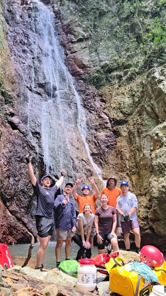
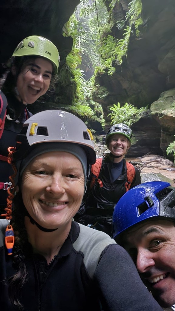
Kylie, Jason, Beck, Robin, Alex, Dane and meeeeeee
We were in northern NSW and it was too good an opportunity not to have a New Years Day play date with Jason and his QLD crew.
Every one else had done this one before but it had been on Kylie and my wish list for a while.
Pictures of it pumping in previous years had us frothing.
However, recent photos look like a trickle.
A storm the night before got our hopes up.
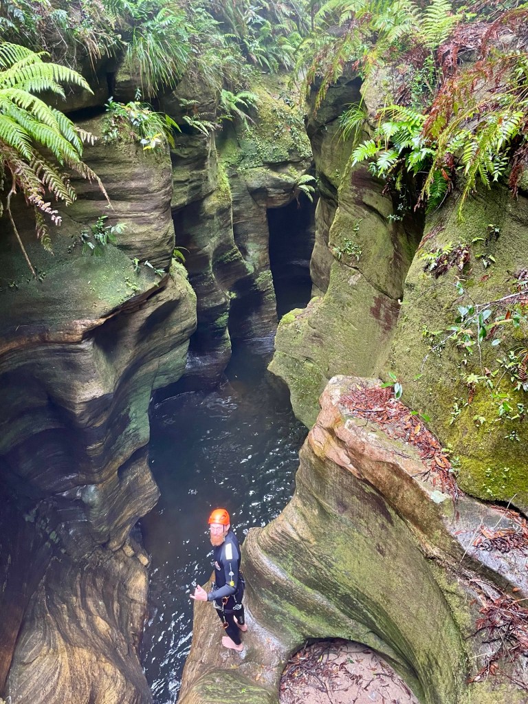
We meet at the top secret location (note: location may not be top secret) and skirt private property boundaries to access our canyon.
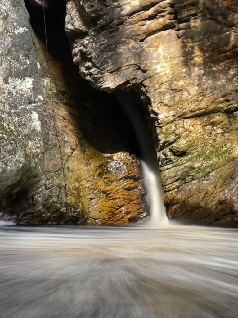
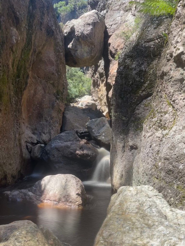
The storm had done nothing. Nothing !
The creek was dry as a nuns nipple.
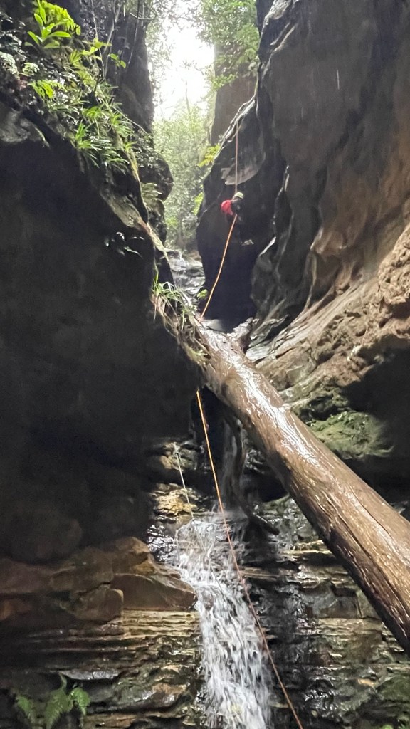
Well not quite. There was water flowing, just
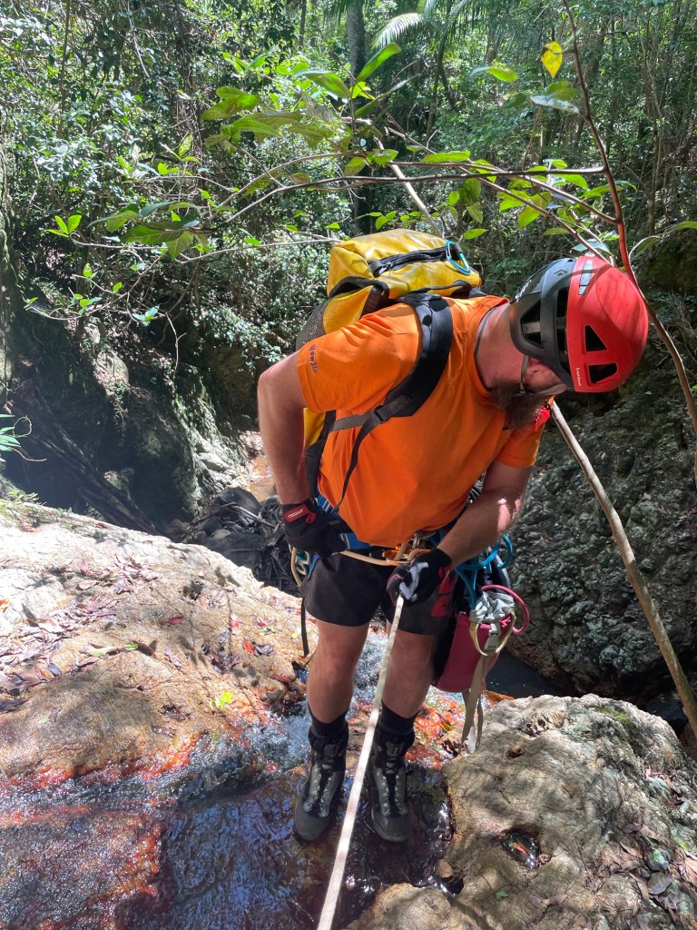
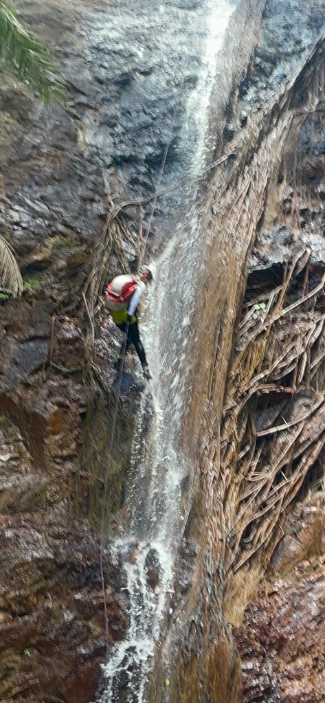
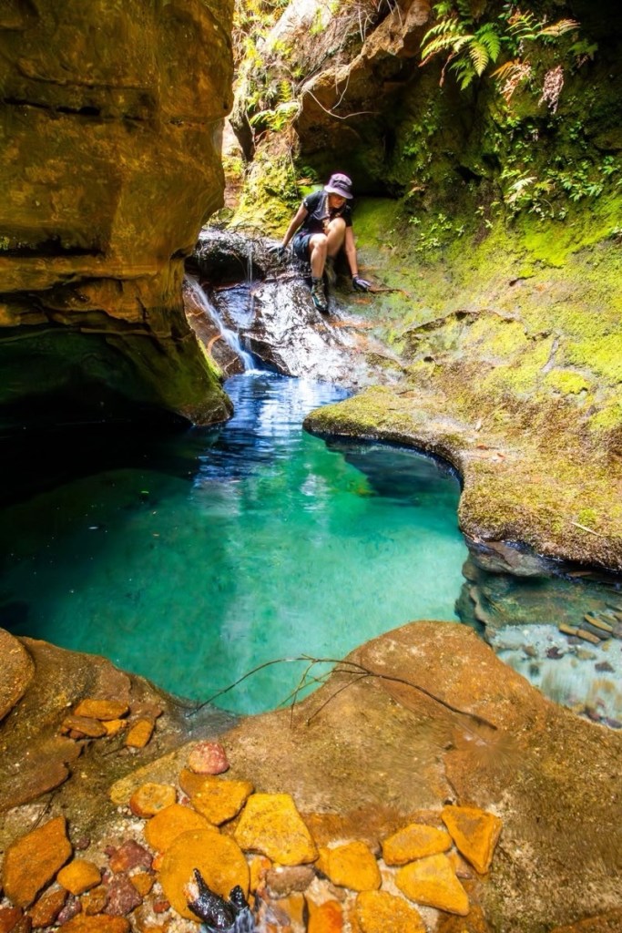
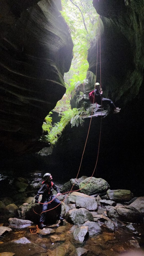
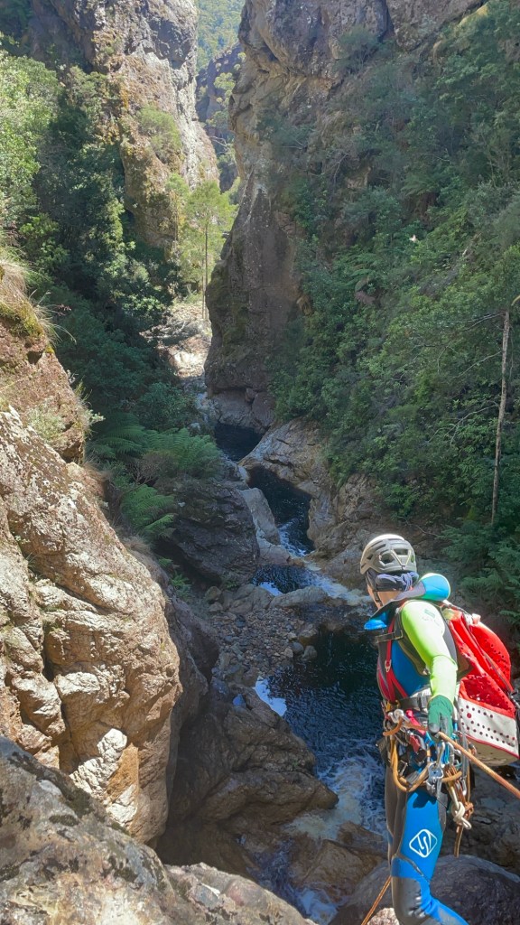
Jason wondering where the water went.
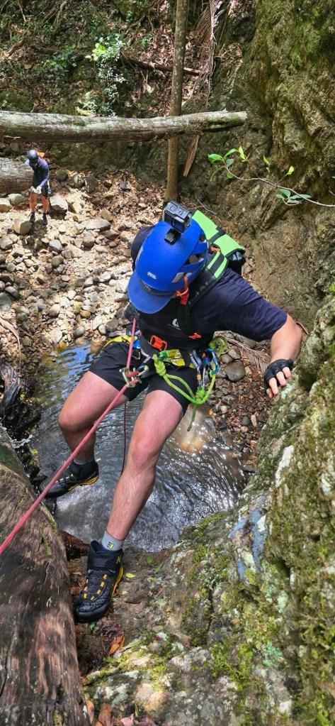
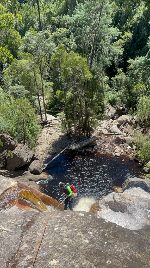
Alex on rope while Dane waits
Kylie thinking, well at least it’s a little wet
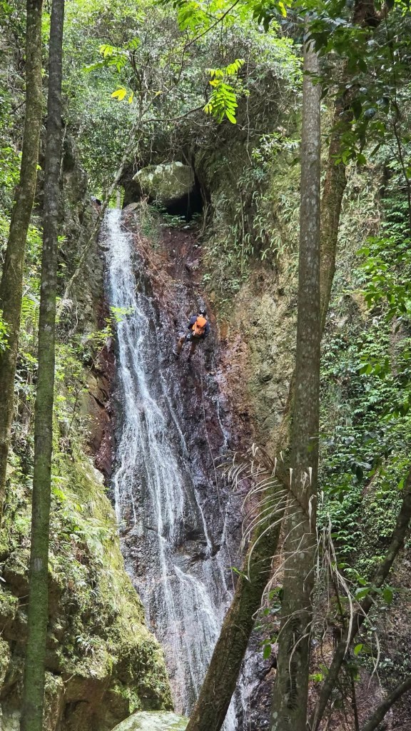
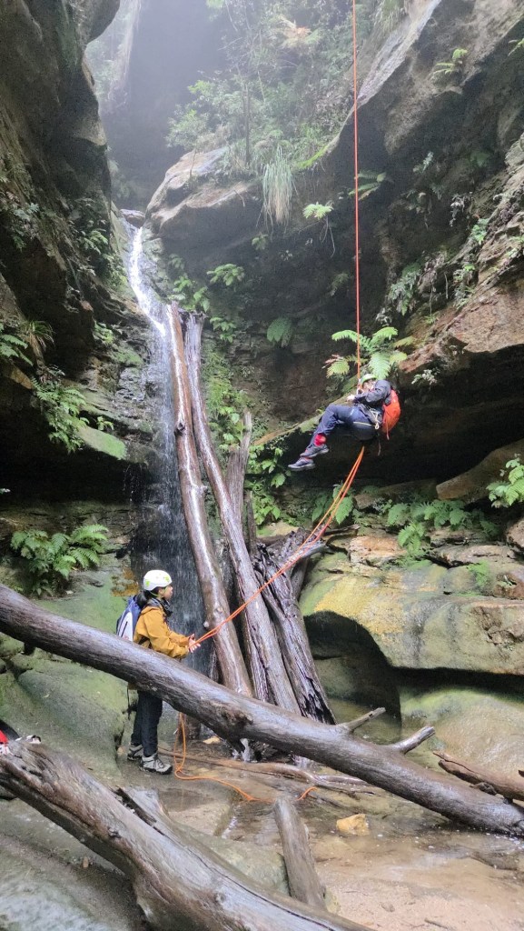
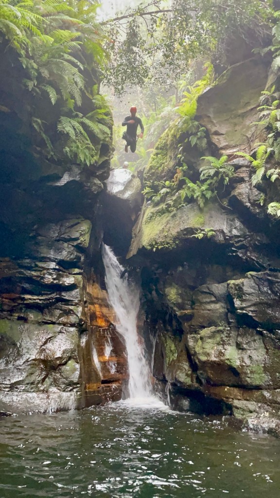
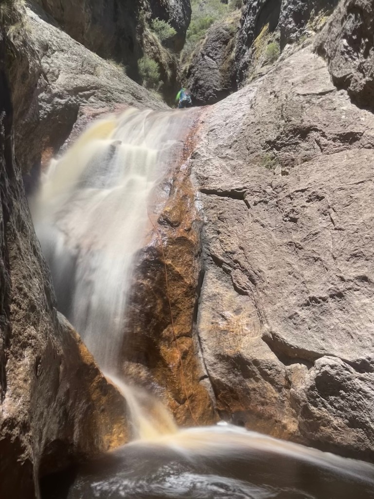
It might be a trickle but still pretty
Taking on Vecna
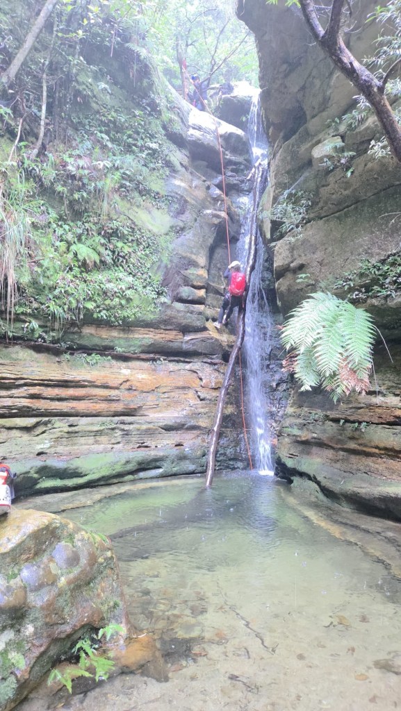
Robin wondering if he should avoid the pool or plunge in
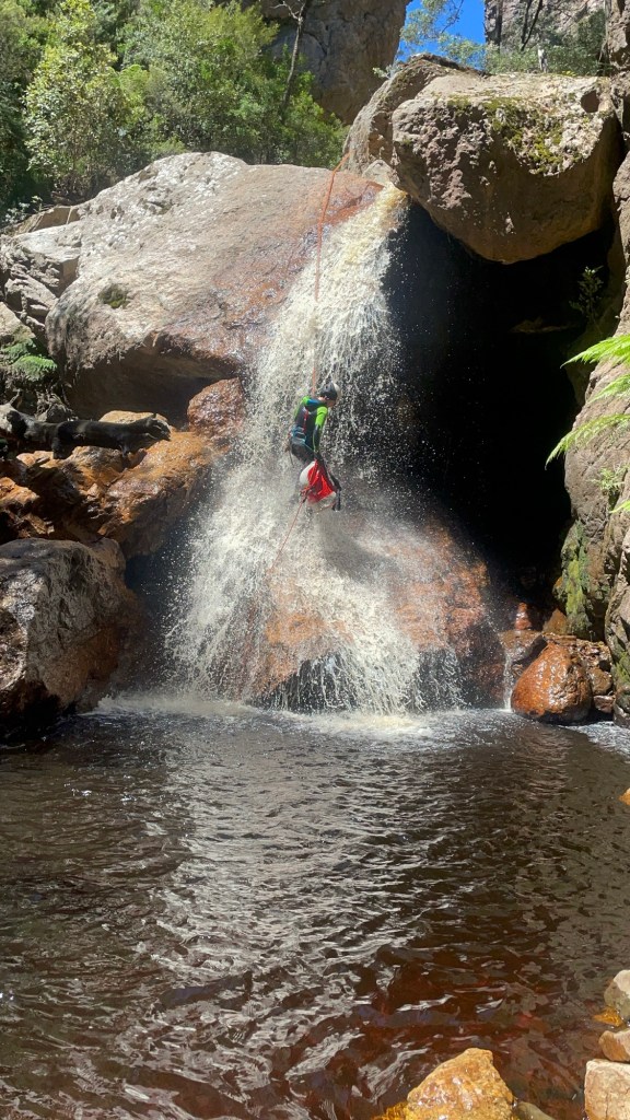
There is a teeny tiny lathe you can unclip and jump from
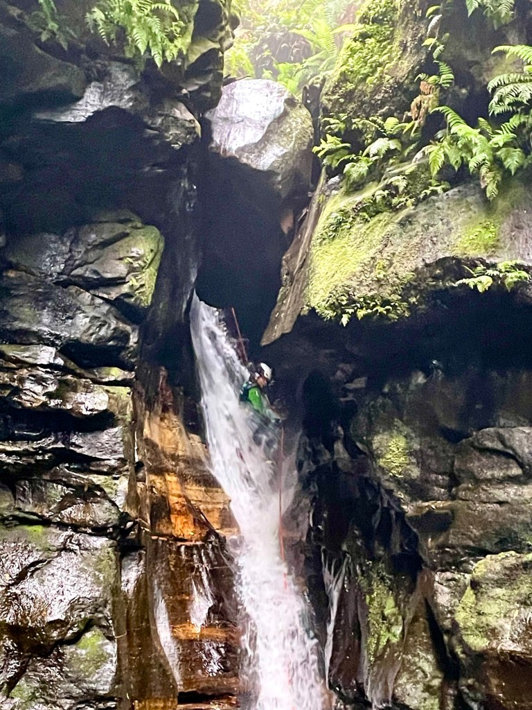
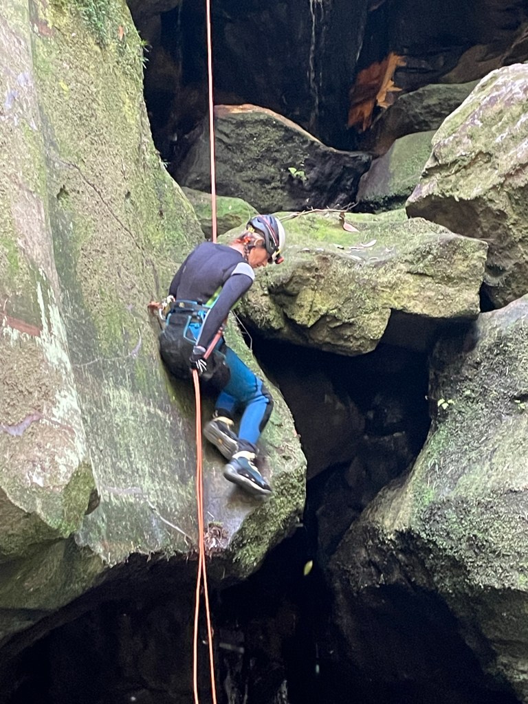
Coming last I made an error. I didn’t unclip it just did the usual Empress release the brake hand and jump.
I knew my centre mark was just beyond the anchor.
I figure I jump out and when I reach the end it will pull the pull strand with me.
I’ve done that before, but I unclipeped first.
This time I’m sailing through the air, there’s “a bit” of a jolt snap the plastic lug it was tied to and the end of the rope recoils up And is now on a teeny tiny ledge 4metres above the pool.
Up I jug to retrieve it.
Lessen learned, double check your centre mark, especially when doing abseils exactly as long as half your rope. And keep an eye on your end of rope markers
I have marks at the 10 and 5m points to let me know I’m getting to the end. I didn’t even look for them. Dumb arse.
Anyhoo all good, no harm, rope retrieved. Let’s never speak of it again.
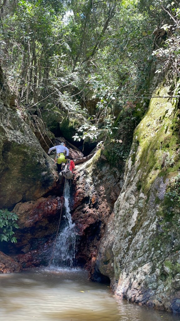
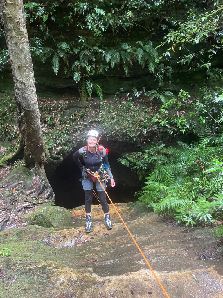
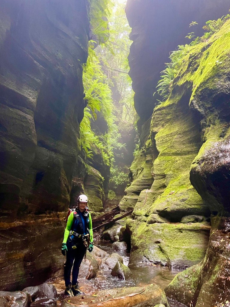
One more abseil and she’s all over.
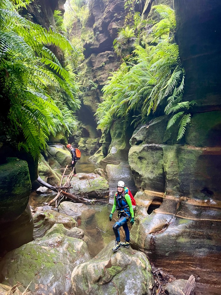
Beck doing it in style Only slightly rinsed but Happy canyoners
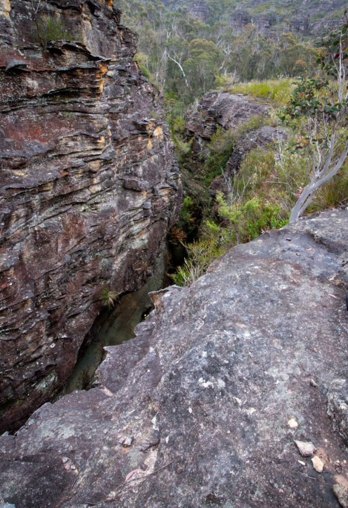
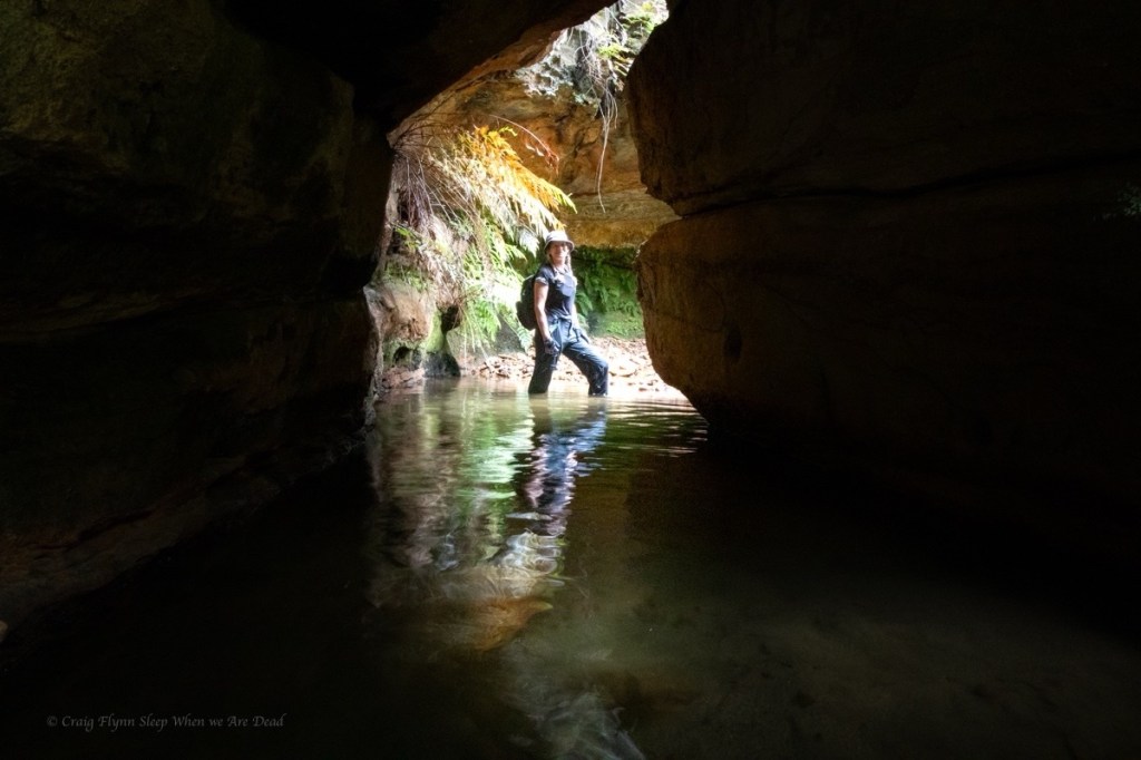
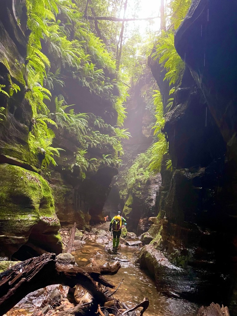
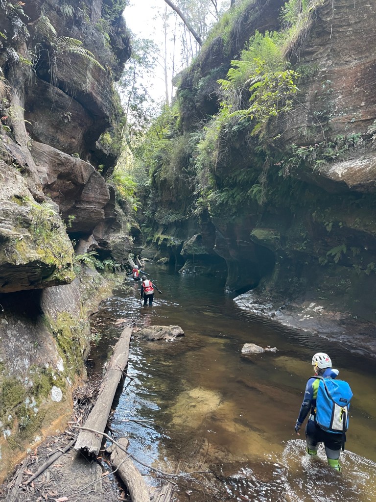
Popeye creek pops in and out of canyon sections along much of its course and it’s one I’d not done before.
A big Saturday trip had been foiled by thunderstorms and we just needed to shake out the cobwebs but couldn’t be arsed repacking ropes and stuff so thought why not have a look at some non abseil sections in Popeye.
Meeting at the crack of 10am, or there abouts we make our way in in no time.
We’d be entering the canyon a long way upstream of where the jamieson guide recommends but not too far from the increasingly popular Popeye falls.
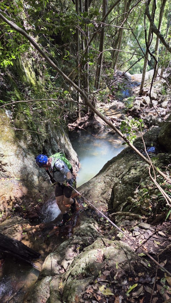
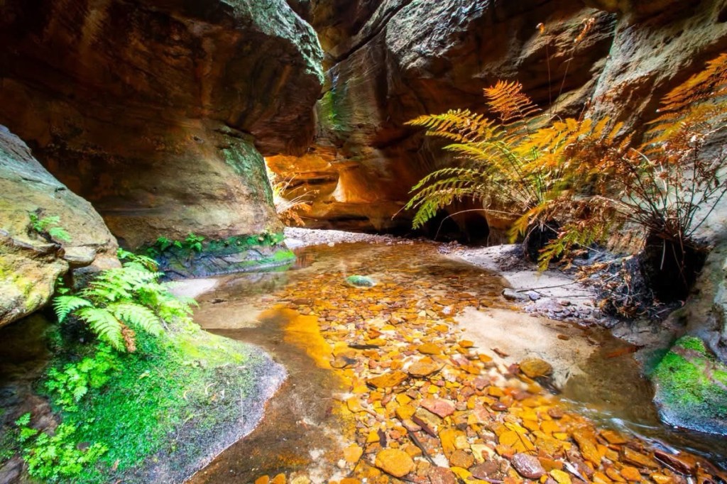
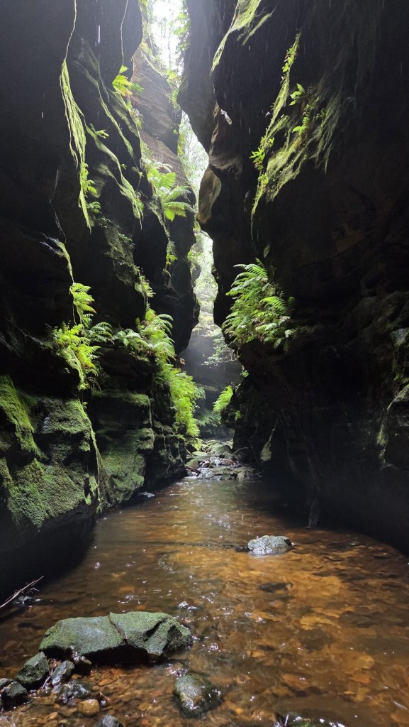
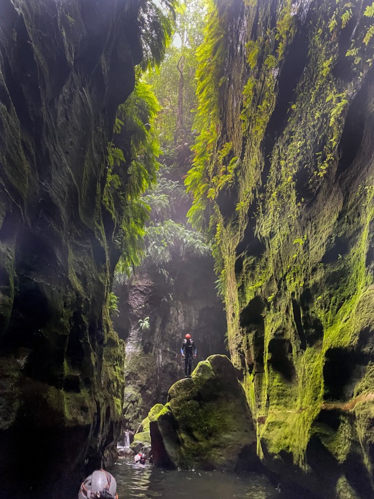
The creek cuts a deep, promising looking cleft in the sandstone.
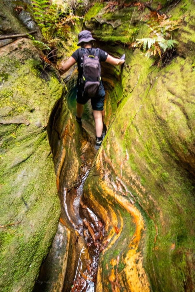
A short section of narrow u bends hide a pleasant little canyon.
There’s a bit of bridging to stay dry above the knees. But the water is a pleasant temp anyway
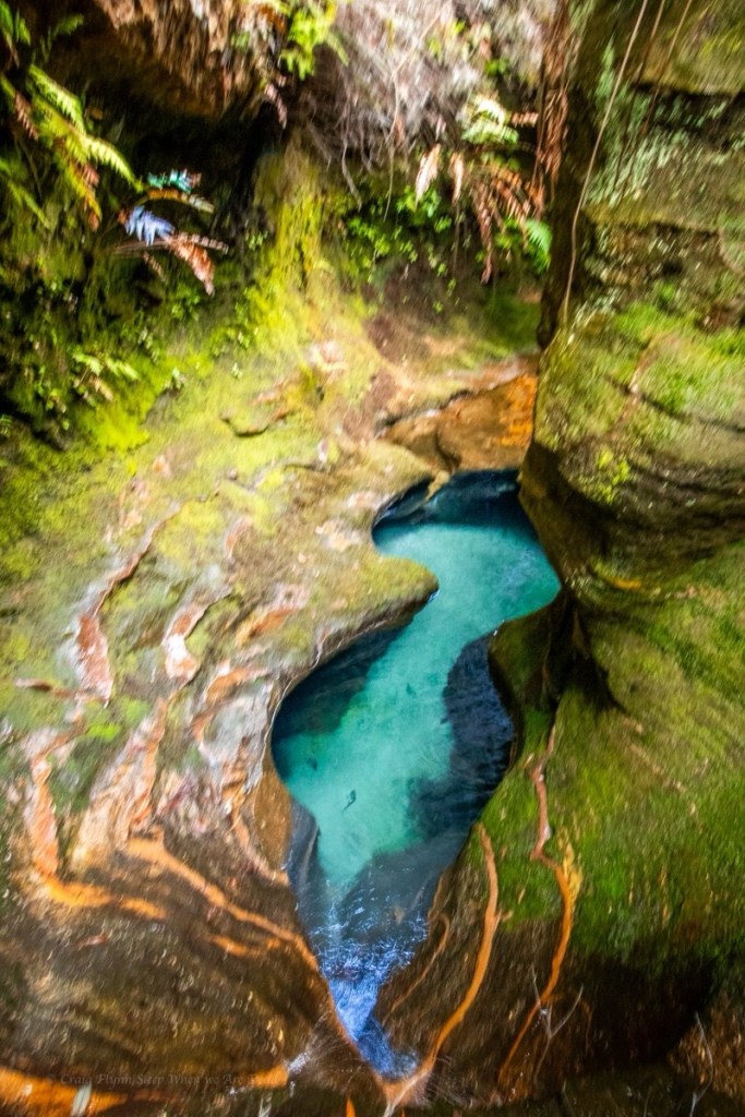
Not the figure 8 pool
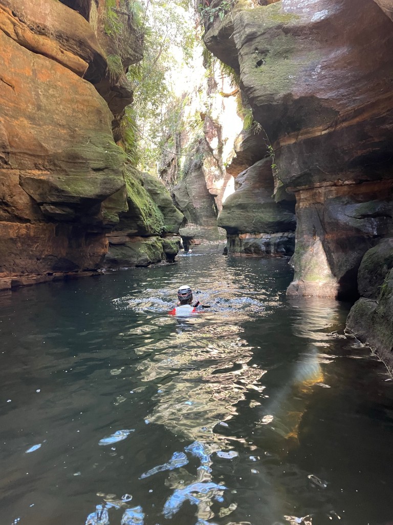
It is very pretty.
Parts very similar to the Dumbano tunnels.
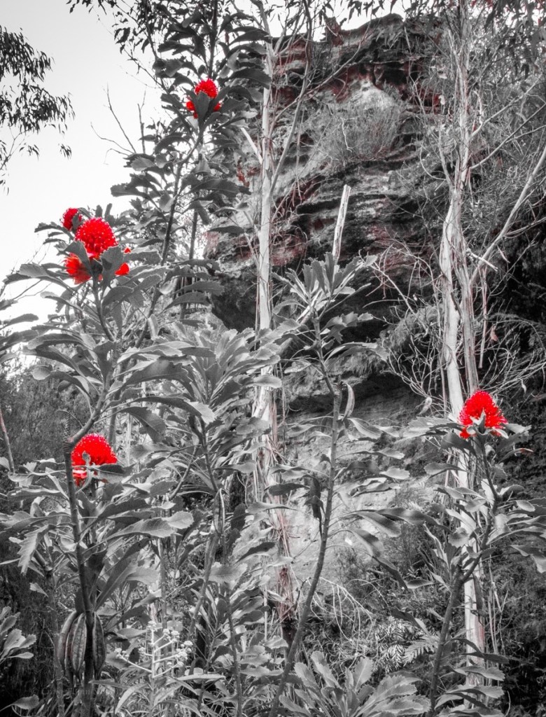
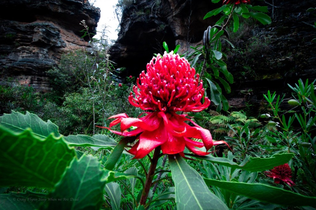
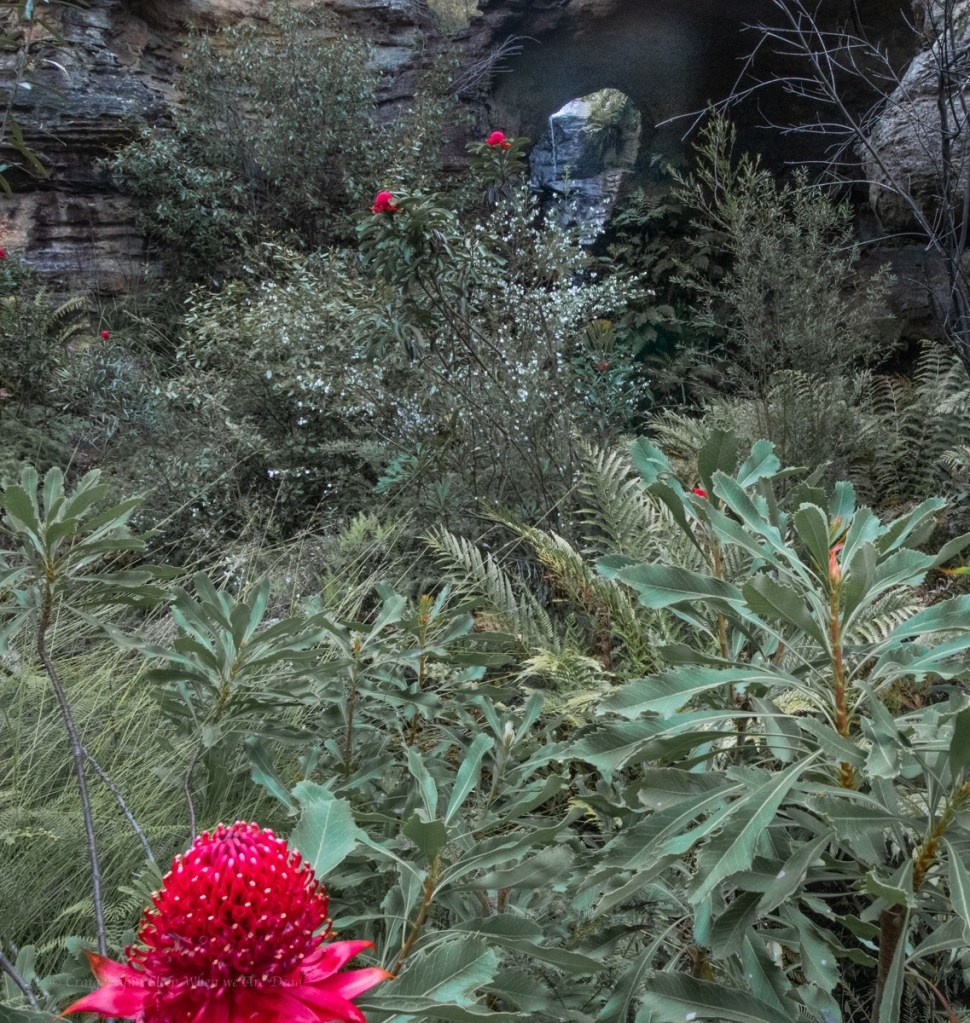
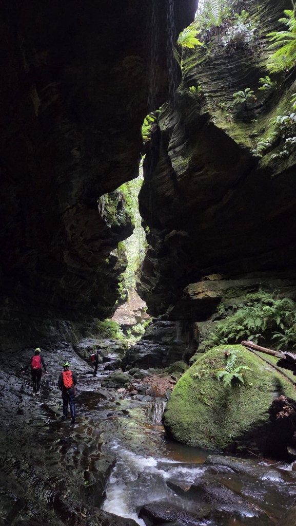
We are already impressed. the canyon opens up a bit and Waratahs line the banks.
Waratahs along a spur off Waratah ridge? Who would have thunk it
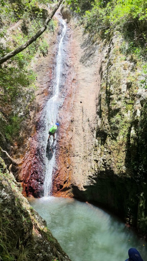
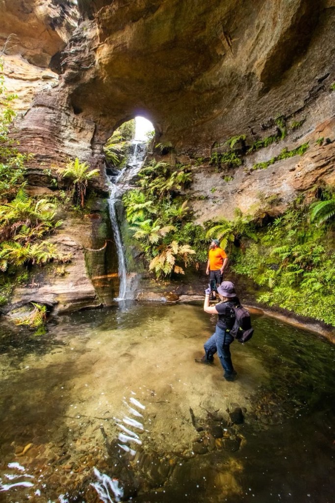
And soon we come to the falls.
Most visitors to here avoid the canyon bit and keep their feet dry by scrambling down the nose.
It’s a funky little waterfall through an arch in a side creek
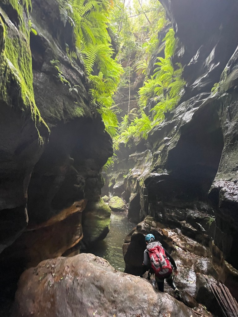
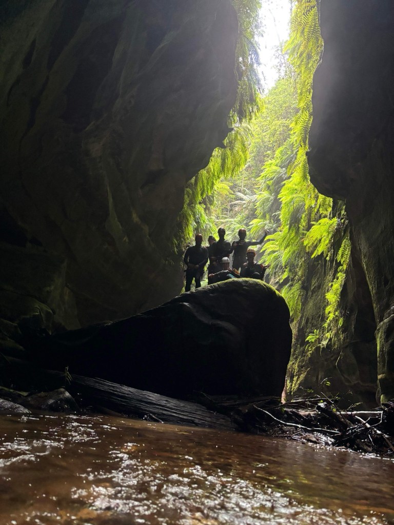
We phaff about with photos for a bit, we have to pool all to ourselves., but then push on downstream to the next canyon section.
A bit wider and deeper it’s a nice walk through section
It’s nice
Again the canyon opens out. We believe it’s a 1km scrub bash down to the next bit so, happy with our easy day, we retrace our steps back up to the waterfall. A crowd of people are here now.
There’s an easier way in, says old mate sucking in a vape.
We came that way, replies Ellie very politely. We just had a look at some other stuff while out here.
We leave the guards and scramble out into the cliff top for lunch.
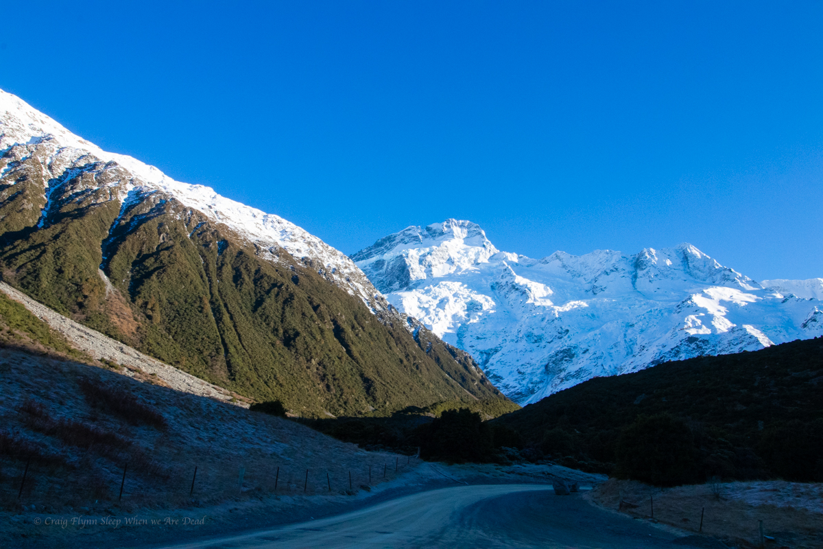
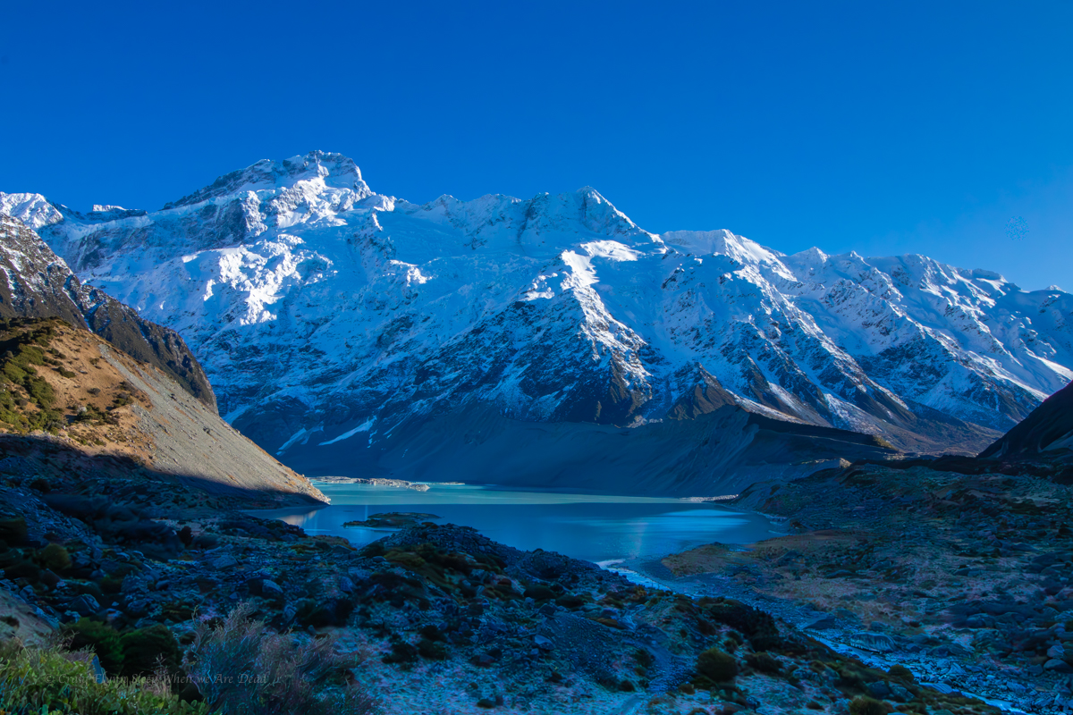
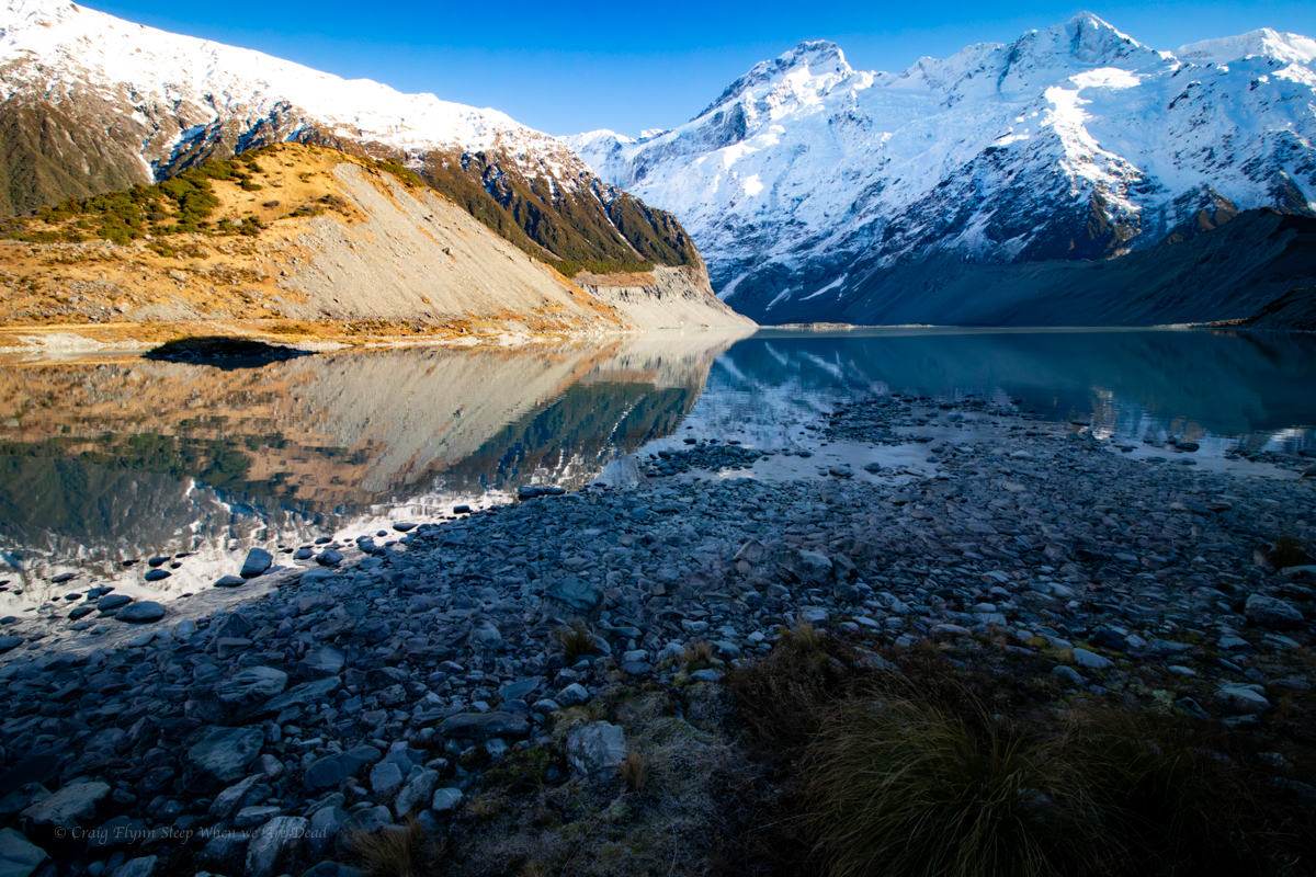
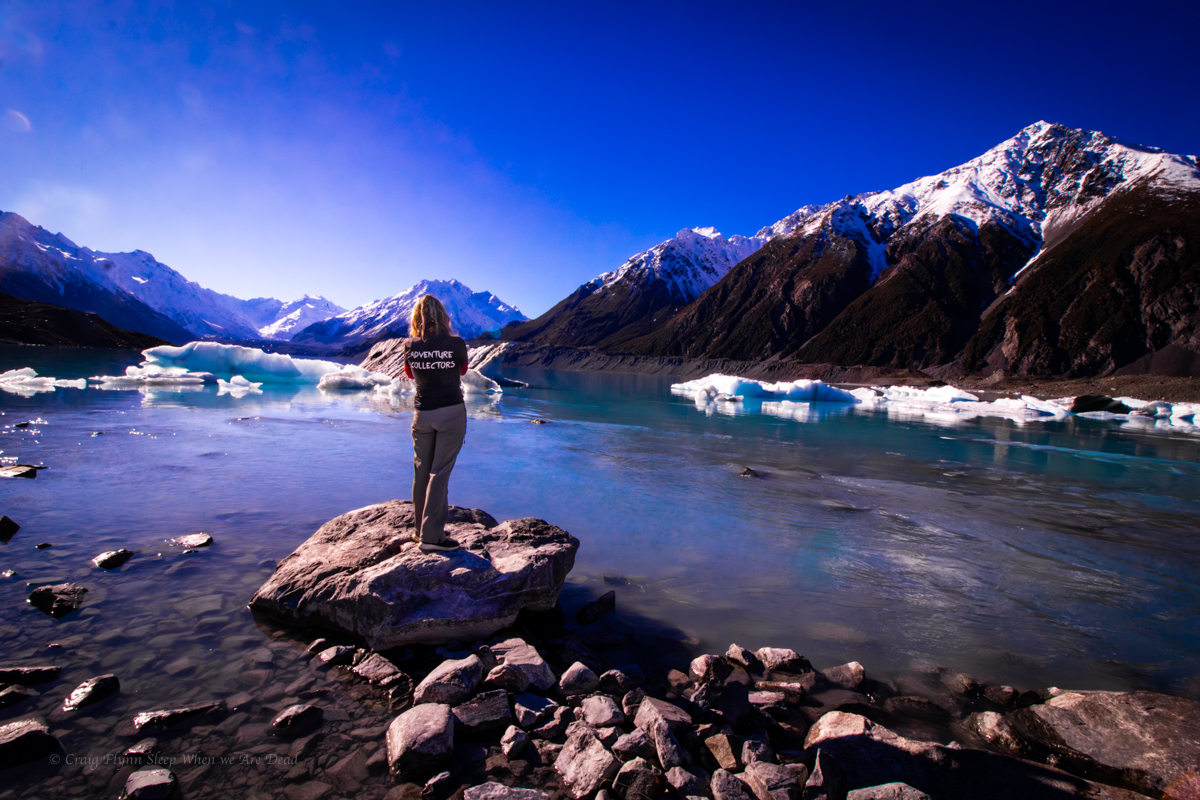
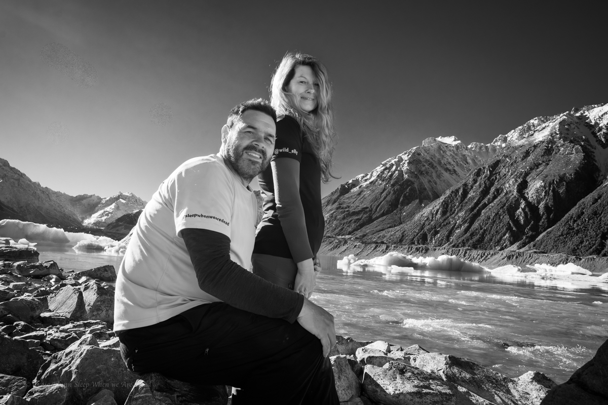
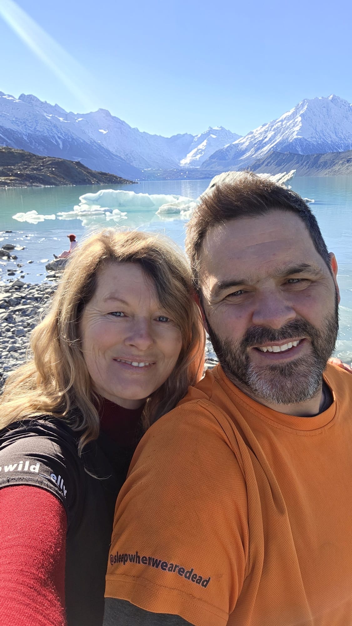
From the Clay Cliffs we make our way up to White Horse Hill campground which is nestled below the towering peak of Aorali/Mount Cook.
White Horse Hill is a paid ground. During the winter the main toilet/shower blocks are closed off as the frequent negative temperatures lead to burst pipes and what not. What you are left with is two of the smelliest drop toilets I’ve ever encountered, And I’ve done long weekends at Newnes Camp ground in it’s heyday.
Take the biggest breath you can here and hold it as long as you can, a young whipper snapper was heard giving advice to her younger brother…..
Don’t let that put you off though, the scenery is well worth a skinny loo or two.
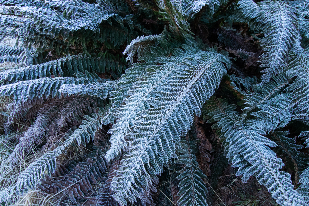
We roll in late afternoon and set the camp up. The temperature is already -2ºC and falling. The little diesel heater fitted in the van is amazing.
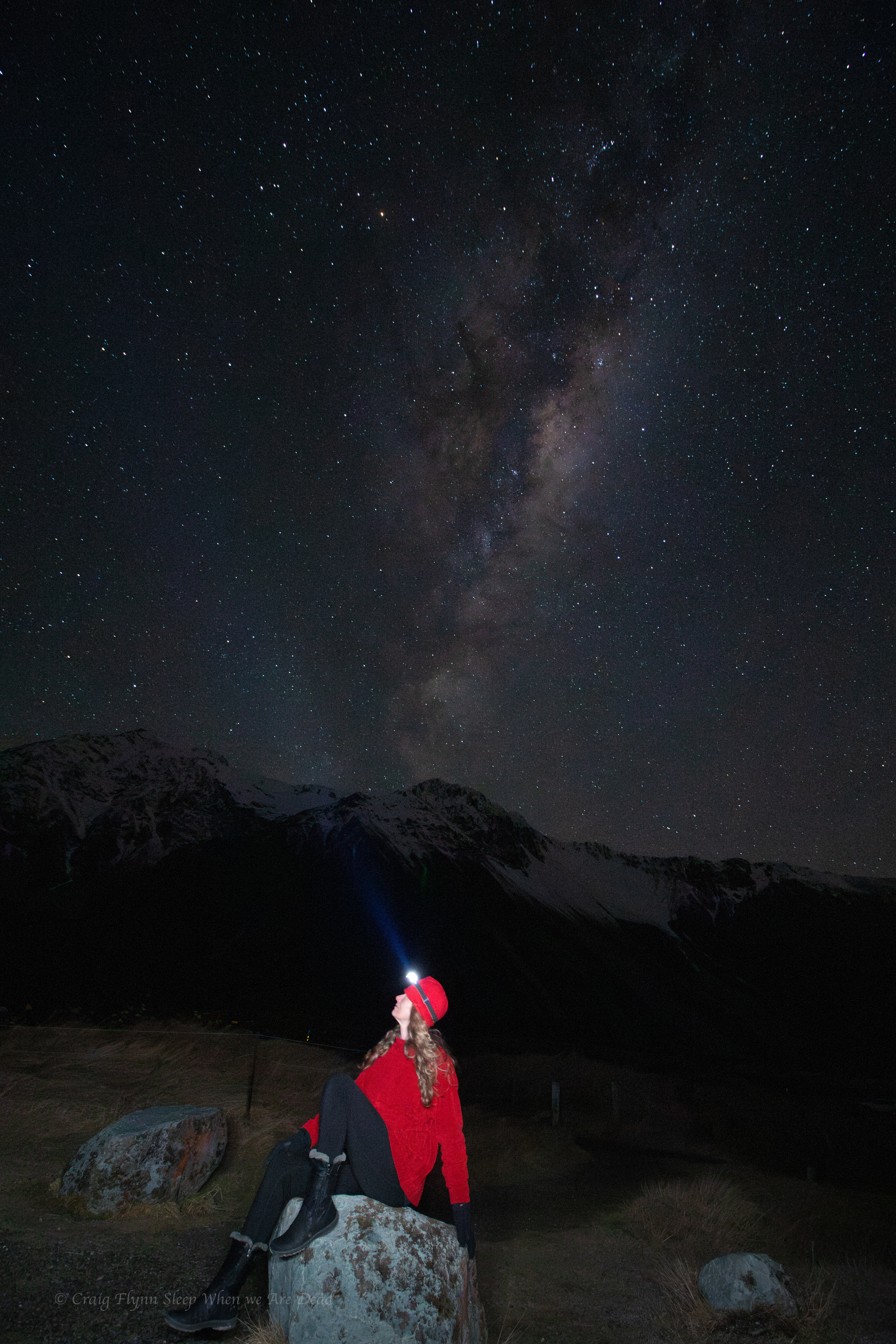
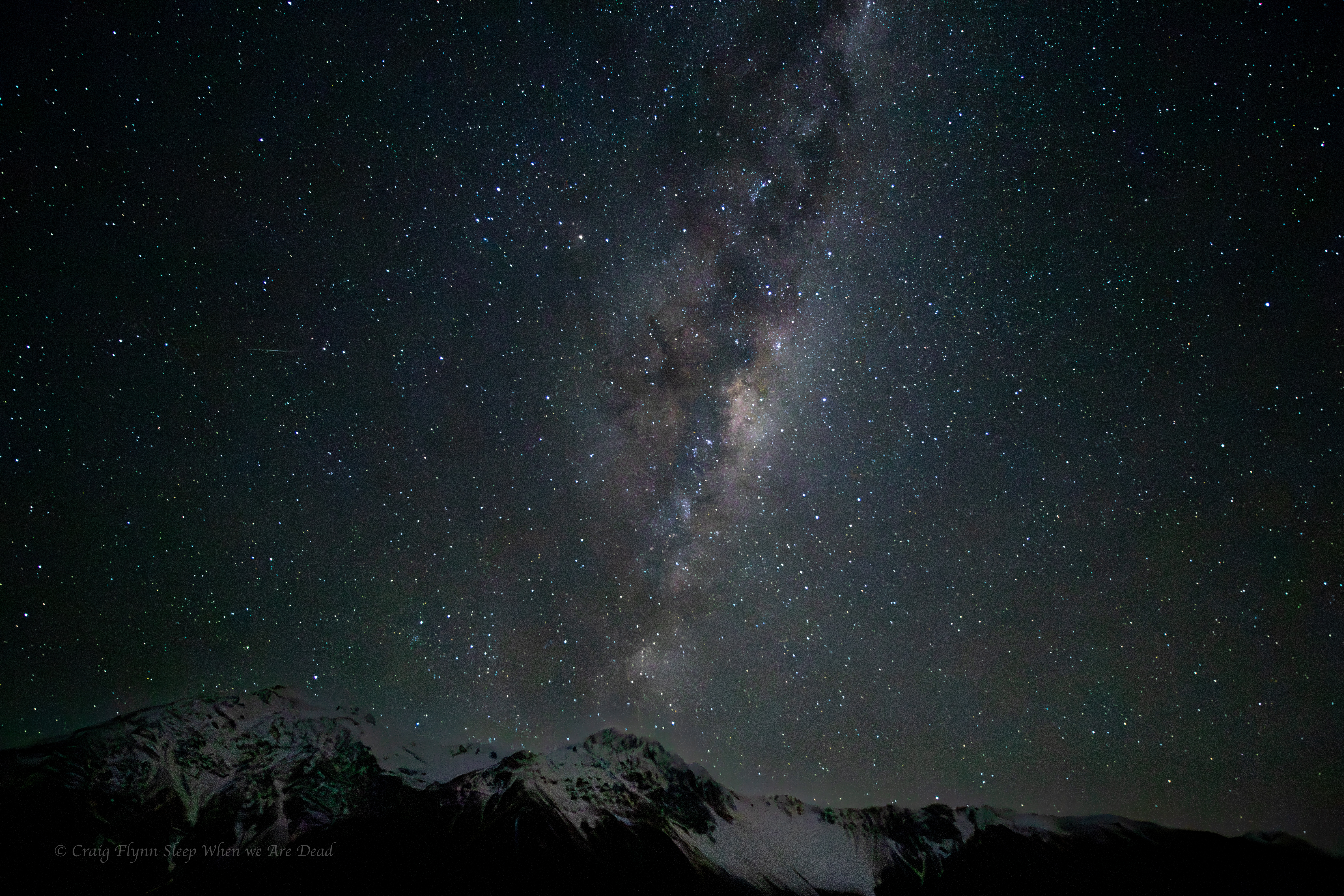
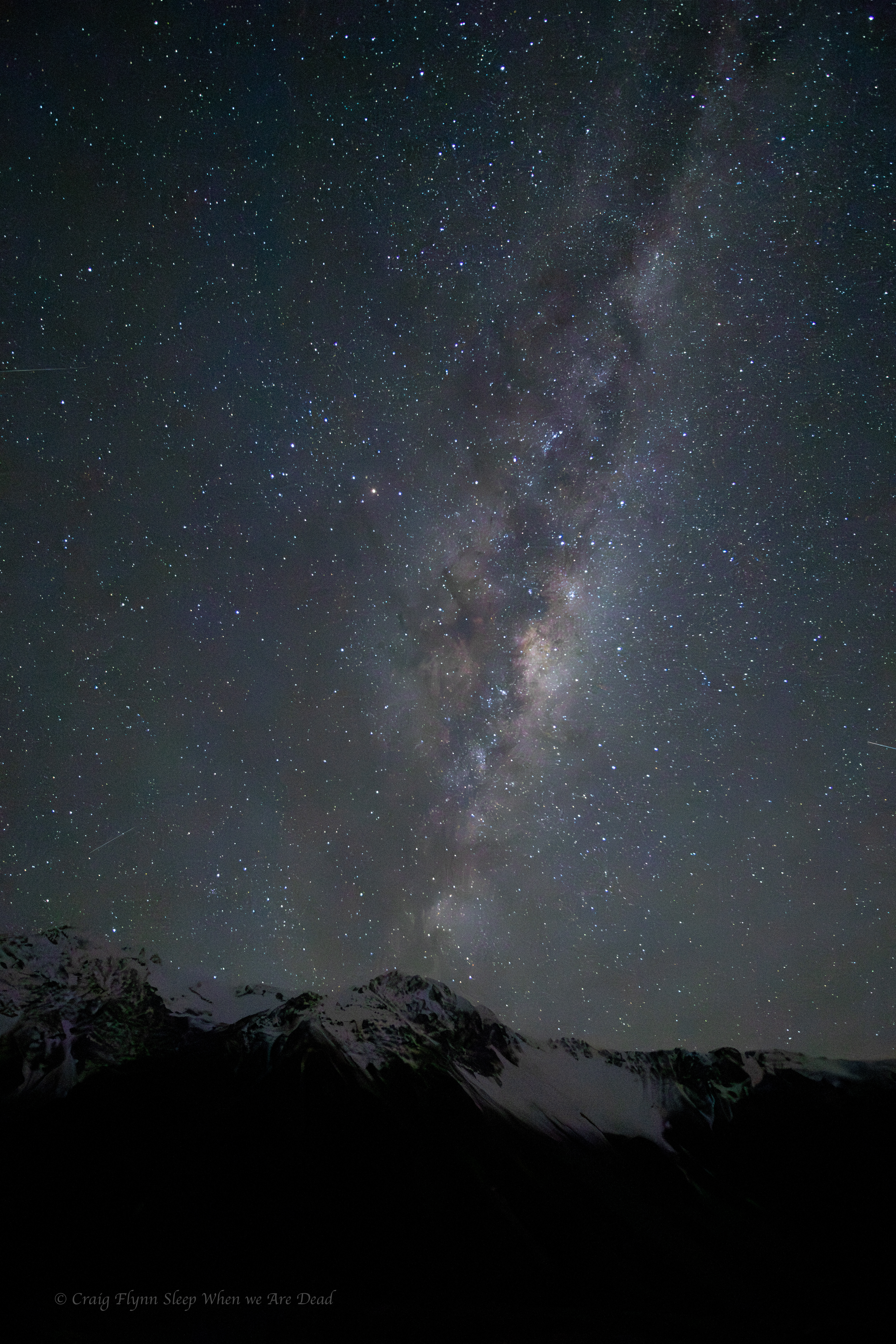
As night settles in and the temp plummets to -8º we decide to brave it for the sake of the most amazingly clear night sky.
Clicky Clicky to see full photo
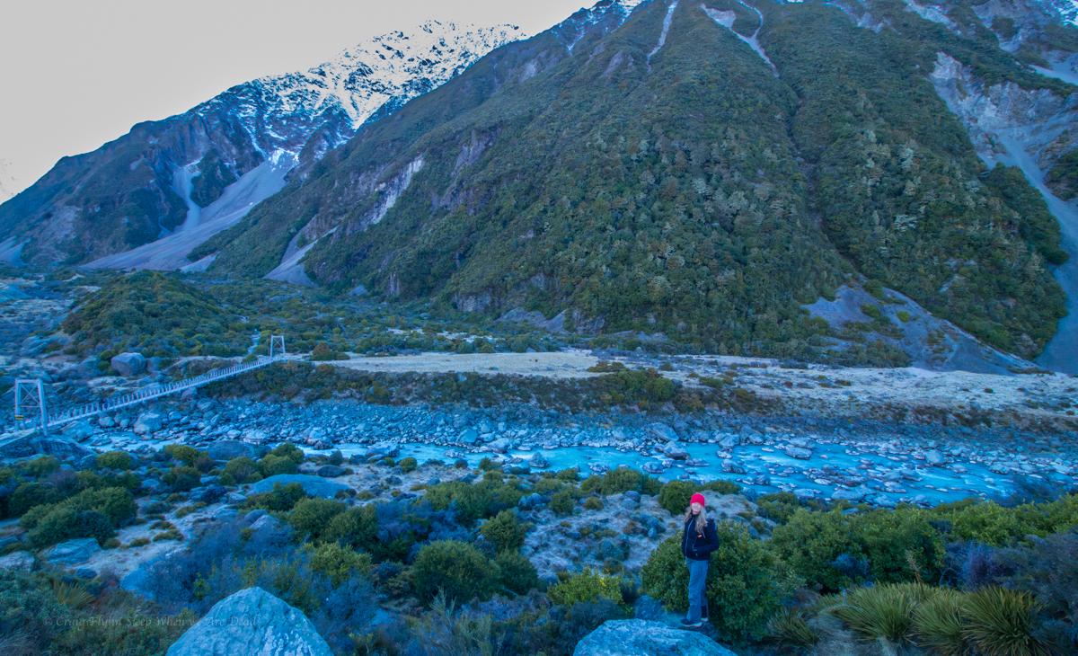
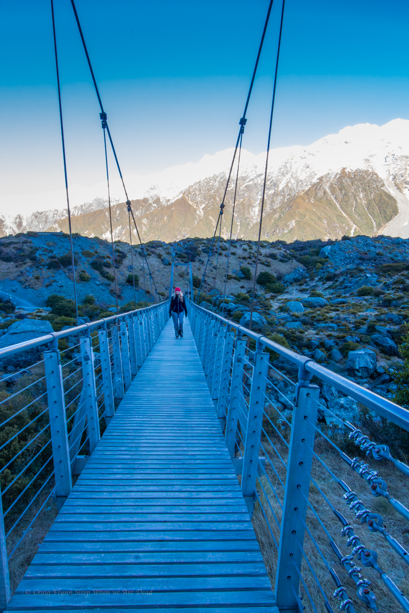
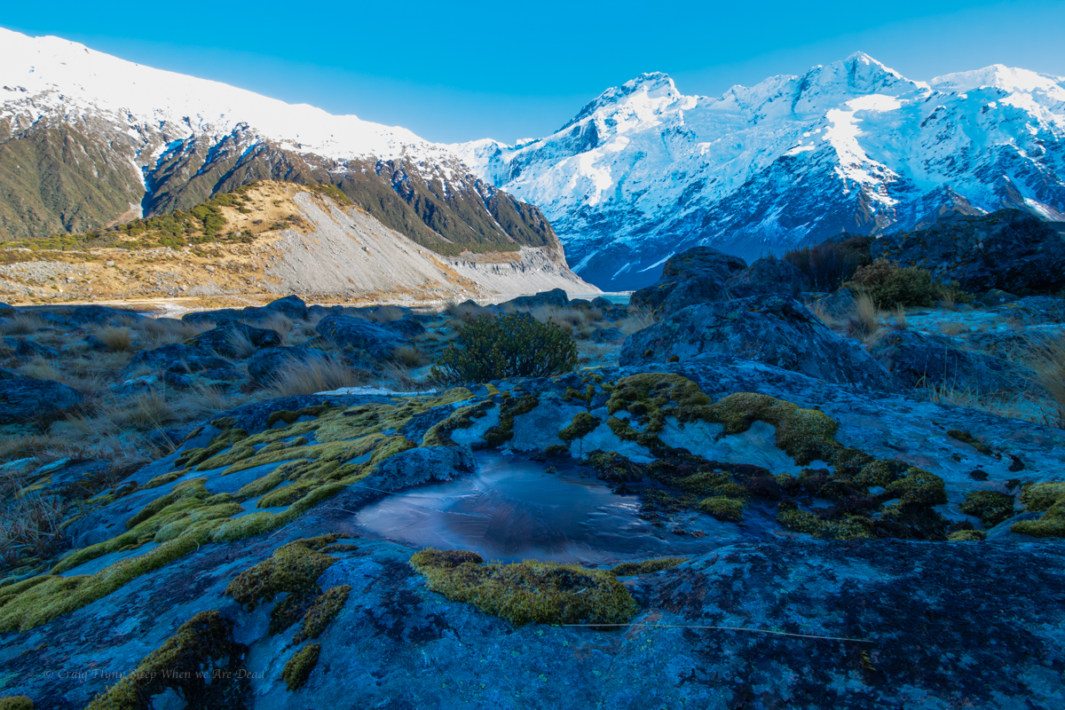
The next day we head out on the Hooker Valley Trail.
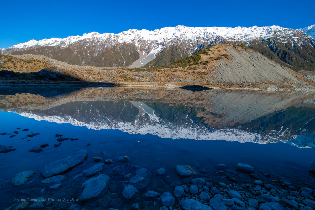
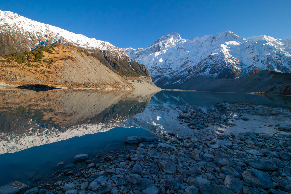
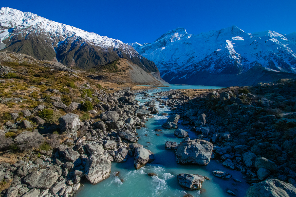
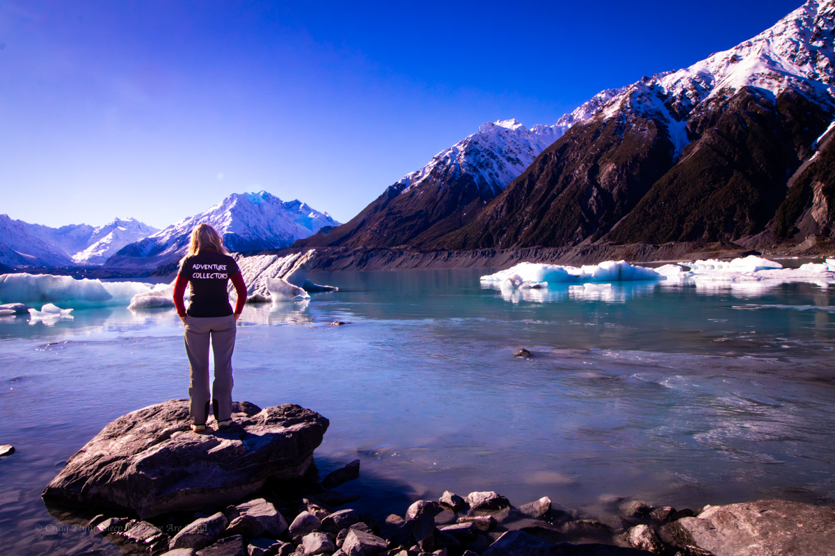
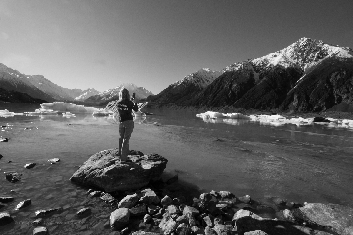
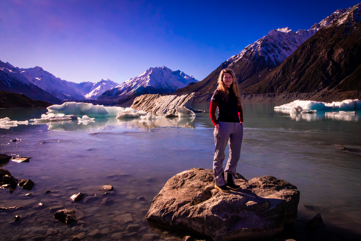
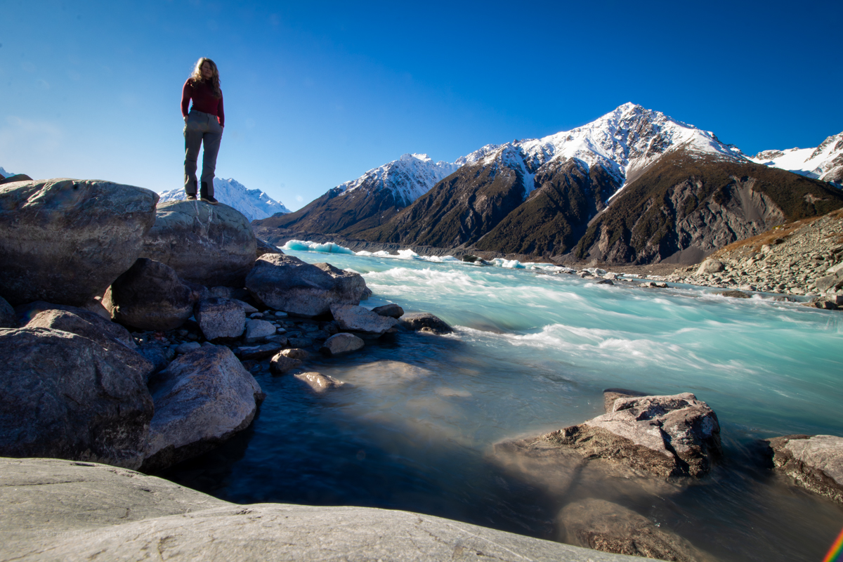
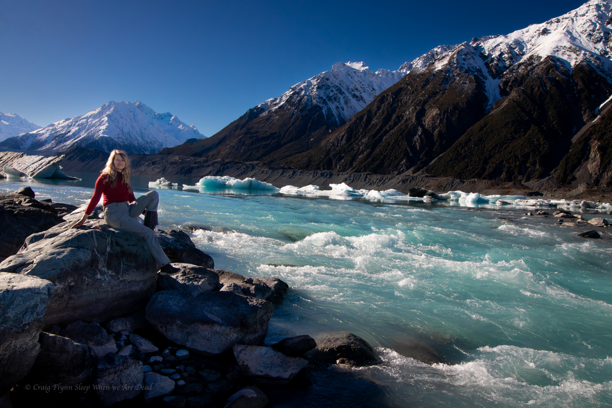
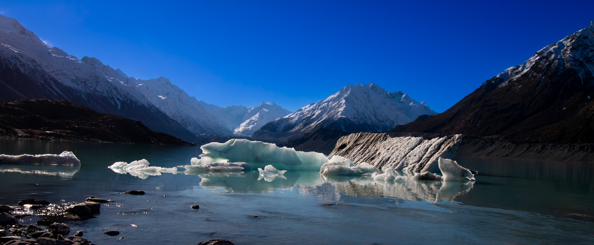
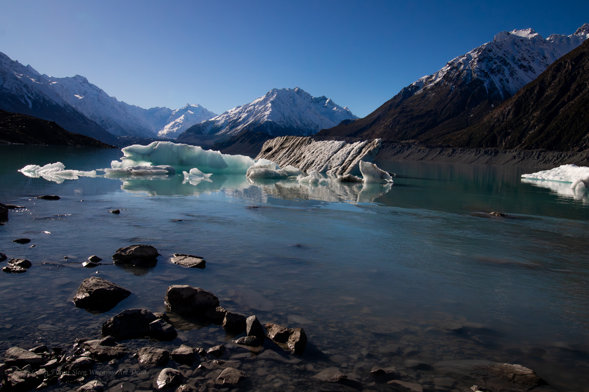
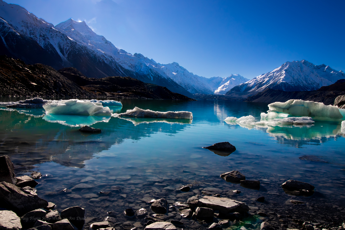
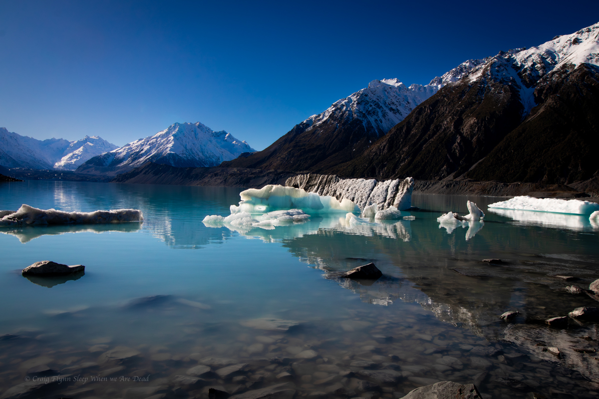
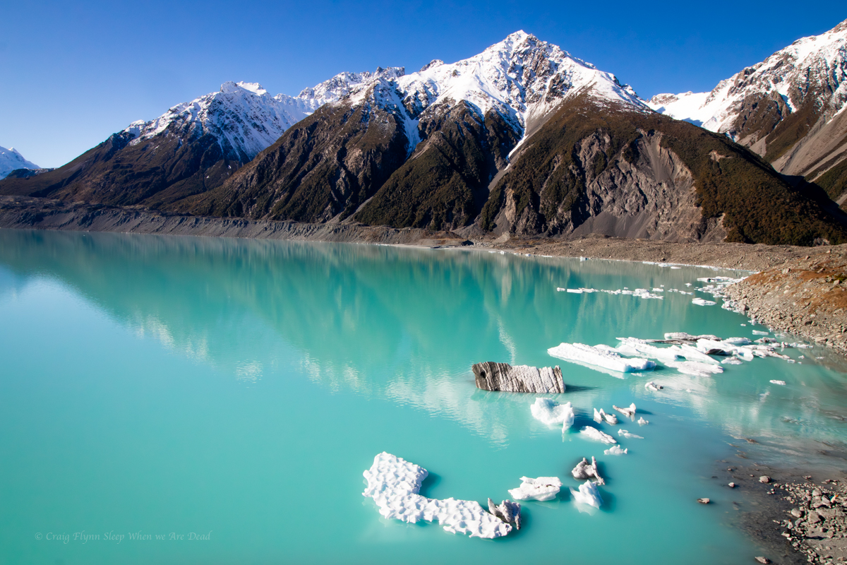
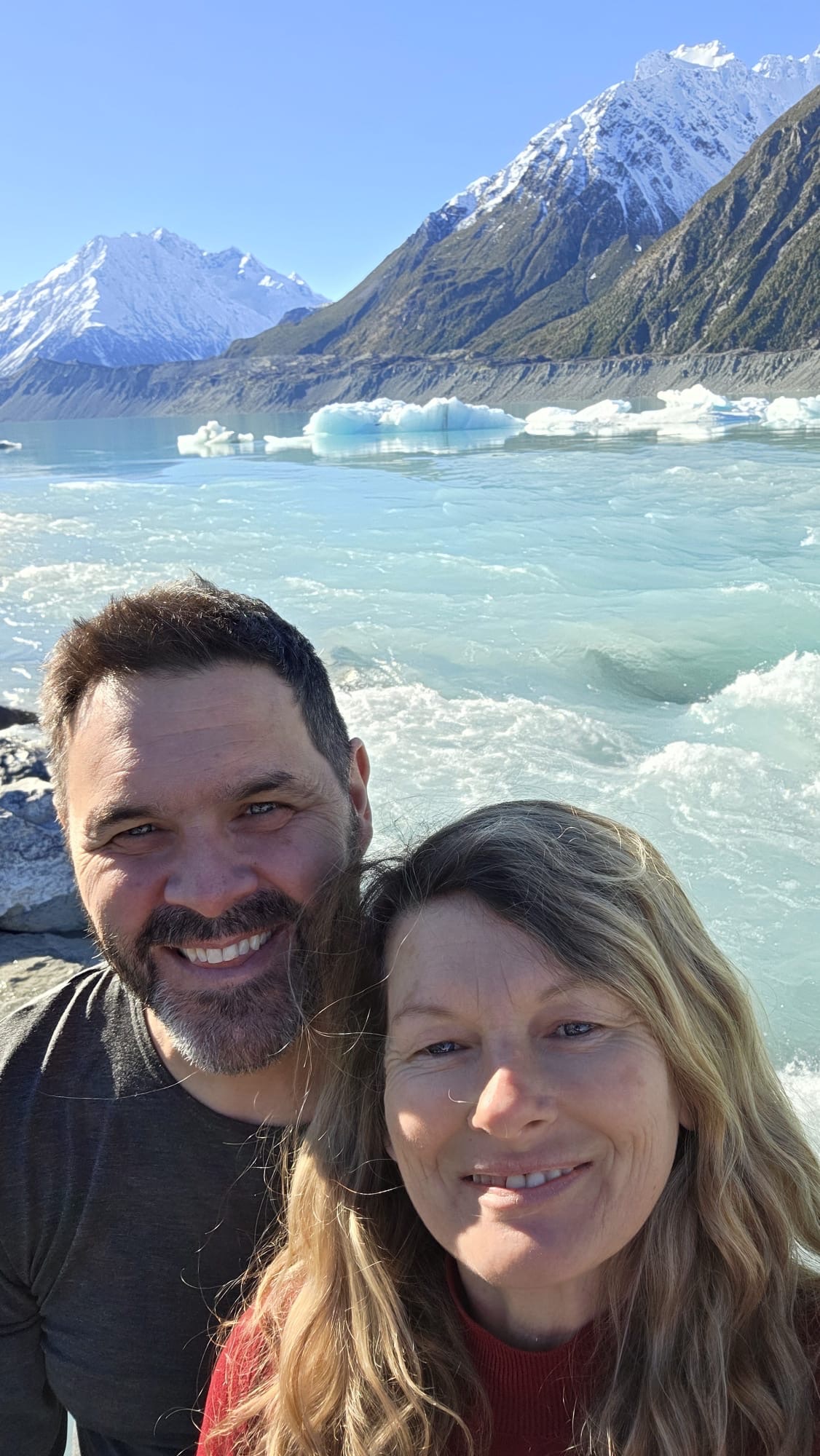
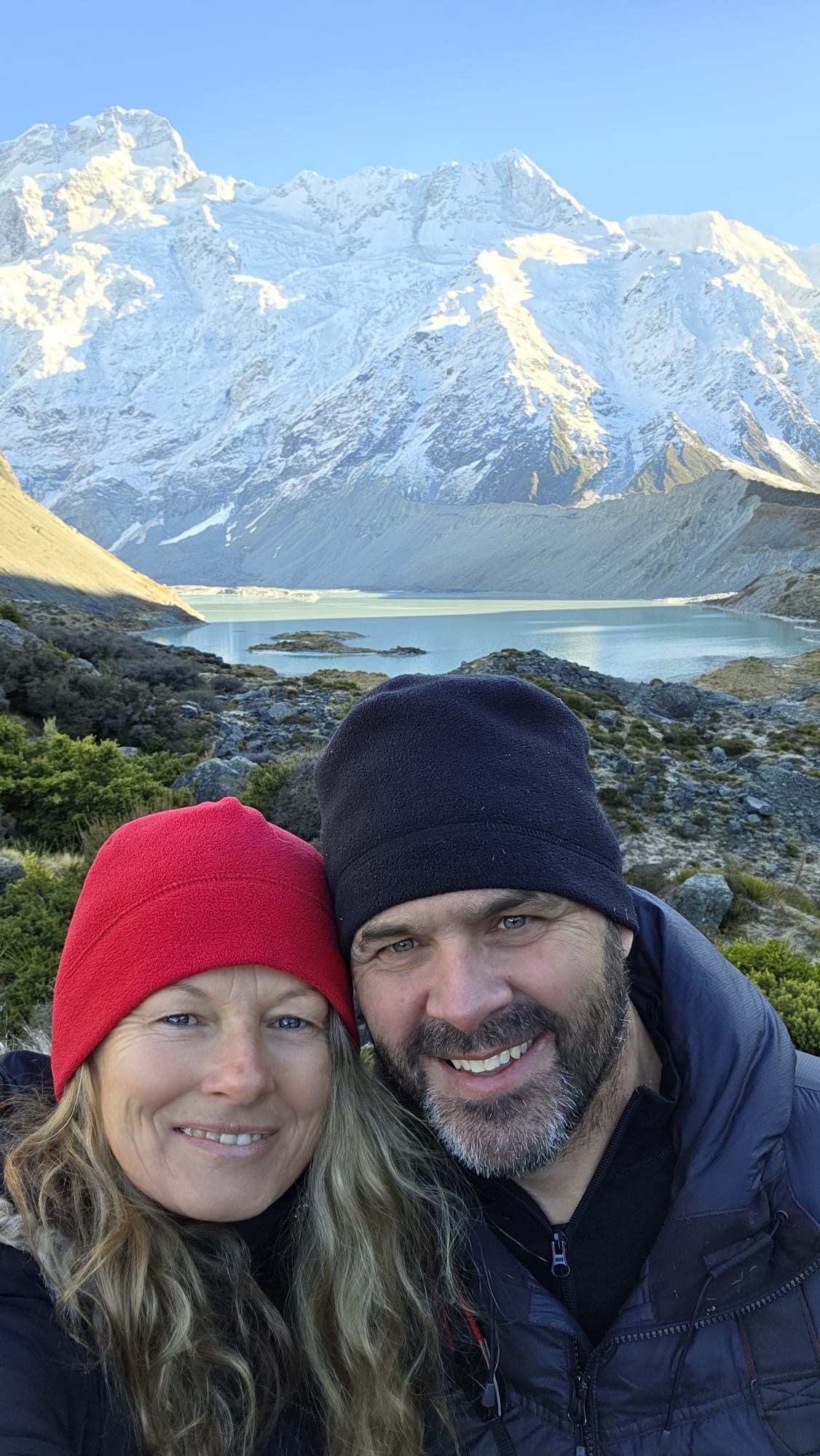
Normally this gives the closest access to the base Aoraki the general public will get and also views over the proglacial Hooker Lake, complete with icebergs, however only a short section of the trail was open at the time of our visit due to track work and a bridge being washed out.
the short open section did, however provide great views over the Mueller Glacier and it’s lake.
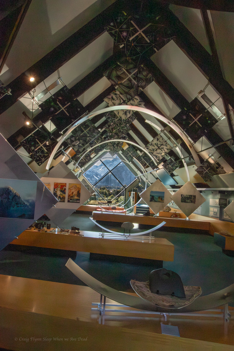
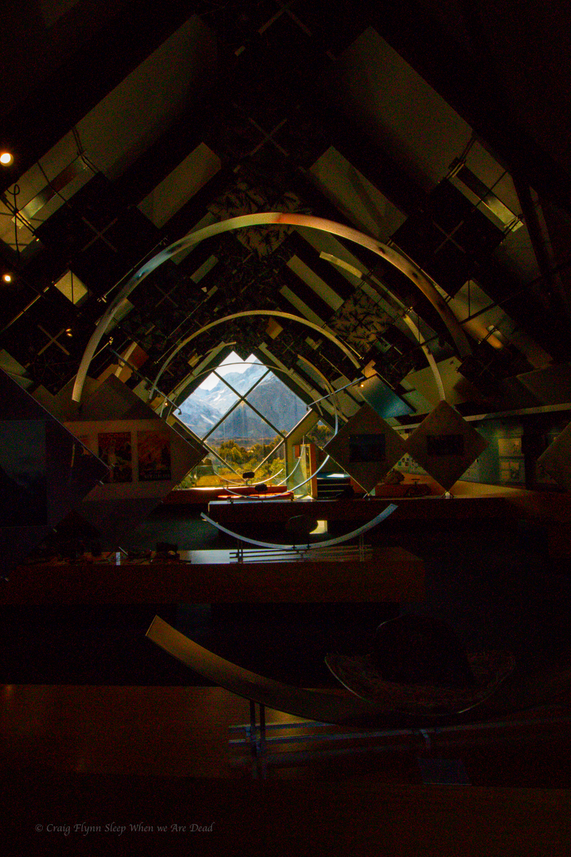
Next we return to the van and duck over to the village for a coffee. While there we dropped in to the Department of Conservation information centre.
Wow!!!
What an amazing free resource. If you were in the area and the weather was bad you could easily spend a whole day in here. There are displays and videos and more lots more.
But today was a blue bird day so we have a quick look and then head over towards the Tasman Glacier.
Here you can take helicopter tour or a boat tour on the lake. We opt to just do the tourist walks.
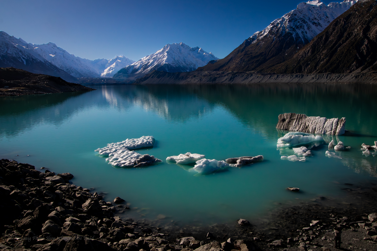
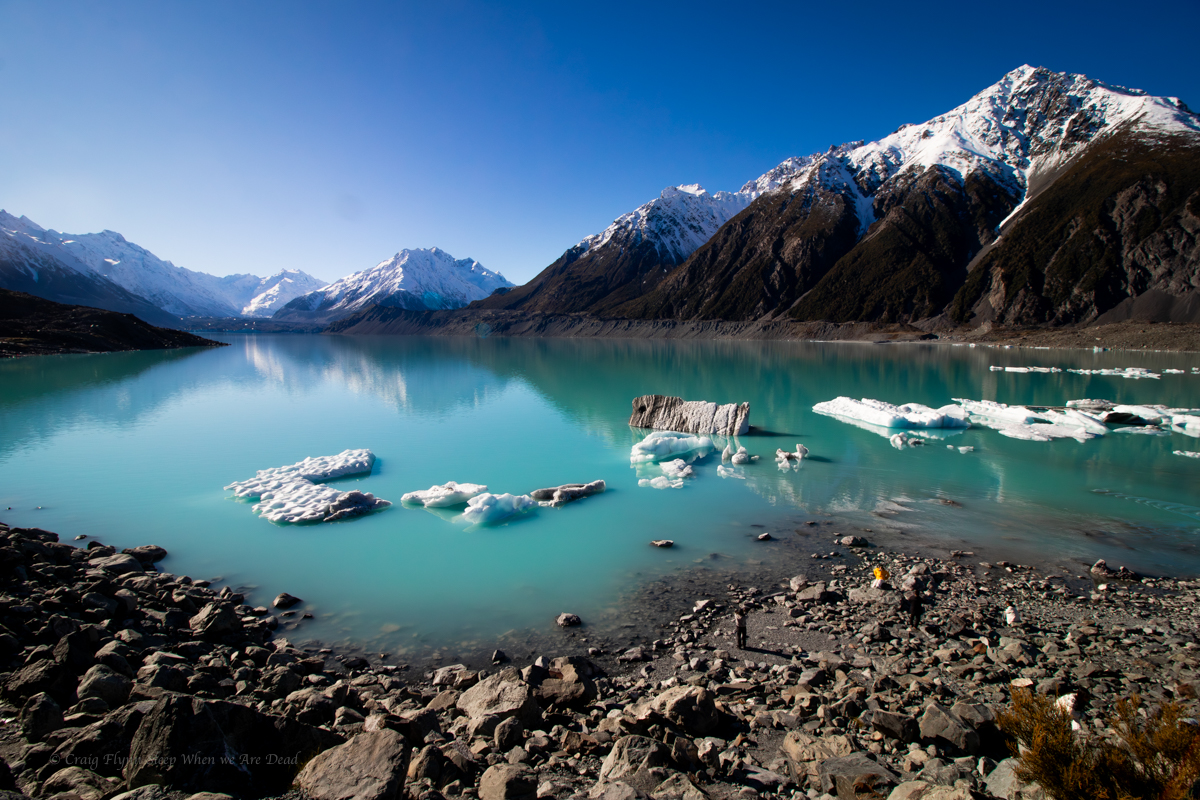
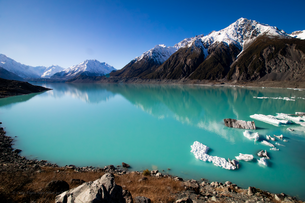
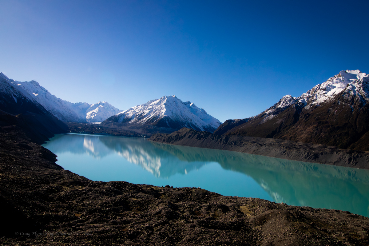
Sitting between NZ’s two tallest peaks the Tasman is New Zealand’s largest glacier, being up to 4km wide and 600m thick in places. It had remained a fairy constant 28km long through out its recorded history up until it starting to retreat in the 1990s. It’s currently 23km long and retreating on average 180m/year.
Looking up the lake from the tourist lookout the glacier is’t much to look at. Compared to the white snow and crystal blue ice on the Franz Josef, the Tasman crunches up and contains a lot more rock and minerals (Glacier flour), giving it a dark, almost dirty appearance. Without the information sign at the I doubt most people, me included, would pick it out in the distance.
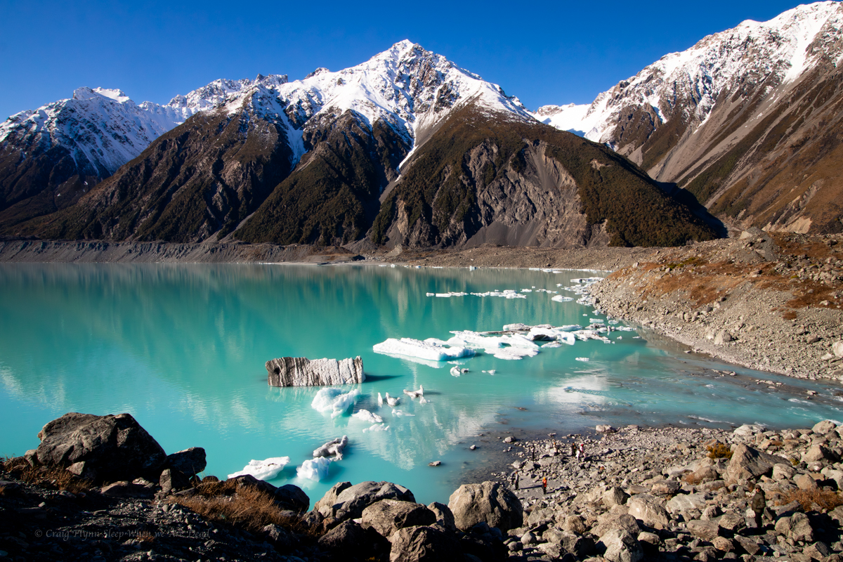
The lake, however is stunning.
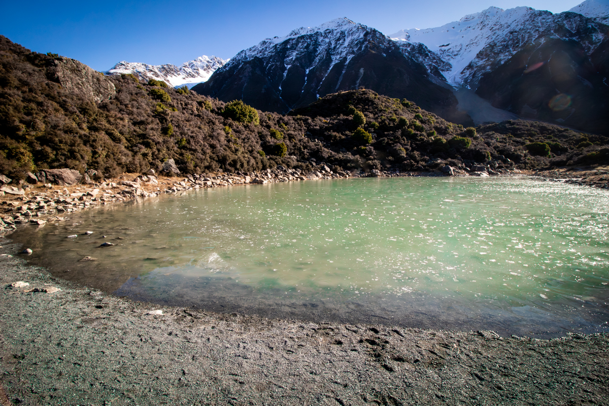
The Blue Pools. When named they were connected to the glacier and very blue. Now they are cut off they are more a stagnant green.
Back at the van we start heading back down the valley.
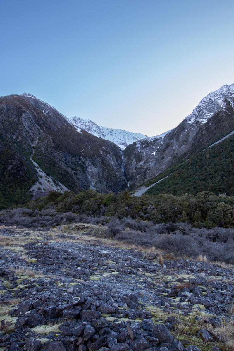
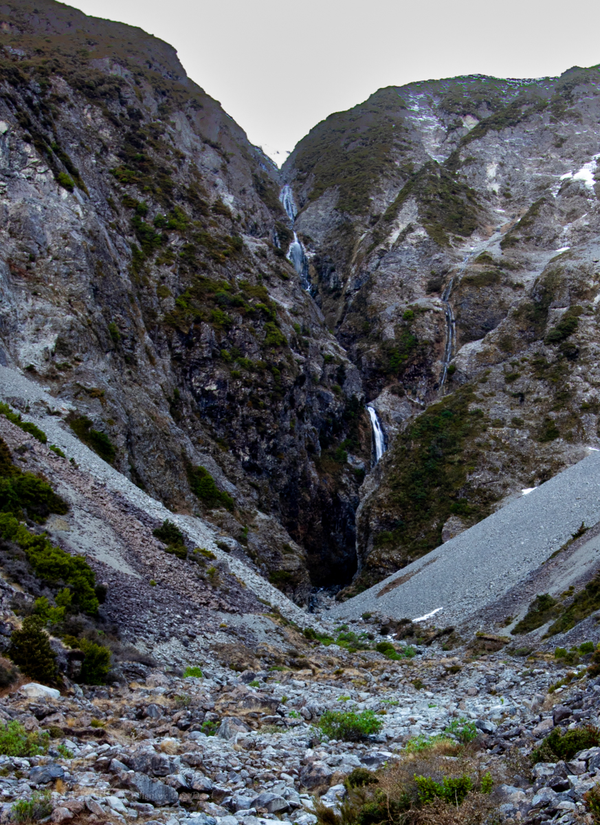
On the way in I’d caught a glimpse of Wakefield Falls. It caught my eye on the way back out.
Is that waterfall frozen?
Looks like it.
It’s difficult to come to terms with scale here. That waterfall tumbles 230 vertical meters.
We pull over for a better look.
Na, it’s flowing. Looks like a cracker of a slot it’s tumbling into.
Should we go for a look.
hell yeah.
I grab the camera and off we go.
There is what appears to be a former tourist trail that comes and goes through the scrub and scree.
Did I mention it is hard to come to terms with scale here? It becomes apparent it’s further than it first looked.
Belatedly I realise in my excitement to get going I failed to grab my puffer jacket and beanie. This is how silly tourist get themselves on the news kids. Luckily not today though
Halfway up we meet to Russian(?) guys coming back down.
Did you get to the waterfall? ask we
Yes yes. Beautiful. Very careful. Very careful.
We push on. We reach the end of the flatter basin and the terrain gets steeper and looser. We had been yeeting up but slow here. A rolled ankle, rock fall or dislodging the scree here would be bad indeed.
There is still a fair way to go. Says Kylie. We should set a hard stop point.
Good idea.
It had been about 2:15pm when we left the van. We decide at 3:15 we need to turn around to get back prior to loosing the light.
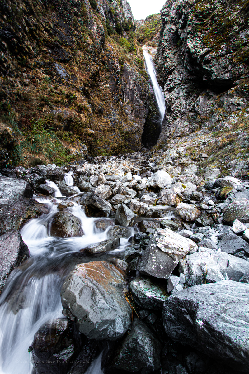
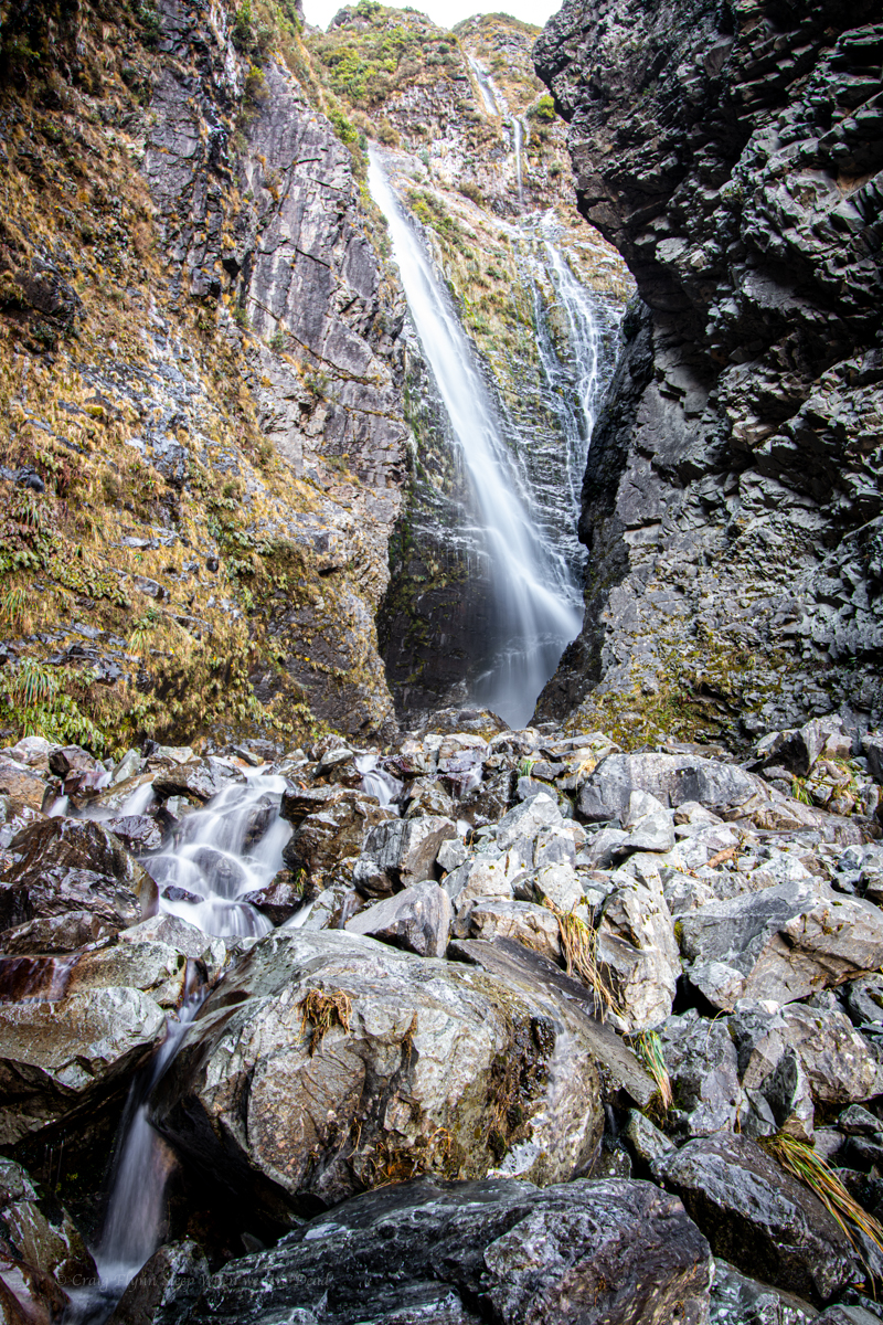
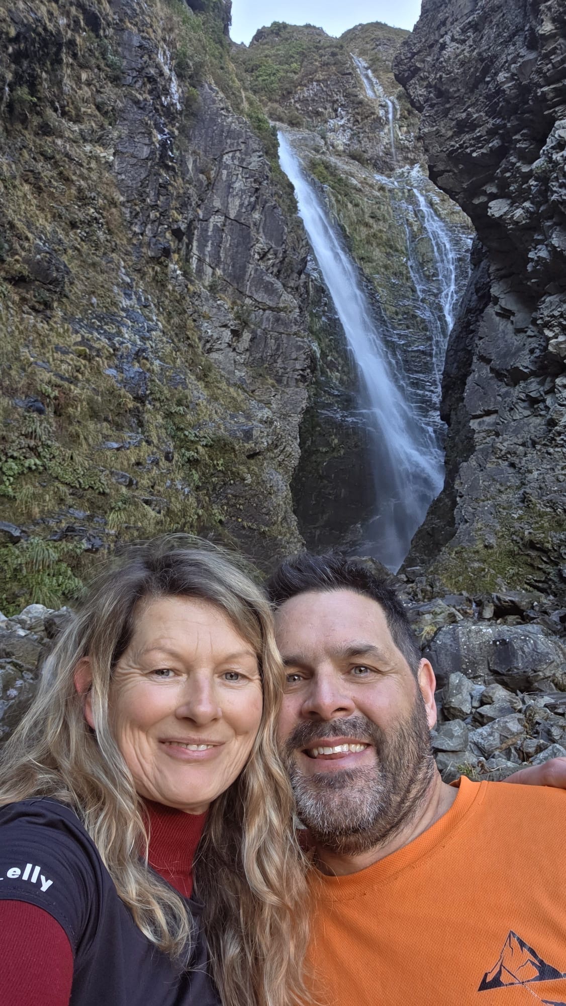
I think we gained about 200m of elevation from the road. A bit after 3pm we get to a point where we had a a reasonable view into the slot where 3 streams of the falls converge.
We are so close. Another 10-15min and we’d be at the base of the falls. but hard stops are hard stops and but I know by the time I get the camera set up and get some shot we’d be close to time so thats what we do.
I’d guesstimate the bottom tier you can see here is about 50m tall
We get the shots and video in and scoot back down.
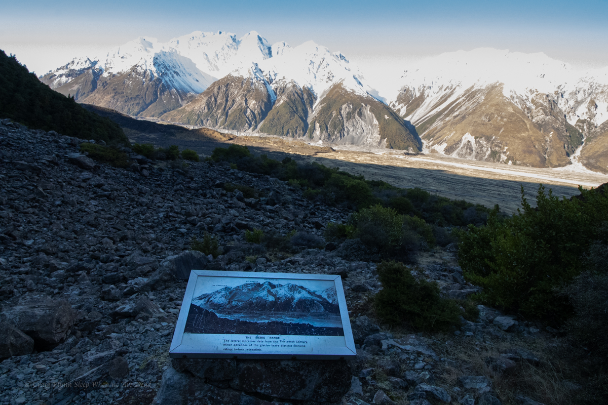
Part way down we come across this old information sign. Weird spot but I guess the old tourist track came up to this vantage point.
Explaining how the moraines pushed up by the glaciers formed dams in the rivers as the glacier retreated. or sumfink
Back at the van we chug down the road making for a freedom camp at lake Pukaki
In the spirit of cruisey we push that start time 30min later..
That might have been a mistake. As I role up the mountain it seems like every second car in NSW is trying to get a car park at the trail head.
Are you with them? Asks old mate pointing at a large group as I step out of my car.
Not me.
Come on boys let’s get going. Says he. Oh which way is it?
I point old mate and his 2 sons(?) in the general direction.
I notice Leo T marshalling the aforementioned group. That’s a relief. A commercially guided group that all bought their own cars making it seem like it’s a bigger group than it is. I know Leo is efficient and quick with his groups so not too fussed there .
Another group jumps out of their car and heads off to beat the rush.
Madie and Leo arrive and introduce another two of the people milling around. Achi and Toni are with us. Excellent.
Everyone ready to go? let’s get going before anyone else shows up. Says they
Um we aren’t due to meet for another 10 mins and Brook’s not here yet. Says I
Bugger say they.
Another group of 4 arrive. Leo knows them from rescue they banter about getting the jump on us and head off.
Brook arrives. Ok let’s go.
A quick walk becomes a slow jog becomes “keep up!”
Oi! I was promised a cruisey social trip.
By the time we get to the wetsuit change spot we’ve over taken all the groups who started before us.
As I always say, it’s not a competition. Unless you are winning, and right now we are winning.
Winning
Ok get changed and get into it. We’ll slow down when we get to the abseils.
Thank fugg for that.
The “black hole”
Overcast day meant sunbeams were unlikely but oh the ohm-bi-aunce
Despite the three thousand two hundred and forty eight cars at the car park we haven’t seen any one in the canyon since one of the groups got to the top of the first abseil just as our last member was roping up.
We figure most of them would have leapfrogged us while we were in Thunder but we catch back up to the group of 4 at the exit and have a chat while we dry off and have a bite to eat and it appears no one else is in front of them.
then it’s up, up and up.
There’s still a gazillion cars at the car park
And while winning is winning, my legs don’t work anymore.
we farewell Achi and Toni then head for a well earned beerio
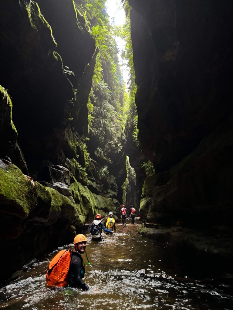
After delaying for a day to allow water levels to drop a bit we were keen as mustard to get into this little gem.
Dove Canyon is the quintessential Cradle Mountain canyon and the awesome folk at Cradle Mountain Canyons have done a great job at opening the canyon up and maintaining the entry/exit track as well as the anchors so it’s well worth booking a tour with them if you are in the area but don’t have gear or white water experience.
The canyon has several aquatic hazards to be wary of so most people would be best to book a tour, especially if you aren’t up on how to recognise, navigate and rescue out of that stuff.
Anyhoo. We got going early to get in front of the guide groups and after one of the easiest and prettiest walk-ins ever we reach the get in point.
A gorgeous little creek greet us. The water was cold but not Bowen creek middle of winter cold so the seland 5mm jacket and John’s were prefect.
We make our way down stream. Already the water is more pushy than anything in the Blue Mountains at normal to high levels so we take our time with the down climbs and assess the eddies at each little jump.
One of the first little pools
Then we come to the first the first of the major obstacles
The Laundry Chute at the exit of the dark tunnel like “Pit” section. Such an awesome feature. Legend has it this is the funnest canyon slide in Australia.
The plan was to do Dove today but big dump of rain had spiked the water levels and our local contacts suggested we wait a day for the levels to drop a bit. We were pretty sure they were being cautious with a couple of randoms asking questions but we were happy to take the advice and opted to do Machinery creek instead.
After parking at the bottom it took me a bit to work out the big obvious bridge wasn’t our bridge. The amount water flowing at speed under the big bridge had me a bit 😳
But the correct creek was a lot more enticing. The water was about 15mm off what we were told was the high level (interesting by the time we got back here it had dropped at least 70mm)
Our advice was if we didn’t have a second car to hitch a ride up the hill but there didn’t seem to be too many cars heading our way so we hoofed it up. While there wasn’t much verge at times the we had plenty of warning to get out of the way of the few cars that did pass us.
40 or 50min (or forever ) later we reach the Round Hill Cafe at the top of the hill. Surprisingly there was a little camp area there. Talking to the care taker we discover it had shower, toilet and kitchen area and was only $25 for a powered site! I know where we are staying tonight. Winning!!!
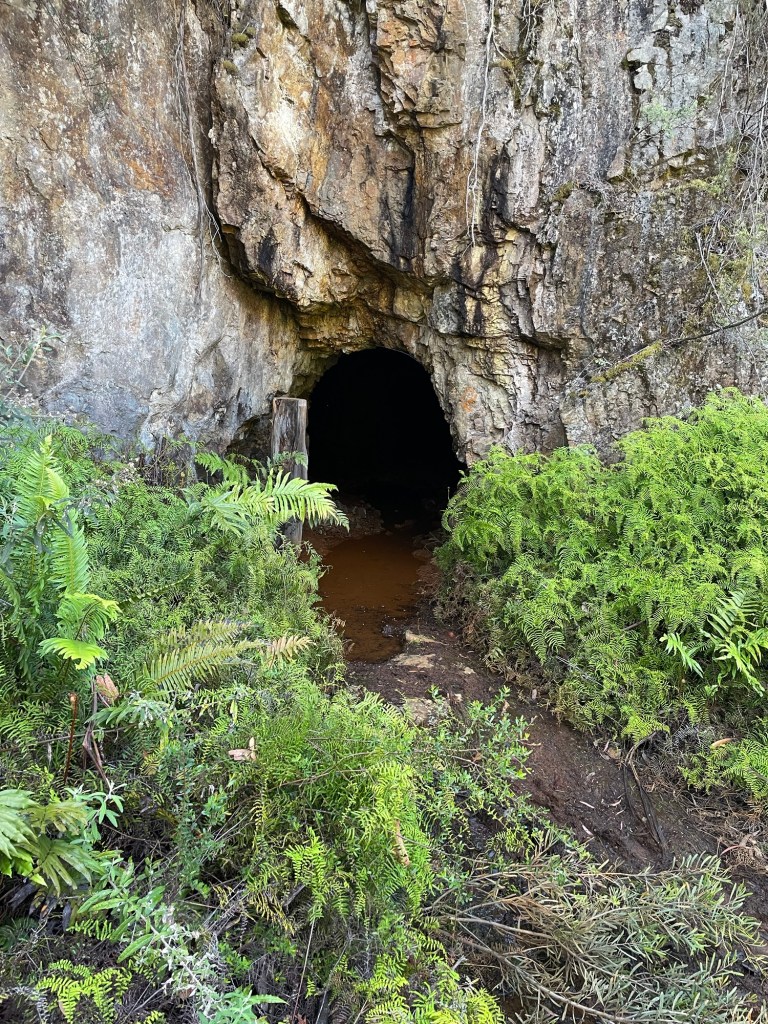
Anyhoo we follow the trail down past some old mine Adits to the start of the canyon.
Enticing. Not.
And soon we were suiting up in a little gorge.
After the slipfest in Urumbilum it took us a bit to trust our footing but the rocks here offered heaps of grip. And soon we were making reasonable time
It threaten to but never really canyoned up.
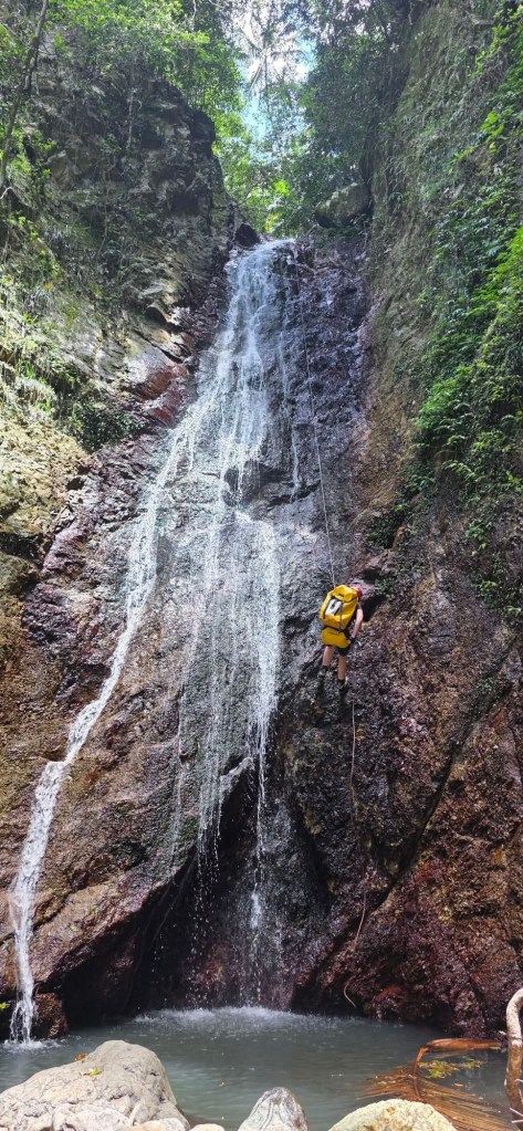
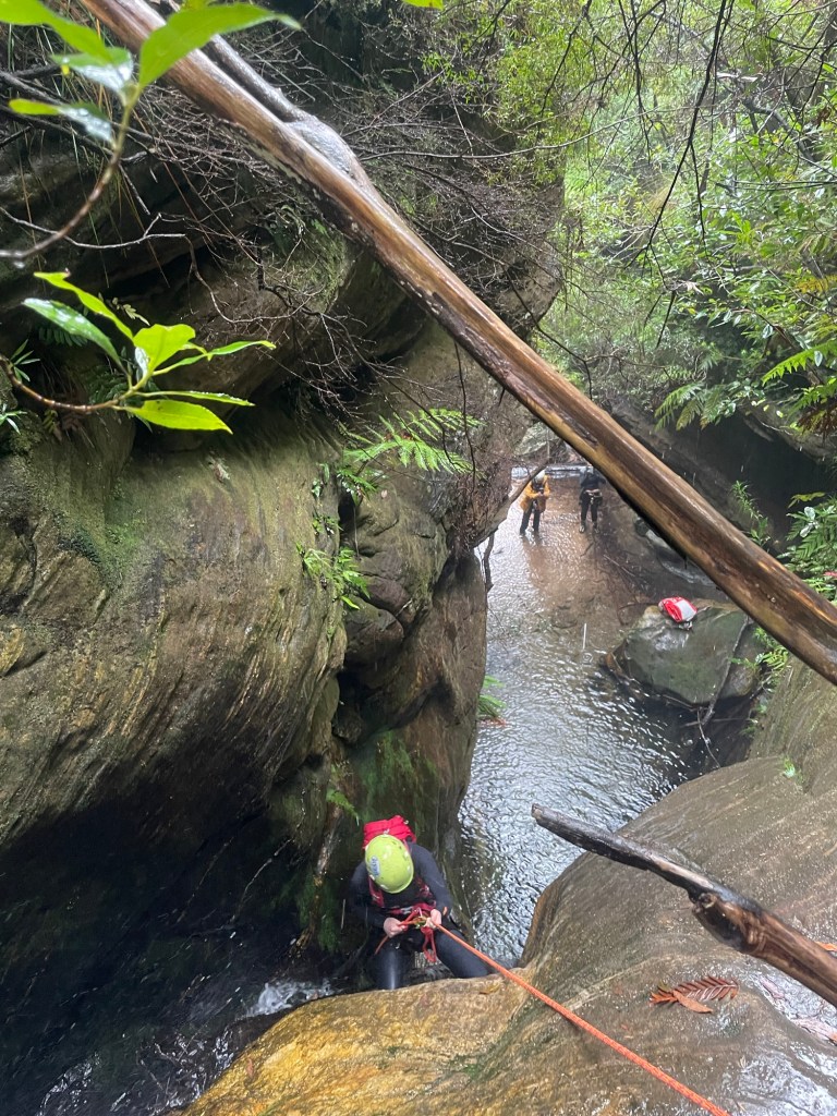
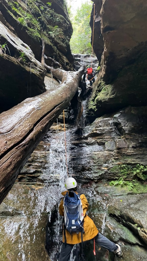
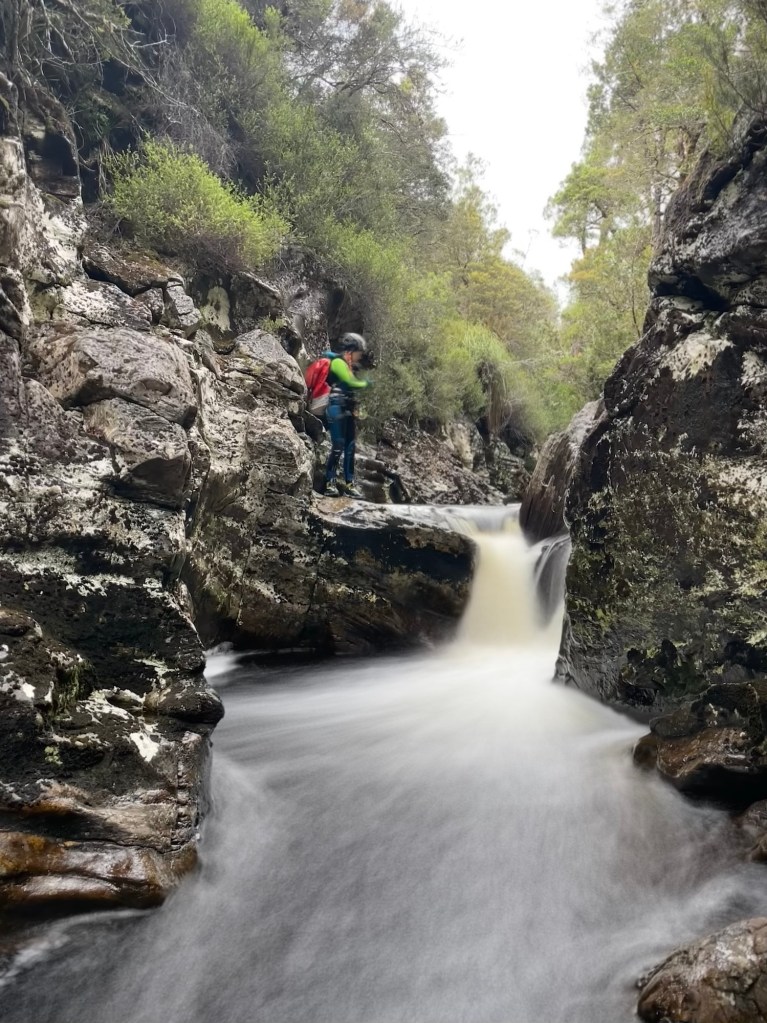
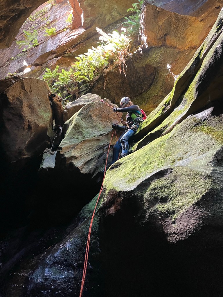
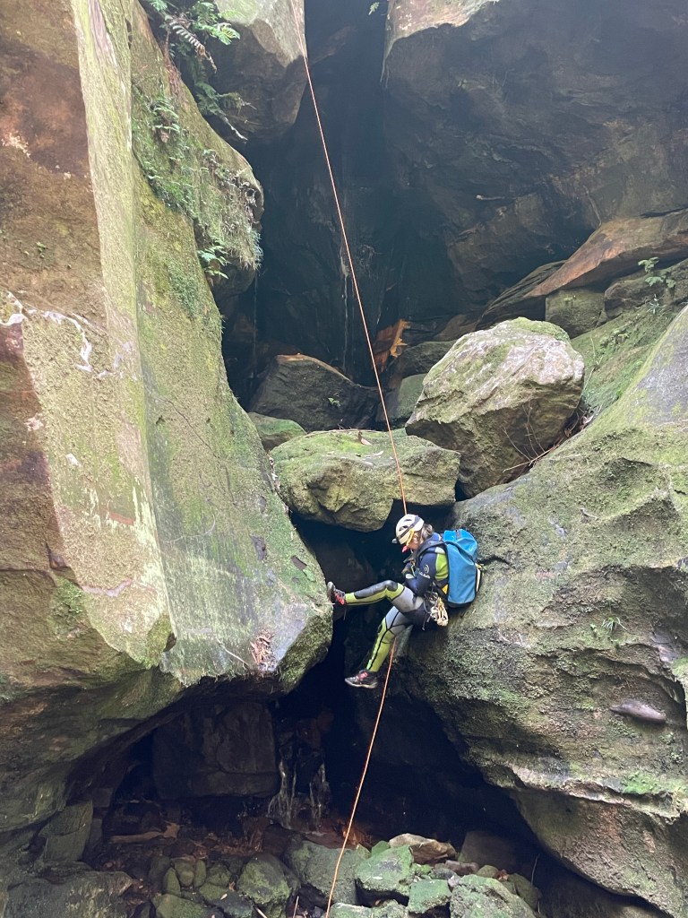
Still there were some very cool abseils in flow. It reminded me of the better of the Bungonia canyons with good water in it, though the abseils tended to be shorter .
The second abseil is the crux. It lands in an enclosed pool that in high water forms a powerful hydraulic with strainers in the outflow
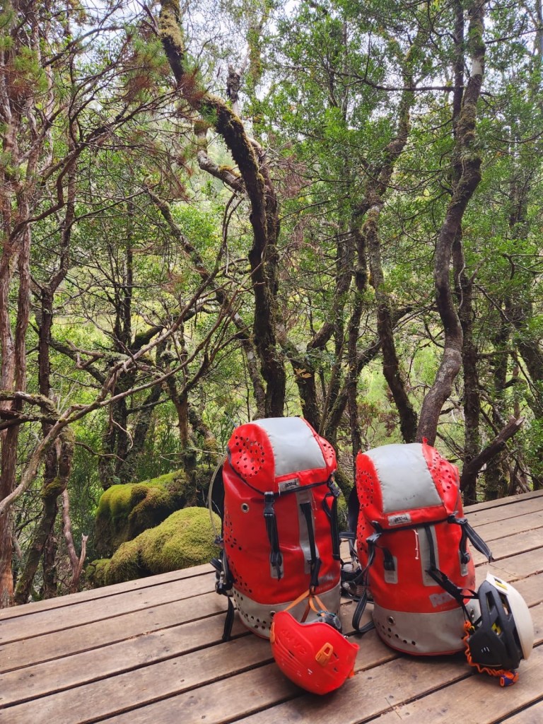
It was a slightly cooler day which worked out perfectly as it’s a bit of a walk to get to this one
Pleasant banter ate up the fire trail and it didn’t seem too long before we were following the HITW exit trail down to Dingo Creek (but really North Bungleboori)
The old dodgy ledge that you could once use to stay dry seems to have washed away and so we stripped down to essentials and waded down to our exit on the other side.
Here we encountered the first of the many large tangles of dead fall we’d encounter today. b
After a bit of effort we were up North East canyon and had a morning tea break looking down over Banks.
The climb out of North East canyon, which runs South West….
We pick an easy path down to cross the head of Banks Canyon. Then over the next ridge to scramble into Nose Dive creek.
Making our way down stream there was lots of dead fall to negotiate.
The gully seemed to be openning out and I voiced concerns that we had dropped in too far down stream (I didn’t get the grid reference or study the map. I go by feel baby)
But then.
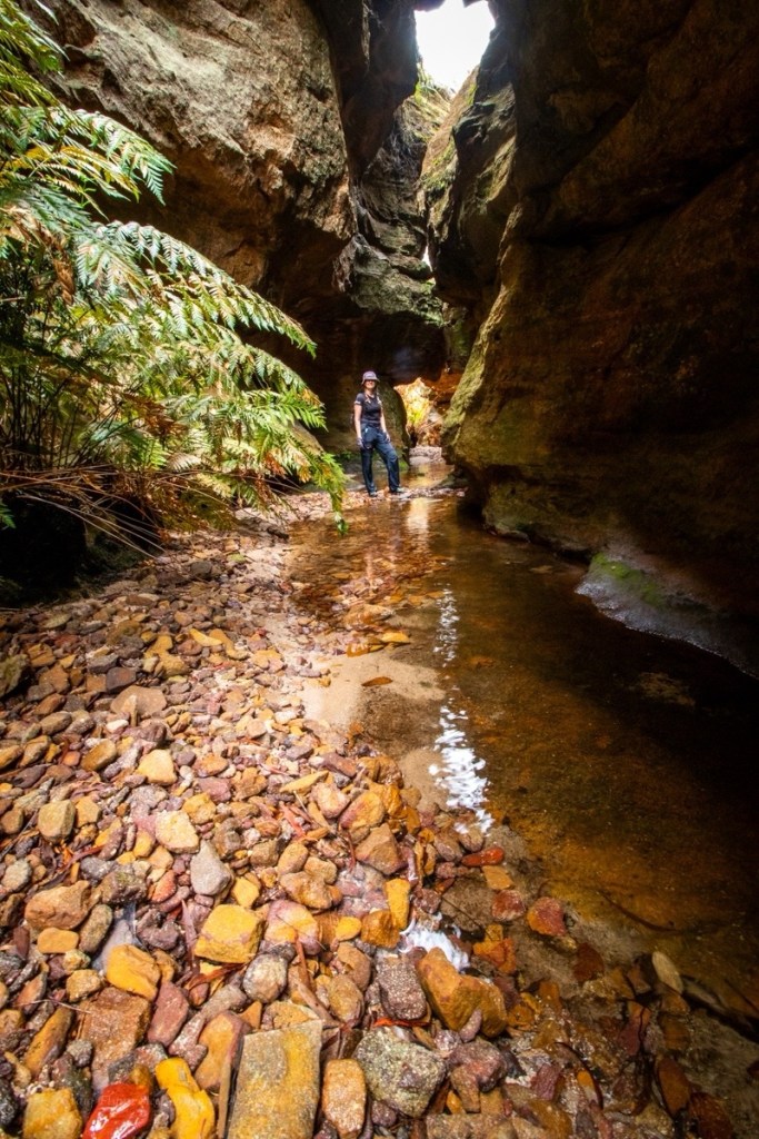
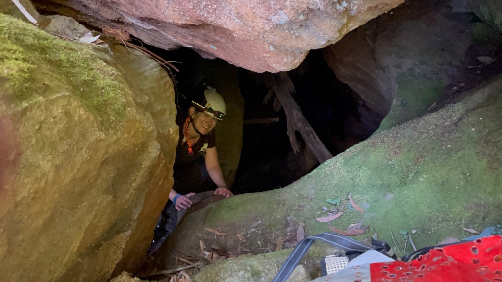
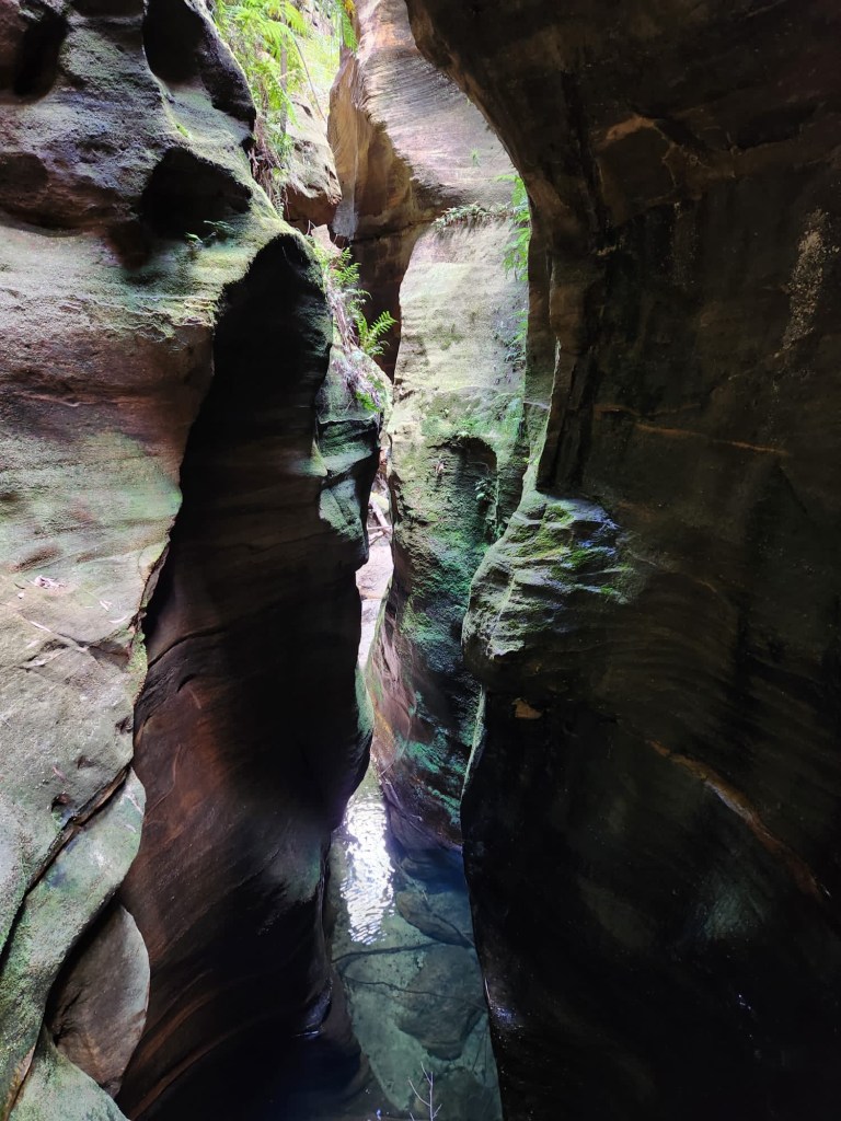
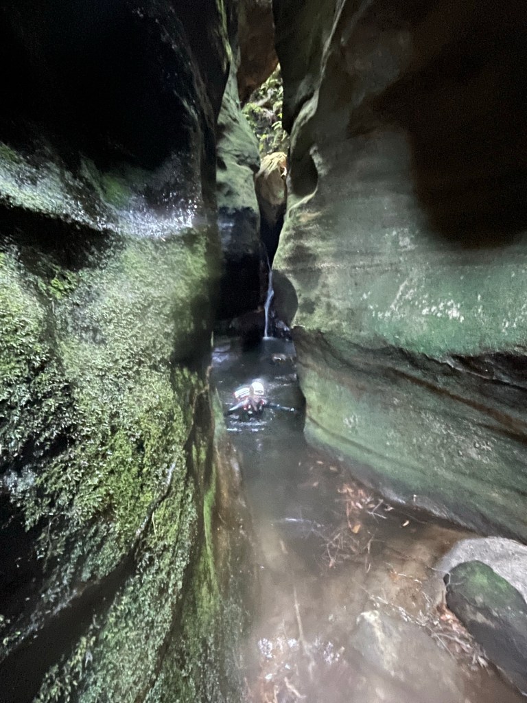
The creek drops down a hole. And so do we.
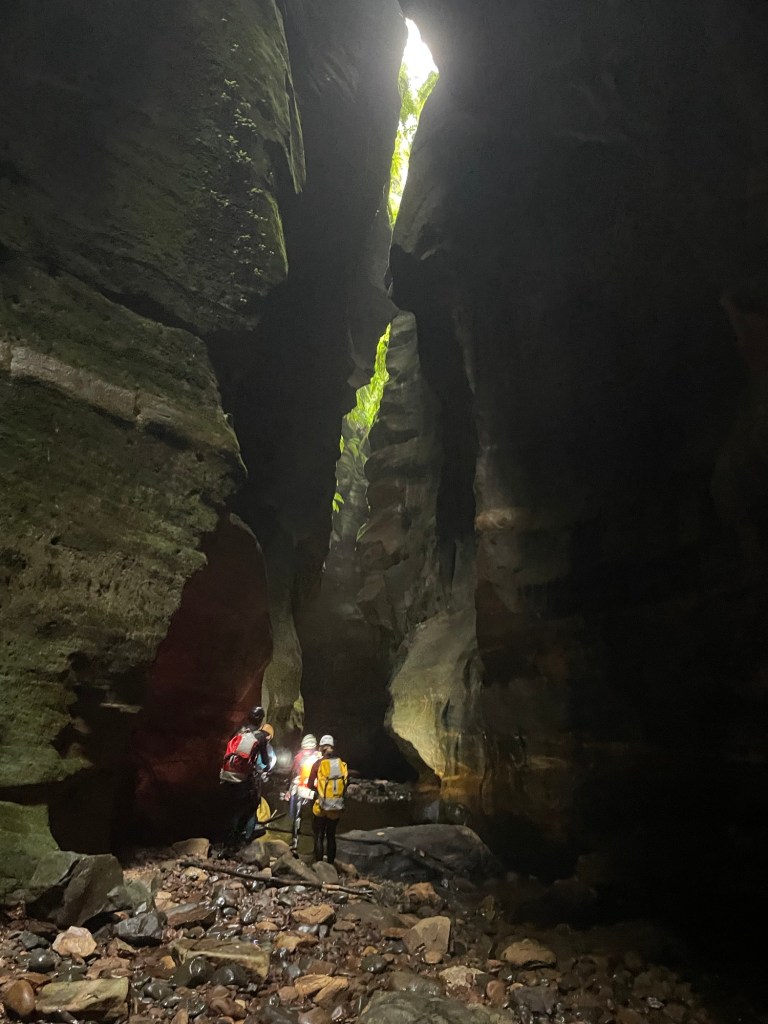
The second of the cavern like sections. It’s ok I guess.
Ok it was more than ok.
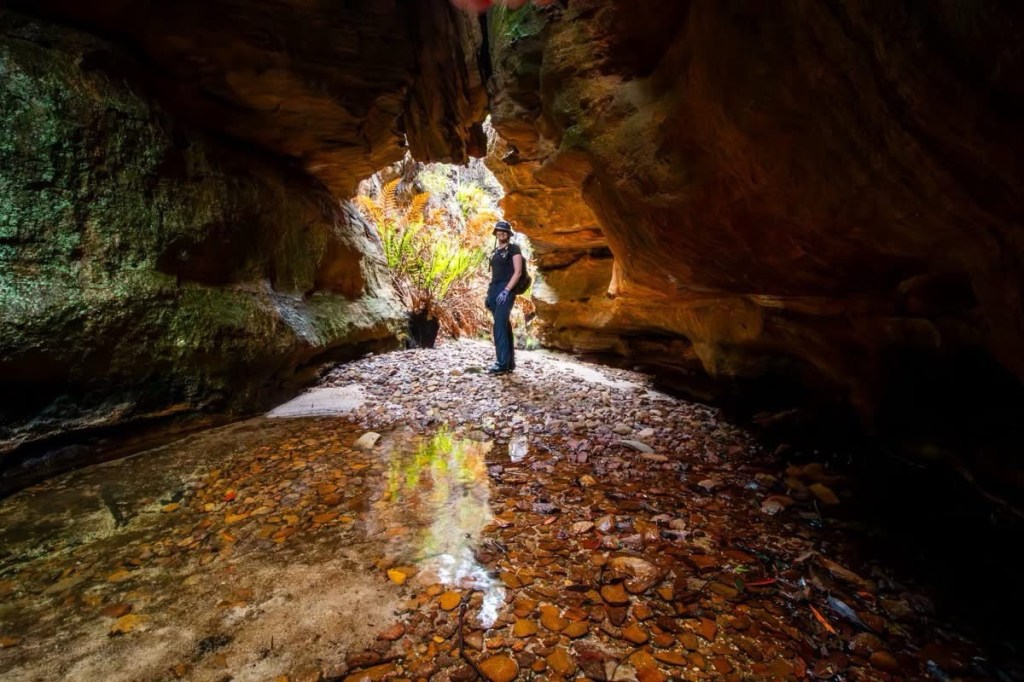
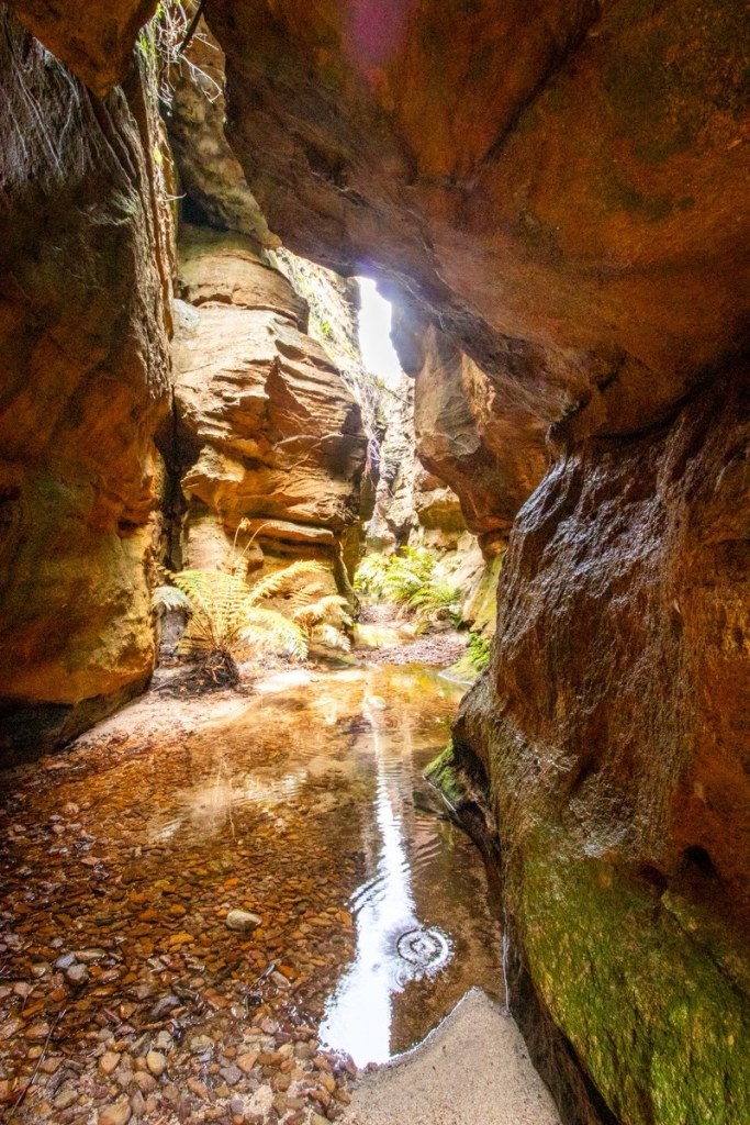
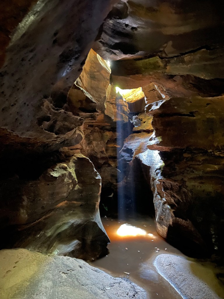
Dark yet somehow filled with beautiful light
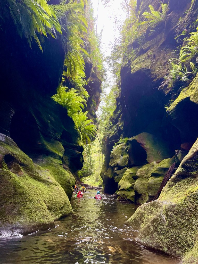
Really spectacular and somewhat unique slot canyon
Such a cool little section
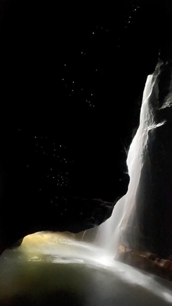
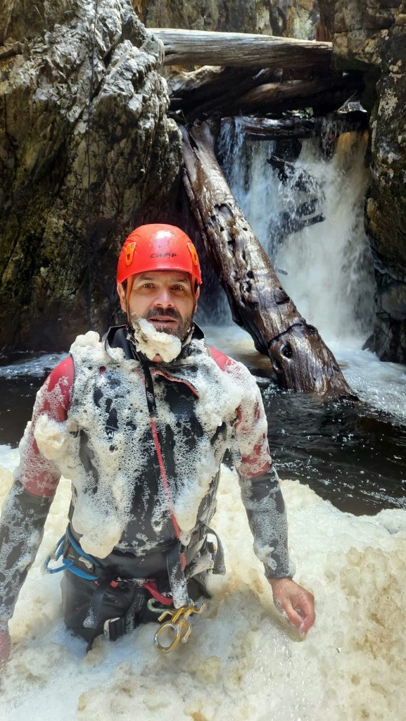
The water was like glass
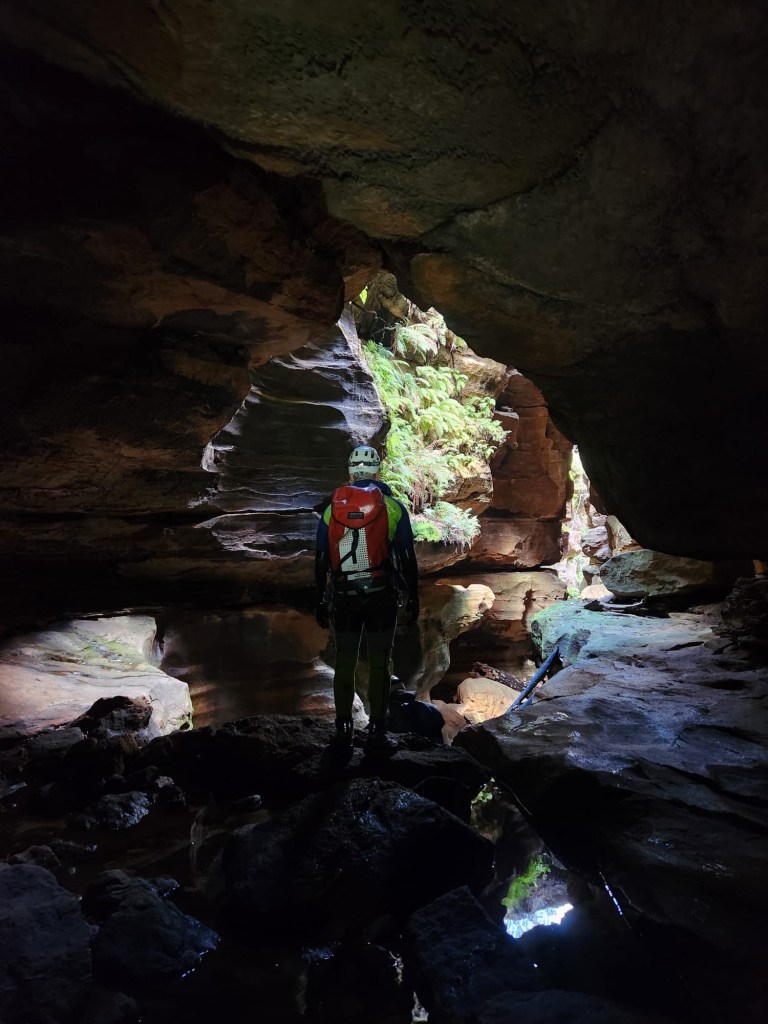
Gadget with H in the background
Throw and go because, well you know.
Was it cold. Yes it was
H
K
G
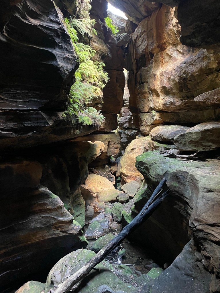
And then we are in T̶h̶e̶ ̶‘̶b̶o̶o̶r̶i̶ Dingo Creek for lunch followed by a bit of creek walking and some long swims to get back up the the HITW exit at the big bend
It’s a gorgeous section of T̶h̶e̶ ̶‘̶b̶o̶o̶r̶i̶… Dingo creek
You should sit in nature for 20min every day.
Unless you are really busy then you should do it for an hour.