The trail out to the Sphinx was longer but far less steep than what we did yesterday to the Pyramid summit but the day was meant to be even hotter so we got an early start.
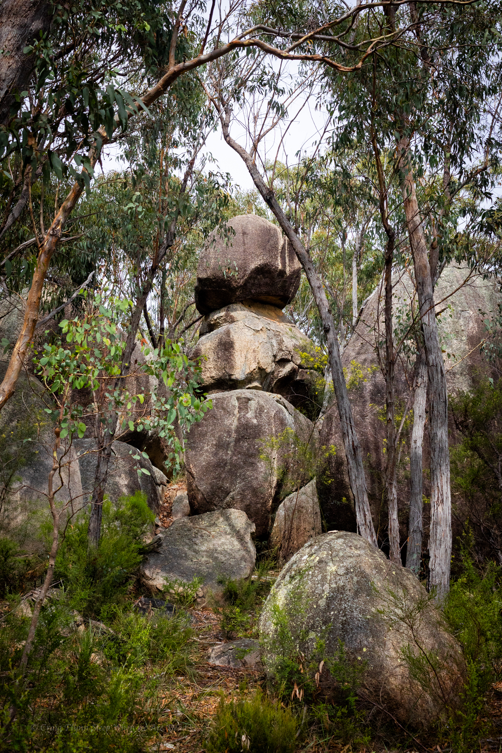
The trail winds it’s way up a gentle ridge and there is plenty to explore just off track
I’t a tad over 3.5km out to the Sphinx, gentle uphill most of the way.
Given the weather forecast of heat heat and more heat we opted not to do the side trip to the top of the castle.
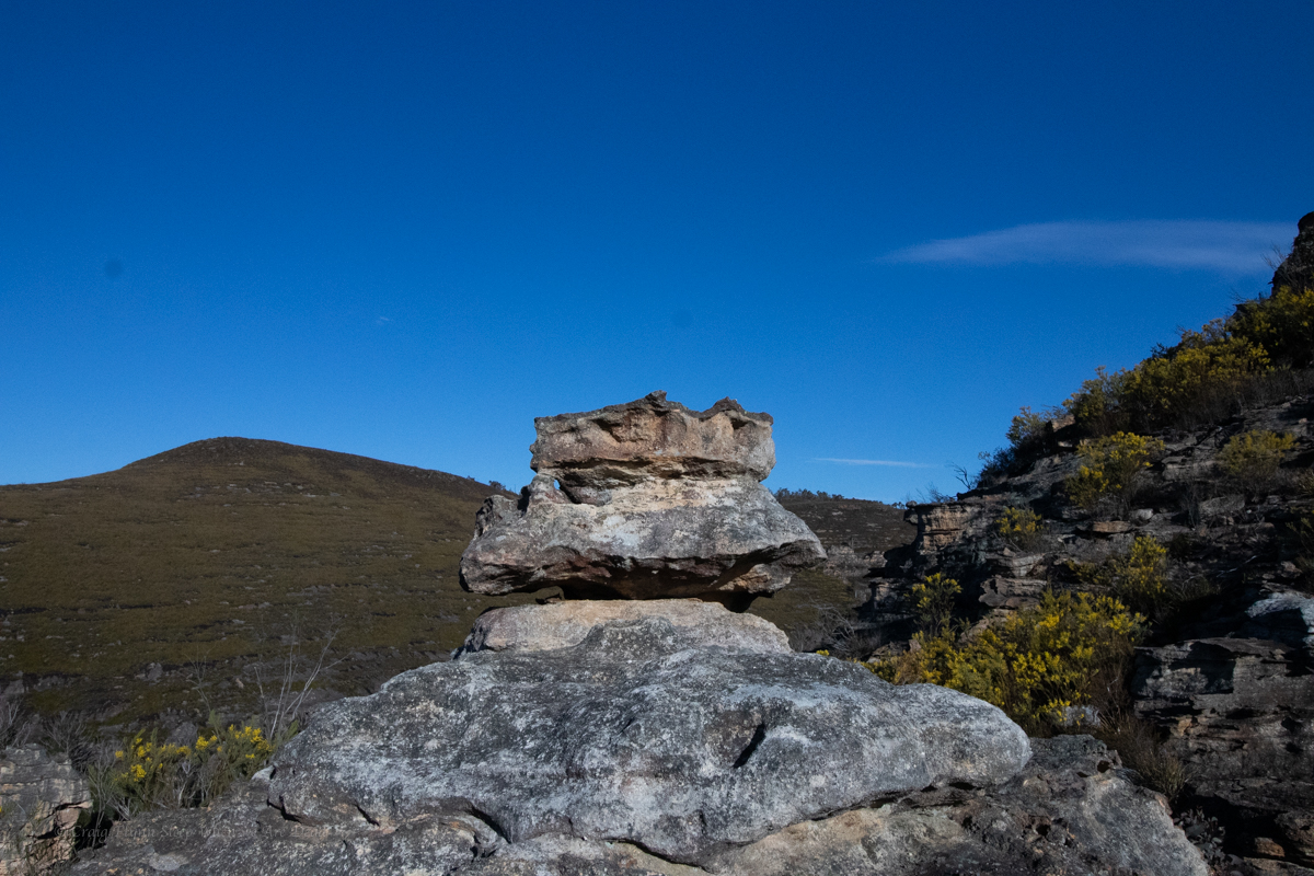
The Sphinx
More like Darth Vader or Batman if you ask me
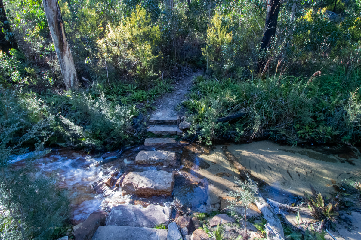
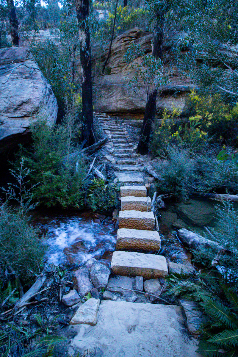
A short skip further down the trail gets you to turtle rock. The track ends here and you could scramble up but, again with the day heating up, we just have morning tea then head back to camp.
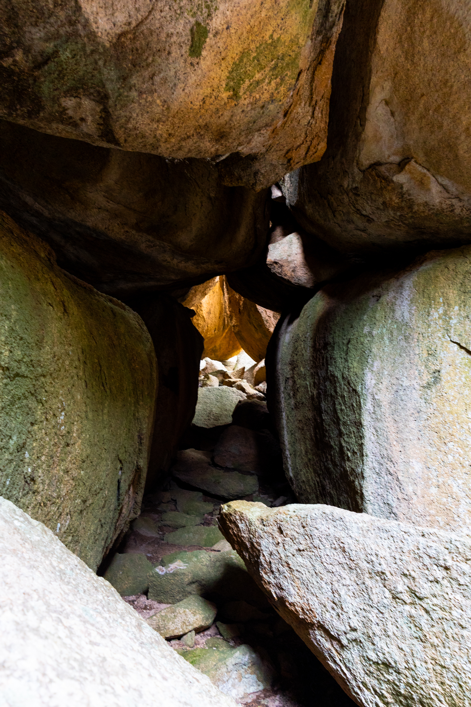
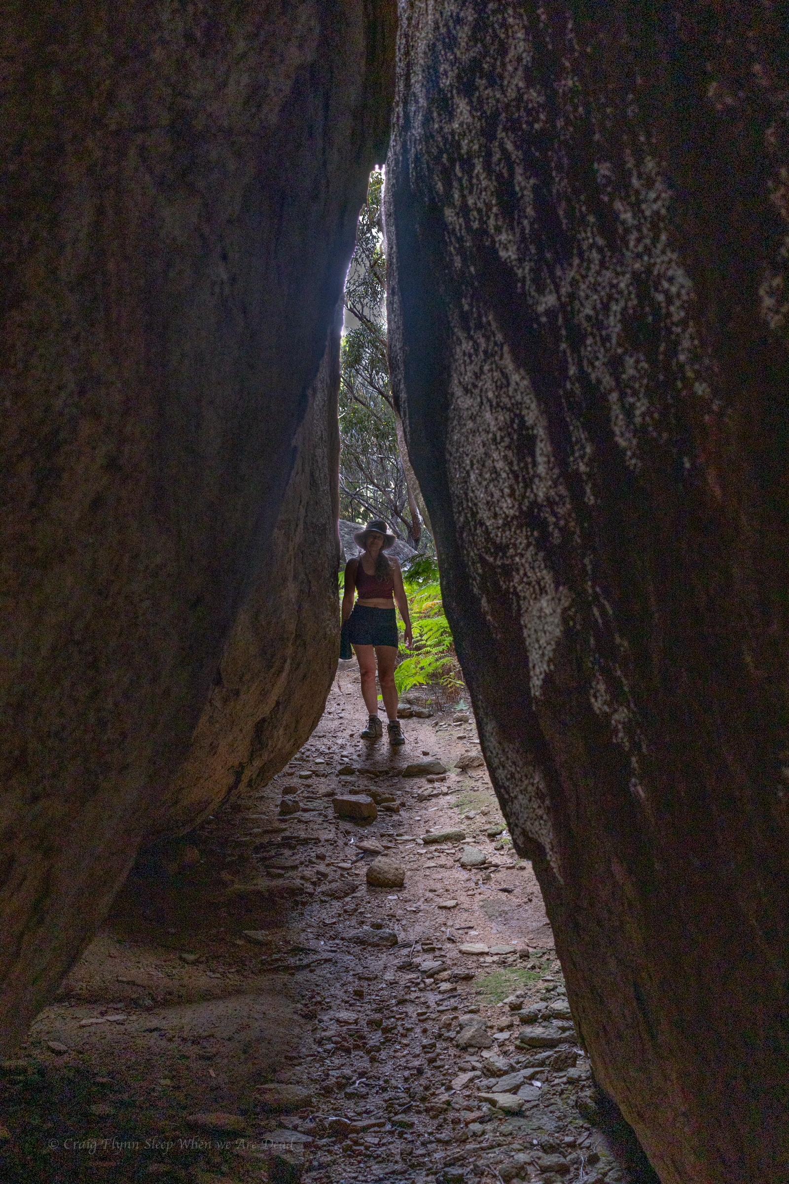
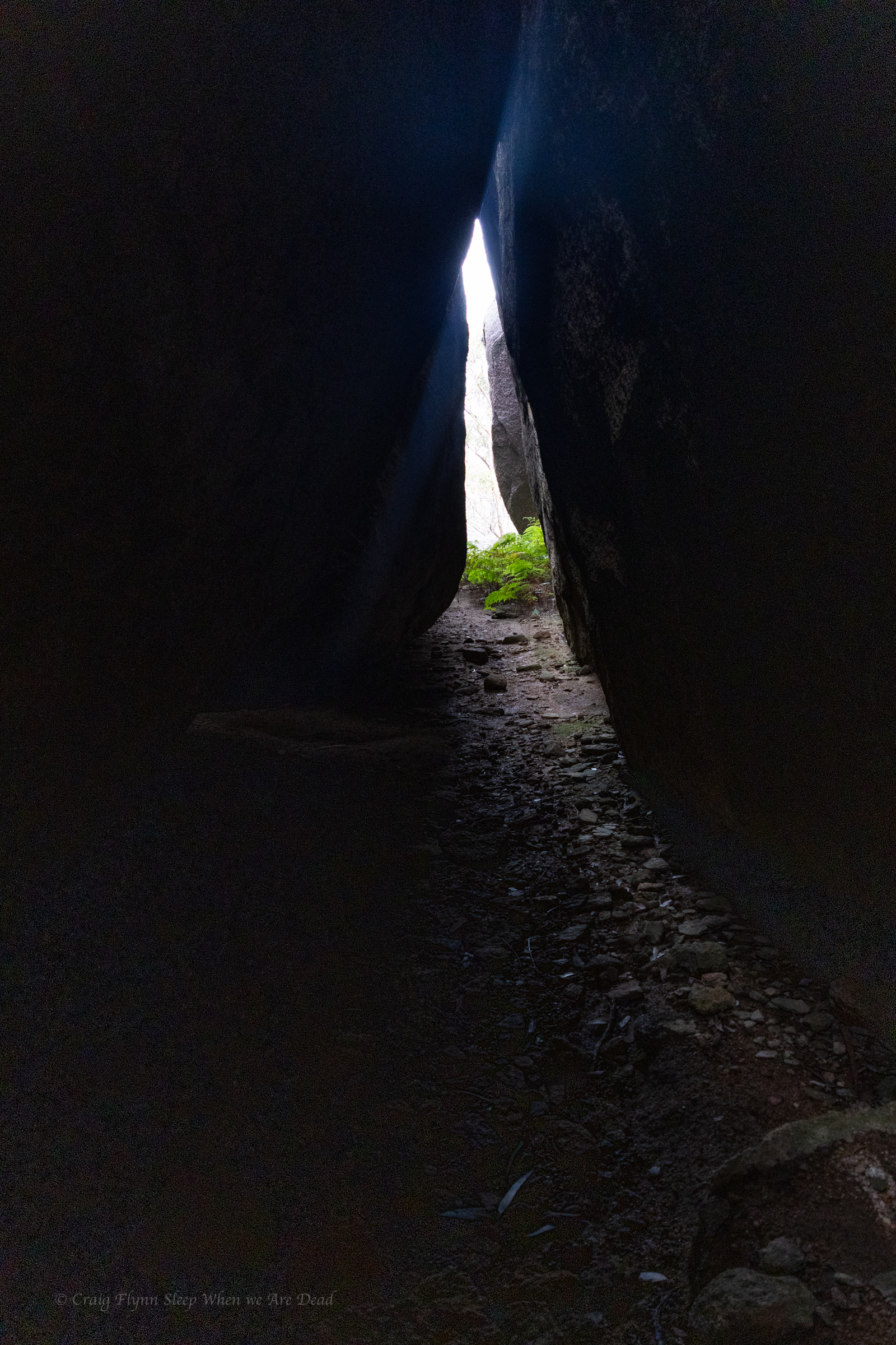
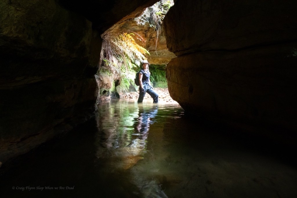
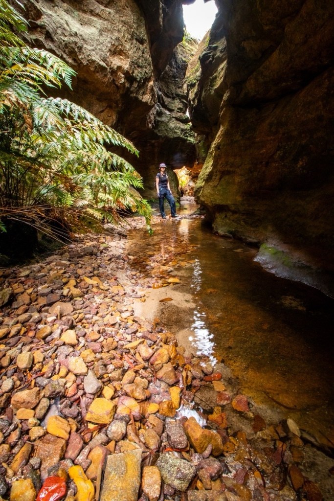
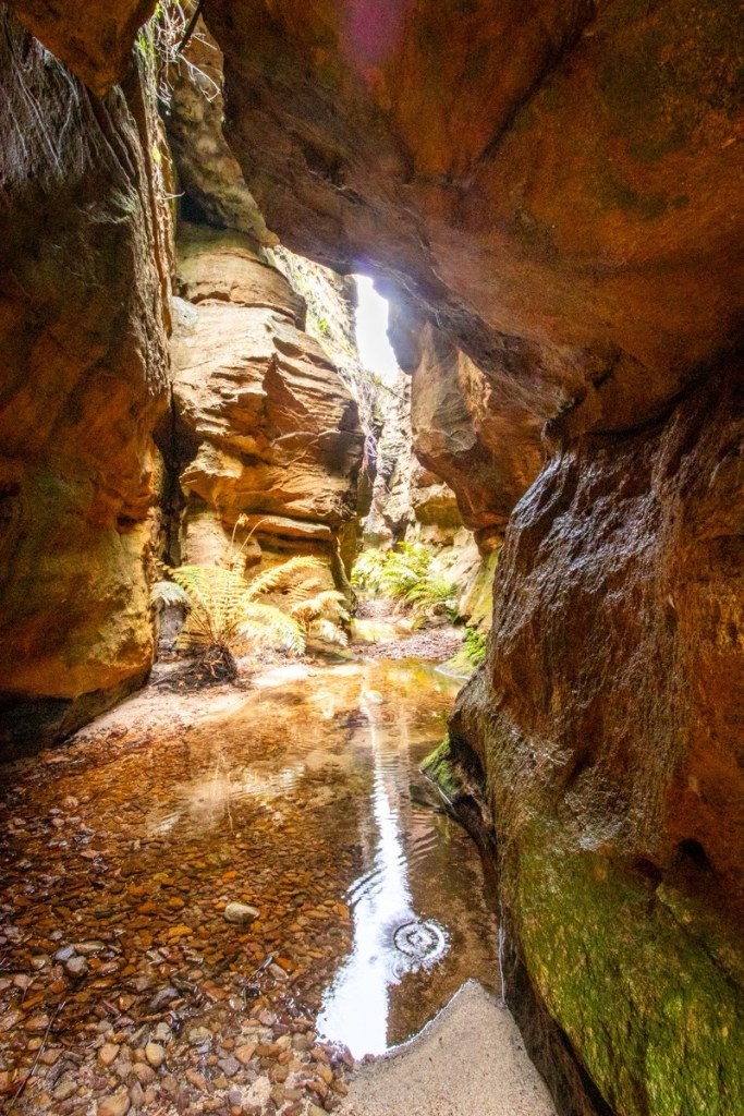
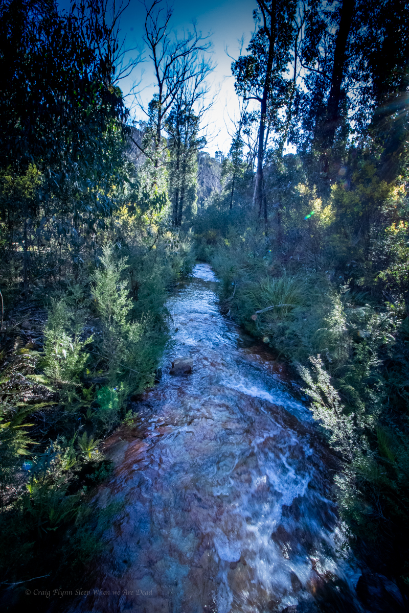
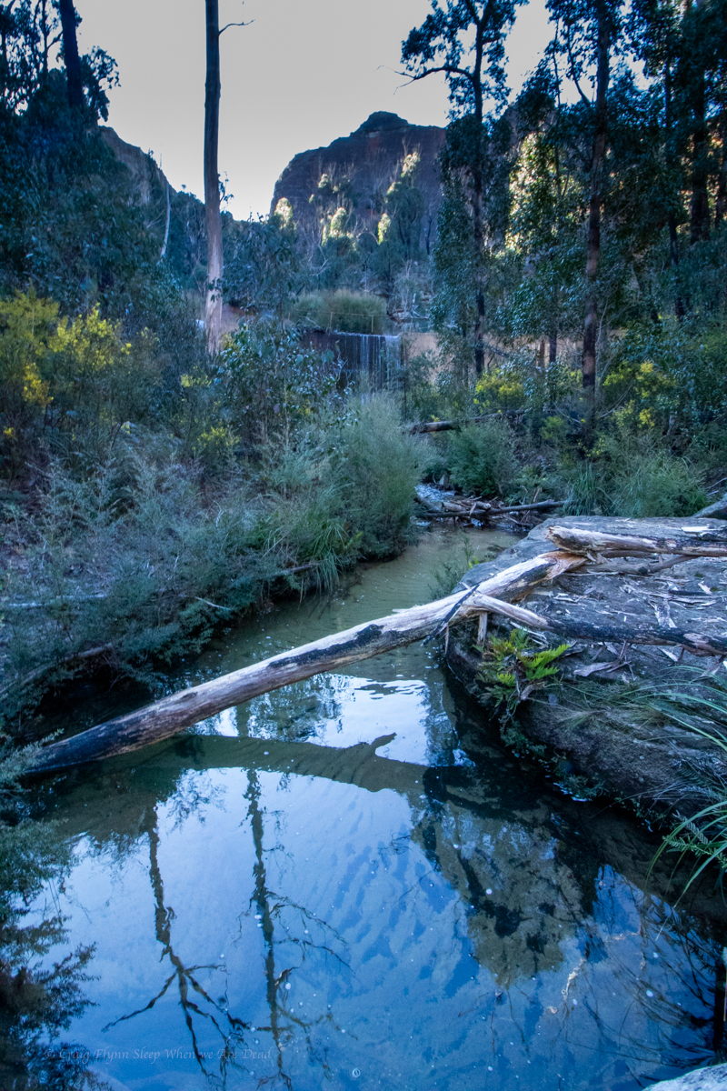
By the time we get back we’ve worked up a sweat and decide it’s a good time to visit an underground creek.
From Booboo Booboo we do a bit of a down and around, crossing the boarder into Qld and into Girraween.
Bald Rock and Girraween are not that far apart as the crow flys, but we aren’t crows and the road needs to circle around the mountainous country in between.
We roll into an almost empty camp ground, the Christmas/New years crowd have dispersed. Just about everyone else we see here we saw at Boonboo Boonoo. Haha
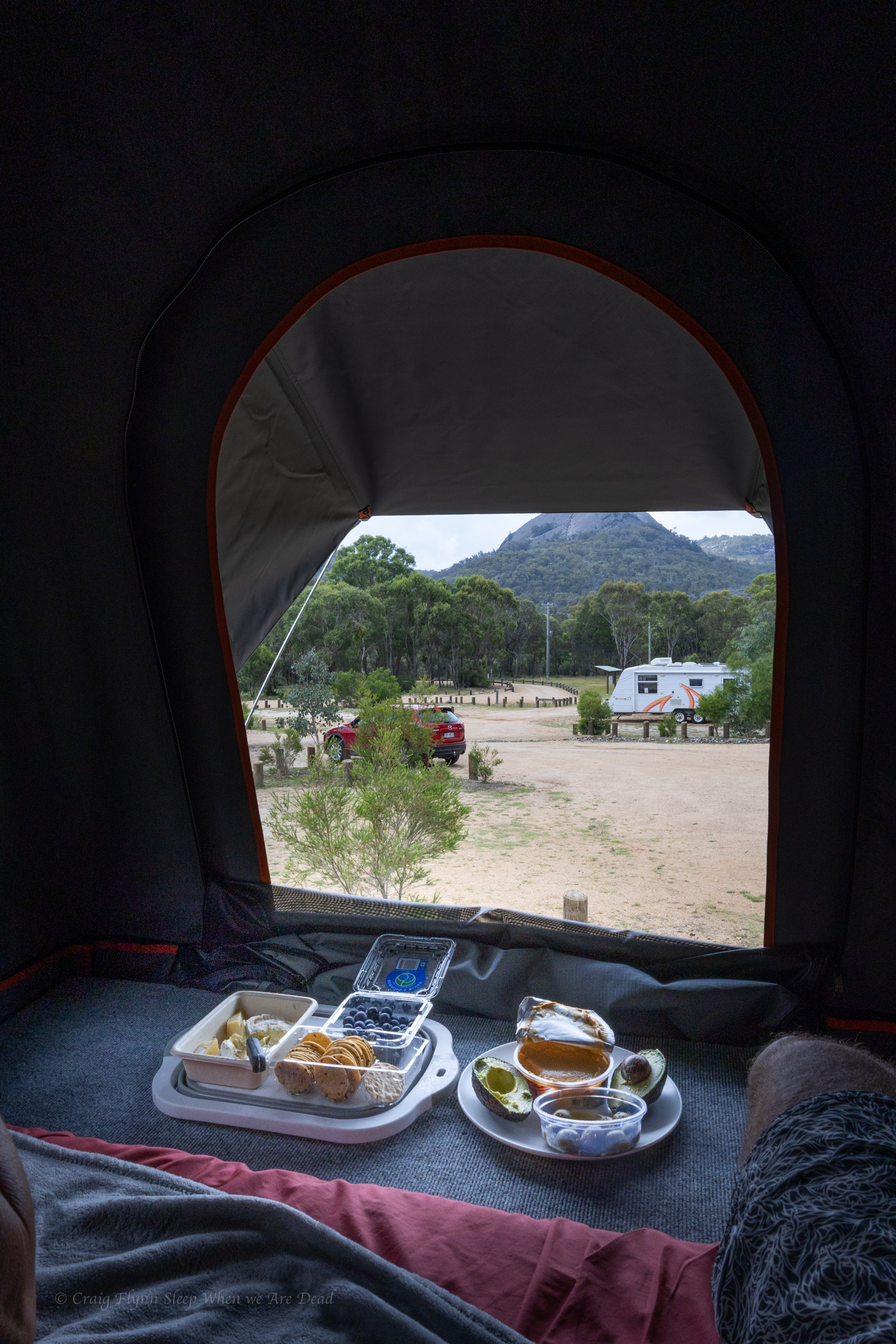
We have a couple of nights here and planned to smash out as much as possible. but the heat was oppressive so we cut our list of things to do from “Everything all at once” to our “must sees” and worked out a bit of a plan for best time of day to see the things. In between we do something rare for us. We chill out and enjoy the camp ground.
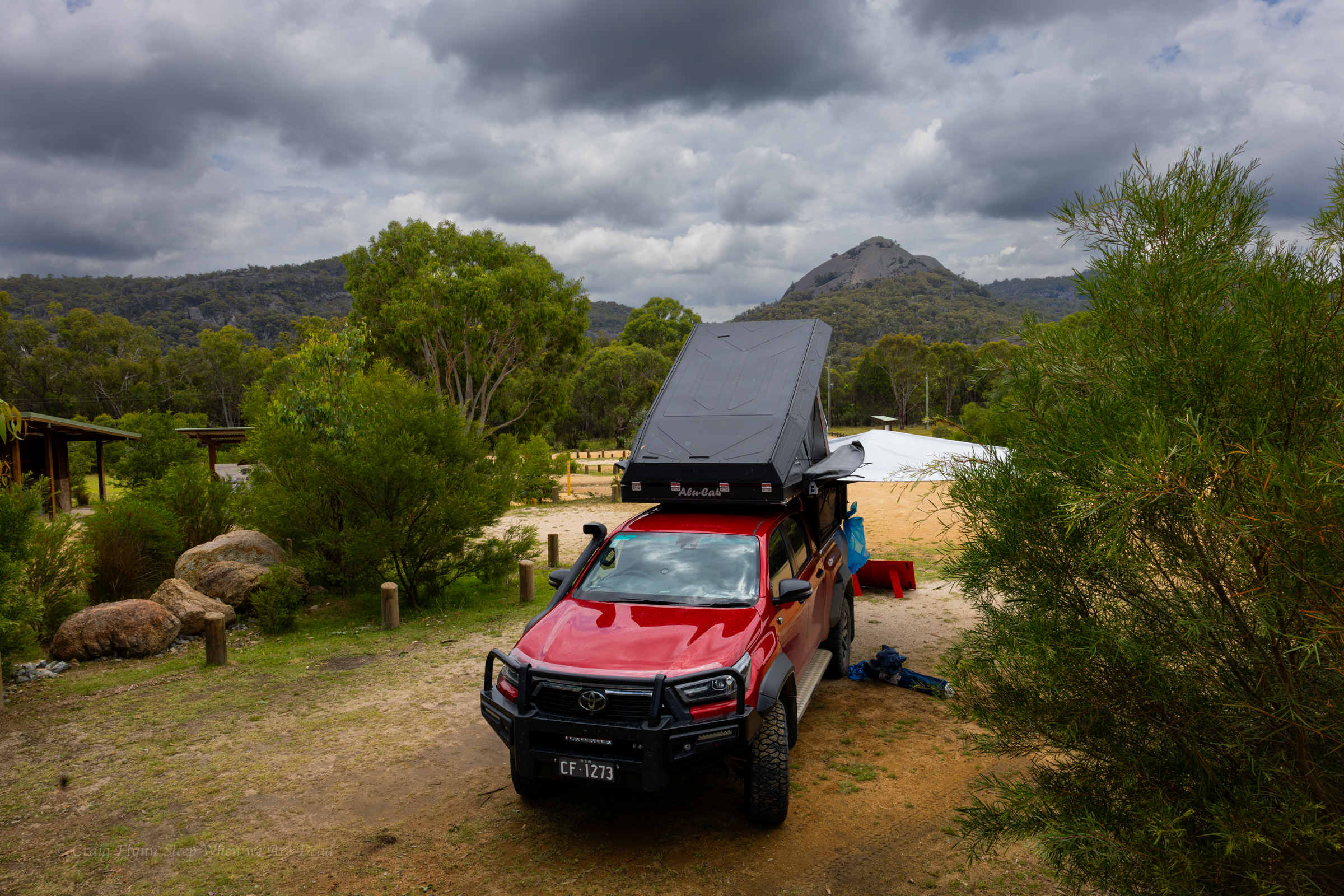
and with views like these out the back of the camper why wouldn’t you
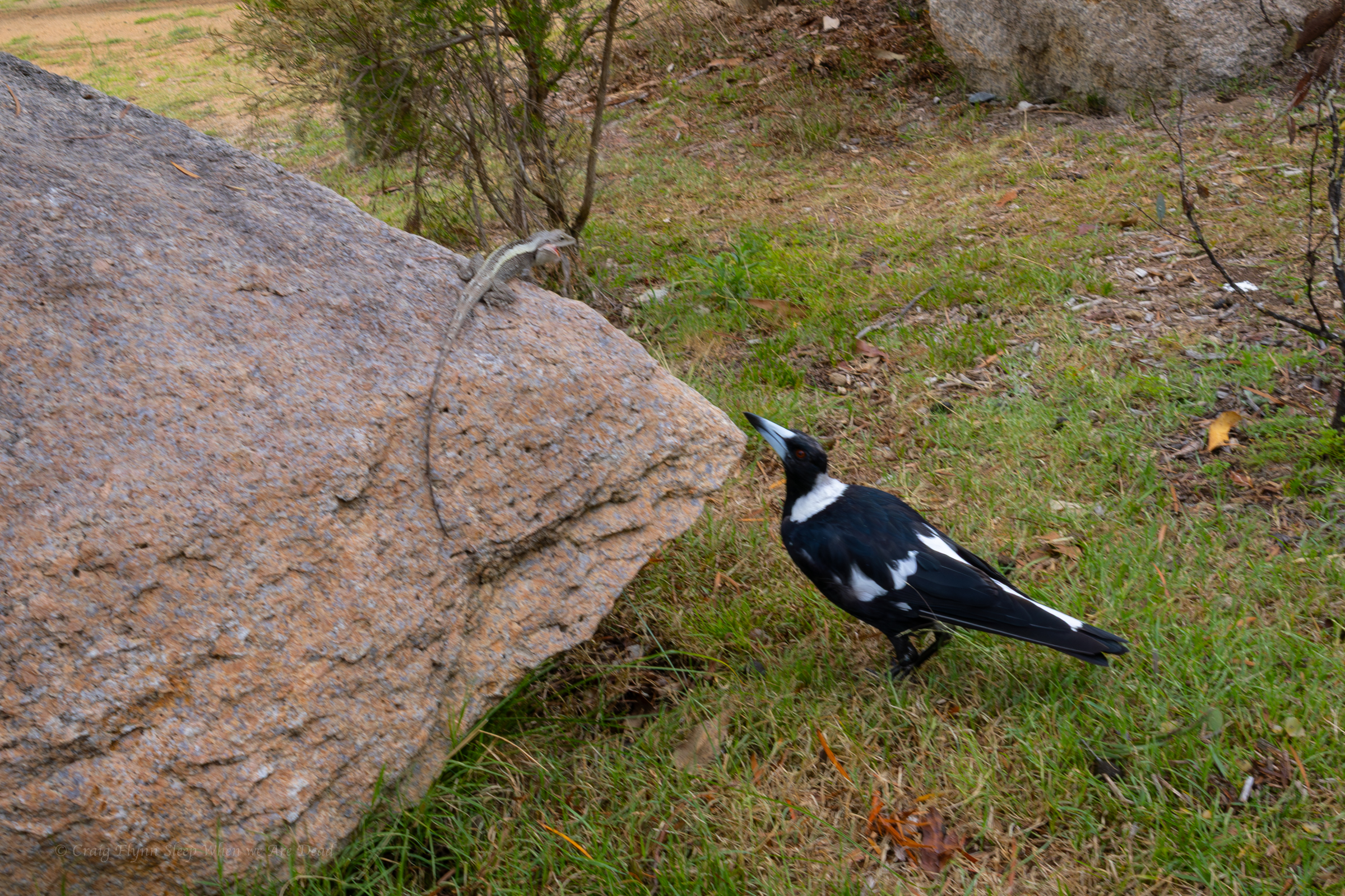
The neighbours were amusing. Knobbie the dragon was preaching the virtues of sun baking. Maggie Pie seemed very engrossed in the topic.
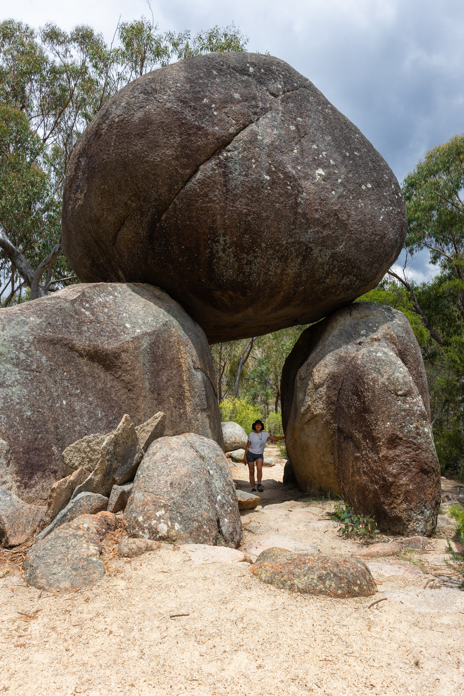
We thought we’d start our stay with a quick walk up to the Granite arch.
An nice easy walk lead us past serval granite outcrops up to this beauty.
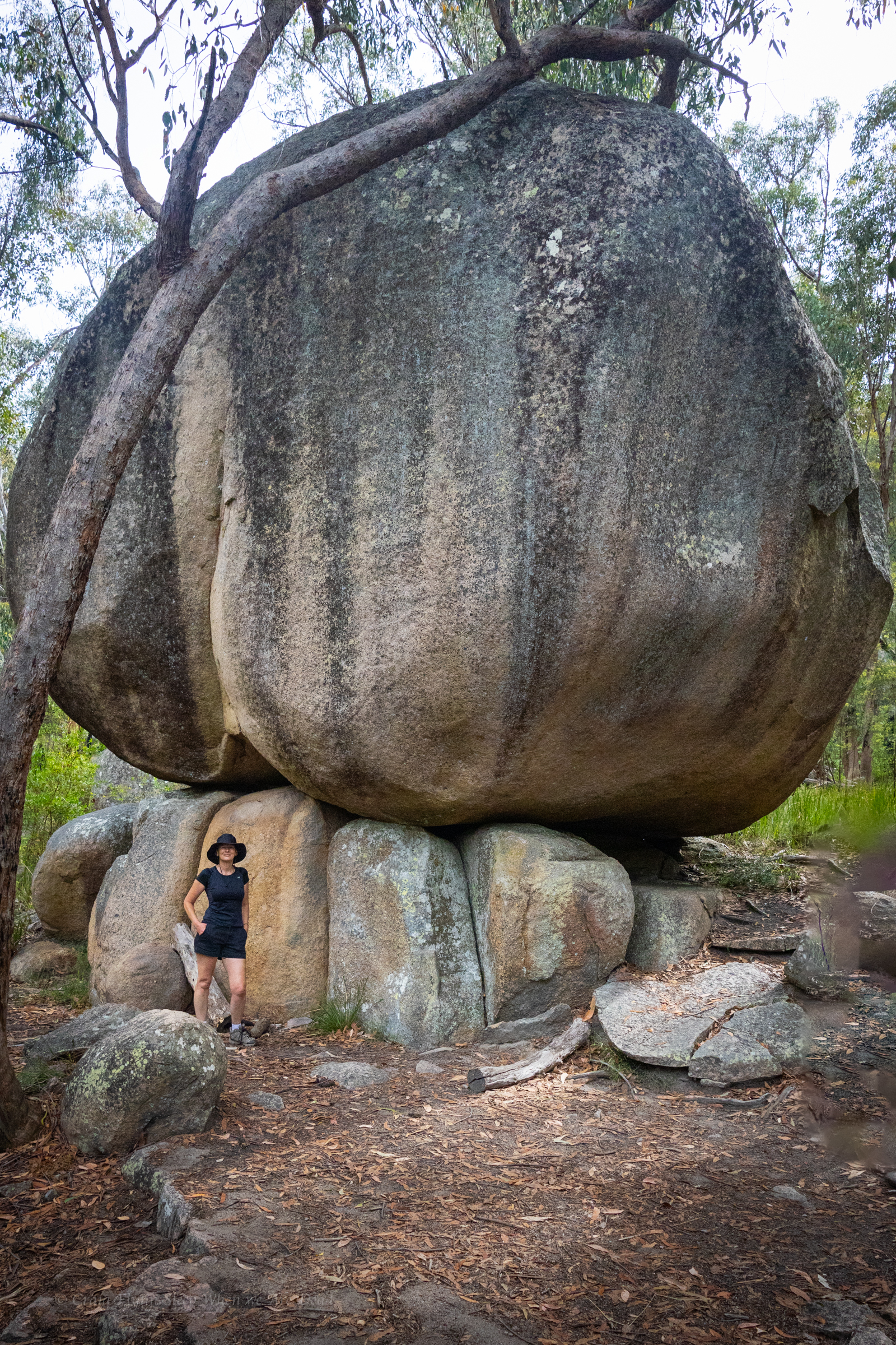
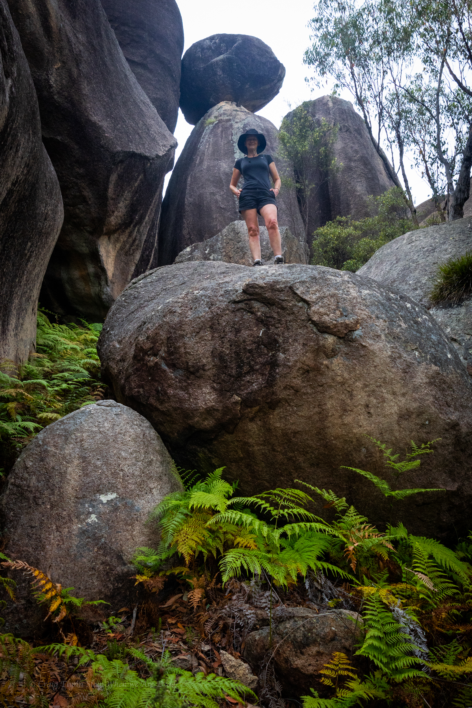
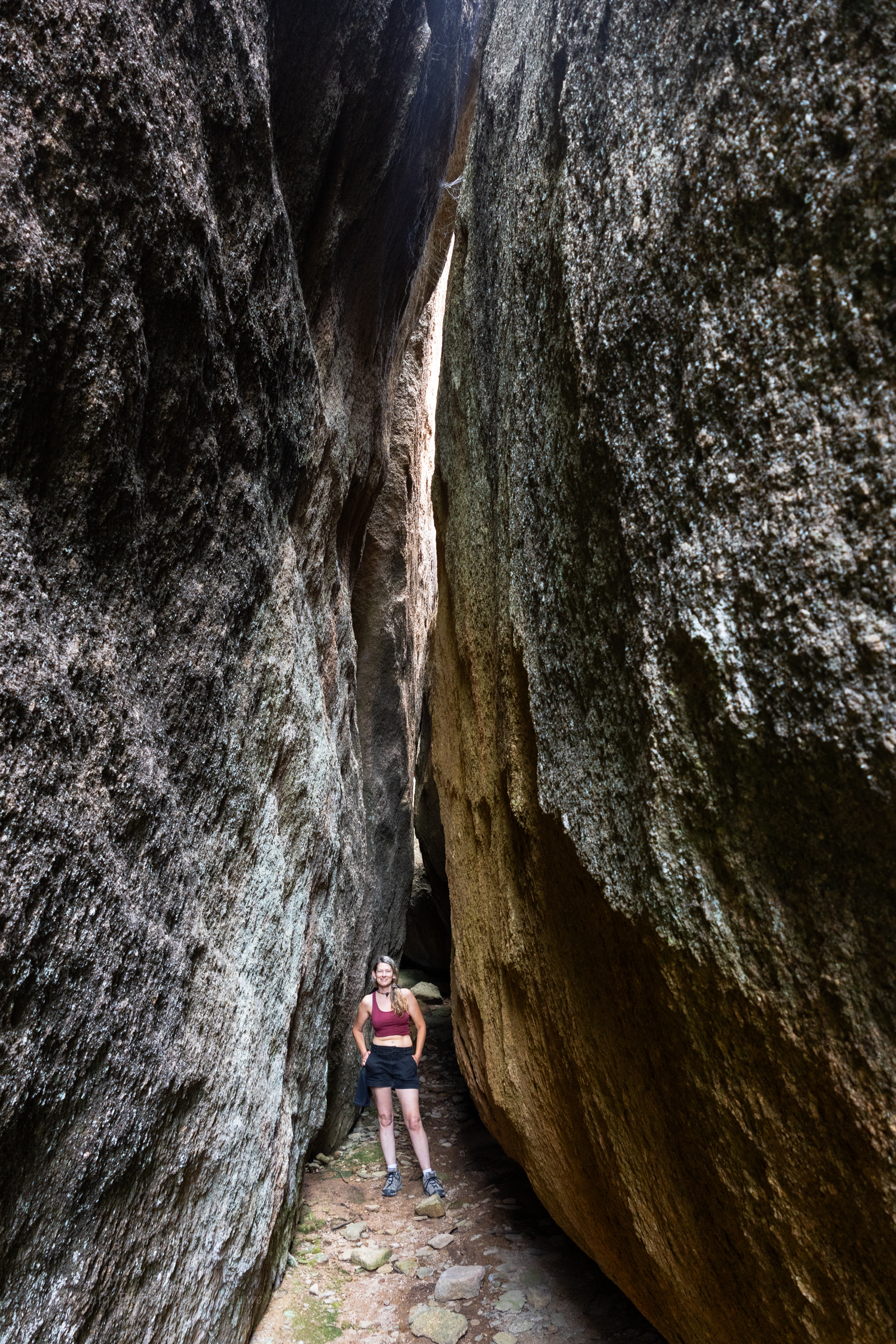
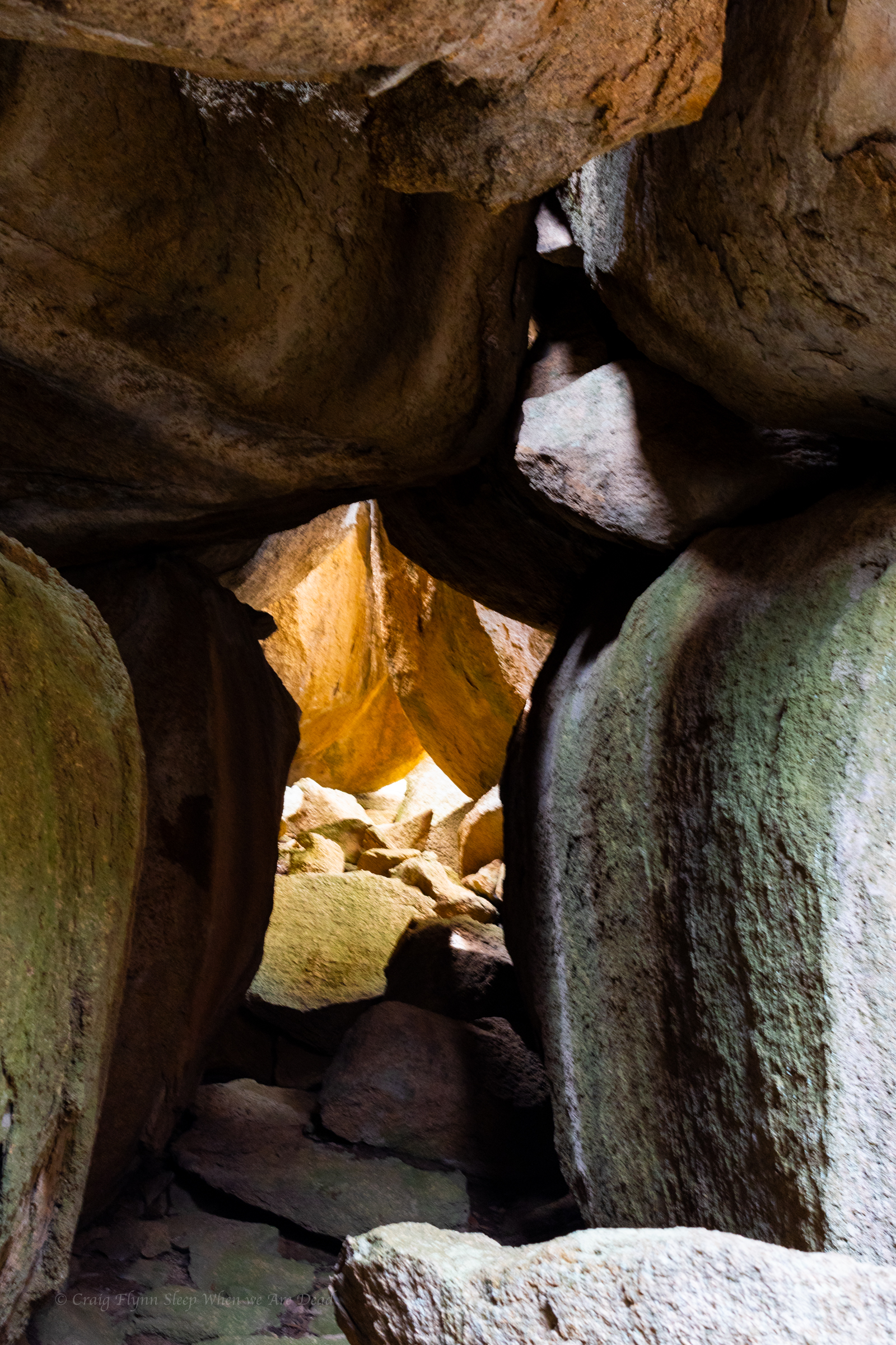
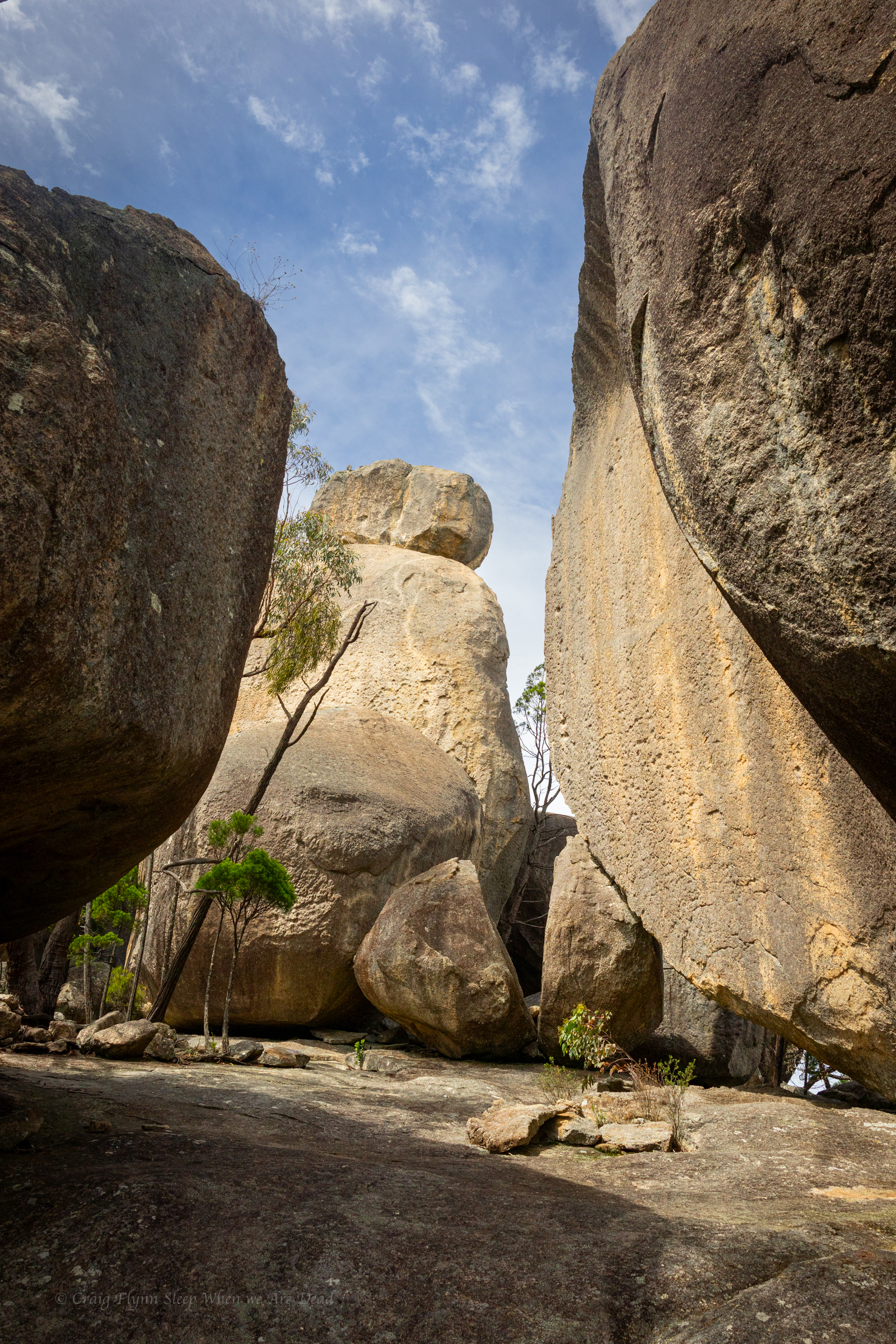
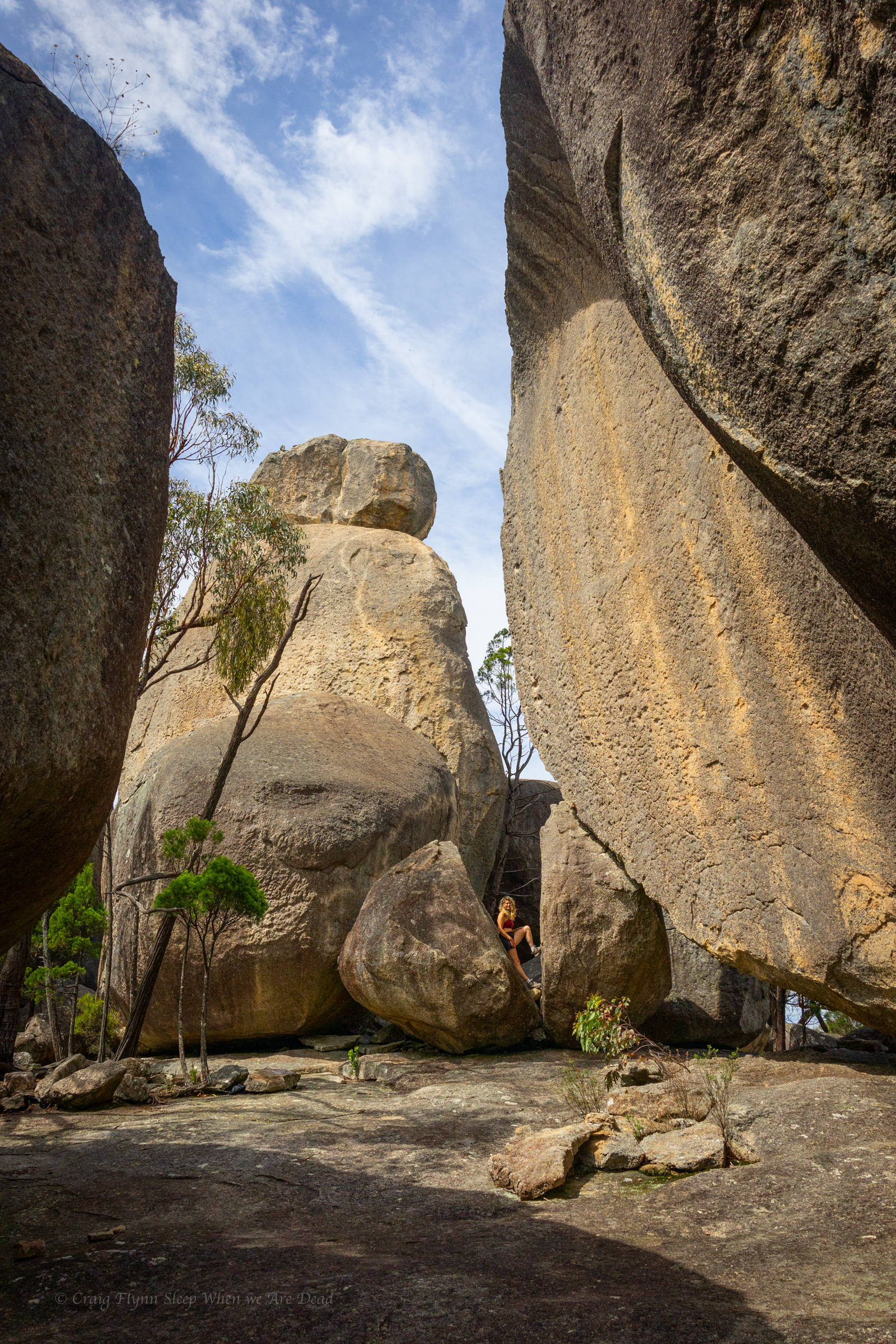
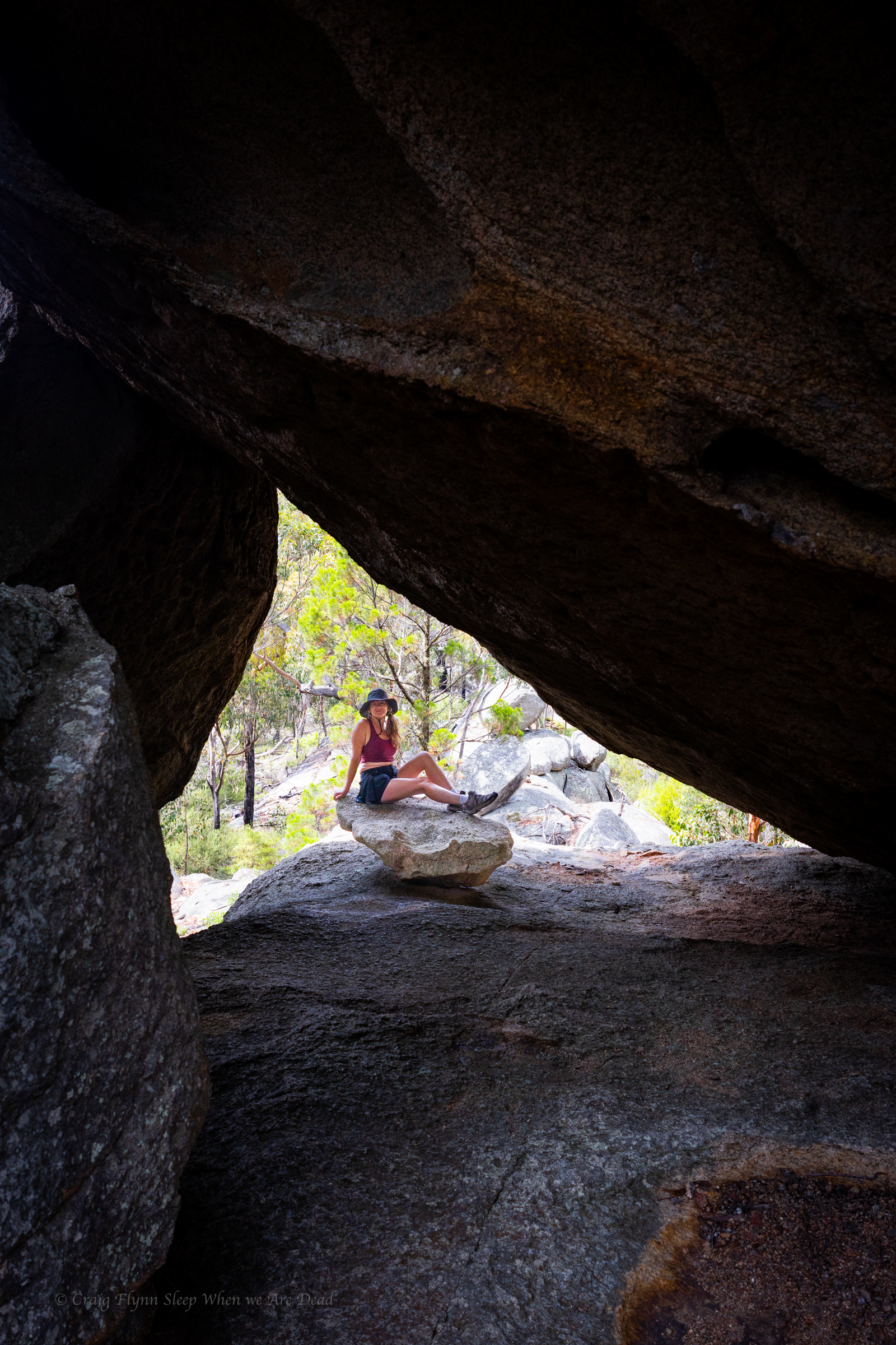
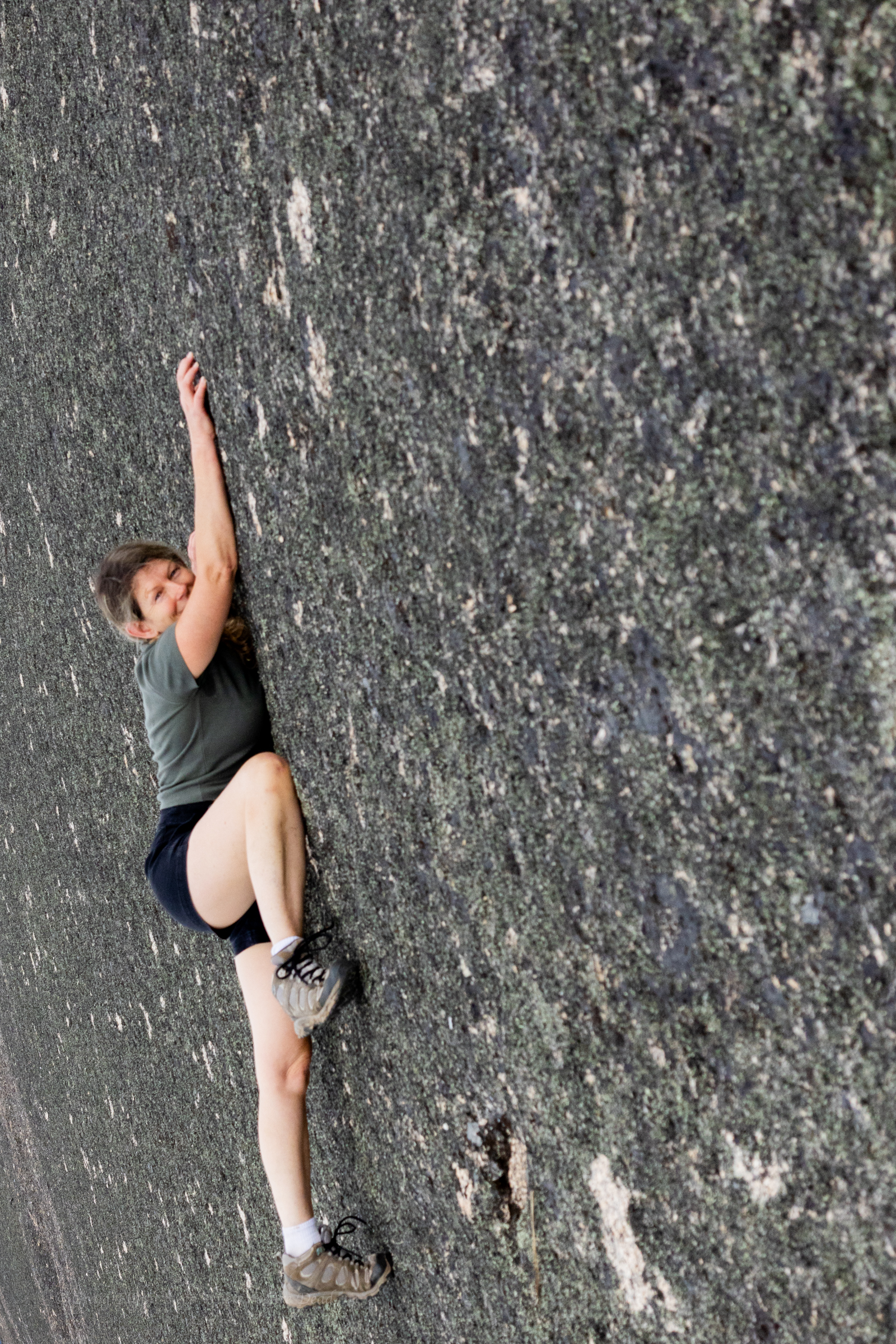
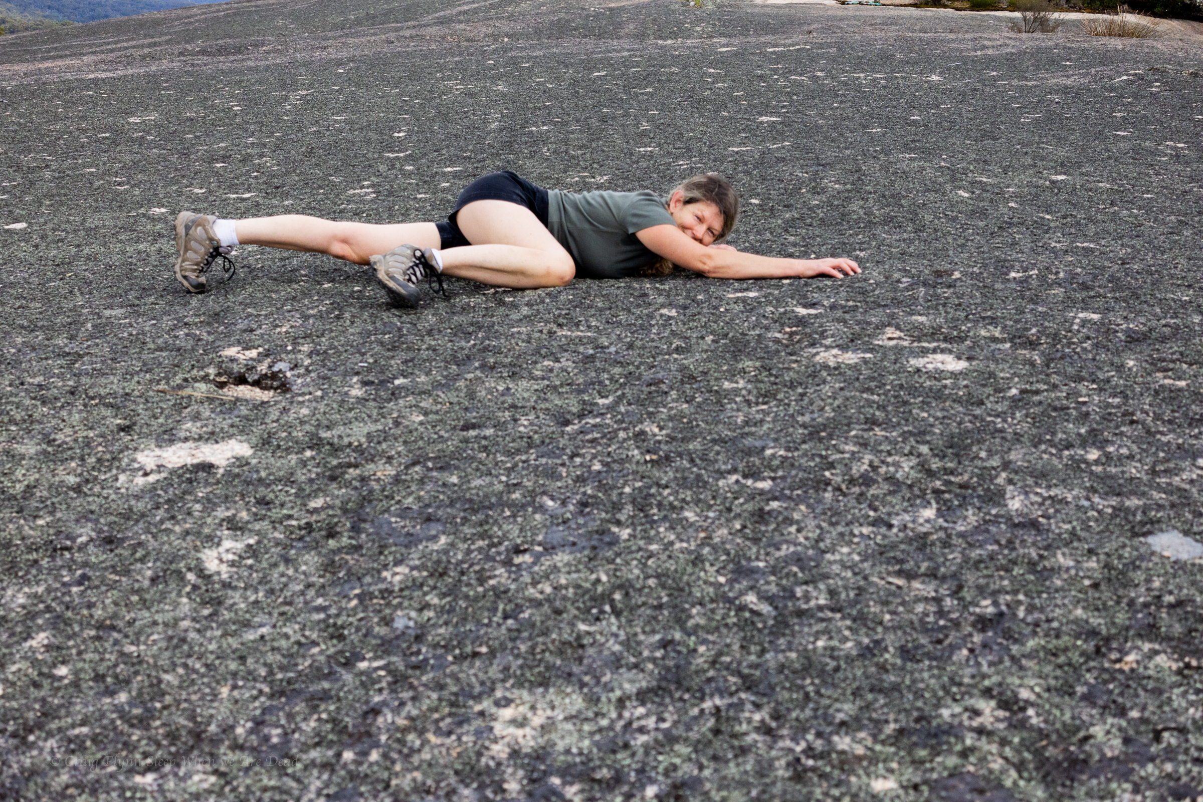
On our way to Bald Rock we had stopped at “Thunderbolt’s hideout.” and joked at the time that if we didn’t stop on the way in we wouldn’t stop on the way back as we’d be sick of looking at Granite tors and boulders .
Narrator: Neither Craig nor Kylie got sick of looking at granite tors or boulders.
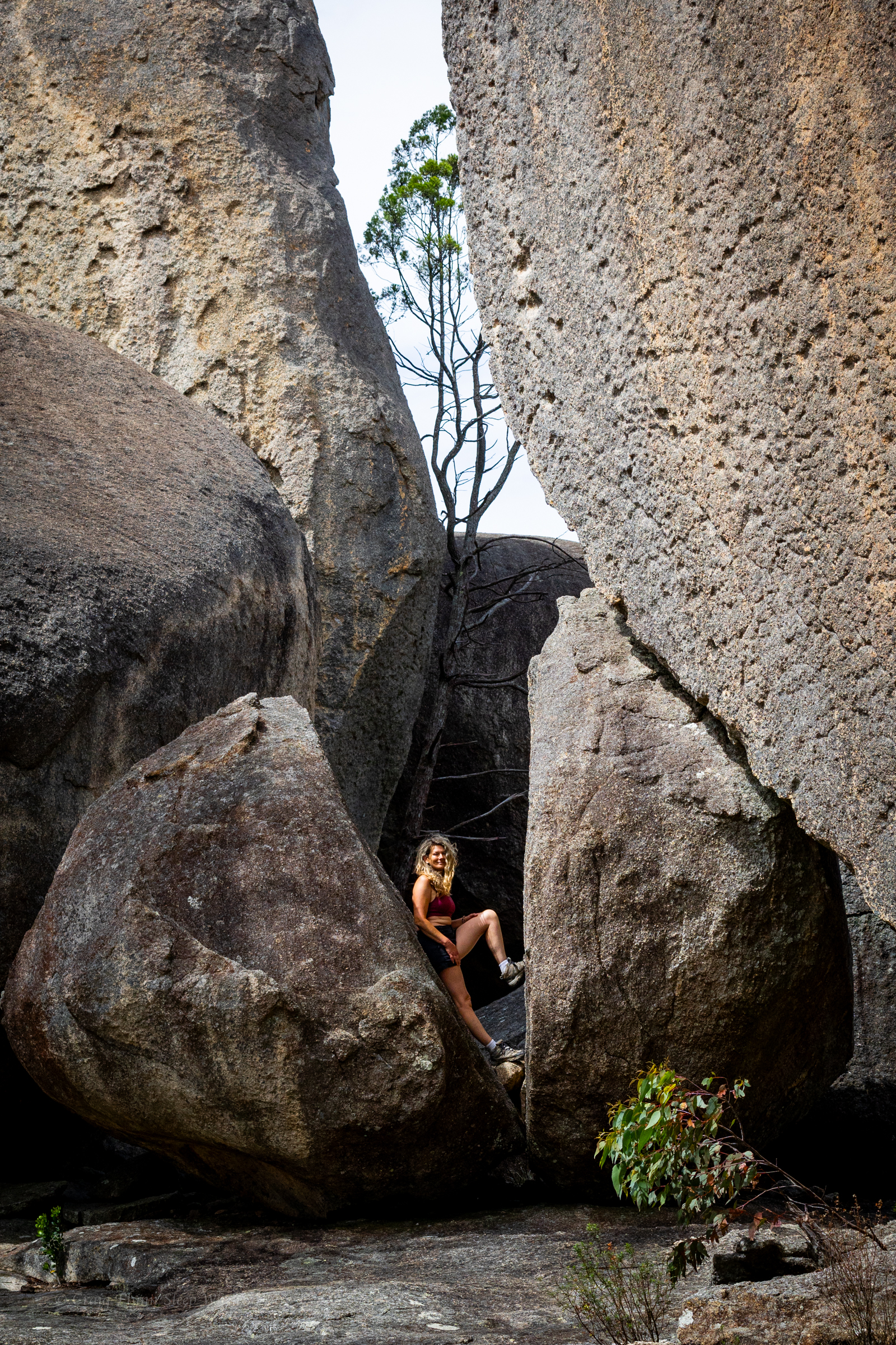
Just adjusting the placement for a better composition
A big storm role din with lots of thunder and lightning so we dashed back to camp.
Knobby Dragon. I think. Could be a Jacky Dragon. I aint know. I’m not a dragon tamer.
The storm passed over without rain and the sky cleared so we thought a late afternoon walk up the Pyramid would be just the ticket.
It’s about 2km from the campground to the summit, so not a big walk.
But it’s steep.
While not the steepest signposted tourist track we’ve been up (I’d probably give that to the Red Track at Bungonia) added to the steepness is the exposure.
Grippy shoes and dry weather is a must for this one. Once the rock is wet you’d have more grip on an ice skating rink.
The first part is along a clear easy path. This leads to some stairs. They lead to a big granite slab. White dots lead the easiest path up. All good so far
Then you scramble up this rocky chute, referred to as the pyramid passage.
Then comes the traverse.
You make your way out, angling up. To the right the granite slab towers above. To your left a steep slope dropping off to nothing but air.
It’s terrifying but worth it. Say a couple coming back down.
(Belatedly, on the way down, we find there is a less terrifying option of veering right and around the back side of the boulders above)
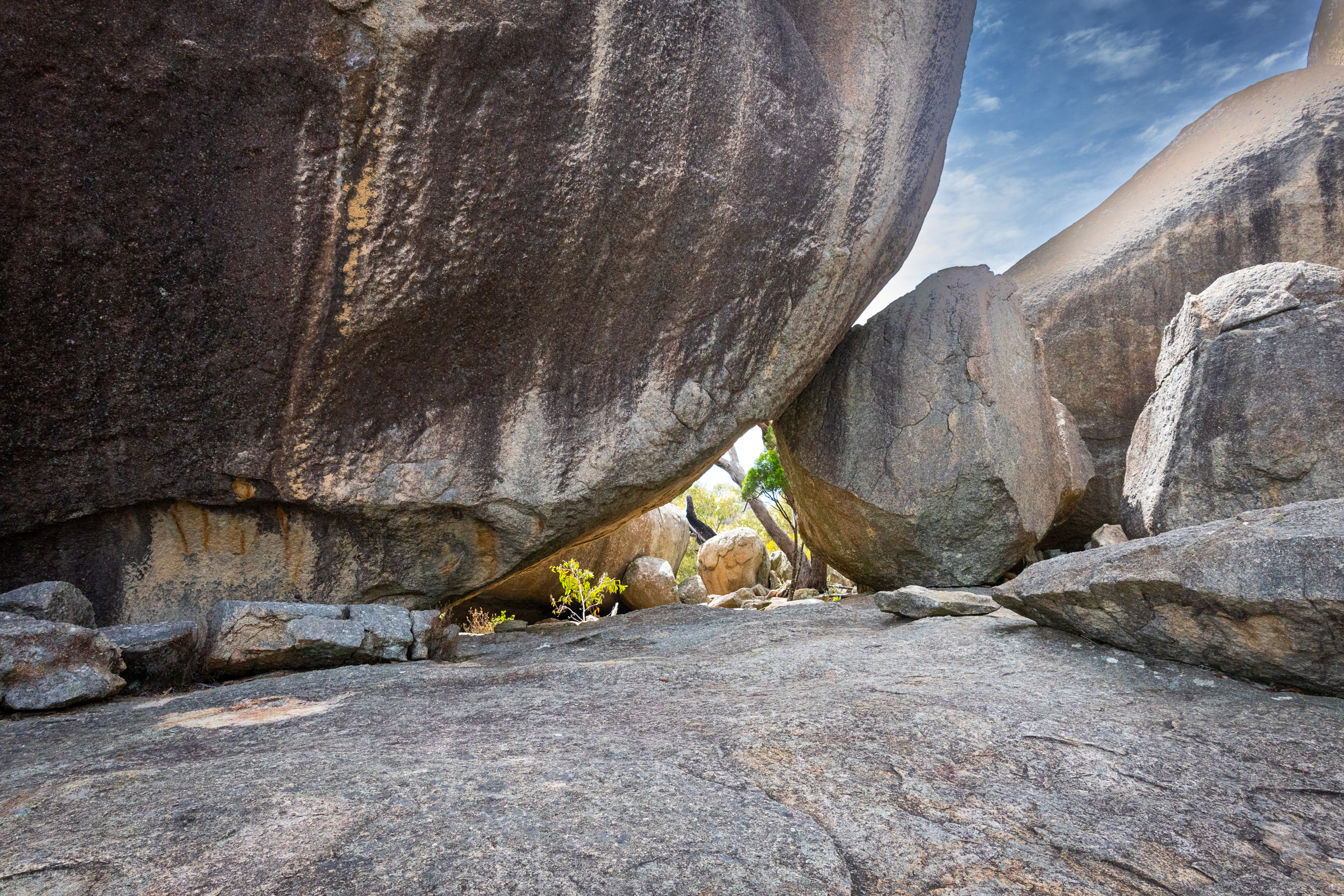
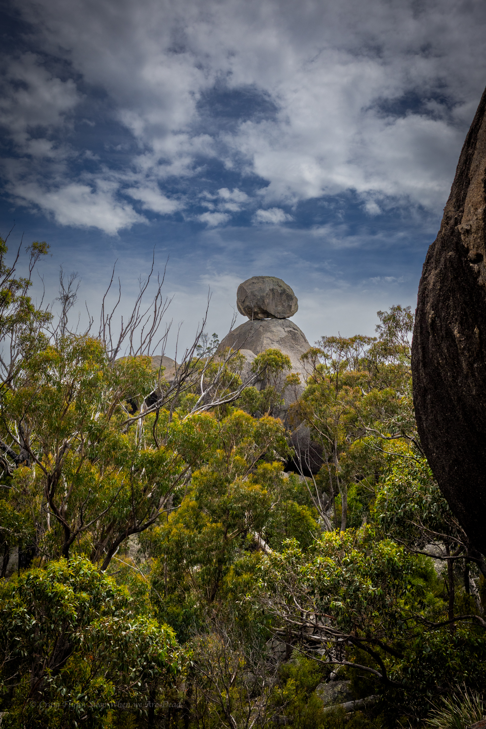
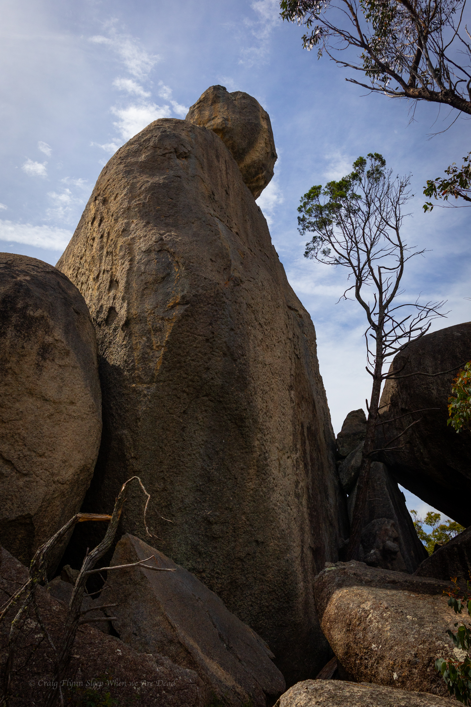
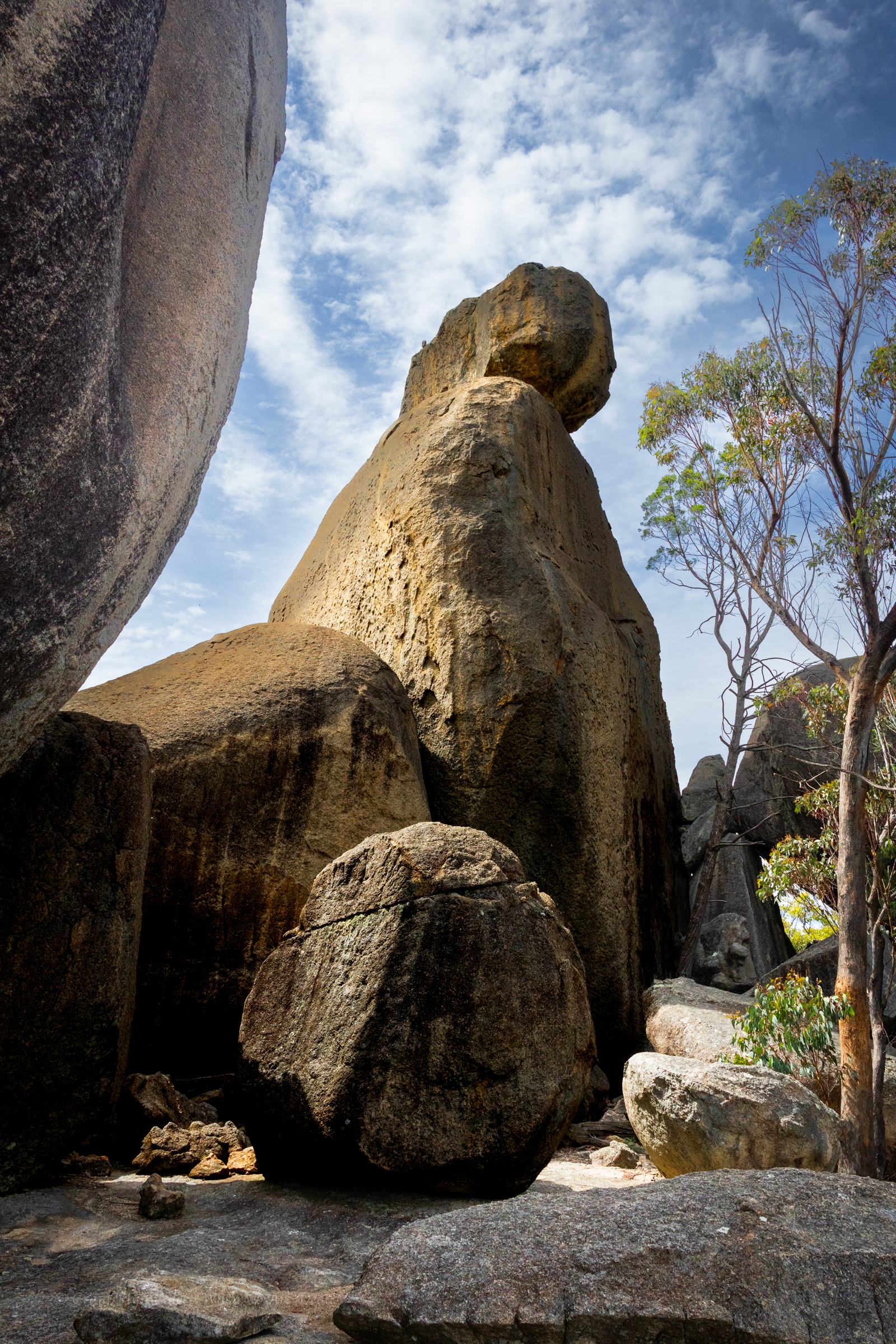
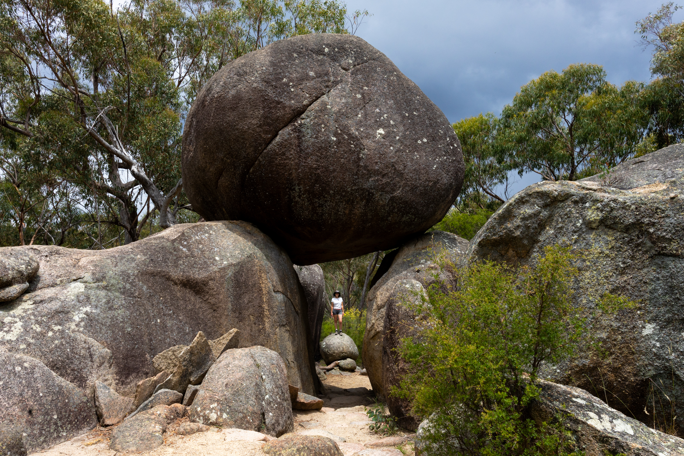
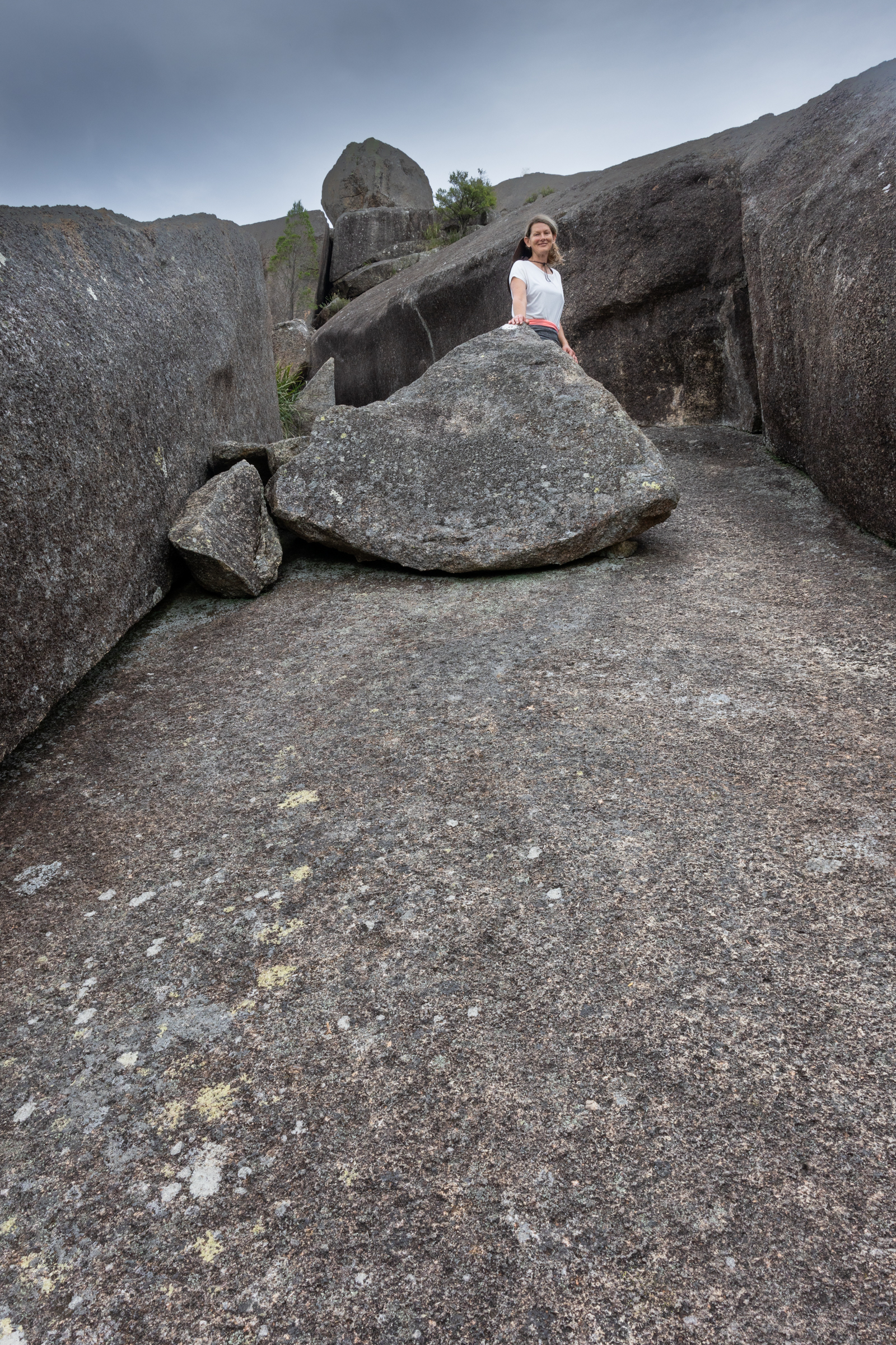
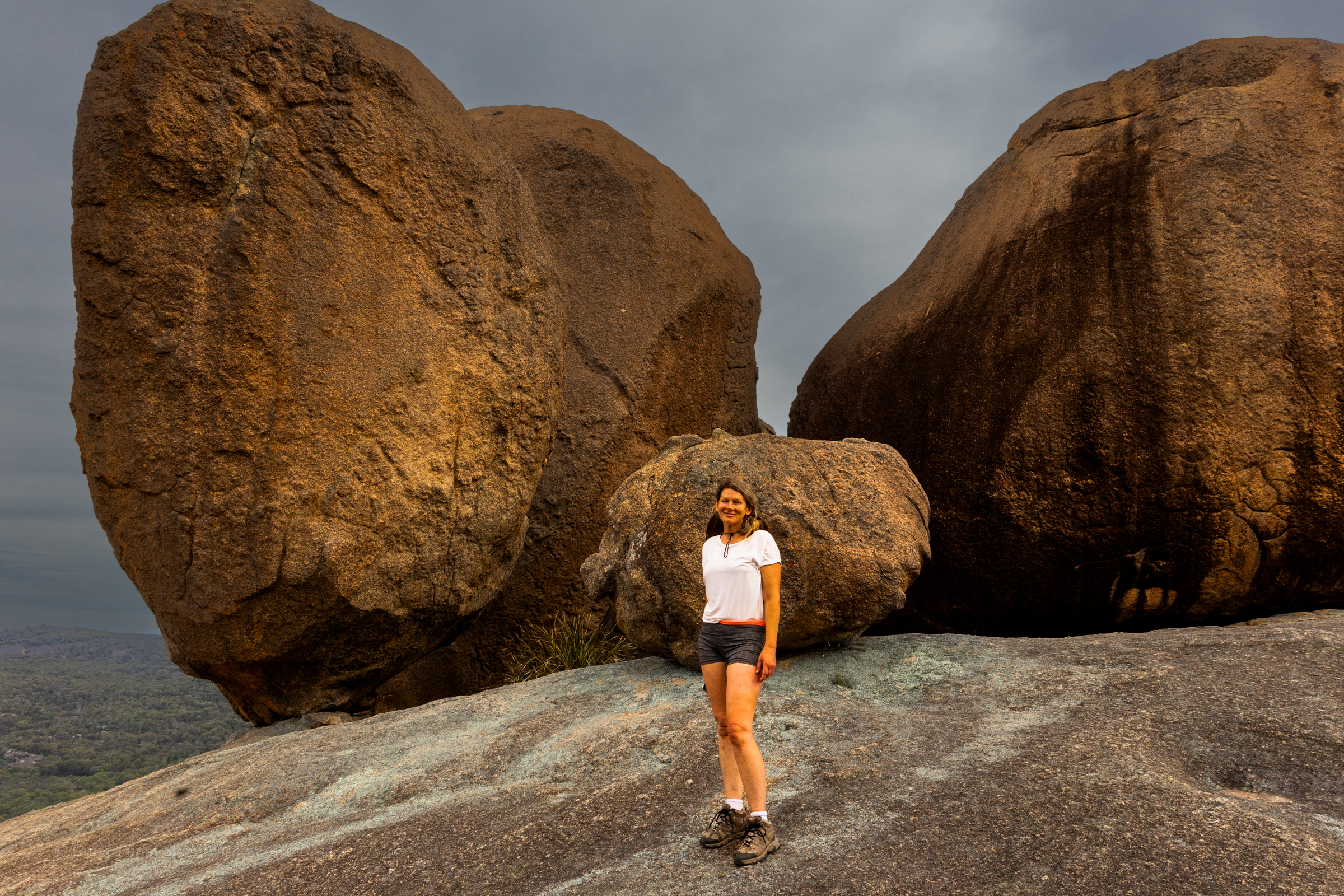
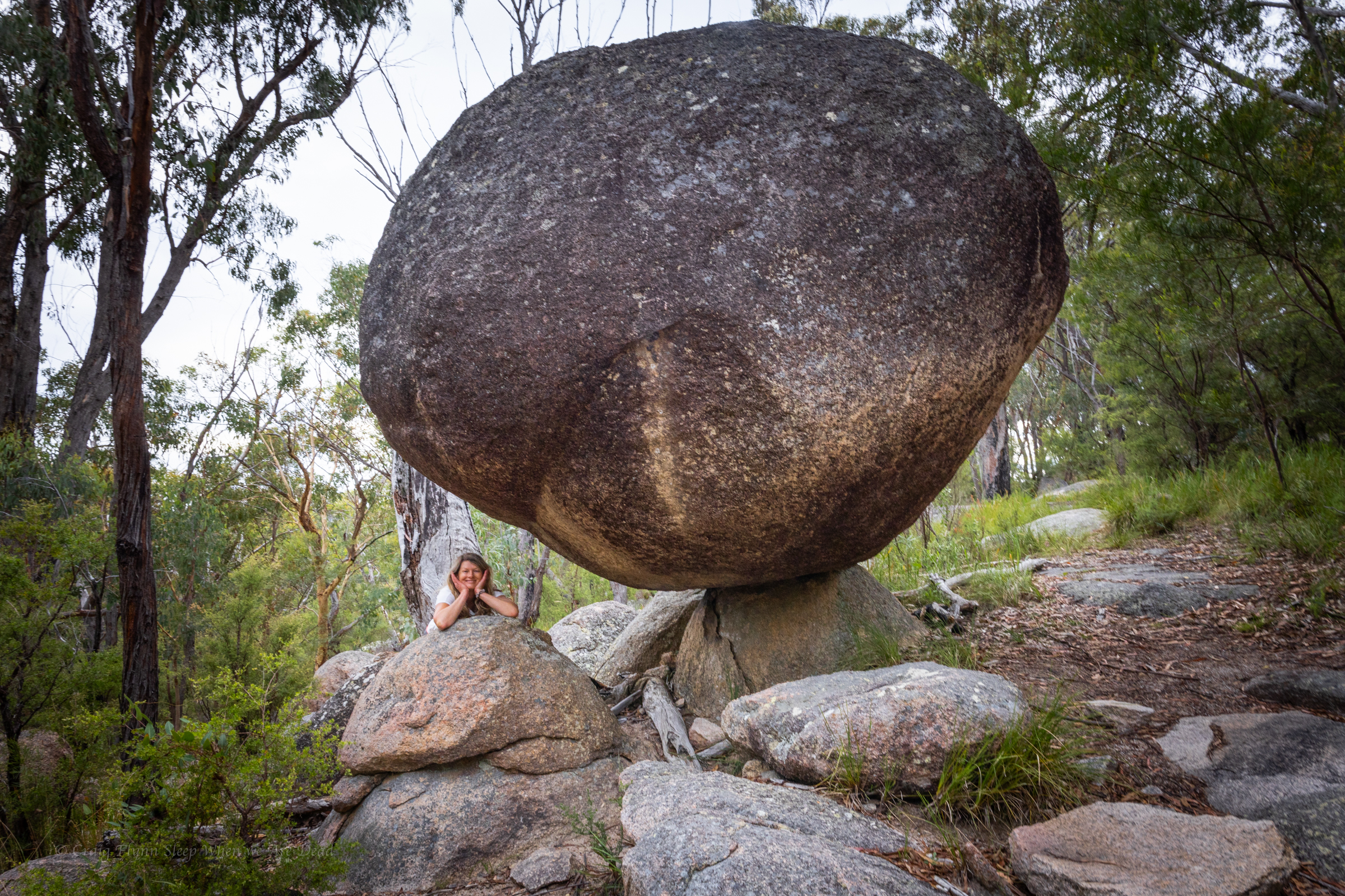
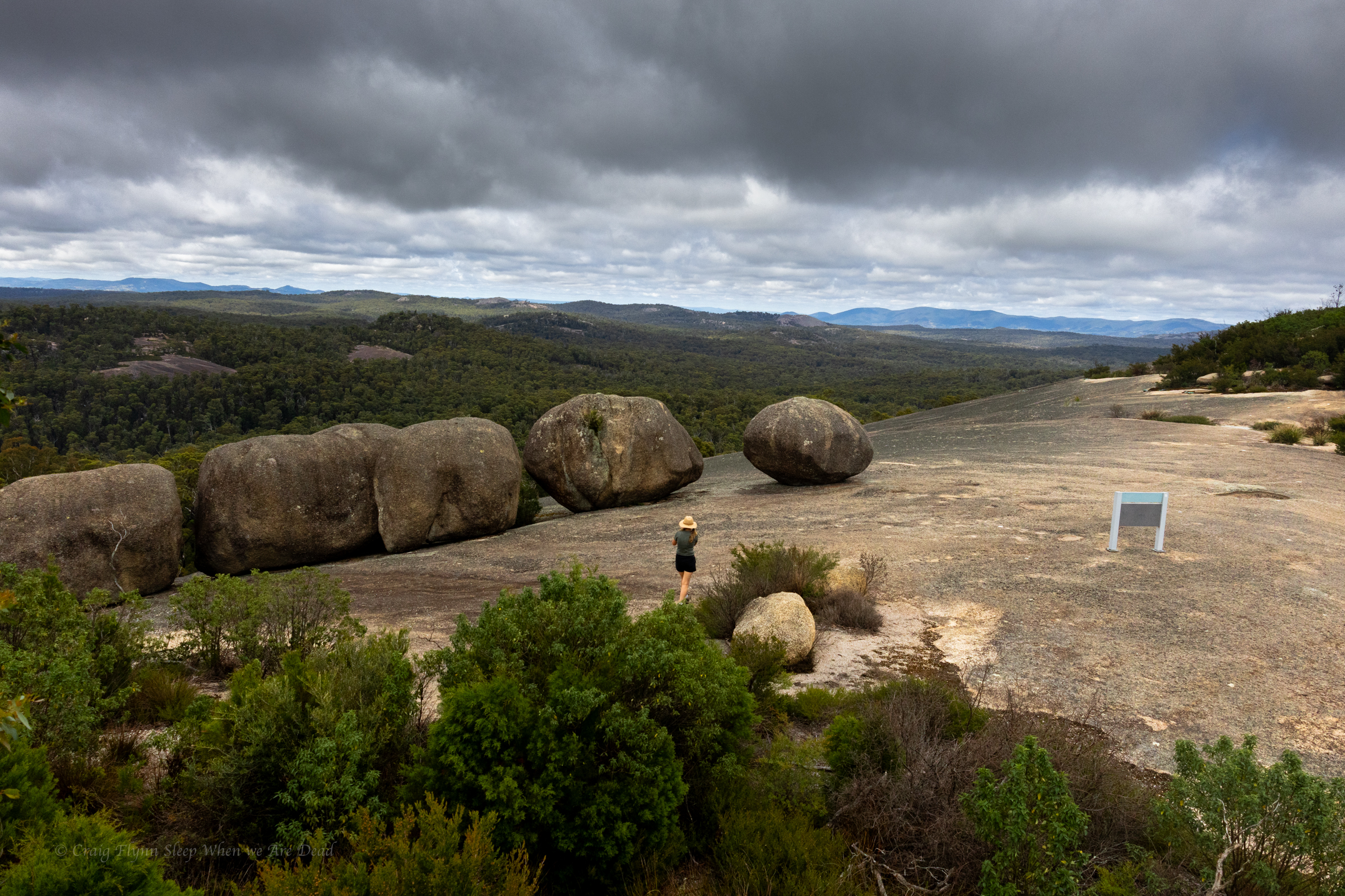
Past traverse its another little scramble before you round a corner to views of the infamous balancing rocks, defying gravity (for the meantime) right on the edge of the dome.
Breath taking in the soft afternoon light of sunset
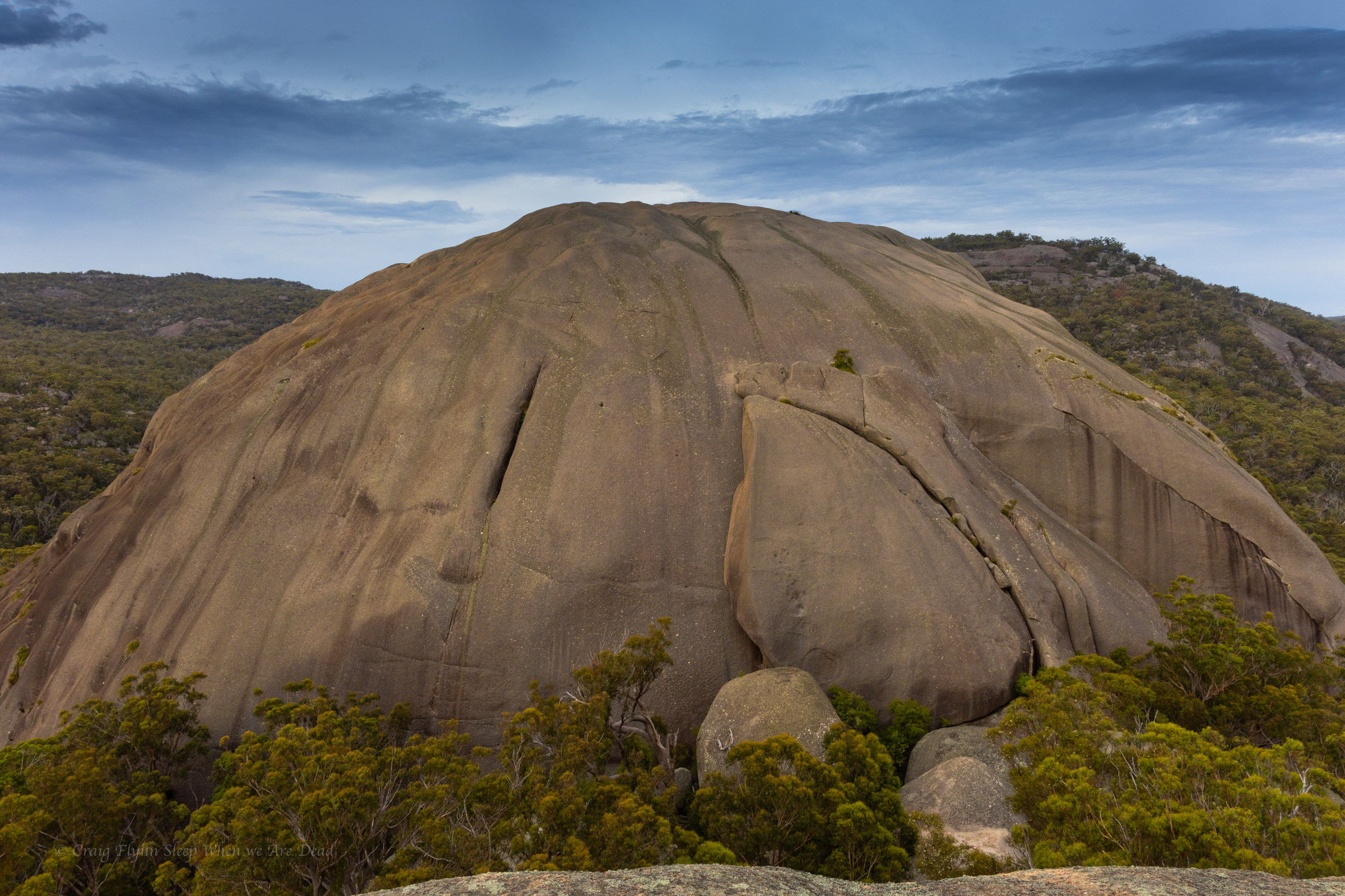
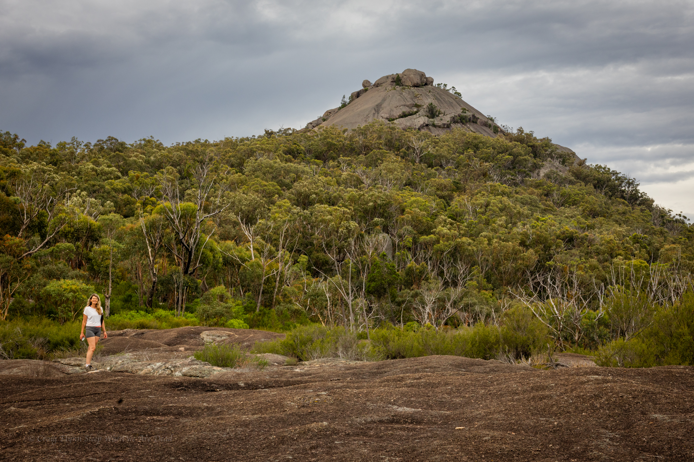
The view across to the second “Pyramid” and equally impressive granite dome.
If you close both eyes and try really hard to imagine a pyramid it looks just like a pyramid.
The aboriginal name for these peaks seems to have been Terrawambella. Early pastoralists mapped them as “the domes” at some point they became known as the Pyramids.
With the sun sitting low in the west the light was magical and we had the views all to ourselves.
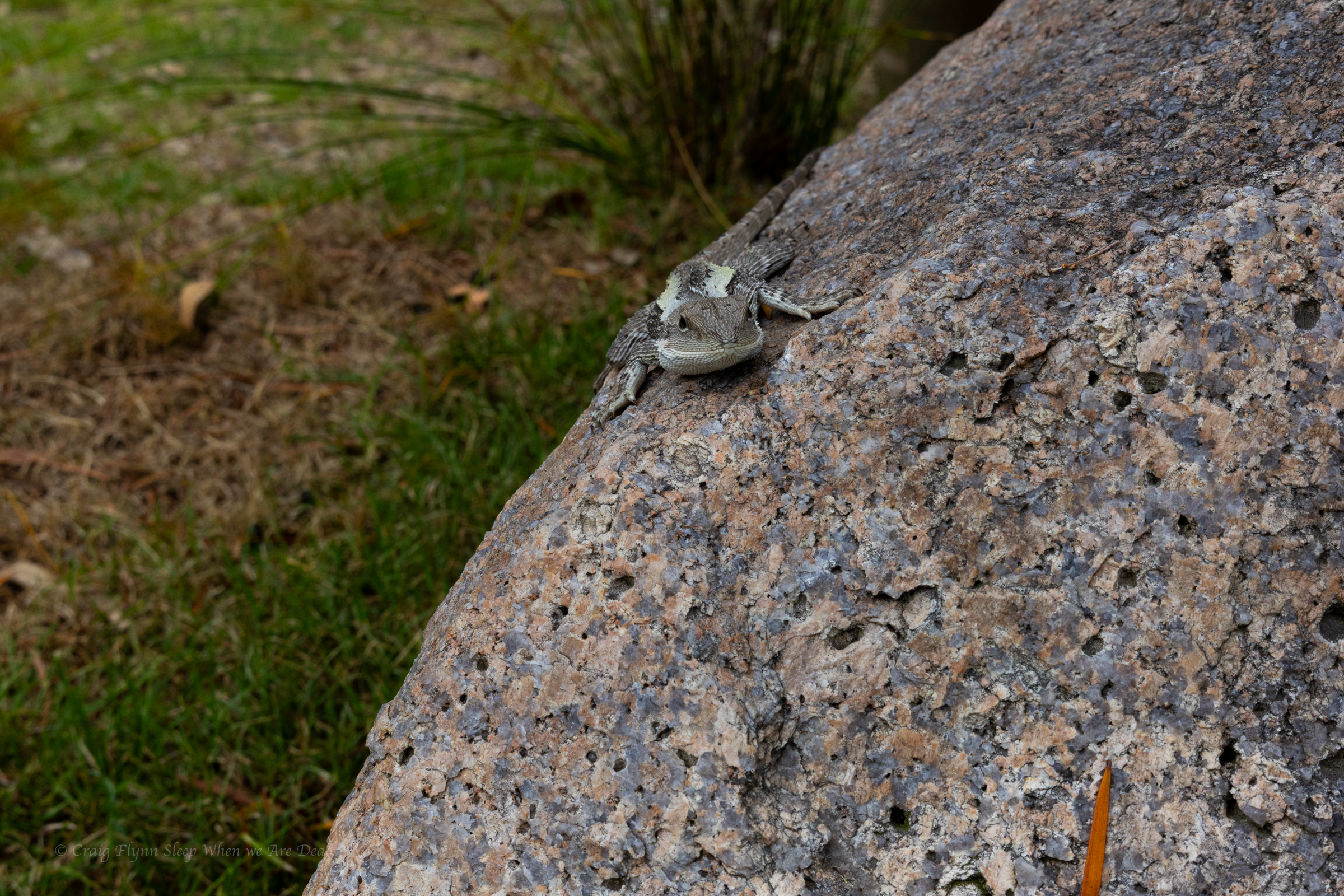
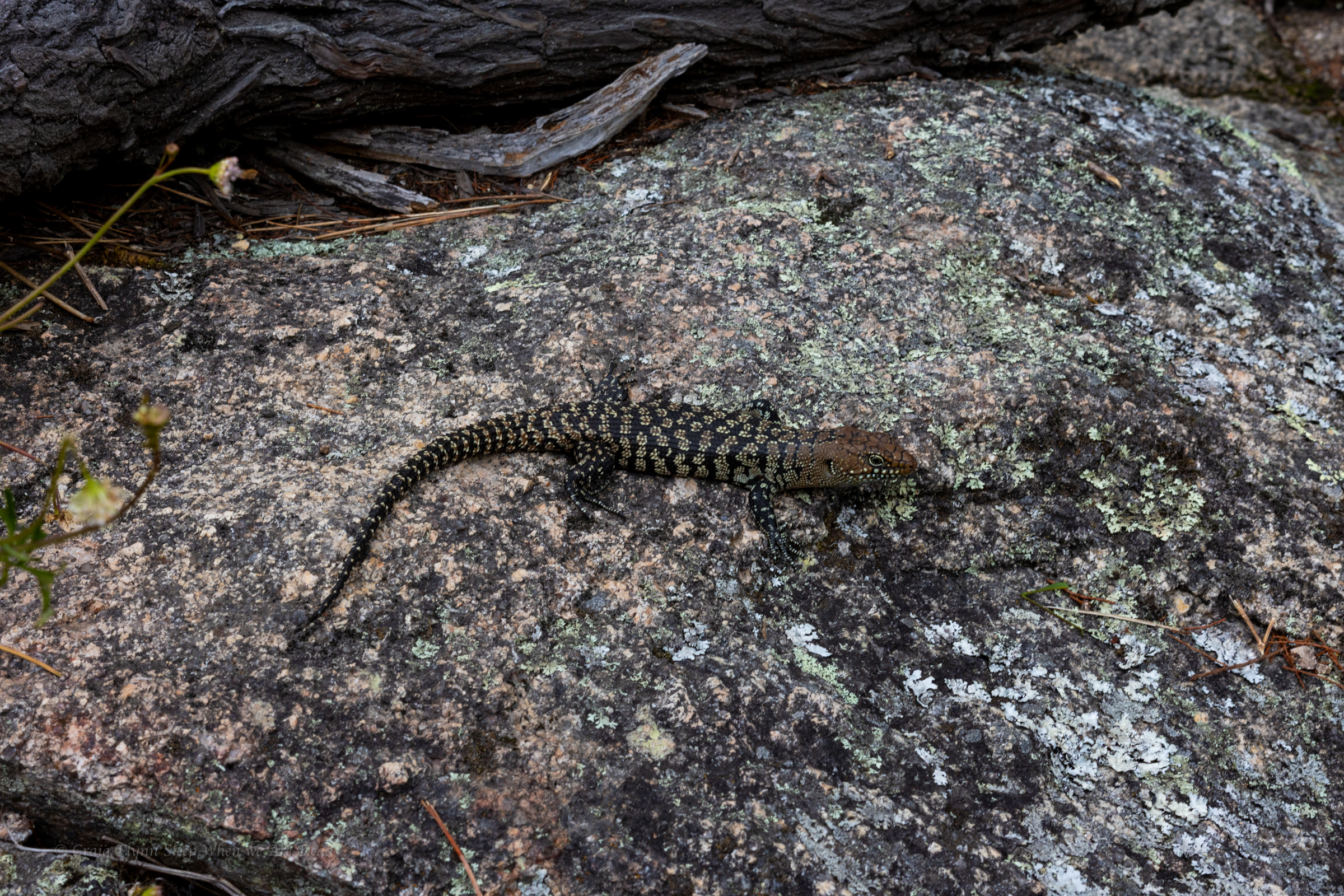
Well, us and Mr Cunningham.
I only recently learnt that Cunningham skinks have the ability to change their colour a bit, sort of like a chameleon, to help blend into the background.
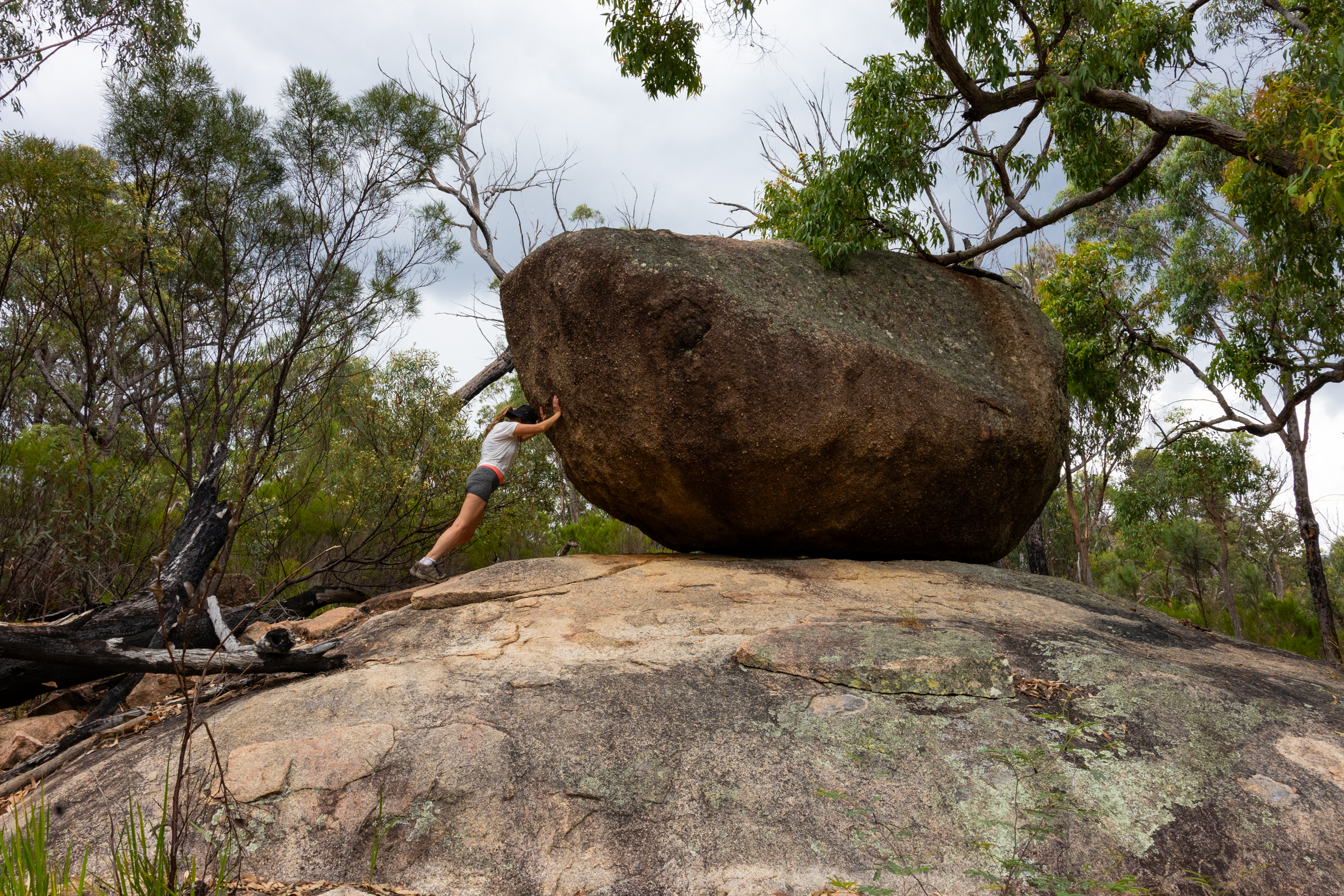
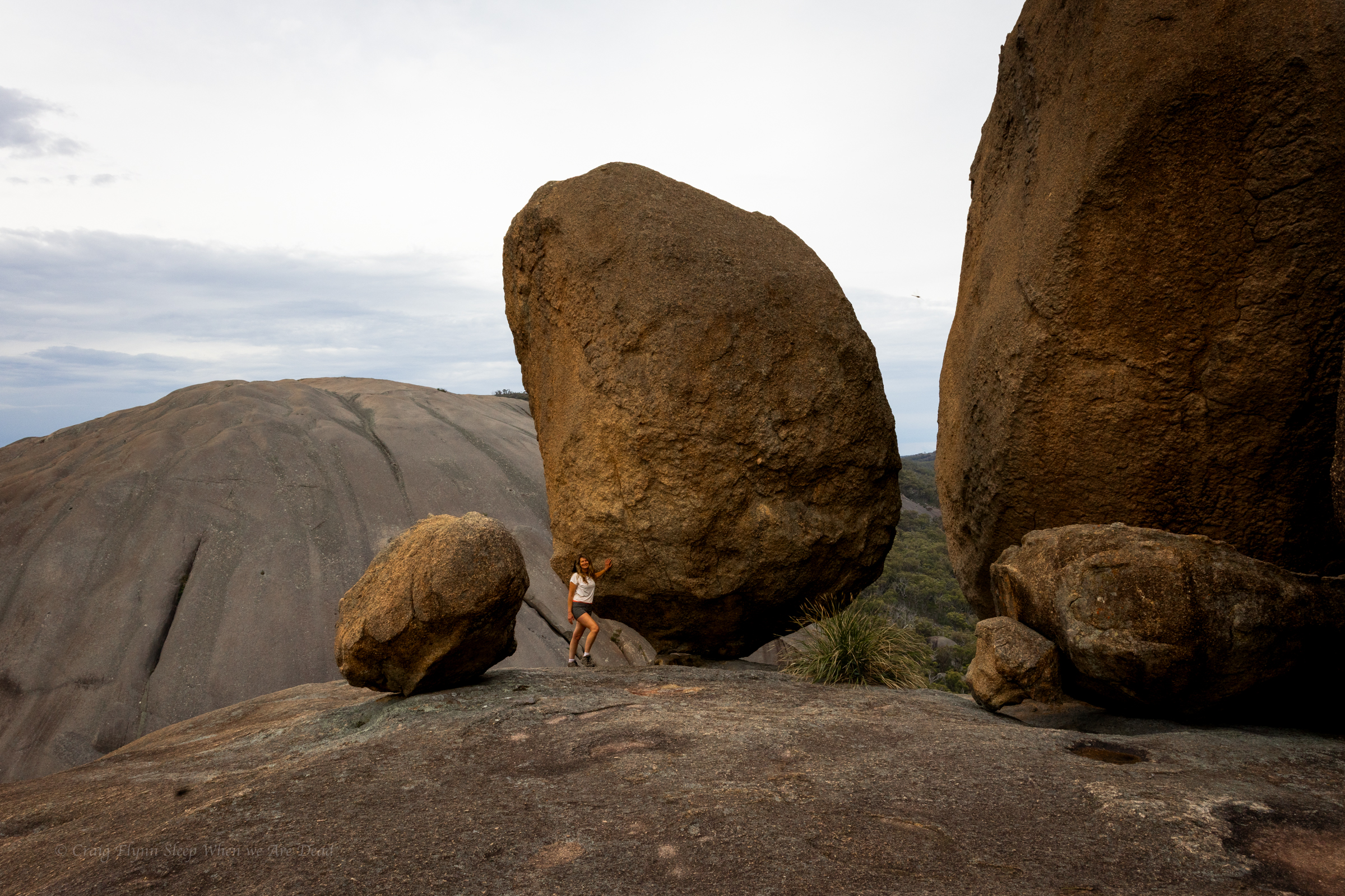
Once back down off the dome we veer off track to check out other balancing rocks and views
Gadget and The Great Pyramid of Girraween
It’s been a good day. We have punched out a couple of short but steep walks. Basketswamp Falls, the Granite Arch and the Pyramid.
We get back to camp as another storm rolls through. The temperature was due to ramp up again tomorrow so we plan an early morning trek out to the Sphinx
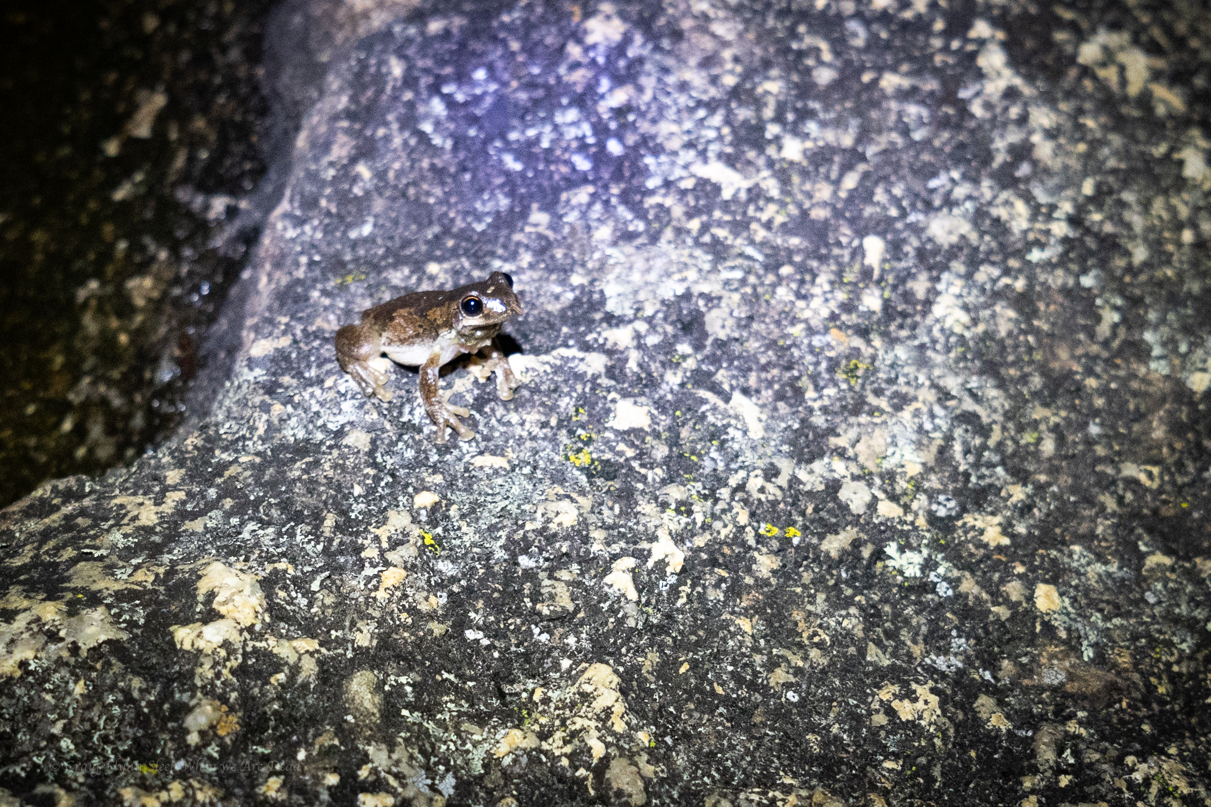
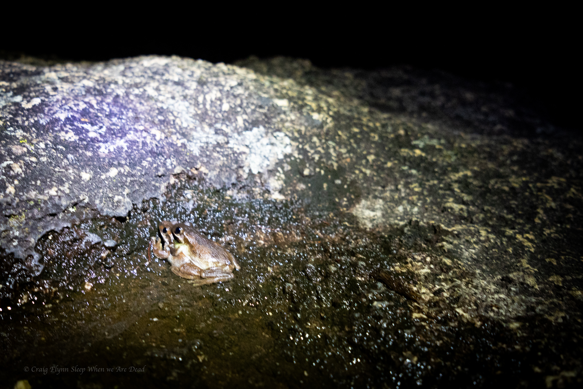
But not before a bit of late night herping
it was a frogathon but I forgot to charge my head torch so had to call it before the snakes came looking for diner.
Finishing up our coastal sojourn we head west. Our plan was to come back down the western line.
As usual we had planned to pack a fair bit in to a short time.
The Western line probably isn’t in the forefront of most peoples minds as a summer trip. We are not most people
Are we crazy? asks one of us
Yeah. says the other as if it was the most obvious answer in the history of obvious answers.
The fact was summer was when we both had time off so…
Our first destination was Bald Rock.
I’d never heard of it but Kylie said it was something she really wanted to see.
It’s right on the Qld border and part of the New England Granite belt, which was formed about 250million years ago. It’s called the New England granite belt because, you know, nothing resembles Old England more than goannas running across massive granite domes…
Anyhoo
We pull into the car park and cook up a breakfast then make our way up to the trailhead.
There are several walk options, from super short to all day. We opt for the summit walk.
A reasonably short walk leads us to the base of the massive granite dome. This point is wheel chair accessible and if its as far as you get it still bloody impressive.
A mountain of granite towers above.
White reflectors stuck on the rock were the only indicators of a path up.
Of course we follow them. Mostly
It was steep.
Jokes
It’s a little steep but not *that* steep
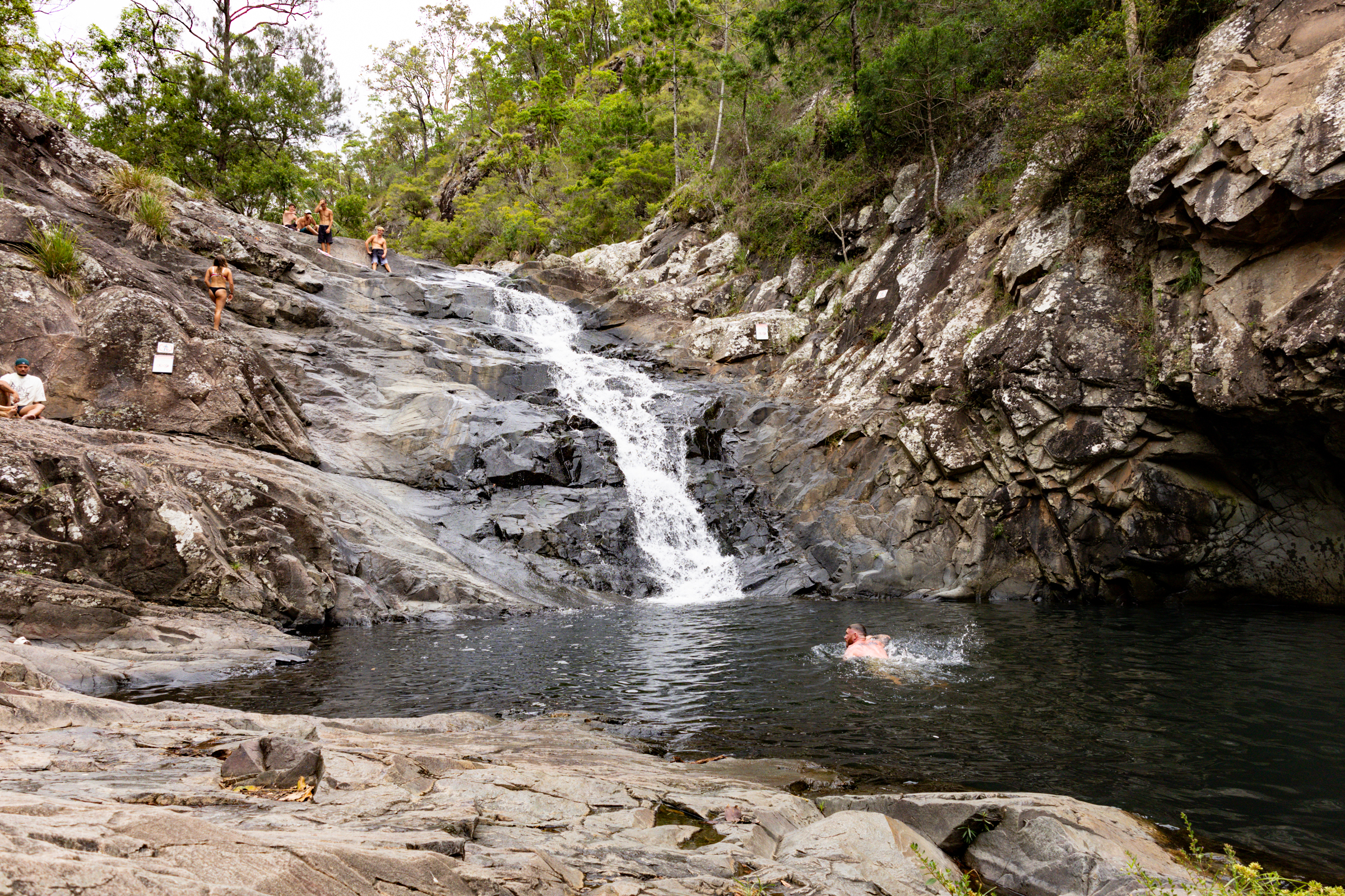
It’s a short, punchy walk up to the summit and it was spectacular.
Rising 260m above the surrounding terrain, Bald Rock is the largest granite monolith in Australia and the colours are amazing, even on an overcast morning.
as it levels out we pass a few boulders and suddenly this view bursts into view
There is something humbling about big terrain. Human trivialities seem… Trivial
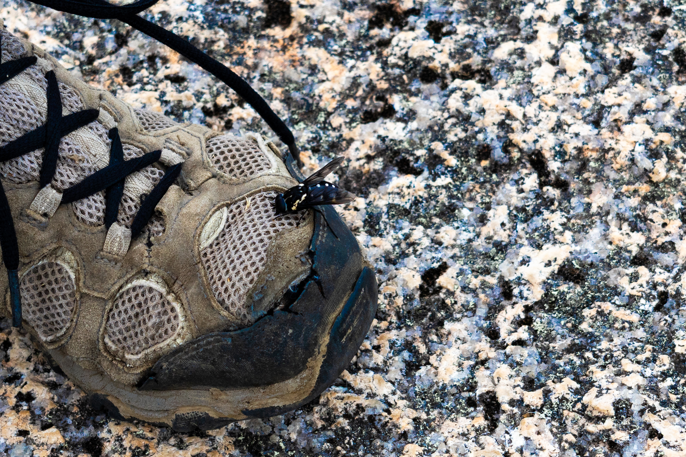
These guys were everywhere and they were curious but they were friendly enough. The bee not the warn out merrells.
We share the summit with several other groups. Families, grey nomads and, us. (There is a song in there somewhere)
We return to the car and back track a little to our camp site in Boonoo Boonoo.
Ash wanted to head to Surface Paradise so we thought it might be nice to drop him off for a day out and drive up to check out a couple of the touristy waterfalls on Tamborine Mountain.
We knew Jason was up visiting family in Brisbane so we threw him a shout out to meet us there.
Our first stop was Cedar Creek falls.
This is another popular swimming spot and it has limited parking. We needed to park way back at the turn off (Junction of Tambourine Mountain Road and Cedar Creek Falls Road.) which gave us an extra 800m walk each way.
Locals at the end of the road had set up a paid (donation) parking lot in their paddock and the kids had an esky set up sell cold drinks. Kylie half jokingly wondered if said locals rushed out of a morning on public holidays and filled the car park up with their own cars before the crowds appeared. Clever them if so as their paddock was just about full.
And to be fair, imagine having this place pretty much as your private back yard extension before the crowds discovered it and the tourists (like us) rolled in.
From the car park a boardwalk style trail leads you down past a nice picnic area beside the creek then down to a lookout above the main falls.
The trail then continues down to the base of a lower cascade and a nice swimming hole.
There are two main pools accessible from the trail.
A series of other cascades and pools are off limits due to safety concerns and rangers were on and to remind people of the need to comply.
We have a dip and laze about then head back up the mountain to check out Curtis Falls.
There’s a much bigger car park here but it’s equally full, luckily people are leaving and we get a park close to the trail head. Winning.
There is no swimming allowed in this one but is a lovely walk along a shaded creek and a very pretty waterfall.
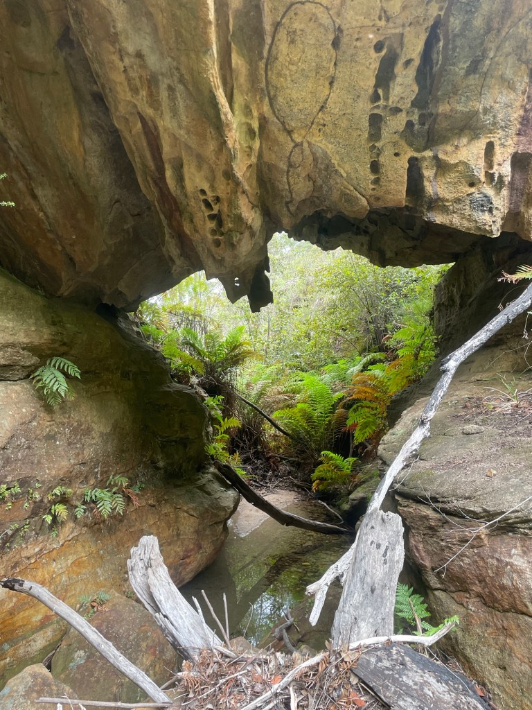
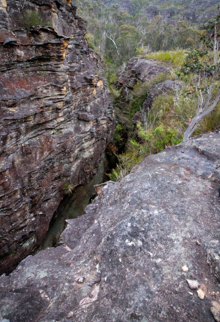
There’s some great side canyons along the Wollangambe with the most popular ones clustered around Mt Wilson.
Of those accessed from the Fire Shed there are a couple of outliers that get less traffic due to being a little harder to get too.
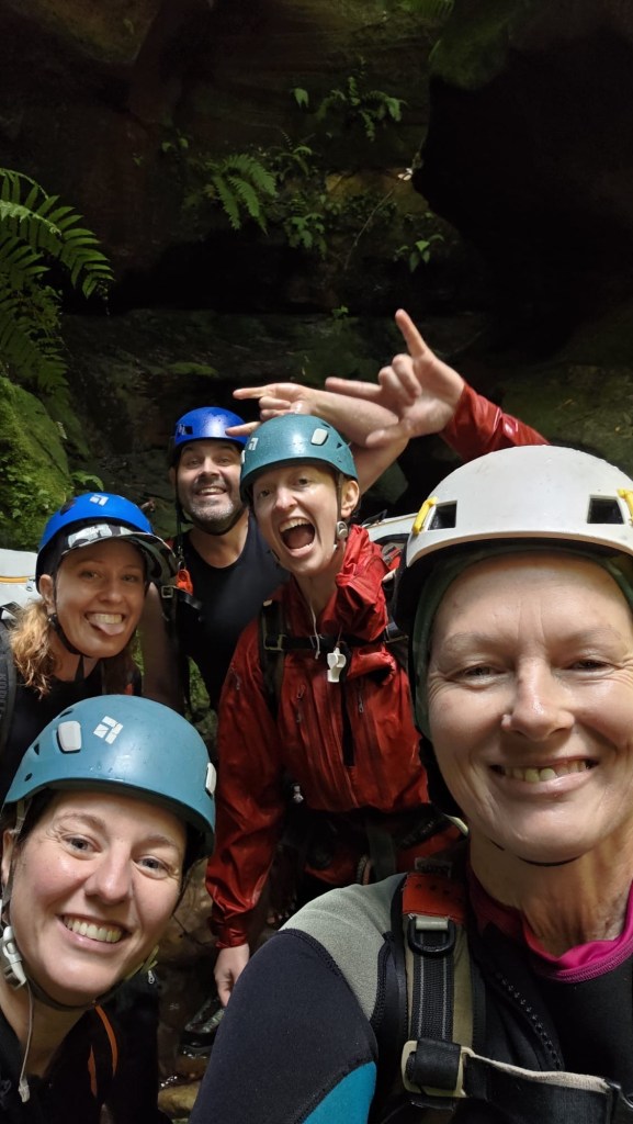
Whirlpool canyon is one of these.
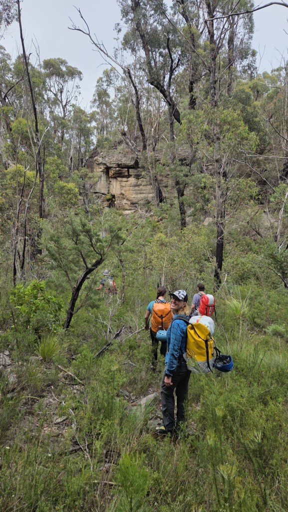
Expecting a stinking hot day and a long scrubby walk in we meet early and head off.
The others had obtained a GPS trace of the entry, I had my usual plotted way point for the canyon start and sometimes/usaul/mostly wackily off gut feel…
Banter made the walk in pass in a flash, well not really but it was surprisingly simple, even if I did get completely turned around at one point, thankfully Clare and Kylie kept us on track. Though when H suggested we try a short cut I was all in.
It was also relatively scrub free(ish)
Slipping down H’s side gully hoping to cut off a fair bit of the GPS trace.
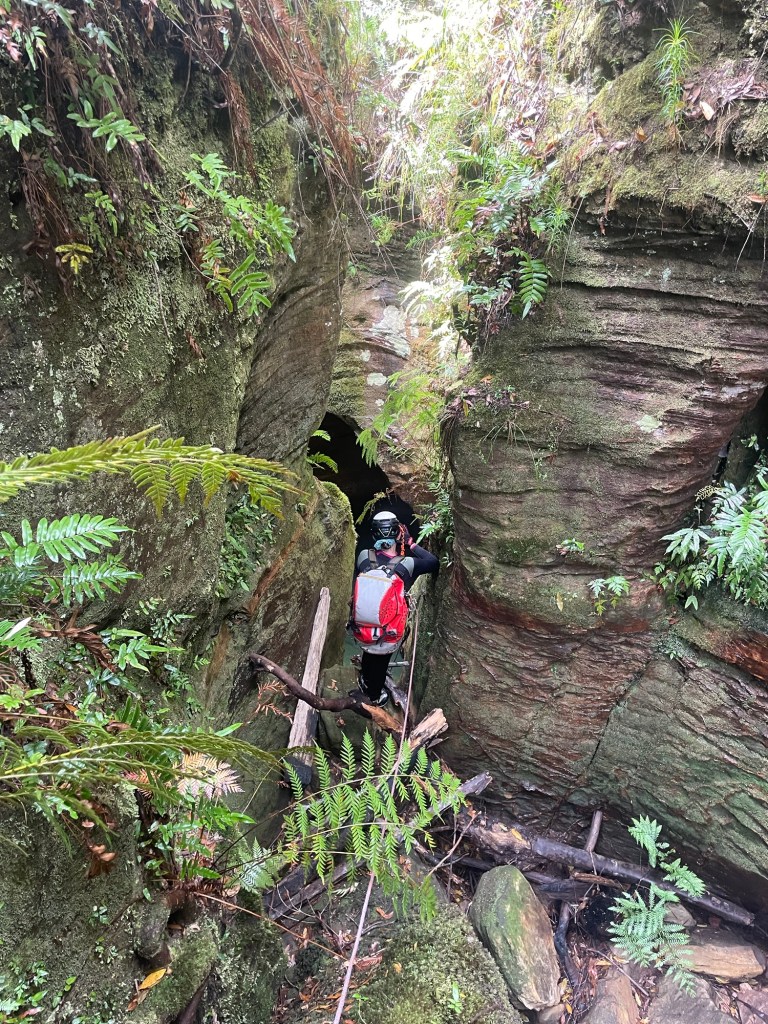
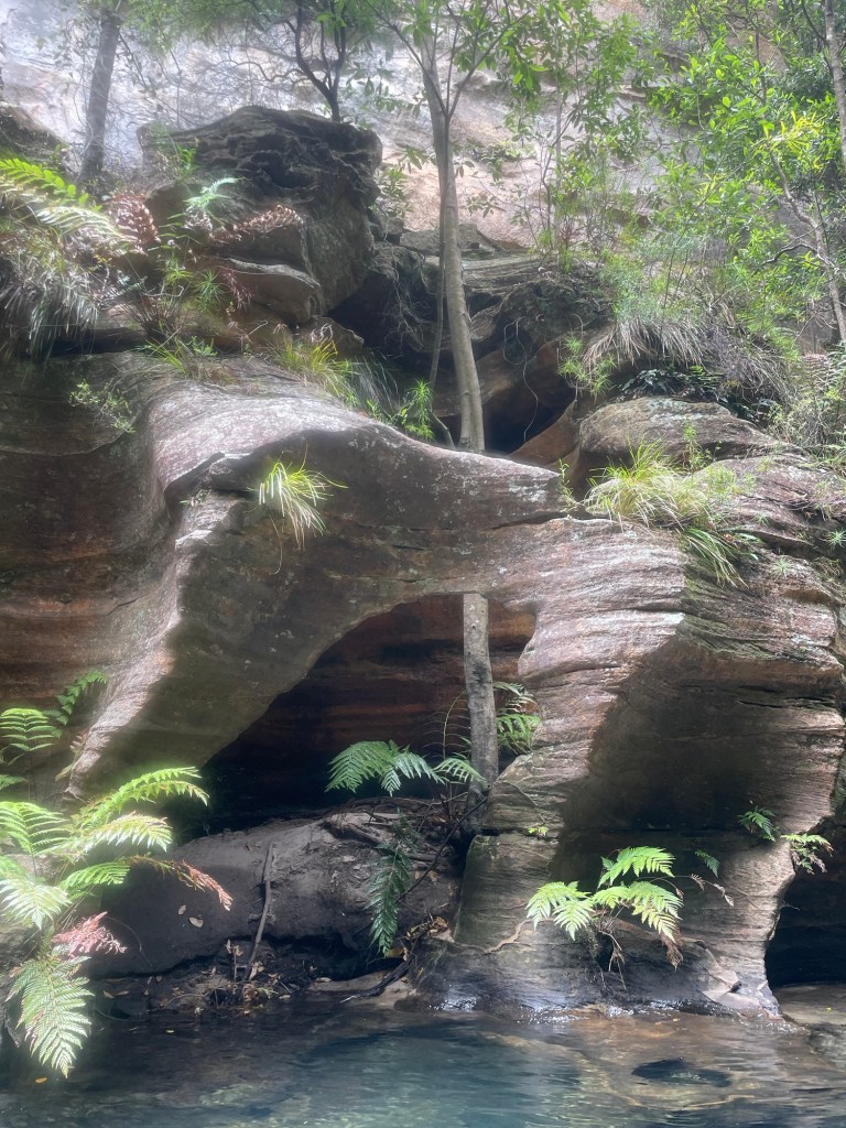
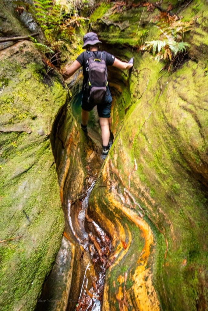
And soon we find ourself at the start of the canyon.
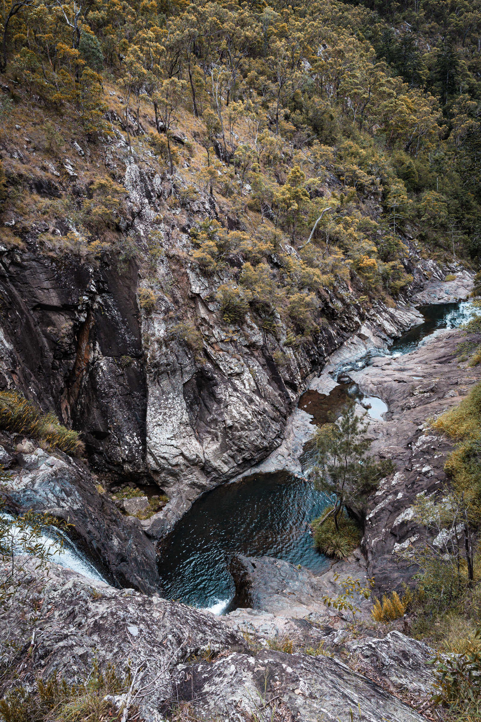
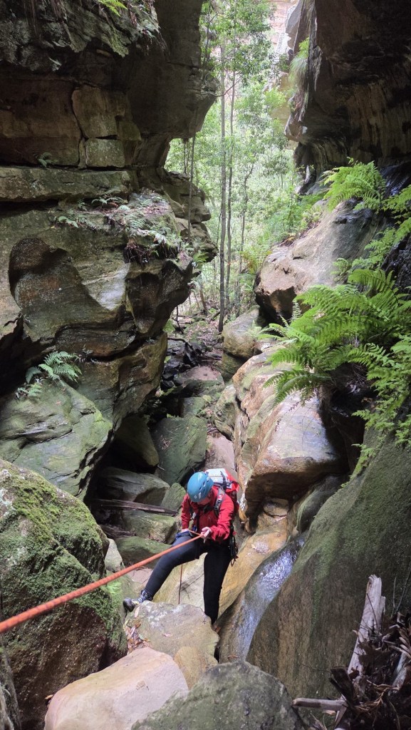
We weren’t expecting much out of this one but a short abseil gets us into a surprisingly nice slot.
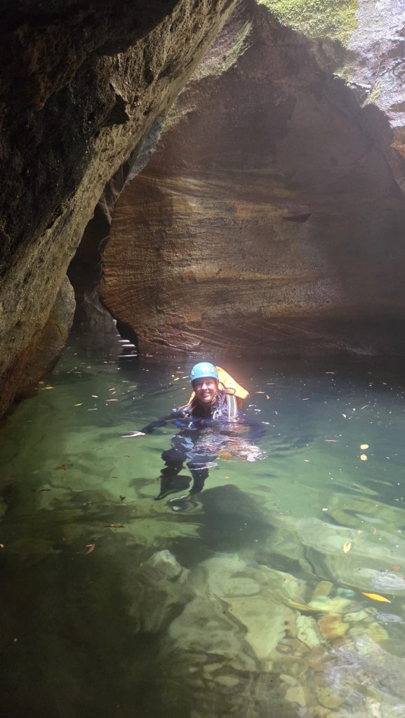
Kylie sussing out the first abseil
There was some interesting anchor set ups and a couple of the abseils have very tricky starts. This problem solving aspect is part of what I really enjoy about canyoning.
Don’t get my wrong, on popular trips where hordes of foot steps compact tree roots and pulling rope after rope wears grooves in the rock well placed bolts are a Good Thing (TM) but they do take something away from the overall experience of problem solving. That’s probably not a major draw for most, but for me it’s a big part of it.
Anyhoo that’s off topic.
Back in the land of dodgy anchors, we check each one carefully (as you should every time). Replace what needs to be replaced and carefully consider the remnant dodginess
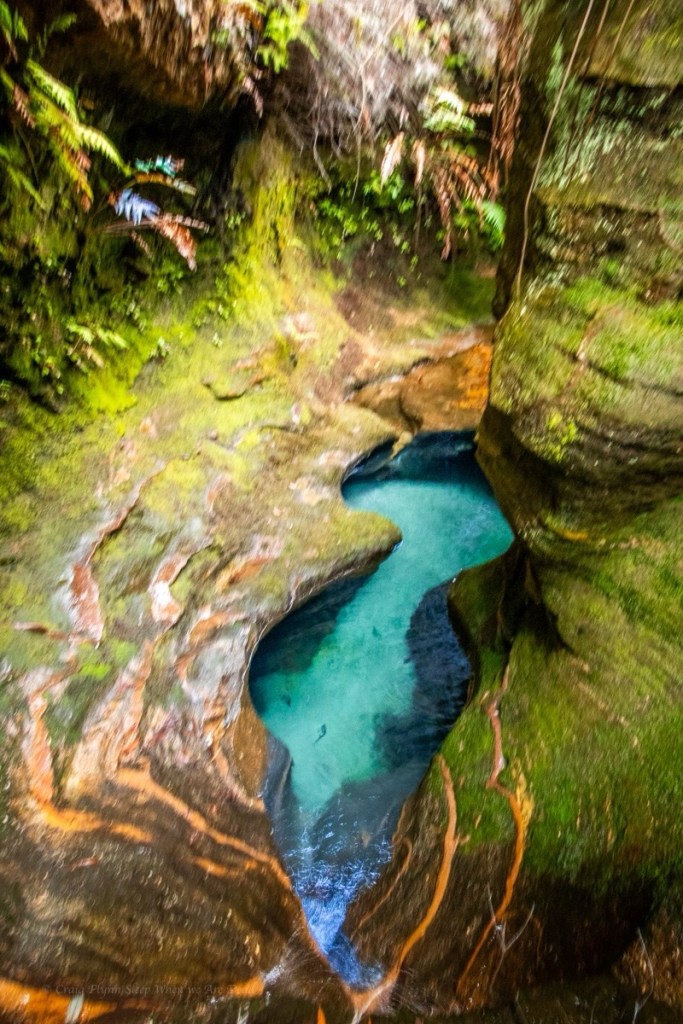
Before lone you could feel the warmth chimneying up from the ‘Gambe
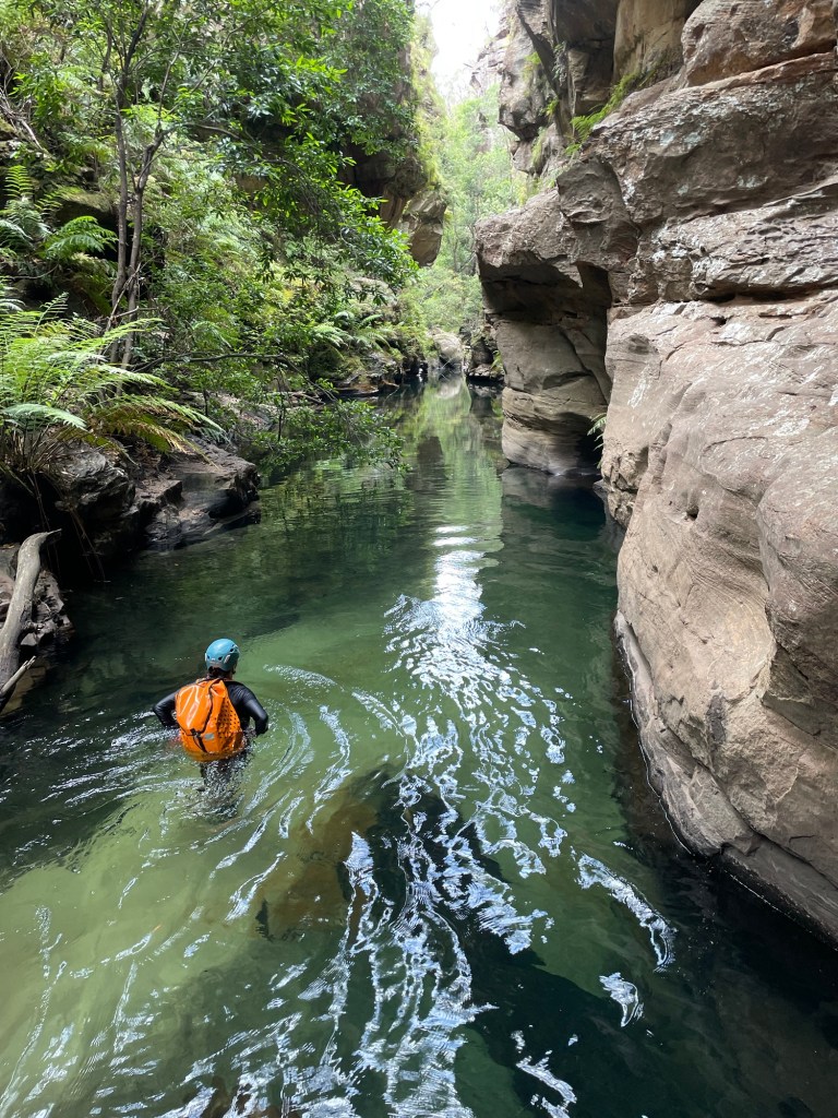
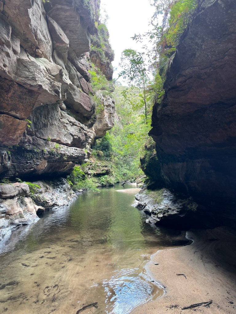
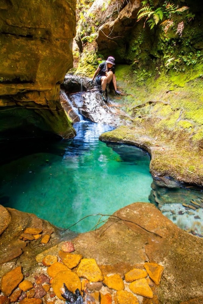
H leads the way down the last abseil and soon we reach the Junction with the Wollangambe
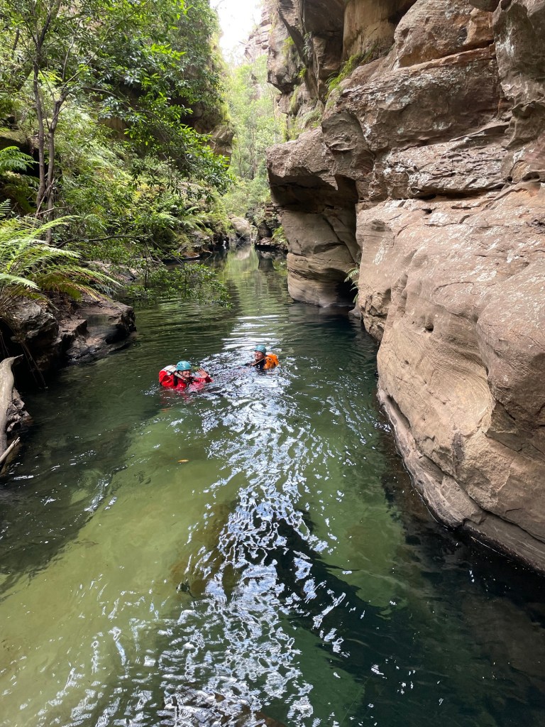
But the day is not over. Our exit is about a kilometre and half downstream.
Having pretty much traced this enigmatic river from its source at Clarence to below Mt Irvine on various trips over the years I reckon this bit is the most stunning section of the ‘Game
Deep walls and beautiful pools.
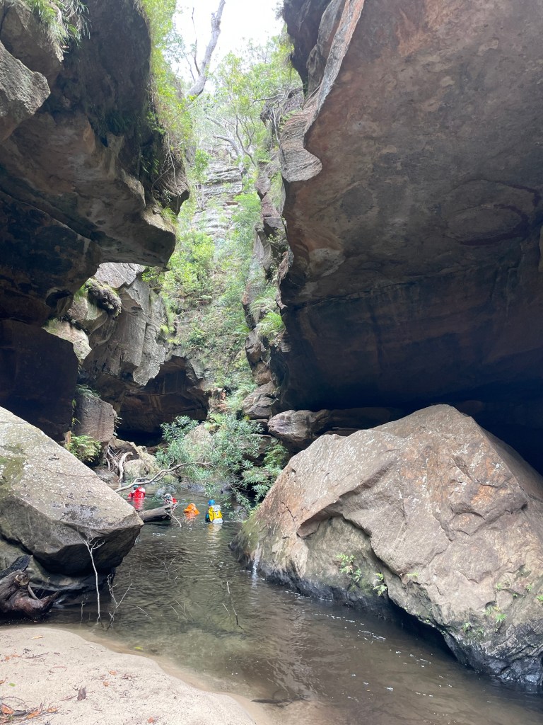
That’s said it’s not easy going with deep sand and boulder hoping between long swims zapping your energy after an already longish day .
Having less foot traffic it’s also a lot slipperier in spots.
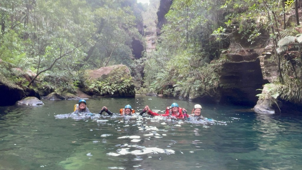
Just before our exit we catch a group from the central coast who had completed Geronimo.
We chat at the exit, cooling off at the sandy beach before making our way back up to the shed.
All in all a thoroughly enjoyable day but it was also a long day for a shortish canyon so I wouldn’t rush back to repeat the trip.
Whirlpool itself was nice and as stated it’s a beautiful section of the Wollangambe so worth doing at least once.
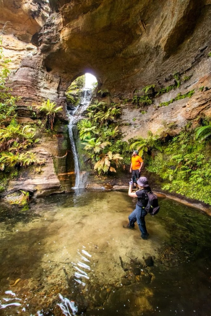
Popeye creek pops in and out of canyon sections along much of its course and it’s one I’d not done before.
A big Saturday trip had been foiled by thunderstorms and we just needed to shake out the cobwebs but couldn’t be arsed repacking ropes and stuff so thought why not have a look at some non abseil sections in Popeye.
Meeting at the crack of 10am, or there abouts we make our way in in no time.
We’d be entering the canyon a long way upstream of where the jamieson guide recommends but not too far from the increasingly popular Popeye falls.
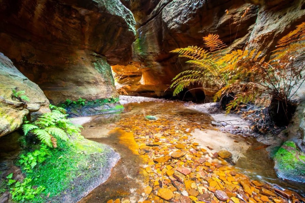
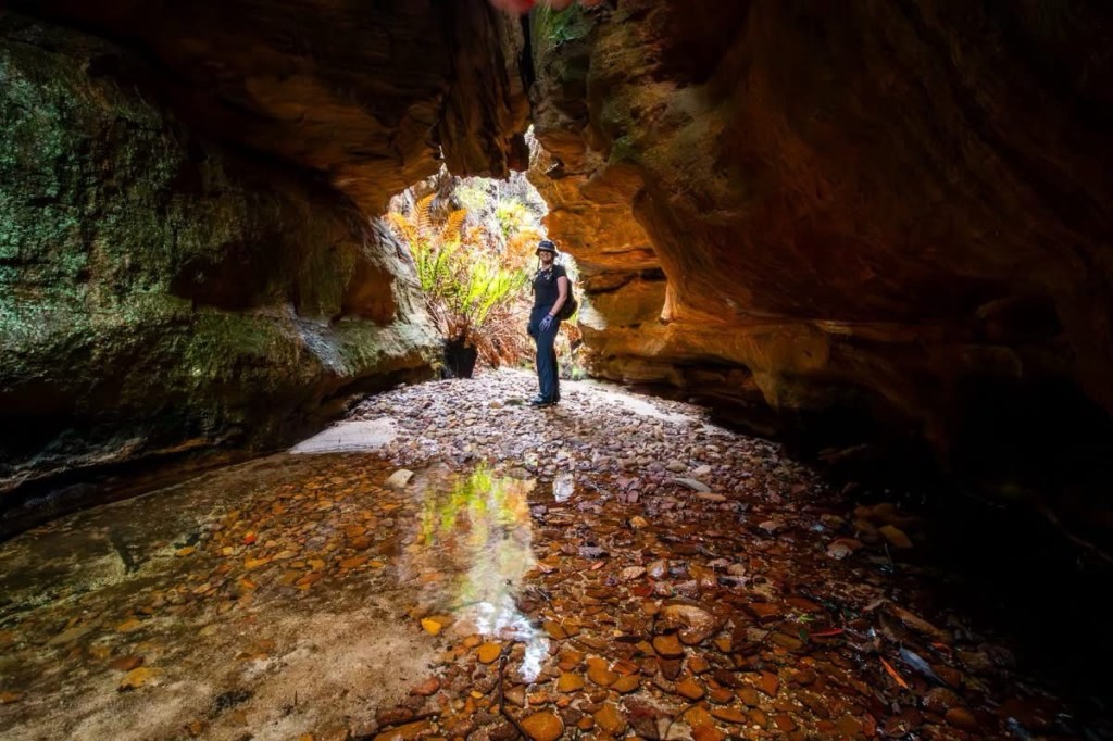
The creek cuts a deep, promising looking cleft in the sandstone.
A short section of narrow u bends hide a pleasant little canyon.
There’s a bit of bridging to stay dry above the knees. But the water is a pleasant temp anyway
Not the figure 8 pool
It is very pretty.
Parts very similar to the Dumbano tunnels.
We are already impressed. the canyon opens up a bit and Waratahs line the banks.
Waratahs along a spur off Waratah ridge? Who would have thunk it
And soon we come to the falls.
Most visitors to here avoid the canyon bit and keep their feet dry by scrambling down the nose.
It’s a funky little waterfall through an arch in a side creek
We phaff about with photos for a bit, we have to pool all to ourselves., but then push on downstream to the next canyon section.
A bit wider and deeper it’s a nice walk through section
It’s nice
Again the canyon opens out. We believe it’s a 1km scrub bash down to the next bit so, happy with our easy day, we retrace our steps back up to the waterfall. A crowd of people are here now.
There’s an easier way in, says old mate sucking in a vape.
We came that way, replies Ellie very politely. We just had a look at some other stuff while out here.
We leave the guards and scramble out into the cliff top for lunch.
Access: Easy access to the start of the trail. Dirt roads but well maintained at time of writing
Navigation: Navigation is fairly straight forward. Signposted tourist trails
Map: Lithgow
Time: There’s various options but give yourself a couple of hours
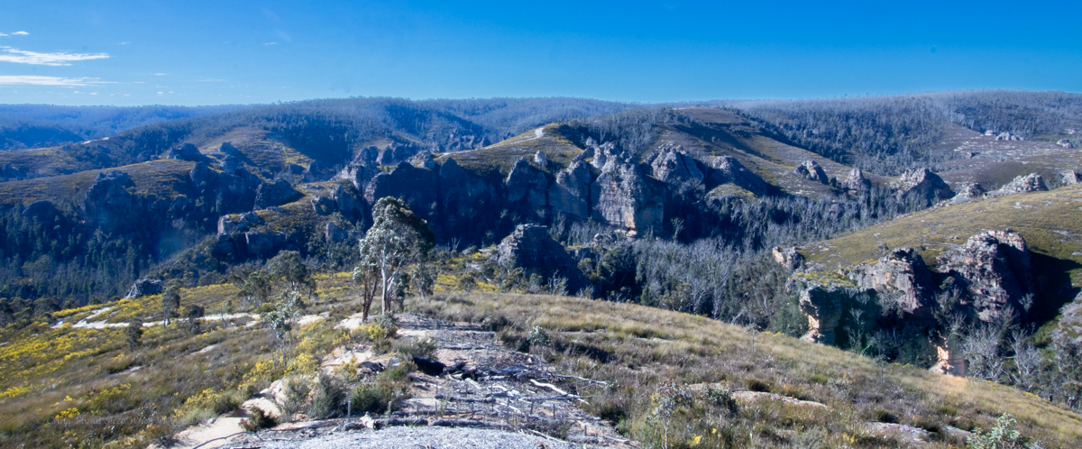
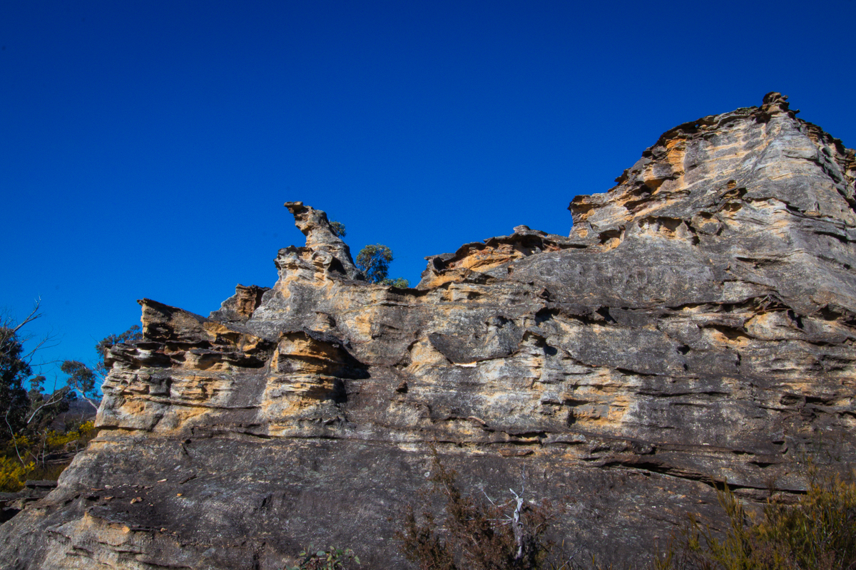
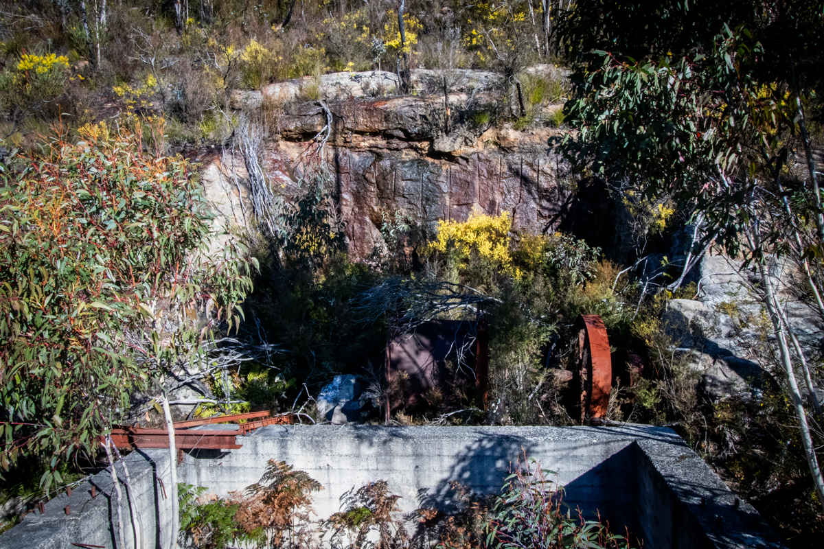
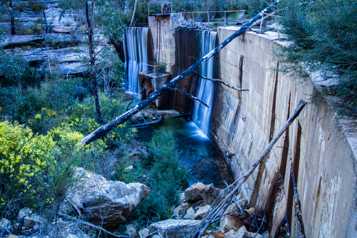
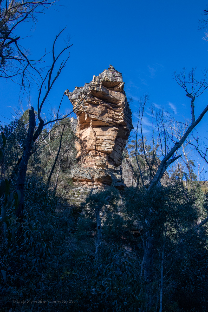
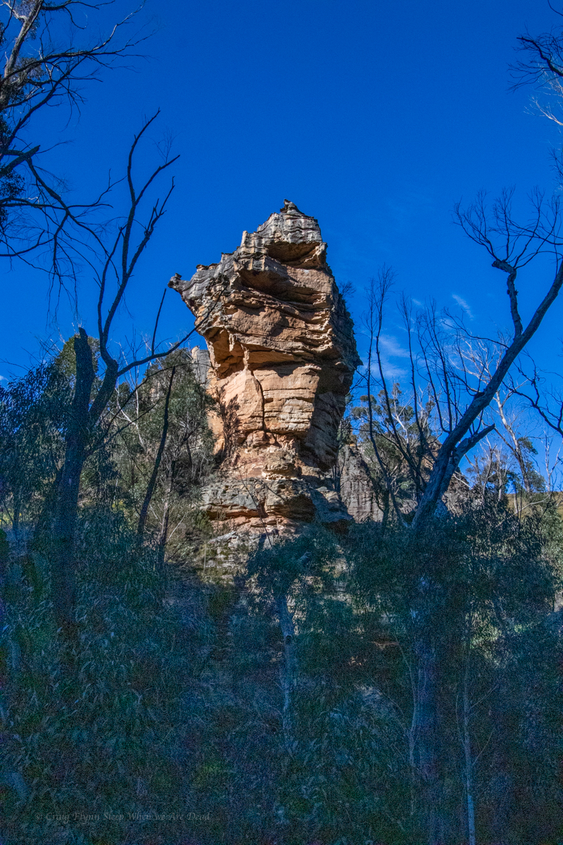
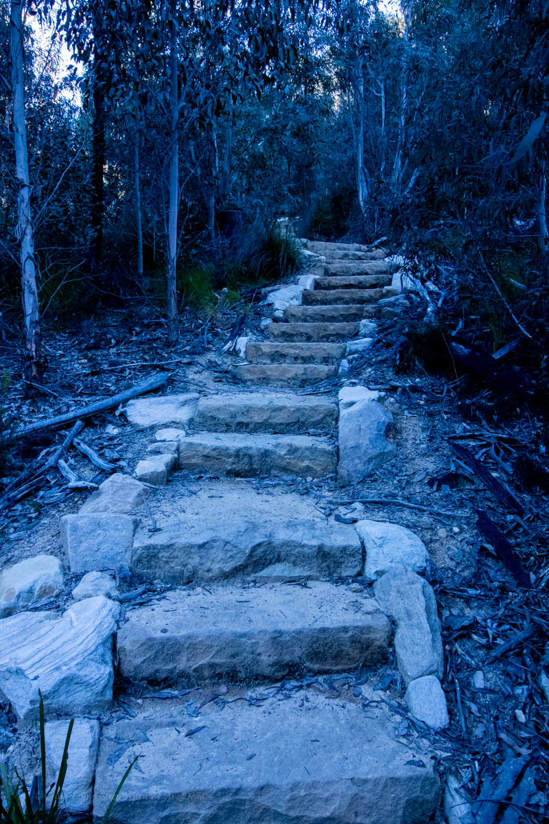
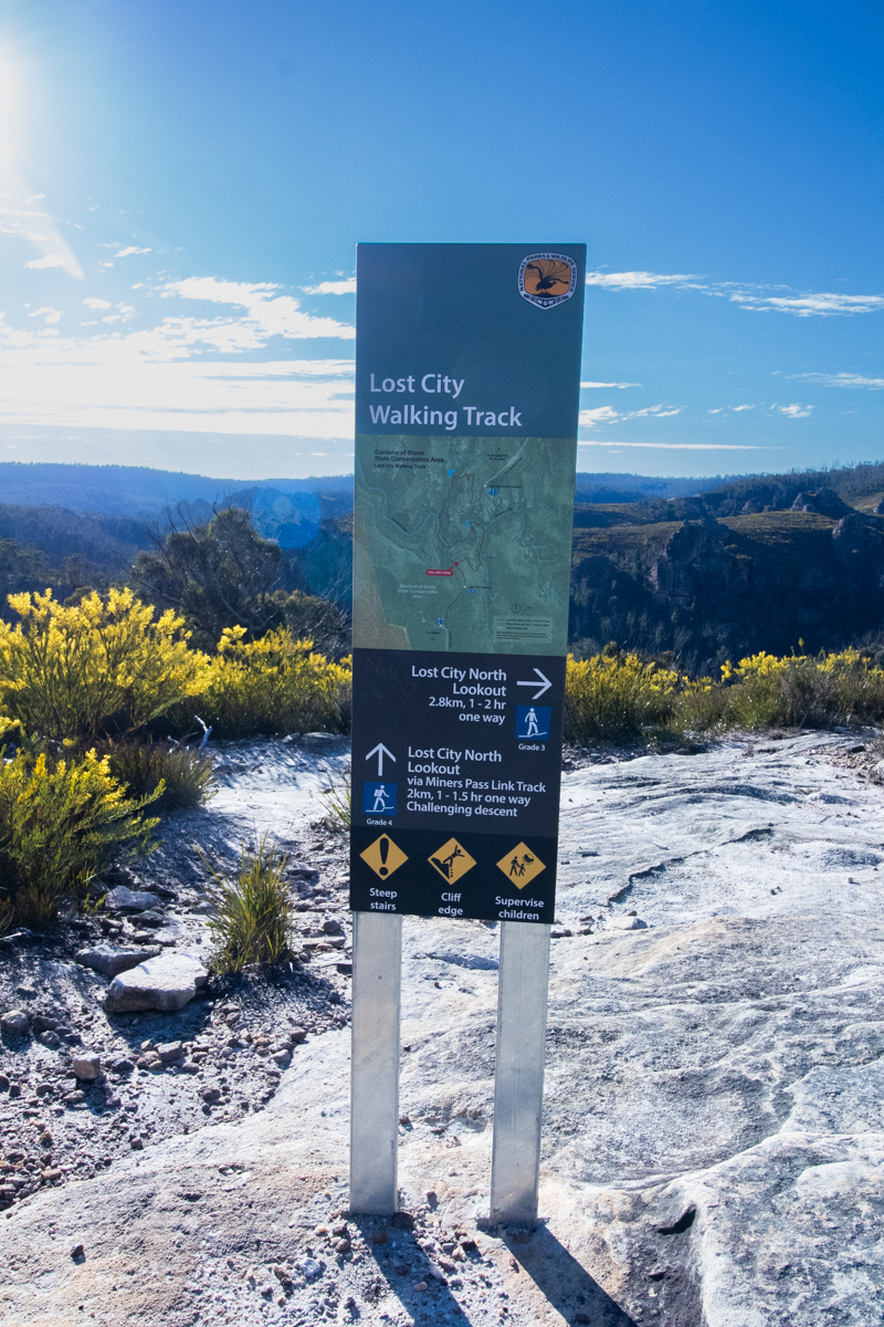
The name is inspired by the resemblance of the spectacular towering pagodas to some fabled lost city, The lost city has been a well known favourite to 4WDers, rock climbers and avid bushwalkers for years but recent works by NPWS has improve accessibility and the area now has a family friendly loop.
While not as shady or rainforesty as the Grand Canyon loop at Blackheath it more than make up for it with towering cliffscapes and industrial heritage
Getting there:
There are a couple of options of where to start, The Northern Lookout (Traditionally more well known) and the Southern Lookout (up until recently more of a local secret.)
Drive out of Lithgow via Atkinson Street and continue up State Mine Gully Road.
(Halfway up the steep hill (Dobbs Drift) there is a parking area on the left and it’s worth a stopping for a quick side trip to have a look here.)
Drive to the top of the hill. The first turn on the left as it flattens out will take you to the southern car park.
Alternatively continue along and onto Glowworm tunnel road. Take the left fork at the Bungleboori Picnic ground, then left again. this will take you to the Northern car park.
Suggested Walks.
Easy 1: Start at the Southern Lookout and enjoy the expansive views over toward the lost city. Follow the main trail down to Marrangaroo creek then return the way you came.
Easy 2: Start at the Northern Lookout and enjoy wandering through the amazing pagodas. Follow the trail down Marrangaroo Creek then return the same way.
Through Walk: Do a car shuffle and walk between the 2 lookouts. I’d suggest starting at the Northern Lookout and walk to the southern lookout via the main trail.
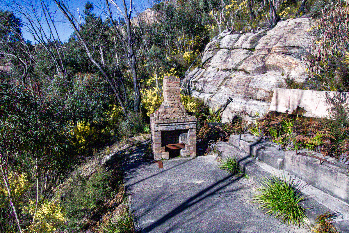
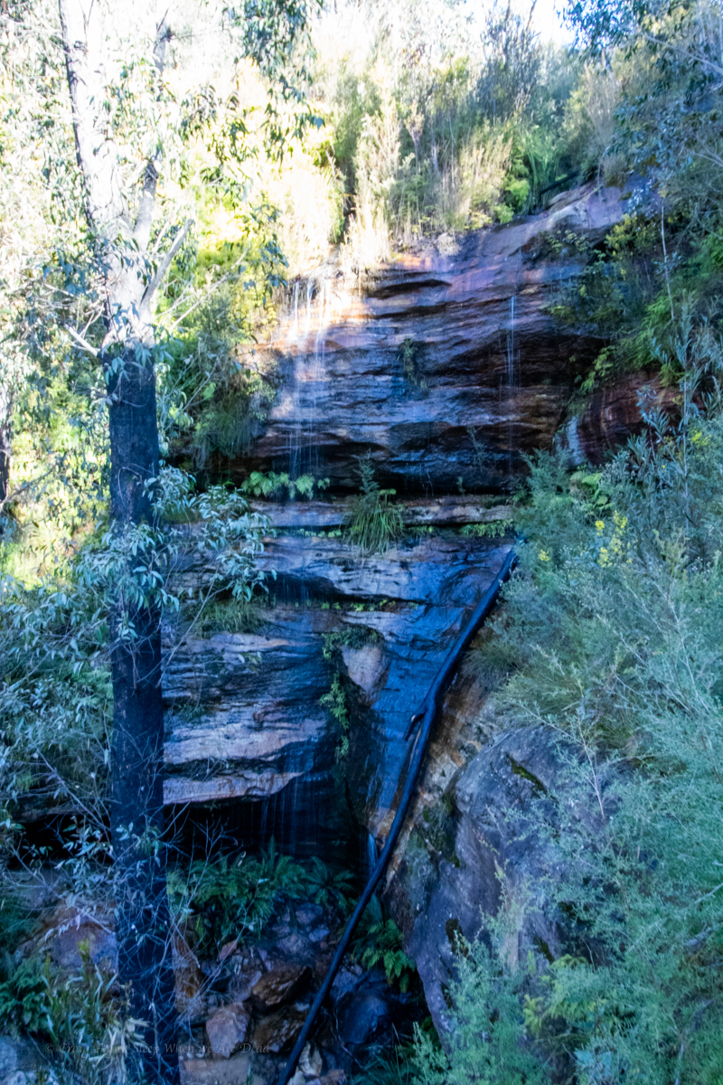
Southern Loop: If you don’t want to do a car shuffle but want a loop rather than an out and back I’d suggest starting at the Southern Lookout. Descend via the miners track then come up the main trail. This provides views over some old mining heritage and takes in a nice waterfall (best after a bit of rain) then a more gentle climb out along the gorgeous Marrangaroo Creek.
The Full Box and dice: If you want to take it all in I’d suggest parking at the Northern Lookout. Walk down and up to the Southern lookout via the main trail then descend the miners track back to Marrangaroo creek and hence back to the Northern Lookout not the main trail.
Of course if you don’t wish to tackle the stairs it’s worth just visiting the lookouts.
From Hokitika it was an early start to drive down for our next adventure.
When planning our itinerary Kylie had mentioned a walk up towards the base of a glacier she had previously done and loved and while we had been trying to keep it a low cost holiday we had also been tossing up splurging on helicopter tour.
I remembered my old mate and mentor, Rusty (RIP) having done a heli/hike tour onto a glacier and raving about it.
If we do the helicopter I’d love a snow or glacier landing, Say I.
That’s a great idea Kylie replies.
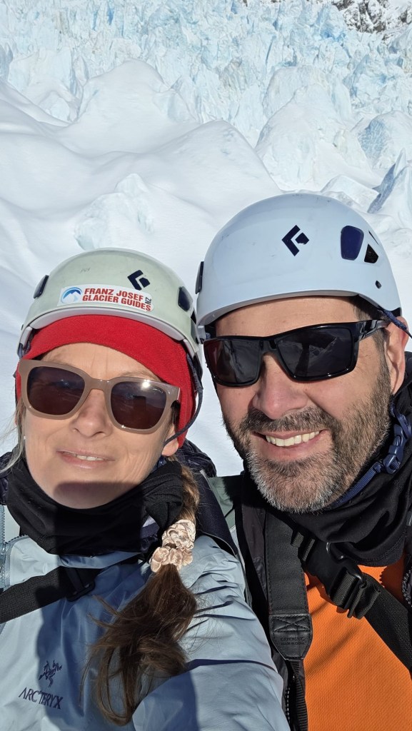
We begin looking into options trying to decide what would fit our wants and itinerary. Franz Josef Glacier Guides started looming large as the front runner.
This is the one part of our holiday where we decided to dam the expense and splash a bit of cash on. IMO it was worth every cent.
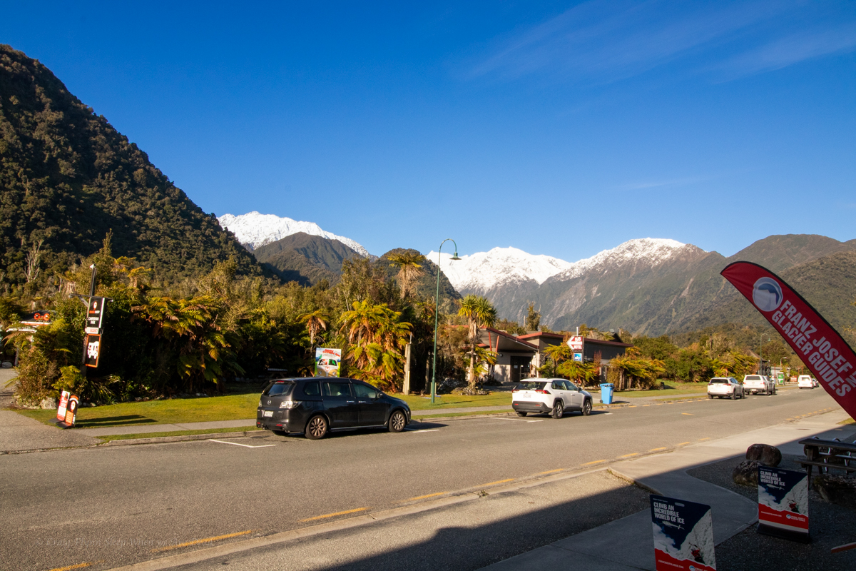
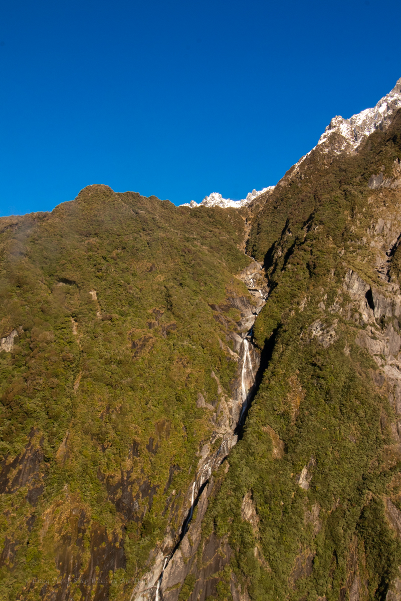
Just driving into town is mind-blowing as we get our first close encounter with the snowcapped peaks while walking down streets lined with giant fern trees.
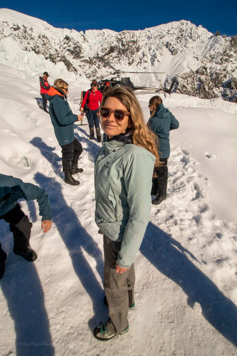
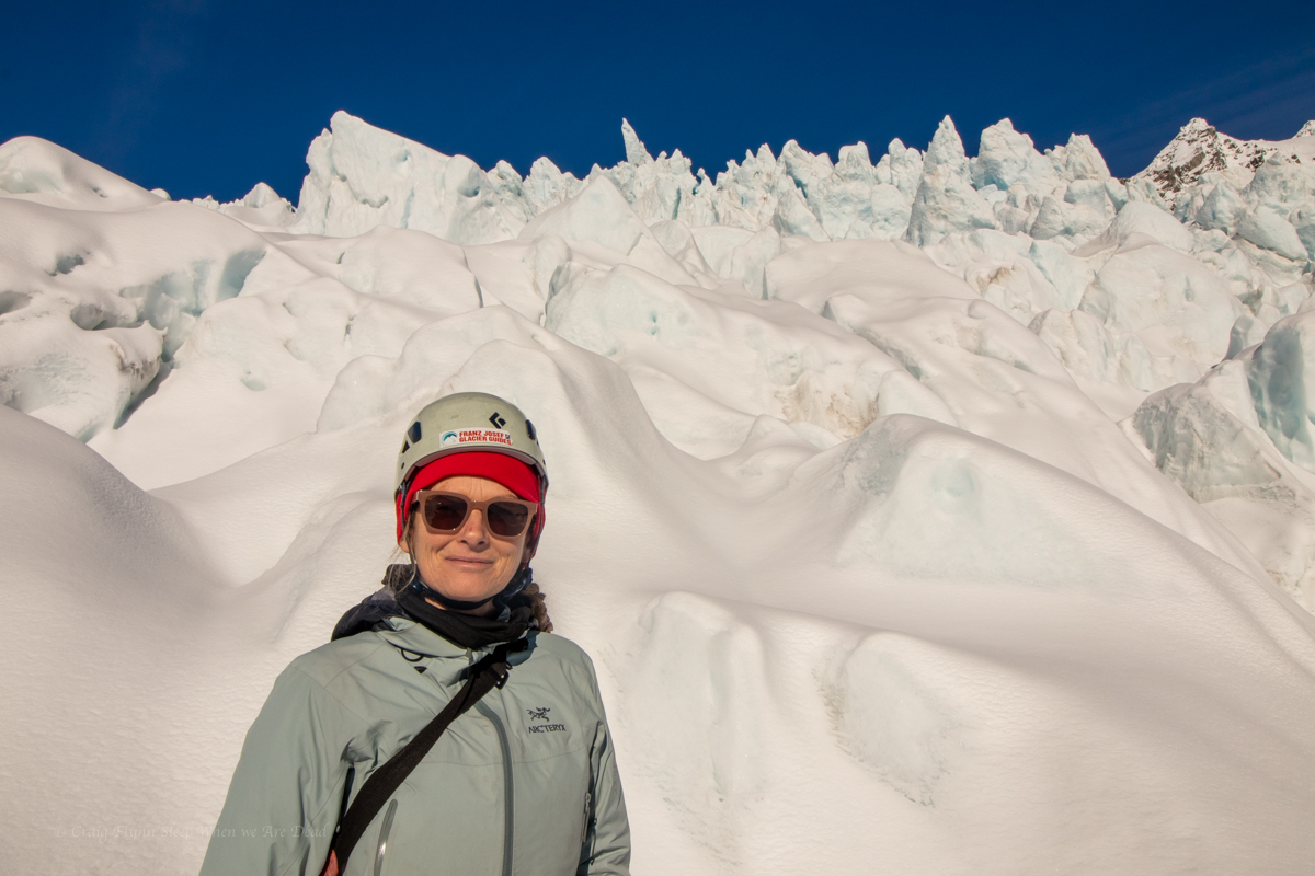
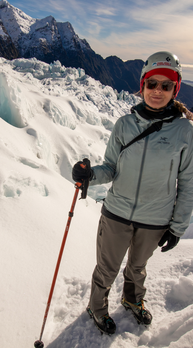
While FJGG supply all the outer layers to keep their clients warm they were more than happy for us to use our own gear (after confirming that it was suitable).
Our guide, Maya, was informative, funny and chill as she took us through the safety talk. That’s worst case, says she. It won’t happen today… I hope. Na, it won’t happen.
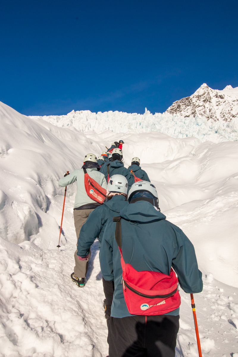
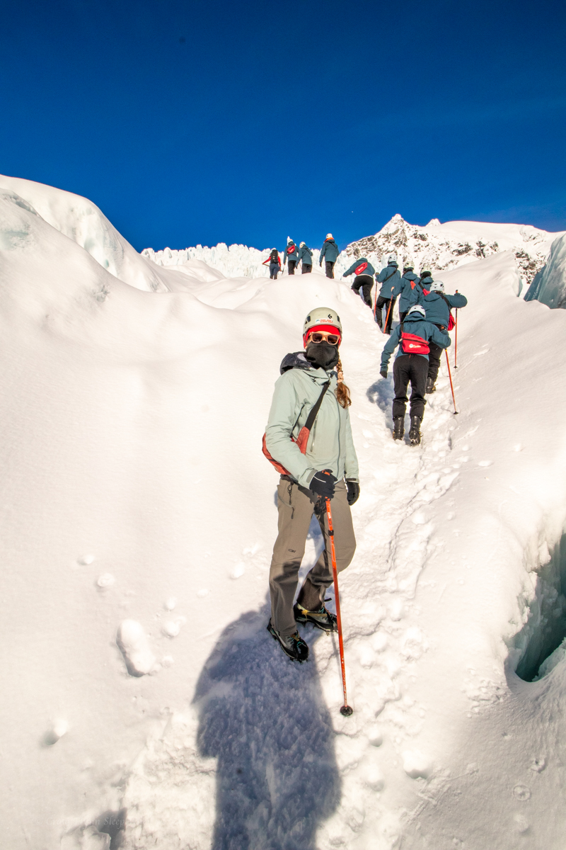
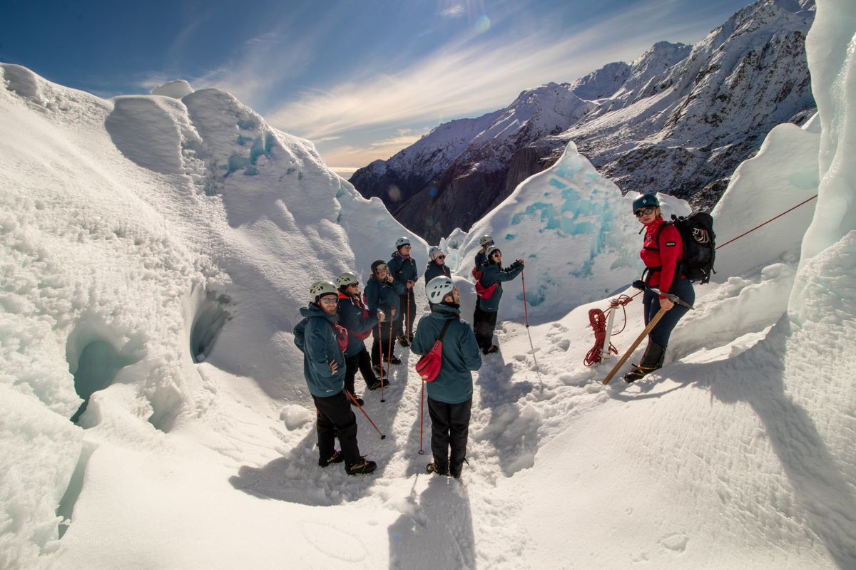
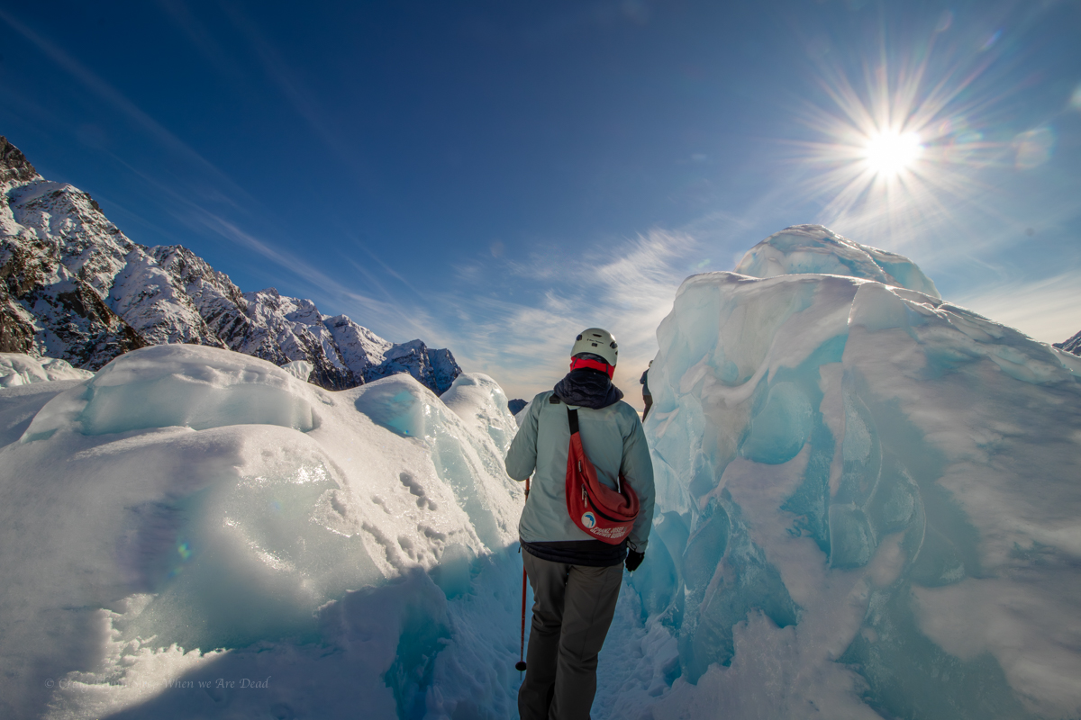
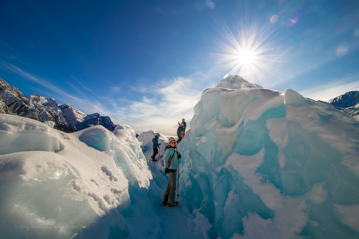
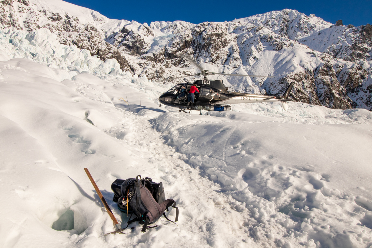
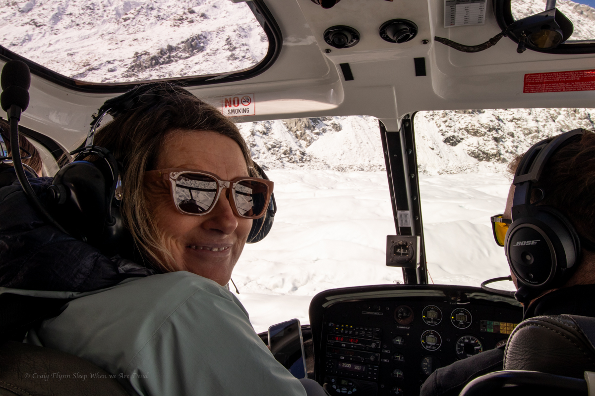
Suitably prepared we leave town via a lovely walk through the rain forest to the helipad. The group would be split into 2. And our group were first up with Maya joining us and our chopper pilot Matt giving great commentary along the way.
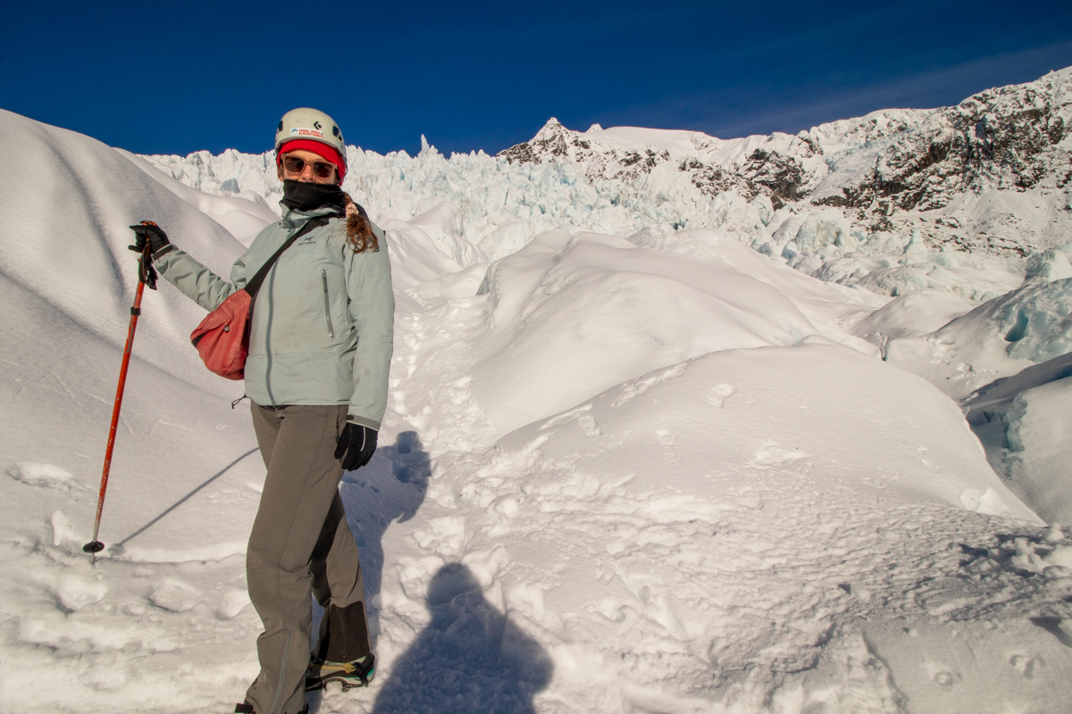
We had been assigned seating and Kylie had jagged a front seat, allowing her to capture some amazing videos.
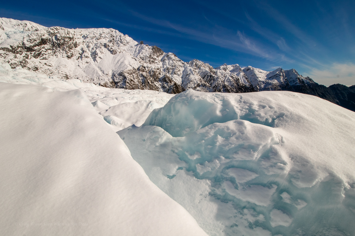
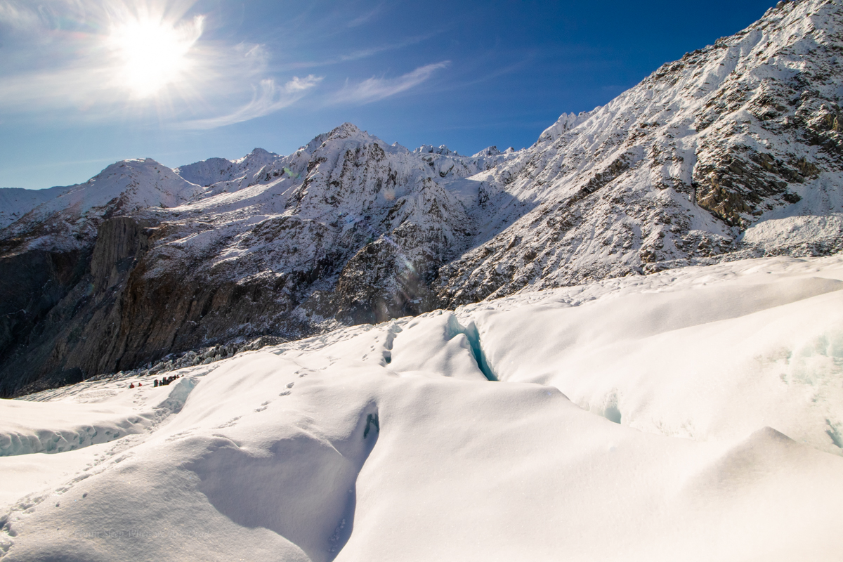
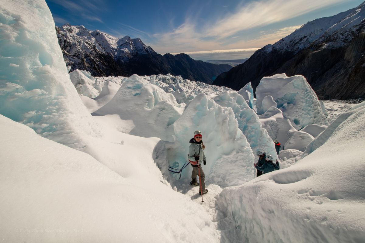
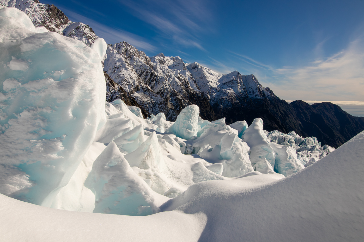
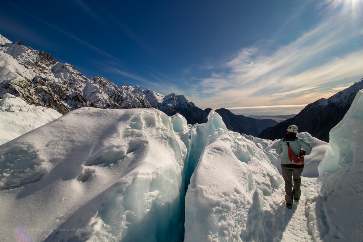
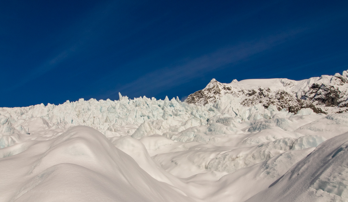
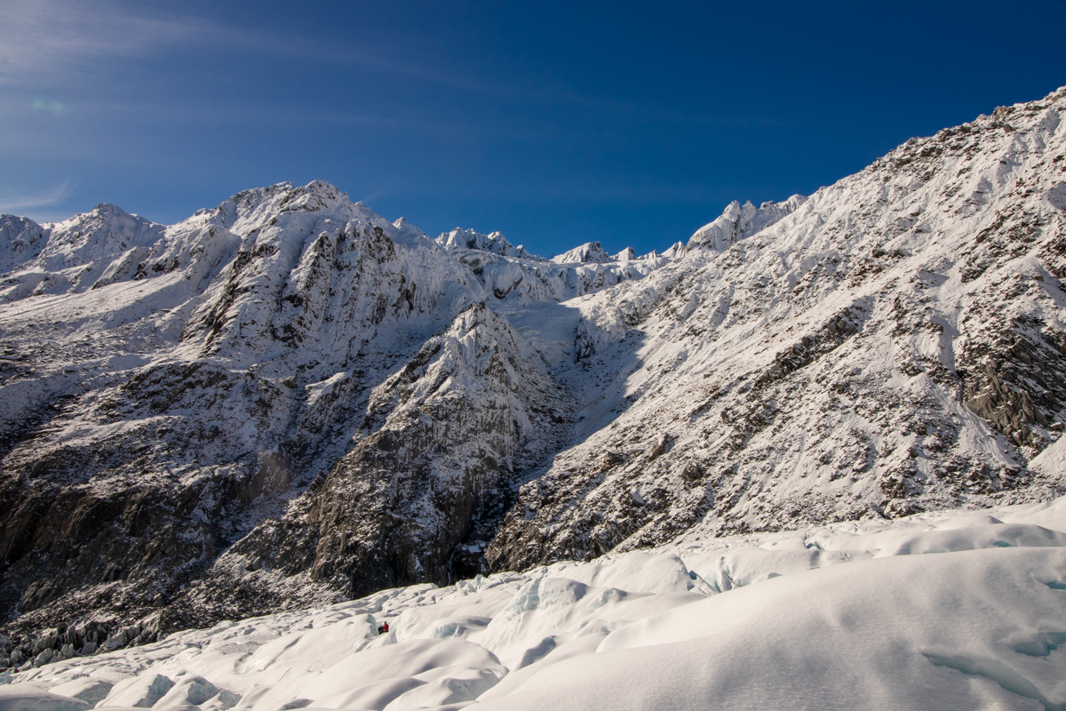
Even with Matt’s commentary it was hard to come to grips with the scale of this place. It wasn’t until we were down and looking back to the following helicopter that was just a tiny speck against the mountainous back drop that it started sinking in.
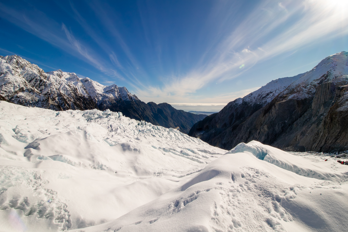
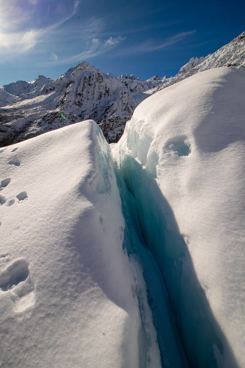
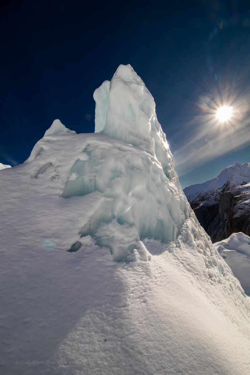
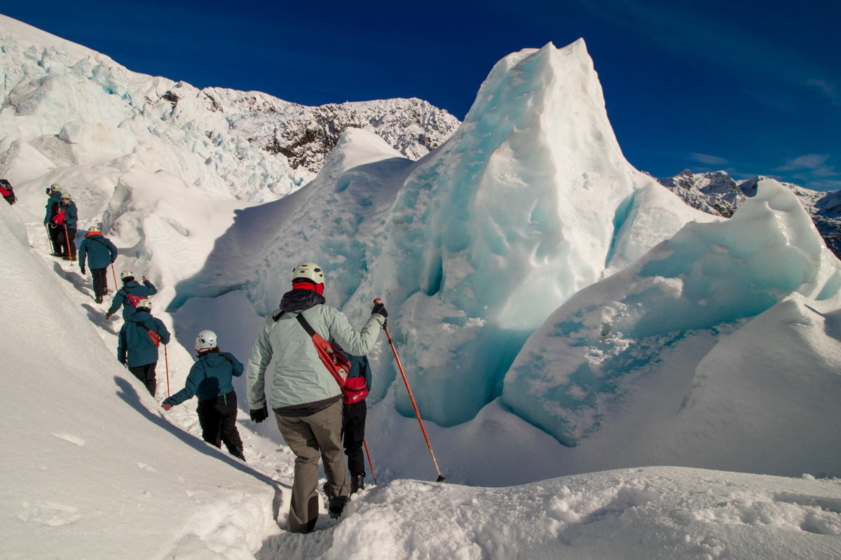
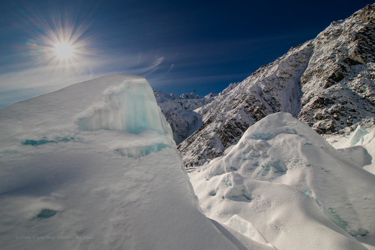
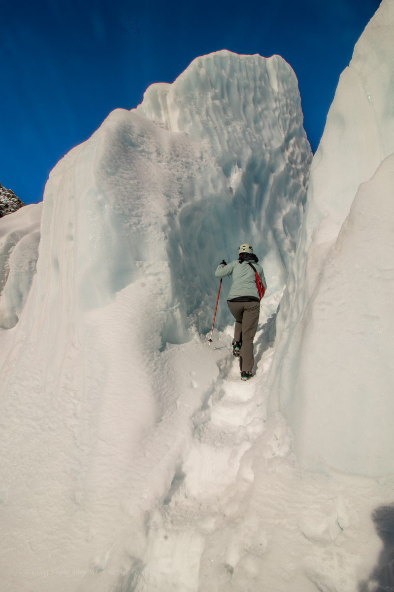
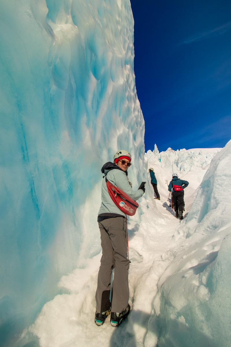
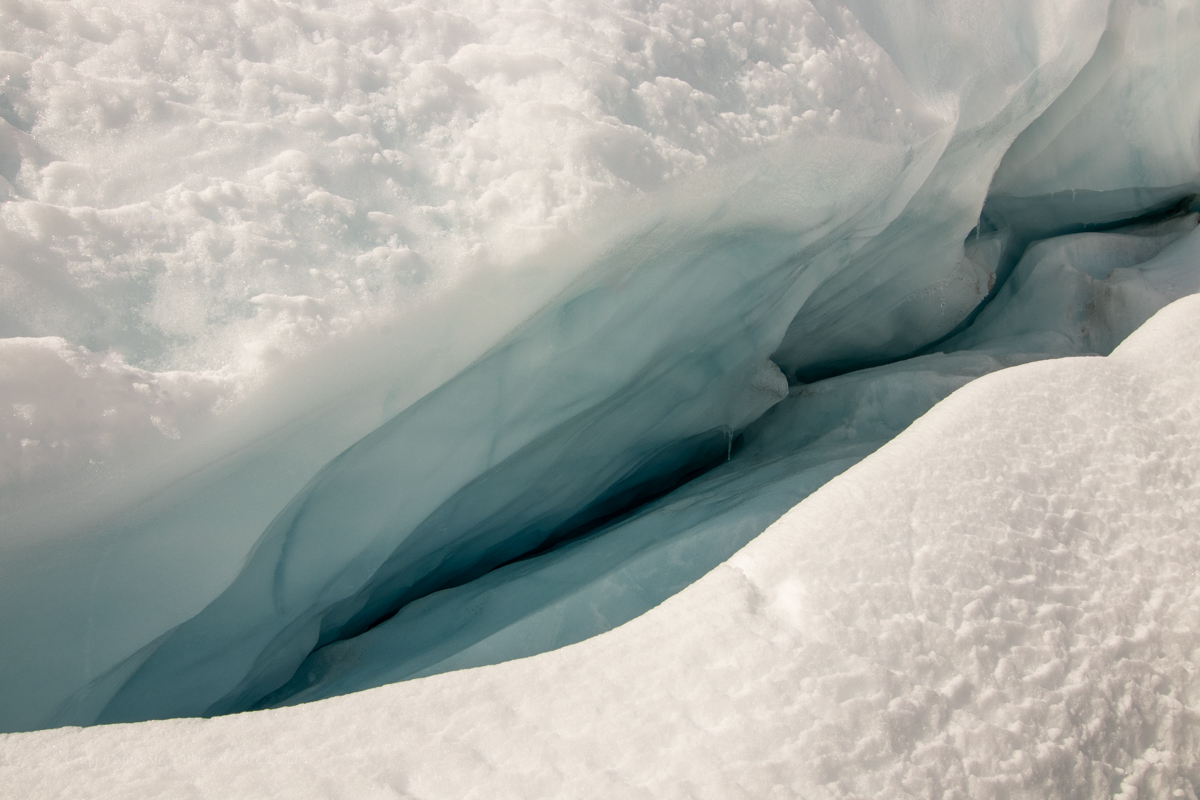
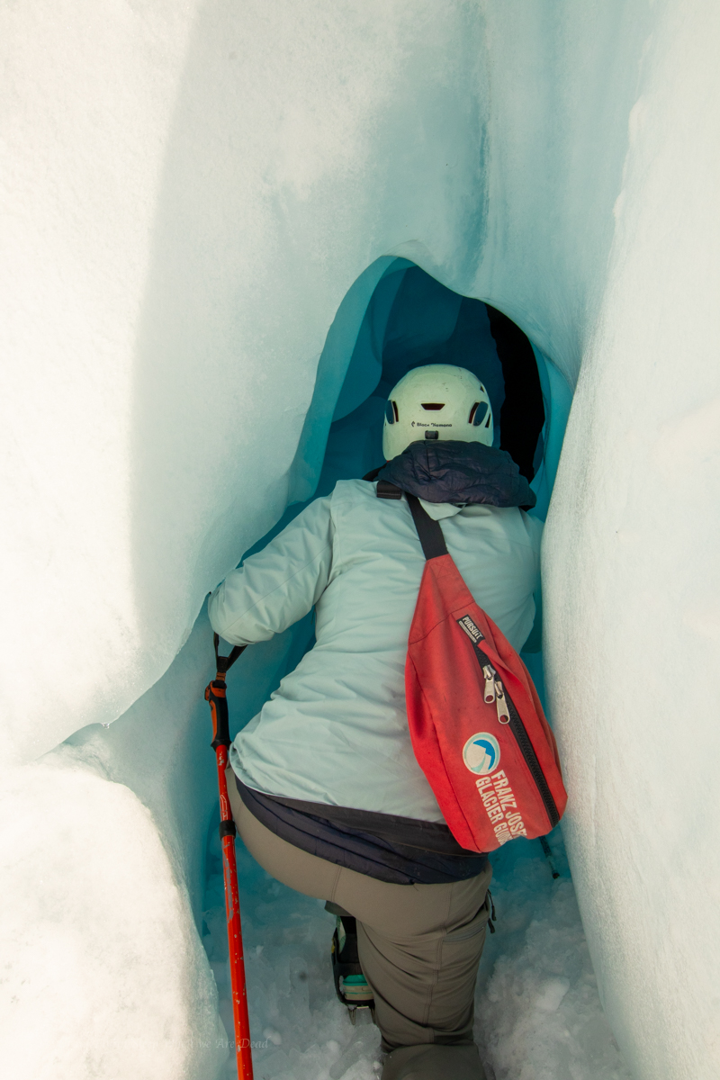
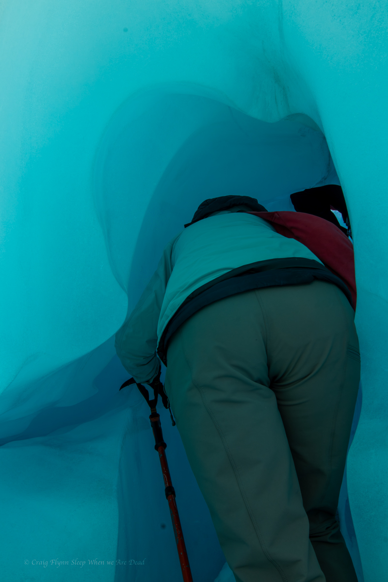
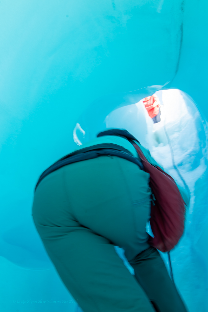
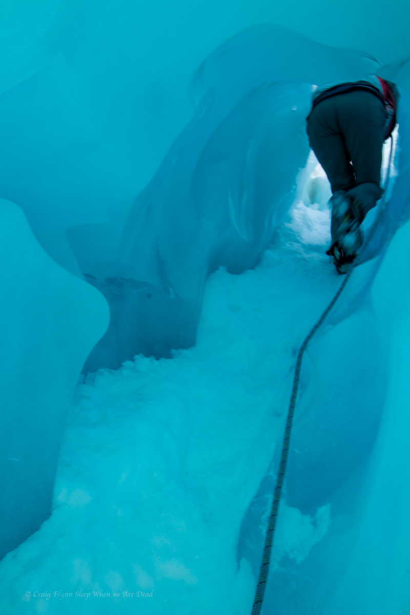
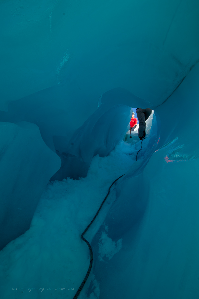
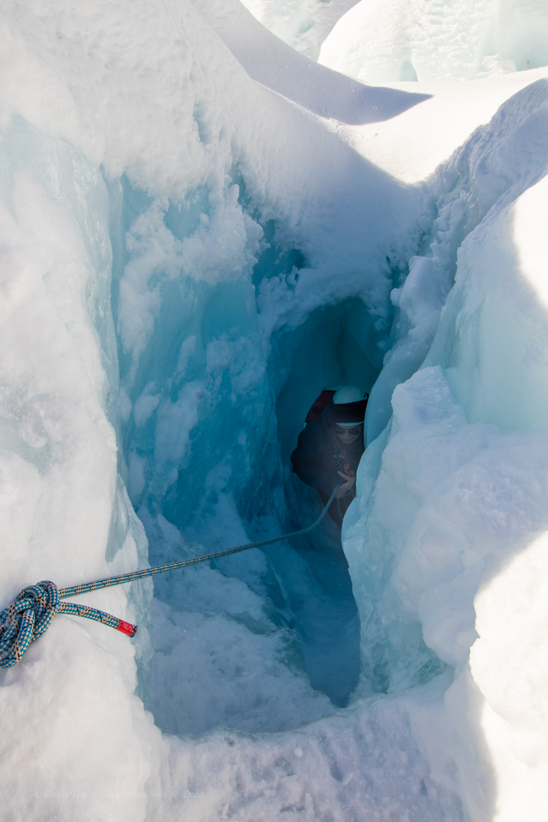
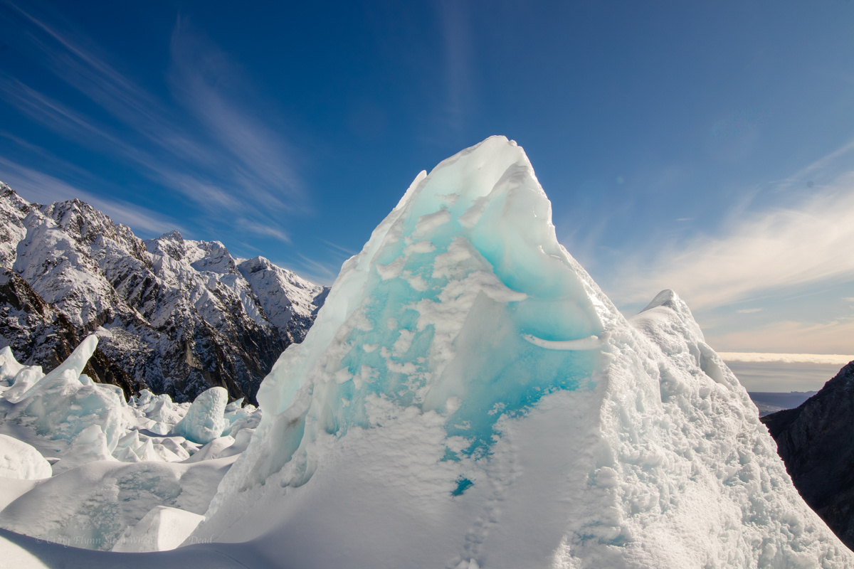
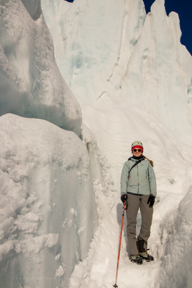
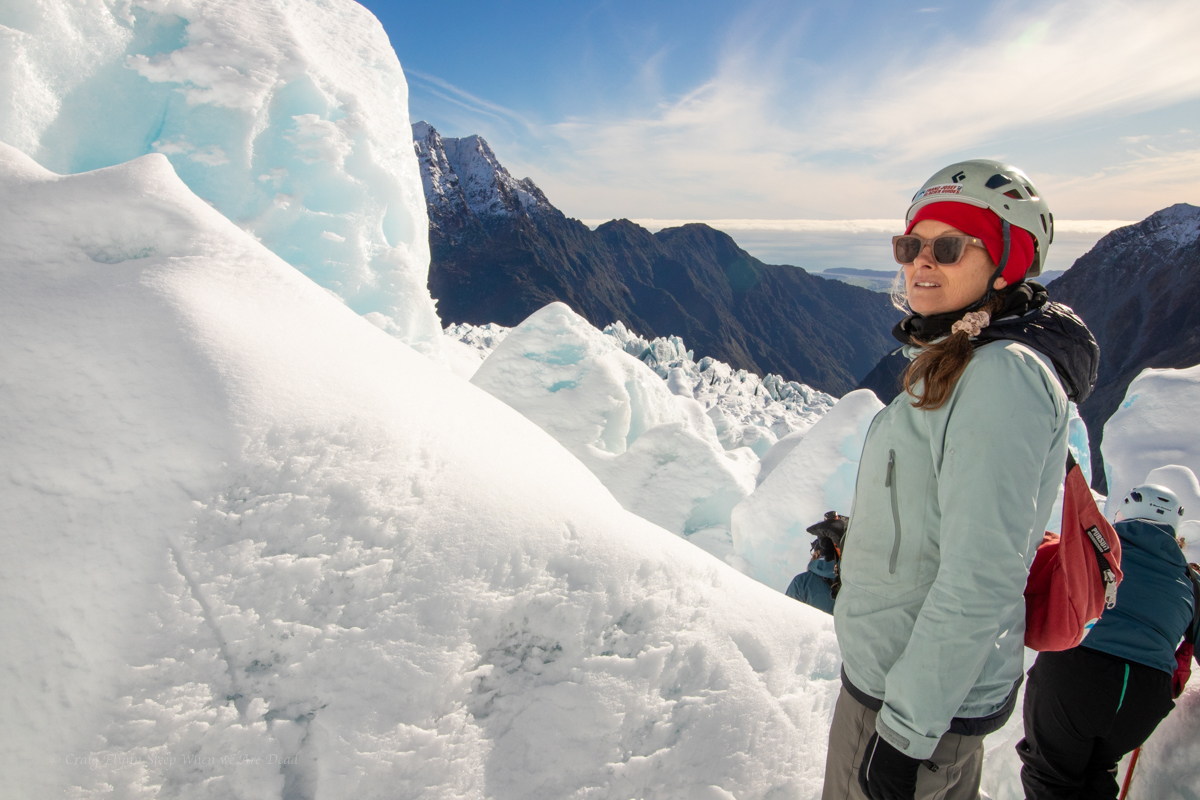
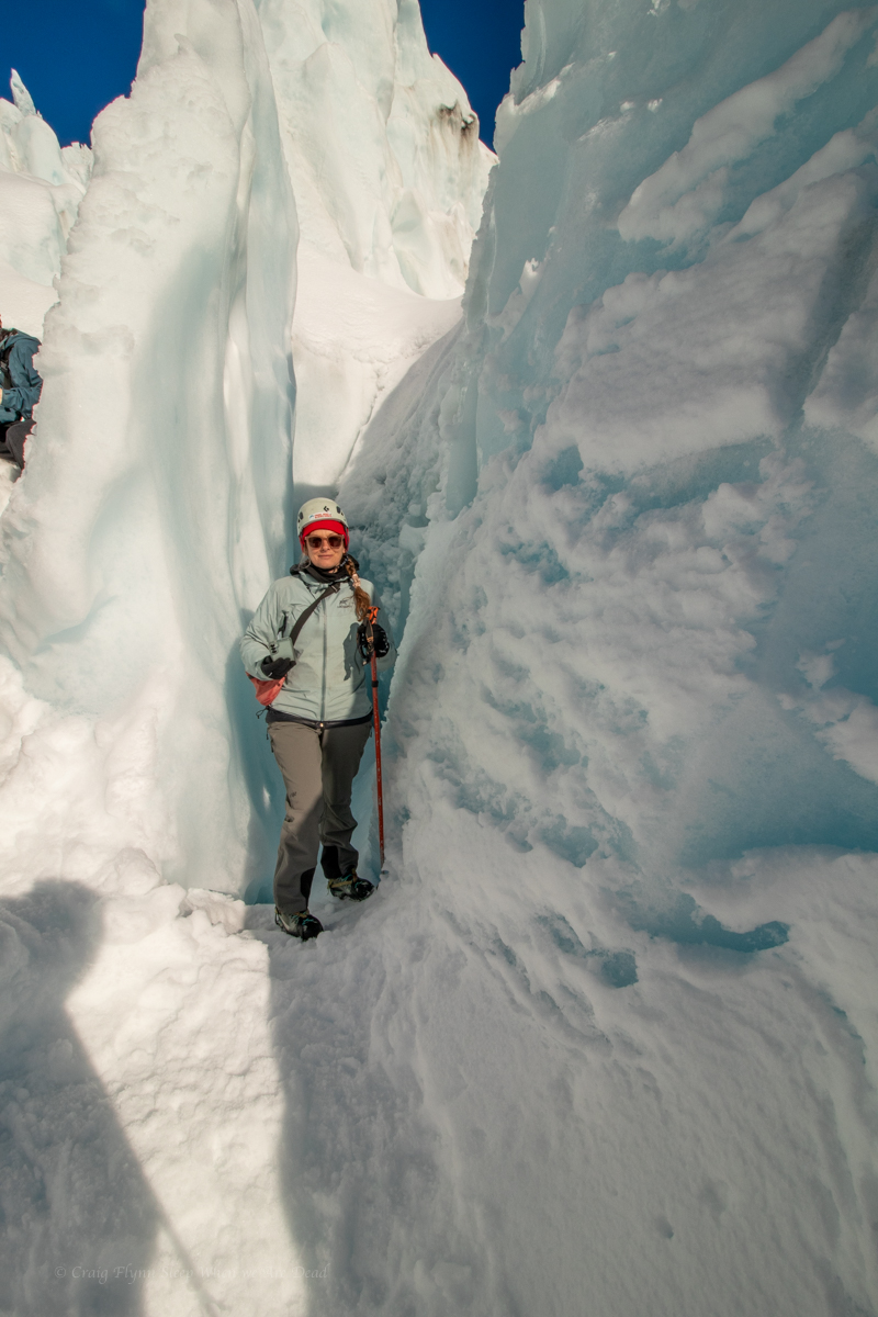
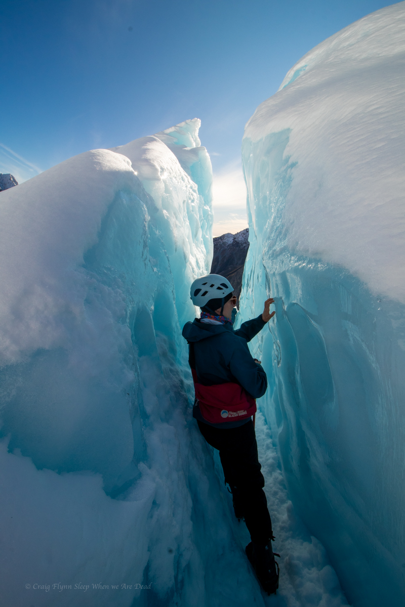
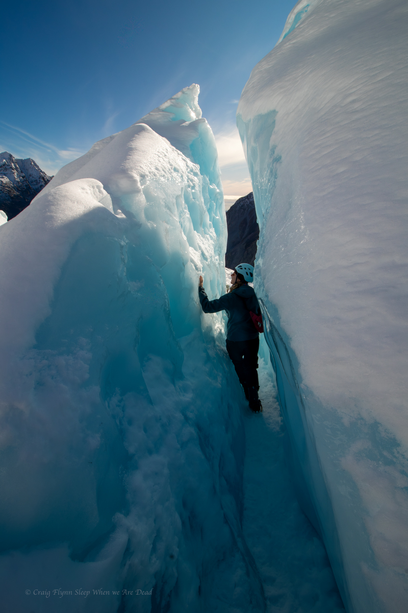
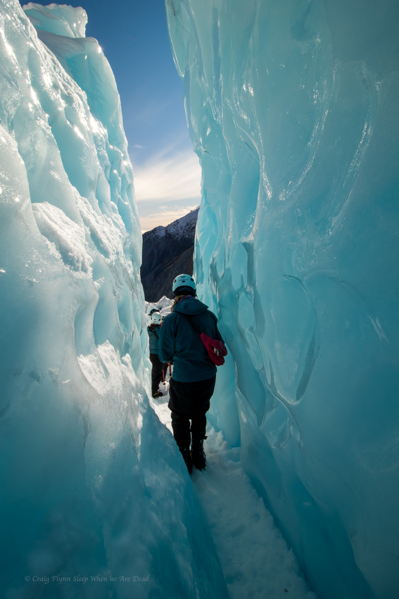
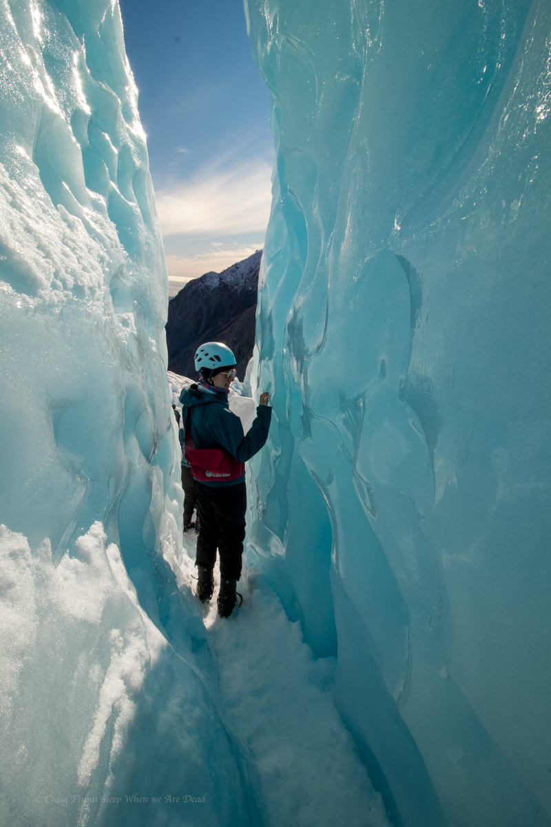
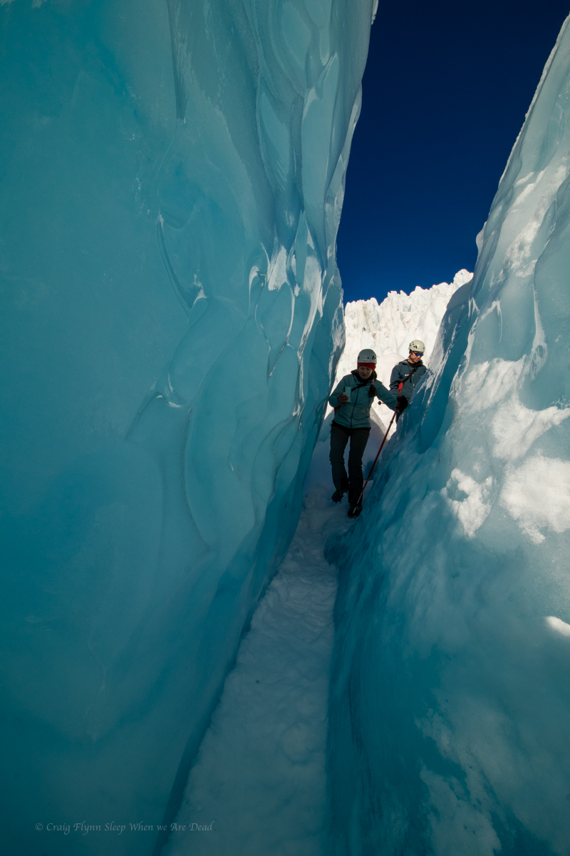
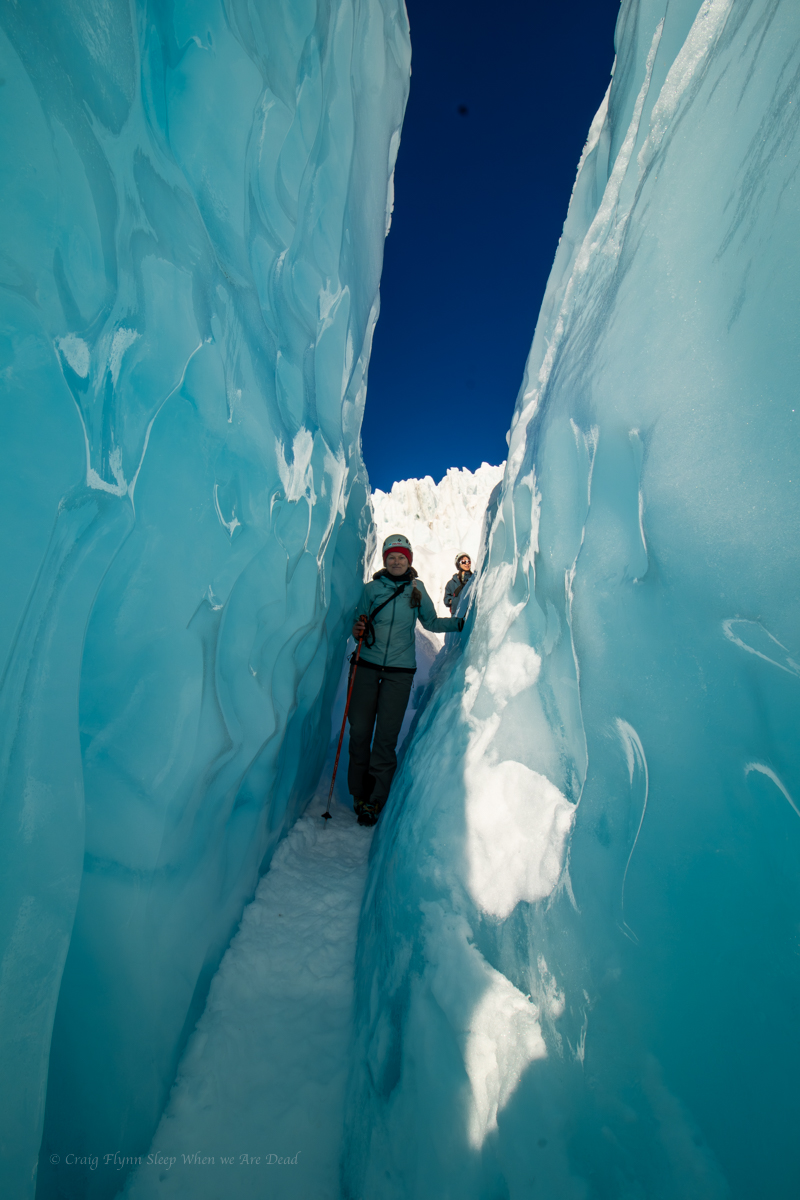
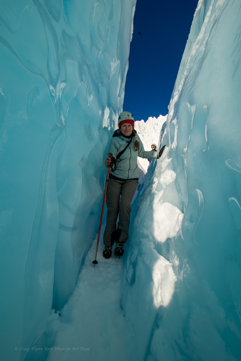
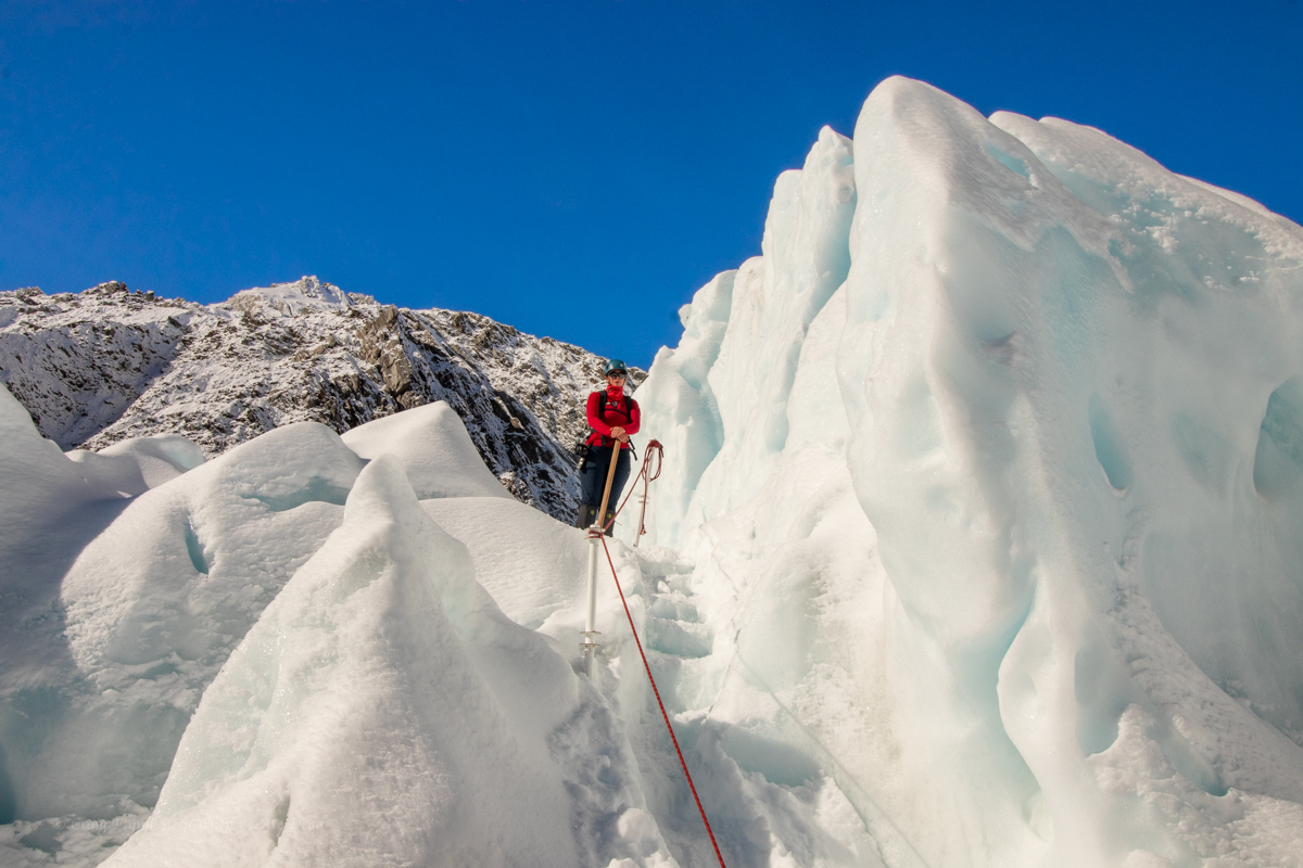
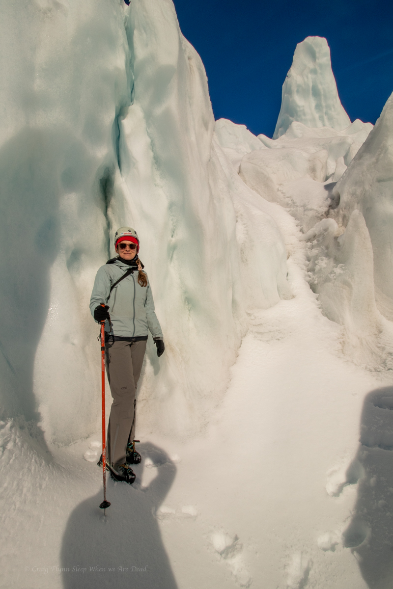
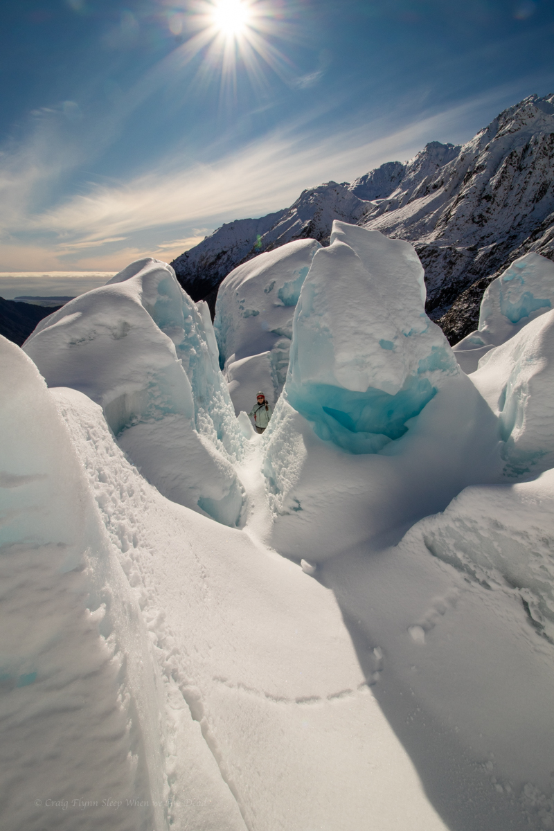
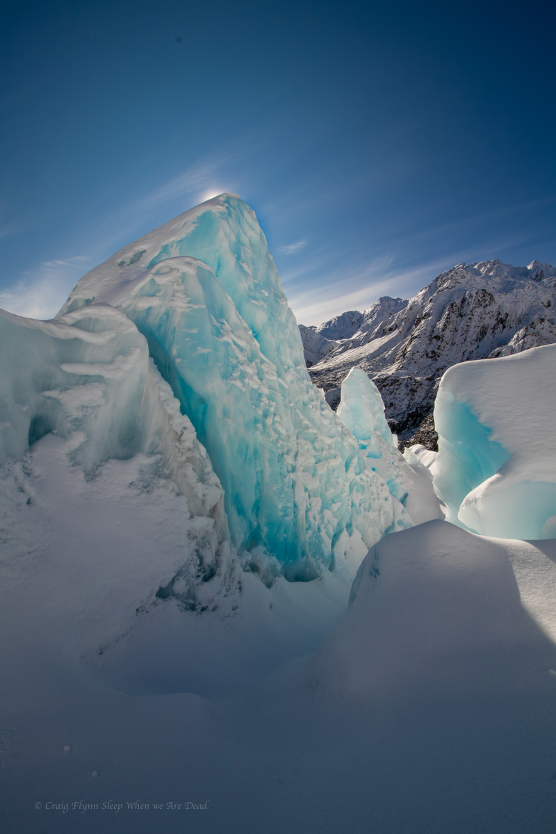
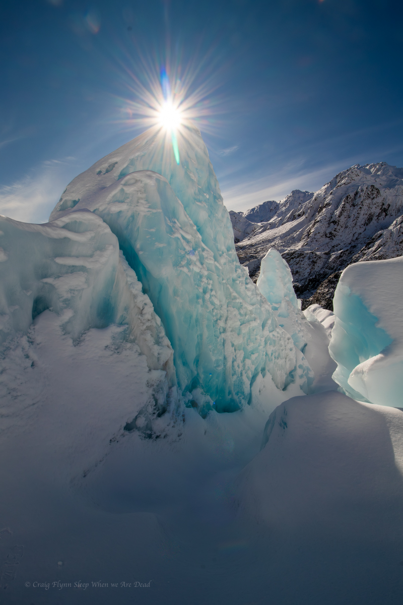
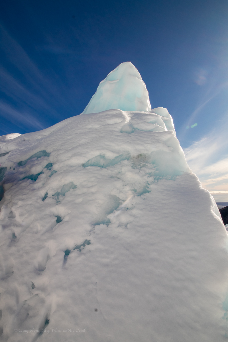
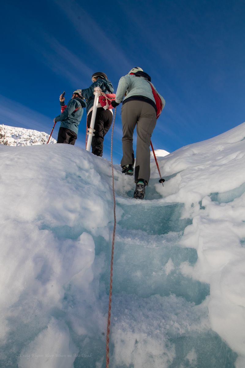
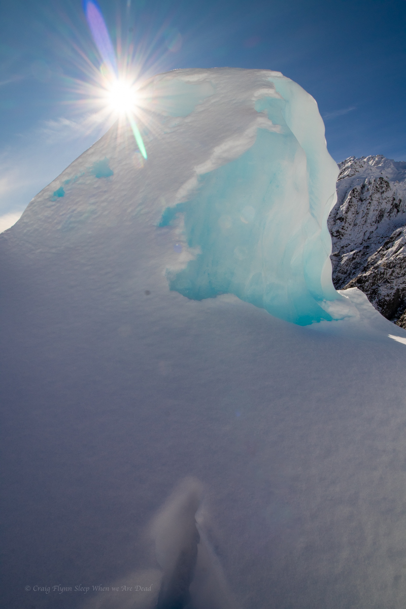
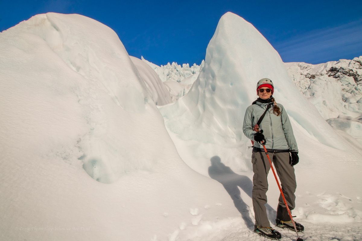
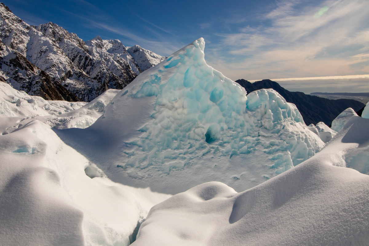
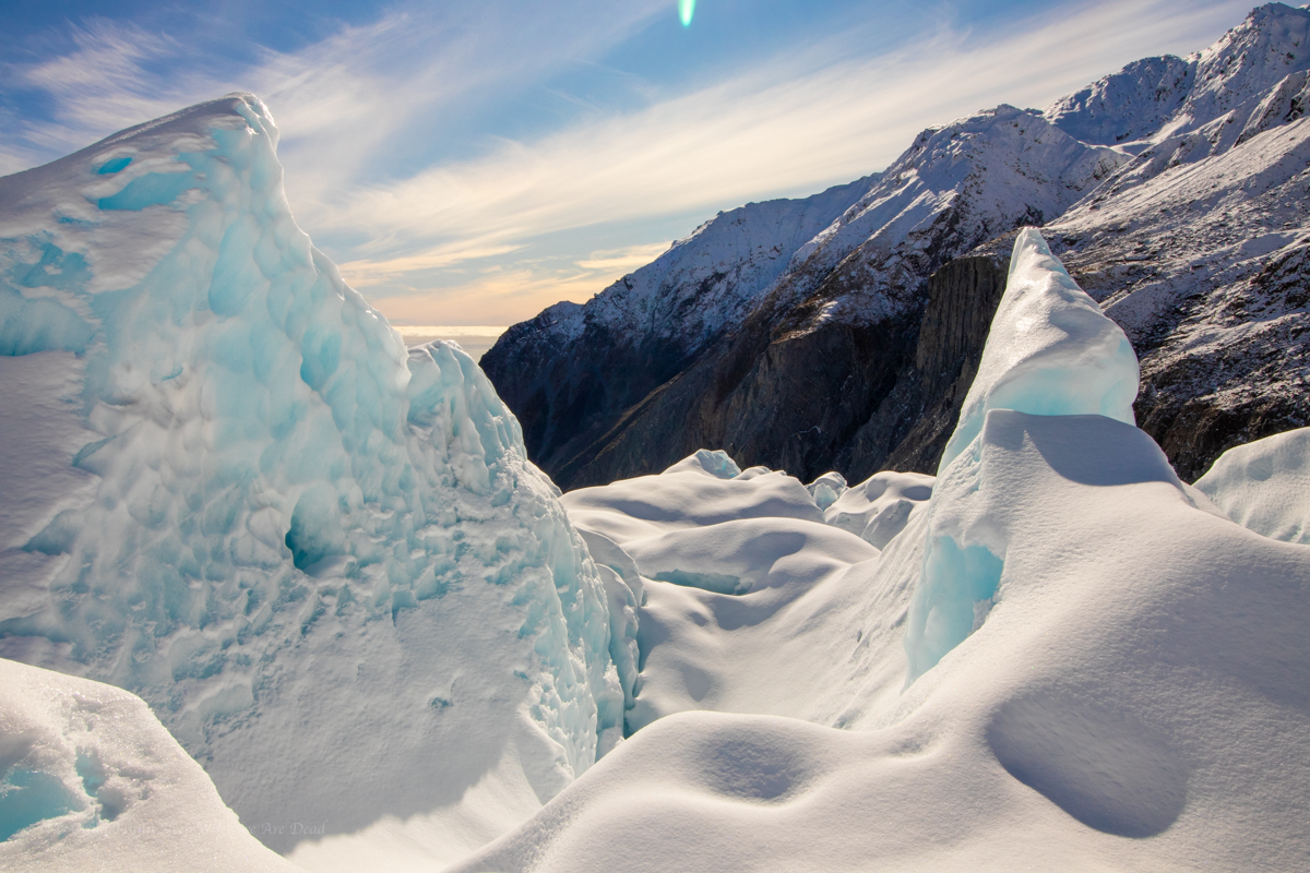
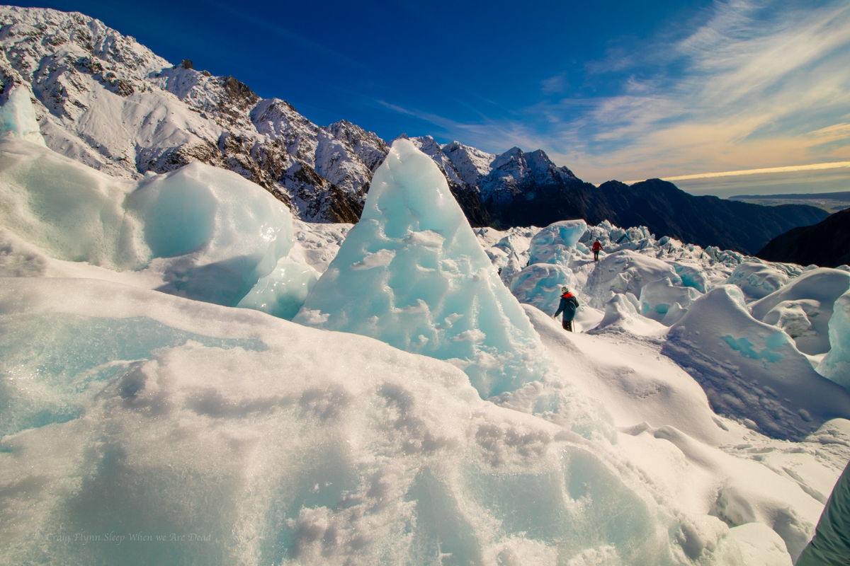
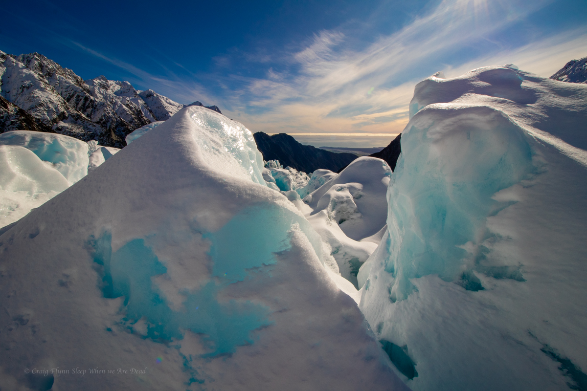
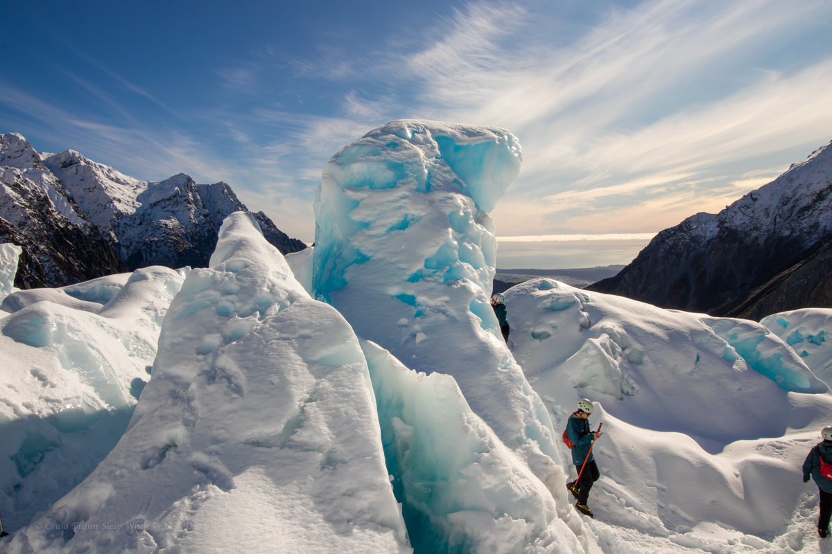
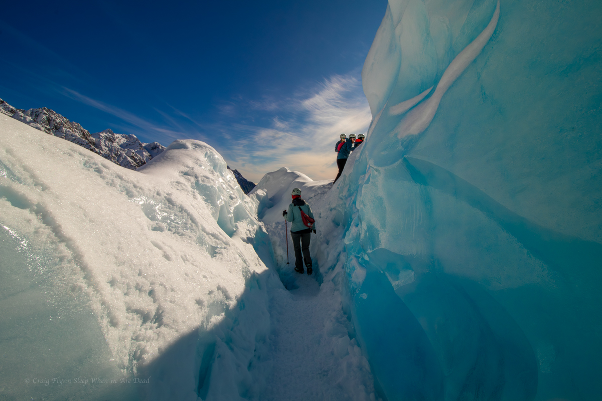
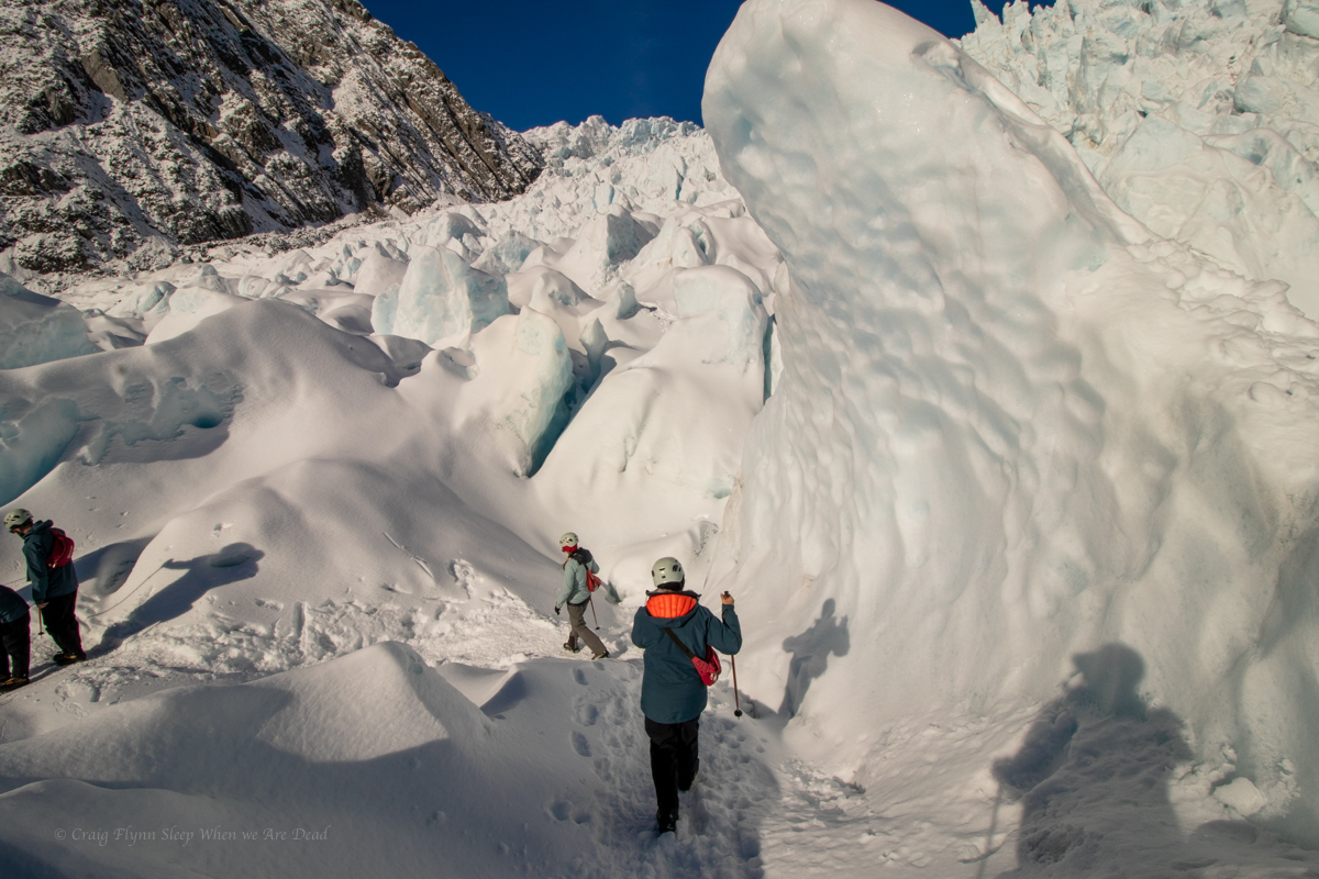
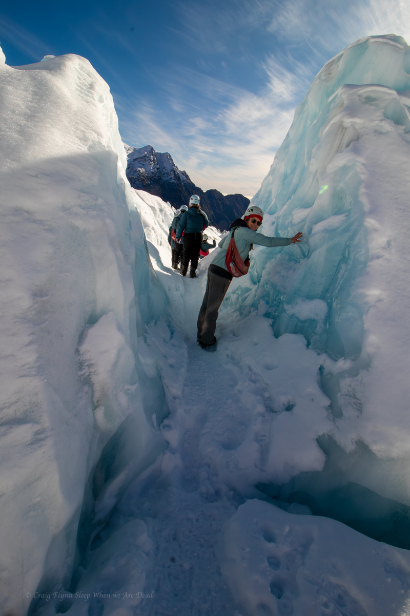
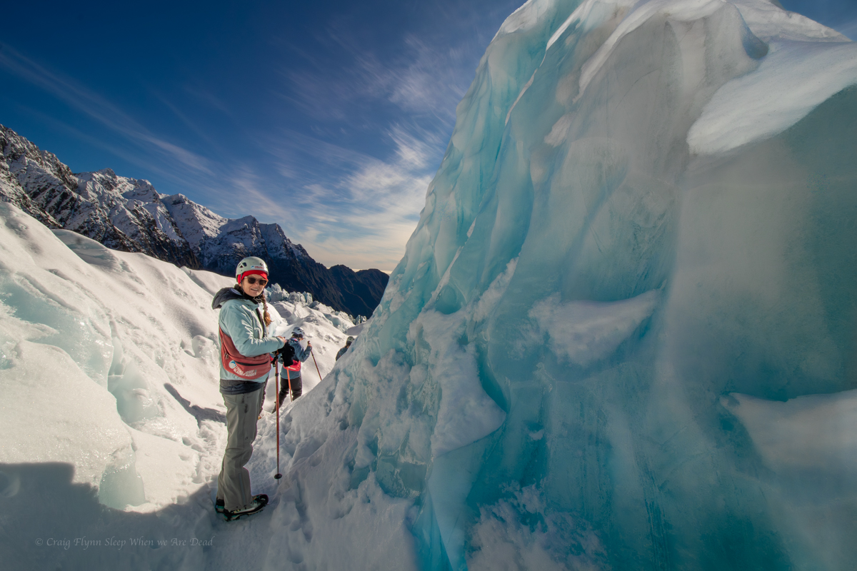
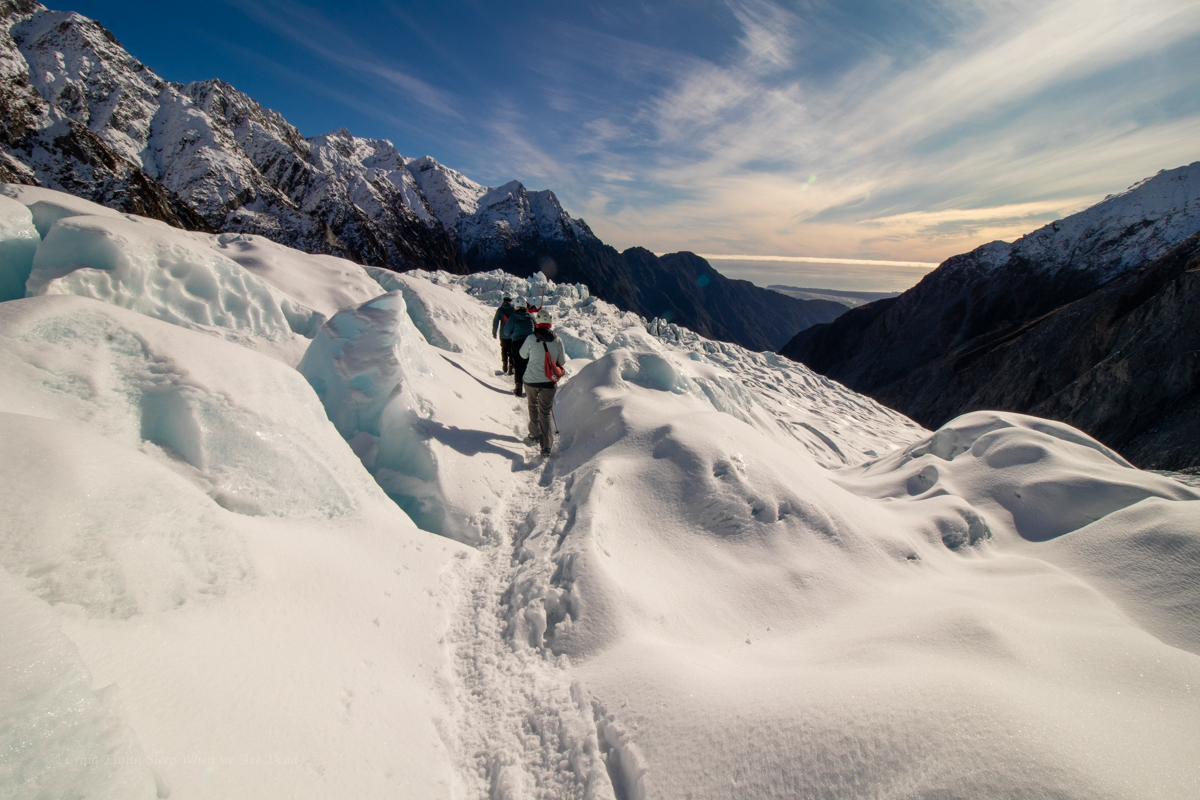
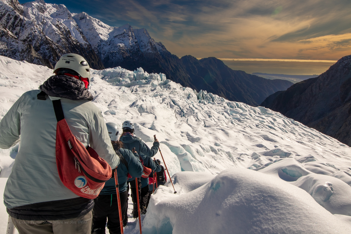
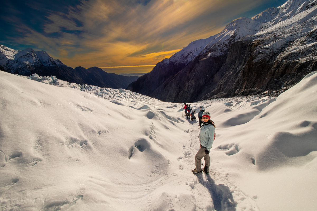
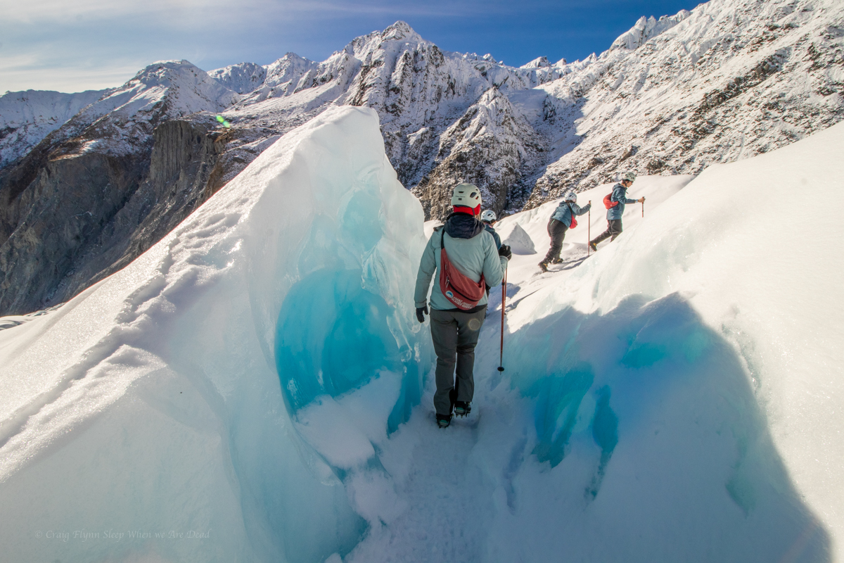
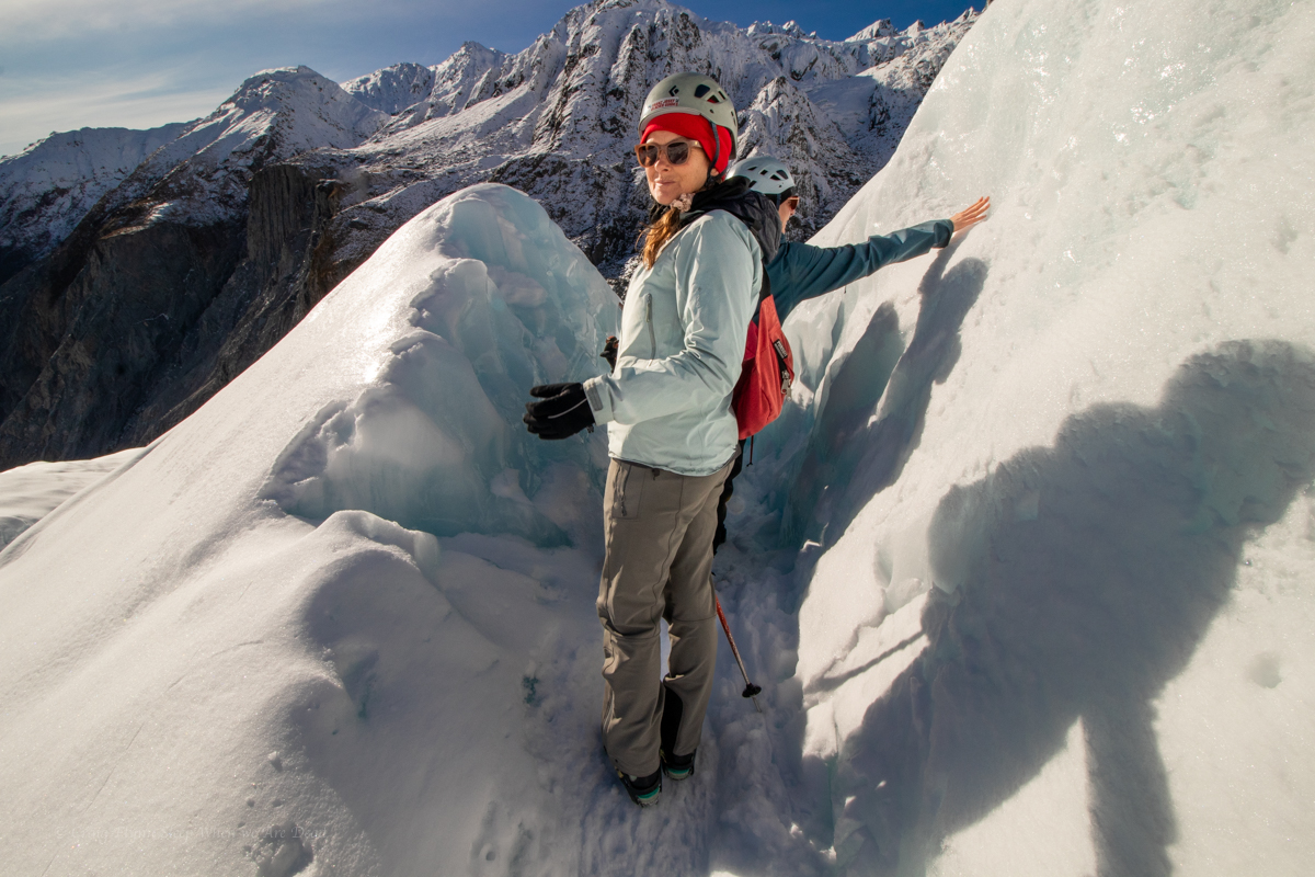
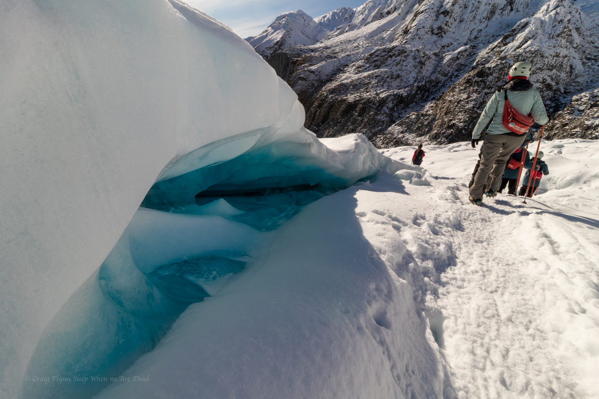
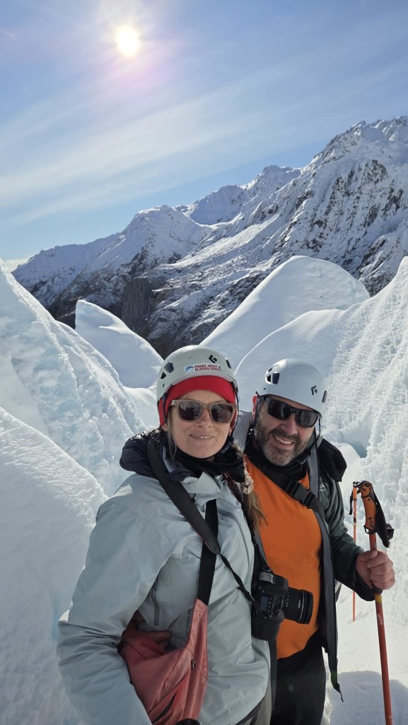
Once both groups were on the ice Maya guided us on a 2.5hr loop around the glacier with lots of facts, anecdotes, and Maori legends thrown in.
Kylie was in her element, engaging in her specialities of climate science, glacial processes, and paleo-river systems. Her smile was beaming and her eyes sparkling.
It was a great experience and I’d highly recommend it.
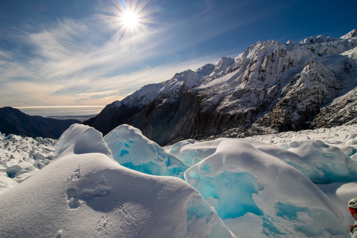
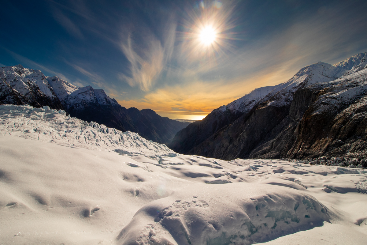
We had jagged a perfect bluebird day. Summer is their peak season but a clear winter’s day is the perfect time to visit.
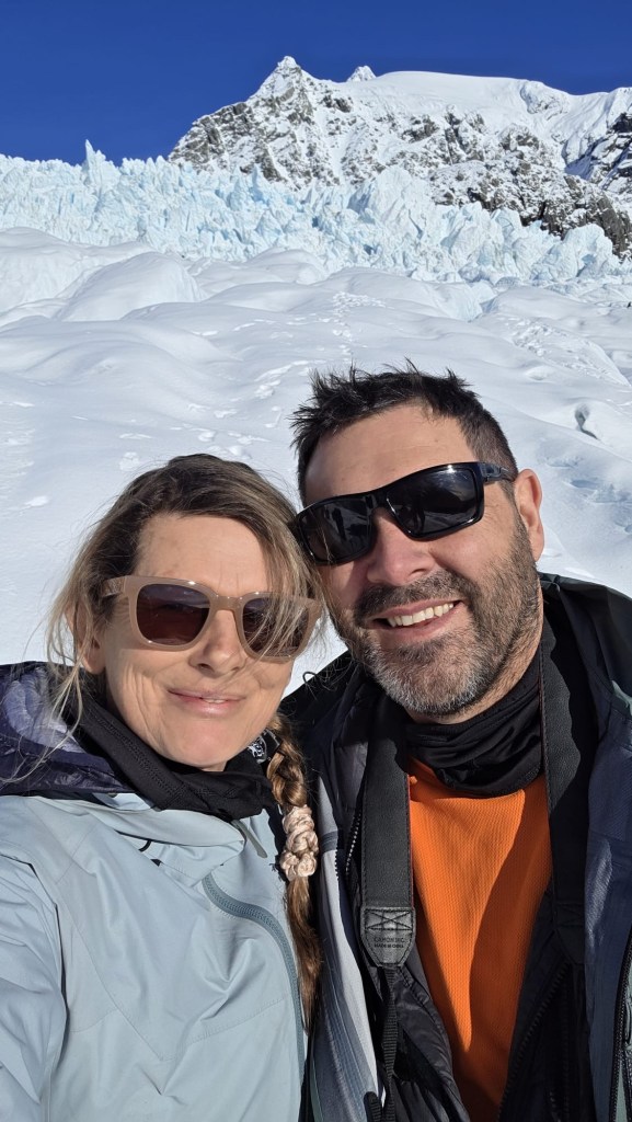
Anyhoo, we took about a thousand photos between us. Here are some of my favourite ones of mine.
Click to expand
Canyon anyone?We are standing on a glacier looking at a beach!!!
Standing on a Glacier looking at a sunset over a beach!!!
Would 100% do it again
And on an absolute high from this we cruise down to Bruce Bay for camp
The south coast of NSW is one of Kylie’s favourite places and I can easily see why. The colours of the dramatic coast line are mesmerising, the escarpments are grand and as a bonus the mountain biking is truly awesome.
With a bit of leave over Christmas I thought I’d be mad not to join her on a road trip.
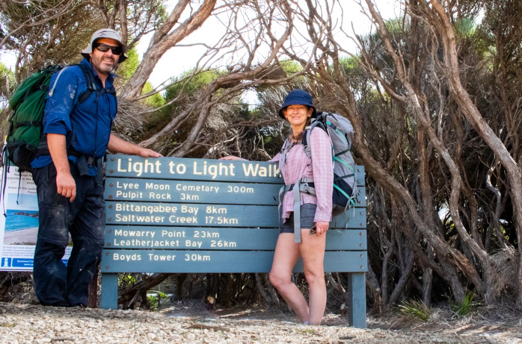
One of our goals would be to squeeze in this popular multiday walk.
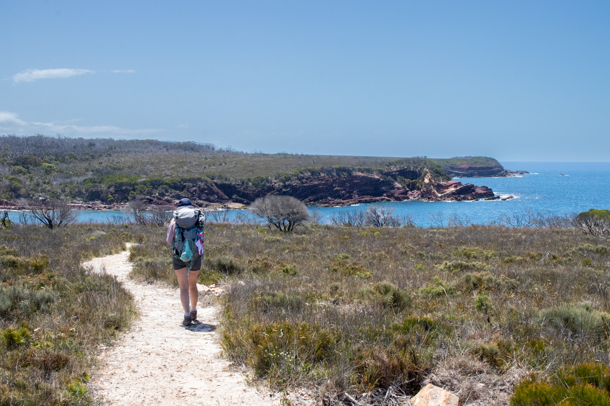
The Light to Light stretches between Boyds Tower and the Green Cape Light house in Beowa National Park, south of Eden. Being about 30km it’s doable in a day but most people do it over 3 days, making use of the offical camps sites at Saltwater Creek and Bittangabee bay (these are drive in campsites with showers and toilets so bookings are essential in peek times.)
We wanted to enjoy the beaches and scenery so decided to do it as a 2 day trip. As we had the mountain bikes we opted to forgo the pick up and drop off logistics (You can pay for a shuttle service at approx $120 per person) and made use of the bikes for the return journey.
Boyds Tower appears to be the usual start to the walk but looking at the topography of the forestry roads we figured it might be an easier ride North to South so we stashed the bikes in the bush near Boyds Tower and drove down to Green Cape to start the walk from there.
Along the way we did a side trip into Saltwater Camp to stash some extra water.
Part 1: Green Cape Light house to Bittangabee Bay
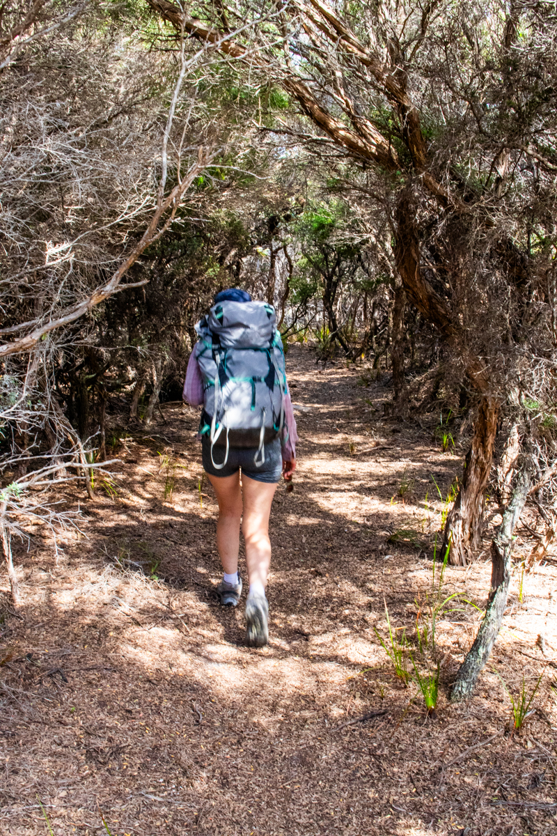
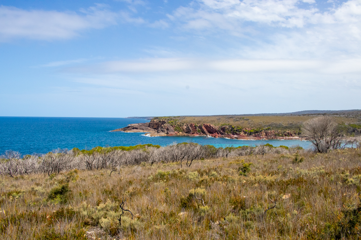
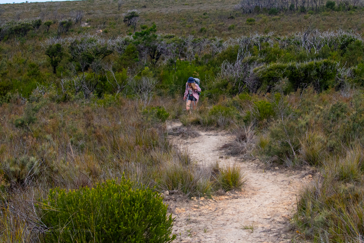
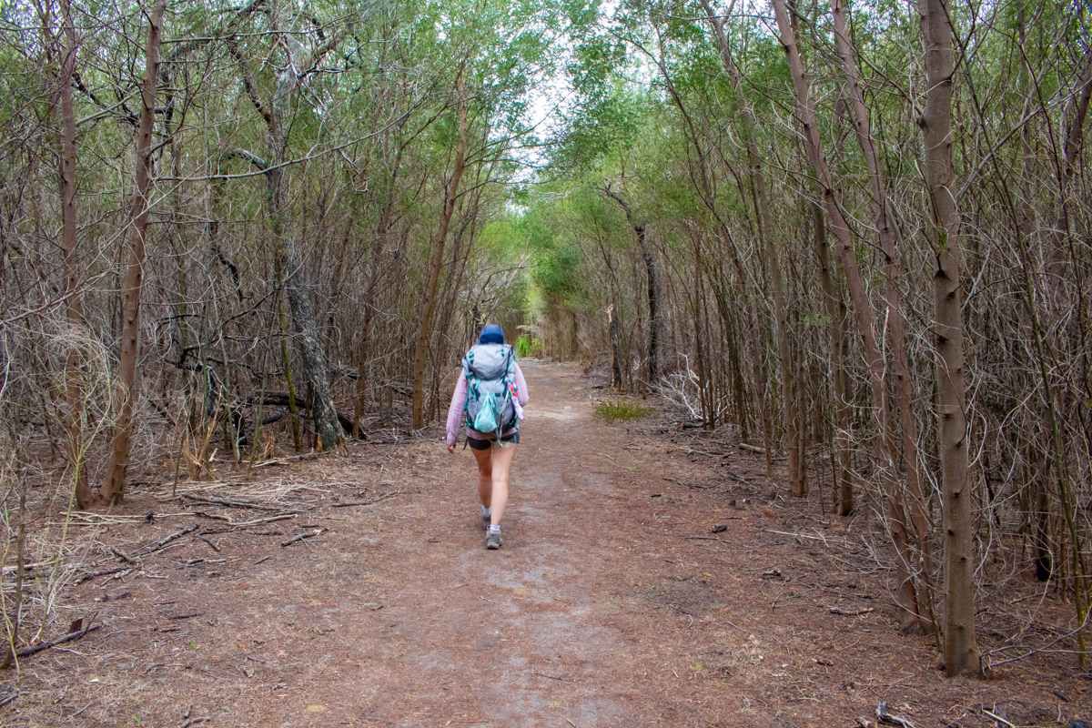
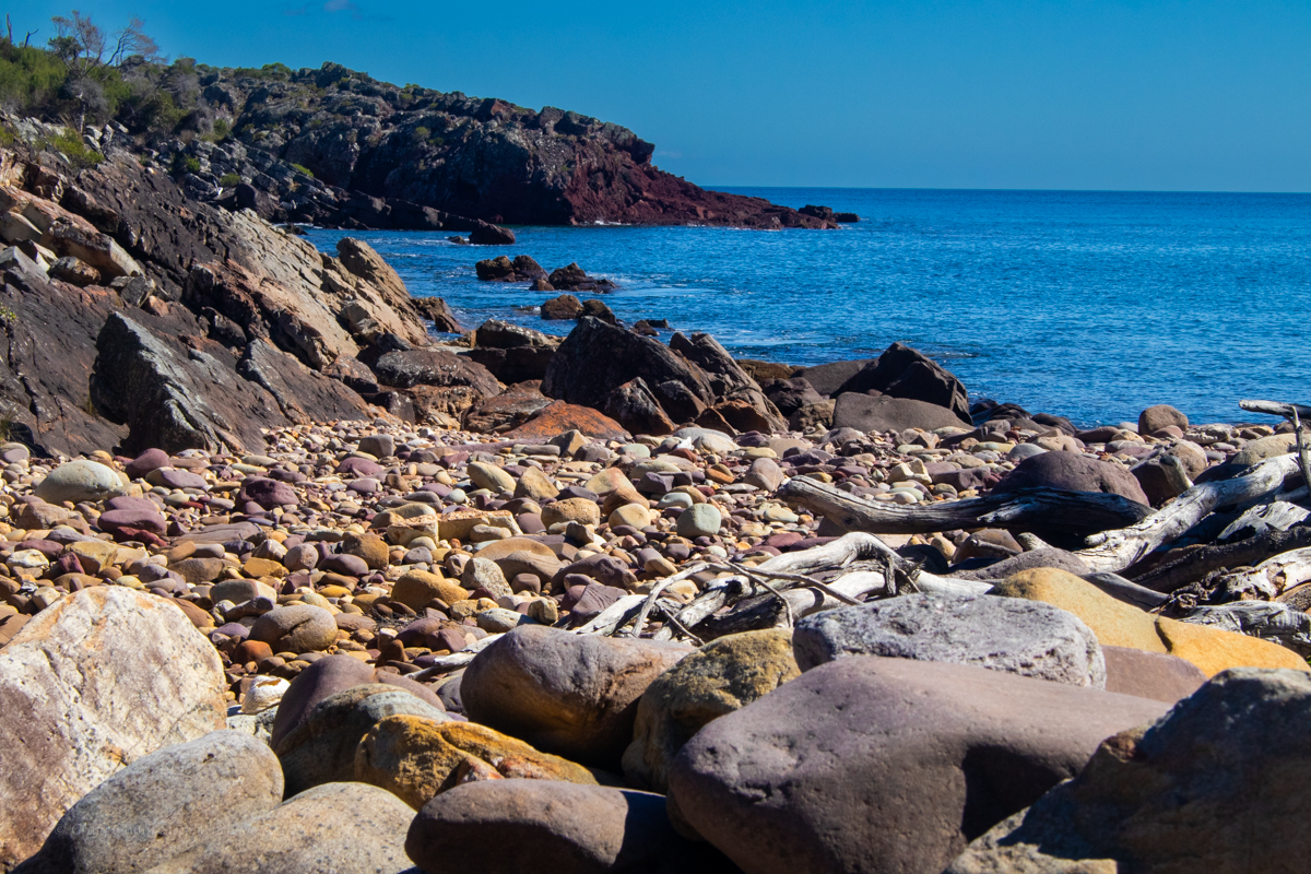
Full of beans and anticipation we set off at the crack of 10am in high spirits. It is a stunning bit of coast down here which is why I’m a bit baffled as to why this section of trail stubbornly avoids it.
TBH, this was my least favourite section of the walk. We could hear the ocean, we could occasionally see the ocean but without large side trips we couldn’t see the coast line.
We wander through tunnels of mallee scrub and across open plateau, it’s like the trail is trying to avoid any elevation loss or gain for the sake of it and at one stage I find myself thinking, I hope I haven’t driven 5hrs for 30km of this shit.
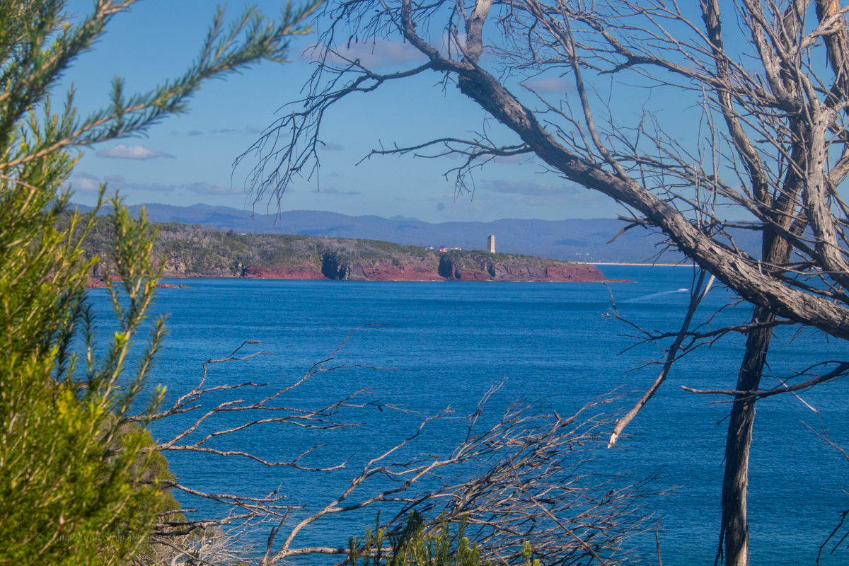
Gadget with the Light house off in the distance
Coming from the other way I can’t help but think this would be a disappointing end to the walk and you’d only be doing it for the sake of doing it and getting to the Light House.
NPs are doing a lot of upgrade work on the trail so perhaps this is a temporary diversion but it doesn’t look temporary.
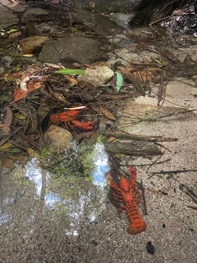
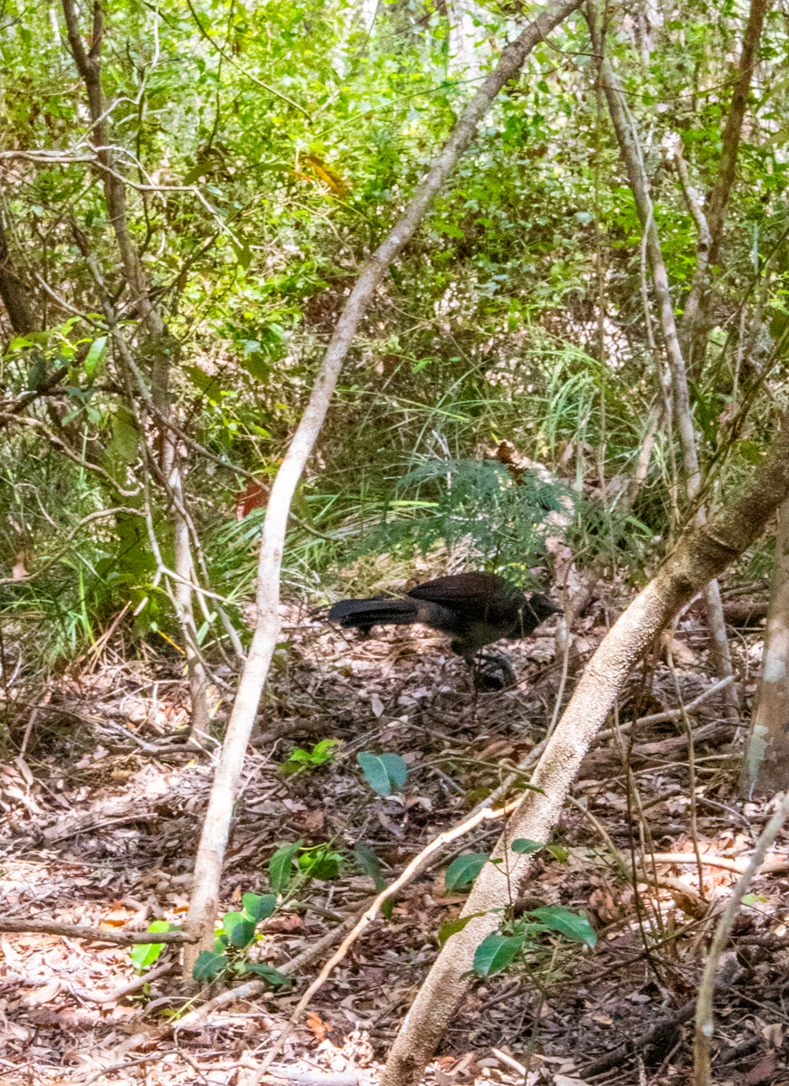
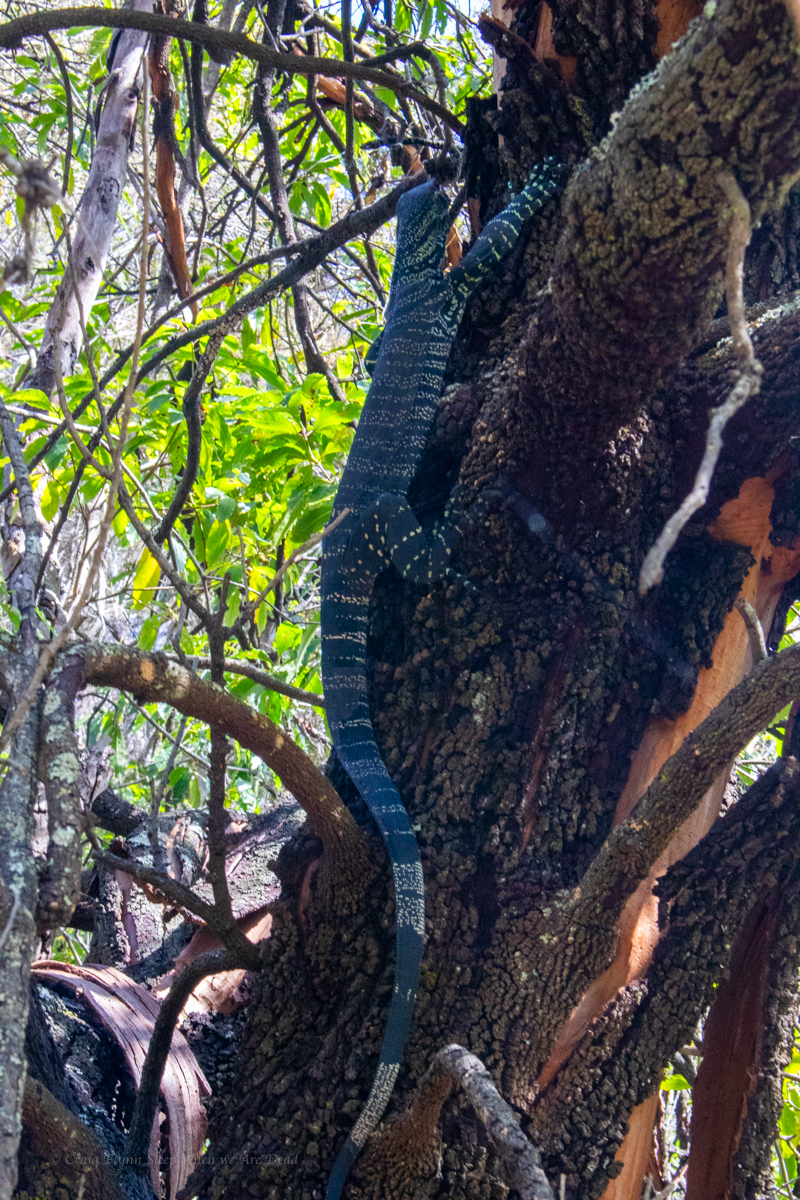
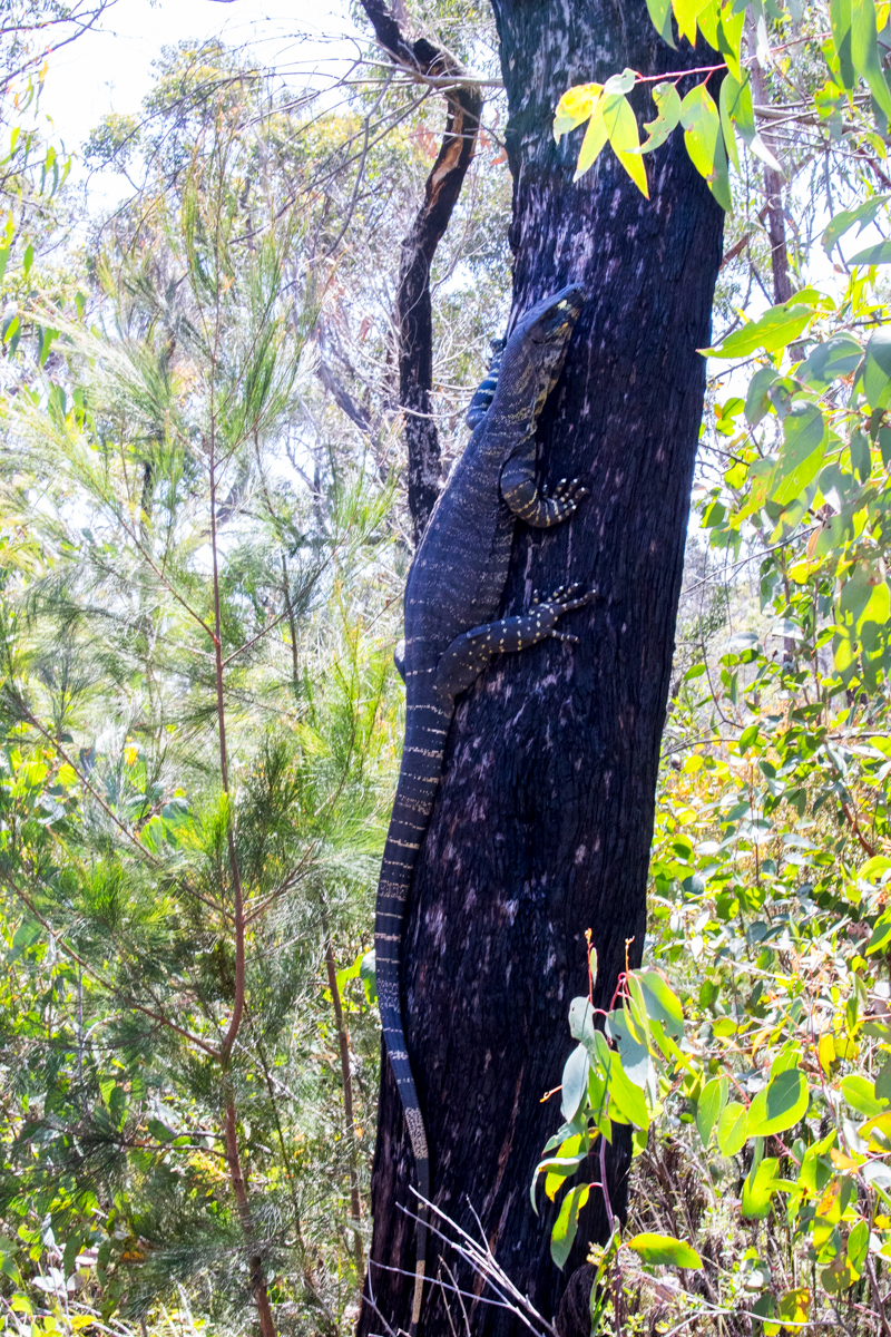
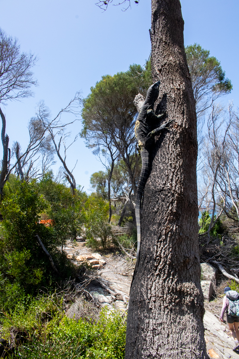
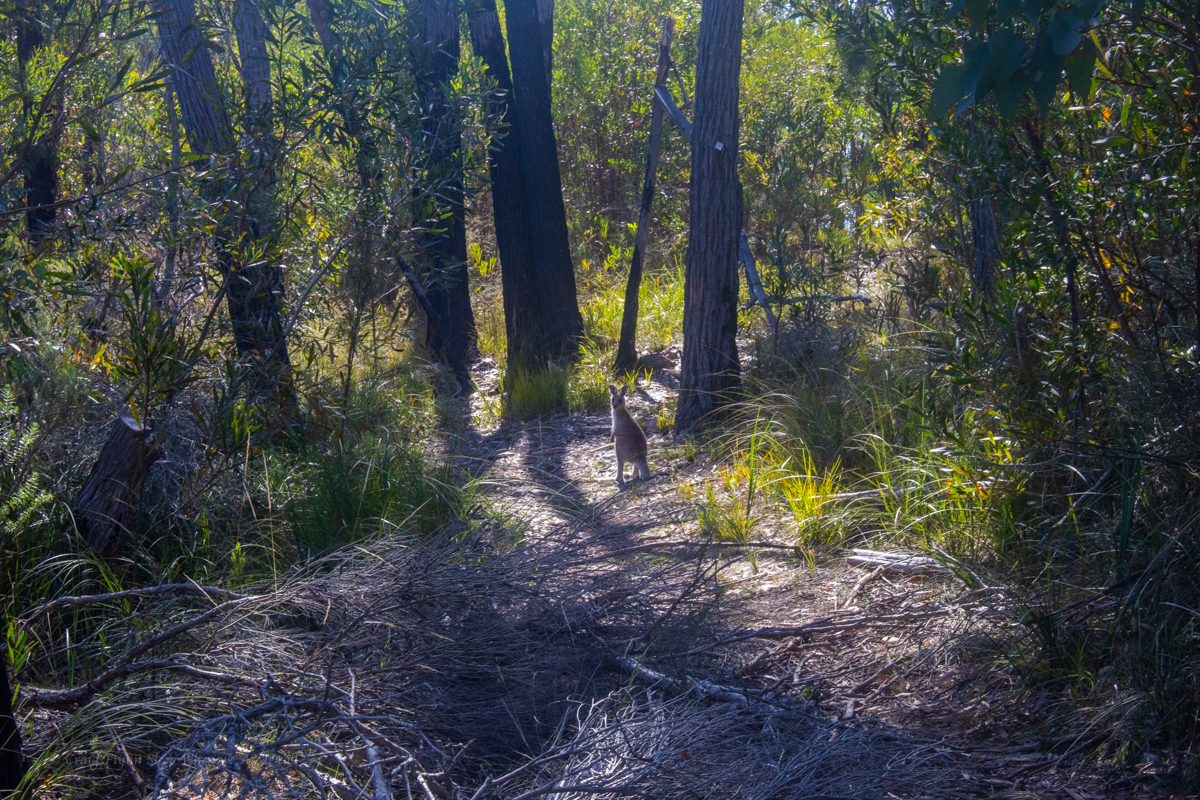
Luckily the plethora of goannas and bird life were a distraction from the flat boring trudge.
Lyrebird scratching aboutlace monitor, Varanus variuscute little water holelace monitor, Varanus variuslace monitor, Varanus varius
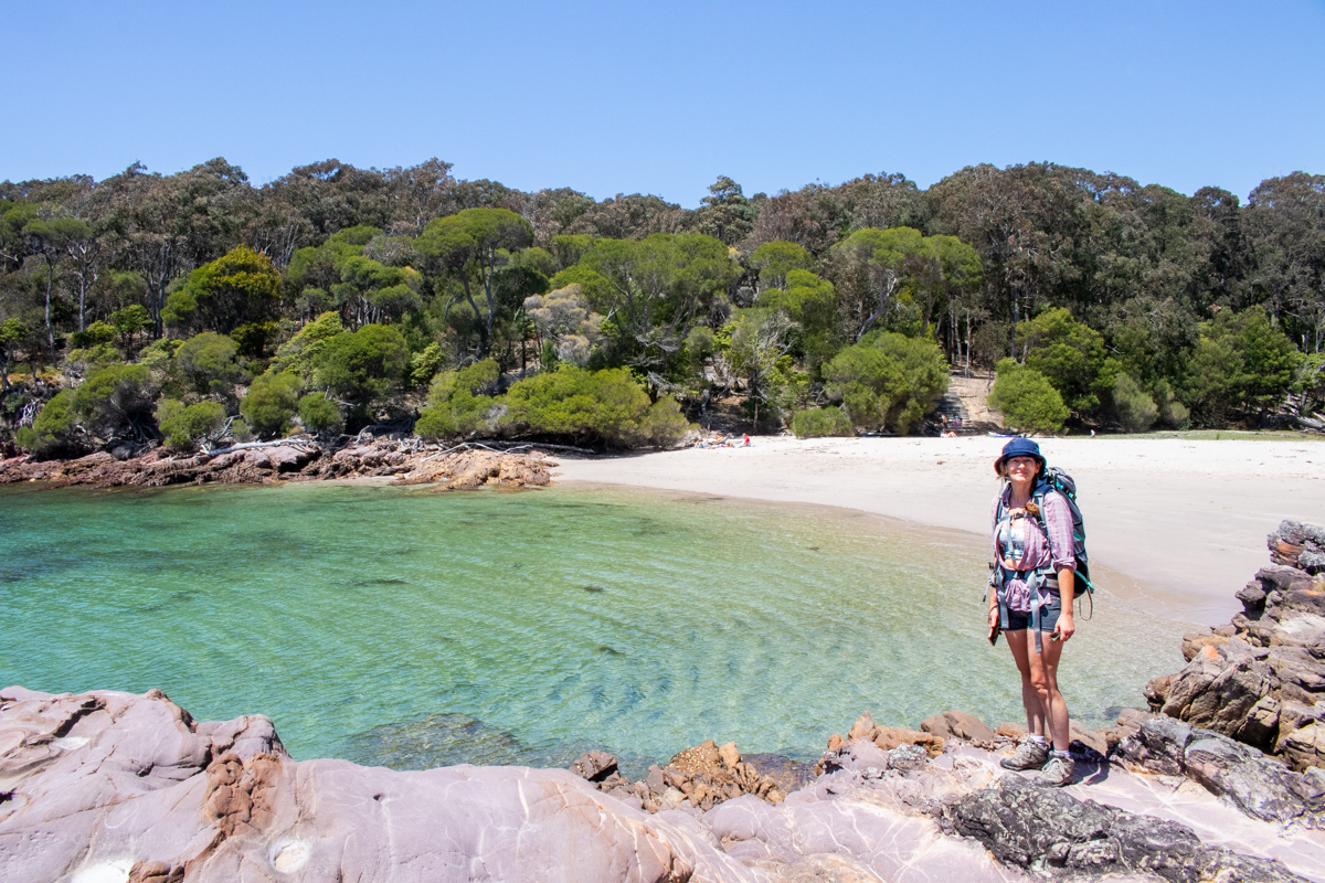
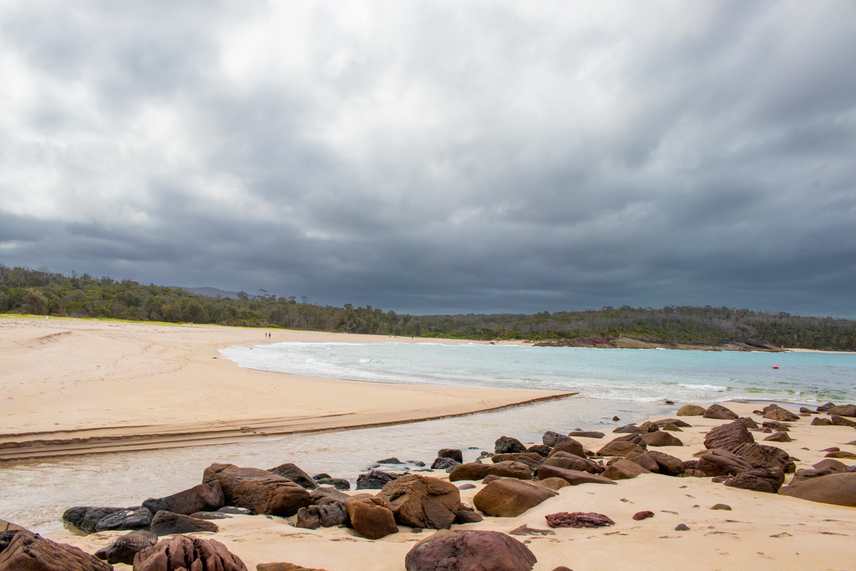
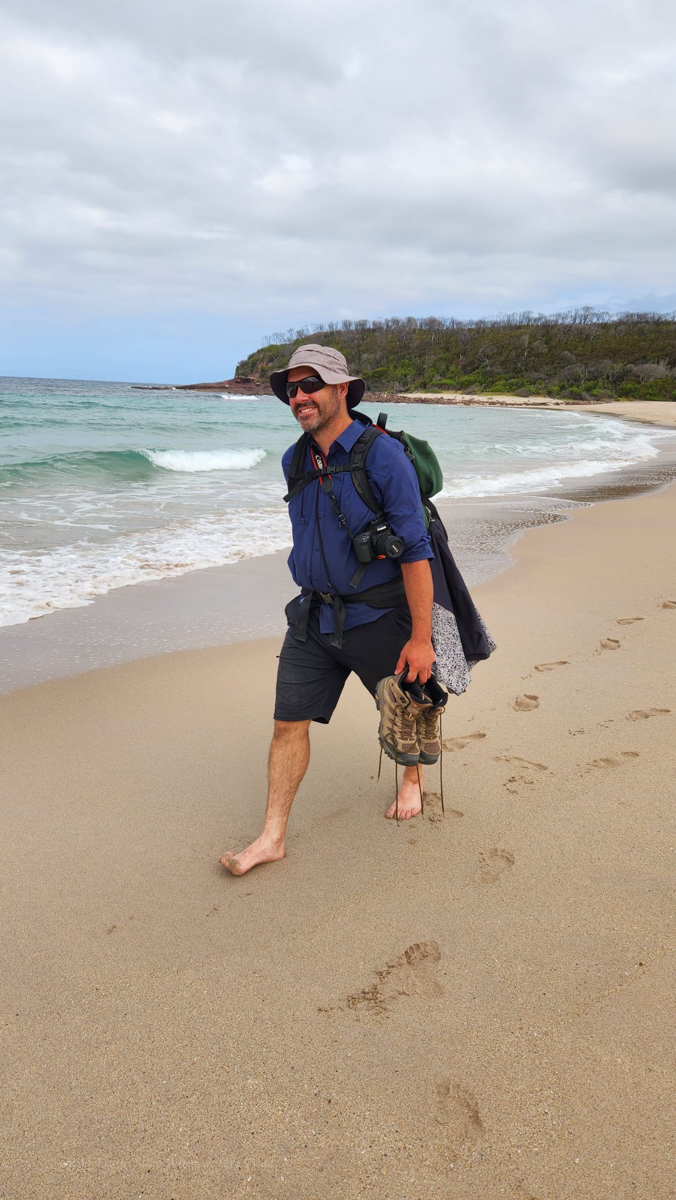
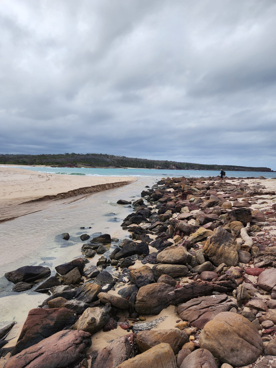
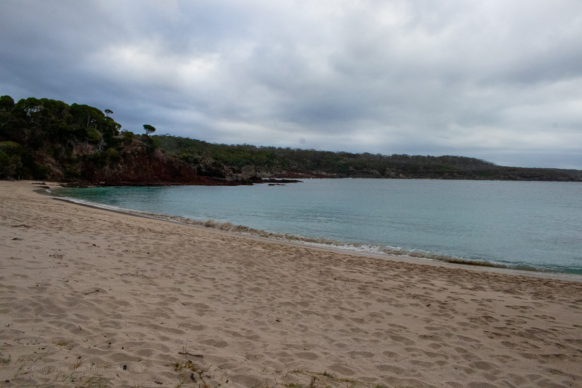
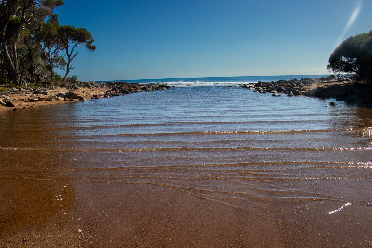
8kms in Bittangabee bay was a welcome site.
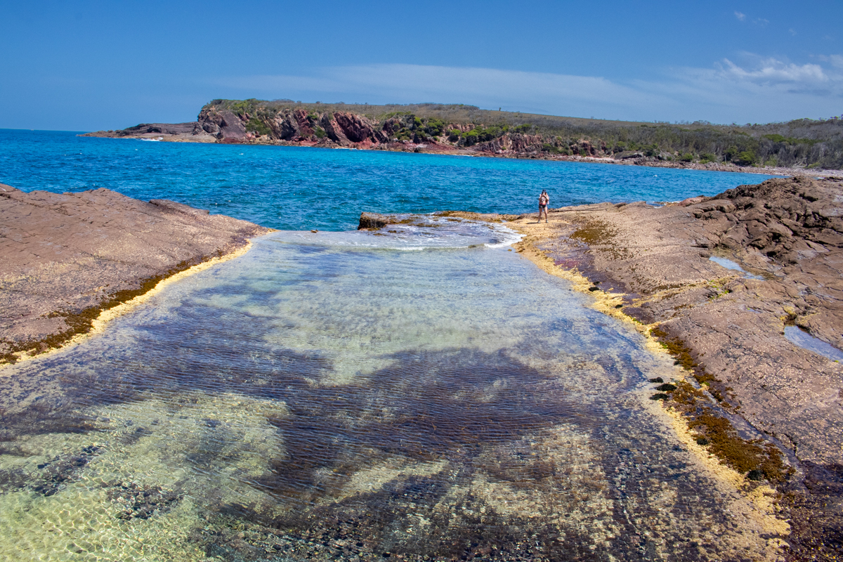
Part 2: Bittangabee bay to Hegarty’s bay
NP were doing upgrade works to the trail around the headland so we were diverted in through the camp. It was packed. A sign near the toilet block directed us back on to the trail on the other side but, confusingly a few hundred meters along we came to a barricade and signage preventing people from accessing that section from the other direction.
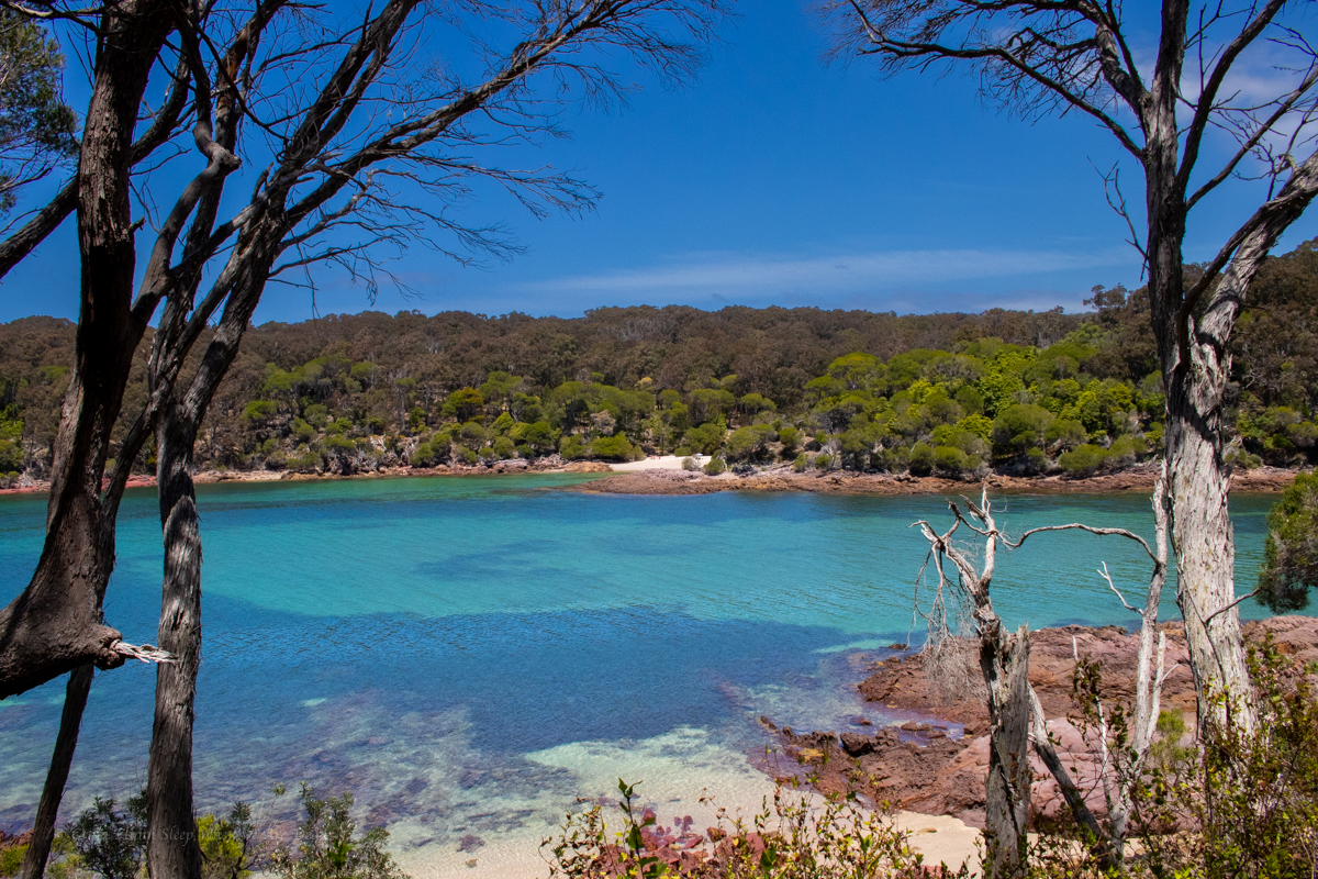
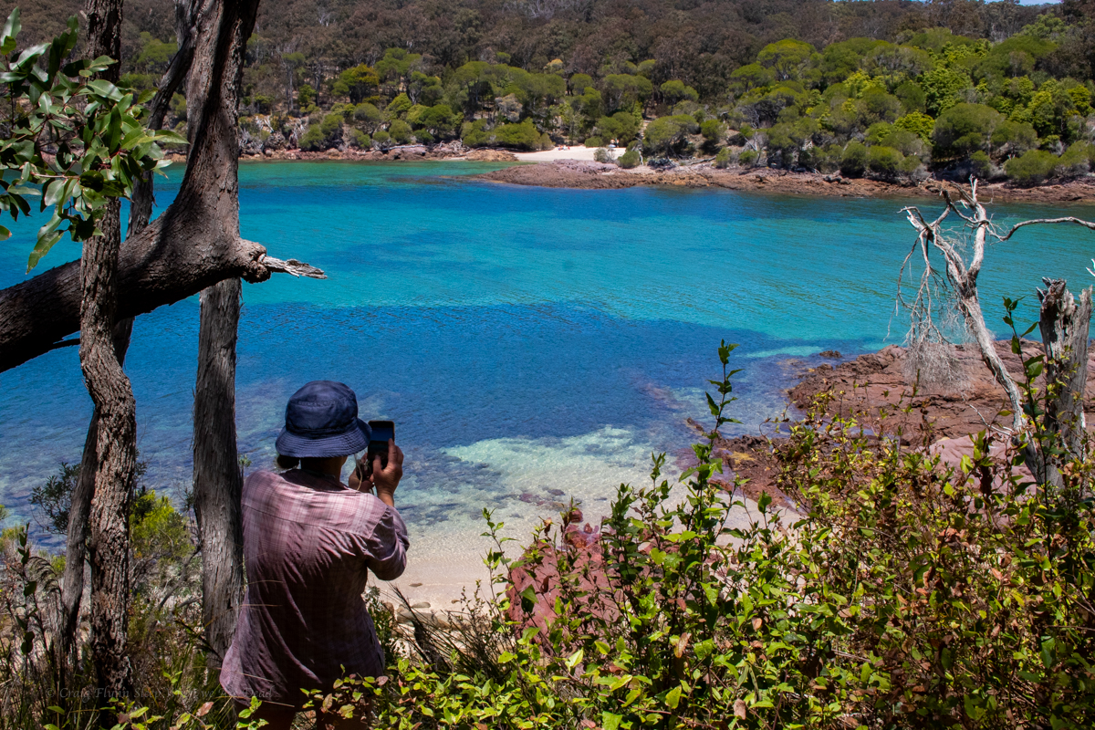
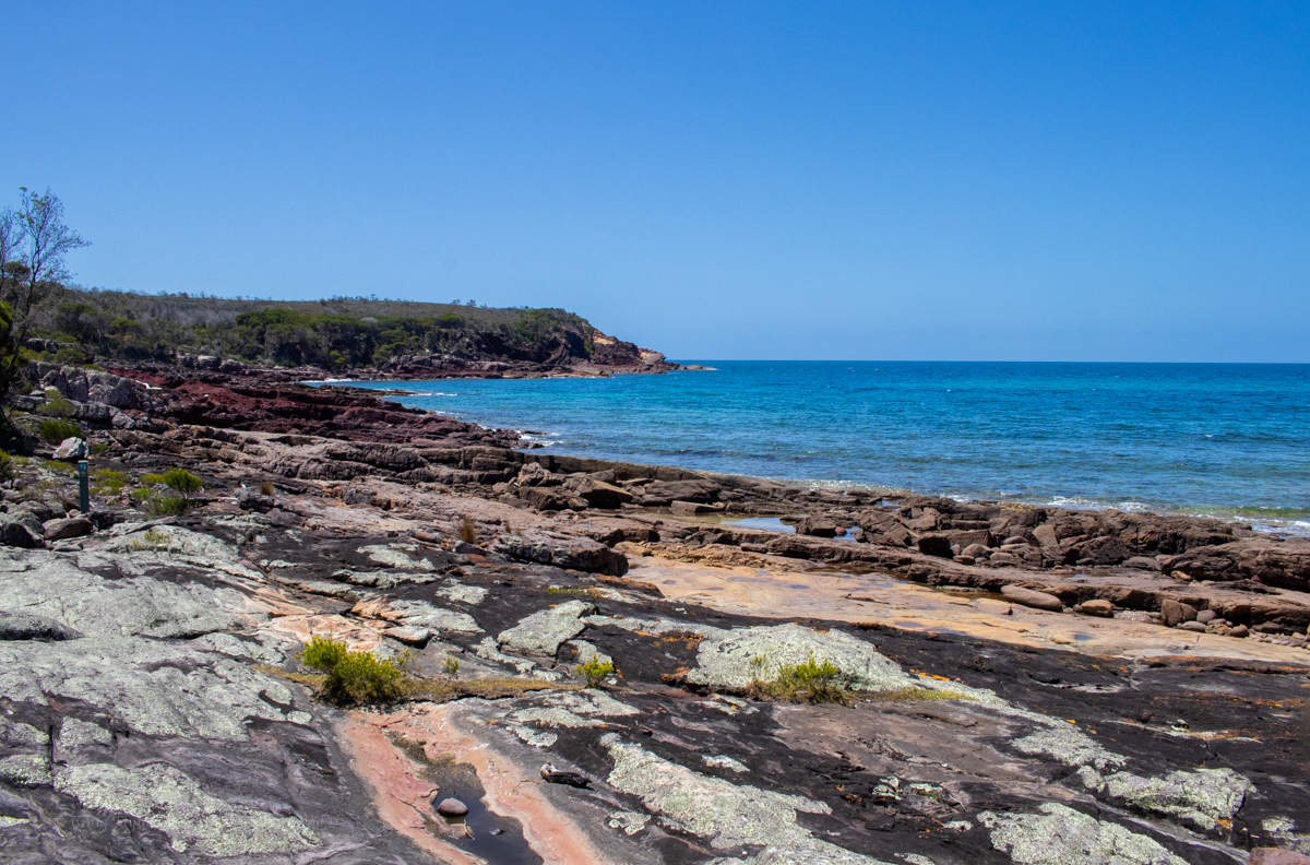
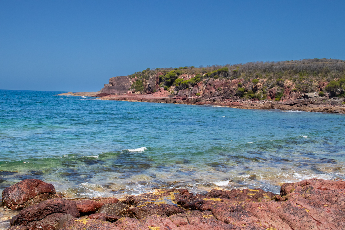
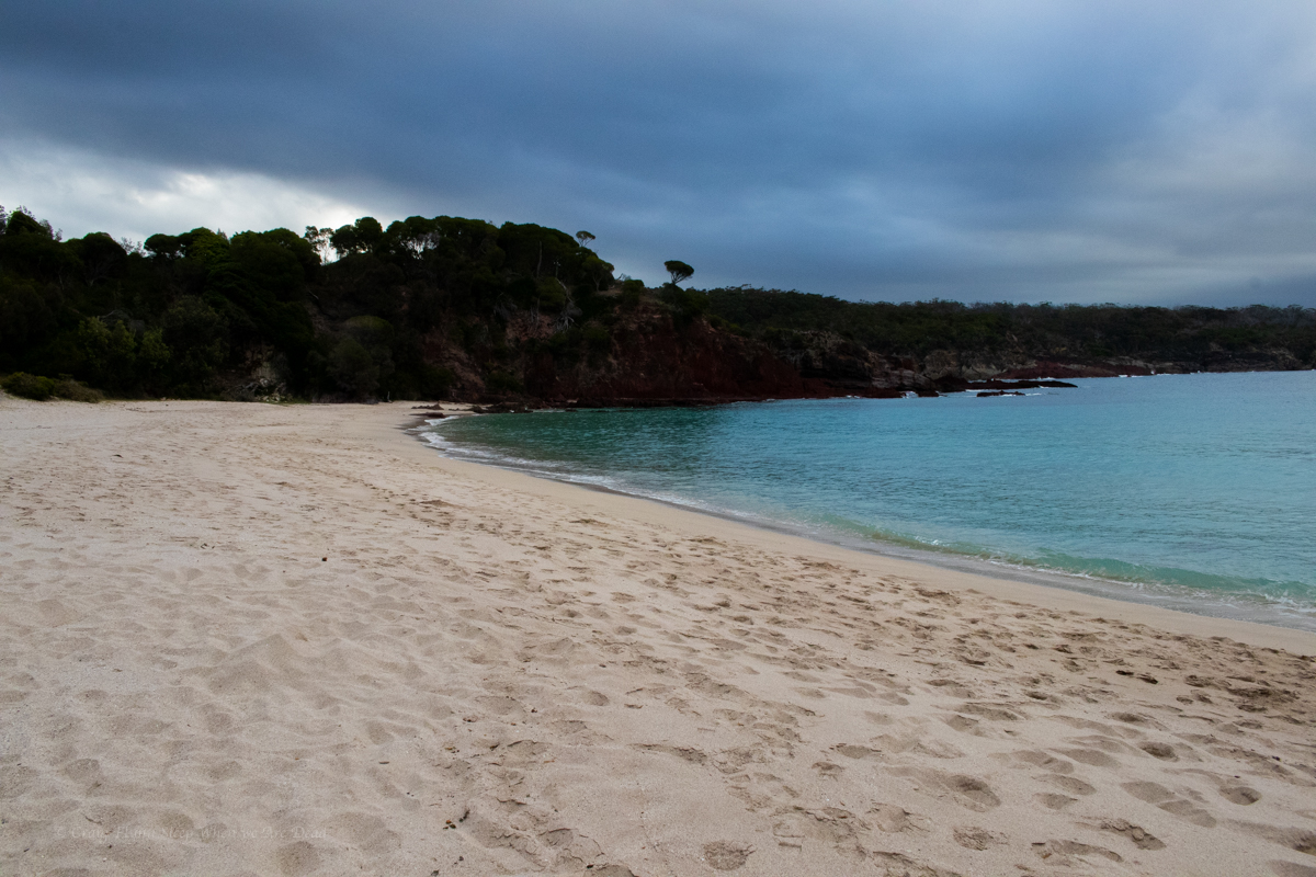
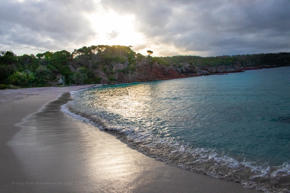
Anyhoo, We make the short side trip down to the surprisingly people-less bay for a swim and a bit of lunch. We also got lucky as the grey clouds dispersed and the sun brought the colours out. Even if you are not doing the walk or camping for the night a visit to Bittangabee Bay is well worth it if you are down this way.
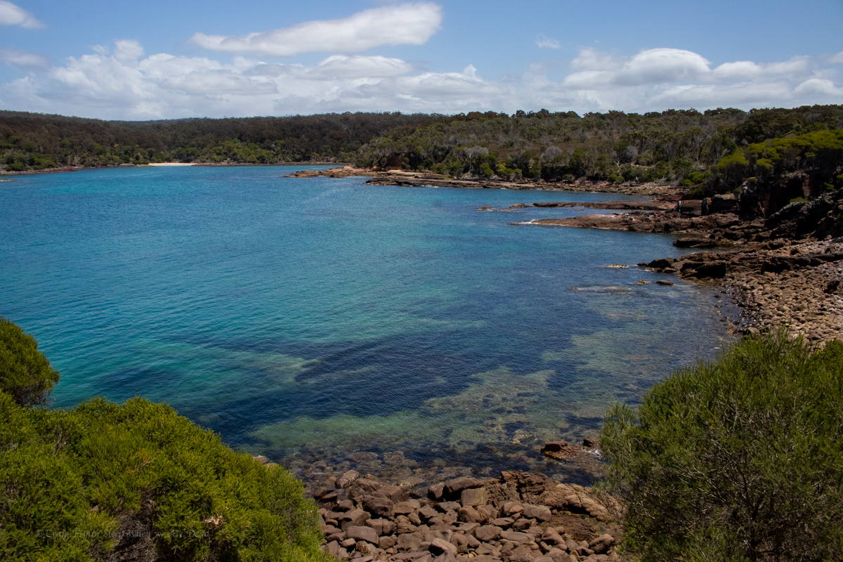
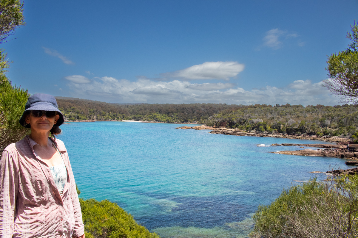
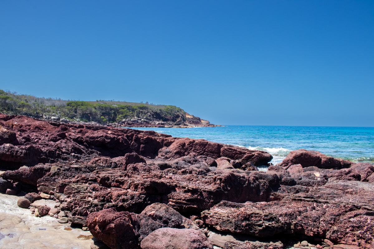
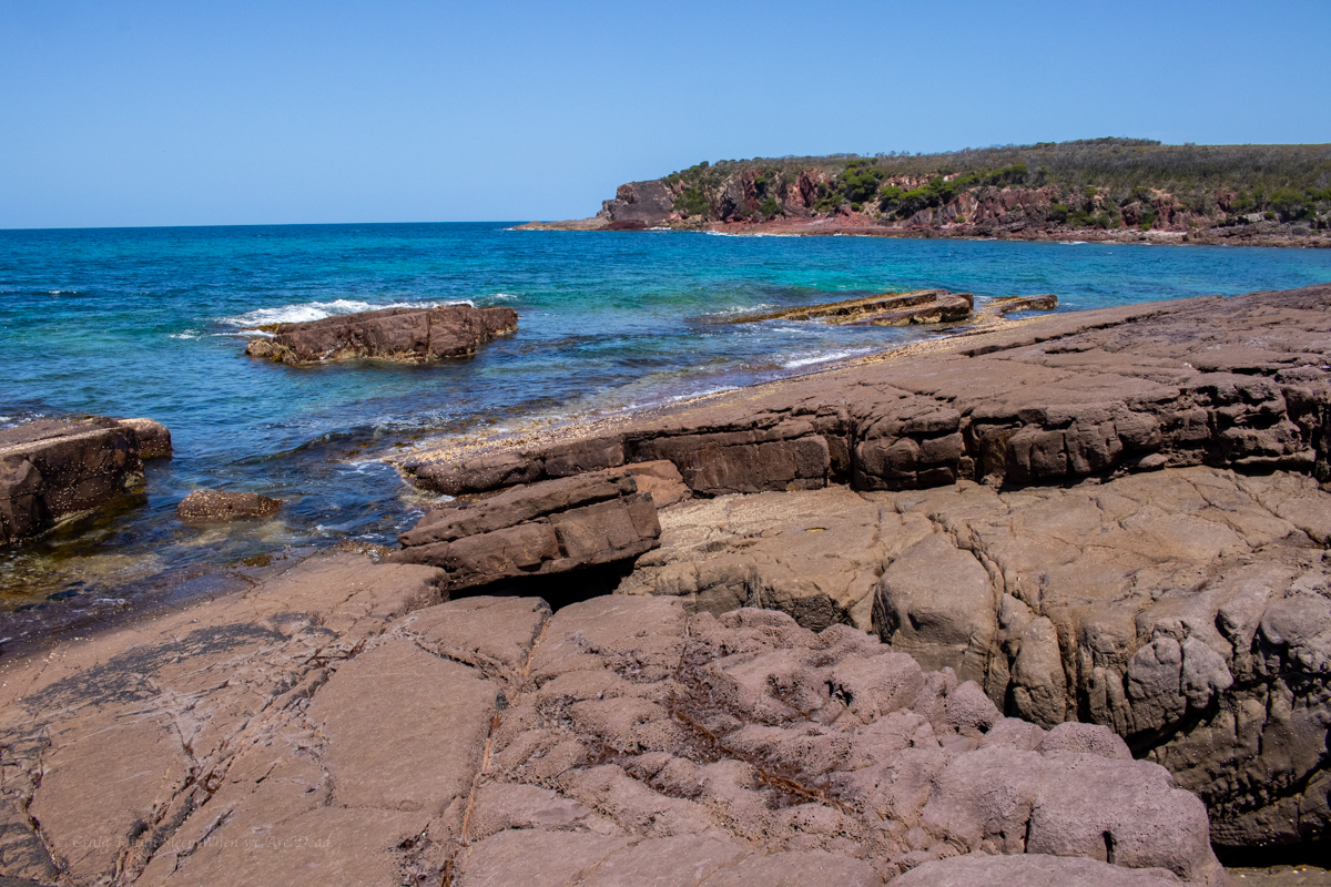
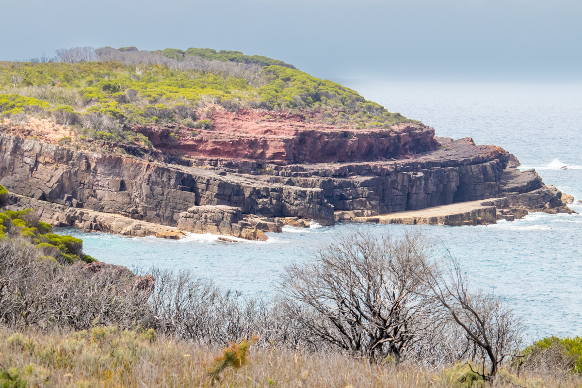
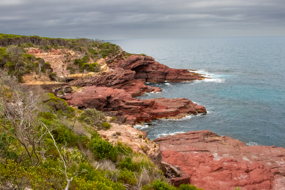
From here the trail does a wide arc around Bittangabee with view after view of the stunning bay.
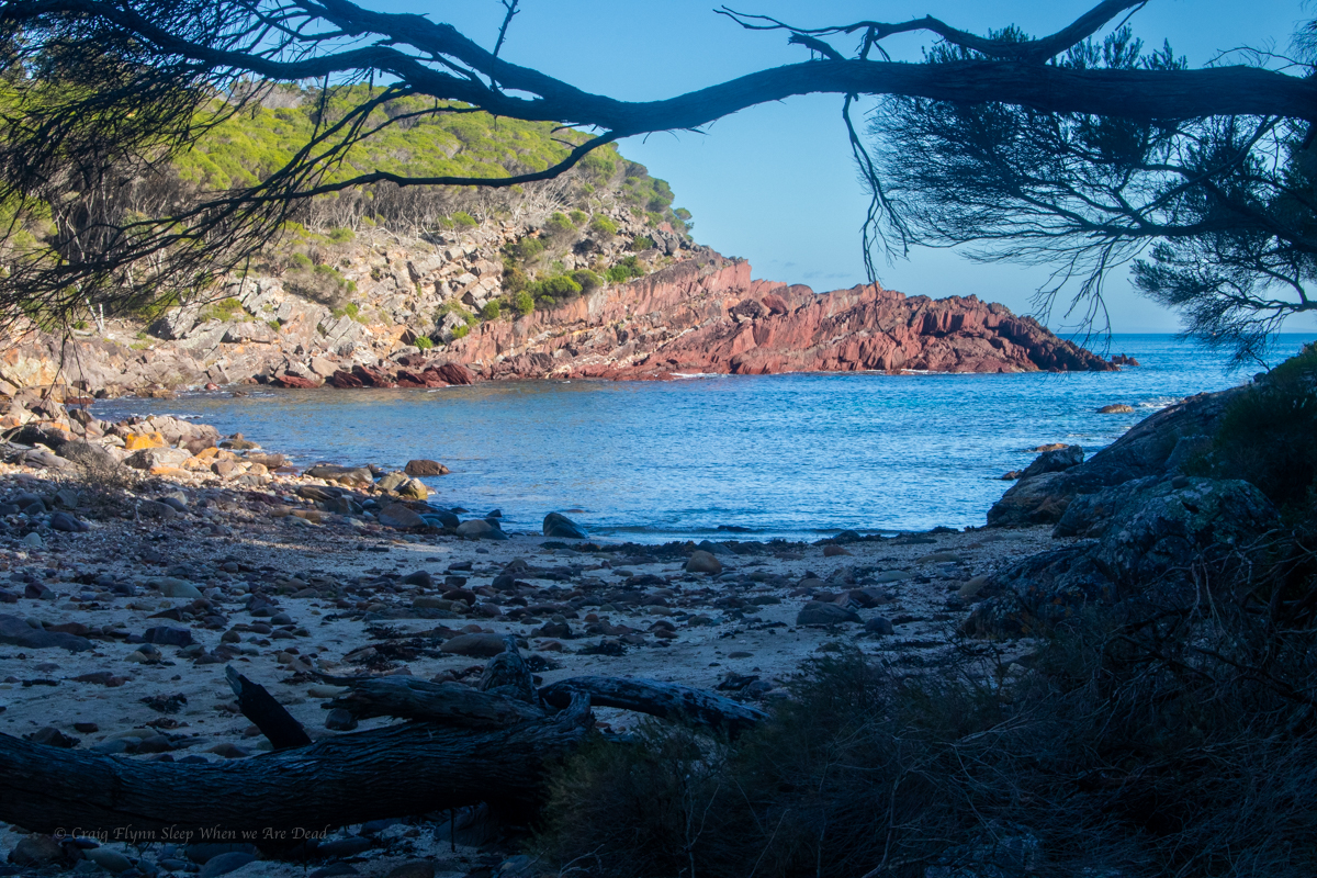
Beautiful from any angle.
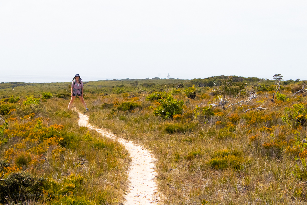
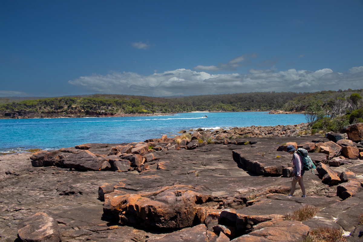
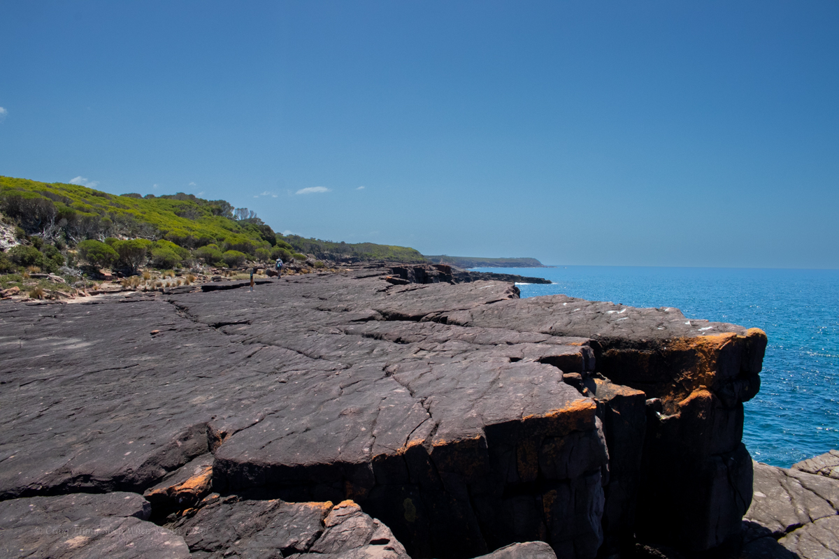
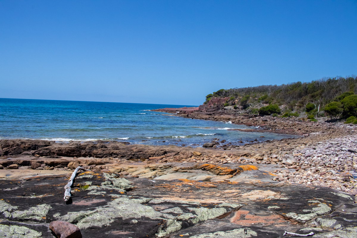
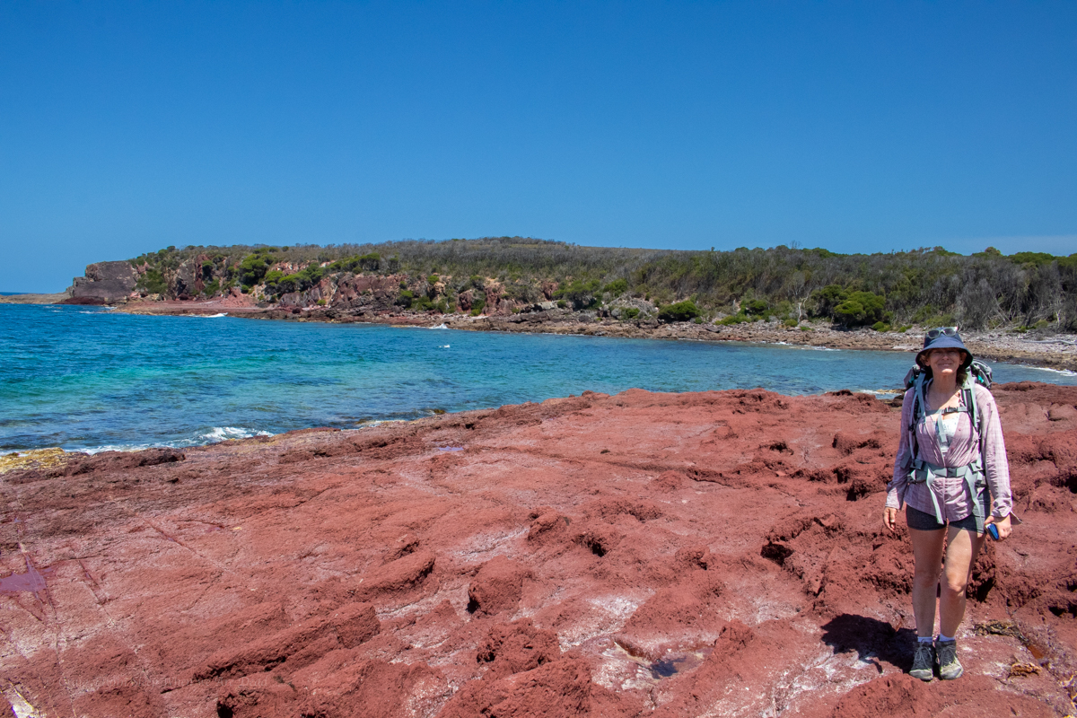
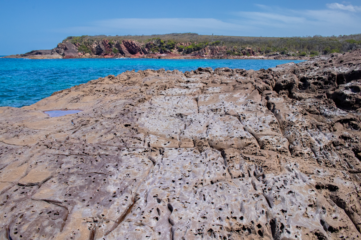
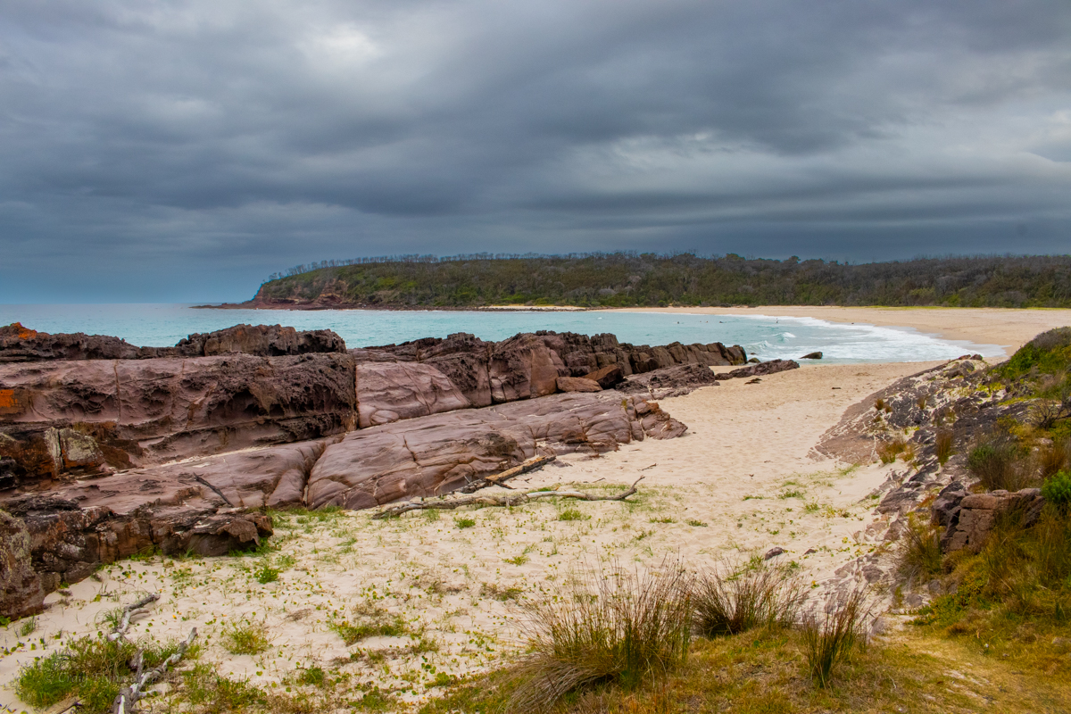
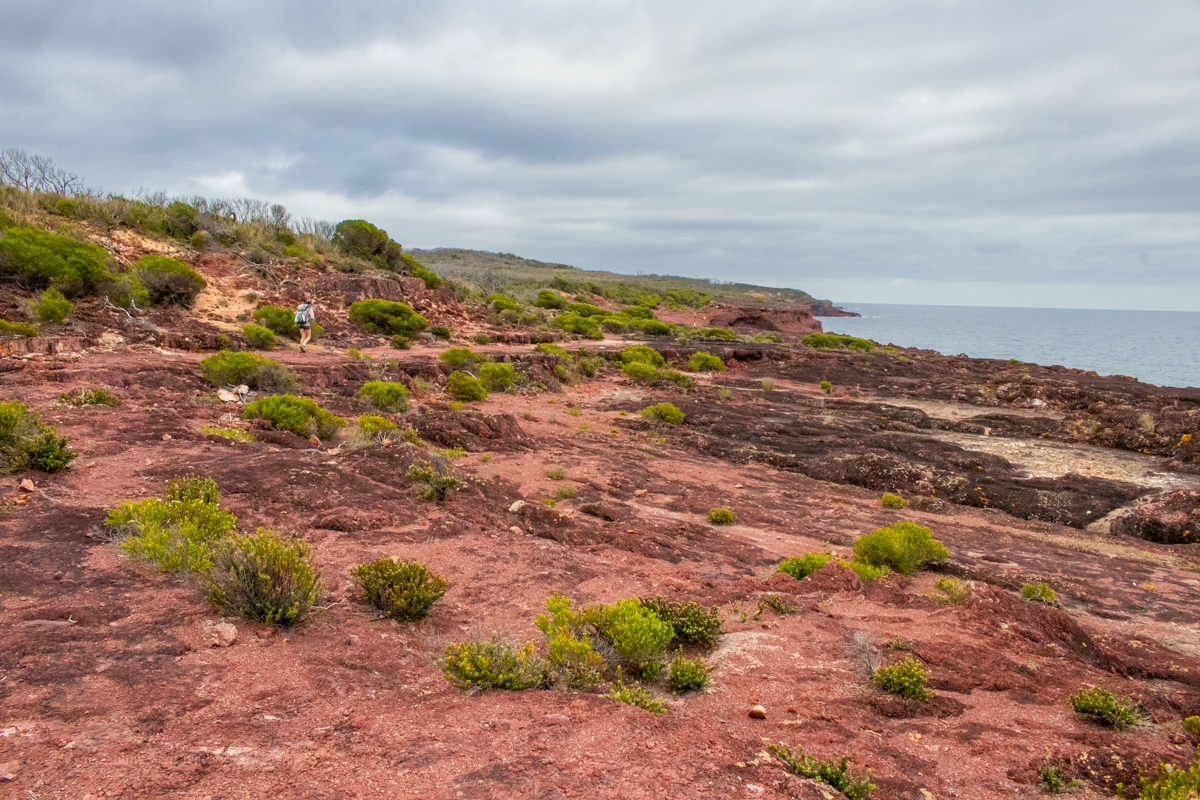
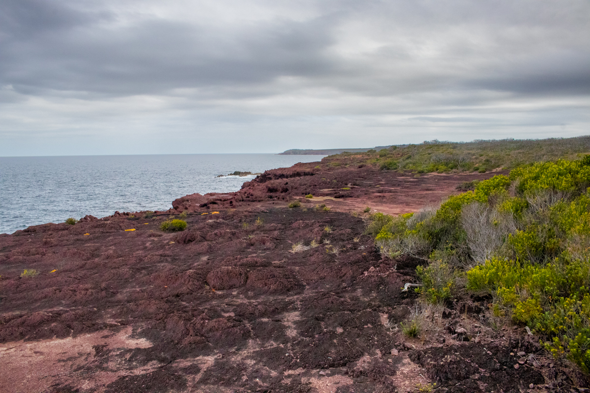
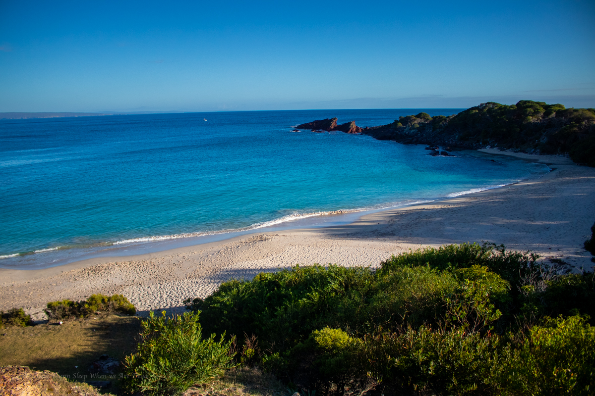
We are now following the coast line with just the occasional diversion inland.
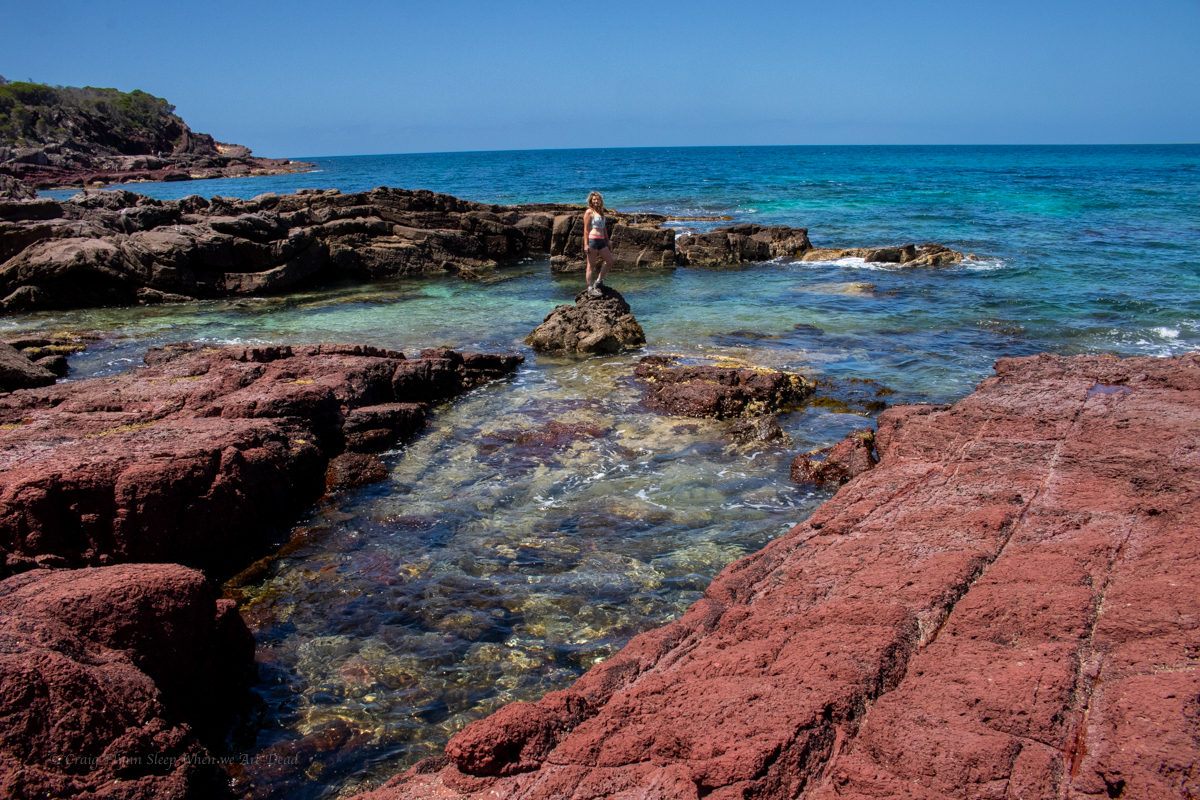
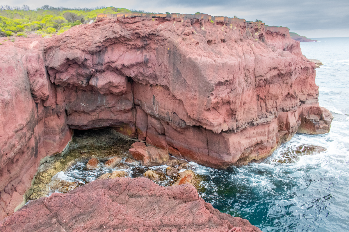
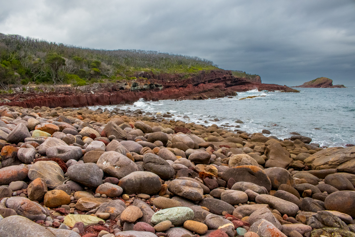
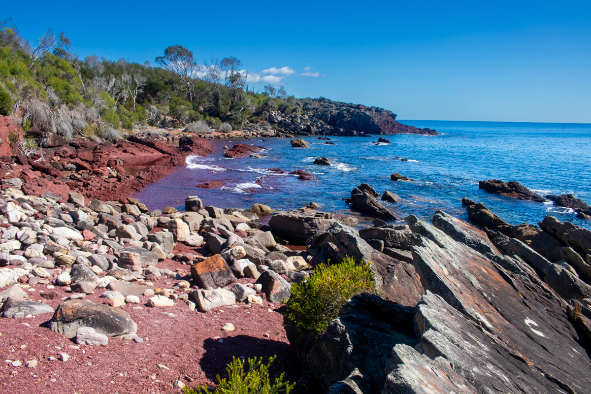
This is what we were here for
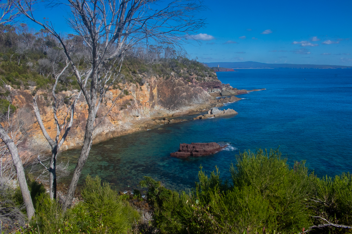
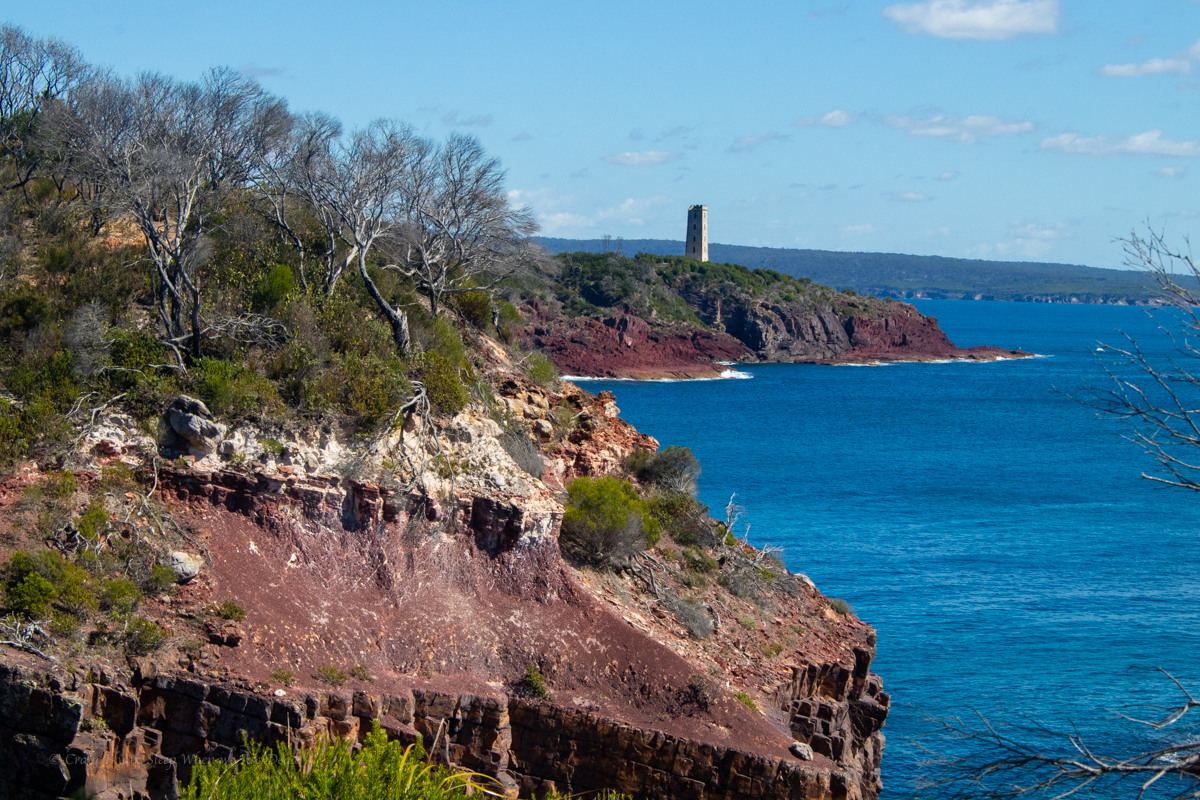
Looking back down the coast with the light house in the distance
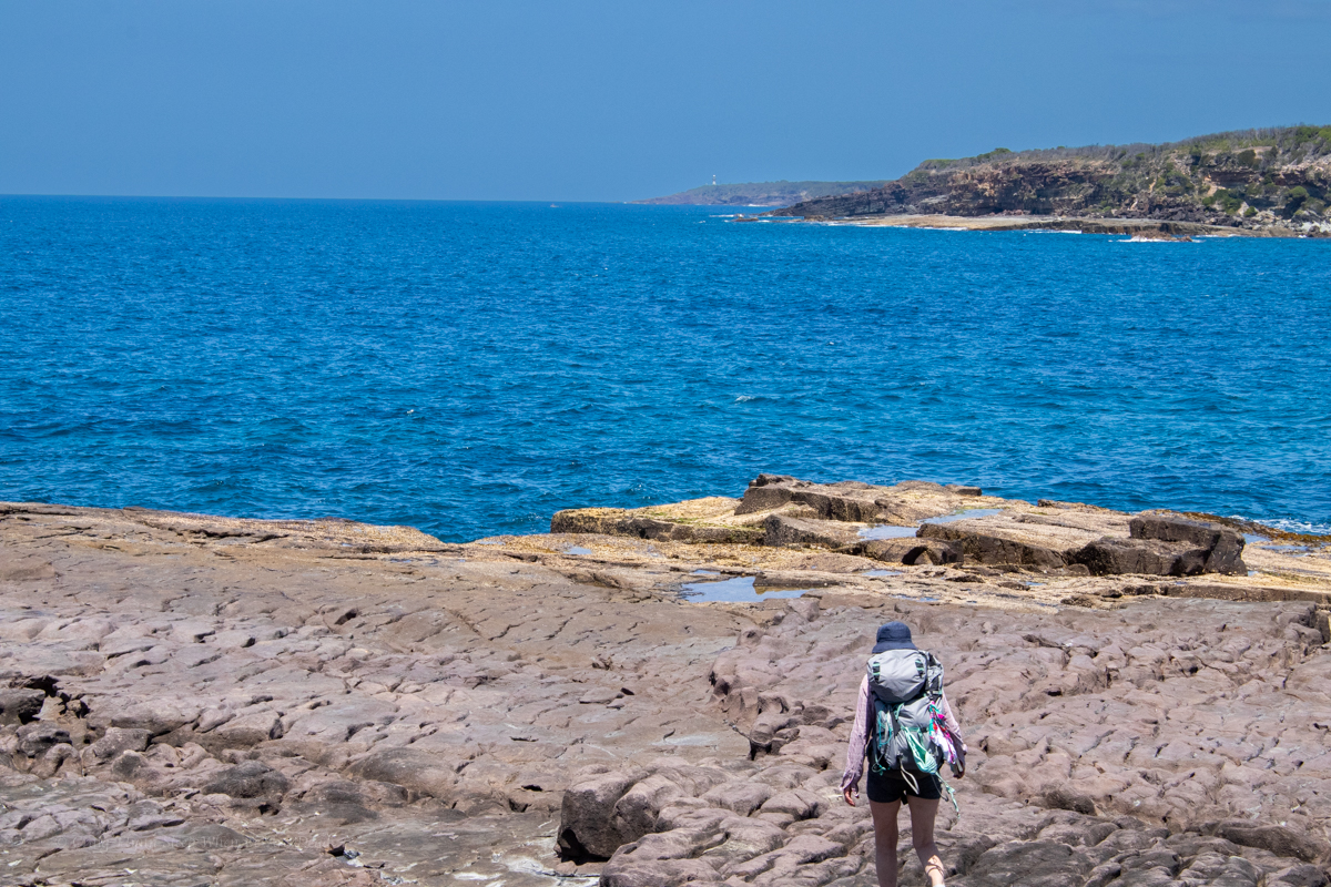
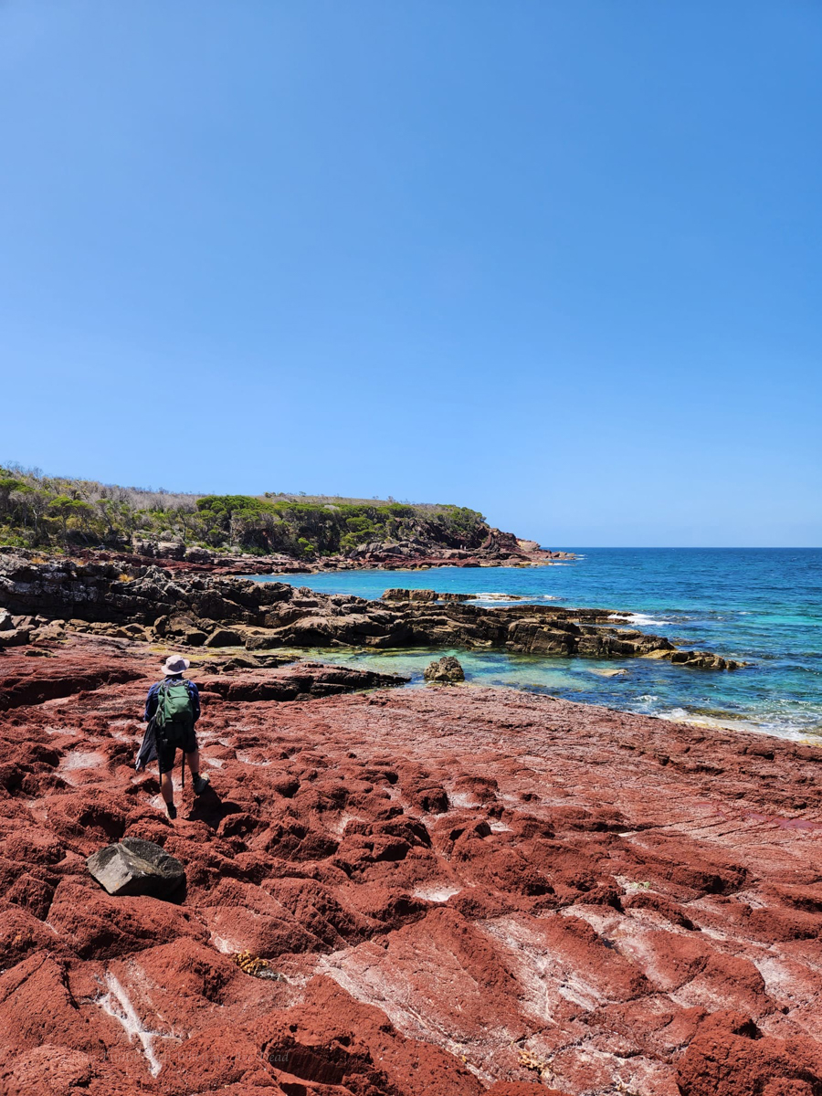
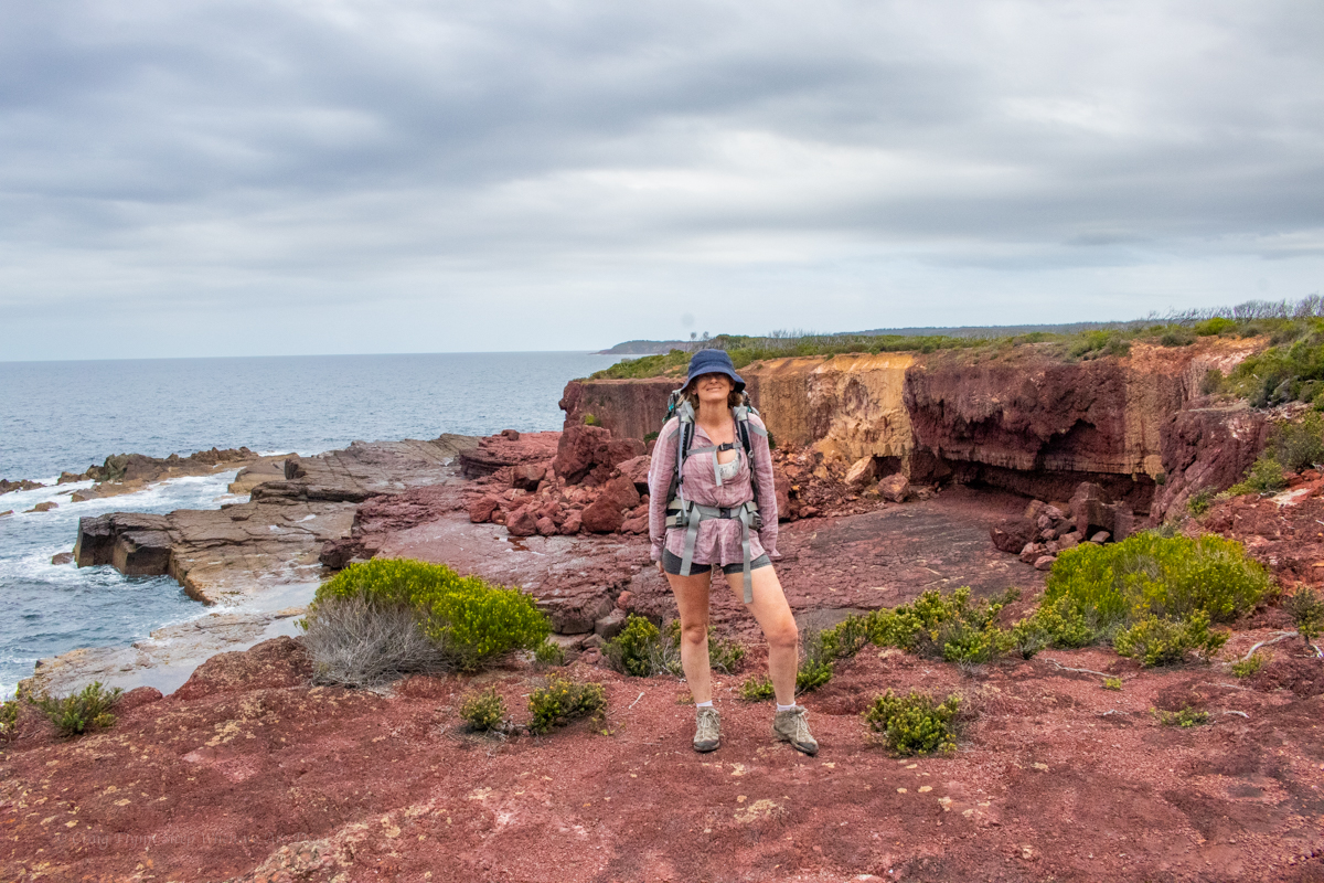
Looking up the coast with stunning cliff lines jutting out over the South Pacific OceanAnd stunning geology with folds and intrusions and flows and stuff
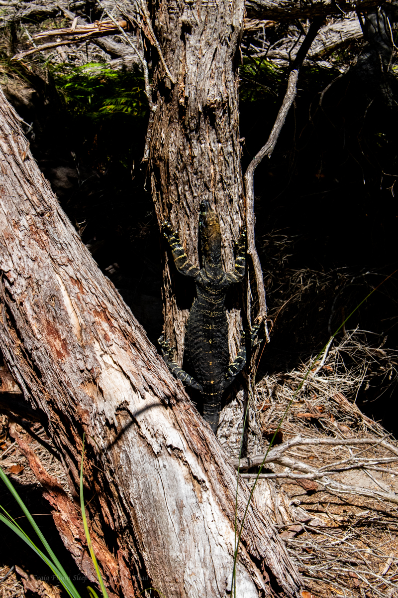
And giant goannas decorated in moss
Did I mention the colours?
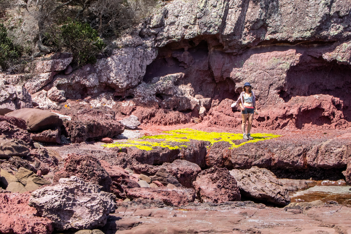
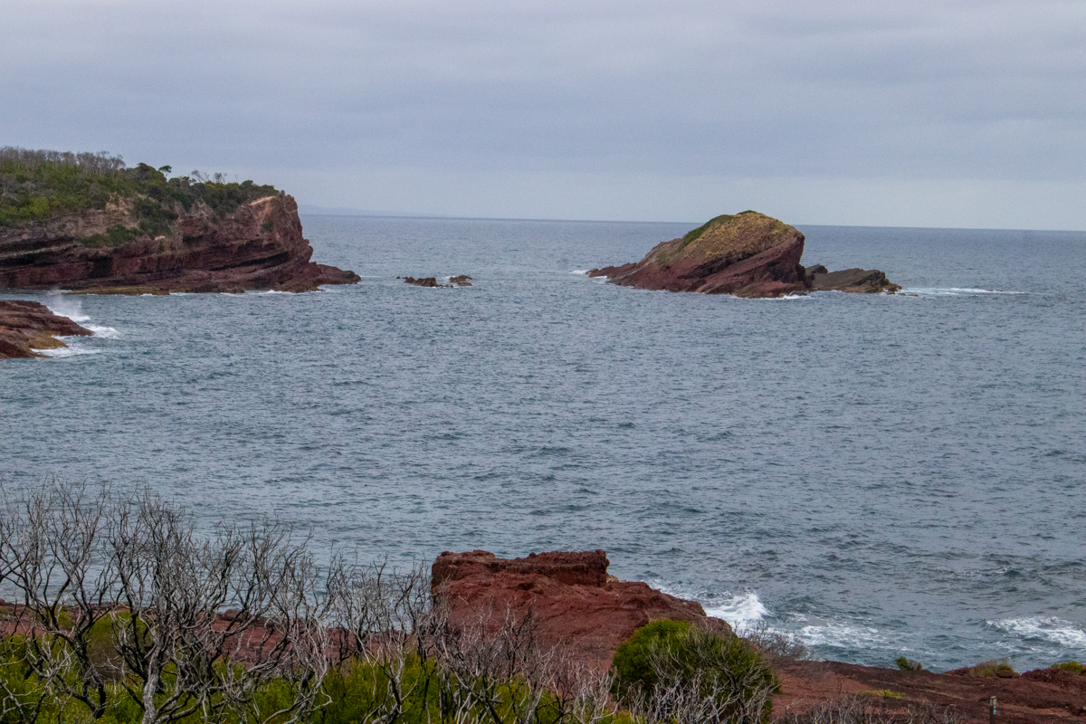
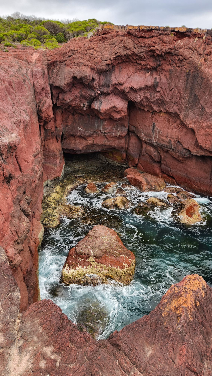
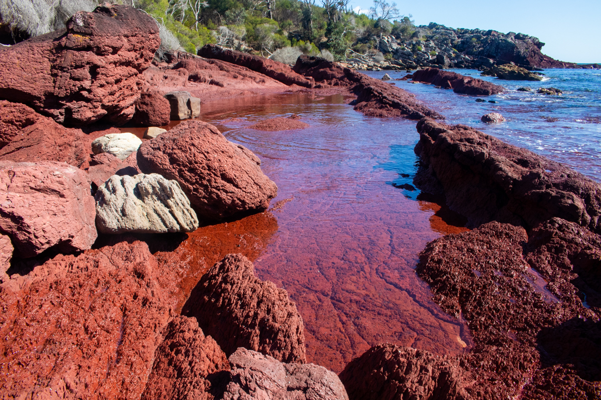
If Bittangabee bay was stunning, and it was, Hegartys bay is beyond words
Once a publicised walk in camp it’s now officially closed for camping. Again NPs were doing work on the trail here, this time though we are diverted down on to the rockshelf. This was one of my favourite parts of the walk and it seems nuts they would divert the walk around some of it.
Oh, did I mention the colours?
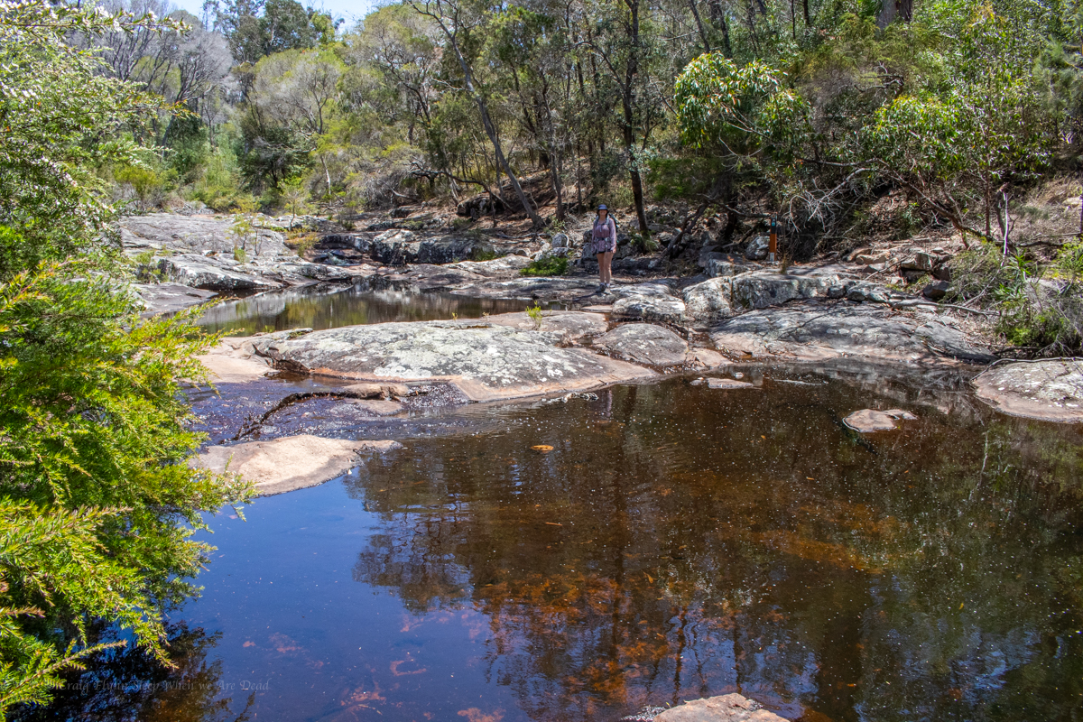
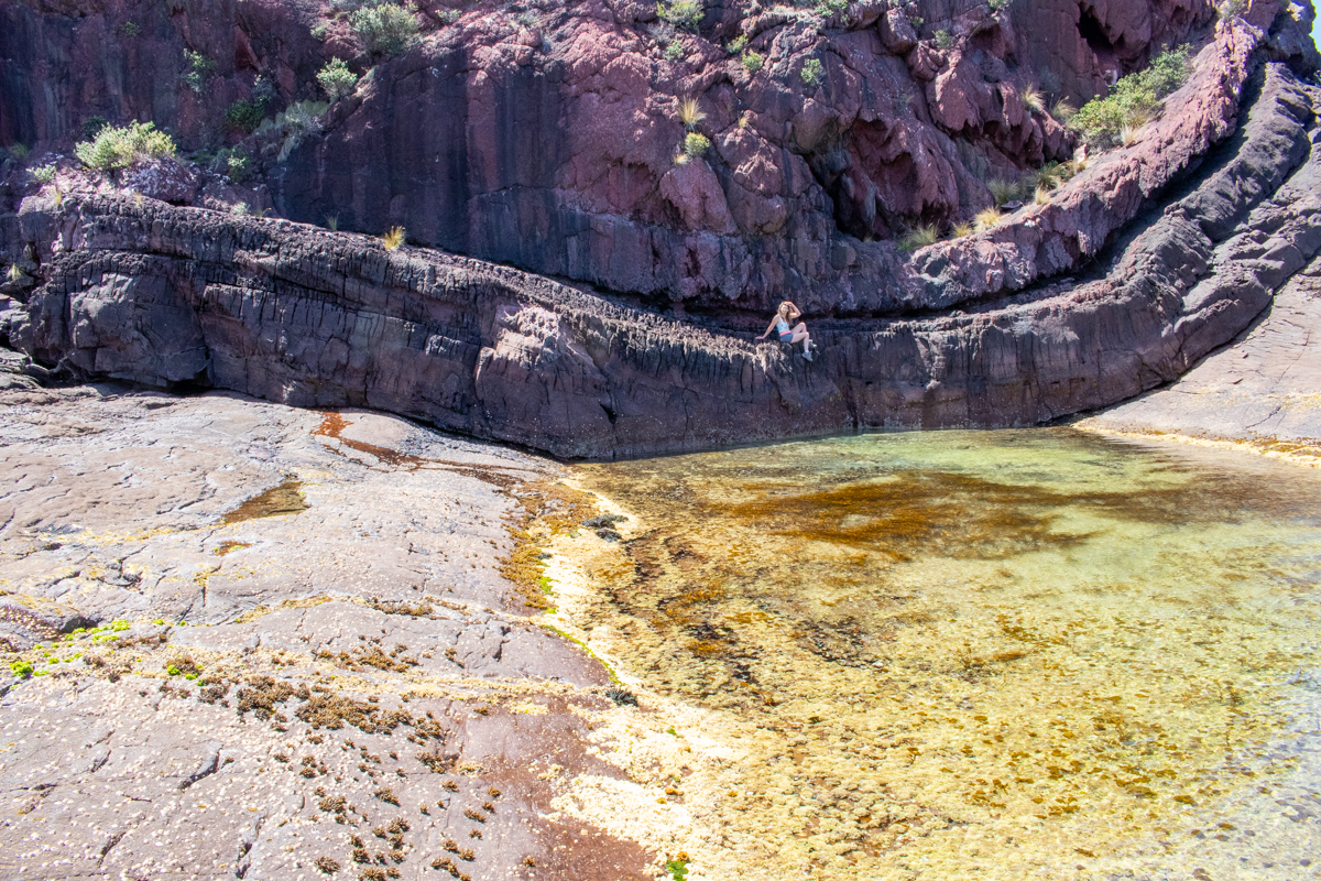
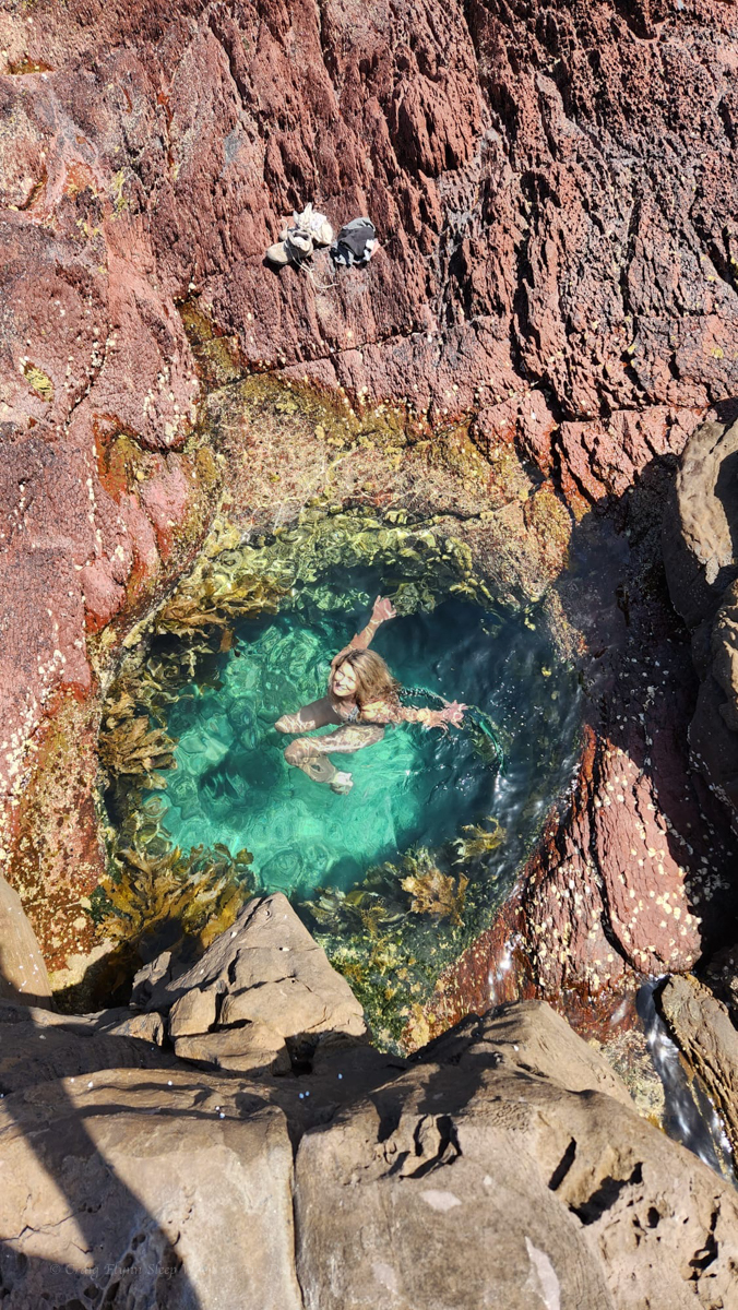
secret waterhole just big enough for 1
Part 3: Hegartys bay to Saltwater Creek
Leaving Hegartys the trail swings back onto the plateau, but at least there are views of the coast
Even the bobcat driver got bored and tried to add little sweepy turns.. (actually well designed trail with water run off controlled by small grade reversals at each bend.)
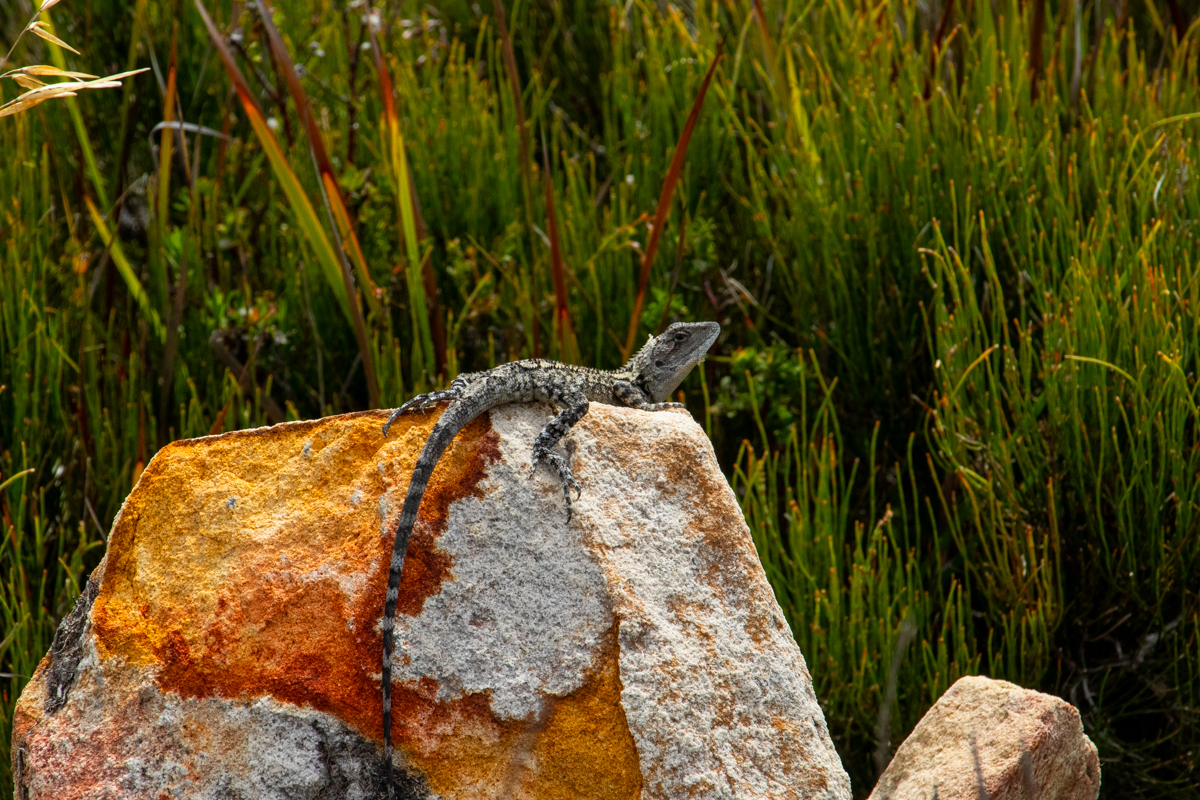
Jacky Dragon (?)
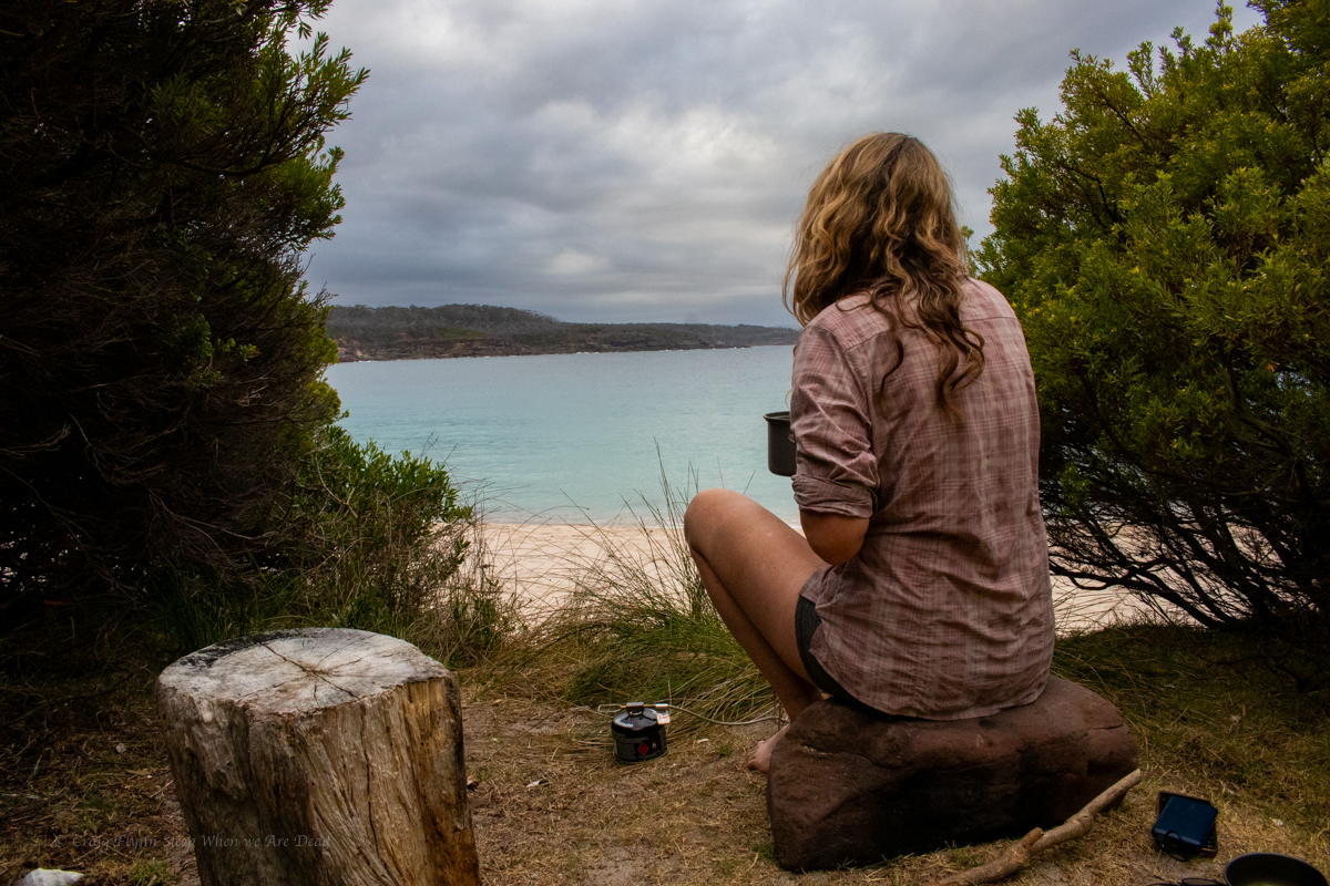
And we stroll into Saltwater creek around 4pm. Again despite the drive in camp being packed the beach was all but empty.
Kylie was getting blisters on her toes so we stop to tape them up while we refill our water bottles.
TBH we’d overestimated how much water we would need. Not knowing if it was going to be baking hot or how much the salt water spray would take out of us we’d packed 3 litres each. I have well over half left when we got to the drop.
We recalculate how much we’d need for the rest of the walk and push on.
Part 4: Saltwater creek to Mowarry beach.
This may explain why so few people were in the water.
follow the yellow brick road… or sumfink
Once again we follow gorgeous coastline where the colours seem too vivid to be real
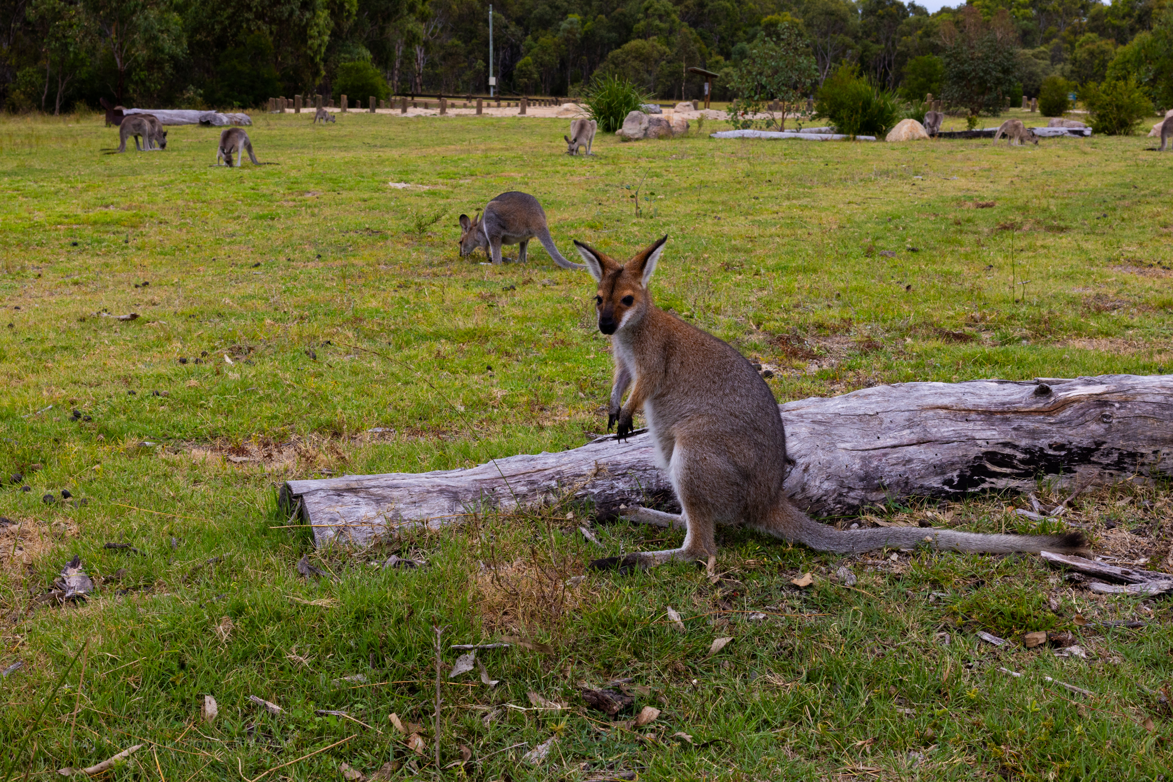
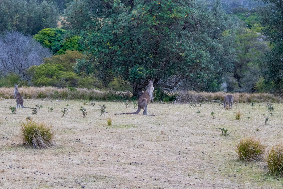
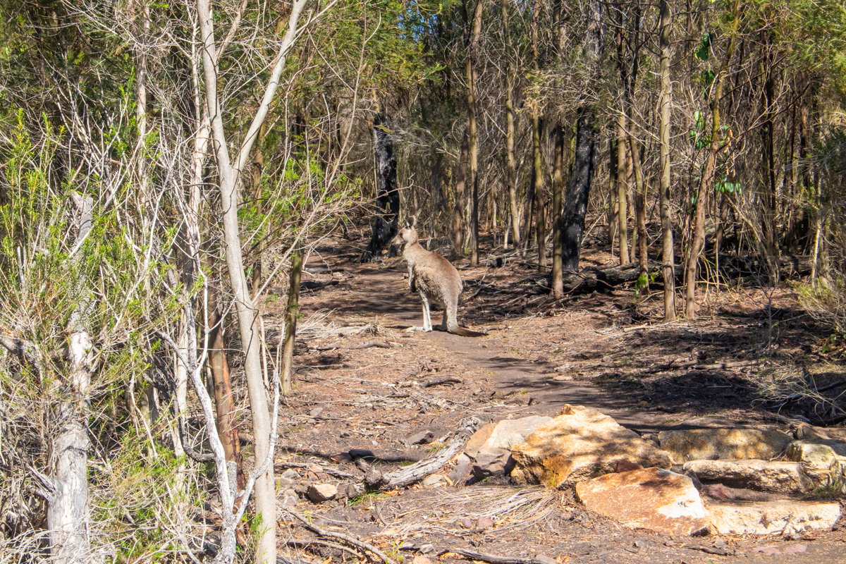
We come to an open grass headland and assume it’s the Mowarry campground. the kangaroos had it to themselves though.
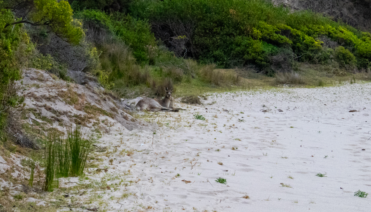
And continue down to the beach, which the kangaroos also had to themselves.
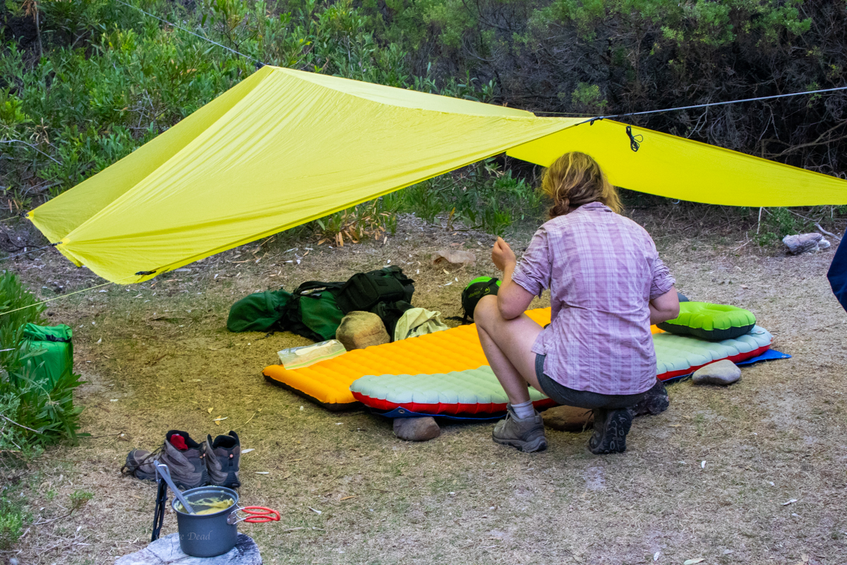
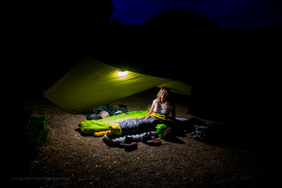
We are surprised to find a camp spot right next to the beach so take advantage of it.
With some little side trips for swims and views we’d done about 28 or 29km today. For some weird reason flatter walks knock me around more than our usual scampering up and down canyons so I was feeling it. Kylie has sprained her ankle the week before and was suffering a head cold so was just as happy as me to have one more swim to wash off the grime of the day and set up camp.
Unbeknownst to us the offical camp spot is up above the beach on the next headland. A tribe of partiers descended in the middle of the night for a mini bush doof which was hilarious but a spattering of rain had them running for their beds not too late into the night.
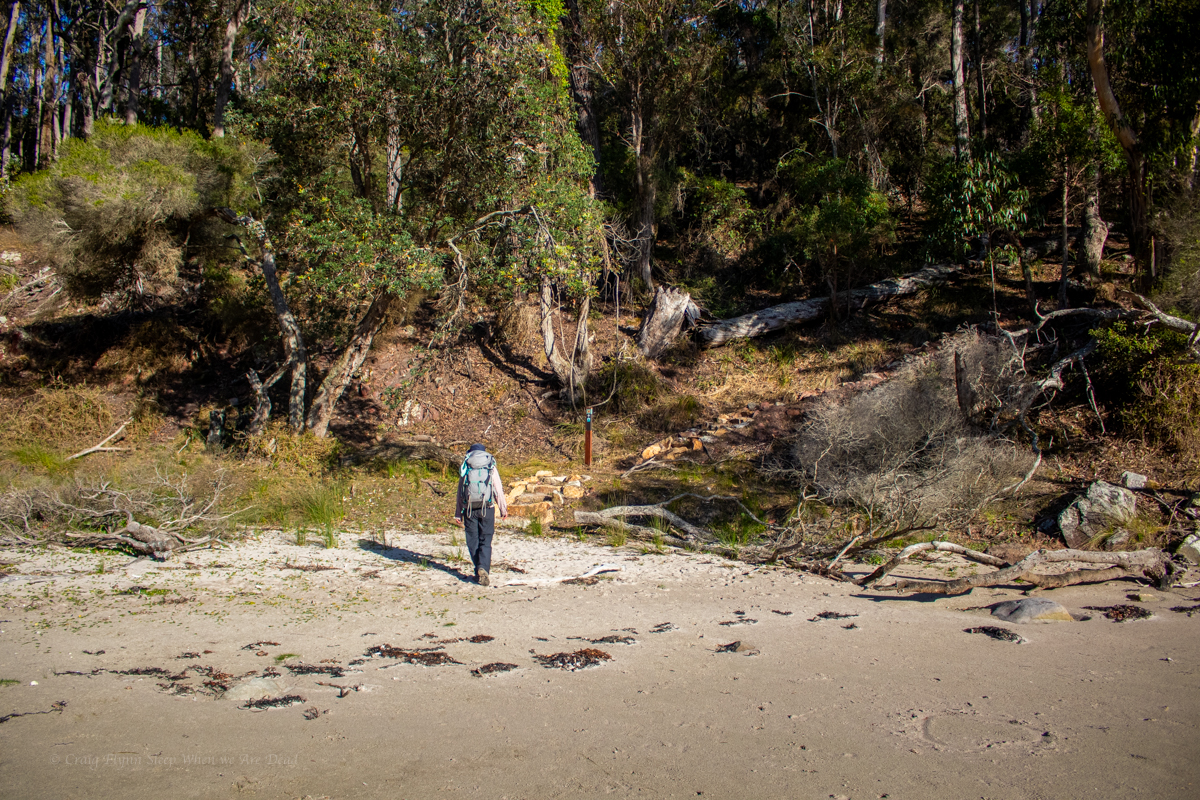
Part 5: Mowarry beach to Boyds Tower.
With just 7 or 8km of walking left we could have had a lazy morning but we were also keen to get the 30km ride back to the cars knocked over before the day got too hot so we were up early for a brekkie with a view then hit the trail
Up over the headland it was a short walk to leatherjacket bay. Leatherjacket bay must be the easiest to reach drive in secluded spot. It was littered with fast food rubbish and toilet paper. Why people would do that to such a beautiful spot is beyond me.
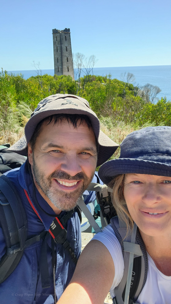
And up the next rise we catch our first glimpse of Boyds Tower
But the walk wasn’t done yet.
and there you have it. Boyds Tower.
Boyds Tower is an unfinished light house created by Ben Boyd. a character once respected for his early settlement down here but recently being cancelled due to him being one of Australia’s most infamous “Blackbirders”
Blackbirders imported cheap labour. Boyd had “recruited” labour from various pacific islands and shipped them to Australia. By the time he got them to Australia though the union movement, religious groups and city based politicians saw it for what it was, low key slavery, and basically outlawed the practice.
Those already at work on Boyds lands down tools and demanded to be sent home.
Find your own way home said Boyd. Many of those brought out found themselves stranded in Sydney with no way to get home…..
All that said his biographer claims he was considerably less racist and cruel than many of the politicians who had publicly condemned him.
Anyhoo, We reach the tower and the end of our walk. We woof down some food, swap backpacks for bikes and ride through the centre of the park, down Duckhole road back to the car.
It’s 30km on what my mate Bernard would refer to “gently undulating” dirt roads. At times the bull dust is so soft it feel’s like you are riding with flat tyres and there’s a few pinches to make sure the legs are still burning but it’s not a bad ride.
Kylie’s fairly new to mountain biking and injury has kept her off the bike for a bit so when we reach the junction with Green Cape light house road I offer to forge ahead and bring the car back to pick her up where ever she gets to.
There’s some fun and fast down hill sections here but also a couple of steepish pinches. It’s the stiff ocean breeze smacking you in the face in the last 2km that hurts the legs the most though.
I get to the car, quickly get changed and drive back up the road, Kylie’s not that far behind. It’s only a couple of kilometres to the end, isn’t it. asks she
Yep, says I. You want to finish it off don’t you?
She grins and pedals on…
All up 36+Km of walking and 30Km ride in 2 days. Not a bad effort.
Our review.
The Grade:
National Parks grade the walk a 4. “Grade 4: Bushwalking experience recommended. Tracks may be long, rough and very steep. Directional signage may be limited.”
Other than the length and a few short sections where you need to pick your way along the beach or over rocky outcrops I’m not sure how it’s 4. it’s fairly flat. I guess the recent upgrades have included adding stairs to any of the steeper sections so maybe before the upgrades….
Would I recommend it?
Sure. it’s definitely worth doing. The views are amazeballs
If your idea of bushwalking is well maintained and sign posted touristy type trails and you want to try something a bit longer or want to try your first overnight walk with the advantage of maintained camp sites this would be perfect.
Would I do it again?
TBH. I wouldn’t bother with the bit between Bittangabee bay and Green Cape Lighthouse again unless I was adding more time and doing side trips out to things like Pulpit rock and checking out the little bays.