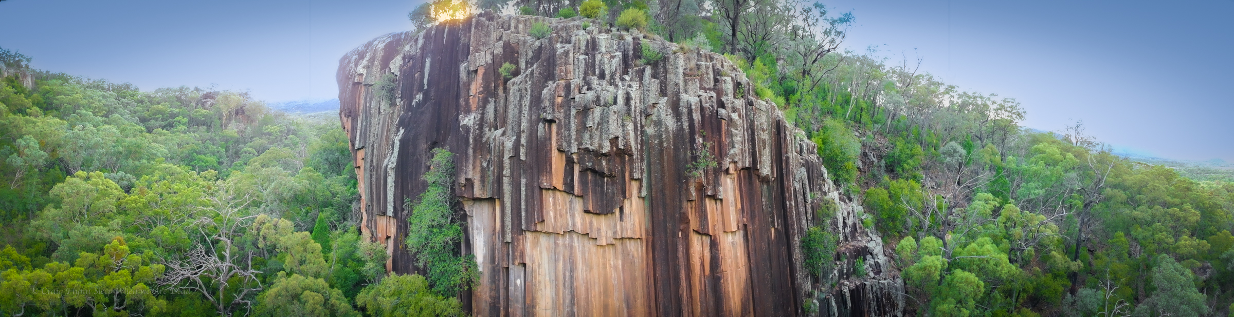
After spending the night at the Glacial Rocks camp we get up early hoping to catch sunrise light up the cliff face.
Sunset would potentially cast a better light onto the rocks at this time of year but it’s a spectacular feature at any time of the day and a short, wheel chair friendly, walk from the car park.
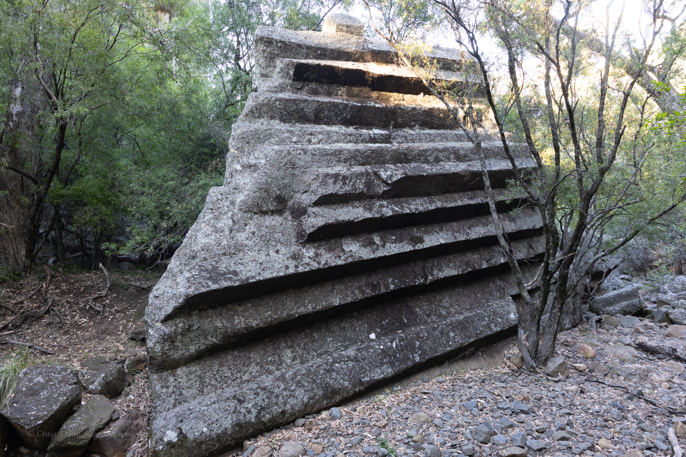
Like a pile of chopped and neatly packed logs you can see where it gets it’s name.
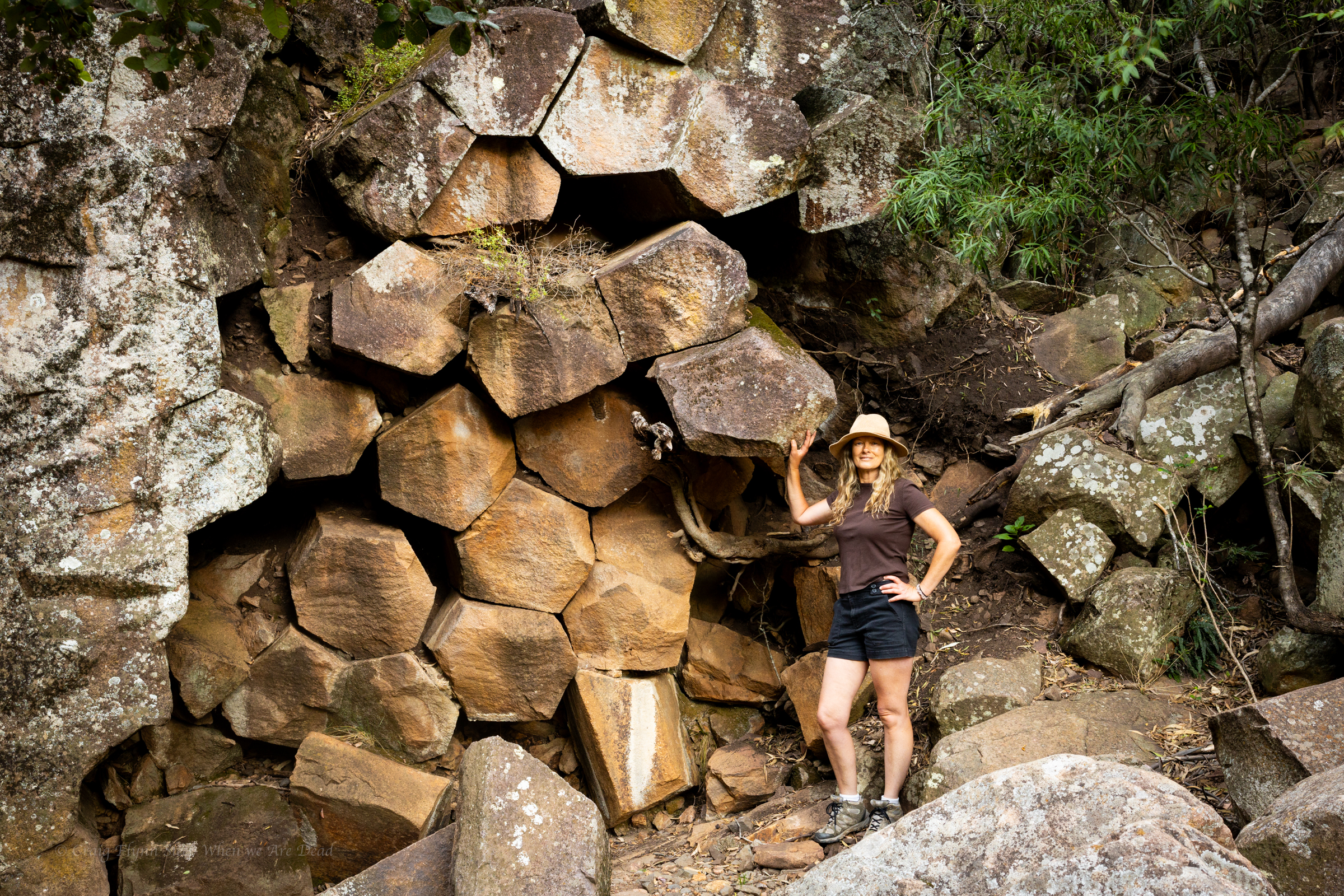
The hanging columns are amazing
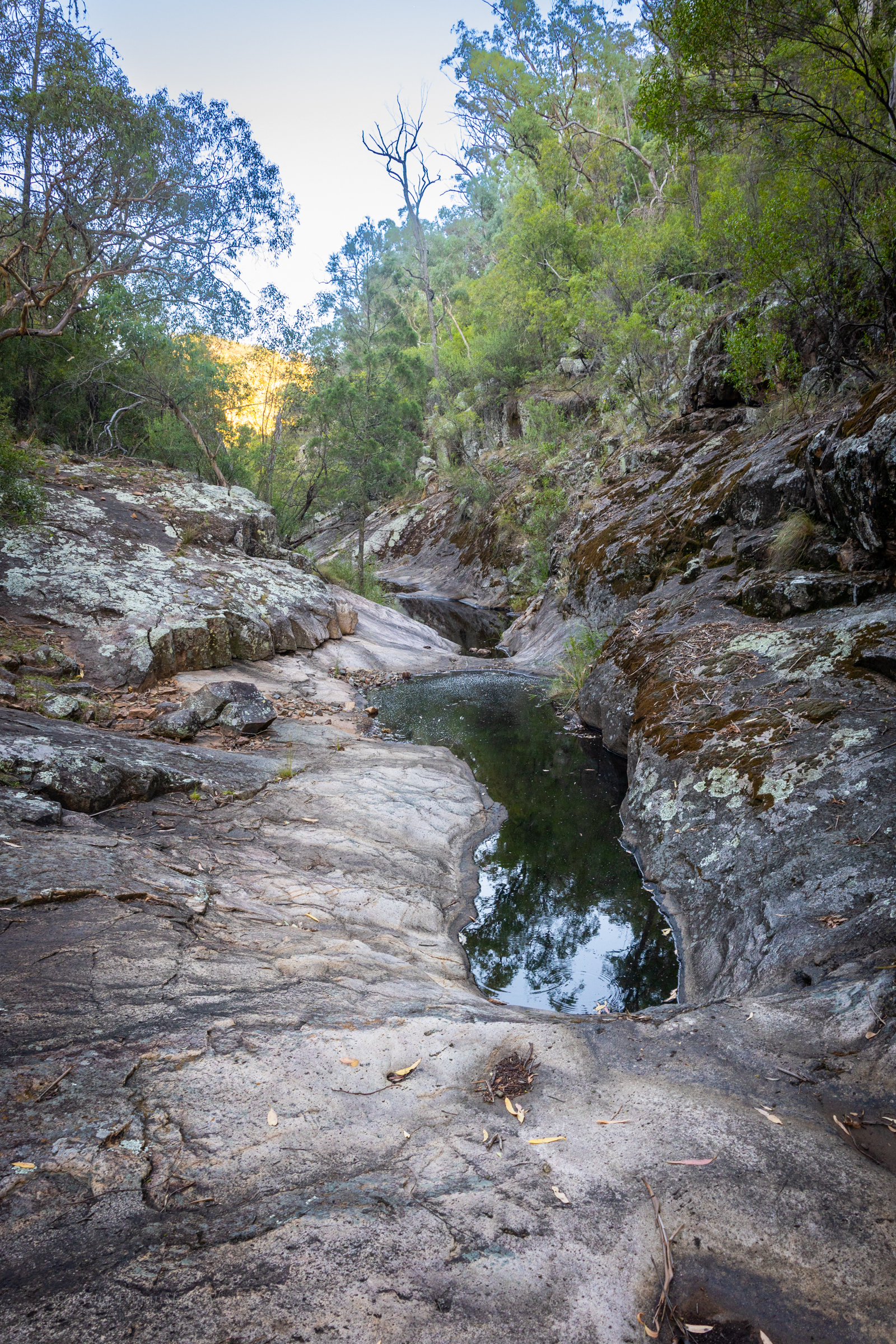
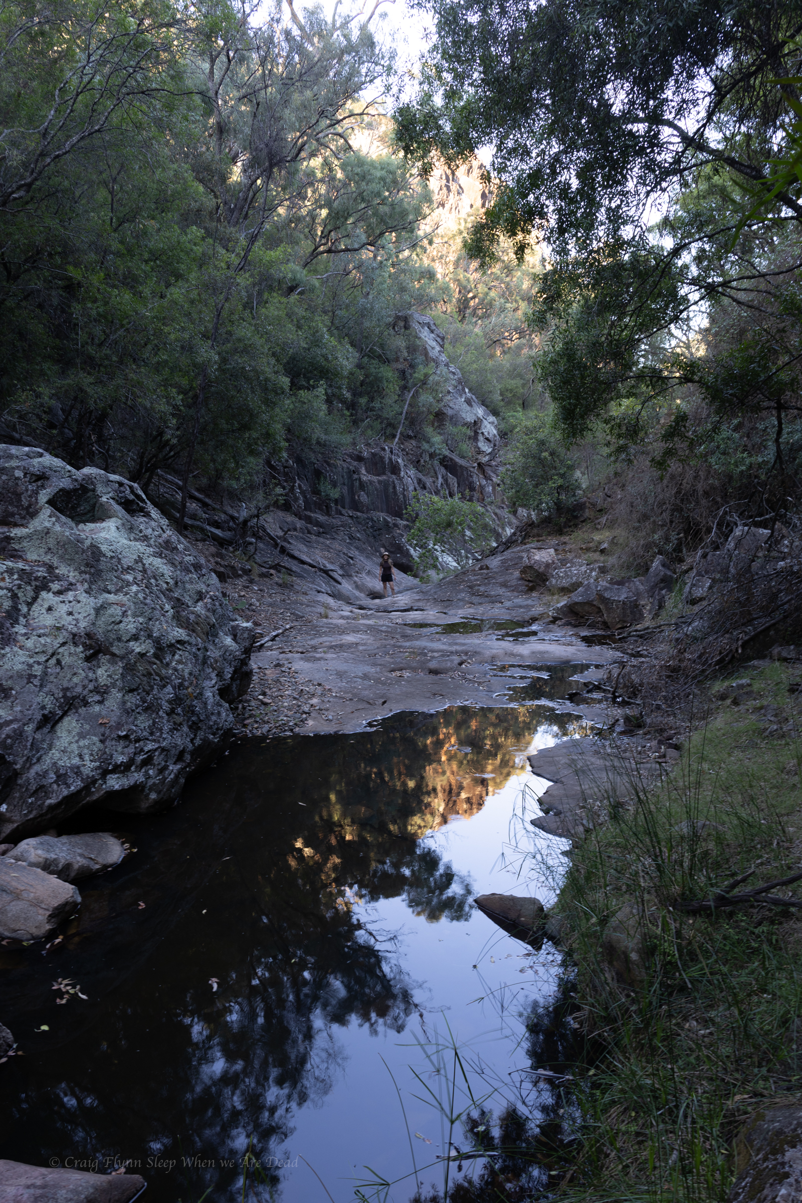
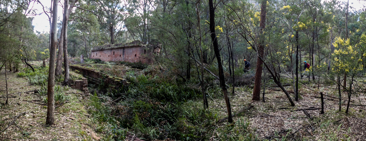
As is our usual we push beyond the formed tourist trail on a rough but well used foot pad to explore the creek beyond.
Once again it’s dry but interesting
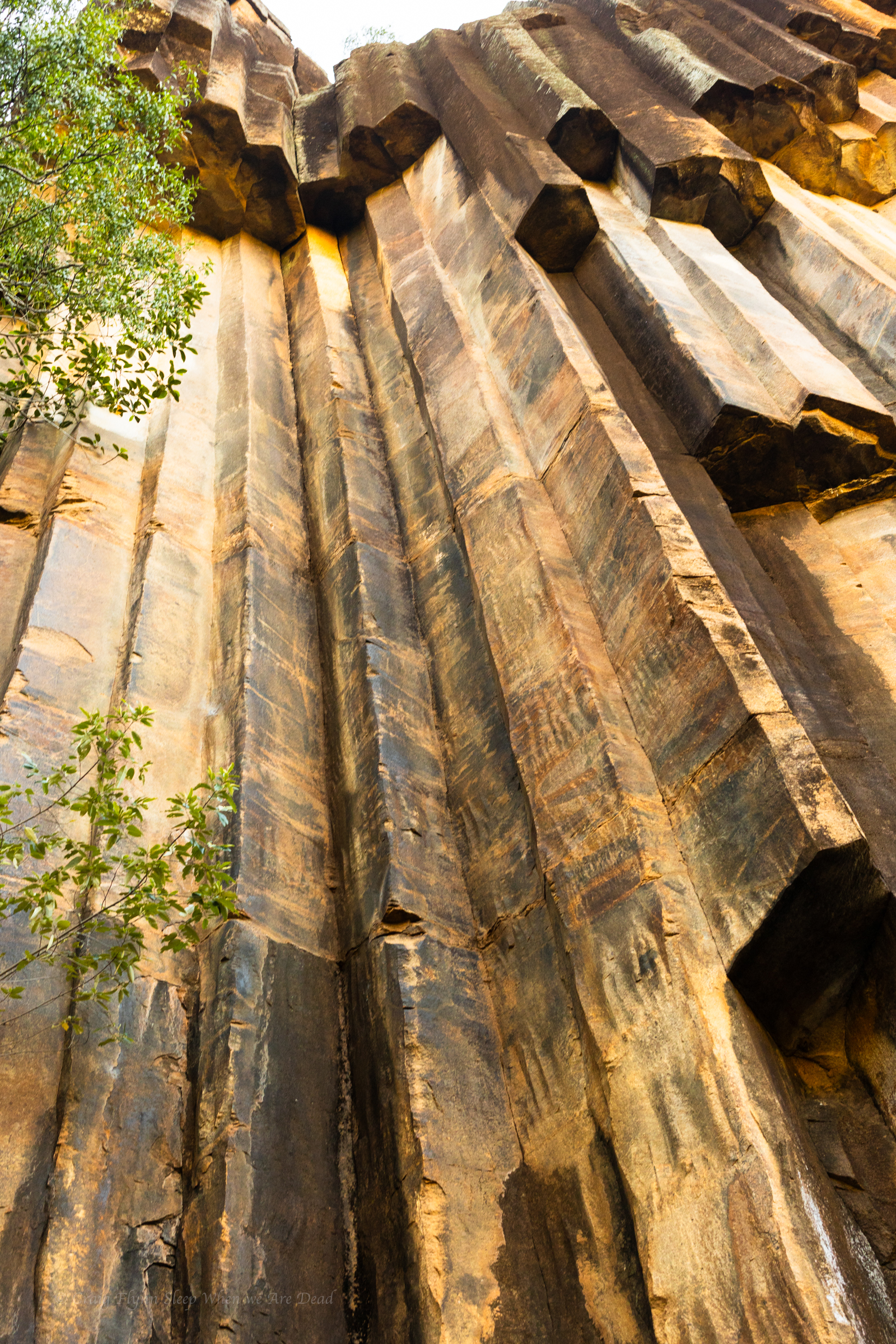
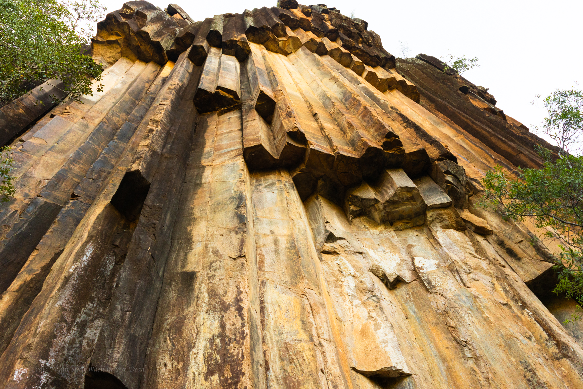
And more of the amazing shapes
The cliff lines soon peter out and the creek snakes it’s way cross the plateau so we retrace out steps and head into Narrabri for coffee and a bite to eat before deciding to drive up to Mt Kaputar for a look.
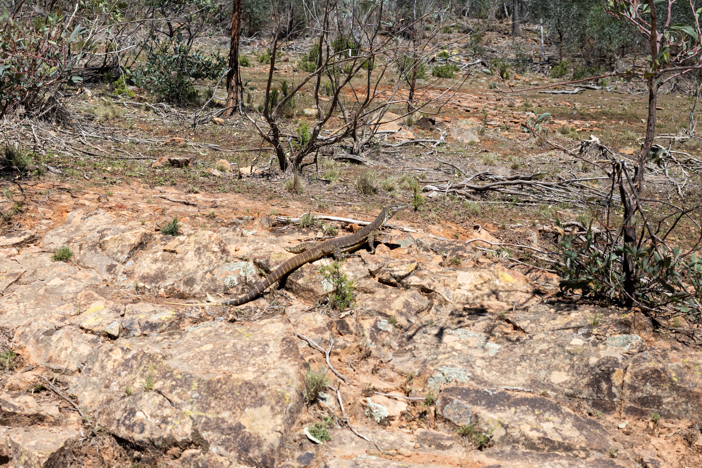
sand goanna (Varanus gouldii)
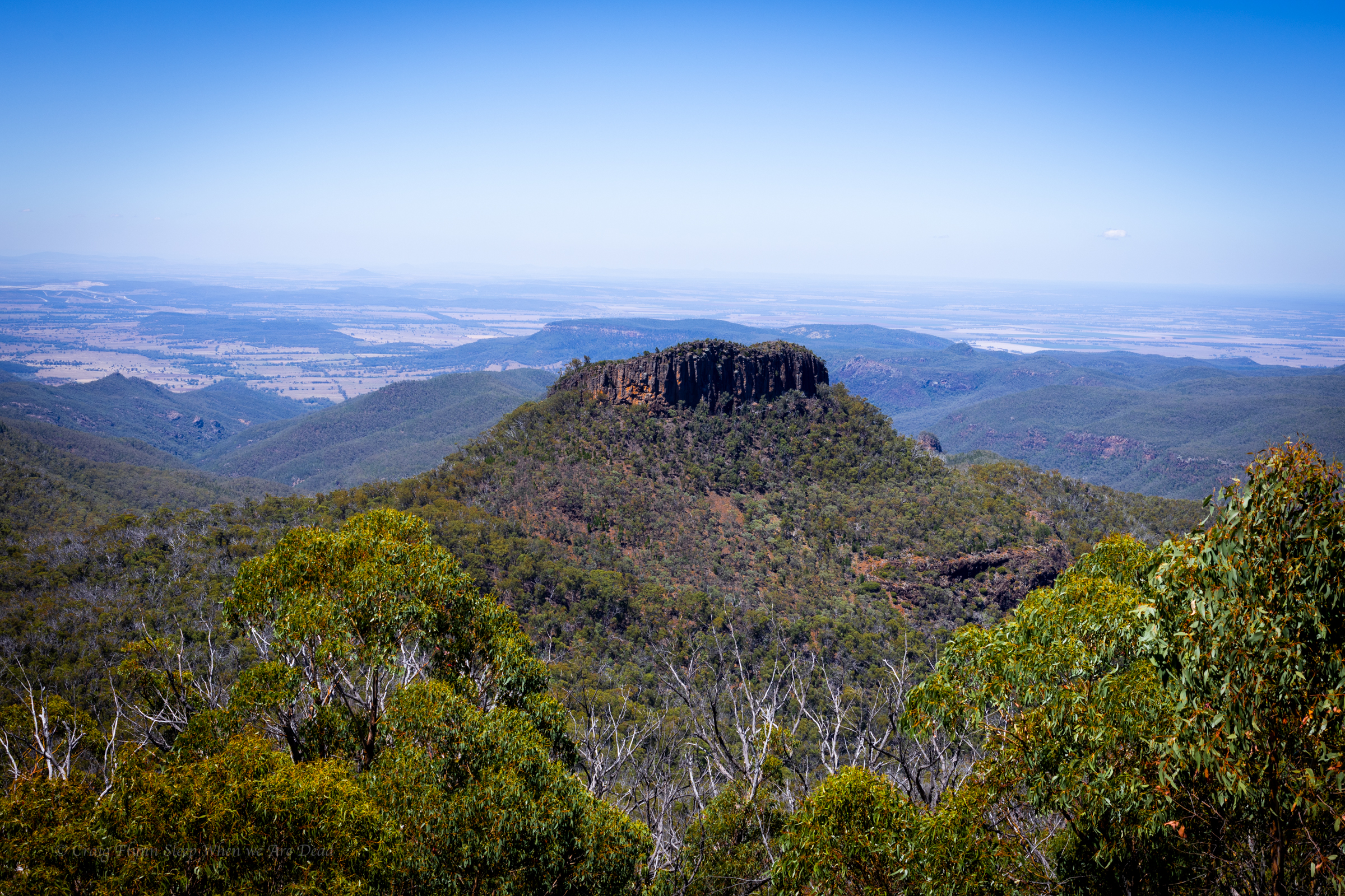
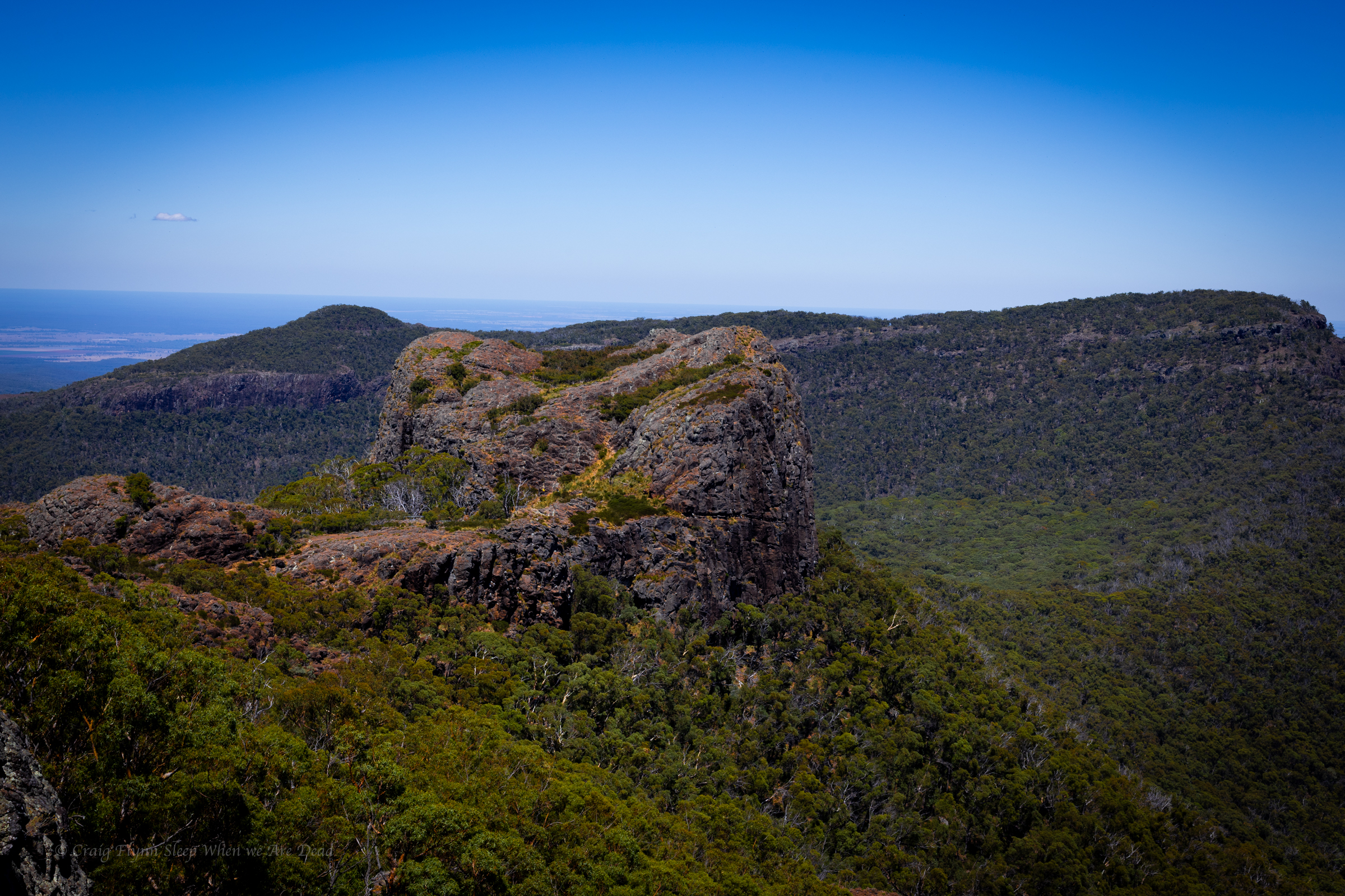
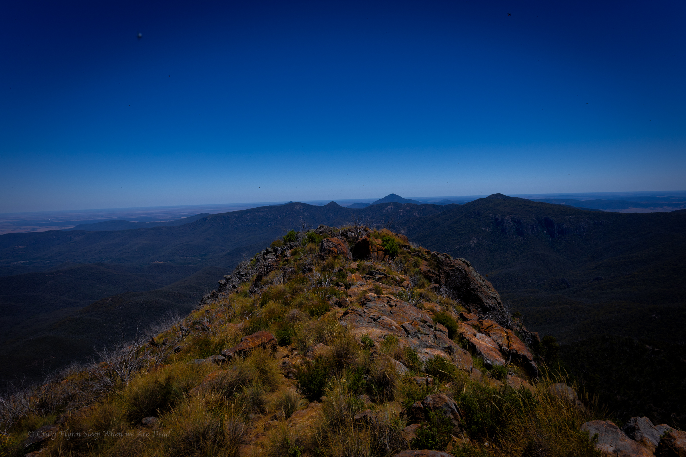
We decide it’s way to hot to do any of the walks in the middle of the day but the road up is outstanding and well worth the drive.
Euglah Rock from Doug Sky lookout
The road itself is an adventure and the views with in a 5min walk from the car just keep coming
But the temperature is pushing into the high 30s again so we make track down to Coonabarabran where we decide to splurge on a motel room with air conditioning.
There’s some great side canyons along the Wollangambe with the most popular ones clustered around Mt Wilson.
Of those accessed from the Fire Shed there are a couple of outliers that get less traffic due to being a little harder to get too.
Whirlpool canyon is one of these.
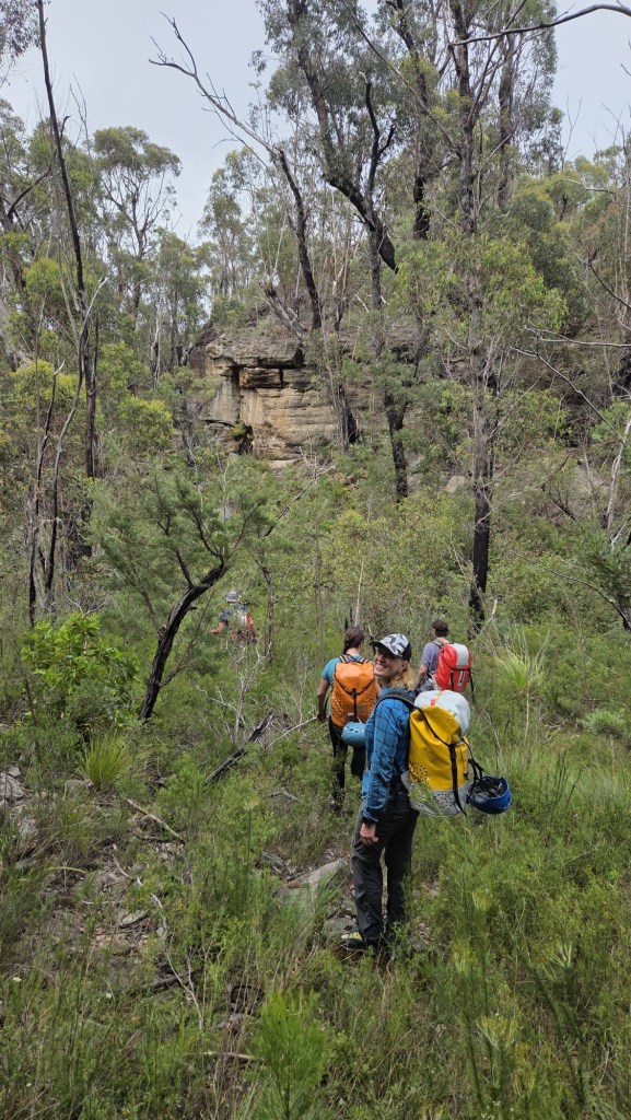
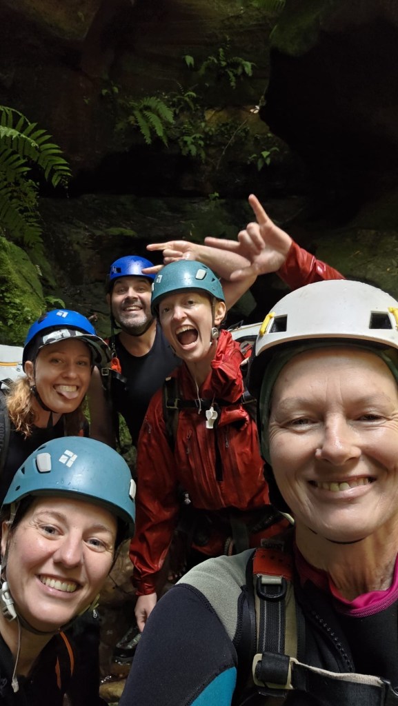
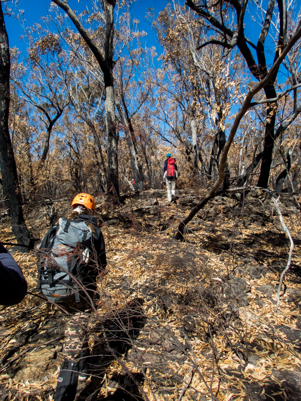
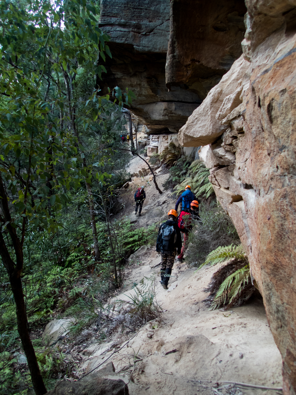
Expecting a stinking hot day and a long scrubby walk in we meet early and head off.
The others had obtained a GPS trace of the entry, I had my usual plotted way point for the canyon start and sometimes/usaul/mostly wackily off gut feel…
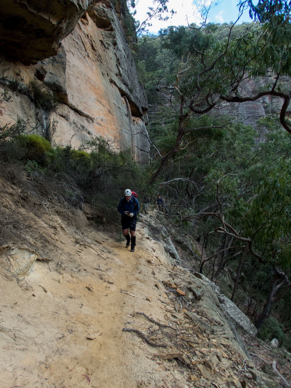
Banter made the walk in pass in a flash, well not really but it was surprisingly simple, even if I did get completely turned around at one point, thankfully Clare and Kylie kept us on track. Though when H suggested we try a short cut I was all in.
It was also relatively scrub free(ish)
Slipping down H’s side gully hoping to cut off a fair bit of the GPS trace.
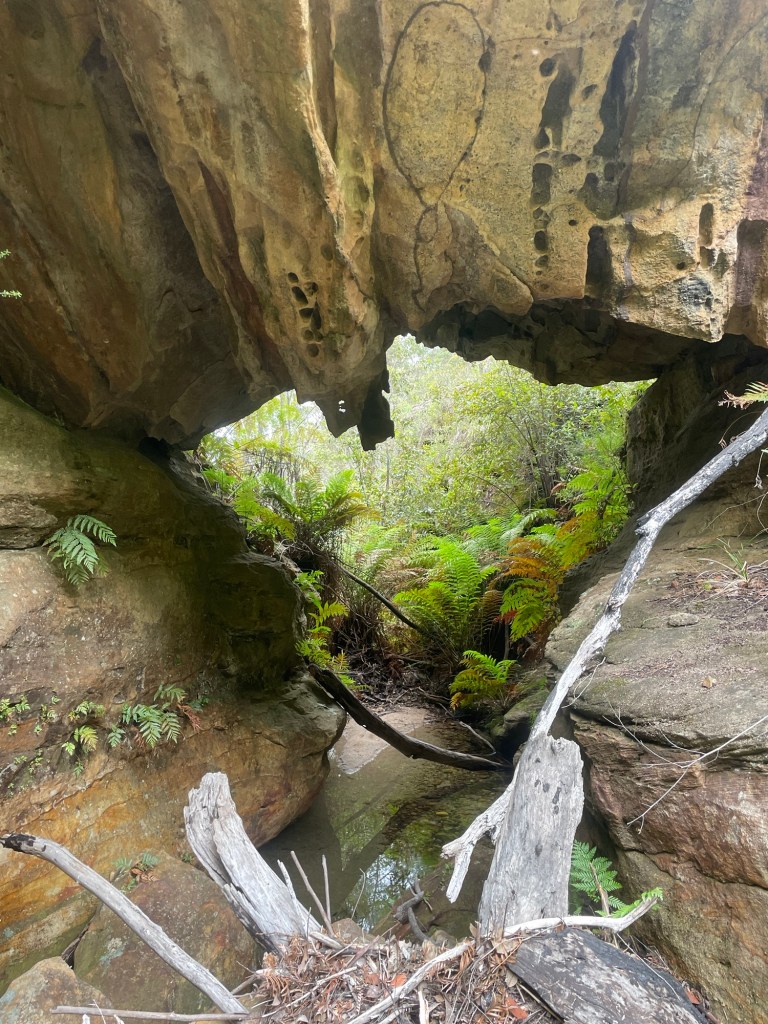
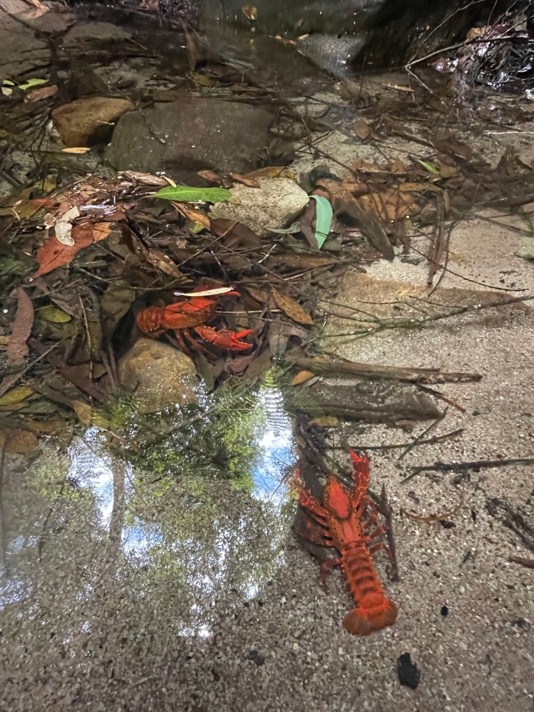
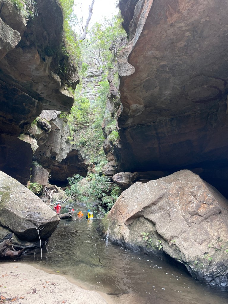
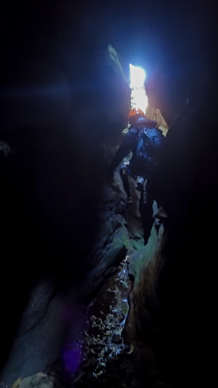
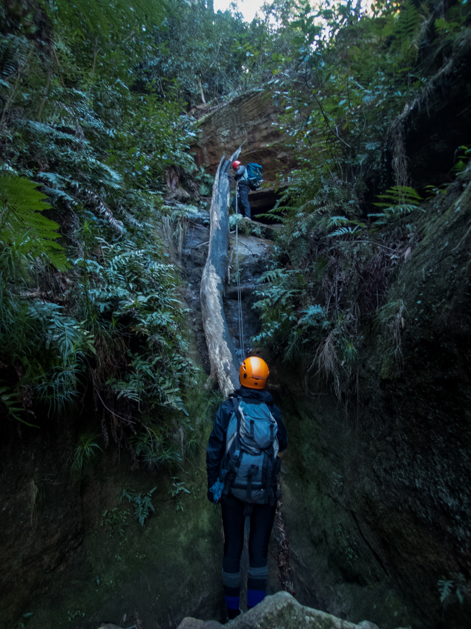
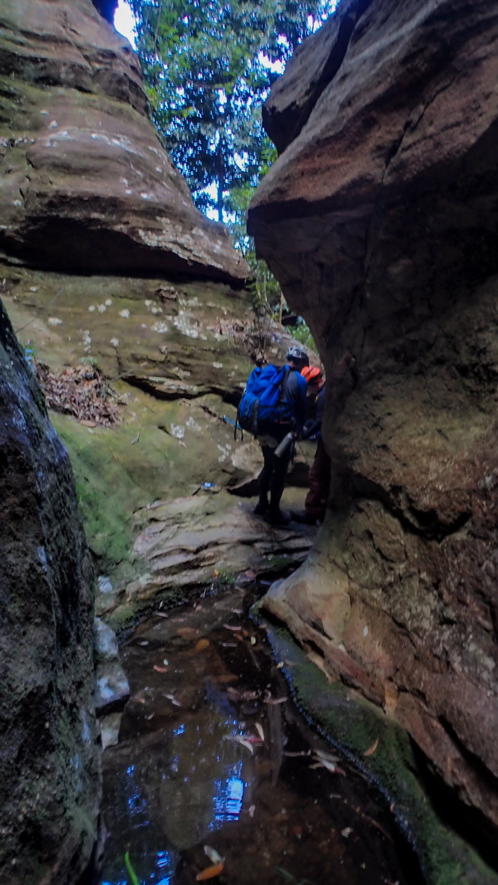
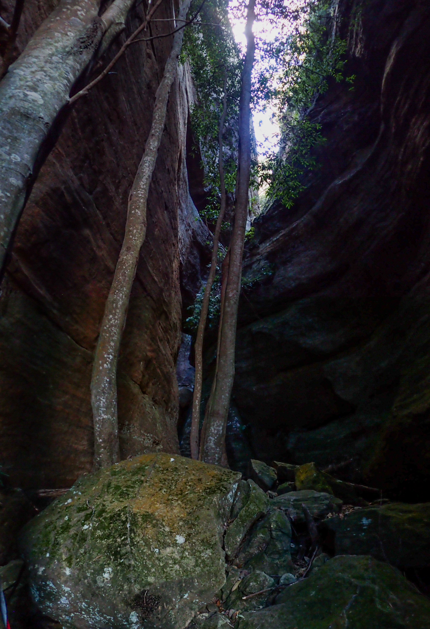
And soon we find ourself at the start of the canyon.
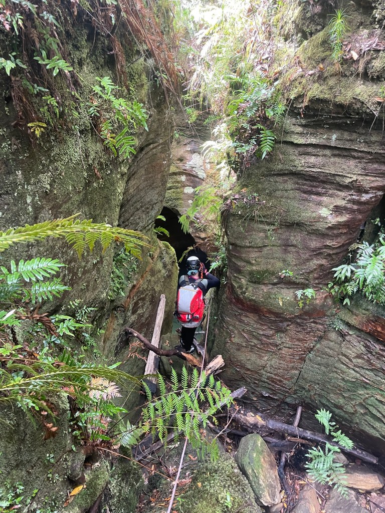
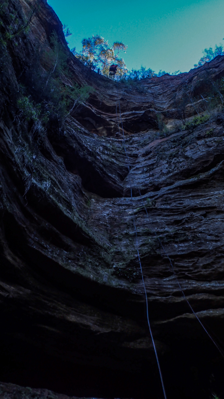
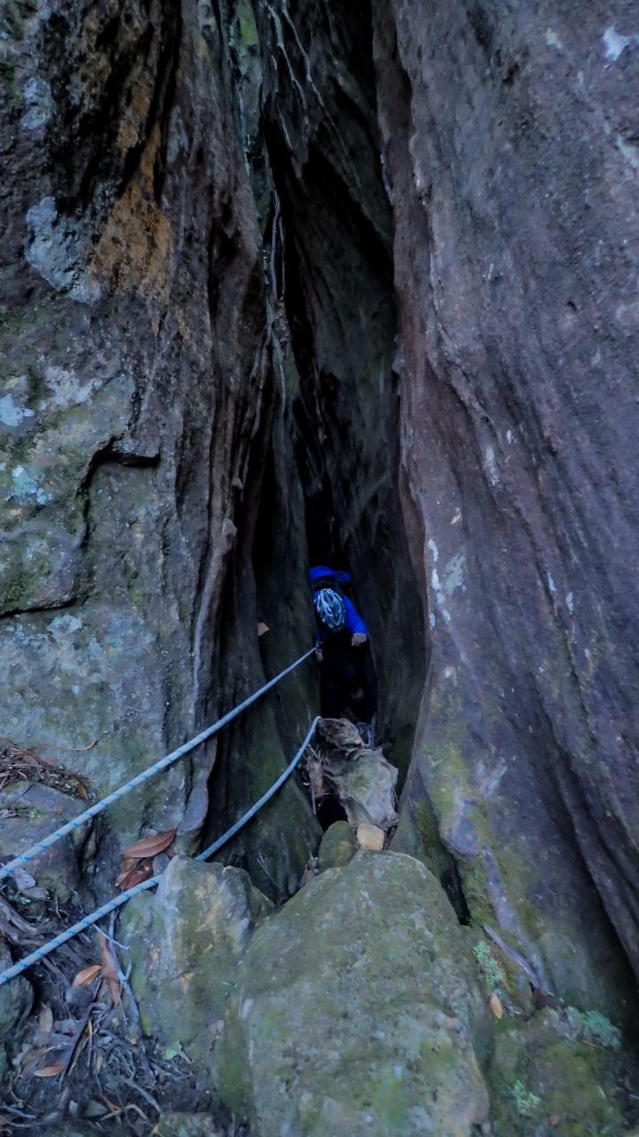
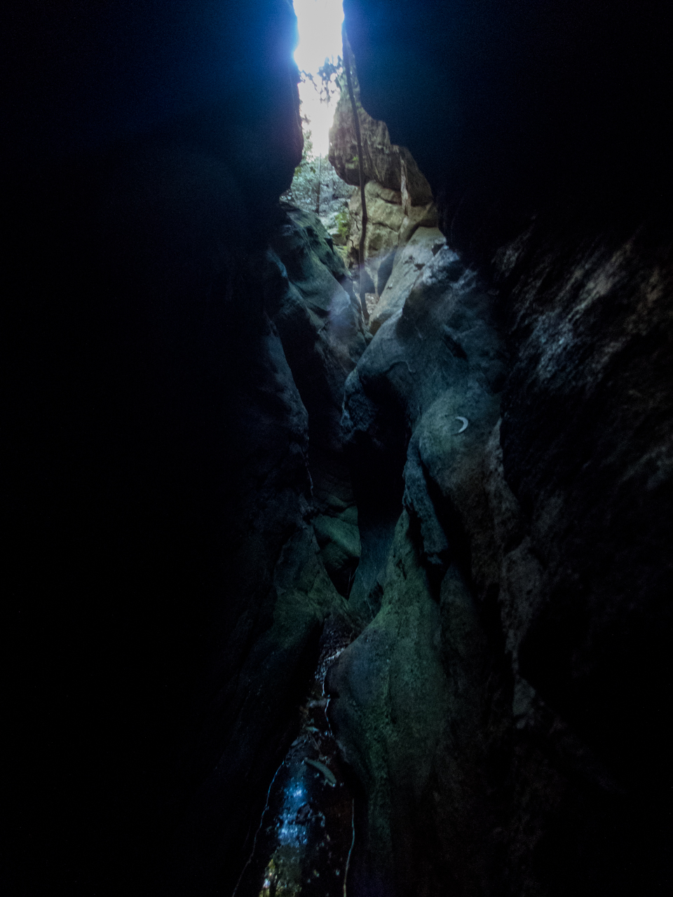
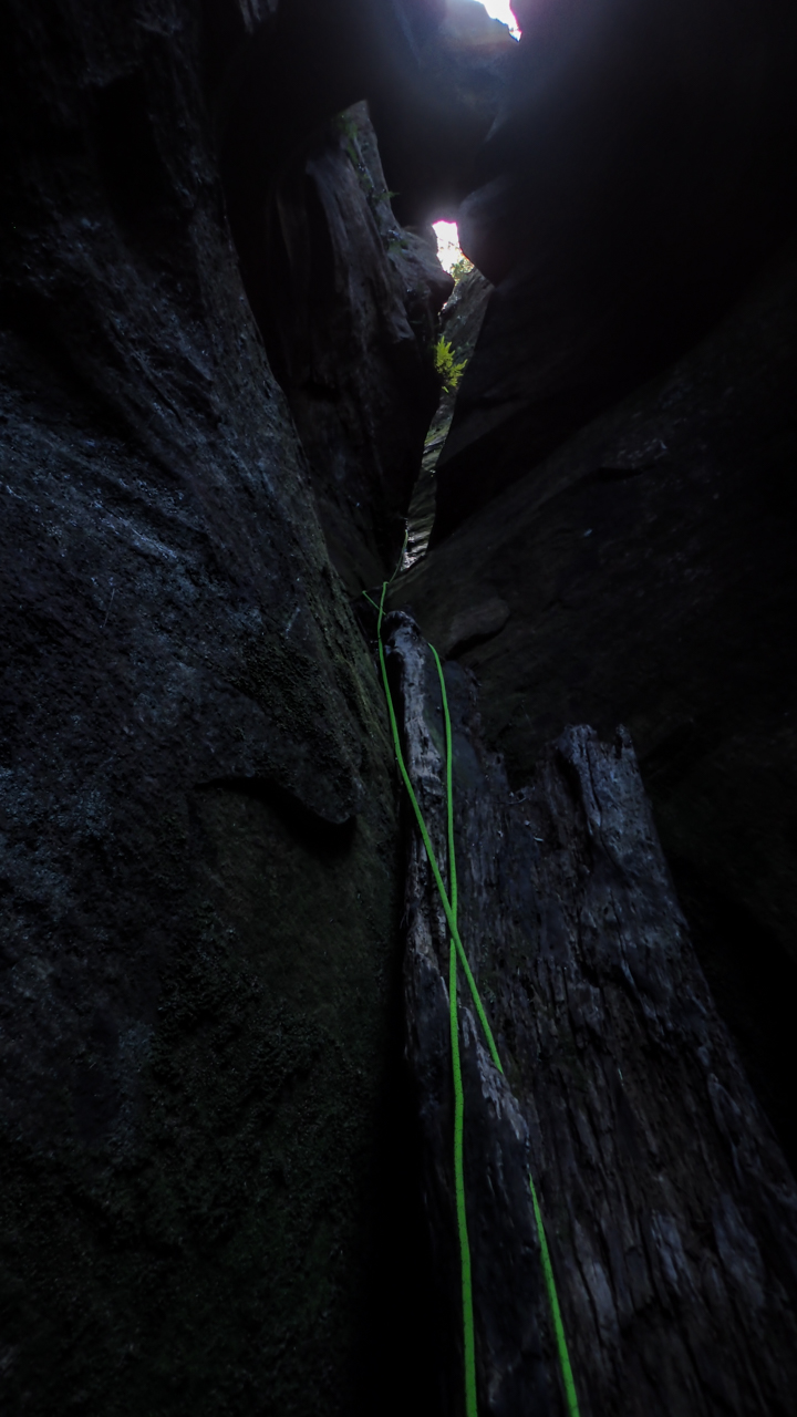
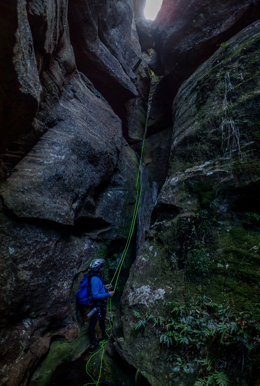
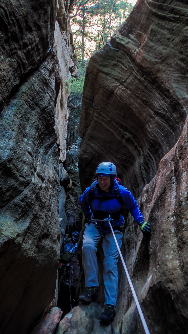
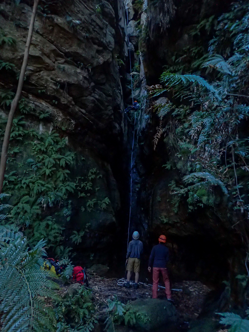
We weren’t expecting much out of this one but a short abseil gets us into a surprisingly nice slot.
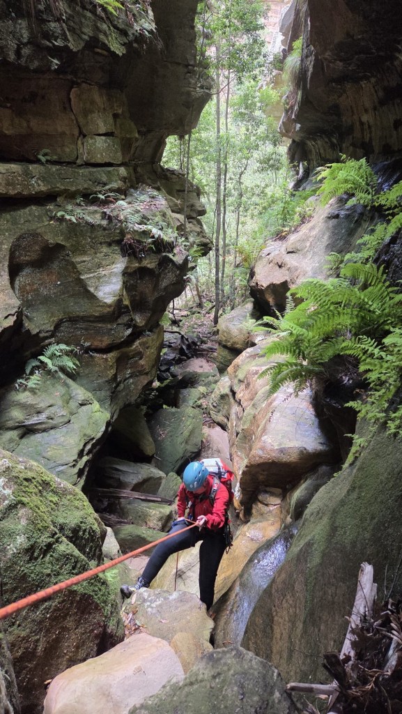
Kylie sussing out the first abseil
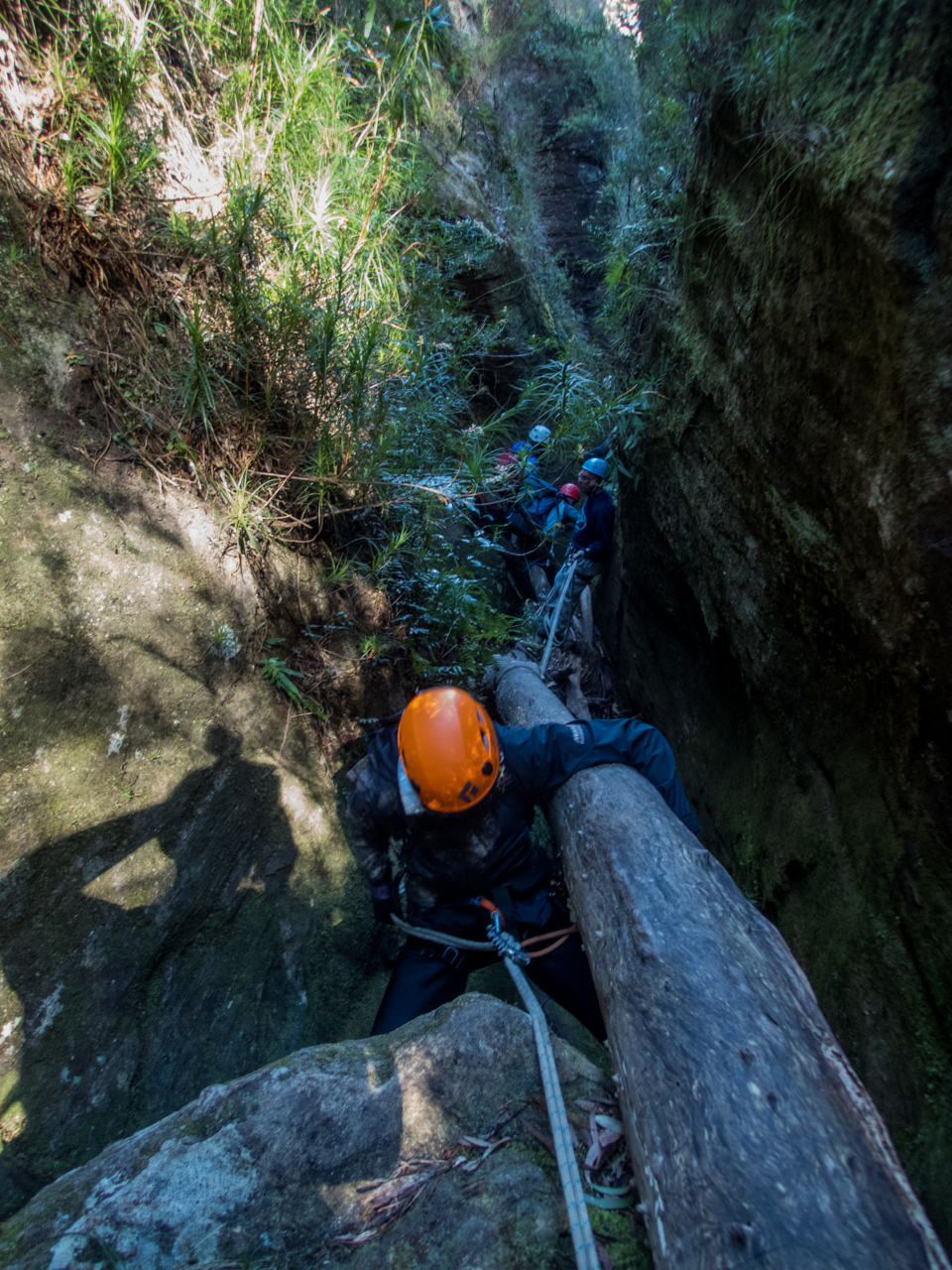
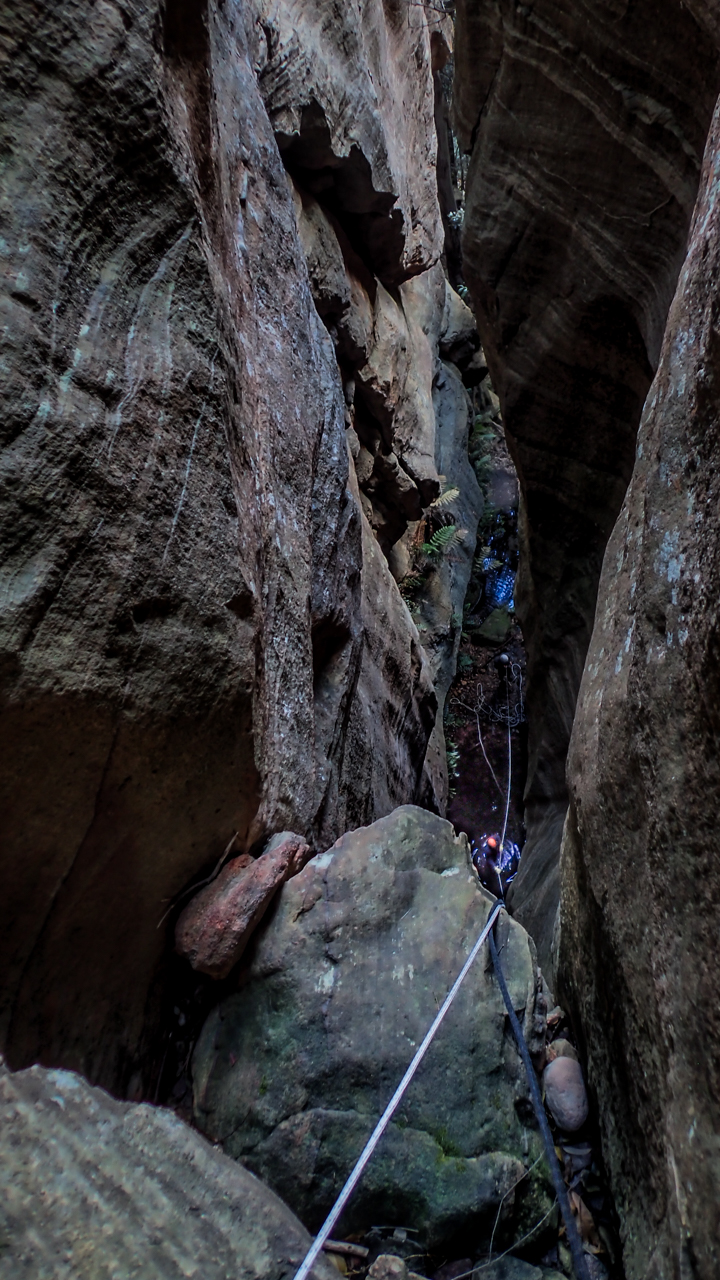
There was some interesting anchor set ups and a couple of the abseils have very tricky starts. This problem solving aspect is part of what I really enjoy about canyoning.
Don’t get my wrong, on popular trips where hordes of foot steps compact tree roots and pulling rope after rope wears grooves in the rock well placed bolts are a Good Thing (TM) but they do take something away from the overall experience of problem solving. That’s probably not a major draw for most, but for me it’s a big part of it.
Anyhoo that’s off topic.
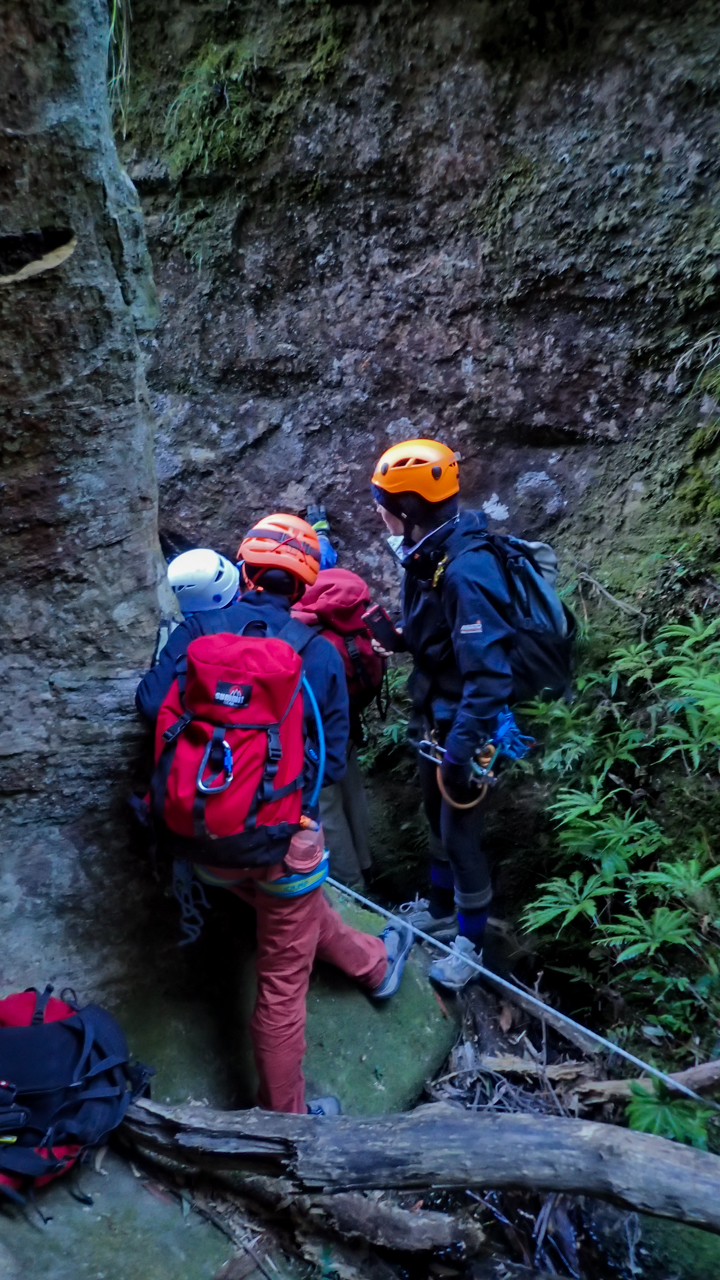
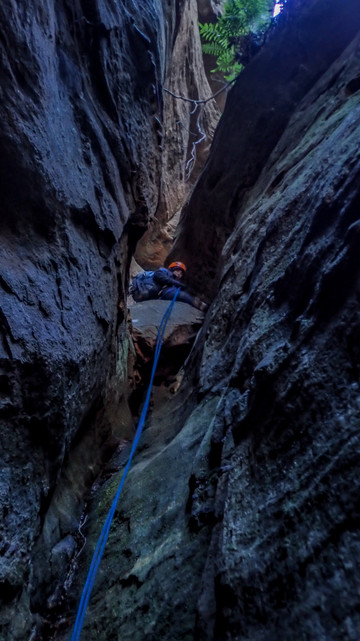
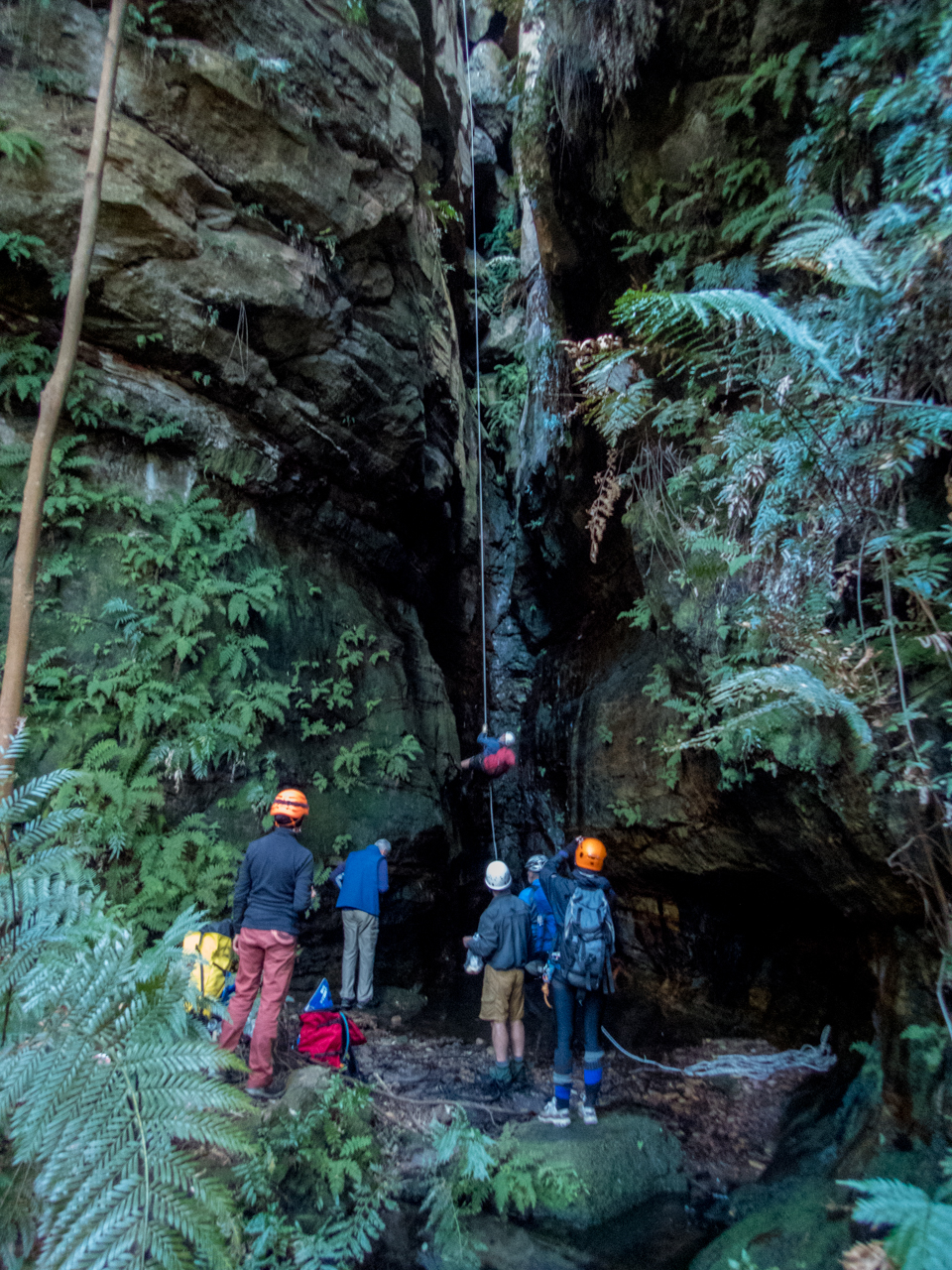
Back in the land of dodgy anchors, we check each one carefully (as you should every time). Replace what needs to be replaced and carefully consider the remnant dodginess
Before lone you could feel the warmth chimneying up from the ‘Gambe
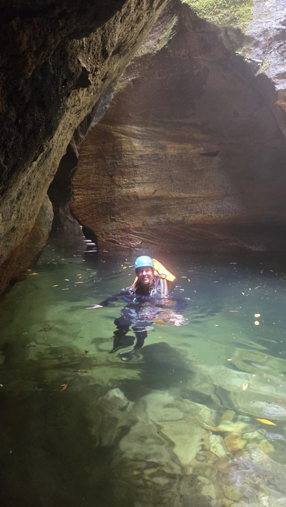
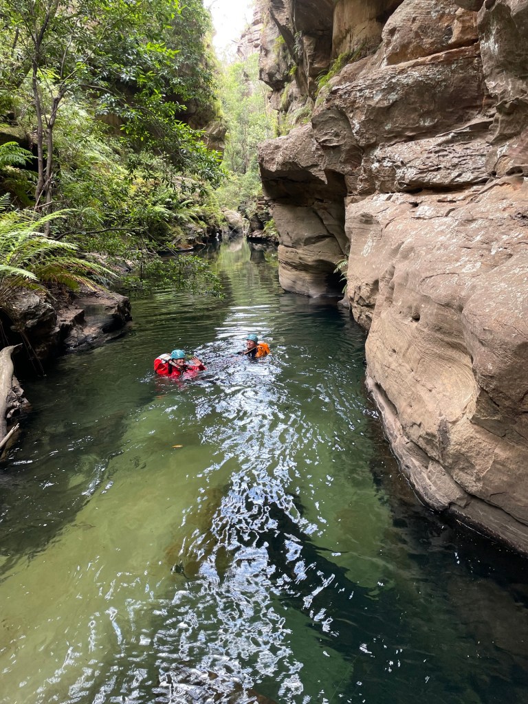
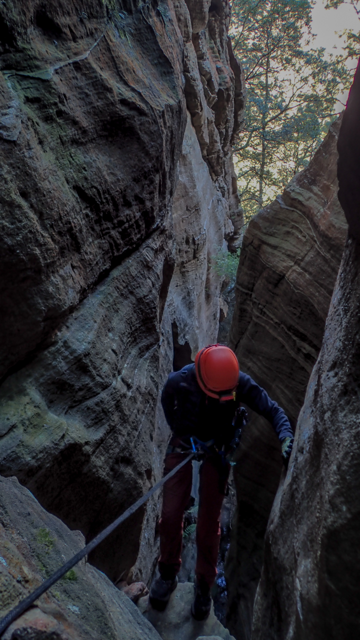
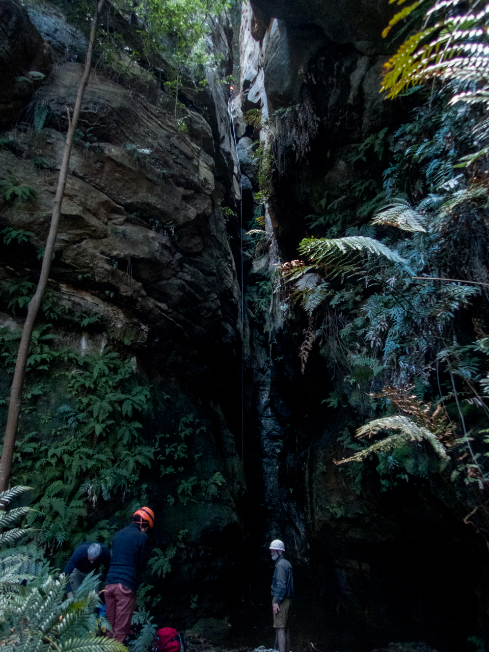
H leads the way down the last abseil and soon we reach the Junction with the Wollangambe
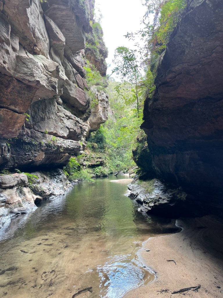
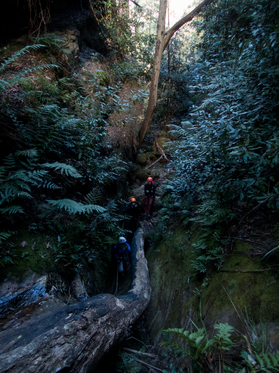
But the day is not over. Our exit is about a kilometre and half downstream.
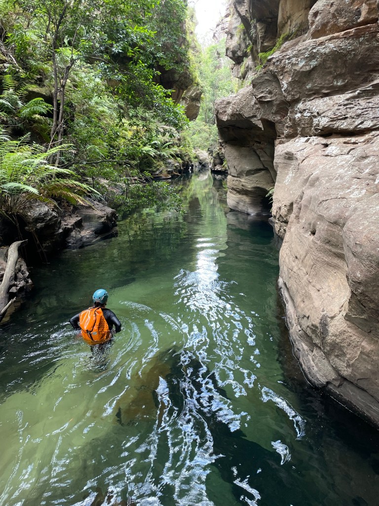
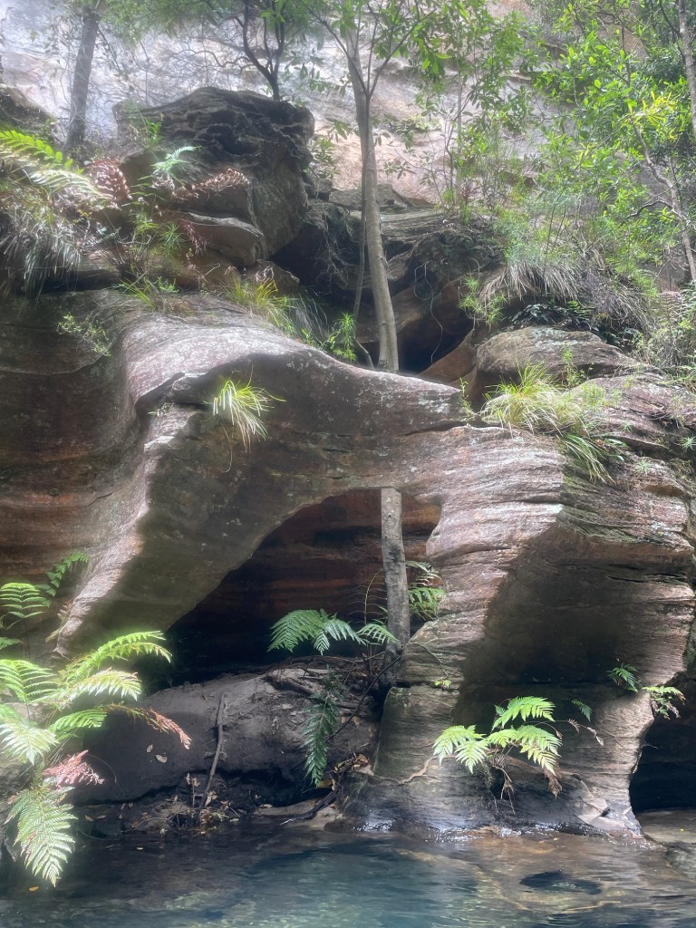
Having pretty much traced this enigmatic river from its source at Clarence to below Mt Irvine on various trips over the years I reckon this bit is the most stunning section of the ‘Game
Deep walls and beautiful pools.
That’s said it’s not easy going with deep sand and boulder hoping between long swims zapping your energy after an already longish day .
Having less foot traffic it’s also a lot slipperier in spots.
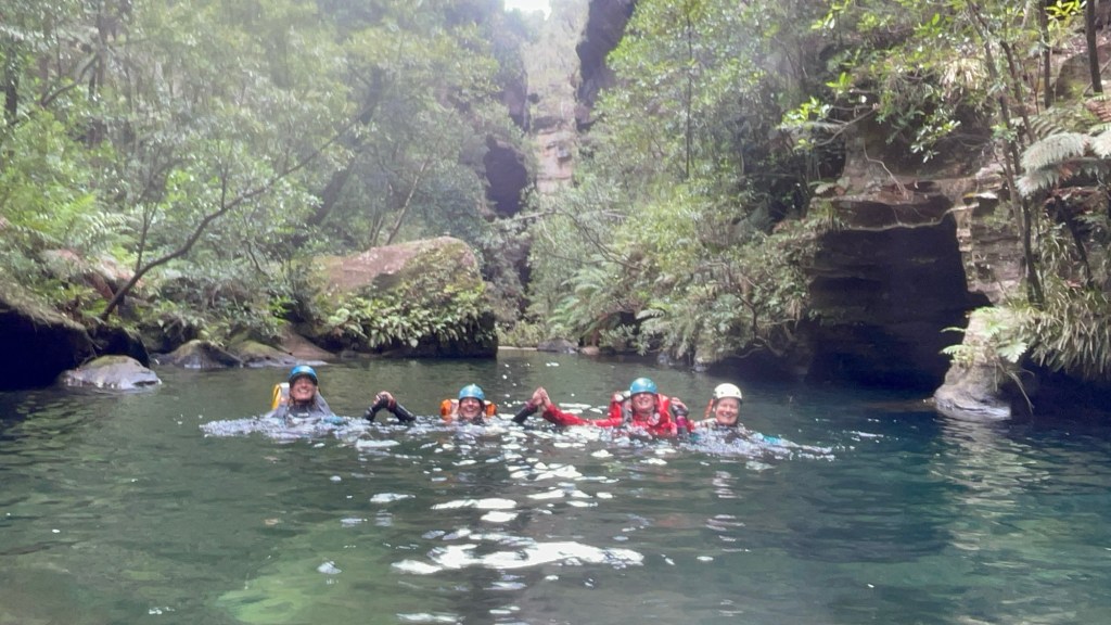
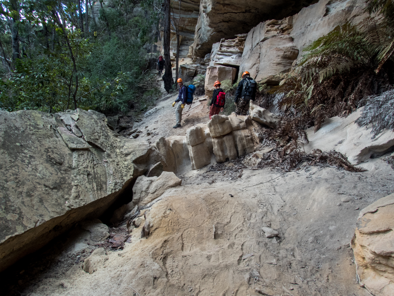
Just before our exit we catch a group from the central coast who had completed Geronimo.
We chat at the exit, cooling off at the sandy beach before making our way back up to the shed.
All in all a thoroughly enjoyable day but it was also a long day for a shortish canyon so I wouldn’t rush back to repeat the trip.
Whirlpool itself was nice and as stated it’s a beautiful section of the Wollangambe so worth doing at least once.
Access: A nice walk along a gentle ridge. Tar to parking area
Navigation: Navigation is fairly straight forward though the trail can be a little vague further out
Time: 30min out. 30min back
Date walked: 31-03-18
Jinki ridge is another spur off the Bells Line of road that gives nice views over the Grose Valley. A trail runs from the Bells Line of road out between Jinki and Dalpura creeks and the Pagodas out the end are reminiscent of the Lost city.
Getting there: From the weigh station at Bell follow the Bells line of road toward Sydney for approximately 4km and just after the concrete lane dividers end there is an old fire trail which goes right just as the road swings around to the left. Turn off into this fire trail and park at the locked gate (Obviously try not to obstruct the gate)
The fire trail goes South and then veers East to start and is easy to follow (note: there is another fire trail just back a bit at a more open park spot, but it goes West then swings North) . Jinki ridge offers great views over the upper Grose over towards Mt Victoria.
The fire trail eventually deteriorates to single track. It can be a little vague but just stay on the top of the ridge
Views change to your left side with some vantage points looking down the Grose. Towards the end of the ridge you get views over to Valhala Head and Thors Head from high pagodas. Be careful near the cliff edges as they are all over hung and brittle.
Also care is needed on the pagodas. The plate pagodas are fairly unique to our area and iron stone bands that make them so unique break off very easily. These awesome rock formations take thousands of years to form, the last thing we want is for them to be damage by a careless footstep.
Return: The way you came in
Note: The great outdoors is an ever changing place. Bush fires, changing weather, vegetation growth and forestry activities can all effect the trail conditions and thus the difficulty of the walk. These are a rough guide only and are by no means meant to be a definitive guide . They do not replace the need adequate map reading and navigational skills
Note 1: Taking care While reasonably well known these spots are still wild places and care needs to be taken around cliff edges and on the steep trails. Carrying the right gear as well as having adequate food, water and clothing is important. Always tell someone where you are going and when you expect to get back.
Emergency beckons (PLBs) can be hired from Katoomba Police for very little.
Note 2:First aid A basic first aid kit is essential bit of kit whenever heading into the Aussie bush. A basic first aid is highly recommended
Note 3: Maps and Navigation Having the right map, a compass and knowing how to read them is very important when heading into the bush. If you are new to bush walking joining a club or accompanying more experienced walker for you first few outing is a very good idea. I found practicing map reading on well defined trails was helpful when I started out.
The Maps mentioned are the 1:25000 series. They can be purchase at Lithgow tourism information center, from outdoors shops or online for around $10 each.
Note 4: These are wild and beautiful places, respect them. If you are able to carry something in you can carry it out. Don’ be a tosser. Leaving your rubbish behind is a sure way to ruin it for every one else.