Endiandra

28/01/2026

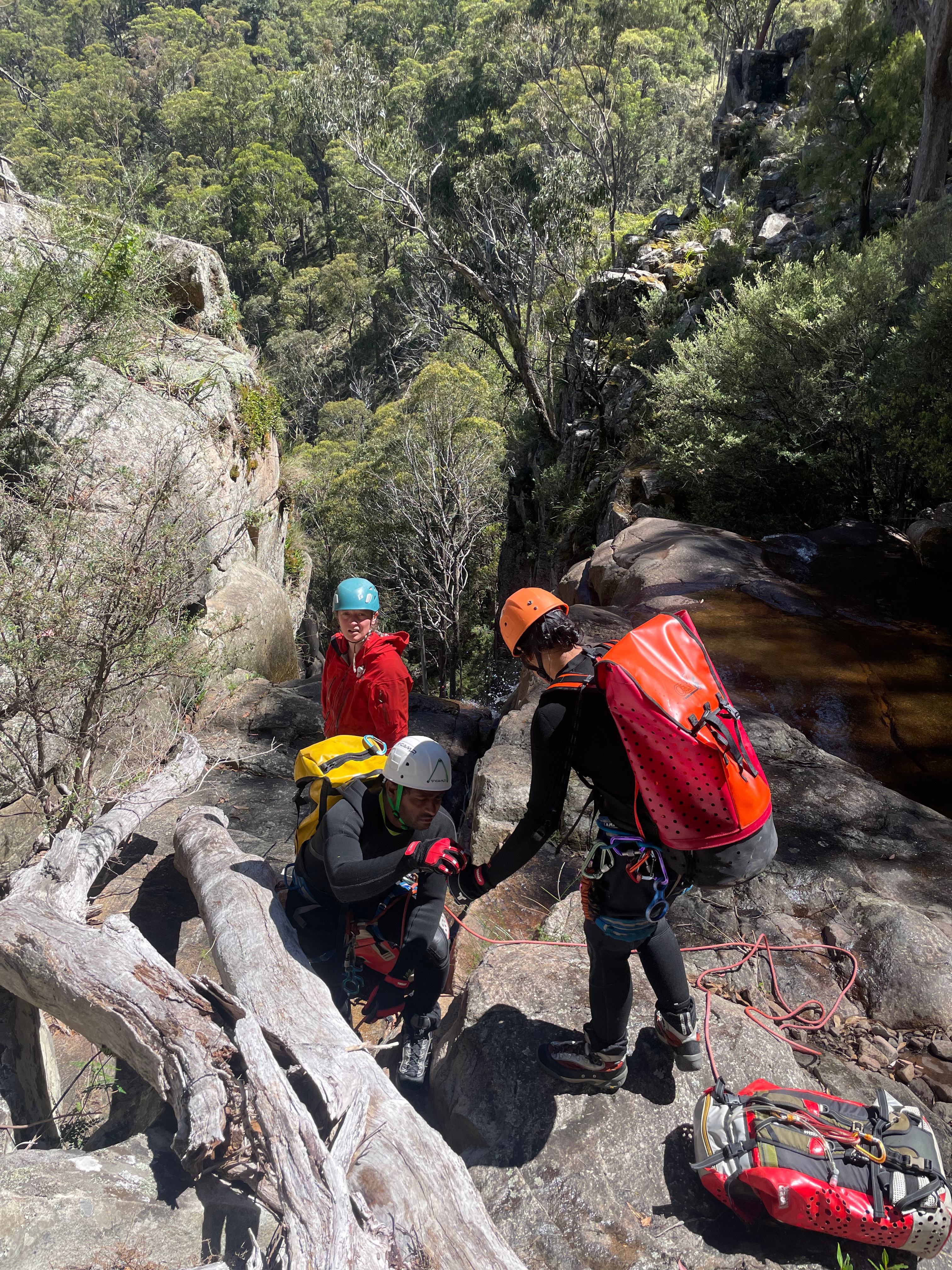
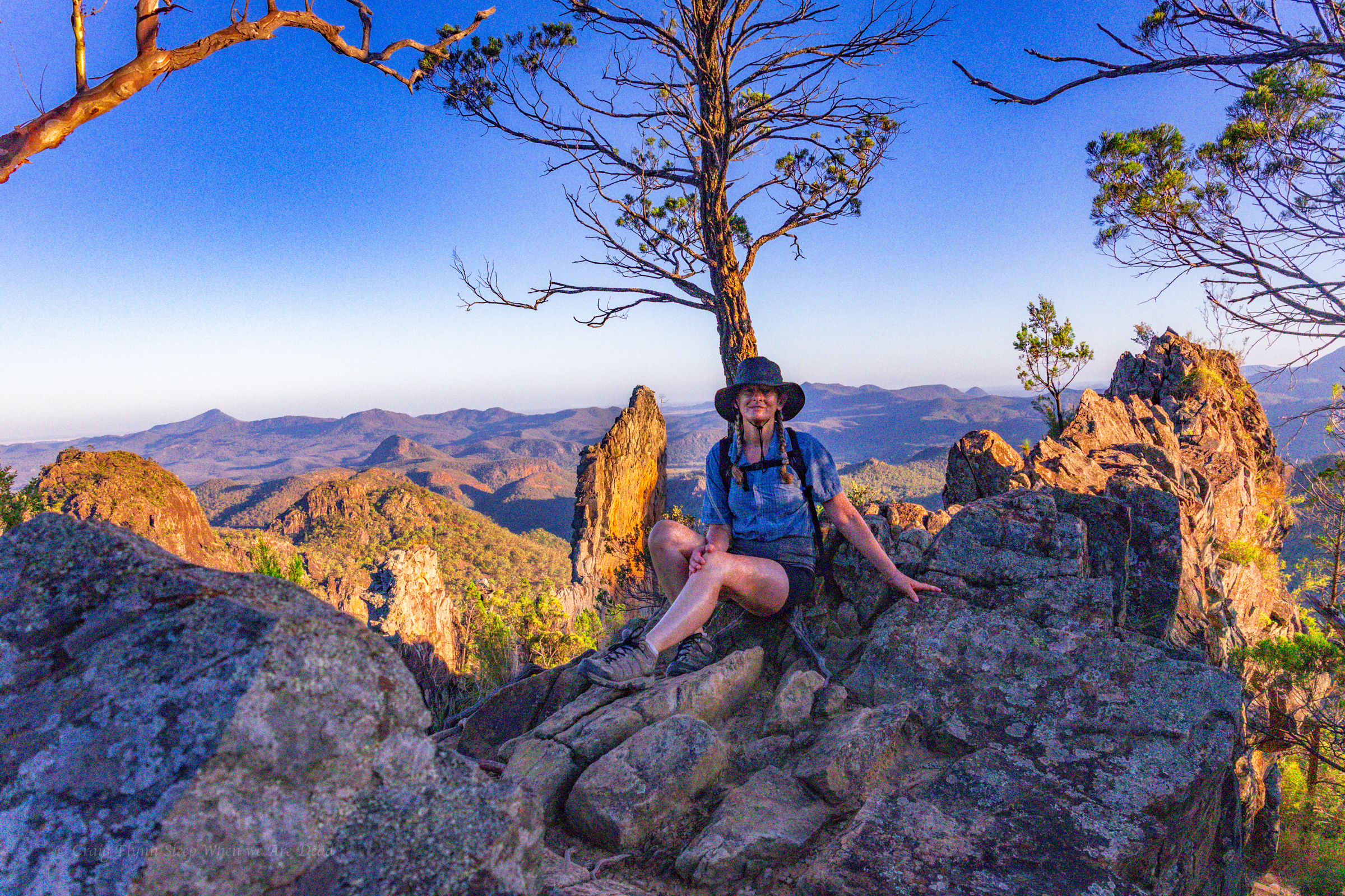
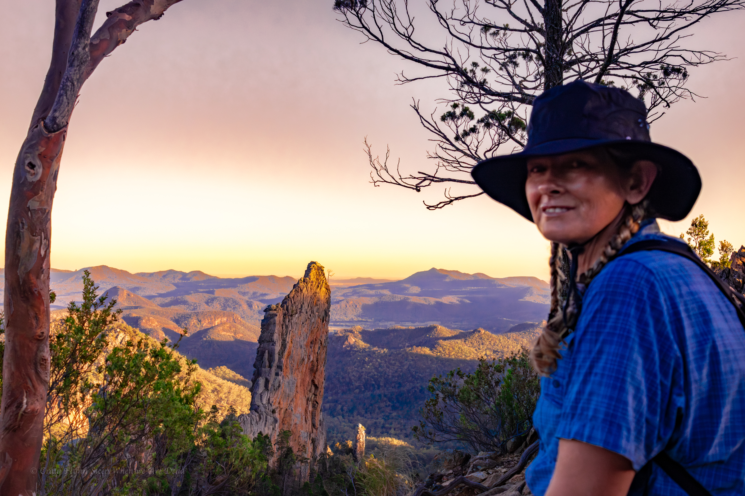
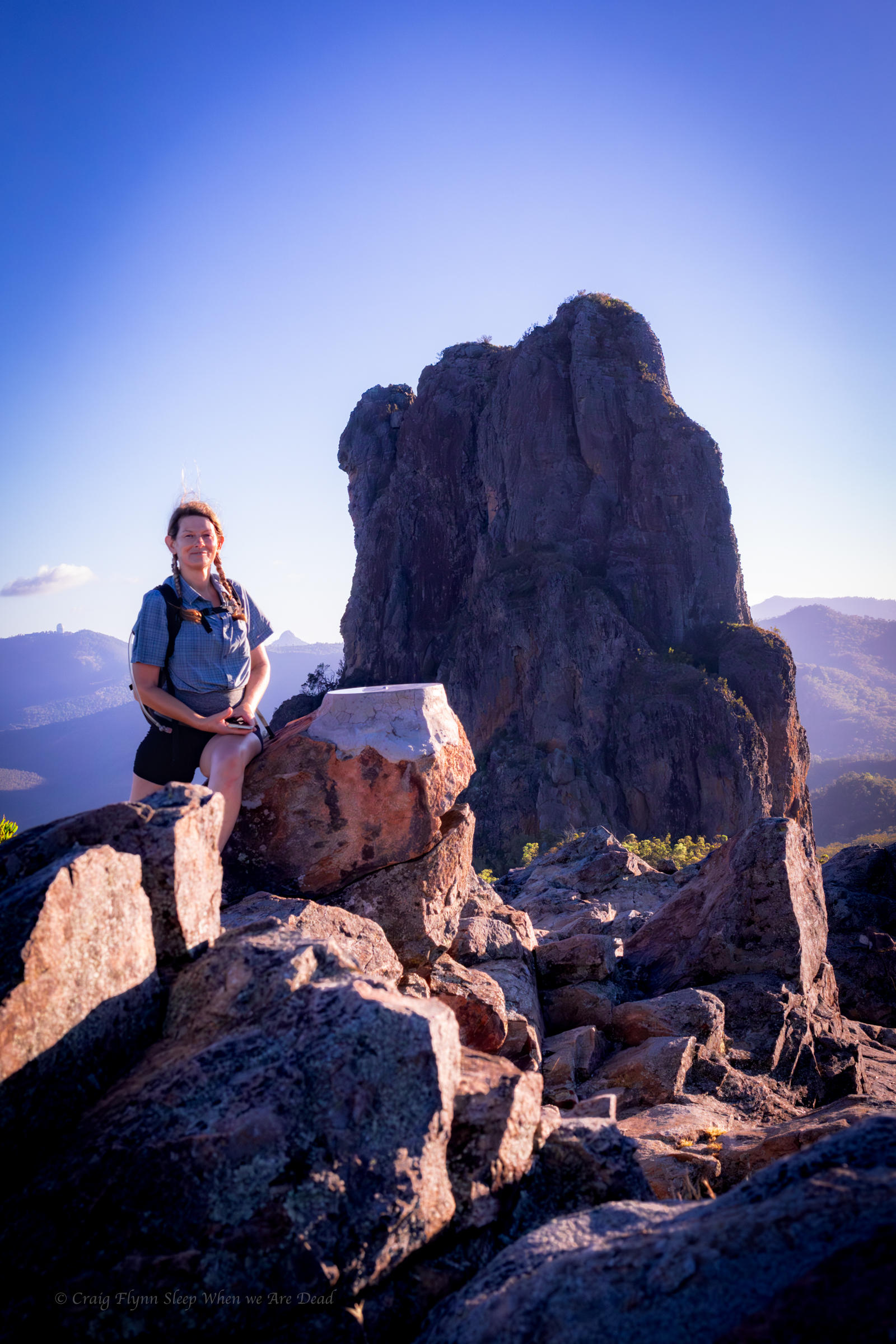
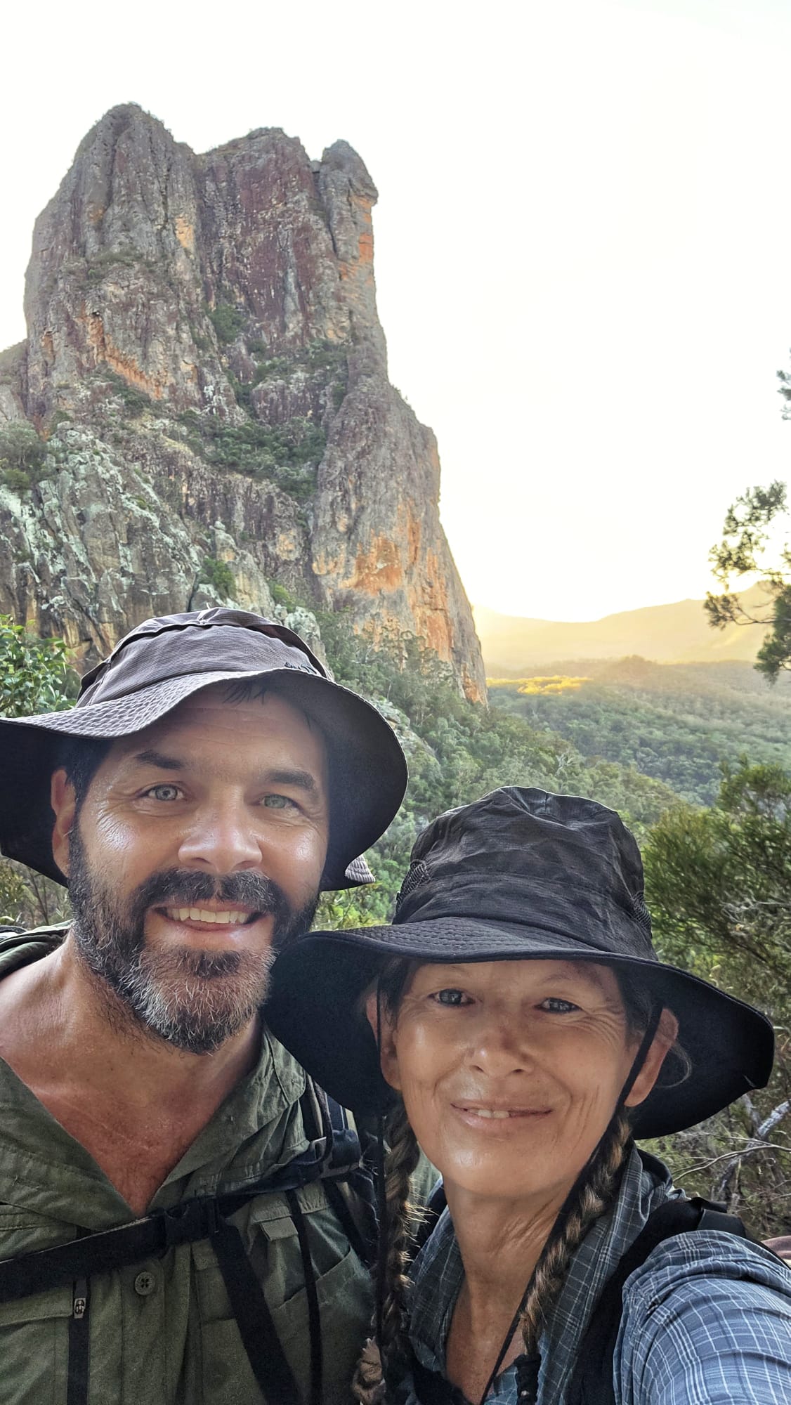
Vince, Hywaida, Kris, Kylie and meeee

We had this one ear marked in case water levels were up. They weren’t up too much but we thought what the heck let’s do it anyway. None of us had done it before.

Making it more appealing was it was just a 15min drive from camp meaning a sleep in and trio to the cafe for coffee and stuff.

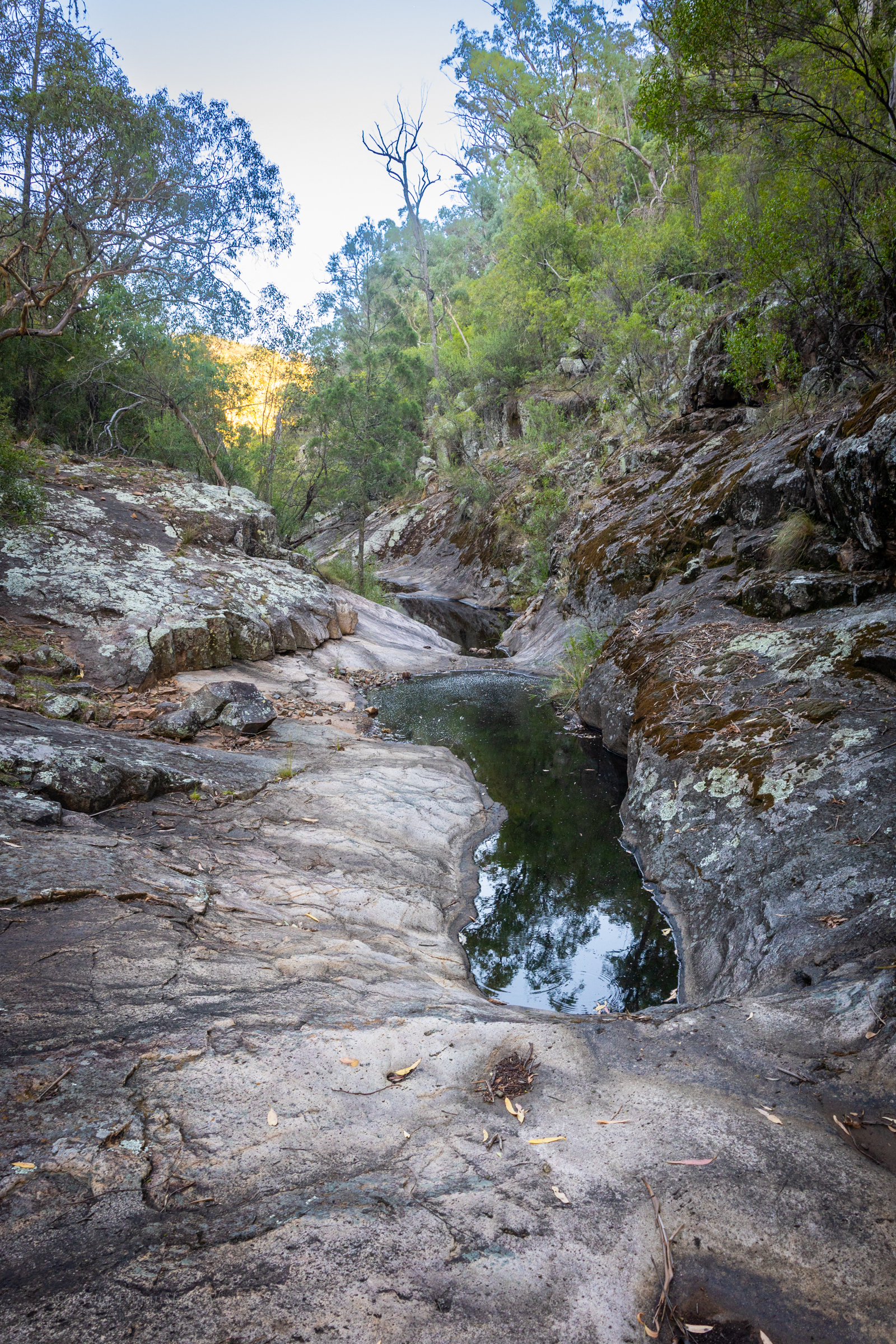
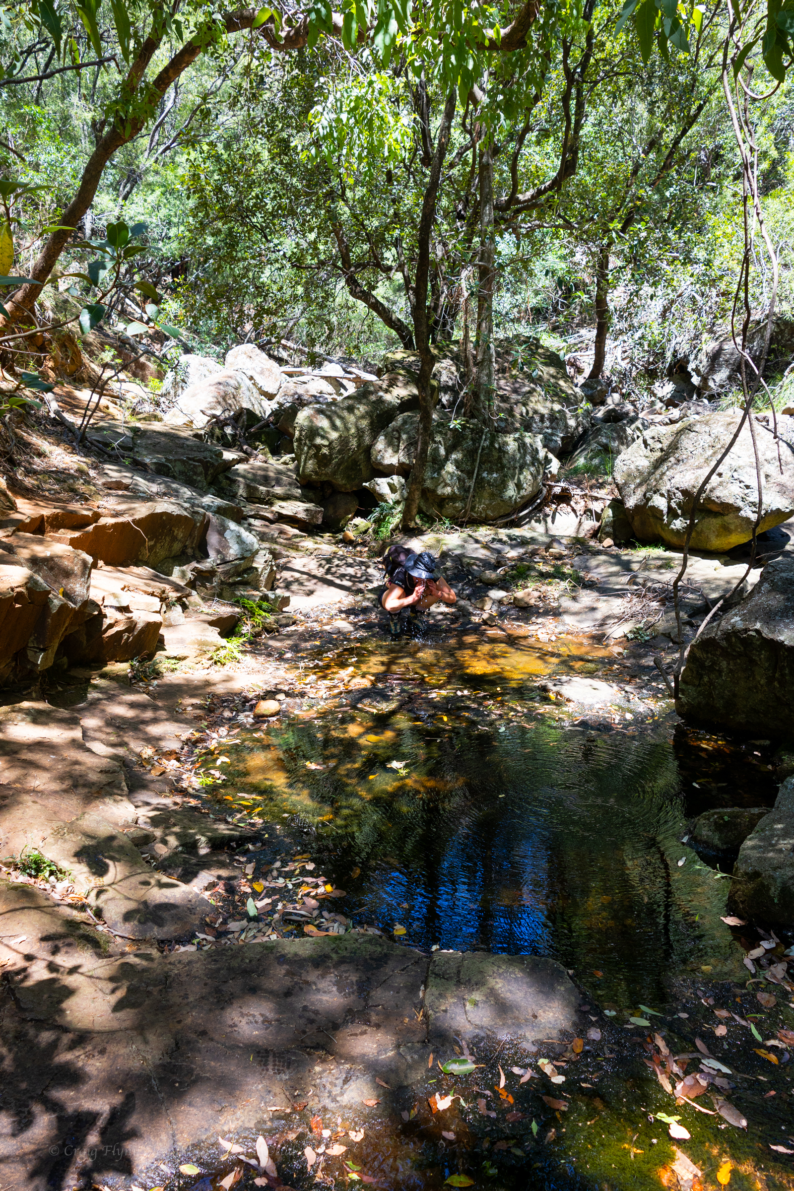
Notes say to park on next to the bridge and get in the creek.

We do our best billy goat gruff impressions. We are not trolls, honest.

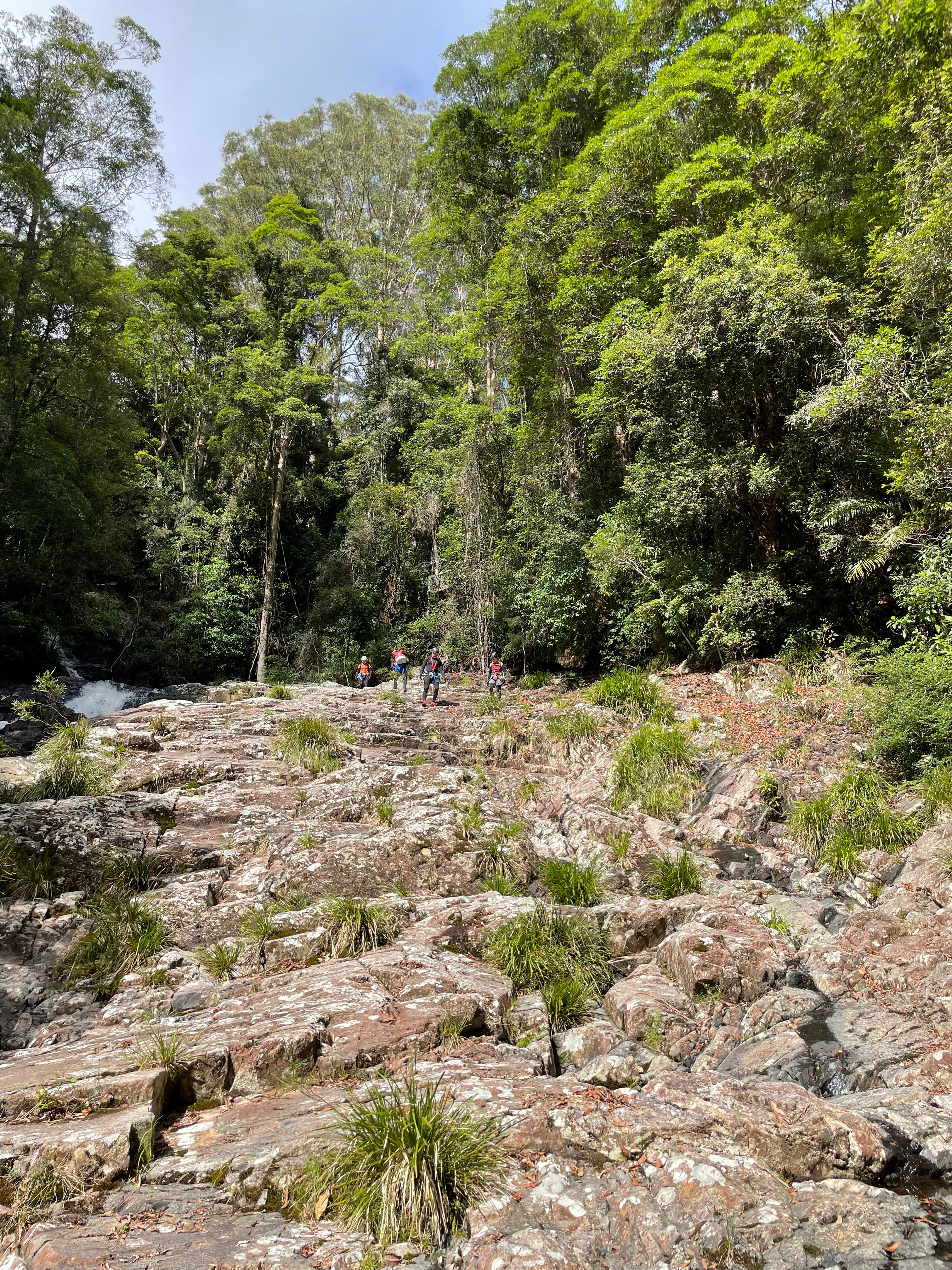
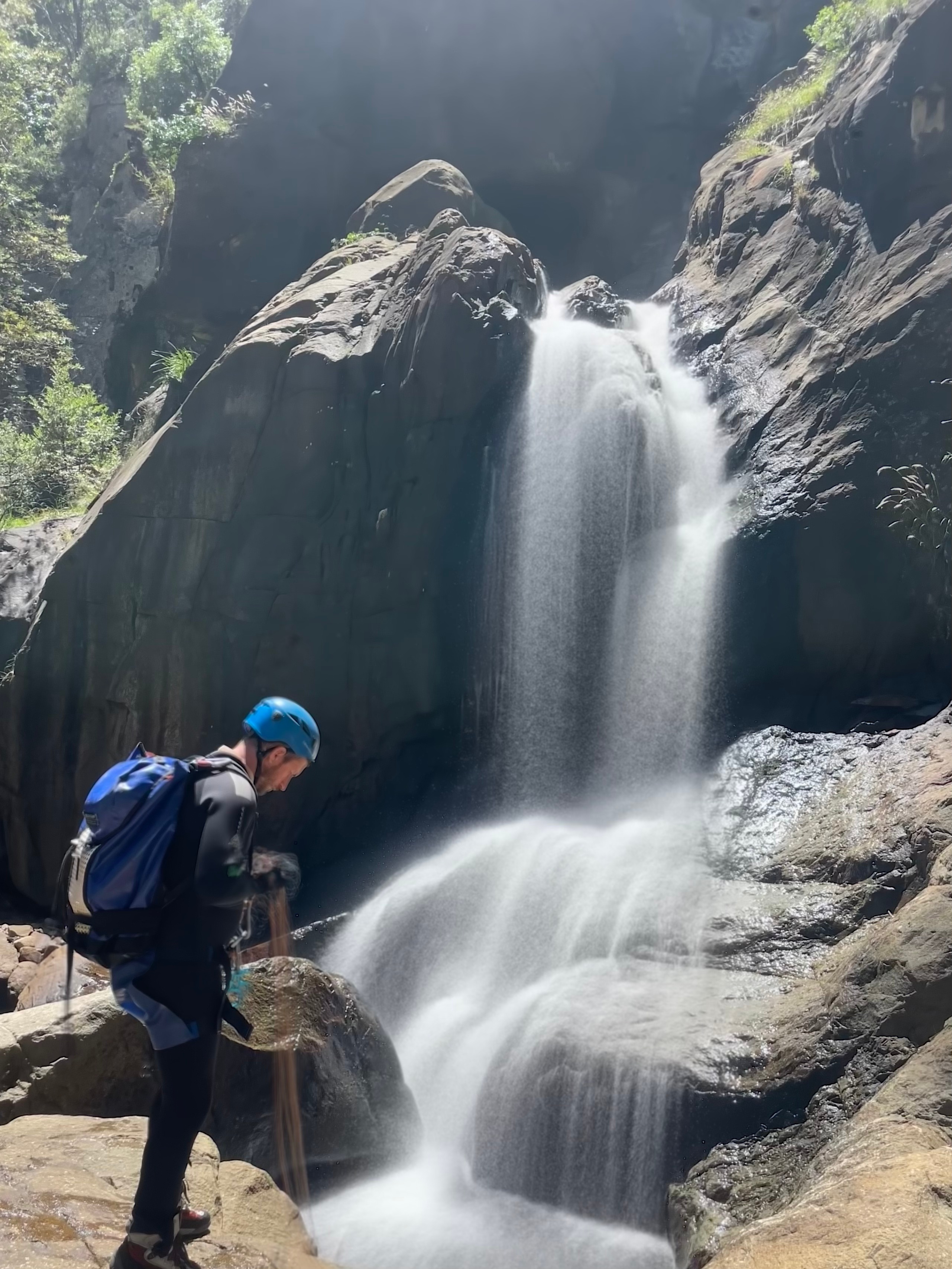
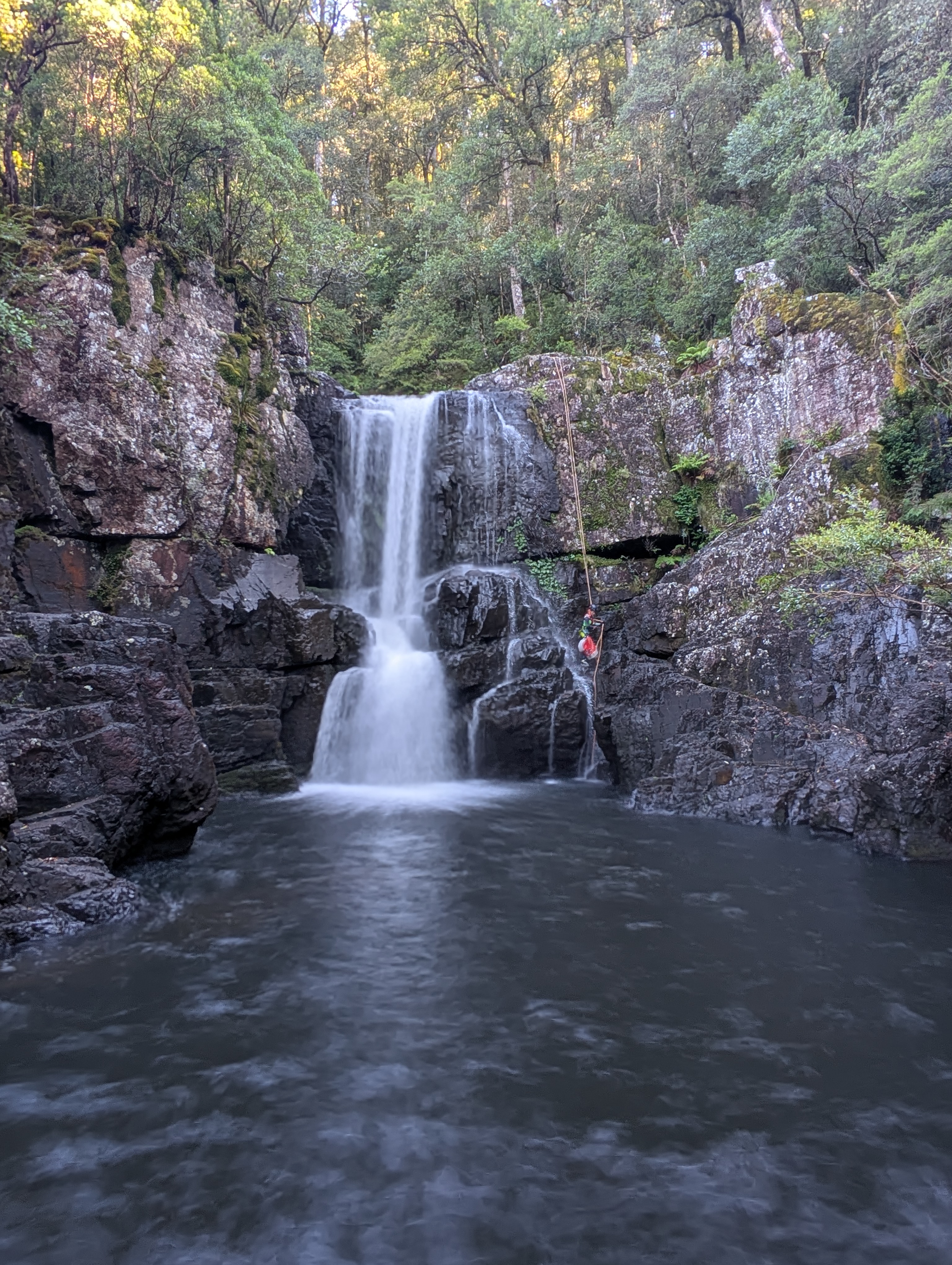
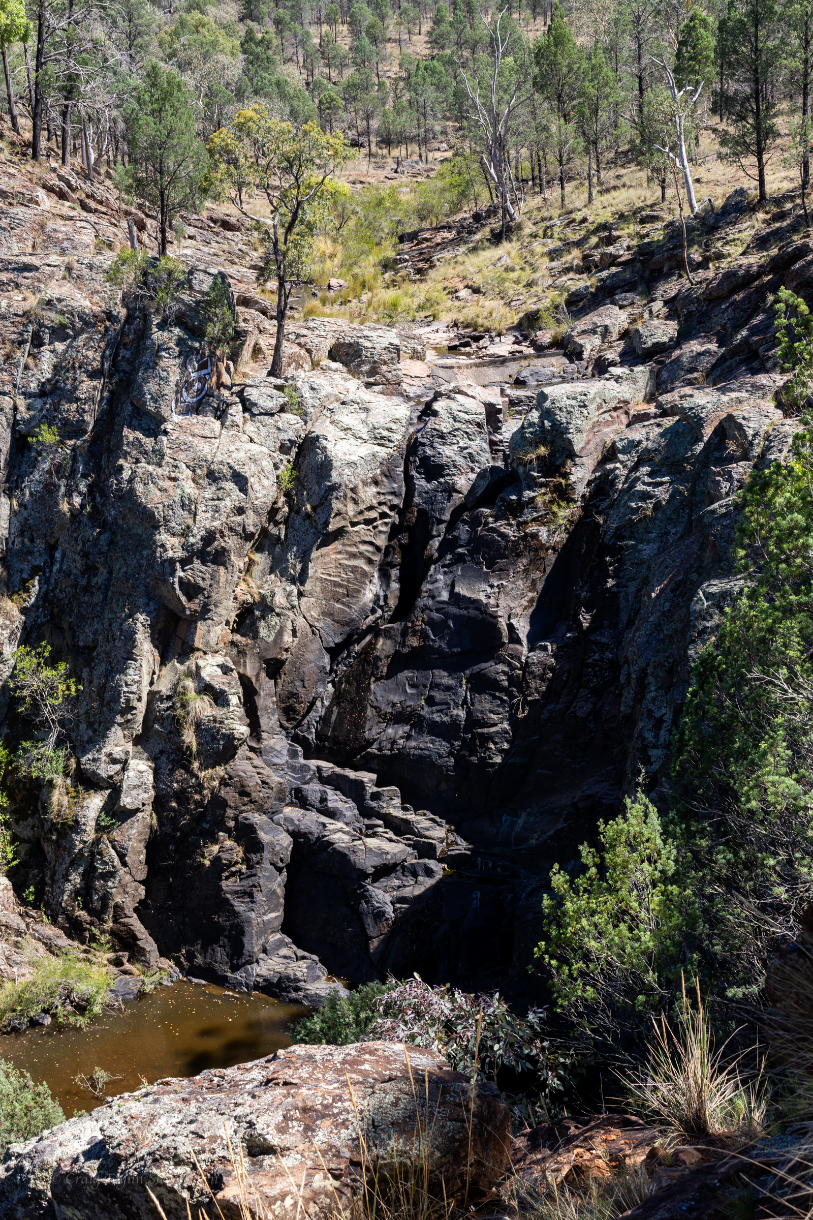
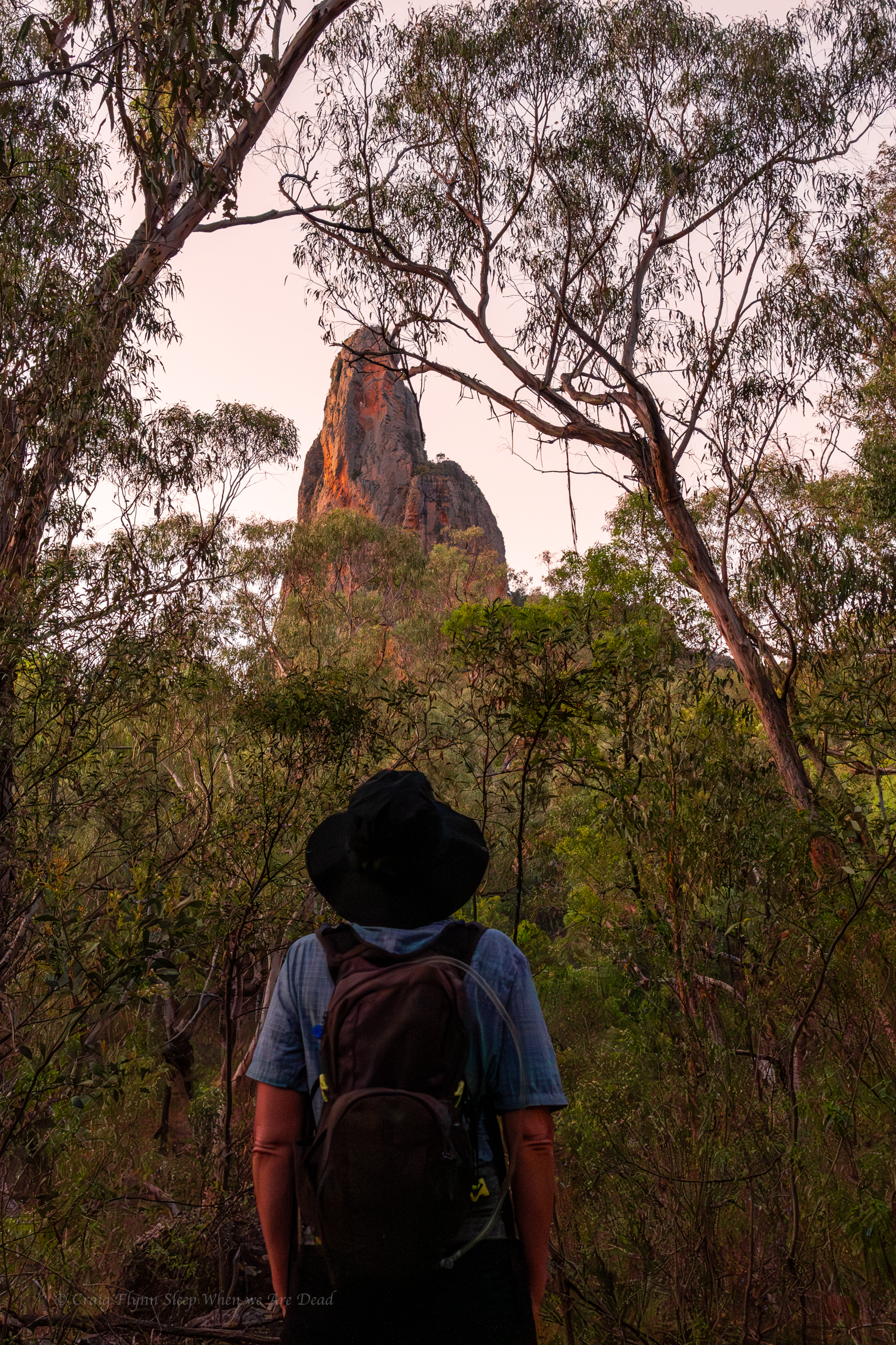
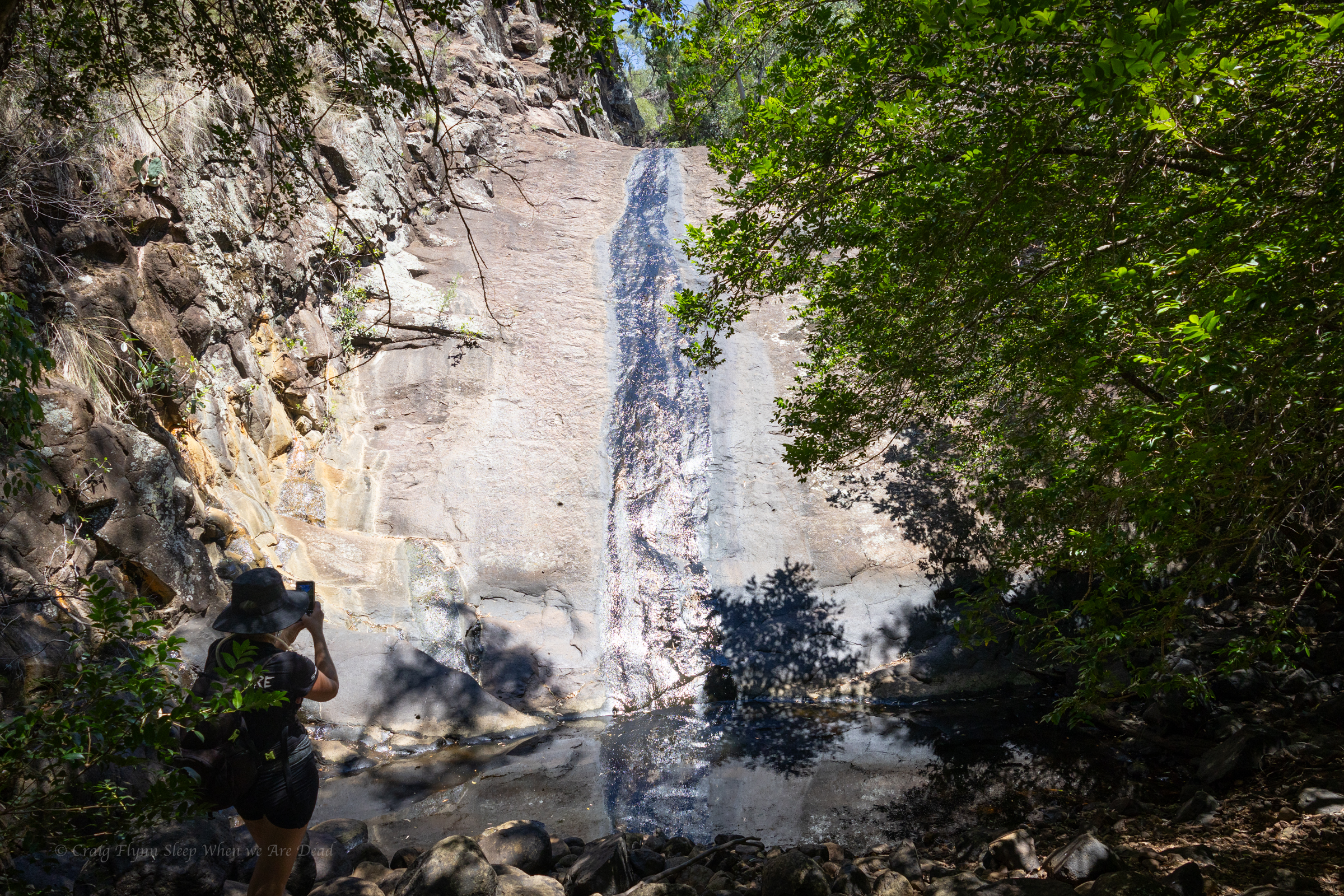
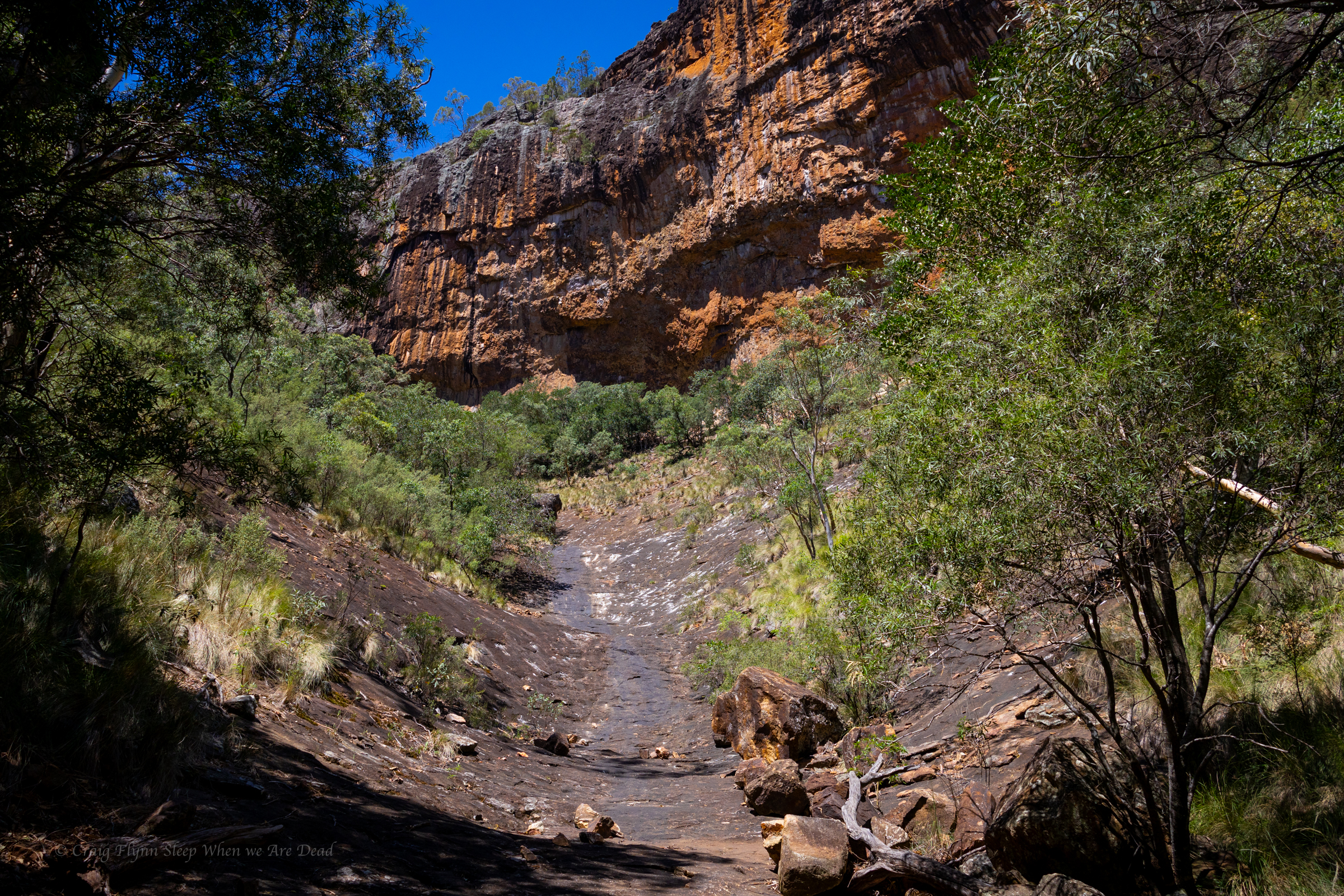
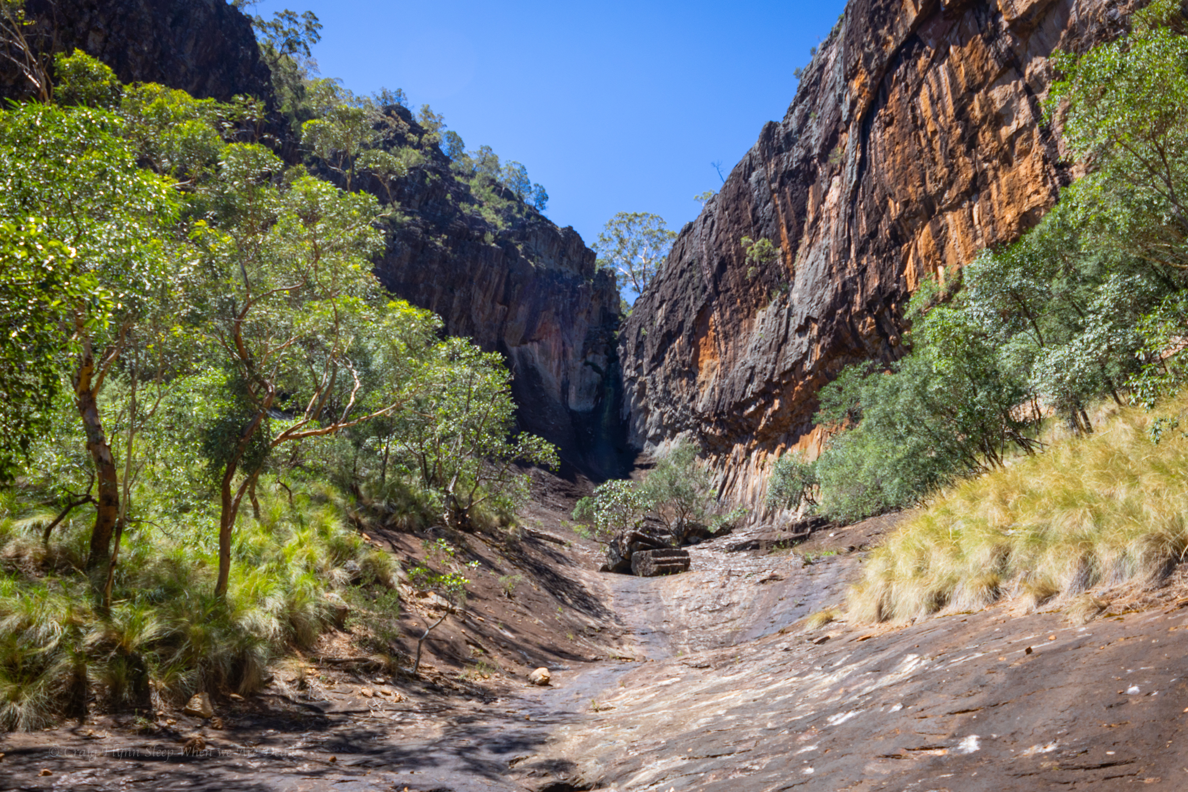
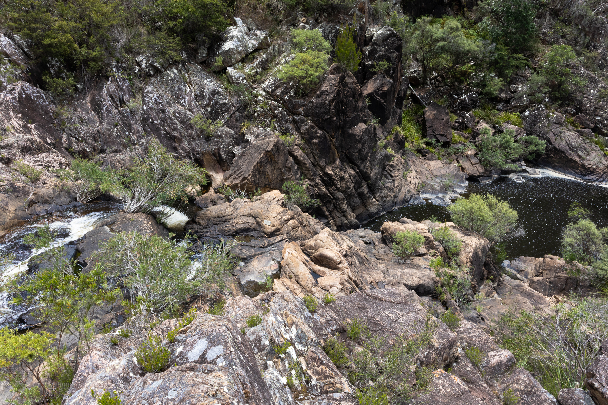
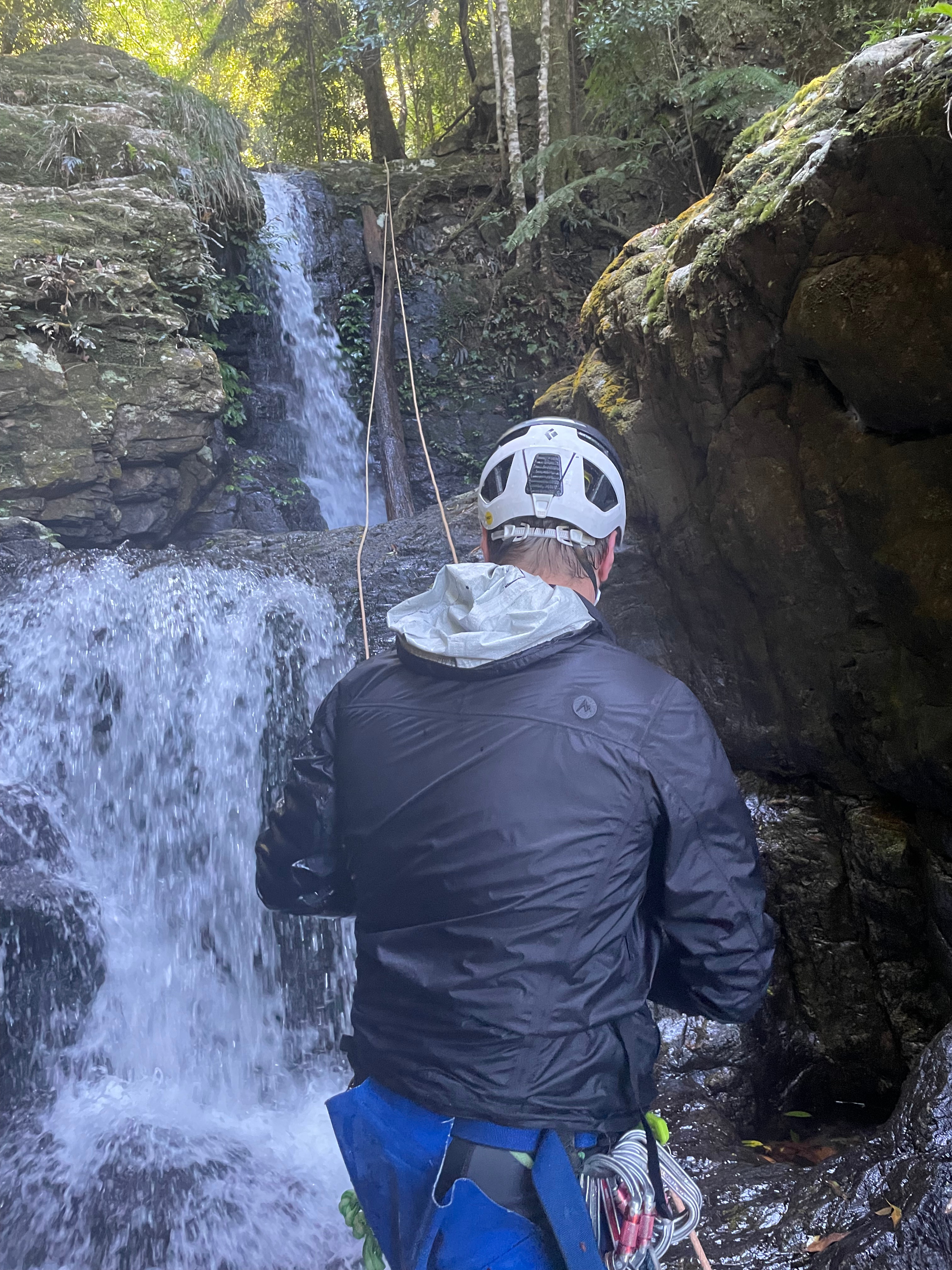
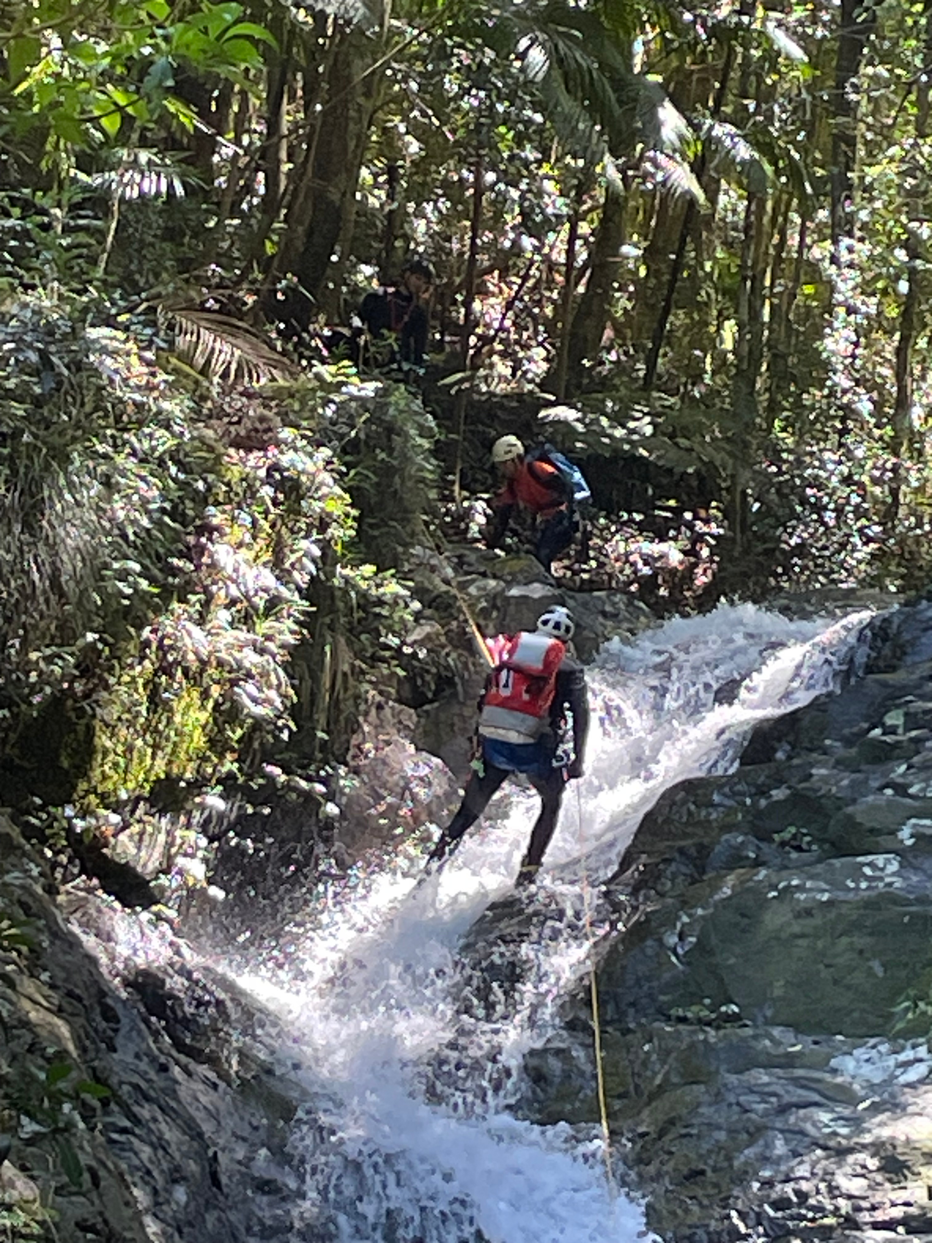
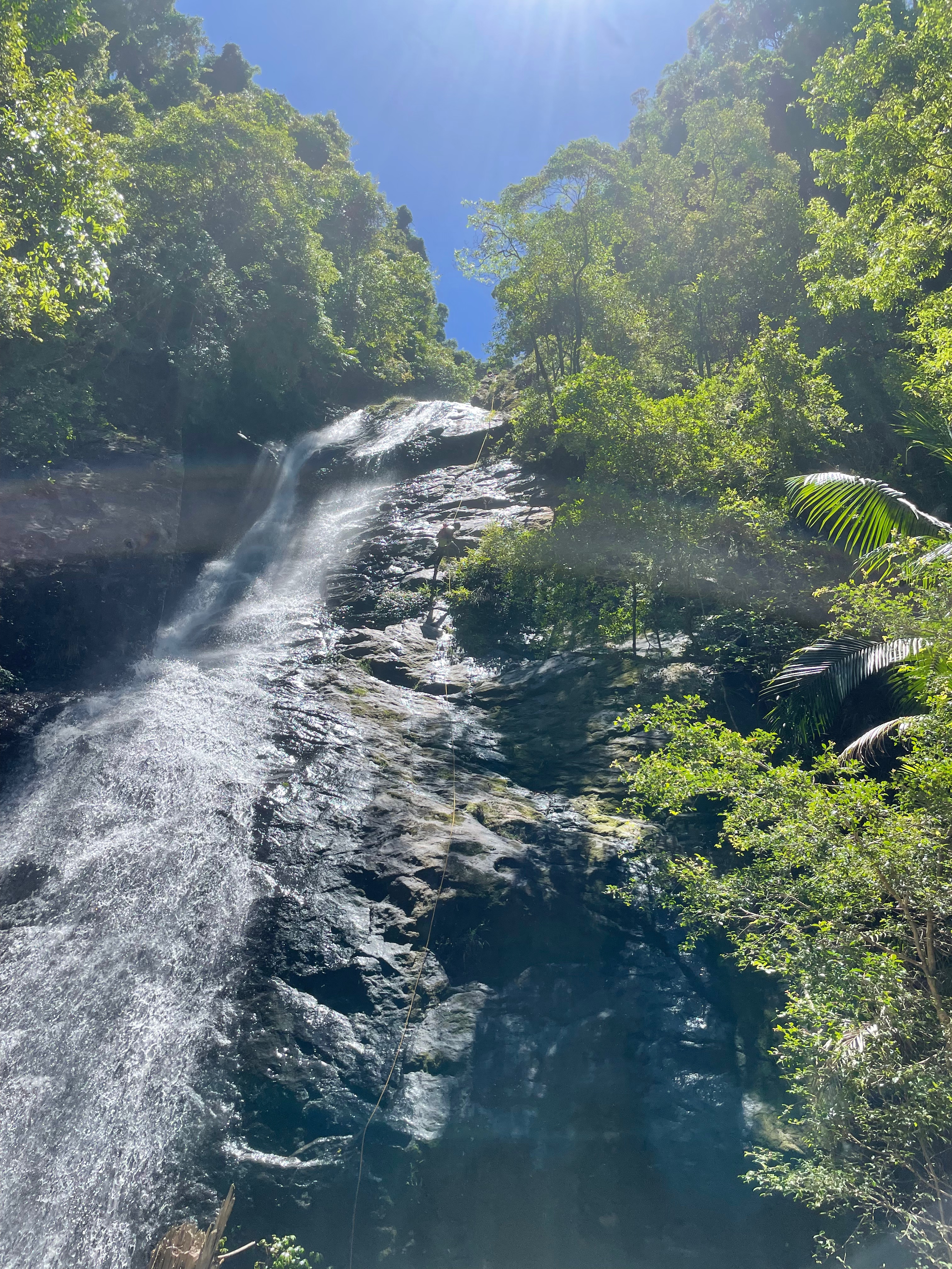
A short walk down the creek brings us to the first abseil

TBH this one is a bit of a nothing abseil, but it does shortcut the top part of the tourist trail.

We get back onto the tourist trail and make our way down. There is a spot where it crosses to the left, now we are not sure if we were just a bit excited but it wasn’t over clear you needed to cross straight over and where we do cross doesn’t seem to be a trail. We make our way down stream a bit and I think I see a bit of flagging tape up the hill on the right.

The Kris and Vince see it too, or at least they think they do. we angle up to where we think the trail is.

No trail. We angle “down stream” a bit before deciding to drop back into the creak.

I put down stream in quotation marks because as we hit the creek and start “down” before Vince says

Isn’t the water flowing the wrong way?

We must have struck up the hill just before as a tributary came in and the main stream swung away.

anyhoo

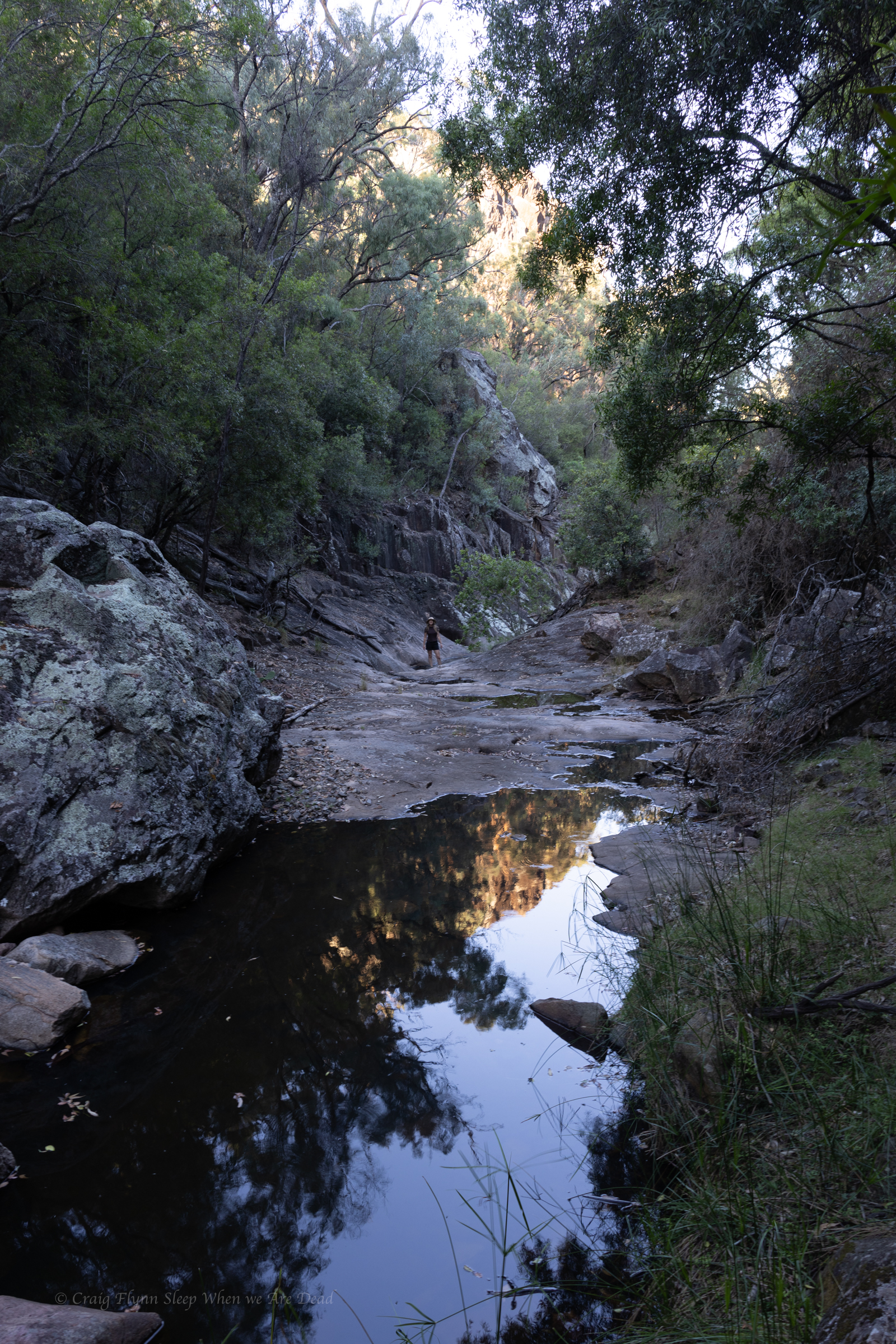
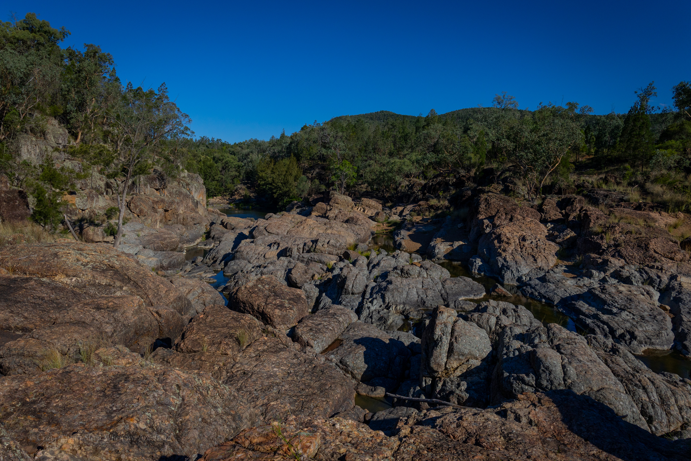
We pop over the small ridge back into the right creek and pick the tourist trail up again and follow it down as the creek drops below us.

We take a guess at where the second drop might be and descend back down. Spot on.

Vince cleaning R2

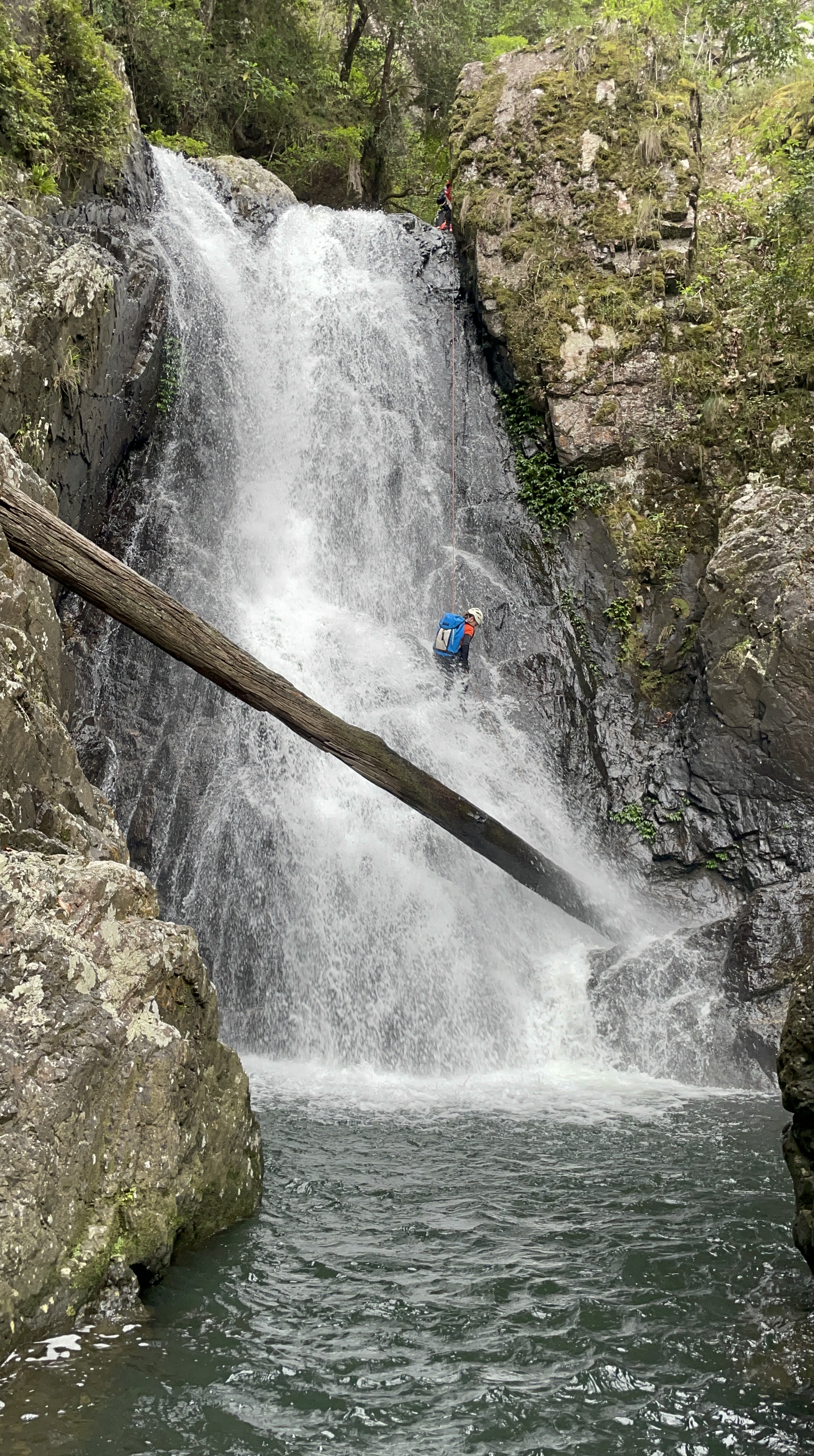
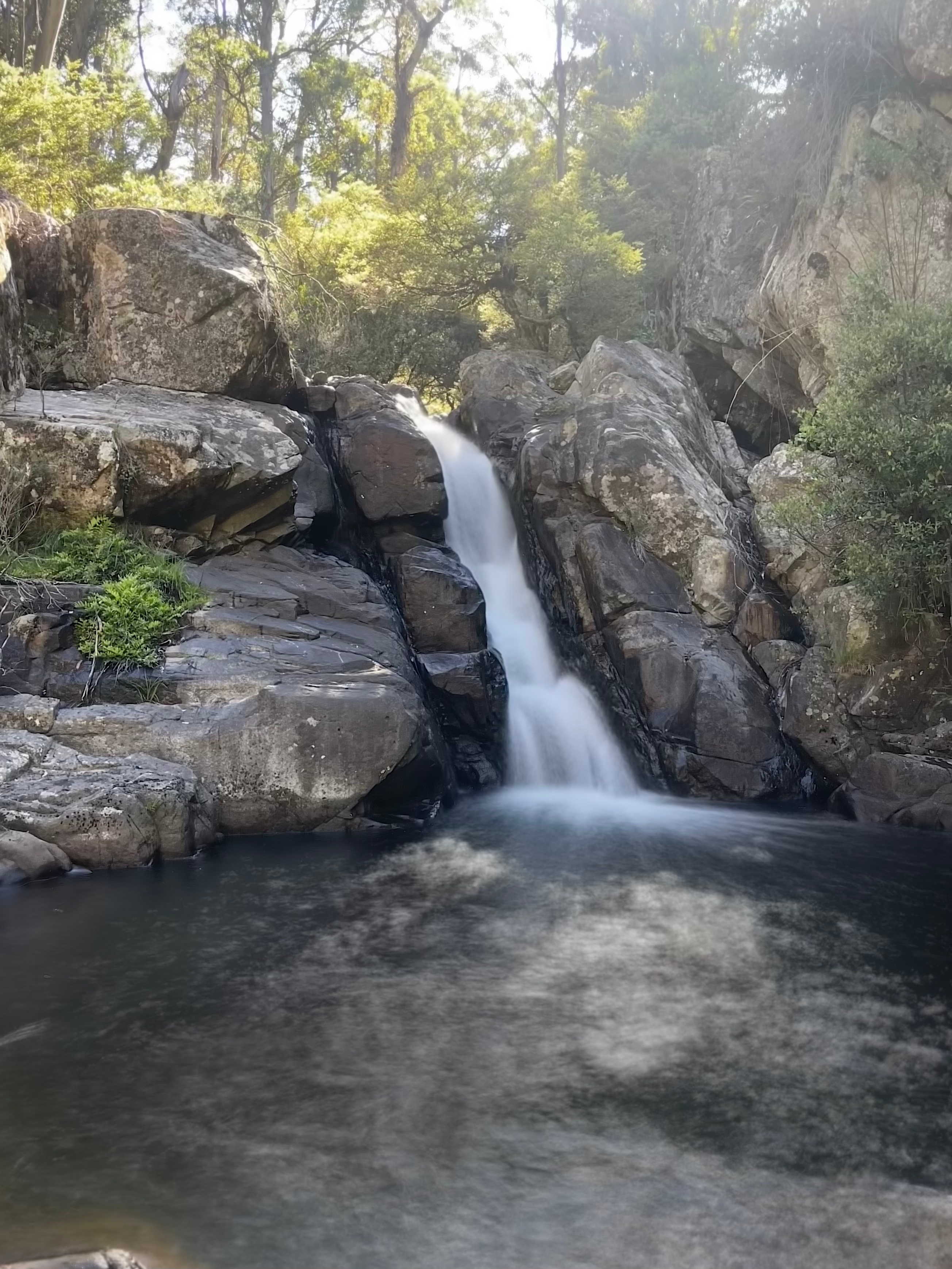
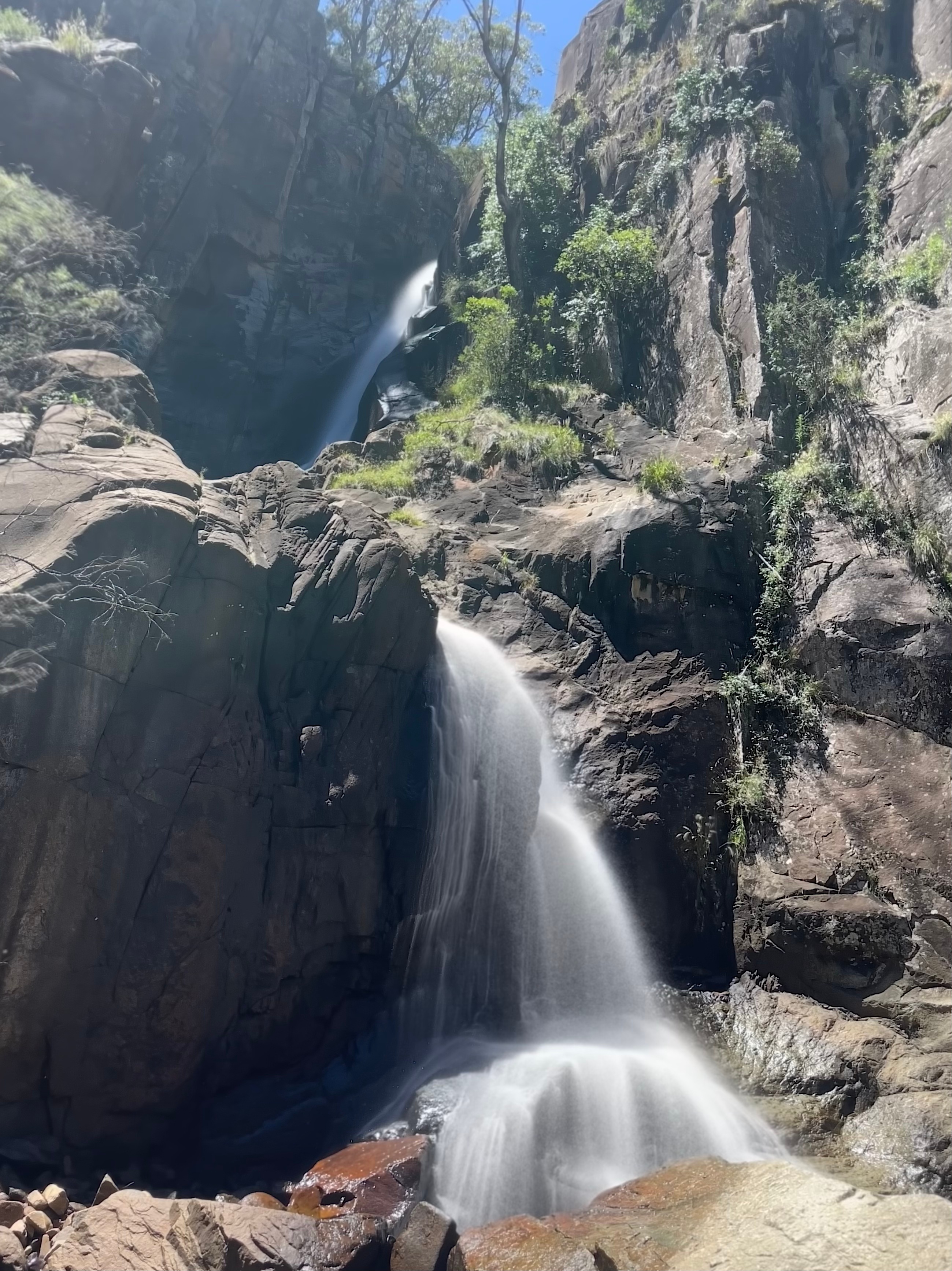
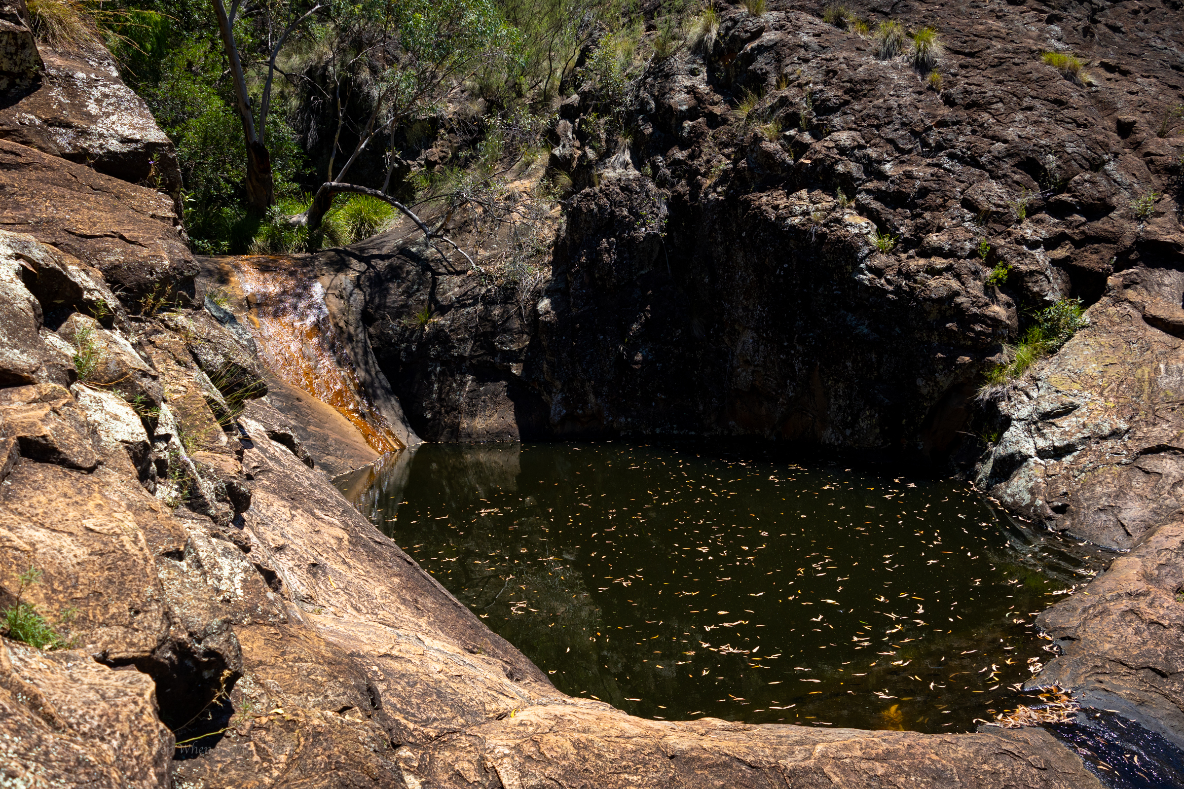
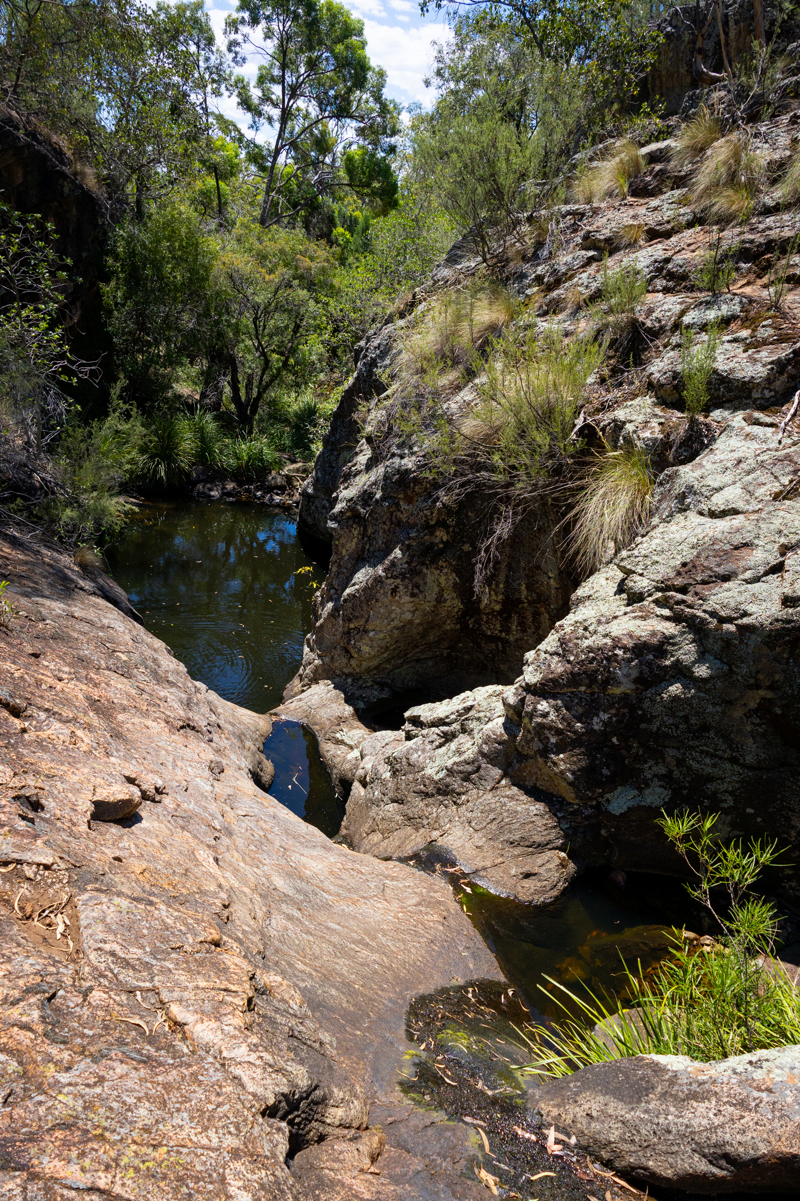
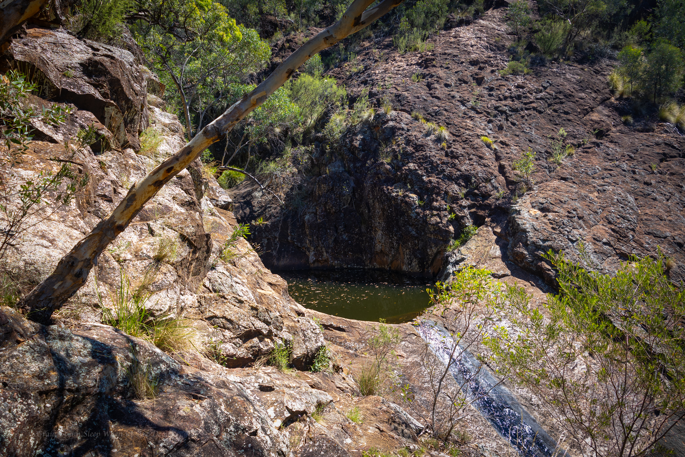
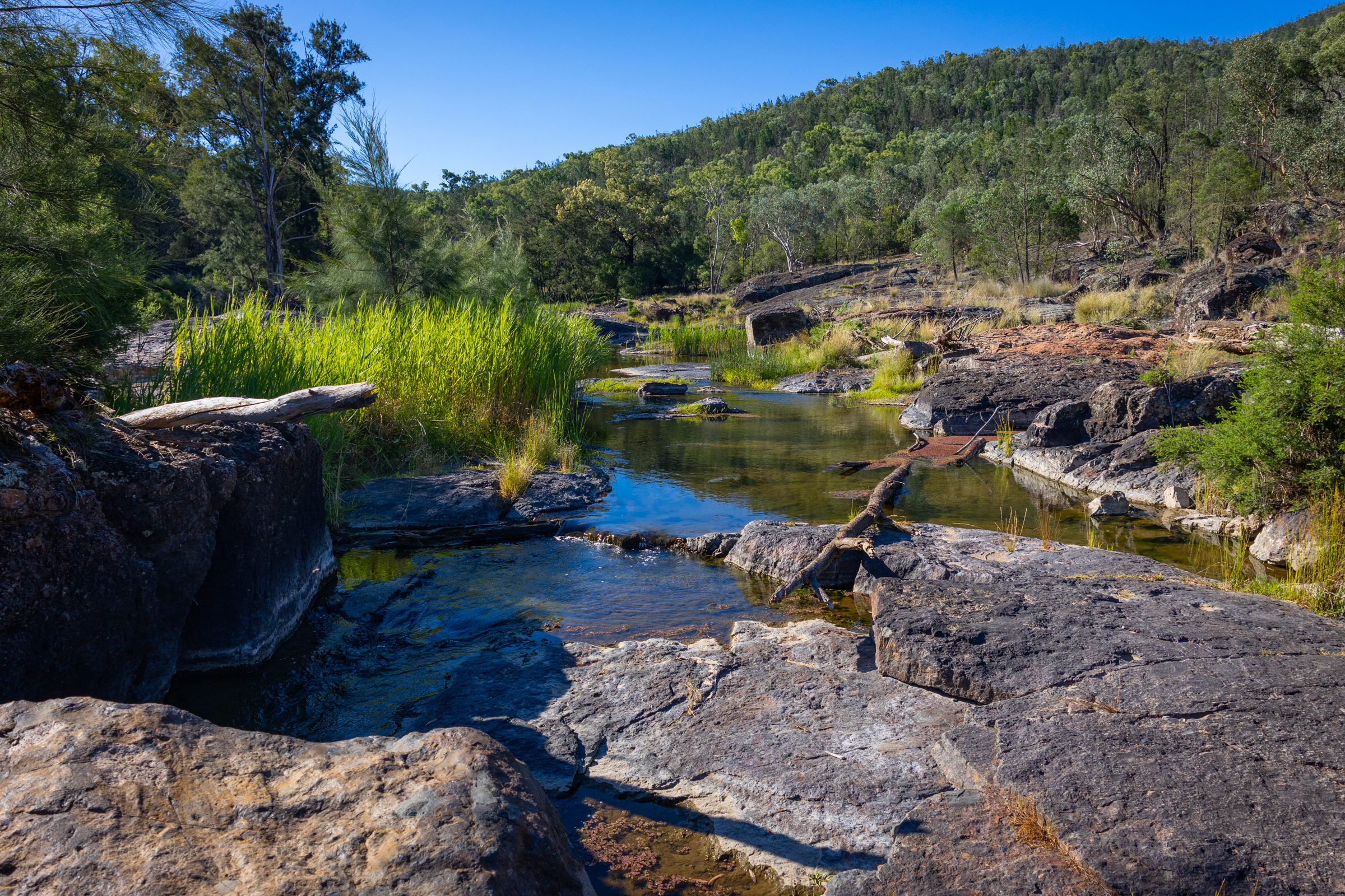
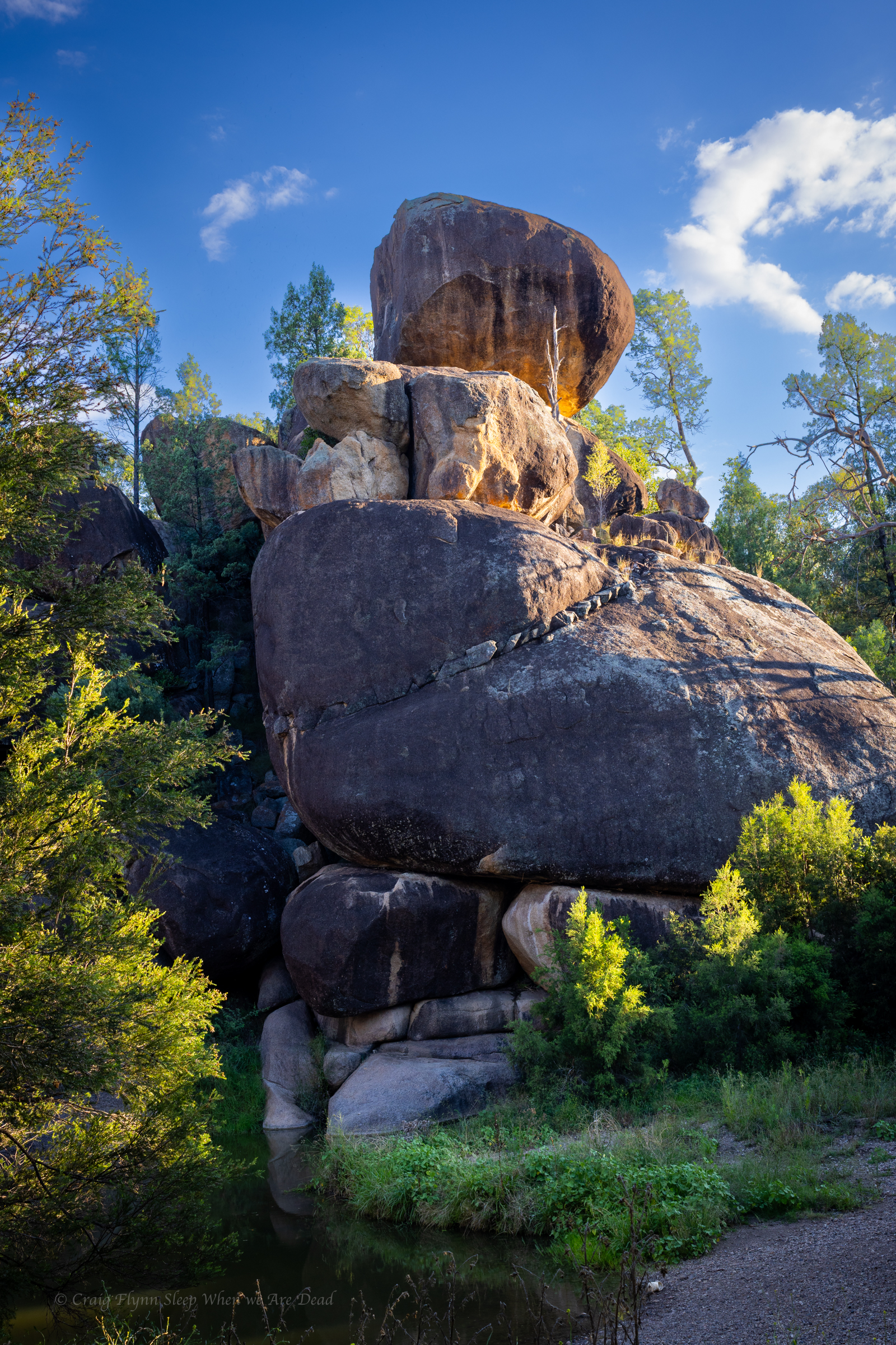
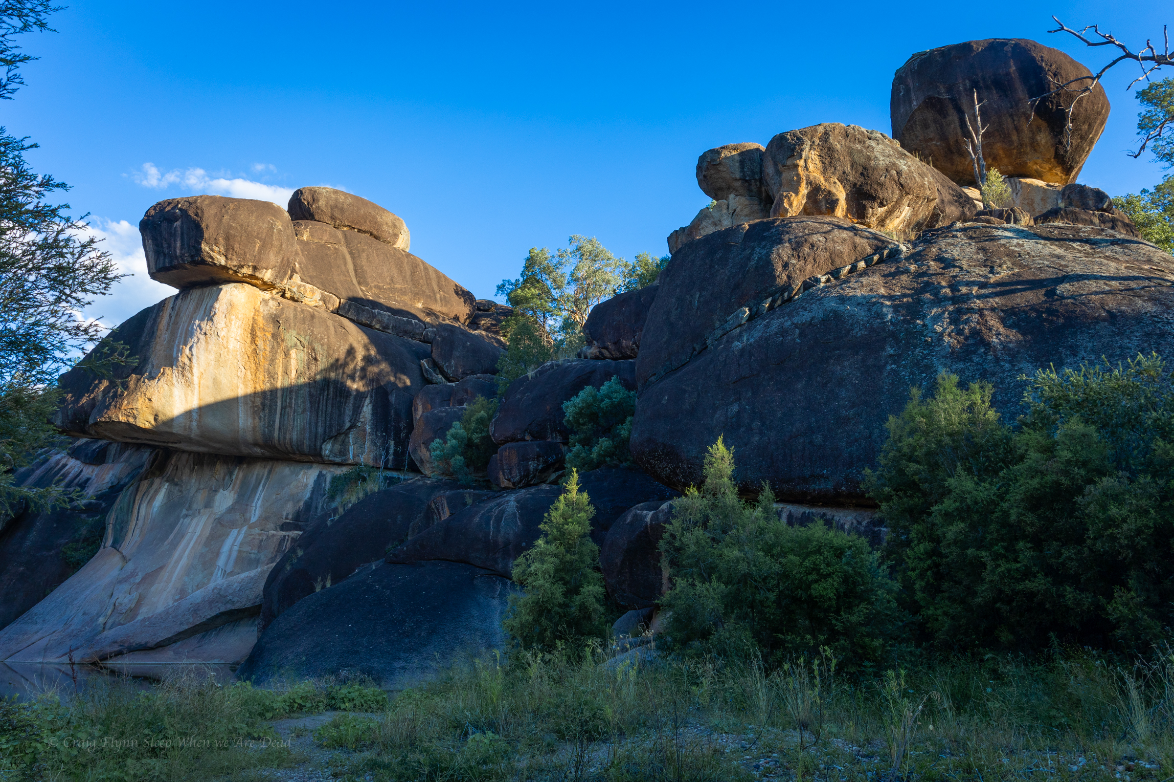
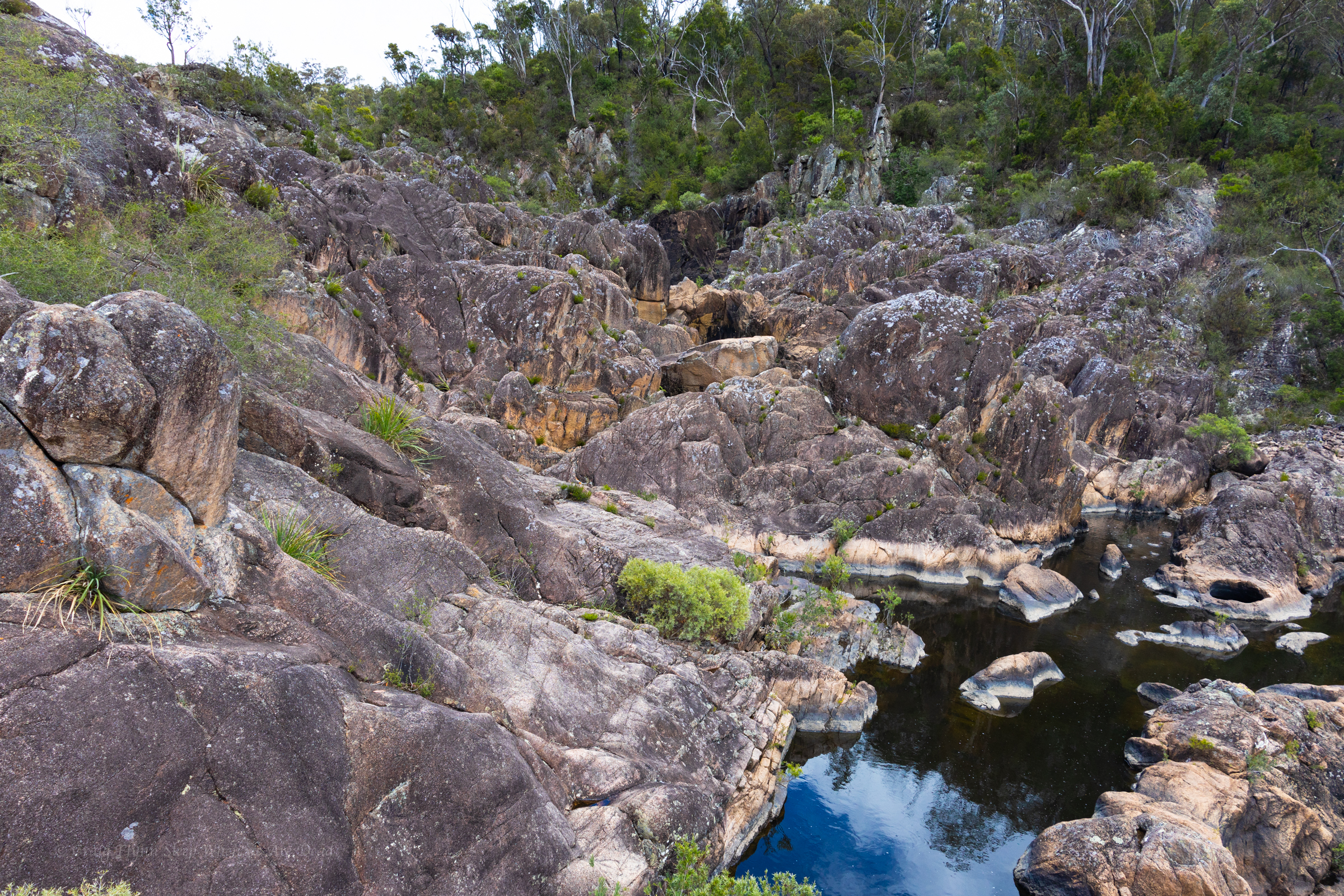
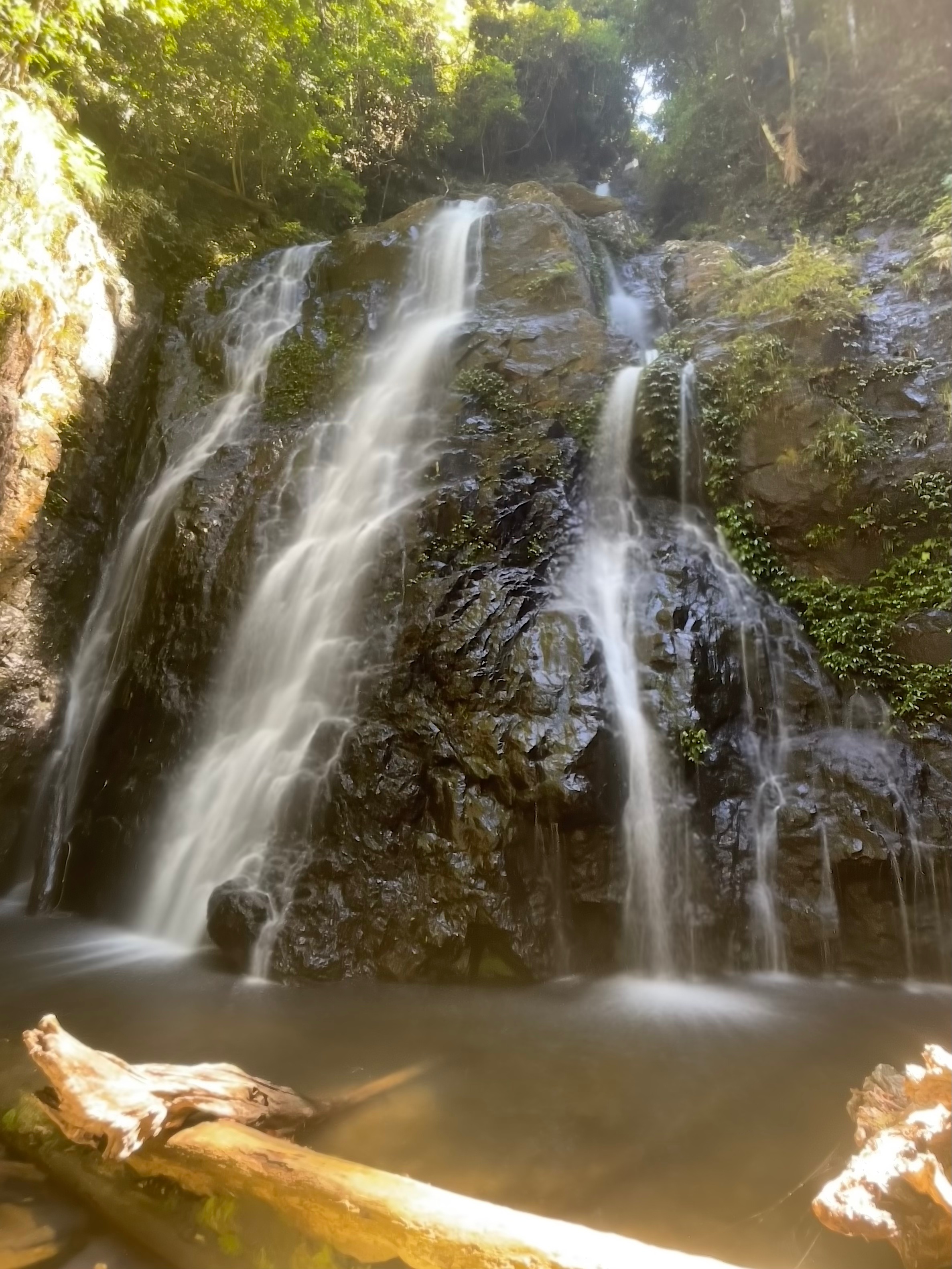
From here down the drops come with just short walks between.

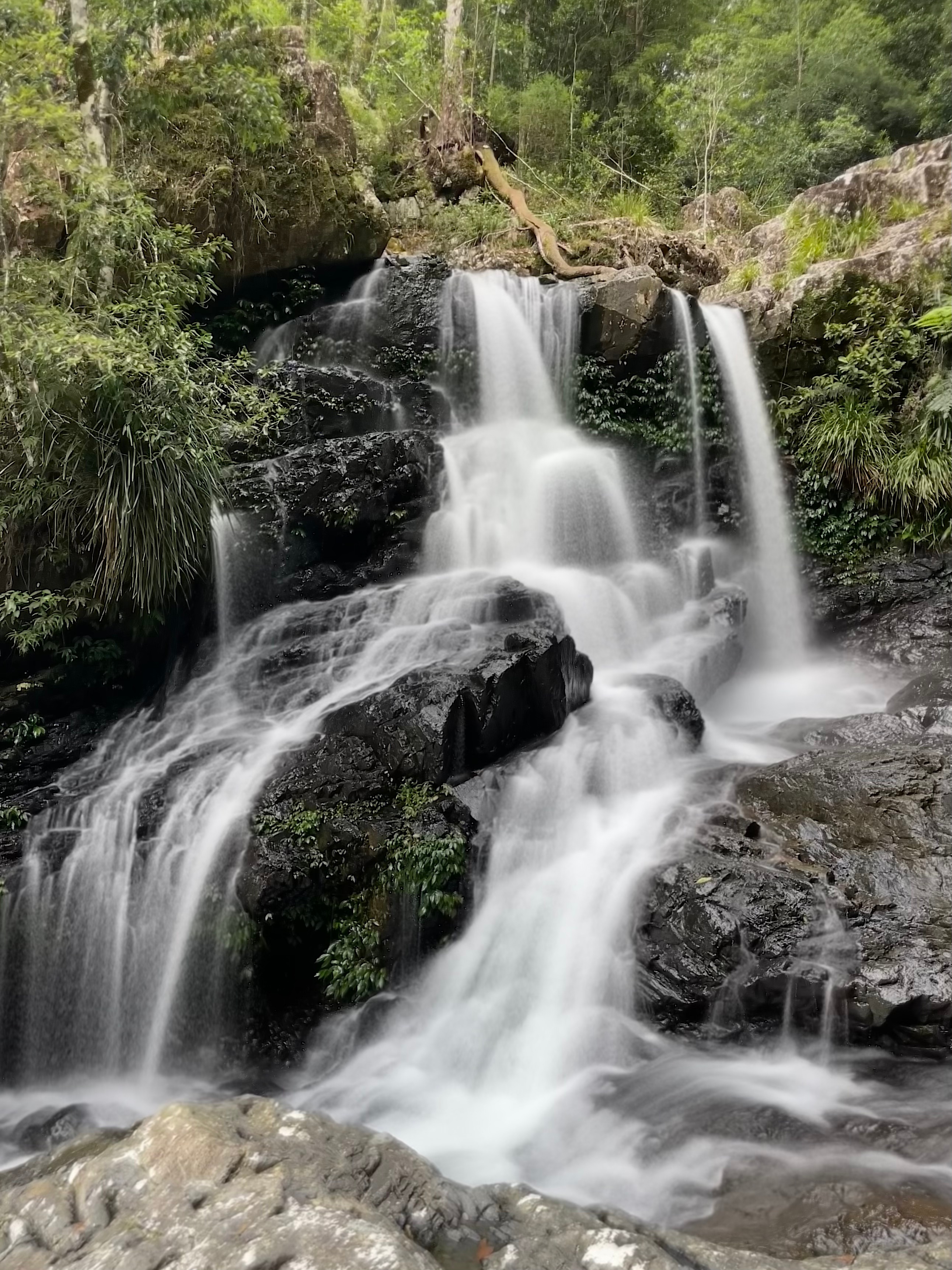
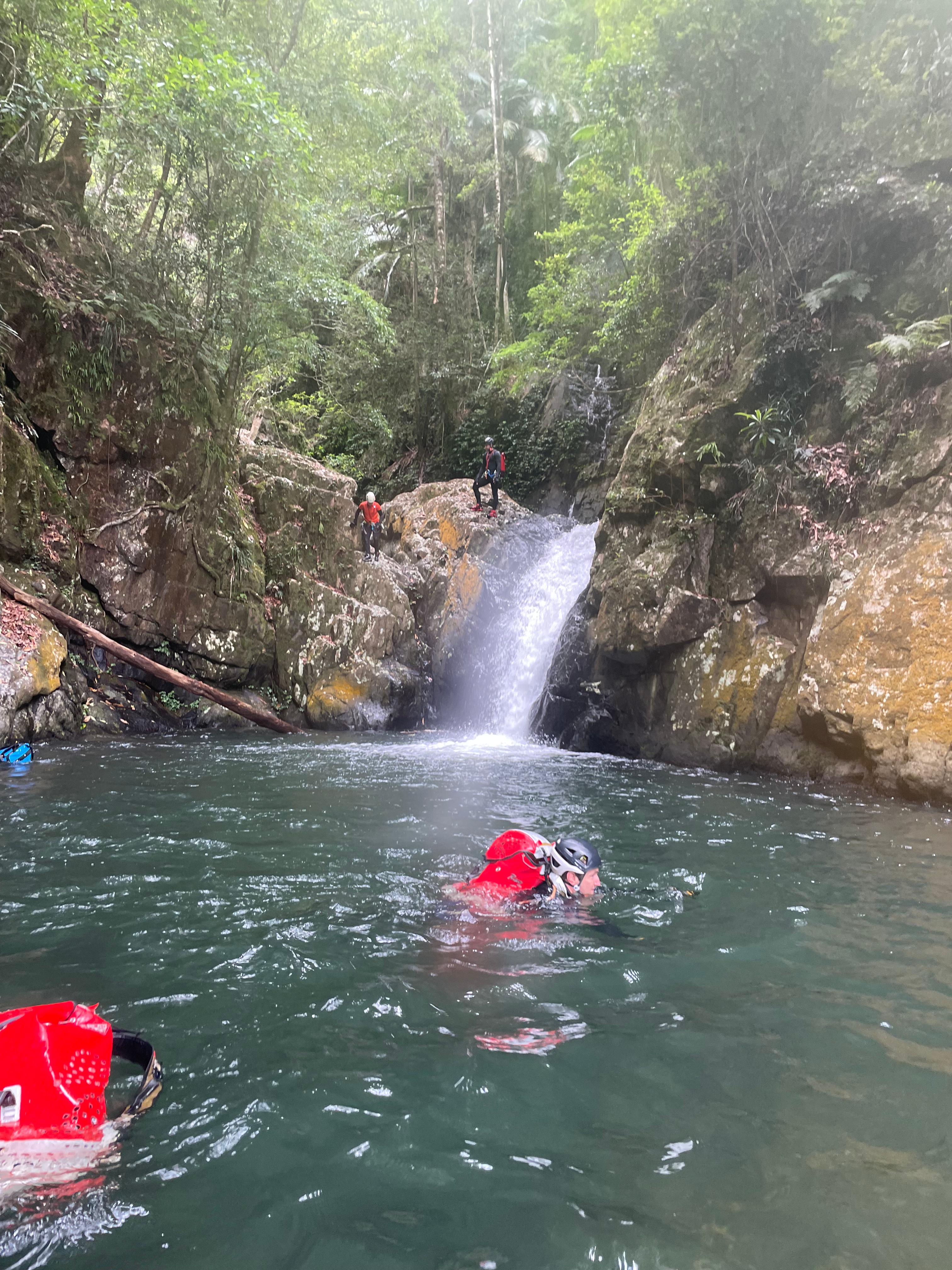
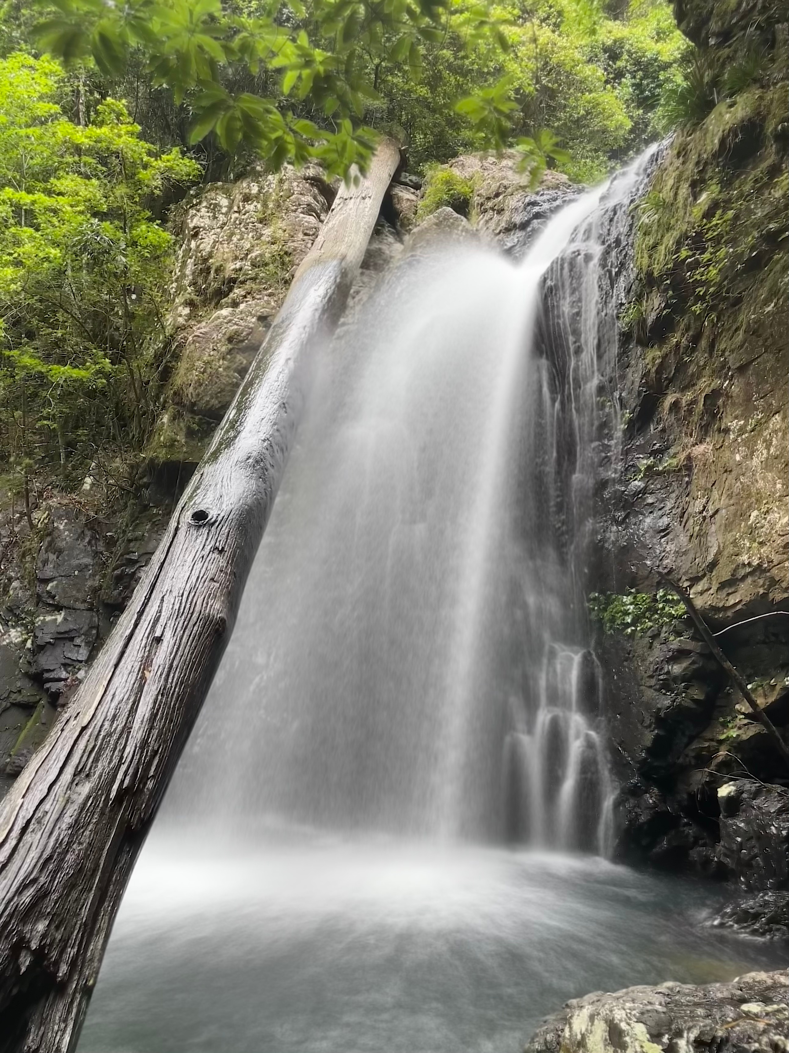
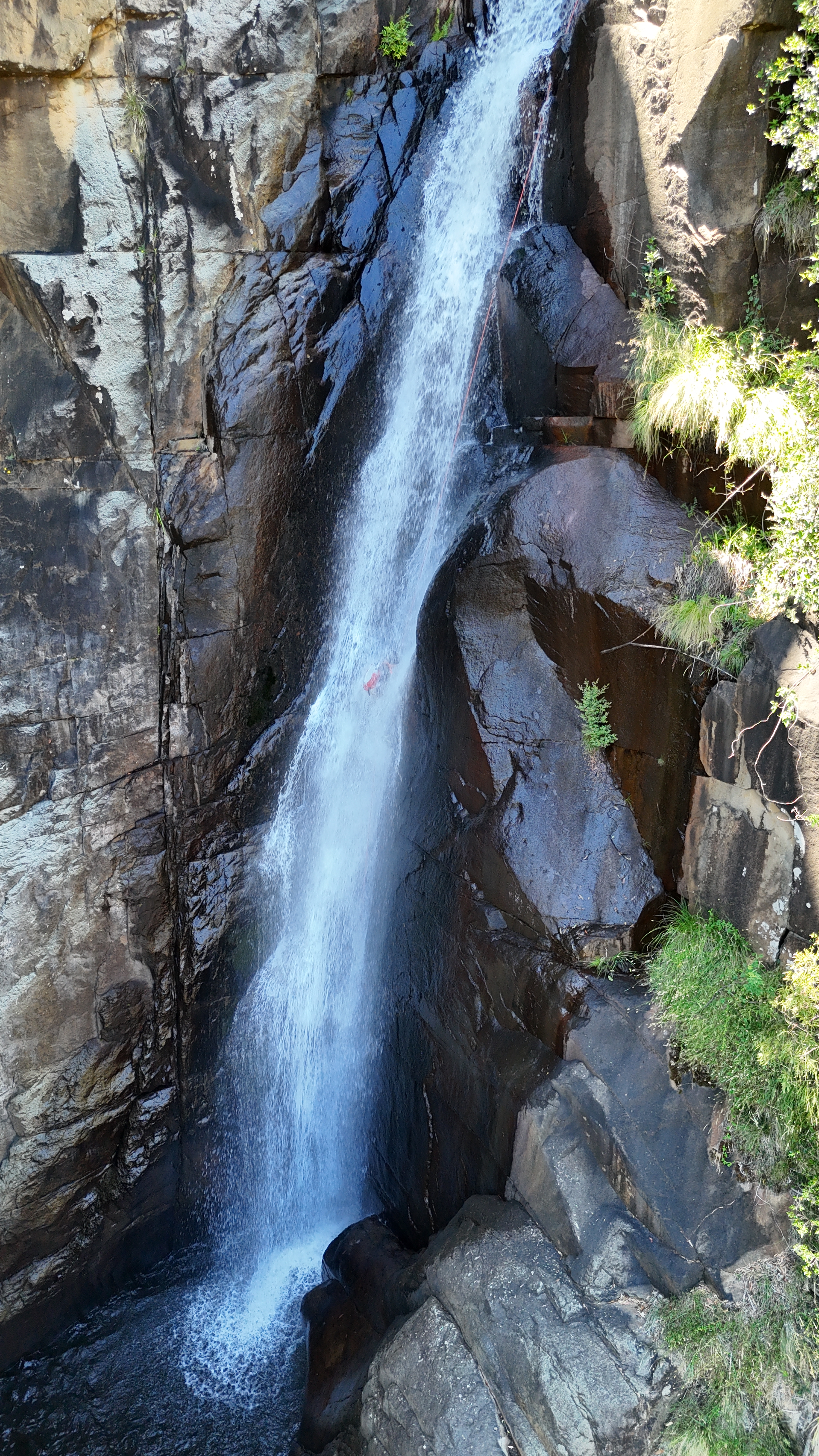
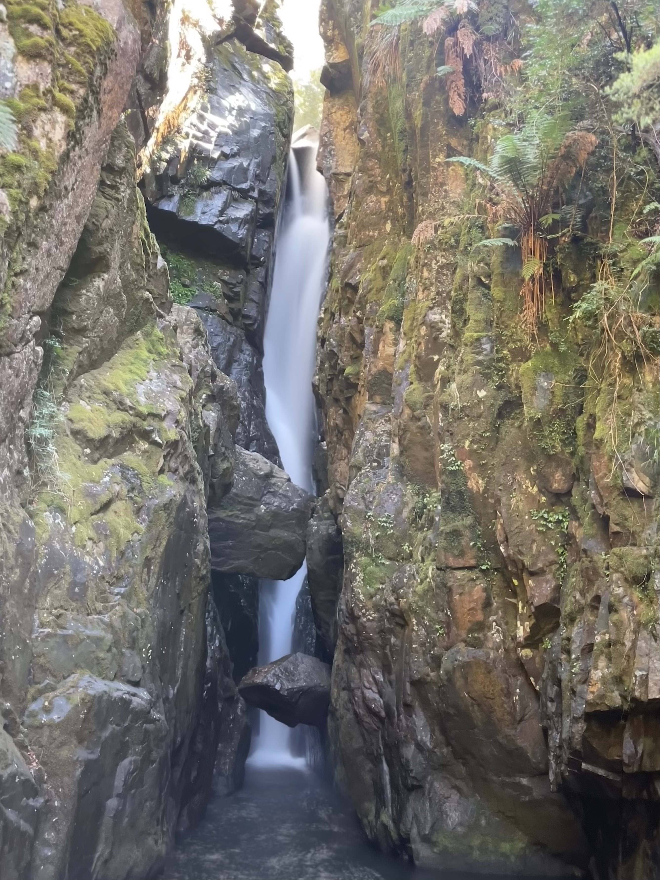
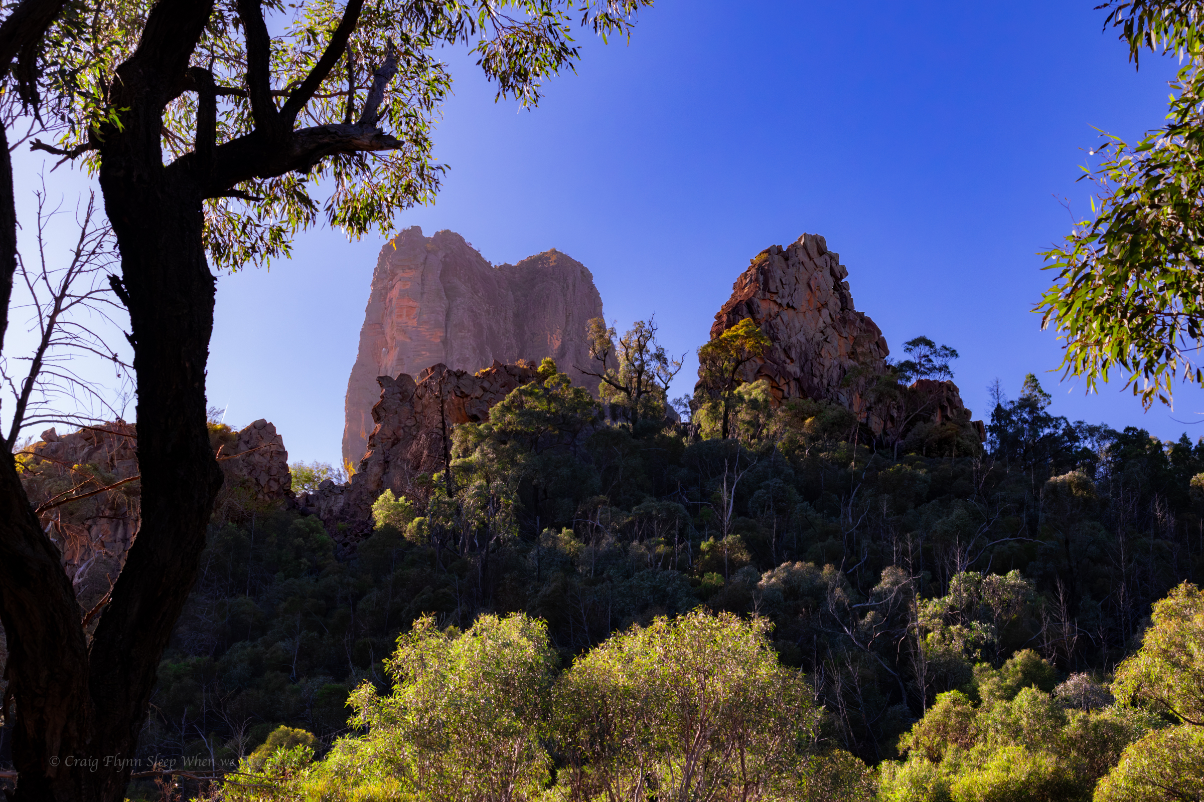
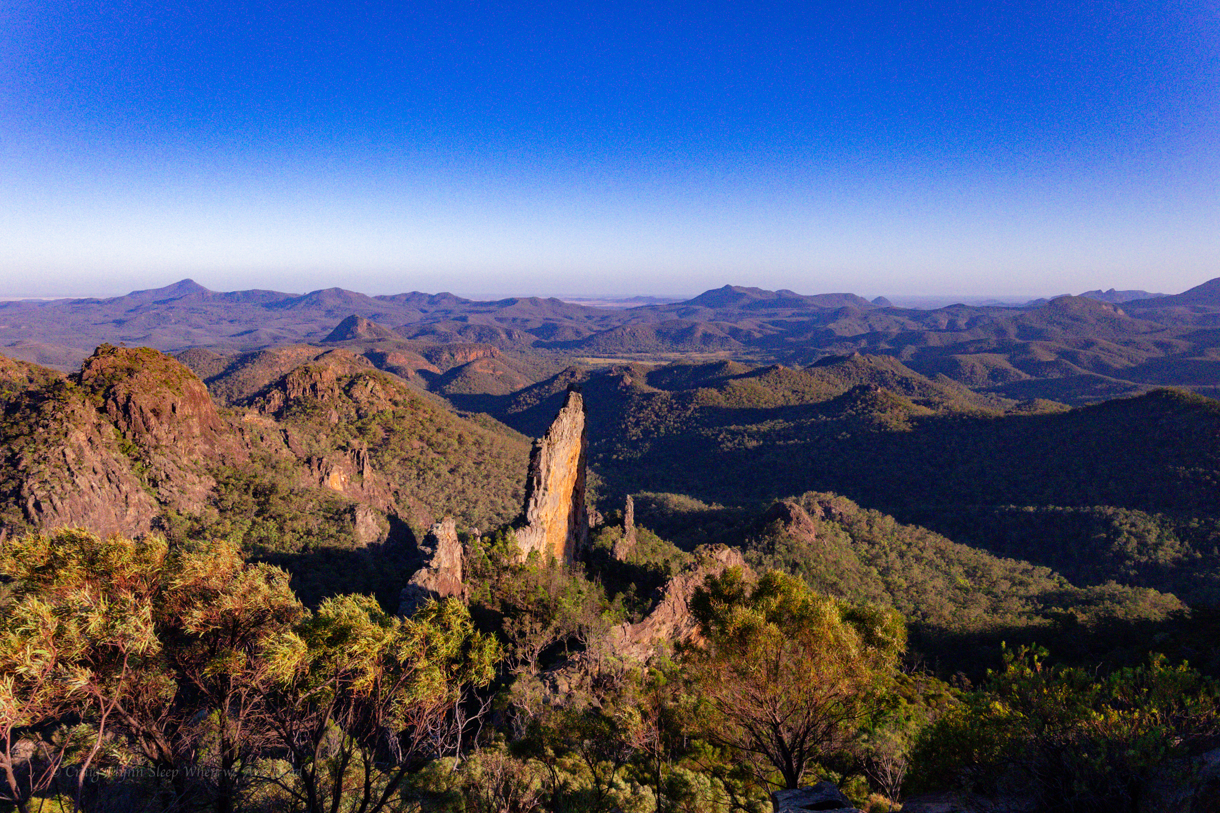
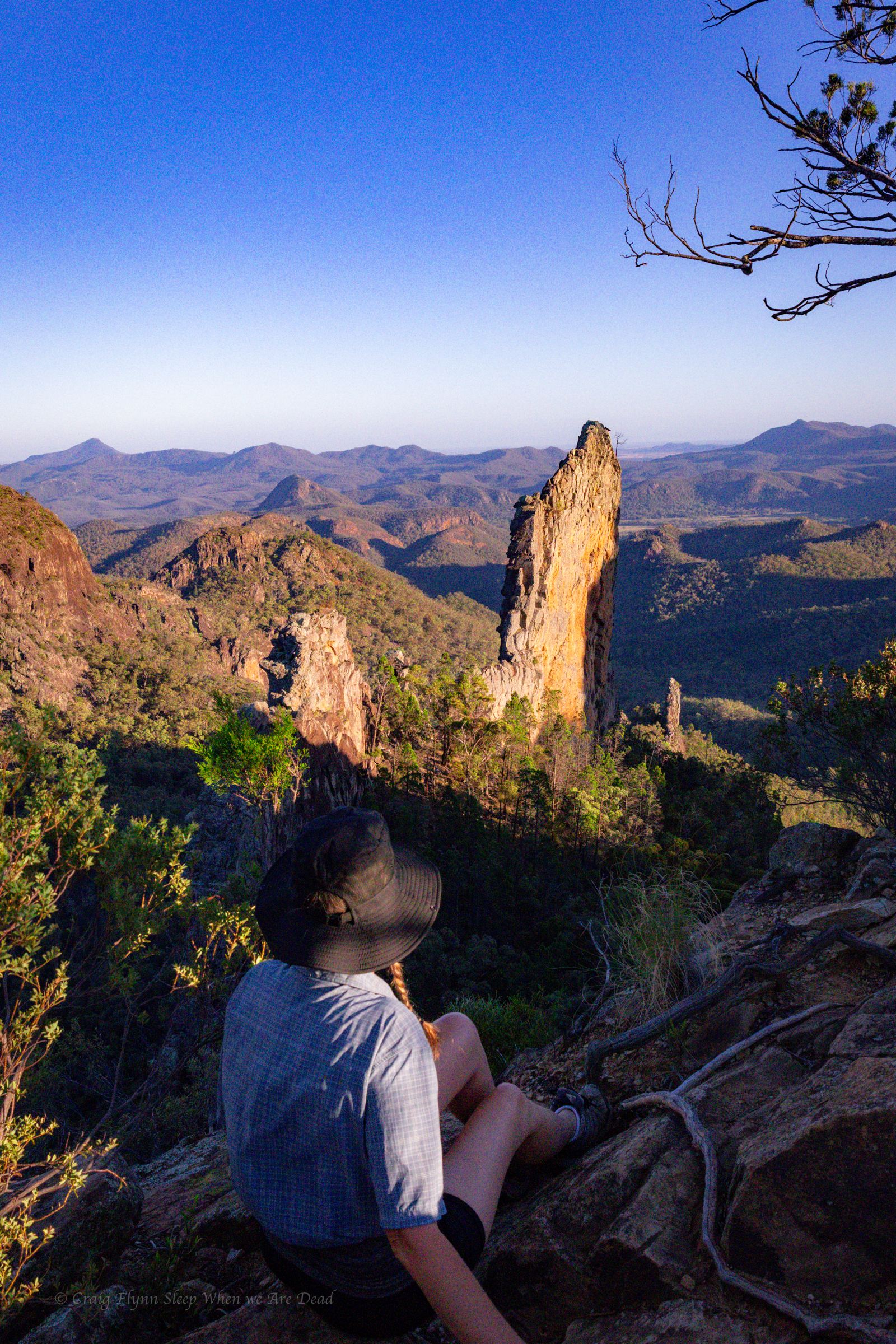
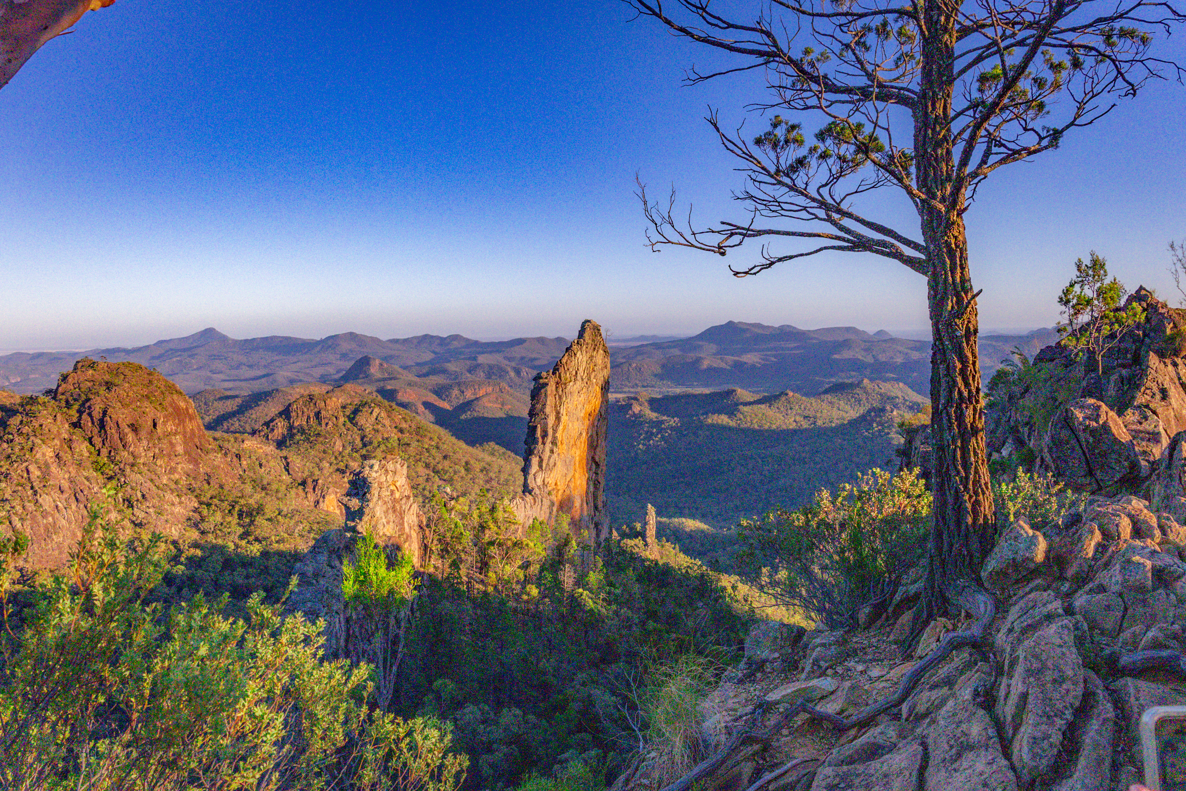
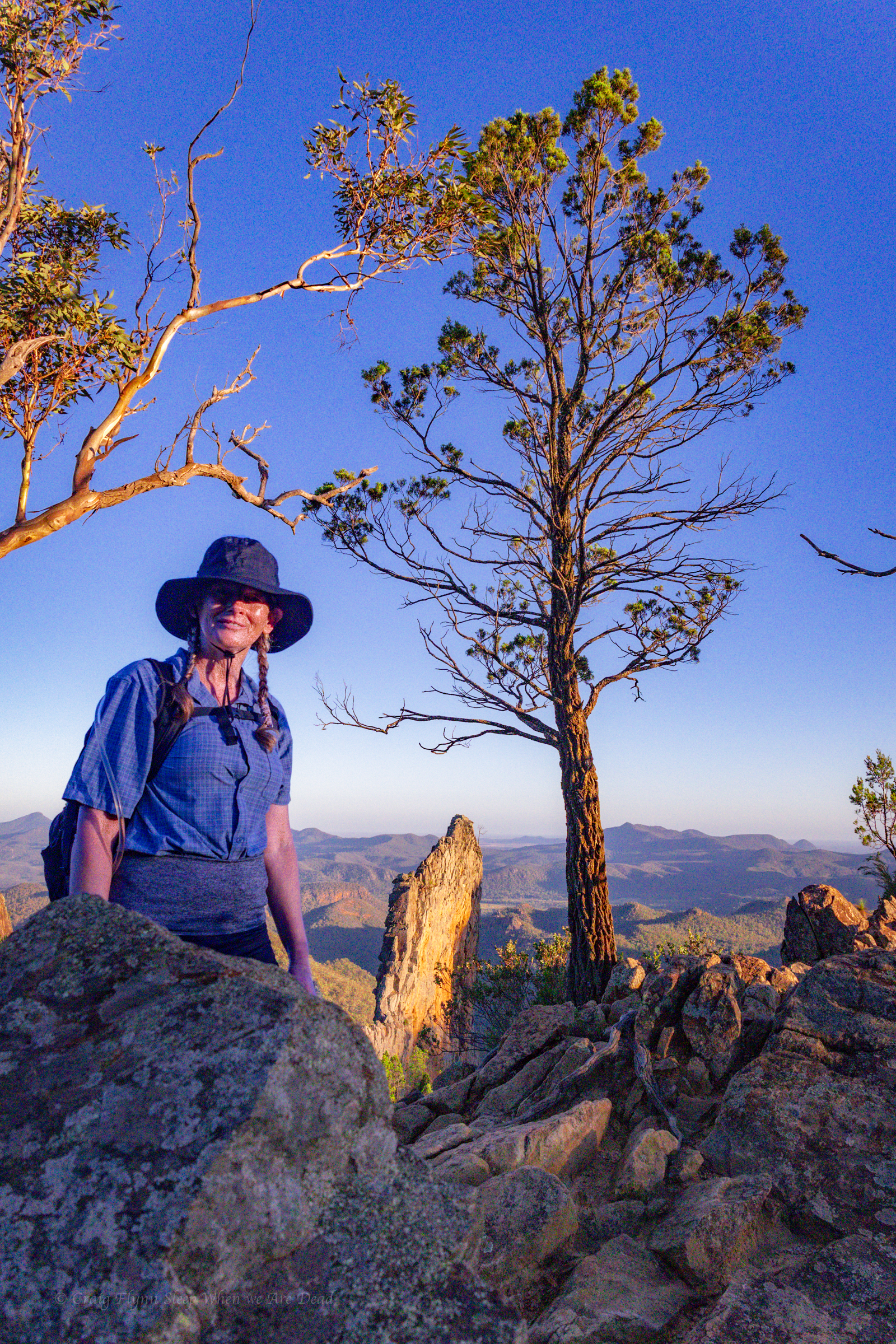
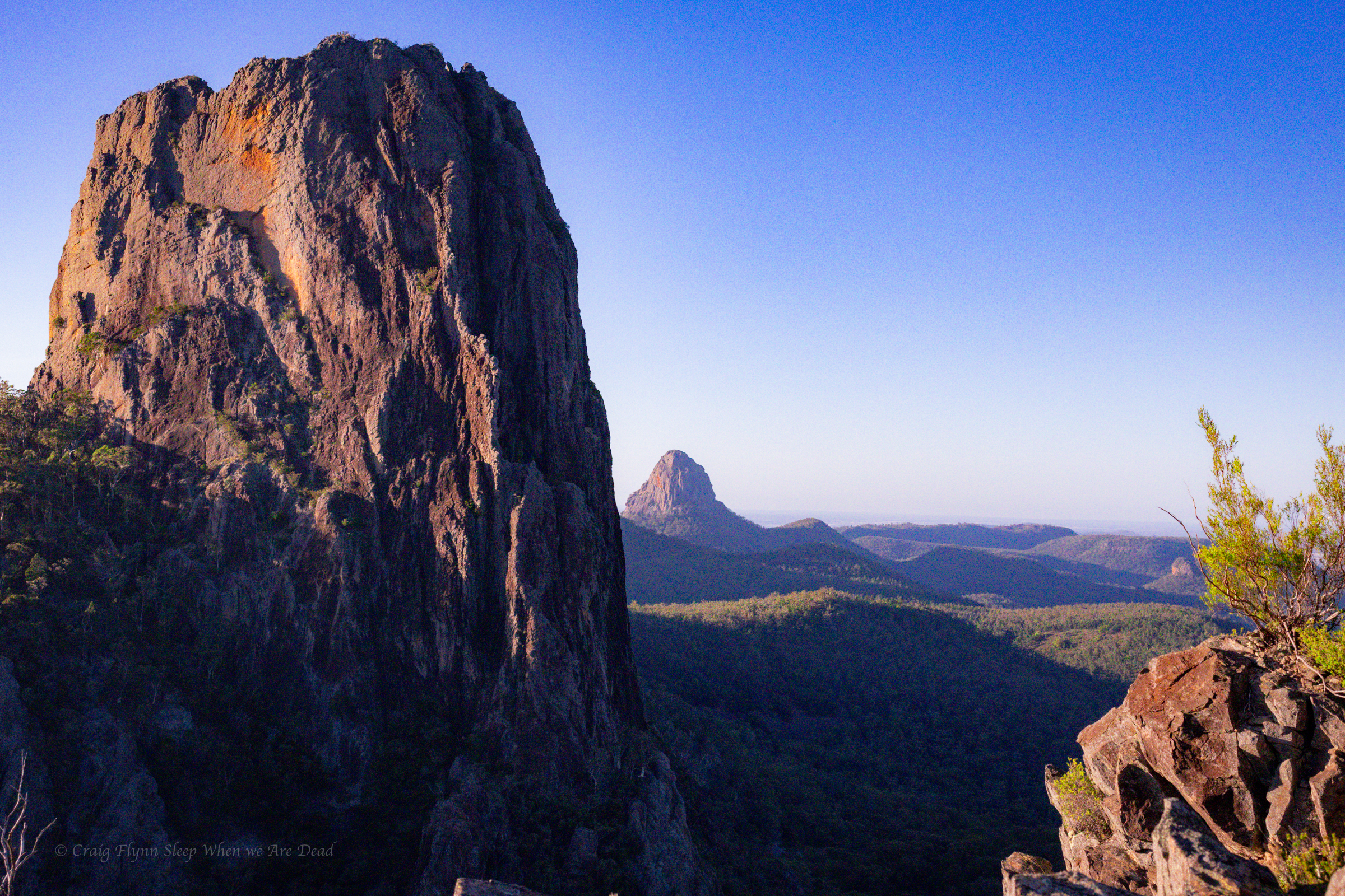
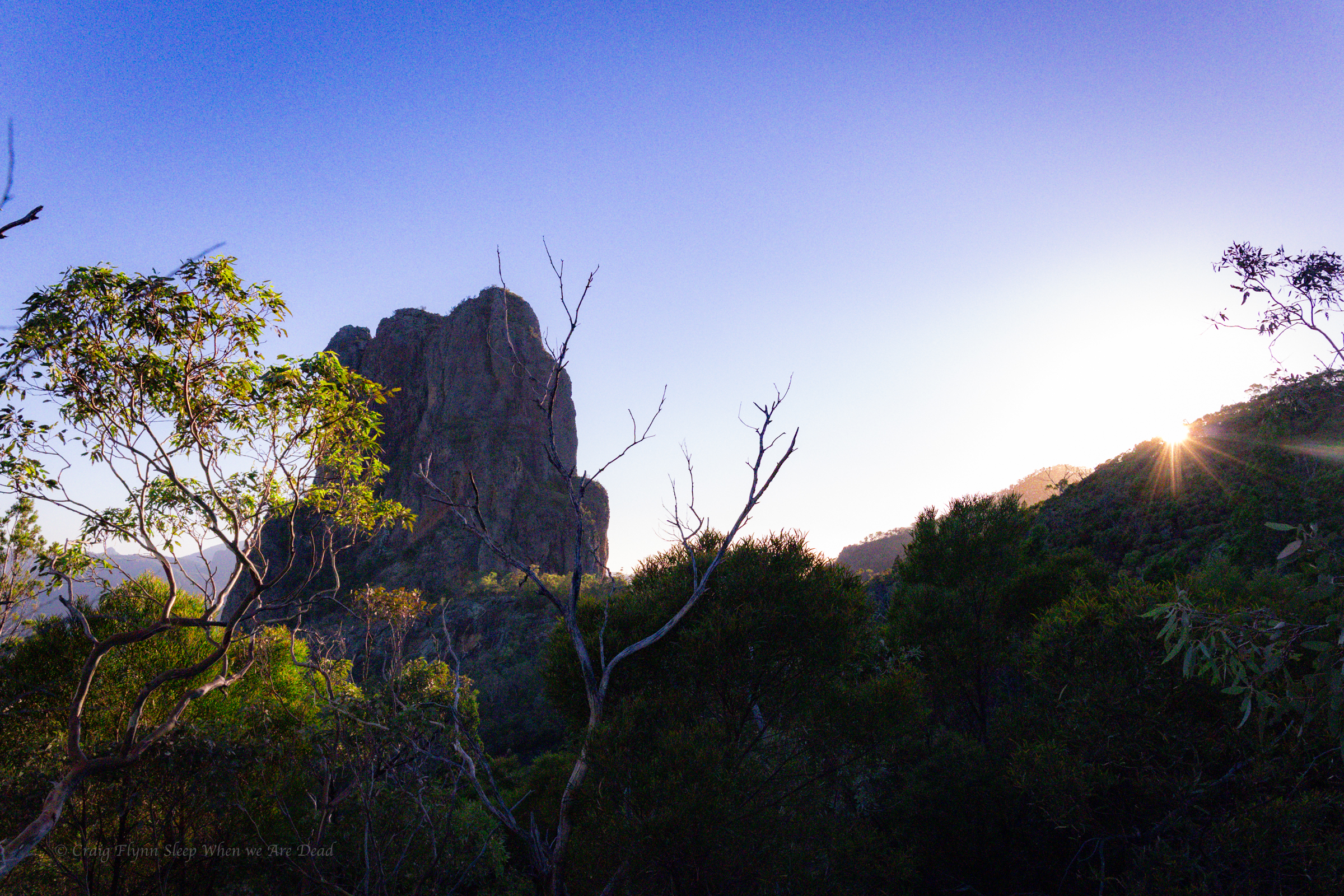
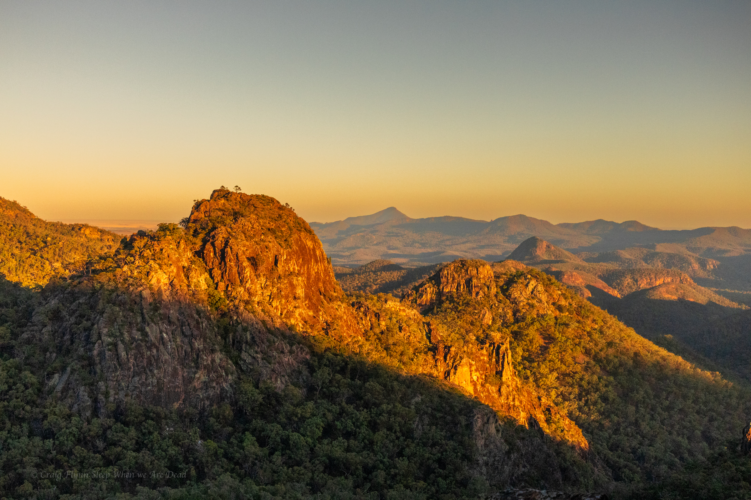
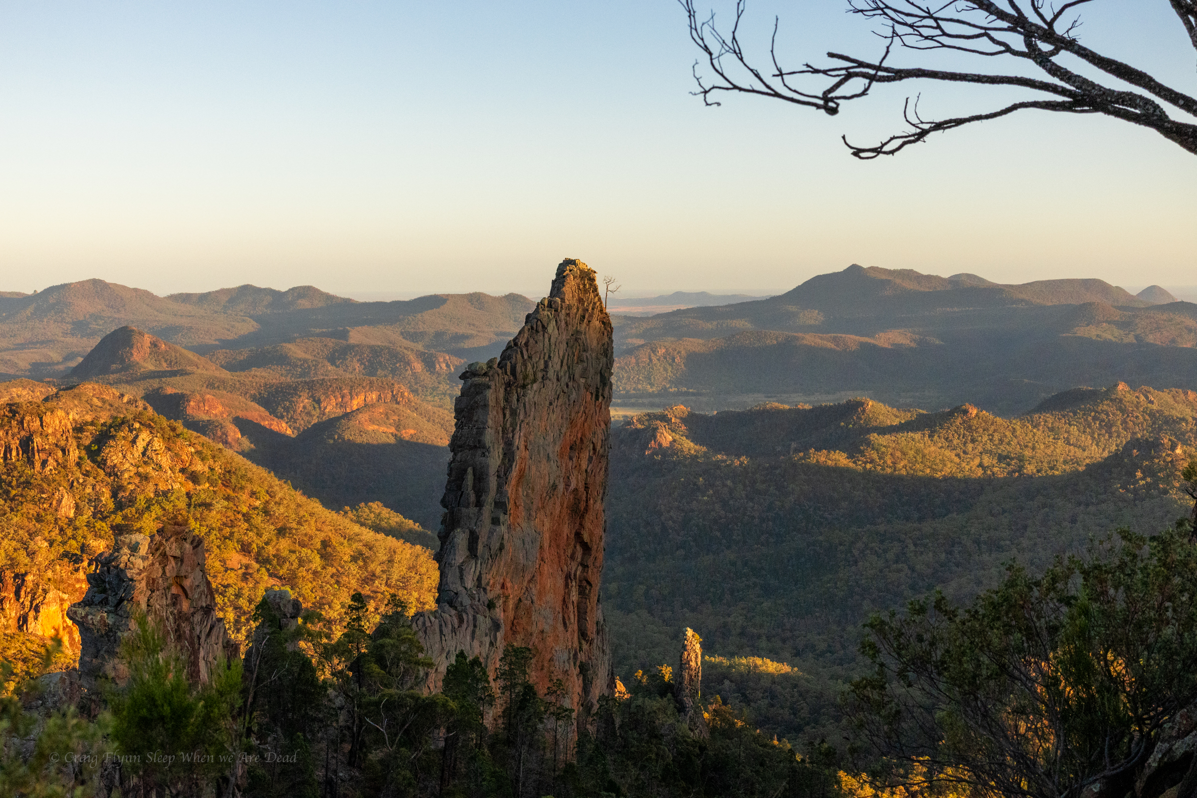
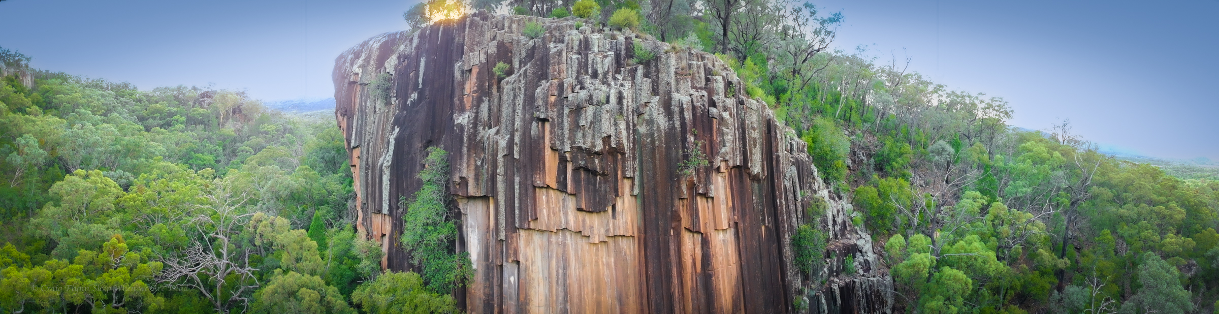
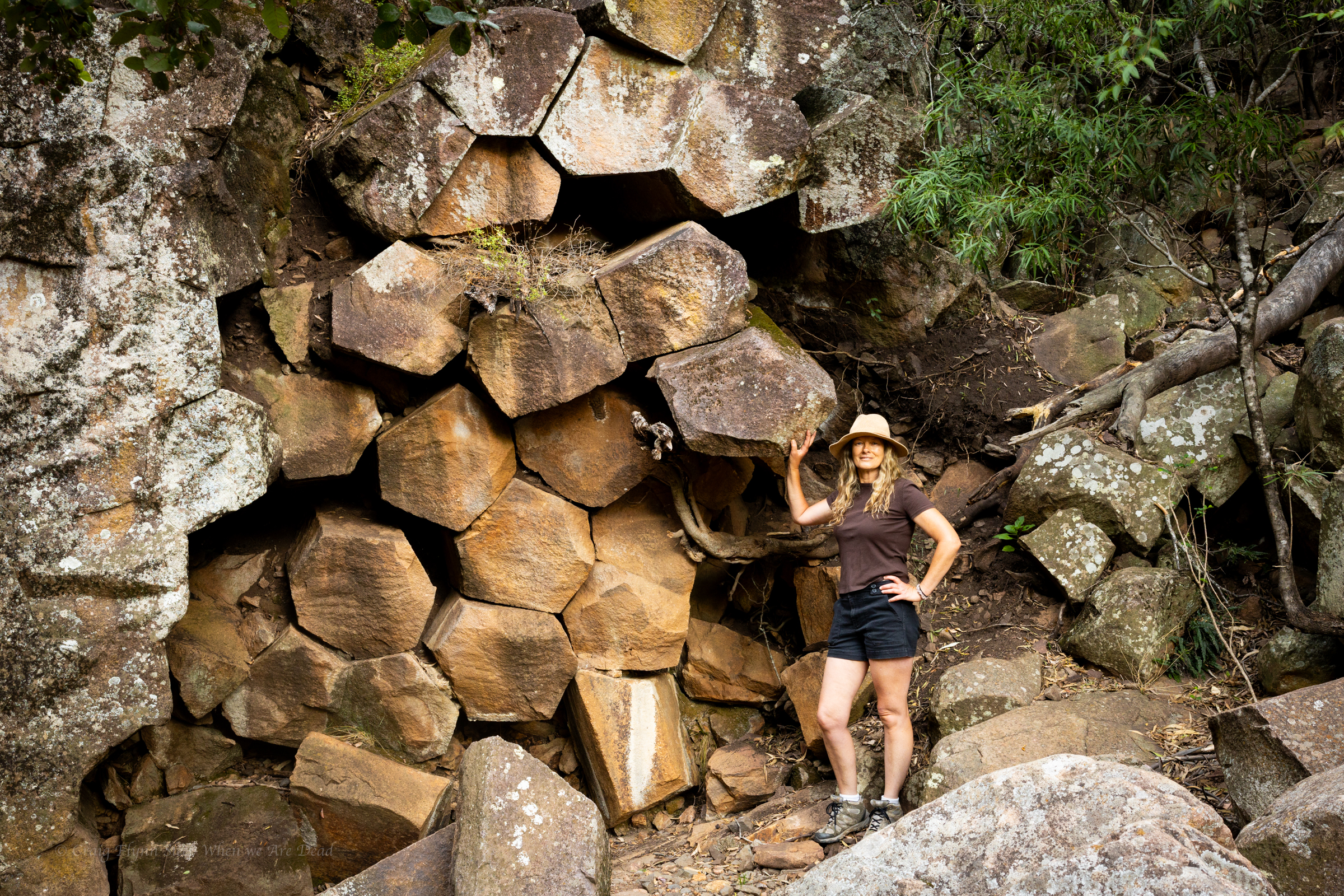
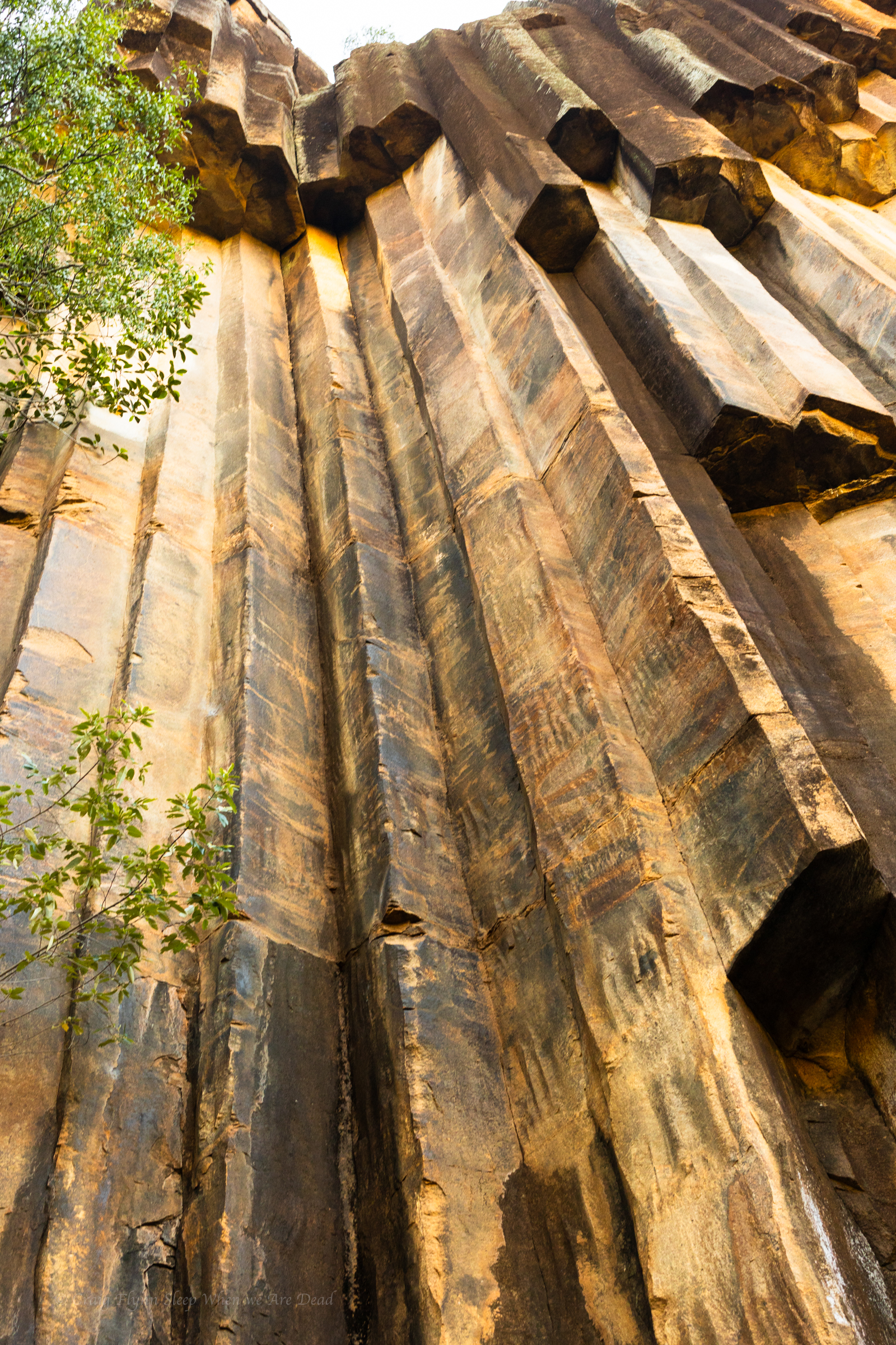
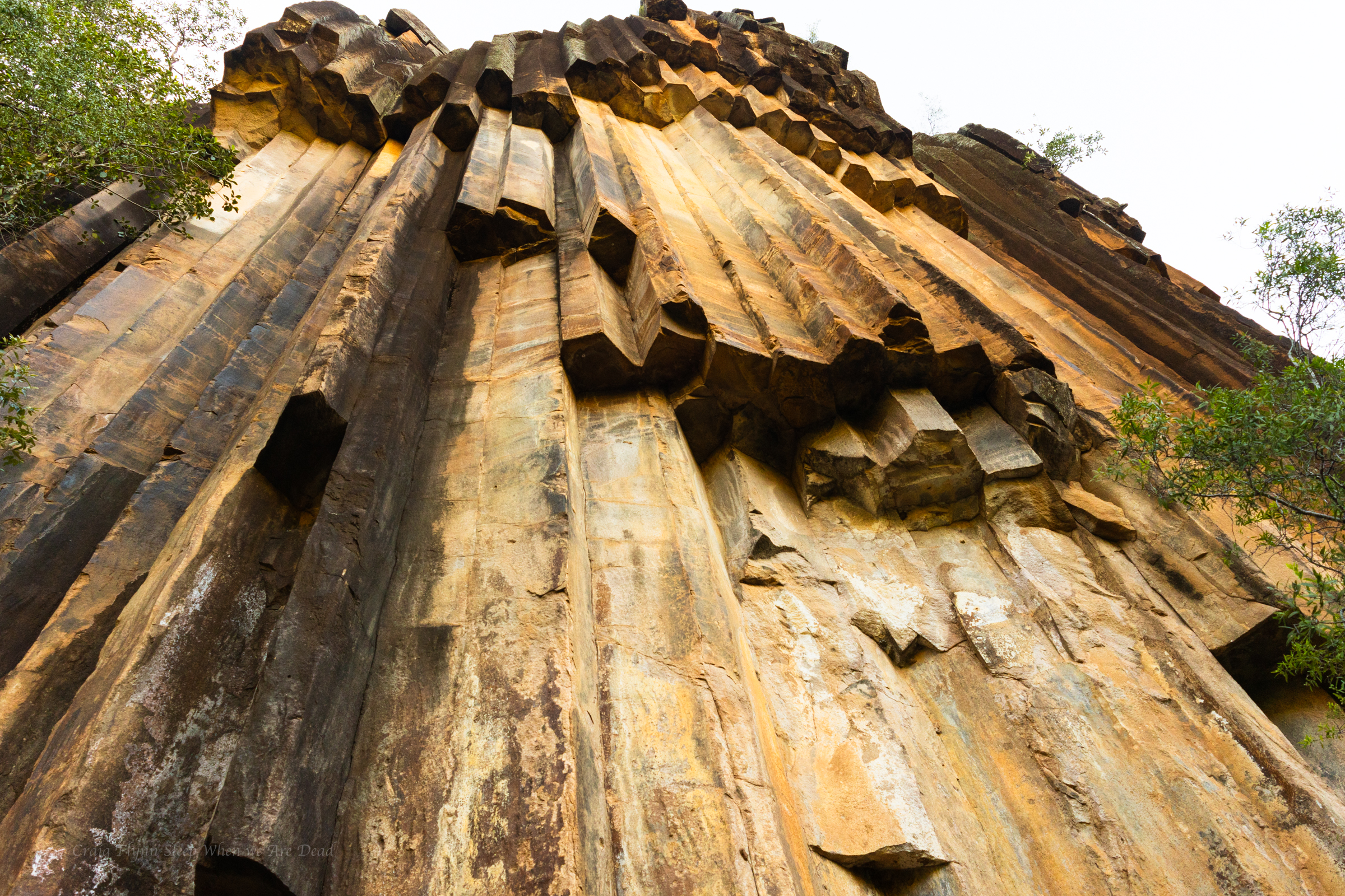
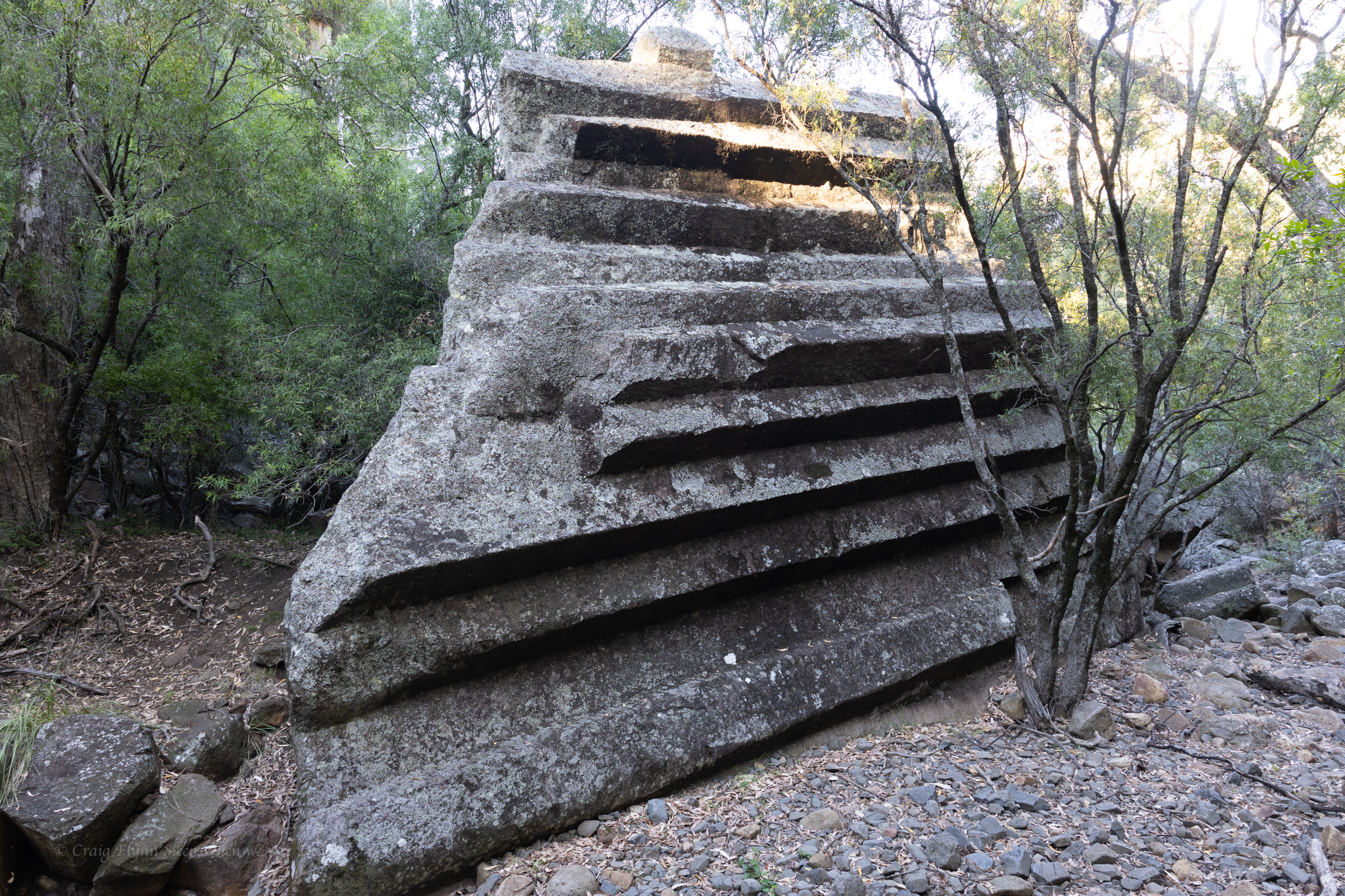
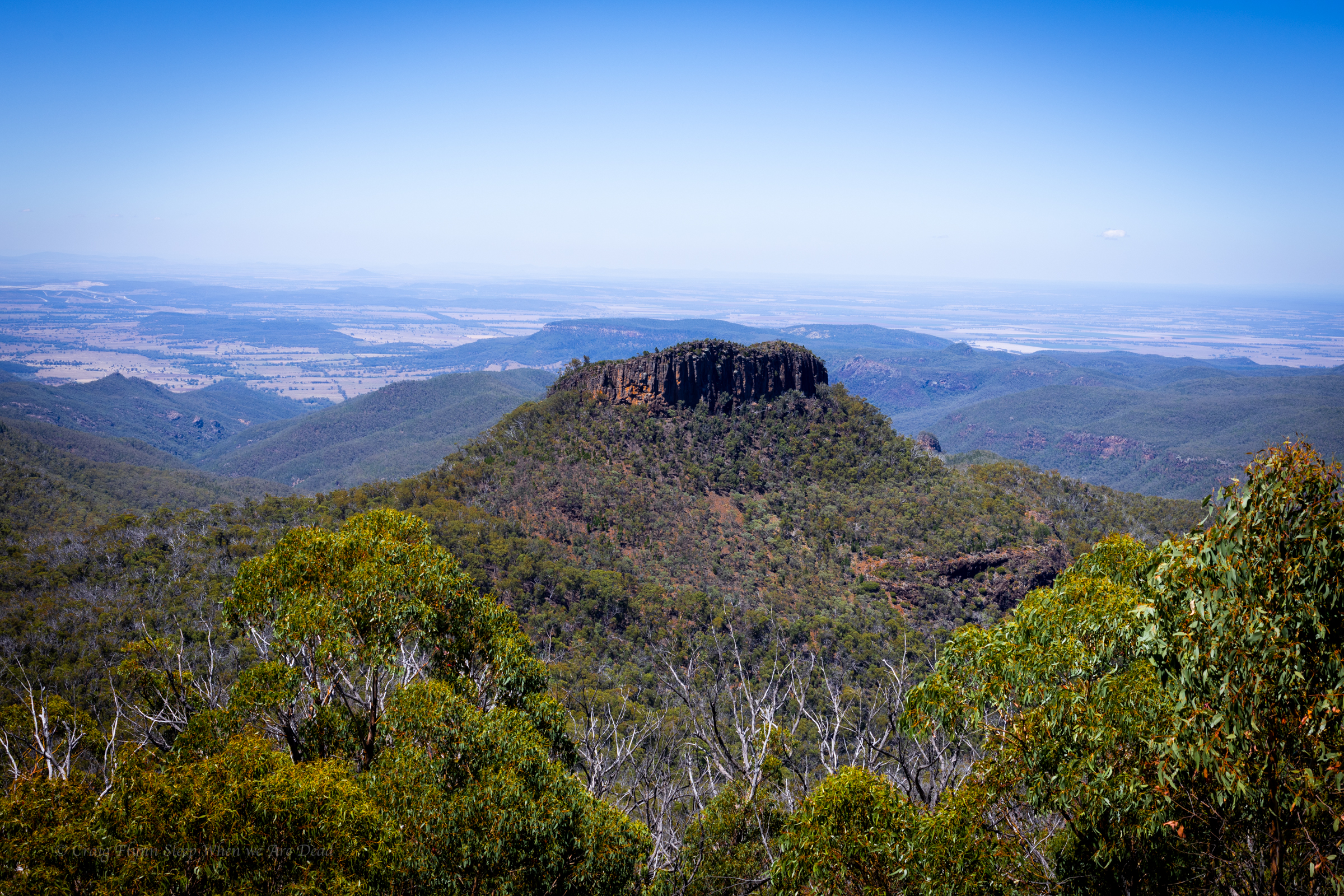
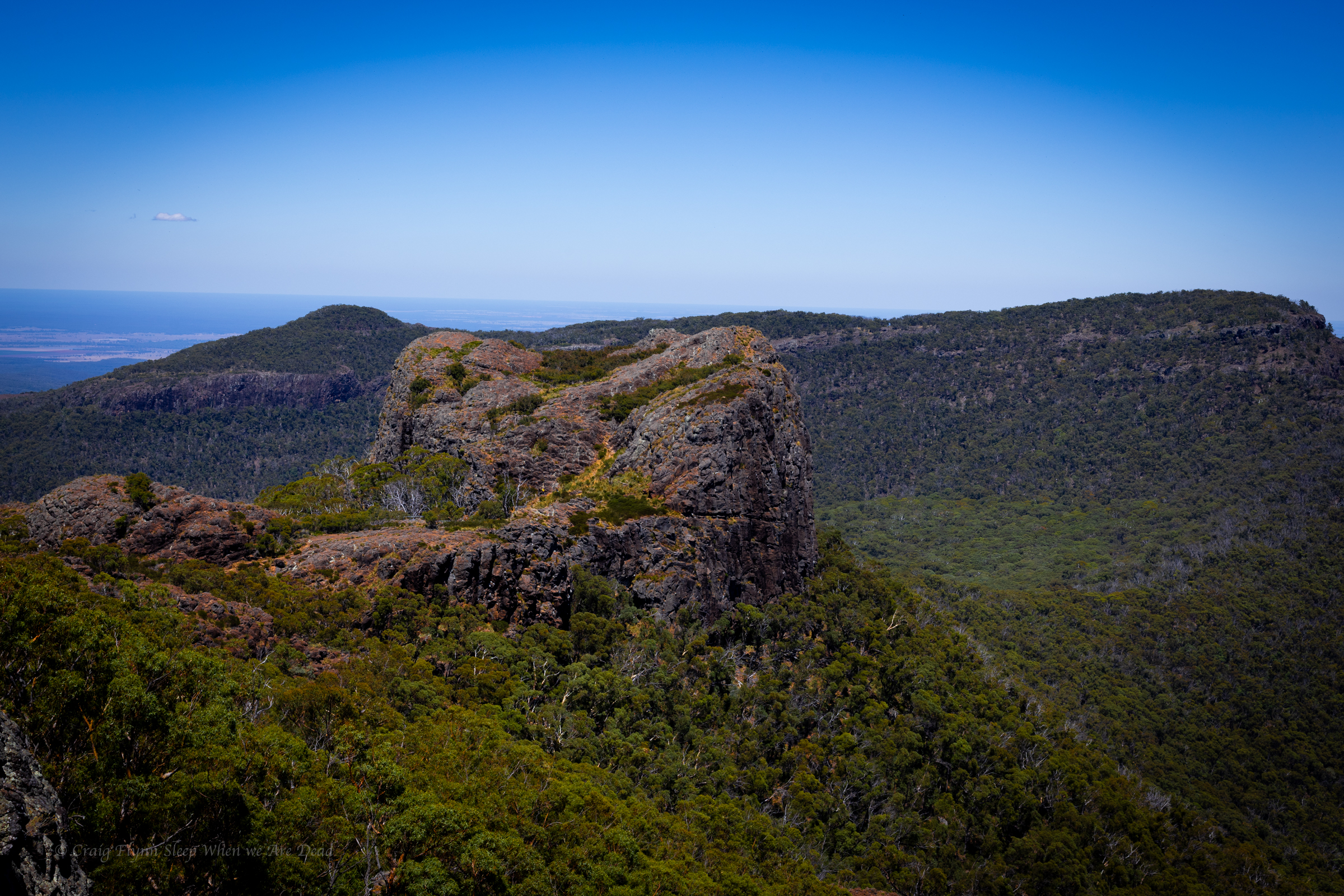
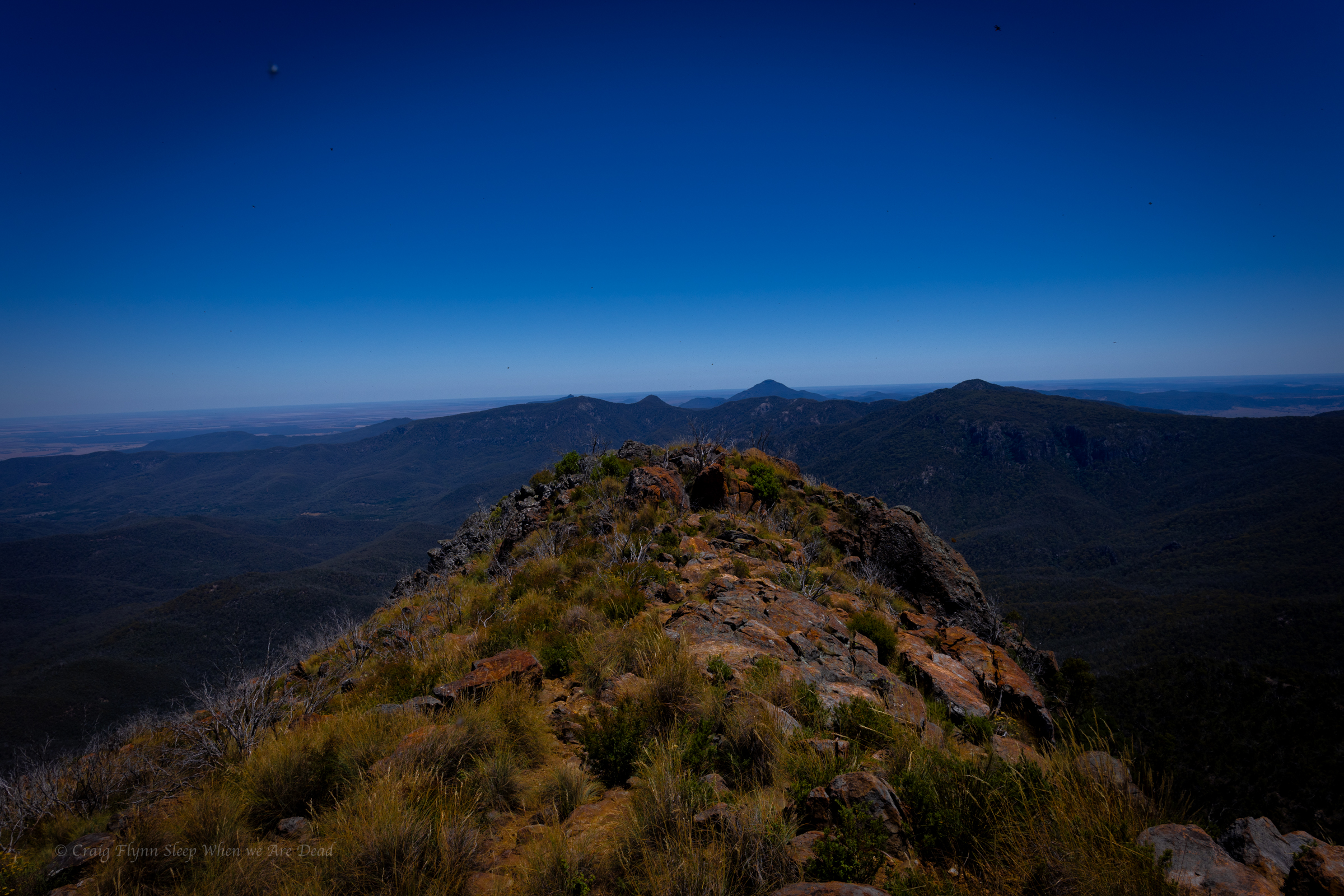
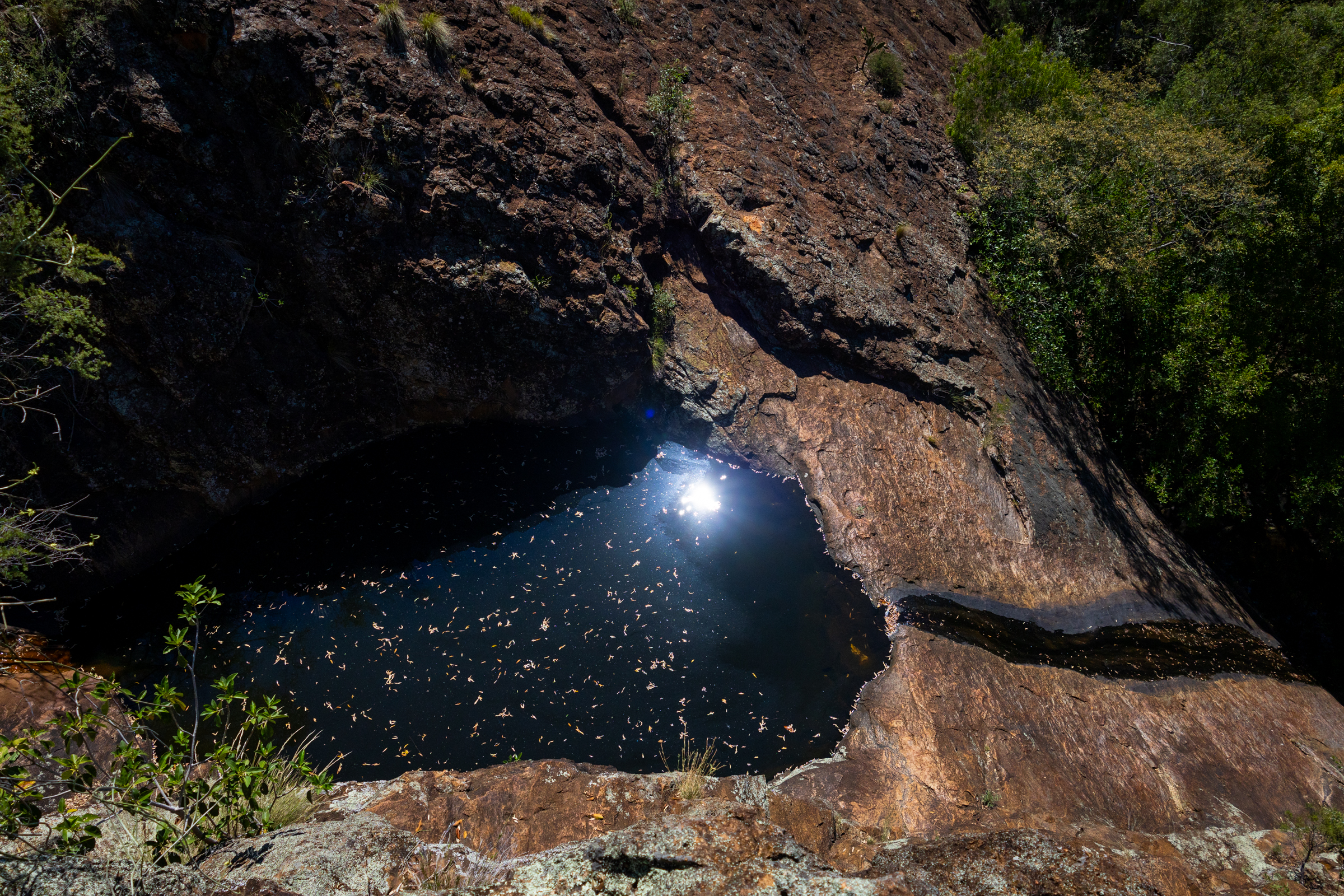
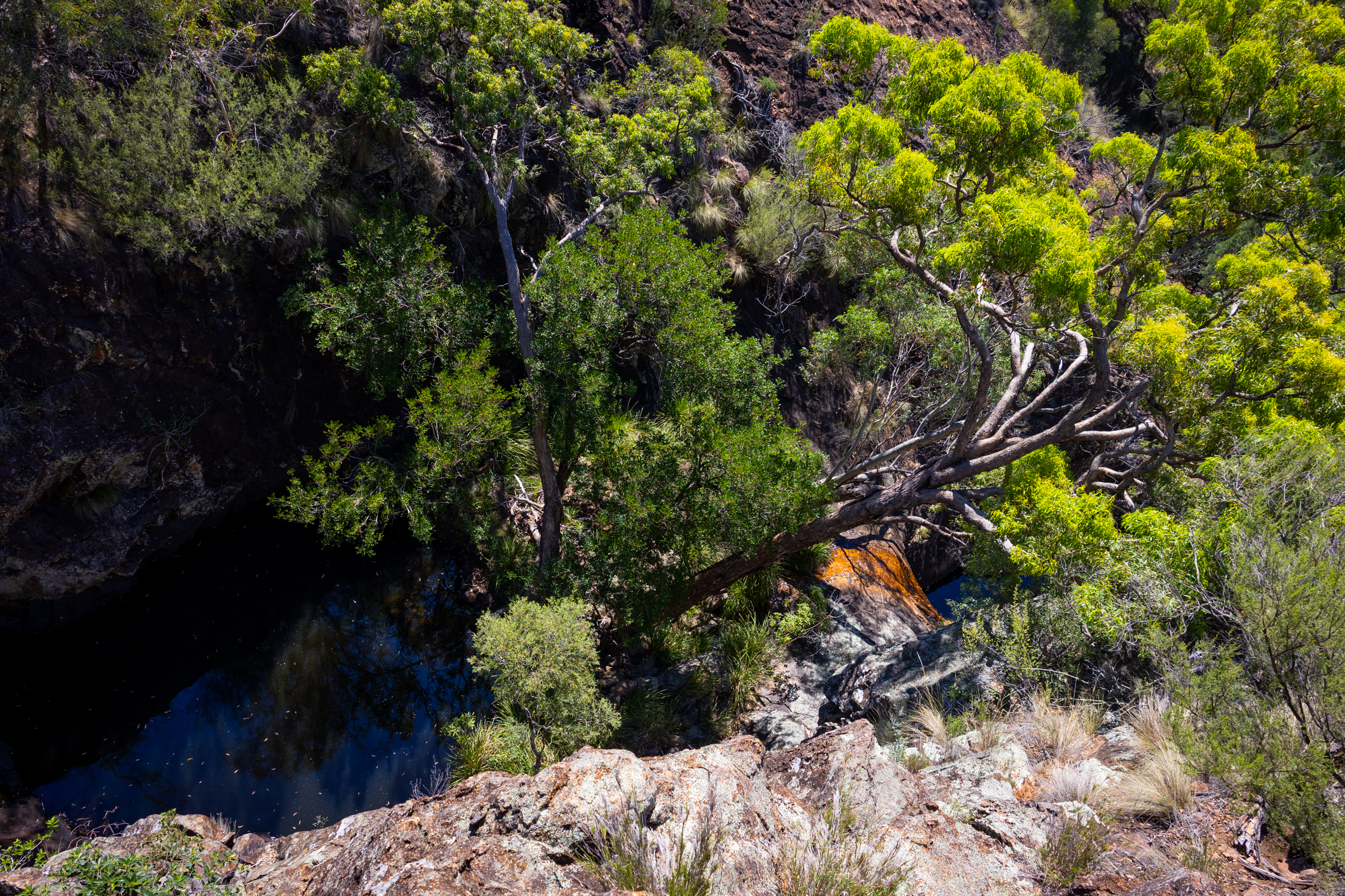
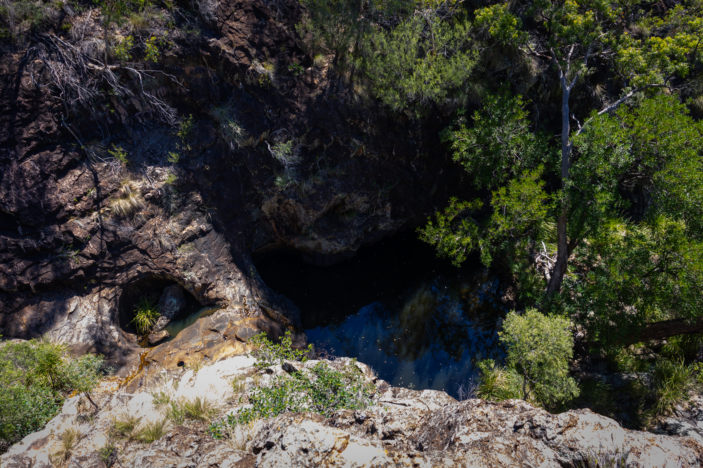
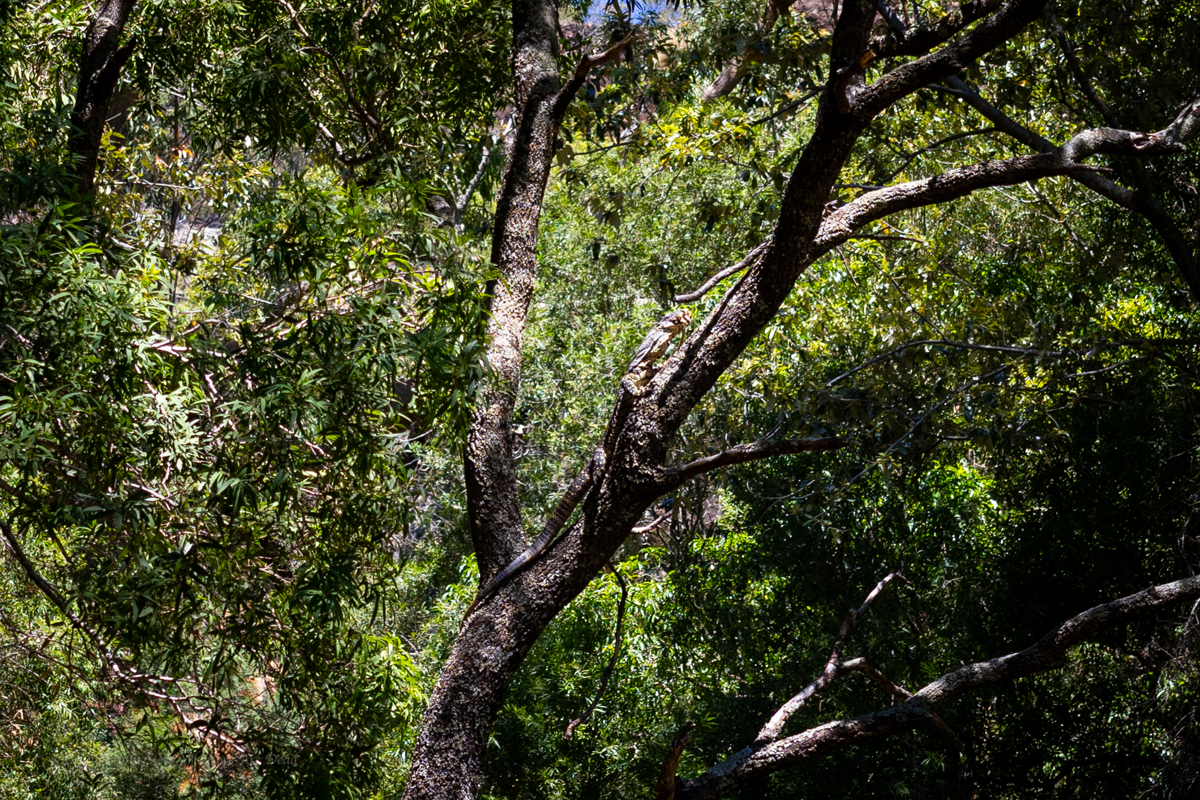
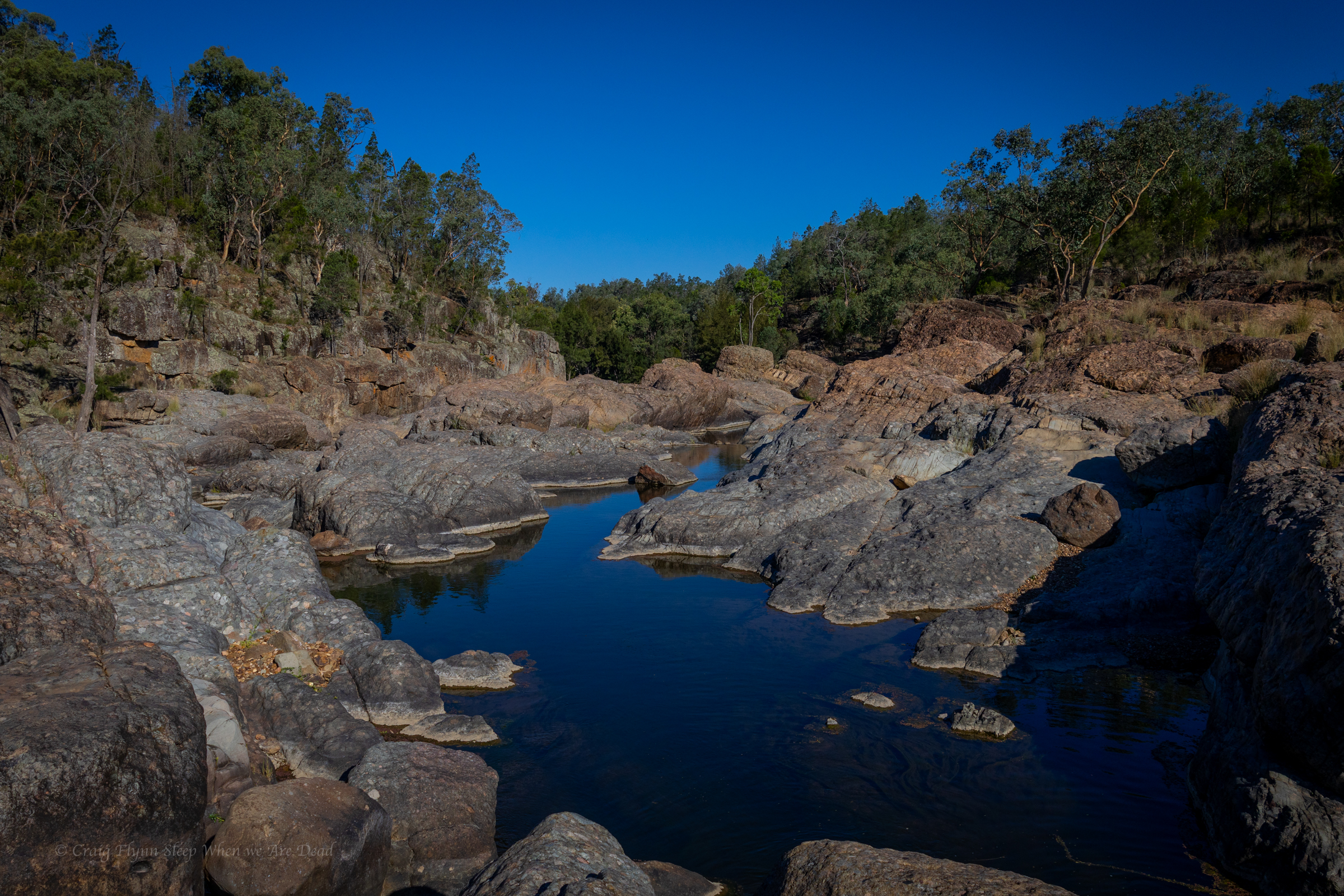
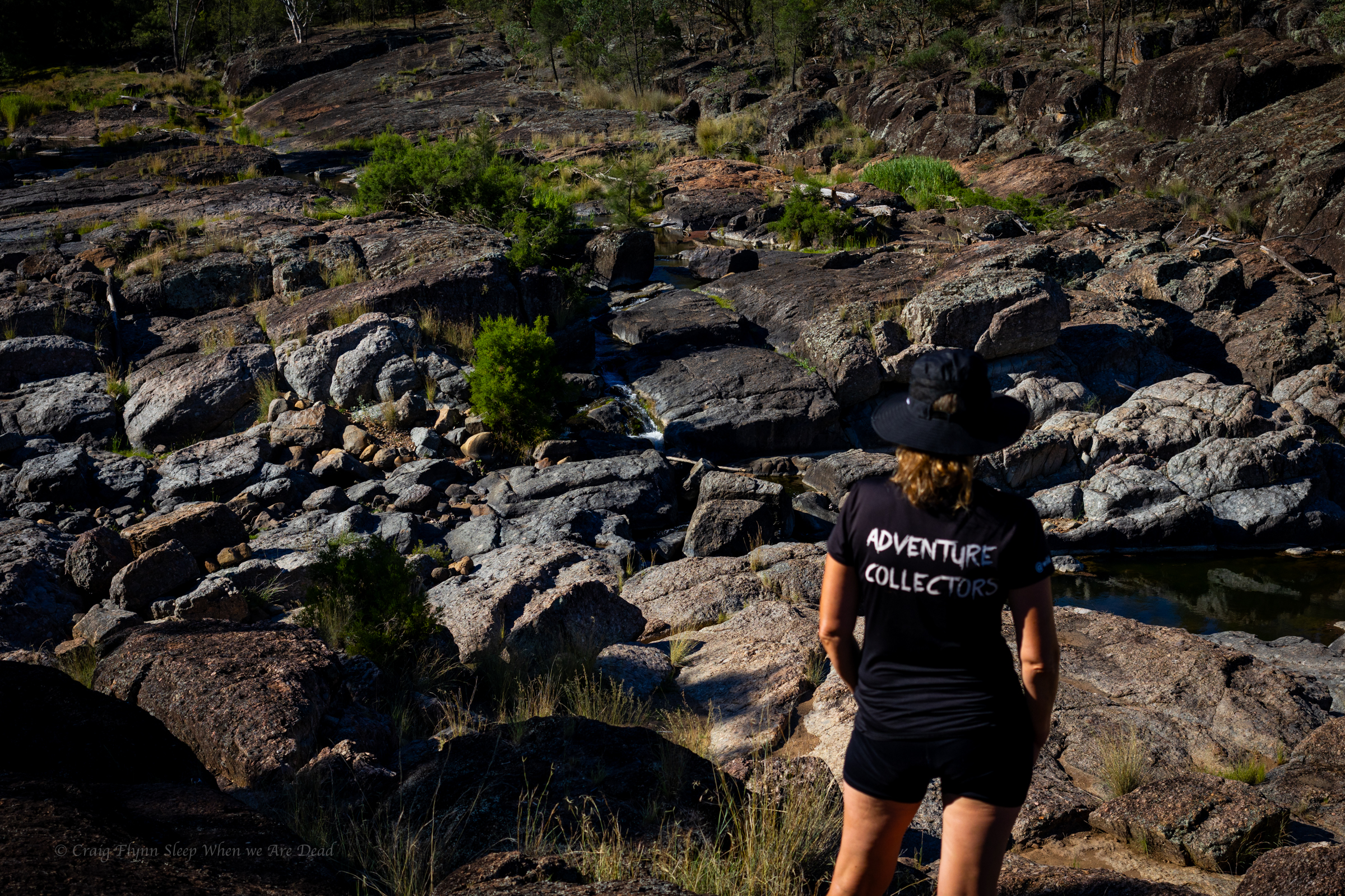
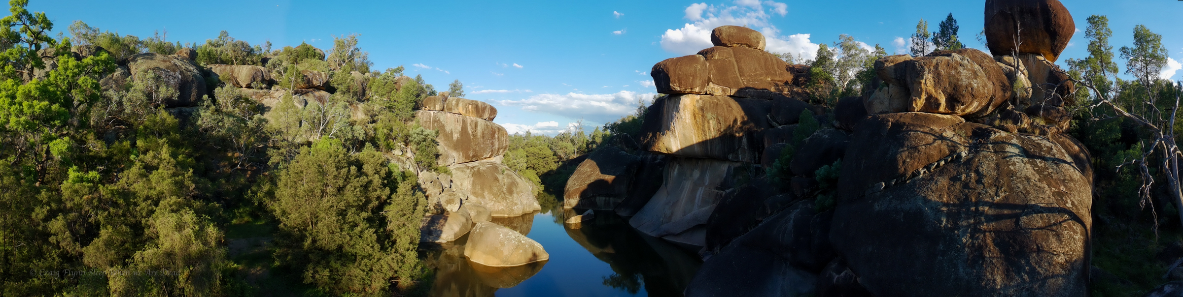
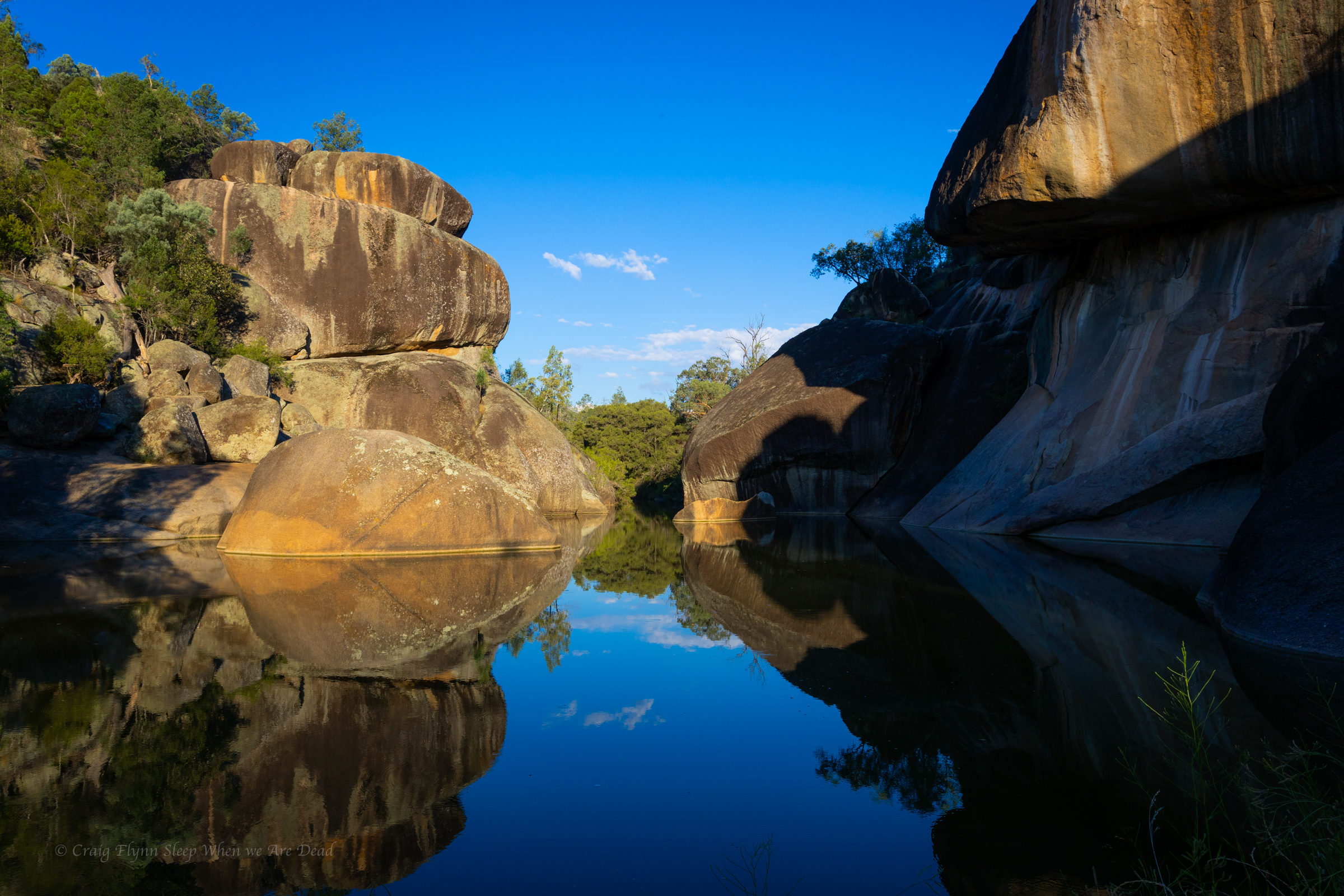
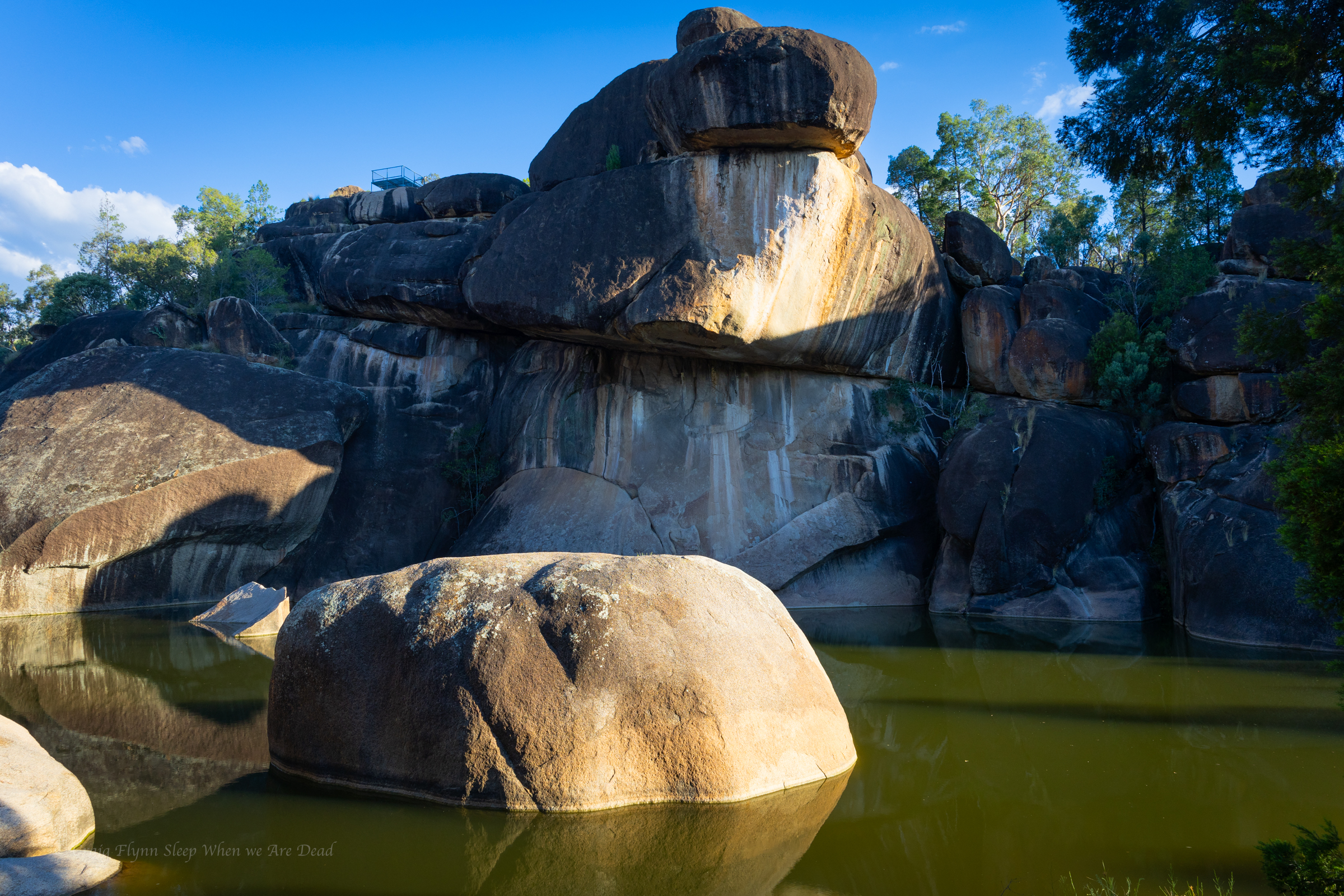
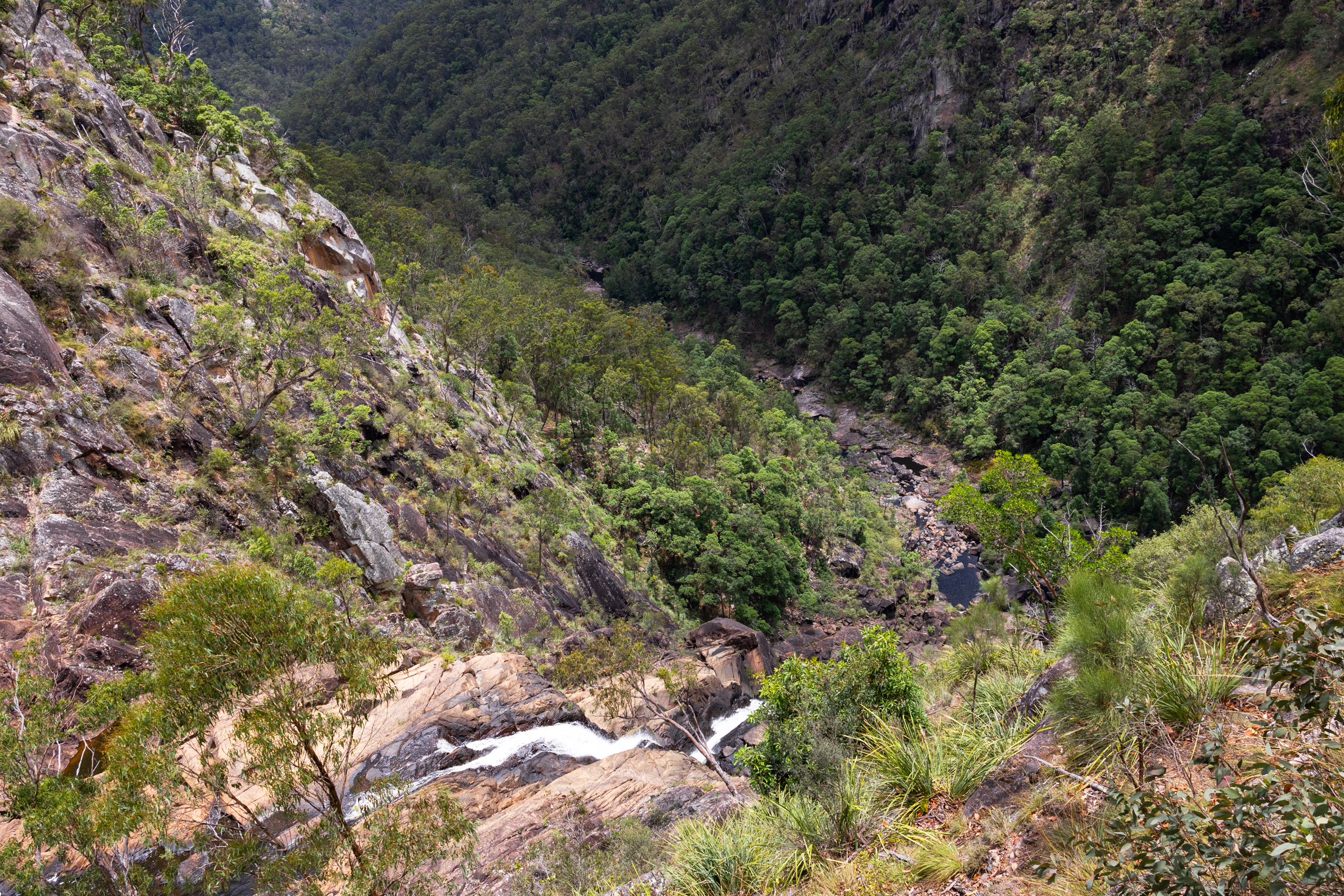
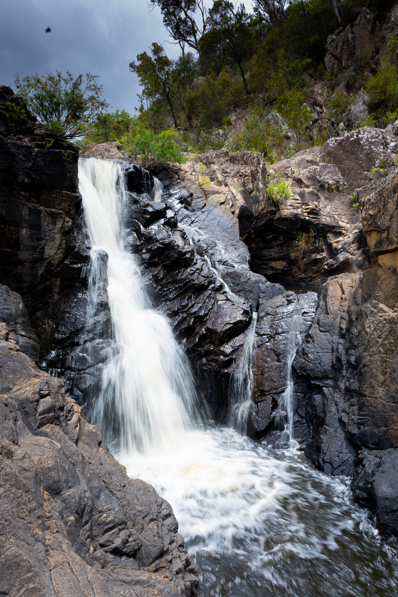
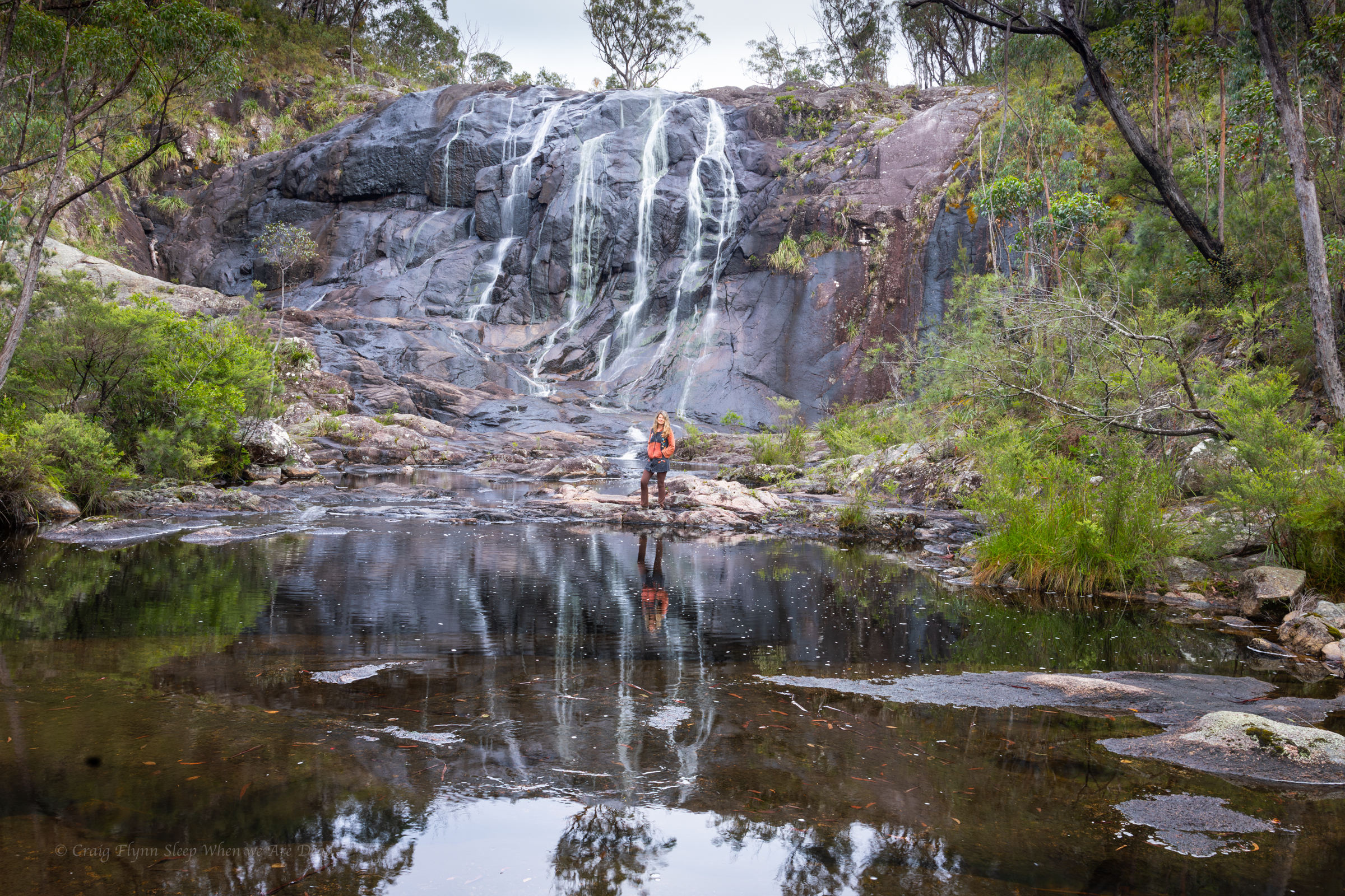
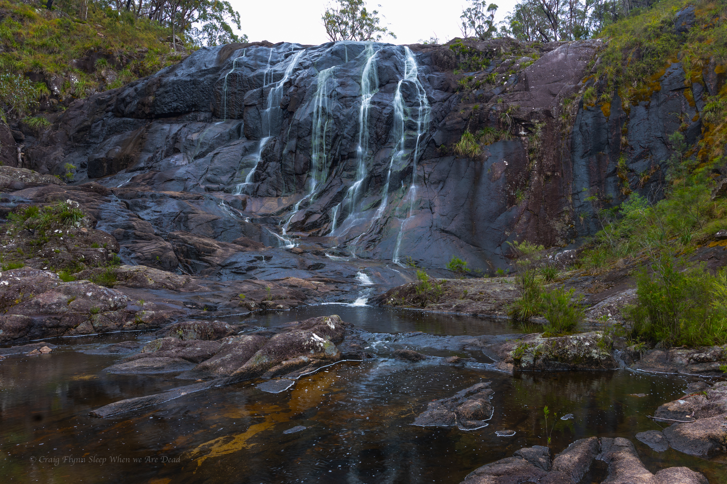
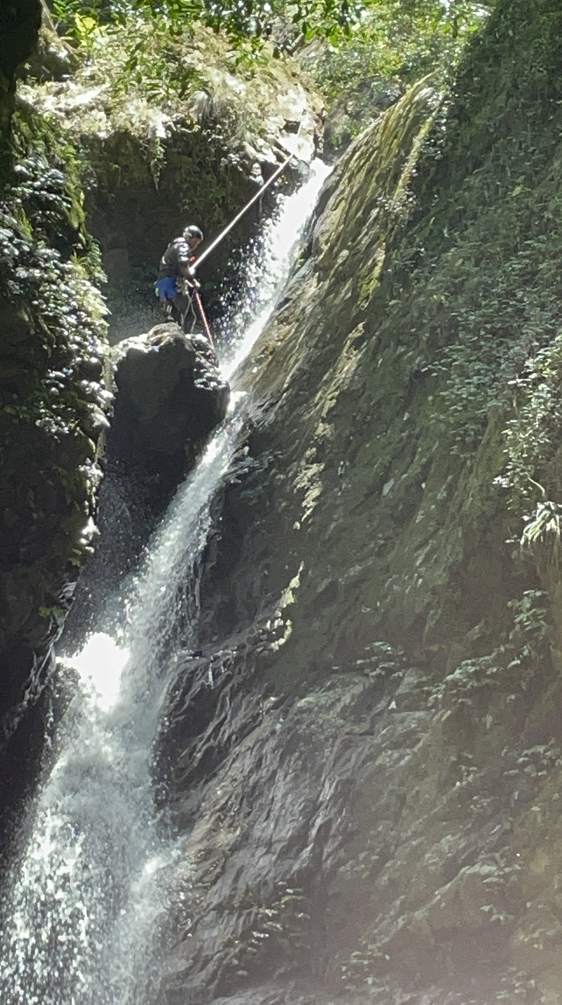
It’s a pretty creek and more canyony than I thought it would be.

R3

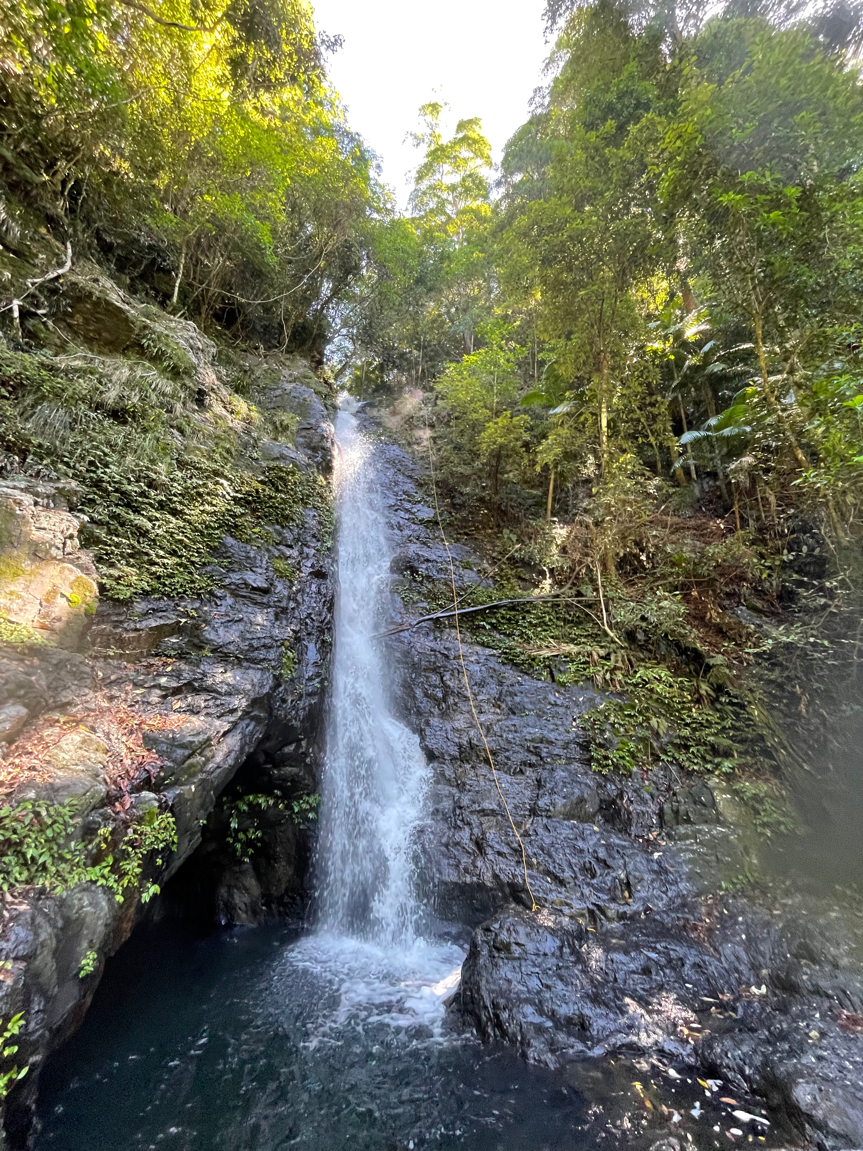
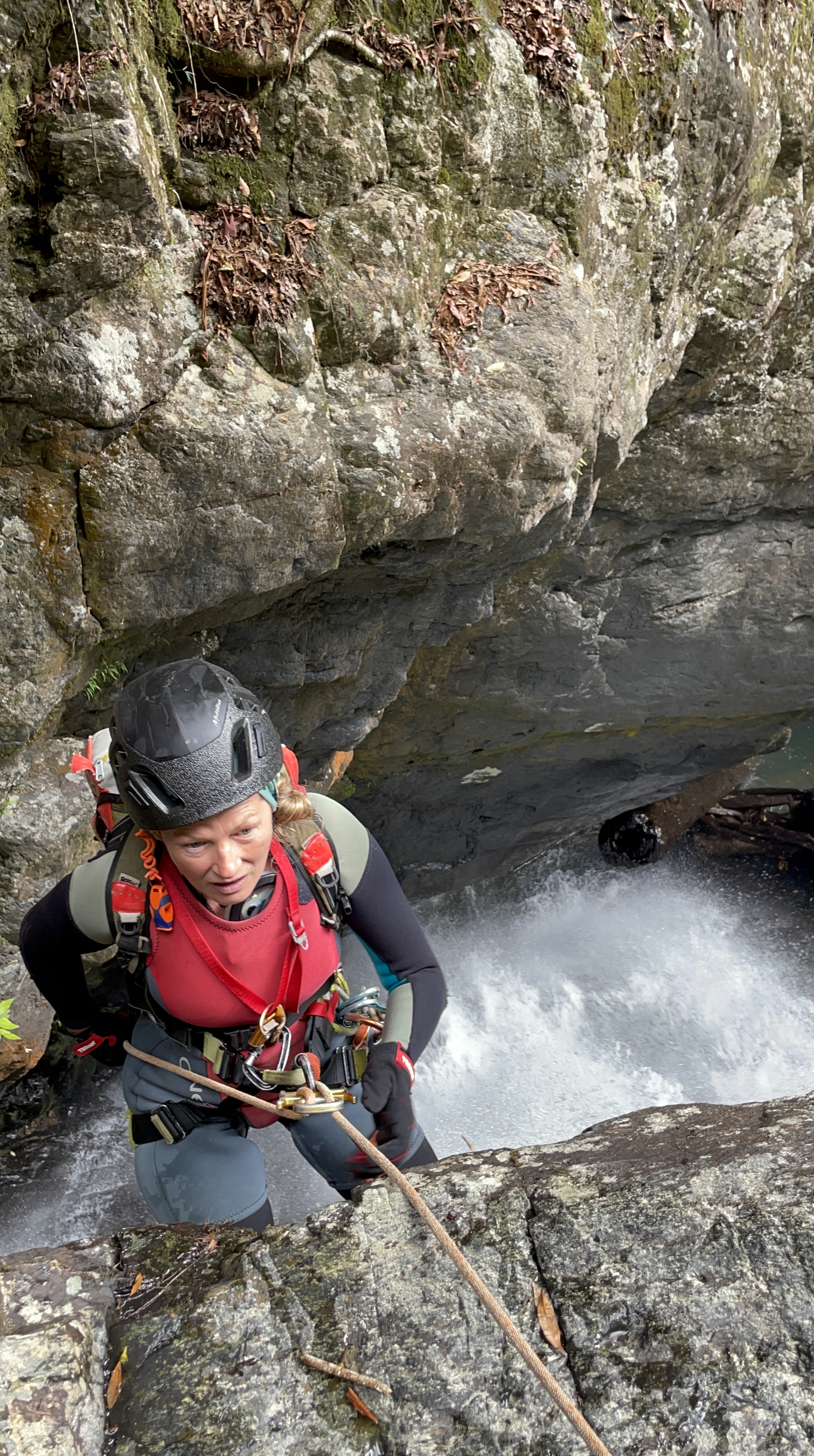
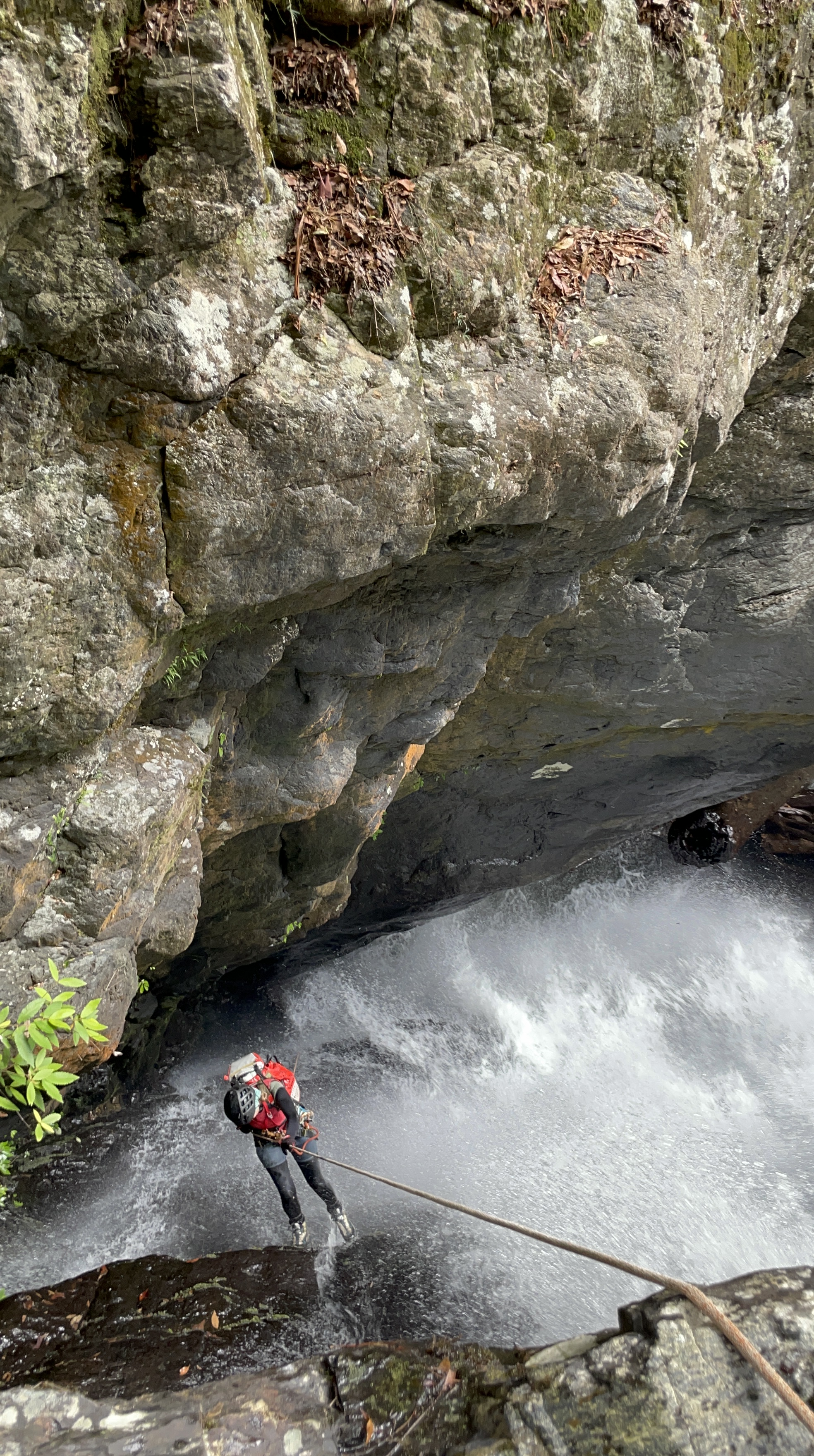
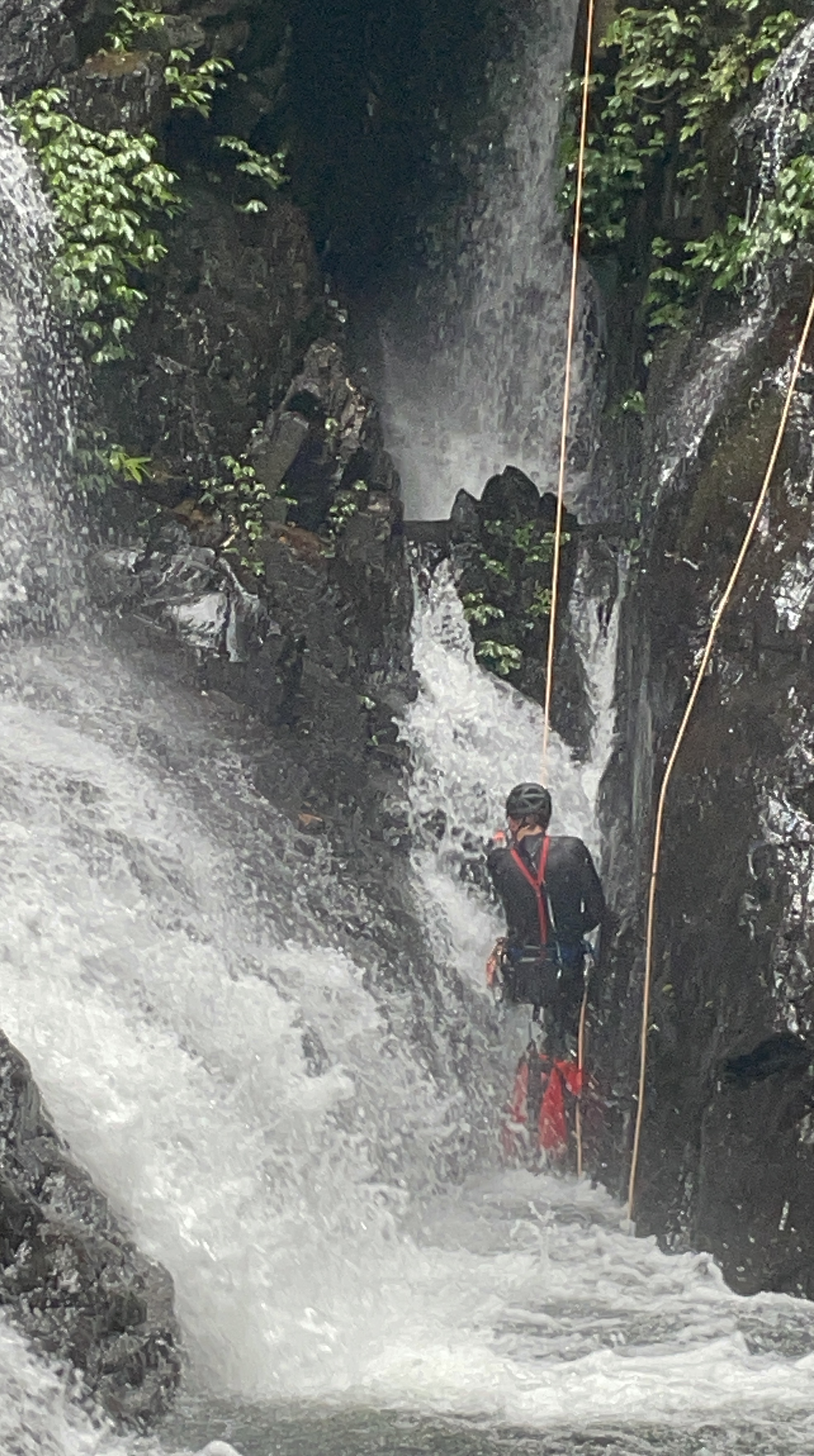
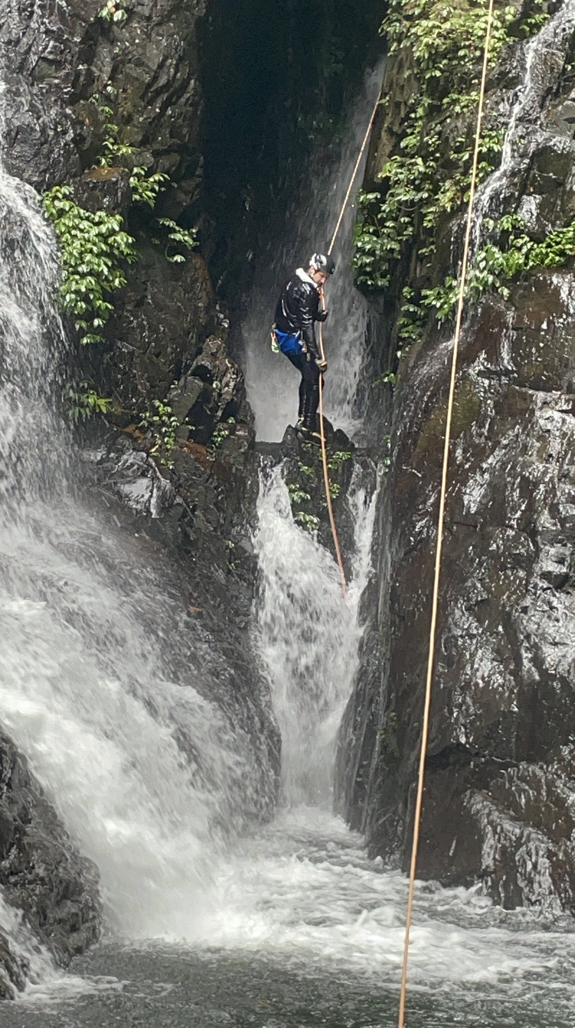
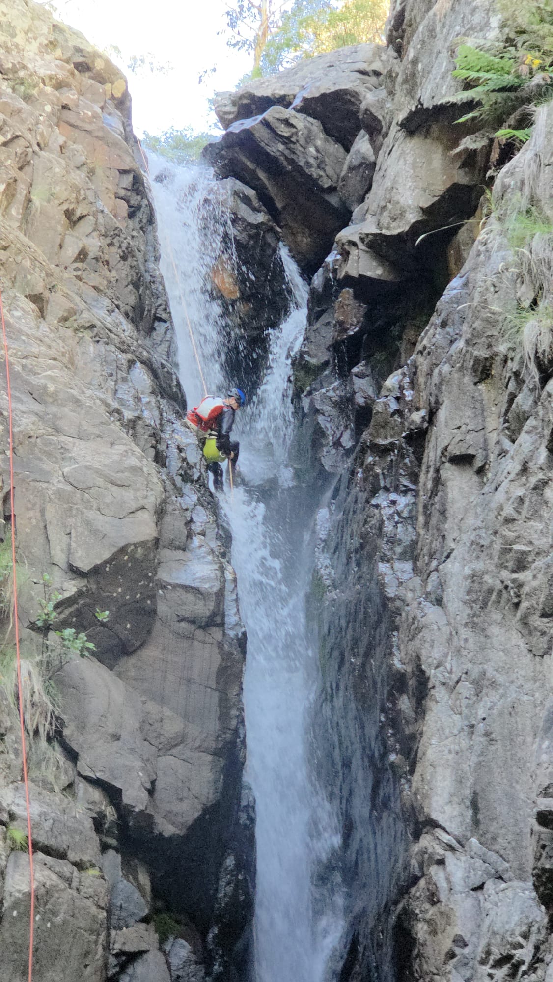
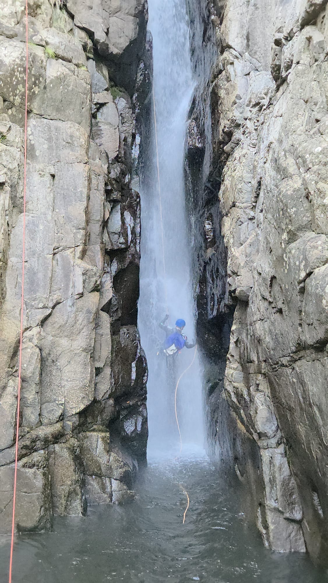
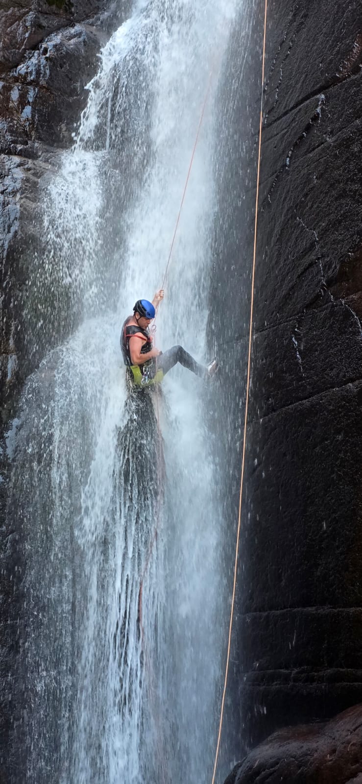
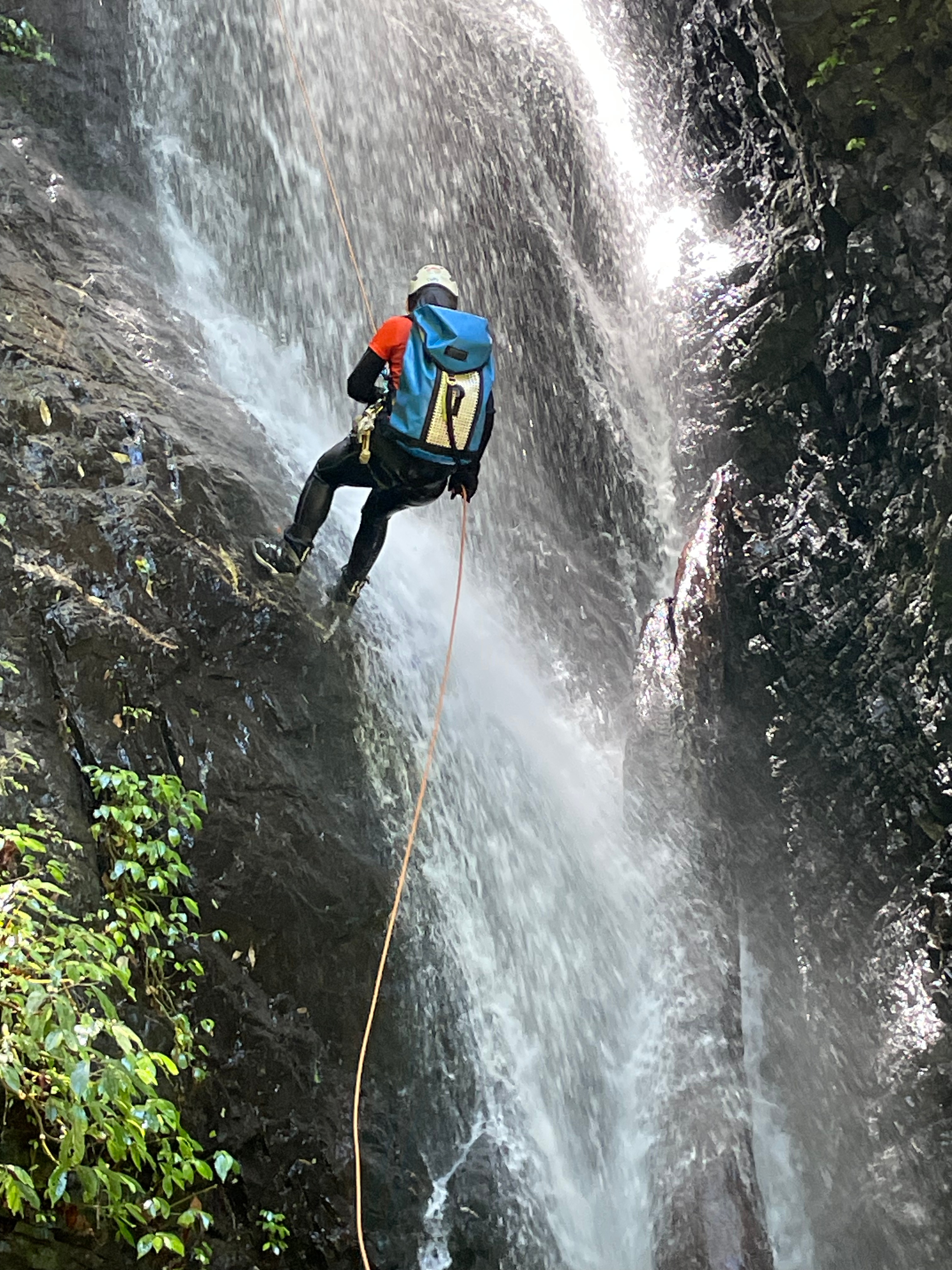
The abseils are varied too, from easy slabs beside the flow, to stepped ledges through it.

Kylie on R5
Vince R6

Vince on R7

Hywaida R7

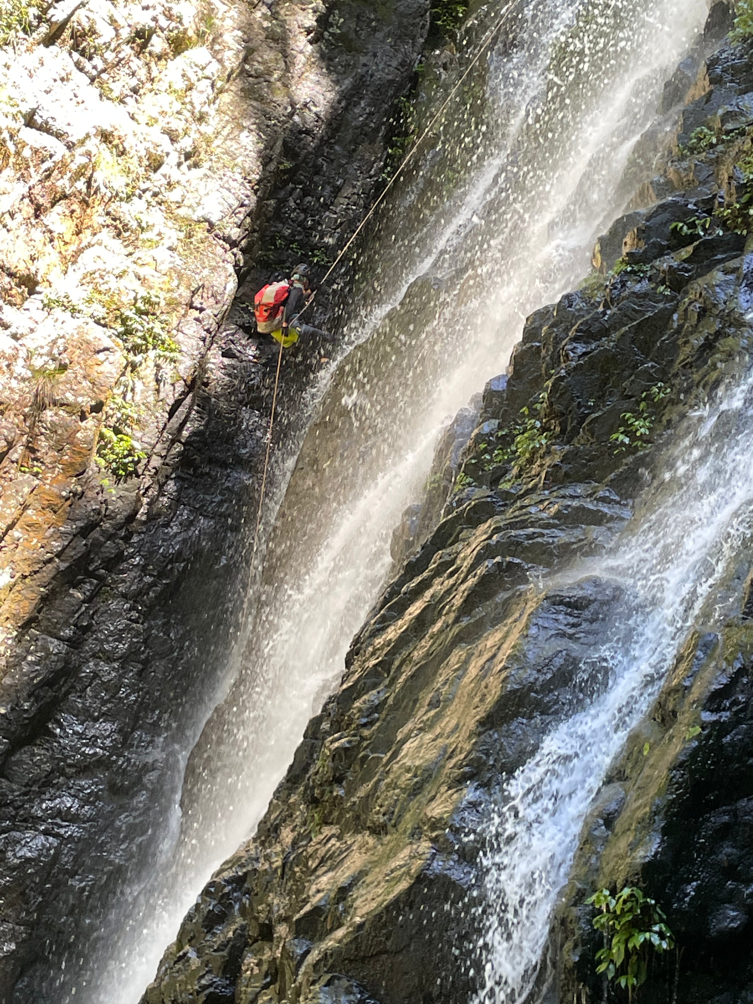
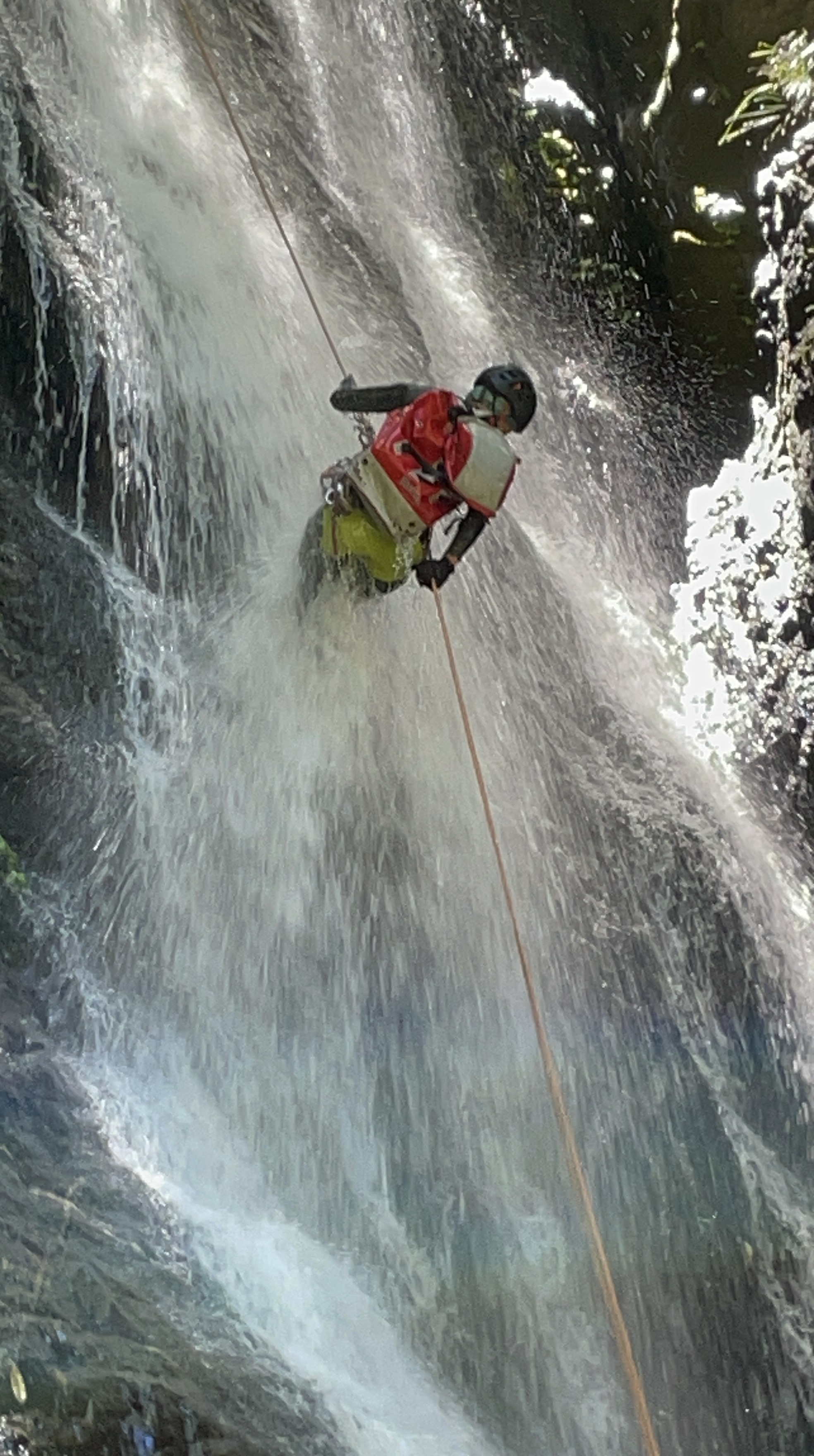
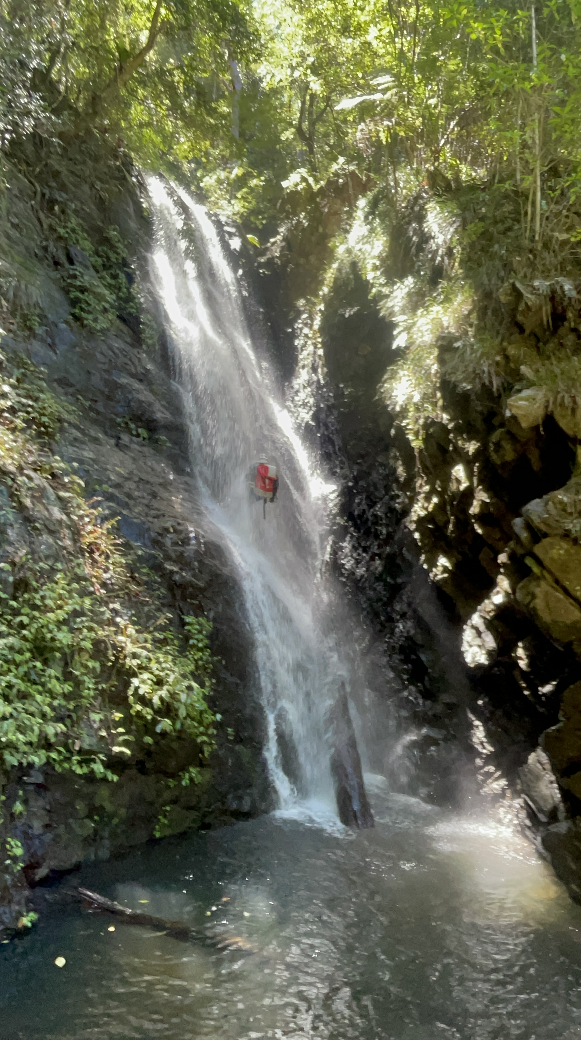
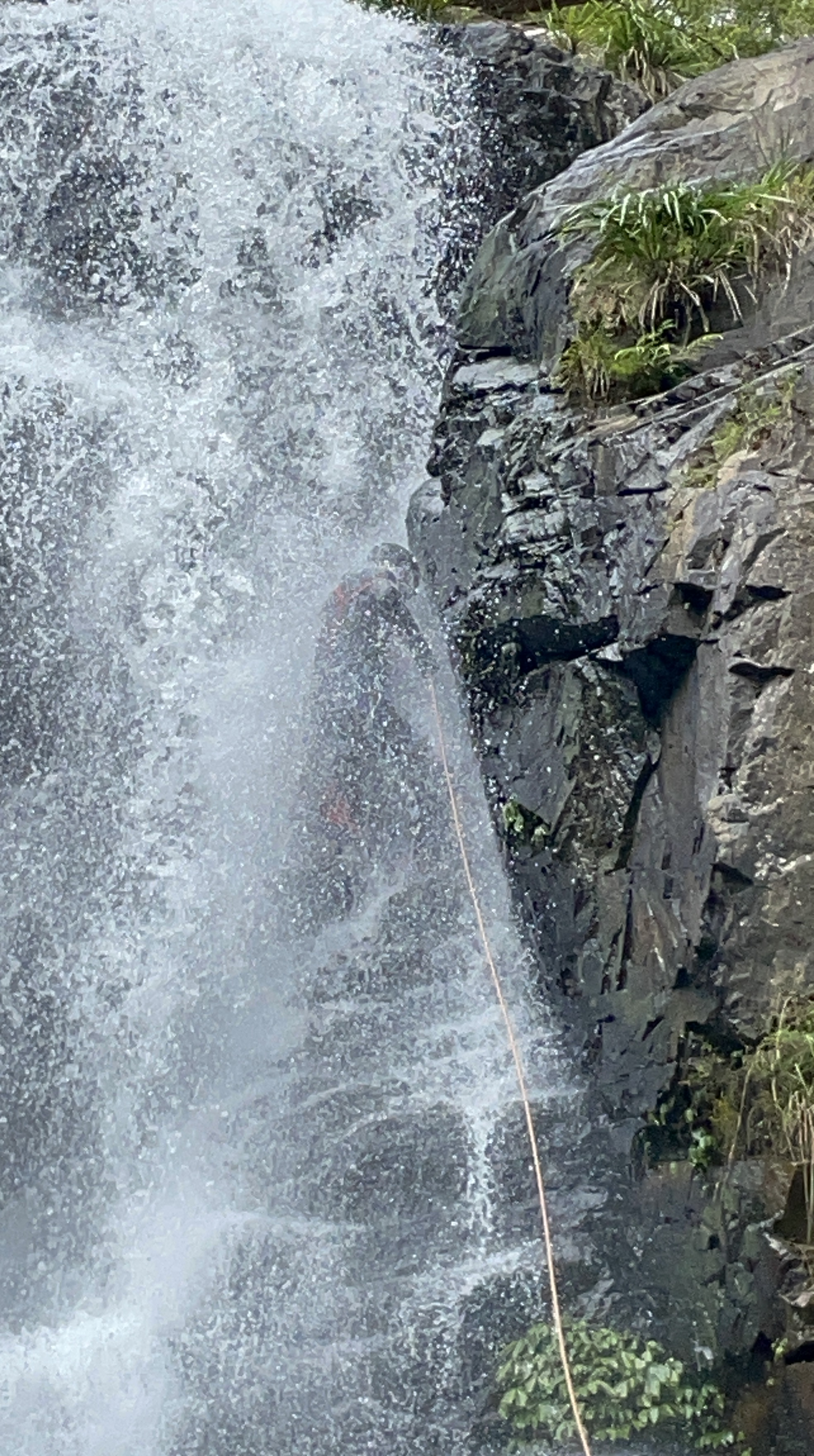
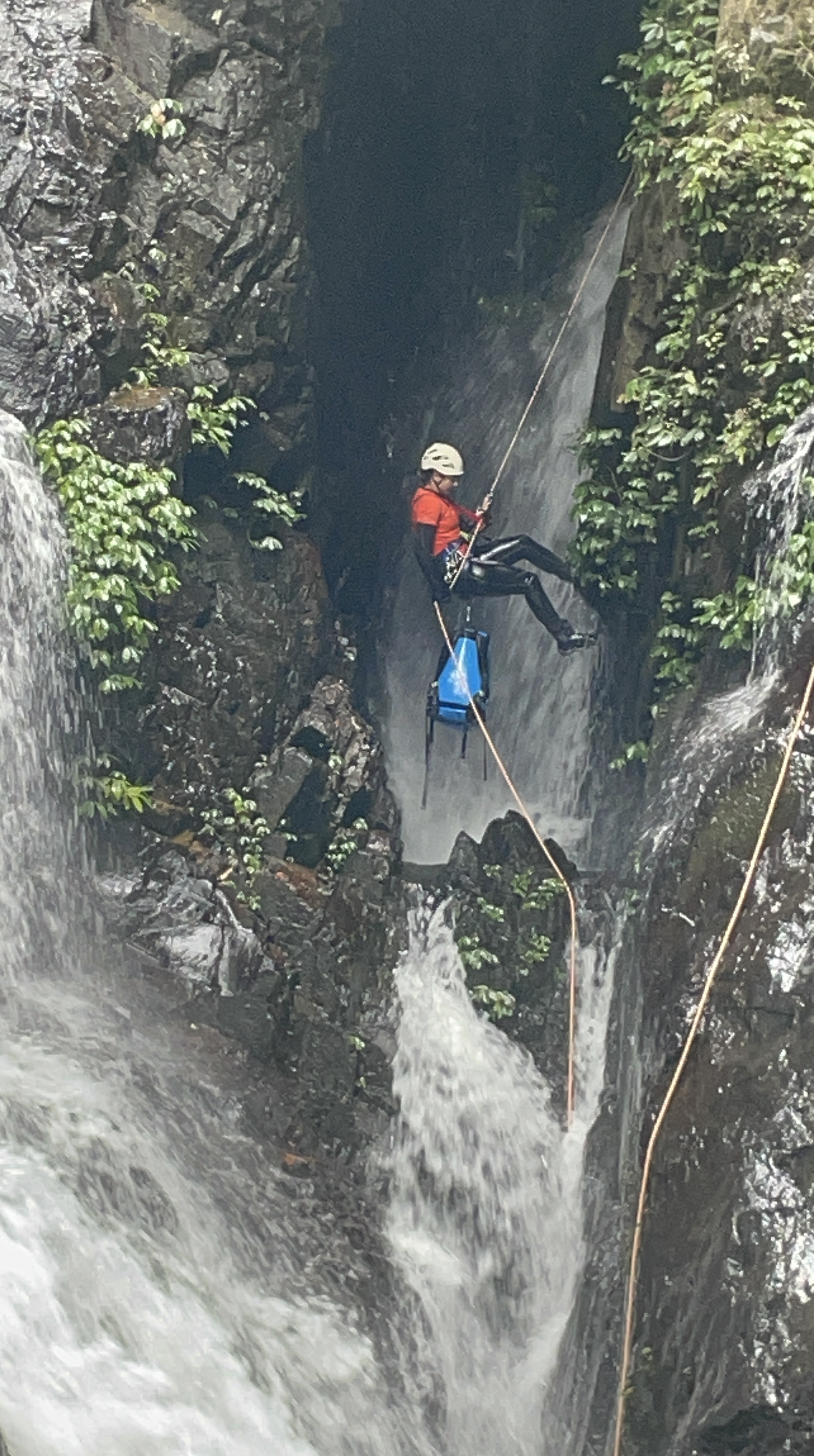
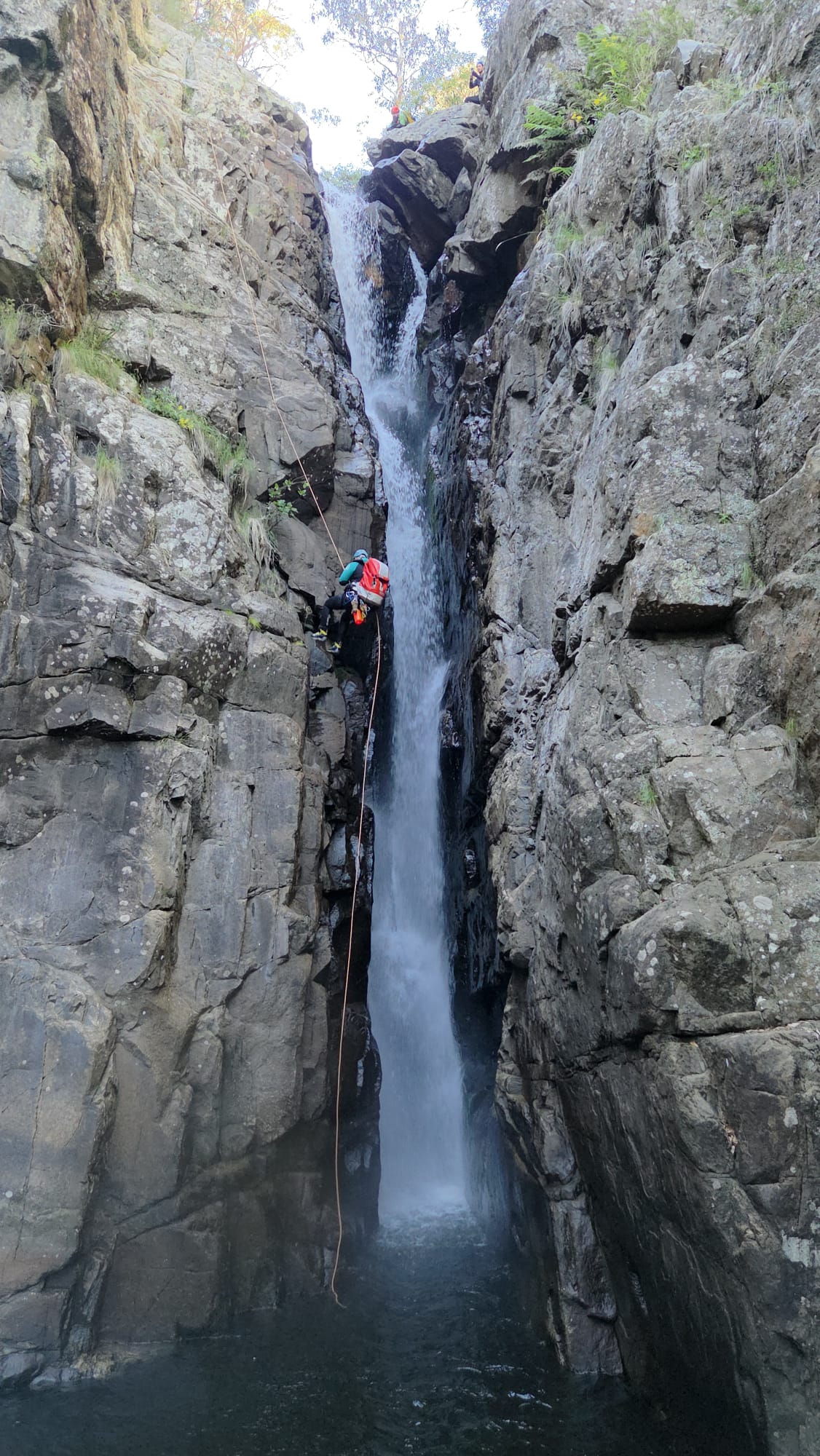
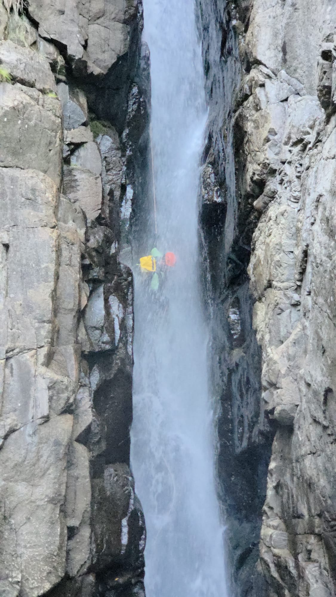
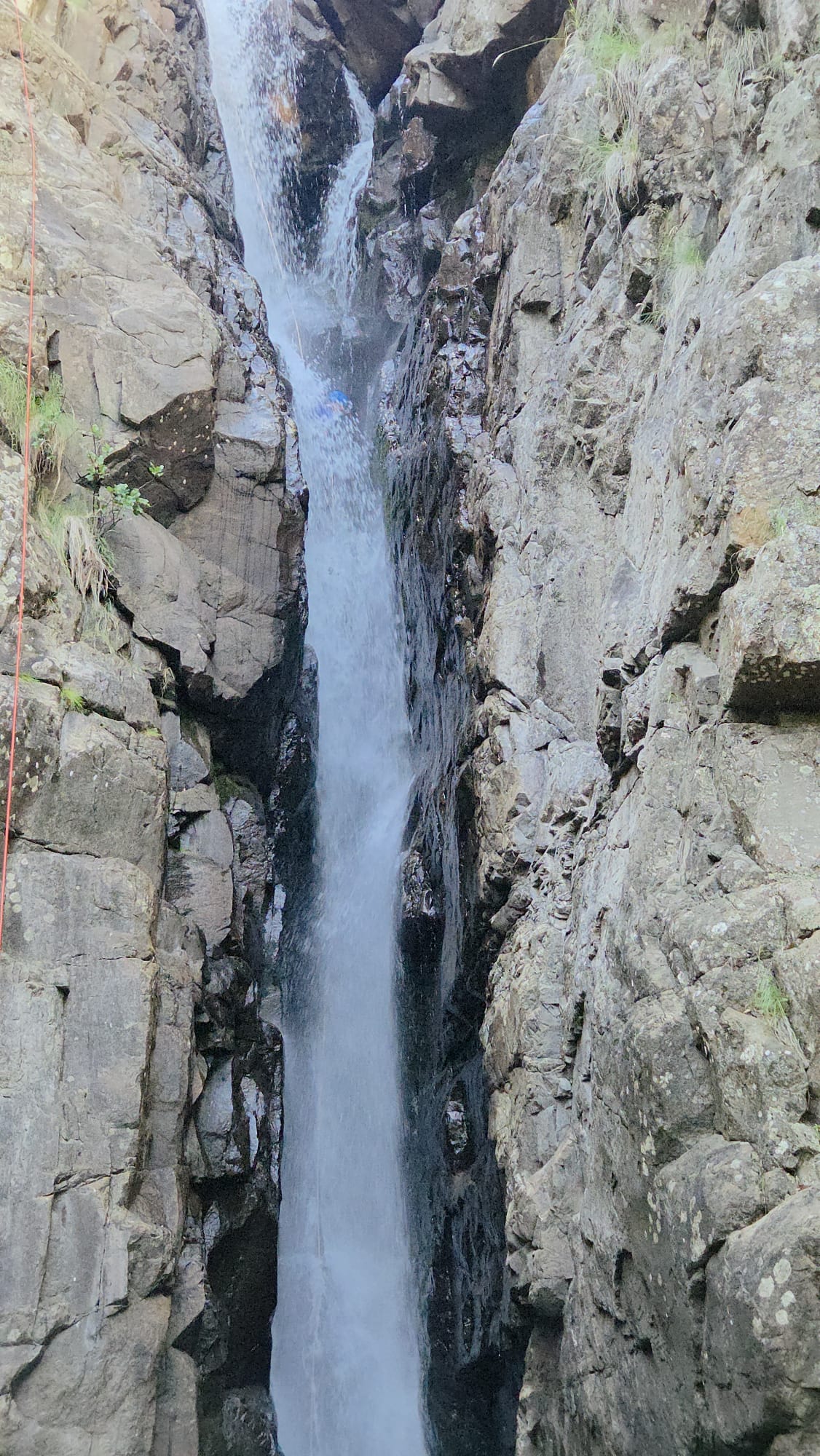
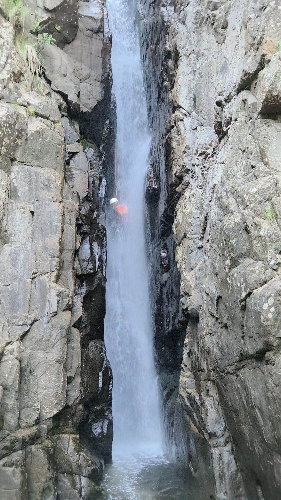
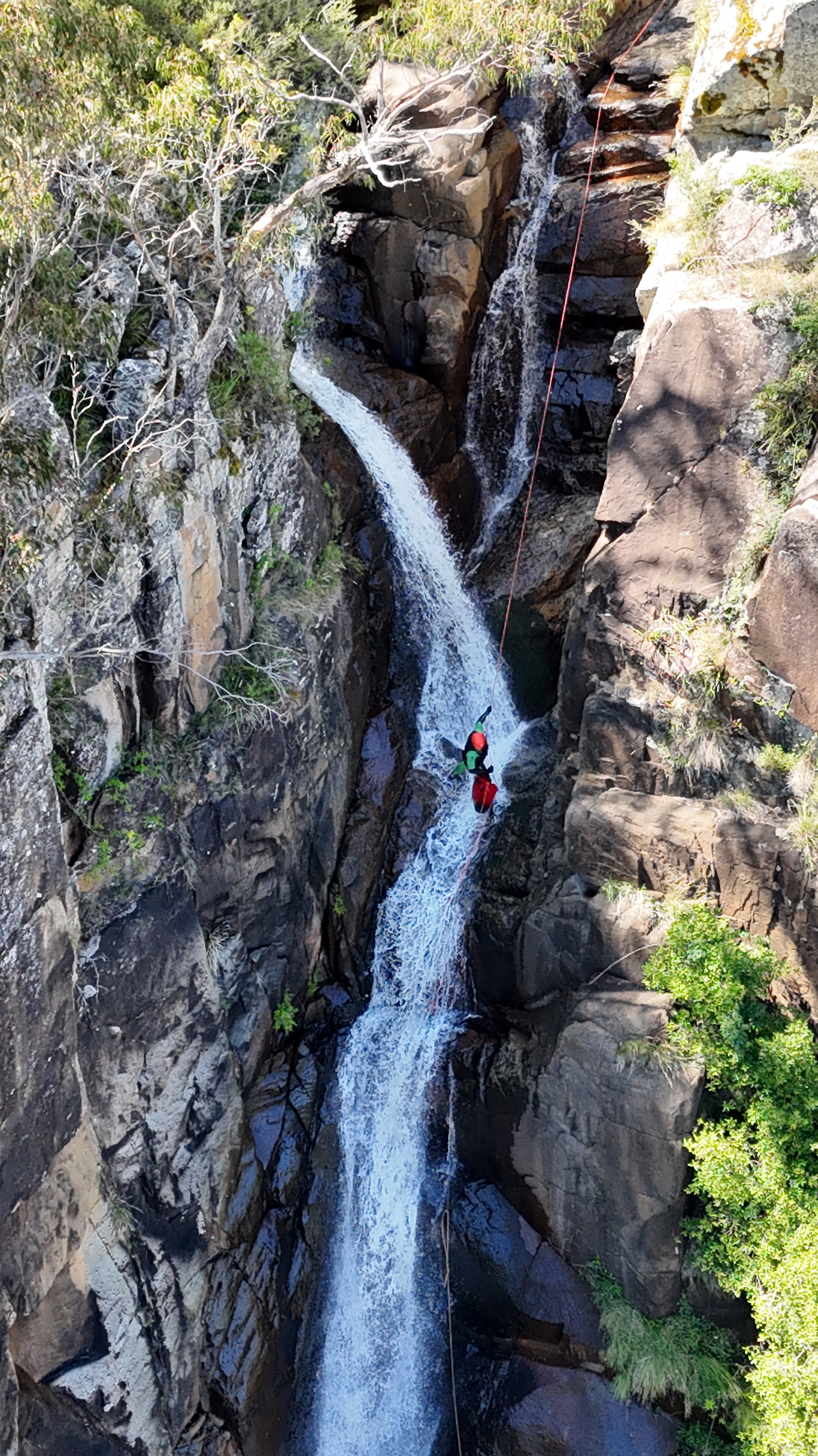
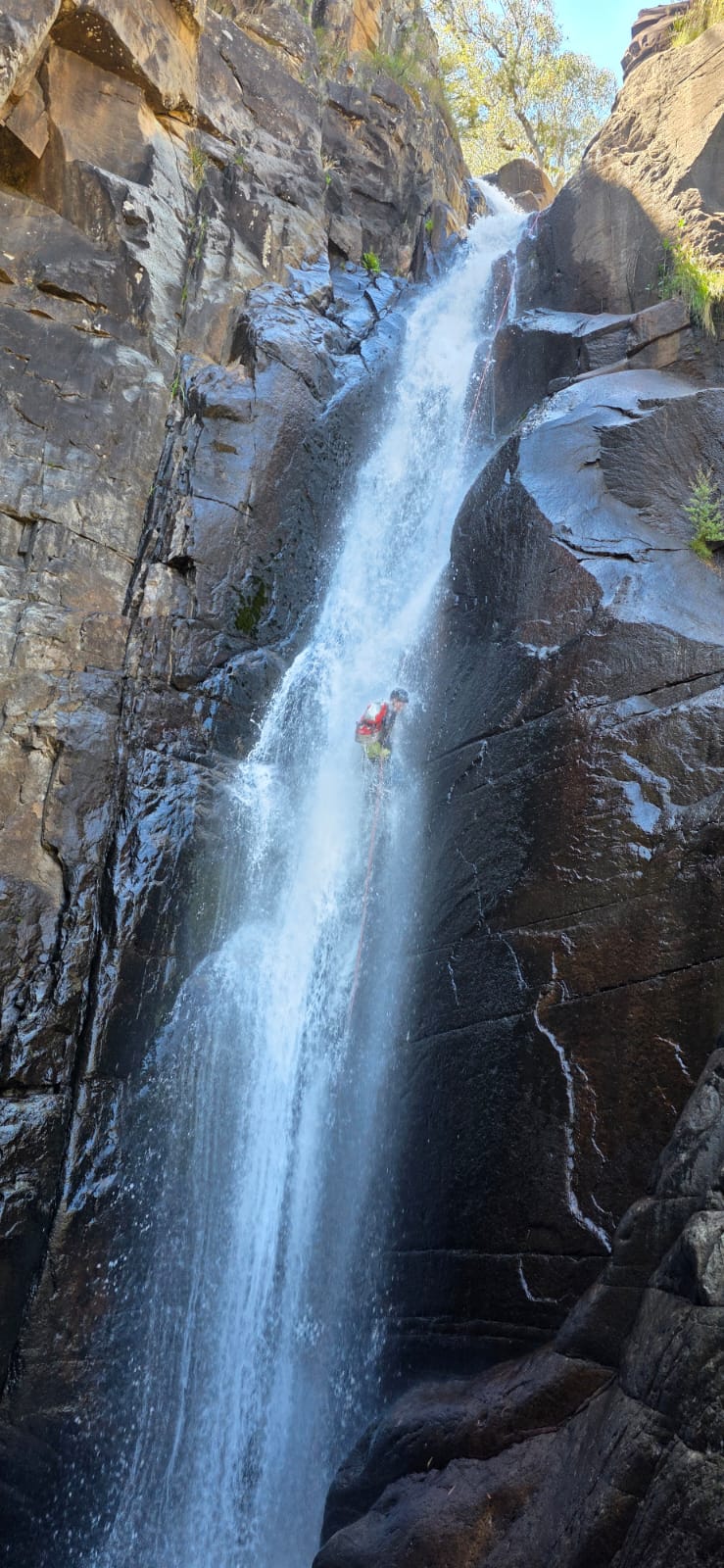
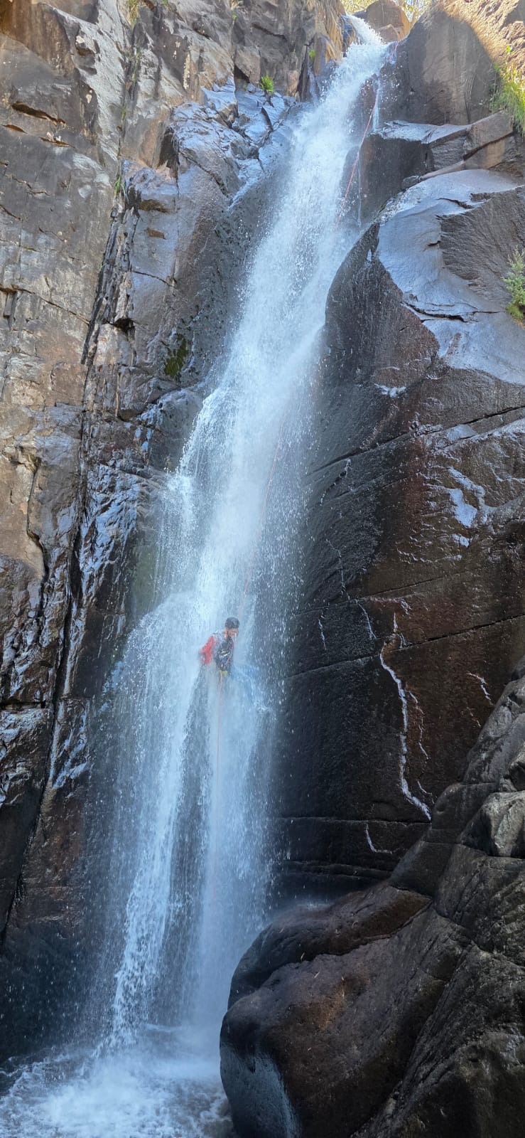
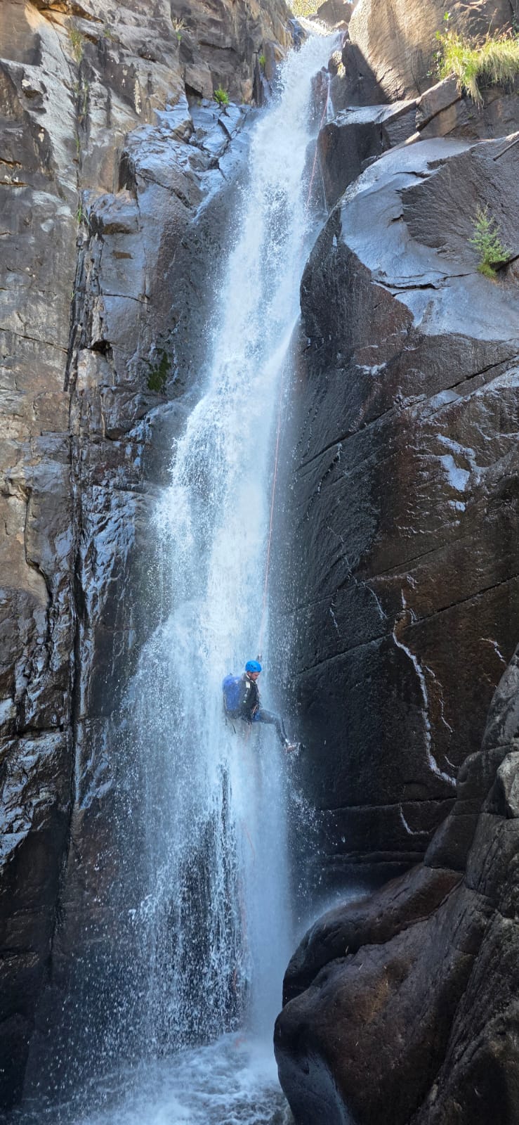
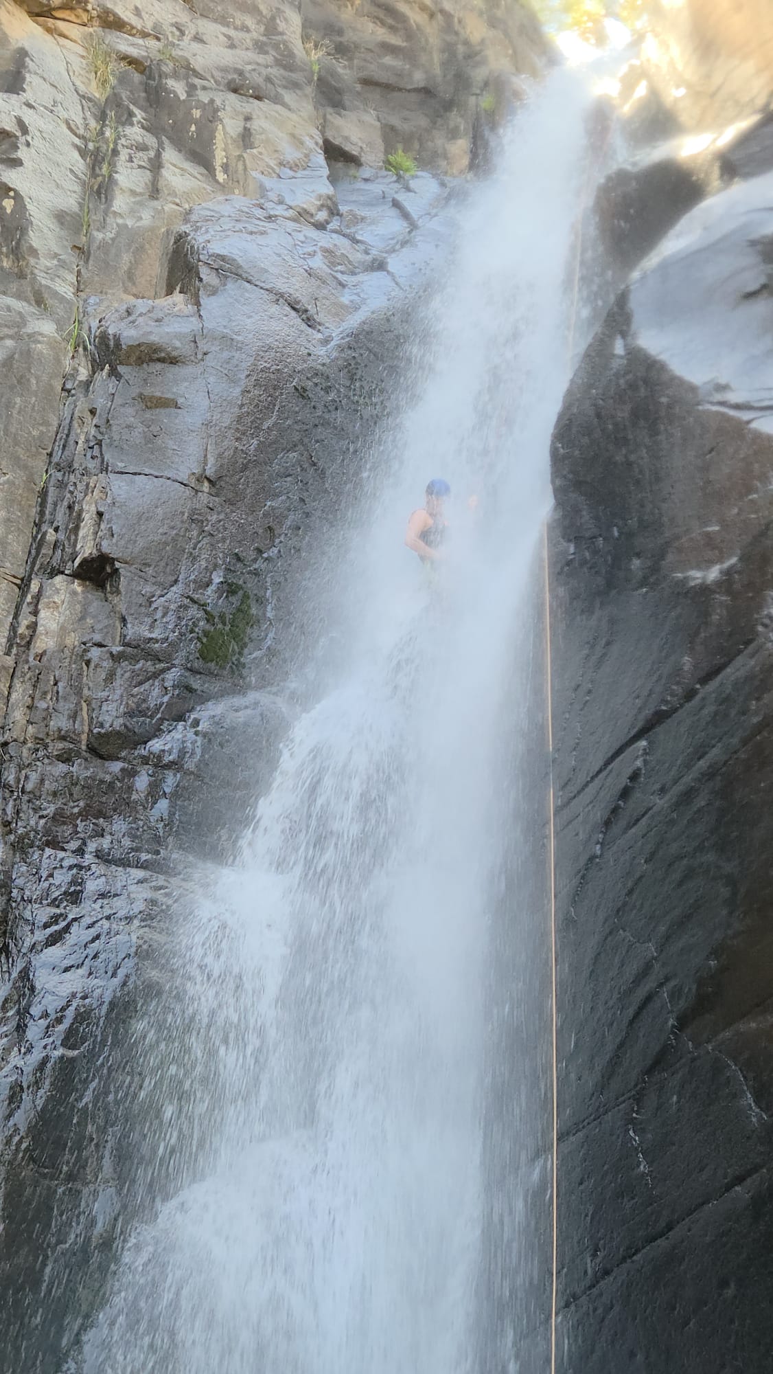
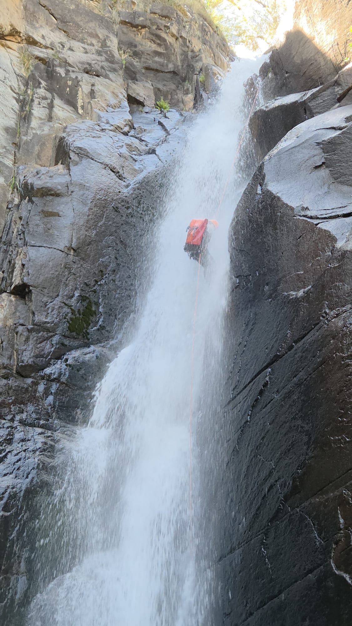
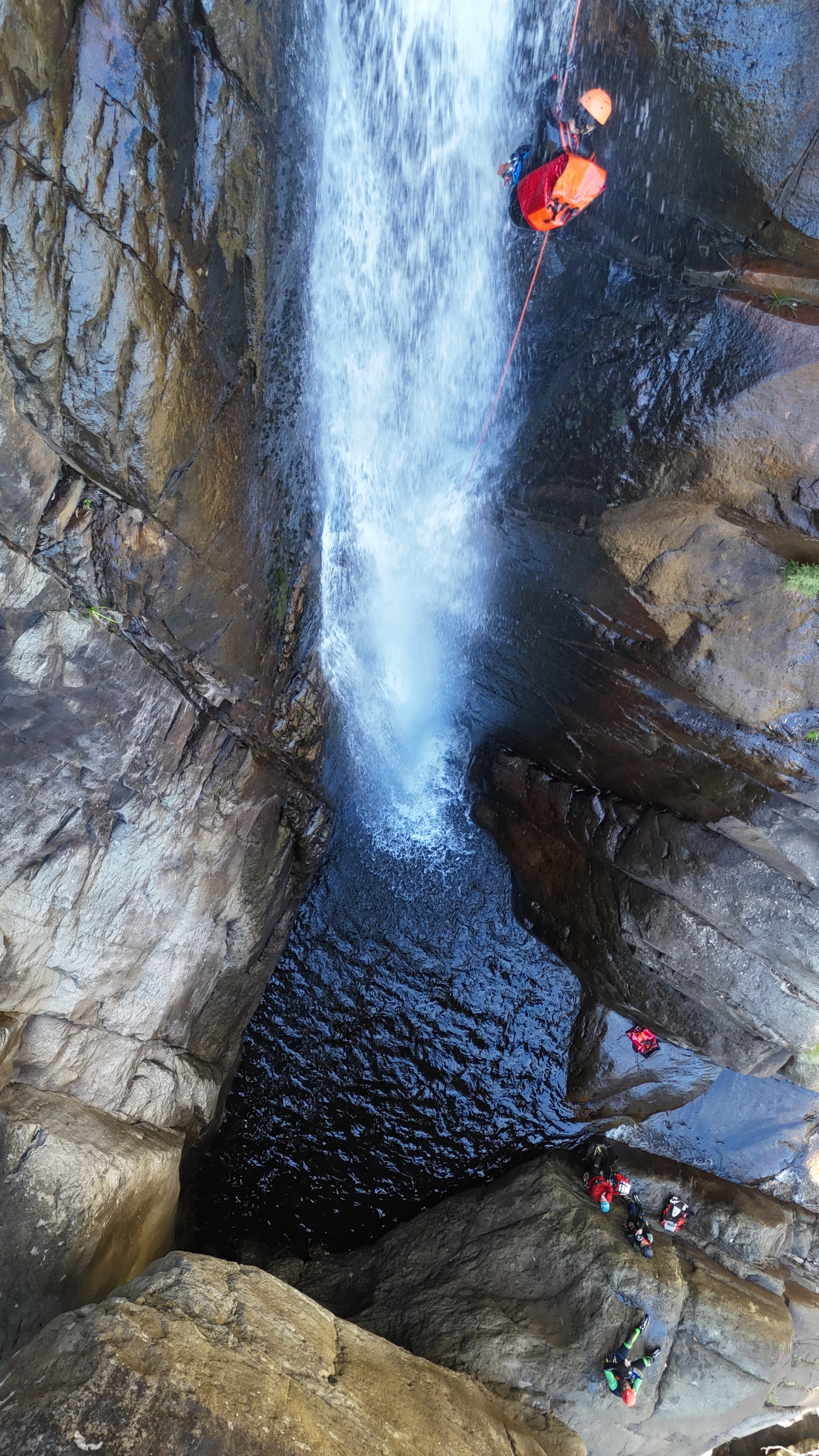
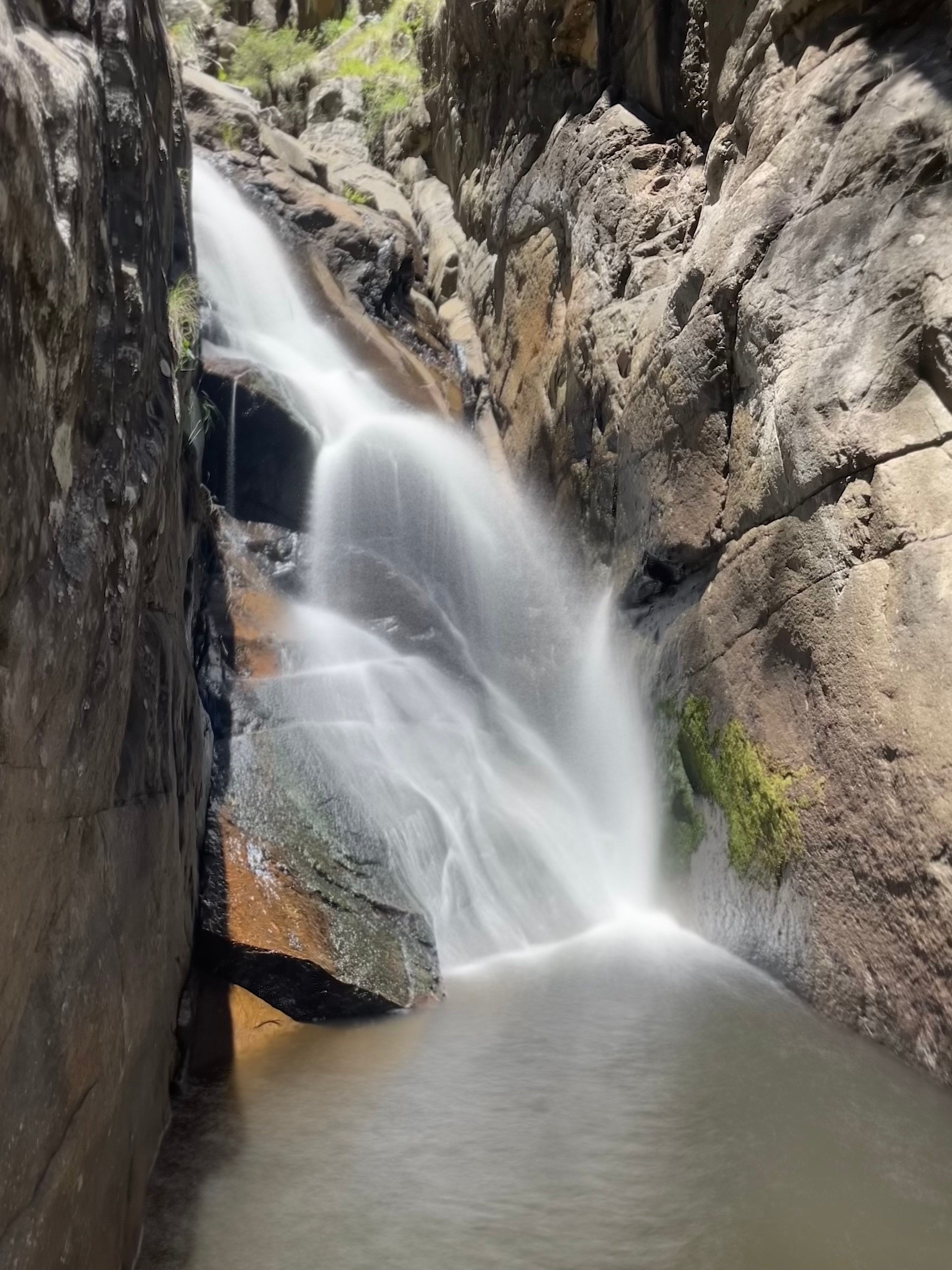
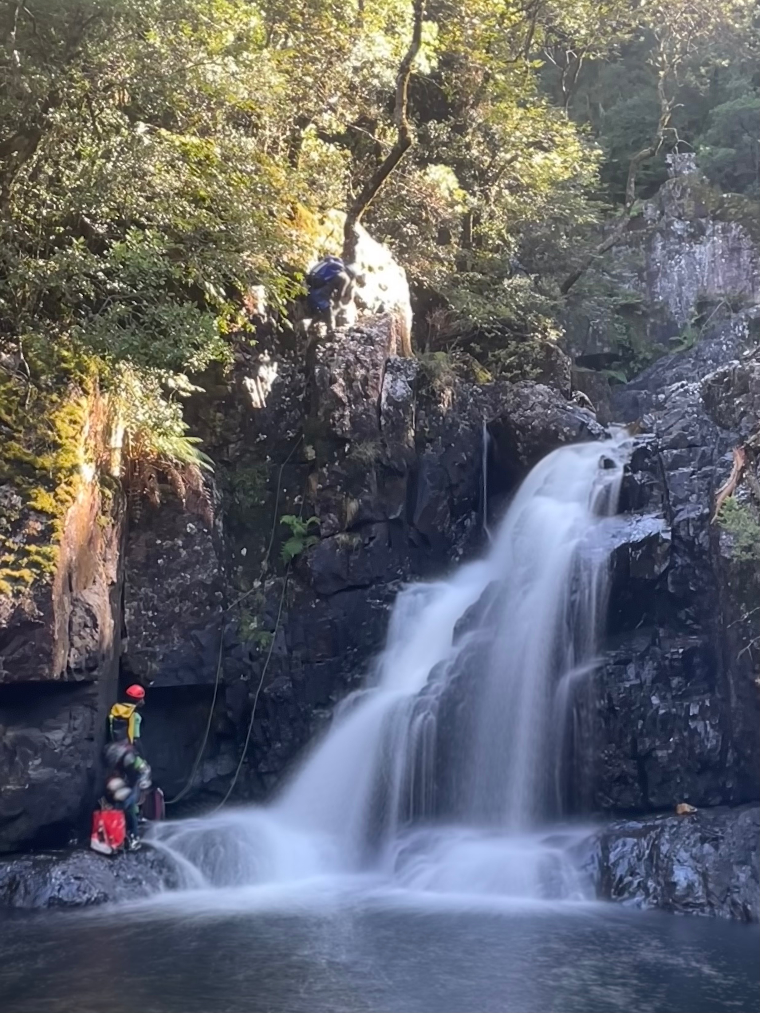
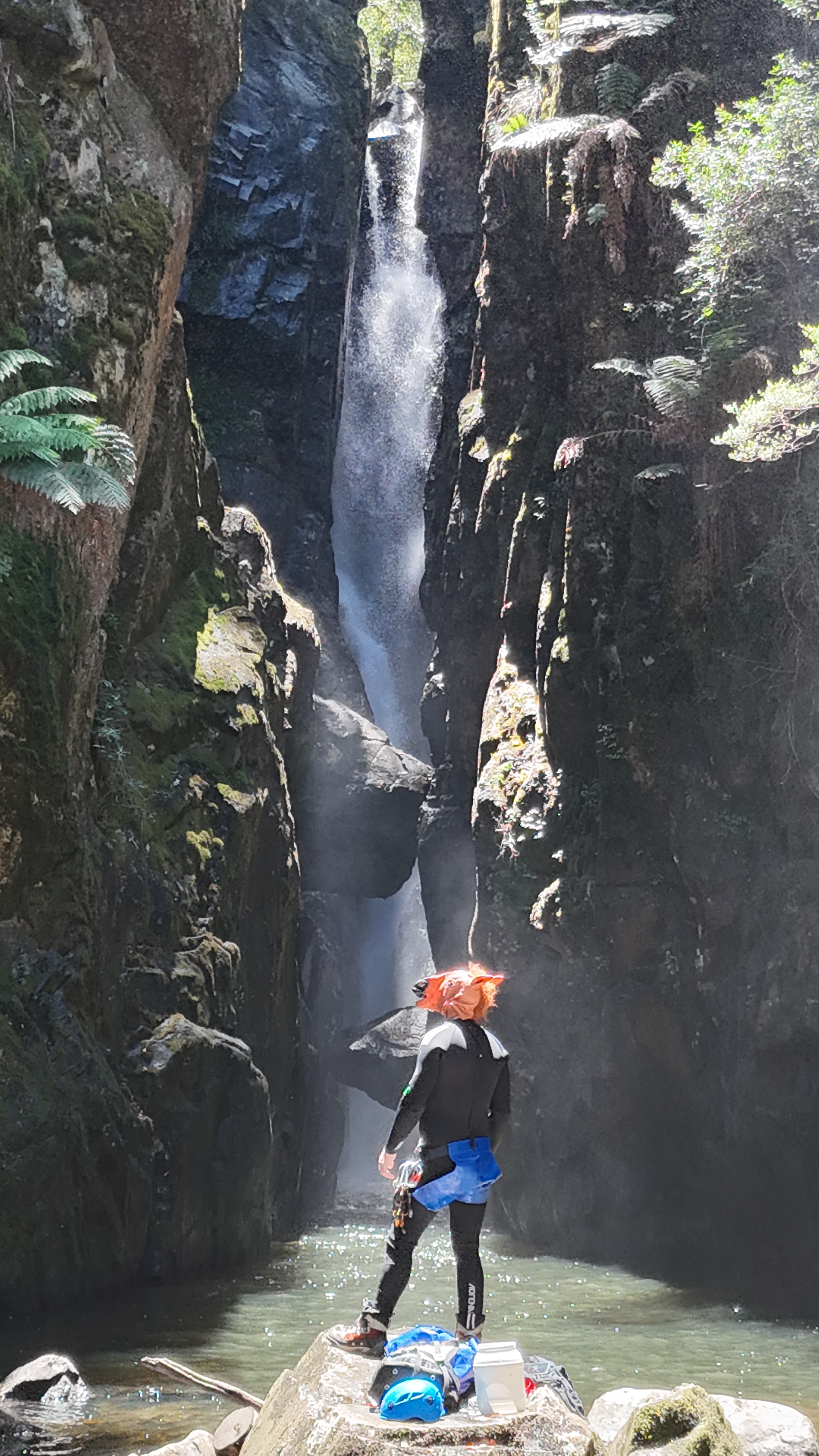
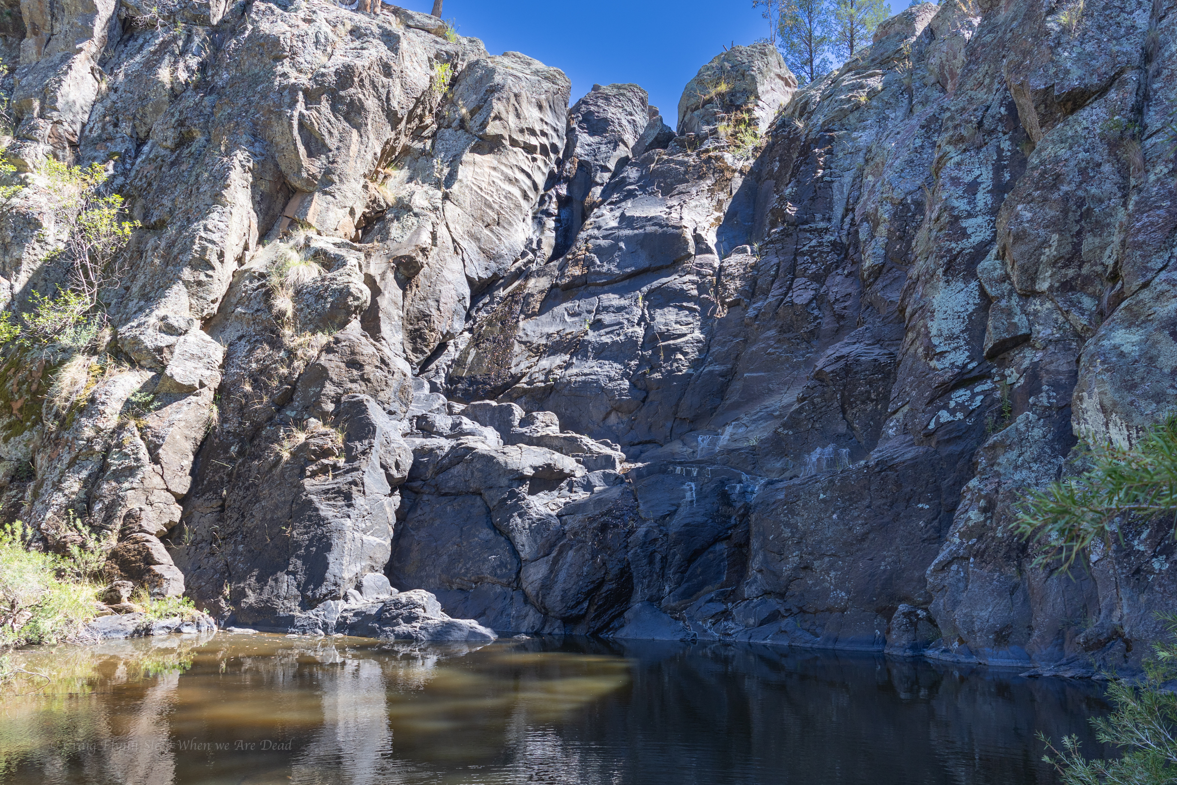
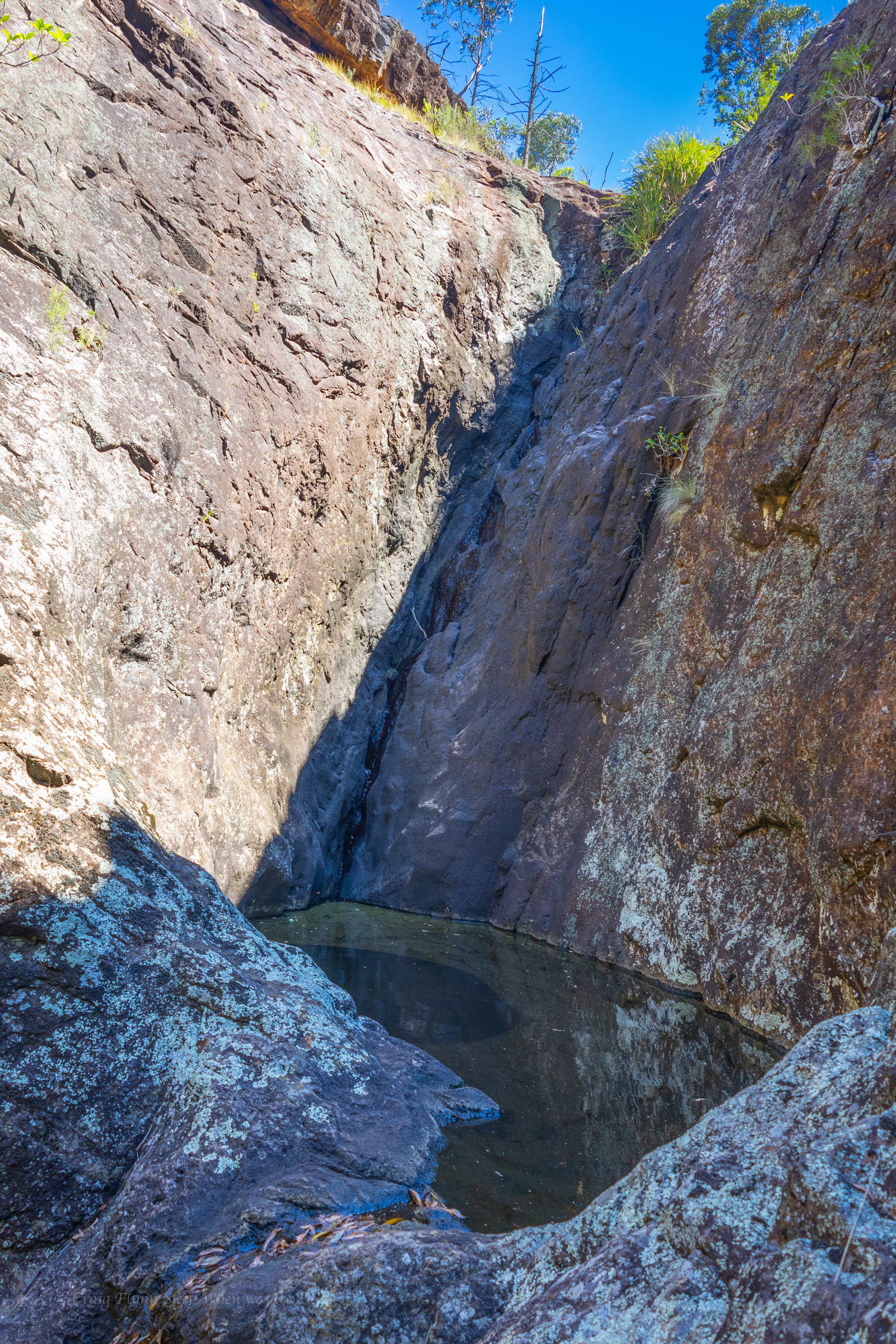
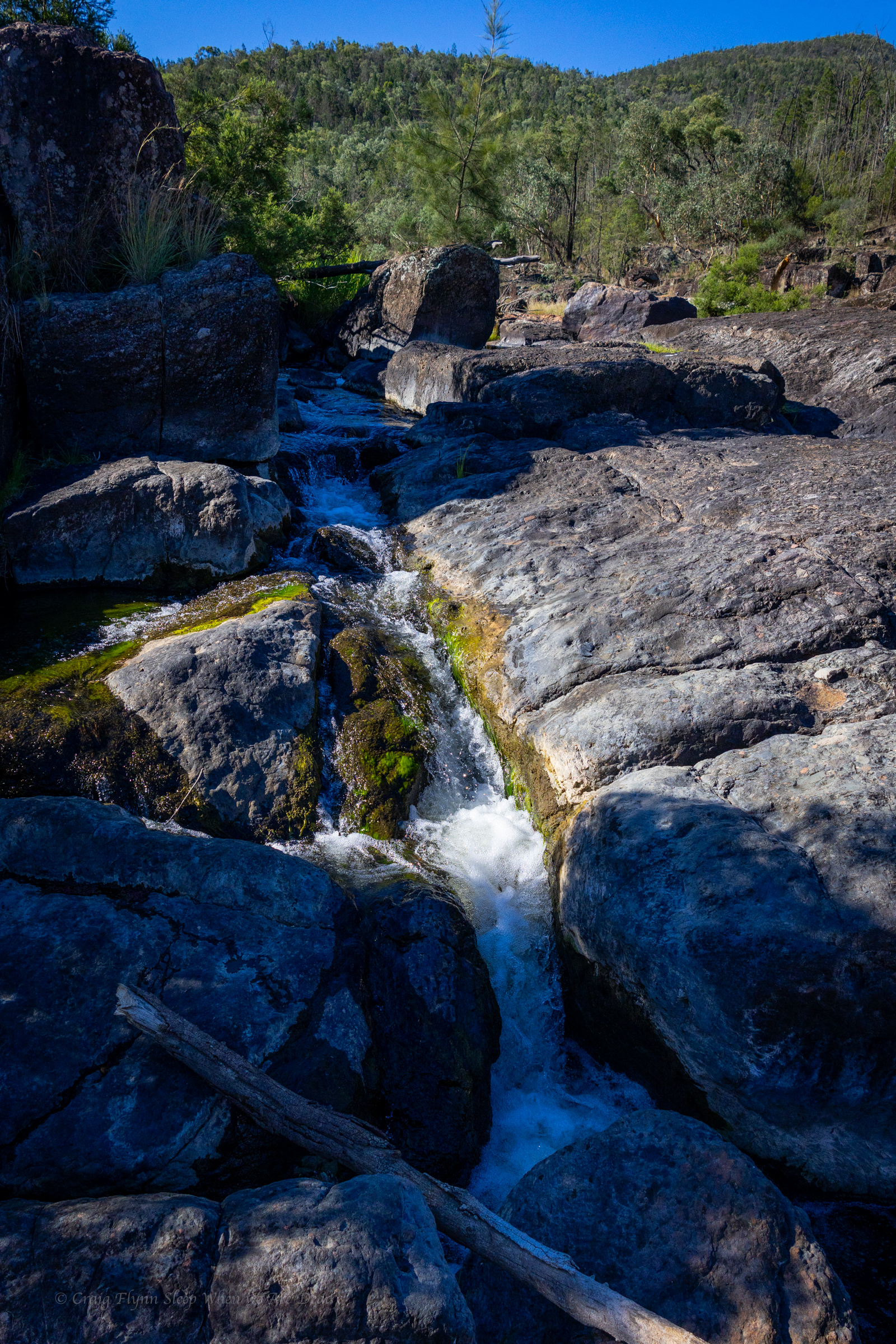
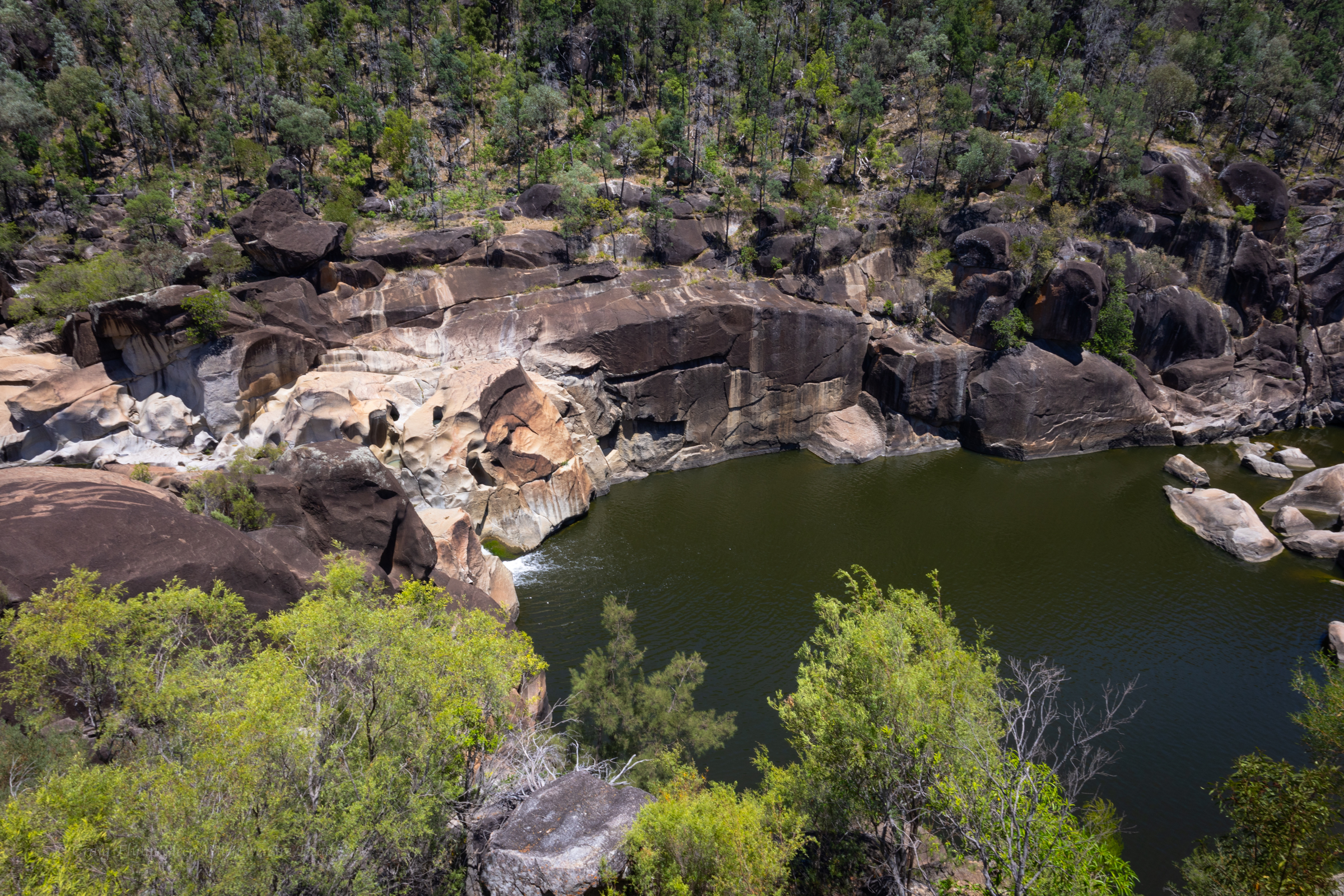
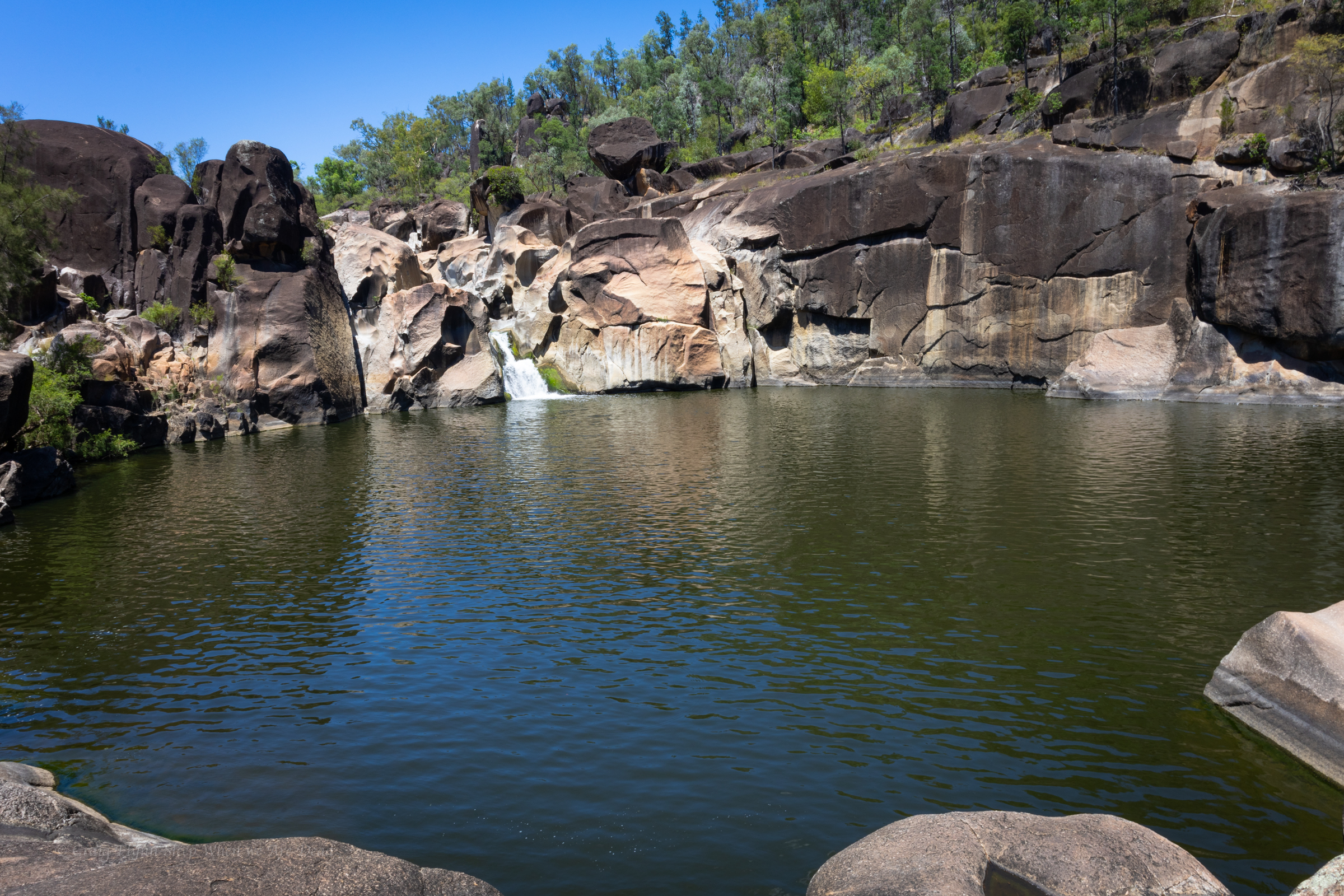
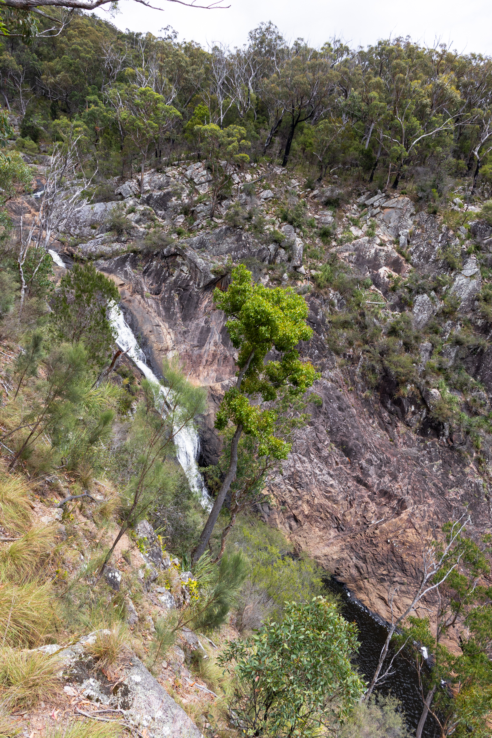
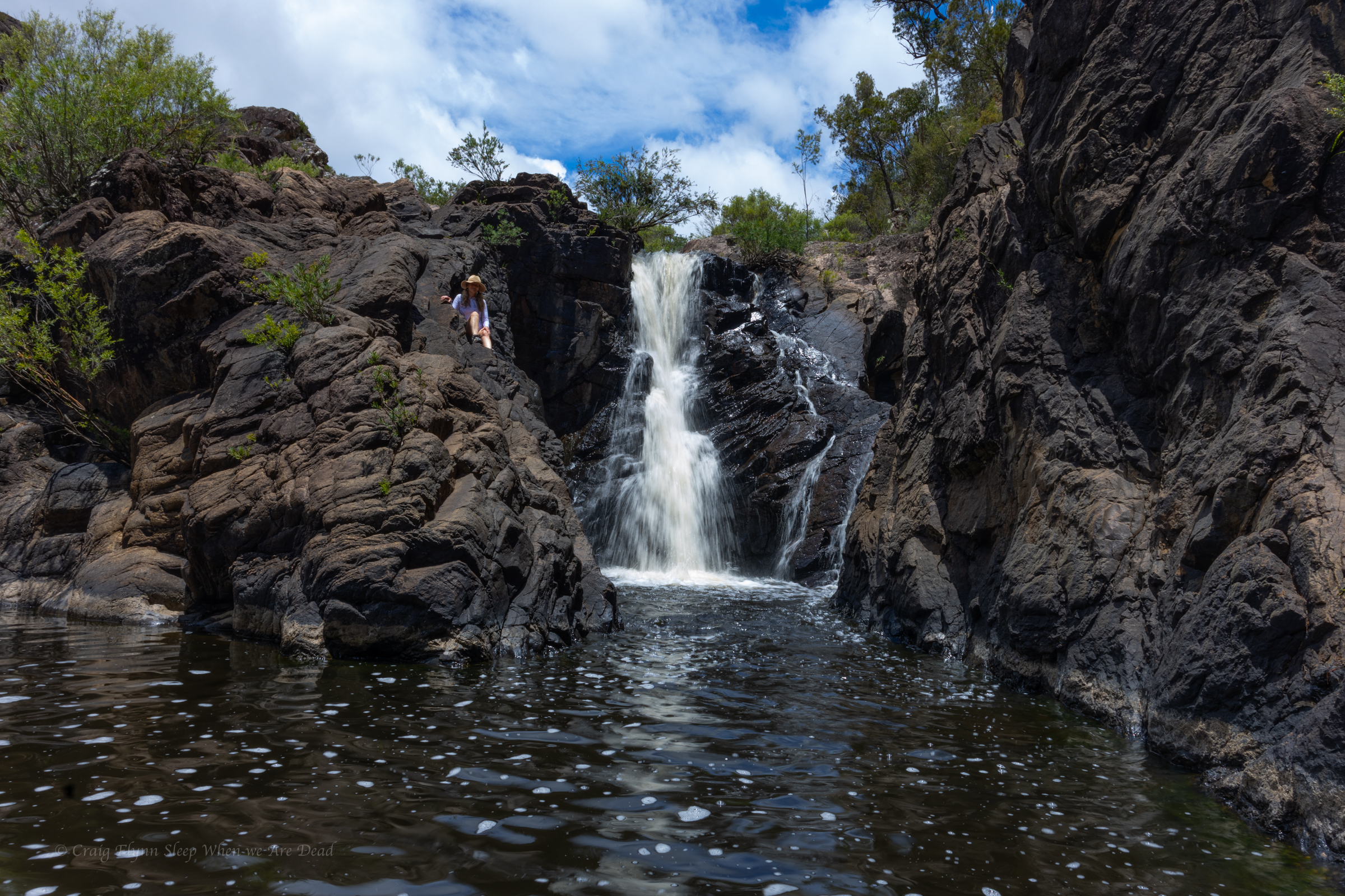
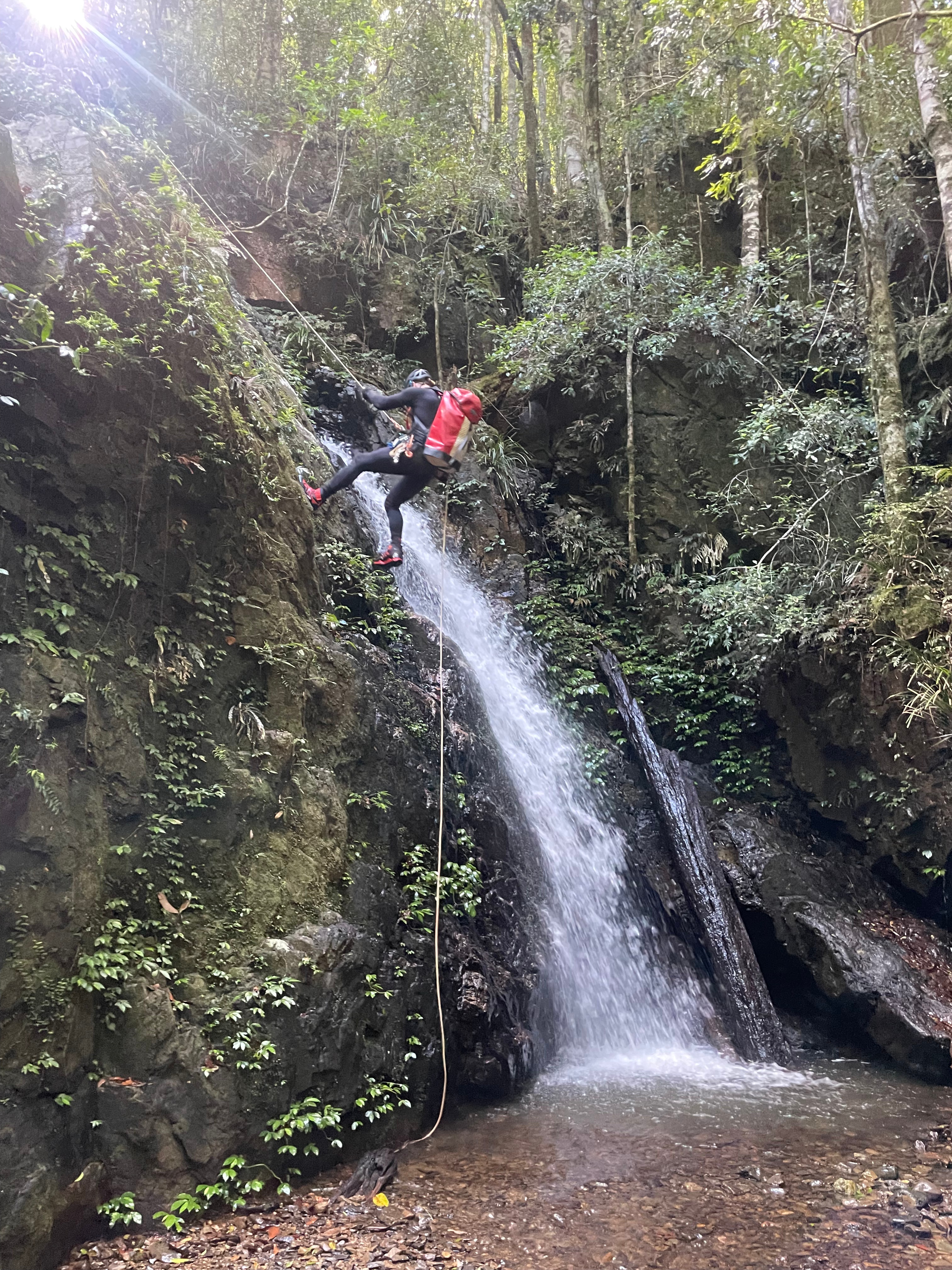
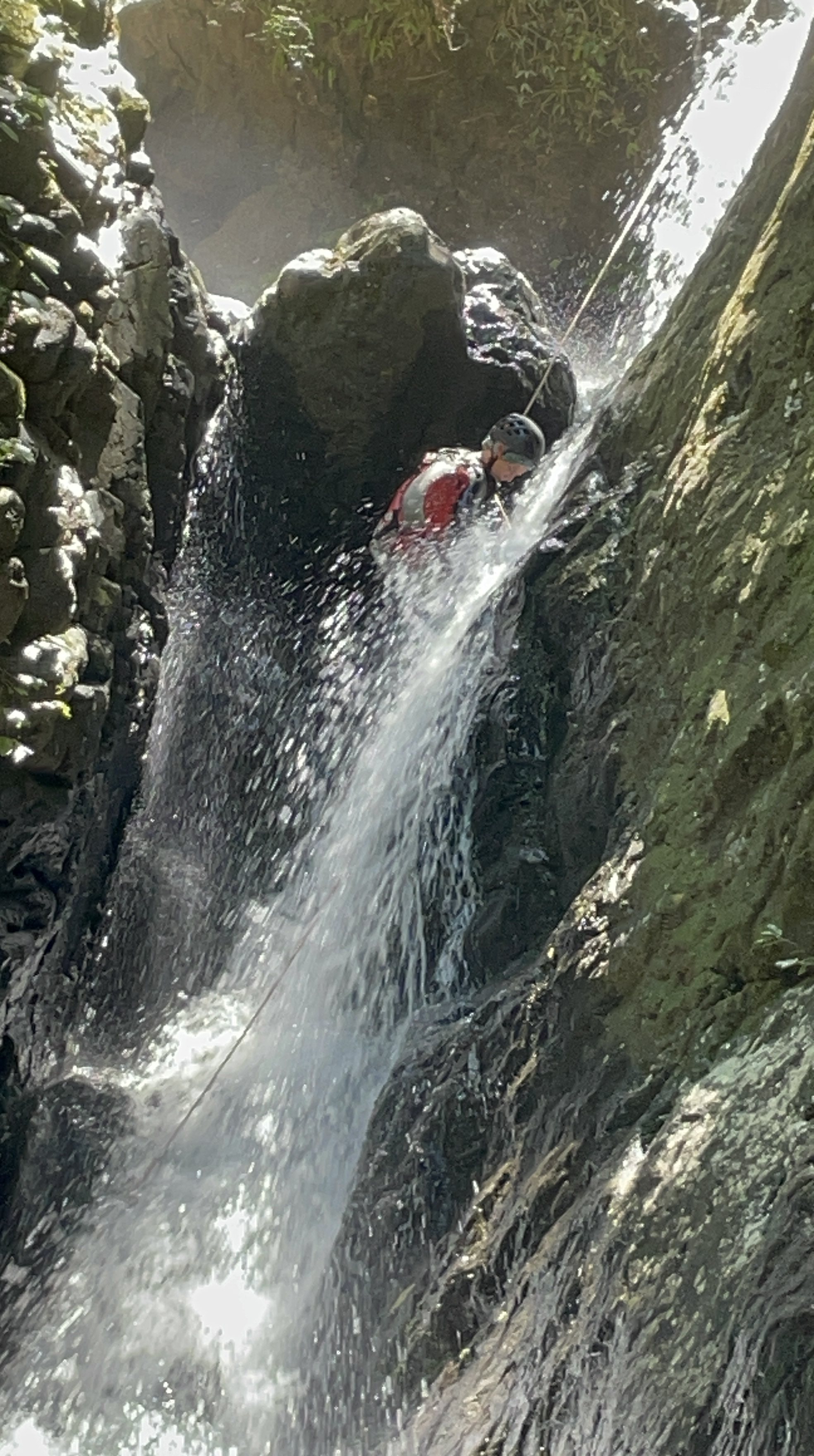
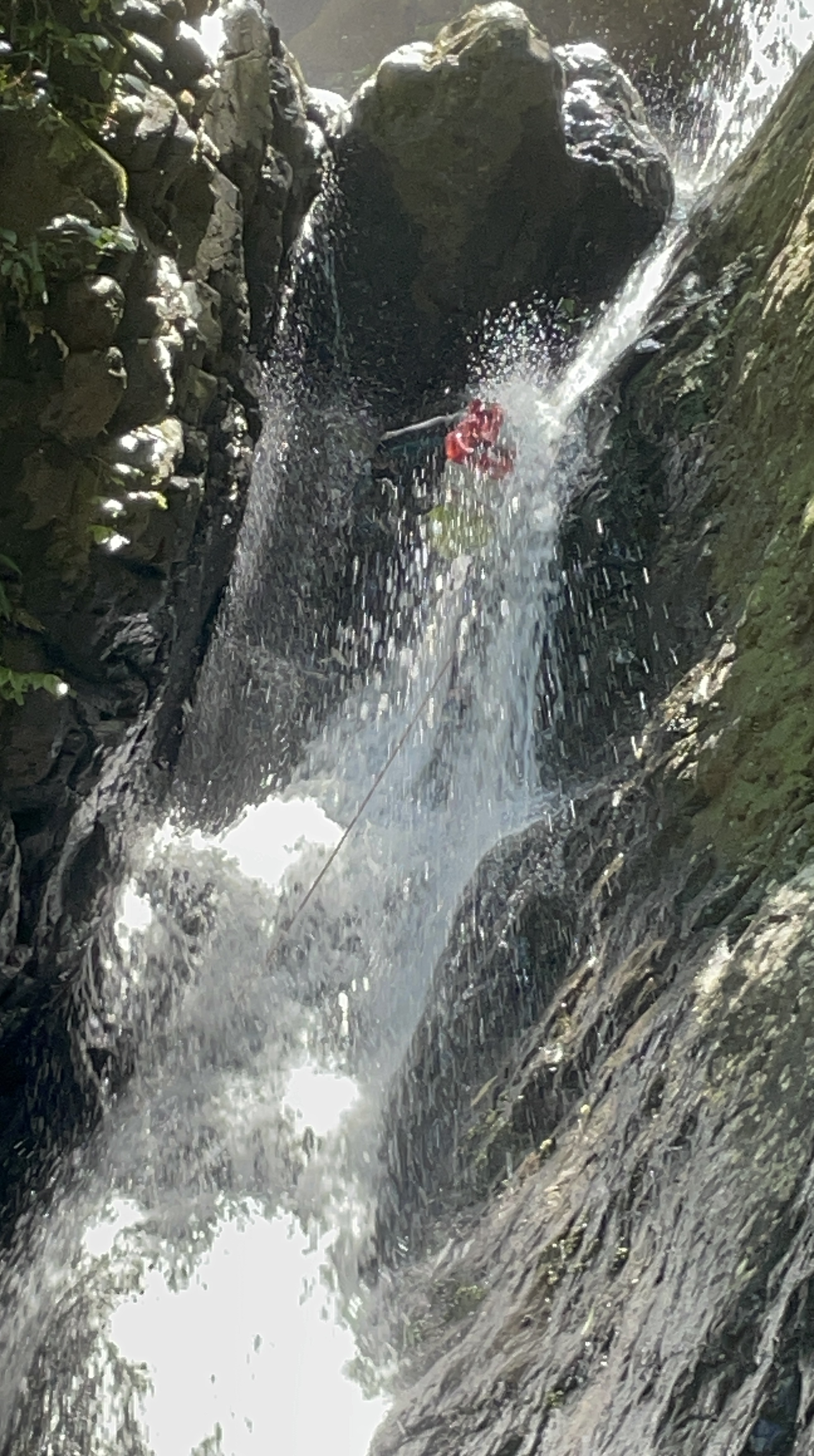
Abseils 7, 8 , 9, and 10 were definitely the highlights though R8 has to be the slipperiest slab I’ve ever slipped slab down.

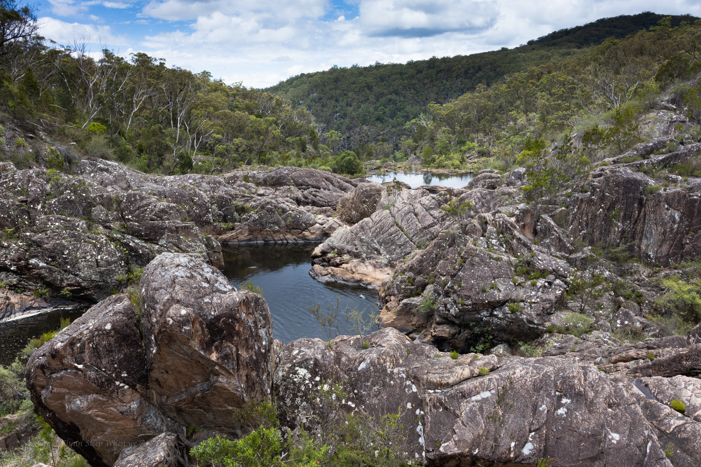
The infinity pool at the base of R8 is without a doubt the prettiest, most awesome natural cliff top pool I’ve been in.

And Absolutely none of us got a photo of it. we have to be fairly well gobsmacked not to get a photo.

Saying that I can see how it would be problematic in high flow.

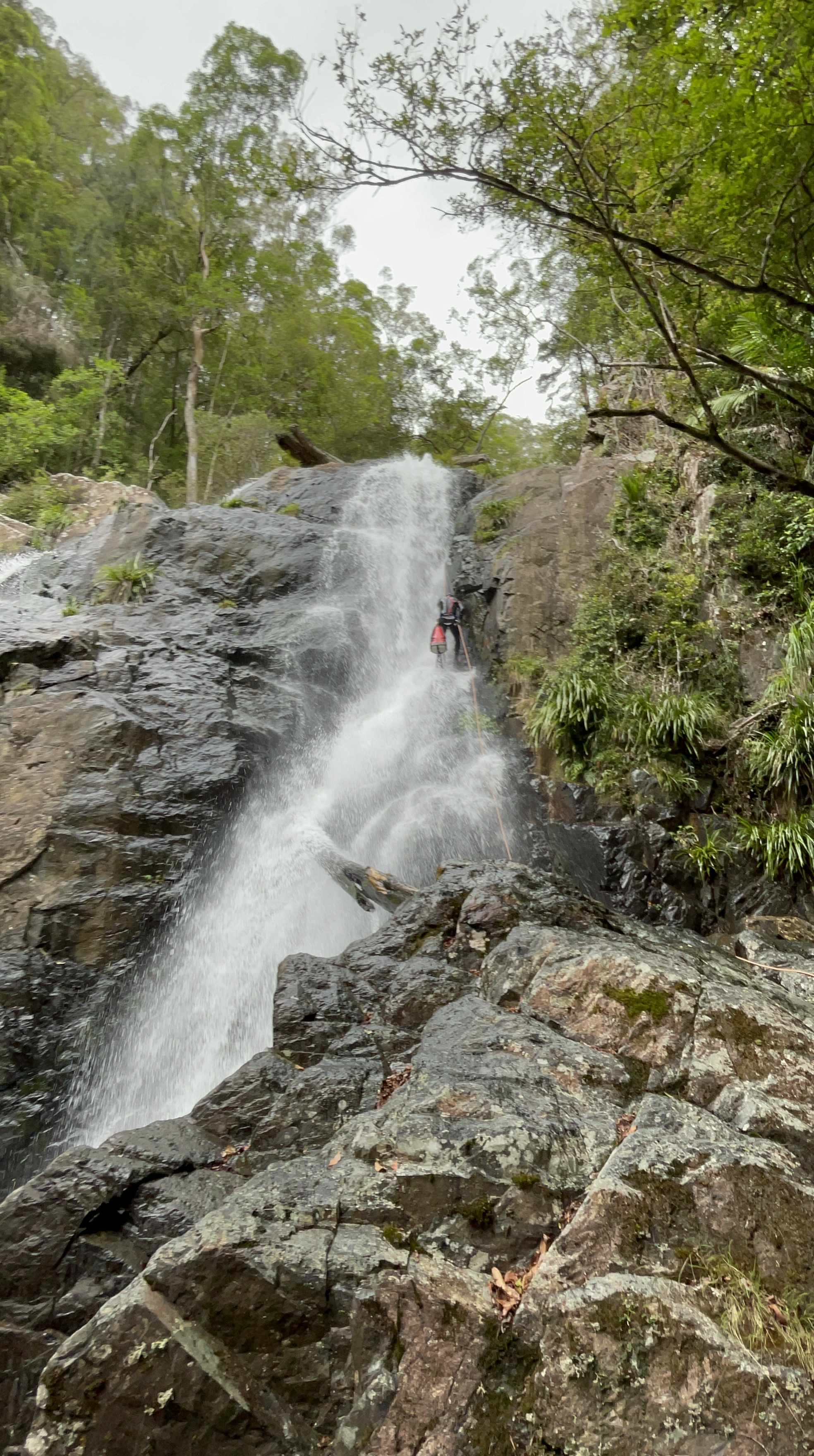
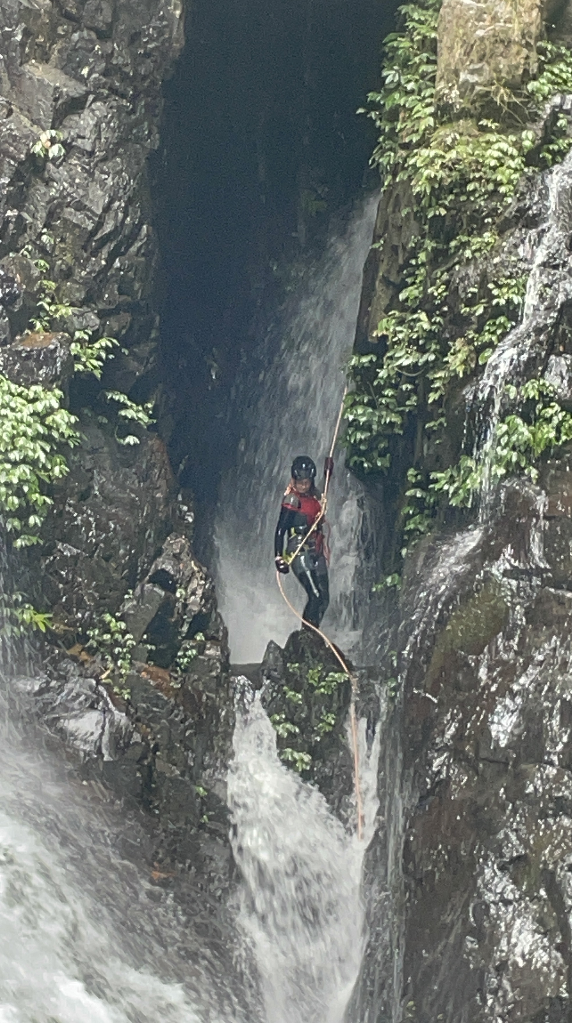
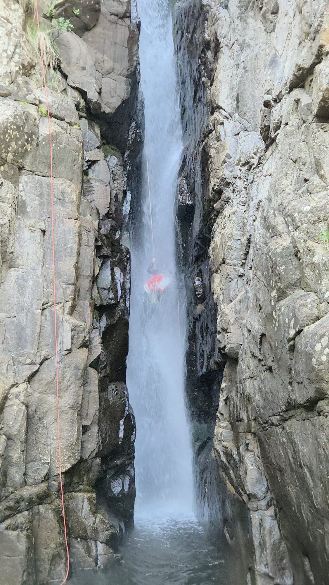
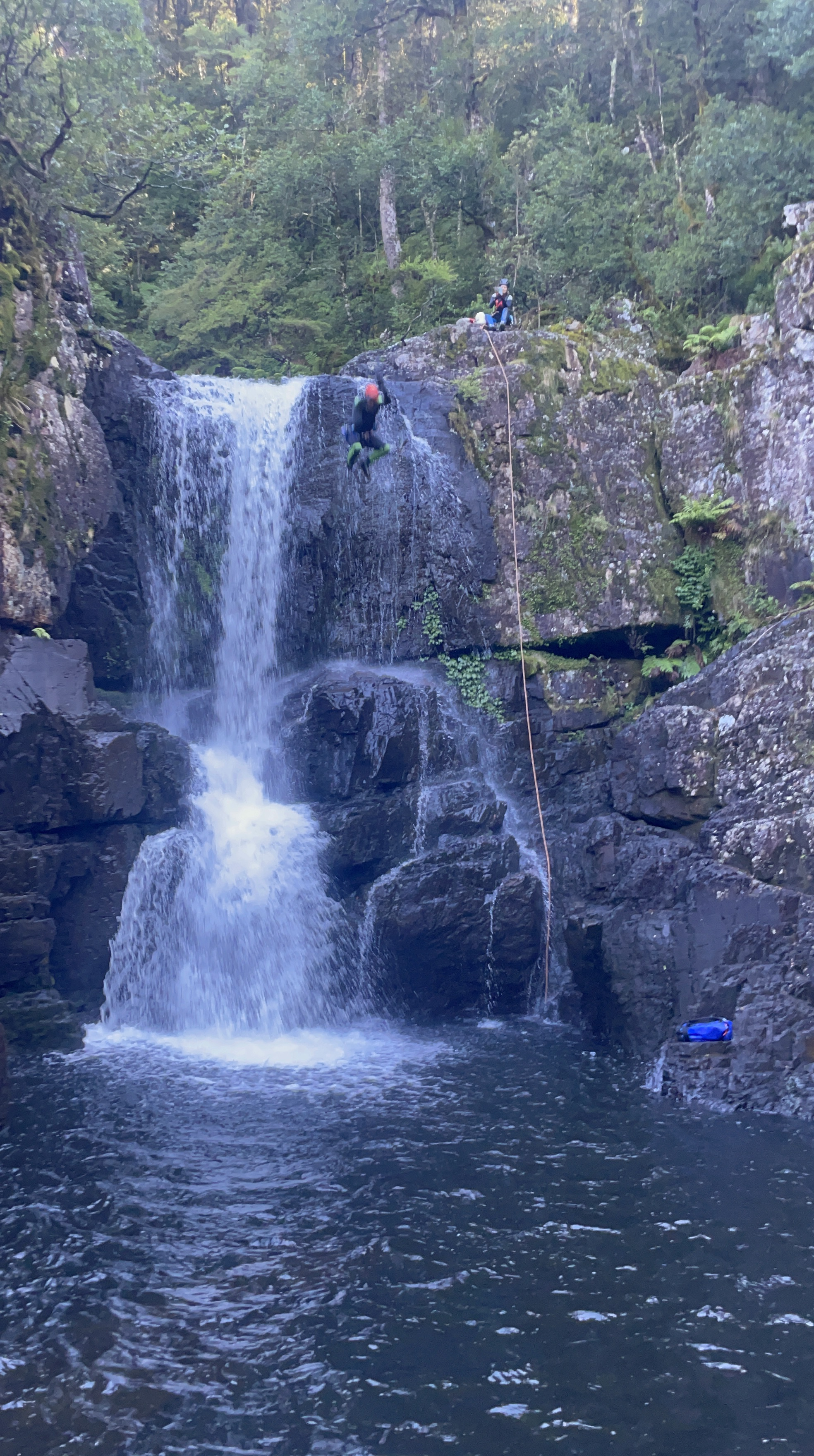
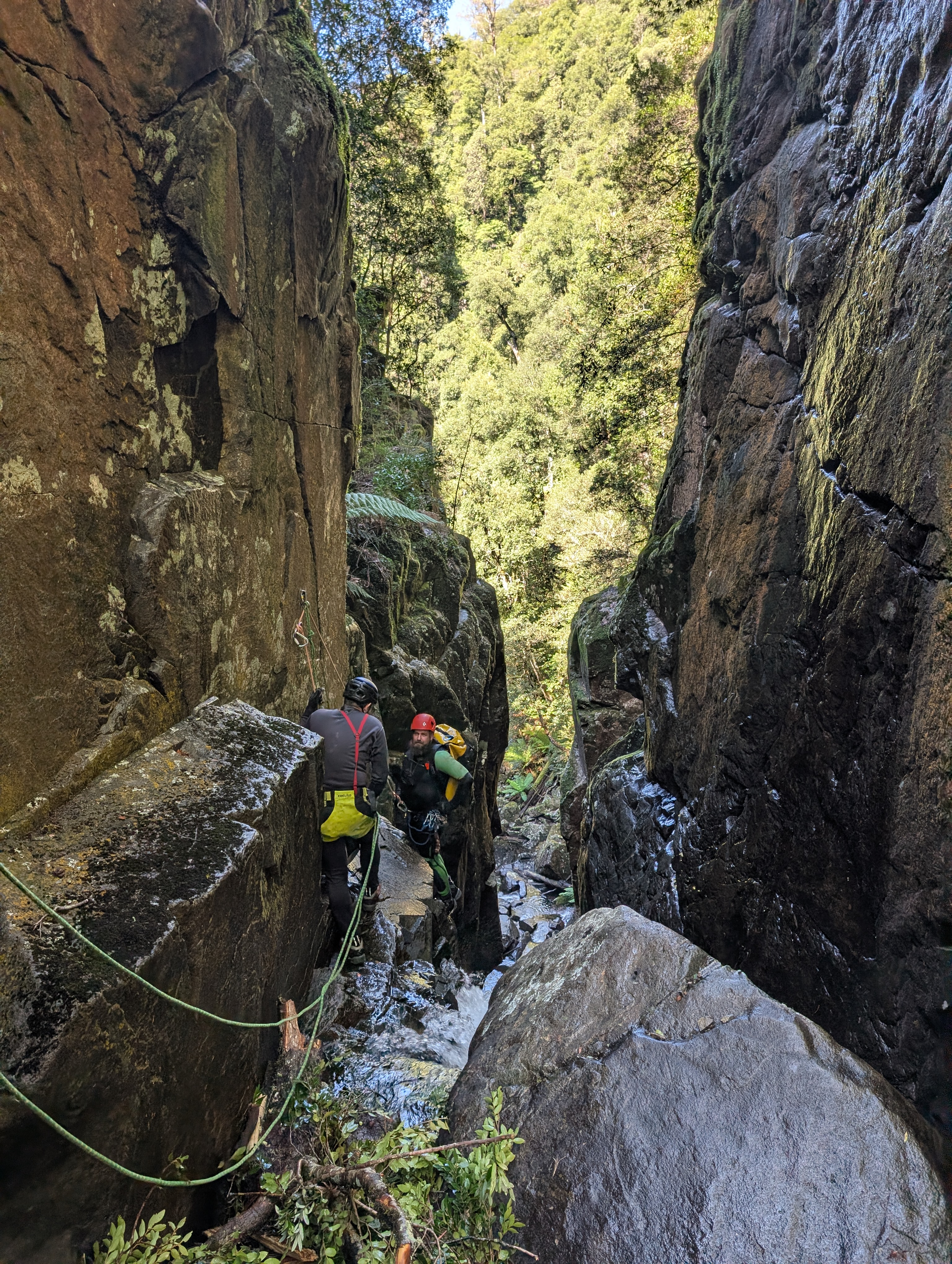
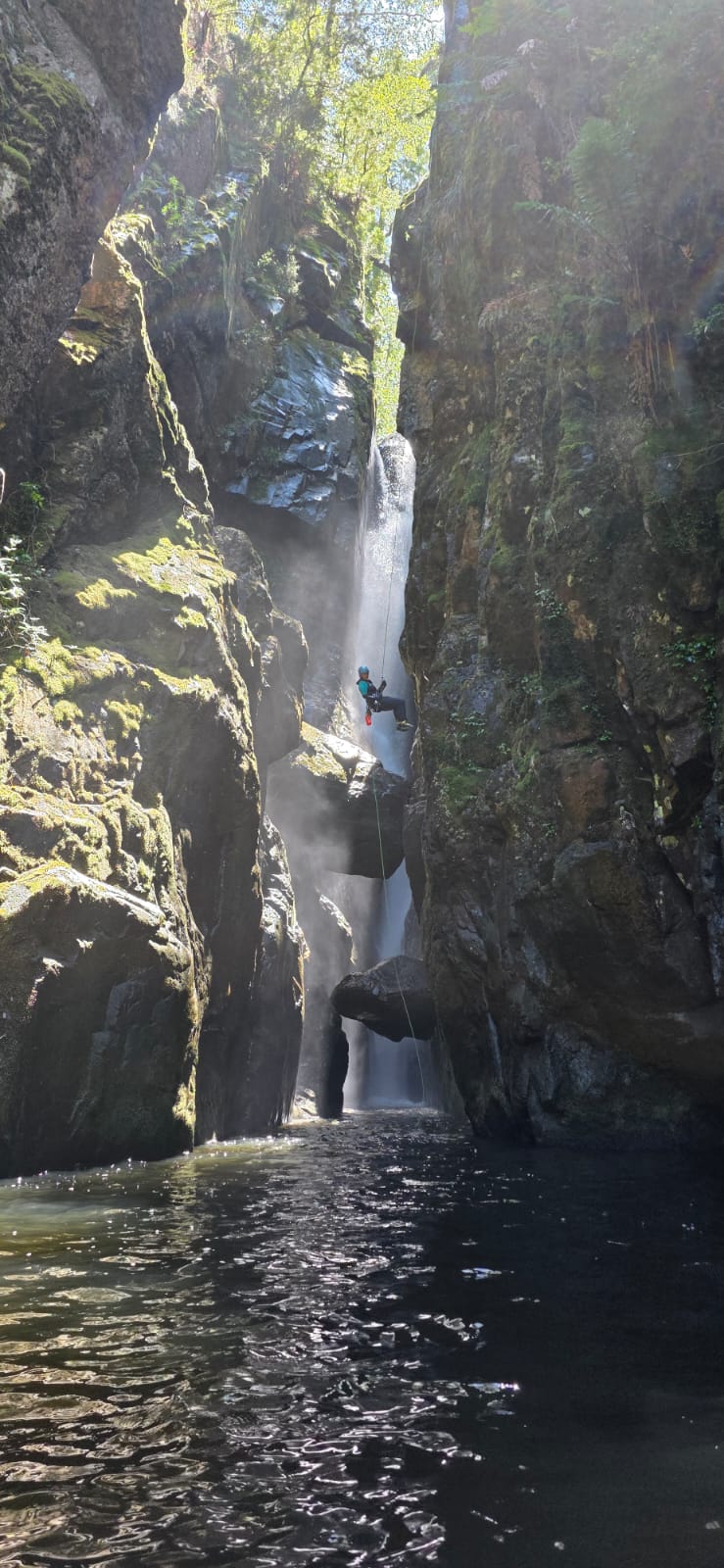
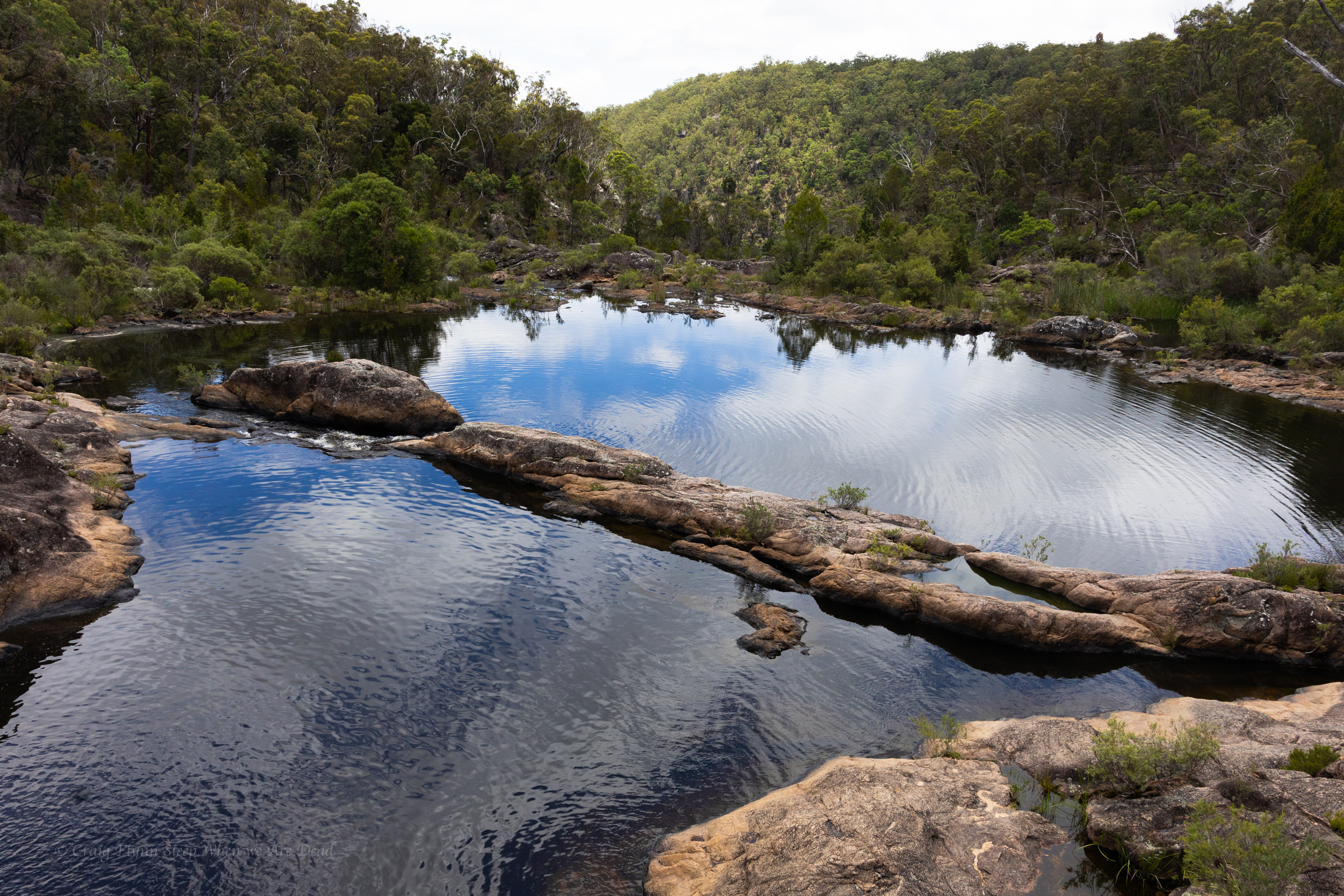
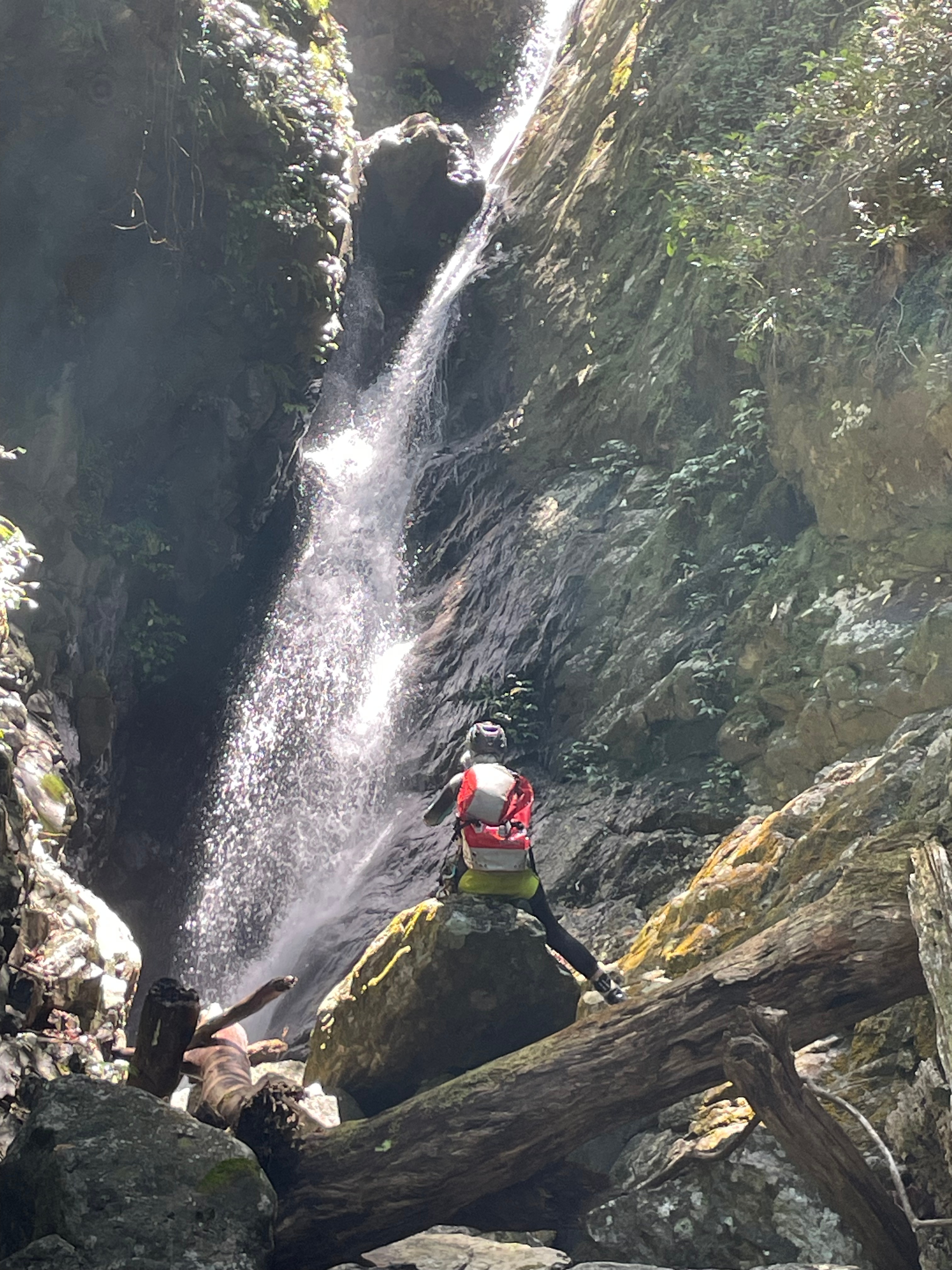
R9 is the big one. 50m from an exposed, semi hanging anchor.

But it’s an easy run down a gentle slab

Can’t believe I took photos of this but missed the pool up top.

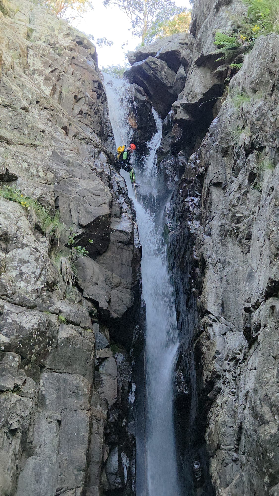
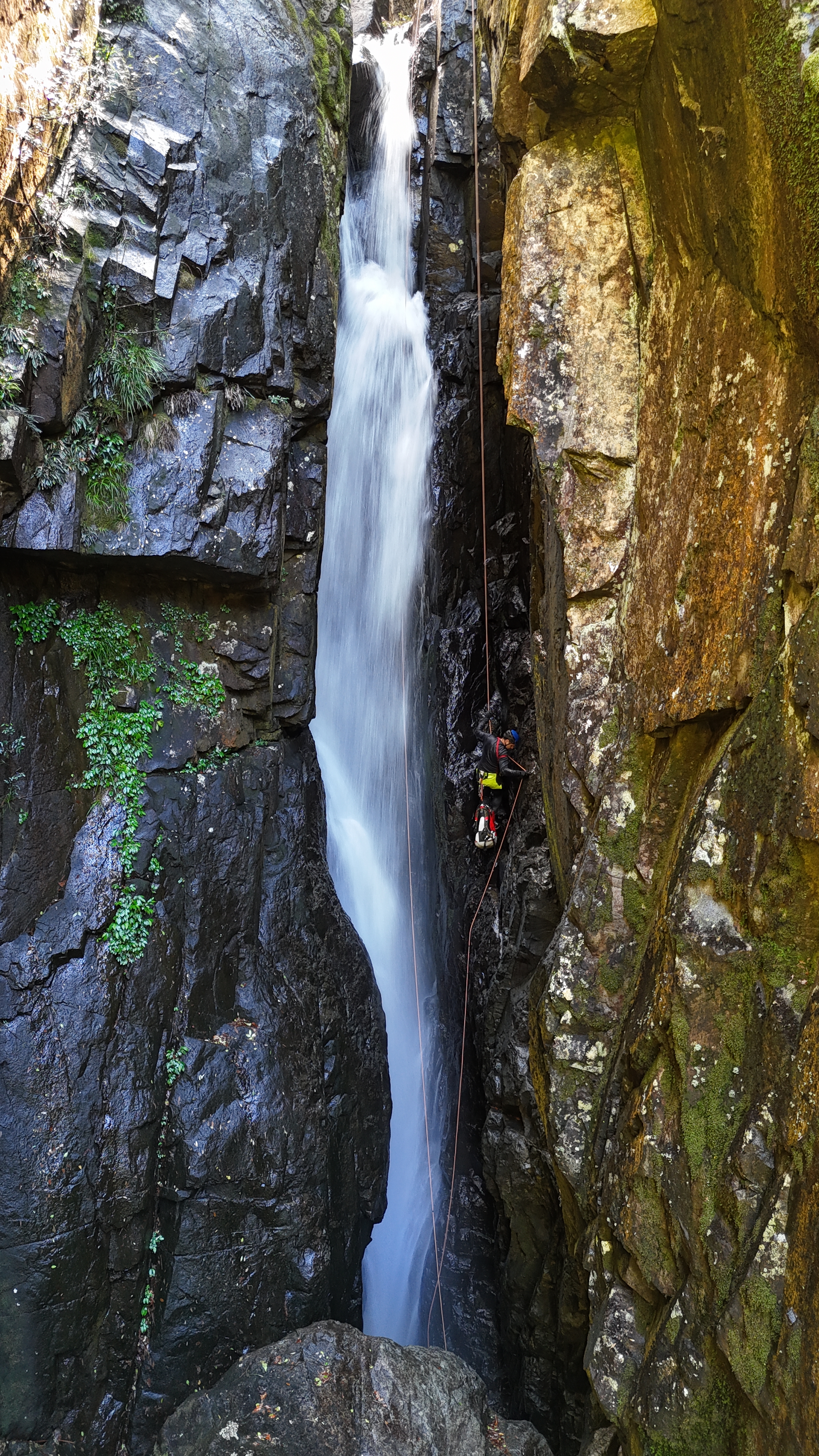
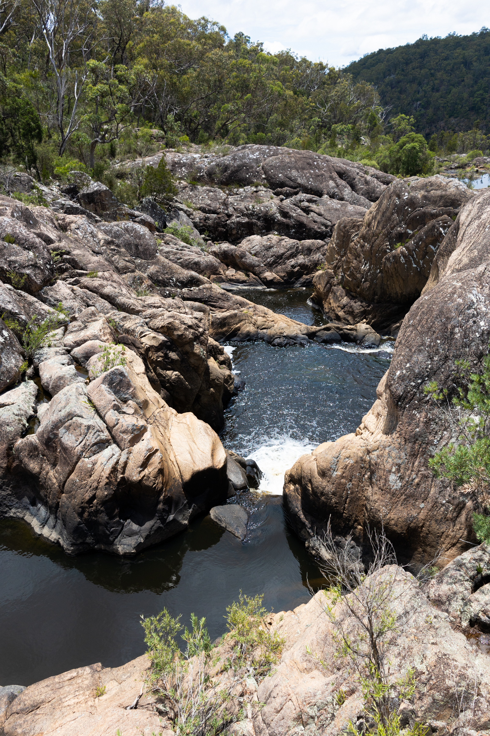
R10 is the most technical of the trip. It has a couple of over hung ledges right in the flow with some foot entrapment hazards to keep you on your game.

Kylie negotiating the second ledge. There a deep grooves here that just feel like they want to grab your boots.
All while copping a face full of white
Hywaida is in there somewhere as Kylie watches on
Kris basically walking on water
Vince on rope duties

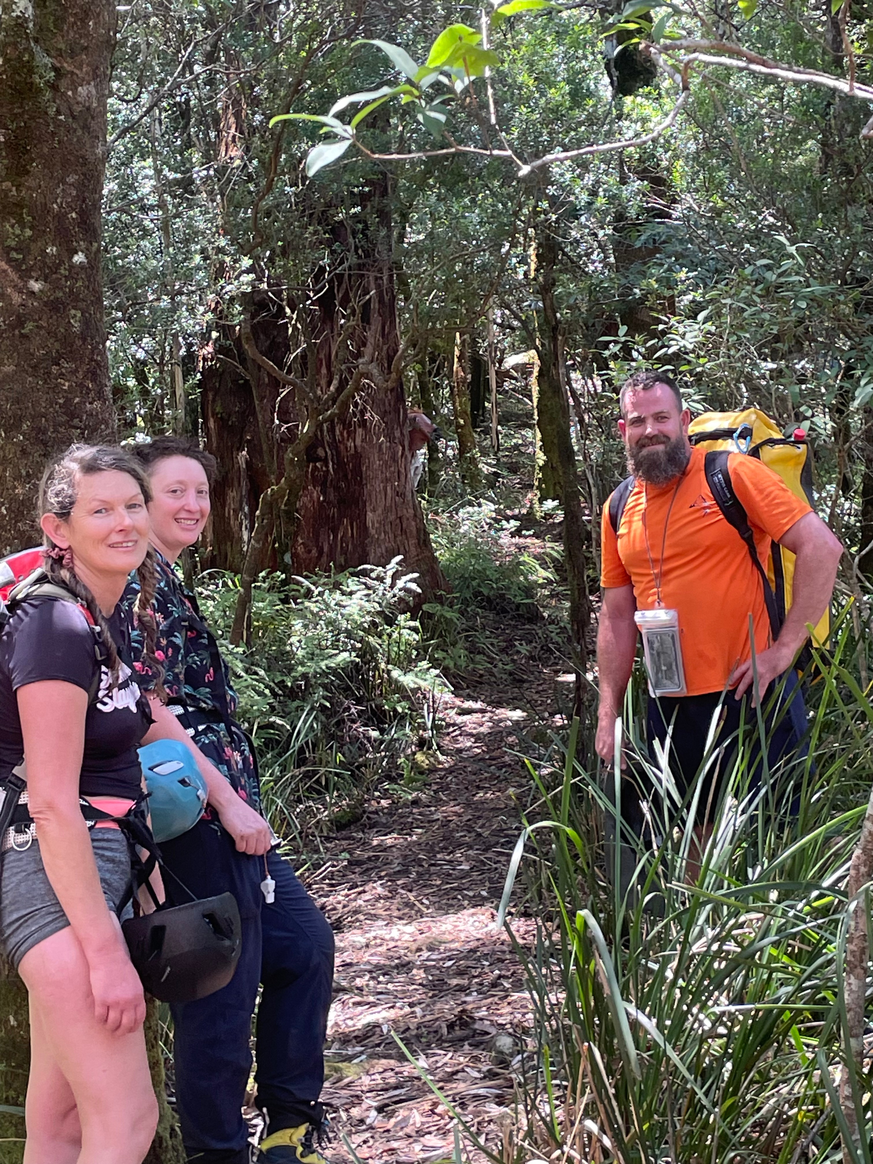
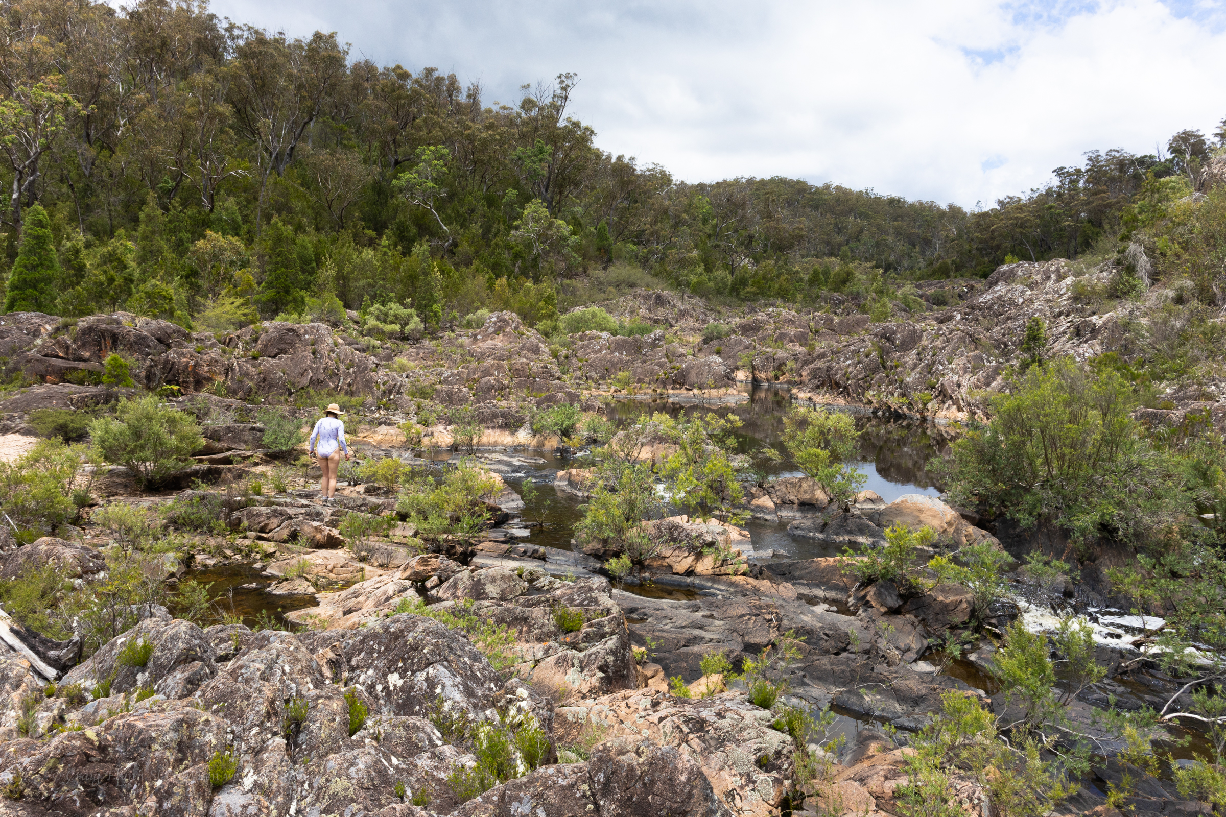
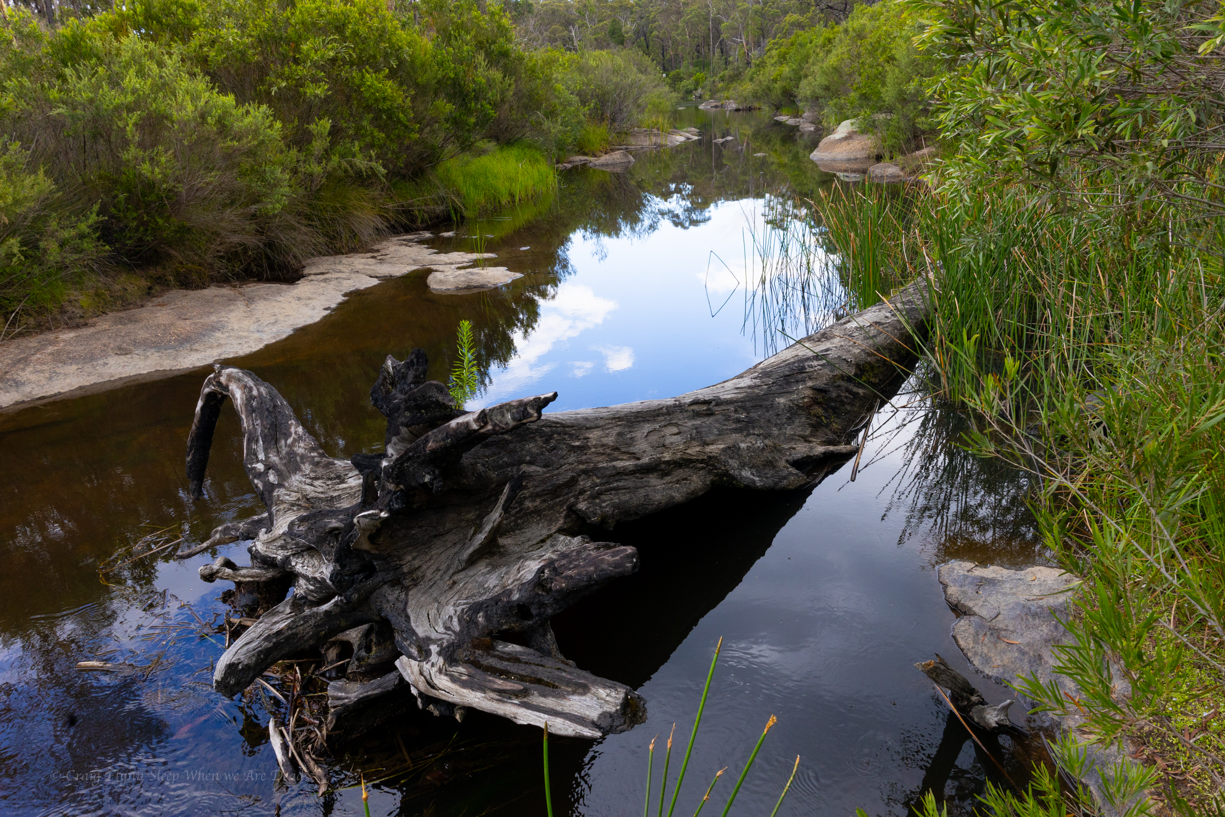
From here there is a long creek walk down to R11, then a longer creek walk down to the bottom exit. We choose just to forgo all that and just exit from the base of R10..

It’s a steep narrow, not quite knife edge ridge, full of wait-a-while and leeches but it goes easy enough. and gets us back into the upper section from where we pick up the tourist trail back to the cars.

“The strength of the team is each individual member. The strength of each member is the team.” — Phil Jackson

Back

Bangalore again

27-01-2026

Hywaida, Kris, Vince, Kylie and meeeeeeeeeeeee

Kylie and I had done this one before and really enjoyed it.

It’s a fun little waterfall style canyon and the water was up a little today compared to last time so we were keen to see what it would bring.

view from the tourist lookout
We suit up on the open slabs and then make our way down to the first abseil

There are 2 choices here, You can scramble over and say out of the flow or you can get frothed

Kris Emerging from the white out

There’s a short drop on to a knub, From here there is the option to drop down through a hole behind the chockstone but with the water a bit bumpy we opt to go in front.

it was at that moment Gadget realised she was going first
Kylie leading us into the froth
the creek is beautiful and the water warm.

Next up is the abseil through another hole. This time we go through.

Gadget
Hywaida
Kris
Vince
and more pretty water falls come

we get to the infamous drop that goes down through a massive log, last time we have avoided the hazard using the bolted traverse. this time we followed Jasons advice and cross to creek right and abseils off a tree. Much simpler

And before long we are at the jade pool and exit stage left up a steep Ridgeline back to where we had dropped a car.

Back

polblue

25/01/2026

Kylie, Jason, David, Wisey, Rakesh, Tanya and meeeee

We had been tossing around what canyon to do today before settling on 1 none of us had done before.

We all pile into Jason’s ute and head across the range.

Ah shit, I meant to reach out to Tanya and Rakesh, Says Kylie. They are up here somewhere.

We pull into the car park.

Hey that’s Tanya and Rakesh…

5 become 7 and we waste no time suiting up and making our way down the creek to the first abseil.

I set up rope and everyone by passes it and scrambles down beside it.

I pull the rope up and follow.

The next couple of drops are a little lame. I’m starting to feel bad.

We had convinced Jason to do this one rather than one of his favourite, high adrenaline, high flow trips and this wasn’t really shaping up. but then we came to the first of the “Spicy Slots”

Kylie and H opt to take the less spicy line ©Kylie
Jason goes full spice ©Kylie

And the rest of use follow.

It’s a tricky start into the white noise.

Just as you are able to see again you realise you are about to drop behind a chock stone and you most defilately don’t want to drop down behind the chock stone.

It’s a battle to resist the push and swing yourself over.

You emerge back into the light then drop off the chockstone into the noise once more.

It’s a fantastic abseil

Everyone one is grinning.

there’s an 800m creek walk to get to the next bit. lets just go back up here and do that again. someone suggests

hmmmm we are here now let;s at least check out the bottom section.

Lucky we did.

The 800m creek walk isn’t too bad and goes quick and the bottom section is the best bit.

looks nice and tame from up top

The creek has spit into 2 channels. A sloping abseil (New anchor has since been installed closer to the lip) brings you to the edge in between them

You step over the edge and both streams recombine.

On your head.

Hello Spicy Slot 2

The next 2 abseils come in quick succession

I scramble down the next one but signal up to the others that it isn’t worth it as there looked to be a nice exit from the ledge they are on.

The exit began on a steep loose scree slope but soon got steeper and looser before getting looser and steeper….

Other than the steepness and the looseness it was fairly easy going. The notes said to get to a certain elevation and then traverse around. While that would cut off some elevation gain it looked long and convoluted so we just went straight up and over a minor nose then dropped down onto the road not to far from the car park.

I nodded, pretending to be a hundred times more courageous than I felt.  Lisa Tawn Bergren.

Back

GLOUCESTER

24/01/2026

Jason, Dave, Wisey, Kylie and Me

Dr Forster went to Gloucester in a shower of rain.

He stepped in a puddle right up to his middle

and never went there again.

Ah English, where Forster rhymes with Gloucester and neither sounds like how they are spelt.

Anyhoo

What better way to pop my Barrington cherry than with a run through the upper section of Gloucester canyon.

Jason and Kylie had done it numerous times before at much higher water levels so today was shaping up to be fairy chill.

We had met Jason and Dave at camp the night before.

H had rolled in sometime through the night and we were all up early and eager.

It’s a short walk in and in high spirits we suit up and make our way down to the first abseil.

Kylie sets the rope and H leads the first drop
Jasons declares ropes are for the vanquished and jumps from a slippery stance
Kylie handling the rope duties ©Dave
The next one is fairly basic down beside a smaller fall

A short hop skip and a jump down stream and we arrive at what we are here for.

The Famous chock stone abseil.

But to get there requires a short abseil and traverse

On their previous trips the water levels had been too high to attempt this one and there is the option to scramble out and do a dry line from high up just down stream of the chock stones.

Conditions today however are perfect so Jason sets a line and I traverse out and set the main drop

Jason follows me out and leads the big one

There are two redirects in place on this drop. The first gets you out, away from a sloping ledge that forms just as the water funnels into a ferocious torrent, the second keeps you out of the hydraulic that forms in high flow at the base. Jason sets them both for us to follow

Me at the second redirect ©Dave

it’s a stunningly beautiful waterfall.

And the view back up to it from just downstream is iconic

There was a bit of horsing around

It was still early in the day. We were tossing up the idea of continuing downstream and completing the lower section. Jason had done it before and thought it was interesting.

The other option was to play around here.

It would be cool to get on top of the chock stone say Wisey.

There is the dry line option, said some one.

We scrmble up the start of the exit track and find our way across to the dry line.

It’s a bit down stream of the chock stones but I manage to swing across to the upper stone to help the following party with a stuck rope (Notes say to throw the pull cord over the chockstone. This lead to the stuck rope. If the flow isn’t too high just bring the pull strand down with you. it pulls fine.)

then drop in.

Jas, Wisey and Dave follow me. It’s a surprisingly fun abseil and we opt to run repeat son it for funzies.

©Jason

Then we head on out and enjoy a relaxing afternoon at Camp

Horse sense is the thing a horse has which keeps it from betting on people: WC Fields

Back

Warrumbungles grand high tops walk in Summer

After the heat of Waa Gorge and Mount Kaputar we decide our best plan would be to get up super early and get the bulk of the Grand High top walk down before the heat of the day.

But first we have to get there. There was another feature just out of Coonabarabran we wanted to check out.

We pull into Hickey Falls, never seen them this dry before. Says a local lady we bump into.

as dry as Uncle Geoff’s sense of humour

The side trip to Hickey Falls meant we’d enter the Warrumbungles from the eastern side and the drive in is spectacular.

View after view.

We pull into the visitor centre to book into our camp we are thinking they are going to say we are nuts but when we mentioned we we planning the Grand Hightop Walk in the morning they just smiled and said, Oh lovely. You’d be best to start early in this heat.

Oh yeah we are going to start about 5 and try and get up to the breadknife for sunrise.

Oh that would be awesome…

Ok so we aren’t nuts. Or not as nut as when thought.

We pull into camp. We had picked our site based around the morning view

All set for the view

It took about an hour, though for the shade to disappear and we begged a change of site to find afternoon shade.

The afternoon is spent having a short section of song echo over and over and over and over.

It was a bot weird, at first I thought the grounds keep really likes his teeny bop but I go for a walk and there’s a K-pop or TikTok or whatever the kiddies call themselves these day <Old man shakes fist at Cloud> perfecting their dance moves to the song.

We are pretty much the only ones in the entire camp ground so good on them say I.

Stil,l I do my best to get into their background and ape their moves. It’s how I roll.

Anyhoo

We up at sparrows fart and hit the trail at about 4.45am

It’s a lovely morning for a walk.

and the first of the pillars pops into view just as the sun lightens the sky and Kylie some how turns into Dicky Knee

Are you thinking what I am thinking?

yes, I just made a Hey Hey its Saturday reference…

I apologise.

and the views keep coming

It’s actually really shit at cutting bread
Sunrise and the Breadknife

We spend a bit of time here and a bit further up just watching the changing light and taking a gazillion photos

the light kept getting better
We are not sure how or why Kyle dressed as a school girl

We scramble up to the tops, the last 100m or so of trail is under construction so it’s still a bit of a scramble.

Topping out the wind is intense.

We take the short cut back down past Balors hut and get back to camp just after 9.

Another hot day poking around town and that brings a close to our epic first road trip in the Alucab

sawn Rocks

After spending the night at the Glacial Rocks camp we get up early hoping to catch sunrise light up the cliff face.

Sunset would potentially cast a better light onto the rocks at this time of year but it’s a spectacular feature at any time of the day and a short, wheel chair friendly, walk from the car park.

Like a pile of chopped and neatly packed logs you can see where it gets it’s name.
The hanging columns are amazing

As is our usual we push beyond the formed tourist trail on a rough but well used foot pad to explore the creek beyond.

And more of the amazing shapes

The cliff lines soon peter out and the creek snakes it’s way cross the plateau so we retrace out steps and head into Narrabri for coffee and a bite to eat before deciding to drive up to Mt Kaputar for a look.

sand goanna (Varanus gouldii)

We decide it’s way to hot to do any of the walks in the middle of the day but the road up is outstanding and well worth the drive.

Euglah Rock from Doug Sky lookout
The road itself is an adventure and the views with in a 5min walk from the car just keep coming

But the temperature is pushing into the high 30s again so we make track down to Coonabarabran where we decide to splurge on a motel room with air conditioning.

Waa Gorge

Over the years I’ve had a quiet giggle at the poor tourists hopelessly out of their way asking “is this the way to the campground at, um, New Ness.” their GPS’s having them very confused.

Today I gained a deeper understanding for those poor souls.

It’s pronounced “War” Gorge, said the amused cowcockie we waved down to ask where the hell are we. Turn left here and you’ll see the signs. he says but where did you come from?

I get ahead of myself. That came later.

We were doing a less than direct route from Cranky Rock to Waa Gorge as we wanted to use a free camp ground at Glacial Rocks to give us access to both Waa Gorge and Sawn Rocks without too much back tracking.

The road in to the Gorge from this end was touted as 4wd and fair weather only so we wanted to swing by the camp to see if it was suitable and make sure the road between was doable.

The camp looked great and we continued on. GSP signal was lost.

We get a couple of bars of signal just down the road and it screams to turn right.

Veering onto Terrergee road the signs matched what we were expect, other than not mentioning the Gorge, “Road Suitable in dry weather only.”

But the road was a lot better than expected.

Must have been recently graded, said we, if this is the rough road people whine about on trip advisor…. We should have shut up.

The road takes us across the top of some beautiful county and then down steeply into the valleys. It did get a bit slippy on the descents and you could see why it would be problematic in the wet.

So far so good.

Take the second left onto “Berrigal road” Says the nice lady in the GPS.

But the second road is signposted “Haven Home road” or sumfink and it’s the only road sign we’ve seen all day and the road looks like a goat track.

We pass it.

Go back says the GPS lady.

We go back have another look. Doesn’t look right. We try the other option.

Go back says the GPS lady.

I get out my phone and check the GPS topo app. I could see where the roads go but Waa Gorge isn’t marked and I’m not 100% sure where it is.

We take the goat track. It gets rougher and rougher.

There’s some dry creek crossing we need to engage 4wd for.

This is why we bought the ute. Says I

but it gets wilder.

Eventually GPS lady says, Turn left 100m ahead.

The left was even more over grown. I check the app again.

It opens out just through there but I’m 100% sure it’s private property.

Straight will skirt around the property boundary but add 18min to the drive.

Oh well we skirt around.

We are now in 4wd more than not.

It was a fun drive.

the road links us back onto Terrergee road, about a 5min drive further on from where the GPs insisted we turn off it earlier and still no signs for Waa Gorge.

We flag down a landcruiser coming the other way, the first car we’d see all day.

Um is this the way to “Wah” Gorge, say I sheepishly.

With a wry grin the afore mentioned conversation takes place.

The GPS took us down that road back there.

That bloody goat track!, it would have tried to take you across old mates property too.

I sense this isn’t his first of such encounters.

Anyhoo we are on the right track now. If the final little bit of bumpy road into the car park is what Tripadvisor folk are complaining about they don’t know what they are missing.

It’s 38°c as we pull into the car park.

By the way, it’s pronounced “War” gorge. 🙂

Sunscrees, hats, water, electrolytes, deep breath

Ok let’s head up. drink lots and if it gets too much say early and we’ll head back.

having suffered heat stroke and dehydration before I’m extra cautious in hot weather so we have a lot of water between us.

It’s a short walk up to the Mill-bullah water holes.

There is water in them but it has been in there a long time with no flush through to clean it out.

The top waterhole looks a little nicer but still stagnant.

The constructed tourist trail ends here but a well used ad hoc trail leads up through the cliff line.

The track skirts above what looks like would be a fun little canyonette full of jumps and slides, in the right water flow

Unfortunately we are here in the middle of one of the driest summers we’ve had since 2019.

Above the canyonette the gorge is shaded but the heat still oppressive

we find a clear pool to splash some water over us in an effort to cool off
We continue up, disturbing this lace monitor with his mouth full of a water dragon sandwich

Finally we get to the junction. Left takes us to the big wall .

A dry cascade greets us.

I head up, Kylie waits in the shade. The heat blasting off the stone is next level

The top of the gorge is impressive

We had a permit to fly the drone for 30min here so I get it out and try my hand at flying again

We slip back down to the junction, have a bite to eat and a big drink in the shade then explore up the other branch

another dry waterfall into a stagnant plunge pool greets us. It looks like there are some interesting levels above too. Definitely worth some exploration when things are cooler and wetter

We make our way back down to the car. And head back to the camp

the Ancient Glacial Rocks site on Rocky creek is interesting. Superficially it looks like another granite lined gorge. A closer look and the rocks are different. You can see how they have been churned up, smashed together and dumped out.

Once again the river is running through agricultural land and wild goat are everywhere but once again it’s too hot to be picky so we cool off in the rapids and then settle in for the night.

The camp site is basic but has bins and toilets. It’s worth checking out the toilet signs for a giggle.

There a 2 other campers set up. Flat spots are at a premium but we manage to jag a flat spot in shade

Winning

We eat diner with the goats. Tomorrow we head to Sawn Rocks.

Cranky Rock

Leaving Girraween and dropping back into NSW we are aiming for Warialda but decide to take a bit of a detour into Kwiambal NP for a look at Macintyre Falls.

Macintyre falls are located about an hour out of Ashford, near the Ashford limestone Caves (which at the time of writing were closed to the public).

The falls aren’t massive but they are impressive none the less, check out the little whirlpool near the top of the main falls in the top view. hate to get stuck in that in high flow.

the view from the lookout is impressive and a tourist trail leads down to the pool below
large Murray Cod could be seen swimming in the waterhole and fishermen are setting up so we opt not to swim and disturb their hunt for dinner

We spend a bit of time rock hoping and exploring then head across to Lemon Tree Flat for a swim in the Severn River.

This is a beautiful little camp ground I got zero photos of…

Then it was onto Warialda and the very cool little council run camp ground at Cranky Rock.

At $20 a night for a powered site it’s a great low cost campground with hot shower and clean toilets.

And an impressive swimming hole

Now I have to be honest, being spoilt in the crystal clear waters you find in Blue Mountains canyons the water hole here did have that agricultural run off look and slight whiff but on a stinking hot day with no better publicly accessible swimming holes within cooee it’s an oasis.

Sure, I wouldn’t drink it but there is no hesitation at jumping in and cooling off.

and the colours in the rocks pop at sunset

With the battery in my head torch now charged I thought I’d have another go at spot lighting.

The creek and waterhole was weirdly devoid of frogs and their predators. I spent a bit of time poking around but was giving up and heading back to camp when this little guy came out to say hello

Spotted Black Snake, Pseudechis guttatus, aka the Blue Belly Black snake

this species comes in range of colours, from creamy grey to shiny black but how good is the camouflage of this speckled version against the blotched granite.

Back at camp Kylie had luck with the furries. Spotting several sugar gliders running amuck in the trees behind our camper.

and also managed to

1. find this little burrowing frog

and

2. find it a second time to show me

But it is getting late. We are mindful of our fellow campers so call it a night.

we also have a long drive tomorrow.

Our next stop will be Waa Gorge (It’s pronounced “War” not “Wah”)

Boonoo Boonoo

It’s pronounced “Bunoo Boonoo” Thou tbh I had to ask Kylie how Bunoo was pronounced differenty to Boonoo.

One is “bun” and one is “boon”. She explains patiently to her favourite idiot.

Anyhoo

After a pleasant morning at Bald Rock the day has heated up and so we drive past the campsite and head to the main falls.

The road runs along the creek as it tumbles through a little granite gorge. It looks like it would have plenty of nooks and crannies to explore.

From the car park tourist trails lead to rock pools above the falls or down to a viewing platform over the main drop.

We head down to the lookout. It’s an easy 5min walk.

A 260m cascading waterfall tumbling into the steep sided gorge below.

Beyond the fenced path glimpses of old trails hint at adventure. If it wasn’t so hot or dry we may have been tempted.

Instead we make our way up to the rock pools intent on a dip.

The main pools at the end of the trail are beautiful, but why stop at there when there’s so much to explore.

We make our way upstream

A bit of rock hoping leads us past a series of cascades and semi hidden water holes

You can see just how low the water is by the waterline on the rocks. But still enough for a cool dip on a hot day.

And we choose a plunge pool below a little waterfall tucked into an alcove and play in the current of the falls wondering just how nasty the hydraulic would get in higher flows

From here its a short drive back to the camp ground where we set up for the night then explore the camp ground

The camp is upstream of the gorge and gives access to the river
We spend the twilight chilling out on the bench by the platypus pool. Unfortunately we didn’t catch a glimpse of any this time around.

An evening storm is our first real test in the Alucab in heavy rain. Lessons learnt: the make shift rain gutter works well but even with it on leaving the door open wasn’t a great idea…

Next morning we get up early and head to BasketSwamp Falls for sunrise.

Kylie below the lower falls
Even after last night storm the water level is low but at least there is some flow over the falls.

Kylie had gifted me a Potensic Atom 2 drone for Christmas and had been forward thinking enough to also apply for permits to fly it in various national parks we’d be visiting .

We were denied permission as the first couple because it was peak tourist time over the New Years long weekend but even then they encouraged us to apply again.

Most of our requests were granted though. There were a few conditions on the permits but they were easy enough to comply with

So if you are taking a drone it’s worth planning ahead and doing the right thing. There were also a few times where we had permission but opted not to put it up due to not wanting to disturb other visitors.

Can’t deny the awesome perspective you get with them though.

This was one of my first flights.

From here we’d be heading west into Queensland… sounds weird but the border does a little curve here. Bald Rock in NSW is North East of Girraween in Qld.