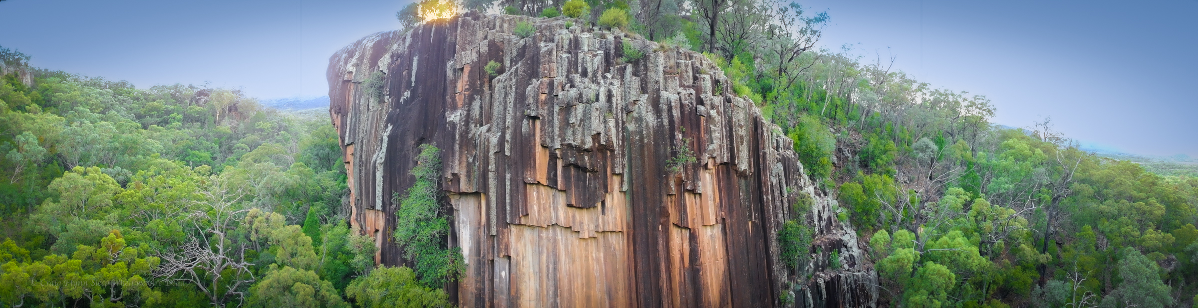
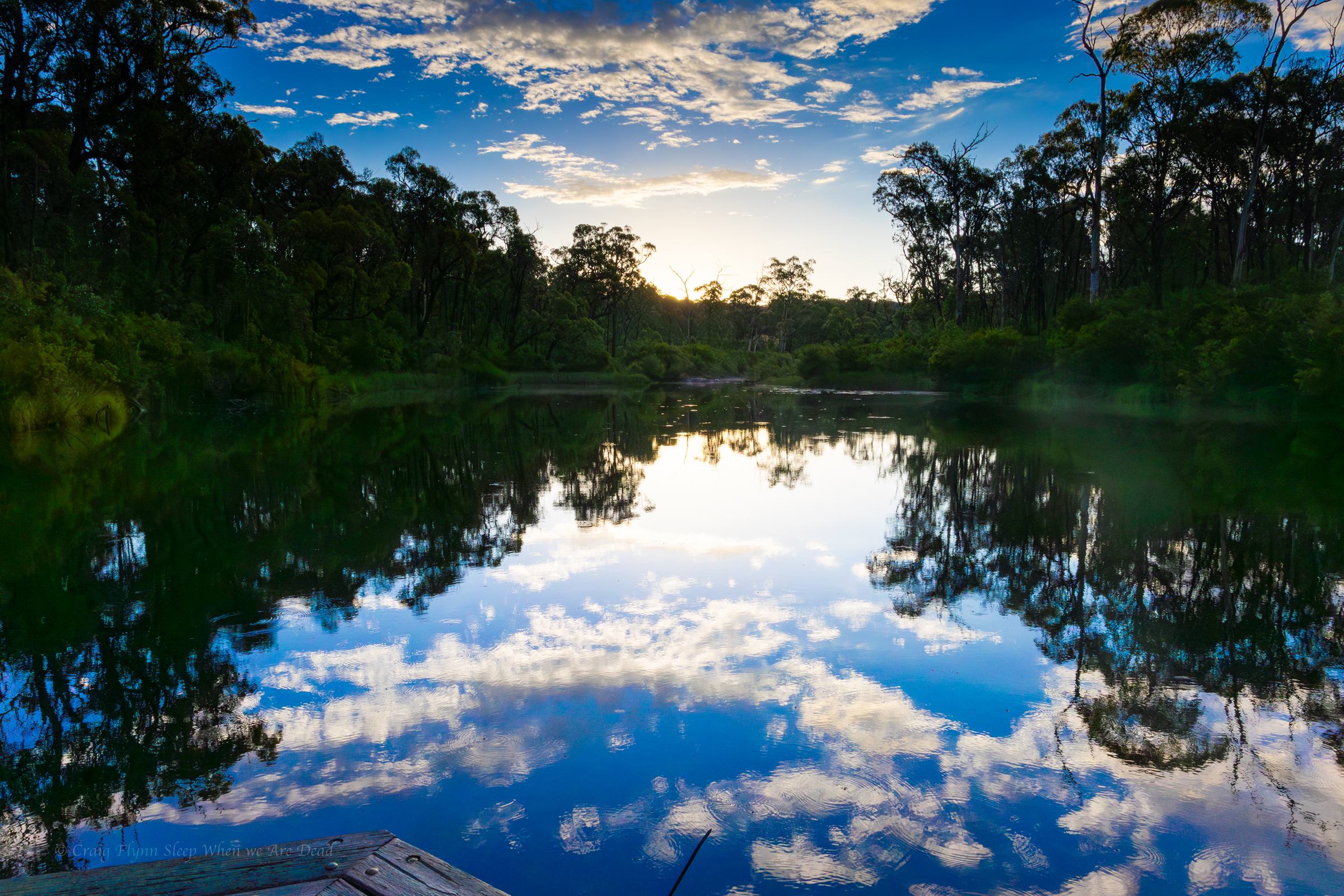
After spending the night at the Glacial Rocks camp we get up early hoping to catch sunrise light up the cliff face.
Sunset would potentially cast a better light onto the rocks at this time of year but it’s a spectacular feature at any time of the day and a short, wheel chair friendly, walk from the car park.
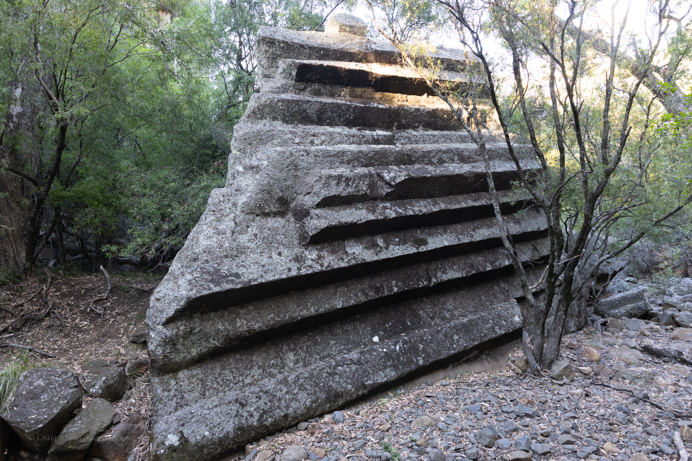
Like a pile of chopped and neatly packed logs you can see where it gets it’s name.
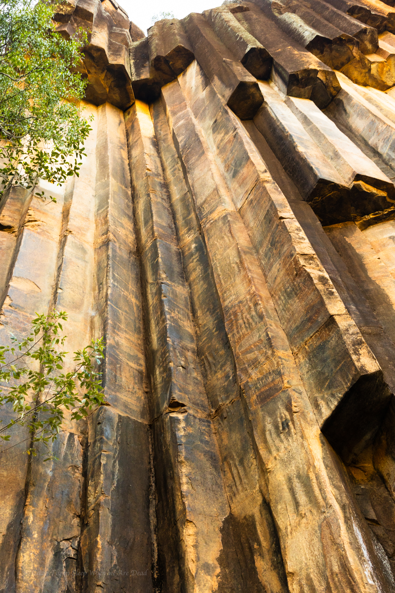
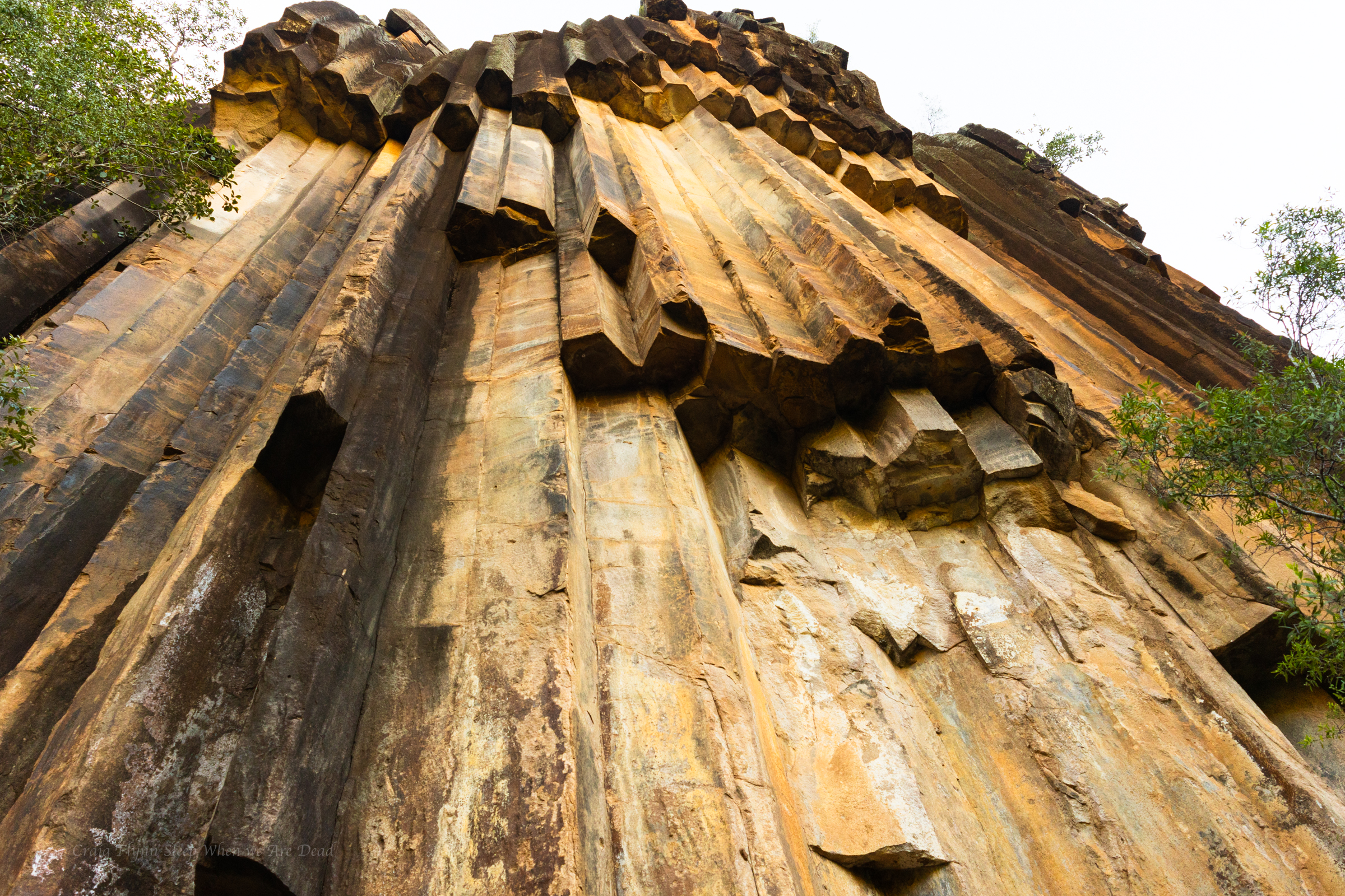
The hanging columns are amazing
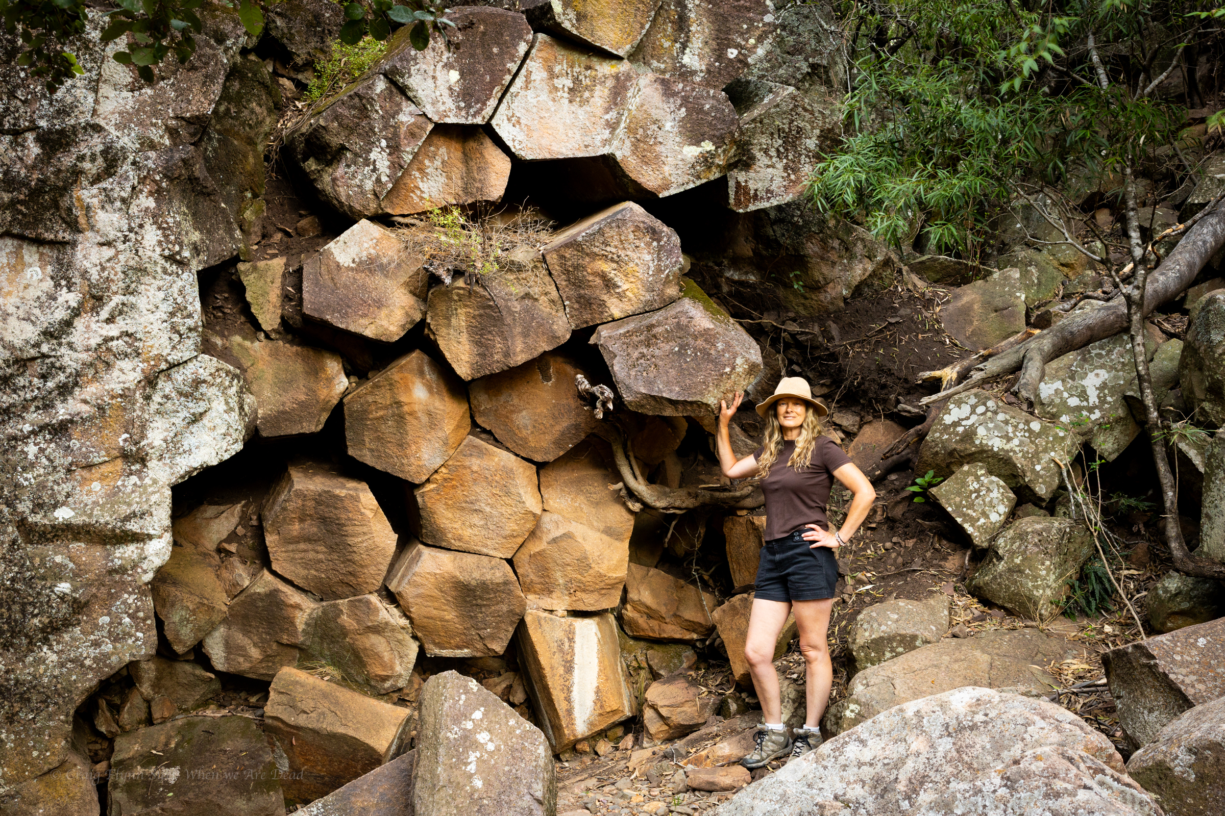
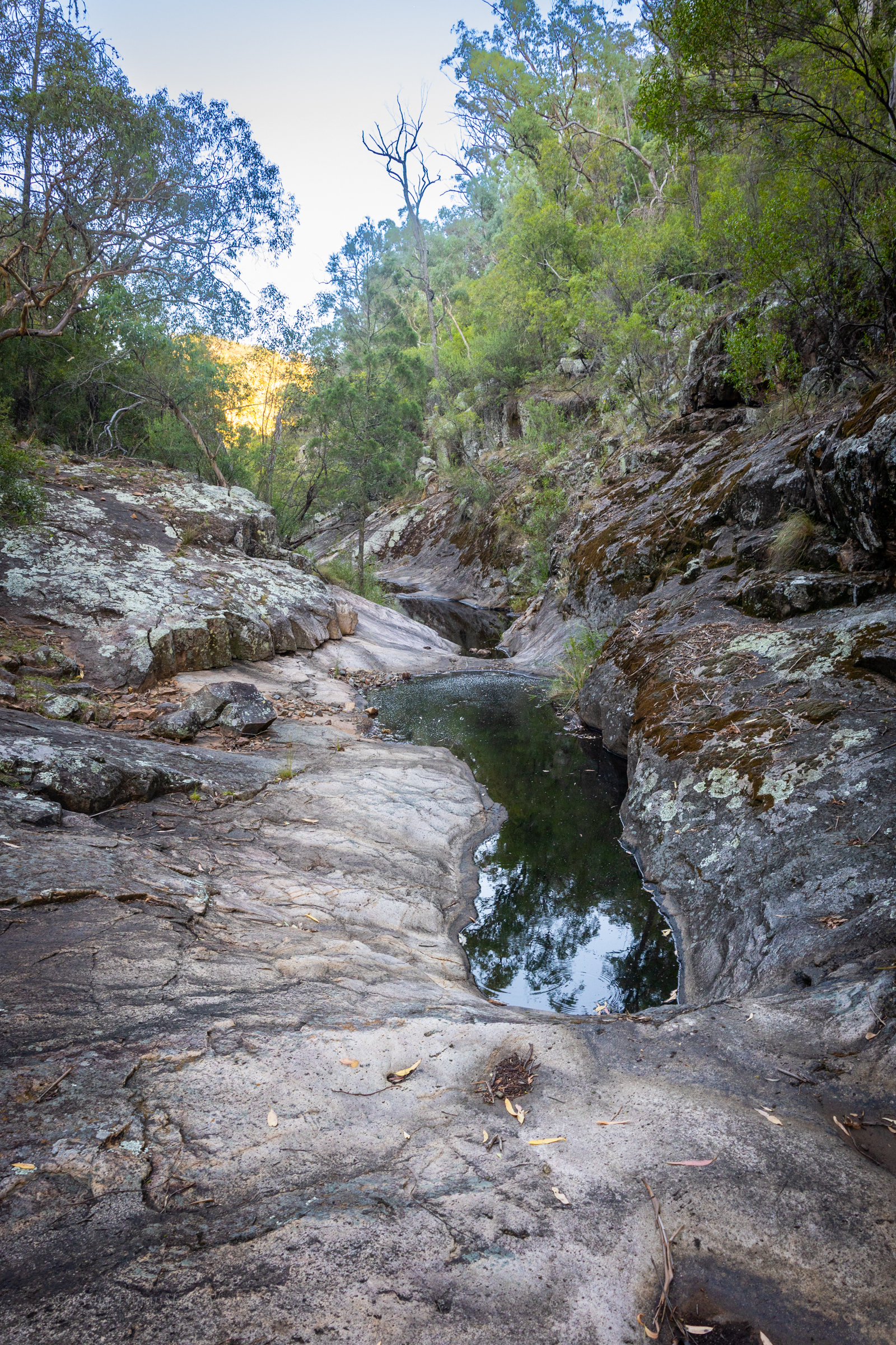
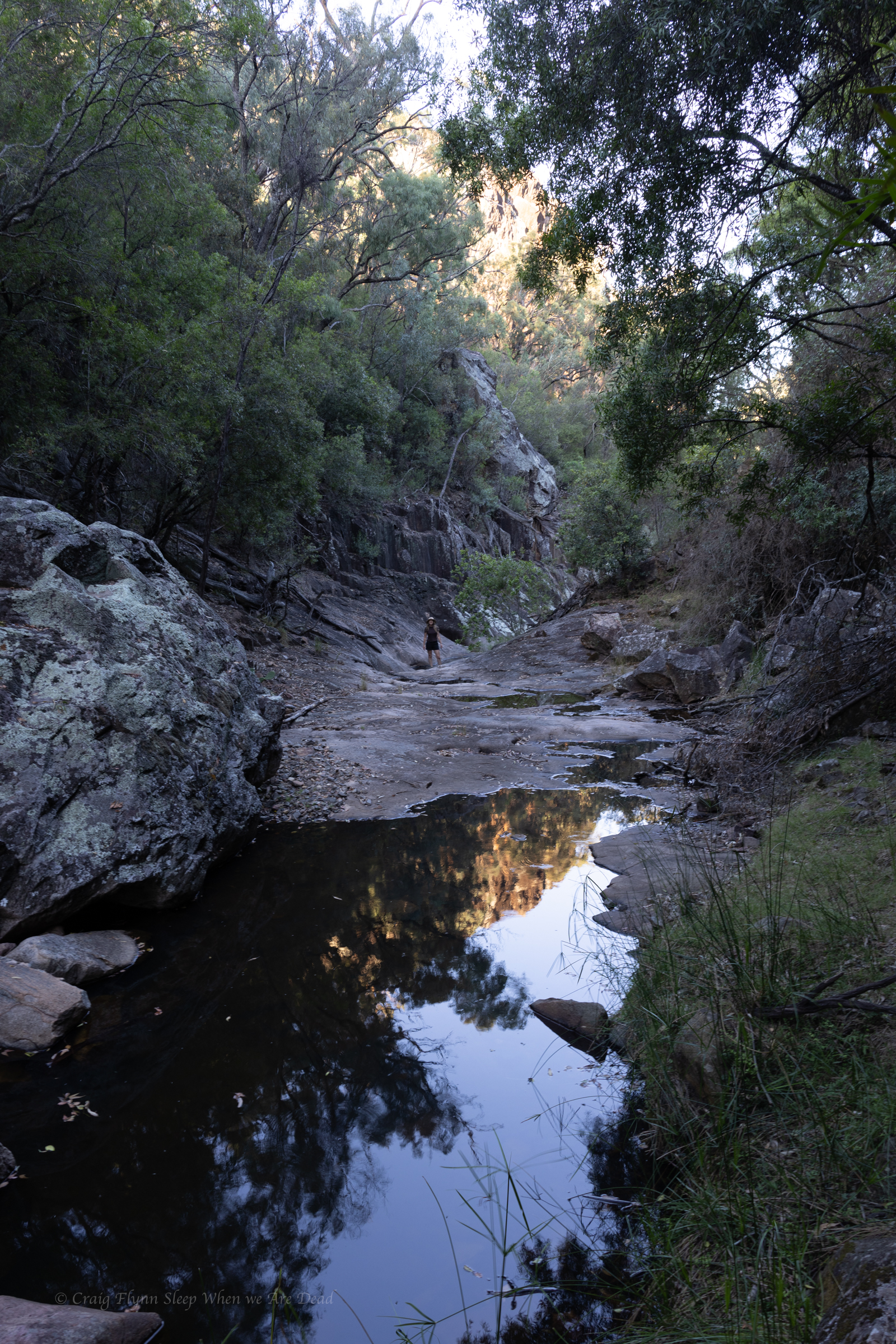
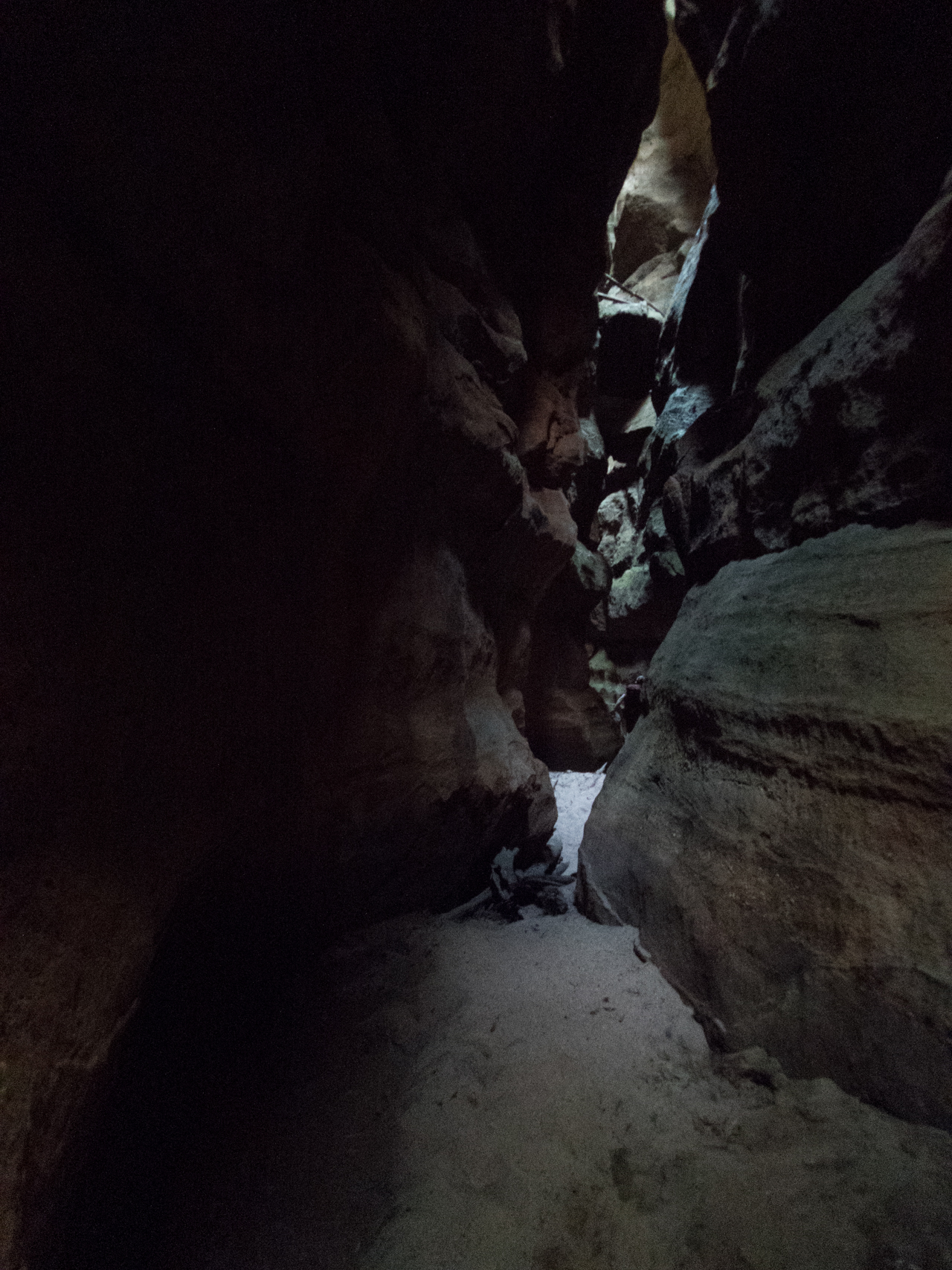
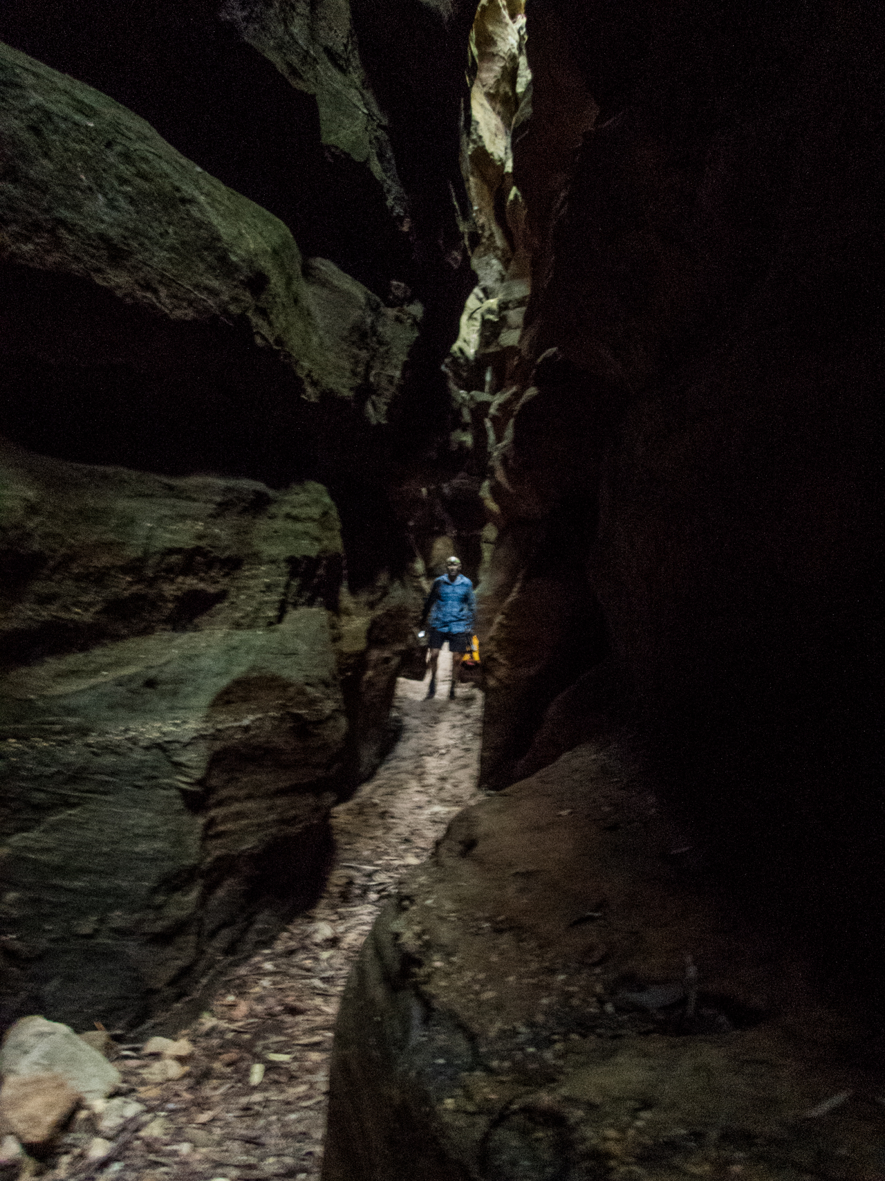
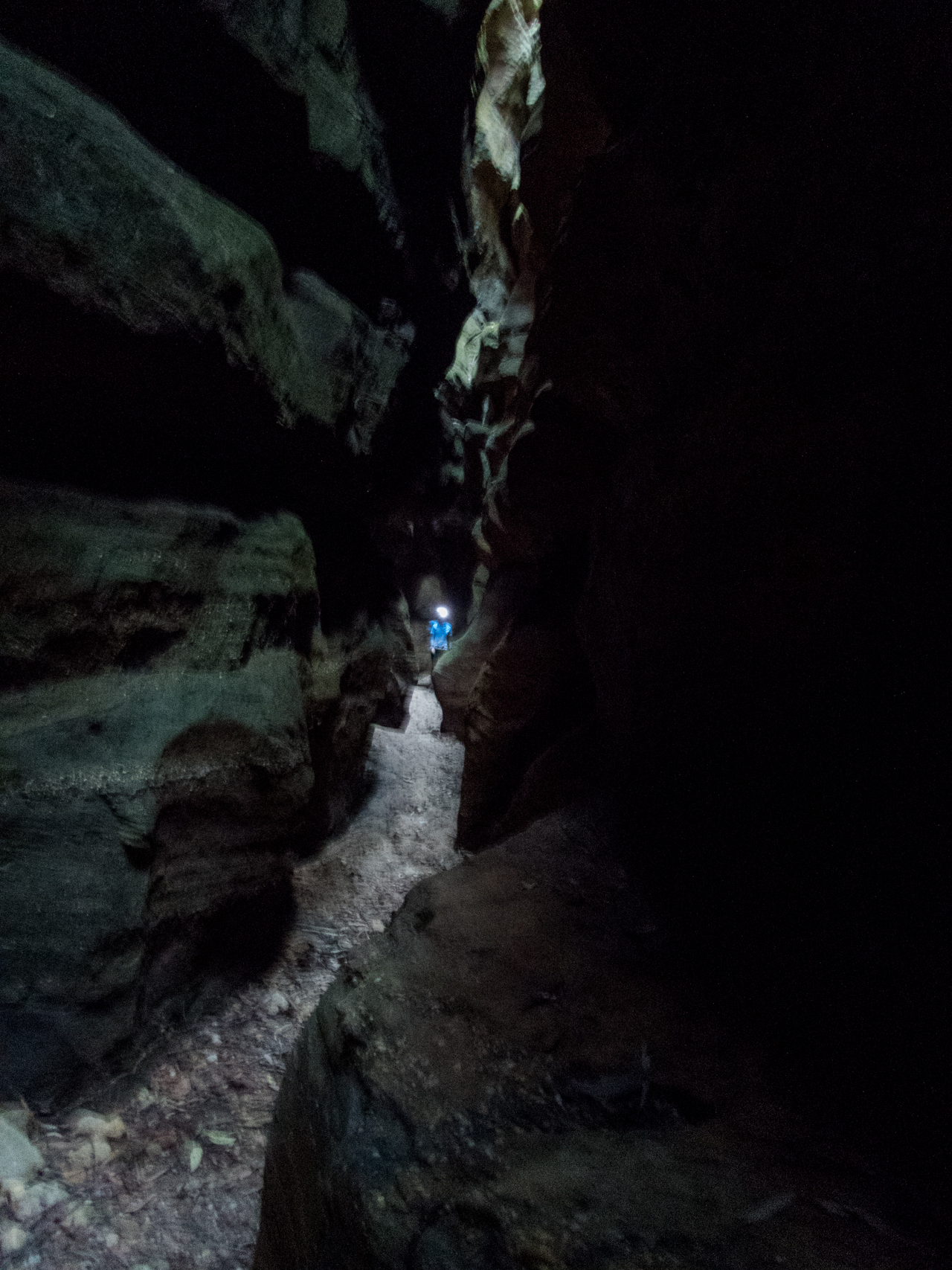
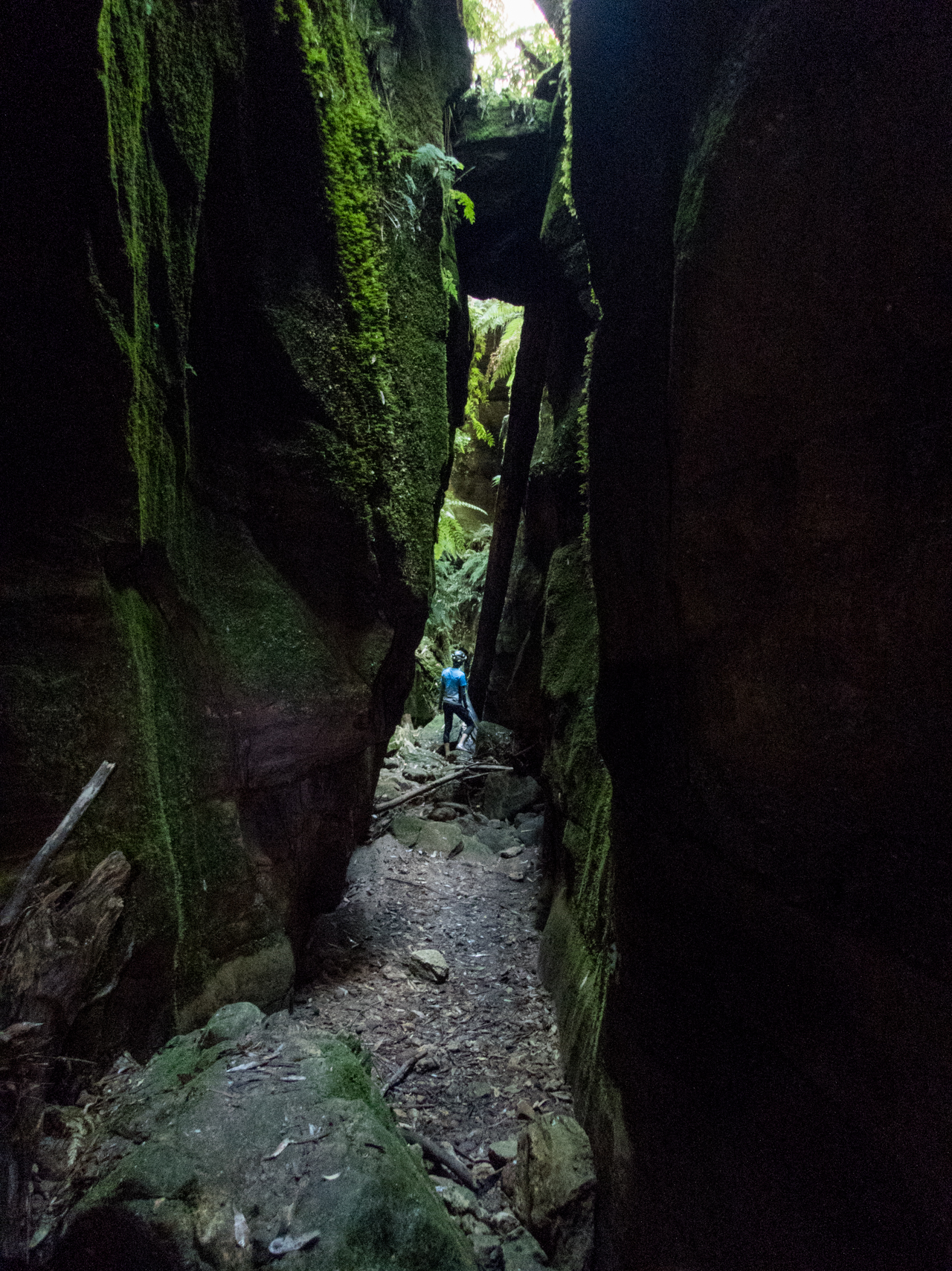
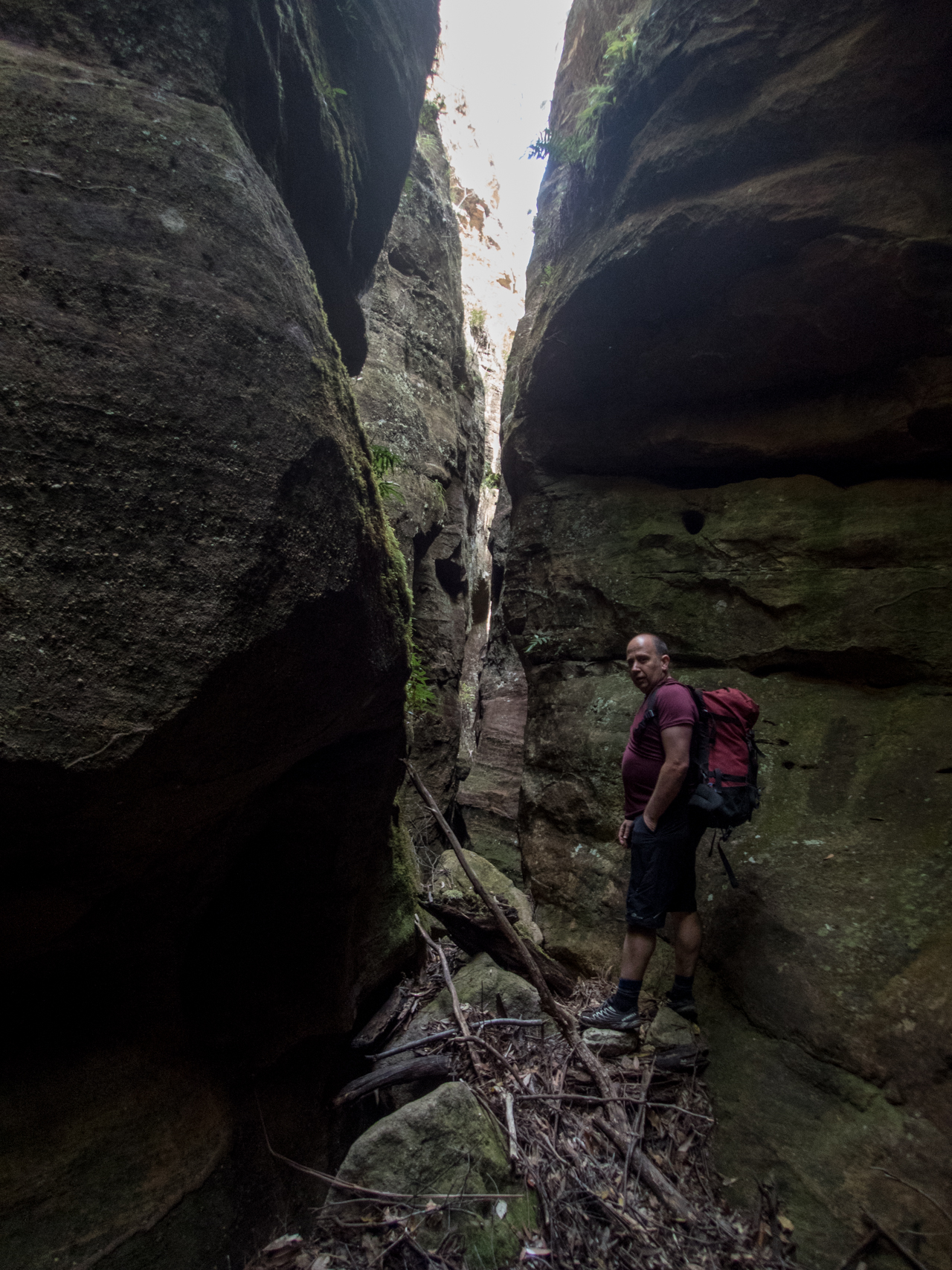
As is our usual we push beyond the formed tourist trail on a rough but well used foot pad to explore the creek beyond.
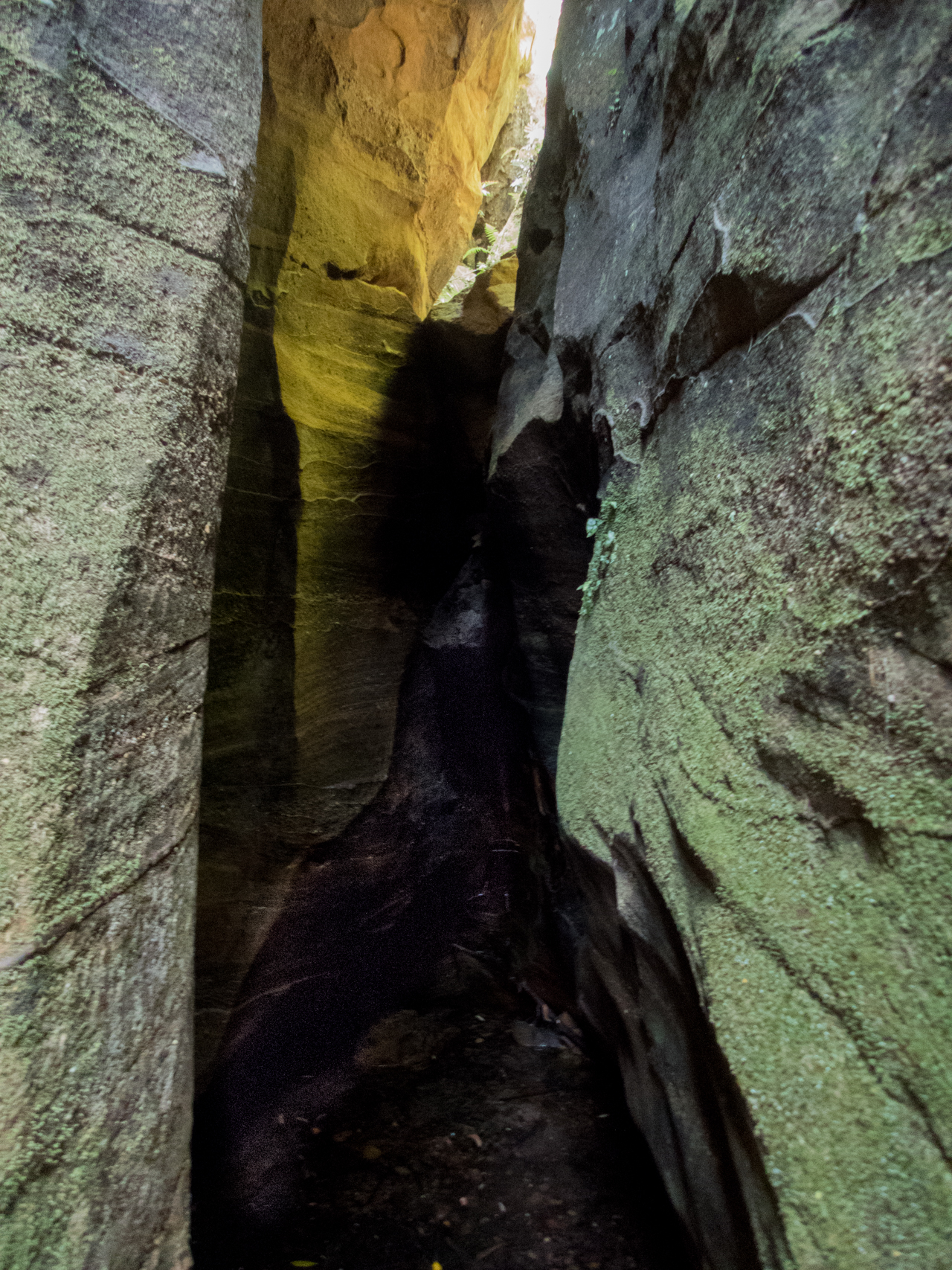
Once again it’s dry but interesting
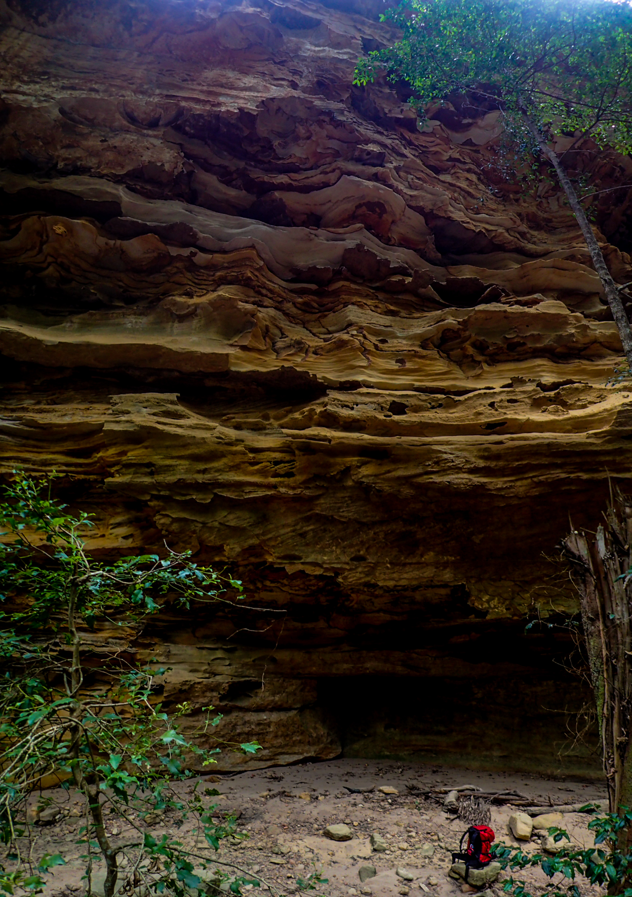
And more of the amazing shapes
The cliff lines soon peter out and the creek snakes it’s way cross the plateau so we retrace out steps and head into Narrabri for coffee and a bite to eat before deciding to drive up to Mt Kaputar for a look.
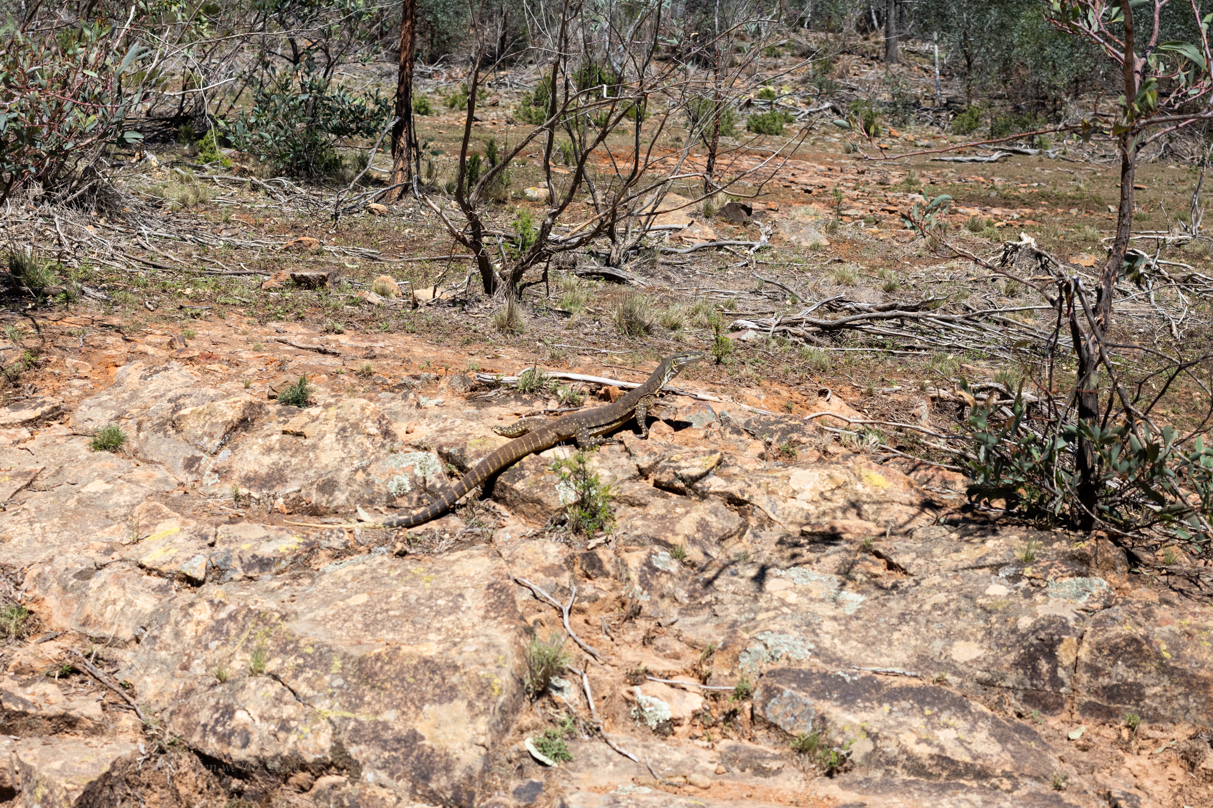
sand goanna (Varanus gouldii)
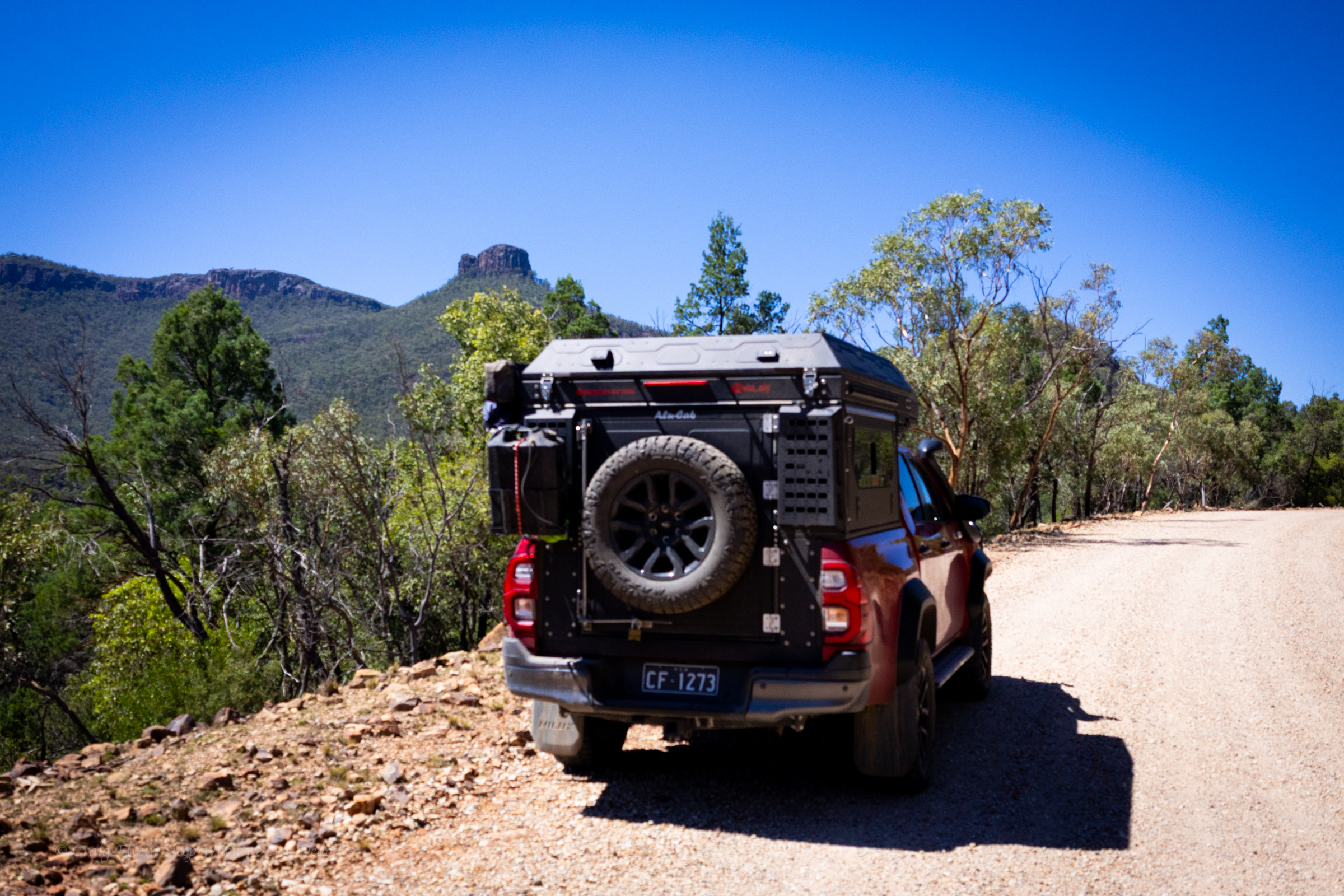
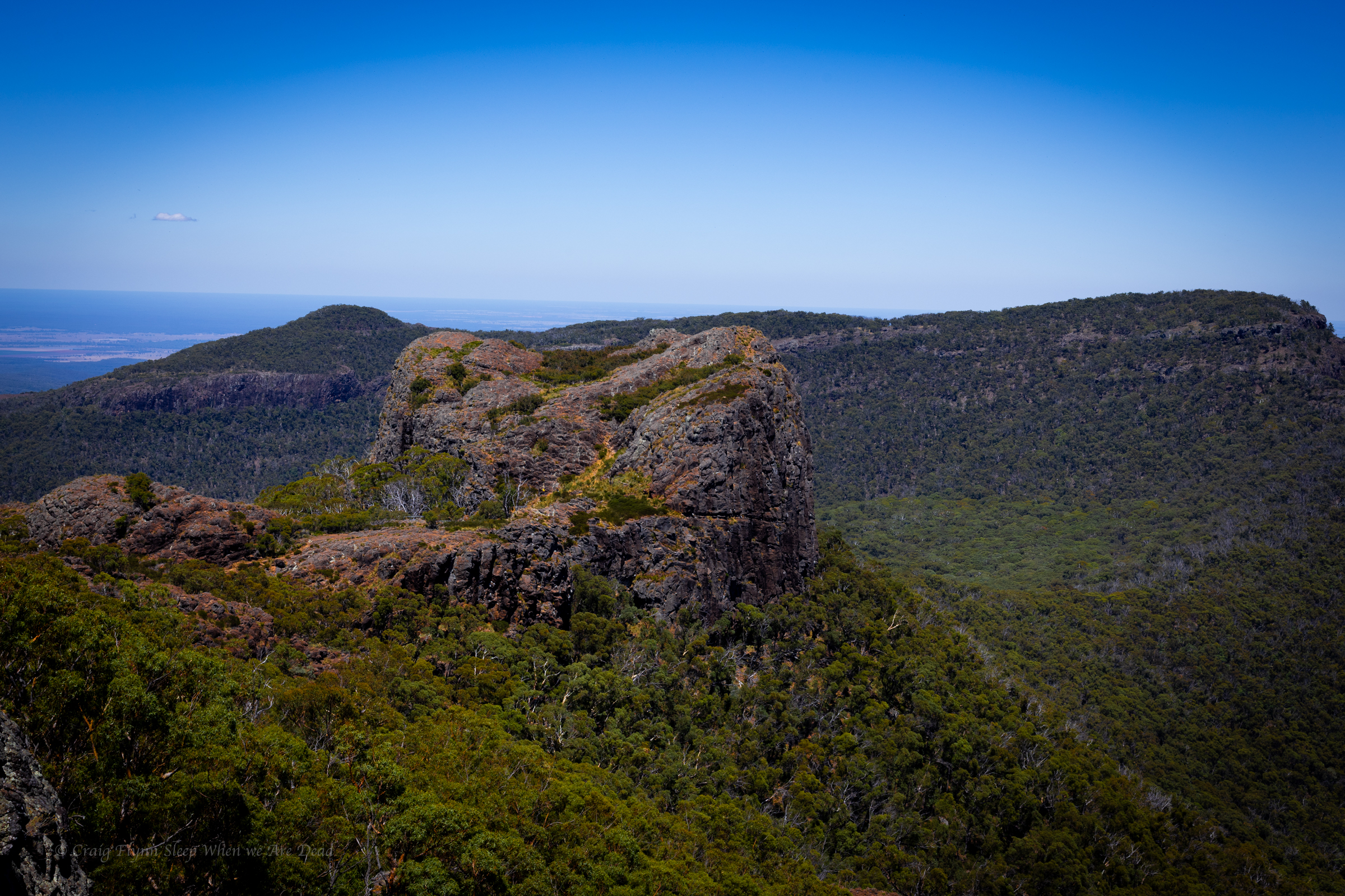
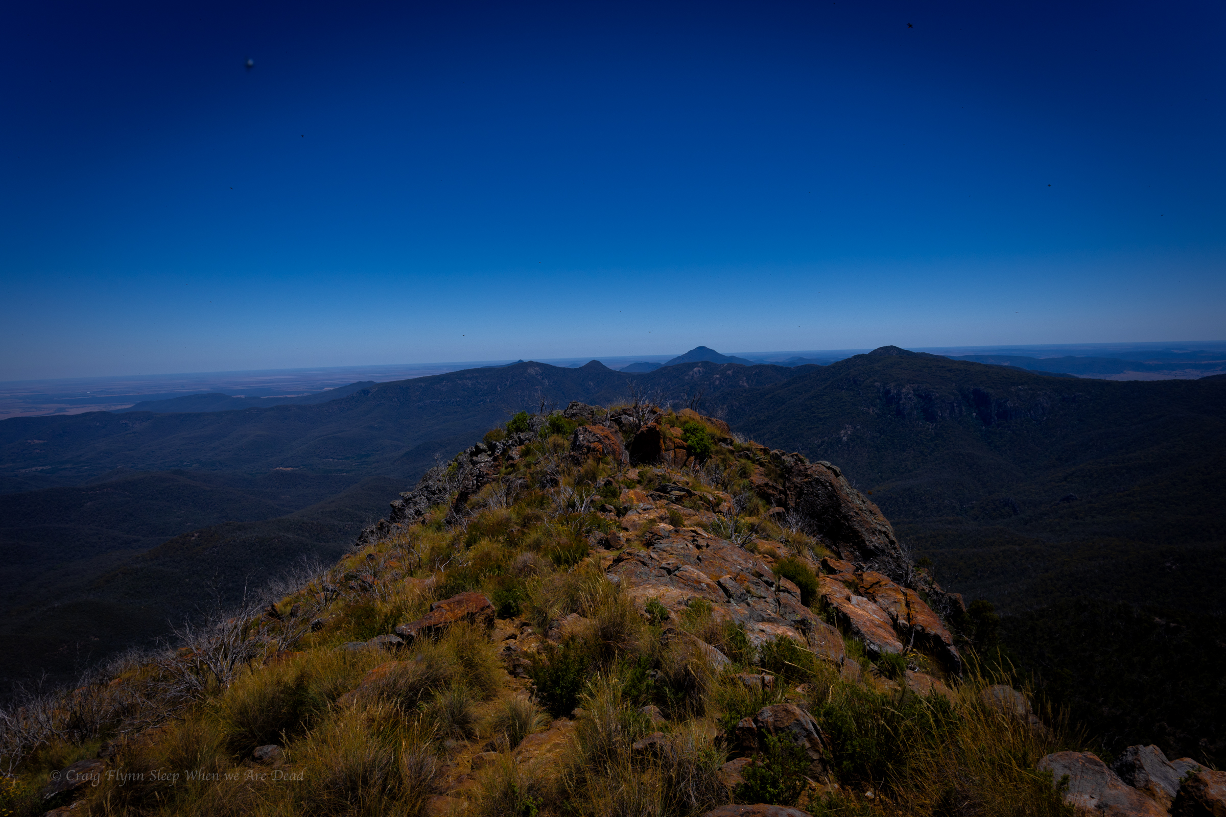
We decide it’s way to hot to do any of the walks in the middle of the day but the road up is outstanding and well worth the drive.
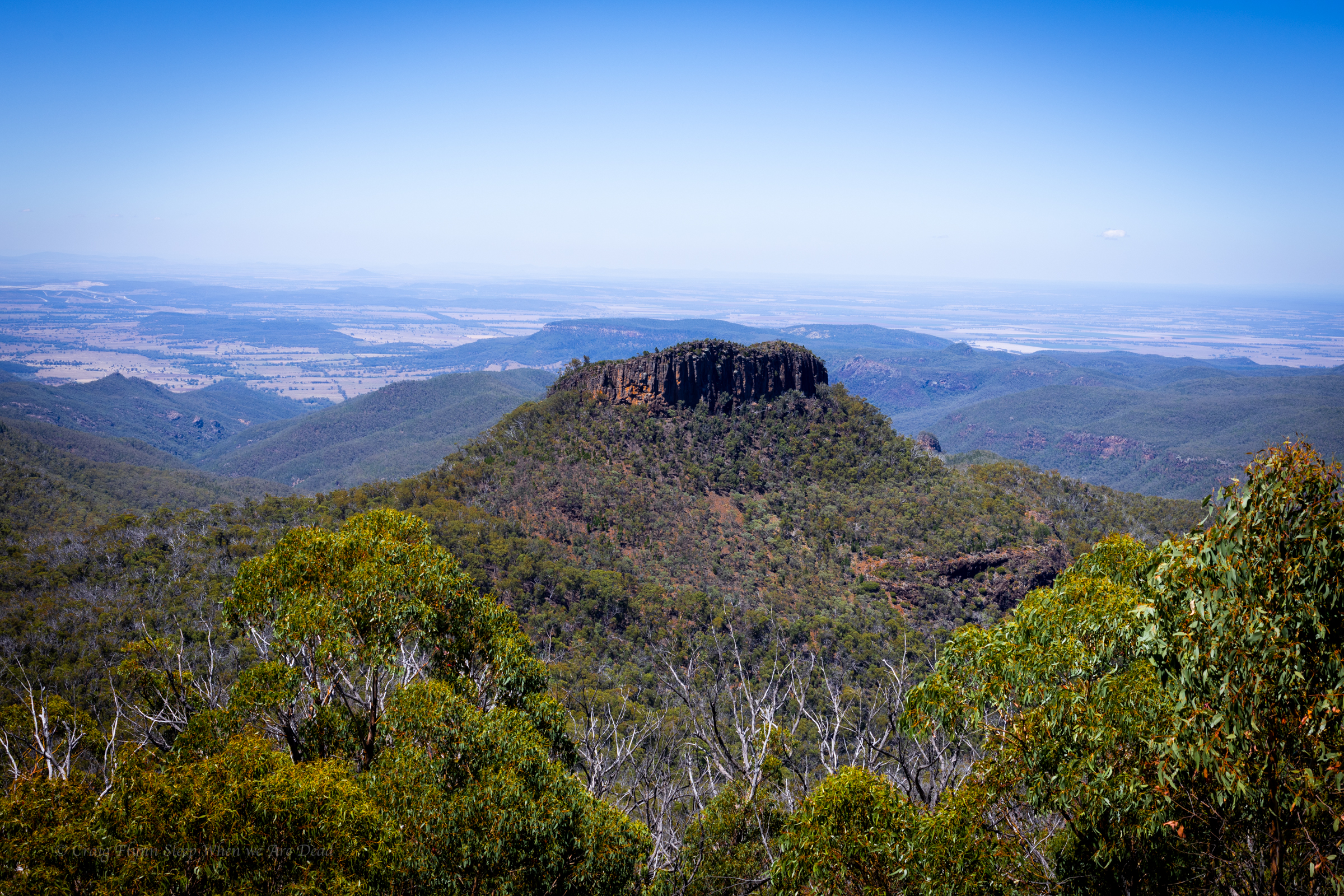
Euglah Rock from Doug Sky lookout
The road itself is an adventure and the views with in a 5min walk from the car just keep coming
But the temperature is pushing into the high 30s again so we make track down to Coonabarabran where we decide to splurge on a motel room with air conditioning.
It’s pronounced “Bunoo Boonoo” Thou tbh I had to ask Kylie how Bunoo was pronounced differenty to Boonoo.
One is “bun” and one is “boon”. She explains patiently to her favourite idiot.
Anyhoo
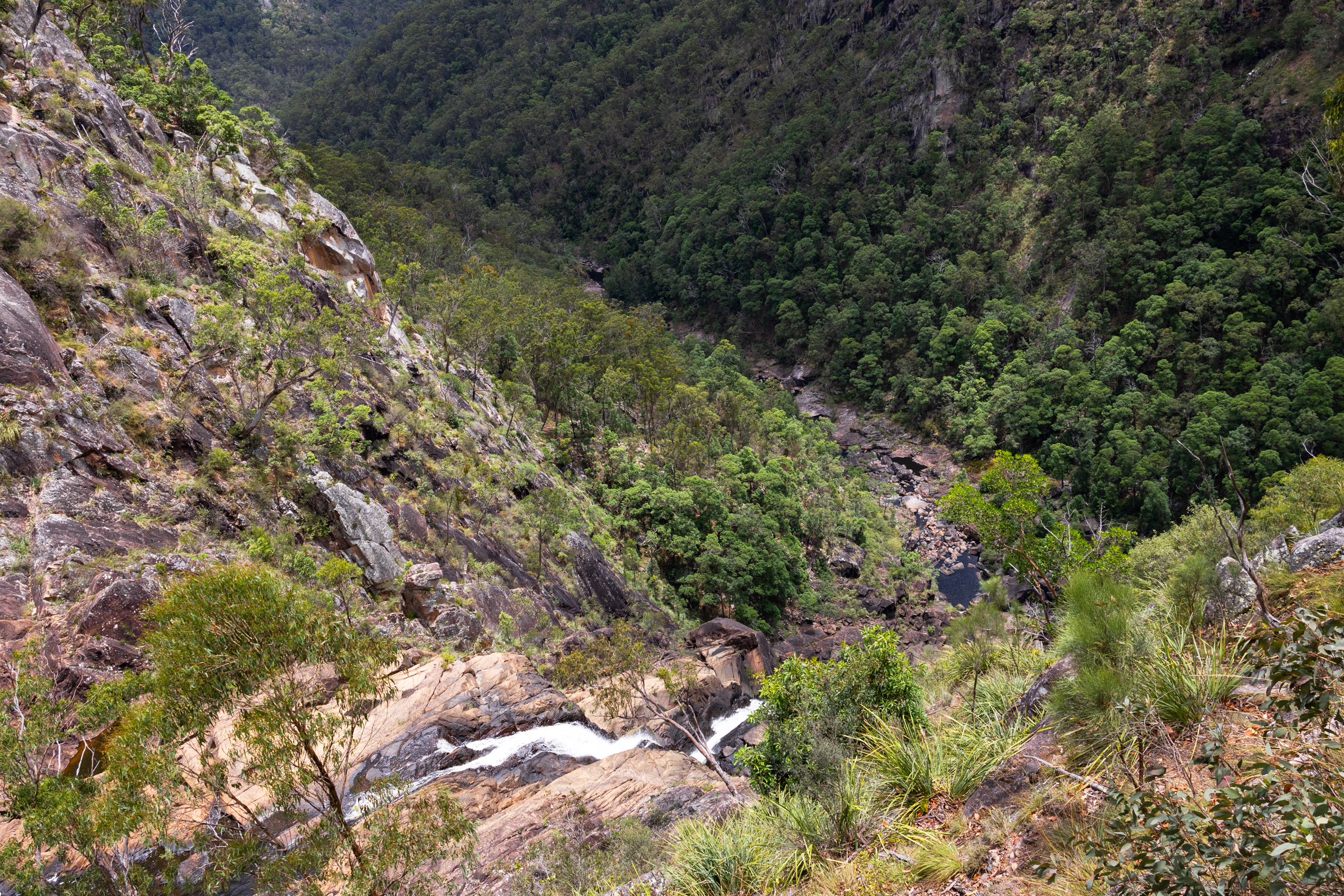
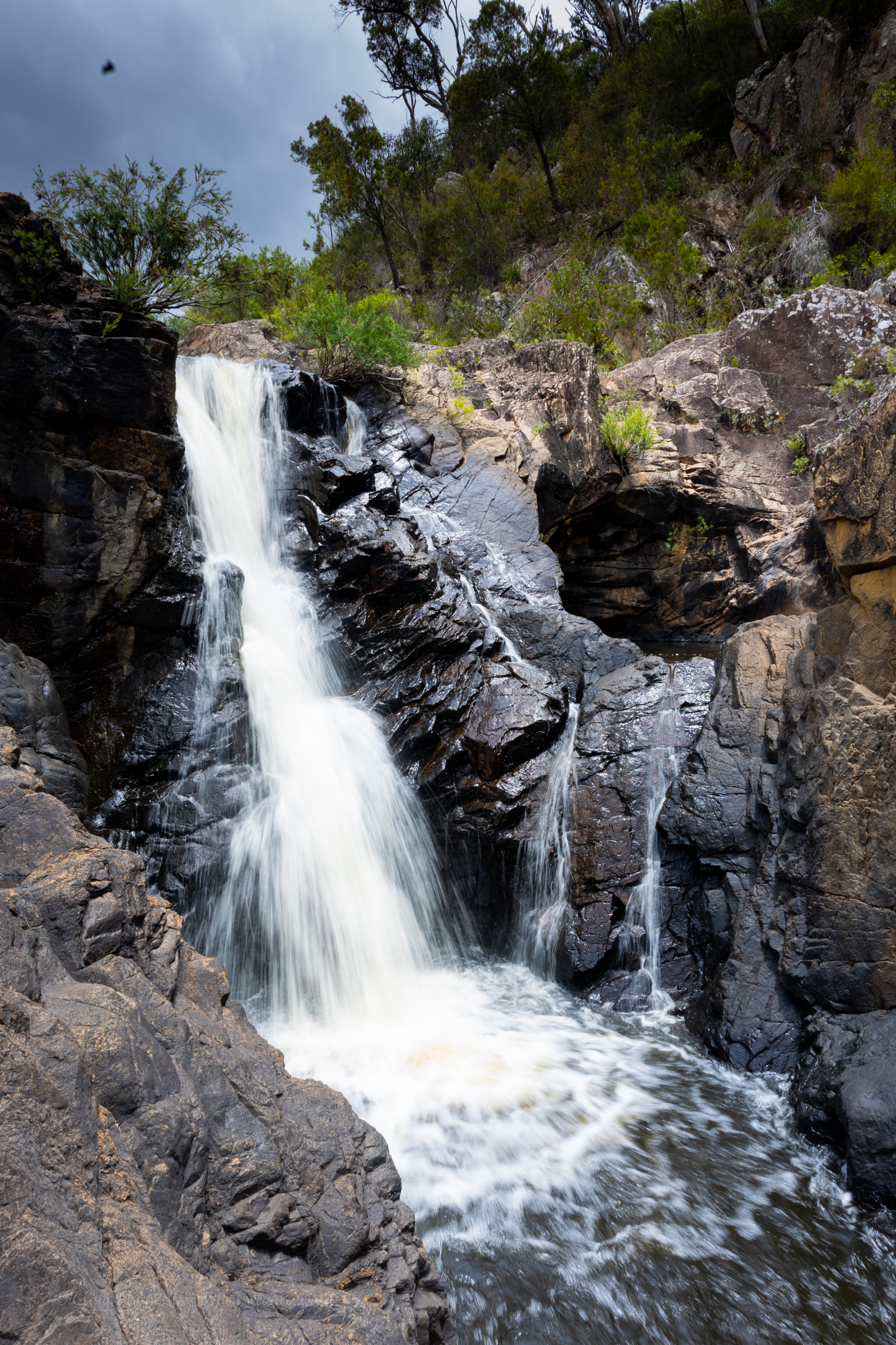
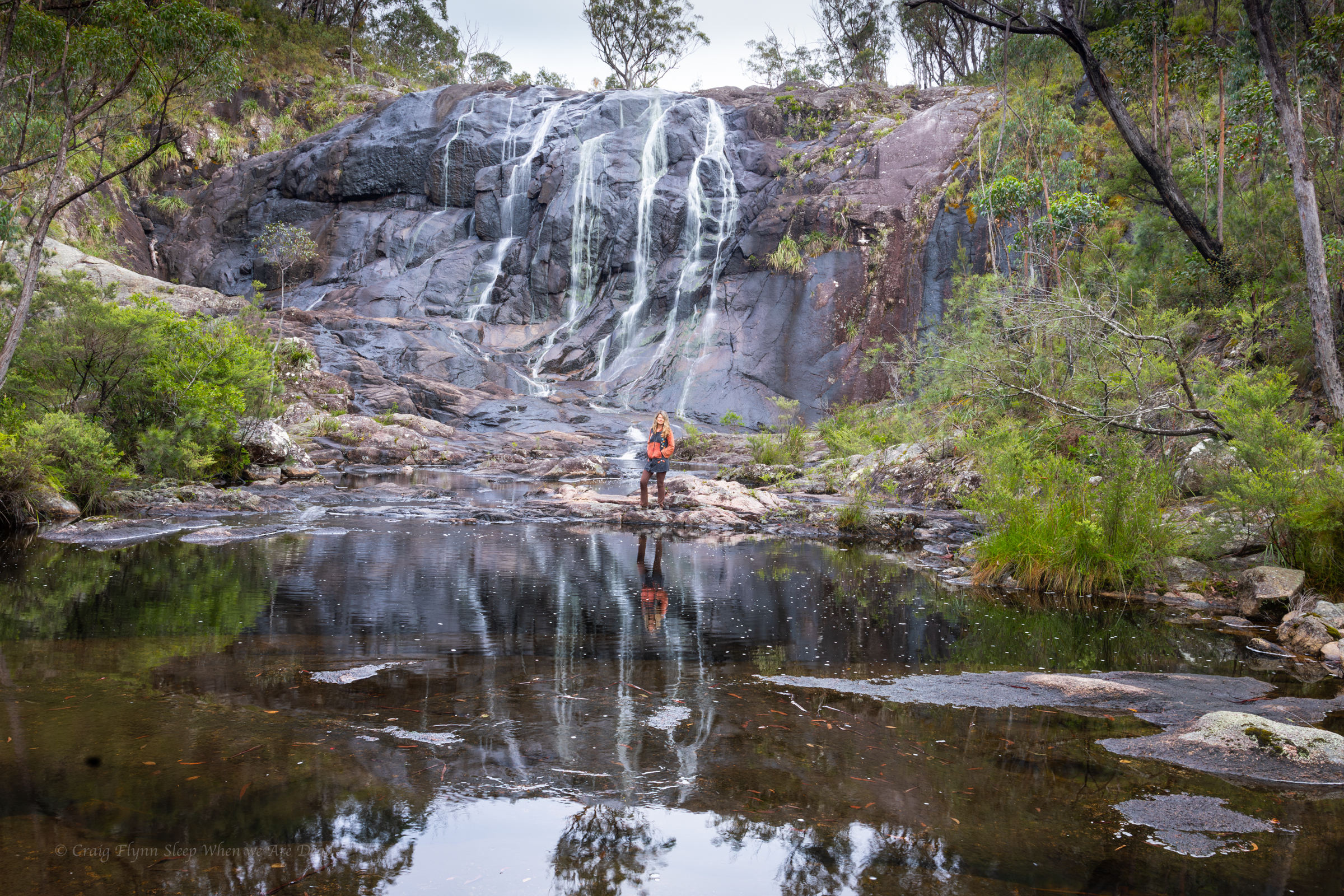
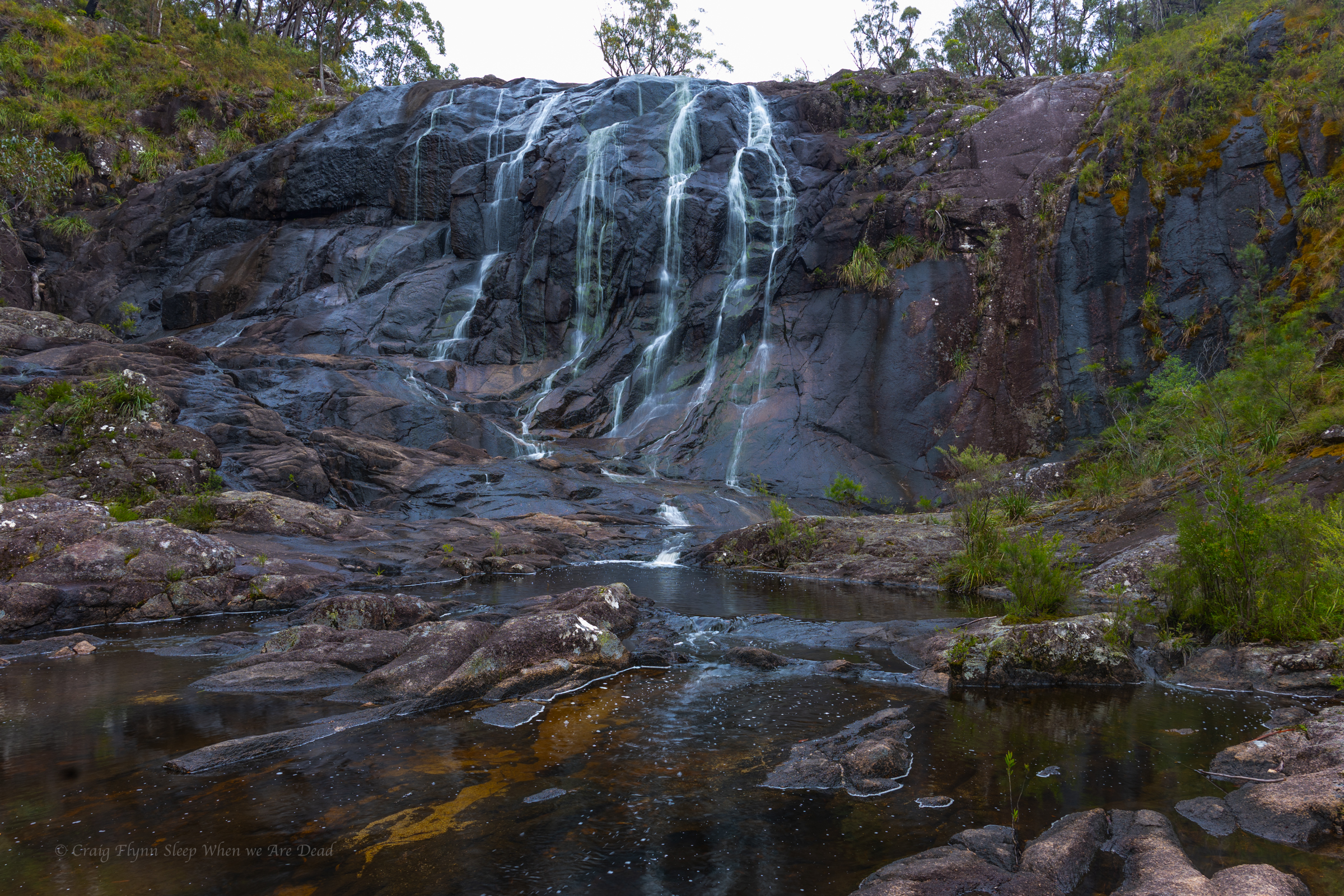
After a pleasant morning at Bald Rock the day has heated up and so we drive past the campsite and head to the main falls.
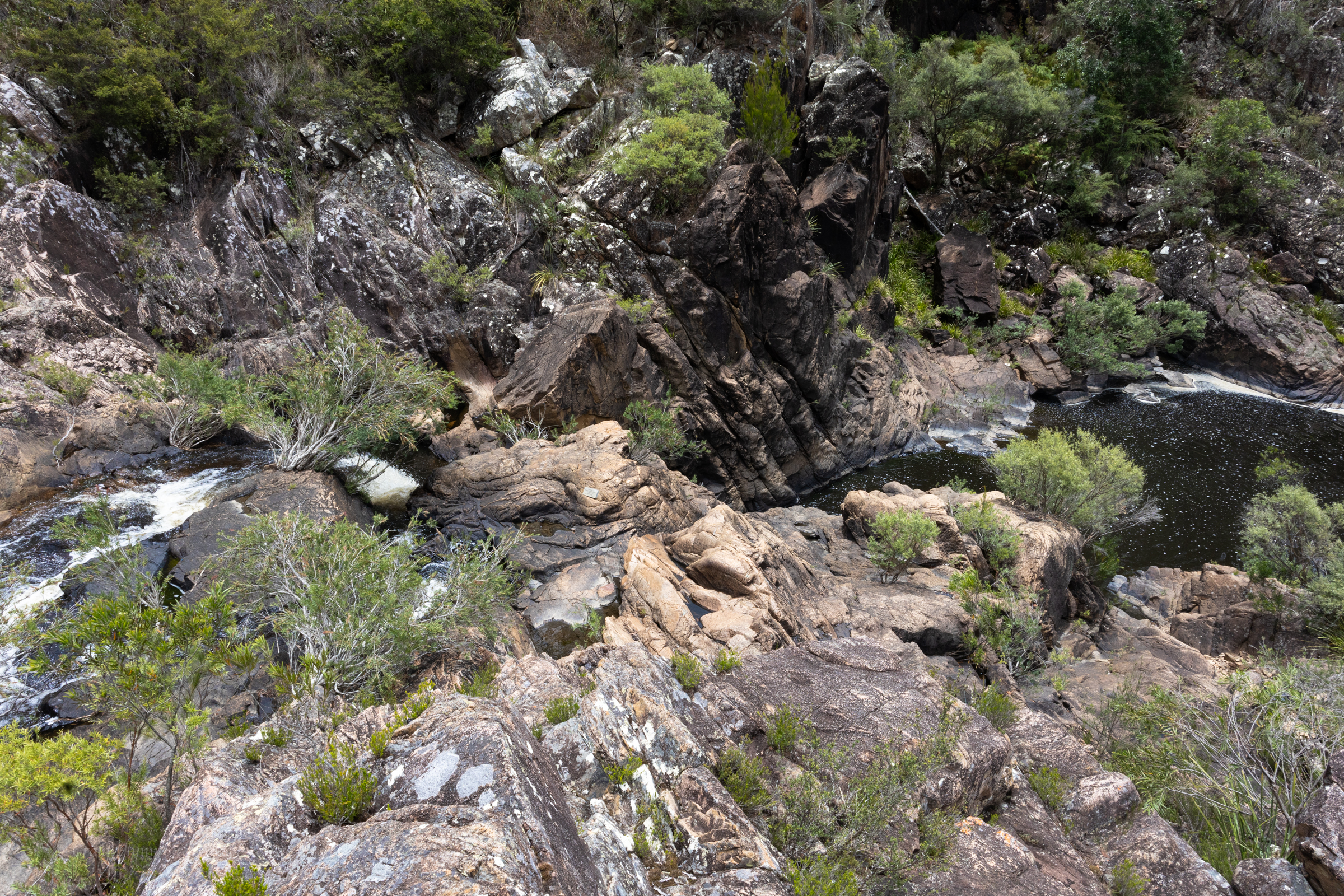
The road runs along the creek as it tumbles through a little granite gorge. It looks like it would have plenty of nooks and crannies to explore.
From the car park tourist trails lead to rock pools above the falls or down to a viewing platform over the main drop.
We head down to the lookout. It’s an easy 5min walk.
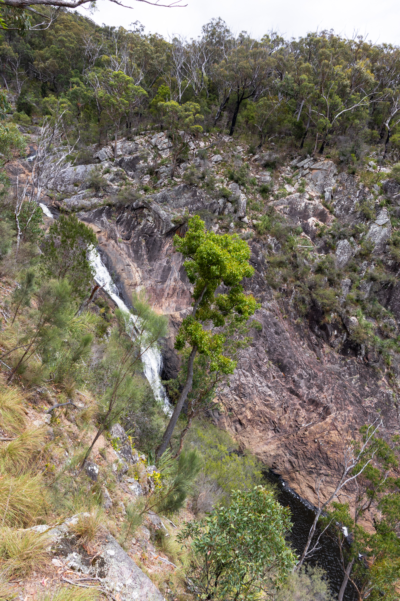
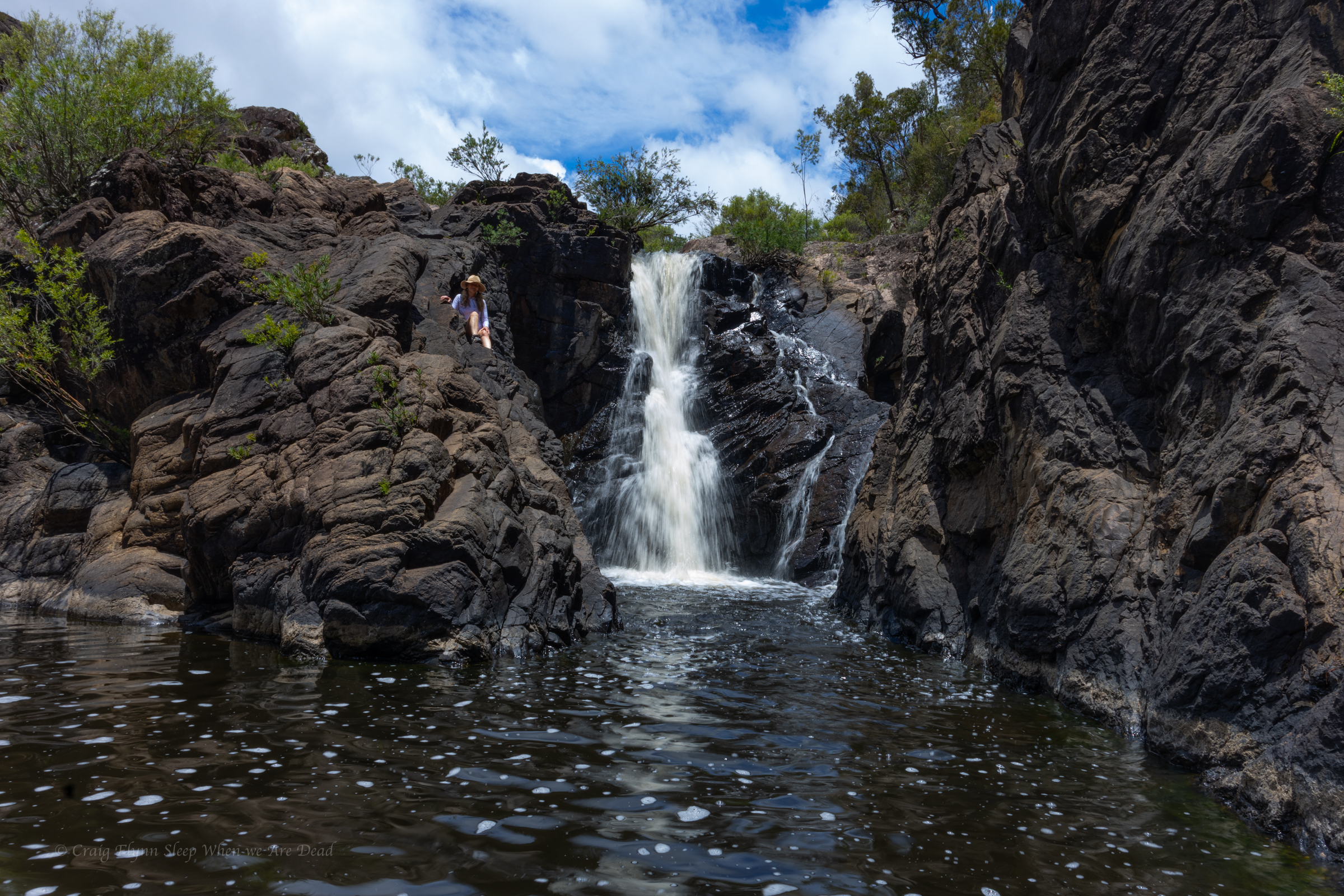
A 260m cascading waterfall tumbling into the steep sided gorge below.
Beyond the fenced path glimpses of old trails hint at adventure. If it wasn’t so hot or dry we may have been tempted.
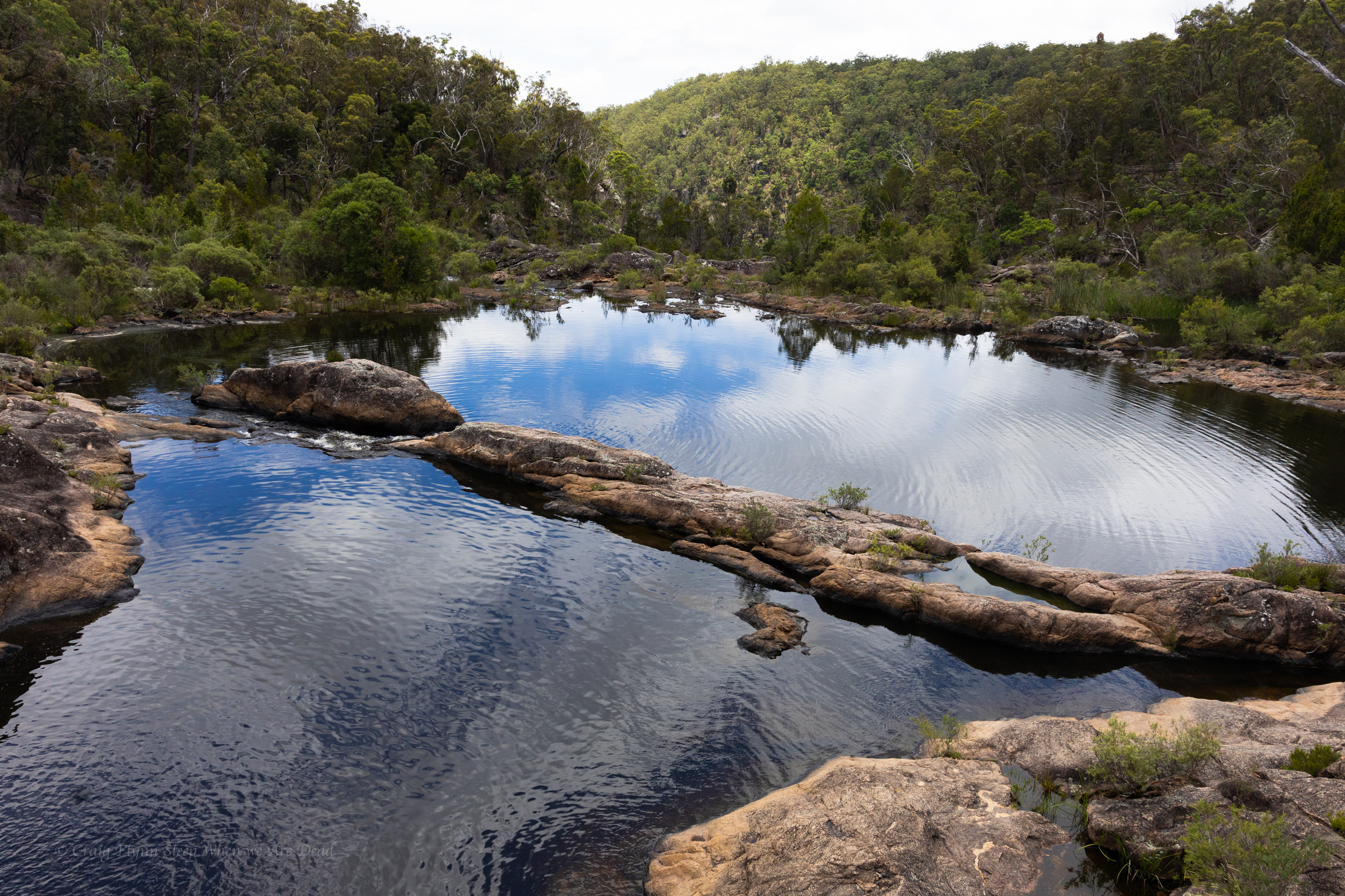
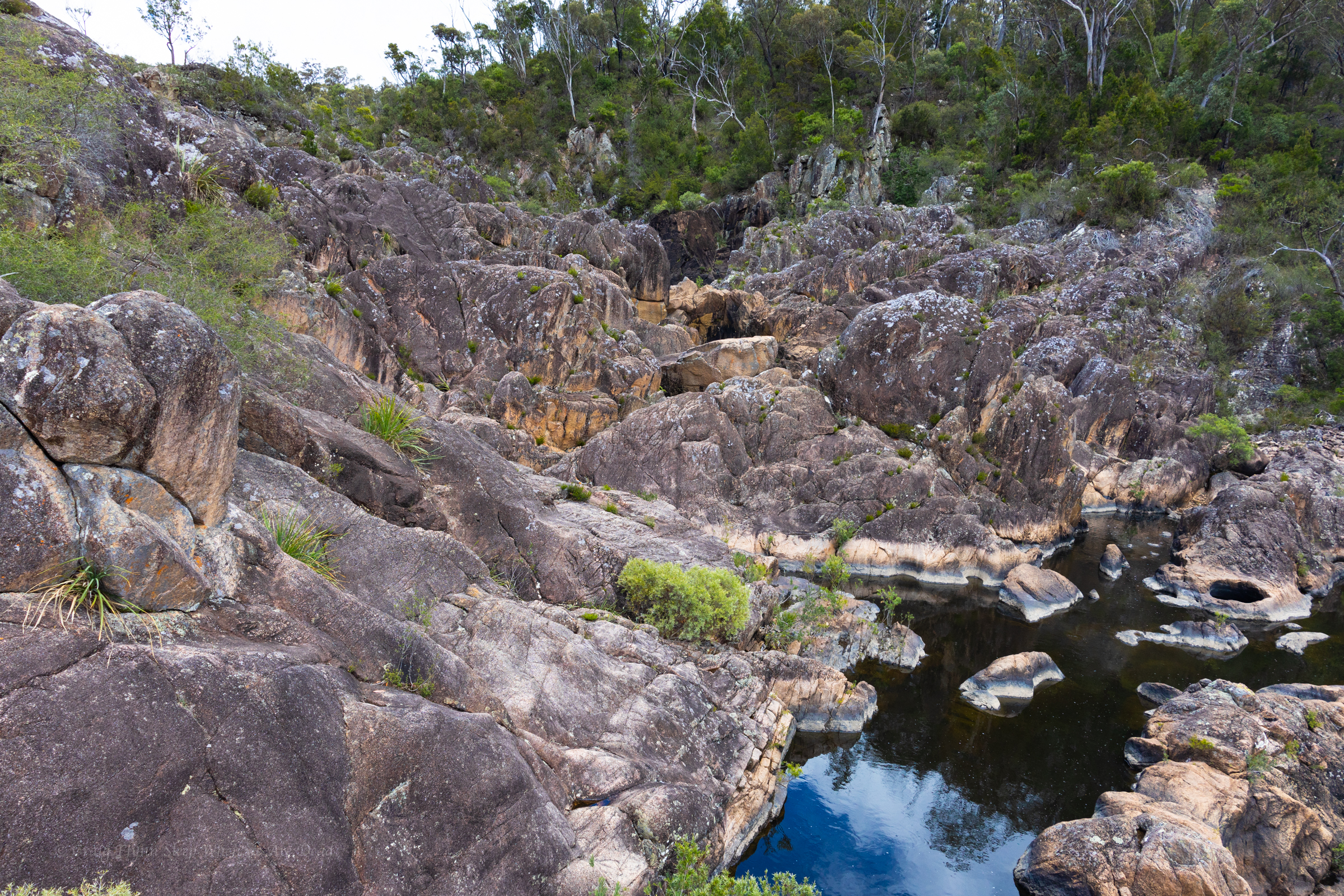
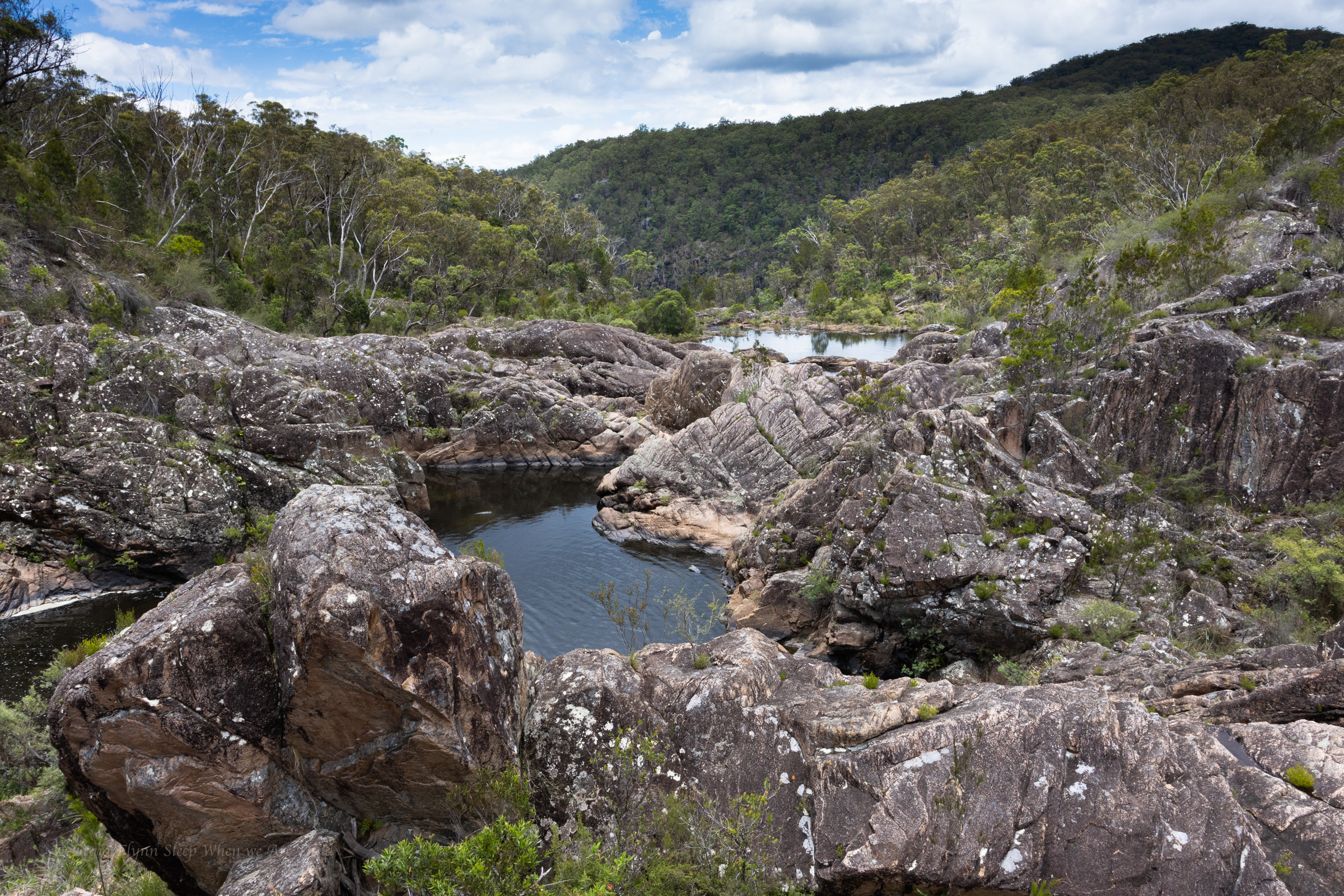
Instead we make our way up to the rock pools intent on a dip.
The main pools at the end of the trail are beautiful, but why stop at there when there’s so much to explore.
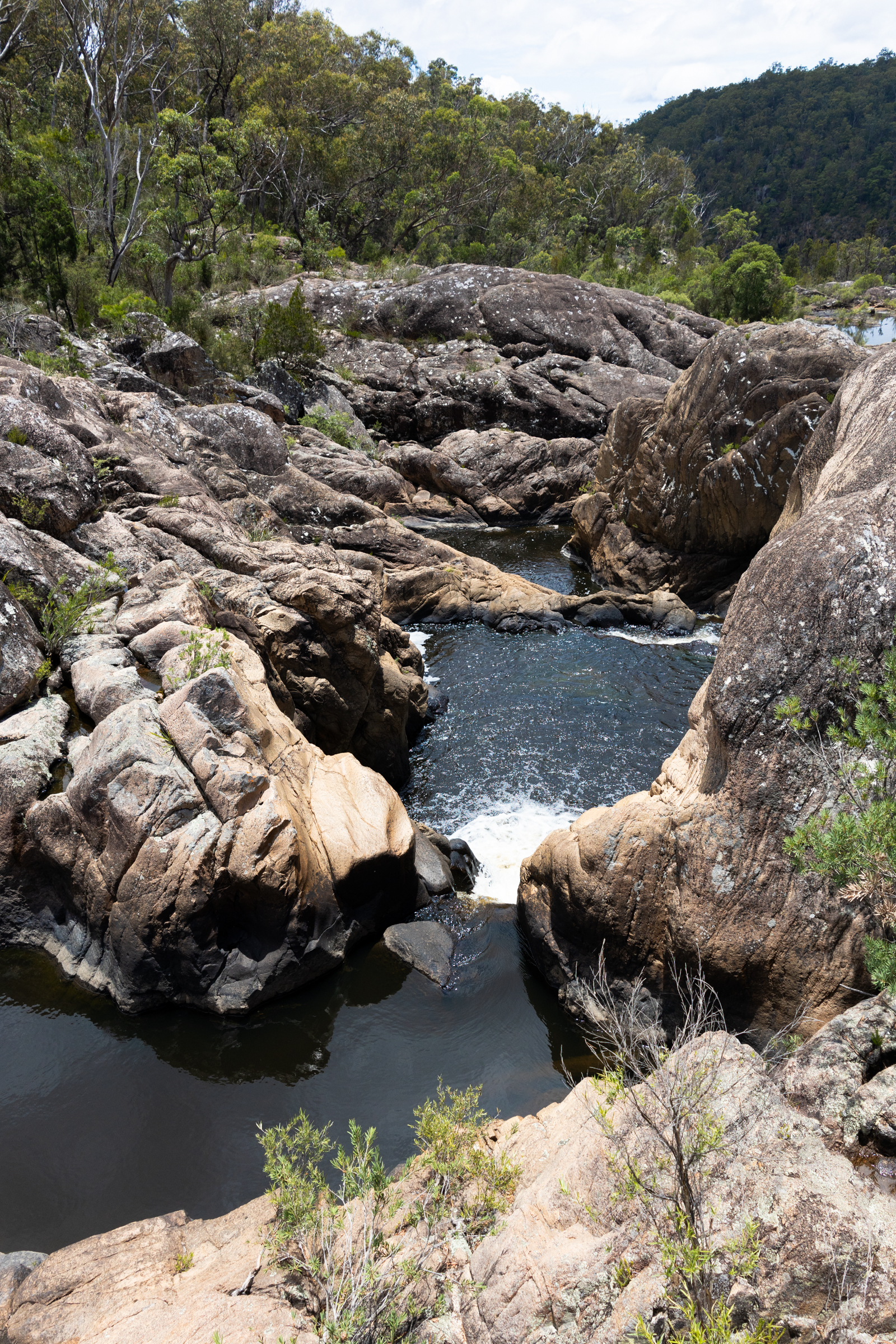
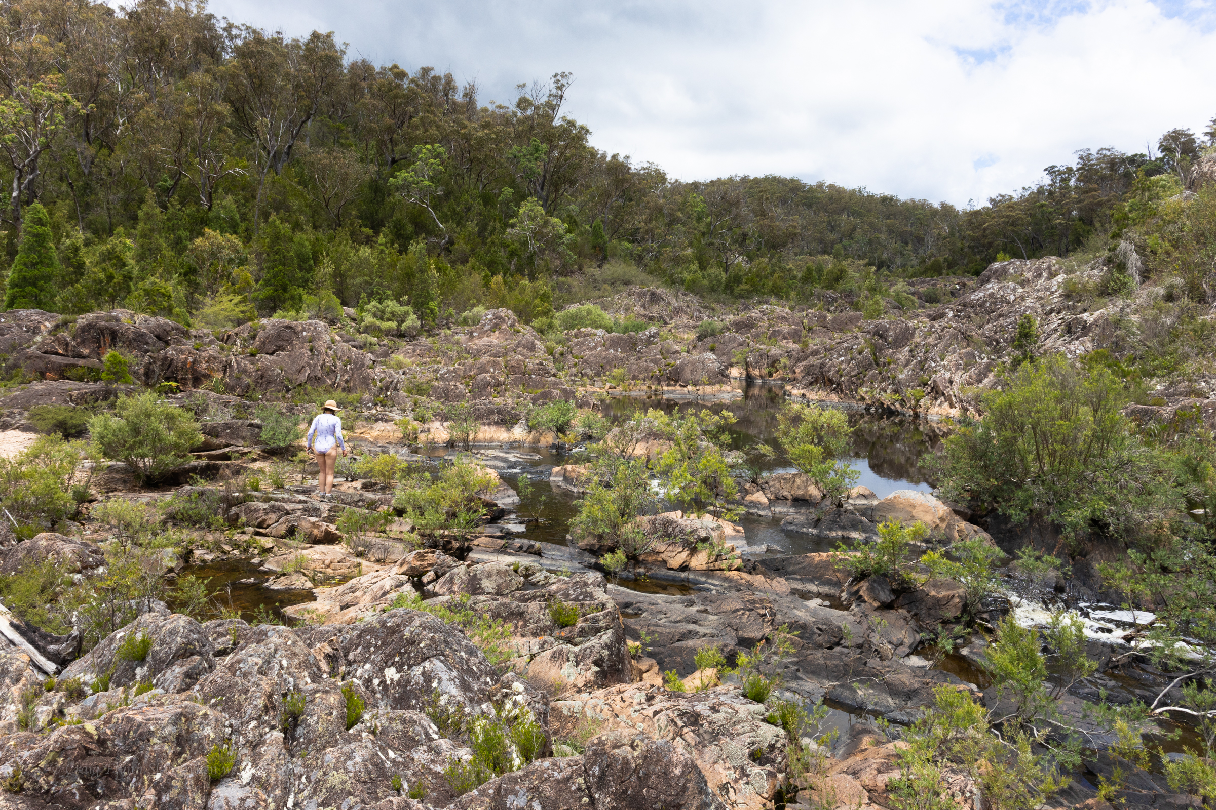
We make our way upstream
A bit of rock hoping leads us past a series of cascades and semi hidden water holes
You can see just how low the water is by the waterline on the rocks. But still enough for a cool dip on a hot day.
And we choose a plunge pool below a little waterfall tucked into an alcove and play in the current of the falls wondering just how nasty the hydraulic would get in higher flows
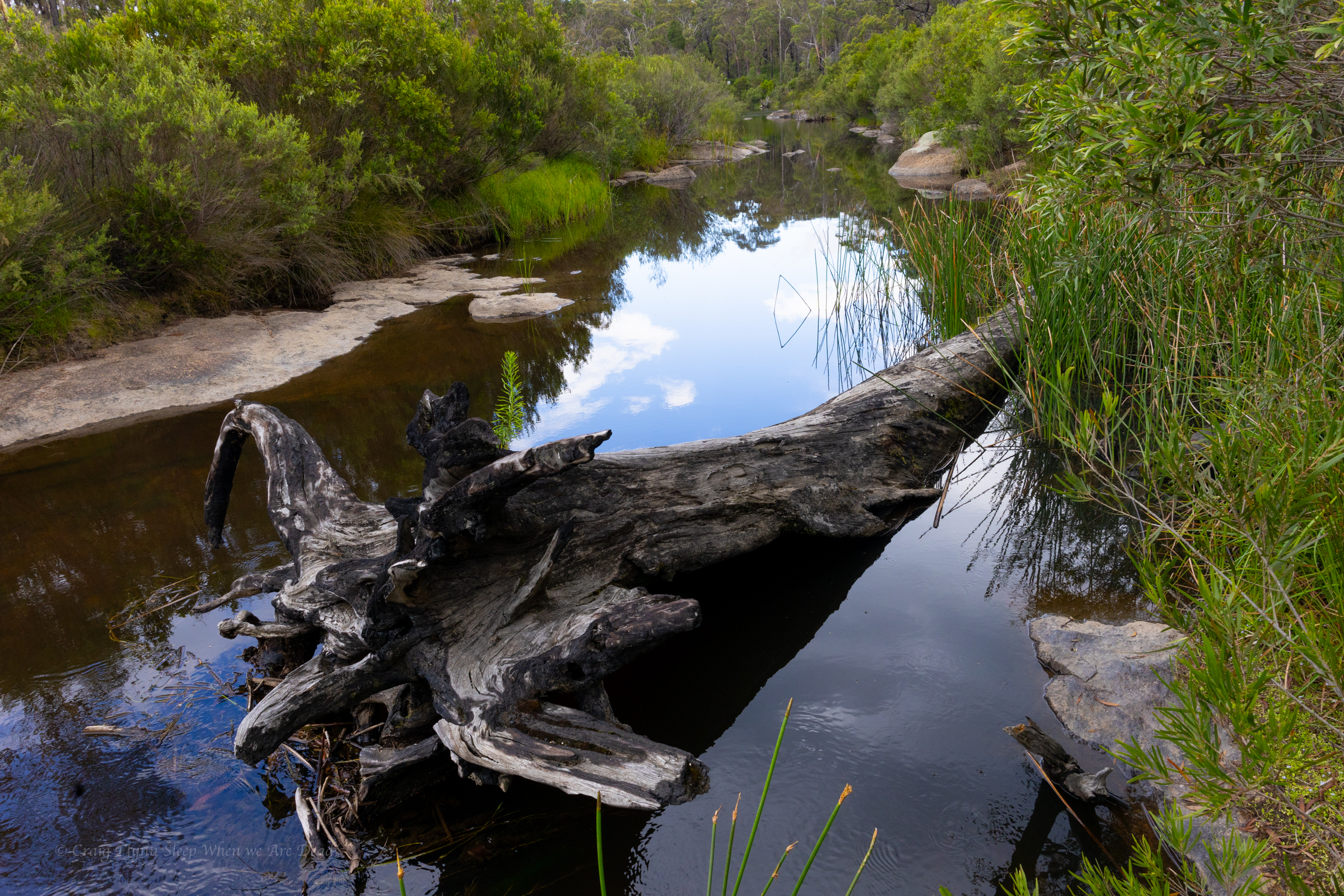
From here its a short drive back to the camp ground where we set up for the night then explore the camp ground
The camp is upstream of the gorge and gives access to the river
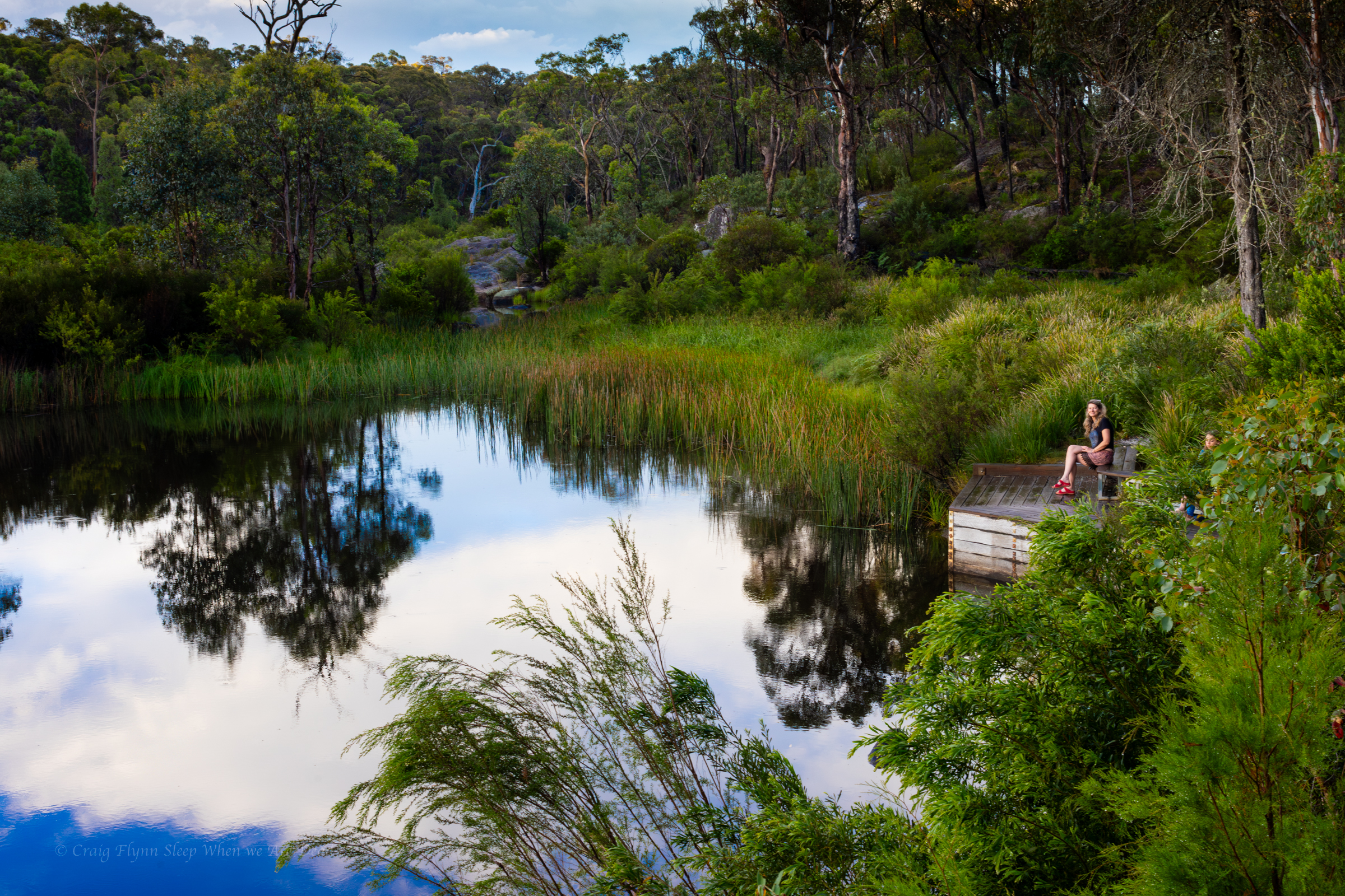
We spend the twilight chilling out on the bench by the platypus pool. Unfortunately we didn’t catch a glimpse of any this time around.
An evening storm is our first real test in the Alucab in heavy rain. Lessons learnt: the make shift rain gutter works well but even with it on leaving the door open wasn’t a great idea…
Next morning we get up early and head to BasketSwamp Falls for sunrise.
Kylie below the lower falls
Even after last night storm the water level is low but at least there is some flow over the falls.
Kylie had gifted me a Potensic Atom 2 drone for Christmas and had been forward thinking enough to also apply for permits to fly it in various national parks we’d be visiting .
We were denied permission as the first couple because it was peak tourist time over the New Years long weekend but even then they encouraged us to apply again.
Most of our requests were granted though. There were a few conditions on the permits but they were easy enough to comply with
So if you are taking a drone it’s worth planning ahead and doing the right thing. There were also a few times where we had permission but opted not to put it up due to not wanting to disturb other visitors.
Can’t deny the awesome perspective you get with them though.
This was one of my first flights.
From here we’d be heading west into Queensland… sounds weird but the border does a little curve here. Bald Rock in NSW is North East of Girraween in Qld.
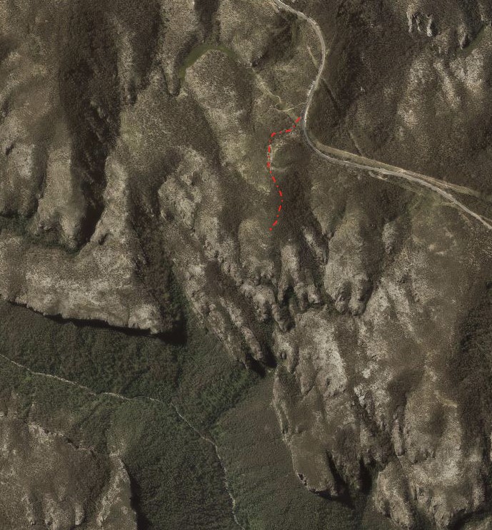
Access: A nice walk along a gentle ridge. Tar to parking area
Navigation: Navigation is fairly straight forward though the trail can be a little vague further out
Time: 30min out. 30min back
Date walked: 31-03-18
Jinki ridge is another spur off the Bells Line of road that gives nice views over the Grose Valley. A trail runs from the Bells Line of road out between Jinki and Dalpura creeks and the Pagodas out the end are reminiscent of the Lost city.
Getting there: From the weigh station at Bell follow the Bells line of road toward Sydney for approximately 4km and just after the concrete lane dividers end there is an old fire trail which goes right just as the road swings around to the left. Turn off into this fire trail and park at the locked gate (Obviously try not to obstruct the gate)
The fire trail goes South and then veers East to start and is easy to follow (note: there is another fire trail just back a bit at a more open park spot, but it goes West then swings North) . Jinki ridge offers great views over the upper Grose over towards Mt Victoria.
The fire trail eventually deteriorates to single track. It can be a little vague but just stay on the top of the ridge
Views change to your left side with some vantage points looking down the Grose. Towards the end of the ridge you get views over to Valhala Head and Thors Head from high pagodas. Be careful near the cliff edges as they are all over hung and brittle.
Also care is needed on the pagodas. The plate pagodas are fairly unique to our area and iron stone bands that make them so unique break off very easily. These awesome rock formations take thousands of years to form, the last thing we want is for them to be damage by a careless footstep.
Return: The way you came in
Note: The great outdoors is an ever changing place. Bush fires, changing weather, vegetation growth and forestry activities can all effect the trail conditions and thus the difficulty of the walk. These are a rough guide only and are by no means meant to be a definitive guide . They do not replace the need adequate map reading and navigational skills
Note 1: Taking care While reasonably well known these spots are still wild places and care needs to be taken around cliff edges and on the steep trails. Carrying the right gear as well as having adequate food, water and clothing is important. Always tell someone where you are going and when you expect to get back.
Emergency beckons (PLBs) can be hired from Katoomba Police for very little.
Note 2:First aid A basic first aid kit is essential bit of kit whenever heading into the Aussie bush. A basic first aid is highly recommended
Note 3: Maps and Navigation Having the right map, a compass and knowing how to read them is very important when heading into the bush. If you are new to bush walking joining a club or accompanying more experienced walker for you first few outing is a very good idea. I found practicing map reading on well defined trails was helpful when I started out.
The Maps mentioned are the 1:25000 series. They can be purchase at Lithgow tourism information center, from outdoors shops or online for around $10 each.
Note 4: These are wild and beautiful places, respect them. If you are able to carry something in you can carry it out. Don’ be a tosser. Leaving your rubbish behind is a sure way to ruin it for every one else.
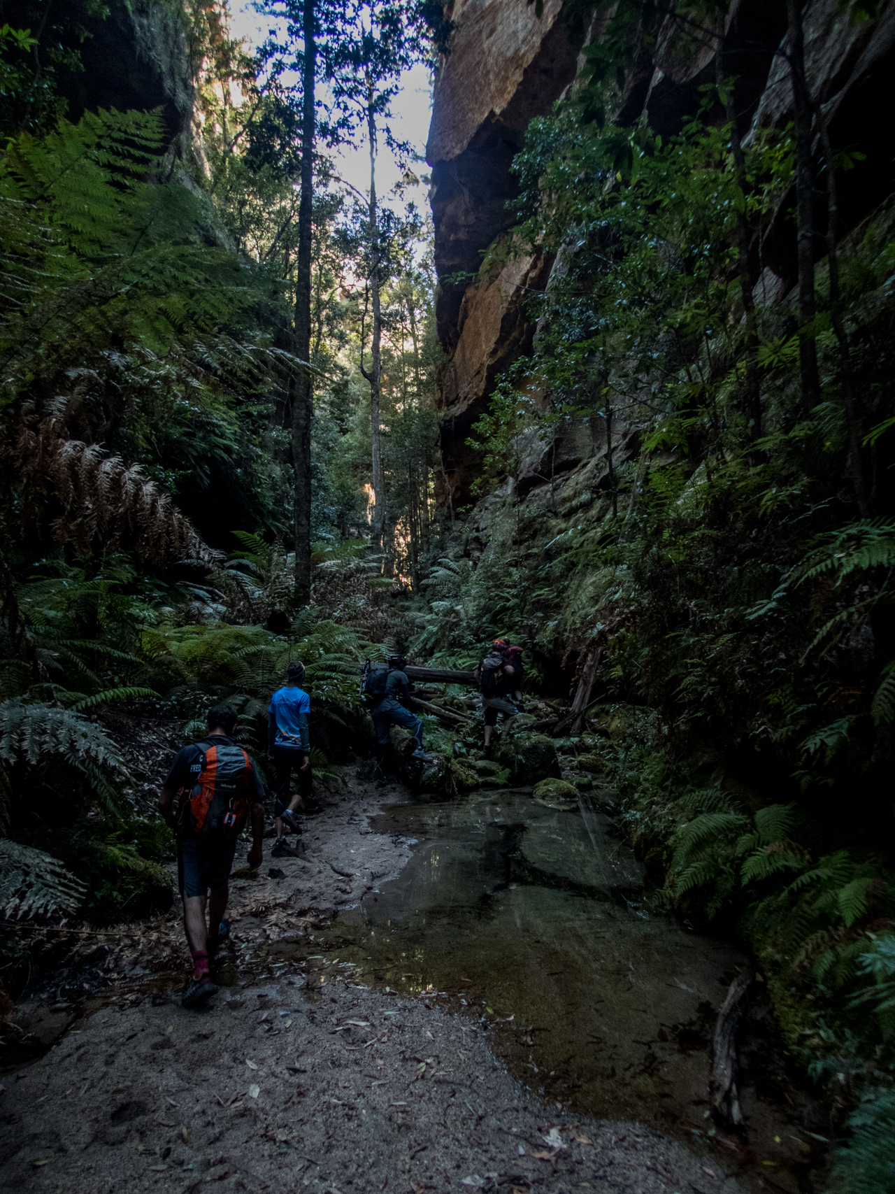
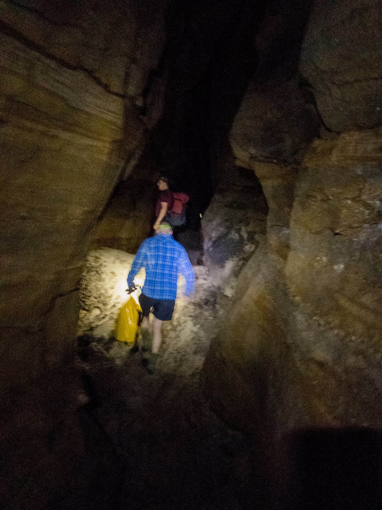
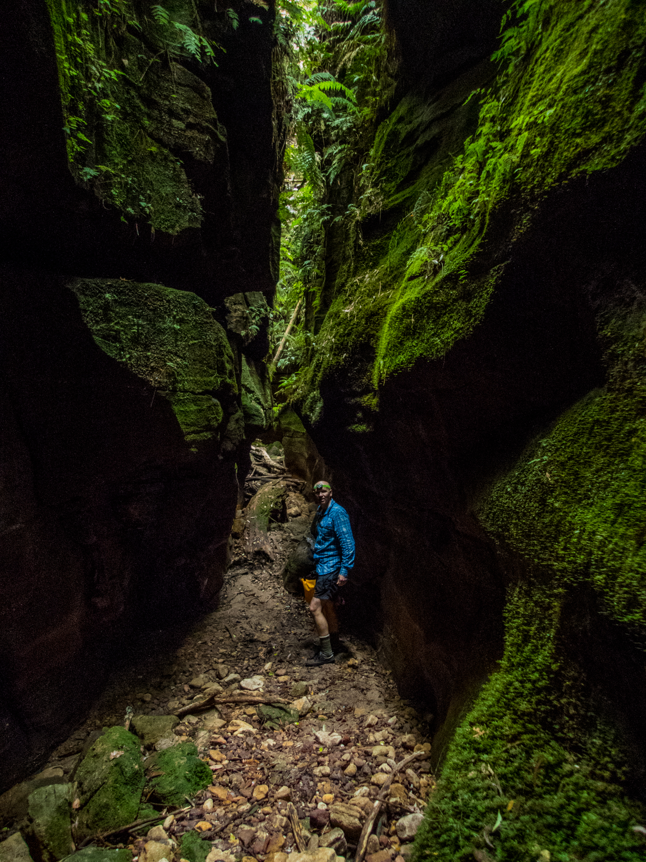
With an early Easter combining with a few family birthdays I wasn’t able to organise the usual Easter Epic Ride this year so instead conspired with Tal to do a quick early morning trip to Dalpura canyon.
Ben posted that he was down from Qld and keen to check out a canyon or two and I messaged to say if he didn’t get a better offer he’s be welcome to come with us. He accepted the offer and we met nice and early in some typical mountain mist. AKA, fog.
Last time we had done Dalpura we dropped into the western tributary, which had some nice bits high up but also involved some thick cutty scrub. This time around we followed Toms track notes and found a reasonable track into the Eastern tributary which also had acouple of short and shallow but nice canyon sections.
OLYMPUS DIGITAL CAMERA
OLYMPUS DIGITAL CAMERA
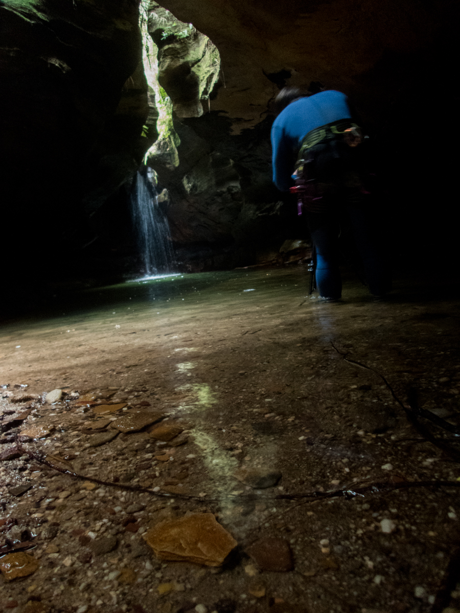
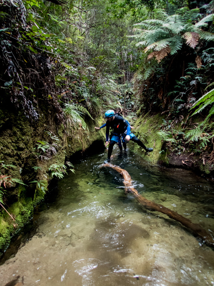
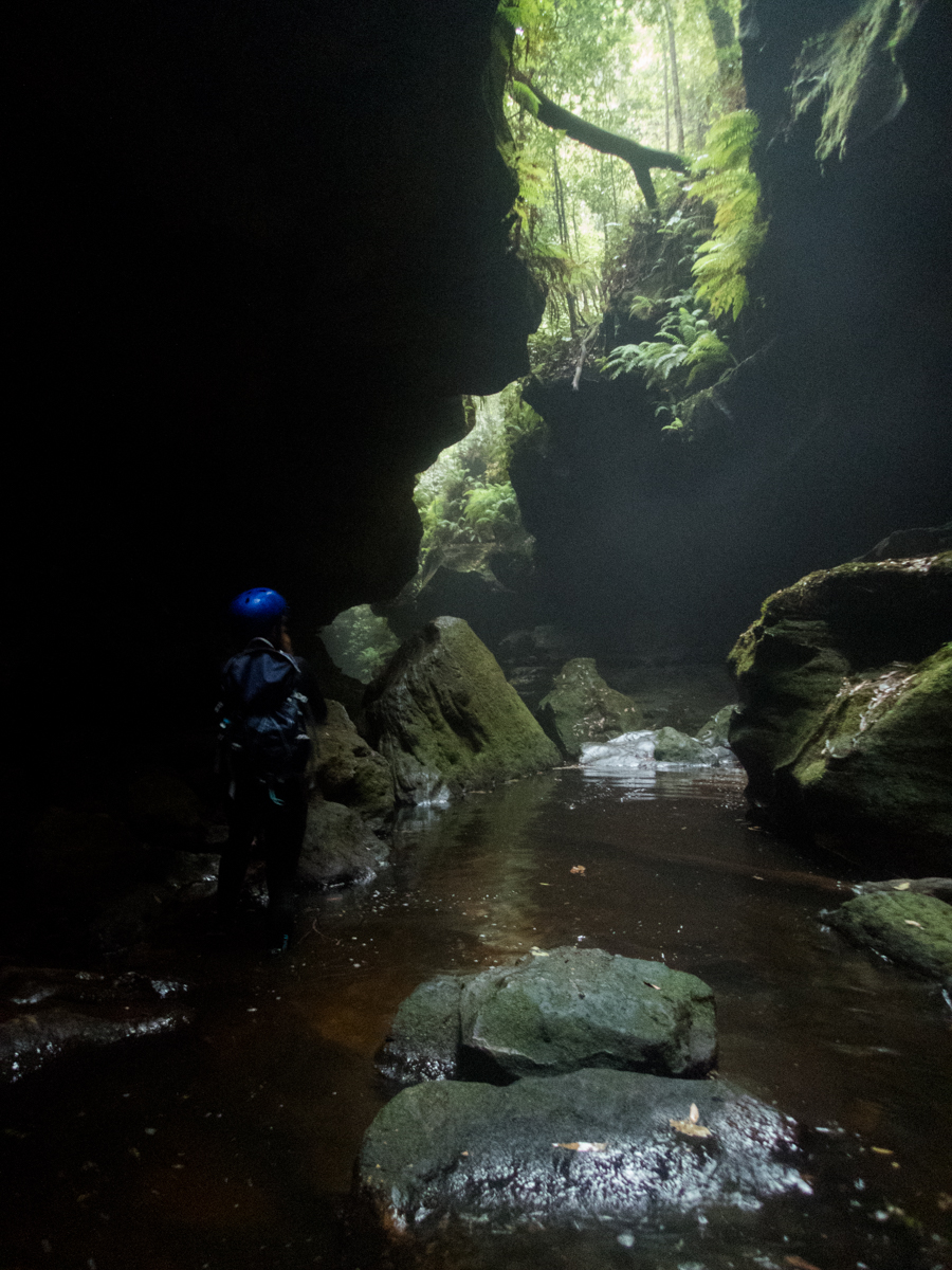
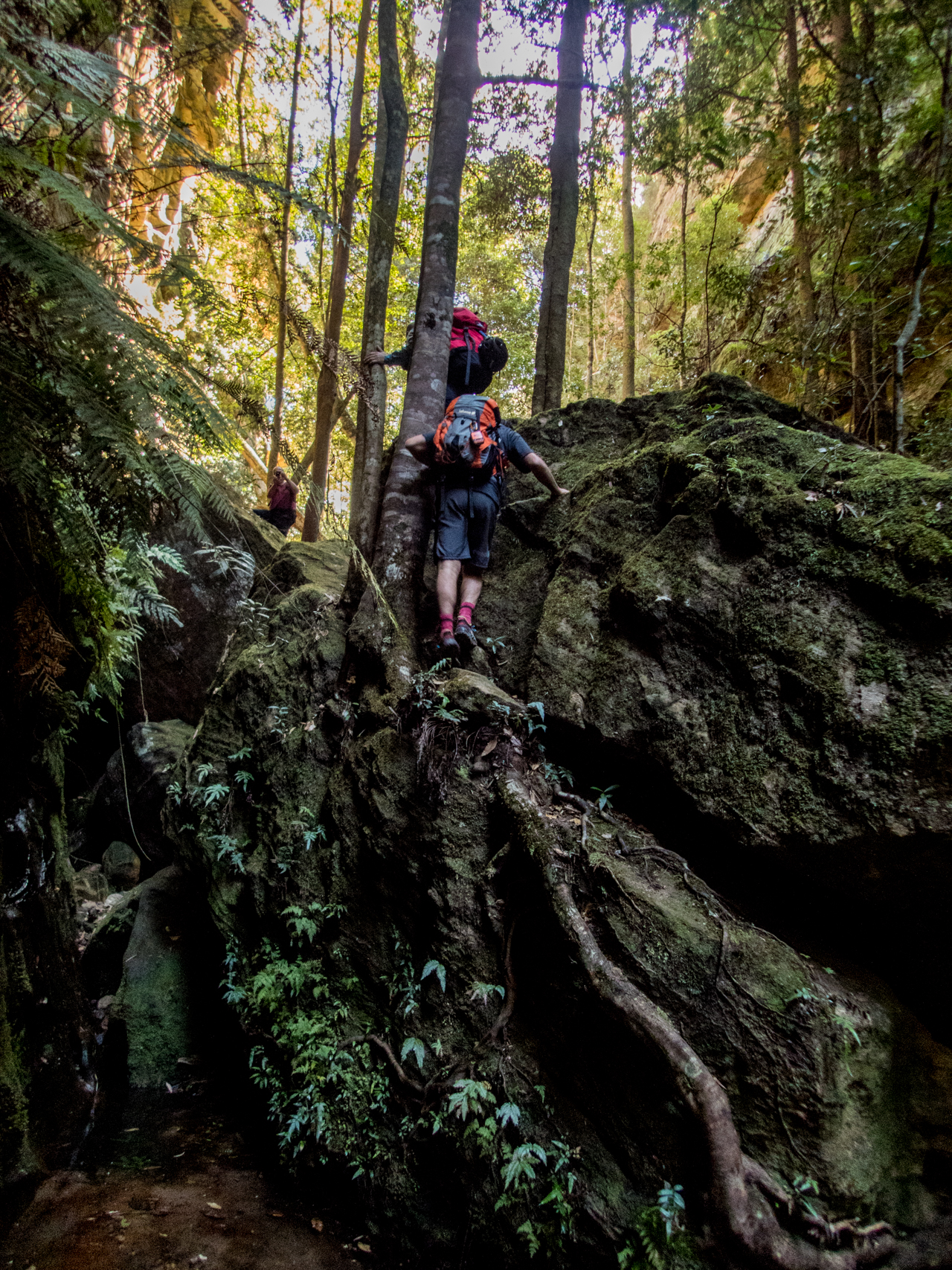
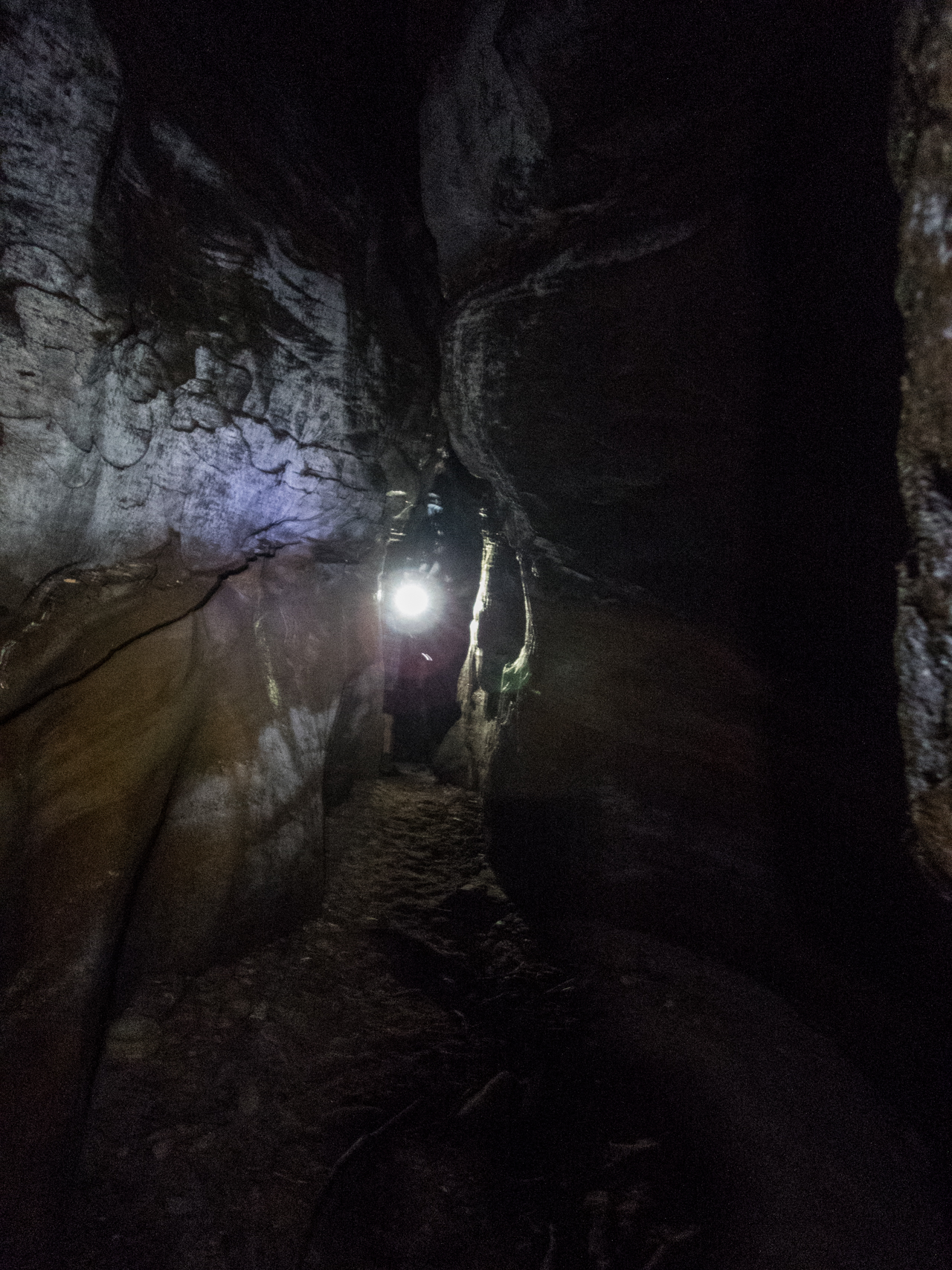
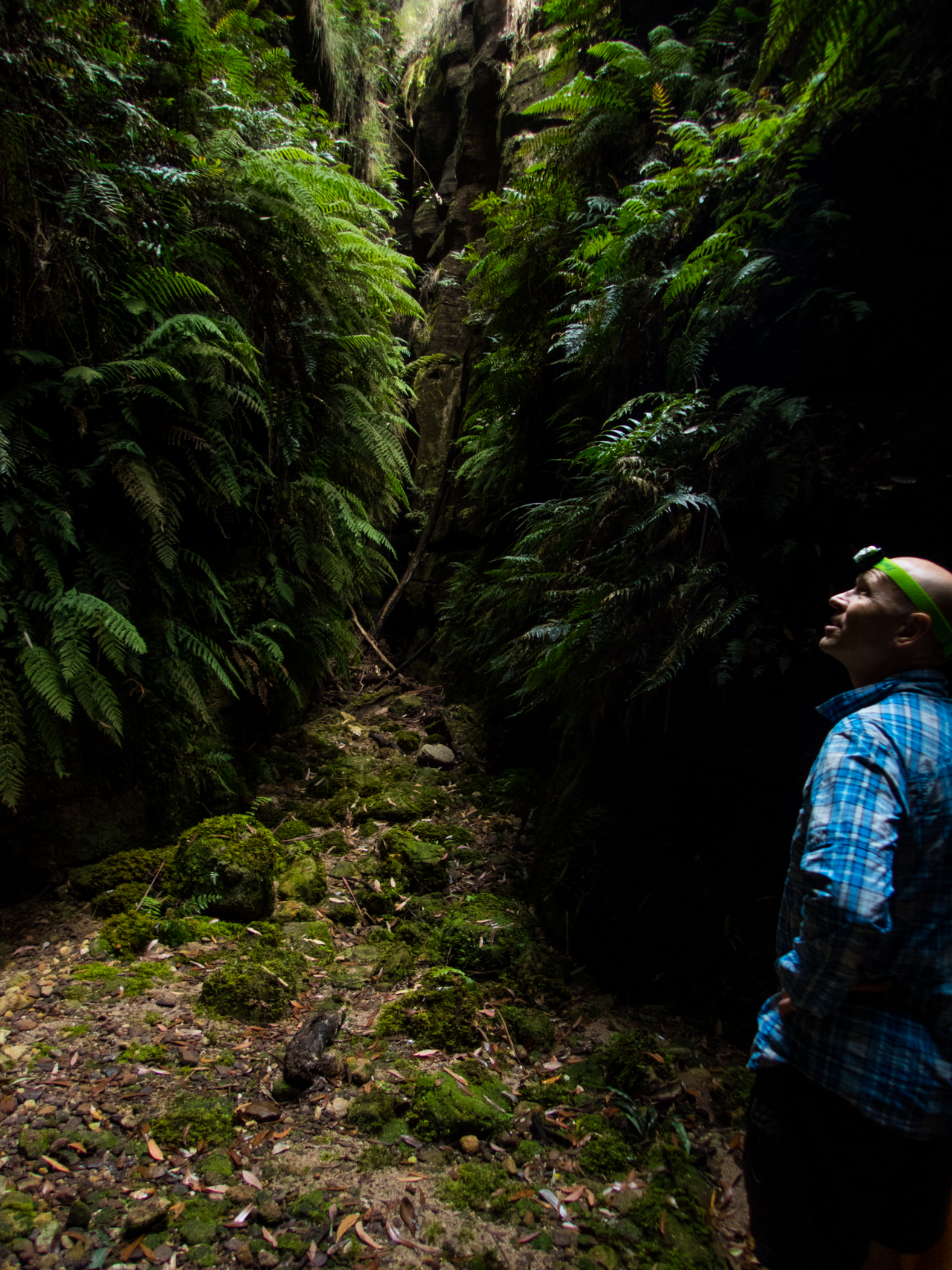
Anyhoo it doesn’t take long to get to the abseil. It’s a short drop into a very nice chamber. Last visit I was still using and iPhone4 for photos so I was hoping for some nice light to see how the TG4 would go.
We waist no time rigging up and drop on in.
Ben descending
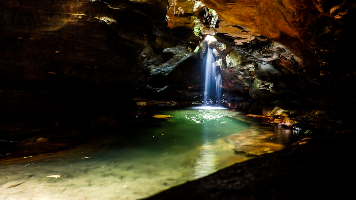
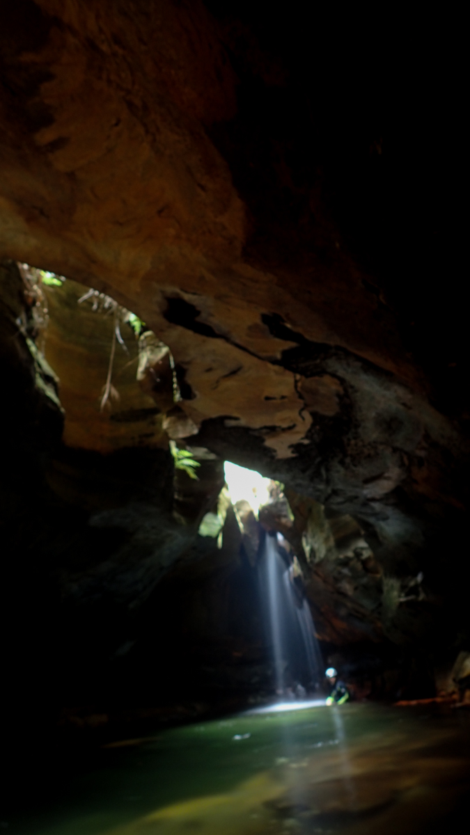
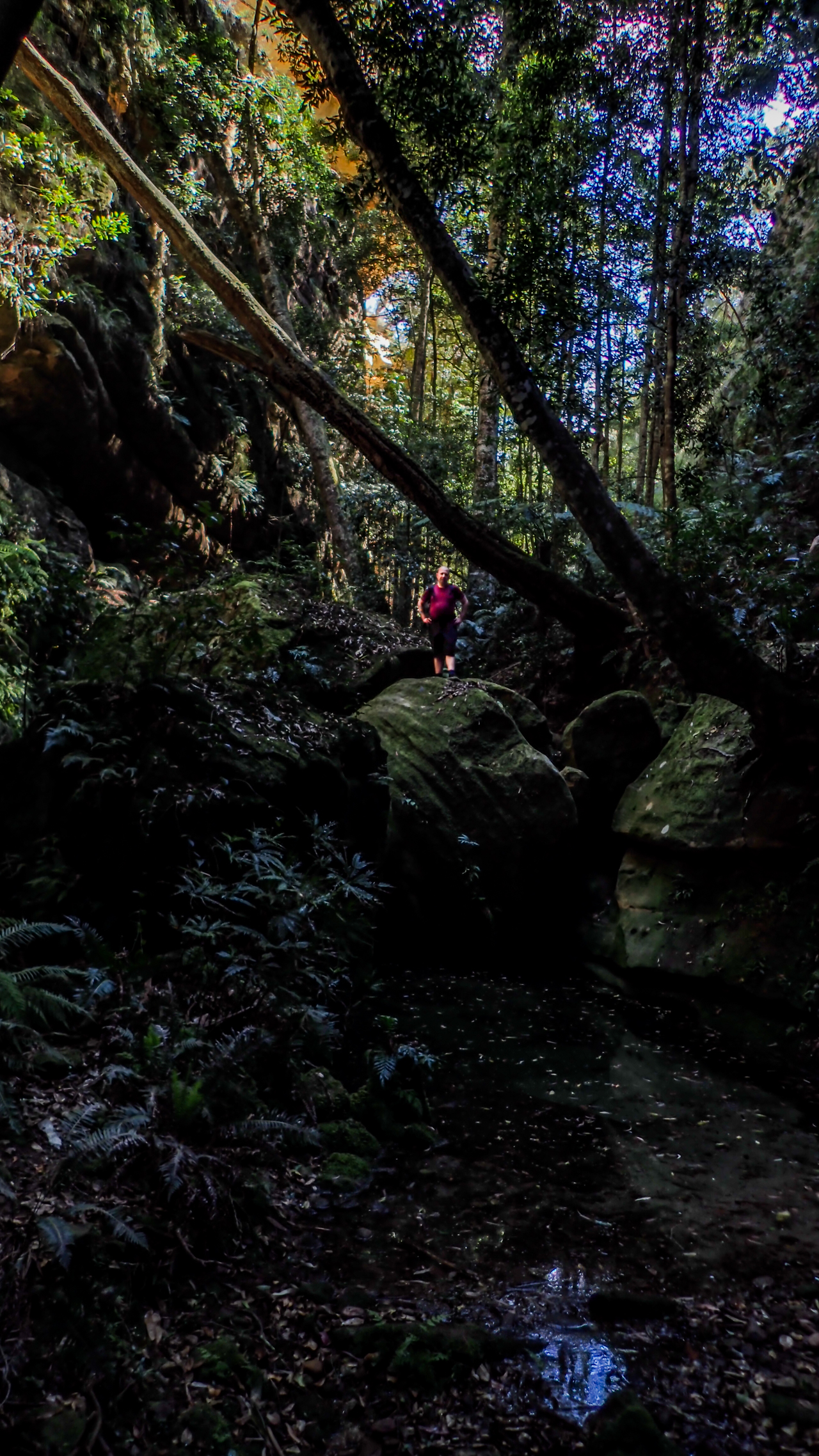
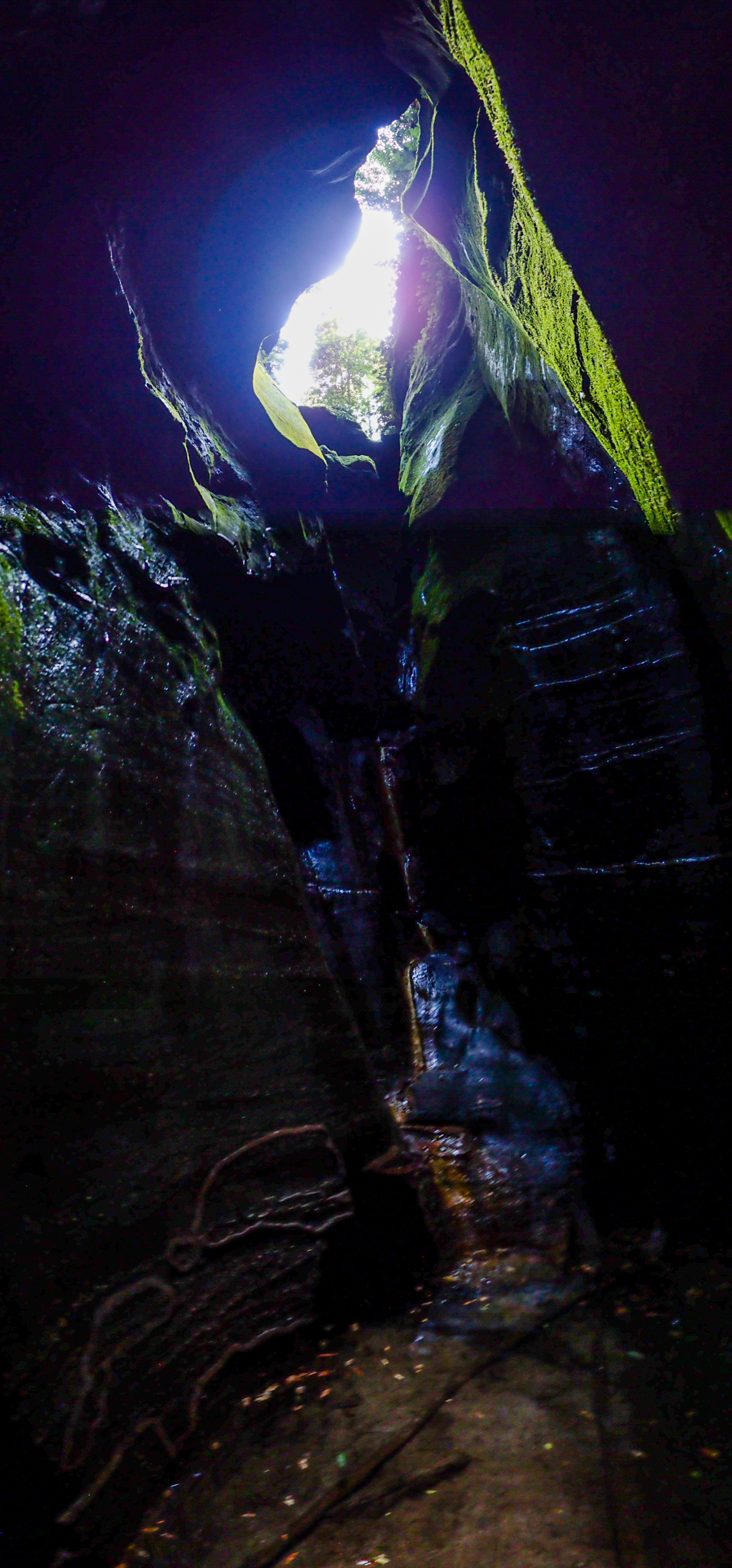
It’s a nice little abseil into a deep green pool. Luckily you land on a ledge just below the water and can work your way around the side.
Ben gets busy with a big camera
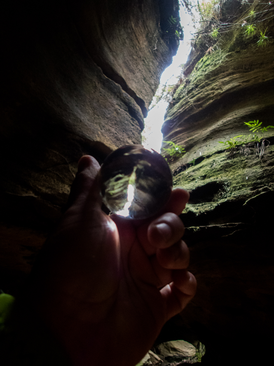
While Ben was setting up his tripod I remember I have the glass ball thingy my sister bought me. It’s been in the top pocket of my pack for about 3 months, I keep forgetting it is there but decide to have a play with it.
With auto focus and hand holding both ball and camera it was tricky getting a shopt but I think it’s definately worth playing with a bit more
For some reason my camera was struggling to focus at all in here. Not sure if it was just the low light or what
Ben in the canyon
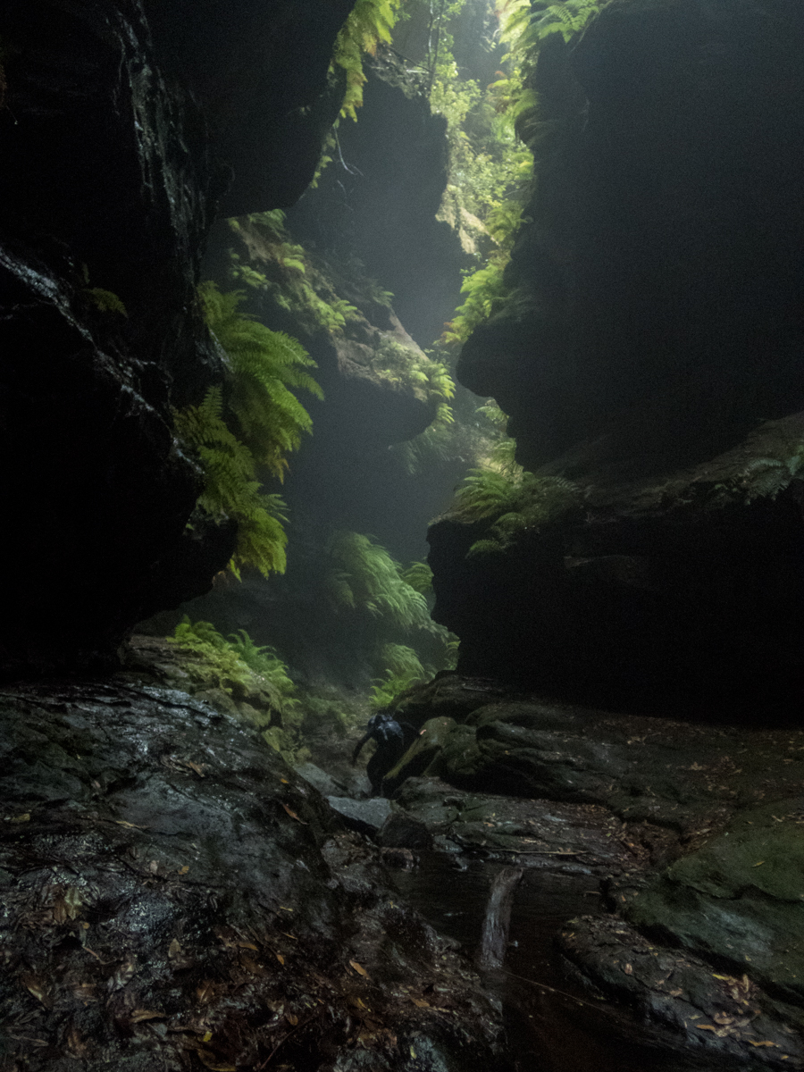
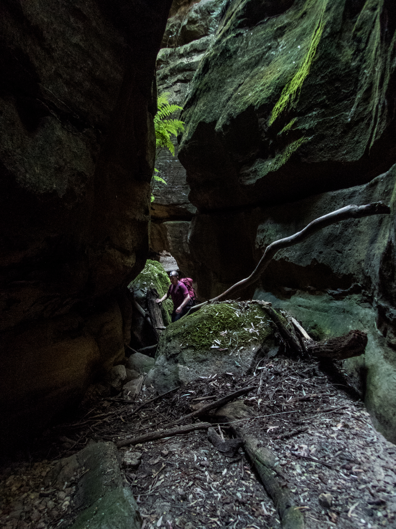
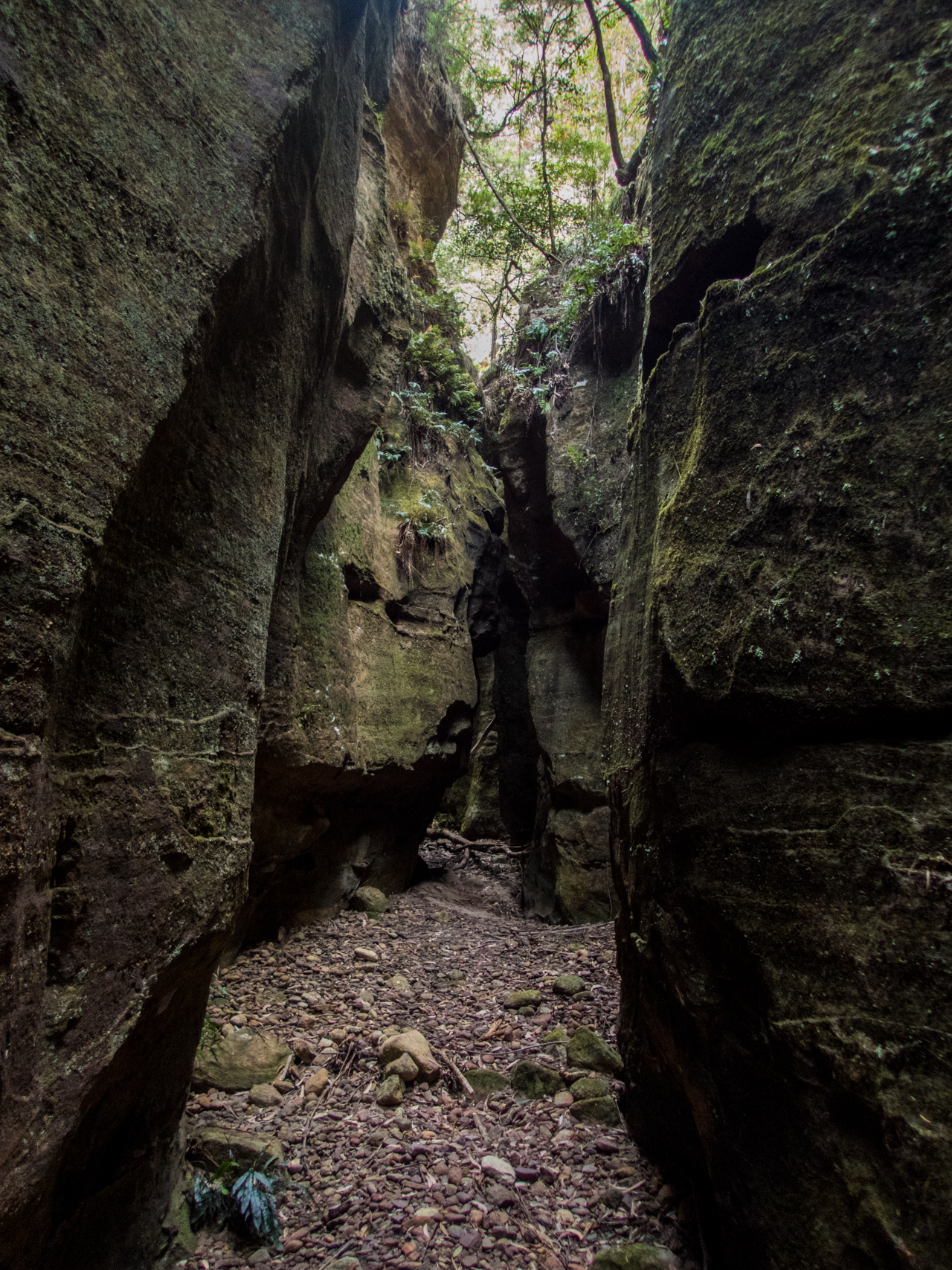
Dalpura is more a series of short canyonish section but it has some nice bits
A tube like section
The water is so clear but the deeper bits have this gorgeous blue/green tinge
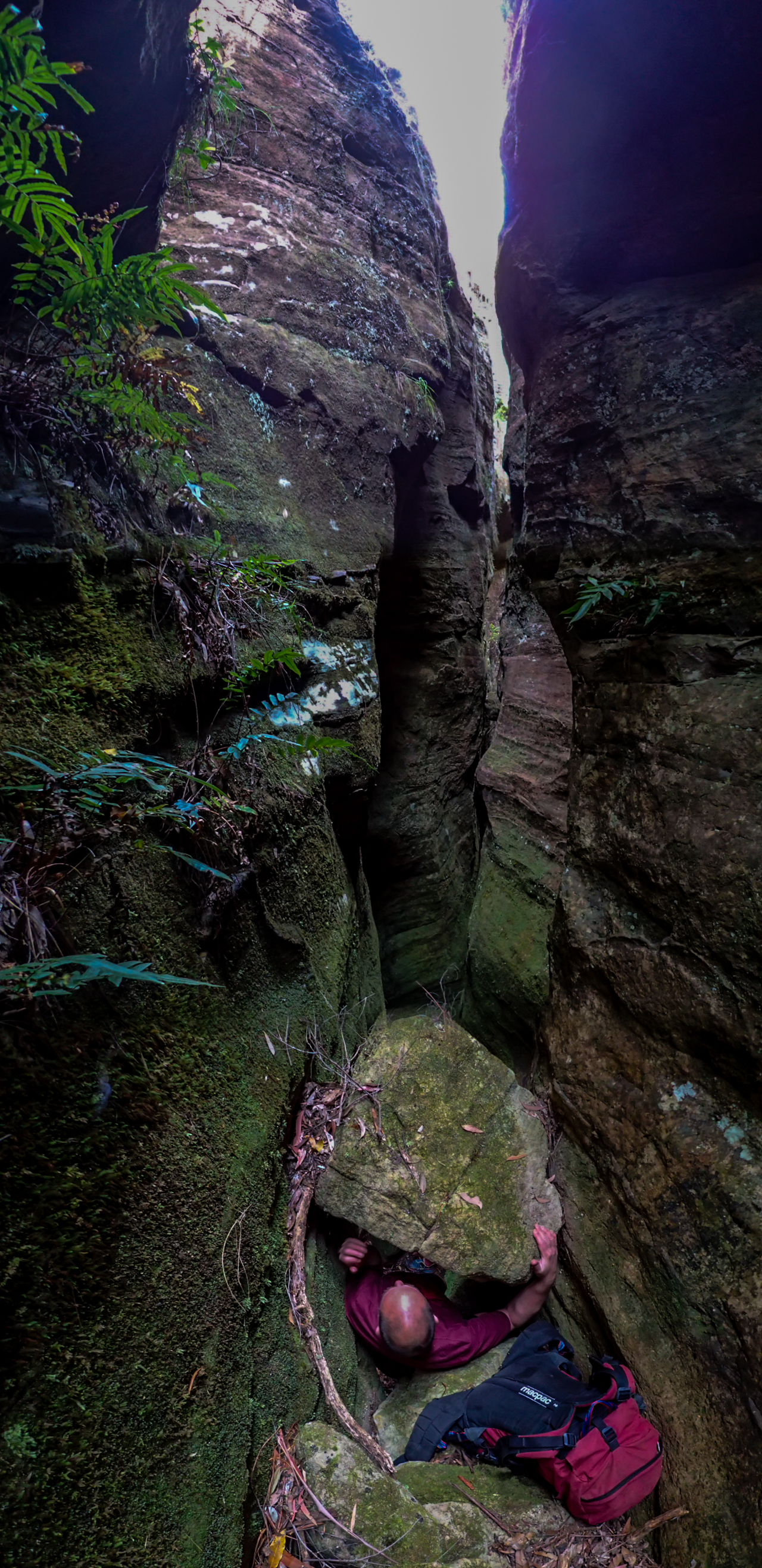
All too soon the canyon opens out and a final optional abseil snakes it’s way down a cleft.
We can walk around it if you don’t want to abseil.
We’re here to experience the canyon….
Ben on a tricky start
Before the easy bottom bit
Tal enjoying it.
And with views like this at the end waht’s not to love?
Party size: 3
Time: 3.5 hrs car to car with some photo Phaffing
Some people are so obsessed with reaching the top they forget it’s the side of the mountain that sustains life.
*Slight detour* in March I am again taking part in the West Cycles Classic to raise money for the Westpac rescue helicopter service. Whether preforming bush rescue, emergency patient transfers, and all the rest no one has ever had to pay to use the helicopter due to public donations. If, like me, you believe this is an invaluable service or if you just enjoy reading my blog think about pitching in with a donation. Large or small every bit counts. follow this link for details 2018 West Cycles
Anyhoo
I mentioned to the gang I wanted to do Grand at night this year. At some stage me and Ed discussed doing it the Australia day weekend but as he is a new dad I doubted he’d get the leave pass and so I promptly forgot about it.
Then I get a text, Are you doing the Grand Canyon trip tomorrow night? Ethan is keen
I had completely blanked it from my mind. Had no intention of doing it. I thought Ed must have known someone else doing it….
Now I’m keen thou.
A quick text to Mandy and Tal. Tal was a nope. Mandy was keen with a slightly earlier start. We’re in. Then Mandy had to pull out last minute.
Me and Ethan it is.
With dry lightning strikes causing havoc and starting bushfires in a lot of the canyoning belt I was keeping a close eye on both the weather and the Rural Fire Service updates, as well as NP closures but unlike the rest of the canyoning areas Blackheath got a bit of rain out of Thursday’s storm (10mm) and so it was damp and misty in the valley.
The soft afteroon/post-storm light was awesome
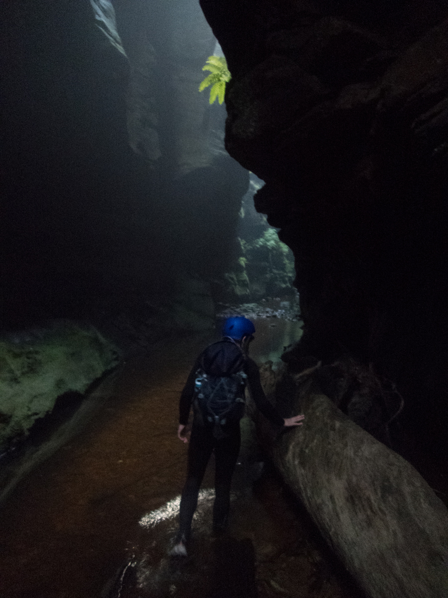
We dropped into the canyon around 6:30pm. Thinking by the time we phaff about with photos things would get dark about halfway through
The light was eerie and atmoshperic and awesome
Normally when I try this sort of canyon shot the sky and center is a blaze of washed out over exposure. The light today was something special, very little post editing done here
The wider bits were still fairly light
The small cascade near the start
Ethan negotiating one of the log jams
Ethan making his way down and the light continues to drop
It really is a stunning slot
Again this shot on a point and click camera would be horibly contrasty in normal light conditions. I could have lightened up the sides a bit but thought why bother, that’s how it looks when you are in there
Ethan contemplating stuff like if snake don’t have eyelids how do they sleep….
In this light it was hard to see with the lights off but even harder with them on as the mist got reflected back in your eyes like driving in fog with high beams
and the moody atmosphere kept getting better. I mean sun beams ar great and all but moonbeams are so chill
Giving the Gand Canyon a Claustral like feel
Um, we are at the last swim…. Depsite the photo phaffing we seem to have come through super quick. We breifly contemplated following the track back to the start and doing it all again but chose the better idea staying in the canyon, reversing it back to the start and coming down again in darkness. Excellent idea Smithers
Side creek near the end
back up we go
Darker it gets
It’s like 3 different canyons in the different light traveling different directions
The glowworms came out to play. they are hard to photo well but the little TG4 does OK
A selfie with some glowworms
Looking up through a gap in the canyon walls. What are stars and what are glowworms?
Serveral times we just turned every thing off and sat in silence under the glowworms. It’s a special experience
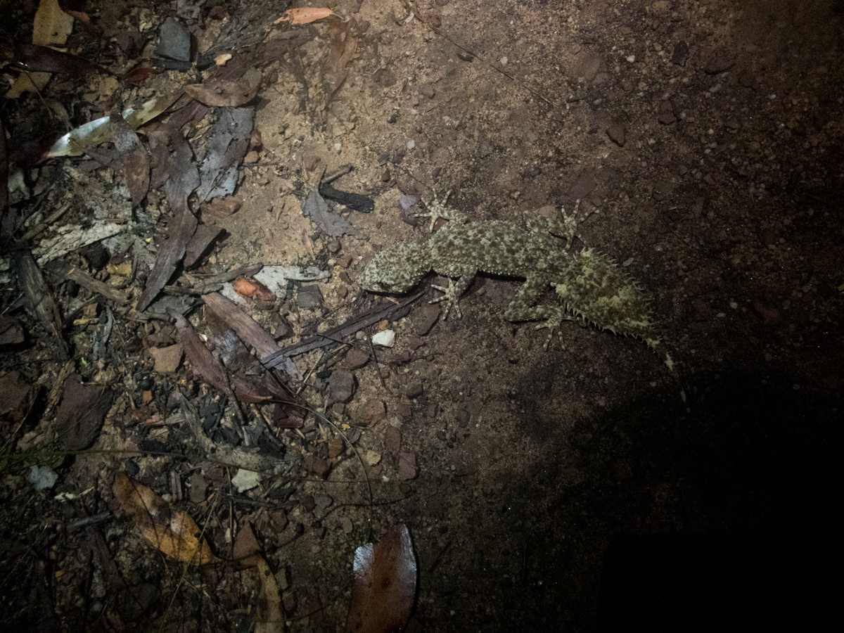
Leaf tailed gecko spoted by another group who were heading in as we headed out
To the mind that is still, the whole universe surrenders. Lao Tzu
Most people do Newnes ( or Starlight) Canyon as a round trip, climbing up the pipeline trail, working their way around the ridges and abseiling in. And don’t get me wrong that’s a great way of doing it but there is a lot to be said about doing it as an up and back from the bottom.
The canyon is off limits over winter as it is an important hybernation cave for bentwing bats and disturbing them during their sleepy time invariable leads to a percentage of them dying as there is no food around food them to replenish the energy it takes to come out of hybernation.
Anyhoo, I had planned to do this earlier in the year on the last weekend before the closure except in the week leading up NPs put out a notice that they were hazard reduction burning and all the canyons in the area were closed…….
Fast forward to the other end of hybernation season and we were good to go.
The plan was to ride down the maintenance trail from the locked gate, stash the bikes then make up way up to the cliffline and into the canyon.
I’ve done it this way several times and have always been able to get all the way up to the bottom of the abseil point (the top of the canyon) no dramas. However, last summer people were reporting deep swims in the tunnel and while that is normal after heavy rain the fact that the water hung around post rain had me thinking maybe something in the floor or blockage had changed.
Not tha I was too worried about long swims after the dry winter we’ve had but the thought of a deep wade through stagnant, bat shit filled water wasn’t that inviting. I needn’t have worried as the tunnel was as dry as a nun’s nasty.
But I get ahead of myself
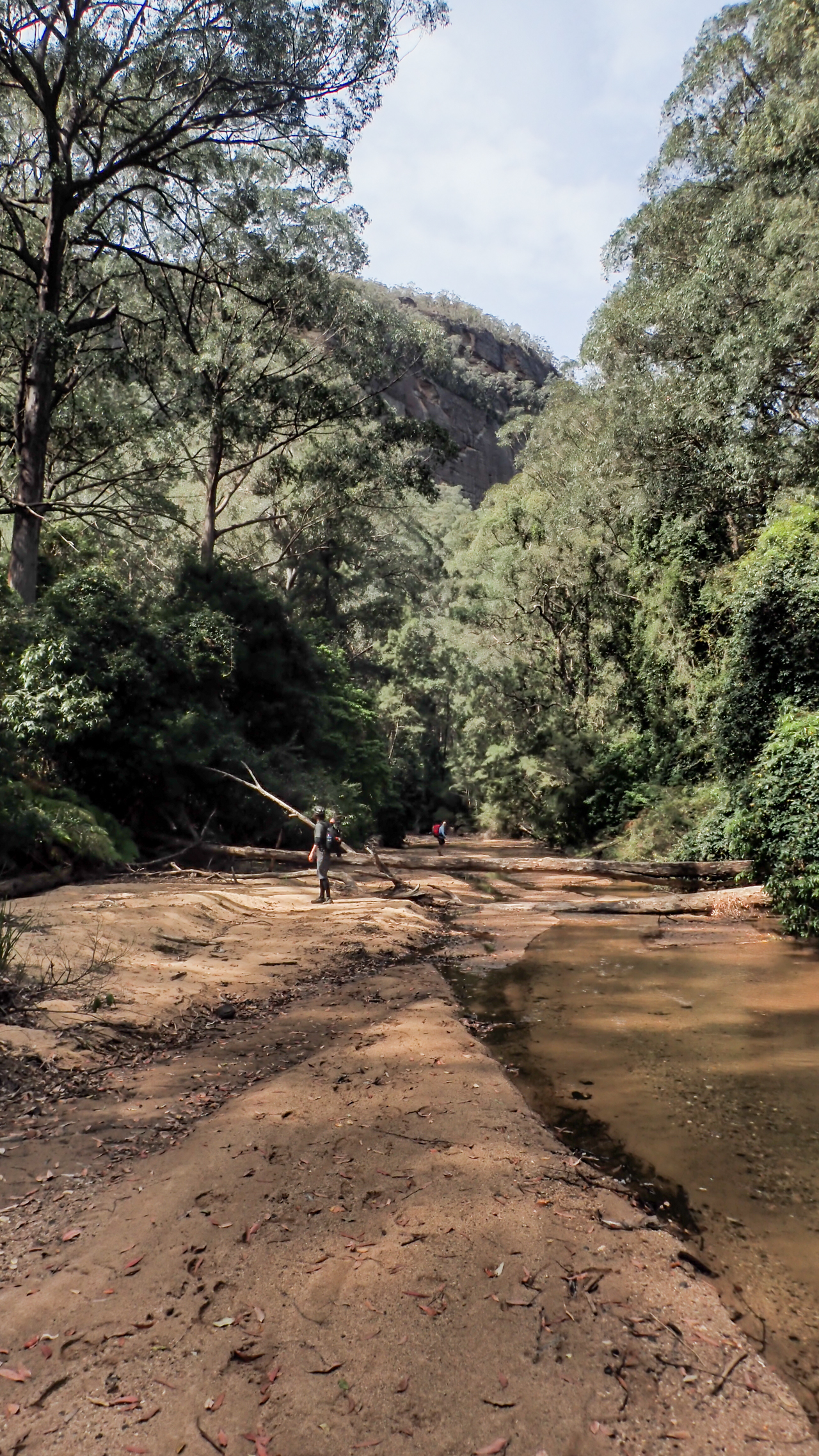
While bikes arn’t necessary they do turn an hour long fire trail walk either way into the 20min ride and the ride down was uneventful, almost. Tina had a small off at the bottom of a loose down hill on a sandy corner and hurt her elbow. As a mad trail runner that didn’t bother her. a sore elbow would not stop her from running so no worries. We hide the bikes in the thick scrub and head across the river which is about as low as I’ve ever seen it.
A bridge over the wolgan
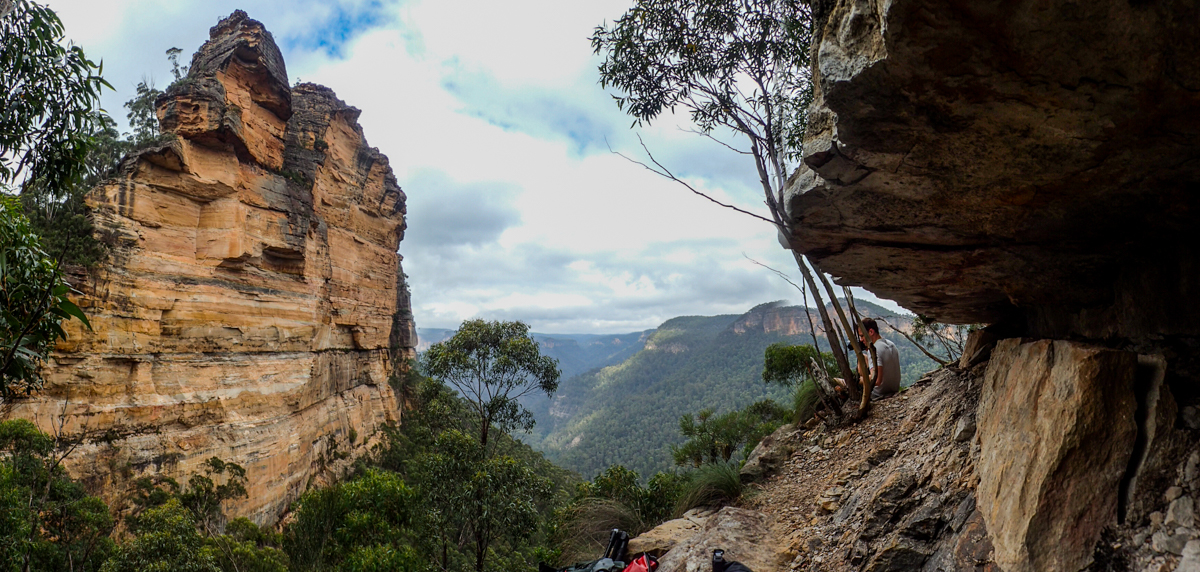
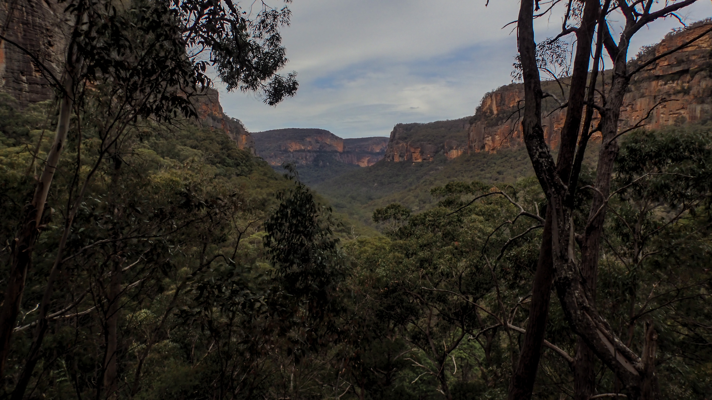
Up the hill we went taking a bit more of a meandering route than I usually take which made the climb up fairly simple, then we took in the views down the Wolgan from the base of the upper cliff before working our way around into the canyon.
Looking down the magnificant Wolgan Valley
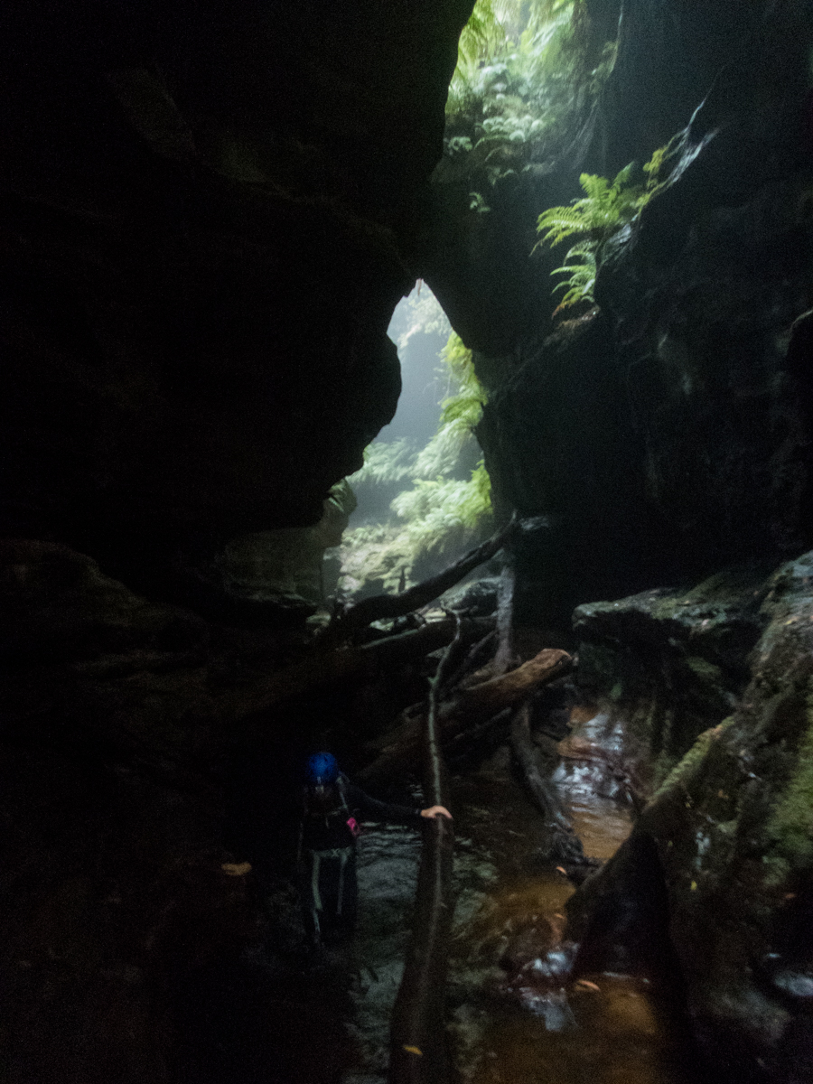
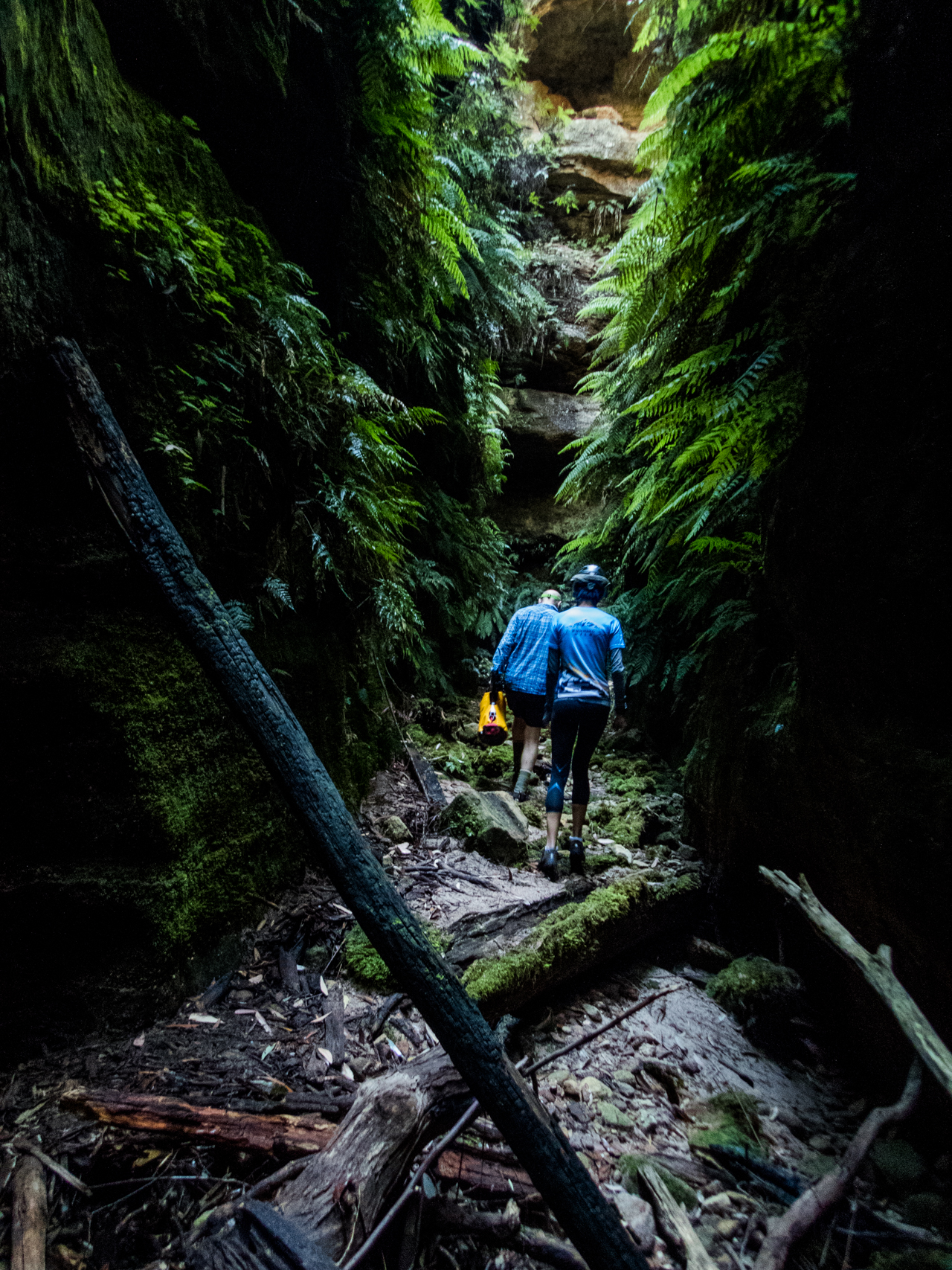
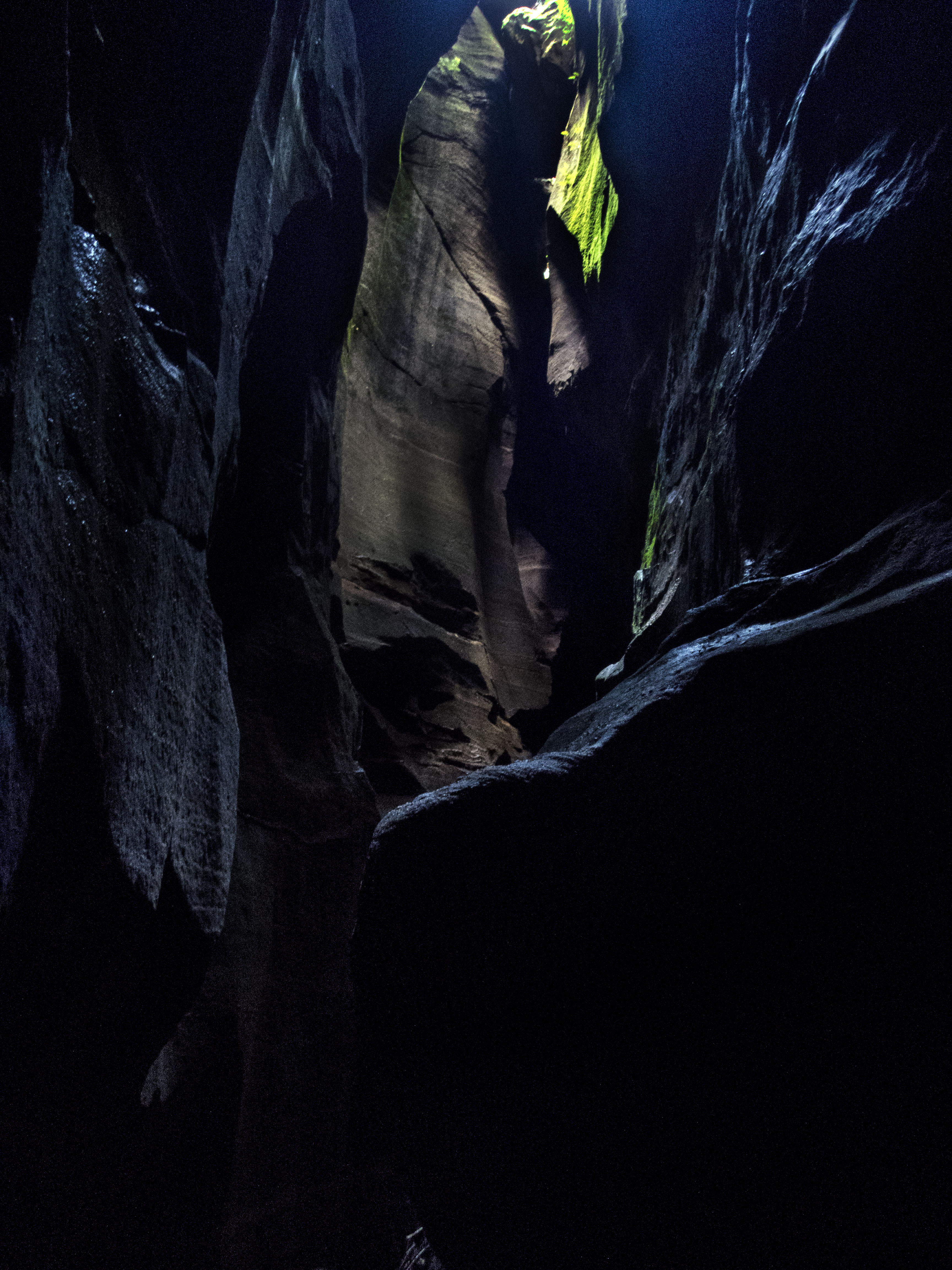
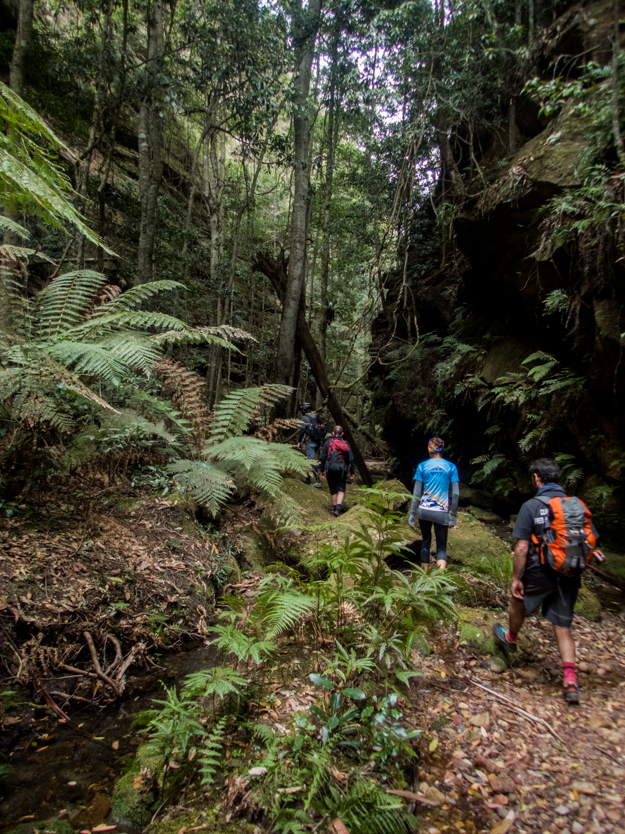
Entering into the lower canyon is like entering another world. The micro climate is completely different to the scrub out on the exposed hill side
This is magical, Flynny, says Sav as we make our way up through ferns, coachwoods and vines so big that at first you think you are stepping over a fallen tree, only to realise its a living vine.
I smile to myself, this is just the appetiser and I think that is the reason I like doing the reverse trip of Newnes Canyon. The starlight section is so awesome that when you come through it from the top you are in such awe of the top section that you kind of over look how spectacular this bottom section is.
There are a few scrambling sections but everytime you would otherwise be blocked tree roots and vines have grown into the perfect pass up.
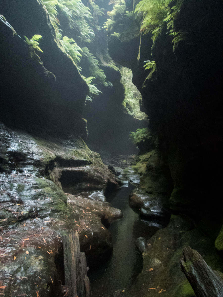
And then, just as you are thinking the walls are petering out and the canyon is about to open out the upper cliffs encroach and suddenly the canyon closes in
A lovely narrow section of canyon follows and again people remark how awesome it is. But again I know it gets better
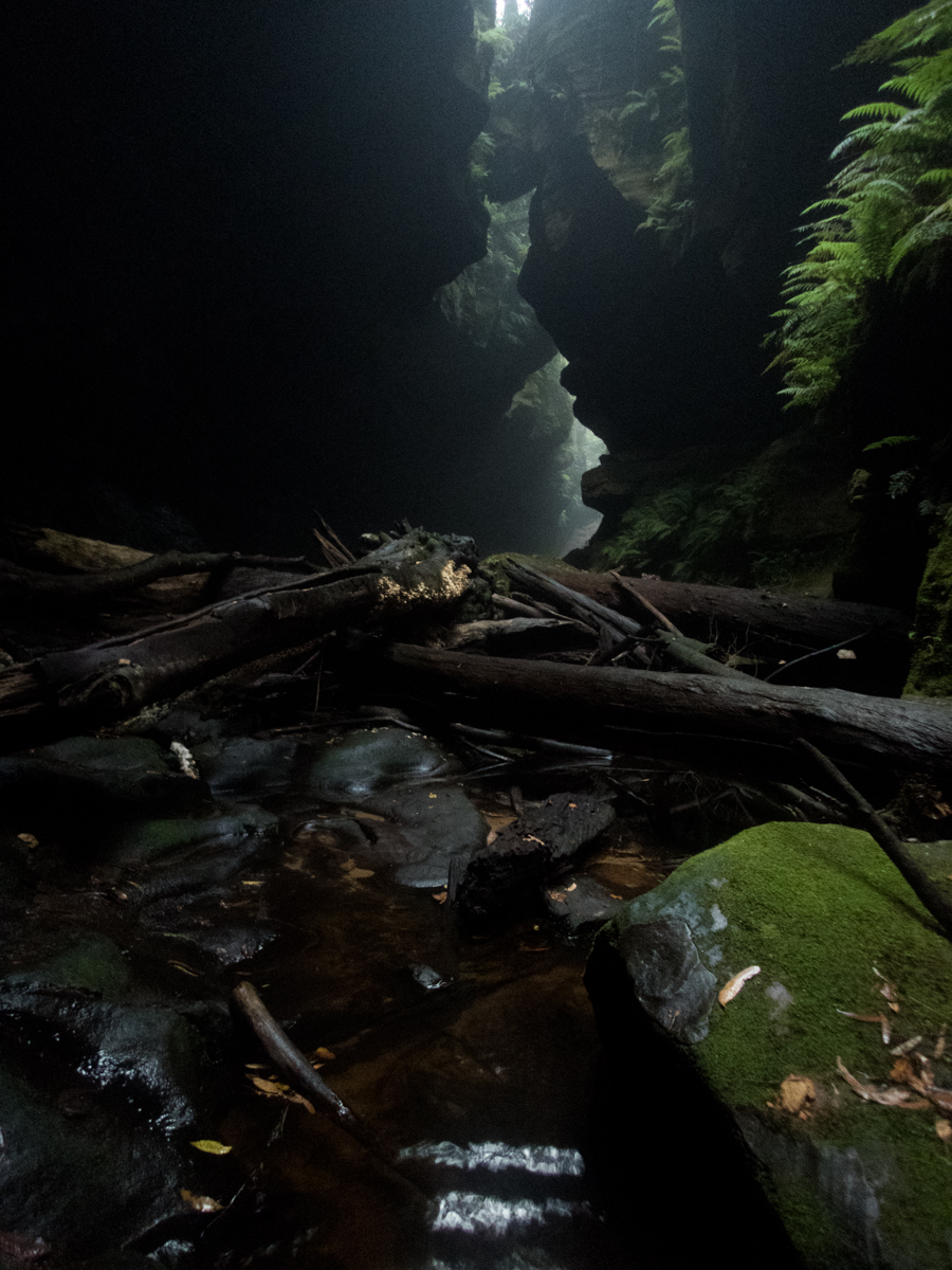
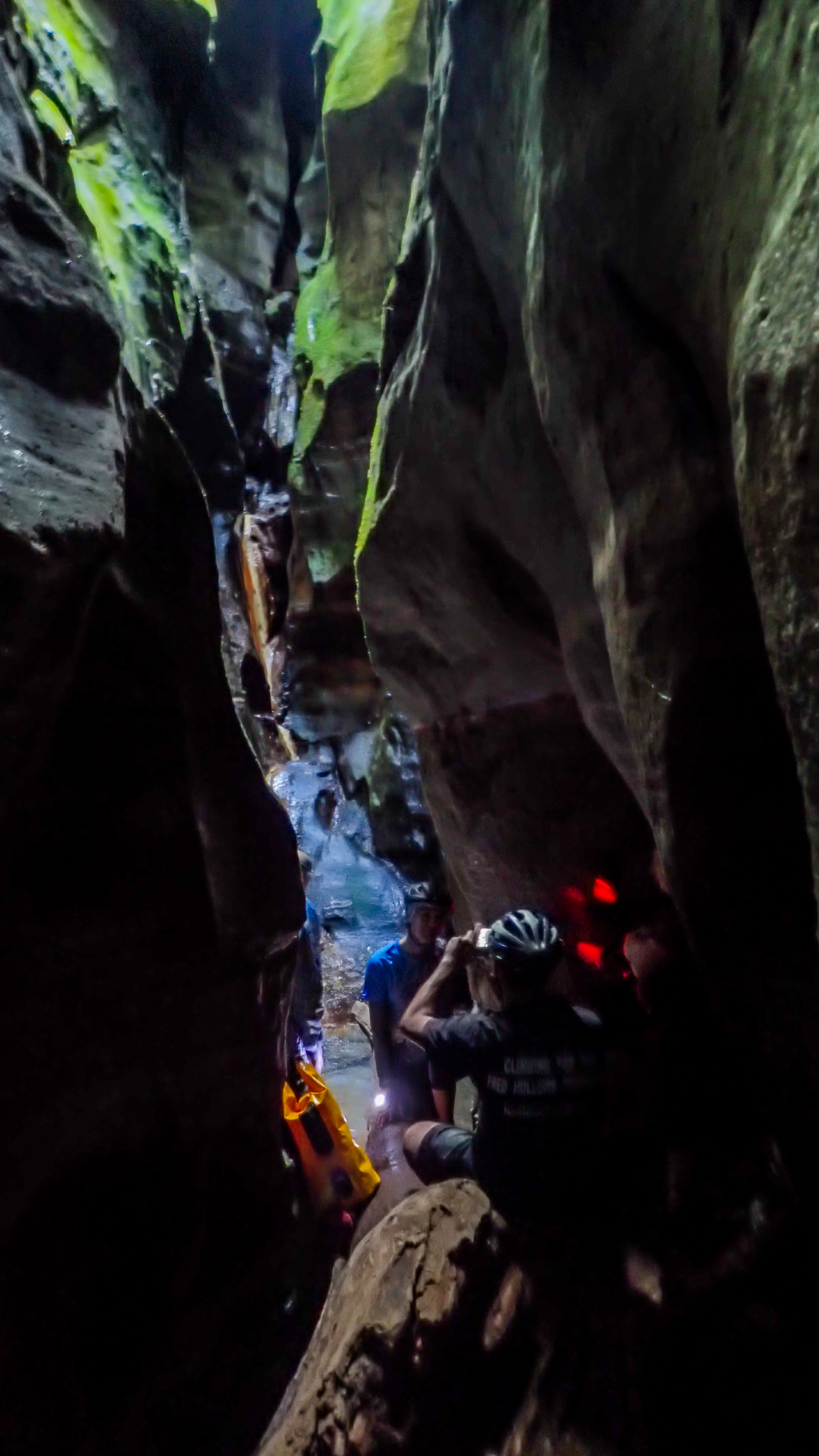
Autal in the long section of deep, narrow canyon
Tina with head torch on as the walls get higher and the canyon gets darker
The canyon breifly opens out and what was dry, bare and sandy suddenly becomes damp, lush and green
Tina in the green section
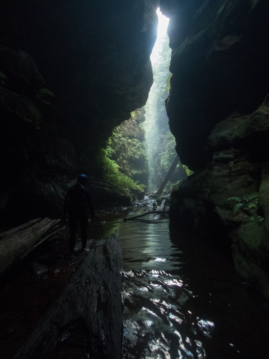
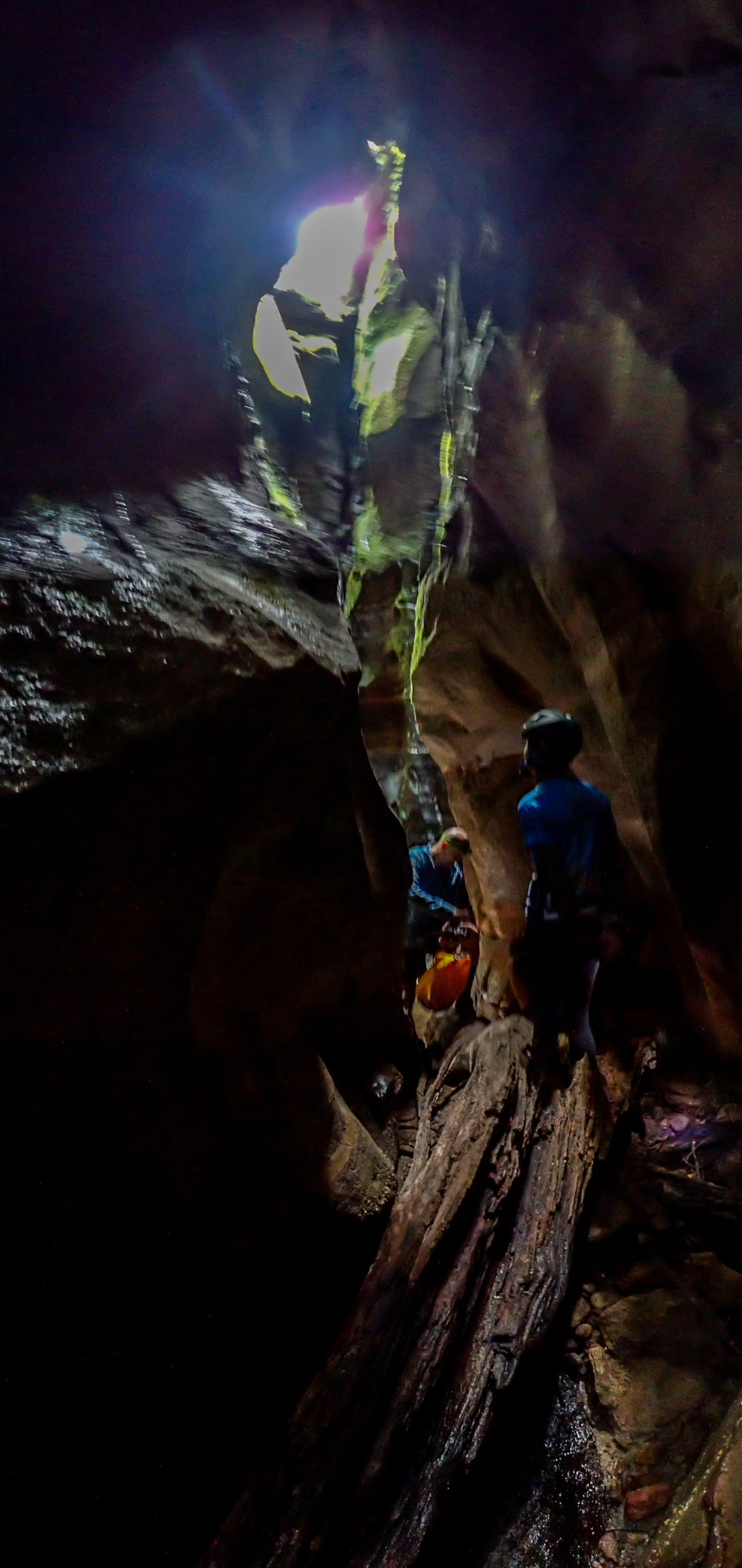
And then we reach the Amazing Wallaby tunnel, better known as the Starlight section, high up the walls close in so much, become so twisted, and are jammed with chock stones that it forms a high narrow tunnel.
Autal and Rob entering the tunnel
I feel on previous trips the glowworms were far more abundant, maybe that has to do with the dry winter, maybe it’s just the time of year as I think it’s around mating season for the flies, maybe it’s just modern headlights are so bright now you don’t notice the worms unless you tuen them off and give your eyes a few minutes to adjust, or maybe the bats had a wormy feast when they awoke
After 300m or so of tight twisting tunnel the roof opens back up and just around the corner is the waterfall that is the normal absiel in point.
I have known people to absiel in here but be blocked by deep water in the tunnel so they had to prusik back out and abseil in further down. I also know of at least 1 group who pulled their ropes without checking the tunnel was passable and were forced to spend a couple of days huddled here waiting for rescue…. When absieling in the first person need check all the way through the tunnel before getting others to absiel or pulling ropes.
And after taking time to enjoy just being there we leave Ed and TJ to get about photo phaffing with their good cameras and the rest of us make our way back down
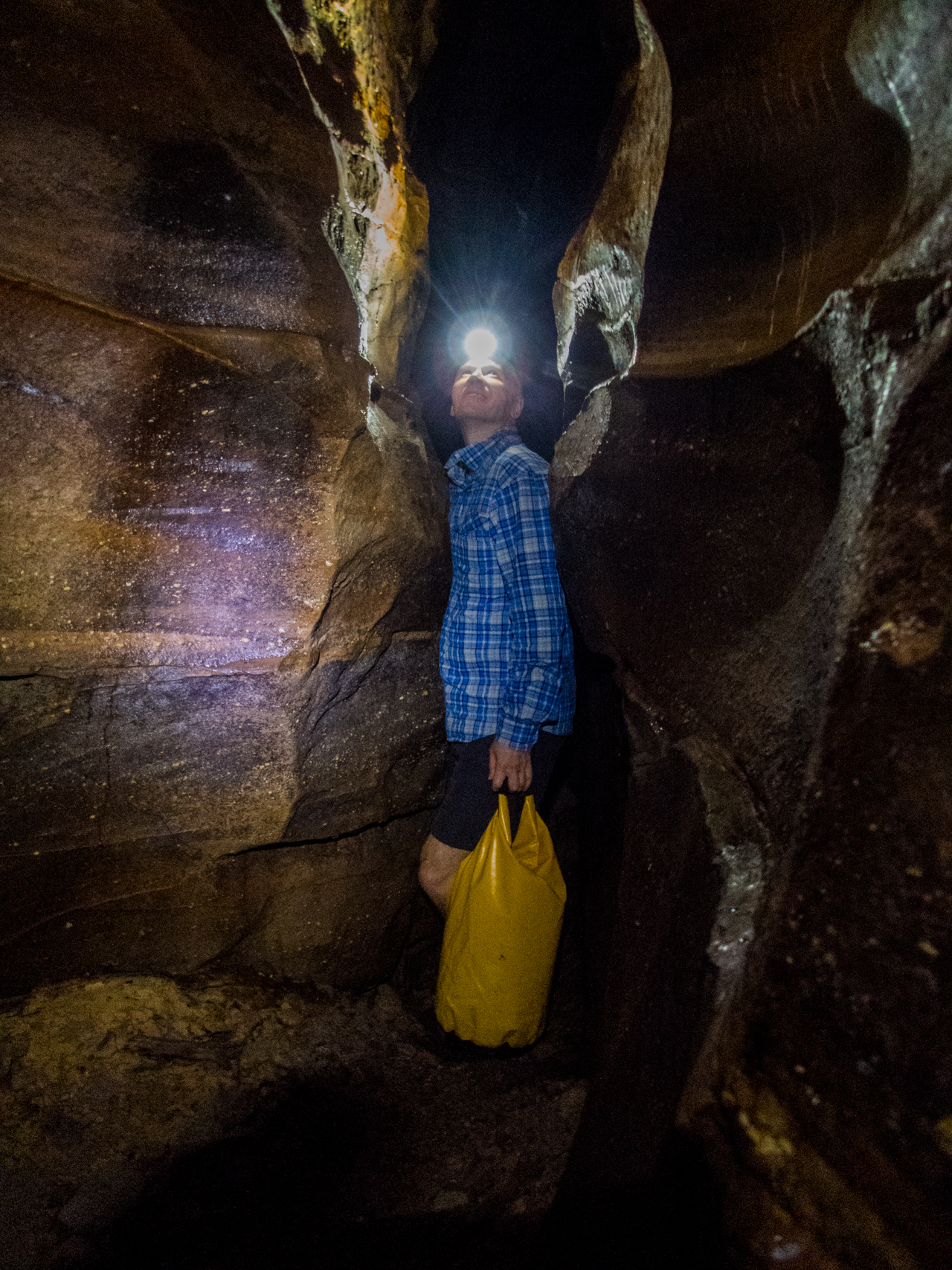
Autal in a narrow squeeze admiring the bats far above
Autal in the green section
We have a bit of lunch and then explore up a side canyon called Upside Down canyon.
Bottom section of Upside Down Canyon.
The bottom section of Upside Down involves some tricky climbs up through small holes. I made the first look far harder than it was mainly as I forgot had the go pro on a chest mount and had to do some contortioning so as not to scracth the crap out of it.
Rob squeezing up through one of the holes. It’s about 7foot straight down, if you squint you can make out Tina down below him
Rob in Upside Down canyon
Our path was blocked by this small waterfall
I remeber the water fall from previous visits and started bridging up, the walls were a tad slippery, I had no doubt we could get everyone up, what I did doubt thou was getting people back down safely without ropes… I’m sure there use to be a log or something here to make the down climb simpler.
Anyhoo despite knowing the top section has some pretty bits I decide it’s not worth the risk today so we turned tail and headed back down.
Ed and TJ are still phaffing so we sit back and just take in the surrounds
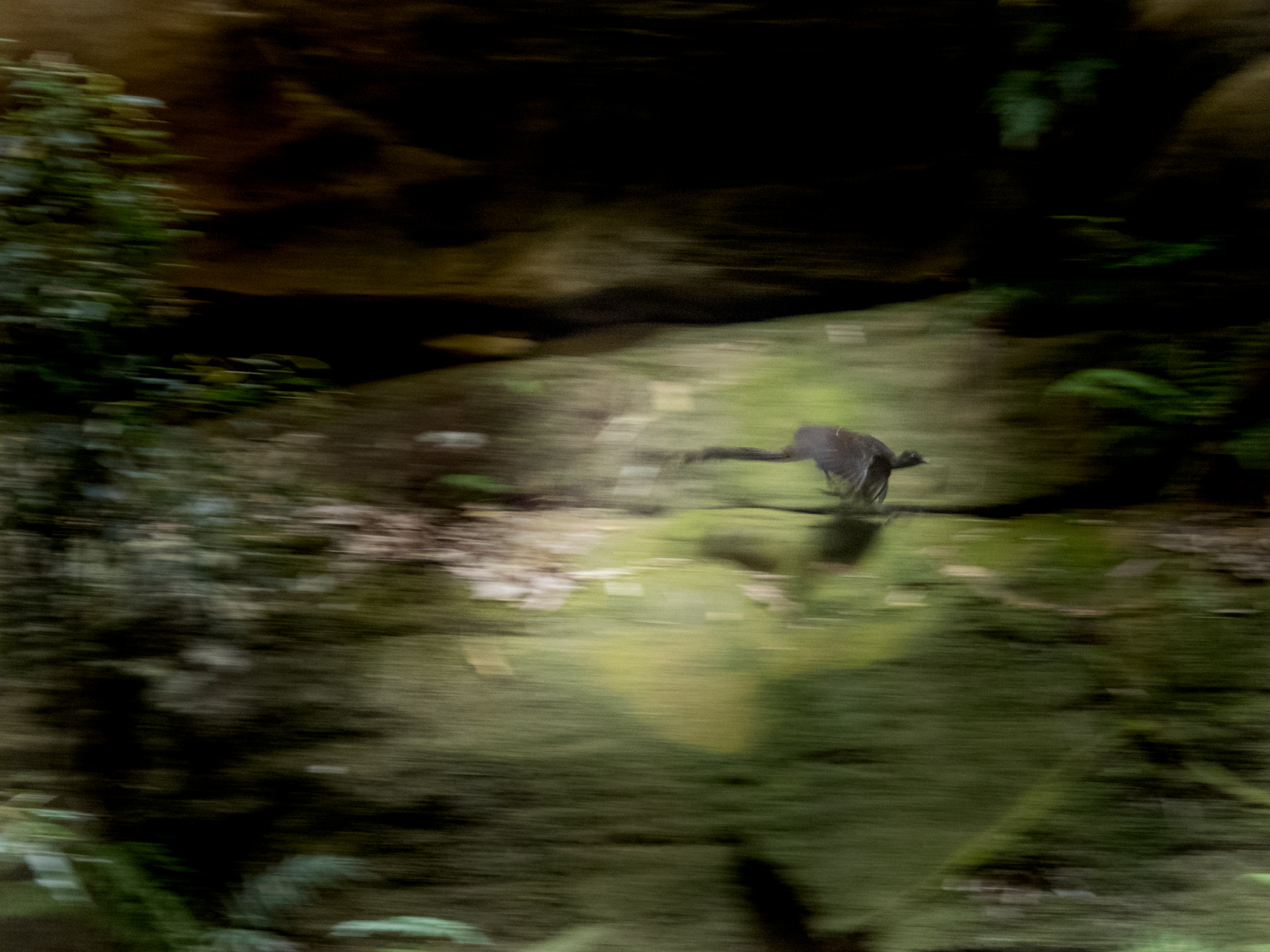
Honey comb walls. we sat and watched the bird dart in an out of pockets and holes
Supurb Lyrebird on the wing
Then it was time to head on out
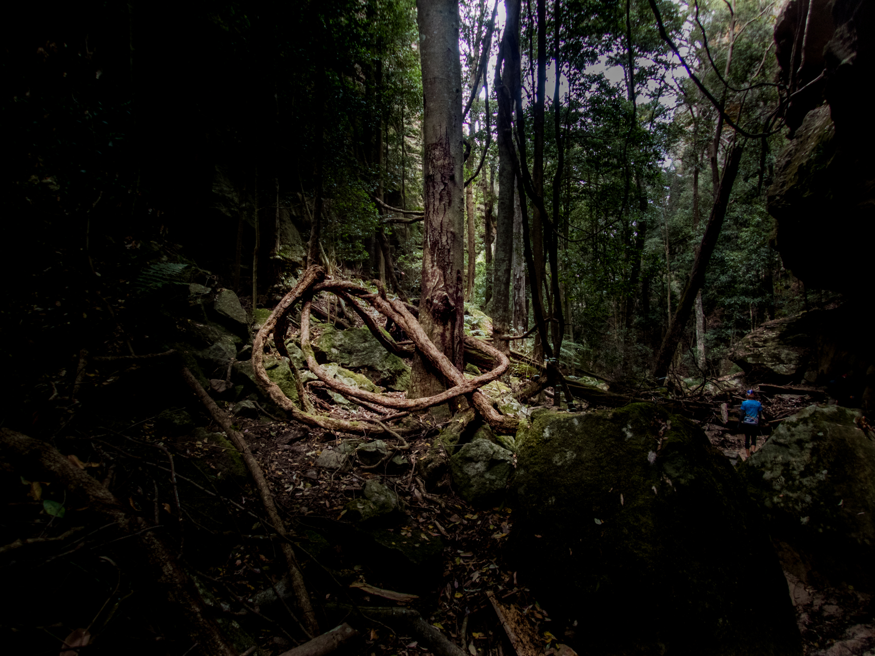
I’d noticed this massive vine knotted around the base of the tree on the way up and was hopeing to catch it in the right light on the way back down. The light did not disappoint. Another advantage of doing the canyon as an up and back the changing light can be magical
And before long we are back at the Wolgan river
The ride back up the valley is a bit more difficult than the ride down but for a mountain biker it’s still better than trudging along a fire trail.
Party size: 7 mixed canyoning experience levels but all experienced outdoors
Timing: 6hr 20 with lots of photo phaffing and chilling out
People talk about their comfort zone as though it’s a place they want to stay don’t they realise your comfort zone is the most dangerous place to be