The next one is fairly basic down beside a smaller fall
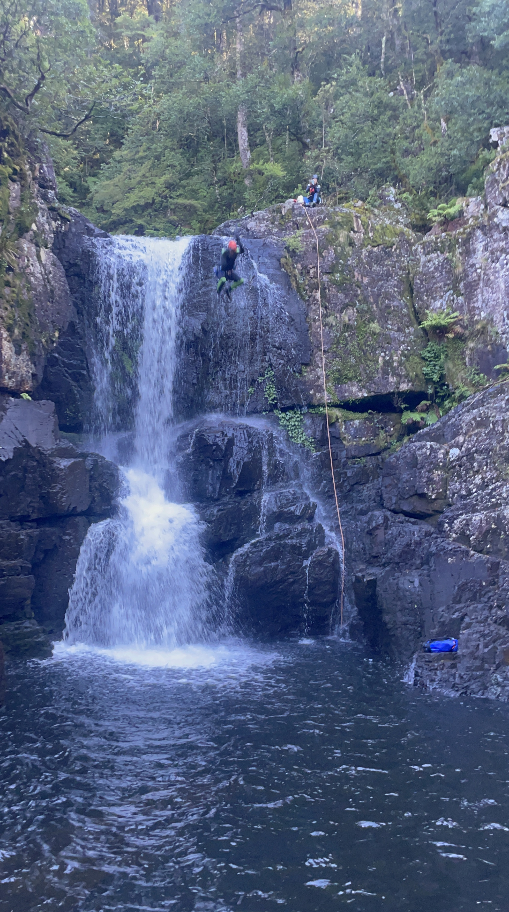
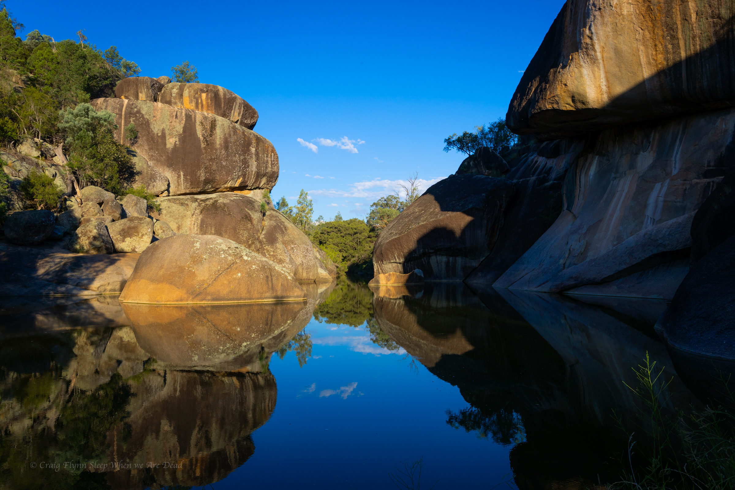
A short hop skip and a jump down stream and we arrive at what we are here for.
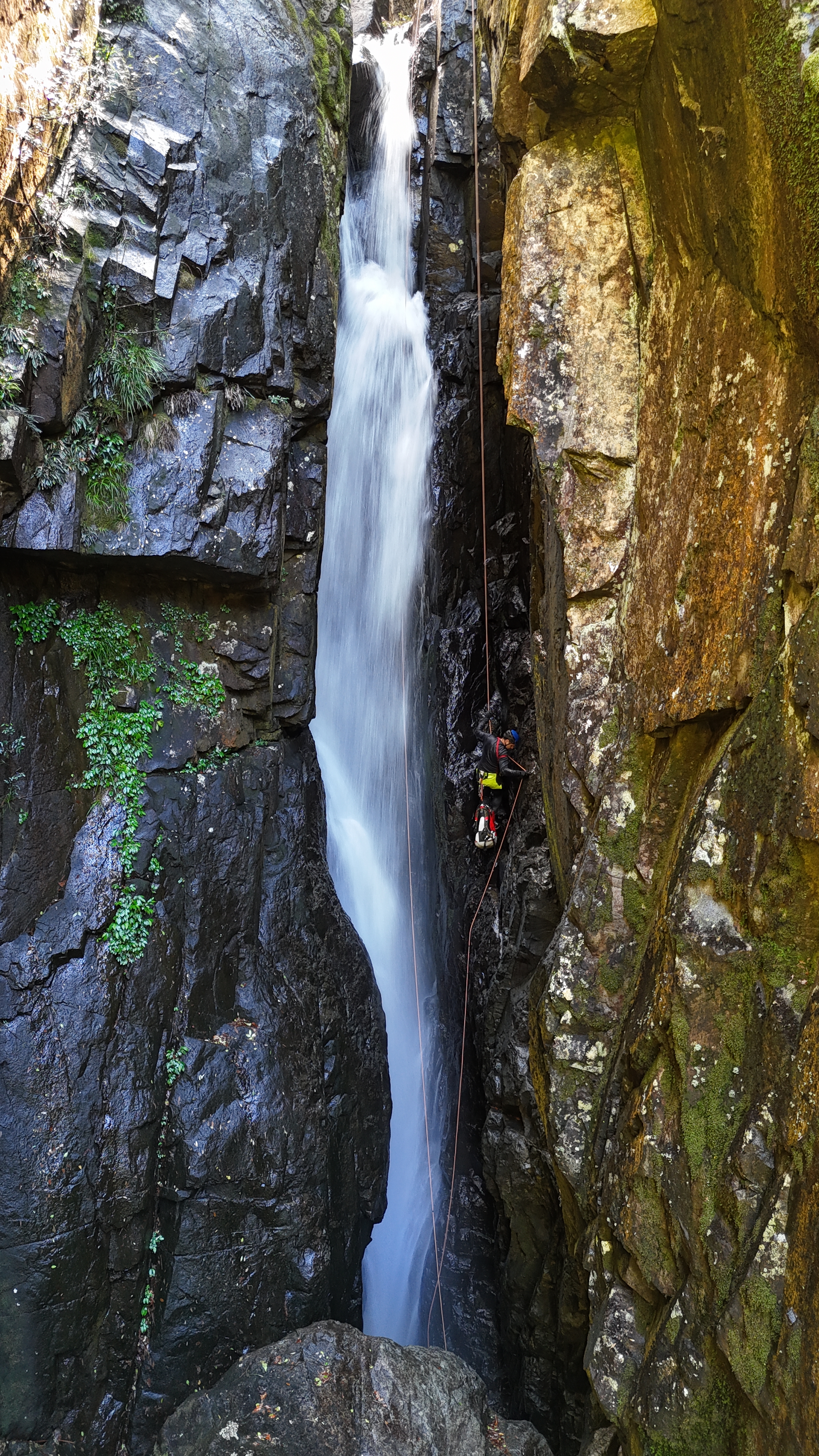
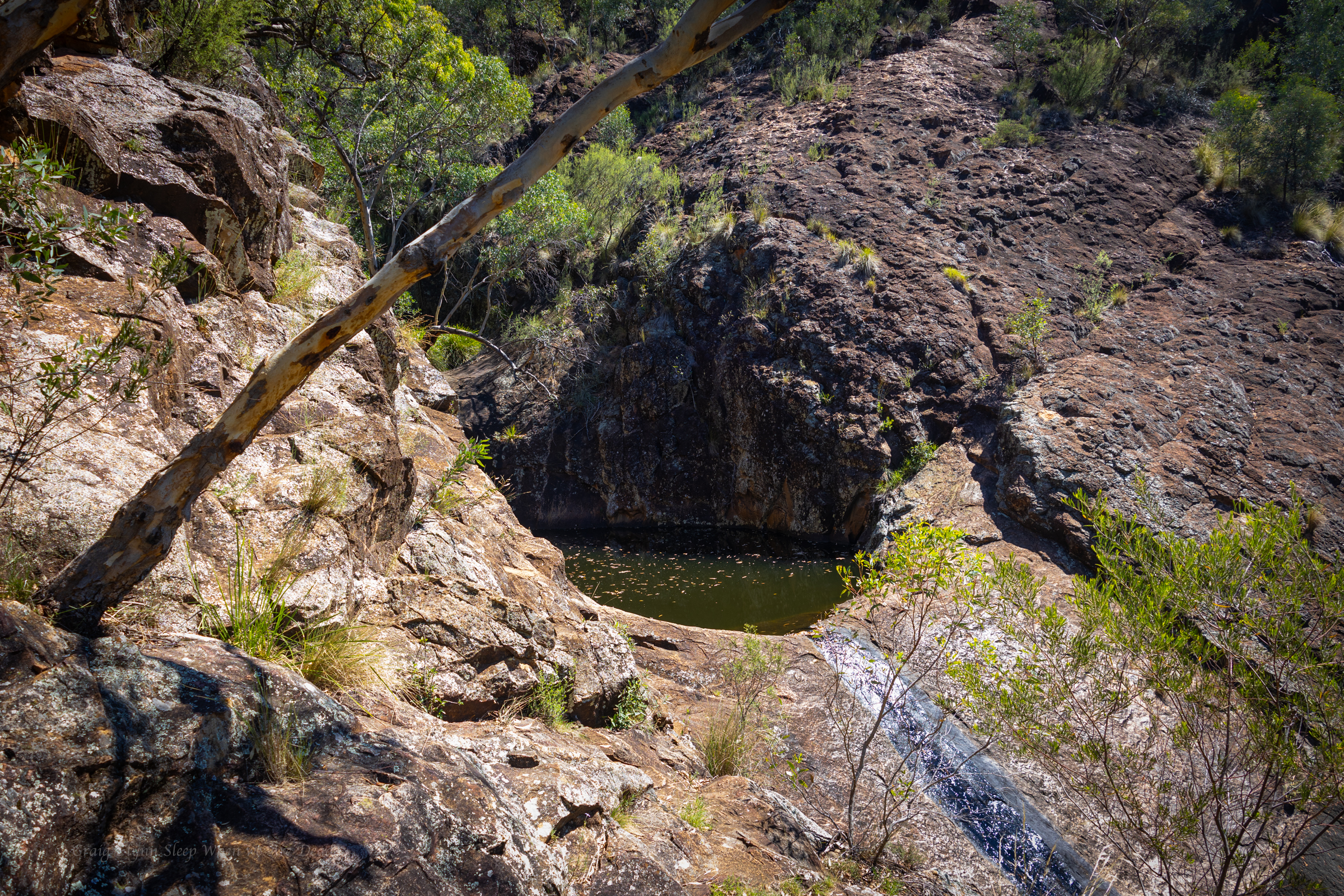
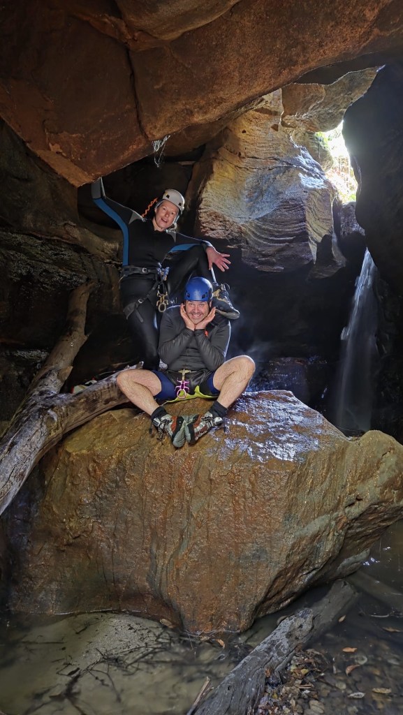
The Famous chock stone abseil.
But to get there requires a short abseil and traverse
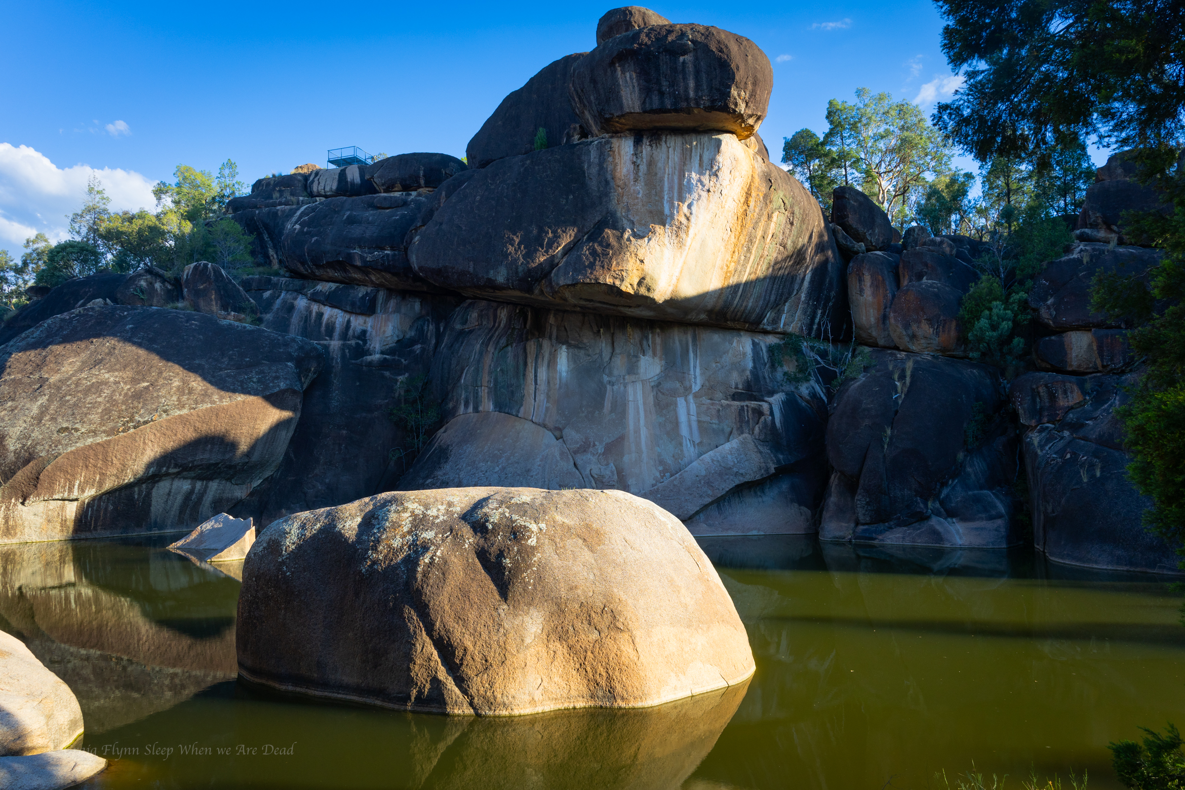
On their previous trips the water levels had been too high to attempt this one and there is the option to scramble out and do a dry line from high up just down stream of the chock stones.
Conditions today however are perfect so Jason sets a line and I traverse out and set the main drop
Jason follows me out and leads the big one
There are two redirects in place on this drop. The first gets you out, away from a sloping ledge that forms just as the water funnels into a ferocious torrent, the second keeps you out of the hydraulic that form in high flow at the base. Jason sets them both for us to follow
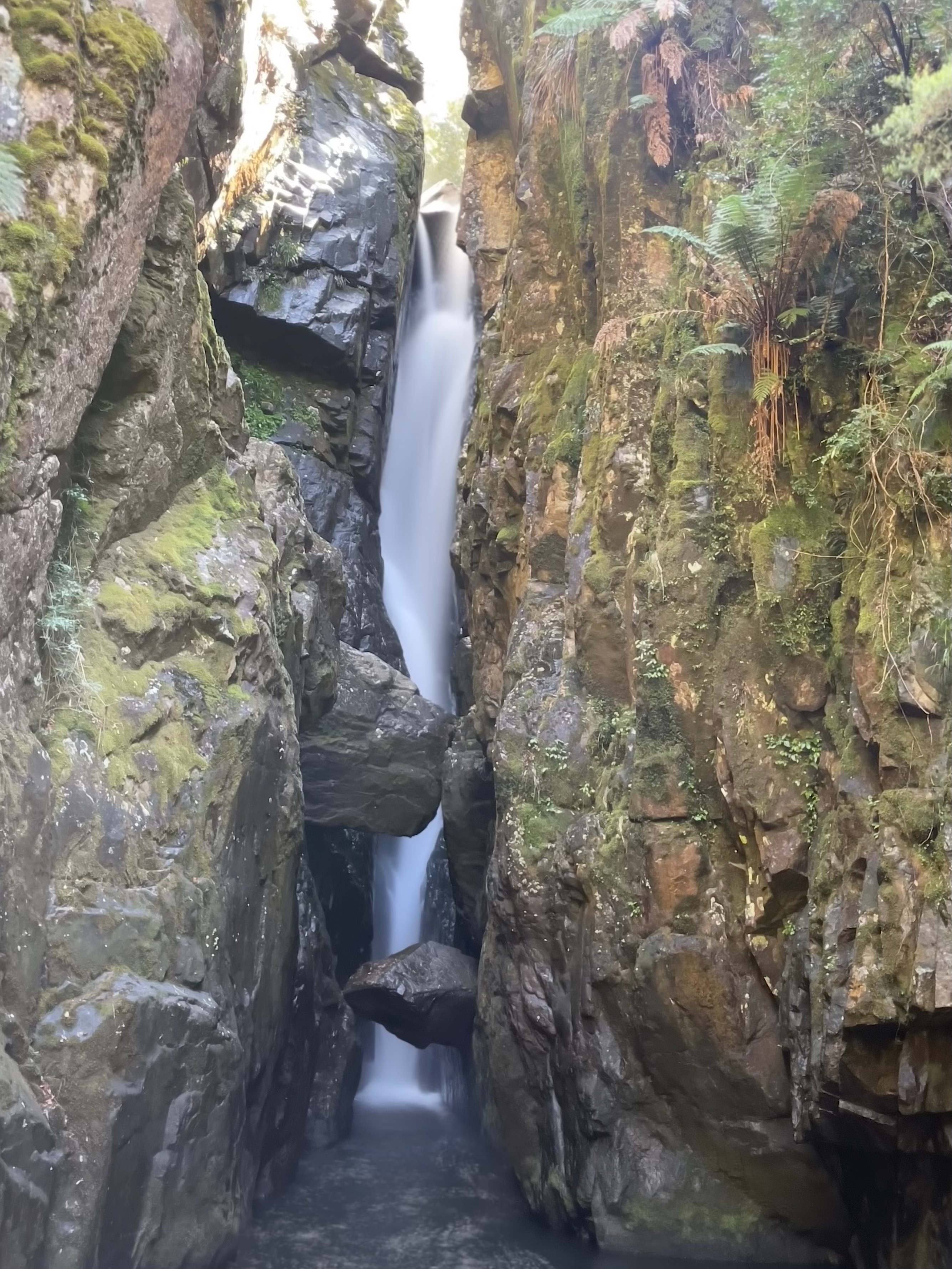
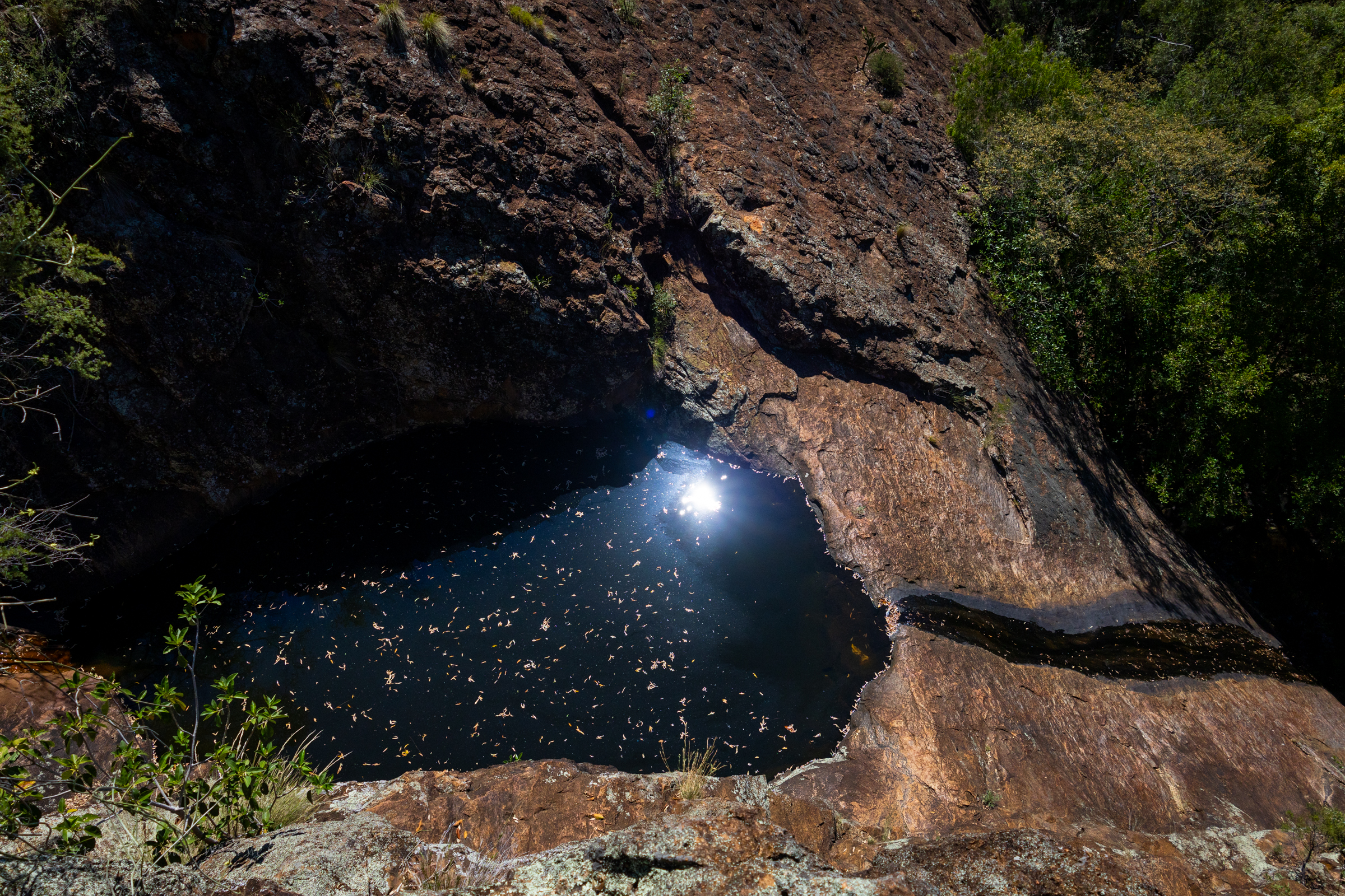
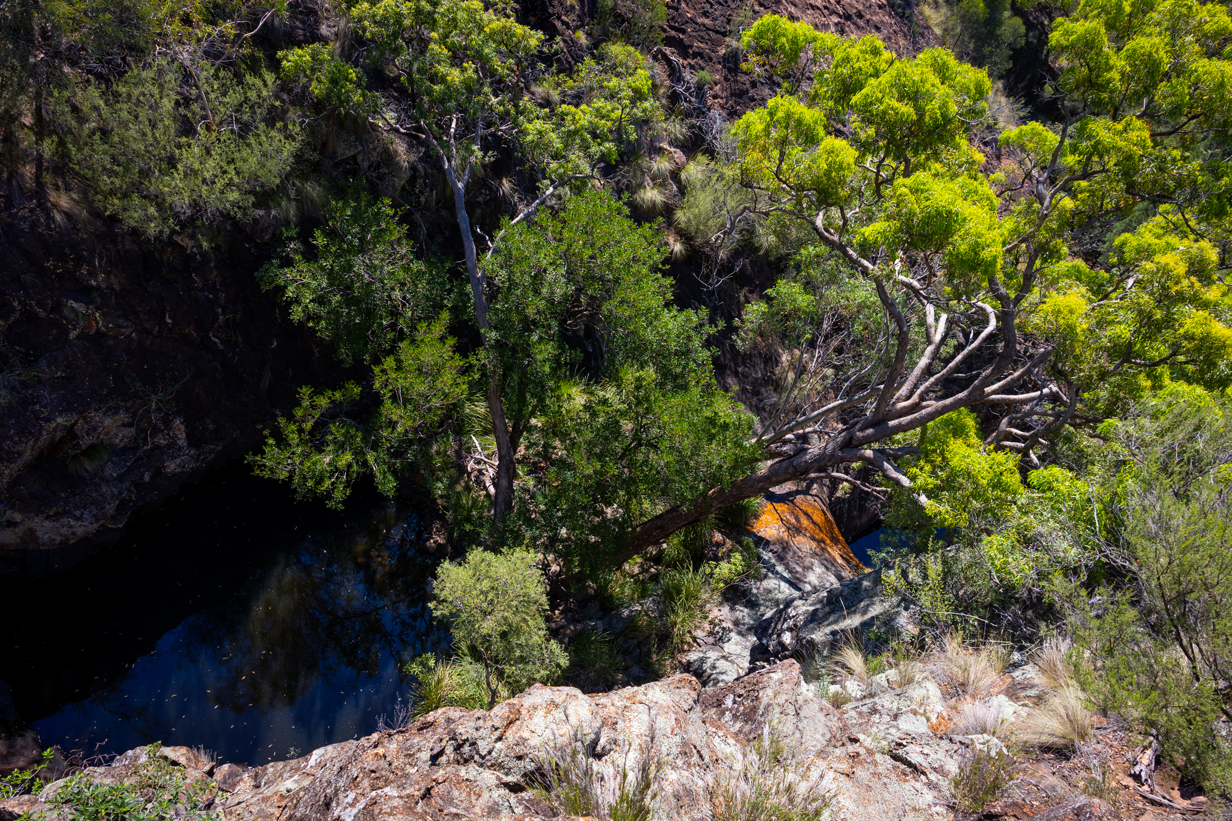
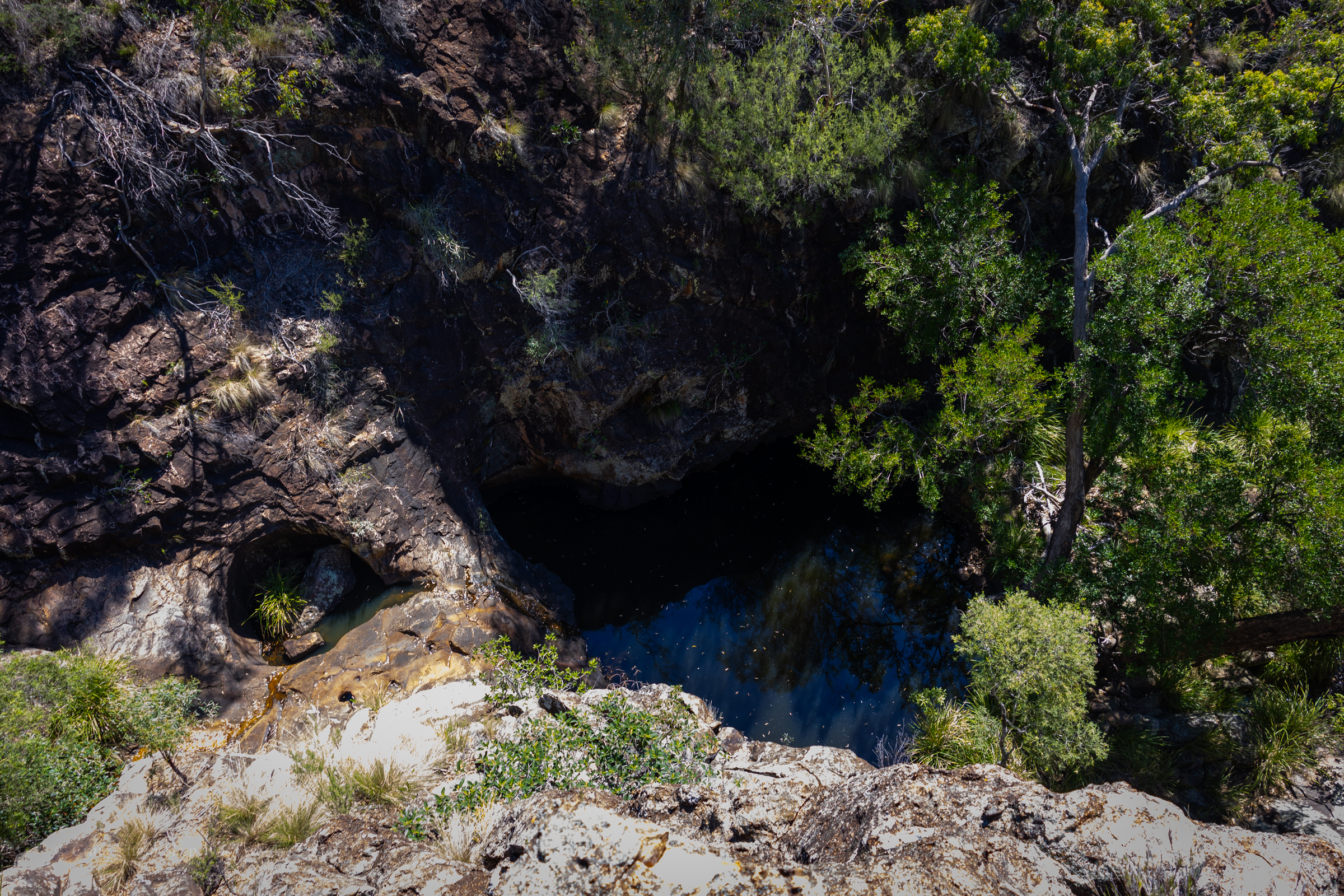
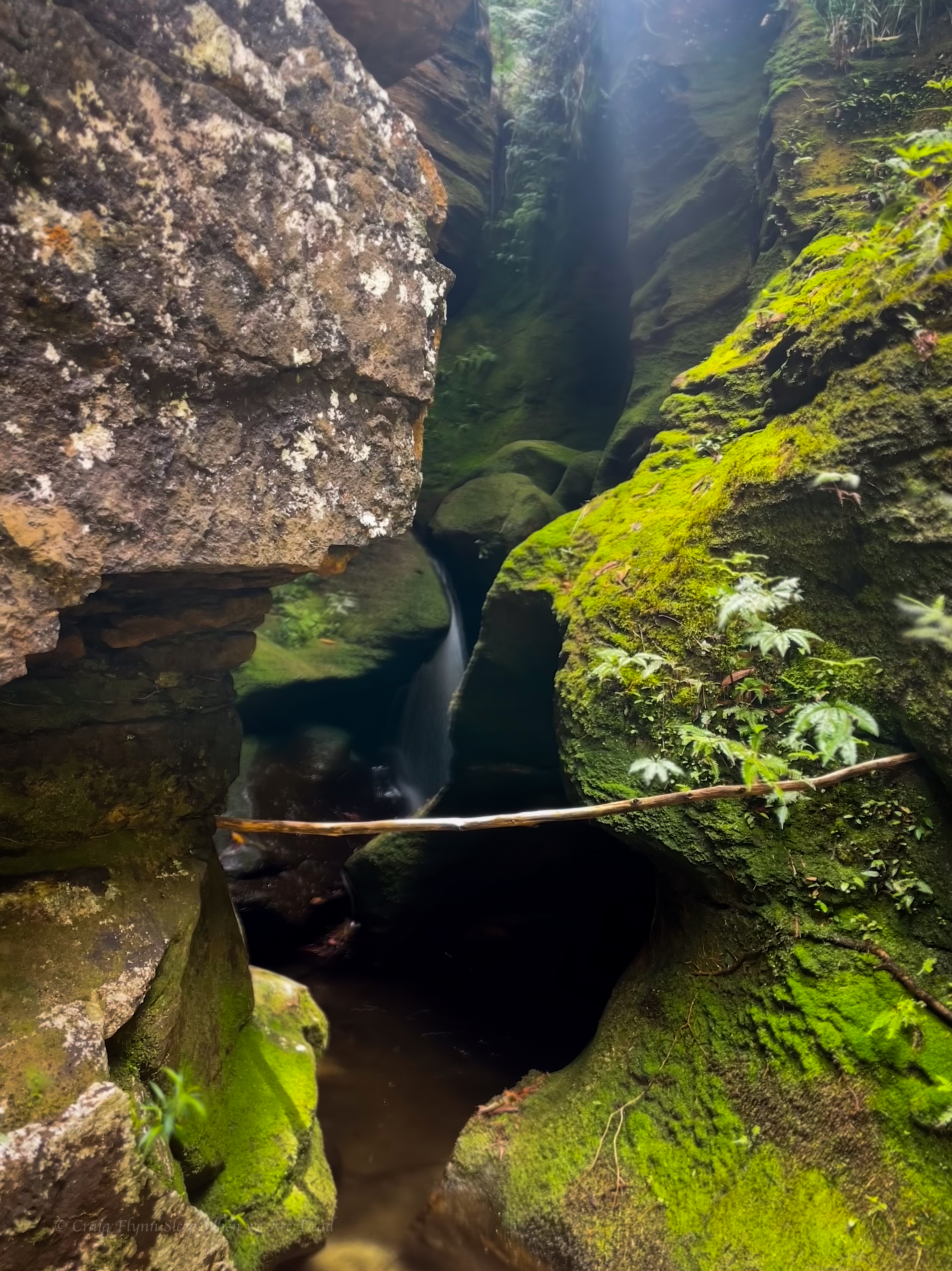
And the view back up tp it from just downstream is iconic
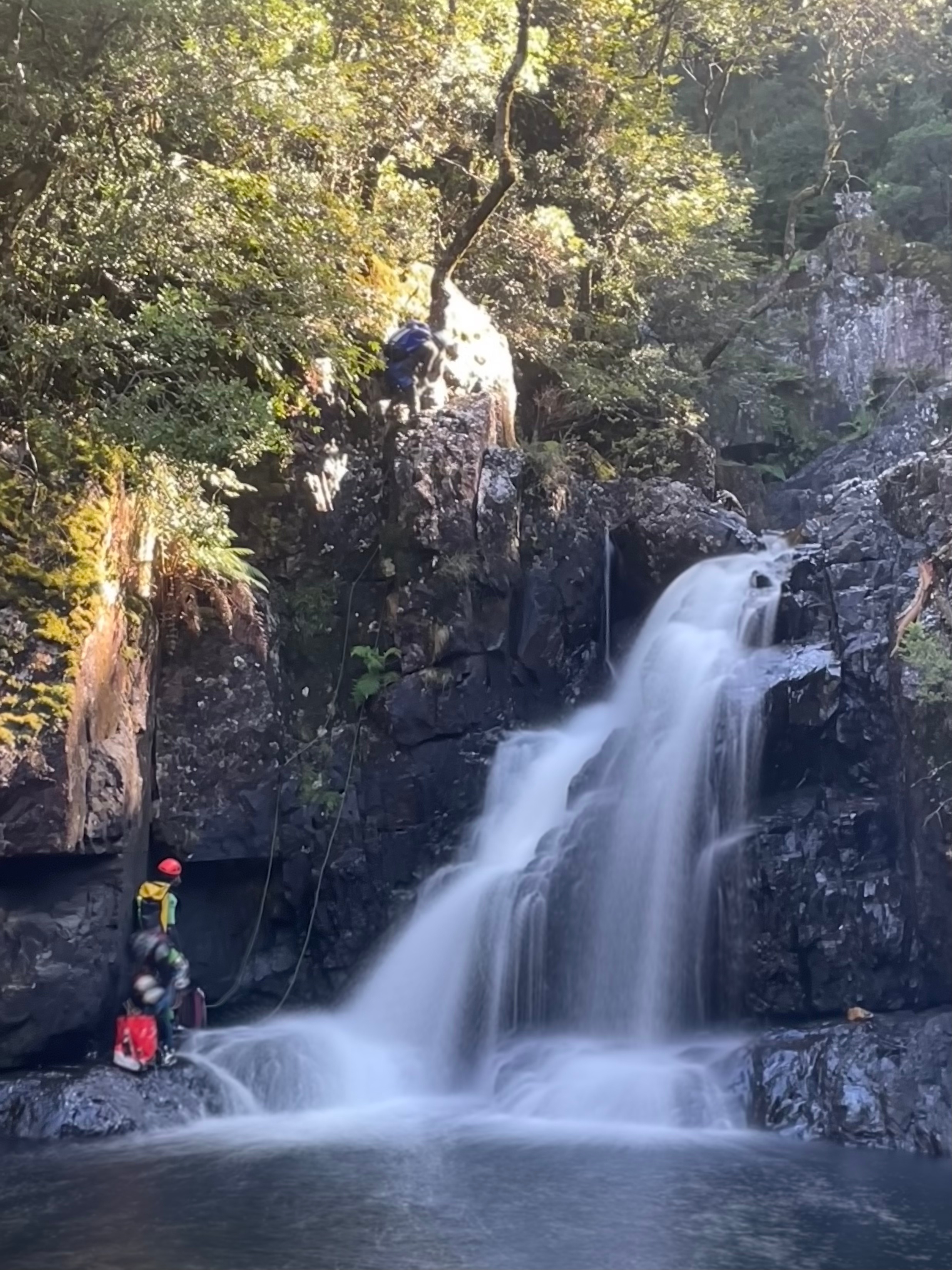
There was a bit of horsing around
It was still early in the day. We were tossing up the idea of continuing downstream and completing the lower section. Jason had done it before and thought it was interesting.
The other option was to play around here.
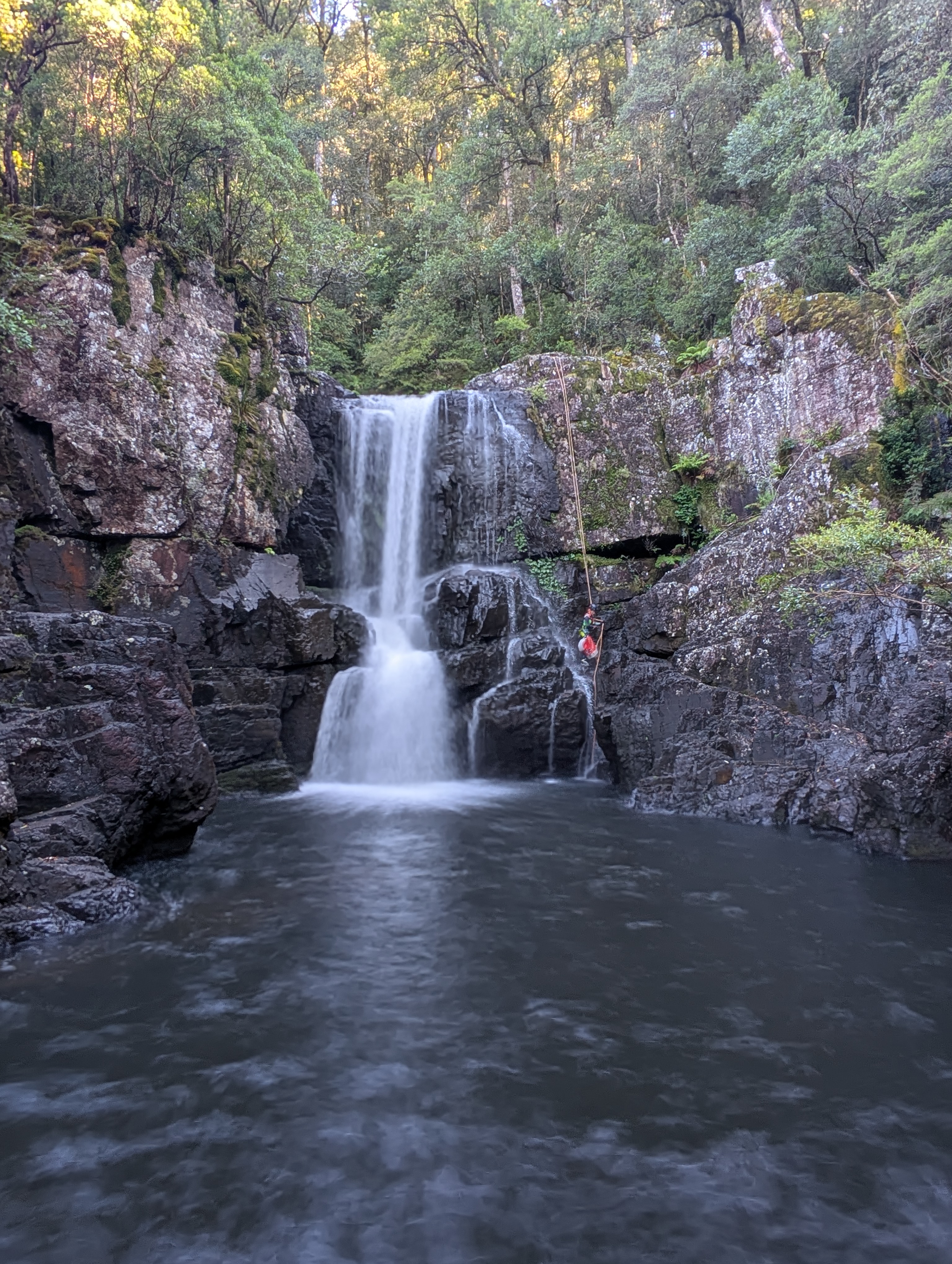
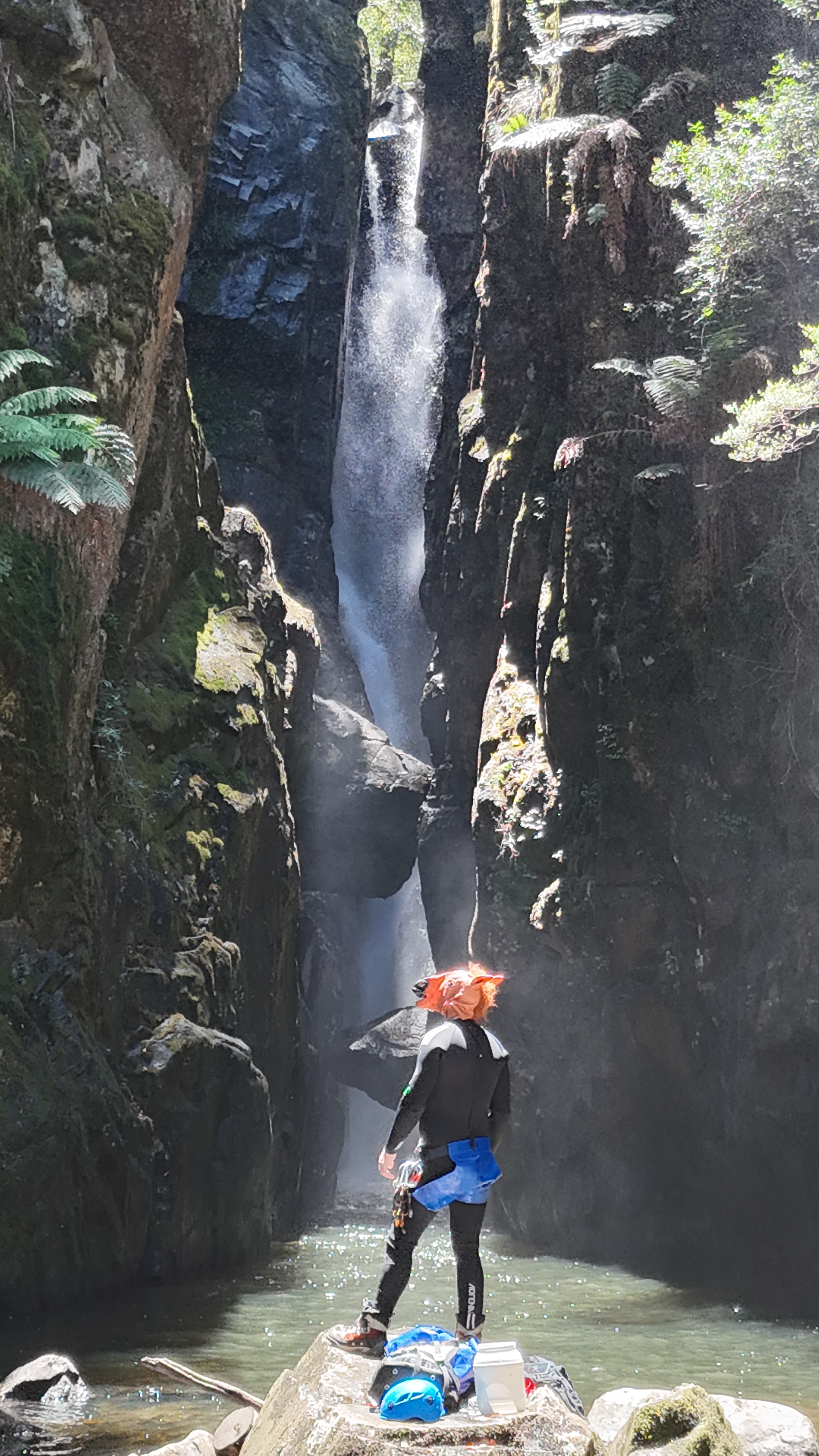
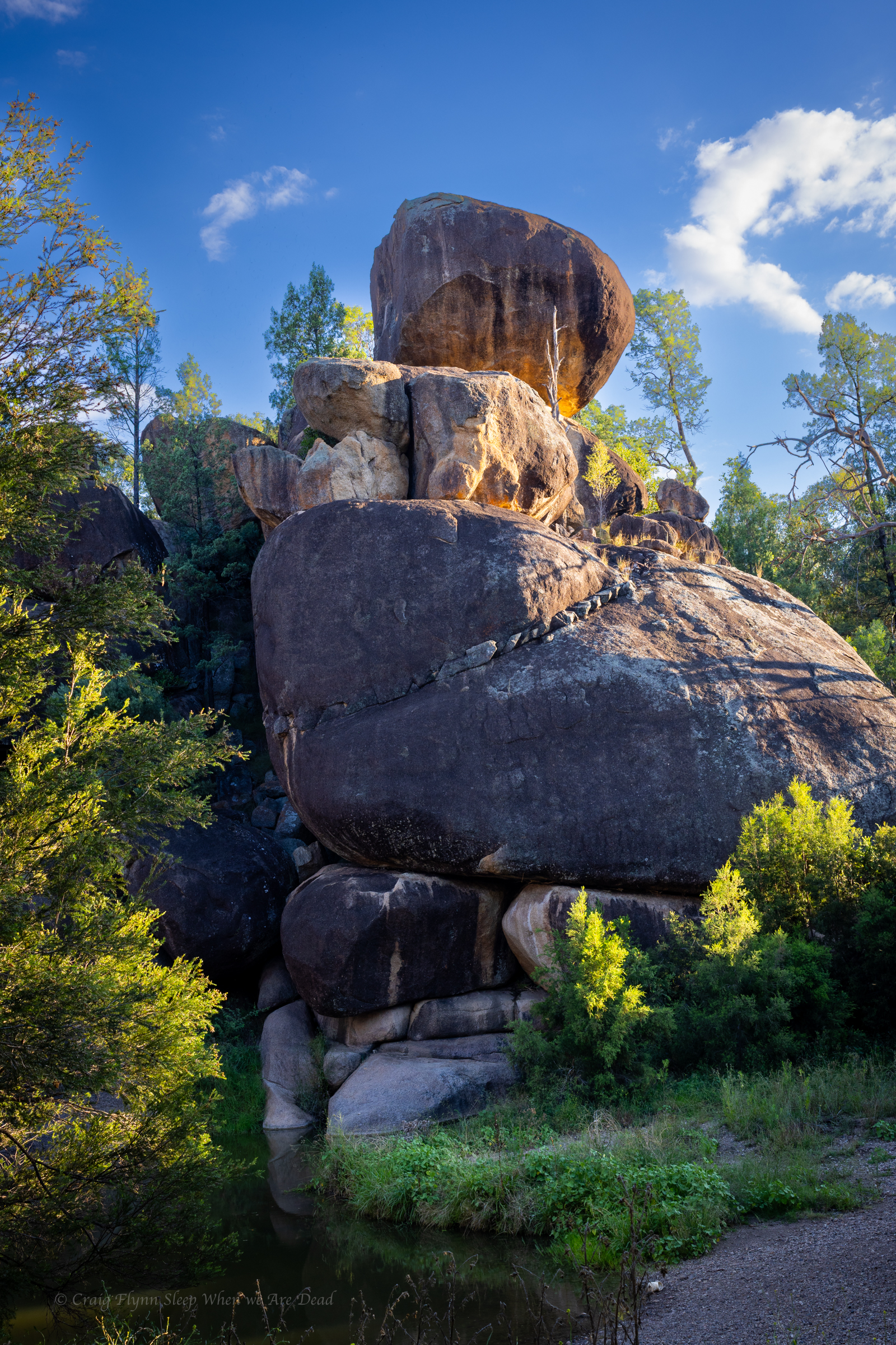
It would be cool to get on top of the chock stone say Wisey.
There is the dry line option, said some one.
We scrmble up the start of the exit track and find our way across to the dry line.
It’s a bit down stream of the chock stones but I manage to swing across to the upper stone to help the following party with a stuck rope (Notes say to throw the pull cord over the chockstone. This lead to the stuck rope. If the flow isn’t too high just bring the pull strand down with you. it pulls fine.)
then drop in.
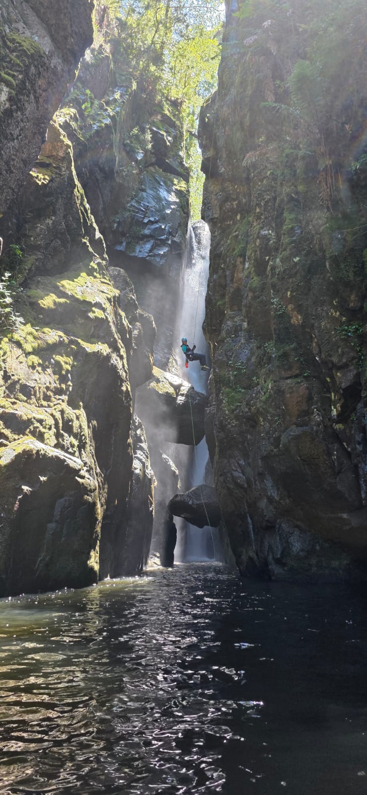
Jas, Wisey and Dave follow me. It’s a surprisingly fun abseil and we opt to run repeat son it for funzies.
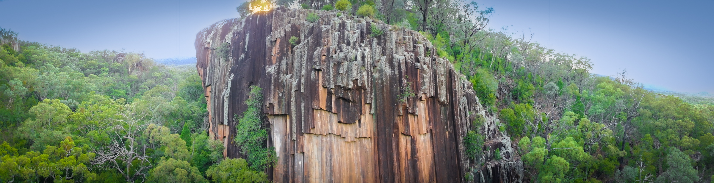
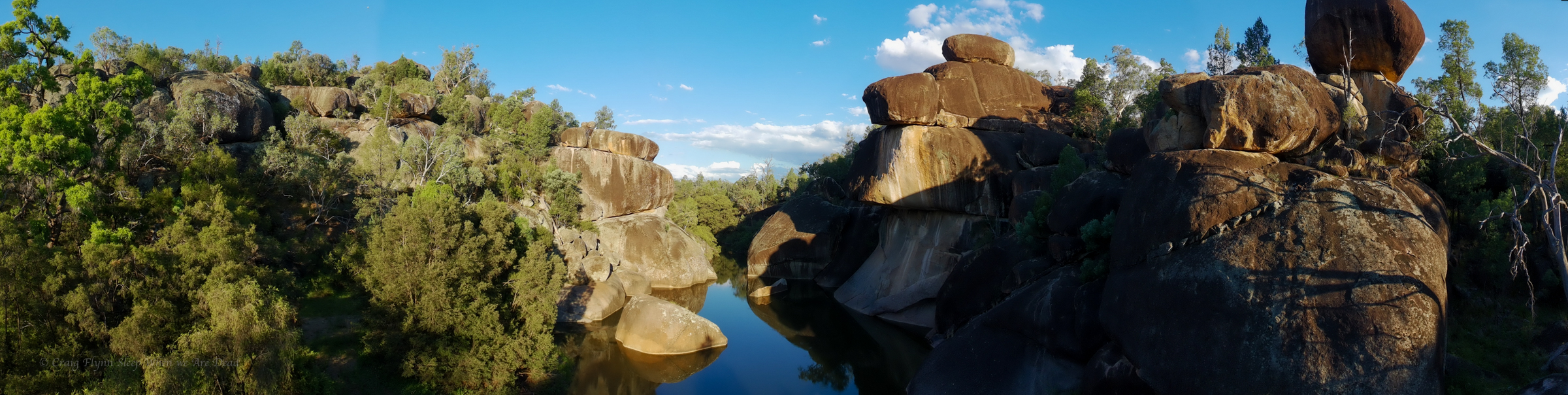
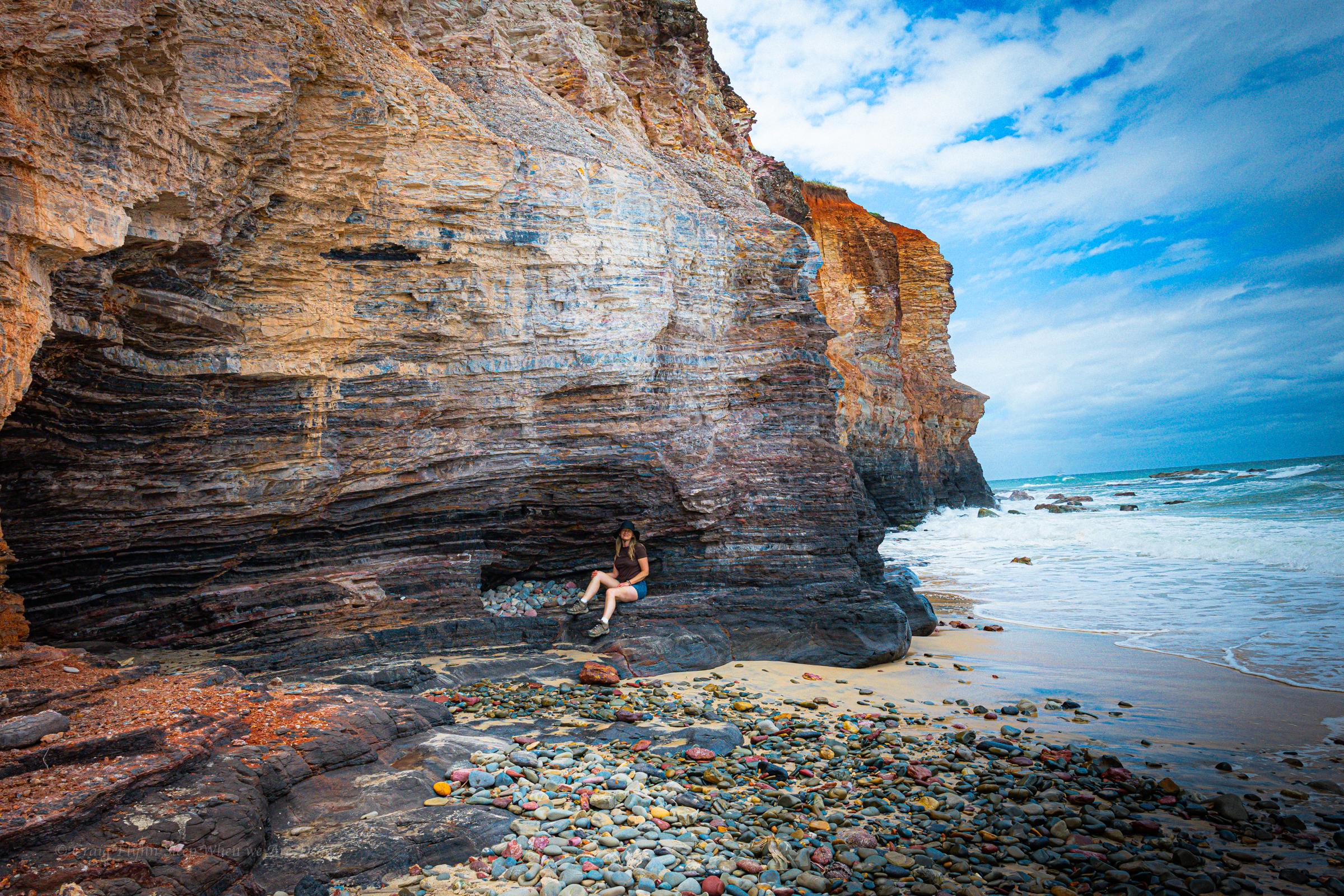
After spending the night at the Glacial Rocks camp we get up early hoping to catch sunrise light up the cliff face.
Sunset would potentially cast a better light onto the rocks at this time of year but it’s a spectacular feature at any time of the day and a short, wheel chair friendly, walk from the car park.
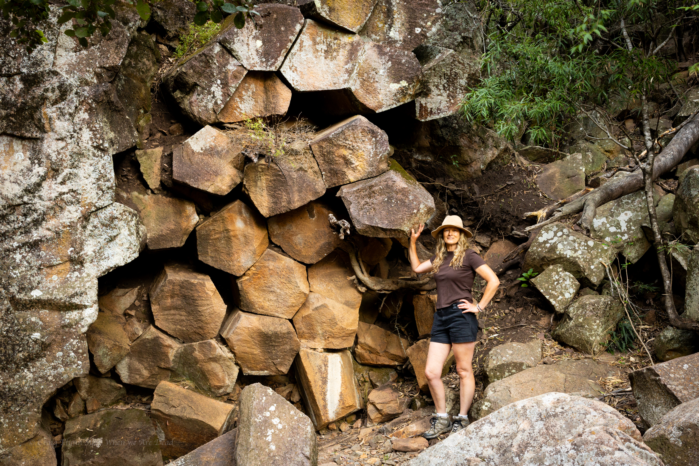
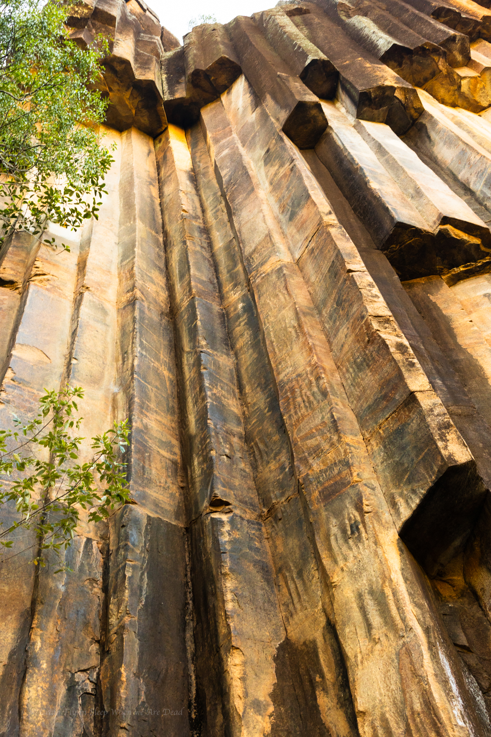
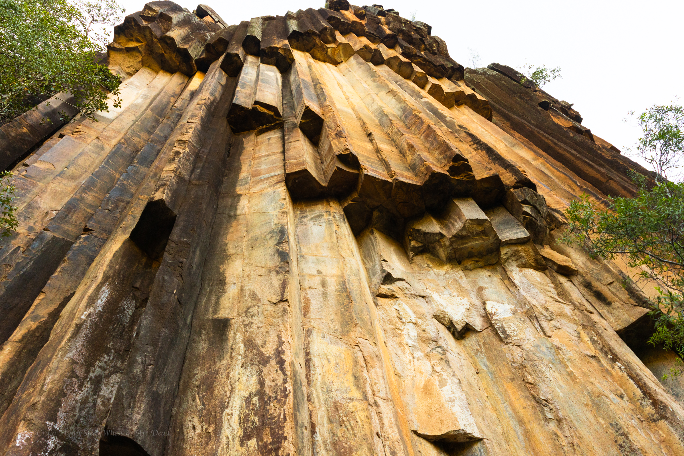
Like a pile of chopped and neatly packed logs you can see where it gets it’s name.
The hanging columns are amazing
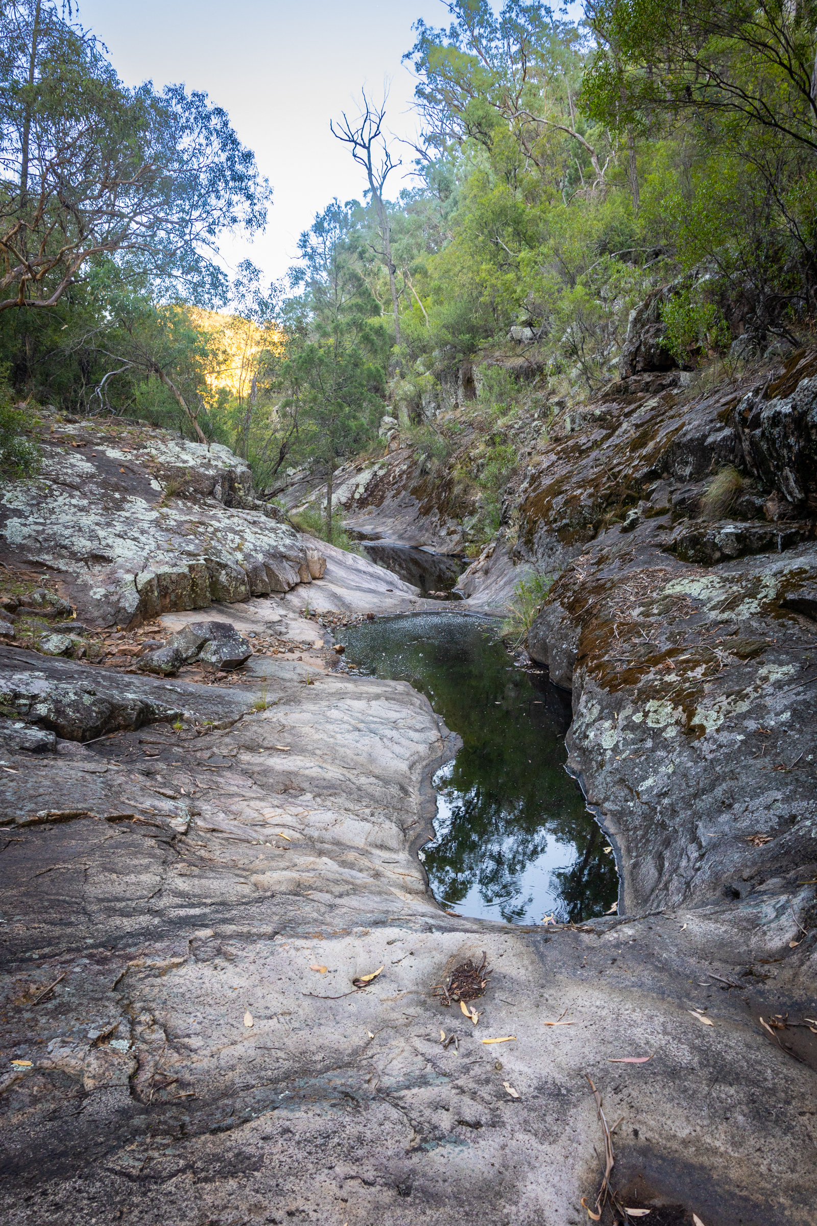
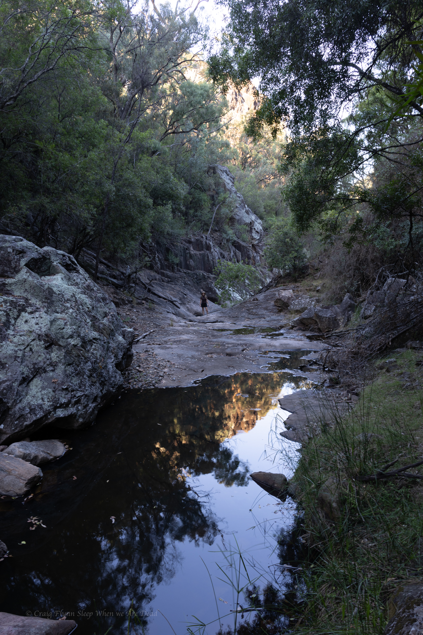
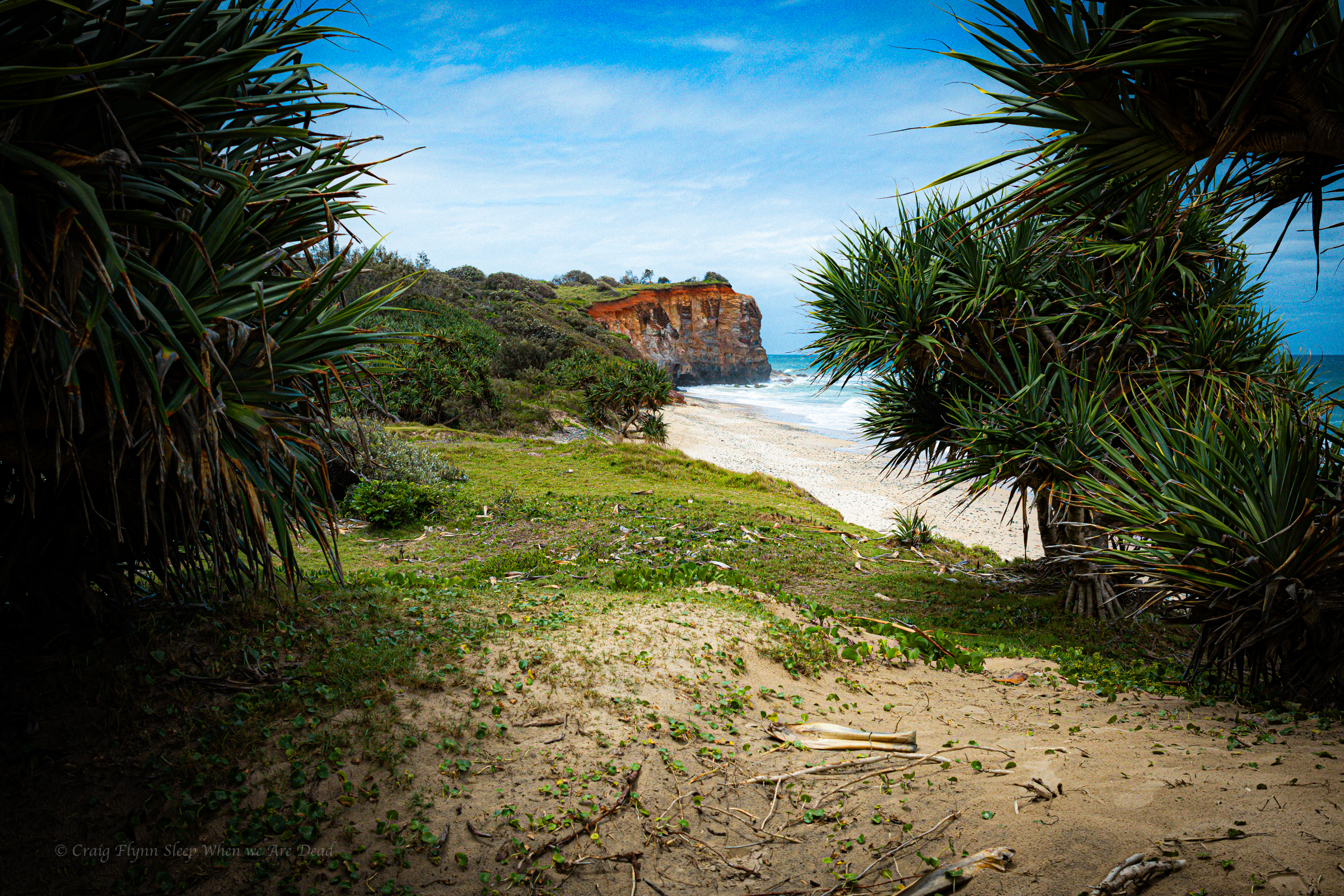
As is our usual we push beyond the formed tourist trail on a rough but well used foot pad to explore the creek beyond.
Once again it’s dry but interesting
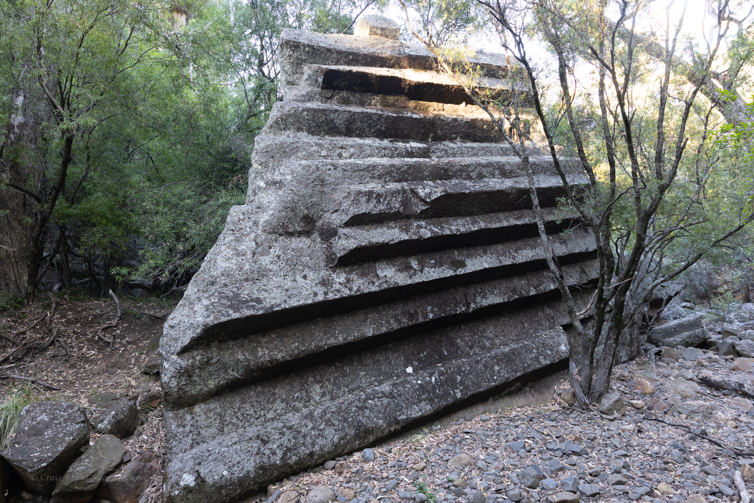
And more of the amazing shapes
The cliff lines soon peter out and the creek snakes it’s way cross the plateau so we retrace out steps and head into Narrabri for coffee and a bite to eat before deciding to drive up to Mt Kaputar for a look.
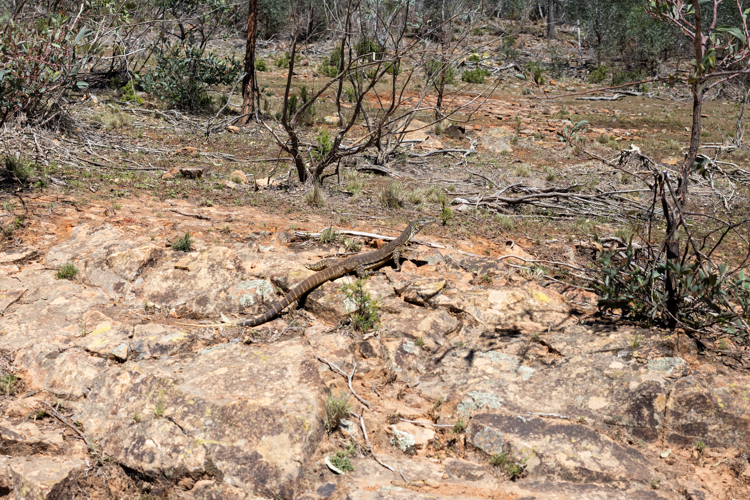
sand goanna (Varanus gouldii)
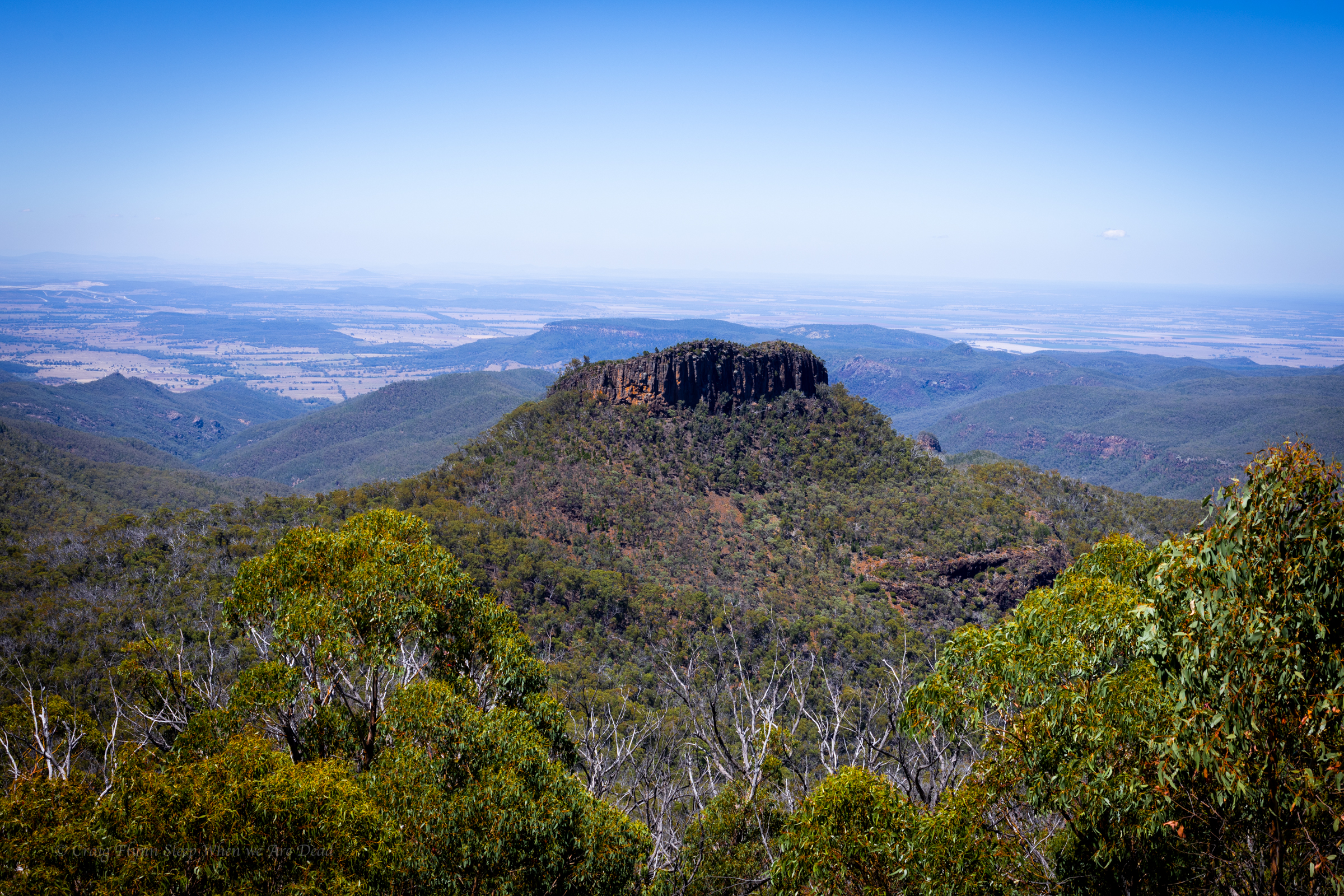
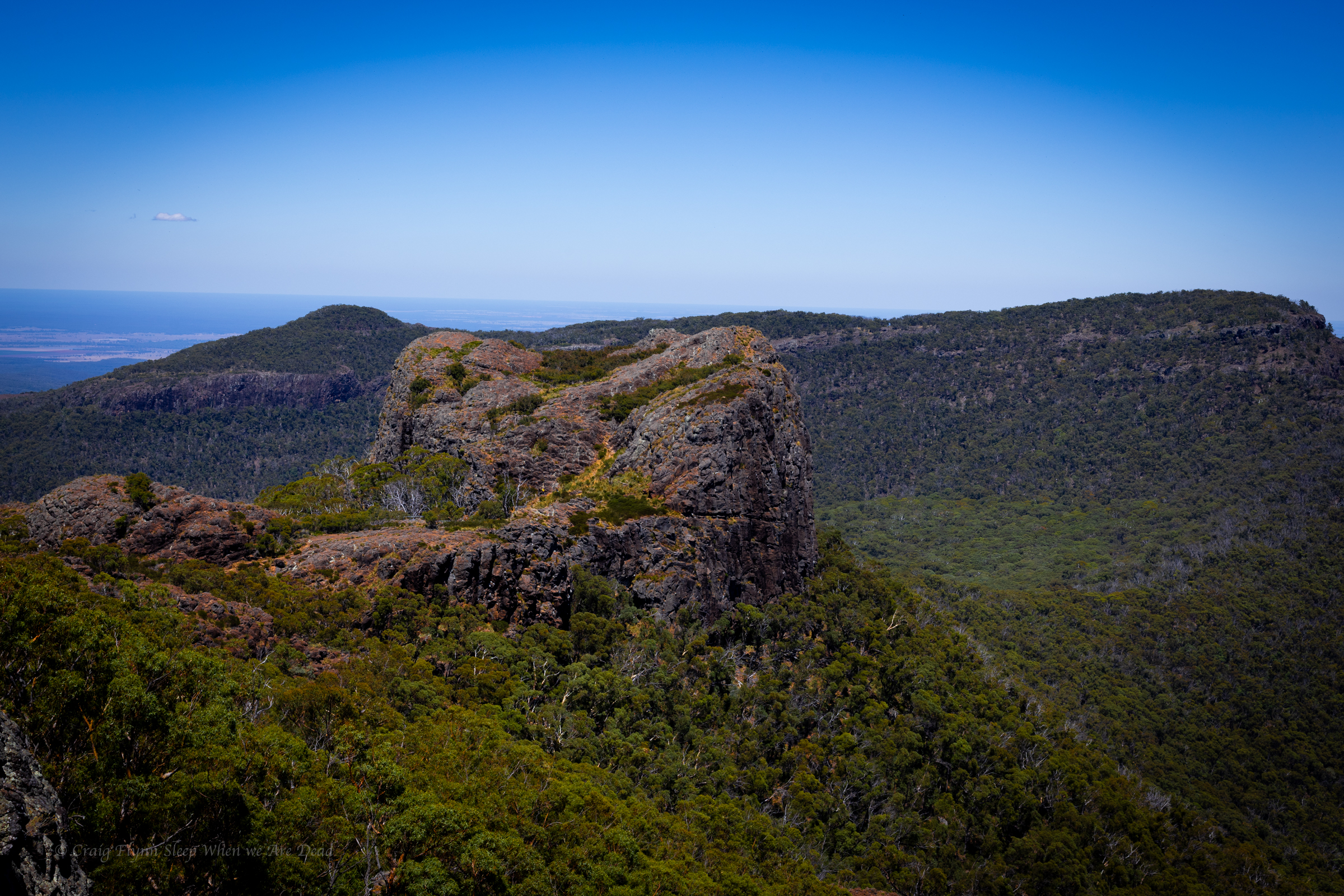
We decide it’s way to hot to do any of the walks in the middle of the day but the road up is outstanding and well worth the drive.
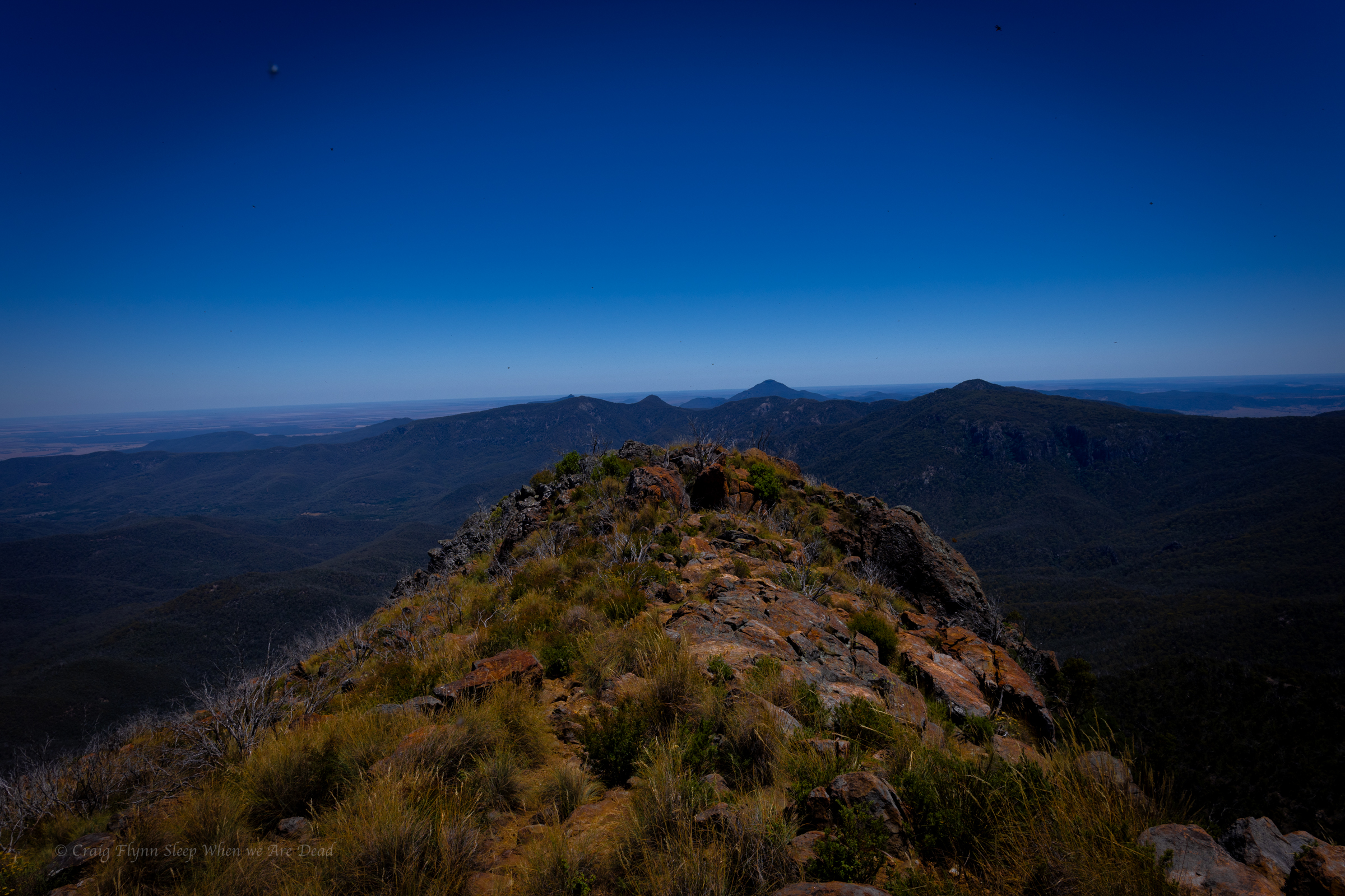
Euglah Rock from Doug Sky lookout
The road itself is an adventure and the views with in a 5min walk from the car just keep coming
But the temperature is pushing into the high 30s again so we make track down to Coonabarabran where we decide to splurge on a motel room with air conditioning.
Over the years I’ve had a quiet giggle at the poor tourists hopelessly out of their way asking “is this the way to the campground at, um, New Ness.” their GPS’s having them very confused.
Today I gained a deeper understanding for those poor souls.
It’s pronounced “War” Gorge, said the amused cowcockie we waved down to ask where the hell are we. Turn left here and you’ll see the signs. he says but where did you come from?
I get ahead of myself. That came later.
We were doing a less than direct route from Cranky Rock to Waa Gorge as we wanted to use a free camp ground at Glacial Rocks to give us access to both Waa Gorge and Sawn Rocks without too much back tracking.
The road in to the Gorge from this end was touted as 4wd and fair weather only so we wanted to swing by the camp to see if it was suitable and make sure the road between was doable.
The camp looked great and we continued on. GSP signal was lost.
We get a couple of bars of signal just down the road and it screams to turn right.
Veering onto Terrergee road the signs matched what we were expect, other than not mentioning the Gorge, “Road Suitable in dry weather only.”
But the road was a lot better than expected.
Must have been recently graded, said we, if this is the rough road people whine about on trip advisor…. We should have shut up.
The road takes us across the top of some beautiful county and then down steeply into the valleys. It did get a bit slippy on the descents and you could see why it would be problematic in the wet.
So far so good.
Take the second left onto “Berrigal road” Says the nice lady in the GPS.
But the second road is signposted “Haven Home road” or sumfink and it’s the only road sign we’ve seen all day and the road looks like a goat track.
We pass it.
Go back says the GPS lady.
We go back have another look. Doesn’t look right. We try the other option.
Go back says the GPS lady.
I get out my phone and check the GPS topo app. I could see where the roads go but Waa Gorge isn’t marked and I’m not 100% sure where it is.
We take the goat track. It gets rougher and rougher.
There’s some dry creek crossing we need to engage 4wd for.
This is why we bought the ute. Says I
but it gets wilder.
Eventually GPS lady says, Turn left 100m ahead.
The left was even more over grown. I check the app again.
It opens out just through there but I’m 100% sure it’s private property.
Straight will skirt around the property boundary but add 18min to the drive.
Oh well we skirt around.
We are now in 4wd more than not.
It was a fun drive.
the road links us back onto Terrergee road, about a 5min drive further on from where the GPs insisted we turn off it earlier and still no signs for Waa Gorge.
We flag down a landcruiser coming the other way, the first car we’d see all day.
Um is this the way to “Wah” Gorge, say I sheepishly.
With a wry grin the afore mentioned conversation takes place.
The GPS took us down that road back there.
That bloody goat track!, it would have tried to take you across old mates property too.
I sense this isn’t his first of such encounters.
Anyhoo we are on the right track now. If the final little bit of bumpy road into the car park is what Tripadvisor folk are complaining about they don’t know what they are missing.
It’s 38°c as we pull into the car park.
By the way, it’s pronounced “War” gorge. 🙂
Sunscrees, hats, water, electrolytes, deep breath
Ok let’s head up. drink lots and if it gets too much say early and we’ll head back.
having suffered heat stroke and dehydration before I’m extra cautious in hot weather so we have a lot of water between us.
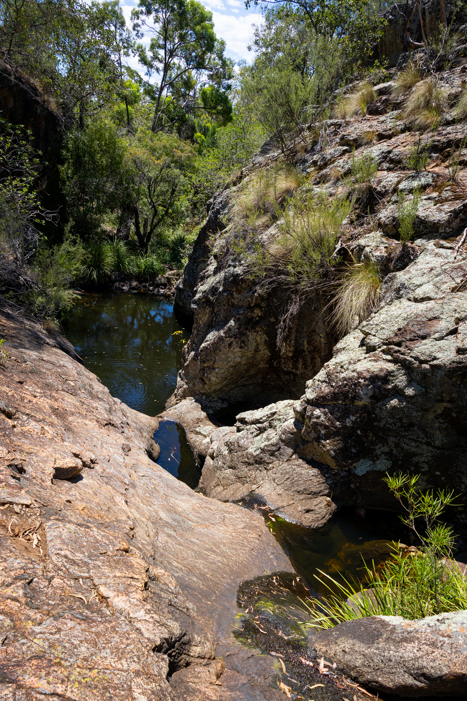
It’s a short walk up to the Mill-bullah water holes.
There is water in them but it has been in there a long time with no flush through to clean it out.
The top waterhole looks a little nicer but still stagnant.
The constructed tourist trail ends here but a well used ad hoc trail leads up through the cliff line.
The track skirts above what looks like would be a fun little canyonette full of jumps and slides, in the right water flow
Unfortunately we are here in the middle of one of the driest summers we’ve had since 2019.
Above the canyonette the gorge is shaded but the heat still oppressive
we find a clear pool to splash some water over us in an effort to cool off
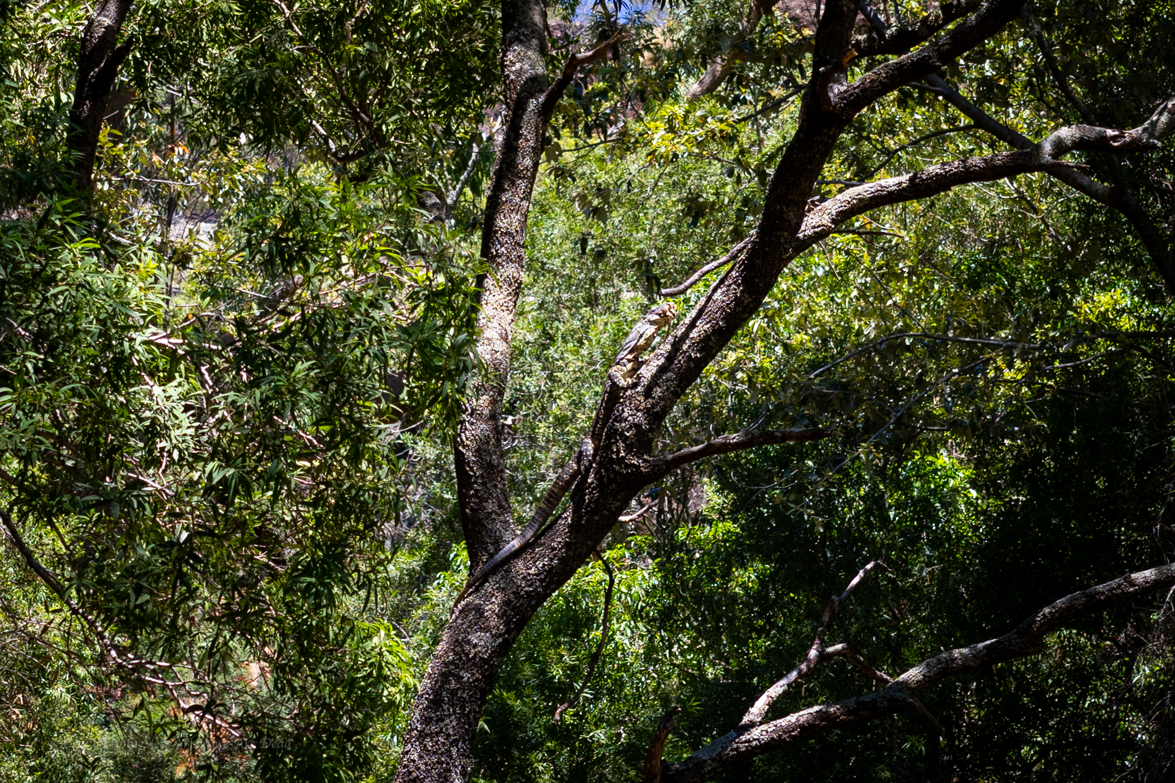
We continue up, disturbing this lace monitor with his mouth full of a water dragon sandwich
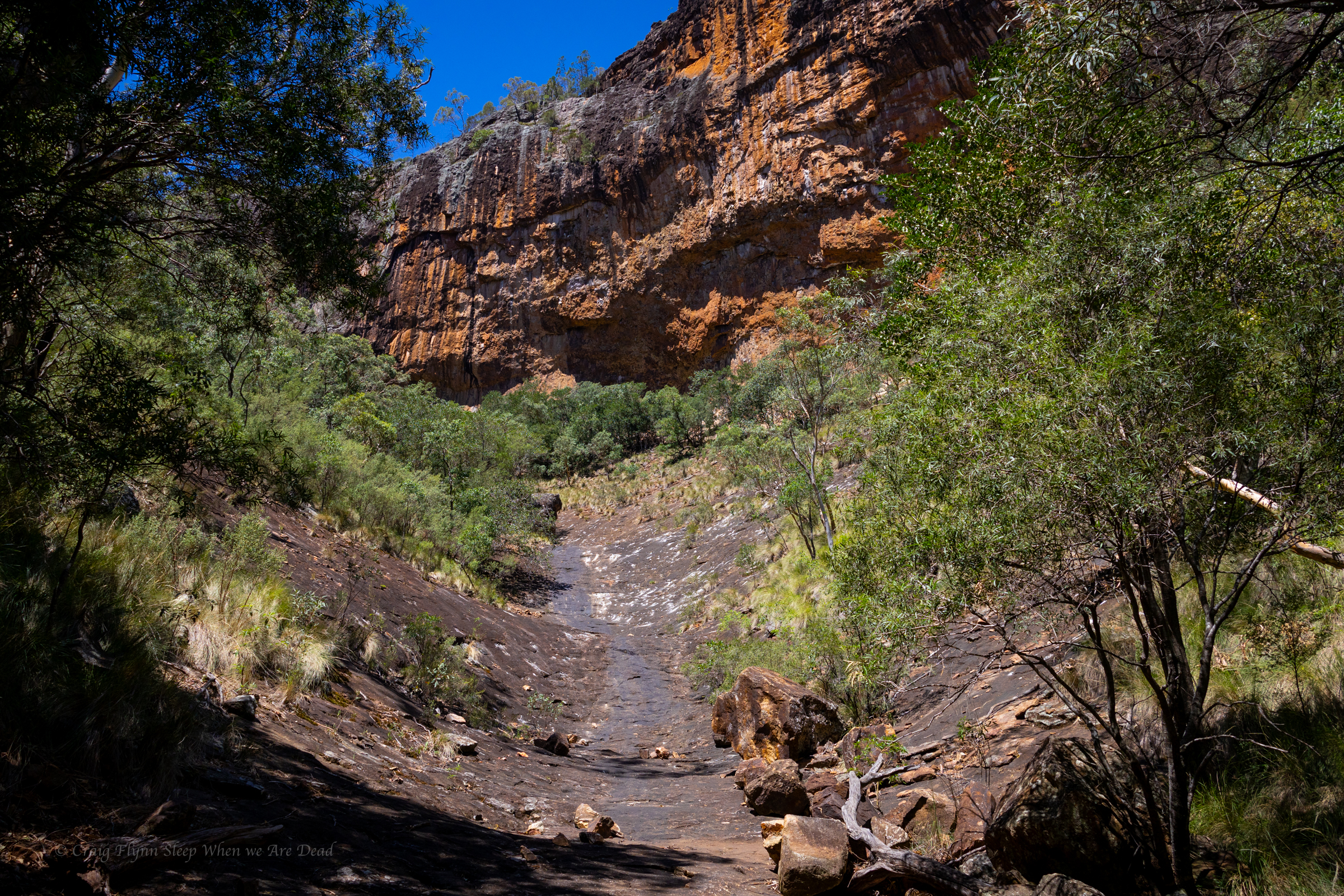
Finally we get to the junction. Left takes us to the big wall .
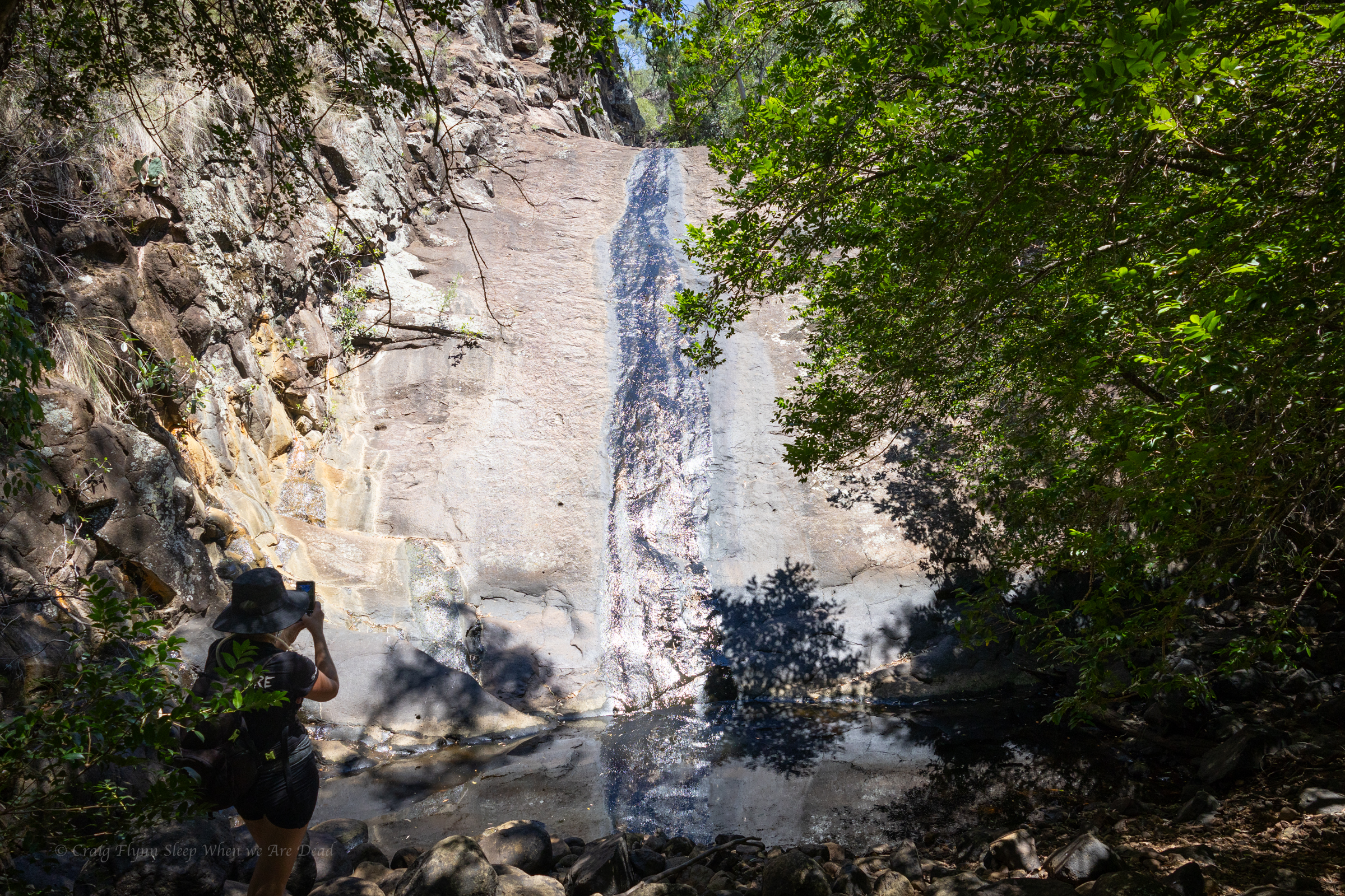
A dry cascade greets us.
I head up, Kylie waits in the shade. The heat blasting off the stone is next level
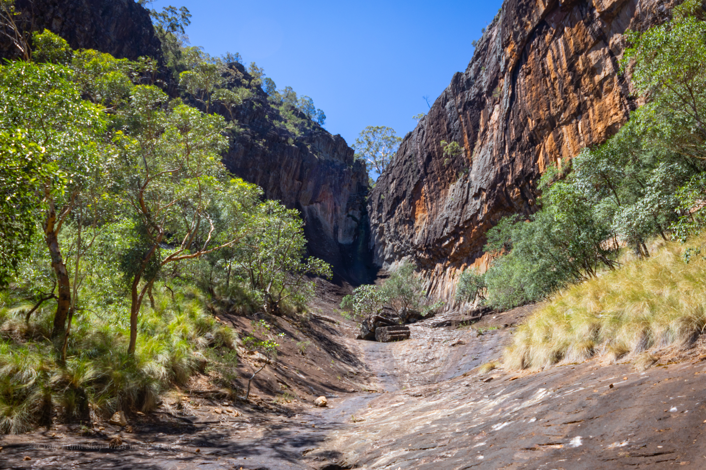
The top of the gorge is impressive
We had a permit to fly the drone for 30min here so I get it out and try my hand at flying again
We slip back down to the junction, have a bite to eat and a big drink in the shade then explore up the other branch
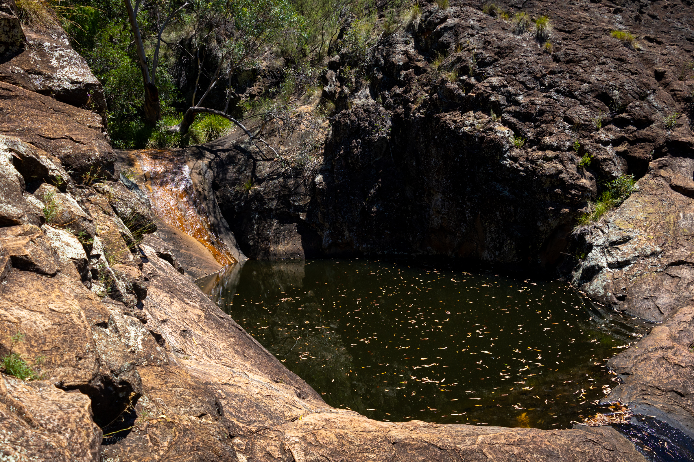
another dry waterfall into a stagnant plunge pool greets us. It looks like there are some interesting levels above too. Definitely worth some exploration when things are cooler and wetter
We make our way back down to the car. And head back to the camp
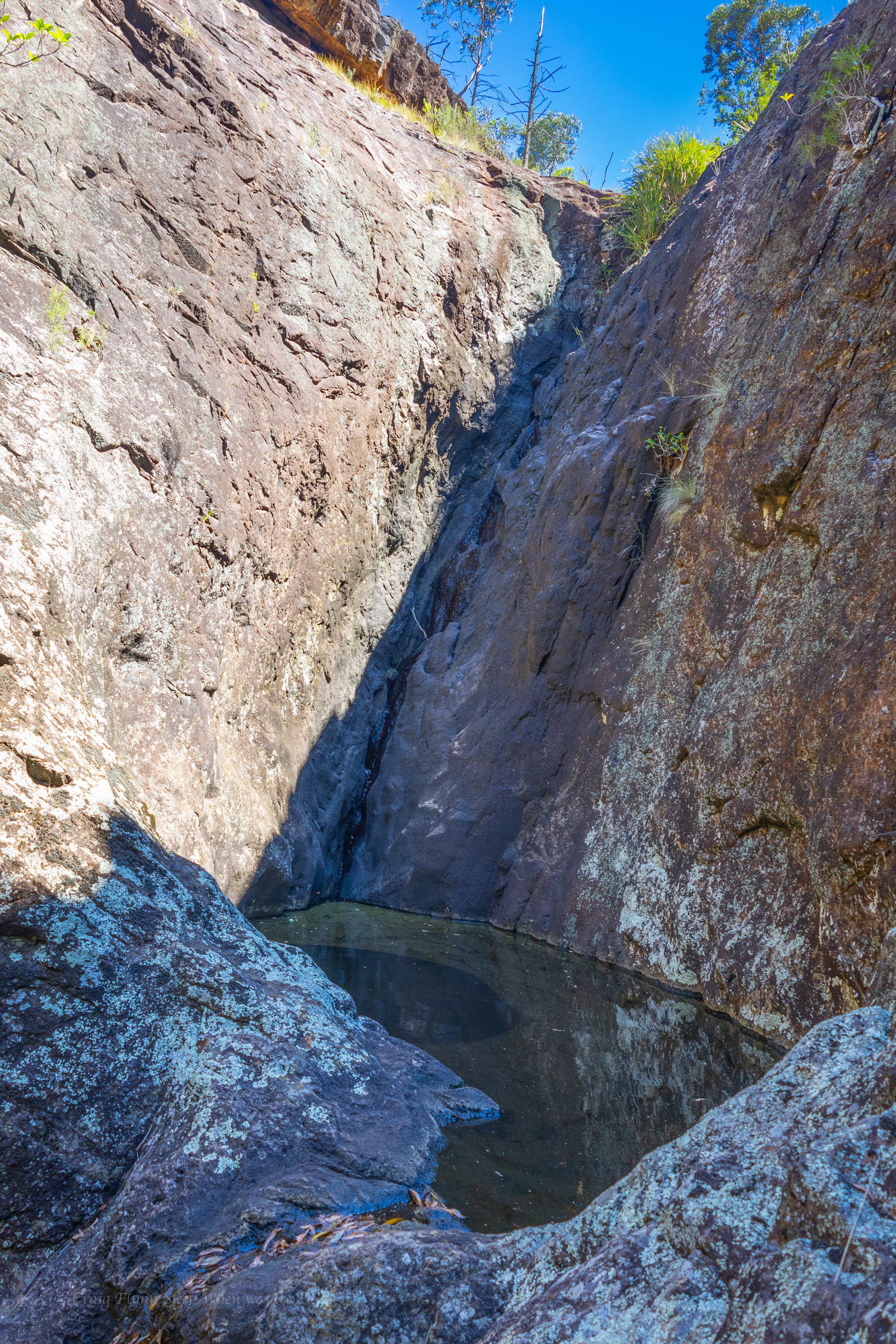
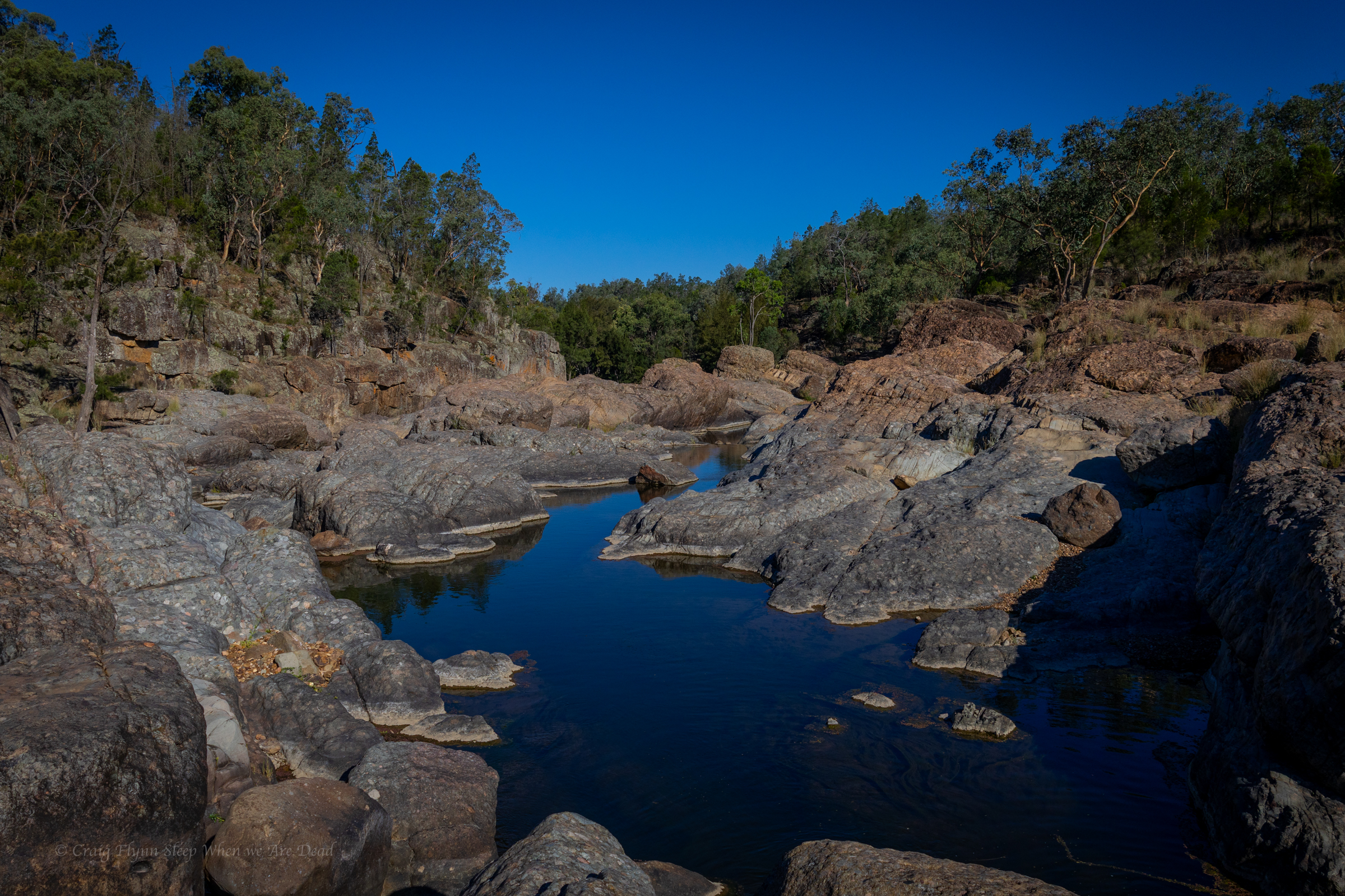
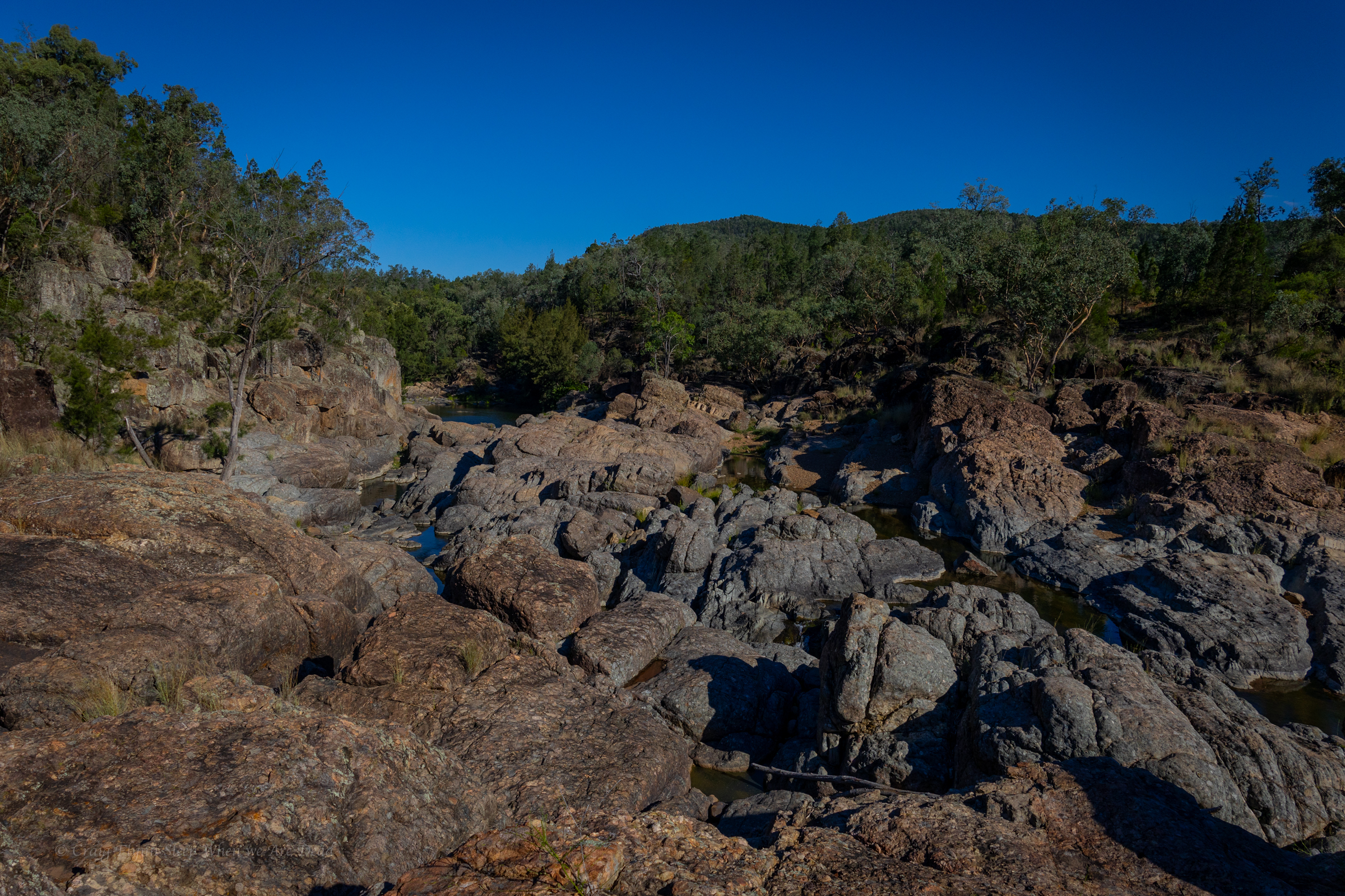
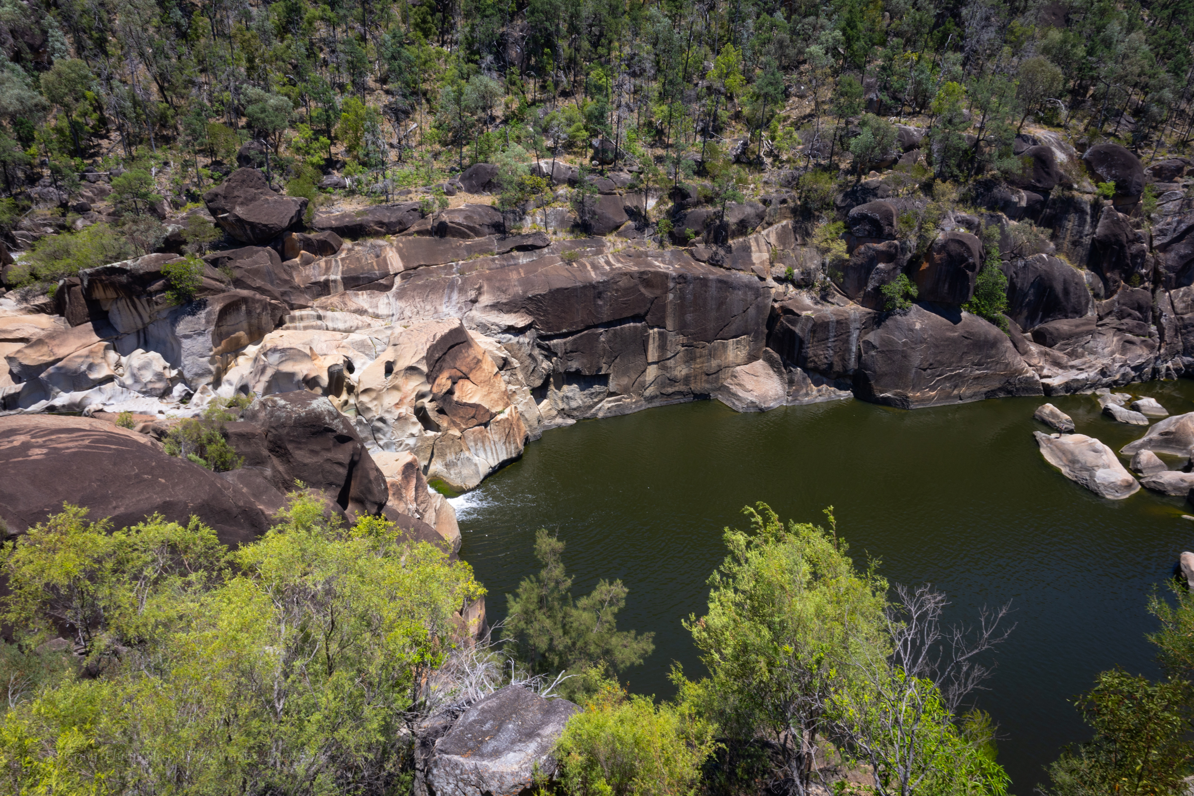
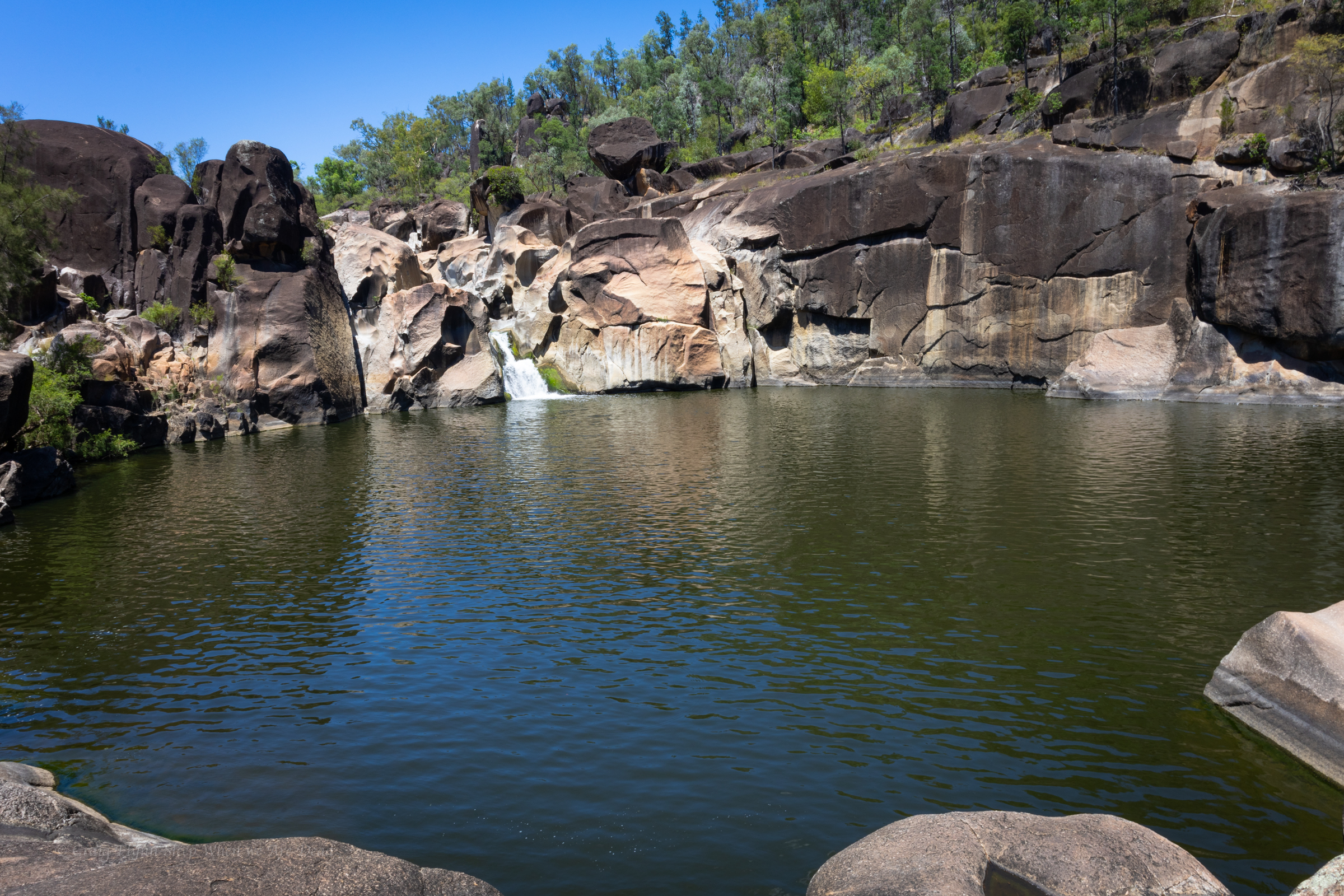
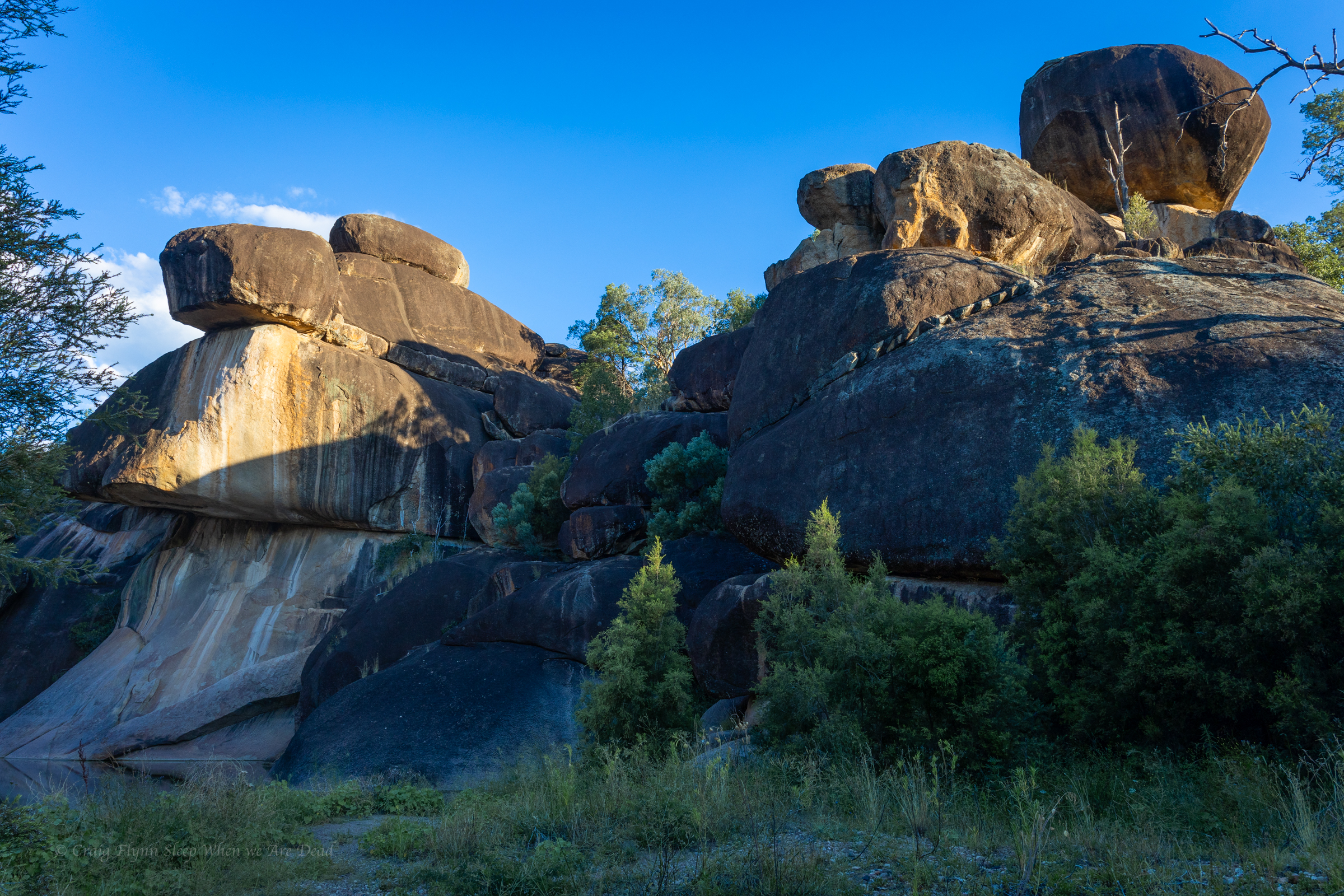
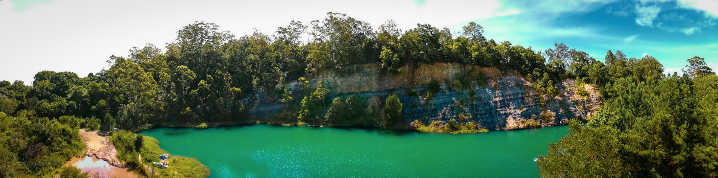
the Ancient Glacial Rocks site on Rocky creek is interesting. Superficially it looks like another granite lined gorge. A closer look and the rocks are different. You can see how they have been churned up, smashed together and dumped out.
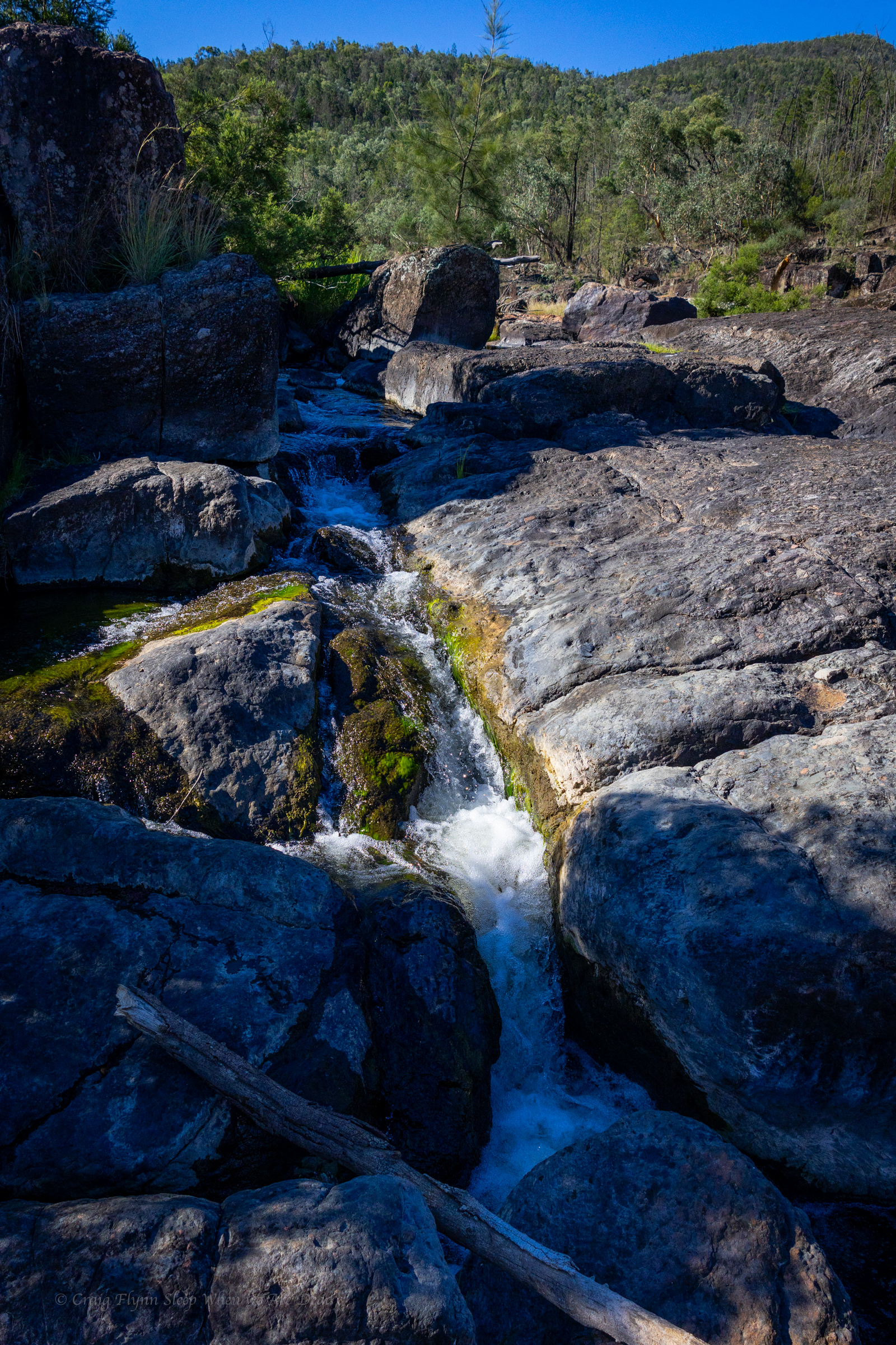
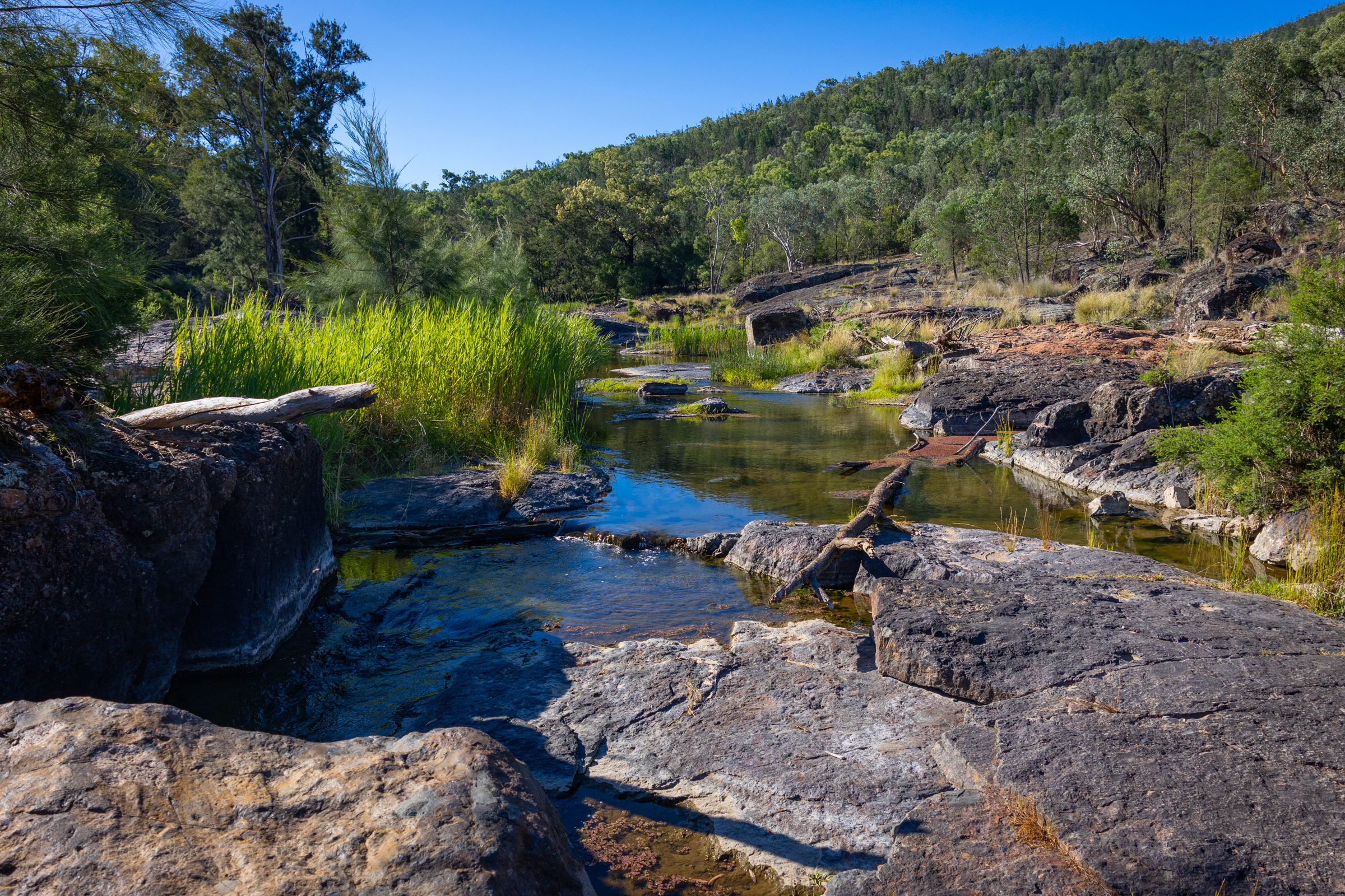
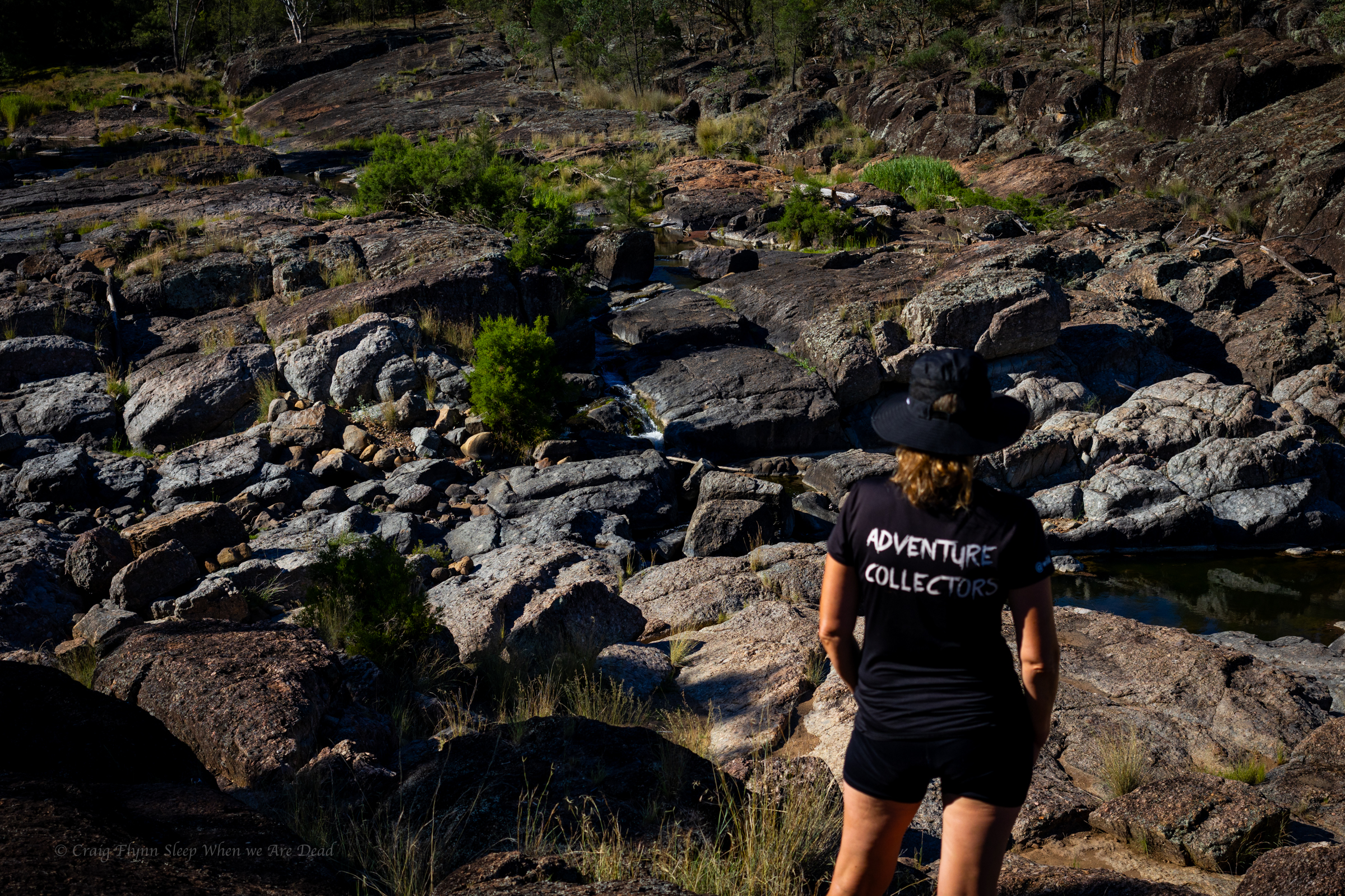
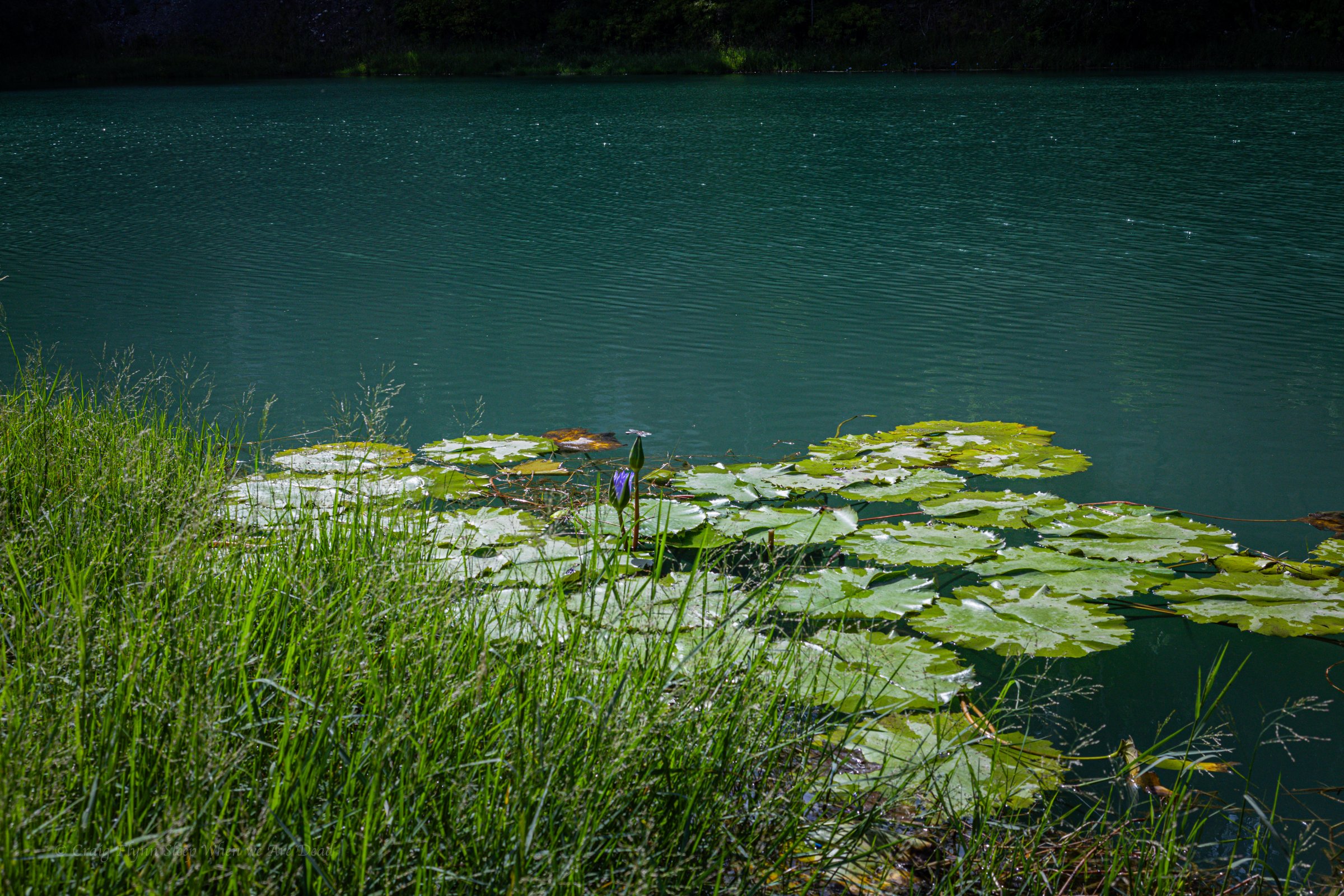
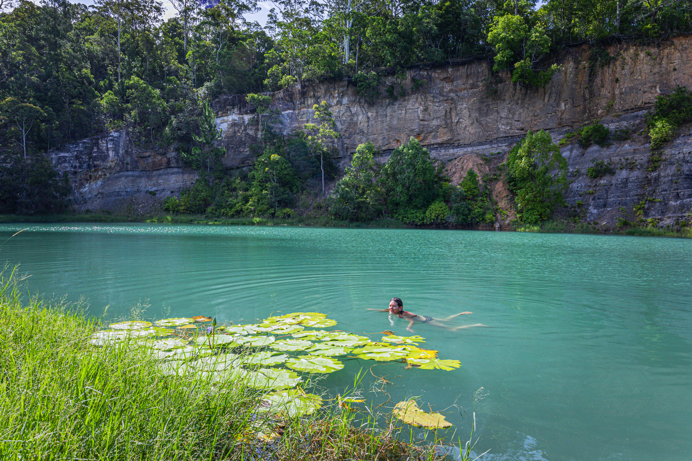
Once again the river is running through agricultural land and wild goat are everywhere but once again it’s too hot to be picky so we cool off in the rapids and then settle in for the night.
The camp site is basic but has bins and toilets. It’s worth checking out the toilet signs for a giggle.
There a 2 other campers set up. Flat spots are at a premium but we manage to jag a flat spot in shade
Winning
We eat diner with the goats. Tomorrow we head to Sawn Rocks.
Leaving Girraween and dropping back into NSW we are aiming for Warialda but decide to take a bit of a detour into Kwiambal NP for a look at Macintyre Falls.
Macintyre falls are located about an hour out of Ashford, near the Ashford limestone Caves (which at the time of writing were closed to the public).
The falls aren’t massive but they are impressive none the less, check out the little whirlpool near the top of the main falls in the top view. hate to get stuck in that in high flow.
the view from the lookout is impressive and a tourist trail leads down to the pool below
large Murray Cod could be seen swimming in the waterhole and fishermen are setting up so we opt not to swim and disturb their hunt for dinner
We spend a bit of time rock hoping and exploring then head across to Lemon Tree Flat for a swim in the Severn River.
This is a beautiful little camp ground I got zero photos of…
Then it was onto Warialda and the very cool little council run camp ground at Cranky Rock.
At $20 a night for a powered site it’s a great low cost campground with hot shower and clean toilets.
And an impressive swimming hole
Now I have to be honest, being spoilt in the crystal clear waters you find in Blue Mountains canyons the water hole here did have that agricultural run off look and slight whiff but on a stinking hot day with no better publicly accessible swimming holes within cooee it’s an oasis.
Sure, I wouldn’t drink it but there is no hesitation at jumping in and cooling off.
and the colours in the rocks pop at sunset
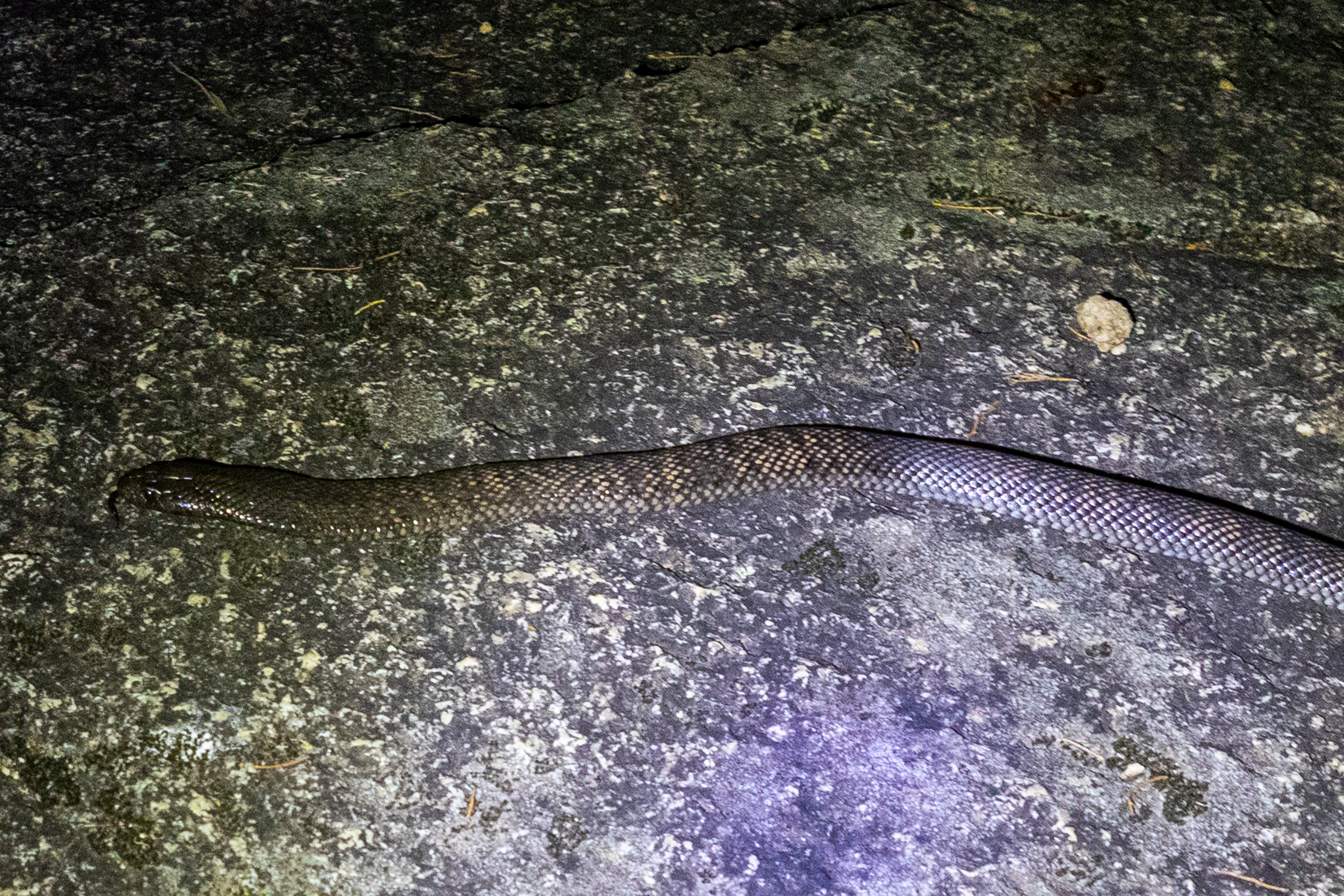
With the battery in my head torch now charged I thought I’d have another go at spot lighting.
The creek and waterhole was weirdly devoid of frogs and their predators. I spent a bit of time poking around but was giving up and heading back to camp when this little guy came out to say hello
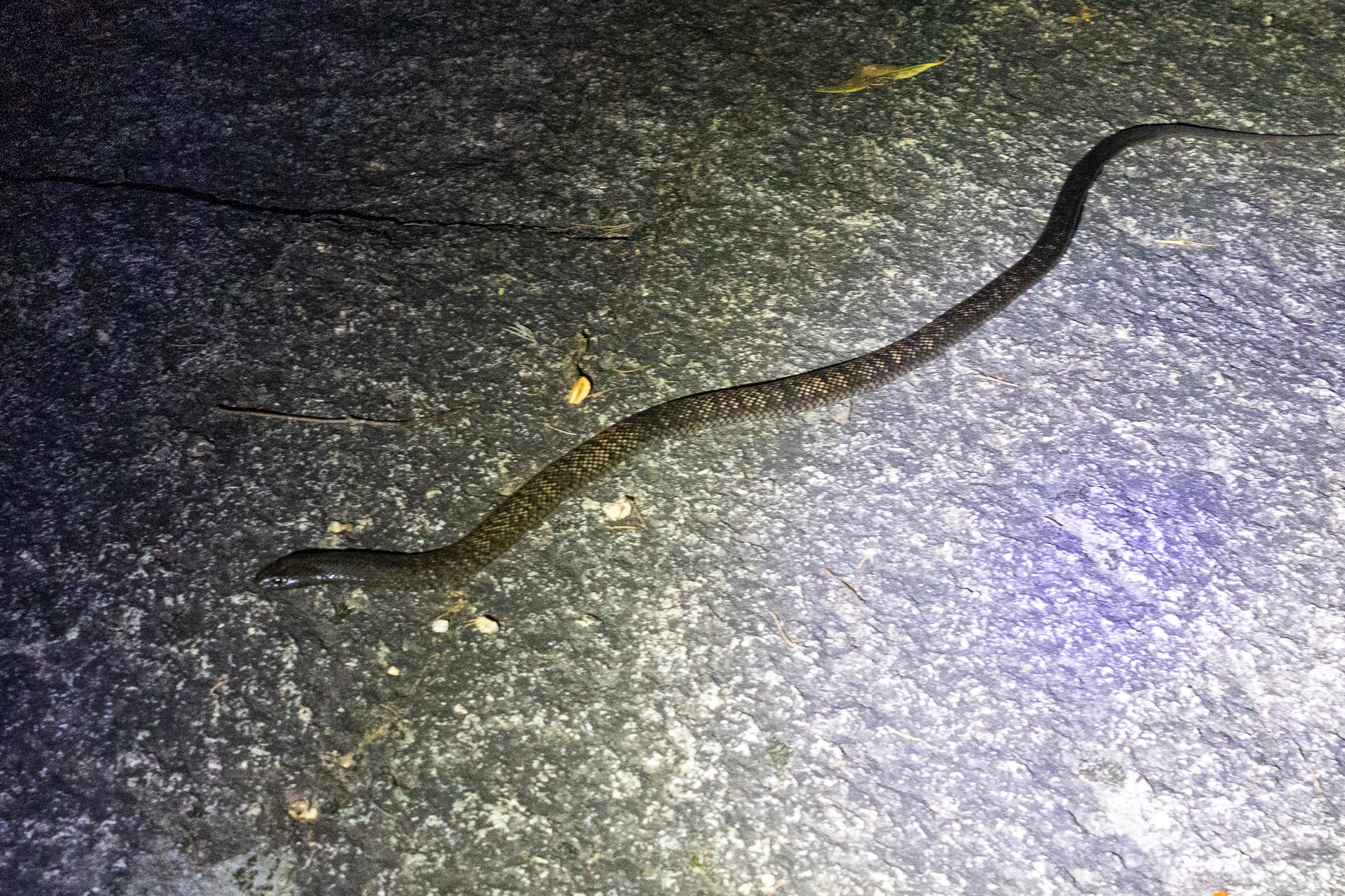
Spotted Black Snake, Pseudechis guttatus, aka the Blue Belly Black snake
this species comes in range of colours, from creamy grey to shiny black but how good is the camouflage of this speckled version against the blotched granite.
Back at camp Kylie had luck with the furries. Spotting several sugar gliders running amuck in the trees behind our camper.
and also managed to
1. find this little burrowing frog
and
2. find it a second time to show me
But it is getting late. We are mindful of our fellow campers so call it a night.
we also have a long drive tomorrow.
Our next stop will be Waa Gorge (It’s pronounced “War” not “Wah”)
Finishing up our coastal sojourn we head west. Our plan was to come back down the western line.
As usual we had planned to pack a fair bit in to a short time.
The Western line probably isn’t in the forefront of most peoples minds as a summer trip. We are not most people
Are we crazy? asks one of us
Yeah. says the other as if it was the most obvious answer in the history of obvious answers.
The fact was summer was when we both had time off so…
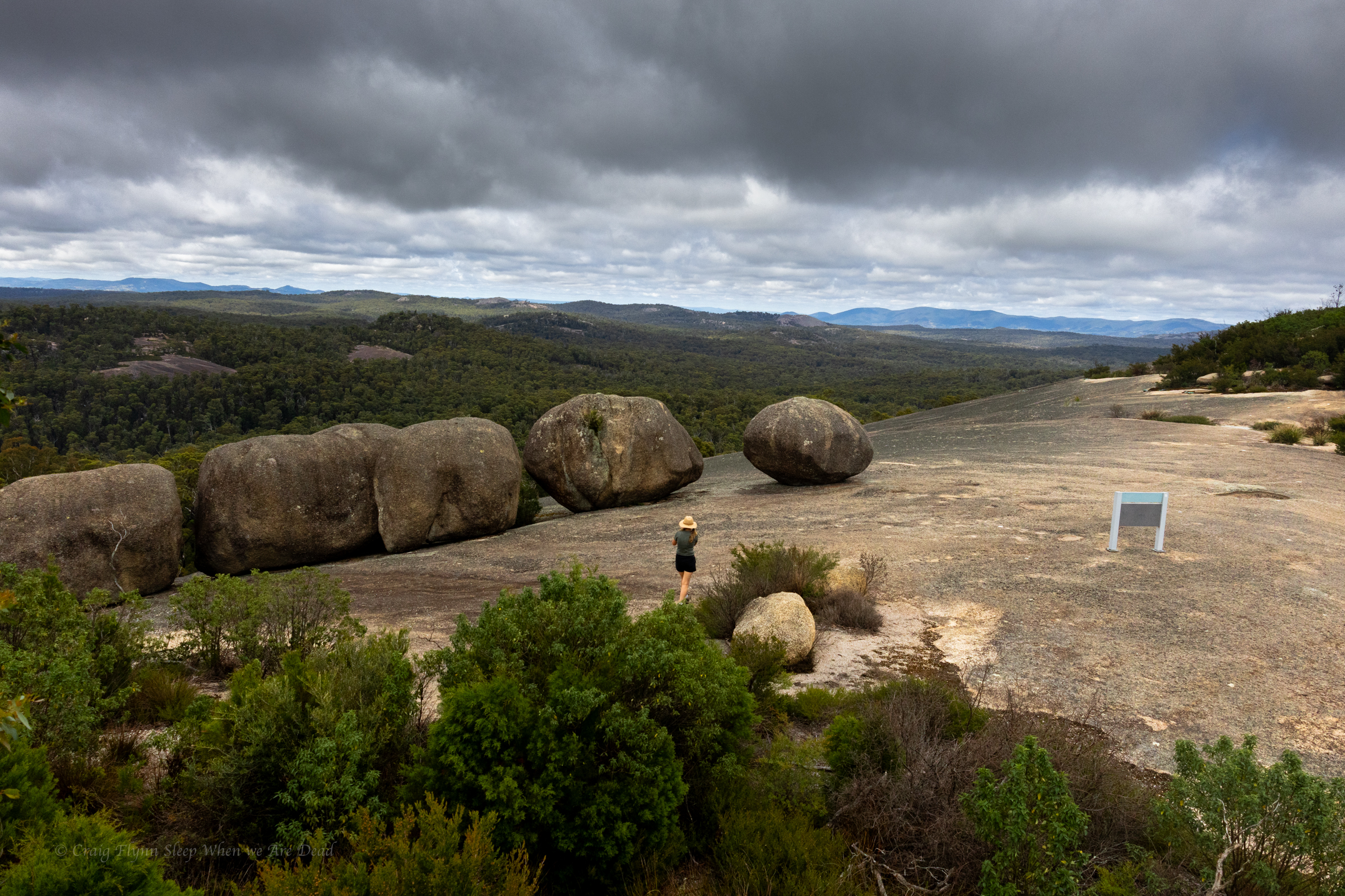
Our first destination was Bald Rock.
I’d never heard of it but Kylie said it was something she really wanted to see.
It’s right on the Qld border and part of the New England Granite belt, which was formed about 250million years ago. It’s called the New England granite belt because, you know, nothing resembles Old England more than goannas running across massive granite domes…
Anyhoo
We pull into the car park and cook up a breakfast then make our way up to the trailhead.
There are several walk options, from super short to all day. We opt for the summit walk.
A reasonably short walk leads us to the base of the massive granite dome. This point is wheel chair accessible and if its as far as you get it still bloody impressive.
A mountain of granite towers above.
White reflectors stuck on the rock were the only indicators of a path up.
Of course we follow them. Mostly
It was steep.
Jokes
It’s a little steep but not *that* steep
It’s a short, punchy walk up to the summit and it was spectacular.
Rising 260m above the surrounding terrain, Bald Rock is the largest granite monolith in Australia and the colours are amazing, even on an overcast morning.
as it levels out we pass a few boulders and suddenly this view bursts into view
There is something humbling about big terrain. Human trivialities seem… Trivial
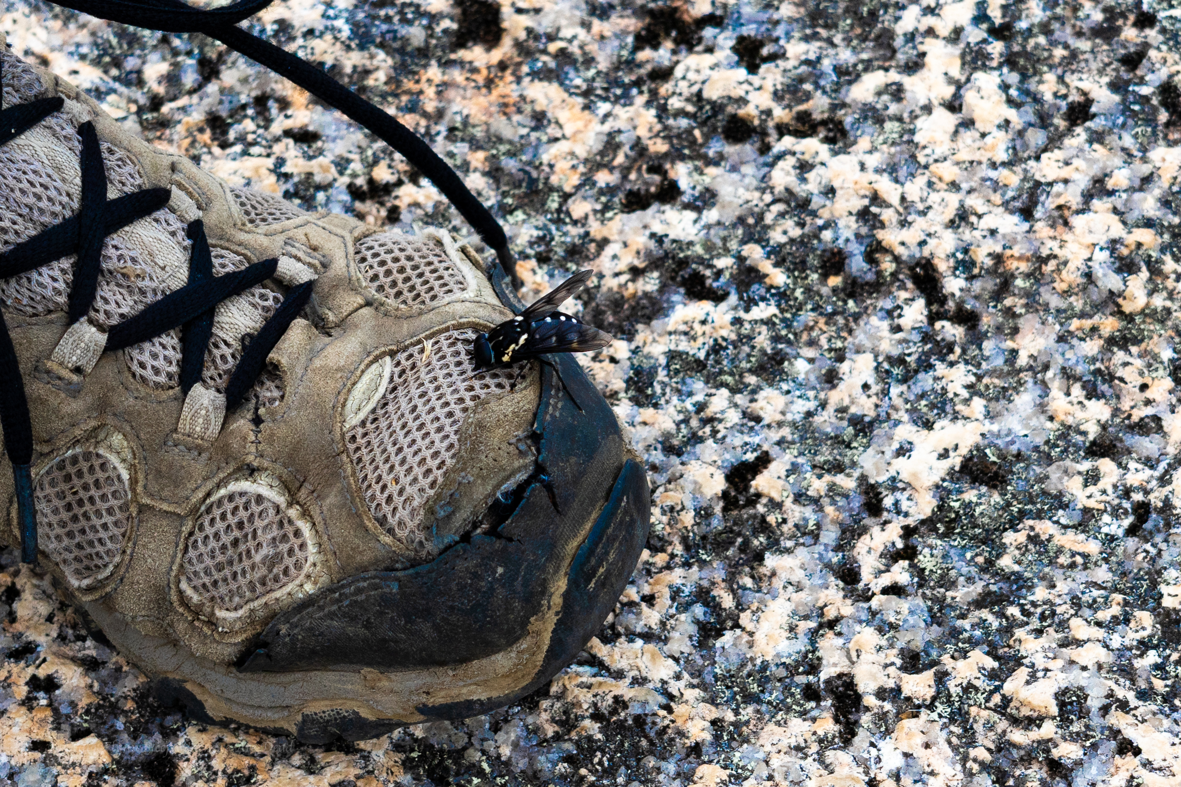
These guys were everywhere and they were curious but they were friendly enough. The bee not the warn out merrells.
We share the summit with several other groups. Families, grey nomads and, us. (There is a song in there somewhere)
We return to the car and back track a little to our camp site in Boonoo Boonoo.
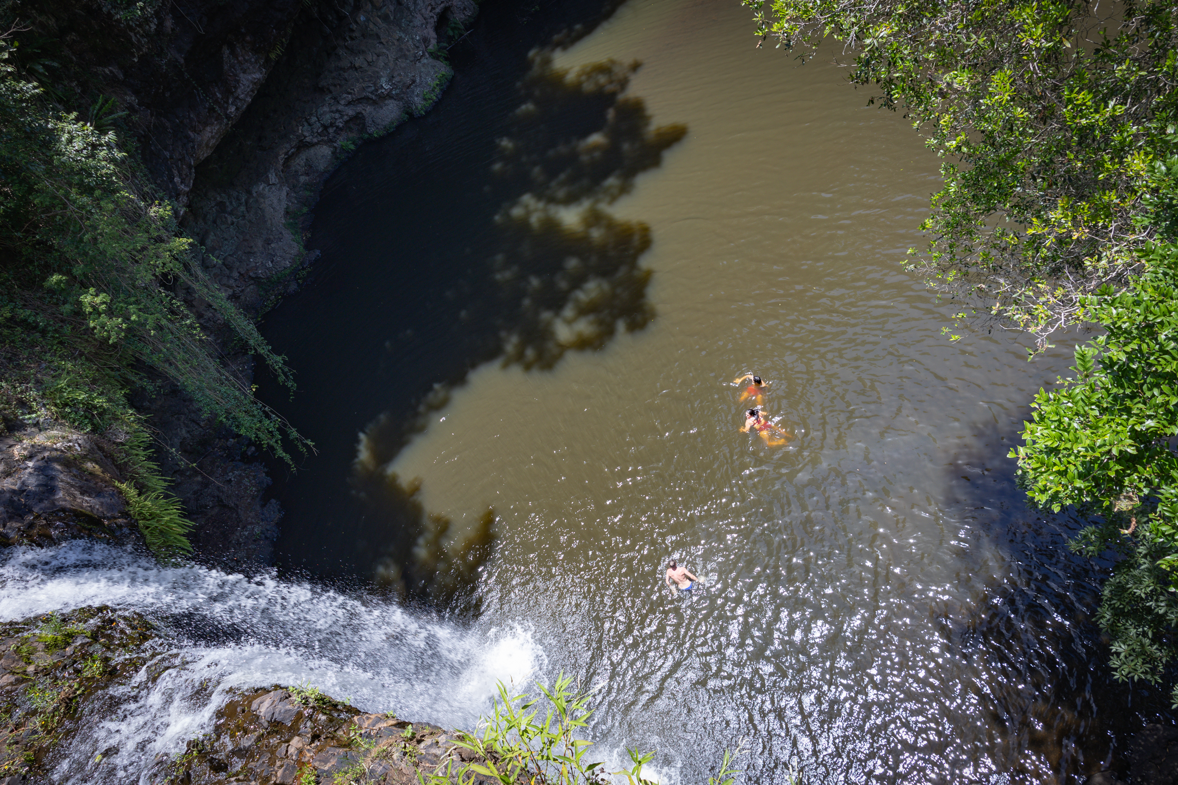
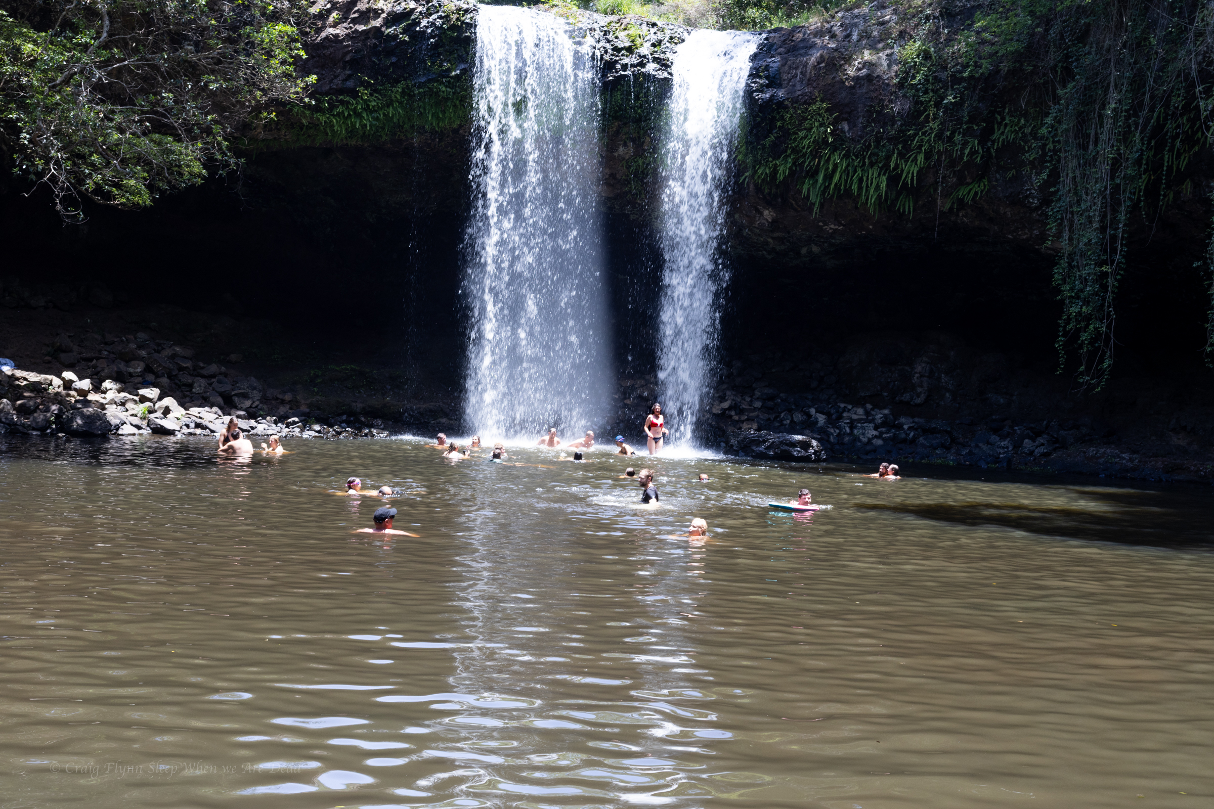
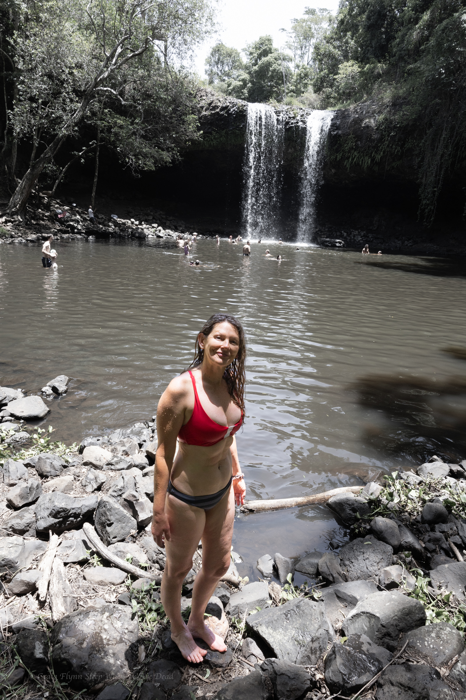
Veering slightly south we thought we’d check out Killen falls as a spot of cool off
Killen Falls if a nice little waterfall in Tintenbar, near Ballina. It’s very touristy but worth a look.
It’s accessed from Friday Flat road and there is plenty of signage to get you to the car park.
From there it’s about a 400m walk to the base of the falls along a nice tourist trail.
There’s a large plunge pool at the base that is a popular swimming hole.
Being use to the crystal clear waters of Blue Mountains canyons it’s little brown and agricultural run offy but it’s a nice enough spot to cool off on a hot day if you are over the beach
On the drive back Kylie asks, Have I shown you the quarry
No, says I
Yeah I have, says she
No you haven’t, said I
Bexhill quarry is an old brick quarry that operated from the 1890s through to the 1940s. When operations ceased it filled up with water and became a popular swimming spot.
With no through flow the water became quite acidic and was found to have high levels of dissolved metals, such as Aluminium and magnesium, so in 2016 it was shut off due to “safety concerns”.
No sooner had the fence gone up than locals cut holes in it…
But nature seems to have found it equilibrium, subsequent testing found acidity levels returning to normal(ish) levels and plans were submitted 2021 to turn the area into a public reserve.
That hasn’t happened yet so in the mean time you’ll still need to climb through the holes in the fence. To be fair though, it’s more hole than fence.
The Quarry is accessed of Coleman Street (Bangalow Road) Bexhill. About 10km from Lismore
Not sure if the starling green water will give us superpowers or just melt the flesh from our bones..But the Lilly Pads and Dragonflys seem to enjoy it
And Kylie isn’t scarred
Water was quite pleasant indeed.
It’s a great spot for photography and a nice dip though, I recommend proficient swimmers only because I have no idea how deep it is.
It teemed down overnight at camp. But our trusty tarp kept us cozy and by morning the sun was peaking through the clouds.
We had said goodbye to Levis and Monica and talked ourselves into another short canyon while we were out here.
Kylie, Jason and I had visited the top couple of sections of Popeye Canyon as a day walk a few weeks earlier which had some pretty bits in it, and so we were keen to have a look at the lower section.
I cooked up a plan to head straight down from camp to the grid reference that the Jamison guide lists as the start of Popeye (a kilometre or so below the upper section).
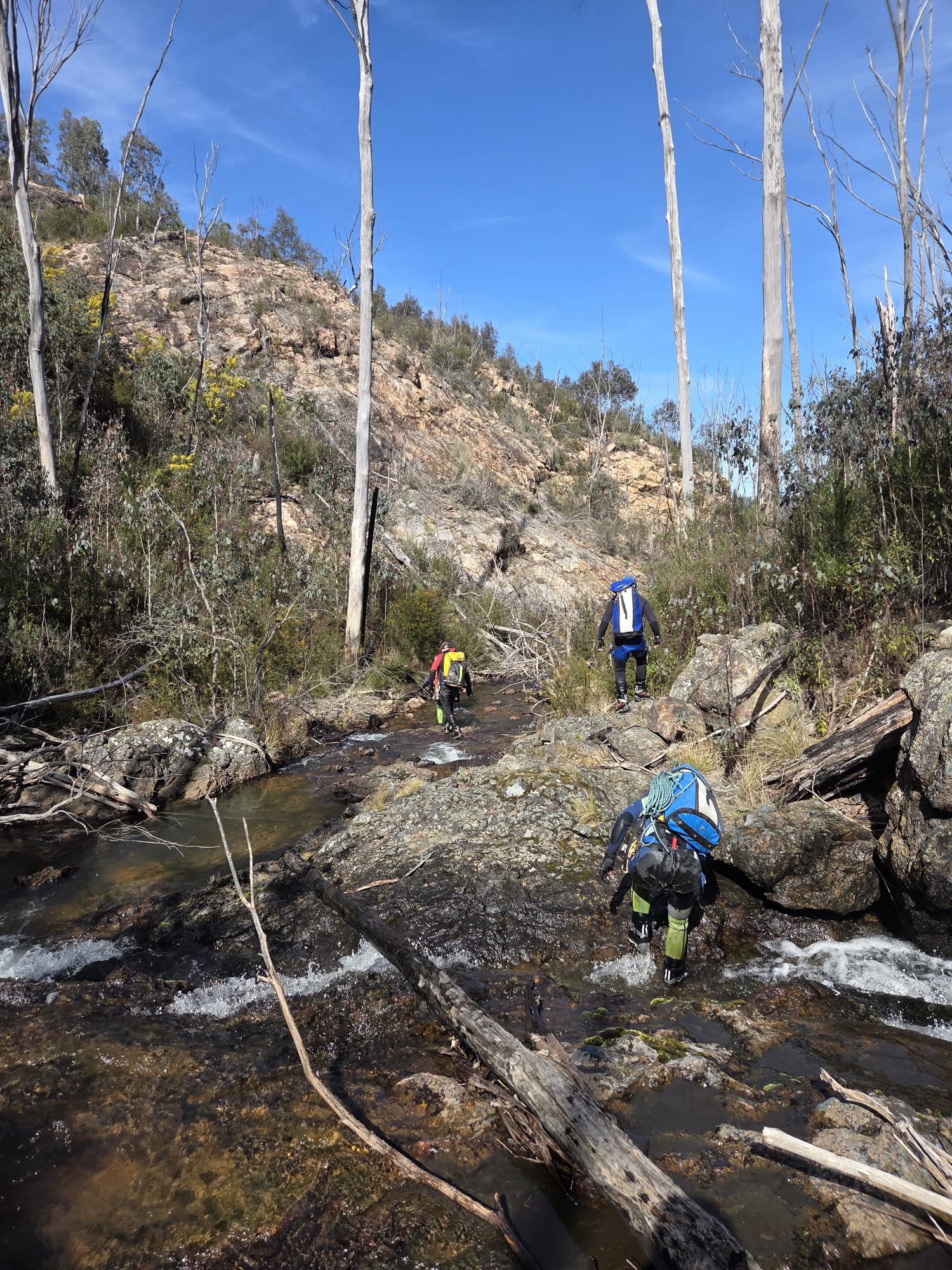
We start down a ridge in between two faint gullies. These soon join to become a stoney bottom creek that tumbles over a substantial cliff line. We only brought a short rope with us today so make our way a bit further long the left hand bank and find a way down into what we came to christen MCPCC. Mega Clear Path Creek Canyon.
heading out to enter via the upper section may have been easier.
Anyhoo we find ourselves in Popeye creek. It’s not looking like much but H and K don light wet suits.
Looks like there’ll be some more creek walking, I’ll suit up later, the rest of us say.
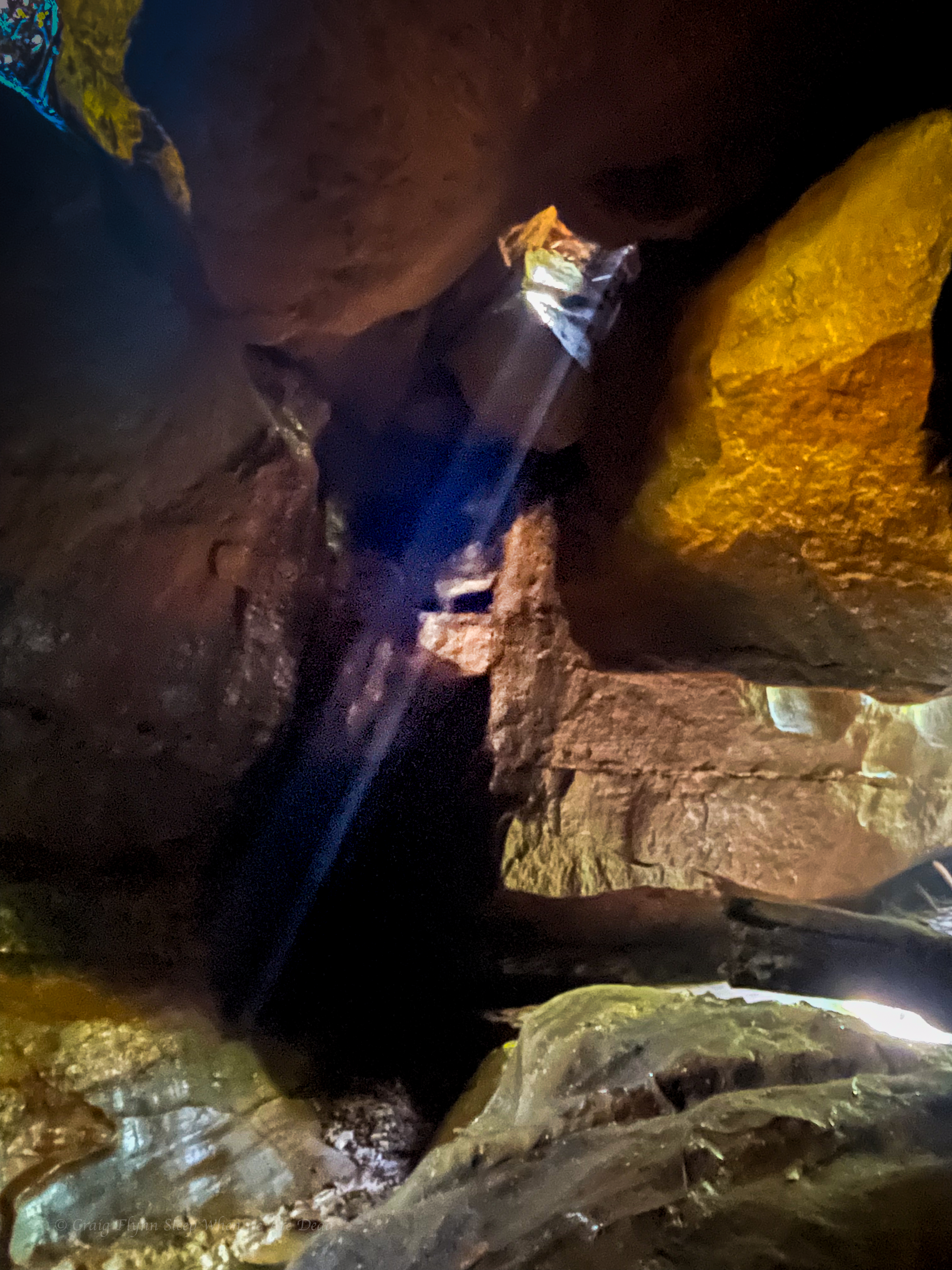
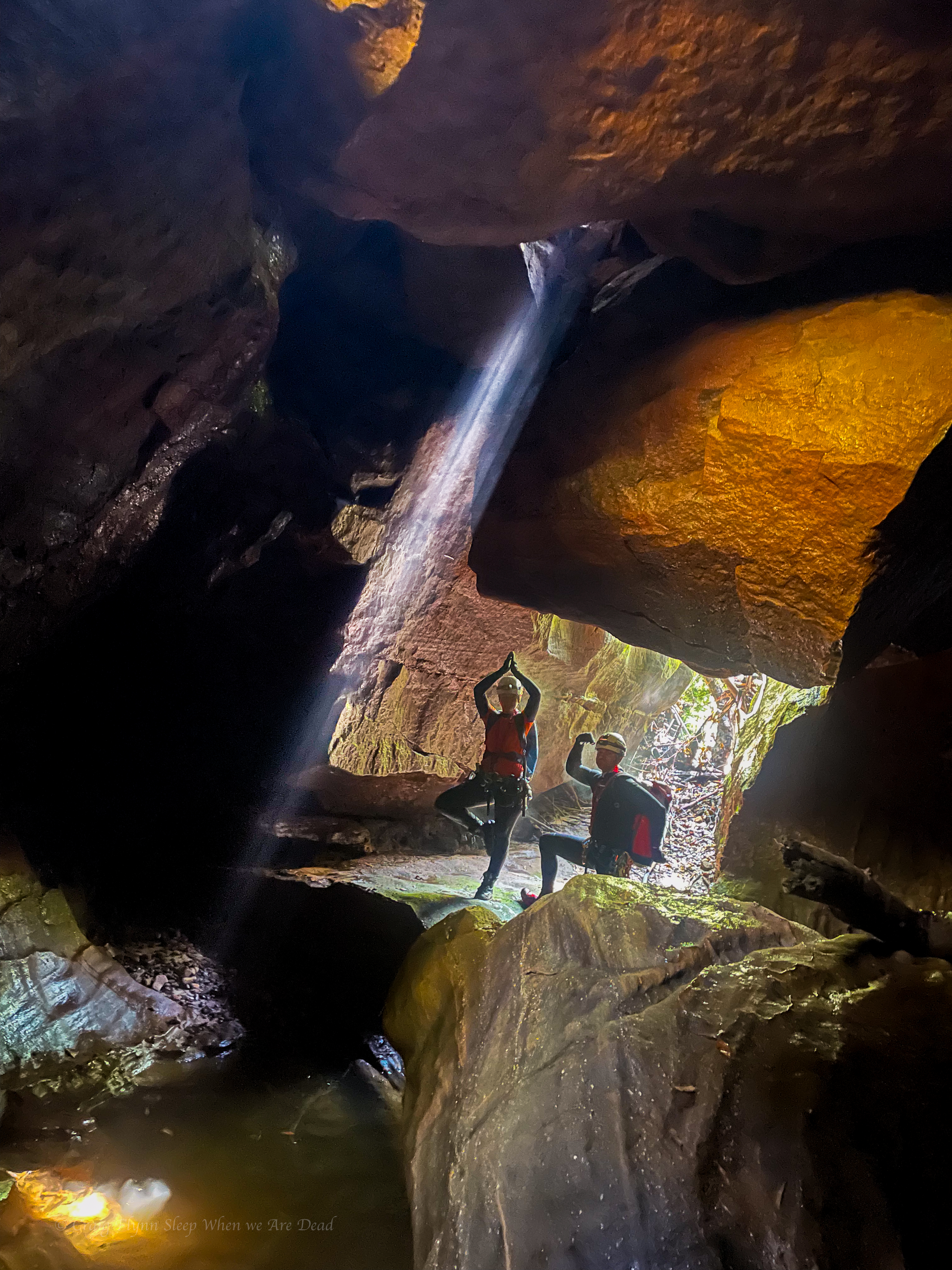
10 steps later, literally, like literally 10 steps babes, we round a bend and the creek drops into a tunnel like canyoney section.
This would be the theme for this section of Popeye. boulder hoping interspaced with tunnels and cavey bits. A few abseils and short swims
and awesome company
but not much quality canyon.
Plenty of weirdness thou
we head all the way down to the…… it hurts to say it…. Dingo *fugging* Creek for the final 10m of “canyon”
The plan is to head down said creek to an exit Kylie had mapped out opposite gateway canyon. I’m hopeful this section is similar to the bit below HITW and we can just float with the current.
There was a bit of floating.
A bit of boulder scrambling.
Some scrub bashing.
And lots of sinking knee, sometimes hip, deep into fine sand to have it defy the sand traps and fill the bestards.
I still have sand in places sand has no place being.
Still, it’s a wild and beautiful part of the Bungleboori system worth visiting. Once.
The bottom of Gateway canyon was a welcome site
The walls lining the creek had gone from broken slopes to towering cliffs and I’m wondering just how tricky this exit is going to be.
Surprisingly it’s straight forward, cutting back along a gentle ramp to a not too steep nose that avoided the cliffs altogether.
Nice one Gadget
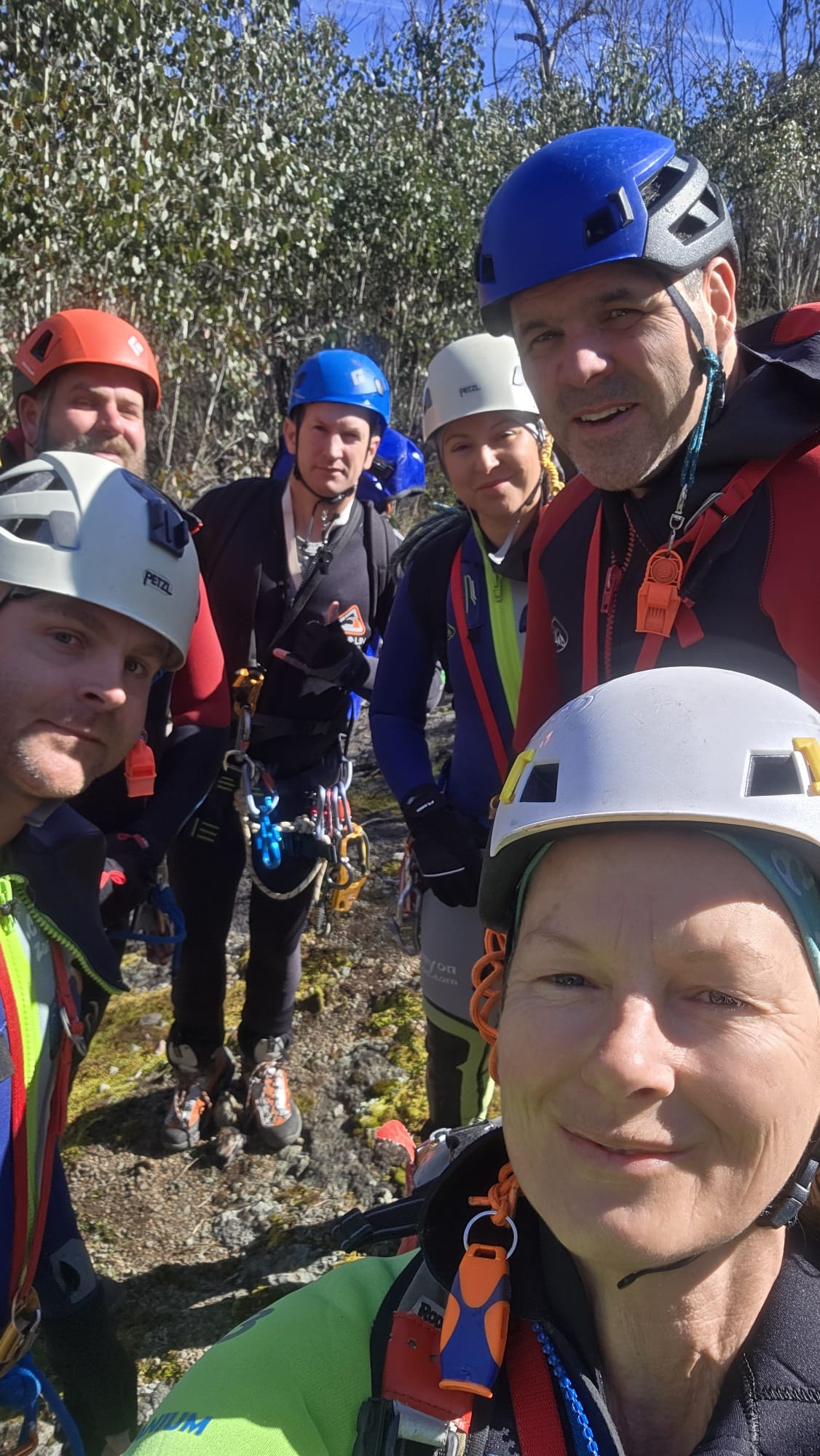
All in all a fantastic weekend out in the wilderness with my kind of people.
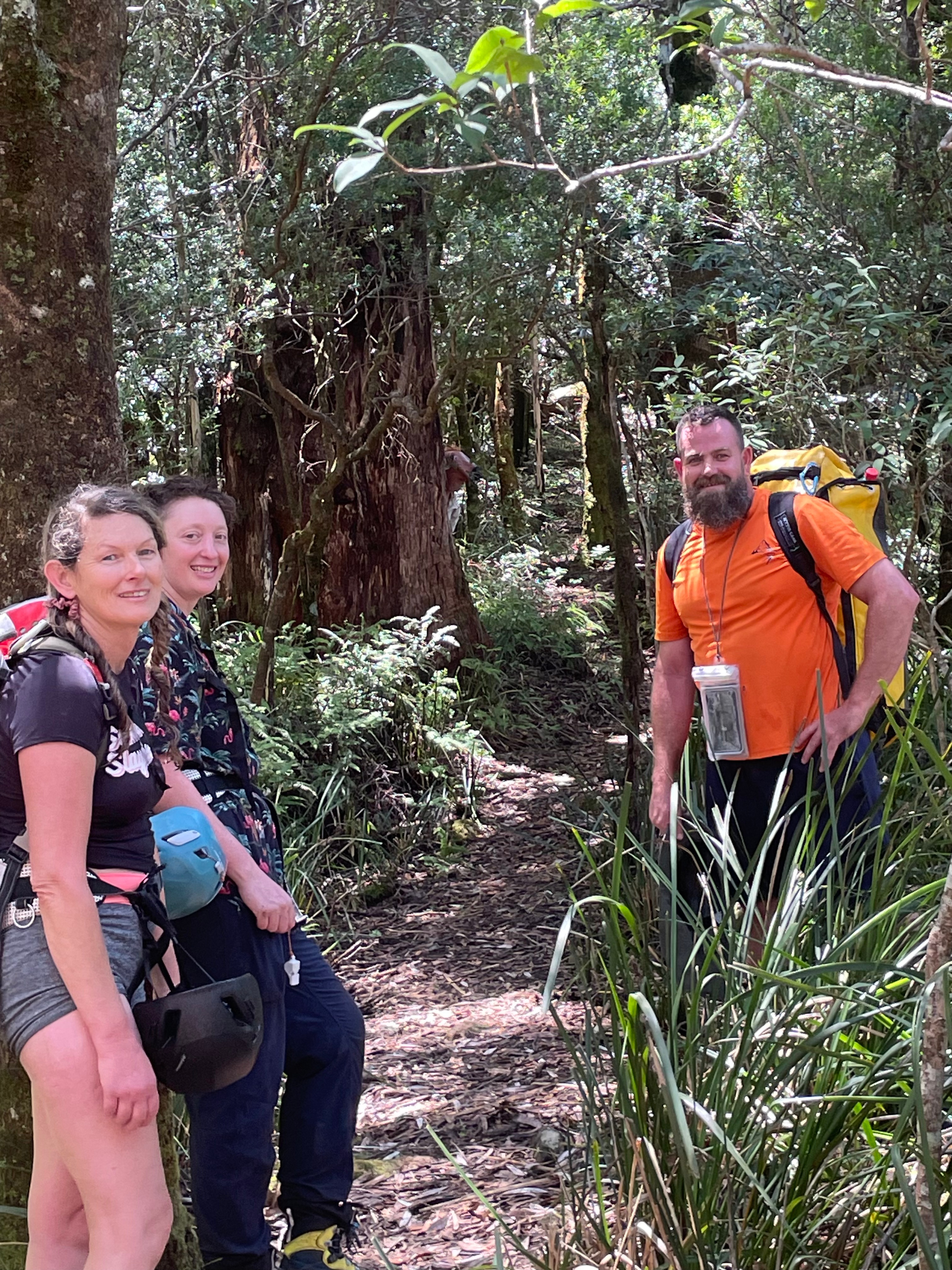
Kylie, Kristo, Jason, Hywaida, Dave and meeeeeeeeeeee
This one had been on the agenda for a while.
Kylie had scoped out topos and satellite images years ago. Then it caught the attention of Laurie, the Victorians and others and the race was on.
I’m not sure who lead the first trip but they did a stella job. It then appeared in the Canyoning Around Victoria guidebook, Published by Rob and Sam. But being a little out of the way meant there hasn’t seemed to be a ton of repeats.
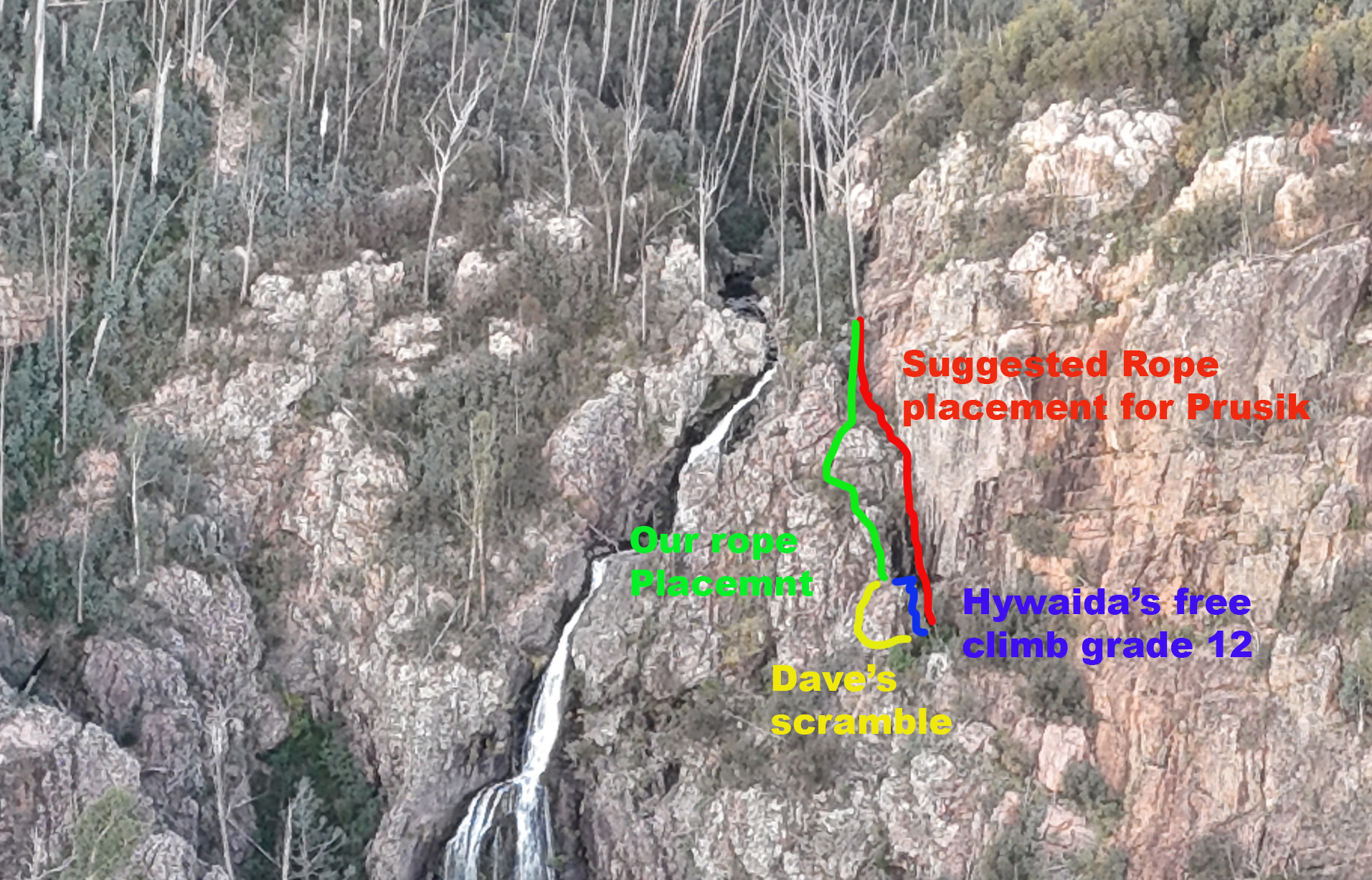
Our intel said to drop a rope to aid with the last little bit of the exit. Rope wiki said someone should descend it to make sure it’s in the right spot. But there was nothing to say what the right spot was. Asking previous parties gave mixed messages. Everyone said it was really obvious where to put the rope. Almost everyone said they put the rope in the wrong spot and had to free climb a bit…
The guide said the last 10m of exit was the tricky bit, ropewiki said setting a 20 or 30m rope in place to assisted existing would be handy.
Looking down the last 10m didn’t look that sketchy. We attach a rope to a tree and Me and Jason descend to have a look. There is another drop. Straight over is a 15-20m vertical face. Around to the right looks to be a grade 10 chimney. We put the rope to the right.
Again we descend. Straight ahead from here drops onto a narrow ledge that doesn’t look to go anywhere. Left is a scrambling climb from a large ledge. We drop the rope to the left so its now in a big zig zag.
One party we spoke to put a longer rope straight down from the top tree and prusiked up the vertical face. In hindsight this is probably the best choice.
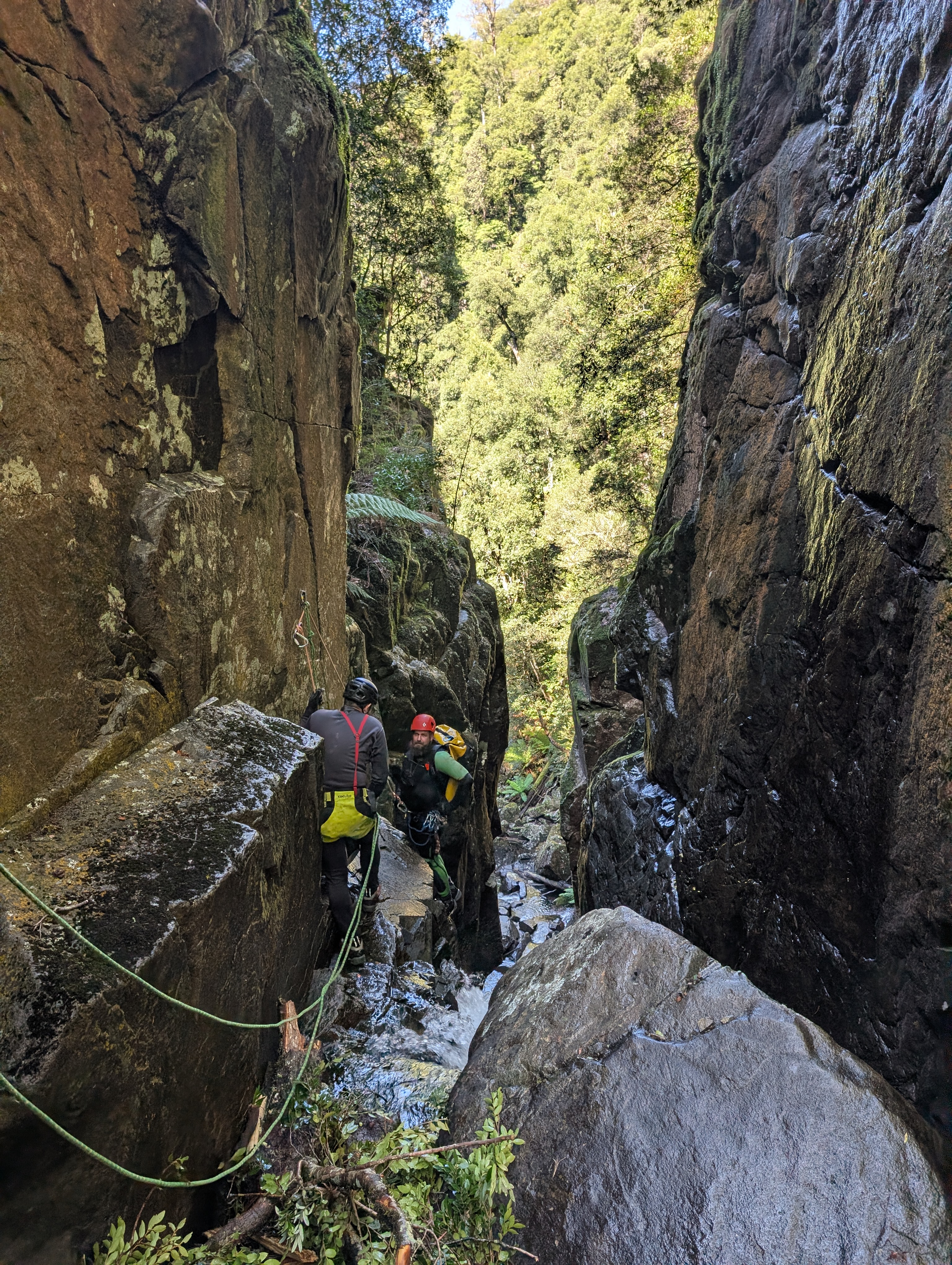
The descent itself is action packed, 6 abseils one after the other, at most there is a small swim between them. At these water levels you are either in the flow or crossing the flow on all of them.
The first 3 pitches are the easiest and we regroup at the base of P3.
Top anchors were all good but with few repeat trips and snow melt we brought gear to replace things if needed. P4 drops to a narrow, semi handing belay above the 45m P5 money pitch. The plan is for Jason to go first with anchor gear, just in case, and a short rope for P6, and get himself safe. Then for me to follow with the long rope for P5. We had discussed leap frogging anchor duties to avoid 1 person exposed to the chill but the water, while cold, wasn’t as bad as expected.
P4 anchors are just over the lip for less rope wear and better pull down. Kristo secures himself on a semi hanging belay and off we go.
Jason signals that the anchors are good. I descend and replace him on anchor. The rest follow.
The bottom 3 pitches are fantastic, well they all are but the bottom 3 especially.
Despite what I said earlier about water temps, I ain’t going to lie. Even with a spray jacket I was bloody cold by the time I got to the bottom of P6.
All pull downs were simple and hassle free for us, potentially with long ropes you could combine pitch 4 and 5 though the guides say there are lots of nubs and cracks that ropes could get jammed in so that may not be the best idea. These cracks are also a foot entrapment risk so take care.
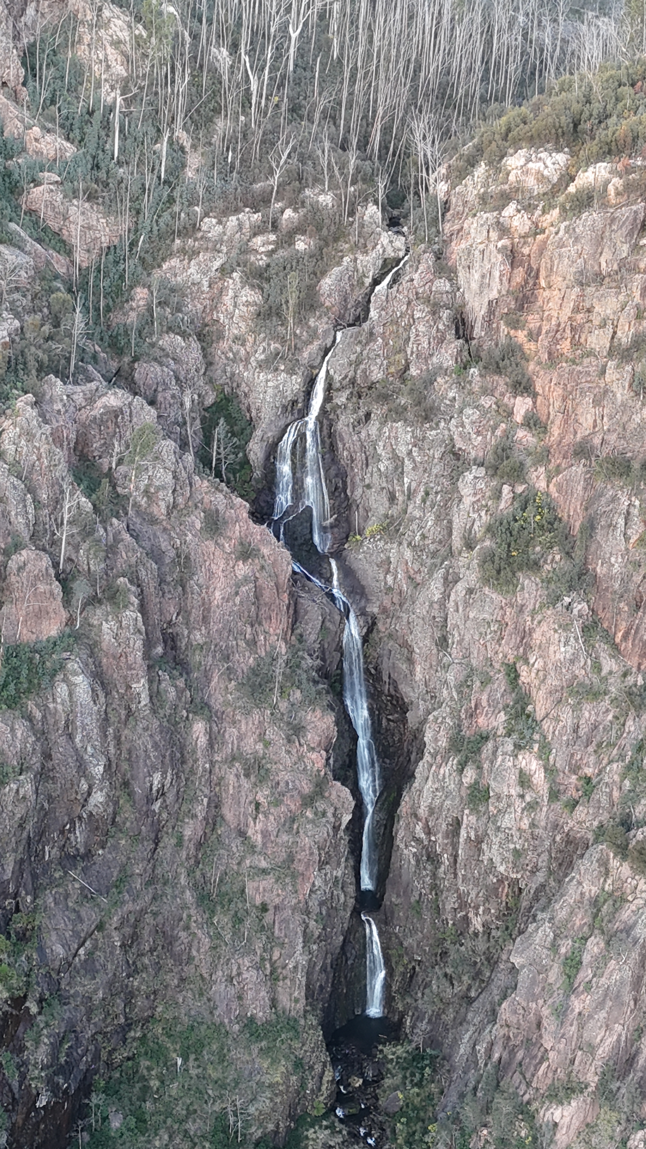
Climb out as soon as the steep cliffs allow, is a bit vague. 50m down stream of the waterfall. Was more helpful.
We were about 50m down stream. A slabby corner crack looked scramblable. Scoping from the other side on creek, braving the scree slope of death Kylie spies and easy spur another 10m down though.
Guide mentions gaining a spur. We took the spur into a gully (if you could call it that) so far matching descriptions. to another spur to gain a ramp leading back towards the top of the waterfall. Well there looked to be a ramp there, it would be a scramble to get up on it but we head up.
Scrub was hectic. Every step forward was a punish. The ramp went up but it would come to an option of narrow, loose traverse that didn’t look like it went or a dodgy scramble bordering climb. Time and again we’d force our way up or along only to get cliffed out and need to retreat a bit and try again.
It was steep and loose and slightly terrifying.
It was energy sapping and soul destroying.
We were a long way up and had been forcing away towards the top of the falls, but it still seemed so far away.
Eventually after getting cliffed out again we retreated back slightly. There looks to be a ledge just below us. Said someone. Kylie and Kris find a way down to it. It might go.
Kristo pushes on.
Some time later, It goes calls Kris.
They had finally stumbled across the right ledge. We still had scrub to fight through and we still didn’t know for sure it was the right ledge.
I see the rope. called someone.
Releaf.
We emerge from the scrub only to find a gully between us and the rope. we drop in and discover we are at the base of a climb and the rope is at the top. Hywaida goats up. When it comes to exits it gets to a point where she transforms to superwomen.
Kris goes next, taking a rope to join to the one in place.
Dave disappears to the left and as Kris drop the rope Dave appears next to him. It’s an easy scramble around the corner. says he.
From there its 3 easy scrambley pitches which we punch up using our crolls on the rope as a safety, but tbh despite some grade 10-12 moves its the least exposed stuff of the entire exit.
3hrs later the battle to escape Landers was done.
I’m not 100% sure we won.
The Beast
There was a point to this story, but it has temporarily escaped the chronicler’s mind: Douglas Adams
A bit of an idea for those wanting to set a fix rope for the final bit of the exit