New Zealand South Island road trip 2025. The launch

New Zealand is a mountain bike and canyoning Mecca so it might come as a surprise that

  1. I hadn’t been before
  2. On my first trip there I had no intention of doing either
  3. We also wouldn’t be heading to either Queenstown or Milford Sound

Kylie and I had been talking about a New Zealand winter road trip for a while and when the stars aligned where we both had time and opportunity we leapt at it.

We had 10 days to smash out a road trip where we’d nerd out on geology and climate, this meant some of the more well known spots got dropped off.

We also wanted to do it on the cheap so if you want to know where we went and what we saw stay tuned, I’ve got about 2000 photos yet to edit and cull so I’ll post them as I go in a little series over the coming days or weeks or whatever.

Anyhoo we flew into Christchurch at some ungodly hour and got a ride to North South Holiday Park where we had arranged a late check in. It was about 1am when we pick up the keys from the key safe and make our way over to the cabin.

Um didn’t we get a double? asked I as I open the door.

Yes says Kylie.

I’d walked into the wrong cabin…. Opsie

Finding the right cabin we settle in. We’d picked a basic cabin, it was basically just big enough for the bed, a bar fridge and a counter top. But considering we just needed somewhere to sleep for a few hours it was perfect. and surprisingly comfy.

And for $54NZD, which included a courtesy bus into town the next day, we couldn’t go wrong.

Next morning we get dropped off at Tui Campers. One of the reasons for flying into Christchurch was the amazing deals Tui do on their camper vans.

And all set up in a Ford Transit van we hit the road for the West Coast via the Lewis Pass. Destination Cape Foulwind, where we’d camp the night in a cosy little Freedom Camp.

Freedom camping in NZ has gone through a little change recently and now to do it legally in most places you need a certified self contained camper. Thus the Transit camper.

Now on the west coast it was time to take in the sights and sounds.

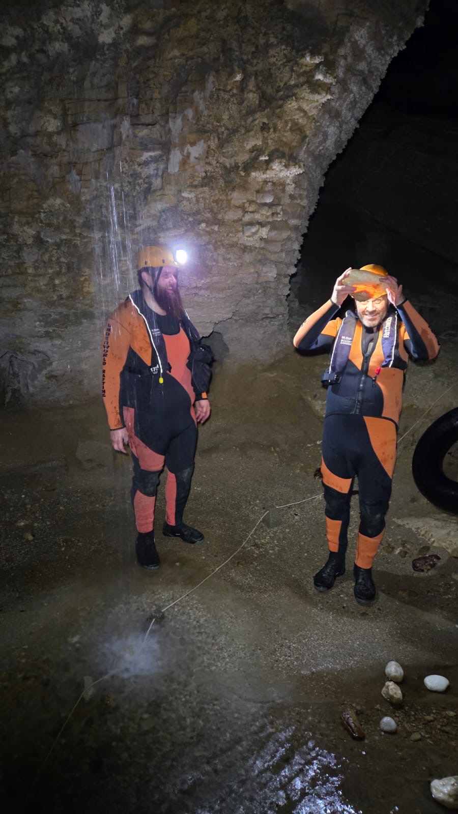
Our first stop was Charlestown for a river rafting tour with Underworld Adventures. Kylie had done this one before and raved about it as a must do.

Look, my home town of Lithgow famously boasts the Glowworm tunnels and the canyons and caves of the Blue Mountains host them by the thousands but this tour was something else.

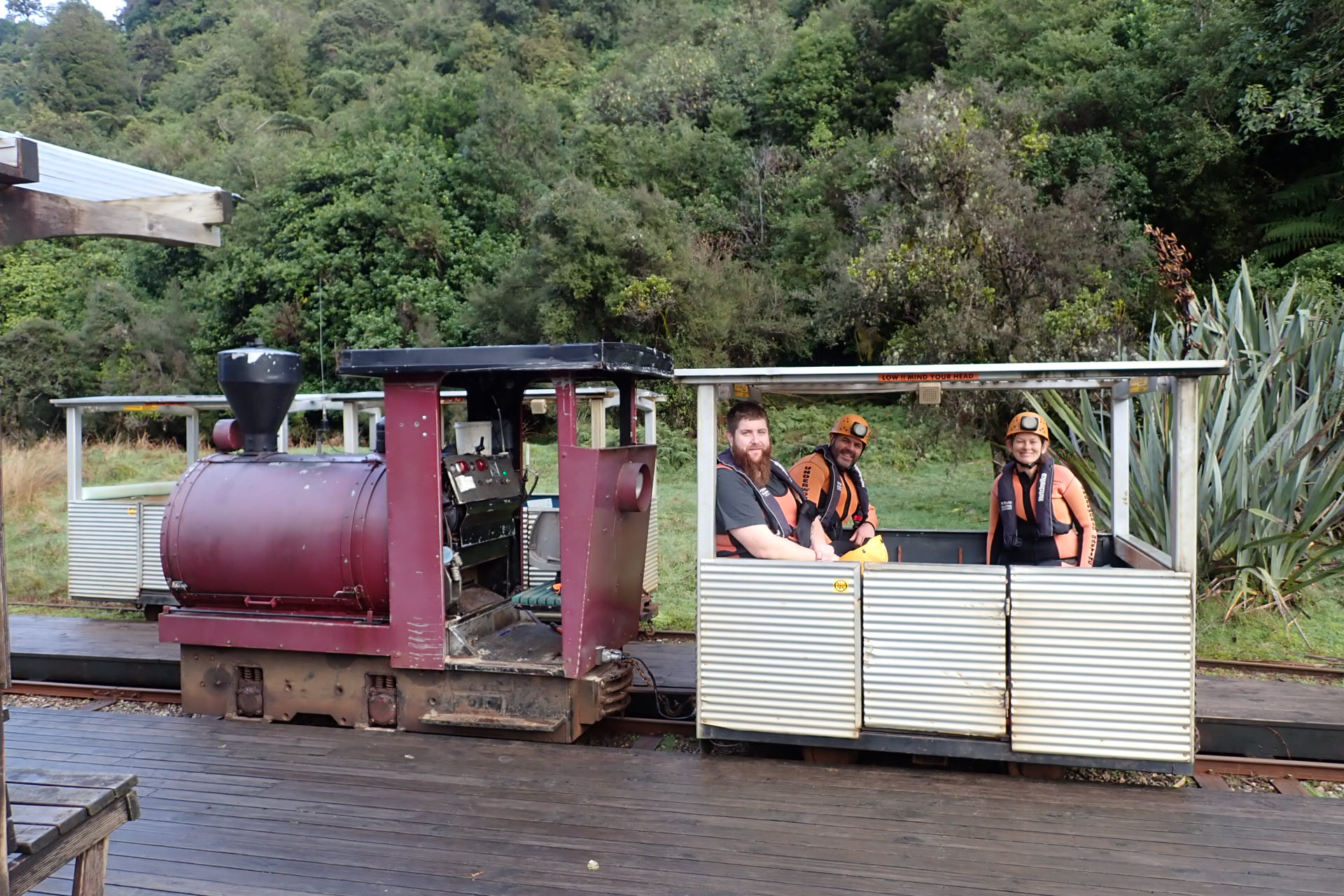
After suiting up the trip started with trip on a funky little petrol engined train.

Toot toot!!!

©Jess the wonder guide
Codi, the big Canadian was over the moon that we rang the previous day to book as there’s a minimum of 2 for the trip to go ahead and until we rang he was told it wouldn’t be offered. ©Kylie

All Photos from the cave are ©Kylie unless stated otherwise as the second half activities meant I didn’t take my camera.

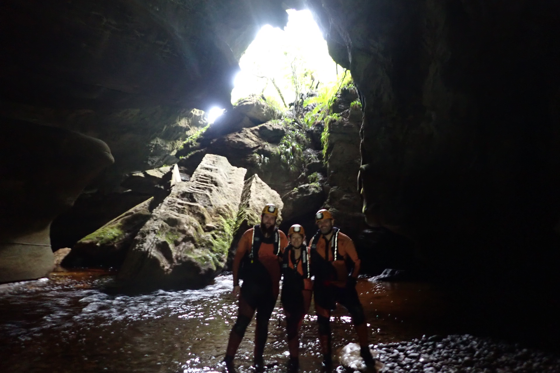
At the end of the train line we pick up our tractor tubes and walk up through the rain forest to the start of the Metro Cave.

we start in the upper level of the cave and are treated to some great limestone formations
Interestingly the little fella trapped in the stalactite is a fungus gnat. ‘Fungus gnat’ doesn’t sound real sexy but this is the adult that gives birth to the glowworms. As an adult they don’t have a digestive system. they just fly around mating wildly for a couple of days and die.
Our guide, Jess giving us the run down of this cool formation
the cave also contained some nice concretions. This one looks to have formed around a crab claw

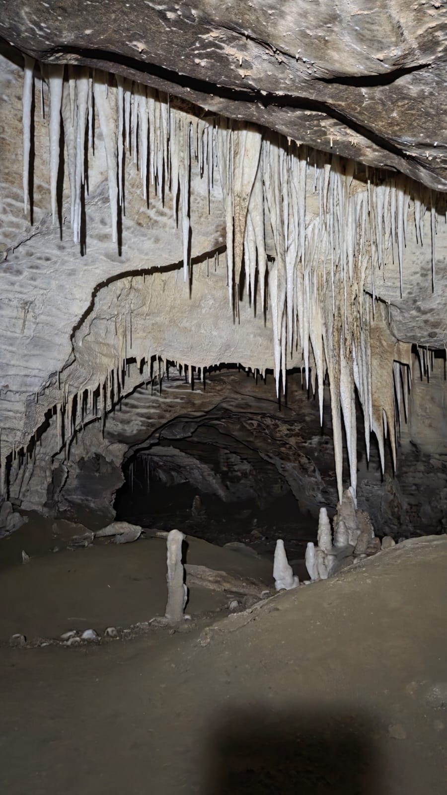
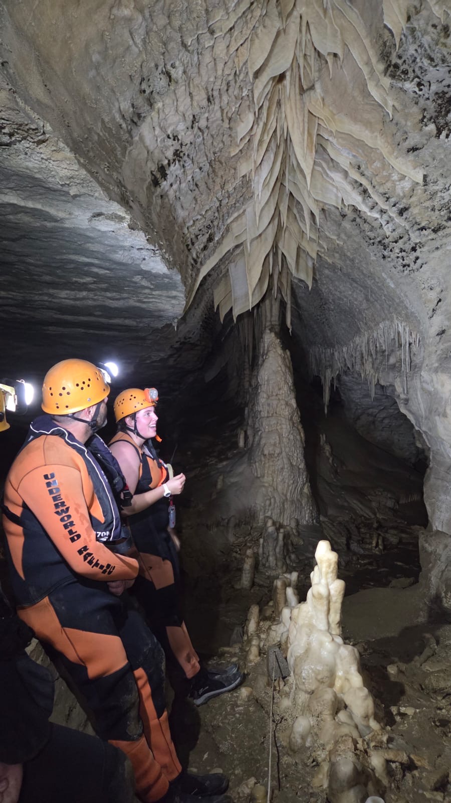
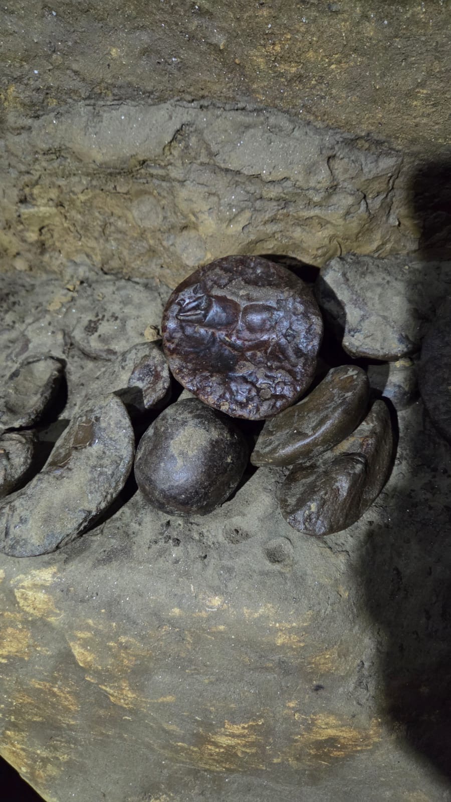
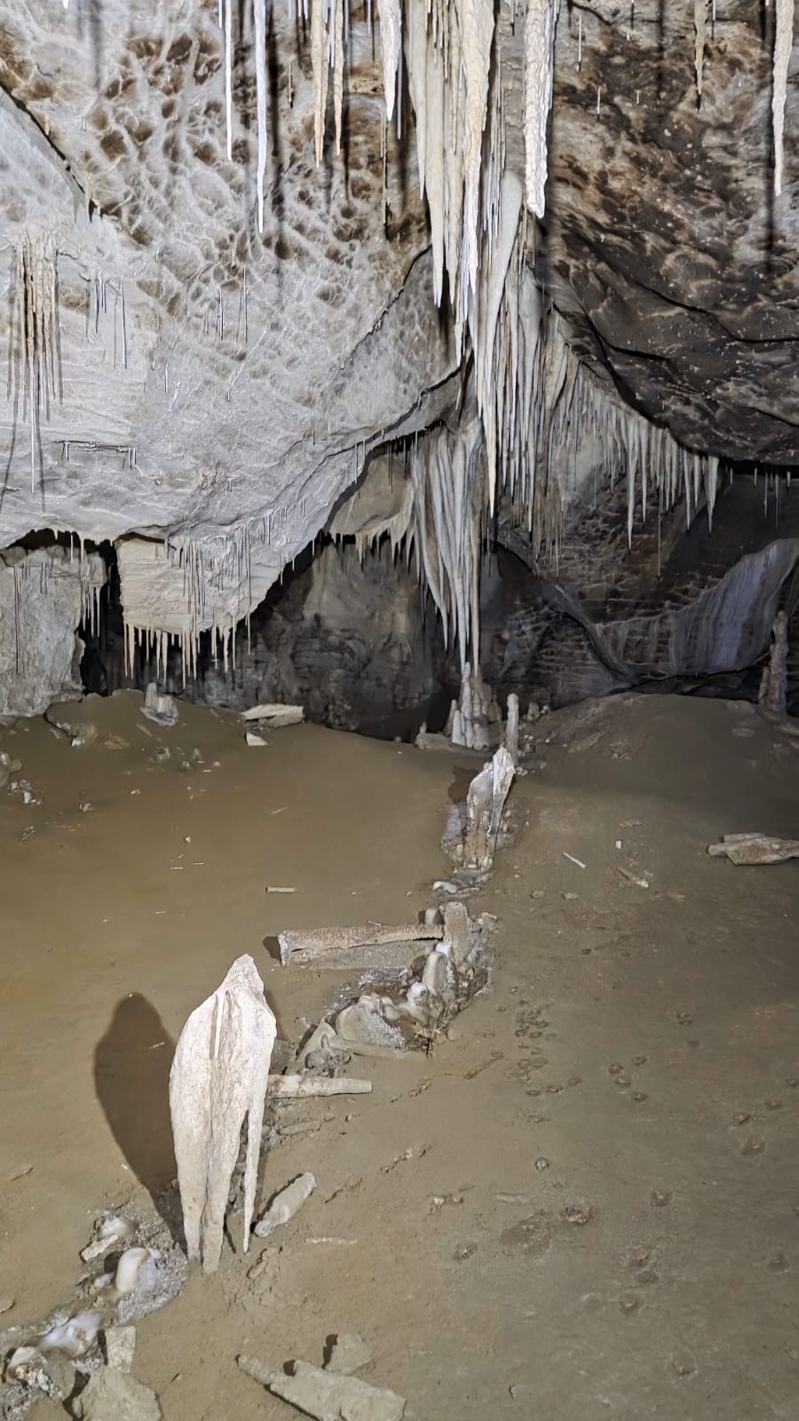
The cave is quite extensive and we explore passageways and crawl-throughs before making our way down to the next level

The second level is a little wetter and I shine my light through a piece of broken limestone under a waterfall.

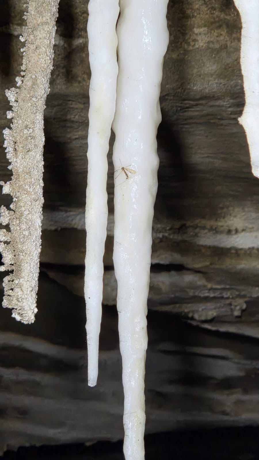
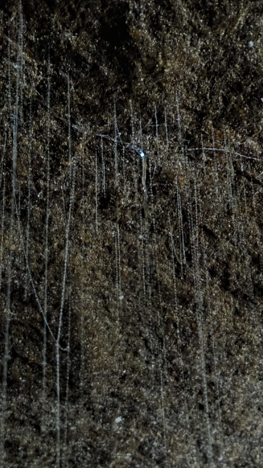
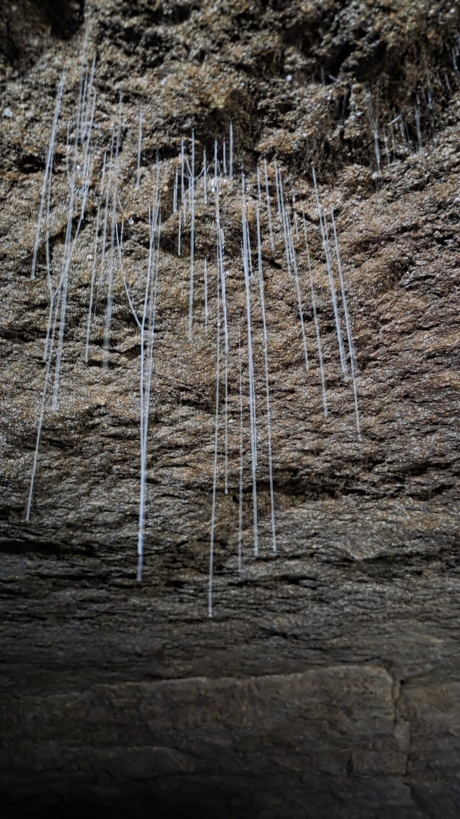
The second level is where we find the first of the glowworm displays. The following photos are promos from Underworld Adventures. Click to Enbiggen.

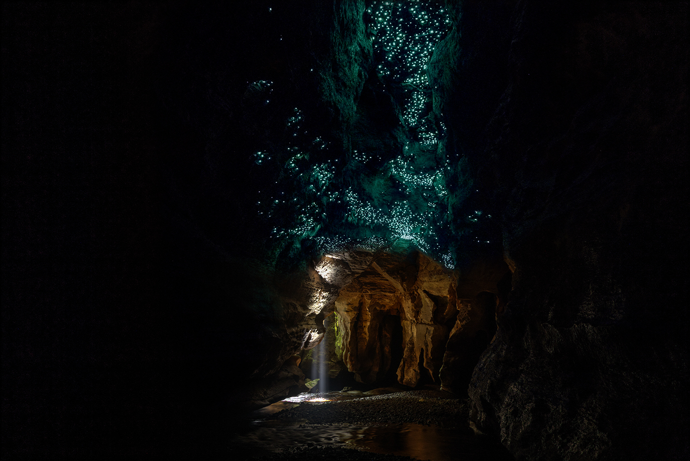
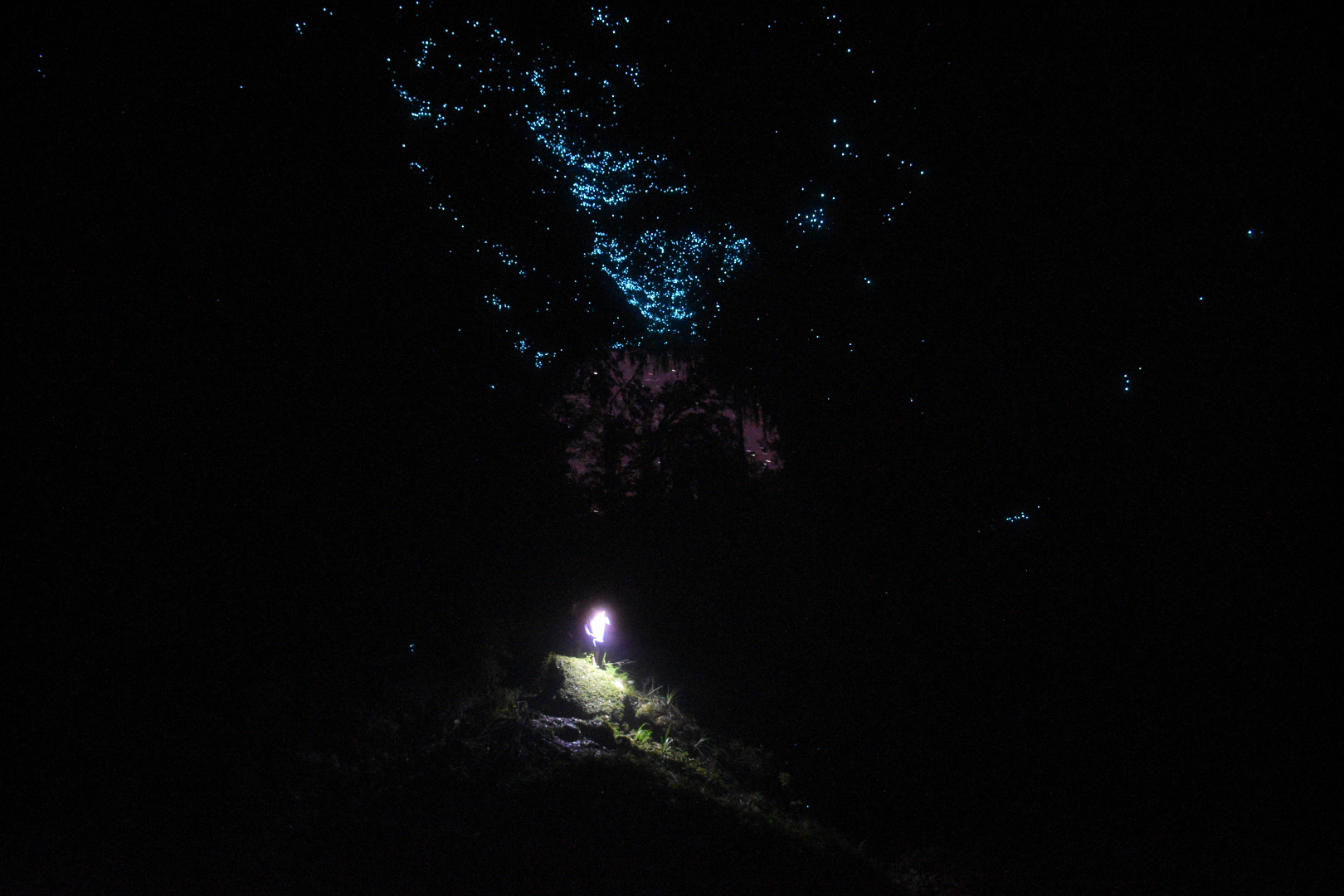
The Glowworms here are Arachnocampa Luminosa close cousins to the ones in the Blue Mountains, Arachnoocampa Richardsae. Arachno means spider like, due to the silky stands they use to catch pray. Campa refers to them setting up a little hammock and wait for food to come to them. Luminosa refers to the fact they are Harry Potter Fans.

Next we descend to the 3 level which is where we find the river and mount our tubes.

It had rained for a week prior to our visit, the river was up but Jess was hyped.

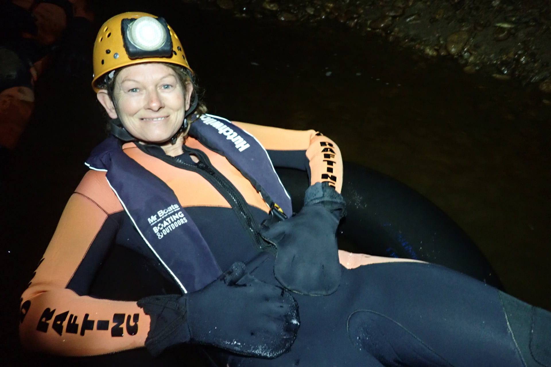
Due to needing to paddle and hold on and stuff we couldn’t really get any photos of this section, let me just say it is mind blowing. You alternate from easy floating under a cavern of glowworms to quicker sections where it’s important to avoid being pushed into the undercuts.

It was hella fun

And then we reach the end of the cave.

©Jess the wonder guide

But the fun isn’t over. We head out to where the Ananui creek meets the mighty Nile River, Waitakere. From here it’s hold on tight for a fun ride down some mild rapids back to the train.

Would recommend this to anyone, it’s a great trip. The cave system is quite extensive so there are drier options but even midwinter the thick wetsuits hold off the worst of the cold.

Continued on (and I’ll try to be less wordy and more photoey)

Hassans Wall Undercliff track

Access: Easy access to the start of the trail then steep and vague in spots

Navigation: Navigation is fairly straight forward .

Map: Lithgow

Time: It takes about 1.5hrs

Traditionally known as Gnallwarra, Hassans Walls was named by Governor Macquarie who thought the stunning pagoda topped cliff line reminded him of the hill forts and Hasanamba temples of the Hassan district of India.

The Under Cliff track began construction in 1916, Largely the work of Richard Merrick and the Lithgow Progress Society, and stages were added over the years.

It largely fell into disuse but was reopened for a short time in the late 90s or early 2000s before being closed by council due to concerns over the stability of the cliffs above (I think a cliff collapse may have taken out part of the trail so be warned or whatever)

Its a shame because its a great walk under some spectacular coloured cliffs with little alcoves of rain forest hidden in the nooks. Just beware of falling rocks, small and large.

Getting there: Head up Hassans Walls Road. Before you get to the top there is a spot people park on the right near the imaginatively named “First lookout”. Park here and look for a road angling back up to the right.

Most of the gullies between here and the lookout will give access to the track but head up to the right passed the locked gate.

The easiest access is in a gully to the left as the road starts up the steep hill https://goo.gl/maps/BcPjZqdgfqBtjD1

But for a more adventurous start keep heading up the hill. Take the left fork at the top of the hill and the next left fork as well.

The road dips down into a saddle, just before the bottom it flattens out. Head into the bush here and find a break in the cliffs to the right of the main gully (main gully cliffs out) https://maps.app.goo.gl/NyPxTjhz5dGzcgQZ9

Alternatively go to the bottom of the saddle and just before the road climb up the other side go left into the bush and find a break to the left of a great lookout. But note the undercliff track is vague at the point.

Once through the cliff line follow the base of the cliffs around to the left. The track can be vague in spots but if you loose it follow the base of the cliff and you’ll eventually pick it back up.

The colours of the cracked and errored cliff line is stunning in afternoon light and you will find small pockets of rain forest in their shadow, unfortunately the biggest section of rain forest is below the car park of the lookout so littered with shopping trolleys, toilet paper and other crap shit humans throw off the top.

Eventually the track will take you around King Georges head ( AKA Indian Head or Iron Dukes head) and it appears to peter out. But continue around and head up the ridge keeping near to the base of the cliff and you will pick it up again on the otherside of the lookout.

This will bring you past the table and chairs in Gannon cave before winding back up to the road near the turn off to Hassans walls Lookout. A short walk down the road will take you back to the car

BACK

Note 1: Taking care  While reasonably well known these spots are still wild places and care needs to be taken around cliff edges and on the steep trails.  Carrying the right gear as well as having adequate food, water and clothing is important. Always tell someone where you are going and when you expect to get back.

Emergency beckons (PLBs) can be hired from Katoomba Police for very little.

Note 2: First aid A basic first aid kit is essential bit of kit whenever heading into the Aussie bush. A basic first aid is highly recommended

Note 3: Maps and Navigation Having the right map, a compass and knowing how to read them is very important when heading into the bush. If you are new to bush walking joining a club or accompanying more experienced walker for you first few outing is a very good idea. I found practicing map reading on well defined trails was helpful when I started out.

The Maps mentioned are the 1:25000 series. They can be purchase at Lithgow tourism information center, from outdoors shops or online for around $10 each.

Note 4: These are wild and beautiful places, respect them. If you are able to carry something in you can carry it out. Don’ be a tosser. Leaving your rubbish behind is a sure way to ruin it for every one else.