After Devils Pinch and Starlight we opted for a lazy Easter morning then a quick trip through Pipeline canyon.
Kylie wasn’t feeling well so decided to sit out.
The rest of us retraced yesterdays steps up the Pipeline trail but speared off early into the side canyon I’ve always known as Drainpipe.
I’m sure I’ve used an easier way into Drainpipe with Tim that avoids all the scrub in the upper gully, but as with last time with Russ we bashed down the gully.
Jess and Wisie were on rope duties and had their work cut out as some of the anchors needed creative solutions. A few of the anchor trees were rotten or completely gone.
Drainpipe lives up to it’s name with trickling skanky sludge rather than water.
will Brooke avoid the sludge?
negative.
A few tricky abseils later and we reach the junction with Pipeline.
The water will be crystal clear from here, says I
I should not of said that.
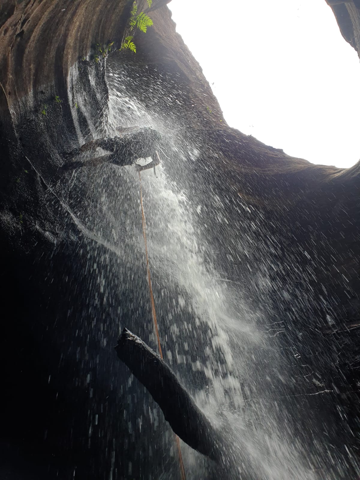
We get to the first large drop and down I go.
There’s a very dead kangaroo wedged into the corner of the pool below oozing its essence into the atmosphere.
</Spewie face>
Emerging from the Roo Stew pool
The log slide
Making our way down the narrow canyon
And before we know it we pop out of the canyon on the last 2 abseils.
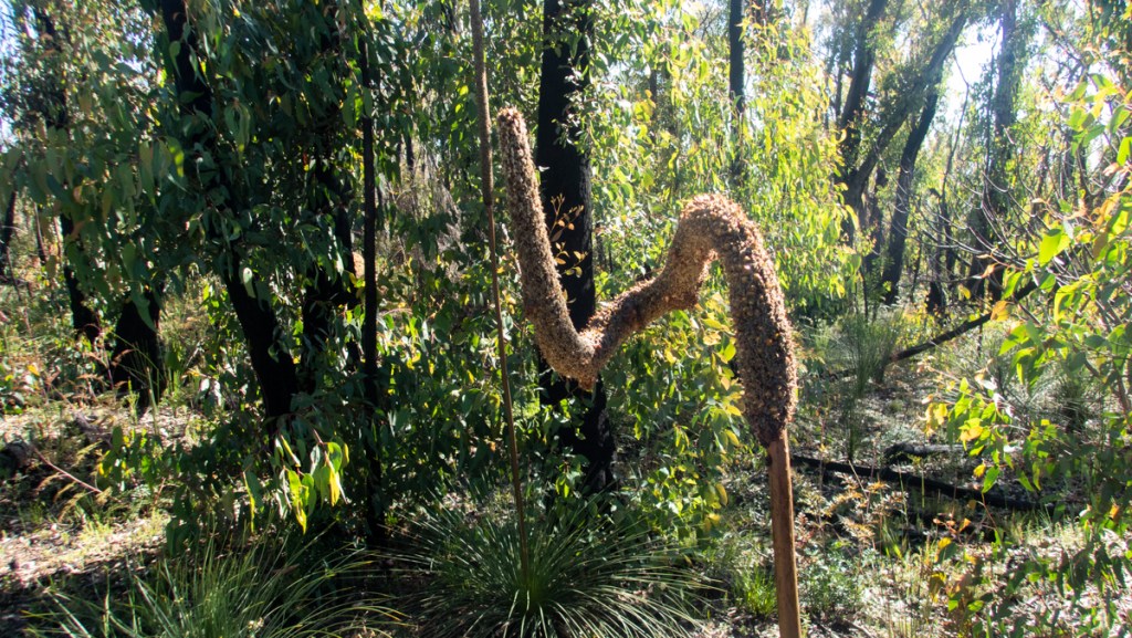
After a bite to eat we follow the base of the clifflines back to the Pipeline track passing this little cutie along the way.
“There is pleasure in the pathless woods, there is rapture in the lonely shore, there is society where none intrudes, by the deep sea, and music in its roar.” — Lord Byron
Some of my earliest memories are of 4wding and camping with my dad in the Wolgan Valley.
The valley has a Genius loci.
A sense of place.
An allure.
It’s history of occupation, both Aboriginal and European, hangs in the air and hides in the undergrowth.
It’s special.
I remember times when it was less known, camping far down the river on unexpected flats.
I remember the hight of popularity when you had to get there early (On the Thursday or even Wednesday prior) to get a good spot on a long weekend.
And I remember more recent trips, where the restricted access returned a feeling of being almost alone in the valley.
So when an old footy mate offered to let me camp on his block of land hidden deep up a gully rarely travelled by the masses I jumped at the chance.
It’s Easter weekend, we wont be alone in the valley. Many campers were utelising Thomas’s shuttle, cabins and camp facitlities at Newnes Cabins. A few more walked in and set up in the NP camp ground (Why they still require bookings and charge fees when it’s walk in only is beyond me).
The road up to our campsite was rough and overgrown in parts but passable. The old hut was no longer there, another casualty of the Gospers Mountain fires, but the block itself every bit as beautiful as always.
We could have been a million miles from anyone, anywhere, and anywhen.
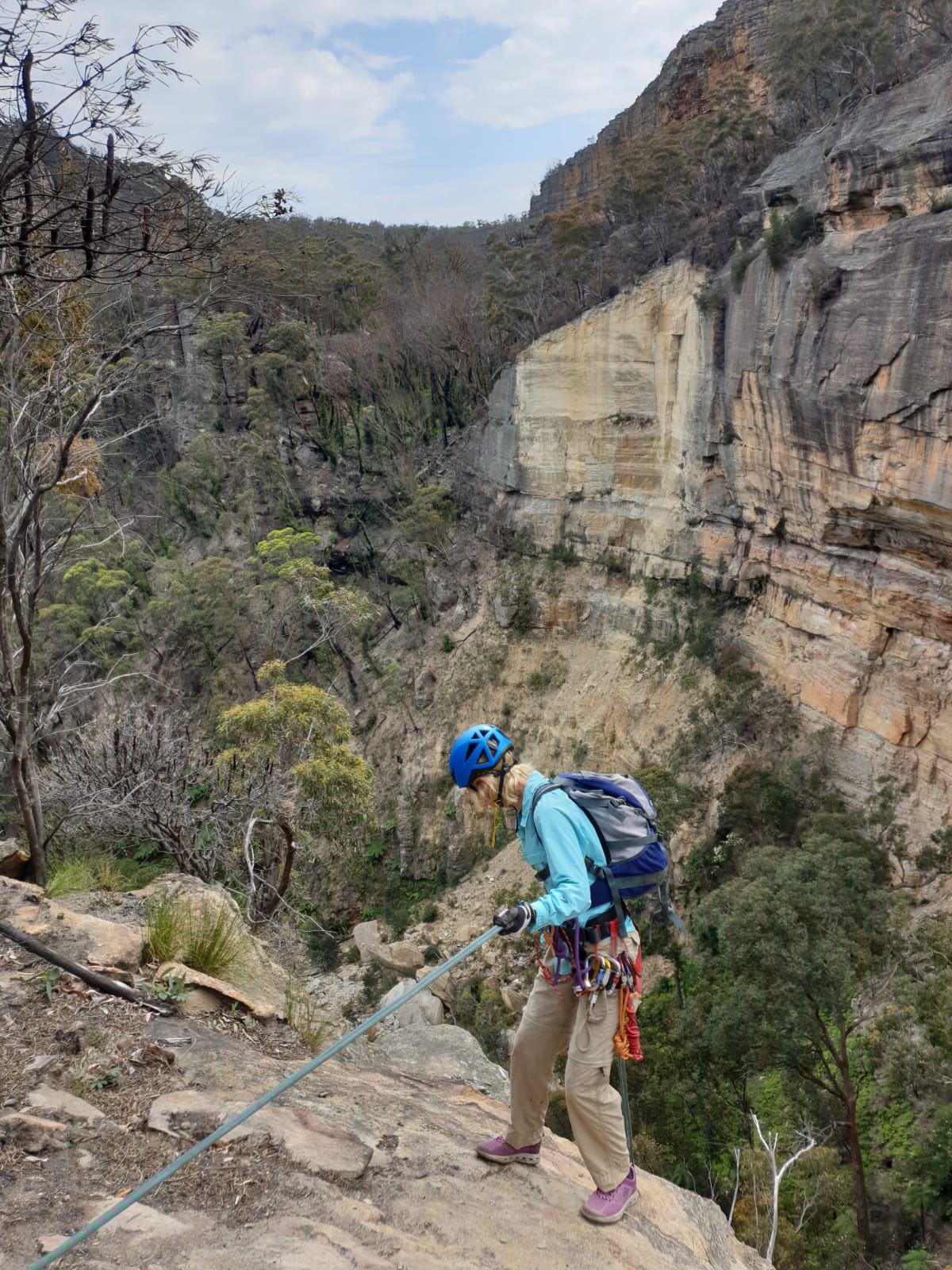
We are up and on the trail early. The pass up via the Pipeline trail is straightforward and Kylie leads us out along the ridge top that separate Newnes from Glen Davis. There’s a good trail for much of the way but as we near the top of Devils pinch creek we veer off, taking a short cut over a knoll and down into the creek.
H leads us down the creek to the first drop, there’s nothing really indicating the deep chasm to come.
We bypass the first few scrambling drops, favouring the longer drop off the ledge to the right.
I set the rope and Kylie leads the way in.
I’d forgotten how spectacular the top section of Devils Pinch is.
Gagdet remarks it’s second to Crikey in feels of depth and narrowness.
The second abseil comes straightway and has a very tricky start but Gadget is on anchor duty and guides us down no dramas.
Brooke regales us with a song.
Just around the corner the deep channel is filled with light
The canyon walls open out and we make our way down to the lower constriction.
Some scrambling and careful bridging keeps us out of the manky water, mostly.
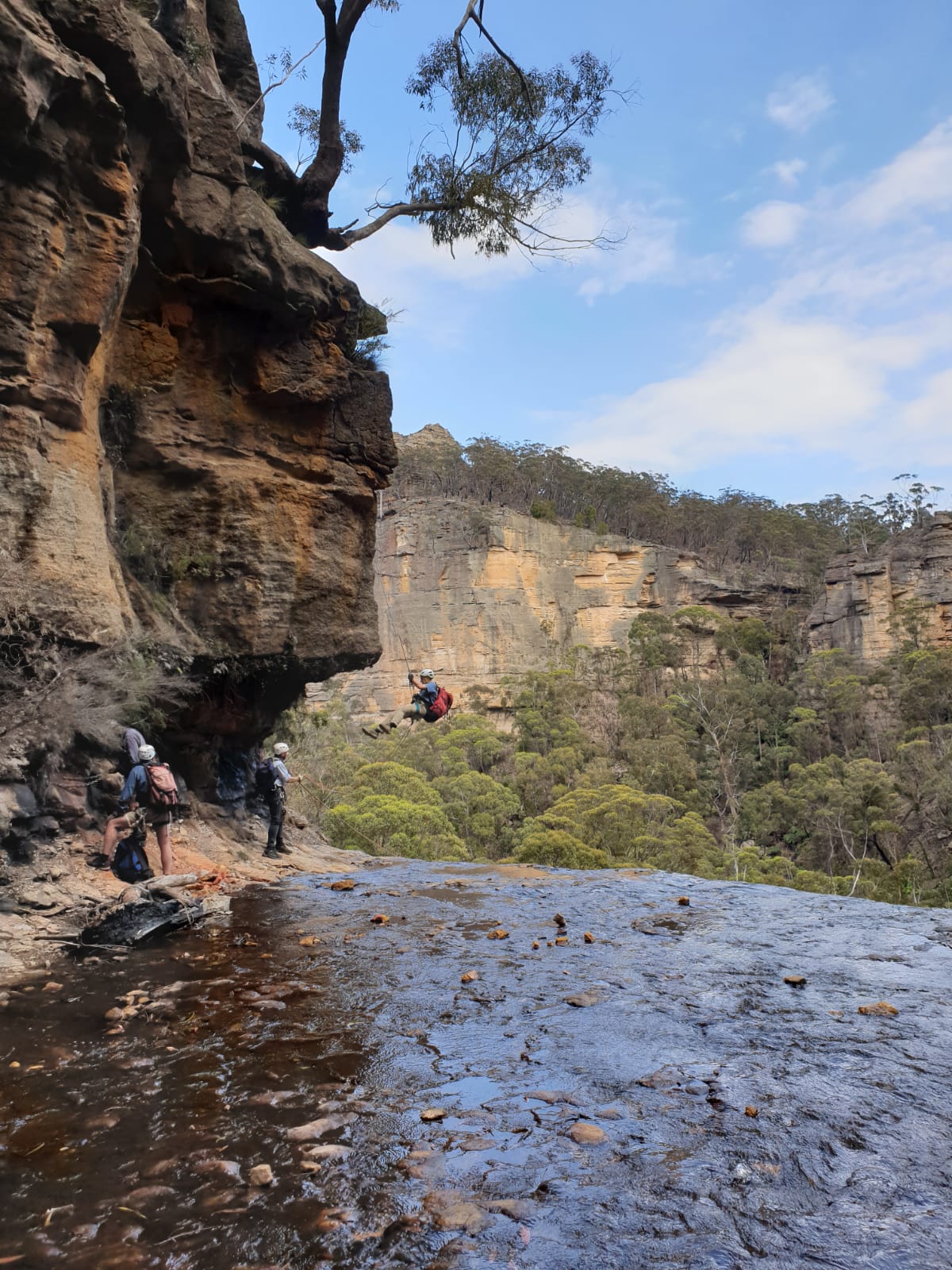
And soon we come to the 20m abseil into the drier lower hallway.
As the canyon opens out we pause for lunch, then dump our canyon gear and make our way along the base of the cliff for a couple of hundred meters to the bottom of Starlight Canyon.
While worth doing on it’s own from the top I think combining it with Devils Pinch in this way makes it a great day out.
We reverse up the canyon, there’s a couple of scrambles but nothing overly tricky, unless you decide to try an alternative squeeze up a chute rather than the easy climb up and along the tree roots like I did…
The bottom of Starlight is like a hidden world and you half expect triceratops to be grazing on the fernery.
And then the canyon closes in.
I get the camera gear out and send the others ahead.
Just a hint of what’s to come
A young eastern brown snake. Pseudonnaja (meaning “Fake cobra”) Textilis ( meaning “scales like my wife’s stockings”).
And soon the walls close in futher and all light is lost
Well not all light.
Your description of a tunnel section severely under sold this. They say when the meet up halfway through as they were coming back down. “Cavern” would be more appropriate.
Over head bats chittered and fluttered.
But we need to head back to the light.
It’s just the way we do it.
We follow the cliffs back around to the bags then make our way down to the river and back to camp.
“Because when you stop and look around, this life is pretty amazing.” — Dr. Seuss
Ok it’s nearly 40years ago which sounds like a long time when I think about it but I was and young whippersnapper out on a Jeep trip with dad and his mates. Day 2 we visited a bloke by the name of Col Ribaux.
As well as being a fellow connoisseur of ex-millitary vehicles, 4wd drive enthusiast and diamond miner, Col was an all around top bloke, legendary character and, the “Guardian of the Mountain.”
After admiring the assortment of old Jeeps, trucks and tracked personnel carriers he fired up one of the old tanks and we followed him up the steep pass through the cliff line of what we knew as Airly but is more properly Airly Turret (Confusingly there is Mount Airly slightly to the West, then Airly gap, then a small bump call Airly Mountain then Airy Turret on the way up to Mount Genowlan (Not to be confused with Jenolan, different spellings of the same aboriginal word for high point/place).
After the steep drive up and a look around the mine we camped the night out at Genowlan Trig.
Col has since passed and the area with it’s plethora of Aboriginal and European heritage sites and stunning natural beauty has been taken over by National Parks and named, Mugii Murum-Ban after local elder Uncle Charlie Riley. Mugii being a type of owl and Murum-Ban being eldest sone.
While always a favourite spot in 4wd circles it’s a bit further from Sydney so hadn’t attracted the bushwalking crowds of the Blue Mountains. That’s changing as walking clubs and fellow bloggers discover just how magical the place is.
Anyhoo, in the ensuing years I’ve driven passed it a lot and even driven up Mount Airly a time or two but it was time for a return to Genowlan.
Kylie and I had scoped it out a couple of weeks prior on a day when she also flew over it with Capertee Valley Helicopters. Remembering the steepness of the road and the old rock steps I opted to park part way up and walk. Finding the road recently graded and, while still steeeeeeeeep we thought it easily doable in the triton.
And so we came back and Dick joined us.
Plan for the day was to have a look around the old mines, enjoys the views and check out some of the slots the walkers had cottoned on to.
First stop Ultimate Slot.
From where we parked I was expecting a bit of a scrub bash but
There a bit of a trail here, called Kylie
We follow a well defined trail for about 2mins and… BAM
Magical but bloody hard to do justice to with photos
After phaffing about for ages we head back to where we parked and head in on the other side of the road. In less than 20 steps from where we parked we were in the “Grotto”
There’s a bit of old rough and ready mining infrastructure in the Grotto. Col and Brian had pumps set up in the pool to supply water to the diamond mine operations.
It’s a beautiful little micro canyon and the colours are stunning
Back to the cars and we head back up past the main diamond mines. Our next stop was Gnomes pass, AKA Ladders Defile. This is another slot/micro canyon that Col had set a series of Ladders in to make it easier for his kids to get through. He also added a bit of a fairy tail touch.
The old ladders make it easy to negotiate the slot which soon opens out to a amphitheatre that would make a great spot for a picnic.
We scramble up onto the pagodas and admire the views
More Pagodas than you could poke a pagoda stick atKylie with the Red Rocks in the far distanceDick looking towards Genowlan plateau
We then continue out to soak in the views from Point Hatteras
The plan was to do Dove today but big dump of rain had spiked the water levels and our local contacts suggested we wait a day for the levels to drop a bit. We were pretty sure they were being cautious with a couple of randoms asking questions but we were happy to take the advice and opted to do Machinery creek instead.
After parking at the bottom it took me a bit to work out the big obvious bridge wasn’t our bridge. The amount water flowing at speed under the big bridge had me a bit 😳
But the correct creek was a lot more enticing. The water was about 15mm off what we were told was the high level (interesting by the time we got back here it had dropped at least 70mm)
Our advice was if we didn’t have a second car to hitch a ride up the hill but there didn’t seem to be too many cars heading our way so we hoofed it up. While there wasn’t much verge at times the we had plenty of warning to get out of the way of the few cars that did pass us.
40 or 50min (or forever ) later we reach the Round Hill Cafe at the top of the hill. Surprisingly there was a little camp area there. Talking to the care taker we discover it had shower, toilet and kitchen area and was only $25 for a powered site! I know where we are staying tonight. Winning!!!
Anyhoo we follow the trail down past some old mine Adits to the start of the canyon.
Enticing. Not.
And soon we were suiting up in a little gorge.
After the slipfest in Urumbilum it took us a bit to trust our footing but the rocks here offered heaps of grip. And soon we were making reasonable time
It threaten to but never really canyoned up.
Still there were some very cool abseils in flow. It reminded me of the better of the Bungonia canyons with good water in it, though the abseils tended to be shorter .
The second abseil is the crux. It lands in an enclosed pool that in high water forms a powerful hydraulic with strainers in the outflow
I’m in. Dad has photos of it from Jeep trips in the late 60s early 70s, though they knew it as the Wolgan Earth Pillar, a name they got from the Luchetti’s who had the farm down Valley. They got it off Carne’s map from his early 1900s mineral survey where he recorded it in his journal as “Earth Pillar, the Pinnacle, Wolgan Valley”. Anyway it’s been on my list of things to visit for a long time.
Hey, do you want to go in from the top and check out a few canyons while we are down that way?
Some times I wonder what it would be like to have friends who hear out my hair brained ideas and say things like, That sounds ridiculous, Flynny. No way we should to that….
But noooooo. Despite several epic scrub bashes my friends keep saying things like, hell yeah lets do it.
Lucky, otherwise this blog would be rather boring.
Besides no one is going to be telling there grandkids about the epic weekend they had playing golf, right?
Well unless they win a major or sumfink.
Anyhooo
We were planning to walk out to a base camp Friday night. 3pm and it’s pissing down. None of us want to start walking in the rain but the rain parts, the radar is clear and it looks like it’s going to be a perfect night for a stroll.
Leo and Madie swing past my place to drop off Pippa the Wonderdog.
Should we take 2 cars?
There’s only 3 of us….
Maybe we should have taken 2
Driving up on dusk and the sky to the north looks like something out of an Armageddon movie.
Rolling storm clouds and blasts of lightning heading right to where we are going. That wasn’t on the radar!
We get to an intersection. Swing right. says I. Left has a 4wd creek crossing.
When was the last time you looked? Says Leo. I got a 2wd through there last year.
While I thought they had done a bit of work to the crossing I hadn’t tried going that way since getting rid of my old FJ45 Cruiser.
We go left, much to Madie’s trepidation.
The creek crossing is up but it’s much easier than the deep rocky drop off of years gone past. We get through easy enough. Except the hill up the other side is a soft rutted mess. 1 quick go at getting up and the ute sinks to the diffs. Lucky it is very wet and Leo is able to reverse out with help of the steep terrain.
We are going back the other way! Madie puts her foot down. And I’m driving from here!!!
We take the by-pass. But halfway down a sharp log hidden on the inside of a corner rips the side wall out of her rear tyre. Pssssssssssssssss.
We get out to change the wheel. Armageddon skies open and the rain belts down. There is an issue with the jack handle which also doubles as a thingie to wind the spare tyre down. Nothing that a quick adjustment with a shifter or screwdriver to open up the slots wont fix.
Where’s your tool box.
I don’t have one….
Apparently Madie cops one of my infamous eye rolls . My kids take the piss out of me about them all the time but surprisingly this is the first one thrown Madie’s way.
Anyway, a bit of dicking around with a small multitool and a blood sacrifice and Leo has the handle working.
Tyre changed we rock into the car park and decide it’s way too late to start our walk so we set camp for the night .
Before you read on; Part of the joy of visiting lessor known canyon areas is not knowing what you’ll find. Sometimes its a disappointing creek bash and sometimes you get a good one. If you ever plan on exploring this area do yourself a favour and leave the rest of this post until after you come back.
Anyhoo
Saturday:
We are up before the sun and after a quick breakfast we are on the trail a little after 5.30am.
After being closed to vehicle traffic 20 years ago this trail devolved into a nightmare scrub bash, like the type of scrub even I avoid, and that’s saying something. Post fires it’s easy walking and we pick our way along the ridge line the old road use to follow for about 8km before spearing off into untracked territory.
We reach our chosen base camp around 8.30am, dump the camp gear and head off for our first canyon in good spirits.
Despite a series of complex cliff lines we find easy passes until we are directly above our drop in point
To be honest we weren’t expecting great things from canyons out this way but this one had a nice start
After a bit the canyon opens up somewhat and then begins to drop steeply. We abseil the first drop and then I scramble down the next few to see it it’s likely to drop into a lower section. It’s pretty but the walls are getting wider and more impenetrable so we make the call to ascend back up the line and try to force a pass to the ridge and drop into another creek.
We somehow jag a straight forward pass up through multiple cliff lines. Winning!
Views over the Wolgan. You can just make out the conical peak of Tayan Pic, AKA Nipple hill, rising way out in the distance, 30km away
Again we managed to find passes down through all but the final cliff
Children of the Corn…. I mean cabbage bush or whatever the hell this is. It was easier than tea tree, hakea, and Acacia but I would be well and truly over pushing through this by the end of the weekend
But soon this creek, too, drops into a nice section of canyon.
This one had a bit of flow to it. Mostly due to the rain but partly from a dam at the end of a pool on that gave way as we passed it.
And it had an arch. You know I like arches Madie
And then the water dropped down a narrow dark hole and 20m later it ran out this funky tunnel
At about the same point we decided to scramble out of the last canyon we had a quick bit to eat. Despite covering a lot of ground so far we are still full of enthusiasm and even talk about trekking down to Dick Rock today. We must have been delusional
Cute little Boop Noodle. The only one we saw all trip
Once again we jag a straight forward pass back to the tops for more stunning views
Heading down to our 3rd canyon of the day and we drop into a tributary thinking it will be an easy pass down
Turns out is had a short but nice canyon section, though we needed some creative anchor options to get us down. No slings were left behind on this trip
A nice dark, tunnel like section was well worth the effort to get here
And below that, more nice canyon
We spent longer in this one than we thought we would, definitely longer than the previous two so squeezing in Dick Rock today was out the window. Time to beat a pass up to the tops again
We get out of the canyon and through most of the cliffs easily except for one little bit that Leo scrambled up with a couple of little boosts from me at the bottom and balls the size of a medium sized car at the top.
He dropped a rope for me and Madie to ascend. I go up to to the ledge and haul Leo’s bag then drop the rope back to Madie. She begins to ascend as I go up the ramp and begin to chimney up the last bit.
Rock! Rock! Rock! Fugg!
I’ve knocked a large rock loose and it tumbles down the chute. Luckily it misses the rope and gains enough momentum to sail out into space. Madie was 5m up the rope with nowhere to hide. The adrenaline rush was real.
But we are up and encounter our first unburnt ridge of the trip. Thick, scratchy, cutting scrub. It was a relief to finally get to a burnt bit.
It’s getting late. We have a couple of deep saddles to get past on the way to camp but Madie navigates us there easily. I have to say I was well and truly slowing down.
Night descends but we are back to the ridge we walked down on our way to the first canyon.
Then Madie lets out a whoop at the sight of the reflective stripes on my Overboard dry bag I had hung up in a tree above camp.
35km and 3 canyons in 14hrs.
We roll out the sleep mats, have a quick diner, a few laughs and then we’re in bed engulfed with satisfaction and a glorious star filled night
Sunday:
Camp Granada
A slightly more sedate wake up time, a casual breakfast and we are off a bit after 8.
Another Ridge top, another view
I’m feeling a little dehydrated from yesterday so I’m determined to drink more today. The plan is to descend a canyon, punch down to Dick Rock and then up another canyon. We knew of a couple of easy passes up ridge lines but it’s going to be a hot day so ascending up a canyon that is supposedly reversible is more appealing
But first we work our way down through the cliff lines once more. This time we manage to scramble right down into the creek
It’s pretty but never really canyons up
It has some cool caves and tunnels but is really just a creek walkIronstone Stalactites. Like the ballerina dancing on the old termite ridden stage, when the mites go up the tights come down. or sumfink
And then we have 3 or 4km of this and worse to make out way down to the main objective of our trip
Finally we made it to Dick Rock. @Madie
It’s hot in the valley we have lunch then take a higher route back which avoids some of the the scrub and short cuts the corner and we work our way up to our intended creek.
Where this morning’s “Canyon” was a pretty creek walk this wasn’t even that. The heat is oppressive and despite drinking a shit load I’m starting to struggle.
But we boulder hop and scrub bash our way high enough up to starting thinking of forcing a pass to the tops.
Thoughts of squeezing in another short canyon are out the window.
By the time we reach camp it’s around 5pm and I’m suffering camps. I’ve drank about 8l of water already today but haven’t pissed since breakfast.
We pack camp, I mix some extra electrolytes into my hydrapac bladder and we start up the hill.
I’m really struggling and a few times have to call for a rest. Much to my equal parts chagrin and relief halfway up the ridge Madie and Leo split my gear between them leaving me with minimal weight. I’m still slow but finally we reach the ridge with the old trail. We still have 8km to go but it’s going to be easier walking.
I’m making OK pace now but my stomach is dehydrated and refusing to take much in. I’m taking small sips out of my hydrapack trying to get through. The cramps are bad, the slightest miss step and something locks up. I get service on the phone and text Mandy to let her know we’re going to be late. My finger camps bad. That’s a new sensation for me.
About 4km along the fire trail we stop for a rest. I try and take a slightly bigger drink. 3 steps later I spew that up. We march on.
It’s dark.
I tune out and walk on.
200m to go calls Madie, you can do it Flynny.
All that’s between us and the car is Natural bridge. I stumble my way down. I normally wouldn’t bat an eyelid at the climb up the other side. I stop for a rest. I spew again. There is nothing in my stomach. My whole abdominals cramp and lock tight.
If that’s what period cramps feels like , girls you get even more respect from me.
Finally we get to the car.
68km walking for the weekend, mostly off track, 3 nice canyons, two disappointing creeks, and one big a tick on the bucket list.
Home at last, I spill out of the car and spew again.
He’s alive, Madie tells Mandy, but he’s got a bit of heat stroke. You may want to get him checked
A quick shower and I think I’m good for bed but Mandy suggests a trip to hospital to get checked out.
At hospital they whack me on the scales, I’m 10kg lighter than I was Friday!
They take some blood and put me on a drip. 3 bags in they send Mandy home and book me in for the night.
6 litres of fluid later, do you think you can pee now? we need to see it before we can let you out.
I feel I want to but it’s not coming out.
Well, we can always put a catheter in.
I pee.
Apparently that threat works every time.
They release me lunch time Monday.
It’s the adversity as much as the victories that makes the lasting memories.
Bush tomatos? Are they eadible? Some were on smooth bushes some covered in little spikes. (Close Kanagroo apple, Thanks Aleasha and Tom, poisonous when green)
Laurence, Kylie, Heni, Peter, Richard, Kent and meeeeeee
A while ago Laurie asked me if I’d ever been down Wolgan Falls. He’d been trying to find away into the top and bottom for years but had not long taken up abseiling.
I hadn’t. A few of us discussed running a trip. Then life happened.
Laurie and others pioneered a route in and out. And began to run the trip regularly. I usually got an invite but it was mostly midweek trips and I never made it, until today.
As I head up to meet Kylie, she messaged saying she was running 10min late because there was a Koala crossing the road.
Best excuse EVER!
I was a little worried about the meet up as the others were coming in from the other side of the plateau.
In the end we all arrived at the car park at pretty much the same time and head off into the untracked wilds of the upper Wolgan river.
And all too soon it’s over. As we were preparing to hike out Richard tripped on a rock and pulled his calf muscle. A quick bit of bandaging and a make shift walking stick and he soldiered his way up the steep exit track
Kylie taking in the views on the way out
Group size: 7
Time: 4hrs very relaxed pace
Back at the cars it was still reasonably early so me and Kylie decide to do a quick dash through Alcatraz on the way back to her car
All in all another excellent day in the great outdoors with great outdoors people
Someone, somewhere thinks you are awesome. Hopefully you do too
Sleepy little town on the outskirts of the Riverina
A small sleeper of a canyon somewhat less visited than it’s neighbours
The name fits with other creek names in the area. Yileen = To dream/dream like. Dalpura = Peaceful, Kamarah = Sleep. I’ve not been able to find a meaning for Koombanda, Jungaburra or Jinki but assume they fit the theme somehow.
Like most canyons in this area it’s not that deep or sustained but has some pretty bits to it.
From the bottom of Koombanda it’s possible to scramble up the nose below the junction and drop back down into the top of Kamarah. I guess this is the way most people do it, it makes sense as they are both short and adding in Kamarah then exiting up to the west via convenient tree roots can be a quicker than exiting via the old mine, especially if you don’t want to do a car shuffle.
You do, however miss some nice erosion caves further up the gully
Anyhoo this description is almost longer than the canyon already
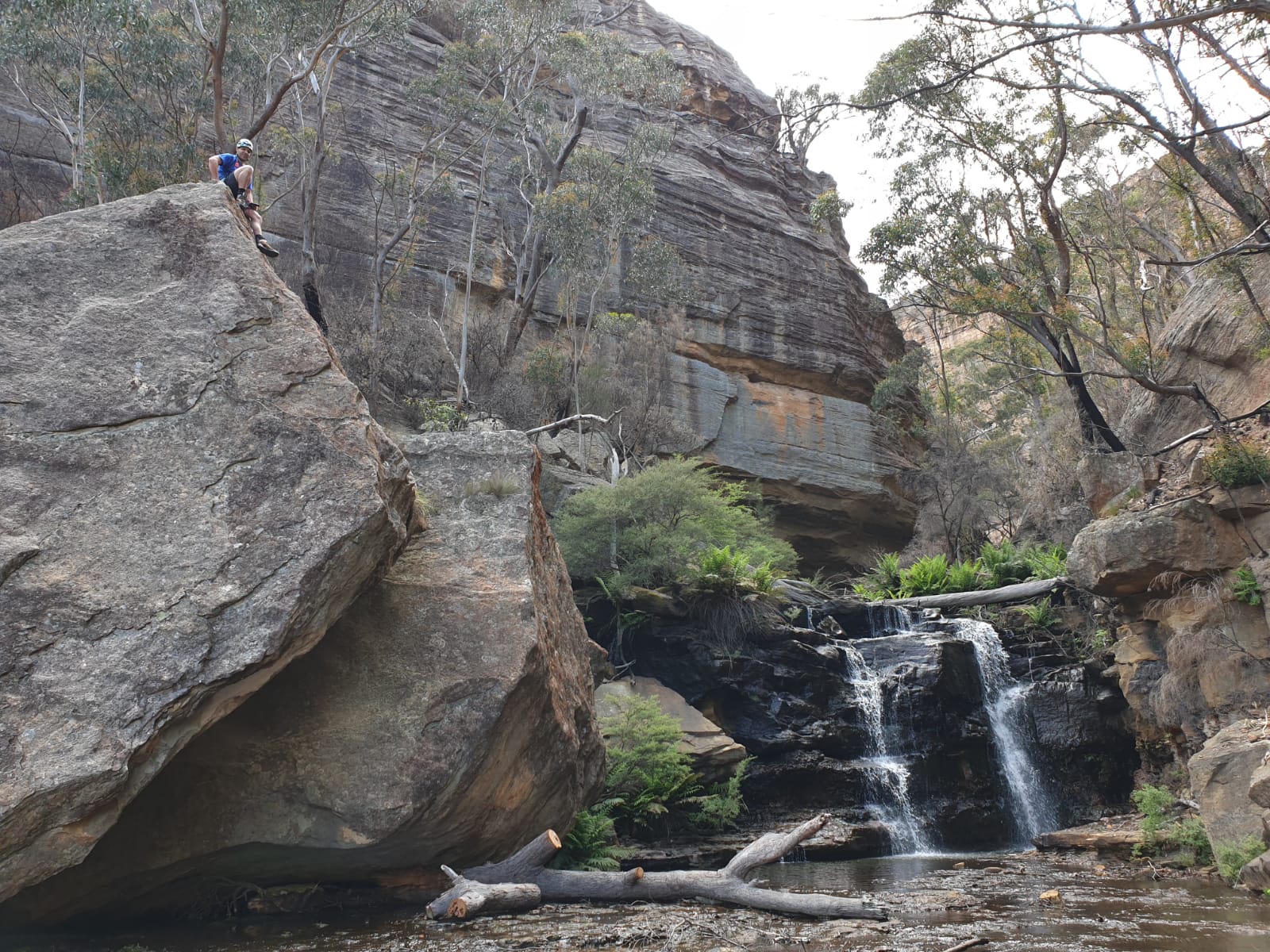
With a day off and everyone else seemingly busy I took the opportunity of a quick afternoon stroll. The creek is drier than I’ve seen it before. I wander down off the ridge, check out the caves which seem to have a lot more block fall than I remember, then make my way down until the walls start to canyon up
The water level is down at least 30cm from my last visit
But it’s still a lush green in contrast to the burnt out ridge lines nearby
First drop is about 3m, some careful bridging meant I could keep my feet dry today
You can see how far down the water level is from usual
More shallow canyon follows
Then the creek drops into a dark hole
Typical of canyons in this area it has one, shallow but stunning chamber
And some nice bits follow
And then just before the junction with Koombanda brook you can climb out on the right, or continue down this this nice overhang to scramble up on the left
Time: 2.5hr car to car with a lot of faffing around
Whatever you do today don’t forget to be just that tiny little bit awesome
I’d been a bit crook and carrying another minor but annoying injury so amid offers of epic adventure stuff I opted for the easier one.
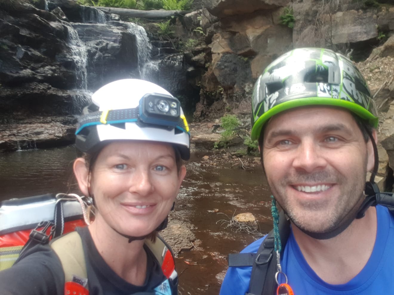
I meet Russ in the Wolgan and we set off for a fantastical slot not too far yet not too close to the camp ground
After dodging the stinging nettle (mostly) a quick march up the steep slopes brings us to a breach in the lower cliff line with a little tunnel like arch for an entry way
Like a lot of the Wollemi the Gospers Mt fire has ripped through here. You see more and the walking is somewhat easier but it’s still a bit depressing.
I struggled to keep up on the ascent but am keen to push on
In normal times the gully between the lower and upper constriction is a glorious lost world. Now it’s black and charred, yet still somehow grand
Further up the Mother of Slots awaits us and I’m pleased to see the confines have been spared the wrath of the inferno
Mater Suspiriorum, The Mother of Sighs. With a room fit for a witches covern or an altar or sumfink
We phaff about with some photos and then make our way up
Toward the top there is a boulder choke. There are a couple of ways to get over. The easiest way up is to crawl into a little cave and twist your way up a short chimney to get on top of the first boulder.
I squeeze in and worm my way up. I have my foot on a chock stone as I propel myself up and out. The chock stone moves.
Then dislodges altogether.
There is a rumble and a tumble I hear the rock bounce down in a shower of smaller stuff. I hear Russ grunt and flee.
Two things go through my head.
First Russ’s safety. It was a large rock and there wasn’t much space plus I wasn’t sure if he had already followed me into the cave.
Mate are you Ok?
Yeeep.
You sure?
Um, Yeah.
Second thought. Was that wedging up the massive bit of rock above me? I claw may way out from between the two boulders as fast as possible.
Looking down Russ is fine. I can not see sign of the rock I dislodged. How did it miss him and how did he not take a tumble fleeing out of it’s potential path I don’t know.
We are both a bit lucky. I’ve been up that way a few times and that chock stone has always been solid. The extremes of wet and dry had loosened something
Russ wondering if one of those rocks was the one I kicked at him and happy that it missed.On return we found one that would be a good 40-50kg was wedged in the mouth of the cave,
Up top the landscape is surreal. Mater Tenebrarum, The mother of Darkness, the Inferno. The youngest, most cruel Mother
Even the usually colourful cliff lines have taken a beating
Our plan was to try and make our way around and down another slot I knew of.
We traverse around the base of the upper cliff line, only to find ourselves stuck on a tier bisected by slots and mini canyons all with tricky drops. We double back looking for a walk down, we had a short rope but weren’t sure if we descended we would just be stuck on another tier with 100m of cliff line below us
Mater Lachrymarum, The Mother of Tears.
We pick a spot to enjoy lunch with stunning views.
Should we push on or go back the way we came?
Most people who know me would assume me to say push on. I’m happy being lost in head high scrub and exploring ways forward. But today was not my usual day. I was feeling drained.
For probably the second time ever I concede my goal and we head back the way we came.
Party size 2
Time: a couple of hours
If you are feeling down remember that weird Beatles song. The sun is up. The sky is Blue. It’s Beautiful and so are You. Dear Prudence


