After spending the night at the Glacial Rocks camp we get up early hoping to catch sunrise light up the cliff face.
Sunset would potentially cast a better light onto the rocks at this time of year but it’s a spectacular feature at any time of the day and a short, wheel chair friendly, walk from the car park.
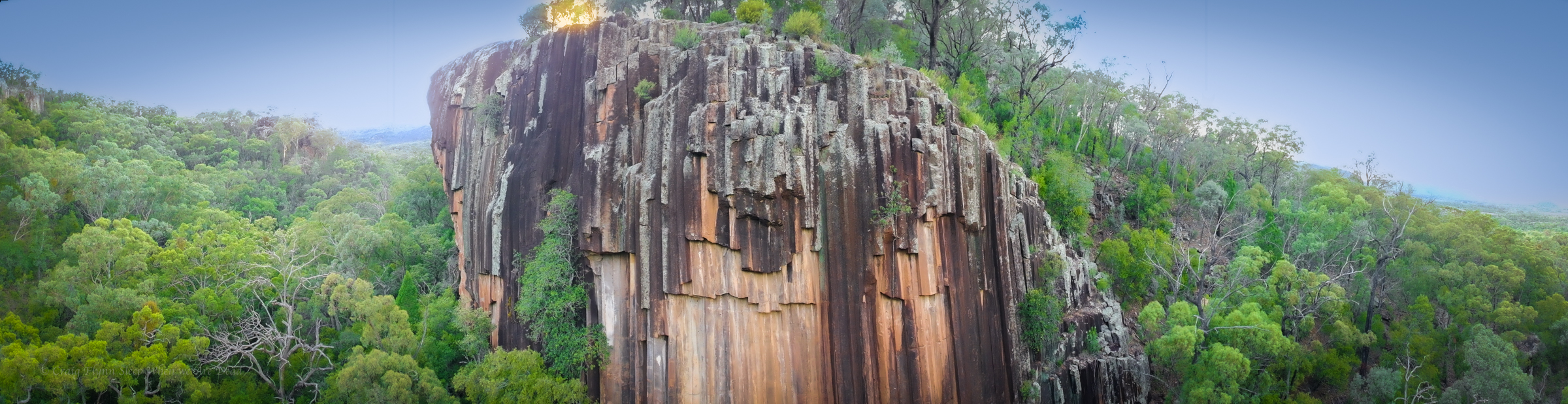
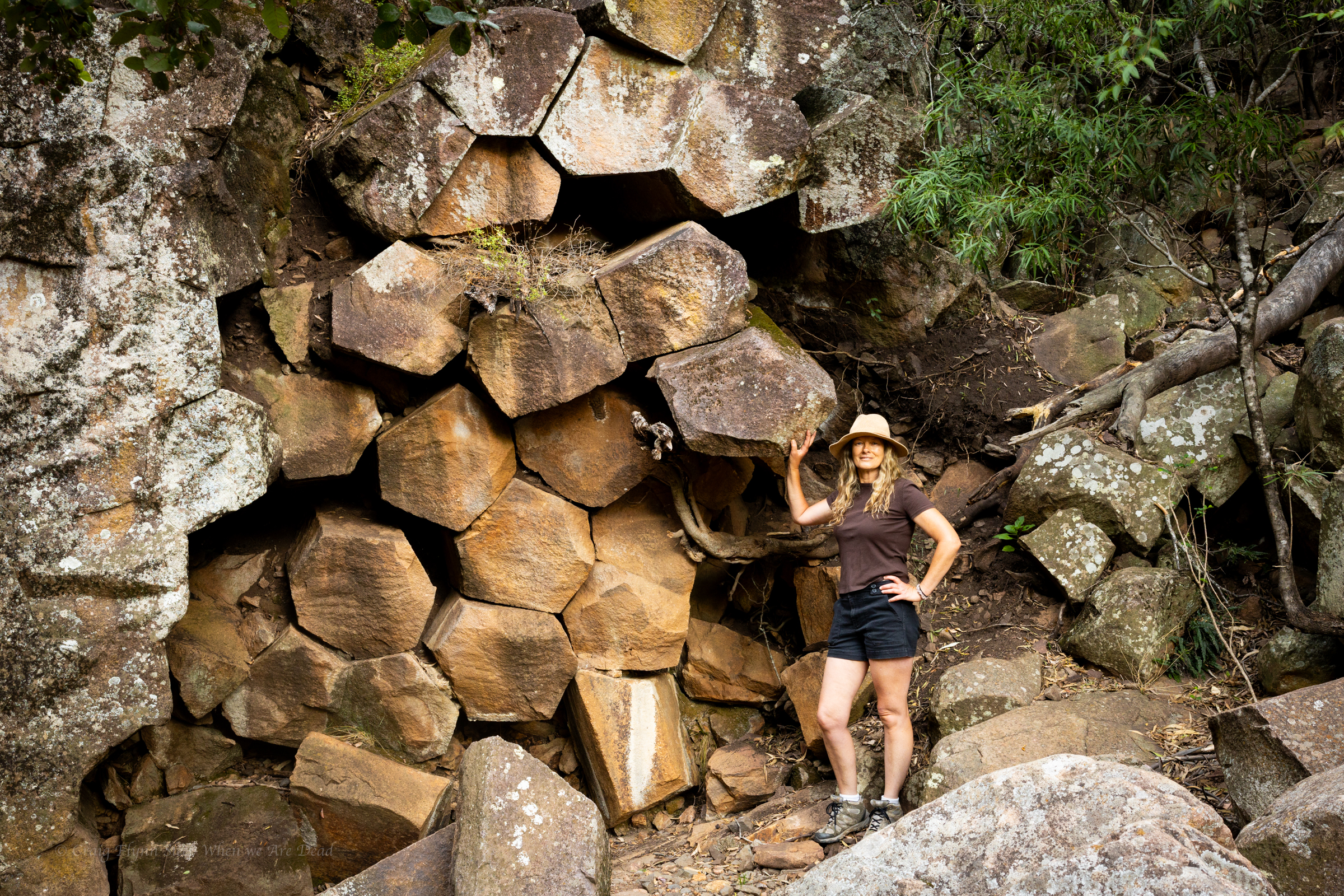
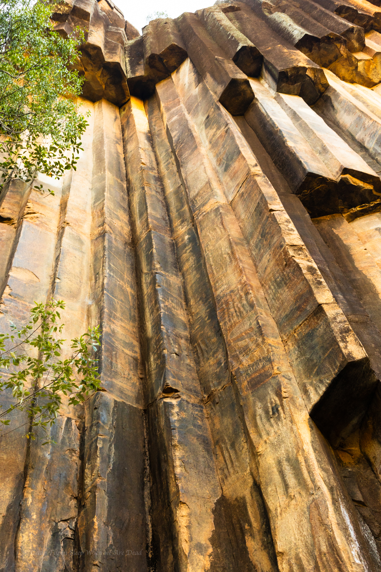
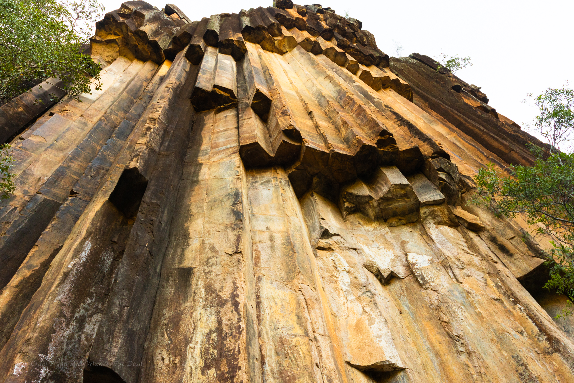
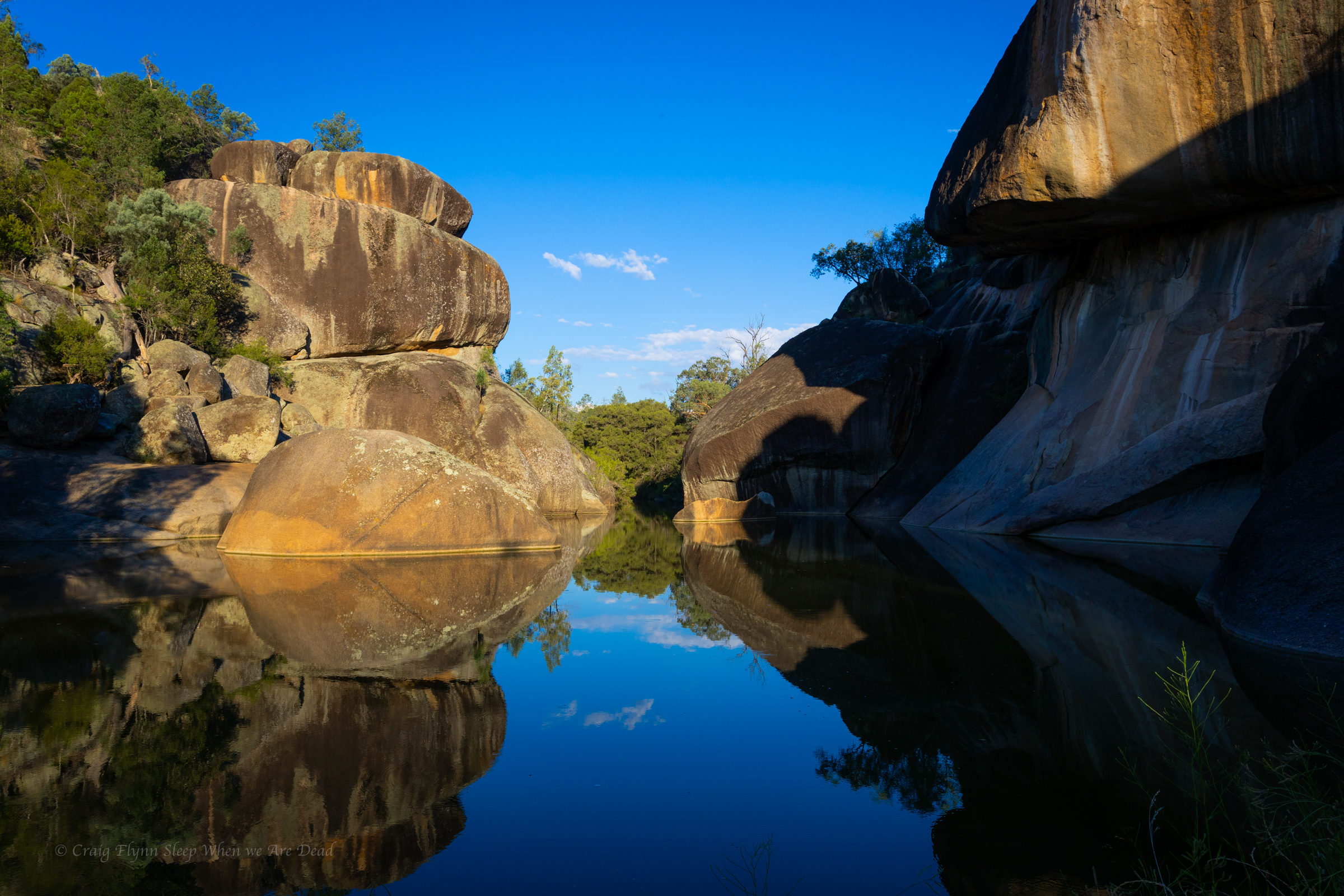
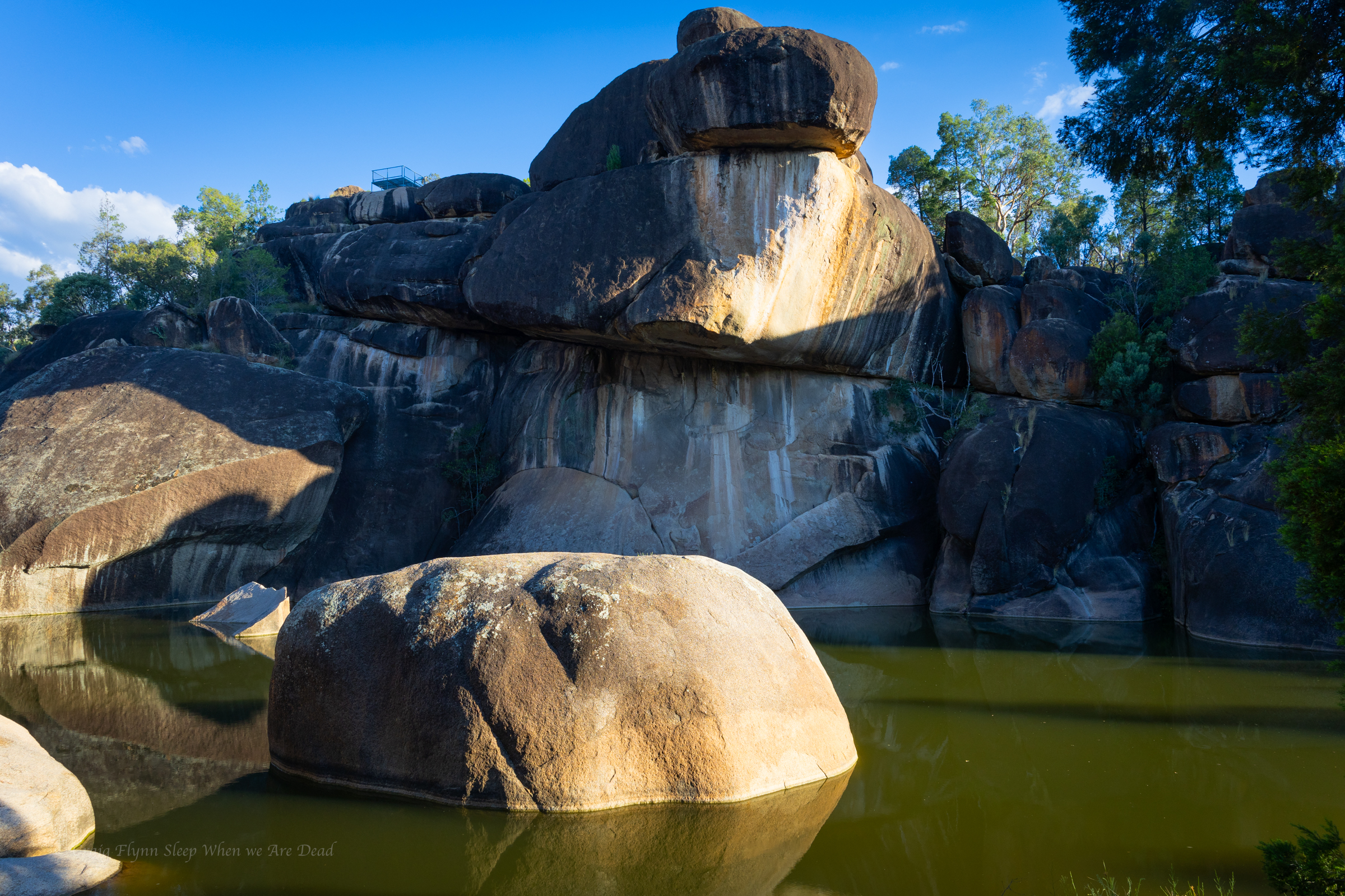
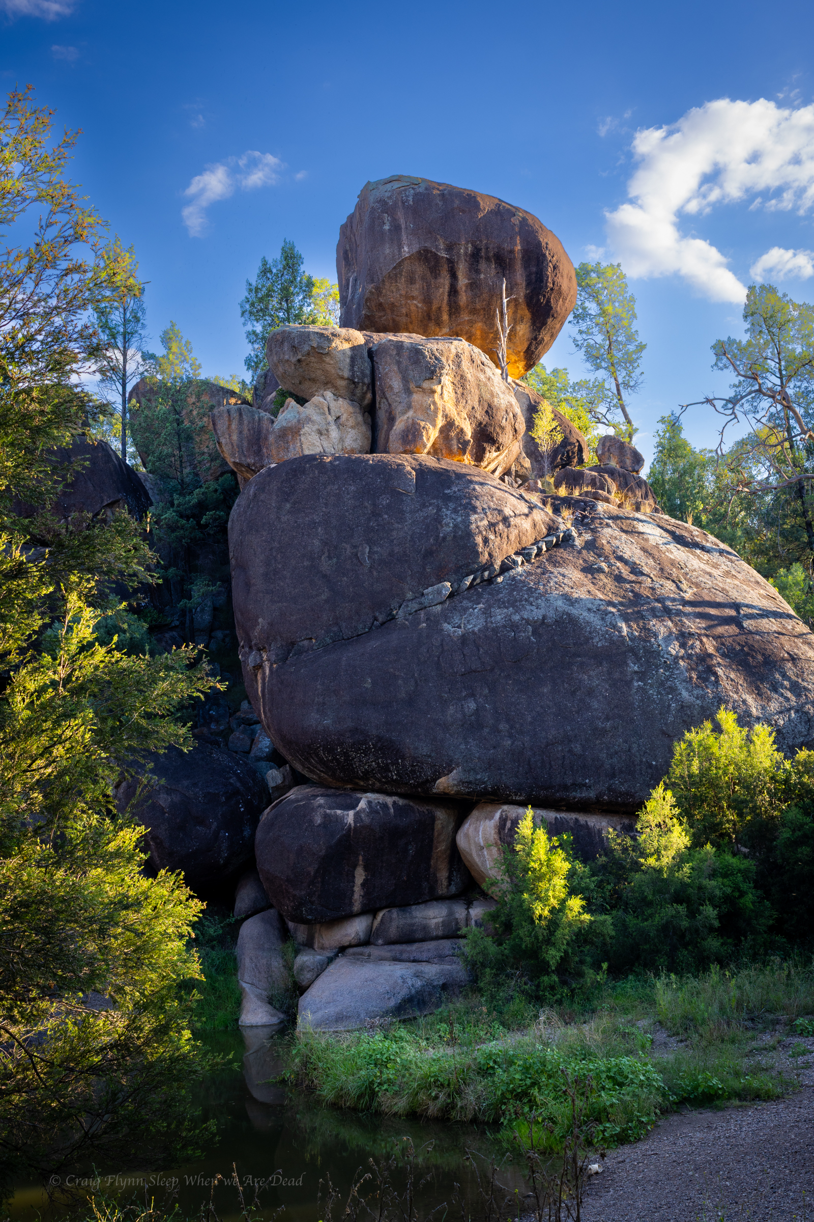
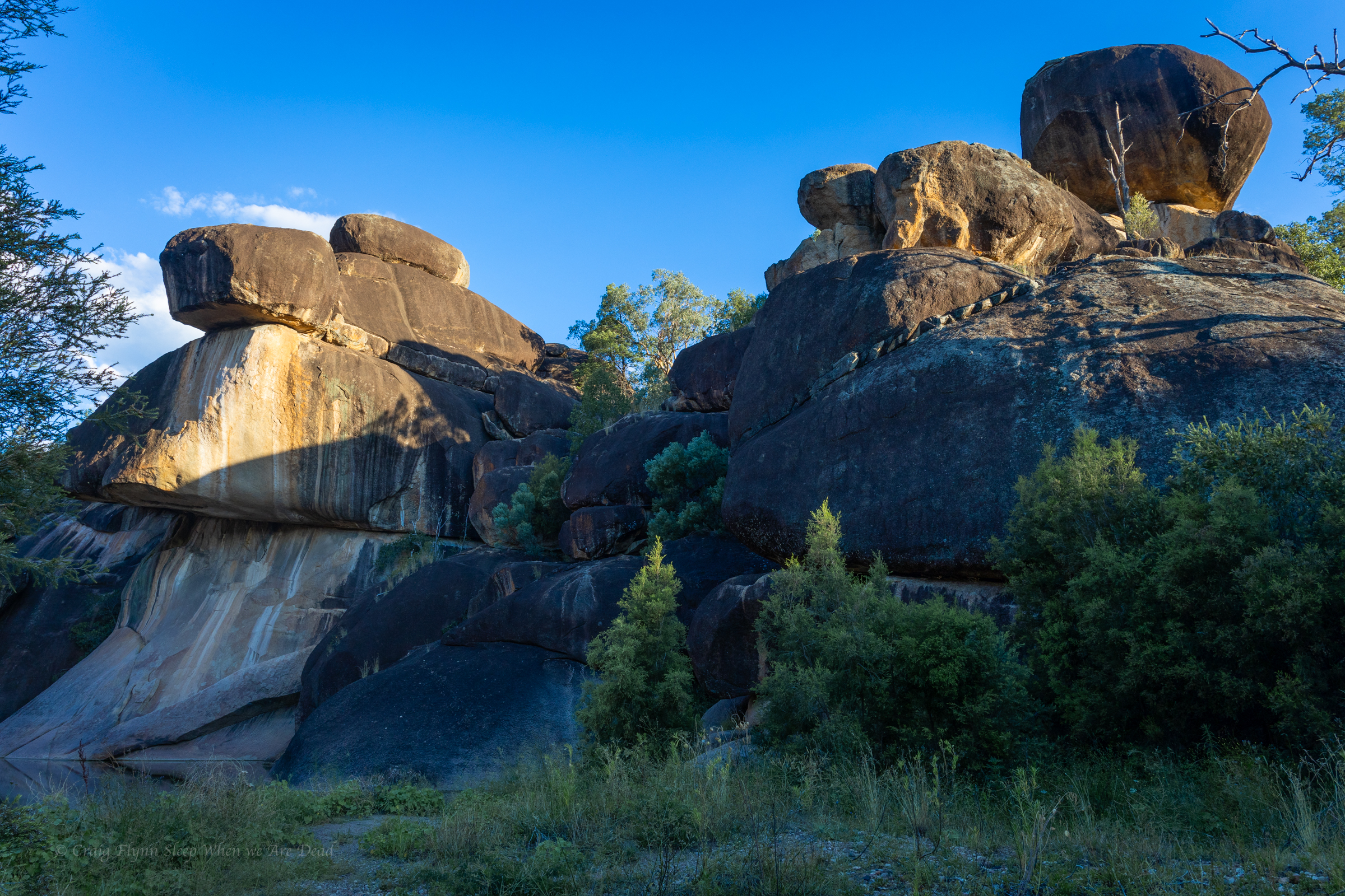
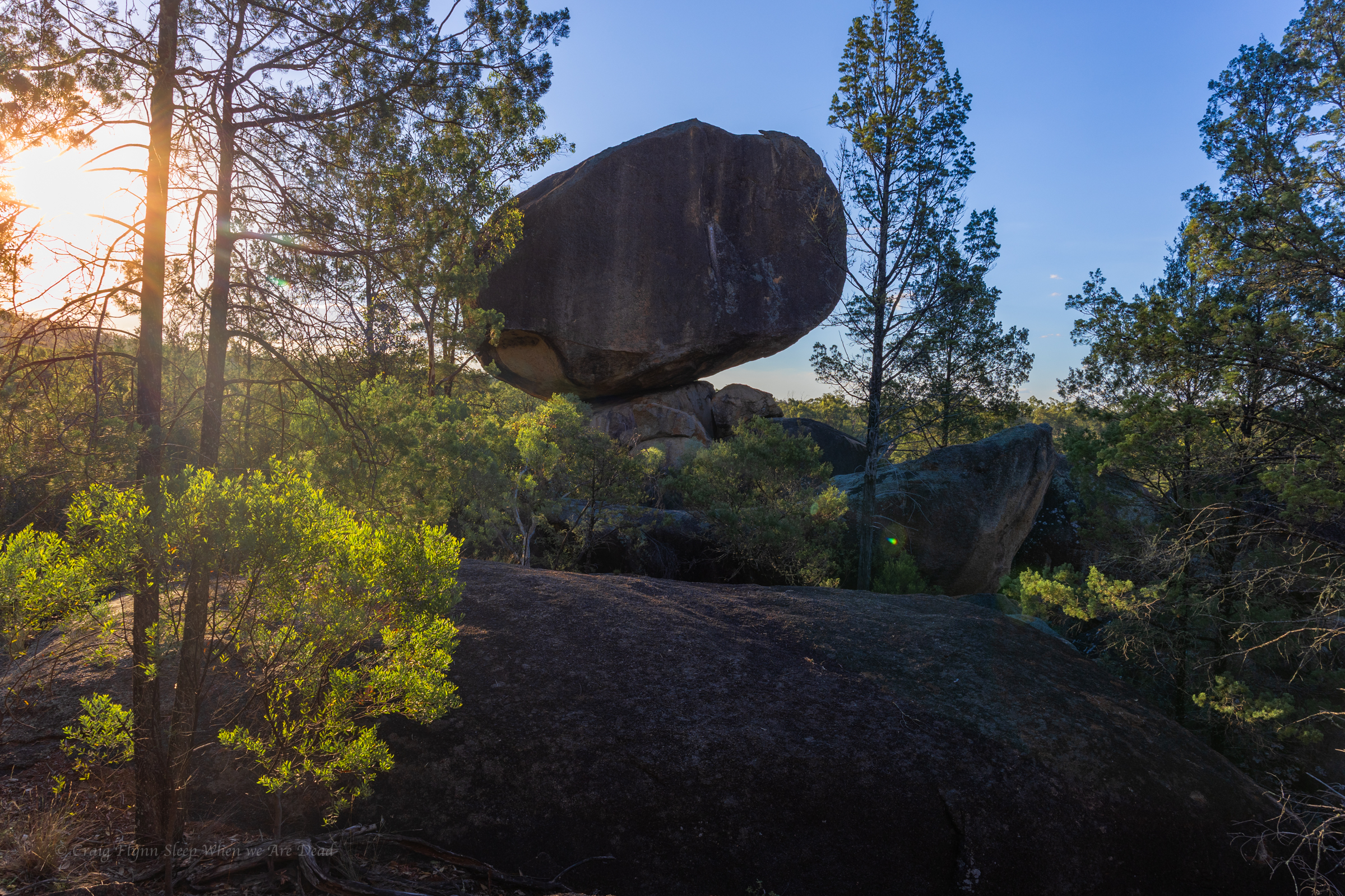
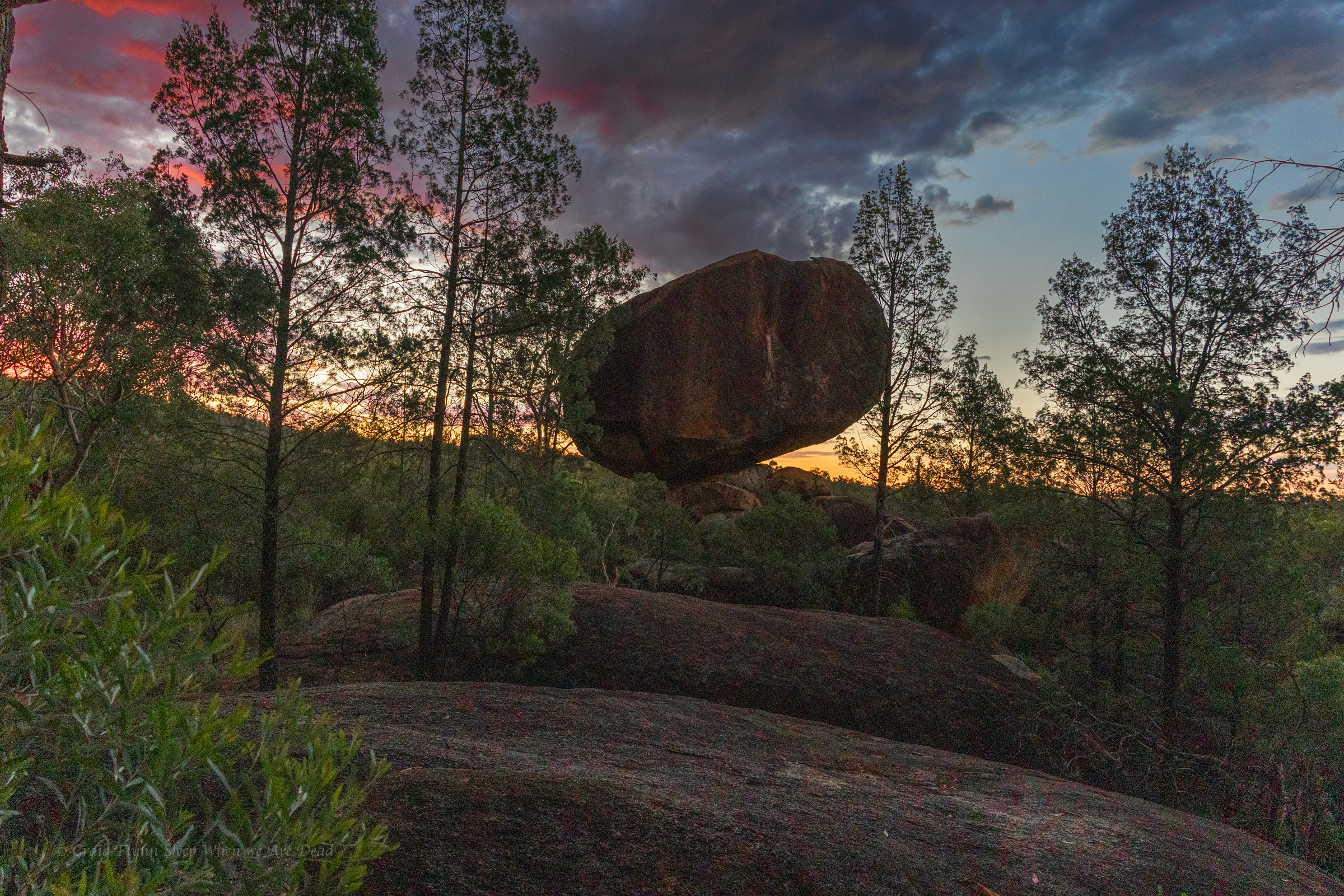
Like a pile of chopped and neatly packed logs you can see where it gets it’s name.
The hanging columns are amazing
As is our usual we push beyond the formed tourist trail on a rough but well used foot pad to explore the creek beyond.
Once again it’s dry but interesting
And more of the amazing shapes
The cliff lines soon peter out and the creek snakes it’s way cross the plateau so we retrace out steps and head into Narrabri for coffee and a bite to eat before deciding to drive up to Mt Kaputar for a look.
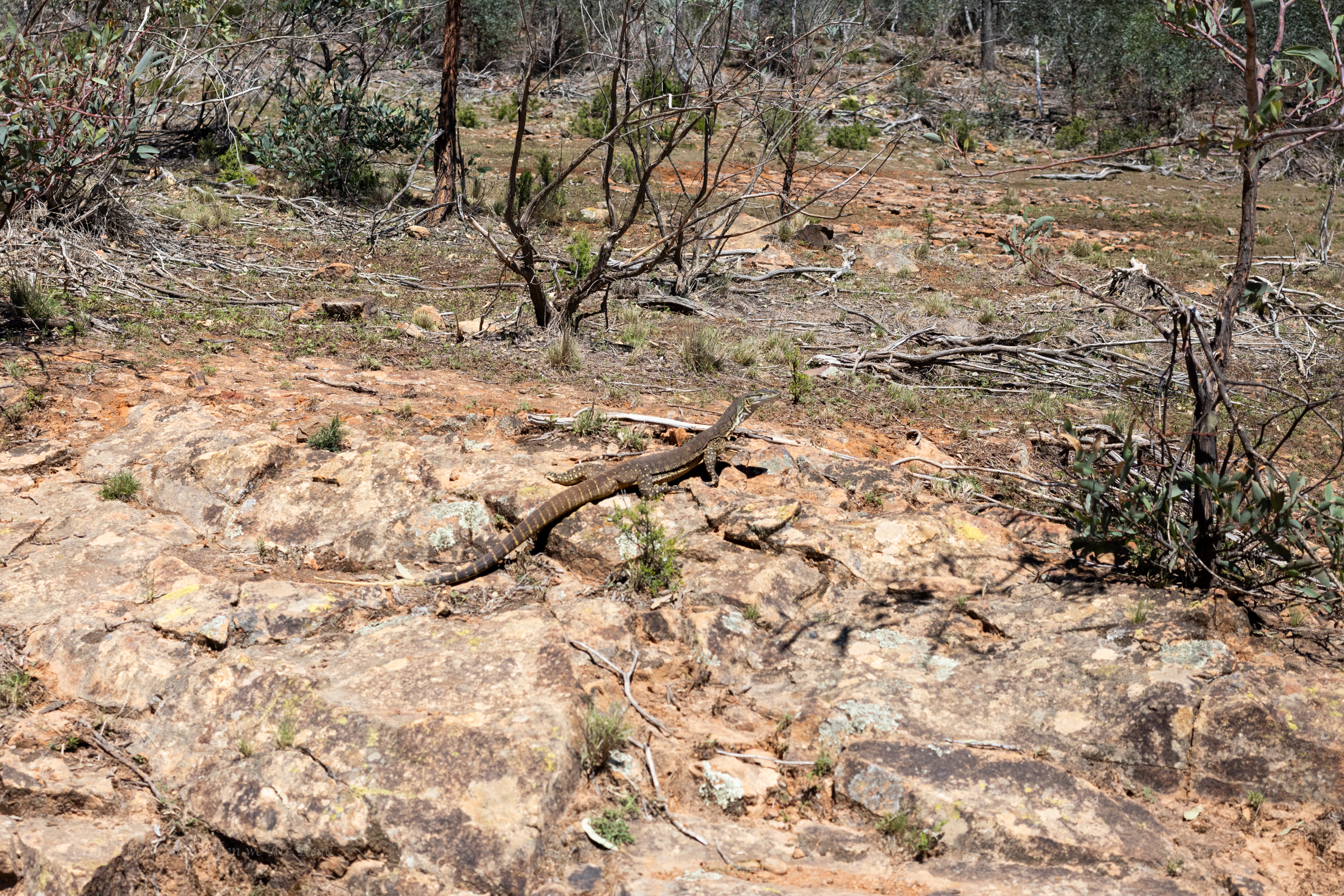
sand goanna (Varanus gouldii)
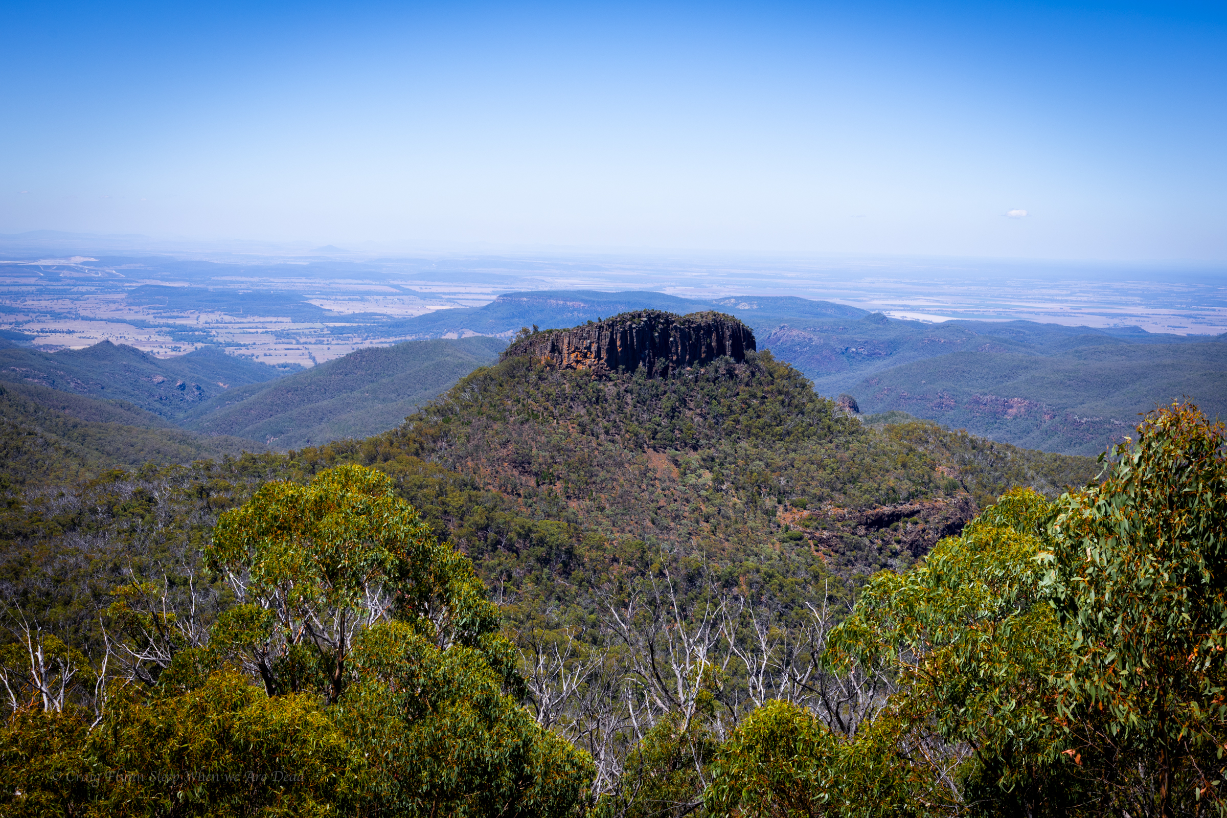
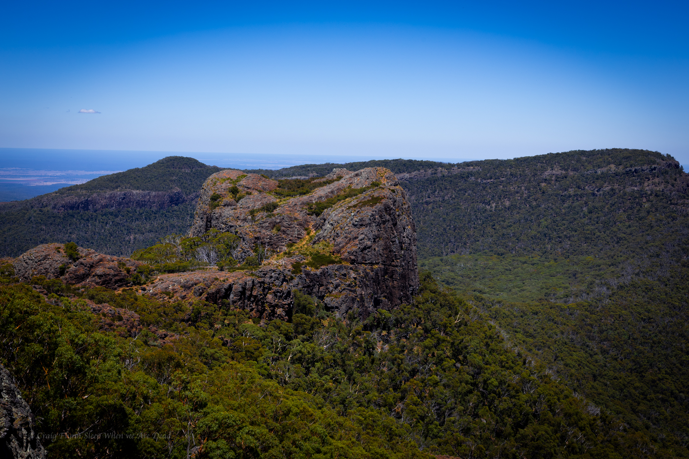
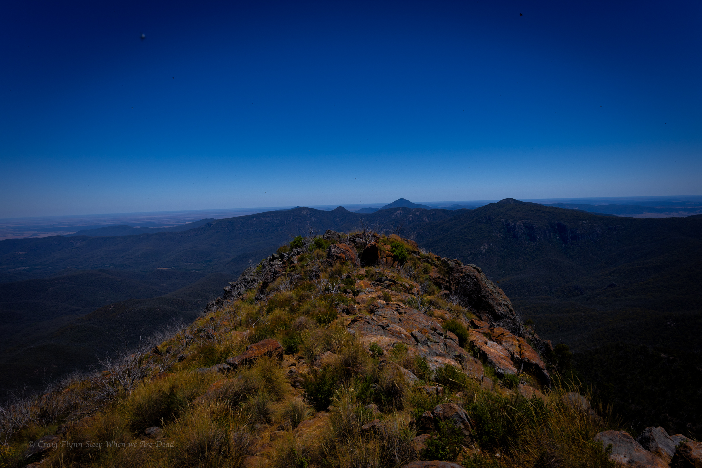
We decide it’s way to hot to do any of the walks in the middle of the day but the road up is outstanding and well worth the drive.
Euglah Rock from Doug Sky lookout
The road itself is an adventure and the views with in a 5min walk from the car just keep coming
But the temperature is pushing into the high 30s again so we make track down to Coonabarabran where we decide to splurge on a motel room with air conditioning.
Over the years I’ve had a quiet giggle at the poor tourists hopelessly out of their way asking “is this the way to the campground at, um, New Ness.” their GPS’s having them very confused.
Today I gained a deeper understanding for those poor souls.
It’s pronounced “War” Gorge, said the amused cowcockie we waved down to ask where the hell are we. Turn left here and you’ll see the signs. he says but where did you come from?
I get ahead of myself. That came later.
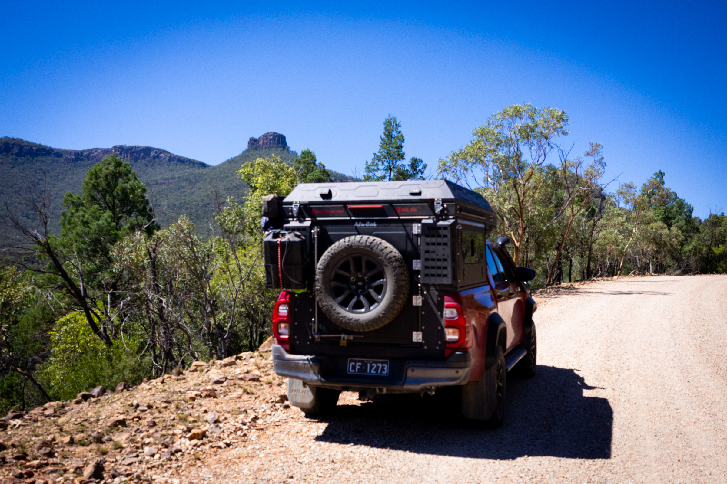
We were doing a less than direct route from Cranky Rock to Waa Gorge as we wanted to use a free camp ground at Glacial Rocks to give us access to both Waa Gorge and Sawn Rocks without too much back tracking.
The road in to the Gorge from this end was touted as 4wd and fair weather only so we wanted to swing by the camp to see if it was suitable and make sure the road between was doable.
The camp looked great and we continued on. GSP signal was lost.
We get a couple of bars of signal just down the road and it screams to turn right.
Veering onto Terrergee road the signs matched what we were expect, other than not mentioning the Gorge, “Road Suitable in dry weather only.”
But the road was a lot better than expected.
Must have been recently graded, said we, if this is the rough road people whine about on trip advisor…. We should have shut up.
The road takes us across the top of some beautiful county and then down steeply into the valleys. It did get a bit slippy on the descents and you could see why it would be problematic in the wet.
So far so good.
Take the second left onto “Berrigal road” Says the nice lady in the GPS.
But the second road is signposted “Haven Home road” or sumfink and it’s the only road sign we’ve seen all day and the road looks like a goat track.
We pass it.
Go back says the GPS lady.
We go back have another look. Doesn’t look right. We try the other option.
Go back says the GPS lady.
I get out my phone and check the GPS topo app. I could see where the roads go but Waa Gorge isn’t marked and I’m not 100% sure where it is.
We take the goat track. It gets rougher and rougher.
There’s some dry creek crossing we need to engage 4wd for.
This is why we bought the ute. Says I
but it gets wilder.
Eventually GPS lady says, Turn left 100m ahead.
The left was even more over grown. I check the app again.
It opens out just through there but I’m 100% sure it’s private property.
Straight will skirt around the property boundary but add 18min to the drive.
Oh well we skirt around.
We are now in 4wd more than not.
It was a fun drive.
the road links us back onto Terrergee road, about a 5min drive further on from where the GPs insisted we turn off it earlier and still no signs for Waa Gorge.
We flag down a landcruiser coming the other way, the first car we’d see all day.
Um is this the way to “Wah” Gorge, say I sheepishly.
With a wry grin the afore mentioned conversation takes place.
The GPS took us down that road back there.
That bloody goat track!, it would have tried to take you across old mates property too.
I sense this isn’t his first of such encounters.
Anyhoo we are on the right track now. If the final little bit of bumpy road into the car park is what Tripadvisor folk are complaining about they don’t know what they are missing.
It’s 38°c as we pull into the car park.
By the way, it’s pronounced “War” gorge. 🙂
Sunscrees, hats, water, electrolytes, deep breath
Ok let’s head up. drink lots and if it gets too much say early and we’ll head back.
having suffered heat stroke and dehydration before I’m extra cautious in hot weather so we have a lot of water between us.
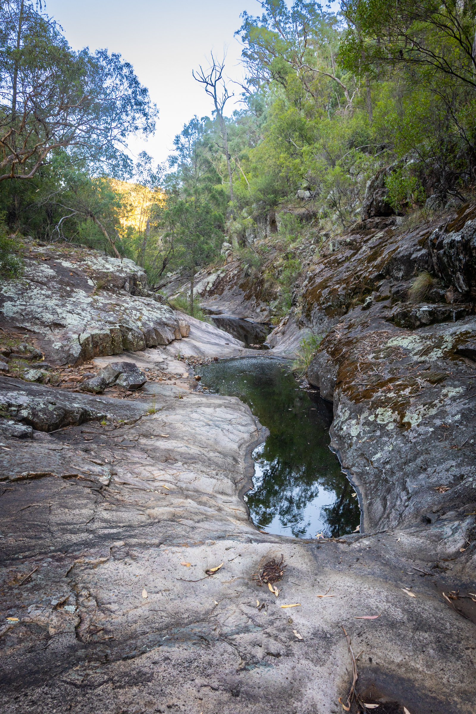
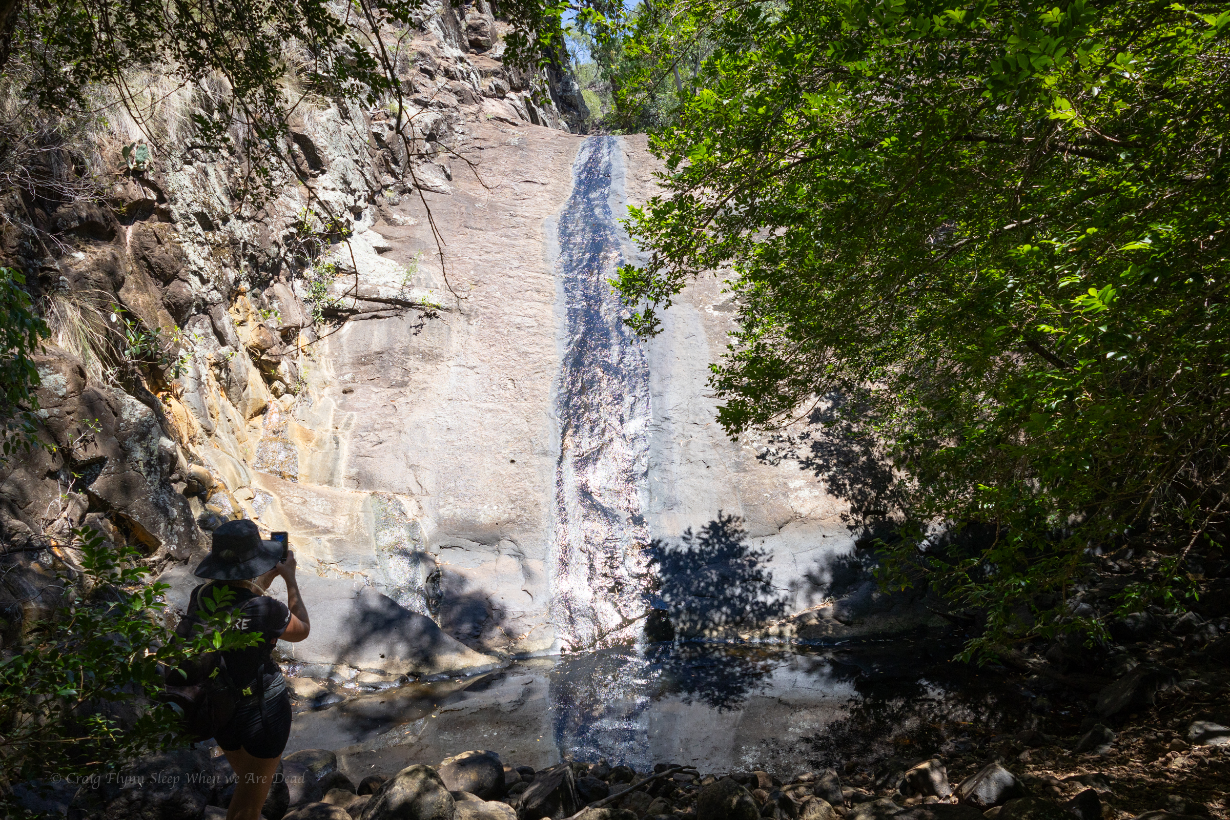
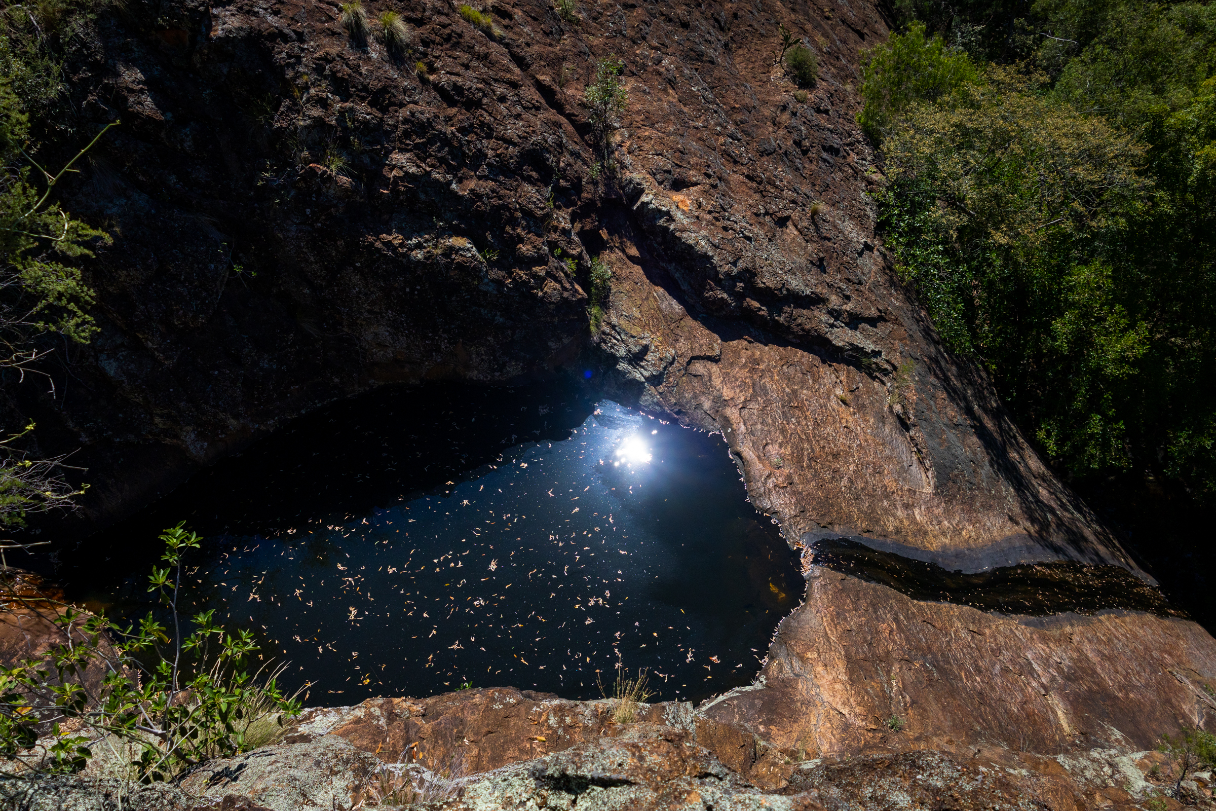
It’s a short walk up to the Mill-bullah water holes.
There is water in them but it has been in there a long time with no flush through to clean it out.
The top waterhole looks a little nicer but still stagnant.
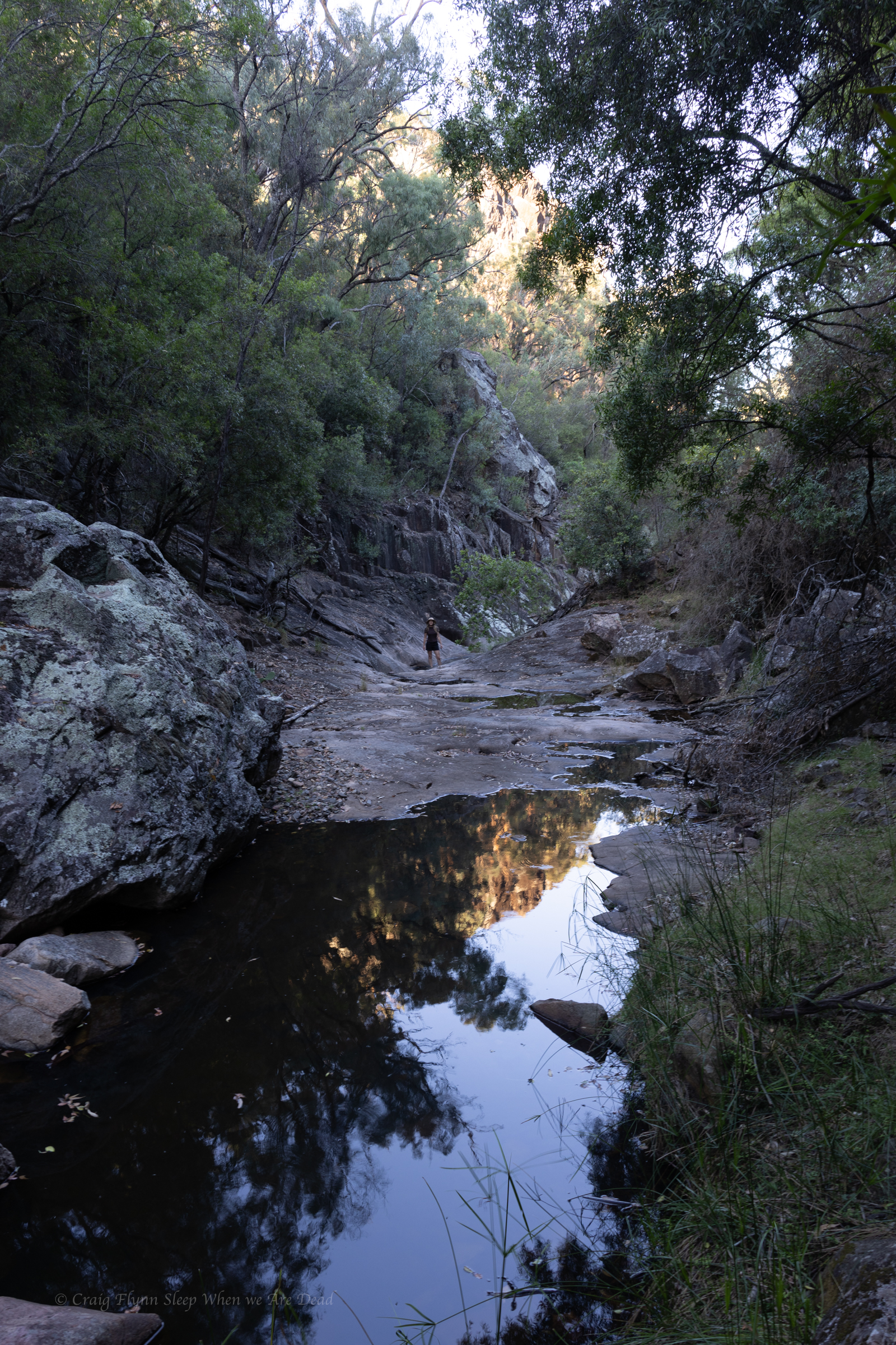
The constructed tourist trail ends here but a well used ad hoc trail leads up through the cliff line.
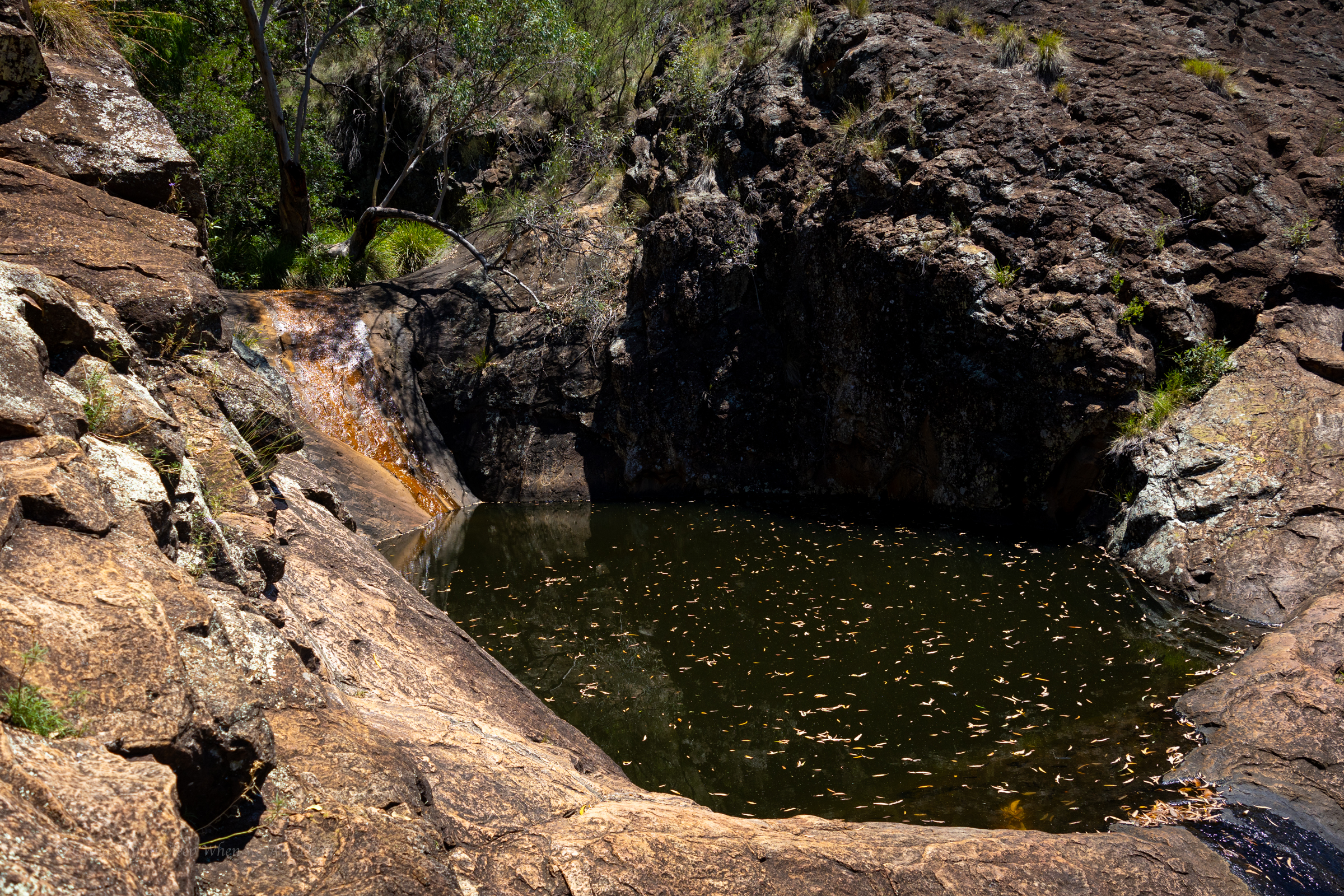
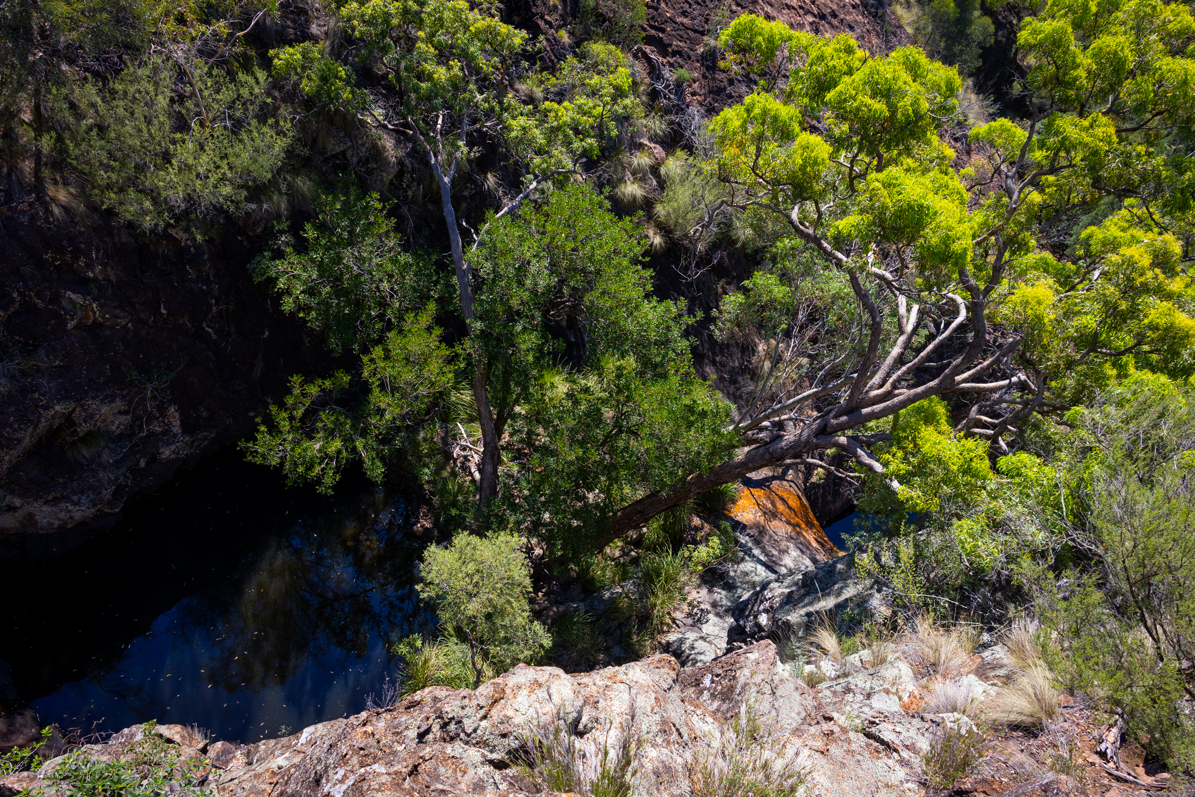
The track skirts above what looks like would be a fun little canyonette full of jumps and slides, in the right water flow
Unfortunately we are here in the middle of one of the driest summers we’ve had since 2019.
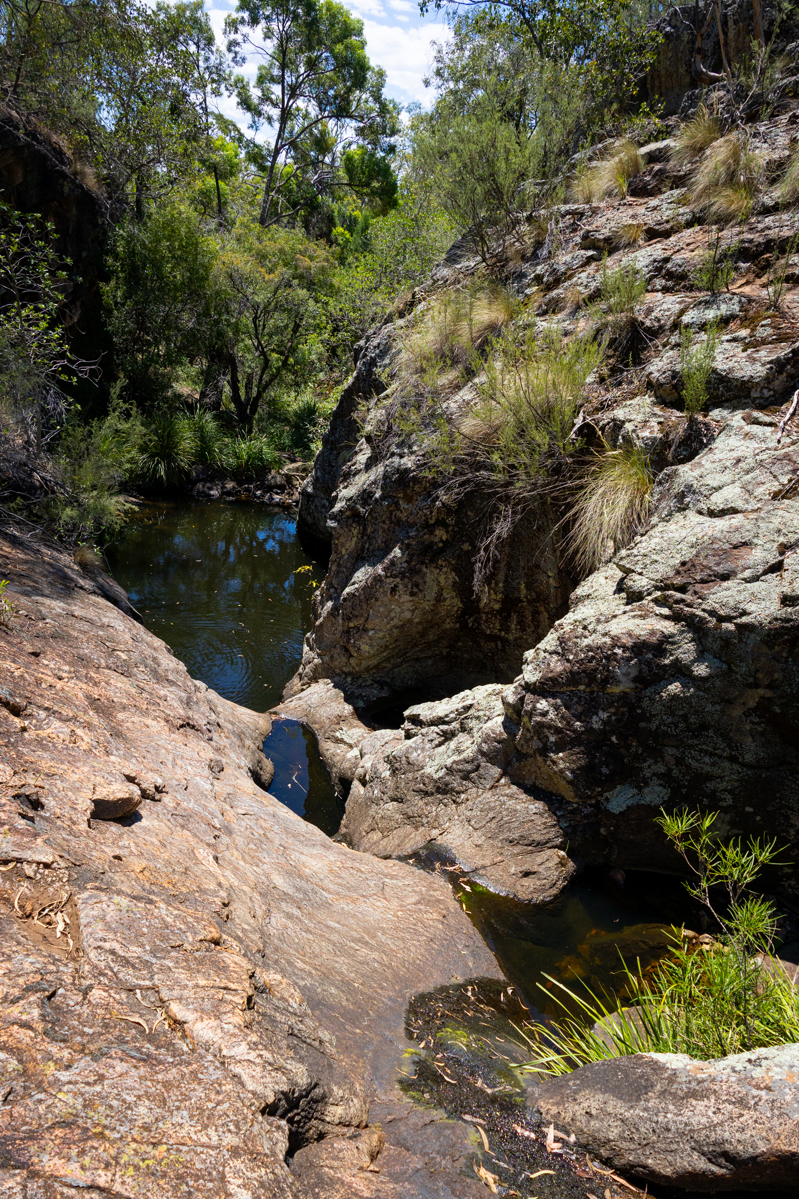
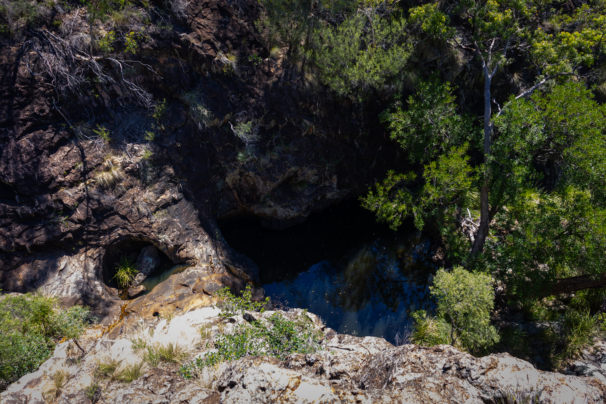
Above the canyonette the gorge is shaded but the heat still oppressive
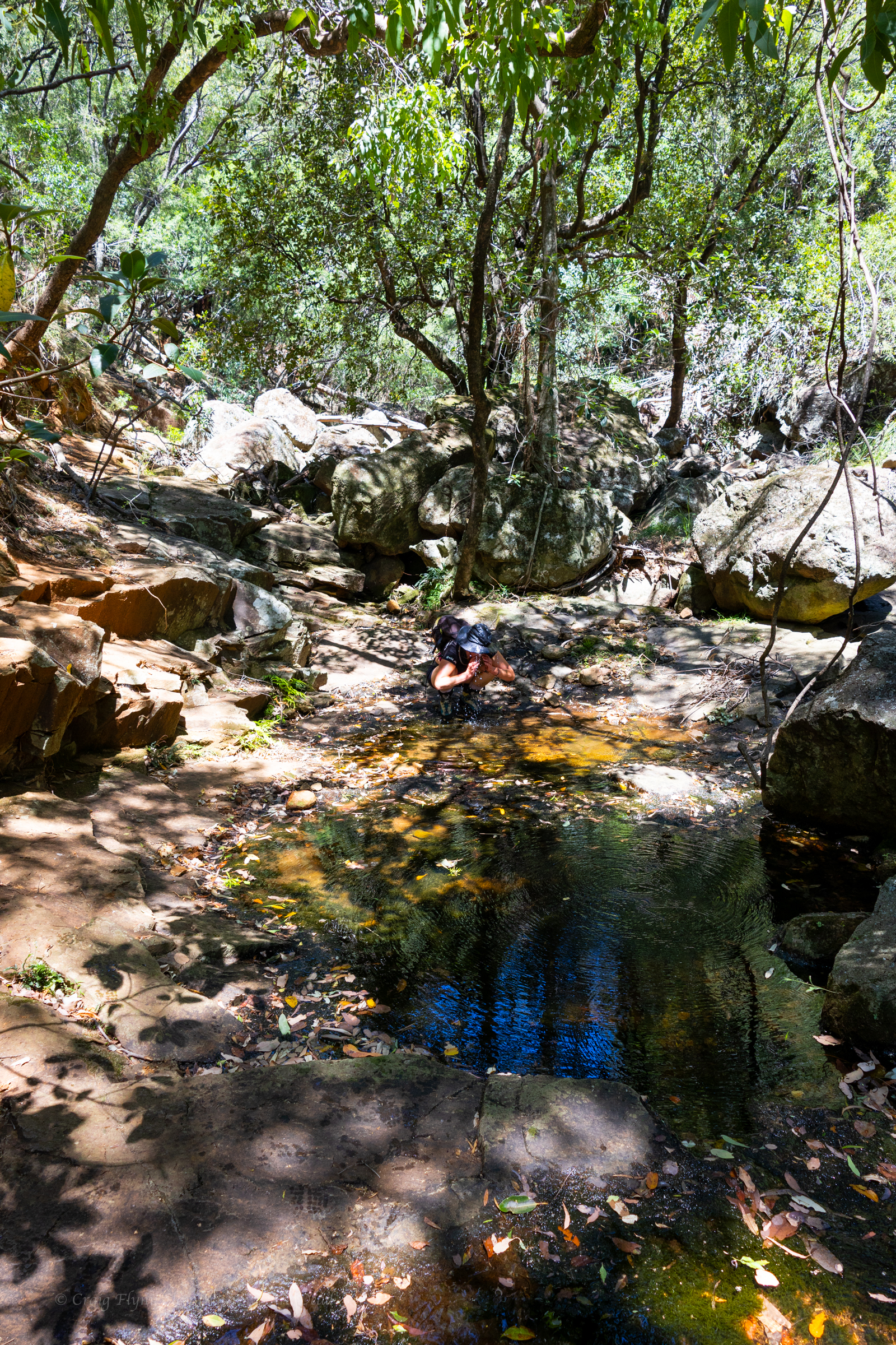
we find a clear pool to splash some water over us in an effort to cool off
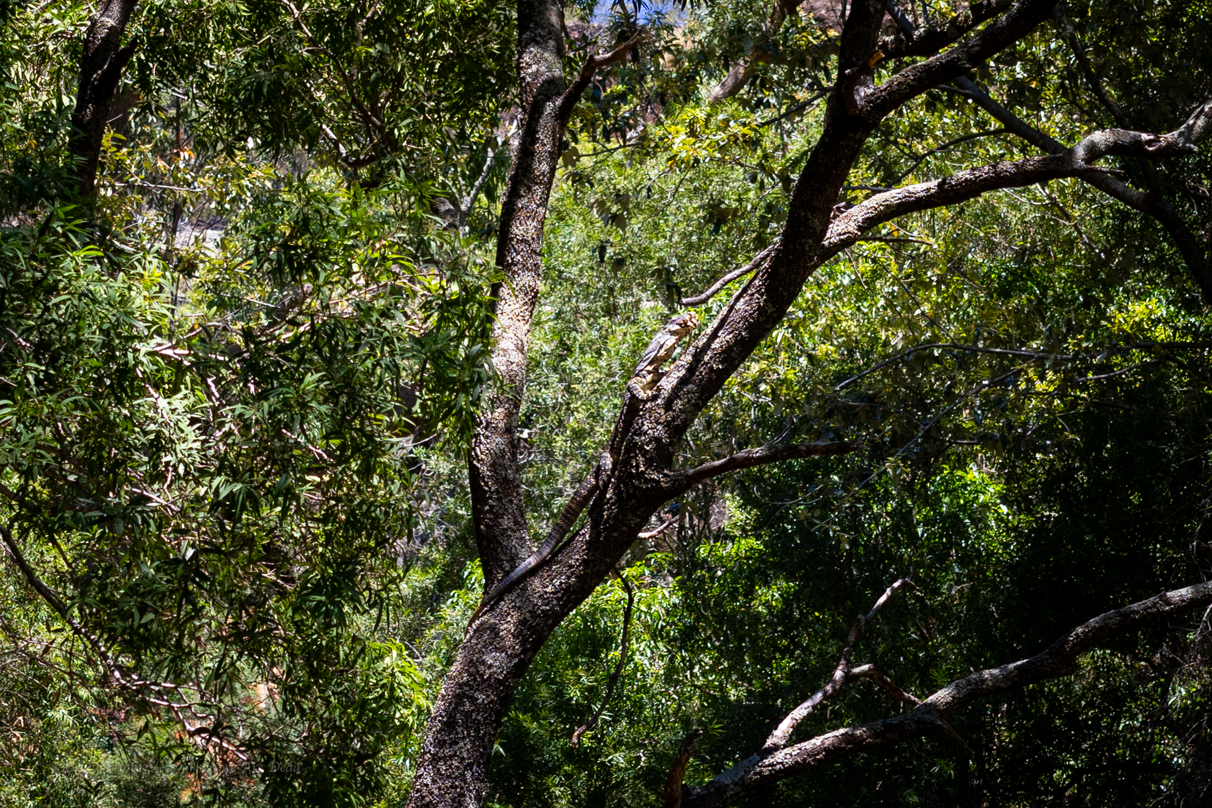
We continue up, disturbing this lace monitor with his mouth full of a water dragon sandwich
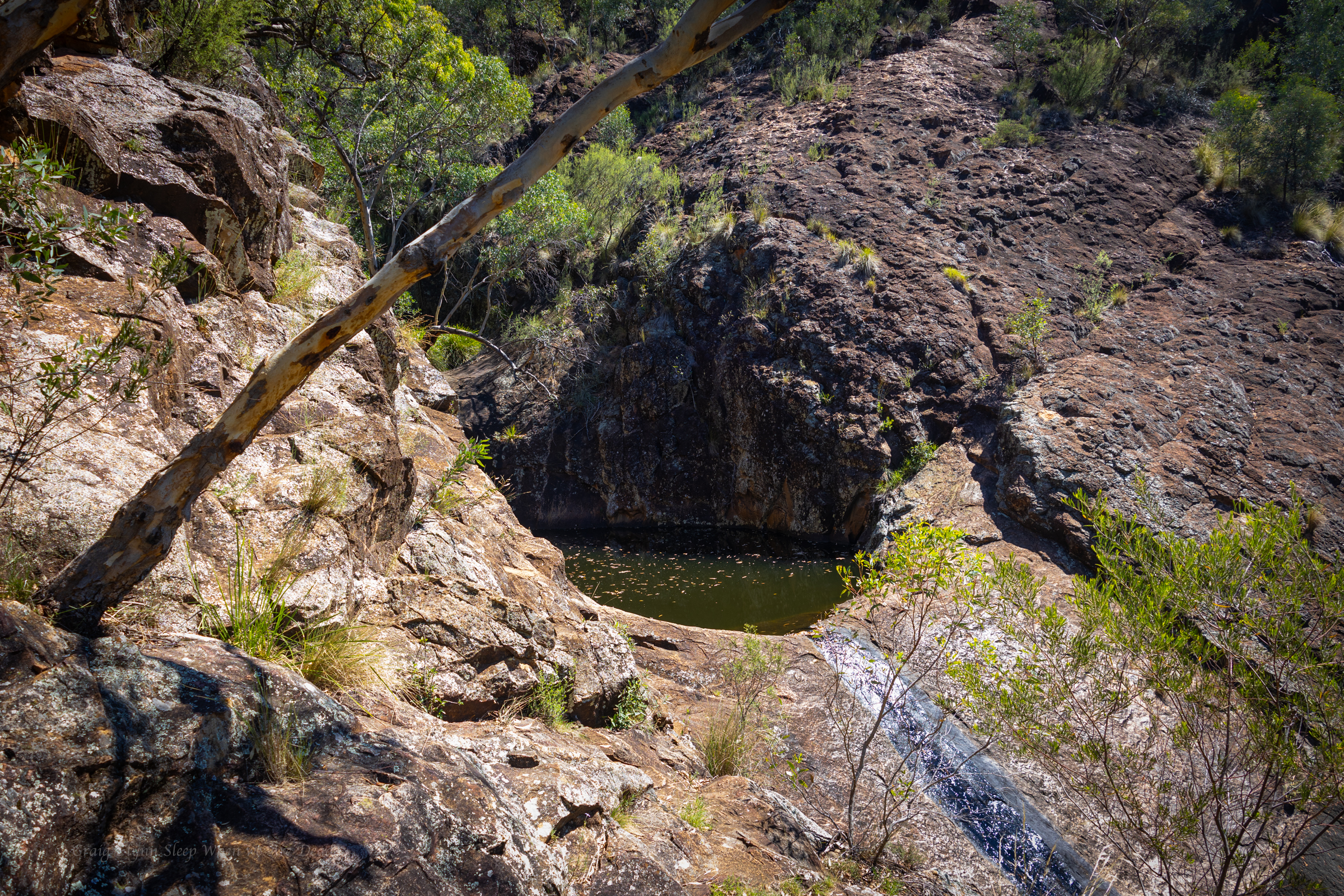
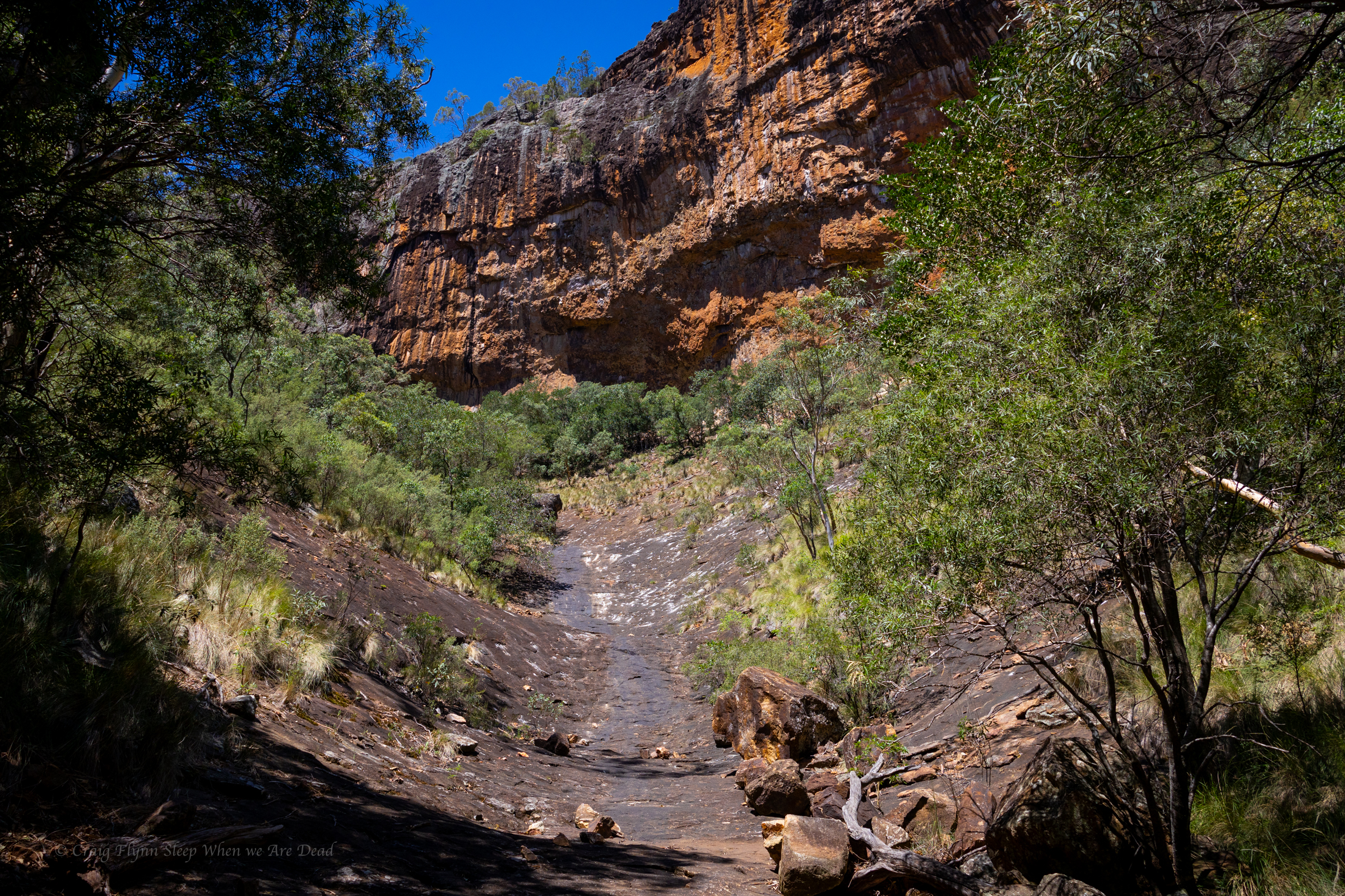
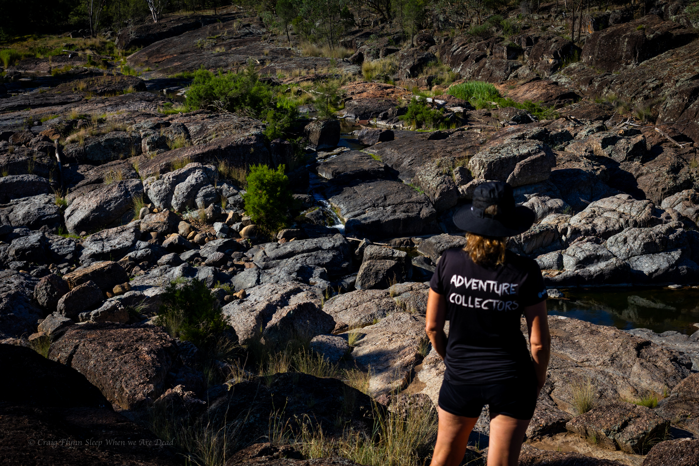
Finally we get to the junction. Left takes us to the big wall .
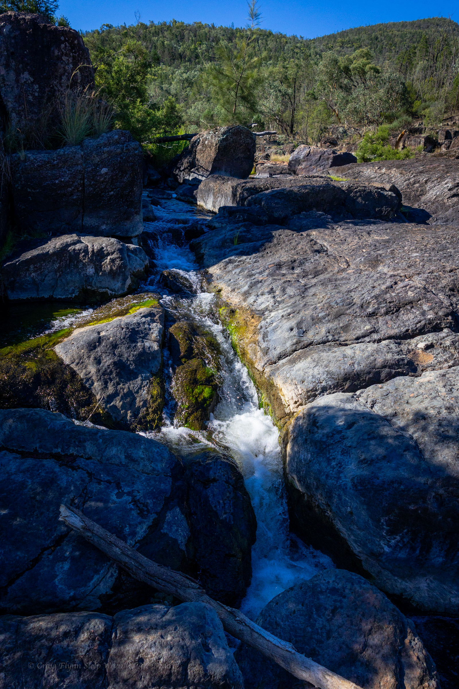
A dry cascade greets us.
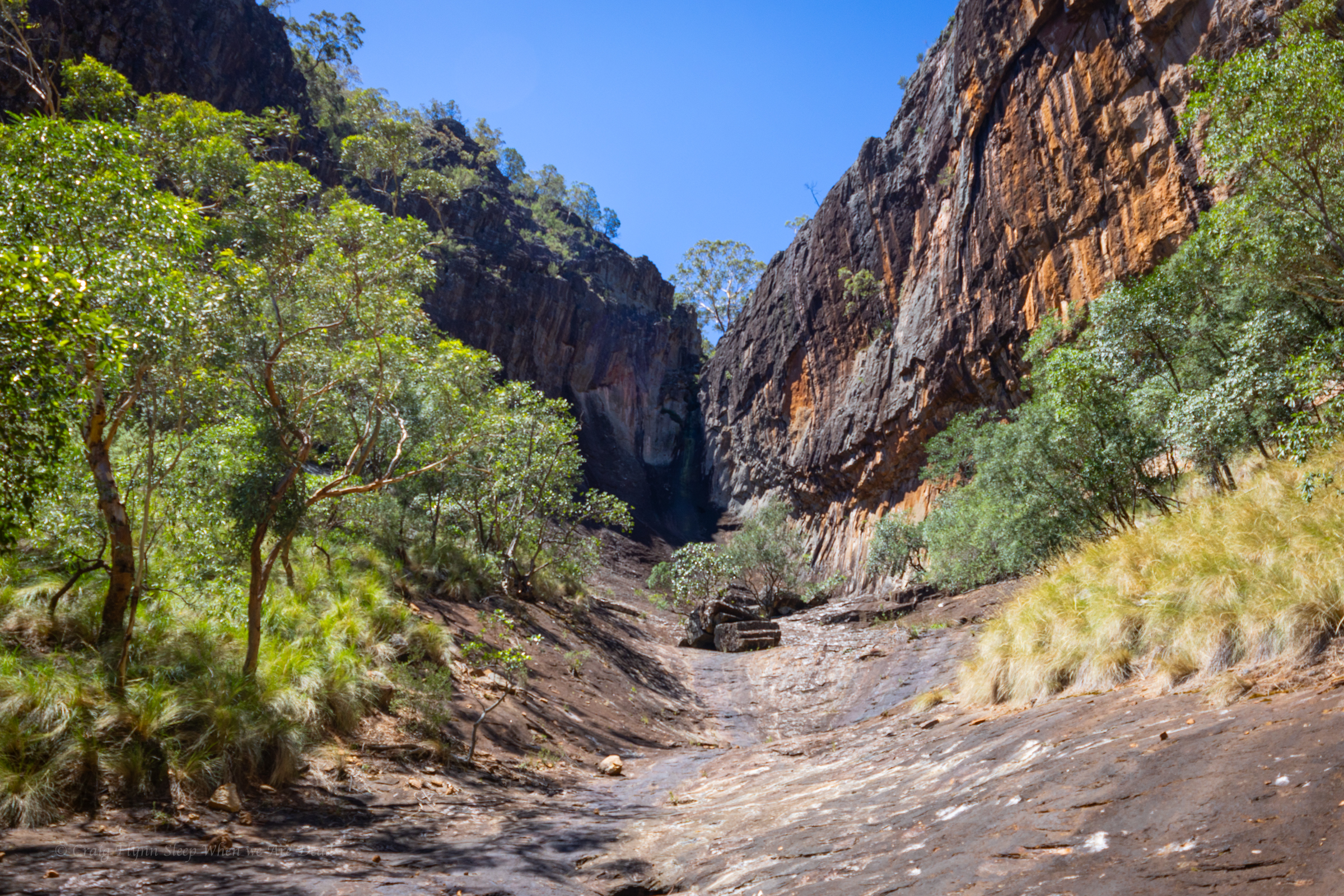
I head up, Kylie waits in the shade. The heat blasting off the stone is next level
The top of the gorge is impressive
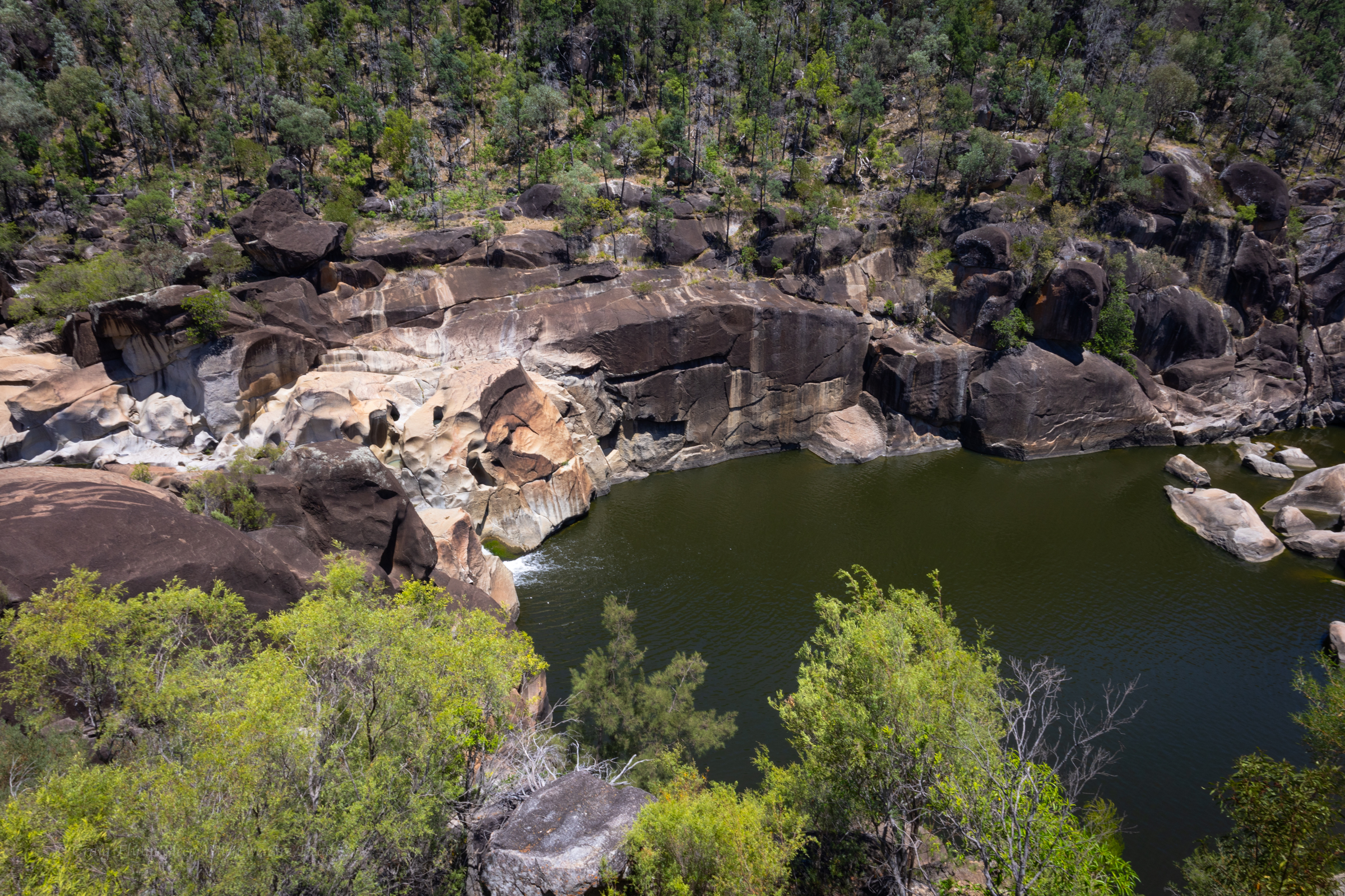
We had a permit to fly the drone for 30min here so I get it out and try my hand at flying again
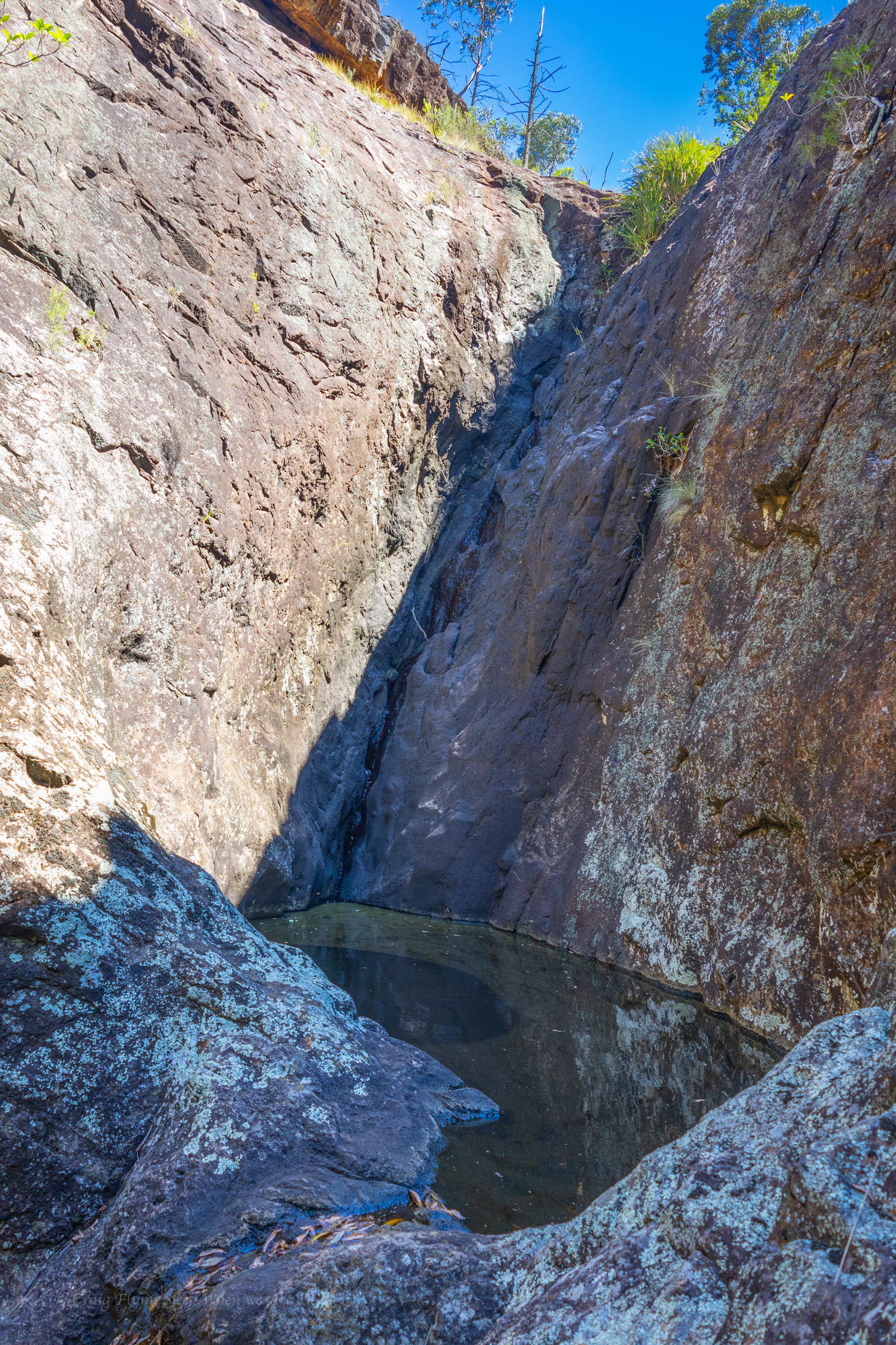
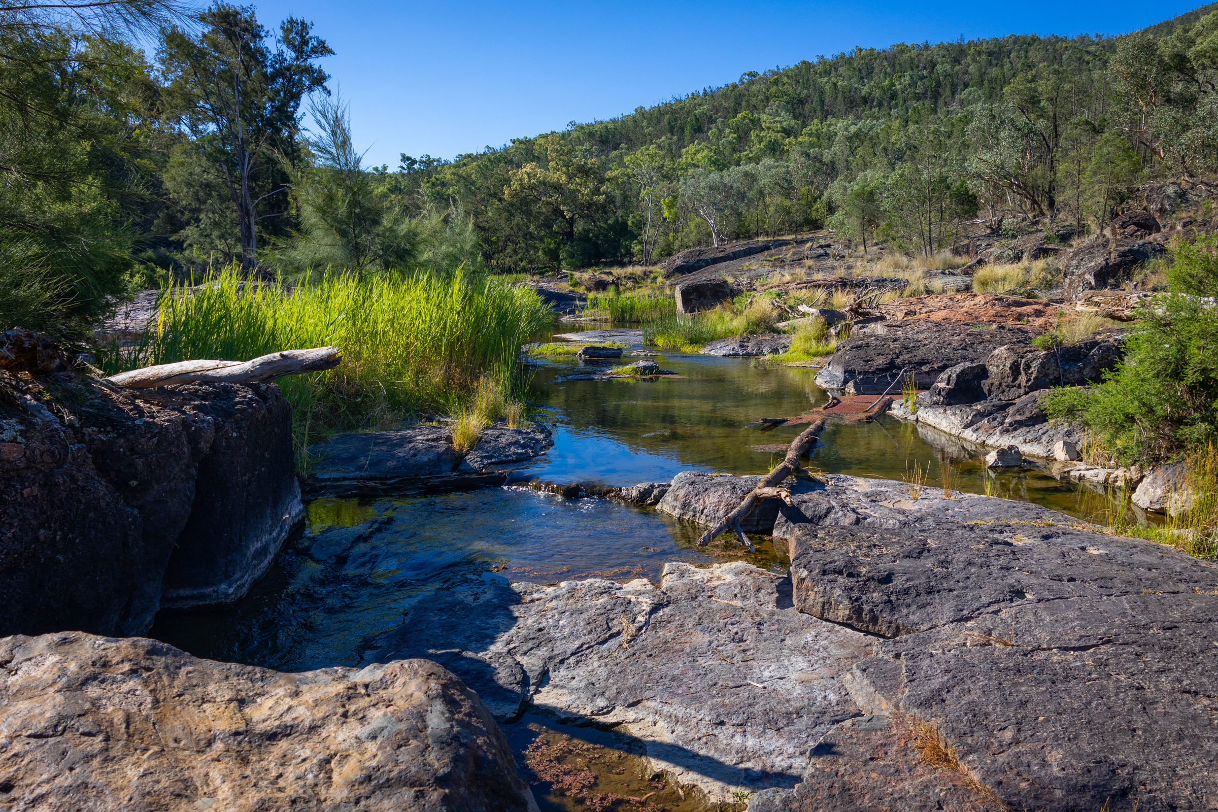
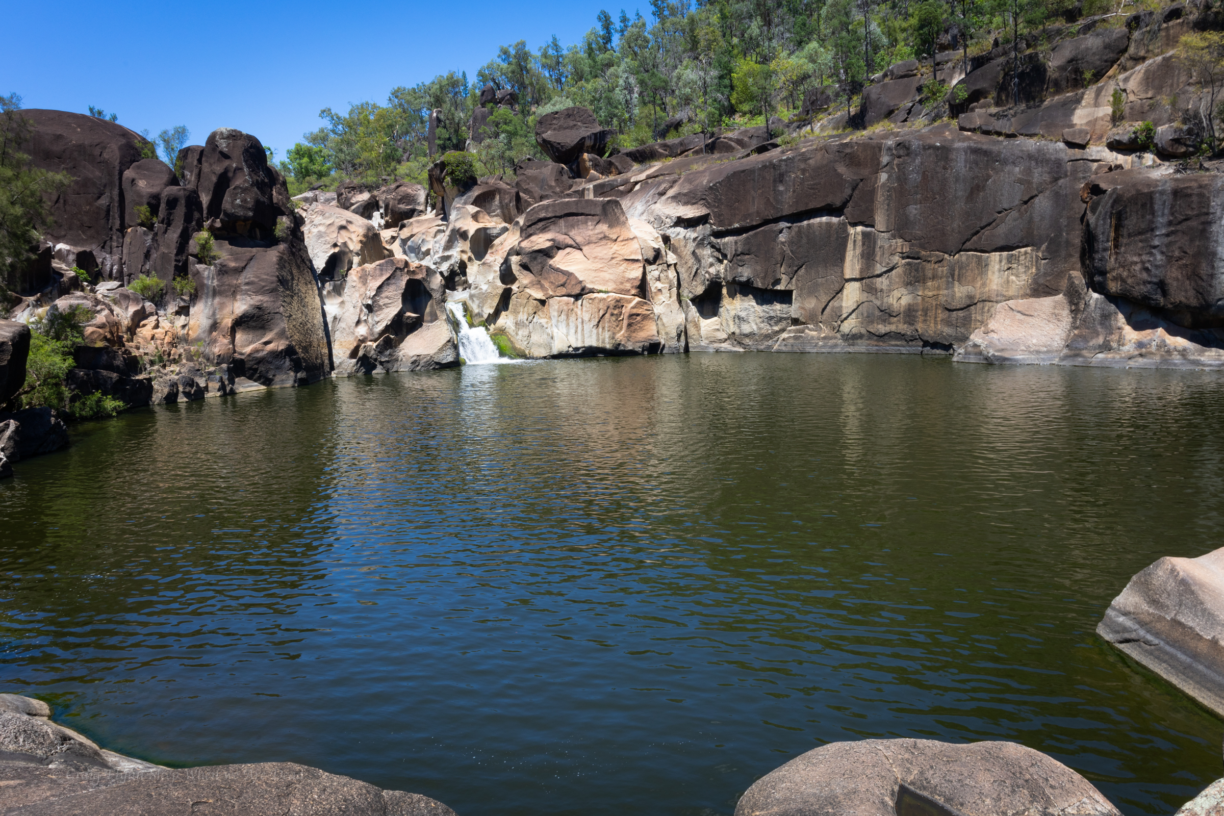
We slip back down to the junction, have a bite to eat and a big drink in the shade then explore up the other branch
another dry waterfall into a stagnant plunge pool greets us. It looks like there are some interesting levels above too. Definitely worth some exploration when things are cooler and wetter
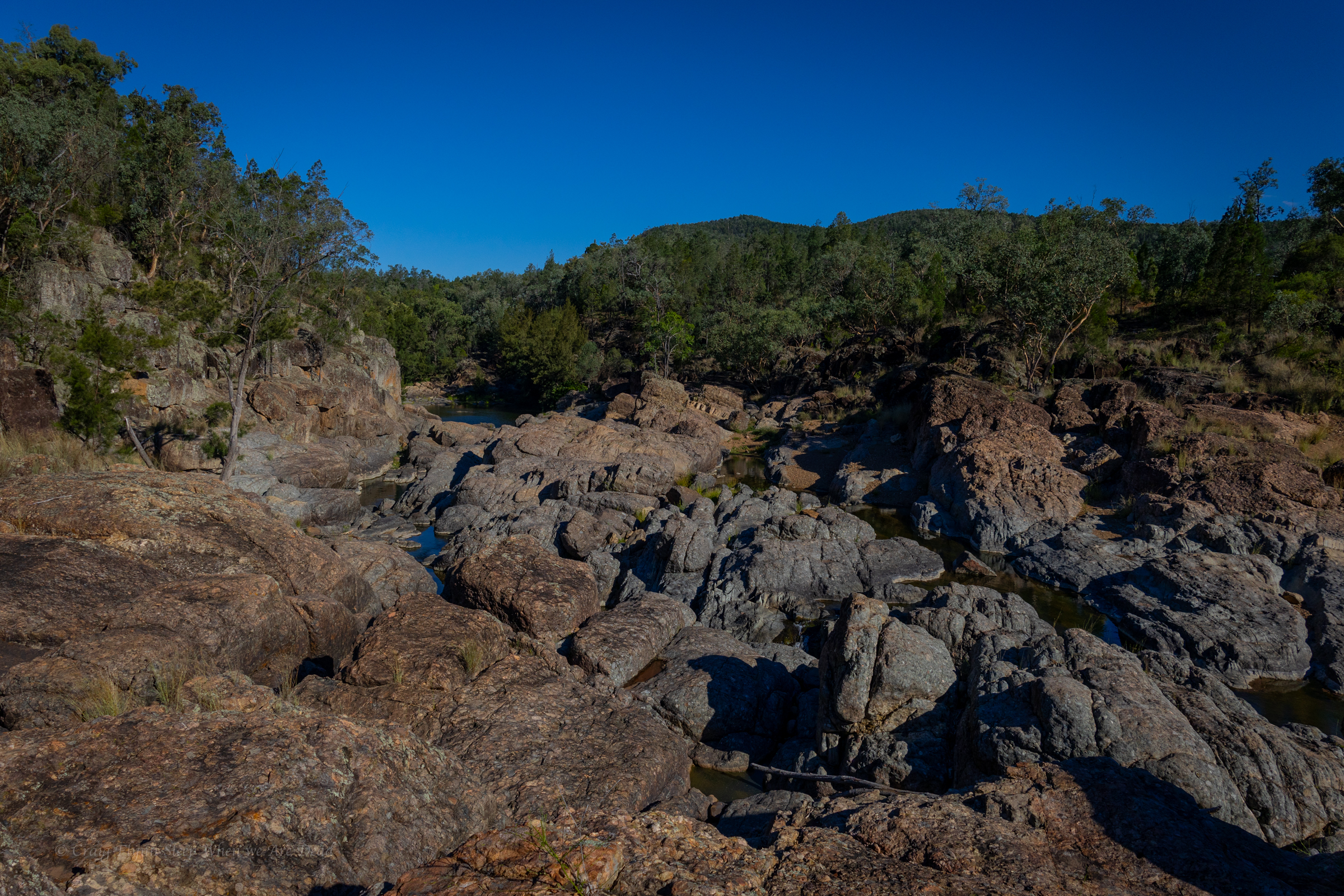
We make our way back down to the car. And head back to the camp
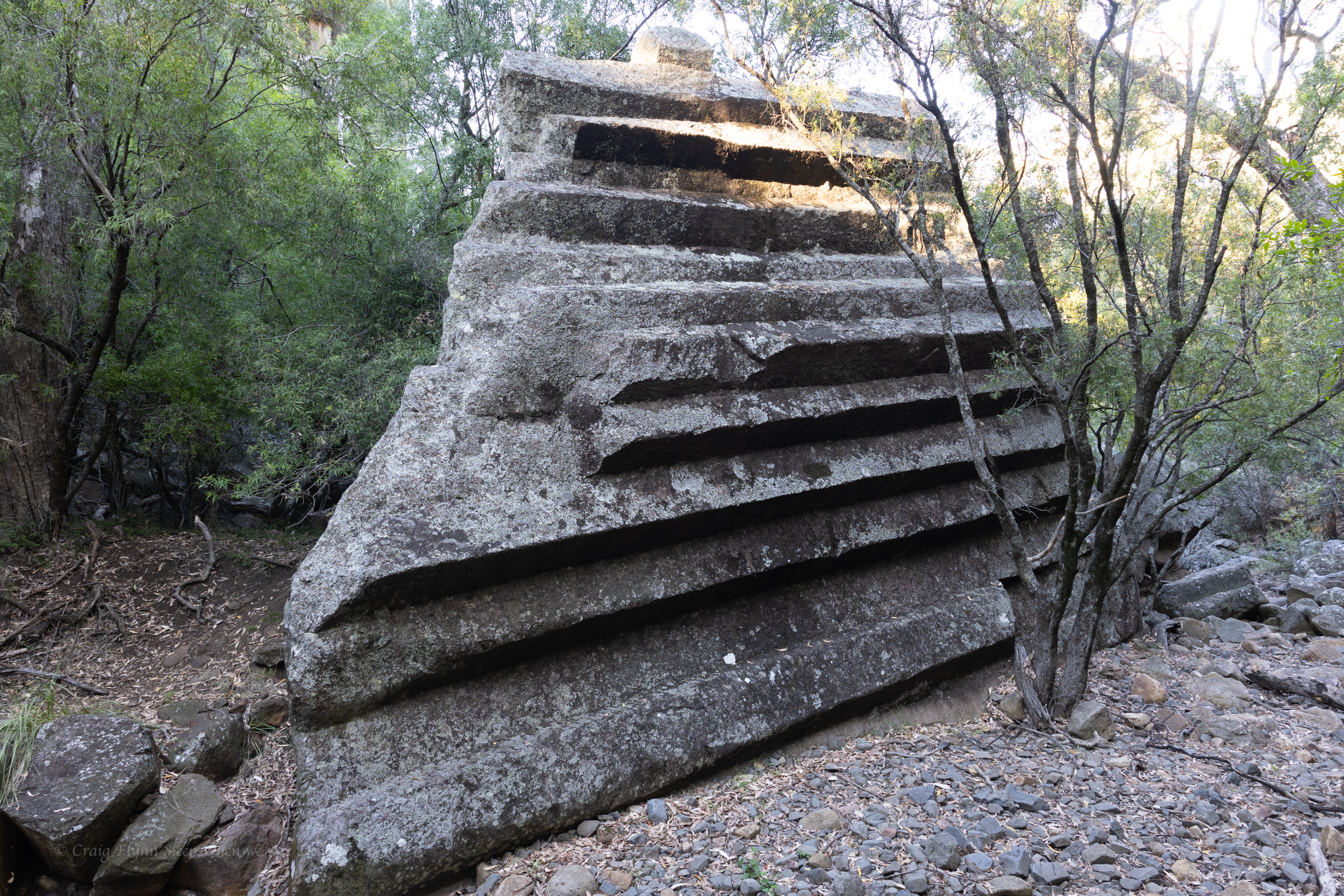
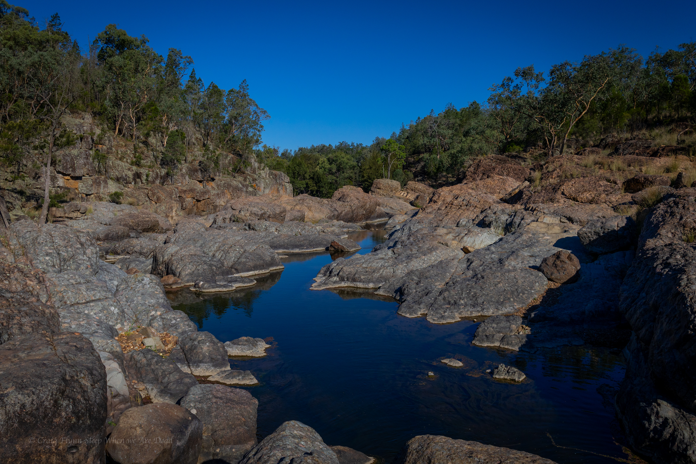
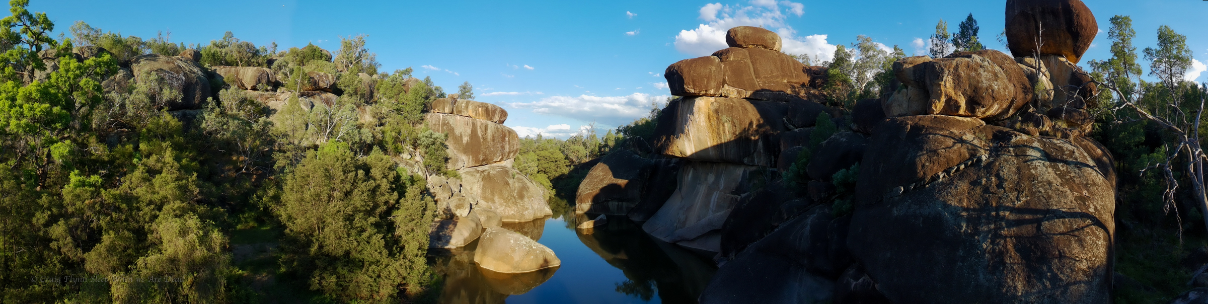
the Ancient Glacial Rocks site on Rocky creek is interesting. Superficially it looks like another granite lined gorge. A closer look and the rocks are different. You can see how they have been churned up, smashed together and dumped out.
Once again the river is running through agricultural land and wild goat are everywhere but once again it’s too hot to be picky so we cool off in the rapids and then settle in for the night.
The camp site is basic but has bins and toilets. It’s worth checking out the toilet signs for a giggle.
There a 2 other campers set up. Flat spots are at a premium but we manage to jag a flat spot in shade
Winning
We eat diner with the goats. Tomorrow we head to Sawn Rocks.
Leaving Girraween and dropping back into NSW we are aiming for Warialda but decide to take a bit of a detour into Kwiambal NP for a look at Macintyre Falls.
Macintyre falls are located about an hour out of Ashford, near the Ashford limestone Caves (which at the time of writing were closed to the public).
The falls aren’t massive but they are impressive none the less, check out the little whirlpool near the top of the main falls in the top view. hate to get stuck in that in high flow.
the view from the lookout is impressive and a tourist trail leads down to the pool below
large Murray Cod could be seen swimming in the waterhole and fishermen are setting up so we opt not to swim and disturb their hunt for dinner
We spend a bit of time rock hoping and exploring then head across to Lemon Tree Flat for a swim in the Severn River.
This is a beautiful little camp ground I got zero photos of…
Then it was onto Warialda and the very cool little council run camp ground at Cranky Rock.
At $20 a night for a powered site it’s a great low cost campground with hot shower and clean toilets.
And an impressive swimming hole
Now I have to be honest, being spoilt in the crystal clear waters you find in Blue Mountains canyons the water hole here did have that agricultural run off look and slight whiff but on a stinking hot day with no better publicly accessible swimming holes within cooee it’s an oasis.
Sure, I wouldn’t drink it but there is no hesitation at jumping in and cooling off.
and the colours in the rocks pop at sunset
With the battery in my head torch now charged I thought I’d have another go at spot lighting.
The creek and waterhole was weirdly devoid of frogs and their predators. I spent a bit of time poking around but was giving up and heading back to camp when this little guy came out to say hello
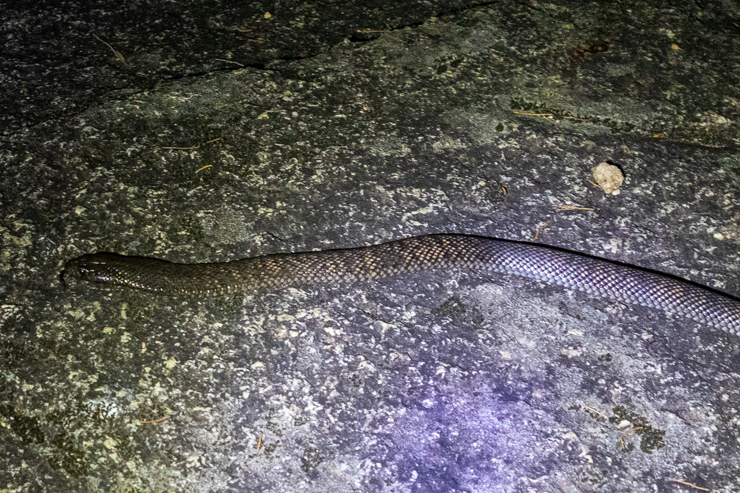
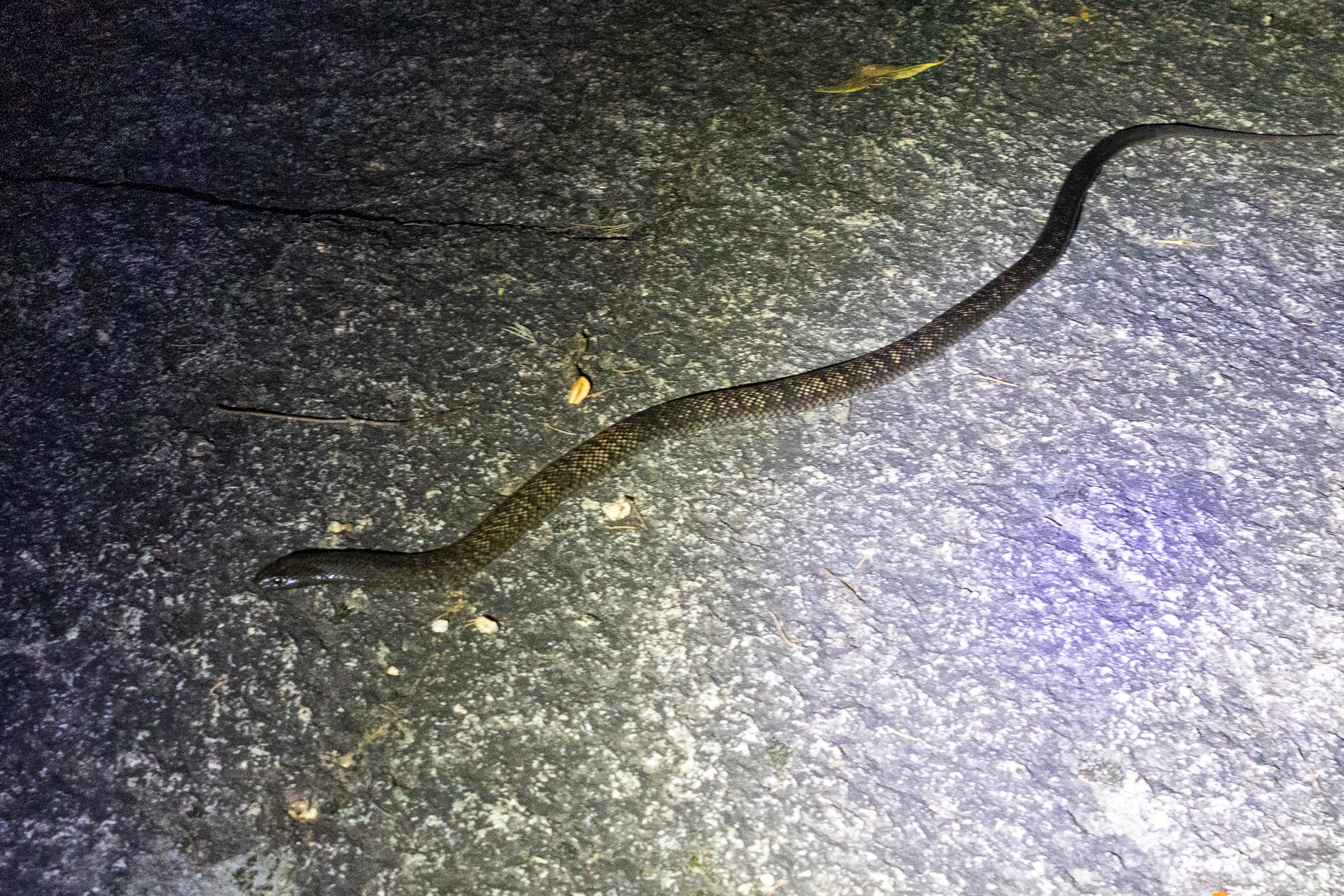
Spotted Black Snake, Pseudechis guttatus, aka the Blue Belly Black snake
this species comes in range of colours, from creamy grey to shiny black but how good is the camouflage of this speckled version against the blotched granite.
Back at camp Kylie had luck with the furries. Spotting several sugar gliders running amuck in the trees behind our camper.
and also managed to
1. find this little burrowing frog
and
2. find it a second time to show me
But it is getting late. We are mindful of our fellow campers so call it a night.
we also have a long drive tomorrow.
Our next stop will be Waa Gorge (It’s pronounced “War” not “Wah”)
Finishing up our coastal sojourn we head west. Our plan was to come back down the western line.
As usual we had planned to pack a fair bit in to a short time.
The Western line probably isn’t in the forefront of most peoples minds as a summer trip. We are not most people
Are we crazy? asks one of us
Yeah. says the other as if it was the most obvious answer in the history of obvious answers.
The fact was summer was when we both had time off so…
Our first destination was Bald Rock.
I’d never heard of it but Kylie said it was something she really wanted to see.
It’s right on the Qld border and part of the New England Granite belt, which was formed about 250million years ago. It’s called the New England granite belt because, you know, nothing resembles Old England more than goannas running across massive granite domes…
Anyhoo
We pull into the car park and cook up a breakfast then make our way up to the trailhead.
There are several walk options, from super short to all day. We opt for the summit walk.
A reasonably short walk leads us to the base of the massive granite dome. This point is wheel chair accessible and if its as far as you get it still bloody impressive.
A mountain of granite towers above.
White reflectors stuck on the rock were the only indicators of a path up.
Of course we follow them. Mostly
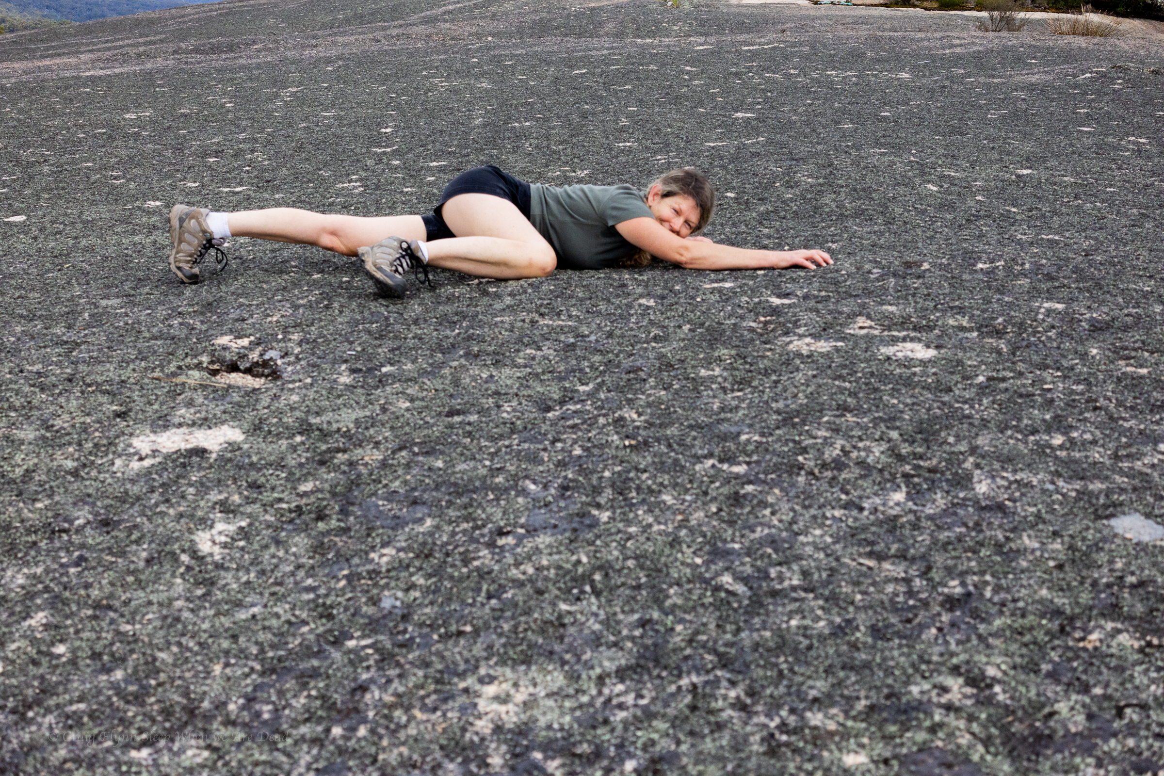
It was steep.
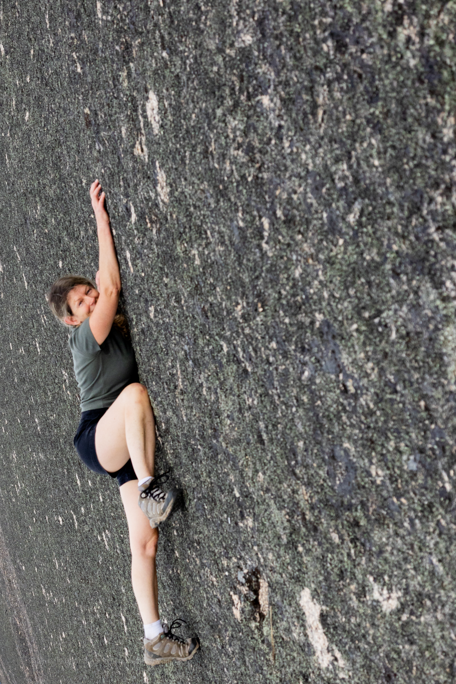
Jokes
It’s a little steep but not *that* steep
It’s a short, punchy walk up to the summit and it was spectacular.
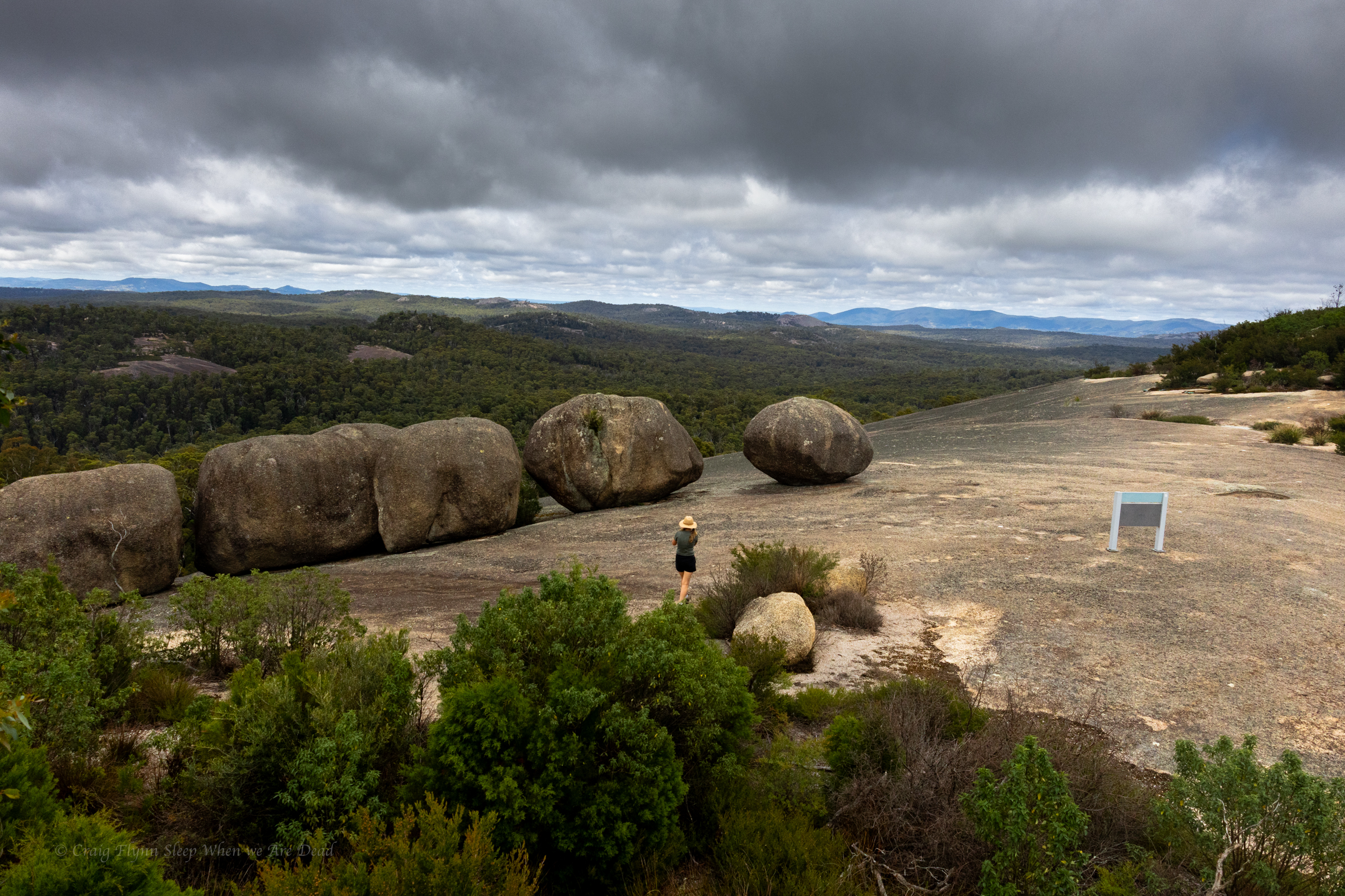
Rising 260m above the surrounding terrain, Bald Rock is the largest granite monolith in Australia and the colours are amazing, even on an overcast morning.
as it levels out we pass a few boulders and suddenly this view bursts into view
There is something humbling about big terrain. Human trivialities seem… Trivial
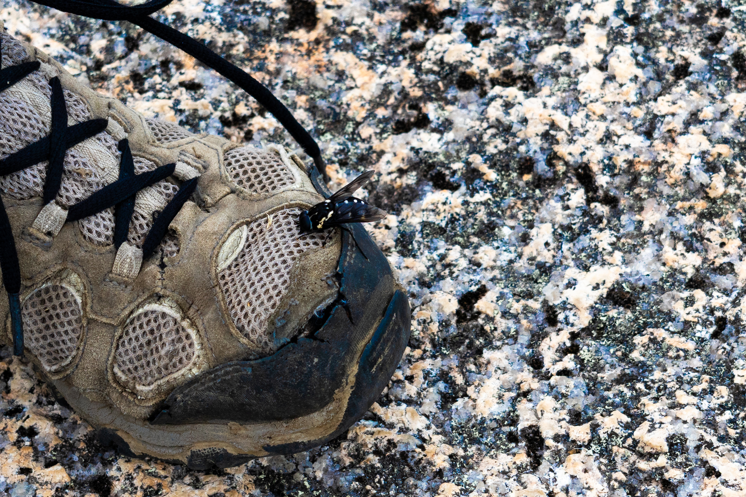
These guys were everywhere and they were curious but they were friendly enough. The bee not the warn out merrells.
We share the summit with several other groups. Families, grey nomads and, us. (There is a song in there somewhere)
We return to the car and back track a little to our camp site in Boonoo Boonoo.