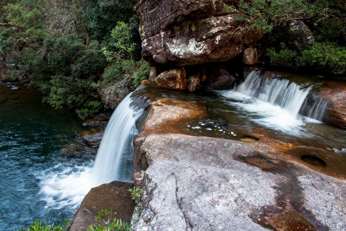
Our weekend plans had fallen through so we thought we’d go in search of some waterfalls neither of us had been to before.
Kylie suggested a spot and during research got a tip off that the fire trail out to them had recently been gated.
So we put the mountain bikes in to help eat up the kilometres.
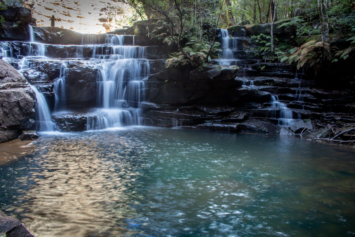
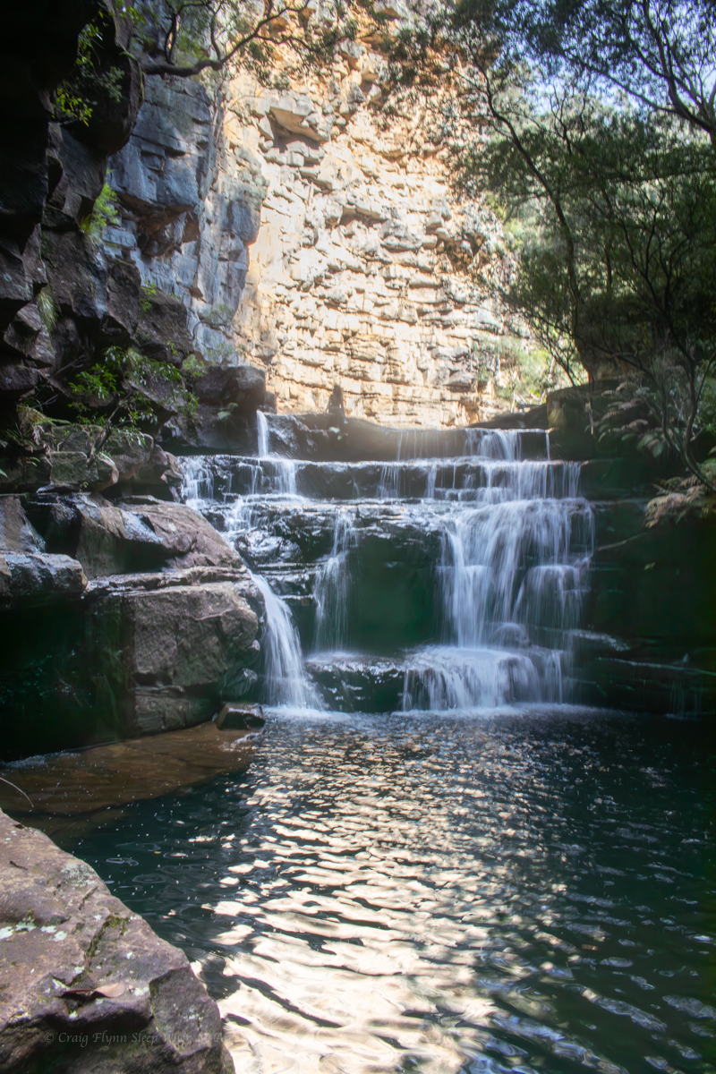
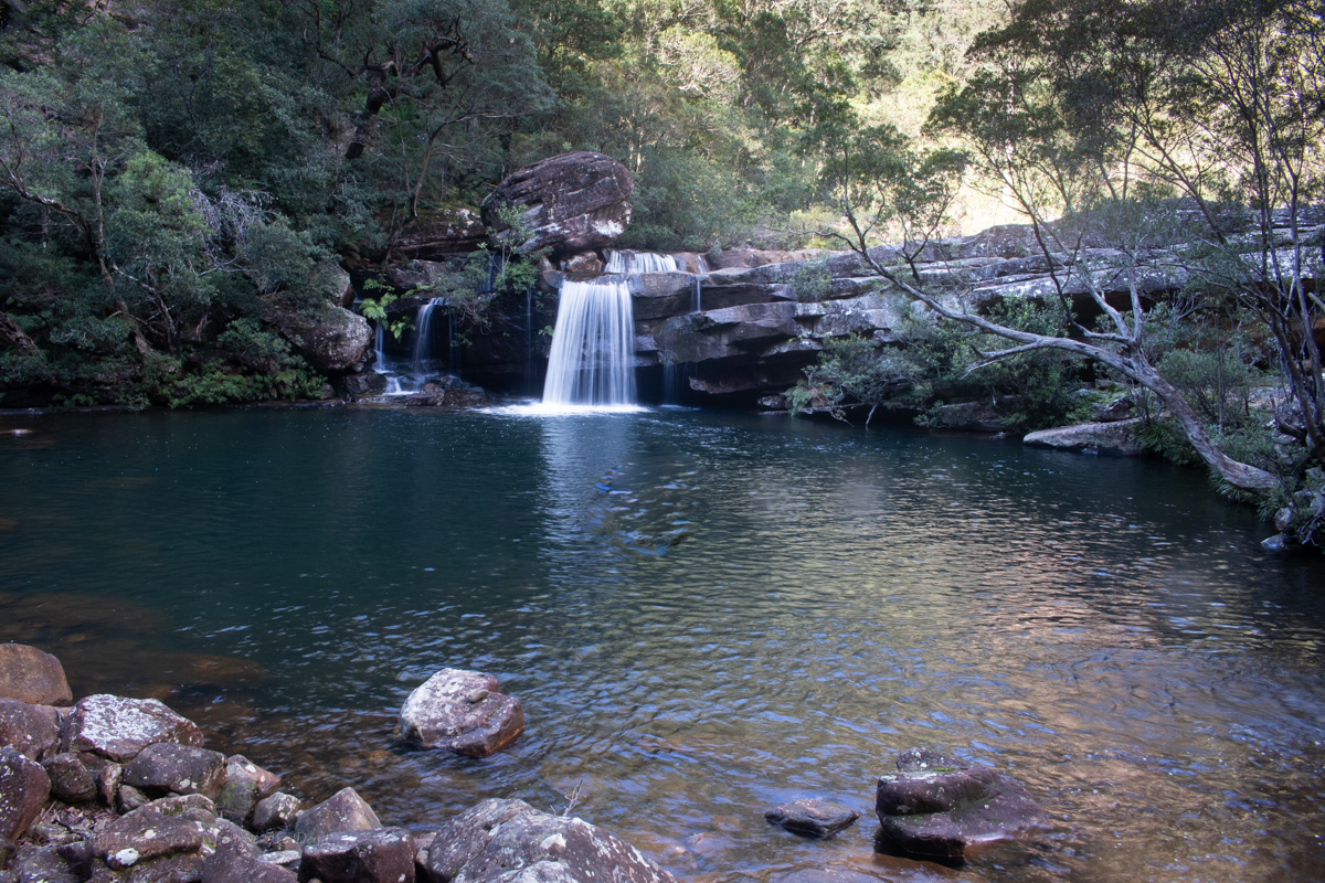
Not only are the swimming holes spectacular this could now be my favourite fire trail ride (Did I just say that? what have I become?) I have a feeling the guy who did the road work is a mountain biker. Each waterbar seemed to be a perfectly shaped step down. Even though recovering from a shoulder injury meant I couldn’t take to the air it was still a blast.
Anyhoo, that’s not what we are here for.
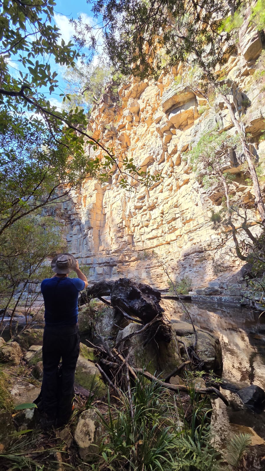
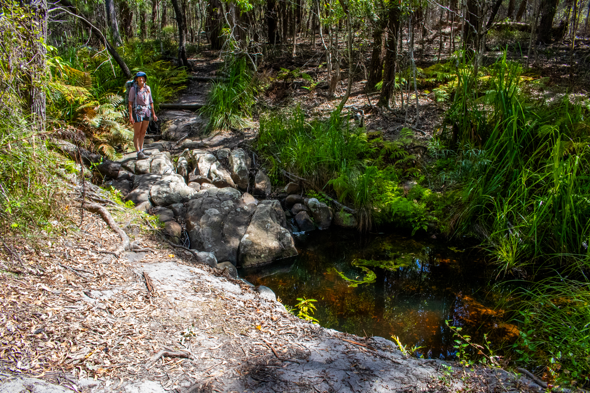
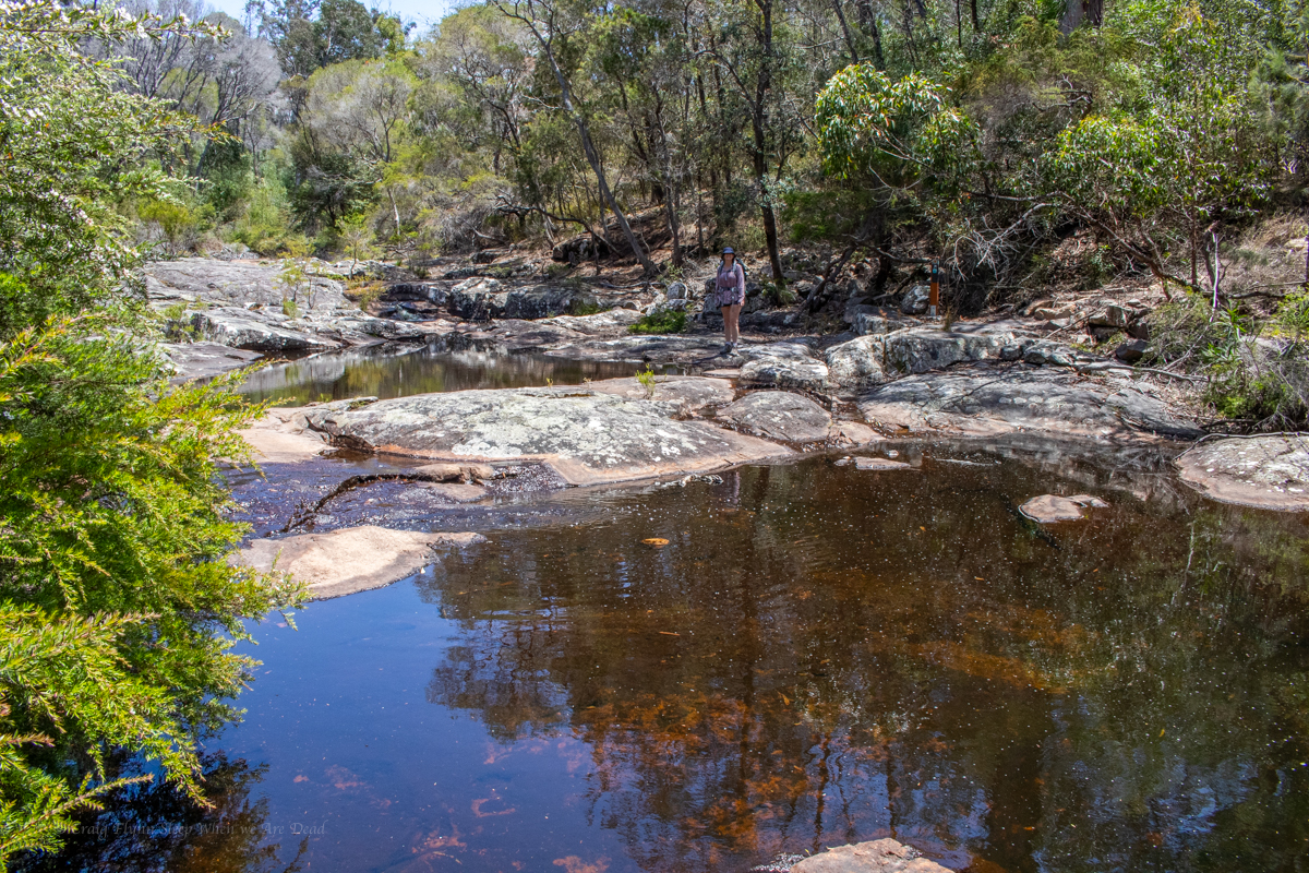
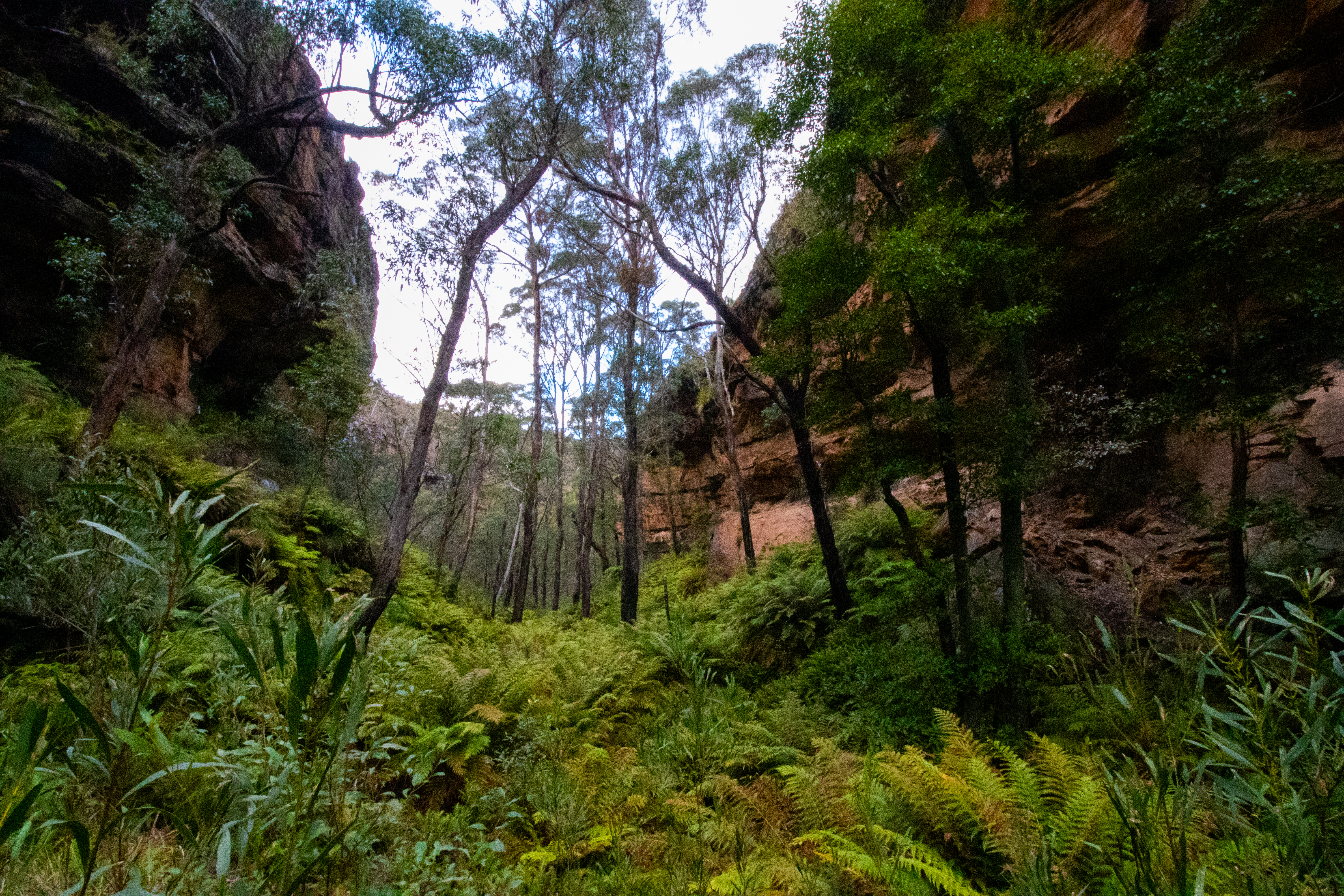
20min later we are stashing the bikes in the bush and heading down a steep trail cutting through subtropical rainforest quiet different from anything you usually see in the upper mountains..
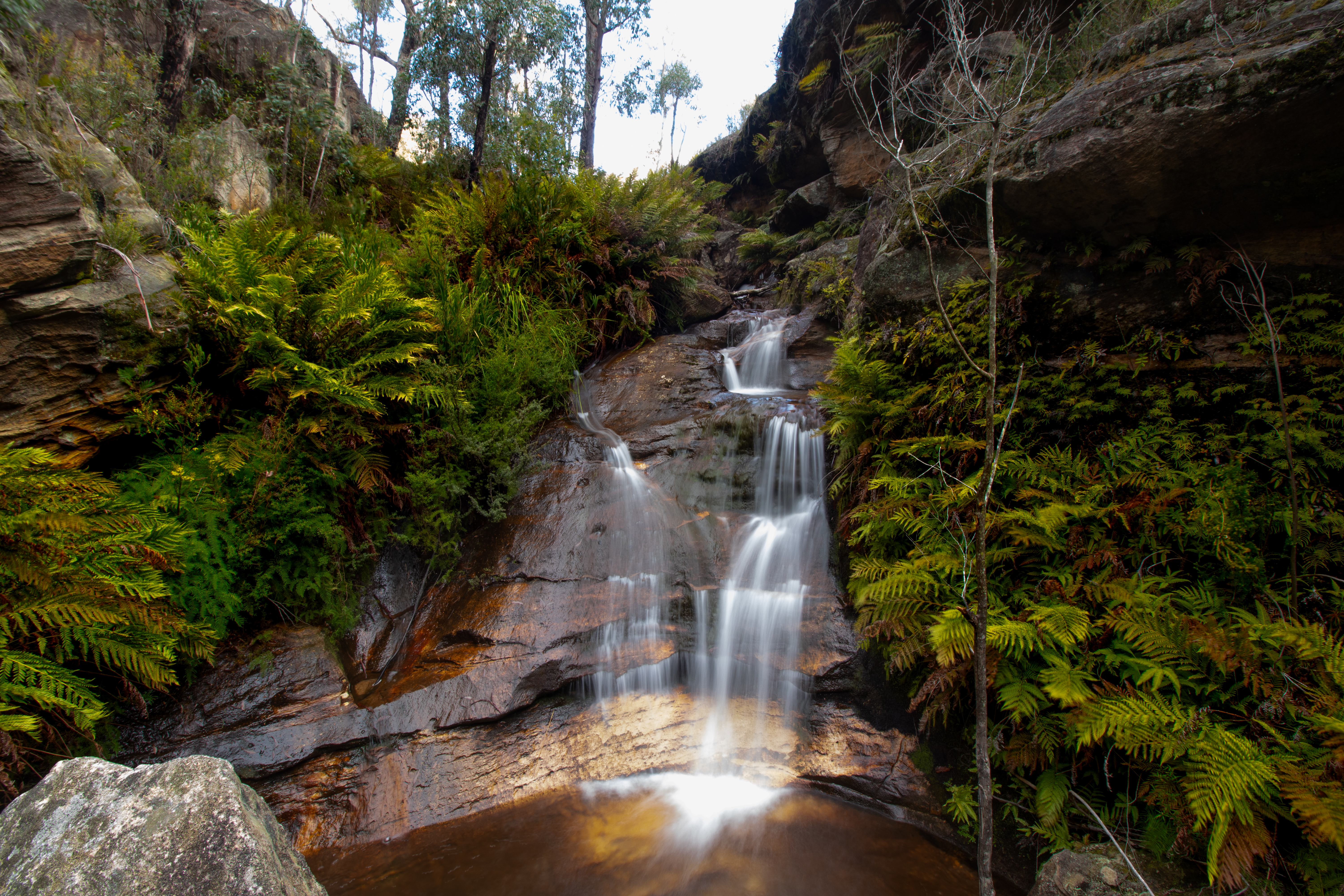
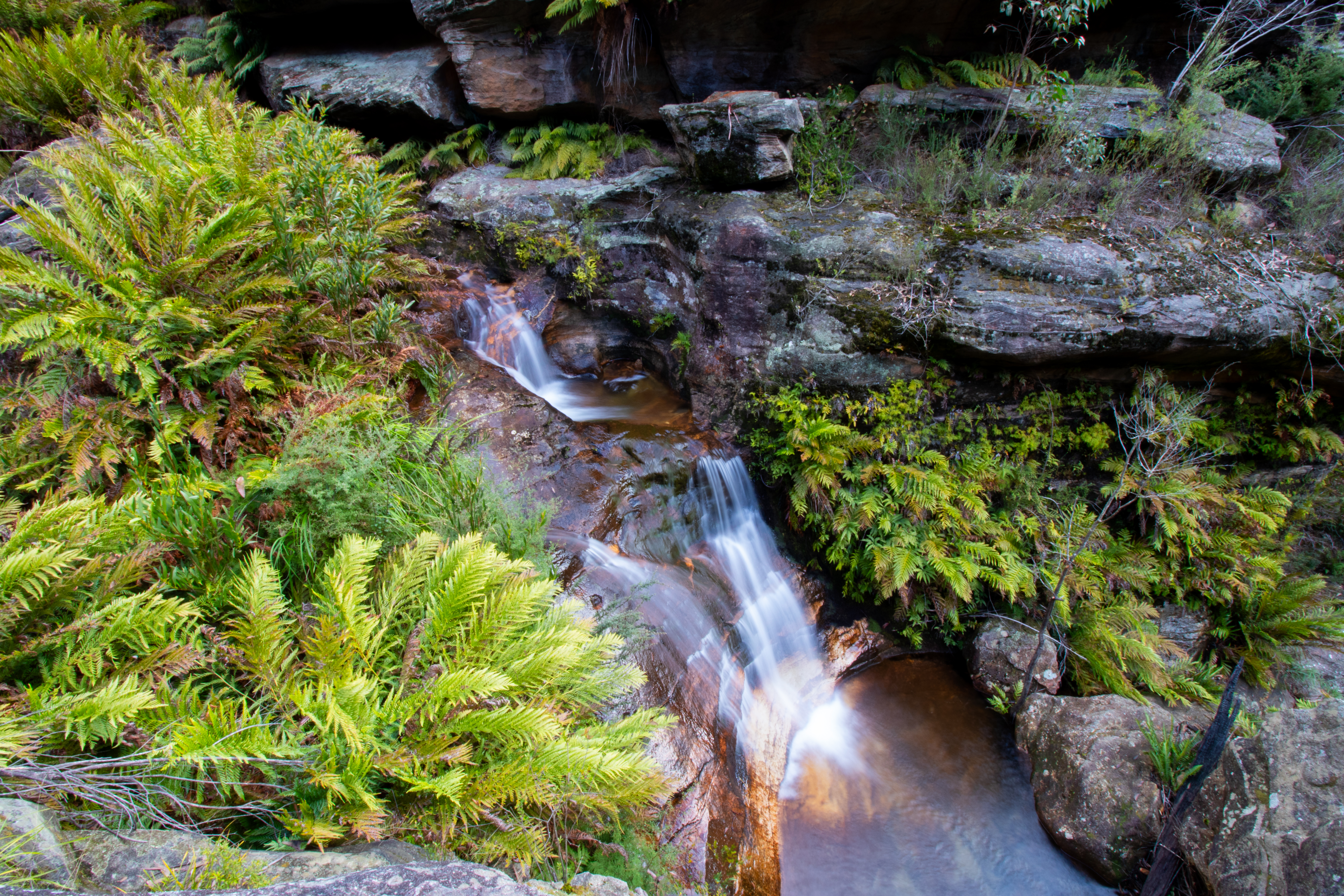
This brings us to a pleasant creek and we head downstream.
We have some lunch and a splash then make our way out.
The Haul up the hill is steep but interesting enough that I wasn’t in a world of suffering. And while I thought the ride back to the car might be tough it was just as much fun as it was coming in, with some pinches to keep you honest.
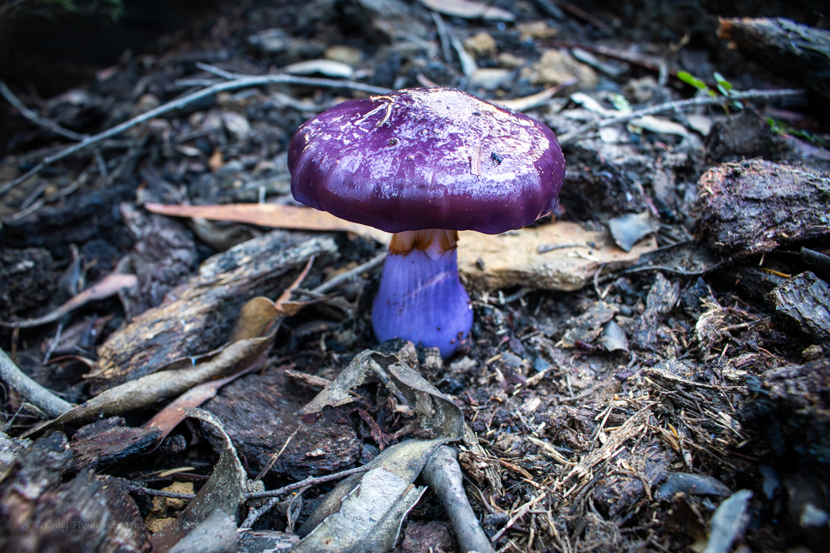
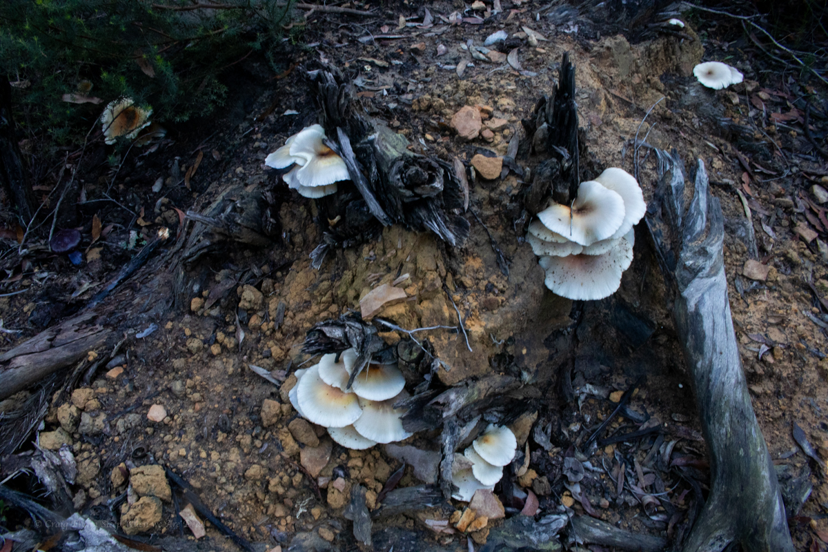
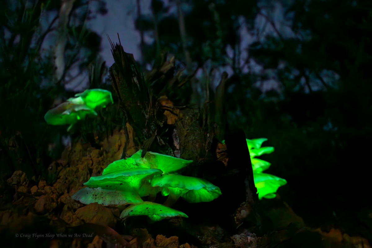
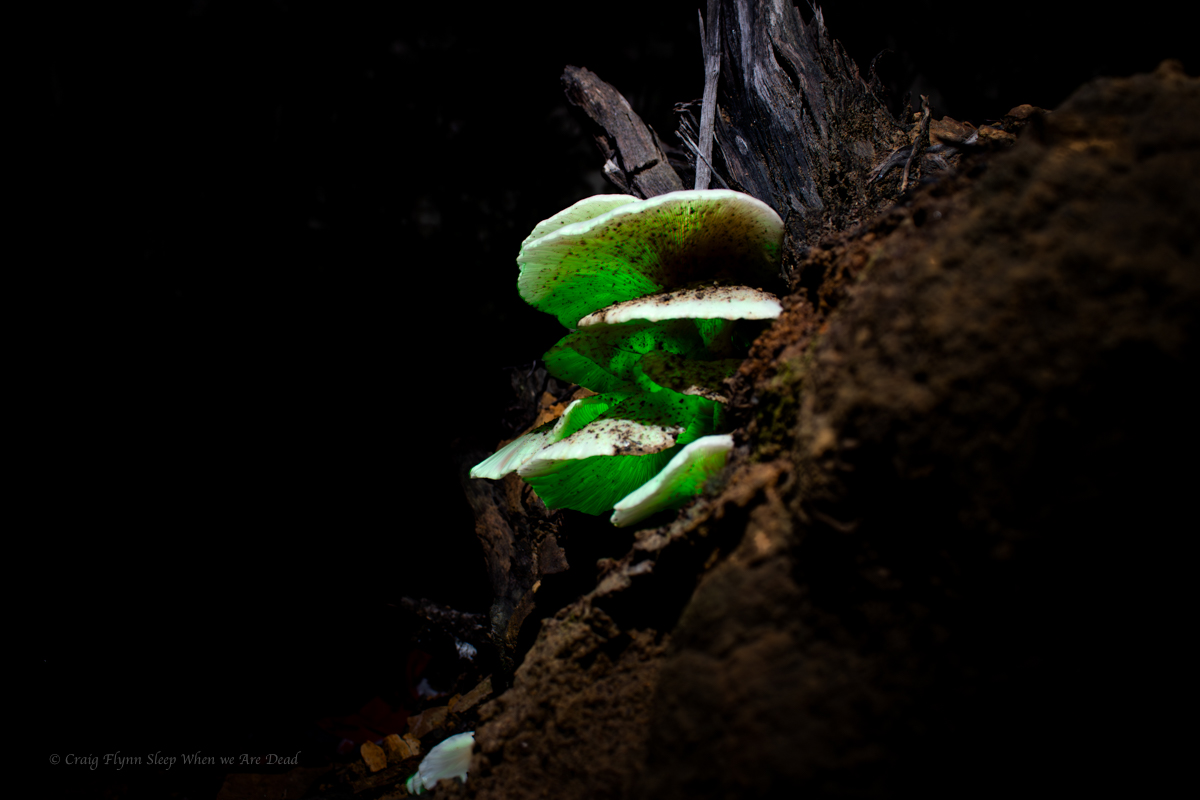
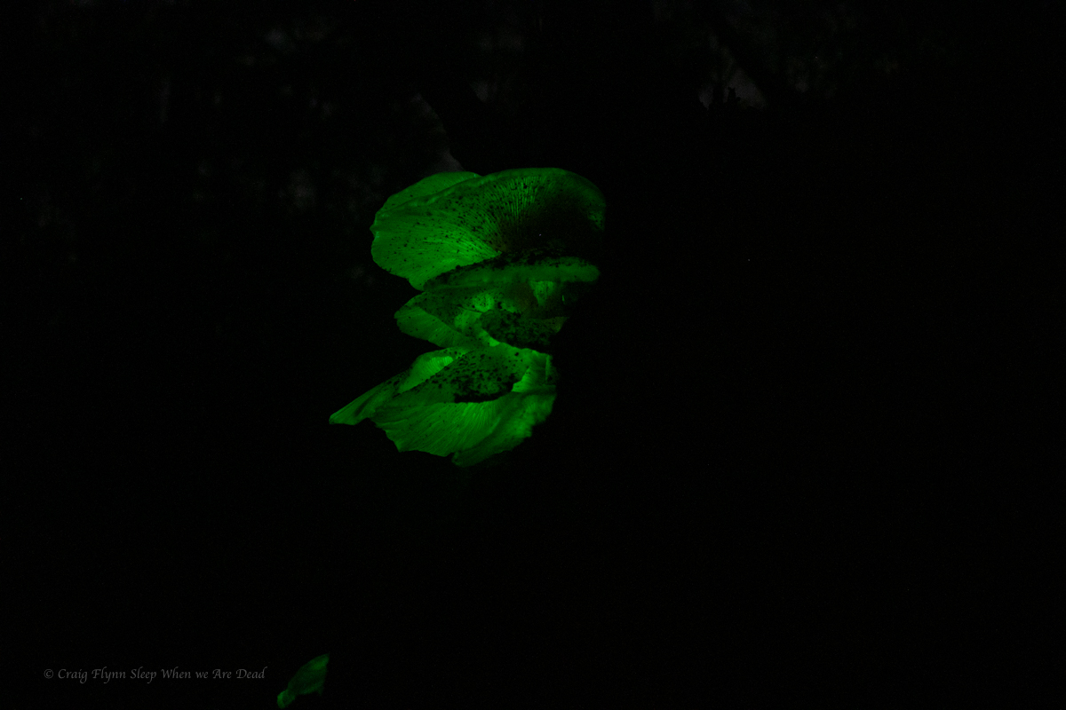
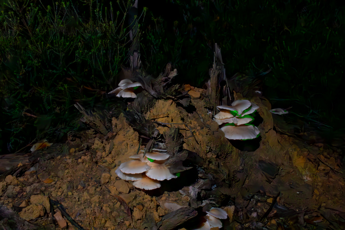
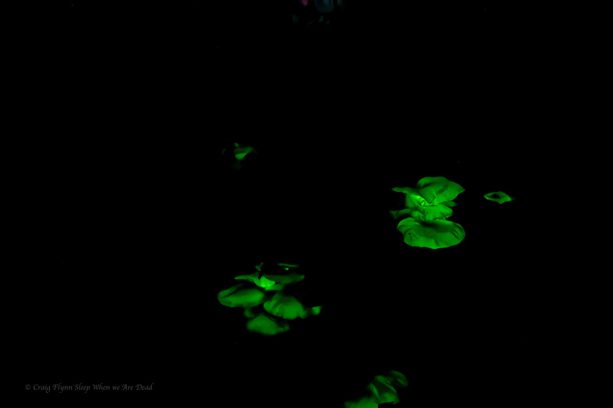
On the way back we spy some interesting mushrooms.
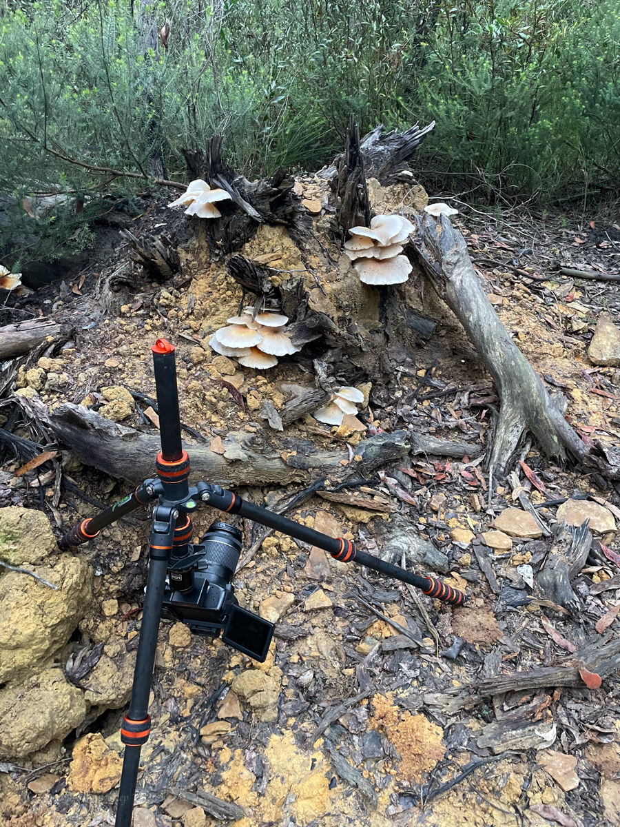
So of course we had to head back in the dark to see if they still had a shine.
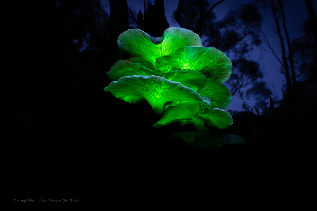
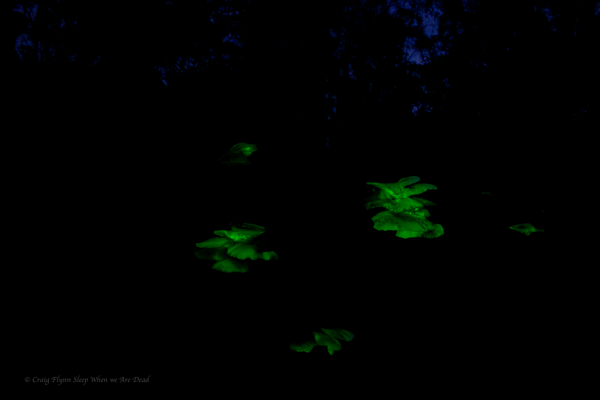
It was faint, barely able to be made out with naked eye but some long exposures brought up their beauty.
Click to enbiggen
Ghost Mushrooms produce bioluminescence for around 22hrs a day. And for 14 of those hours you would think they are just another mushroom. People are like ghost mushrooms, if you can’t see their glow you are looking at them in the wrong light: C Flynn
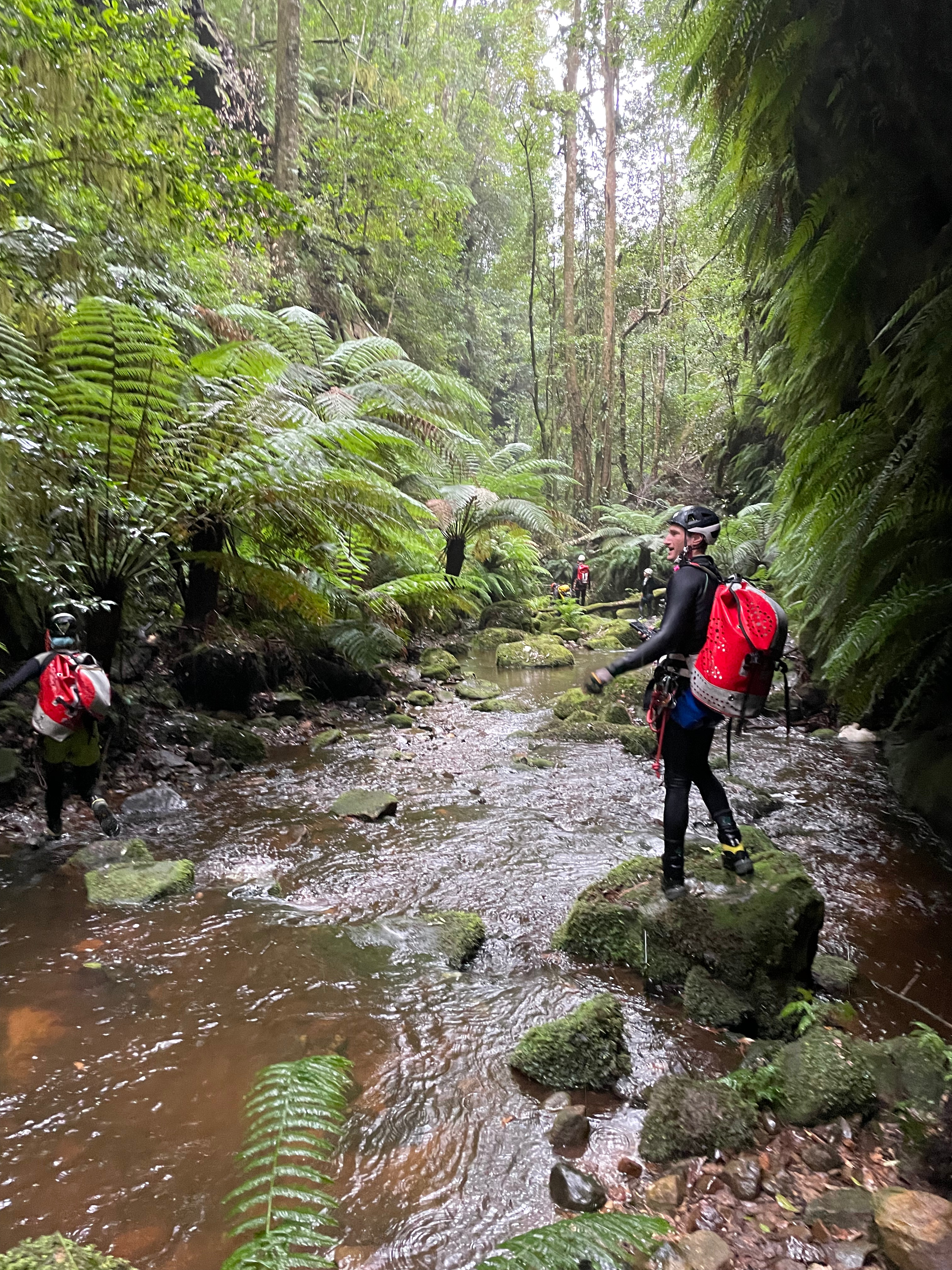
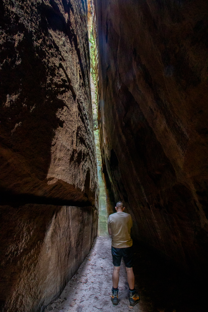
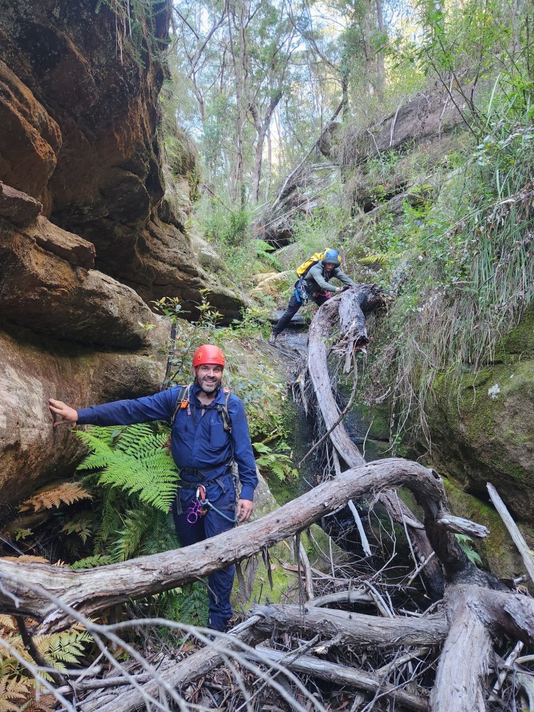
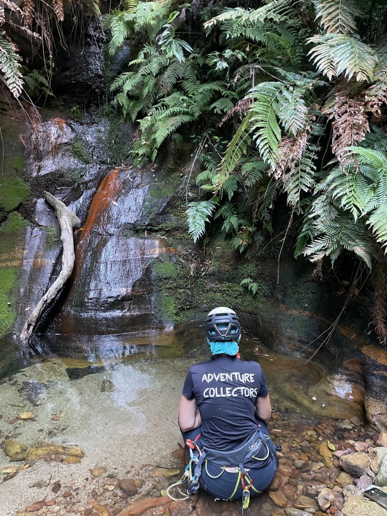
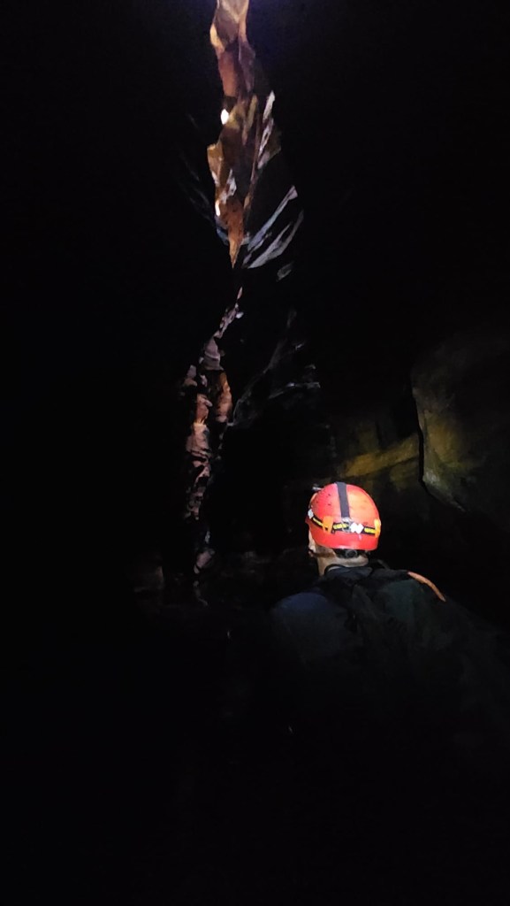
One of the less visited canyons in Mt Wilson beckoned and we headed the call.
The section we did is more or less a creek walk with an abseil but it had some pretty bits and was a relaxing way to spend a rainy morning out.
The theme song for the day was that song by The Presidents of the United States, Leeches. “Millions of leeches, leeches for free. Millions of Leeches all coming for me”
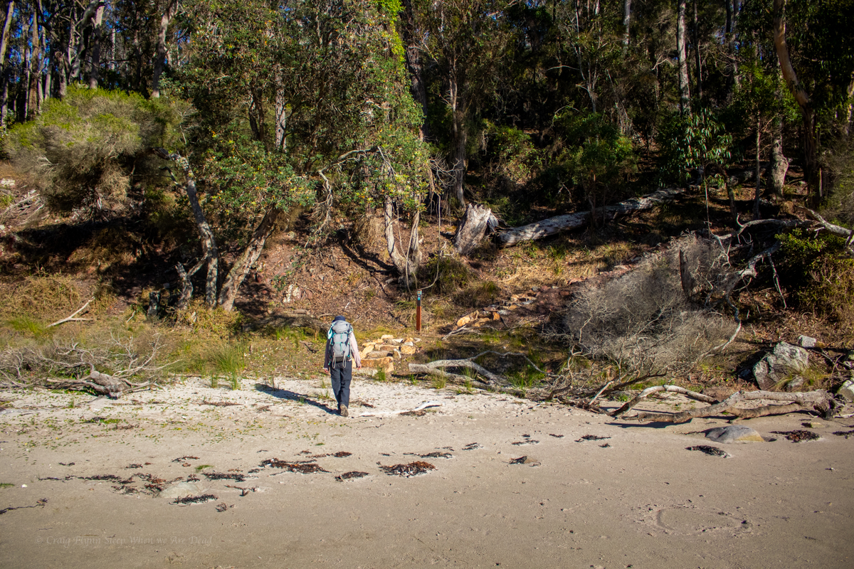
We start down an old tourist trail, cross a small creek then spear off into the scrub, cutting below a parcel of private property. The scrub was nowhere near as bad as expected but the rain had turned the ground into a slippery mud slide.
We had a Grid reference in the main creek below the next tributary upstream and while we doubted we needed to go that far up we also knew there was only 1 main feature in this section and we didn’t want to miss it.
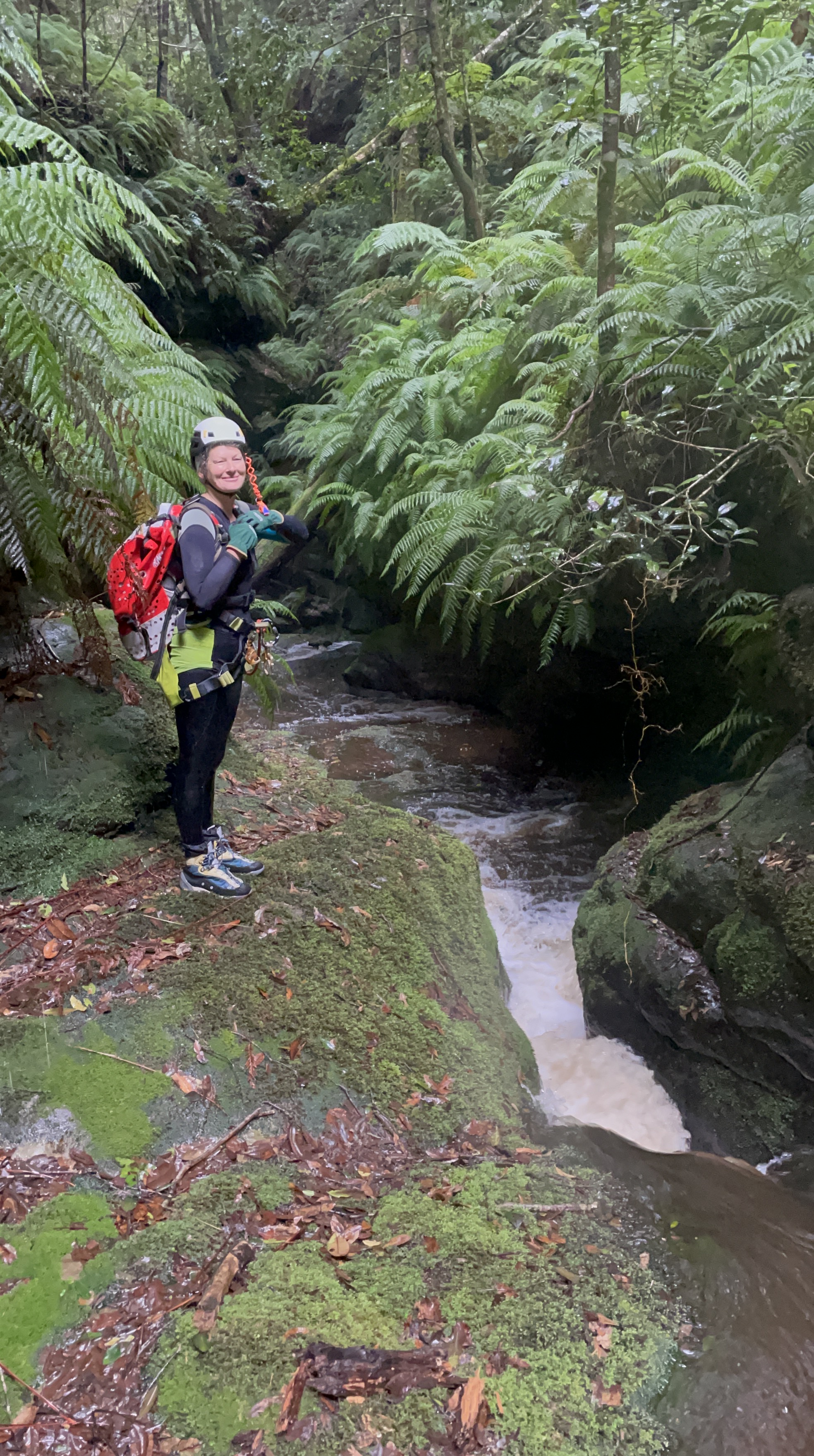
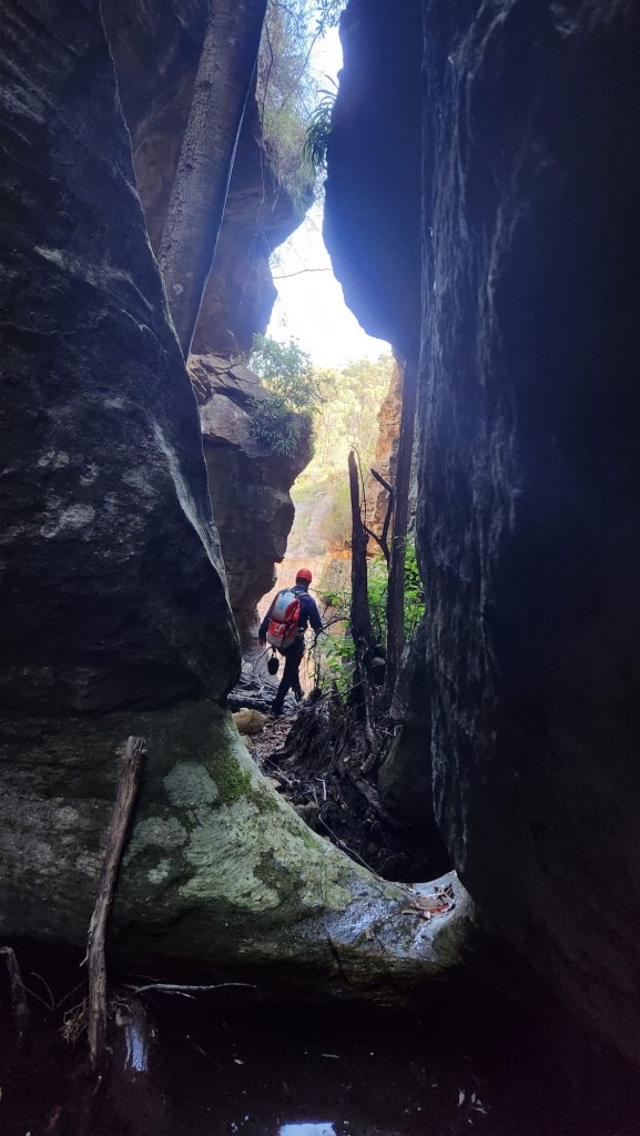
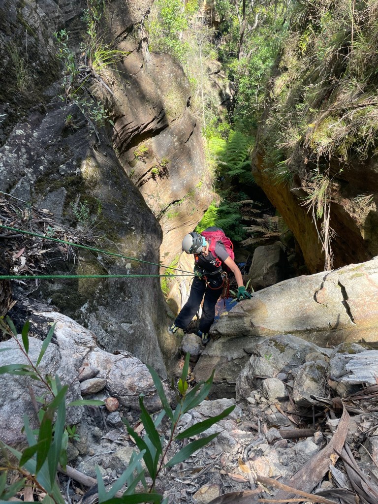
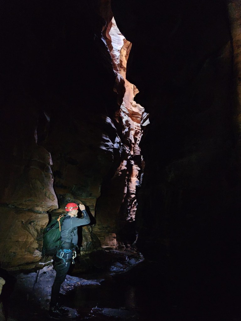
Skirting the private property we optioned to stroll down the nose of the ridge rather than battle our way down the creek line. It was easy going and brought us to a small cliffline over looking the junction of the trib and the main creek.
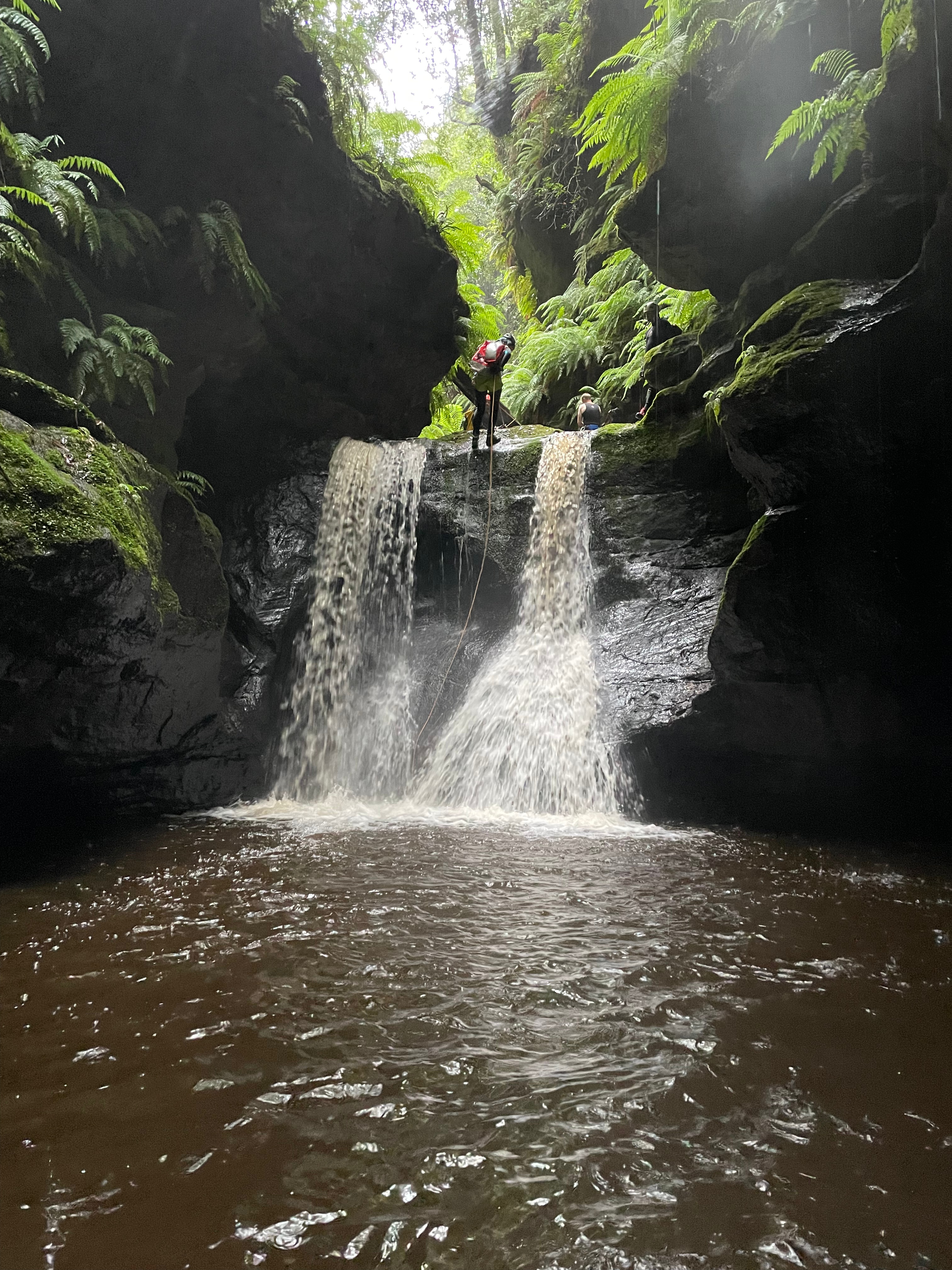
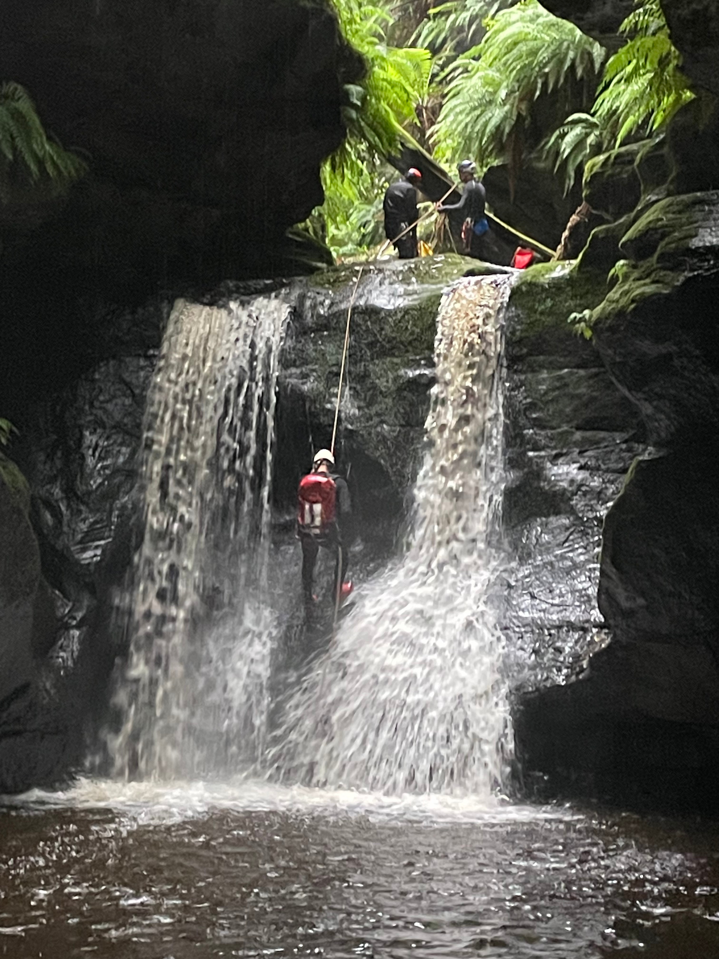
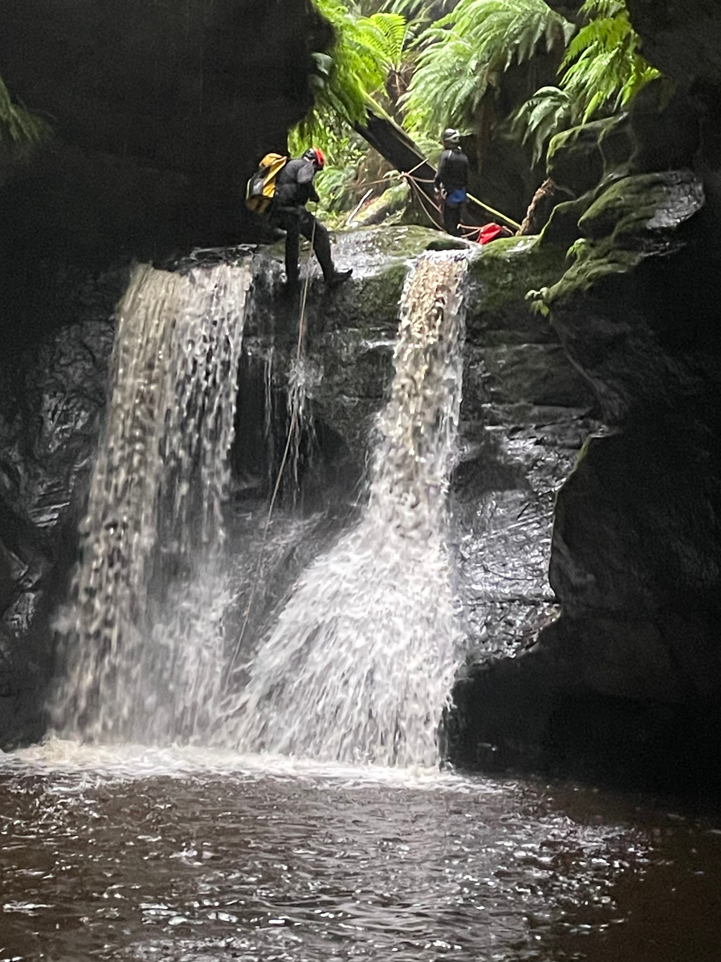
We roped up and made short work of the 10m drop then scrambled down to the creek.
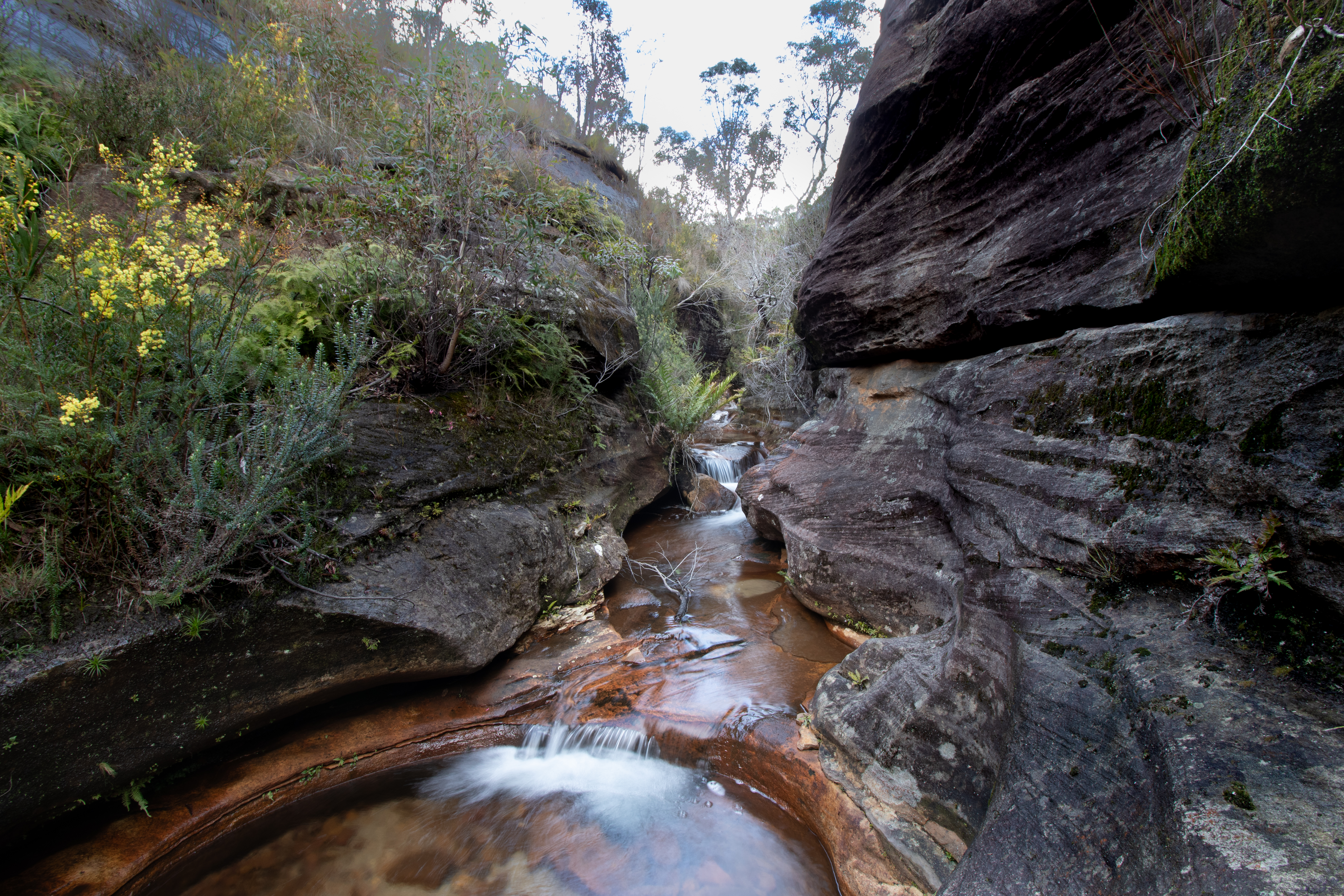
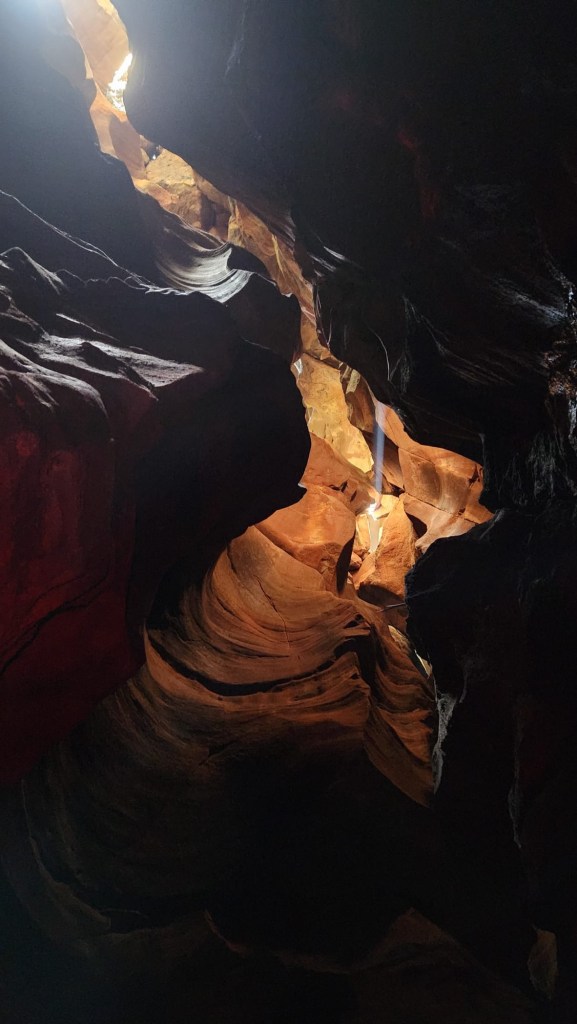
Waterfall creek itself is a tributary of Bowen Creek and has that lush beauty about it.
She is fernalicious, pondalicious and delicious
H, not on the phone, honest.
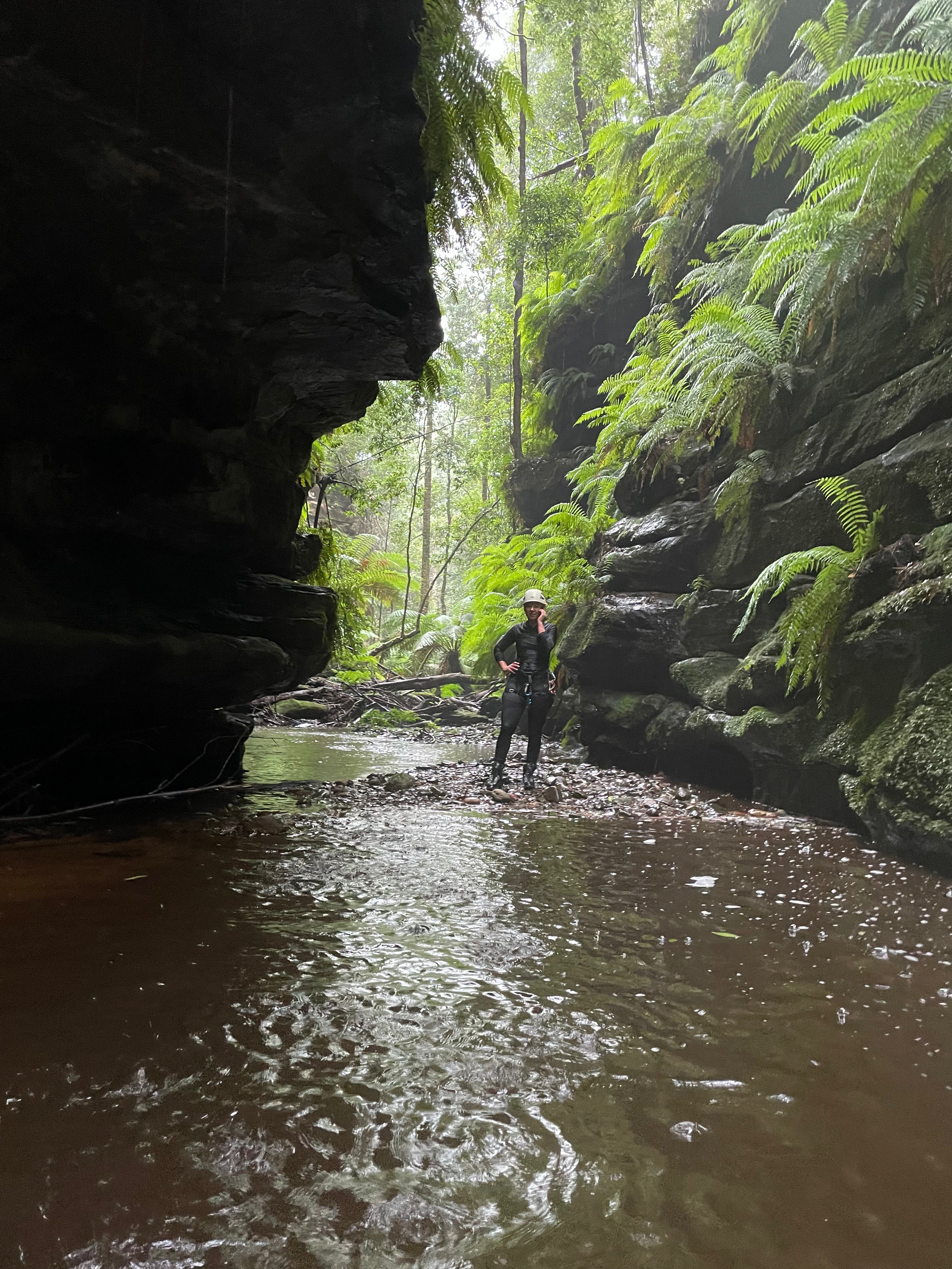
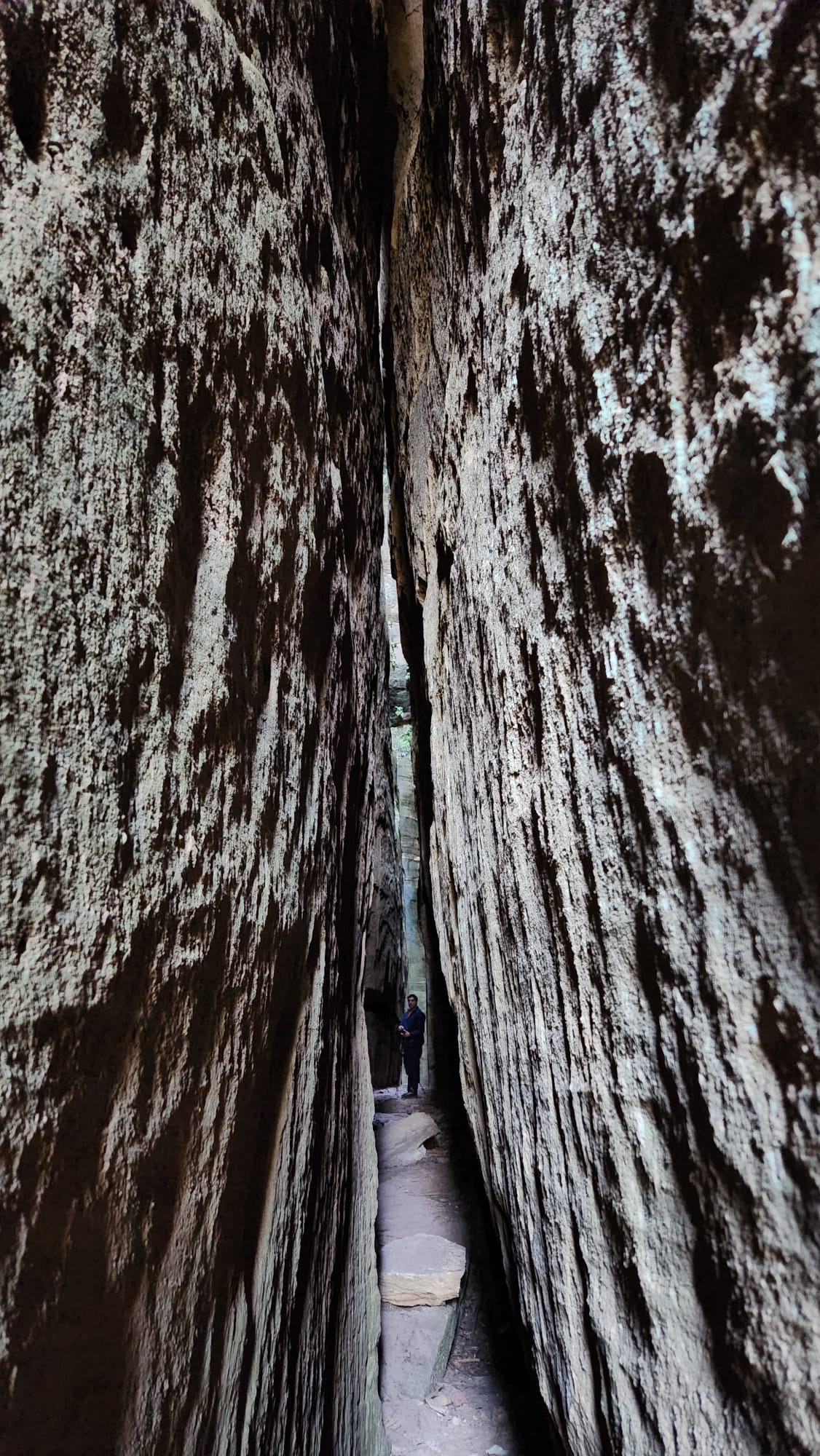
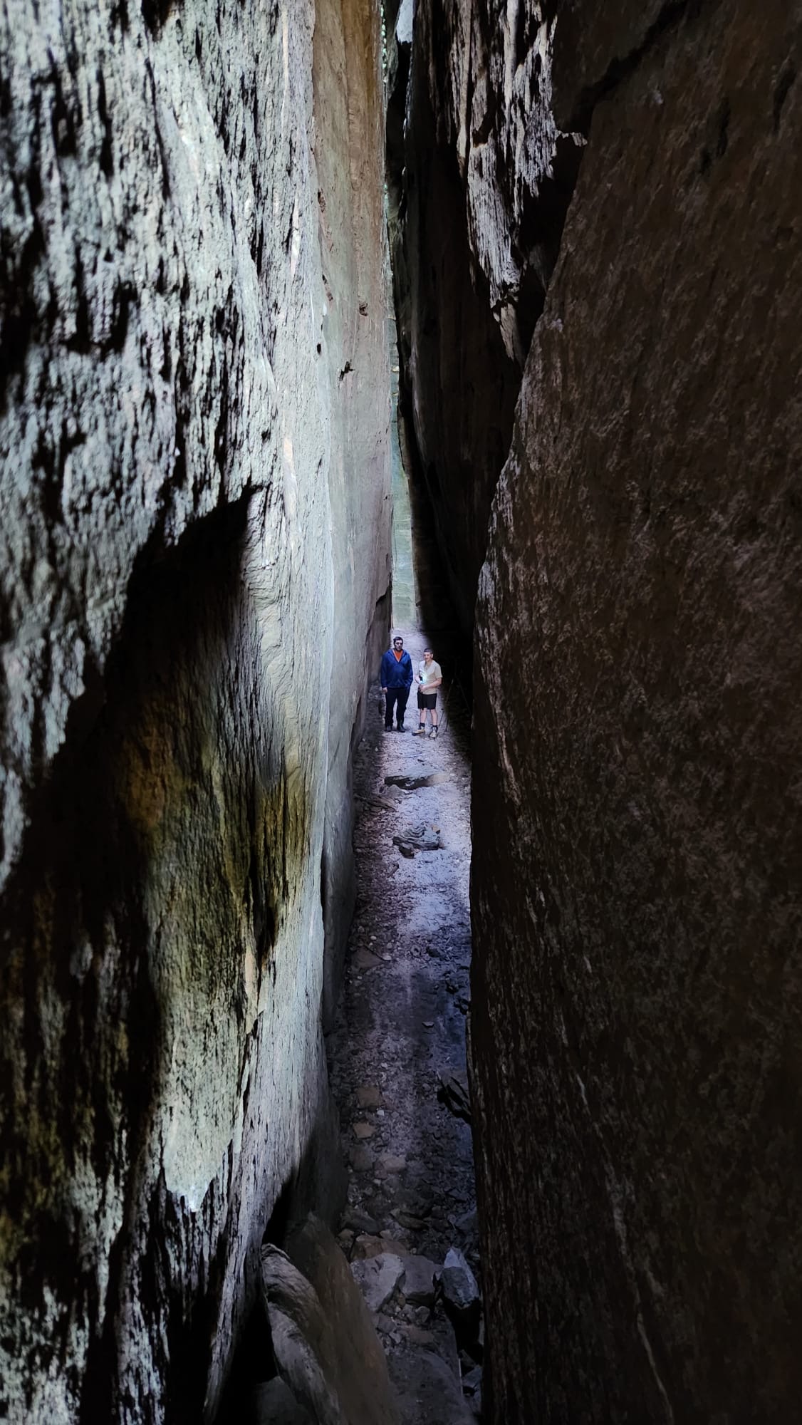
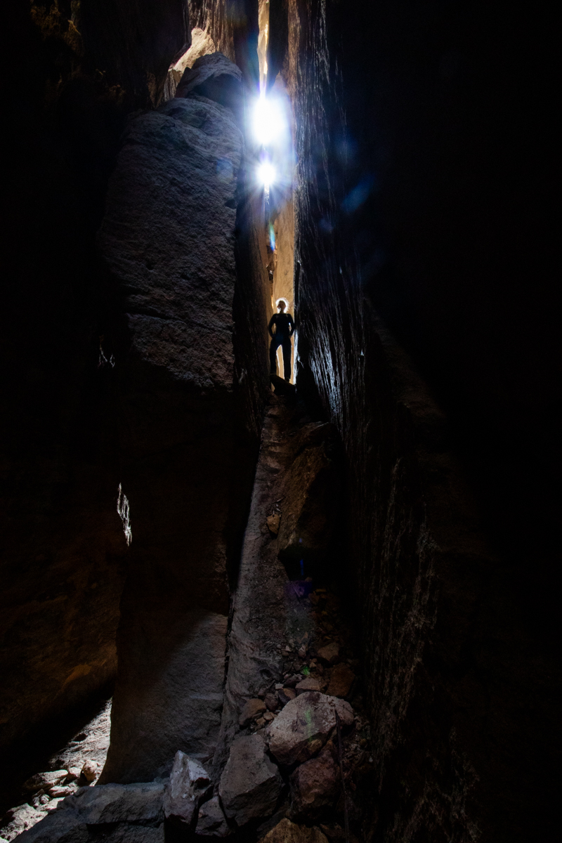
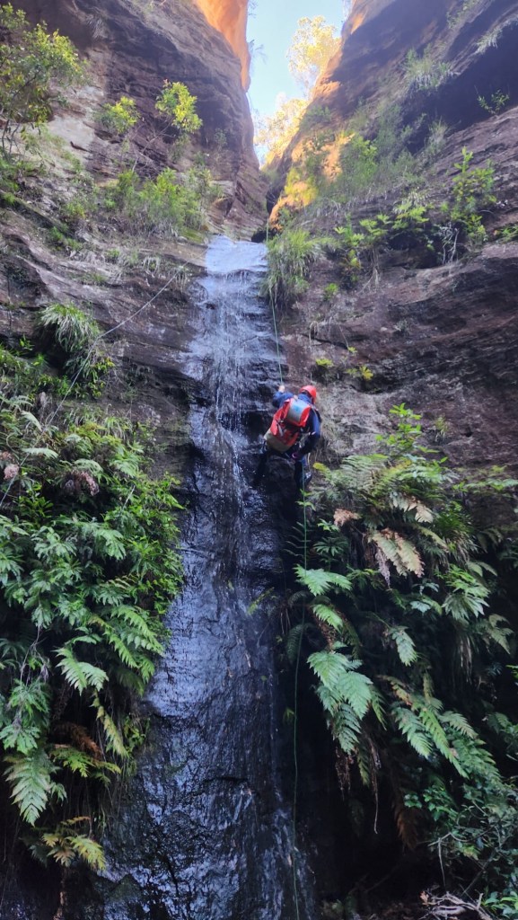
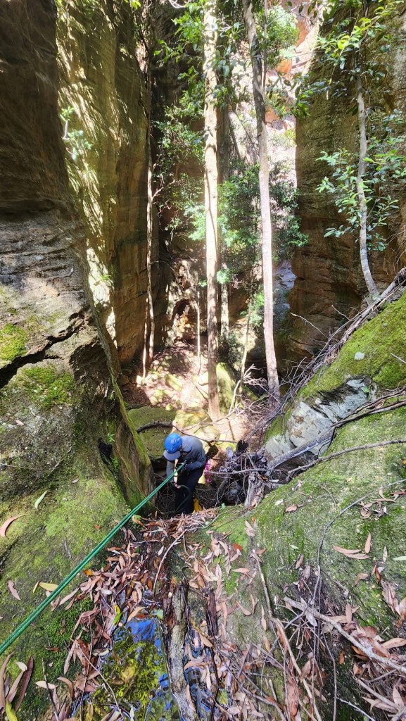
The creek tries to canyon up. But we are too high in the strata for a consistent slot.
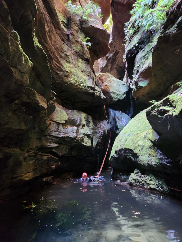
A fun little abseil in the most canyony bit
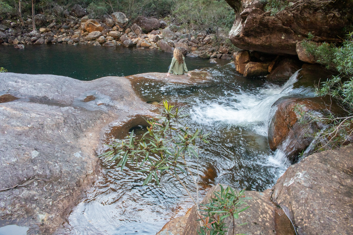
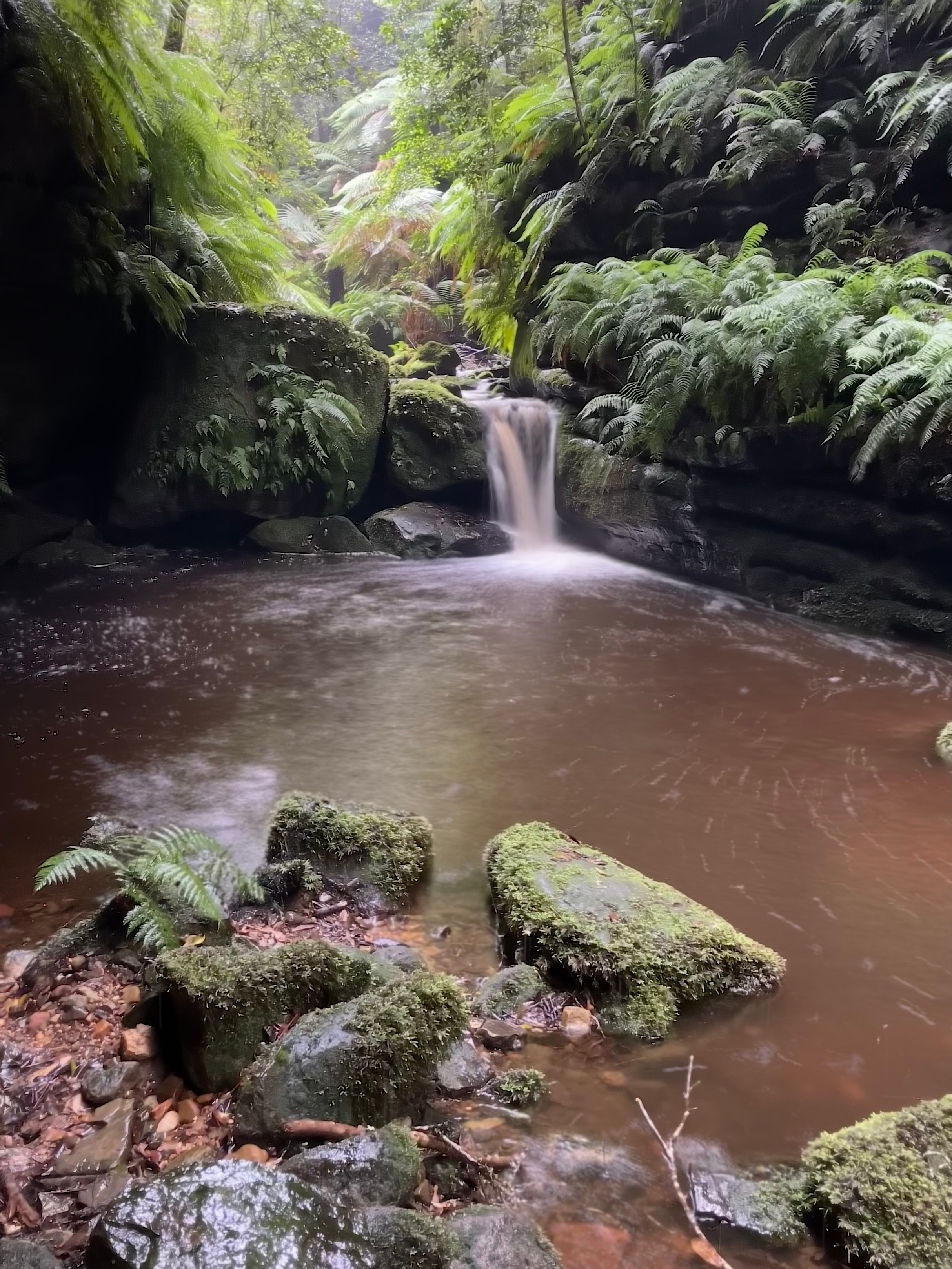
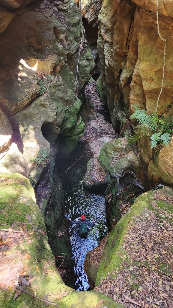
And before long we come to the pool known as “Happy Valley”
The rain had turned the water a little murky but the greenery of outstanding
We could have kept exploring down stream but know this is an easy exit option and for today, that’ll do.
A lot of work has gone into the trail in and out of this little pool. It might be a nice spot for a swim on a hot summers day, though it’s a steep haul out.
If leeches ate peaches instead of my blood, then I would be free to drink tea in the mud: E Autumn
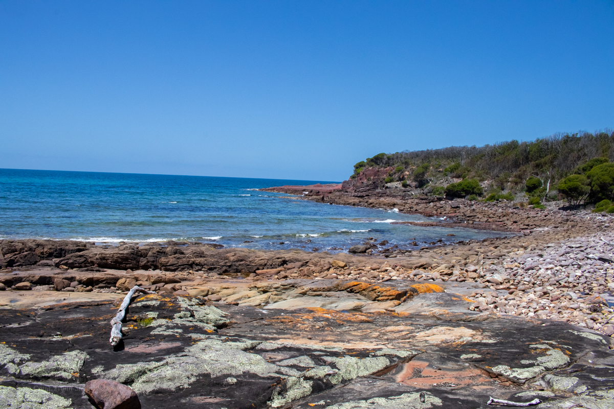
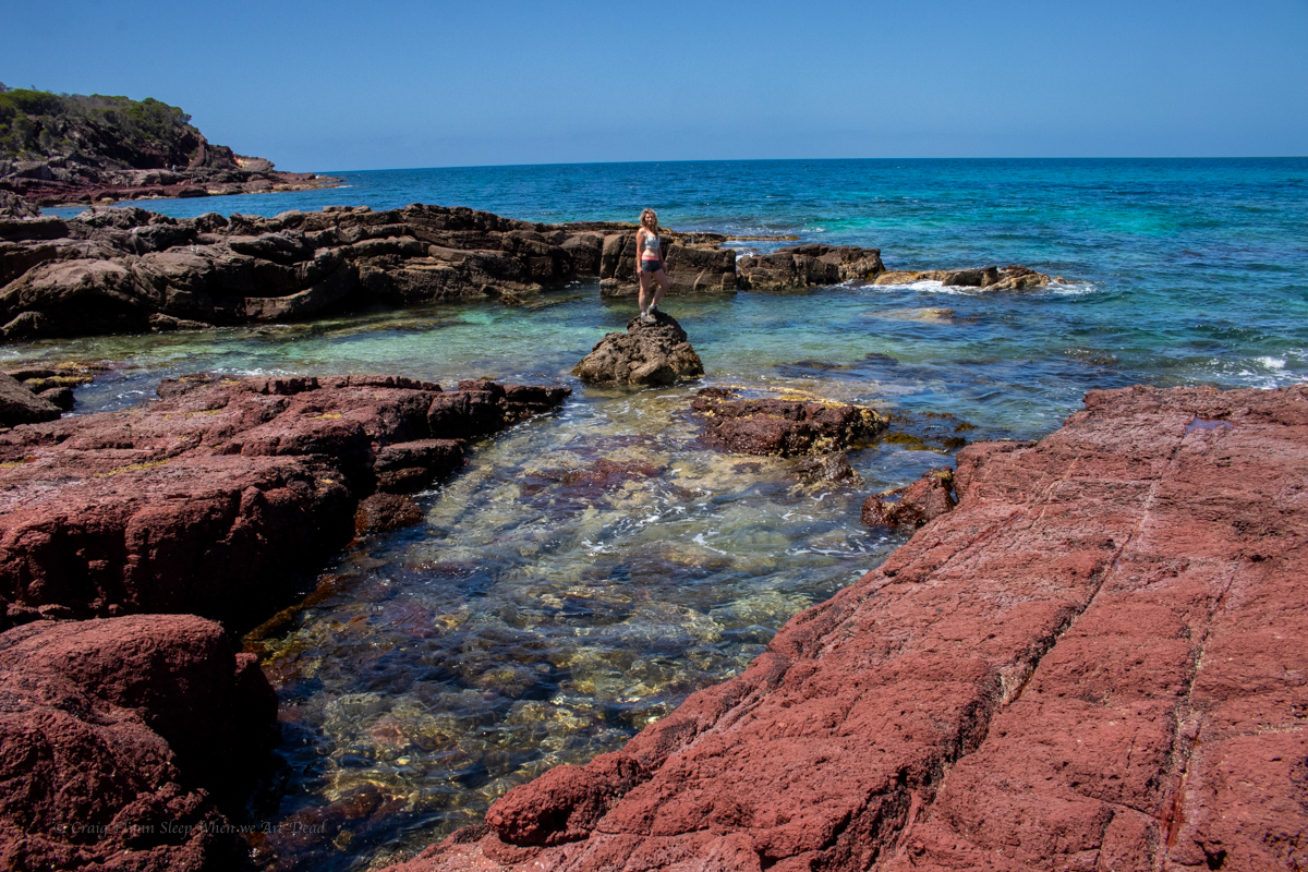
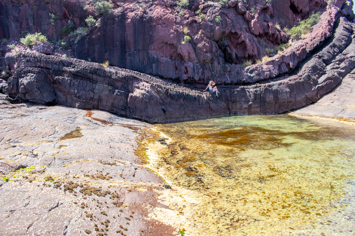
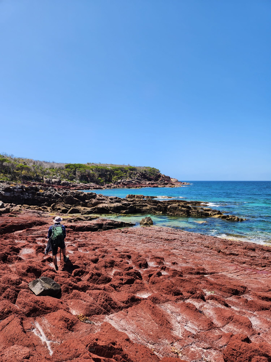
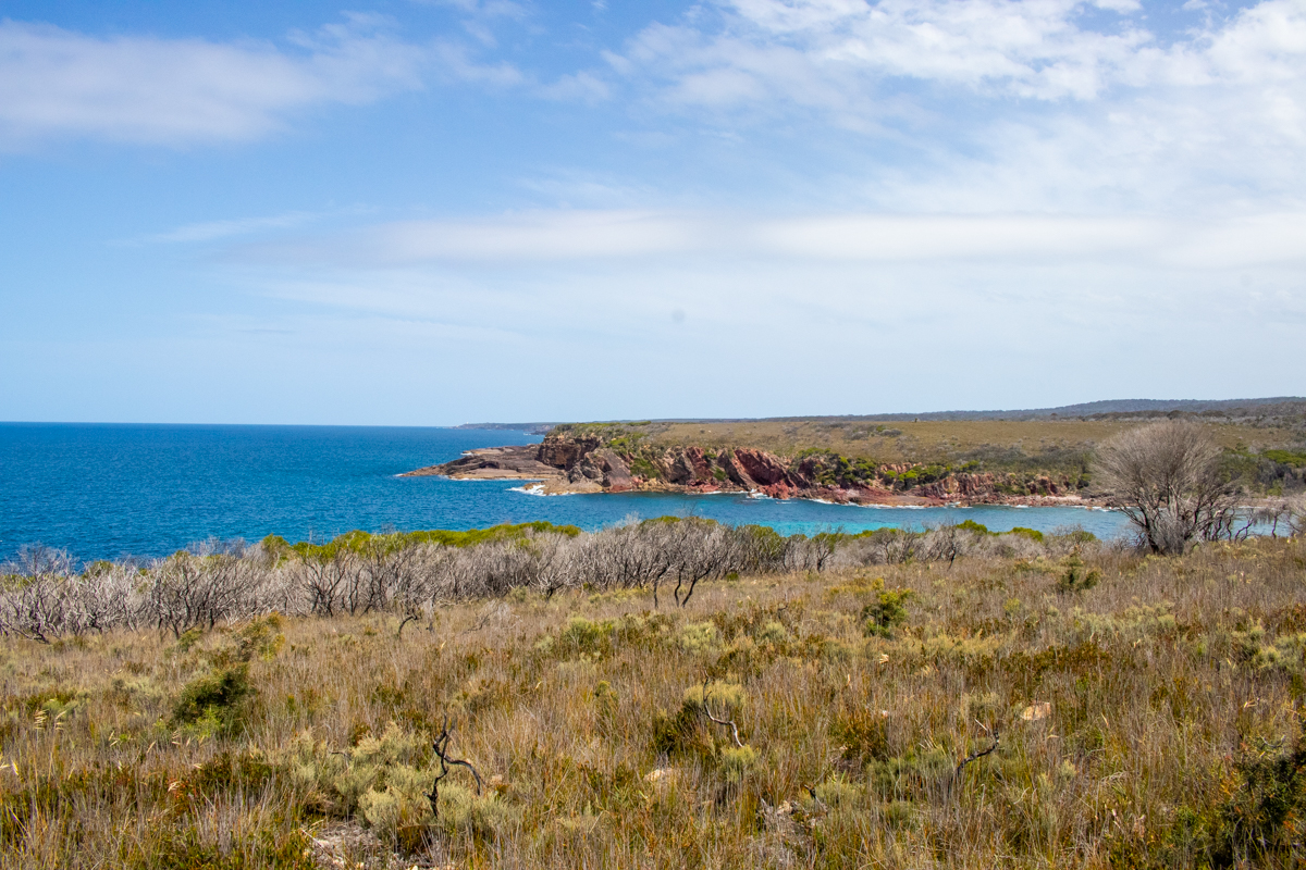
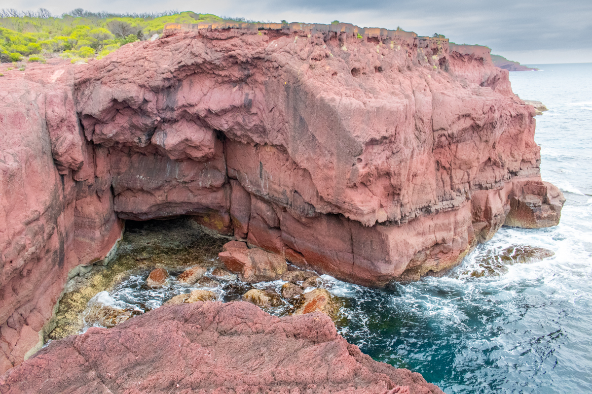
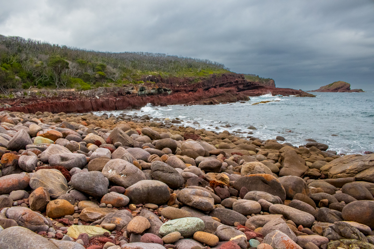
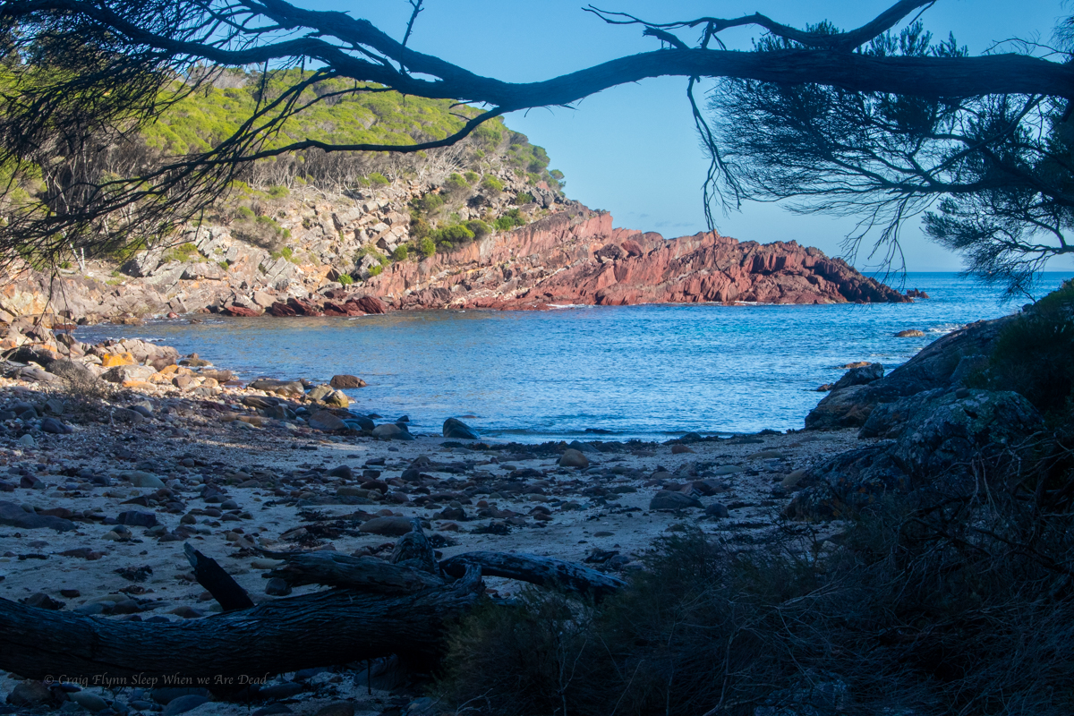
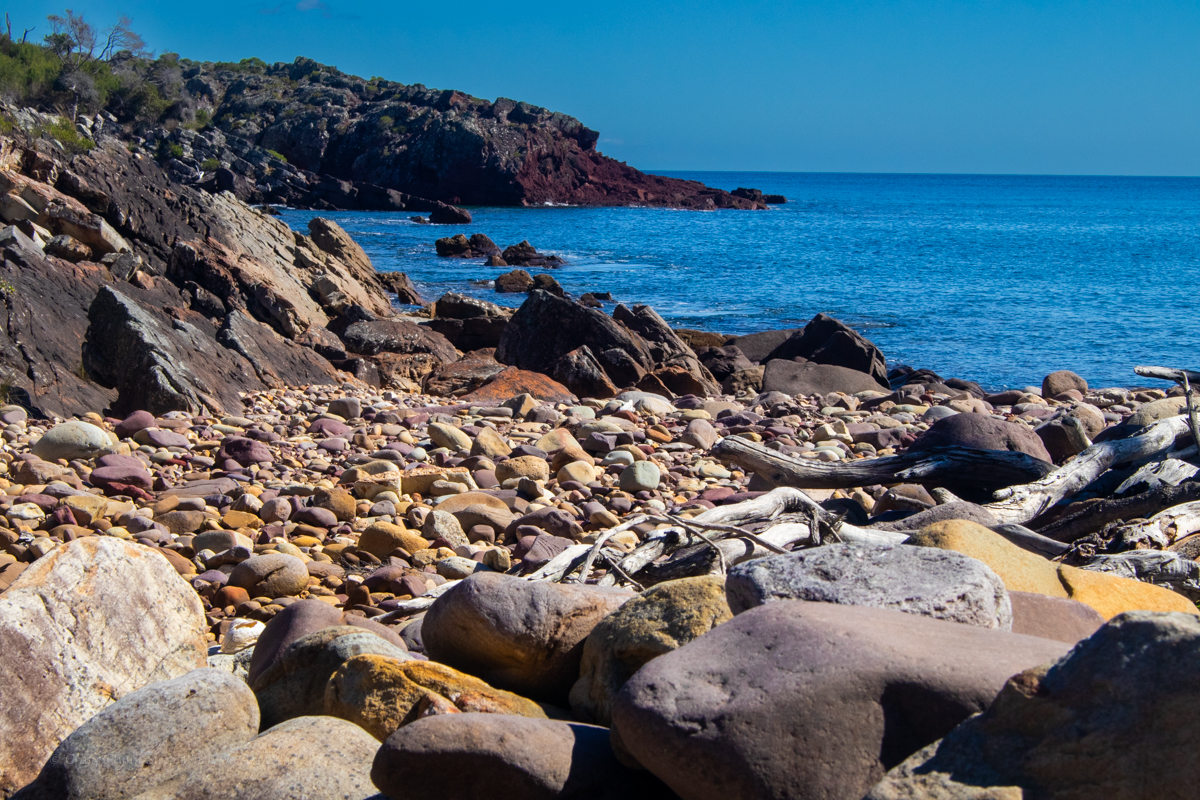
The south coast of NSW is one of Kylie’s favourite places and I can easily see why. The colours of the dramatic coast line are mesmerising, the escarpments are grand and as a bonus the mountain biking is truly awesome.
With a bit of leave over Christmas I thought I’d be mad not to join her on a road trip.
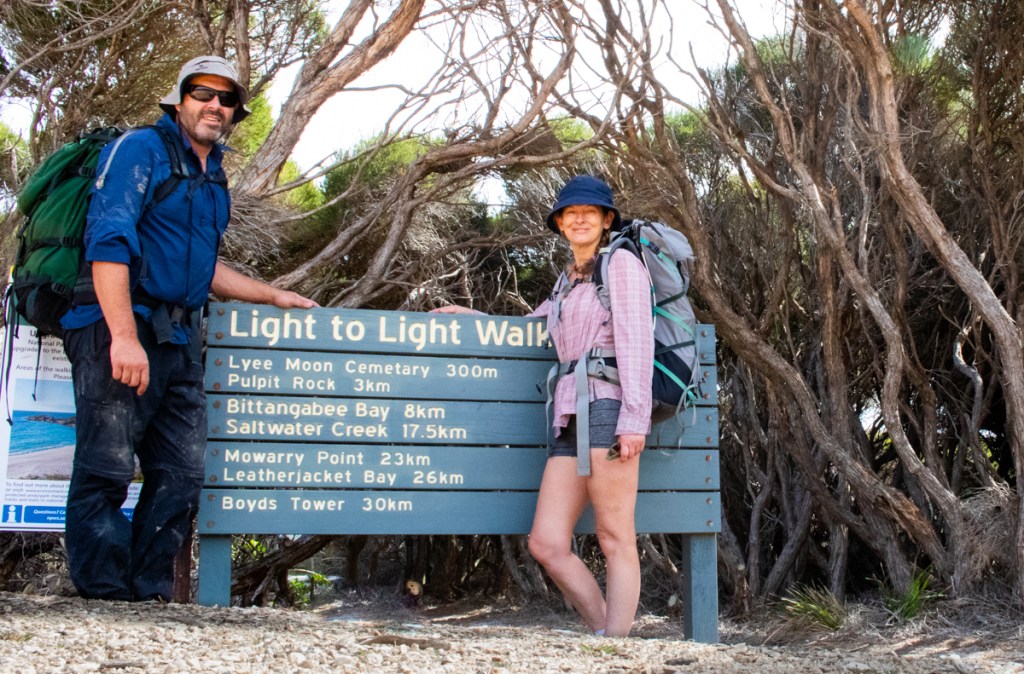
One of our goals would be to squeeze in this popular multiday walk.
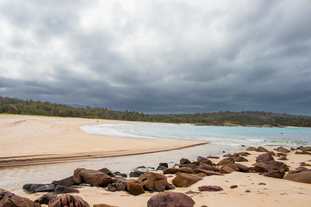
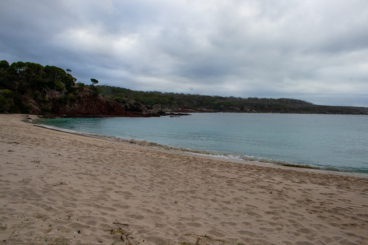
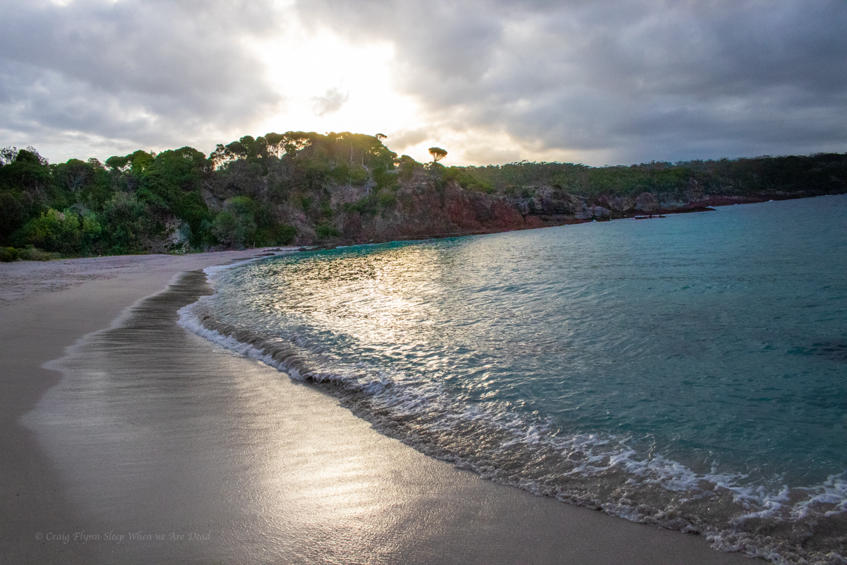
The Light to Light stretches between Boyds Tower and the Green Cape Light house in Beowa National Park, south of Eden. Being about 30km it’s doable in a day but most people do it over 3 days, making use of the offical camps sites at Saltwater Creek and Bittangabee bay (these are drive in campsites with showers and toilets so bookings are essential in peek times.)
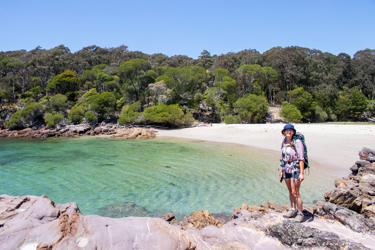
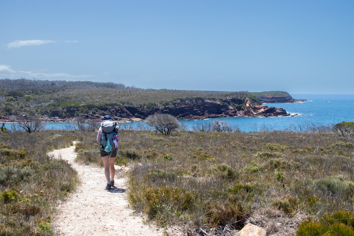
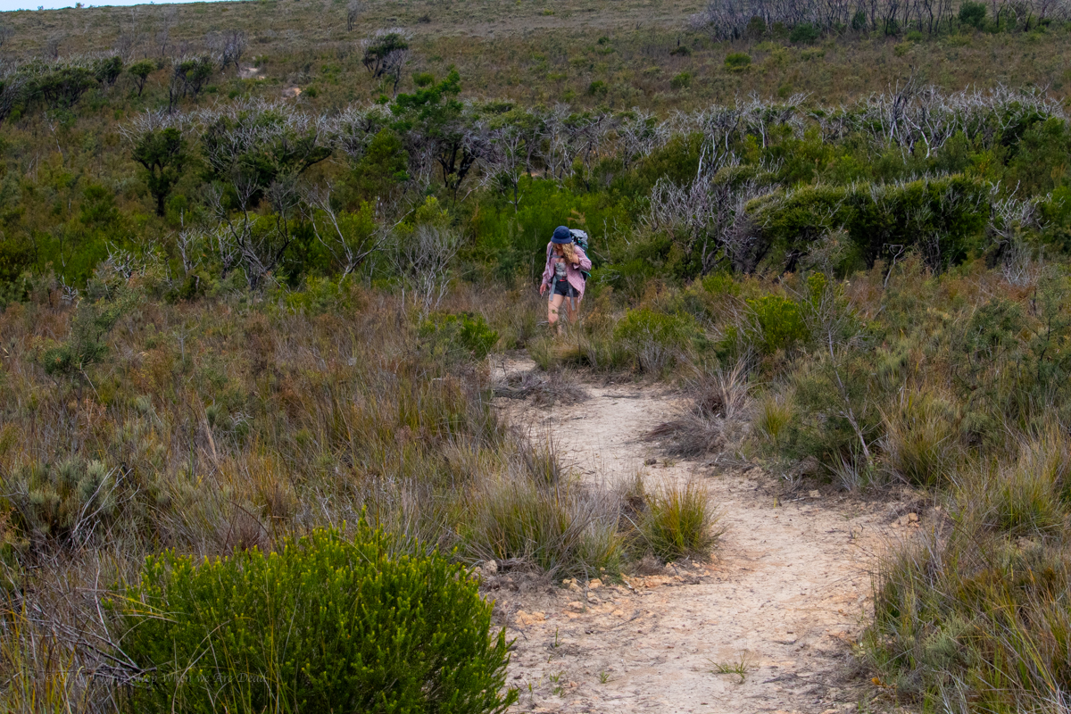
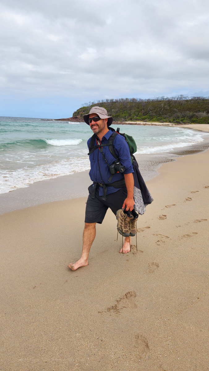
We wanted to enjoy the beaches and scenery so decided to do it as a 2 day trip. As we had the mountain bikes we opted to forgo the pick up and drop off logistics (You can pay for a shuttle service at approx $120 per person) and made use of the bikes for the return journey.
Boyds Tower appears to be the usual start to the walk but looking at the topography of the forestry roads we figured it might be an easier ride North to South so we stashed the bikes in the bush near Boyds Tower and drove down to Green Cape to start the walk from there.
Along the way we did a side trip into Saltwater Camp to stash some extra water.
Part 1: Green Cape Light house to Bittangabee Bay
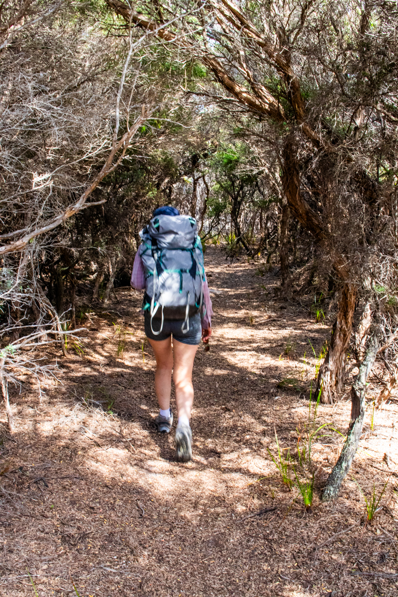
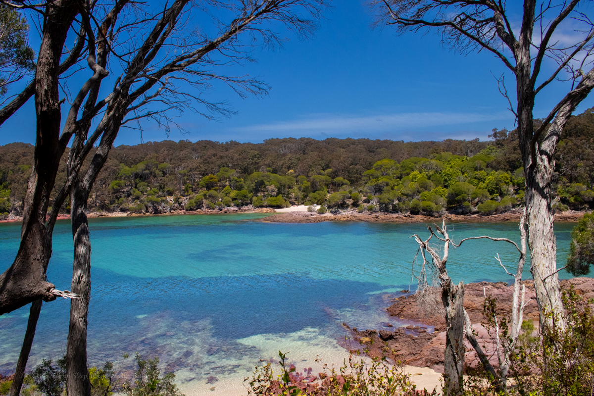
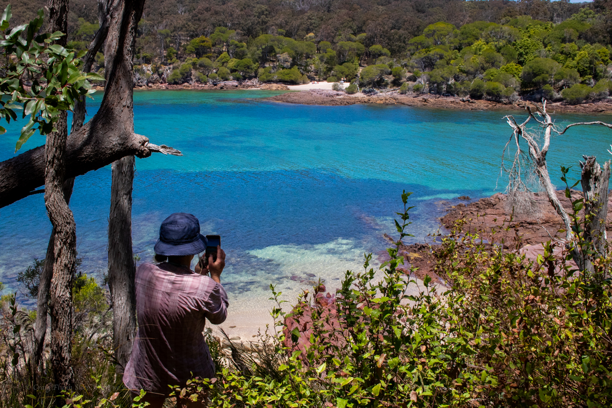
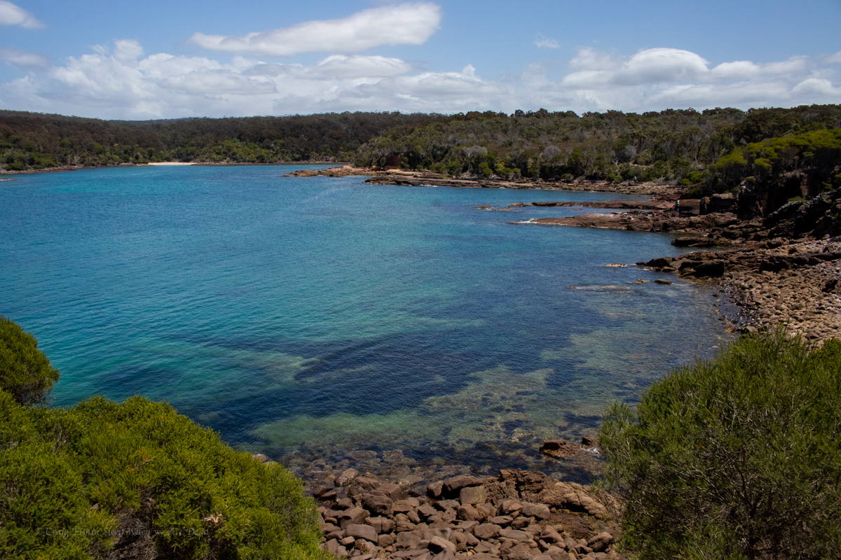
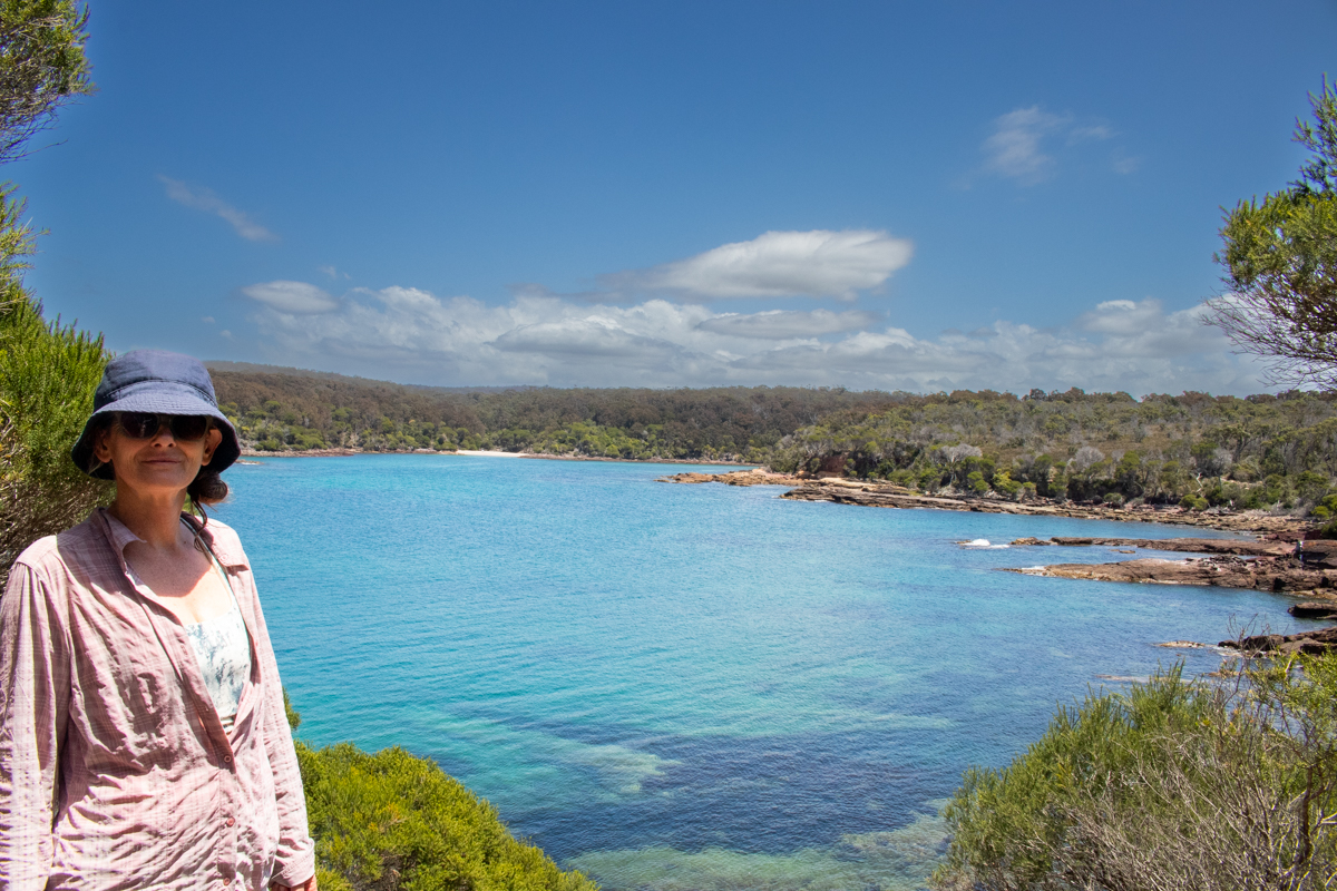
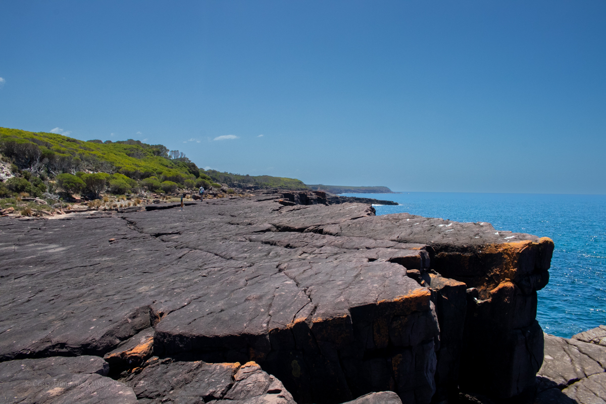
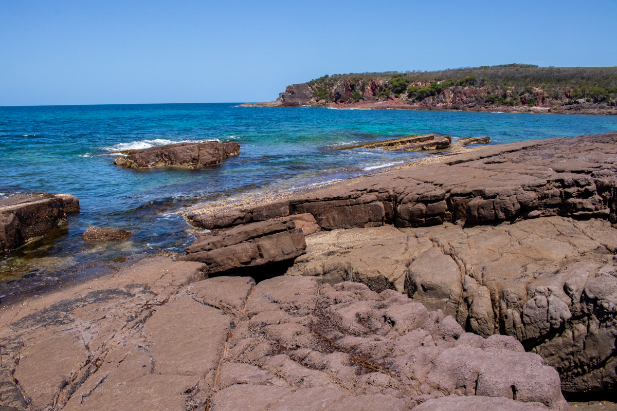
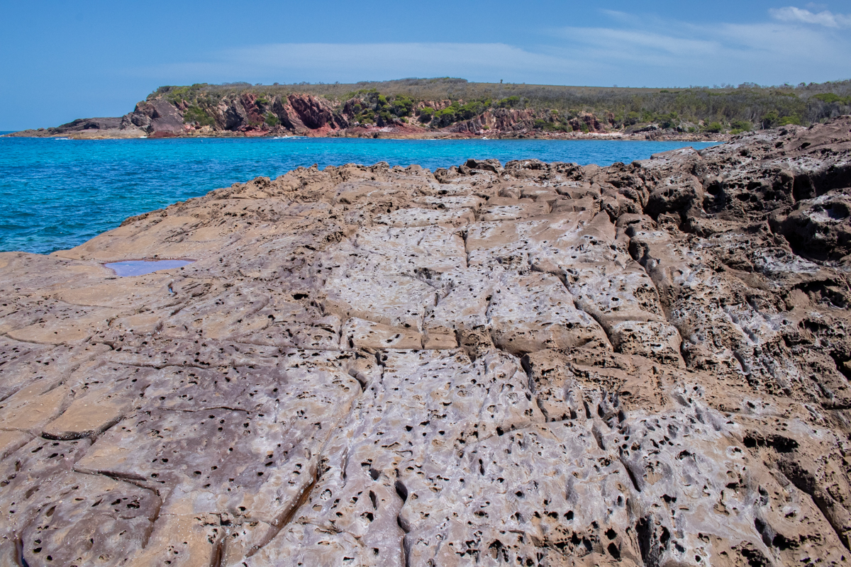
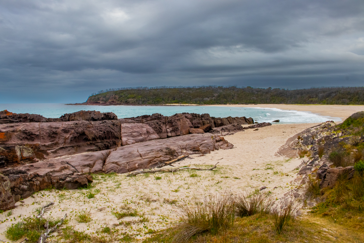
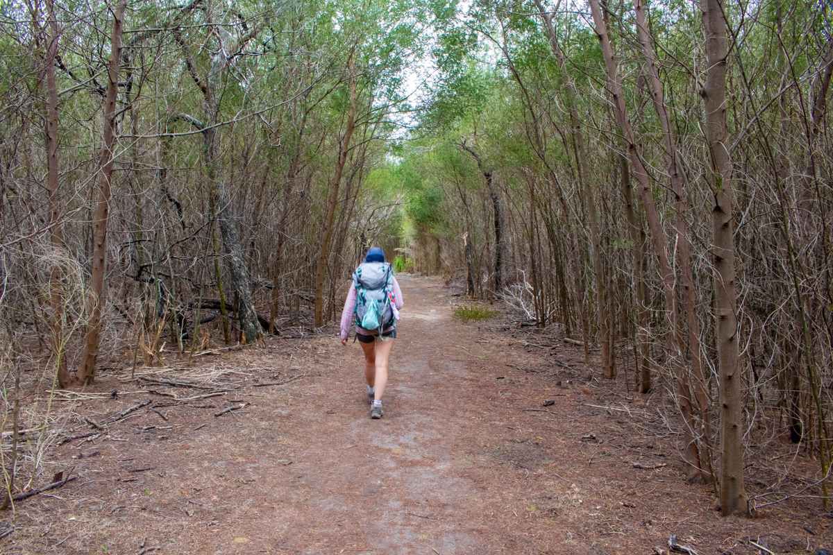
Full of beans and anticipation we set off at the crack of 10am in high spirits. It is a stunning bit of coast down here which is why I’m a bit baffled as to why this section of trail stubbornly avoids it.
TBH, this was my least favourite section of the walk. We could hear the ocean, we could occasionally see the ocean but without large side trips we couldn’t see the coast line.
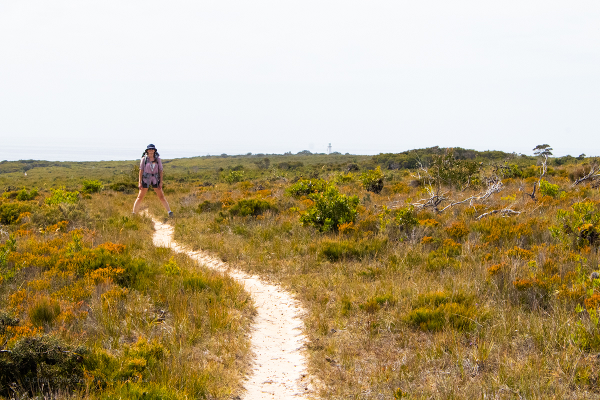
We wander through tunnels of mallee scrub and across open plateau, it’s like the trail is trying to avoid any elevation loss or gain for the sake of it and at one stage I find myself thinking, I hope I haven’t driven 5hrs for 30km of this shit.
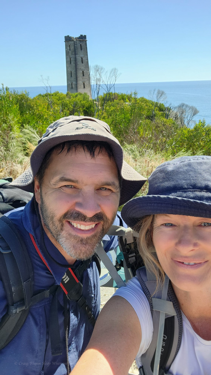
Gadget with the Light house off in the distance
Coming from the other way I can’t help but think this would be a disappointing end to the walk and you’d only be doing it for the sake of doing it and getting to the Light House.
NPs are doing a lot of upgrade work on the trail so perhaps this is a temporary diversion but it doesn’t look temporary.
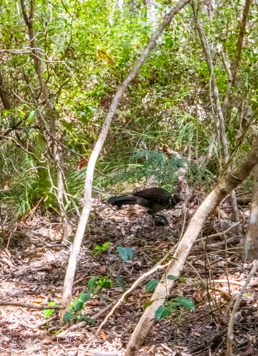
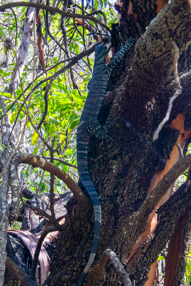
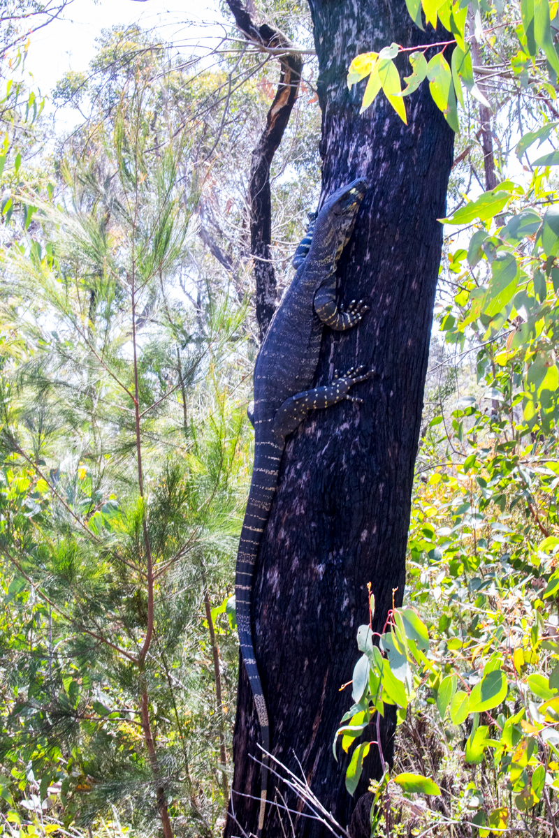
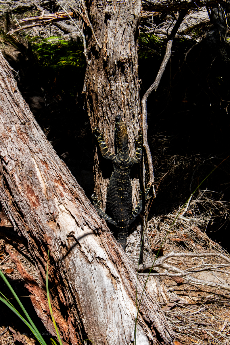
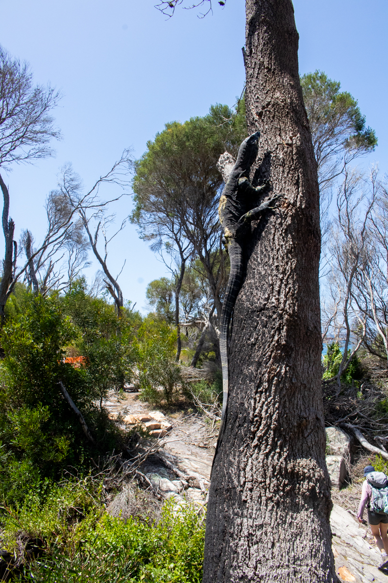
Luckily the plethora of goannas and bird life were a distraction from the flat boring trudge.
Lyrebird scratching aboutlace monitor, Varanus variuscute little water holelace monitor, Varanus variuslace monitor, Varanus varius
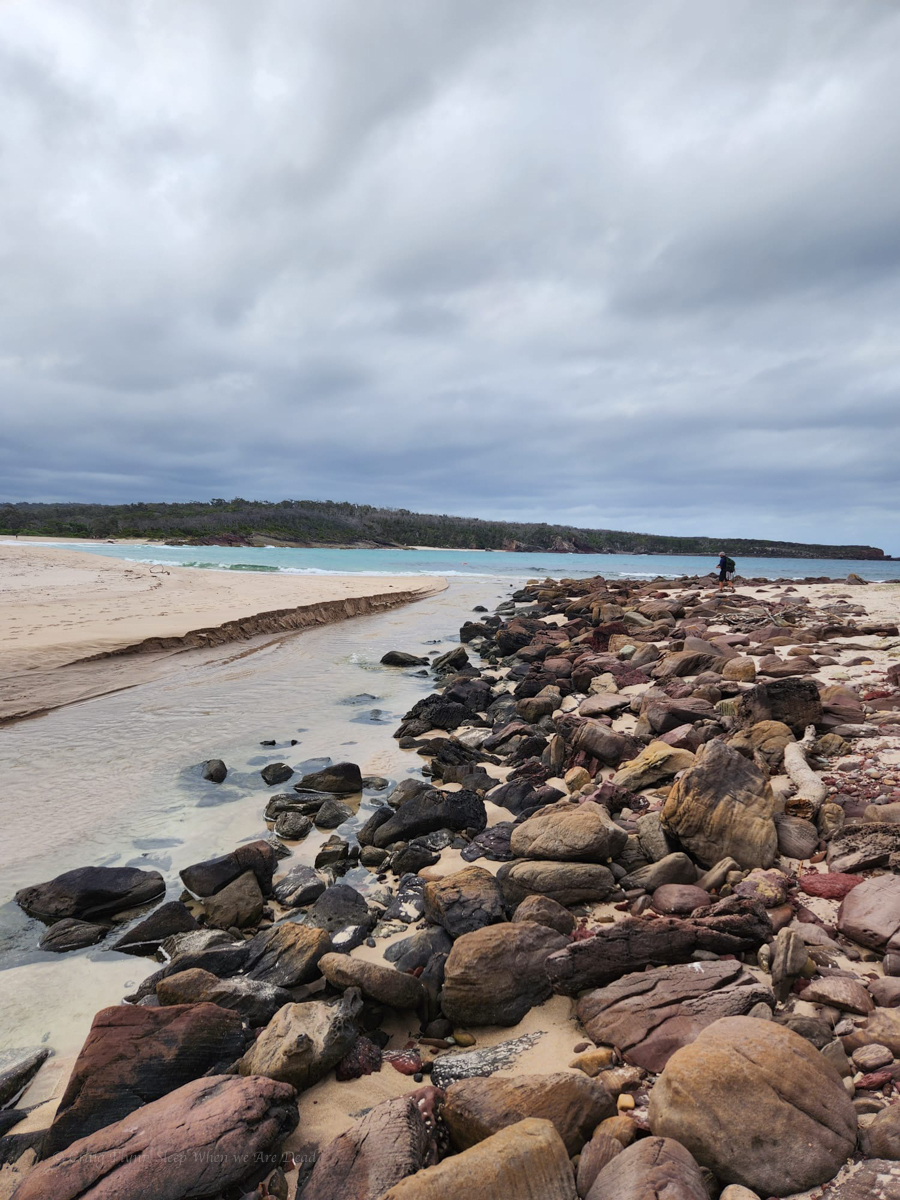
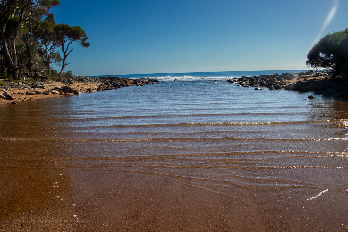
8kms in Bittangabee bay was a welcome site.
Part 2: Bittangabee bay to Hegarty’s bay
NP were doing upgrade works to the trail around the headland so we were diverted in through the camp. It was packed. A sign near the toilet block directed us back on to the trail on the other side but, confusingly a few hundred meters along we came to a barricade and signage preventing people from accessing that section from the other direction.
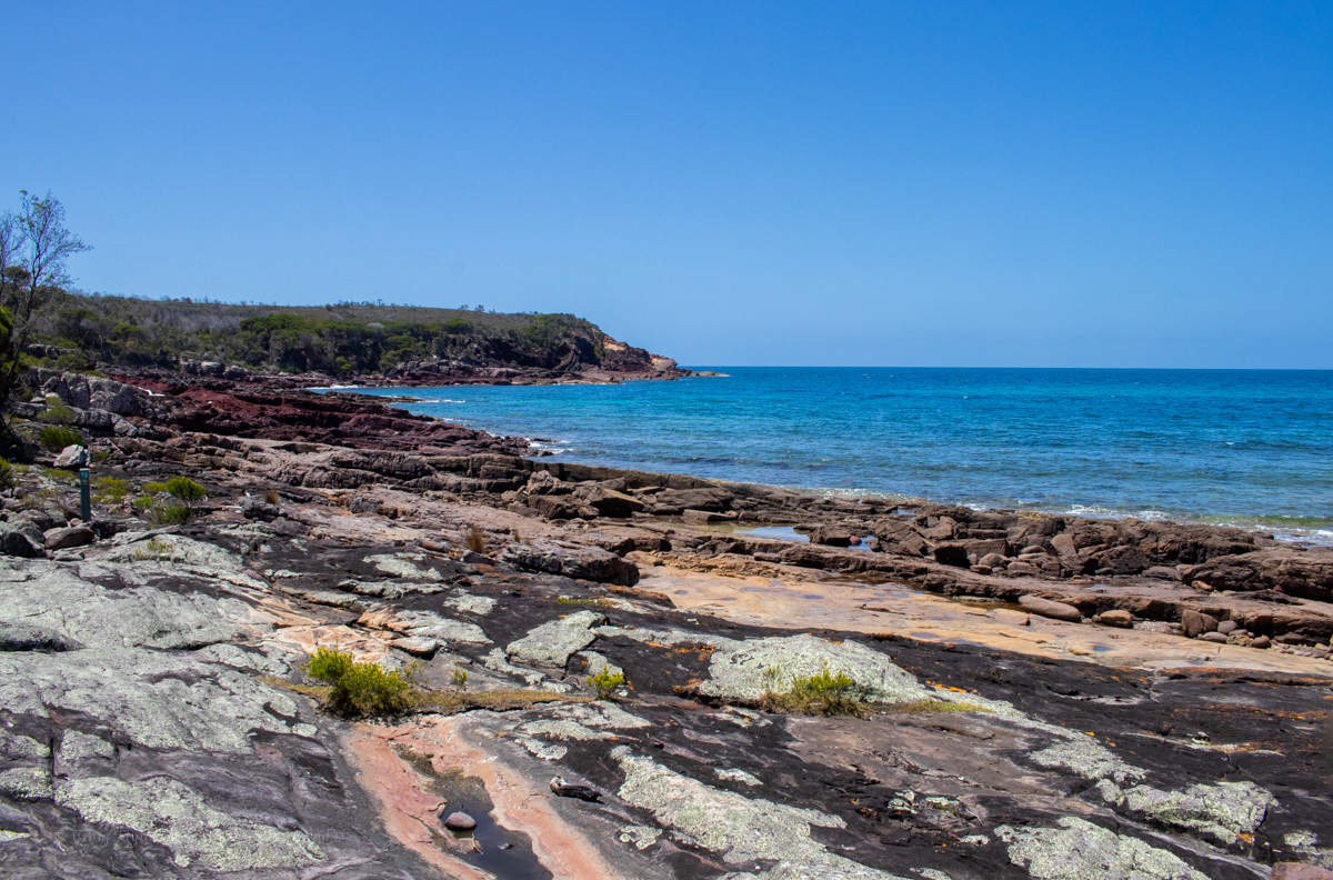
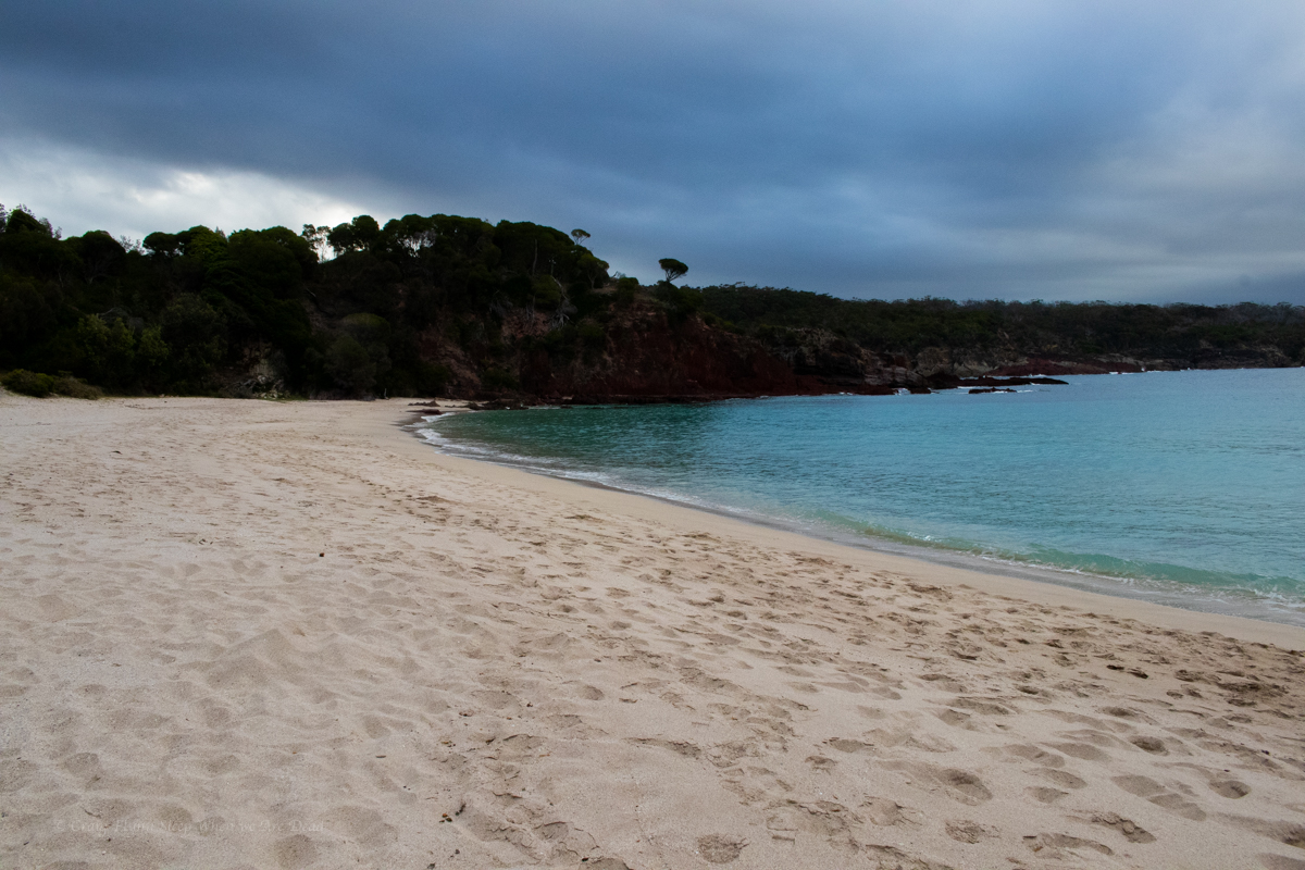
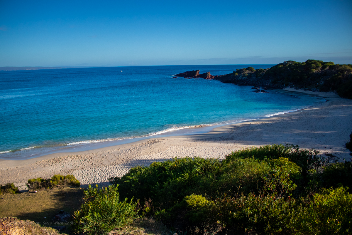
Anyhoo, We make the short side trip down to the surprisingly people-less bay for a swim and a bit of lunch. We also got lucky as the grey clouds dispersed and the sun brought the colours out. Even if you are not doing the walk or camping for the night a visit to Bittangabee Bay is well worth it if you are down this way.
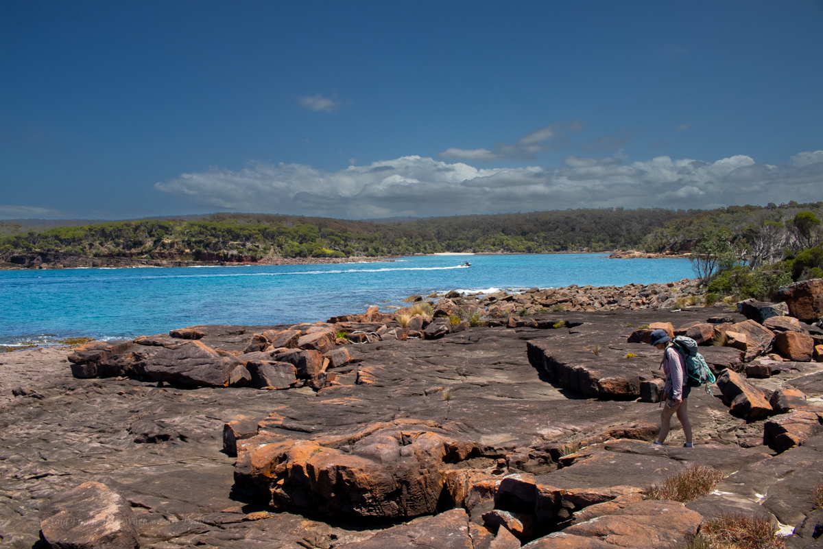
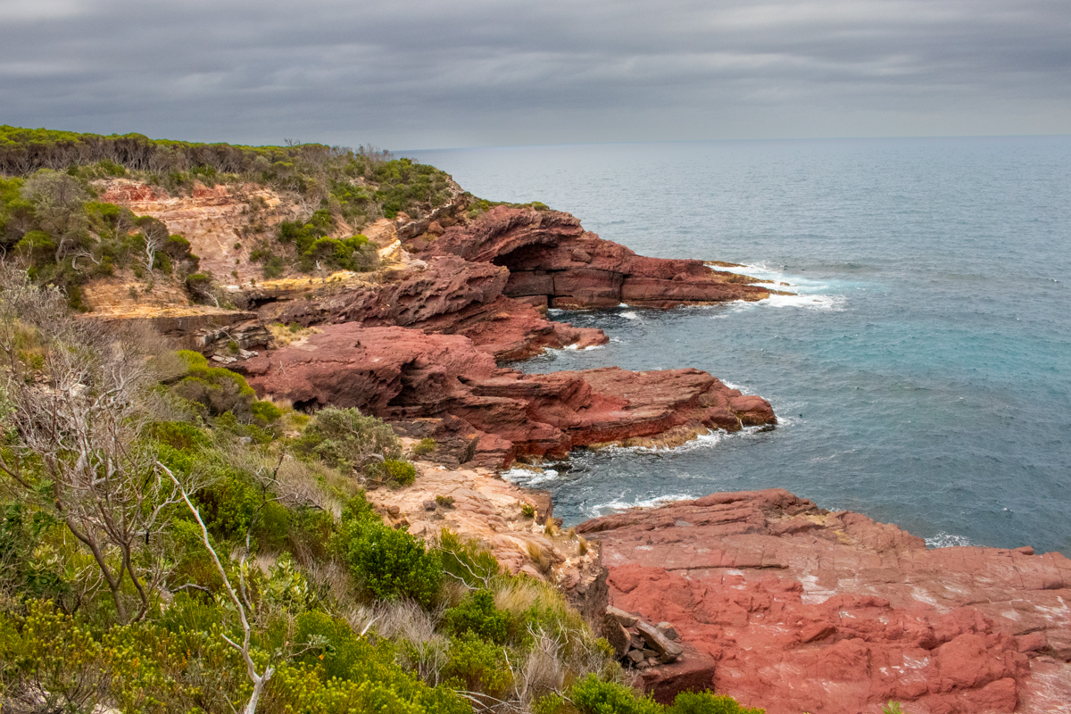
From here the trail does a wide arc around Bittangabee with view after view of the stunning bay.
Beautiful from any angle.
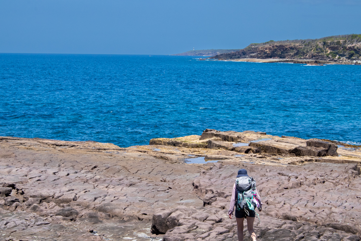
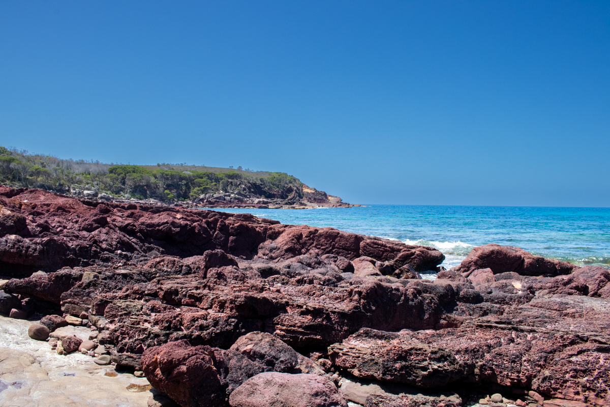
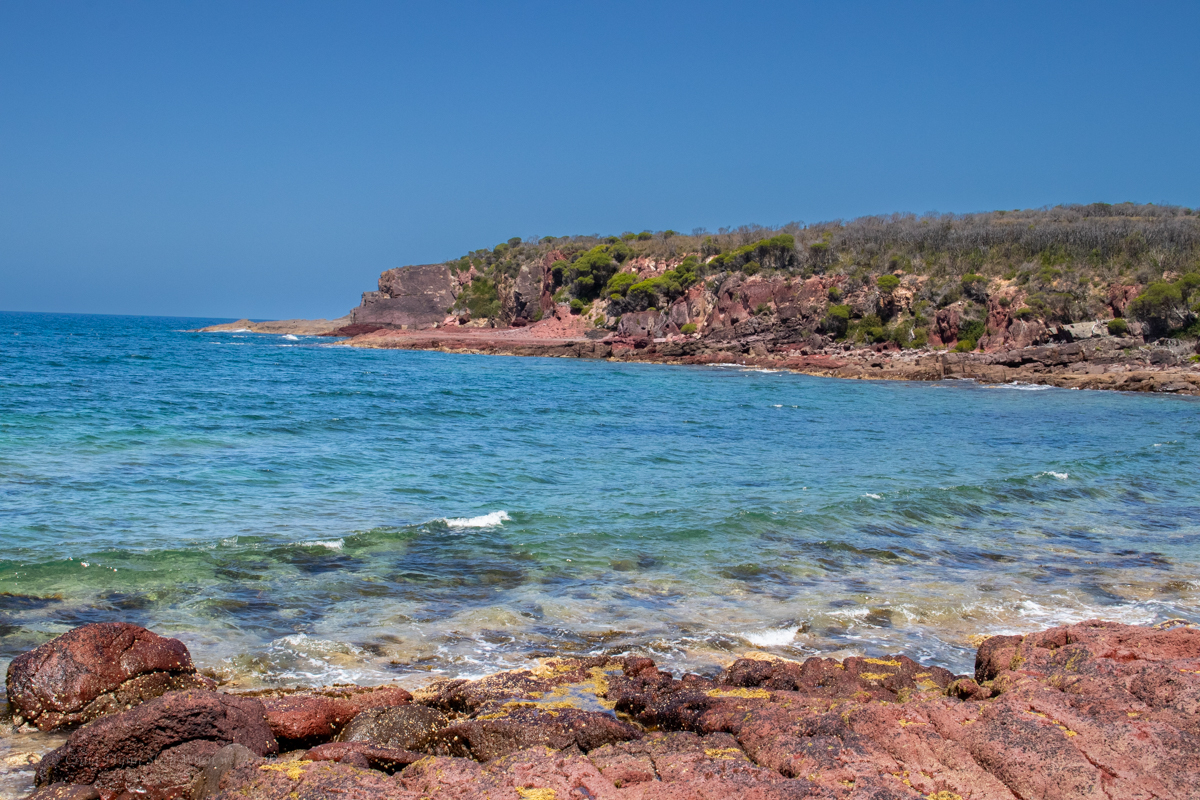
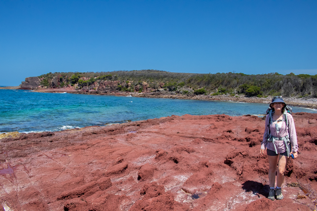
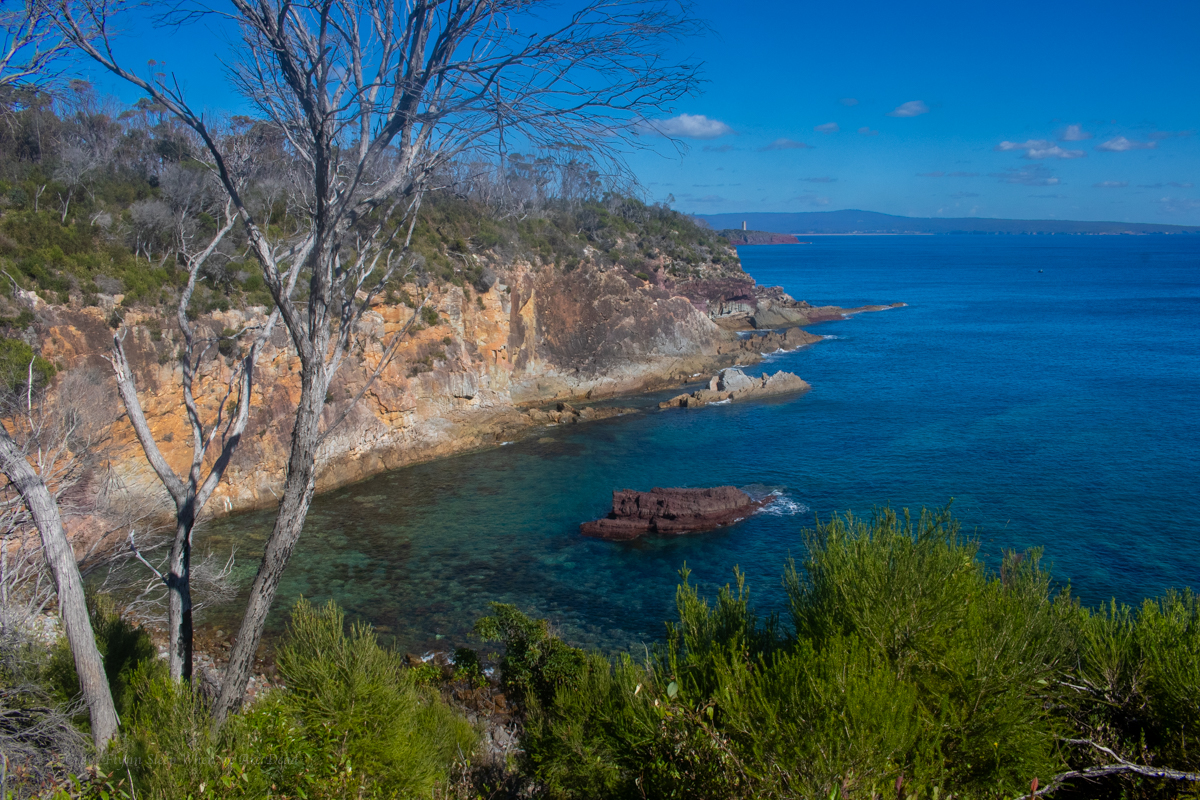
We are now following the coast line with just the occasional diversion inland.
This is what we were here for
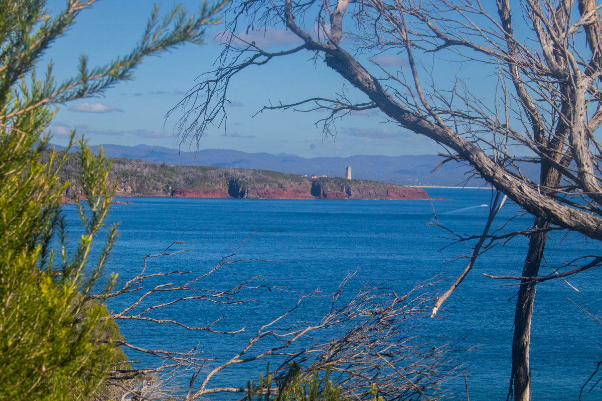
Looking back down the coast with the light house in the distance
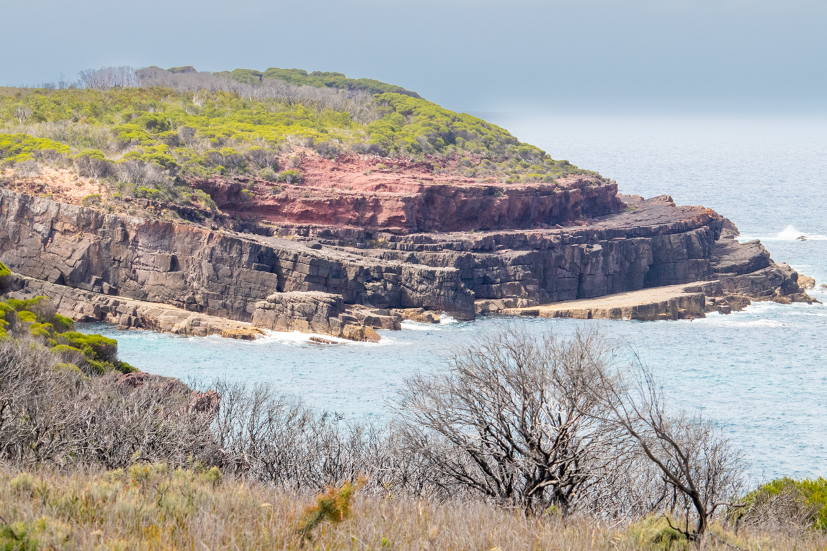
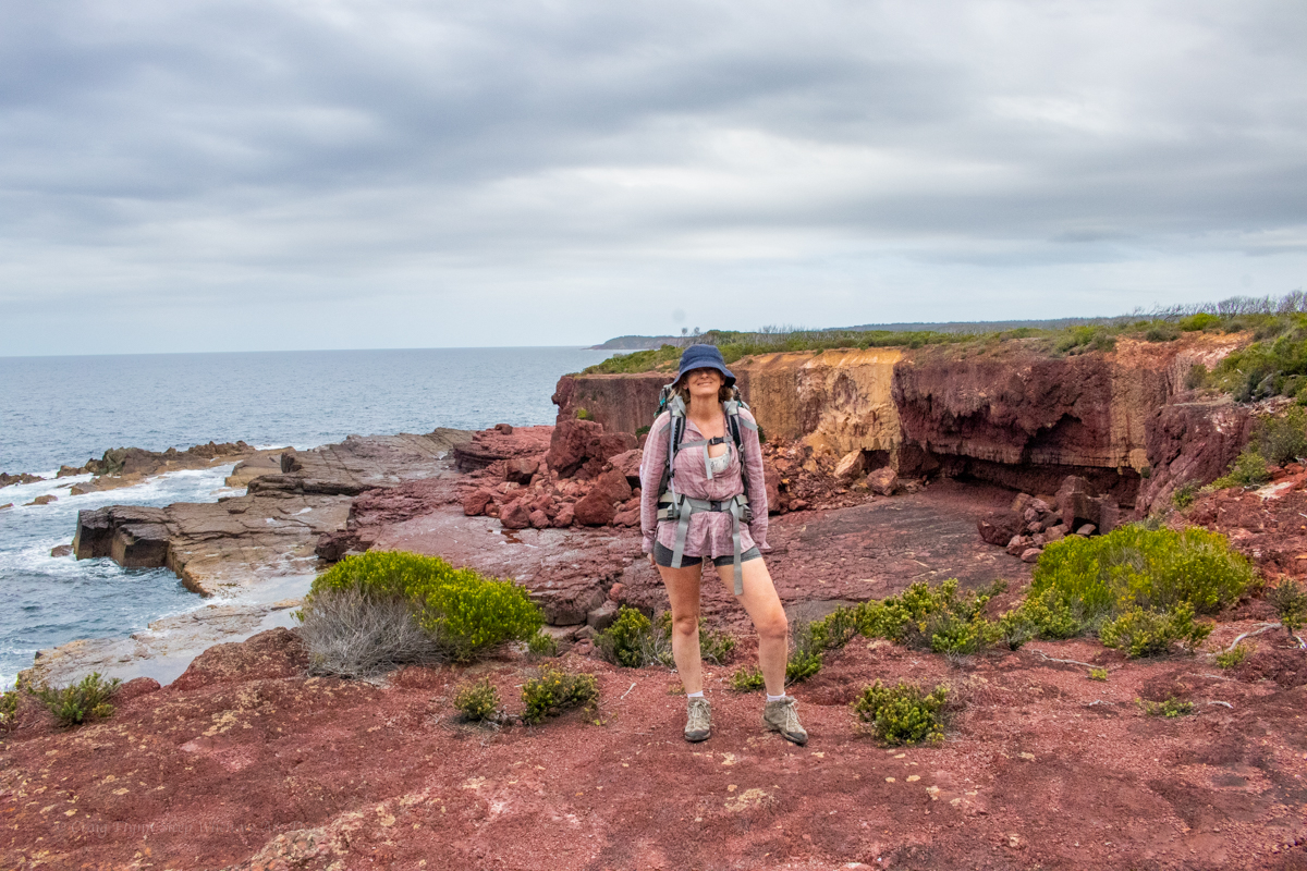
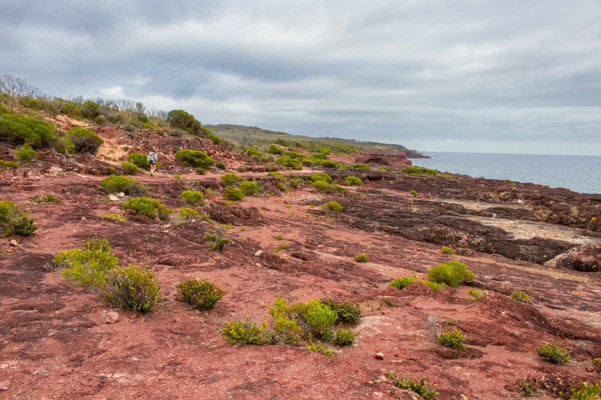
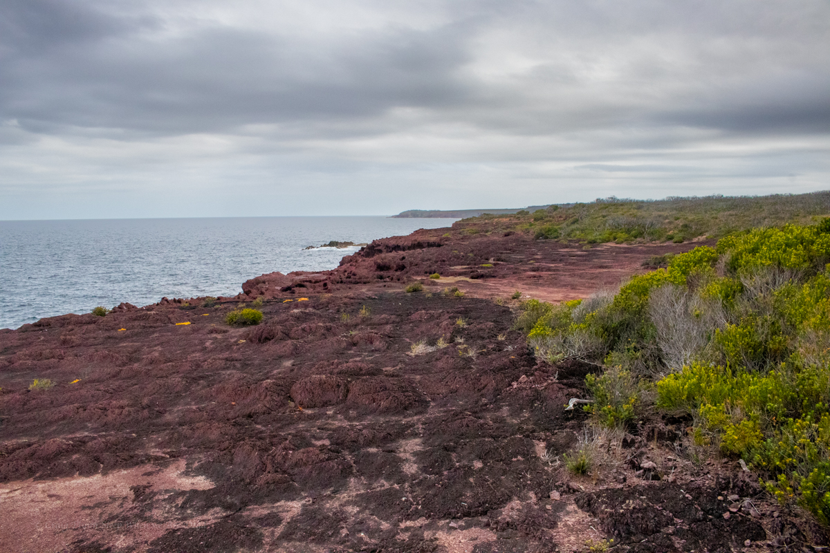
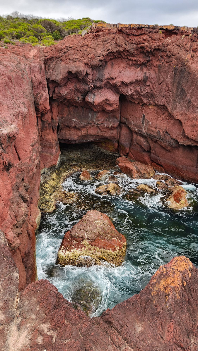
Looking up the coast with stunning cliff lines jutting out over the South Pacific OceanAnd stunning geology with folds and intrusions and flows and stuff
And giant goannas decorated in moss
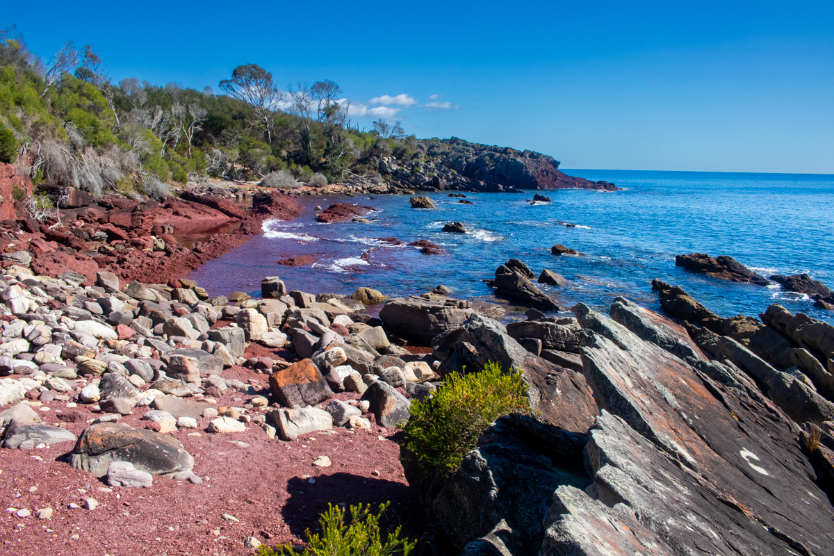
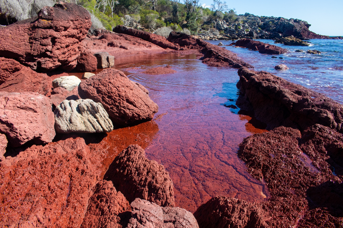
Did I mention the colours?
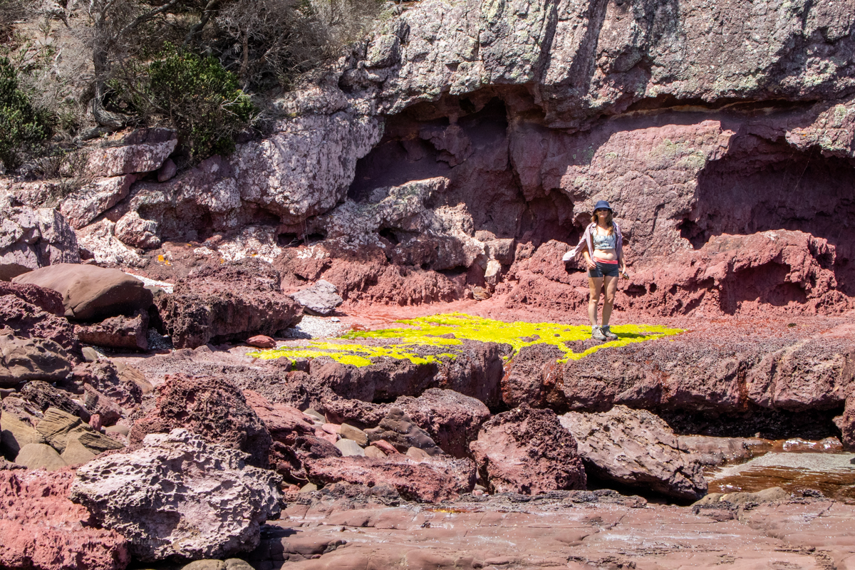
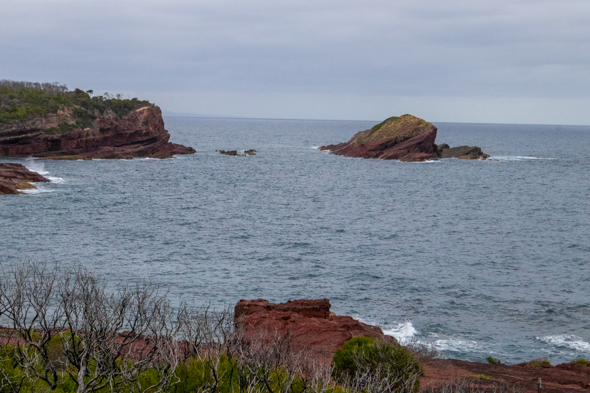
If Bittangabee bay was stunning, and it was, Hegartys bay is beyond words
Once a publicised walk in camp it’s now officially closed for camping. Again NPs were doing work on the trail here, this time though we are diverted down on to the rockshelf. This was one of my favourite parts of the walk and it seems nuts they would divert the walk around some of it.
Oh, did I mention the colours?
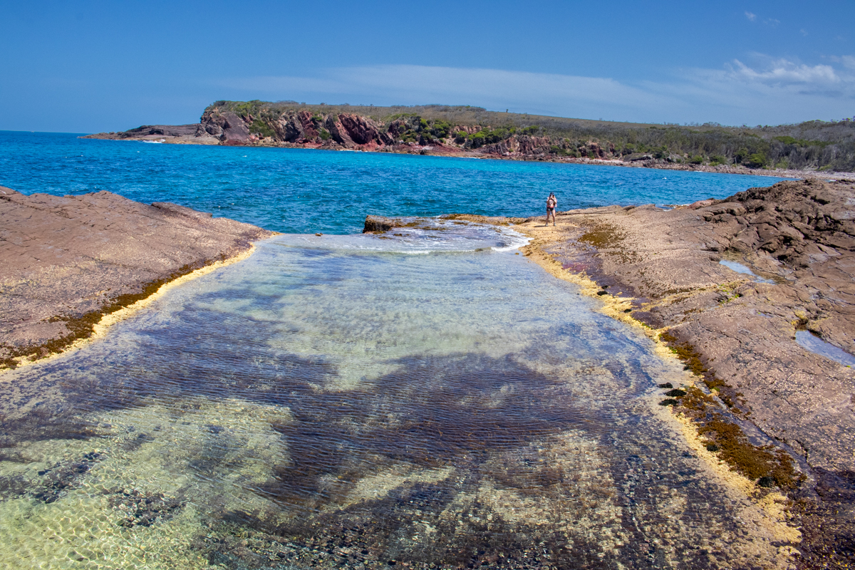
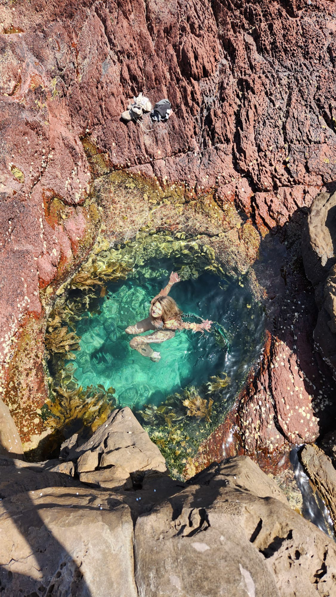
secret waterhole just big enough for 1
Part 3: Hegartys bay to Saltwater Creek
Leaving Hegartys the trail swings back onto the plateau, but at least there are views of the coast
Even the bobcat driver got bored and tried to add little sweepy turns.. (actually well designed trail with water run off controlled by small grade reversals at each bend.)
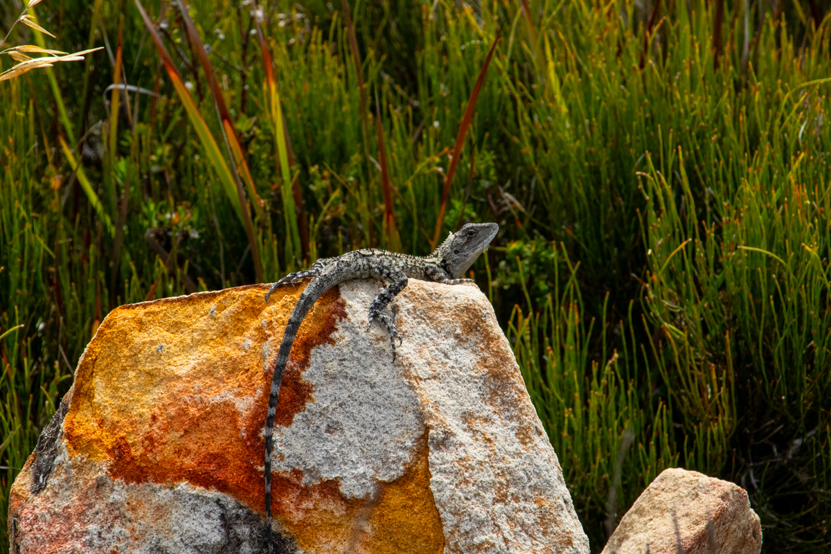
Jacky Dragon (?)
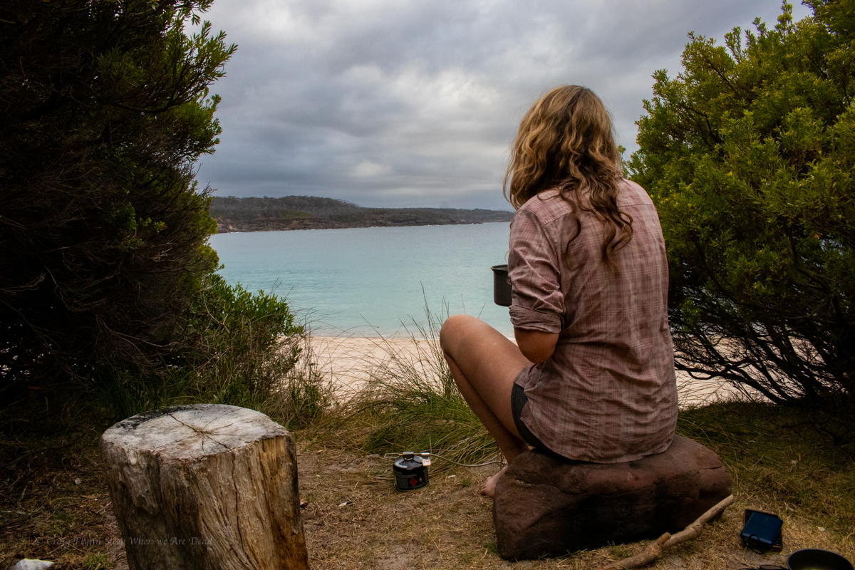
And we stroll into Saltwater creek around 4pm. Again despite the drive in camp being packed the beach was all but empty.
Kylie was getting blisters on her toes so we stop to tape them up while we refill our water bottles.
TBH we’d overestimated how much water we would need. Not knowing if it was going to be baking hot or how much the salt water spray would take out of us we’d packed 3 litres each. I have well over half left when we got to the drop.
We recalculate how much we’d need for the rest of the walk and push on.
Part 4: Saltwater creek to Mowarry beach.
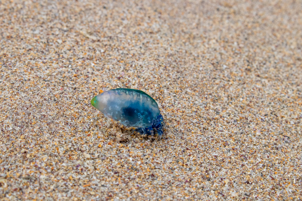
This may explain why so few people were in the water.
follow the yellow brick road… or sumfink
Once again we follow gorgeous coastline where the colours seem too vivid to be real
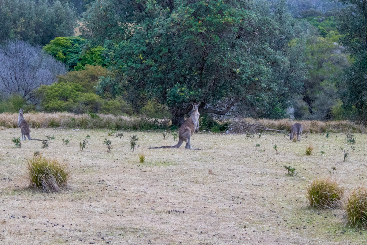
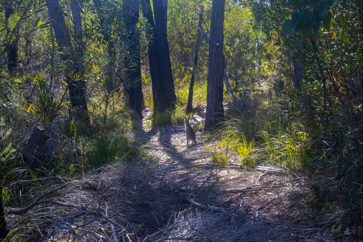
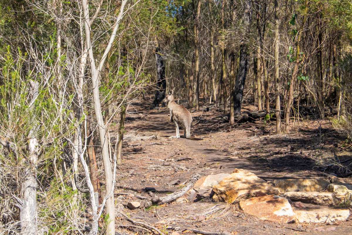
We come to an open grass headland and assume it’s the Mowarry campground. the kangaroos had it to themselves though.
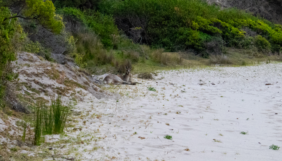
And continue down to the beach, which the kangaroos also had to themselves.
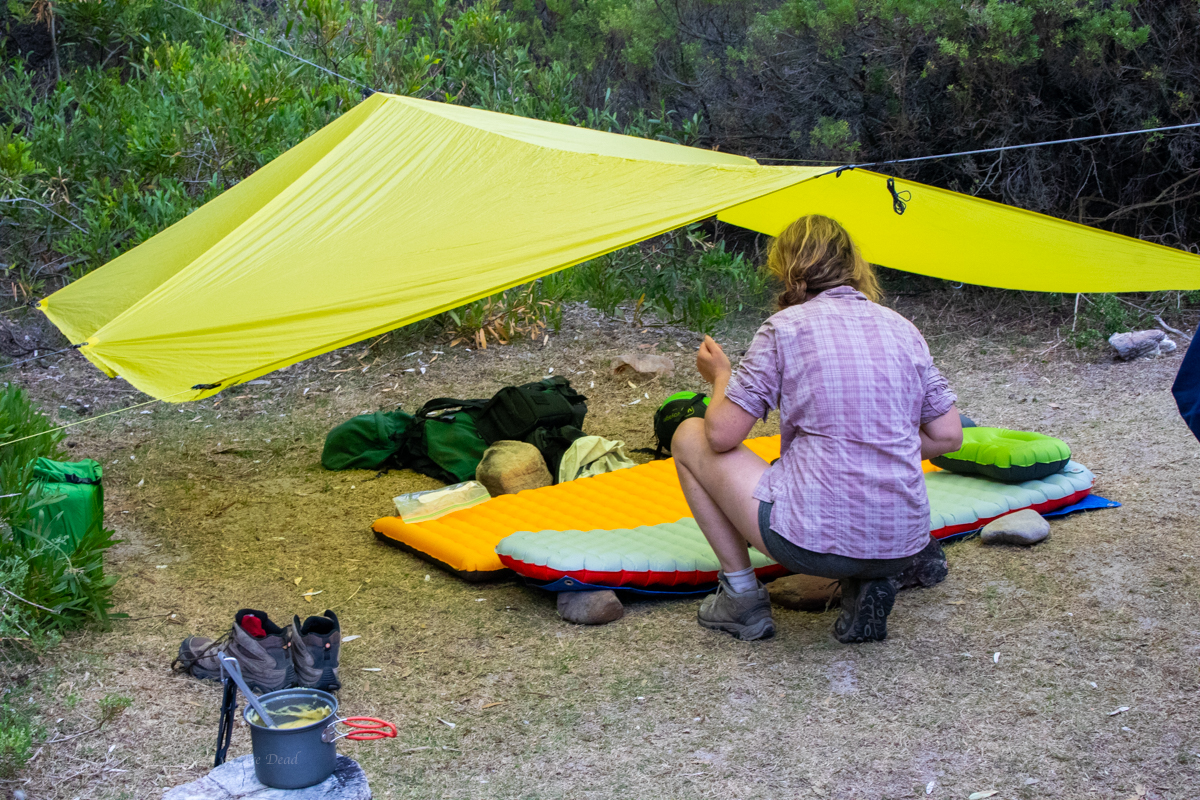
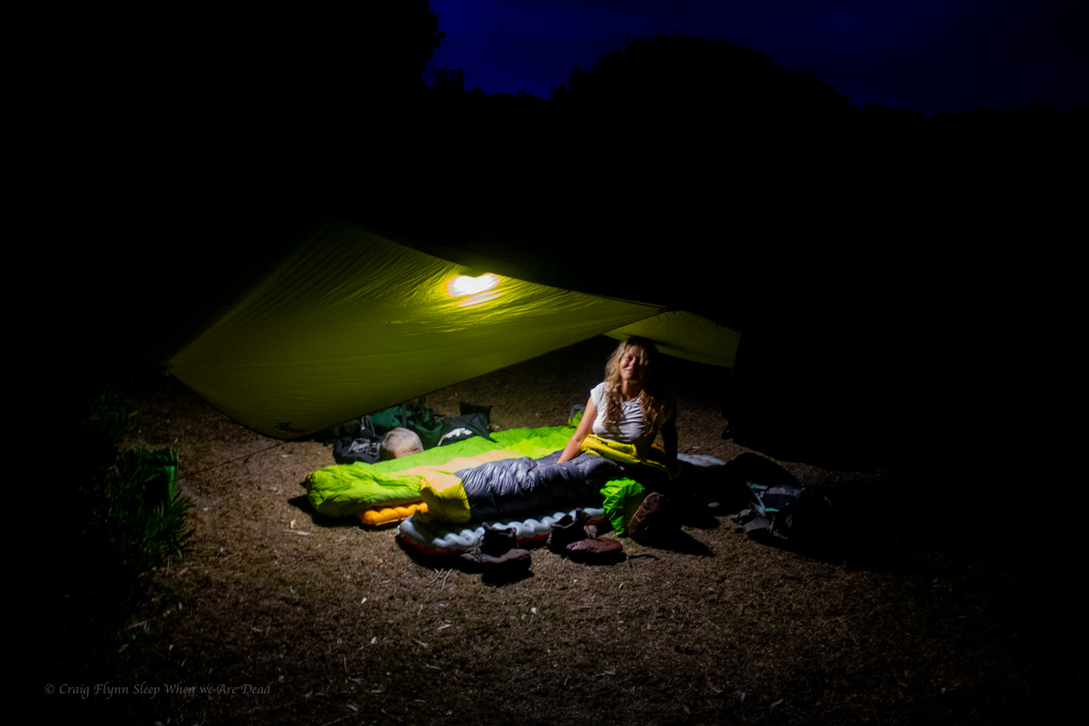
We are surprised to find a camp spot right next to the beach so take advantage of it.
With some little side trips for swims and views we’d done about 28 or 29km today. For some weird reason flatter walks knock me around more than our usual scampering up and down canyons so I was feeling it. Kylie has sprained her ankle the week before and was suffering a head cold so was just as happy as me to have one more swim to wash off the grime of the day and set up camp.
Unbeknownst to us the offical camp spot is up above the beach on the next headland. A tribe of partiers descended in the middle of the night for a mini bush doof which was hilarious but a spattering of rain had them running for their beds not too late into the night.
Part 5: Mowarry beach to Boyds Tower.
With just 7 or 8km of walking left we could have had a lazy morning but we were also keen to get the 30km ride back to the cars knocked over before the day got too hot so we were up early for a brekkie with a view then hit the trail
Up over the headland it was a short walk to leatherjacket bay. Leatherjacket bay must be the easiest to reach drive in secluded spot. It was littered with fast food rubbish and toilet paper. Why people would do that to such a beautiful spot is beyond me.
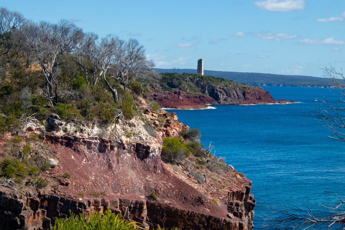
And up the next rise we catch our first glimpse of Boyds Tower
But the walk wasn’t done yet.
and there you have it. Boyds Tower.
Boyds Tower is an unfinished light house created by Ben Boyd. a character once respected for his early settlement down here but recently being cancelled due to him being one of Australia’s most infamous “Blackbirders”
Blackbirders imported cheap labour. Boyd had “recruited” labour from various pacific islands and shipped them to Australia. By the time he got them to Australia though the union movement, religious groups and city based politicians saw it for what it was, low key slavery, and basically outlawed the practice.
Those already at work on Boyds lands down tools and demanded to be sent home.
Find your own way home said Boyd. Many of those brought out found themselves stranded in Sydney with no way to get home…..
All that said his biographer claims he was considerably less racist and cruel than many of the politicians who had publicly condemned him.
Anyhoo, We reach the tower and the end of our walk. We woof down some food, swap backpacks for bikes and ride through the centre of the park, down Duckhole road back to the car.
It’s 30km on what my mate Bernard would refer to “gently undulating” dirt roads. At times the bull dust is so soft it feel’s like you are riding with flat tyres and there’s a few pinches to make sure the legs are still burning but it’s not a bad ride.
Kylie’s fairly new to mountain biking and injury has kept her off the bike for a bit so when we reach the junction with Green Cape light house road I offer to forge ahead and bring the car back to pick her up where ever she gets to.
There’s some fun and fast down hill sections here but also a couple of steepish pinches. It’s the stiff ocean breeze smacking you in the face in the last 2km that hurts the legs the most though.
I get to the car, quickly get changed and drive back up the road, Kylie’s not that far behind. It’s only a couple of kilometres to the end, isn’t it. asks she
Yep, says I. You want to finish it off don’t you?
She grins and pedals on…
All up 36+Km of walking and 30Km ride in 2 days. Not a bad effort.
Our review.
The Grade:
National Parks grade the walk a 4. “Grade 4: Bushwalking experience recommended. Tracks may be long, rough and very steep. Directional signage may be limited.”
Other than the length and a few short sections where you need to pick your way along the beach or over rocky outcrops I’m not sure how it’s 4. it’s fairly flat. I guess the recent upgrades have included adding stairs to any of the steeper sections so maybe before the upgrades….
Would I recommend it?
Sure. it’s definitely worth doing. The views are amazeballs
If your idea of bushwalking is well maintained and sign posted touristy type trails and you want to try something a bit longer or want to try your first overnight walk with the advantage of maintained camp sites this would be perfect.
Would I do it again?
TBH. I wouldn’t bother with the bit between Bittangabee bay and Green Cape Lighthouse again unless I was adding more time and doing side trips out to things like Pulpit rock and checking out the little bays.
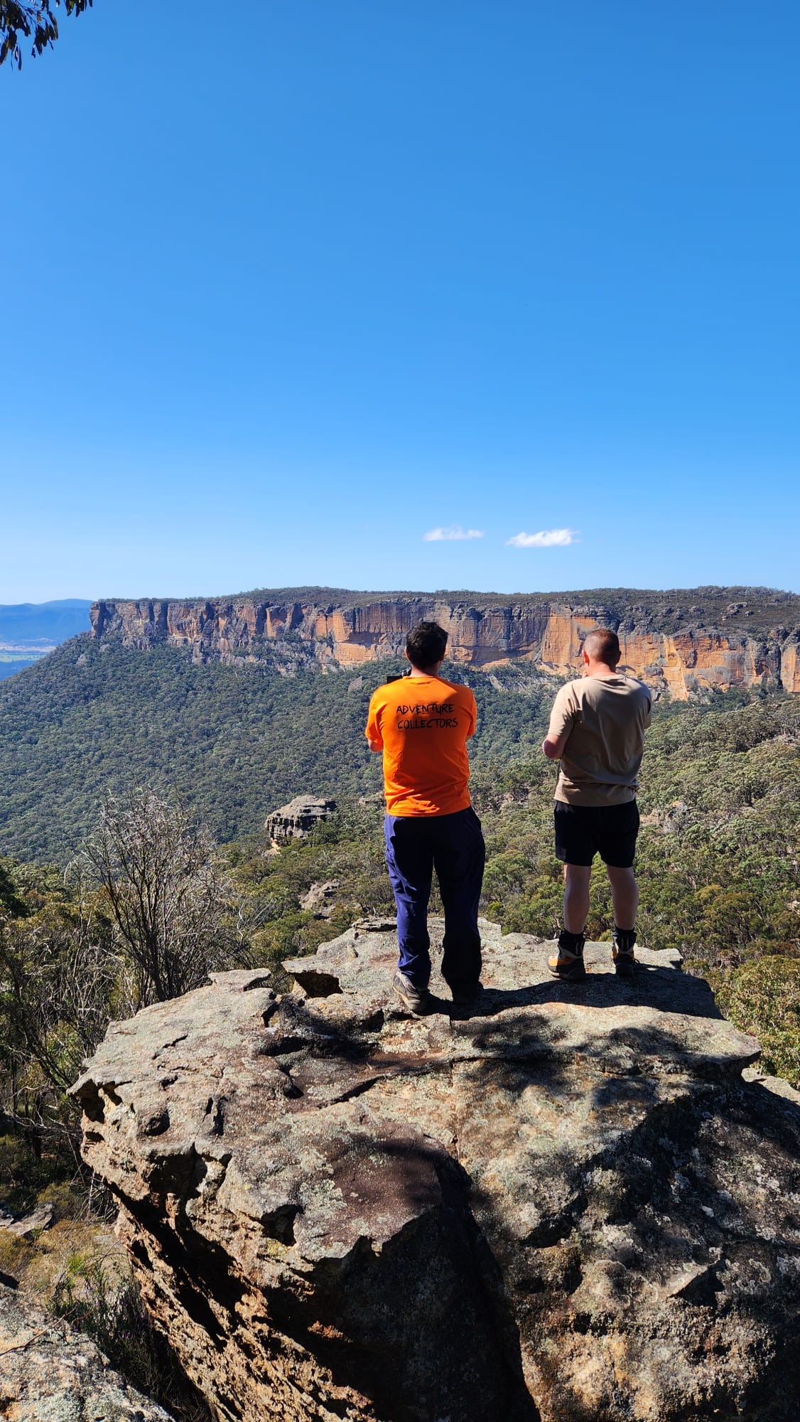
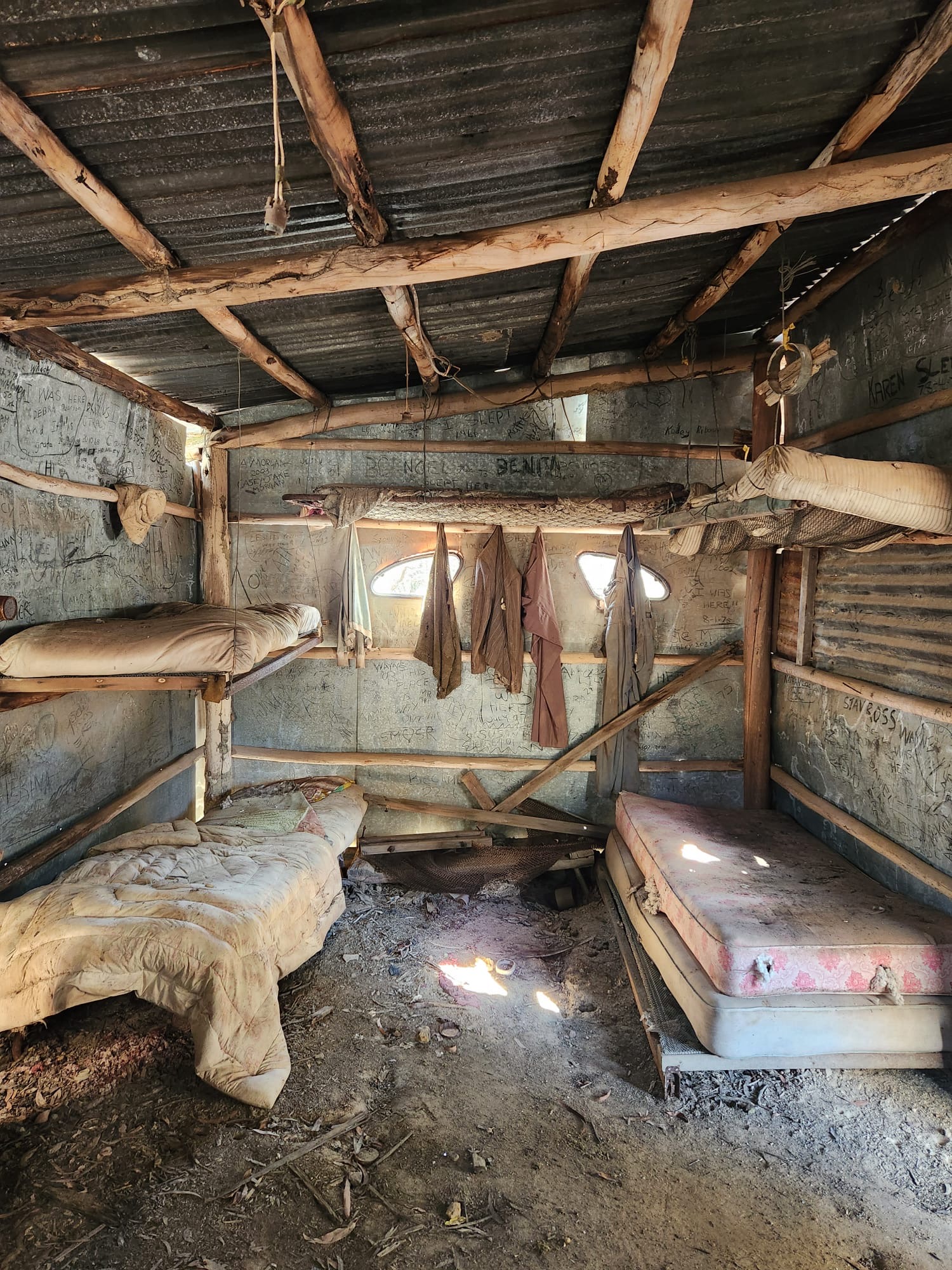
Ok it’s nearly 40years ago which sounds like a long time when I think about it but I was and young whippersnapper out on a Jeep trip with dad and his mates. Day 2 we visited a bloke by the name of Col Ribaux.
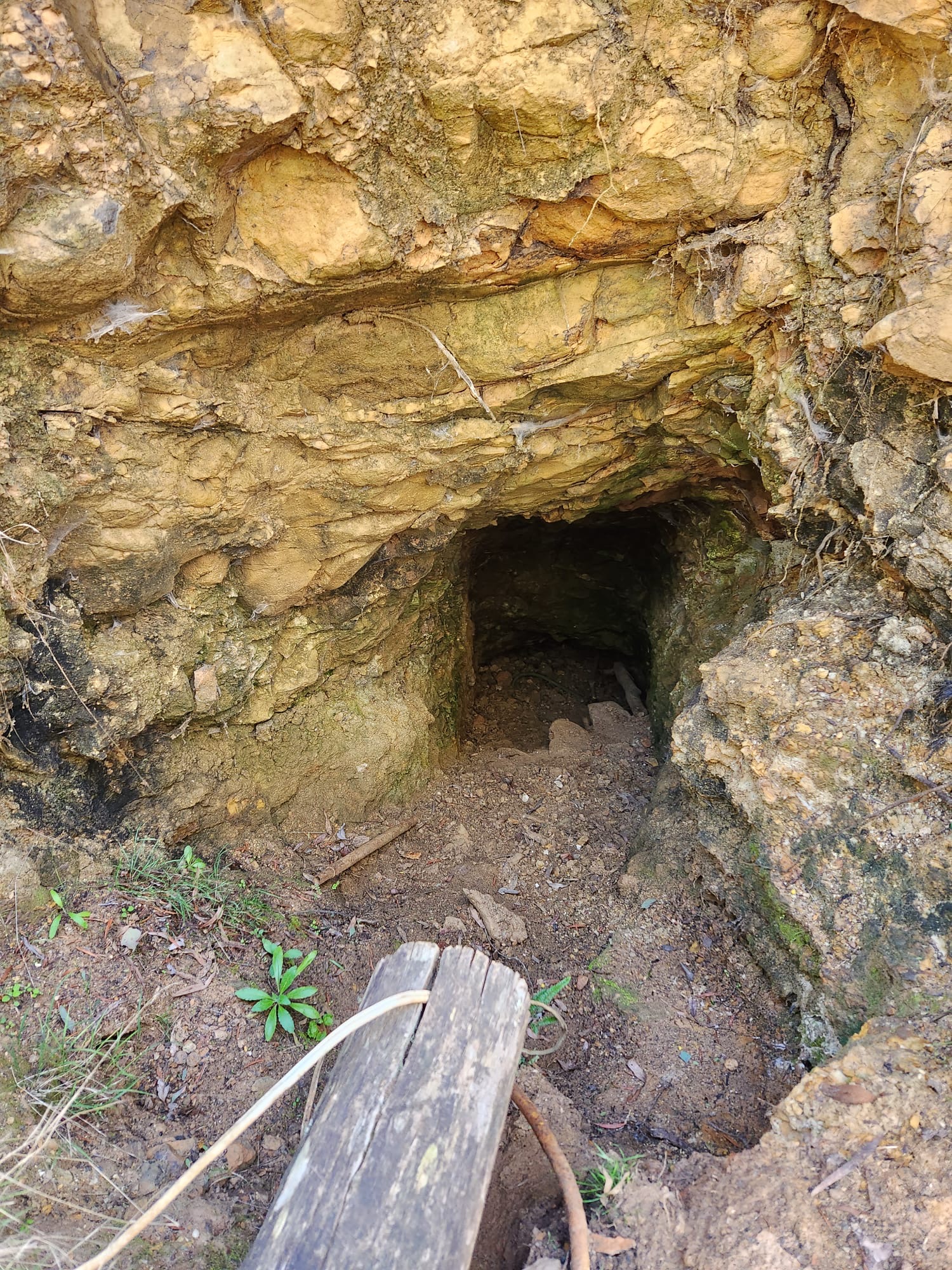
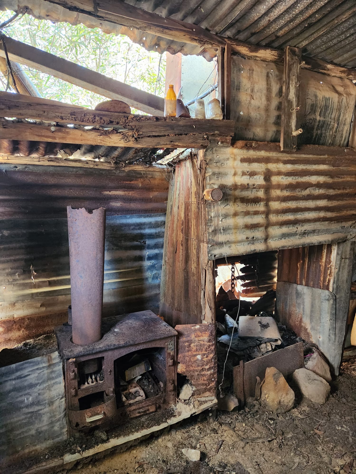
As well as being a fellow connoisseur of ex-millitary vehicles, 4wd drive enthusiast and diamond miner, Col was an all around top bloke, legendary character and, the “Guardian of the Mountain.”
After admiring the assortment of old Jeeps, trucks and tracked personnel carriers he fired up one of the old tanks and we followed him up the steep pass through the cliff line of what we knew as Airly but is more properly Airly Turret (Confusingly there is Mount Airly slightly to the West, then Airly gap, then a small bump call Airly Mountain then Airy Turret on the way up to Mount Genowlan (Not to be confused with Jenolan, different spellings of the same aboriginal word for high point/place).
After the steep drive up and a look around the mine we camped the night out at Genowlan Trig.
Col has since passed and the area with it’s plethora of Aboriginal and European heritage sites and stunning natural beauty has been taken over by National Parks and named, Mugii Murum-Ban after local elder Uncle Charlie Riley. Mugii being a type of owl and Murum-Ban being eldest sone.
While always a favourite spot in 4wd circles it’s a bit further from Sydney so hadn’t attracted the bushwalking crowds of the Blue Mountains. That’s changing as walking clubs and fellow bloggers discover just how magical the place is.
Anyhoo, in the ensuing years I’ve driven passed it a lot and even driven up Mount Airly a time or two but it was time for a return to Genowlan.
Kylie and I had scoped it out a couple of weeks prior on a day when she also flew over it with Capertee Valley Helicopters. Remembering the steepness of the road and the old rock steps I opted to park part way up and walk. Finding the road recently graded and, while still steeeeeeeeep we thought it easily doable in the triton.
And so we came back and Dick joined us.
Plan for the day was to have a look around the old mines, enjoys the views and check out some of the slots the walkers had cottoned on to.
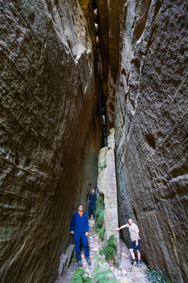
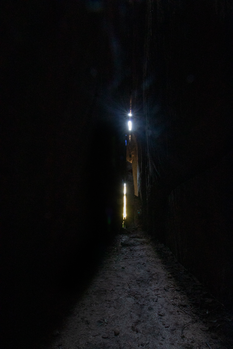
First stop Ultimate Slot.
From where we parked I was expecting a bit of a scrub bash but
There a bit of a trail here, called Kylie
We follow a well defined trail for about 2mins and… BAM
Magical but bloody hard to do justice to with photos
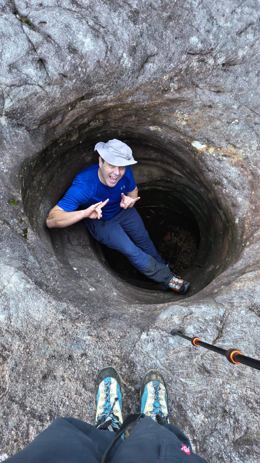
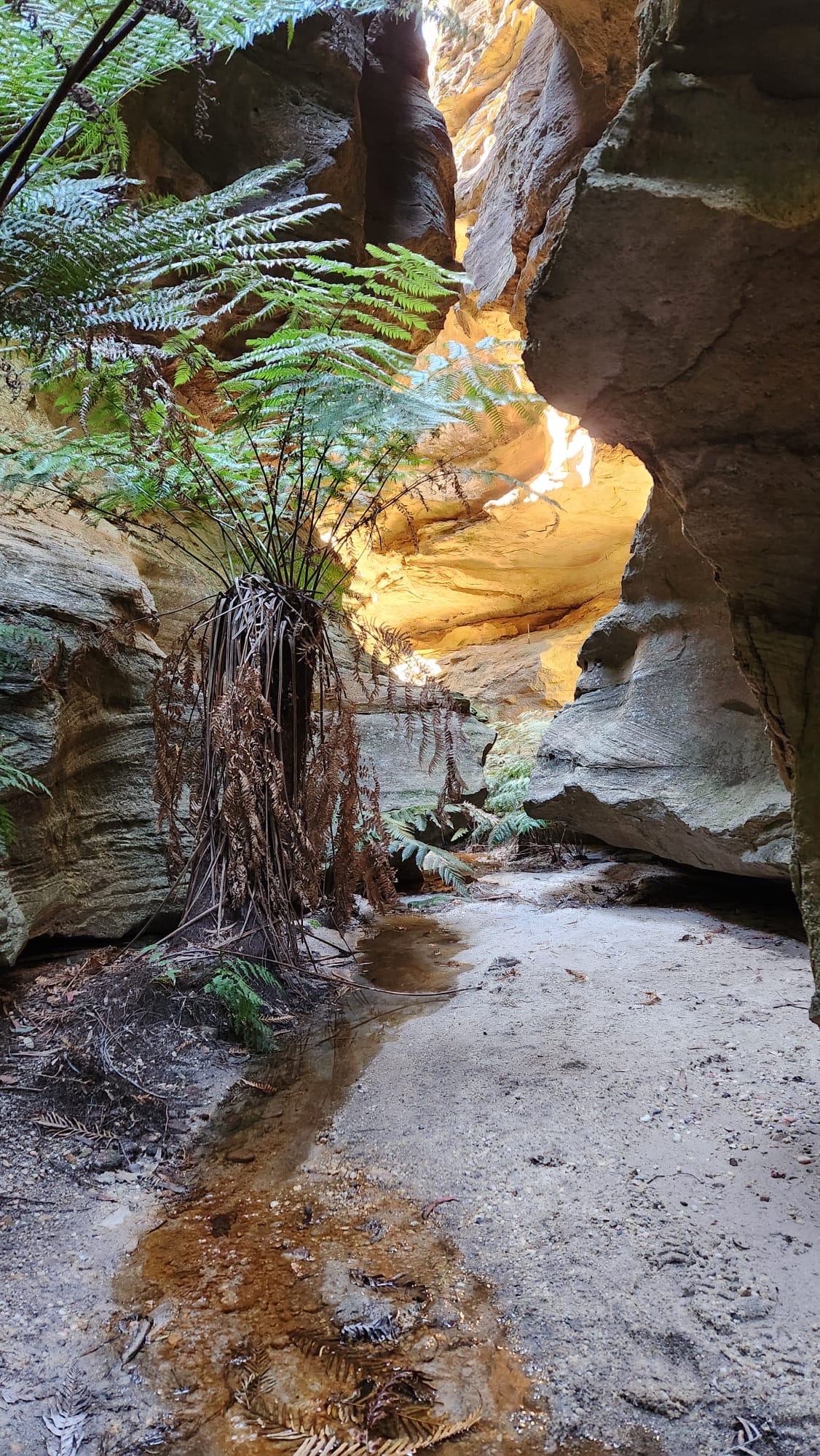
After phaffing about for ages we head back to where we parked and head in on the other side of the road. In less than 20 steps from where we parked we were in the “Grotto”
There’s a bit of old rough and ready mining infrastructure in the Grotto. Col and Brian had pumps set up in the pool to supply water to the diamond mine operations.
It’s a beautiful little micro canyon and the colours are stunning
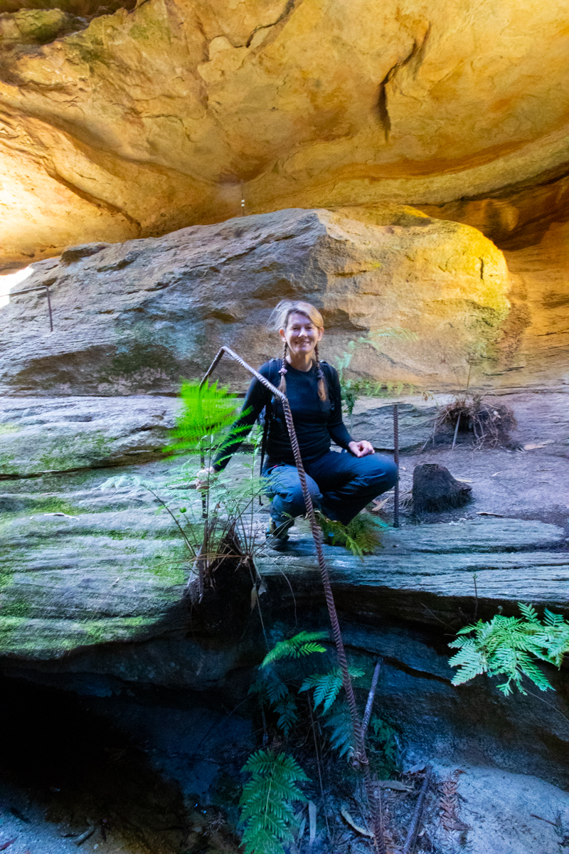
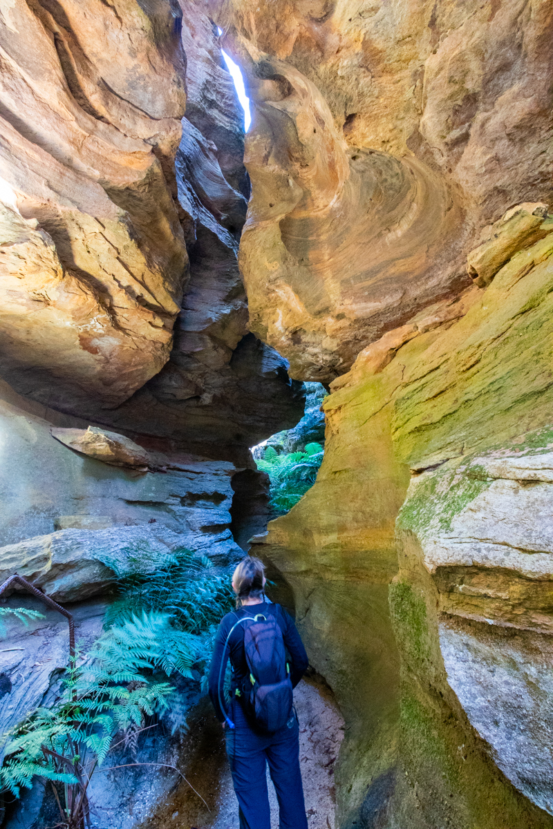
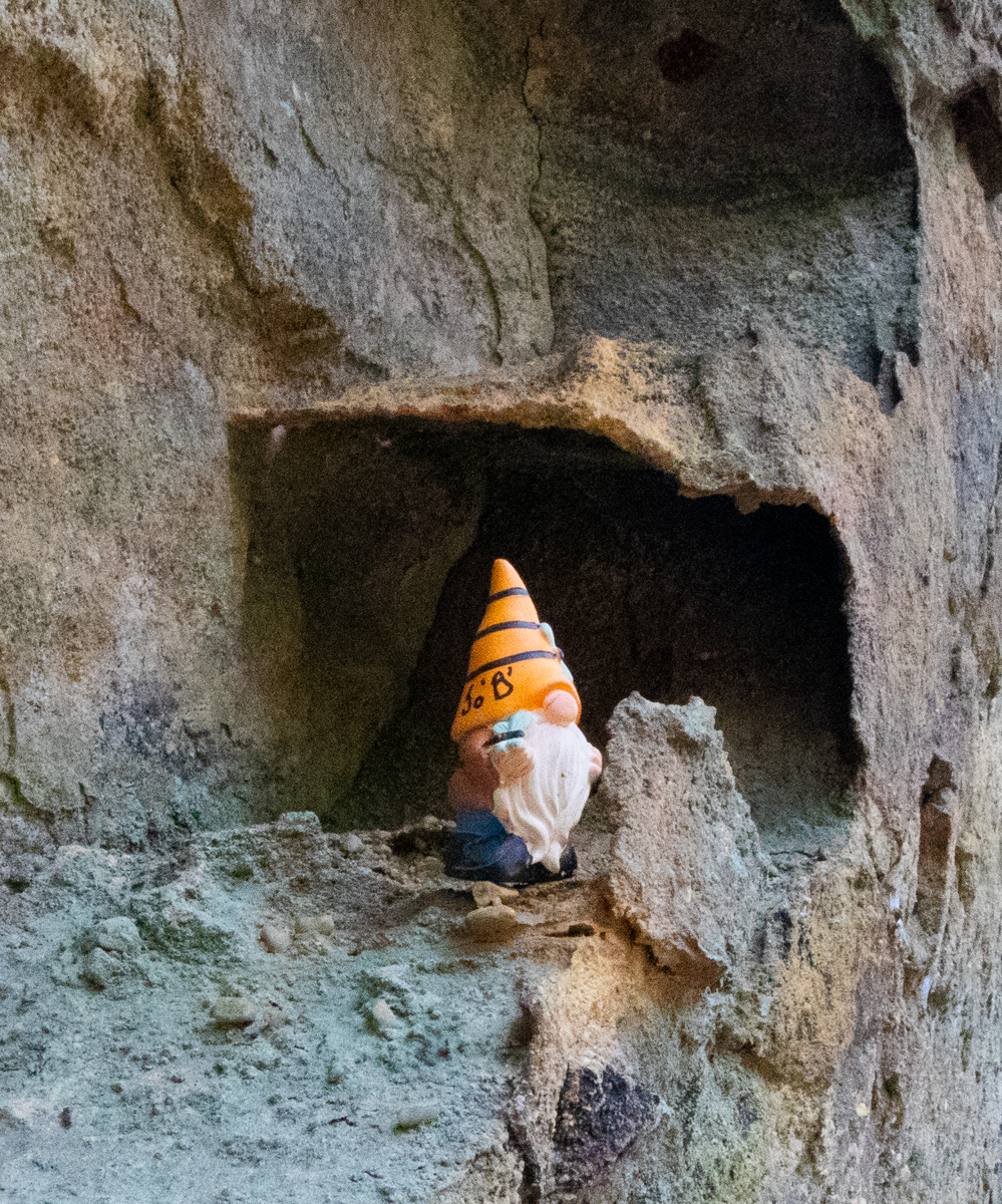
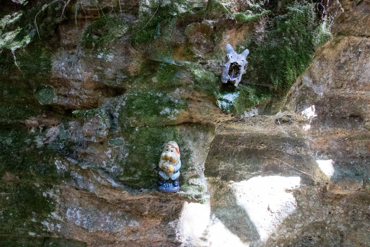
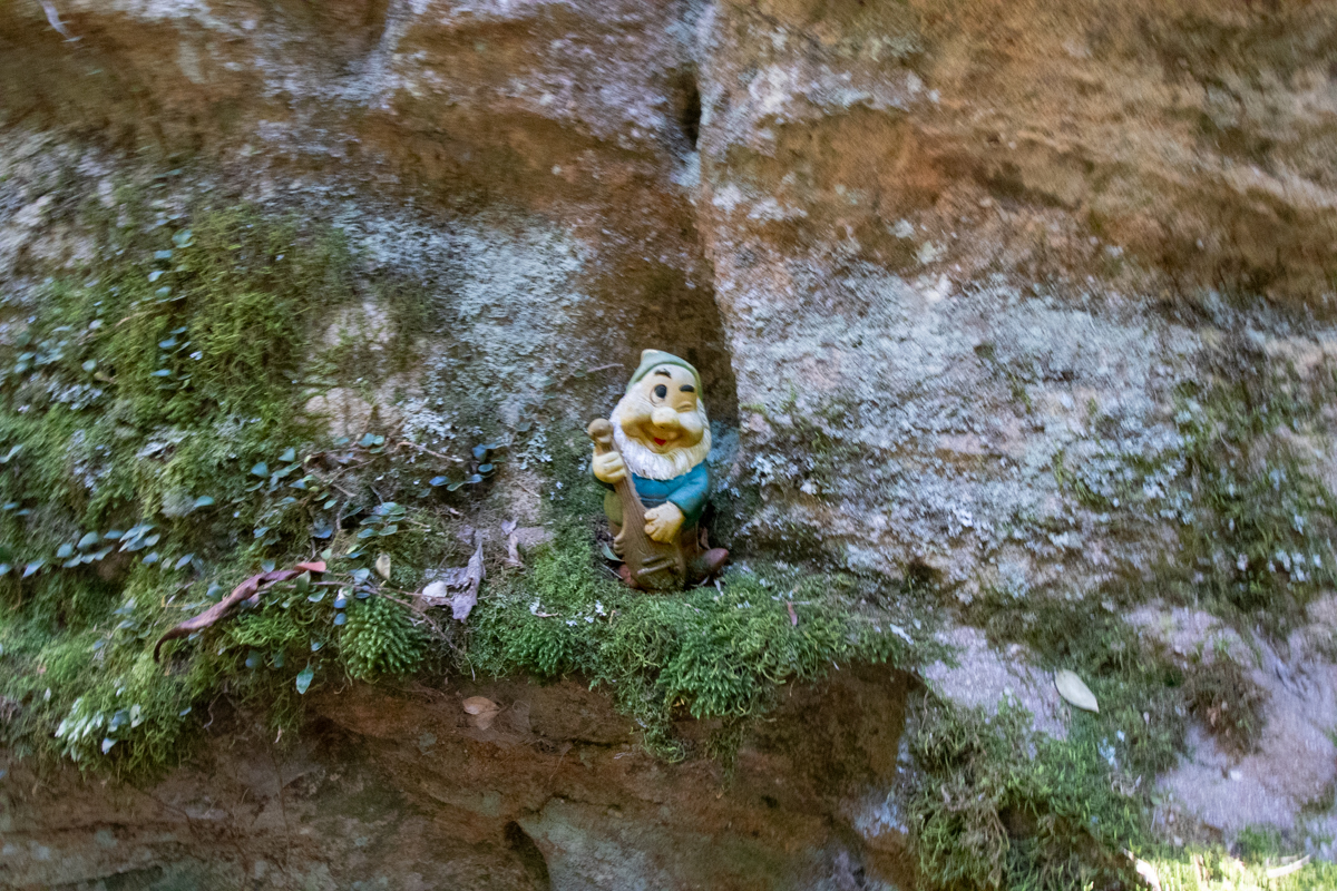
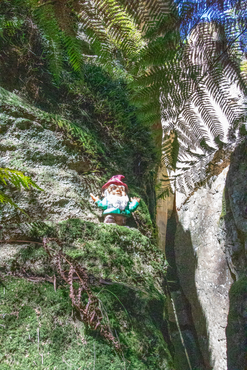
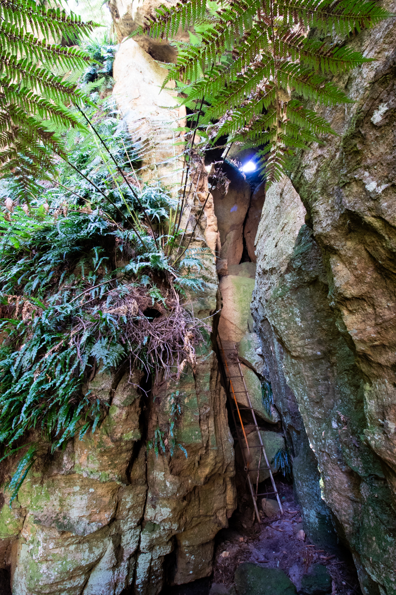
Back to the cars and we head back up past the main diamond mines. Our next stop was Gnomes pass, AKA Ladders Defile. This is another slot/micro canyon that Col had set a series of Ladders in to make it easier for his kids to get through. He also added a bit of a fairy tail touch.
The old ladders make it easy to negotiate the slot which soon opens out to a amphitheatre that would make a great spot for a picnic.
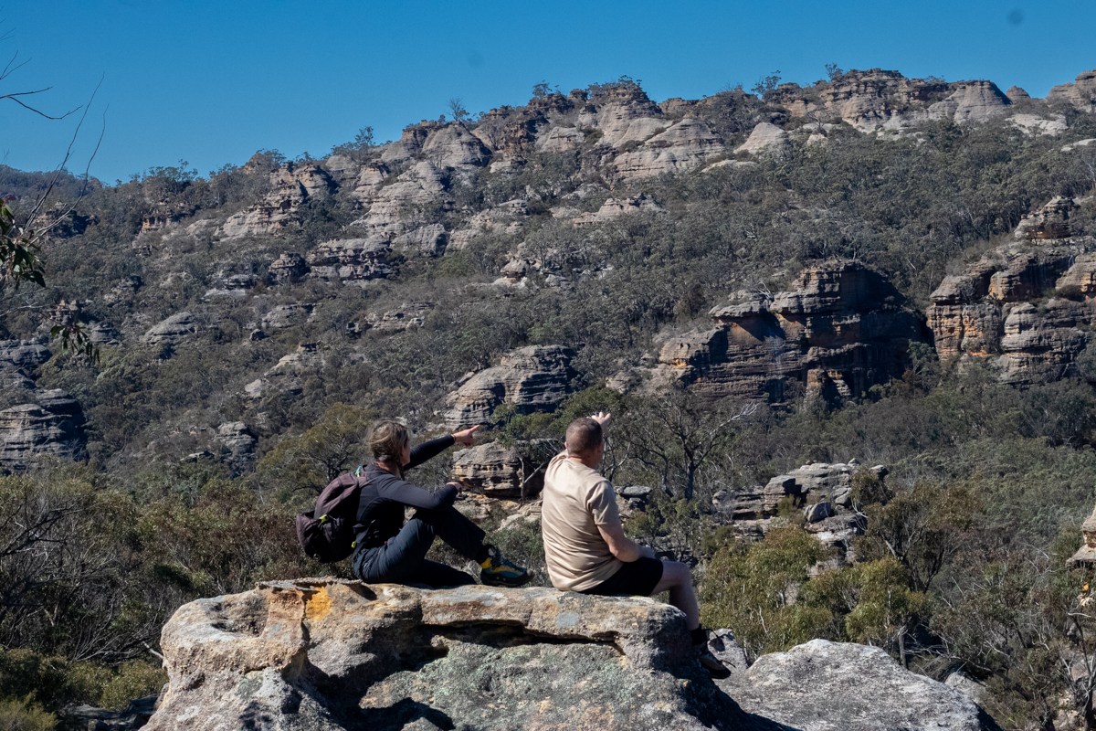
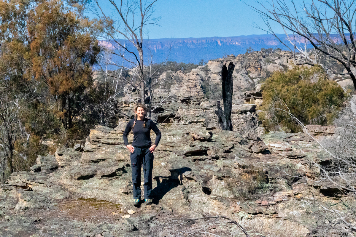
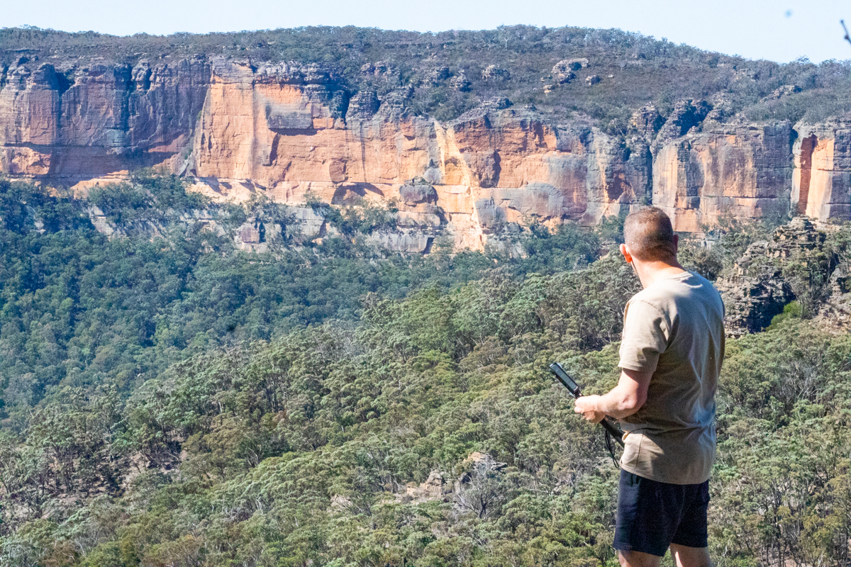
We scramble up onto the pagodas and admire the views
More Pagodas than you could poke a pagoda stick atKylie with the Red Rocks in the far distanceDick looking towards Genowlan plateau
We then continue out to soak in the views from Point Hatteras
Access: Short section of dirt road then an easy walk. Thanks to Ty N. for his hard work fixing up the old track it is an easy walk up to the falls, though as of July 2024 the trail is a little overgrown.
Navigation: Navigation is fairly straight forward.
Map: Lithgow 1:25000 These can be purchased at Lithgow Tourist information center or online for around $10 each though not really needed here
Time: It takes about 20 min to walk up to the falls
fern filled gorge leading up to the falls
Cicada Falls is a small waterfall in a very pretty gorge on the outskirts of Lithgow.
The walk up is straight forward on an informal trail, though there is some scrambling and exposure.
Getting There:
From the end of Inch street continue onto Bells road then past the water treatment plant onto the dirt road towards Water Works Gully. This can be a little rough with large puddles after rain.
Just before the first creek crossing look for a road up to the right (2wd vehicles will need to park here.) Turn right and follow the road up 100m and take the left option at the intersection. Follow this along the side of the creek. This road can get very boggy but walking on the right bank is easy going.
The walking track continues from the end of the road, slightly higher to the right. As of July 2024 the trail is over grown so can be hard to spot. A few large trees have fallen across the trail near the start, however it follows a flat bench above the creek and other than clambering over the trees it is easy going.
The trail crosses the creek at some industrial relics as the gorge starts to close in.
This section is the most over grown at the time at the time of writing, as you push through the ferns.
After another creek crossing the trail climbs slightly on a bench and then swings around to the right and the falls appear.
Above the falls is a cute little micro canyon that leads up to a small dam (now totally silted up)
And at the very top of the scrubby gully above is a low, wide horseshoe style falls that really only flows at more than a misty drizzle after good rain.
Note: The great outdoors is an ever changing place. Bush fires, changing weather, vegetation growth and forestry activities can all effect the trail conditions and thus the difficulty of the walk. These are a rough guide only and are by no means meant to be a definitive guide . They do not replace the need adequate map reading and navigational skills
Note 1: Taking care While reasonably well known these spots are still wild places and care needs to be taken around cliff edges and on the steep trails. Carrying the right gear as well as having adequate food, water and clothing is important. Always tell someone where you are going and when you expect to get back.
Emergency beckons (PLBs) can be hired from Katoomba Police for very little.
Note 2:First aid A basic first aid kit is essential bit of kit whenever heading into the Aussie bush. A basic first aid is highly recommended
Note 3: Maps and Navigation Having the right map, a compass and knowing how to read them is very important when heading into the bush. If you are new to bush walking joining a club or accompanying more experienced walker for you first few outing is a very good idea. I found practicing map reading on well defined trails was helpful when I started out.
The Maps mentioned are the 1:25000 series. They can be purchase at Lithgow tourism information center, from outdoors shops or online for around $10 each.
Note 4: These are wild and beautiful places, respect them. If you are able to carry something in you can carry it out. Don’ be a tosser. Leaving your rubbish behind is a sure way to ruin it for every one else.
The predicted snow didn’t come our way and I was keen to do something short and sweet.
Wolgan Falls seemed a good option.
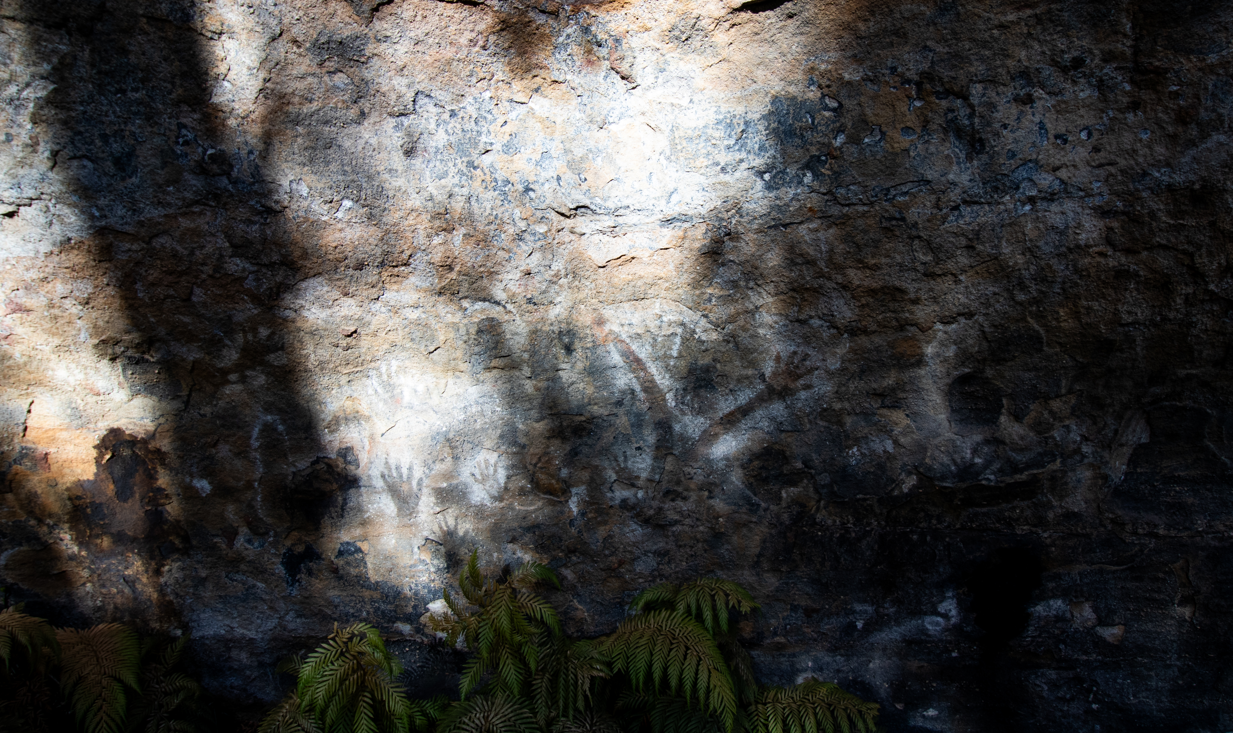
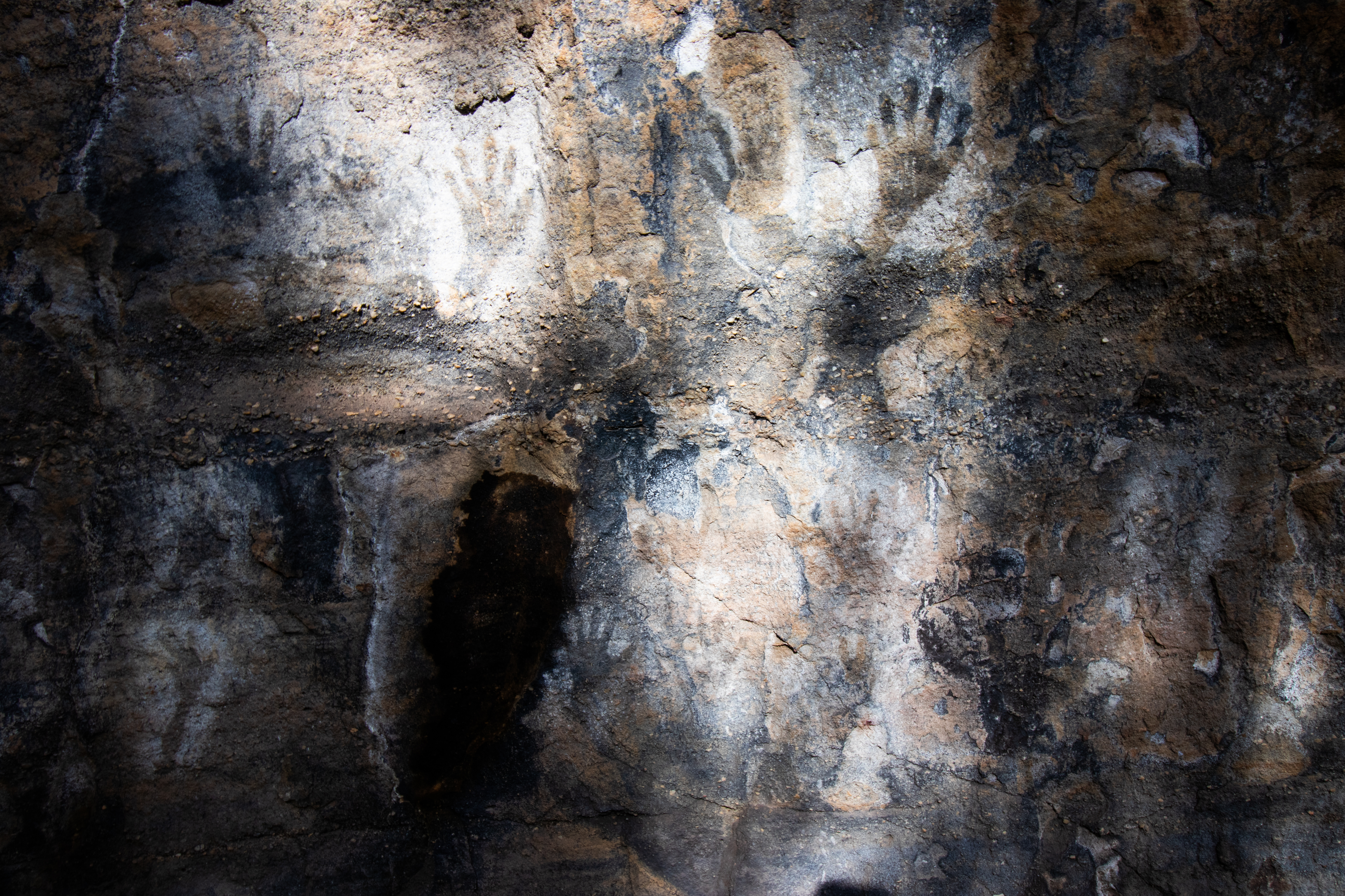
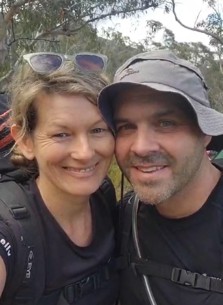
Kylie and I had been searching for rock art in Kia Ring Gai NP and it occurred to me I hadn’t shown her some of the more prominent stencils around here so we met Dick early at Maiyingu Marragu (Black Fellows Hands rock)
Maiyingu Marragu was a meeting place for Wiradjuri, Gandangara, Dharug and Dharkinjung people. It was also an occupation site with a mens area, Women’s are and a special birthing place. Exisiting art layers are upto 1600 years old.
There are other art sites in the area but Maiyingu Marragu is the easiest to get to and one of the more impressive with over 50 motifs.
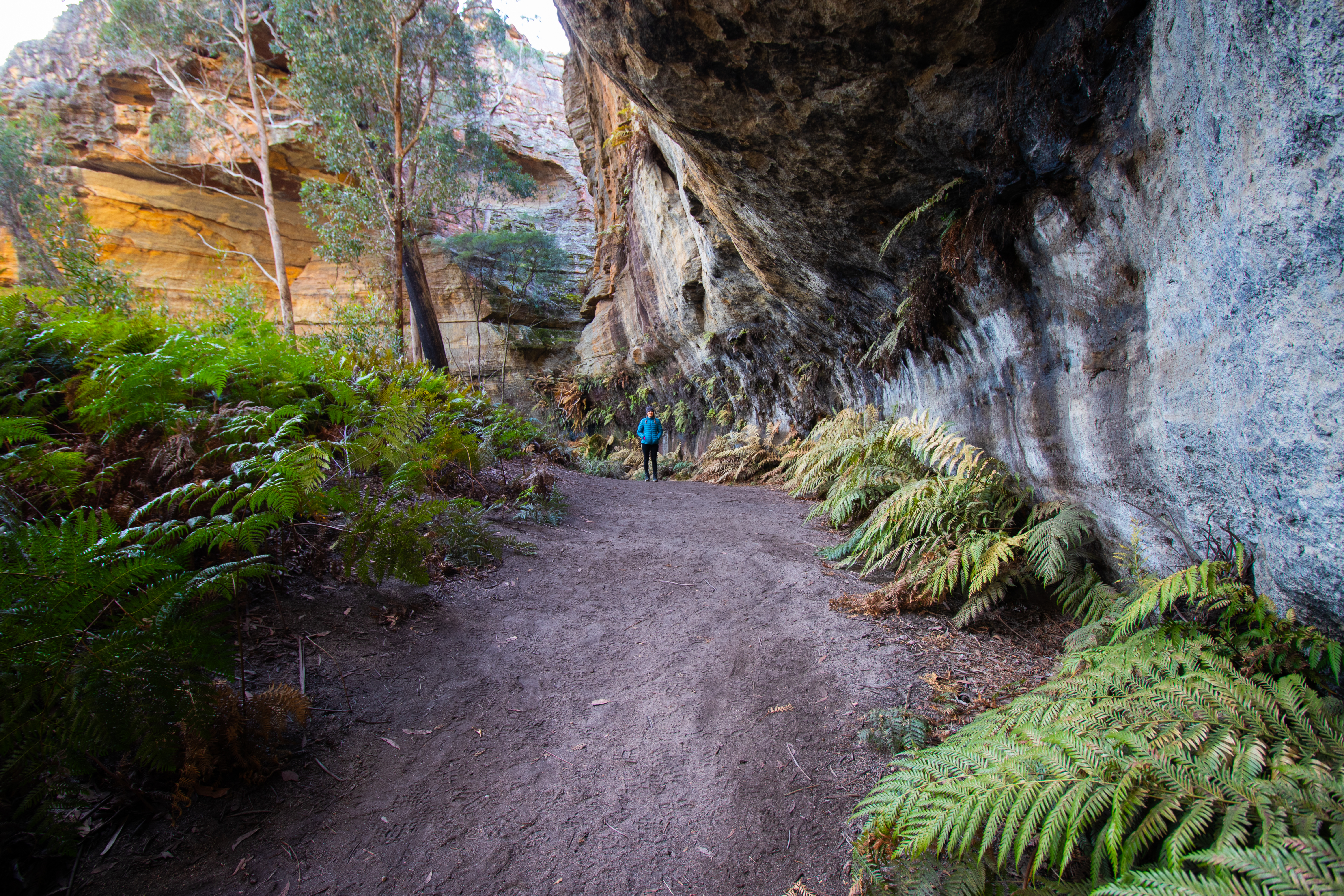
We take our time soaking in the ambiance then head back to the cars to meet Russ and Vince before heading up the hill.
I definitely didn’t take them down a wrong fire trail, twice… Shuddup
The trail in is reasonable and it doesn’t take us long to get to the views over the spectacular upper Wolgan gorge.
Dick dropping in
A couple of dry abseils gets us down to the shelf above the falls.
It is an awe inspiring place to be.
My old mate Loz pioneered this trip. We have dubbed the little cascade above the main falls in his memory “Laurie Cohen Falls”
I sign the log book and, again we spend some time soaking in the special space
And then we rig the main drop.
Myself, Kylie and Dick are going to take the main drop in one 55M+ abseil down a wet line in the side flow. While Vince a Russ opt for the usual 2 stage dry line.
Kylie taking a shower. We have rigged the main flow in the past but it requires a long complicated anchor. This line was wet enough for a cold winters day.
Kylie riding rainbowsDick avoiding a swim with Russ on the dry line
Dick, the gold at the end of the rainbow
She’s an impressive sight
And then it was back up the hill.
Back at the cars it was still early so we headed off over the plateau to some other gems.
and we finish the day and get home just before the weather breaks.
Access: A nice walk along fire trail up a gentle gully. Short section of dirt road to car park.
It is a dog friendly walk but is popular with families so please keep your pooches under control and clean up their poo.
Navigation: Navigation is straight forward
Time: 30min out. 30min back
Waterworks gully is a pleasant walk up the gully beside Farmers Creek. There are a few creek crossings to navigate. With a bit of care and finesse you can keep your feet dry at normal water levels but if the creek is full expect wet shoes.
Getting there:
Follow Bells rd all the way to the end and continue onto the dirt road.
You can park
1. On a cleared area to the right just after the tar ends as per Ida Falls
2. A bit further on at the water treatment plant (don’t block the access gates)
3. Further past the treatment plant if you don’t mind a few puddles and rougher road.
The walk follows the road as it winds its way up the gully to Dam 1
Contrary some non local belief, Dam 1 is the lower dam. It was built in 1896 and is no longer used to store water.
The gully bellow the dam is flanked by towering cliff lines, occasionally defaced with graffiti, some historic some less so.
The cliffs on the right are undercut in places and a bit of exploration will show the remains of old humpy’s used by the workers and the remains of the foundation of the foreman’s cottage.
Eagle eyed folk might even spot the infamous T Lawson rock
This has been a source of mystery to generations of locals with wild rumours about satanism, Masonic rituals and even it being a memorial to a horse.
However some sleuthing by this Author and others seems to have solved the puzzle.
For those more adventurous souls there are plenty of side gully’s, most of which give access the the tops, to explore and it is possible to go passed the dam wall and continue up the the base of dam 2
Return: The way you came in
Note: The great outdoors is an ever changing place. Bush fires, changing weather, vegetation growth and forestry activities can all effect the trail conditions and thus the difficulty of the walk. These are a rough guide only and are by no means meant to be a definitive guide . They do not replace the need adequate map reading and navigational skills
Note 1: Taking care While reasonably well known these spots are still wild places and care needs to be taken around cliff edges and on the steep trails. Carrying the right gear as well as having adequate food, water and clothing is important. Always tell someone where you are going and when you expect to get back. Emergency beckons (PLBs) can be hired from Katoomba Police for very little.
Note 2:First aid A basic first aid kit is essential bit of kit whenever heading into the Aussie bush. A basic first aid is highly recommended
Note 3: Maps and Navigation Having the right map, a compass and knowing how to read them is very important when heading into the bush. If you are new to bush walking joining a club or accompanying more experienced walker for you first few outing is a very good idea. I found practicing map reading on well defined trails was helpful when I started out. The Maps mentioned are the 1:25000 series. They can be purchase at Lithgow tourism information center, from outdoors shops or online for around $10 each. Note 4: These are wild and beautiful places, respect them. If you are able to carry something in you can carry it out. Don’ be a tosser. Leaving your rubbish behind is a sure way to ruin it for every one else.
It’s been a spell since I’d done a big scrub bash on a djinn’s whim of finding a questionable canyon and, TBH I had a tip off that we would find canyons in our chosen creeks
But you never know until you go.
We use to drive out here for a picnic over looking the Wolgan. Even a few years ago it was a reasonable (if legally questionable ) ride on the mountain bikes. Post 2019 fires regrowth is hectic.
Even since we did surefire late last year the scrub has engulfed more of the trail.
Anyhoo that was not going to deter us and we head out in good spirits.
There was a bit of debate about where to set up camp. Closer to our destination would give quicker access to the canyons in the morning but that meant lugging the camp gear further
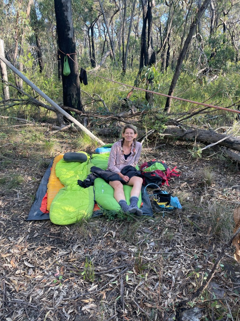
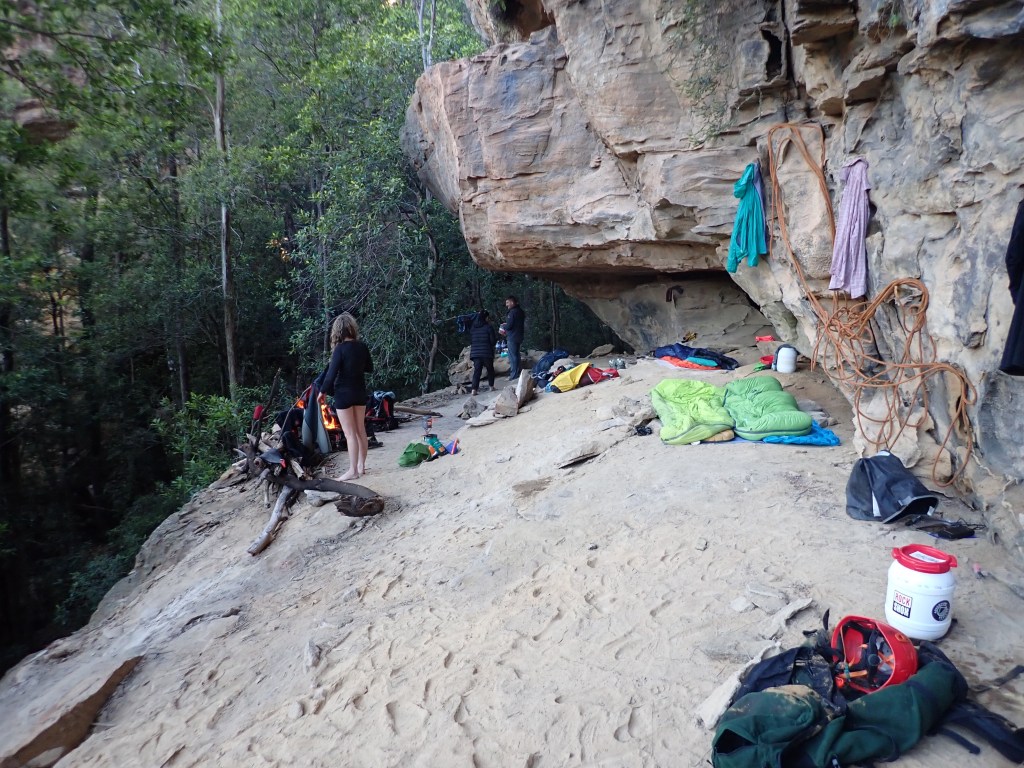
Deadset this seems as good a place as any to set a rough camp.
Not wanting to carry a full tent we banked on it not raining and spread out under the stars.
Magical
I didn’t even feel the factor 3 earth quake that was conjured up and rumbled through the Bluies sometime that evening
Did you feel it? Asks Vince the next morning.
Nope, says I. I was dead to the world
We leave the camp gear and make our way further along the ridge before dropping into our first target.
We weren’t expecting much. unpublished “wilderness” canyons along this part of the Wolgan can be hit and miss but generally aren’t renown for high quality. (The high quality ones mostly found their way into the guidebook)
My good self and Vince making our way into a promising looking creek
We descend the upper cliffs without it really. Canyoning up and then it opens out again
Have we missed it? Asks Gadget. We’re not that far from the junction.
We are expecting the junction to be where the canyon ends.
We continue down.
And then
Hmmm that looks smelly I wonder how deep it is ?
Kylie summons up the courage. Turns out it was smelly and deep enough.
The creek finally canyons up and begins to plummet through the lower cliff line
The abseils all have tricky starts. getting over the edge without getting jammed is a bit of a black art but we all got through.
Gadget below abseil 3 looking for an anchor amid the dead fall
Another tricky start and a long abseil over several ledges with no options to rebelay
It keeps going. like the army of the undead
It was an interesting little canyon dropping steeply through several ledges of various widths.
Despite the ledges the only anchor options is about 35m above me at this point
Ok first goal achievements . A quick look about and now to break a pass back up through the cliff and check out its neighbour.
Getting back up through the lower cliff was surprisingly easy.
We knew the adjoining creek also had a canyon in it and seeing as all the interesting bits of the first one were in the lower cliff line we traversed around and dropped into our next one.
It started with a bit of promise
But just didn’t deliver.
After the second scrubby abseil we realise we are 1 short abseil above the junction where our first canyon finished.
Disappointment
We ascend up the previous drop then scramble out a convenient side gully.
There was chatter about checking the upper section out as it is rumoured to hold cool abseils.
But open scrubby creek greets us as we make our way up stream. We gain the ridge and continue up, keeping an eye on our gully just in case it drops through a slot but there’s nothing of note below the top cliff line.
Another easy pass yields us the ridge top
And thus back to camp and homeward bound.
It was a longish walk out for 2 short canyons. But I still get a kick out of exploring little canyons few others bother wit h. These ones would be doable in a day with a fit, efficient group but camping out was half the appeal. Plus there is other stuff out here that’s worth a look
We weren’t expecting the others until 9:30 at the earliest and given our slow going on the ridge we decided to wait til 10.
A couple of cooeees and we thought we heard a faint reply. I slip up the gully a bit to guide them down. More cooees and whistle blasts but no response.
Back at camp we scratch a note in the dirt and head for Crikey. it’s 10:30.
We cross the ‘Boori (dingo creek) and start making up way up the opposite gully. It’s full of dead fall and scrub. It’s slow going and we’d already had a late start.
I spot a break in the cliffs and decide to try to climb out. Kylie is skeptical but we escape the gully and make heaps better time along the ridge.
Dropping into the creek at Kent’s entry (well downstream of Jamieson’s grid reference) we encounter walls of dead fall. So much.
It was a real punish. by the time we get to the canyon we are bruised and bloody and just a little over it.
There are several breaks in the cliff further down. I’d suggest future party’s explore their way down the spur and drop in closer to the canyon proper.
Anyhoo Crikey is deep and dark and our timing wasn’t conductive for photos but Kylie managed to get a few crackers
We reach the ‘Boori…. Bloody “dingo” creek.
We are bashed up and exhausted from battling the dead fall, sticks and scrub.
My memories of my previous trip to crikey was some hard going up the creek to get back to camp.
We have lunch and start making our way up stream
Somehow we pick our way up the banks and avoid strenuous swims or boulder hopping.
It’s about 4:30 when we reach the base of the pass up to camp. We strip out of the wetsuits, wash down in the creek and dry off in the sun before making our way back up.
Below camp we call out and are delighted to hear Dick reply.
Camp.
Unfortunately Sunday morning dawns with me and Kylie having grumbling in our belly’s.
I’m careful where I collect water from and have never had issues before but that’s all we can put it down to.
A bit of running off into the bush and we decide it’s best to skip canyoning today and head back to the cars.
It’s a shame for Dick and Monica to walk all the way out and miss the stunning canyons but it is the wisest choice.
It was a tough walk out. Kylie did it real tough. She’s a trooper.
We have a tough next couple of days. It hit us hard.
Anyhoo
There is a hidden message in every waterfall. It says, if you are flexible, falling will not hurt you!” ― Mehmet Murat ildan