This was suppose to happen before Christmas but a big rain event had NP jumping at shadows and closing things down.
Even though it stayed dry for the next 4days the parks were still closed and we had to postpone.
Until now.
Yeah baby
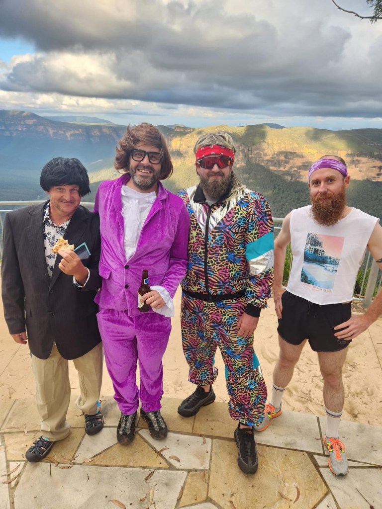
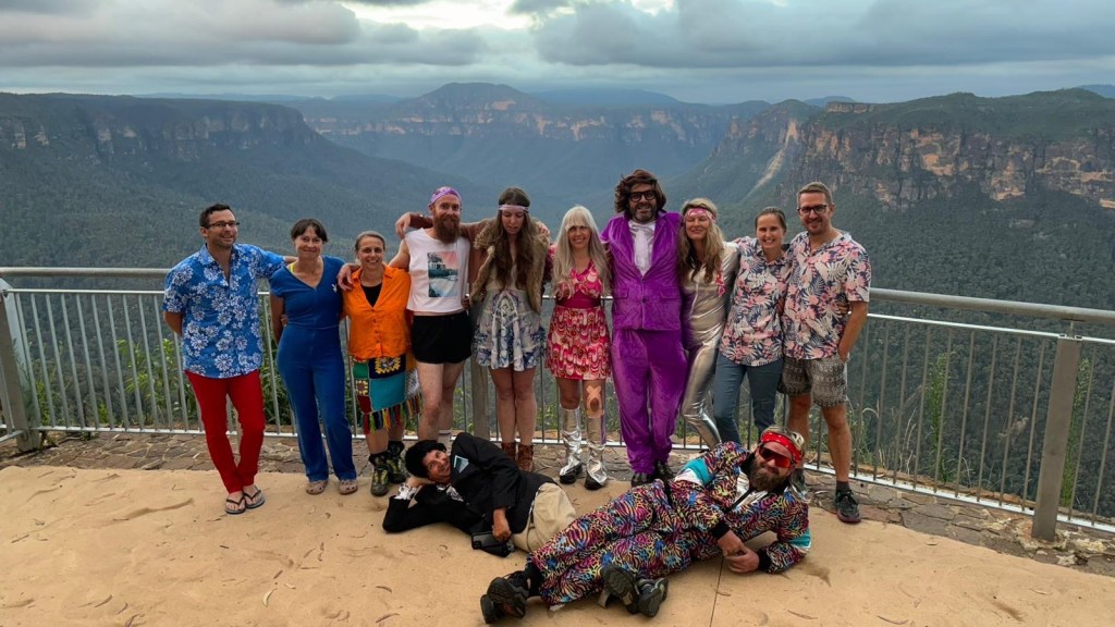
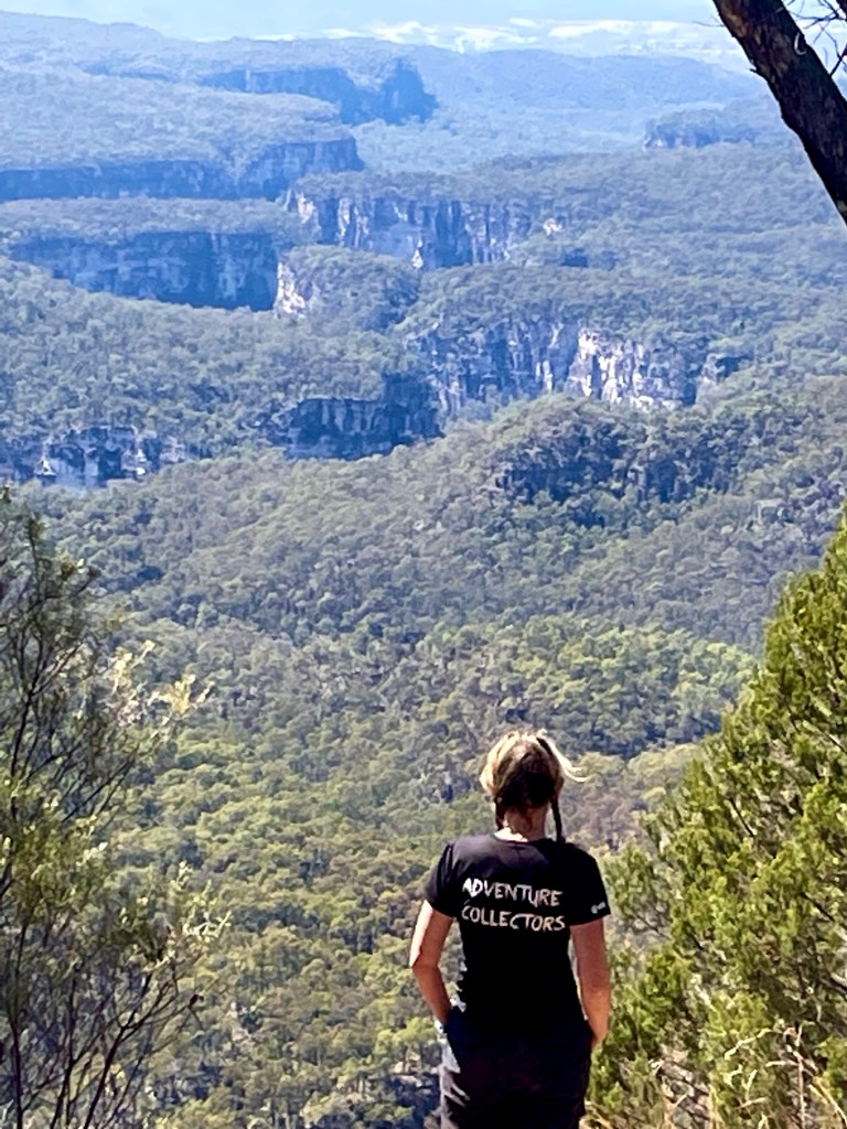
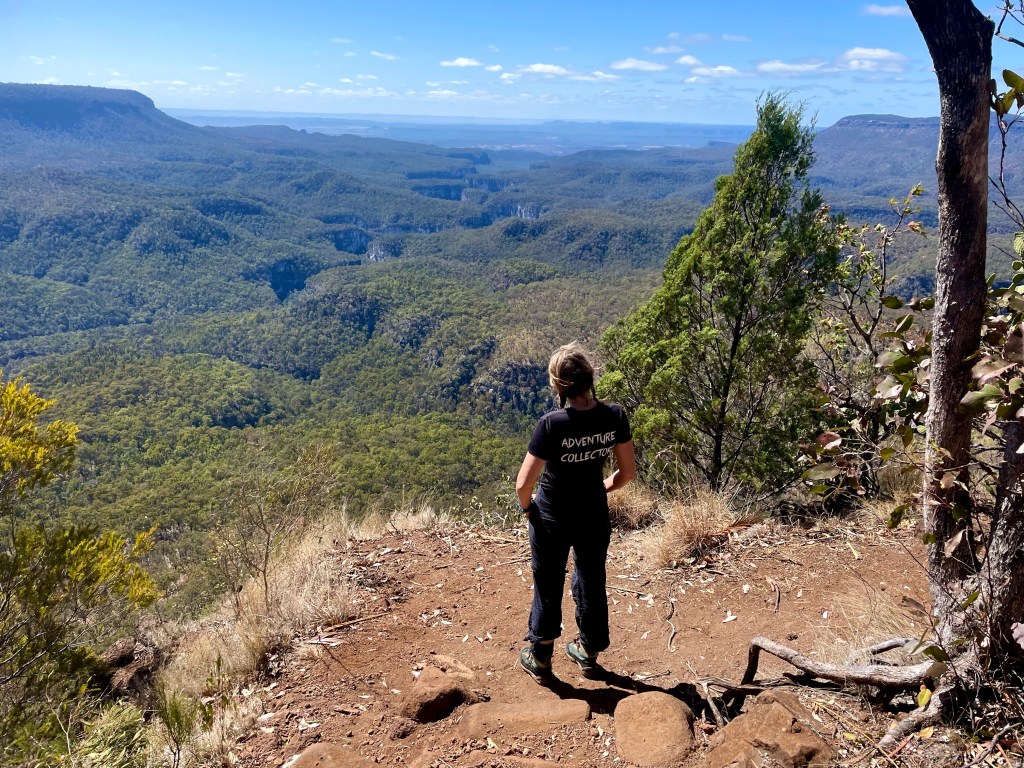
First up pizza and beerios at Evans lookout.
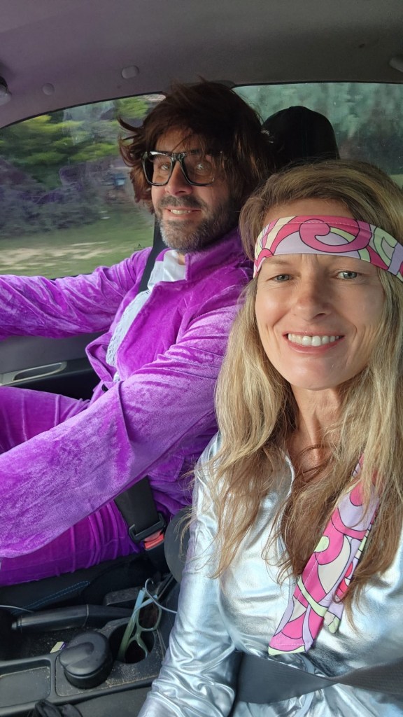
Oh, and as a 70s child a 70s theme seemed to make sense.
These lads
They really are a legendary bunch of humans
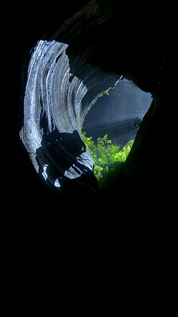
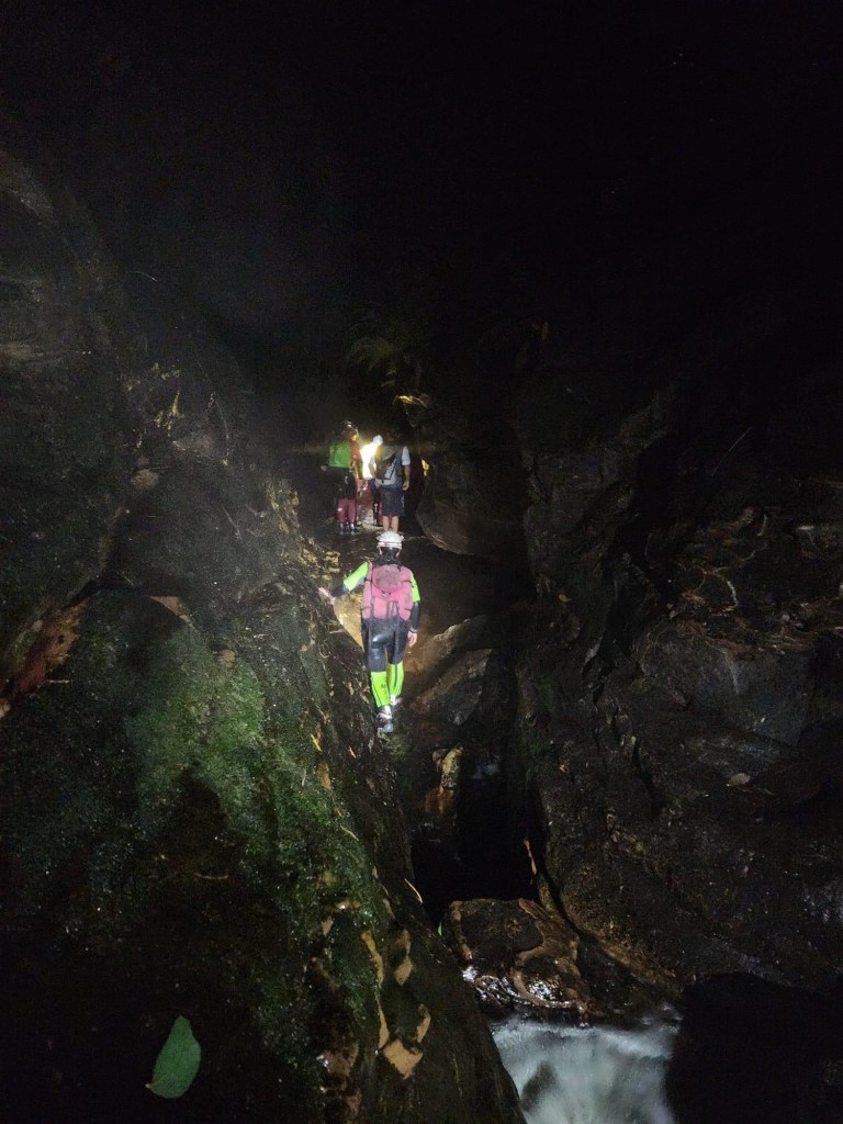
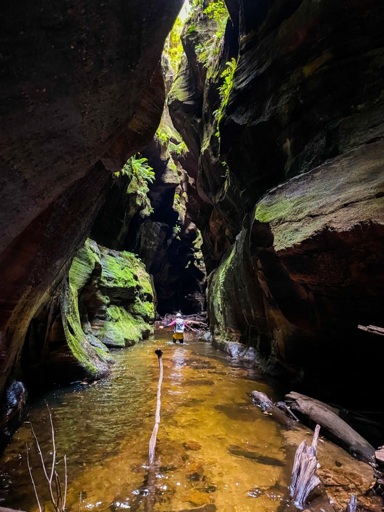
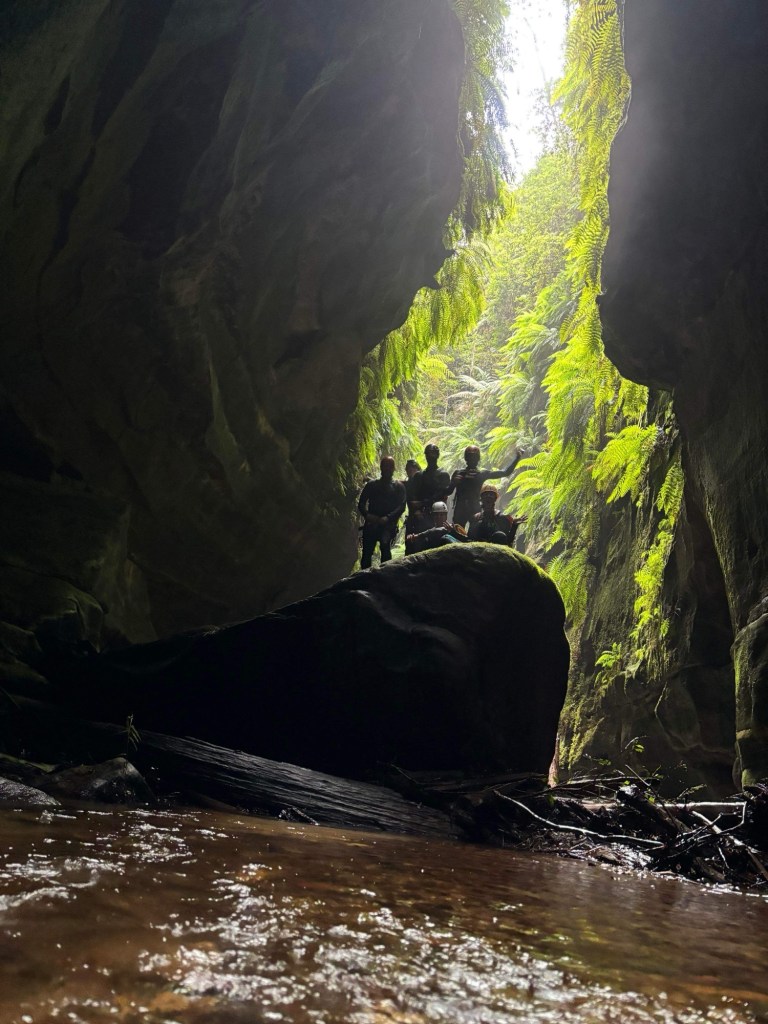
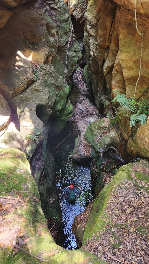
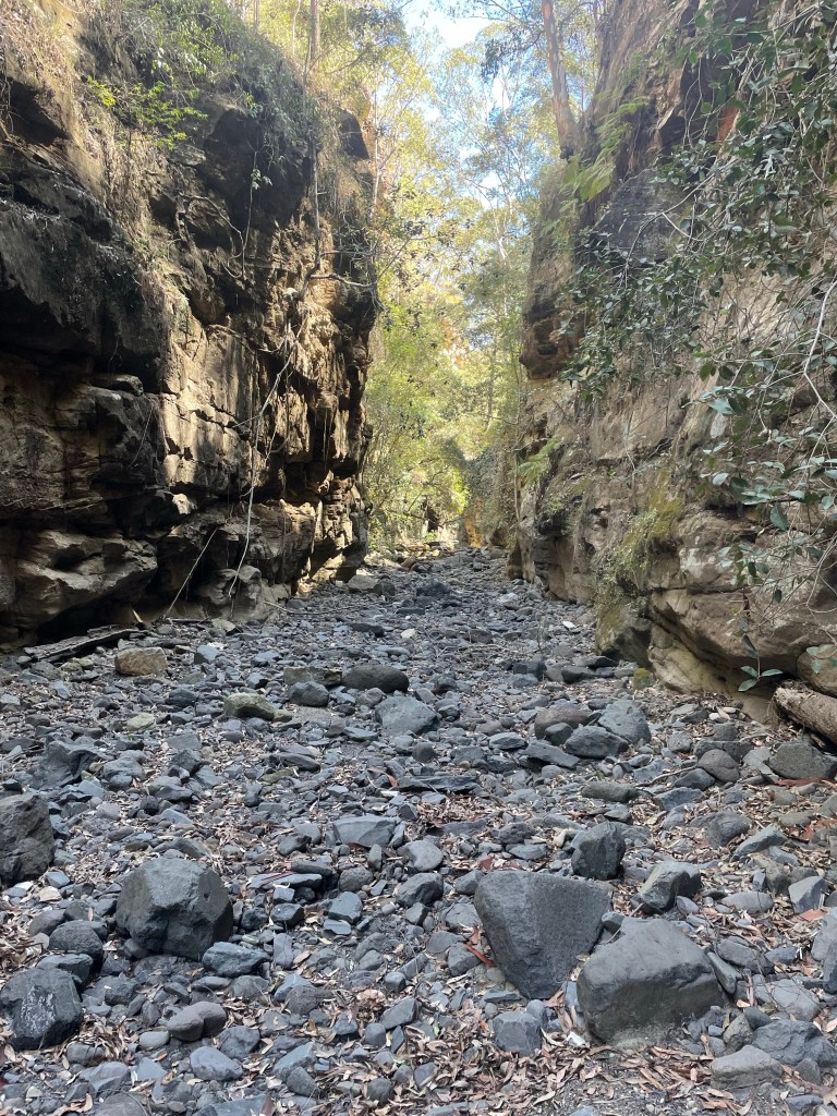
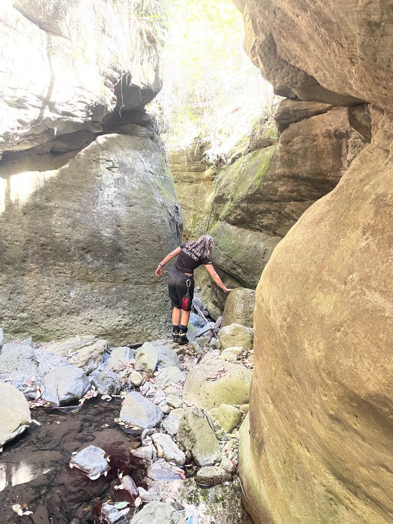
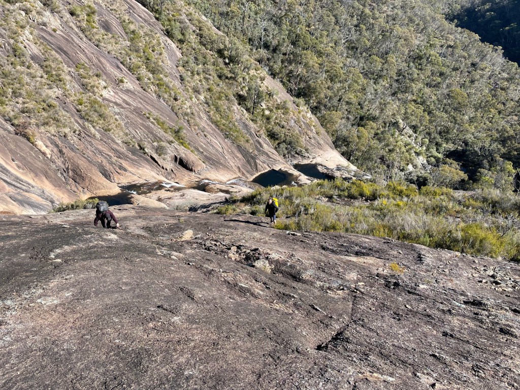
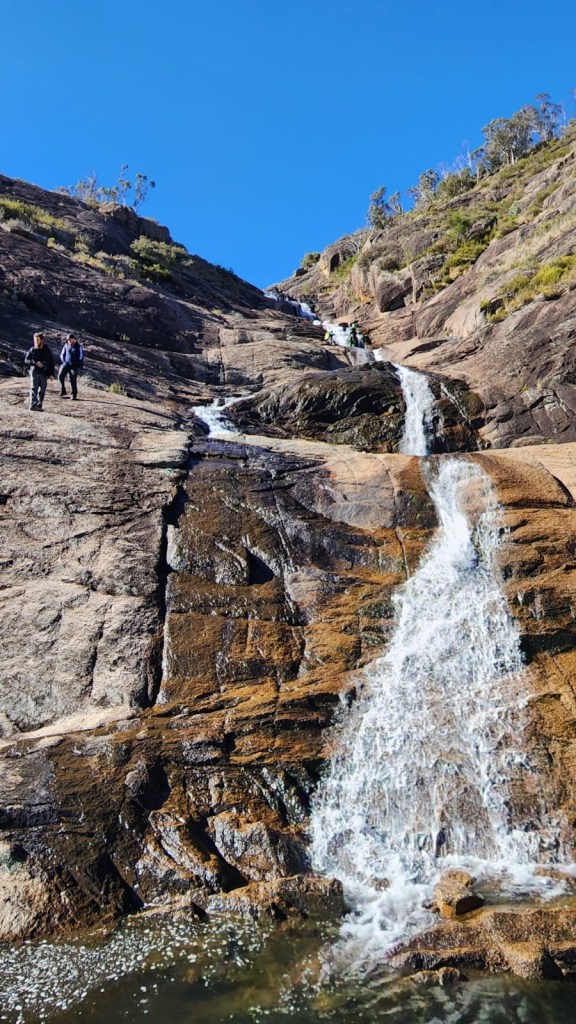
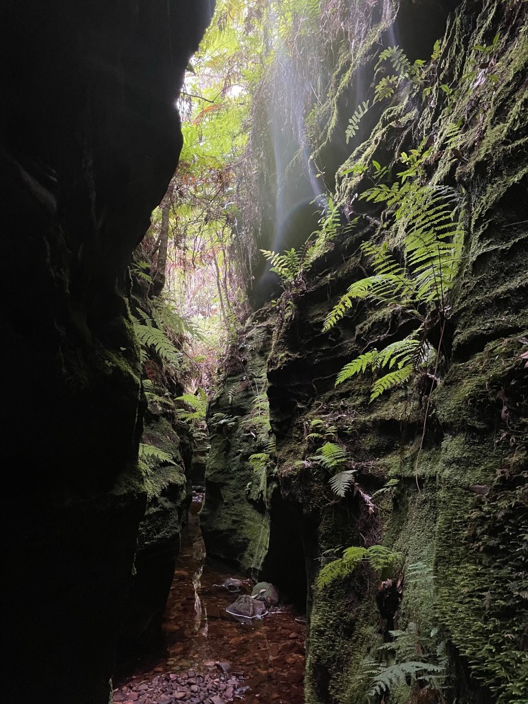
After posing and yakking and general shenanigans we make our way down the Grand Canyon trail under a setting sun and drop into the slot to say g’day to the glowworms.
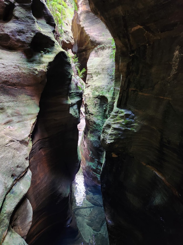
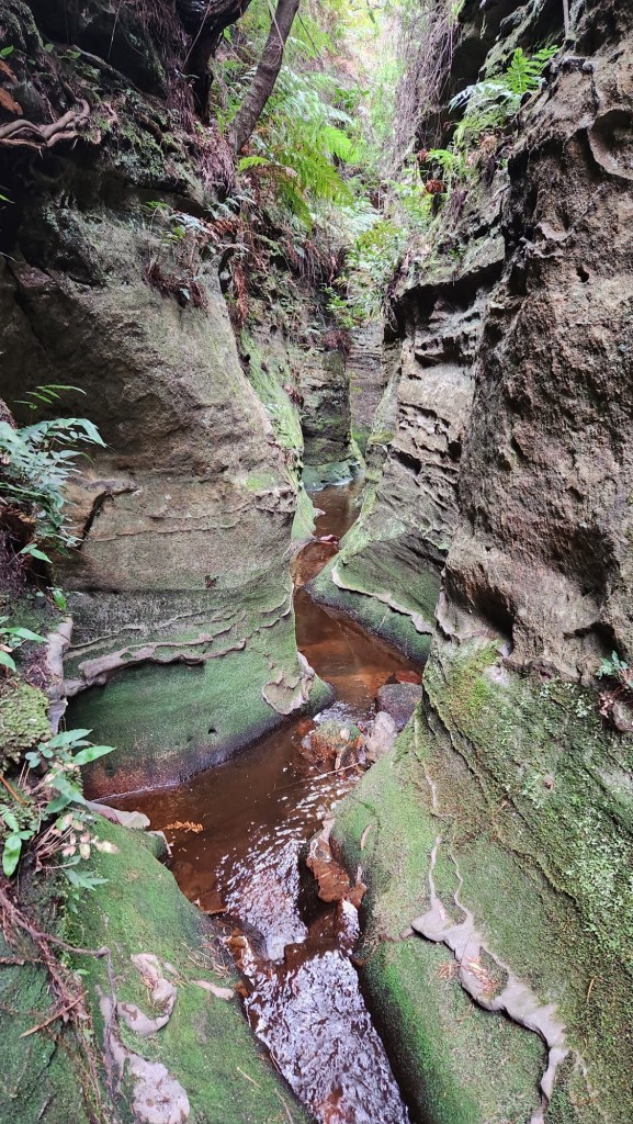
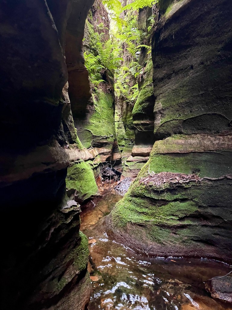
I always forget the walkin/walkout to canyon ratio for Grand blows but it is a pretty little slot in any light
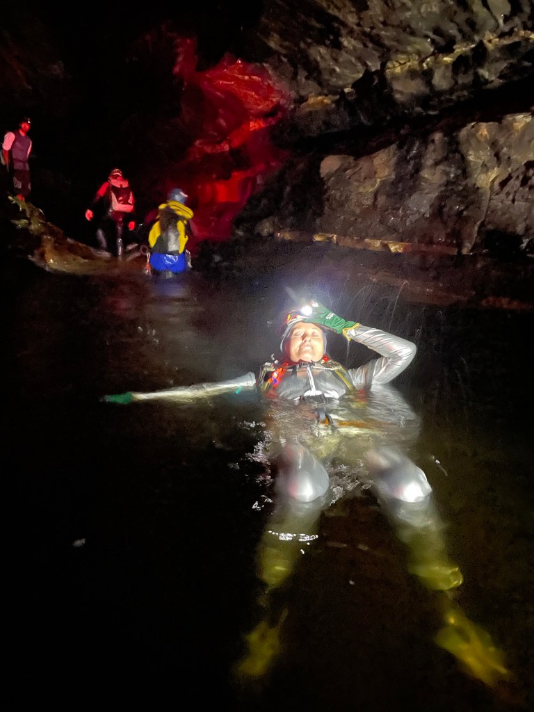
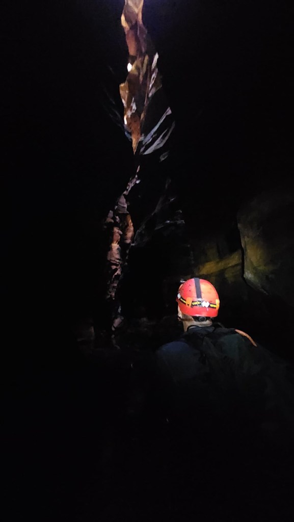
Night canyoning is a different experience
Space girl
Traversing under worms.
Dick glows as much as any worm
I really am lucky to be surrounded by amazing people and it was a great night.
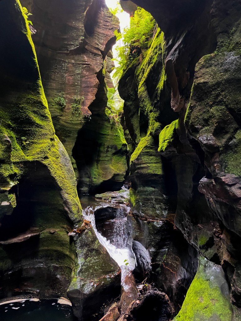
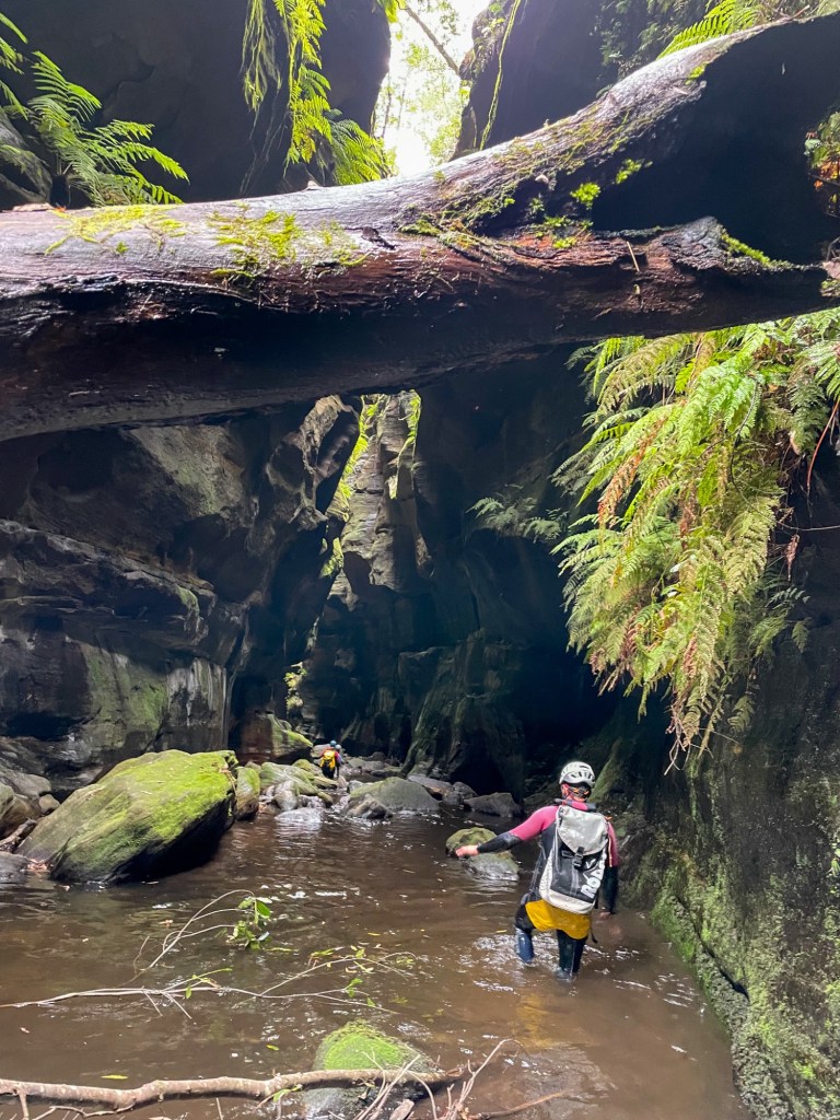
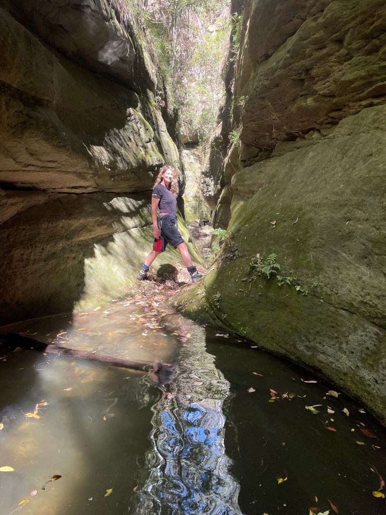
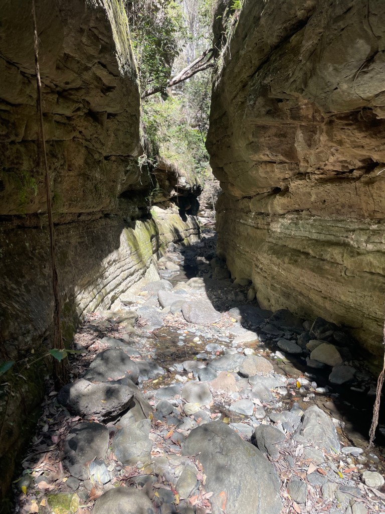
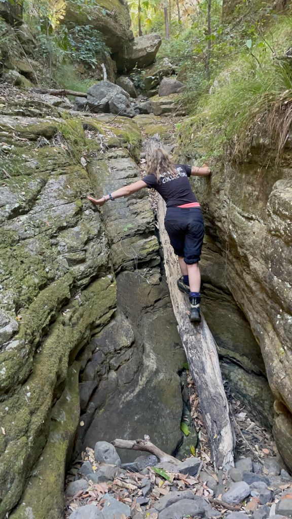
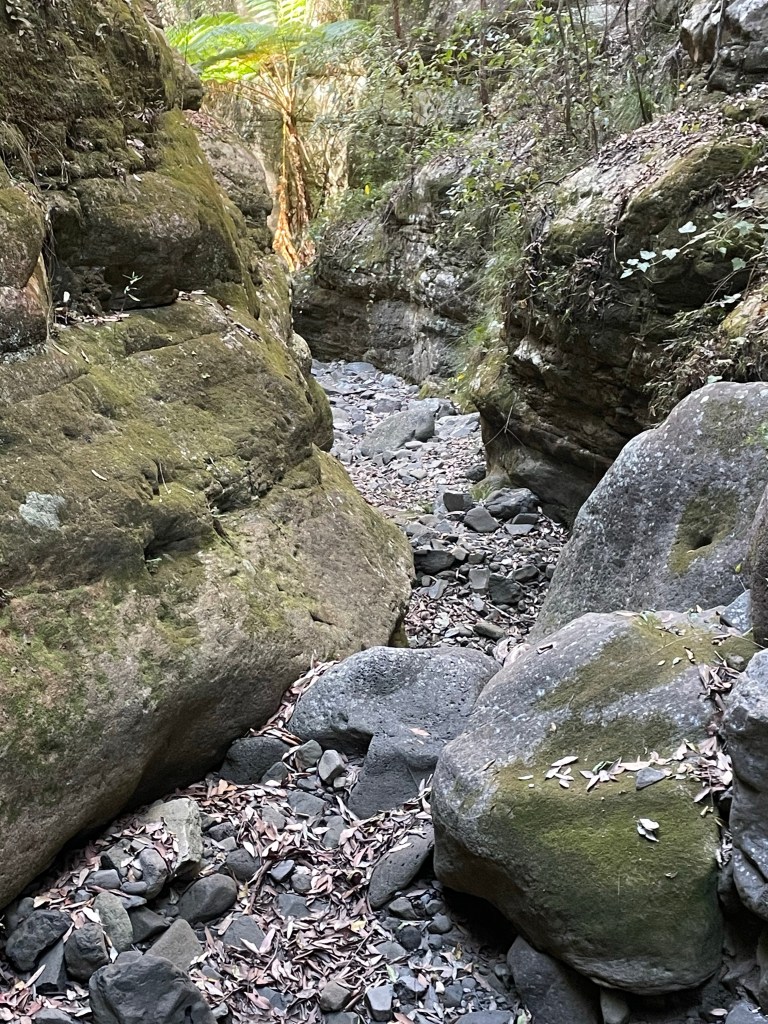
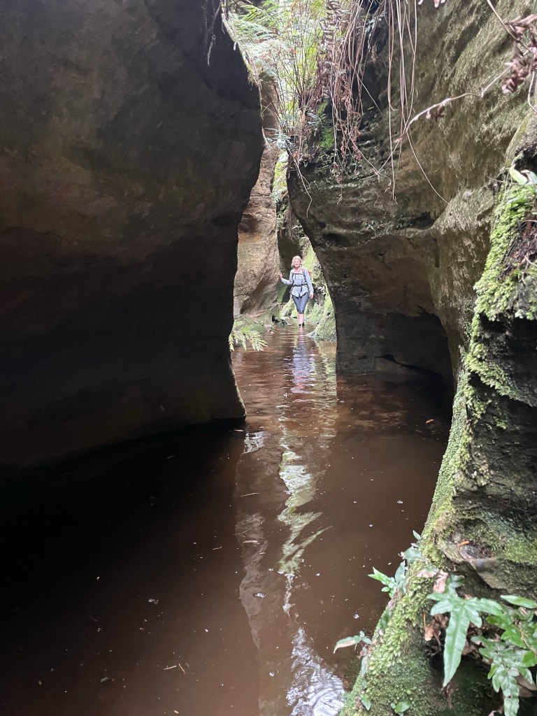
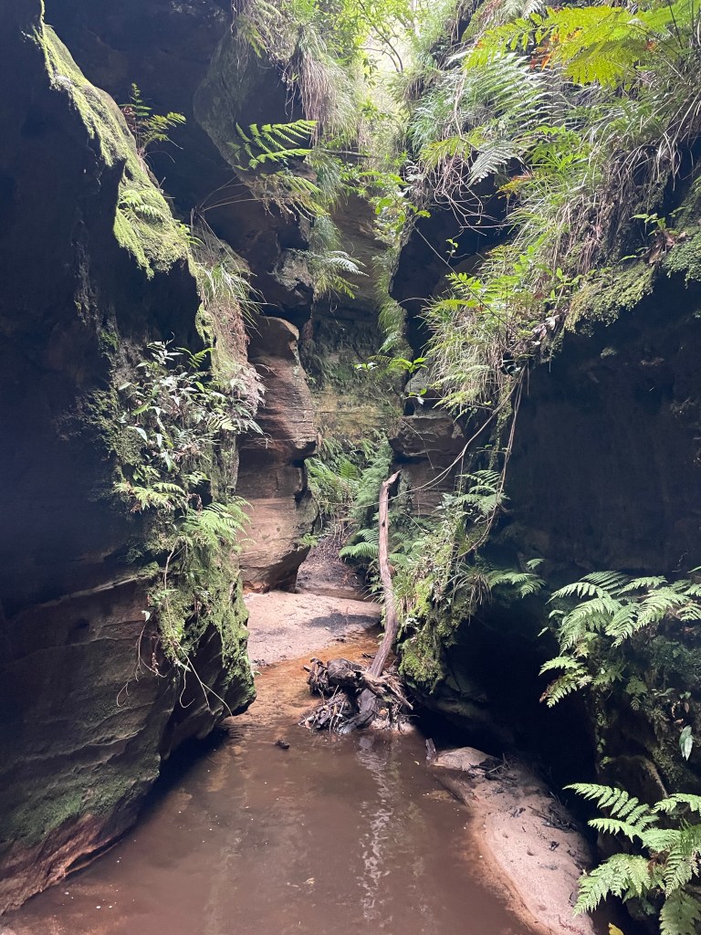
And backing it up the next morning with a trip through Twister and Rocky Creek was a great idea
Entering the maw
It’s hard to describe just how much I love rocky creek.
How could the weekend get any better?
I’m glad you asked
Fill what’s empty. Empty what’s full. And scratch where it itches. A Roosevelt Longworth
BACK oh and once again I’m raising money fir the Westpak Rescue Helicopter so please consider a donation
In the spirit of cruisey we push that start time 30min later..
That might have been a mistake. As I role up the mountain it seems like every second car in NSW is trying to get a car park at the trail head.
Are you with them? Asks old mate pointing at a large group as I step out of my car.
Not me.
Come on boys let’s get going. Says he. Oh which way is it?
I point old mate and his 2 sons(?) in the general direction.
I notice Leo T marshalling the aforementioned group. That’s a relief. A commercially guided group that all bought their own cars making it seem like it’s a bigger group than it is. I know Leo is efficient and quick with his groups so not too fussed there .
Another group jumps out of their car and heads off to beat the rush.
Madie and Leo arrive and introduce another two of the people milling around. Achi and Toni are with us. Excellent.
Everyone ready to go? let’s get going before anyone else shows up. Says they
Um we aren’t due to meet for another 10 mins and Brook’s not here yet. Says I
Bugger say they.
Another group of 4 arrive. Leo knows them from rescue they banter about getting the jump on us and head off.
Brook arrives. Ok let’s go.
A quick walk becomes a slow jog becomes “keep up!”
Oi! I was promised a cruisey social trip.
By the time we get to the wetsuit change spot we’ve over taken all the groups who started before us.
As I always say, it’s not a competition. Unless you are winning, and right now we are winning.
Winning
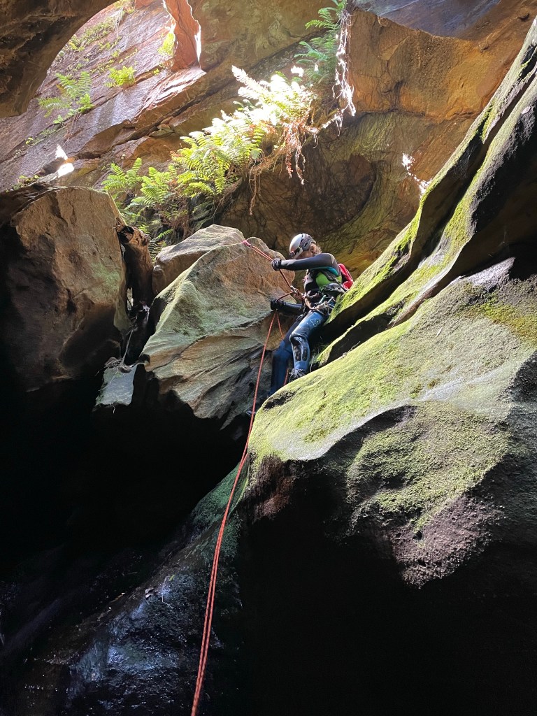
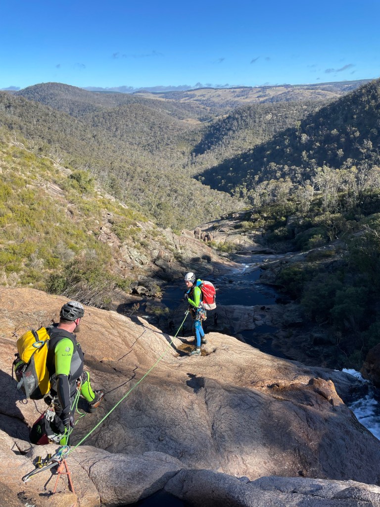
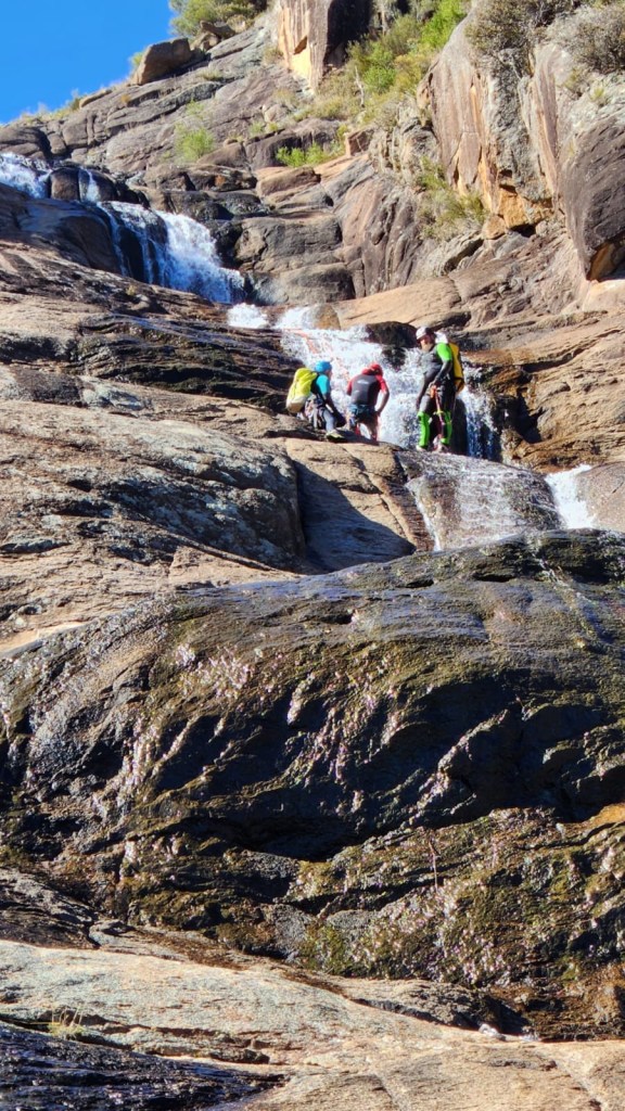
Ok get changed and get into it. We’ll slow down when we get to the abseils.
Thank fugg for that.
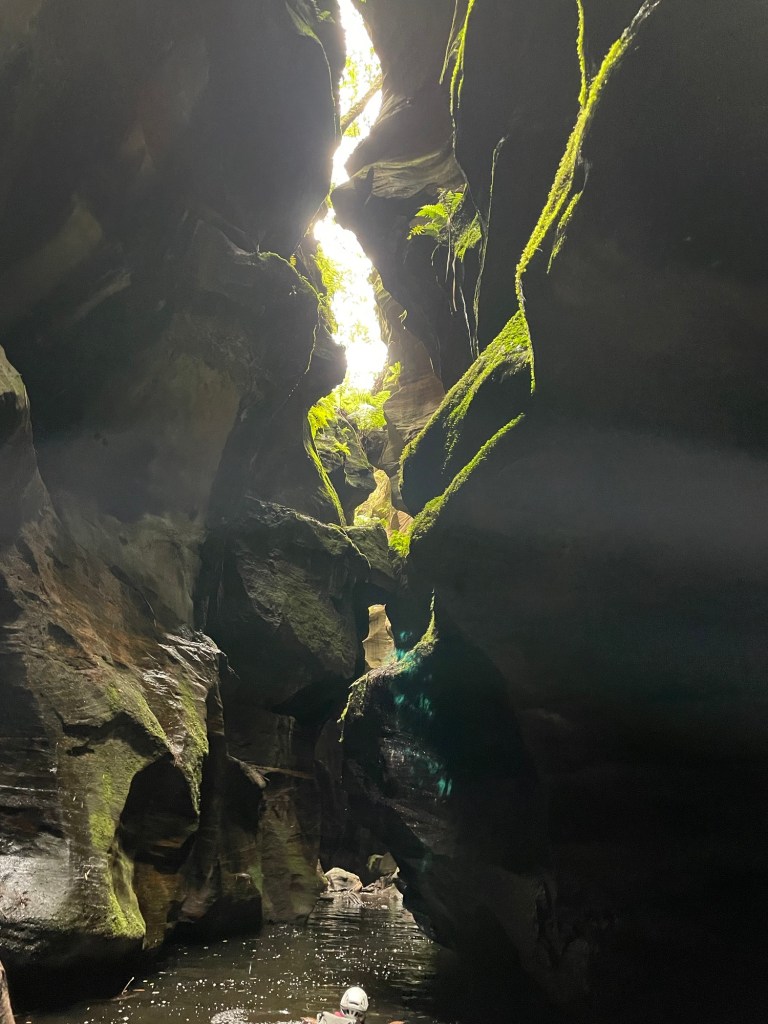
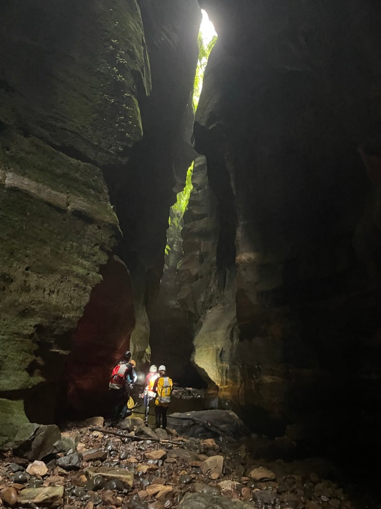
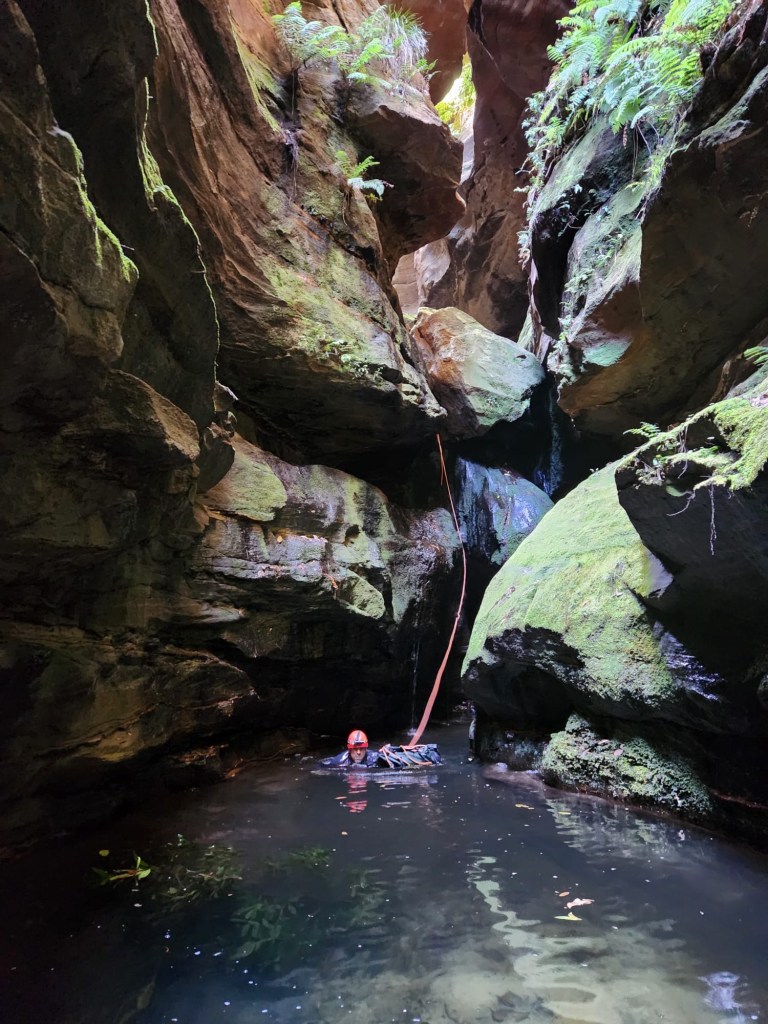
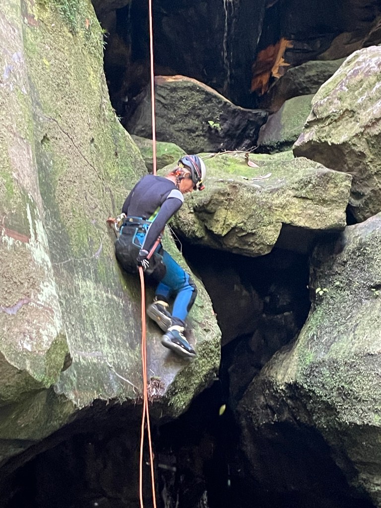
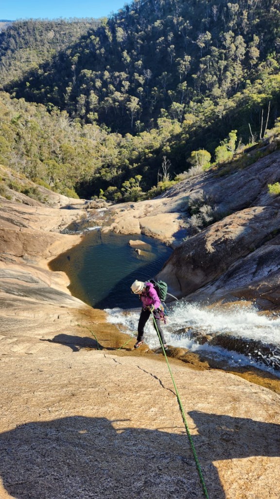
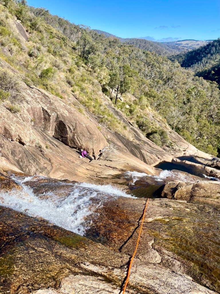
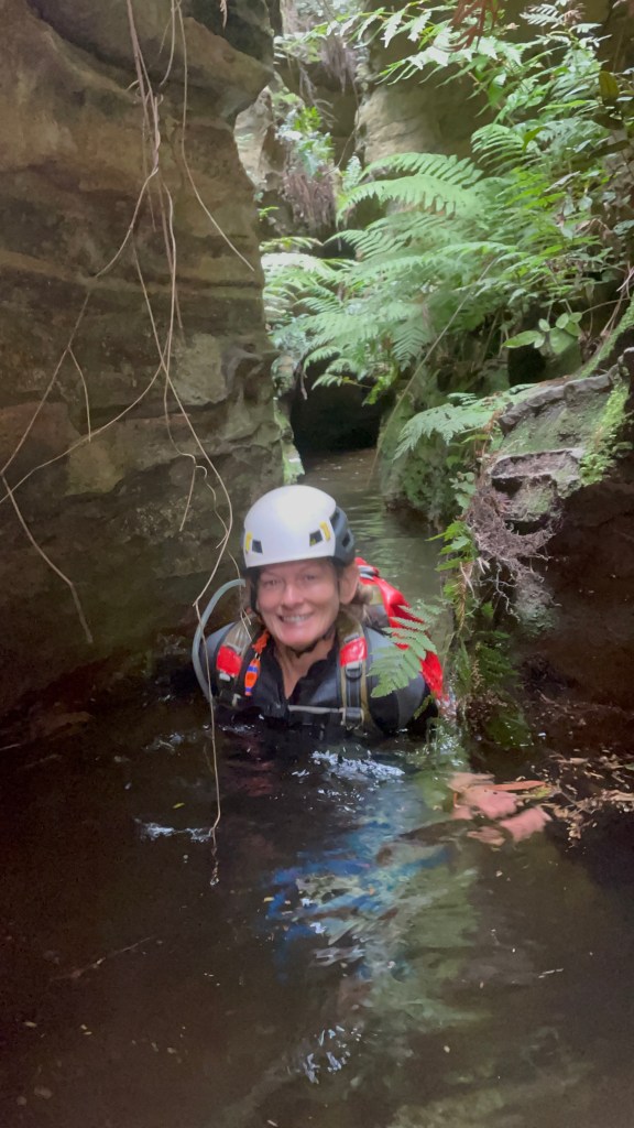
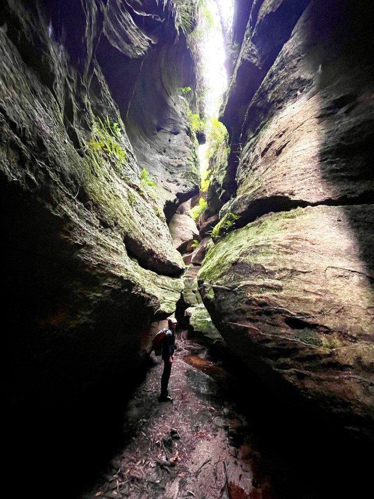
The “black hole”
Overcast day meant sunbeams were unlikely but oh the ohm-bi-aunce
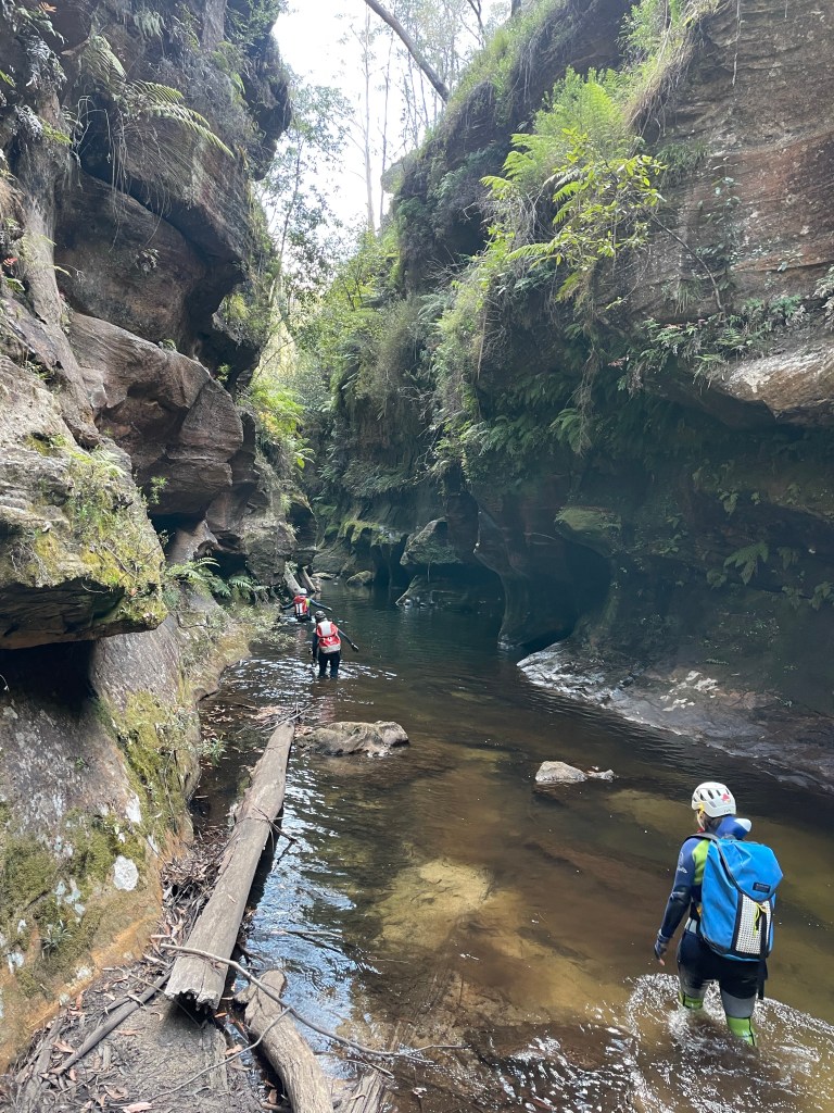
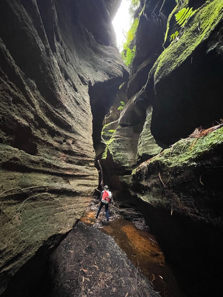
Despite the three thousand two hundred and forty eight cars at the car park we haven’t seen any one in the canyon since one of the groups got to the top of the first abseil just as our last member was roping up.
We figure most of them would have leapfrogged us while we were in Thunder but we catch back up to the group of 4 at the exit and have a chat while we dry off and have a bite to eat and it appears no one else is in front of them.
then it’s up, up and up.
There’s still a gazillion cars at the car park
And while winning is winning, my legs don’t work anymore.
we farewell Achi and Toni then head for a well earned beerio
We weren’t expecting the others until 9:30 at the earliest and given our slow going on the ridge we decided to wait til 10.
A couple of cooeees and we thought we heard a faint reply. I slip up the gully a bit to guide them down. More cooees and whistle blasts but no response.
Back at camp we scratch a note in the dirt and head for Crikey. it’s 10:30.
We cross the ‘Boori (dingo creek) and start making up way up the opposite gully. It’s full of dead fall and scrub. It’s slow going and we’d already had a late start.
I spot a break in the cliffs and decide to try to climb out. Kylie is skeptical but we escape the gully and make heaps better time along the ridge.
Dropping into the creek at Kent’s entry (well downstream of Jamieson’s grid reference) we encounter walls of dead fall. So much.
It was a real punish. by the time we get to the canyon we are bruised and bloody and just a little over it.
There are several breaks in the cliff further down. I’d suggest future party’s explore their way down the spur and drop in closer to the canyon proper.
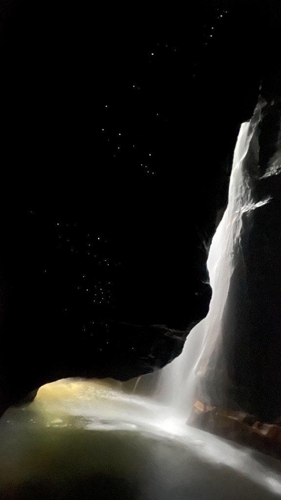
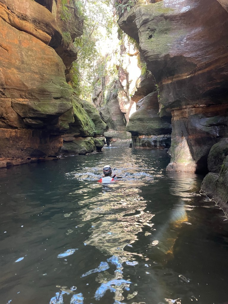
Anyhoo Crikey is deep and dark and our timing wasn’t conductive for photos but Kylie managed to get a few crackers
We reach the ‘Boori…. Bloody “dingo” creek.
We are bashed up and exhausted from battling the dead fall, sticks and scrub.
My memories of my previous trip to crikey was some hard going up the creek to get back to camp.
We have lunch and start making our way up stream
Somehow we pick our way up the banks and avoid strenuous swims or boulder hopping.
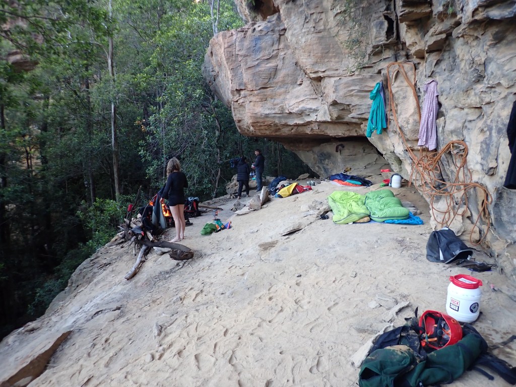
It’s about 4:30 when we reach the base of the pass up to camp. We strip out of the wetsuits, wash down in the creek and dry off in the sun before making our way back up.
Below camp we call out and are delighted to hear Dick reply.
Camp.
Unfortunately Sunday morning dawns with me and Kylie having grumbling in our belly’s.
I’m careful where I collect water from and have never had issues before but that’s all we can put it down to.
A bit of running off into the bush and we decide it’s best to skip canyoning today and head back to the cars.
It’s a shame for Dick and Monica to walk all the way out and miss the stunning canyons but it is the wisest choice.
It was a tough walk out. Kylie did it real tough. She’s a trooper.
We have a tough next couple of days. It hit us hard.
Anyhoo
There is a hidden message in every waterfall. It says, if you are flexible, falling will not hurt you!” ― Mehmet Murat ildan
We were planning a weekend out on the B̶o̶o̶r̶i̶… I mean *hackspit* Dingo creek.
The others were meeting us in the morning but we headed out Friday afternoon
We made good time along the fire trail but slowed a bit navigating the twisting ridge as the faint trail came and went.
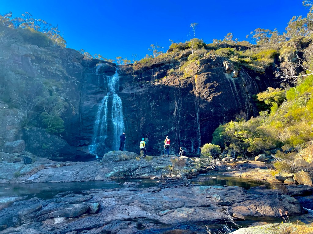
We got to the camp around 5:30. Dumped gear, set up camp and headed up for a quick run through Bubblebath Canyon. AKA Froth and bubble canyon. (There was difference of opinion in the first descent party over the name.)
Not wanting to put wet gear on in the morning we went light. I knew it was short so we decided to brave the cold.
Dropping in
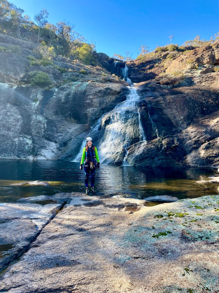
The water above the canyon was surprisingly warm.
Gadget at the start of the good bit
Bubblebath is a beautiful little canyon. It’s a bit underrated compared to some of the others. The late evning light didn’t do it justice but it’s one of the more beautiful ones out this way. “Mini Crikey”as Kylie called it.
The deeper we got the colder the water got and we lost the light just before the end.
Getting to camp we rug up and settle in for the night.
It was a slightly cooler day which worked out perfectly as it’s a bit of a walk to get to this one
Pleasant banter ate up the fire trail and it didn’t seem too long before we were following the HITW exit trail down to Dingo Creek (but really North Bungleboori)
The old dodgy ledge that you could once use to stay dry seems to have washed away and so we stripped down to essentials and waded down to our exit on the other side.
Here we encountered the first of the many large tangles of dead fall we’d encounter today. b
After a bit of effort we were up North East canyon and had a morning tea break looking down over Banks.
The climb out of North East canyon, which runs South West….
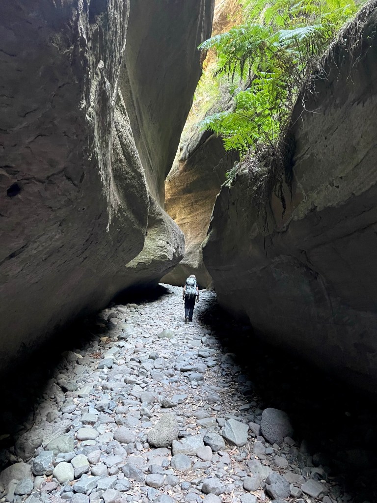
We pick an easy path down to cross the head of Banks Canyon. Then over the next ridge to scramble into Nose Dive creek.
Making our way down stream there was lots of dead fall to negotiate.
The gully seemed to be openning out and I voiced concerns that we had dropped in too far down stream (I didn’t get the grid reference or study the map. I go by feel baby)
But then.
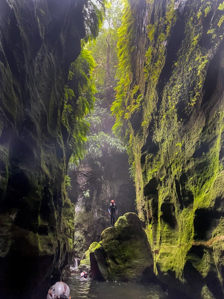
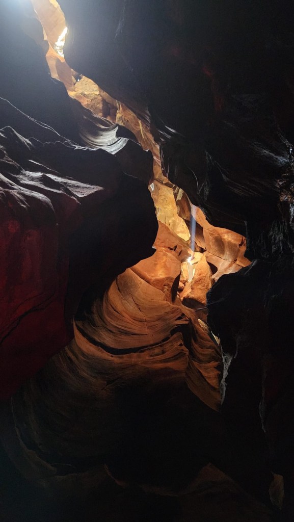
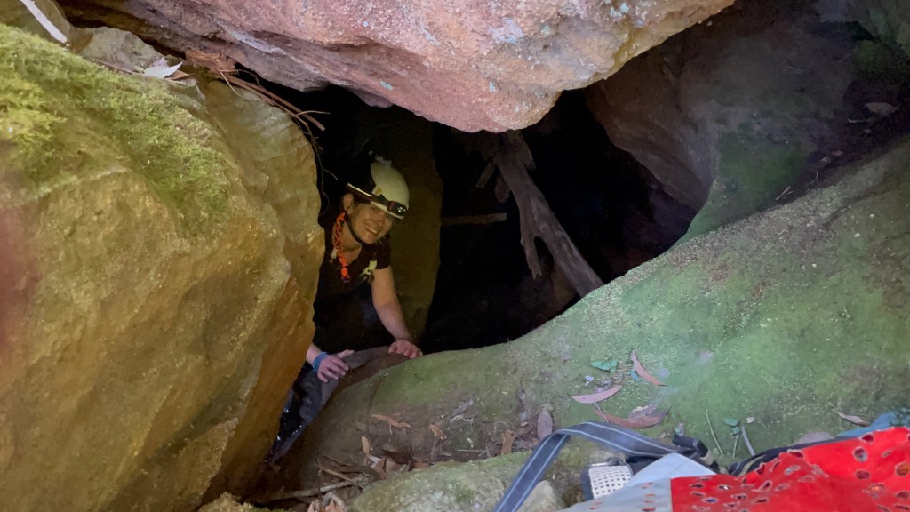
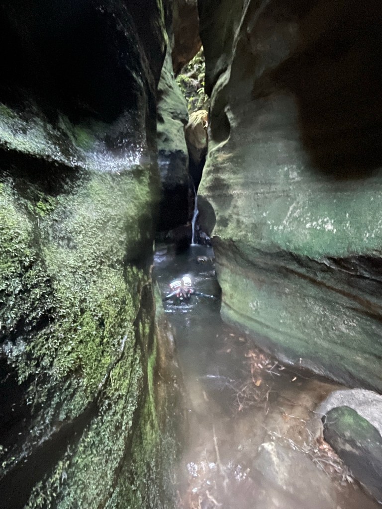
The creek drops down a hole. And so do we.
The second of the cavern like sections. It’s ok I guess.
Ok it was more than ok.
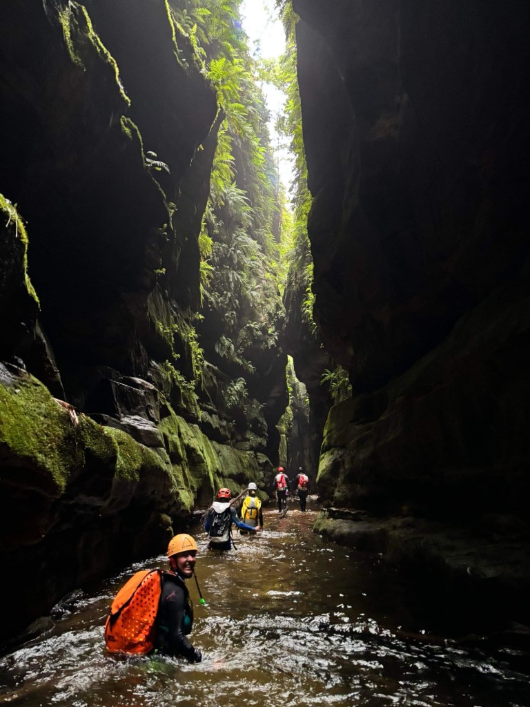
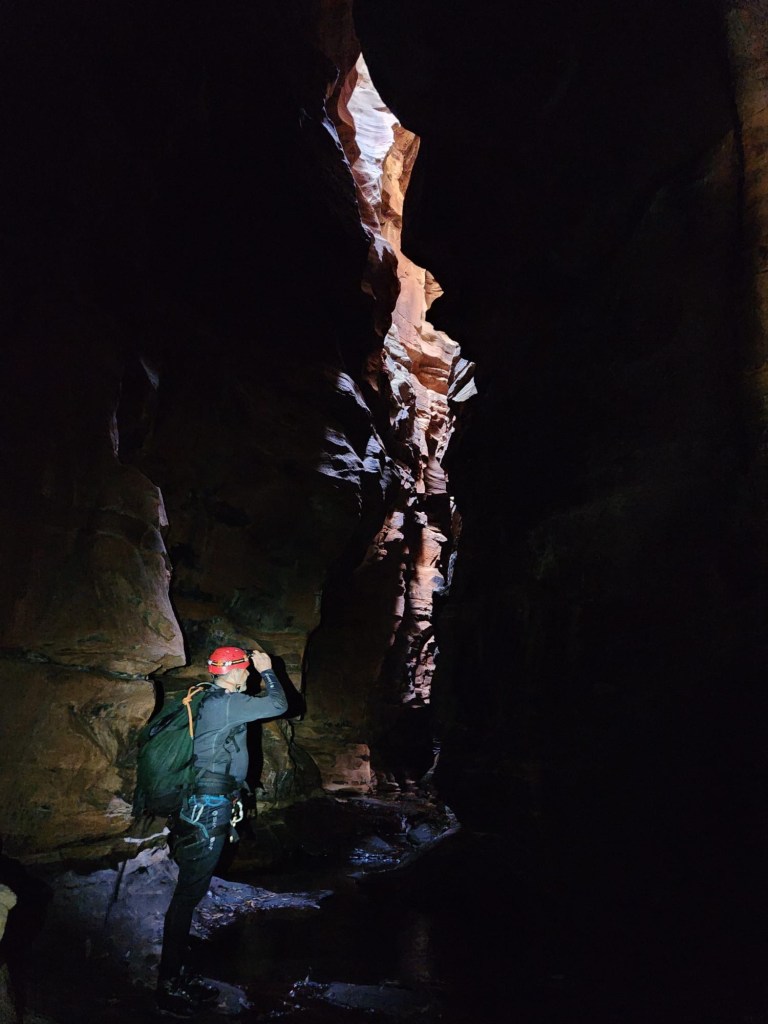
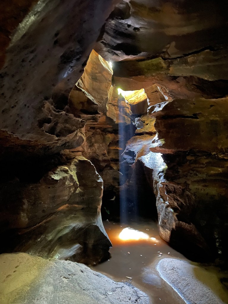
Dark yet somehow filled with beautiful light
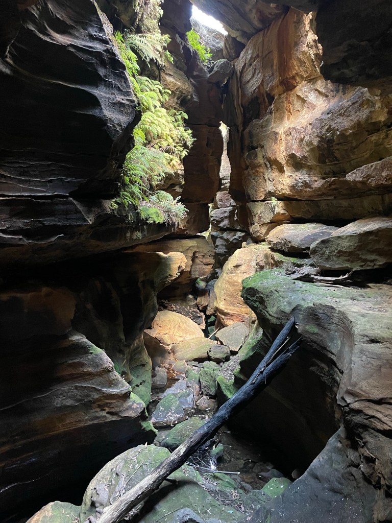
Really spectacular and somewhat unique slot canyon
Such a cool little section
The water was like glass
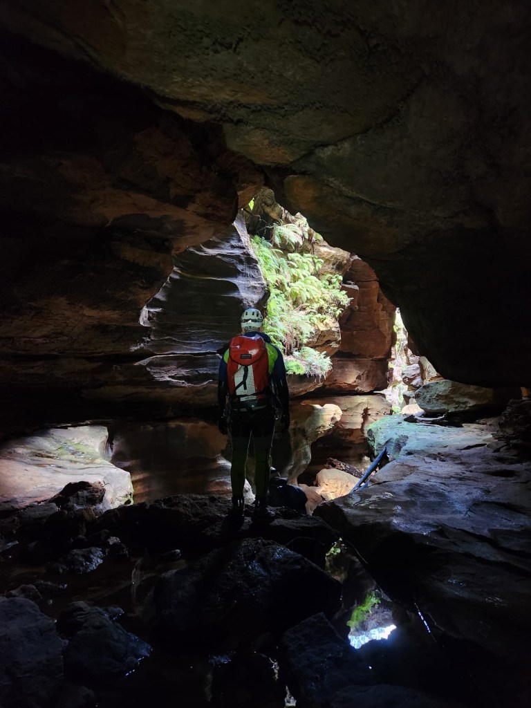
Gadget with H in the background
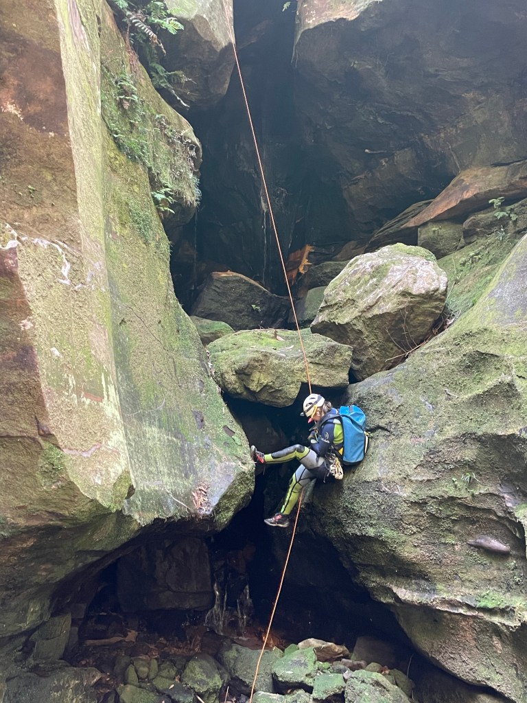
Throw and go because, well you know.
Was it cold. Yes it was
H
K
G
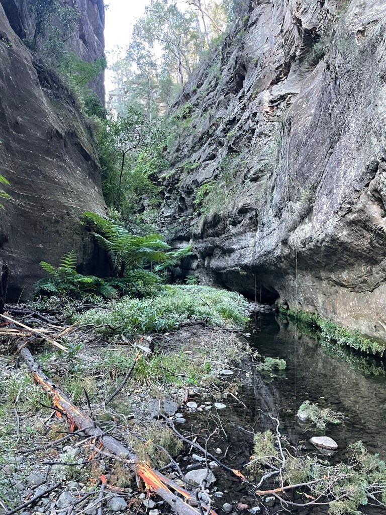
And then we are in T̶h̶e̶ ̶‘̶b̶o̶o̶r̶i̶ Dingo Creek for lunch followed by a bit of creek walking and some long swims to get back up the the HITW exit at the big bend
It’s a gorgeous section of T̶h̶e̶ ̶‘̶b̶o̶o̶r̶i̶… Dingo creek
You should sit in nature for 20min every day.
Unless you are really busy then you should do it for an hour.
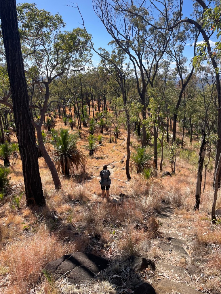
Day 3 would see us back on the tourist trail for the most part. We’d planned to get up to Battleship Spur, nearly 600m above our camp, before the heat of the day. Then check out Boowinda Gorge and it’s side creeks
Both were listed as star attractions. The young couple we had shared camp with came back raving about how beautiful Boowinda Gorge was and a steady stream of people had made their way either up to or down from the spur on their journey along the great walk.
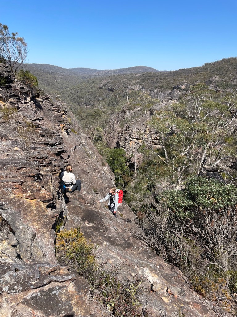
So up we go. The path up to the spur starts up Boowinda gorge but we don’t really take notice as we’re nervously excited about the haul up to the spur.
A side gully acts as a pass out of the gorge. It’s steep, reminiscent of the scramble out of Tigersnake canyon. but once through the lower cliff line a well maintained trail makes it’s way up and along an amazingly varied spur.
Think the Thuratt Spires with a tourist trail…
Wide open grassland alternates with almost razorback spur. Fine white sandstone changes to conglomerate and an out crop what appears to my uneducated eye as quartzite. Speculation around the geology distracts from the slog up.
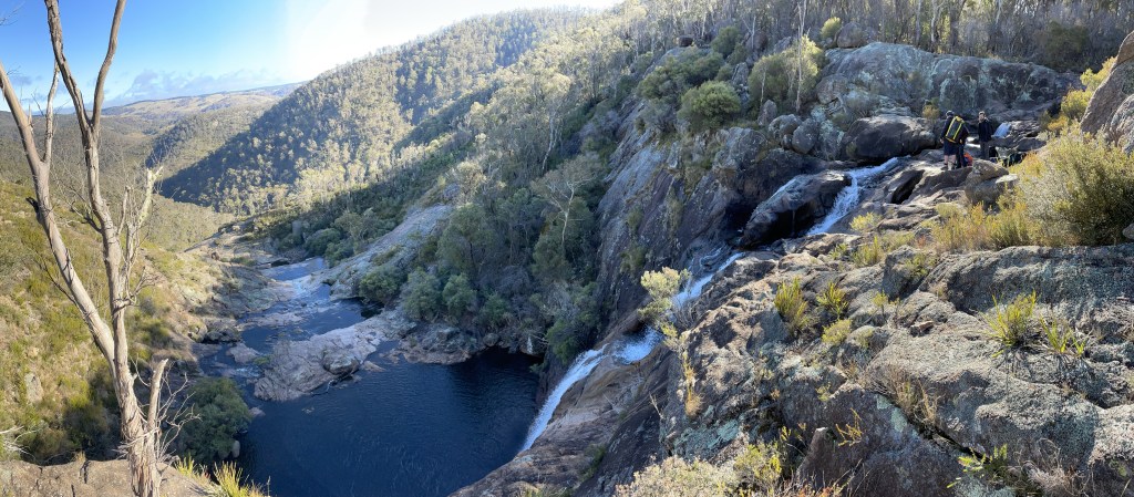
And the views from the top?
Worth every grunt and groan
Gadget looking back over the lower end of Carnarvon gorge. The mouth of which is 10km away and 700 or 800m below.
Now back down for lunch in the cool of Boowinda gorge.
Running on a high we start making our way up the gorge.
It’s a bloody soul destroying slog
Think of walking up the Wollemgambe. Only it’s dry as a nuns nasty and instead of sand it’s littered with baby head sized river stones. And the river stones haven’t been tumbled enough to make them smooth so they are jaggered. And they move beneath your feet. And the bigger ones give false hope with 3 or 4 holding firm then the next rolls just to mock your ankles.
Still so many Carnarvon glamour shot are from Boowinda gorge.
We press on.
Several times we consider just turning around but we’re a stubborn couple.
I guess the PC term would be “determined” but it was pure stubbornness (and a view of our white slot at the start we glimpsed from the Spur track) that kept us going.
Finally we get to the junction towards the top of the bloody Boowinda gorge and by some miracle there’s clear running water. Not much but more than we’ve seen in the side creeks since Wards Canyon.
We take the right branch. It’s a low quality slot but it has clear flowing water. So there’s that.
The water is far clearer than this shot implies but I was well and truely over this bloody Boowinda gorge to bother trying to photograph it well.
We get to a point we could have scrambled in from the top (It would have been much easier) but it got far too steep for us the reach the mysterious white walls a few hundred metres up the escarpment.
We retreat back and try the right branch. It was shit
We trudge back down and check out all the side creeks along the way. Some had canyons like sections but after the quality slot canyons of yesterday they were a major disappointment.
Back down past the Spur exit and I don’t know if it was the different light or just we were paying more attention but we had to admit the bottom was nicer than we originally gave it credit for.
Like, if you had never been in a proper slot canyon before you’d be impressed
If you are going to do Carnarvon gorge try a cooler month and hope for a good bit of rain in the days before you get here.
Finally out of what my mind I will always call Bloody Boowinda Gorge we paused for a bite to eat. All the trudging over loose river stones had zapped our energy.
It would have been easy just to return to camp but it was barely 4:30pm and there was another long gully about a kilometre down stream that had a name (At least on one map we had stumbled across) so we couldn’t help ourselves and went for a look.
The gully was scrubby and hard going but it keep promising to canyon up just up ahead. So we pressed on.
At least it was wet
We trudged on until we started to loose light and so left this intriguing chasm to its secrets and made our way back to camp.
It’s June. We are sleeping in and heading to Kanangra for a lazy half day of canyoning.
If that sounds odd we aren’t really “canyoning.”
The plan is to do the abseil trip down Box Creek falls. Ropes aren’t really necessary as you can scramble down right beside all the drops (as Dave and Phill did) or take an even easier walk down a little bit further right.
But anyhoo we had ropes so we were going to abseil.
Friday had been misty and miserable Saturday dawned bright and cold!
Like really cold.
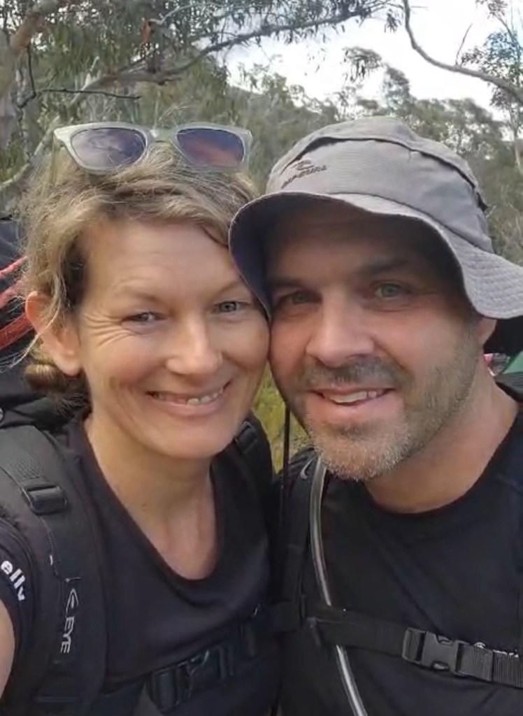
It’s been ages since I’ve seen Jen so it was cool to catch up with her. And it was the first time meeting Phil and Dave.
It’s a pretty creek. But for an abseil trip… as Jason said you could ride a mountain bike down it.
Kylie psyching up for a cold swim at the bottom of abseil 1
Apparently I missed the bolts on this one as I walked down the slab beside it …
Jen wondering if it’s worth another cold dip
In the end she decided just to walk down and have a snooze in the sun while we continued to play with ropes
Aimee was keen to keep braving the water
Jason handled rope duties for most of it.
Phil and Dave walking down beside the “falls” to take photos of the idiots in the water.
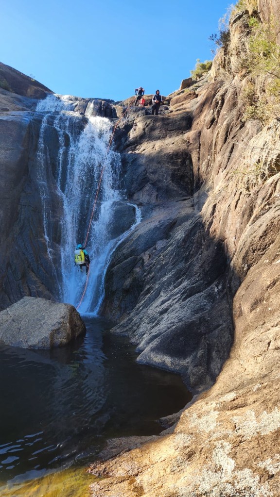
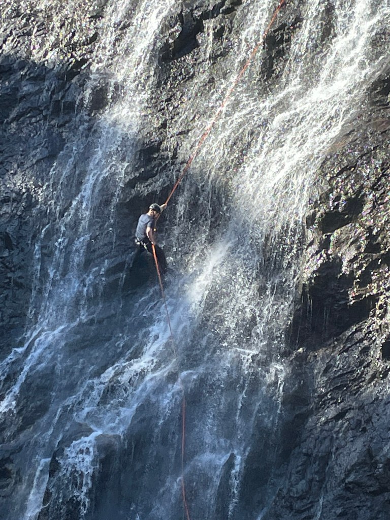
And then we get to the top of the big drop.
Normally if I was at the top of a 65m abseil at Kanangra I’d be a little nervous. They are intimidating.
This one wasn’t.
It didn’t look to be that big or committing.
We set up.
There’s a series of ledges. Says Jason as he leads the way.
Going over the edge I see it doesn’t really get vertical at all. But it’s a bit of fun.
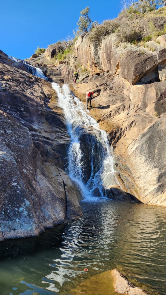
Dave decides to give the last one a crack
It would be cool to see with more water, thou I doubt it would hold water for long. Aimee says she walked up to the base in 2018 and it was bone dry.
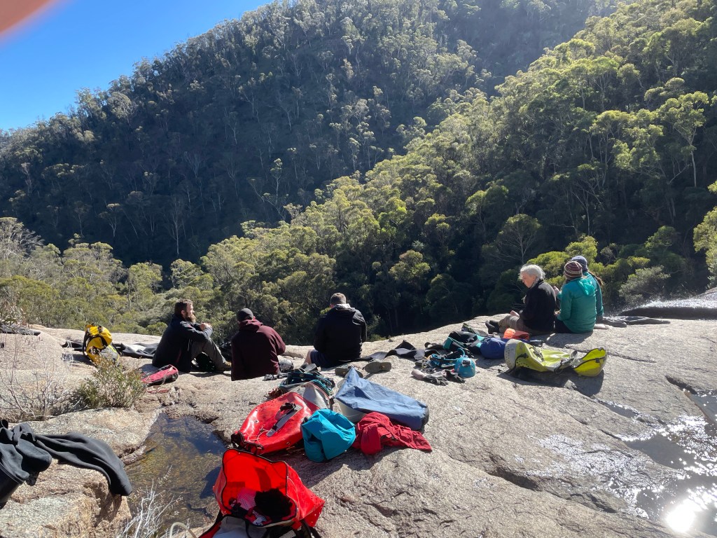
Lunch in the glorious sun back at the top of the last absiel
So what did I think of it?
It’s kinda like an even less technical Dione Dell without the crappy walks between abseils. It’s not canyoning but a nice creek scramble between 2 optional abseils. It would be a nice spot for a swim early autumn.
Surround yourself with awesome people. Experience awesome things
It’s been a while since I’ve organised an obscure trip.
Others take the piss out of my scrub bashes to shit canyons but I get a kick out of checking out places the majority wouldn’t bother with.
So when we were thinking about what to do and South Bowen formed up as the front runner I suggest how about we go in fro the top.
Not that’s it’s overly obscure, for as long as I can remember David Noble has been commenting that people miss 3 or 4 canyon sections by going in the “standard” entry.
Still upper sections tend to be hit and miss so I wasn’t expecting high quality but they are all worth doing once.
The only hitch was the car shuffle. We didn’t have a second car.
Let’s just do the top and scramble out the Cork Screw entrance. Says I. That way it’s only a 2km walk back up the highway and we can do that first.
Deal.
We pick one of the branches below Mt Wilson turn off and make our way in. It was scrubby on the spur and muddy in the creek line.
Like scrubby scrub and muddy mud
But it’s only a short bash to the first canyon section. And it’s surprisingly high quality.
And once we got to the junction with the “standard” entry we reversed back up the Cork Screw section and found a break in the cliffs to scramble up.
Access: Easy access to the start of the trail then steep and vague in spots
Navigation: Navigation is fairly straight forward .
Map: Lithgow
Time: It takes about 1.5hrs
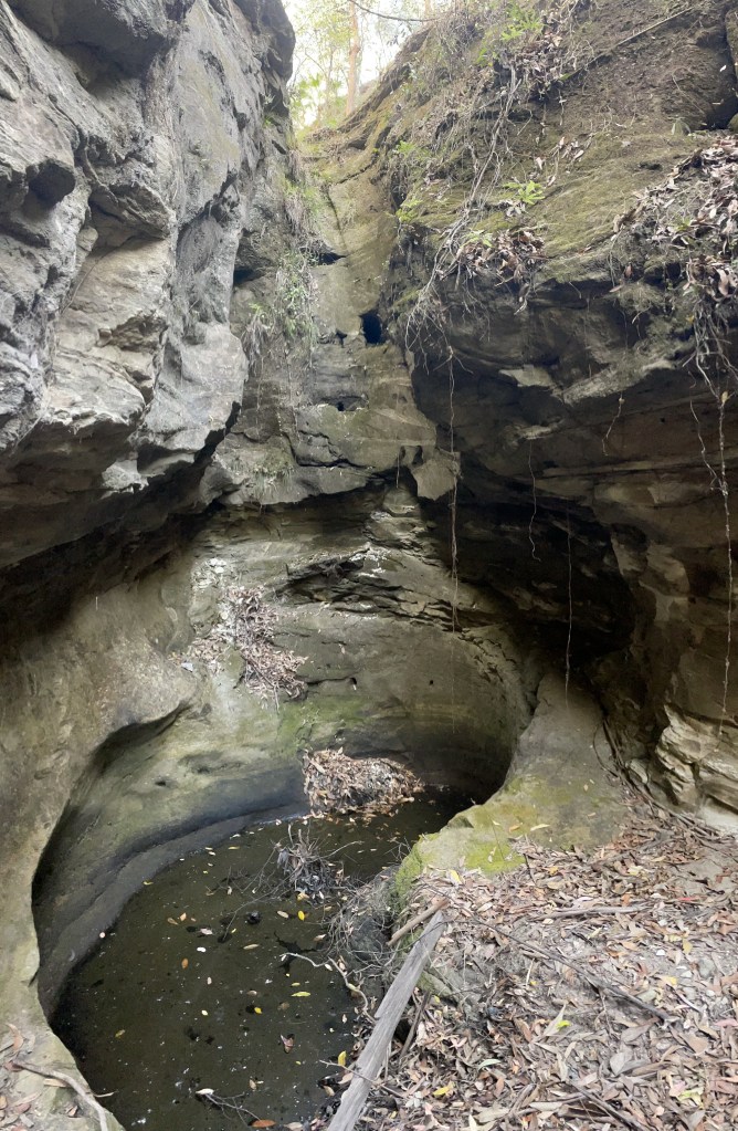
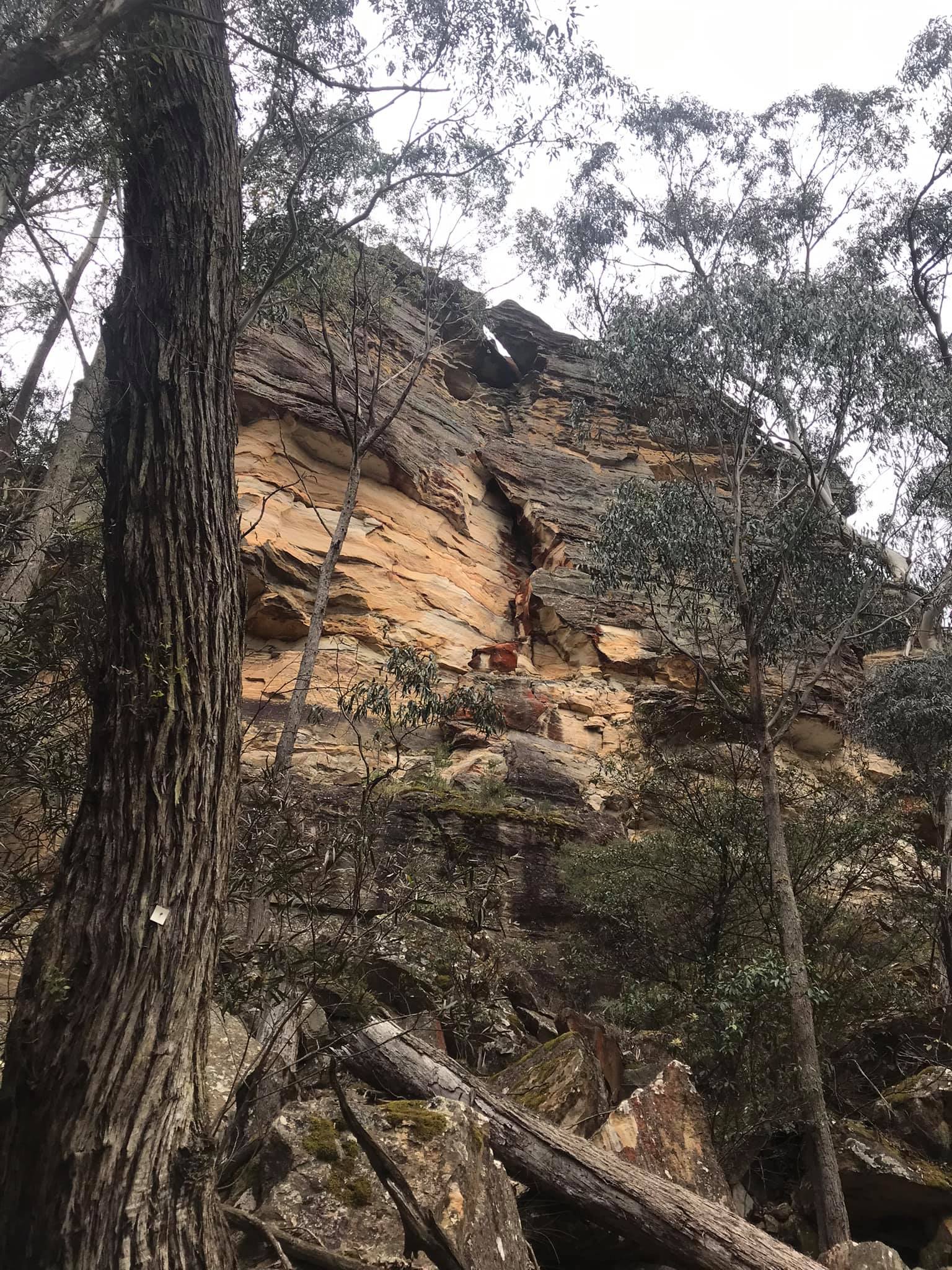
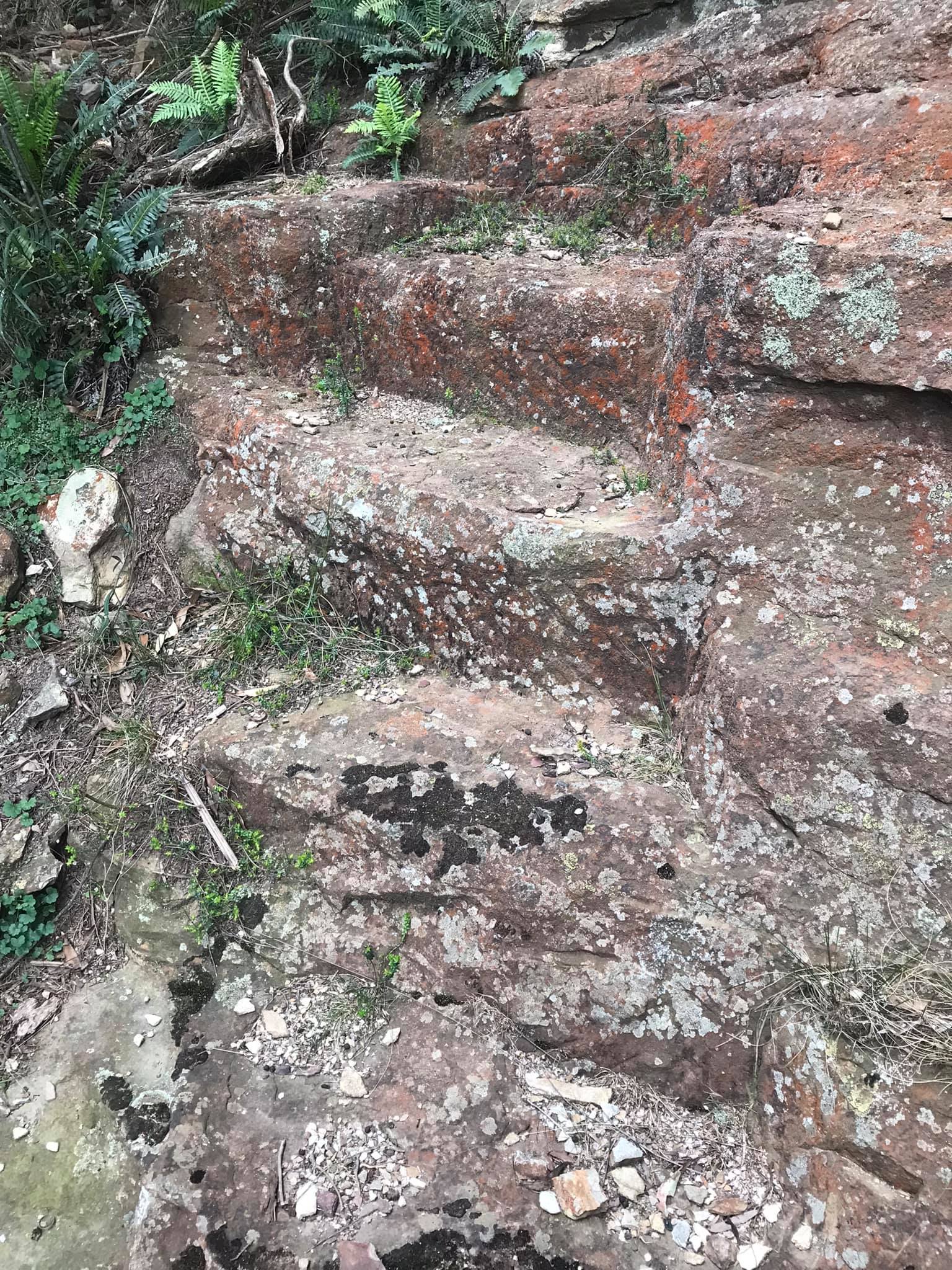
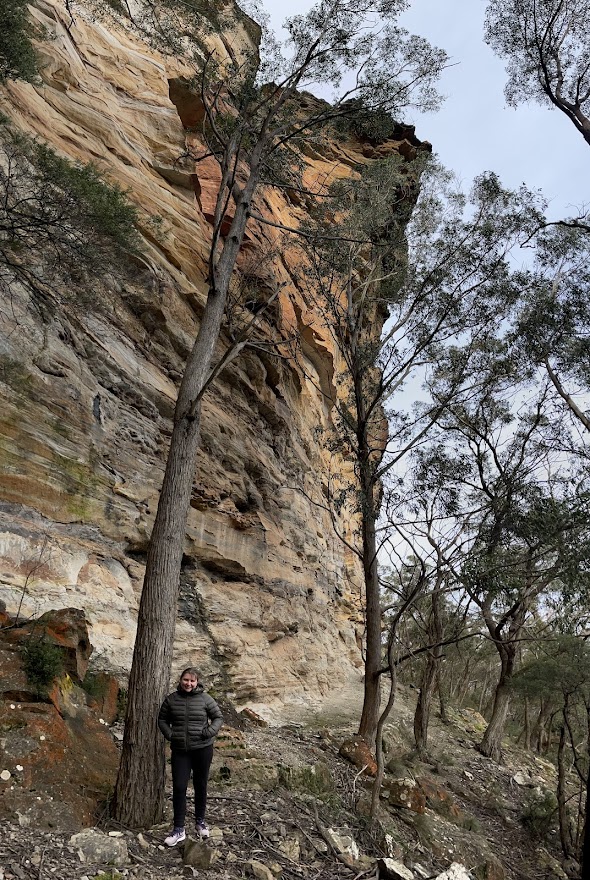
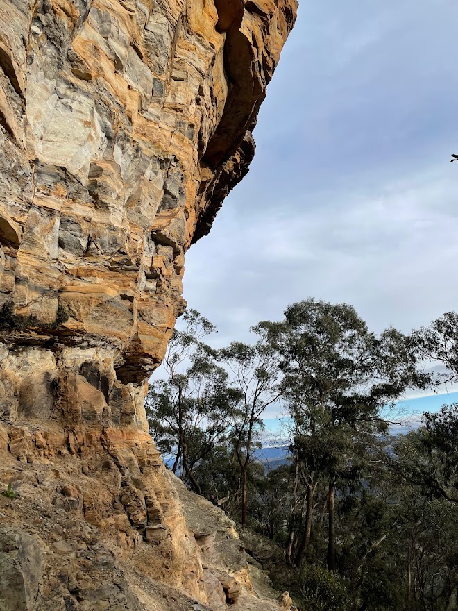
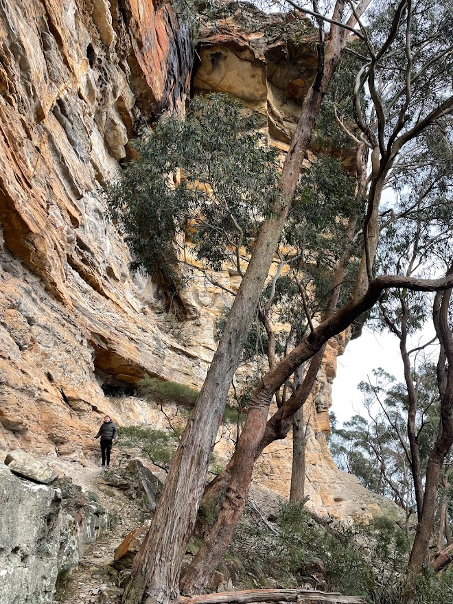
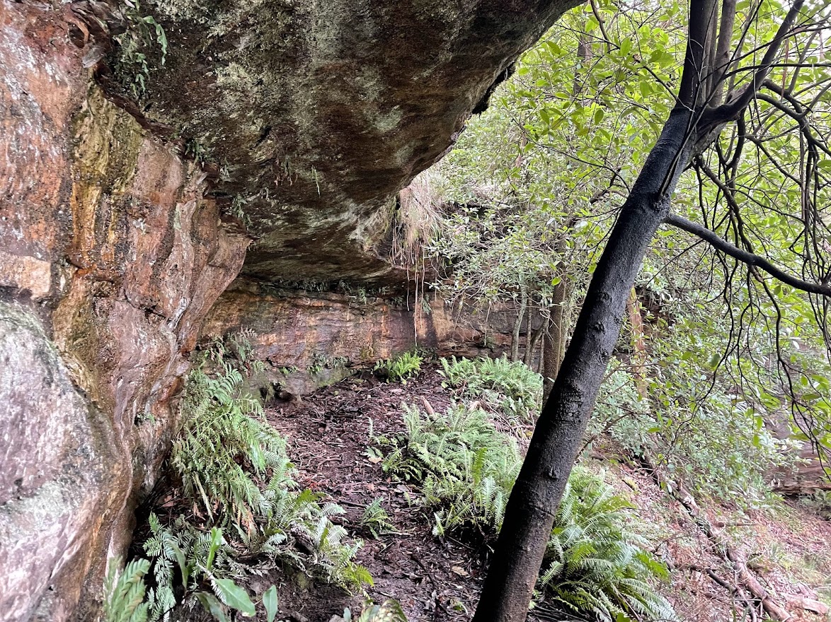
Traditionally known as Gnallwarra, Hassans Walls was named by Governor Macquarie who thought the stunning pagoda topped cliff line reminded him of the hill forts and Hasanamba temples of the Hassan district of India.
The Under Cliff track began construction in 1916, Largely the work of Richard Merrick and the Lithgow Progress Society, and stages were added over the years.
It largely fell into disuse but was reopened for a short time in the late 90s or early 2000s before being closed by council due to concerns over the stability of the cliffs above (I think a cliff collapse may have taken out part of the trail so be warned or whatever)
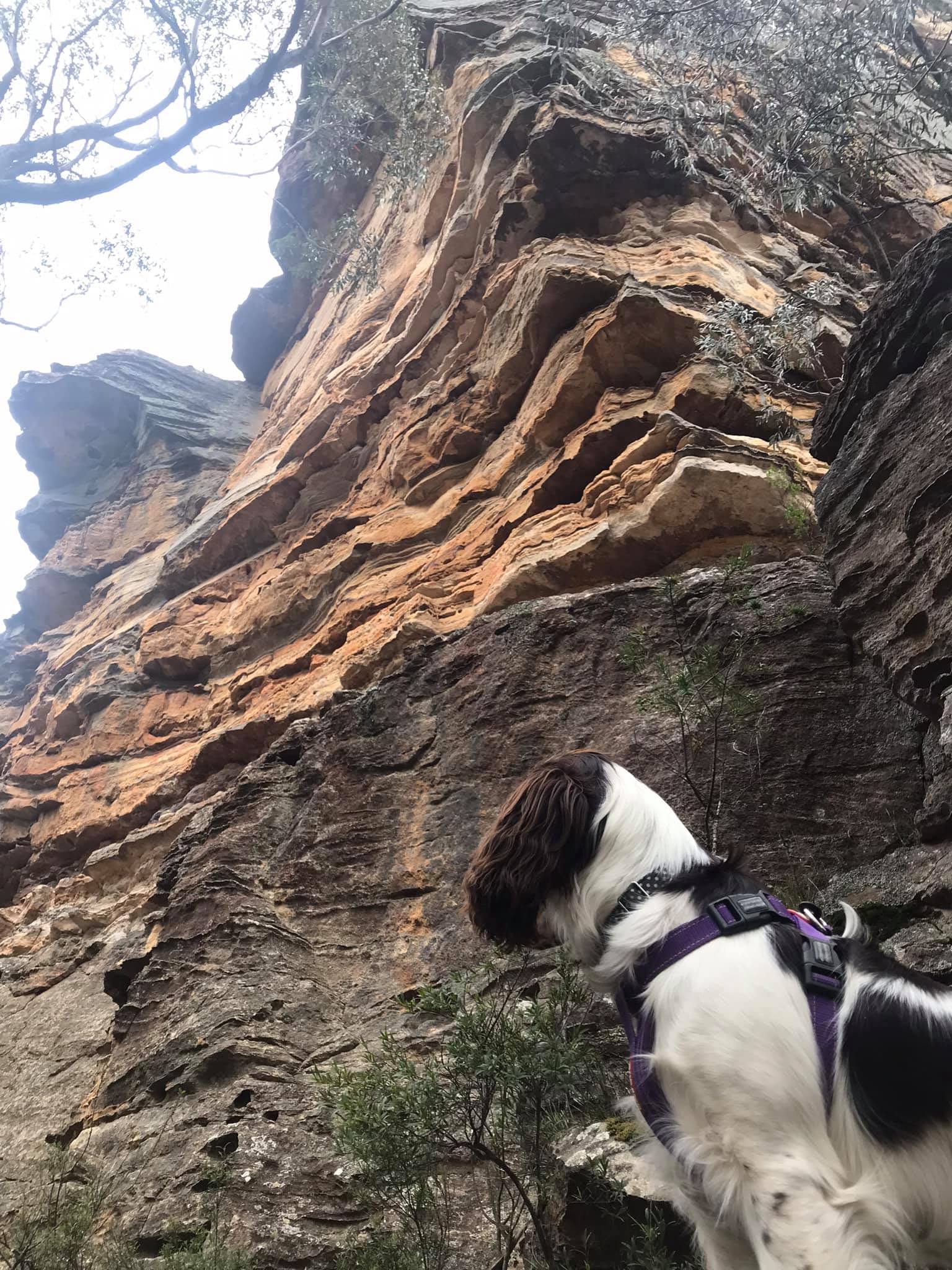
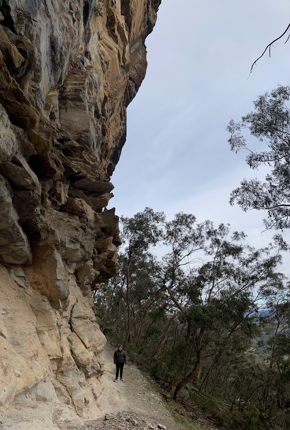
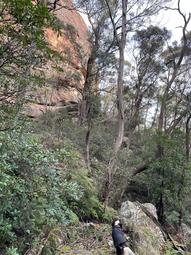
Its a shame because its a great walk under some spectacular coloured cliffs with little alcoves of rain forest hidden in the nooks. Just beware of falling rocks, small and large.
Getting there: Head up Hassans Walls Road. Before you get to the top there is a spot people park on the right near the imaginatively named “First lookout”. Park here and look for a road angling back up to the right.
Most of the gullies between here and the lookout will give access to the track but head up to the right passed the locked gate.
But for a more adventurous start keep heading up the hill. Take the left fork at the top of the hill and the next left fork as well.
The road dips down into a saddle, just before the bottom it flattens out. Head into the bush here and find a break in the cliffs to the right of the main gully (main gully cliffs out) https://maps.app.goo.gl/NyPxTjhz5dGzcgQZ9
Alternatively go to the bottom of the saddle and just before the road climb up the other side go left into the bush and find a break to the left of a great lookout. But note the undercliff track is vague at the point.
Once through the cliff line follow the base of the cliffs around to the left. The track can be vague in spots but if you loose it follow the base of the cliff and you’ll eventually pick it back up.
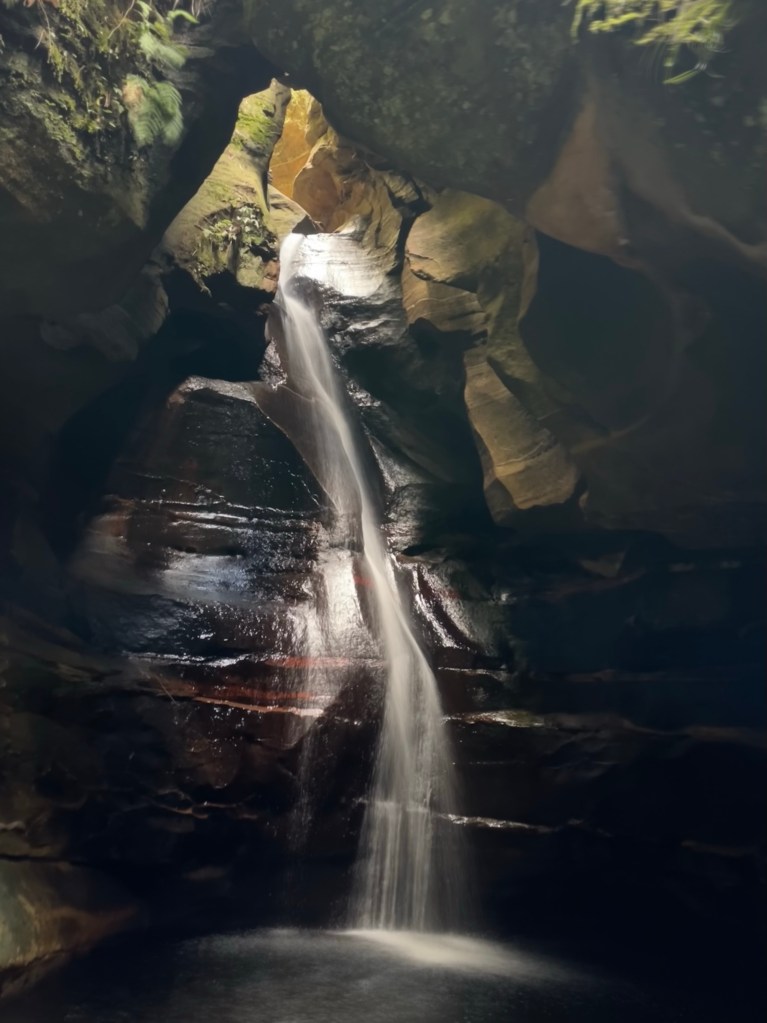
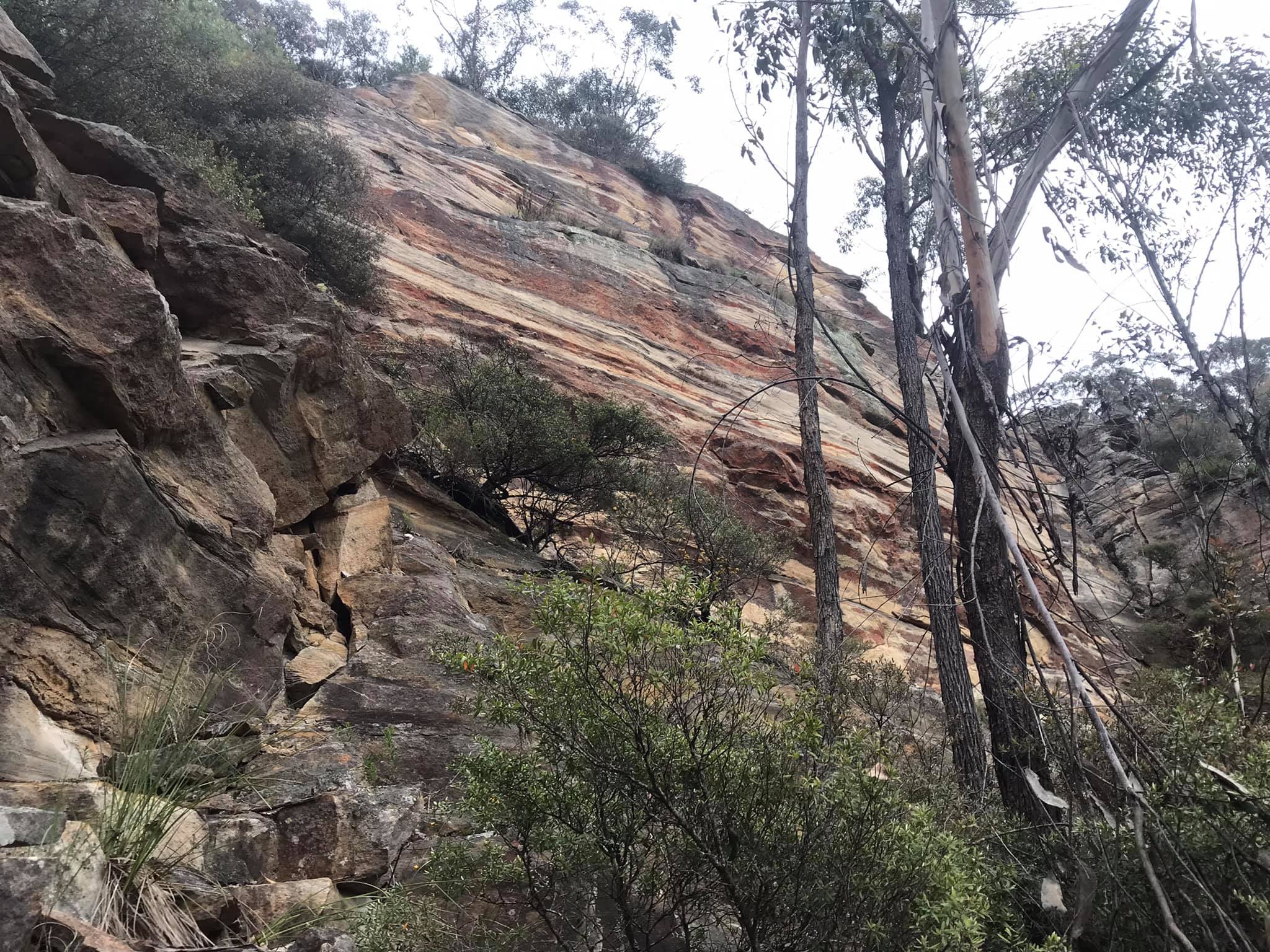
The colours of the cracked and errored cliff line is stunning in afternoon light and you will find small pockets of rain forest in their shadow, unfortunately the biggest section of rain forest is below the car park of the lookout so littered with shopping trolleys, toilet paper and other crap shit humans throw off the top.
Eventually the track will take you around King Georges head ( AKA Indian Head or Iron Dukes head) and it appears to peter out. But continue around and head up the ridge keeping near to the base of the cliff and you will pick it up again on the otherside of the lookout.
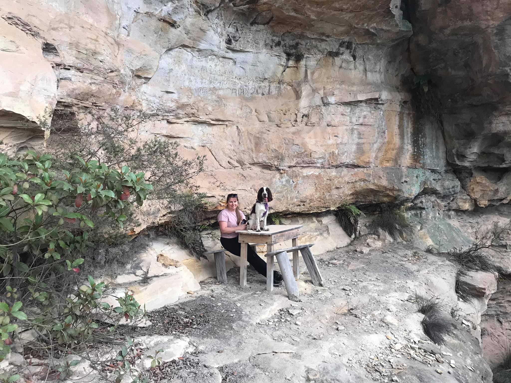
This will bring you past the table and chairs in Gannon cave before winding back up to the road near the turn off to Hassans walls Lookout. A short walk down the road will take you back to the car
Note 1: Taking care While reasonably well known these spots are still wild places and care needs to be taken around cliff edges and on the steep trails. Carrying the right gear as well as having adequate food, water and clothing is important. Always tell someone where you are going and when you expect to get back.
Emergency beckons (PLBs) can be hired from Katoomba Police for very little.
Note 2:First aid A basic first aid kit is essential bit of kit whenever heading into the Aussie bush. A basic first aid is highly recommended
Note 3: Maps and Navigation Having the right map, a compass and knowing how to read them is very important when heading into the bush. If you are new to bush walking joining a club or accompanying more experienced walker for you first few outing is a very good idea. I found practicing map reading on well defined trails was helpful when I started out.
The Maps mentioned are the 1:25000 series. They can be purchase at Lithgow tourism information center, from outdoors shops or online for around $10 each.
Note 4: These are wild and beautiful places, respect them. If you are able to carry something in you can carry it out. Don’ be a tosser. Leaving your rubbish behind is a sure way to ruin it for every one else.