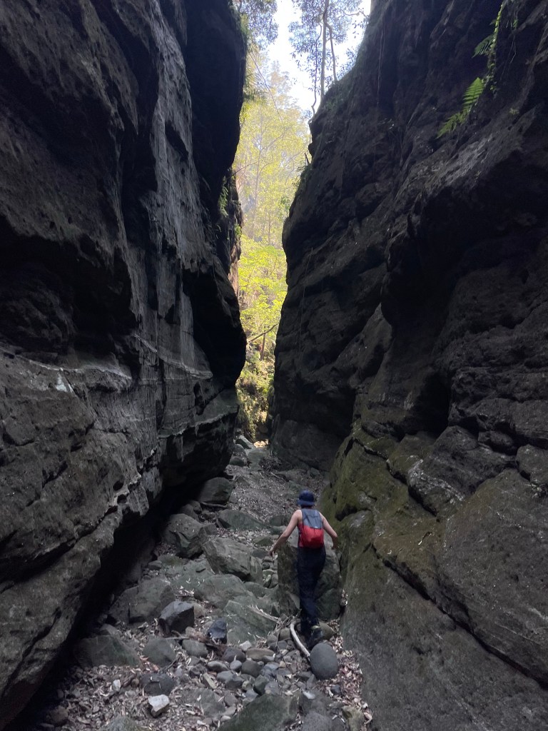
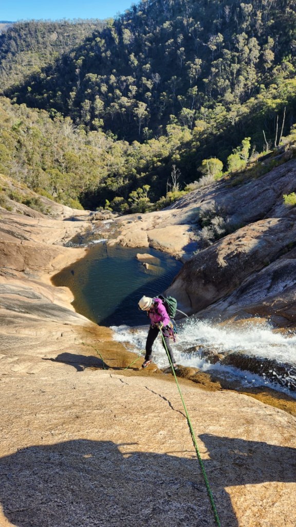
It was a slightly cooler day which worked out perfectly as it’s a bit of a walk to get to this one
Pleasant banter ate up the fire trail and it didn’t seem too long before we were following the HITW exit trail down to Dingo Creek (but really North Bungleboori)
The old dodgy ledge that you could once use to stay dry seems to have washed away and so we stripped down to essentials and waded down to our exit on the other side.
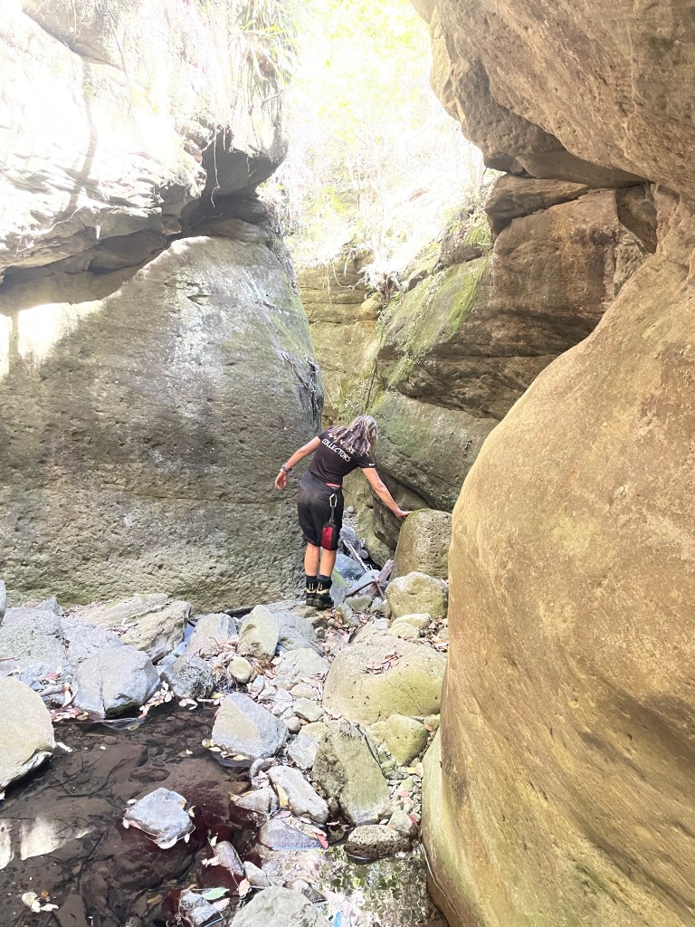
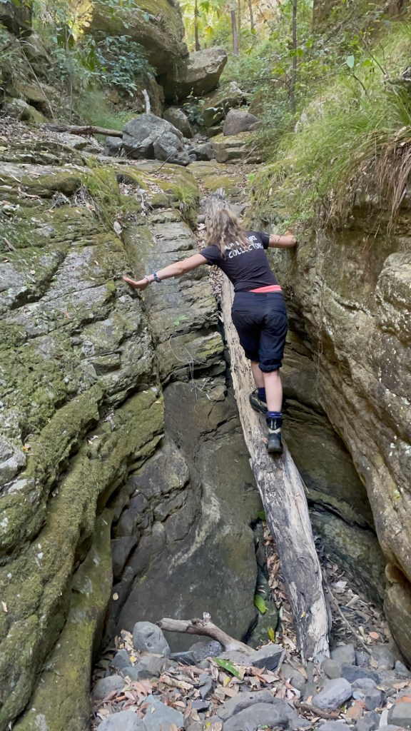
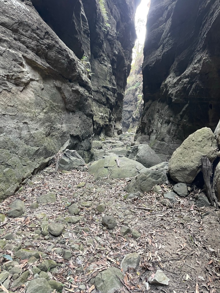
Here we encountered the first of the many large tangles of dead fall we’d encounter today. b
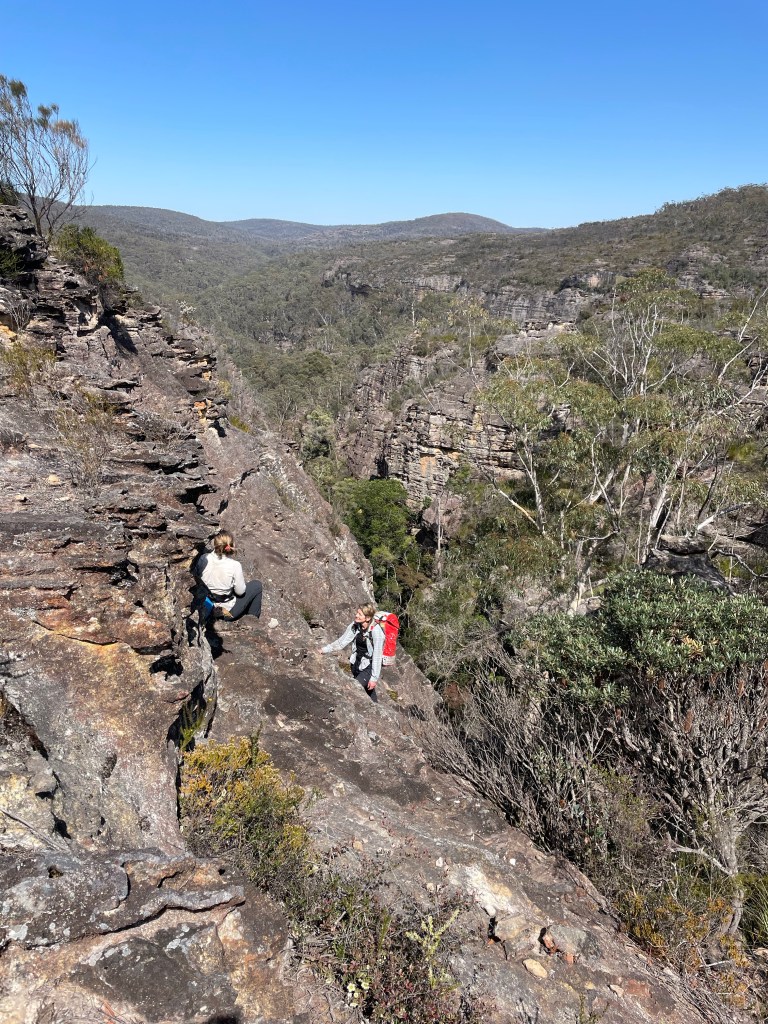
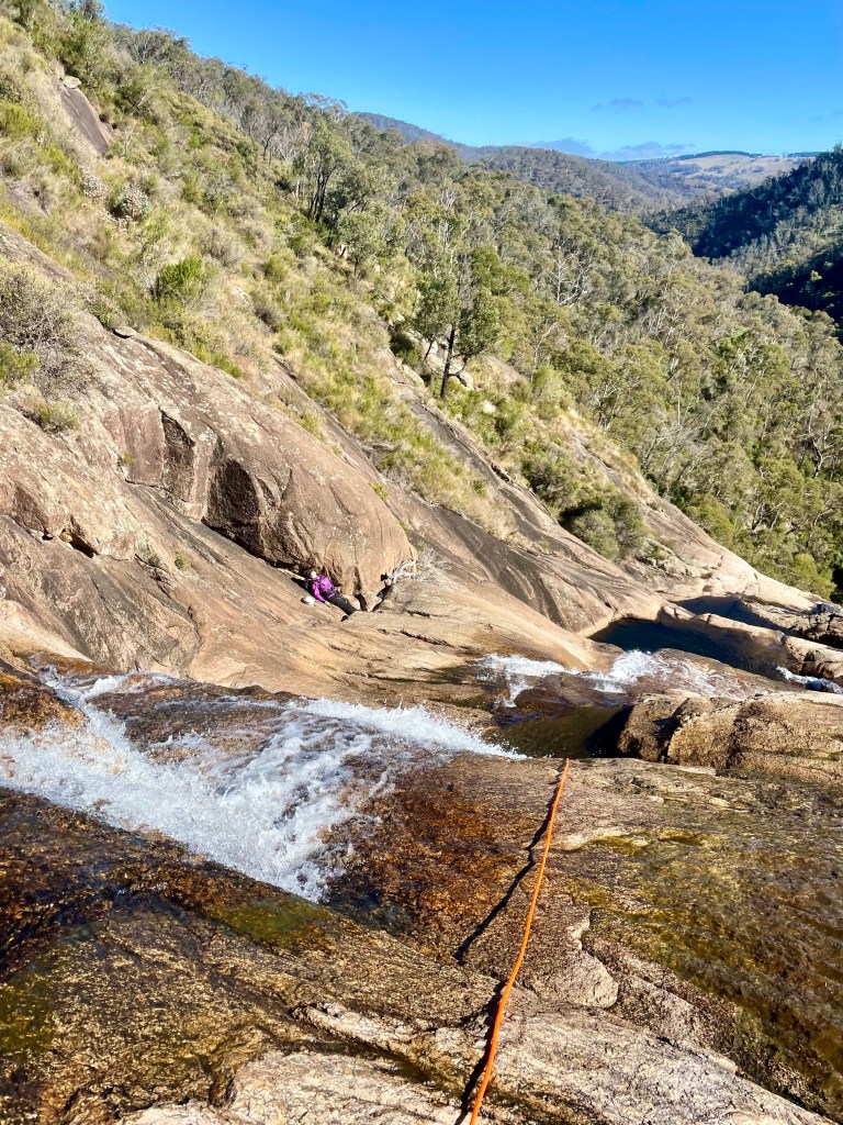
After a bit of effort we were up North East canyon and had a morning tea break looking down over Banks.
The climb out of North East canyon, which runs South West….
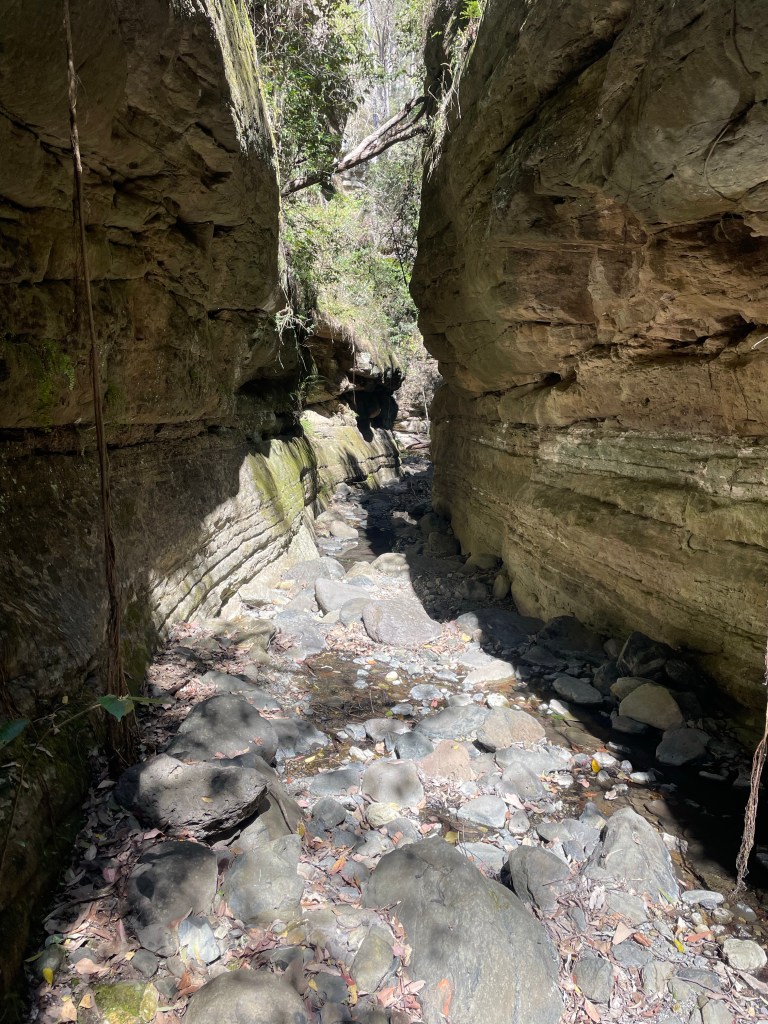
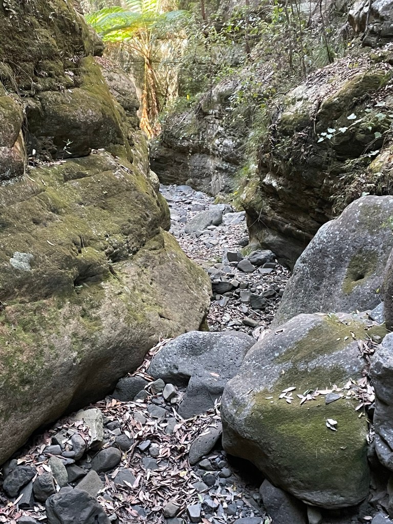
We pick an easy path down to cross the head of Banks Canyon. Then over the next ridge to scramble into Nose Dive creek.
Making our way down stream there was lots of dead fall to negotiate.
The gully seemed to be openning out and I voiced concerns that we had dropped in too far down stream (I didn’t get the grid reference or study the map. I go by feel baby)
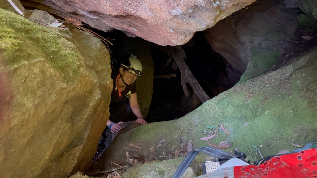
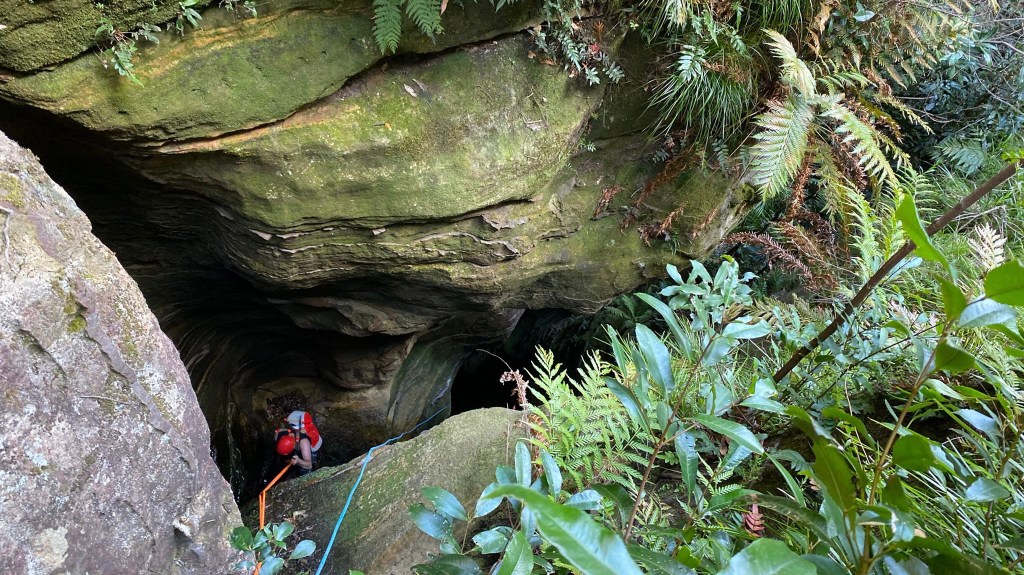
But then.
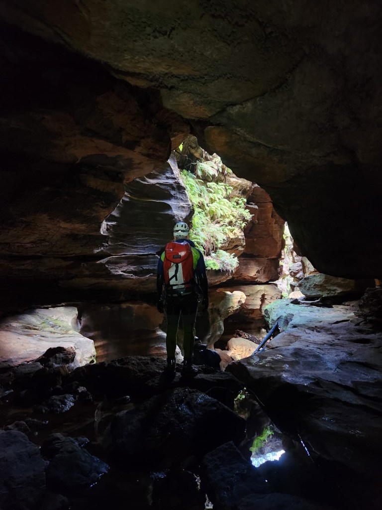
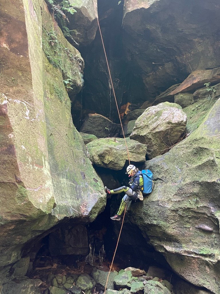
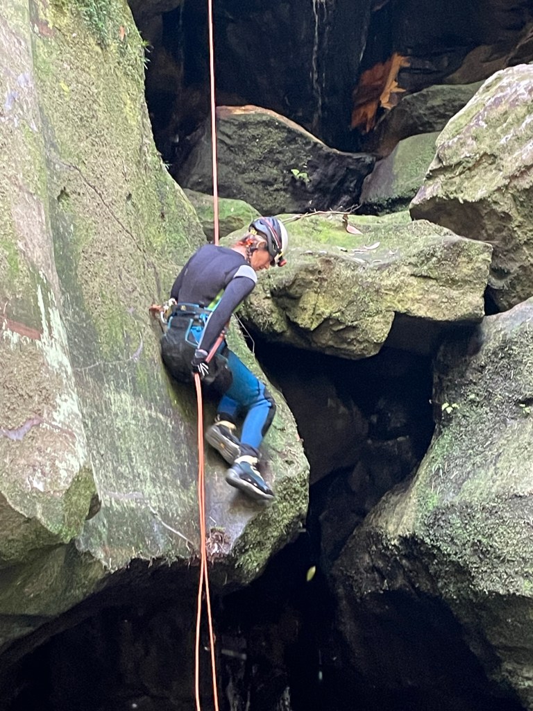
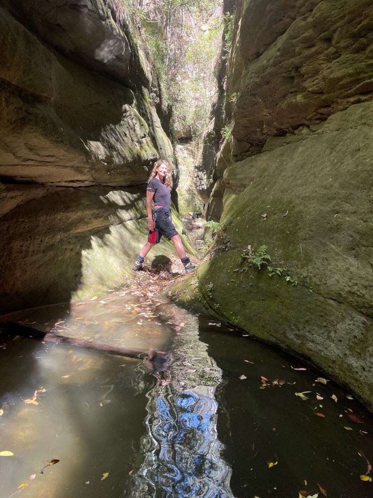
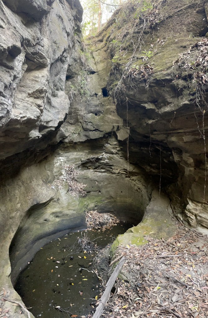
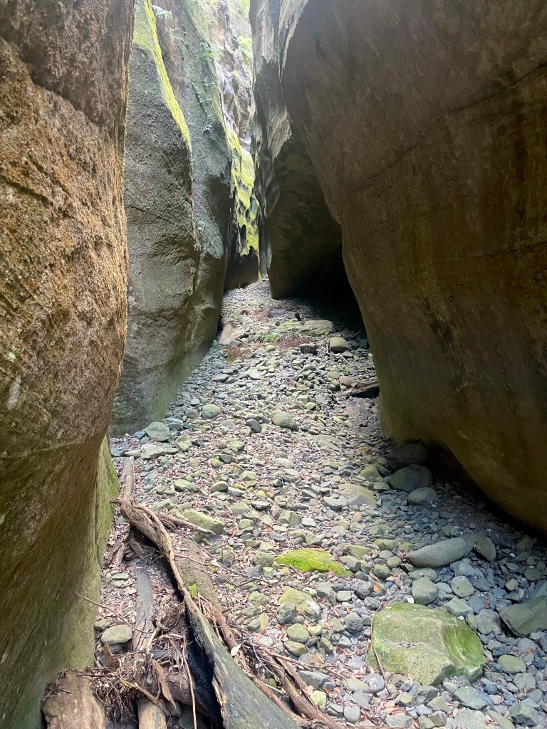
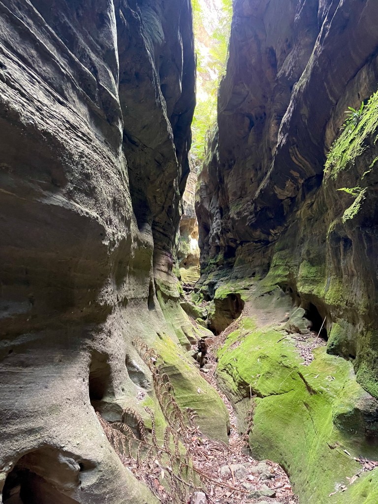
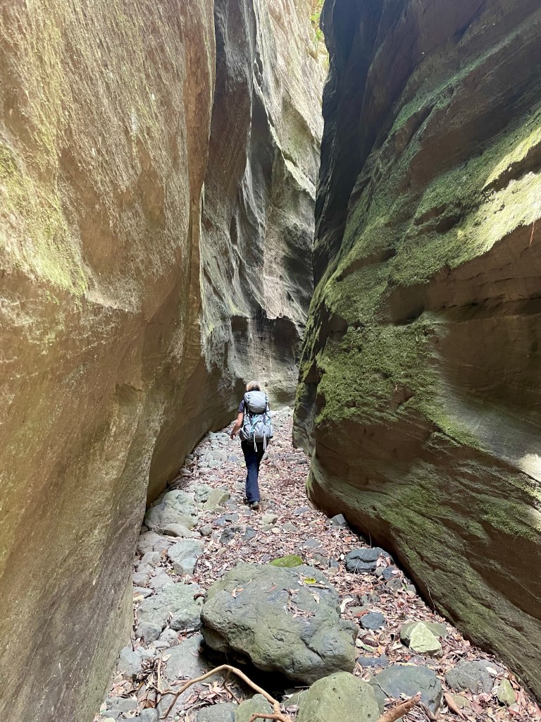
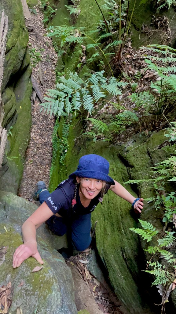
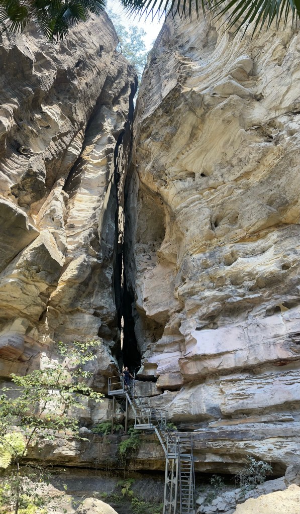
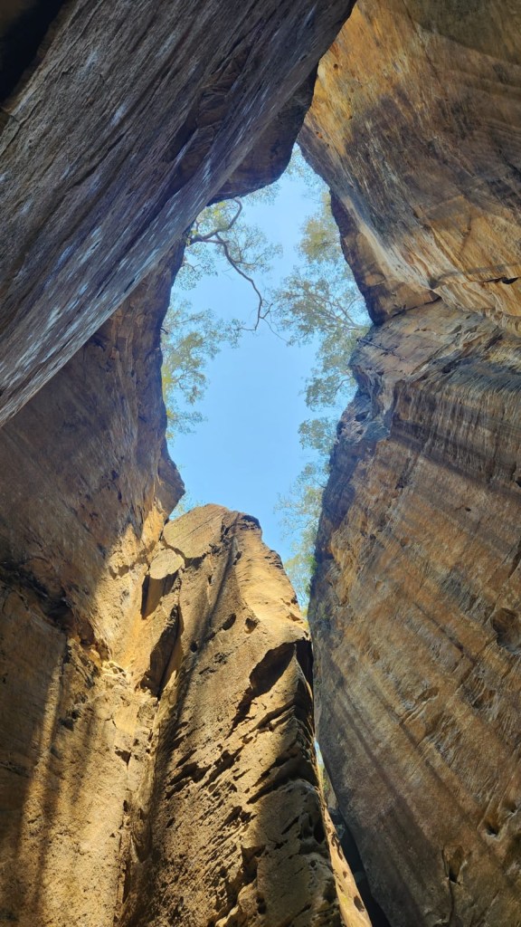
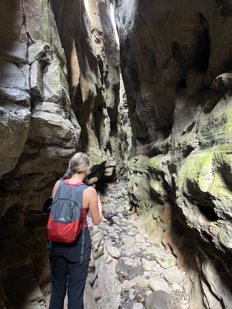
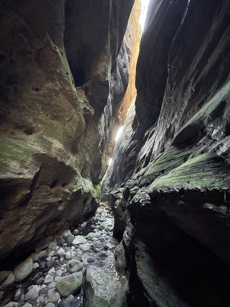
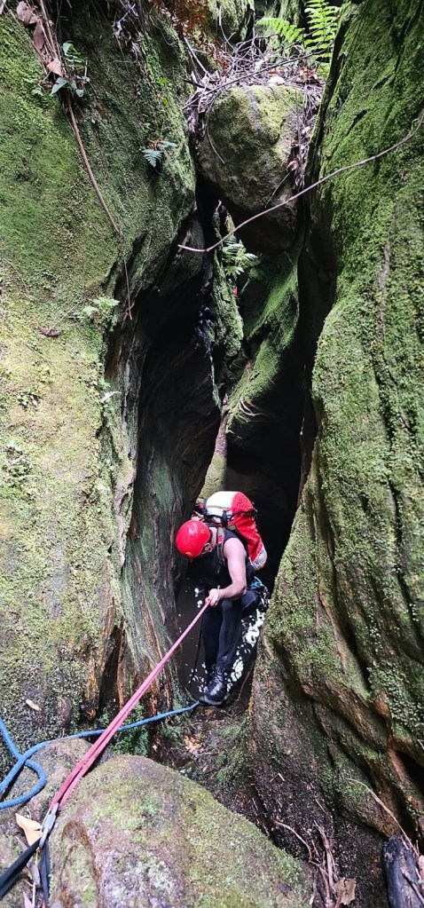
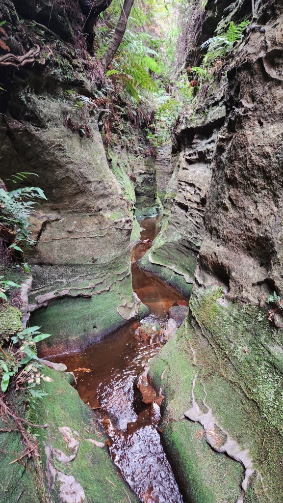
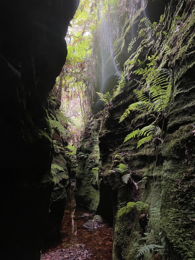
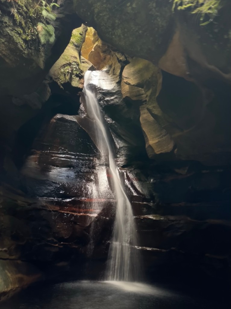
The creek drops down a hole. And so do we.
The second of the cavern like sections. It’s ok I guess.
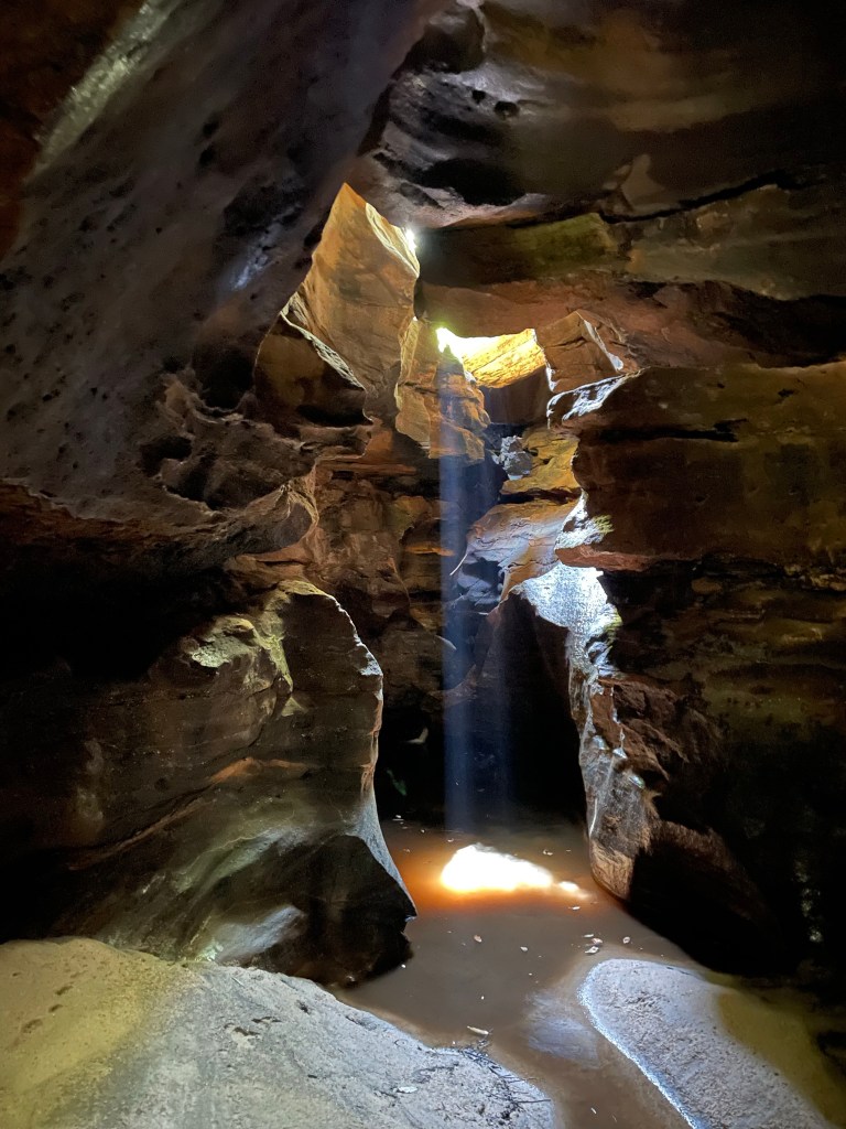
Ok it was more than ok.
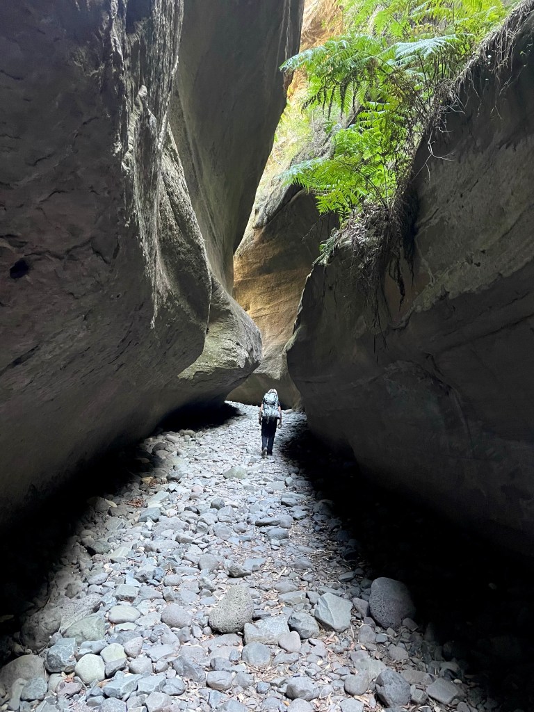
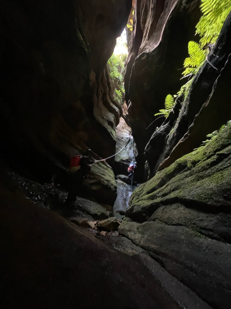
Dark yet somehow filled with beautiful light
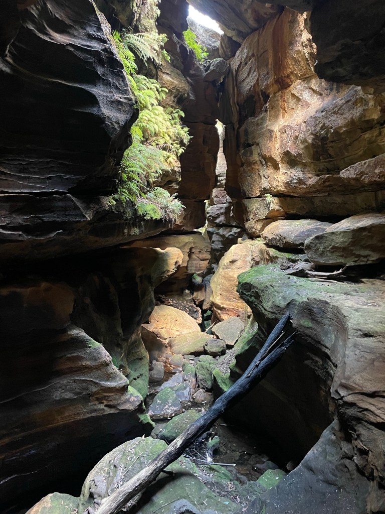
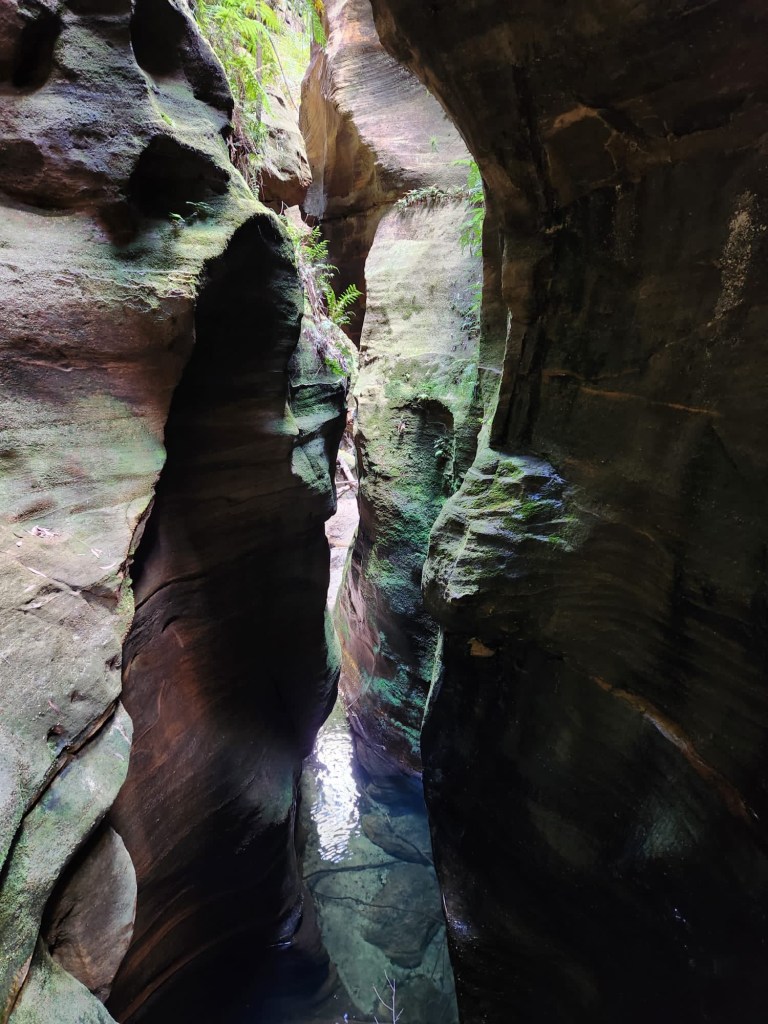
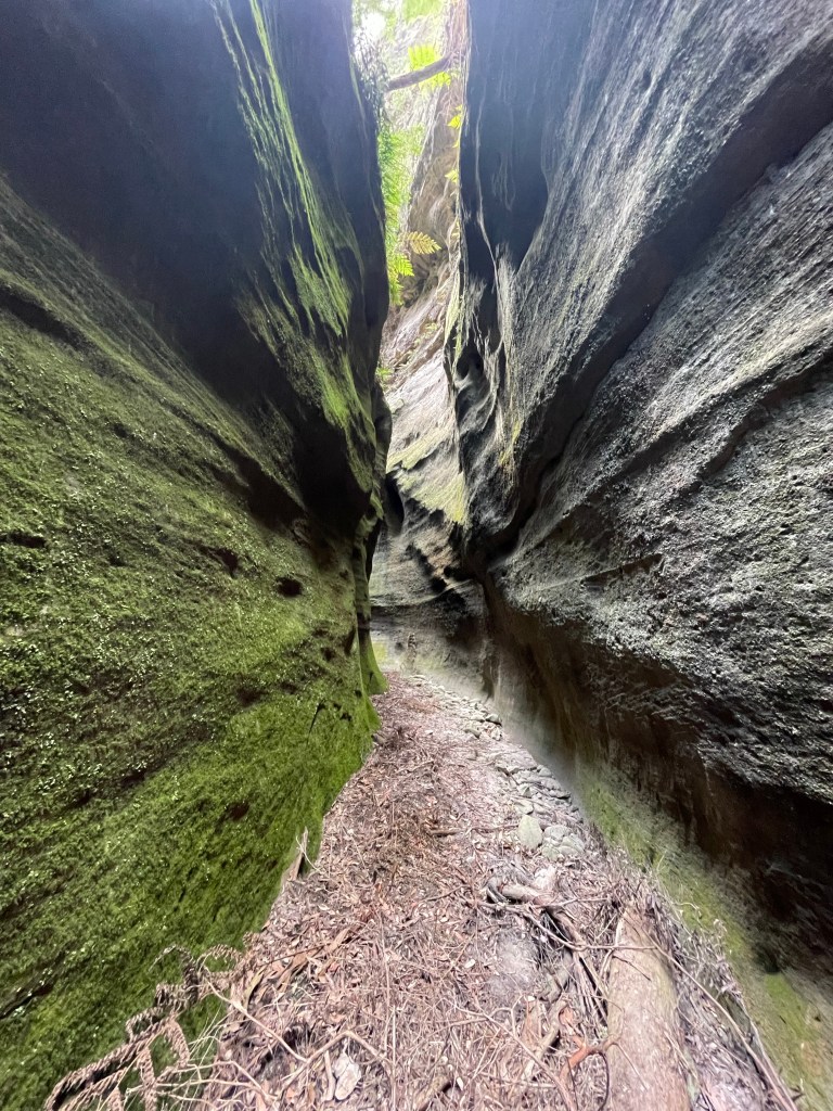
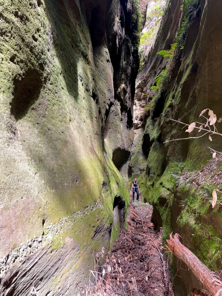
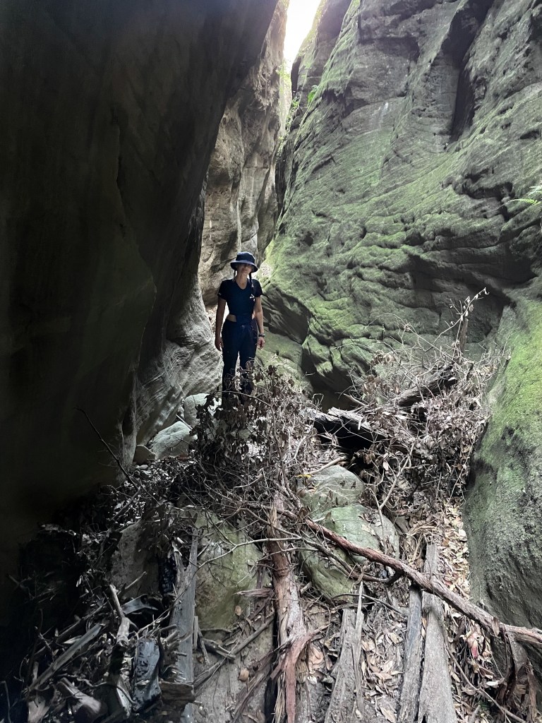
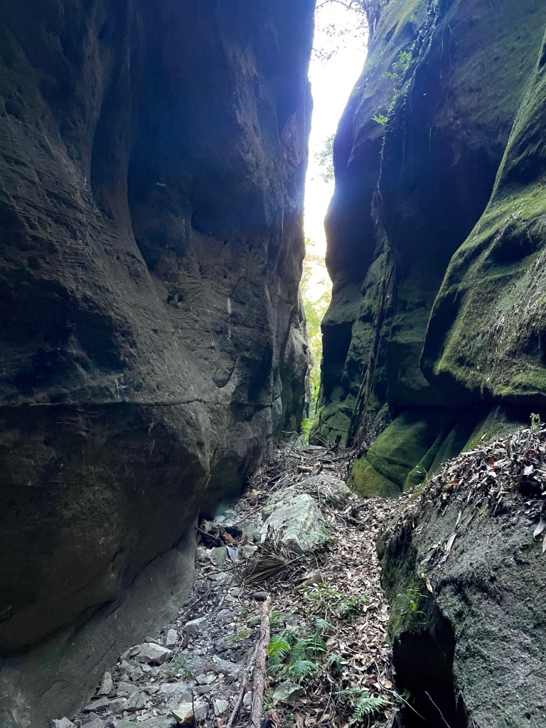
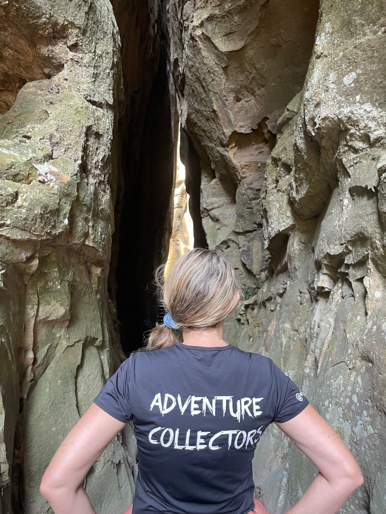
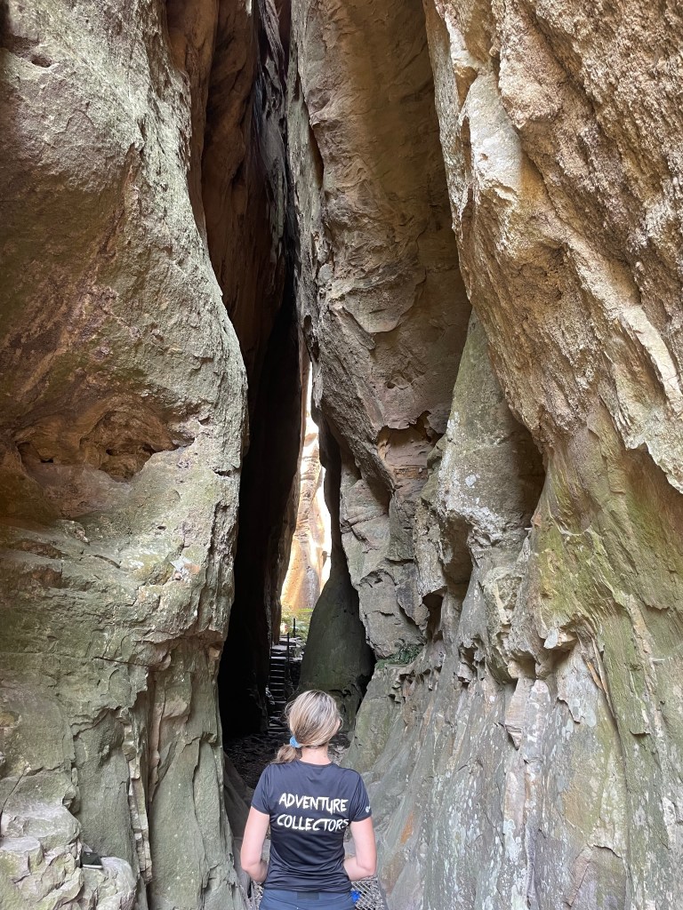
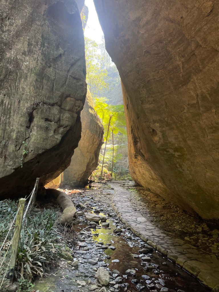
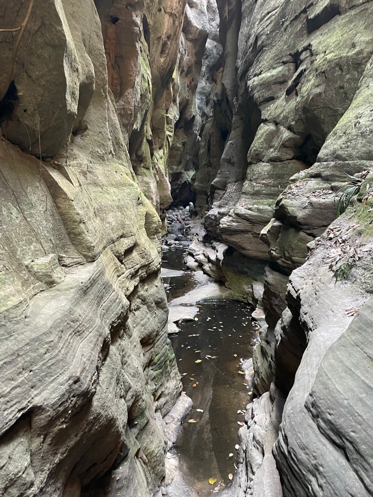
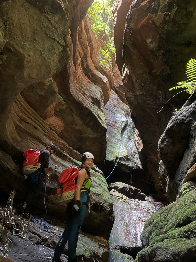
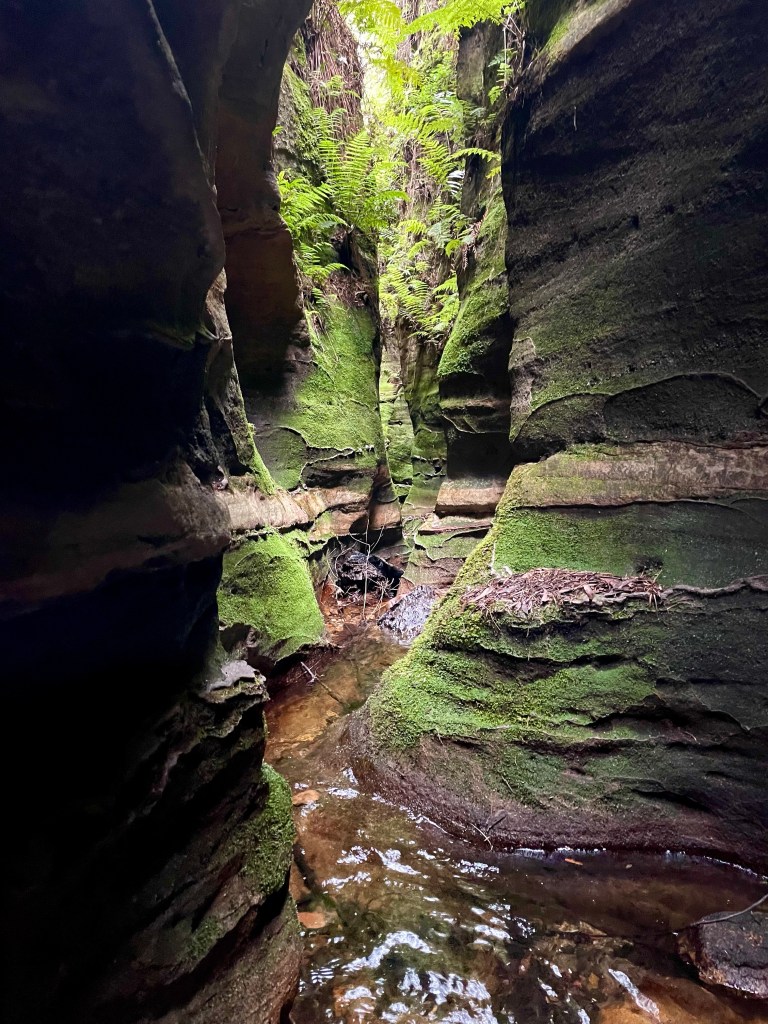
Really spectacular and somewhat unique slot canyon
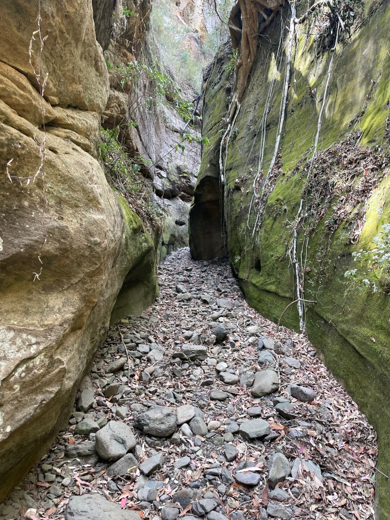
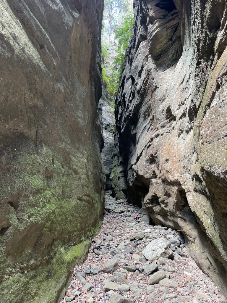
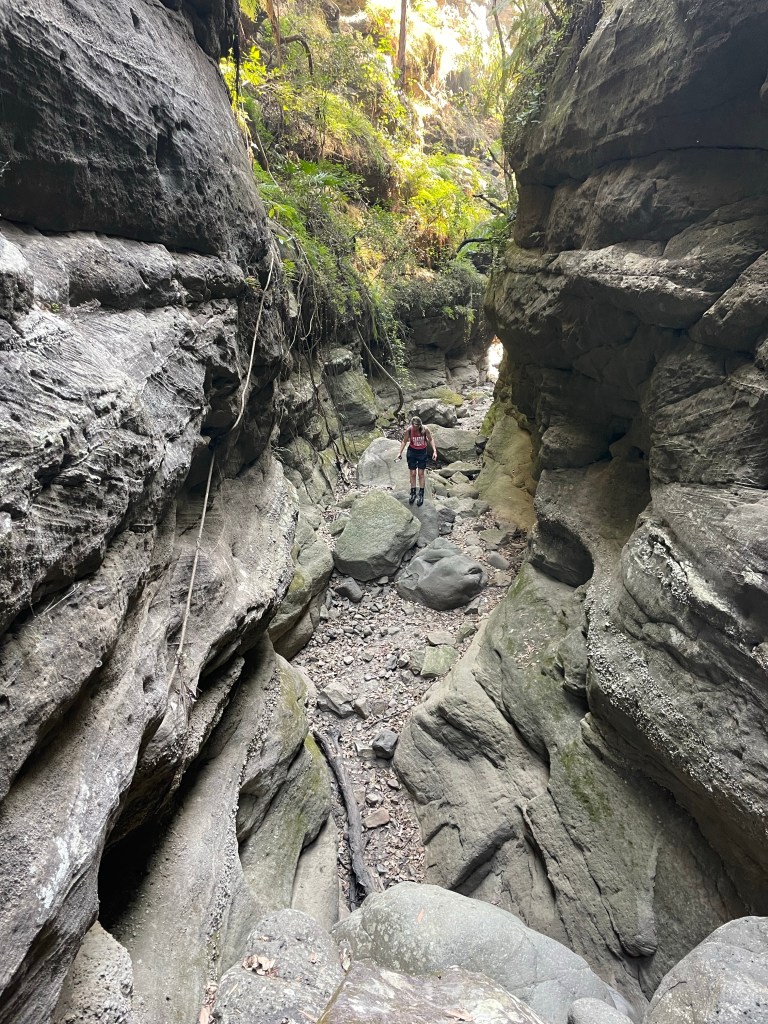
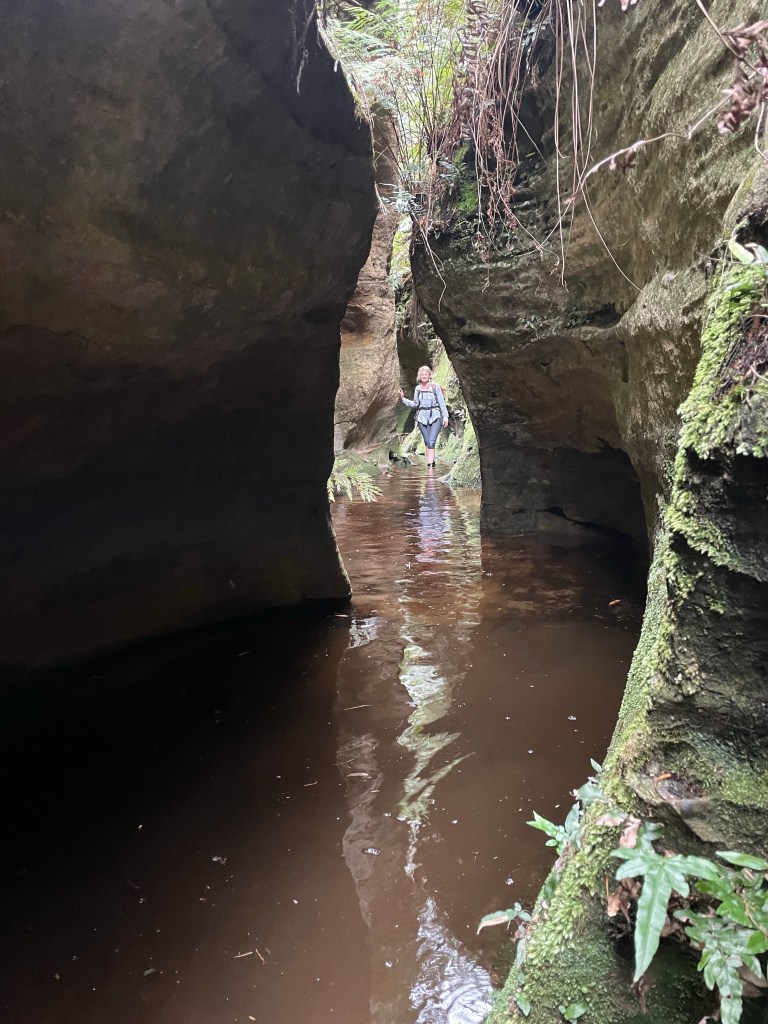
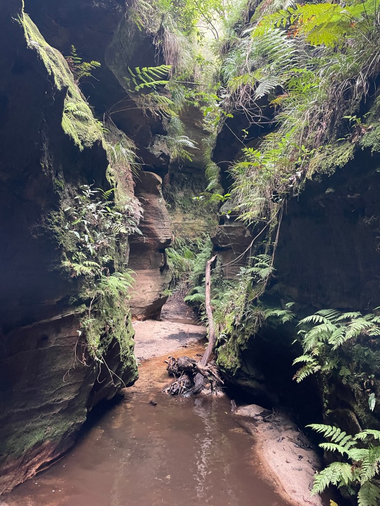
Such a cool little section
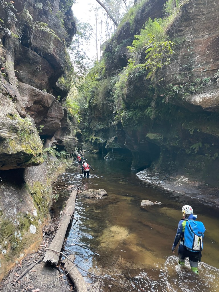
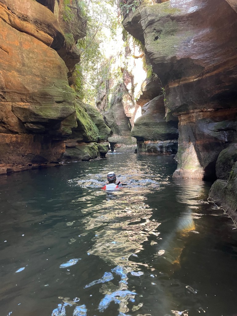
The water was like glass
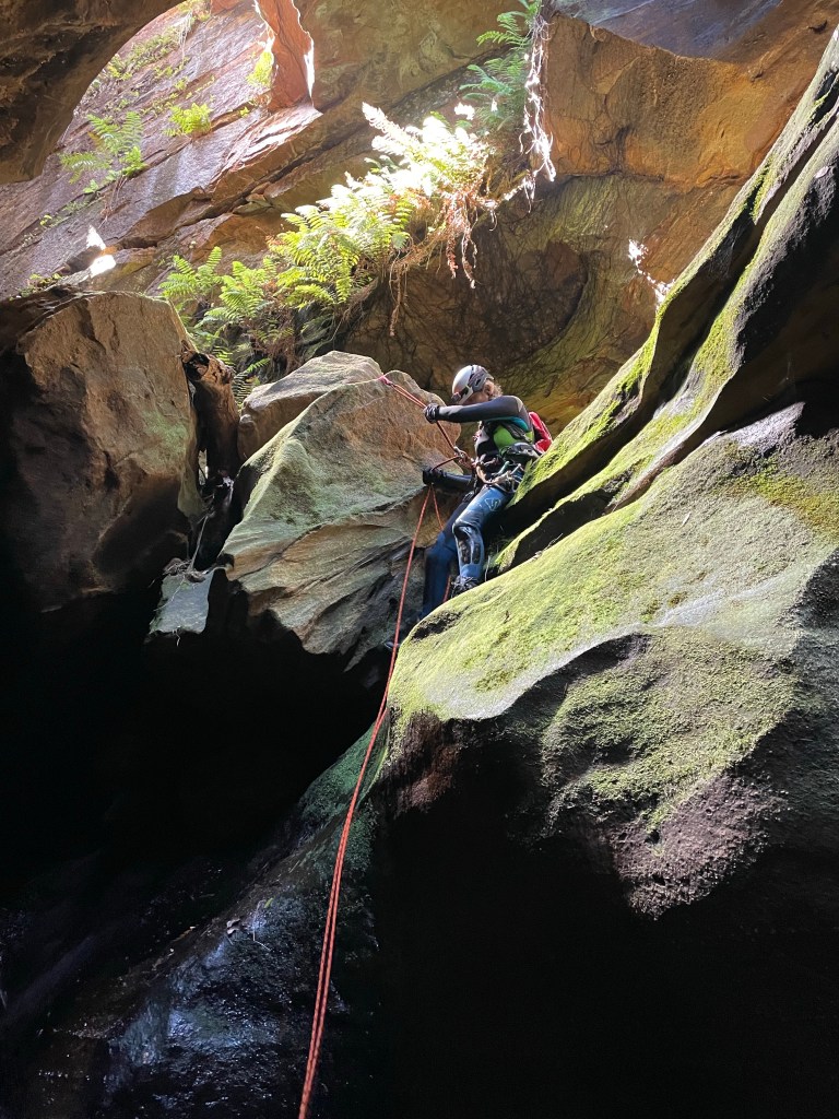
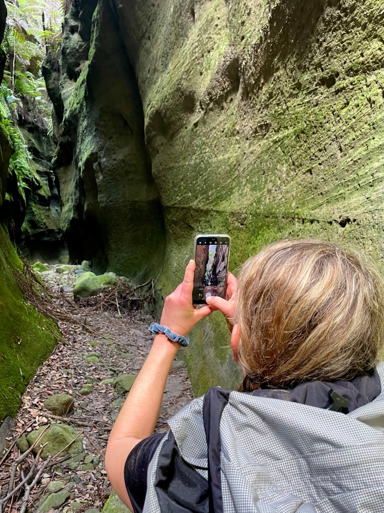
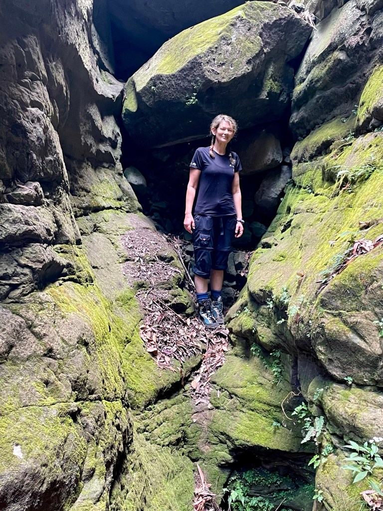
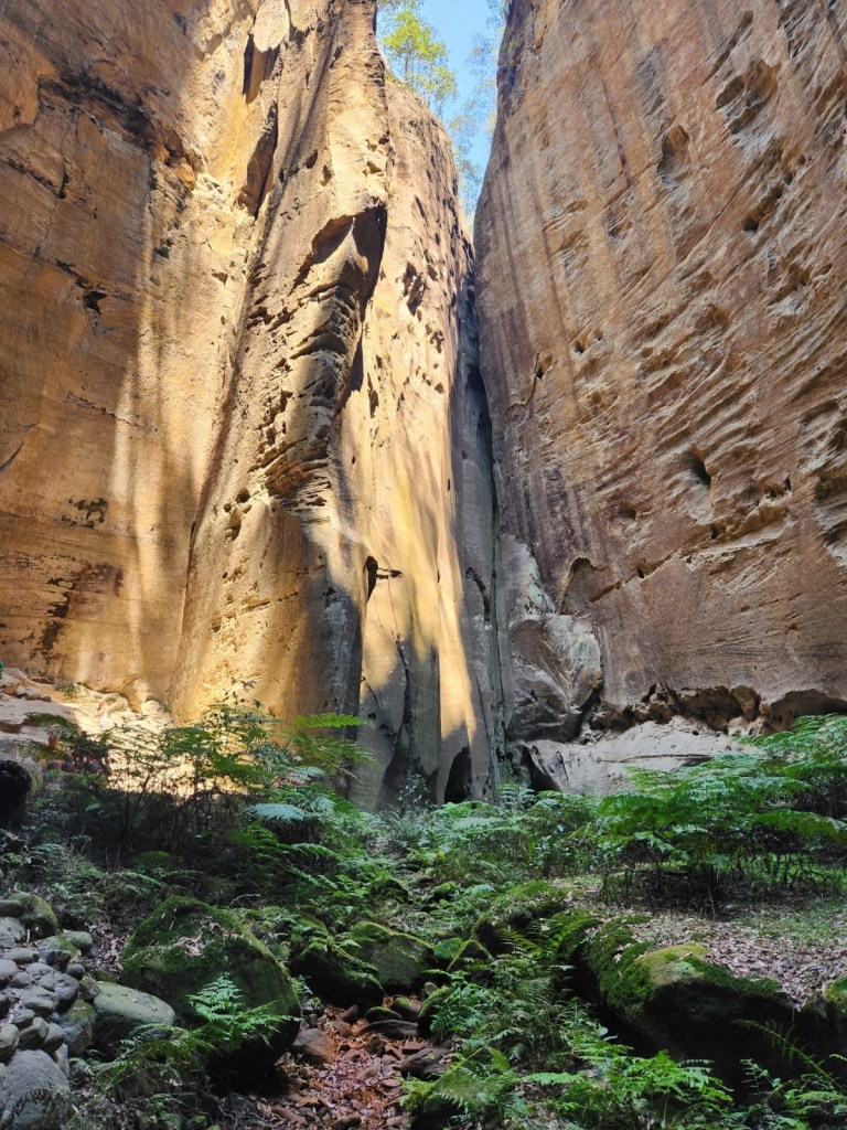
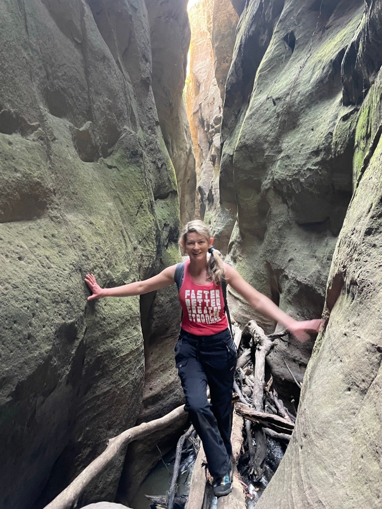
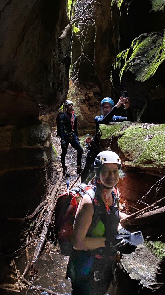
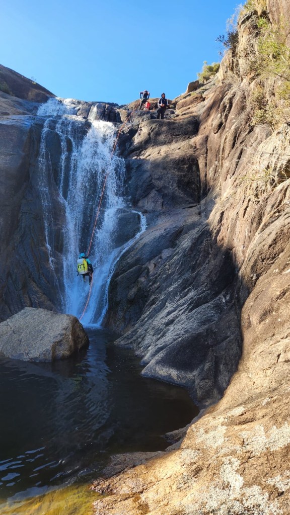
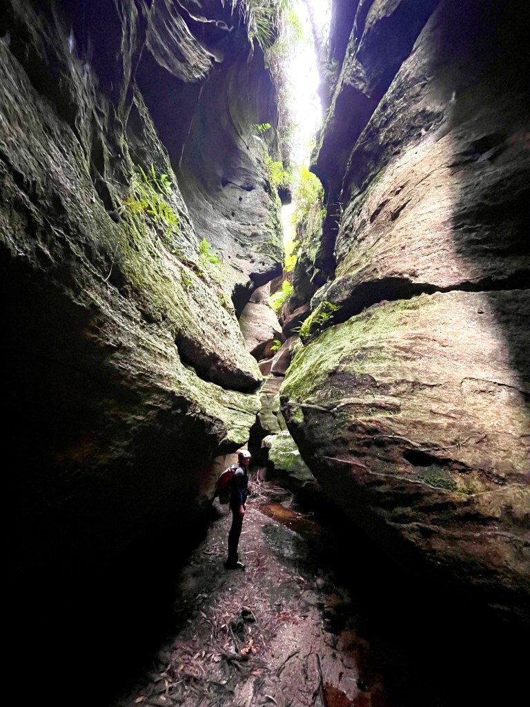
Gadget with H in the background
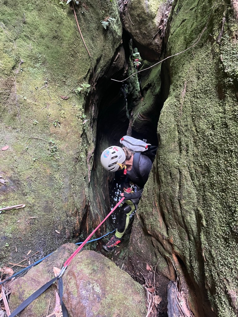
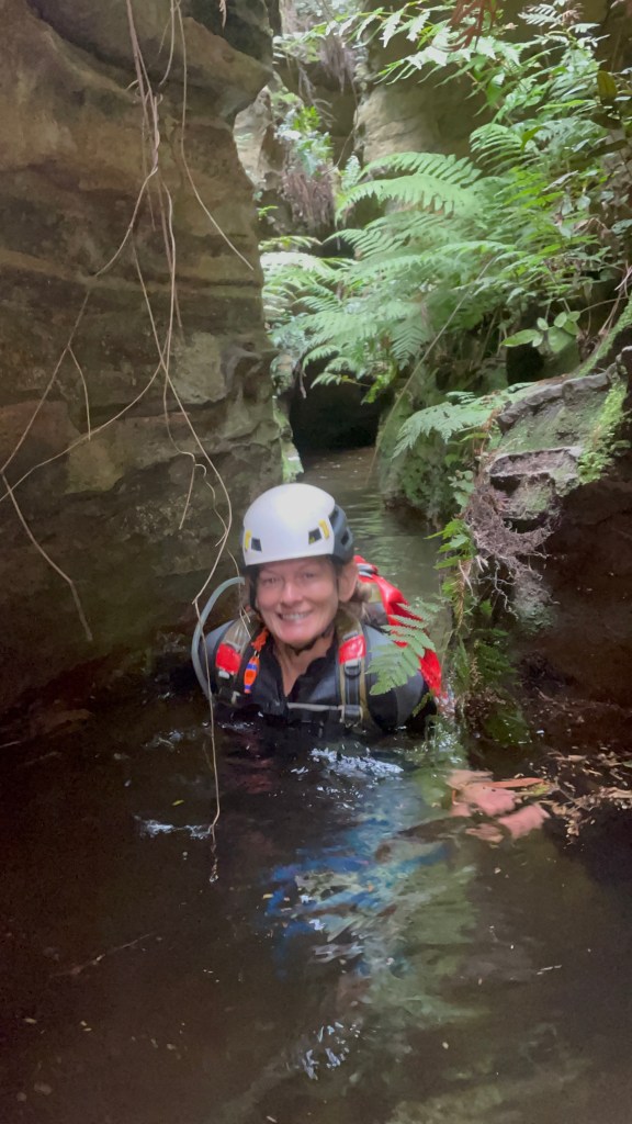
Throw and go because, well you know.
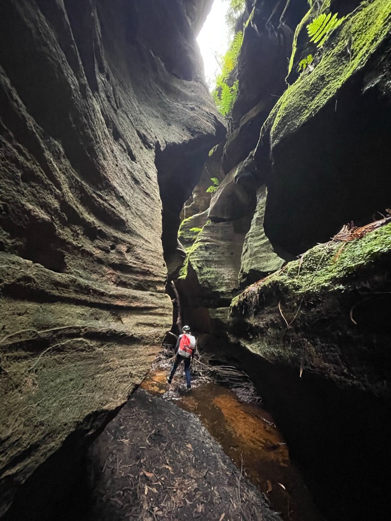
Was it cold. Yes it was
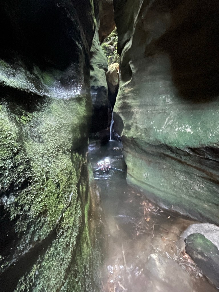
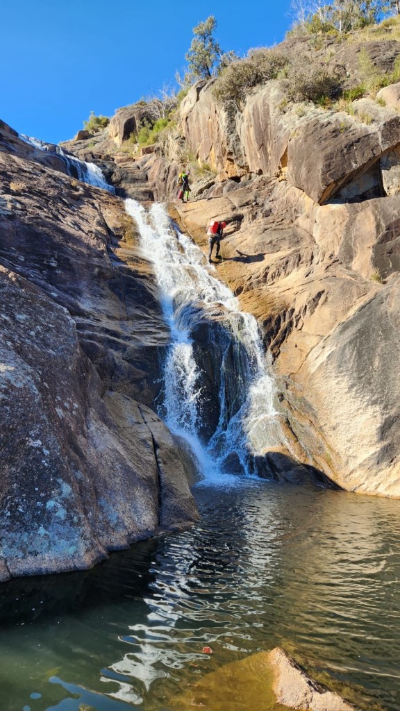
H
K
G
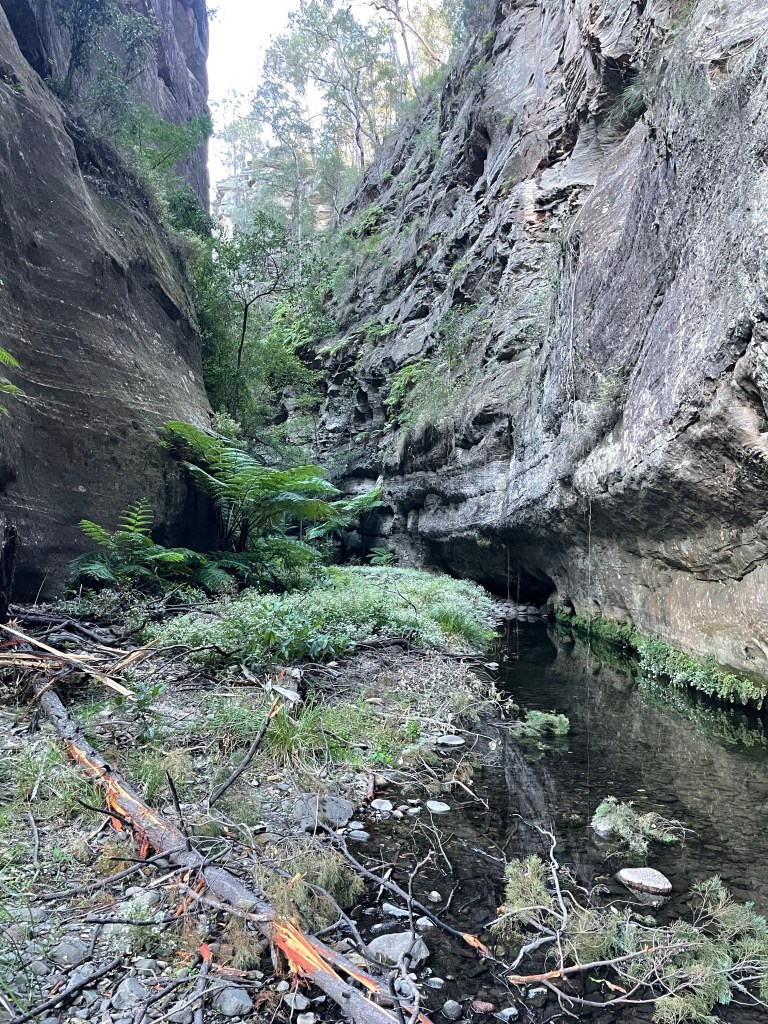
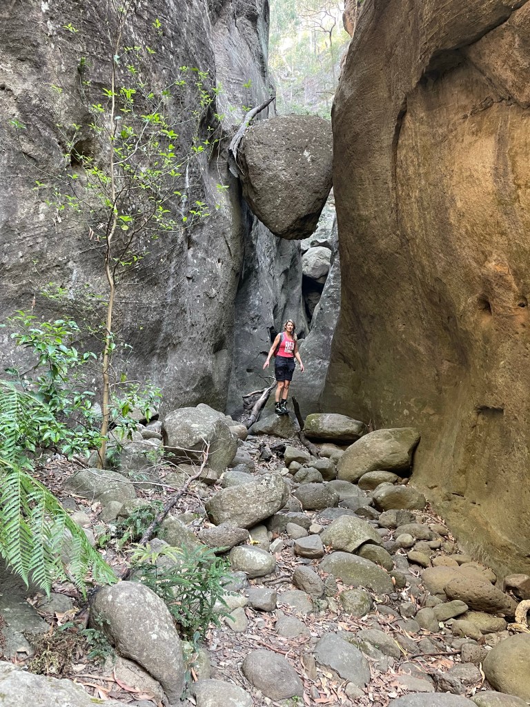
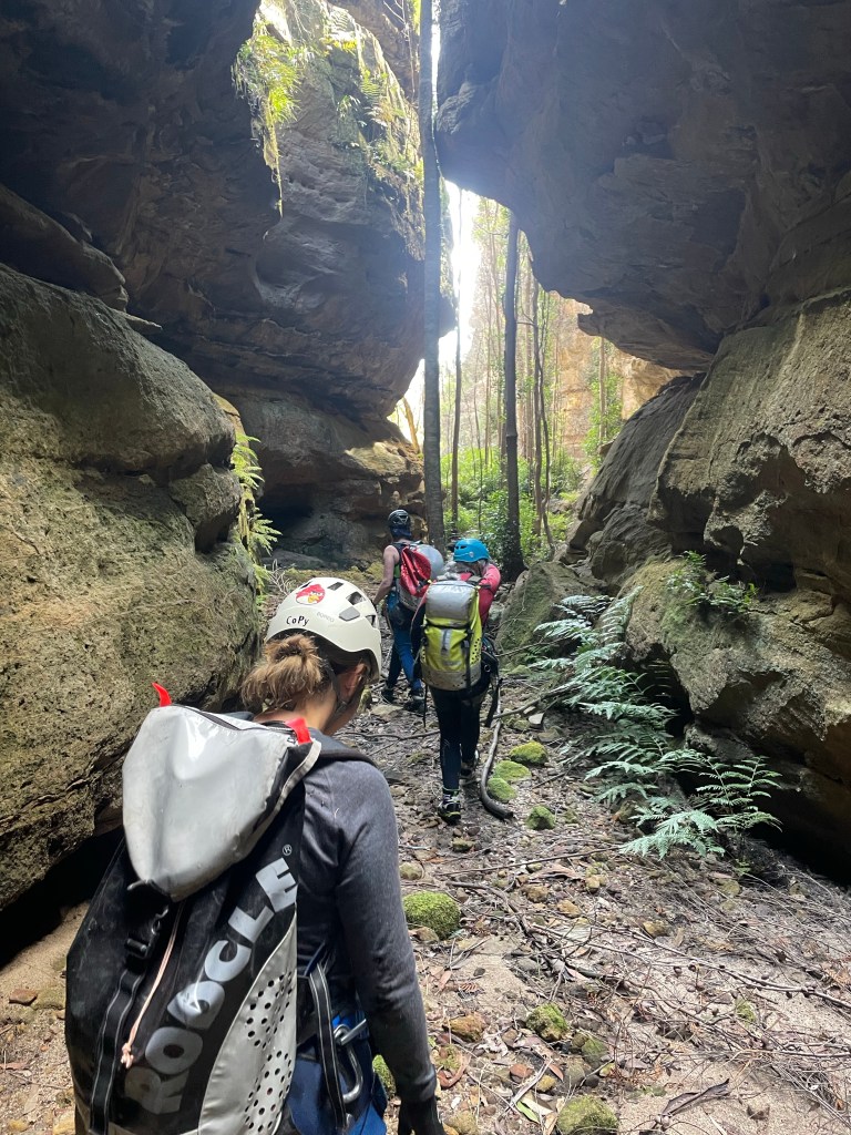
And then we are in T̶h̶e̶ ̶‘̶b̶o̶o̶r̶i̶ Dingo Creek for lunch followed by a bit of creek walking and some long swims to get back up the the HITW exit at the big bend
It’s a gorgeous section of T̶h̶e̶ ̶‘̶b̶o̶o̶r̶i̶… Dingo creek
You should sit in nature for 20min every day.
Unless you are really busy then you should do it for an hour.
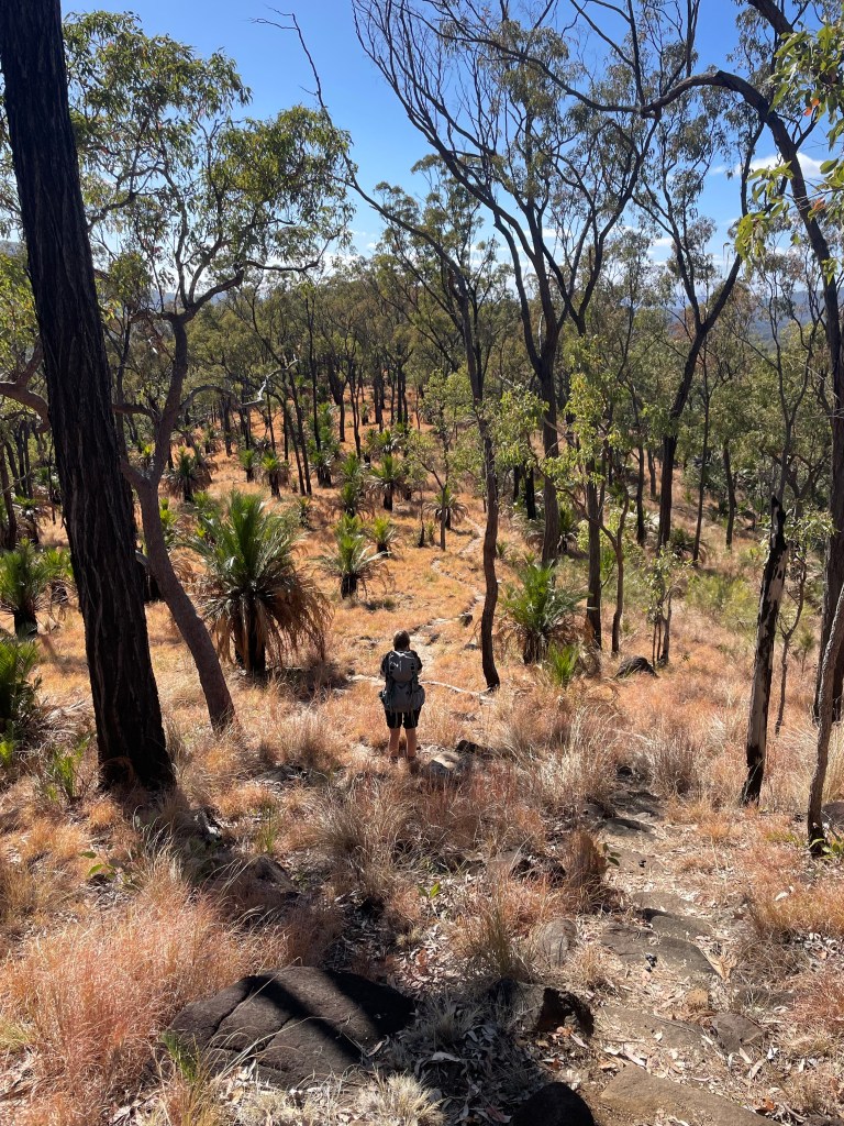
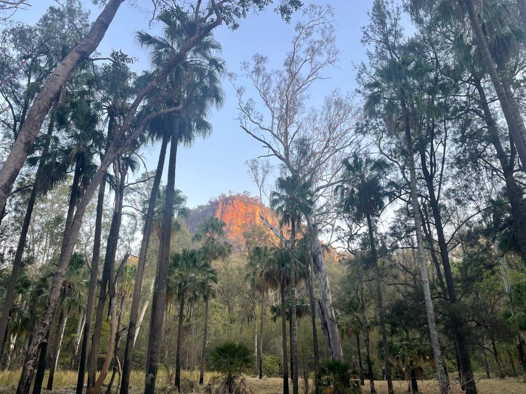
Day 3 would see us back on the tourist trail for the most part. We’d planned to get up to Battleship Spur, nearly 600m above our camp, before the heat of the day. Then check out Boowinda Gorge and it’s side creeks
Both were listed as star attractions. The young couple we had shared camp with came back raving about how beautiful Boowinda Gorge was and a steady stream of people had made their way either up to or down from the spur on their journey along the great walk.
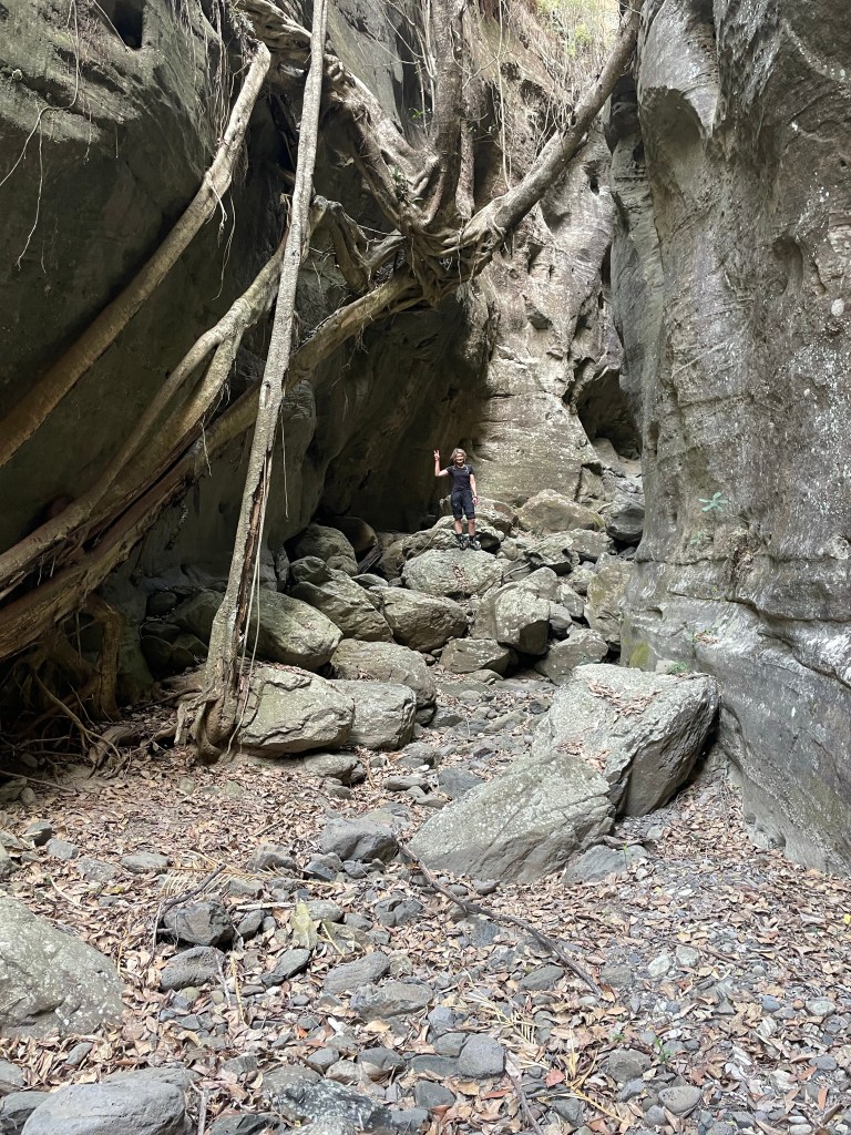
So up we go. The path up to the spur starts up Boowinda gorge but we don’t really take notice as we’re nervously excited about the haul up to the spur.
A side gully acts as a pass out of the gorge. It’s steep, reminiscent of the scramble out of Tigersnake canyon. but once through the lower cliff line a well maintained trail makes it’s way up and along an amazingly varied spur.
Think the Thuratt Spires with a tourist trail…
Wide open grassland alternates with almost razorback spur. Fine white sandstone changes to conglomerate and an out crop what appears to my uneducated eye as quartzite. Speculation around the geology distracts from the slog up.
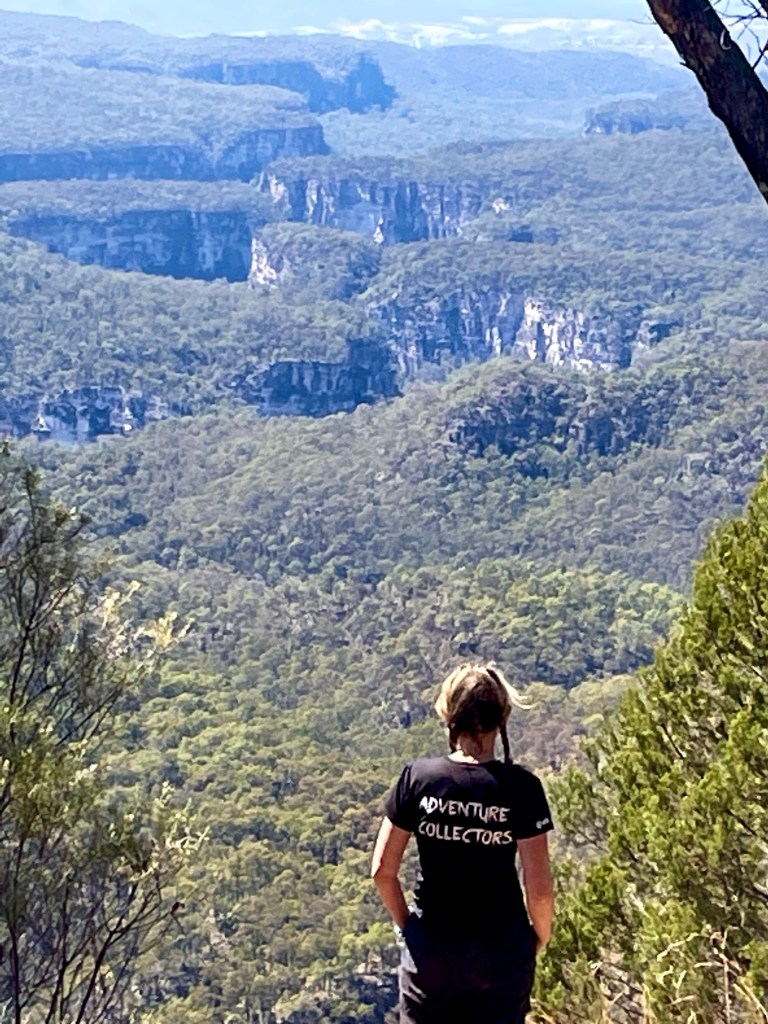
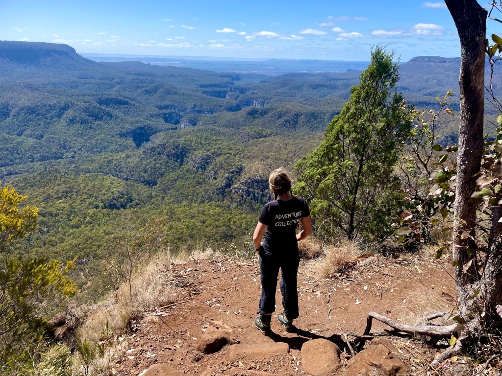
And the views from the top?
Worth every grunt and groan
Gadget looking back over the lower end of Carnarvon gorge. The mouth of which is 10km away and 700 or 800m below.
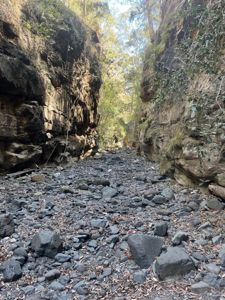
Now back down for lunch in the cool of Boowinda gorge.
Running on a high we start making our way up the gorge.
It’s a bloody soul destroying slog
Think of walking up the Wollemgambe. Only it’s dry as a nuns nasty and instead of sand it’s littered with baby head sized river stones. And the river stones haven’t been tumbled enough to make them smooth so they are jaggered. And they move beneath your feet. And the bigger ones give false hope with 3 or 4 holding firm then the next rolls just to mock your ankles.
Still so many Carnarvon glamour shot are from Boowinda gorge.
We press on.
Several times we consider just turning around but we’re a stubborn couple.
I guess the PC term would be “determined” but it was pure stubbornness (and a view of our white slot at the start we glimpsed from the Spur track) that kept us going.
Finally we get to the junction towards the top of the bloody Boowinda gorge and by some miracle there’s clear running water. Not much but more than we’ve seen in the side creeks since Wards Canyon.
We take the right branch. It’s a low quality slot but it has clear flowing water. So there’s that.
The water is far clearer than this shot implies but I was well and truely over this bloody Boowinda gorge to bother trying to photograph it well.
We get to a point we could have scrambled in from the top (It would have been much easier) but it got far too steep for us the reach the mysterious white walls a few hundred metres up the escarpment.
We retreat back and try the right branch. It was shit
We trudge back down and check out all the side creeks along the way. Some had canyons like sections but after the quality slot canyons of yesterday they were a major disappointment.
Back down past the Spur exit and I don’t know if it was the different light or just we were paying more attention but we had to admit the bottom was nicer than we originally gave it credit for.
Like, if you had never been in a proper slot canyon before you’d be impressed
If you are going to do Carnarvon gorge try a cooler month and hope for a good bit of rain in the days before you get here.
Finally out of what my mind I will always call Bloody Boowinda Gorge we paused for a bite to eat. All the trudging over loose river stones had zapped our energy.
It would have been easy just to return to camp but it was barely 4:30pm and there was another long gully about a kilometre down stream that had a name (At least on one map we had stumbled across) so we couldn’t help ourselves and went for a look.
The gully was scrubby and hard going but it keep promising to canyon up just up ahead. So we pressed on.
At least it was wet
We trudged on until we started to loose light and so left this intriguing chasm to its secrets and made our way back to camp.
Ever since my episode of heat stroke/ dehydration a few years ago I struggle a bit in the heat and yesterday was hot.
We plan a lazy start for day 2 and then some exploring.
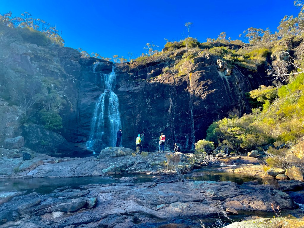
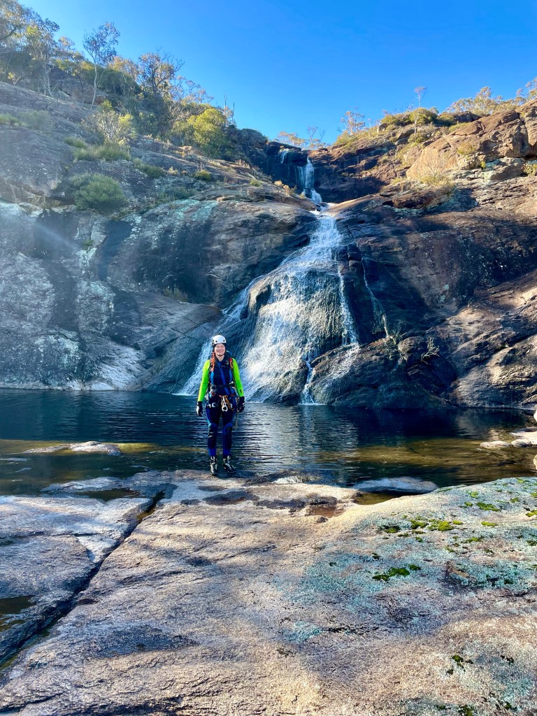
There’s a waterfall marked on the map, googling before we came showed some photos of a fairly shit looking waterfall but with the other side creeks being so dry we though we might as well check it out.
We boulder hop and scrub bash up stream.
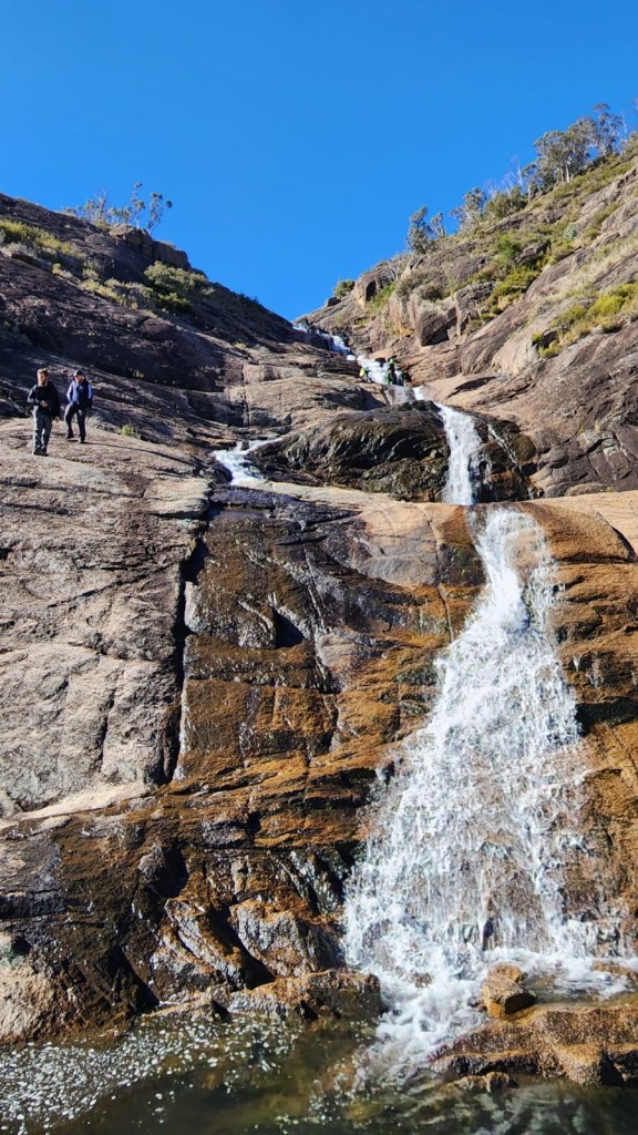
Canyon 6
The mouth of the side stream is bone dry, it’s not looking promising but we head up. A cool breeze comes down,then we round a corner and…
Bam!
If it had a couple of inches of water running down it would be a match for the section in Claustral between the Hulks Fist and Thunder canyon.
And it kept going
I wanted to call it Betty. Kylie wanted to call it Jon. Which is ridiculous. Everyone knows the correct response to calling it Betty is to call it Al.
You mean Al, says I
Jon, says Gadget.
What ever
Further up it had a Bowen creek feel. Only dry as an English backpacker waking up on Bondi beach in the noon Sun on New Year’s Day.
You could see by the moss that it had water recently.
The map showed this creek cuts its way up high up the escarpment but so far a few easy scrambles were all we needed to make our way up.
1 thing I learnt this day though was the location of the creeks on the topo were accurate. The contour lines in the gullies however, were a guess at best and complete fantasy for the most.
We made our way up a kilometre or 2 of slot canyon before getting blocked by a large chockstone. No shitty waterfall to be seen.
We could not believe several blogs had photos of the waterfall but we had found no hint of this anywhere. I guess bushwalkers use a pass up beside the canyon to access the falls and maybe as another pass up to the great walk.
We head back to the gorge and onto the next.
Canyon 7
Further up stream our next target didn’t look like much. A scrub bash into a wide gully. Then a gap in a side wall gave a hint of something.
I almost didn’t bother but I’m going to duck up here for a look, says I.
I’ll come too, says Gadget.
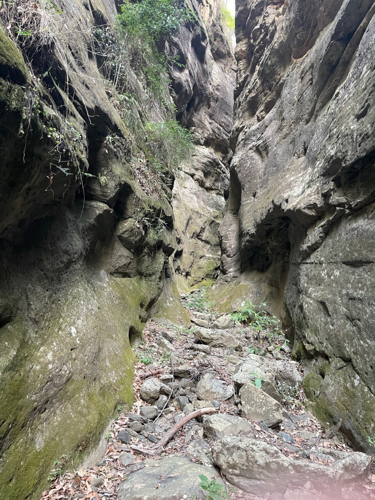
It’s a shallow canyon but it won’t go far. It’s running parallel to the main gorge cutting back downstream but going up…
It might not be as pretty as the previous one But again it is deceptive and just keeps going. Twisting and turning, cutting deeper into the walls.
It took a couple of sketchy climbs but we made it up to where it begins to open out and then retraced our steps to once more bash up the gorge
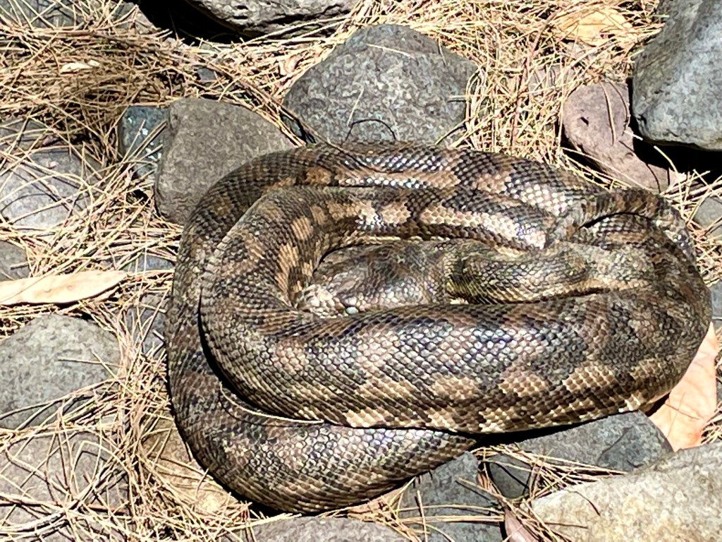
Canyon 8
A beautiful big Carpet Python guarded the way. It’s curled up in the shade with a full belly getting ready to shed.
The next canyon started with promise
But a few hundred meters in we are blocked by a 8m dry waterfall.
There’s some promising looking lines on the map further up the gorge but it’s getting late and we are fairly cooked from all the boulder hoping. We decide to head back down to camp.
But along the way there was 1 gully we had skipped, originally planing to do it tomorrow. But we were here now so pop in for a look.
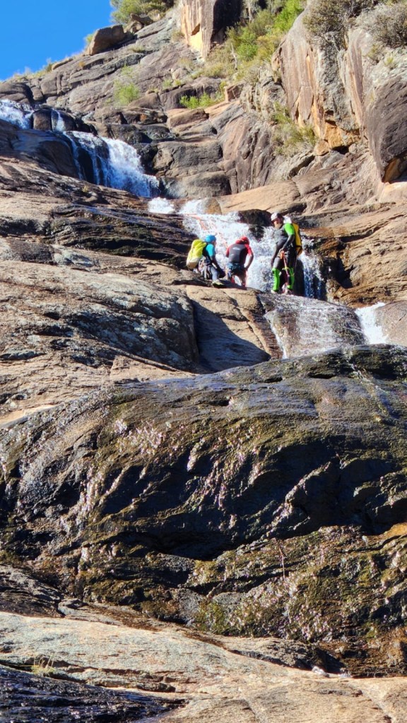
Canyon 9
Another dry slot canyon greets us
The map showed this as one of the longer ones on this side of the gorge upstream of the big bend camp but as tired as we were from all the boulder hoping in the heat of the gorge we were keen to see how far up we could push it.
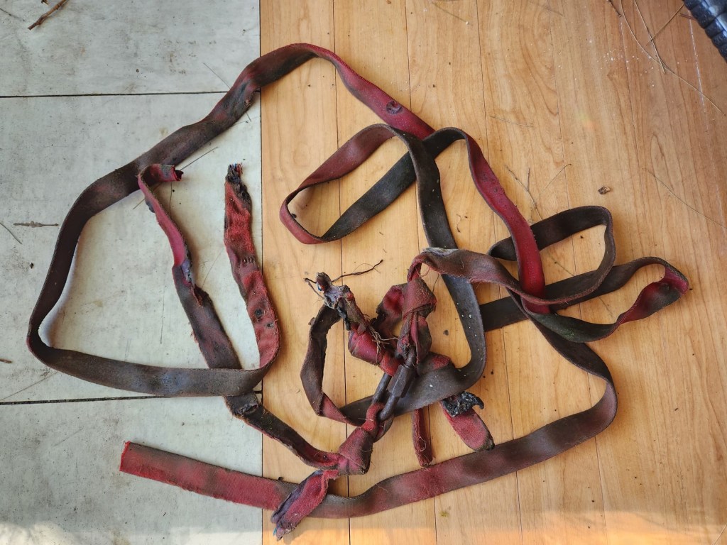
More dodgy scrambles/climbs were needed. We took a bit 3mm amsteel rope as a hand line to assist getting back down.
Finally we couldn’t get any further up so made our way back to camp content with a big day in the heat.
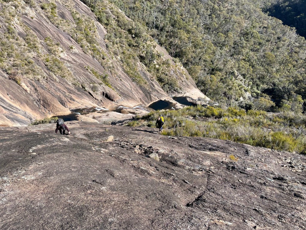
We make our way back to the camp ground and park in the over night car park.
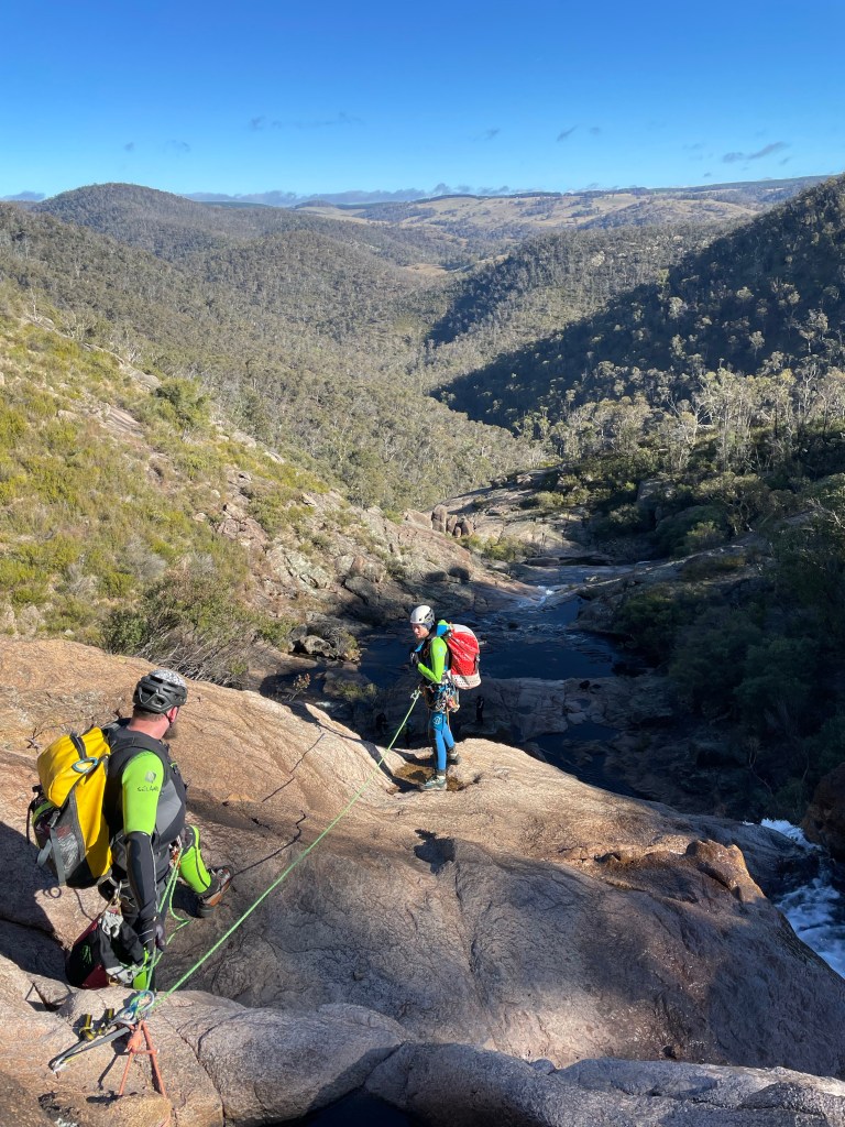
Our plan now was to hike up to the remote camp ground at the Big Bend , a bit over 9km up the gorge.
Along the way we’d do the side trips to the touristy stuff.
It was already 35°. We stock up on water.
Canyon 4
The Ampetheter.
Is it a canyon? I don’t know
Is it touristy as all hell? I don’t care.
I was pretty keen to see this one. It’s just off the main track.
It’s a short but impressive slot
Kylie climbing the ladder access
A short but impressive Hall leads to an otherwise enclosed chamber
Back on the main trail we head up stream.
The next thing on the tourist map is Wards Canyon. Just before it is a break in the cliffline and a small stream, the first we’ve seen with clear water.
And if you are good at spotting trails you may spot a vague track leading up beside.
We dump the packs and go for a stickybeak.
The soil is the finest white sand I’ve ever seen. Almost as fine and white as the cliffs towering above.
The trail continues up but it’s a wide gully. I guess it’s used as a sneaky short cut up or off the great walk or sumfink, we head back to the trail
Canyon 5
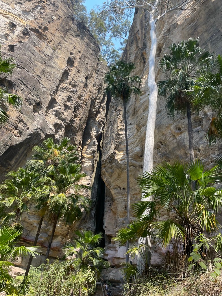
Wards Canyon.
Wards canyon looks like the most adventurous canyon in the lower gorge. However you can only access the very lower bit. I think tour company’s might run trips through it so it might be worth applying for a permit
It’s pretty and hosts the only known non-coastal population of King Ferns, Angiopteris evecta, in Queensland.
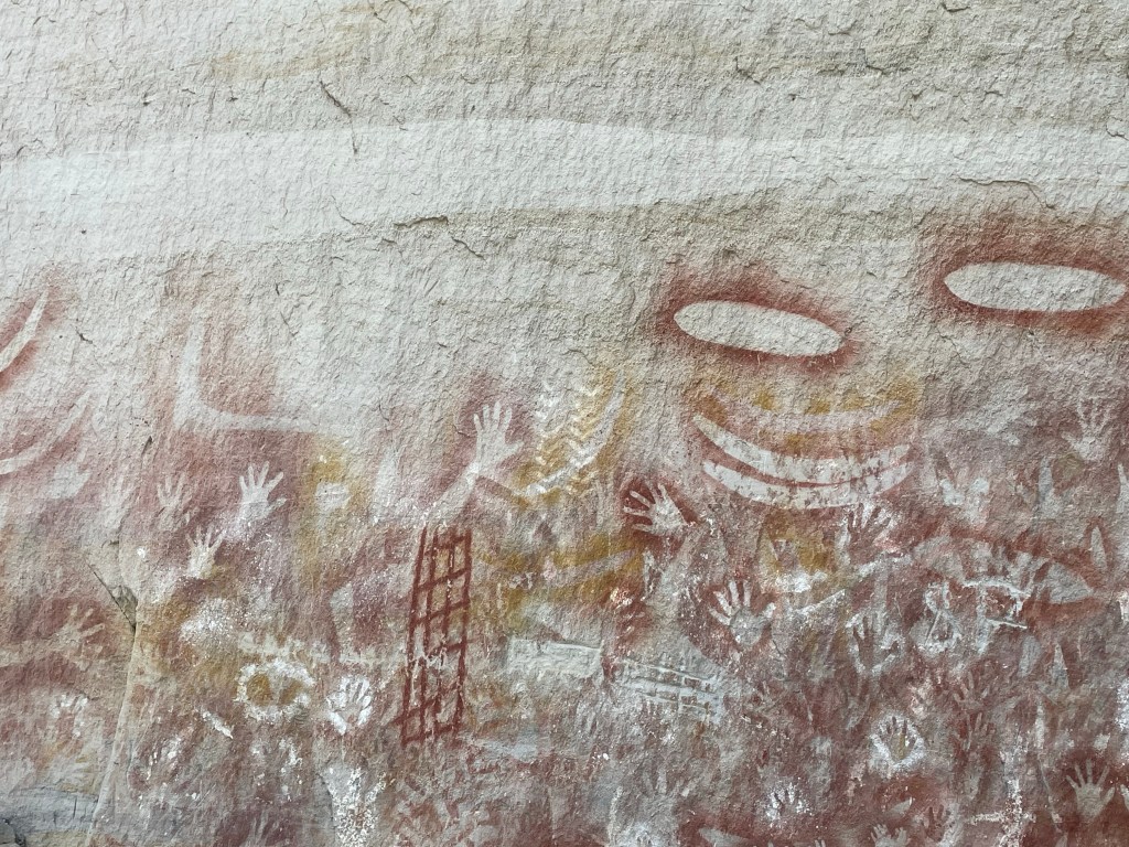
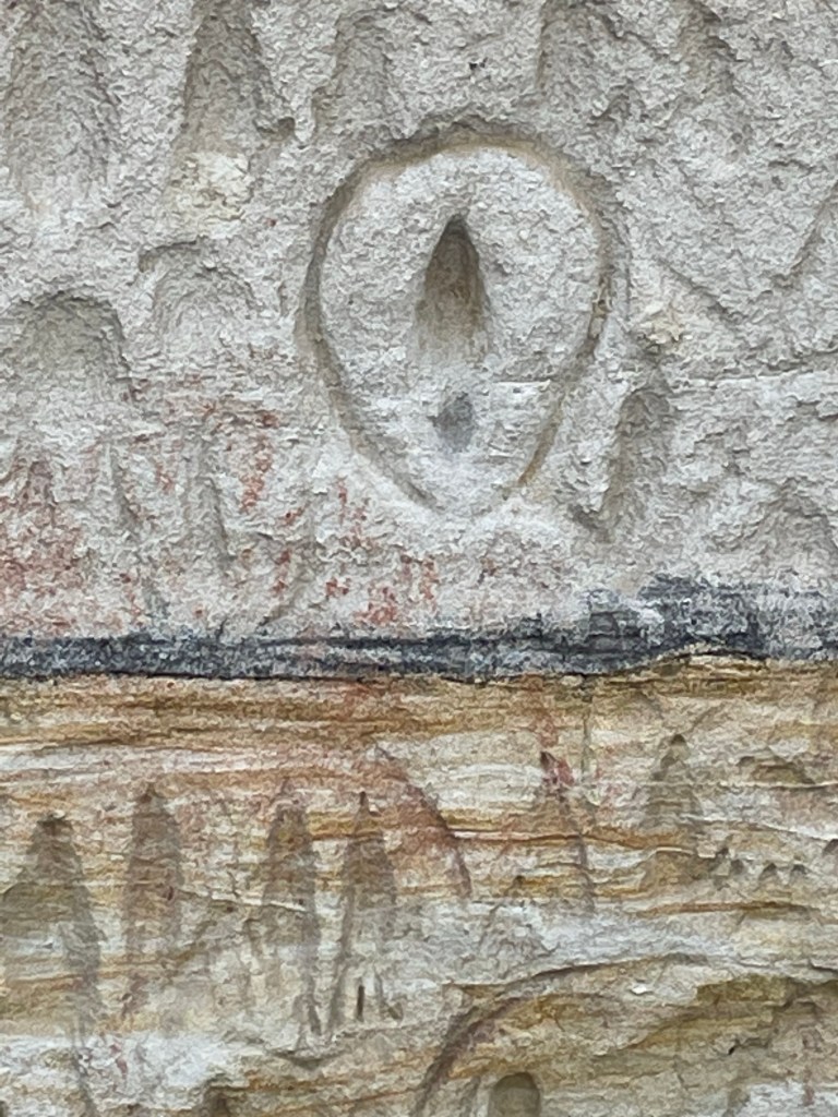
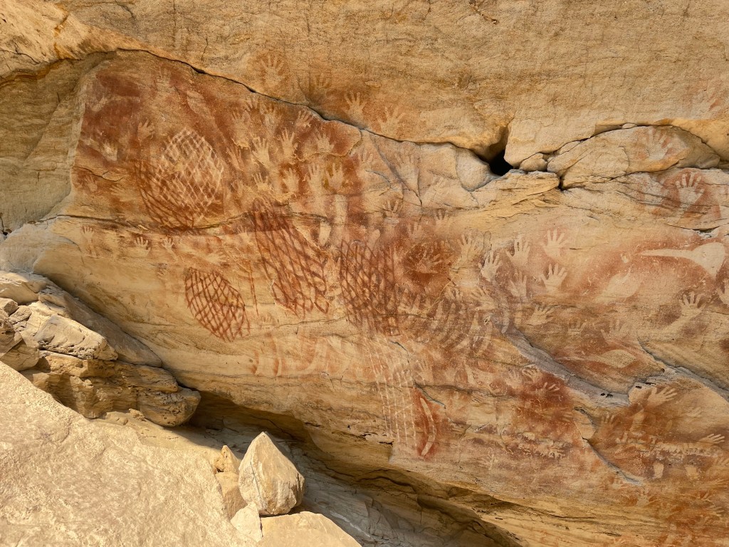
The Art Gallery
I couldn’t find the indigenous name for the art cave which is a shame. It looks like it was painted yesterday but archeological studies found evidence it’s been in use for at least 3500 years, sites just over the hill date to 19,000 years.
And on we go.
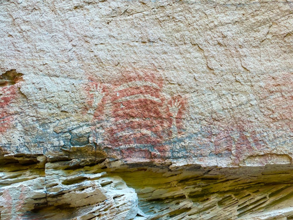
Pitjara Cave
It has another name on the tourist map but this is the name on the old topo. The art is top notch.
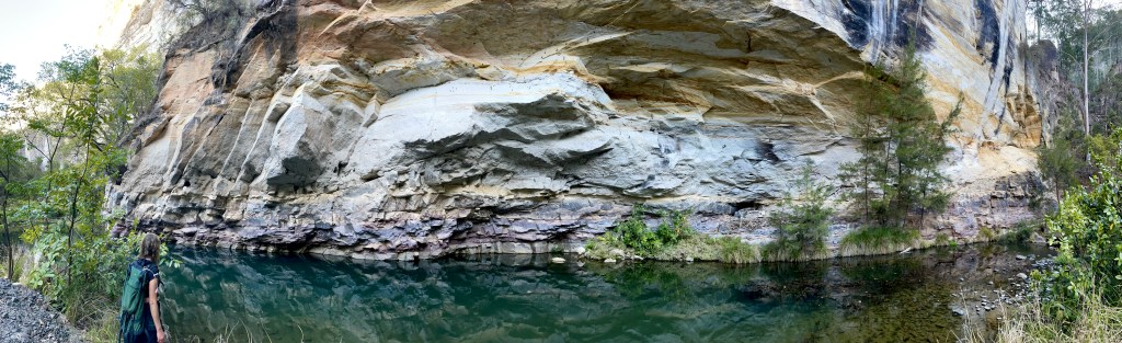
And finally we make it all the way up to the camp and stumble into one of the only semi secluded spots at the camp. Winning!
We haven’t done a huge amount of Ks, probably only 15 or 16 but it’s bloody hot so the myriad of No Swimming signs at such a beautiful hole were a little soul crushing.
Gather around friends, adventure family, misfits and, vagabonds I’ve got a story to tell.
Or sumfink
30 odd years ago when Jameison published the first edition of Canyons Near Sydney he included a short section at the back for other canyon areas with a short paragraph on Carnarvon Gorge saying it had sandstone slot canyons similar to the Blue Mountains.
The only description was try starting at the homestead, make your way up the gorge and look for a routes up.
My curiosity was pipped and it got filed in the back of my brain.
Since that time it’s become a tourist mecca with a wilderness lodge going in around 1996 and National parks developing a good trail network. But I had a feeling there’d still be some hidden gems.
So when the stars aligned and Gadget and myself found ourselves with a week off I said fugg it, let’s go.
Of course abseiling is frowned upon in QLD national parks. There are permits but from all accounts these are about as hard to obtain as diamond impregnated rocking horse shit.
So our plan would be to just have a look. Scramble up from the bottoms or down from the tops as far as possible then retreat.
Day 1 though would be the touristy stuff. But I’m getting ahead of myself.
We rock into the NP camp ground late Thursday night. Not realising the nondescript pop up gazebo was the visitor check in we cruise past and pull into a random camp site to get our bearings.
Hey Kylie, what number site is on our booking ? says I
9, says she
You’d never guess what number we had pulled into at random.
Ok, most of you guessed 9. But Shit yeah! good start to the trip.
Not a bad view out of the tent
Our first target was back up the road a bit, Micky Creek Canyon.
Micky Creek is on all the maps, tourist brochures and instagram posts but 1 person I spoke to said the side creek next to it was betterer.
Canyon 1
Weirdly Warrumbah creek is sign posted and has a tourist trail that leads to the mouth of the canyon but there was zero info on it.
A short way from the end of the “formed trail” we find ourselves in a proper slot canyon
The start was impressive but it was dry as a dead dingo’s donger.
The further we scrambled up the better it got. We met a guy who said he had visited in June and it had been flowing.
Note: to self September is a shit time to visit. Hot as hell and dry. you could see the moss drying on the walls, with a bit of water the colours would pop.
It got a little damp as we scrambled higher but the water was manky
The canyon just kept going
About a kilometre on we come to a long section of stinky pea soup looking water. We thought about trying to bridge over it but the walls were slimey and it’s our first canyon on our first day and it already exceeded expectations so we headed back down.
Canyon 2
Micky Creek right branch.
Once again the tourist trail takes us to the mouth of Micky Creek canyon. It ends while the creek is still a wide gorge but soon after there’s a junction and we head up the right branch.
It soon starts to canyon up
There were a few tricky scrambles to get up into the good bit
Eventually we got to a scramble that,while confident I could get up, I wasn’t overly keen on getting back down the slippery stone without a hand line. so once again we decided to turn back down.
Canyon 3
Micky creek left branch had a short section of canyon just upstream of the junction. This seemed to be the source of all the brochure and instagram photos. It was pretty but short. We continued up and it was narrowing but it wasn’t long before we were stopped by another scramble ropes would be handy for.
So I kinda like visiting the little canyons most people would not bother with.
Part of it is seeing beautiful places most people don’t get to and part is just getting out and exploring with mates.
When Tom posted photos of this one on https://ozultimate.com a few years ago it caught my attention as I had a reasonable knowledge of the canyons in that area but didn’t recognise this at all.
Then a month or so ago a YouTube video was posted that had a few clues.
10mins of comparing images in the video and the areal images on sixmaps and I was confident I knew how to find the start and how to get out.
Anyhoo it had been so long since I’d dragged friends out on a scrub bash to a low quality canyon that they had forgotten the pain and agreed to come again.
Was it scruby? Yes it was
Was it low quality?
The canyon section was pretty. Pretty short. But actually pretty.
Wetsuits were over kill. I thought there might be a bit more flow in the falls after last weeks rain but most of us stayed dry above the knees.
Just a few abseils and a short hallway and the canyon opened up
Then it was back up the ridge and we avoided some of the scrub back to the car
A bit under 2.5hrs car to car with a large group and giving Muz some abseiling refreshers along the way.
Despite being right next to Bindook cattle Station Bindook falls are in the middle of nowhere.
Sure it’s an interesting bit of nowhere but it’s a longish drive from anywhere.
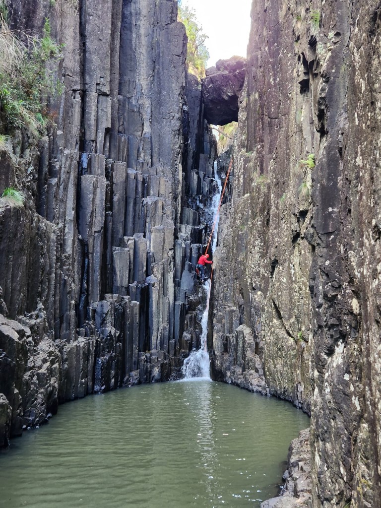
The creek cuts a short but pretty slot down a series of Falls that have 2 main points of interest
1) they cut through hexagonal columns of basalt (Edit: apparently it’s not basalt but Barrallier Ignimbrite. Ignimbrite is basically the result of hot ash flows if I am understanding things, which I usually don’t)
b) it’s called a chasm.
Plus
iii) the distance means it’s less visited than a lot of blue mountains canyons.
Any hoo it’s been on my radar for a while only I thought you needed permission to cross the private property and I thought it was a very long drive to get to.
A tiny bit of research revealed you can skirt around the property within the boundary of the National park and it wasn’t that much longer a drive than it is to Kanangra which makes it an easy day trip from my place.
And so we thought why the hell not.
It’s a pretty drive made prettier by a dusting of snow coating the pine trees on the way out through Shooters Hill. And the road past mt Werong to Bindook is very scenic indeed. It’s awe inspiring country
We had no problem finding a spot to park and making the short walk to the start of the chasm.
Making our way down to where the creek first cuts into a narrow slot we are greeted by 2 smallish drops each with a long swim at the bottom and little to no anchor options between
The start of the chasm
We discussed setting an anchor for the first abseil and linking them together but it looked like it might be a tricky pull down in cold water so we opted to bypass a short section and abseil in from the side.
There was a reasonable flow of water so I believe the murky green is due to calcites in the strata?
Bypassing the first 2 drops with a 40m traversing abseil from trees above.
Looking down the amazing “chasm” towards the chock stone. With a bit of effort we were able to use the ledge on the left to avoid the early swim.
The anchor for the next abseil was threaded throu a single piton jammed in the back of the chock stone.
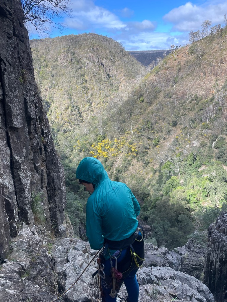
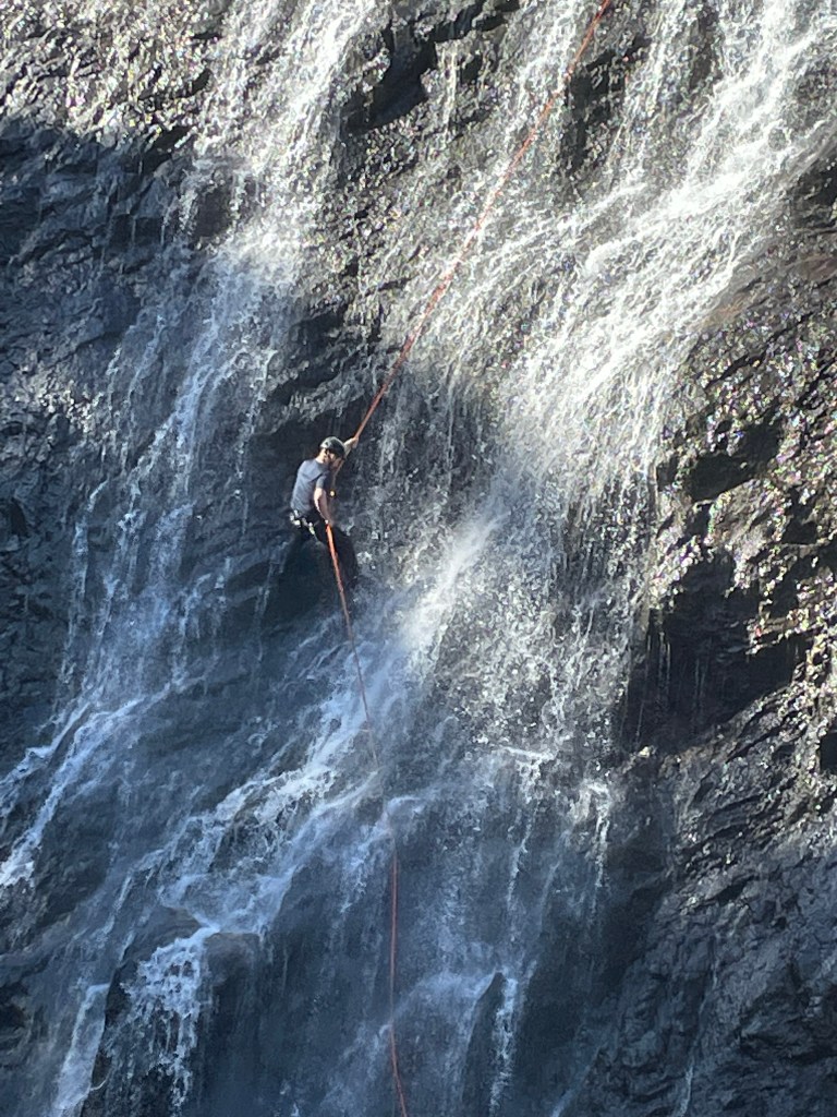
We searched for a while for a feasible back up without luck. Test weighting the anchor showed the piton to be solid and with a stepped, scrambley abseil we decided it was good enough and Gadget went down first.
You don’t really notice the columns until you look back
I perch above the pool and pull the rope. It comes easily and I stop to take out the biner block I had in place then go to pull the last bit down…. It locks solid!
It had come super easy til then. But nothing I could do would get it to budge. I assume the end has knotted itself on the ring and not wanting to waste too much time as Kylie was wet and waiting at the next anchor, I resort to cutting the rope.
The next anchor looks like it needed replacing 15years ago… it partly crumbles as Gadget inspects it. Other bits are so stiff we had to cut them out.
Gadget checking angles.
The next abseil is off old pitons again. At least there are 4 of them but we take a bit of time to set new tape. It was impossible to equalise them in the direction we wanted to abseil but again they felt solidly placed. And Gadget lead the stepped 45m abseil.
Another cold swim greeted us at the bottom of this one.
We pull rope from the far side of the pool then have a brief look for an anchor for the final 60-70m drop.
There wasn’t much in the way of obvious anchors and spying a steep ramp leading up to the right we opt to exit early.
It’s steep, loose and at times narrow but it goes.
Back up top we push our way through black thorn thickets up to the clearing below the property fence line, then make our way back to cross the top of the chasm and thus back to the car
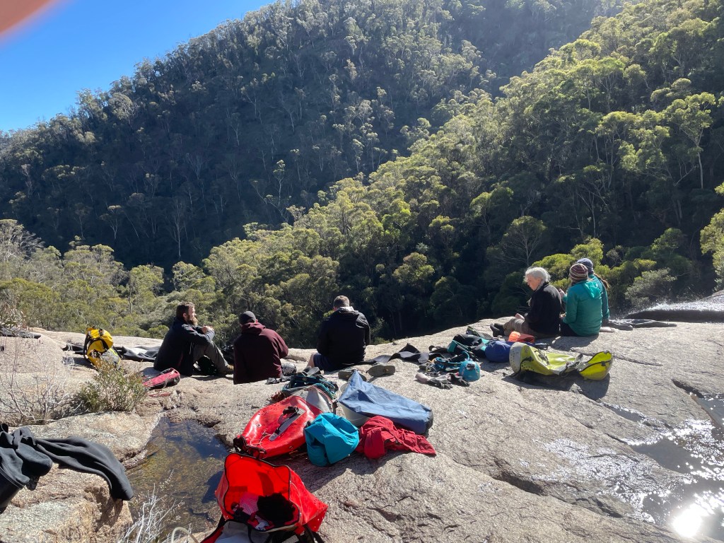
Nice spot for a picnic
Part size: 2
Time: 4hr car to car.
Big places help you realise how small you and your problems are
It’s June. We are sleeping in and heading to Kanangra for a lazy half day of canyoning.
If that sounds odd we aren’t really “canyoning.”
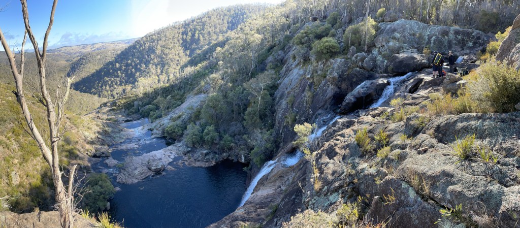
The plan is to do the abseil trip down Box Creek falls. Ropes aren’t really necessary as you can scramble down right beside all the drops (as Dave and Phill did) or take an even easier walk down a little bit further right.
But anyhoo we had ropes so we were going to abseil.
Friday had been misty and miserable Saturday dawned bright and cold!
Like really cold.
It’s been ages since I’ve seen Jen so it was cool to catch up with her. And it was the first time meeting Phil and Dave.
It’s a pretty creek. But for an abseil trip… as Jason said you could ride a mountain bike down it.
Kylie psyching up for a cold swim at the bottom of abseil 1
Apparently I missed the bolts on this one as I walked down the slab beside it …
Jen wondering if it’s worth another cold dip
In the end she decided just to walk down and have a snooze in the sun while we continued to play with ropes
Aimee was keen to keep braving the water
Jason handled rope duties for most of it.
Phil and Dave walking down beside the “falls” to take photos of the idiots in the water.
And then we get to the top of the big drop.
Normally if I was at the top of a 65m abseil at Kanangra I’d be a little nervous. They are intimidating.
This one wasn’t.
It didn’t look to be that big or committing.
We set up.
There’s a series of ledges. Says Jason as he leads the way.
Going over the edge I see it doesn’t really get vertical at all. But it’s a bit of fun.
Dave decides to give the last one a crack
It would be cool to see with more water, thou I doubt it would hold water for long. Aimee says she walked up to the base in 2018 and it was bone dry.
Lunch in the glorious sun back at the top of the last absiel
So what did I think of it?
It’s kinda like an even less technical Dione Dell without the crappy walks between abseils. It’s not canyoning but a nice creek scramble between 2 optional abseils. It would be a nice spot for a swim early autumn.
Surround yourself with awesome people. Experience awesome things
It’s been a while since I’ve organised an obscure trip.
Others take the piss out of my scrub bashes to shit canyons but I get a kick out of checking out places the majority wouldn’t bother with.
So when we were thinking about what to do and South Bowen formed up as the front runner I suggest how about we go in fro the top.
Not that’s it’s overly obscure, for as long as I can remember David Noble has been commenting that people miss 3 or 4 canyon sections by going in the “standard” entry.
Still upper sections tend to be hit and miss so I wasn’t expecting high quality but they are all worth doing once.
The only hitch was the car shuffle. We didn’t have a second car.
Let’s just do the top and scramble out the Cork Screw entrance. Says I. That way it’s only a 2km walk back up the highway and we can do that first.
Deal.
We pick one of the branches below Mt Wilson turn off and make our way in. It was scrubby on the spur and muddy in the creek line.
Like scrubby scrub and muddy mud
But it’s only a short bash to the first canyon section. And it’s surprisingly high quality.
And once we got to the junction with the “standard” entry we reversed back up the Cork Screw section and found a break in the cliffs to scramble up.