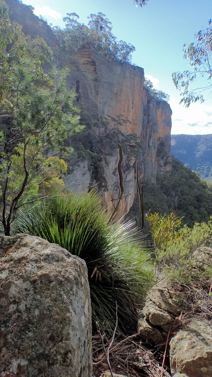
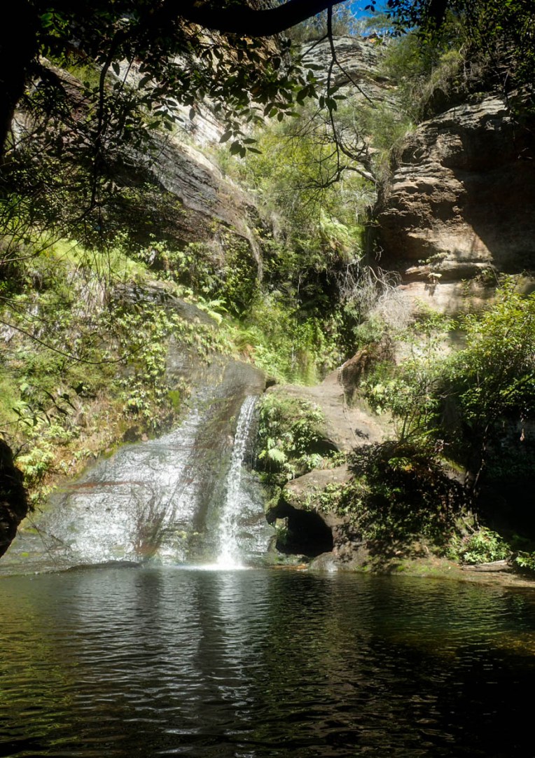
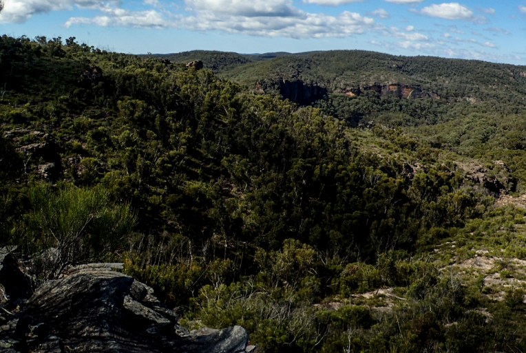
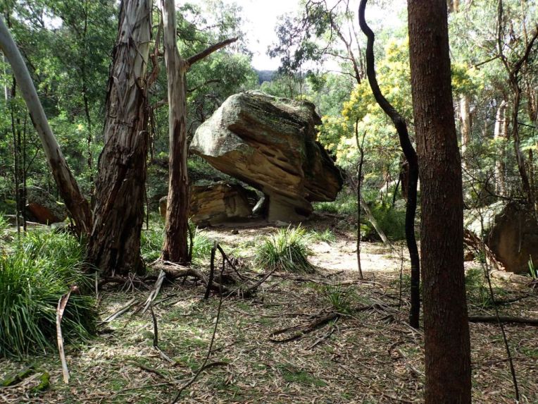
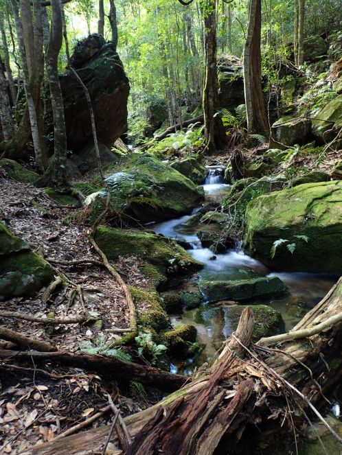
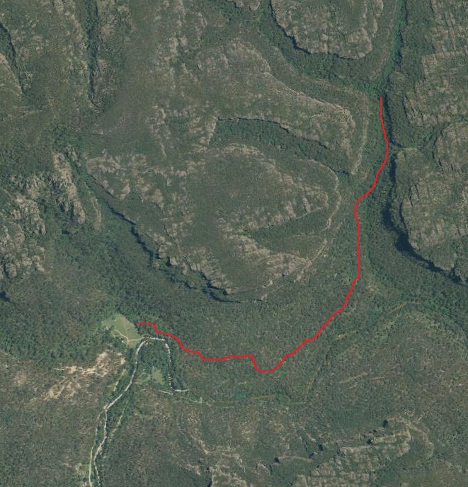
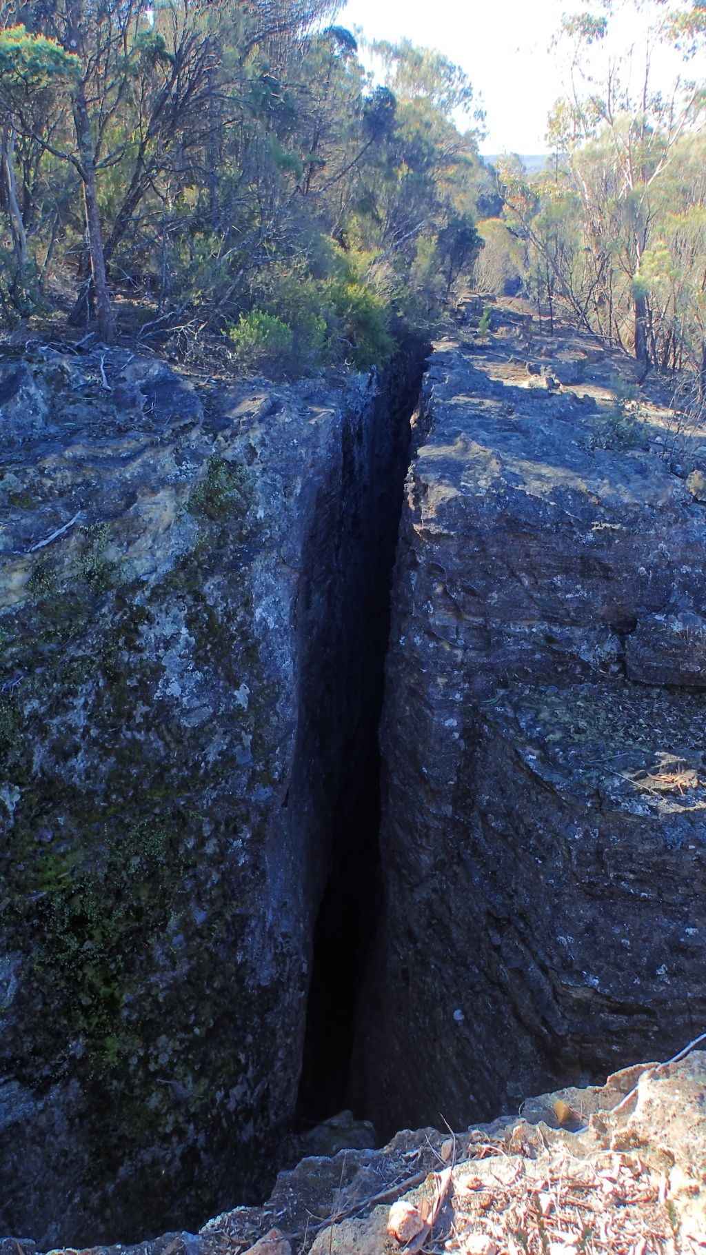
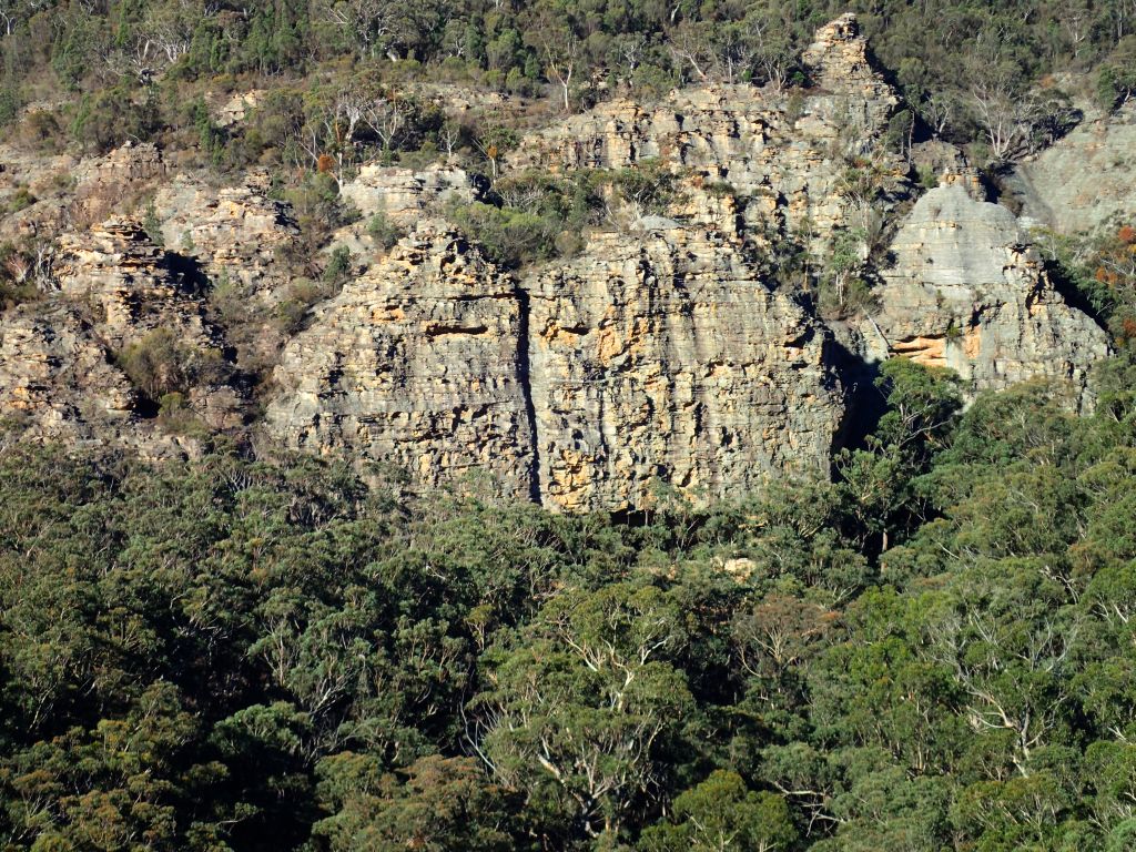
Pleasant View canyon is a canyon which leads a view over the Carne crk which is pleasant… Actually the views from the end of the fire trail are better as are those from the cliffs above the canyon.
But anyhoo…
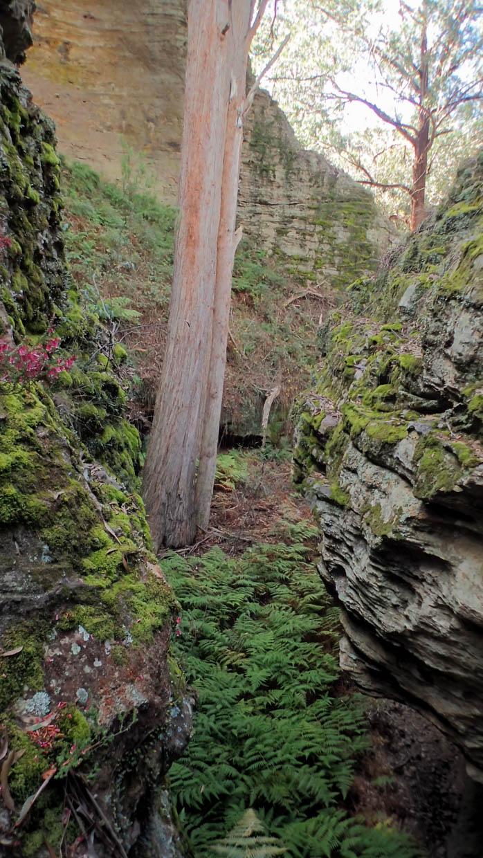
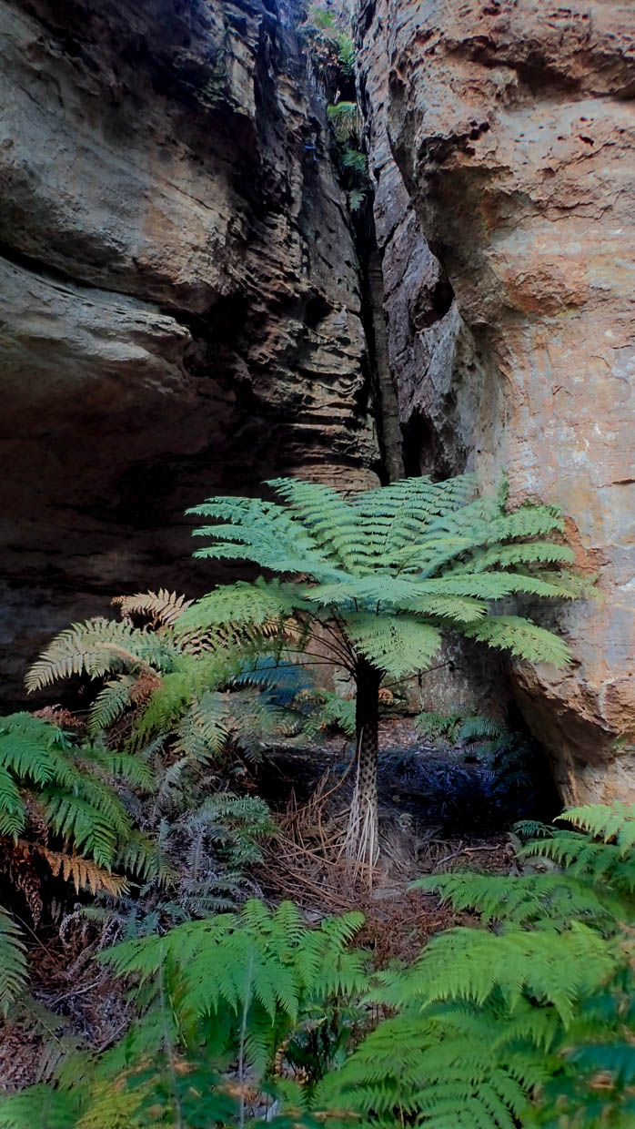
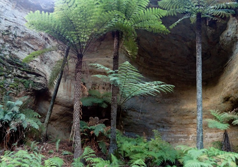
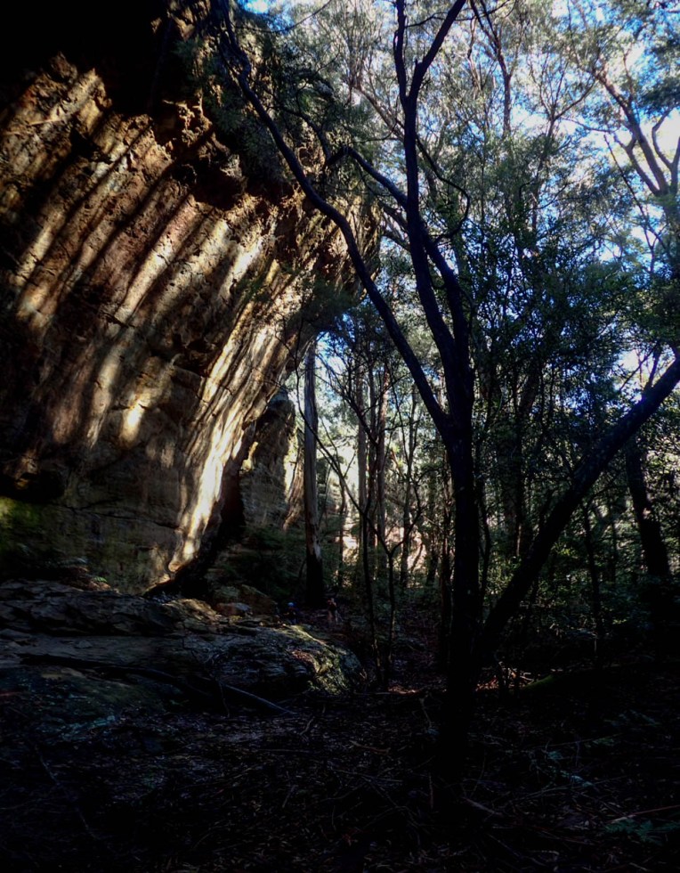
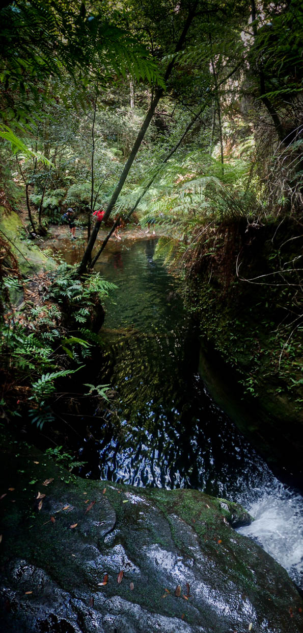
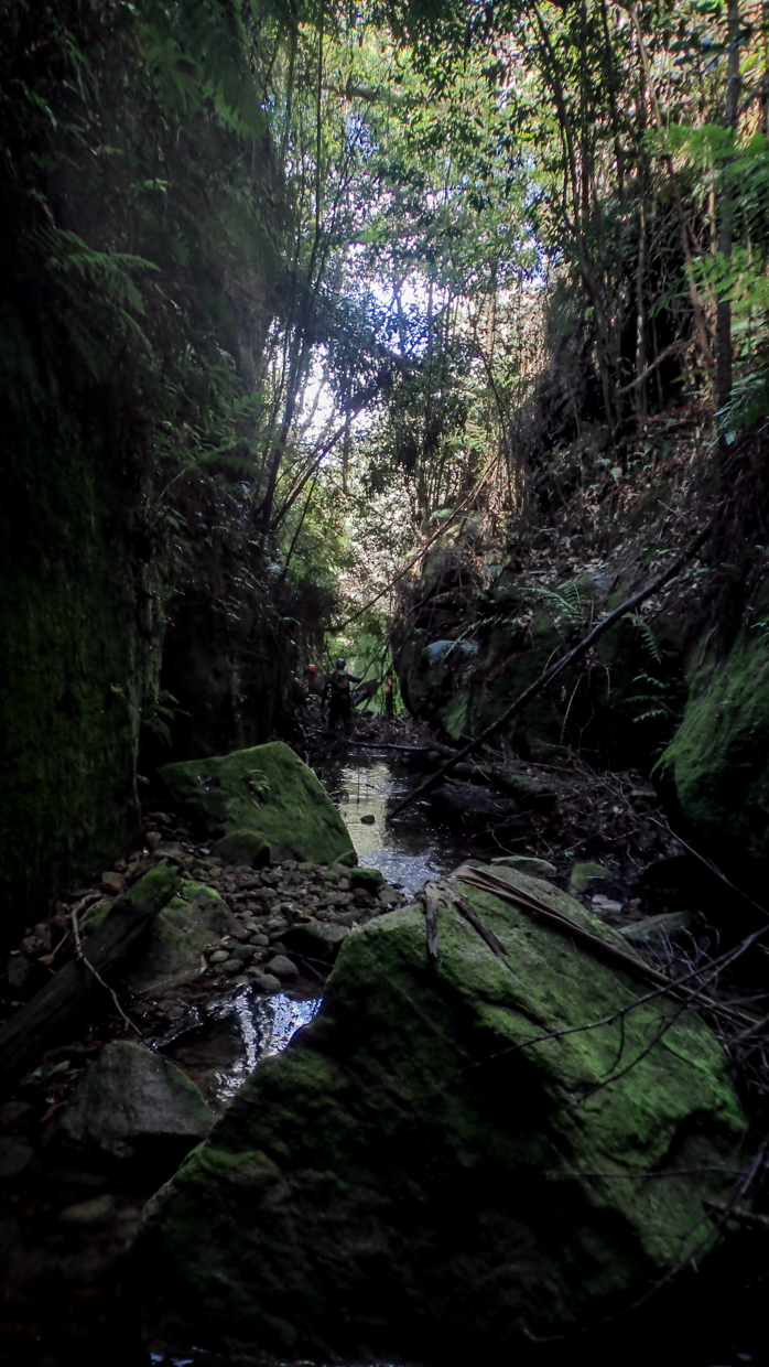
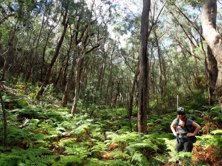
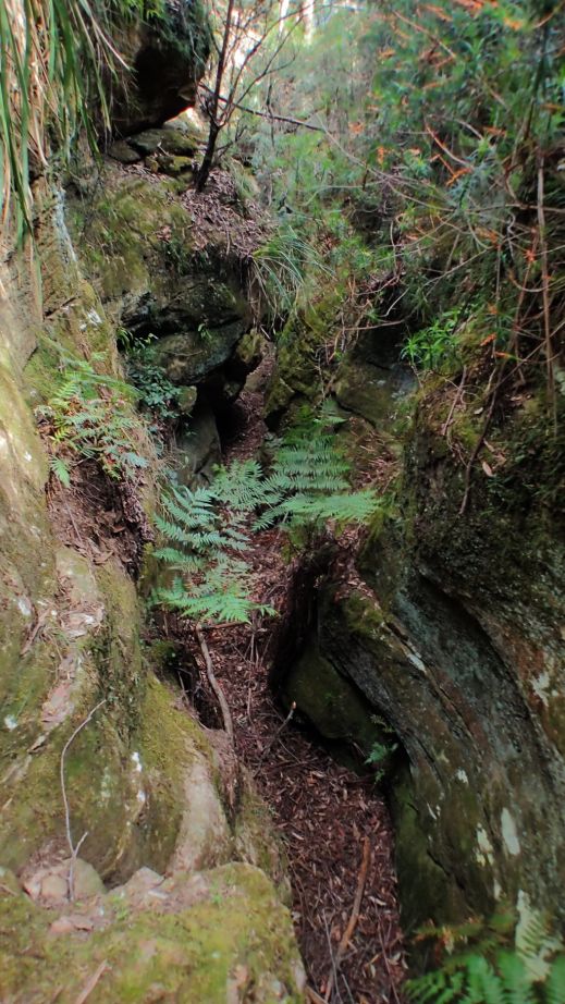
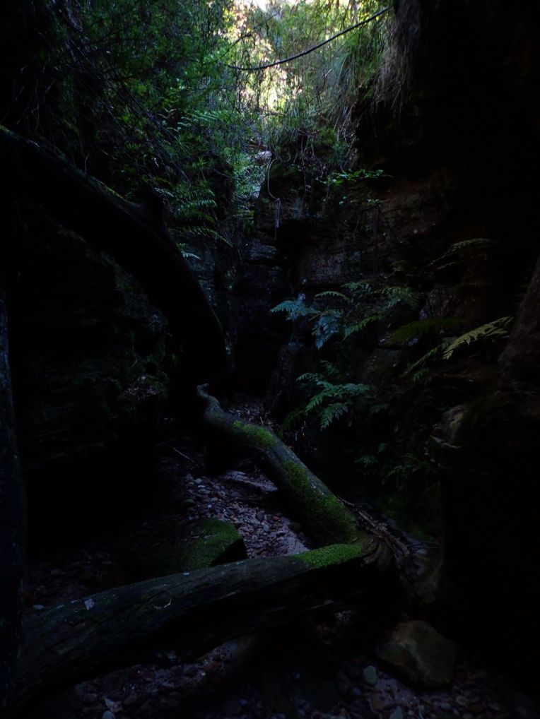
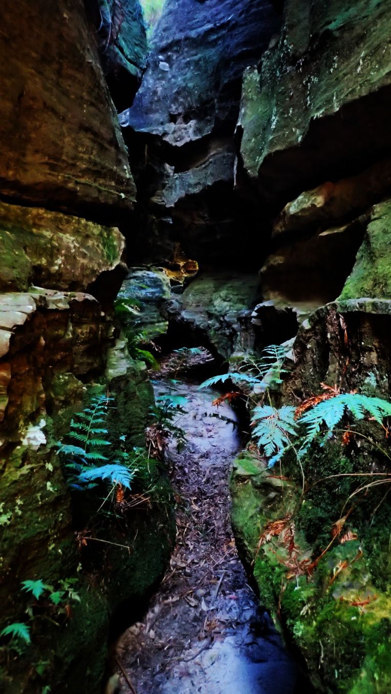
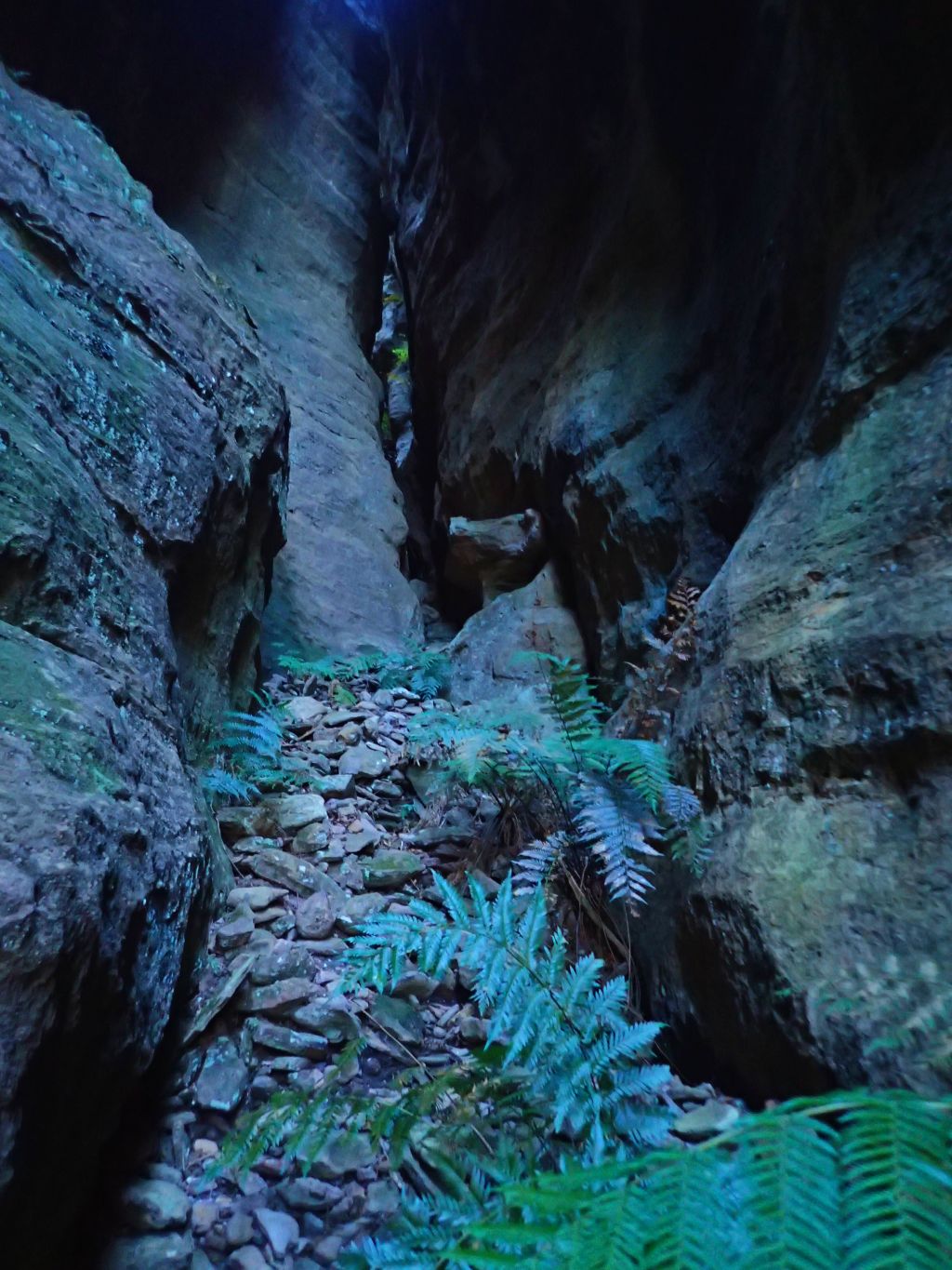
The canyon itself has some nice features (Some of the erosion caves are, IMO, on par with those found in Acoustic/Sunnyside canyon) and the tree ferns are awesome, but the canyon sections tend to be short and there is a bit of scrub, stripped bark and dead fall to negotiate.
All in all it’s worth a look if you are in the area doing other stuff
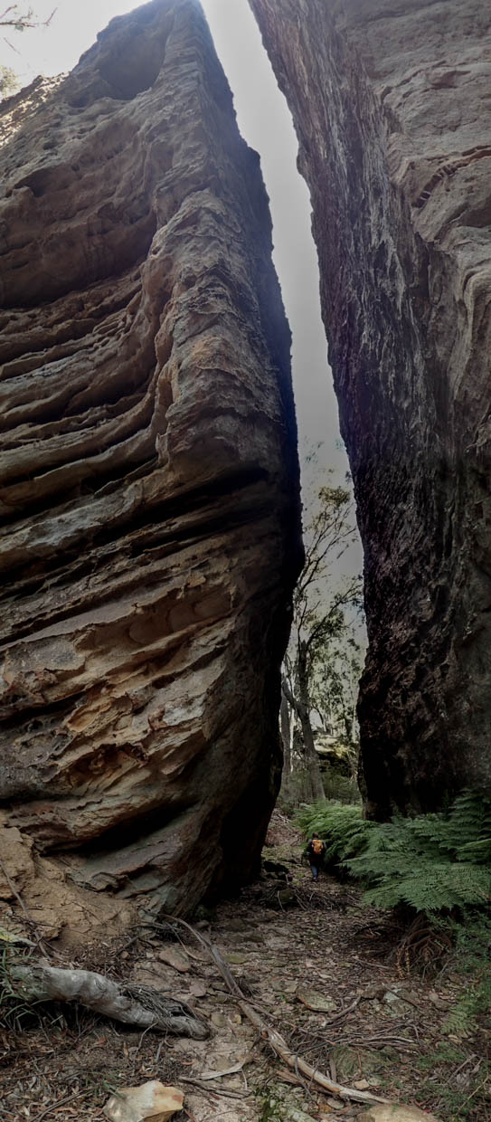
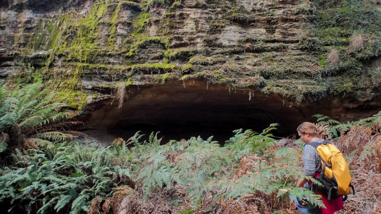
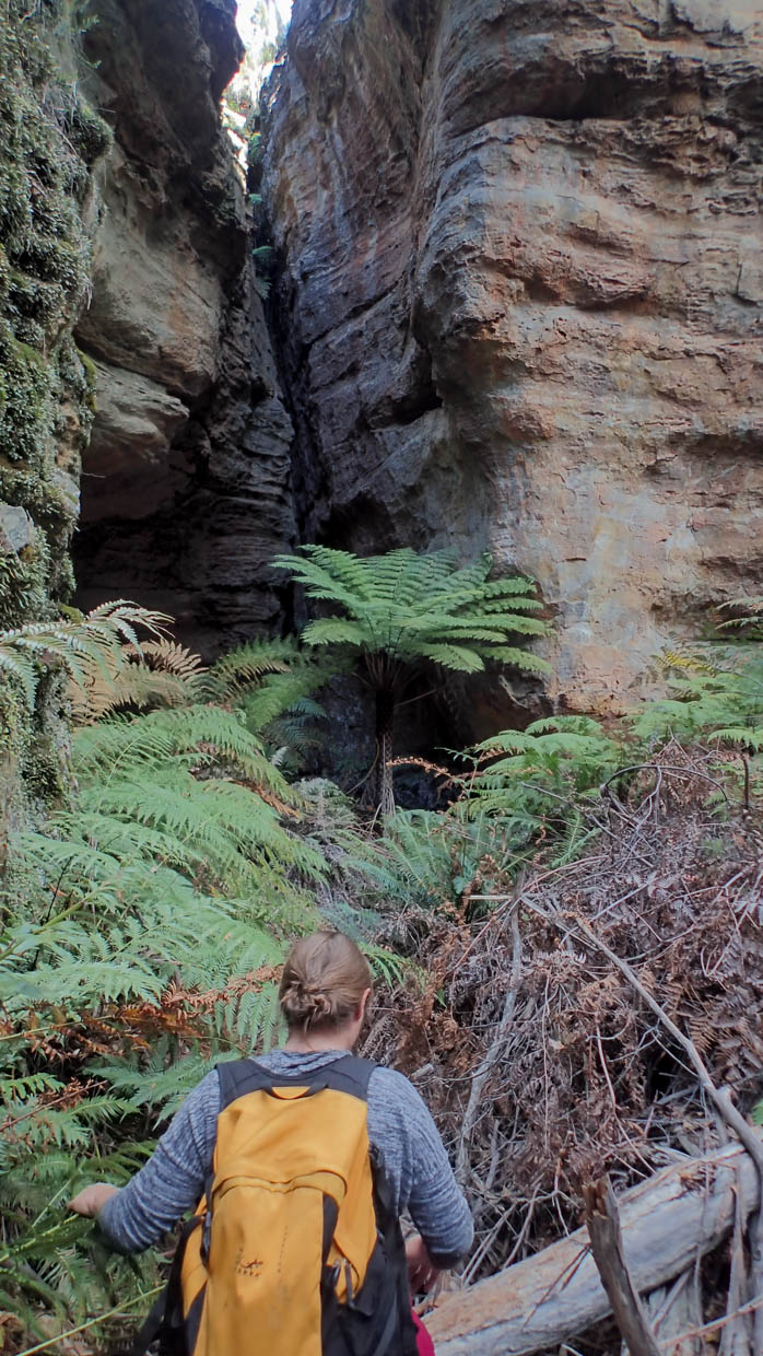
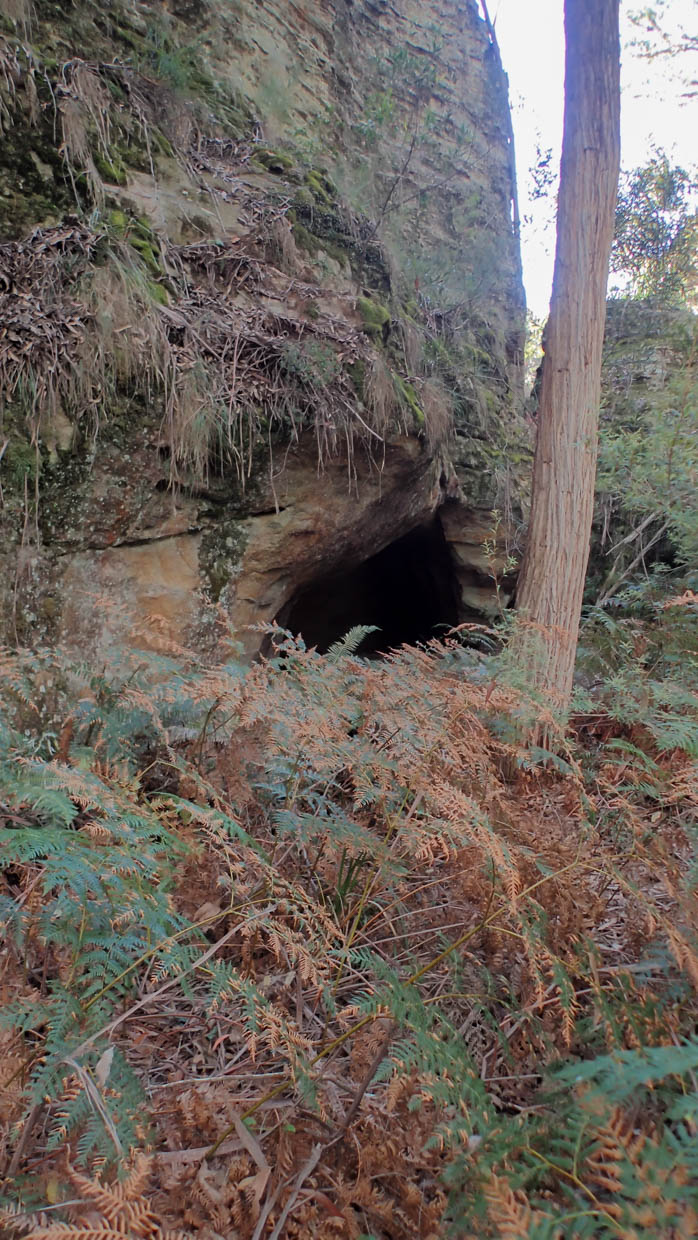
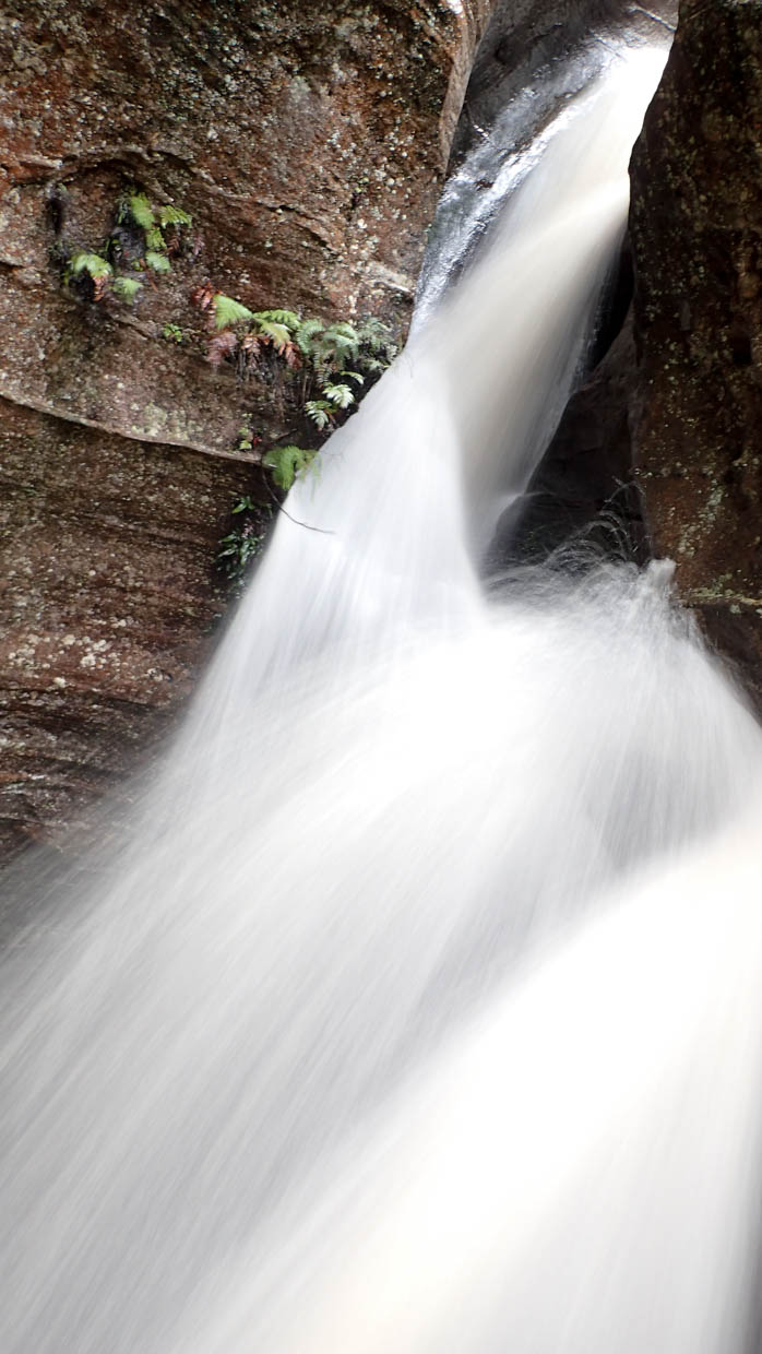
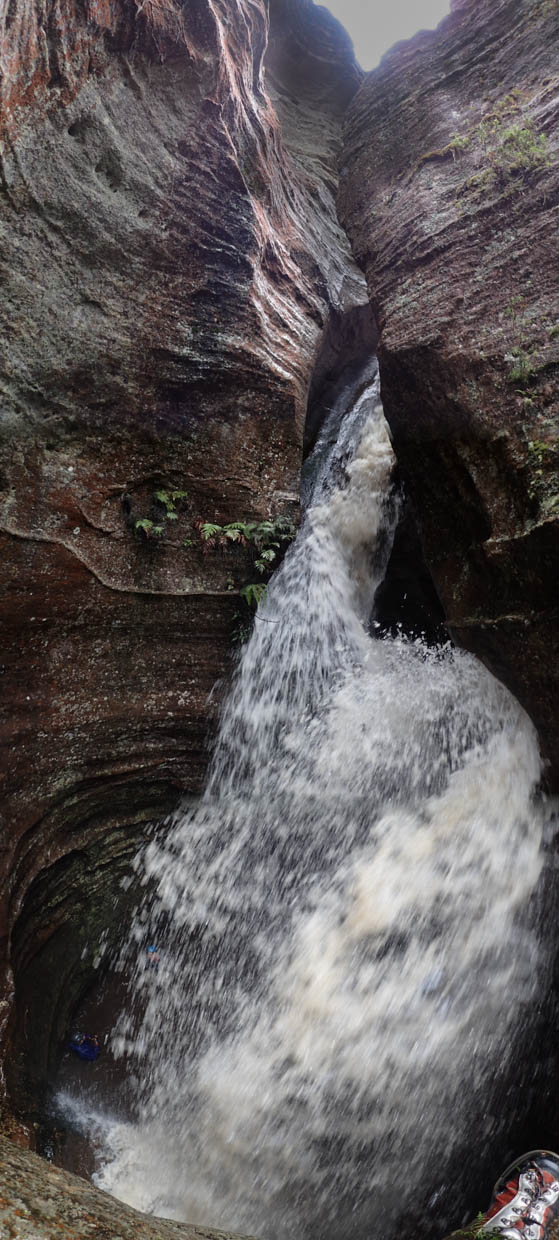
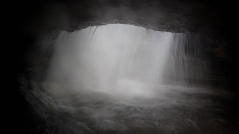
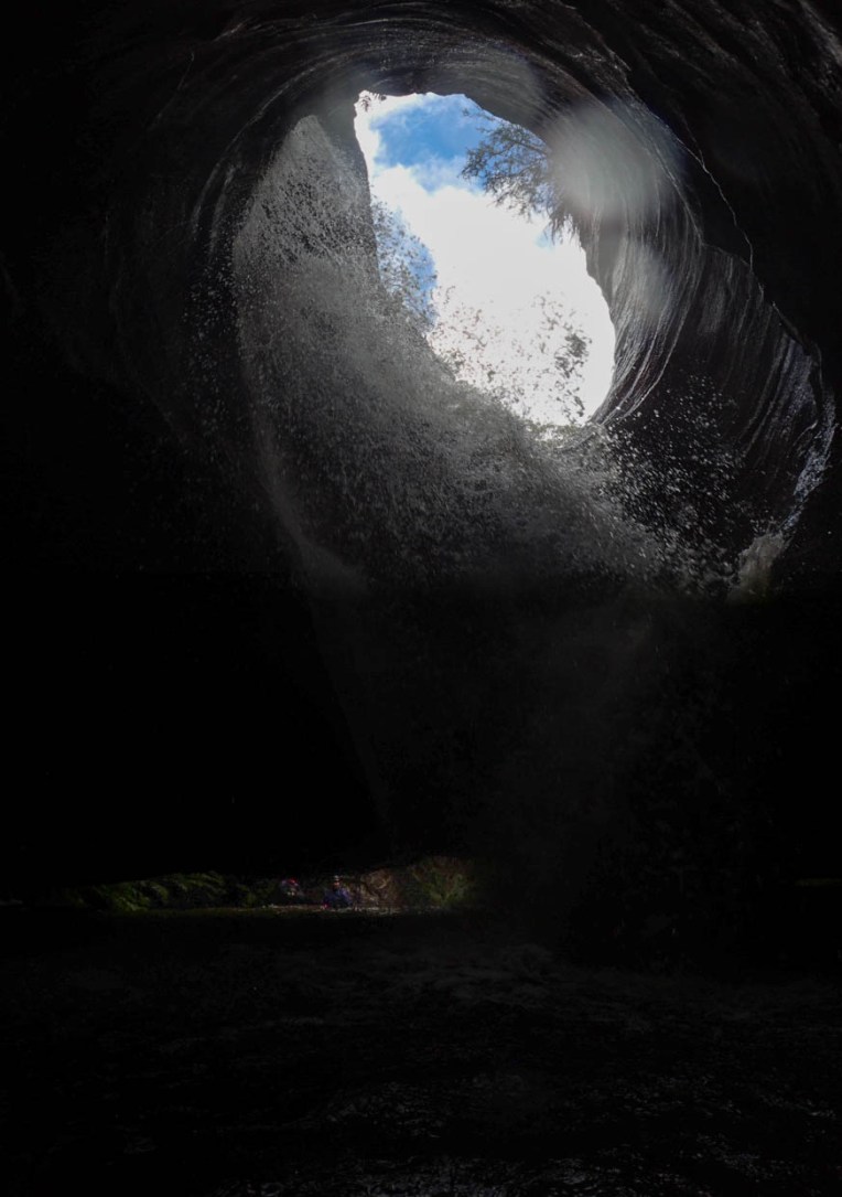
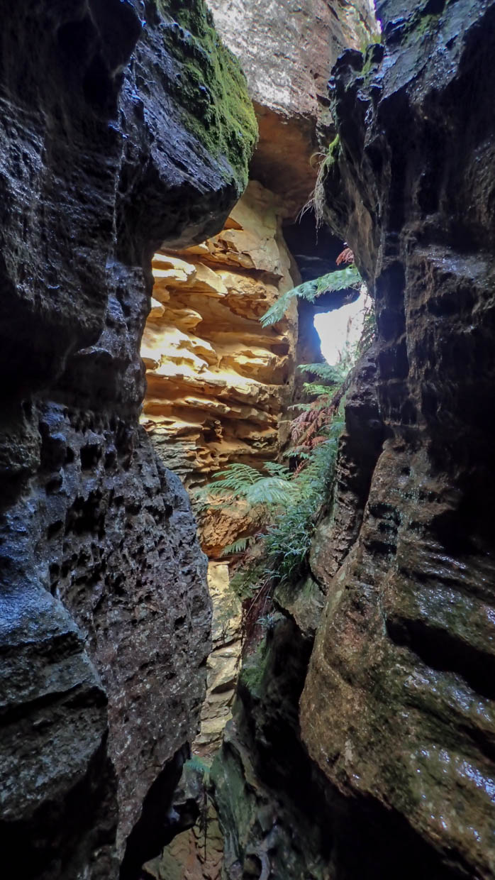
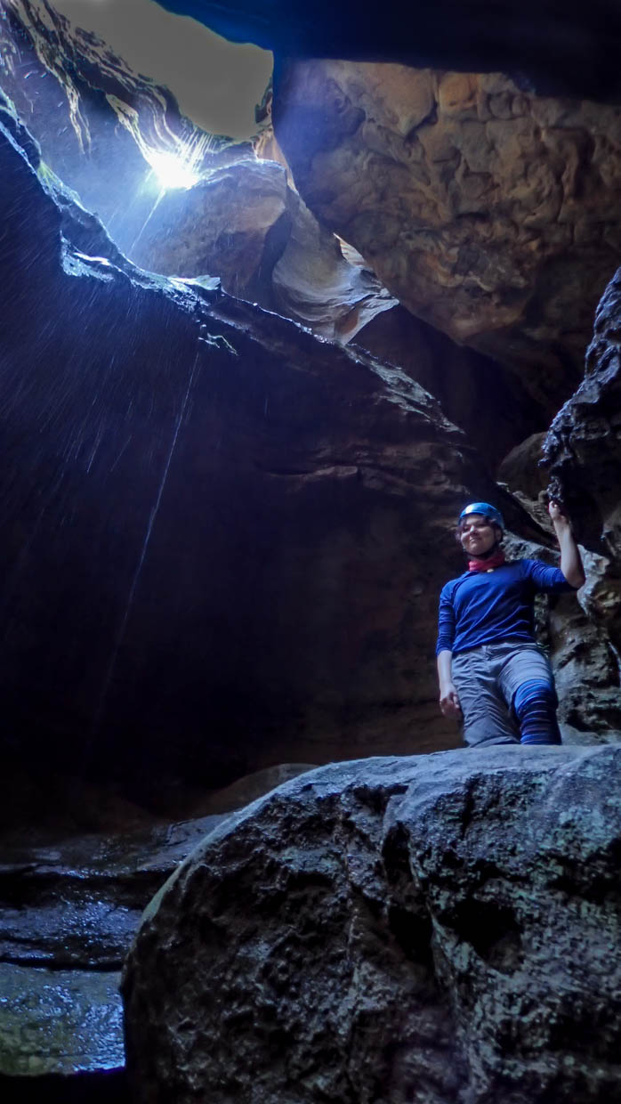
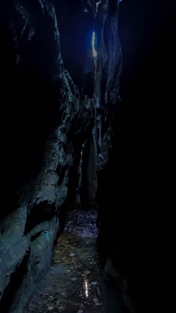
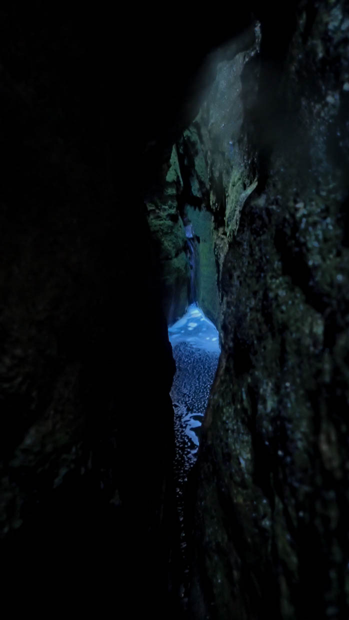
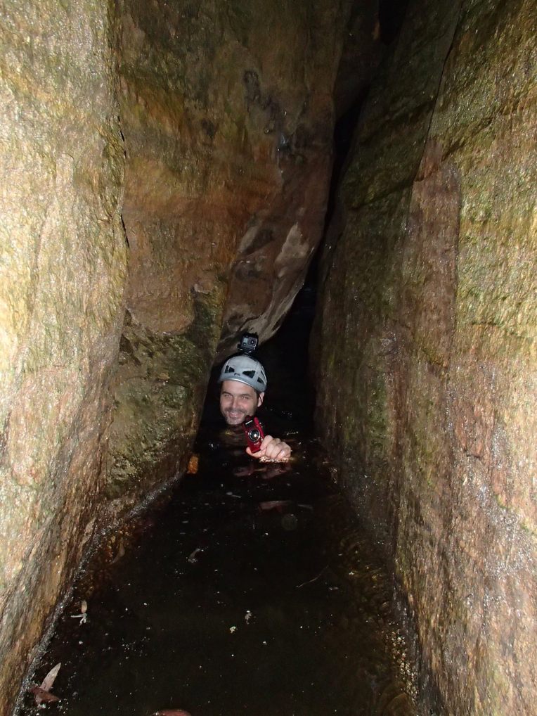
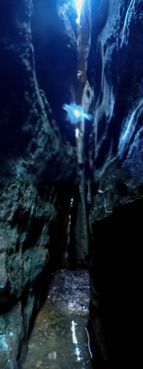
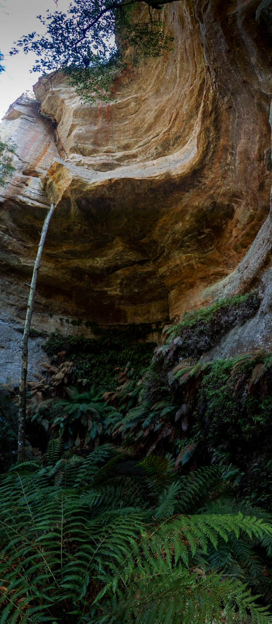
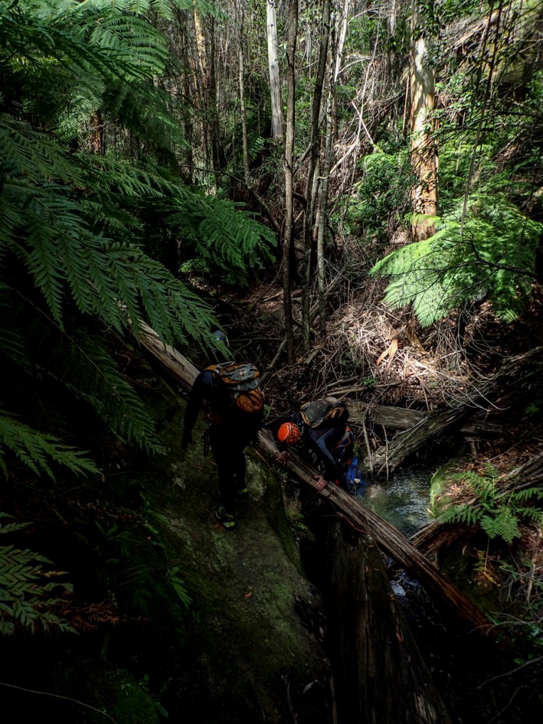
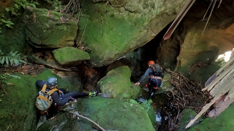
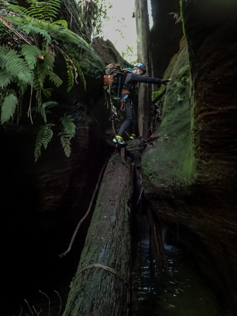
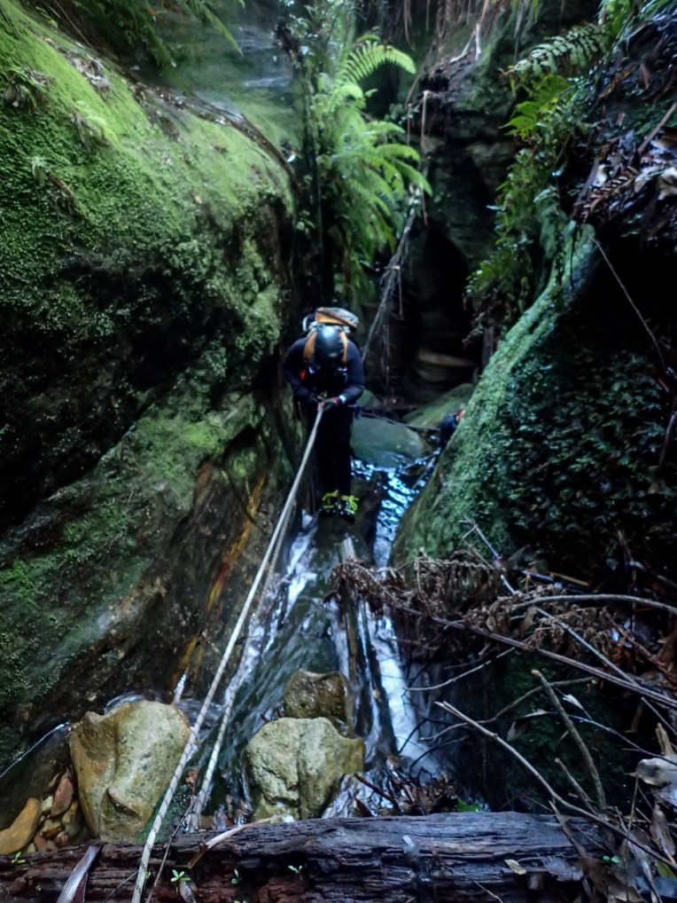
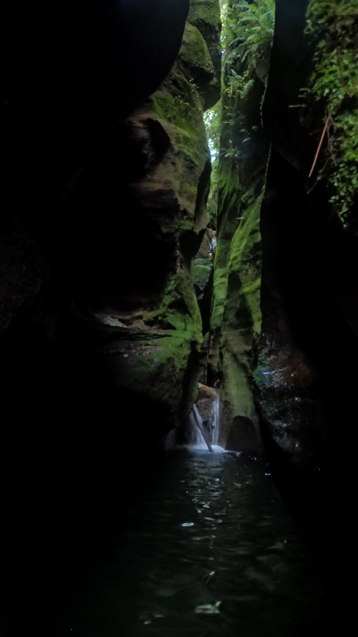
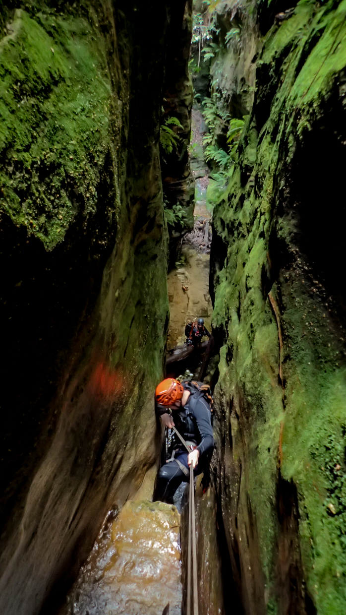
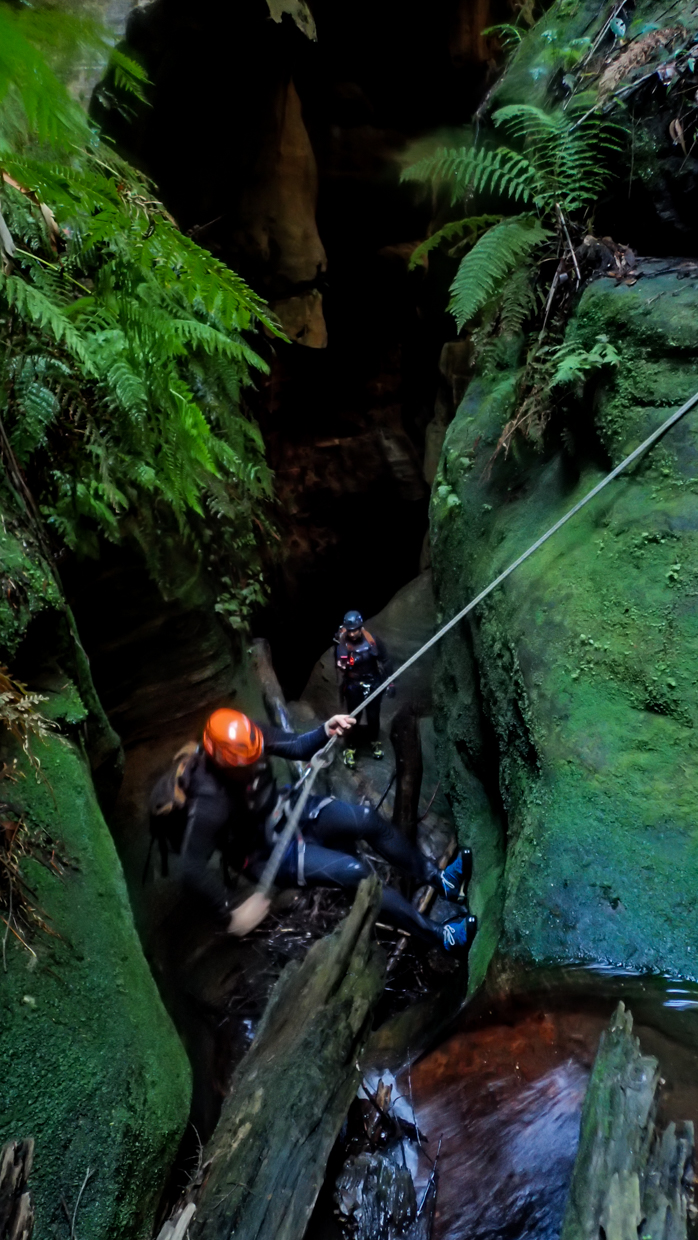
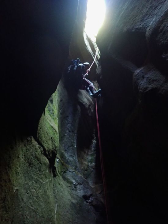
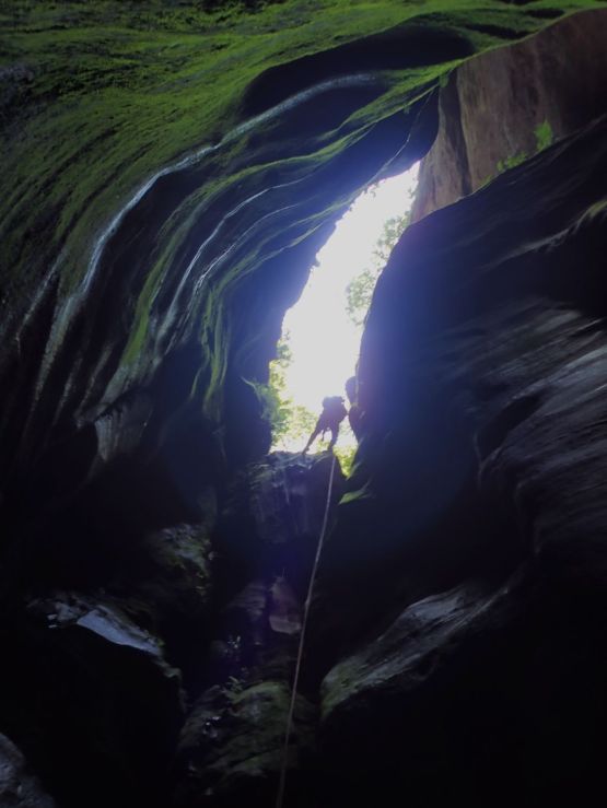
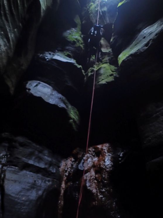
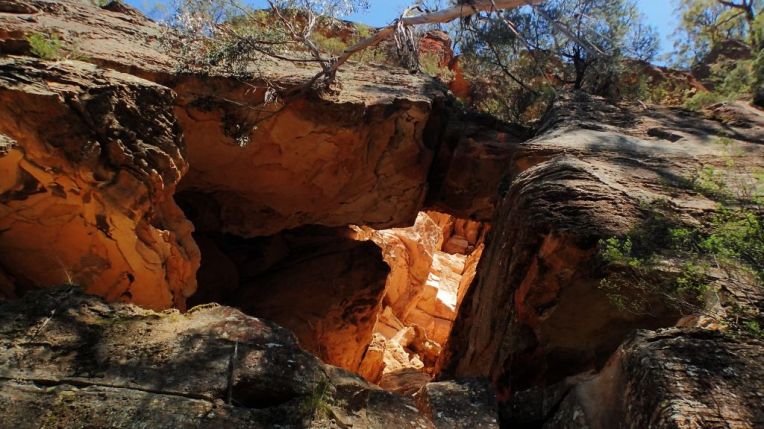
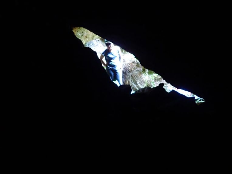
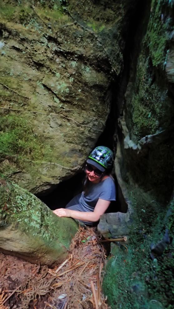
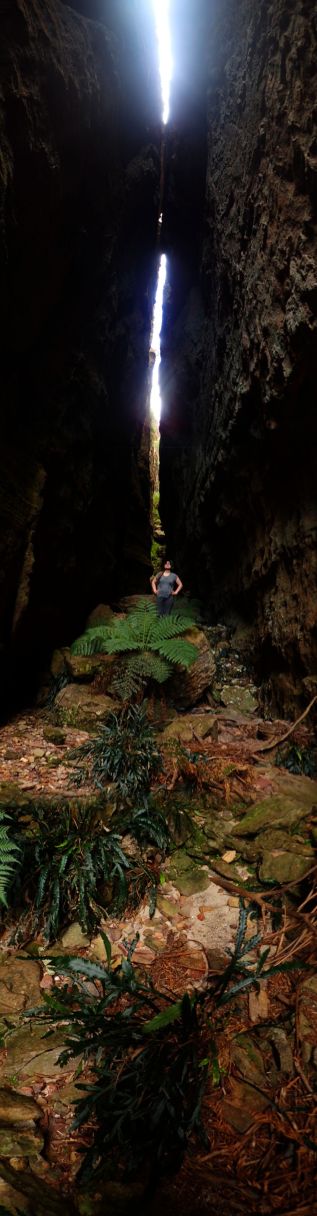
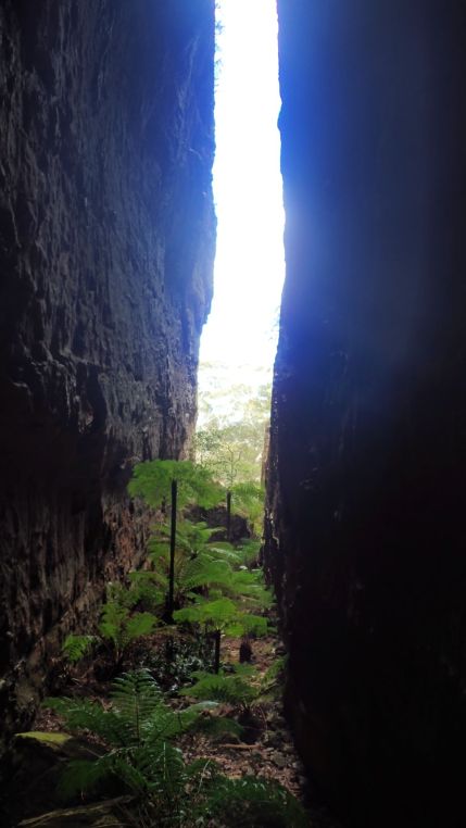
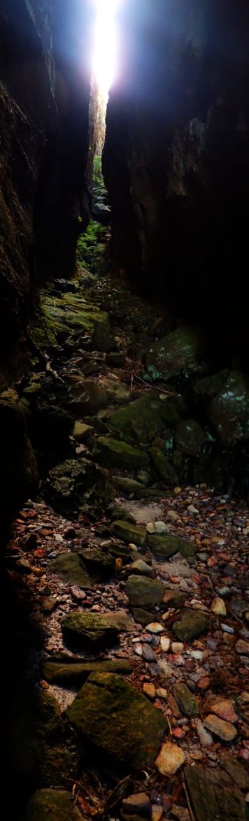
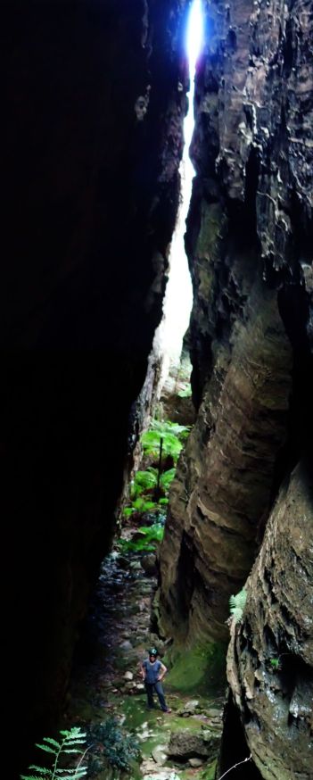
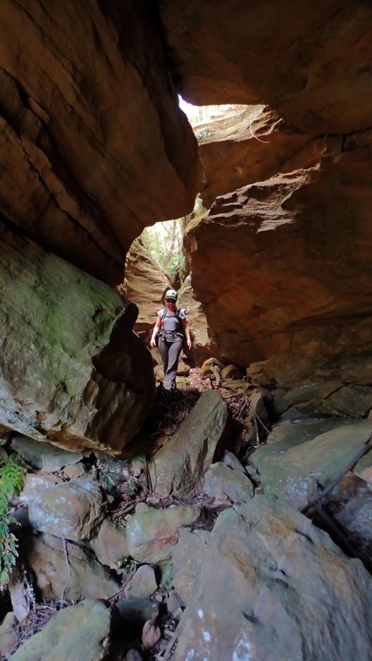
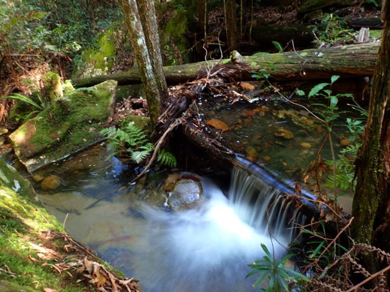
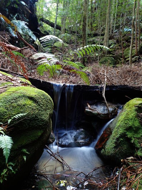
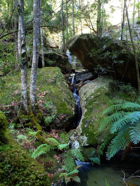
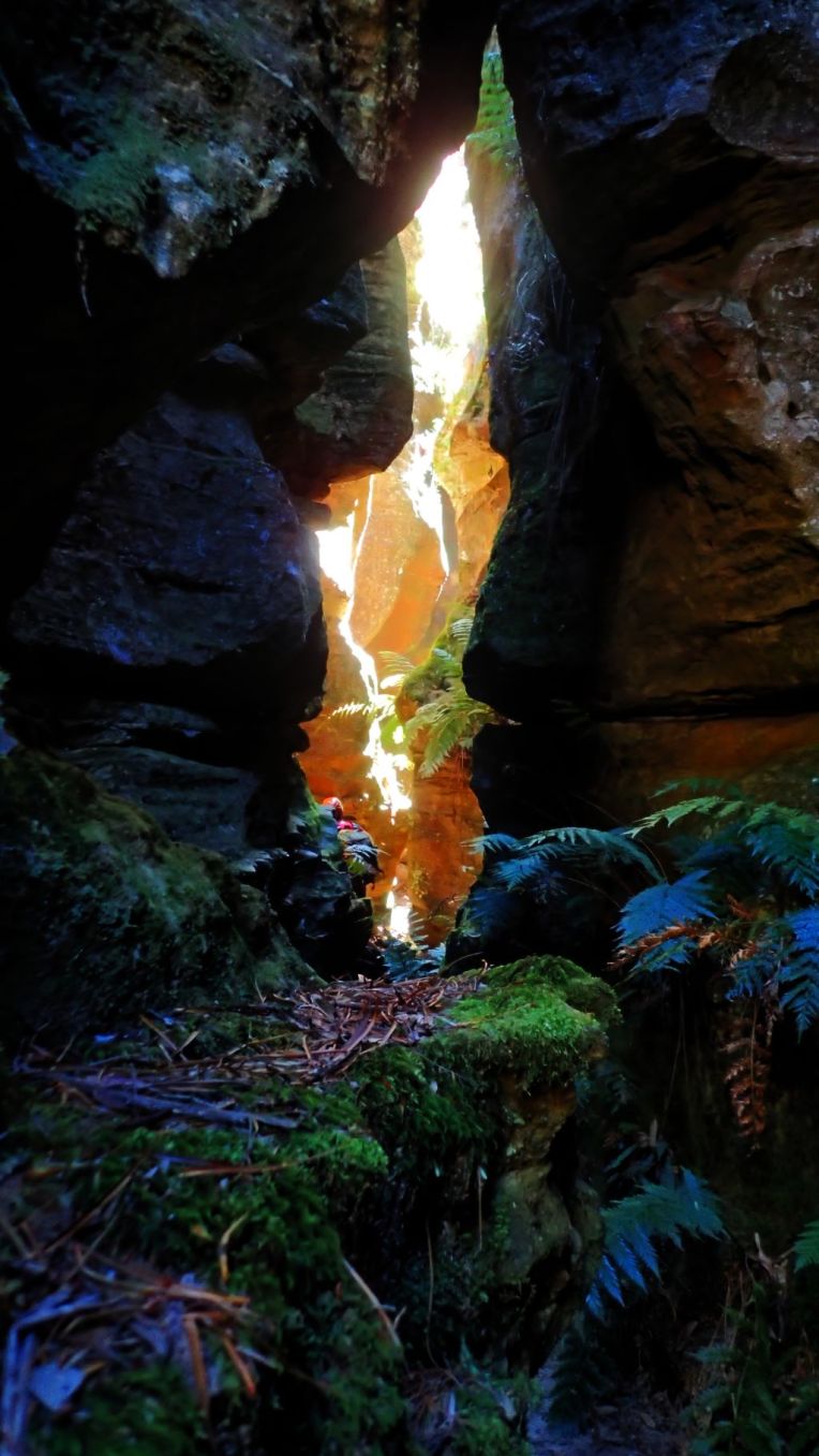
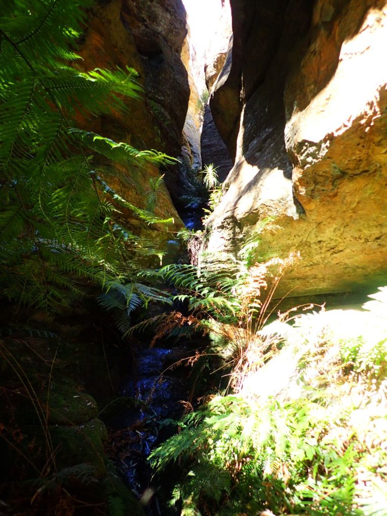
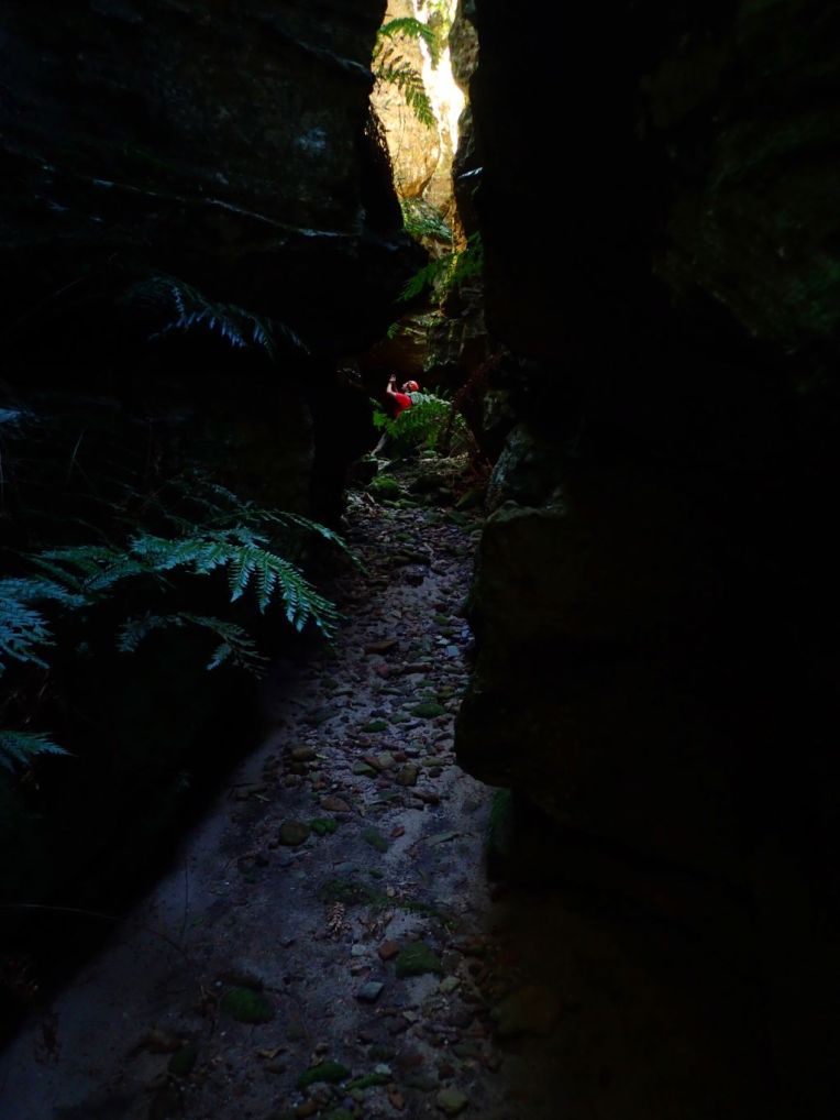
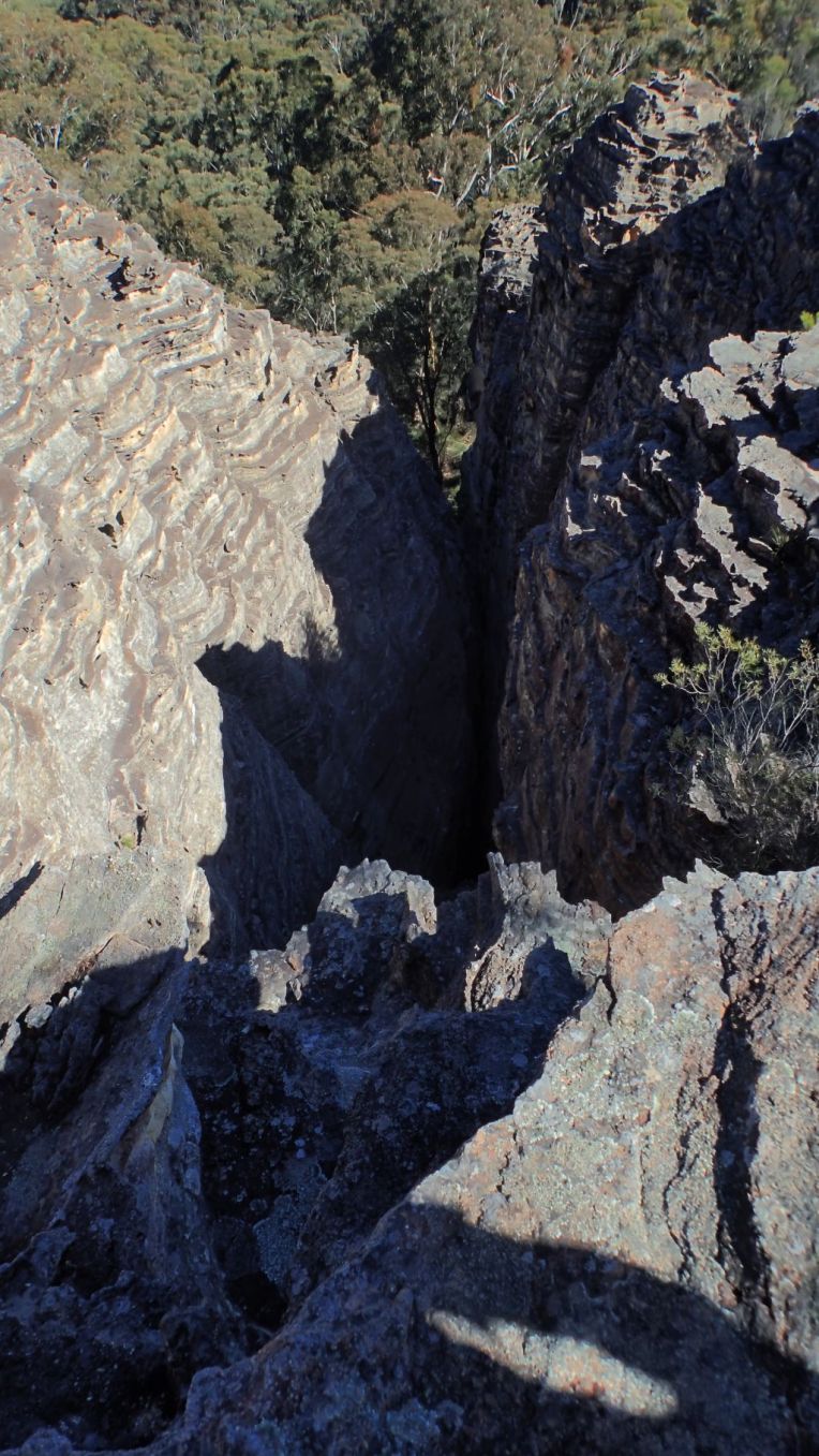
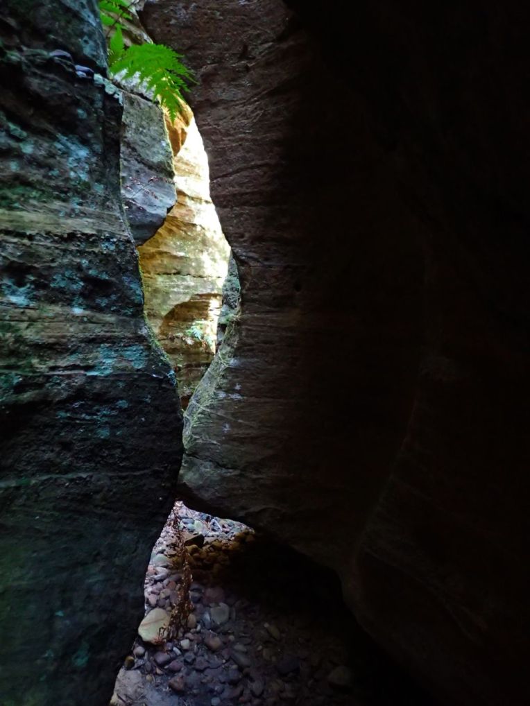
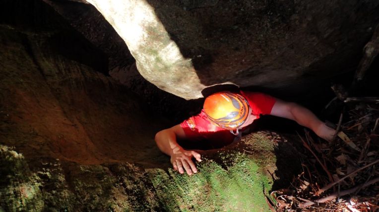
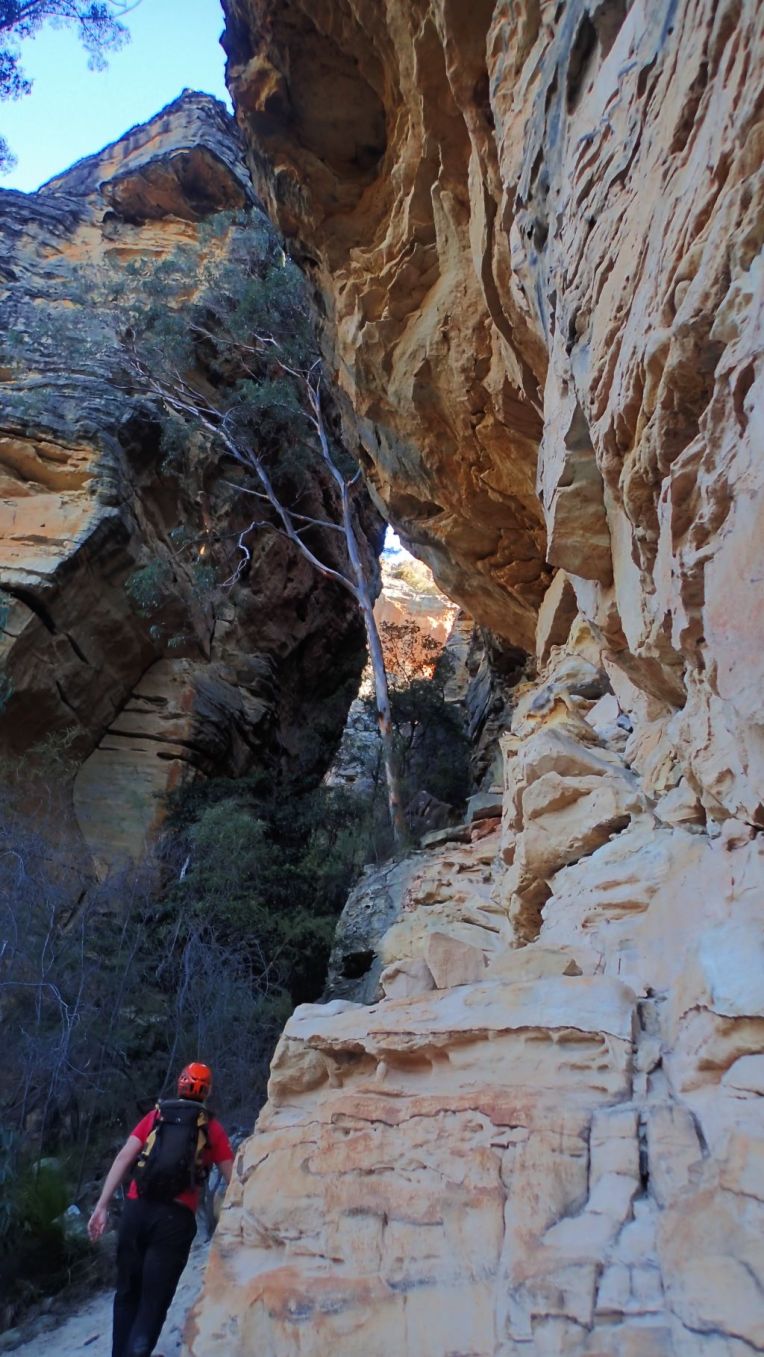
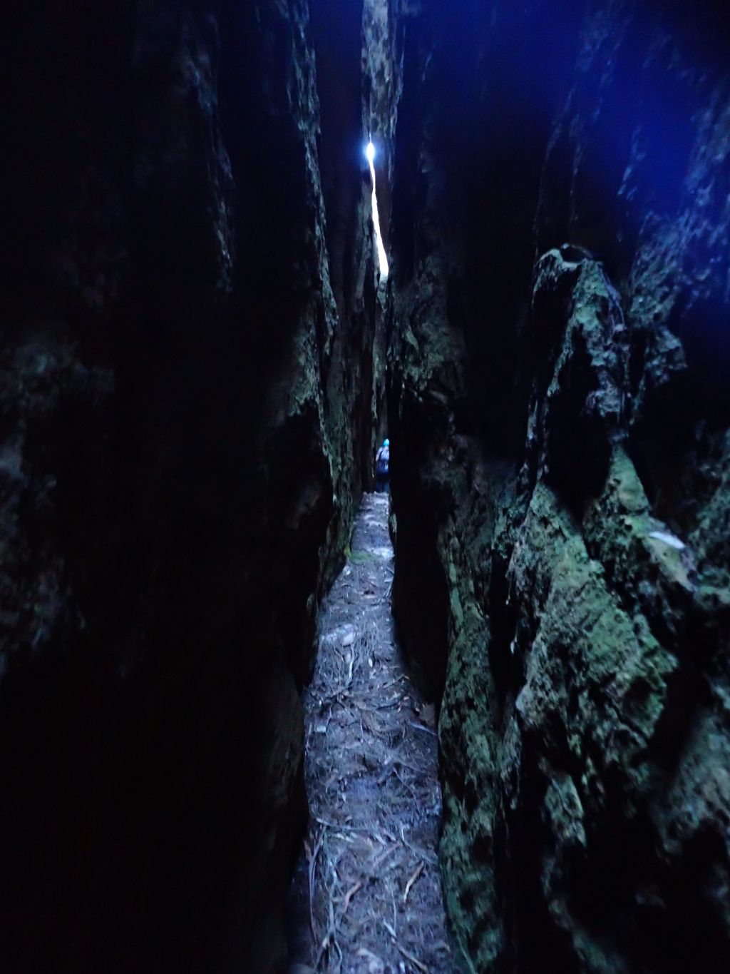
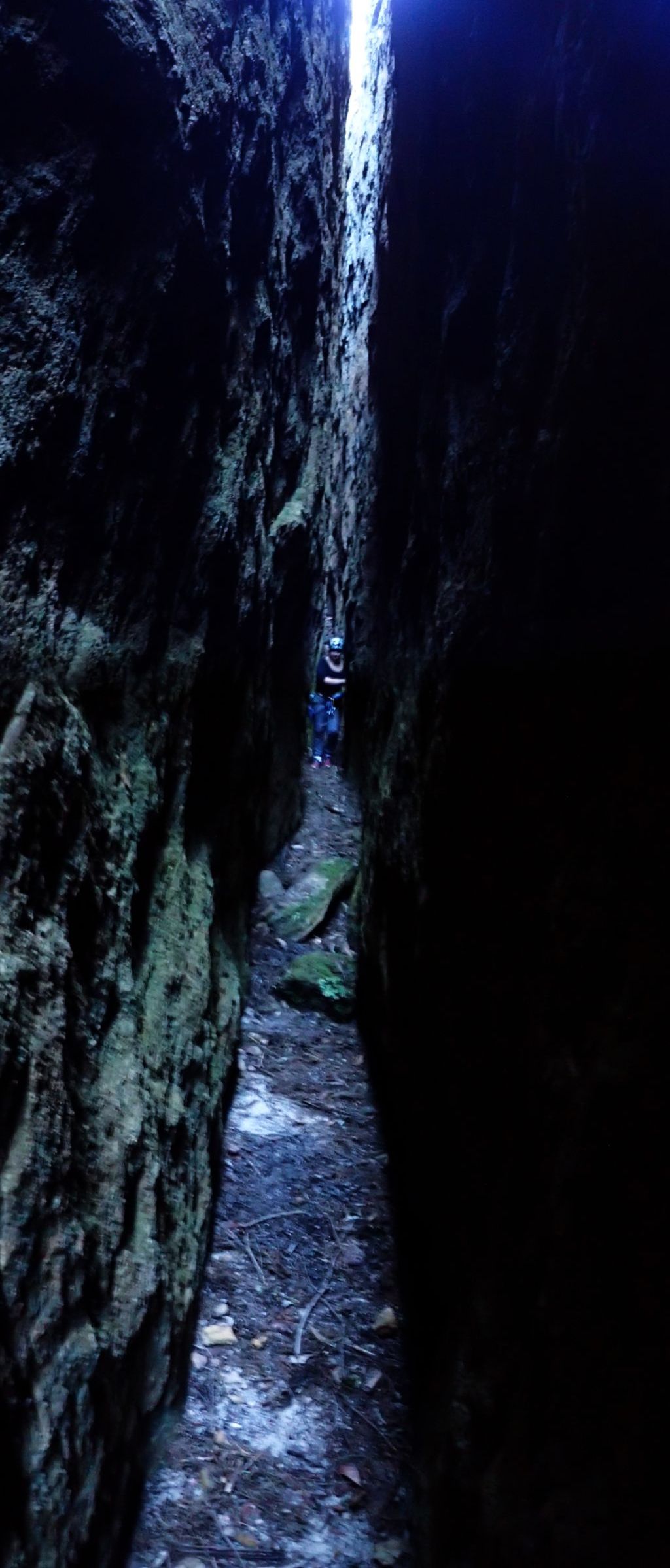
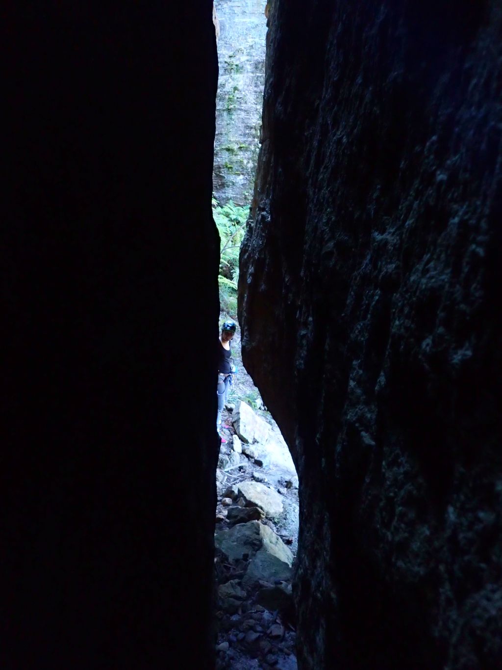
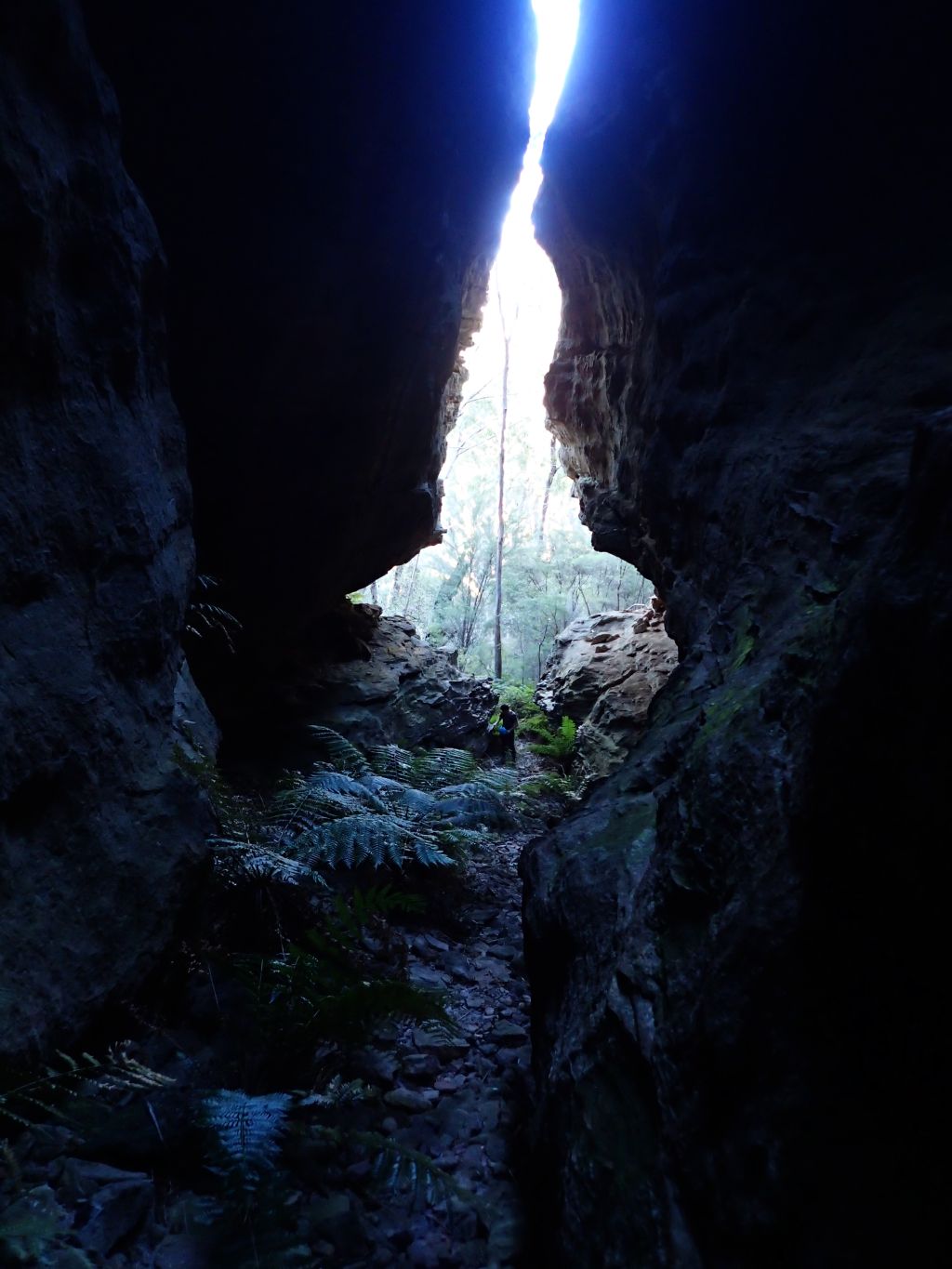
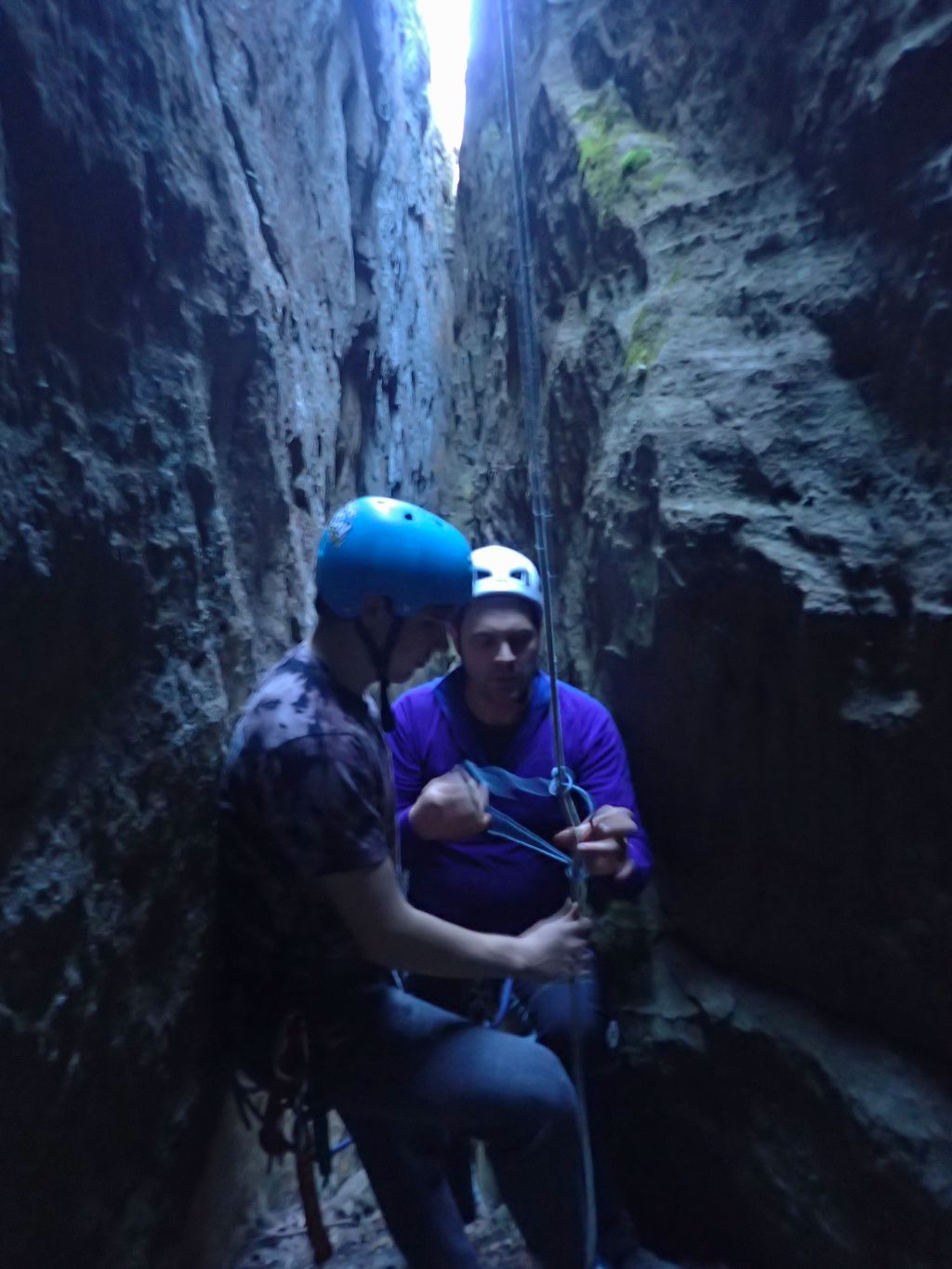
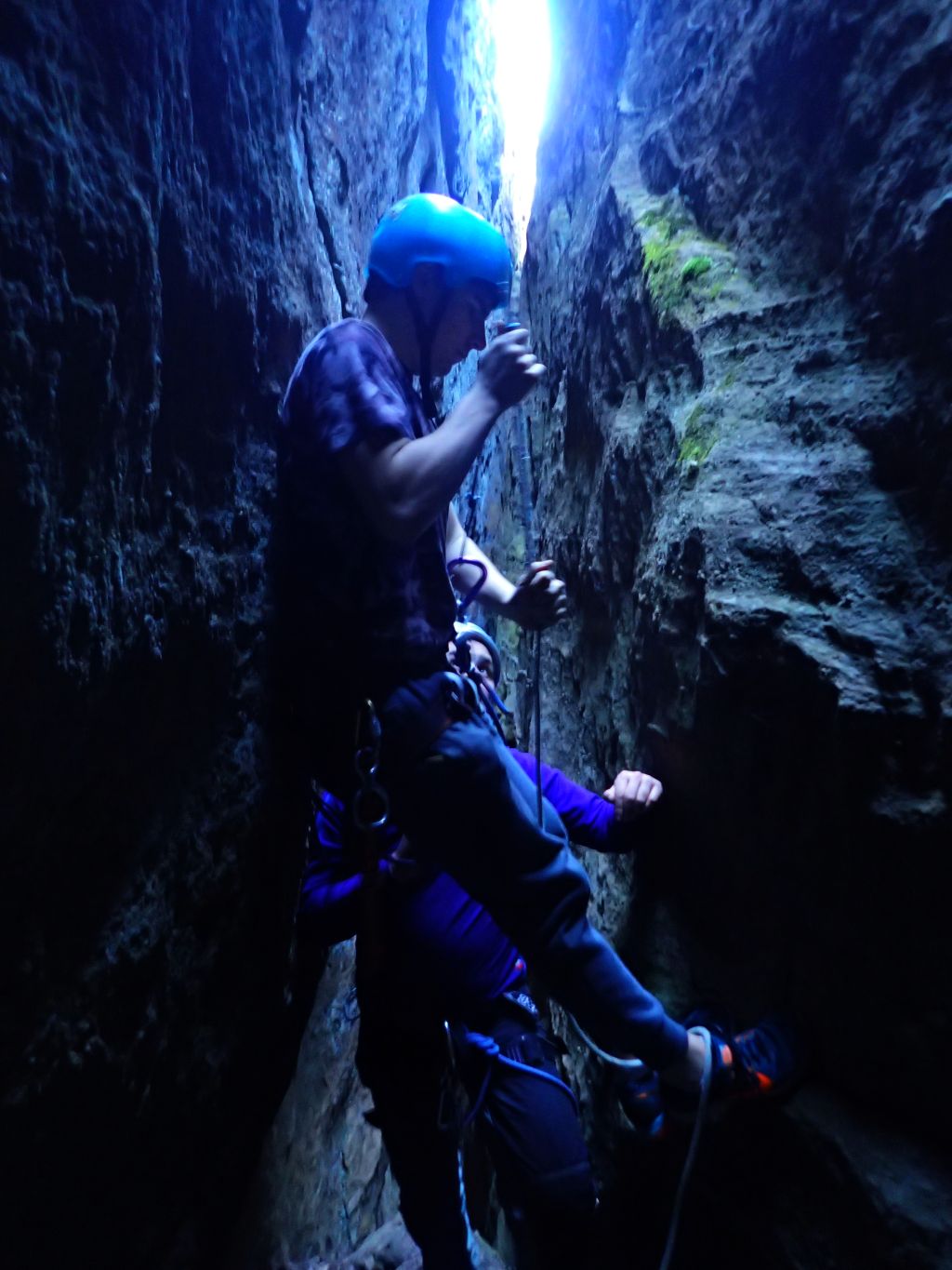
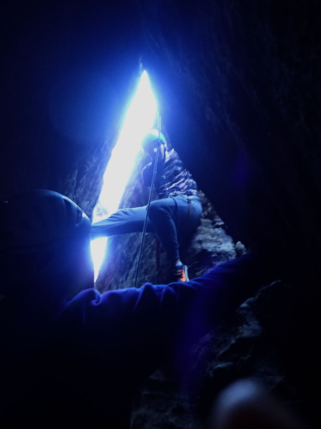
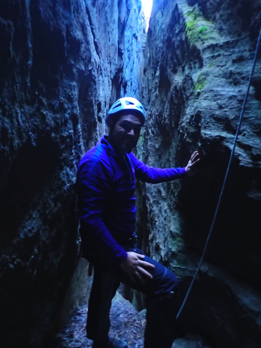
We followed a little gully down through a short canyonette but a 4-5m drop barred our way in this fantastic chamberLuckily it was easy to slip over the top of the pagodas and scramble down then approach the chamber from below.With the big wind swept over hangs in the upper cliff and the blanket of ferns commanding my eyes I would have missed this cave altogether if it wasn’t for Mandy disappearing into itSure the canyon sections were short but a couple of them gave promise of a deep, narrow passage.Did I mention tree ferns?Felt fern covered the walls, leaf litter and bark carpeted the floor.
OLYMPUS DIGITAL CAMERA
OLYMPUS DIGITAL CAMERA
OLYMPUS DIGITAL CAMERA
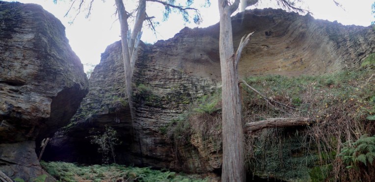
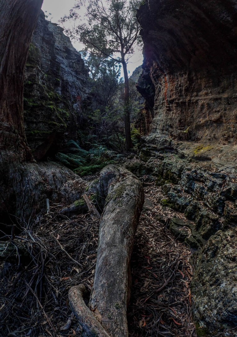
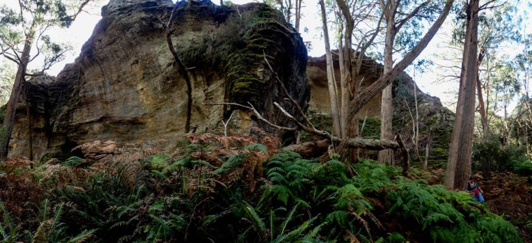
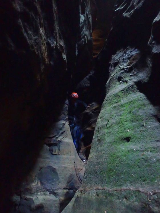
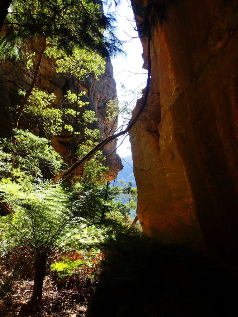
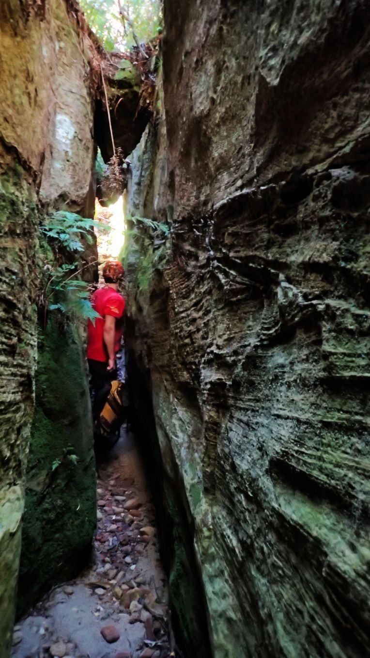
The dry creek bed followed the big over handing wall around almost 180°
OLYMPUS DIGITAL CAMERA
OLYMPUS DIGITAL CAMERA
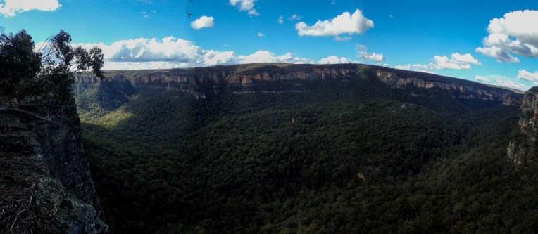
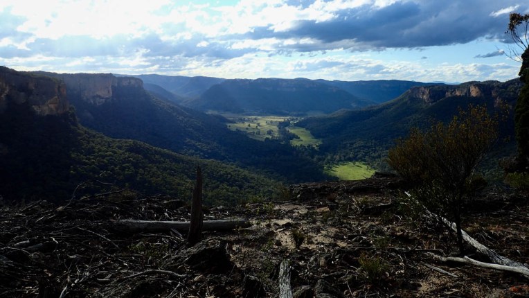
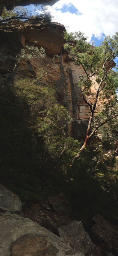
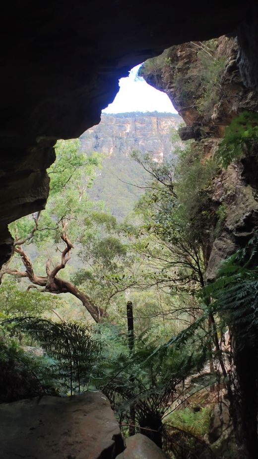
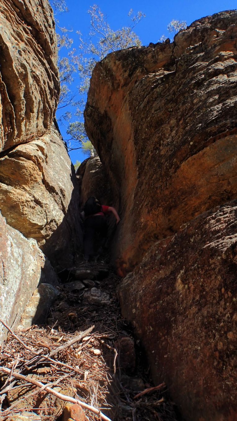
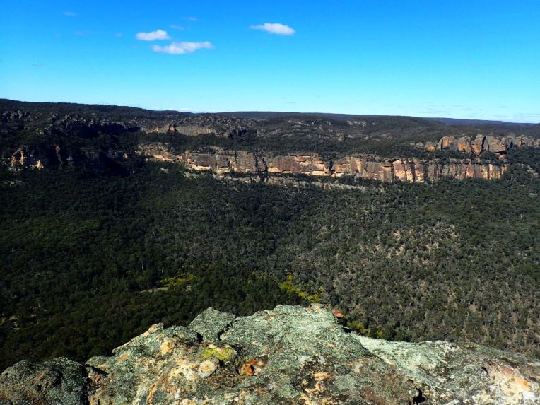
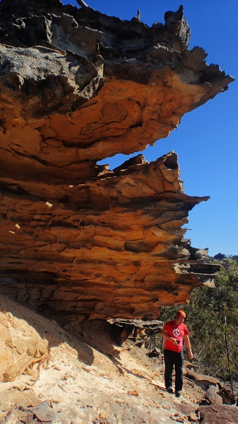
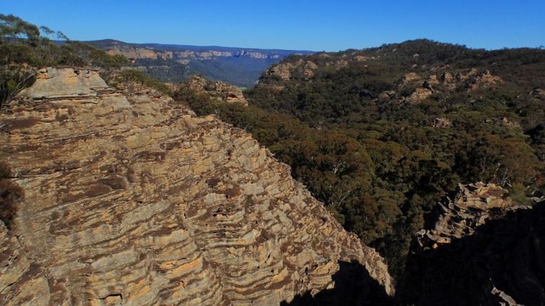
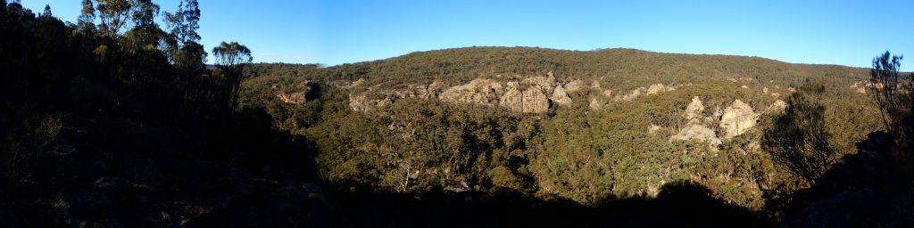
Scrambling out of the canyon gave this awesome view over the CarneThe pleasant view at the end of pleasant view canyon
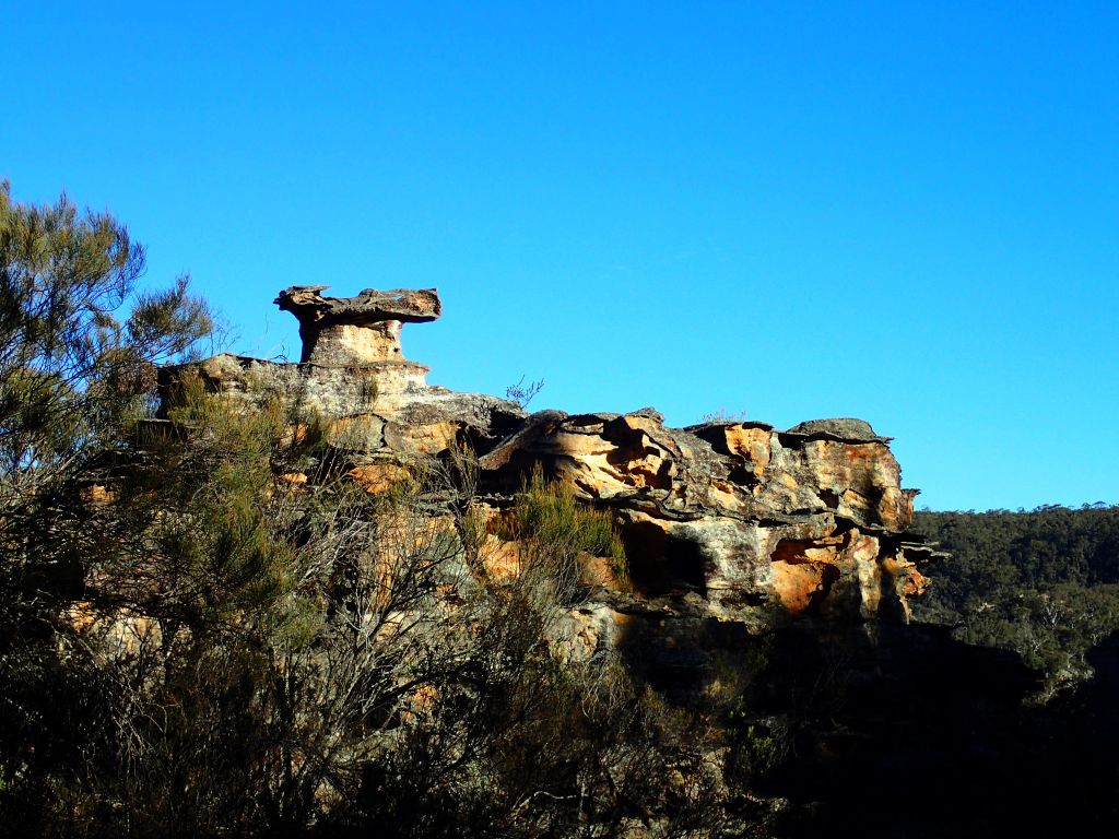
Xanthorrhoea spears back droped by towering cliff lines.
OLYMPUS DIGITAL CAMERA
OLYMPUS DIGITAL CAMERA
OLYMPUS DIGITAL CAMERA
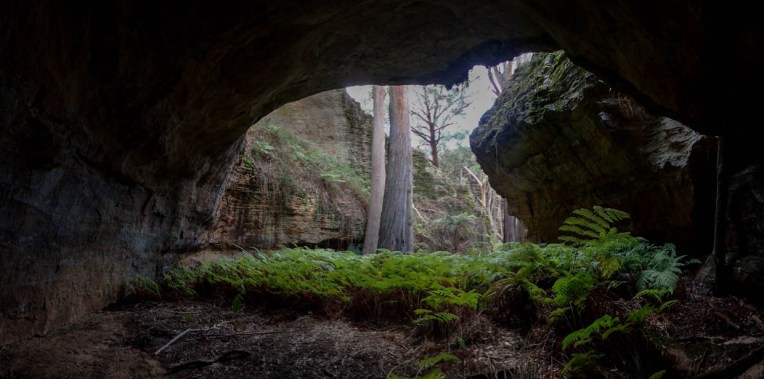
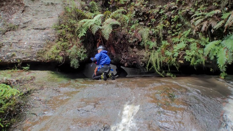
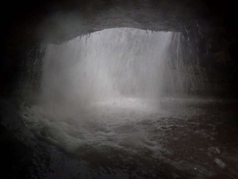
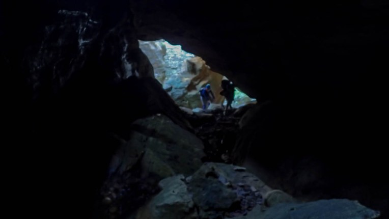
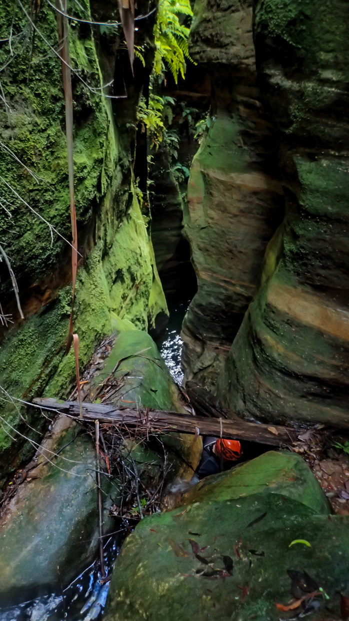
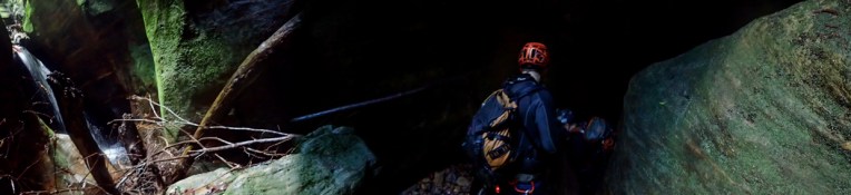
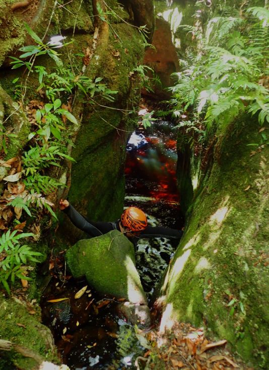
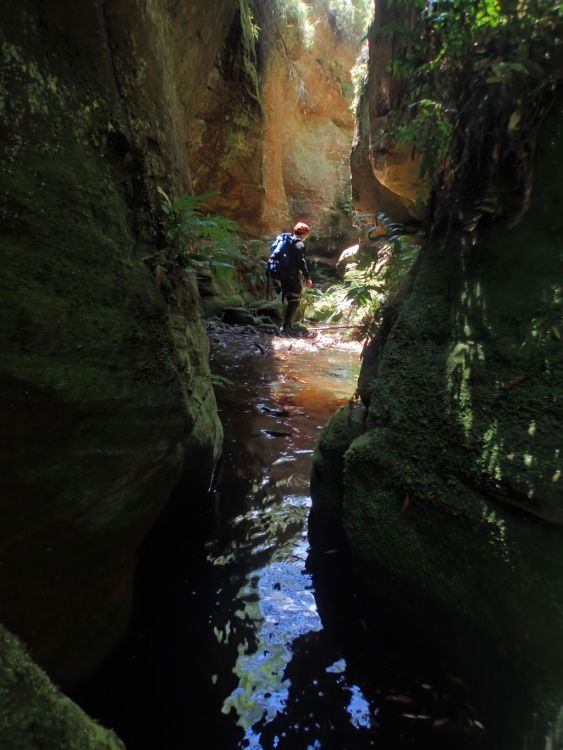
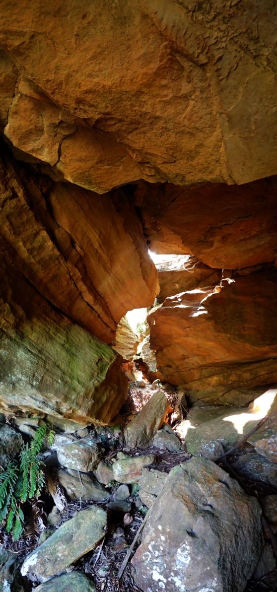
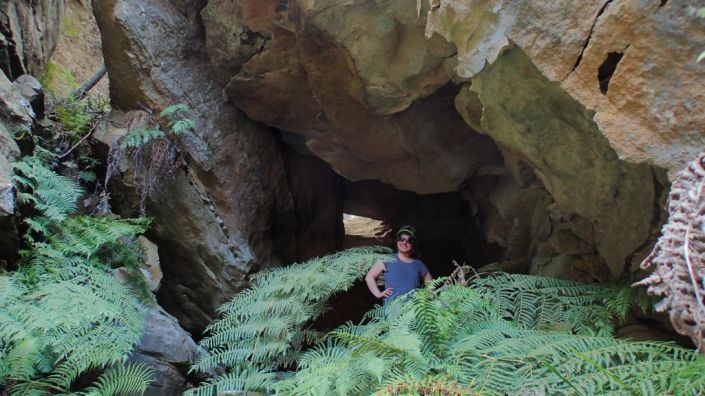
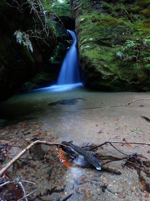
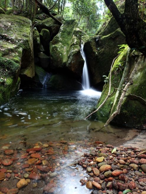
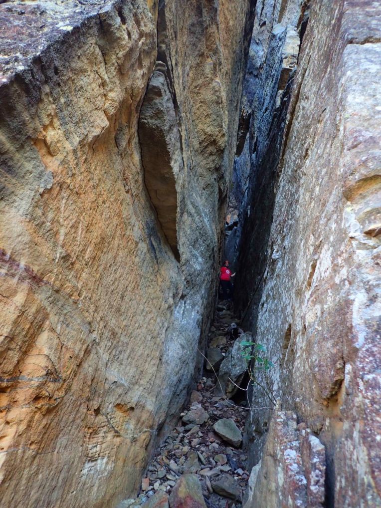
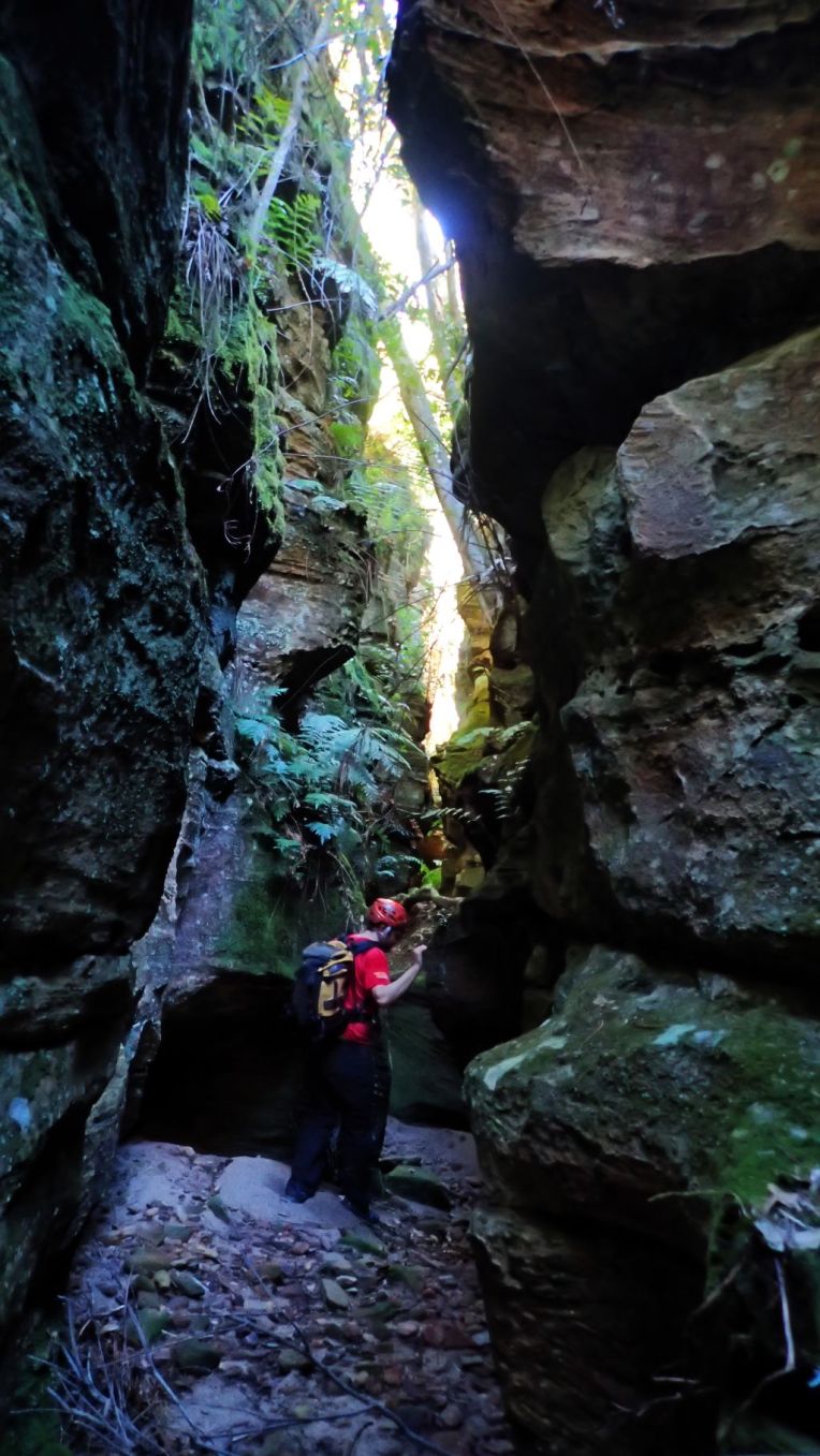
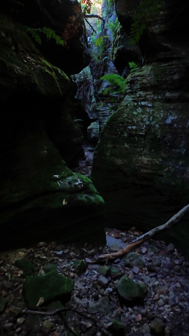
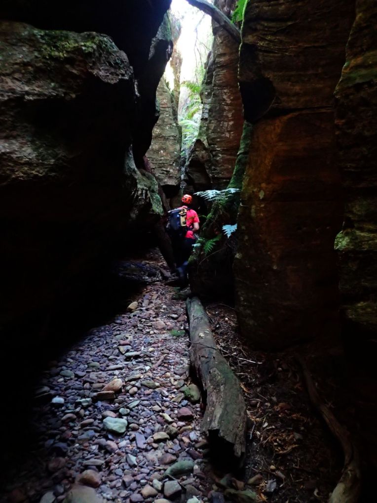
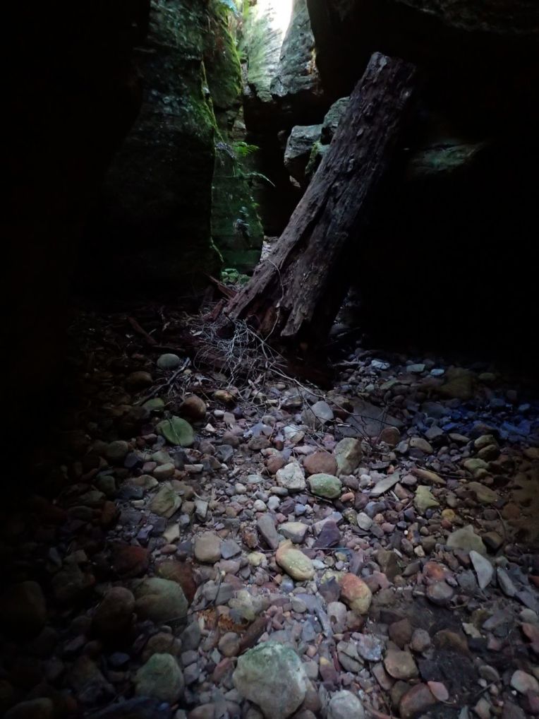
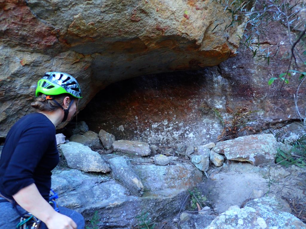
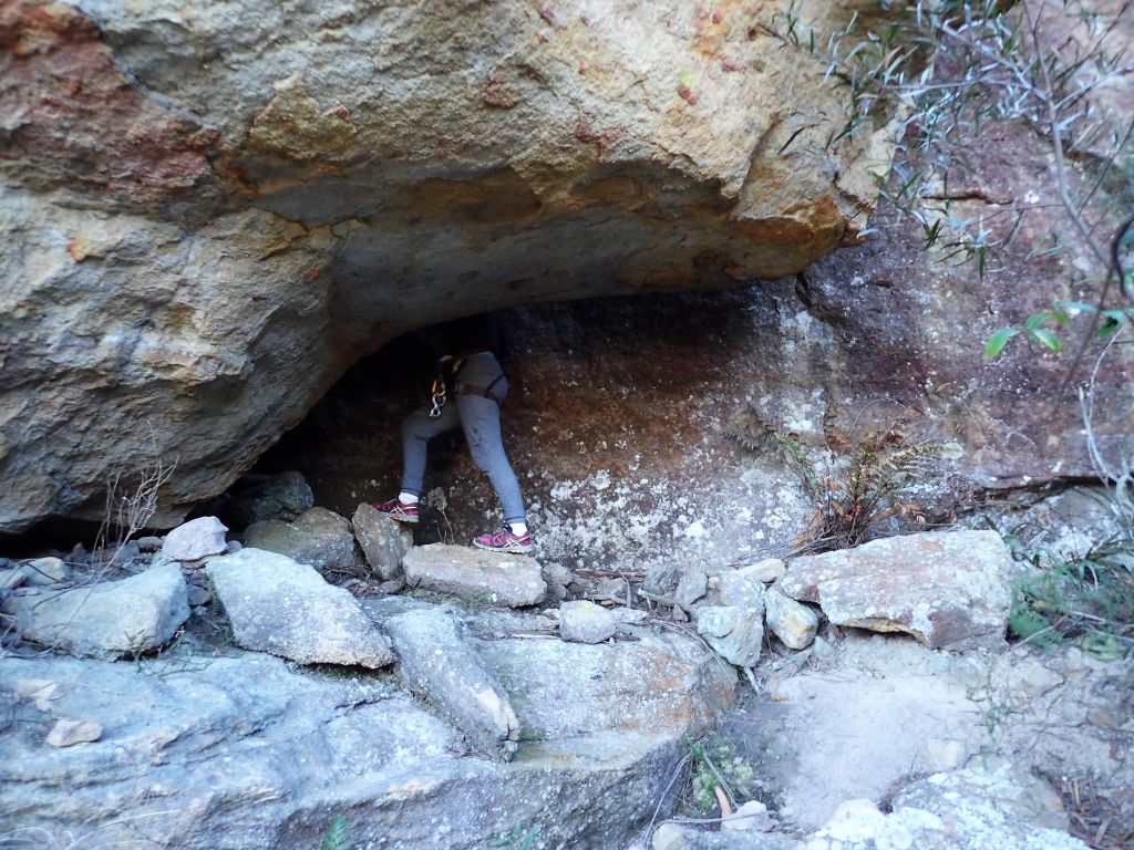
Another caveHeading back up into the canyonAnother cave
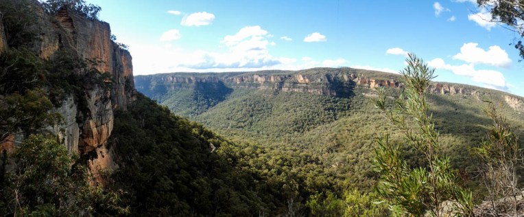
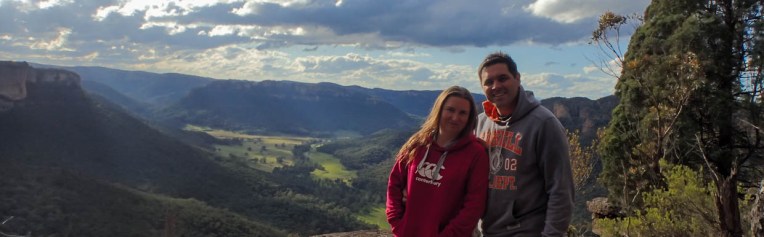
An even more pleasant view from the end of the fire trail above
So if you listened to the weather forecasters you’d expect to see a guy building a baot and collecting animals two by two or something.
Still I was keen to get out and was origanlly thinking one of the drier canyons out around Sunnyside might be nice with some rain.
Julie was keen and expressed an interest in doing Alcatraz instead.
Leaf posted on the Ozcanyons facebook group looking for trip she could join inon and we invited her along.
After a bit of discussion we settled on Alcatraz and a small double(or is it triple) canyon system out near the glowworm tunnel that I wanted to check out.
The forecaste went from gloomy to dire. There was some discussion on canceling the trip but thankfully we decided to roll with it.
Friday was ment to be the worse day. It was fine but the rain rolled in Friday night and belted down.
Saturday dawned sunny. A prefect day for a bit of exploring.
We met up and navigated the maze of roads into Alcatraz. The view down into the canyon from the cliff above showed the waterlevel well up but we suited up and carefully made our way into the anchor point.
Looking down into the slot, had me a bit concerned. I’d done it in high water with Ed and others a while ago and it was fine but this was up even more and without being able to see the exit I wasn’t comfortable dropping in.
We opted to descend the cliff beside it and make up way up from below. In hindsight it was likely doable but te canyons are always there for next time and I’m happy to play it safe.
Looking across into the spoutJulie setting the camera up while LEaf makes her way into the chamberThe chamber and exit were fineJulie and Leaf in the chamberInside the chamberInside the chamberThe exit slot
So a bit disappoint we didn’t abseil in but as I said there is always next time.
We made our way back to the cars and then continued out toward the glowworm tunnels for our next points off interest.
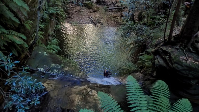
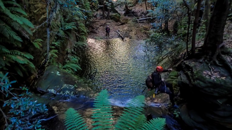
I had done the first little slot with Mandy from below and after checking the satelite imagry realised there was another system close by. This time we headed down the dry canyon (not so dry today) and then explored as far up the other system as we could get before retracingour steps.
It’s been a bit of a tradition over the last 5 years or so that at some stage over the Easter long weekend we do a bit of a longer social ride. We’ve done the Lithgow-Glowworm Tunnels- Wolgan loop a couple of times. Lithgow to Capertee via Black Fellow hands trail, Long Swamp, Baal Bone Gap, Crown Station was a good one. Sunnyside ridge return. All good rides with a more sociable atmosphere
This year I thought we’d try something different, it would be a slightly shorter ride but broken up with a bit of a bushwalk up into the bottom of the delightful Deep Pass Canyon.
The idea gathered a fair bit of interest so even though i knew a few of the regulars had other commitments I was expecting a largish group. but when I rolled into the meeting spot it was just Shawie, Richard and Wiggo there.
We waited until the appointed time and with no sign of anyone else headed off just the 4 of us.
No dramas, we’re all about the same level of fitness so while not turning it into a race we were able to push a steady pace.
Dragon sky or some such thingie was on so the plateau was infested with 900 or so scouts and venturers out having a bit of fun. In times when people often whinge about kids sitting around playing computer games it’s great to so many kids out learning bush skills. We came across them in groups of 4s and fives as the navigated the maze of fire trials between check points.
Your going the wrong way! called Richard as one group came around a corner. We are not! replys girl with map and compass but no sense of humour. Her friends had a bit of a chuckle. Not her. Serious face. Eyes on the prize.
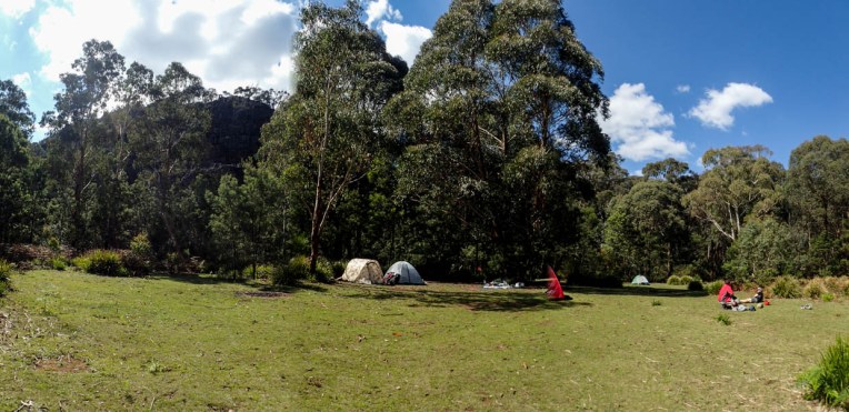
Anyway after a bit of a cold snap earlier in the week it was a pleasant day to be out riding and we covered the miles to the Mt Cameron fire trail turn off in good time and stopped for a bit to eat. From there it was down down and down into Deep Pass Clearing. An awesome walk in camp ground. The thought of lugging gear in and out the steep track on foot usually keeps the hordes at bay but today it was a little tent village.
Gus Norris and Russel May carved out a bit of a clearing and built a hut down here under an occupational lease way back in the day. The hut was once a popular stop over camp for 4wders, motorbike riders, walkers and partyers. It was dismantled in the 80s(?)
After a bit of a look around the clearing we stashed the bikes and made our way up the head waters of Nayook creek to the bottom of the very pretty Deep Pass Canyon. It was on a very similar excursion (Riding, bush walk, swim) I first visited this canyon on a school camp back in the days of my misspent yooff.
A bit of time soaking in the ambiance then back down to the clearing for lunch then pushing out bike up the steep track up to Deep Pass Saddle and then the steeper trail up through the cliff lines before remounting and taking the back roads homes.
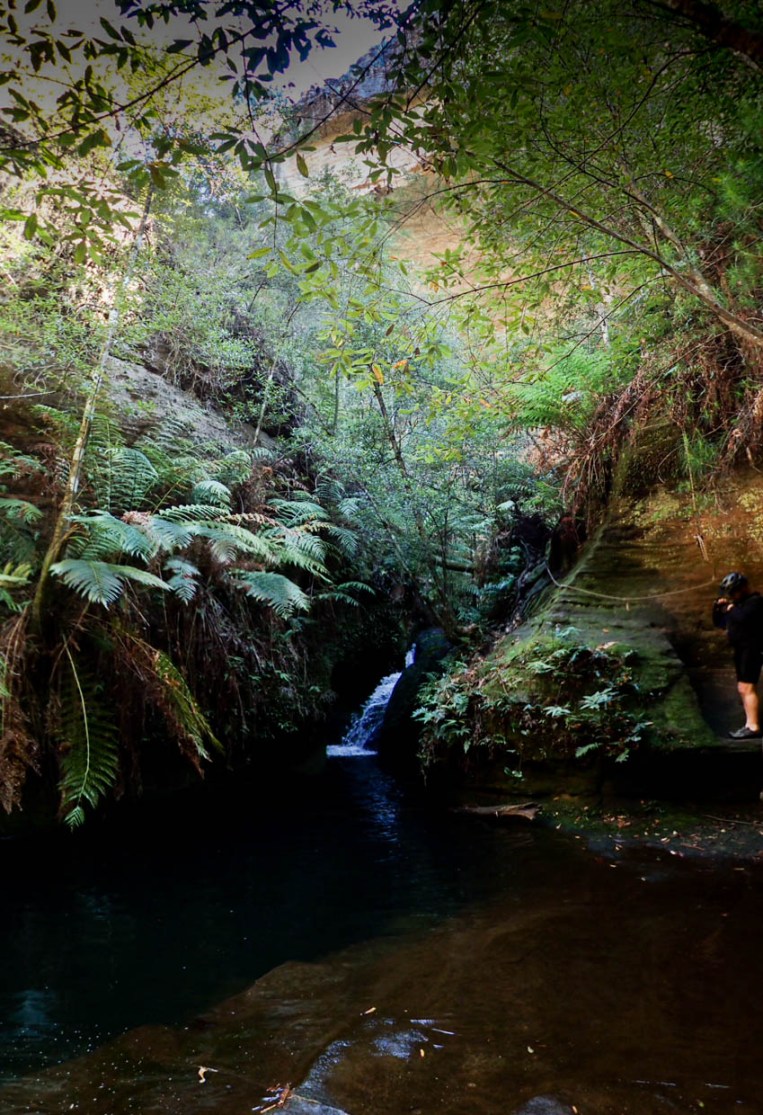
The little waterfall and deep plunge pool at the exit portal of Deep Pass canyon is a great spot for a dip on a hot summers dayRichard using one of the fixed lines to scramble up into the next sectionthe Second last waterfall is an even better spot for a swim and cliff jump
This was as far up as we went to day. It’s possible to scramble up into the canyon proper with out getting wet via fixed hand lines and an assortment of logs tethered to the walls in the narrow bit but cycling shoes aint the best option.
Julie invited me and Ed out on a trip out to one of the less raved about canyons on the Southern Bungleboori, accessed off Waratah ridge and we weren’t about to say no.
The original plan was to do 4 Dope but after all the rain the Julie suggested Dead Tree (AKA “Dead Log” in the Jameison guide) instead as 4 Dope required 1km of wading, swimming and, scrambling upstream to exit the Bunglebooori which may well be pumping.
I had previously read on Dave Nobles blog that he hadn’t thought much of the canyon on his first trip through (thou that was at a time when canyons like Rocky Crk, Crikey, Steep crk… were still being discovered) and while on a much later trip he was more impressed with it, of the 2 he still preferred 4 Dope. So even though Julie assured me she liked Dead Tree better I didn’t have high expectations for a spectacular constriction.
Whether it was these low expectations, the extra water flow or a combination of both I thought it was a great trip through a very pretty constriction with plenty of challenges to keep you thinking.
Anyhoo I get ahead of myself.
Oddly the Jameison guide suggests 1 day for 4 Dope but, even though it has a shorter walk in and out, suggests a “long day” for Dead ‘Log’ I’m figuring it must be slow going in the canyon so was a little surprised with reasonable starting time and we roll out of my place a little after 8.30am.
The Waratah Ridge car park was empty when we arrived (though had another 3 cars by the time we returned) and the walk out was fairly uneventful with a clear trail for fair way before we veer off the main ridge and head into trackless scrub. Julie is navigating and I enjoy just tagging along.
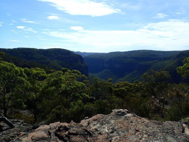
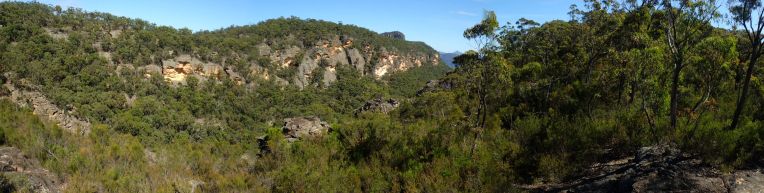
We wander out to the end of our ridge to a big pagoda complex that offers views out over the trackless wilderness of the Southern Bungleboori.
then we back track slightly and drop into our creek
Delicate irons stone structures
Themighty cliffs of the Bungleboori
Julie leading out across a small ridge
Doesn’t look like much ahead
Avoiding an abseil via a Plately pagoda and a slippery chute
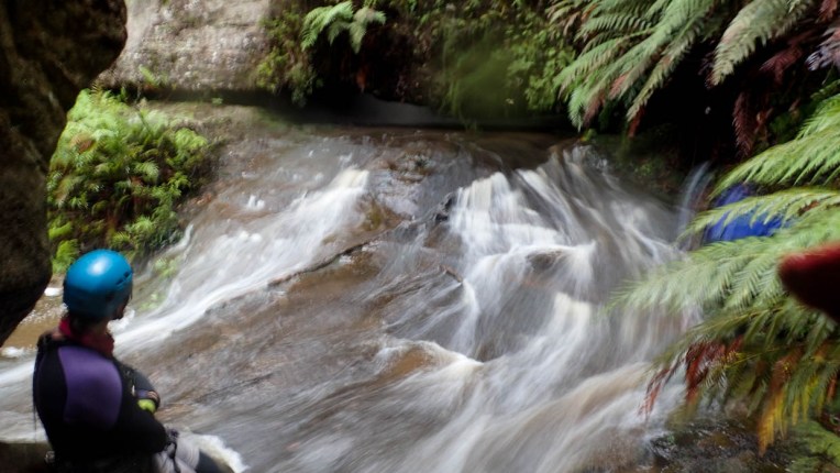
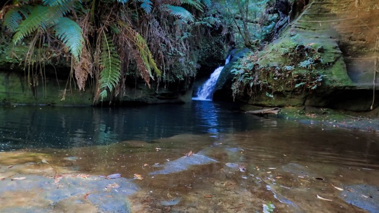
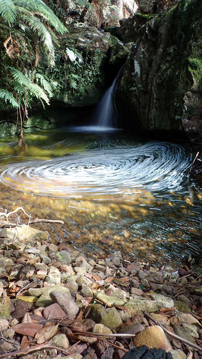
Straight away we are greeted with a very pretty pool at the base of a small cascade. I set the little camera up in live comp mode and leave it recording as we don wetsuits and harness’s
This pool was crystal clear and looked fairly still but Olympus live comp mode compiles images in a basic histogram type thing that keeps adding the bright sections to the background image and them blends it all together in camera. The guide says it’s for getting good fireworks photos but it is great for waterfalls and foam/leaf swirls too. Here foam bubbles are captured in a slow swirl
Next up we are straight into a cool little tunnel.
Cool in more ways than one. brrrr. fresh
Ed follows Julie into the darkness
It was a short swim through darkness
What follows is a bit of a slog down the gully. It wasn’t too bad but lots of dead fall, peeled bark and washed down stick jams to negotiate between some slippery boulder scrambles.
And then the canyon closed in and we were met with a lot of tricky little down climbs and abseils that looked higher than they were. You’d be squeezing down a hole, trying work out how to get your foot over the next ledge by feel as you couldn’t see then you realise that ledge was the floor…
With the water levels up a little the waterfalls were all very pretty and a few of the abseils had you swinging under them. it was all very enjoyable.
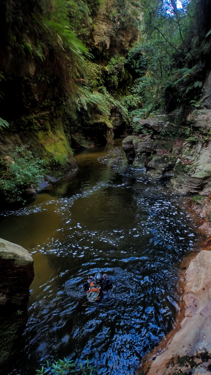
Julie and Ed at the drop into the constriction, we ended up down climbing rather than roping upJulie making her way down a very slippery, dead tree/log with an old sling at the bottomAnother drop down a Dead Tree/log follows, this time it stops 2 meters or so from the water level so a rope is needed.The constriction was narrow, deep and dark in placesEd squeezes down an tight hole on one of the many awkward abseils.Canyon formation
Julie and Ed in the Canyon Formation
Canyon formation
Ed in the canyon
Canyon formation
Julie on another tight abseil with a tricky start
click images to enlarge
Ed on rope with Julie looking on from below
Canyon formation
I’m sure the little extra water flow added to the experience
Julie making her way through the canyon
click to enlarge images
Ed on rope, Julie on photo duties below.Ed watching Julie disappear down into one of the darker chambers
Canyon formation
Canyon formation
Canyon formation
Canyon formation
Ed and Julie in the canyon
Canyon formation
Canyon formation
Canyon formation
Click to enbiggen
Julie on the final abseilEd on the final abseilJust above the junction with the ‘Boori
After the coolness in the canyon we scrambled up into a patch of sunlight to thaw out and grab a bite to eat and then it was back into the water and down stream on the Boori.
Type 1 fun*, says Julie as for the most part we lie back on our packs and let the extra current take us. Some short, shallow rapids were shot. Sure the video makes it look tame but it felt fast and fun at the time and sure beat wading up stream.
Julie letting the current do the work
We forgo the exit suggested in the guide and continue down to the one next to Arch canyon. This is a fairly easy pass with a bit of route finding but with slight side trips offers nice views over the arch, only slightly obscured by trees.
OLYMPUS DIGITAL CAMERA
OLYMPUS DIGITAL CAMERA
click images to expanderise
Back on the ridge top it’s fairly easy going. The trail comes and goes from clear as clear, well trodden and defined to nothing but the scrub is sparce and we know we just need to follow the tops. Eventually we find the trail proper and it’s an easy march back to the car park.
A most enjoyable day
Party size: 3 all experienced
Time: 8.5hrs car to car
After all the rain there was a lot of fungi out and about and we spotted some nice looking ones. If you can identify any of them I’d love to see it in the comments below
Don’t eat the red ones: Boletellus obscurecoccineus willkilluious deadii
White ones. What ever you do don’t eat the white one. Glowious inthedarki deatheous
I thought these were fallen flowers
Deathiate bi beautii
Like fantasy castles waiting to launch an attack on your mind and kidneys
Tremella fuciformis, the white brain that will fry your brain. Like crystal meth but spongy
Smurfs disguised as ‘srooms. They are sure to kill you. evil smurfs
Shagadelic. 1 sniff and you’ll be talking to a great dane and eating Scooby snacks
If you peel it and boil it for 4hrs then tip the water out and boil it again it’ll probably still kill you
Tpye 1. Good old plain fun. Its fun planning, it’s fun doing and it’s fun looking back on. You really wish you were doing it now
Type 2. It was fun after the fact. You know once you’ve forgotten the 3km of scrub the scratched the crap out of you on the way to the fun and you have also forgotten also the 5000m of vertical you climbed to get out of the fun. You’d definitely do it again
Type 3. You claim it was fun. You tell your mates it was fun. But you’d would never do it again.
Devils pinch is one of several canyons accessed via the Pipeline trail just down steam of Newnes. I’d done a few of the others and was keen to get back for this one as it was reputably one of the better ones in the area.
Ed arrived a my place nice and early and we headed on down hoping to do the climb before the heat of the day. Good plan.
At the car park we debated taking wet suits. We hadn’t used them last year when we did Pipeline Canyon but we had heard the wet section in Devils Pinch was longer, darker and more sustained. We decided to take them, they offer good scrape protection when scrambling down rocks if nothing else. Not such a good plan.
Bags stuffed full we headed down stream to the start of the Pipeline trail and began the climb up. It starts fairly gentle and we had a slight breeze in the shadow of the tower cliffs above us. The higher you go the steeper it gets and it wasn’t long before I was stripping off my sweat soaked shirt to get a bit of that breeze on my skin.
It still amazes me the effort it must have taken to build the pipeline between Glen Davis and Newnes (not to mention all the way to Newnes Junction near Clarence). Back when men were men and so were women or something and hard work was par for the course.
I bet those guys didn’t go home from work and talk about their feelings. says Ed.
I dragged steel pipes up a mountain all day but Ed was mean to me and called me names. Says I.
Anyhoo. We reach the top, dump the bags and make the short detour to the look out. Man how good does it feel to walk through the bush without a 75l pack stuffed full of gear on your back? (What was I saying about men being men… Yeah na, my shoulders hurt.)
We snap a few photos and then continue up to the watershed (It’s not like an actual shed, Stupid…) and veer off onto the Starlight trail. Once again we lost it somewhere around where you’d turn off for Pipeline canyon but corrected our error and pick up the main trail without too much drama.
The cliffs overlooking the Glen Davis end of the Pipeline trail and you can make out the awesome conical peak of Tayan Pic in the distance across the Capertee
Considering the popularity of Devils Pinch canyon I expected there to be a bit of a trail veering off the main track, if there is we missed it but found our way down to the headwaters of the creek without incident.
The heat is getting oppressive now so we are keen to get into the cool of the canyon. The creek threatens to “canyon up” a few times before we reach the spot where it drops down a dark slot. Woohoo.
We scramble along a ledge beside the slot to the abseil point and now have to put our gear on balanced on small stances. Didn’t think that through…
The top section is suppose to be fairly dry should we put wetties on now?
It says the abseil lands in a pool and there are some climb downs into water.
Rather than putting harnesses on now, then doing some deep wades and have to take harnesses off, put wetties on and harness up again we chose to put the wetsuits on now. Bad plan.
I’ve said it before but abseiling for me is just a means to get to the next bit of canyon. But this abseil is really cool. Relatively easy start then a long drop into an awesome slot but one you touch down it keeps going down another dark, narrow drop. About 25m all up, or down I should say.
Ed on the second bit of the first abseil
We’re now in a deep, dark narrow cleft. It’s really beautiful. There is a tight squeeze climb down a twisting chute before we are on the cleft floor. The pool the guide suggested we would land in is nonexistent at the moment, just a damp patch of mud.
Edwin contorting down the chute
Rounding a bend and all too soon the canyon opens out into a wide gorge. Scrambling down the valley the creek bed is as dry as a nuns nasty and the heat is slowly cooking me. We stop and strip the top of our wetsuits down in an attempt to stive off heat stroke.
It was disappointing to see this section of otherwise pristine creek was infected with backberry.And Flys! I’m pretty sure there was an international convention of the bushfly alliance. Millions of them swarming around, we were expecting to come across something dead but nothing, just clouds of flys. I’m pretty happy at this point they weren’t bitey.
Finally, droping down through a layer of strata a small trickle of water appeared in the creekbed. I wasted now time in splashing the cool liquid over my head.
And then we come to the next section of shallow canyon with the welcome sight of a deepish pool waiting at the bottom. Rotting vegetaion leaching tannins gave the water what Ed described as a lovely shade of Earl Grey (What’s that Paul Kelly line about the coffee being the colour of the river but not nearly as brown?) but we pulled the wetties back up and jumped in.
Ahhh, Bliss
Ed scrambling into the wet section
The next section of canyon is really nice. It’s not all that deep but has some narrow squeezes, tricky climb downs and deep wades.
Small pot hole you can’t touch the bottom off in at the bottom of a narrow climb down
click images to enlarge
This section is reasonably long and has a lot of fun bits but eventually it drops into another deep narrow section.
Overhanging abseils are nice but usually have shity starts as you work your way over a tricky lip. This one just gradually turns over hung so it’s a really nice start then a 17m abseil hanging in space.
This section is awesome. Deep and sustained and, despite being midday, the play of light on the walls was divine.
click images to enlarge
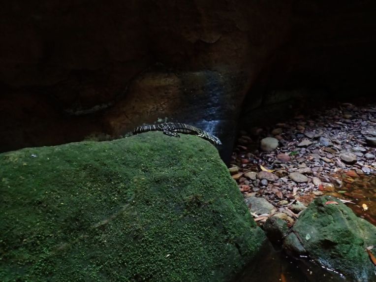
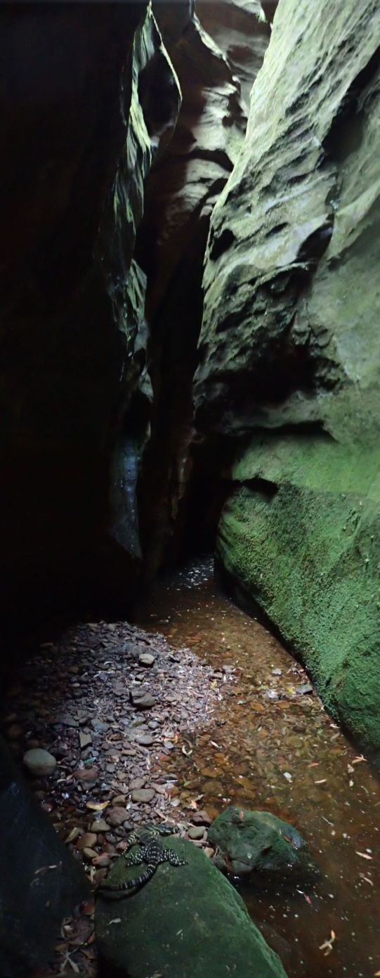
We come to a slightly wider chamber and Ed points down to a funny looking rock. Look a skull. Oh yeah a wallaby skull, fair size. Must have fallen in…. Oh shit goanna.
Sitting on a rock about 3feet away is a small, beautifully patterned lace monitor. I guess that’s who dragged the wallaby in. It’s dark and cool in here but it turns out it an easy walk up from the exit portal so I’m pretty sure it hasn’t fallen in and become trapped. Unfortunately around the corner is the remains of a much larger one, just under 2m long.
Lanna the canyoning goannaLanna looking up the slot but keeping an eye on us
The rest of the canyon is an easy walk down a sublime slot.
Click images to enlarge
At the exit portal we get out of the harnesses and wetsuits and eat lunch in the shade enjoying the cool breeze drifting down out of the canyon.
Once fed we opt to by pass the final two abseils and scramble down beside the steep gully to the Wolgan river before commencing the 5km hike back to the camp ground. It was hot, damn hot and our water was getting low. When we did Pipeline canyon the weather gods blessed us with a cooling down poor of rain on the walk out. No such luck today.
A hot but very worthwhile trip.
Party size: 2 both experienced
Time: 6.5 hrs car to car. Bit of Photo Phaffing, not rushing but moving steadily all day.
On such a hot day it would have been fine for most people without wetsuits. The water was cold but the pools short and there were plenty of little patches of sunshine flooding in.
I tried the helmet mount for the go pro, didn’t have the angle right for much of it so most of my clips were unusable, I’ve salvaged what I could…
After a lazy long weekend in the Wolgan, with just a stroll up to the arch to break up the eating and drinking
Wolgan Arch
I was keen to head back down and have a bit of a look around a dry canyon I knew of but hadn’t explored before and so I dragged Mandy out and ventured back down the valley.
I’d heard about this in the early to mid 2000s but never got around to having a look.
The road in crosses some private property, a couple of old school mates owned a block up the end but wasn’t 100% sure there weren’t other properties on the way up so in the interest of doing the right thing we left the road at the first gate and wandered up through the scrub on the other side of the creek.
We soon passed Ringo and Karl’s block and started climbing the steep hill that would bring us to the lower cliffline and the first short canyonette.
It was steep and loose and the weather had decided to play spring so it was fairly muggy too but we made our way up and reached the base of the cliffs without too many dramas.
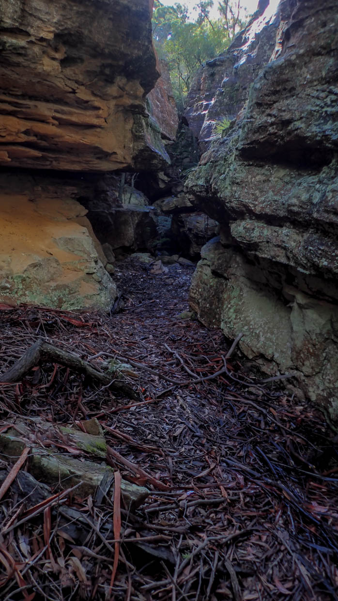
The first canyon section started with some promise, a scramble up through another impressive arch. The slot carved up through the lower cliffs but opened out almost as soon as it started.
Nice scramble up through an arch into the canyonette
Climbing out of this brief slot we wandered up through a pleasant, if sometimes scrubby amphitheater to the next cliff line
The scrub was thick with lawyer vines as the valley rose up to the base of the upper cliffs but once there the cool breeze racing up the constriction was like a sigh of relief.
We had to negotiate a squeeze through a tunnel section under boulders
Mandy making it look easy
And then we were into the main constriction
Mandy enjoying the cool breeze
My original plan had been to scamper up and out the top to admire the views and check out some other little canyons near by but Mandy hadn’t been feeling the best so I contented myself taking a bunch of photos and then we retraced out steps back the way we came.
If you stick our tongue out it helps you squeeze your gut through
A Window on the Wolgan
Mandy under the arch
Party size 2, both experienced, but Mandy feeling unwell on the climb up so taking it slow
Access: A nice walk up an old logging track beside a bubbling brook.
Navigation: Navigation is fairly straight forward if you stay on the trail
Map: Mt Morgan
Time: Give yourself a few hours to enjoy it.
Date walked: 04-09-16 Mandy and myself
Petries gully is a pleasant stroll up an old logging track in the Wolgan Valley, just down stream of Newnes. We were lucky enough to catch it after a wet spell so the cascades were in full display.
Getting there: From the main camp ground at the end of the road follow the trail down stream staying on the left (North) side of the Wolgan river.
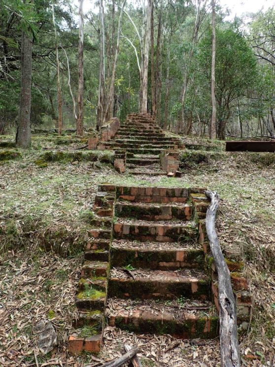
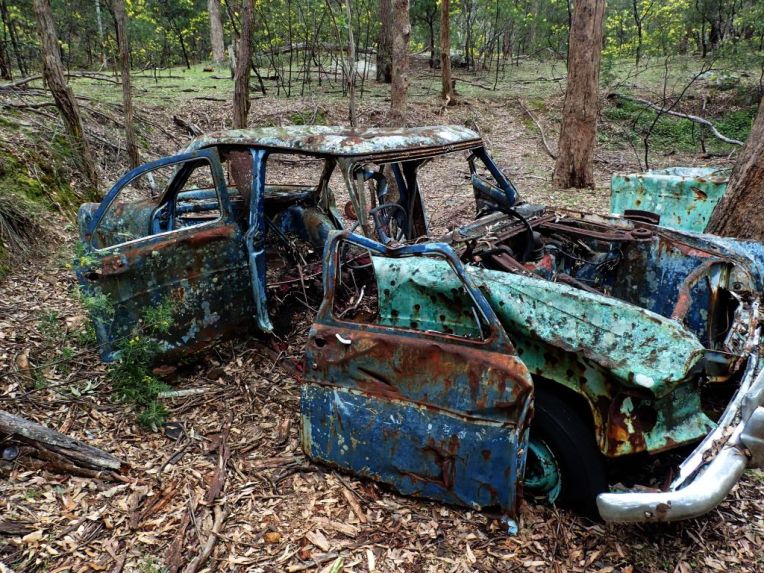
You’ll pass the ruins of the old managers residence, which is worth a look around.
After about a kilometer you will come to a Y intersection at the bottom of a hill. The righthand trail is signposted “Pipeline Trail” go left instead and this will take you up Petries gully.
It’s fairly easy going and straight forward to begin. As you get higher the trail crosses the stream a few times and can be hard to follow as it’s overgrown and washed out the higher you go..
Return: Return the way you came.
Note: The great outdoors is an ever changing place. Bush fires, changing weather, vegetation growth and forestry activities can all effect the trail conditions and thus the difficulty of the walk. These are a rough guide only and are by no means meant to be a definitive guide . They do not replace the need adequate map reading and navigational skills
Note 1: Taking care While reasonably well known these spots are still wild places and care needs to be taken around cliff edges and on the steep trails. Carrying the right gear as well as having adequate food, water and clothing is important. Always tell someone where you are going and when you expect to get back.
Emergency beckons (PLBs) can be hired from Katoomba Police for very little.
Note 2:First aid A basic first aid kit is essential bit of kit whenever heading into the Aussie bush. A basic first aid is highly recommended
Note 3: Maps and Navigation Having the right map, a compass and knowing how to read them is very important when heading into the bush. If you are new to bush walking joining a club or accompanying more experienced walker for you first few outing is a very good idea. I found practicing map reading on well defined trails was helpful when I started out.
The Maps mentioned are the 1:25000 series. They can be purchase at Lithgow tourism information center, from outdoors shops or online for around $10 each.
Note 4: These are wild and beautiful places, respect them. If you are able to carry something in you can carry it out. Don’ be a tosser. Leaving your rubbish behind is a sure way to ruin it for every one else.
Steps to the managers residence for the Commonwealth Oil Companies shale worksEnter a captionit’s all a matter of balanceThis one is normally dry
The harsh mid day sun made it difficult to get nice shots. This one is almost there
I’ve been meaning to get to this one for a while and it was a bigger day than I expected. Nice to have visited it but I don’t think I’d rush back real soon.
Anyhoo Ed met at my place not too early and after Mandy decided to pyke it was just the 2 of us heading down into the Wolgan.
Packing the ropes we had a couple of options.
Option 1 was either my 11mm 58m or Ed’s 9mm 60m
We choose option 2. Meggsie’s 9mm 40m because it was lighter. This would come into play later.
Arriving in the valley we have 2 options. Option 1 head a bit further down stream and park at the actual car park. We choose option 2 and park in this convenient car spot that sort of matches the description and starting marching up the hill, after a bit of steep stuff we found and old road and traversed around a bit on it. So far all good. Then the road took a turn back down towards the main road. We left it behind and traversed our way across and up to the base of the cliff. Our car park ended up being 1km further up stream than necessary
Drink breaks. Just above us looks to be an interesting slot around a detached block of cliff. It was more interesting than that as behind it was another slot around a second detached block. Very Noice!
We stuff around here a fair while investigating little nooks and slots and disturb an owl (Possibly a Powerful Owl) before continuing around the corner to the dry creek we are looking for.
Ed investigating a slot
Following this up we cross from one side to the other finding some cool sandy caves and side canyons on our way up to the main canyon.
Side canyon
The Bellbirds are in full voice as we make our way up towards The gully.
It doesn’t give much indication it is going to close in any time soon and we start to think maybe we were suppose to head up one of the side canyons. But then, with little warning the canyon appears.
The gully eventually closes inIt’s not deep or dark but it is relatively sustained
It’s a nice, dry canyon but I think after the beauty of last weekends canyon and with the midday sun belting directly in to create harsh contrasts I was a little underwhelmed.
Never very deep or dark, the canyon threatened to open out on a couple of occasions but kept going further than we through it would. When it finally did open up we had 2 options.
Option 1 is to Reverse down
We go option 2. With Great views over the Wolgan promised we choose to climb out.
Up we go
After several pagodas offered false high points we reach the ridge top and again have 2 options. We’ve come across a slot that is not running in the direction of out track notes.
Option 1 is to explore a way down through the slot. I have vague memories of trip reports that suggest that it will lead down with a couple of abseils but I’m unsure how big the drops are and we have the short rope.
This option was very tempting
We choose Option 2. Head down a ridge spur and have a look off the end.
We reach the cliff edge and the grand views typical of the Wolgan greet us. Good spot for lunch.
Across the Wolgan, Penrose gully is to the far right and if you know where to look you can make out the slots of Kenobi, Windows and Hole in the Rock canyons
Now we need to find away down. We wander out to the end of the ridge. Lots of Options all bigger than we are expecting. It’s now I choose to read the track notes a little closer.
“Follow the ridge until the slot…” We didn’t see a slot so make our way back up the ridge a bit.
A steep crack might be our slot but it was hard to say. A bit further around a weakness in the cliff appears to give us access to the lower cliffline where a convenient tree provides great anchor. We toss the ropes.
Sounded like it hit the ground, Says I. Sounded like not much if any hit the ground, Retorts Ed.
I had used my safety rope to tie into while I set the ropes. I pack this up and now I am on rope I have 2 options.
Option 1. Take my pack back off and put it back where I normally keep it.
I choose option 2. I give it to Ed to Store in his pack while I abseil down.
I still can’t see the ground but over I go. There is a second ledge about 15m below me. I can’t see ropes on the ground. I rap to the lower ledge and peer over.
Now either of my 50m+ ropes would have reached. Ed’s 60m would have reached. But the lighter 40m rope ends aren’t on the ground. It doesn’t help we have chosen to rap directly into a small Vee gully. If the tree up top had been 20m either side and the ropes would be on the deck.
Now I have 2 options.
Option 1. Prusik back up and look for another spot to get down.
I choose option 2. I make myself safe by hero looping a “chicken head” (a little nub of rock I can hitch a sling around and clip into). It was a reasonable ledge. Then get Ed to re set the rope to full length single strand. This gets me to the bottom fine but the halfway mark is about 7-8m above me.
Now to get Ed down.
Easy I’ll tie my 10m safety line… Um Ed has my 10m safety line. He tosses it down and some how manages to miss the ledge, the trees and the snags and I catch it just fine.
So the solution. Tie my line to the end I have on the ground. Anchor that to a tree just a bit back with a long sling. Ed can now haul the slack back up, lower the other end and rap down on that strand. It’s still head height off the ground but as he weights it the give in the system has him reaching the ground all safe.
Now it was just a stroll back down the hill to the car.
Party Size: 2 both experienced
Elevation gain: 640m
Time: Bit under 7hrs car to car with lots of stuffing about with photos and exploring and rigging up impromptu abseil solutions.
Those following along at home may recall my recent misadventures, firstly not finding the Cracks of Doom and then not fitting through the Cracks of Doom well after a ” it should only take 1 hour” rail trail meeting went all morning we thought we’d at least get out for an afternoon walk and head back for another folly.
This time we took the abseiling gear and the plan was for a quick look at the Crack of Doom 1 then traverse the cliffline and abseil into the exit crack, Crack of Doom 2.
Plowing straight across the scrub was much better then traversing though it and we found the first crack no dramas.
Have a look down Tal, says I. You might fit. I use to…
Are you sure you that goes? Calls Tal from the depths where the slot becomes nothing but a crack. Um, yep use to.
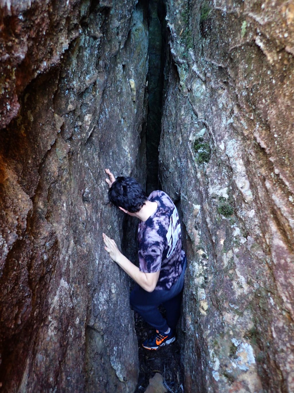
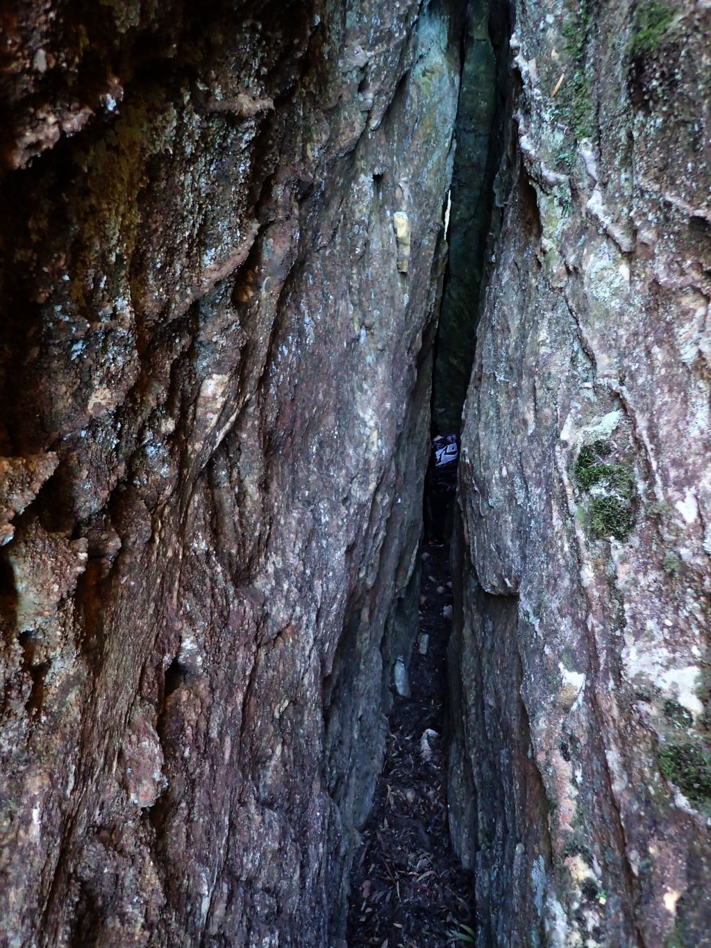
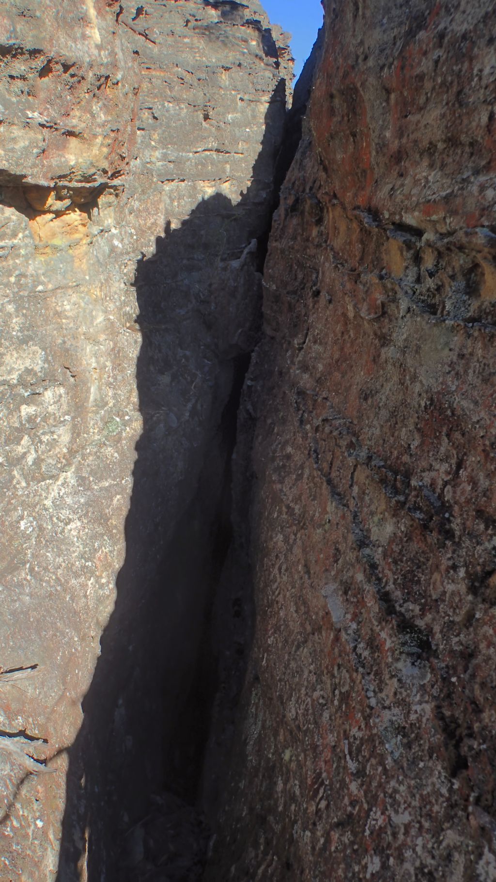
These types of crack are fairly common in this area, forming along fault lines (for want of better, more correcter terminology) known as joints. These tend to run parallel and perpendicular to each other.
The way they were explained to me, and this may well be completely wrong, was they were formed as the landscape pushed up and the former sea bed raised up to create the Blue Mt range. As it did so the bulge basically caused the sandstone to fracture in the parallel lines which can be seen clearly in aerial photos and satellite imaging, google earth etc..
Anyhoo we make out way back up and follow the cliffline around, making our way a little bit back up hill away from the edge. Ignoring the more obvious start to Cathedral canyon for now we head to Crack of Doom 2. This was our exit slot all those years ago and coming up the end needed a tricky bit of climbing to get up over an over hanging chockstone. Thus the ropes and harnesses for a descent this time around.
We rap in and leave the rope in place as an aid to get out later. I comment to Mandy that the rocks looks like they have seen a bit of traffic. I’m no tracker but it tends to be obvious when others have passed this way. A bit of rock with the moss worn off at on obvious foot hold, that sort of thing.
This crack has a bit more width about it, a tad wider than shoulder width for most of it’s length, and it descends steadily down through the cliff line in a nice ramp. The bottom exit is well hidden, the crack basically runs parallel with the main cliff line and looking up the little alcove it starts in you would not see it if you didn’t know where to look.
The original plan was traverse back along the bottom of the cliff line for a look up the bottom of Crack of Doom 1 but not far around the scrub encroaches right up to the cliff edge. With limited time we opted to forego bashing through this and instead head the other way to the base of Cathedral canyon.
I was surprised to see a number of foot prints in the fine sand along the base of the cliffs. Others must have visited here fairly recently, I’m thinking yesterday as they were quite clear and the fine powdery sand wouldn’t hold a print that clear for too long.
Anyhoo Cathedral canyon is as awesome as I remember. The Bush Explorers refer to it as the Diamond Cavern and describe it with much reverence in their Gardens of Stone books and I can see why but back in the day my guide introduced me to it as Cathedral canyon and that’s the name I prefer as it does have a Cathedral feel to it.
The micro canyon is very short and gets thinner as it climbs up through the cliff line before your passage is blocked by a small overhang chock stone 2 or 3 meters up in the narrow walls. Belatedly I figure it would probably be a much easier climb out here. Alas I’d left my pack at the bottom of the abseil.
Anyhoo we have a bit of a look around before head back the way we came.
Party size: 3. All experienced
Time: I really didn’t take much notice but it wouldn’t have been much more than a couple of hours car to car with a few snack breaks and a lot of phaffing about with photos
Tal gets to the narrow bit of Crack of Doom1 and thinks yer aint fairdinkumCrack of Doom 1. Yep once upon a time I did fit throughCrack of Doom 2. A more sensible widthTal heads down the crackMandy DescendingMandy at the 90° exitHeading up Cathedral CanyonTal in Cathedral CanyonBack at the hidden base of Crack of Doom 2Where’d she go?Knots 101 refresher course. My climbing skills are a little rusty so we used a prusik back up, just in case.Tal bridges up and out easy peasyIgnore me, I’m an idiotAnother crack across the wayPagoda countryEnter a captionTop of Cathedral Canyon