Returning from The Sphinx as the heat began to ramp up a visit to the underground creek sounded ideal.
If nothing else the name was cool.
A short drive from our camp took us up into the surrounding hills. The car park is well signposted and gives access to both the Underground creek trail and Dr Roberts Waterhole.
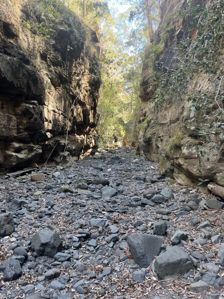
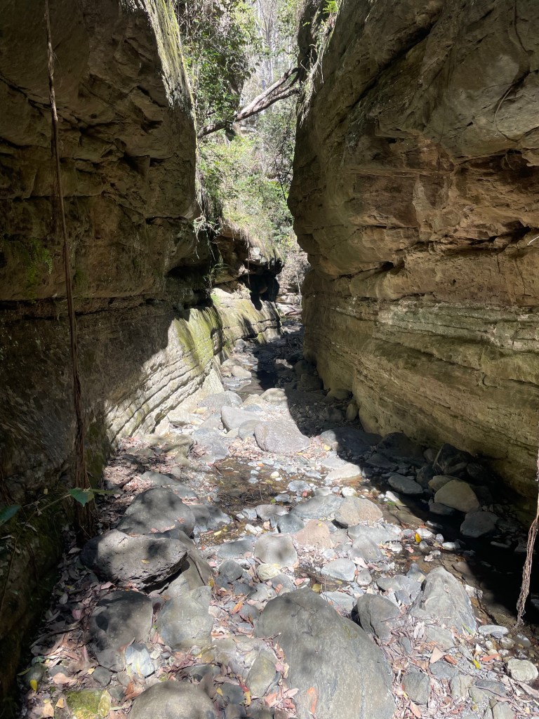
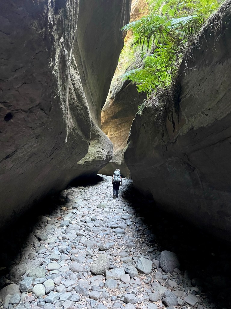
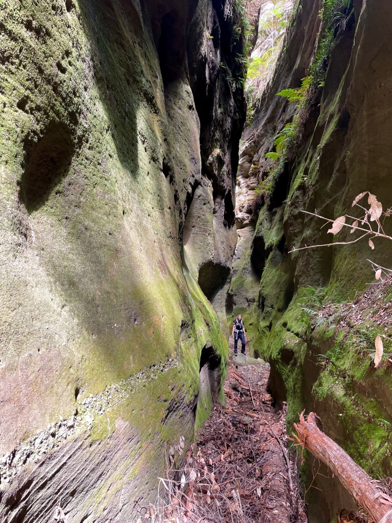
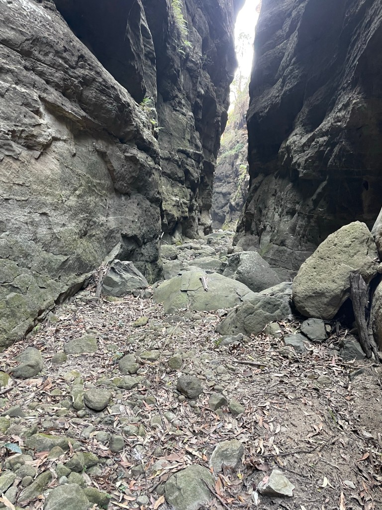
The walk out to the underground section the creek is just over a 1km and fairly flat.
So what the hell is it?
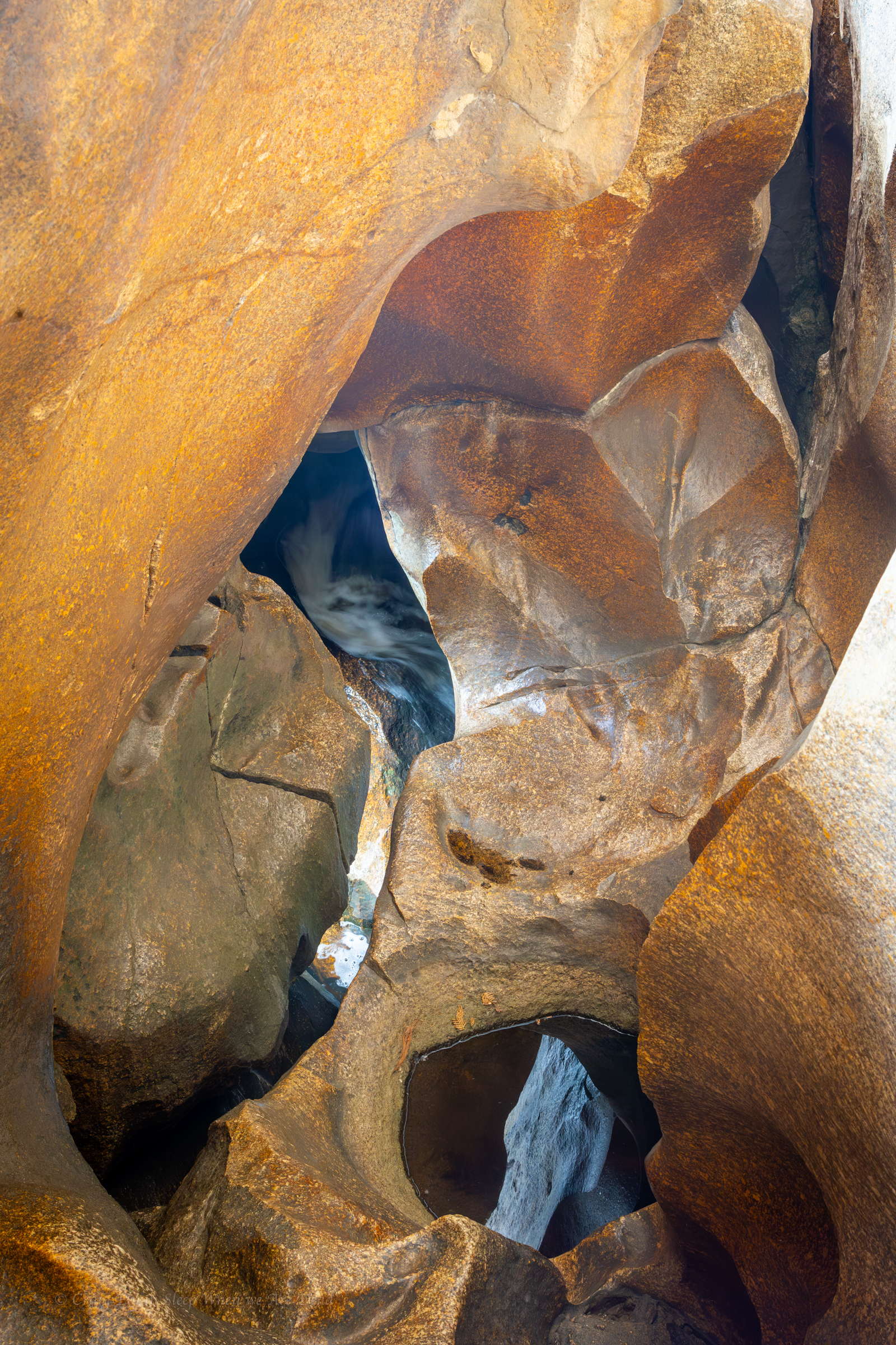
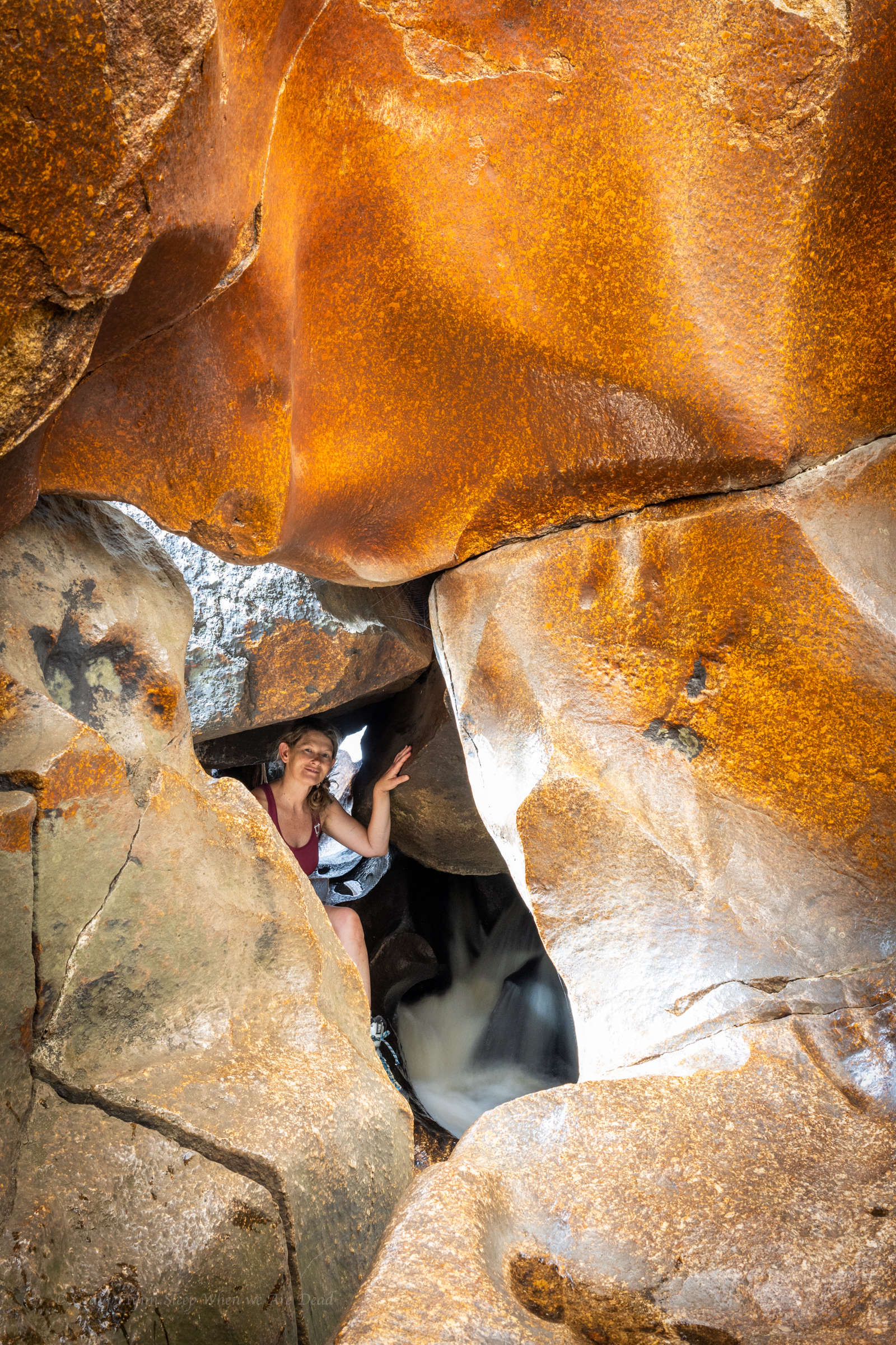
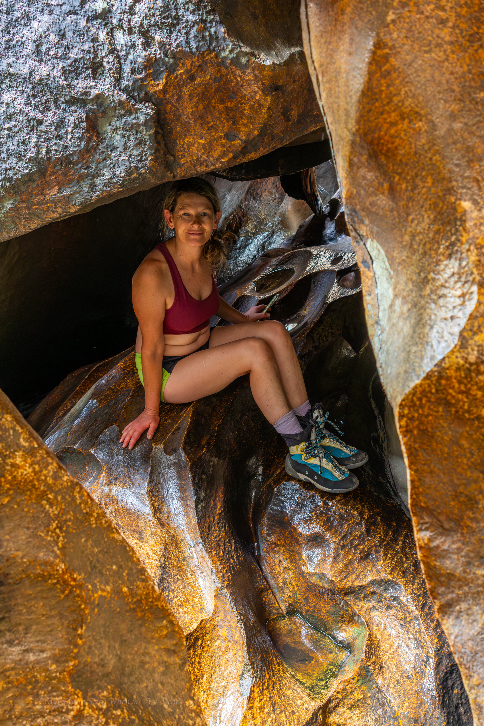
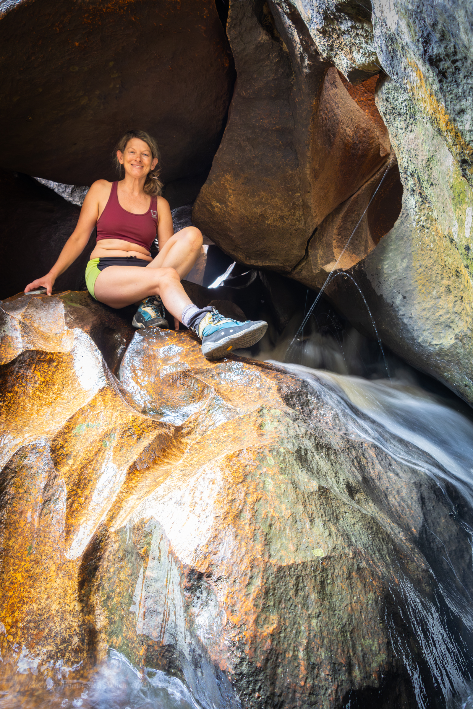
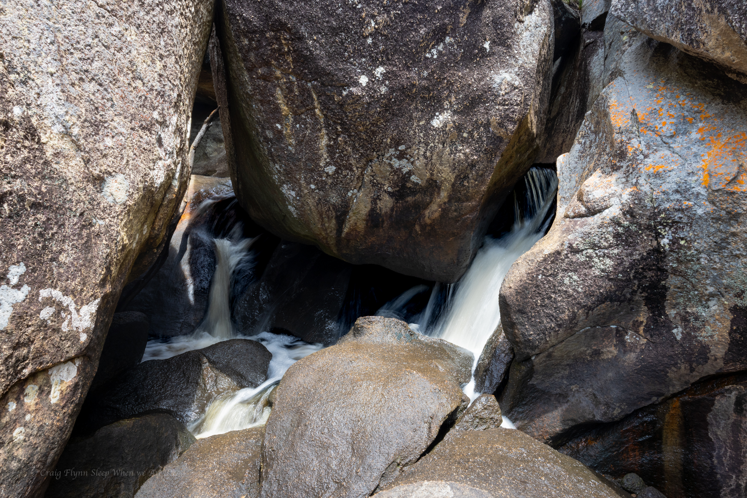
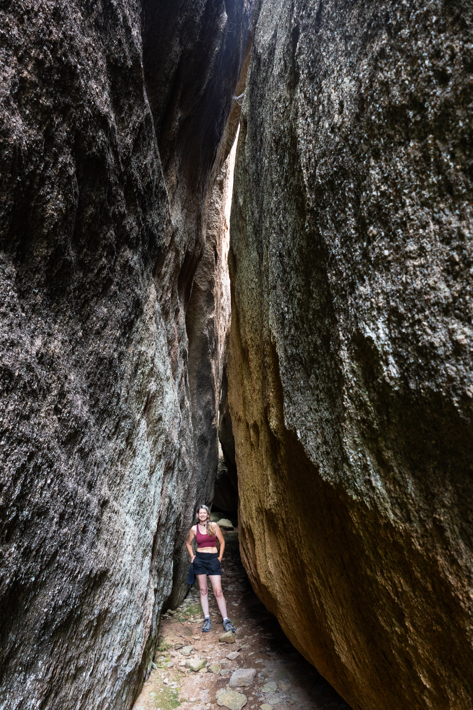
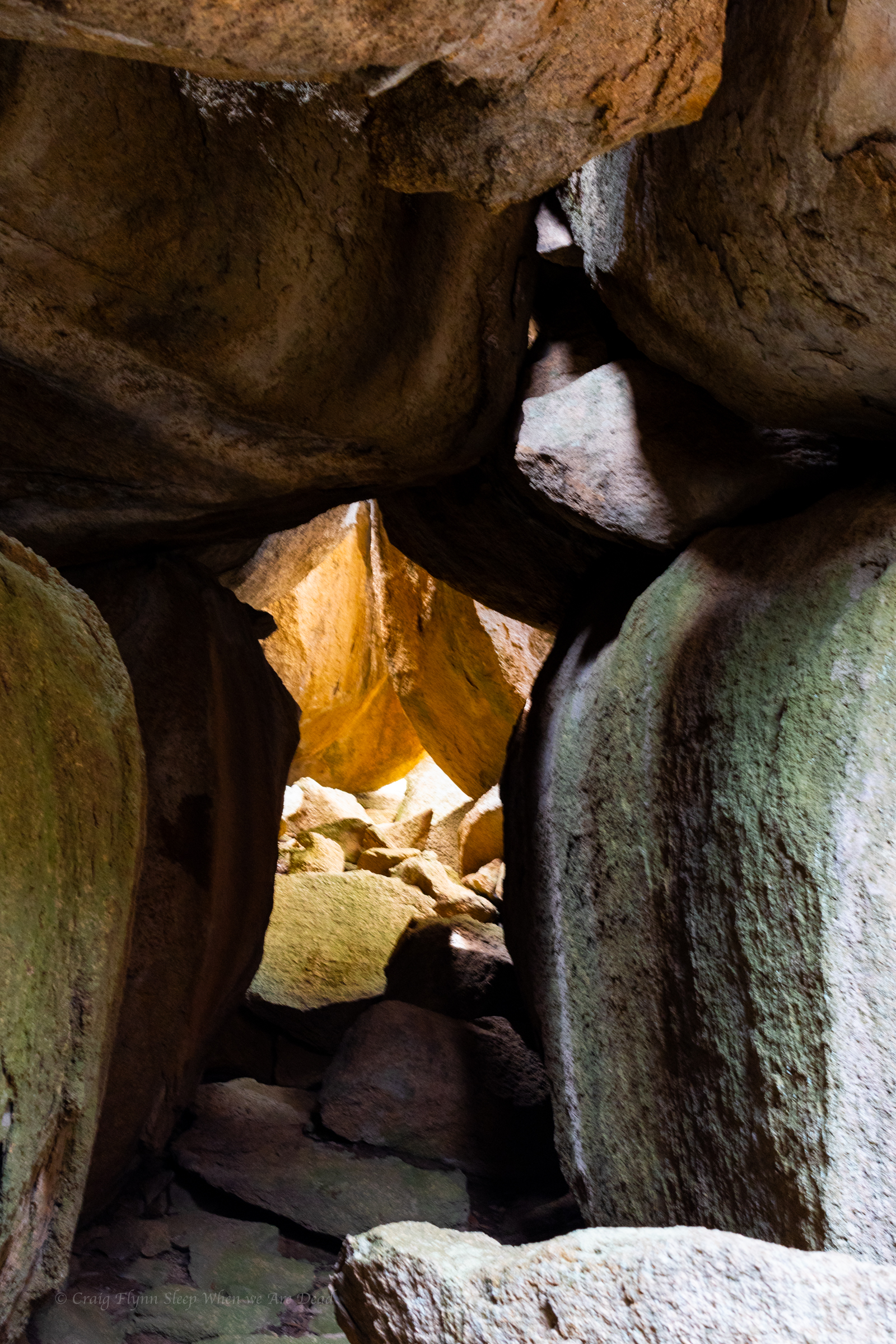
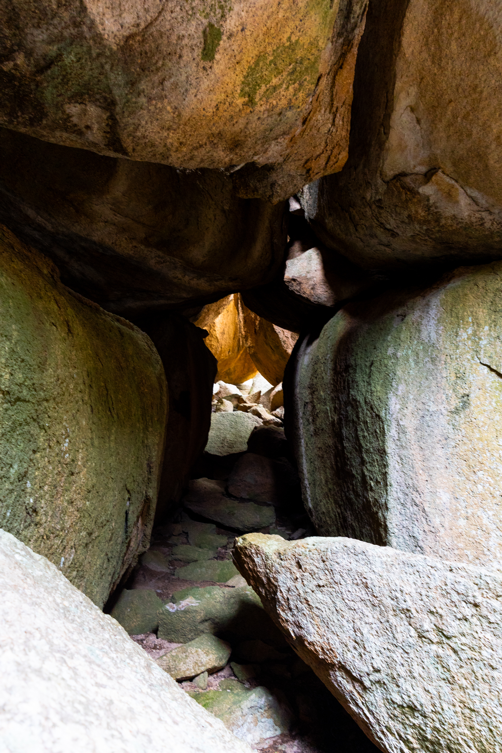
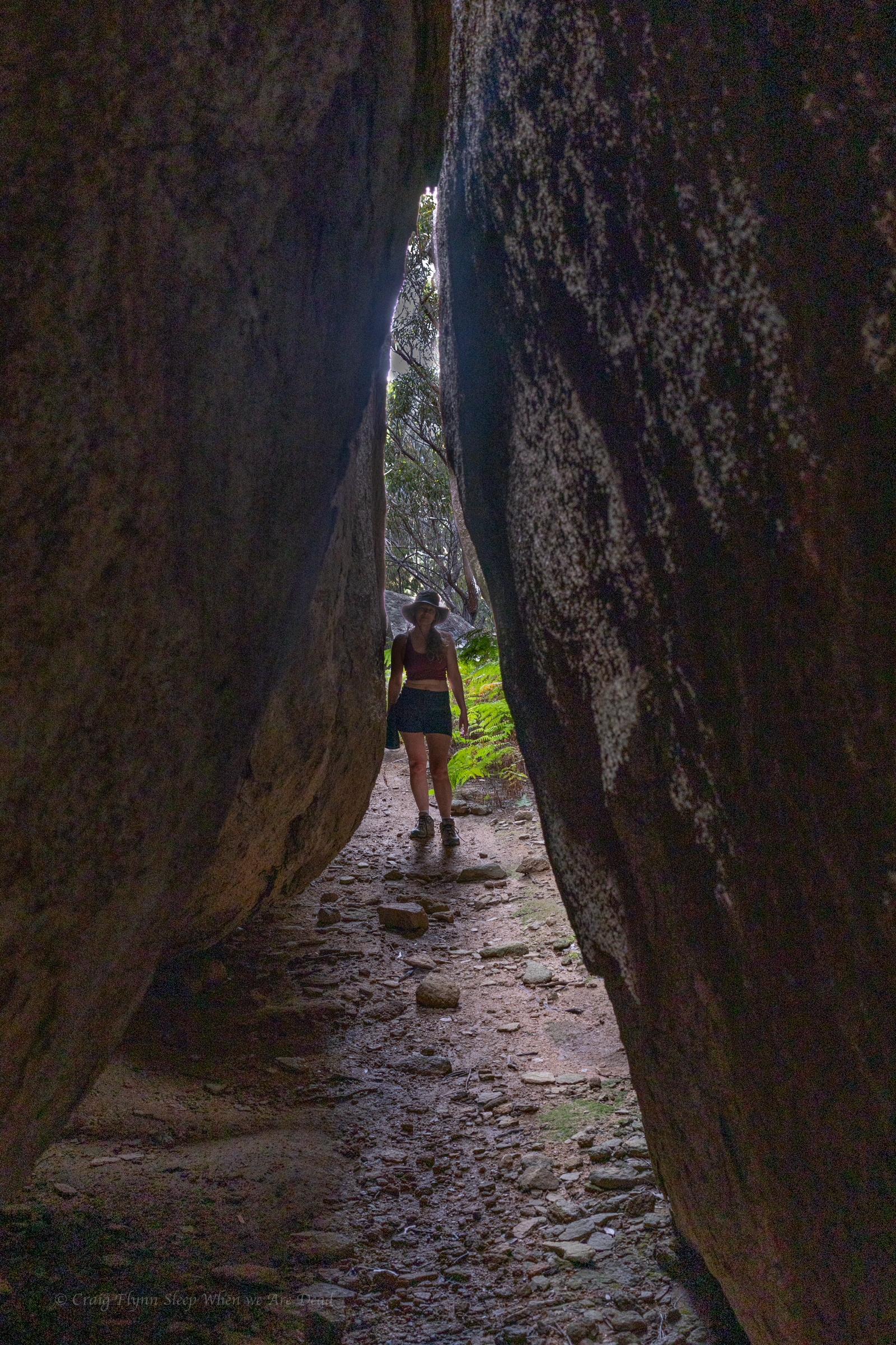
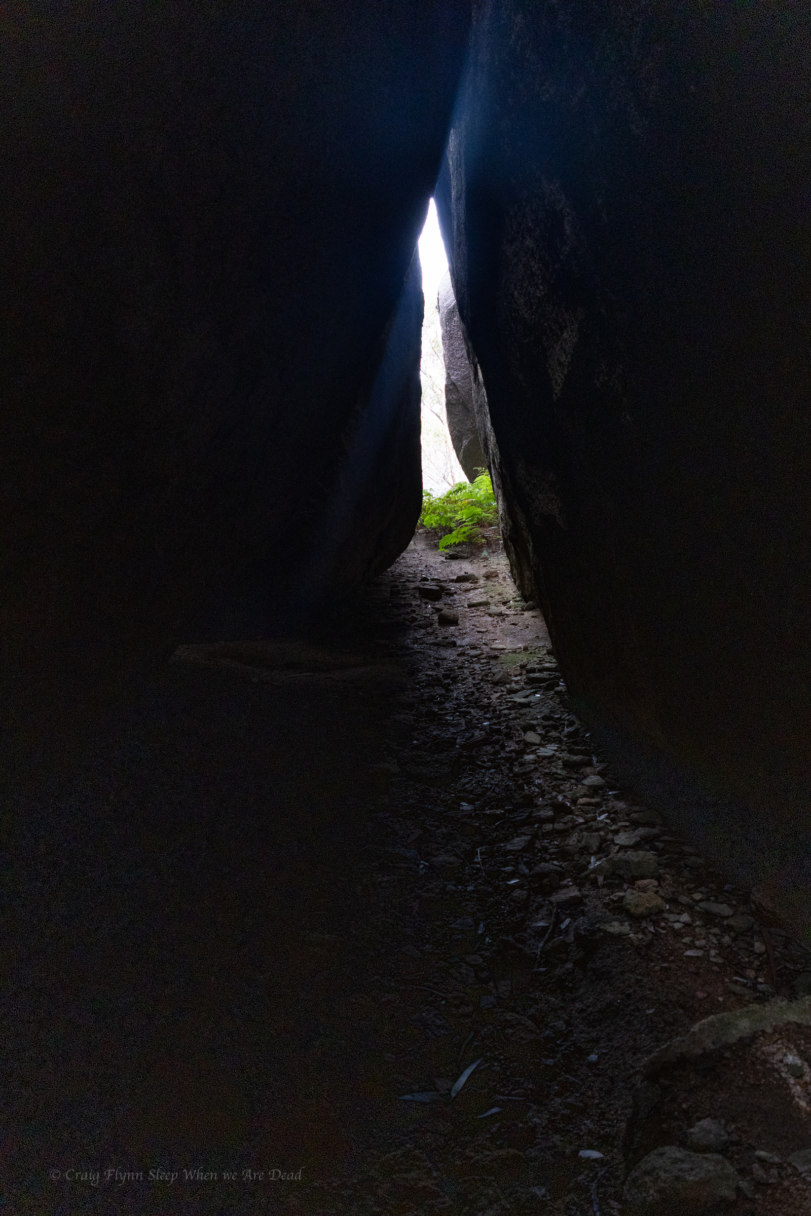
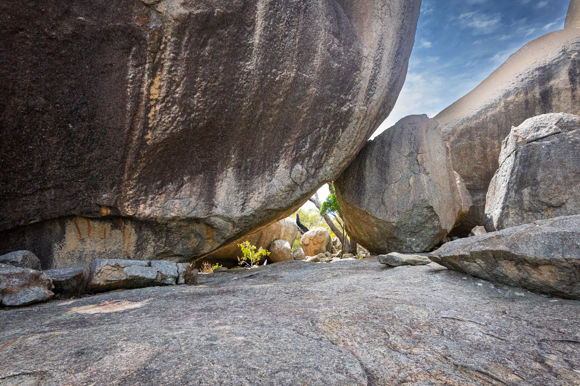
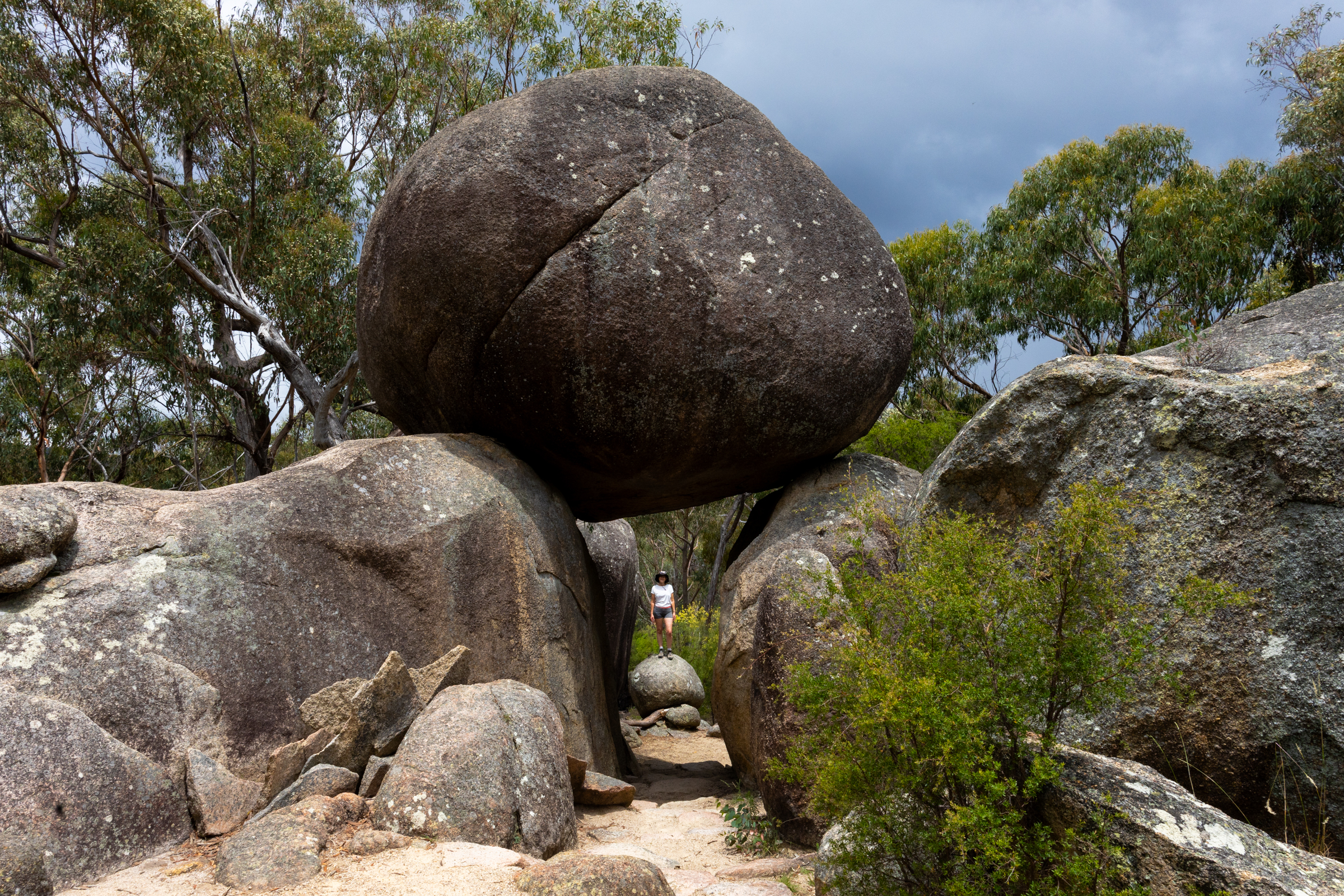
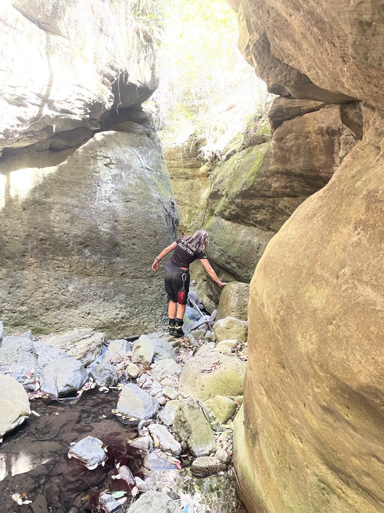
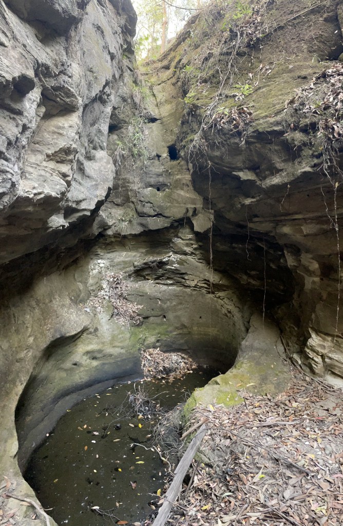
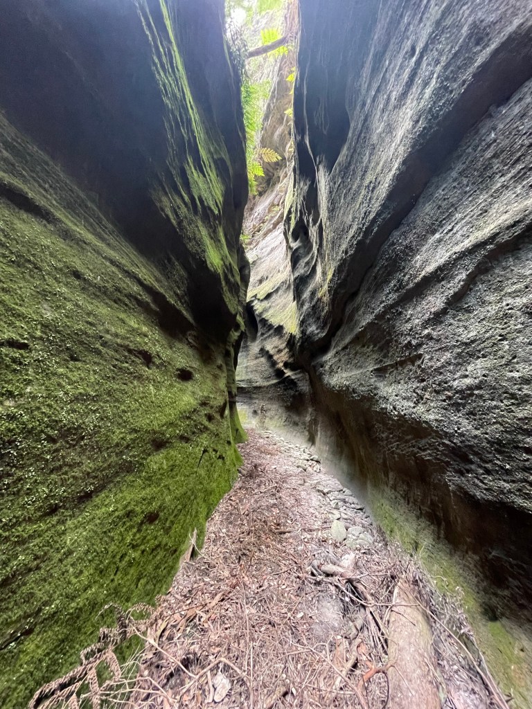
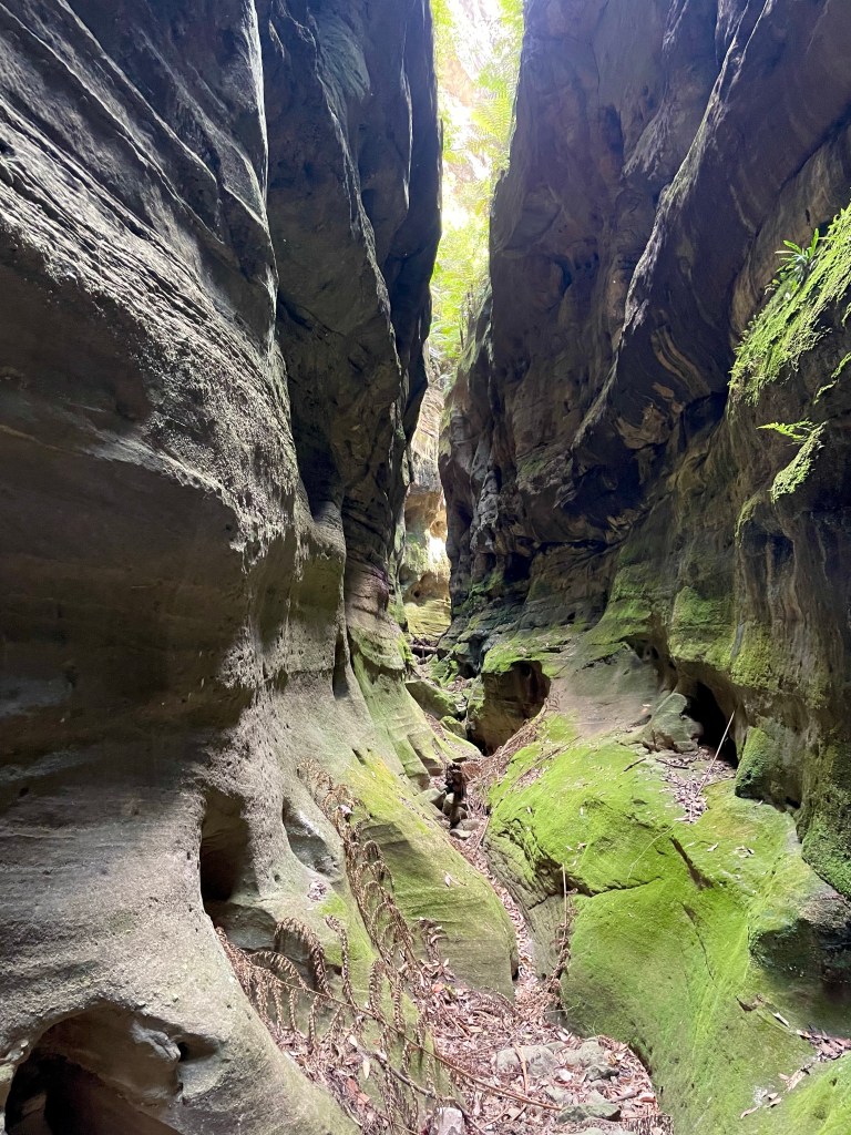
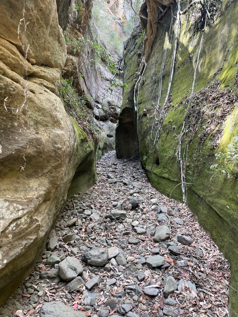
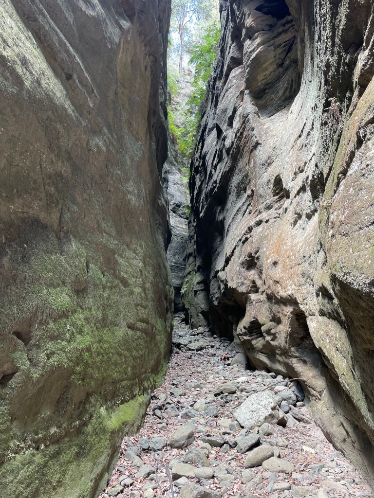
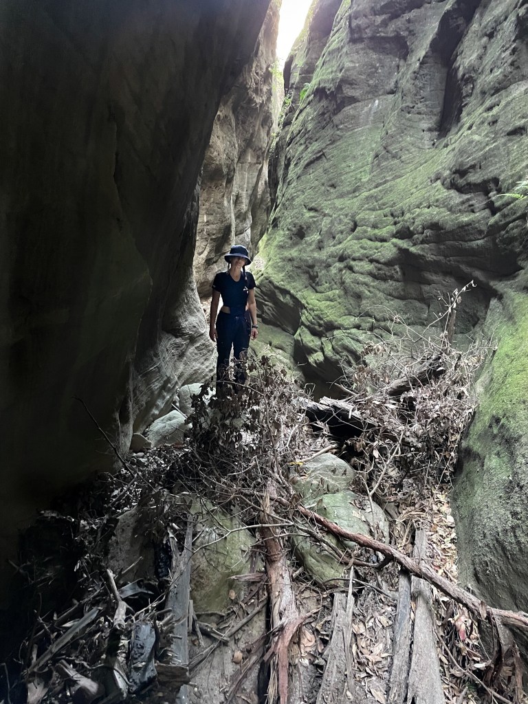
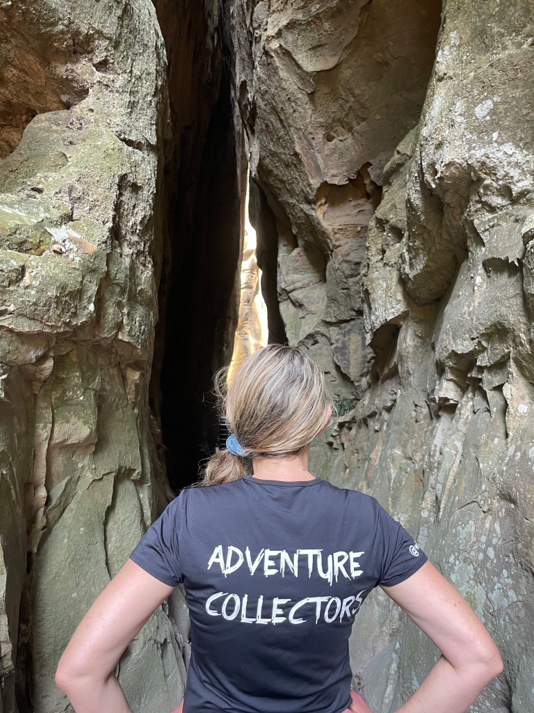
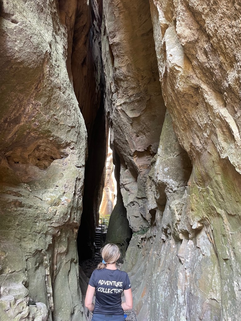
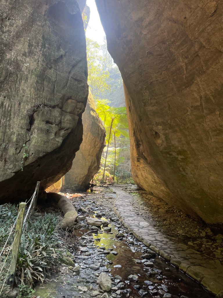
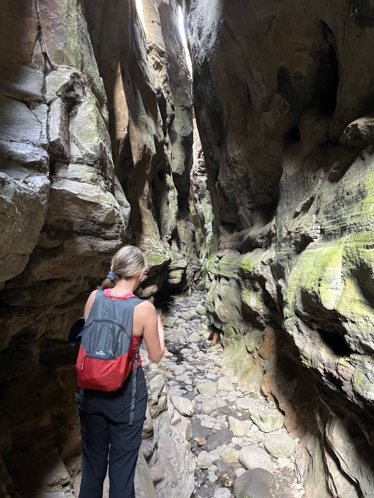
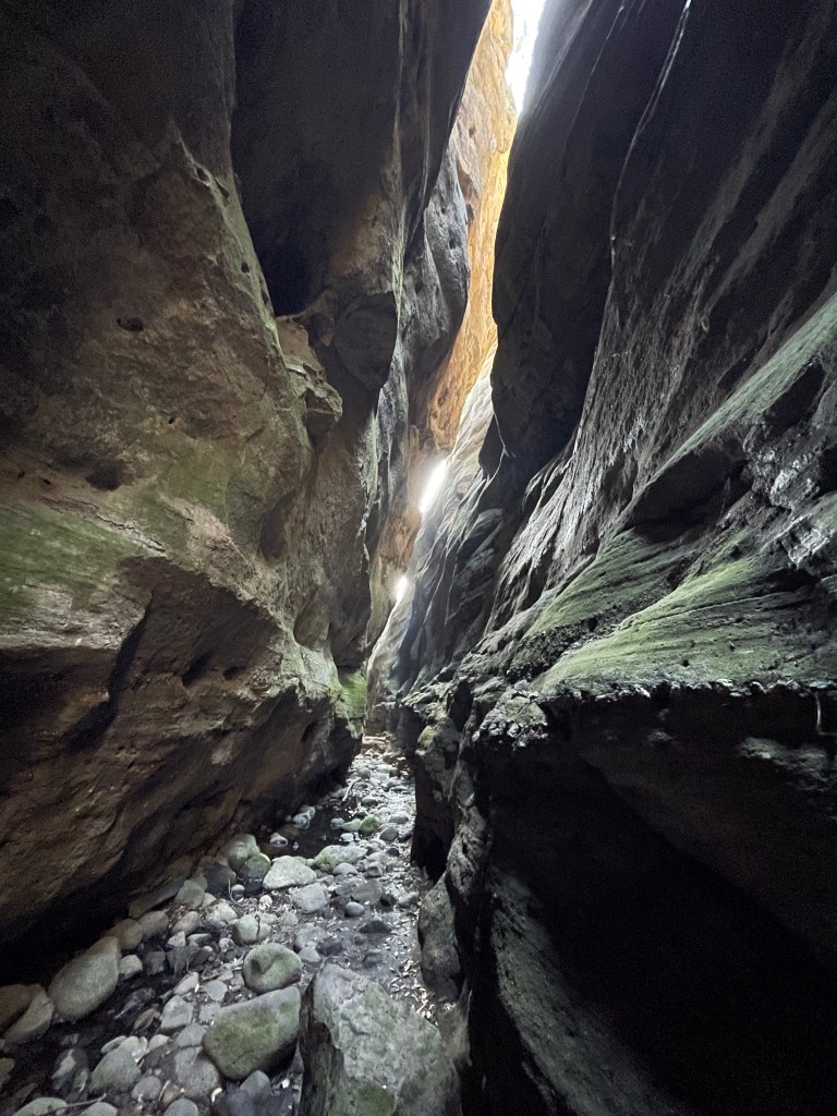
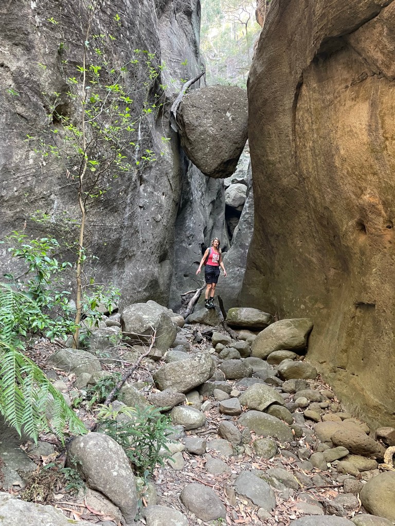
This section of creek drops down through boulders into a a short section of old lava tube
If you find the top secret… I mean really obvious entry it’s such a cool feature
of course we spend no time scrambling down
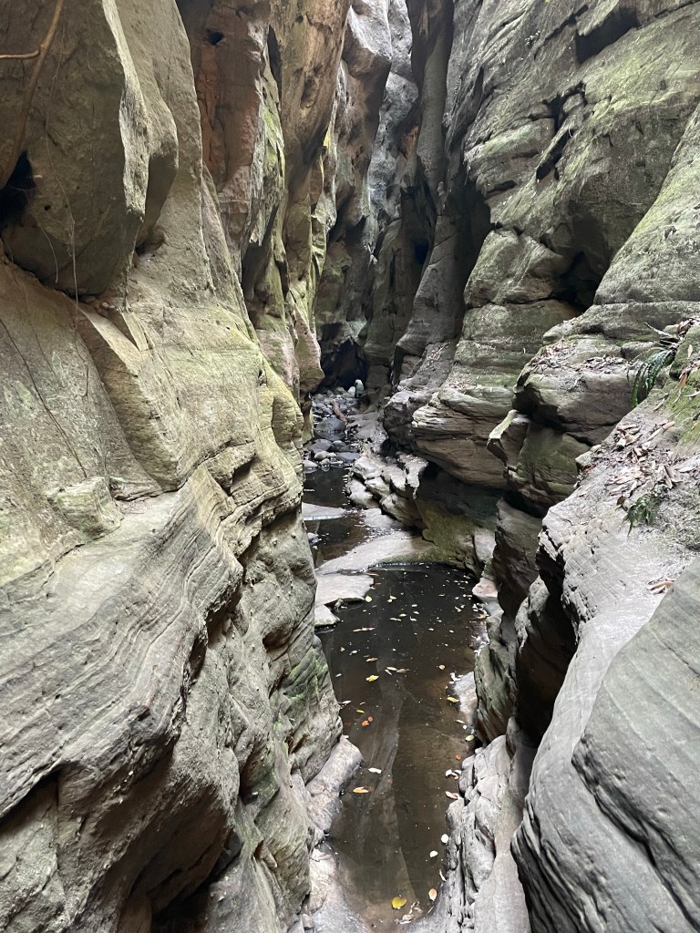
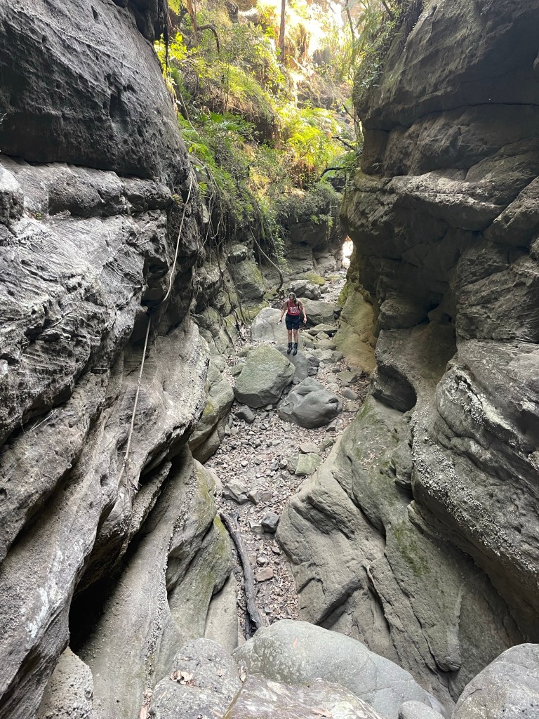
It’s a short section but well worth exploring a bit.
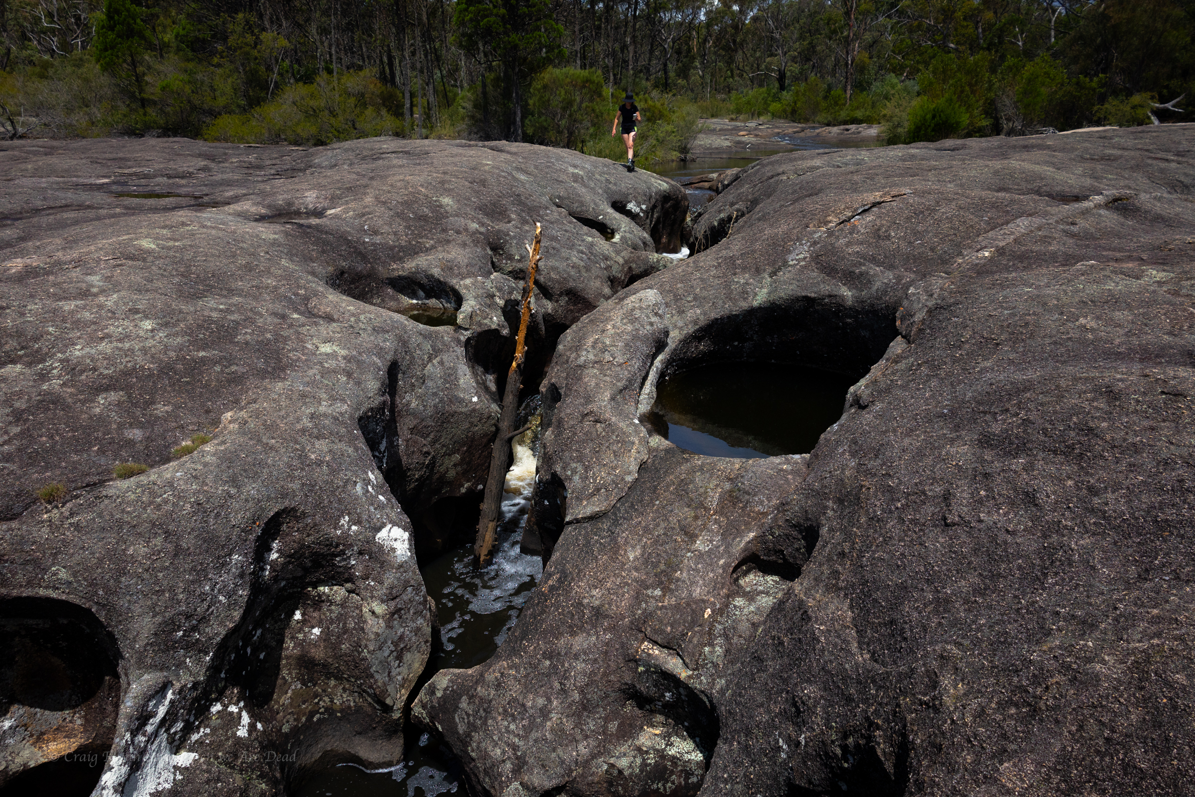
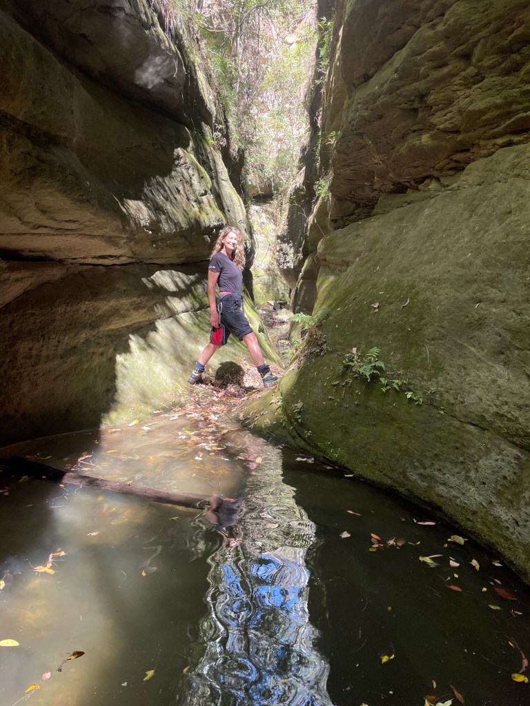
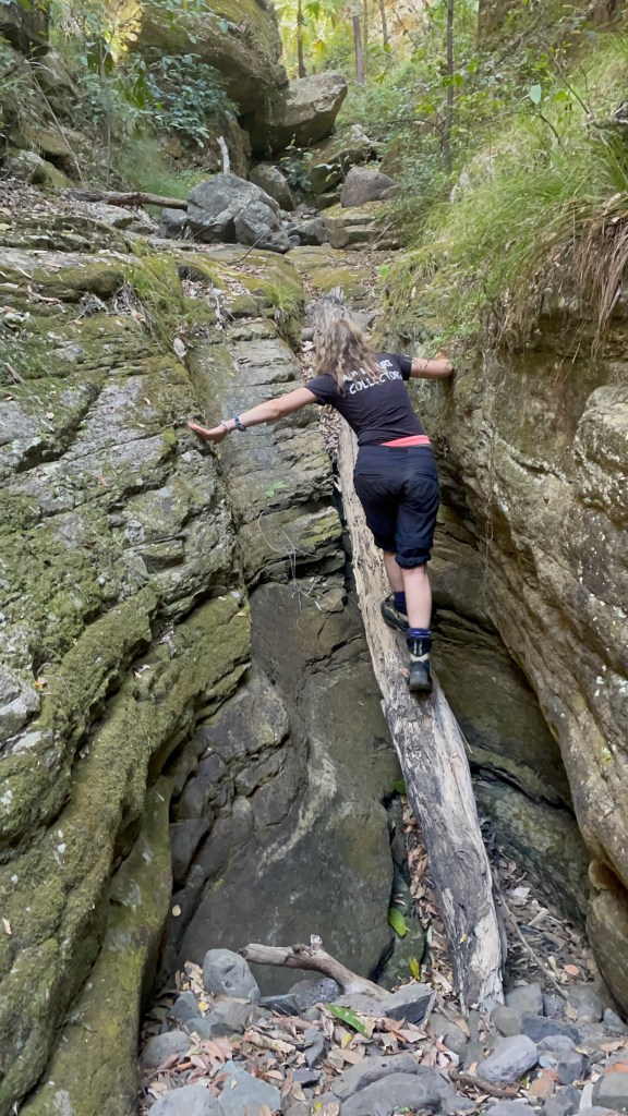
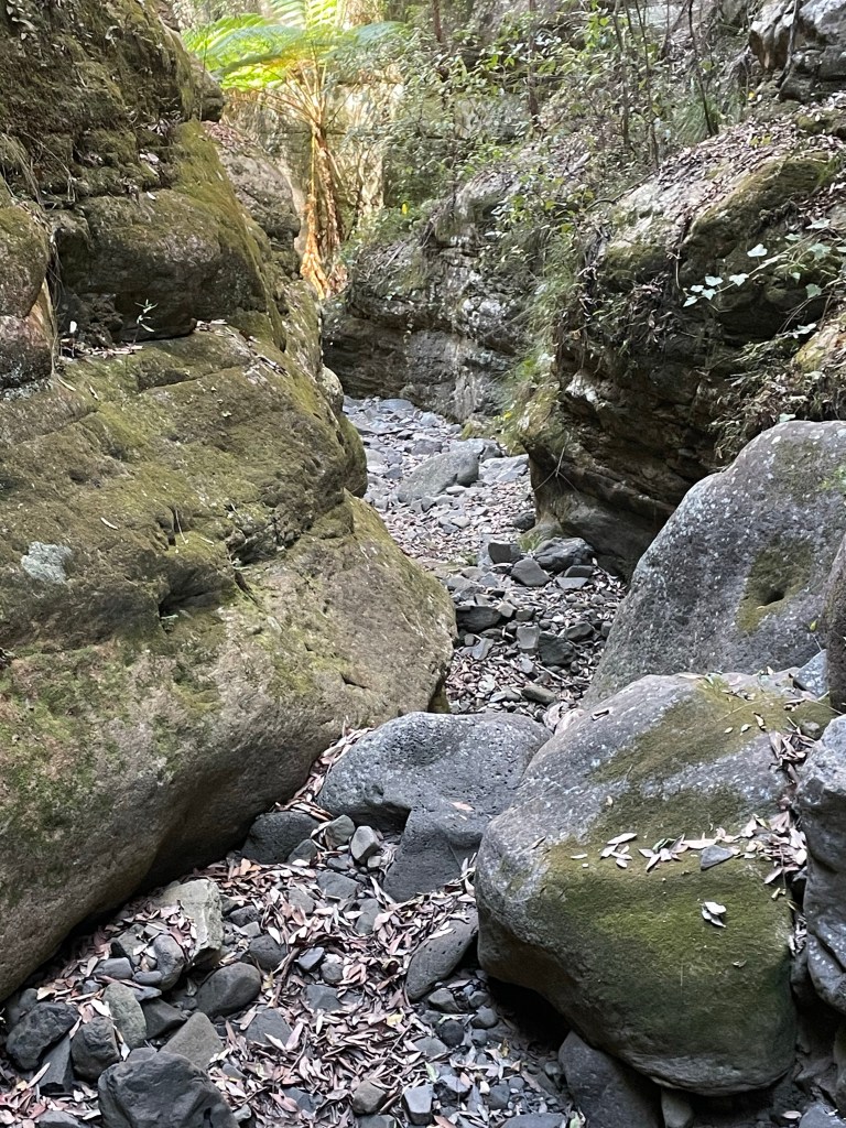
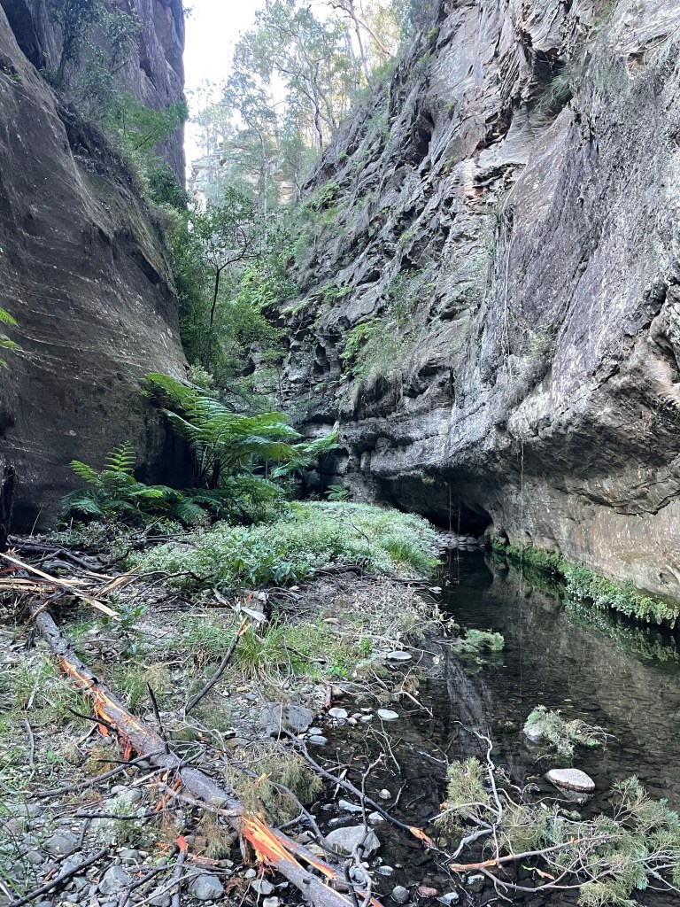
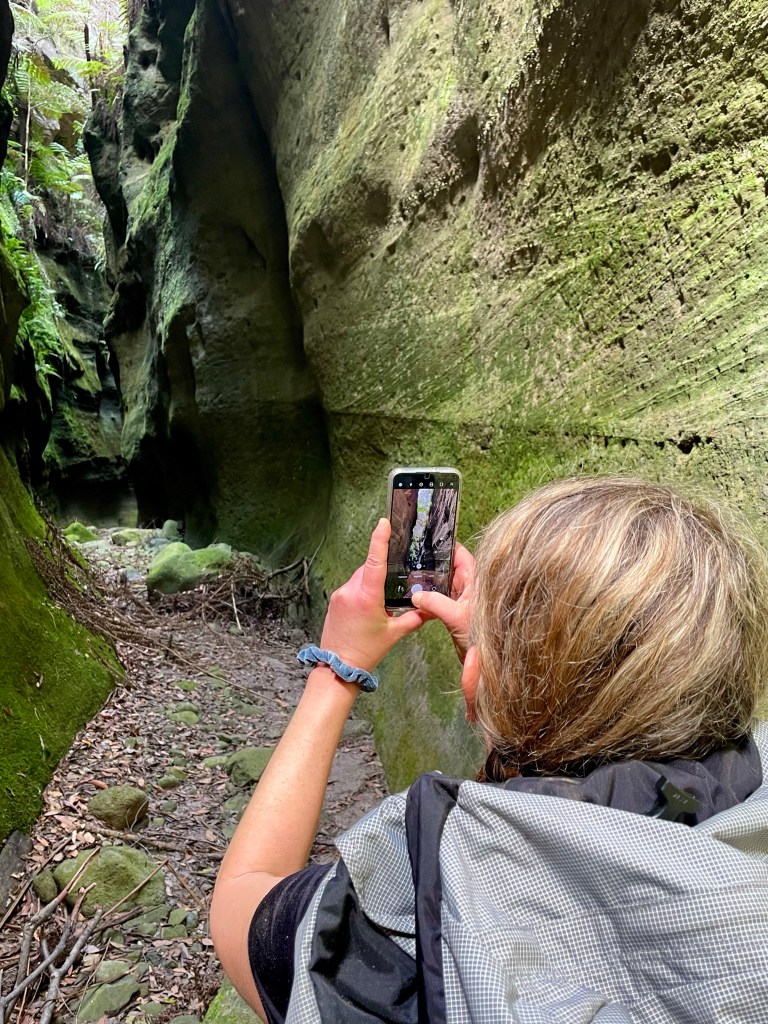
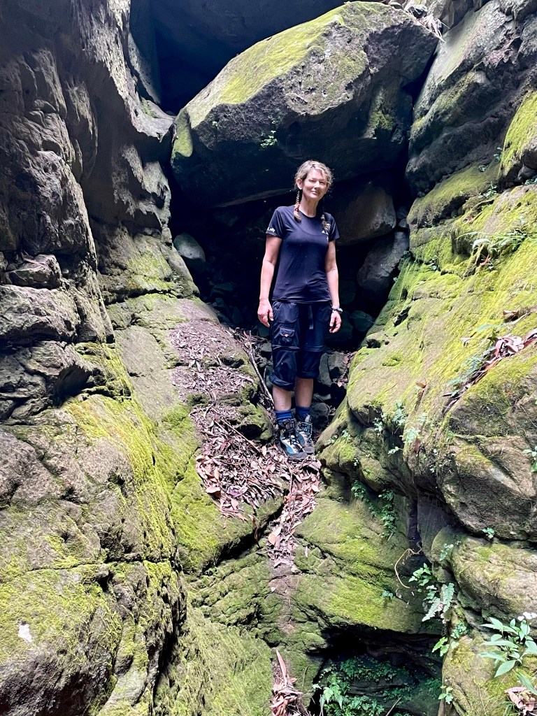
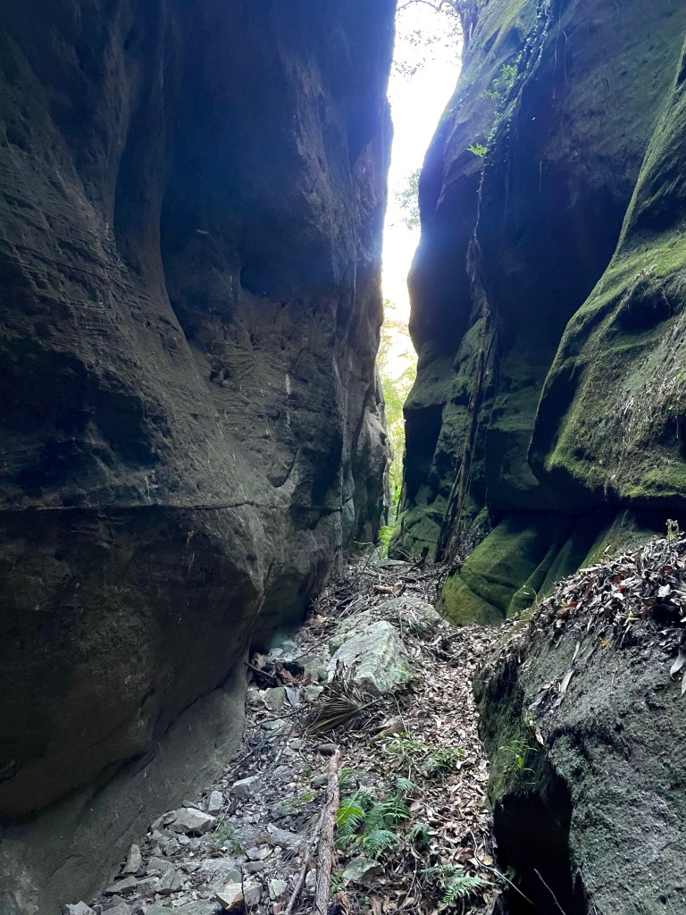
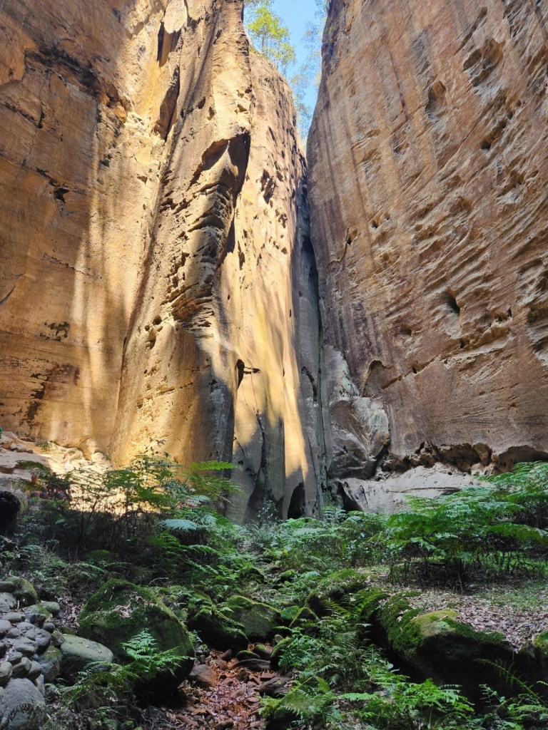
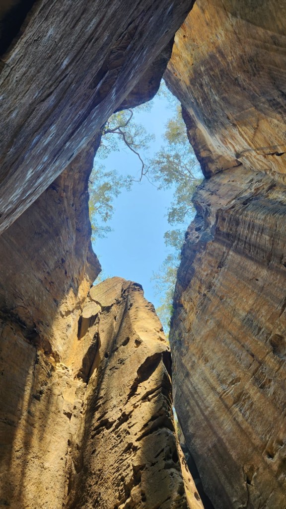
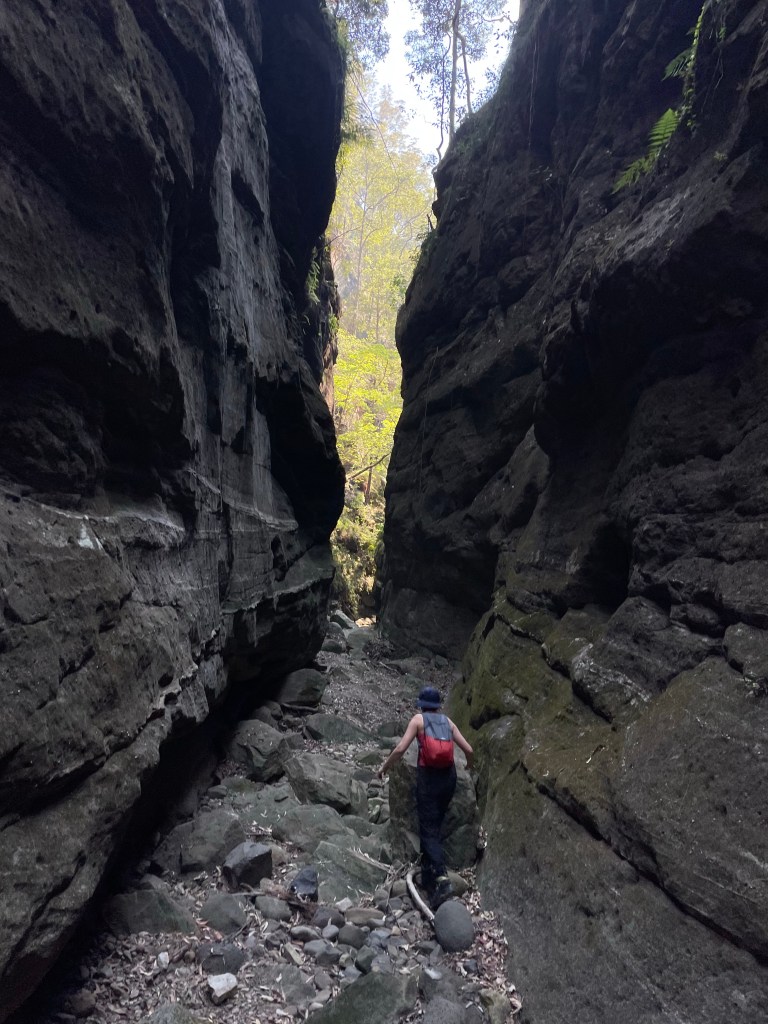
Just upstream we scrambled up past this feature. Belatedly we found an easy trail that bypasses around the little cliff line up to a sunny platform that’s worth a look
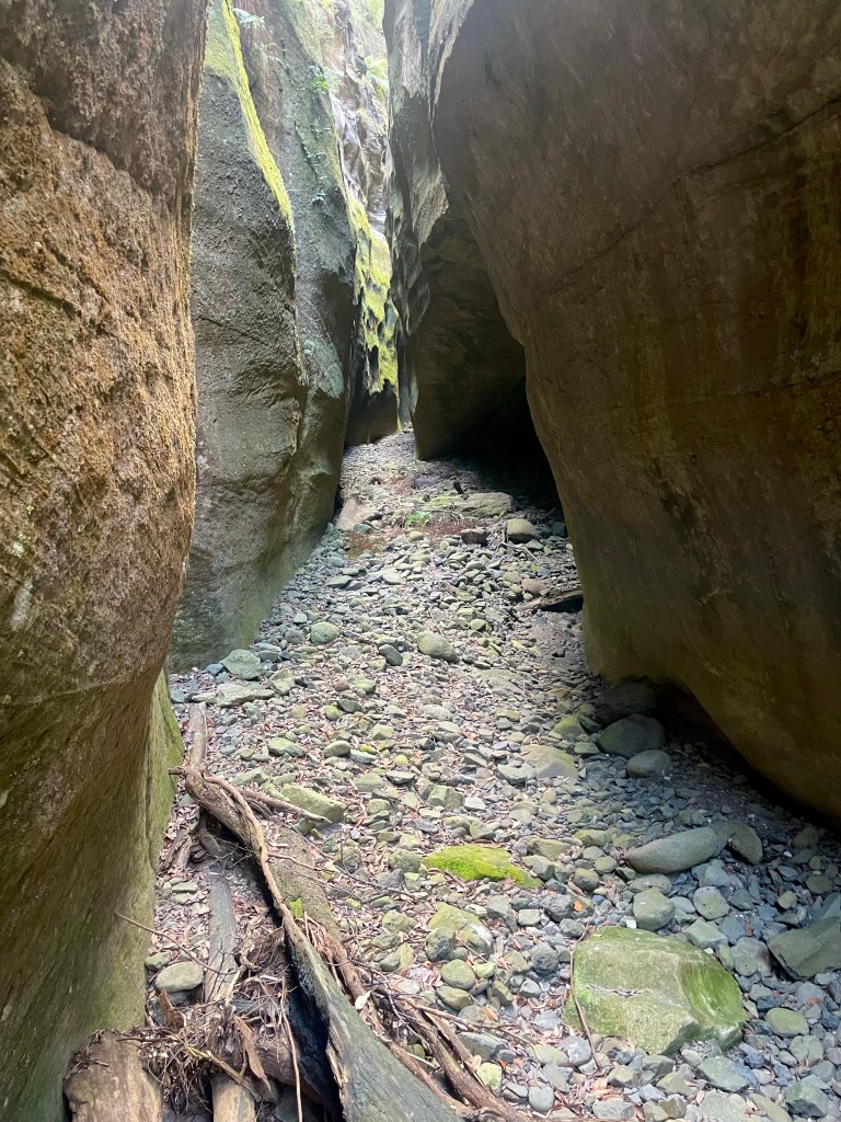
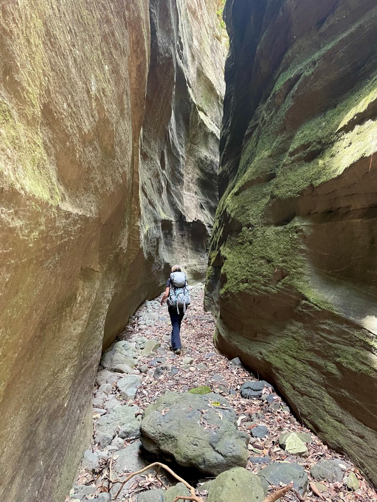
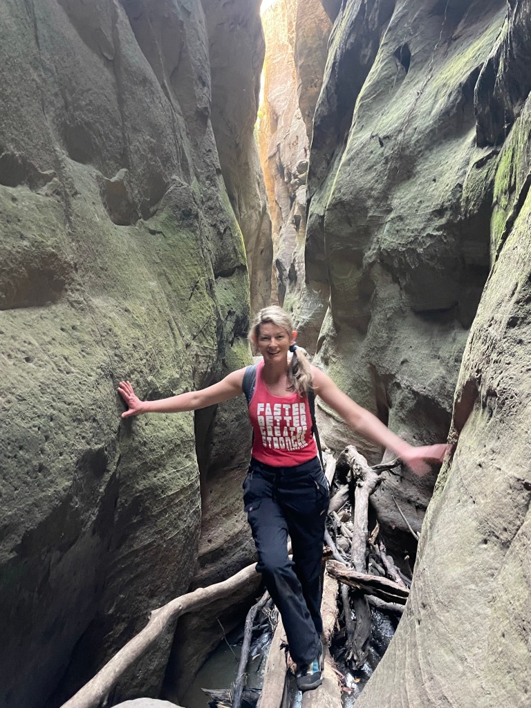
iddy biddy baby canyon
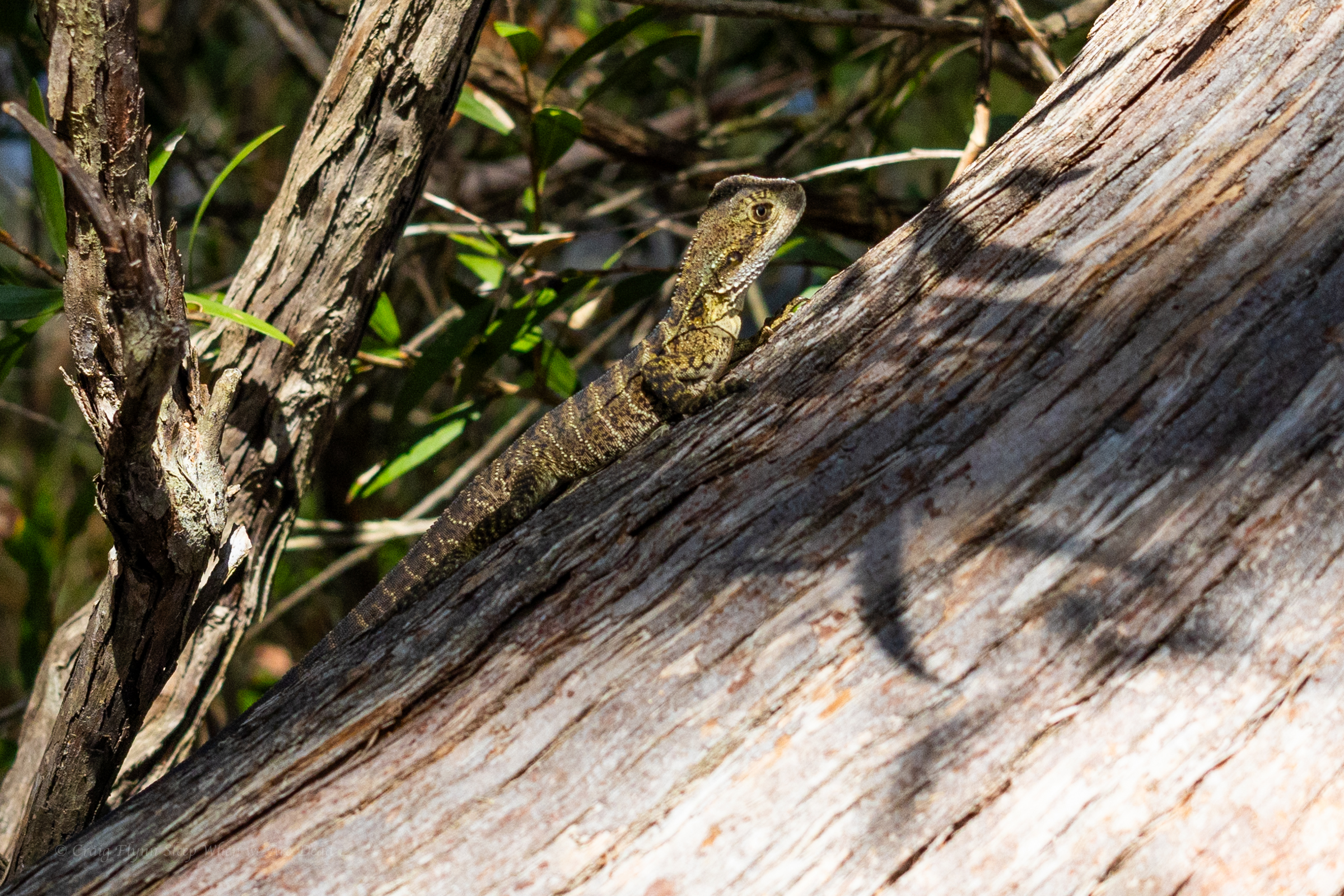
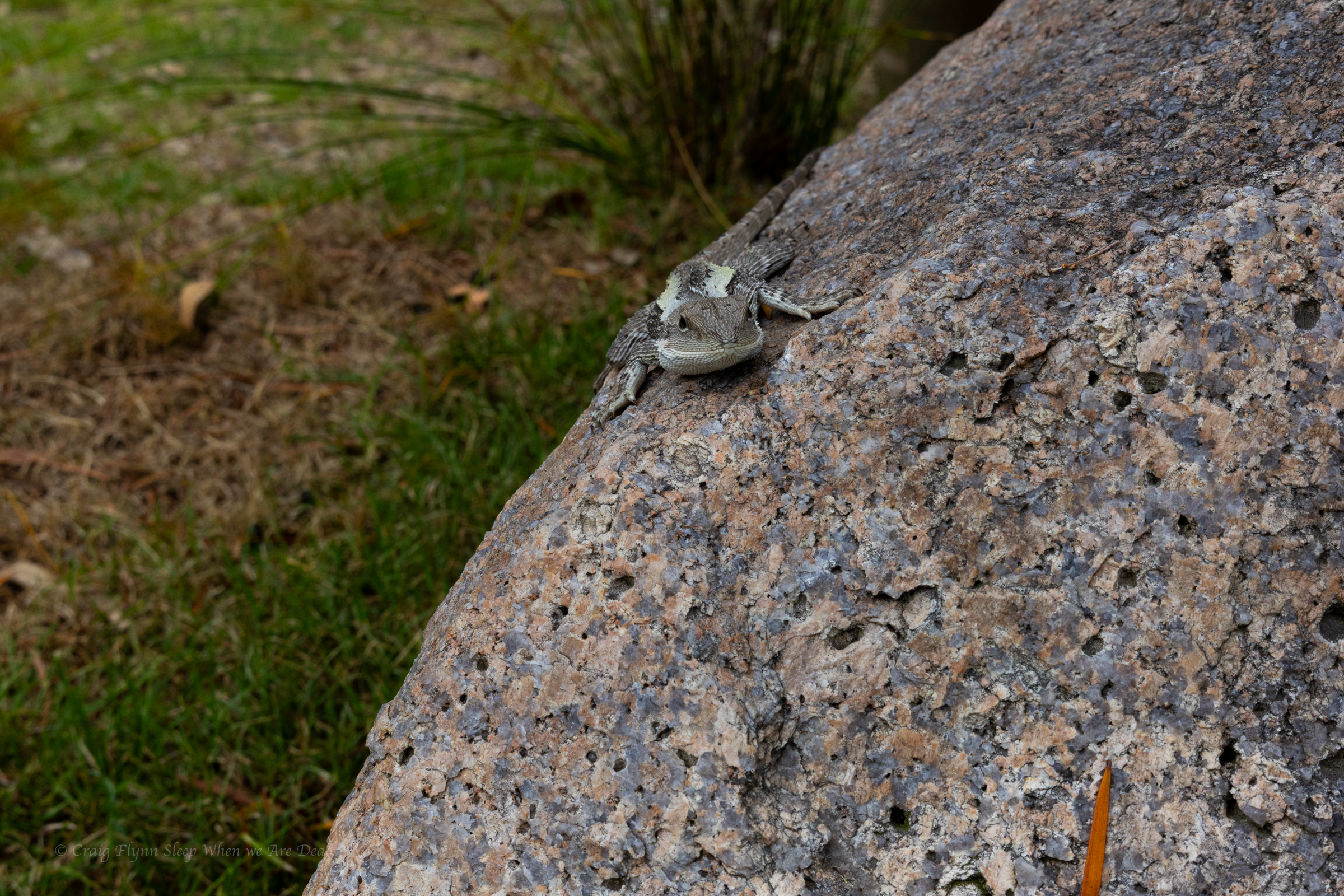
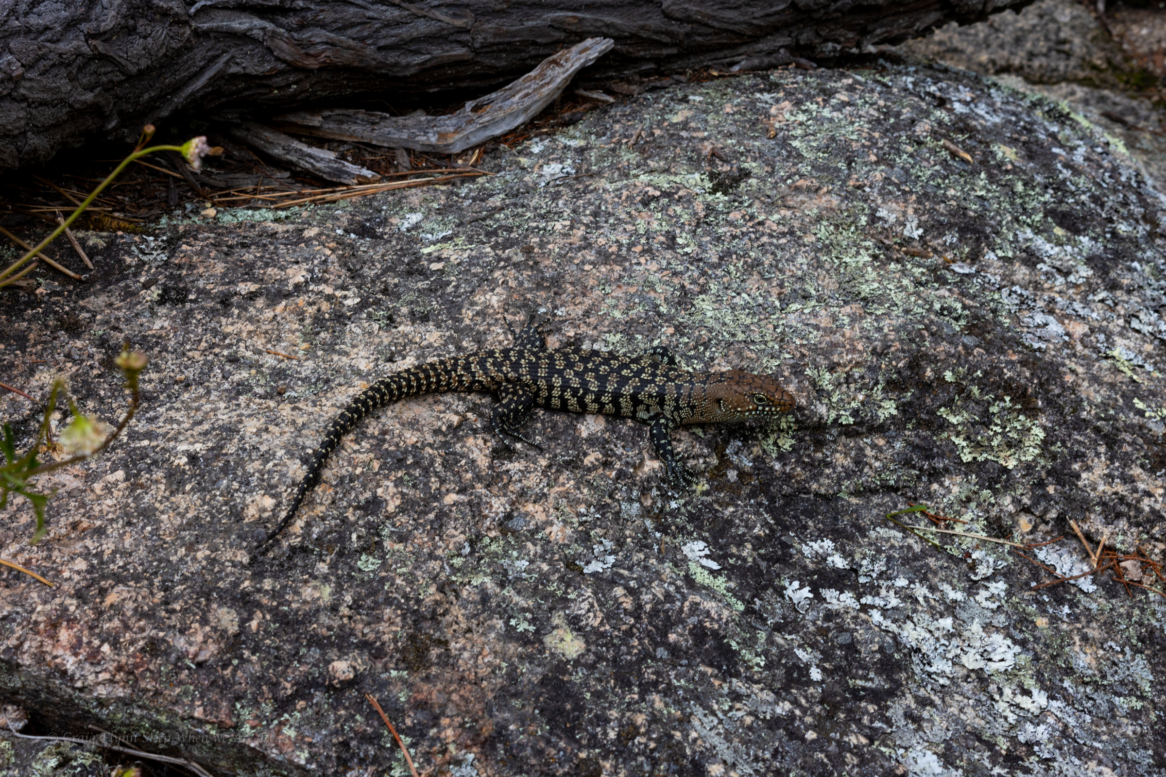
iddy biddy baby water dragon
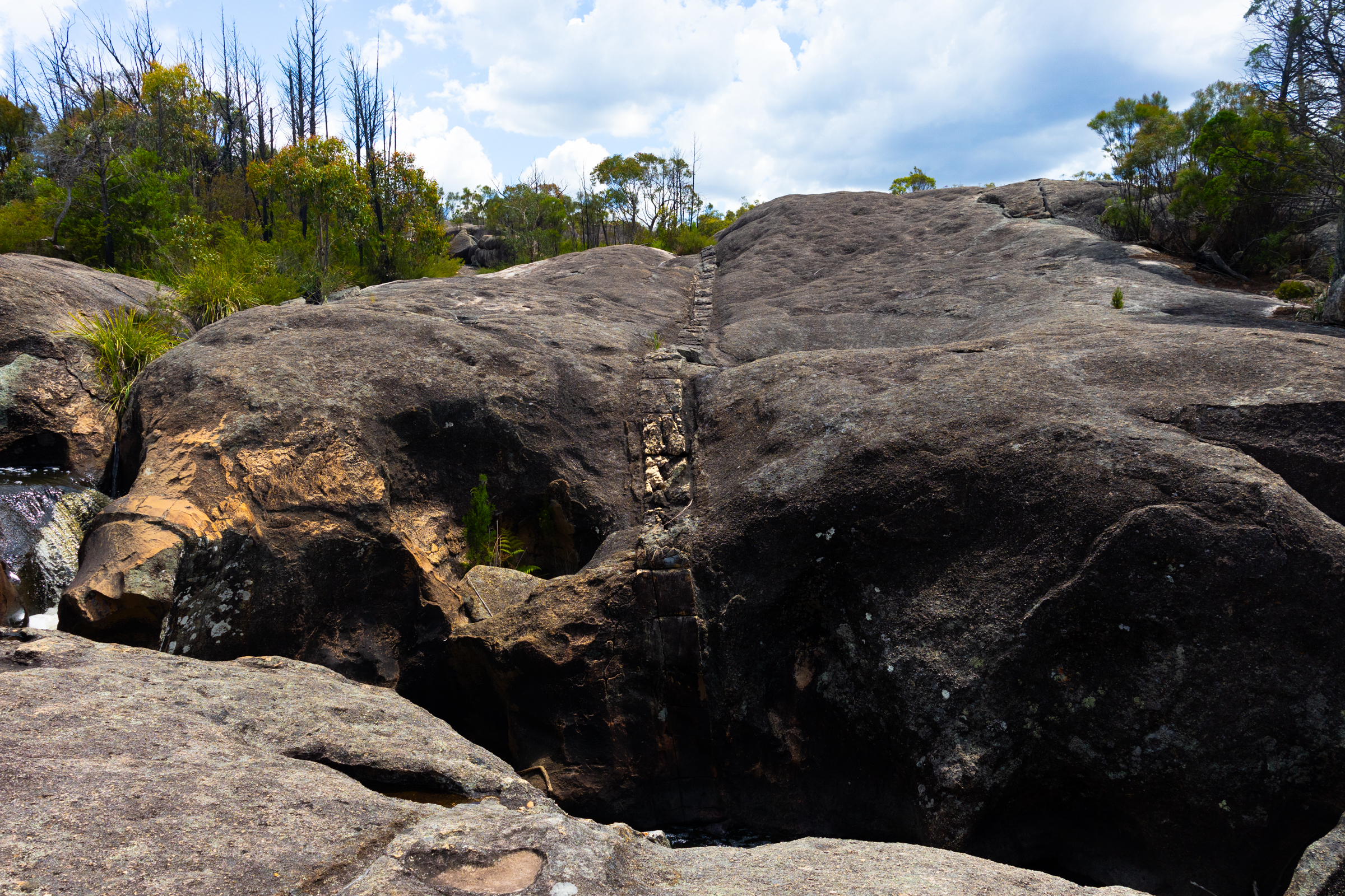
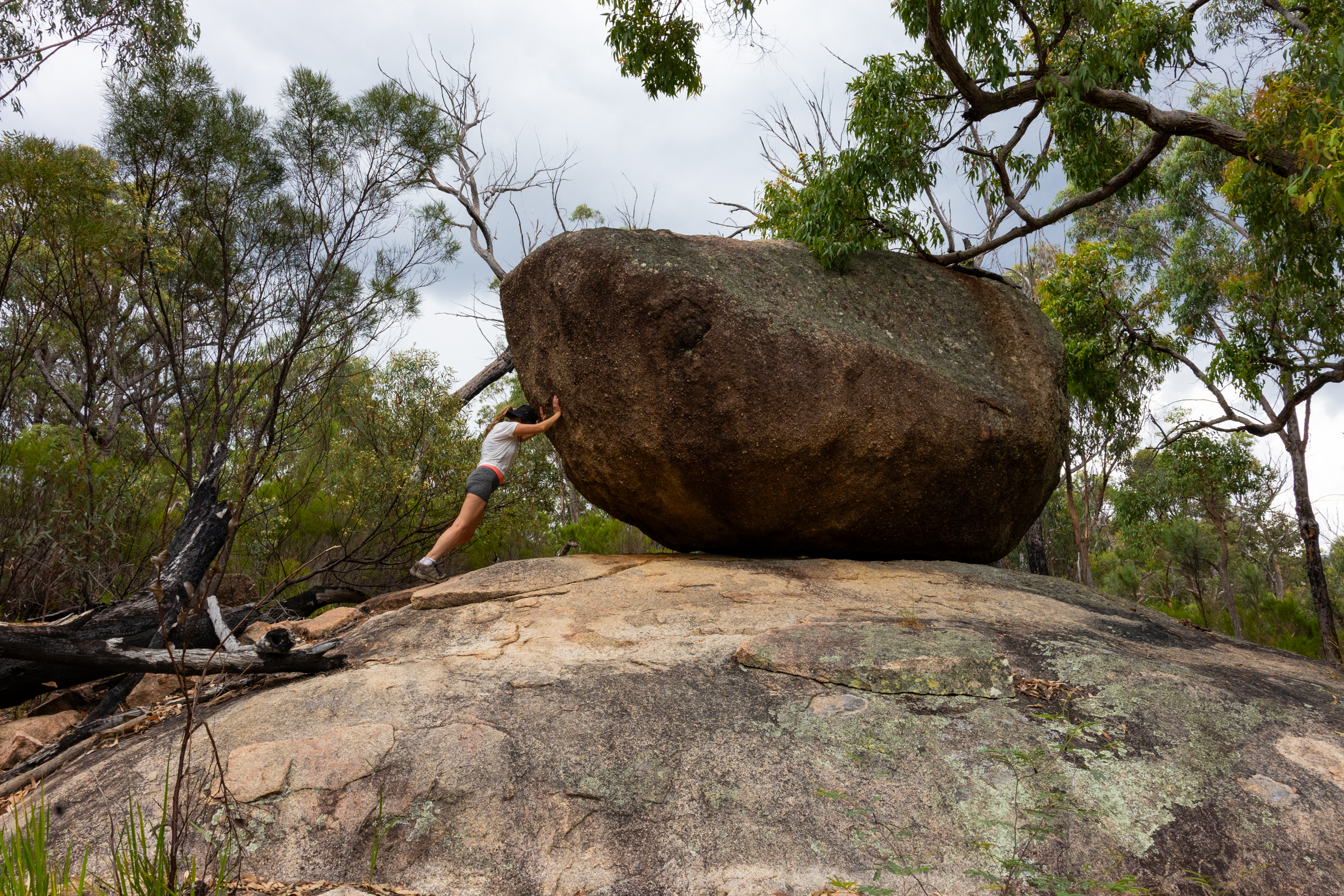
big dyke
On the way back we made the detour to Dr Roberts waterhole. It’s a nice spot for a dip.
We’d spend another night in Girraween before hitting the road and head towards Cranky Rock
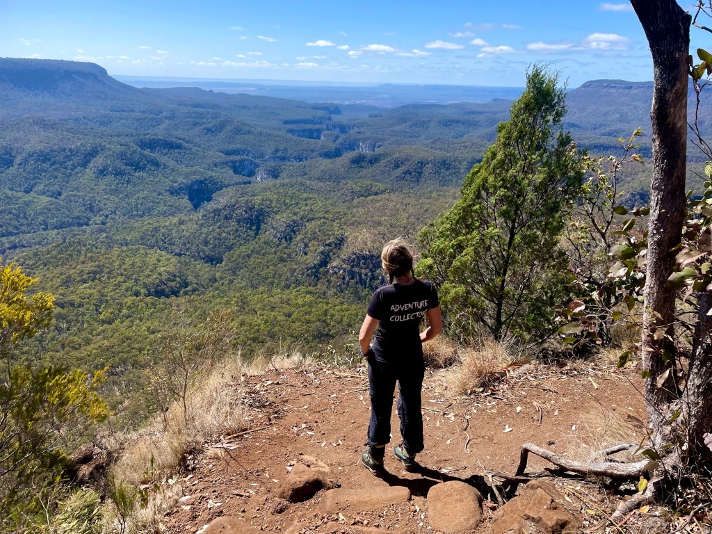
The trail out to the Sphinx was longer but far less steep than what we did yesterday to the Pyramid summit but the day was meant to be even hotter so we got an early start.
The trail winds it’s way up a gentle ridge and there is plenty to explore just off track
I’t a tad over 3.5km out to the Sphinx, gentle uphill most of the way.
Given the weather forecast of heat heat and more heat we opted not to do the side trip to the top of the castle.
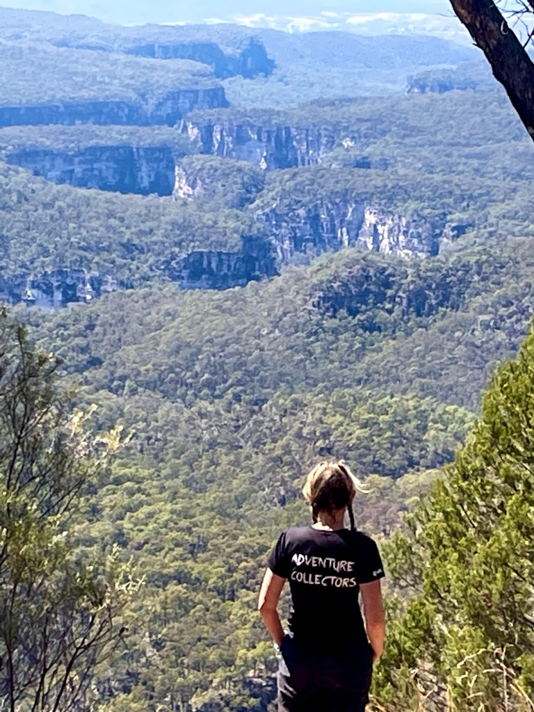
The Sphinx
More like Darth Vader or Batman if you ask me
A short skip further down the trail gets you to turtle rock. The track ends here and you could scramble up but, again with the day heating up, we just have morning tea then head back to camp.
By the time we get back we’ve worked up a sweat and decide it’s a good time to visit an underground creek.
From Booboo Booboo we do a bit of a down and around, crossing the boarder into Qld and into Girraween.
Bald Rock and Girraween are not that far apart as the crow flys, but we aren’t crows and the road needs to circle around the mountainous country in between.
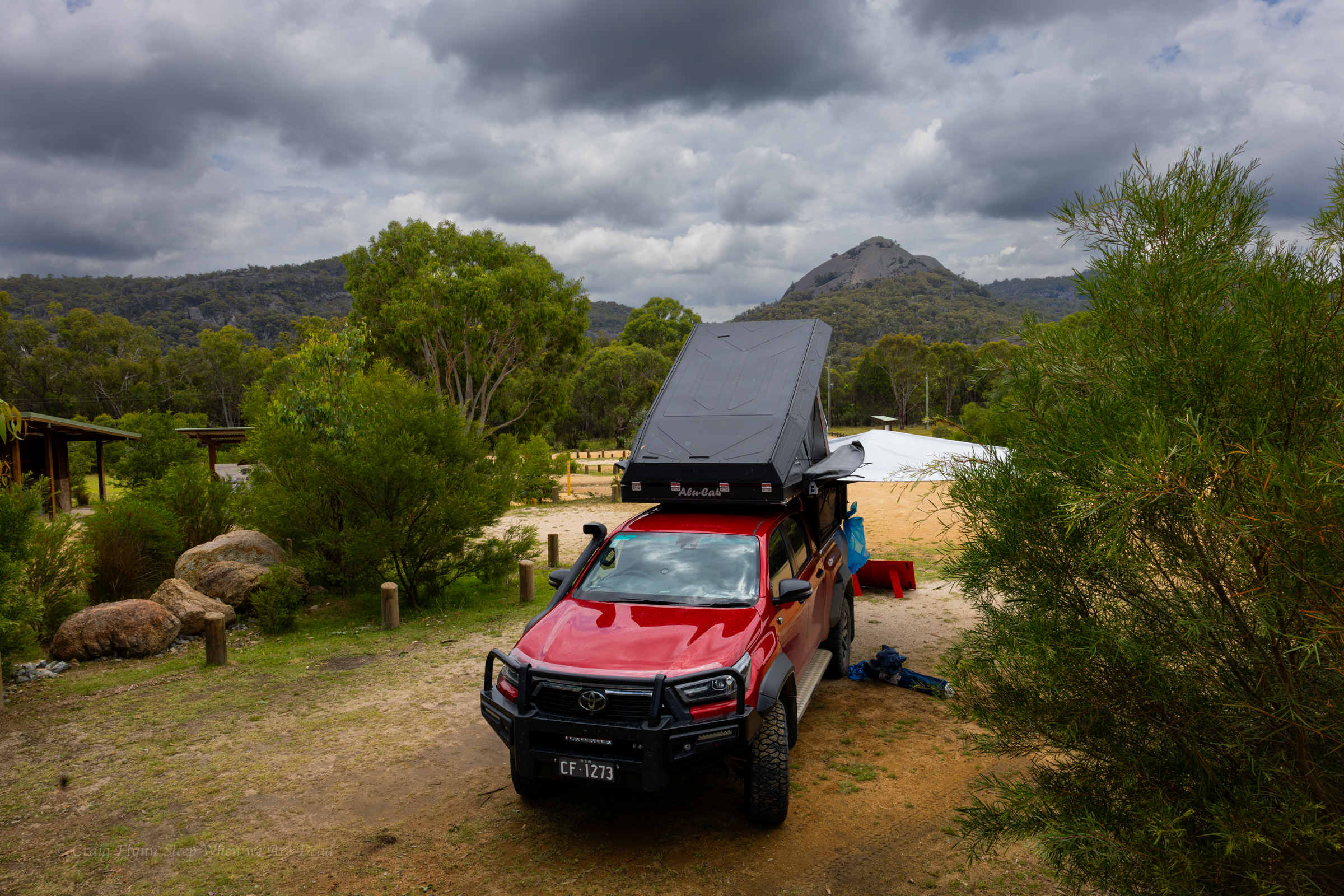
We roll into an almost empty camp ground, the Christmas/New years crowd have dispersed. Just about everyone else we see here we saw at Boonboo Boonoo. Haha
We have a couple of nights here and planned to smash out as much as possible. but the heat was oppressive so we cut our list of things to do from “Everything all at once” to our “must sees” and worked out a bit of a plan for best time of day to see the things. In between we do something rare for us. We chill out and enjoy the camp ground.
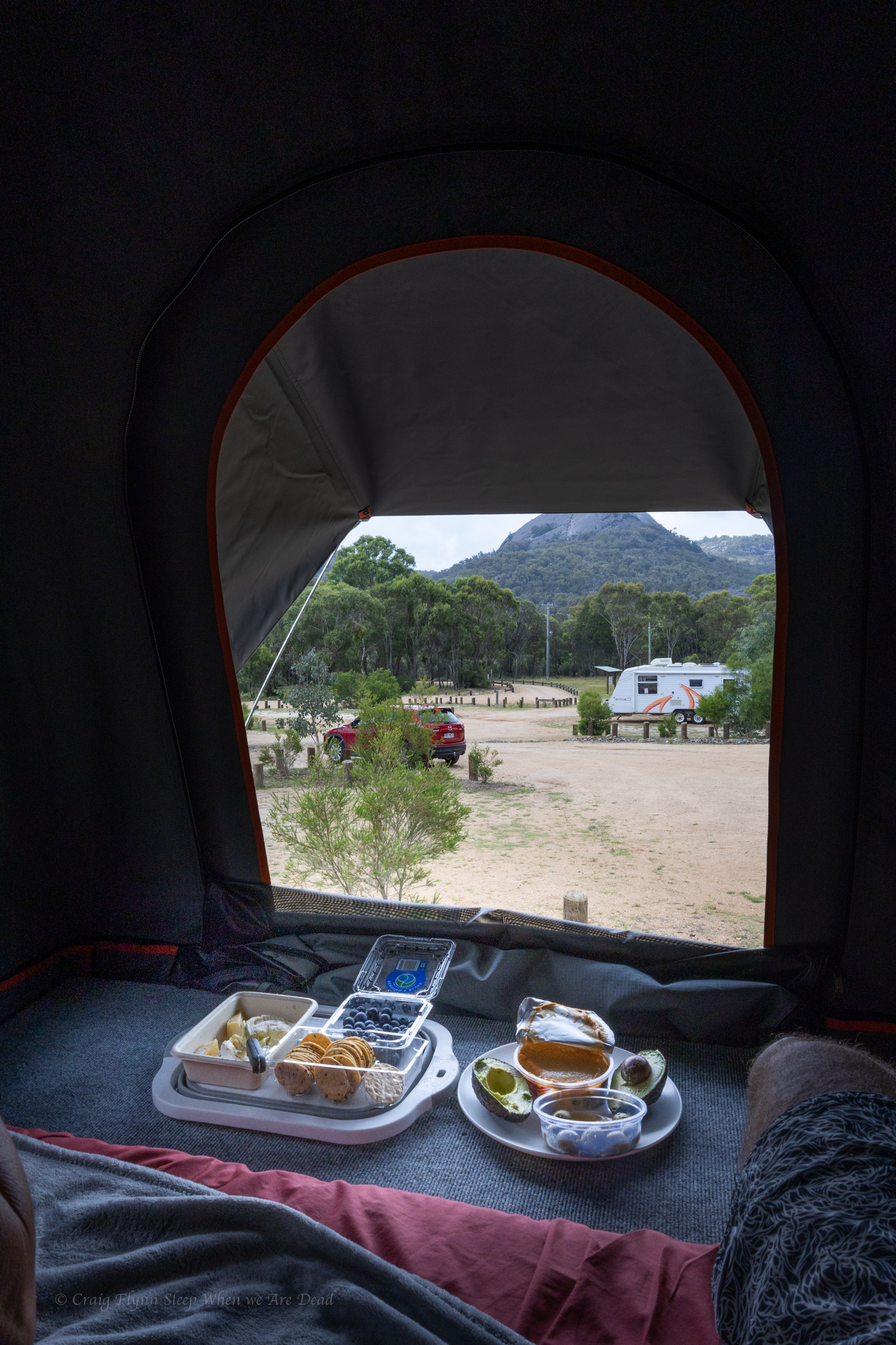
and with views like these out the back of the camper why wouldn’t you
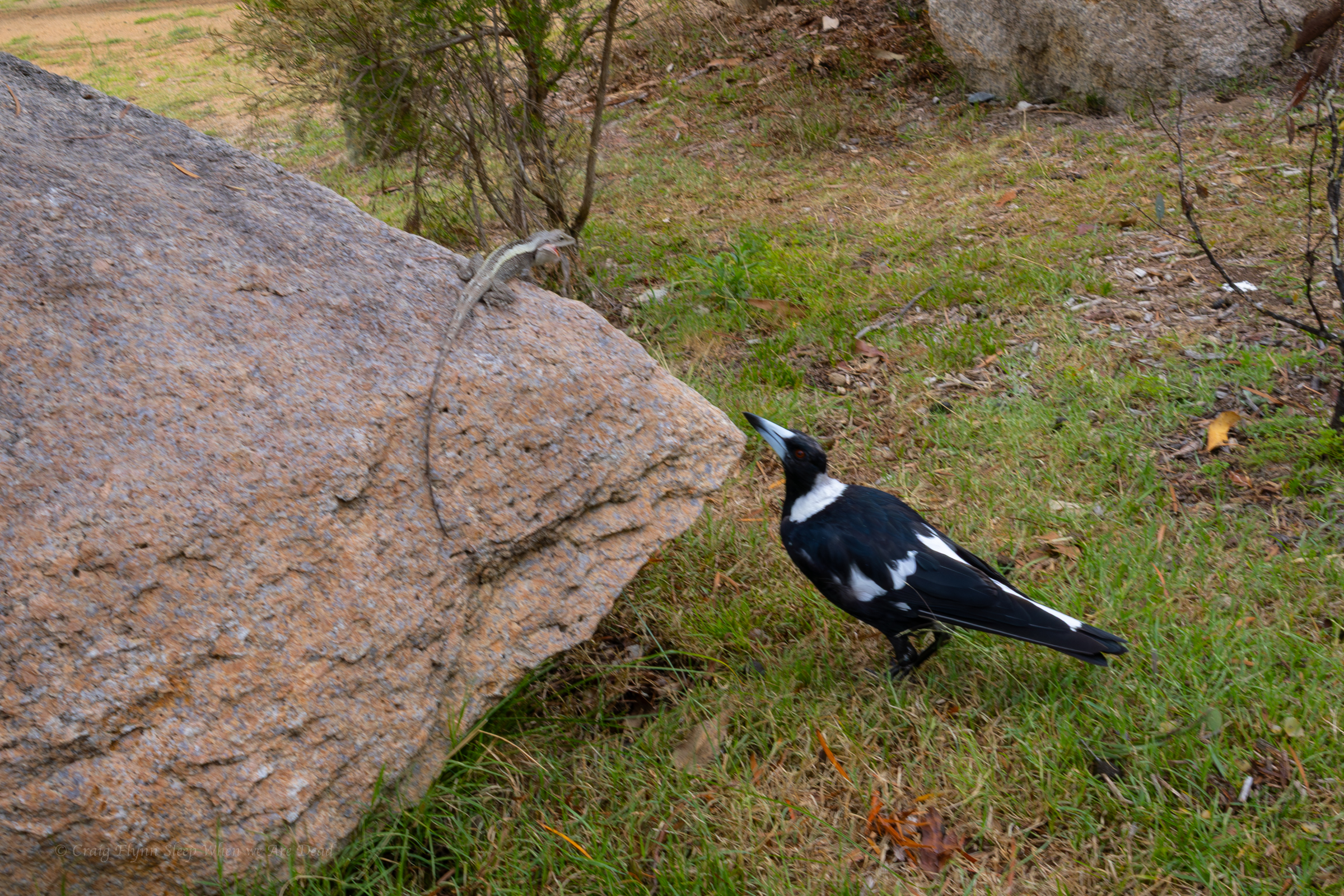
The neighbours were amusing. Knobbie the dragon was preaching the virtues of sun baking. Maggie Pie seemed very engrossed in the topic.
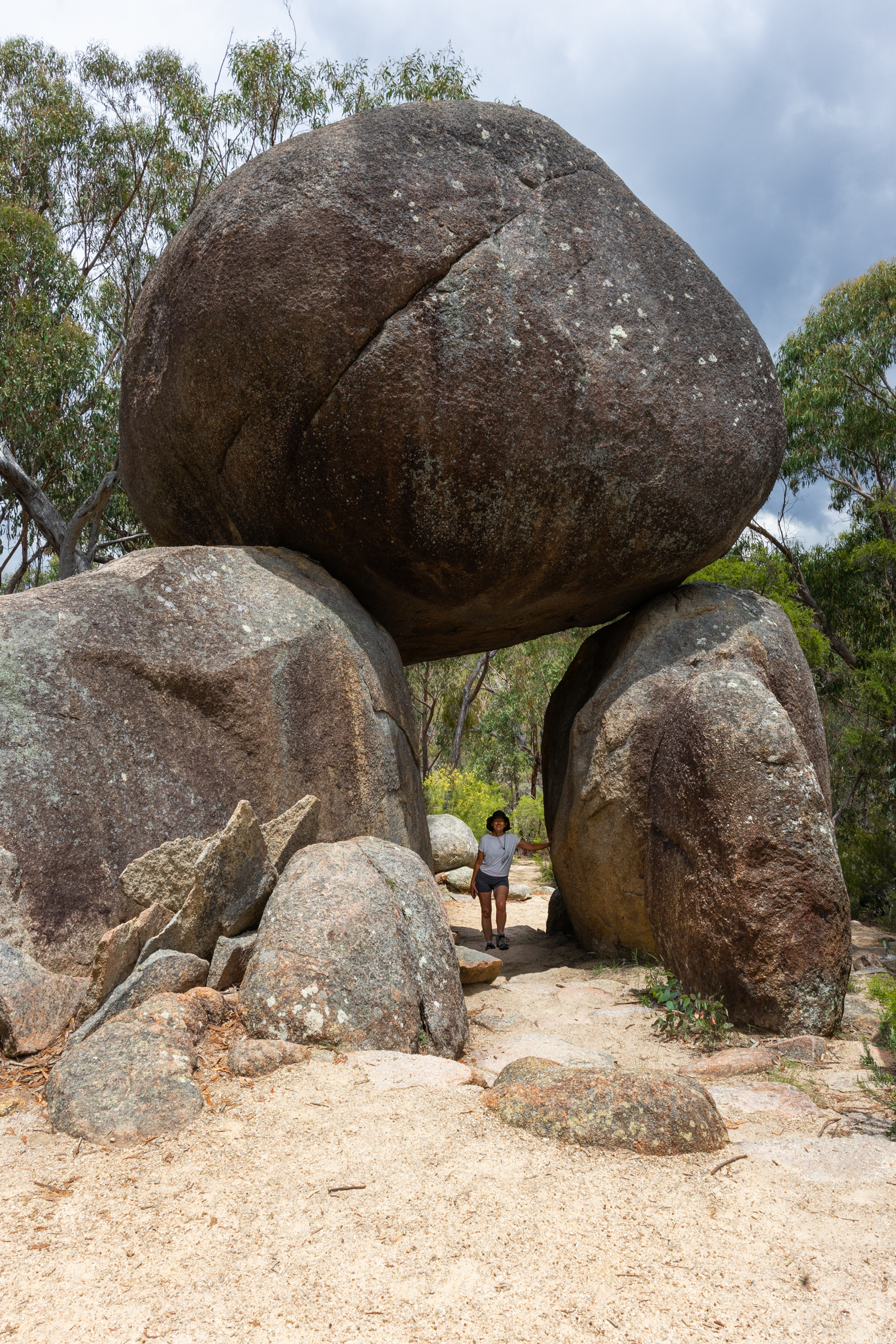
We thought we’d start our stay with a quick walk up to the Granite arch.
An nice easy walk lead us past serval granite outcrops up to this beauty.
On our way to Bald Rock we had stopped at “Thunderbolt’s hideout.” and joked at the time that if we didn’t stop on the way in we wouldn’t stop on the way back as we’d be sick of looking at Granite tors and boulders .
Narrator: Neither Craig nor Kylie got sick of looking at granite tors or boulders.
Just adjusting the placement for a better composition
A big storm role din with lots of thunder and lightning so we dashed back to camp.
Knobby Dragon. I think. Could be a Jacky Dragon. I aint know. I’m not a dragon tamer.
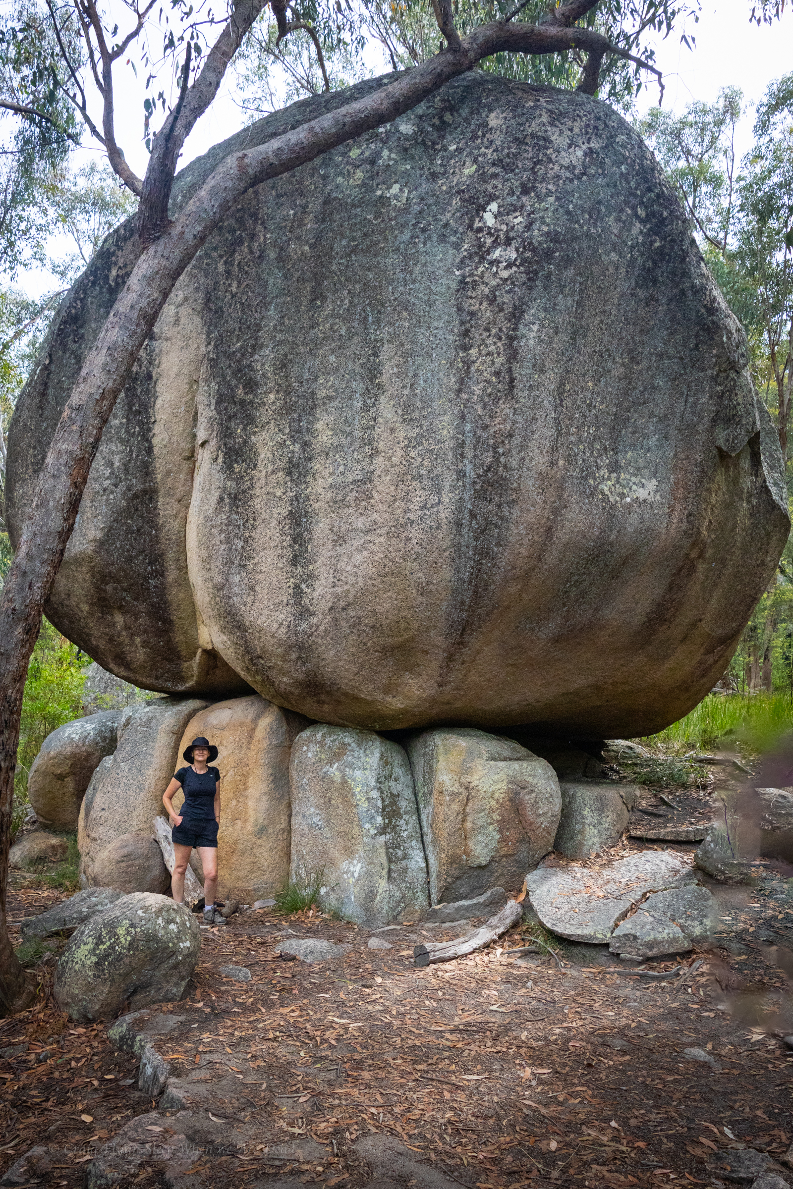
The storm passed over without rain and the sky cleared so we thought a late afternoon walk up the Pyramid would be just the ticket.
It’s about 2km from the campground to the summit, so not a big walk.
But it’s steep.
While not the steepest signposted tourist track we’ve been up (I’d probably give that to the Red Track at Bungonia) added to the steepness is the exposure.
Grippy shoes and dry weather is a must for this one. Once the rock is wet you’d have more grip on an ice skating rink.
The first part is along a clear easy path. This leads to some stairs. They lead to a big granite slab. White dots lead the easiest path up. All good so far
Then you scramble up this rocky chute, referred to as the pyramid passage.
Then comes the traverse.
You make your way out, angling up. To the right the granite slab towers above. To your left a steep slope dropping off to nothing but air.
It’s terrifying but worth it. Say a couple coming back down.
(Belatedly, on the way down, we find there is a less terrifying option of veering right and around the back side of the boulders above)
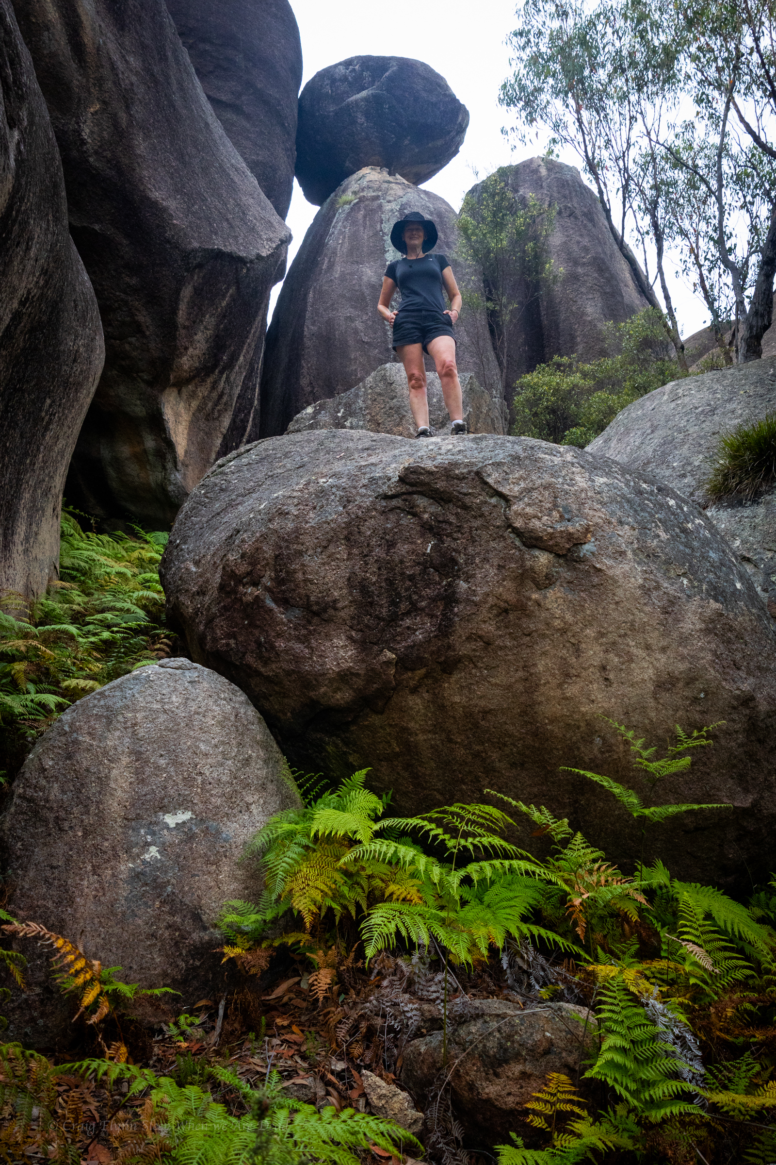
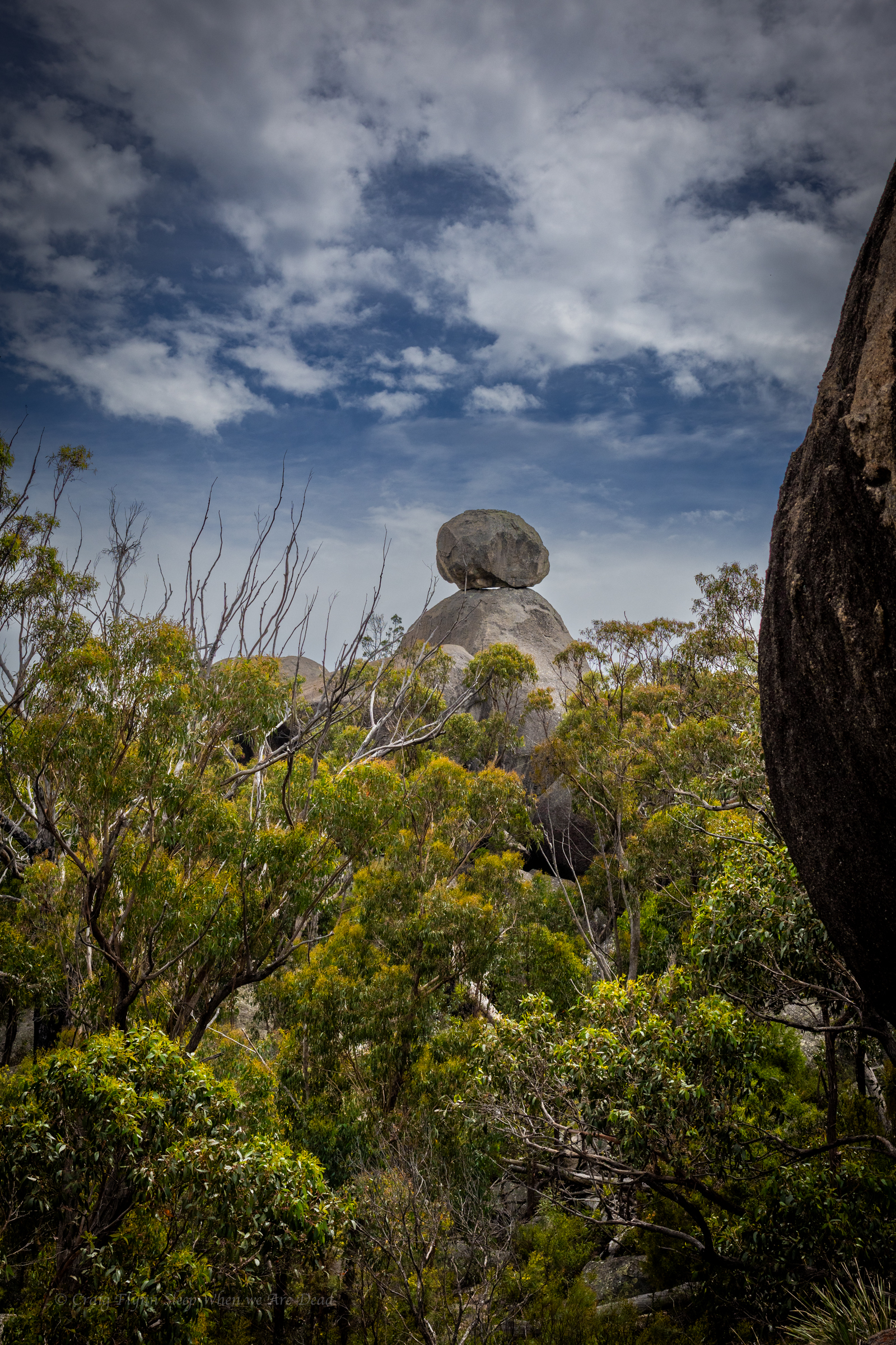
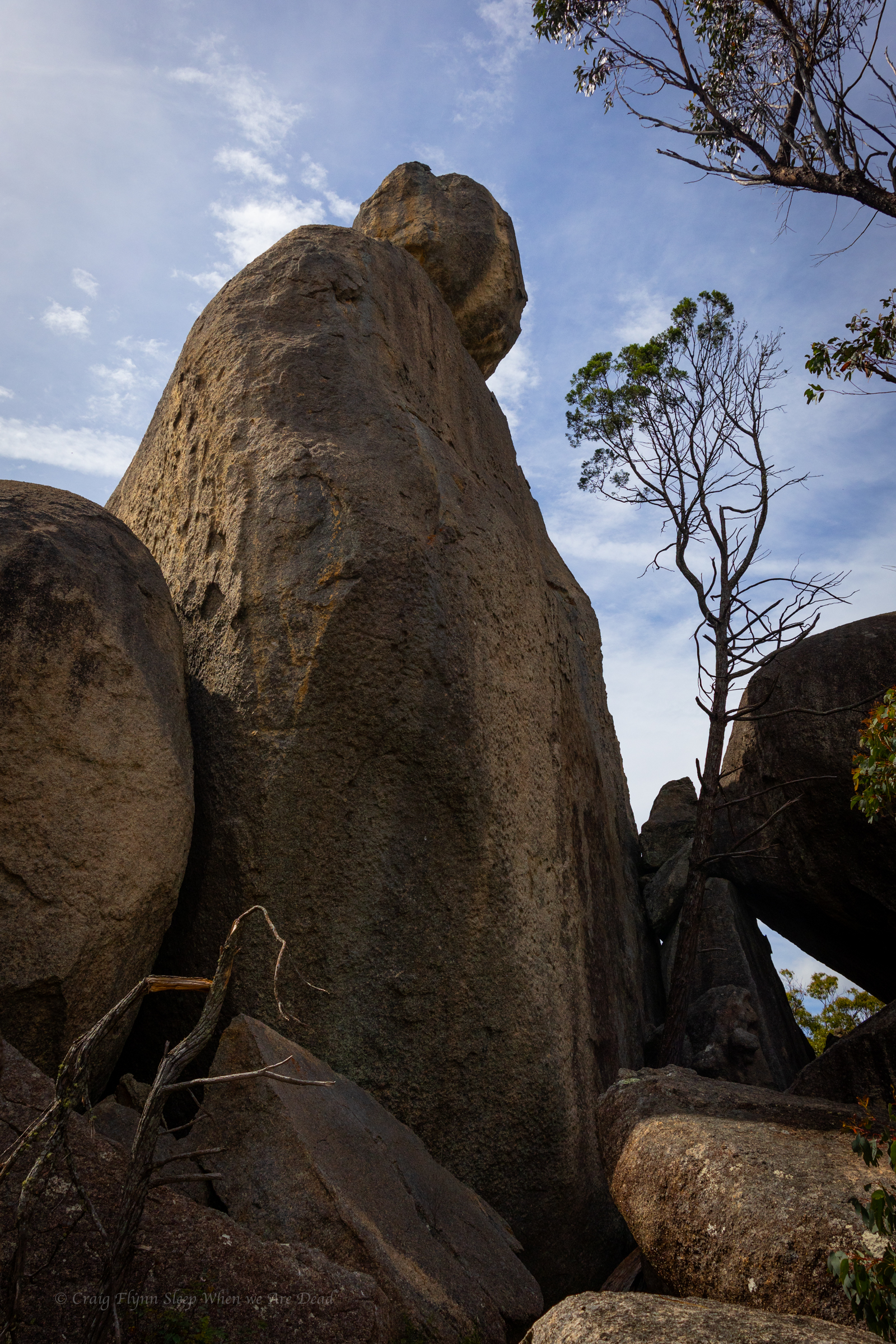
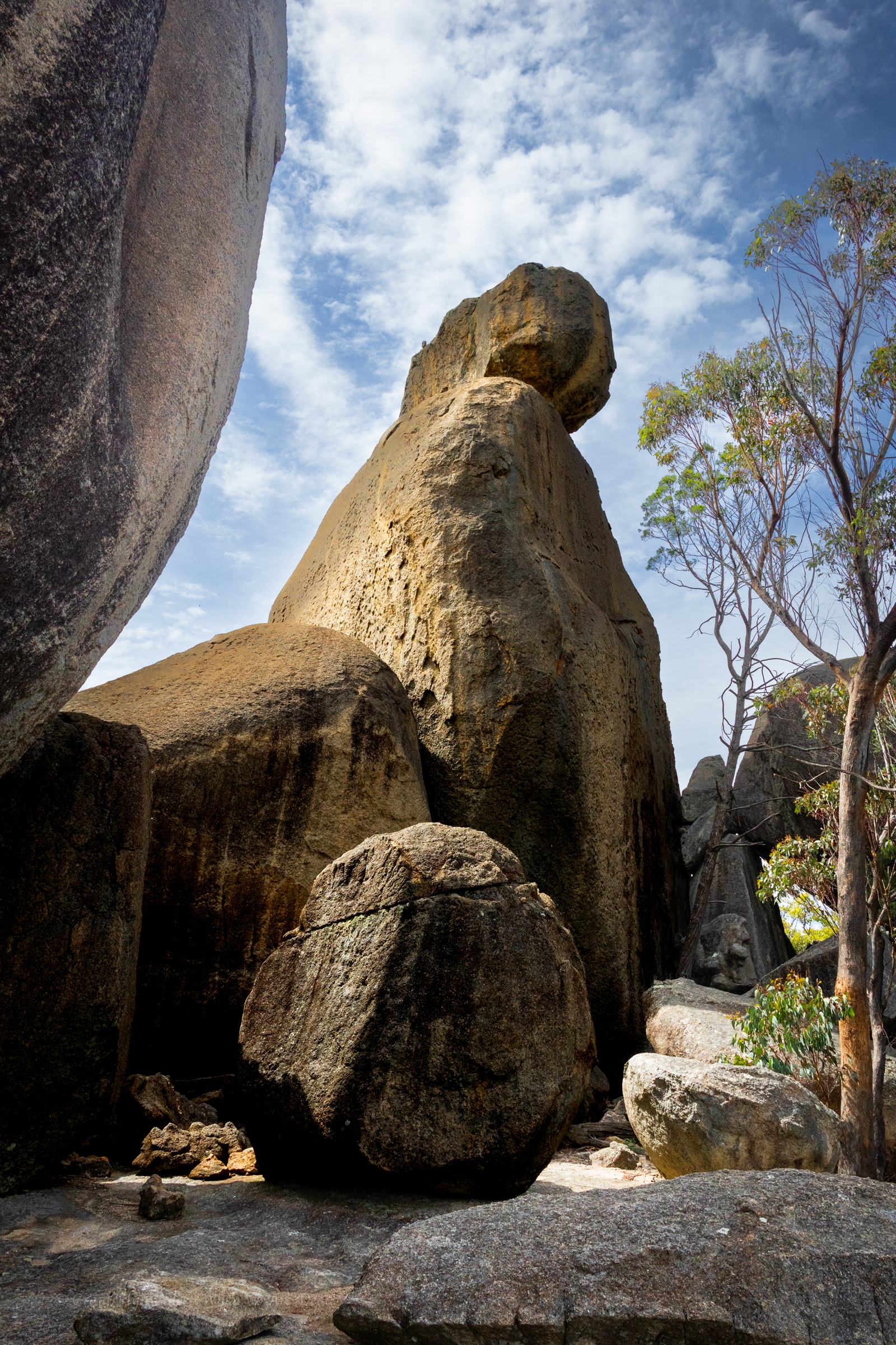
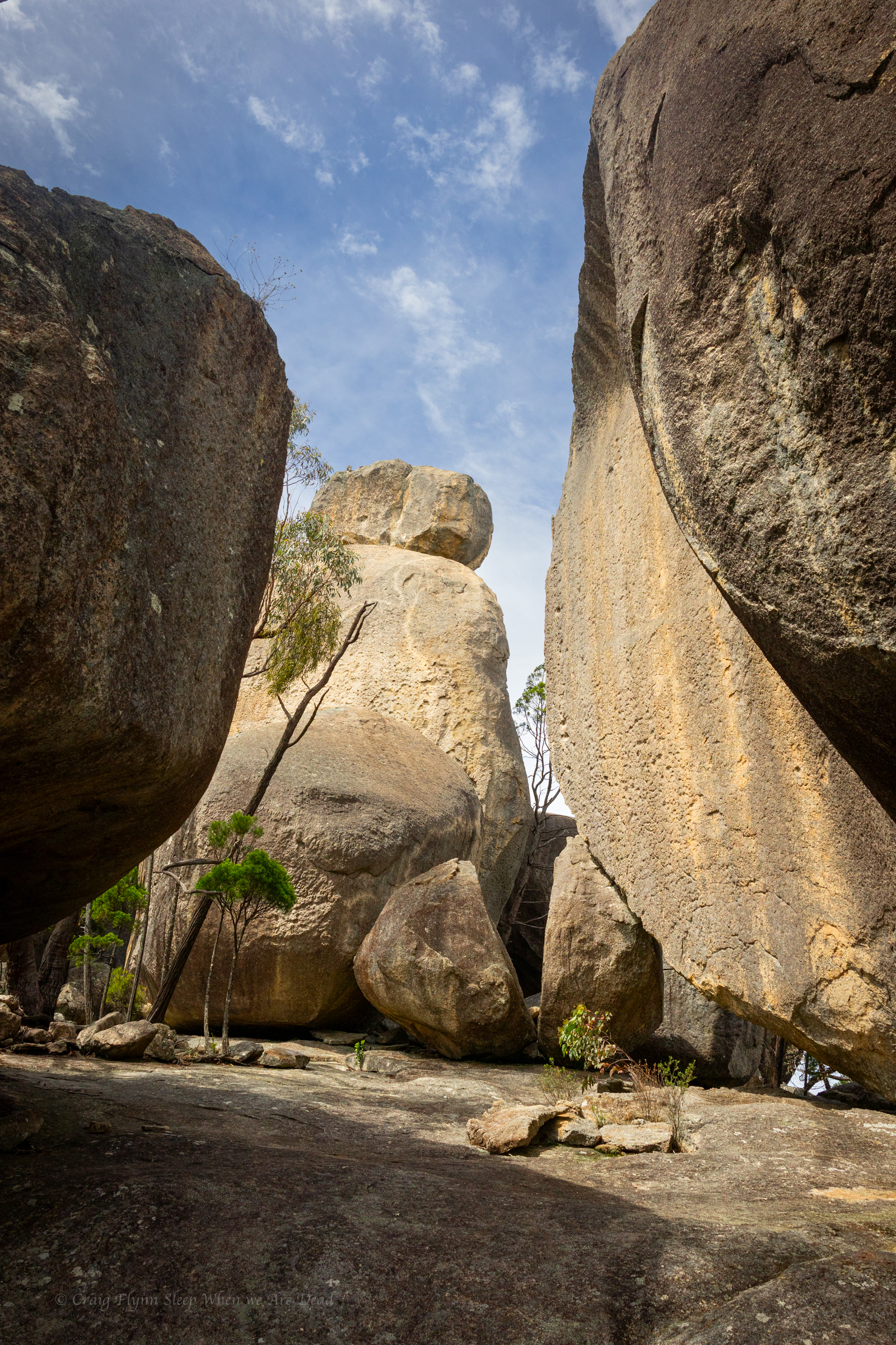
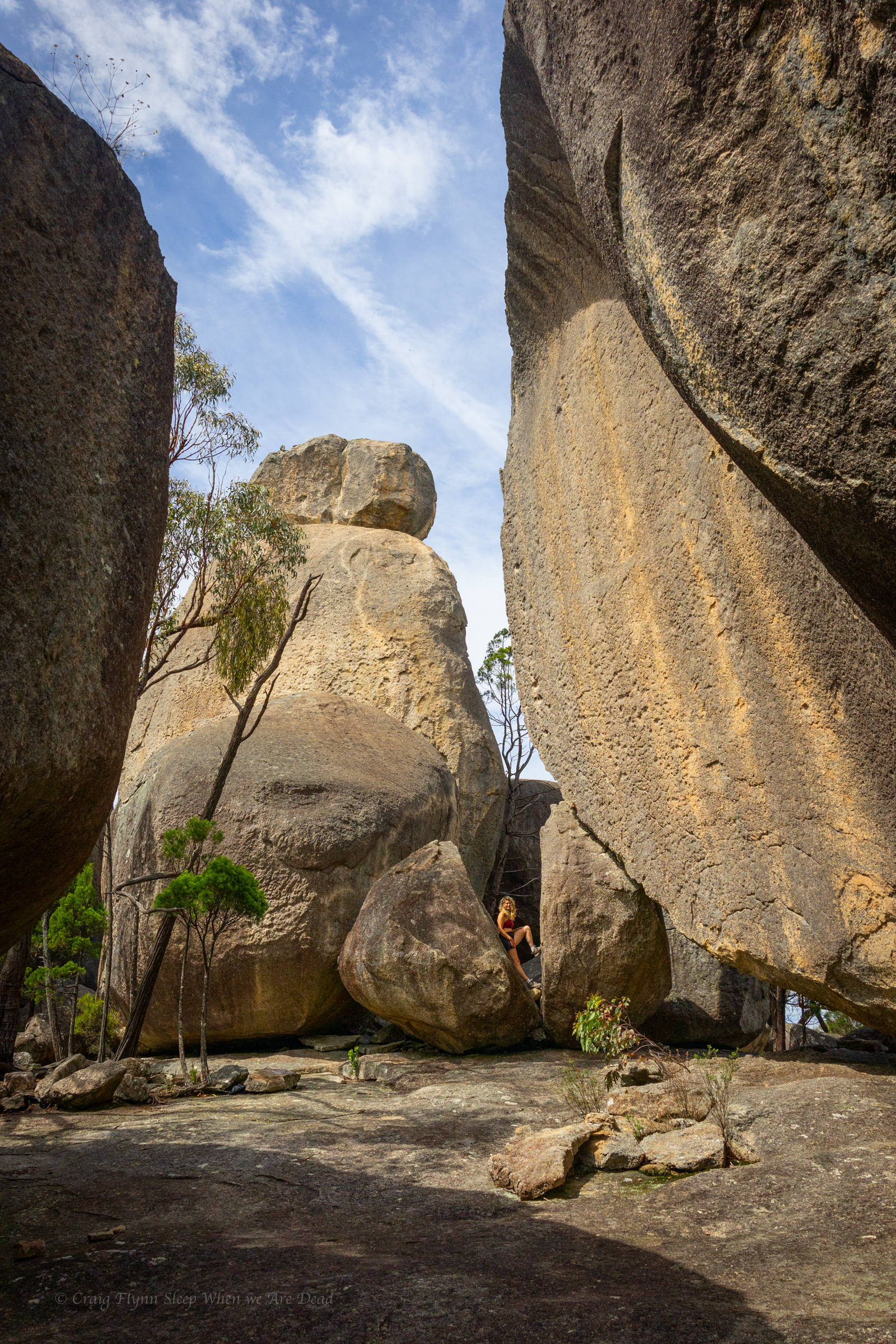
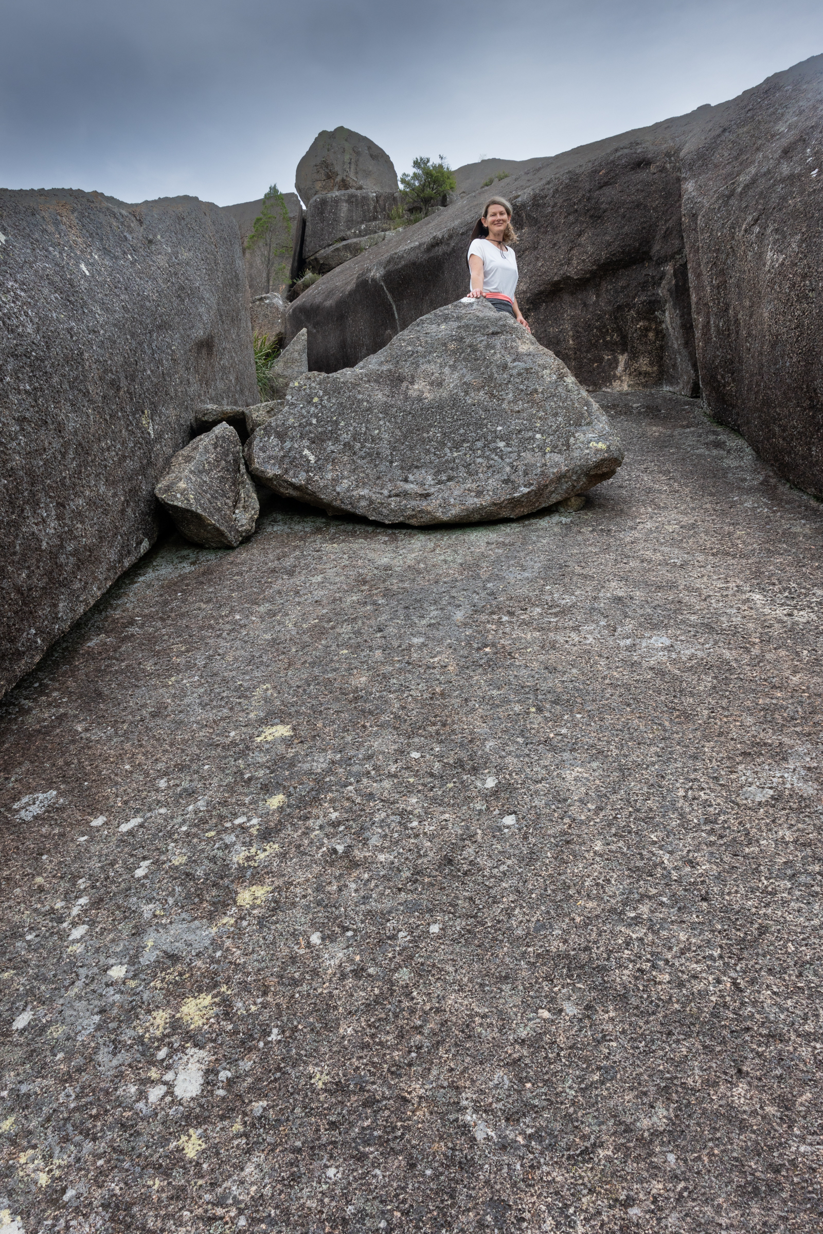
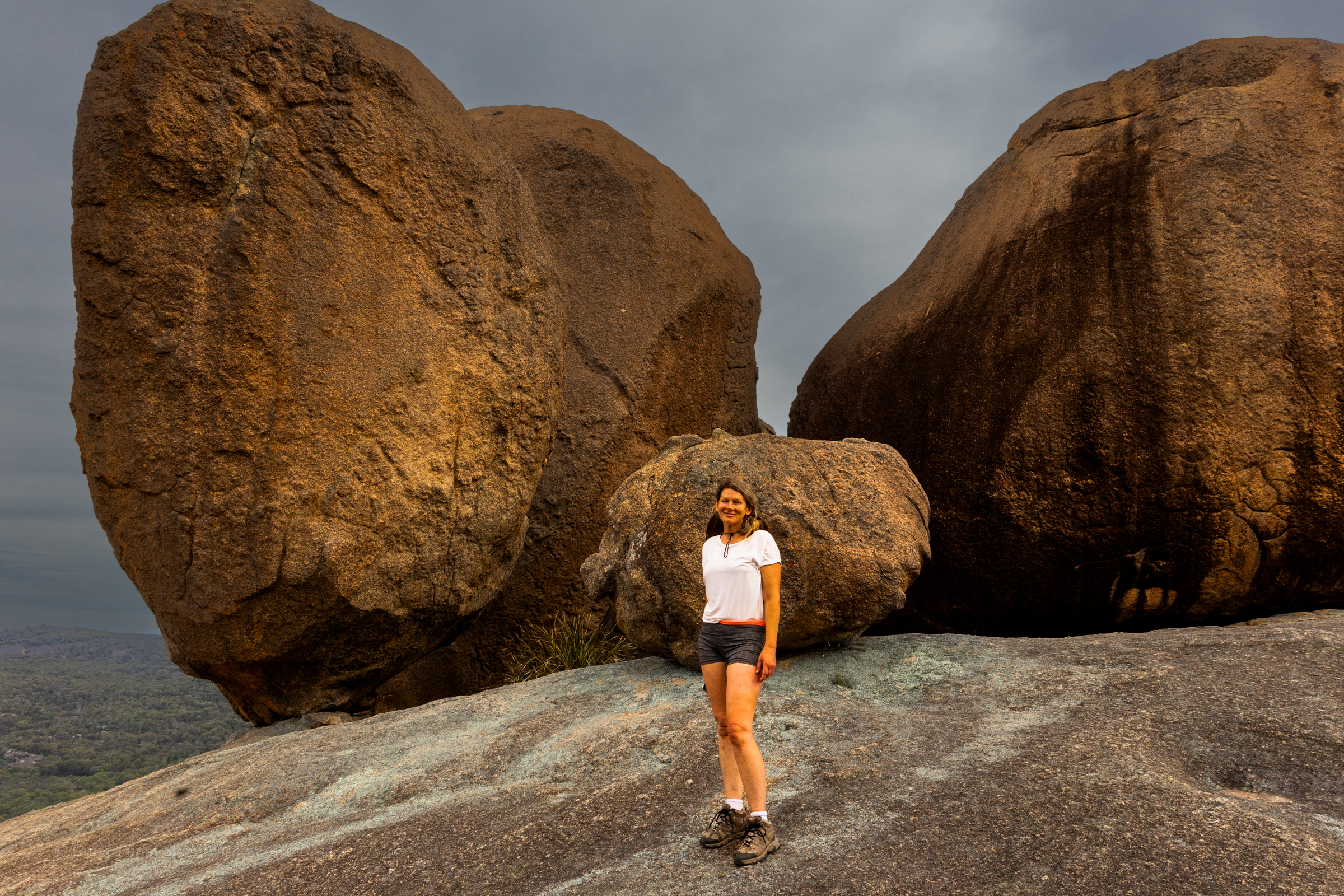
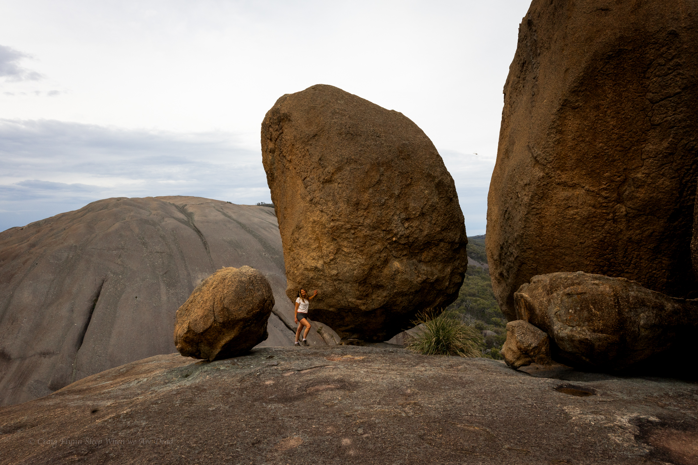
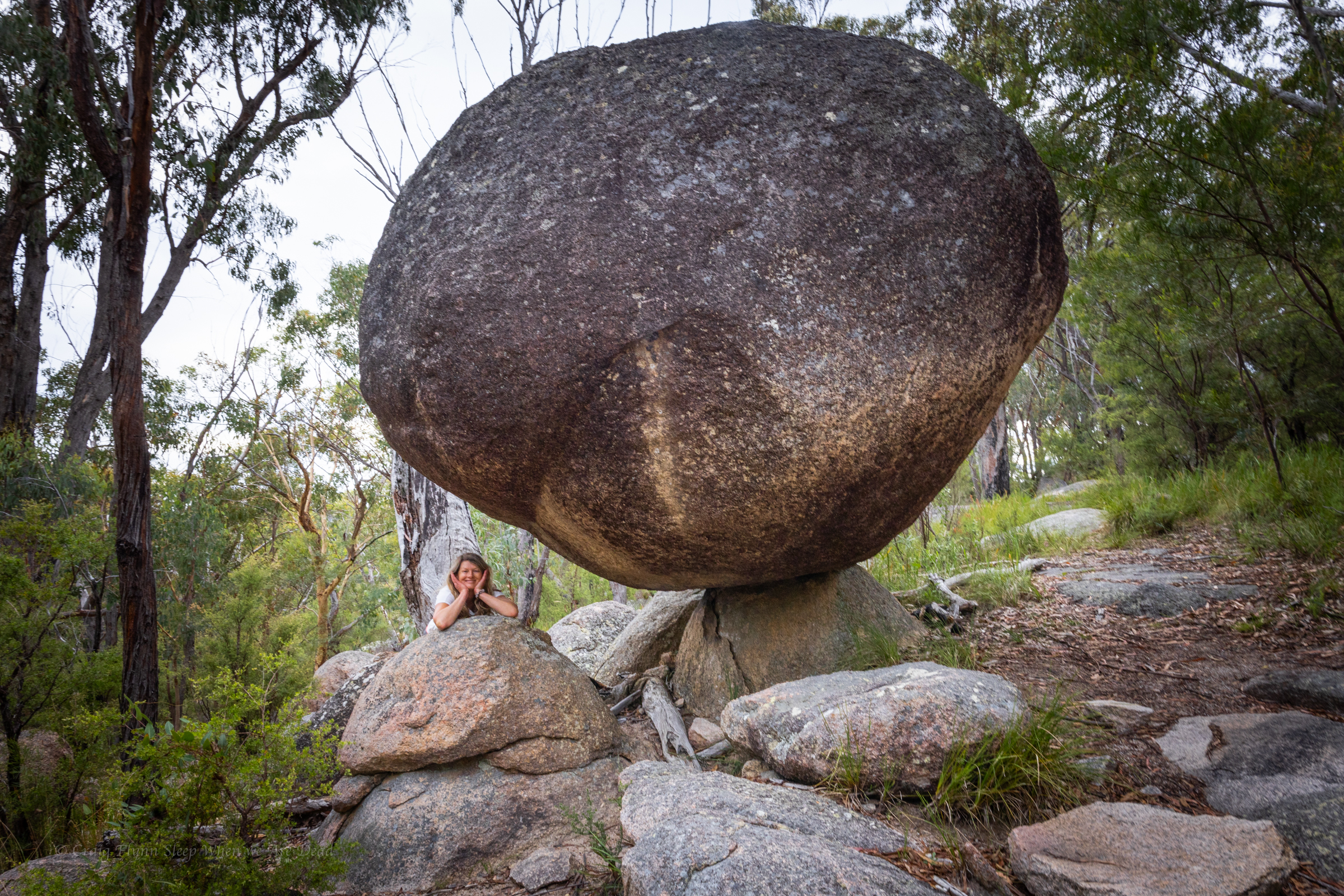
Past traverse its another little scramble before you round a corner to views of the infamous balancing rocks, defying gravity (for the meantime) right on the edge of the dome.
Breath taking in the soft afternoon light of sunset
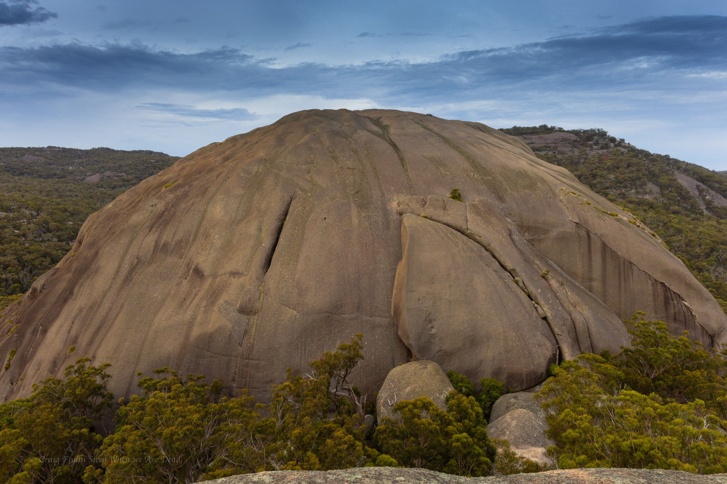
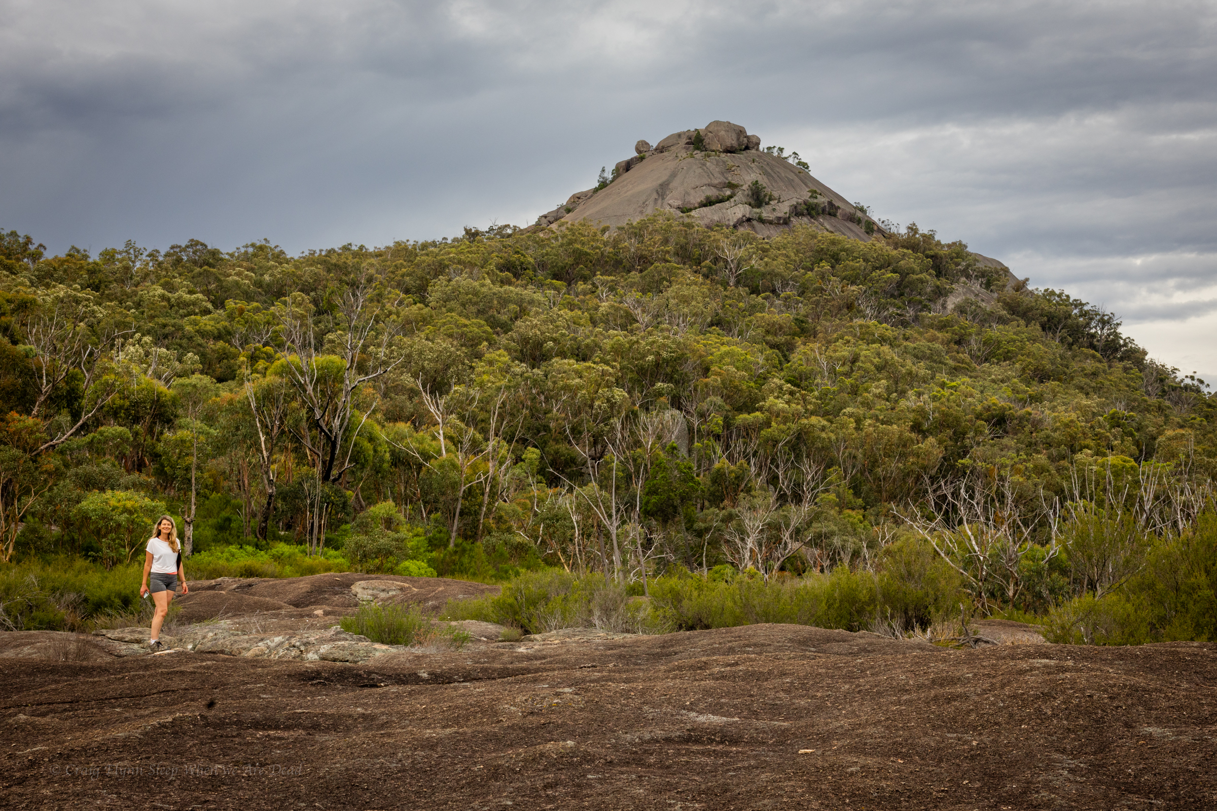
The view across to the second “Pyramid” and equally impressive granite dome.
If you close both eyes and try really hard to imagine a pyramid it looks just like a pyramid.
The aboriginal name for these peaks seems to have been Terrawambella. Early pastoralists mapped them as “the domes” at some point they became known as the Pyramids.
With the sun sitting low in the west the light was magical and we had the views all to ourselves.
Well, us and Mr Cunningham.
I only recently learnt that Cunningham skinks have the ability to change their colour a bit, sort of like a chameleon, to help blend into the background.
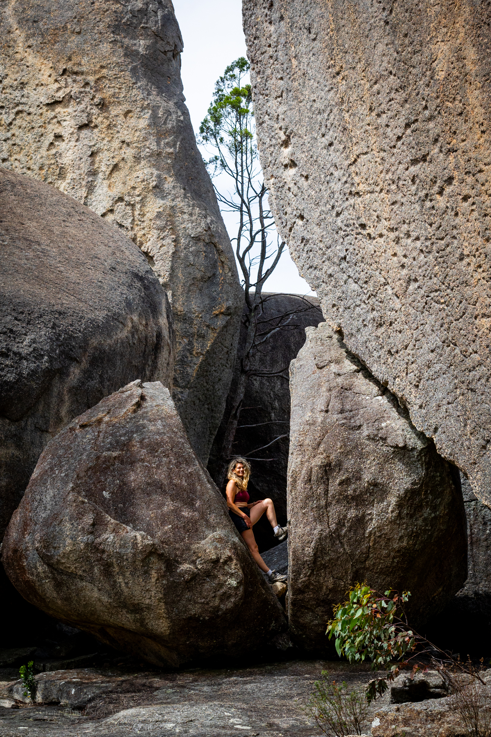
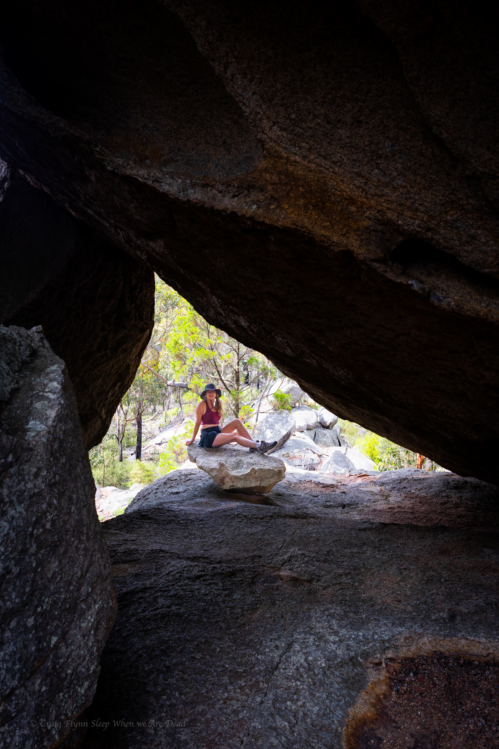
Once back down off the dome we veer off track to check out other balancing rocks and views
Gadget and The Great Pyramid of Girraween
It’s been a good day. We have punched out a couple of short but steep walks. Basketswamp Falls, the Granite Arch and the Pyramid.
We get back to camp as another storm rolls through. The temperature was due to ramp up again tomorrow so we plan an early morning trek out to the Sphinx
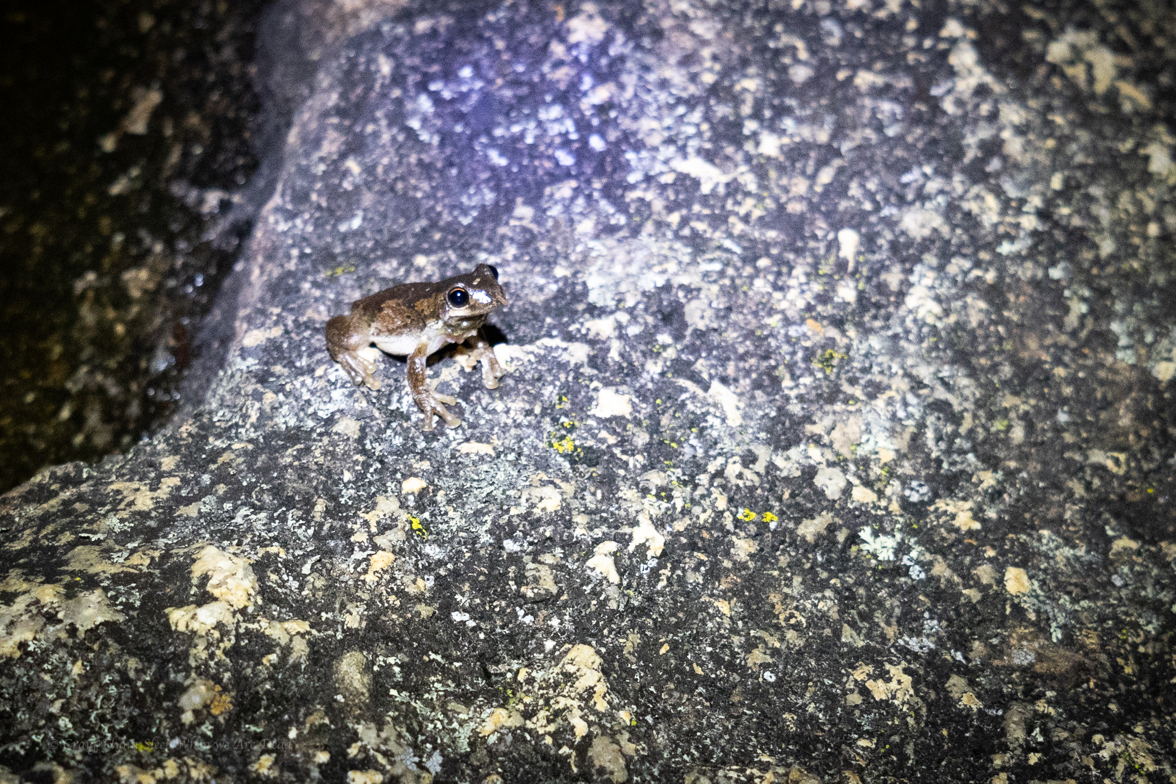
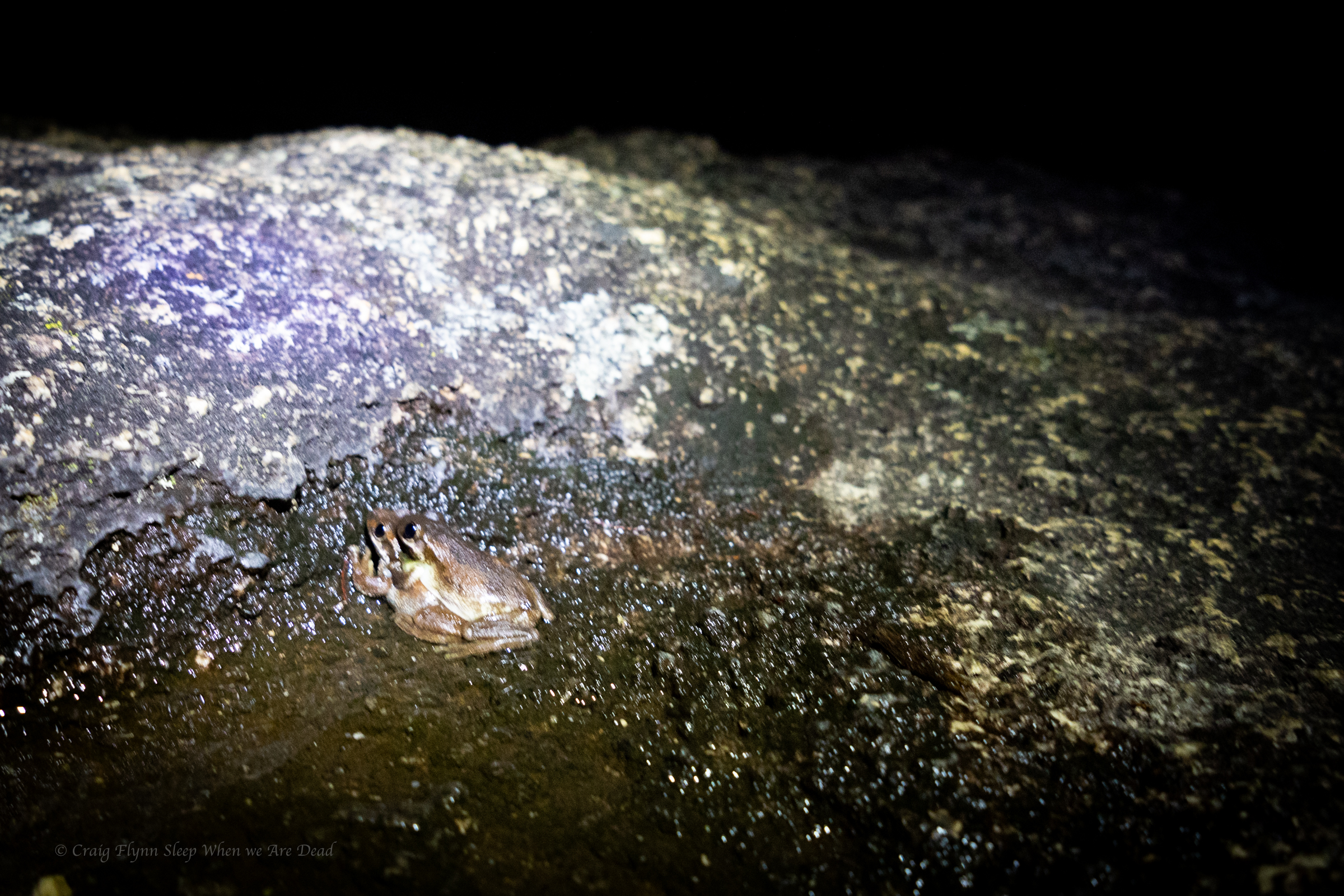
But not before a bit of late night herping
it was a frogathon but I forgot to charge my head torch so had to call it before the snakes came looking for diner.
Ash wanted to head to Surface Paradise so we thought it might be nice to drop him off for a day out and drive up to check out a couple of the touristy waterfalls on Tamborine Mountain.
We knew Jason was up visiting family in Brisbane so we threw him a shout out to meet us there.
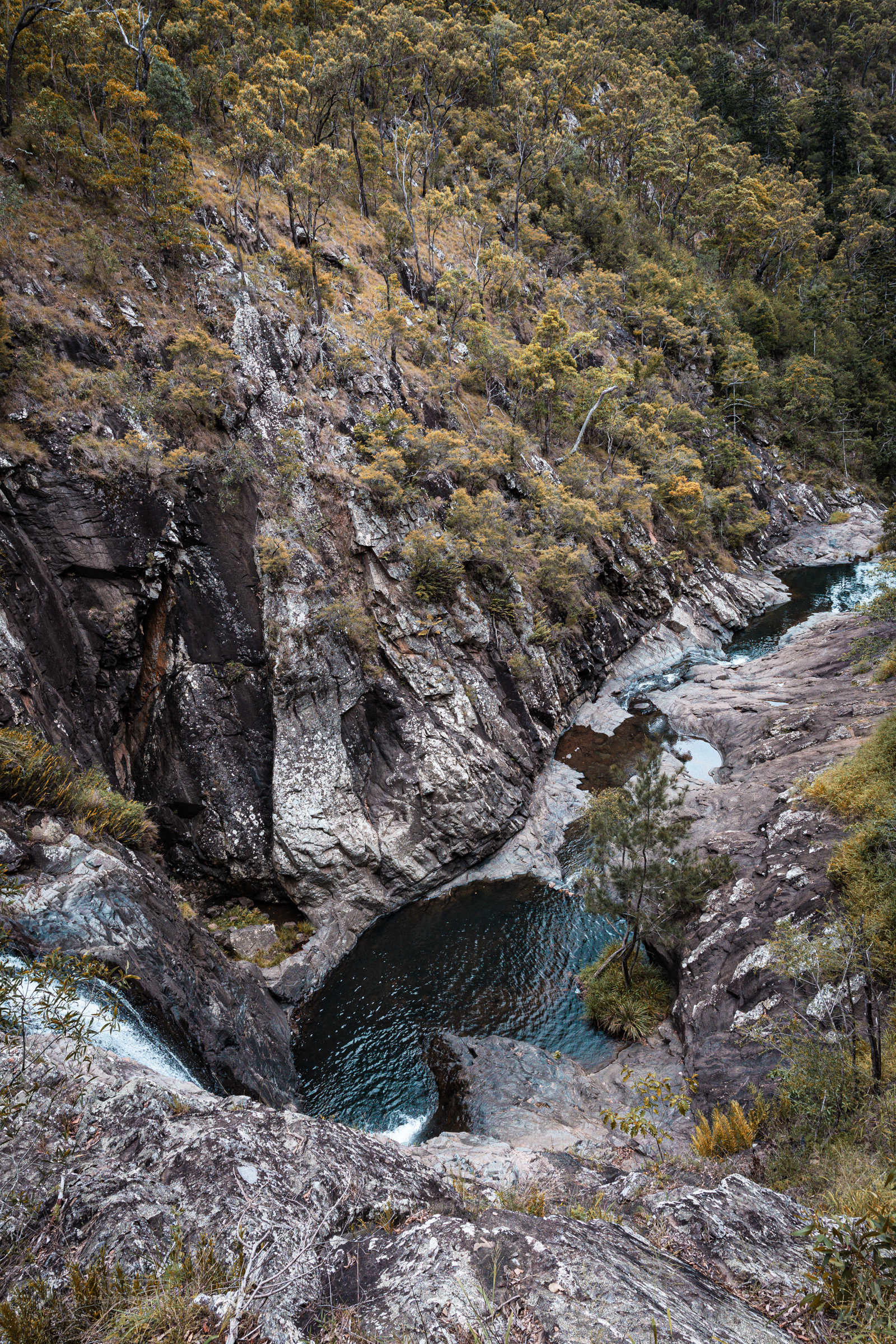
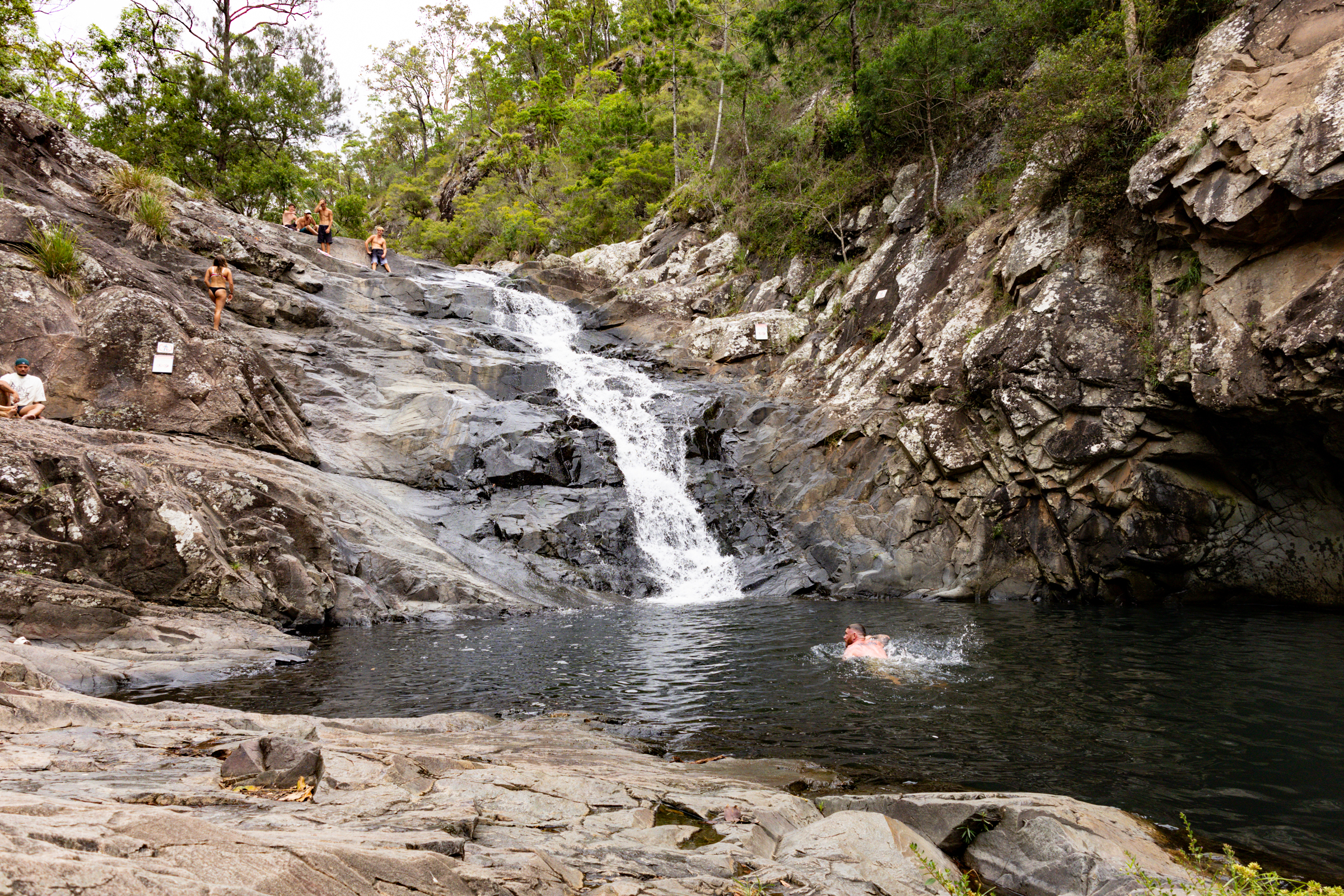
Our first stop was Cedar Creek falls.
This is another popular swimming spot and it has limited parking. We needed to park way back at the turn off (Junction of Tambourine Mountain Road and Cedar Creek Falls Road.) which gave us an extra 800m walk each way.
Locals at the end of the road had set up a paid (donation) parking lot in their paddock and the kids had an esky set up sell cold drinks. Kylie half jokingly wondered if said locals rushed out of a morning on public holidays and filled the car park up with their own cars before the crowds appeared. Clever them if so as their paddock was just about full.
And to be fair, imagine having this place pretty much as your private back yard extension before the crowds discovered it and the tourists (like us) rolled in.
From the car park a boardwalk style trail leads you down past a nice picnic area beside the creek then down to a lookout above the main falls.
The trail then continues down to the base of a lower cascade and a nice swimming hole.
There are two main pools accessible from the trail.
A series of other cascades and pools are off limits due to safety concerns and rangers were on and to remind people of the need to comply.
We have a dip and laze about then head back up the mountain to check out Curtis Falls.
There’s a much bigger car park here but it’s equally full, luckily people are leaving and we get a park close to the trail head. Winning.
There is no swimming allowed in this one but is a lovely walk along a shaded creek and a very pretty waterfall.
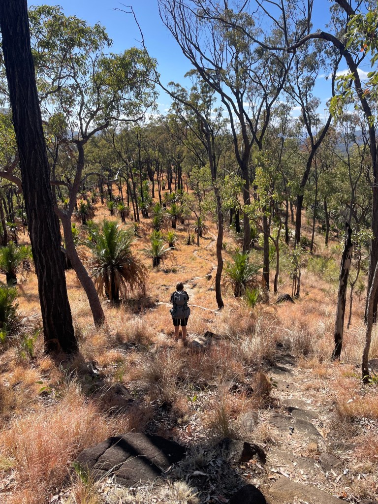
Day 3 would see us back on the tourist trail for the most part. We’d planned to get up to Battleship Spur, nearly 600m above our camp, before the heat of the day. Then check out Boowinda Gorge and it’s side creeks
Both were listed as star attractions. The young couple we had shared camp with came back raving about how beautiful Boowinda Gorge was and a steady stream of people had made their way either up to or down from the spur on their journey along the great walk.
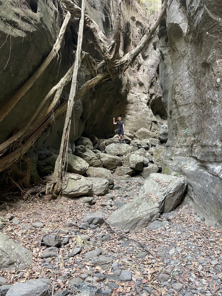
So up we go. The path up to the spur starts up Boowinda gorge but we don’t really take notice as we’re nervously excited about the haul up to the spur.
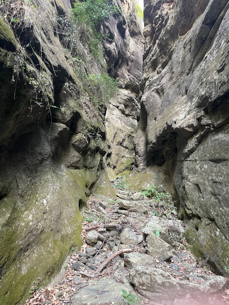
A side gully acts as a pass out of the gorge. It’s steep, reminiscent of the scramble out of Tigersnake canyon. but once through the lower cliff line a well maintained trail makes it’s way up and along an amazingly varied spur.
Think the Thuratt Spires with a tourist trail…
Wide open grassland alternates with almost razorback spur. Fine white sandstone changes to conglomerate and an out crop what appears to my uneducated eye as quartzite. Speculation around the geology distracts from the slog up.
And the views from the top?
Worth every grunt and groan
Gadget looking back over the lower end of Carnarvon gorge. The mouth of which is 10km away and 700 or 800m below.
Now back down for lunch in the cool of Boowinda gorge.
Running on a high we start making our way up the gorge.
It’s a bloody soul destroying slog
Think of walking up the Wollemgambe. Only it’s dry as a nuns nasty and instead of sand it’s littered with baby head sized river stones. And the river stones haven’t been tumbled enough to make them smooth so they are jaggered. And they move beneath your feet. And the bigger ones give false hope with 3 or 4 holding firm then the next rolls just to mock your ankles.
Still so many Carnarvon glamour shot are from Boowinda gorge.
We press on.
Several times we consider just turning around but we’re a stubborn couple.
I guess the PC term would be “determined” but it was pure stubbornness (and a view of our white slot at the start we glimpsed from the Spur track) that kept us going.
Finally we get to the junction towards the top of the bloody Boowinda gorge and by some miracle there’s clear running water. Not much but more than we’ve seen in the side creeks since Wards Canyon.
We take the right branch. It’s a low quality slot but it has clear flowing water. So there’s that.
The water is far clearer than this shot implies but I was well and truely over this bloody Boowinda gorge to bother trying to photograph it well.
We get to a point we could have scrambled in from the top (It would have been much easier) but it got far too steep for us the reach the mysterious white walls a few hundred metres up the escarpment.
We retreat back and try the right branch. It was shit
We trudge back down and check out all the side creeks along the way. Some had canyons like sections but after the quality slot canyons of yesterday they were a major disappointment.
Back down past the Spur exit and I don’t know if it was the different light or just we were paying more attention but we had to admit the bottom was nicer than we originally gave it credit for.
Like, if you had never been in a proper slot canyon before you’d be impressed
If you are going to do Carnarvon gorge try a cooler month and hope for a good bit of rain in the days before you get here.
Finally out of what my mind I will always call Bloody Boowinda Gorge we paused for a bite to eat. All the trudging over loose river stones had zapped our energy.
It would have been easy just to return to camp but it was barely 4:30pm and there was another long gully about a kilometre down stream that had a name (At least on one map we had stumbled across) so we couldn’t help ourselves and went for a look.
The gully was scrubby and hard going but it keep promising to canyon up just up ahead. So we pressed on.
At least it was wet
We trudged on until we started to loose light and so left this intriguing chasm to its secrets and made our way back to camp.
Ever since my episode of heat stroke/ dehydration a few years ago I struggle a bit in the heat and yesterday was hot.
We plan a lazy start for day 2 and then some exploring.
There’s a waterfall marked on the map, googling before we came showed some photos of a fairly shit looking waterfall but with the other side creeks being so dry we though we might as well check it out.
We boulder hop and scrub bash up stream.
Canyon 6
The mouth of the side stream is bone dry, it’s not looking promising but we head up. A cool breeze comes down,then we round a corner and…
Bam!
If it had a couple of inches of water running down it would be a match for the section in Claustral between the Hulks Fist and Thunder canyon.
And it kept going
I wanted to call it Betty. Kylie wanted to call it Jon. Which is ridiculous. Everyone knows the correct response to calling it Betty is to call it Al.
You mean Al, says I
Jon, says Gadget.
What ever
Further up it had a Bowen creek feel. Only dry as an English backpacker waking up on Bondi beach in the noon Sun on New Year’s Day.
You could see by the moss that it had water recently.
The map showed this creek cuts its way up high up the escarpment but so far a few easy scrambles were all we needed to make our way up.
1 thing I learnt this day though was the location of the creeks on the topo were accurate. The contour lines in the gullies however, were a guess at best and complete fantasy for the most.
We made our way up a kilometre or 2 of slot canyon before getting blocked by a large chockstone. No shitty waterfall to be seen.
We could not believe several blogs had photos of the waterfall but we had found no hint of this anywhere. I guess bushwalkers use a pass up beside the canyon to access the falls and maybe as another pass up to the great walk.
We head back to the gorge and onto the next.
Canyon 7
Further up stream our next target didn’t look like much. A scrub bash into a wide gully. Then a gap in a side wall gave a hint of something.
I almost didn’t bother but I’m going to duck up here for a look, says I.
I’ll come too, says Gadget.
It’s a shallow canyon but it won’t go far. It’s running parallel to the main gorge cutting back downstream but going up…
It might not be as pretty as the previous one But again it is deceptive and just keeps going. Twisting and turning, cutting deeper into the walls.
It took a couple of sketchy climbs but we made it up to where it begins to open out and then retraced our steps to once more bash up the gorge
Canyon 8
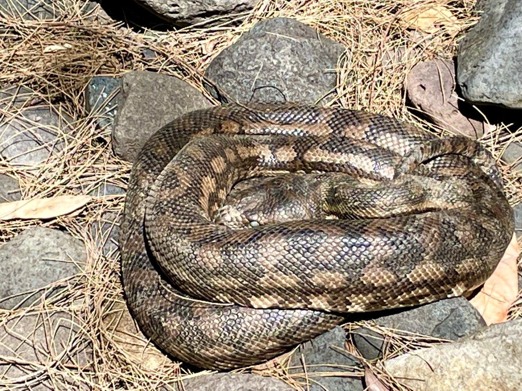
A beautiful big Carpet Python guarded the way. It’s curled up in the shade with a full belly getting ready to shed.
The next canyon started with promise
But a few hundred meters in we are blocked by a 8m dry waterfall.
There’s some promising looking lines on the map further up the gorge but it’s getting late and we are fairly cooked from all the boulder hoping. We decide to head back down to camp.
But along the way there was 1 gully we had skipped, originally planing to do it tomorrow. But we were here now so pop in for a look.
Canyon 9
Another dry slot canyon greets us
The map showed this as one of the longer ones on this side of the gorge upstream of the big bend camp but as tired as we were from all the boulder hoping in the heat of the gorge we were keen to see how far up we could push it.
More dodgy scrambles/climbs were needed. We took a bit 3mm amsteel rope as a hand line to assist getting back down.
Finally we couldn’t get any further up so made our way back to camp content with a big day in the heat.
We make our way back to the camp ground and park in the over night car park.
Our plan now was to hike up to the remote camp ground at the Big Bend , a bit over 9km up the gorge.
Along the way we’d do the side trips to the touristy stuff.
It was already 35°. We stock up on water.
Canyon 4
The Ampetheter.
Is it a canyon? I don’t know
Is it touristy as all hell? I don’t care.
I was pretty keen to see this one. It’s just off the main track.
It’s a short but impressive slot
Kylie climbing the ladder access
A short but impressive Hall leads to an otherwise enclosed chamber
Back on the main trail we head up stream.
The next thing on the tourist map is Wards Canyon. Just before it is a break in the cliffline and a small stream, the first we’ve seen with clear water.
And if you are good at spotting trails you may spot a vague track leading up beside.
We dump the packs and go for a stickybeak.
The soil is the finest white sand I’ve ever seen. Almost as fine and white as the cliffs towering above.
The trail continues up but it’s a wide gully. I guess it’s used as a sneaky short cut up or off the great walk or sumfink, we head back to the trail
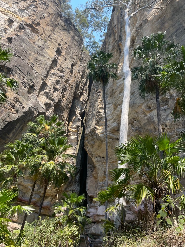
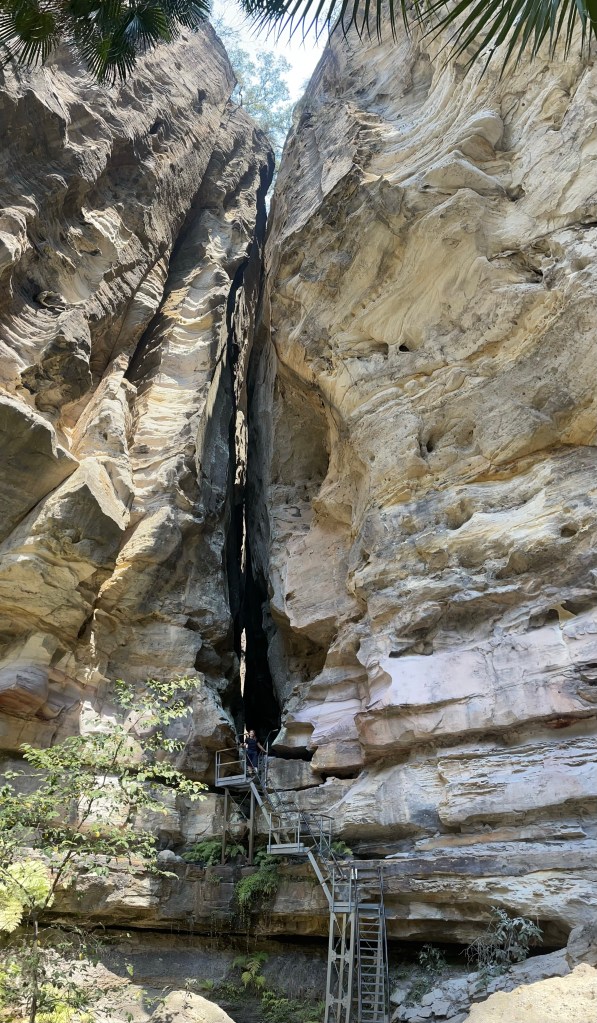
Canyon 5
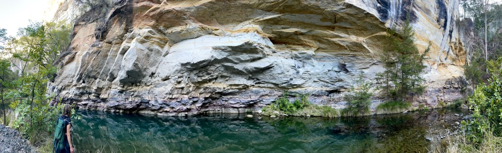
Wards Canyon.
Wards canyon looks like the most adventurous canyon in the lower gorge. However you can only access the very lower bit. I think tour company’s might run trips through it so it might be worth applying for a permit
It’s pretty and hosts the only known non-coastal population of King Ferns, Angiopteris evecta, in Queensland.
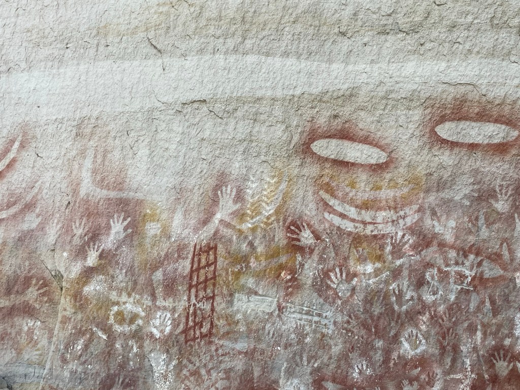
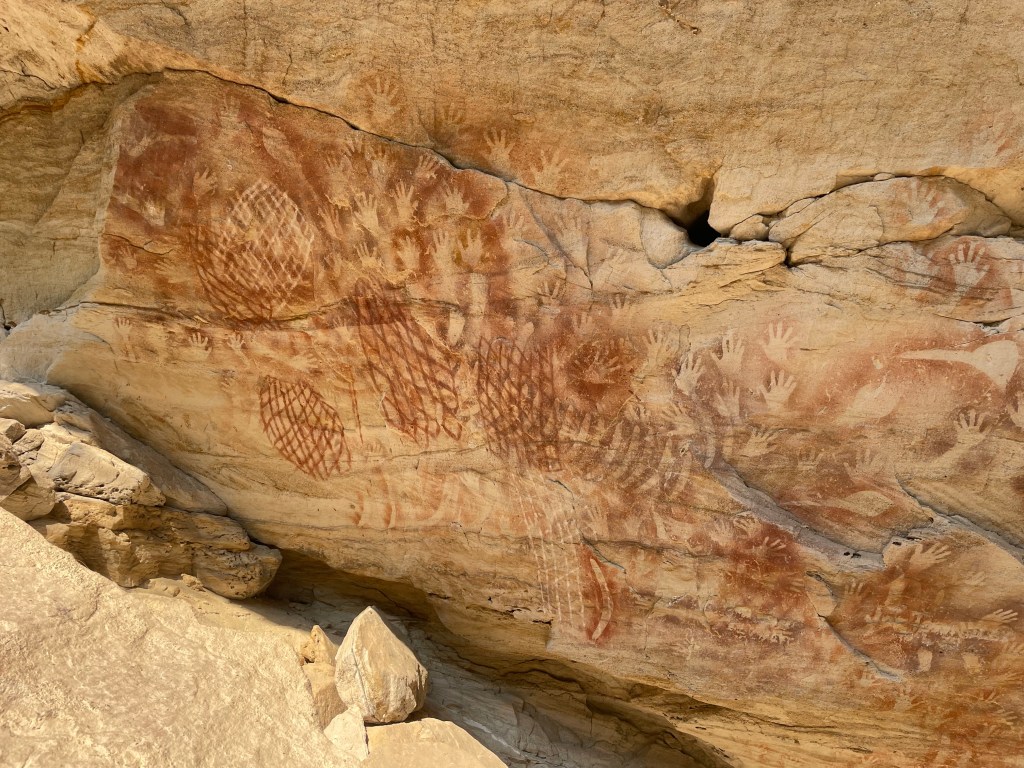
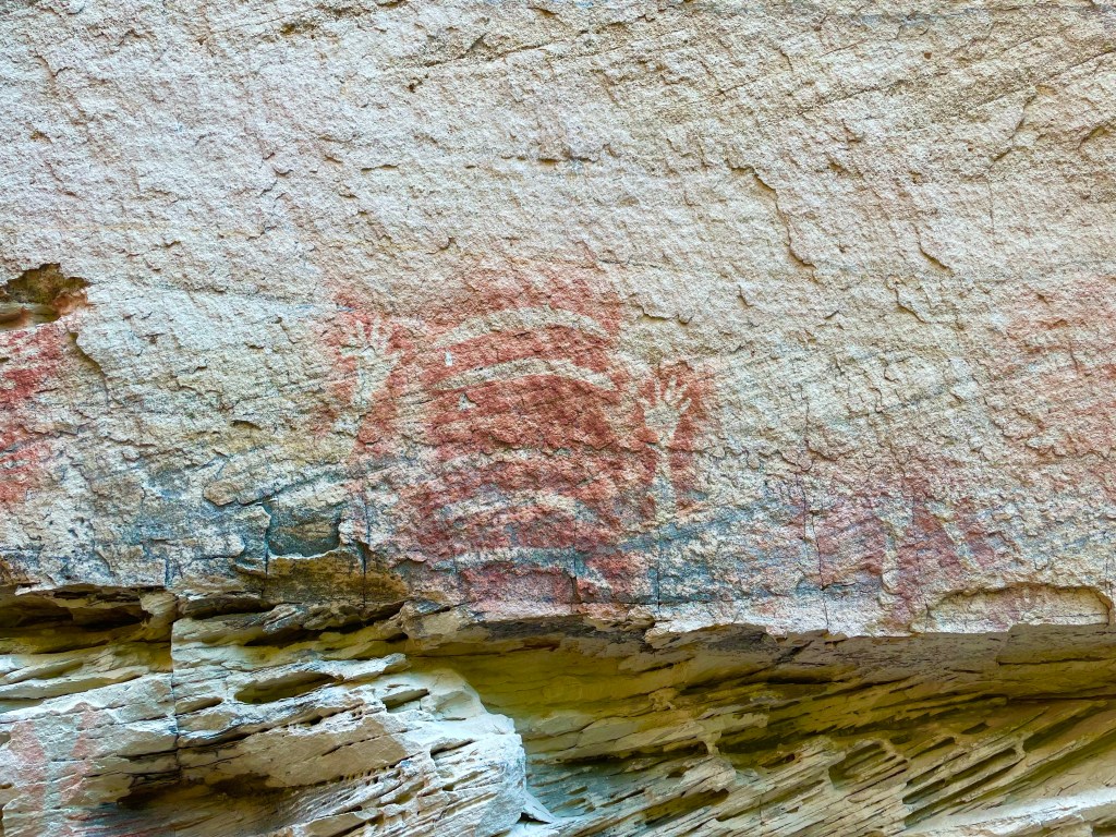
The Art Gallery
I couldn’t find the indigenous name for the art cave which is a shame. It looks like it was painted yesterday but archeological studies found evidence it’s been in use for at least 3500 years, sites just over the hill date to 19,000 years.
And on we go.
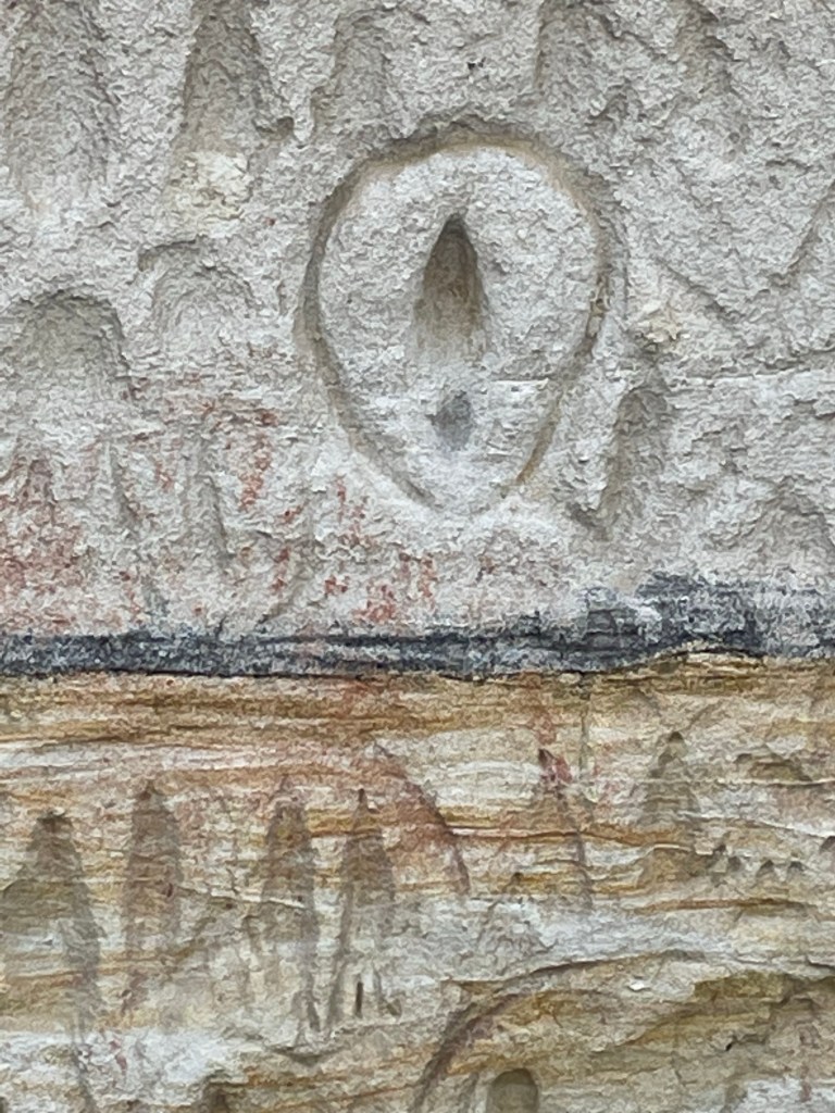
Pitjara Cave
It has another name on the tourist map but this is the name on the old topo. The art is top notch.
And finally we make it all the way up to the camp and stumble into one of the only semi secluded spots at the camp. Winning!
We haven’t done a huge amount of Ks, probably only 15 or 16 but it’s bloody hot so the myriad of No Swimming signs at such a beautiful hole were a little soul crushing.
Gather around friends, adventure family, misfits and, vagabonds I’ve got a story to tell.
Or sumfink
30 odd years ago when Jameison published the first edition of Canyons Near Sydney he included a short section at the back for other canyon areas with a short paragraph on Carnarvon Gorge saying it had sandstone slot canyons similar to the Blue Mountains.
The only description was try starting at the homestead, make your way up the gorge and look for a routes up.
My curiosity was pipped and it got filed in the back of my brain.
Since that time it’s become a tourist mecca with a wilderness lodge going in around 1996 and National parks developing a good trail network. But I had a feeling there’d still be some hidden gems.
So when the stars aligned and Gadget and myself found ourselves with a week off I said fugg it, let’s go.
Of course abseiling is frowned upon in QLD national parks. There are permits but from all accounts these are about as hard to obtain as diamond impregnated rocking horse shit.
So our plan would be to just have a look. Scramble up from the bottoms or down from the tops as far as possible then retreat.
Day 1 though would be the touristy stuff. But I’m getting ahead of myself.
We rock into the NP camp ground late Thursday night. Not realising the nondescript pop up gazebo was the visitor check in we cruise past and pull into a random camp site to get our bearings.
Hey Kylie, what number site is on our booking ? says I
9, says she
You’d never guess what number we had pulled into at random.
Ok, most of you guessed 9. But Shit yeah! good start to the trip.
Not a bad view out of the tent
Our first target was back up the road a bit, Micky Creek Canyon.
Micky Creek is on all the maps, tourist brochures and instagram posts but 1 person I spoke to said the side creek next to it was betterer.
Canyon 1
Weirdly Warrumbah creek is sign posted and has a tourist trail that leads to the mouth of the canyon but there was zero info on it.
A short way from the end of the “formed trail” we find ourselves in a proper slot canyon
The start was impressive but it was dry as a dead dingo’s donger.
The further we scrambled up the better it got. We met a guy who said he had visited in June and it had been flowing.
Note: to self September is a shit time to visit. Hot as hell and dry. you could see the moss drying on the walls, with a bit of water the colours would pop.
It got a little damp as we scrambled higher but the water was manky
The canyon just kept going
About a kilometre on we come to a long section of stinky pea soup looking water. We thought about trying to bridge over it but the walls were slimey and it’s our first canyon on our first day and it already exceeded expectations so we headed back down.
Canyon 2
Micky Creek right branch.
Once again the tourist trail takes us to the mouth of Micky Creek canyon. It ends while the creek is still a wide gorge but soon after there’s a junction and we head up the right branch.
It soon starts to canyon up
There were a few tricky scrambles to get up into the good bit
Eventually we got to a scramble that,while confident I could get up, I wasn’t overly keen on getting back down the slippery stone without a hand line. so once again we decided to turn back down.
Canyon 3
Micky creek left branch had a short section of canyon just upstream of the junction. This seemed to be the source of all the brochure and instagram photos. It was pretty but short. We continued up and it was narrowing but it wasn’t long before we were stopped by another scramble ropes would be handy for.