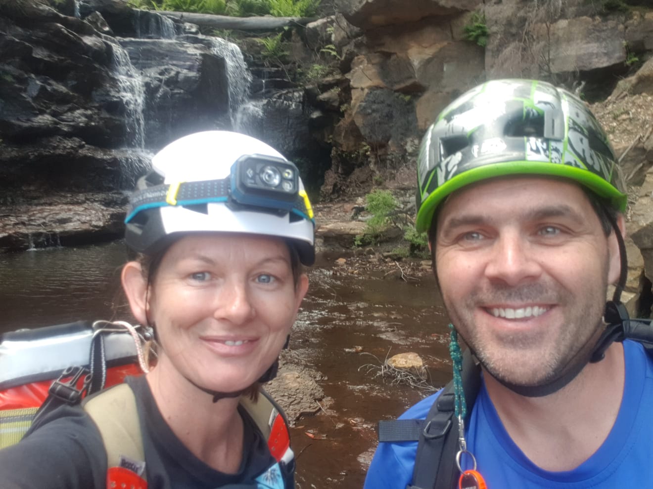
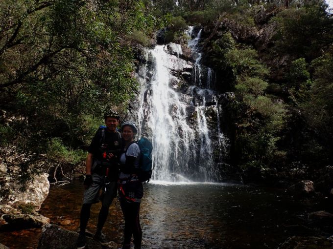
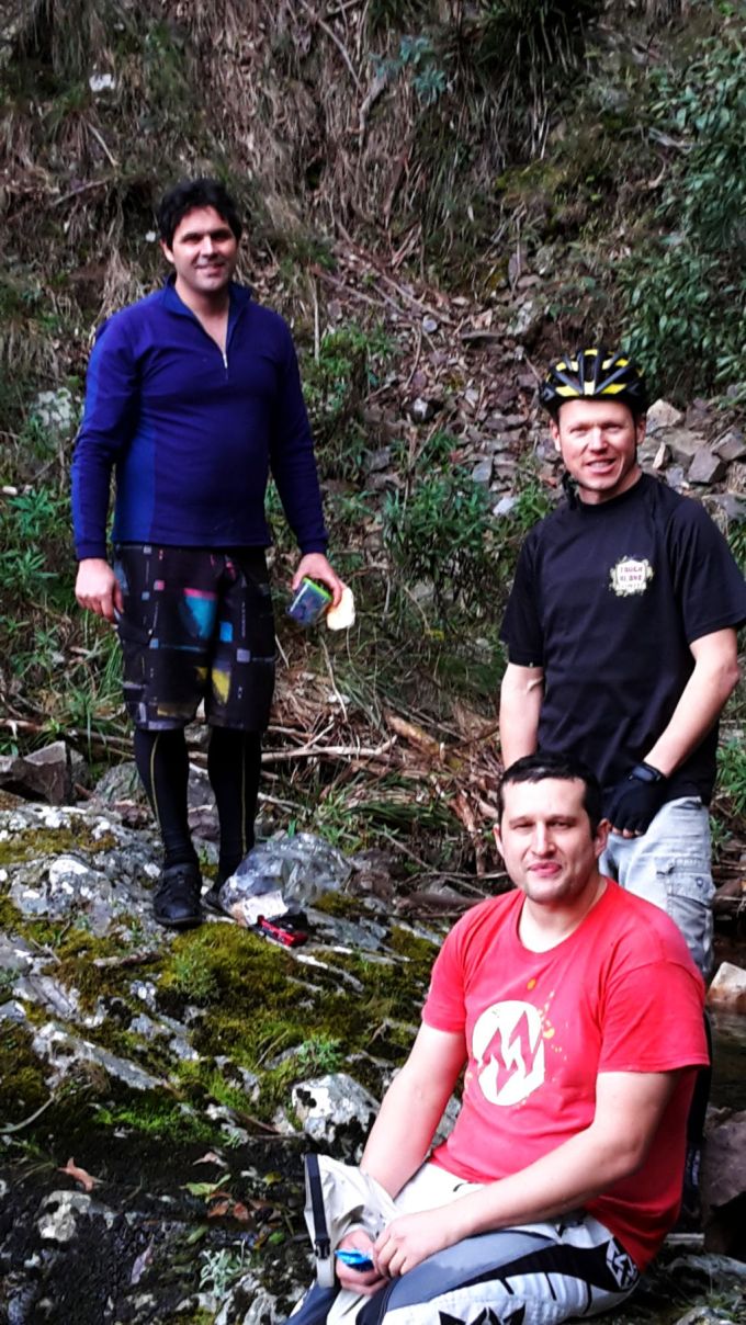
Laurence, Kylie, Heni, Peter, Richard, Kent and meeeeeee
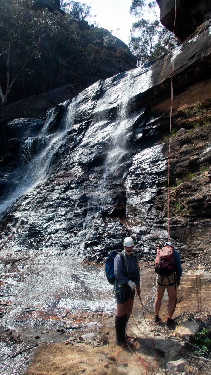
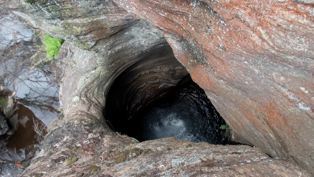
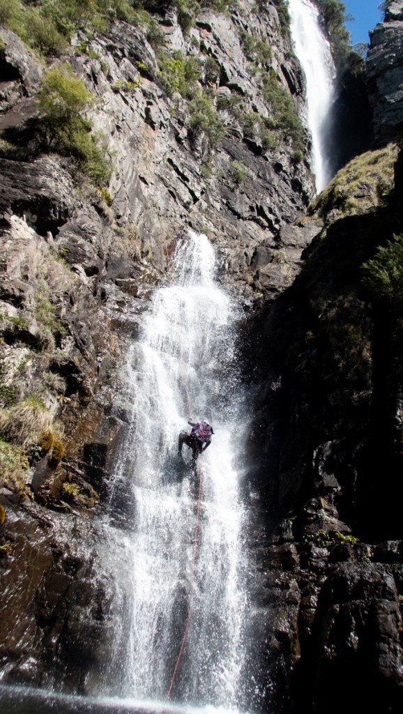
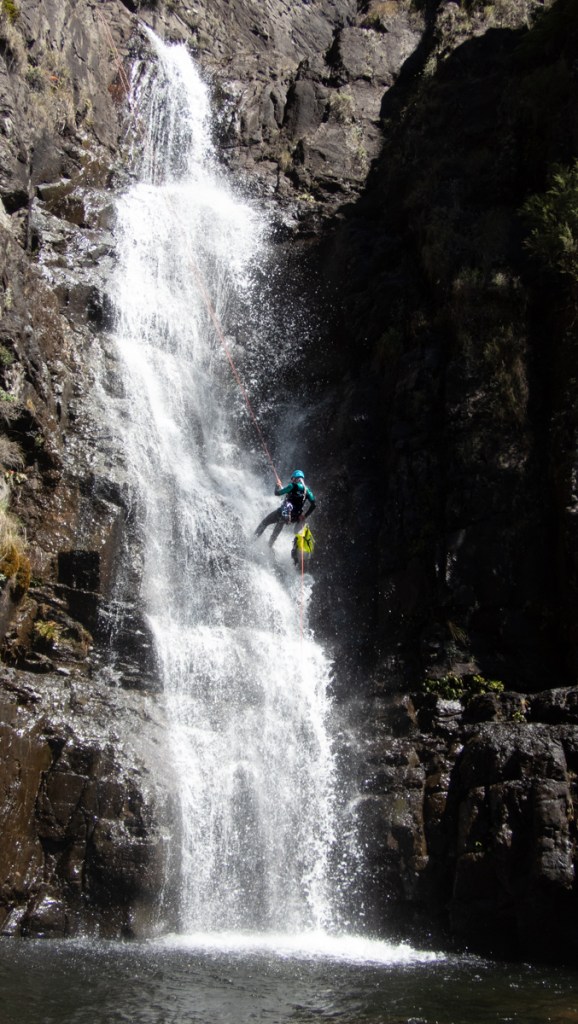
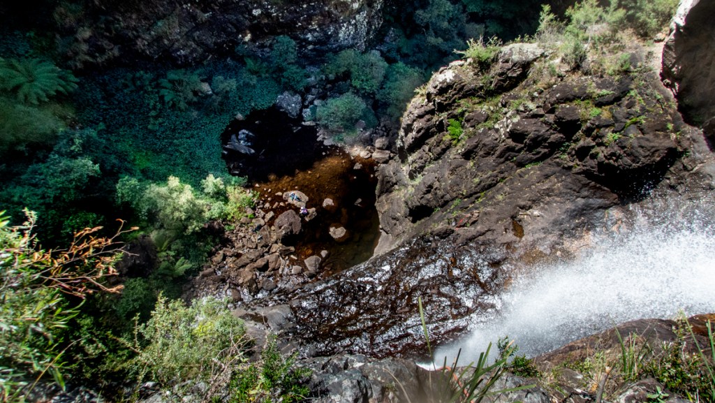
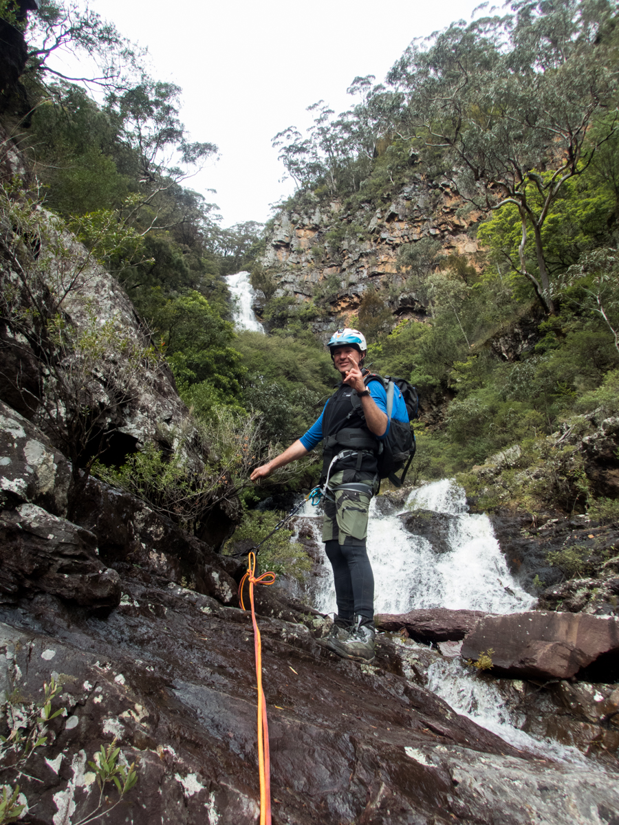
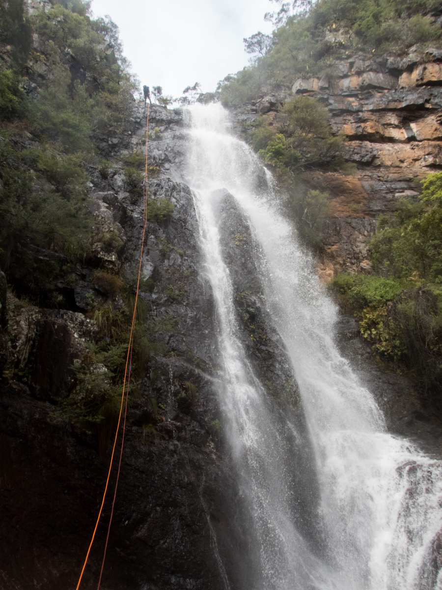
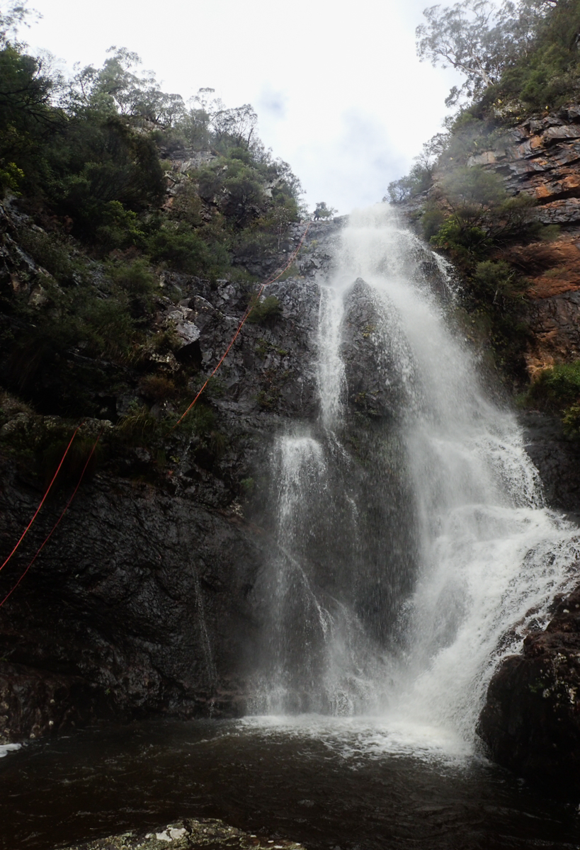
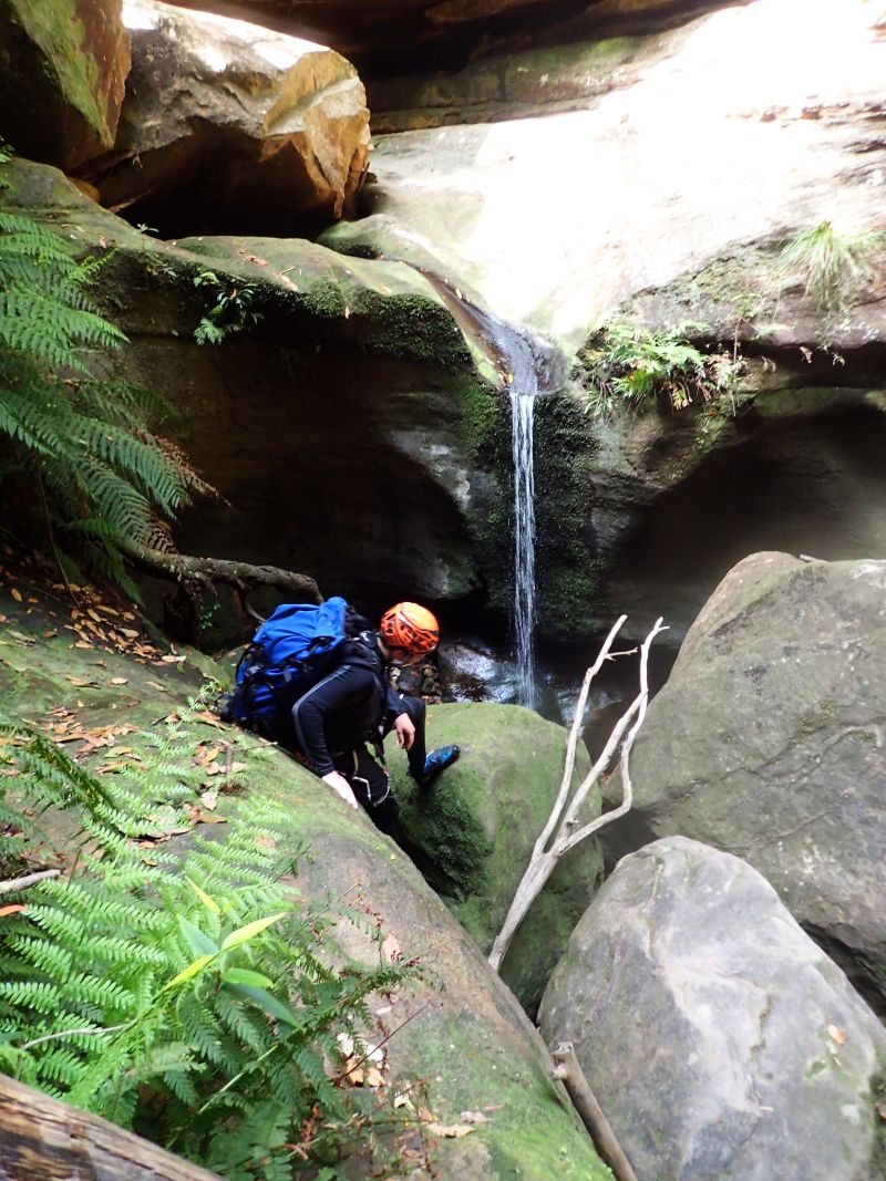
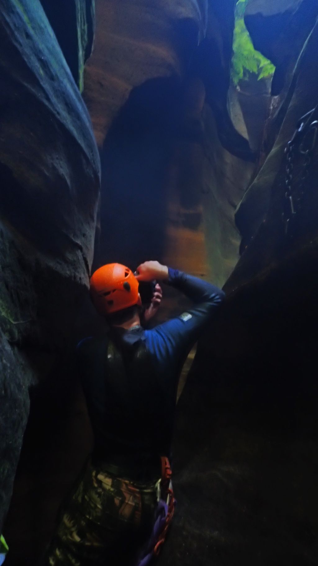
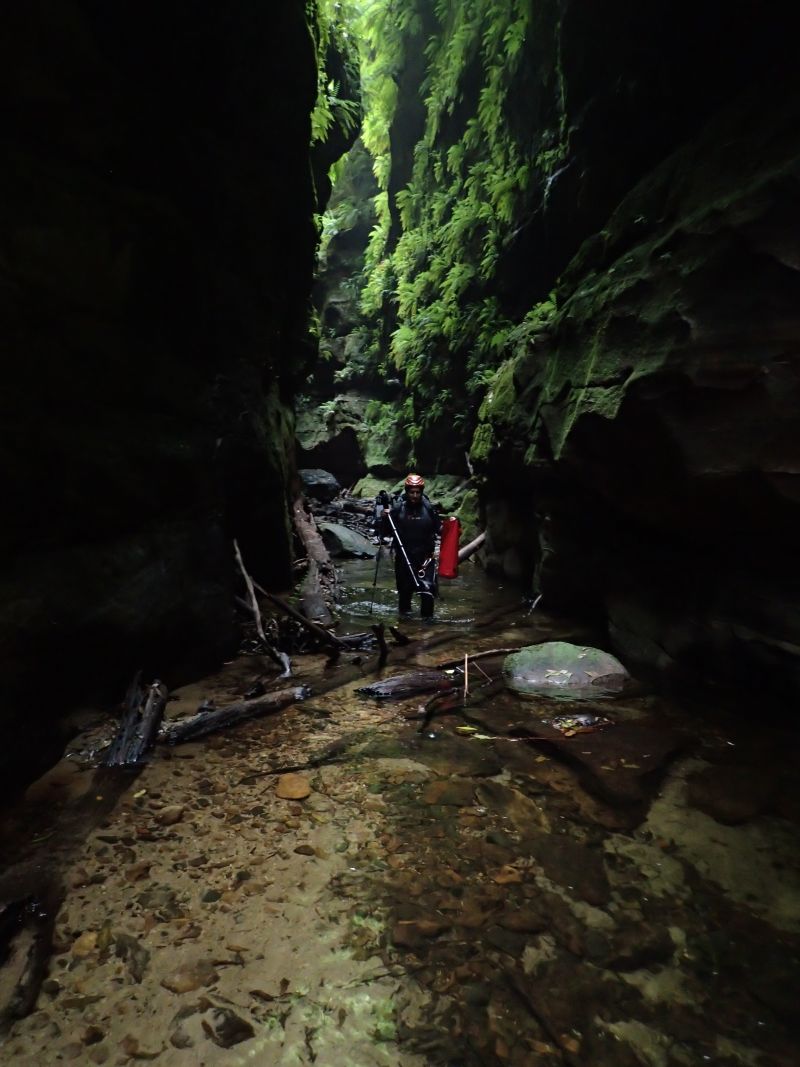
A while ago Laurie asked me if I’d ever been down Wolgan Falls. He’d been trying to find away into the top and bottom for years but had not long taken up abseiling.
I hadn’t. A few of us discussed running a trip. Then life happened.
Laurie and others pioneered a route in and out. And began to run the trip regularly. I usually got an invite but it was mostly midweek trips and I never made it, until today.
As I head up to meet Kylie, she messaged saying she was running 10min late because there was a Koala crossing the road.
Best excuse EVER!
I was a little worried about the meet up as the others were coming in from the other side of the plateau.
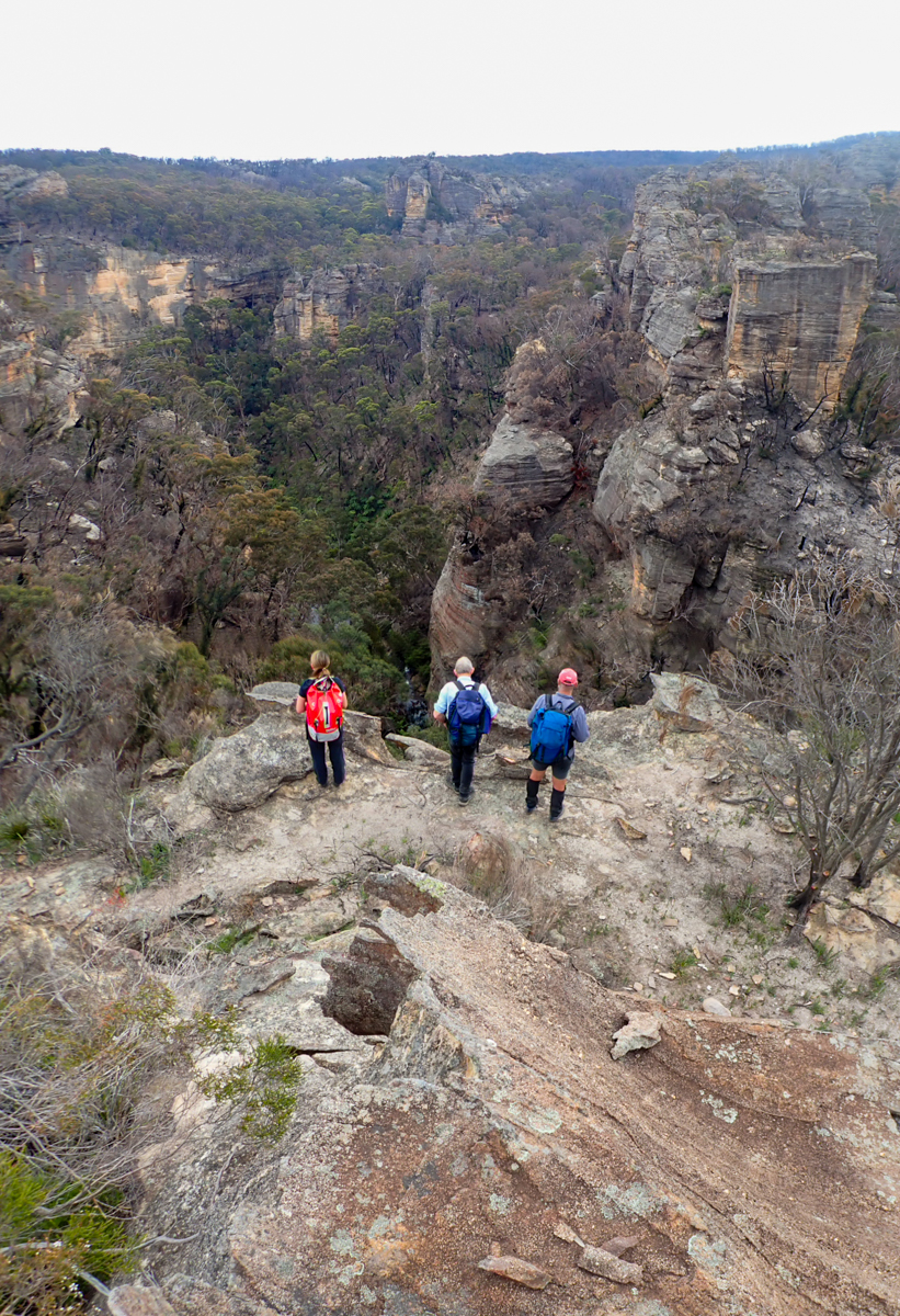
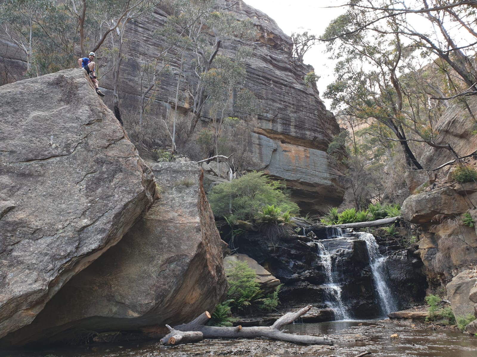
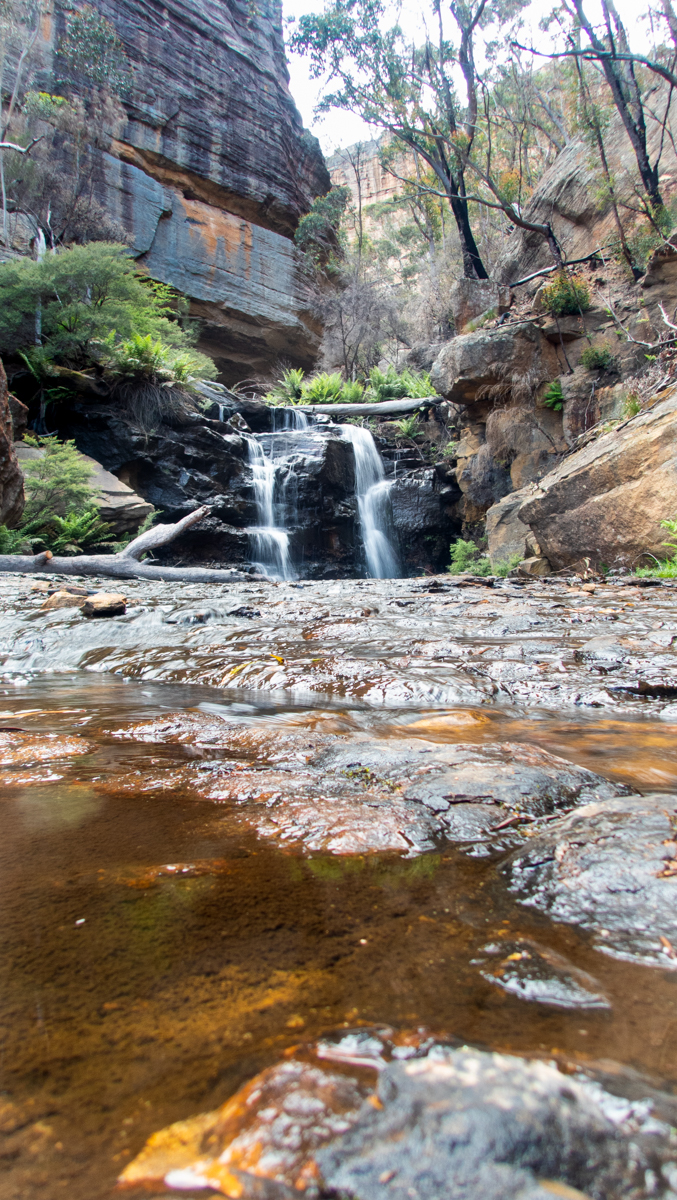
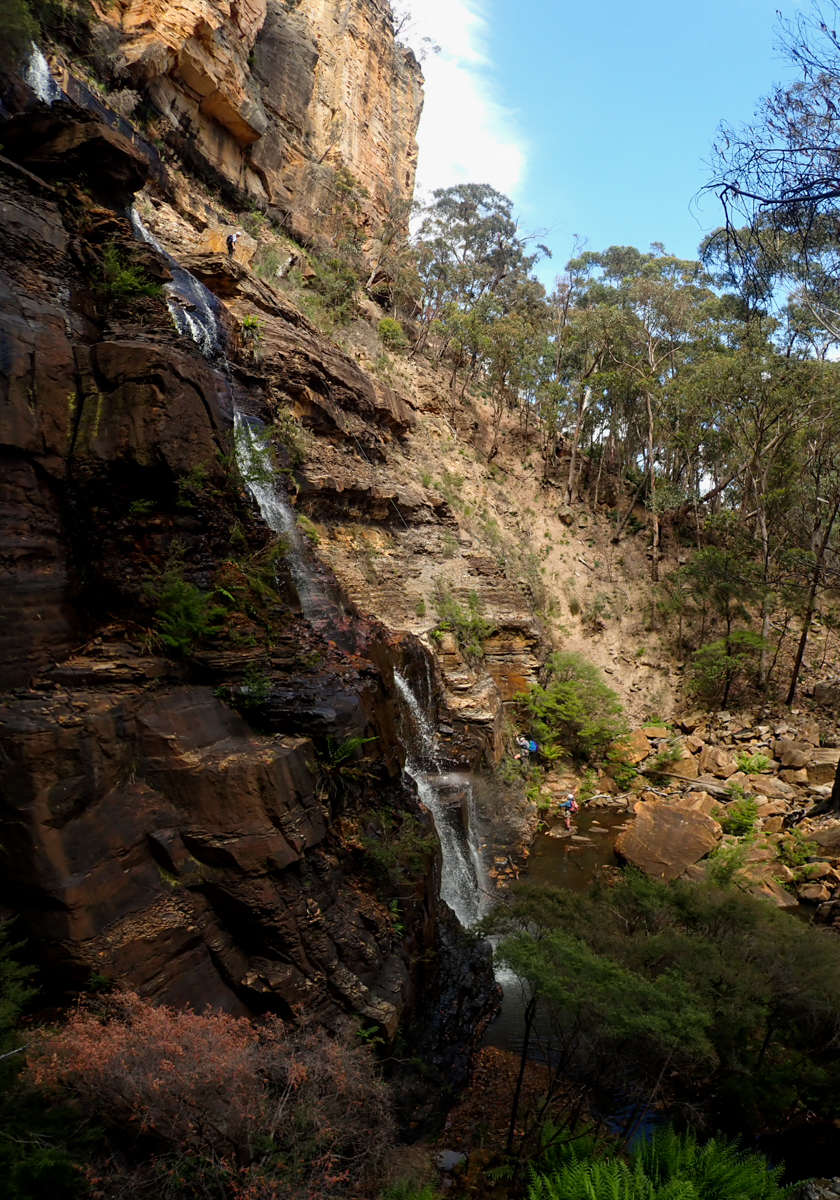
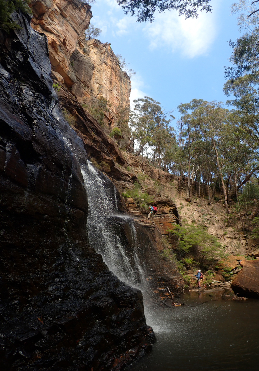
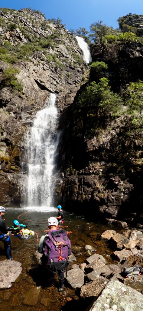
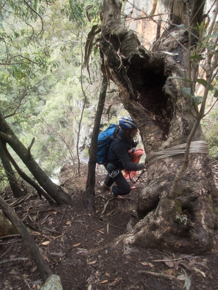
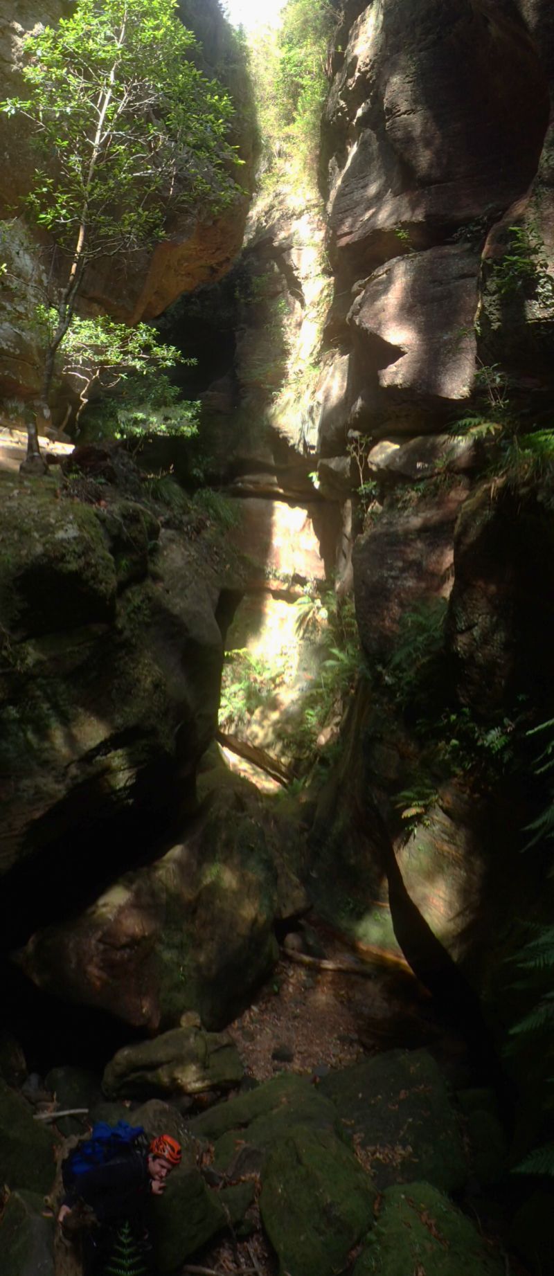
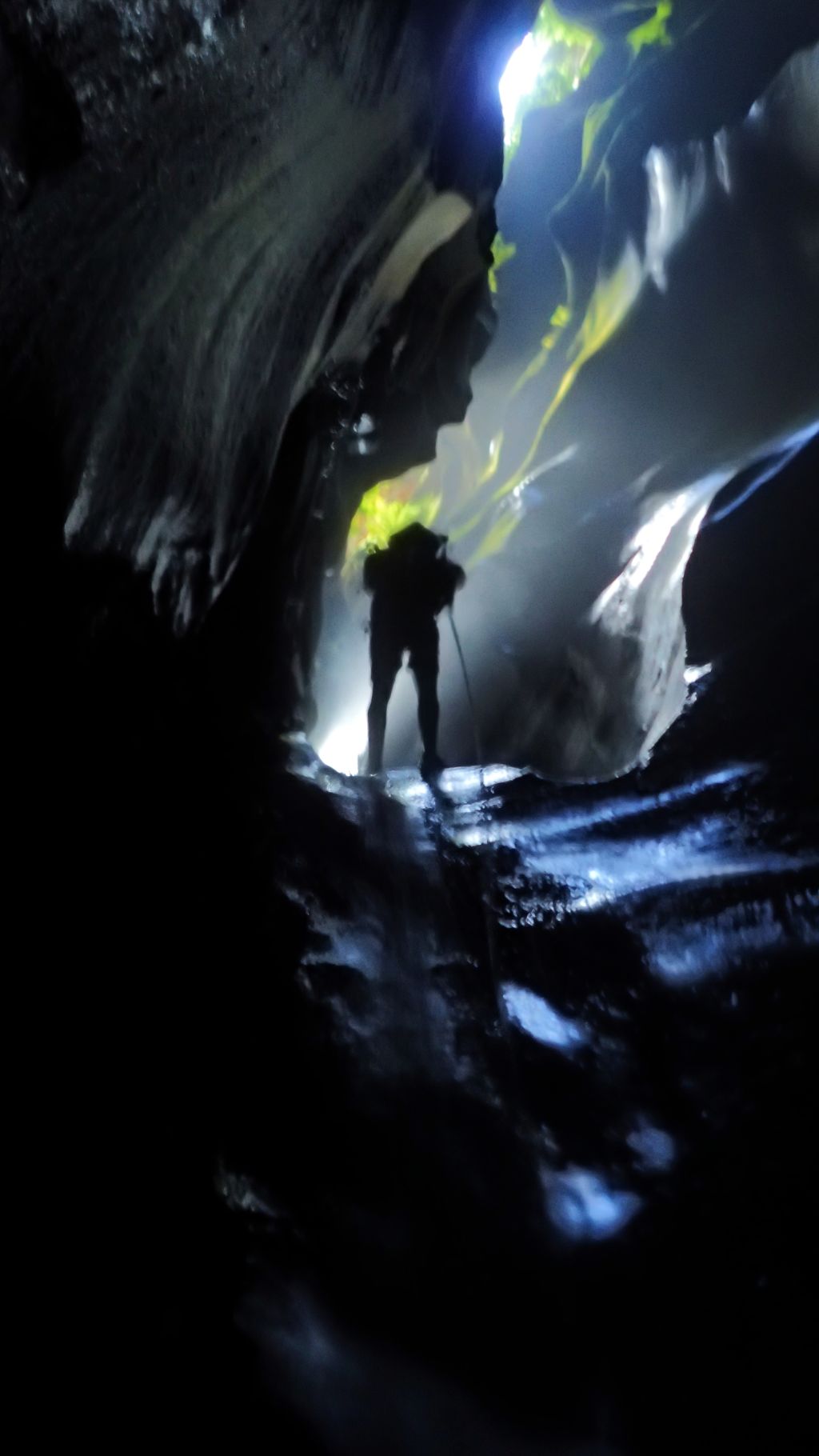
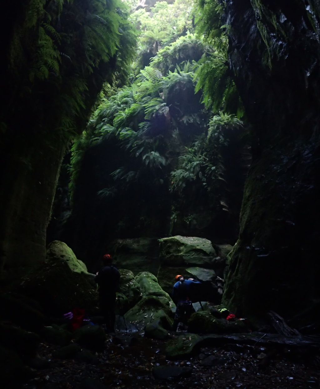
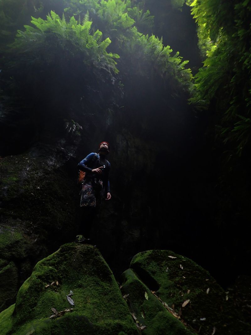
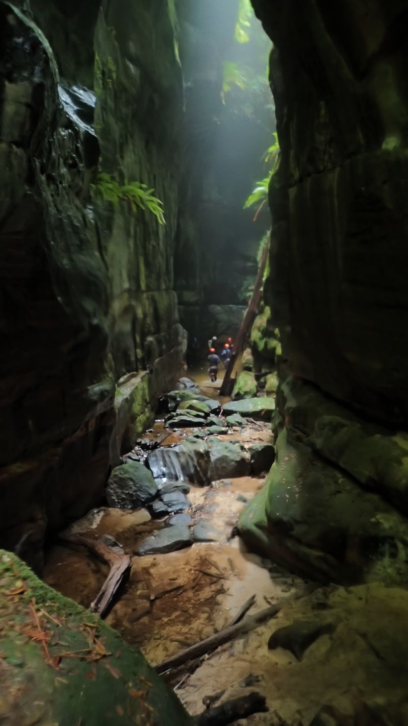
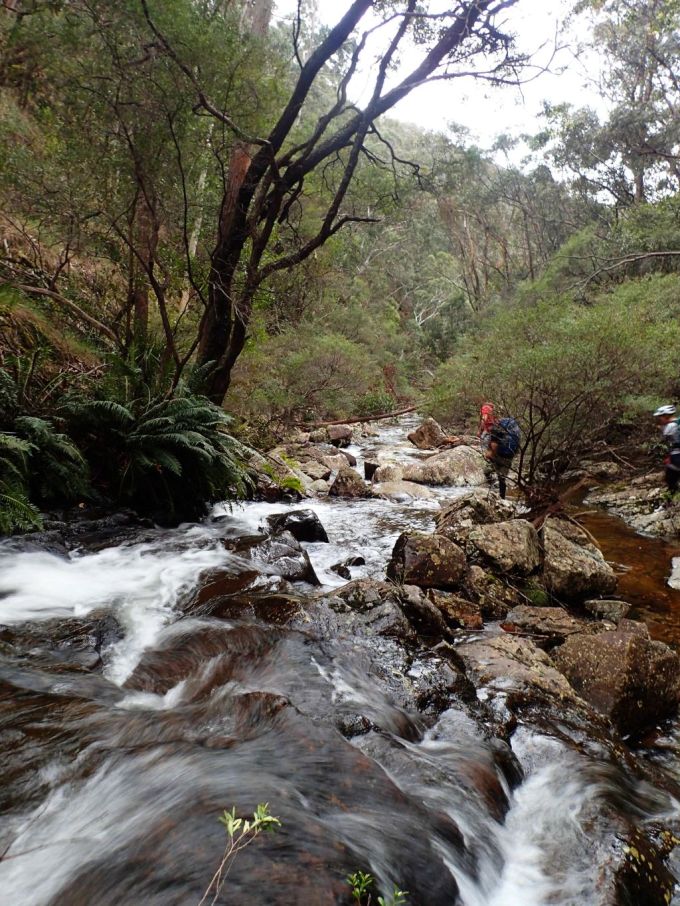
In the end we all arrived at the car park at pretty much the same time and head off into the untracked wilds of the upper Wolgan river.
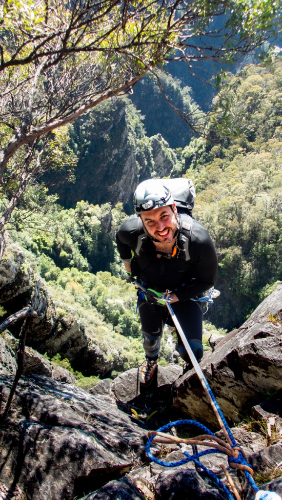
And all too soon it’s over. As we were preparing to hike out Richard tripped on a rock and pulled his calf muscle. A quick bit of bandaging and a make shift walking stick and he soldiered his way up the steep exit track
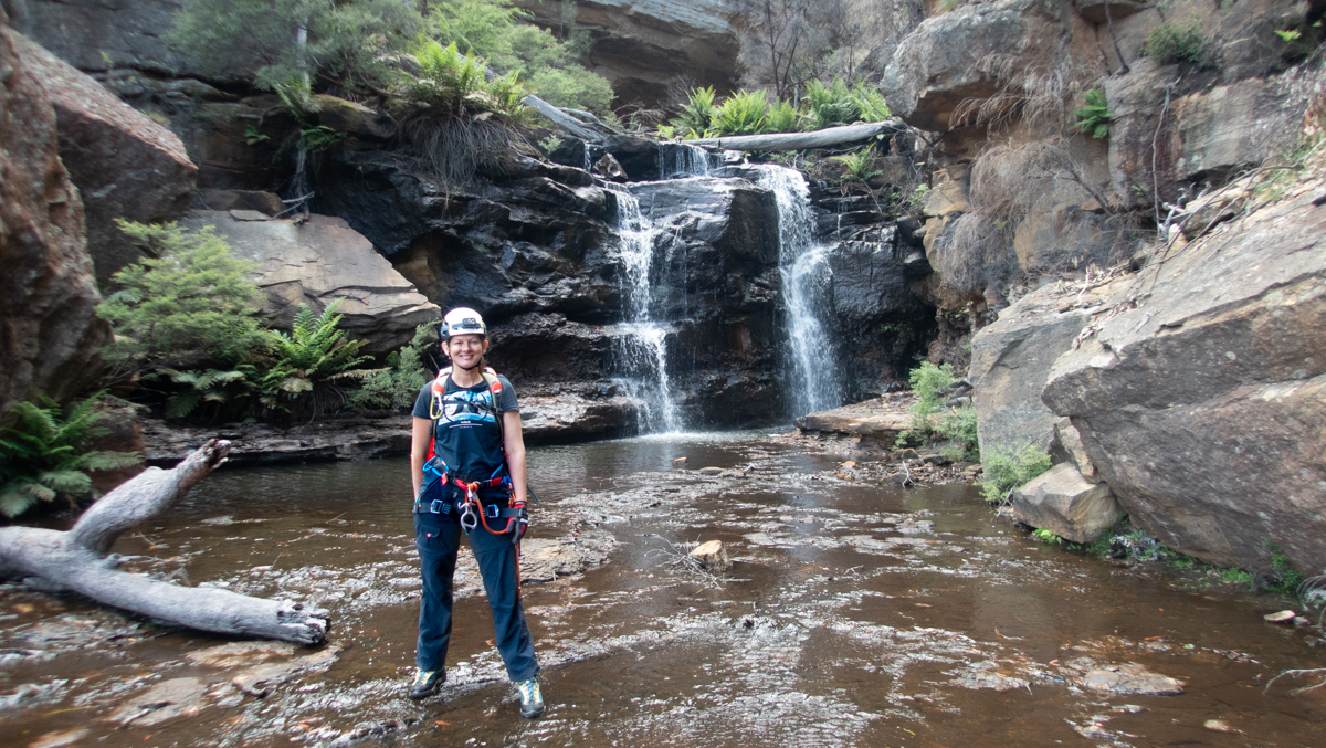
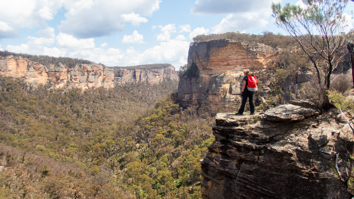
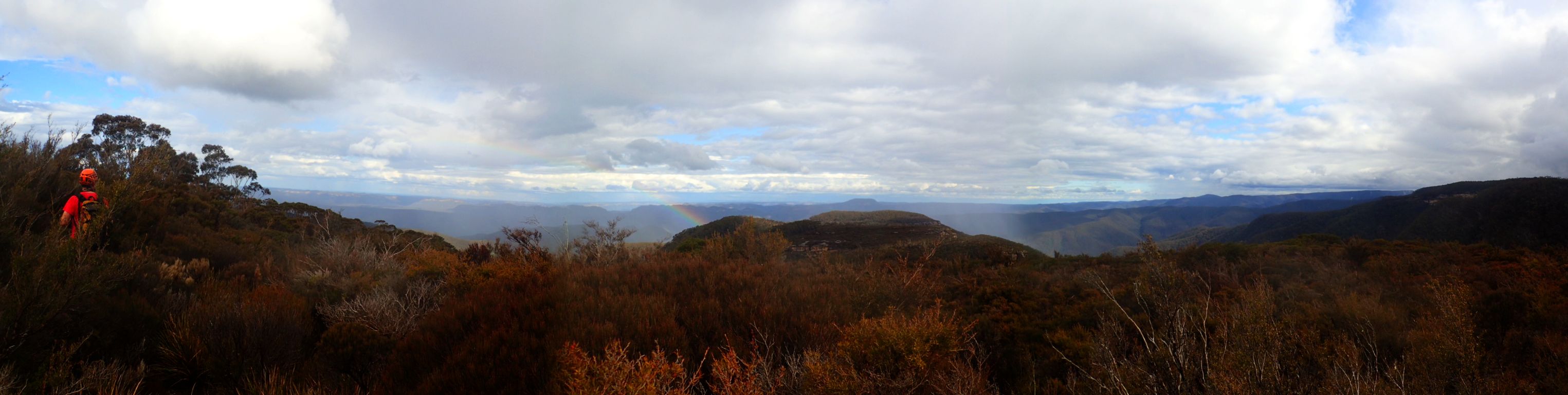
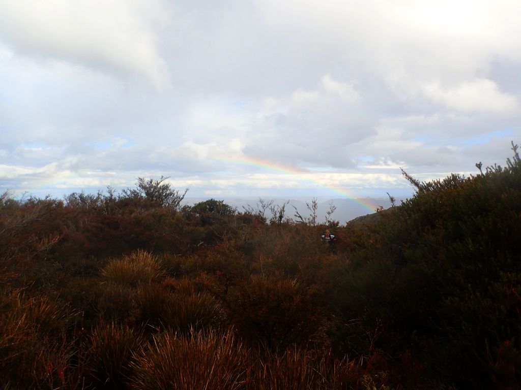
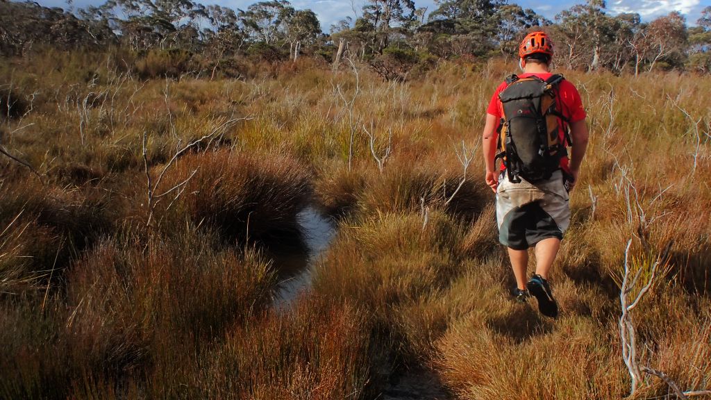
Kylie taking in the views on the way out
Group size: 7
Time: 4hrs very relaxed pace
Back at the cars it was still reasonably early so me and Kylie decide to do a quick dash through Alcatraz on the way back to her car
All in all another excellent day in the great outdoors with great outdoors people
Someone, somewhere thinks you are awesome. Hopefully you do too
Jamie, Aimee, Mamie, Gamie and shamie…. I mean Jamie, Aimee, Matt, Mark and Meeeeee
Confession time: I’d not done Kanangra main before.
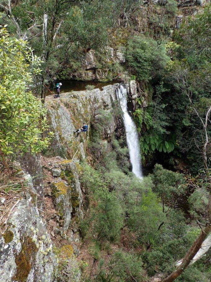
Abseiling for the sake of abseiling doesn’t really float my boat so it wasn’t a trip that ever featured high on my priority list but with anchor options that put you into more of the waterfalls rather than beside them it sounded fun and when Mark invited me on a trip I thought it high time I pop my K-Main cherry
After an early meet up we set off into the Kanangra wilds amidst banter and bravo. Before long we arrive at the start of the epicness and gear up
Aimee is picking up rope craft really quick, wont be long before she is leading us
Adventure Matt
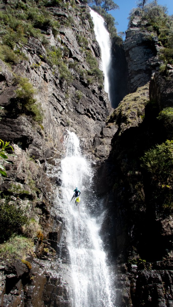
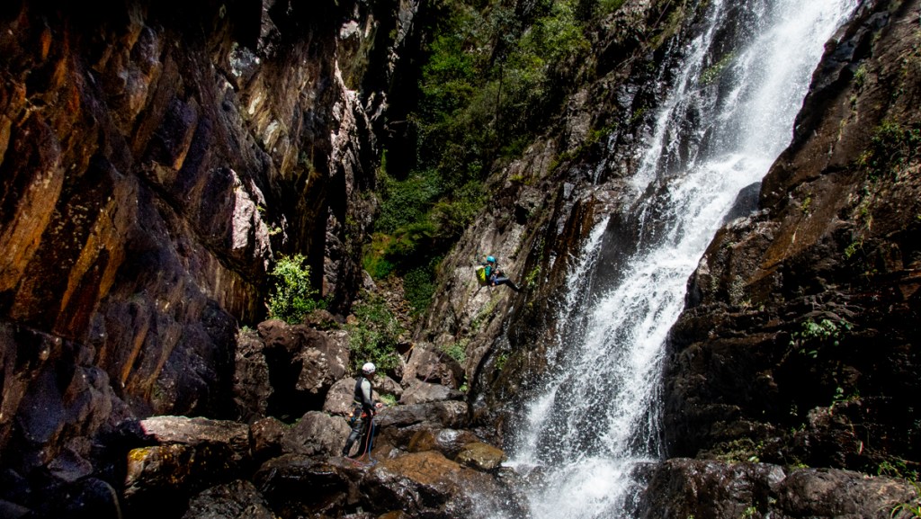
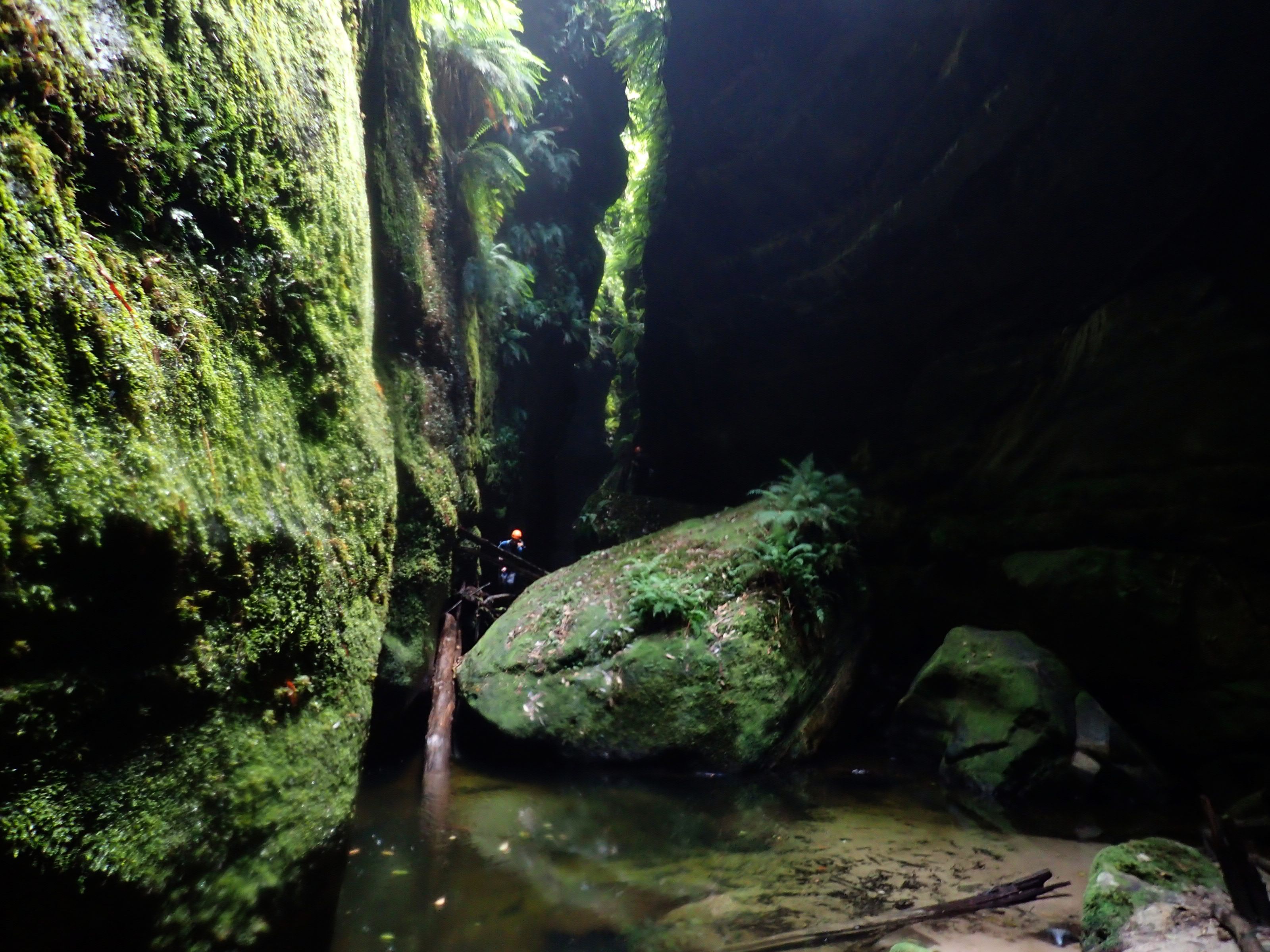
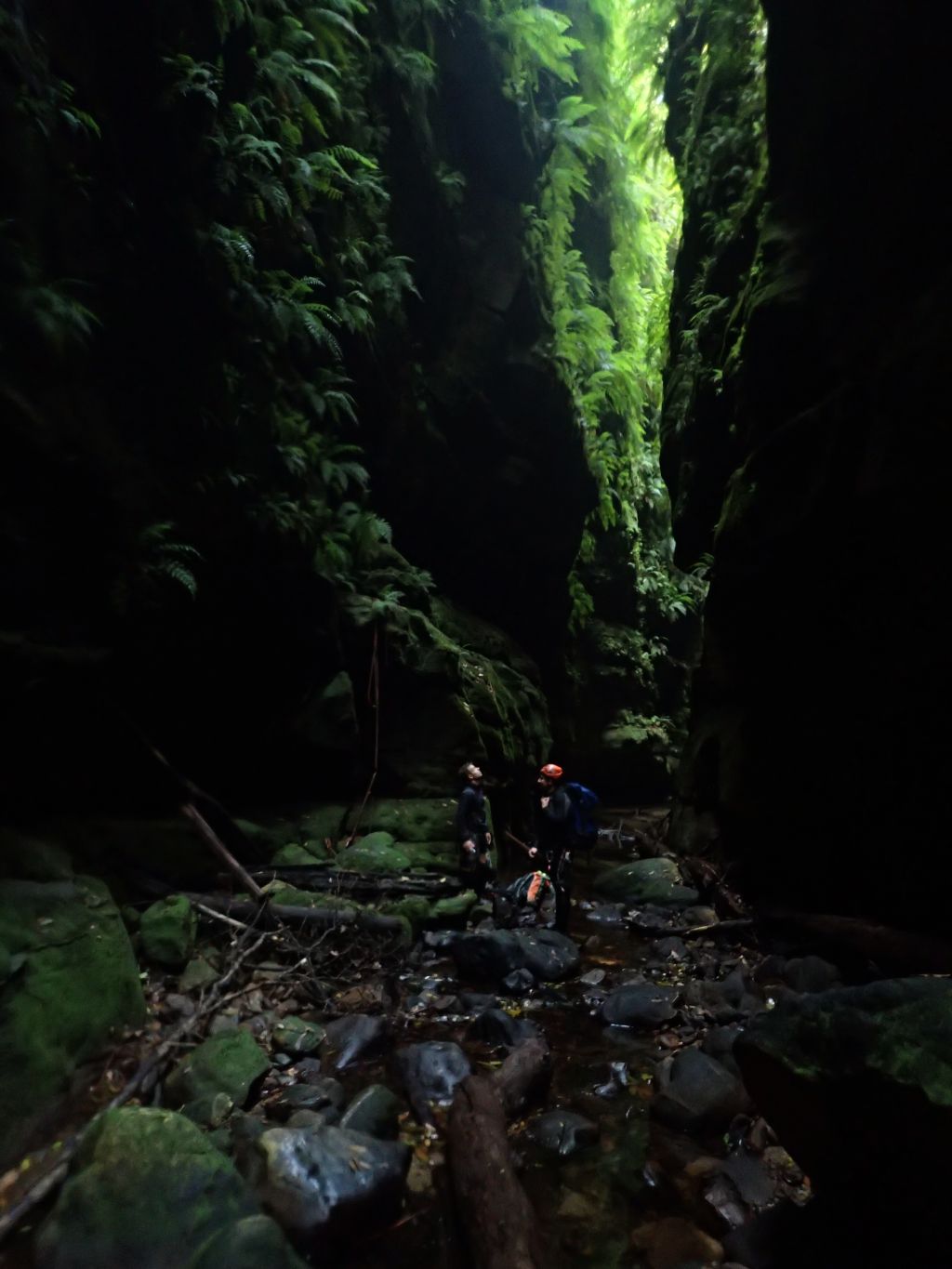
Epic is a word used a lot with the Kanangra wilderness and I have to admit it humbles you as you get dwarfed in the terrain.
Pitch 2
Spot the 4 people in this photo
How’s the Orange glow?
Jamie into it
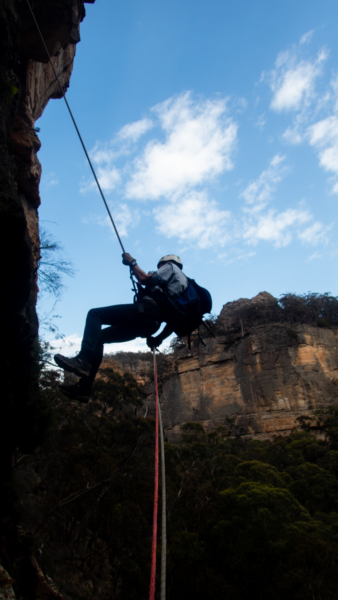
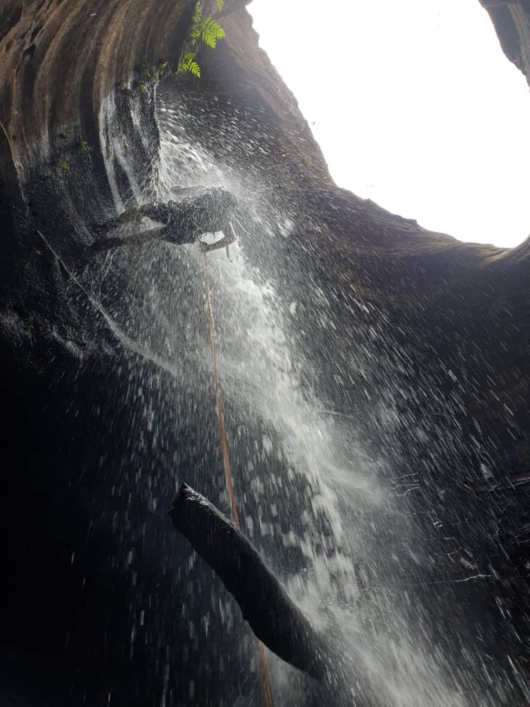
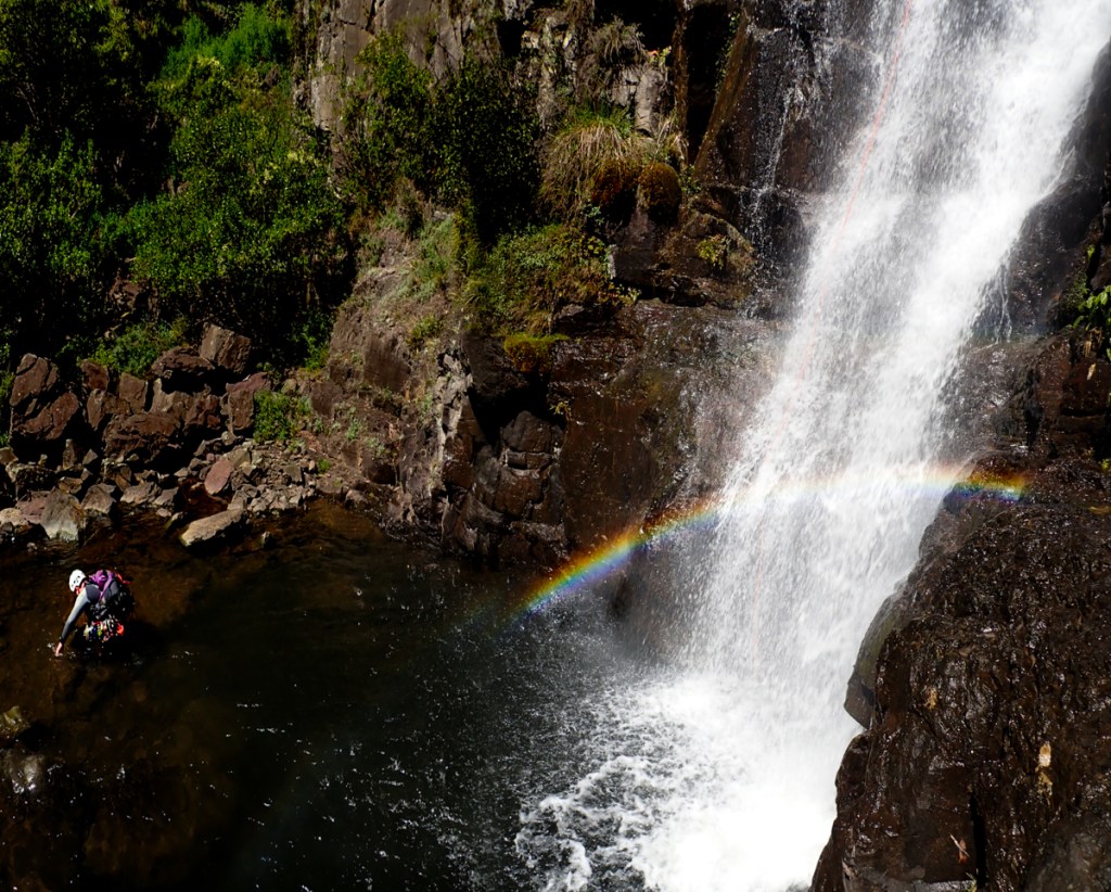
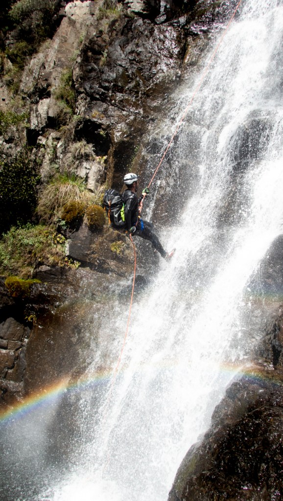
While water levels are down after a long dry spell, and even at normal level it’s not considered anywhere near hi-flow there is something about being swallowed into a waterfall halfway down a rope
Jamie on rope
Waterfallbow
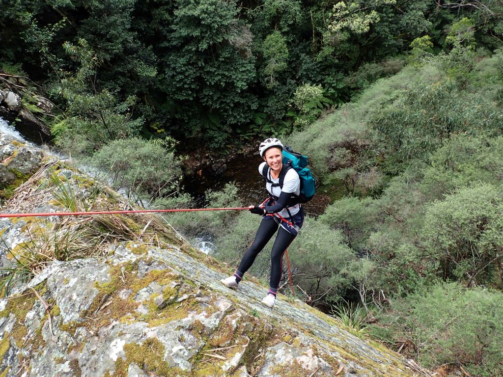
Aimee looking tinier than usual
She took control of this anchor and look at her go with feeding the rope out of the bag. Nice work
Matt
Aimee
The gang
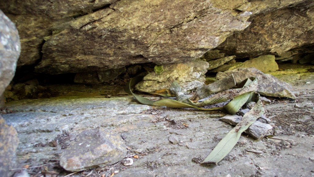
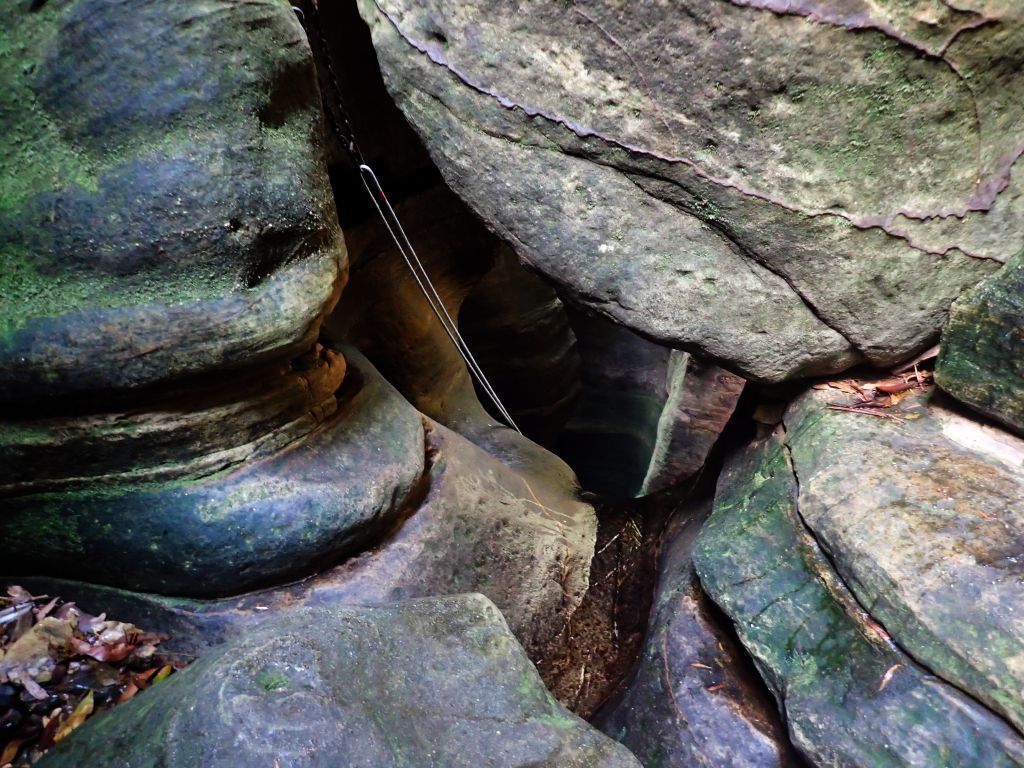
Below is a typical “Ethical and safe” blue mountains anchor…. sling crumbled with 1 sharp tug
At least there is not far to fall…
I’m glad Mark converted me to releasable systems and flaking ropes into/out of bags. Constantly coiling and uncoiling ropes on this trip would be a PITA. We got the others into it too
Rope stuffing beside waterfalls, it’s a thing we are into…. Or sumfink
Looks like a jump, feels like a jump, smells like a jump… Well half a jump. Woot woot
And then we rock hop down the the Kalang junction and begin the “gentle stroll” back up manslaughter ridge… Helps if you stop to smell the orchids every now and then
Another great day with great people
You gain strength, courage and confidence by every experience in which you really stop to look fear in the face : Eleanor Roosevelt
I’ve said before that for me the abseils are just a means to get to the next bit of canyon.
I’m far more excited by exploring the dark confines of a slot canyon. I’m captivated by the play of light as the sun arcs over head. I get fascinated by the way water and time have sculptured the rock, and I’m dazzled by the ferntacious greenery…
Ayhoo with that in mind the Kanangra canyons have never held a massive appeal to me but when Tim invited me on a trip down Kalang Falls I thought I may as well check it out to see what the fuss is all about.
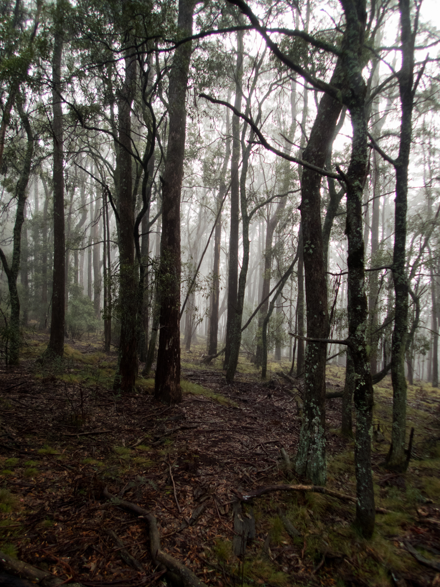
With the east coast experiencing some much needed rain it was moody in the forest waiting for the others to arrive.
After a week of drizzle mixed with rain we’d check the water levels and if it was too high we’d abort and do Dione Dell instead.
As it was it was pretty much prefect
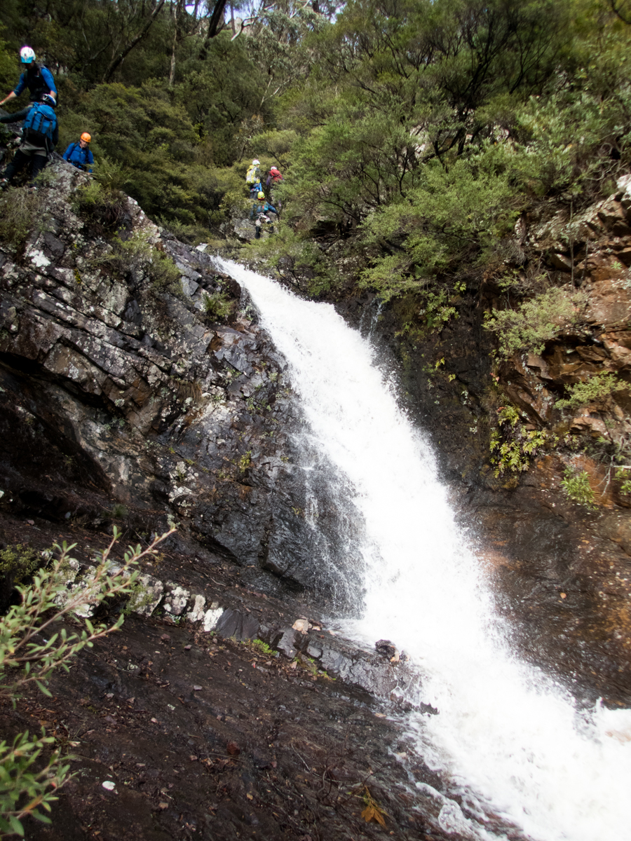
And so our group of merry adventurers set off from the car park with a buzz of excitement and a swagger in our steps.
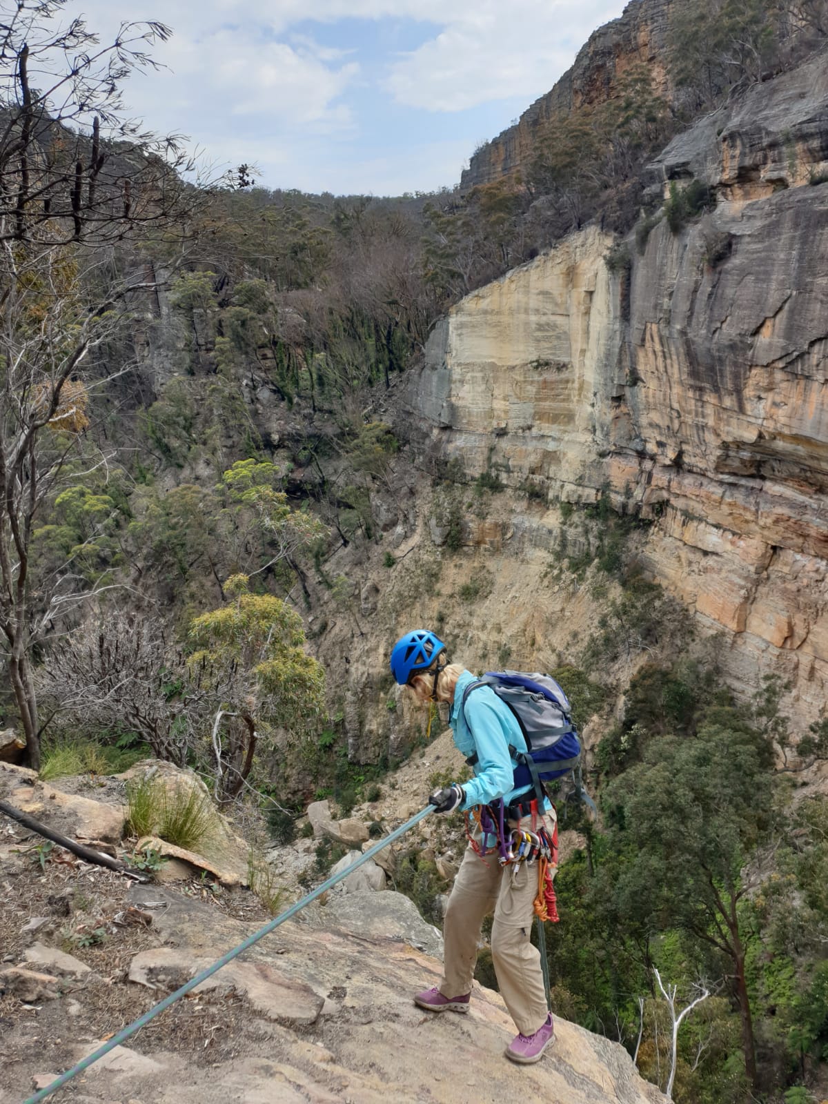
Despite a few of the others having done the trip before myself and Al got nominated leaders so the real leader, Tim could follow along at the back of the group as safety man with the spare rope. So we set off to rig the first drop.
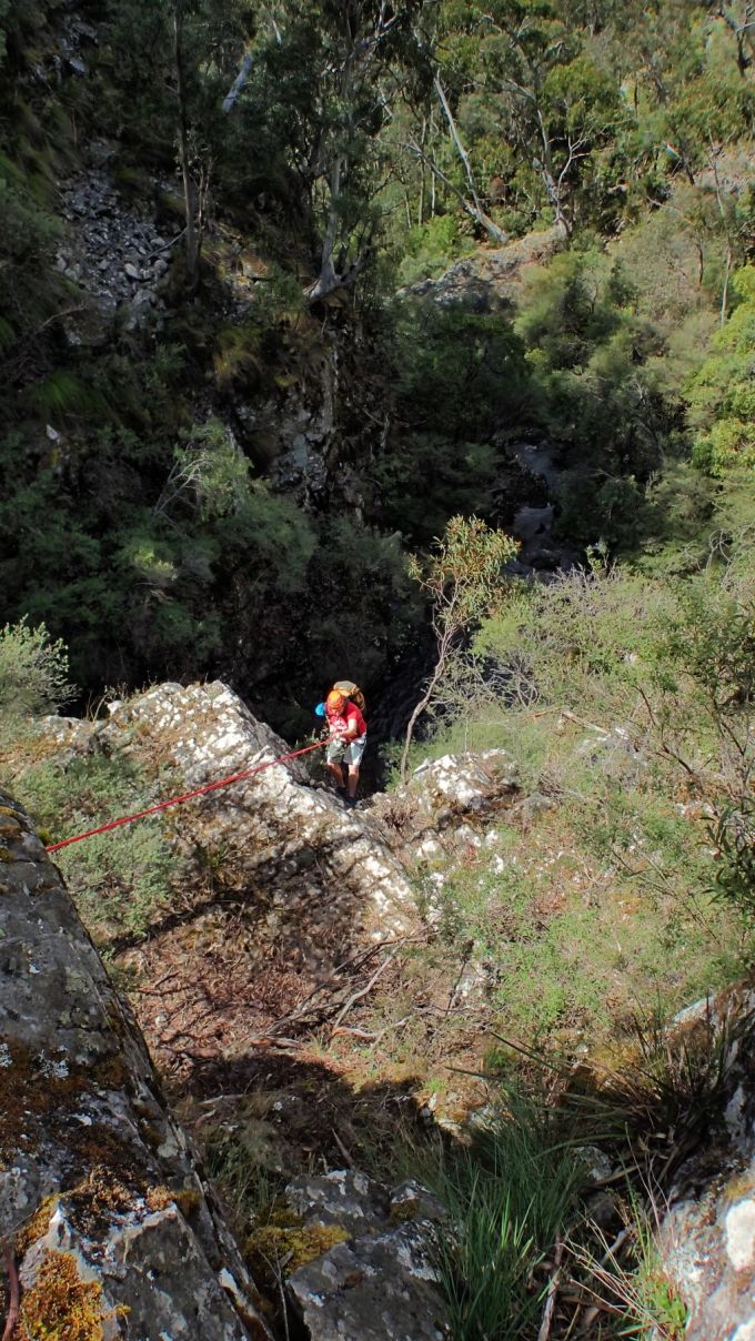
Making our way down towards the first abseil conditions were very slippery making it slow and steady going
There is a bit of scrambling to get down to the first anchor and Tom’s notes warned the final drop before the anchor could be dangerous so in the wet slippery conditions we rigged the abseil from above it.
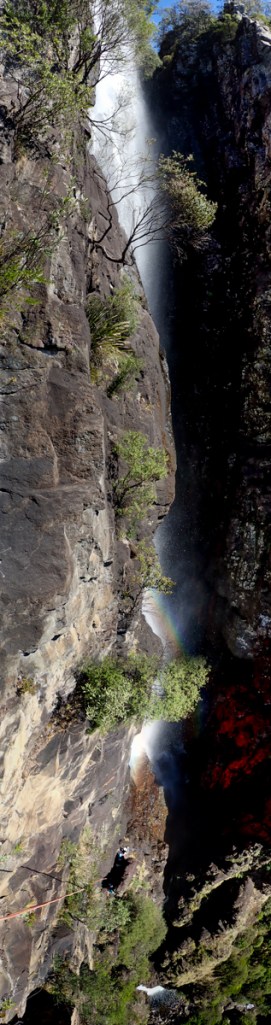
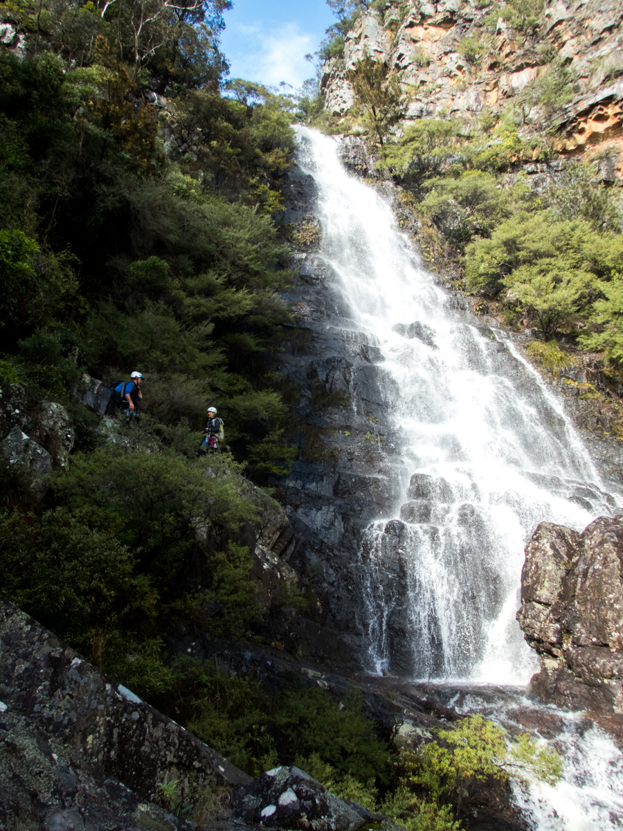
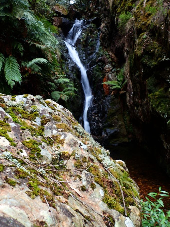
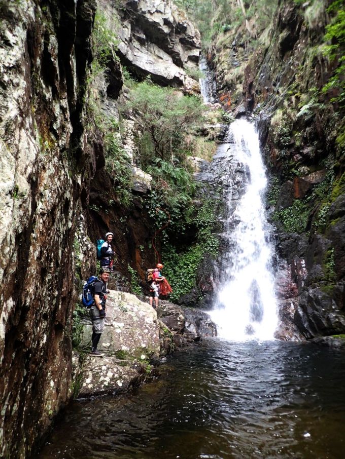
I have to admit the waterfalls are stunning
As with all of Tim’s trips we had multiple ropes and walkie-talkie communi-doonies so the group could spread out. Me and Al would set rope, the next person would arrive, we’d take their rope and descend to the next one. And so on and so forth etc etc etc. So even with a largish group taking their time on slick rock we made good time down the ravine.
Al, Fingers crossed I’ve tied the knot right Bro.
It’s technically a dry trip but I got soaked in the spray off this one. If doing it in winter with this much water you’d want some good waterproof clothing
Rope management was the theme of the day. Lots of vegetation and ledges for ropes to get tangled on. I can see where flaking it out of a rope bag would be handy on a trip like this.
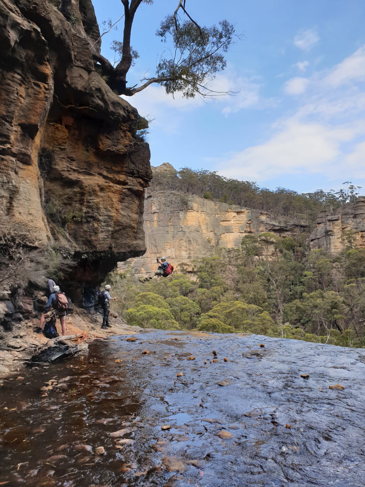
You can just make out Ev about to come over the edge
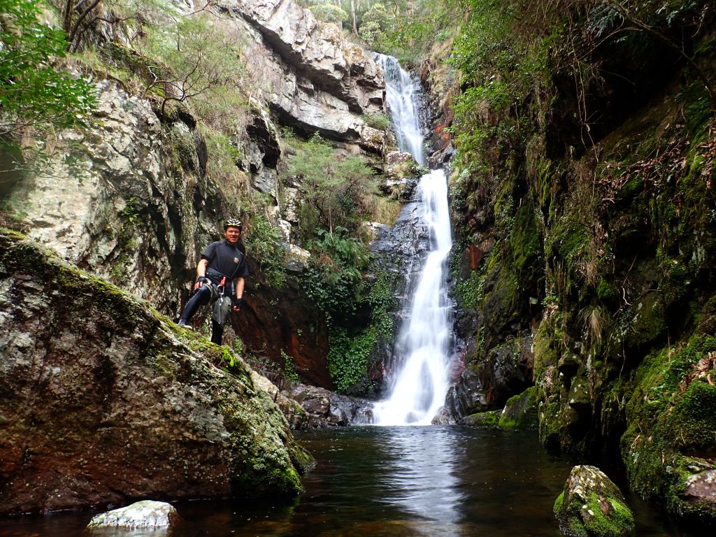
Tim at the 3rd anchor, this one is a little hard to locate.
Not the best silky smooth waterfall photography today but not bad for hand-held shots with the TG4
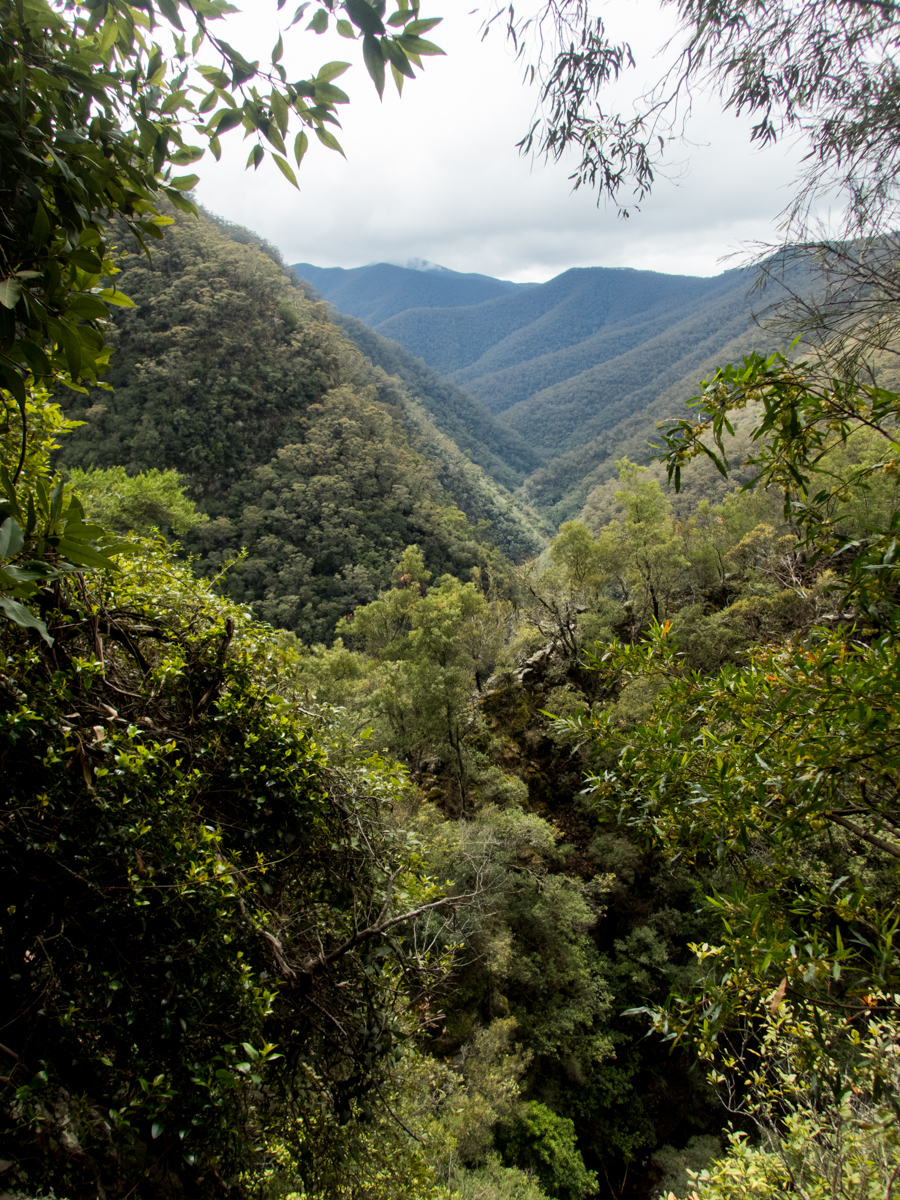
Epic Kanangra country
Al below the 3rd abseil. You can see Ev on belay where the ropes come down to the right
I found the scrambles between the falls took a lot of concentration. The quartzite is a lot slipperier than the standard Bluies sandstone and also tends to have a lot more loose rocks ready to roll your ankle.
Ev at the bottom of the big drop with Gabby way up high on rope to the right at the top of the falls
Despite the cool day Gabby felt the need for a bit of a swim. Ev is trying to dissuade her.
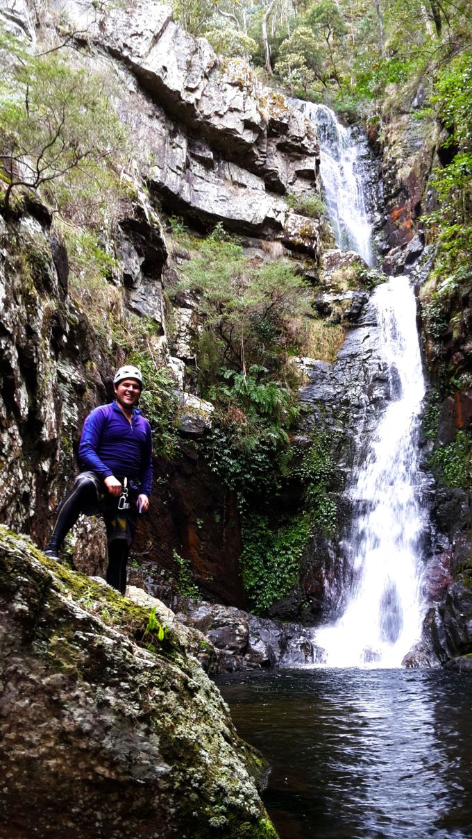
Geoff handling it with ease
But….
Then he went for a swing and only good team belaying by Ev and Gabby kept him dry
Always time for a selfie
Geoff’s enthusiasm for the bush is infectious
And then it was up Manslaughter ridge and out
OLYMPUS DIGITAL CAMERA
OLYMPUS DIGITAL CAMERA
Probably really common, but can anyone tell me the species?
Thuratt Spires and Kanangra wilderness
How did I find it? Well the waterfalls were stunning, the company was awesome, the abseils were abseils and the walk out wasn’t as hard as I thought it was going to be.
Another great day in the bush with great people.
The mind is like water: capable of going anywhere but once hemmed in by walls of it’s own making it takes a powerfull flood to burst it’s banks and change its course: me
Group size: 8 all experienced
Time: 9hr 20min car to car, not rushing in the slippery conditions and taking it easy up the exit ridge.
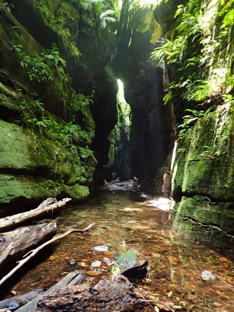
Claustral is the quintessential Blue Mountains canyon. A deep, dark, sustained slot accessed by a series of abseils down a dark hole known as the Black Hole of Calcutta. Once in you are committed, the slot can be as fearsome as it is beautiful. Flash floods do happen and the exit is hours away. It has claimed the lives of some very experienced canyoners and been the scene of various rescue operations over the years.
It’s part of the big three. Thunder, Ranon and, Claustral canyons and their tributaries, carve the saddle in between Mt Tomah and Mountain Banks into a deep maze that has come to be known as the Carmathan labyrinth.
In 1804 the botanist and explorer, George Caley, gazed up at the Blue Mountains and confidently declared “There is not a single peak which would take more than half a day to scale!”
He was right, but it wasn’t the peaks that would thwart him in his attempt to cross the mountains. His party reached the top of Mt Tomah with little difficulty then set about crossing the short distance to the next peak, Mt Banks. He didn’t know about the labyrinth that awaited him below.
We were taught at school that the early explorers failed to find a way across the mountains because they tried to penetrate the river valleys when they needed to follow the ridges. But Caley’s plan was always to follow the ridges between the high peaks. Unfortunately the ridge he tried to follow didn’t exist
Scrambling down through lawyer vines and disjointed cliff lines they eventually came to a deep dark chasm they called Gaping Gill (while a chasm still bares this name it is probable they were looking into the lower reaches of Thunder gorge).
With no way to cross the chasm they beat a retreat back up to the ridge and tried another approach. This time into a gully Caley would name Dismal Dingle. Night descended and they made camp in a small overhang. Awestruck by the glow worms lighting up the wall over head, tormented by possums who ran like little demons through their camp stealing their food, eaten alive by mosquitoes and, terrorised by a wild fire that ripped up through the Grose Valley his men threatened revolt if he tried to push on they way they were going.
Come morning they beat another retreat up to the ridge line and opted to follow this in a wide arc around the labyrinth below. They were now on the very ridge that would one day carry the Bells Line of road. A native track way, had they stayed on this ridge they would have achieved their goal of crossing the Mountains in little over another days walk. But, of course, they didn’t know this.
Their plan was to follow the ridge line they mistakenly believed connected the major peaks they could see from the Richmond plains . And so they veered off to explore the peak of Mt Banks with Hat Hill, their next objective. Upon reaching the top of Mt Banks they looked down in dismay at the 300m cliff line that plummeted into the Grose Valley with Hat Hill unreachable on the other side. Dejected they turned tail and headed for home.
Later, or so I have read somewhere (but for the life of me I now can’t find the source) an early female bush explorer (Mary Biles?) ventured into the rim of the Labyrinth and upon peering down into a dark slot dropping into bowels of the earth wrote words to the effect of “One day the depths may be explored. Whether brave or fool hardy those who do surely will not suffer from claustrophobia.” Thus the slot was later christened Claustral canyon.
OK, maybe I spiced a bit or even all of that intro up. I’m not a historian, don’t take it as gospel. After all, I got my history of the world from Mel Brooks and all I know for certain is “It’s good to be the king.”….
Anyhoo. I’ve a confession to make. I’d never done Claustral Canyon. I’d been into the system through Ranon and I’d wandered up the bottom section of Thunder canyon but back in the day Claustral was the most popular abseil canyon and I was put off by the thought of lining up to access the abseils. I was a bit of a canyon snob really and I come to realise I had cheated myself of a great experience.
Soooooo when Ed and his mate, Lewis, invited me along on a photophaffary trip I jumped at the chance. Now as you probably have worked out by now I have a little point a shoot camera (Olympus Tough TG4) and am not overly concerned at capturing amazing images of art, more documentaries of my travels so I had a sneaky suspicion that they needed a mule to carry the ropes so that they might lugg in more photomagraphary equipment needed to get their awesome shots but I was cool with that.
As it was everybody bought rope.
Anyhoo, I was running a bit early so stopped by the Emu Cave to get a few photos and explore the rock shelf a little more. then it was onto the car park
After a quick meet and greet, with the wrong party ( Are you Lewis, Says I. Nope, says he. Are you doing Claustral? We’re doing Ranon. Cool we’ll probably see you in there)
Lewis arrives and we introduce ourselves just as Ed turns up. We reconcile gear, stuff packs and we’re off. The traditional entry and exit point to Claustral was from the top of Mt Tomah, however in 2011 the land the access track crosses changed hands and the new owners built a house right where the track was. And who can blame them, they have some of the best views in the mountains.
A new route was found from the other side Mt Bell. This made the exit a lot longer and more convoluted which I think may have reduced visitor numbers a bit.
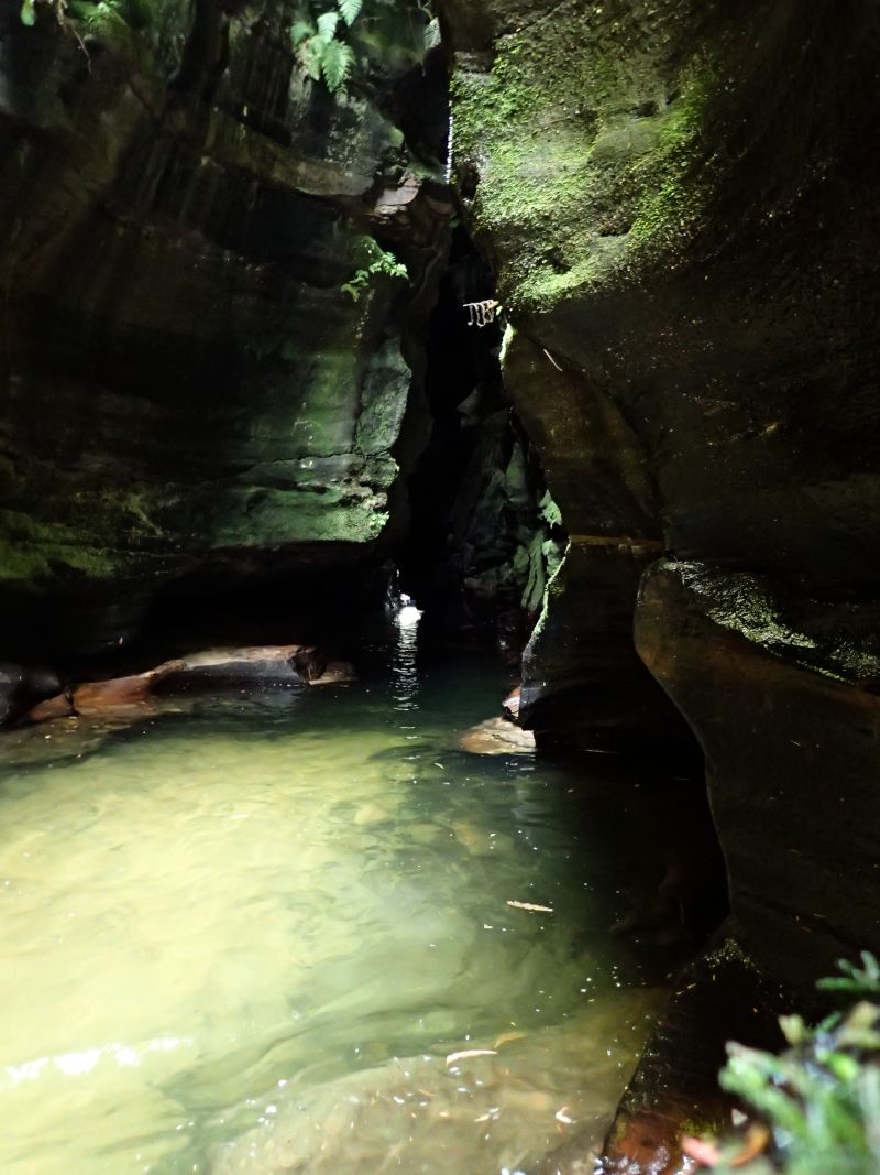
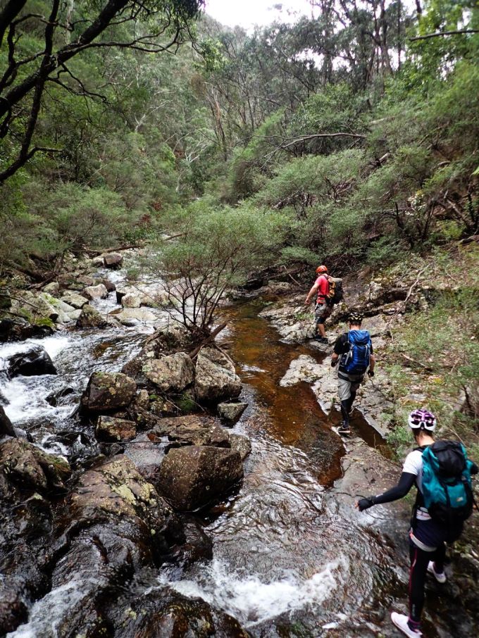
Anyhoo. We quickly make our way down through a pleasant gully and soon reach the junction with Claustral Brook
A bit of creek walking and boulder scrambling brings us to the first swim and we suit up and plunge in as the canyon begins to get deeper
Ed scrambling down
The canyon is looking good already
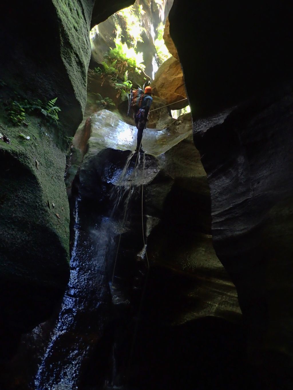
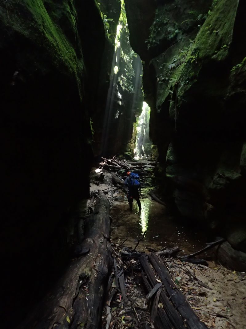
A little more scrambling and we come to the abseils. 3 successive drops down into a dark abyss. Ed and Lewis scramble to get cameras out. Looks like I’m going first for want of a better model
The start of the abseils
Lewis on the first abseil
The drops are pretty cool. Abseil 10-15 meters, swim across a pool to a small stance and repeat
Lining up to take photos on the small stance between drops
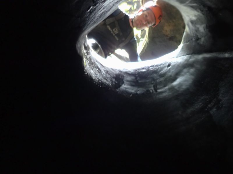
The final abseil starts through a small hole and drops into darkness. Much awesomeness
Edwin dropping into the Black hole of Calcutta, nicely back lit by Lewis’ torch
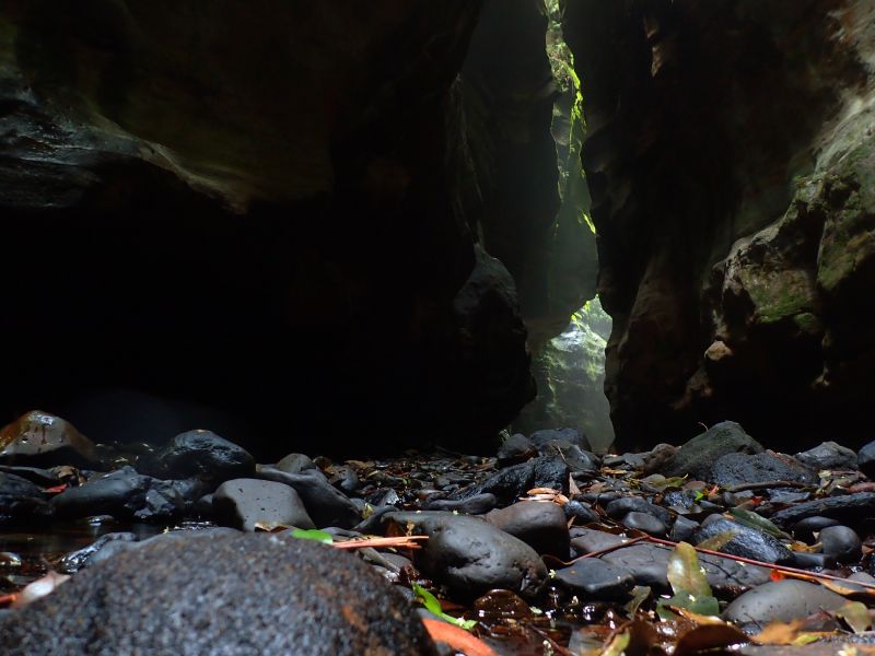
From here its 50m through the darkest part of the slot until it widens slightly at the Junction with Ranon.
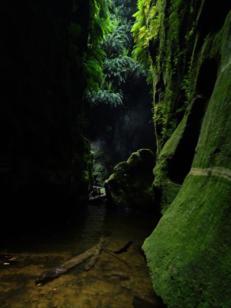
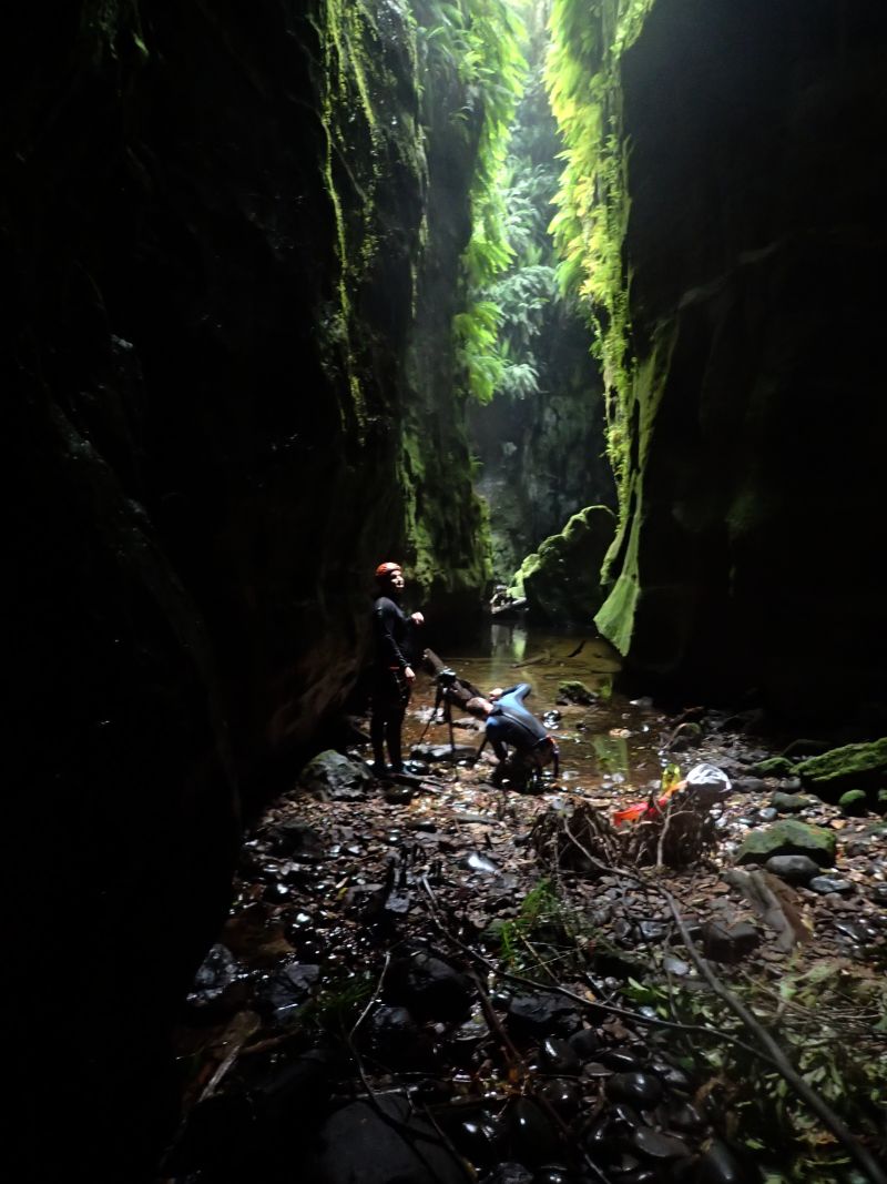
The moss covered boulders and fern strewn walls at the junction may well be the most photographed bit of canyon in the country but it is truly stunning.
We played around here for a while snapping photos from all angles
Lewis contemplating the light
It’s much greener than I remember. One of the most fern filled and moss covered canyons I’ve been in
Cameras at 10 paces… I’ve heard of people paying to do the guided trip just for a photo here
After lots of photo phaffing we head down. The boys need to be very careful with keeping their gear dry so it’s in and out of dry bags a lot. The advantage of my TG4 is I can keep it at the ready. The photos may not be the same quality but as it’s so handy I have about 600 to trawl through.
Canyon formation
Canyon Formation
Just as the big cameras get triple dry bagged to continue on Ed looks up to see one of the group coming in from Ranon has slid out along a fallen log that spans the canyon 40 or 50 meters up. There was a scramble to get cameras back out in the hope they were going to abseil down the middle of the canyon walls from this log but by the time cameras were out he had thought better of it and retreated to do the normal route through the waterfalls
The group coming in from Ranon catch us
Like the slot the greenery just keeps going
With all the standing about i had begun to get cold so I peeled down the wet suit and put a light thermal underneath which improved things greatly.
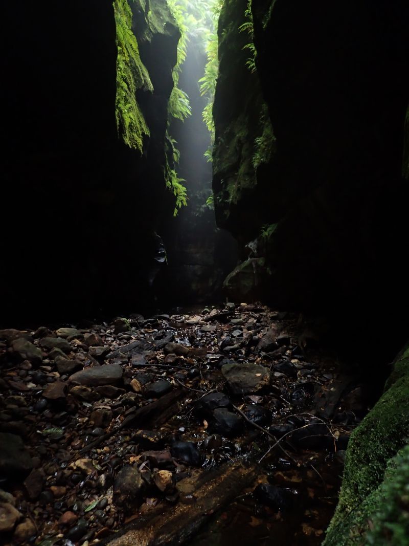
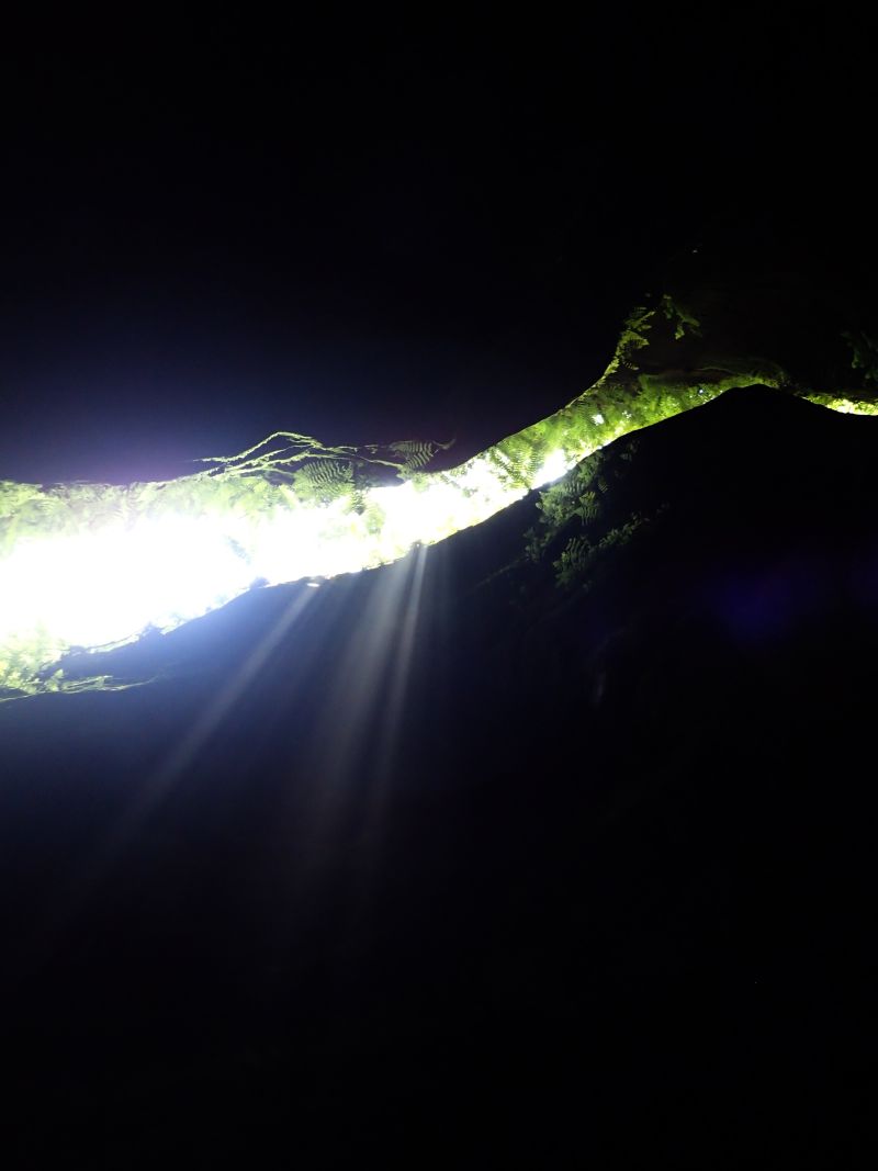
Looking for sun rays but the day was a little overcast so the few we got were very faint
Ed carefully wading with the camera out
Canyon formation
Light rays, canyons and photographers
Ed chasing Rays
We caught back up to the other group at the junction with Thunder Canyon, which is a great spot for lunch. They soon finished and continued on, we have a quick look up Thunder and then followed suit.
After this junction the canyon opens up a little and there is some tricky scrambling down some drops before it closes back in.
Lewis looking down a pot hole
Once it closes back in you encounter the infamous tunnel swim. Way back when I did Ranon the last time the water level was down and you could walk through here. Now it’s a spectular 50m swim
A little more scrambling, a couple of pools and you reach the exit
There is a steep haul up Rainbow Ravine, which has some pretty canyon sections itself, then a long walk up the ridge to the top of the Camels Hump. I remember last time getting to this point and thinking we had come up the wrong hill. From the top the hump it looks to be surrounded on all sides by chasms and the old exit point to top of Mt Tomah can be seen across a particularly deep chasm. You can see why, with no maps and no knowledge of the land Caley and his crew had so much trouble. I’m remember almost having my own muntiny on my hands as hungover and exstausted Della and Lurch were in no mood to drop down and climb out again.
Just when we thought we would have to descend all the way down and start again the trail crossed a narrow, bridge like rock saddle. It barely looks real. Something straight out of Tolkin. The old exit is now just up the hill. 10-15min up to the car park… The old exit.
The new exit is not so quick and does involved dropping all the way back down into Claustral Brook. We head steeply back down. There are some nice canyon sections and a swim or two before we reach the gully we came in on.
Yeah it’s a long walk out. Yeah I’m feeling it today but it’s not too bad, we’ve done worse.
Party Size: 3 All experienced
Time: 10hrs car to car. Lots of time spent striking poses and snapping photos
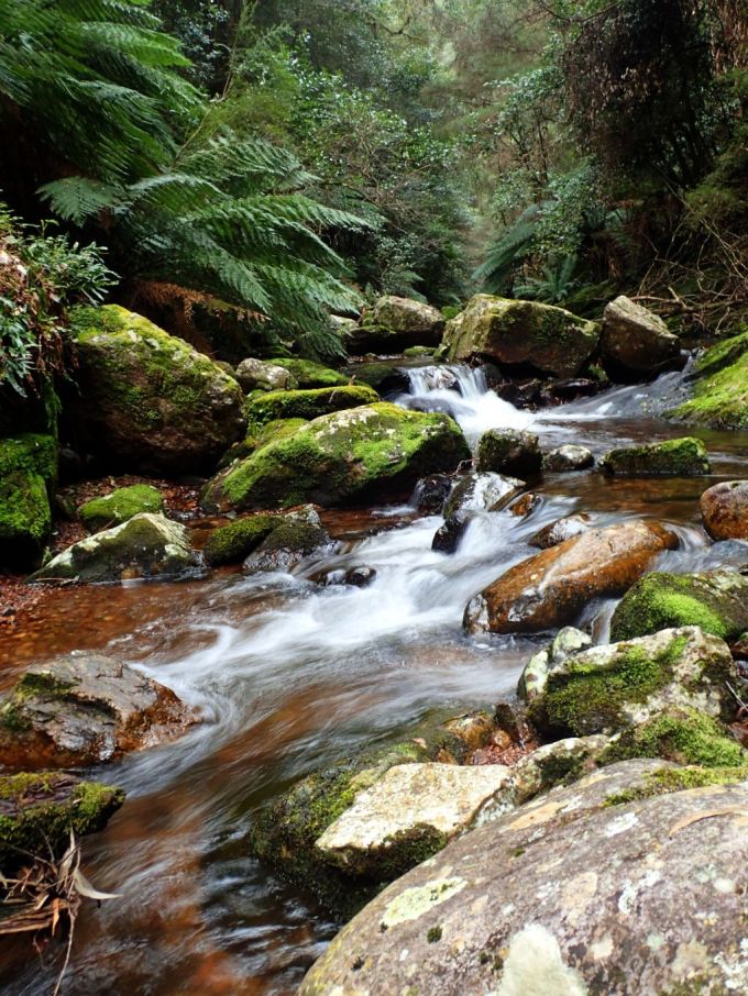
Dione Dell is a good introduction to the Kanangra-Boyd style canyons. Unlike the dark, sandstone constrictions of Blue Mt canyons the ones out this way are more steep ravines that drop through a series of water falls as the streams cut down through the quartzite landscape.
Now at first glance quartzite looks a bit like sandstone, and once upon a time it was just that but then it got subjected to heat and pressure which melts down the granny structure and metamorphises it into and different beast.
Gone is the grittiness that offers some semblance of grip, and it’s harder too so tends to break off in lots of block sized chunks. Loose and slippery. It can make for hard going as you try to traverse it.
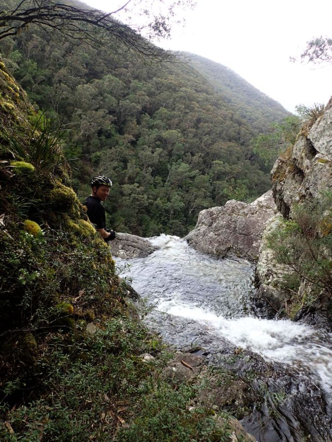
Anyhoo it had been ages since I’d been down Dione Dell (Almost 18 years) and I was keen to take Tal, he and his mates had other ideas and went camping instead but I was still excited to show the others through it.
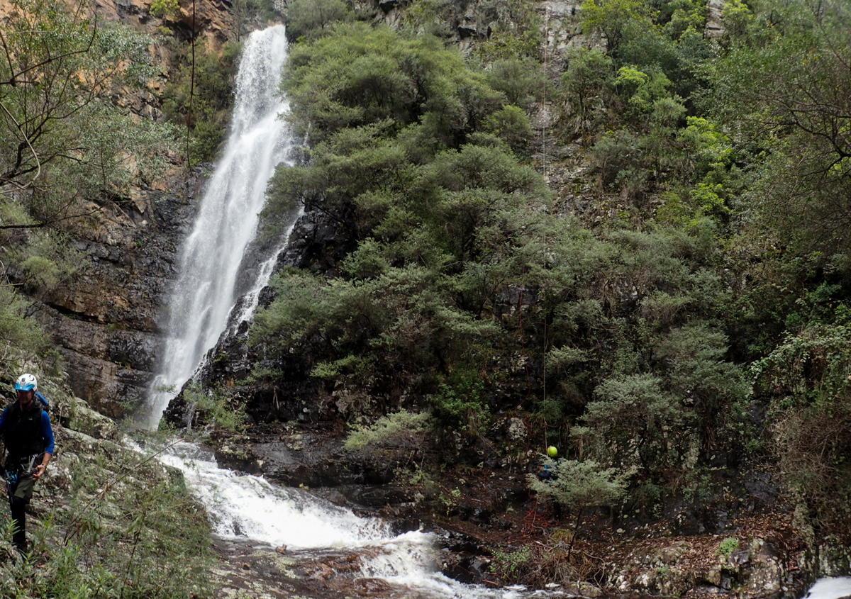
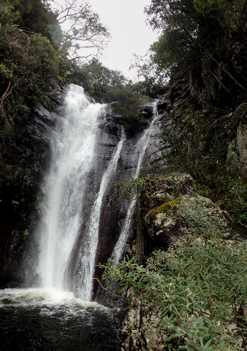
As I said earlier, it’s a good intro into Kanangra Walls canyons. One of the smaller trips out this way it consists of 4 major waterfalls, which are, for the most part, descended in single pitches, and a relatively easy walk out.
All that said it shouldn’t be taken lightly. The quartzite is slippy and loose and some of the abseils have quiet a bit of vegetation and in high water it would be a bit of a challenge.
In summer it is possible to take the direct route down through the falls. Today we opted to stay mostly dry (‘Cept for me who fell in. Pay back for the time I took Della down in the snow and he fell in multiple times)
But enough of my blabbering. here are some photos to wet your appetite.
Edwin testing out my new Canyonfire rope
Jodie and Gaz
Gaz on the second abseil
Jodie
The crew at the base of Wallara falls
Garry
Me just after my unintended swim
Party Size: 4 (3 experienced I beginner)
Time: About5 hr car to car with some photo phaffing
Access: Easy walk, thanks to Ty N. and all his hard work fixing up the old track. There is some steep uneven dirt steps and a couple of spot where you are stepping over or along logs but no abseils or rock scrambles.
Navigation: Navigation is fairly straight forward.
Map: Lithgow 1:25000 These can be purchased at Lithgow Tourist information center or online for around $10 each though not really needed here
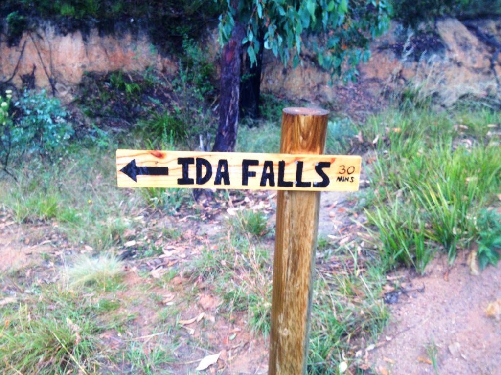
Time: It takes about 30min to walk up to the falls.
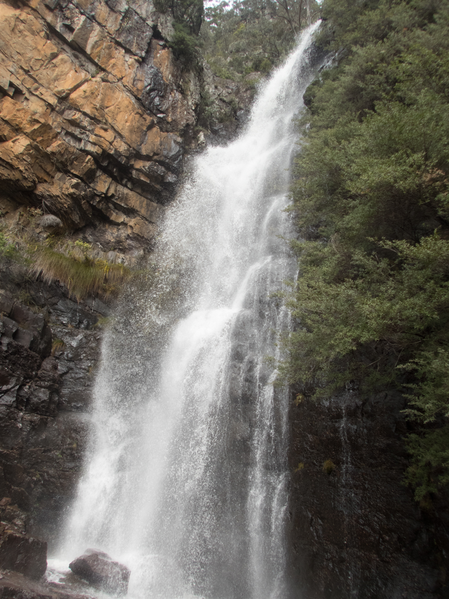
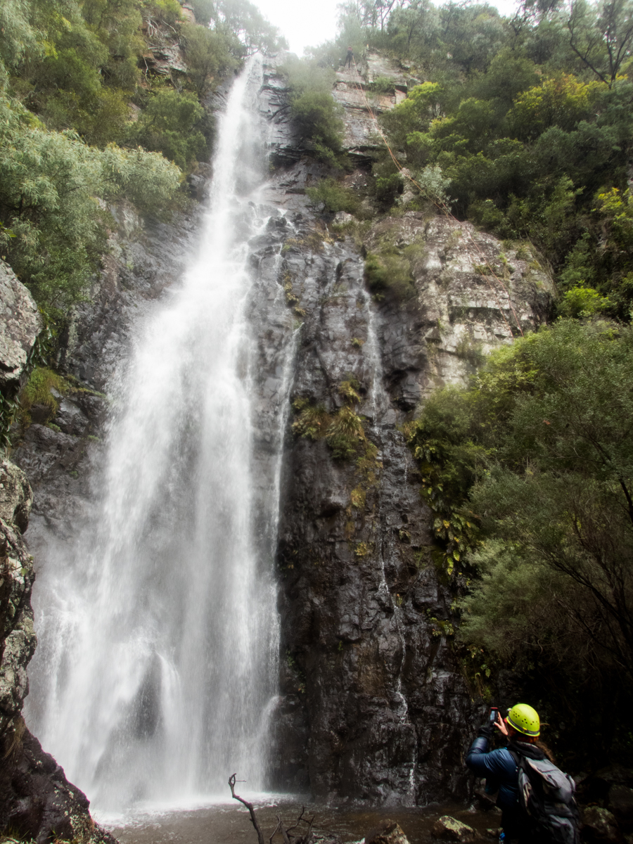
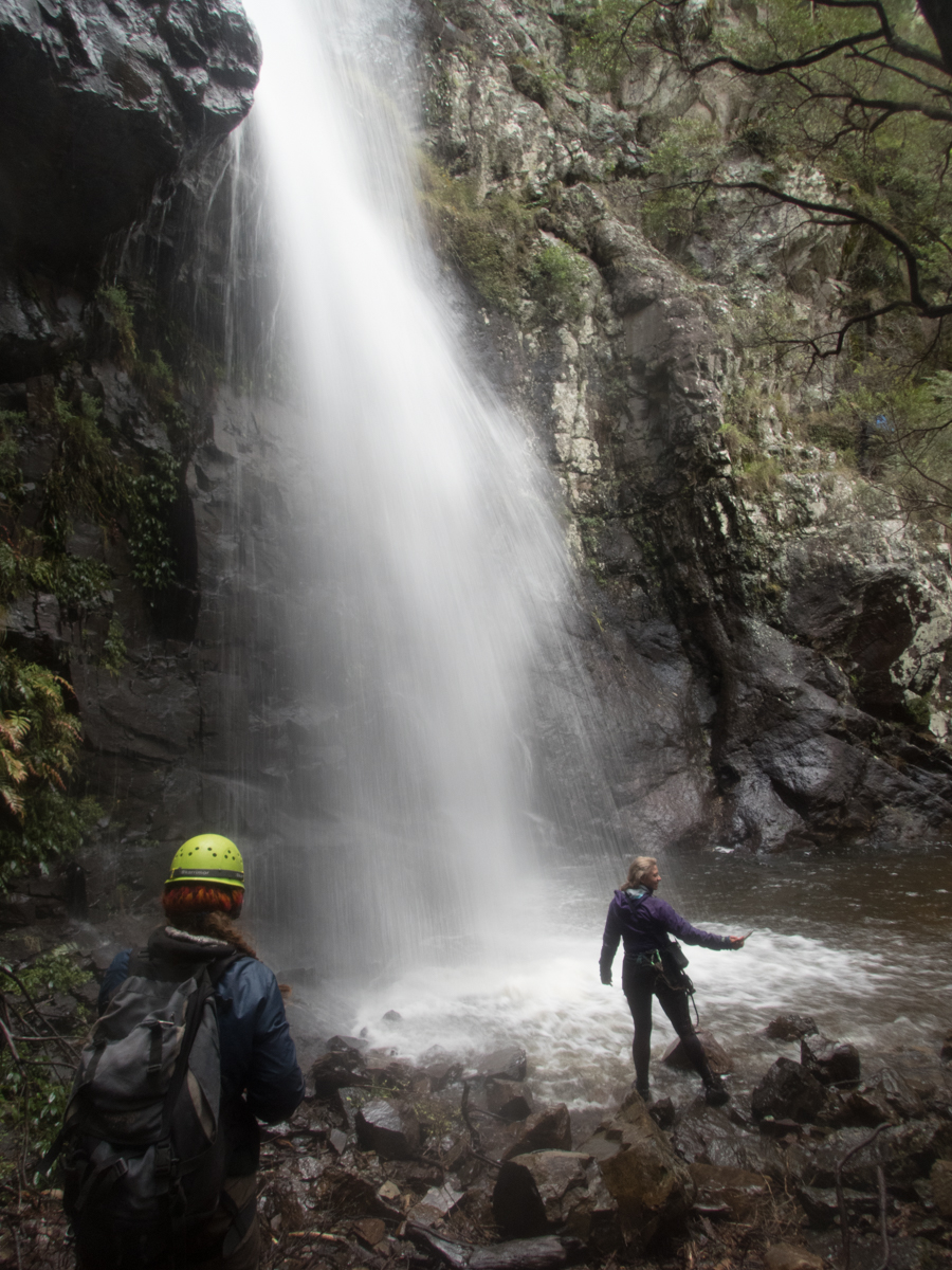
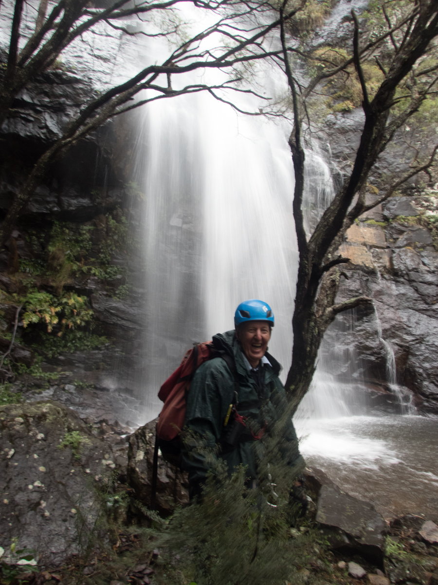
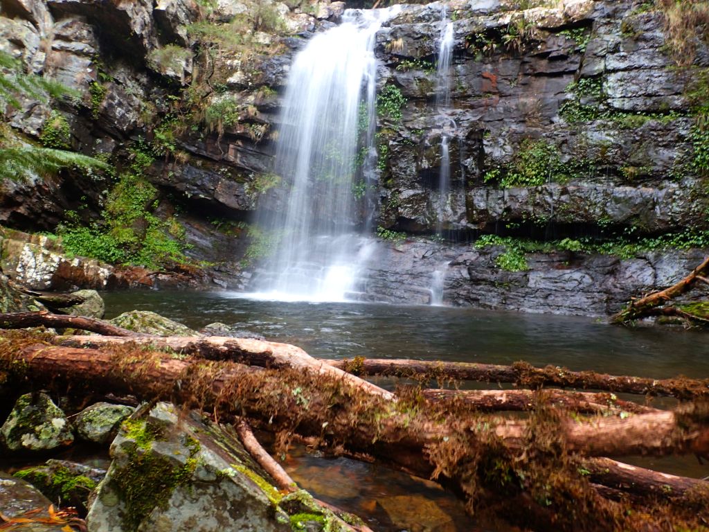
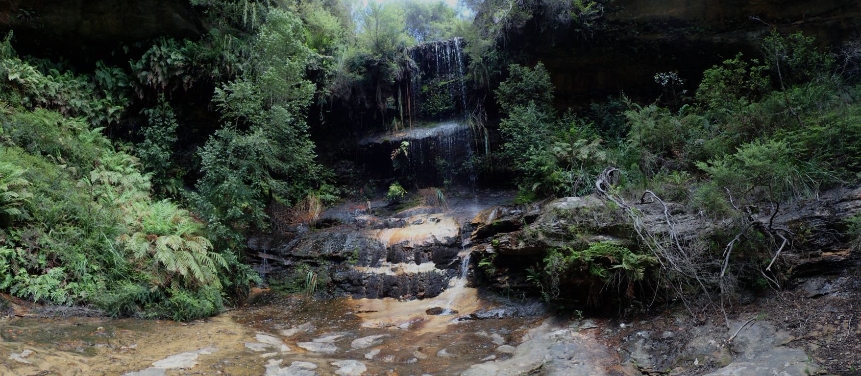
Ida Falls is a nice little walk on the outskirts of Lithgow. There are hand stencils in the area suggesting it was important to the native peoples prior to white settlement. The lower gully was once a coal mine and relics from that era are easy to spot.
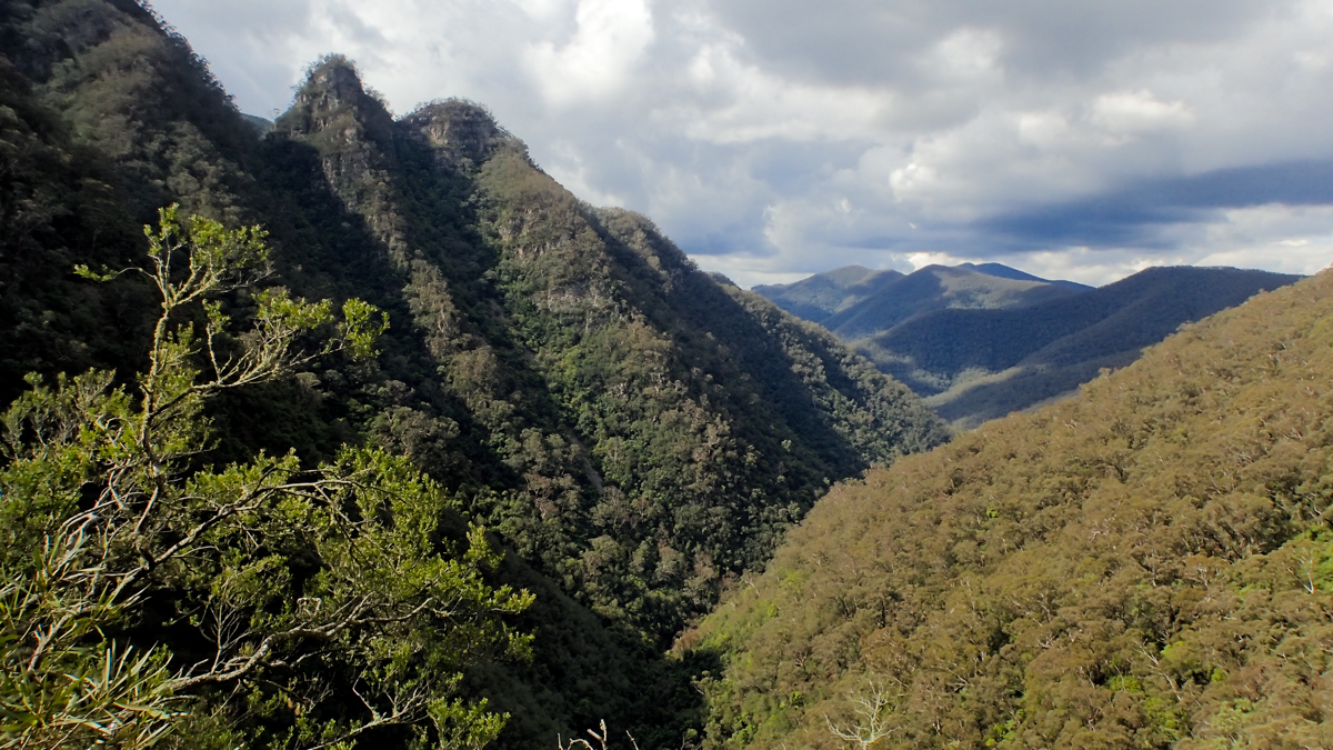
Familiar to generations of Oakey Park kids as a semi secret hidout and yabbie hunting spot.
Half way up the gully is over looked by Top Points on the ZigZag railway to the left and a forgotten look out (opposite PoW memorial on Scenic Hill) and old climbing crag to the right.
In recent years a young local took on the task of fixing up the trail so others less adventurous could visit it. Please respect not only all his hard work but the very nature of the location, a piece of pristine beauty right on the edge of town
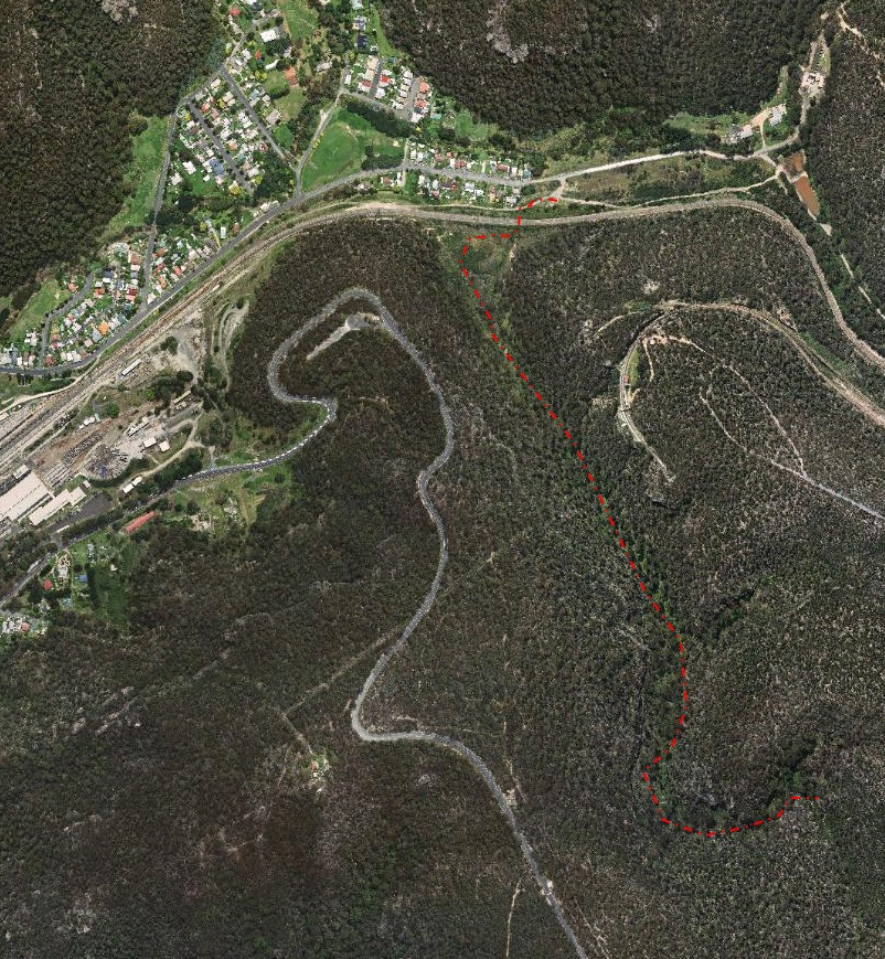
Getting there:
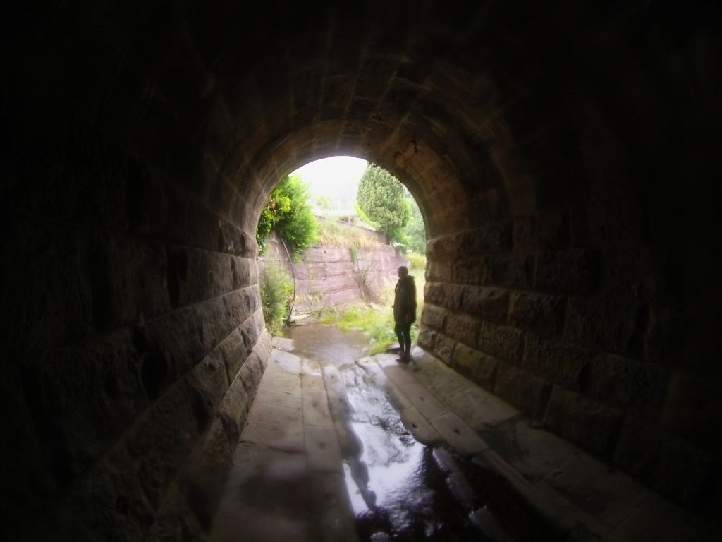
Head down Inch st this becomes Bells St after the second rail over bridge. At end of Bell st cross a little bridge (Notice the tunnel this creek comes out of on the right) and there is a small parking area on the right. Walk back towards the last house, down toward the crk. You need to get to the other side of the railway line and you do this by passing through a cool old culvert.
Mandy in the tunnel
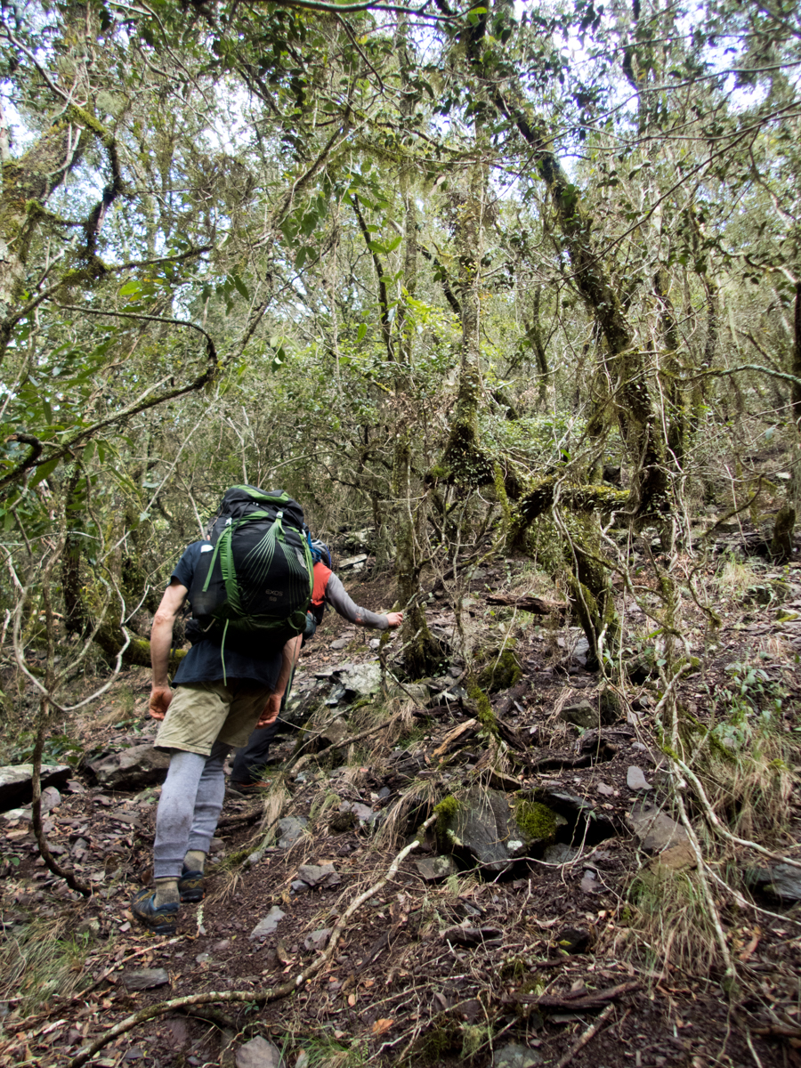
Once through the tunnel look for Ty’s home made signs as the guide you across the creek then up to the right to avoid the boggy ground and hence up the gully towards the falls
The Falls don’t always have a flow going over them so it’s best to do the walk after a bit of rain, or even while it’s raining. Return the same way
It’s possible scramble up through breaks in the cliff lines and visit the upper gully to but care and respect is needed
Note: The great outdoors is an ever changing place. Bush fires, changing weather, vegetation growth and forestry activities can all effect the trail conditions and thus the difficulty of the walk. These are a rough guide only and are by no means meant to be a definitive guide . They do not replace the need adequate map reading and navigational skills
Note 1: Taking care While reasonably well known these spots are still wild places and care needs to be taken around cliff edges and on the steep trails. Carrying the right gear as well as having adequate food, water and clothing is important. Always tell someone where you are going and when you expect to get back.
Emergency beckons (PLBs) can be hired from Katoomba Police for very little.
Note 2:First aid A basic first aid kit is essential bit of kit whenever heading into the Aussie bush. A basic first aid is highly recommended
Note 3: Maps and Navigation Having the right map, a compass and knowing how to read them is very important when heading into the bush. If you are new to bush walking joining a club or accompanying more experienced walker for you first few outing is a very good idea. I found practicing map reading on well defined trails was helpful when I started out.
The Maps mentioned are the 1:25000 series. They can be purchase at Lithgow tourism information center, from outdoors shops or online for around $10 each.
Note 4: These are wild and beautiful places, respect them. If you are able to carry something in you can carry it out. Don’ be a tosser. Leaving your rubbish behind is a sure way to ruin it for every one else.