We were planning a weekend out on the B̶o̶o̶r̶i̶… I mean *hackspit* Dingo creek.
The others were meeting us in the morning but we headed out Friday afternoon
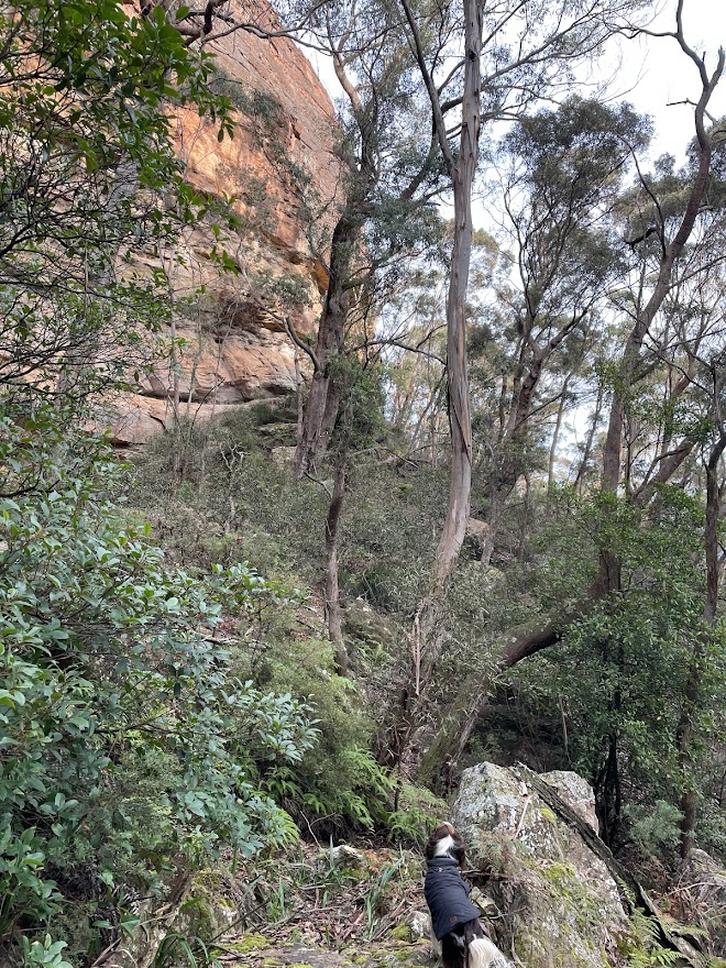
We made good time along the fire trail but slowed a bit navigating the twisting ridge as the faint trail came and went.
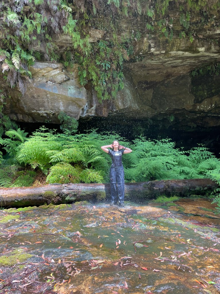
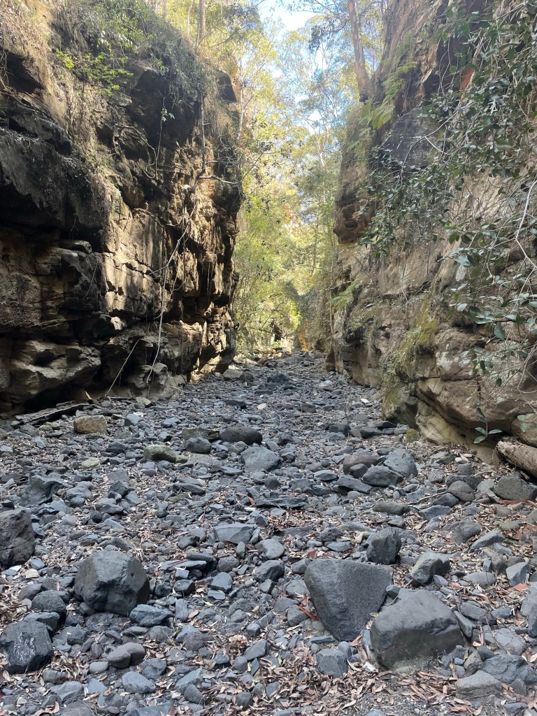
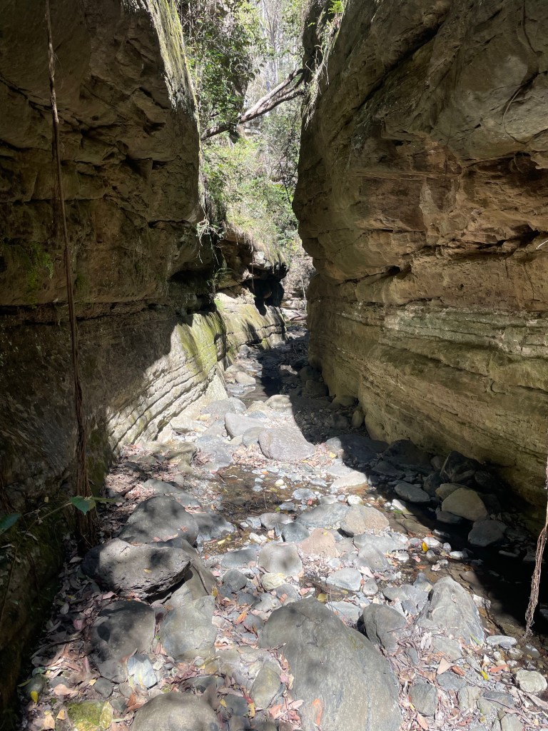
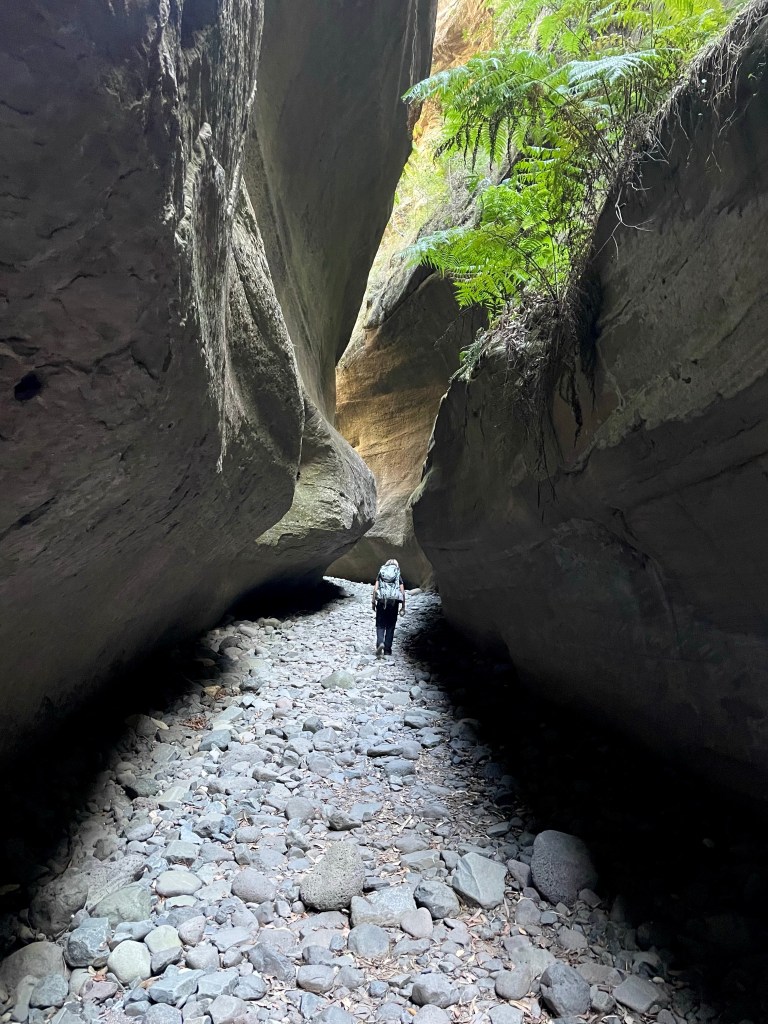
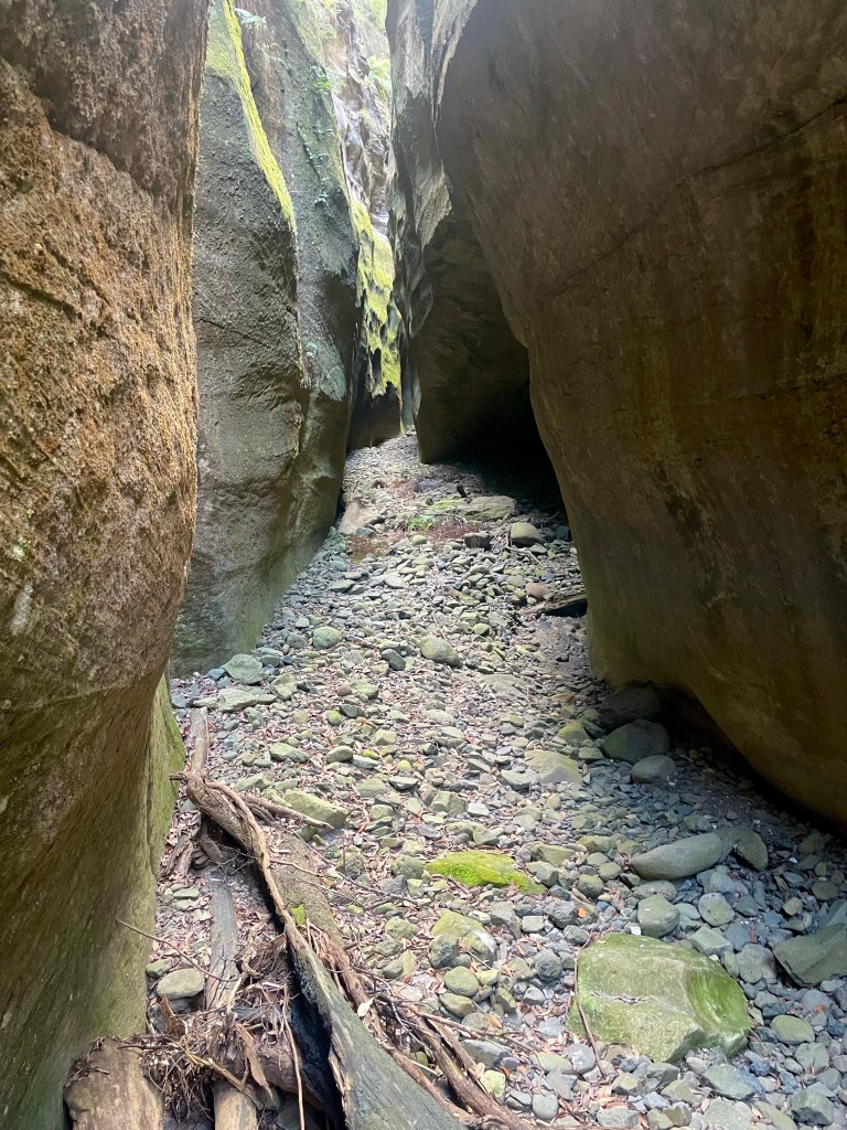
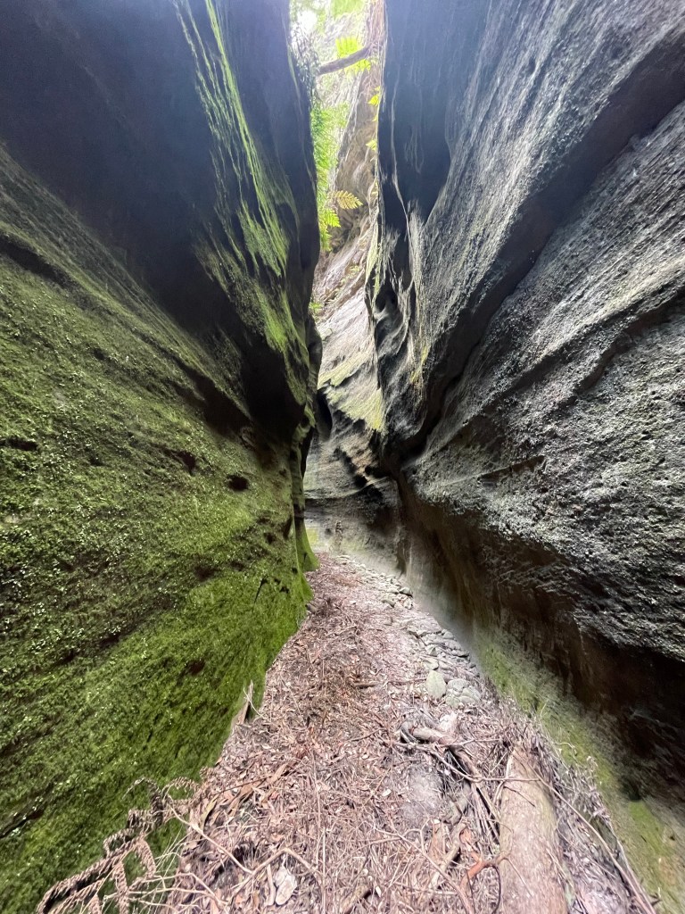
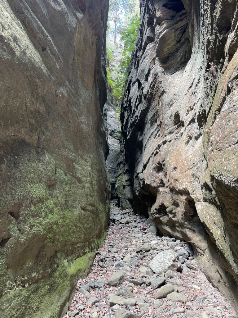
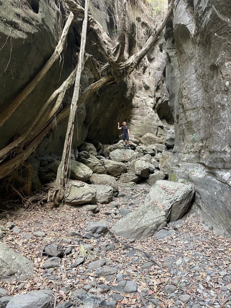
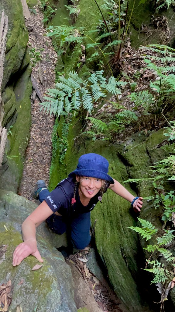
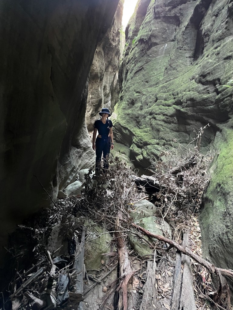
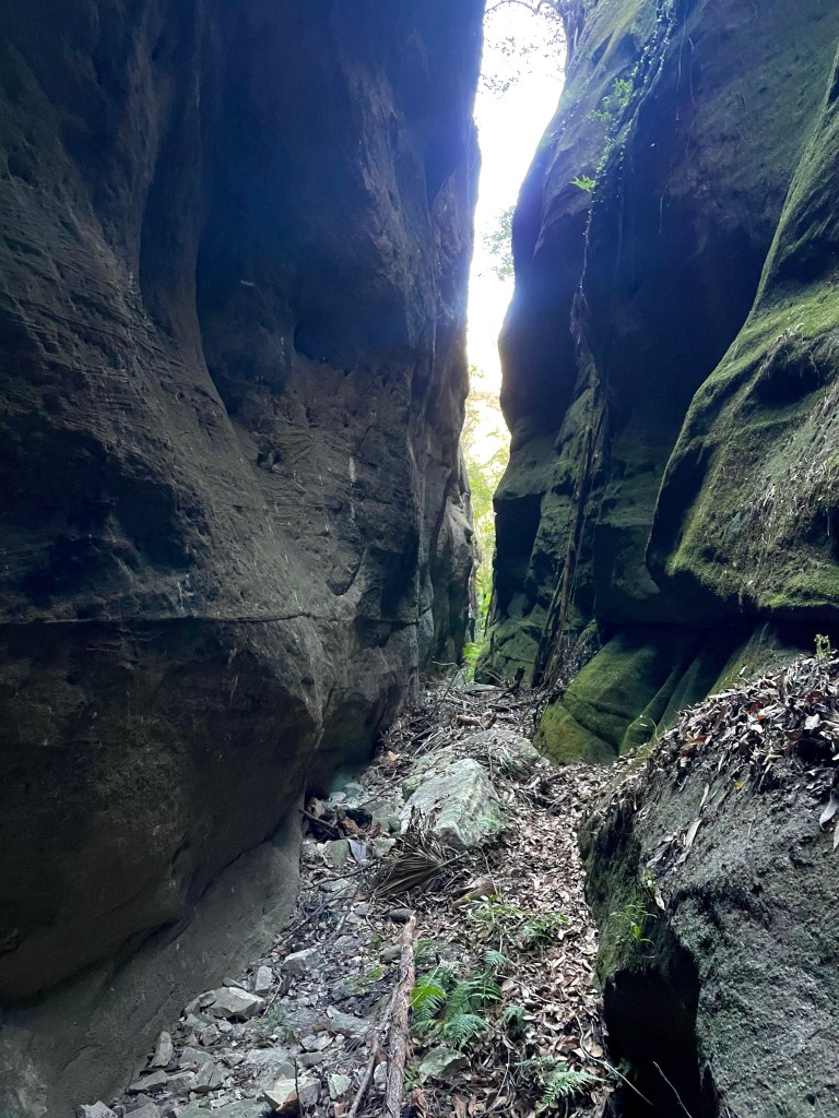
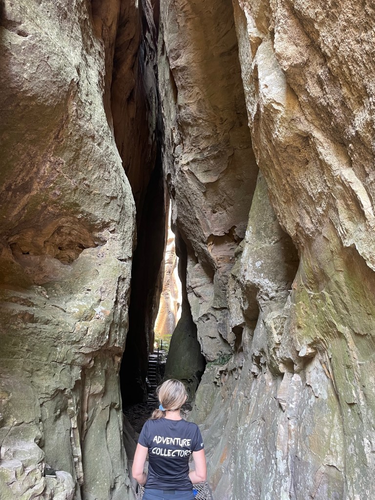
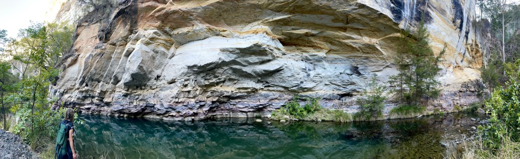
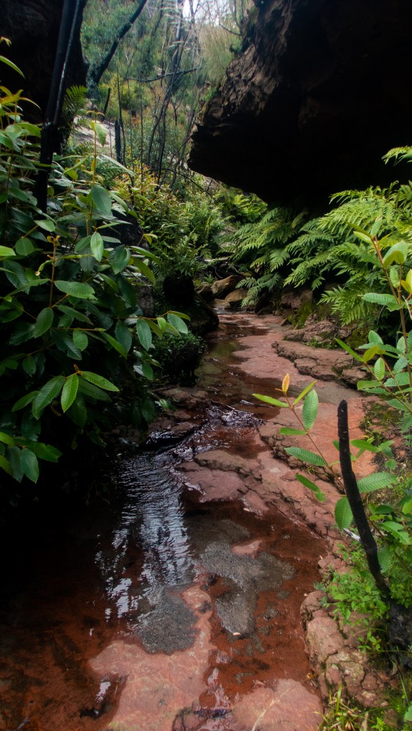
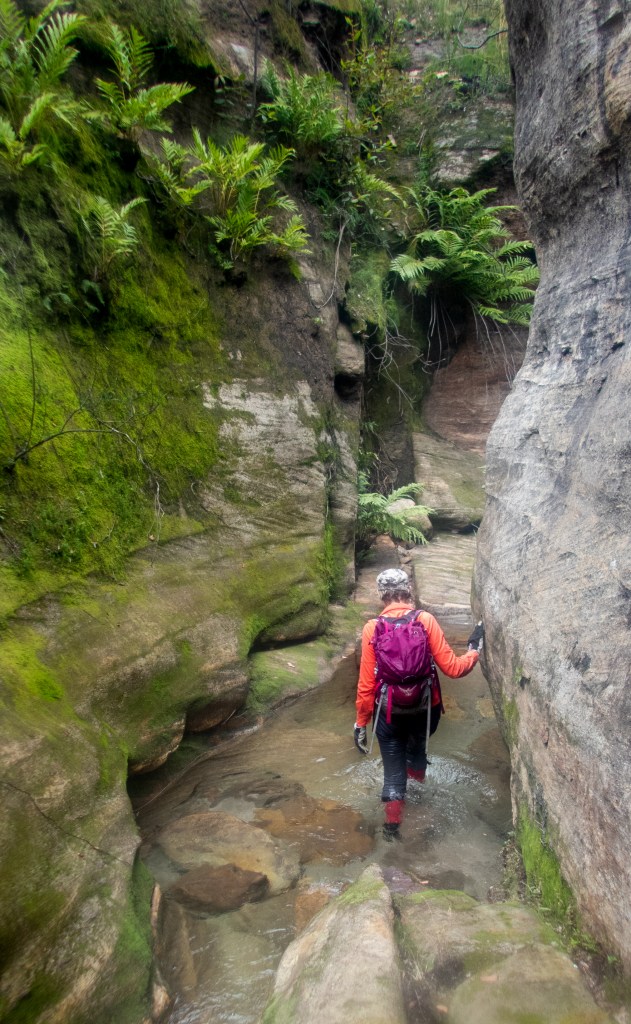
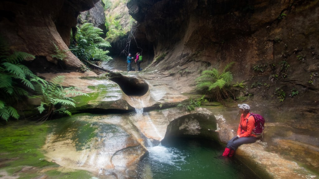
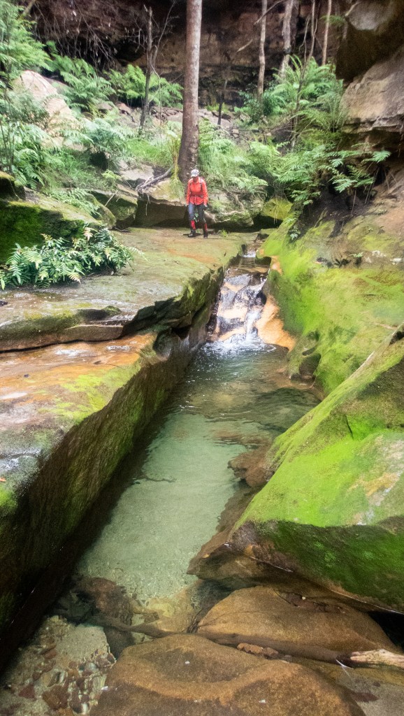
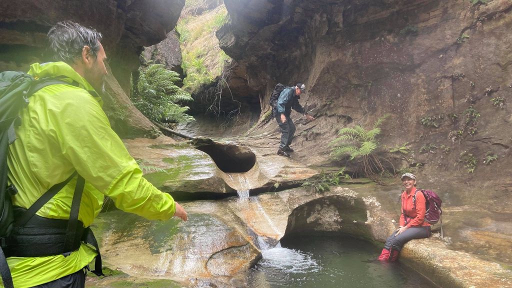
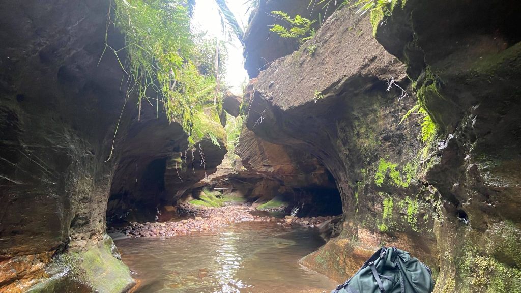
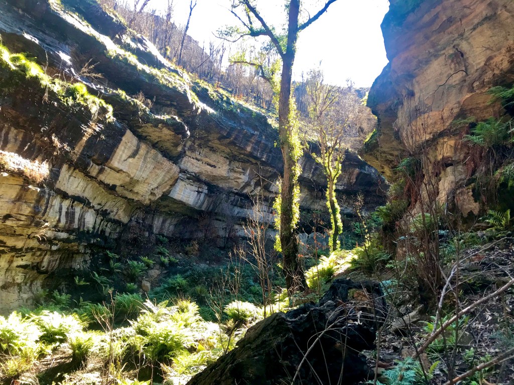
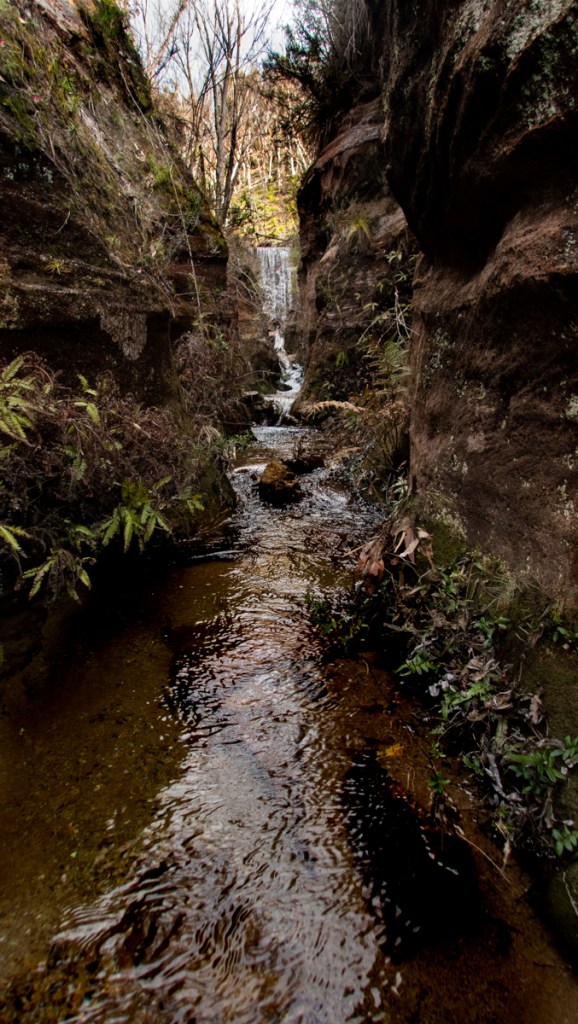
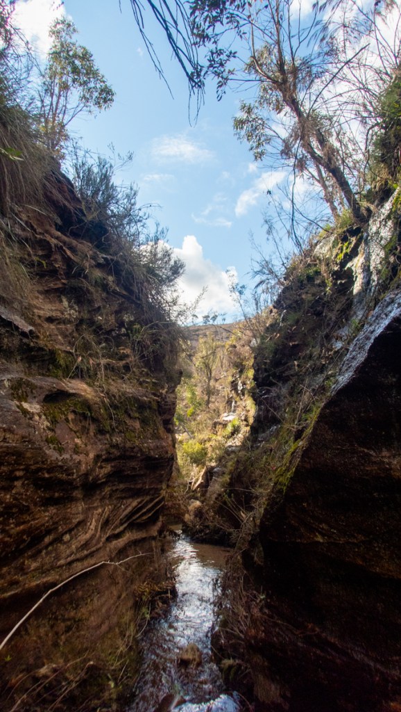
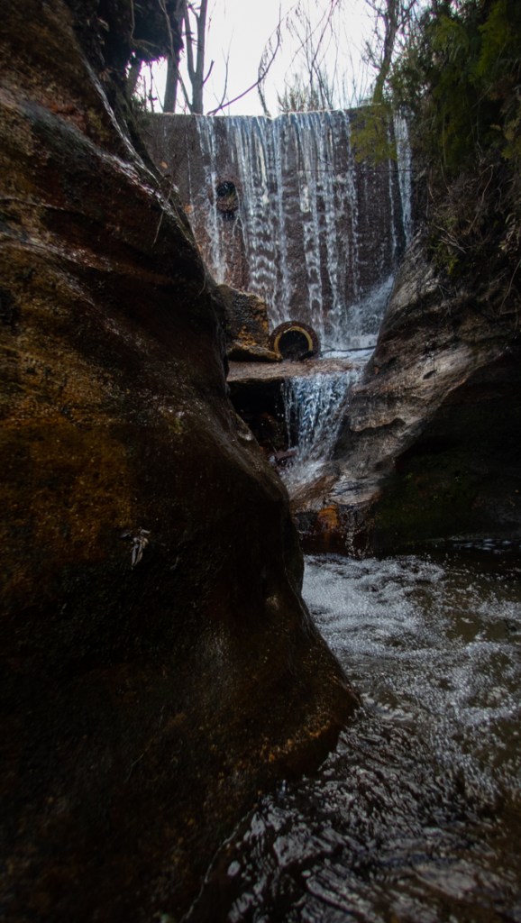
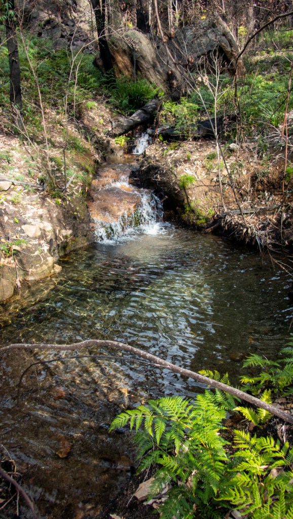
We got to the camp around 5:30. Dumped gear, set up camp and headed up for a quick run through Bubblebath Canyon. AKA Froth and bubble canyon. (There was difference of opinion in the first descent party over the name.)
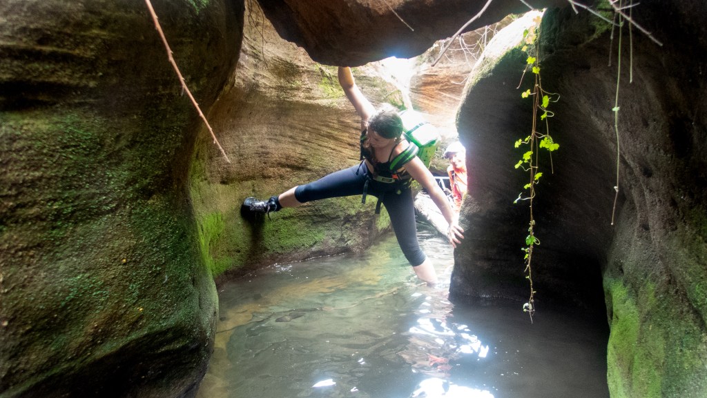
Not wanting to put wet gear on in the morning we went light. I knew it was short so we decided to brave the cold.
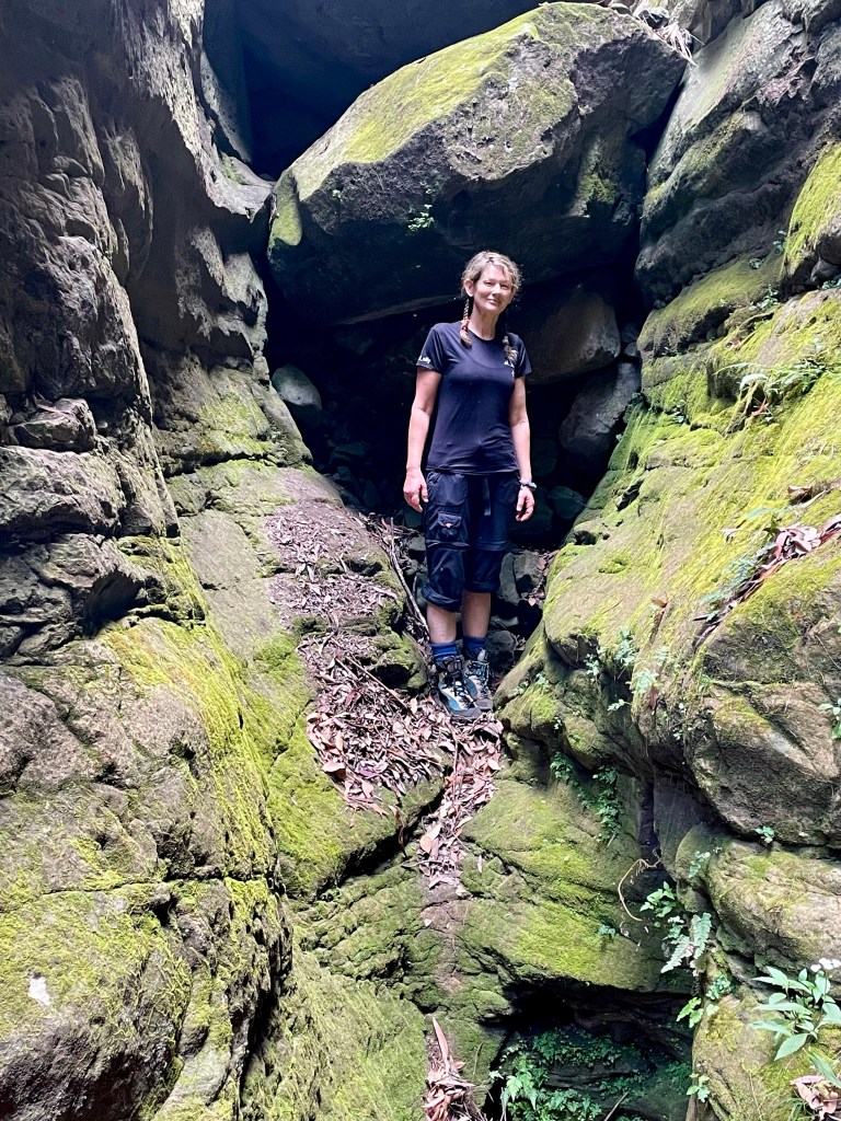
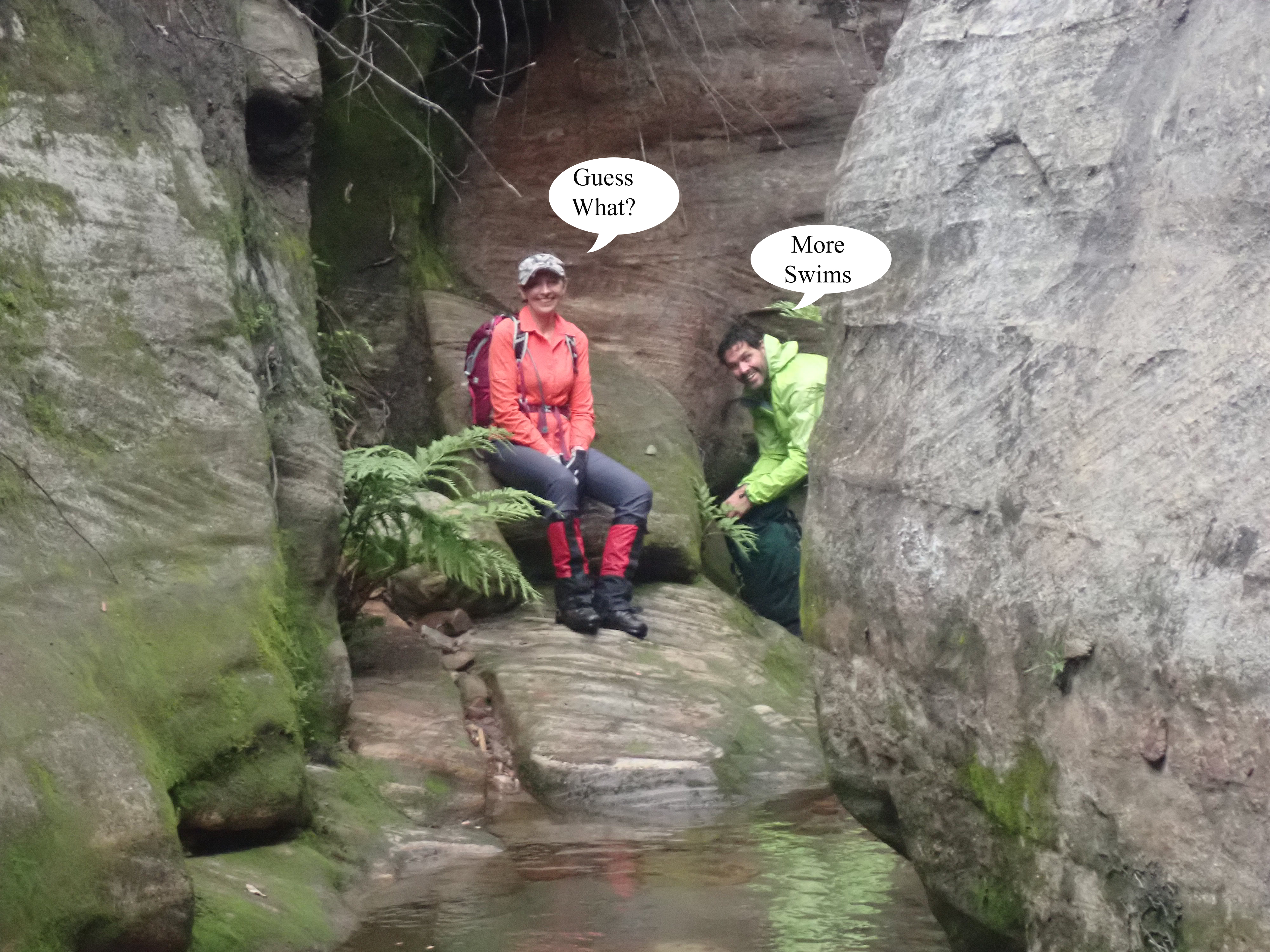
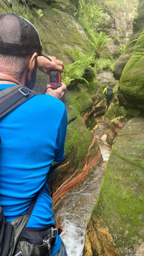
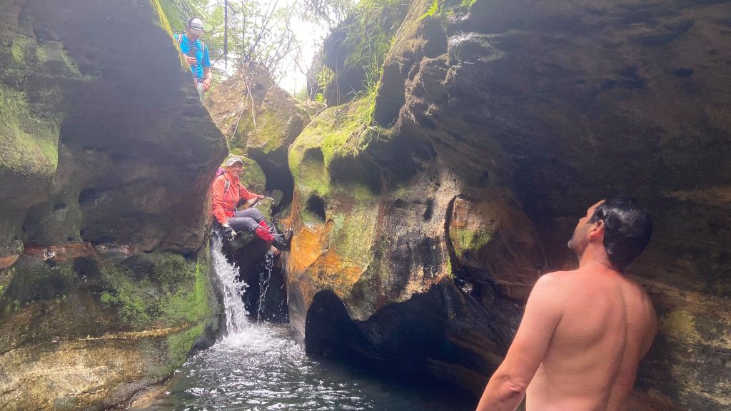
Dropping in
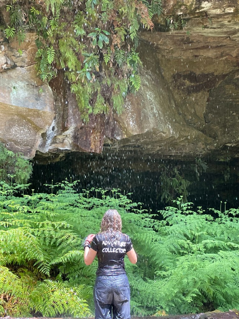
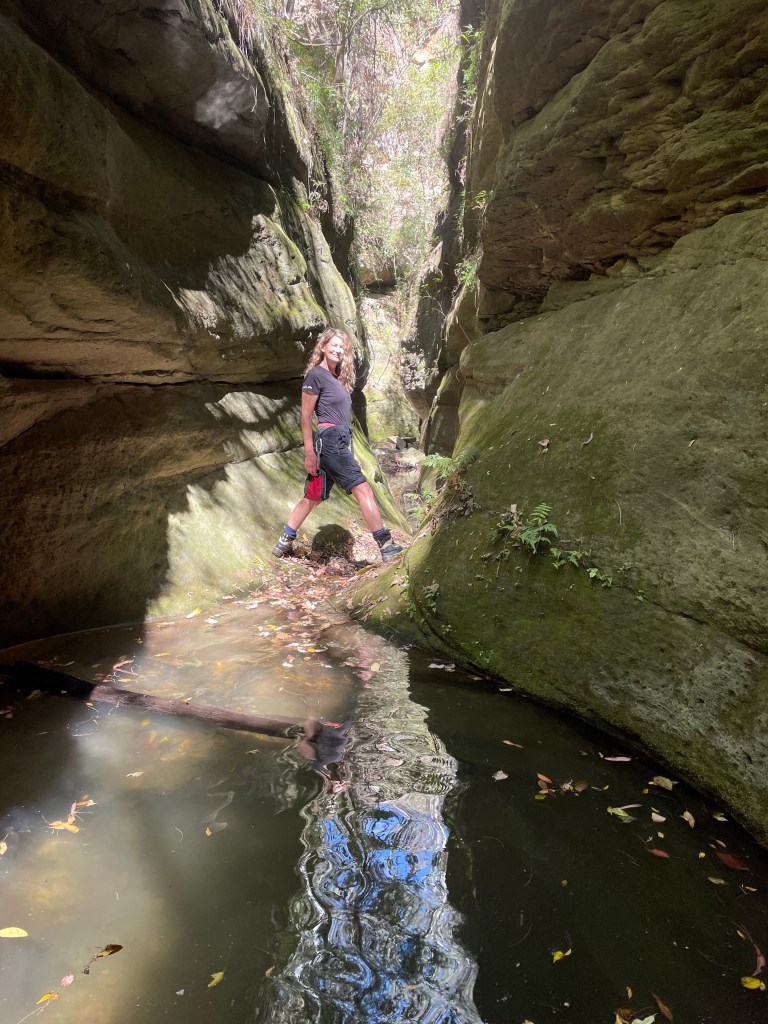
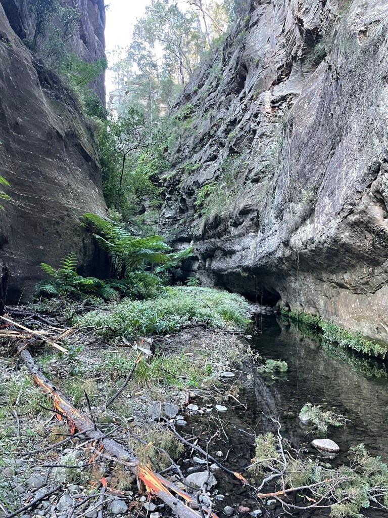
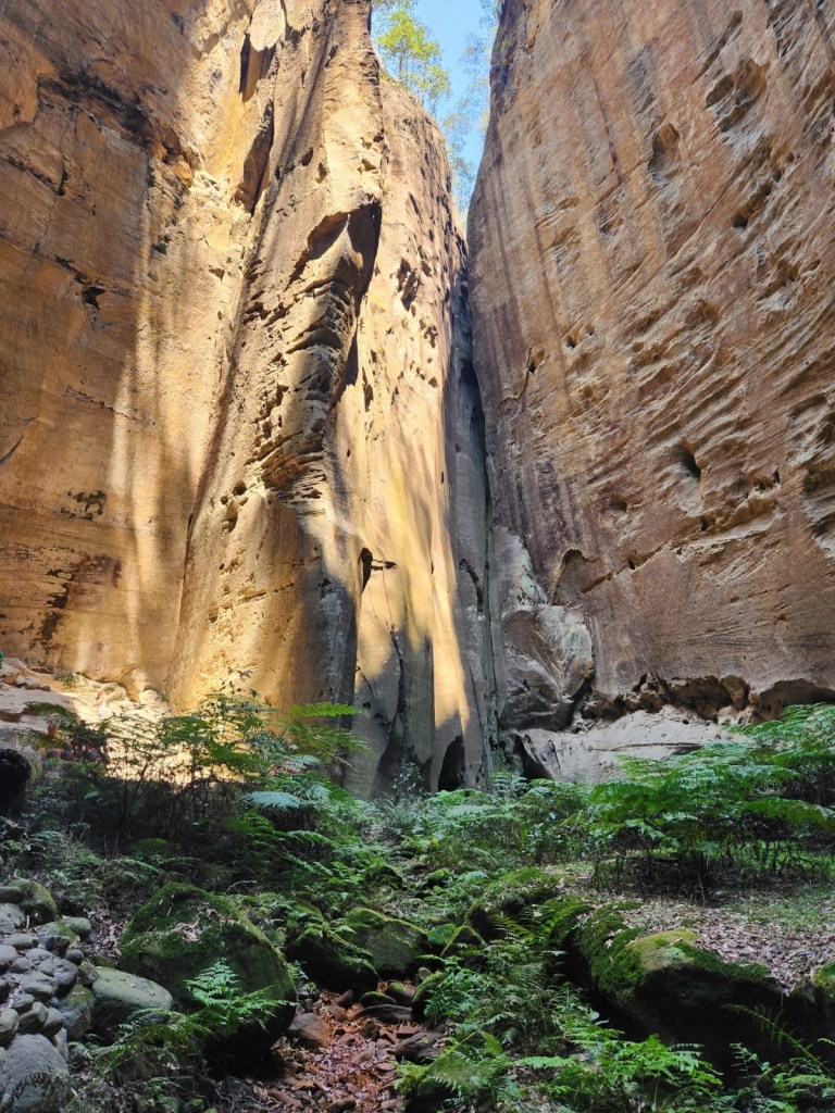
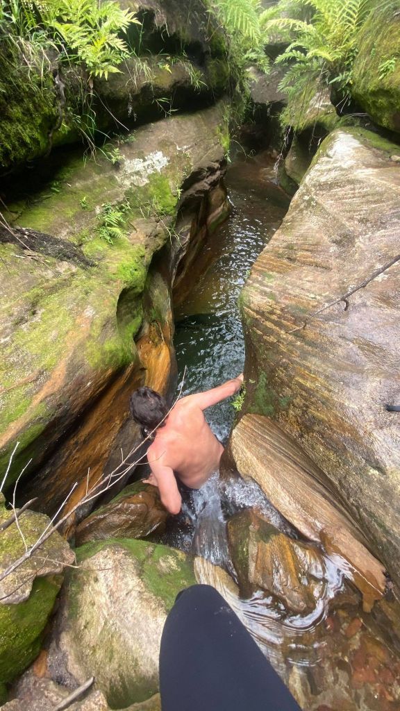
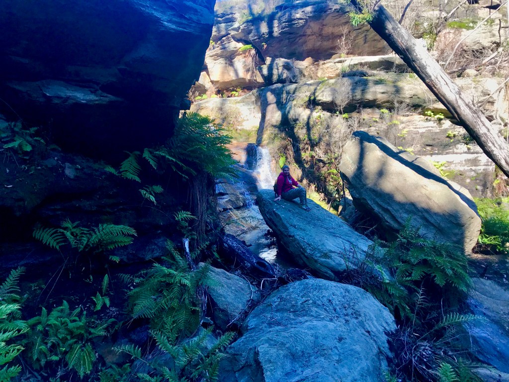
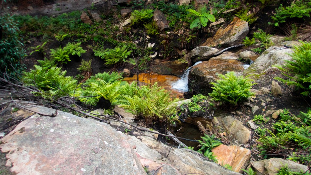
The water above the canyon was surprisingly warm.
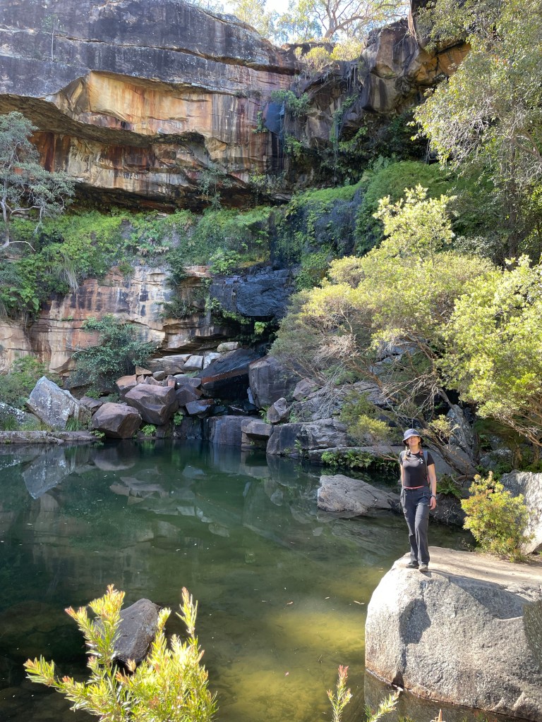
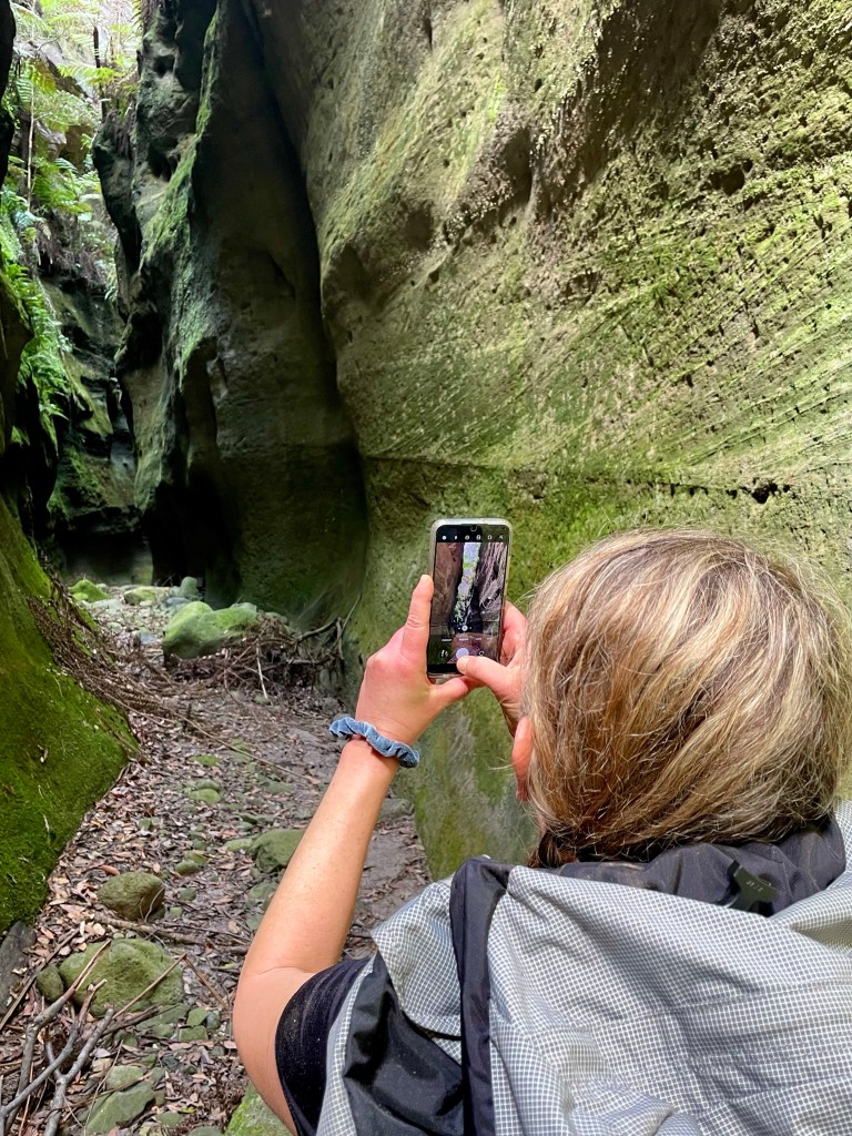
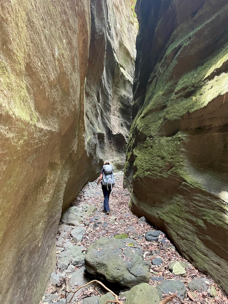
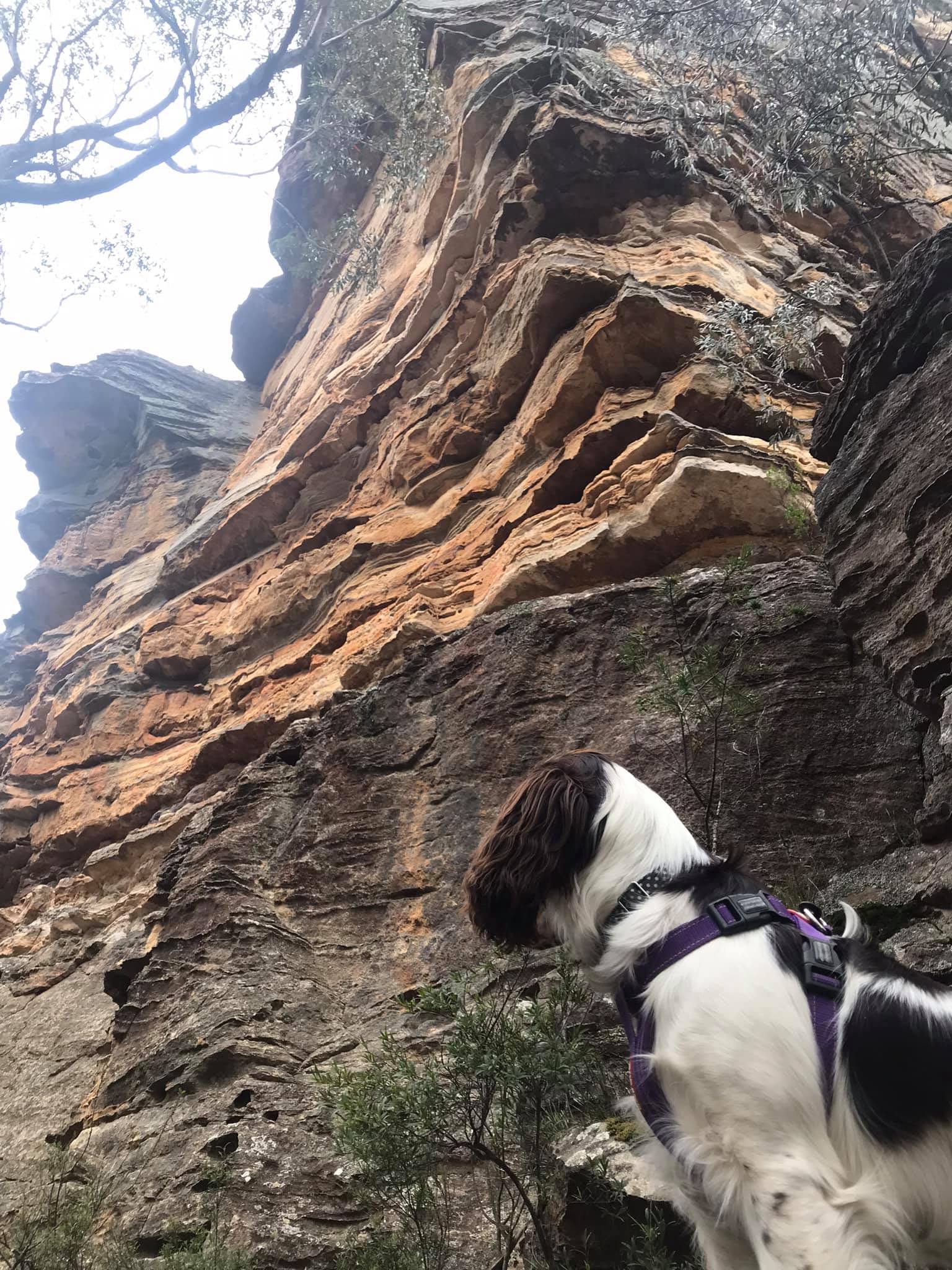
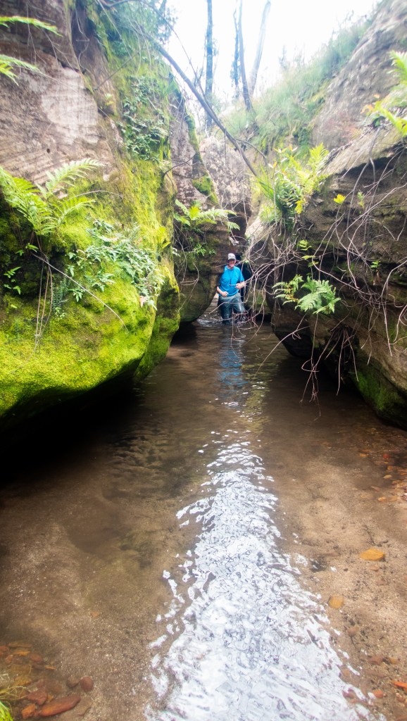
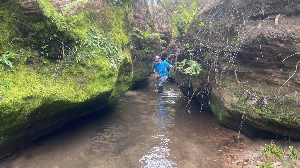
Gadget at the start of the good bit
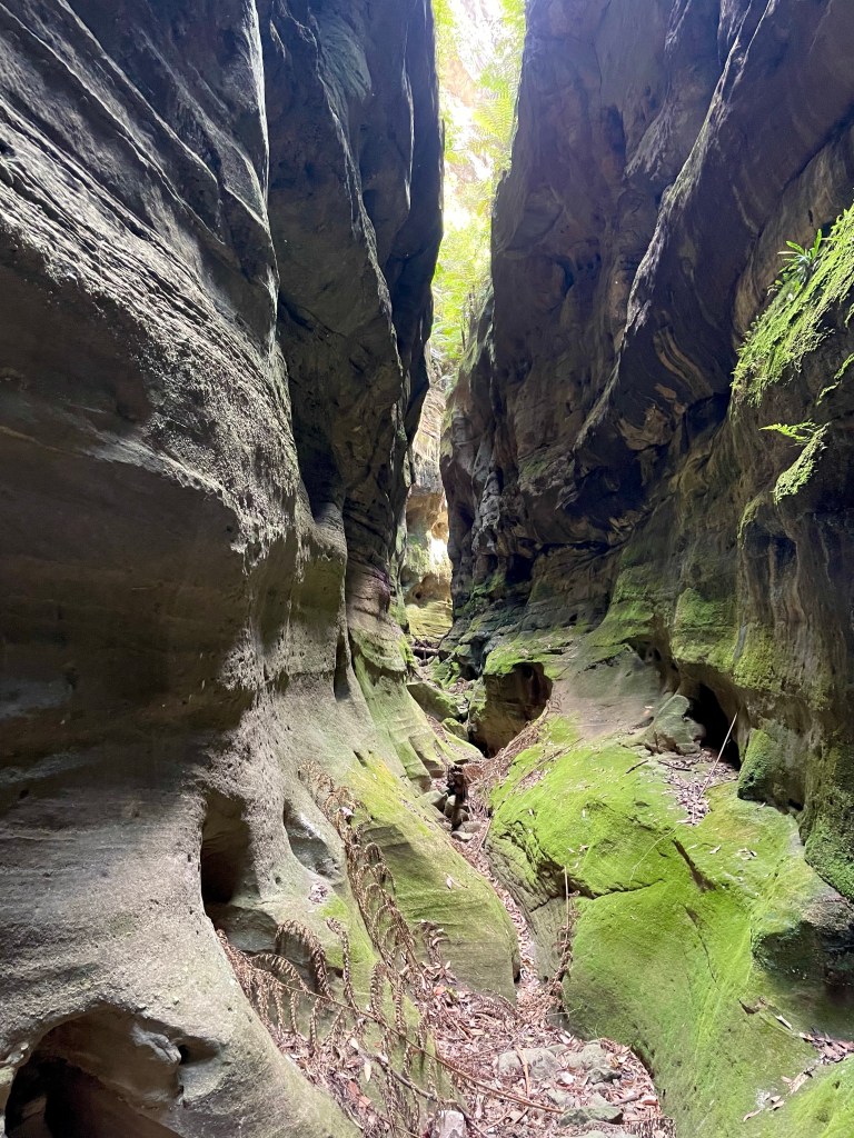
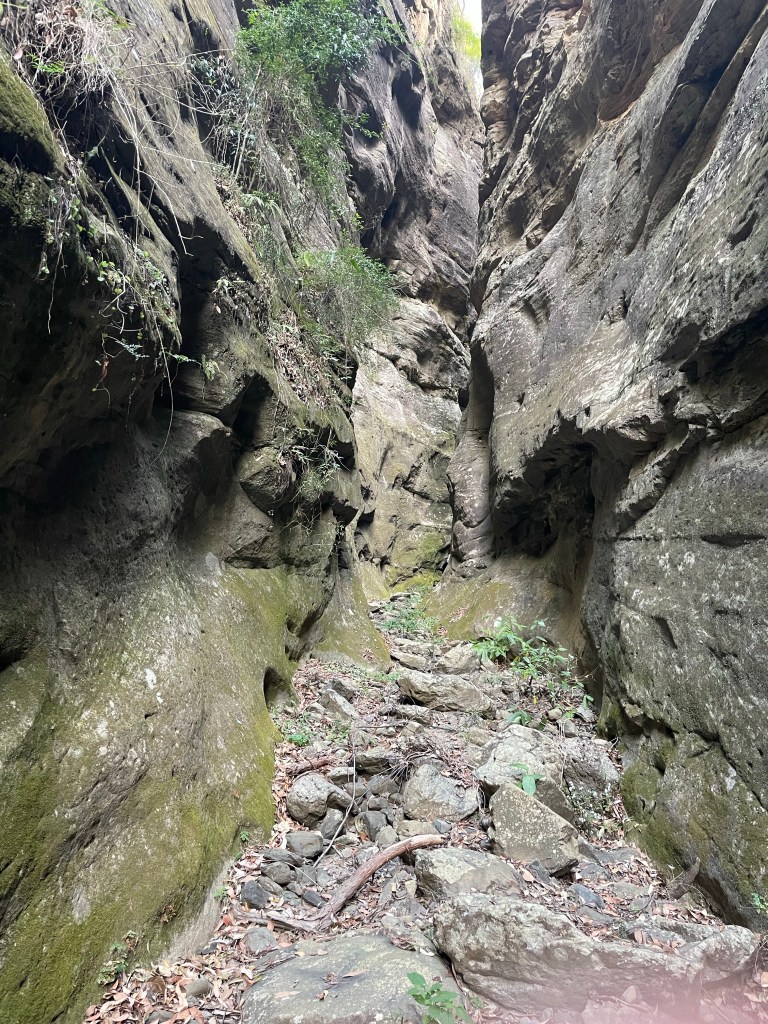
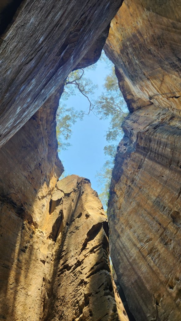
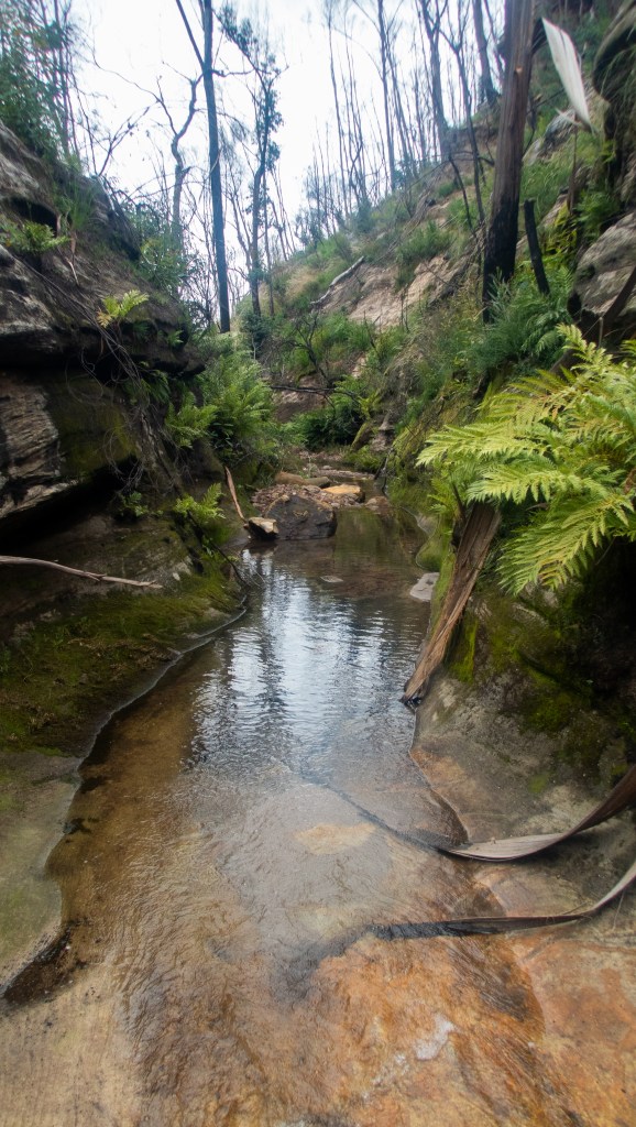
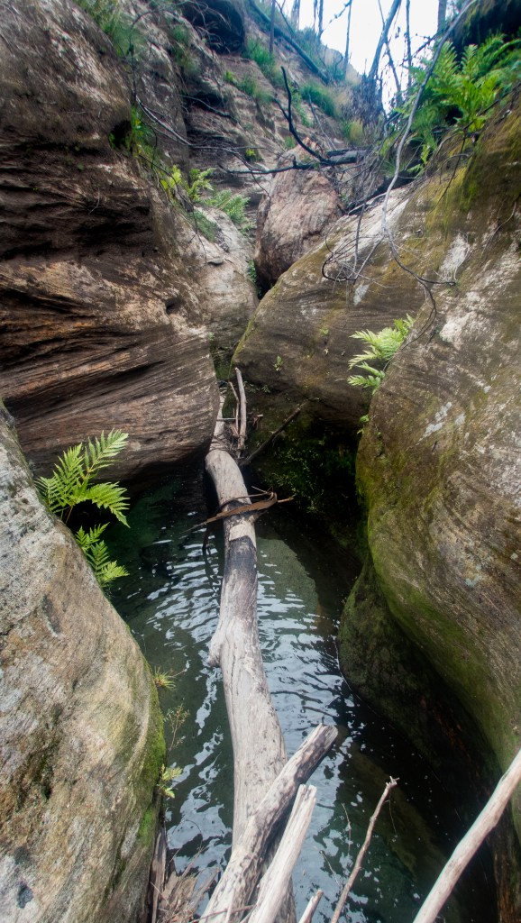
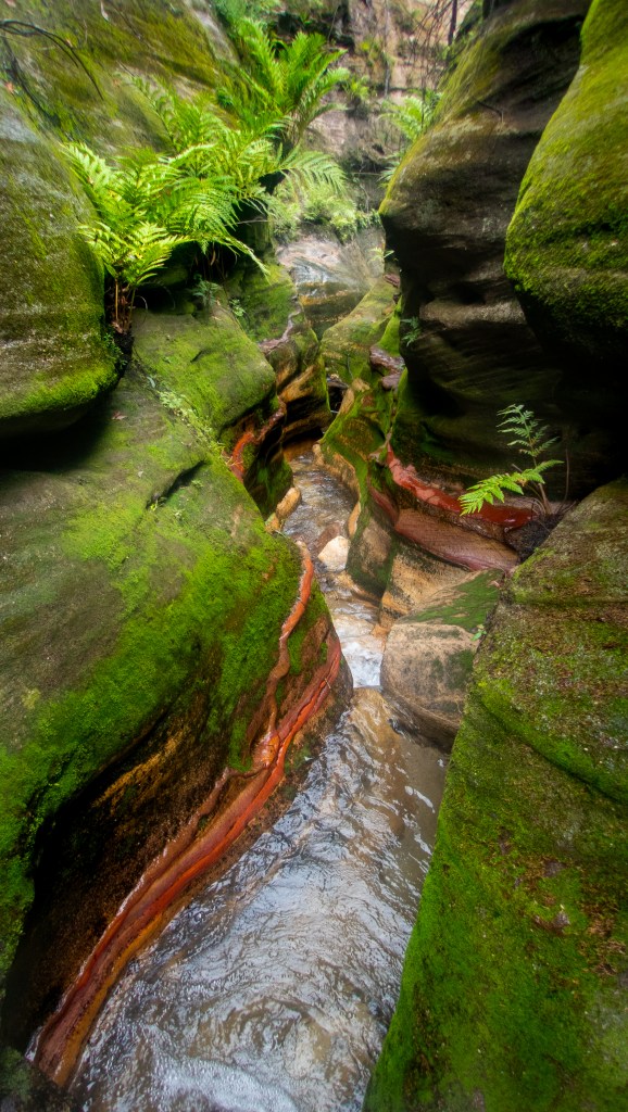
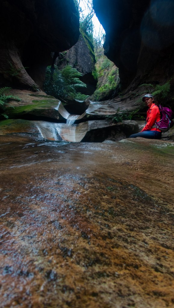
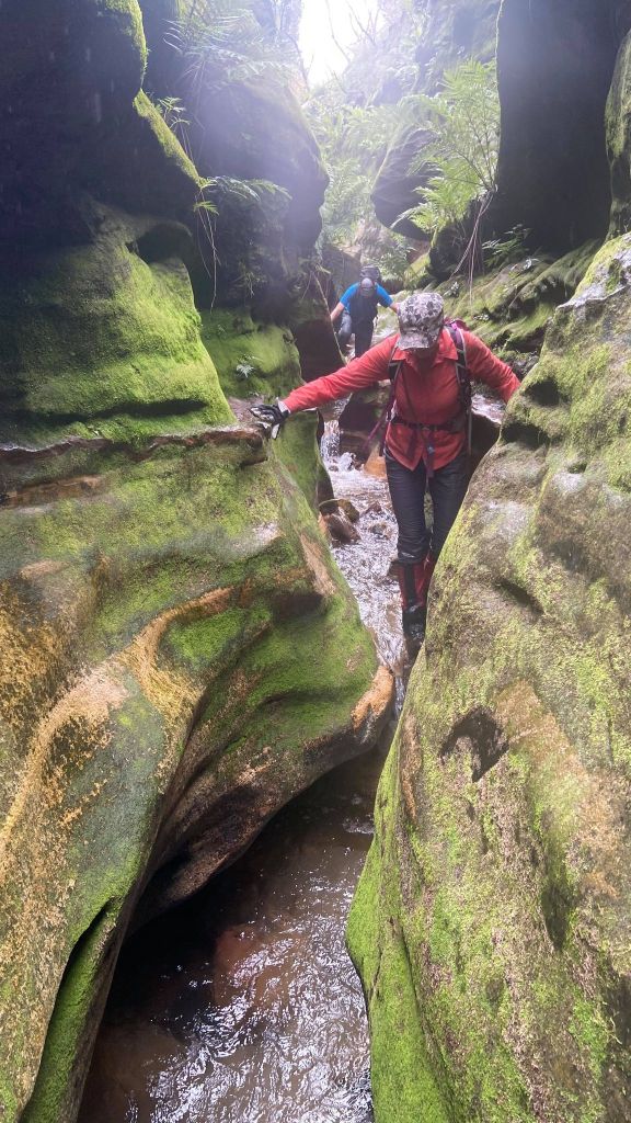
Bubblebath is a beautiful little canyon. It’s a bit underrated compared to some of the others. The late evning light didn’t do it justice but it’s one of the more beautiful ones out this way. “Mini Crikey”as Kylie called it.
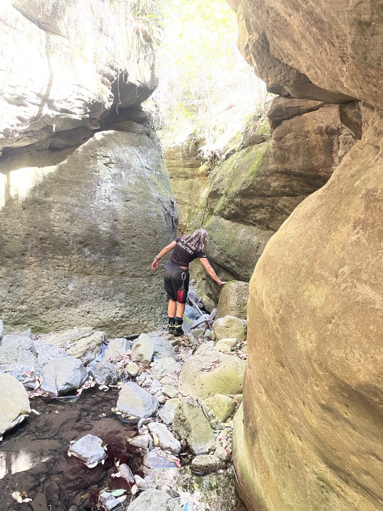
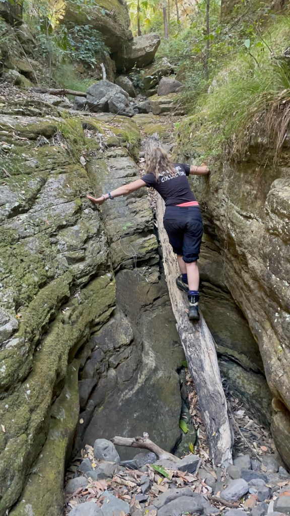
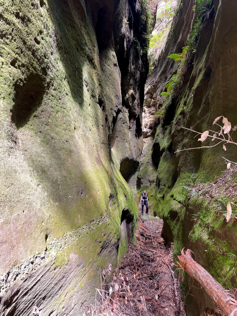
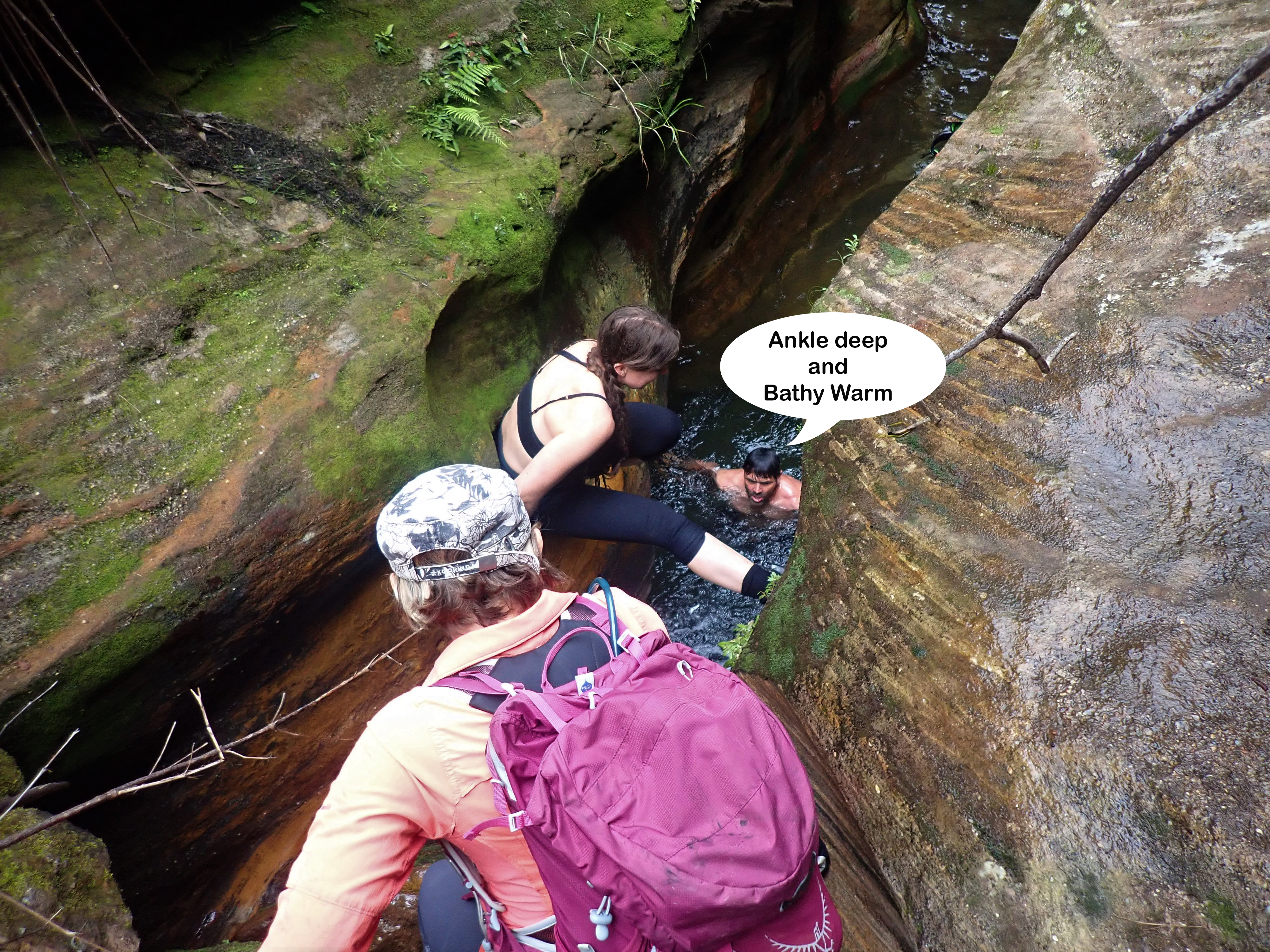
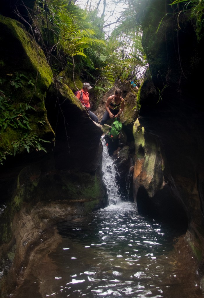
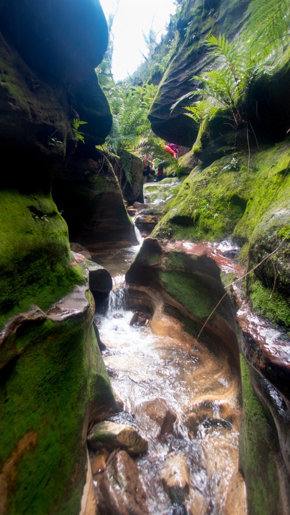
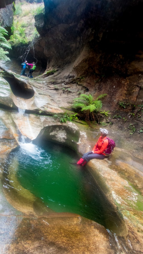
The deeper we got the colder the water got and we lost the light just before the end.
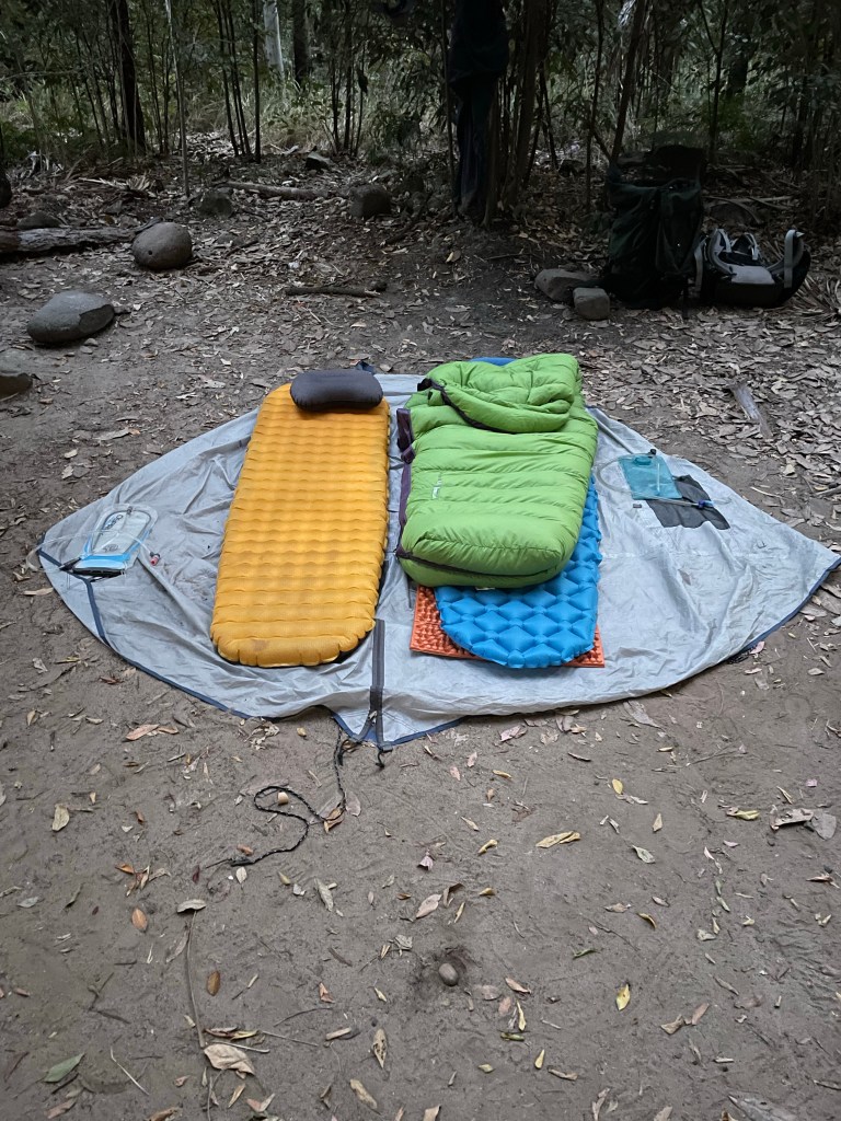
Getting to camp we rug up and settle in for the night.
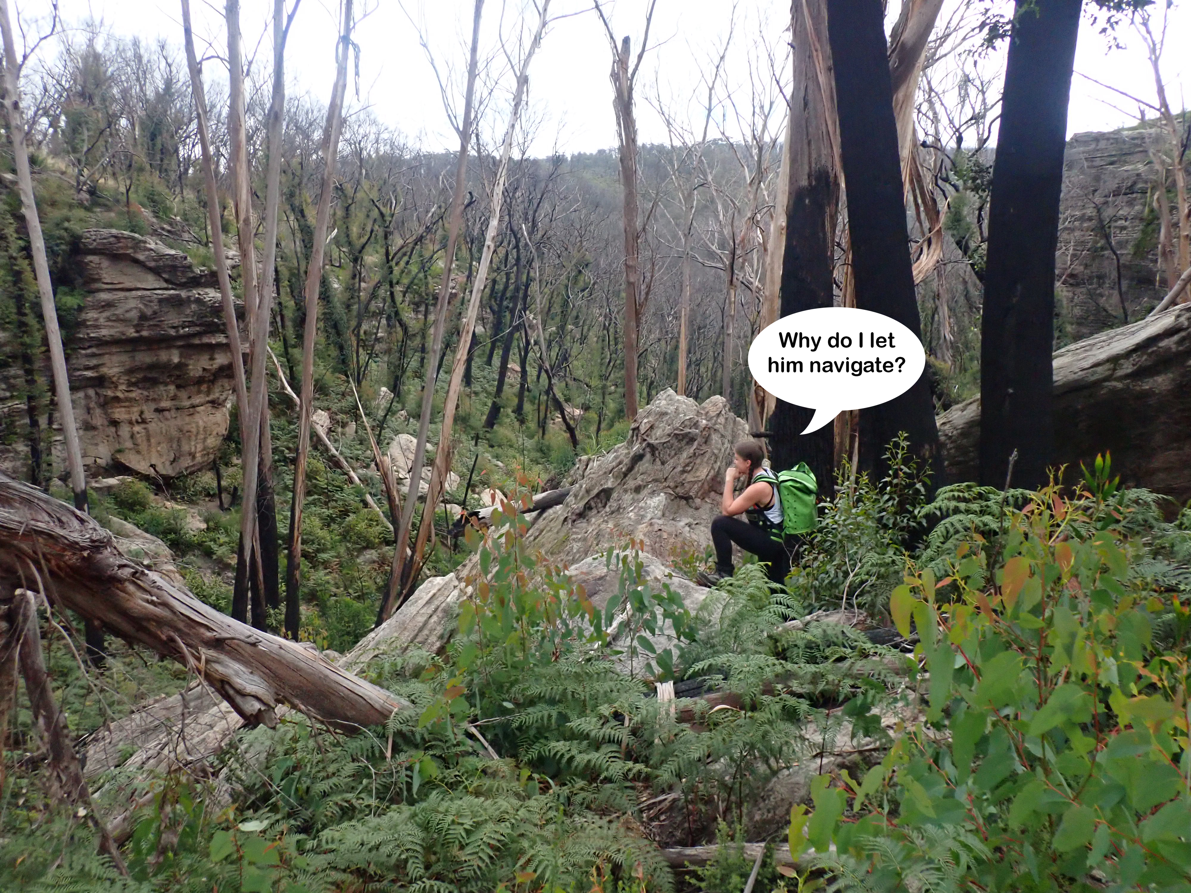
We had planned to head back up stream to check those promising lines on the map (which looked deep and dark from the Spur) but trudging up and down bloody Boowinda Gorge had left us battered and weary. The thought of bashing our way further up stream for more dry canyons had lost its appeal.
We decide to pack up camp and head back to the car to look for something wet.
Kylie had worked out Blackdown Tablelands were almost exactly between Carnarvon Gorge and Rockhampton so it seemed like a good idea to check it out.
A quick google show some beautiful waterfalls and plunge pools, though the latest posts said it was much drier than usual.
The park had also been evacuated the week before due to a fire in a neighbouring park but as luck would have it it was reopening today. Winning.
We jump online to try and book a camp site. Qld NPs do a great job at maintaining the parks up this way, walking tracks were family friendly with informative signs and toilets were plentiful and clean, but their online booking system is a PITA.
Anyhoo we eventually get it working and the whole camp ground is booked out!!!
Hmmm, surely if the park is just reopenning some of those people would have canceled or changed plans.
I eventually find a number to call and convince them to reluctantly take my money. We’ll take the chance says I.
If the camp ground is full we’ll find somewhere else and you can keep the $15 as a donation…
There’s 2 other groups in the entire camp ground as we roll in.
We check out a walk to another art site then set up camp for the night
Day 5
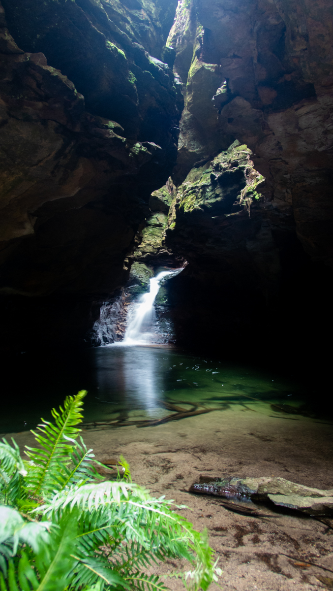
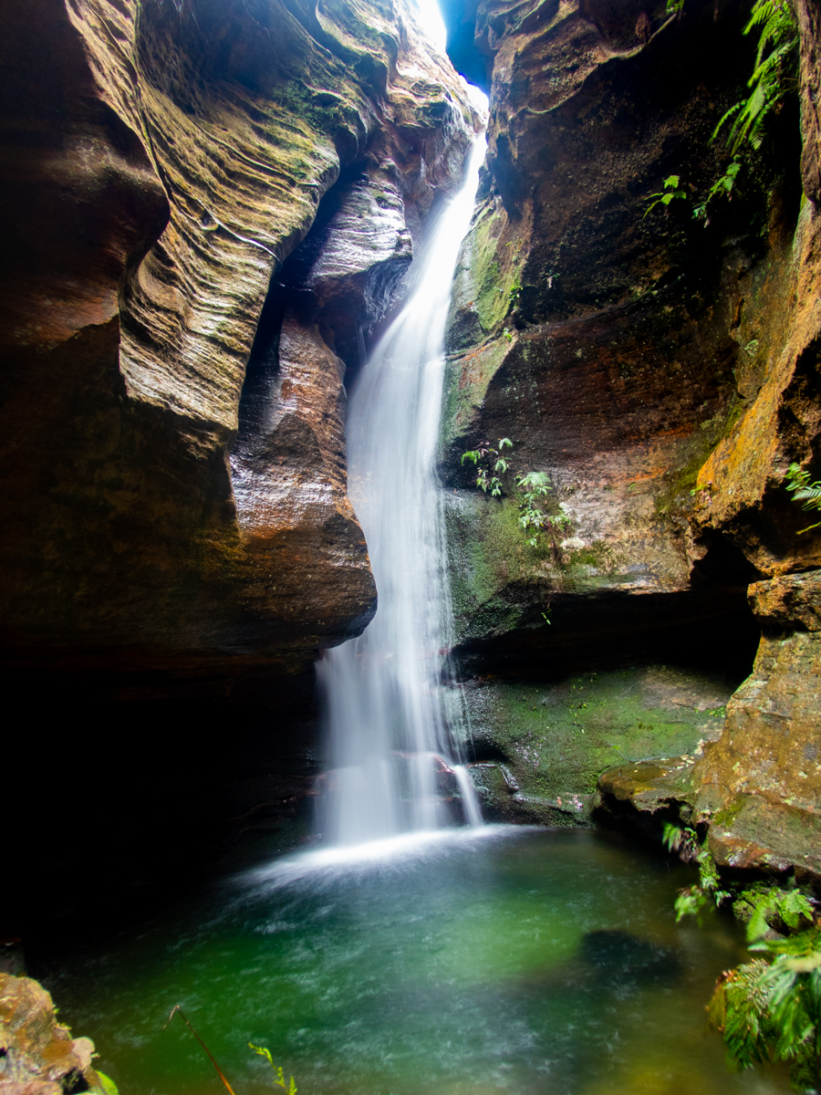
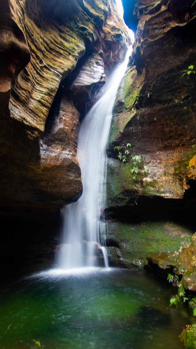
Apparently Gudda Gumoo is a seasonal waterfall and we’ve got it as it’s drying out Anyhoo we are keen for a look.
Heading down the tourist track we cross a couple of creek beds. They are as dry as uncle Geoff’s sense of humour.
But wait!
I hear running water.
A steady stream of water tumbles 20 or 30m into a large clear swimming hole.
A less formed trail heads down stream.
We follow it down and catch a glimpse of the usual instagram pot holes. They look dry.
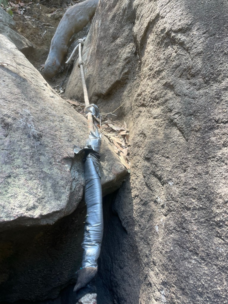
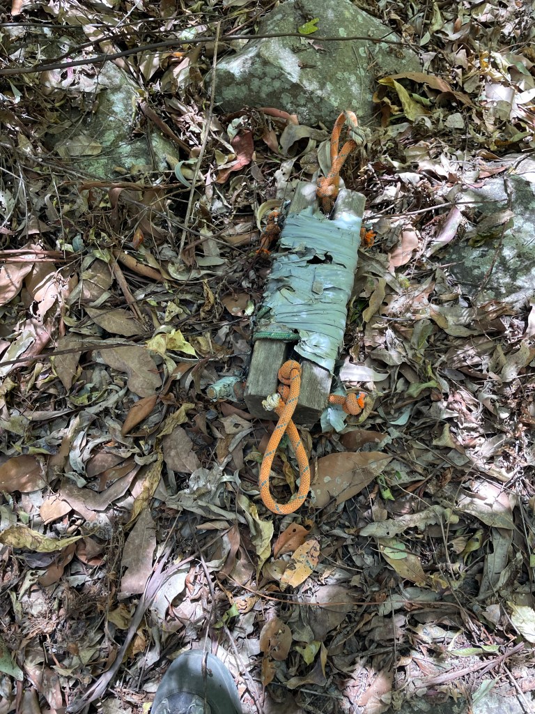
I’ve discovered Blue mountain anchors have a distinct lack duck tape.
And whatever this thing is
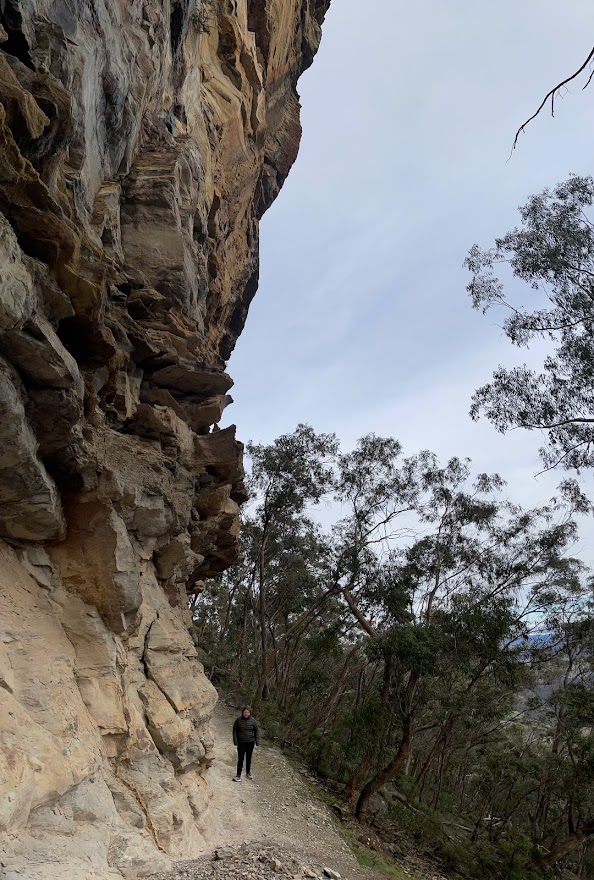
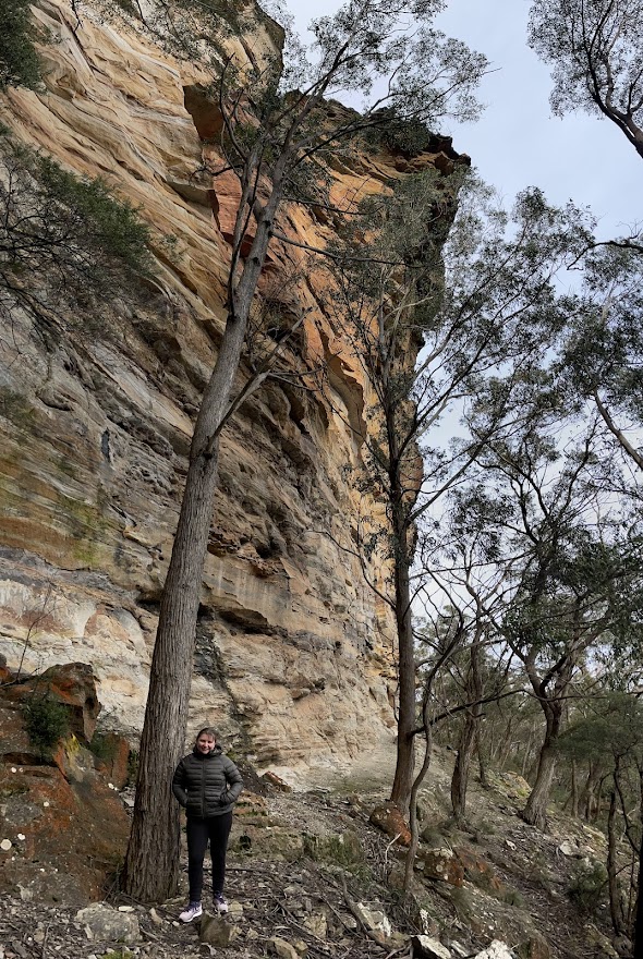
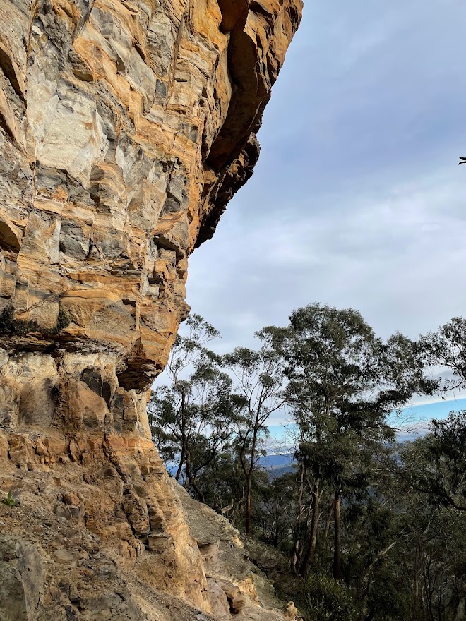
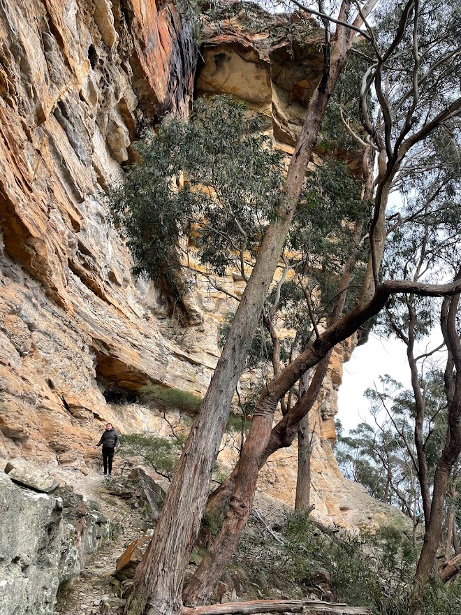
an even vaguer track continues along the cliff edge.
A couple of tracks head down to the various levels but we forge on. The track is now more a vague sense someone, or something has walked here before.
Finally a weakness in the cliffline allows a tricky descent.
Another very tricky scramble breaks the next cliff.
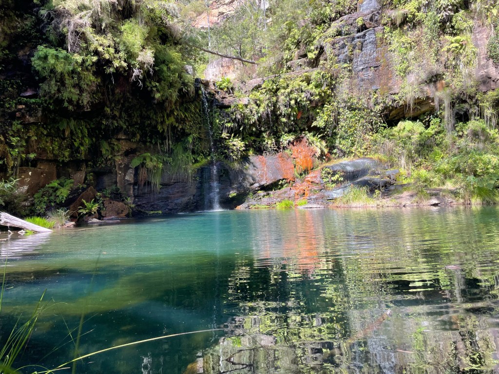
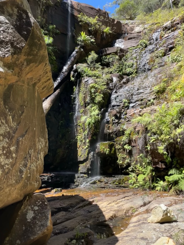
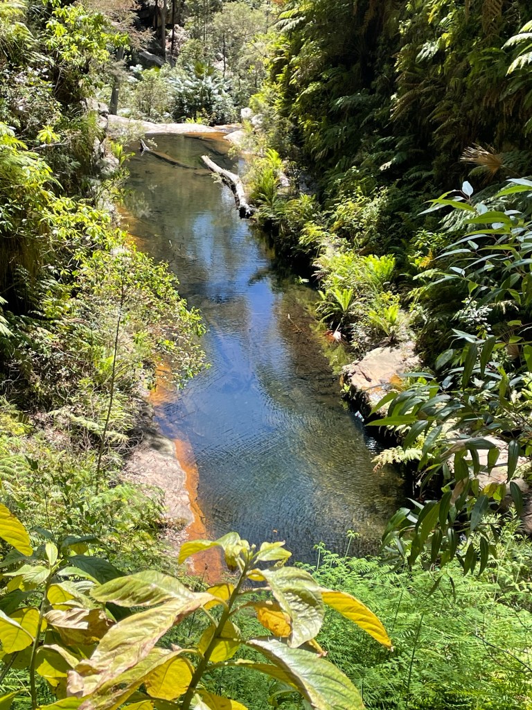
More secluded waterfalls and swimming holes reward our efforts
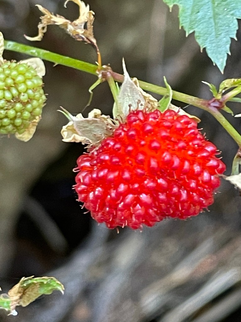
And yummy native raspberries
The valley has stepped down 20 or 30 meters at a time and it seems like there’s a hidden pool on each level.
We’ve made it down to one of the bigger shelves. Below us the arse drops out of the world
The water tumbles 100-150m down to another large pool. Below that we can make out another drop and another pool….
If this was anywhere near the Blue Mountains or Southern Highlands it would be a must do abseil trip. But it’s Queensland and well, Abseiling, stepping off track, not paying for a guided tour or wild swimming!!!
After a swim we linger in the sun and have lazy brunch before smaking our way back up through the cliffs to check out some of the upper terraces.
The locals have put some work in to get down to this one a couple below the usual ‘Gram shots.
And so ends our excellent adventure to central Q. L. D.
It been a blast and remember as Alice Roosevelt Longworth said…
Day 3 would see us back on the tourist trail for the most part. We’d planned to get up to Battleship Spur, nearly 600m above our camp, before the heat of the day. Then check out Boowinda Gorge and it’s side creeks
Both were listed as star attractions. The young couple we had shared camp with came back raving about how beautiful Boowinda Gorge was and a steady stream of people had made their way either up to or down from the spur on their journey along the great walk.
So up we go. The path up to the spur starts up Boowinda gorge but we don’t really take notice as we’re nervously excited about the haul up to the spur.
A side gully acts as a pass out of the gorge. It’s steep, reminiscent of the scramble out of Tigersnake canyon. but once through the lower cliff line a well maintained trail makes it’s way up and along an amazingly varied spur.
Think the Thuratt Spires with a tourist trail…
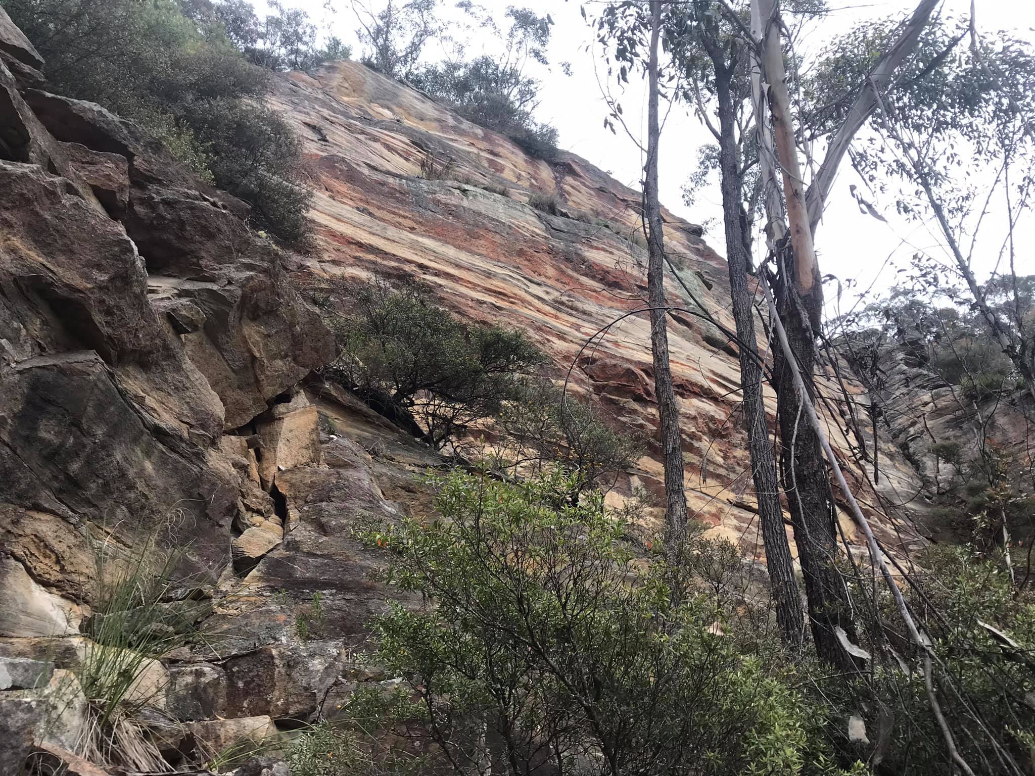
Wide open grassland alternates with almost razorback spur. Fine white sandstone changes to conglomerate and an out crop what appears to my uneducated eye as quartzite. Speculation around the geology distracts from the slog up.
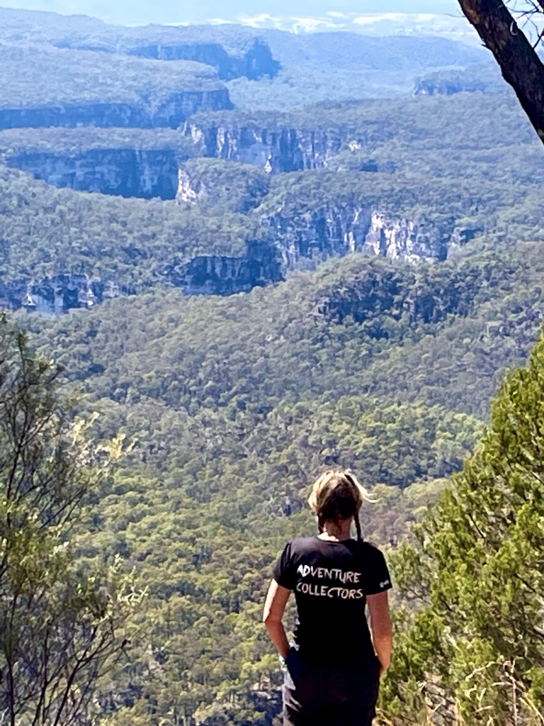
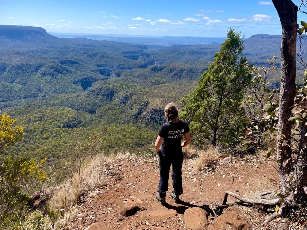
And the views from the top?
Worth every grunt and groan
Gadget looking back over the lower end of Carnarvon gorge. The mouth of which is 10km away and 700 or 800m below.
Now back down for lunch in the cool of Boowinda gorge.
Running on a high we start making our way up the gorge.
It’s a bloody soul destroying slog
Think of walking up the Wollemgambe. Only it’s dry as a nuns nasty and instead of sand it’s littered with baby head sized river stones. And the river stones haven’t been tumbled enough to make them smooth so they are jaggered. And they move beneath your feet. And the bigger ones give false hope with 3 or 4 holding firm then the next rolls just to mock your ankles.
Still so many Carnarvon glamour shot are from Boowinda gorge.
We press on.
Several times we consider just turning around but we’re a stubborn couple.
I guess the PC term would be “determined” but it was pure stubbornness (and a view of our white slot at the start we glimpsed from the Spur track) that kept us going.
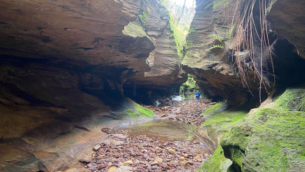
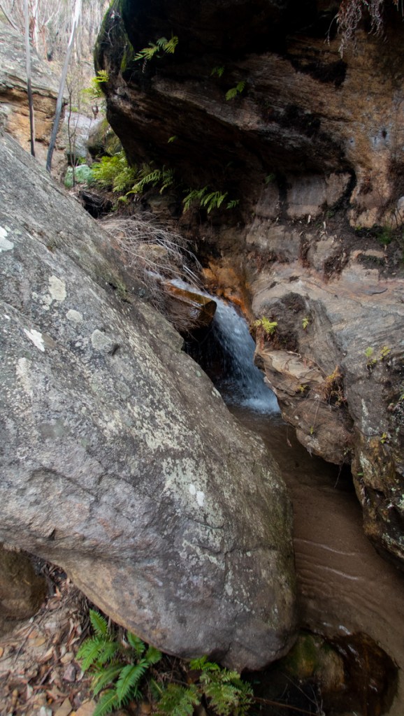
Finally we get to the junction towards the top of the bloody Boowinda gorge and by some miracle there’s clear running water. Not much but more than we’ve seen in the side creeks since Wards Canyon.
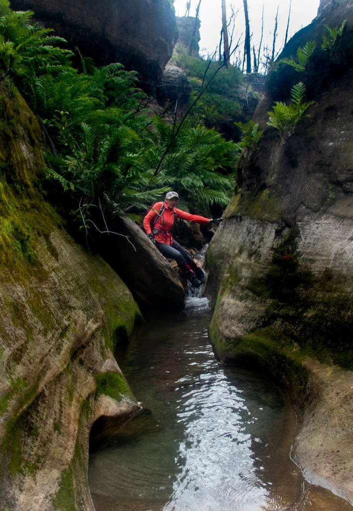
We take the right branch. It’s a low quality slot but it has clear flowing water. So there’s that.
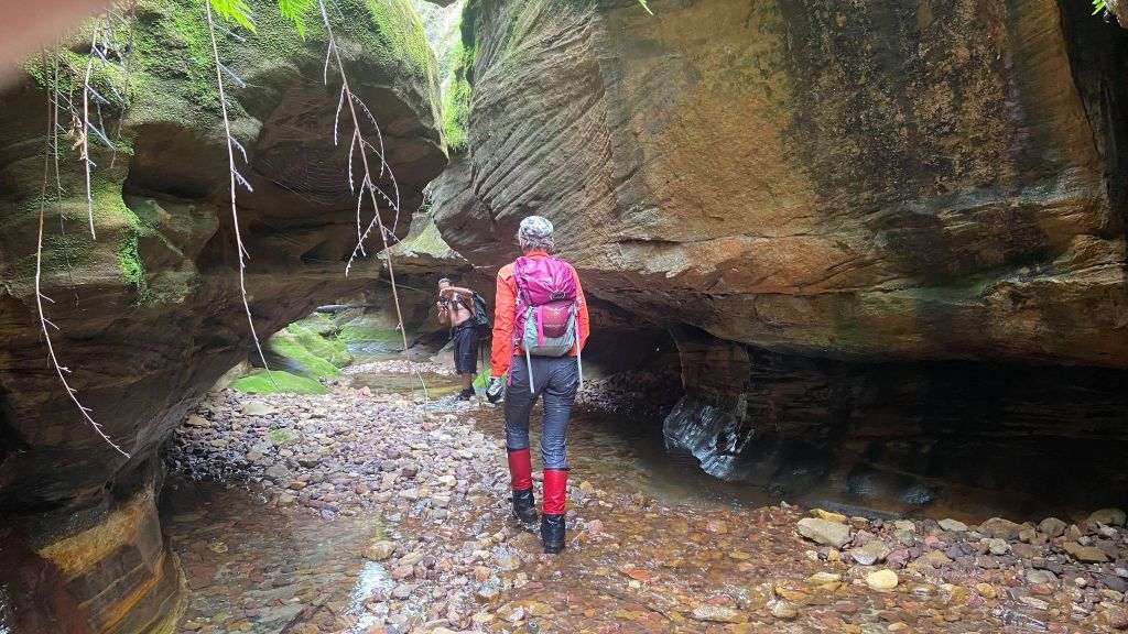
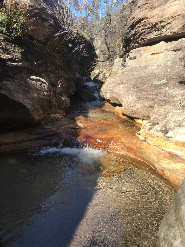
The water is far clearer than this shot implies but I was well and truely over this bloody Boowinda gorge to bother trying to photograph it well.
We get to a point we could have scrambled in from the top (It would have been much easier) but it got far too steep for us the reach the mysterious white walls a few hundred metres up the escarpment.
We retreat back and try the right branch. It was shit
We trudge back down and check out all the side creeks along the way. Some had canyons like sections but after the quality slot canyons of yesterday they were a major disappointment.
Back down past the Spur exit and I don’t know if it was the different light or just we were paying more attention but we had to admit the bottom was nicer than we originally gave it credit for.
Like, if you had never been in a proper slot canyon before you’d be impressed
If you are going to do Carnarvon gorge try a cooler month and hope for a good bit of rain in the days before you get here.
Finally out of what my mind I will always call Bloody Boowinda Gorge we paused for a bite to eat. All the trudging over loose river stones had zapped our energy.
It would have been easy just to return to camp but it was barely 4:30pm and there was another long gully about a kilometre down stream that had a name (At least on one map we had stumbled across) so we couldn’t help ourselves and went for a look.
The gully was scrubby and hard going but it keep promising to canyon up just up ahead. So we pressed on.
At least it was wet
We trudged on until we started to loose light and so left this intriguing chasm to its secrets and made our way back to camp.
Ever since my episode of heat stroke/ dehydration a few years ago I struggle a bit in the heat and yesterday was hot.
We plan a lazy start for day 2 and then some exploring.
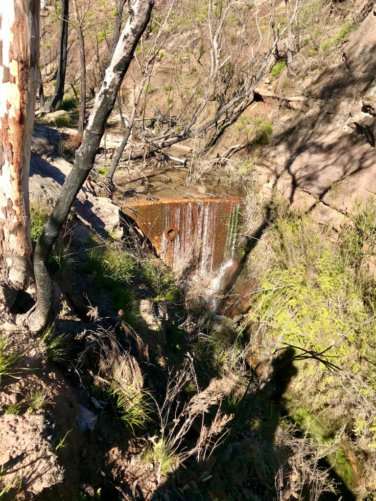
There’s a waterfall marked on the map, googling before we came showed some photos of a fairly shit looking waterfall but with the other side creeks being so dry we though we might as well check it out.
We boulder hop and scrub bash up stream.
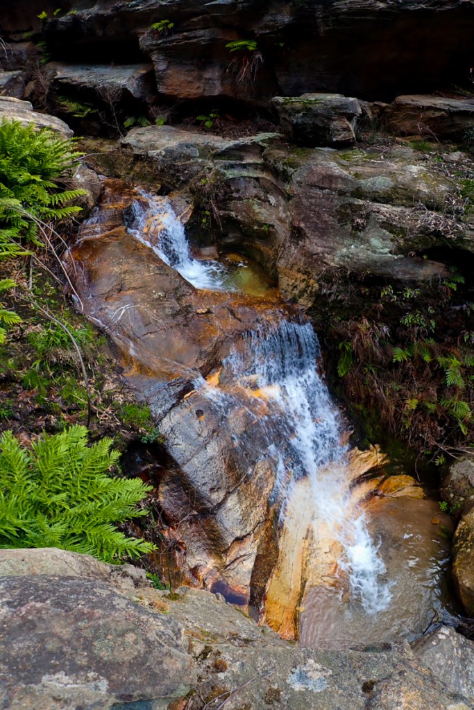
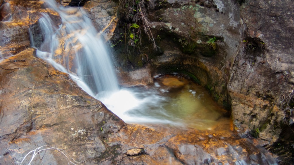
Canyon 6
The mouth of the side stream is bone dry, it’s not looking promising but we head up. A cool breeze comes down,then we round a corner and…
Bam!
If it had a couple of inches of water running down it would be a match for the section in Claustral between the Hulks Fist and Thunder canyon.
And it kept going
I wanted to call it Betty. Kylie wanted to call it Jon. Which is ridiculous. Everyone knows the correct response to calling it Betty is to call it Al.
You mean Al, says I
Jon, says Gadget.
What ever
Further up it had a Bowen creek feel. Only dry as an English backpacker waking up on Bondi beach in the noon Sun on New Year’s Day.
You could see by the moss that it had water recently.
The map showed this creek cuts its way up high up the escarpment but so far a few easy scrambles were all we needed to make our way up.
1 thing I learnt this day though was the location of the creeks on the topo were accurate. The contour lines in the gullies however, were a guess at best and complete fantasy for the most.
We made our way up a kilometre or 2 of slot canyon before getting blocked by a large chockstone. No shitty waterfall to be seen.
We could not believe several blogs had photos of the waterfall but we had found no hint of this anywhere. I guess bushwalkers use a pass up beside the canyon to access the falls and maybe as another pass up to the great walk.
We head back to the gorge and onto the next.
Canyon 7
Further up stream our next target didn’t look like much. A scrub bash into a wide gully. Then a gap in a side wall gave a hint of something.
I almost didn’t bother but I’m going to duck up here for a look, says I.
I’ll come too, says Gadget.
It’s a shallow canyon but it won’t go far. It’s running parallel to the main gorge cutting back downstream but going up…
It might not be as pretty as the previous one But again it is deceptive and just keeps going. Twisting and turning, cutting deeper into the walls.
It took a couple of sketchy climbs but we made it up to where it begins to open out and then retraced our steps to once more bash up the gorge
Canyon 8
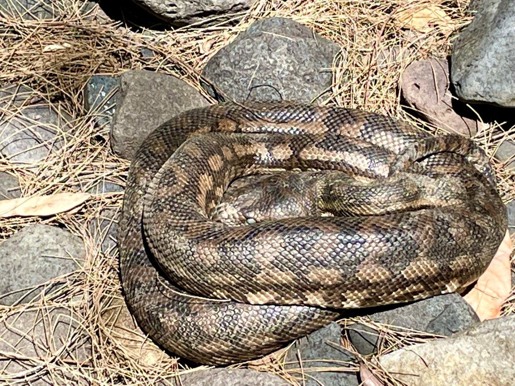
A beautiful big Carpet Python guarded the way. It’s curled up in the shade with a full belly getting ready to shed.
The next canyon started with promise
But a few hundred meters in we are blocked by a 8m dry waterfall.
There’s some promising looking lines on the map further up the gorge but it’s getting late and we are fairly cooked from all the boulder hoping. We decide to head back down to camp.
But along the way there was 1 gully we had skipped, originally planing to do it tomorrow. But we were here now so pop in for a look.
Canyon 9
Another dry slot canyon greets us
The map showed this as one of the longer ones on this side of the gorge upstream of the big bend camp but as tired as we were from all the boulder hoping in the heat of the gorge we were keen to see how far up we could push it.
More dodgy scrambles/climbs were needed. We took a bit 3mm amsteel rope as a hand line to assist getting back down.
Finally we couldn’t get any further up so made our way back to camp content with a big day in the heat.
We make our way back to the camp ground and park in the over night car park.
Our plan now was to hike up to the remote camp ground at the Big Bend , a bit over 9km up the gorge.
Along the way we’d do the side trips to the touristy stuff.
It was already 35°. We stock up on water.
Canyon 4
The Ampetheter.
Is it a canyon? I don’t know
Is it touristy as all hell? I don’t care.
I was pretty keen to see this one. It’s just off the main track.
It’s a short but impressive slot
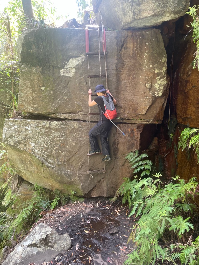
Kylie climbing the ladder access
A short but impressive Hall leads to an otherwise enclosed chamber
Back on the main trail we head up stream.
The next thing on the tourist map is Wards Canyon. Just before it is a break in the cliffline and a small stream, the first we’ve seen with clear water.
And if you are good at spotting trails you may spot a vague track leading up beside.
We dump the packs and go for a stickybeak.
The soil is the finest white sand I’ve ever seen. Almost as fine and white as the cliffs towering above.
The trail continues up but it’s a wide gully. I guess it’s used as a sneaky short cut up or off the great walk or sumfink, we head back to the trail
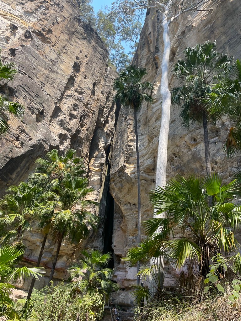
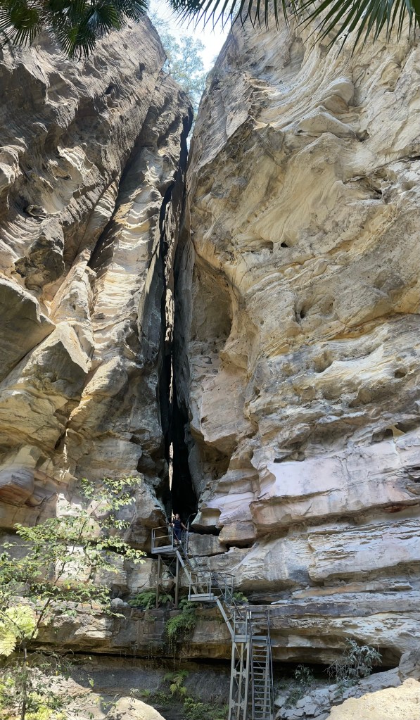
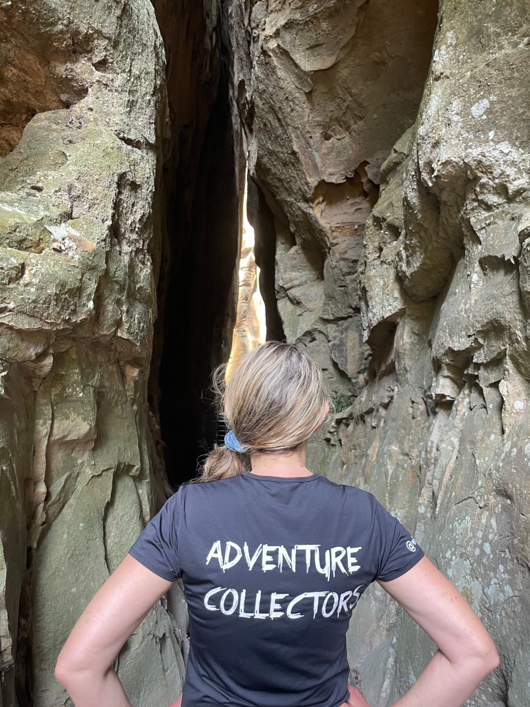
Canyon 5
Wards Canyon.
Wards canyon looks like the most adventurous canyon in the lower gorge. However you can only access the very lower bit. I think tour company’s might run trips through it so it might be worth applying for a permit
It’s pretty and hosts the only known non-coastal population of King Ferns, Angiopteris evecta, in Queensland.
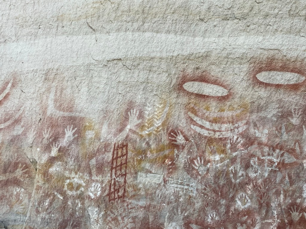
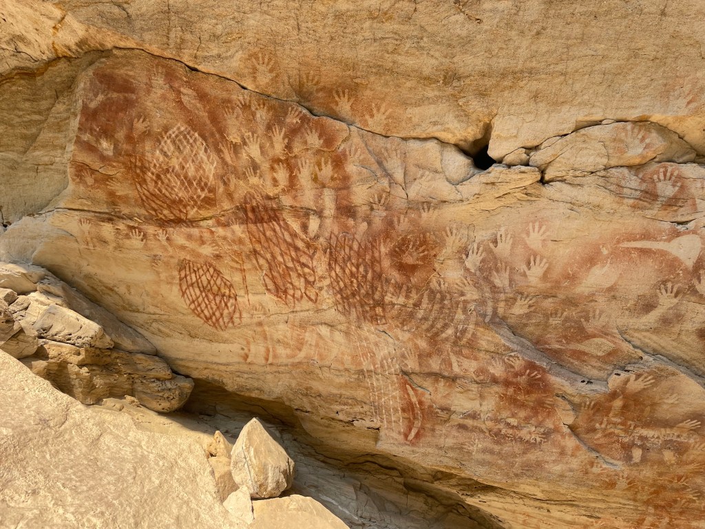
The Art Gallery
I couldn’t find the indigenous name for the art cave which is a shame. It looks like it was painted yesterday but archeological studies found evidence it’s been in use for at least 3500 years, sites just over the hill date to 19,000 years.
And on we go.
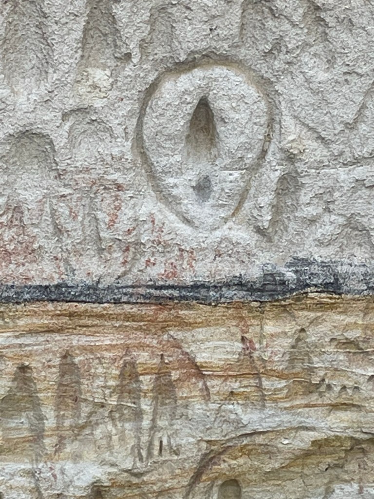
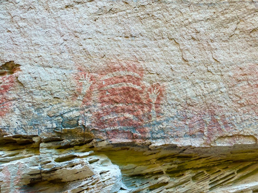
Pitjara Cave
It has another name on the tourist map but this is the name on the old topo. The art is top notch.
And finally we make it all the way up to the camp and stumble into one of the only semi secluded spots at the camp. Winning!
We haven’t done a huge amount of Ks, probably only 15 or 16 but it’s bloody hot so the myriad of No Swimming signs at such a beautiful hole were a little soul crushing.
Access: Easy access to the start of the trail then steep and vague in spots
Navigation: Navigation is fairly straight forward .
Map: Lithgow
Time: It takes about 1.5hrs
Traditionally known as Gnallwarra, Hassans Walls was named by Governor Macquarie who thought the stunning pagoda topped cliff line reminded him of the hill forts and Hasanamba temples of the Hassan district of India.
The Under Cliff track began construction in 1916, Largely the work of Richard Merrick and the Lithgow Progress Society, and stages were added over the years.
It largely fell into disuse but was reopened for a short time in the late 90s or early 2000s before being closed by council due to concerns over the stability of the cliffs above (I think a cliff collapse may have taken out part of the trail so be warned or whatever)
Its a shame because its a great walk under some spectacular coloured cliffs with little alcoves of rain forest hidden in the nooks. Just beware of falling rocks, small and large.
Getting there: Head up Hassans Walls Road. Before you get to the top there is a spot people park on the right near the imaginatively named “First lookout”. Park here and look for a road angling back up to the right.
Most of the gullies between here and the lookout will give access to the track but head up to the right passed the locked gate.
But for a more adventurous start keep heading up the hill. Take the left fork at the top of the hill and the next left fork as well.
The road dips down into a saddle, just before the bottom it flattens out. Head into the bush here and find a break in the cliffs to the right of the main gully (main gully cliffs out) https://maps.app.goo.gl/NyPxTjhz5dGzcgQZ9
Alternatively go to the bottom of the saddle and just before the road climb up the other side go left into the bush and find a break to the left of a great lookout. But note the undercliff track is vague at the point.
Once through the cliff line follow the base of the cliffs around to the left. The track can be vague in spots but if you loose it follow the base of the cliff and you’ll eventually pick it back up.
The colours of the cracked and errored cliff line is stunning in afternoon light and you will find small pockets of rain forest in their shadow, unfortunately the biggest section of rain forest is below the car park of the lookout so littered with shopping trolleys, toilet paper and other crap shit humans throw off the top.
Eventually the track will take you around King Georges head ( AKA Indian Head or Iron Dukes head) and it appears to peter out. But continue around and head up the ridge keeping near to the base of the cliff and you will pick it up again on the otherside of the lookout.
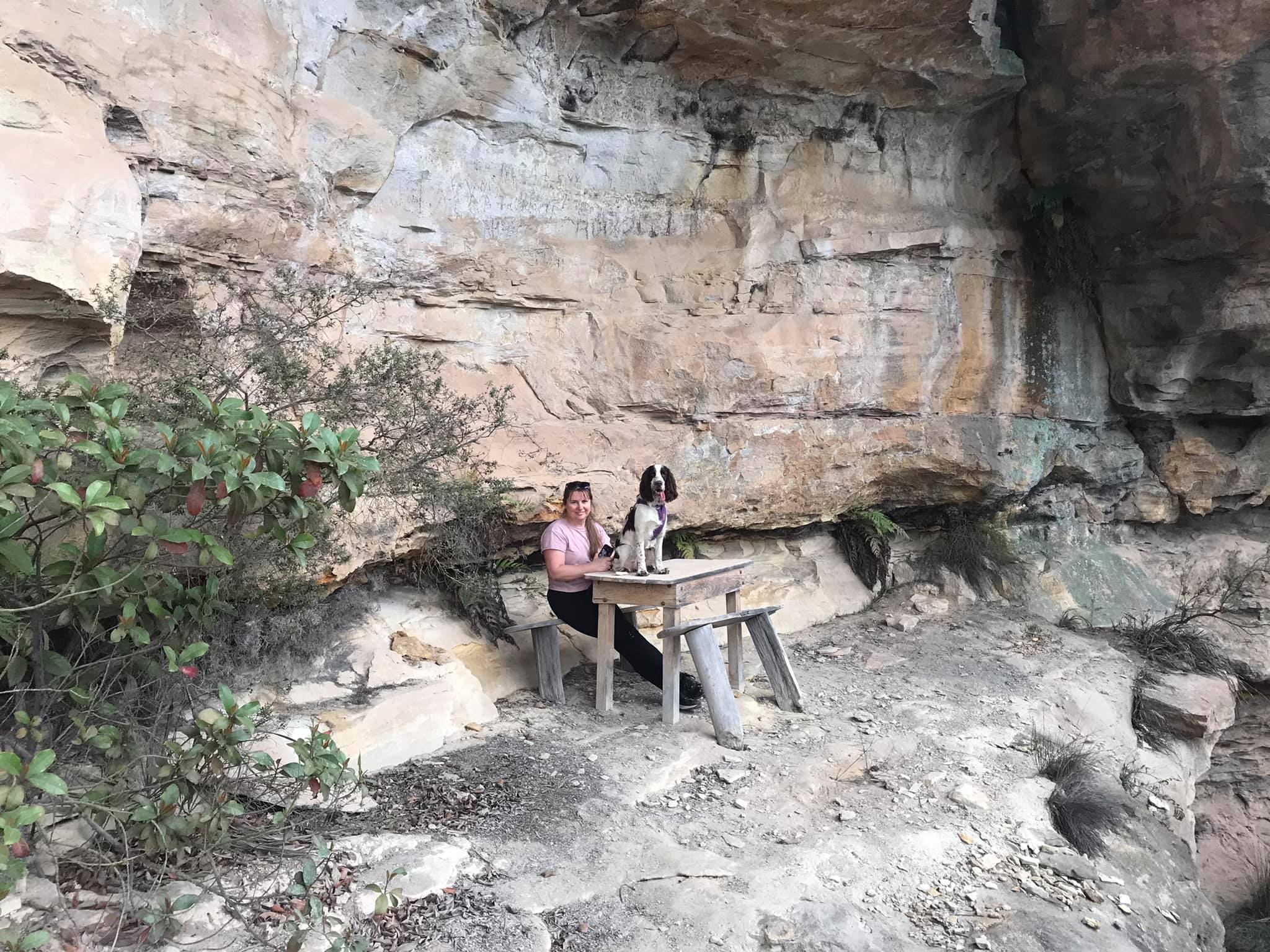
This will bring you past the table and chairs in Gannon cave before winding back up to the road near the turn off to Hassans walls Lookout. A short walk down the road will take you back to the car
Note 1: Taking care While reasonably well known these spots are still wild places and care needs to be taken around cliff edges and on the steep trails. Carrying the right gear as well as having adequate food, water and clothing is important. Always tell someone where you are going and when you expect to get back.
Emergency beckons (PLBs) can be hired from Katoomba Police for very little.
Note 2:First aid A basic first aid kit is essential bit of kit whenever heading into the Aussie bush. A basic first aid is highly recommended
Note 3: Maps and Navigation Having the right map, a compass and knowing how to read them is very important when heading into the bush. If you are new to bush walking joining a club or accompanying more experienced walker for you first few outing is a very good idea. I found practicing map reading on well defined trails was helpful when I started out.
The Maps mentioned are the 1:25000 series. They can be purchase at Lithgow tourism information center, from outdoors shops or online for around $10 each.
Note 4: These are wild and beautiful places, respect them. If you are able to carry something in you can carry it out. Don’ be a tosser. Leaving your rubbish behind is a sure way to ruin it for every one else.
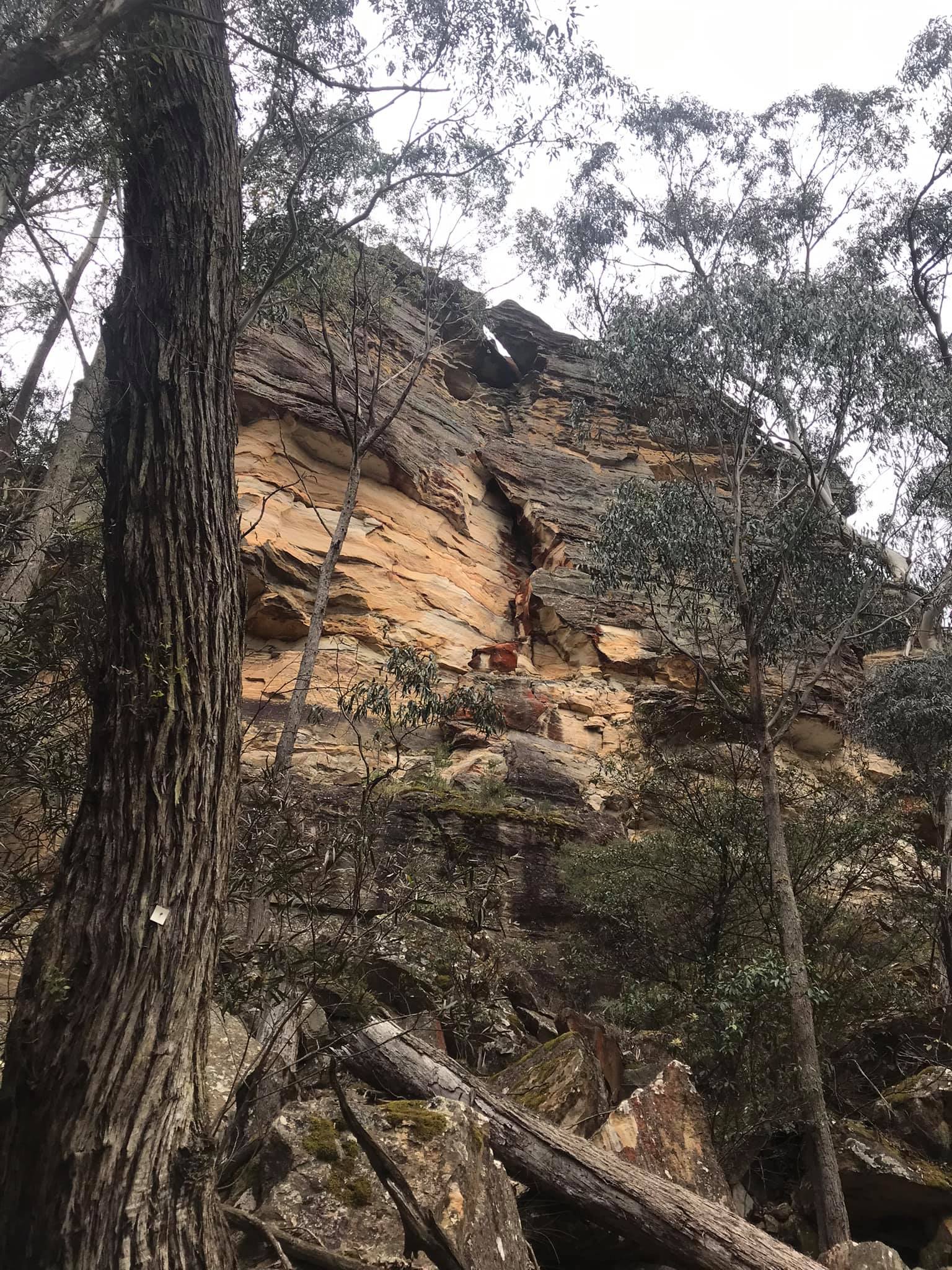
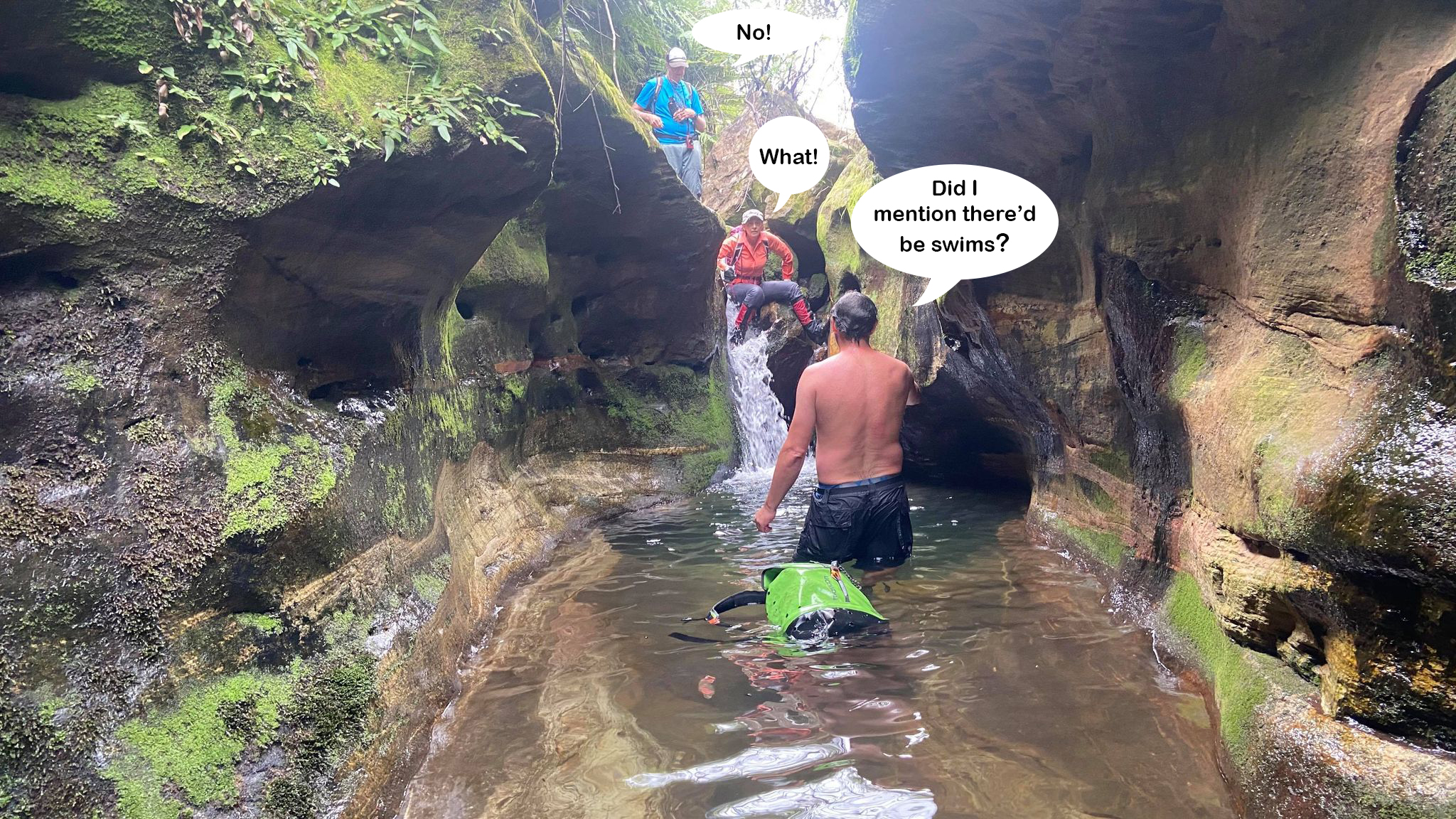
So I wanted to checkout a couple of small, less visited creeks in the mountains. The above mentioned legends joined me. I had a tip one creek had a small canyon section but I wasn’t expecting much. We packed ropes just in case. We didn’t pack wetsuits….
The creek contained two small, but very pretty canyon sections.
Our original plan was to continue down through the clifflines then skirt around and walk up another creek. But changing plans is what we do the bestest
I reckon the gully might give us a short cut over the ridge, says I
Lets do it, says Madie
It would save a couple of kilometres of creek walking, says Marcia
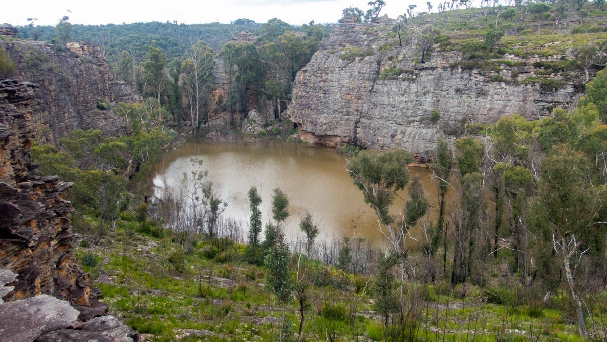
Many years ago I came across a video of a little lake that had formed in Goochs crater and and ever since I have wanted to see it in the same state . \
Many times Mandy and I have headed up in the pouring rain in the hopes of witnessing this rare phenomena (Do doo be-do-do) without luck
Now here I am looking at a photo of it full
As soon as I can get out of work I do
Grab your shoes, I say to Mandy.
I have to work this afternoon lets’ do it tomorrow
Oooooo. But it might be empty by then. pouty face.
Take Tal
Woohooo.
We head on up, anticipation grows
What will we find? will it blow my mind or disappoint me a again?
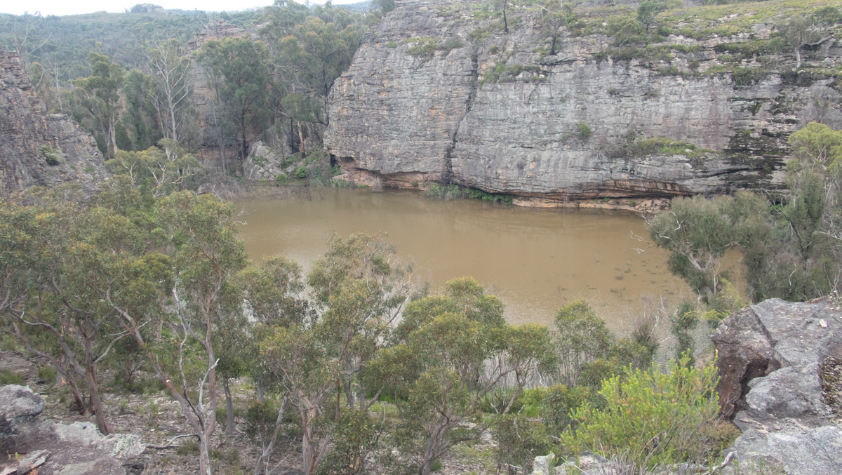
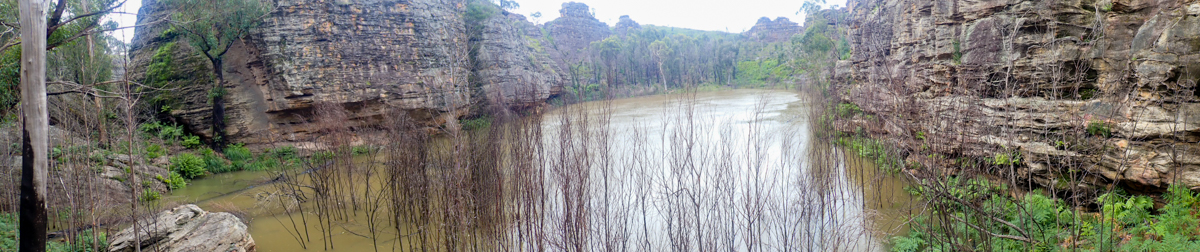
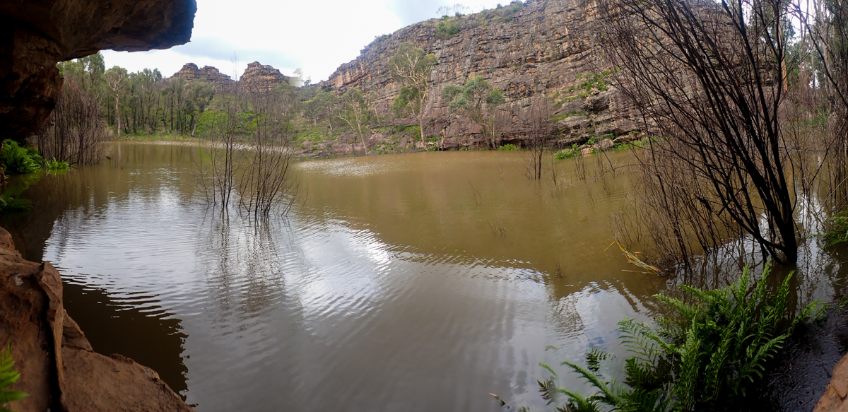
Looking down on the “Crater” It’s full of brown water” I the video that first inspired me shoed crystal clear water. With run off from post fires and what not what greeted us was a murky brown lake.
but a lake non-the-less. Happy boy
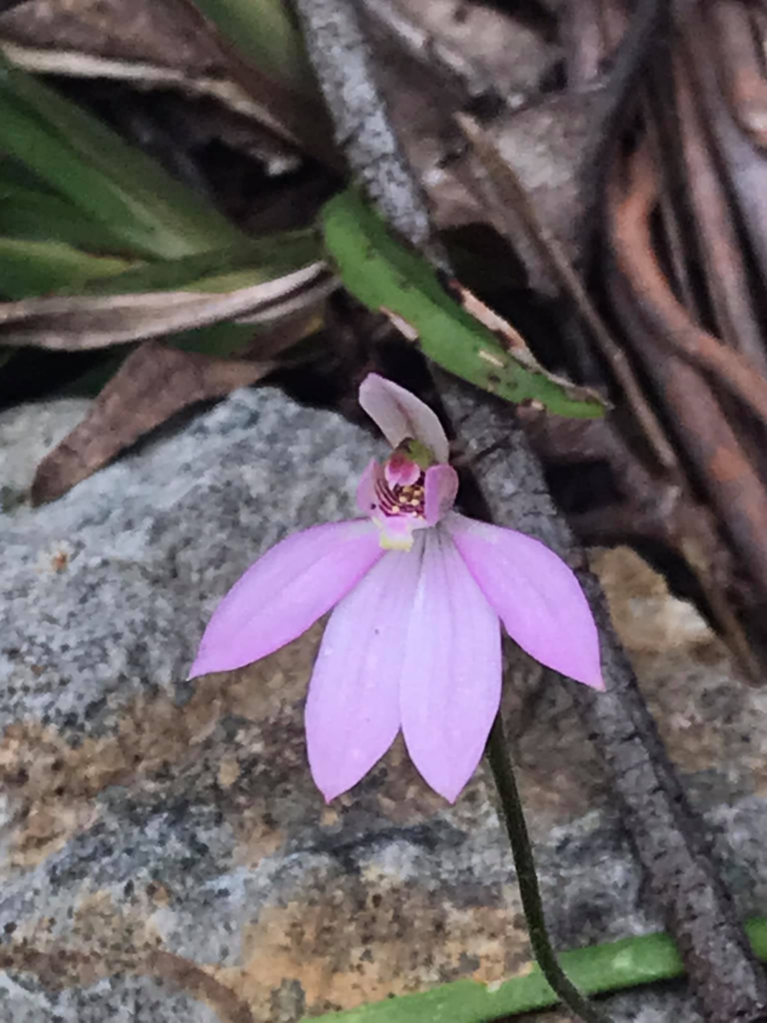
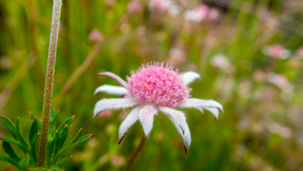
The wild flowers are out too
We Phaff about
And finally we duck down to check out a nearby canyonette
When I was a kid a lot of amazing adventures started or finished at 166 Bells Street. We are 13 or 14 popping wheelies on our BMXes, or hanging out high up in the climbing tree, or digging tunnels in the river bank or making home made fireworks out of stuff you could still buy or find when we were kids or sumfink.
Let’s go yabbying.
We grab some string, stuff some form of meet into our pockets, race off on our bikes and head up to some long forgotten little dams in a long forgotten gully right at the edge of town. It all sounds very Huckleberry Finnish. But it’s nothing so grand, just a day in the life of me and my mate Smiddy some time in the 80s. Nothing overly memorable except we didn’t catch any yabbies and on the way back while bridging through what I’d now call a canyonette (but back then was just a nice bit of narrow creek) Pat slipped in. We are wearing jeans and jumpers, it was an icy winters day (the yabbies had been smartly tucked up in their nests) and it was cold ride home for Smiddy.
Anyhoo, fast forward mumblemumble years. (Would you believe 10? No? How about 20? Ok it’s closer to 30, and by closer I mean over 30) Mandy is keen for a small walk and thinks Ida falls might be the go.
Pulling up in the little car park it’s packed (well 4 or 5 cars but enough to ruin the uncrowded feel I like.)
Hey there’s another gully we use to frequent and from memory it’s kind pretty too… says I
Understatement!
Especially after we’ve had a bit of rain through the week.