Many years ago I came across a video of a little lake that had formed in Goochs crater and and ever since I have wanted to see it in the same state . \
Many times Mandy and I have headed up in the pouring rain in the hopes of witnessing this rare phenomena (Do doo be-do-do) without luck
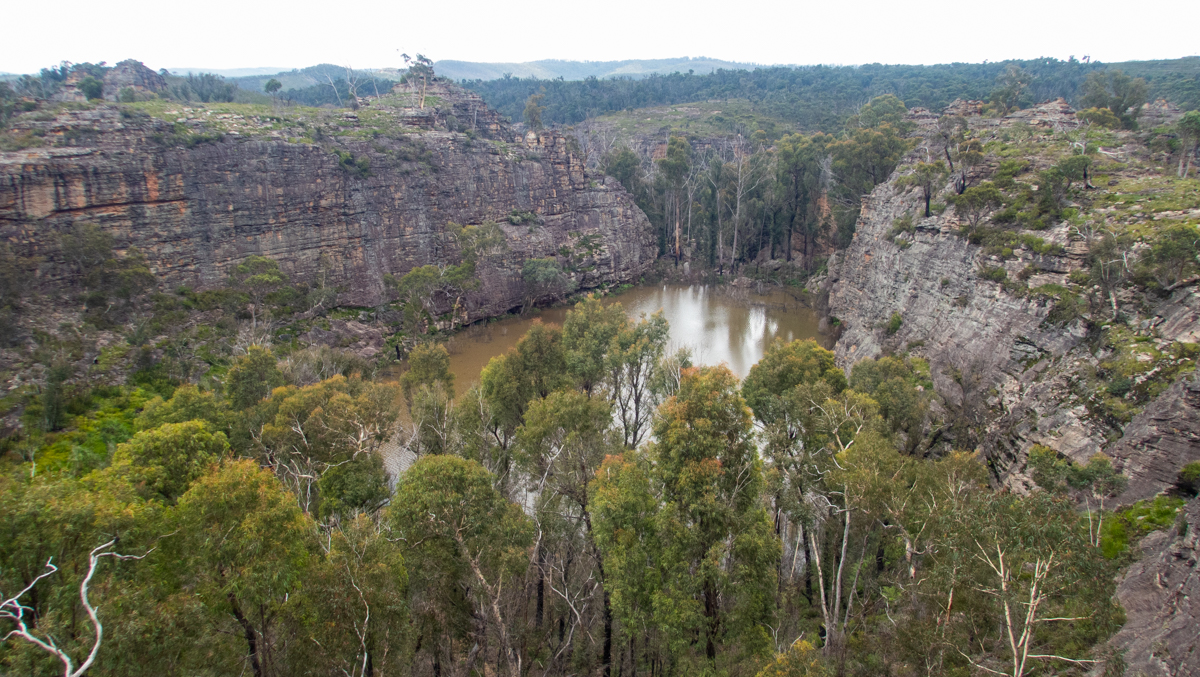
Now here I am looking at a photo of it full
As soon as I can get out of work I do
Grab your shoes, I say to Mandy.
I have to work this afternoon lets’ do it tomorrow
Oooooo. But it might be empty by then. pouty face.
Take Tal
Woohooo.
We head on up, anticipation grows
What will we find? will it blow my mind or disappoint me a again?
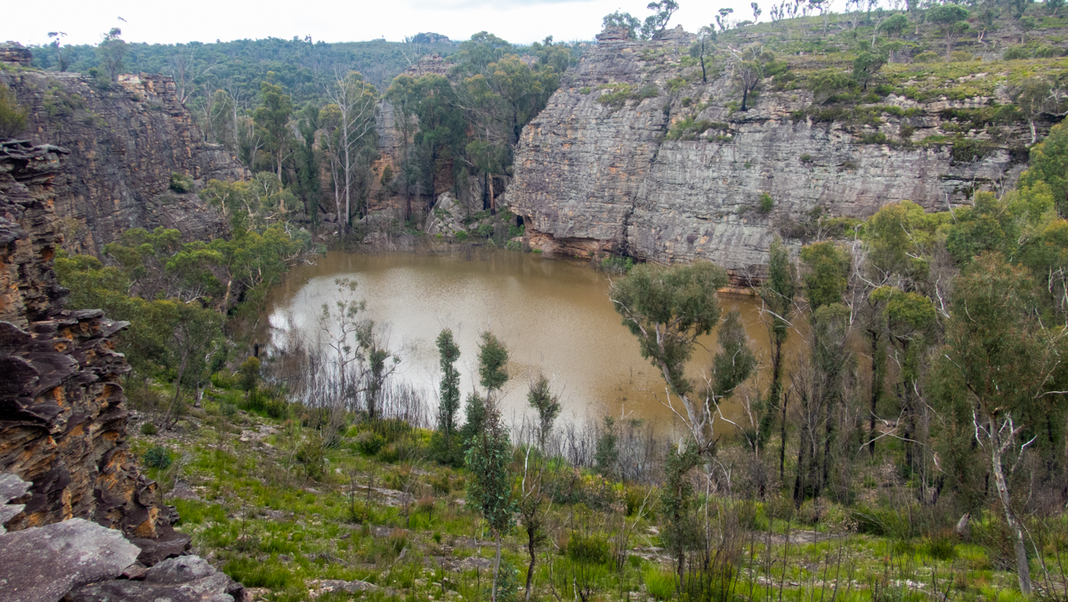
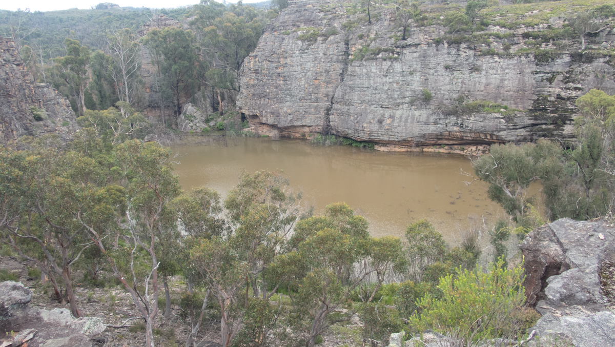
Looking down on the “Crater” It’s full of brown water” I the video that first inspired me shoed crystal clear water. With run off from post fires and what not what greeted us was a murky brown lake.
but a lake non-the-less. Happy boy
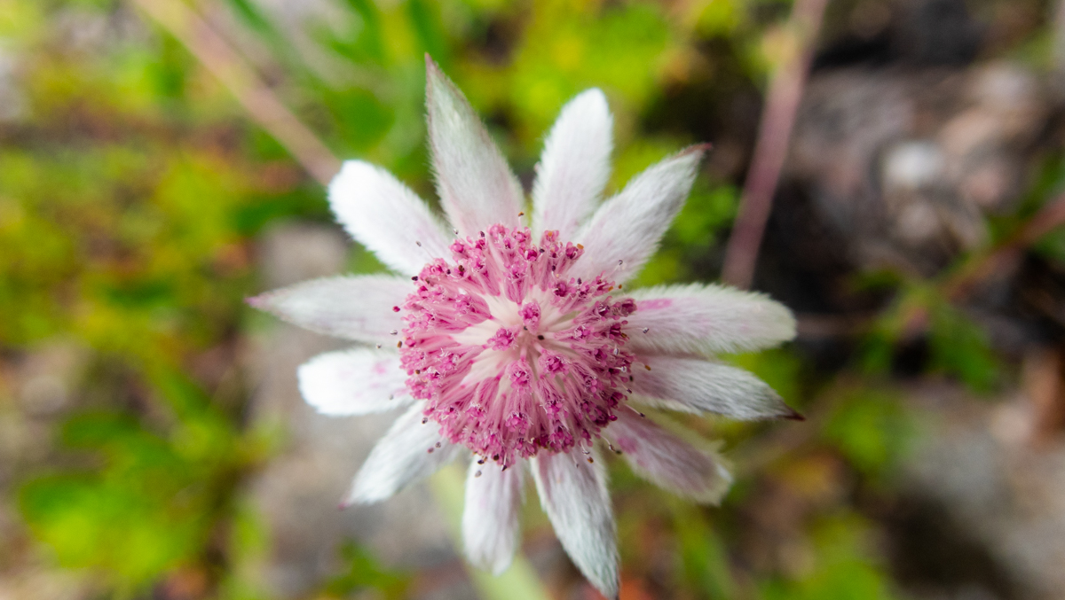
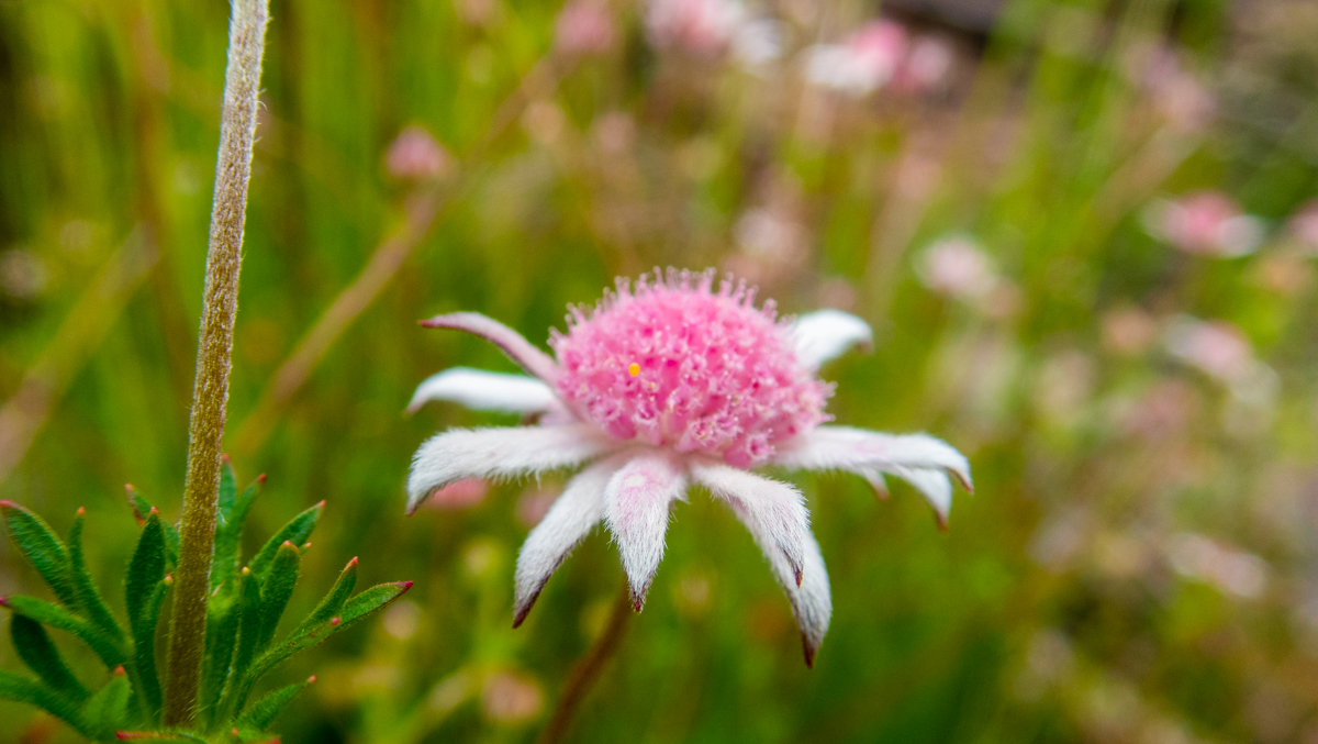
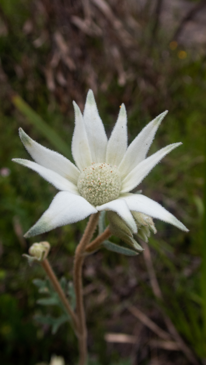
The wild flowers are out too
We Phaff about
And finally we duck down to check out a nearby canyonette
Another trip to this short but pretty dryish canyon out the back of Clarence, and a stop at Goochs Crater on the way back
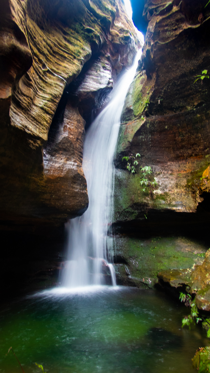
This is an awesome sheltered cave. The creek, when it’s running flows through the back of it.
Venturing up the stuning side canyon. First recorded exploration of this slot by a bushwalking club was a group from Sydney Uni Bush Walking club in 1962, though I suspect Col Oloman would have visited previously either on one of his solo trips or with friends as they explored the areas through here across to the Bungleboori and beyond. Neither bothered to name it.
I keep forgetting how short this slot is. You get caught up in the light and ambience and time ceases to have meaning
the large cave in a 180 bend in the canyon.It’s like another world. Ciaus and Ed desided when society falls apart this might be a good place to live
Ed in one of the more open twists and turns in the very narrow upper section of canyon
tight and twisting canyon formation
Ed on the peak, the canyon carves around either side of him. The cave at the bend can be seen in the cliff line, though the scale of it is hiddne by the trees
We seem to be climbing out to look down on the top of canyons a lot lately
Ciaus and Jake as the canyon opens out slightly near the cave
Access: Getting to the carpark involves a dirt road with a few rough bits. Nothing extreme but a 4WD is handy just for the ground clearance and traction
Navigation: Navigation is fairly straight forward.
Map: Wollangambe 1:25000 These can be purchased at Lithgow Tourist information center or online for around $10
Time: Less than 2hrs with a bit of time for lunch on the clifflines at the end
View from the end of the fire trail. Mt Banks in the centre distance, Mt Wilson to the left.
Depending on which map you look at or who you talk to this is either the Wollangambe or Dumbano fire trail. Open source and google maps seem to show it as Dumbano fire trail. Wollangambe fire trail is what I always knew it as and makes more sense to me as at the end you lookout over the ‘Gambe just upstream of Wollangambe crater.
Anyhoo, whatever you want to call it, it’s a pleasant stroll with some stunning backdrops.
Getting there:
Turn off the Bells Line of road at the ZigZag Railway onto the Newnes Forest rd. Follow this along for around 4.8km and turn off to the right at the bottom of a hill below Bald Trig.
Unfortunitely the start of the fire trail looks a bit like a rubish tip where grubs seem to dump there soft drink bottles and coffee cups… But it gets better.
Set your odeometer here, you want to stay on the main fire trail but there are a couple of intersections where it is easy to take the wrong fork.
At Approximately 1km keep left (right follows the old Wolgan Railway easment around Bald trig to the sand quarry.)
At Approximately 2.5km stay right then at approximately 6.4km stay left. After a little over 8km you will come to the locked gate (GR 499952).
Park up and follow the old road on foot past the gate. The first couple of hundered meters is steep then it is easy going along a flattish ridge for 2km.
Either side of the ridge are sheer sided gullies and at the end of the ridge is a rocky point (GR 505931) in between where these two tributaries meet the Wollangambe.
This is a nice spot of a bit of lunch (or as we did today cheese on smith chips…) there are some great views with Mt Banks straight ahead, Mt wilson slightly off to the left and Bell out to the right. And the wild Wollangambe can be heard gurgling below.
For the more adventurous this route, with some off track navigation at the end is the shorter way to access the Wollangambe crater which is usually done as a over night bushwalk from Bell. (its not a real crater but a circular depension holding a hanging swamp. I think it is the reminants of a large billabong type feature made in a sweep of the wollangambe. It sure looks craterish from aerial photos and satelite images though.)
Easy walking along the old fire trail.
Note: The great outdoors is an ever changing place. Bush fires, changing weather, vegetation growth and forestry activities can all effect the trail conditions and thus the difficulty of the walk. These are a rough guide only and are by no means meant to be a definitive guide . They do not replace the need adequate map reading and navigational skills
Note 1: Taking care While reasonably well known these spots are still wild places and care needs to be taken around cliff edges and on the steep trails. Carrying the right gear as well as having adequate food, water and clothing is important. Always tell someone where you are going and when you expect to get back.
Emergency beckons (PLBs) can be hired from Katoomba Police for very little.
Note 2:First aid A basic first aid kit is essential bit of kit whenever heading into the Aussie bush. First aid training is highly recommended
Note 3: Maps and Navigation Having the right map, a compass and knowing how to read them is very important when heading into the bush. If you are new to bush walking joining a club or accompanying more experienced walker for you first few outing is a very good idea. I found practicing map reading on well defined trails was helpful when I started out.
The Maps mentioned are the 1:25000 series. They can be purchase at Lithgow tourism information center, from outdoors shops or online for around $10 each.
Note 4: These are wild and beautiful places, respect them. If you are able to carry something in you can carry it out. Don’ be a tosser. Leaving your rubbish behind is a sure way to ruin it for every one else.