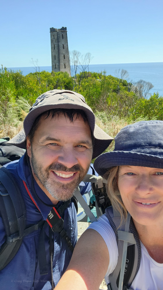
Ash wanted to head to Surface Paradise so we thought it might be nice to drop him off for a day out and drive up to check out a couple of the touristy waterfalls on Tamborine Mountain.
We knew Jason was up visiting family in Brisbane so we threw him a shout out to meet us there.
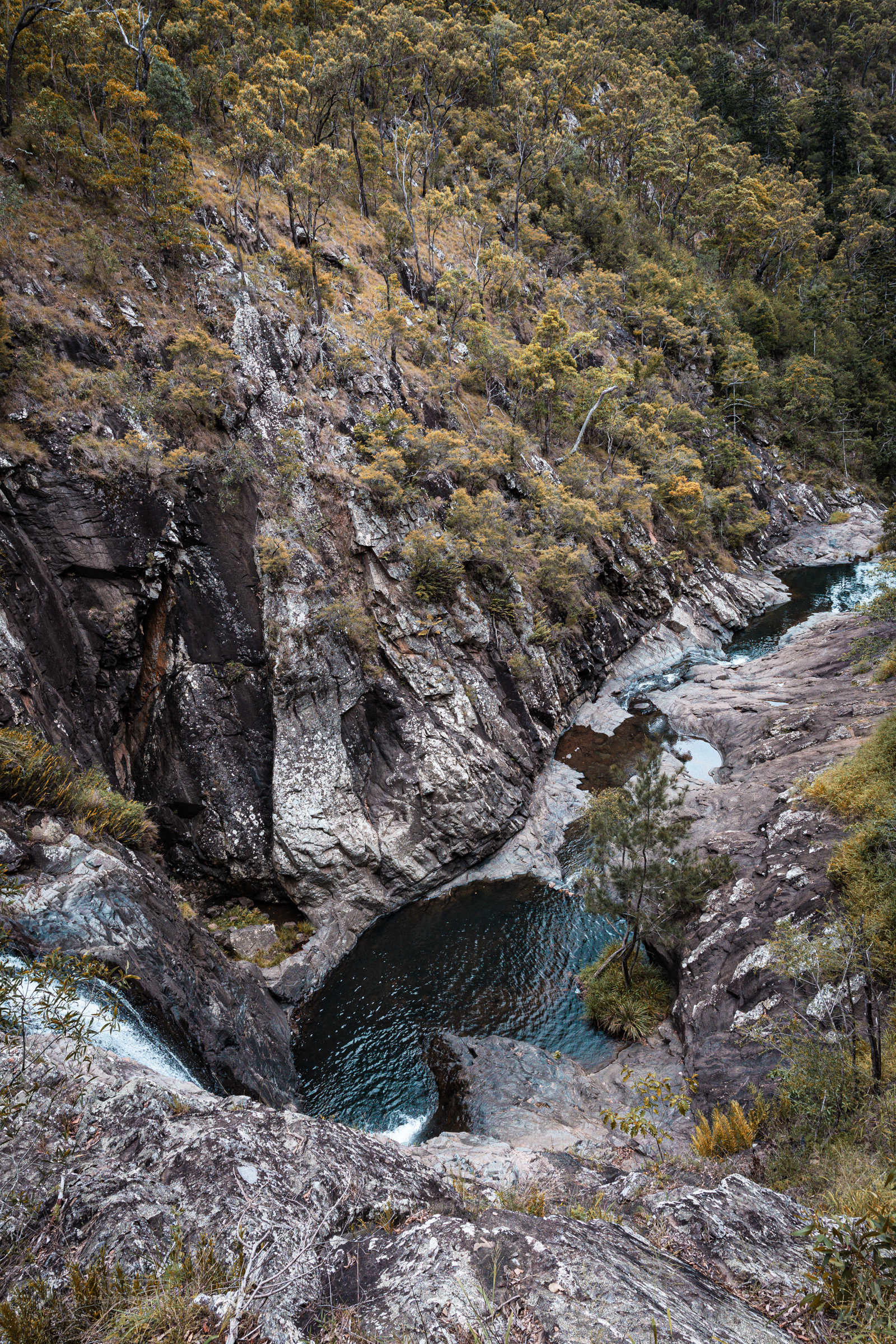
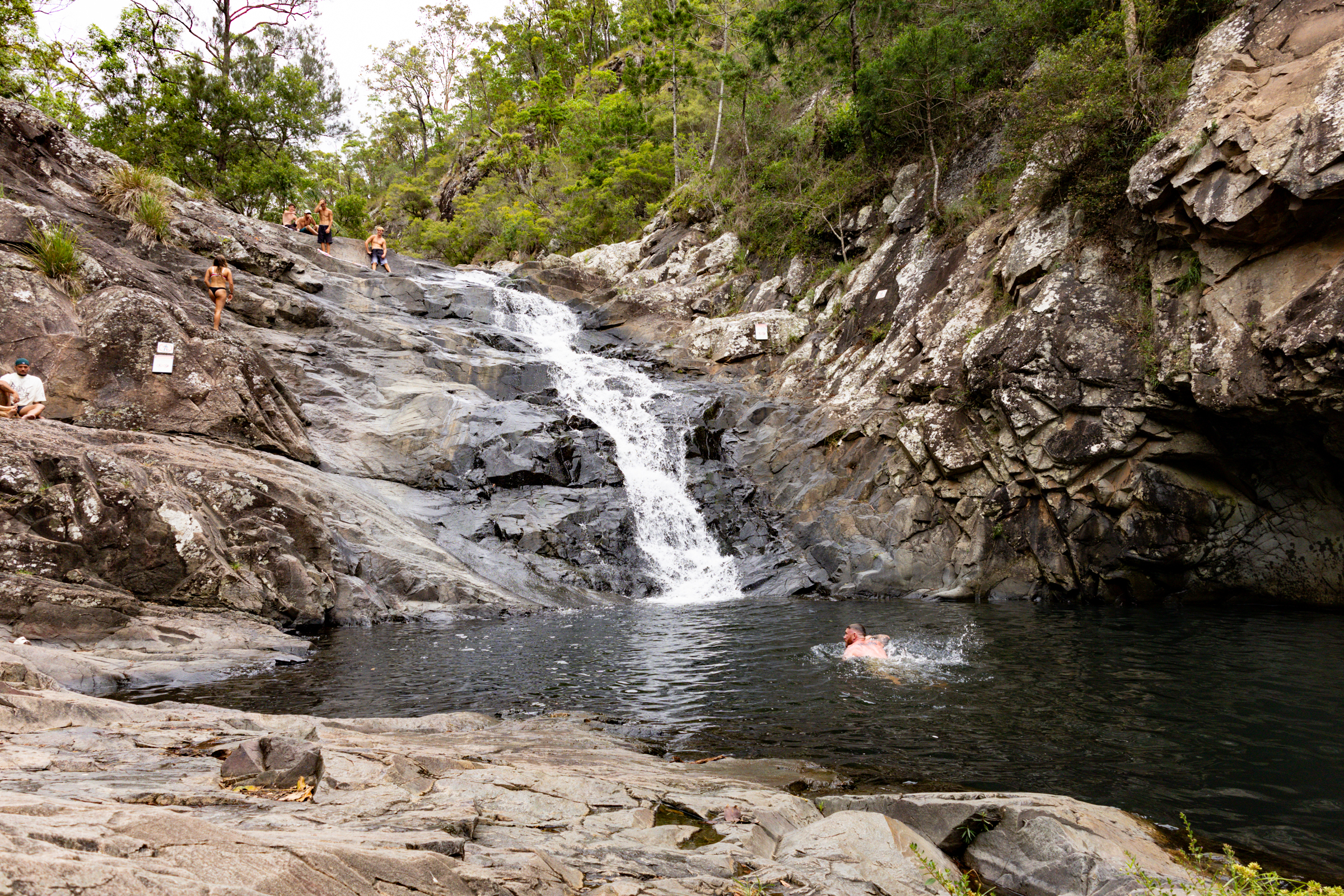
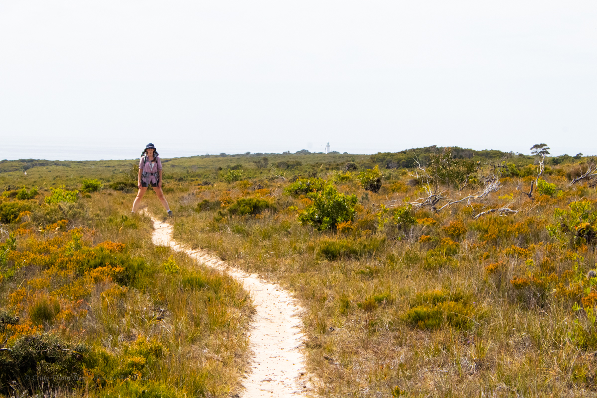
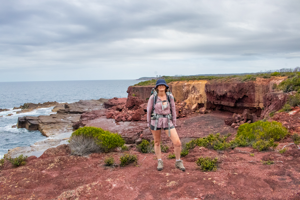
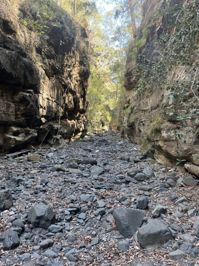
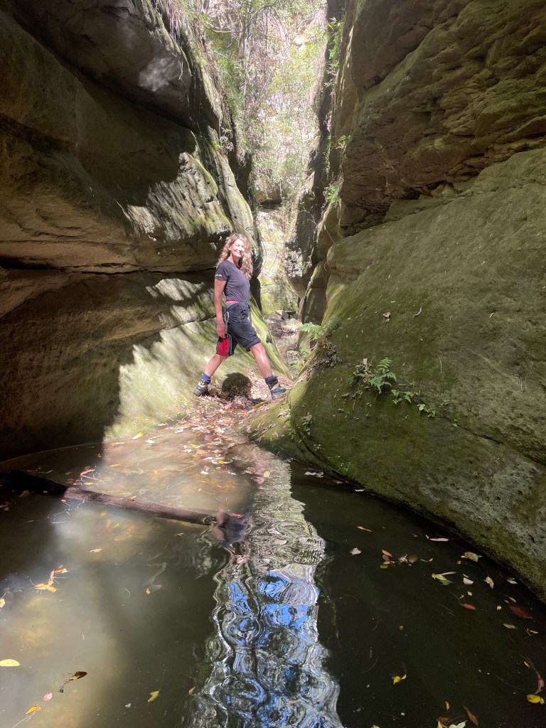
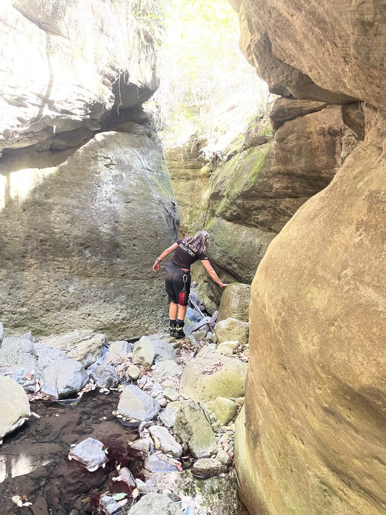
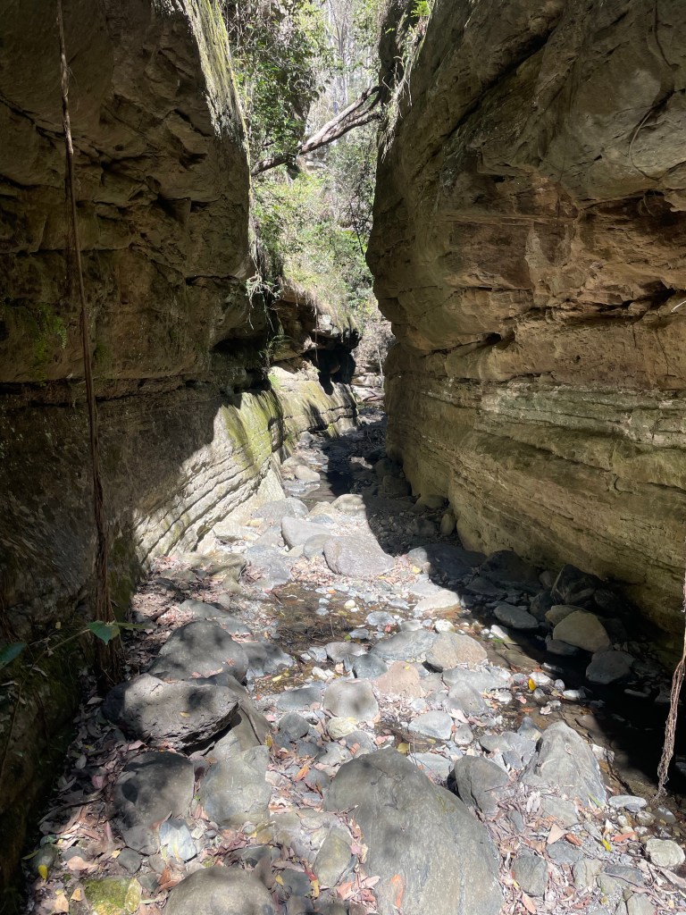
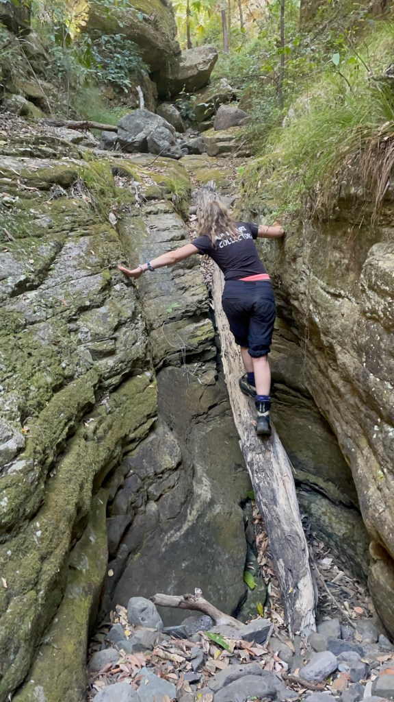
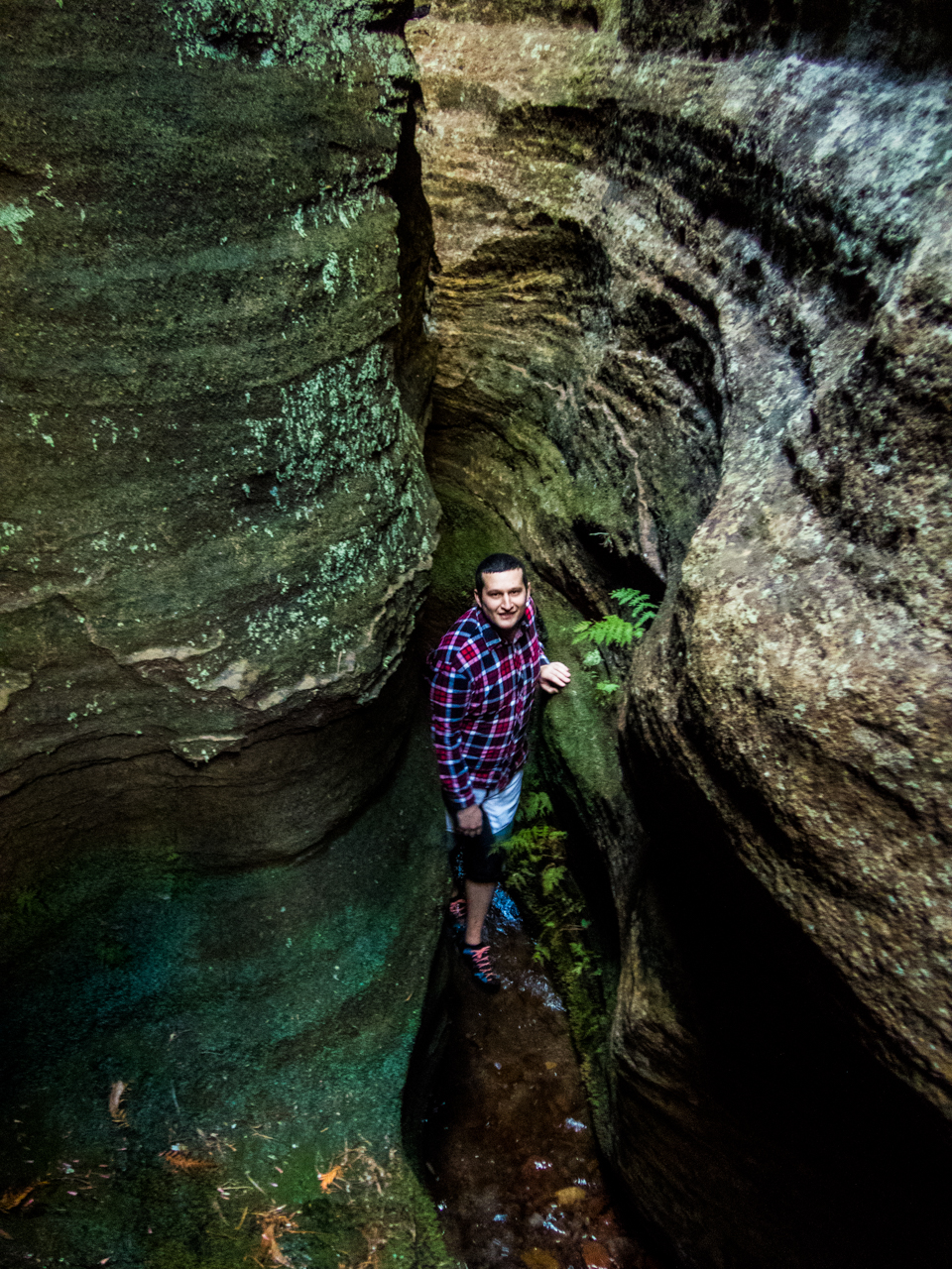
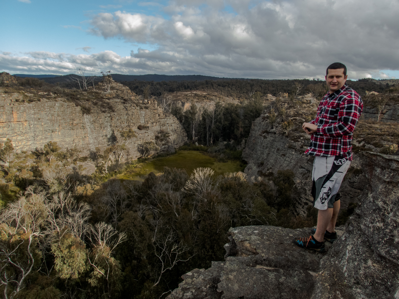
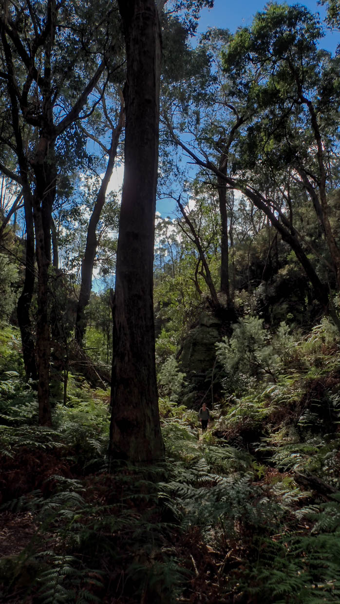
Our first stop was Cedar Creek falls.
This is another popular swimming spot and it has limited parking. We needed to park way back at the turn off (Junction of Tambourine Mountain Road and Cedar Creek Falls Road.) which gave us an extra 800m walk each way.
Locals at the end of the road had set up a paid (donation) parking lot in their paddock and the kids had an esky set up sell cold drinks. Kylie half jokingly wondered if said locals rushed out of a morning on public holidays and filled the car park up with their own cars before the crowds appeared. Clever them if so as their paddock was just about full.
And to be fair, imagine having this place pretty much as your private back yard extension before the crowds discovered it and the tourists (like us) rolled in.
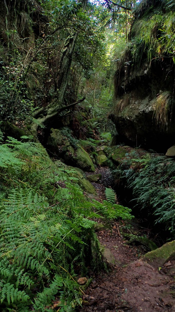
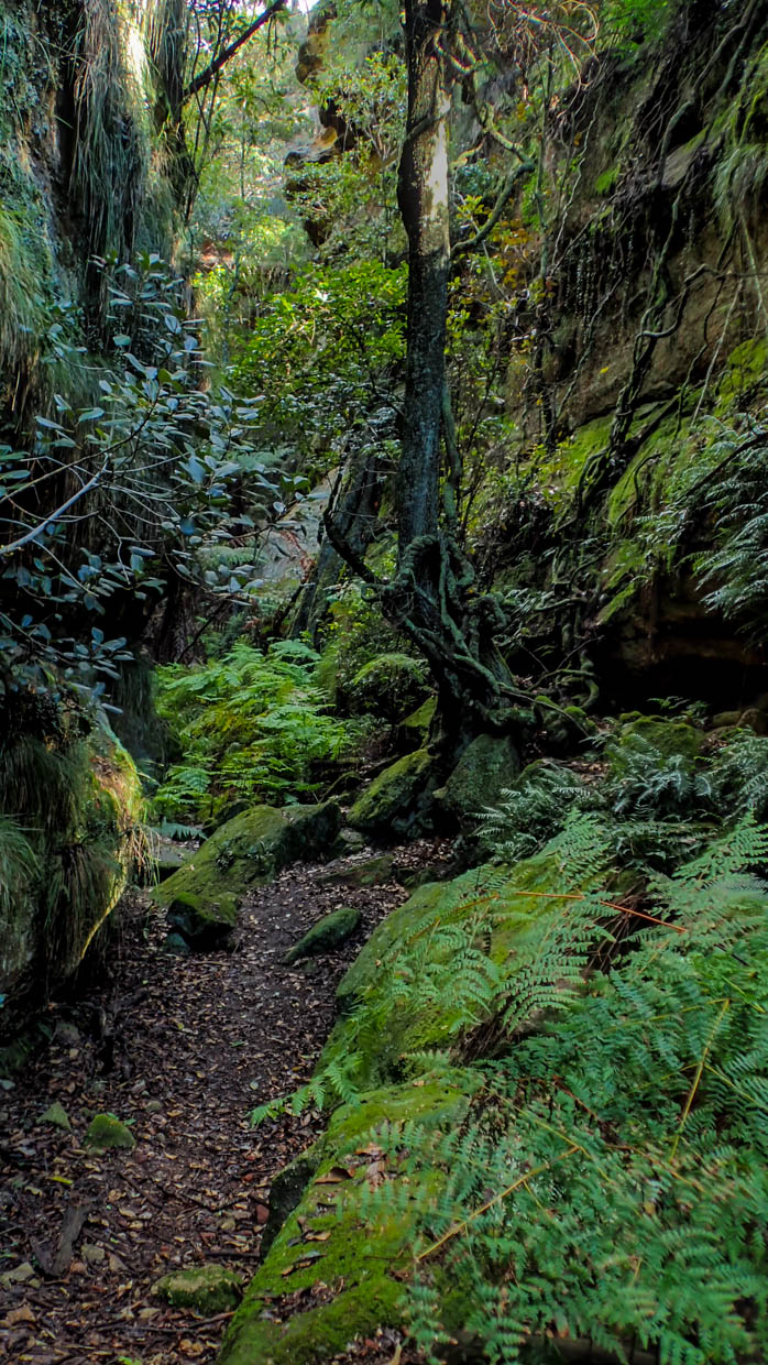
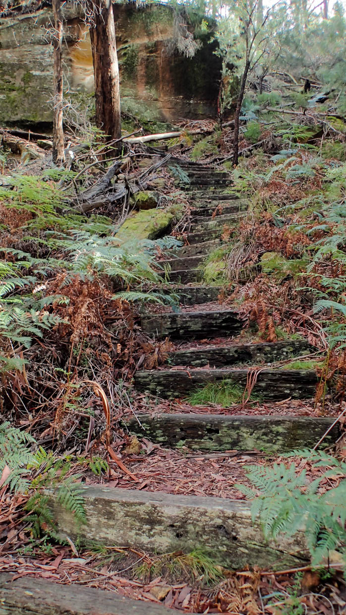
From the car park a boardwalk style trail leads you down past a nice picnic area beside the creek then down to a lookout above the main falls.
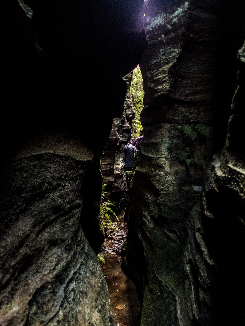
The trail then continues down to the base of a lower cascade and a nice swimming hole.
There are two main pools accessible from the trail.
A series of other cascades and pools are off limits due to safety concerns and rangers were on and to remind people of the need to comply.
We have a dip and laze about then head back up the mountain to check out Curtis Falls.
There’s a much bigger car park here but it’s equally full, luckily people are leaving and we get a park close to the trail head. Winning.
There is no swimming allowed in this one but is a lovely walk along a shaded creek and a very pretty waterfall.
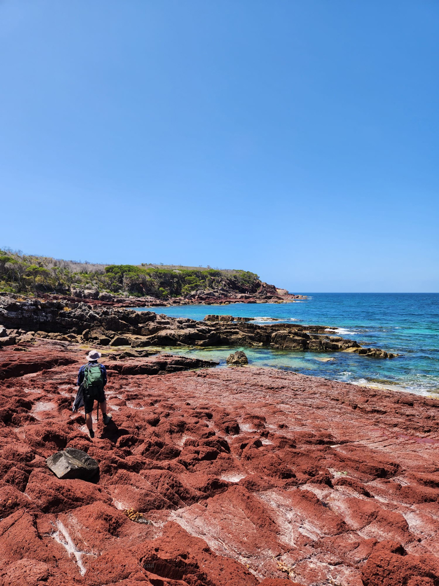
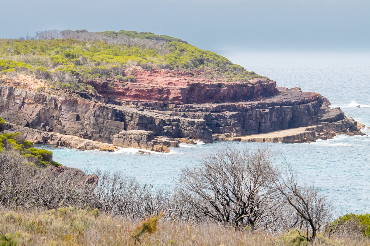
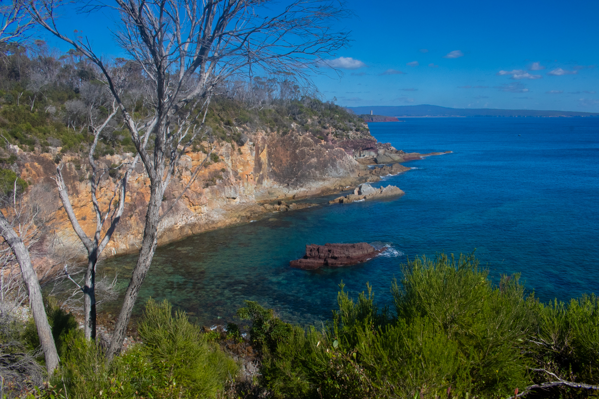
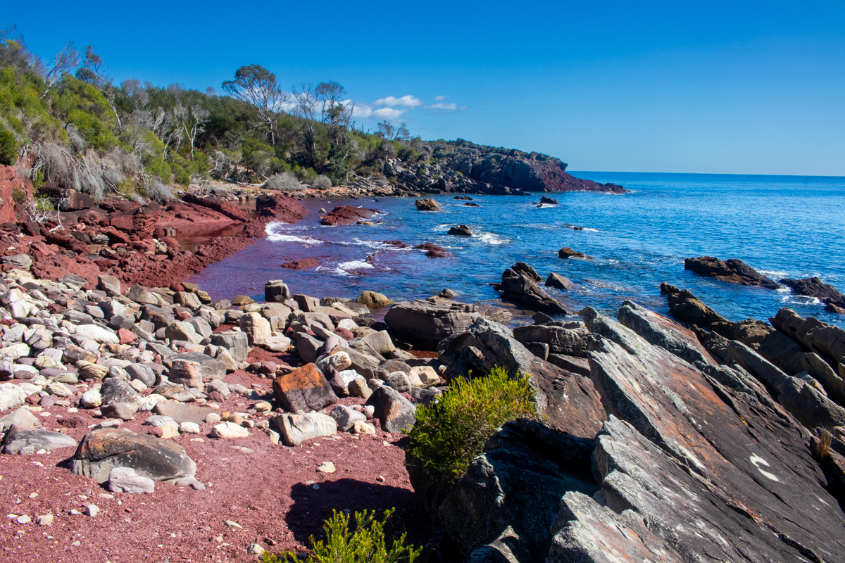
The south coast of NSW is one of Kylie’s favourite places and I can easily see why. The colours of the dramatic coast line are mesmerising, the escarpments are grand and as a bonus the mountain biking is truly awesome.
With a bit of leave over Christmas I thought I’d be mad not to join her on a road trip.
One of our goals would be to squeeze in this popular multiday walk.
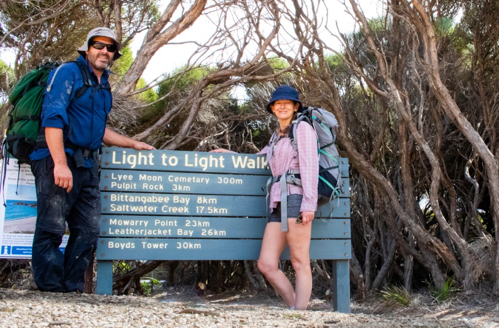
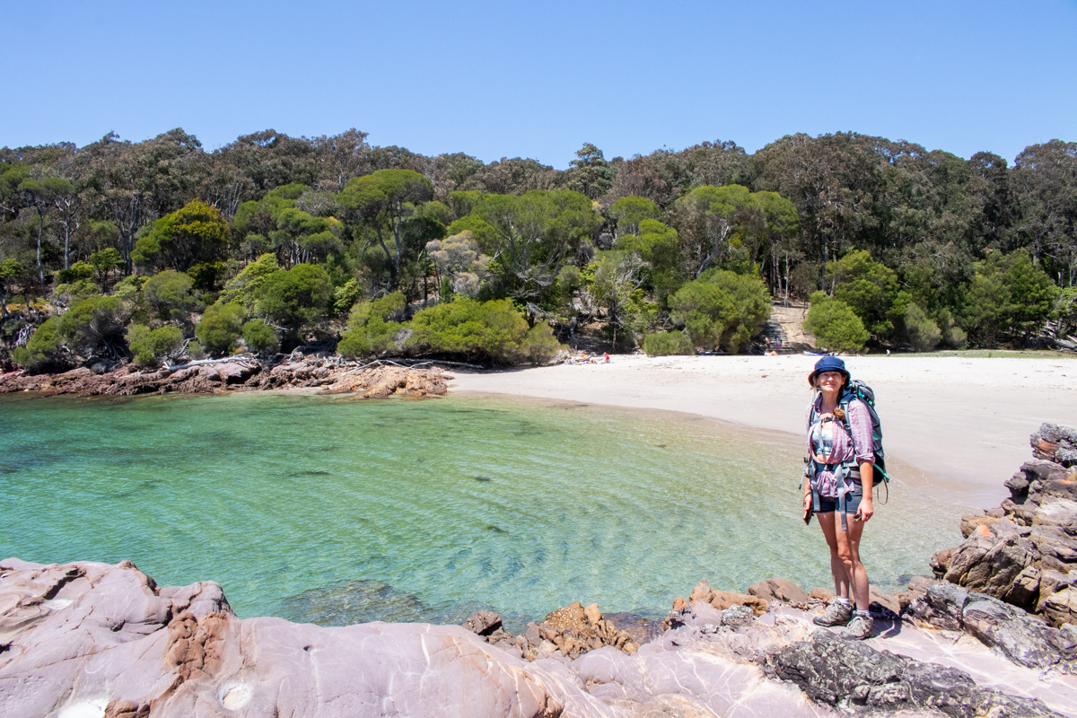
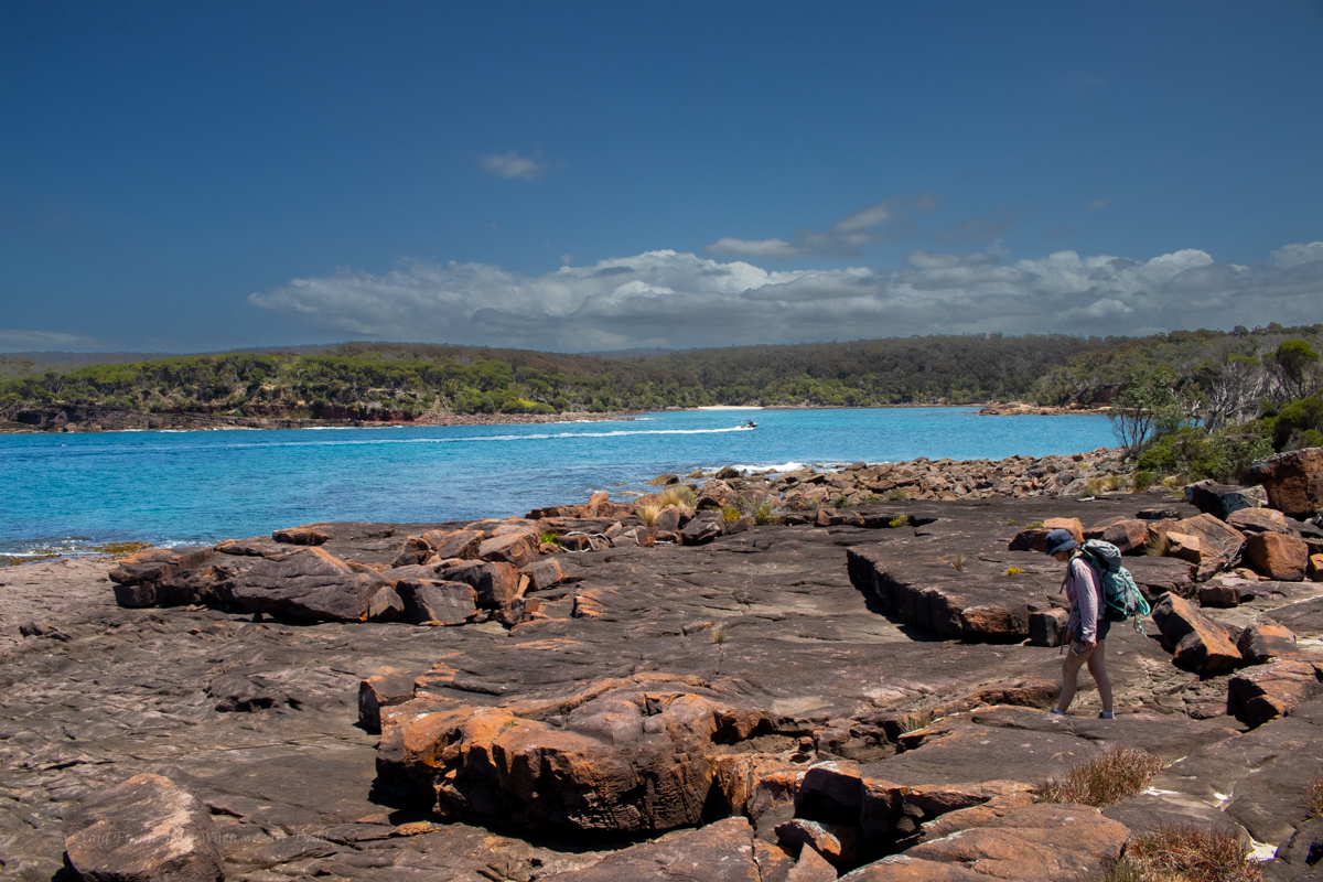
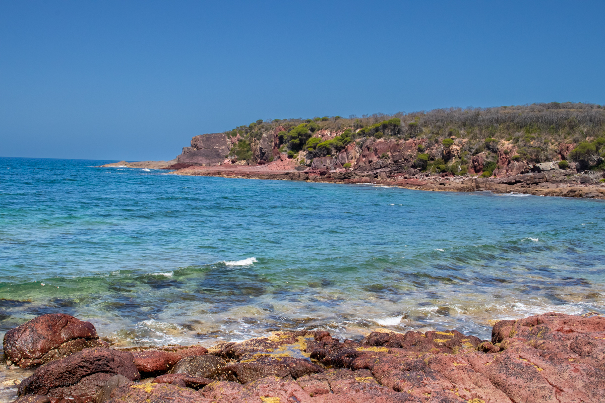
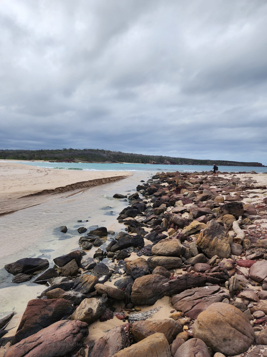
The Light to Light stretches between Boyds Tower and the Green Cape Light house in Beowa National Park, south of Eden. Being about 30km it’s doable in a day but most people do it over 3 days, making use of the offical camps sites at Saltwater Creek and Bittangabee bay (these are drive in campsites with showers and toilets so bookings are essential in peek times.)
We wanted to enjoy the beaches and scenery so decided to do it as a 2 day trip. As we had the mountain bikes we opted to forgo the pick up and drop off logistics (You can pay for a shuttle service at approx $120 per person) and made use of the bikes for the return journey.
Boyds Tower appears to be the usual start to the walk but looking at the topography of the forestry roads we figured it might be an easier ride North to South so we stashed the bikes in the bush near Boyds Tower and drove down to Green Cape to start the walk from there.
Along the way we did a side trip into Saltwater Camp to stash some extra water.
Part 1: Green Cape Light house to Bittangabee Bay
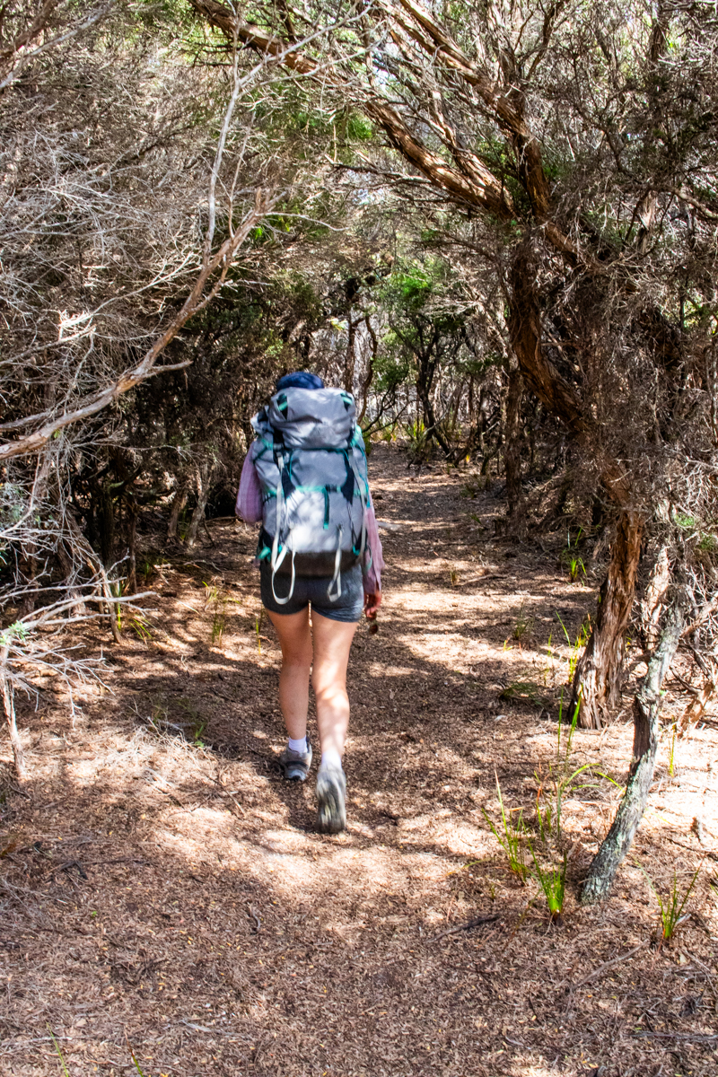
Full of beans and anticipation we set off at the crack of 10am in high spirits. It is a stunning bit of coast down here which is why I’m a bit baffled as to why this section of trail stubbornly avoids it.
TBH, this was my least favourite section of the walk. We could hear the ocean, we could occasionally see the ocean but without large side trips we couldn’t see the coast line.
We wander through tunnels of mallee scrub and across open plateau, it’s like the trail is trying to avoid any elevation loss or gain for the sake of it and at one stage I find myself thinking, I hope I haven’t driven 5hrs for 30km of this shit.
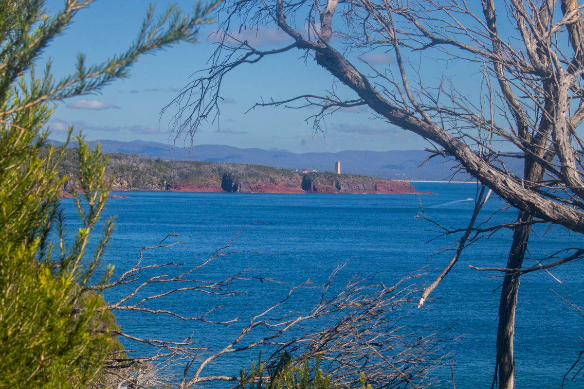
Gadget with the Light house off in the distance
Coming from the other way I can’t help but think this would be a disappointing end to the walk and you’d only be doing it for the sake of doing it and getting to the Light House.
NPs are doing a lot of upgrade work on the trail so perhaps this is a temporary diversion but it doesn’t look temporary.
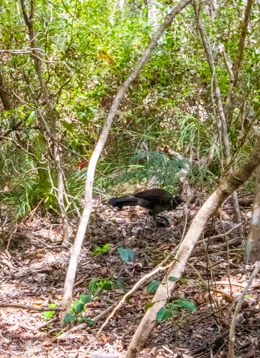
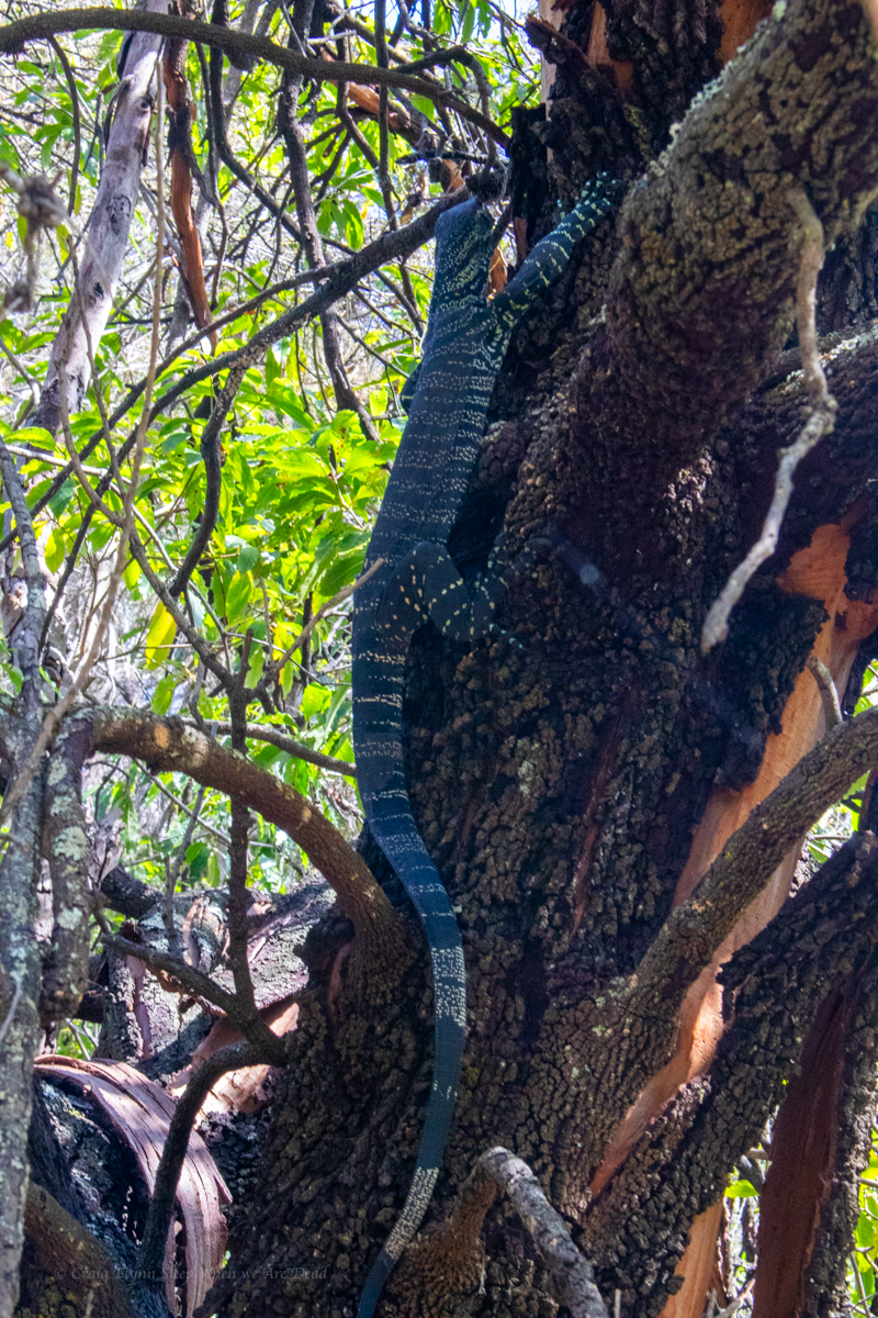
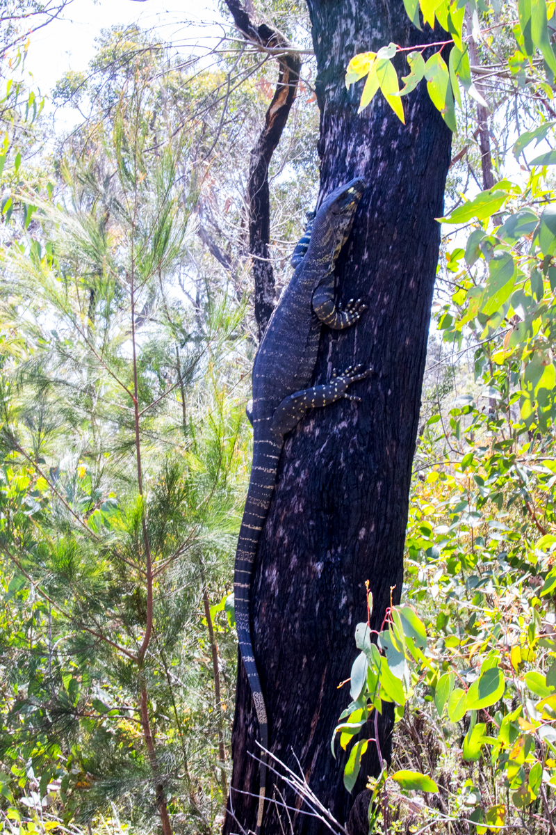
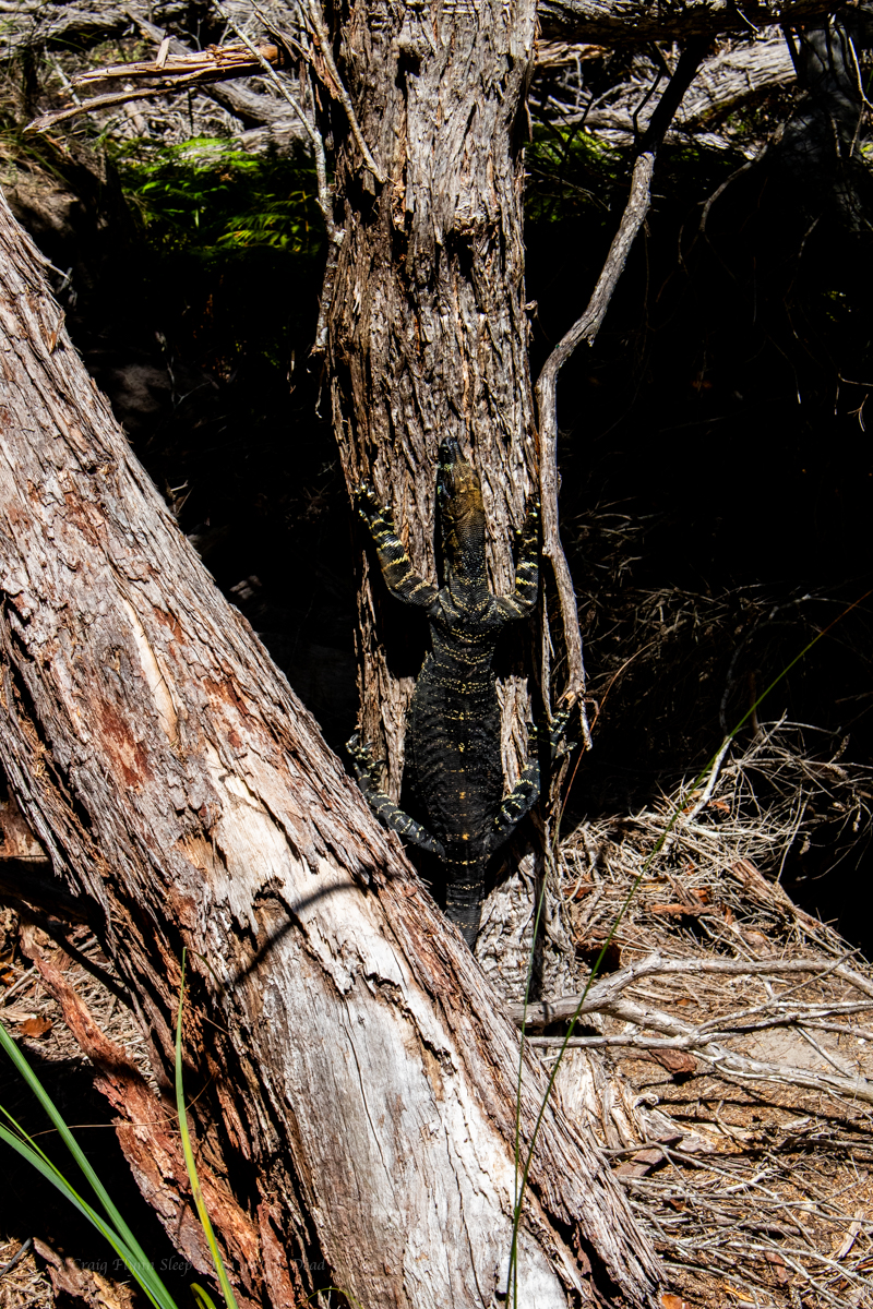
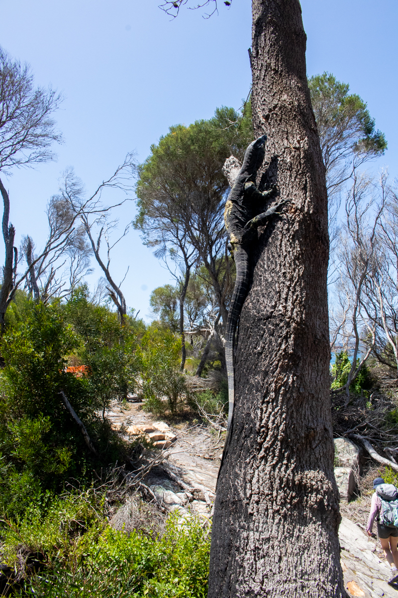
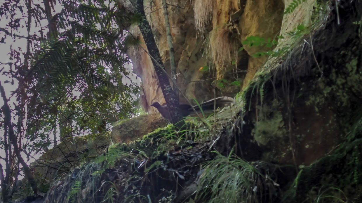
Luckily the plethora of goannas and bird life were a distraction from the flat boring trudge.
Lyrebird scratching aboutlace monitor, Varanus variuscute little water holelace monitor, Varanus variuslace monitor, Varanus varius
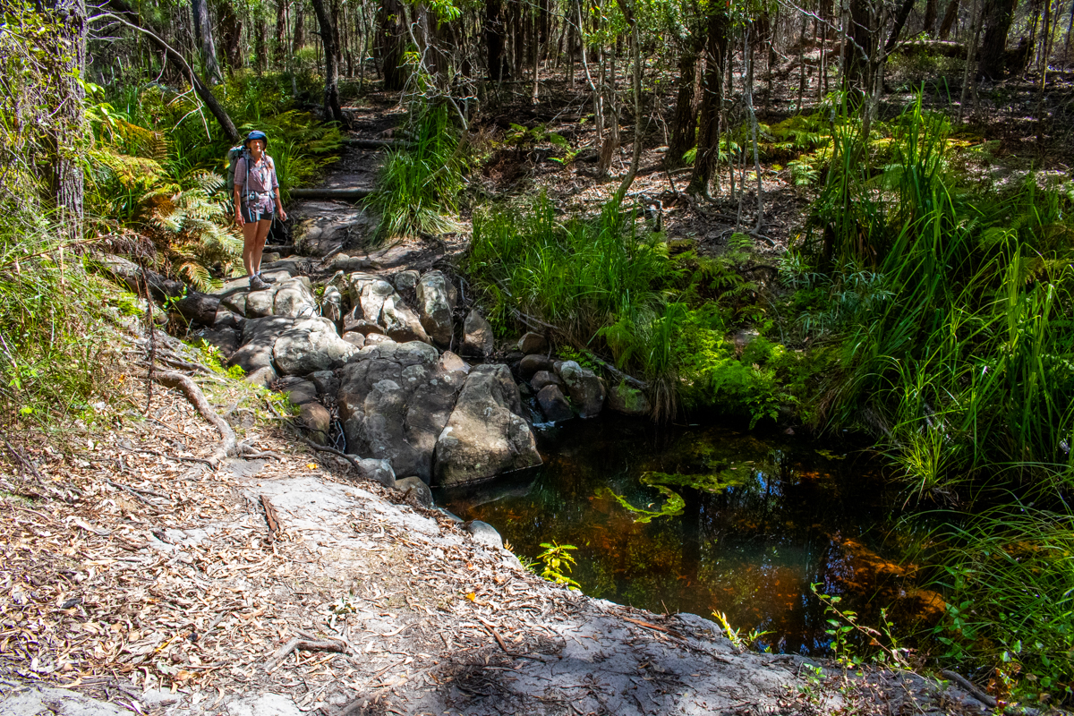
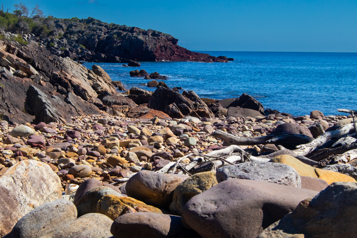
8kms in Bittangabee bay was a welcome site.
Part 2: Bittangabee bay to Hegarty’s bay
NP were doing upgrade works to the trail around the headland so we were diverted in through the camp. It was packed. A sign near the toilet block directed us back on to the trail on the other side but, confusingly a few hundred meters along we came to a barricade and signage preventing people from accessing that section from the other direction.
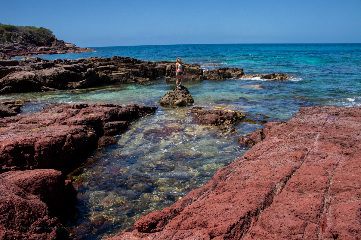
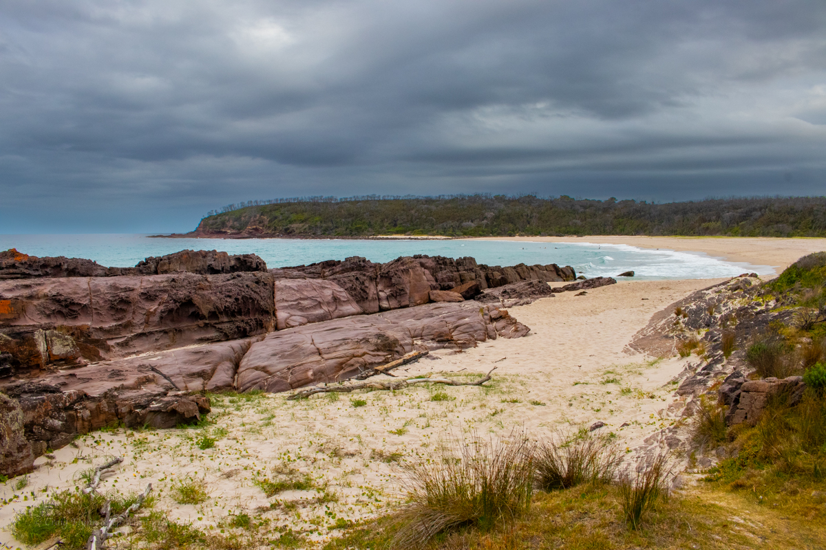
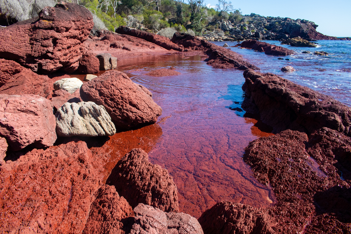
Anyhoo, We make the short side trip down to the surprisingly people-less bay for a swim and a bit of lunch. We also got lucky as the grey clouds dispersed and the sun brought the colours out. Even if you are not doing the walk or camping for the night a visit to Bittangabee Bay is well worth it if you are down this way.
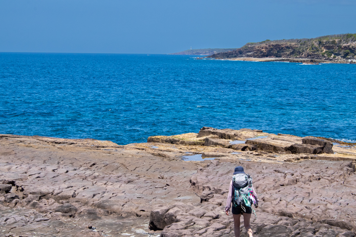
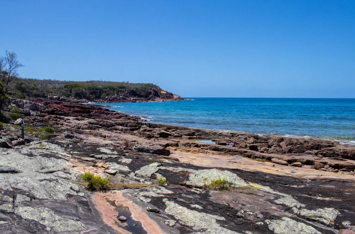
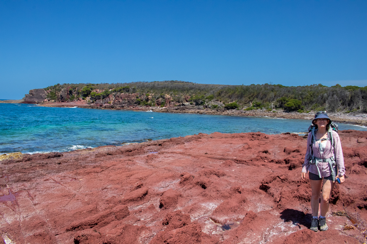
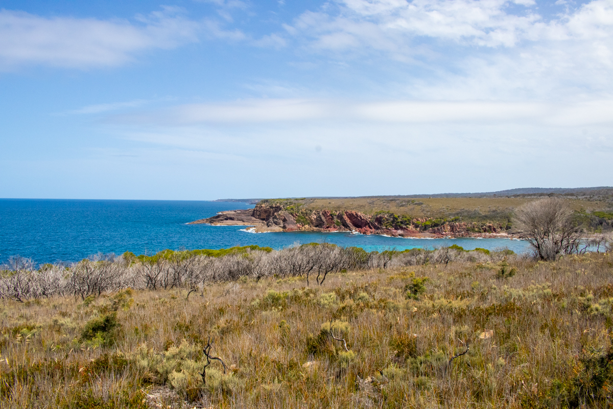
From here the trail does a wide arc around Bittangabee with view after view of the stunning bay.
Beautiful from any angle.
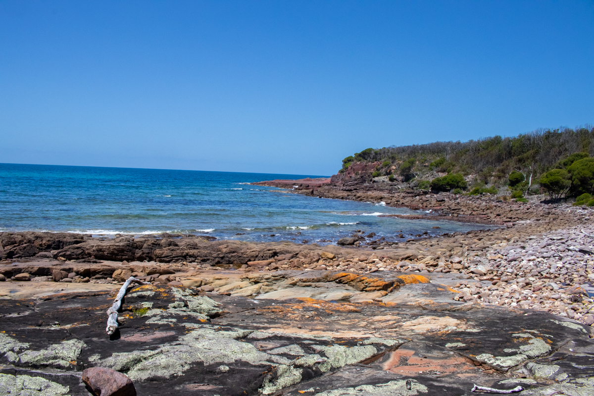
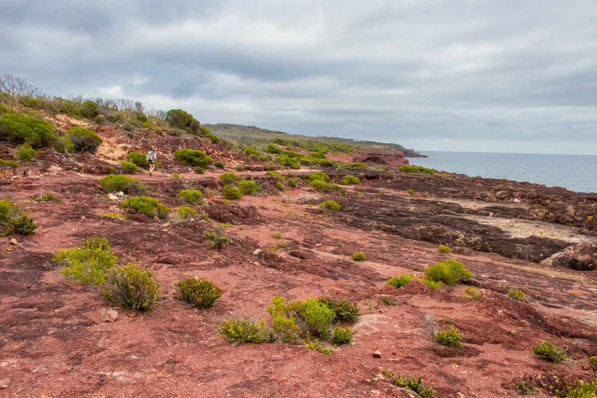
We are now following the coast line with just the occasional diversion inland.
This is what we were here for
Looking back down the coast with the light house in the distance
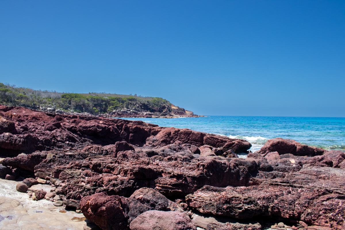
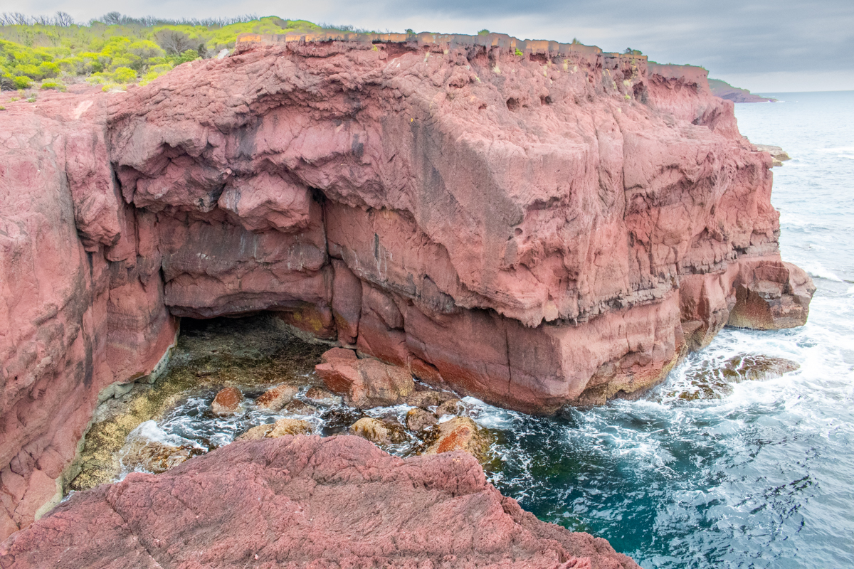
Looking up the coast with stunning cliff lines jutting out over the South Pacific OceanAnd stunning geology with folds and intrusions and flows and stuff
And giant goannas decorated in moss
Did I mention the colours?
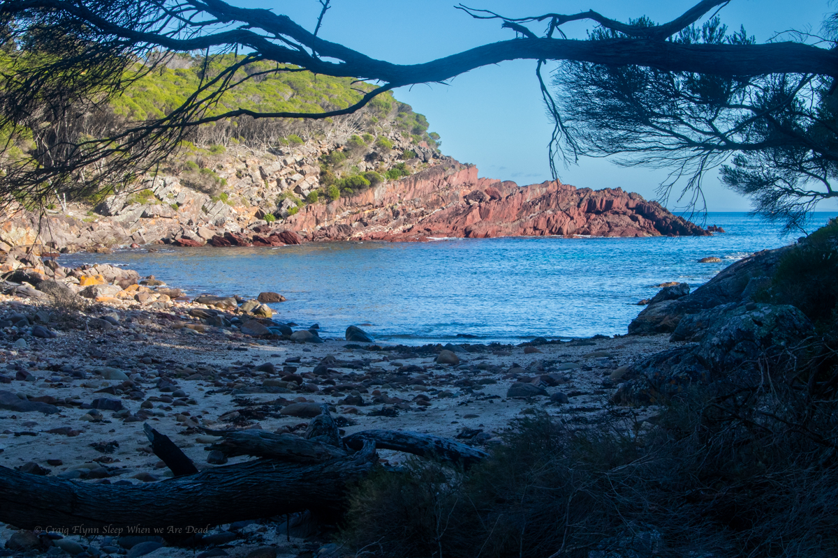
If Bittangabee bay was stunning, and it was, Hegartys bay is beyond words
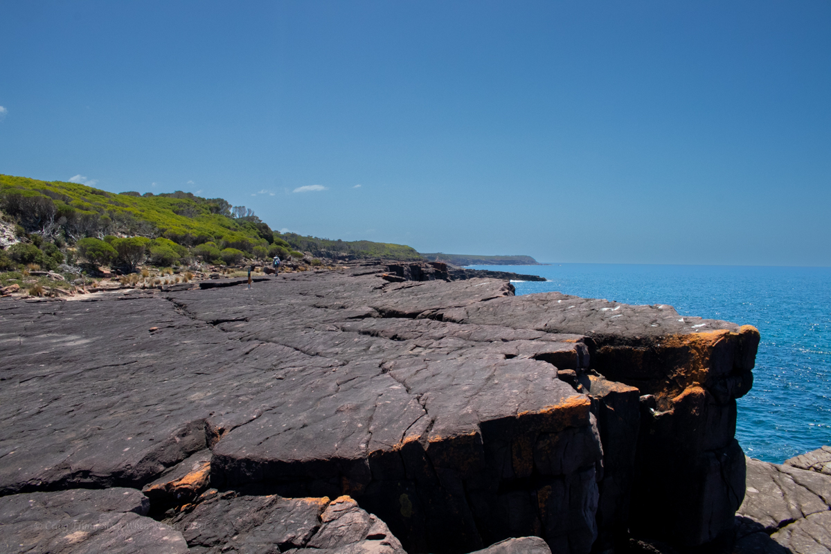
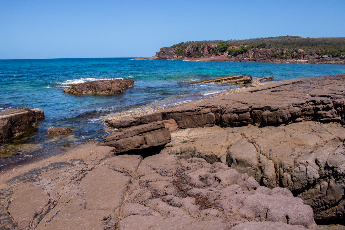
Once a publicised walk in camp it’s now officially closed for camping. Again NPs were doing work on the trail here, this time though we are diverted down on to the rockshelf. This was one of my favourite parts of the walk and it seems nuts they would divert the walk around some of it.
Oh, did I mention the colours?
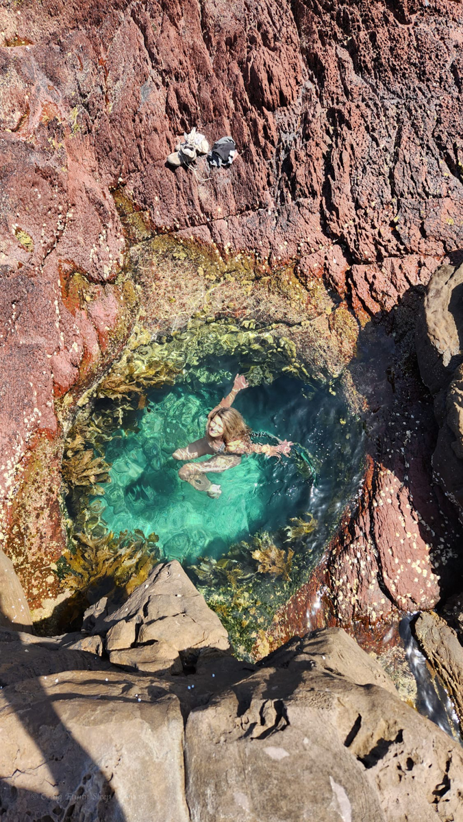
secret waterhole just big enough for 1
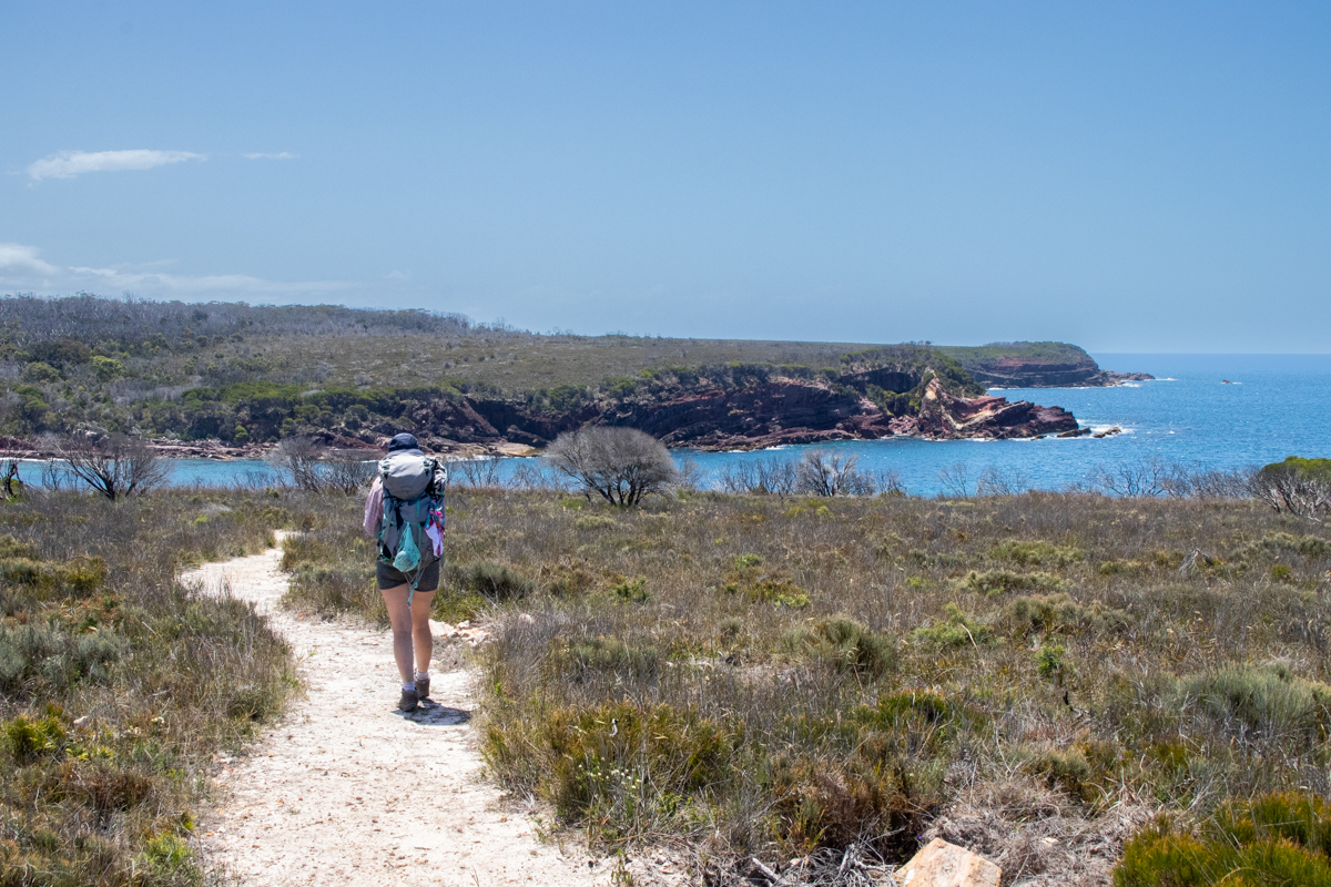
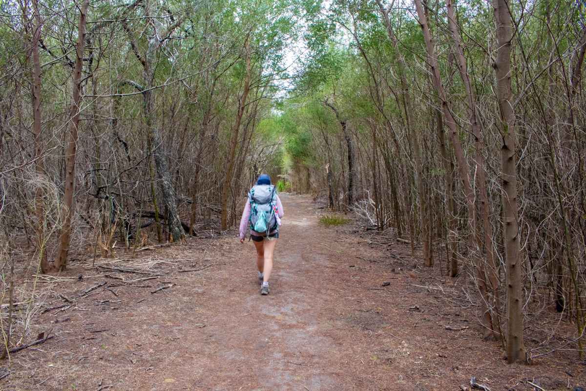
Part 3: Hegartys bay to Saltwater Creek
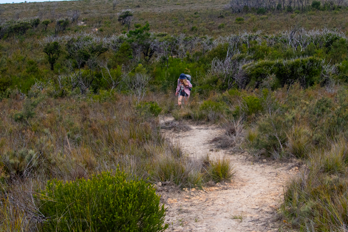
Leaving Hegartys the trail swings back onto the plateau, but at least there are views of the coast
Even the bobcat driver got bored and tried to add little sweepy turns.. (actually well designed trail with water run off controlled by small grade reversals at each bend.)
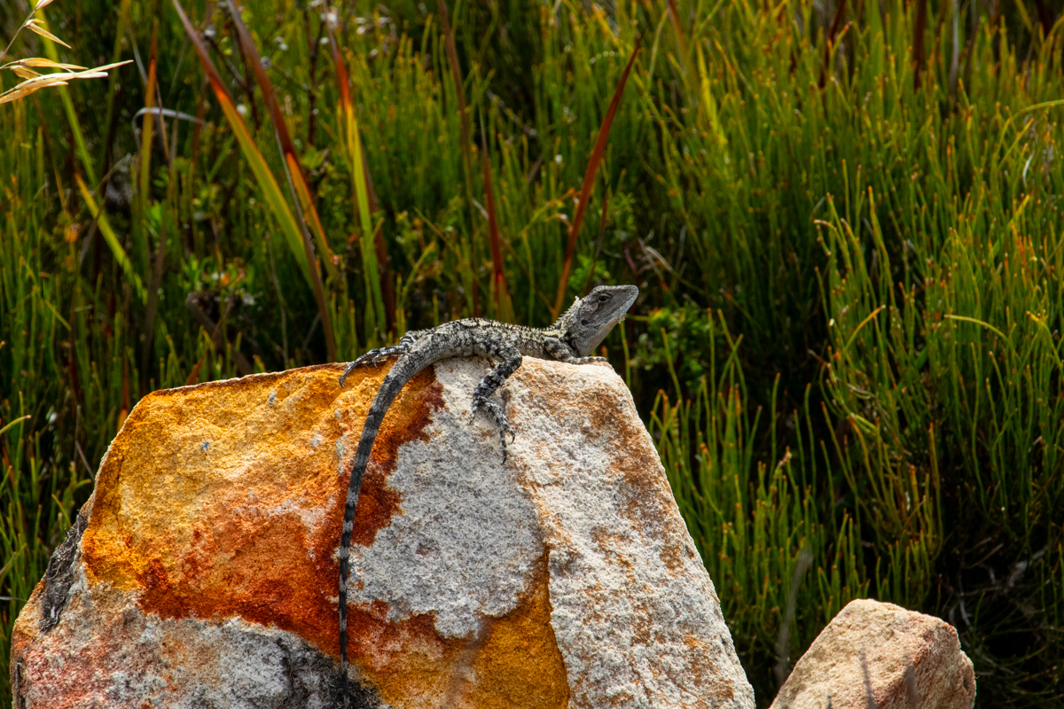
Jacky Dragon (?)
And we stroll into Saltwater creek around 4pm. Again despite the drive in camp being packed the beach was all but empty.
Kylie was getting blisters on her toes so we stop to tape them up while we refill our water bottles.
TBH we’d overestimated how much water we would need. Not knowing if it was going to be baking hot or how much the salt water spray would take out of us we’d packed 3 litres each. I have well over half left when we got to the drop.
We recalculate how much we’d need for the rest of the walk and push on.
Part 4: Saltwater creek to Mowarry beach.
This may explain why so few people were in the water.
follow the yellow brick road… or sumfink
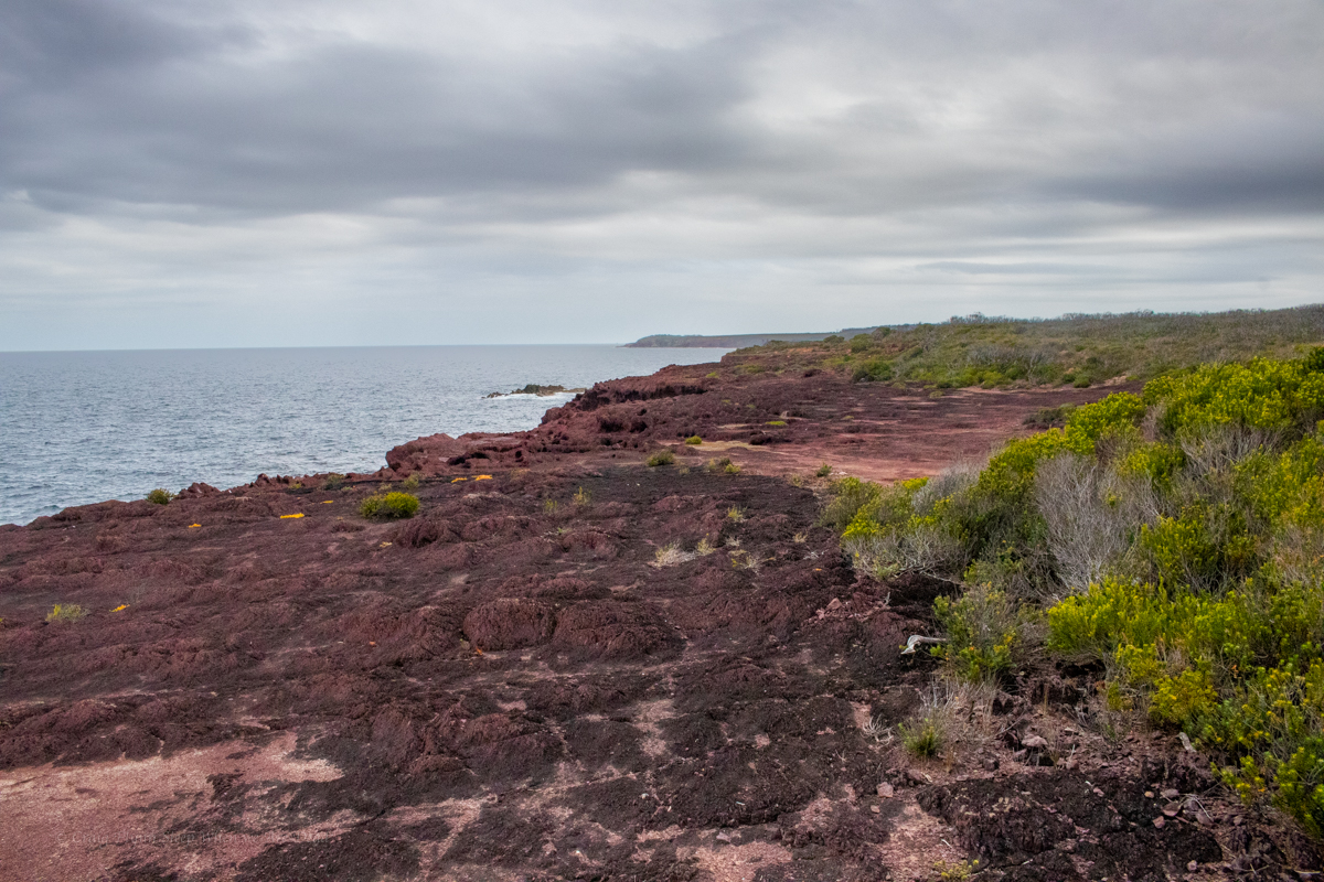
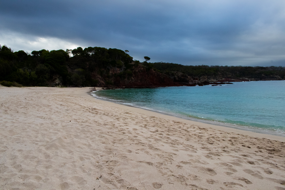
Once again we follow gorgeous coastline where the colours seem too vivid to be real
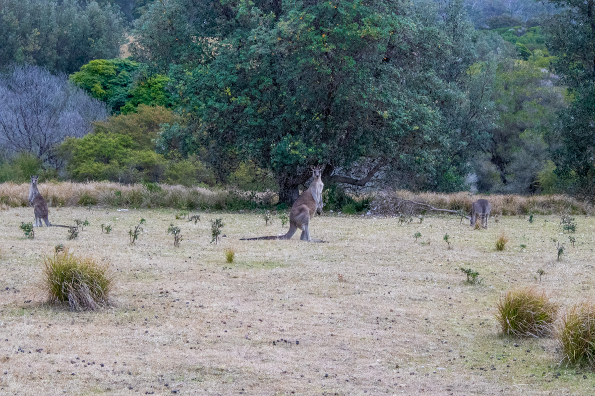
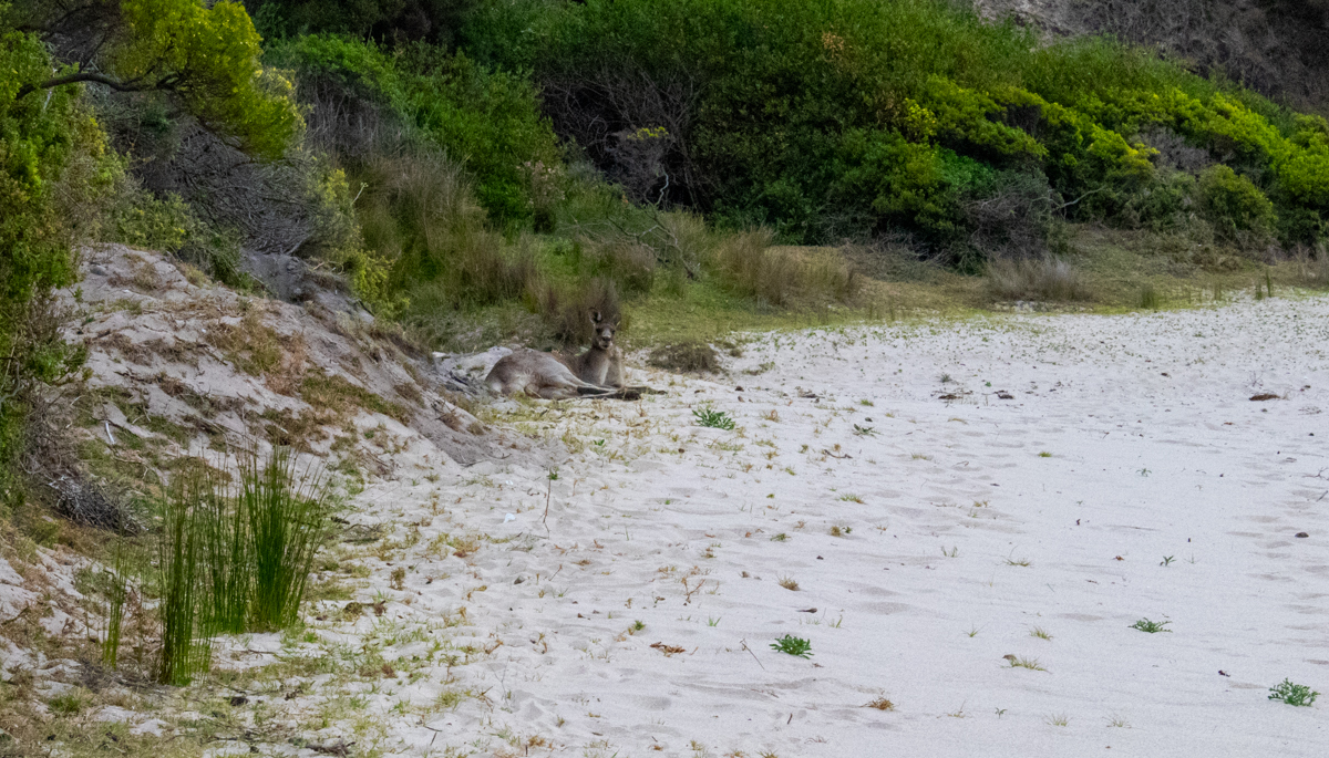
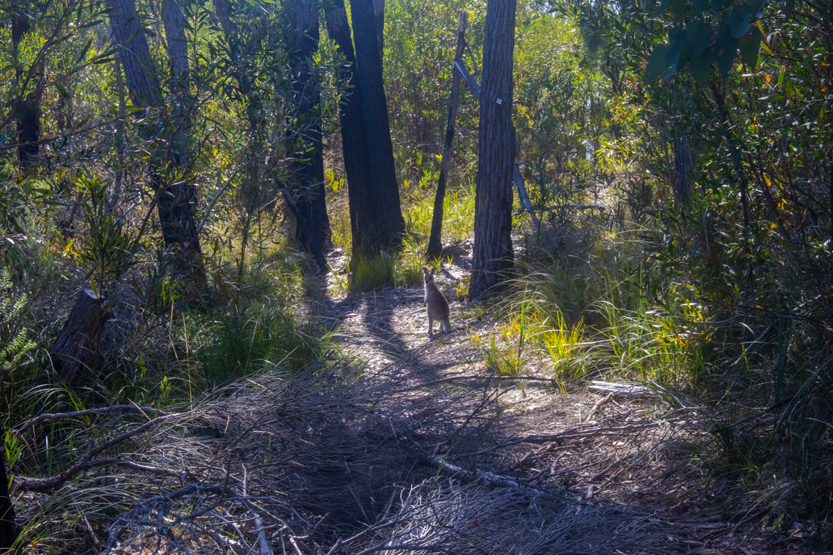
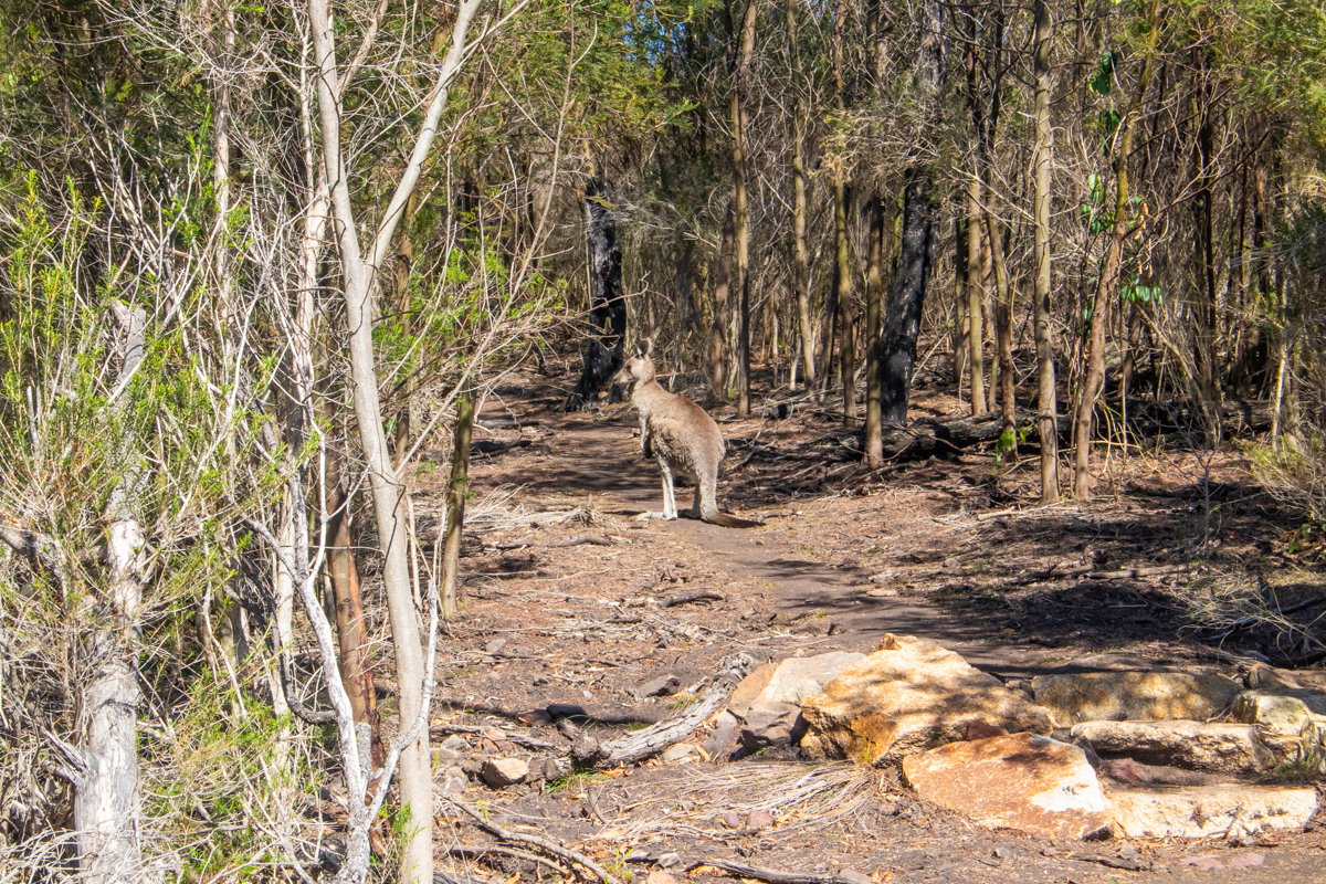
We come to an open grass headland and assume it’s the Mowarry campground. the kangaroos had it to themselves though.
And continue down to the beach, which the kangaroos also had to themselves.
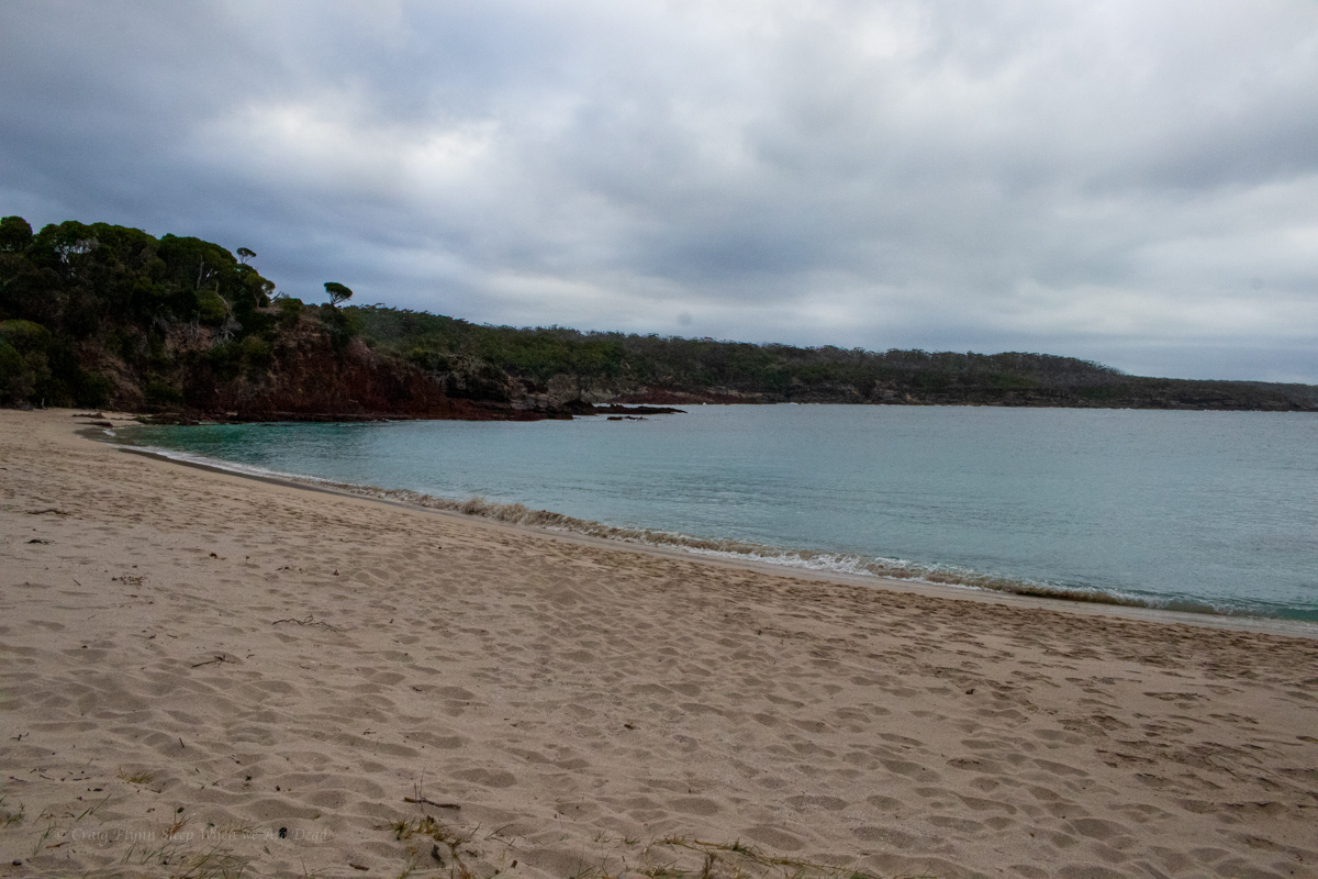
We are surprised to find a camp spot right next to the beach so take advantage of it.
With some little side trips for swims and views we’d done about 28 or 29km today. For some weird reason flatter walks knock me around more than our usual scampering up and down canyons so I was feeling it. Kylie has sprained her ankle the week before and was suffering a head cold so was just as happy as me to have one more swim to wash off the grime of the day and set up camp.
Unbeknownst to us the offical camp spot is up above the beach on the next headland. A tribe of partiers descended in the middle of the night for a mini bush doof which was hilarious but a spattering of rain had them running for their beds not too late into the night.
Part 5: Mowarry beach to Boyds Tower.
With just 7 or 8km of walking left we could have had a lazy morning but we were also keen to get the 30km ride back to the cars knocked over before the day got too hot so we were up early for a brekkie with a view then hit the trail
Up over the headland it was a short walk to leatherjacket bay. Leatherjacket bay must be the easiest to reach drive in secluded spot. It was littered with fast food rubbish and toilet paper. Why people would do that to such a beautiful spot is beyond me.
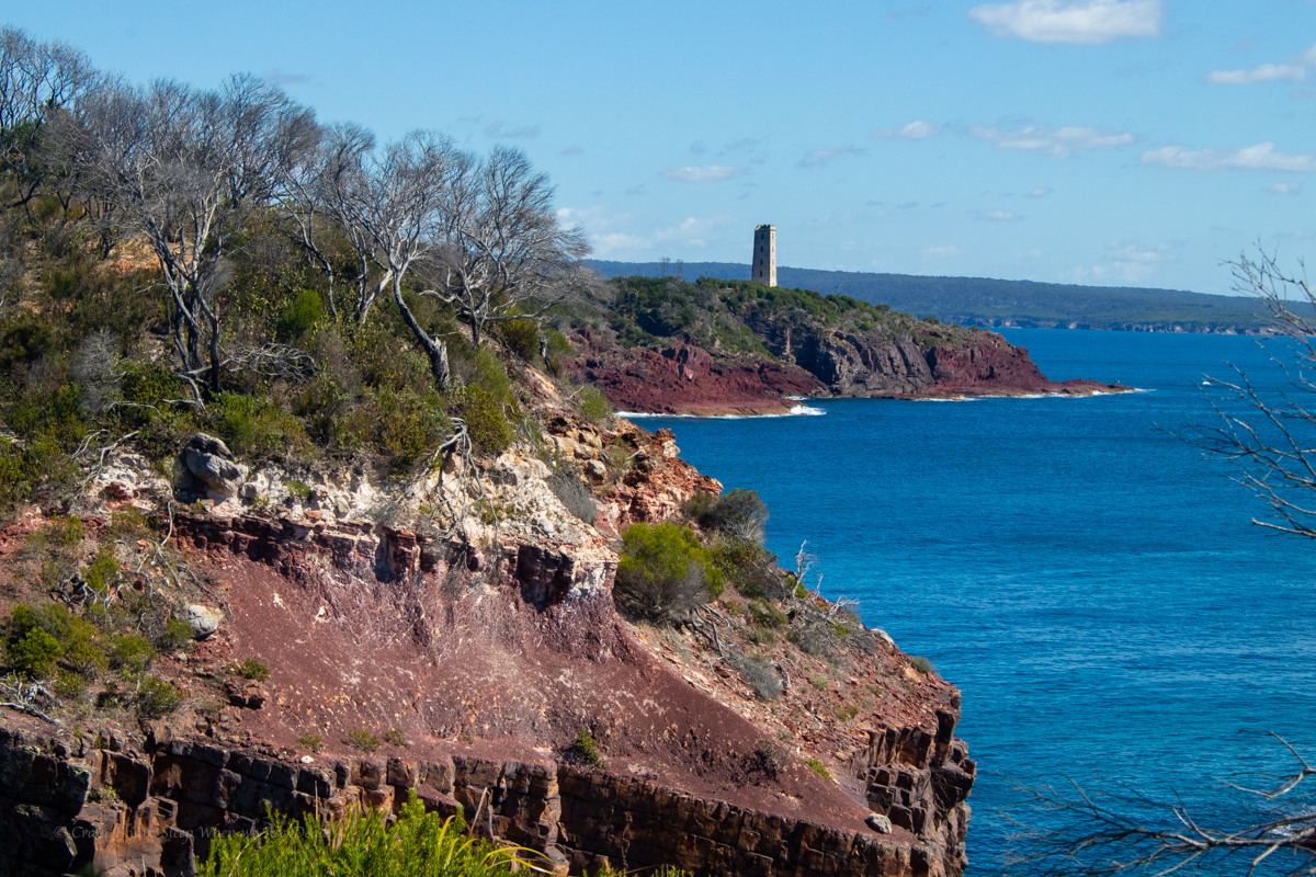
And up the next rise we catch our first glimpse of Boyds Tower
But the walk wasn’t done yet.
and there you have it. Boyds Tower.
Boyds Tower is an unfinished light house created by Ben Boyd. a character once respected for his early settlement down here but recently being cancelled due to him being one of Australia’s most infamous “Blackbirders”
Blackbirders imported cheap labour. Boyd had “recruited” labour from various pacific islands and shipped them to Australia. By the time he got them to Australia though the union movement, religious groups and city based politicians saw it for what it was, low key slavery, and basically outlawed the practice.
Those already at work on Boyds lands down tools and demanded to be sent home.
Find your own way home said Boyd. Many of those brought out found themselves stranded in Sydney with no way to get home…..
All that said his biographer claims he was considerably less racist and cruel than many of the politicians who had publicly condemned him.
Anyhoo, We reach the tower and the end of our walk. We woof down some food, swap backpacks for bikes and ride through the centre of the park, down Duckhole road back to the car.
It’s 30km on what my mate Bernard would refer to “gently undulating” dirt roads. At times the bull dust is so soft it feel’s like you are riding with flat tyres and there’s a few pinches to make sure the legs are still burning but it’s not a bad ride.
Kylie’s fairly new to mountain biking and injury has kept her off the bike for a bit so when we reach the junction with Green Cape light house road I offer to forge ahead and bring the car back to pick her up where ever she gets to.
There’s some fun and fast down hill sections here but also a couple of steepish pinches. It’s the stiff ocean breeze smacking you in the face in the last 2km that hurts the legs the most though.
I get to the car, quickly get changed and drive back up the road, Kylie’s not that far behind. It’s only a couple of kilometres to the end, isn’t it. asks she
Yep, says I. You want to finish it off don’t you?
She grins and pedals on…
All up 36+Km of walking and 30Km ride in 2 days. Not a bad effort.
Our review.
The Grade:
National Parks grade the walk a 4. “Grade 4: Bushwalking experience recommended. Tracks may be long, rough and very steep. Directional signage may be limited.”
Other than the length and a few short sections where you need to pick your way along the beach or over rocky outcrops I’m not sure how it’s 4. it’s fairly flat. I guess the recent upgrades have included adding stairs to any of the steeper sections so maybe before the upgrades….
Would I recommend it?
Sure. it’s definitely worth doing. The views are amazeballs
If your idea of bushwalking is well maintained and sign posted touristy type trails and you want to try something a bit longer or want to try your first overnight walk with the advantage of maintained camp sites this would be perfect.
Would I do it again?
TBH. I wouldn’t bother with the bit between Bittangabee bay and Green Cape Lighthouse again unless I was adding more time and doing side trips out to things like Pulpit rock and checking out the little bays.
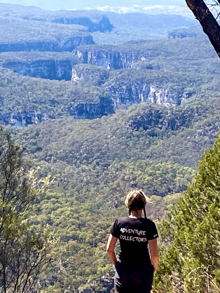
Day 3 would see us back on the tourist trail for the most part. We’d planned to get up to Battleship Spur, nearly 600m above our camp, before the heat of the day. Then check out Boowinda Gorge and it’s side creeks
Both were listed as star attractions. The young couple we had shared camp with came back raving about how beautiful Boowinda Gorge was and a steady stream of people had made their way either up to or down from the spur on their journey along the great walk.
So up we go. The path up to the spur starts up Boowinda gorge but we don’t really take notice as we’re nervously excited about the haul up to the spur.
A side gully acts as a pass out of the gorge. It’s steep, reminiscent of the scramble out of Tigersnake canyon. but once through the lower cliff line a well maintained trail makes it’s way up and along an amazingly varied spur.
Think the Thuratt Spires with a tourist trail…
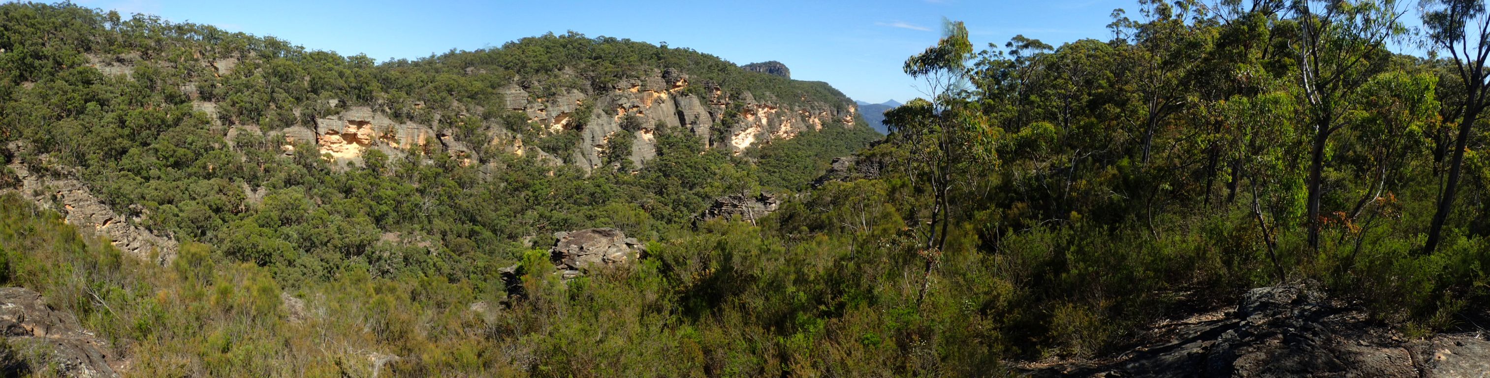
Wide open grassland alternates with almost razorback spur. Fine white sandstone changes to conglomerate and an out crop what appears to my uneducated eye as quartzite. Speculation around the geology distracts from the slog up.
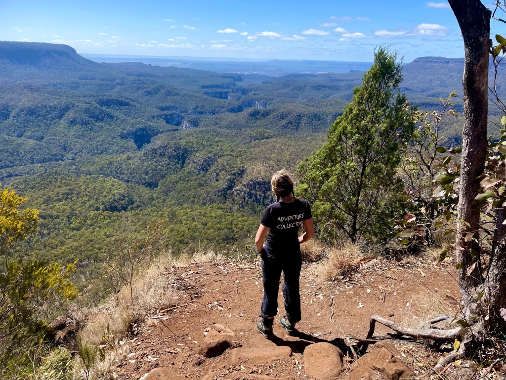
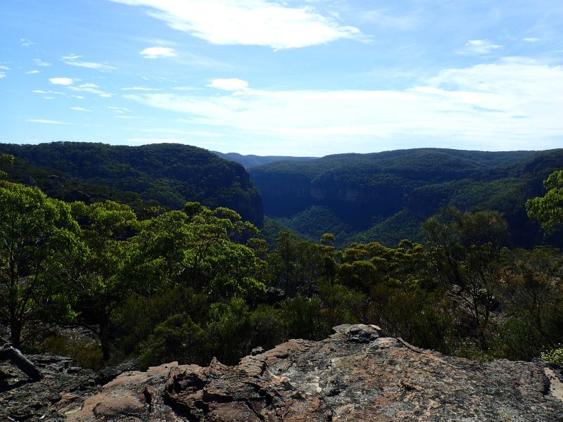
And the views from the top?
Worth every grunt and groan
Gadget looking back over the lower end of Carnarvon gorge. The mouth of which is 10km away and 700 or 800m below.
Now back down for lunch in the cool of Boowinda gorge.
Running on a high we start making our way up the gorge.
It’s a bloody soul destroying slog
Think of walking up the Wollemgambe. Only it’s dry as a nuns nasty and instead of sand it’s littered with baby head sized river stones. And the river stones haven’t been tumbled enough to make them smooth so they are jaggered. And they move beneath your feet. And the bigger ones give false hope with 3 or 4 holding firm then the next rolls just to mock your ankles.
Still so many Carnarvon glamour shot are from Boowinda gorge.
We press on.
Several times we consider just turning around but we’re a stubborn couple.
I guess the PC term would be “determined” but it was pure stubbornness (and a view of our white slot at the start we glimpsed from the Spur track) that kept us going.
Finally we get to the junction towards the top of the bloody Boowinda gorge and by some miracle there’s clear running water. Not much but more than we’ve seen in the side creeks since Wards Canyon.
We take the right branch. It’s a low quality slot but it has clear flowing water. So there’s that.
The water is far clearer than this shot implies but I was well and truely over this bloody Boowinda gorge to bother trying to photograph it well.
We get to a point we could have scrambled in from the top (It would have been much easier) but it got far too steep for us the reach the mysterious white walls a few hundred metres up the escarpment.
We retreat back and try the right branch. It was shit
We trudge back down and check out all the side creeks along the way. Some had canyons like sections but after the quality slot canyons of yesterday they were a major disappointment.
Back down past the Spur exit and I don’t know if it was the different light or just we were paying more attention but we had to admit the bottom was nicer than we originally gave it credit for.
Like, if you had never been in a proper slot canyon before you’d be impressed
If you are going to do Carnarvon gorge try a cooler month and hope for a good bit of rain in the days before you get here.
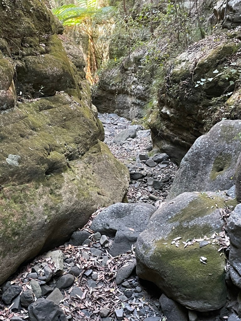
Finally out of what my mind I will always call Bloody Boowinda Gorge we paused for a bite to eat. All the trudging over loose river stones had zapped our energy.
It would have been easy just to return to camp but it was barely 4:30pm and there was another long gully about a kilometre down stream that had a name (At least on one map we had stumbled across) so we couldn’t help ourselves and went for a look.
The gully was scrubby and hard going but it keep promising to canyon up just up ahead. So we pressed on.
At least it was wet
We trudged on until we started to loose light and so left this intriguing chasm to its secrets and made our way back to camp.
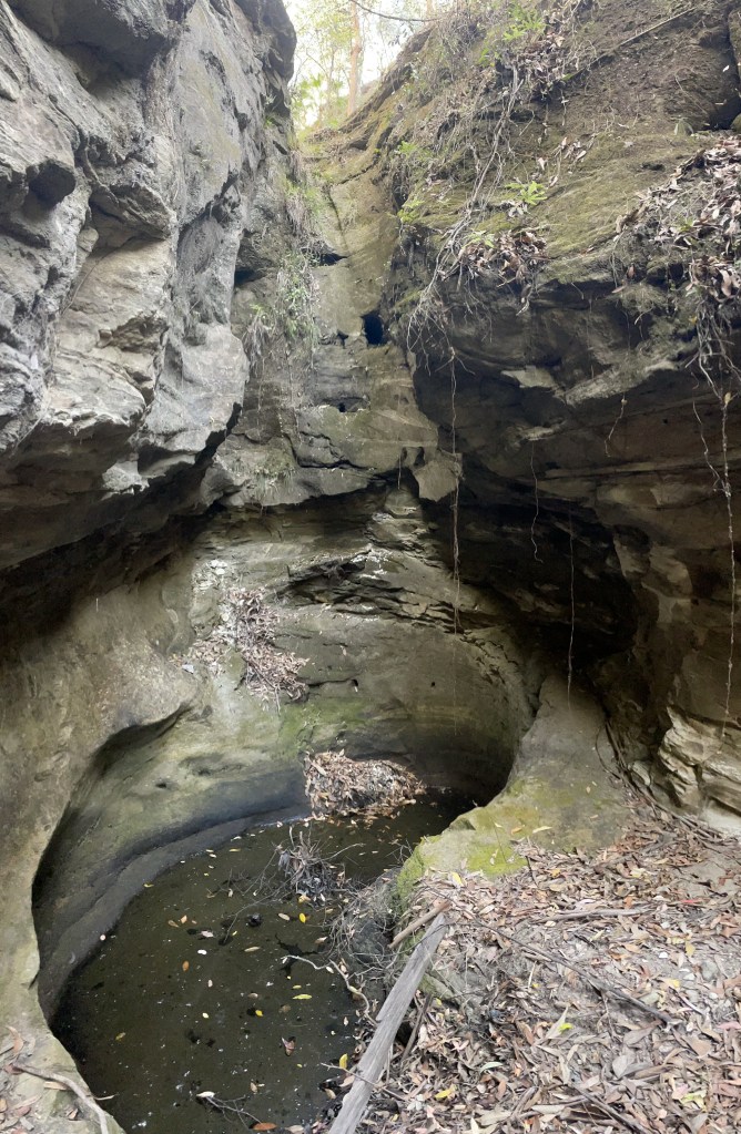
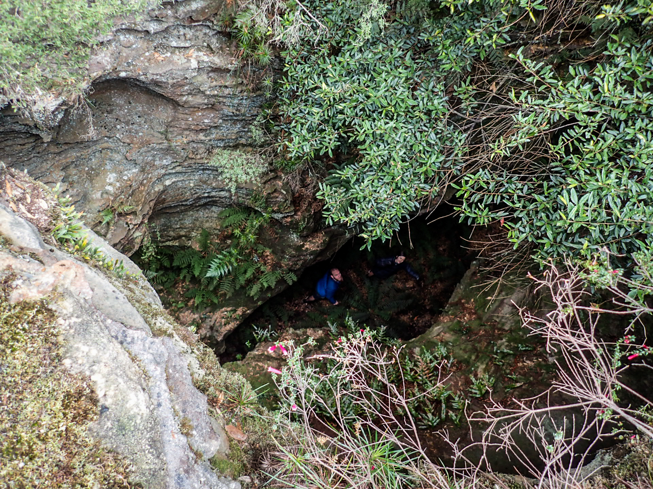
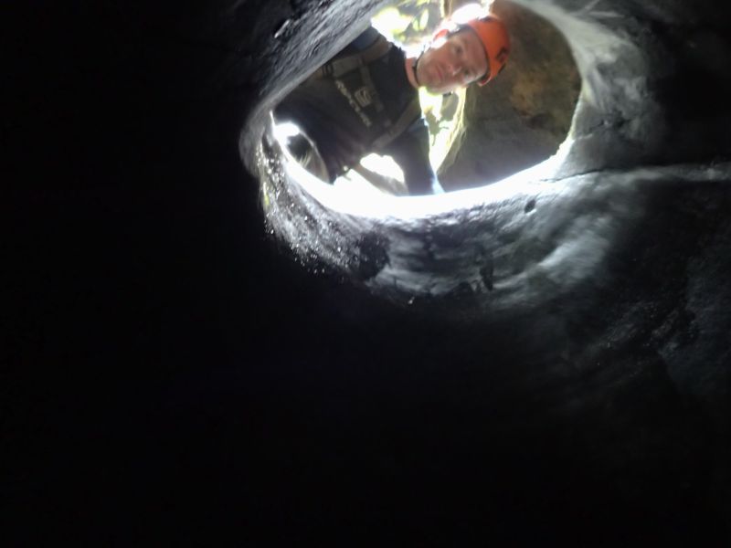
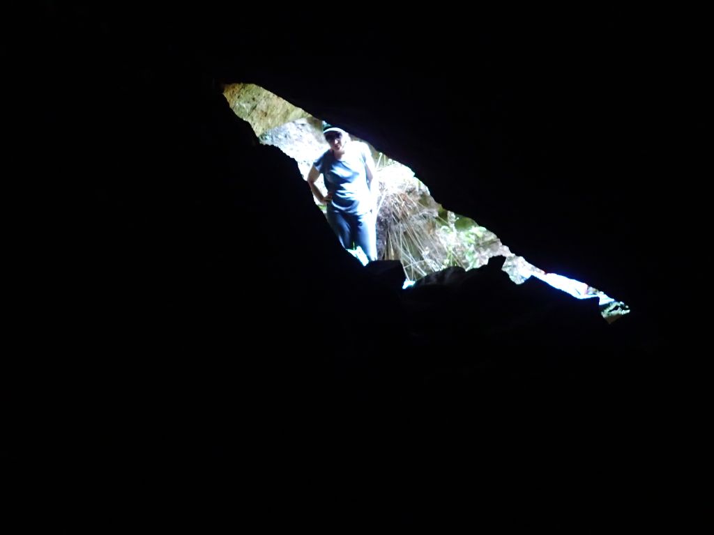
There’s not much to see. Says Tal. It’s just a hole in the ground
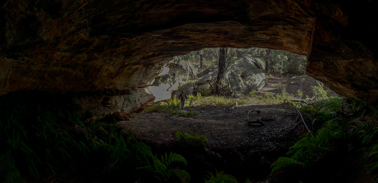
In one sense he is right, it is just a hole in the ground.
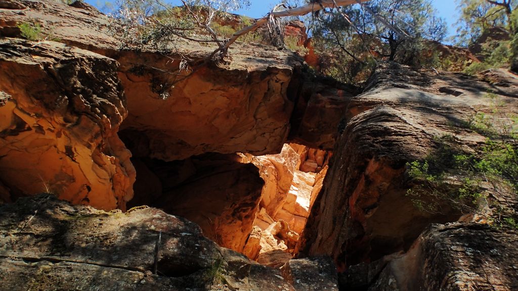
But the hole had significance in a couple of ways.
As drab as it is it happens to be one of the largest sandstone caves of it’s type in NSW, possibly Australia (1 report I read claims 10th biggest in the world). From what I’ve been able to make out from what I’ve read sandstone doesn’t tend to form these large subterranean cavities that often.
and
ii. 25 years ago, when we first started going out Mandy dragged me out on a wild goose chase trying to find this cave that was suppose to be near her grandfathers property. Way back before we got really into the adventurous outdoors we had a couple of goes at finding it and never did
So when Tal comes home after a weekend of camping with his mates and nonchalantly announces they found the cave I was 2 parts proud dad 1 part jealous.
You’ll have to take us there one day. Says I
Meh, shrugs he. There’s not much to see. It’s just a hole in the ground
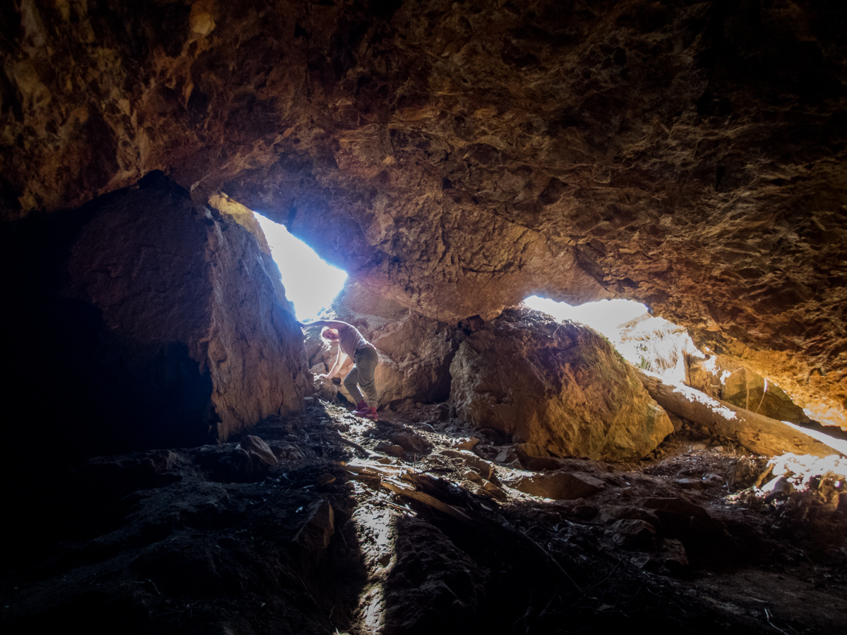
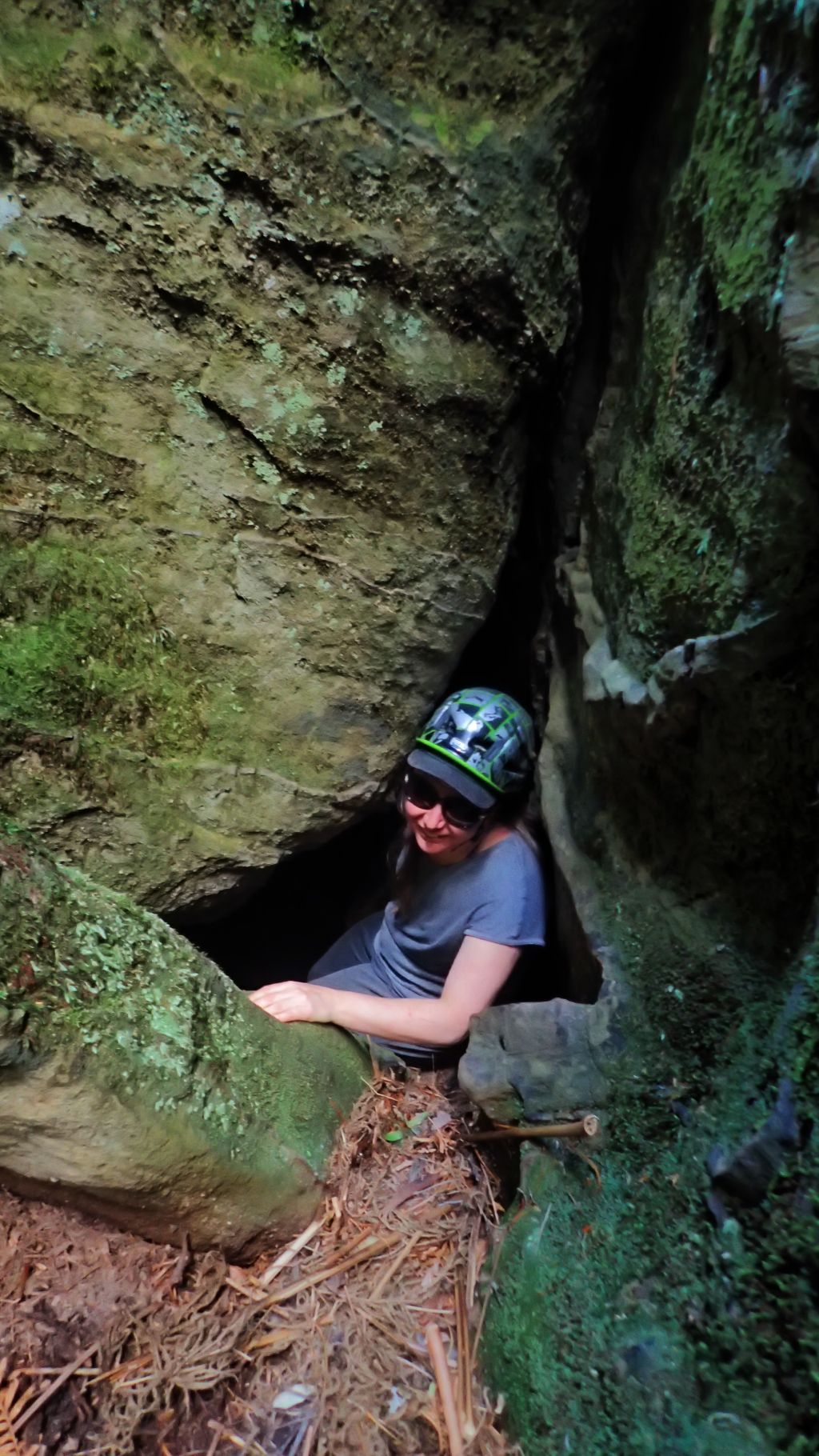
Any way with a bit of bunged up ankle and a free afternoon I con him into taking us for a walk. He and his mates had traversed quiet a bit of private property on their journey. We try the approach from the other side.
It’s further around then we thought and hard to spot until you are on top of it but he navigates us in with nary a wrong turn.
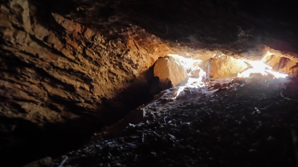
Like he said it’s just a hole in the ground.
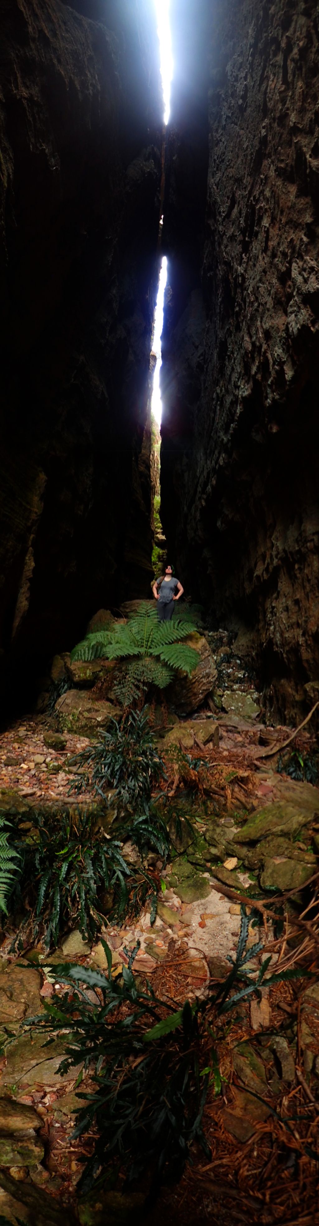
But that’s not the point
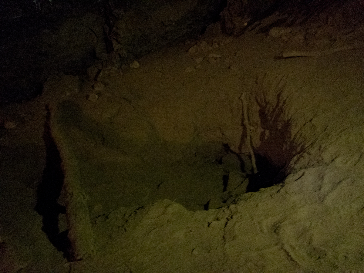
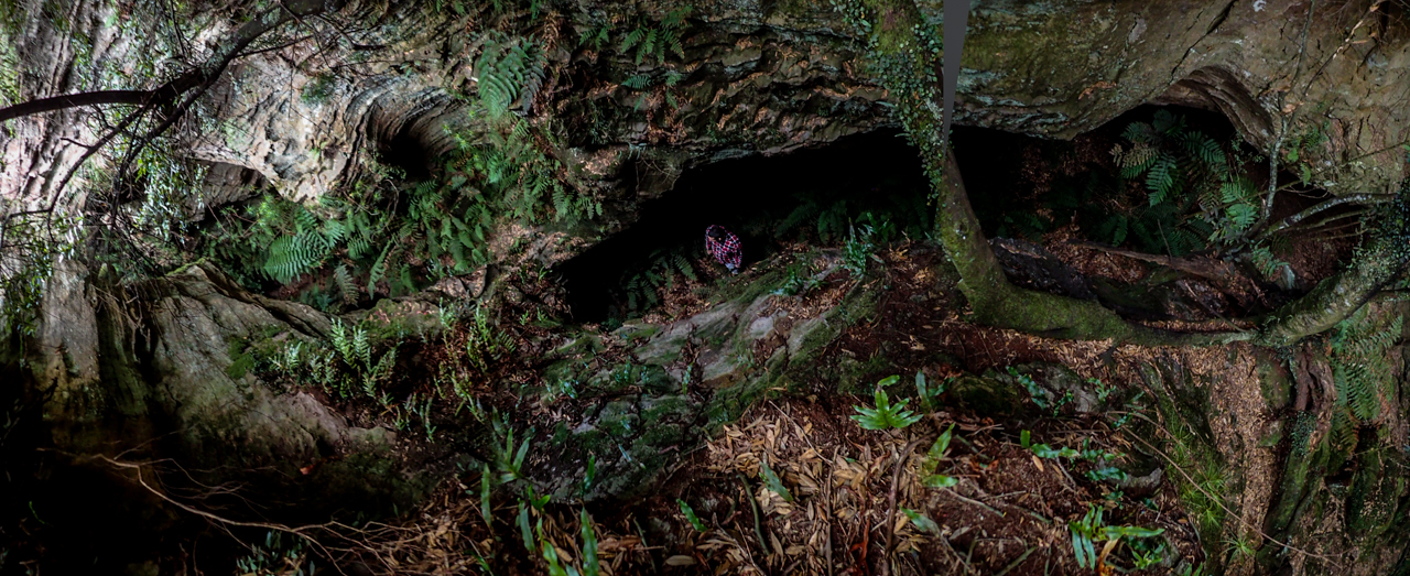
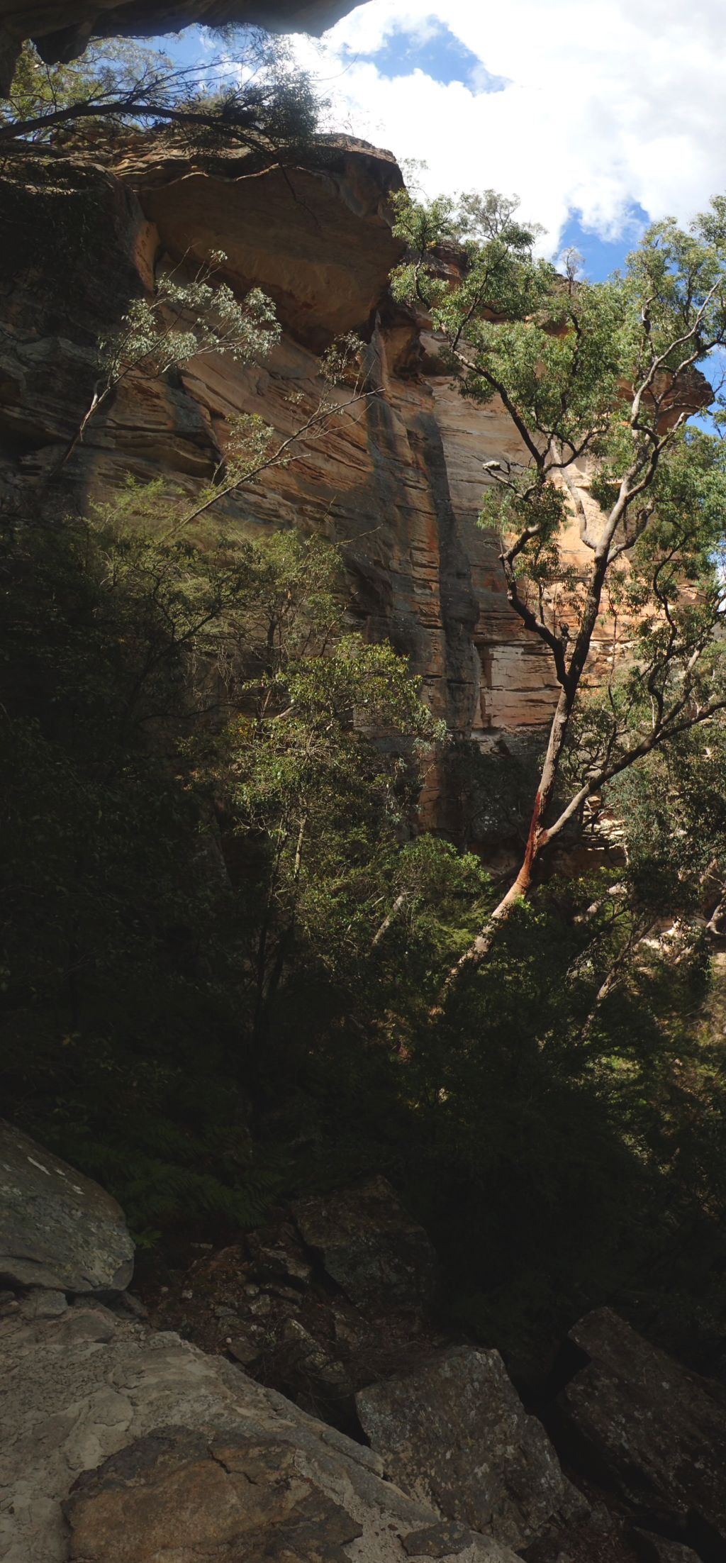
Tal leading the way in. The big depression this hole lies at the base of suggests the cave was once much much bigger
A little witchcraft is needed to find it
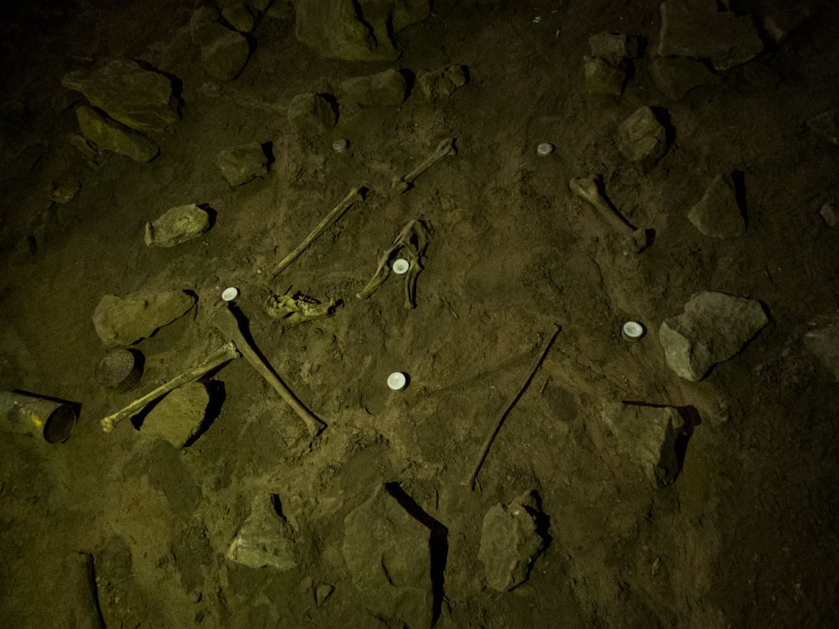
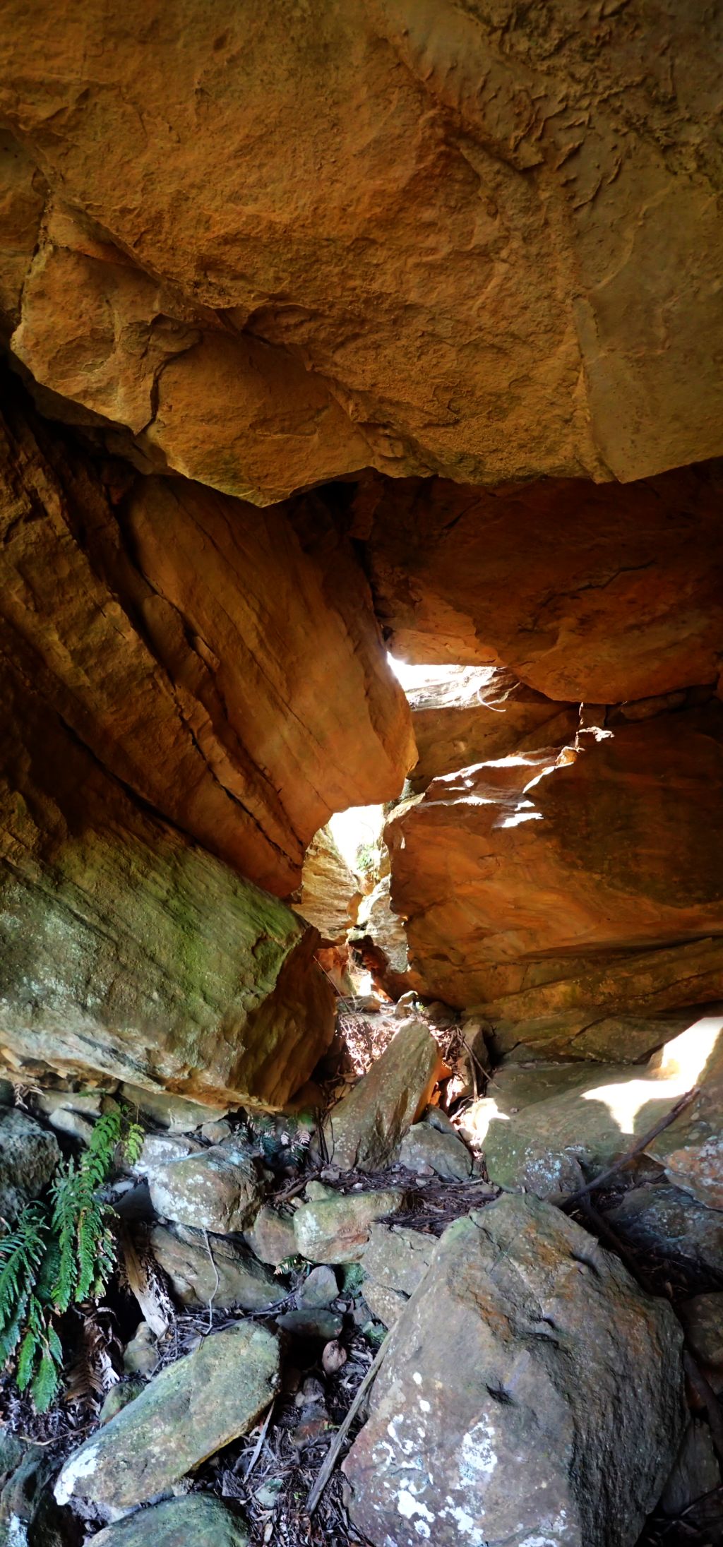
Bad photo of a pit left over from an archaeological dig done in the 80s(?) Apparently nothing was found
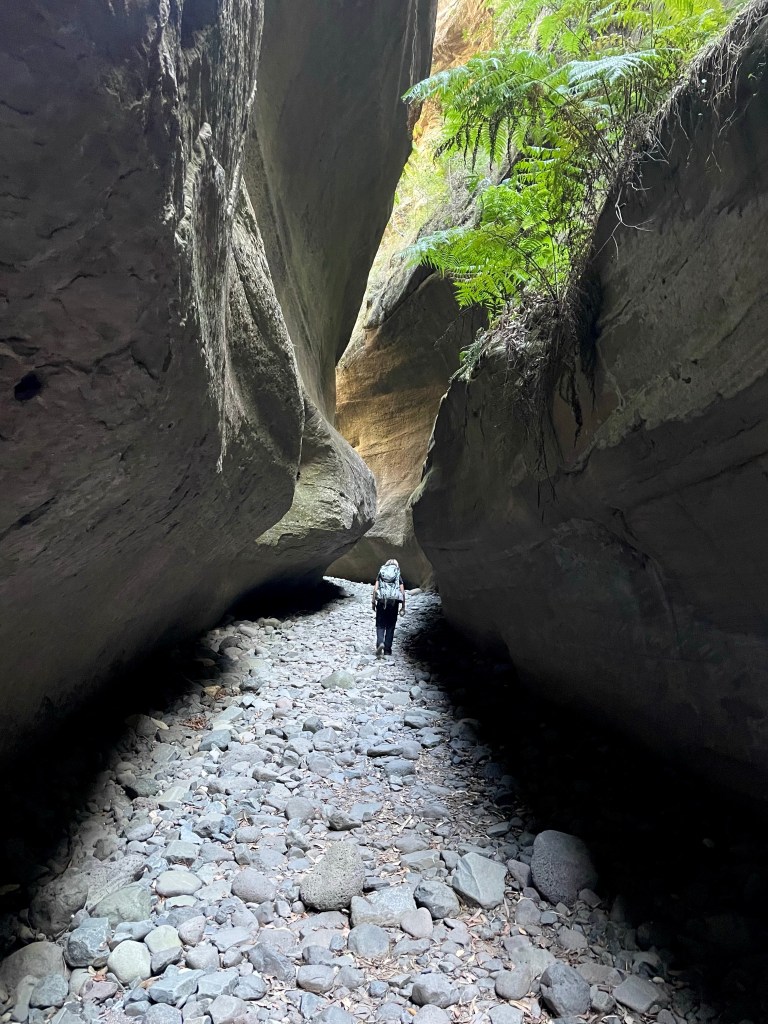
Another trip to this short but pretty dryish canyon out the back of Clarence, and a stop at Goochs Crater on the way back
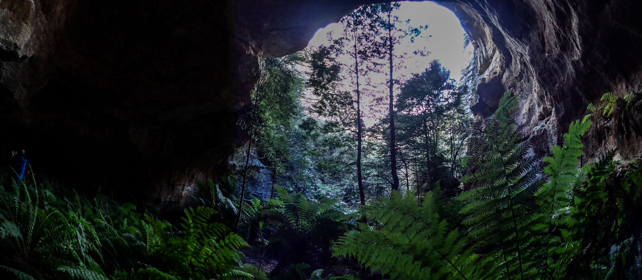
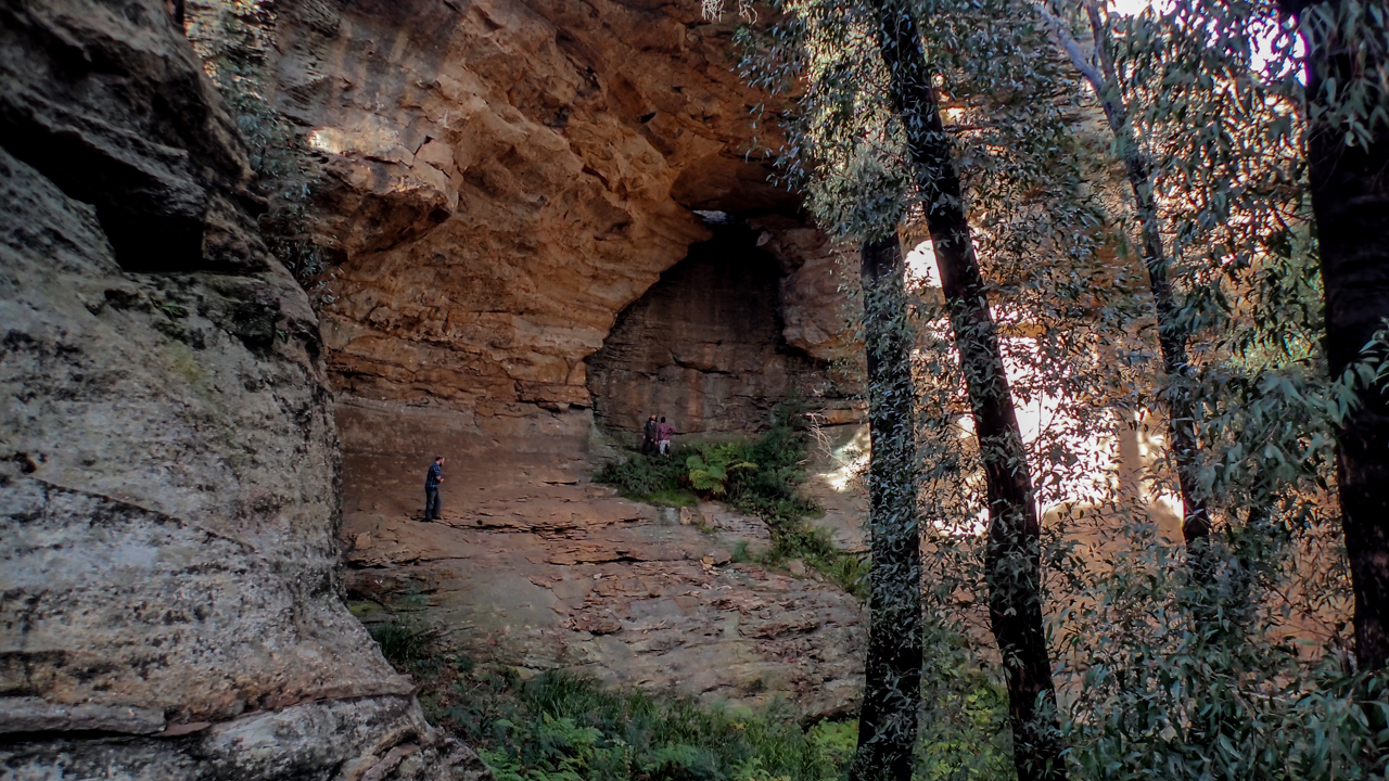
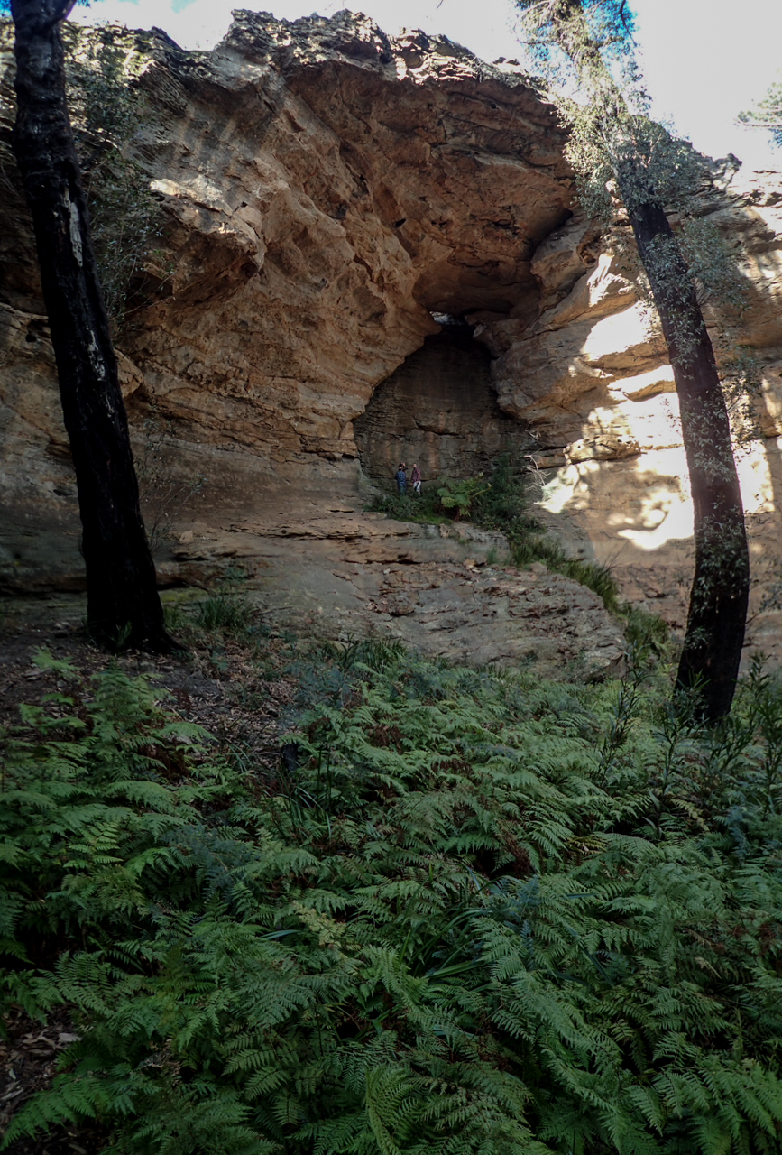
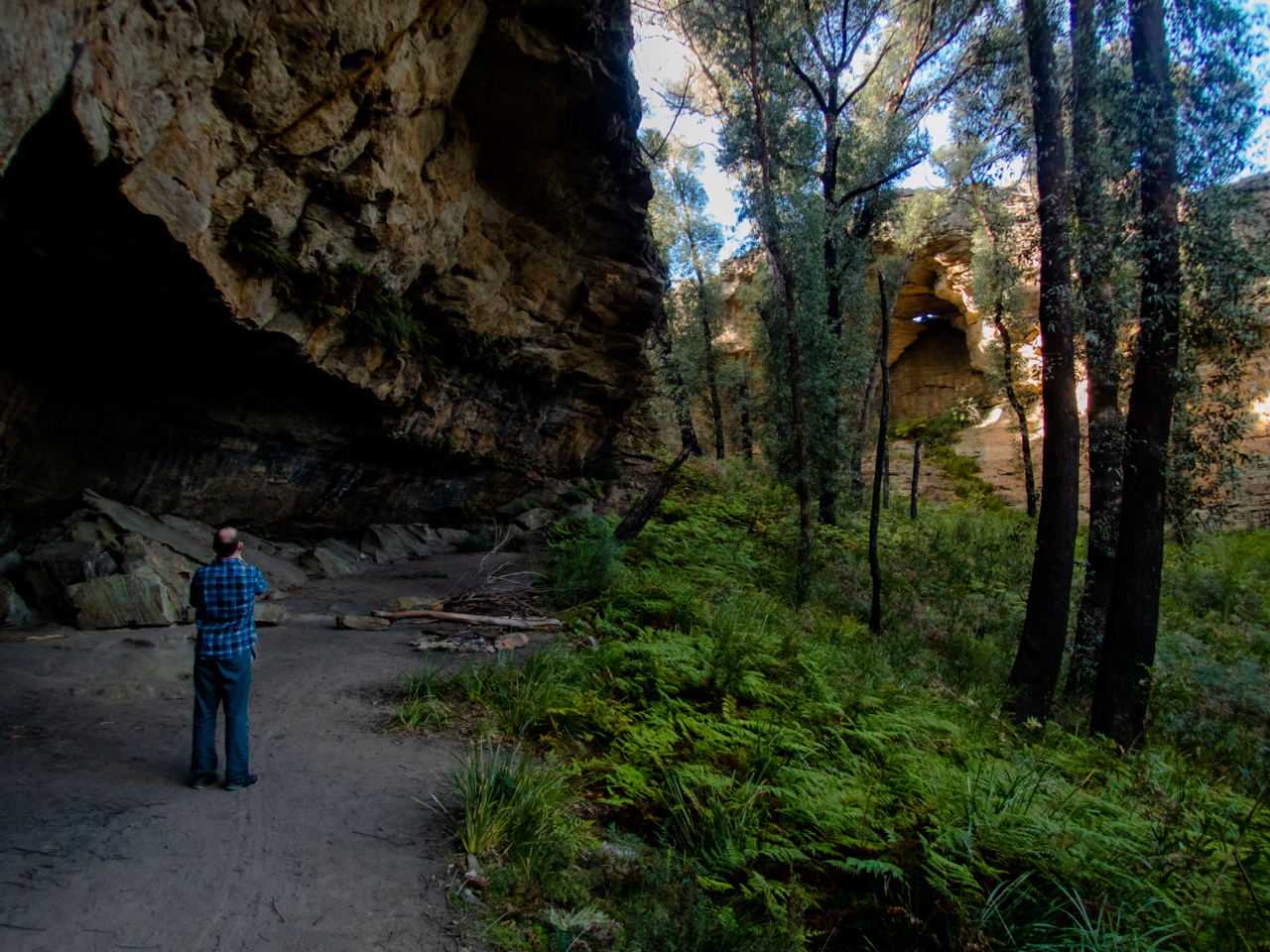
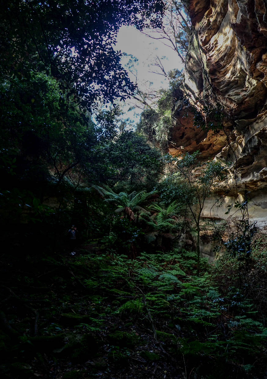
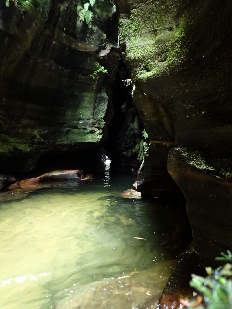
This is an awesome sheltered cave. The creek, when it’s running flows through the back of it.
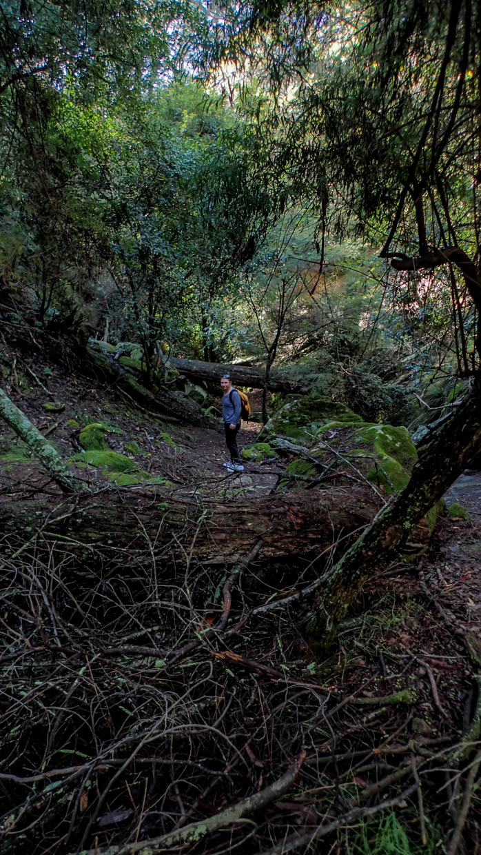
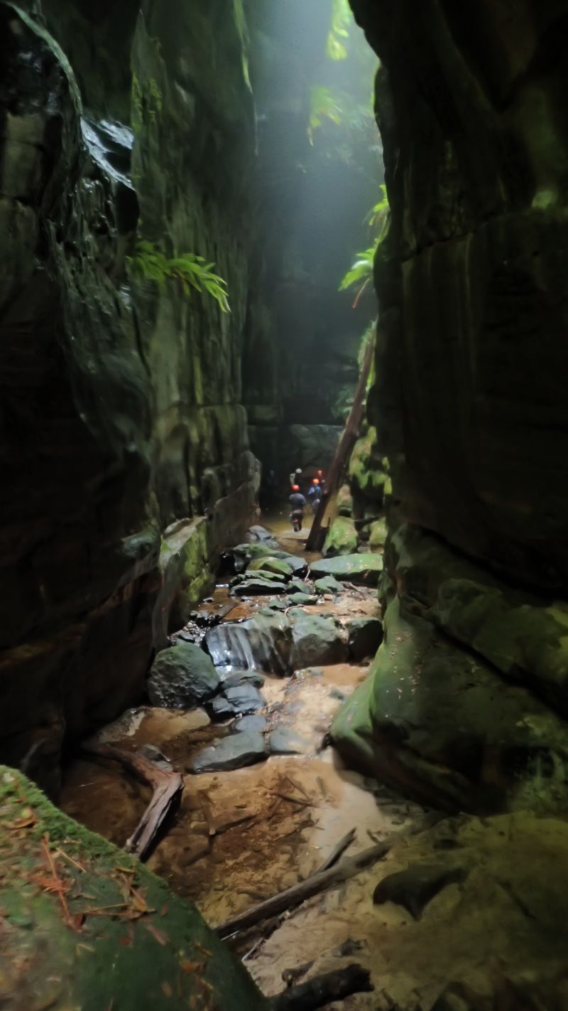
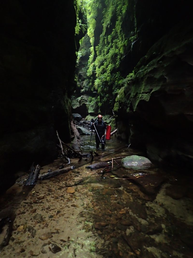
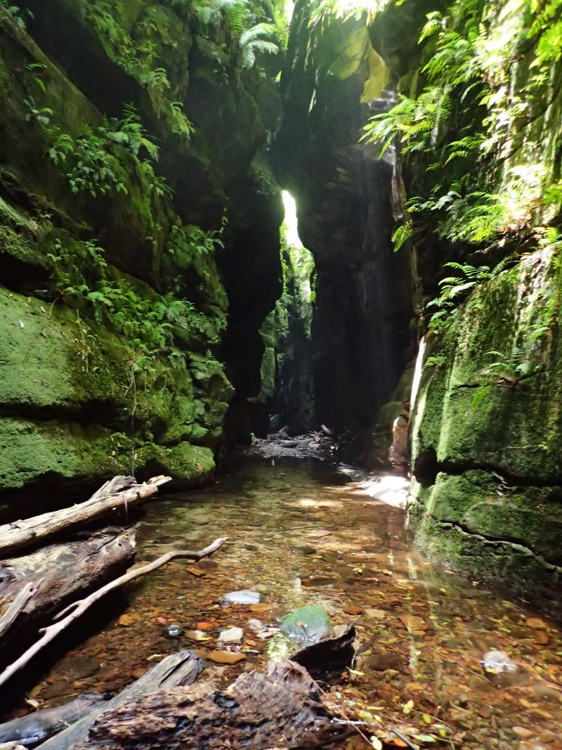
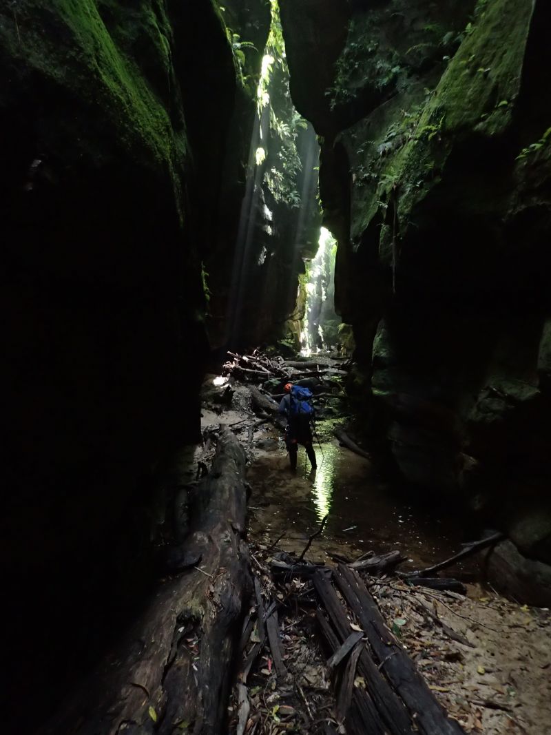
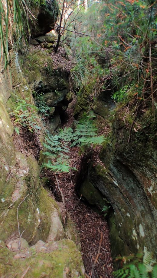
Venturing up the stuning side canyon. First recorded exploration of this slot by a bushwalking club was a group from Sydney Uni Bush Walking club in 1962, though I suspect Col Oloman would have visited previously either on one of his solo trips or with friends as they explored the areas through here across to the Bungleboori and beyond. Neither bothered to name it.
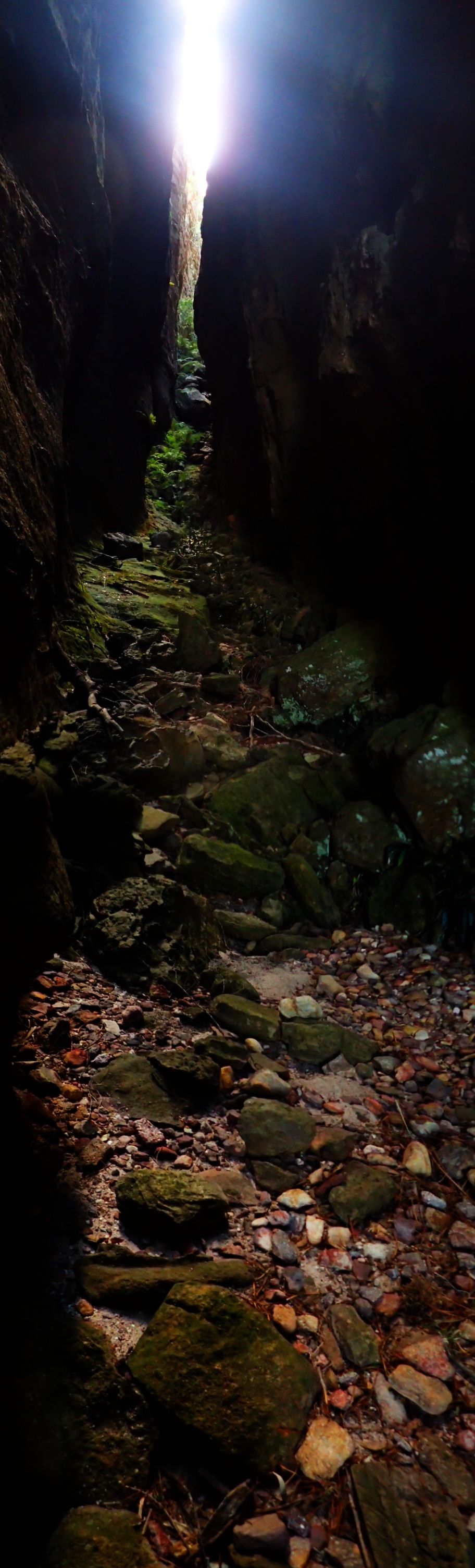
I keep forgetting how short this slot is. You get caught up in the light and ambience and time ceases to have meaning
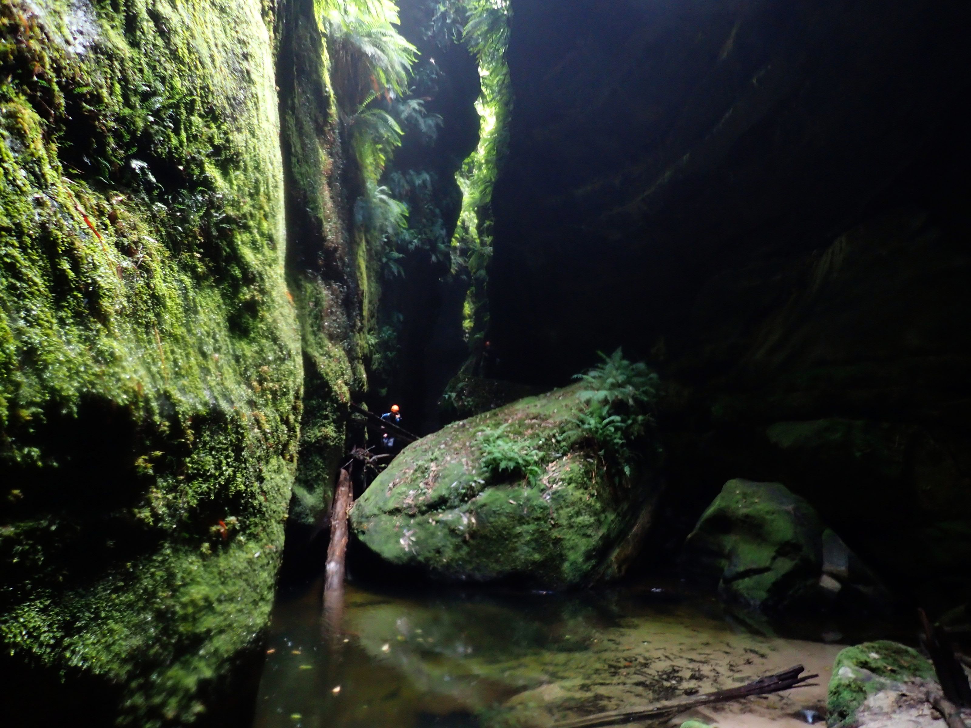
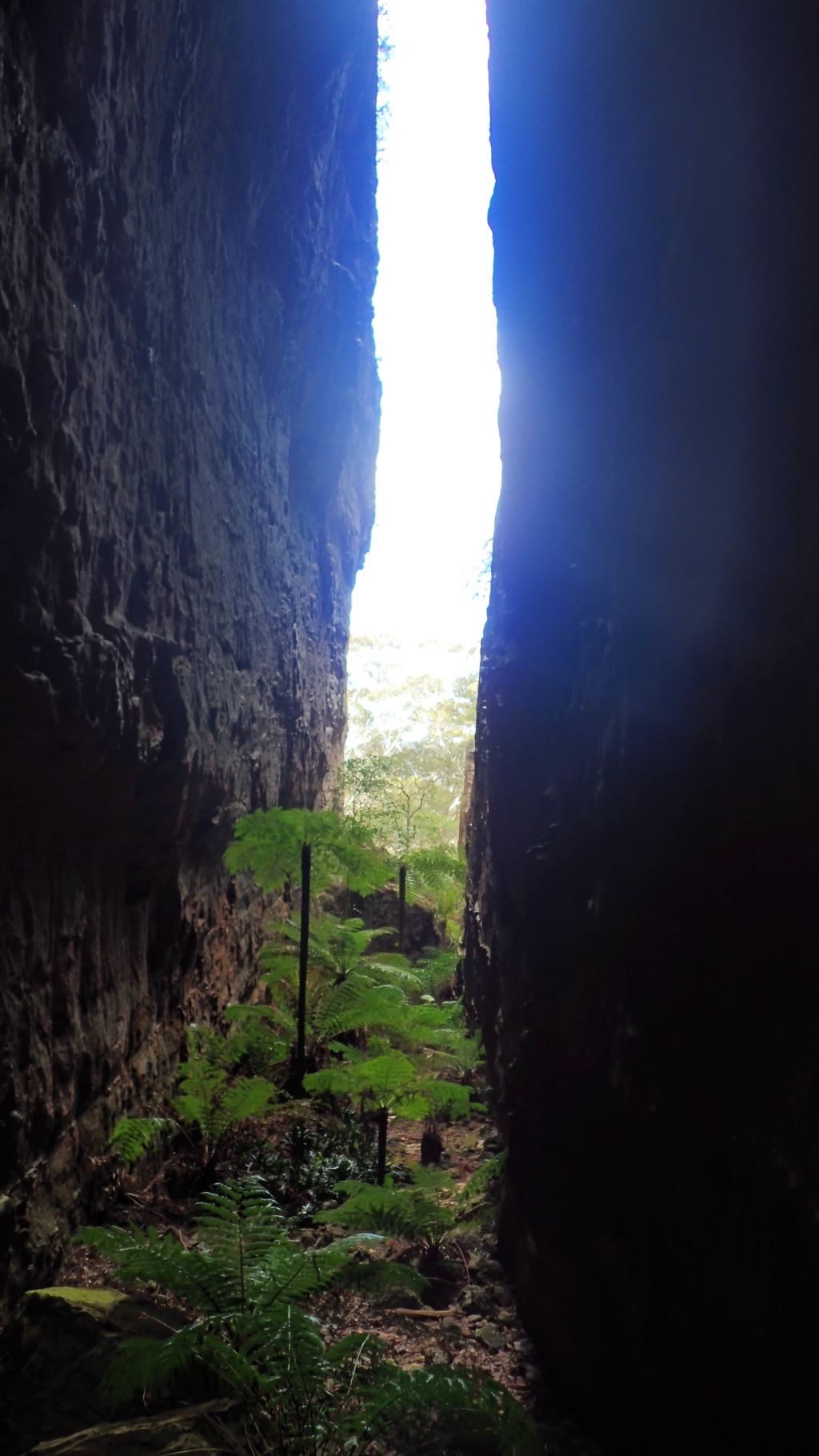
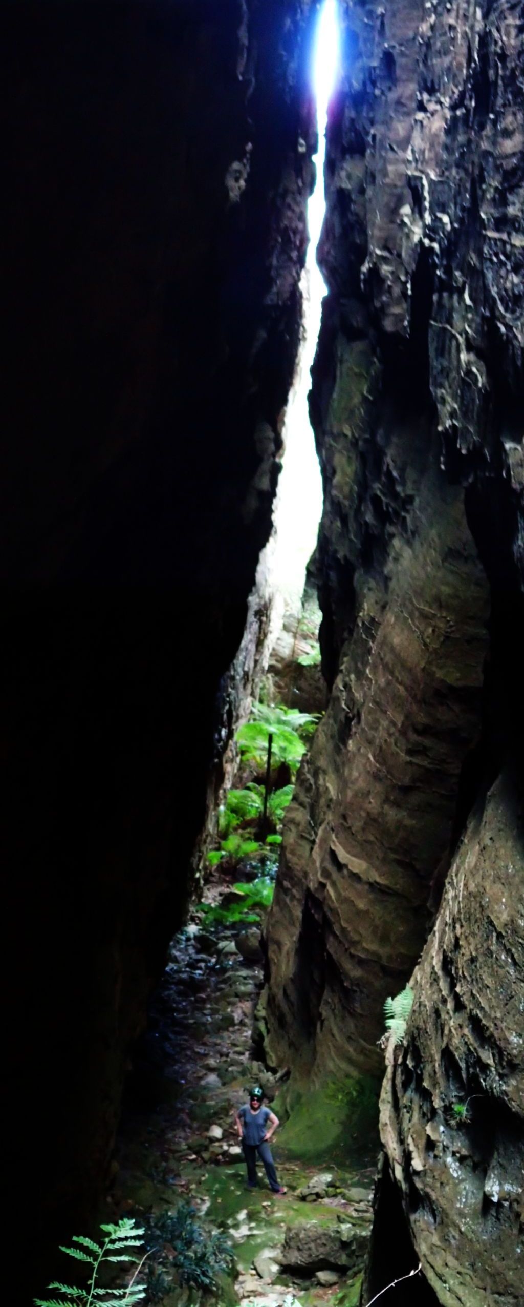
the large cave in a 180 bend in the canyon.It’s like another world. Ciaus and Ed desided when society falls apart this might be a good place to live
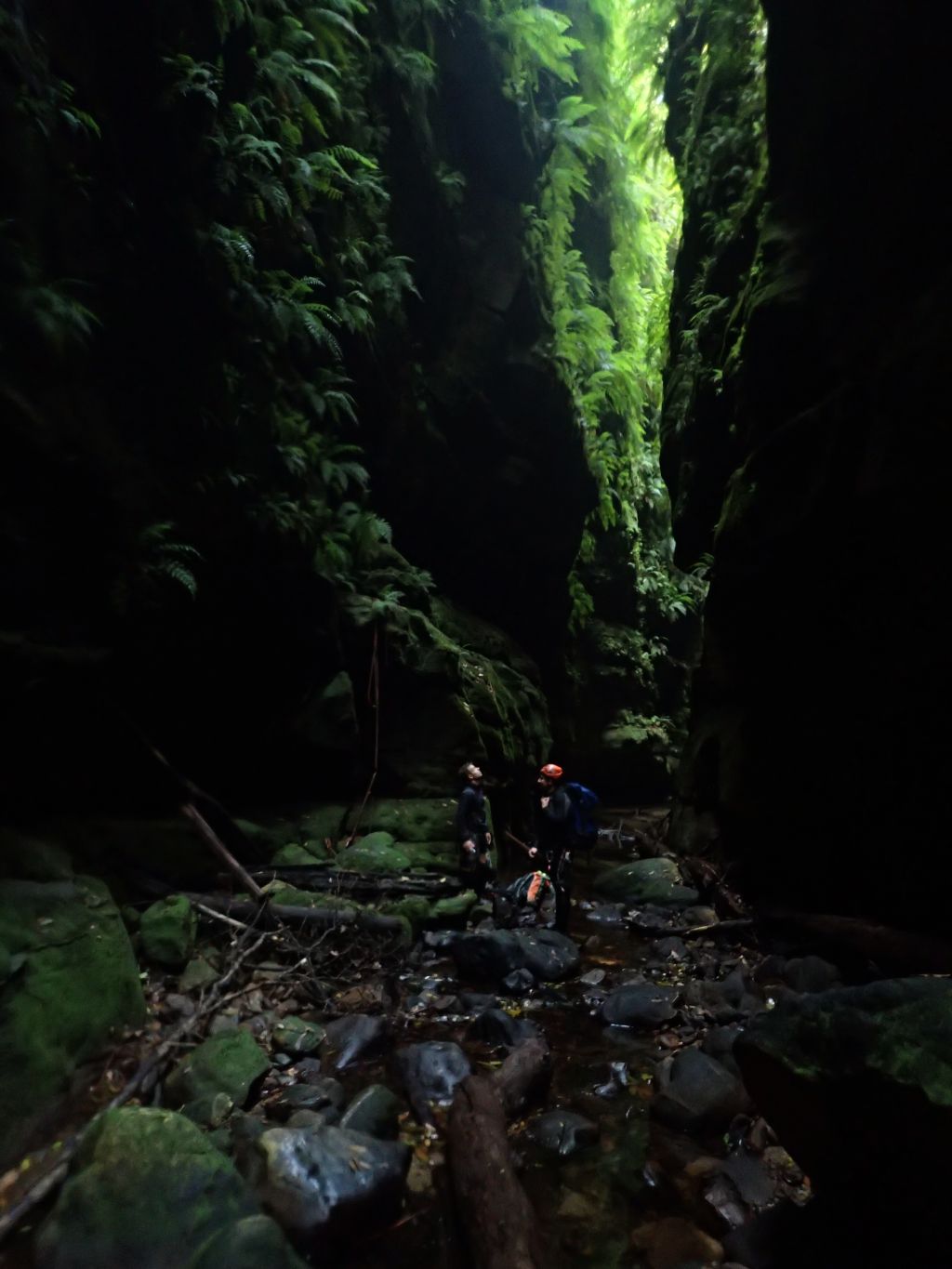
Ed in one of the more open twists and turns in the very narrow upper section of canyon
tight and twisting canyon formation
Ed on the peak, the canyon carves around either side of him. The cave at the bend can be seen in the cliff line, though the scale of it is hiddne by the trees
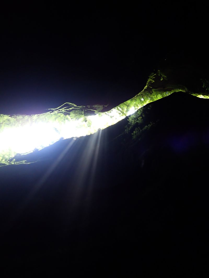
We seem to be climbing out to look down on the top of canyons a lot lately
Ciaus and Jake as the canyon opens out slightly near the cave
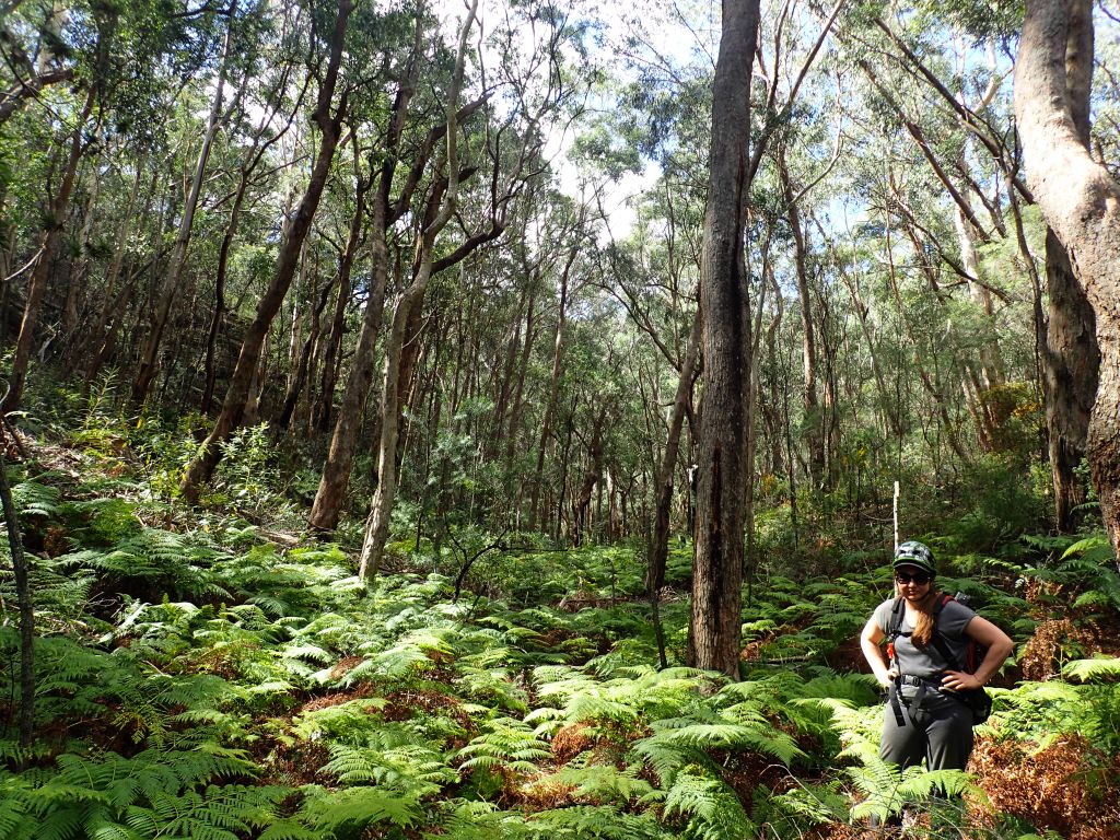
It might be hard to beleive but the town of Rylstone has one of the best Yum Cha/Tea house in Australia (29 Nine 99, do yourself a favour). I’d booked in with Mandy for a late Mothers day lunch and we thought why not do a walk while we were there.
Dunns Swamp is the gate way to the Wollemi and a hot spot for outdoor activity in the area but it’s a long way out of town and with the limited openning hours for Yum Cha we needed something closer and a bit more touritsy.
A quick google search told me there was a little nature reserve about 16km north of Rylstone that might offer up a pleasant walk. Fern Tree Gully
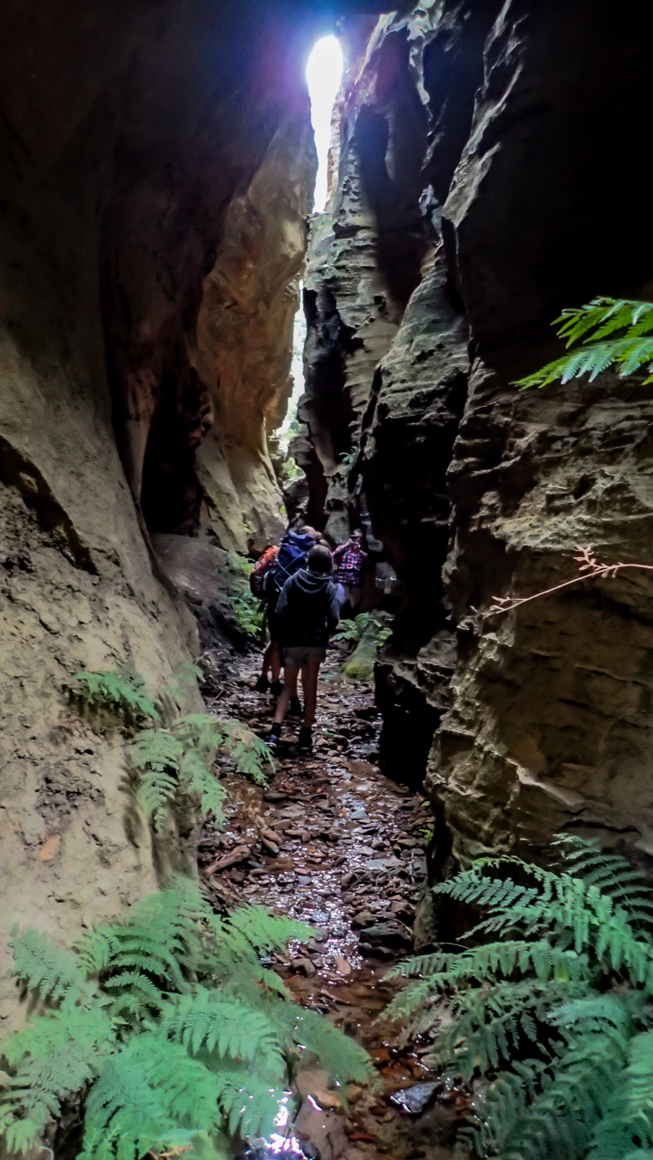
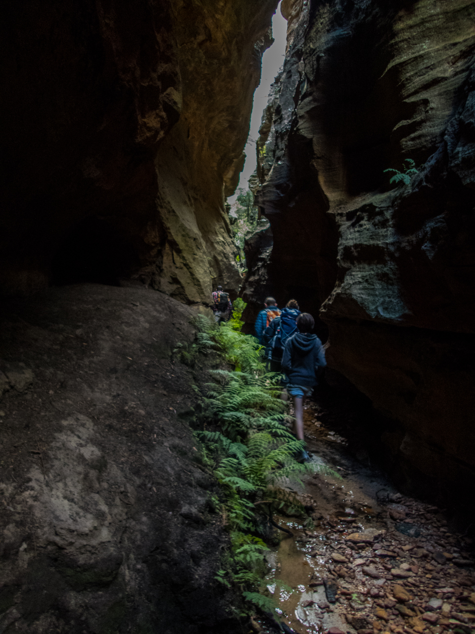
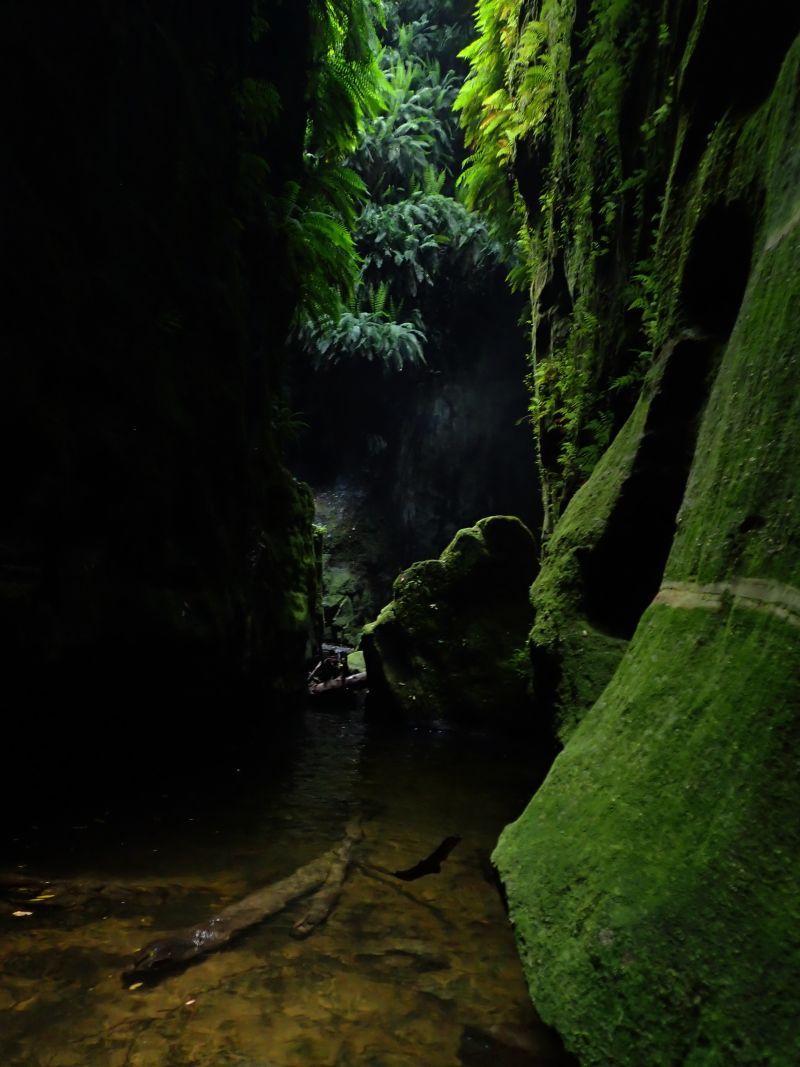
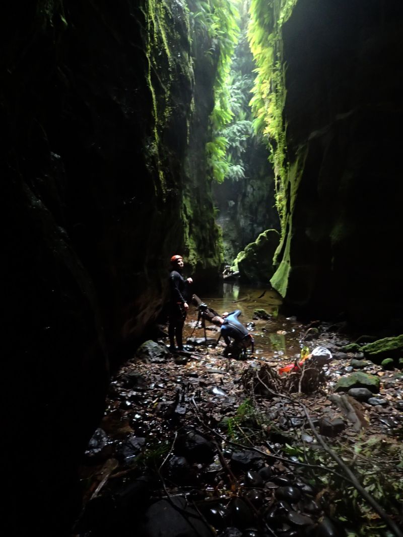
I wasn’t sure what I was expecting, certainly not a little canyon, but I was in fr a pleasant surprise.
A well maintained (Not a thing out of place, 1 discarded chip pack the solo piece of rubbish we carted out.) tourist trail winds down into a pretty gully the vegetation is completely different to what I’m use to in the blues and there were lots of little information signs to let us know what we were looking at.
At the base of the gully I commented it was almost a canyon… then we rounded the corner and it canyoned up. Sweet!
Mandy making her way down into Fern Tree Gully
Fern Trees aplenty
The walls close in and a canyon appears
OLYMPUS DIGITAL CAMERA
OLYMPUS DIGITAL CAMERA
OLYMPUS DIGITAL CAMERA
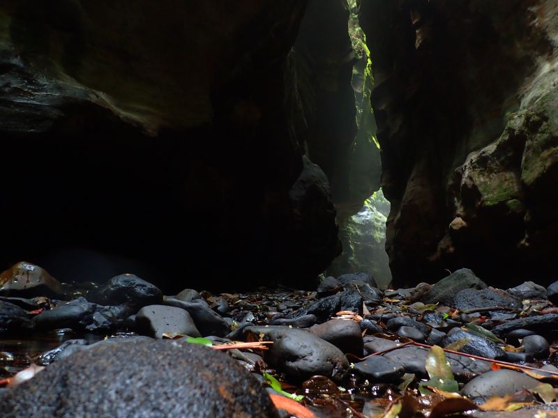
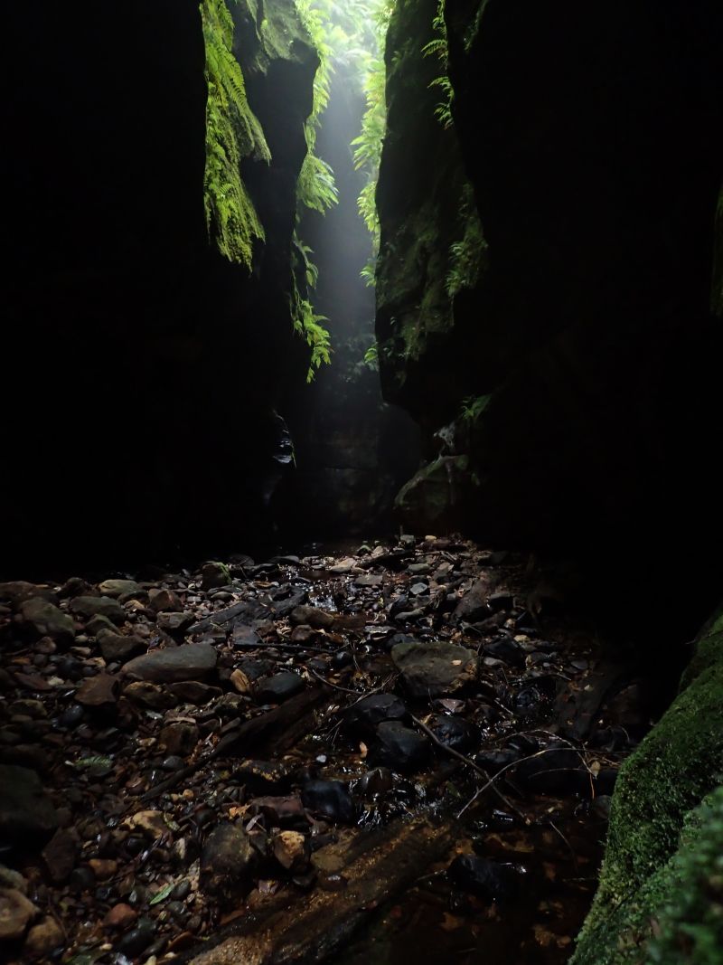
After a bit the gorge opens up a little as the trail ambles through the gully
Even close to midday the light was magical
For all their calling and mimicry Lyrebirds are normally shy creatures that dart off into the scrub at the first scent of humans… This one didn’t get that memo. I think he liked Mandy to be honest.
The canyon opens out and closes in a few times
The grey gums were massive
OLYMPUS DIGITAL CAMERA
OLYMPUS DIGITAL CAMERA
At the junction with the exit gully a short board walk lead down the main gully to a little chair where a natural spring rises
There was more canyonette in the exit gully
OLYMPUS DIGITAL CAMERA
OLYMPUS DIGITAL CAMERA
OLYMPUS DIGITAL CAMERA
OLYMPUS DIGITAL CAMERA
Did I mention the trees were huge?
Steps back up to the lookout trail
The Lookout trail winds along the top of the canyons 1.4km back to the car park and offers some very nice views
Devils pinch is one of several canyons accessed via the Pipeline trail just down steam of Newnes. I’d done a few of the others and was keen to get back for this one as it was reputably one of the better ones in the area.
Ed arrived a my place nice and early and we headed on down hoping to do the climb before the heat of the day. Good plan.
At the car park we debated taking wet suits. We hadn’t used them last year when we did Pipeline Canyon but we had heard the wet section in Devils Pinch was longer, darker and more sustained. We decided to take them, they offer good scrape protection when scrambling down rocks if nothing else. Not such a good plan.
Bags stuffed full we headed down stream to the start of the Pipeline trail and began the climb up. It starts fairly gentle and we had a slight breeze in the shadow of the tower cliffs above us. The higher you go the steeper it gets and it wasn’t long before I was stripping off my sweat soaked shirt to get a bit of that breeze on my skin.
It still amazes me the effort it must have taken to build the pipeline between Glen Davis and Newnes (not to mention all the way to Newnes Junction near Clarence). Back when men were men and so were women or something and hard work was par for the course.
I bet those guys didn’t go home from work and talk about their feelings. says Ed.
I dragged steel pipes up a mountain all day but Ed was mean to me and called me names. Says I.
Anyhoo. We reach the top, dump the bags and make the short detour to the look out. Man how good does it feel to walk through the bush without a 75l pack stuffed full of gear on your back? (What was I saying about men being men… Yeah na, my shoulders hurt.)
We snap a few photos and then continue up to the watershed (It’s not like an actual shed, Stupid…) and veer off onto the Starlight trail. Once again we lost it somewhere around where you’d turn off for Pipeline canyon but corrected our error and pick up the main trail without too much drama.
The cliffs overlooking the Glen Davis end of the Pipeline trail and you can make out the awesome conical peak of Tayan Pic in the distance across the Capertee
Considering the popularity of Devils Pinch canyon I expected there to be a bit of a trail veering off the main track, if there is we missed it but found our way down to the headwaters of the creek without incident.
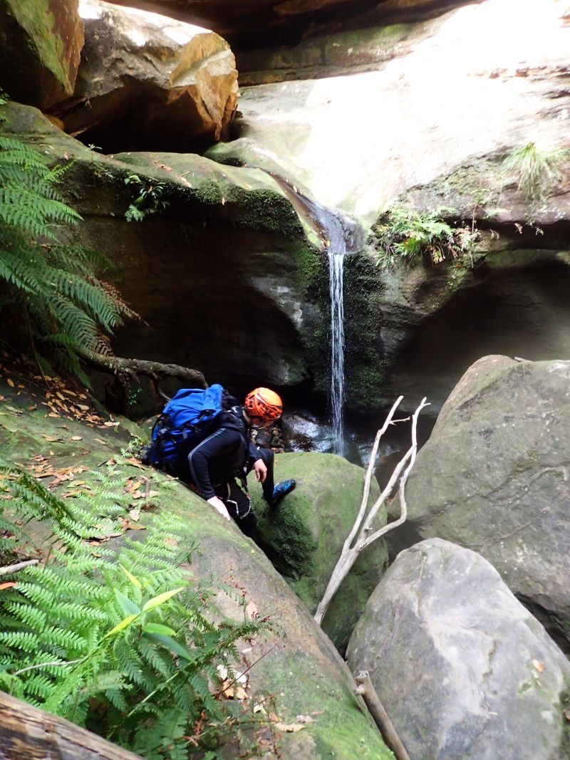
The heat is getting oppressive now so we are keen to get into the cool of the canyon. The creek threatens to “canyon up” a few times before we reach the spot where it drops down a dark slot. Woohoo.
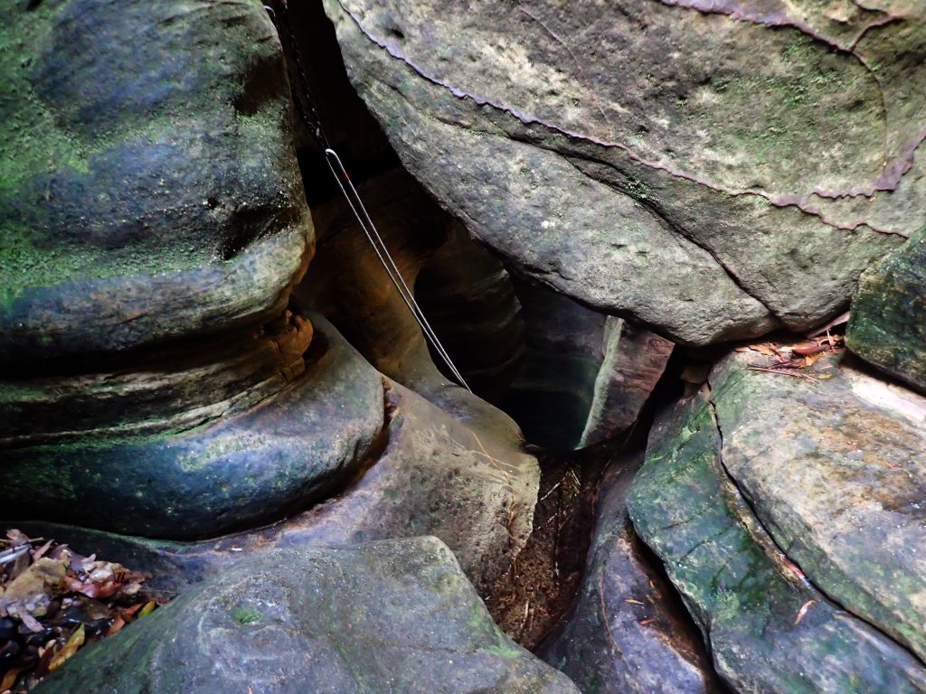
We scramble along a ledge beside the slot to the abseil point and now have to put our gear on balanced on small stances. Didn’t think that through…
The top section is suppose to be fairly dry should we put wetties on now?
It says the abseil lands in a pool and there are some climb downs into water.
Rather than putting harnesses on now, then doing some deep wades and have to take harnesses off, put wetties on and harness up again we chose to put the wetsuits on now. Bad plan.
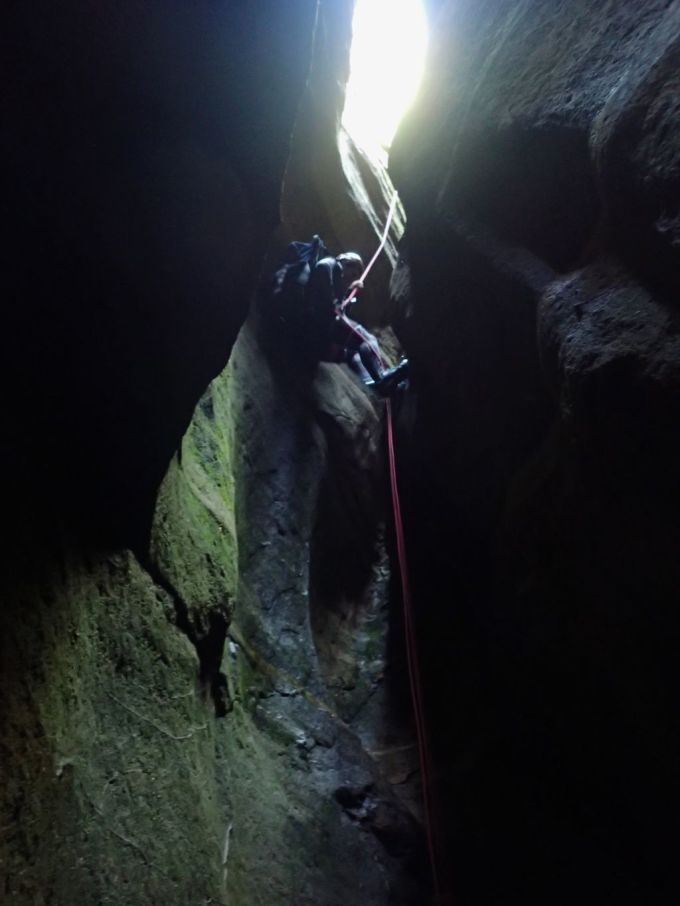
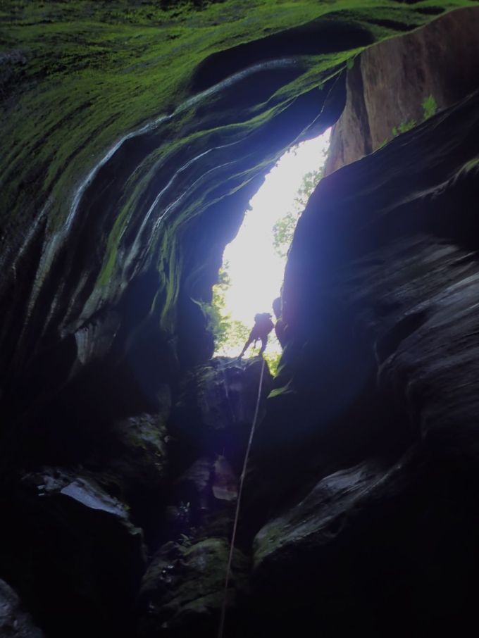
I’ve said it before but abseiling for me is just a means to get to the next bit of canyon. But this abseil is really cool. Relatively easy start then a long drop into an awesome slot but one you touch down it keeps going down another dark, narrow drop. About 25m all up, or down I should say.
Ed on the second bit of the first abseil
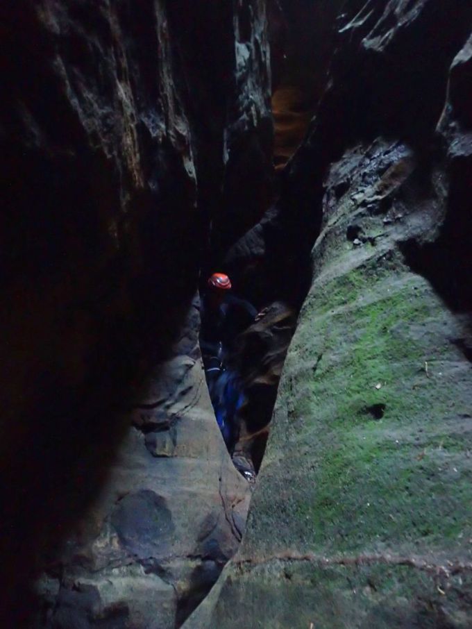
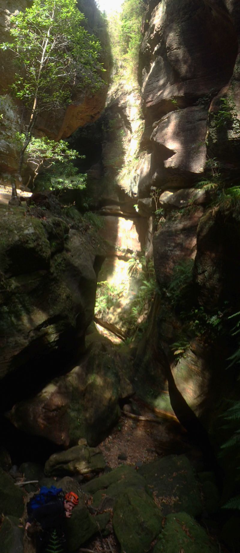
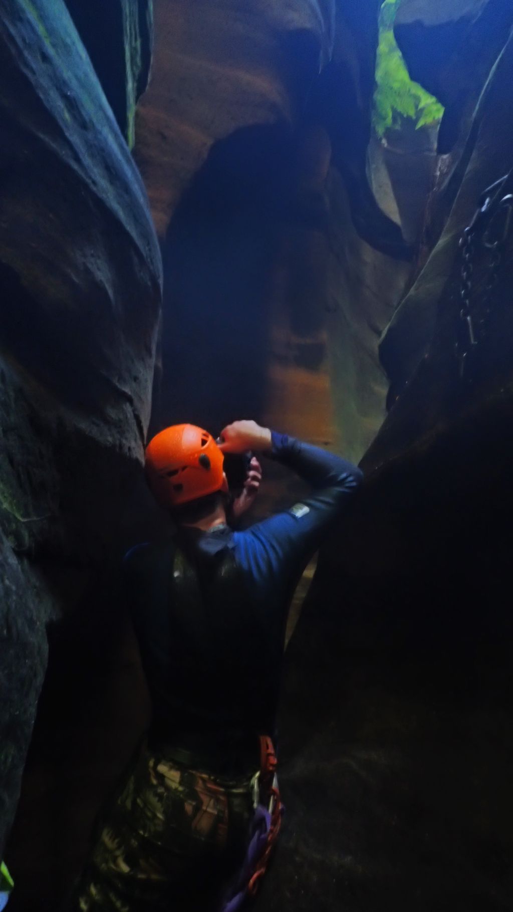
We’re now in a deep, dark narrow cleft. It’s really beautiful. There is a tight squeeze climb down a twisting chute before we are on the cleft floor. The pool the guide suggested we would land in is nonexistent at the moment, just a damp patch of mud.
Edwin contorting down the chute
Rounding a bend and all too soon the canyon opens out into a wide gorge. Scrambling down the valley the creek bed is as dry as a nuns nasty and the heat is slowly cooking me. We stop and strip the top of our wetsuits down in an attempt to stive off heat stroke.
It was disappointing to see this section of otherwise pristine creek was infected with backberry.And Flys! I’m pretty sure there was an international convention of the bushfly alliance. Millions of them swarming around, we were expecting to come across something dead but nothing, just clouds of flys. I’m pretty happy at this point they weren’t bitey.
Finally, droping down through a layer of strata a small trickle of water appeared in the creekbed. I wasted now time in splashing the cool liquid over my head.
And then we come to the next section of shallow canyon with the welcome sight of a deepish pool waiting at the bottom. Rotting vegetaion leaching tannins gave the water what Ed described as a lovely shade of Earl Grey (What’s that Paul Kelly line about the coffee being the colour of the river but not nearly as brown?) but we pulled the wetties back up and jumped in.
Ahhh, Bliss
Ed scrambling into the wet section
The next section of canyon is really nice. It’s not all that deep but has some narrow squeezes, tricky climb downs and deep wades.
Small pot hole you can’t touch the bottom off in at the bottom of a narrow climb down
click images to enlarge
This section is reasonably long and has a lot of fun bits but eventually it drops into another deep narrow section.
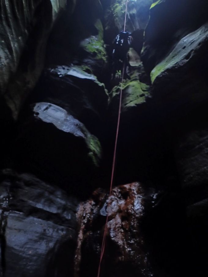
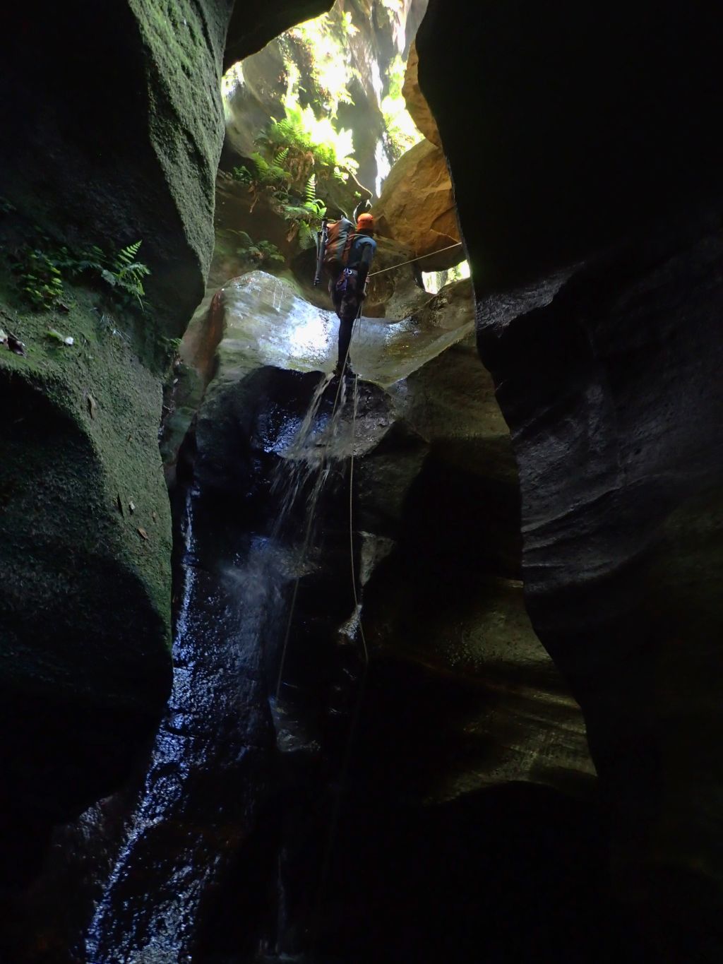
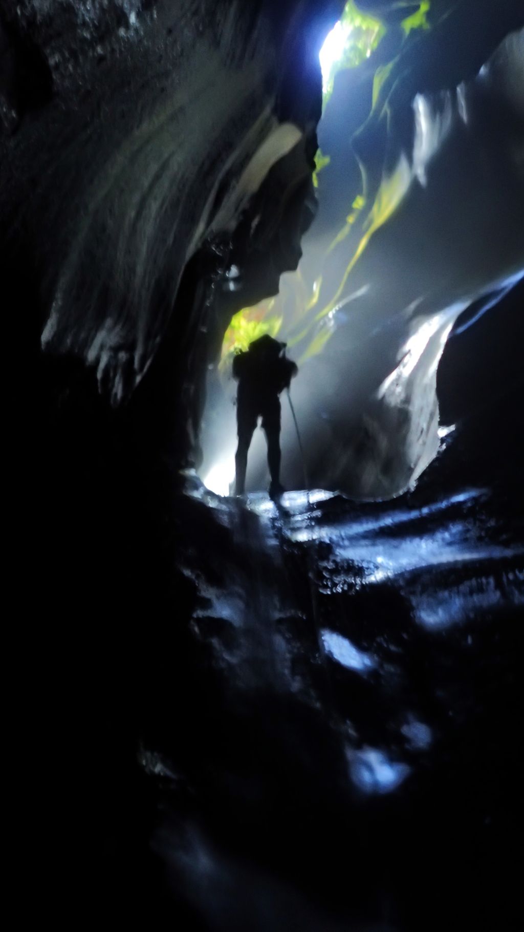
Overhanging abseils are nice but usually have shity starts as you work your way over a tricky lip. This one just gradually turns over hung so it’s a really nice start then a 17m abseil hanging in space.
This section is awesome. Deep and sustained and, despite being midday, the play of light on the walls was divine.
click images to enlarge
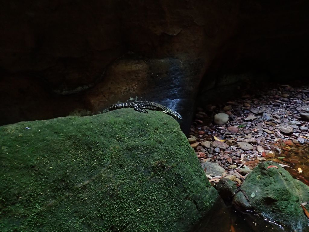
We come to a slightly wider chamber and Ed points down to a funny looking rock. Look a skull. Oh yeah a wallaby skull, fair size. Must have fallen in…. Oh shit goanna.
Sitting on a rock about 3feet away is a small, beautifully patterned lace monitor. I guess that’s who dragged the wallaby in. It’s dark and cool in here but it turns out it an easy walk up from the exit portal so I’m pretty sure it hasn’t fallen in and become trapped. Unfortunately around the corner is the remains of a much larger one, just under 2m long.
Lanna the canyoning goanna
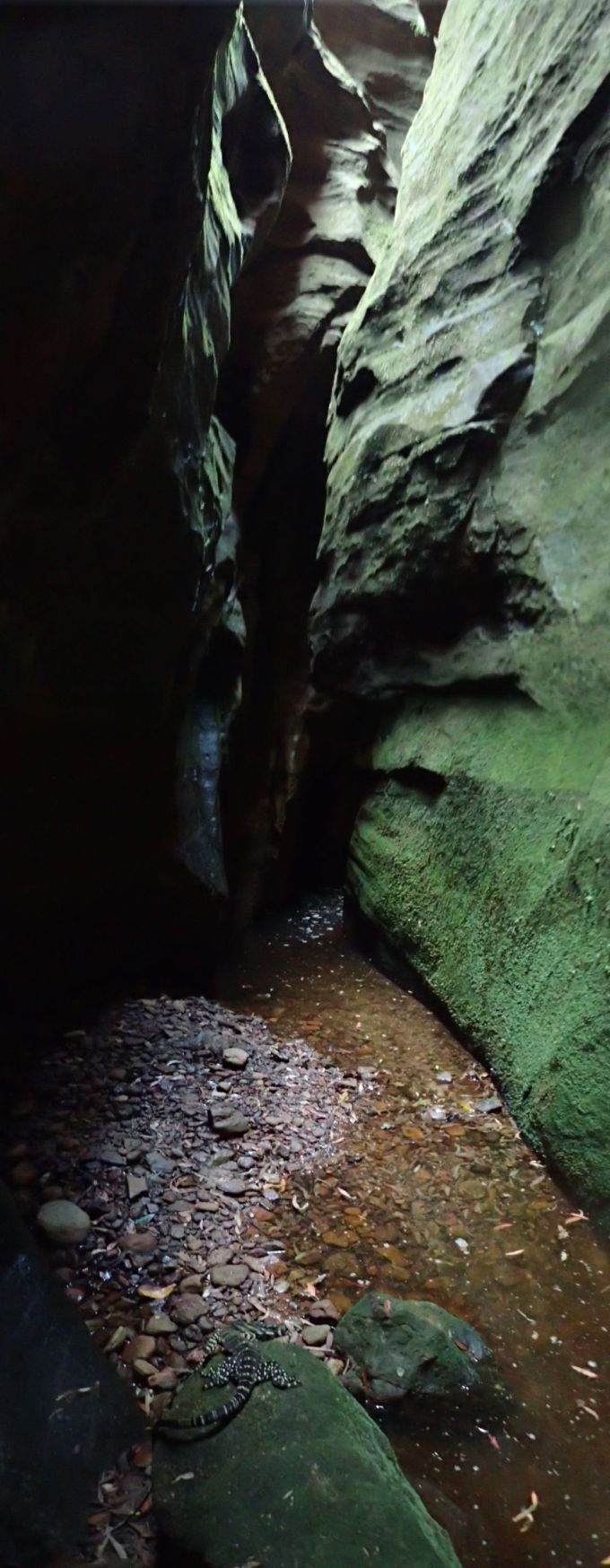
Lanna looking up the slot but keeping an eye on us
The rest of the canyon is an easy walk down a sublime slot.
Click images to enlarge
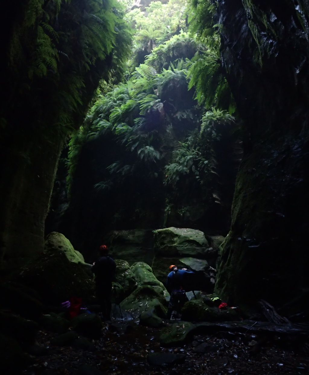
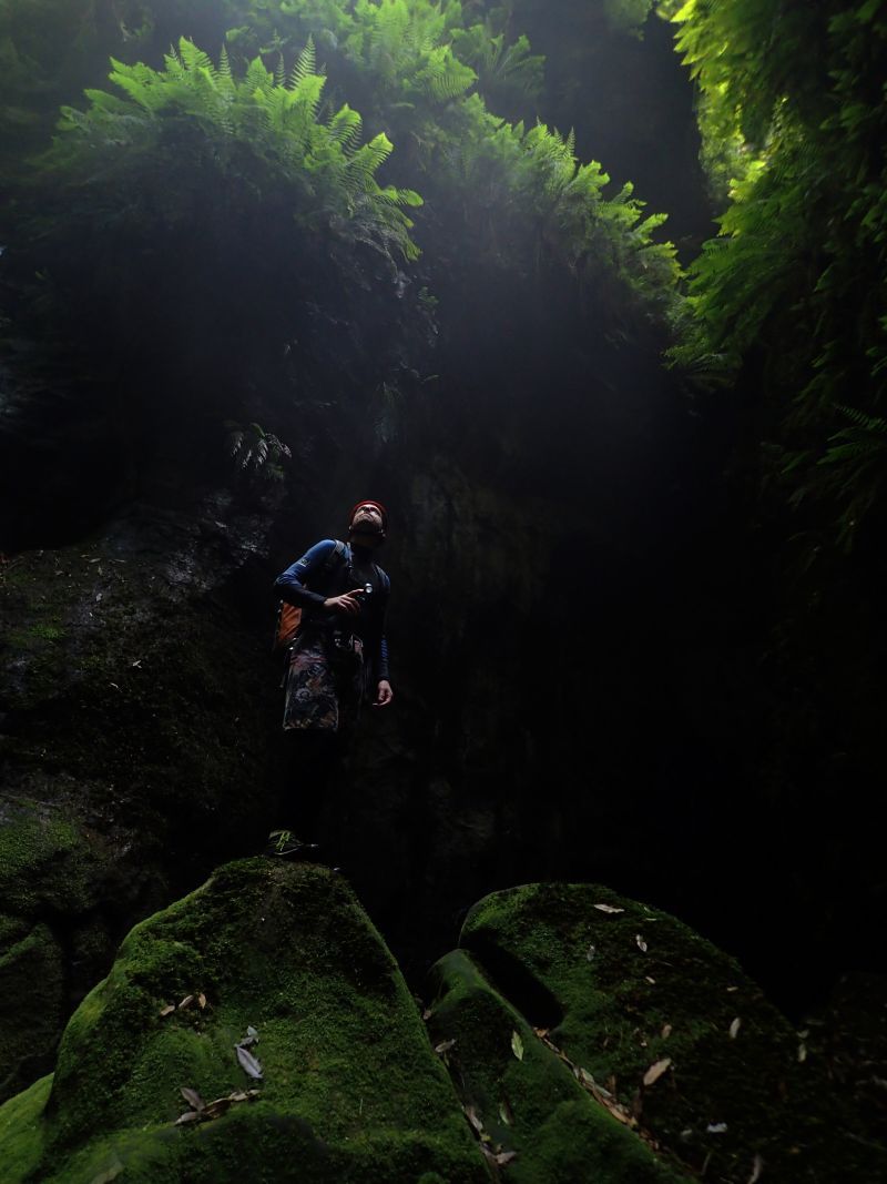
At the exit portal we get out of the harnesses and wetsuits and eat lunch in the shade enjoying the cool breeze drifting down out of the canyon.
Once fed we opt to by pass the final two abseils and scramble down beside the steep gully to the Wolgan river before commencing the 5km hike back to the camp ground. It was hot, damn hot and our water was getting low. When we did Pipeline canyon the weather gods blessed us with a cooling down poor of rain on the walk out. No such luck today.
A hot but very worthwhile trip.
Party size: 2 both experienced
Time: 6.5 hrs car to car. Bit of Photo Phaffing, not rushing but moving steadily all day.
On such a hot day it would have been fine for most people without wetsuits. The water was cold but the pools short and there were plenty of little patches of sunshine flooding in.
I tried the helmet mount for the go pro, didn’t have the angle right for much of it so most of my clips were unusable, I’ve salvaged what I could…
Claustral is the quintessential Blue Mountains canyon. A deep, dark, sustained slot accessed by a series of abseils down a dark hole known as the Black Hole of Calcutta. Once in you are committed, the slot can be as fearsome as it is beautiful. Flash floods do happen and the exit is hours away. It has claimed the lives of some very experienced canyoners and been the scene of various rescue operations over the years.
It’s part of the big three. Thunder, Ranon and, Claustral canyons and their tributaries, carve the saddle in between Mt Tomah and Mountain Banks into a deep maze that has come to be known as the Carmathan labyrinth.
In 1804 the botanist and explorer, George Caley, gazed up at the Blue Mountains and confidently declared “There is not a single peak which would take more than half a day to scale!”
He was right, but it wasn’t the peaks that would thwart him in his attempt to cross the mountains. His party reached the top of Mt Tomah with little difficulty then set about crossing the short distance to the next peak, Mt Banks. He didn’t know about the labyrinth that awaited him below.
We were taught at school that the early explorers failed to find a way across the mountains because they tried to penetrate the river valleys when they needed to follow the ridges. But Caley’s plan was always to follow the ridges between the high peaks. Unfortunately the ridge he tried to follow didn’t exist
Scrambling down through lawyer vines and disjointed cliff lines they eventually came to a deep dark chasm they called Gaping Gill (while a chasm still bares this name it is probable they were looking into the lower reaches of Thunder gorge).
With no way to cross the chasm they beat a retreat back up to the ridge and tried another approach. This time into a gully Caley would name Dismal Dingle. Night descended and they made camp in a small overhang. Awestruck by the glow worms lighting up the wall over head, tormented by possums who ran like little demons through their camp stealing their food, eaten alive by mosquitoes and, terrorised by a wild fire that ripped up through the Grose Valley his men threatened revolt if he tried to push on they way they were going.
Come morning they beat another retreat up to the ridge line and opted to follow this in a wide arc around the labyrinth below. They were now on the very ridge that would one day carry the Bells Line of road. A native track way, had they stayed on this ridge they would have achieved their goal of crossing the Mountains in little over another days walk. But, of course, they didn’t know this.
Their plan was to follow the ridge line they mistakenly believed connected the major peaks they could see from the Richmond plains . And so they veered off to explore the peak of Mt Banks with Hat Hill, their next objective. Upon reaching the top of Mt Banks they looked down in dismay at the 300m cliff line that plummeted into the Grose Valley with Hat Hill unreachable on the other side. Dejected they turned tail and headed for home.
Later, or so I have read somewhere (but for the life of me I now can’t find the source) an early female bush explorer (Mary Biles?) ventured into the rim of the Labyrinth and upon peering down into a dark slot dropping into bowels of the earth wrote words to the effect of “One day the depths may be explored. Whether brave or fool hardy those who do surely will not suffer from claustrophobia.” Thus the slot was later christened Claustral canyon.
OK, maybe I spiced a bit or even all of that intro up. I’m not a historian, don’t take it as gospel. After all, I got my history of the world from Mel Brooks and all I know for certain is “It’s good to be the king.”….
Anyhoo. I’ve a confession to make. I’d never done Claustral Canyon. I’d been into the system through Ranon and I’d wandered up the bottom section of Thunder canyon but back in the day Claustral was the most popular abseil canyon and I was put off by the thought of lining up to access the abseils. I was a bit of a canyon snob really and I come to realise I had cheated myself of a great experience.
Soooooo when Ed and his mate, Lewis, invited me along on a photophaffary trip I jumped at the chance. Now as you probably have worked out by now I have a little point a shoot camera (Olympus Tough TG4) and am not overly concerned at capturing amazing images of art, more documentaries of my travels so I had a sneaky suspicion that they needed a mule to carry the ropes so that they might lugg in more photomagraphary equipment needed to get their awesome shots but I was cool with that.
As it was everybody bought rope.
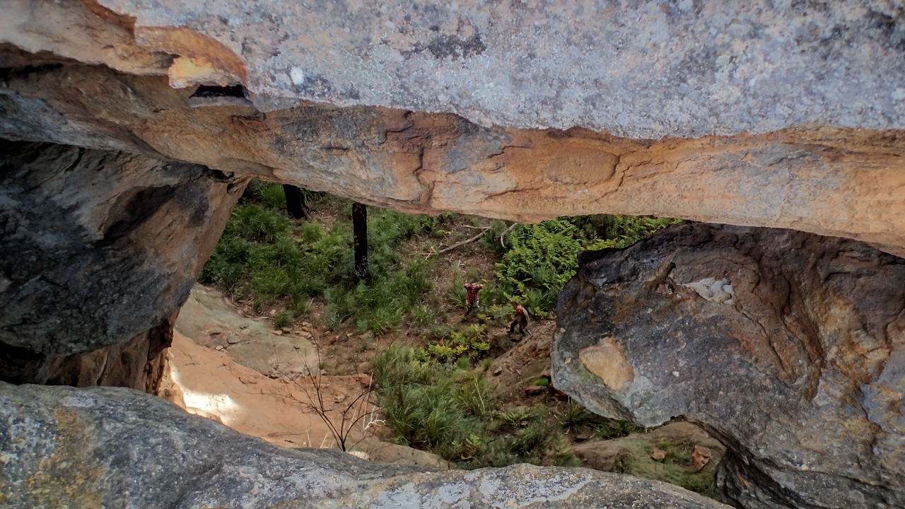
Anyhoo, I was running a bit early so stopped by the Emu Cave to get a few photos and explore the rock shelf a little more. then it was onto the car park
After a quick meet and greet, with the wrong party ( Are you Lewis, Says I. Nope, says he. Are you doing Claustral? We’re doing Ranon. Cool we’ll probably see you in there)
Lewis arrives and we introduce ourselves just as Ed turns up. We reconcile gear, stuff packs and we’re off. The traditional entry and exit point to Claustral was from the top of Mt Tomah, however in 2011 the land the access track crosses changed hands and the new owners built a house right where the track was. And who can blame them, they have some of the best views in the mountains.
A new route was found from the other side Mt Bell. This made the exit a lot longer and more convoluted which I think may have reduced visitor numbers a bit.
Anyhoo. We quickly make our way down through a pleasant gully and soon reach the junction with Claustral Brook
A bit of creek walking and boulder scrambling brings us to the first swim and we suit up and plunge in as the canyon begins to get deeper
Ed scrambling down
The canyon is looking good already
A little more scrambling and we come to the abseils. 3 successive drops down into a dark abyss. Ed and Lewis scramble to get cameras out. Looks like I’m going first for want of a better model
The start of the abseils
Lewis on the first abseil
The drops are pretty cool. Abseil 10-15 meters, swim across a pool to a small stance and repeat
Lining up to take photos on the small stance between drops
The final abseil starts through a small hole and drops into darkness. Much awesomeness
Edwin dropping into the Black hole of Calcutta, nicely back lit by Lewis’ torch
From here its 50m through the darkest part of the slot until it widens slightly at the Junction with Ranon.
The moss covered boulders and fern strewn walls at the junction may well be the most photographed bit of canyon in the country but it is truly stunning.
We played around here for a while snapping photos from all angles
Lewis contemplating the light
It’s much greener than I remember. One of the most fern filled and moss covered canyons I’ve been in
Cameras at 10 paces… I’ve heard of people paying to do the guided trip just for a photo here
After lots of photo phaffing we head down. The boys need to be very careful with keeping their gear dry so it’s in and out of dry bags a lot. The advantage of my TG4 is I can keep it at the ready. The photos may not be the same quality but as it’s so handy I have about 600 to trawl through.
Canyon formation
Canyon Formation
Just as the big cameras get triple dry bagged to continue on Ed looks up to see one of the group coming in from Ranon has slid out along a fallen log that spans the canyon 40 or 50 meters up. There was a scramble to get cameras back out in the hope they were going to abseil down the middle of the canyon walls from this log but by the time cameras were out he had thought better of it and retreated to do the normal route through the waterfalls
The group coming in from Ranon catch us
Like the slot the greenery just keeps going
With all the standing about i had begun to get cold so I peeled down the wet suit and put a light thermal underneath which improved things greatly.
Looking for sun rays but the day was a little overcast so the few we got were very faint
Ed carefully wading with the camera out
Canyon formation
Light rays, canyons and photographers
Ed chasing Rays
We caught back up to the other group at the junction with Thunder Canyon, which is a great spot for lunch. They soon finished and continued on, we have a quick look up Thunder and then followed suit.
After this junction the canyon opens up a little and there is some tricky scrambling down some drops before it closes back in.
Lewis looking down a pot hole
Once it closes back in you encounter the infamous tunnel swim. Way back when I did Ranon the last time the water level was down and you could walk through here. Now it’s a spectular 50m swim
A little more scrambling, a couple of pools and you reach the exit
There is a steep haul up Rainbow Ravine, which has some pretty canyon sections itself, then a long walk up the ridge to the top of the Camels Hump. I remember last time getting to this point and thinking we had come up the wrong hill. From the top the hump it looks to be surrounded on all sides by chasms and the old exit point to top of Mt Tomah can be seen across a particularly deep chasm. You can see why, with no maps and no knowledge of the land Caley and his crew had so much trouble. I’m remember almost having my own muntiny on my hands as hungover and exstausted Della and Lurch were in no mood to drop down and climb out again.
Just when we thought we would have to descend all the way down and start again the trail crossed a narrow, bridge like rock saddle. It barely looks real. Something straight out of Tolkin. The old exit is now just up the hill. 10-15min up to the car park… The old exit.
The new exit is not so quick and does involved dropping all the way back down into Claustral Brook. We head steeply back down. There are some nice canyon sections and a swim or two before we reach the gully we came in on.
Yeah it’s a long walk out. Yeah I’m feeling it today but it’s not too bad, we’ve done worse.
Party Size: 3 All experienced
Time: 10hrs car to car. Lots of time spent striking poses and snapping photos
After a lazy long weekend in the Wolgan, with just a stroll up to the arch to break up the eating and drinking
Wolgan Arch
I was keen to head back down and have a bit of a look around a dry canyon I knew of but hadn’t explored before and so I dragged Mandy out and ventured back down the valley.
I’d heard about this in the early to mid 2000s but never got around to having a look.
The road in crosses some private property, a couple of old school mates owned a block up the end but wasn’t 100% sure there weren’t other properties on the way up so in the interest of doing the right thing we left the road at the first gate and wandered up through the scrub on the other side of the creek.
We soon passed Ringo and Karl’s block and started climbing the steep hill that would bring us to the lower cliffline and the first short canyonette.
It was steep and loose and the weather had decided to play spring so it was fairly muggy too but we made our way up and reached the base of the cliffs without too many dramas.
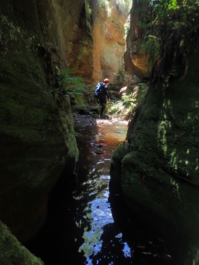
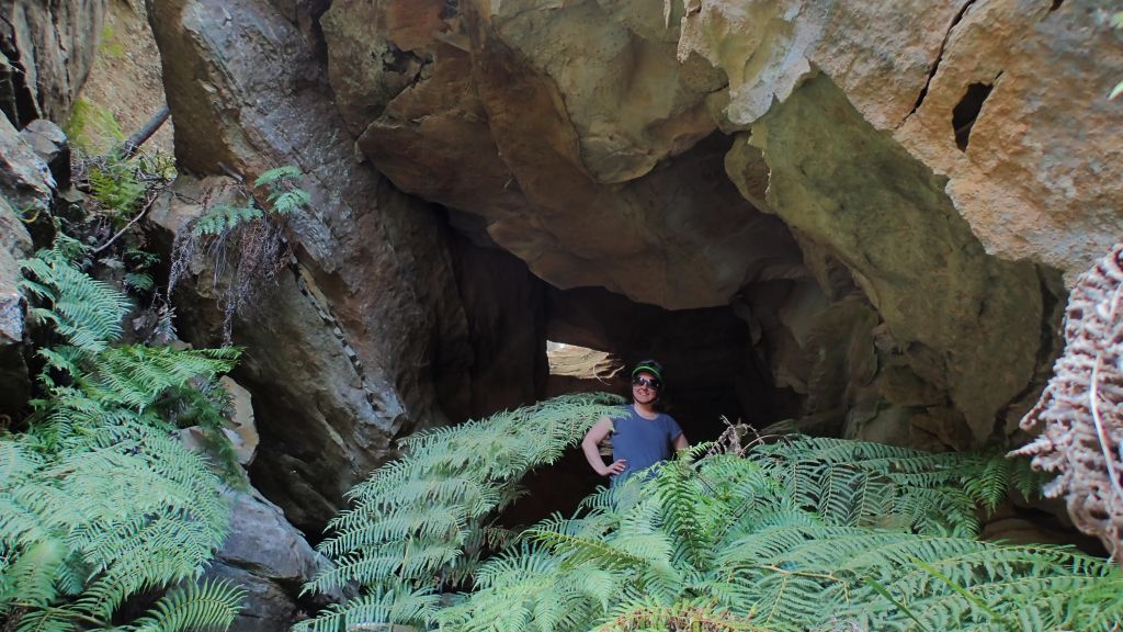
The first canyon section started with some promise, a scramble up through another impressive arch. The slot carved up through the lower cliffs but opened out almost as soon as it started.
Nice scramble up through an arch into the canyonette
Climbing out of this brief slot we wandered up through a pleasant, if sometimes scrubby amphitheater to the next cliff line
The scrub was thick with lawyer vines as the valley rose up to the base of the upper cliffs but once there the cool breeze racing up the constriction was like a sigh of relief.
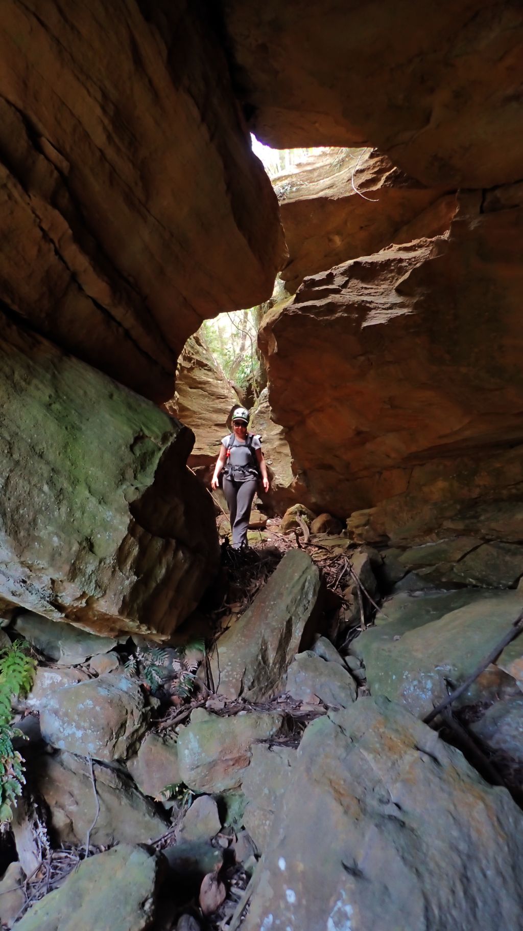
We had to negotiate a squeeze through a tunnel section under boulders
Mandy making it look easy
And then we were into the main constriction
Mandy enjoying the cool breeze
My original plan had been to scamper up and out the top to admire the views and check out some other little canyons near by but Mandy hadn’t been feeling the best so I contented myself taking a bunch of photos and then we retraced out steps back the way we came.
If you stick our tongue out it helps you squeeze your gut through
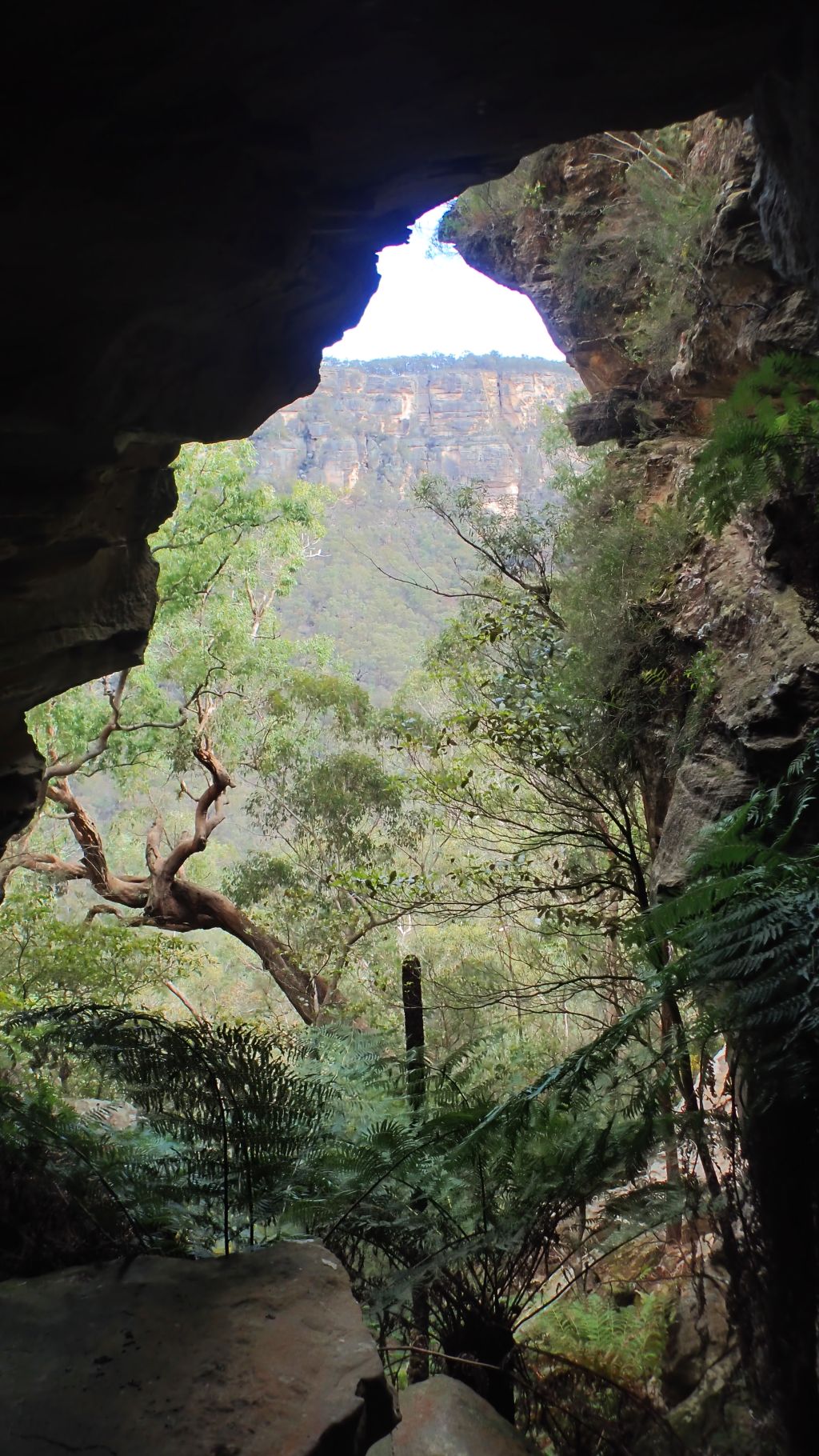
A Window on the Wolgan
Mandy under the arch
Party size 2, both experienced, but Mandy feeling unwell on the climb up so taking it slow